Day
Bivingen, Luxemburg
49° 32' 40.8" N 6° 8' 8.6" E
49.5446533 6.1357148
• Head toward Rue des Jardins on Rue de Kockelscheuer. Go for 115 m.
• Turn right onto Rue Edward Steichen (CR159). Go for 2.0 km.
• Turn right onto N31. Go for 536 m.
• Take ramp onto A3 toward Luxembourg/Belgique/Deutschland. Go for 4.7 km.
• Take the exit toward E29/Aéroport/Trier/Ettelbruck/A7/Bruxelles/Liège/Esch/Alzette/A4 onto A6. Go for 21.7 km.
• Continue on E25/E411. Go for 42.5 km.
• Continue on E411 toward Bruxelles/Namur. Go for 95.2 km.
• Take the exit toward Mons/Charleroi onto E42. Go for 29.8 km.
• Take the exit toward Beaumont/Charleroi/Châtelet onto R3. Go for 6.0 km.
• Take the exit toward Charleroi onto N90 (Route de la Basse Sambre). Go for 3.2 km.
• Keep left onto Route de la Basse Sambre (N90) toward Charleroi Nord. Go for 631 m.
• Take the 5th exit from Square Jules Hiernaux roundabout onto Boulevard Frans Dewandre (R51). Go for 420 m.
• Turn slightly right onto Boulevard Joseph II. Go for 241 m.
• Continue on Boulevard Alfred de Fontaine. Go for 466 m.
• Turn right onto Rue d'Orléans. Go for 87 m.
• Turn slightly left onto Rue Basslé. Go for 69 m.
• Arrive at Rue Basslé. Your destination is on the right.
☍
207,7 km
(1 hrs. 55 min.)
Charleroi, Belgien
Ab Luxemburg empfiehlt uns unser Navi durch Belgien zu fahren, ist ein wenig kürzer und man spart jede Menge Autobahngebühren ...
50° 24' 38.9" N 4° 26' 40.7" E
50.4108095 4.4446430
• Head toward Rue d'Orléans on Rue Basslé. Go for 69 m.
• Turn slightly right onto Rue d'Orléans. Go for 87 m.
• Turn right onto Boulevard Alfred de Fontaine. Go for 17 m.
• Turn left onto Boulevard Audent (R51). Go for 193 m.
• Take the 3rd exit from roundabout onto Boulevard Emile Devreux. Go for 278 m.
• Turn left onto Boulevard Pierre Mayence. Go for 254 m.
• Continue on Rue de la Paix. Go for 90 m.
• Take left ramp onto E420 (Petite Ceinture de Charleroi). Go for 1.1 km.
• Keep right onto E420 toward Bruxelles/Mons/E42/Liège/Aéroport Charleroi. Go for 2.0 km.
• Keep left onto E420 (Jumet-Est). Go for 5.0 km.
• Take the exit toward Mons onto E42. Go for 50.9 km.
• Keep left onto E19 toward Paris/Valenciennes. Go for 7.3 km.
• Continue on A2. Go for 77.7 km.
• Continue on A1 (Autoroute du Nord). Go for 17.7 km.
• Take the exit toward E44/A29/Reims/Rouen/St Quentin/Amiens. Go for 1.5 km.
• Take the exit toward Amiens/Rouen/Paris-Ouest onto A29. Go for 33.0 km.
• Take the left exit toward Rouen/Calais/Paris/Amiens-Centre/Amiens-Sud onto A29 (Viaduc de l'Avre). Go for 10.9 km.
• Take the exit toward Calais/Rouen/Amiens-Ouest onto A16 (L'Européenne). Go for 4.0 km.
• Take the exit toward Le Havre/Rouen/Dieppe/Poix de Picardie onto A29. Go for 55.4 km.
• Take exit 11 toward Neufchâtel-Nord. Go for 514 m.
• Turn right onto Route d'Aumale (D929) toward Neufchâtel en Bray. Go for 5.0 km.
• Take the 3rd exit from roundabout onto D928 toward Neufchâtel en B. Go for 3.3 km.
• Turn right onto Route de Londinières (D157). Go for 313 m.
• Continue on Route de la Rocade (D157). Go for 244 m.
• Turn right onto Rue de Saint-Vincent (D1 F). Go for 524 m.
• Turn right onto Rue de Flandre (D1). Go for 305 m.
• Turn left onto Rue Sainte-Claire. Go for 177 m.
• Turn right. Go for 47 m.
• Arrive at your destination on the right.
☍
278,0 km
(2 hrs. 30 min.)
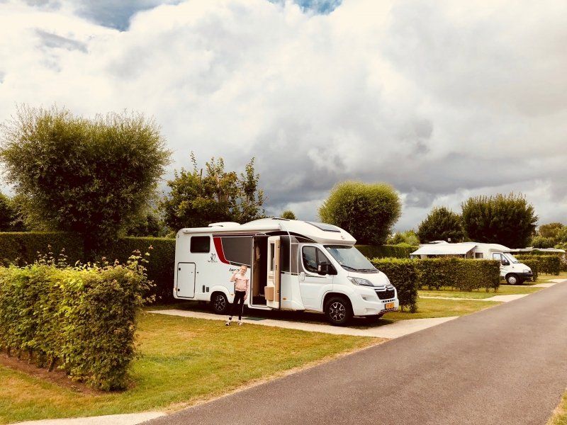
Camping De Sainte Claire
Sehr gepflegter Campingplatz unweit der Autobahn A28 Richtung Normandie/Bretagne. Supermärkte und Tankstelle sind in der Nähe, sowie auch der nette kleine Ort Neufchatel en Bray mit einigen Geschäften.
76270, Neufchatel En Bray, Frankreich
49° 44' 15" N 1° 25' 40.4" E
49.7375000 1.4279000
• Head south. Go for 5 m.
• Turn left. Go for 175 m.
• Turn right toward Rue Sainte-Claire. Go for 31 m.
• Turn right onto Rue Sainte-Claire. Go for 313 m.
• Turn left onto Rue de la Grande Flandre. Go for 49 m.
• Turn right onto Rue de Flandre (D1). Go for 455 m.
• Turn right onto Rue de Drincourt (D157). Go for 402 m.
• Turn right onto Rue des Abreuvoirs. Go for 253 m.
• Take the 3rd exit from roundabout onto Avenue des Canadiens (D928). Go for 1.5 km.
• Take right ramp onto A28 toward St Saëns/Les Grandes-Ventes/Rouen. Go for 14.5 km.
• Keep right onto A29 toward Le Havre/Caen. Go for 83.8 km.
• Continue on N1029. Go for 7.1 km.
• Take ramp toward Honfleur. Go for 429 m.
• Take the 1st exit from roundabout onto D580 toward Caen/Trouville/Deauville/Honfleur. Go for 323 m.
• Pass 2 roundabouts and continue on D580. Go for 981 m.
• Take the 3rd exit from roundabout onto Cours Jean de Vienne (D580) toward Honfleur. Go for 768 m.
• Take the 2nd exit from Rond-Point du Port roundabout onto Cours Jean de Vienne (D580). Go for 388 m.
• Take the 2nd exit from Rond-Point Carnot roundabout onto Pont Mercedès Villey. Go for 112 m.
• Turn right onto Quai de la Cale. Go for 144 m.
• Turn right onto Quai de la Cale. Go for 137 m.
• Arrive at Quai de la Cale. Your destination is on the right.
☍
111,9 km
(1 hrs. 5 min.)
Day
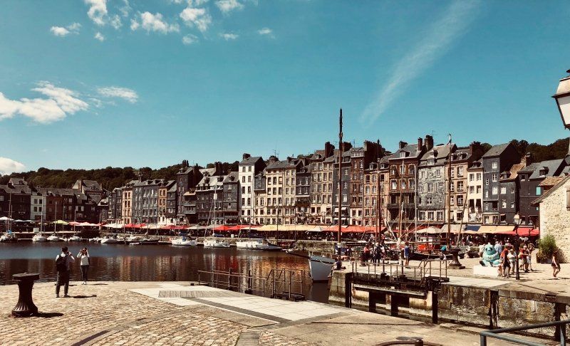
Stellplatz am Bassin Carnot
Kurze Mittagspause im wunderschönen Honfleur.
Für den zentral gelegenen Stellplatz zahlt man eine Pauschale von 11€ für 24 Stunden, auch wenn man nur einige Stunden bleibt.
Quai du Nord, 14600, Honfleur, Frankreich
49° 25' 8" N 0° 14' 37" E
49.4188889 0.2436111
• Head east on Quai de la Cale.
• Turn left. Go for 132 m.
• Turn left toward Quai de la Cale. Go for 21 m.
• Continue on Quai de la Cale. Go for 144 m.
• Turn left onto Pont Mercedès Villey. Go for 67 m.
• Take the 3rd exit from Rond-Point Carnot roundabout onto Cours Jean de Vienne (D580). Go for 430 m.
• Take the 2nd exit from Rond-Point du Port roundabout onto Cours Jean de Vienne (D580). Go for 749 m.
• Take the 1st exit from roundabout onto Rue des 4 Francs (D579) toward Caen/Deauville/Trouville/Lisieux/La Rivière-St Sauveur/Pont-l'Évêque. Go for 256 m.
• Pass 5 roundabouts and continue on Route de Honfleur (D579). Go for 15.5 km.
• Take the 2nd exit from roundabout onto A132 toward Caen/Rouen/Paris. Go for 894 m.
• Keep right onto A132 toward Paris/Rouen/Caen. Go for 328 m.
• Continue toward Autoroute de Normandie/A13. Go for 10 m.
• Take the exit toward Caen onto A13 (Autoroute de Normandie). Go for 40.8 km.
• Take the exit toward Alençon/Rennes/Cherbourg onto N513 (Porte de Paris). Go for 964 m.
• Take ramp onto Périphérique (N513/N814). Go for 12.7 km.
• Take ramp onto A84 toward Le Mt-St-Michel/Rennes/Vire. Go for 91.0 km.
• Continue on N175. Go for 10.6 km.
• Take ramp onto N175 toward St Brieuc/St Malo/Le Mont-St Michel/Pontorson. Go for 13.2 km.
• Keep left onto N176. Go for 32.5 km.
• Take ramp onto D137 toward St Malo/Châteauneuf d'I. et V./Barrage de la Rance. Go for 10.3 km.
• Keep left onto D137 toward Saint-Malo Par Saint-Servan/D168/Dinard/Aéroport Pleurtuit/Barrage de la Rance. Go for 260 m.
• Keep left onto Rue du Général Patton (D137) toward Saint-Malo Par Saint-Servan. Go for 152 m.
• Pass 2 roundabouts and continue on Rue du Général Patton. Go for 845 m.
• Continue on Rue de la Balue. Go for 280 m.
• Take the 1st exit from roundabout onto Rue de la Balue. Go for 296 m.
• Take the 3rd exit from Rond-Point du Mouchoir Vert roundabout onto Boulevard Douville toward St Servan/Hôpital le Rosais/St Servan-Centre. Go for 501 m.
• Continue on Rue Ville Pépin. Go for 192 m.
• Continue on Rue Ville Pépin. Go for 486 m.
• Continue on Place Bouvet. Go for 32 m.
• Turn left onto Place Bouvet. Go for 71 m.
• Turn right onto Rue Amiral Magon. Go for 132 m.
• Turn left onto Rue des Bas-Sablons. Go for 128 m.
• Continue on Place Monseigneur Duchesne. Go for 125 m.
• Continue on Rue des Hauts-Sablons. Go for 42 m.
• Turn slightly right onto Rue des Hauts-Sablons. Go for 88 m.
• Turn right onto Rue de la Cité. Go for 137 m.
• Turn slightly left onto Rue de la Cité. Go for 151 m.
• Continue on Place Saint-Pierre. Go for 13 m.
• Turn left onto Allée Gaston Buy. Go for 6 m.
• Turn slightly right onto Allée Gaston Buy. Go for 49 m.
• Turn left onto Allée du Marégraphe. Go for 158 m.
• Arrive at Allée du Marégraphe. Your destination is on the right.
☍
234,8 km
(2 hrs. 21 min.)
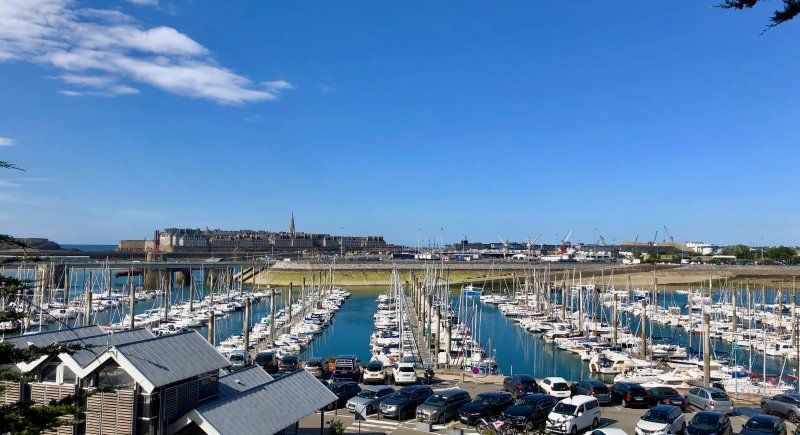
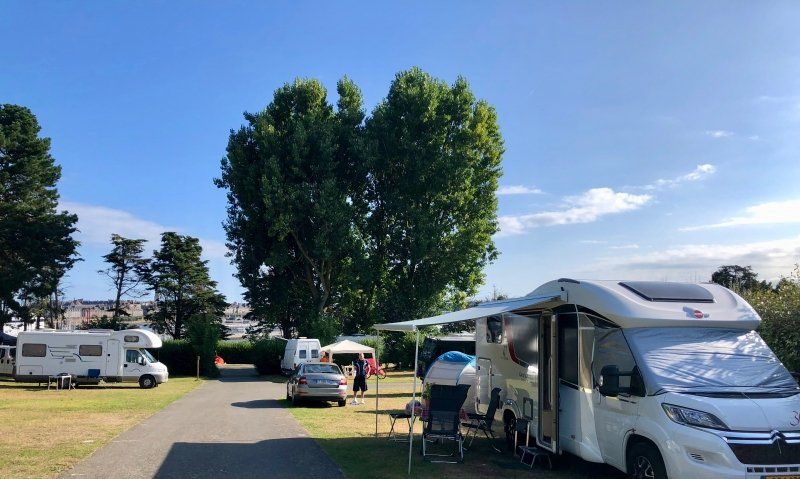
Camping de la Cité d'Alet
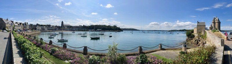
Ein etwas in die Jahre gekommener Stadtcamping unweit des historischen Zentrums (2km) mit herrlichem Blick über den Hafen auf Saint-Malo.
allée Gaston Buy, 35400, Saint Malo, Frankreich
48° 38' 6.7" N 2° 1' 44.8" W
48.6352000 -2.0291000
• Head west on Allée du Marégraphe. Go for 38 m.
• Turn sharp left onto Chemin de la Corderie. Go for 207 m.
• Continue on Place Saint-Pierre. Go for 47 m.
• Continue on Rue d'Alet. Go for 120 m.
• Turn left onto Quai Sébastopol. Go for 44 m.
• Keep right onto Esplanade du Commandant Yves Menguy. Go for 144 m.
• Continue on Rue Amiral Épron. Go for 43 m.
• Turn slightly right onto Rue des Hauts-Sablons. Go for 130 m.
• Continue on Place Monseigneur Duchesne. Go for 126 m.
• Continue on Rue des Bas-Sablons. Go for 217 m.
• Continue on Rue de Gaspé. Go for 230 m.
• Take the 4th exit from roundabout onto Quai du Naye (D126) toward Port Terminal Ferry du Naye/Gare Maritime de la Bourse. Go for 464 m.
• Pass 2 roundabouts and continue on Quai Saint-Louis (D126). Go for 676 m.
• Turn left onto Porte Saint-Louis. Go for 17 m.
• Continue on Rue de Toulouse. Go for 47 m.
• Turn right onto Rue d'Asfeld. Go for 64 m.
• Turn left onto Rue des Forgeurs. Go for 81 m.
• Continue on Rue Saint-François. Go for 58 m.
• Turn right onto Rue Robert Surcouf. Go for 21 m.
• Turn left onto Rue Sainte-Catherine. Go for 32 m.
• Continue on Place Brevet. Go for 28 m.
• Continue on Rue Saint-Sauveur. Go for 71 m.
• Turn right onto Rue des Bouchers. Go for 75 m.
• Continue on Rue de la Crosse. Go for 113 m.
• Continue on Rue Sainte-Anne. Go for 80 m.
• Continue on Rue Grout de Saint-Georges. Go for 48 m.
• Turn right onto Rue Toullier. Go for 34 m.
• Turn right onto Rue Toullier. Go for 43 m.
• Turn left onto Place Gasnier-Duparc. Go for 51 m.
• Turn right onto Place Jean de Châtillon. Go for 43 m.
• Turn left onto Rue Guillaume Le Gouverneur. Go for 22 m.
• Arrive at Rue Guillaume Le Gouverneur. Your destination is on the left.
☍
3,4 km
( 11 min.)
Day
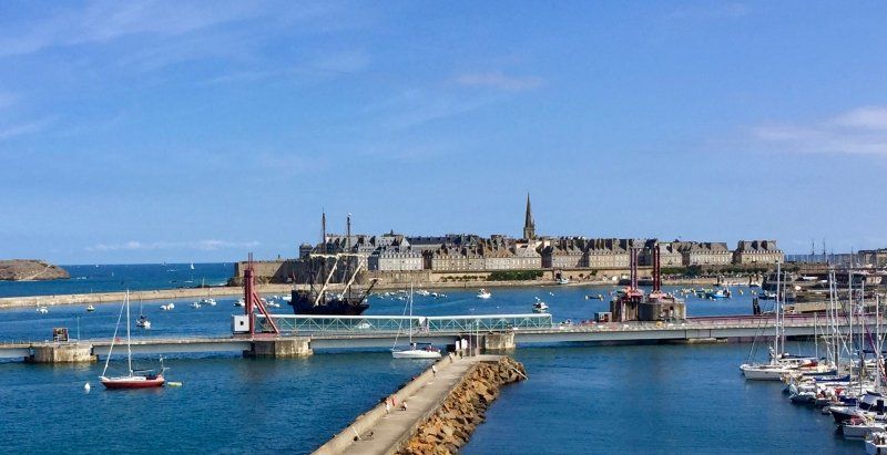
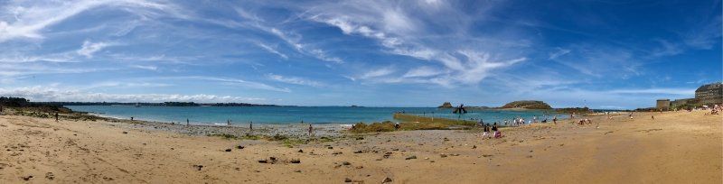
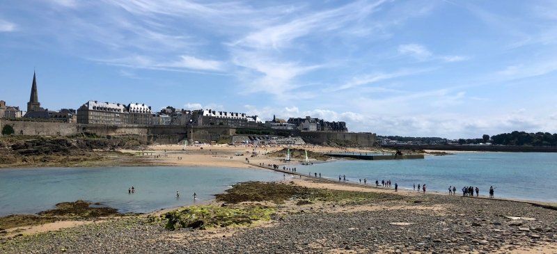
Saint-Malo
Ein Spaziergang über den Panoramaweg um den Campinghügel (Alet) bietet einen wunderschönen Ausblick über den Hafen auf die Altstadt Saint-Malos wie auch über die Bucht auf die Nachbarstadt Dinard.
Nach einem Bad im Naturbecken vor den Festungsmauern und einem Besuch der Grabinsel Châteaubriands, welche nur bei Ebbe trockenen Fußes erreichbar ist, entdecken wir die Gassen und Geschäfte der Altstadt.
Unweit des Campingplatzes im Viertel Saint-Servan findet man in der Rue Ville-Pépin jede Menge kleine Lebensmittelgeschäfte für den täglichen Bedarf.
Saint-Malo, Frankreich
48° 38' 57.6" N 2° 1' 32.4" W
48.6493370 -2.0256740
• Head toward Place Jean de Châtillon on Rue Guillaume Le Gouverneur. Go for 22 m.
• Turn left onto Rue du Pourpris. Go for 43 m.
• Continue on Rue Broussais. Go for 121 m.
• Continue on Rue de Dinan. Go for 177 m.
• Continue on Porte de Dinan. Go for 25 m.
• Turn left onto Esplanade de la Bourse. Go for 38 m.
• Turn right onto Esplanade de la Bourse. Go for 141 m.
• Take the 2nd exit from Rond-Point de l'Île Maurice roundabout onto Chaussée Éric Tabarly (D126). Go for 529 m.
• Take the 3rd exit from Rond-Point du Naye roundabout onto Quai de Trichet (D126) toward Les Sablons/La Gare. Go for 467 m.
• Take the 4th exit from roundabout onto Quai de Trichet (D126) toward Barrage de la Rance. Go for 455 m.
• Take the 2nd exit from Giratoire des Quatre Pavillons roundabout onto Rue des Grèves de Chasles (D126) toward Marville/Paramé. Go for 152 m.
• Take the 1st exit from roundabout onto Boulevard des Talards toward Bellevue. Go for 212 m.
• Continue on Rue de la Marne. Go for 959 m.
• Take the 3rd exit from Rond-Point du Mouchoir Vert roundabout onto Rue de la Balue toward Dol-de-Bretagne/Barrage de la Rance/Lorette/La Madeleine. Go for 333 m.
• Take the 2nd exit from roundabout onto Rue de la Balue. Go for 316 m.
• Continue on Rue du Général Patton. Go for 416 m.
• Take the 2nd exit from roundabout onto Rue du Général Patton. Go for 348 m.
• Take the 3rd exit from Rond-Point René Cassin roundabout onto Rue du Général Patton (D137). Go for 10.1 km.
• Take ramp onto N176 toward St Brieuc/Dinan/Plouër S/Rance. Go for 44.2 km.
• Take ramp onto N12. Go for 24.1 km.
• Take ramp onto D222 toward Le Perray/Quimper/Quintin/Ploufragan/Plédran/Trégueux. Go for 5.7 km.
• Take ramp toward Quimper/Vannes/St Brieuc/Loudéac/Quintin. Go for 303 m.
• Take the 3rd exit from roundabout onto D700 toward Quimper/Vannes/Loudéac/Quintin/Les Châtelets. Go for 7.0 km.
• Take ramp toward D790/Malakoff/Quimper/Rostrenen/Quintin/St Brandan. Go for 220 m.
• Continue on D790 B. Go for 124 m.
• Take the 2nd exit from roundabout onto Lieu-dit Malakoff (D790) toward Quimper/Quintin/Rostrenen. Go for 6.3 km.
• Take the 3rd exit from roundabout onto D790 toward Quimper/Guingamp/Rostrenen. Go for 23.6 km.
• Take the 3rd exit from Rond-Point Miltown roundabout onto D790 toward Quimper/Rostrenen/Plounévez-Quintin. Go for 13.8 km.
• Take the 1st exit from roundabout onto N164 toward Quimper/Carhaix Plouguer/Glomel. Go for 4.2 km.
• Take ramp. Go for 498 m.
• Take the 1st exit from roundabout onto N164 toward Brest/Quimper/Carhaix Plouguer. Go for 55.4 km.
• Take the 3rd exit from roundabout onto N164 toward Quimper. Go for 204 m.
• Take the 3rd exit from roundabout onto N165 toward Quimper. Go for 24.3 km.
• Take ramp onto Route de Brest toward Quimper-Centre. Go for 472 m.
• Take the 2nd exit from Rond-Point du Moulin du Loch roundabout onto Route de Brest (D783). Go for 1.2 km.
• Take the 3rd exit from Rond-Point de Tréqueffelec roundabout onto Boulevard Président Allende (D783). Go for 1.4 km.
• Pass 2 roundabouts and continue on Boulevard d'Ergué-Armel (D783). Go for 1.3 km.
• Take the 2nd exit from Rond-Point d'Ergué-Armel roundabout onto Boulevard Gutenberg (D783 A). Go for 429 m.
• Turn right onto Boulevard Gutenberg. Go for 302 m.
• Continue on Boulevard Flandres-Dunkerque 1940 (D783 A). Go for 904 m.
• Take the 3rd exit from Rond-Point de Kerustum roundabout onto Boulevard Louis Le Guennec (D34). Go for 1.6 km.
• Take ramp onto Boulevard de Poulguinan (D785). Go for 1.3 km.
• Take the 3rd exit from Rond-Point de Ludugris roundabout onto Route de Pluguffan (D785). Go for 14.2 km.
• Take the 2nd exit from Rond-Point de Kermaria roundabout onto D785. Go for 2.2 km.
• Take the 3rd exit from roundabout onto D785. Go for 1.1 km.
• Take the 2nd exit from roundabout onto D785. Go for 902 m.
• Take the 1st exit from roundabout onto Route de Plomeur (D785). Go for 3.2 km.
• Pass 5 roundabouts and continue on Route de Plomeur (D785). Go for 4.9 km.
• Continue on Hent Prad Gouzien (D785). Go for 167 m.
• Continue on Rue Edmond Michelet (D785). Go for 187 m.
• Take the 1st exit from roundabout onto Rue Edmond Michelet (D785). Go for 314 m.
• Take the 3rd exit from roundabout onto Rue Edmond Michelet (D785). Go for 335 m.
• Turn right onto Rue François Merrien (D785). Go for 88 m.
• Turn left onto Rue de la Gare. Go for 551 m.
• Continue on Rue de l'École de Voile. Go for 459 m.
• Turn right onto Rue Toul Ar Ster. Go for 374 m.
• Arrive at Rue Toul Ar Ster. Your destination is on the left.
☍
262,7 km
(3 hrs. 3 min.)
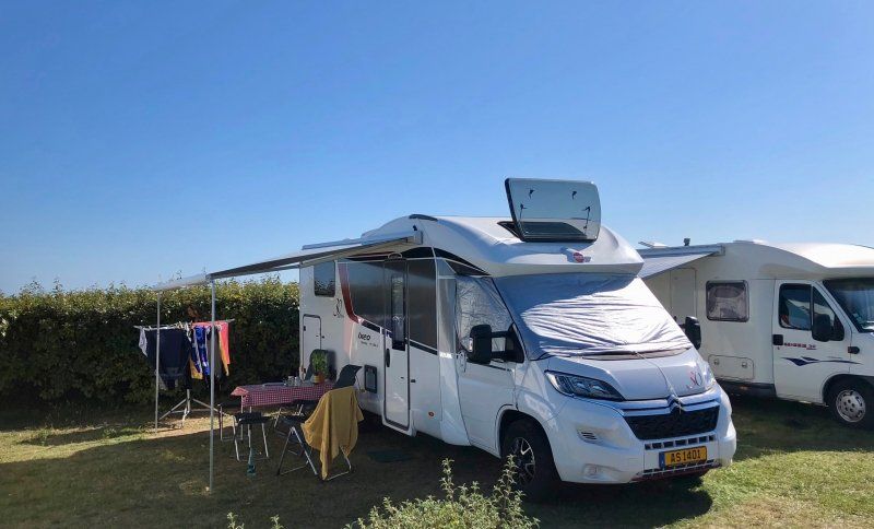
Camping Municipal Toul Ar Ster
Ein kleiner, etwas in die Jahre gekommener 2* Platz direkt am Strand und am Fahrradweg von Penmarch nach Guilvinec.
rue toul ar ster, 29760, Penmarch, Frankreich
47° 48' 1.4" N 4° 19' 59.9" W
47.8004000 -4.3333000
• Head south on Rue Toul Ar Ster. Go for 38 m.
• Arrive at Rue Toul Ar Ster. Your destination is on the right.
☍
0,0 km
( )
Day
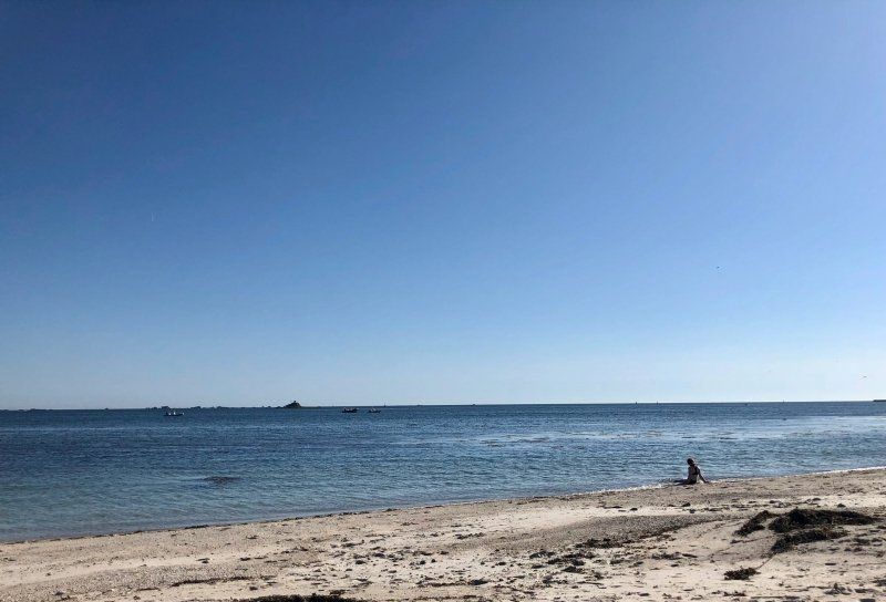
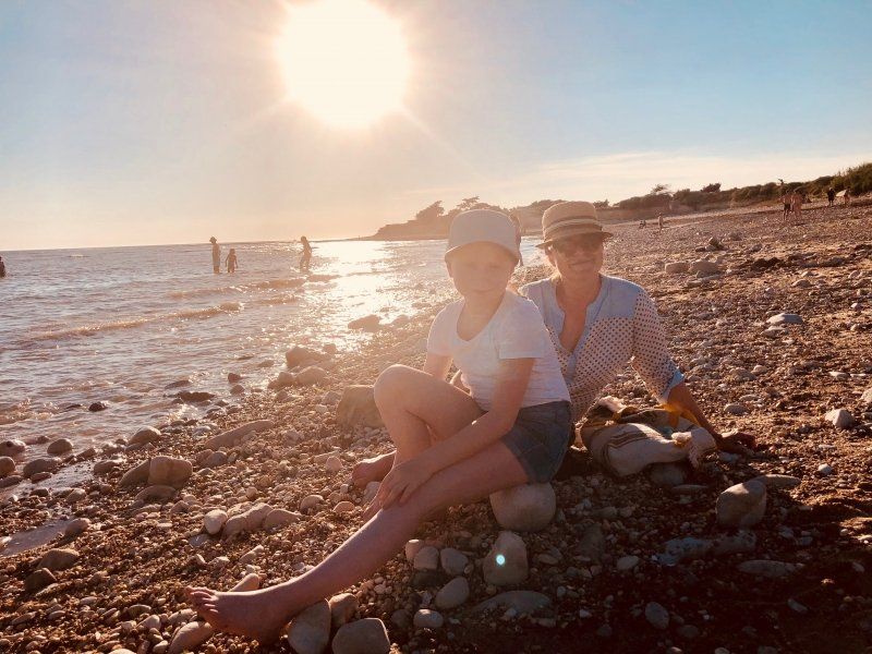
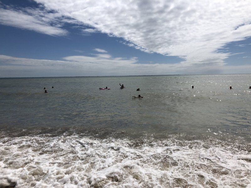
Am Strand "Toul ar Ster, Penmarch"
Nach einem Fahrradausflug ins Fischerdorf Guilvinec verbringen wir einen gemütlichen Tag am Strand "Toul ar Ster", direkt am Campingplatz. In dieser Bucht trifft der Atlantik nicht direkt auf die Küste, das Meer ist flach und ruhig.
Toul ar Ster, 29760 Penmarch, Frankreich
47° 48' 0.3" N 4° 20' 4.8" W
47.8000820 -4.3346700
• Head toward Rue de l'École de Voile on Rue Toul Ar Ster. Go for 412 m.
• Turn left onto Rue de l'École de Voile. Go for 459 m.
• Continue on Rue de la Gare. Go for 551 m.
• Turn right onto Rue François Merrien (D785). Go for 88 m.
• Turn left onto Rue Edmond Michelet (D785). Go for 282 m.
• Take the 1st exit from roundabout onto Rue Edmond Michelet (D785). Go for 295 m.
• Take the 2nd exit from roundabout onto Rue Edmond Michelet (D785). Go for 218 m.
• Continue on Hent Prad Gouzien (D785). Go for 167 m.
• Continue on Route de Plomeur (D785). Go for 685 m.
• Pass 5 roundabouts and continue on D785. Go for 7.4 km.
• Take the 3rd exit from roundabout onto D785. Go for 969 m.
• Pass 2 roundabouts and continue on D785. Go for 3.3 km.
• Take the 4th exit from Rond-Point de Kermaria roundabout onto D785. Go for 14.1 km.
• Keep right toward Boulevard de Poulguinan. Go for 169 m.
• Continue on Boulevard de Poulguinan. Go for 882 m.
• Take ramp onto Boulevard Louis Le Guennec (D34). Go for 1.6 km.
• Take the 2nd exit from Rond-Point de Kerustum roundabout onto Boulevard Flandres-Dunkerque 1940 (D783 A). Go for 1.1 km.
• Take the 2nd exit from Rond-Point de Gutenberg roundabout onto Avenue du Morbihan (D365). Go for 4.8 km.
• Take the 2nd exit from Rond-Point de Troyalac'h roundabout onto D365. Go for 313 m.
• Take the 1st exit from roundabout onto N165 toward Lorient. Go for 57.4 km.
• Keep left onto Voie Express de Nantes à Brest (N165) toward Vannes/Nantes/Rennes/Hennebont/Auray. Go for 59.9 km.
• Keep left onto N165 toward St Nazaire/Nantes/Theix/Muzillac. Go for 91.5 km.
• Take ramp onto N444 toward Bordeaux/Nantes-Centre/Aéroport Nantes-Atlantique/St Herblain/Couëron. Go for 5.7 km.
• Take ramp onto Périphérique Ouest (N844) toward Noirmoutier/Bordeaux/Poitiers/Périphérique-Sud/Aéroport Nantes-Atlantique. Go for 5.6 km.
• Keep left onto Périphérique Ouest (N844). Go for 8.2 km.
• Take ramp onto A83 toward Porte des Sorinières/Bordeaux/La Roche S/Yon/St Philbert de Gd L. Go for 81.2 km.
• Take exit 7 toward La Rochelle. Go for 952 m.
• Continue toward La Rochelle/Les Sables d'O./St Jean de Beugné. Go for 29 m.
• Take the 1st exit from roundabout onto D137 toward La Rochelle/St Jean de Beugné. Go for 699 m.
• Pass 5 roundabouts and continue on D137. Go for 11.9 km.
• Take the 2nd exit from roundabout onto D10 A toward Puyravault. Go for 6.2 km.
• Take the 2nd exit from roundabout onto D10 A. Go for 6.6 km.
• Continue on D9. Go for 1.4 km.
• Take the 2nd exit from roundabout onto Route de Villedoux (D9). Go for 6.3 km.
• Take the 1st exit from roundabout onto D10. Go for 1.6 km.
• Take the 2nd exit from roundabout onto D10. Go for 3.9 km.
• Take the 3rd exit from roundabout onto D105. Go for 2.7 km.
• Take the 2nd exit from roundabout onto D105. Go for 2.5 km.
• Take the 3rd exit from roundabout onto Avenue du 8 Mai 1945 (D104). Go for 1.3 km.
• Take the 1st exit from roundabout. Go for 290 m.
• Take ramp onto N237. Go for 4.6 km.
• Take ramp toward Île de Ré. Go for 251 m.
• Take the 3rd exit from roundabout onto D735. Go for 3.8 km.
• Take the 2nd exit from roundabout onto Pont de l'Île de Ré (D735). Go for 669 m.
• Take the 2nd exit from roundabout onto Avenue des Dunes (D201). Go for 2.0 km.
• Pass 2 roundabouts and continue on D201. Go for 2.3 km.
• Turn left onto Rue des Moineaux. Go for 106 m.
• Turn right onto Rue de la Beurelière. Go for 136 m.
• Turn left onto Rue Lucien Favreau. Go for 22 m.
• Turn left onto Rue de la République. Go for 94 m.
• Turn right onto Rue des Villages. Go for 55 m.
• Turn left onto Rue de la Grolle. Go for 163 m.
• Turn right onto Rue des Jardins. Go for 95 m.
• Turn slightly left onto Rue de la Barbinière. Go for 35 m.
• Continue on Rue de la Tour. Go for 580 m.
• Turn left. Go for 163 m.
• Turn right. Go for 51 m.
• Arrive at your destination on the left.
☍
409,0 km
(4 hrs. 23 min.)
Day
Cote Sauvage - Ile de Ré
Nach einer endlos langen Fahrt aus der Bretagne auf die Ile de Ré wegen eines Megastaus vor der Mautstelle zur Ile de Ré (mehr als 3 Stunden für 15km), werden wir mit einem wunderschönen Sonnenuntergang getröstet.
Plage de la Basse Benaie, 17740, Sainte-Marie-de-Ré, Frankreich
46° 8' 39.5" N 1° 18' 46.8" W
46.1443000 -1.3130000
• Head south. Go for 40 m.
• Turn right. Go for 131 m.
• Turn left. Go for 135 m.
• Turn right toward Rue de la Tour. Go for 17 m.
• Continue on Rue de la Tour. Go for 563 m.
• Continue on Rue de la Barbinière. Go for 35 m.
• Turn slightly right onto Rue des Jardins. Go for 95 m.
• Turn left onto Rue de la Grolle. Go for 163 m.
• Turn right onto Rue des Villages. Go for 55 m.
• Arrive at Rue des Villages. Your destination is on the left.
☍
1,2 km
( 3 min.)
Day
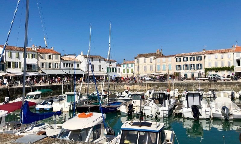
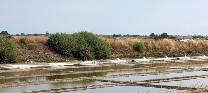
Sainte-Marie-de-Ré, Frankreich
Wir verbringen insgesamt 5 Tage auf der Insel. Wir erkunden die umliegenden Dörfer und Salzfelder mit dem Fahrrad, die Fahrradwege sind gut ausgebaut, im August jedoch ziemlich voll.
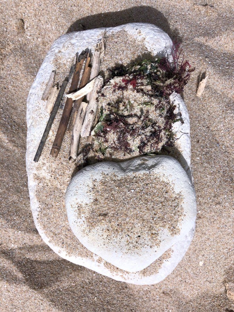
Die meisten Strände sind voller spitzer Steine, besonders bei Ebbe sollte man Wasserschuhe tragen.
17740 Sainte-Marie-de-Ré, Frankreich
46° 9' 5.9" N 1° 18' 43.4" W
46.1516270 -1.3120620
• Head northeast on Rue des Villages.
• Turn right onto Rue de la République. Go for 29 m.
• Turn left onto Rue de la Malette. Go for 457 m.
• Turn left onto Rue de la Croix de la Mine. Go for 74 m.
• Take the 1st exit from roundabout onto D201. Go for 1.9 km.
• Take the 2nd exit from roundabout onto D201. Go for 2.0 km.
• Take the 2nd exit from roundabout onto Avenue Gustave Perreau (D735). Go for 658 m.
• Take the 2nd exit from roundabout onto Pont de l'Île de Ré (D735). Go for 3.7 km.
• Keep right toward N237. Go for 252 m.
• Continue on N237. Go for 8.0 km.
• Keep left onto N137. Go for 6.3 km.
• Continue on D137. Go for 57.5 km.
• Continue on A10 (L'Aquitaine). Go for 90.4 km.
• Take exit 39A toward Libourne/St André de C./Bourg/Coutras. Go for 324 m.
• Take the 2nd exit from roundabout onto D1010 toward Paris/Saintes/Royan/Angoulême/St Antoine/Coutras/Montendre/Z.A. la Garosse. Go for 506 m.
• Take the 1st exit from roundabout onto Avenue de l'Europe (D1010) toward Angoulême/Montendre/St Antoine/Coutras/Z.A. la Garosse. Go for 177 m.
• Take the 2nd exit from roundabout onto Avenue de l'Europe (D142 E1) toward Z.A. la Garosse. Go for 778 m.
• Take the 3rd exit from roundabout onto D10 E1. Go for 473 m.
• Take the 2nd exit from roundabout onto D10. Go for 638 m.
• Take the 2nd exit from roundabout onto Rue de la Gruppe (D10). Go for 8.2 km.
• Turn right onto Avenue des Anciens Combattants d'Afr. du N. (D10) toward St Ciers d'Abzac/Guîtres/Coutras. Go for 49 m.
• Turn left onto Rue du Capitaine Oscar de Géreaux (D10). Go for 704 m.
• Turn right onto Lieu-dit Normandin (D10 E2). Go for 569 m.
• Continue on D10 E2. Go for 62 m.
• Continue on Lieu-dit Jean Roux Sud (D10 E2). Go for 131 m.
• Continue on Lieu-dit Bezerie (D10 E2). Go for 204 m.
• Continue on Lieu-dit Borlhe (D10 E2). Go for 493 m.
• Turn right onto Lieu-dit Borlhe (D18). Go for 2.4 km.
• Pass 3 roundabouts and continue on D18. Go for 6.6 km.
• Take the 2nd exit from roundabout toward Bordeaux/A89/Périgueux/E70. Go for 89 m.
• Continue on Lieu-dit Les Pradasses. Go for 587 m.
• Take ramp onto A89 toward Périgueux/Bergerac. Go for 157 km.
• Take the left exit toward Paris/Limoges/Lyon/A89/Clermont-Fd/Tulle/Brive-Est onto A20 (L'Occitane). Go for 16.7 km.
• Take exit 46.1 toward Lyon/Clermont-Fd/Tulle/St-Germain les V. onto A89. Go for 108 km.
• Take exit 25 toward Clermont-Fd-Sud/Le Mont-Dore/La Bourboule/Clermont-Fd/Rochefort-Mgne. Go for 2.2 km.
• Take the 4th exit from roundabout onto D2089 toward Clermont-Fd/Rochefort-Mgne. Go for 11.4 km.
• Turn left onto Route de Bordeaux (D216) toward Centre Ville. Go for 429 m.
• Turn left onto Place de la Fontaine (D80). Go for 15 m.
• Keep right onto Rue des Écoles (D74 C). Go for 456 m.
• Turn left onto D74. Go for 398 m.
• Continue on Lieu-dit Les Granges (D74). Go for 110 m.
• Continue on D74. Go for 3.0 km.
• Turn left onto D27. Go for 646 m.
• Continue on Lieu-dit Le Batiment Neuf (D27). Go for 88 m.
• Continue on D27. Go for 644 m.
• Turn left onto Rue du Guery. Go for 197 m.
• Continue on Place de la Basilique. Go for 97 m.
• Turn left onto Place Hugues de La Tour. Go for 65 m.
• Arrive at Place Hugues de La Tour. Your destination is on the right.
☍
495,7 km
(4 hrs. 36 min.)
Day
Day
Day
Day
Bauernhof "Le Roc", Orcival, Frankreich
Als Zwischenstopp übernachten wir auf einem Hügel (1100m) in der Auvergne auf dem Bauernhof "Le Roc", der auch Mitglied bei France Passion (https://www.france-passion.com) ist.
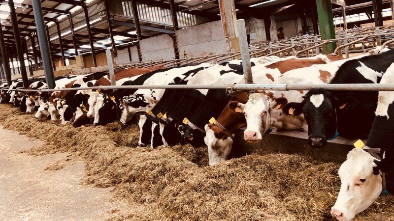
Man darf sich auf dem Hof zu jeder Zeit frei bewegen. Gegen 17 Uhr ist ein kommentierter Rundgang des Hofes, wo man erfährt wie der bekannte Käse "Saint-Nectaire fermier" hergestellt wird.
In einem kleinen Laden werden lokale Produkte angeboten, unter anderem kann man den hier produzierten Käse kosten und natürlich auch kaufen.
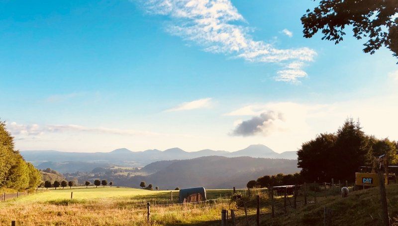
Man steht neben dem Stall, ab 5:30 beginnt die Arbeit, also nichts für Langschläfer ;-) Trotz allem wird man mit einem wunderbaren Sonnenaufgang über den Vulkankegeln der Auvergne und dem Puy de Dôme entlohnt.
63210 Orcival, Frankreich
45° 41' 0.8" N 2° 50' 29.5" E
45.6835660 2.8415350
• Head north on Place Hugues de La Tour.
• Turn right onto Place Hugues de La Tour. Go for 36 m.
• Turn left onto D555. Go for 15 m.
• Turn right onto Rue du Pont. Go for 31 m.
• Continue on Route de Clermont-Ferrand (D555). Go for 197 m.
• Turn left onto Route du Calvaire (D27). Go for 3.3 km.
• Continue on Route de Puy de Sire (D216). Go for 3.5 km.
• Take the 2nd exit from roundabout onto D942 toward Orcines/Royat/Chamalières/Le Puy de Dôme/Vulcania/Z.A. des Quatre Routes. Go for 10.4 km.
• Pass 2 roundabouts and continue on Route de Bordeaux (D942). Go for 7.7 km.
• Turn slightly left onto Rue du Clos Notre-Dame toward A71-A75/A89/Paris/Lyon/Montpellier. Go for 647 m.
• Continue on Rue Gilles Durant. Go for 121 m.
• Continue on Boulevard Gordon Bennett toward A71-A75/A89/Paris/Lyon/Montpellier/Gerzat/Aéroport Aulnat. Go for 326 m.
• Take the 3rd exit from roundabout onto Boulevard Maurice Pourchon toward Paris/Lyon/Montpellier/Gerzat/Aéroport Aulnat. Go for 967 m.
• Continue on Boulevard Daniel Mayer. Go for 334 m.
• Take the 2nd exit from roundabout onto Boulevard Daniel Mayer toward Paris/Lyon/Montpellier/Gerzat/Aéroport Aulnat. Go for 160 m.
• Continue on Rue du Clos de Chanturgue. Go for 182 m.
• Continue on Boulevard Daniel Mayer. Go for 108 m.
• Continue on Avenue Fernand Forest (D69). Go for 1.0 km.
• Turn slightly left onto Boulevard Edgar Quinet toward Gerzat/Les Gravanches/Paris/Riom/Vichy/Montluçon/A71-A75/A89. Go for 694 m.
• Take the 2nd exit from roundabout onto Boulevard Edgar Quinet toward A71-A75/A89/Gerzat/Les Gravanches/Vergnes. Go for 497 m.
• Keep left toward A710. Go for 780 m.
• Continue on A710. Go for 2.0 km.
• Continue on A89. Go for 83.5 km.
• Continue on A72 toward St Étienne/Feurs. Go for 53.7 km.
• Take the exit toward A47/Valence/Lyon/St Chamond onto N488. Go for 1.5 km.
• Continue on N88. Go for 5.8 km.
• Keep left onto A47 toward E70/St Chamond-Stelytec/Lyon/Valence. Go for 29.4 km.
• Take the exit toward Vienne/Valence/Marseille onto A7 (Autoroute du Soleil). Go for 102 km.
• Take exit 16 toward Privas/La Voulte/Livron/Loriol. Go for 727 m.
• Take the 3rd exit from roundabout onto D104 N toward Loriol/Livron/Crest/Die. Go for 736 m.
• Take the 2nd exit from roundabout onto D104 N toward Loriol-Centre. Go for 1.6 km.
• Turn left onto Boulevard Frédéric Mistral (N7) toward Valence/Livron/Crest/Die. Go for 2.1 km.
• Take the 2nd exit from roundabout onto D104 A toward Grâne/Crest/Le Jardin aux Oiseaux. Go for 1.1 km.
• Continue on D104. Go for 6.2 km.
• Turn right onto D437. Go for 460 m.
• Continue on D437. Go for 62 m.
• Turn left onto Grande Rue (D437). Go for 390 m.
• Turn right onto Route de Crest (D437). Go for 103 m.
• Turn right onto Route de Roche (D113) toward La Roche S/ Grâne/Marsanne. Go for 2.4 km.
• Continue on D113. Go for 930 m.
• Continue on Lieu-dit Barreau (D113). Go for 92 m.
• Continue on D113. Go for 365 m.
• Continue on Lieu-dit German (D113). Go for 81 m.
• Continue on D113. Go for 573 m.
• Turn right onto D113. Go for 206 m.
• Continue on Lieu-dit Issartel (D113). Go for 87 m.
• Continue on D113. Go for 398 m.
• Continue on Lieu-dit Le Mouras (D113). Go for 162 m.
• Continue on D113. Go for 963 m.
• Turn left onto D536. Go for 265 m.
• Continue on Route du Terron. Go for 80 m.
• Turn right onto Lieu-dit Le Terron. Go for 137 m.
• Continue on Lieu-dit Gronlier. Go for 119 m.
• Continue on Route des Fayes. Go for 4 m.
• Arrive at Route des Fayes. Your destination is on the left.
☍
328,6 km
(3 hrs. 17 min.)
Day
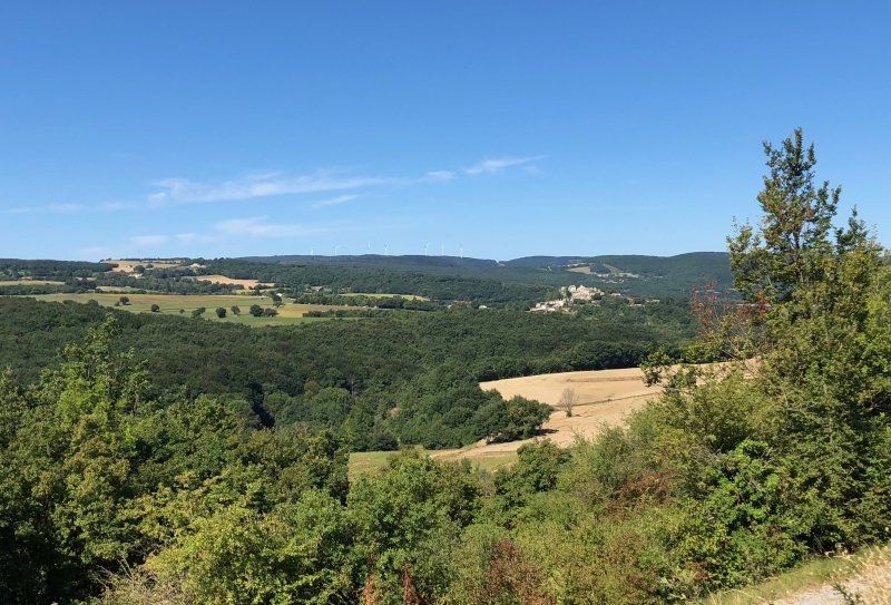
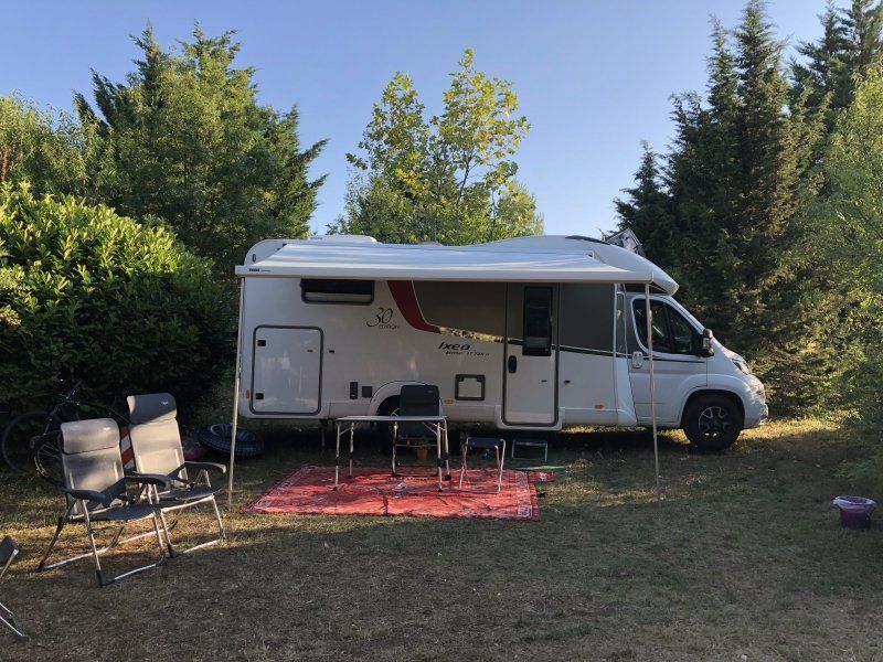
La Magerie, Les Fayes, La Roche-sur-Grane, Frankreich
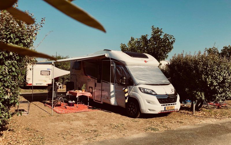
Der Campingplatz "La Magerie" wurde 1993 von einem luxemburgischen Ehepaar gegründet, die Stellplätze sind sehr groß und durch Hecken, Sträucher und Bäume getrennt. Abends kann mit anderen Gästen in gemütlicher Runde zusammen lecker essen.
Die doch recht entlegene Lage mit den teils sehr steilen und langen Hügeln reizt vor allem Radfahrer. Weniger sportliche Camper brauchen einen motorisierten Untersatz um die Gegend zu erkunden oder einzukaufen.
Wir besuchen meinen Bruder und dessen Familie und verbringen einige erholsame Tage.
Les Fayes, 26400 La Roche-sur-Grane, Frankreich
44° 40' 46.6" N 4° 56' 38.6" E
44.6796170 4.9440590
• Head northwest on Route des Fayes. Go for 4 m.
• Continue on Lieu-dit Gronlier. Go for 119 m.
• Continue on Lieu-dit Le Terron. Go for 137 m.
• Turn left onto Route du Terron. Go for 80 m.
• Continue on D536. Go for 265 m.
• Turn right onto D113. Go for 963 m.
• Continue on Lieu-dit Le Mouras (D113). Go for 162 m.
• Continue on D113. Go for 398 m.
• Continue on Lieu-dit Issartel (D113). Go for 87 m.
• Continue on D113. Go for 779 m.
• Continue on Lieu-dit German (D113). Go for 81 m.
• Continue on D113. Go for 365 m.
• Continue on Lieu-dit Barreau (D113). Go for 92 m.
• Continue on D113. Go for 930 m.
• Continue on Route de Roche (D113). Go for 2.4 km.
• Turn left onto Route de Crest (D437) toward D113/Loriol/Allex. Go for 103 m.
• Turn left onto Place du Champ-de-Mars (D437). Go for 390 m.
• Continue on D437. Go for 62 m.
• Continue on D125. Go for 298 m.
• Take the 4th exit from roundabout onto D125 toward Allex/Le Jardin aux Oiseaux. Go for 3.1 km.
• Turn left onto D93 toward Fiancey/Montoison/Zone Artisanale/Jardin aux Oiseaux. Go for 626 m.
• Take the 2nd exit from roundabout onto Lieu-dit Mouret (D93) toward Fiancey/Valence/Jardin aux Oiseaux/Montoison. Go for 559 m.
• Take the 3rd exit from roundabout onto Impasse des Fanges (D555) toward Ambonil. Go for 726 m.
• Continue on Lieu-dit Ferme de Grange Neuve (D555). Go for 95 m.
• Continue on Lieu-dit Les Fanges (D555). Go for 203 m.
• Continue on D555. Go for 394 m.
• Continue on Lieu-dit Bonnardel (D555). Go for 196 m.
• Continue on D555. Go for 1.2 km.
• Continue on Route d'Allex (D555). Go for 239 m.
• Continue on D555. Go for 2.0 km.
• Continue on Route d'Ambonil (D555). Go for 2.1 km.
• Take the 3rd exit from roundabout onto Route de Die (D111). Go for 943 m.
• Pass 2 roundabouts and continue on Route d'Étoile (D111). Go for 3.2 km.
• Take the 1st exit from roundabout onto Route des Mernes (D269) toward Z.A. de Clairac/Z.A. de Beauvert/Les Mernes. Go for 1.1 km.
• Continue on D269. Go for 2.0 km.
• Take the 3rd exit from roundabout onto Route de Montéléger (D261) toward Valence. Go for 1.8 km.
• Take the 2nd exit from roundabout onto Route de Montéléger (D261) toward Valence. Go for 976 m.
• Take the 1st exit from roundabout onto N7 toward A49/Romans/Valence-le Haut. Go for 7.3 km.
• Continue on E713. Go for 168 m.
• Continue on N532. Go for 10.6 km.
• Keep left onto A49 toward Genève/Chambéry/Grenoble/Romans-Centre. Go for 60.6 km.
• Take the exit toward Voiron/Lyon/Chambéry/Genève onto A48. Go for 41.8 km.
• Take the exit toward Genève/Chambéry/La Tour du Pin onto A43. Go for 46.8 km.
• Continue on A41 toward Genève/Annecy/Aix les Bains. Go for 51.0 km.
• Keep right onto A410 toward Milan/Chamonix-Mt B./Thonon/Évian/Annemasse. Go for 25.4 km.
• Take the exit toward Bonneville/Chamonix-Mt Blanc/Turin-Milan Par Tunnel du Mt Blanc onto A40 (Autoroute Blanche). Go for 44.7 km.
• Continue on N205. Go for 15.5 km.
• Take ramp onto N205 toward D1205/Torino/Milano/Aosta/Courmayeur/Tunnel du Mt Blanc. Go for 11.9 km.
• Continue on Traforo del Monte Bianco (T1). Go for 4.8 km.
• Continue on SS26dir. Go for 165 m.
• Continue on T1. Go for 864 m.
• Continue on SS26dir (Autostrada Torino-Aosta). Go for 80 m.
• Continue on A5 (Autostrada Torino-Aosta). Go for 30.3 km.
• Take the exit toward Aosta Ovest/Aosta Centro/Aoste Centre/St.Pierre/Aosta/SS26/T1/T2. Go for 1.2 km.
• Continue on SR47. Go for 409 m.
• Take the 1st exit from roundabout onto Strada Statale della Valle d'Aosta (SS26). Go for 634 m.
• Arrive at Frazione Saint Maurice (SS26). Your destination is on the left.
☍
383,2 km
(3 hrs. 42 min.)
Day
Day
Day
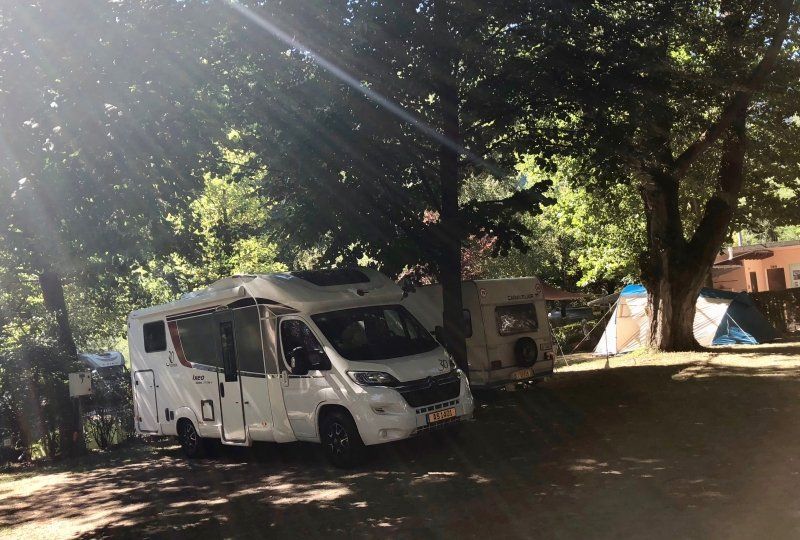
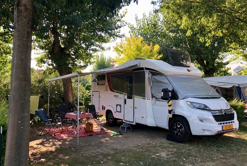
Camping Monte Bianco, Sarre, Aosta
Ein kleiner, etwas älterer, jedoch liebevoll gepflegter Campingplatz in Sarre, unweit von Aosta.
Loc.Saint Maurice 15, 11010, Sarre, Italien
45° 43' 3" N 7° 15' 38.9" E
45.7175000 7.2608000
• Head northeast on Frazione Saint Maurice (SS26). Go for 164 m.
• Pass 2 roundabouts and continue on Frazione La Grenade (SS26). Go for 2.3 km.
• Take ramp toward Aosta Centro/Carrel Centro. Go for 314 m.
• Continue on Viale Piccolo San Bernardo. Go for 1.1 km.
• Take the 1st exit from roundabout onto Via Chambery. Go for 893 m.
• Turn left onto Viale dei Partigiani. Go for 116 m.
• Arrive at Viale dei Partigiani. Your destination is on the left.
☍
4,9 km
( 6 min.)
Day
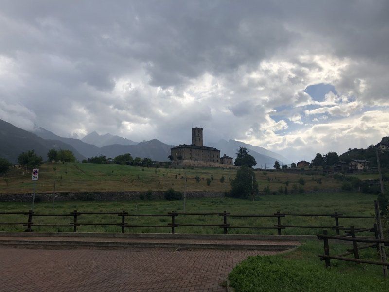
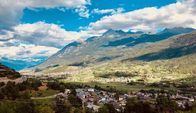
Aosta, Aostatal, Italien
Der Tag beginnt mit einer etwas "aufwendigeren" Suche nach der lokalen Bäckerei, welche sich in einem unscheinbaren Reihenhaus unweit der Kirche befindet, lediglich ein handgemaltes Schild weist auf die Backstube hin.
Nach einem Stadtbummel durch die schöne Stadt Aosta wandern wir noch ein wenig durch die umliegenden Hügel und Weinberge bis zur Burg Sarre.
Mit lokalen Spezialitäten in einer urigen Trattoria schliessen wird den Tag ab.
11100 Aosta, Aosta Valley, Italien
45° 44' 5.8" N 7° 18' 47.1" E
45.7349551 7.3130762
• Head toward Via Monte Vodice on Viale dei Partigiani. Go for 8 m.
• Turn right onto Piazza della Repubblica. Go for 125 m.
• Turn left onto Via Monte Solarolo. Go for 450 m.
• Turn right onto Corso Saint-Martin-de-Corleans. Go for 209 m.
• Turn left onto Viale Ginevra. Go for 172 m.
• Take the 1st exit from roundabout onto Via Roma (SS26) toward Via-Rue Roma/Hôpital Beauregard/Ospedale Beauregard/Aeroporto C.Gex/A5/Torino. Go for 962 m.
• Pass 3 roundabouts and continue on Località Grand Chemin (SS26). Go for 4.3 km.
• Take ramp onto Strada Statale del Gran San Bernardo (SS27) toward Genova/A26/E25/Milano/A4/E64/Torino/A5/E612/Monte Bianco/T1/Mont Blanc. Go for 400 m.
• Keep left toward Aosta Centro/Aoste Centre/Genova/E25/Milano/A4/E64/Torino/A5/E612. Go for 465 m.
• Take ramp onto A5 (Ponte L'Eglise) toward Genova/A26/E25/E612/Torino/Milano/A4/E64. Go for 63.5 km.
• Take the exit onto A5 (Diramazione A4/A5). Go for 24.3 km.
• Take the exit toward Milano onto A4 (Autostrada Torino-Trieste). Go for 216 km.
• Take the exit toward Peschiera. Go for 1.1 km.
• Continue on Strada Regionale Gardesana Orientale (SR249). Go for 27 m.
• Keep left onto Strada Regionale Gardesana Orientale (SR249) toward Peschiera Centro/Ospedale/Valeggio S.M. Go for 96 m.
• Keep right toward Peschiera Centro/Ospedale. Go for 57 m.
• Turn right onto Località Paradiso di Sopra (SR249). Go for 907 m.
• Continue toward Via Venezia. Go for 35 m.
• Take the 2nd exit from roundabout onto Via Venezia. Go for 433 m.
• Continue on Parco Catullo. Go for 218 m.
• Turn right onto Riviera Giosuè Carducci. Go for 191 m.
• Take the 1st exit from roundabout onto Lungolago Giuseppe Mazzini. Go for 717 m.
• Turn slightly left onto Via Giacomo Puccini. Go for 141 m.
• Arrive at Via Giacomo Puccini. Your destination is on the right.
☍
314,7 km
(2 hrs. 46 min.)
Day
Gardasee, Peschiera, Campeggio Cappuccini
Am Gardasee gibt es viele sehr große Campinganlagen , Cappucini ist da eher überschaubar und dementsprechend gemütlicher, ein Animationsprogramm wie am Nachbarplatz sucht man vergeblich (uff).
Der Platz liegt direkt am See, die Altstadt Peschieras ist in wenigen Minuten bequem am See entlang zu erreichen.
Via Arrigo Boito 2, 37019, Peschiera del Garda, Italien
45° 26' 35.9" N 10° 41' 2" E
45.4433000 10.6839000
• Head toward Via Torino on Via Giacomo Puccini. Go for 118 m.
• Turn left onto Viale della Repubblica. Go for 418 m.
• Turn right toward Viale Risorgimento. Go for 23 m.
• Take the 4th exit from roundabout onto Viale Risorgimento. Go for 322 m.
• Continue on Riviera Giosuè Carducci. Go for 14 m.
• Take the 3rd exit from roundabout onto Riviera Giosuè Carducci. Go for 216 m.
• Turn left onto Parco Catullo. Go for 350 m.
• Continue on Via Venezia. Go for 228 m.
• Keep right toward Via Venezia/SR249. Go for 32 m.
• Take the 2nd exit from roundabout onto Via Venezia (SR249). Go for 112 m.
• Turn right toward Viale Stazione. Go for 28 m.
• Continue on Viale Stazione. Go for 228 m.
• Arrive at Viale Stazione. Your destination is on the right.
☍
2,1 km
( 4 min.)
Day
Peschiera Del Garda, Peschiera del Garda, Verona, Italien
37019 Peschiera del Garda, Verona, Italien
45° 26' 18.8" N 10° 42' 8.7" E
45.4385618 10.7024254
• Head toward Via Sebino on Viale Stazione. Go for 256 m.
• Turn right onto Via Venezia (SR249). Go for 1.2 km.
• Take the 3rd exit from roundabout onto Strada Regionale Padana Superiore (SR11) toward Verona. Go for 2.4 km.
• Take the 3rd exit from roundabout onto Strada Regionale di Affi (SR450) toward Brennero/A22/Modena/Affi. Go for 13.1 km.
• Take the 1st exit from roundabout toward SS12/A22. Go for 359 m.
• Take the 2nd exit from roundabout onto A22 (Autostrada del Brennero) toward Milano/A4/Brennero. Go for 130 km.
• Take the exit toward Bolzano Nord/Val D 'Ega/Bozen Nord/Eggental/Steinegg/Collepietra/Kastelruth/Castelrotto/Brenner/Brennero. Go for 578 m.
• Turn left onto Strada Statale dell'Abetone e del Brennero (SS12) toward Steinegg/Collepietra/Kastelruth/Castelrotto/Brenner/Brennero. Go for 3.6 km.
• Take left ramp onto Strada Provinciale Prato Isarco-Ponte Gardena (SP24) toward Tiers/Tires. Go for 7.4 km.
• Take the 2nd exit from roundabout onto Via per Bolzano (SP24) toward Seis A. Schlern/Siusi A. Sciliar/Kastelruth/Castelrotto. Go for 3.5 km.
• Turn left onto Località San Costantino. Go for 125 m.
• Turn slightly left onto Via Dolomiti. Go for 311 m.
• Arrive at Via Dolomiti. Your destination is on the right.
☍
162,4 km
(1 hrs. 35 min.)
Day
Day
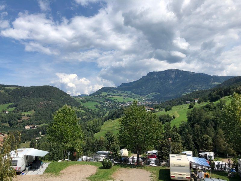
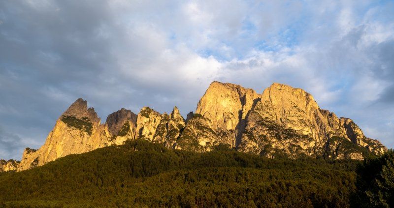
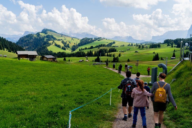
Camping Seiser Alm
Sehr gepflegter Campingplatz mit super Ausblick, ideal zum Wandern.
Dolomiten Weg 10, 39050, Völs am Schlern, Italien
46° 31' 59.2" N 11° 32' 1" E
46.5331000 11.5336000
• Head north on Via Dolomiti. Go for 311 m.
• Turn slightly right onto Località San Costantino. Go for 125 m.
• Turn sharp left onto Strada Provinciale Prato Isarco-Ponte Gardena (SP24). Go for 3.4 km.
• Take the 2nd exit from roundabout onto Via Sciliar (SP24) toward Kastelruth/Castelrotto. Go for 1.7 km.
• Take the 3rd exit from roundabout onto Strada Provinciale Prato Isarco-Ponte Gardena (SP24) toward Autostrada/A22/Waidbruck/Ponte Gardena/Bozen/Bolzano/Zona Industriale Telfen. Go for 7.6 km.
• Take the 3rd exit from roundabout onto Strada Statale di Val Gardena e Passo Sella (SS242). Go for 168 m.
• Turn right onto Strada Statale dell'Abetone e del Brennero (SS12) toward Brennero/A22/Brenner/Barbian/Barbiano/Brixen/Bressanone. Go for 7.6 km.
• Take the 1st exit from roundabout onto Strada Statale di Val Gardena e Passo Sella (SS242dir). Go for 287 m.
• Take the 2nd exit from roundabout onto A22 (Autostrada del Brennero) toward Autobahn/Autostrada/Brennero/Brenner. Go for 53.8 km.
• Continue on A13 (Brennerpass). Go for 31.7 km.
• Keep right onto A13 (Knoten Innsbruck-Berg Isel) toward Bregenz/Garmisch/Innsbruck-West. Go for 2.0 km.
• Continue on A12 (Inntal Autobahn). Go for 67.7 km.
• Continue on Arlberg Schnellstraße (S16). Go for 5.1 km.
• Keep left onto Arlberg Schnellstraße (S16). Go for 13.6 km.
• Keep left onto Arlberg Schnellstraße (S16). Go for 42.9 km.
• Continue on Rheintal Autobahn (A14). Go for 61.6 km.
• Continue on A96. Go for 3.3 km.
• Take exit 3 toward Flughafen Friedrichshafen/B31. Go for 386 m.
• Turn left onto B308 toward Flughafen Friedrichshafen/Lindau/Ravensburg/B31/B467. Go for 181 m.
• Continue on B31. Go for 19.4 km.
• Take ramp onto Lindauer Straße toward Schweiz Fähre/Friedrichshafen-Ost/Stadtmitte/Gewerbegebiet Unteresch. Go for 1.7 km.
• Turn left. Go for 28 m.
• Turn right. Go for 61 m.
• Arrive at your destination on the right.
☍
324,7 km
(3 hrs. 39 min.)
Day
Day
Day
Day
Day
Day
Day
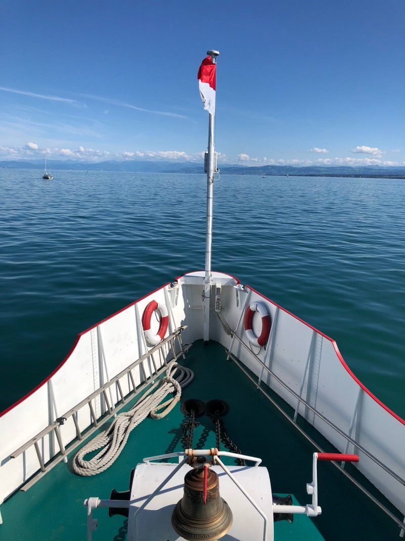
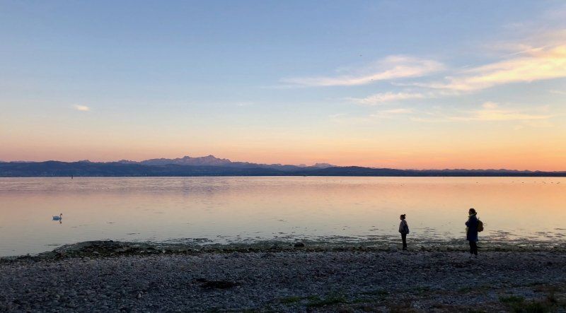
Friedrichshafen: Cap Rotach
Eigentlich wollten wir nur eine Nacht am Bodensee verbringen, doch am zweiten Tag zeigte sich die Sonne und wir blieben 3 Tage, mit Ausflügen zur Mainau und Umgebung.
Lindauer Straße 2, 88046, Friedrichshafen, Deutschland
47° 38' 59.6" N 9° 29' 46.7" E
47.6499000 9.4963000
• Head east. Go for 61 m.
• Turn left toward Lindauer Straße/L328A. Go for 28 m.
• Turn right onto Lindauer Straße (L328A). Go for 1.0 km.
• Take ramp onto B31. Go for 16.6 km.
• Continue on B31 toward Donaueschingen/Meersburg. Go for 4.9 km.
• Keep left onto B31 toward Stuttgart/Singen/Stockach/Überlingen/Uhldingen-Mühlhofen. Go for 12.6 km.
• Continue on B31N. Go for 15.6 km.
• Continue on A98. Go for 12.5 km.
• Take exit 11 toward Stuttgart/Villingen-Schwenningen onto A81. Go for 20.6 km.
• Take exit 38 toward Geisingen/Freiburg/Tuttlingen/B31/Immendingen. Go for 411 m.
• Turn left onto B311 toward Freiburg/Donaueschingen/Geisingen. Go for 789 m.
• Keep right onto B31. Go for 76.7 km.
• Take ramp onto A5 toward Karlsruhe. Go for 27.4 km.
• Take exit 57B toward Rust/Europa-Park/Ringsheim. Go for 308 m.
• Take the 1st exit from roundabout onto K5349 toward A5/Basel/Rust/Europa-Park. Go for 1.5 km.
• Turn right toward Rust. Go for 88 m.
• Turn left onto Ringsheimer Straße. Go for 704 m.
• Take the 1st exit from roundabout onto Ringsheimer Straße toward Rust. Go for 266 m.
• Take the 2nd exit from roundabout onto Ritterstraße. Go for 937 m.
• Turn left onto Karl-Friedrich-Straße (L104). Go for 64 m.
• Turn right onto Austraße. Go for 274 m.
• Continue on Rheinweg. Go for 430 m.
• Turn right. Go for 103 m.
• Arrive at your destination on the left.
☍
193,9 km
(2 hrs. 22 min.)
Day
Day
Day
Camping Europa-Park Rust
Rheinweg 5, 77977, Rust, Deutschland
48° 16' 17.8" N 7° 43' 2.3" E
48.2716000 7.7173000
• Head south. Go for 103 m.
• Turn left onto Rheinweg. Go for 430 m.
• Continue on Austraße. Go for 274 m.
• Turn left onto Karl-Friedrich-Straße (L104). Go for 64 m.
• Turn right onto Ritterstraße. Go for 908 m.
• Take the 2nd exit from roundabout onto Ringsheimer Straße. Go for 274 m.
• Take the 2nd exit from roundabout onto Ringsheimer Straße toward A5/Ringsheim. Go for 908 m.
• Take ramp onto K5349. Go for 1.2 km.
• Continue on K5349. Go for 203 m.
• Continue on K5349 toward Karlsruhe. Go for 83 m.
• Take the 2nd exit from roundabout onto A5 toward Karlsruhe. Go for 27.7 km.
• Take exit 55 toward Schutterwald onto B33A. Go for 343 m.
• Keep left onto B33A toward Karlsruhe/A5/Strasbourg/Flughafen/Kehl/Schutterwald. Go for 415 m.
• Keep right onto L98 toward Strasbourg/Flughafen/Kehl/Neuried/Schutterwald. Go for 6.1 km.
• Pass 2 roundabouts and continue on L98. Go for 4.6 km.
• Continue on Pont Pierre Pflimlin (M353). Go for 5.3 km.
• Take ramp toward M83/St Dié Par Col/Strasbourg/Aéroport Entzheim. Go for 928 m.
• Continue on M83. Go for 1.8 km.
• Take ramp onto A35 toward Strasbourg. Go for 9.4 km.
• Continue on A4 (Autoroute de l'Est) toward Nancy/Metz/Paris/Haguenau/Karlsruhe/Bischheim/Schiltigheim. Go for 166 km.
• Take the exit toward Thionville/Luxembourg/Longwy onto A31. Go for 36.2 km.
• Continue on A3. Go for 6.4 km.
• Take exit 2 toward Livange onto N31. Go for 876 m.
• Turn left onto Rue de Bettembourg (CR159). Go for 2.0 km.
• Turn left onto Rue de Kockelscheuer. Go for 115 m.
• Arrive at Rue de Kockelscheuer. Your destination is on the left.
☍
272,4 km
(2 hrs. 38 min.)
Day
Bivingen, Luxemburg
49° 32' 40.8" N 6° 8' 8.6" E
49.5446533 6.1357148