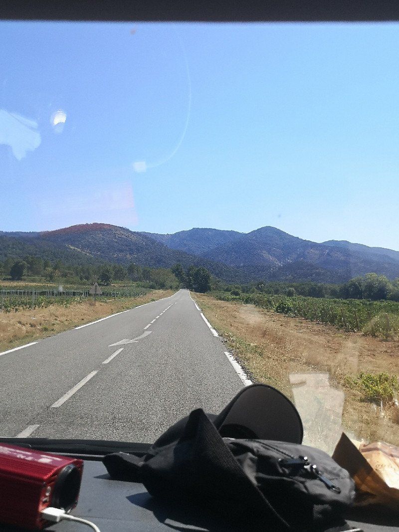
Summer tour in high season without reservation! Originally it was supposed to go to Portugal via southern France. Our gut feeling then unexpectedly pulled us to Italy. Best decision!
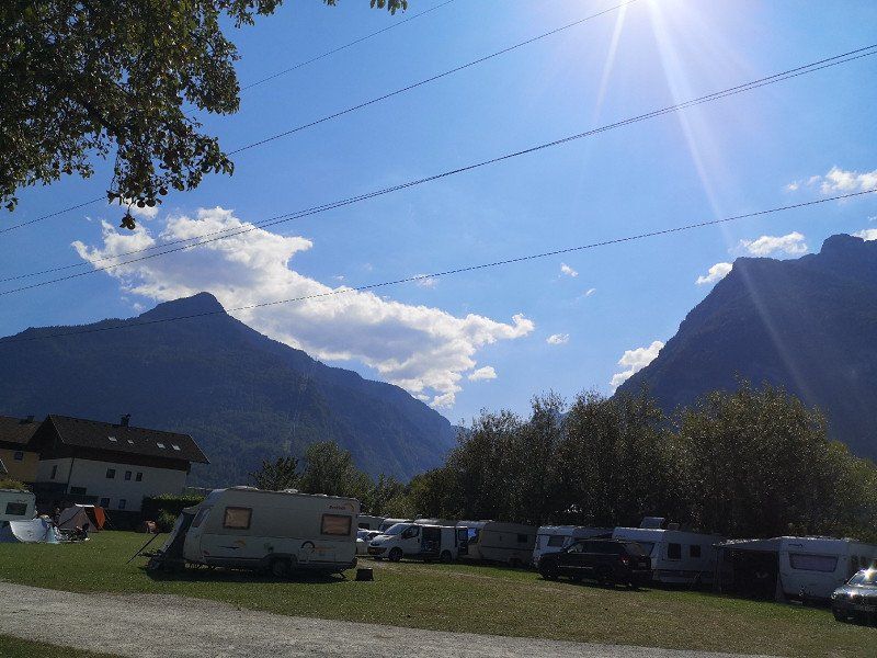
07/31/2022 - 08/20/2022
Day
Blumenberg
departure from home
Köln, Deutschland
51° 2' 11.7" N 6° 53' 33" E
51.0365859 6.8924963
• Head northwest on Langenbergstraße. Go for 138 m.
• Turn left onto Langenbergstraße. Go for 621 m.
• Continue on Geiersbergstraße. Go for 7 m.
• Turn left onto Geiersbergstraße. Go for 85 m.
• Take the 2nd exit from roundabout onto Mercatorstraße (K8). Go for 534 m.
• Take the 1st exit from roundabout onto Mercatorstraße (K8). Go for 1.1 km.
• Keep left onto Chorweiler Zubringer toward K.-Zentrum. Go for 2.4 km.
• Take left ramp onto A57 toward Zentrum. Go for 868 m.
• Take exit 28 toward Koblenz onto A1. Go for 29.1 km.
• Take exit 109 toward Trier/B51/Euskirchen onto A1. Go for 37.7 km.
• Take exit 114 toward Blankenheim/Dahlem/Trier onto B51. Go for 38.1 km.
• Take ramp onto B51/B410. Go for 7.2 km.
• Take the 2nd exit from roundabout onto B51 toward Luxemburg/A60/Trier/Bitburg/E42/Schloßheck. Go for 223 m.
• Take ramp onto A60 toward Luxembourg/Trier/Bitburg. Go for 18.9 km.
• Take exit 6 toward Luxembourg/Bitburg onto B51. Go for 32.9 km.
• Take ramp onto A64 toward Luxembourg. Go for 8.8 km.
• Continue on A1 (Sauertalbrücke). Go for 36.4 km.
• Take the exit toward Metz/Saarbrücken/Livange onto A3. Go for 13.0 km.
• Continue on A31. Go for 91.1 km.
• Take exit 23 toward Malzéville/Bouxières aux D./Parc Nancy-Pompey-Logistique onto D321 (Voie Express Banlieue-Est). Go for 3.3 km.
• Take the 2nd exit from roundabout onto Voie Express Banlieue-Est (D321). Go for 277 m.
• Continue on M321. Go for 838 m.
• Take the 2nd exit from Rond-Point de Pixéricourt roundabout onto M321 toward Nancy/Saint Max/Dommartemont/Plateau de Malzéville. Go for 2.1 km.
• Take the 2nd exit from roundabout onto M321 toward Nancy/Saint Max/Dommartemont/Plateau de Malzéville. Go for 1.1 km.
• Continue on Viaduc Louis Marin. Go for 743 m.
• Take ramp. Go for 156 m.
• Continue on Boulevard du 26ème Régiment d'Infanterie. Go for 100 m.
• Continue on Boulevard du 26ème Régiment d'Infanterie. Go for 514 m.
• Continue on Porte Sainte-Catherine. Go for 26 m.
• Turn right onto Rue Sainte-Catherine toward Quartier Stanislas/Cité Administrative/Préfecture. Go for 357 m.
• Turn left onto Rue Guibal. Go for 36 m.
• Continue on Place d'Alliance. Go for 67 m.
• Turn right onto Rue Pierre Fourier. Go for 199 m.
• Turn left onto Rue Saint-Julien. Go for 54 m.
• Turn left onto Rue Claude Charles. Go for 24 m.
• Arrive at Rue Claude Charles. Your destination is on the right.
☍
329,0 km
(3 hrs. 25 min.)
Nancy
Stopover at Camping Moselle campsite in Nancy.
Frankreich
48° 41' 31.4" N 6° 11' 3.9" E
48.6920540 6.1844170
• Head toward Rue Maurice Barrès on Rue Claude Charles. Go for 57 m.
• Turn right onto Rue Maurice Barrès. Go for 91 m.
• Turn left onto Rue Saint-Georges. Go for 325 m.
• Turn right onto Place de la Division de Fer. Go for 23 m.
• Continue on Place de la Division de Fer toward Jarville/Quartier Charles III. Go for 253 m.
• Turn slightly right onto Boulevard Lobau (D570). Go for 1.4 km.
• Continue on Boulevard Lobau. Go for 147 m.
• Take ramp onto M674 toward Vandoeuvre/Parc des Expositions. Go for 2.1 km.
• Continue on A330. Go for 5.9 km.
• Take exit 6 toward A31 (Dijon)/Neuves-Maisons/Richardménil. Go for 371 m.
• Take the 3rd exit from roundabout onto D331 toward Dijon/A31/Messein/Neuves-Maisons/Pont St Vincent. Go for 13.7 km.
• Continue on D974. Go for 9.2 km.
• Take the 3rd exit from roundabout toward Troyes/Dijon/Nancy/Toul. Go for 555 m.
• Take the 2nd exit from roundabout. Go for 44 m.
• Take ramp onto A31 toward Dijon/Troyes. Go for 101 km.
• Take the left exit toward Lyon/Besançon/Dijon/Langres-Sud onto A31. Go for 115 km.
• Continue on A6 (Autoroute du Soleil). Go for 147 km.
• Keep left onto Autoroute du Soleil (M6) toward Lyon-Centre. Go for 6.8 km.
• Keep left onto Autoroute du Soleil (M7). Go for 194 km.
• Keep right onto A9 (Échangeur d'Orange) toward Barcelone/Toulouse/Montpellier/Nîmes. Go for 122 km.
• Take exit 33 toward Sète/Frontignan/Balaruc/Mèze. Go for 1.1 km.
• Keep left onto D600 toward Sète/Montpellier/Balaruc/Frontignan/Gigean/Fabrègues/Villeveyrac/Z.I. des Trouyaux. Go for 888 m.
• Take ramp onto Route de Sète (D2 E) toward Balaruc le Vieux/Balaruc les Bains. Go for 524 m.
• Take the 1st exit from roundabout onto D129 E1. Go for 83 m.
• Continue on Avenue de Montpellier (D129 E1). Go for 493 m.
• Take the 2nd exit from roundabout onto Avenue des Bains (D129). Go for 390 m.
• Take the 2nd exit from roundabout onto Route de Montpellier (D129). Go for 238 m.
• Take the 2nd exit from roundabout onto Route de Montpellier (D129). Go for 571 m.
• Take the 2nd exit from roundabout onto Route de Montpellier (D129). Go for 465 m.
• Take the 2nd exit from roundabout onto Avenue de Montpellier (D129). Go for 546 m.
• Turn right onto Avenue de la Cadole. Go for 37 m.
• Turn right onto Rue du Lavoir. Go for 78 m.
• Arrive at Rue du Lavoir. Your destination is on the right.
☍
725,4 km
(6 hrs. 24 min.)
Day
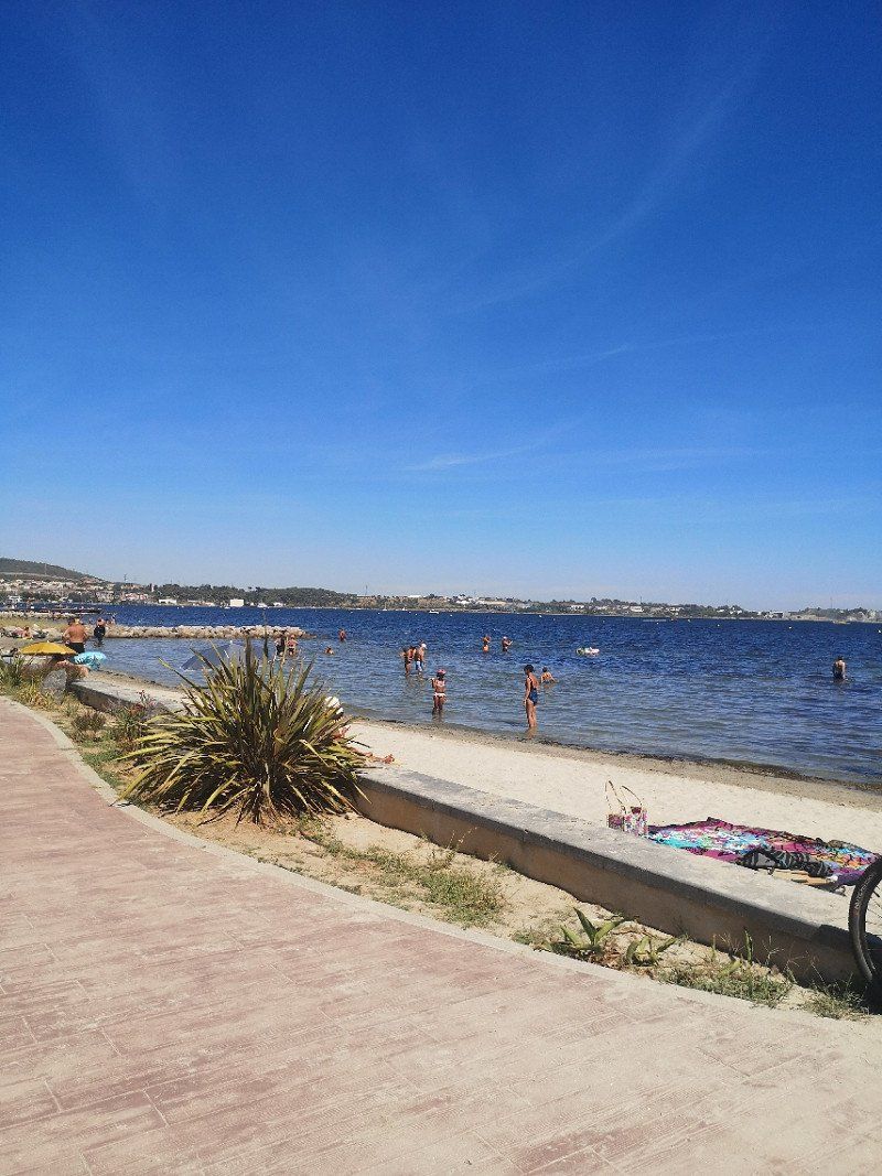
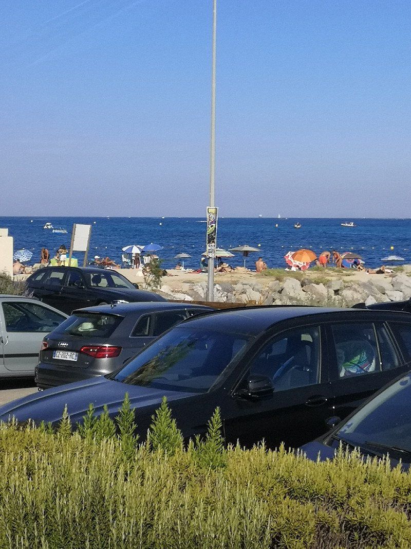
Balaruc-les-Bains
Arrived in southern France, another stop at the parking space park Camping Municipal Chemin des Bains. Very large, pleasant place with free choice of parking space. Automated registration, therefore no opening times have to be observed. 2 showers available (free use), no toilets!
Lots of local tourists!
Frankreich
43° 26' 33.4" N 3° 40' 45.3" E
43.4425979 3.6792410
• Head toward Résidence Côté Jardin on Rue du Lavoir. Go for 229 m.
• Continue on Avenue de Montpellier (D129). Go for 194 m.
• Take the 2nd exit from roundabout onto Route de Montpellier (D129). Go for 418 m.
• Pass 2 roundabouts and continue on Route de Montpellier (D129). Go for 856 m.
• Take the 2nd exit from roundabout onto Avenue des Bains (D129). Go for 396 m.
• Take the 2nd exit from roundabout onto Esplanade Marcel Pradel (D129). Go for 71 m.
• Turn right onto Avenue de Montpellier (D129 E1). Go for 443 m.
• Continue on D129 E1. Go for 17 m.
• Turn right toward D129 E1. Go for 34 m.
• Take the 3rd exit from roundabout onto Route de Sète (D2 E) toward Poussan. Go for 510 m.
• Take ramp. Go for 364 m.
• Continue on D600. Go for 1.2 km.
• Take ramp onto A9 (La Languedocienne) toward Montpellier/Lyon. Go for 68.0 km.
• Take the exit toward Nîmes-Centre/Aéroport Garons/Arles/Aix en Pce/Marseille onto A54. Go for 48.0 km.
• Continue on A54. Go for 23.7 km.
• Take the exit toward Aix en Pce/Aéroport Marignane/Nice/Marseille onto A7 (Autoroute du Soleil). Go for 11.8 km.
• Keep left onto A8 (Échangeur de la Croix de Coudoux) toward Nice/Toulon/Aix en Pce. Go for 98.7 km.
• Take the exit toward Hyères/La Garde Freinet/Vidauban/Le Luc onto A57. Go for 595 m.
• Take exit 13 toward La Garde-Freinet/Vidauban/Le Luc/Le Cannet des M. Go for 527 m.
• Take the 4th exit from Rond-Point de la Paix roundabout onto D558 toward La Garde Freinet/Cogolin/St Tropez. Go for 381 m.
• Take the 3rd exit from roundabout onto D558 toward La Garde Freinet. Go for 17.3 km.
• Take the 3rd exit from roundabout onto Route Nationale (D558) toward Grimaud/St Tropez/Plan de La Tour. Go for 325 m.
• Take the 3rd exit from roundabout onto D558 toward Grimaud/St Tropez. Go for 8.4 km.
• Take the 2nd exit from roundabout onto Route Nationale (D558) toward Cogolin/St Tropez. Go for 1.7 km.
• Take the 2nd exit from roundabout onto Route des Oliviers (D14) toward St Tropez/Ste Maxime. Go for 860 m.
• Take the 2nd exit from roundabout onto Route des Oliviers (D14). Go for 95 m.
• Take the 1st exit from roundabout onto Route de Saint-Tropez (D61). Go for 748 m.
• Take the 2nd exit from roundabout onto Route du Pont de Vinaigre (D61) toward Port Grimaud/St Tropez/Gassin/La Croix Valmer. Go for 1.9 km.
• Take the 3rd exit from roundabout onto D98 toward St Tropez/Ste Maxime. Go for 568 m.
• Turn right onto D559 toward D98/St Tropez/Fréjus/St Raphaël/Ste Maxime. Go for 248 m.
• Keep right onto Rond-Point de la Foux (D98 A) toward St Tropez/Ramatuelle. Go for 524 m.
• Keep right onto D98 A. Go for 394 m.
• Take the 1st exit from roundabout onto Route du Littoral (D98 A). Go for 880 m.
• Keep left onto D98 A toward Saint-Tropez. Go for 226 m.
• Continue on D61. Go for 138 m.
• Continue on D98 A. Go for 97 m.
• Keep right toward D98/St Tropez. Go for 80 m.
• Continue on Route du Littoral (D98 A). Go for 2.4 km.
• Turn right onto Allée de la Bouillabaisse. Go for 9 m.
• Turn left onto Avenue Général Leclerc. Go for 61 m.
• Turn left onto Avenue Général Leclerc. Go for 13 m.
• Turn right onto Avenue Général Leclerc (D98 A). Go for 46 m.
• Take the 2nd exit from roundabout onto Avenue Général Leclerc (D98 A). Go for 917 m.
• Keep right onto Avenue Général Leclerc (D98 A). Go for 81 m.
• Continue on Rue Général Allard (D98 A). Go for 6 m.
• Keep right onto Boulevard Louis Blanc. Go for 145 m.
• Turn right onto Avenue Paul Roussel. Go for 308 m.
• Keep right toward Avenue Paul Roussel. Go for 26 m.
• Arrive at Avenue Paul Roussel. Your destination is on the left.
☍
295,1 km
(3 hrs. 9 min.)
Day
Day
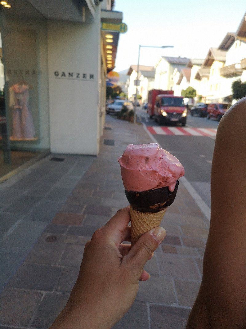
Saint-Tropez
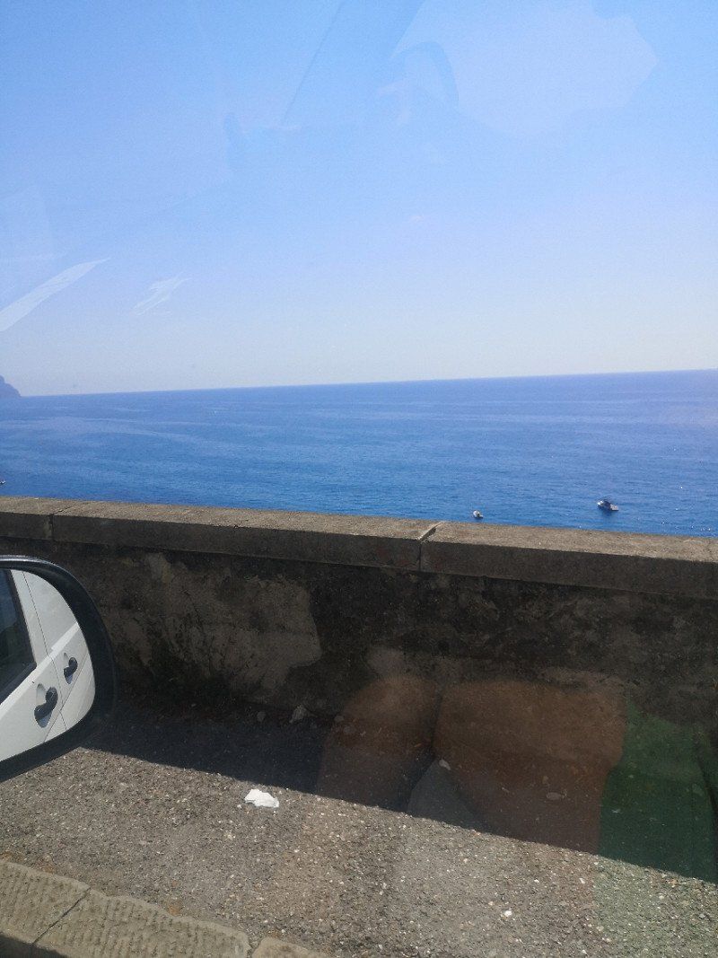
Short detour to St. Tropez. Very nice panorama on the way to the center, but very overloaded. Therefore left again after a few hours.
Frankreich
43° 16' 3.7" N 6° 38' 26.6" E
43.2676808 6.6407109
• Head southeast on Avenue Augustin Grangeon. Go for 10 m.
• Turn right onto Avenue Augustin Grangeon. Go for 111 m.
• Continue on Chemin de Sainte-Anne. Go for 665 m.
• Turn slightly right onto Chemin des Bastidettes. Go for 832 m.
• Turn right onto Route des Plages (D93). Go for 121 m.
• Turn left onto Route des Marres. Go for 373 m.
• Continue on Route des Marres. Go for 742 m.
• Turn right onto Chemin des Moulins de Bistagne. Go for 148 m.
• Turn slightly left onto Chemin des Moulins de Bistagne. Go for 2.1 km.
• Turn right onto Chemin de Valisson. Go for 876 m.
• Turn sharp right toward Chemin des Piboules. Go for 900 m.
• Continue on Chemin des Piboules. Go for 448 m.
• Turn right onto Route de la Rouillère (D61). Go for 234 m.
• Continue on Route de Ramatuelle (D61). Go for 2.4 km.
• Take the 2nd exit from roundabout onto Route de Ramatuelle (D61). Go for 575 m.
• Continue on D98 A. Go for 139 m.
• Continue on D61. Go for 138 m.
• Continue on D98 A. Go for 97 m.
• Make a U-Turn at Route Departementale 98A onto Route du Littoral (D98 A). Go for 337 m.
• Keep right onto Route du Littoral (D98 A). Go for 586 m.
• Take the 2nd exit from roundabout onto Avenue du Littoral (D98 A). Go for 790 m.
• Keep right toward Aix Nice/Fréjus/St Raphaël/Ste Maxime. Go for 68 m.
• Turn right onto D559. Go for 1.8 km.
• Take the 1st exit from roundabout onto Route du Littoral (D559). Go for 495 m.
• Pass 3 roundabouts and continue on Boulevard Jean Moulin (D559). Go for 5.1 km.
• Continue on Boulevard Jean Moulin (D559). Go for 181 m.
• Keep left onto Avenue Saint-Exupéry toward A8/Plan de La Tour/Le Muy/Z.A. Camp Ferrat. Go for 211 m.
• Take the 1st exit from Rond-Point du Train des Pignes roundabout onto Avenue Antoine de Saint-Exupéry toward A8/St Raphaël/Le Muy. Go for 275 m.
• Take the 2nd exit from Rond-Point du Préconil roundabout onto Avenue du 8 Mai 1945 toward A8/Draguignan/Aix en Pce/Plan de La Tour/Le Muy. Go for 639 m.
• Take the 2nd exit from Rond-Point Léonce Olivier roundabout onto D25 toward A8/Draguignan/Aix en Pce/Plan de La Tour/Le Muy. Go for 361 m.
• Pass 5 roundabouts and continue on Route du Muy (D25). Go for 19.4 km.
• Continue on Route de Sainte-Maxime (D125). Go for 55 m.
• Take the 3rd exit from roundabout onto D1555 toward Toulon/Nice/Aix en Pce. Go for 324 m.
• Take ramp onto A8 (La Provençale) toward Fréjus/St Raphaël/Nice. Go for 107 km.
• Continue on A10 (Galleria Cima Giralda). Go for 6.3 km.
• Take the exit toward Ventimiglia/Strada Statale del Colle di Tenda/SS20. Go for 817 m.
• Take ramp toward Ventimiglia/SS1/SS20. Go for 202 m.
• Take the 2nd exit from roundabout. Go for 686 m.
• Take ramp onto Strada Statale del Colle di Tenda e di Valle Roja (SS20) toward Genova/Francia/Ventimiglia. Go for 1.8 km.
• Turn right onto Ponte Gian Domenico Cassini (SS1). Go for 164 m.
• Turn right onto Ponte Gian Domenico Cassini (SS1) toward Francia. Go for 3.6 km.
• Arrive at Corso Nizza (SS1). Your destination is on the right.
☍
162,4 km
(2 hrs. 17 min.)
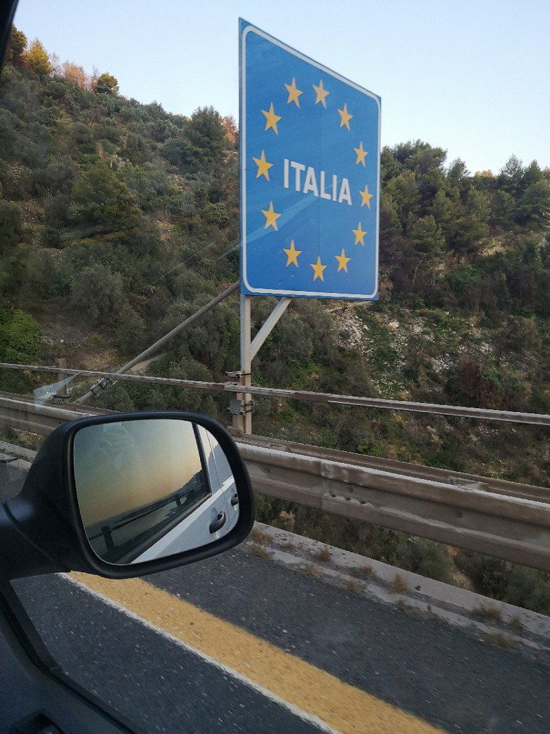
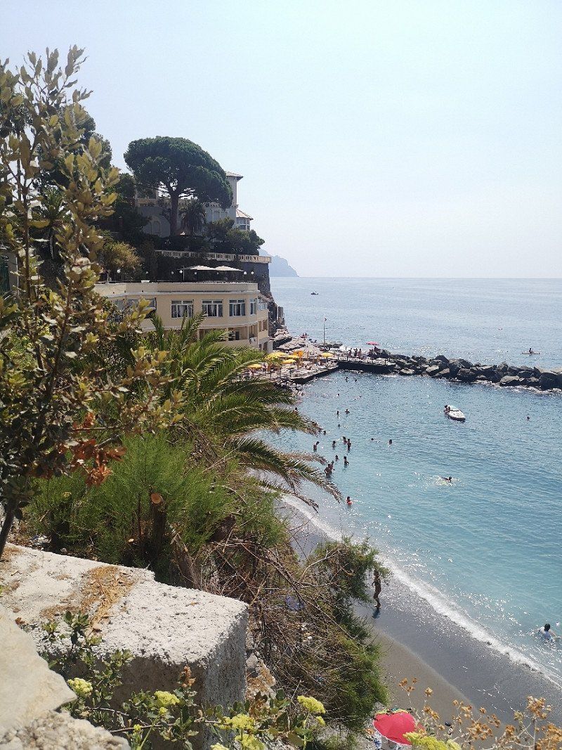
Latte
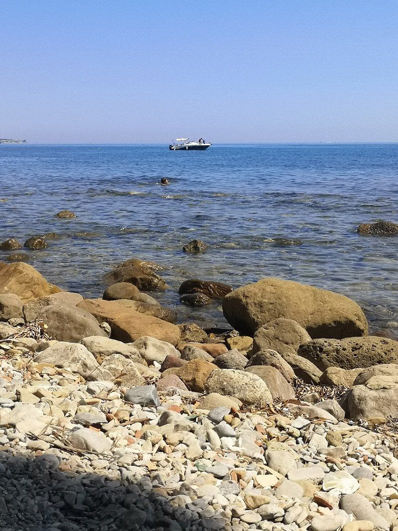
Spontaneous decision to make a detour to Liguria (Italy) to escape from mass tourism. Last pitch at Camping por la Mar campsite, near Ventimiglia. Very small, simple but beautiful campsite with very friendly owners. Little tourism, many locals. Beautiful, small bay with a pebble beach in front of the door.
Ventimiglia Imperia, Italien
43° 47' 41" N 7° 33' 50.4" E
43.7947109 7.5639956
• Head northwest on Corso Nizza (SS1). Go for 30 m.
• Take the 3rd exit from roundabout onto Corso Nizza (SS1). Go for 3.7 km.
• Turn left onto Ponte Ammiraglio Andrea Doria (SS1) toward Ventimiglia Centro/Genova/A10/Nizza/Nice/Colle di Tenda/SS20/Imperia. Go for 139 m.
• Take the 4th exit from Largo Torino roundabout onto Strada Statale del Colle di Tenda e di Valle Roja (SS20) toward Genova/A10/Nizza/Nice. Go for 2.2 km.
• Turn sharp right onto Corso Limone Piemonte toward Genova/A10/Nizza/Nice/Roverino/Ventimiglia. Go for 283 m.
• Take ramp toward Genova/A10/Nizza/Nice. Go for 480 m.
• Keep left toward Nizza/E80/Genova. Go for 298 m.
• Take the 1st exit from roundabout toward Genova/A10/Nizza/A8/Nice/Ventimiglia. Go for 484 m.
• Take ramp onto A10 (Autostrada dei Fiori). Go for 84.1 km.
• Take the exit toward Pietra Ligure. Go for 968 m.
• Take the 2nd exit from roundabout onto Viale Riviera toward Centro. Go for 1.5 km.
• Take the 3rd exit from roundabout onto Viale Riviera. Go for 400 m.
• Take the 2nd exit from Largo Santa Corona roundabout onto Via 25 Aprile (SS1) toward Centro/Savona/Finale Ligure. Go for 909 m.
• Pass 2 roundabouts and continue on Corso Italia (SS1). Go for 5.1 km.
• Turn left onto Via Caprazoppa (SP490) toward Genova-Ventimiglia/A10/Calizzano/Finalborgo/Calice Ligure. Go for 1.6 km.
• Take the 2nd exit from roundabout onto Via per Gorra (SP490) toward Autostrada/A10. Go for 1.2 km.
• Take the 1st exit from roundabout toward Genova/A10/Ventimiglia. Go for 607 m.
• Take ramp onto A10 (Autostrada dei Fiori) toward Genova. Go for 50.2 km.
• Take the exit toward Genova/Livorno/A12 onto A10 (Autostrada Genova-Ventimiglia). Go for 791 m.
• Take the exit onto A10 (Autostrada Genova-Ventimiglia). Go for 980 m.
• Take the exit toward Genova Prà/Porto di Prà/Genova/Aurelia. Go for 1.2 km.
• Turn left onto Via Aurelia (SS1). Go for 725 m.
• Pass 2 roundabouts and continue on Via Aurelia (SS1). Go for 923 m.
• Continue toward Via Aurelia/SS1. Go for 26 m.
• Take the 2nd exit from roundabout onto Via Aurelia (SS1). Go for 381 m.
• Take the 2nd exit from roundabout onto Via Prà (SS1). Go for 2.4 km.
• Continue on Via Ronchi (SS1). Go for 2.7 km.
• Continue on Via Enrico Albareto. Go for 412 m.
• Take ramp onto Via Enrico Melen toward Autostrade/Via Erzelli. Go for 1.7 km.
• Take left ramp onto A10 (Autostrada Genova-Ventimiglia) toward Genova Ovest/Livorno/A12/Milano Via Serravalle/A7/E62. Go for 2.4 km.
• Take the exit toward Milano onto A7 (Autostrada Milano-Genova). Go for 2.8 km.
• Take the exit toward Genova Est/Livorno onto A12 (Autostrada Azzurra). Go for 10.5 km.
• Take the exit toward Genova Nervi onto Svincolo Genova Nervi. Go for 1.6 km.
• Turn slightly left toward Via Tigullio. Go for 39 m.
• Continue on Cavalcavia Carlo Negri. Go for 45 m.
• Turn left and take ramp onto Corso Europa. Go for 2.2 km.
• Keep left onto Corso Europa toward La Spezia/SS1. Go for 364 m.
• Continue on Via Donato Somma (SS1). Go for 2.8 km.
• Arrive at Via Aurelia (SS1). Your destination is on the left.
☍
189,2 km
(2 hrs. 29 min.)
Day
Day
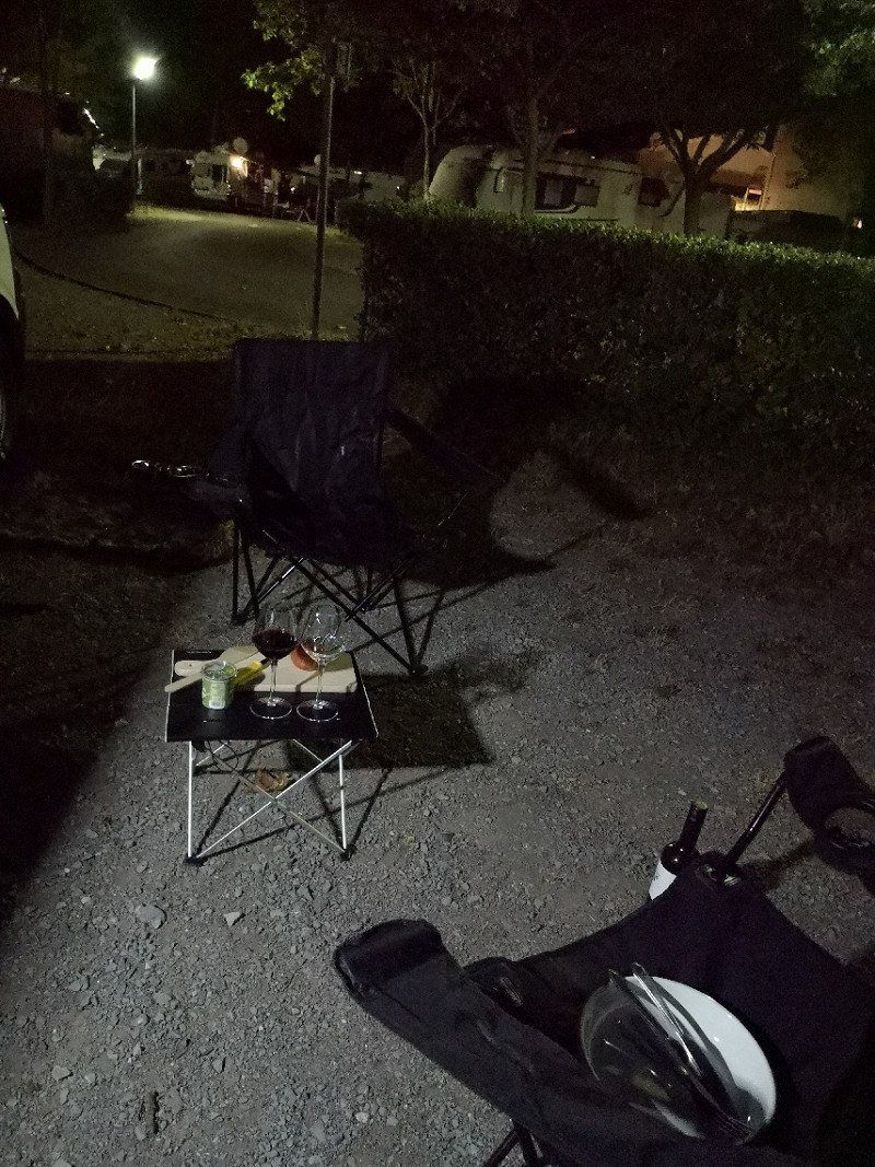
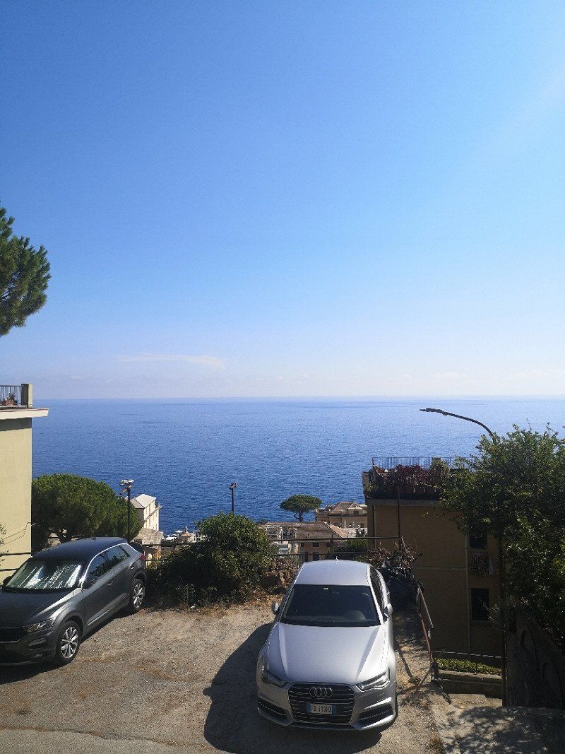
Bogliasco
Next stop at Camping Genova Est in Bogliasco near Genoa. Approx. 150m altitude, therefore narrow, steep driveway. But a beautiful view of the sea! Very friendly owner, parking space is available without prior reservation. Free shuttle service to the center of Genoa.
Genua, Italien
44° 22' 45.5" N 9° 3' 53.2" E
44.3792927 9.0647653
• Head east on Via Aurelia (SS1). Go for 271 m.
• Turn sharp right onto Via Gian Francesco De Marchi toward Bogliasco. Go for 167 m.
• Turn right onto Via Giuseppe Mazzini. Go for 121 m.
• Turn left onto Largo Aleksandr Skrjabin (SS1). Go for 2.9 km.
• Keep left onto Corso Europa toward Centro/Ospedale Nervi/Autostrade. Go for 2.4 km.
• Take ramp onto Via Tigullio toward Autostrade. Go for 121 m.
• Turn sharp right onto Svincolo Genova Nervi toward Genova/A12/Livorno/E80. Go for 1.4 km.
• Take ramp onto A12 (Autostrada Azzurra) toward E25/Milano/A7/Ventimiglia/A10. Go for 10.5 km.
• Take the exit toward Milano/Via Serravalle/Genova/Bolzaneto onto A7 (Autostrada Milano-Genova). Go for 61.7 km.
• Take the exit toward Piacenza/Brescia onto A21 (Autostrada Torino-Piacenza-Brescia). Go for 149 km.
• Take the exit toward E45/Brennero/A22/Venezia onto A4 (Autostrada della Serenissima). Go for 97.5 km.
• Take the exit toward SPV/Strada Pedemontana Veneta/Montecchio/A27/Treviso-Belluno onto SPV (Strada Regionale di Montecchio Maggiore). Go for 52.8 km.
• Continue on Superstrada Pedemontana Veneta. Go for 42.8 km.
• Take the left exit toward Belluno onto A27 (Autostrada d'Alemagna). Go for 41.4 km.
• Take the exit toward Fadalto/Lago di S.Croce/Belluno/SS50/Feltre/Cortina. Go for 664 m.
• Continue on Via Fadalto Alto (SS51). Go for 1.7 km.
• Keep right onto Strada Provinciale del Lago di Santa Croce (SP423) toward Pojana di Granfion. Go for 4.6 km.
• Take the 3rd exit from roundabout onto Viale Europa (SP423) toward Belluno/La Secca. Go for 92 m.
• Arrive at Viale Europa (SP423). Your destination is on the left.
☍
470,1 km
(4 hrs. 9 min.)
Day
Day
Day
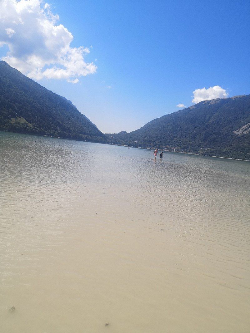
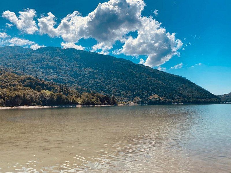
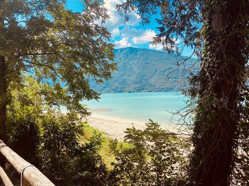
Farra d’Alpago
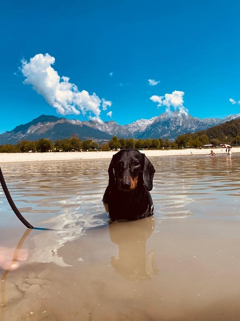
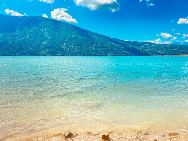
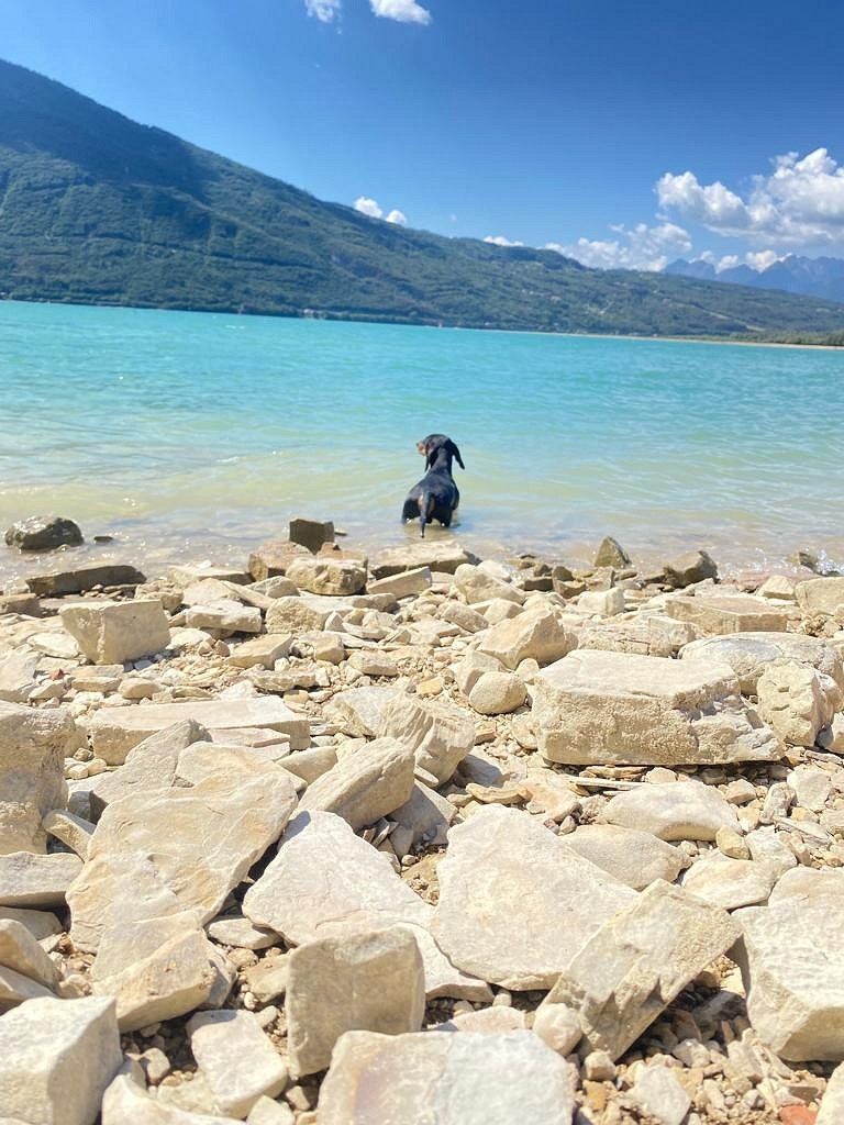
We continue to the beautifully situated campsite Campeggio Sarathei near the Dolomites and the Treviso wine region. Crystal clear mountain lake in front of the door.
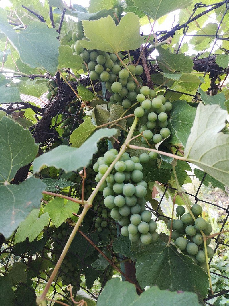
Farra D'Alpago is a very small, little touristy place with good wine and very warm, hospitable people.
Belluno, Italien
46° 7' 14.4" N 12° 21' 23.9" E
46.1206639 12.3566375
• Head toward Viale al Lago-Farra on Viale Europa (SP423). Go for 1.7 km.
• Take the 3rd exit from roundabout onto Viale Alpago (SP422/SP423) toward SS51/Belluno. Go for 2.1 km.
• Turn right onto Località La Secca (SS51). Go for 4.0 km.
• Take the 3rd exit from roundabout onto A27 (Autostrada d'Alemagna) toward Autostrada/Cortina/Belluno Nord. Go for 5.3 km.
• Take the left exit toward Cadore-Dolomiti/Cortina onto SS51 (Strada Statale di Alemagna). Go for 2.2 km.
• Take the 1st exit from roundabout onto Strada Statale di Alemagna (SS51). Go for 25.1 km.
• Keep right onto Strada Statale di Alemagna (SS51bis) toward Sappada/Auronzo/Comelico. Go for 2.4 km.
• Take the 2nd exit from roundabout onto Strada Statale di Alemagna (SS51bis) toward Sappada. Go for 9.6 km.
• Take the 2nd exit from roundabout onto Strada Statale Carnica (SS52) toward Auronzo D.C./SS48/S.Stefano D.C./Sappada/SS355/S.Stefano/Auronzo. Go for 5.7 km.
• Turn right onto Via Cella. Go for 39 m.
• Turn slightly right toward Strada Provinciale del Passo Sant'Antonio/SP532. Go for 90 m.
• Turn right onto Strada Provinciale del Passo Sant'Antonio (SP532). Go for 12.1 km.
• Turn left onto Borgata Ponte Padola. Go for 158 m.
• Turn right onto Via La Carlina. Go for 120 m.
• Turn left onto Strada Statale Carnica (SS52). Go for 24.2 km.
• Turn right onto Via Sesto. Go for 541 m.
• Turn left onto Via Freising. Go for 291 m.
• Turn right onto Via Duca Tassilo. Go for 440 m.
• Turn right onto Strada Statale della Pusteria (SS49) toward Österreich/Austria. Go for 6.6 km.
• Continue on Arnbach (B100). Go for 33.8 km.
• Pass 2 roundabouts and continue on Drautal Bundesstraße (B100). Go for 38.1 km.
• Turn right onto Bahnhofstraße (B87) toward Hermagor/Weißensee. Go for 7.7 km.
• Continue on Techendorfer Landesstraße (L7). Go for 1.4 km.
• Turn right onto Oberdorf. Go for 28 m.
• Turn slightly left onto Oberdorf. Go for 232 m.
• Turn right toward Oberdorf. Go for 69 m.
• Continue on Oberdorf. Go for 79 m.
• Arrive at Oberdorf. Your destination is on the right.
☍
184,0 km
(2 hrs. 47 min.)
Day
Day
Day
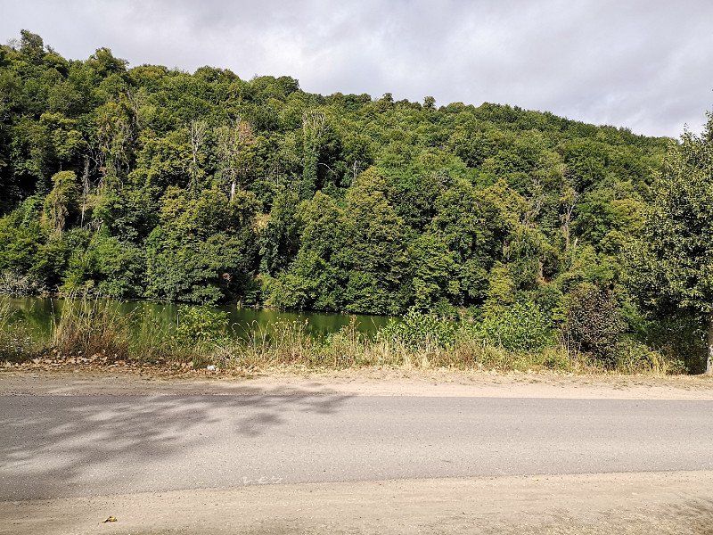
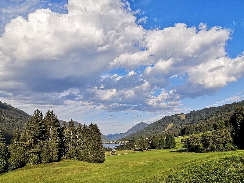
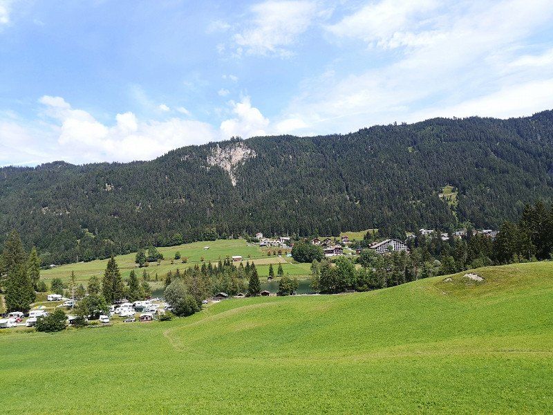
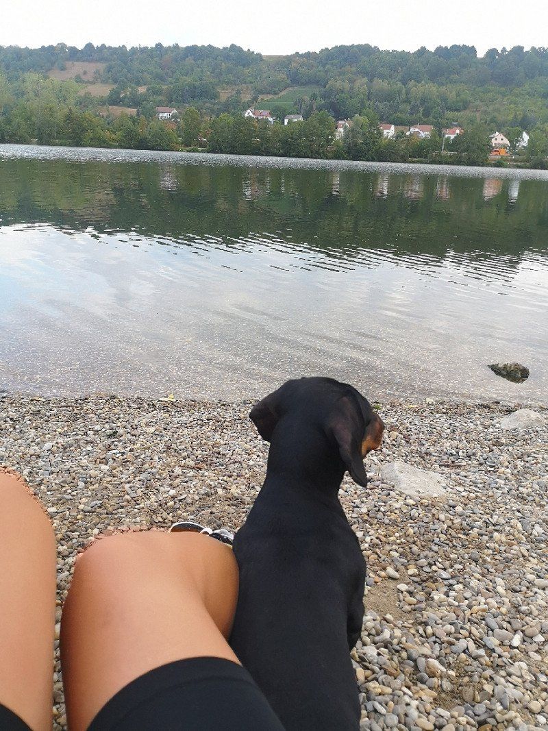
Seecamping Müller
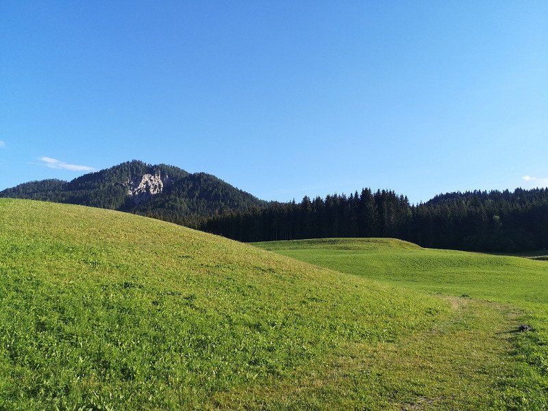
Family campsite (we then became aware of it) at about 1000 meters above sea level. Noisy campsite with beautiful scenic landscape located by the lake.
Oberdorf, 9762, Weissensee, Österreich
46° 43' 7.9" N 13° 15' 41.7" E
46.7188700 13.2615700
• Head west on Oberdorf. Go for 148 m.
• Turn left onto Oberdorf. Go for 260 m.
• Turn left onto Oberdorf (L7). Go for 1.4 km.
• Continue on Weißensee Bundesstraße (B87). Go for 7.7 km.
• Turn right onto Hauptstraße (B100). Go for 25.4 km.
• Take ramp onto A10 (Tauern Autobahn) toward Salzburg/Villach/Spittal Ost. Go for 4.8 km.
• Take the exit toward Salzburg/Gmünd onto A10 (Tauern Autobahn). Go for 112 km.
• Take exit 28 toward Golling. Go for 1.7 km.
• Turn left onto Salzachtal Bundesstraße (B159) toward Kuchl/Golling/St. Koloman/B210. Go for 746 m.
• Arrive at Markt (B159).
☍
154,2 km
(1 hrs. 42 min.)
Day
Day
Day
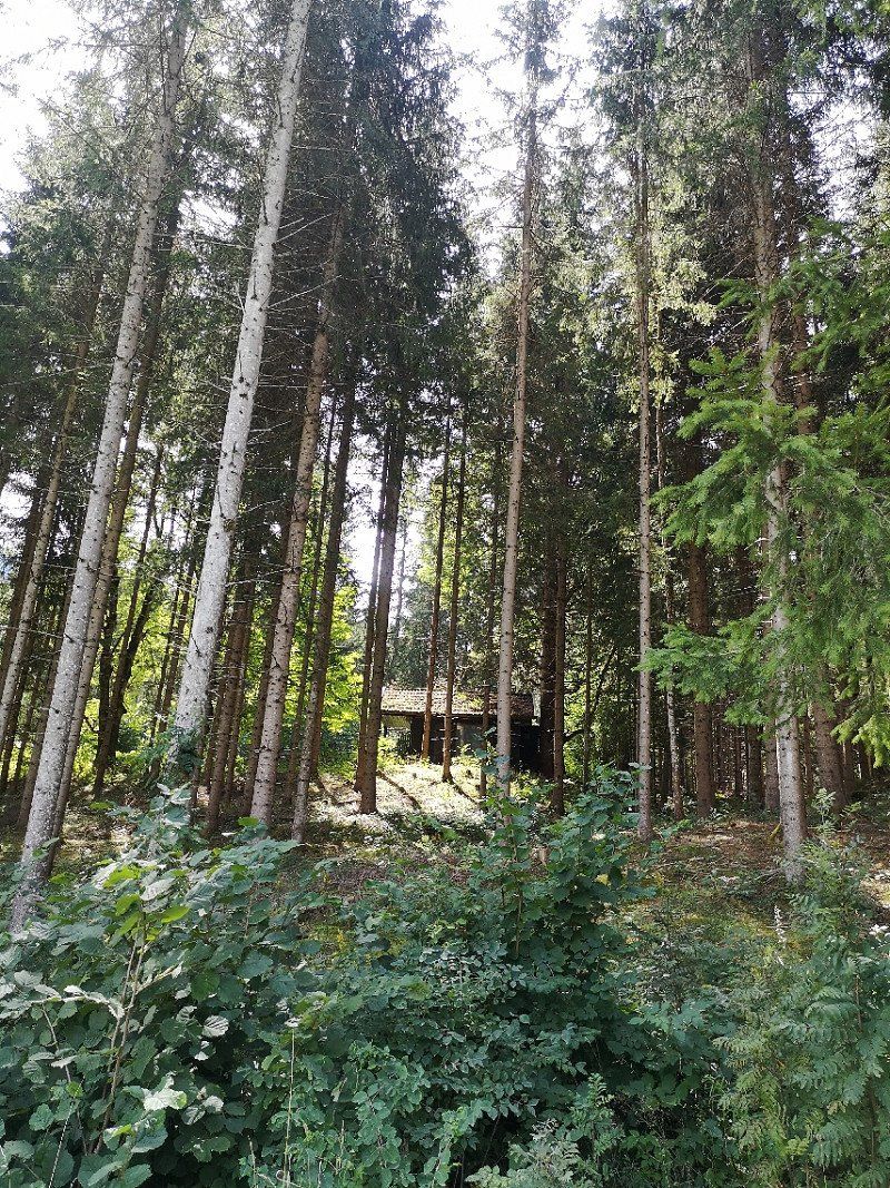
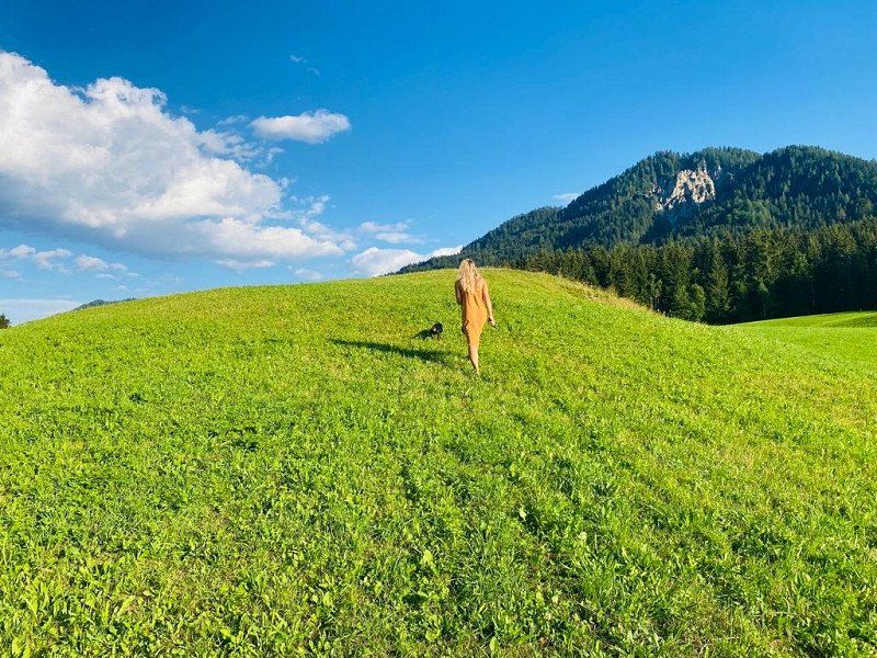
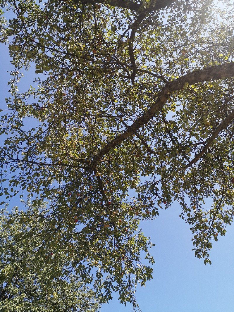
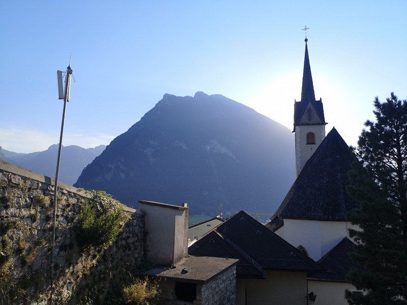
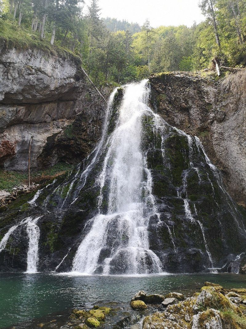
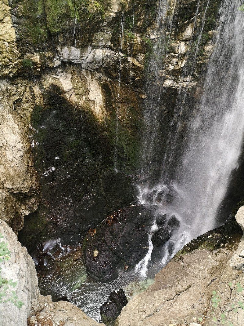
Golling an der Salzach
Camping Martina in Golling. Picturesque little village near the Golling waterfalls. Small cute campsite without pitches with a panoramic view of the Alps and many apple trees on the property.
Österreich
47° 35' 50.8" N 13° 10' 3.6" E
47.5974332 13.1676579
• Head north on Markt (B159). Go for 6 m.
• Turn left onto Bahnhofstraße. Go for 154 m.
• Continue on Markt. Go for 214 m.
• Turn left onto Durchlassstraße. Go for 205 m.
• Turn right onto Obergäu (B159). Go for 262 m.
• Take ramp onto A10 (Tauern Autobahn) toward Salzburg. Go for 27.1 km.
• Take the exit onto A1 (West Autobahn). Go for 3.5 km.
• Continue on A8. Go for 114 km.
• Take exit 95 toward Nürnberg/Stuttgart/Messe/ICM/Flughafen München onto A99. Go for 29.8 km.
• Take exit 13 toward Berlin/Nürnberg/Deggendorf/Flughafen München onto A9. Go for 41.7 km.
• Take exit 65 toward Prag/Praha/Hof/Regensburg/Wolnzach onto A93. Go for 69.1 km.
• Take exit 40 toward Regensburg-West. Go for 306 m.
• Turn left onto Clermont-Ferrand-Allee. Go for 981 m.
• Turn right onto Messerschmittstraße. Go for 555 m.
• Arrive at Messerschmittstraße. Your destination is on the left.
☍
288,0 km
(2 hrs. 33 min.)
Day
Day
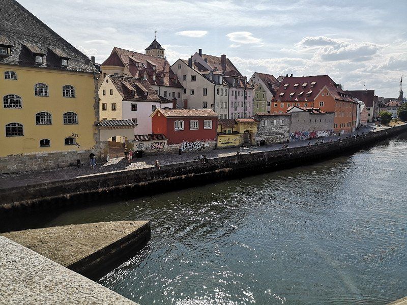
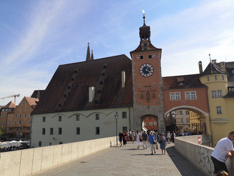
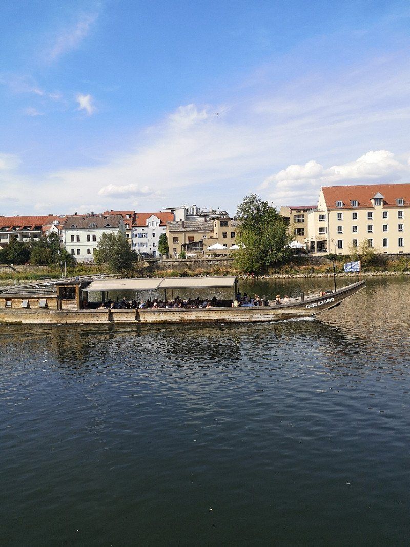
AZUR Camping Regensburg in Bayern
Very pleasant spacious campsite, more pensioners than young people. The Danube invites you to cool off right in front of the door. Approx. 30 minutes on foot from the center of Regensburg. Beautiful city!
Weinweg 40, 93049, Regensburg - Bayern, Deutschland
49° 1' 40" N 12° 3' 31" E
49.0277800 12.0586100
• Head toward Westheim on Messerschmittstraße. Go for 18 m.
• Continue on Weinweg. Go for 450 m.
• Turn right onto Boessnerstraße. Go for 420 m.
• Turn left onto Clermont-Ferrand-Allee. Go for 279 m.
• Take ramp onto A93 (Tunnel Prüfening) toward München/Nürnberg/Passau. Go for 3.0 km.
• Take exit 44 toward Nürnberg onto A3. Go for 349 km.
• Take exit 46 toward Wiesbaden/Niedernhausen/Königstein/Eppstein/B455. Go for 268 m.
• Turn right onto L3028 toward B455/Königstein i.Ts./Eppstein/Niederjosbach/Wiesbaden/Gewerbegebiet Eppstein West. Go for 321 m.
• Turn left onto B455 toward Königstein/Eppstein/Hochheim. Go for 760 m.
• Take the 2nd exit from roundabout onto B455 toward Königstein/Eppstein. Go for 4.0 km.
• Turn left onto Hauptstraße (L3011) toward Waldems-Esch/Epp.-Ehlhalten/Vockenhausen. Go for 43 m.
• Turn right onto Steinwiesenweg. Go for 152 m.
• Turn slightly right onto Eppenhainer Weg. Go for 227 m.
• Arrive at Eppenhainer Weg. Your destination is on the right.
☍
358,5 km
(3 hrs. 14 min.)
Day
Day
Day
Eppstein
On the way back a last stop at "The Eppstein Project" in the Taunus. Relatively new, unusual campsite on a hillside with a nice view. Wine and grill bar available.
Deutschland
50° 8' 43.1" N 8° 23' 17.3" E
50.1452960 8.3881459
• Head west on Eppenhainer Weg. Go for 227 m.
• Turn right onto Steinwiesenweg. Go for 81 m.
• Turn left onto Am Lindenhof. Go for 85 m.
• Turn left onto Weingasse. Go for 14 m.
• Turn left onto Hauptstraße (L3011). Go for 300 m.
• Turn right onto B455. Go for 3.9 km.
• Take the 2nd exit from roundabout onto B455 toward A3/Wiesbaden/Niedernhausen. Go for 765 m.
• Turn right onto L3028 toward Köln/A3/Niedernhausen. Go for 340 m.
• Turn left and take ramp onto A3 toward Köln. Go for 146 km.
• Take the exit toward K-Zentrum onto A4. Go for 1.6 km.
• Continue on B55A. Go for 7.3 km.
• Keep left toward A57/A1/Ehrenfeld. Go for 467 m.
• Continue on K4. Go for 871 m.
• Continue on A57. Go for 6.4 km.
• Take exit 27 toward Chorweiler/Pesch/Heimersdorf. Go for 330 m.
• Keep right onto Chorweiler Zubringer. Go for 2.0 km.
• Continue on Mercatorstraße (K8). Go for 1.1 km.
• Take the 2nd exit from roundabout onto Mercatorstraße (K8) toward Worringen/Roggendorf/Thenhoven/Blumenberg. Go for 534 m.
• Take the 1st exit from roundabout onto Geiersbergstraße toward Blumenberg-Süd. Go for 106 m.
• Turn right onto Geiersbergstraße. Go for 7 m.
• Continue on Langenbergstraße. Go for 621 m.
• Turn right onto Langenbergstraße. Go for 138 m.
• Arrive at Langenbergstraße.
☍
173,6 km
(1 hrs. 45 min.)
Day
Blumenberg
Return home relaxed and full of new impressions. Many new plans have already been made for next summer. Camping means freedom and for me there is no all-inclusive holiday in the world that can replace it.
Köln, Deutschland
51° 2' 11.7" N 6° 53' 33" E
51.0365859 6.8924963