May 13 - 5 weeks.
All changes possible from Spain (pitch/campsite and number of days)
Day
Merelbeke 13 mei 2023
9820 Merelbeke, Belgium
50° 59' 40.4" N 3° 44' 43.8" E
50.9945558 3.7455051
• Head toward Tramstelplaats on Hundelgemsesteenweg (N444). Go for 142 m.
• Take the 2nd exit from roundabout onto Zwijnaardsesteenweg (N469) toward Zwijnaarde. Go for 1.6 km.
• Continue on Adolphe della Faillelaan. Go for 859 m.
• Continue on Tramstraat. Go for 1.1 km.
• Turn right onto Grotesteenweg-Noord toward Zelzate/N60/Oudenaarde/De Pinte/Station Gent-St.-Pieters. Go for 277 m.
• Turn left onto Grotesteenweg-Noord toward N60/De Pinte/Oudenaarde/Industriezone Zwijnaarde. Go for 3.7 km.
• Take ramp onto E17 toward Kortrijk. Go for 44.1 km.
• Continue on A22. Go for 11.7 km.
• Keep left onto N356 toward Paris/A1/Lille/Aéroport Lille Lesquin. Go for 4.8 km.
• Keep left onto N356 toward Paris/Dunkerque/Lille-Centre/Aéroport Lesquin. Go for 1.7 km.
• Keep left onto Boulevard Périphérique Est de Lille (N356) toward Paris/Bruxelles/Valenciennes/Villeneuve d'Ascq/Aéroport Lesquin. Go for 411 m.
• Take ramp onto A1 (Autoroute du Nord). Go for 20.5 km.
• Keep left onto A1 (Autoroute du Nord). Go for 18.1 km.
• Take the exit toward Cambrai/Reims/Metz/Nancy/Lyon onto A26 (Autoroute des Anglais). Go for 70.4 km.
• Take exit 11 toward Chauny/Tergnier/Soissons onto D1. Go for 12.5 km.
• Take the 2nd exit from roundabout onto D1. Go for 9.0 km.
• Take ramp onto D1032 toward D1/Tergnier/Soissons/Viry-Noureuil/Chauny-Z.I. Sud. Go for 986 m.
• Pass 2 roundabouts and continue on D1032. Go for 1.6 km.
• Take the 1st exit from roundabout onto D1 toward Soissons/Coucy le Château/Saint-Gobain/Sinceny. Go for 3.1 km.
• Pass 4 roundabouts and continue on Avenue de Coucy (D1). Go for 27.9 km.
• Turn right onto Place de Laon toward Centre Ville. Go for 13 m.
• Continue on Avenue de Laon. Go for 124 m.
• Continue on Pont du Mail. Go for 141 m.
• Take the 1st exit from roundabout onto Avenue du Mail. Go for 1.1 km.
• Arrive at Avenue du Mail. Your destination is on the right.
☍
235,9 km
(2 hrs. 29 min.)
Vertrokken filmpje
See us on Youtube:
https://youtu.be/Ga-2Hj9qw4k
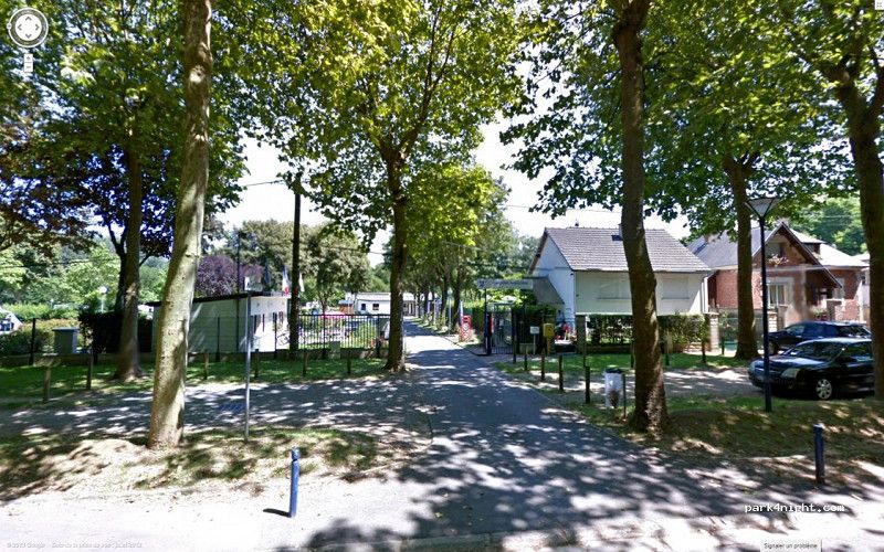
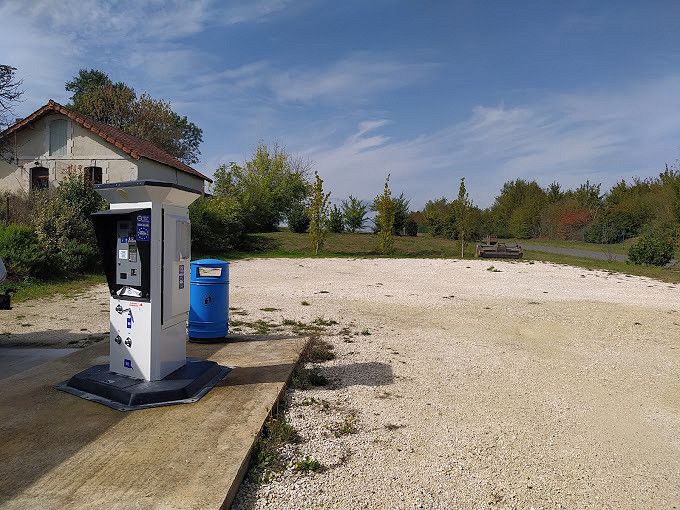
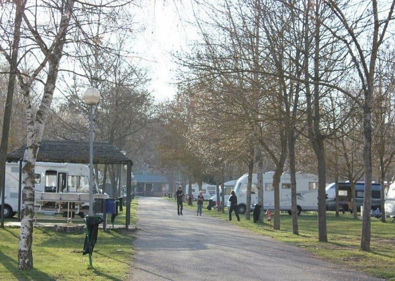
SOISSON - Camping Municipal Les Marguerites Du Mail - 13 mei
Municipality of the campsite - Electricity/water/showers
Sanitary top.
Only 15 paved pitches before MH.
On foot to the center 20 minutes.
02200, Soissons, France
49° 23' 37" N 3° 19' 38" E
49.3936100 3.3272200
• Head toward Rond-Point du Mail on Avenue du Mail. Go for 1.0 km.
• Take the 2nd exit from roundabout onto Rue Ernest Ringuier toward Centre Ville. Go for 217 m.
• Continue on Rue de la Résistance. Go for 29 m.
• Turn left onto Rue de la Résistance. Go for 96 m.
• Continue on Avenue de l'Aisne. Go for 336 m.
• Turn right onto Boulevard Gambetta (D1). Go for 289 m.
• Take the 2nd exit from Place de la République roundabout onto D1. Go for 213 m.
• Take the 1st exit from Rond-Point des États-Unis roundabout onto Boulevard Jeanne d'Arc. Go for 172 m.
• Turn left onto Rue Carnot. Go for 202 m.
• Continue on Boulevard Camille Desmoulins. Go for 188 m.
• Keep left onto Boulevard Camille Desmoulins. Go for 45 m.
• Take the 2nd exit from Carrefour de l'Écusson roundabout onto Route Nationale. Go for 129 m.
• Continue on Avenue Jean Monnet. Go for 885 m.
• Take the 2nd exit from Carrefour de l'Archer roundabout onto Avenue du Président Kennedy (N2) toward Senlis/Meaux/Paris/Villers-Cotterêts/Parc d'Activités le Plateau. Go for 10.3 km.
• Continue on Allée de Villers-Cotterêt (N2). Go for 62.5 km.
• Continue on A104 (La Francilienne). Go for 6.3 km.
• Take the exit toward St Denis/Garonor onto A1 (Autoroute du Nord). Go for 15.2 km.
• Take the exit toward Rouen/Pte de Clignancourt onto Boulevard Périphérique. Go for 11.8 km.
• Take ramp toward Boulogne/D910/A10/Bordeaux/Nantes. Go for 203 m.
• Continue on Avenue Édouard Vaillant toward Nantes/Bordeaux/Boulogne/N10. Go for 163 m.
• Keep right onto Avenue Édouard Vaillant (D910) toward Nantes/Bordeaux/Boulogne/N10/Pont de Sèvres. Go for 679 m.
• Keep left onto D910. Go for 1.3 km.
• Turn left onto Rond-Point du Pont de Sèvres (D910). Go for 448 m.
• Keep left onto N118. Go for 5.6 km.
• Keep left onto N118 toward Chartres/Nantes/Orléans/Bordeaux/Bièvres/Z.A. Villacoublay. Go for 16.4 km.
• Take ramp onto A10 (L'Aquitaine) toward Nantes/A11/Chartres/Bordeaux/Orléans. Go for 97.6 km.
• Take the exit toward A20/Toulouse/Clermont-Fd/Vierzon onto A71. Go for 79.7 km.
• Take the exit toward Toulouse/Limoges/Châteauroux/Vierzon-Centre onto A20 (L'Occitane). Go for 65.2 km.
• Take exit 13.1 toward Châtellerault/Mézières en Brenne. Go for 475 m.
• Turn right onto D925 toward Parc Naturel Régional de la Brenne/Châtellerault/Mézières en Brenne. Go for 5.1 km.
• Turn left onto Lieu-dit La Croix Rouge (D125). Go for 1.7 km.
• Continue on D125. Go for 3.4 km.
• Turn right onto Lieu-dit Domaine Neuf de Bois Robert (D21). Go for 88 m.
• Continue on D21. Go for 761 m.
• Continue on Lieu-dit Chézal-Collet (D21). Go for 208 m.
• Continue on D21. Go for 551 m.
• Continue on Route de Luant (D21). Go for 771 m.
• Continue on Place du Champ de Foire (D21). Go for 75 m.
• Turn left onto Rue Principale (D1). Go for 182 m.
• Turn right onto Route de Méobecq (D21). Go for 1.4 km.
• Turn left onto D27. Go for 4.7 km.
• Turn right onto Route de Saint-Gaultier (D11). Go for 17 m.
• Turn left onto Route de Migné (D27). Go for 7.1 km.
• Turn right onto Route de la Grand-Maison (D27). Go for 2.3 km.
• Turn left onto D27. Go for 7.4 km.
• Turn right onto Rue des Petits Prés (D44). Go for 620 m.
• Turn left onto Lieu-dit Les Gillards. Go for 45 m.
• Arrive at Lieu-dit Les Gillards.
☍
414,2 km
(4 hrs. 19 min.)
Day
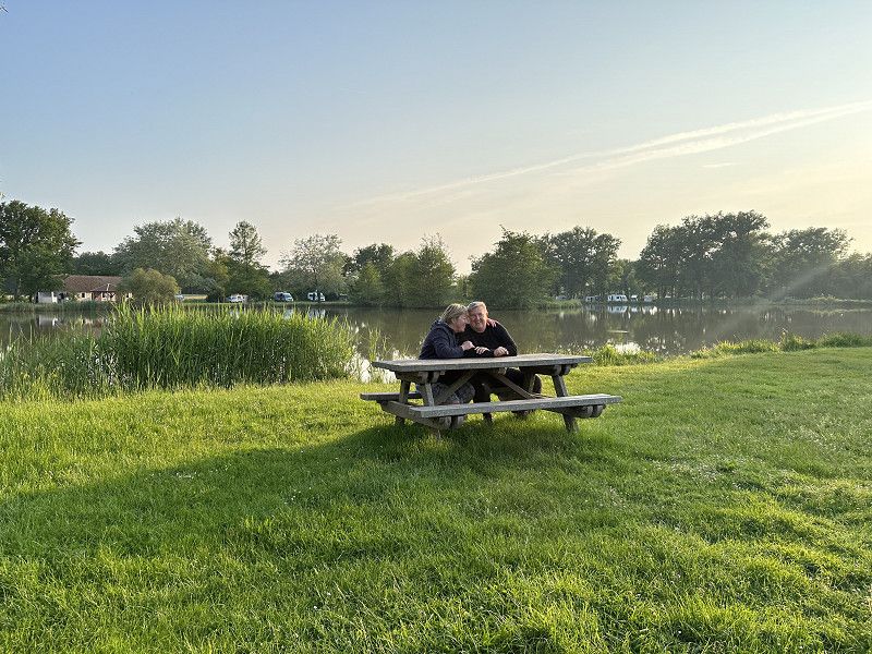
ROSNAY Camping Municipal - Zondag 14 mei
Full of nature reserve, village further away nothing to do.
Very beautiful around large pond. Electrical/water/shower
Sanitary facilities not large but in order.
Tip ; drive in and look for a place that does not have a reservation for that day (there are reservation signs with the date of reservation).
Manager will come in the evening for payment.
36300, Rosnay, France
46° 42' 22.7" N 1° 12' 43.2" E
46.7063000 1.2120000
• Head southeast on Lieu-dit Les Gillards. Go for 45 m.
• Turn right onto Rue des Petits Prés (D44). Go for 620 m.
• Turn right onto Route de Le Blanc (D15). Go for 1.3 km.
• Turn left onto D15. Go for 7.5 km.
• Continue on Lieu-dit Les Maufrais (D15). Go for 160 m.
• Turn left onto D15. Go for 95 m.
• Continue on Route Nationale (D15). Go for 66 m.
• Turn right onto Route Nationale (D951). Go for 36 m.
• Turn left onto Route de Bélâbre (D15) toward Belâbre/La Creuse. Go for 233 m.
• Continue on D15. Go for 13 m.
• Continue on Rue de Belâbre (D15). Go for 73 m.
• Continue on D15. Go for 125 m.
• Continue on Route de Bélâbre (D15). Go for 215 m.
• Continue on Route de Bélâbre (D15). Go for 237 m.
• Continue on Lieu-dit La Grange (D15). Go for 103 m.
• Continue on Route de Bélâbre (D15). Go for 262 m.
• Continue on D15. Go for 4.2 km.
• Continue on Lieu-dit Le Petit Mareuil (D15). Go for 528 m.
• Continue on Lieu-dit Mareuil (D15). Go for 681 m.
• Continue on D15. Go for 515 m.
• Turn left onto Lieu-dit La Chaumette (D10). Go for 1.9 km.
• Turn slightly right onto Avenue Jean Jaurès (D927). Go for 4.3 km.
• Continue on D727. Go for 9.3 km.
• Continue on Rue de Trupet. Go for 78 m.
• Turn left onto Rue Rouget de Lisle. Go for 58 m.
• Turn left onto Rue Octave Bernard (D675). Go for 29.6 km.
• Turn left onto Boulevard du 8 Mai 1945 (D88 A). Go for 519 m.
• Turn slightly right onto Avenue de la Gare (D942). Go for 375 m.
• Take the 3rd exit from Avenue de la Gare roundabout onto Avenue de la Gare (D675). Go for 9.9 km.
• Take the 2nd exit from roundabout onto D675 toward Bellac/Monts de Blond. Go for 1.1 km.
• Take the 3rd exit from Carrefour Rhin et Danube roundabout onto Rue Pierre Merlin (D675). Go for 272 m.
• Take the 1st exit from roundabout onto Rue Pierre Merlin (D675). Go for 721 m.
• Turn right onto Avenue Jean Jaurès. Go for 390 m.
• Continue on Route de Poitiers. Go for 1.6 km.
• Turn left onto Route de Saint-Junien (D675). Go for 27.3 km.
• Take the 2nd exit from roundabout onto D675 toward St Junien/Rochechouart. Go for 415 m.
• Take the 1st exit from roundabout onto D941. Go for 983 m.
• Pass 3 roundabouts and continue on Avenue Henri Barbusse (D941). Go for 1.6 km.
• Take the 3rd exit from roundabout onto Square Curie. Go for 101 m.
• Continue on Rue Lucien Dumas. Go for 176 m.
• Continue on Place Guy Môquet. Go for 35 m.
• Turn slightly right onto Place Auguste Roche. Go for 22 m.
• Arrive at Place Auguste Roche. Your destination is on the left.
☍
107,9 km
(1 hrs. 30 min.)
Day
Saint-Junien, Frankrijk - Maandag 15 mei
Campsite of the organization CAMPING-CAR PARK.
Very beautiful, lots of greenery and very large pitches.
Sanitary top.
Center 1km.
Saint-Junien, 87200, Frankrijk
45° 53' 14" N 0° 54' 4" E
45.8872222 0.9011111
• Head west on Place Auguste Roche. Go for 42 m.
• Continue on Rue Jean-Jacques Rousseau. Go for 19 m.
• Turn right onto Rue des Valets. Go for 64 m.
• Turn left onto Rue de Nontron. Go for 23 m.
• Turn right onto Rue Peyrusson. Go for 54 m.
• Turn left onto Rue de la Grande École. Go for 20 m.
• Turn right onto Boulevard Victor Hugo (D941). Go for 185 m.
• Take the 3rd exit from roundabout onto Avenue Henri Barbusse (D941). Go for 237 m.
• Pass 4 roundabouts and continue on Lieu-dit Le Pavillon (D941). Go for 2.9 km.
• Take the 2nd exit from roundabout onto N141. Go for 1.6 km.
• Take ramp toward St Brice sur Vienne/La Bretagne/Oradour sur Glane. Go for 393 m.
• Take the 4th exit from roundabout. Go for 478 m.
• Continue on D101. Go for 2.0 km.
• Continue on Rue de l'Ancienne École (D101). Go for 1.9 km.
• Continue on Lieu-dit Le Masférat (D101). Go for 84 m.
• Continue on D101. Go for 942 m.
• Continue on Lieu-dit La Croix du Bois du Loup (D101). Go for 355 m.
• Continue on D101. Go for 825 m.
• Take the 2nd exit from roundabout onto Rue de Saint-Junien (D101). Go for 300 m.
• Turn left onto Rue de la Glane. Go for 108 m.
• Turn right onto Rue de la Glane. Go for 249 m.
• Turn right onto Avenue du 10 Juin 1944 (D3). Go for 53 m.
• Arrive at Avenue du 10 Juin 1944 (D3). Your destination is on the left.
☍
12,8 km
( 15 min.)
Day
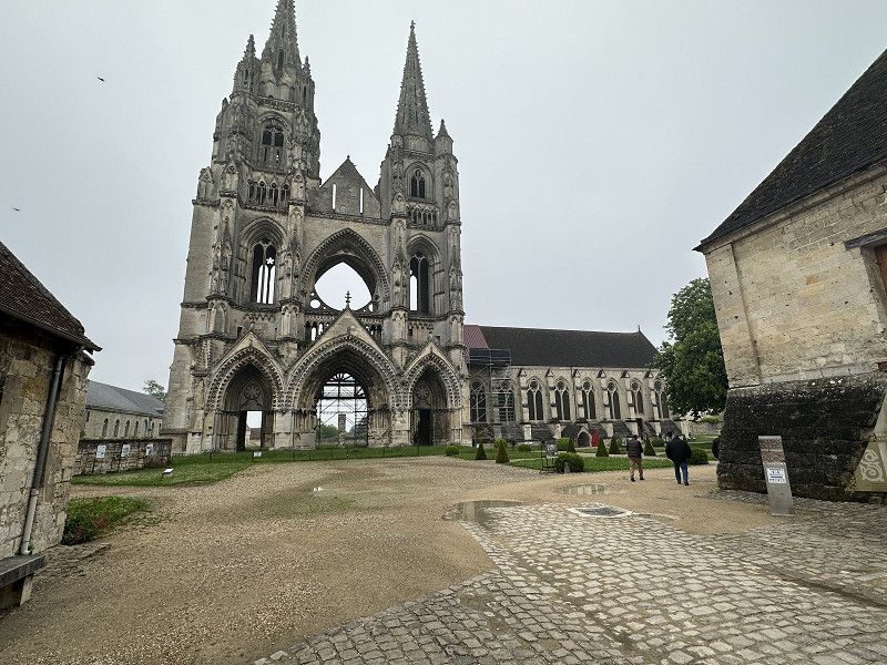
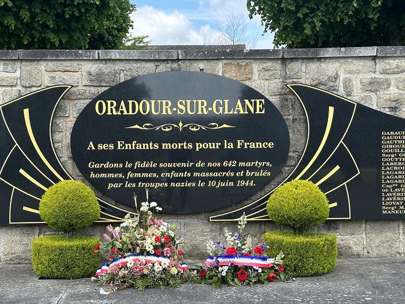
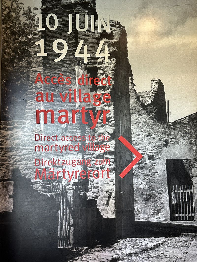
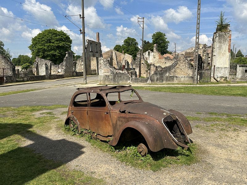
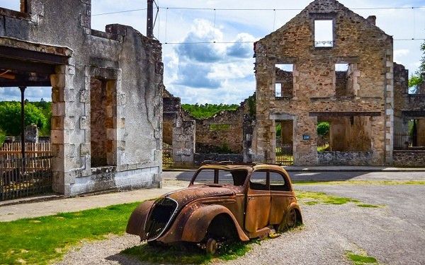
Oradour-sur-Glane, Frankrijk - Dinsdag 16 mei
Visit to a gruesome history.
It made us silent.
Putin and others should come here.
WAR - Horror
87520 Oradour-sur-Glane, France
45° 55' 51.9" N 1° 1' 57.9" E
45.9310789 1.0327460
• Head toward Rue de la Renaissance on Avenue du 10 Juin 1944 (D3). Go for 202 m.
• Take the 2nd exit from roundabout onto D3. Go for 936 m.
• Continue on D9. Go for 4.6 km.
• Take the 2nd exit from roundabout onto Route de Limoges (D9). Go for 2.1 km.
• Turn right and take ramp onto N141 toward Limoges/Verneuil S/Vienne/Aéroport Bellegarde. Go for 5.8 km.
• Take ramp toward A20/Poitiers/Périgueux/Aixe S/ Vienne/Couzeix/Aéroport Bellegarde. Go for 262 m.
• Take the 1st exit from roundabout onto D2000 toward Périgueux/Aixe S/Vienne. Go for 1.1 km.
• Pass 2 roundabouts and continue on D2000. Go for 7.4 km.
• Take the 1st exit from roundabout onto Avenue de Bordeaux (N21) toward Périgueux/Châlus/Séreilhac. Go for 16.8 km.
• Continue on N21. Go for 30.8 km.
• Take the 2nd exit from roundabout onto N21 toward Périgueux/Sorges. Go for 13.1 km.
• Turn right onto Avenue de la Voie Romaine toward Agonac/Les Piles/Les Potences/Centre Hospitalier de Lanmary. Go for 2.2 km.
• Continue on Lieu-dit La Chiroulette Ouest (D8). Go for 411 m.
• Continue on Lieu-dit La Chiroulette (D8). Go for 591 m.
• Continue on D8. Go for 2.2 km.
• Continue on Lieu-dit Pied de Lièvre (D8). Go for 123 m.
• Continue on D8. Go for 845 m.
• Continue on Lieu-dit Les Quatre Routes (D8). Go for 73 m.
• Continue on Avenue de la Résistance (D8). Go for 2.1 km.
• Continue on Rue Valentine Bussière (D8). Go for 373 m.
• Continue on Rue Valentine Bussière (D8). Go for 1.4 km.
• Continue on Lieu-dit Les Tavernes (D8). Go for 858 m.
• Continue on D8. Go for 139 m.
• Continue on Lieu-dit Charetier (D8). Go for 557 m.
• Continue on Route des Piles (D8). Go for 1.5 km.
• Continue on D8. Go for 56 m.
• Continue on Lieu-dit Barbaleix (D8). Go for 266 m.
• Continue on D8. Go for 192 m.
• Continue on Lieu-dit Barbeleix (D8). Go for 73 m.
• Continue on Lieu-dit Barbaleix (D8). Go for 310 m.
• Continue on Lieu-dit Sept Fonts (D8). Go for 114 m.
• Continue on D8. Go for 806 m.
• Continue on Route de Paris (D8). Go for 574 m.
• Pass 4 roundabouts and continue on Avenue Georges Pompidou (D8). Go for 4.0 km.
• Take the 2nd exit from roundabout onto Boulevard Michel Montaigne (D939). Go for 486 m.
• Continue on Place Francheville. Go for 386 m.
• Turn right onto Cours Fénelon (D6089) toward Brive/Bergerac/Limoges/Cahors/Aéroport de Périgueux-Bassillac/St Georges. Go for 218 m.
• Turn right onto Boulevard Lakanal. Go for 329 m.
• Take the 2nd exit from roundabout onto Boulevard Lakanal. Go for 176 m.
• Turn left onto Lieu-dit Moulin de Sainte-Claire. Go for 224 m.
• Continue toward Route de Bergerac/D6021. Go for 30 m.
• Take the 2nd exit from roundabout onto Route de Bergerac (D6021) toward A89/Bergerac/Agen/Bordeaux/Brive/Notre Dame de S./Vergt. Go for 4.5 km.
• Take the 2nd exit from roundabout toward Bergerac/Angoulême/Bordeaux. Go for 106 m.
• Take ramp onto A89. Go for 51.6 km.
• Take exit 12 toward Ste Foy la Gde. Go for 790 m.
• Take the 1st exit from roundabout onto D708 toward Ste Foy la Gde. Go for 927 m.
• Turn right toward D11. Go for 1.2 km.
• Turn left onto D11. Go for 233 m.
• Continue on Lieu-dit Fourgeaud (D11). Go for 362 m.
• Continue on D11. Go for 262 m.
• Continue on Lieu-dit Le Cornile (D11). Go for 176 m.
• Continue on D11. Go for 1.7 km.
• Continue on Lieu-dit Le Gardelac (D11). Go for 101 m.
• Continue on D11. Go for 256 m.
• Continue on Lieu-dit Le Claud du Gendre (D11). Go for 162 m.
• Continue on D11. Go for 172 m.
• Turn right onto Lieu-dit Le Poteau de Giaud (VC204). Go for 197 m.
• Continue on VC204. Go for 298 m.
• Continue on Lieu-dit Jeanduffe (VC204). Go for 300 m.
• Continue on VC204. Go for 1.7 km.
• Continue on Rue des Écoles (VC204). Go for 640 m.
• Turn right onto Route de Carsac. Go for 129 m.
• Turn left onto Rue de Grange Neuve. Go for 34 m.
• Arrive at Rue de Grange Neuve. Your destination is on the left.
☍
170,5 km
(2 hrs. 9 min.)
Saint-Martin-de-Gurson Motorhome Aire - Dins 16 mei
Stay at a camper place and visit friends locally.
Very quiet.
24610 Saint-Martin-de-Gurson, France
44° 57' 12.3" N 0° 6' 24.5" E
44.9534161 0.1068089
• Head toward Route du Lac on Rue de Grange Neuve. Go for 34 m.
• Turn right onto Route de Carsac. Go for 129 m.
• Turn left onto Rue du Presbytère (D33). Go for 640 m.
• Continue on VC204. Go for 1.7 km.
• Continue on Lieu-dit Jeanduffe (VC204). Go for 300 m.
• Continue on VC204. Go for 298 m.
• Continue on Lieu-dit Le Poteau de Giaud (VC204). Go for 197 m.
• Turn left onto D11. Go for 172 m.
• Continue on Lieu-dit Le Claud du Gendre (D11). Go for 162 m.
• Continue on D11. Go for 256 m.
• Continue on Lieu-dit Le Gardelac (D11). Go for 101 m.
• Continue on D11. Go for 1.7 km.
• Continue on Lieu-dit Le Cornile (D11). Go for 176 m.
• Continue on D11. Go for 262 m.
• Continue on Lieu-dit Fourgeaud (D11). Go for 362 m.
• Continue on D11. Go for 233 m.
• Turn right toward Lieu-dit La Tour/D708. Go for 1.2 km.
• Turn left onto Lieu-dit La Tour (D708). Go for 924 m.
• Take the 2nd exit from roundabout onto A89 toward Bordeaux/Libourne. Go for 46.9 km.
• Continue on N89. Go for 17.8 km.
• Keep left onto N89 toward Arcachon/Bayonne/Toulouse/Bordeaux-St Jean/Z.I. Artigues. Go for 217 m.
• Take ramp onto Rocade de Bordeaux (N230) toward Arcachon/Bayonne/Toulouse/Bordeaux-Centre/Bordeaux-St Jean/Z.I. Artigues. Go for 17.7 km.
• Take exit 15 toward Saint Sébastien/Bayonne/Mont de Marsan/Bassin d'Arcachon onto A63. Go for 206 km.
• Continue on AP-8 (Autopista del Cantábrico). Go for 12.2 km.
• Take the exit toward Bilbao/Vitoria-Gasteiz/Burgos/Hernani/A-15/Iruña/Pamplona onto AP-1/AP-8. Go for 14.8 km.
• Take the exit onto AP-1/AP-8 (Autopista del Cantábrico). Go for 10.5 km.
• Take exit 38 toward N-634/Zarautz/Getaria. Go for 578 m.
• Take the 2nd exit from roundabout onto Calle Irita. Go for 119 m.
• Take the 2nd exit from roundabout onto Camino Mendibeltz. Go for 162 m.
• Turn left onto Camino Sorginmuno. Go for 18 m.
• Turn right toward Camino Talaimendi. Go for 203 m.
• Turn slightly left onto Camino Talaimendi. Go for 87 m.
• Turn right toward Camino Talaimendi. Go for 373 m.
• Continue on Camino Talaimendi. Go for 212 m.
• Turn slightly left onto Camino Talaimendi. Go for 262 m.
• Turn right toward Camino Talaimendi. Go for 77 m.
• Turn slightly left onto Camino Talaimendi. Go for 10 m.
• Turn left onto Laurgain kalea. Go for 16 m.
• Continue toward Camino Talaimendi. Go for 57 m.
• Turn left onto Camino Talaimendi. Go for 5 m.
• Turn right. Go for 27 m.
• Turn left. Go for 28 m.
• Arrive at your destination on the left.
☍
337,5 km
(3 hrs. 8 min.)
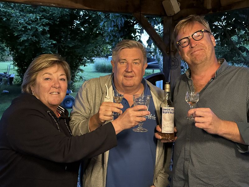
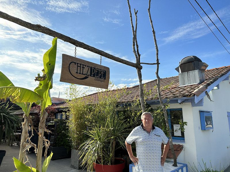
Bezoek Le GUINOT
Visit Belgian friends Jo - Karolien (ex-Gildenhuis Melle)
Gites & Table d'hotes LE GUINOT
https://www.leguinot.be
Great welcome with delicious dinner.
Warm people who will make your holiday a complete success.
Like god in France that's how it is.
Day
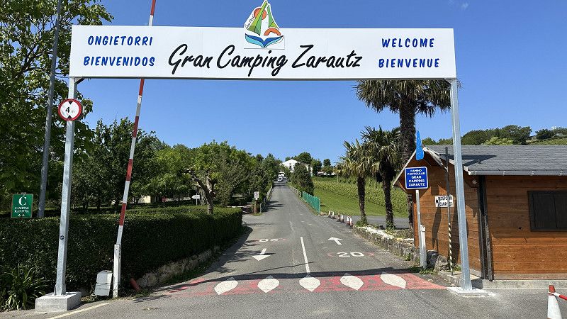
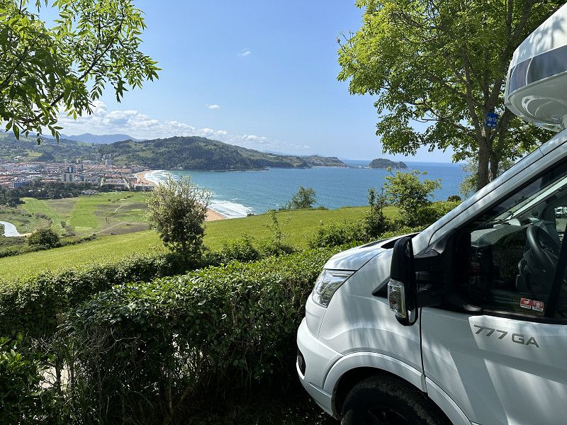
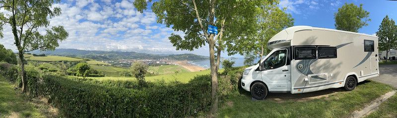
ZARAUTZ Spanje - Grand Camping Zarautz - Woens 17 - 18 - 19 mei
Campsite by the sea, booked 2 nights but stayed a day longer.
Campsite located above the city with a view of the sea.
Sanitary TOP. Super friendly.
Monte Talai-mendi Zarautz, 20800, Zarautz, Spain
43° 17' 26" N 2° 8' 48" W
43.2905600 -2.1466700
• Head east. Go for 28 m.
• Turn right toward Camino Talaimendi. Go for 27 m.
• Turn left onto Camino Talaimendi. Go for 5 m.
• Turn right toward Laurgain kalea. Go for 57 m.
• Continue on Laurgain kalea. Go for 16 m.
• Turn right onto Camino Talaimendi. Go for 10 m.
• Turn slightly right toward Camino Talaimendi. Go for 77 m.
• Turn left onto Camino Talaimendi. Go for 262 m.
• Turn slightly right onto Camino Talaimendi. Go for 212 m.
• Turn left toward Camino Talaimendi. Go for 373 m.
• Turn left onto Camino Talaimendi. Go for 87 m.
• Turn slightly right toward Camino Sorginmuno. Go for 203 m.
• Turn left onto Camino Sorginmuno. Go for 18 m.
• Turn right onto Camino Mendibeltz. Go for 112 m.
• Take the 2nd exit from roundabout onto Calle Irita toward Bilbao/A-8/Donostia/S. Sebastián. Go for 133 m.
• Take the 2nd exit from roundabout toward Donostia/San Sebastián/Bilbo/Vitoria/Gasteiz. Go for 75 m.
• Take ramp onto AP-1/AP-8 (Autopista del Cantábrico) toward Donostia/S. Sebastián. Go for 10.8 km.
• Continue on GI-20 toward Donostia/S. Sebastián/Lasarte-Oria/GI-11/Pamplona/A-15/Iruña. Go for 1.6 km.
• Take exit 13 toward Lasarte-Oria/N-634/Usurbil/Tolosa/Iruña/A-15/Pamplona onto GI-11. Go for 1.5 km.
• Take the exit onto N-1. Go for 8.8 km.
• Keep right onto A-15 (Agaraitz auzoa) toward Irurtzun/Iruña/Pamplona. Go for 44.4 km.
• Continue on AP-15 (Autopista de Navarra). Go for 14.5 km.
• Take exit 97 toward PA-34/Pamplona/Iruña/Berriozar onto Avenida de Navarra. Go for 1.3 km.
• Take ramp toward PA-34/Francia/San Sebastián/Donostia/Berriozar. Go for 587 m.
• Take the 1st exit from roundabout onto Avenida de Gipuzkoa (N-240-A) toward Berriozar. Go for 338 m.
• Take the 2nd exit from roundabout onto Avenida de Gipuzkoa (N-240-A). Go for 650 m.
• Take the 3rd exit from roundabout onto Avenida de Berriozar (NA-4106). Go for 121 m.
• Continue on NA-4106. Go for 13 m.
• Continue on Avenida de Berriozar (NA-4106). Go for 640 m.
• Turn right. Go for 186 m.
• Arrive at your destination.
☍
87,3 km
(1 hrs. )
Day
Met de fiets naar beneden stadje - 18 mei
First Spanish terrace.
Day
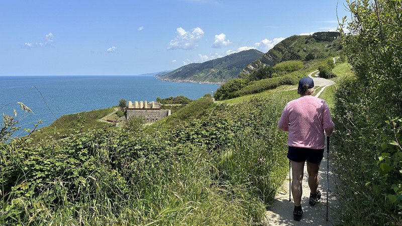
Wandeling langs de kust op en neer !!! - 19 mei
Day
PAMPLONA - Area Camper Berriozar - 20 mei
Closed camper place 700m from the center.
Electrical and all facilities gray water/chemical and fresh water. No sanitary facilities.
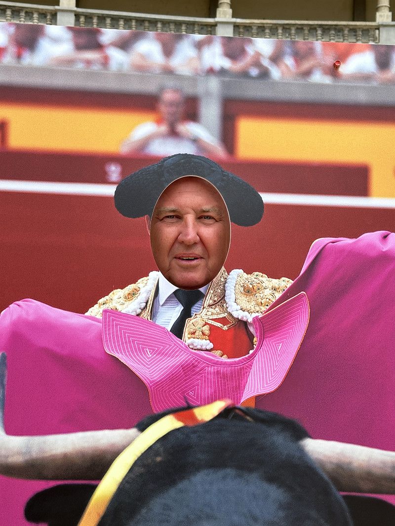
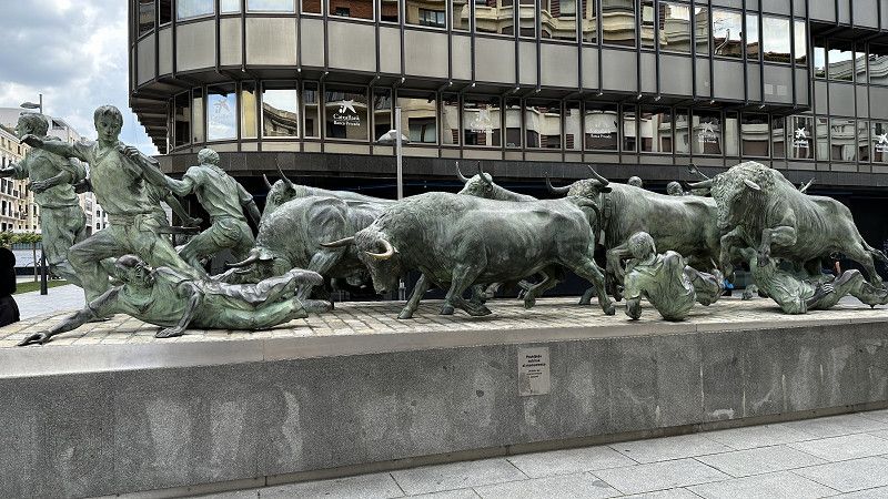
Walked to the center and enjoyed aperitif and tapas with hundreds of Spaniards.
Also visited the arena and followed the bull run course.
In the evening we had a very nice meal 400m from the cmaperplaats in a very local special occasion Basque Cidereria.
Av. Berriozar, 1, 31013 Berriozar, Navarra, Spain
42° 50' 25.6" N 1° 39' 56.5" W
42.8404446 -1.6656806
• Head toward Avenida de Berriozar. Go for 186 m.
• Turn left onto Avenida de Berriozar (NA-4106). Go for 183 m.
• Turn right toward Berriozar. Go for 10 m.
• Turn left onto Berriozar. Go for 366 m.
• Continue toward Avenida Guipúzcoa. Go for 302 m.
• Continue on Avenida Guipúzcoa. Go for 102 m.
• Take the 1st exit from roundabout onto Avenida de Gipuzkoa (N-240-A). Go for 320 m.
• Take the 2nd exit from roundabout toward A-15/Zaragoza/Pamplona/Iruña/Francia/San Sebastián/Donostia/Vitoria/Gasteiz. Go for 146 m.
• Keep left toward Pamplona/Iruña/Ciudad del Transporte. Go for 537 m.
• Take ramp onto A-15 (Ronda Oeste). Go for 7.6 km.
• Take exit 88 toward Pamplona/Iruña/Zizur Mayor/Zizur Nagusia/Estella-Lizarra/Logroño/Cizur/Zizur/Estella/Lizarra onto A-12. Go for 74.4 km.
• Take left exit 78 toward Zaragoza/N-232/Aeropuerto/E-804/AP-68 onto LO-20 (Circunvalación Sur de Logroño). Go for 1.4 km.
• Arrive at Circunvalación Sur de Logroño (LO-20). Your destination is on the right.
☍
85,5 km
( 46 min.)
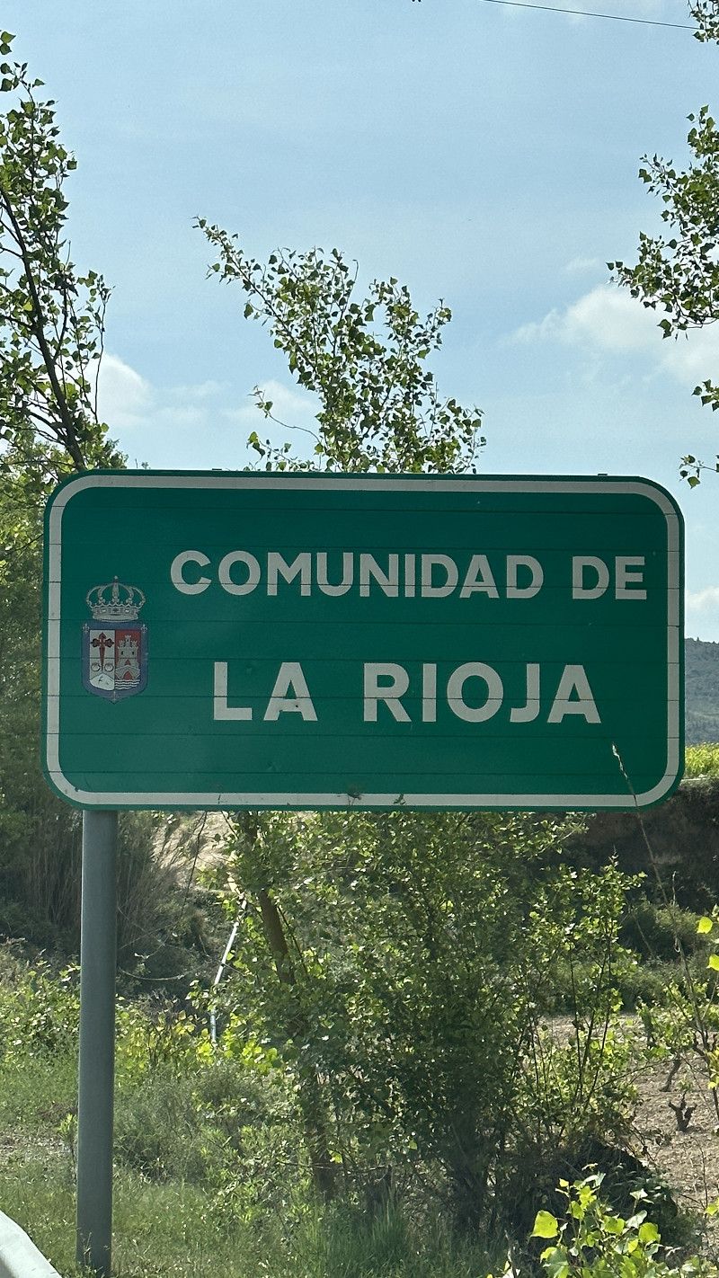
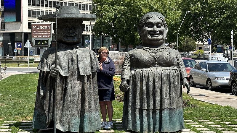
Logroño, Rioja wijnstreek
Circunvalación Sur de Logroño, 26142, Logroño, Spain
42° 27' 17.8" N 2° 21' 41.3" W
42.4549557 -2.3614584
• Head southeast on LO-20 (Circunvalación Sur de Logroño). Go for 810 m.
• Take ramp toward Bilbao/AP-68/Zaragoza/N-232a. Go for 269 m.
• Take the 2nd exit from roundabout toward AP-68/Zaragoza/Bilbao. Go for 372 m.
• Take ramp onto AP-68 (Autopista del Ebro) toward Vitoria/Gasteiz/Bilbao/Burgos. Go for 50.3 km.
• Take exit 9 toward Haro/Sto. Domingo de la Calzada. Go for 562 m.
• Turn left onto N-126 toward Casalarreina. Go for 1.9 km.
• Take the 1st exit from roundabout onto N-232 toward Pancorbo/Santander. Go for 20.9 km.
• Take the 3rd exit from roundabout onto AP-1 (Autovía del Norte) toward Burgos. Go for 56.7 km.
• Take exit 1 toward Burgos (Oeste)/N-623/Santander/Aeropuerto onto A-1 (Autovía del Norte). Go for 1.5 km.
• Take exit 245 toward Centro Ciudad Burgos/Logroño/Aeropuerto de Burgos/Burgos/N-120. Go for 318 m.
• Take the 5th exit from roundabout onto Carretera a Logroño (N-120) toward Burgos. Go for 2.1 km.
• Take ramp. Go for 199 m.
• Take the 3rd exit from roundabout onto Bulevar del Ferrocarril. Go for 853 m.
• Take the 2nd exit from roundabout onto BU-800. Go for 1.1 km.
• Arrive at BU-800.
☍
137,9 km
(1 hrs. 16 min.)
Day
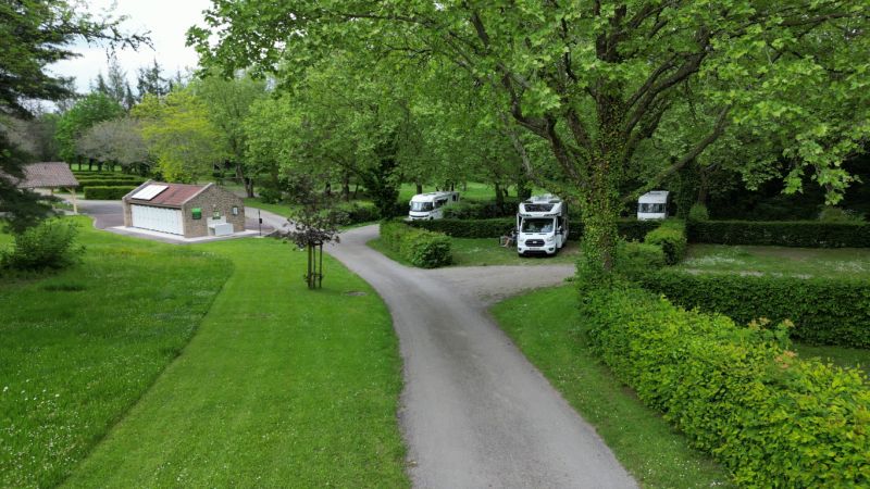
BURGOS - Camping Fuentes Blancas - 21 en 22 mei
Mega chaotic campsite.
Just find a place and settle down.
Not helpful at the counter.
Very poor (pretty much no) WiFi.
Sanitary facilities are outdated but are kept very clean.
Very good/warm showers.
Camping for transit and very expensive.
Cartuja Miraflores, 09193, Burgos, Spain
42° 20' 30" N 3° 39' 25" W
42.3416600 -3.6569400
• Head west on BU-800. Go for 996 m.
• Take the 2nd exit from roundabout onto Bulevar del Ferrocarril. Go for 1.3 km.
• Turn right onto Calle Timoteo Arnaiz. Go for 66 m.
• Take the 3rd exit from roundabout onto Avenida de Cantabria. Go for 110 m.
• Continue on Calle Timoteo Arnaiz. Go for 79 m.
• Turn right onto N-120. Go for 78 m.
• Take the 3rd exit from roundabout onto N-120. Go for 234 m.
• Take the 1st exit from roundabout onto BU-11 (Carretera Madrid a Irún) toward León/Valladolid/Palencia/A-62/Madrid/Soria/E-5/A-1/N-234/Vitoria/AP-1/Bilbao/N-1/Logroño/N-120. Go for 3.6 km.
• Take exit 4A toward Valladolid/Palencia/León/A-231 onto BU-30 (Nudo de Landa). Go for 3.9 km.
• Continue on A-62 (Autovía de Castilla) toward Palencia/Valladolid. Go for 146 km.
• Keep right onto A-62 (Autovía de Castilla) toward E-82/Zamora/A-11/Salamanca/Portugal. Go for 81.1 km.
• Take exit 234 toward Salamanca/Pol. Ind. Los Villares onto N-620. Go for 1.8 km.
• Take the 4th exit from roundabout onto Camino Cabrerizos (DSA-600). Go for 485 m.
• Continue on Carretera Villares de la Reina (DSA-600). Go for 864 m.
• Continue on Calle Camino Villares (DSA-600). Go for 1.6 km.
• Take the 3rd exit from roundabout onto Calle Los Labradores. Go for 242 m.
• Turn right onto Calle Salas Pombo. Go for 25 m.
• Arrive at Calle Salas Pombo.
☍
242,9 km
(2 hrs. 7 min.)
Day
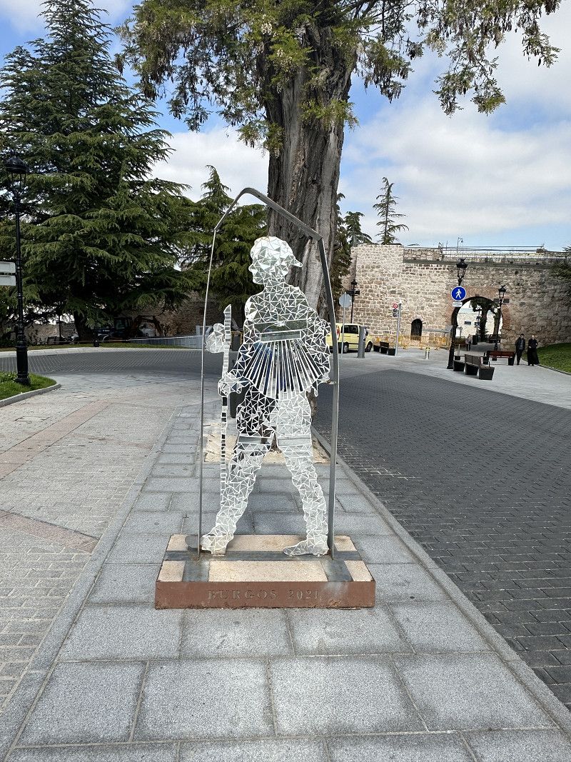
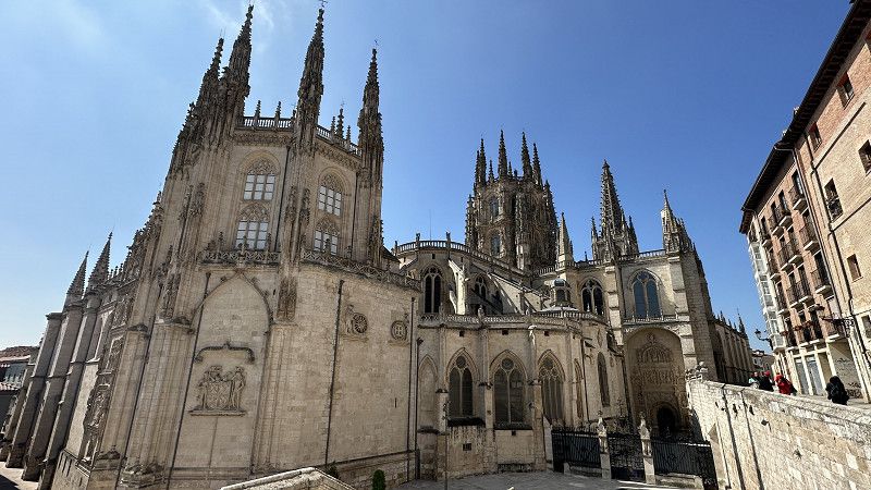
Bezoek Burgos - 22 mei
Found a bike tour via Komoot. Super cycle paths through the city.
Crosses the entire center.
Cathedral is worth it.
Day
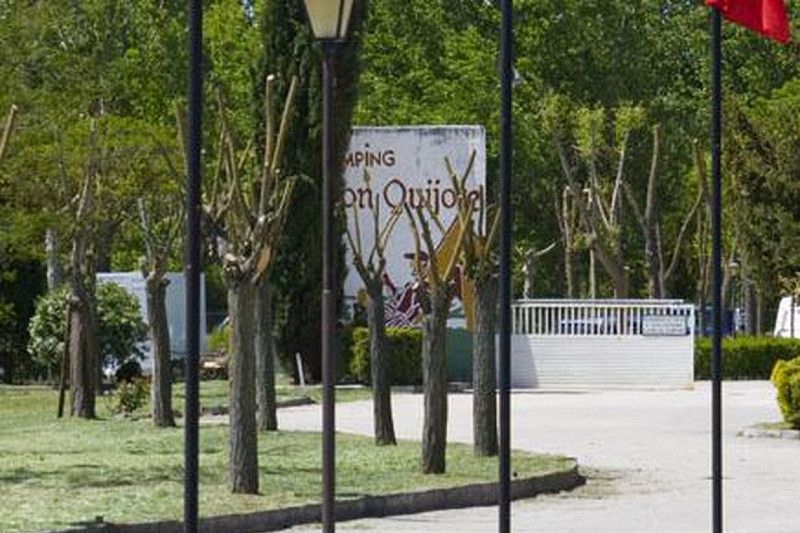
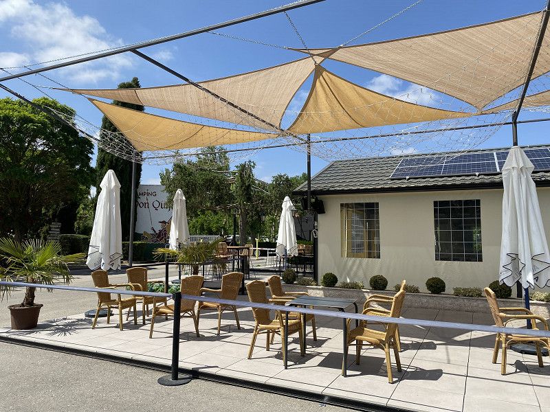
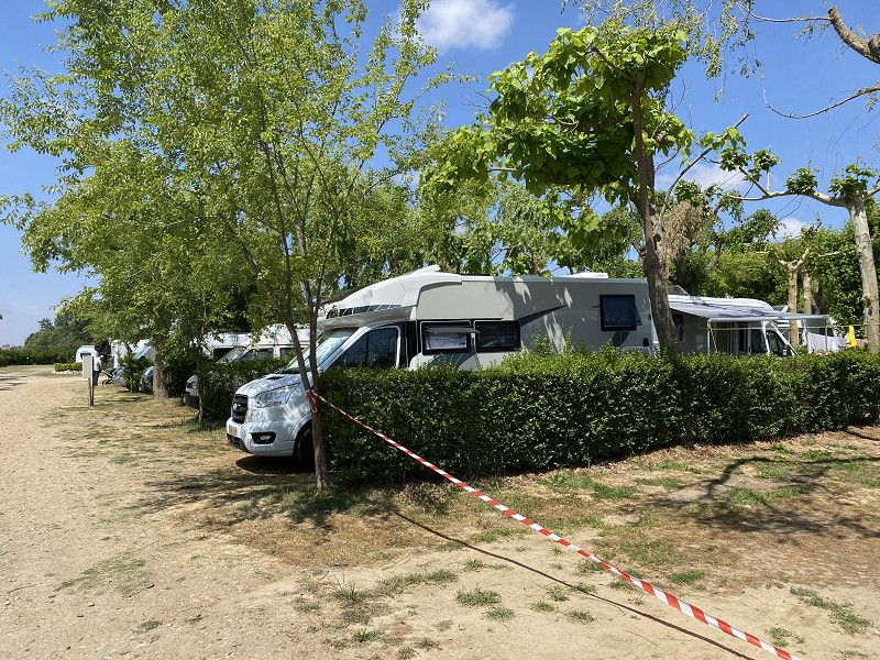
SALAMANCA Camping Don Quijote - 23-24 en 25 mei
Carretera Salamanca-aldealengua KM 1.930, 37193, Salamanca-este, Spain
40° 58' 43" N 5° 36' 35" W
40.9786100 -5.6097200
• Head toward Calle Los Arroyos on Calle Salas Pombo. Go for 47 m.
• Continue on Calle Camino de Salamanca. Go for 144 m.
• Turn right onto Calle Azucena. Go for 222 m.
• Turn right onto Avenida de las Palmeras. Go for 120 m.
• Take the 4th exit from roundabout onto Calle Camino Villares (DSA-600). Go for 1.6 km.
• Continue on Carretera Villares de la Reina (DSA-600). Go for 864 m.
• Continue on Camino Cabrerizos (DSA-600). Go for 365 m.
• Take the 1st exit from roundabout onto N-620. Go for 941 m.
• Take ramp onto A-62 (Autovía de Castilla) toward Portugal. Go for 121 km.
• Continue on A25 (Autoestrada Beiras Litoral e Alta). Go for 52.1 km.
• Take exit 28A toward Bragança/Trancoso onto IP2. Go for 33.0 km.
• Take ramp toward Marialva/(N324)/Meda. Go for 289 m.
• Take the 4th exit from roundabout onto N102. Go for 186 m.
• Take the 1st exit from roundabout onto N102. Go for 903 m.
• Turn slightly left onto N324. Go for 7.5 km.
• Take the 2nd exit from roundabout onto N324. Go for 831 m.
• Turn left. Go for 52 m.
• Turn right. Go for 168 m.
• Arrive at your destination on the left.
☍
220,7 km
(2 hrs. 1 min.)
Day
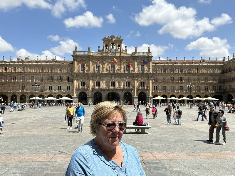
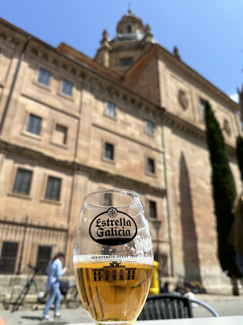
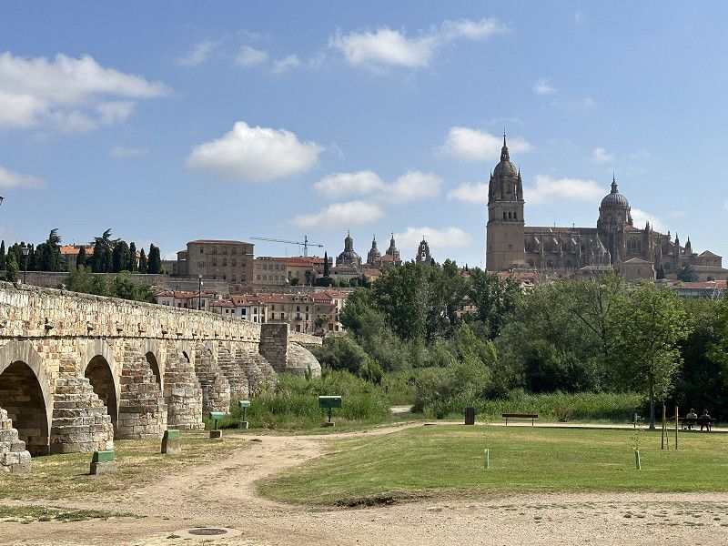
Bezoek Salamanca
From the campsite to the center by bike. 7.5km cycle path TOP, even the Dutch would be surprised by this.
What a beautiful city Plaza Royal - Cathedral (as I saw them) - Pont Romana
Day
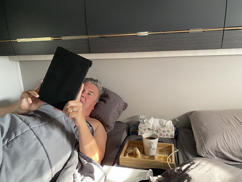
Rustdag
Breakfast in bed - a bit of work Jopal - laundry day Tania - update itinerary
Day
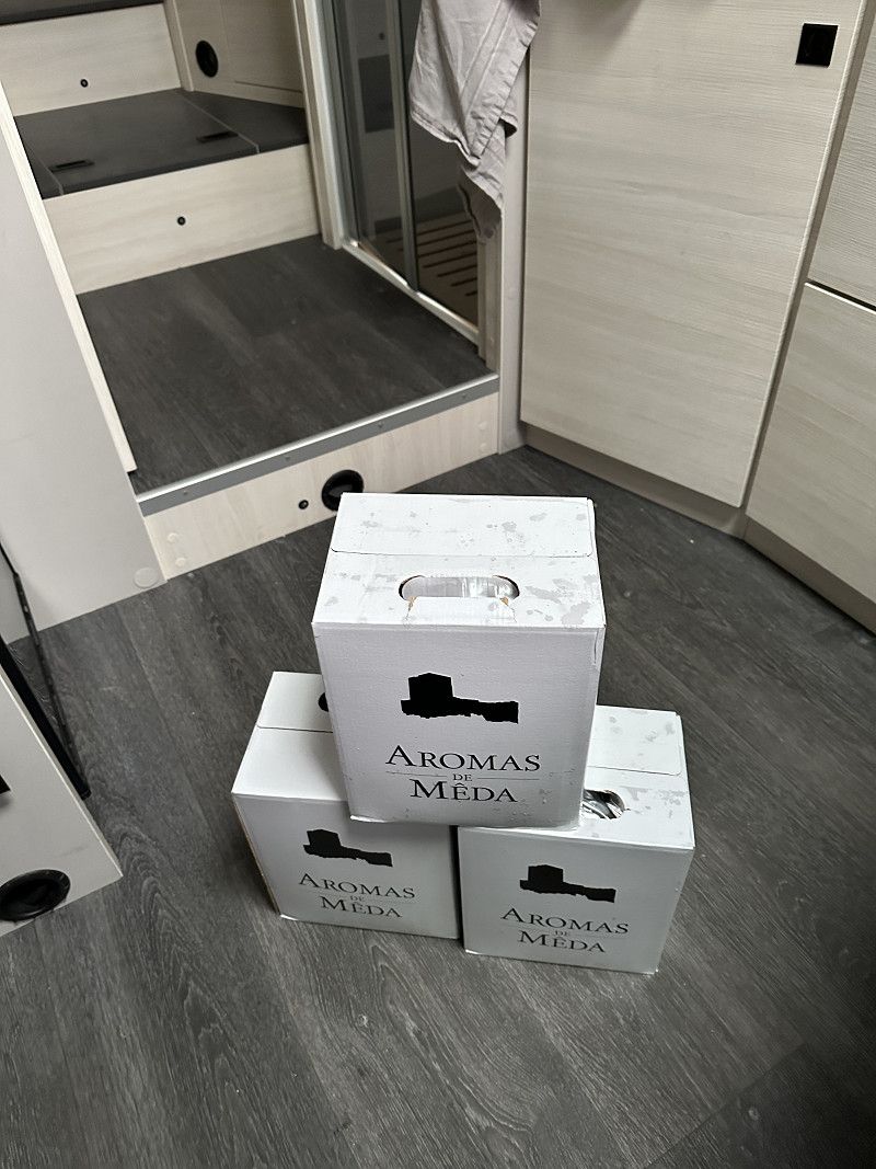
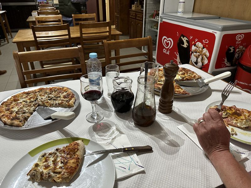
Meda - Campismo Municipal Mêda - 26 mei
Stopover on the way to Porto.
Bought local wine at very cheap prices.
Very tasty pizza eaten in the village. Patron makes his own wine and degustif. The lady is in the kitchen and bakes everything fresh. Very cheap bill.
Av. Professor Adriano Vasco Rodrigues, 6430, Mêda, Portugal
40° 58' 11.4" N 7° 15' 32.9" W
40.9698300 -7.2591500
• Head east. Go for 168 m.
• Turn left toward N324. Go for 52 m.
• Turn right onto N324. Go for 784 m.
• Take the 2nd exit from roundabout onto N324. Go for 7.5 km.
• Turn right onto N102. Go for 898 m.
• Take the 1st exit from roundabout onto IP2 toward Guarda/Trancoso. Go for 32.9 km.
• Take ramp onto A25 (Autoestrada Beiras Litoral e Alta) toward Aveiro/Viseu. Go for 124 km.
• Take exit 7 toward Porto onto A1 (Autoestrada do Norte). Go for 53.9 km.
• Take the exit toward Canidelo/(Devesas). Go for 152 m.
• Turn right onto Rua Particular do Fojo toward V. N. Gaia Centro/Canidelo/Pavilhão Municipal de Coimbrões. Go for 182 m.
• Take the 2nd exit from roundabout onto Rua Nova do Fojo (M627). Go for 264 m.
• Take the 1st exit from roundabout onto Rua Nova do Fojo (M627). Go for 190 m.
• Take the 2nd exit from roundabout onto Rua da Bélgica (M627) toward Canidelo Centro. Go for 763 m.
• Take the 3rd exit from Rua de Bélgica roundabout onto Rua da Bélgica (M627). Go for 484 m.
• Turn left onto Rua António Ferreira Braga Júnior. Go for 595 m.
• Continue on Rua do Viso (M627-1). Go for 134 m.
• Continue on Rua de Salgueiros (M627-1). Go for 930 m.
• Turn left onto Rua do Campismo. Go for 85 m.
• Turn left. Go for 16 m.
• Turn right. Go for 22 m.
• Arrive at your destination on the left.
☍
223,5 km
(2 hrs. 16 min.)
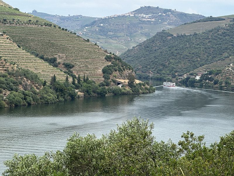
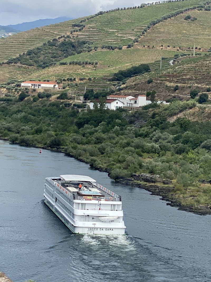
Van Meda nr Porto
Completely drove the route N222 along the Douro (beautiful but long and a lot of up and down).
Day
PORTO - Parque de Campismo de Salgueiros - 27 en 28 mei
Very outdated campsite. Only possibility to visit Porto from here.
Not worth the money, only the water in the showers was warm, the rest was of no use.
Rua do Campismo 263, 4400-397, Canidelo, Portugal
41° 7' 14.6" N 8° 39' 39.1" W
41.1207235 -8.6608694
• Head north. Go for 22 m.
• Turn left toward Rua do Campismo. Go for 16 m.
• Turn right onto Rua do Campismo. Go for 85 m.
• Turn right onto Rua de Salgueiros (M627-1). Go for 930 m.
• Continue on Rua do Viso (M627-1). Go for 134 m.
• Continue on Rua António Ferreira Braga Júnior. Go for 595 m.
• Turn right onto Rua da Bélgica (M627) toward Lisboa/IC1/Porto/V. N. Gaia Centro. Go for 409 m.
• Pass 3 roundabouts and continue on M627. Go for 1.3 km.
• Take the 3rd exit from roundabout onto Rua Particular do Fojo. Go for 232 m.
• Turn left and take ramp onto A1 (Autoestrada do Norte) toward Viana do Castelo/Braga/Porto. Go for 2.6 km.
• Continue on A28 (Autoestrada do Litoral Norte) toward P.te Freixo/V.na Castelo/Aeroporto/(IC24)/Braga/A3/V. Real/A4. Go for 2.2 km.
• Continue on A20 (CRIP). Go for 4.1 km.
• Take the exit toward Valença/Braga/Vila Real/A4/Valongo onto A3 (Autoestrada do Minho). Go for 112 km.
• Continue on A-55. Go for 4.5 km.
• Take exit 26B toward Pontevedra/Vigo onto AP-9 (Autoestrada do Atlántico). Go for 110 km.
• Take exit 67 toward Centro Histórico. Go for 1.2 km.
• Take the 2nd exit from roundabout onto Avenida de Camilo José Cela toward Centro Histórico/Lavacolla/Aeropuerto Lavacolla/San Marcos/Tve Tvg. Go for 520 m.
• Take the 3rd exit from roundabout onto Rúa de San Lázaro (N-634) toward San Marcos/Lavacolla Aeroporto. Go for 1.1 km.
• Turn left. Go for 305 m.
• Turn left. Go for 48 m.
• Arrive at your destination on the left.
☍
242,7 km
(2 hrs. 20 min.)
Day
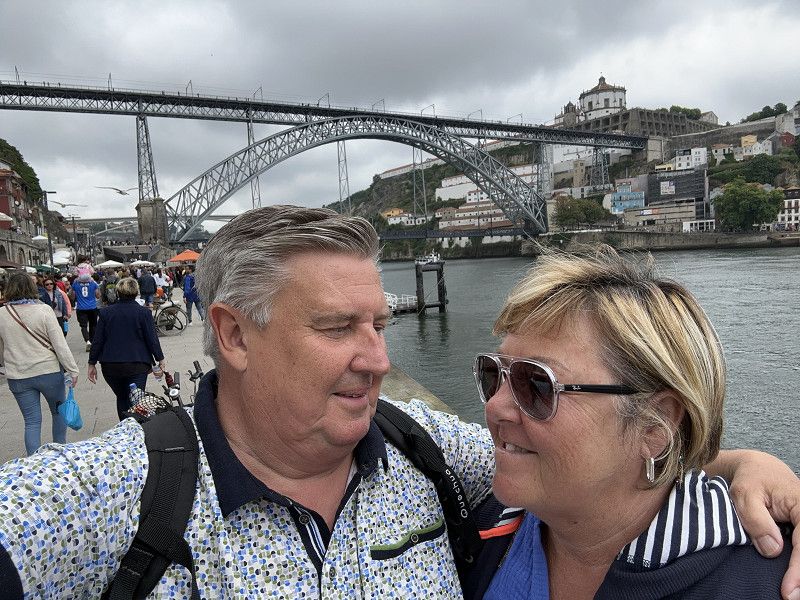
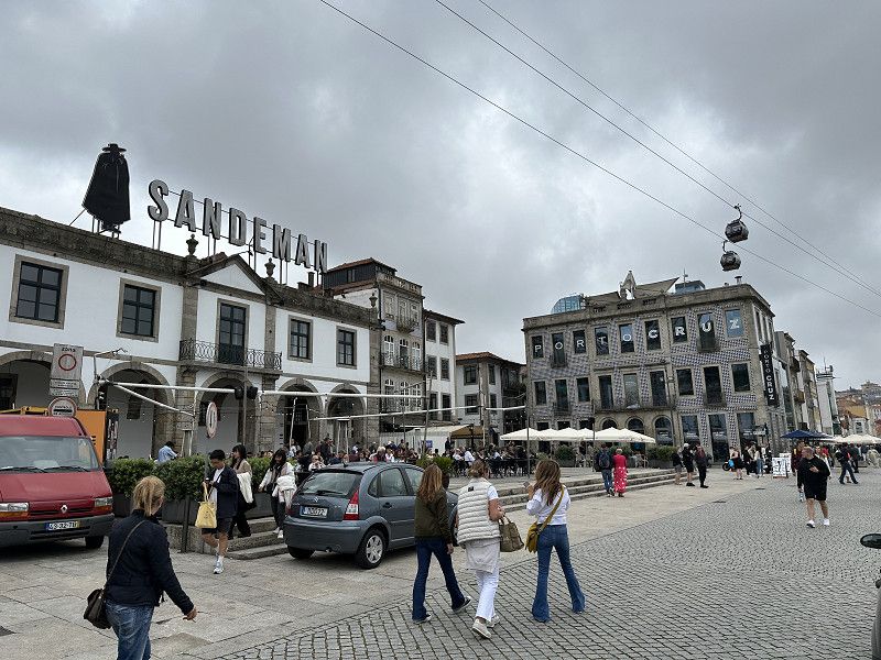
Porto bezoeken 28 mei
By taxi to the center of Porto (upper town). 10€
On foot down to the Douro. Cross the bridge and visit Porto houses.
Day
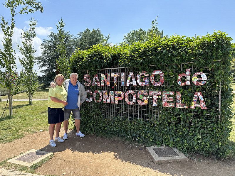
SANTIAGO DE COMPOSTELLA - Autocamper Compostella - 29 en 30 mei
Top location with a view of the city.
Lg Granxa San Lazaro 29, 15890, Santiago de Compostela, Spain
42° 53' 31.1" N 8° 30' 3.6" W
42.8919695 -8.5009938
• Head southeast. Go for 48 m.
• Turn left onto Lugar A Granxa de San Lázaro. Go for 46 m.
• Continue on Lugar Granxa San Lázaro. Go for 108 m.
• Continue on Lugar A Granxa de San Lázaro. Go for 71 m.
• Turn left onto Costa de San Marcos (N-634). Go for 885 m.
• Turn left onto Rúa Lugar de Castro. Go for 543 m.
• Take the 1st exit from roundabout onto A-54 toward Oviedo/Lugo/Aeropuerto/E-1/AP-9/A Coruña. Go for 6.8 km.
• Take exit 84 toward N-634/Curtis/Oviedo. Go for 352 m.
• Take the 3rd exit from roundabout toward N-634/Curtis/Oviedo. Go for 786 m.
• Take the 1st exit from roundabout onto N-634 toward Curtis/Oviedo. Go for 42.1 km.
• Take the 2nd exit from roundabout onto Avenida Lugo (N-634). Go for 9.2 km.
• Take ramp onto A-6 (Autovía do Noroeste) toward Lugo/Madrid. Go for 16.9 km.
• Take exit 522AB toward Oviedo onto A-8 (Autovía do Cantábrico). Go for 69.6 km.
• Take exit 524 toward N-634/Barreiros/N-642/Foz/San Cibrao/Hospital da Costa. Go for 2.2 km.
• Continue on A Anea. Go for 192 m.
• Turn right toward A Anea/N-634. Go for 25 m.
• Take the 2nd exit from roundabout onto A Anea (N-634) toward Ribadeo/Oviedo/San Cibrao/N-642/Viveiro/LU-862/Hospital da Costa/Burela. Go for 636 m.
• Keep left onto N-634. Go for 96 m.
• Take the 2nd exit from roundabout onto A Anea (N-642). Go for 4.2 km.
• Turn right onto Vilaxuane (N-642). Go for 160 m.
• Continue on Avenida Asturias (N-642). Go for 222 m.
• Continue on Vilaxuane (N-642). Go for 443 m.
• Continue on Rúa de Ribadeo (N-642). Go for 153 m.
• Take the 1st exit from roundabout onto Rúa Concello de Barreros. Go for 147 m.
• Continue on Rúa Curbeiro. Go for 324 m.
• Continue on Barrio Fondós. Go for 75 m.
• Turn left. Go for 61 m.
• Arrive at your destination on the left.
☍
156,4 km
(1 hrs. 39 min.)
Day
Bezoek Santiago de Compostella - 30 mei
On a pilgrimage, haha.
Heat thunderstorm in the evening but it was good before it cooled down.
Day
FOZ - Area de Foz - 31 mei
Camper site with a sea view. Free and great for one night.
Lunch of pure fish top.
Rua do Ru Curbeiro, 27780, Foz, Spain
43° 33' 48" N 7° 15' 27" W
43.5633333 -7.2575000
• Head north. Go for 19 m.
• Turn left. Go for 48 m.
• Turn left toward Barrio Fondós. Go for 80 m.
• Turn right onto Barrio Fondós. Go for 352 m.
• Continue on Foz. Go for 137 m.
• Take the 3rd exit from roundabout onto Rúa de Ribadeo (N-642). Go for 209 m.
• Continue on Avenida Asturias (N-642). Go for 418 m.
• Continue on Vilaxuane (N-642). Go for 247 m.
• Continue on Vilaxuane (N-642). Go for 113 m.
• Take the 3rd exit from roundabout onto Vilaxuane (N-642). Go for 4.2 km.
• Take the 2nd exit from roundabout onto N-634. Go for 752 m.
• Take the 3rd exit from roundabout onto A Anea. Go for 509 m.
• Take ramp onto A-8 (Autovía do Cantábrico) toward Oviedo/Ribadeo. Go for 163 km.
• Take the left exit toward Villaviciosa/Santander onto A-8 (Autovía del Cantábrico). Go for 89.4 km.
• Take exit 272 toward N-621/Unquera/Panes/Potes/Parque Nacional Picos de Europa. Go for 246 m.
• Pass 2 roundabouts and continue on Paseo Juncal (N-621). Go for 38.1 km.
• Take the 1st exit from roundabout onto Calle Rosacabado (N-621). Go for 1.0 km.
• Continue on Calle Doctor Encinas (CA-185). Go for 425 m.
• Turn slightly left onto Plaza de la Serna (CA-185). Go for 74 m.
• Continue on Calle Fonfría (CA-185). Go for 542 m.
• Continue toward CA-185. Go for 53 m.
• Turn slightly left toward CA-885. Go for 40 m.
• Turn slightly left onto CA-885. Go for 649 m.
• Continue on Carretera Santo Toribio (CA-885). Go for 274 m.
• Arrive at Carretera Santo Toribio (CA-885). Your destination is on the right.
☍
300,9 km
(3 hrs. 10 min.)
Day
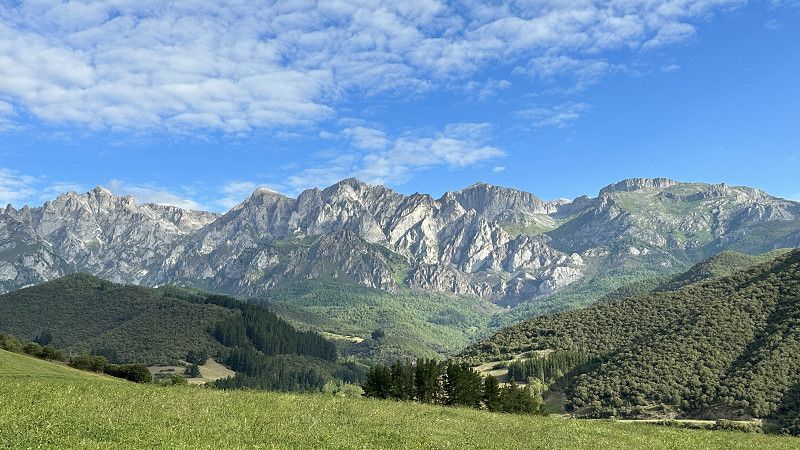
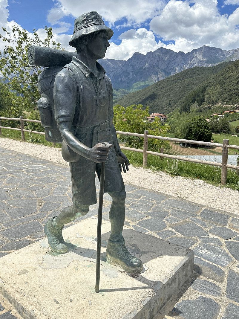
POTES PICOS de EUROPE - Camping La Viorna - 1,2 en 3 juni
After 30km into the mountains it feels like we are in Austria.
Terrifyingly narrow road through the gorge.
But so beautiful at the top of the campsite.
Car. Santo Toribio, 39570, Potes, Spain
43° 9' 15.9" N 4° 38' 36.7" W
43.1544300 -4.6435200
• Head toward Camino del Cementerio on Carretera Santo Toribio (CA-885). Go for 274 m.
• Continue on CA-885. Go for 638 m.
• Turn slightly right onto Calle Fonfría (CA-185). Go for 631 m.
• Continue on Plaza de la Serna (CA-185). Go for 74 m.
• Turn slightly right onto Calle Doctor Encinas (CA-185). Go for 246 m.
• Keep left onto Calle Doctor Encinas (CA-185). Go for 1.2 km.
• Take the 3rd exit from roundabout onto Calle el Puente (N-621). Go for 37.2 km.
• Take the 2nd exit from roundabout onto Paseo Juncal (N-621). Go for 873 m.
• Take the 2nd exit from roundabout onto A-8 (Autovía del Cantábrico) toward Santander. Go for 72.7 km.
• Take the exit onto A-8 (Autovía del Cantábrico). Go for 80.0 km.
• Take exit 119 toward Balmaseda/E-70/AP-8 onto BI-636 (Carretera del Corredor del Cadagua). Go for 579 m.
• Take exit 5 toward Zorrozgoiti/Altamira onto BI-3736 (Carretera de Basurto a Castrexana). Go for 1.9 km.
• Turn right onto Carretera Basurtu-Kastrexana. Go for 247 m.
• Turn right onto Camino Kobetabidea. Go for 319 m.
• Turn left onto Monte Kobeta. Go for 11 m.
• Turn left onto Monte Kobeta. Go for 266 m.
• Turn right onto Monte Kobeta. Go for 35 m.
• Turn left. Go for 30 m.
• Arrive at your destination on the right.
☍
197,2 km
(2 hrs. 23 min.)
Day
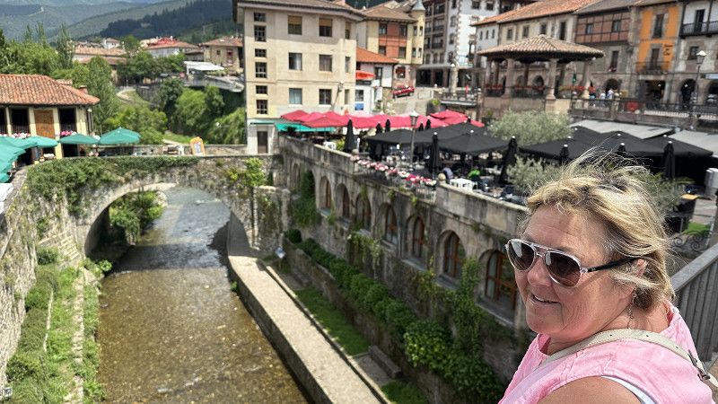
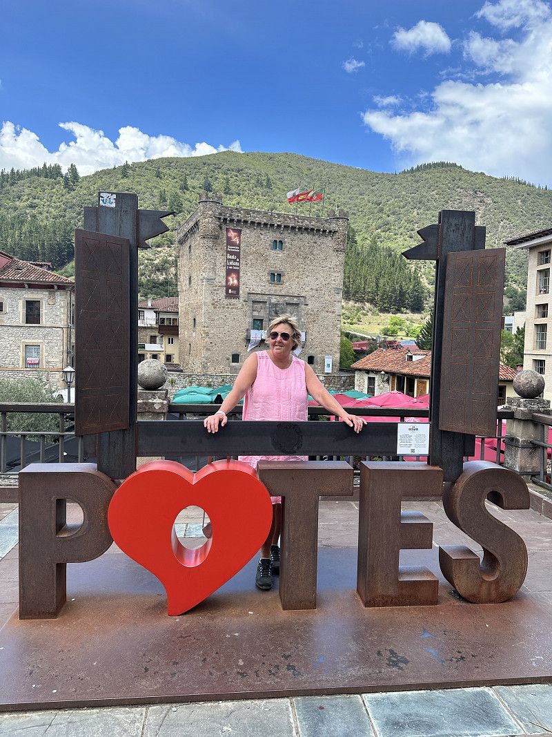
Te voet naar Potes - 2 juni
First a daily special at the campsite.
Starter - main course - dessert and glass of wine Fri €12/pp.
Here €1.4 for a glass of rosé. You can get a bottle of house wine for..... no surprise: €4.
Bottle with cork.
On foot to Potes. Long walk down, the way back took some time. But a Cervesa and Rosé wine and everything is fine again.
Stay here for an extra day so wonderful.
Day
Potes extra rustdag in de bergen - 3 juni
Day
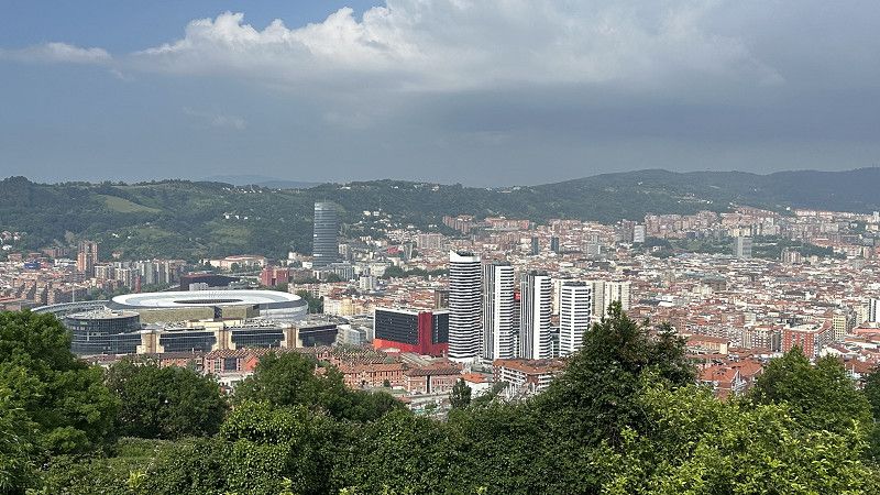
BILBAO - Autocaravaning Kobetamendi - 4 juni
Standing above the city of Bilbao - beautiful overview. Straight down by bike.
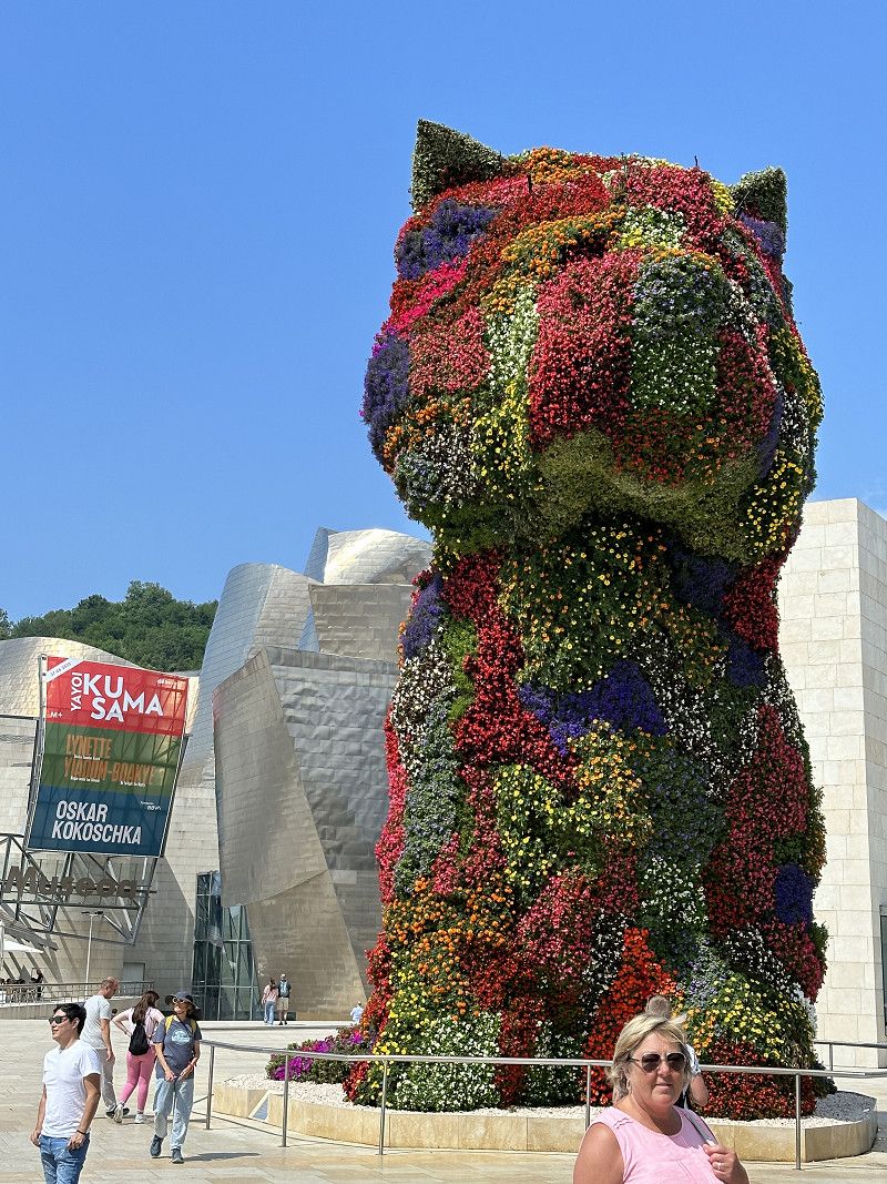
Visit the Guugenheim museum (not open tomorrow).
Calle del Monte Cobetas 33, 48000, Bilbao, Spain
43° 15' 33" N 2° 57' 49" W
43.2591667 -2.9636111
• Head toward Monte Kobeta. Go for 30 m.
• Turn right onto Monte Kobeta. Go for 35 m.
• Turn left onto Monte Kobeta. Go for 266 m.
• Turn right onto Monte Kobeta. Go for 11 m.
• Turn right onto Camino Kobetabidea. Go for 319 m.
• Turn left onto Carretera Basurtu-Kastrexana. Go for 247 m.
• Turn right onto Carretera de Basurto a Castrexana (BI-3736). Go for 72 m.
• Take the 3rd exit from roundabout onto Carretera de Basurto a Castrexana (BI-3736). Go for 242 m.
• Turn right. Go for 75 m.
• Turn right toward Autovía del Cantábrico/A-8. Go for 116 m.
• Take ramp onto A-8 (Autovía del Cantábrico). Go for 4.8 km.
• Keep left onto AP-8 (Autopista del Cantábrico) toward A-8/Donostia-San Sebastián. Go for 86.4 km.
• Take the exit toward Hernani/Pasaia/Irun/Baiona/Bordeaux onto AP-1/AP-8 (Segundo Cinturón de San Sebastián). Go for 14.6 km.
• Take the exit onto AP-8. Go for 12.7 km.
• Continue on A63 (Autoroute de la Côte Basque). Go for 21.8 km.
• Take exit 4 toward Biarritz/Aéroport Biarritz-Parme. Go for 1.2 km.
• Continue toward Boulevard Marcel Dassault/D810. Go for 46 m.
• Take the 3rd exit from roundabout onto Boulevard Marcel Dassault (D810) toward St Jean de Luz/St Sébastien/Bidart/Donostia. Go for 1.5 km.
• Take the 3rd exit from roundabout onto Avenue de Bayonne (D810) toward Biarritz. Go for 295 m.
• Take the 1st exit from roundabout onto Rue de l'Étape (D655) toward Biarritz. Go for 498 m.
• Continue on Avenue de Biarritz (D911). Go for 826 m.
• Take the 3rd exit from Rond-Point Maïté Barnetche roundabout onto Avenue de Biarritz (D911). Go for 498 m.
• Take the 1st exit from Avenue de la Milady roundabout onto Avenue de la Milady (D911). Go for 373 m.
• Take the 1st exit from Avenue de la Milady roundabout onto Chemin des Prés. Go for 58 m.
• Continue on Avenue de la Milady. Go for 51 m.
• Arrive at your destination on the right.
☍
146,9 km
(1 hrs. 32 min.)
Day
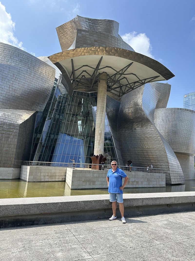
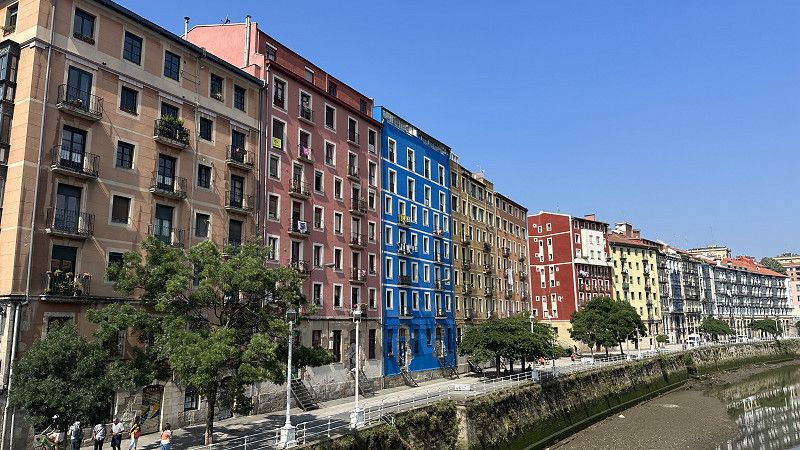
Bezoek Bilbao - 5 juni
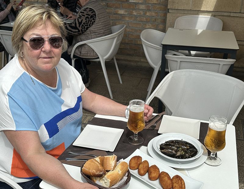
By bus to the old town. Delicious Paella and Conejo ate with the real Spaniards.
In the city of 28° I'm happy in the shade.
Day
BIARRITZ - Camping-car Park de la Milady - 6 juni
CAMPING-CAR PARK - beautiful place and only 200m from the sea and 1km from the center.
Too bad a pint was €4 instead of €2.10 yesterday. A glass of wine €6 instead of €1.5 yesterday.
Diesel 1.85 instead of 1.32 yesterday Spain.
France expensive or Spain too cheap.
Avenue de la Milady, 64200, Biarritz, France
43° 27' 58" N 1° 34' 18" W
43.4661111 -1.5716667
• Head north. Go for 95 m.
• Continue on Avenue de la Milady. Go for 52 m.
• Turn right onto Avenue de la Milady. Go for 18 m.
• Continue on Chemin des Prés. Go for 46 m.
• Take the 3rd exit from Avenue de la Milady roundabout onto Avenue de la Milady (D911). Go for 382 m.
• Take the 2nd exit from Avenue de la Milady roundabout onto Avenue de la Milady (D911). Go for 500 m.
• Keep right onto Avenue de Biarritz (D911). Go for 39 m.
• Take the 2nd exit from Rond-Point Maïté Barnetche roundabout onto Avenue de Biarritz (D911). Go for 870 m.
• Turn left onto Rue de l'Étape (D655). Go for 475 m.
• Take the 3rd exit from roundabout onto Parc d'Acivités de la Source (D810). Go for 362 m.
• Take the 3rd exit from roundabout. Go for 75 m.
• Continue on Avenue de Bayonne (D810). Go for 1.4 km.
• Take the 2nd exit from roundabout toward A63/A63-A64/Saint Jean de Luz/San Sébastien/Bayonne/Bordeaux. Go for 130 m.
• Take ramp onto A63 (Autoroute de la Côte Basque) toward Bordeaux/Bayonne. Go for 163 km.
• Take exit 23 toward Le Barp/Marcheprime/Lacanau. Go for 226 m.
• Take the 3rd exit from roundabout onto Route du Barp (D5). Go for 238 m.
• Pass 7 roundabouts and continue on Lieu-dit Pointe Émile (D5). Go for 16.4 km.
• Turn left onto D5 E9. Go for 68 m.
• Take ramp onto D106. Go for 6.8 km.
• Pass 4 roundabouts and continue on D106. Go for 10.1 km.
• Take ramp toward D3/Lège/Lacanau/Arès. Go for 215 m.
• Take the 3rd exit from roundabout onto Rue du Général de Gaulle (D3). Go for 101 m.
• Take the 1st exit from roundabout onto Rue du Général de Gaulle (D3). Go for 266 m.
• Turn left onto Allée de la Machinotte. Go for 19 m.
• Arrive at Allée de la Machinotte. Your destination is on the right.
☍
201,6 km
(1 hrs. 57 min.)
Day
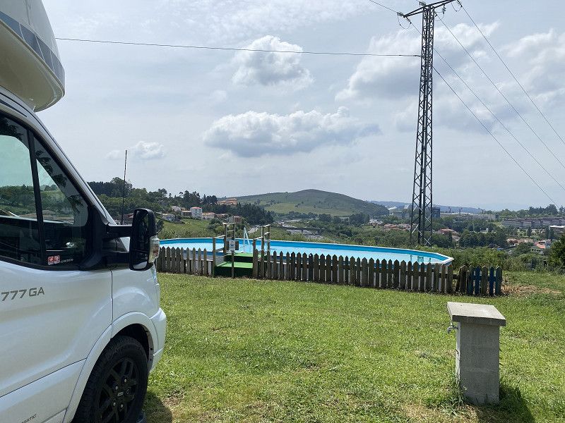
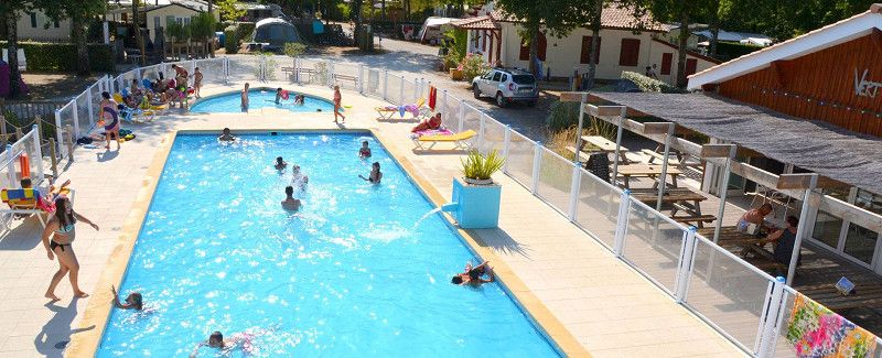
ARES/ARCACHON - Flower Camping La Canadienne - 7-8-9-10 juni
https://www.lacanadienne.com/
Top campsite - small scale - clean sanitary facilities - heated swimming pool.
Not busy yet (snack bar only opens June 15) so total peace and quiet and enjoying the holiday feeling. 27-29°
Only booked 2-3 nights at first, but quickly booked.
82 rue du Général de Gaulle, 33740, Arès, France
44° 46' 44.3" N 1° 8' 35.3" W
44.7789700 -1.1431360
• Head toward Rue du Général de Gaulle on Allée de la Machinotte. Go for 19 m.
• Turn right onto Rue du Général de Gaulle (D3). Go for 230 m.
• Take the 1st exit from roundabout onto D106. Go for 1.6 km.
• Pass 2 roundabouts and continue on D106. Go for 6.0 km.
• Take the 3rd exit from roundabout onto D106. Go for 2.6 km.
• Take the 2nd exit from roundabout onto D106. Go for 11.6 km.
• Take the 2nd exit from roundabout onto D213 toward Martignas S/J./St Médard en J. Go for 8.0 km.
• Take the 1st exit from roundabout onto Avenue du Bassin d'Arcachon (D213) toward Mérignac. Go for 3.0 km.
• Pass 6 roundabouts and continue on Avenue Marcel Dassault (D213). Go for 6.5 km.
• Take the 1st exit from roundabout onto Avenue Marcel Dassault (D213). Go for 315 m.
• Take the 5th exit from roundabout onto Avenue Marcel Dassault (D213) toward Mérignac Centre/Rocade/Pichey. Go for 827 m.
• Pass 3 roundabouts and continue on Avenue Marcel Dassault (D213). Go for 1.4 km.
• Take the 2nd exit from Rond-Point de l'Océan roundabout onto Rue Jacques Prévert toward Angoulême/Nantes/Paris. Go for 240 m.
• Take the 2nd exit from roundabout toward Angoulême/Nantes/Paris. Go for 153 m.
• Continue on A630 (Rocade de Bordeaux). Go for 16.0 km.
• Continue on A10. Go for 324 km.
• Take the exit toward Lyon/Bourges onto A85. Go for 22.5 km.
• Take exit 11 toward Bléré/Chenonceaux/Montrichard/Amboise. Go for 1.1 km.
• Take the 3rd exit from roundabout onto D31 toward Bléré/Chenonceaux/Amboise/Montrichard. Go for 3.6 km.
• Turn left and take ramp onto D976 toward Tours/Montlouis S/L./Amboise. Go for 2.2 km.
• Continue on D31. Go for 7.8 km.
• Pass 4 roundabouts and continue on Boulevard Saint-Denis Hors (D31). Go for 6.4 km.
• Take ramp toward Amboise/Chargé/Mosnes/Chaumont S/L. Go for 220 m.
• Turn right onto D751. Go for 7.6 km.
• Turn left onto Rue du Pont. Go for 796 m.
• Turn left onto Rue du Pont. Go for 81 m.
• Turn left. Go for 52 m.
• Turn right. Go for 39 m.
• Arrive at your destination on the left.
☍
435,0 km
(3 hrs. 55 min.)
Day
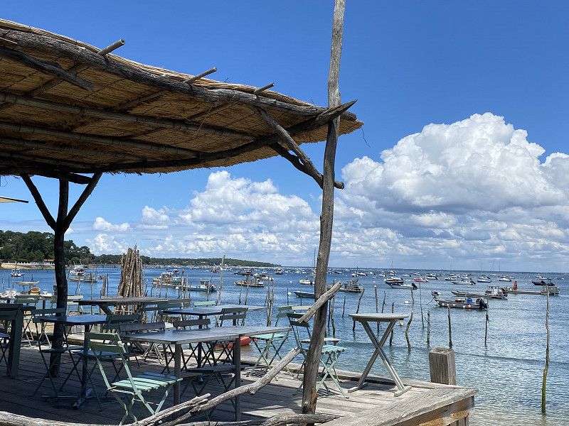
Met de fiets een deel van Basin D'Arcachon - 8 juni
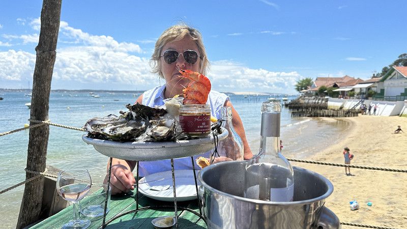
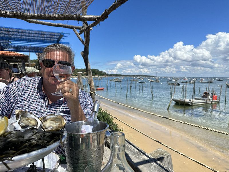
Many Oyster/cabanes where the fish is so fresh so probably still alive on your plate.
Is for Friday or Saturday evening.
First check with the campsite operator to see who we would be best with. Don't want a TOURIST*TRAP.
Day
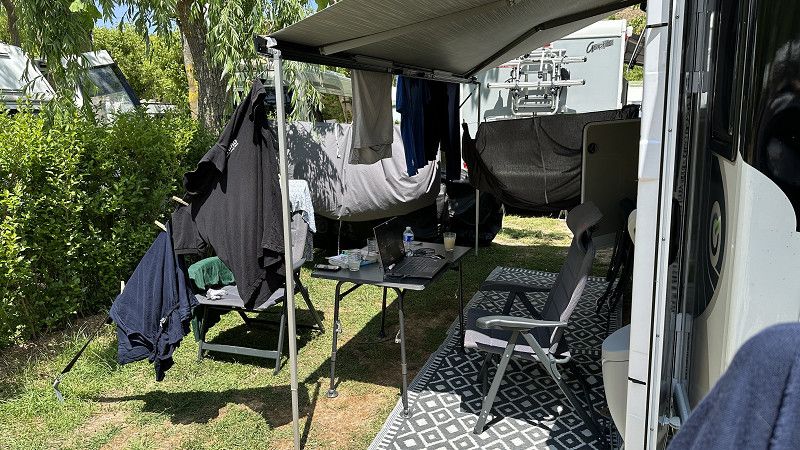
Rustdag ter plaatse - een beetje werken vr Jopal - 9 juni
Work in peace and quiet with a view of the swimming pool and put your laptop (perfect WiFi here) on the table. Emails - invoices etc.....
I am very grateful to Danny and Tom for arranging and carrying out 90% of the work themselves. Owner very pleased, it won't do them any harm. Haha
Day
Naar de markt CAP FERRET - 10 juni
Via the perfect cycling network (many of the cycle paths are closed off).
Market day
Day
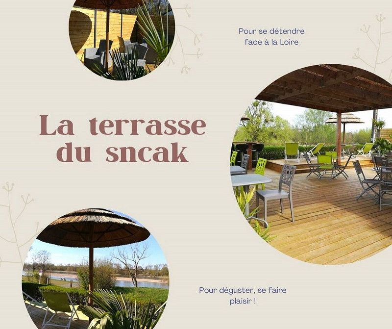
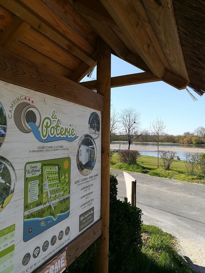
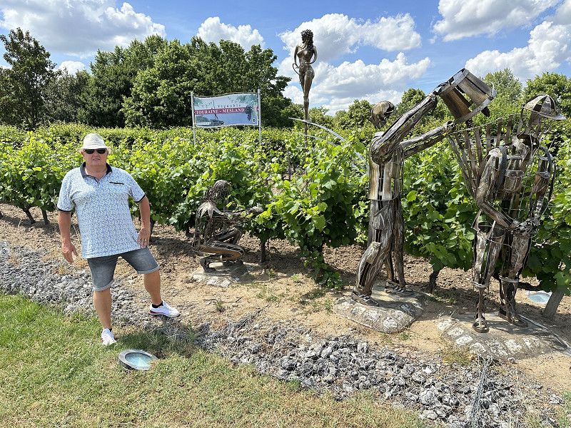
AMBOISE/LOIRE - Camping de la Poterie - 11-12 en 13 juni
Small nice campsite right on the Loire and major cycling routes.
Quai André Citroën, Mosnes, Indre-et-Loire, Centre-Val de Loire, Frankrijk
47° 27' 41.2" N 1° 5' 46.5" E
47.4614374 1.0962531
• Head northeast. Go for 39 m.
• Turn left toward Rue du Pont. Go for 52 m.
• Turn right onto Rue du Pont. Go for 81 m.
• Turn right onto Rue du Pont. Go for 796 m.
• Turn left onto Rue Nationale (D751). Go for 7.3 km.
• Continue on Rue du Maréchal Leclerc (D114). Go for 302 m.
• Turn left onto D1. Go for 581 m.
• Take the 1st exit from roundabout onto D952 toward Blois/Chambord/Chouzy S/C. Go for 6.7 km.
• Take the 1st exit from roundabout onto D952 toward Blois/Chambord. Go for 11.4 km.
• Take ramp onto Avenue de Verdun (D956). Go for 741 m.
• Keep left onto Boulevard des Cités Unies (D956) toward Orléans/Tours/Chartres/Le Mans/Angers/Blois-Nord. Go for 1.2 km.
• Turn right toward A10/Villerbon/PA A10/PA Gailletrous. Go for 453 m.
• Continue on D956. Go for 635 m.
• Take the 3rd exit from Rond-Point des Châteaux roundabout onto D952 A toward Orléans/Orleans/Tours. Go for 576 m.
• Take ramp onto A10 (L'Aquitaine) toward Paris/Orléans. Go for 113 km.
• Take exit 11 toward Rambouillet/Allainville. Go for 932 m.
• Take the 2nd exit from roundabout onto N191 toward A11/Rambouillet/Chartres/Allainville/Ablis. Go for 9.2 km.
• Take ramp onto N10 toward A11/Rambouillet/Z.A. d'Ablis Nord. Go for 36.3 km.
• Take the 2nd exit from roundabout onto N10 toward A86/A12/A13/Paris/Versailles/St Quentin en Ynes/St Cyr l'École/Montigny le Bx. Go for 2.0 km.
• Take left ramp onto A12 toward A86/Rouen/A13/Paris/Versailles. Go for 7.8 km.
• Take the left exit toward Rouen/Poissy onto A13 (Autoroute de Normandie). Go for 32.2 km.
• Keep left onto A13 (Autoroute de Normandie). Go for 39.9 km.
• Take exit 17 toward Gaillon/Les Andelys onto D316. Go for 711 m.
• Take the 3rd exit from roundabout onto D316. Go for 2.3 km.
• Pass 7 roundabouts and continue on Route des Andélys (D316). Go for 7.9 km.
• Take the 2nd exit from roundabout onto D313. Go for 3.1 km.
• Take the 2nd exit from Giratoire Jacques Erisay roundabout onto D313. Go for 583 m.
• Take the 4th exit from roundabout onto Rue Gilles Nicolle (D313). Go for 200 m.
• Turn right. Go for 175 m.
• Turn slightly right. Go for 271 m.
• Arrive at your destination on the right.
☍
287,1 km
(2 hrs. 57 min.)
Day
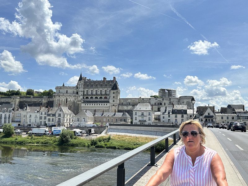
AMBOISE - 12 juni
Cycling tour along the Loire nr Amboies etc... 48km.
Day
LES ANDELYS - Flower camping Les Trois Rois - 14-15-16 juni
Campsite on the Seine with a beautiful view of Chateau Grilliard. Two swimming pools and top pitches. Sanitary just cracked. Will stay here longer because it is so good.
Sunbathe - swim - cycle a bit and enjoy.
https://www.camping-troisrois.com/
Rue Gilles Nicolle 1, Les Andelys, Eure, Normandië, Frankrijk
49° 13' 58.3" N 1° 23' 56" E
49.2328622 1.3988926
• Head north. Go for 406 m.
• Turn left toward Rue Gilles Nicolle/D313. Go for 96 m.
• Take the 2nd exit from roundabout onto Rue Gilles Nicolle (D313). Go for 872 m.
• Turn right onto Avenue de la République (D316). Go for 2.0 km.
• Keep right onto Rue Henri Rémy (D125). Go for 975 m.
• Take the 2nd exit from roundabout onto Rue du Maréchal Foch (D125). Go for 10.3 km.
• Turn right onto D6014. Go for 3.1 km.
• Turn left onto Rue Saint-Denis (D181) toward Beauvais/Gisors/Étrépagny. Go for 6.4 km.
• Take the 2nd exit from roundabout onto D181 toward Dangu. Go for 1.2 km.
• Continue on Route de Dangu (D981). Go for 4.5 km.
• Continue on Rue Pierre Durand (D181). Go for 1.3 km.
• Take the 1st exit from roundabout onto D14 B toward A16/Amiens/Gournay/Cergy-Pontoise/Zone Industrielle. Go for 743 m.
• Take the 2nd exit from roundabout onto D15 B toward Amiens/A16/Beauvais/Dieppe/Gournay/P.A. du Mont de Magny. Go for 811 m.
• Take the 2nd exit from roundabout onto D981 toward A16/Beauvais/Chaumont en Vexin/Chambors/Trie/Château. Go for 2.4 km.
• Take the 3rd exit from roundabout onto D981 toward Beauvais/Chaumont en Vexin/Trie/Château. Go for 1.6 km.
• Take the 3rd exit from roundabout onto Route de Beauvais (D981) toward (Amiens)/A16/Beauvais/Auneuil. Go for 5.4 km.
• Take the 2nd exit from roundabout onto D981 toward A16/Beauvais/Auneuil. Go for 3.8 km.
• Continue on Grande Route (N181). Go for 4.6 km.
• Pass 2 roundabouts and continue on Route de Gisors (D981). Go for 4.8 km.
• Take the 1st exit from roundabout onto N31 toward Paris/Amiens/Compiègne/Beauvais. Go for 9.3 km.
• Take ramp onto A16 (L'Européenne) toward Amiens/Compiègne/Creil/Beauvais-Nord. Go for 52.9 km.
• Take the exit toward Saint-Quentin/Reims/Lille/Amiens-Sud onto A29. Go for 10.9 km.
• Take the exit toward Paris/Lille/Reims/St Quentin onto A29. Go for 32.7 km.
• Take the exit toward Paris/Lille/Bruxelles/Péronne. Go for 1.9 km.
• Take the left exit toward Lille/Calais/Bruxelles/Péronne onto A1 (Autoroute du Nord). Go for 92.5 km.
• Take the exit toward La Madeleine/Lille-St Maurice onto N356 (Boulevard Périphérique Est de Lille). Go for 2.0 km.
• Keep right onto N356 toward Gand (Gent)/Roubaix/Marcq en Baroeul/Mons en Baroeul/Tourcoing. Go for 3.4 km.
• Keep left onto N356 toward Tourcoing/Gand (Gent)/Roubaix-Centre/Wasquehal/Croix. Go for 2.1 km.
• Continue on A22. Go for 11.7 km.
• Continue on E17. Go for 43.0 km.
• Take the exit toward De Pinte onto N60. Go for 1.6 km.
• Take the 2nd exit from roundabout onto N60 toward Gent/De Pinte. Go for 3.5 km.
• Turn right onto Grotesteenweg-Noord. Go for 19 m.
• Turn right onto Tramstraat toward Merelbeke/Zwijnaarde-Centrum/Industriezone Zwijnaarde I,II,III,IV. Go for 1.1 km.
• Continue on Adolphe della Faillelaan. Go for 859 m.
• Continue on Zwijnaardsesteenweg (N469). Go for 1.6 km.
• Take the 1st exit from roundabout onto Hundelgemsesteenweg (N444). Go for 495 m.
• Turn left onto Doktor O. de Gruyterstraat. Go for 180 m.
• Turn left onto Doktor O. de Gruyterstraat. Go for 175 m.
• Take the 1st exit from roundabout onto Zusters Maricolenstraat. Go for 230 m.
• Arrive at Zusters Maricolenstraat. Your destination is on the right.
☍
327,3 km
(3 hrs. 46 min.)
Day
Zonnen - zwemmen - genieten
Day
Beetje fietsen langs de Seine - zonnen - zwemmen - genieten
Day
MERELBEKE - Zusters Maricolenstraat - 17 juni
Home after five wonderful weeks
Gent, Oost-Vlaanderen, België
50° 59' 27.3" N 3° 45' 7" E
50.9909243 3.7519524