June 25th - July 19, 2022
Over four weeks on the road to Strasbourg, Annecy, Lyon, Nancy, Trier and Bad Honnef. Attending the Rammstein concert in Lyon.
Day
Werder (Havel), 25.06.22
(June 25th - July 19th, 2022)
14542 Werder (Havel), Deutschland
52° 21' 53.3" N 12° 52' 12.3" E
52.3647941 12.8700716
• Head south on Lange Straße. Go for 62 m.
• Turn right onto Lehniner Chaussee. Go for 1.7 km.
• Turn left onto Lehniner Chaussee (L861). Go for 6.3 km.
• Take the 3rd exit from roundabout onto Lehniner Straße (L86). Go for 776 m.
• Take ramp onto A2 toward Hannover. Go for 150 km.
• Take exit 58 toward Kassel/Salzgitter/Braunschweig-Süd onto A39. Go for 50.9 km.
• Take the left exit toward Kassel onto A7. Go for 115 km.
• Take exit 79 toward Marburg/Kassel onto A49 (Südtangente). Go for 86.5 km.
• Take the left exit toward Basel/Frankfurt/Wiesbaden/Gießen onto A5. Go for 111 km.
• Take the exit toward Basel/Karlsruhe/Heidelberg onto A5. Go for 168 km.
• Take exit 54 toward Appenweier/Kehl/Strasbourg-Mitte/Bad Peterstal-Griesbach/Oberkirch/Strasbourg/Kehl onto B28. Go for 12.0 km.
• Continue on Pont de l'Europe (N4). Go for 469 m.
• Keep right onto Avenue du Pont de l'Europe (N4) toward Strasbourg. Go for 4.3 km.
• Take ramp onto Rue de la Corderie toward Hôpital Civil Gare Centrale/Z.I. Plaine des Bouchers/Montagne Verte/Lingolsheim. Go for 331 m.
• Keep left onto Rue du Kuehlager. Go for 150 m.
• Turn right toward Rue du Kuehlager. Go for 27 m.
• Continue on Rue de la Montagne Verte. Go for 1.0 km.
• Continue on Pont de la Montagne Verte. Go for 99 m.
• Continue on Rue de la Tour Verte. Go for 259 m.
• Turn left onto Route de Schirmeck (M392) toward Lingolsheim/Ostwald/Montagne Verte. Go for 277 m.
• Turn right onto Rue de l'Auberge de Jeunesse. Go for 125 m.
• Arrive at Rue de l'Auberge de Jeunesse. Your destination is on the right.
☍
709,7 km
(6 hrs. 28 min.)
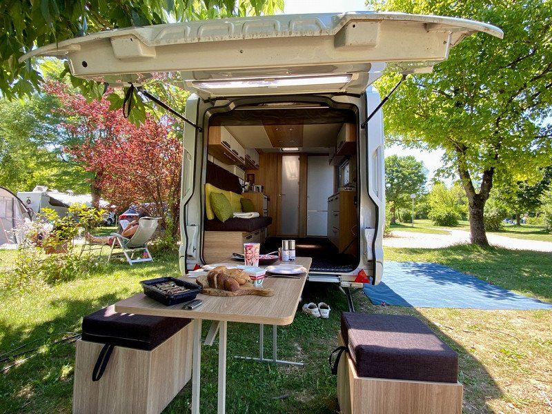
Camping de Strasbourg, Rue de l'Auberge de jeunesse, Straßburg, 25.06.22
06/25/22
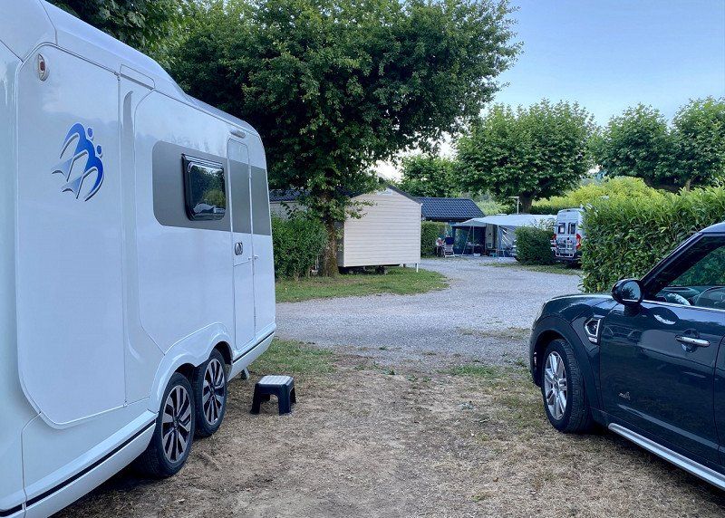
The campsite is located in the immediate vicinity of the Old Town Ring and is therefore ideal for visiting the city. The facility is located in a park-like area. The individual pitches are surrounded with plants. There is sufficient electricity nearby. Filling up with fresh water is a bit difficult. What is needed is an additional, space-saving container to transport the water from the washhouses to the parking space. The washhouses are quite okay. Distances: Shopping approx. 4km, old town approx. 4km, border with Germany approx. 10km
9 Rue de l'Auberge de jeunesse, 67200 Strasbourg, Frankreich
48° 34' 27.6" N 7° 43' 5.4" E
48.5743454 7.7181762
• Head northwest on Rue de l'Auberge de Jeunesse.
• Arrive at Rue de l'Auberge de Jeunesse. Your destination is on the right.
☍
Distance not available
(Duration not available)
Day
Camping de Strasbourg, Rue de l'Auberge de jeunesse, Straßburg, 26.06.22
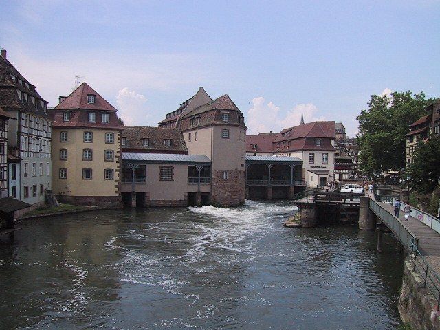
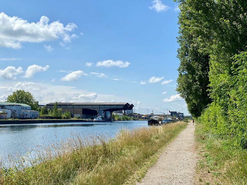
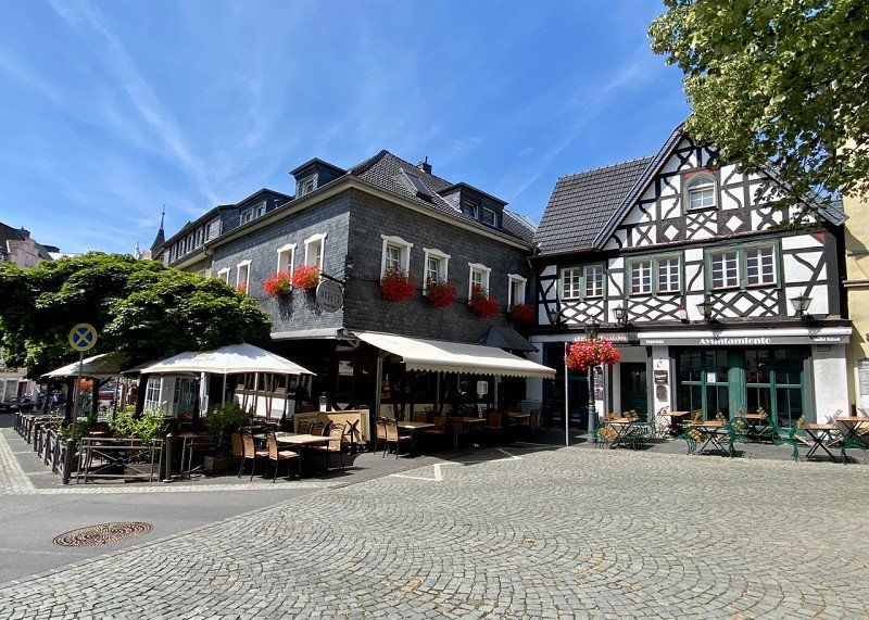
06/26/22 - Strolling through the city by bike on well-developed bike paths
9 Rue de l'Auberge de jeunesse, 67200 Strasbourg, Frankreich
48° 34' 27.6" N 7° 43' 5.4" E
48.5743454 7.7181762
• Head toward Piste François Faber on Rue de l'Auberge de Jeunesse. Go for 17 m.
• Continue on Rue de l'Auberge de Jeunesse. Go for 27 m.
• Turn left toward Rue de l'Auberge de Jeunesse. Go for 41 m.
• Turn right onto Rue de l'Auberge de Jeunesse. Go for 191 m.
• Turn left onto Route de Schirmeck (M392). Go for 554 m.
• Turn slightly right onto Route de Schirmeck (M392). Go for 287 m.
• Continue on Rue de Fouday. Go for 232 m.
• Continue on Rue de Saales. Go for 109 m.
• Turn right onto Boulevard de Lyon. Go for 138 m.
• Continue on Pont Louis Pasteur. Go for 177 m.
• Continue on Quai Louis Pasteur. Go for 350 m.
• Continue on Quai Menachem Taffel. Go for 535 m.
• Continue on Quai Fustel de Coulanges. Go for 273 m.
• Turn right onto Pont de la Bourse. Go for 268 m.
• Turn right onto Rue René Fontaine. Go for 64 m.
• Turn right onto Rue du Marksgarten. Go for 12 m.
• Turn left onto Rue du Marksgarten. Go for 33 m.
• Turn right. Go for 29 m.
• Arrive at your destination on the right.
☍
3,3 km
( 7 min.)
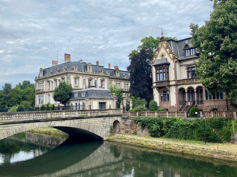
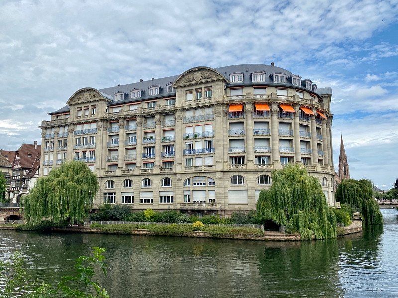
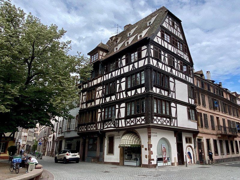
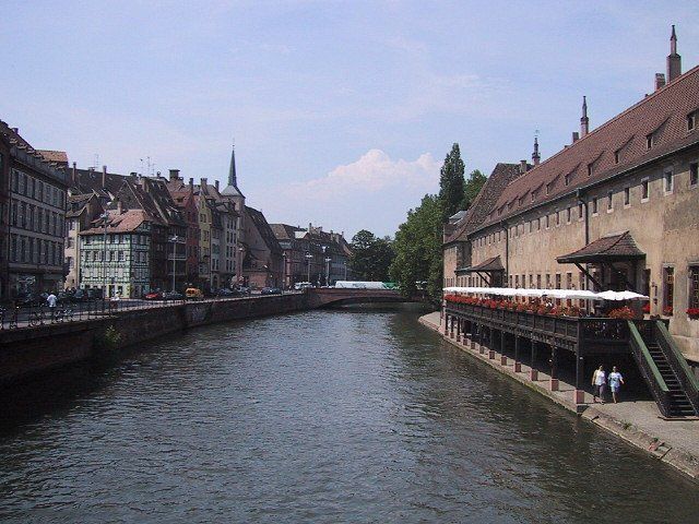
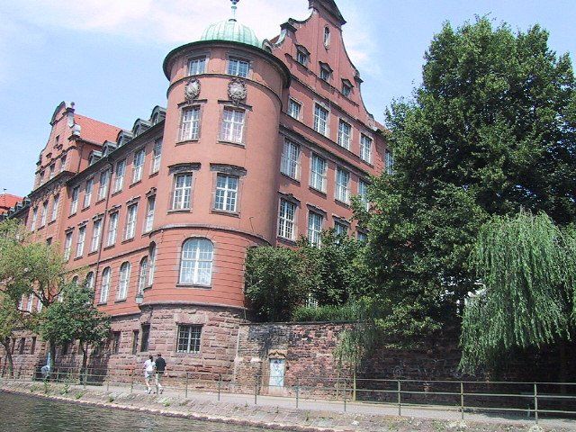
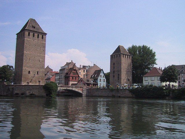
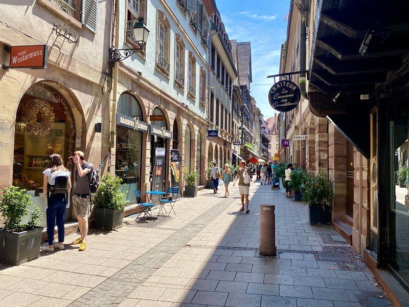
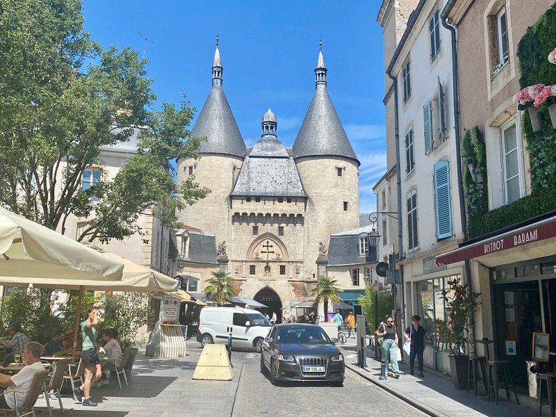
Strasbourg City
Straßburg, Frankreich
48° 34' 24.3" N 7° 45' 7.6" E
48.5734053 7.7521113
• Head toward Rue du Marksgarten. Go for 29 m.
• Turn right onto Rue du Marksgarten. Go for 244 m.
• Turn left onto Rue du Marksgarten. Go for 20 m.
• Turn right onto Route de l'Hôpital. Go for 96 m.
• Continue on Pont de la Porte de l'Hôpital. Go for 68 m.
• Turn right onto Quai Fustel de Coulanges. Go for 364 m.
• Continue on Quai du Général Koenig. Go for 59 m.
• Turn left onto Rue de Lausanne. Go for 304 m.
• Continue on Rue de l'Hôpital Militaire. Go for 161 m.
• Turn left onto Rue de Zurich. Go for 157 m.
• Continue on Rue de la Krutenau. Go for 118 m.
• Continue on Rue Munch. Go for 152 m.
• Continue on Quai des Pêcheurs. Go for 47 m.
• Turn left onto Quai des Pêcheurs. Go for 14 m.
• Turn right onto Quai des Pêcheurs. Go for 227 m.
• Continue on Quai du Maire Dietrich. Go for 190 m.
• Turn sharp left onto Pont d'Auvergne. Go for 145 m.
• Continue on Avenue de la Liberté. Go for 192 m.
• Turn left onto Rue André Malraux. Go for 108 m.
• Continue on Rue Joseph Massol. Go for 90 m.
• Continue on Pont de la Poste. Go for 11 m.
• Continue on Rue des Récollets. Go for 50 m.
• Continue on Rue du Parchemin. Go for 69 m.
• Continue on Rue des Juifs. Go for 257 m.
• Turn left onto Rue du Dôme. Go for 45 m.
• Arrive at Rue du Dôme. Your destination is on the right.
☍
3,2 km
( 9 min.)
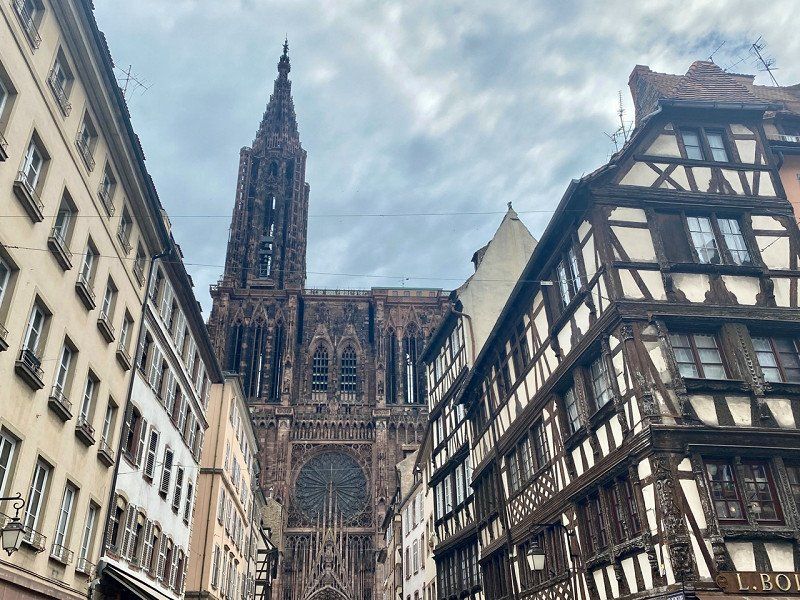
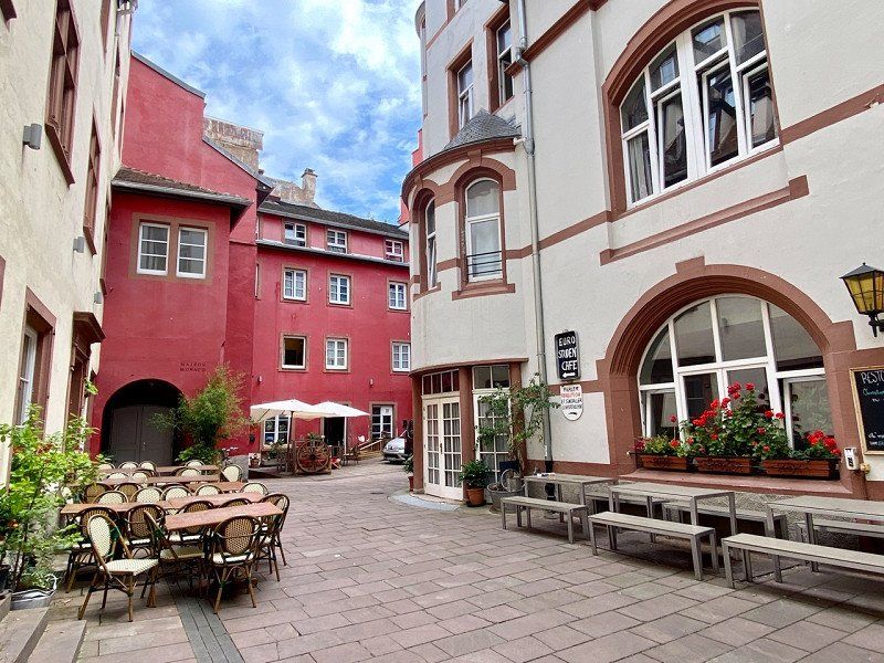
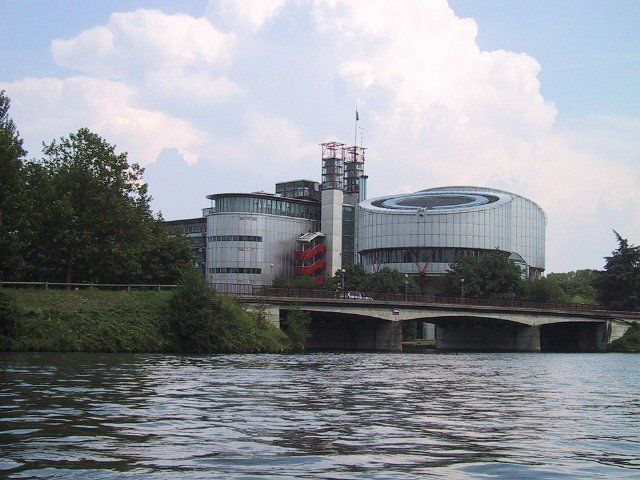
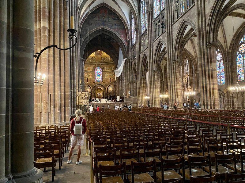
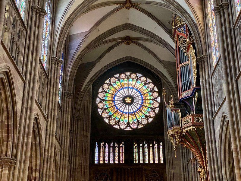
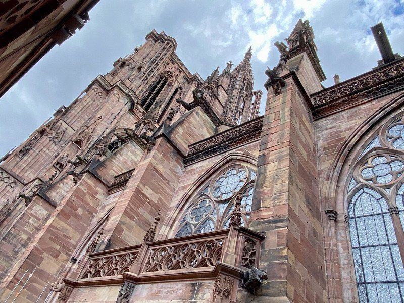
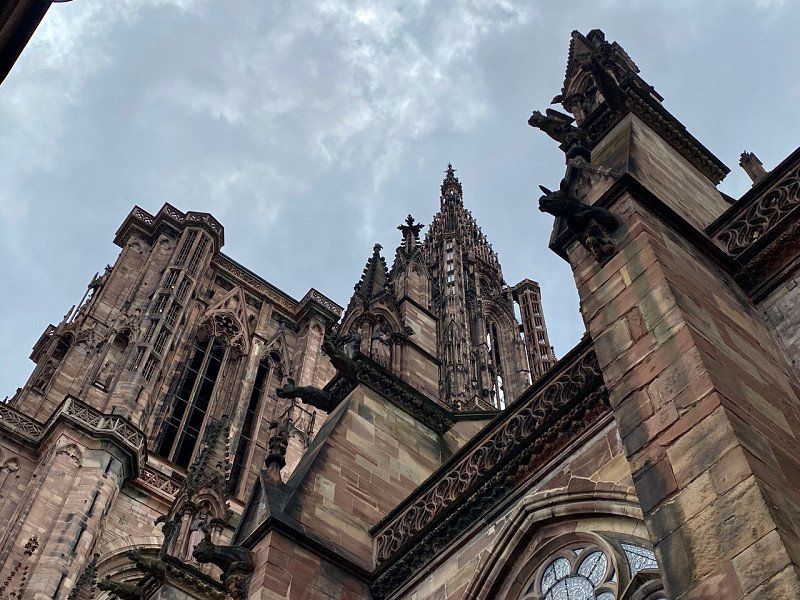
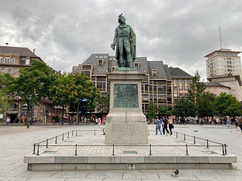
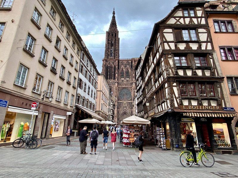
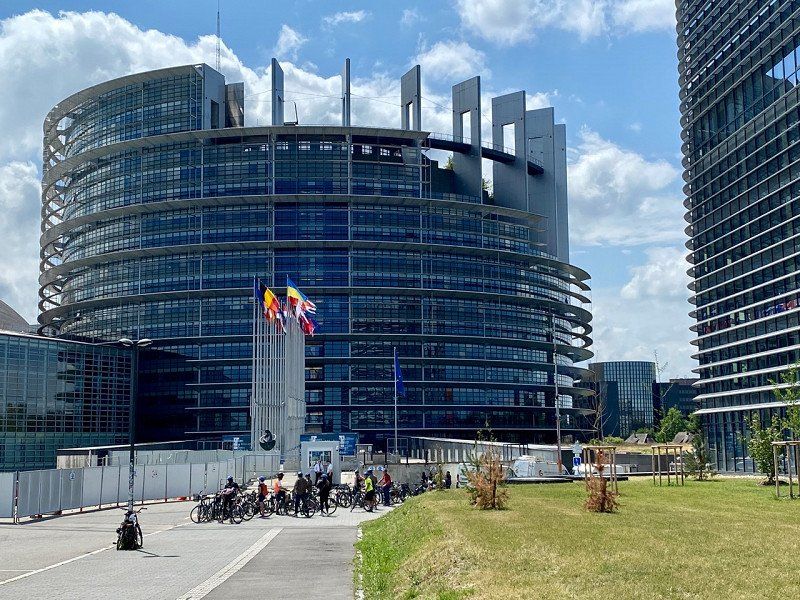
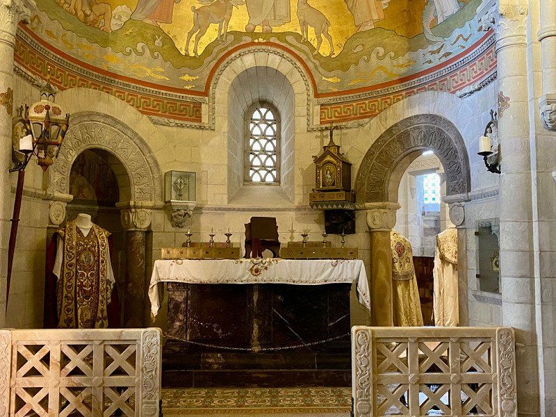
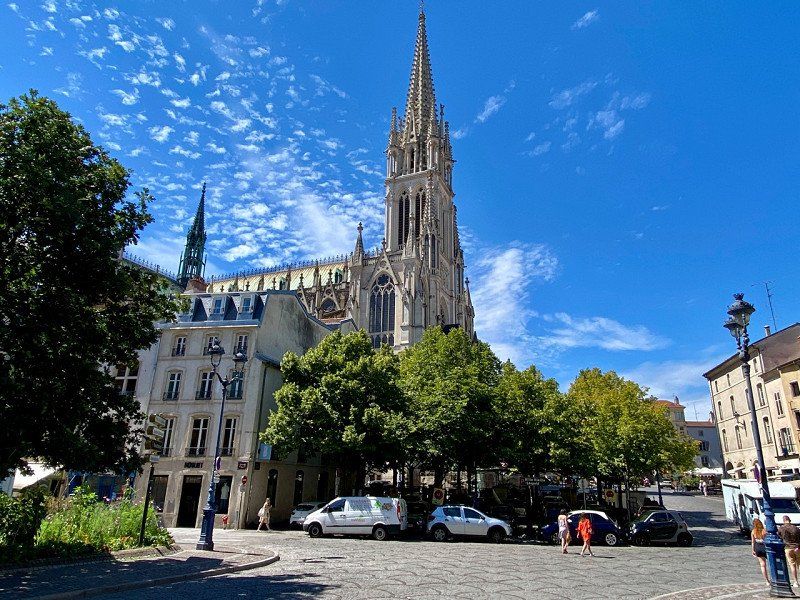
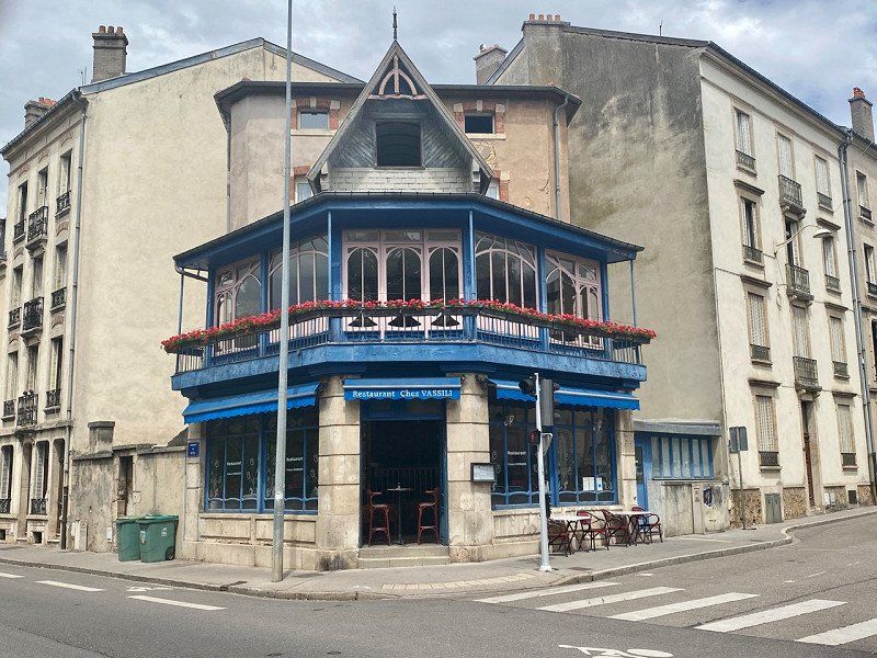
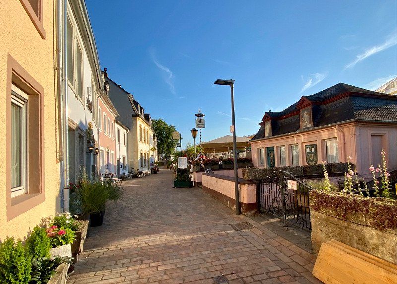
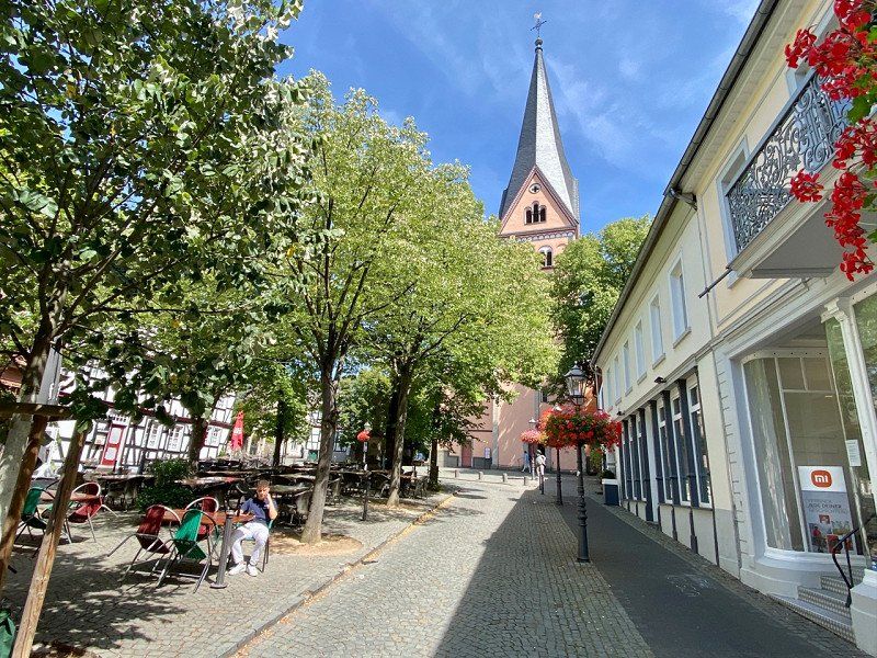
Straßburger Münster
Visit to the cathedral. Not that easy because the opening times are not consistent.
Pl. de la Cathédrale, 67000 Strasbourg, Frankreich
48° 34' 54.8" N 7° 45' 3.7" E
48.5818881 7.7510262
• Head southeast on Rue du Dôme.
• Turn left onto Rue des Frères. Go for 103 m.
• Turn right onto Rue des Écrivains. Go for 141 m.
• Turn left onto Rue des Veaux. Go for 208 m.
• Turn right onto Rue de la Pierre Large. Go for 53 m.
• Continue on Pont Saint-Guillaume. Go for 52 m.
• Turn right onto Quai des Bateliers. Go for 53 m.
• Continue on Rue de Zurich. Go for 210 m.
• Continue on Place de Zurich. Go for 35 m.
• Continue on Rue des Orphelins. Go for 231 m.
• Continue on Place d'Austerlitz. Go for 135 m.
• Continue on Rue Sengenwald. Go for 84 m.
• Turn left onto Rue de la 1ère Armée. Go for 260 m.
• Continue on Pont de la Bourse. Go for 268 m.
• Turn right onto Rue René Fontaine. Go for 64 m.
• Turn right onto Rue du Marksgarten. Go for 12 m.
• Turn left onto Rue du Marksgarten. Go for 33 m.
• Turn right. Go for 29 m.
• Arrive at your destination on the right.
☍
2,0 km
( 6 min.)
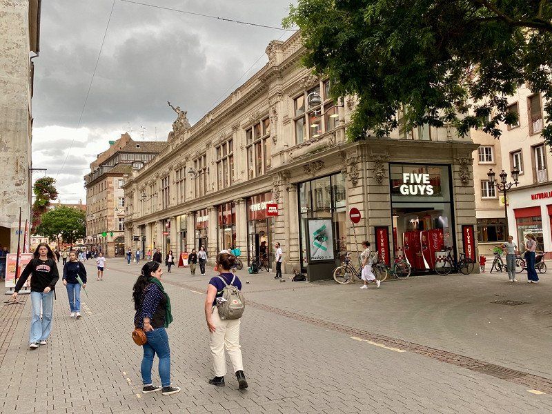
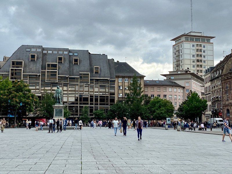
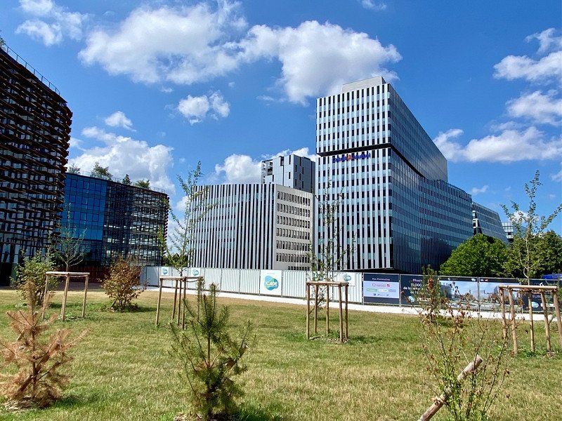
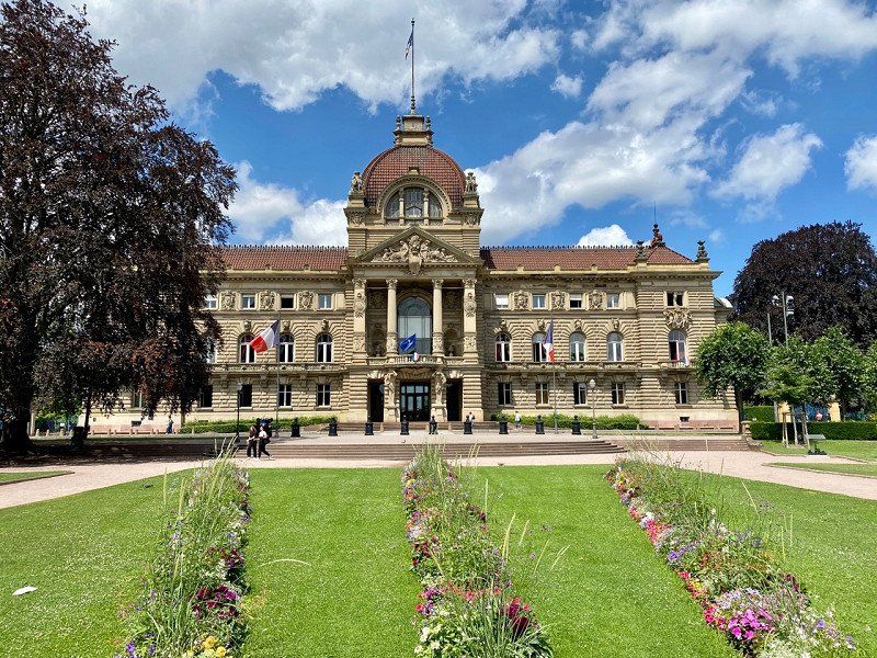
Strasbourg, Frankreich
Stroll through the city by bike
Straßburg, Frankreich
48° 34' 24.3" N 7° 45' 7.6" E
48.5734053 7.7521113
• Head toward Rue du Marksgarten. Go for 29 m.
• Turn right onto Rue du Marksgarten. Go for 244 m.
• Turn left onto Rue du Marksgarten. Go for 20 m.
• Turn left onto Route de l'Hôpital. Go for 66 m.
• Turn right onto Rue de la Corderie. Go for 927 m.
• Keep left onto Rue du Kuehlager. Go for 150 m.
• Turn right toward Rue du Kuehlager. Go for 27 m.
• Continue on Rue de la Montagne Verte. Go for 1.0 km.
• Continue on Pont de la Montagne Verte. Go for 99 m.
• Continue on Rue de la Tour Verte. Go for 259 m.
• Turn left onto Route de Schirmeck (M392) toward Lingolsheim/Ostwald/Montagne Verte. Go for 277 m.
• Turn right onto Rue de l'Auberge de Jeunesse. Go for 125 m.
• Arrive at Rue de l'Auberge de Jeunesse. Your destination is on the right.
☍
3,2 km
( 6 min.)
Camping de Strasbourg, Rue de l'Auberge de jeunesse, Straßburg, 26.06.22
9 Rue de l'Auberge de jeunesse, 67200 Strasbourg, Frankreich
48° 34' 27.6" N 7° 43' 5.4" E
48.5743454 7.7181762
• Head northwest on Rue de l'Auberge de Jeunesse.
• Arrive at Rue de l'Auberge de Jeunesse. Your destination is on the right.
☍
Distance not available
(Duration not available)
Day
Camping de Strasbourg, Rue de l'Auberge de jeunesse, Straßburg, 27.06.22
06/27/22
9 Rue de l'Auberge de jeunesse, 67200 Strasbourg, Frankreich
48° 34' 27.6" N 7° 43' 5.4" E
48.5743454 7.7181762
• Head toward Piste François Faber on Rue de l'Auberge de Jeunesse. Go for 17 m.
• Continue on Rue de l'Auberge de Jeunesse. Go for 27 m.
• Turn left toward Rue de l'Auberge de Jeunesse. Go for 41 m.
• Turn right onto Rue de l'Auberge de Jeunesse. Go for 191 m.
• Turn left onto Route de Schirmeck (M392). Go for 554 m.
• Turn slightly right onto Route de Schirmeck (M392). Go for 287 m.
• Continue on Rue de Fouday. Go for 232 m.
• Continue on Rue de Saales. Go for 109 m.
• Turn right onto Boulevard de Lyon. Go for 138 m.
• Continue on Pont Louis Pasteur. Go for 177 m.
• Continue on Quai Louis Pasteur. Go for 350 m.
• Continue on Quai Menachem Taffel. Go for 535 m.
• Continue on Quai Fustel de Coulanges. Go for 273 m.
• Turn right onto Pont de la Bourse. Go for 268 m.
• Turn right onto Rue René Fontaine. Go for 64 m.
• Turn right onto Rue du Marksgarten. Go for 12 m.
• Turn left onto Rue du Marksgarten. Go for 33 m.
• Turn right. Go for 29 m.
• Arrive at your destination on the right.
☍
3,3 km
( 7 min.)
Strasbourg, Frankreich
Stroll through the city by bike
Straßburg, Frankreich
48° 34' 24.3" N 7° 45' 7.6" E
48.5734053 7.7521113
• Head toward Rue du Marksgarten. Go for 29 m.
• Turn right onto Rue du Marksgarten. Go for 244 m.
• Turn left onto Rue du Marksgarten. Go for 20 m.
• Turn left onto Route de l'Hôpital. Go for 66 m.
• Turn right onto Rue de la Corderie. Go for 927 m.
• Keep left onto Rue du Kuehlager. Go for 150 m.
• Turn right toward Rue du Kuehlager. Go for 27 m.
• Continue on Rue de la Montagne Verte. Go for 1.0 km.
• Continue on Pont de la Montagne Verte. Go for 99 m.
• Continue on Rue de la Tour Verte. Go for 259 m.
• Turn left onto Route de Schirmeck (M392) toward Lingolsheim/Ostwald/Montagne Verte. Go for 277 m.
• Turn right onto Rue de l'Auberge de Jeunesse. Go for 125 m.
• Arrive at Rue de l'Auberge de Jeunesse. Your destination is on the right.
☍
3,2 km
( 7 min.)
Day
Camping de Strasbourg, Rue de l'Auberge de jeunesse, Straßburg, 28.06.22
9 Rue de l'Auberge de jeunesse, 67200 Strasbourg, Frankreich
48° 34' 27.6" N 7° 43' 5.4" E
48.5743454 7.7181762
• Head toward Piste François Faber on Rue de l'Auberge de Jeunesse. Go for 17 m.
• Continue on Rue de l'Auberge de Jeunesse. Go for 27 m.
• Turn left toward Rue de l'Auberge de Jeunesse. Go for 41 m.
• Turn right onto Rue de l'Auberge de Jeunesse. Go for 191 m.
• Turn left onto Route de Schirmeck (M392). Go for 554 m.
• Turn slightly right onto Route de Schirmeck (M392). Go for 287 m.
• Continue on Rue de Fouday. Go for 232 m.
• Continue on Rue de Saales. Go for 109 m.
• Turn right onto Boulevard de Lyon. Go for 138 m.
• Continue on Pont Louis Pasteur. Go for 177 m.
• Continue on Quai Louis Pasteur. Go for 350 m.
• Continue on Quai Menachem Taffel. Go for 535 m.
• Continue on Quai Fustel de Coulanges. Go for 273 m.
• Turn right onto Pont de la Bourse. Go for 268 m.
• Turn right onto Rue René Fontaine. Go for 64 m.
• Turn right onto Rue du Marksgarten. Go for 12 m.
• Turn left onto Rue du Marksgarten. Go for 33 m.
• Turn right. Go for 29 m.
• Arrive at your destination on the right.
☍
3,3 km
( 8 min.)
Strasbourg, Frankreich
Stroll through the city by bike
Straßburg, Frankreich
48° 34' 24.3" N 7° 45' 7.6" E
48.5734053 7.7521113
• Head toward Rue du Marksgarten. Go for 29 m.
• Turn right onto Rue du Marksgarten. Go for 244 m.
• Turn left onto Rue du Marksgarten. Go for 20 m.
• Turn left onto Route de l'Hôpital. Go for 66 m.
• Turn right onto Rue de la Corderie. Go for 927 m.
• Keep left onto Rue du Kuehlager. Go for 150 m.
• Turn right toward Rue du Kuehlager. Go for 27 m.
• Continue on Rue de la Montagne Verte. Go for 1.0 km.
• Continue on Pont de la Montagne Verte. Go for 99 m.
• Continue on Rue de la Tour Verte. Go for 259 m.
• Turn left onto Route de Schirmeck (M392) toward Lingolsheim/Ostwald/Montagne Verte. Go for 277 m.
• Turn right onto Rue de l'Auberge de Jeunesse. Go for 125 m.
• Arrive at Rue de l'Auberge de Jeunesse. Your destination is on the right.
☍
3,2 km
( 7 min.)
Camping de Strasbourg, Rue de l'Auberge de jeunesse, Straßburg, 28.06.22
06/28/22
9 Rue de l'Auberge de jeunesse, 67200 Strasbourg, Frankreich
48° 34' 27.6" N 7° 43' 5.4" E
48.5743454 7.7181762
• Head northwest on Rue de l'Auberge de Jeunesse.
• Arrive at Rue de l'Auberge de Jeunesse. Your destination is on the right.
☍
Distance not available
(Duration not available)
Day
Camping de Strasbourg, Rue de l'Auberge de jeunesse, Straßburg, 29.06.22
06/29/22
9 Rue de l'Auberge de jeunesse, 67200 Strasbourg, Frankreich
48° 34' 27.6" N 7° 43' 5.4" E
48.5743454 7.7181762
• Head toward Piste François Faber on Rue de l'Auberge de Jeunesse. Go for 17 m.
• Continue on Rue de l'Auberge de Jeunesse. Go for 27 m.
• Turn left toward Rue de l'Auberge de Jeunesse. Go for 41 m.
• Turn right onto Rue de l'Auberge de Jeunesse. Go for 191 m.
• Turn left onto Route de Schirmeck (M392). Go for 259 m.
• Turn right onto Rue de la Tour Verte toward A35/Colmar/Kehl/Elsau/Meinau. Go for 261 m.
• Continue on Rue de la Montagne Verte. Go for 99 m.
• Continue on Rue de la Montagne Verte. Go for 265 m.
• Turn left and take ramp onto A35 toward Mulhouse/Colmar/Illkirch-Graff. Go for 14.1 km.
• Take the exit toward Mulhouse/Colmar/Obernai onto A35. Go for 40.7 km.
• Continue on D83. Go for 10.7 km.
• Keep left onto A35. Go for 38.5 km.
• Take the exit toward Aéroport/Basel (Bâle)/Lörrach/A36 onto A35. Go for 27.6 km.
• Continue on A3. Go for 16.0 km.
• Keep right onto A2 (Verzweigung Augst) toward Chiasso/Gotthard/Luzern/Bern/Arisdorf. Go for 27.2 km.
• Take exit 14 toward Olten/5/Egerkingen onto Expressstrasse. Go for 589 m.
• Take the 2nd exit from roundabout onto Oltnerstrasse (5) toward Solothurn. Go for 656 m.
• Pass 2 roundabouts and continue on Hauptstrasse (5). Go for 7.1 km.
• Turn left onto Solothurnstrasse (5/12). Go for 251 m.
• Turn right and take ramp toward Zürich/Luzern/Basel/Bern/Biel. Go for 887 m.
• Continue on Oensingen. Go for 110 m.
• Take ramp onto A1 toward Bern/Biel/Solothurn. Go for 43.5 km.
• Take the exit toward Lausanne/Fribourg/Neuchâtel/Bern-Neufeld onto A1 (Wankdorf). Go for 99.8 km.
• Continue on A1. Go for 2.7 km.
• Take the exit toward Genève onto A1. Go for 65.2 km.
• Continue on A41. Go for 31.9 km.
• Take exit 16 toward Albertville/Cran-Gevrier onto D3508. Go for 1.6 km.
• Keep left onto D3508 toward Aix-les-Bains/Chambéry/Seynod/Z.I. de Vovray. Go for 688 m.
• Keep left onto D3508 toward Z.I. de Vouvray/Le Lac/Le Semnoz. Go for 189 m.
• Take the 3rd exit from Rond-Point de la Croisée roundabout onto Avenue du Pont-Neuf (D1201) toward Annecy-Centre/Albertville. Go for 699 m.
• Take the 1st exit from roundabout onto Avenue du Rhône (D5) toward Albertville/Le Château/Le Lac/Le Semnoz. Go for 304 m.
• Continue on Avenue Lucien Boschetti toward Albertville/Le Lac/Z.I. de Vovrey. Go for 207 m.
• Take the 2nd exit from roundabout onto Avenue du Crêt du Maure toward Albertville/Le Château/Le Lac. Go for 442 m.
• Take the 1st exit from Place du Paradis roundabout onto Boulevard de la Corniche toward Albertville/Le Lac. Go for 247 m.
• Take the 2nd exit from roundabout onto Avenue du Tresum toward Albertville/Le Lac/Vieille Ville/Les Marquisats. Go for 422 m.
• Take the 1st exit from roundabout onto Rue des Marquisats (D1508) toward Albertville/Faverges/Sevrier. Go for 4.3 km.
• Take the 2nd exit from roundabout onto Route d'Albertville (D1508). Go for 1.4 km.
• Turn left onto Route des Grands Prés (C3). Go for 328 m.
• Turn right onto Route des Mongets. Go for 63 m.
• Turn right onto Chemin des Communaux. Go for 351 m.
• Turn left. Go for 73 m.
• Arrive at your destination on the right.
☍
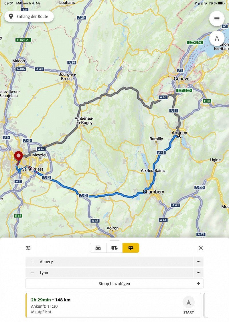
439,8 km
(4 hrs. 40 min.)
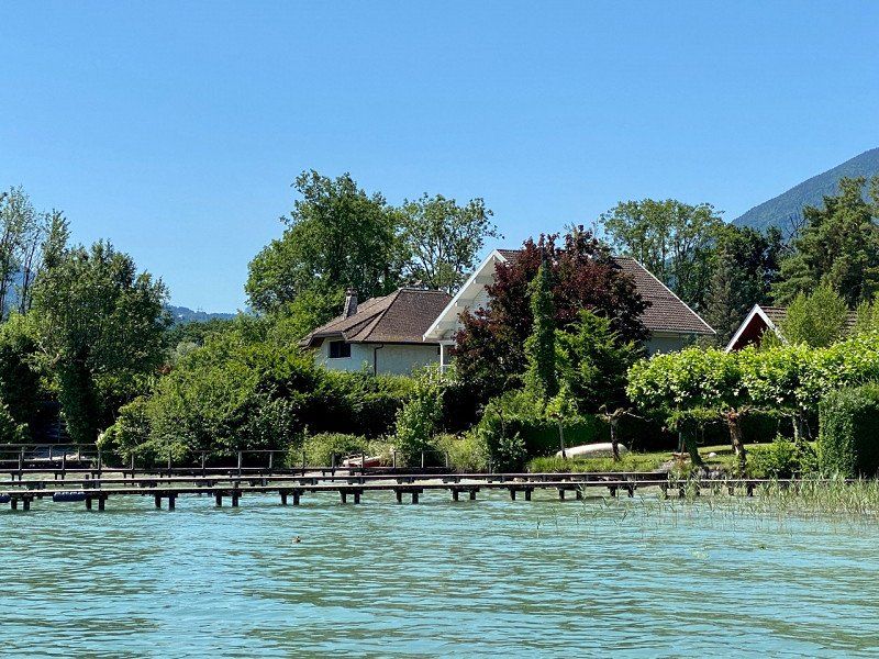
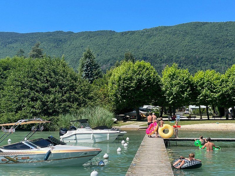
Camping Les Rives du Lac, Chemin des Communaux, Sévrier, 29.06.22
06/29/22 Lac Annecy
331 Chem. des Communaux, 74320 Sévrier, Frankreich
45° 50' 55.5" N 6° 9' 4.2" E
45.8487559 6.1511735
• Head northwest.
• Arrive at your destination on the right.
☍
Distance not available
(Duration not available)
Day
Camping Les Rives du Lac, Chemin des Communaux, Sévrier, 30.06.22
06/30/22
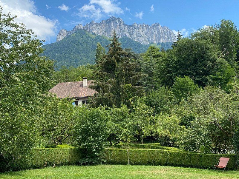
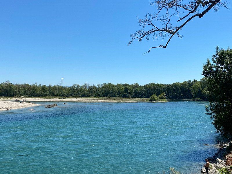
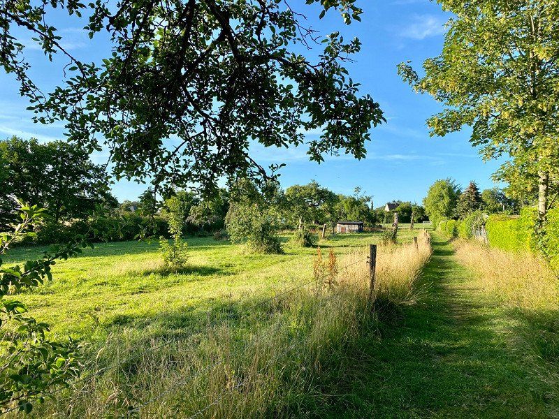
The campsite is located about 7km from Annecy, directly on Lac Annecy. The access is a bit narrow, but definitely manageable. There is no restaurant on the campsite. However, you can shop at a supermarket nearby. Electricity is available directly at the pitch, water must be fetched from the supply points (portable canister required). The complex has quite narrow paths, which could make arriving and departing during rush hour a bit difficult. A chicken roaster comes several times a week and offers the poultry at reasonable prices (otherwise there are pre-cooked potatoes). The cycle path, which allows you to travel safely to Annecy, is praiseworthy.
331 Chem. des Communaux, 74320 Sévrier, Frankreich
45° 50' 55.5" N 6° 9' 4.2" E
45.8487559 6.1511735
• Head toward Chemin des Communaux. Go for 73 m.
• Turn right onto Chemin des Communaux. Go for 173 m.
• Turn left onto Chemin du Lanfonnet. Go for 197 m.
• Turn right onto Chemin du Brouillet. Go for 169 m.
• Turn left onto Route des Grands Prés (C3). Go for 213 m.
• Turn right onto Route d'Albertville (D1508). Go for 1.4 km.
• Pass 2 roundabouts and continue on Rue des Marquisats (D1508). Go for 4.8 km.
• Turn right onto Esplanade de l'Hôtel de Ville. Go for 157 m.
• Turn right. Go for 16 m.
• Arrive at your destination on the right.
☍
7,1 km
( 13 min.)
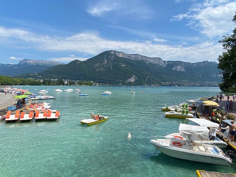
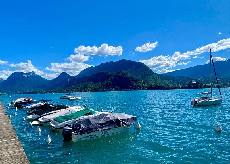
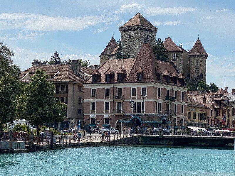
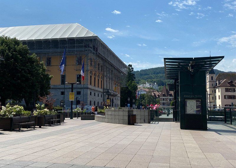
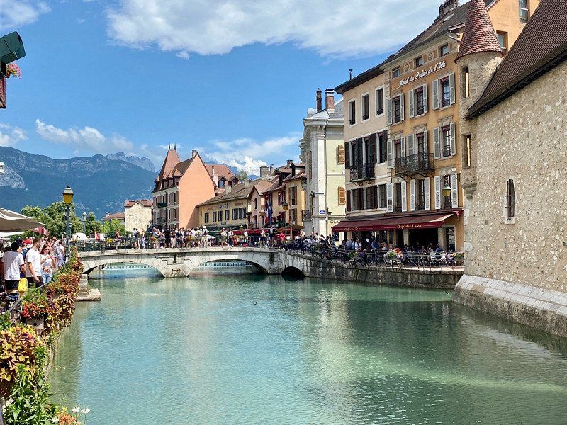
Annecy, Frankreich
Stroll through the city by bike
45° 53' 56.7" N 6° 7' 46.3" E
45.8990887 6.1295411
• Head east. Go for 16 m.
• Turn left onto Esplanade de l'Hôtel de Ville. Go for 157 m.
• Turn left onto Quai Eustache Chappuis (D1508). Go for 418 m.
• Pass 2 roundabouts and continue on Route d'Albertville (D1508). Go for 5.7 km.
• Turn left onto Route des Grands Prés (C3). Go for 328 m.
• Turn right onto Route des Mongets. Go for 63 m.
• Turn right onto Chemin des Communaux. Go for 351 m.
• Turn left. Go for 73 m.
• Arrive at your destination on the right.
☍
7,1 km
( 14 min.)
Camping Les Rives du Lac, Chemin des Communaux, Sévrier, Frankreich
331 Chem. des Communaux, 74320 Sévrier, Frankreich
45° 50' 55.5" N 6° 9' 4.2" E
45.8487559 6.1511735
• Head northwest.
• Arrive at your destination on the right.
☍
Distance not available
(Duration not available)
Day
Camping Les Rives du Lac, Chemin des Communaux, Sévrier, 01.07.22
07/01/22
331 Chem. des Communaux, 74320 Sévrier, Frankreich
45° 50' 55.5" N 6° 9' 4.2" E
45.8487559 6.1511735
• Head toward Chemin des Communaux. Go for 73 m.
• Turn right onto Chemin des Communaux. Go for 173 m.
• Turn left onto Chemin du Lanfonnet. Go for 197 m.
• Turn left onto Chemin du Brouillet. Go for 286 m.
• Turn left onto Route d'Albertville (D1508). Go for 151 m.
• Pass 8 roundabouts and continue on D1508. Go for 15.8 km.
• Take the 3rd exit from roundabout onto D1508 toward A430/Albertville/Ugine/Zone Industrielle de Faverges/Zone Artisanale de St Ferréol. Go for 3.1 km.
• Pass 6 roundabouts and continue on Route d'Annecy (D1508). Go for 9.4 km.
• Take the 1st exit from roundabout onto Route d'Annecy (D1508) toward Albertville/Megève. Go for 485 m.
• Take the 2nd exit from roundabout onto Avenue Jean-Marie Meunier (D1212) toward A430/Albertville/Tarentaise. Go for 486 m.
• Pass 2 roundabouts and continue on Route d'Ugine. Go for 7.8 km.
• Continue on Cours de l'Hôtel de Ville. Go for 93 m.
• Turn right onto Place de l'Hôtel de Ville. Go for 28 m.
• Arrive at Place de l'Hôtel de Ville. Your destination is on the right.
☍
38,0 km
( 42 min.)
Albertville, Frankreich
73200 Albertville, Frankreich
45° 40' 31.9" N 6° 23' 33.8" E
45.6755350 6.3927260
• Head toward Cours de l'Hôtel de Ville on Place de l'Hôtel de Ville. Go for 46 m.
• Turn right onto Cours de l'Hôtel de Ville. Go for 220 m.
• Turn right onto Rue Félix Chautemps. Go for 179 m.
• Take the 2nd exit from roundabout onto Rue Félix Chautemps. Go for 590 m.
• Turn left onto Rue Suarez (D63). Go for 675 m.
• Turn slightly right onto Route de Perthuis (D63). Go for 439 m.
• Continue on Chemin du Villard (D63). Go for 440 m.
• Continue on Route du Chenola (D63). Go for 488 m.
• Turn right onto Route du Chenola (D63). Go for 27 m.
• Turn left onto Route de la Poyat (D104 A). Go for 724 m.
• Continue on Route de la Dent de Cons (D104 A). Go for 994 m.
• Turn left onto Route du Roc Rouge (D104). Go for 2.0 km.
• Turn right onto Route du Collet de Tamie (D104). Go for 6.2 km.
• Turn right onto Route de Tamié (D201 C). Go for 5.7 km.
• Turn left onto Route de la Sambuy (D112). Go for 775 m.
• Turn right onto Route de la Sambuy (D112). Go for 232 m.
• Turn right onto Place de la De la Mairie à l'Église. Go for 57 m.
• Arrive at Place de la De la Mairie à l'Église. Your destination is on the right.
☍
19,8 km
( 30 min.)
Seythenex, Faverges, Frankreich
Seythenex Caves - Worth a visit
Seythenex, 74210 Faverges, Frankreich
45° 43' 34.5" N 6° 17' 58.8" E
45.7262380 6.2996530
• Head north on Place de la De la Mairie à l'Église. Go for 10 m.
• Turn right onto Route des Grottes. Go for 1.1 km.
• Turn slightly right onto Route des Grottes. Go for 852 m.
• Continue on Route du Villaret. Go for 671 m.
• Turn left onto Route de Tamié (D12). Go for 825 m.
• Turn right onto Rue Carnot. Go for 108 m.
• Turn left onto Rue Gambetta (D12). Go for 499 m.
• Continue on Rue des Usines. Go for 117 m.
• Continue on Route de Thônes (D12). Go for 336 m.
• Take the 2nd exit from Lieu-dit Le Port es Gerbes roundabout onto Route de Thônes (D12). Go for 271 m.
• Take the 1st exit from Lieu-dit Le Port es Gerbes roundabout onto D1508. Go for 2.2 km.
• Take the 2nd exit from roundabout onto D1508 toward Annecy/Doussard. Go for 1.4 km.
• Pass 8 roundabouts and continue on Route d'Albertville (D1508). Go for 14.5 km.
• Turn right onto Chemin du Brouillet. Go for 286 m.
• Turn right onto Chemin du Lanfonnet. Go for 197 m.
• Turn right onto Chemin des Communaux. Go for 173 m.
• Turn left. Go for 73 m.
• Arrive at your destination on the right.
☍
23,7 km
( 34 min.)
Camping Les Rives du Lac, Chemin des Communaux, Sévrier, Frankreich
331 Chem. des Communaux, 74320 Sévrier, Frankreich
45° 50' 55.5" N 6° 9' 4.2" E
45.8487559 6.1511735
• Head northwest.
• Arrive at your destination on the right.
☍
Distance not available
(Duration not available)
Day
Camping Les Rives du Lac, Chemin des Communaux, Sévrier, 02.07.22
07/02/22
331 Chem. des Communaux, 74320 Sévrier, Frankreich
45° 50' 55.5" N 6° 9' 4.2" E
45.8487559 6.1511735
• Head toward Chemin des Communaux. Go for 73 m.
• Turn right onto Chemin des Communaux. Go for 173 m.
• Turn left onto Chemin du Lanfonnet. Go for 197 m.
• Turn right onto Chemin du Brouillet. Go for 169 m.
• Turn left onto Route des Grands Prés (C3). Go for 213 m.
• Turn right onto Route d'Albertville (D1508). Go for 1.4 km.
• Pass 2 roundabouts and continue on Rue des Marquisats (D1508). Go for 4.9 km.
• Turn right onto Pont Albert Lebrun (D909). Go for 2.3 km.
• Pass 4 roundabouts and continue on Rue de la Tournette (D909). Go for 3.6 km.
• Take the 2nd exit from roundabout onto Route de Menthon. Go for 59 m.
• Continue on Route de Thônes (D909). Go for 6.5 km.
• Take the 2nd exit from roundabout onto Route de Thônes (D909). Go for 1.4 km.
• Take the 1st exit from roundabout. Go for 100 m.
• Continue on D909. Go for 4.4 km.
• Take the 2nd exit from roundabout onto Avenue d'Annecy (D909). Go for 1.4 km.
• Take the 3rd exit from roundabout onto Route d'Annecy (D909). Go for 538 m.
• Take the 2nd exit from roundabout onto Route des Aravis (D909). Go for 464 m.
• Pass 2 roundabouts and continue on Route des Aravis (D909). Go for 8.1 km.
• Take the 3rd exit from Rond-Point des Aravis roundabout onto Route du Grand-Bornand (D12). Go for 917 m.
• Continue on Route du Grand-Bornand (D4). Go for 1.6 km.
• Pass 2 roundabouts and continue on Route du Chinaillon (D4). Go for 12.0 km.
• Arrive at Route de la Colombière (D4). Your destination is on the right.
☍
50,5 km
(1 hrs. 11 min.)
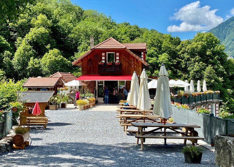
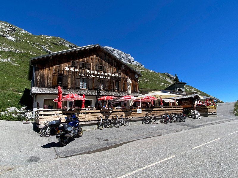
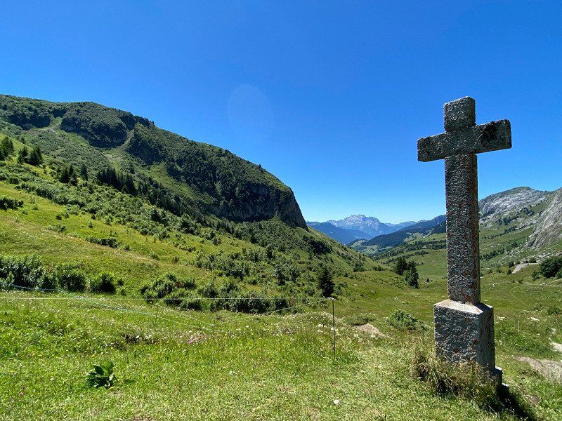
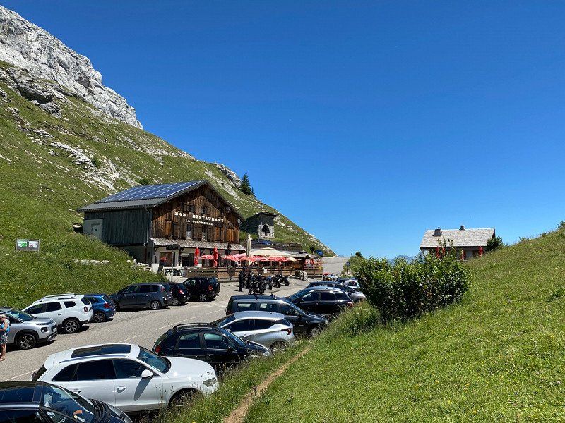
Col de la Colombière, Le Reposoir, Frankreich
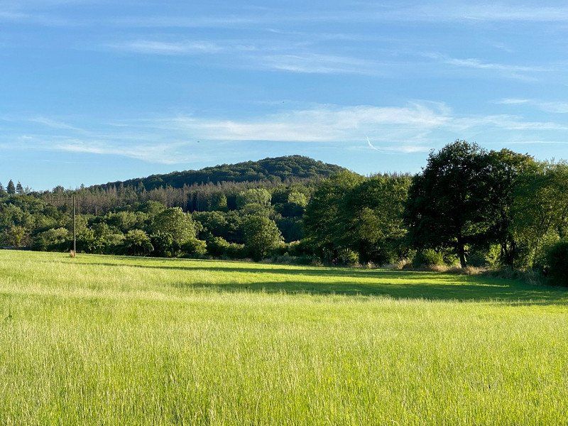
Ascent to the Col de Colombiere (but by car) and on to Chamonix
Col de la Colombière, 74950 Le Reposoir, Frankreich
45° 59' 31.8" N 6° 28' 31.8" E
45.9921650 6.4755030
• Head toward Route d'Auferrand on Route de la Colombière (D4). Go for 17.3 km.
• Pass 2 roundabouts and continue on Avenue du Mont Blanc (D4). Go for 950 m.
• Take the 1st exit from Rond-Point du Mont-Blanc roundabout onto Avenue Louis Rouxel (D1205) toward Chamonix-Mt Blanc/Les Carroz/Flaine/Magland/Sallanches/A40. Go for 682 m.
• Pass 2 roundabouts and continue on Route de Chamonix (D1205). Go for 1.5 km.
• Take the 2nd exit from roundabout toward A40/Annecy/Genève/Chamonix-Mt-Blanc. Go for 171 m.
• Take left ramp toward Chamonix-Mt Blanc. Go for 780 m.
• Continue on A40 (Autoroute Blanche). Go for 19.5 km.
• Continue on N205. Go for 16.1 km.
• Take the 3rd exit from roundabout onto Route Blanche (D1506) toward Chamonix/Mt Blanc/Martigny. Go for 1.2 km.
• Take the 3rd exit from Carrefour du Grépon roundabout onto Avenue de Courmayeur. Go for 186 m.
• Pass 2 roundabouts and continue on Avenue de Courmayeur. Go for 318 m.
• Take the 1st exit from Rond-Point Lionel Terray roundabout onto Allée Recteur Payot. Go for 538 m.
• Take the 1st exit from Rond-Point de la Mollard roundabout onto Allée Recteur Payot. Go for 147 m.
• Turn right onto Impasse de l'Androsace. Go for 101 m.
• Arrive at Impasse de l'Androsace. Your destination is on the right.
☍
59,5 km
( 54 min.)
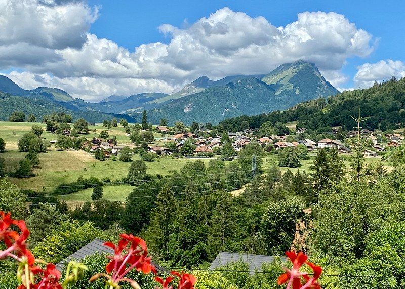
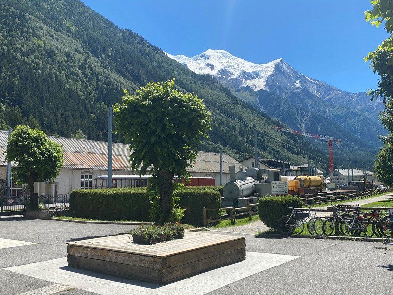
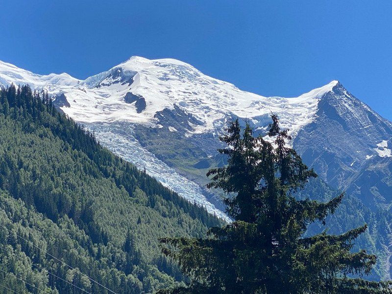
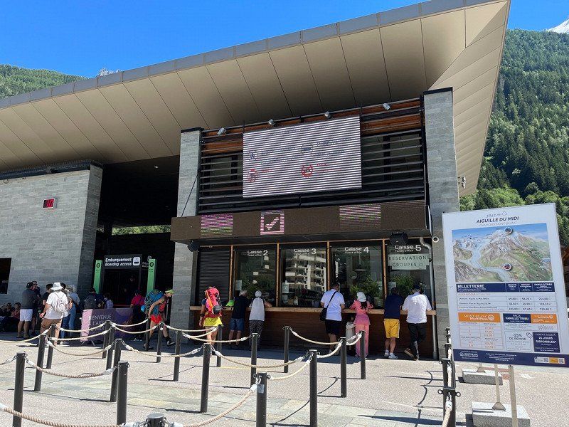
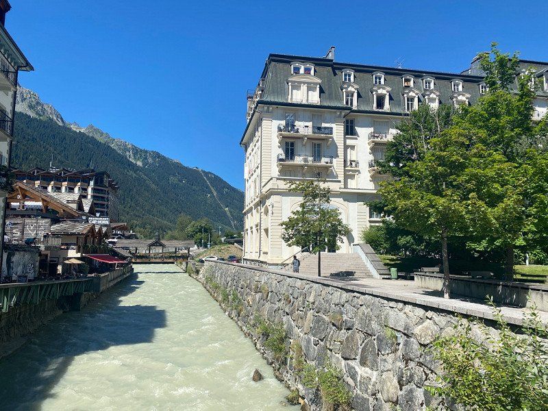
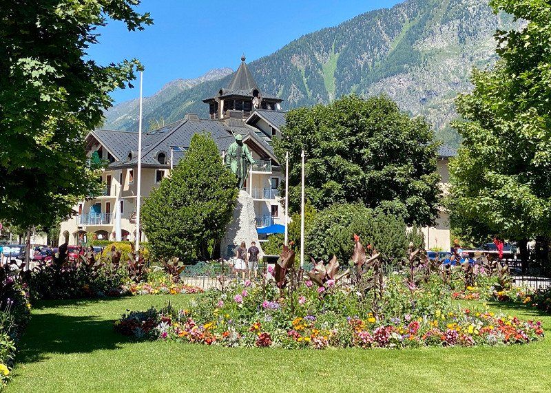
Chamonix, Frankreich
View of the Mont Blanc massif
Chamonix-Mont-Blanc, Frankreich
45° 55' 25.3" N 6° 52' 10" E
45.9236970 6.8694330
• Head toward Allée Recteur Payot on Impasse de l'Androsace. Go for 101 m.
• Turn left onto Allée Recteur Payot. Go for 118 m.
• Take the 2nd exit from Rond-Point de la Mollard roundabout onto Allée Recteur Payot. Go for 554 m.
• Take the 2nd exit from Rond-Point Lionel Terray roundabout onto Avenue de Courmayeur. Go for 214 m.
• Pass 2 roundabouts and continue on Avenue de Courmayeur. Go for 244 m.
• Take the 1st exit from Carrefour du Grépon roundabout onto Route Blanche (D1506). Go for 1.2 km.
• Take the 2nd exit from roundabout onto Route Blanche toward D1205/A40/Lyon/Annecy/Genève/Albertville/Les Houches/Les Bossons. Go for 16.3 km.
• Keep left onto A40 (Autoroute Blanche) toward Paris/Lyon/Annecy/Genève/Passy-Centre. Go for 43.7 km.
• Take the exit toward Lyon Par Annecy/Grenoble/Annecy onto A410. Go for 26.4 km.
• Continue on A41. Go for 11.4 km.
• Take exit 16 toward Albertville/Cran-Gevrier onto D3508. Go for 1.6 km.
• Keep left onto D3508 toward Aix-les-Bains/Chambéry/Seynod/Z.I. de Vovray. Go for 688 m.
• Keep left onto D3508 toward Z.I. de Vouvray/Le Lac/Le Semnoz. Go for 189 m.
• Take the 3rd exit from Rond-Point de la Croisée roundabout onto Avenue du Pont-Neuf (D1201) toward Annecy-Centre/Albertville. Go for 699 m.
• Take the 1st exit from roundabout onto Avenue du Rhône (D5) toward Albertville/Le Château/Le Lac/Le Semnoz. Go for 304 m.
• Continue on Avenue Lucien Boschetti toward Albertville/Le Lac/Z.I. de Vovrey. Go for 207 m.
• Take the 2nd exit from roundabout onto Avenue du Crêt du Maure toward Albertville/Le Château/Le Lac. Go for 442 m.
• Take the 1st exit from Place du Paradis roundabout onto Boulevard de la Corniche toward Albertville/Le Lac. Go for 247 m.
• Take the 2nd exit from roundabout onto Avenue du Tresum toward Albertville/Le Lac/Vieille Ville/Les Marquisats. Go for 422 m.
• Take the 1st exit from roundabout onto Rue des Marquisats (D1508) toward Albertville/Faverges/Sevrier. Go for 4.3 km.
• Take the 2nd exit from roundabout onto Route d'Albertville (D1508). Go for 1.4 km.
• Turn left onto Route des Grands Prés (C3). Go for 328 m.
• Turn right onto Route des Mongets. Go for 63 m.
• Turn right onto Chemin des Communaux. Go for 351 m.
• Turn left. Go for 73 m.
• Arrive at your destination on the right.
☍
111,6 km
(1 hrs. 18 min.)
Camping Les Rives du Lac, Chemin des Communaux, Sévrier, Frankreich
331 Chem. des Communaux, 74320 Sévrier, Frankreich
45° 50' 55.5" N 6° 9' 4.2" E
45.8487559 6.1511735
• Head northwest.
• Arrive at your destination on the right.
☍
Distance not available
(Duration not available)
Day
Camping Les Rives du Lac, Chemin des Communaux, Sévrier, 03.07.22
07/03/22
331 Chem. des Communaux, 74320 Sévrier, Frankreich
45° 50' 55.5" N 6° 9' 4.2" E
45.8487559 6.1511735
• Head northwest.
• Arrive at your destination on the right.
☍
Distance not available
(Duration not available)
Camping Les Rives du Lac, Chemin des Communaux, Sévrier, Frankreich
331 Chem. des Communaux, 74320 Sévrier, Frankreich
45° 50' 55.5" N 6° 9' 4.2" E
45.8487559 6.1511735
• Head northwest.
• Arrive at your destination on the right.
☍
Distance not available
(Duration not available)
Day
Camping Les Rives du Lac, Chemin des Communaux, Sévrier, 04.07.22
07/04/22
331 Chem. des Communaux, 74320 Sévrier, Frankreich
45° 50' 55.5" N 6° 9' 4.2" E
45.8487559 6.1511735
• Head toward Chemin des Communaux. Go for 73 m.
• Turn right onto Chemin des Communaux. Go for 173 m.
• Turn left onto Chemin du Lanfonnet. Go for 197 m.
• Turn right onto Chemin du Brouillet. Go for 169 m.
• Turn left onto Route des Grands Prés (C3). Go for 213 m.
• Turn right onto Route d'Albertville (D1508). Go for 1.4 km.
• Pass 2 roundabouts and continue on Rue des Marquisats (D1508). Go for 4.9 km.
• Turn right onto Pont Albert Lebrun (D909). Go for 2.3 km.
• Pass 4 roundabouts and continue on Rue de la Tournette (D909). Go for 3.6 km.
• Take the 1st exit from roundabout onto Route de Menthon (D909 A). Go for 2.5 km.
• Turn right onto Allée Hippolyte Taine. Go for 48 m.
• Arrive at Allée Hippolyte Taine. Your destination is on the left.
☍
15,6 km
( 27 min.)
Menthon-Saint-Bernard, Frankreich
Circumnavigation of the lake by bike on well-developed cycle paths
74290 Menthon-Saint-Bernard, Frankreich
45° 51' 38" N 6° 11' 41.1" E
45.8605430 6.1947370
• Head toward Rue Saint-Bernard on Allée Hippolyte Taine. Go for 48 m.
• Turn left onto Rue Saint-Bernard (D909 A). Go for 2.5 km.
• Take the 2nd exit from roundabout onto Rue de la Tournette (D909). Go for 655 m.
• Pass 4 roundabouts and continue on Avenue du Petit Port (D909). Go for 5.3 km.
• Turn left onto Quai Eustache Chappuis (D1508). Go for 596 m.
• Pass 2 roundabouts and continue on Route d'Albertville (D1508). Go for 5.7 km.
• Turn left onto Route des Grands Prés (C3). Go for 328 m.
• Turn right onto Route des Mongets. Go for 63 m.
• Turn right onto Chemin des Communaux. Go for 351 m.
• Turn left. Go for 73 m.
• Arrive at your destination on the right.
☍
15,7 km
( 28 min.)
Camping Les Rives du Lac, Chemin des Communaux, Sévrier, Frankreich
331 Chem. des Communaux, 74320 Sévrier, Frankreich
45° 50' 55.5" N 6° 9' 4.2" E
45.8487559 6.1511735
• Head northwest.
• Arrive at your destination on the right.
☍
Distance not available
(Duration not available)
Day
Camping Les Rives du Lac, Chemin des Communaux, Sévrier, 05.07.22
07/05/22
331 Chem. des Communaux, 74320 Sévrier, Frankreich
45° 50' 55.5" N 6° 9' 4.2" E
45.8487559 6.1511735
• Head toward Chemin des Communaux. Go for 73 m.
• Turn right onto Chemin des Communaux. Go for 173 m.
• Turn left onto Chemin du Lanfonnet. Go for 197 m.
• Turn right onto Chemin du Brouillet. Go for 169 m.
• Turn left onto Route des Grands Prés (C3). Go for 213 m.
• Turn right onto Route d'Albertville (D1508). Go for 1.4 km.
• Pass 2 roundabouts and continue on Rue des Marquisats (D1508). Go for 4.8 km.
• Turn right onto Esplanade de l'Hôtel de Ville. Go for 157 m.
• Turn right. Go for 16 m.
• Arrive at your destination on the right.
☍
7,1 km
( 12 min.)
Annecy, Frankreich
Last bike trip to Annecy
45° 53' 56.7" N 6° 7' 46.3" E
45.8990887 6.1295411
• Head east. Go for 16 m.
• Turn left onto Esplanade de l'Hôtel de Ville. Go for 157 m.
• Turn left onto Quai Eustache Chappuis (D1508). Go for 418 m.
• Pass 2 roundabouts and continue on Route d'Albertville (D1508). Go for 5.7 km.
• Turn left onto Route des Grands Prés (C3). Go for 328 m.
• Turn right onto Route des Mongets. Go for 63 m.
• Turn right onto Chemin des Communaux. Go for 351 m.
• Turn left. Go for 73 m.
• Arrive at your destination on the right.
☍
7,1 km
( 12 min.)
Camping Les Rives du Lac, Chemin des Communaux, Sévrier, Frankreich
331 Chem. des Communaux, 74320 Sévrier, Frankreich
45° 50' 55.5" N 6° 9' 4.2" E
45.8487559 6.1511735
• Head northwest.
• Arrive at your destination on the right.
☍
Distance not available
(Duration not available)
Day
Camping Les Rives du Lac, Chemin des Communaux, Sévrier, 06.07.22
07/06/22
331 Chem. des Communaux, 74320 Sévrier, Frankreich
45° 50' 55.5" N 6° 9' 4.2" E
45.8487559 6.1511735
• Head toward Chemin des Communaux. Go for 73 m.
• Turn right onto Chemin des Communaux. Go for 173 m.
• Turn left onto Chemin du Lanfonnet. Go for 197 m.
• Turn right onto Chemin du Brouillet. Go for 169 m.
• Turn left onto Route des Grands Prés (C3). Go for 213 m.
• Turn right onto Route d'Albertville (D1508). Go for 1.4 km.
• Take the 1st exit from roundabout onto Route d'Albertville (D1508). Go for 4.3 km.
• Take the 3rd exit from roundabout onto Avenue du Tresum toward Thônes/Le Château/Z.I. de Vovray. Go for 383 m.
• Turn sharp right onto Boulevard de la Corniche. Go for 263 m.
• Take the 2nd exit from Place du Paradis roundabout onto Avenue du Crêt du Maure toward Vieille Ville/Loverchy-les Balmettes. Go for 420 m.
• Turn right onto Avenue Lucien Boschetti toward Thônes. Go for 236 m.
• Continue on Avenue du Rhône (D5) toward Seynod. Go for 289 m.
• Take the 3rd exit from roundabout onto Avenue de Chambéry (D1201) toward Chambéry. Go for 672 m.
• Take the 1st exit from Rond-Point de la Croisée roundabout onto D3508 toward Bourg en B./Meythet/Thônes. Go for 1.3 km.
• Take ramp onto A41 toward Genève. Go for 30.4 km.
• Take the exit toward Bourg en B. onto A40 (Autoroute Blanche). Go for 78.3 km.
• Take the exit toward Lyon/Aéroport Saint Exupéry onto A42. Go for 28.1 km.
• Take exit 7 toward Pérouges/Meximieux/P.I. Plaine de l'Ain. Go for 974 m.
• Take the 1st exit from roundabout onto D65 B toward St Maurice de G. Go for 418 m.
• Take the 2nd exit from roundabout onto D65 B. Go for 2.4 km.
• Continue on Route de la Charrière (D65 B). Go for 1.8 km.
• Turn right onto Route de Lyon (D84). Go for 199 m.
• Turn left onto Chemin du Stade. Go for 5 m.
• Turn slightly right onto Chemin du Stade. Go for 1.5 km.
• Arrive at Chemin du Stade. Your destination is on the left.
☍
154,0 km
(1 hrs. 38 min.)
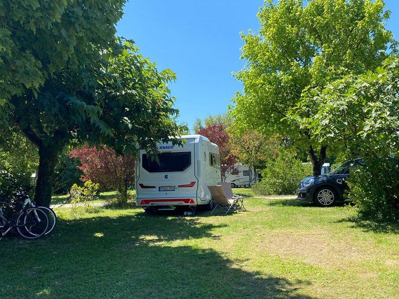
Camping Les Plages de l'Ain, 06.07.22
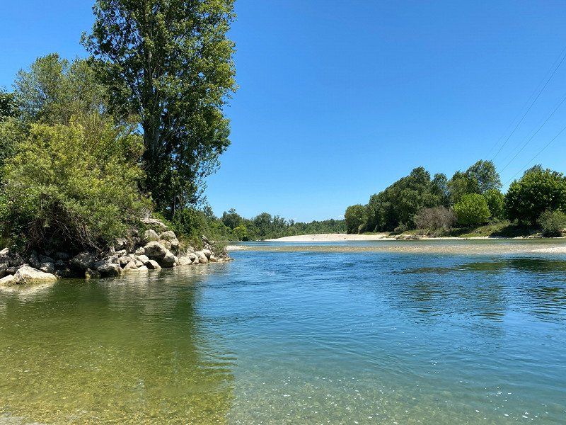
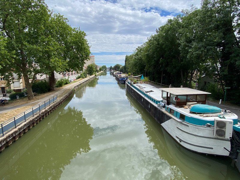
Camping on the L'Ain river near the mouth of the Rhone
11 Chemin du Stade, 01800, St Maurice de Gourdans, Frankreich
45° 48' 28.3" N 5° 11' 12.9" E
45.8078530 5.1869230
• Head southwest on Chemin du Stade. Go for 34 m.
• Arrive at Chemin du Stade.
☍
0,0 km
( )
Day
Camping les Plages de l'Ain, Chemin du Stade, Saint-Maurice-de-Gourdans, 07.07.22
07/07/22
A really nice campsite in terms of the complex. Everyone has enough space in their assigned area in this park-like area. There are two pools for the kids. Adults prefer swimming in the Ain River, but due to the pebble bottom you should wear appropriate bathing shoes. In any case, it's visually appealing. On weekends, disco and music lectures are possible in the restaurant. This may last until the night, but it's not particularly annoying. Attention: There are concrete elevations on the paths, which should be crossed slowly to avoid damage. Electricity is available directly at the pitch (bring your own Schuco plug), you get water from the water points, where the water unfortunately only flows slowly. But the latter can be survived. The management is very customer oriented and nice. Orders for ribs for the next day are accepted. The town is a good 3km away and, in addition to a bakery, also houses a sinfully expensive mini supermarket. It's better to plan a bulk purchase in one of the country's typical supermarkets. Your wallet will thank you.
11 Chem. du Stade, 01800 Saint-Maurice-de-Gourdans, Frankreich
45° 48' 27.3" N 5° 11' 9.1" E
45.8075840 5.1858720
• Head toward Chemin de la Thomasse on Chemin du Stade. Go for 344 m.
• Continue on Chemin du Zonchet. Go for 13 m.
• Take the 1st exit from roundabout onto Chemin du Zonchet. Go for 228 m.
• Continue on Chemin du Zonchet. Go for 287 m.
• Continue on Chemin de Fort Janot. Go for 479 m.
• Turn right onto Chemin de Pollet. Go for 106 m.
• Turn left onto Route de Lyon (D84). Go for 4.0 km.
• Continue on D84. Go for 1.8 km.
• Continue on Rue de Saint-Maurice (D84). Go for 1.1 km.
• Take the 2nd exit from roundabout onto Rue de Saint-Maurice (D84). Go for 1.3 km.
• Take the 3rd exit from roundabout toward Lyon/Aéroport Saint Exupéry/Genève. Go for 252 m.
• Take ramp onto A42 toward A432/Aéroport Saint Exupéry/Lyon. Go for 14.8 km.
• Take the left exit toward Marseille/Grenoble/Lyon/N346 onto A42. Go for 990 m.
• Take the exit toward Lyon onto A42. Go for 3.6 km.
• Take the exit toward Paris/Roanne/Lyon-Centre/Périphérique Nord/Porte de la Pape onto Boulevard Périphérique Nord. Go for 1.1 km.
• Take ramp onto Boulevard Laurent Bonnevay (D383) toward Roanne/Lyon-Centre/Porte de la Doua. Go for 2.4 km.
• Turn right toward Lyon-Centre. Go for 84 m.
• Continue on Boulevard Laurent Bonnevay. Go for 183 m.
• Continue on Quai Charles de Gaulle (N483). Go for 1.6 km.
• Keep left onto Quai Charles de Gaulle (N483) toward Croix-Rousse. Go for 248 m.
• Turn right onto Pont Winston Churchill. Go for 300 m.
• Turn left onto Place Adrien Godien toward Lyon-Centre/Croix-Rousse-Pentes. Go for 1.2 km.
• Continue on Quai Jean Moulin. Go for 583 m.
• Turn right onto Place des Cordeliers. Go for 102 m.
• Turn right onto Rue de la Bourse. Go for 156 m.
• Turn left onto Rue Gentil. Go for 141 m.
• Turn left onto Rue de la Gerbe. Go for 92 m.
• Arrive at Rue de la Gerbe. Your destination is on the left.
☍
37,4 km
( 34 min.)
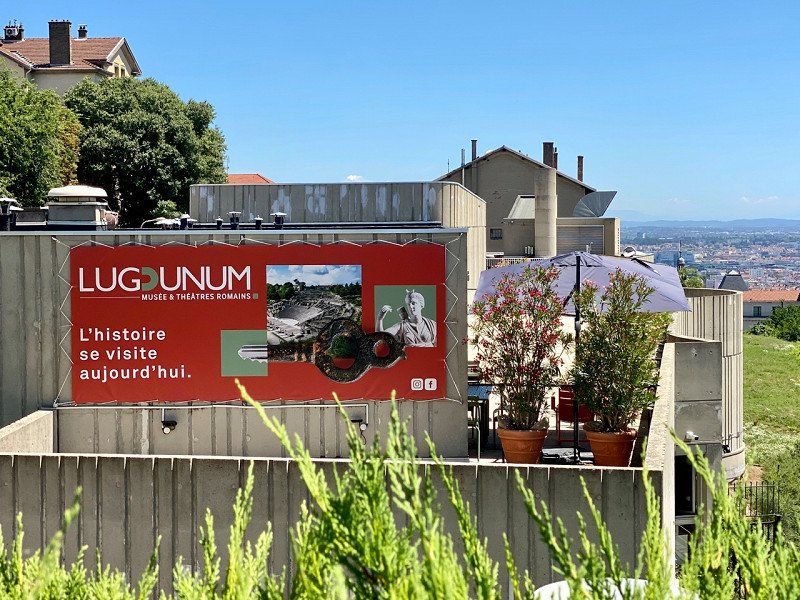
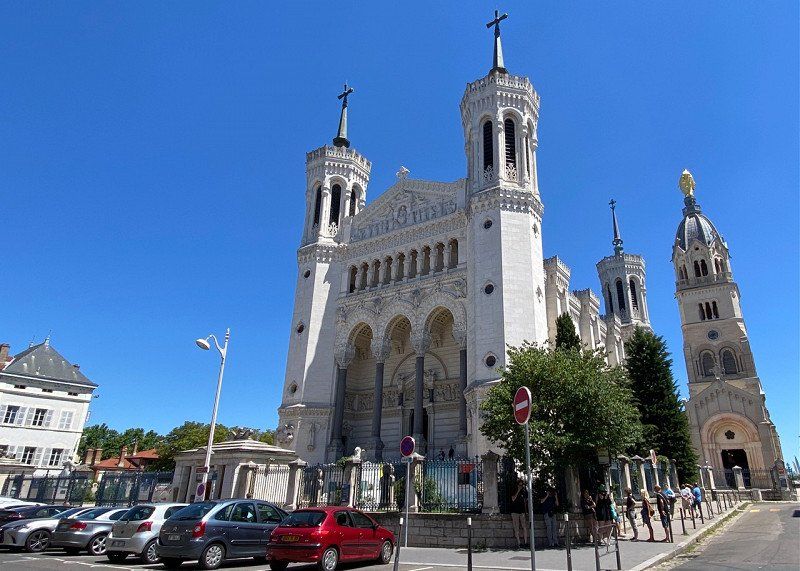
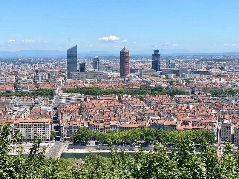
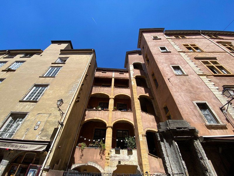
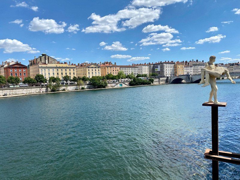
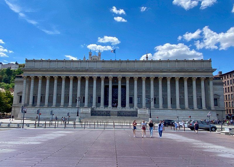
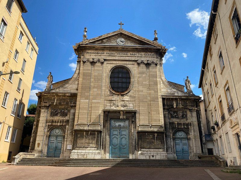
Lyon, Frankreich
Stroll through the old town in Lyon
45° 45' 50.6" N 4° 50' 8.4" E
45.7640430 4.8356590
• Head southeast on Rue de la Gerbe.
• Turn right onto Rue de la Poulaillerie. Go for 103 m.
• Turn right onto Rue du Président Édouard Herriot. Go for 75 m.
• Continue on Rue du Président Édouard Herriot. Go for 133 m.
• Turn right onto Rue du Bât d'Argent. Go for 290 m.
• Turn left onto Quai Jean Moulin. Go for 51 m.
• Keep left onto Quai Jean Moulin toward Périphérique Porte de St Clair/Croix Rousse Plateau/Brotteaux/Cité Internationale. Go for 267 m.
• Continue on Quai André Lassagne. Go for 336 m.
• Keep right onto Quai André Lassagne toward Périphérique/Porte de St Clair/Croix Rousse Plateau/Cité Internationale. Go for 206 m.
• Continue on Cours d'Herbouville. Go for 475 m.
• Keep right onto Autoberge Rive Droite toward Périphérique Porte de St-Clair/Caluire St-Clair. Go for 159 m.
• Continue on Quai Bellevue. Go for 963 m.
• Keep right onto Quai Bellevue toward Périphérique/Porte de St Clair/Tunnel Quai de Bellevue. Go for 349 m.
• Continue on Tunnel du Quai Bellevue. Go for 759 m.
• Keep right onto Porte de Saint-Clair toward Marseille/Genève/Grenoble/Périphérique Est/Porte de Croix Luizet. Go for 133 m.
• Take ramp onto Boulevard Périphérique Nord. Go for 2.4 km.
• Continue on Boulevard Laurent Bonnevay (D383). Go for 509 m.
• Take ramp onto A42 (Pont de Croix Luizet) toward Genève/Aéroport Saint-Exupéry/Rocade Est. Go for 3.3 km.
• Take the left exit toward Paris/Genève/Bourg en B./Aéroport Saint Exupéry onto A42/A46. Go for 1.1 km.
• Take the exit toward Bourg en B./Genève/Strasbourg/Aéroport Saint-Exupéry onto A42. Go for 14.3 km.
• Take exit 6 toward Balan/Dagneux. Go for 763 m.
• Take the 3rd exit from roundabout onto Rue de Saint-Maurice (D84) toward St Maurice de G./Balan. Go for 1.4 km.
• Take the 2nd exit from roundabout onto Rue de Saint-Maurice (D84). Go for 1.1 km.
• Continue on D84. Go for 1.8 km.
• Continue on Route de Lyon (D84). Go for 4.0 km.
• Turn right onto Chemin de Pollet. Go for 106 m.
• Turn left onto Chemin de Fort Janot. Go for 479 m.
• Continue on Chemin du Zonchet. Go for 287 m.
• Continue on Chemin du Zonchet. Go for 206 m.
• Take the 2nd exit from roundabout onto Chemin du Zonchet. Go for 55 m.
• Continue on Chemin du Stade. Go for 344 m.
• Arrive at Chemin du Stade. Your destination is on the right.
☍
36,3 km
( 30 min.)
Camping les Plages de l'Ain, Chemin du Stade, Saint-Maurice-de-Gourdans, Frankreich
11 Chem. du Stade, 01800 Saint-Maurice-de-Gourdans, Frankreich
45° 48' 27.3" N 5° 11' 9.1" E
45.8075840 5.1858720
• Head east on Chemin du Stade.
• Arrive at Chemin du Stade. Your destination is on the right.
☍
Distance not available
(Duration not available)
Day
Camping les Plages de l'Ain, Chemin du Stade, Saint-Maurice-de-Gourdans, 08.07.22
07/08/22 Rest day with swimming in the L'Ain
11 Chem. du Stade, 01800 Saint-Maurice-de-Gourdans, Frankreich
45° 48' 27.3" N 5° 11' 9.1" E
45.8075840 5.1858720
• Head east on Chemin du Stade.
• Arrive at Chemin du Stade. Your destination is on the right.
☍
Distance not available
(Duration not available)
Day
Camping les Plages de l'Ain, Chemin du Stade, Saint-Maurice-de-Gourdans, 09.07.22
07/09/22
11 Chem. du Stade, 01800 Saint-Maurice-de-Gourdans, Frankreich
45° 48' 27.3" N 5° 11' 9.1" E
45.8075840 5.1858720
• Head toward Chemin de la Thomasse on Chemin du Stade. Go for 344 m.
• Continue on Chemin du Zonchet. Go for 13 m.
• Take the 1st exit from roundabout onto Chemin du Zonchet. Go for 228 m.
• Continue on Chemin du Zonchet. Go for 287 m.
• Continue on Chemin de Fort Janot. Go for 479 m.
• Turn right onto Chemin de Pollet. Go for 106 m.
• Turn left onto Route de Lyon (D84). Go for 4.0 km.
• Continue on D84. Go for 1.8 km.
• Continue on Rue de Saint-Maurice (D84). Go for 1.1 km.
• Take the 2nd exit from roundabout onto Rue de Saint-Maurice (D84). Go for 1.3 km.
• Take the 3rd exit from roundabout toward Lyon/Aéroport Saint Exupéry/Genève. Go for 252 m.
• Take ramp onto A42 toward A432/Aéroport Saint Exupéry/Lyon. Go for 14.8 km.
• Take the left exit toward Marseille/Grenoble/Lyon/N346 onto A42. Go for 990 m.
• Take the left exit toward Marseille/Grenoble onto N346 (Échangeur Rocade Est). Go for 6.3 km.
• Take ramp toward Meyzieu/Décines-Centre/Le Grand Large. Go for 371 m.
• Take the 1st exit from roundabout onto Avenue Jean Jaurès (D317). Go for 50 m.
• Keep right onto Avenue Jean Jaurès. Go for 101 m.
• Turn left onto Avenue Jean Jaurès. Go for 28 m.
• Continue on Rue Violette Maurice. Go for 315 m.
• Enter the roundabout. Go for 16 m.
• Arrive at your destination.
☍
32,9 km
( 25 min.)
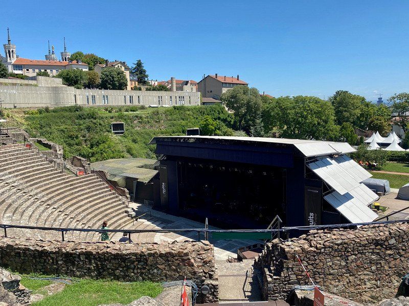
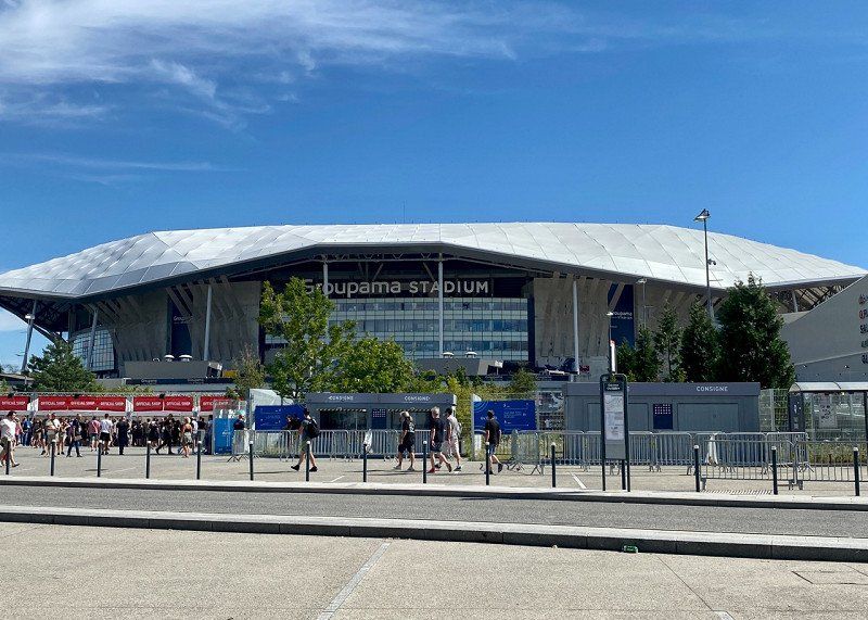
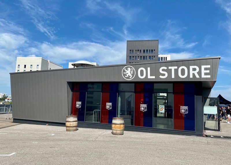
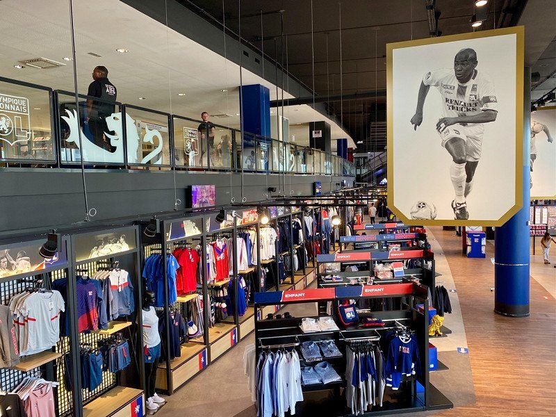
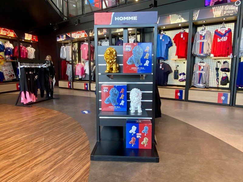
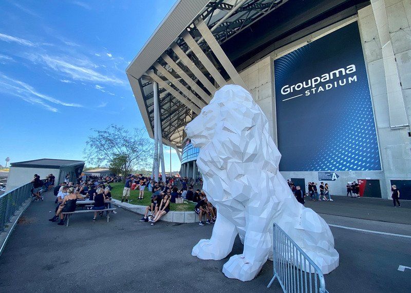
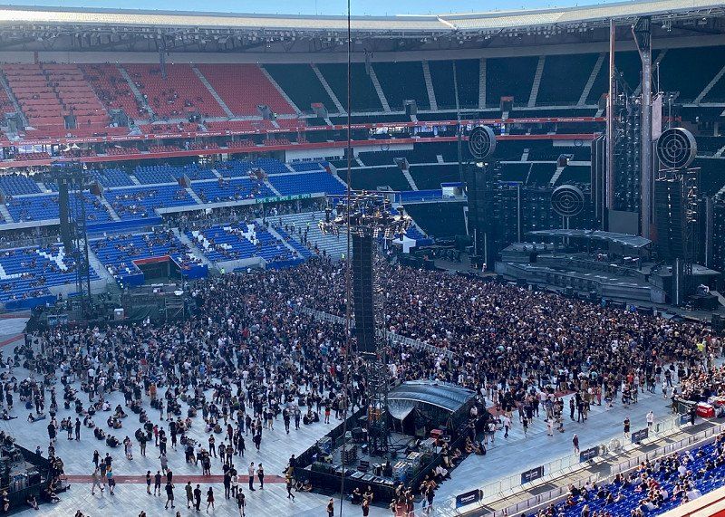
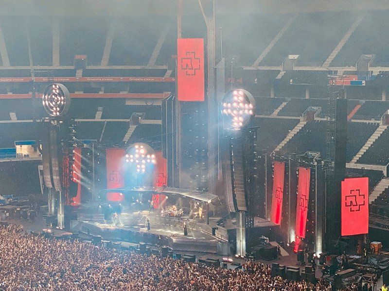
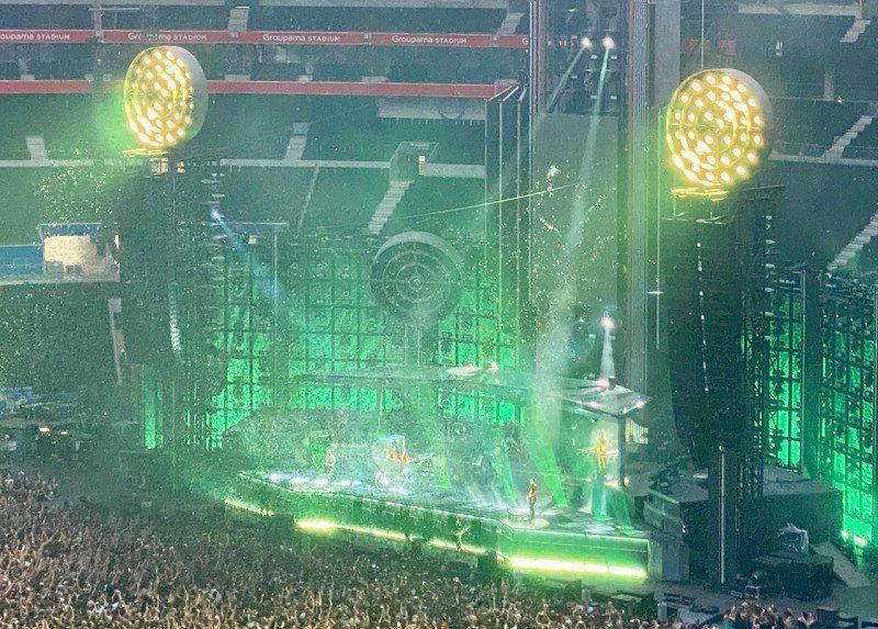
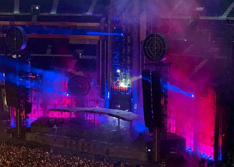
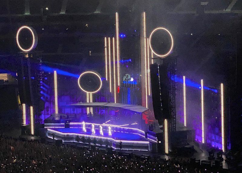
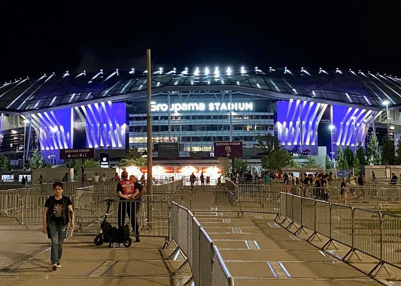
Groupama Stadium, Avenue Simone Veil, Décines-Charpieu, Frankreich
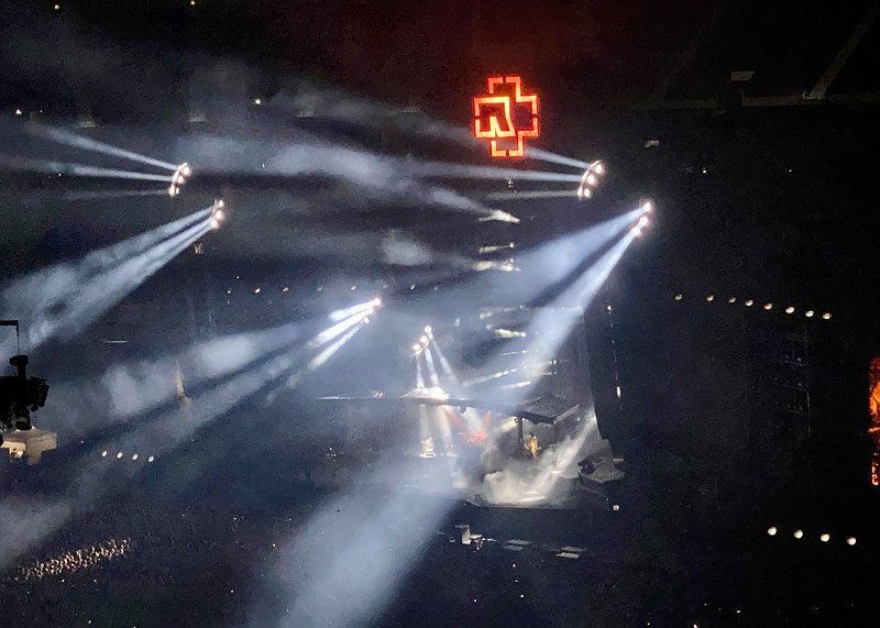
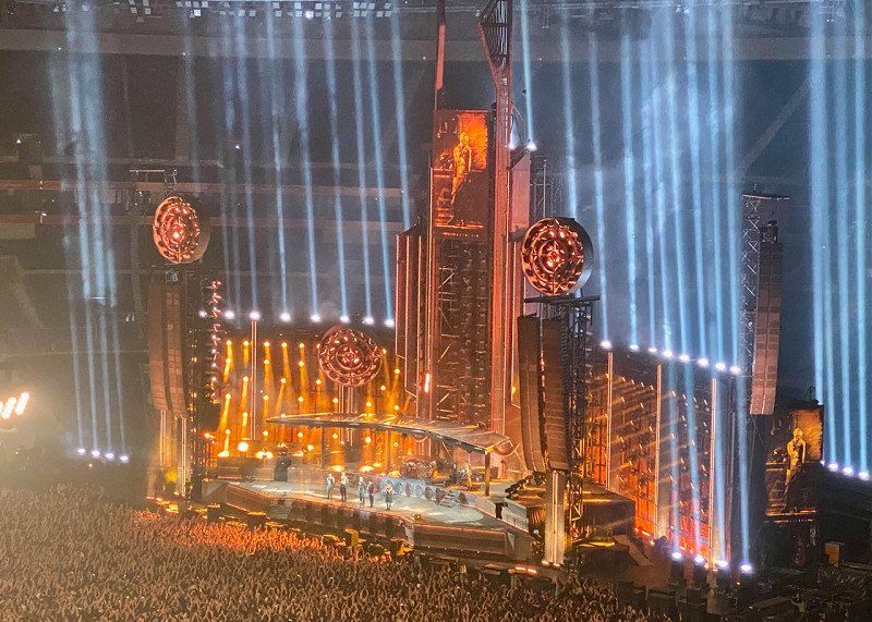
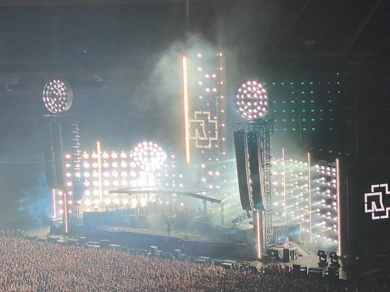
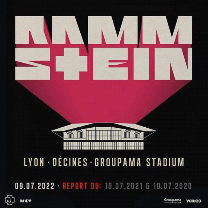
Visit to the Groupama Stadium at Olympique Lyon for the Rammstein concert
10 Av. Simone Veil, 69150 Décines-Charpieu, Frankreich
45° 45' 55.1" N 4° 58' 55.3" E
45.7652950 4.9820290
• Follow the roundabout. Go for 17 m.
• Take the 2nd exit from roundabout onto Rue Violette Maurice. Go for 315 m.
• Turn right onto Avenue Jean Jaurès. Go for 141 m.
• Take the 4th exit from roundabout onto Rocade Est (N346) toward A42 (Genève)/A46(Paris)/Lyon/Vaulx en Velin/Aéroport Saint-Exupéry. Go for 5.5 km.
• Keep left onto A42/A46 toward Paris/Villefranche S/Saône/Genève/Aéroport Saint-Exupéry. Go for 560 m.
• Take the exit onto A42/A46. Go for 988 m.
• Take the exit toward Bourg en B./Genève/Strasbourg/Aéroport Saint-Exupéry onto A42. Go for 14.3 km.
• Take exit 6 toward Balan/Dagneux. Go for 763 m.
• Take the 3rd exit from roundabout onto Rue de Saint-Maurice (D84) toward St Maurice de G./Balan. Go for 1.4 km.
• Take the 2nd exit from roundabout onto Rue de Saint-Maurice (D84). Go for 1.1 km.
• Continue on D84. Go for 1.8 km.
• Continue on Route de Lyon (D84). Go for 4.0 km.
• Turn right onto Chemin de Pollet. Go for 106 m.
• Turn left onto Chemin de Fort Janot. Go for 479 m.
• Continue on Chemin du Zonchet. Go for 287 m.
• Continue on Chemin du Zonchet. Go for 206 m.
• Take the 2nd exit from roundabout onto Chemin du Zonchet. Go for 55 m.
• Continue on Chemin du Stade. Go for 344 m.
• Arrive at Chemin du Stade. Your destination is on the right.
☍
32,2 km
( 24 min.)
Camping les Plages de l'Ain, Chemin du Stade, Saint-Maurice-de-Gourdans, Frankreich
11 Chem. du Stade, 01800 Saint-Maurice-de-Gourdans, Frankreich
45° 48' 27.3" N 5° 11' 9.1" E
45.8075840 5.1858720
• Head east on Chemin du Stade.
• Arrive at Chemin du Stade. Your destination is on the right.
☍
Distance not available
(Duration not available)
Day
Camping les Plages de l'Ain, Chemin du Stade, Saint-Maurice-de-Gourdans, 10.07.22
07/10/22
11 Chem. du Stade, 01800 Saint-Maurice-de-Gourdans, Frankreich
45° 48' 27.3" N 5° 11' 9.1" E
45.8075840 5.1858720
• Head east on Chemin du Stade.
• Arrive at Chemin du Stade. Your destination is on the right.
☍
Distance not available
(Duration not available)
Day
Camping les Plages de l'Ain, Chemin du Stade, Saint-Maurice-de-Gourdans, 11.07.22
07/11/22
11 Chem. du Stade, 01800 Saint-Maurice-de-Gourdans, Frankreich
45° 48' 27.3" N 5° 11' 9.1" E
45.8075840 5.1858720
• Head east on Chemin du Stade. Go for 1.5 km.
• Turn right onto Route de Lyon (D84). Go for 199 m.
• Continue on Place de l'Église (D84). Go for 1.4 km.
• Turn right onto Route de Saint-Jean-de-Niost (D65). Go for 4.1 km.
• Take the 3rd exit from roundabout onto Rue de Grange Peyraud (D65) toward Crémieu/Pont de Chéruy. Go for 610 m.
• Take the 1st exit from roundabout onto Rue du Bugey (D20). Go for 1.0 km.
• Turn right onto Rue du Port. Go for 163 m.
• Take the 1st exit from Place des Mariniers roundabout onto Rue du Godimut. Go for 34 m.
• Turn right onto Rue de la Mairie. Go for 91 m.
• Arrive at Rue de la Mairie. Your destination is on the left.
☍
9,2 km
( 12 min.)
Loyettes, Frankreich
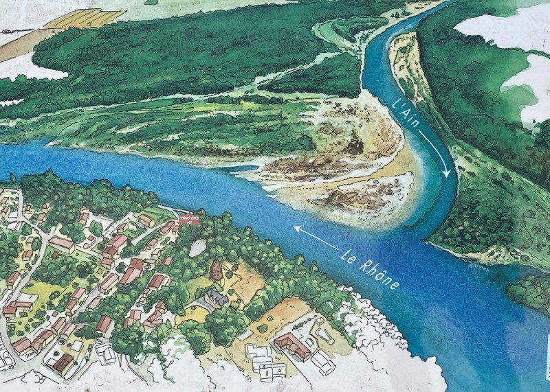
At the mouth of L'Ain into the Rhone
01360 Loyettes, Frankreich
45° 46' 26.9" N 5° 12' 12.2" E
45.7741339 5.2033870
• Head north on Rue de la Mairie. Go for 100 m.
• Turn right onto Rue Émile Guichard. Go for 28 m.
• Continue on Rue des Verchères. Go for 49 m.
• Continue on Chemin du Grand Voilet. Go for 56 m.
• Continue on Rue des Verchères. Go for 53 m.
• Turn right onto Rue des Verchères. Go for 49 m.
• Turn left onto Rue du Bugey (D20). Go for 931 m.
• Take the 2nd exit from roundabout onto Rue de Grange Peyraud (D65) toward Meximieux/St Jean de Niost/St Maurice de G./Cité Médiévale de Pérouges/Z.I. de la Croze. Go for 649 m.
• Take the 1st exit from roundabout onto Route de Loyers (D65) toward Meximieux/St Jean de Niost/St Maurice de G./Cité Médiévale de Pérouges/Z.I. de la Croze. Go for 4.1 km.
• Turn left onto Route de Port-Galland (D84). Go for 1.4 km.
• Continue on Route de Lyon (D84). Go for 199 m.
• Turn left onto Chemin du Stade. Go for 5 m.
• Turn slightly right onto Chemin du Stade. Go for 1.5 km.
• Arrive at Chemin du Stade.
☍
9,2 km
( 12 min.)
Camping les Plages de l'Ain, Chemin du Stade, Saint-Maurice-de-Gourdans, Frankreich
11 Chem. du Stade, 01800 Saint-Maurice-de-Gourdans, Frankreich
45° 48' 27.3" N 5° 11' 9.1" E
45.8075840 5.1858720
• Head west on Chemin du Stade.
• Arrive at Chemin du Stade.
☍
Distance not available
(Duration not available)
Day
Camping les Plages de l'Ain, Chemin du Stade, Saint-Maurice-de-Gourdans, 12.07.22
07/12/22
11 Chem. du Stade, 01800 Saint-Maurice-de-Gourdans, Frankreich
45° 48' 27.3" N 5° 11' 9.1" E
45.8075840 5.1858720
• Head toward Chemin de la Thomasse on Chemin du Stade. Go for 344 m.
• Continue on Chemin du Zonchet. Go for 13 m.
• Take the 1st exit from roundabout onto Chemin du Zonchet. Go for 228 m.
• Continue on Chemin du Zonchet. Go for 287 m.
• Continue on Chemin de Fort Janot. Go for 479 m.
• Turn right onto Chemin de Pollet. Go for 106 m.
• Turn right onto Route de Lyon (D84). Go for 889 m.
• Turn left onto Route de la Charrière (D65 B). Go for 1.8 km.
• Continue on D65 B. Go for 2.3 km.
• Take the 2nd exit from roundabout onto D65 B. Go for 432 m.
• Take the 3rd exit from roundabout toward Genève/Bourg en B./Lyon/Aéroport Saint Exupéry. Go for 301 m.
• Take ramp onto A42 toward Genève/Bourg en B. Go for 28.0 km.
• Continue on A40. Go for 23.0 km.
• Keep left onto A39 (Autoroute Verte) toward Strasbourg/Lille/Paris Par A5/Dijon/Lons le S. Go for 138 km.
• Take the exit toward Lille/Paris/Metz/Nancy/Chaumont onto A31. Go for 75.3 km.
• Take the exit toward Metz/Nancy/Épinal/Langres-Nord onto A31. Go for 132 km.
• Take the exit toward Lunéville/Strasbourg/Nancy-Brabois/Vandoeuvre onto A33. Go for 6.0 km.
• Take exit 2B toward Nancy-Brabois/Vandoeuvre onto D974 (Rue de Nancy). Go for 1.1 km.
• Turn left onto Avenue de la Forêt-de-Haye (D92 A) toward Villers/Maron. Go for 1.0 km.
• Turn right onto Allée de Longchamps toward Parc d'Activités de l'Hippodrome. Go for 321 m.
• Turn left onto Allée d'Enghien. Go for 104 m.
• Turn right onto Allée d'Évry. Go for 130 m.
• Turn right onto Allée de Longchamps. Go for 248 m.
• Turn left. Go for 60 m.
• Arrive at your destination on the right.
☍
413,1 km
(3 hrs. 29 min.)
Camping Campéole - Le Brabois, 12.07.22
Avenue Paul Muller 2301, 54600, Villers Les Nancy, Frankreich
48° 39' 25.2" N 6° 8' 22.2" E
48.6570000 6.1395000
• Head north. Go for 102 m.
• Turn right toward Allée de Longchamps. Go for 14 m.
• Turn left onto Allée de Longchamps. Go for 167 m.
• Turn right onto Allée d'Enghien. Go for 242 m.
• Turn left onto Allée de Vincennes. Go for 203 m.
• Turn right onto Allée de Longchamps. Go for 100 m.
• Turn right onto Avenue de la Forêt-de-Haye (D92 A) toward Nancy/Parc d'Activités de la Forêt de la Reine/Parc d'Activités du Bois St Julien. Go for 396 m.
• Turn right onto Avenue Paul Muller toward Nancy/Villers-Centre. Go for 584 m.
• Turn right onto Avenue Paul Muller toward Brabois. Go for 138 m.
• Turn left onto Avenue Paul Muller. Go for 122 m.
• Arrive at your destination on the right.
☍
2,1 km
( 4 min.)
Day
Camping Le Brabois, Avenue Paul Muller, Villers-lès-Nancy, 13.07.22
07/13/22
The campsite is located high above the city on a mountain. If you come from below, the car struggles with the trailer. The place itself is heavily exposed to the sun. When choosing a spot, you should definitely take the direction of the sun into account and take your time when parking and aligning. The sanitary facilities are in fair condition. There is electricity directly on site and you can get water from the wash house (bring a container). A small restaurant is available and is happy to welcome guests (there would be nothing else nearby). You have to plan a longer route to the disposal points. It is advisable to carry out disposal in connection with leaving the place.
2301 Av. Paul Muller, 54600 Villers-lès-Nancy, Frankreich
48° 39' 27.2" N 6° 8' 29.3" E
48.6575653 6.1414648
• Head west. Go for 95 m.
• Continue on Avenue Paul Muller. Go for 27 m.
• Turn right toward Avenue Paul Muller. Go for 21 m.
• Continue on Avenue Paul Muller. Go for 117 m.
• Turn right onto Avenue Paul Muller toward Nancy/Villers-Centre/Remicourt. Go for 2.1 km.
• Turn left onto Boulevard des Aiguillettes toward Nancy/Laxou. Go for 715 m.
• Turn right onto Avenue du Général Leclerc (D92) toward Nancy. Go for 493 m.
• Take the 3rd exit from roundabout onto Avenue de la Libération (D92). Go for 656 m.
• Turn right onto Rue Émile Bertin (D92). Go for 209 m.
• Continue on Place Paul Painlevé. Go for 96 m.
• Continue on Rue de Mon-Désert. Go for 1.0 km.
• Continue on Pont des Fusillés. Go for 152 m.
• Continue on Rue Charles III toward Tomblaine/St Max. Go for 92 m.
• Keep right onto Rue de l'Abbé Didelot. Go for 8 m.
• Continue on Rue Charles III. Go for 471 m.
• Turn left onto Rue Sainte-Anne toward Préfecture- Hôtel de Ville. Go for 273 m.
• Turn left onto Rue des Tiercelins. Go for 109 m.
• Turn right onto Rue Saint-Julien. Go for 302 m.
• Turn right onto Rue Claude Charles. Go for 24 m.
• Arrive at Rue Claude Charles. Your destination is on the right.
☍
7,0 km
( 13 min.)
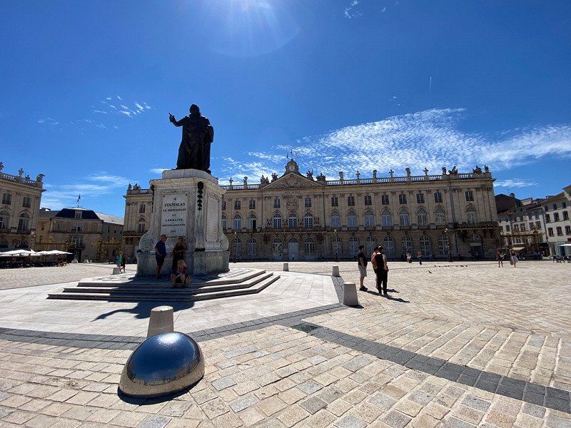
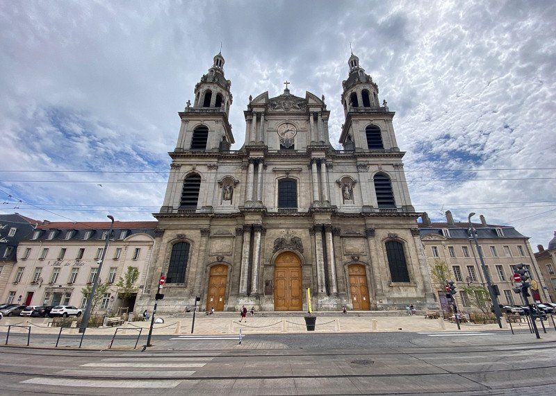
Nancy, Frankreich
By bike to Nancy City. Steeply downhill from the campsite. Of course, the route had to be climbed again at the end of the day. The whole thing then at 35 degrees.
48° 41' 31.4" N 6° 11' 3.9" E
48.6920540 6.1844170
• Head toward Rue Maurice Barrès on Rue Claude Charles. Go for 57 m.
• Turn right onto Rue Maurice Barrès. Go for 91 m.
• Turn left onto Rue Saint-Georges. Go for 116 m.
• Turn right onto Rue du Manège. Go for 218 m.
• Turn right onto Rue des Tiercelins. Go for 265 m.
• Turn left onto Rue Saint-Nicolas. Go for 77 m.
• Turn right onto Rue des Soeurs Macarons. Go for 116 m.
• Continue on Rue de la Hache. Go for 91 m.
• Turn left onto Rue des 4 Églises. Go for 202 m.
• Continue on Rue des Quatre Églises. Go for 4 m.
• Continue on Rue des 4 Églises. Go for 63 m.
• Continue on Rue des Quatre Églises. Go for 234 m.
• Turn right onto Avenue du Général Leclerc. Go for 2.4 km.
• Turn right onto Boulevard des Aiguillettes. Go for 715 m.
• Turn left onto Avenue Paul Muller toward Clairlieu/Remicourt. Go for 2.1 km.
• Turn left onto Avenue Paul Muller. Go for 138 m.
• Turn left onto Avenue Paul Muller. Go for 122 m.
• Arrive at your destination on the right.
☍
7,1 km
( 15 min.)
Camping Le Brabois, Avenue Paul Muller, Villers-lès-Nancy, Frankreich
2301 Av. Paul Muller, 54600 Villers-lès-Nancy, Frankreich
48° 39' 27.2" N 6° 8' 29.3" E
48.6575653 6.1414648
• Head east.
• Arrive at your destination on the right.
☍
Distance not available
(Duration not available)
Day
Camping Le Brabois, Avenue Paul Muller, Villers-lès-Nancy, 14.07.22
07/14/22
2301 Av. Paul Muller, 54600 Villers-lès-Nancy, Frankreich
48° 39' 27.2" N 6° 8' 29.3" E
48.6575653 6.1414648
• Head west. Go for 95 m.
• Continue on Avenue Paul Muller. Go for 27 m.
• Turn right toward Avenue Paul Muller. Go for 21 m.
• Continue on Avenue Paul Muller. Go for 117 m.
• Turn left onto Avenue Paul Muller toward Clairlieu. Go for 549 m.
• Turn left onto Avenue de la Forêt-de-Haye (D92 A). Go for 1.4 km.
• Turn right onto Avenue de Bourgogne (D974). Go for 532 m.
• Take ramp onto A33 toward Toul/Paris/Dijon/Metz. Go for 6.7 km.
• Continue on A31. Go for 99.9 km.
• Continue on A3. Go for 11.3 km.
• Take the exit toward E29/Aéroport/Trier/Ettelbruck/A7 onto A1. Go for 16.1 km.
• Take exit 11 toward Niederanven onto CR132. Go for 1.4 km.
• Continue on Rue de Munsbach (CR132). Go for 638 m.
• Turn right onto Route de Trèves (N1). Go for 5.9 km.
• Continue on Route de Luxembourg (N1). Go for 5.7 km.
• Take the 2nd exit from roundabout onto Potaschberg (N1). Go for 352 m.
• Take left ramp onto A1 toward Mertert/Wasserbillig/Trier. Go for 3.8 km.
• Take exit 14 toward Wasserbillig/Grevenmacher/Fähre Mertert onto N1d. Go for 1.2 km.
• Turn left onto Route du Vin (N1) toward Echternach/Wasserbillig/Port de Mertert. Go for 1.6 km.
• Take the 3rd exit from roundabout onto Route de Wasserbillig (N1). Go for 2.6 km.
• Continue on B49. Go for 33 m.
• Turn right onto B49 toward Trier/Igel/Igeler Säule. Go for 9.9 km.
• Keep left onto Luxemburger Straße toward Köln/Aachen/B51. Go for 472 m.
• Turn right. Go for 177 m.
• Arrive at your destination on the left.
☍
170,6 km
(1 hrs. 55 min.)
CamperplaatS Trier, Luxemburger Straße, Trier, 14.07.22
Arrival in Trier at 30 degrees. Dinner on the banks of the Moselle.
Luxemburger Str. 81, 54294 Trier, Deutschland
49° 44' 36.1" N 6° 37' 30.2" E
49.7433559 6.6250662
• Head east.
• Arrive at your destination on the left.
☍
Distance not available
(Duration not available)
Day
CamperplaatS Trier, Luxemburger Straße, Trier, 15.07.22
07/15/22
The campsite is located directly on the banks of the Moselle, but without direct access to it. The old town can be reached quickly by bike or on foot. All sights can be reached without much effort. The square is purely a transit area. Most campers only stay there one night. If you're lucky, you'll be assigned a spot with a green barrier to the camper behind it. There is electricity directly at the pitch, water only in the sanitary facilities. The disposal facilities can also be found there. The building doesn't look entirely trustworthy, but the inside is totally at the highest level. The terrain is flat and easy to master. The approach is a bit narrow. You just hope that no one comes towards you when you arrive or leave.
Luxemburger Str. 81, 54294 Trier, Deutschland
49° 44' 36.1" N 6° 37' 30.2" E
49.7433559 6.6250662
• Head toward Luxemburger Straße. Go for 177 m.
• Turn right onto Luxemburger Straße (B51). Go for 974 m.
• Take the 1st exit from roundabout onto Römerbrücke toward Centrum. Go for 263 m.
• Turn right onto Sankt-Barbara-Ufer (B49). Go for 70 m.
• Turn left onto Südallee (L143). Go for 672 m.
• Turn left toward Saarstraße. Go for 20 m.
• Arrive at Saarstraße. Your destination is on the right.
☍
2,2 km
( 5 min.)
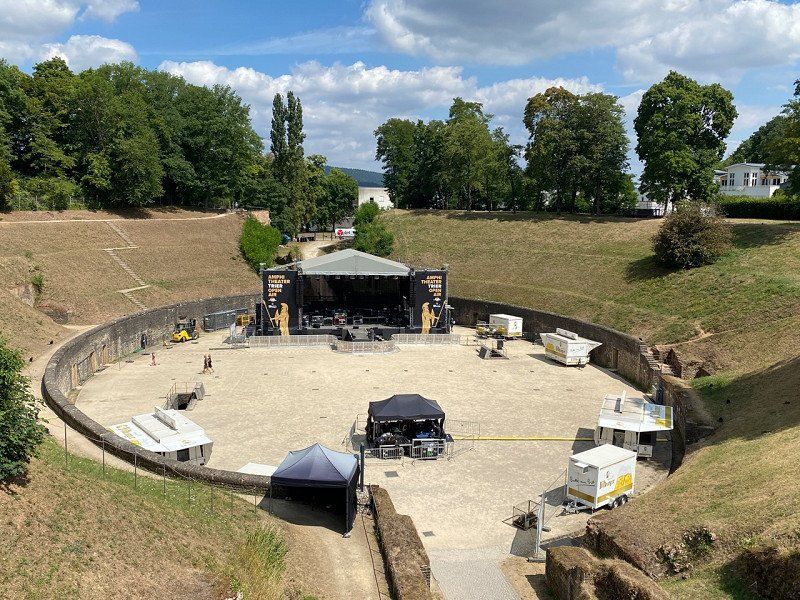
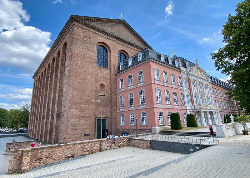
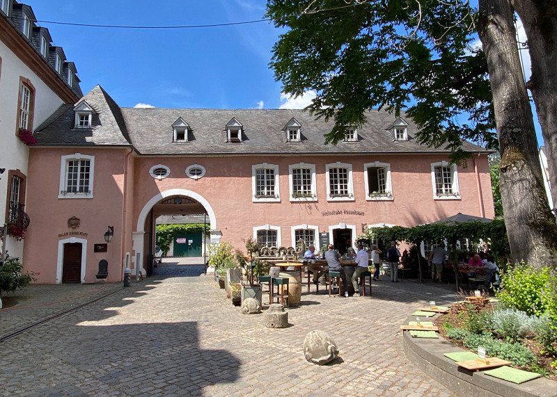
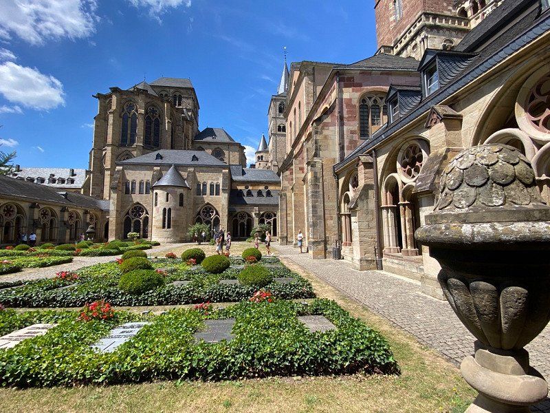
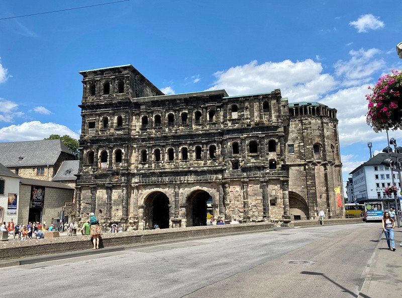
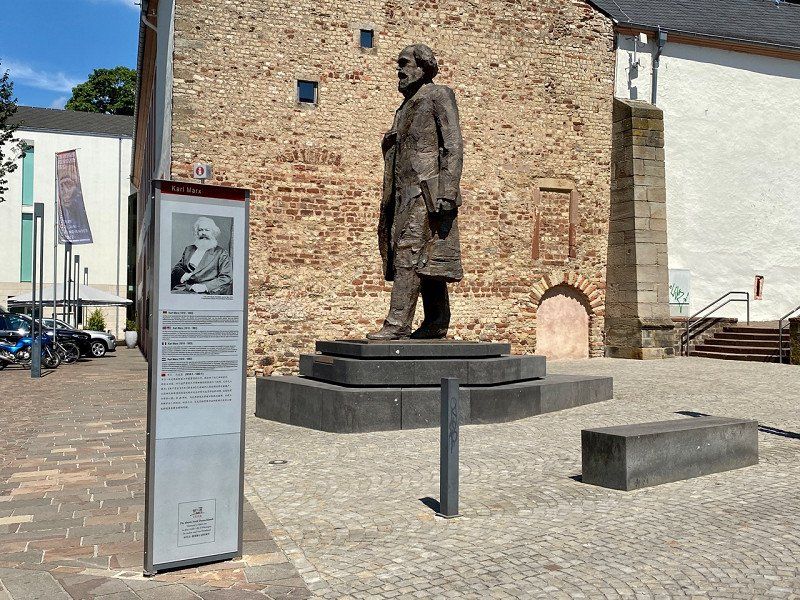
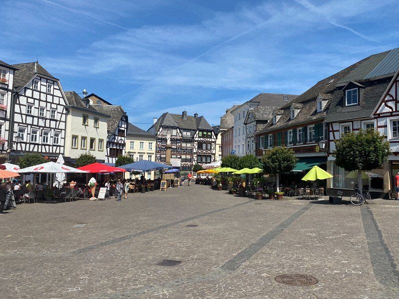
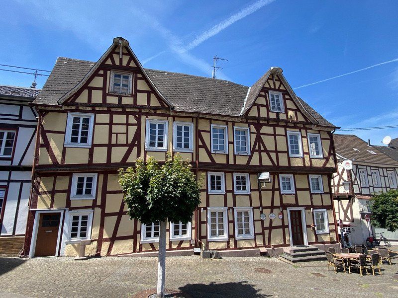
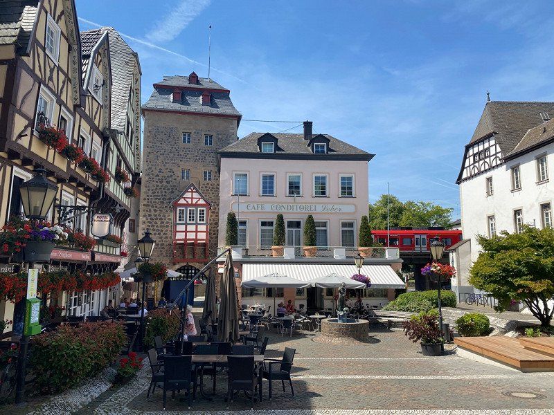
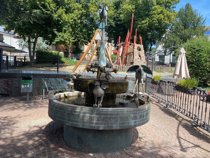
Trier, Deutschland
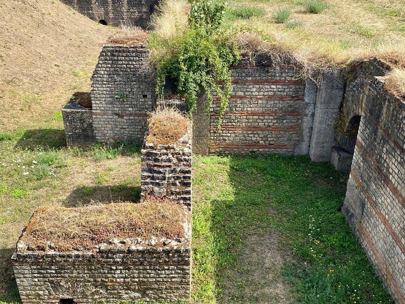
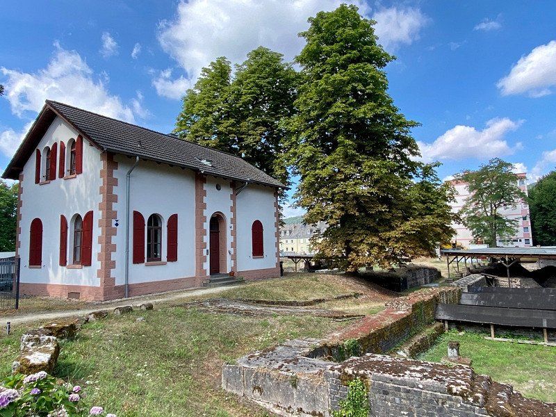
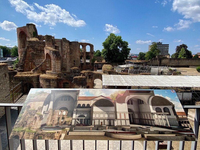
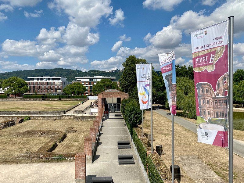
Visit the old town by bike. Visit to the Barbara and Kaiser thermal baths, the amphitheater, the cathedral, Porta Nigra and Karl Marx House - plus a monument
49° 44' 60" N 6° 38' 13.7" E
49.7499920 6.6371433
• Head toward Neustraße on Kaiserstraße (L143). Go for 13 m.
• Turn left onto Kaiserstraße (L143). Go for 422 m.
• Turn right onto Lorenz-Kellner-Straße. Go for 128 m.
• Turn left onto Bollwerkstraße. Go for 280 m.
• Continue on Römerbrücke. Go for 262 m.
• Take the 3rd exit from roundabout onto Luxemburger Straße (B51) toward Saarbrücken/B49/Centrum/Gewerbegebiet TR-Euren. Go for 1.0 km.
• Turn left. Go for 177 m.
• Arrive at your destination on the left.
☍
2,3 km
( 6 min.)
Day
CamperplaatS Trier, Luxemburger Straße, Trier, Deutschland
Luxemburger Str. 81, 54294 Trier, Deutschland
49° 44' 36.1" N 6° 37' 30.2" E
49.7433559 6.6250662
• Head east.
• Arrive at your destination on the left.
☍
Distance not available
(Duration not available)
CamperplaatS Trier, Luxemburger Straße, Trier, 16.07.22
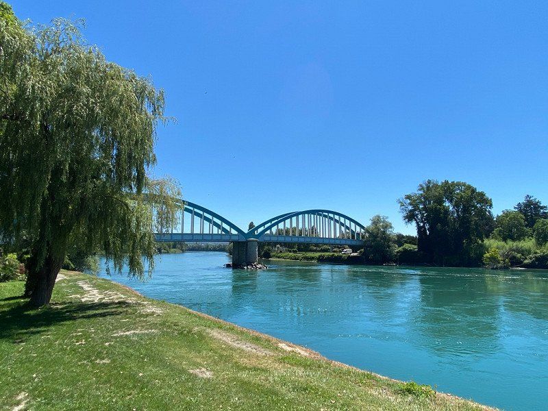
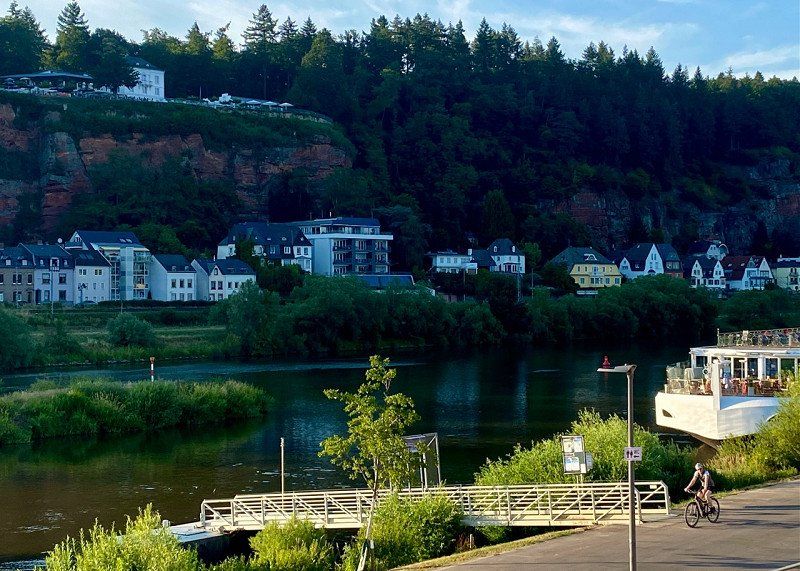
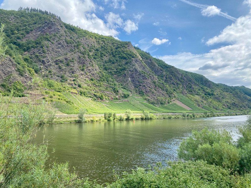
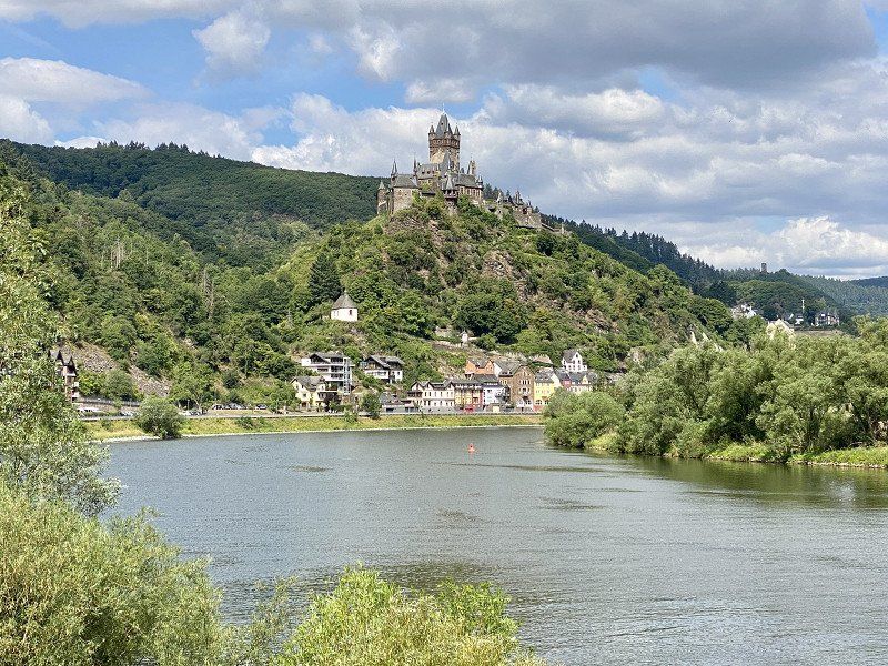
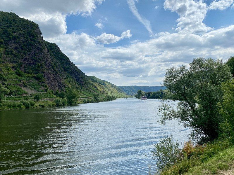
07/16/22, Along the Moselle (here near Cochem)
Luxemburger Str. 81, 54294 Trier, Deutschland
49° 44' 36.1" N 6° 37' 30.2" E
49.7433559 6.6250662
• Head toward Luxemburger Straße. Go for 177 m.
• Turn right onto Luxemburger Straße (B51). Go for 974 m.
• Take the 2nd exit from roundabout onto Aachener Straße (B51) toward Köln/Aachen. Go for 885 m.
• Turn right onto Kölner Straße (B51) toward Köln/Aachen. Go for 425 m.
• Keep left onto Bitburger Straße (B51) toward Köln/Aachen/Centrum. Go for 238 m.
• Turn right onto Kaiser-Wilhelm-Brücke toward A602/Centrum. Go for 328 m.
• Turn right toward Martinsufer/B49. Go for 186 m.
• Turn sharp left onto Martinsufer (B49) toward A602. Go for 2.7 km.
• Continue on A602. Go for 9.8 km.
• Continue on E44 (Autobahndreieck Moseltal). Go for 77 m.
• Take the exit onto A1. Go for 49.9 km.
• Take exit 120 toward Koblenz/Köln onto A48. Go for 77.4 km.
• Take exit 13 toward Köln/Bonn onto A3. Go for 41.2 km.
• Take exit 34 toward Linz/Bad Honnef. Go for 416 m.
• Turn left onto Rottbitzer Straße (L247) toward Linz/Bad Honnef. Go for 385 m.
• Take the 2nd exit from roundabout onto Rottbitzer Straße (L247) toward Linz/Unkel/Bad Honnef. Go for 1.2 km.
• Turn right onto Himberger Straße (L143). Go for 757 m.
• Turn left onto Hubertusstraße. Go for 12 m.
• Turn right onto Ginsterbergweg. Go for 185 m.
• Turn right. Go for 32 m.
• Turn left. Go for 122 m.
• Turn slightly right. Go for 45 m.
• Arrive at your destination on the left.
☍
187,4 km
(1 hrs. 47 min.)
Camping Jillieshof, Ginsterbergweg, Bad Honnef, 16.07.22
Arrival at the Aegidenberg near Bad Honnef
Ginsterbergweg 6, 53604 Bad Honnef, Deutschland
50° 38' 59.5" N 7° 17' 58.4" E
50.6498520 7.2995600
• Head northwest.
• Arrive at your destination on the left.
☍
Distance not available
(Duration not available)
Day
Camping Jillieshof, Ginsterbergweg, Bad Honnef, 17.07.22
07/17/22
The campsite is located on the Aegidenberg in slightly sloping terrain. The generously sized pitches are almost all surrounded by plants. The path is covered with splintered gravel, which could make parking with external movers difficult. The sanitary facilities are excellent, as are the disposal facilities located in the basement of the house. Electricity on site, you go on a hike to get water. At the end of the pitch there is also a clean toilet and a fresh water tap. Overall, a great system for the price (€25). in beautiful surroundings. You can quickly reach the Rhine by car.
Ginsterbergweg 6, 53604 Bad Honnef, Deutschland
50° 38' 59.5" N 7° 17' 58.4" E
50.6498520 7.2995600
• Head northwest.
• Arrive at your destination on the left.
☍
Distance not available
(Duration not available)
Camping Jillieshof, Ginsterbergweg, Bad Honnef, Deutschland
Ginsterbergweg 6, 53604 Bad Honnef, Deutschland
50° 38' 59.5" N 7° 17' 58.4" E
50.6498520 7.2995600
• Head northwest. Go for 190 m.
• Turn right toward Ginsterbergweg. Go for 134 m.
• Turn left onto Ginsterbergweg. Go for 185 m.
• Turn left onto Hubertusstraße. Go for 12 m.
• Turn right onto Himberger Straße (L143). Go for 757 m.
• Turn right onto Rottbitzer Straße (L143) toward Linz/Kretzhaus/Unkel. Go for 978 m.
• Continue on L253. Go for 3.1 km.
• Turn left onto L254. Go for 1.7 km.
• Take the 2nd exit from roundabout onto L254. Go for 2.8 km.
• Turn right onto L251. Go for 3.2 km.
• Turn left onto L253. Go for 1.4 km.
• Arrive at Asbacher Straße (L253). Your destination is on the left.
☍
14,6 km
( 16 min.)
Linz am Rhein, Deutschland
Stroll through the old town in Linz am Rhein
50° 34' 5.3" N 7° 17' 5.2" E
50.5681410 7.2847870
• Head toward Breitestraße on Asbacher Straße (L253). Go for 1.4 km.
• Turn right onto Im Dickert (L251). Go for 3.2 km.
• Turn left onto Linzer Straße (L254). Go for 2.8 km.
• Take the 2nd exit from roundabout onto L254. Go for 1.8 km.
• Turn right onto Asbacher Straße (L253). Go for 3.1 km.
• Continue on Rottbitzer Straße (L143). Go for 978 m.
• Turn left onto Himberger Straße (L143). Go for 757 m.
• Turn left onto Hubertusstraße. Go for 12 m.
• Turn right onto Ginsterbergweg. Go for 185 m.
• Turn right. Go for 32 m.
• Turn left. Go for 122 m.
• Turn slightly right. Go for 45 m.
• Arrive at your destination on the left.
☍
14,4 km
( 16 min.)
Day
Camping Jillieshof, Ginsterbergweg, Bad Honnef, 18.07.22
07/18/22
Ginsterbergweg 6, 53604 Bad Honnef, Deutschland
50° 38' 59.5" N 7° 17' 58.4" E
50.6498520 7.2995600
• Head northwest. Go for 190 m.
• Turn right toward Ginsterbergweg. Go for 134 m.
• Turn left onto Ginsterbergweg. Go for 185 m.
• Turn left onto Hubertusstraße. Go for 12 m.
• Turn left onto Himberger Straße (L143). Go for 177 m.
• Take the 2nd exit from roundabout onto Himberger Straße (L144). Go for 7.8 km.
• Turn right onto Mülheimer Straße. Go for 57 m.
• Turn left onto Kirchstraße. Go for 103 m.
• Turn right onto Mühlenpfad. Go for 80 m.
• Arrive at Mühlenpfad. Your destination is on the right.
☍
8,7 km
( 12 min.)
Bad Honnef, Deutschland
Shopping in Bad Honnef
53604 Bad Honnef, Deutschland
50° 38' 33.4" N 7° 13' 34.5" E
50.6426173 7.2262446
• Head toward Kirchstraße on Mühlenpfad. Go for 80 m.
• Turn left onto Kirchstraße. Go for 169 m.
• Turn right onto Am Saynschen Hof (L193). Go for 63 m.
• Turn right onto Linzer Straße (L144). Go for 65 m.
• Turn left onto Mülheimer Straße. Go for 325 m.
• Turn right onto Hauptstraße (L144). Go for 7.3 km.
• Take the 2nd exit from roundabout onto Himberger Straße (L143). Go for 221 m.
• Turn right onto Hubertusstraße. Go for 12 m.
• Turn right onto Ginsterbergweg. Go for 185 m.
• Turn right. Go for 32 m.
• Turn left. Go for 122 m.
• Turn slightly right. Go for 45 m.
• Arrive at your destination on the left.
☍
8,7 km
( 12 min.)
Camping Jillieshof, Ginsterbergweg, Bad Honnef, Deutschland
Ginsterbergweg 6, 53604 Bad Honnef, Deutschland
50° 38' 59.5" N 7° 17' 58.4" E
50.6498520 7.2995600
• Head northwest.
• Arrive at your destination on the left.
☍
Distance not available
(Duration not available)
Day
Camping Jillieshof, Ginsterbergweg, Bad Honnef, 19.07.22
07/19/22
Ginsterbergweg 6, 53604 Bad Honnef, Deutschland
50° 38' 59.5" N 7° 17' 58.4" E
50.6498520 7.2995600
• Head northwest. Go for 190 m.
• Turn right toward Ginsterbergweg. Go for 134 m.
• Turn left onto Ginsterbergweg. Go for 185 m.
• Turn left onto Hubertusstraße. Go for 12 m.
• Turn right onto Himberger Straße (L143). Go for 757 m.
• Turn left onto Rottbitzer Straße (L247) toward Köln-Frankfurt/A3/Asbach/Stockhausen/Eitorf. Go for 1.1 km.
• Take the 2nd exit from roundabout onto Rottbitzer Straße (L247). Go for 131 m.
• Take ramp onto A3 toward Windhagen/Köln/Frankfurt a.M. Go for 65.6 km.
• Take exit 42 toward Gießen/Weilburg onto B49/B54. Go for 2.4 km.
• Take ramp toward LM-Offheim/LM-Dietkirchen/Gewerbegebiet Offheimer Höhe/Gewerbegebiet Dietkircher Höhe. Go for 255 m.
• Take the 3rd exit from roundabout onto K473 toward Dietkirchen. Go for 1.0 km.
• Take the 2nd exit from roundabout onto Am Eckert. Go for 78 m.
• Turn right onto Faberstraße. Go for 112 m.
• Continue on Limburger Straße. Go for 125 m.
• Arrive at Limburger Straße. Your destination is on the right.
☍
72,2 km
( 42 min.)
Limburg an der Lahn, Deutschland
50° 23' 55" N 8° 4' 46.5" E
50.3986005 8.0795783
• Head northeast on Limburger Straße. Go for 65 m.
• Turn left onto Mundipharmastraße. Go for 18 m.
• Turn right onto Limburger Straße (K472). Go for 139 m.
• Take the 3rd exit from roundabout onto K473. Go for 983 m.
• Take the 1st exit from roundabout onto B49/B54 toward Siegen/Gießen/Weilburg. Go for 50.9 km.
• Take ramp onto B429 toward Wettenberg/Heuchelheim/Gießen. Go for 4.9 km.
• Take ramp onto A480 (Gießener Ring) toward Kassel/Marburg. Go for 14.1 km.
• Take the left exit toward Hannover/Kassel/Fulda onto A5. Go for 22.3 km.
• Take left exit 4 toward Kassel/Dortmund onto A49. Go for 79.2 km.
• Take exit 7 toward Hannover/Frankfurt onto A44. Go for 4.7 km.
• Take the left exit toward Hamburg/Hannover/Kassel onto A7. Go for 118 km.
• Take exit 64 toward Berlin/Braunschweig/Salzgitter onto A39. Go for 50.0 km.
• Take exit 28 toward Berlin/Königslutter onto A2. Go for 151 km.
• Take exit 80 toward Groß Kreutz. Go for 300 m.
• Turn left onto L86 toward Werder/Groß Kreutz. Go for 1.0 km.
• Take the 1st exit from roundabout onto Lehniner Straße (L861). Go for 6.4 km.
• Turn right onto Lehniner Chaussee. Go for 1.7 km.
• Turn left onto Lange Straße. Go for 62 m.
• Arrive at Lange Straße.
☍
505,1 km
(4 hrs. 38 min.)
Werder (Havel), Deutschland
07/19/22
On the way to Werder (Havel) at icy 34 degrees
A few more details about the route. The toll on the French Highway is around €80. I traveled with diesel and spent an average of €1.98/l, a total of around €550 for around 3,400km. The weather was sunny and hot throughout the entire travel period. This made the nights and the ventilation times longer. All water temperatures were in a range where ice cubes would definitely not float past, June-July.
14542 Werder (Havel), Deutschland
52° 21' 53.3" N 12° 52' 12.3" E
52.3647941 12.8700716