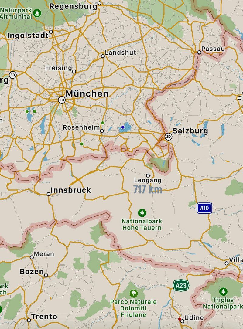
07/25 - August 5th, 2021
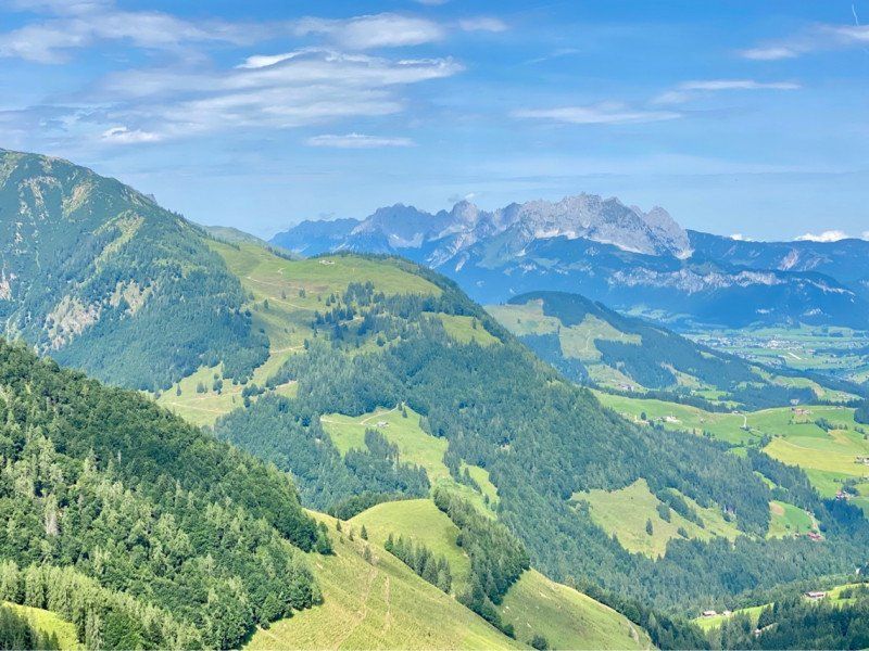
Region Zell am See (AT) and Rust am Neusiedler See with detours to Innsbruck, Vienna and Sopron (HUN)
Day
Werder (Havel), Deutschland
Glindow, 14542 Werder (Havel), Deutschland
52° 21' 26.1" N 12° 53' 21.9" E
52.3572443 12.8894092
• Head toward Albertstraße on Bliesendorfer Straße. Go for 12 m.
• Turn right onto Albertstraße. Go for 414 m.
• Turn left onto Ziemensstraße. Go for 1.0 km.
• Turn right onto Deiche. Go for 48 m.
• Turn slightly left onto Deiche. Go for 162 m.
• Turn right onto Klaistower Straße (L90). Go for 969 m.
• Pass 2 roundabouts and continue on Klaistower Straße (L90). Go for 4.8 km.
• Turn left and take ramp onto A10 (Berliner Ring) toward Frankfurt/München. Go for 3.2 km.
• Take exit 19 toward München/Leipzig onto A9 (Autobahndreieck Potsdam). Go for 522 km.
• Take the exit toward Salzburg/Innsbruck/Messe/ICM onto A99. Go for 29.4 km.
• Take exit 21 toward Salzburg/Innsbruck onto A8. Go for 47.3 km.
• Take the exit toward Verona/Brenner/Innsbruck/Kufstein onto A93. Go for 25.4 km.
• Continue on A12 (Inntal Autobahn). Go for 5.8 km.
• Take exit 6 toward Kufstein-Süd/Felbertauern onto B173 (Eiberg Bundesstraße). Go for 1.0 km.
• Take the 2nd exit from roundabout onto Eiberg Bundesstraße (B173) toward St. Johann i. T. Go for 692 m.
• Keep right toward Kitzbühel/St. Johann i. T./Felbertauern. Go for 110 m.
• Continue on Eibergstraße (B173). Go for 9.0 km.
• Take left ramp onto Loferer Bundesstraße (B178) toward Salzburg/Kitzbühel/St. Johann i. T./Felbertauern. Go for 18.2 km.
• Take ramp onto Dechant-Wieshofer-Straße (B164) toward Saalfelden/Fieberbrunn/St. Johann i. T. Go for 1.0 km.
• Take the 3rd exit from roundabout onto Fieberbrunner Straße (B164). Go for 9.0 km.
• Take the 2nd exit from roundabout onto Rosenegg (B164). Go for 1.7 km.
• Turn right onto Dorfstraße. Go for 118 m.
• Continue on Lindauweg. Go for 220 m.
• Turn left onto Prama. Go for 69 m.
• Turn left onto Prama. Go for 53 m.
• Arrive at Prama. Your destination is on the right.
☍
681,8 km
(6 hrs. 9 min.)
Fieberbrunn, 25.07.
6391 Fieberbrunn, Österreich
47° 28' 32.1" N 12° 32' 44.7" E
47.4755900 12.5457457
• Head east on Prama. Go for 53 m.
• Turn right onto Prama. Go for 69 m.
• Turn right onto Lindauweg. Go for 220 m.
• Continue on Dorfstraße. Go for 118 m.
• Turn right onto Spielbergstraße (B164). Go for 741 m.
• Turn right onto Lindau. Go for 356 m.
• Turn left onto Reith. Go for 60 m.
• Turn right onto Lindau. Go for 102 m.
• Turn right onto Lindau. Go for 165 m.
• Turn left. Go for 73 m.
• Turn right. Go for 303 m.
• Turn left. Go for 35 m.
• Arrive at your destination on the right.
☍
2,3 km
( 6 min.)
Day
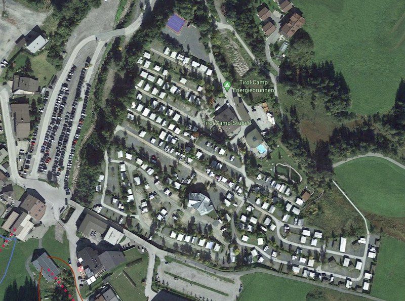
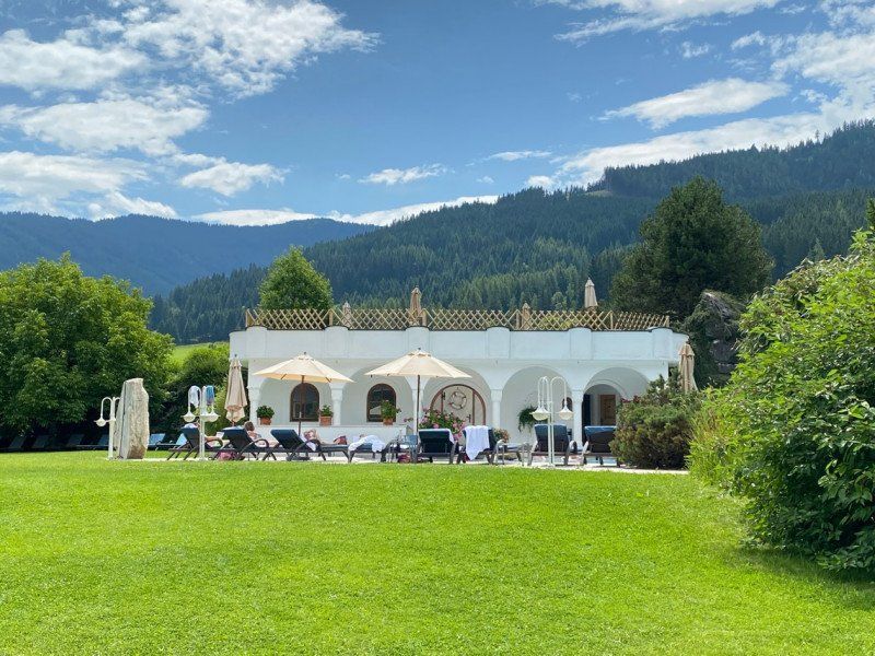
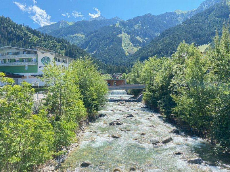
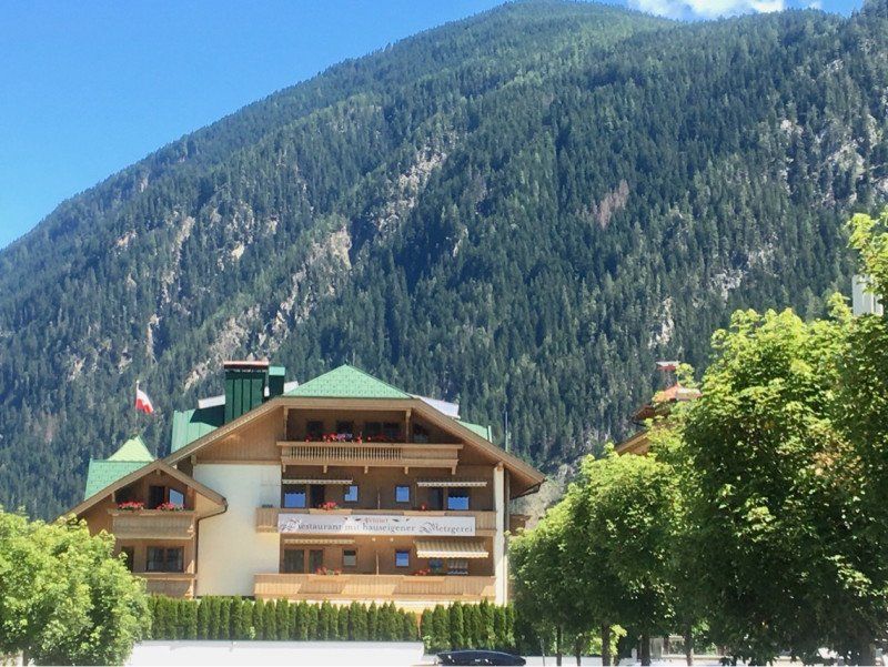
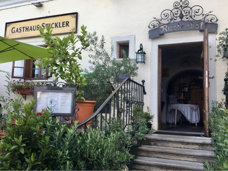
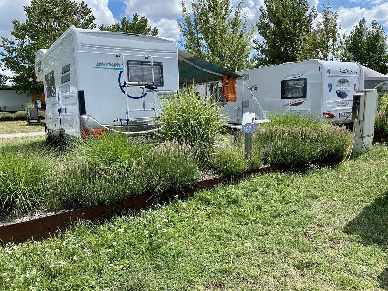
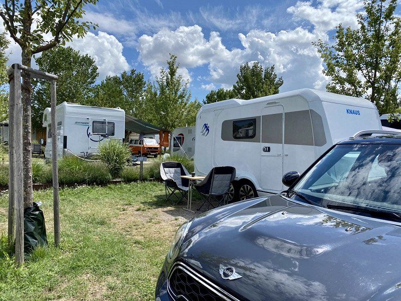
Tirol-Camp-Fieberbrunn, 26.07.
With a total of 477 EUR, this is probably the most expensive campsite of all time. But it also offers something: Terraced grounds, comfort pitches with private bathrooms, 8 saunas for an extra €20 per person, good restaurant, indoor pool, 2 outdoor pools, good views of the mountains, overall short distances to the lift and shopping.
Lindau 20, 6391, Fieberbrunn, Österreich
47° 28' 3.8" N 12° 33' 10.2" E
47.4677300 12.5528200
• Head south. Go for 35 m.
• Turn right. Go for 303 m.
• Turn left. Go for 36 m.
• Turn right toward Lindau. Go for 37 m.
• Turn right onto Lindau. Go for 165 m.
• Turn left onto Lindau. Go for 102 m.
• Turn left onto Reith. Go for 60 m.
• Turn right onto Lindau. Go for 356 m.
• Turn right onto Spielbergstraße (B164). Go for 15.3 km.
• Turn right onto Rain. Go for 406 m.
• Turn right. Go for 86 m.
• Arrive at your destination on the left.
☍
16,9 km
( 19 min.)
Krallerhof, Rain, Leogang, Österreich
Rain 6, 5771 Leogang, Österreich
47° 26' 17.6" N 12° 44' 9.6" E
47.4382170 12.7359890
• Head north. Go for 108 m.
• Turn left onto Rain. Go for 104 m.
• Continue on Rain. Go for 302 m.
• Turn right onto Hochkönig Bundesstraße (B164). Go for 8.9 km.
• Take the 1st exit from roundabout onto Zeller Bundesstraße (B311). Go for 281 m.
• Pass 2 roundabouts and continue on Thor (B311). Go for 11.0 km.
• Take ramp onto Zeller Straße (L247) toward Zell am See/Thumersbach. Go for 731 m.
• Continue on Loferer Bundesstraße. Go for 1.8 km.
• Continue on Brucker Bundesstraße. Go for 29 m.
• Arrive at Brucker Bundesstraße. Your destination is on the left.
☍
23,2 km
( 23 min.)
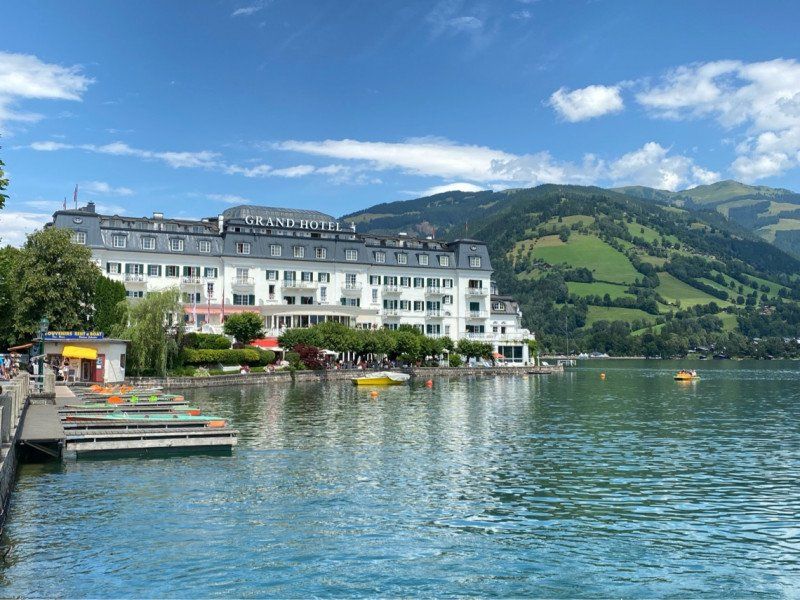
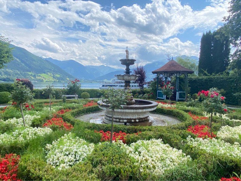
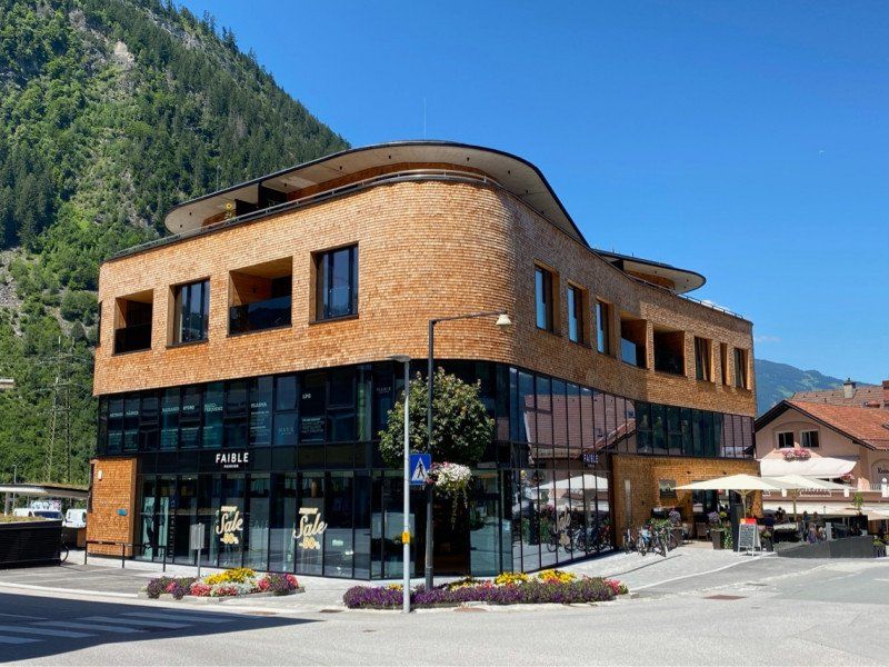
Zell am See, Österreich
Local tour
5700 Zell am See, Österreich
47° 19' 24.7" N 12° 47' 48.7" E
47.3235200 12.7968500
• Head toward Dreifaltigkeitsgasse on Brucker Bundesstraße. Go for 29 m.
• Continue on Loferer Bundesstraße. Go for 2.4 km.
• Take left ramp onto Pinzgauer Bundesstraße (B311). Go for 10.3 km.
• Pass 2 roundabouts and continue on Markt (B311). Go for 1.0 km.
• Take the 3rd exit from roundabout onto Leogangerstraße (B164). Go for 24.2 km.
• Turn left onto Lindau. Go for 356 m.
• Turn left onto Reith. Go for 60 m.
• Turn right onto Lindau. Go for 102 m.
• Turn right onto Lindau. Go for 165 m.
• Turn left. Go for 73 m.
• Turn right. Go for 303 m.
• Turn left. Go for 35 m.
• Arrive at your destination on the right.
☍
39,1 km
( 39 min.)
Tirol-Camp-Fieberbrunn
Lindau 20, 6391, Fieberbrunn, Österreich
47° 28' 3.8" N 12° 33' 10.2" E
47.4677300 12.5528200
• Head south.
• Arrive at your destination on the left.
☍
Distance not available
(Duration not available)
Day
Tirol-Camp-Fieberbrunn, 27.07.
Lindau 20, 6391, Fieberbrunn, Österreich
47° 28' 3.8" N 12° 33' 10.2" E
47.4677300 12.5528200
• Head south.
• Arrive at your destination on the left.
☍
Distance not available
(Duration not available)
Tirol-Camp-Fieberbrunn
Lindau 20, 6391, Fieberbrunn, Österreich
47° 28' 3.8" N 12° 33' 10.2" E
47.4677300 12.5528200
• Head south. Go for 35 m.
• Turn right. Go for 303 m.
• Turn left. Go for 36 m.
• Turn right toward Lindau. Go for 37 m.
• Turn right onto Lindau. Go for 165 m.
• Turn left onto Lindau. Go for 102 m.
• Turn left onto Reith. Go for 60 m.
• Turn right onto Lindau. Go for 356 m.
• Turn left onto Spielbergstraße (B164). Go for 2.4 km.
• Take the 2nd exit from roundabout onto Rosenegg (B164). Go for 9.0 km.
• Take the 3rd exit from roundabout onto Bahnhofstraße. Go for 211 m.
• Continue on Brauweg. Go for 86 m.
• Take the 1st exit from roundabout onto Brauweg. Go for 274 m.
• Turn left onto Speckbacherstraße. Go for 2.4 km.
• Turn left onto Pass Thurn Bundesstraße (B161). Go for 7.6 km.
• Arrive at Pass Thurn-Straße (B161).
☍
23,1 km
( 30 min.)
Day
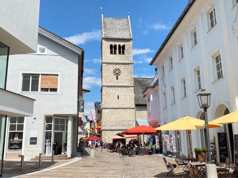
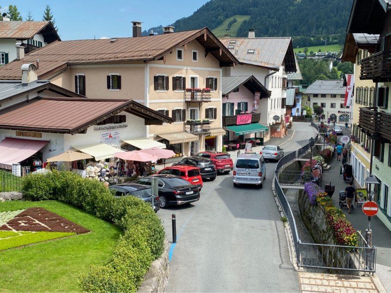
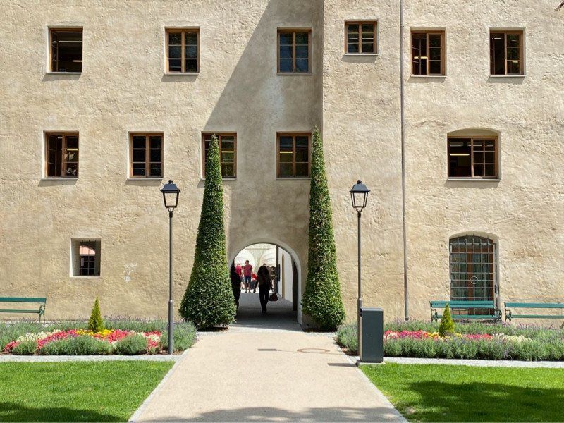
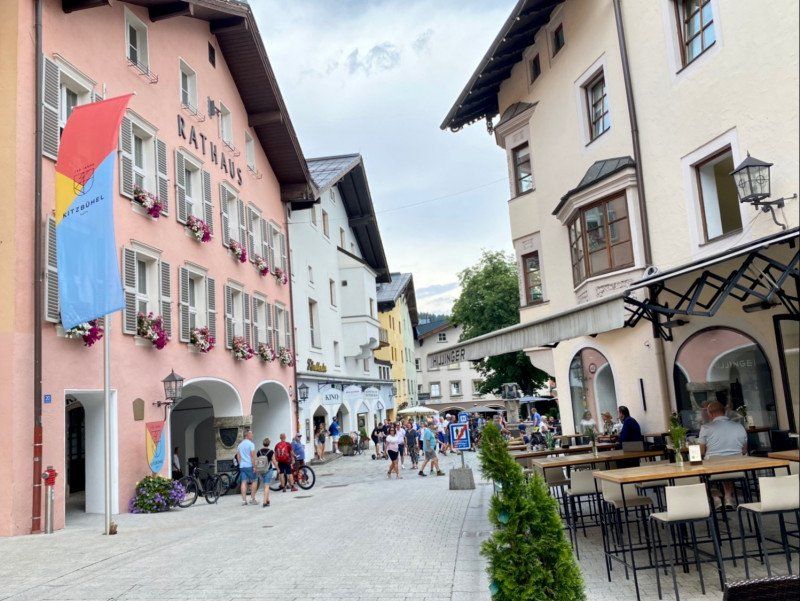
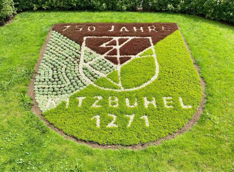
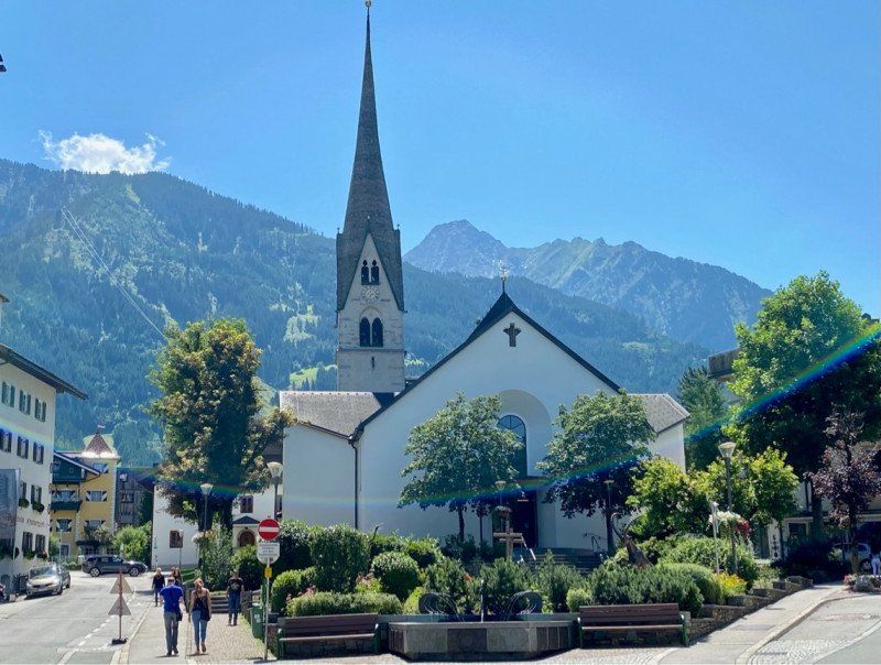
Kitzbühel, Österreich
6370 Kitzbühel, Österreich
47° 26' 57.3" N 12° 23' 33.1" E
47.4492375 12.3925407
• Head southeast on Pass Thurn-Straße (B161).
• Turn left onto Hornweg. Go for 19 m.
• Turn left onto Achenweg. Go for 560 m.
• Continue on Bahnhofplatz. Go for 37 m.
• Continue on Bahnhofstraße. Go for 156 m.
• Turn right onto Josef-Pirchl-Straße (B161). Go for 7.0 km.
• Turn right toward St. Johann Süd. Go for 143 m.
• Continue on Speckbacher. Go for 2.3 km.
• Turn right onto Brauweg. Go for 244 m.
• Take the 2nd exit from roundabout onto Brauweg. Go for 121 m.
• Continue on Bahnhofstraße. Go for 165 m.
• Take the 1st exit from roundabout onto Fieberbrunner Straße (B164). Go for 9.0 km.
• Take the 2nd exit from roundabout onto Rosenegg (B164). Go for 2.4 km.
• Turn right onto Lindau. Go for 356 m.
• Turn left onto Reith. Go for 60 m.
• Turn right onto Lindau. Go for 102 m.
• Turn right onto Lindau. Go for 165 m.
• Turn left. Go for 73 m.
• Turn right. Go for 303 m.
• Turn left. Go for 35 m.
• Arrive at your destination on the right.
☍
23,3 km
( 31 min.)
Tirol-Camp-Fieberbrunn, 28.07.
Lindau 20, 6391, Fieberbrunn, Österreich
47° 28' 3.8" N 12° 33' 10.2" E
47.4677300 12.5528200
• Head south.
• Arrive at your destination on the left.
☍
Distance not available
(Duration not available)
Day
Tirol-Camp-Fieberbrunn, 29.07.
Lindau 20, 6391, Fieberbrunn, Österreich
47° 28' 3.8" N 12° 33' 10.2" E
47.4677300 12.5528200
• Head south. Go for 35 m.
• Turn right. Go for 303 m.
• Turn left. Go for 36 m.
• Turn right toward Lindau. Go for 37 m.
• Turn right onto Lindau. Go for 165 m.
• Turn left onto Lindau. Go for 102 m.
• Turn left onto Reith. Go for 60 m.
• Turn right onto Lindau. Go for 356 m.
• Turn left onto Spielbergstraße (B164). Go for 2.4 km.
• Take the 2nd exit from roundabout onto Rosenegg (B164). Go for 9.0 km.
• Take the 1st exit from roundabout onto Meraner Straße (B164). Go for 210 m.
• Turn left onto Dechant-Wieshofer-Straße. Go for 115 m.
• Turn right onto Neubauweg. Go for 361 m.
• Turn left onto Gasteiger Straße. Go for 36 m.
• Turn right onto Birkenstraße. Go for 219 m.
• Turn left onto Salzburger Straße (B178). Go for 1.3 km.
• Keep left onto Pass-Thurn-Straße (B178) toward Innsbruck/München/Kufstein/Wörgl. Go for 28.3 km.
• Continue on Anschlussstelle Wörgl Ost toward Salzburg/A12/München/E45/Innsbruck/E60. Go for 553 m.
• Take ramp onto A12 (Inntal Autobahn) toward Innsbruck. Go for 23.5 km.
• Take exit 39 toward Zillertal. Go for 477 m.
• Continue on Achensee Bundesstraße (B181). Go for 758 m.
• Continue on Zillertal Bundesstraße (B169). Go for 14.1 km.
• Pass 3 roundabouts and continue on Umfahrungstraße (B169). Go for 15.4 km.
• Turn left onto Einfahrt Mitte (L330). Go for 265 m.
• Turn right onto Waldbadstraße. Go for 118 m.
• Turn slightly left onto Waldbadstraße. Go for 191 m.
• Arrive at Waldbadstraße. Your destination is on the left.
☍
98,3 km
(1 hrs. 33 min.)
Mayrhofen im Zillertal, Waldbadstraße, Mayrhofen, Österreich
Waldbadstraße 539, 6290 Mayrhofen, Österreich
47° 9' 51" N 11° 51' 51.6" E
47.1641622 11.8643453
• Head toward Peter-Habeler-Straße on Waldbadstraße. Go for 148 m.
• Turn sharp left onto Peter-Habeler-Straße. Go for 429 m.
• Turn slightly left onto Pfarrer-Krapf-Straße (L330). Go for 28 m.
• Turn left onto Scheulingstraße (L330). Go for 30 m.
• Turn right onto Pfarrer-Krapf-Straße (L330). Go for 402 m.
• Turn right onto Umfahrungstraße (B169). Go for 362 m.
• Pass 2 roundabouts and continue on Talstraße (B169). Go for 6.4 km.
• Continue on Steinfeld (B169). Go for 8.7 km.
• Take the 2nd exit from roundabout onto Gewerbegebiet (B169). Go for 14.1 km.
• Continue on Achensee Bundesstraße (B181). Go for 825 m.
• Take the 3rd exit from roundabout onto A12 (Inntal Autobahn) toward Wiesing/Innsbruck. Go for 9.4 km.
• Take exit 49 toward Schwaz. Go for 931 m.
• Continue on Münchner Straße. Go for 455 m.
• Take the 1st exit from roundabout onto Münchner Straße (B171) toward Innsbruck. Go for 772 m.
• Turn right onto Swarovskistraße. Go for 104 m.
• Turn left onto Dr.-Körner-Straße. Go for 882 m.
• Continue on Innhöfe. Go for 104 m.
• Arrive at Innhöfe. Your destination is on the left.
☍
44,0 km
( 44 min.)
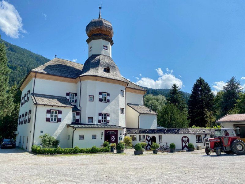
Schloß Mitterhart Hotel - Restaurant, Innhöfe, Vomp, Österreich
Innhöfe 3, 6134 Vomp, Österreich
47° 20' 13.7" N 11° 42' 6.3" E
47.3371521 11.7017504
• Head west on Innhöfe. Go for 89 m.
• Turn left onto Innhöfe. Go for 60 m.
• Turn slightly right onto Innhöfe. Go for 856 m.
• Turn left onto Altmahd. Go for 1.3 km.
• Take the 1st exit from roundabout onto Altmahd. Go for 86 m.
• Continue on Pirchat. Go for 512 m.
• Turn left onto Vomper Landesstraße (L222). Go for 180 m.
• Take the 1st exit from roundabout onto A12 (Inntal Autobahn) toward Innsbruck. Go for 20.8 km.
• Take exit 73 toward Innsbruck-Ost onto B174 (Amraser-See-Straße). Go for 1.1 km.
• Keep left onto Innsbrucker Bundesstraße (B174) toward Zentrum Innsbruck. Go for 683 m.
• Turn slightly right onto Amraser Straße. Go for 321 m.
• Turn right onto Rudolf-Greinz-Straße toward Zentrum. Go for 156 m.
• Continue on Langstraße. Go for 482 m.
• Continue on Pembaurstraße. Go for 612 m.
• Continue on Pembaurbrücke. Go for 37 m.
• Continue on Bienerstraße. Go for 697 m.
• Continue on Tschurtschenthalerstraße. Go for 289 m.
• Turn left onto Rennweg (B171). Go for 807 m.
• Arrive at Herzog-Otto-Straße (B171). Your destination is on the left.
☍
29,1 km
( 29 min.)
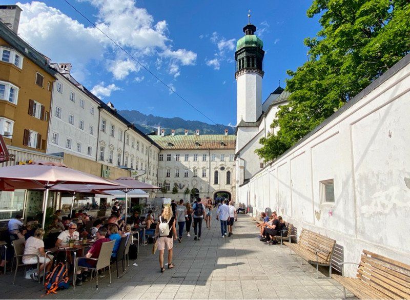
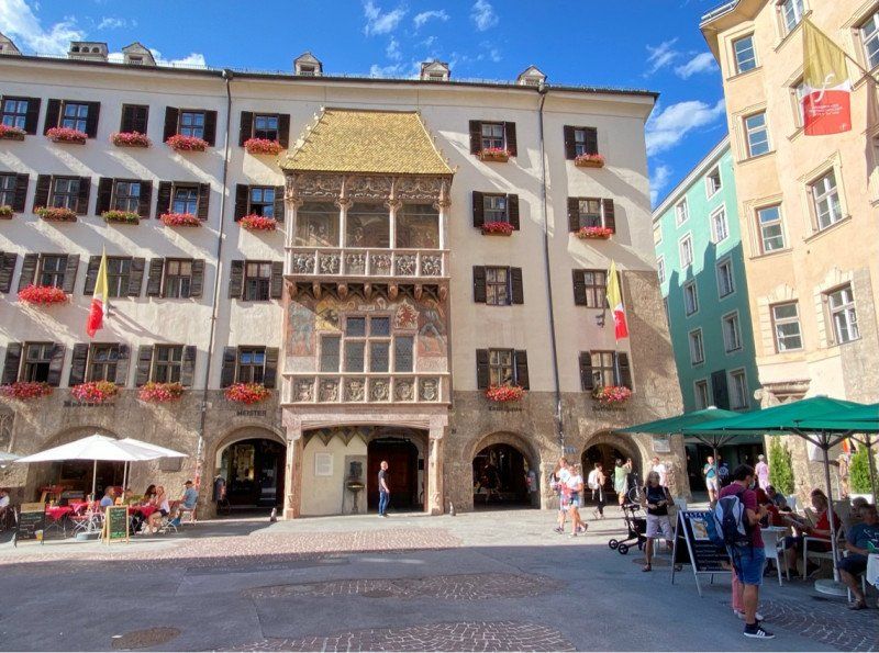
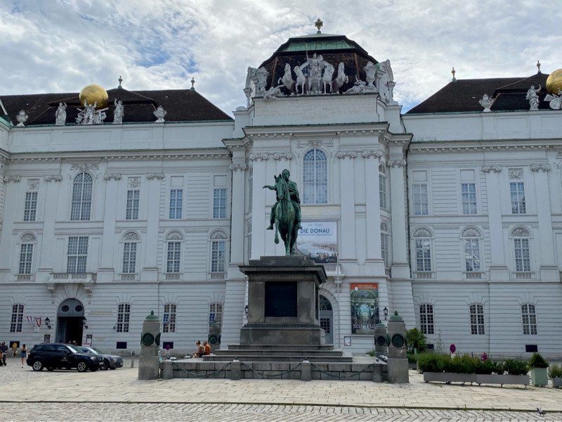
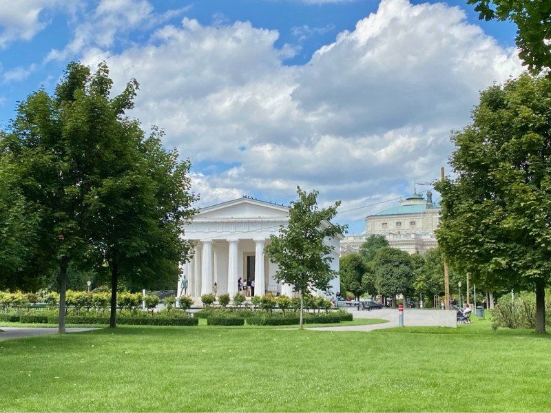
Goldenes Dachl, Herzog-Friedrich-Straße, Innsbruck, Österreich
Herzog-Friedrich-Straße 15, 6020 Innsbruck, Österreich
47° 16' 7.2" N 11° 23' 35.8" E
47.2686596 11.3932778
• Head toward Innbrücke on Herzog-Otto-Straße (B171). Go for 631 m.
• Continue on Innrain (L11) toward A12/A13/Matrei a. Br. Go for 740 m.
• Turn left onto Holzhammerstraße (B174) toward Matrei a. Br./B182. Go for 2.1 km.
• Continue on Olympiastraße (B174). Go for 32 m.
• Keep right onto Olympiastraße toward A12/Igls/Aldrans. Go for 312 m.
• Take the 1st exit from roundabout onto Resselstraße (L9) toward Bregenz/A12/Igls/Aldrans. Go for 197 m.
• Turn right. Go for 147 m.
• Arrive at your destination on the left.
☍
4,2 km
( 9 min.)
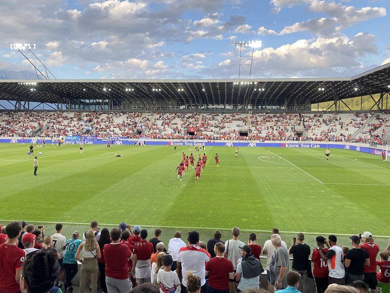
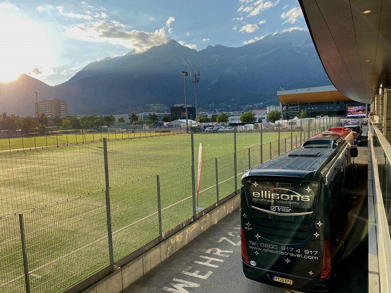
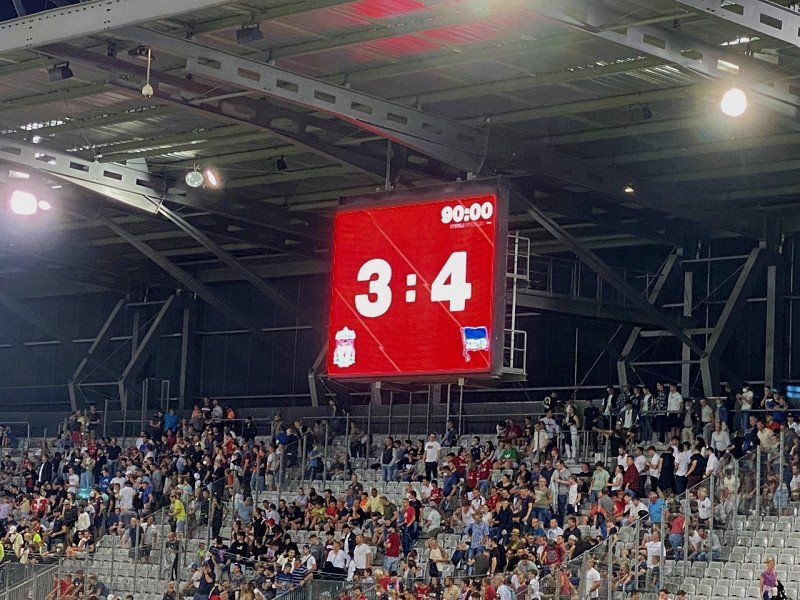
Tivoli Stadion, Stadionstraße, Innsbruck, Österreich
Hertha BSC - Liverpool FC 4:3
Stadionstraße 1, 6020 Innsbruck, Österreich
47° 15' 21.8" N 11° 24' 37.8" E
47.2560654 11.4104910
• Head toward Resselstraße. Go for 147 m.
• Turn right onto Resselstraße (L9). Go for 372 m.
• Take the 4th exit from roundabout onto A12 (Knoten Innsbruck-Amras) toward Salzburg/München. Go for 58.3 km.
• Take exit 17 toward B178/Felbertauern/Brixental onto Anschlussstelle Wörgl Ost. Go for 1.9 km.
• Continue on Loferer Bundesstraße (B178). Go for 30.3 km.
• Take ramp onto Dechant-Wieshofer-Straße (B164) toward Saalfelden/Fieberbrunn/St. Johann i. T. Go for 1.0 km.
• Take the 3rd exit from roundabout onto Fieberbrunner Straße (B164). Go for 9.0 km.
• Take the 2nd exit from roundabout onto Rosenegg (B164). Go for 2.4 km.
• Turn right onto Lindau. Go for 356 m.
• Turn left onto Reith. Go for 60 m.
• Turn right onto Lindau. Go for 102 m.
• Turn right onto Lindau. Go for 165 m.
• Turn left. Go for 73 m.
• Turn right. Go for 303 m.
• Turn left. Go for 35 m.
• Arrive at your destination on the right.
☍
104,7 km
(1 hrs. 25 min.)
Tirol-Camp-Fieberbrunn
Lindau 20, 6391, Fieberbrunn, Österreich
47° 28' 3.8" N 12° 33' 10.2" E
47.4677300 12.5528200
• Head south.
• Arrive at your destination on the left.
☍
Distance not available
(Duration not available)
Day
Tirol-Camp-Fieberbrunn, 30.07.
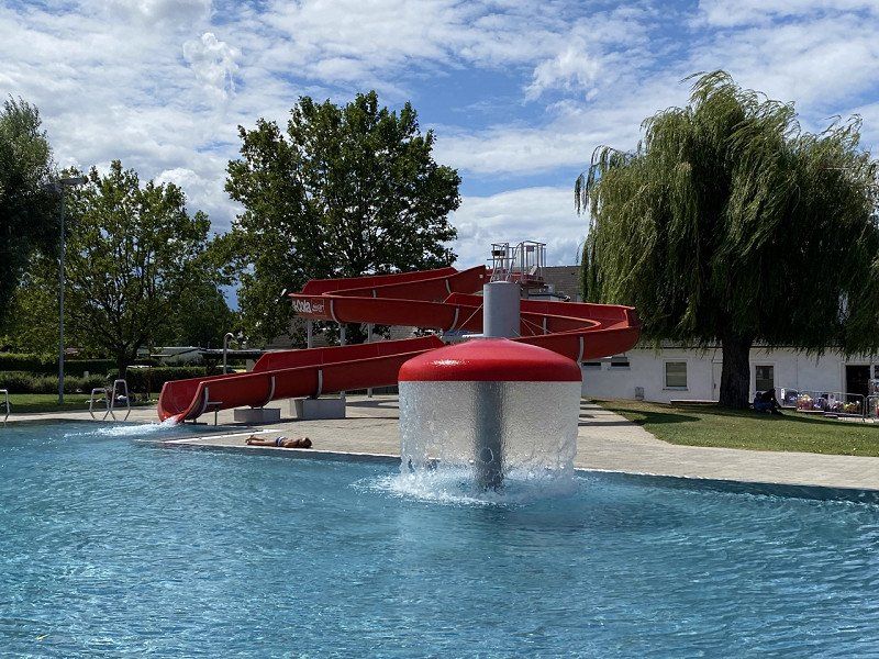
Rest day, use of the swimming area (natural lake, indoor and outdoor pool)
Lindau 20, 6391, Fieberbrunn, Österreich
47° 28' 3.8" N 12° 33' 10.2" E
47.4677300 12.5528200
• Head south.
• Arrive at your destination on the left.
☍
Distance not available
(Duration not available)
Tirol-Camp-Fieberbrunn
Lindau 20, 6391, Fieberbrunn, Österreich
47° 28' 3.8" N 12° 33' 10.2" E
47.4677300 12.5528200
• Head south.
• Arrive at your destination on the left.
☍
Distance not available
(Duration not available)
Day
Tirol-Camp-Fieberbrunn, 31.07.
Lindau 20, 6391, Fieberbrunn, Österreich
47° 28' 3.8" N 12° 33' 10.2" E
47.4677300 12.5528200
• Head south. Go for 35 m.
• Turn right. Go for 303 m.
• Turn left. Go for 36 m.
• Turn right toward Lindau. Go for 37 m.
• Turn right onto Lindau. Go for 165 m.
• Turn left onto Lindau. Go for 102 m.
• Turn left onto Reith. Go for 60 m.
• Turn right onto Lindau. Go for 356 m.
• Turn right onto Spielbergstraße (B164). Go for 24.2 km.
• Take the 2nd exit from roundabout onto Leogangerstraße. Go for 349 m.
• Take the 3rd exit from roundabout onto Bahnhofstraße (B164). Go for 18.3 km.
• Pass 3 roundabouts. Go for 20.5 km.
• Take ramp onto Pinzgauer Bundesstraße (B311). Go for 4.0 km.
• Take ramp onto A10 (Tauern Autobahn) toward Graz/Villach. Go for 16.0 km.
• Take exit 63 toward Graz/Altenmarkt. Go for 1.9 km.
• Continue on Salzburger Straße (B320). Go for 4.7 km.
• Keep right onto Ennstal Bundesstraße (B320) toward Graz/Wien/Schladming. Go for 68.6 km.
• Continue on Salzburger Straße (B320). Go for 1.5 km.
• Keep right toward Slowenien/A9/Graz. Go for 1.6 km.
• Continue on Anschlussstelle Selzthal. Go for 1.3 km.
• Take ramp onto A9 (Pyhrn Autobahn). Go for 63.5 km.
• Take exit 133 toward Klagenfurt/Wien/A9/Graz onto S6 (Semmering Schnellstraße). Go for 7.1 km.
• Take exit 98 toward Leoben-West/Zentrum/Leoben. Go for 811 m.
• Take the 2nd exit from roundabout onto Turmgasse (L101) toward Leoben/Leoben Zentrum. Go for 1.4 km.
• Take the 3rd exit from roundabout onto Turmgasse (L101). Go for 471 m.
• Continue on Josef-Heißl-Straße (L101). Go for 891 m.
• Turn right onto Kärntner Straße. Go for 252 m.
• Continue straight ahead. Go for 11 m.
• Arrive at your destination.
☍
238,3 km
(3 hrs. 7 min.)
Leoben, Österreich
Drive through Styria to Burgenland
8700 Leoben, Österreich
47° 22' 35" N 15° 5' 28.1" E
47.3763900 15.0911300
• Head south on Kärntner Straße (B116). Go for 11 m.
• Turn left onto Kärntner Straße (B116). Go for 2.4 km.
• Take ramp onto S6 (Semmering Schnellstraße) toward Wien/Graz/Bruck/Mur. Go for 92.0 km.
• Continue on Knoten Seebenstein. Go for 1.7 km.
• Continue on A2 (Süd Autobahn). Go for 8.5 km.
• Take the exit toward Eisenstadt/Mattersburg/Wr.Neustadt Süd onto S4 (Mattersburger Schnellstraße). Go for 5.0 km.
• Take ramp onto Mattersburger Schnellstraße (S4) toward Eisenstadt/Mattersburg. Go for 12.0 km.
• Keep left onto Mattersburger Schnellstraße (S4) toward Wien/S31/Sopron/Eisenstadt/Mattersburg. Go for 503 m.
• Take ramp onto Burgenland Schnellstraße (S31) toward Sopron/Eisenstadt/Wien. Go for 12.9 km.
• Take the exit toward Rust. Go for 414 m.
• Turn slightly right onto Ruster Straße (B52) toward Rust/Mörbisch/See/St.Margarethen/Trausdorf. Go for 106 m.
• Pass 4 roundabouts and continue on Ruster Bundesstraße (B52). Go for 11.6 km.
• Turn left onto Oggauer Straße (L209). Go for 186 m.
• Arrive at Oggauer Straße (L209). Your destination is on the right.
☍
147,3 km
(1 hrs. 29 min.)
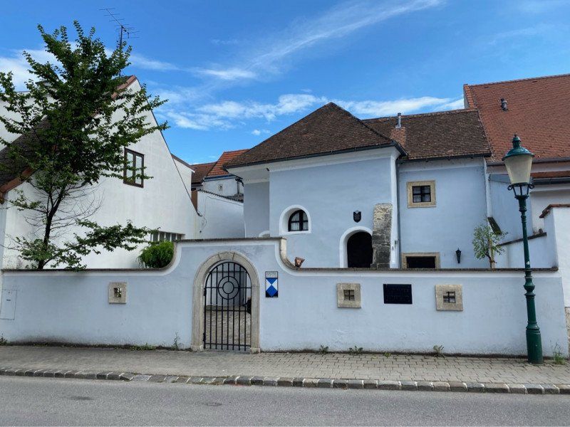
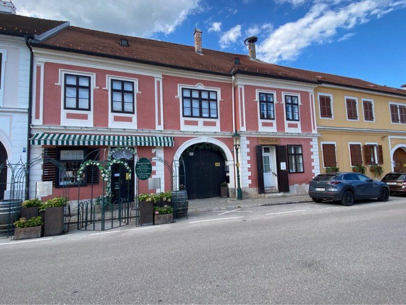
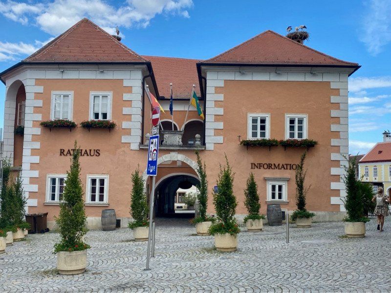
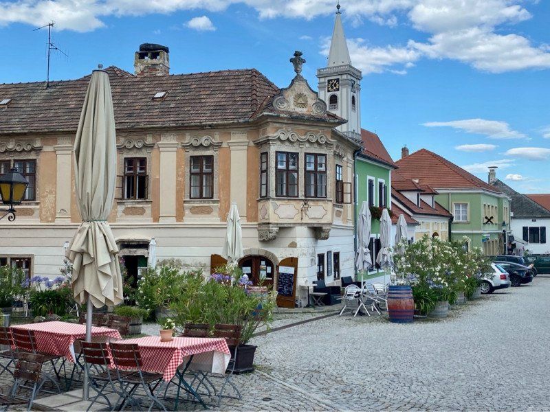
Rust, Österreich, 31.07.
7071 Rust, Österreich
47° 48' 8.6" N 16° 40' 19.8" E
47.8023800 16.6721800
• Head north on Oggauer Straße (L209).
• Turn right onto Dr.-Ernst-Franz-Straße. Go for 410 m.
• Turn right onto Am Seekanal. Go for 51 m.
• Turn left onto Seestraße (L315). Go for 1.1 km.
• Turn right onto Ruster Bucht Campingplatz. Go for 160 m.
• Arrive at Ruster Bucht Campingplatz. Your destination is on the right.
☍
1,8 km
( 3 min.)
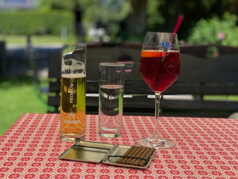
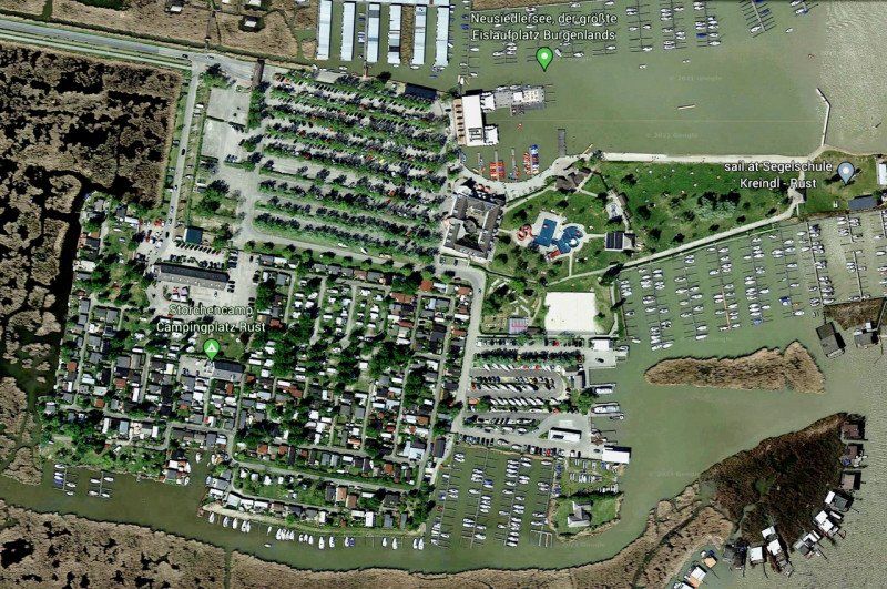
Storchencamp Rust
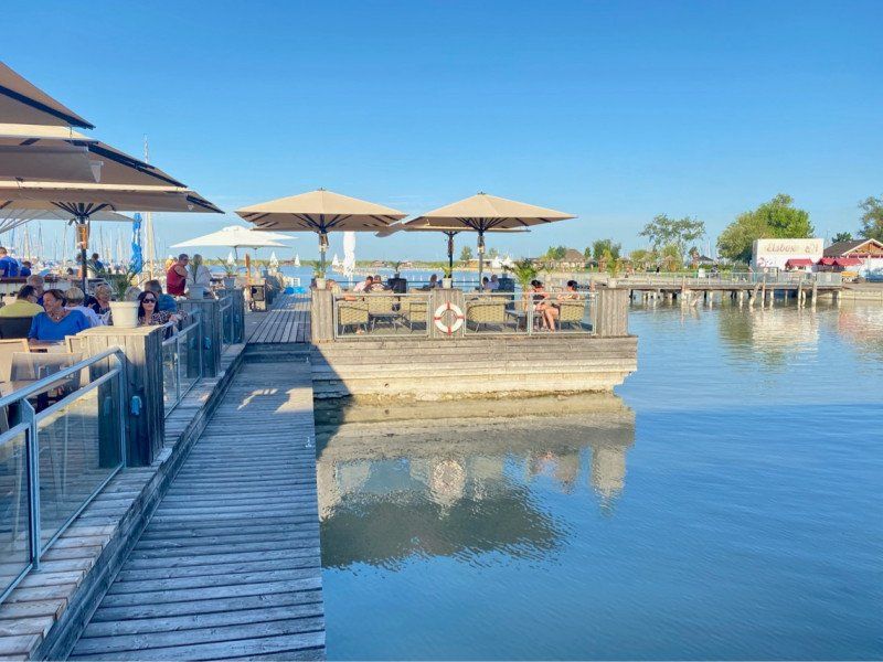
At €195, the campsite is at a high level. The price also includes entry to the adjacent outdoor swimming pool, which has a restaurant, a bar and a pool area. The sanitary facilities are modern. The squares have modern plants on one side. The water and electricity connections could possibly be a little far away from the pitch (water hose and power cable of 25-30 meters each should be sufficient).
Seebadanlage Ruster Bucht, 7071, Rust, Österreich
47° 48' 3.5" N 16° 41' 31.4" E
47.8009600 16.6920500
• Head east on Ruster Bucht Campingplatz.
• Arrive at Ruster Bucht Campingplatz. Your destination is on the right.
☍
Distance not available
(Duration not available)
Day
Storchencamp Rust, 01.08.
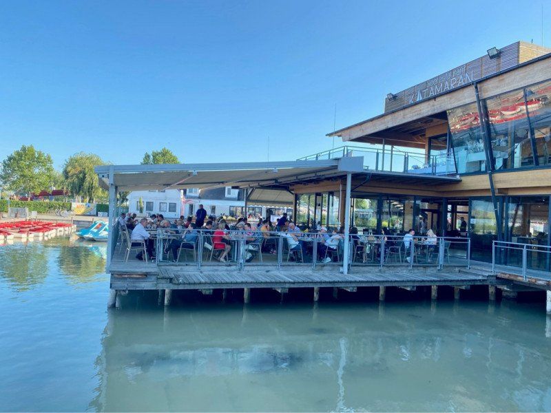
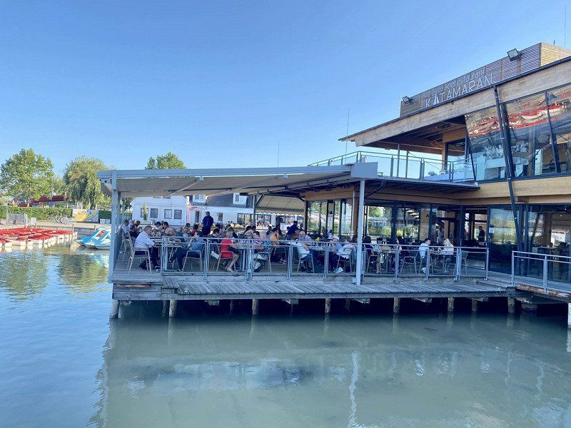
After arriving at the “Katamaran” restaurant
Seebadanlage Ruster Bucht, 7071, Rust, Österreich
47° 48' 3.5" N 16° 41' 31.4" E
47.8009600 16.6920500
• Head toward Seestraße on Ruster Bucht Campingplatz. Go for 160 m.
• Turn right onto Ruster Bucht (L315). Go for 306 m.
• Continue on Ruster Bucht. Go for 149 m.
• Continue on Südhafen. Go for 70 m.
• Turn right onto Ruster Bucht Campingplatz. Go for 162 m.
• Turn left onto Ruster Bucht Campingplatz. Go for 23 m.
• Turn left onto Ruster Bucht Campingplatz. Go for 23 m.
• Turn right onto Ruster Bucht Campingplatz. Go for 39 m.
• Arrive at Ruster Bucht Campingplatz. Your destination is on the left.
☍
0,9 km
( 2 min.)
Storchencamp Campingplatz Rust, Ruster Bucht Campingplatz, Rust, Österreich
Ruster Bucht Campingpl. 334, 7071 Rust, Österreich
47° 48' 1.4" N 16° 41' 32.2" E
47.8003799 16.6922831
• Head south on Ruster Bucht Campingplatz. Go for 39 m.
• Turn left onto Ruster Bucht Campingplatz. Go for 23 m.
• Turn right onto Ruster Bucht Campingplatz. Go for 23 m.
• Turn right onto Ruster Bucht Campingplatz. Go for 162 m.
• Turn left onto Südhafen. Go for 70 m.
• Continue on Ruster Bucht. Go for 448 m.
• Turn left onto Ruster Bucht Campingplatz. Go for 160 m.
• Arrive at Ruster Bucht Campingplatz. Your destination is on the right.
☍
0,9 km
( 3 min.)
Day
Storchencamp Rust, 02.08.
Seebadanlage Ruster Bucht, 7071, Rust, Österreich
47° 48' 3.5" N 16° 41' 31.4" E
47.8009600 16.6920500
• Head toward Ruster Bucht on Ruster Bucht Campingplatz. Go for 160 m.
• Turn left onto Seestraße (L315). Go for 1.3 km.
• Turn right onto Hauptstraße (L315). Go for 380 m.
• Turn right onto Franz-Josefs-Platz (B52). Go for 2.1 km.
• Pass 2 roundabouts and continue on Hauptstraße (B52). Go for 8.2 km.
• Take the 3rd exit from roundabout onto Ruster Bundesstraße (B52). Go for 1.2 km.
• Take the 1st exit from roundabout onto Ruster Straße (B52). Go for 341 m.
• Take the 1st exit from roundabout onto S31 (Burgenland Schnellstraße) toward Wien/A3/Wr.Neustadt/Mattersburg. Go for 2.4 km.
• Take the exit toward Wien onto A3 (Südost Autobahn). Go for 30.5 km.
• Continue on A2 (Knoten Guntramsdorf). Go for 12.3 km.
• Continue on A23 (Knoten Wien-Inzersdorf Süd) toward Wien/Favoriten. Go for 9.4 km.
• Take the exit toward Zentrum/B227/Erdberg/B221 onto A4 (Ost Autobahn). Go for 1.4 km.
• Continue on Schüttelstraße (B227). Go for 3.3 km.
• Turn right onto Taborstraße. Go for 622 m.
• Turn right onto Rotensterngasse. Go for 245 m.
• Arrive at Rotensterngasse.
☍
74,0 km
( 57 min.)
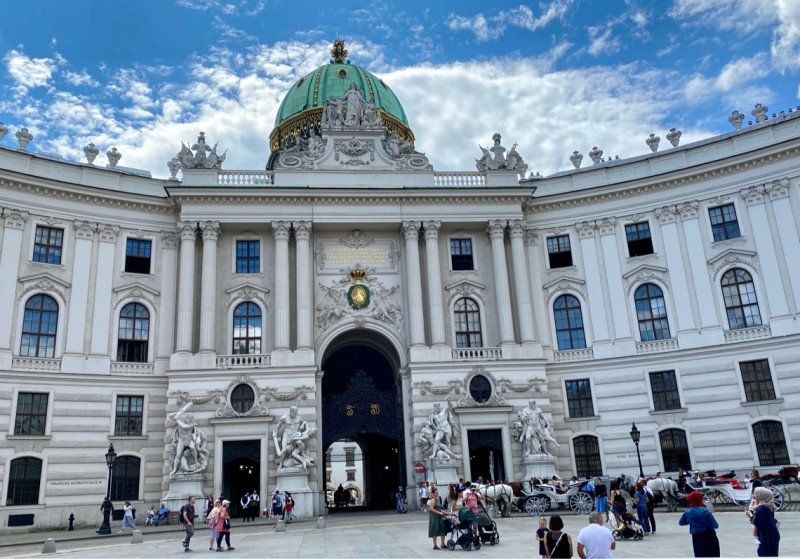
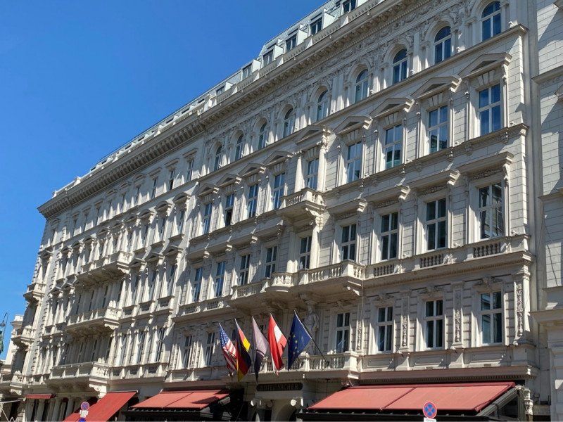
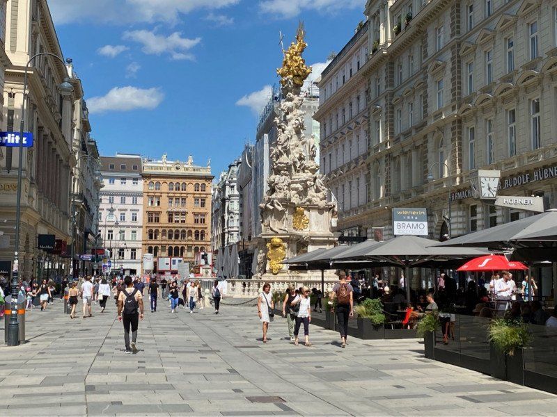
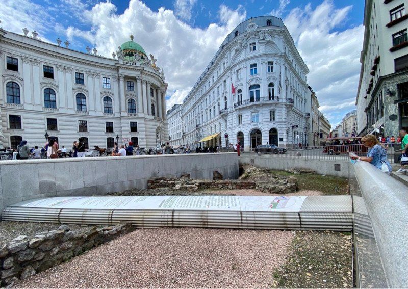
Altstadtspaziergang, Rotensterngasse, Wien, Österreich
Rotensterngasse, 1020 Wien, Österreich
48° 13' 2.4" N 16° 23' 2.2" E
48.2173198 16.3839424
• Head southeast on Rotensterngasse. Go for 46 m.
• Turn right onto Kleine Mohrengasse. Go for 155 m.
• Turn right onto Johannes-von-Gott-Platz. Go for 225 m.
• Turn left onto Taborstraße. Go for 370 m.
• Turn right onto Obere Donaustraße (B227). Go for 1.5 km.
• Keep left onto Brigittenauer Lände (B227) toward A22/Praha/Brno/B7. Go for 2.8 km.
• Take ramp onto Brigittenauer Lände toward Döbling/Brigittenau. Go for 323 m.
• Turn right onto Heiligenstädter Brücke. Go for 126 m.
• Continue on Gunoldstraße. Go for 391 m.
• Continue on Barawitzkagasse. Go for 456 m.
• Turn right onto Hohe Warte. Go for 1.0 km.
• Turn left onto Grinzinger Straße. Go for 964 m.
• Turn right onto Cobenzlgasse. Go for 332 m.
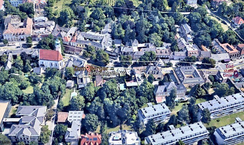
• Arrive at Himmelstraße. Your destination is on the right.
☍
8,7 km
( 15 min.)
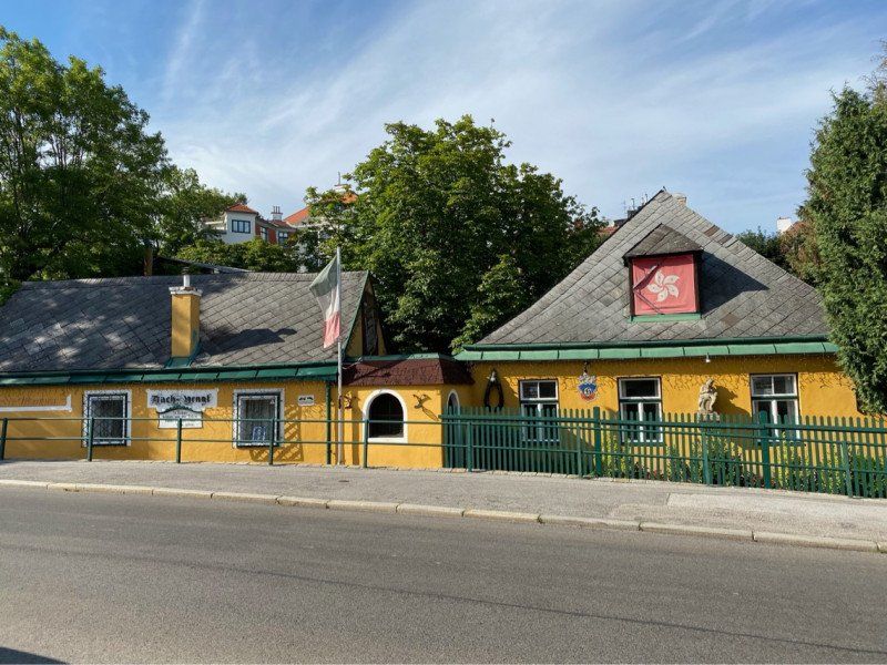
Grinzing, Wien, Österreich
48° 15' 26.3" N 16° 20' 20.6" E
48.2573052 16.3390522
• Head northwest on Himmelstraße.
• Continue on Cobenzlgasse. Go for 146 m.
• Turn left onto Feilergasse. Go for 104 m.
• Turn left onto Himmelstraße. Go for 450 m.
• Turn right onto Grinzinger Allee. Go for 1.1 km.
• Continue on Billrothstraße. Go for 599 m.
• Turn right onto Billrothstraße. Go for 1.2 km.
• Continue on Döblinger Hauptstraße. Go for 130 m.
• Turn right onto U-Bahn Bogen (B221). Go for 4.3 km.
• Turn right onto Felberstraße. Go for 248 m.
• Continue on Felberstraße. Go for 437 m.
• Turn left onto Schmelzbrücke. Go for 144 m.
• Continue on Schmelzbrückenrampe. Go for 146 m.
• Turn right onto Avedikstraße. Go for 756 m.
• Continue on Winckelmannstraße. Go for 532 m.
• Continue on Schönbrunner Brücke (B224). Go for 1.3 km.
• Keep left onto Grünbergstraße (B224). Go for 1.6 km.
• Keep right onto Anschlussstelle Altmannsdorfer Straße (A23) toward Graz/A2/Linz/A21/A1/Eisenstadt/A3/Budapest/A4/Flughafen/Inzersdorf. Go for 1.2 km.
• Keep left onto A2 (Knoten Wien-Inzersdorf Nord) toward Flughafen/Graz/Linz/St.Pölten/Eisenstadt. Go for 13.8 km.
• Take the exit toward Eisenstadt/Neusiedler See onto A3 (Knoten Guntramsdorf). Go for 30.3 km.
• Take the exit toward Eisenstadt/Neusiedler See onto S31 (Knoten Eisenstadt). Go for 3.8 km.
• Take the exit toward Rust. Go for 414 m.
• Turn slightly right onto Ruster Straße (B52) toward Rust/Mörbisch/See/St.Margarethen/Trausdorf. Go for 106 m.
• Pass 4 roundabouts and continue on Ruster Bundesstraße (B52). Go for 11.6 km.
• Turn left onto Conradplatz (L315). Go for 380 m.
• Turn left onto Am Seekanal (L315). Go for 1.6 km.
• Continue on Ruster Bucht. Go for 149 m.
• Continue on Südhafen. Go for 70 m.
• Turn right onto Ruster Bucht Campingplatz. Go for 162 m.
• Turn left onto Ruster Bucht Campingplatz. Go for 23 m.
• Turn left onto Ruster Bucht Campingplatz. Go for 23 m.
• Turn right onto Ruster Bucht Campingplatz. Go for 39 m.
• Arrive at Ruster Bucht Campingplatz. Your destination is on the left.
☍
76,8 km
(1 hrs. 9 min.)
Storchencamp Campingplatz Rust, Ruster Bucht Campingplatz, Rust, Österreich
Extremely well-maintained and new sanitary facilities. There are occasional rows of hedges planted between the parking spaces (at least towards the back). Depending on the location of the pitch, the water connections are sometimes very far away. It is therefore worth taking a longer water hose with you for refueling.
Ruster Bucht Campingpl. 334, 7071 Rust, Österreich
47° 48' 1.4" N 16° 41' 32.2" E
47.8003799 16.6922831
• Head south on Ruster Bucht Campingplatz. Go for 39 m.
• Turn left onto Ruster Bucht Campingplatz. Go for 23 m.
• Turn right onto Ruster Bucht Campingplatz. Go for 23 m.
• Turn right onto Ruster Bucht Campingplatz. Go for 162 m.
• Turn left onto Südhafen. Go for 70 m.
• Continue on Ruster Bucht. Go for 448 m.
• Turn left onto Ruster Bucht Campingplatz. Go for 160 m.
• Arrive at Ruster Bucht Campingplatz. Your destination is on the right.
☍
0,9 km
( 3 min.)
Day
Storchencamp Rust, 03.08.
Seebadanlage Ruster Bucht, 7071, Rust, Österreich
47° 48' 3.5" N 16° 41' 31.4" E
47.8009600 16.6920500
• Head toward Ruster Bucht on Ruster Bucht Campingplatz. Go for 160 m.
• Turn left onto Seestraße (L315). Go for 1.3 km.
• Turn right onto Hauptstraße (L315). Go for 380 m.
• Turn right onto Franz-Josefs-Platz (B52). Go for 23 m.
• Turn right onto Oggauer Straße (L209). Go for 8.6 km.
• Take the 1st exit from roundabout onto Burgenland Bundesstraße (B50) toward Neusiedl am See. Go for 13.0 km.
• Pass 4 roundabouts and continue on Burgenland Bundesstraße (B50). Go for 8.6 km.
• Take ramp onto A4 (Ost Autobahn) toward Wien. Go for 7.7 km.
• Take exit 36 toward Bruck/Leitha Ost. Go for 276 m.
• Turn right onto Rohrauer Bundesstraße (B211) toward Bad D. Altenburg/Petronell/Rohrau. Go for 9.6 km.
• Turn left onto Brucker Straße (L2031) toward Petronell-Carnuntum. Go for 900 m.
• Turn right onto Hauptstraße (L2026) toward Bad Deutsch-Altenburg. Go for 78 m.
• Turn left onto Langegasse. Go for 77 m.
• Arrive at Langegasse. Your destination is on the left.
☍
50,7 km
( 46 min.)
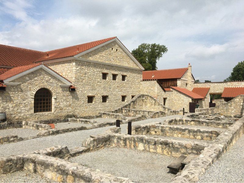
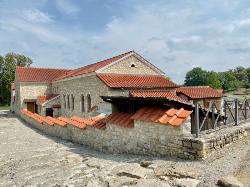
Petronell-Carnuntum, Österreich
2404 Petronell-Carnuntum, Österreich
48° 6' 46.4" N 16° 51' 54.3" E
48.1129002 16.8650784
• Head toward Hauptstraße on Langegasse. Go for 77 m.
• Turn right onto Hauptstraße (L2026). Go for 78 m.
• Turn left onto Brucker Straße (L2031) toward Bruck/L./Rohrau. Go for 900 m.
• Turn right onto Brucker Straße (B211) toward Bruck/L./Rohrau. Go for 9.9 km.
• Take ramp onto A4 (Ost Autobahn) toward Budapest/Bratislava. Go for 7.8 km.
• Take exit 43 toward Neusiedl am See/Parndorf/Eisenstadt/Neusiedl a. See onto B50 (Burgenland Bundesstraße). Go for 853 m.
• Pass 4 roundabouts and continue on Burgenland Bundesstraße (B50). Go for 20.9 km.
• Take the 2nd exit from roundabout onto L273 toward Schützen am Gebirge. Go for 2.5 km.
• Turn left onto Ruster Straße (L210). Go for 339 m.
• Turn right onto Sankt Margarethener Landesstraße (L210). Go for 5.5 km.
• Take the 1st exit from roundabout onto Hauptstraße (B52). Go for 976 m.
• Turn left onto Siegendorfer Straße. Go for 231 m.
• Continue on Hauptplatz. Go for 64 m.
• Turn left onto Hauptplatz. Go for 65 m.
• Turn right onto Friedhofgasse. Go for 125 m.
• Turn left onto Flurgasse. Go for 245 m.
• Turn right onto Flurgasse. Go for 170 m.
• Arrive at Flurgasse. Your destination is on the left.
☍
50,8 km
( 46 min.)
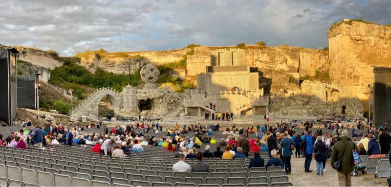
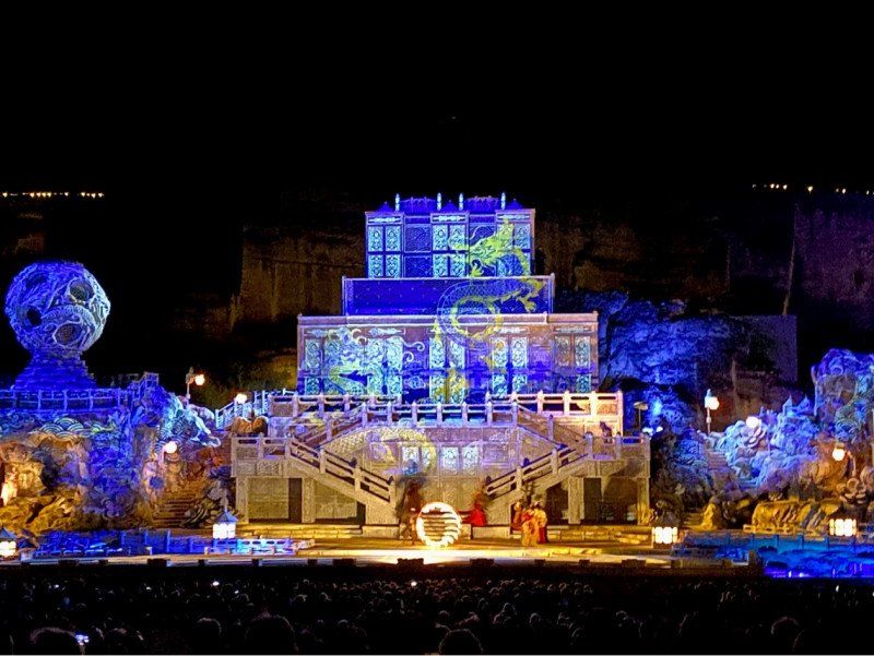
St. Margarethen im Burgenland, Sankt Margarethen im Burgenland, Österreich
Opera Turandot in the Roman quarry
St. Margarethen im Burgenland, 7062 St. Margarethen im Burgenland, Österreich
47° 47' 56" N 16° 36' 31" E
47.7988895 16.6086007
• Head north on Flurgasse. Go for 170 m.
• Turn left onto Flurgasse. Go for 245 m.
• Turn right onto Friedhofgasse. Go for 125 m.
• Turn left onto Hauptplatz. Go for 65 m.
• Turn right onto Hauptplatz. Go for 64 m.
• Continue on Siegendorfer Straße. Go for 231 m.
• Turn right onto Hauptstraße (B52). Go for 962 m.
• Pass 2 roundabouts and continue on Ruster Bundesstraße (B52). Go for 4.1 km.
• Turn left onto Conradplatz (L315). Go for 380 m.
• Turn left onto Am Seekanal (L315). Go for 1.6 km.
• Continue on Ruster Bucht. Go for 149 m.
• Continue on Südhafen. Go for 70 m.
• Turn right onto Ruster Bucht Campingplatz. Go for 162 m.
• Turn left onto Ruster Bucht Campingplatz. Go for 23 m.
• Turn left onto Ruster Bucht Campingplatz. Go for 23 m.
• Turn right onto Ruster Bucht Campingplatz. Go for 39 m.
• Arrive at Ruster Bucht Campingplatz. Your destination is on the left.
☍
8,5 km
( 12 min.)
Storchencamp Campingplatz Rust, Ruster Bucht Campingplatz, Rust, Österreich
Ruster Bucht Campingpl. 334, 7071 Rust, Österreich
47° 48' 1.4" N 16° 41' 32.2" E
47.8003799 16.6922831
• Head south on Ruster Bucht Campingplatz. Go for 39 m.
• Turn left onto Ruster Bucht Campingplatz. Go for 23 m.
• Turn right onto Ruster Bucht Campingplatz. Go for 23 m.
• Turn right onto Ruster Bucht Campingplatz. Go for 162 m.
• Turn left onto Südhafen. Go for 70 m.
• Continue on Ruster Bucht. Go for 448 m.
• Turn left onto Ruster Bucht Campingplatz. Go for 160 m.
• Arrive at Ruster Bucht Campingplatz. Your destination is on the right.
☍
0,9 km
( 2 min.)
Day
Storchencamp Rust, 04.08.
Seebadanlage Ruster Bucht, 7071, Rust, Österreich
47° 48' 3.5" N 16° 41' 31.4" E
47.8009600 16.6920500
• Head toward Ruster Bucht on Ruster Bucht Campingplatz. Go for 160 m.
• Turn left onto Seestraße (L315). Go for 1.3 km.
• Turn right onto Hauptstraße (L315). Go for 380 m.
• Turn right onto Franz-Josefs-Platz (B52). Go for 2.1 km.
• Pass 2 roundabouts and continue on Hauptstraße (B52). Go for 3.0 km.
• Turn left onto Siegendorfer Straße. Go for 231 m.
• Continue on Hauptplatz. Go for 64 m.
• Turn right onto Siegendorfer Straße. Go for 2.6 km.
• Continue on Sankt Margarethener Straße. Go for 2.0 km.
• Continue on Güterweg Siegendorf-Sankt Margarethen. Go for 515 m.
• Continue on Haydnplatz. Go for 55 m.
• Take the 1st exit from Haydnplatz roundabout onto Haydnplatz. Go for 69 m.
• Continue on Sankt-Margarethner-Straße. Go for 341 m.
• Turn right onto Berggasse. Go for 89 m.
• Turn left onto Hauptstraße. Go for 257 m.
• Continue on Rathausplatz. Go for 61 m.
• Turn left onto Rathausplatz (L212). Go for 1.1 km.
• Take the 3rd exit from roundabout onto GZO-Dienstleistungszentrum (B16) toward Sopron/Klingenbach. Go for 860 m.
• Take the 2nd exit from roundabout onto Ödenburger Bundesstraße (B16) toward Sopron. Go for 3.4 km.
• Continue on Bécsi út (84). Go for 2.0 km.
• Take the 2nd exit from roundabout onto Bécsi út (84) toward Sopron Centrum. Go for 1.6 km.
• Take the 3rd exit from roundabout onto Bécsi út (84) toward Sopron Centrum. Go for 1.9 km.
• Turn right onto Lackner Kristóf utca toward Centrum/Sopron/Lővérek/Brennbergbánya/Ágfalva. Go for 813 m.
• Take the 2nd exit from roundabout onto Lackner Kristóf utca. Go for 418 m.
• Take the 1st exit from roundabout onto Selmeci utca. Go for 449 m.
• Turn left onto Táncsics utca. Go for 122 m.
• Continue toward Újteleki utca. Go for 20 m.
• Take the 2nd exit from roundabout onto Újteleki utca. Go for 145 m.
• Take the 1st exit from roundabout onto Csatkai Endre utca. Go for 302 m.
• Turn left onto Deák tér. Go for 173 m.
• Arrive at Deák tér. Your destination is on the left.
☍
26,5 km
( 32 min.)
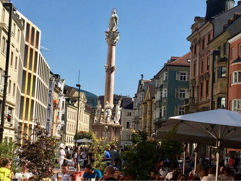
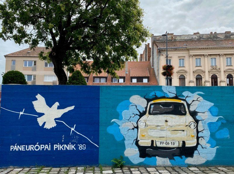
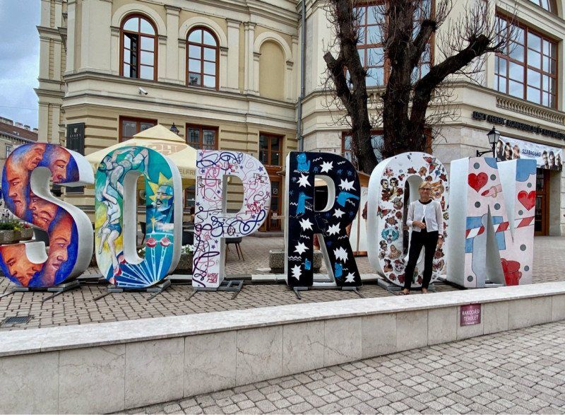
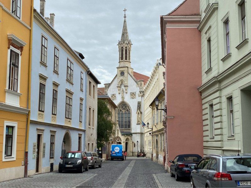
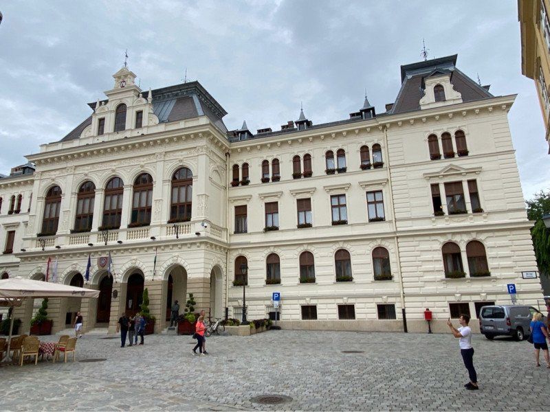
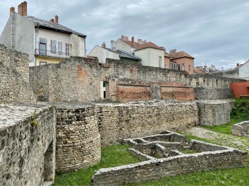
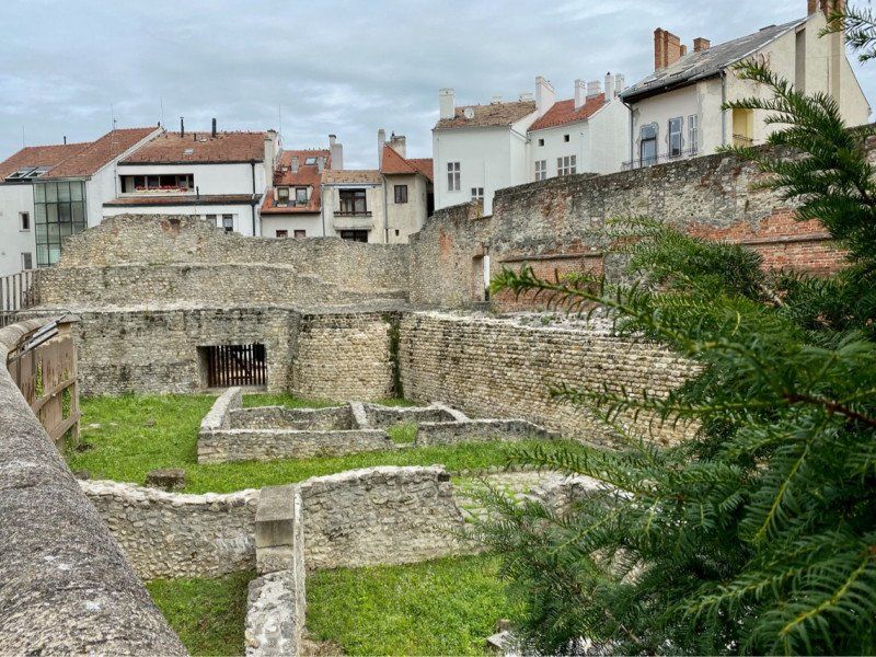
Sopron, Ungarn
Ödenburg, Ungarn
47° 40' 54" N 16° 35' 4.1" E
47.6816619 16.5844795
• Head toward Pázmány Péter utca on Deák tér. Go for 186 m.
• Turn right onto Erzsébet utca. Go for 132 m.
• Turn left onto Csengery utca (86107) toward Balaton/Győr. Go for 720 m.
• Take the 3rd exit from roundabout onto Kőszegi út (8645) toward Centrum. Go for 203 m.
• Continue on Kőfaragó tér toward Bécs/84/Wien. Go for 91 m.
• Continue on Magyar utca. Go for 50 m.
• Continue on Fapiac. Go for 313 m.
• Continue on Híd utca. Go for 247 m.
• Take the 1st exit from roundabout onto Balfi út toward Balf/84. Go for 1.1 km.
• Pass 3 roundabouts and continue on Balfi út (8518). Go for 22.6 km.
• Turn right onto Joseph Haydn utca (8518). Go for 495 m.
• Turn right. Go for 571 m.
• Arrive at your destination on the right.
☍
26,7 km
( 29 min.)
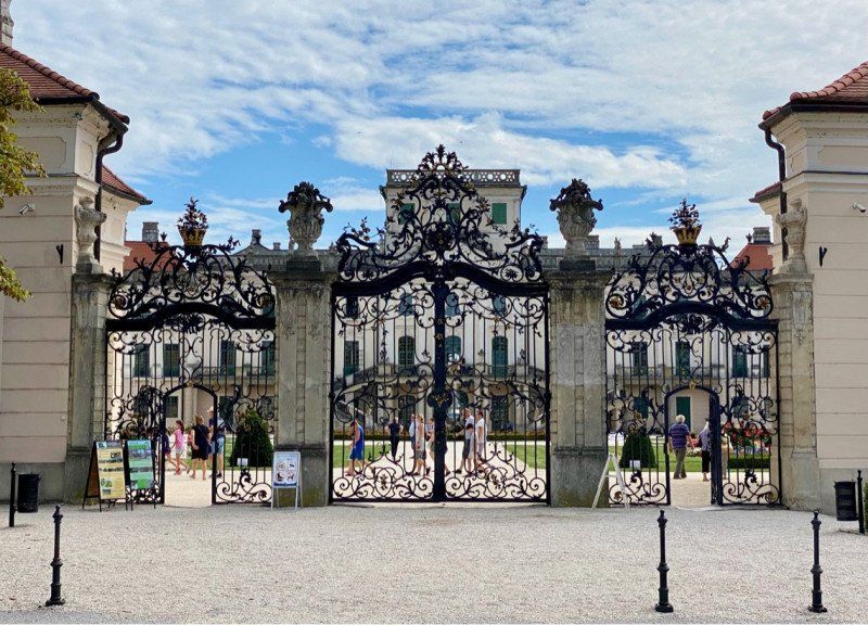
Fertőd, Ungarn
47° 37' 5.4" N 16° 52' 26.9" E
47.6181800 16.8741418
• Head east. Go for 571 m.
• Turn left onto Joseph Haydn utca (8518). Go for 495 m.
• Turn left onto Bartók Béla utca (8518). Go for 21.4 km.
• Take the 2nd exit from roundabout toward Sopron-Balf/Bécs/Wien/Sopron-nyugat. Go for 47 m.
• Take ramp onto M85. Go for 8.5 km.
• Take the 2nd exit from roundabout onto Bécsi út (84) toward Bécs/Wien. Go for 2.1 km.
• Continue on Ödenburger Bundesstraße (B16). Go for 3.3 km.
• Take the 2nd exit from roundabout onto Ödenburger Bundesstraße (B16). Go for 819 m.
• Take the 2nd exit from roundabout onto Draßburger Landesstraße (L212) toward Siegendorf. Go for 1.1 km.
• Turn right onto Rathausplatz. Go for 61 m.
• Continue on Hauptstraße. Go for 233 m.
• Turn right onto Berggasse. Go for 113 m.
• Turn left onto Sankt-Margarethner-Straße. Go for 341 m.
• Continue on Haydnplatz. Go for 33 m.
• Take the 2nd exit from Haydnplatz roundabout onto Haydnplatz. Go for 109 m.
• Continue on Sankt-Margarethner-Straße. Go for 515 m.
• Continue on Sankt Margarethener Straße. Go for 2.0 km.
• Continue on Güterweg Sankt Margarethen-Siegendorf. Go for 2.6 km.
• Turn left onto Hauptplatz. Go for 64 m.
• Continue on Siegendorfer Straße. Go for 231 m.
• Turn right onto Hauptstraße (B52). Go for 962 m.
• Pass 2 roundabouts and continue on Ruster Bundesstraße (B52). Go for 4.1 km.
• Turn left onto Conradplatz (L315). Go for 380 m.
• Turn left onto Am Seekanal (L315). Go for 1.3 km.
• Turn right onto Ruster Bucht Campingplatz. Go for 160 m.
• Arrive at Ruster Bucht Campingplatz. Your destination is on the right.
☍
51,6 km
( 51 min.)
Storchencamp Rust, 04.08.
Seebadanlage Ruster Bucht, 7071, Rust, Österreich
47° 48' 3.5" N 16° 41' 31.4" E
47.8009600 16.6920500
• Head east on Ruster Bucht Campingplatz.
• Arrive at Ruster Bucht Campingplatz. Your destination is on the right.
☍
Distance not available
(Duration not available)
Day
Storchencamp Rust, 05.08.
Seebadanlage Ruster Bucht, 7071, Rust, Österreich
47° 48' 3.5" N 16° 41' 31.4" E
47.8009600 16.6920500
• Head toward Ruster Bucht on Ruster Bucht Campingplatz. Go for 160 m.
• Turn left onto Seestraße (L315). Go for 1.3 km.
• Turn right onto Hauptstraße (L315). Go for 380 m.
• Turn right onto Franz-Josefs-Platz (B52). Go for 23 m.
• Turn right onto Oggauer Straße (L209). Go for 8.6 km.
• Take the 1st exit from roundabout onto Burgenland Bundesstraße (B50) toward Neusiedl am See. Go for 13.0 km.
• Pass 4 roundabouts and continue on Burgenland Bundesstraße (B50). Go for 8.6 km.
• Take ramp onto A4 (Ost Autobahn) toward Wien. Go for 5.1 km.
• Take the exit toward Bratislava/Kittsee onto A6 (Nordost Autobahn). Go for 22.3 km.
• Continue on D4. Go for 1.1 km.
• Continue on E58 (Križovatka Jarovce). Go for 420 m.
• Take the left exit toward Letisko/Žilina/Brno/Bratislava onto D2. Go for 6.4 km.
• Take the exit toward Žilina/Ružinov/Einsteinova/Letisko/Brno/Dúbravka/Karlova Ves/D2 onto D1. Go for 1.7 km.
• Take the exit toward Čunovo/Háje/Centrum onto 2/61 (Einsteinova). Go for 1.3 km.
• Take ramp onto Panónska cesta toward Centrum. Go for 602 m.
• Continue on Most SNP. Go for 808 m.
• Continue on Staromestská. Go for 582 m.
• Keep left toward Nové Mesto. Go for 462 m.
• Continue on Námestie 1. mája. Go for 95 m.
• Turn right onto Kollárovo námestie toward Centrum/Hrad. Go for 236 m.
• Turn left onto Kollárovo námestie toward Centrum/Hrad. Go for 51 m.
• Turn left onto Jánska toward Centrum/Hrad. Go for 206 m.
• Turn left onto Námestie 1. mája toward Centrum/Hrad. Go for 220 m.
• Keep right onto Námestie 1. mája toward Centrum/Hrad. Go for 54 m.
• Continue on Hodžovo námestie. Go for 90 m.
• Arrive at Hodžovo námestie. Your destination is on the right.
☍
73,8 km
( 55 min.)
Bratislava, Slowakei
In Slovakia and the Czech Republic, you need an eDocument during Corona times that will allow you to enter and transit. The best place to get information about this is on the ADAC website. The electronic Corona papers are free of charge. If you choose this transit, motorway tolls will be charged. Online booking is relatively easy. Fees in Slovakia are a good 10 EUR and in the Czech Republic around 12 EUR. Here too, the procedure is quite clear and certainly not a hurdle for experienced online users. So there is no longer a vignette. Nothing was actually checked at the border apart from the Corona status (Corona app certificate). The highways are on average busy during the week. Unfortunately in Prague you have to cross the outer ring. This can sometimes lead to a loss of time (plan around 1-1.5 hours). The petrol price is around EUR 1.21 for diesel and can be paid with an EC card.
48° 8' 54.9" N 17° 6' 27.9" E
48.1485965 17.1077477
• Head southwest on Hodžovo námestie. Go for 52 m.
• Turn right toward Hodžovo námestie. Go for 42 m.
• Continue on Hodžovo námestie. Go for 44 m.
• Continue on Štefánikova. Go for 751 m.
• Continue on Pražská (572) toward Brno. Go for 2.7 km.
• Continue on Lamačská cesta (2). Go for 1.5 km.
• Take ramp onto D2 toward Brno/Malacky. Go for 58.8 km.
• Continue on D2. Go for 59.3 km.
• Take exit 1 toward Praha/Svitavy/Brno-Tuřany/Autodrom/Výstaviště onto D1. Go for 198 km.
• Keep left onto 5. května (8) toward Praha/Plzeň/Letiště. Go for 581 m.
• Keep left onto 5. května (8). Go for 6.6 km.
• Turn right onto Rumunská toward Vršovice/Vinohrady. Go for 380 m.
• Continue on náměstí Míru. Go for 220 m.
• Arrive at náměstí Míru. Your destination is on the right.
☍
329,2 km
(2 hrs. 51 min.)
Prague, Tschechien
Prag, Tschechien
50° 4' 31.9" N 14° 26' 16.1" E
50.0755381 14.4378005
• Head toward Slezská on náměstí Míru. Go for 208 m.
• Continue on Anglická. Go for 382 m.
• Turn right onto Legerova (8) toward Holešovice/Centrum. Go for 2.4 km.
• Take ramp onto nábřeží Kapitána Jaroše (8) toward Městský okruh/Prosek. Go for 430 m.
• Turn left onto Argentinská (8) toward Zoo/Městský okruh/Prosek/Kanoistický areál. Go for 5.9 km.
• Keep left onto Liberecká (8) toward Ústí n. L./Mělník/E55. Go for 2.7 km.
• Keep left onto Cínovecká (E55) toward Dresden/Teplice/Mělník/Ústí n. L./D8. Go for 1.9 km.
• Continue on D8. Go for 94.5 km.
• Continue on A17. Go for 44.3 km.
• Take exit 1 toward Görlitz/Berlin/Flughafen Dresden onto A4 (Autobahndreieck Dresden-West). Go for 12.5 km.
• Take exit 82 toward Berlin/Cottbus/Flughafen Dresden. Go for 2.0 km.
• Keep left onto A13. Go for 88.2 km.
• Take the left exit toward Potsdam/Berlin/Lübbenau onto A13. Go for 63.6 km.
• Take exit 1 toward Magdeburg/Leipzig/Potsdam onto A10 (Berliner Ring). Go for 44.8 km.
• Take exit 19 toward Hamburg/Rostock/Hannover/Magdeburg/Potsdam-Nord onto A10 (Berliner Ring). Go for 3.6 km.
• Take exit 20 toward Glindow/Klaistow. Go for 342 m.
• Turn right onto L90 toward Werder/Glindow/Schwielowsee. Go for 3.5 km.
• Pass 2 roundabouts and continue on Klaistower Straße (L90). Go for 2.0 km.
• Turn left onto Deiche. Go for 210 m.
• Turn left onto Ziemensstraße. Go for 1.0 km.
• Turn right onto Albertstraße. Go for 414 m.
• Turn left onto Bliesendorfer Straße. Go for 12 m.
• Arrive at Bliesendorfer Straße.
☍
375,0 km
(3 hrs. 25 min.)
Werder (Havel), Deutschland
Trip canceled due to rain in Austria and the Czech Republic (partly heavy rain)
Glindow, 14542 Werder (Havel), Deutschland
52° 21' 26.1" N 12° 53' 21.9" E
52.3572443 12.8894092