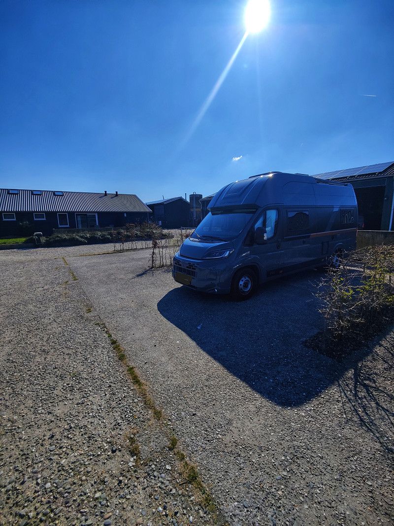
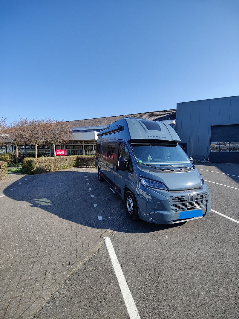
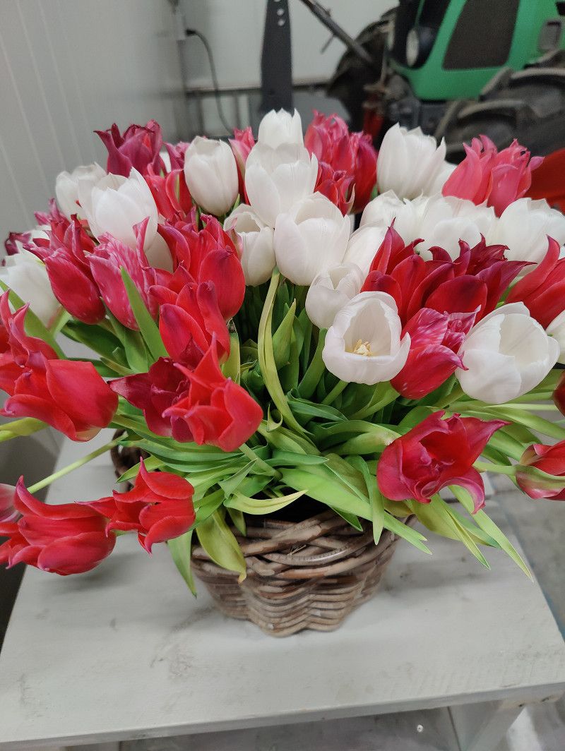
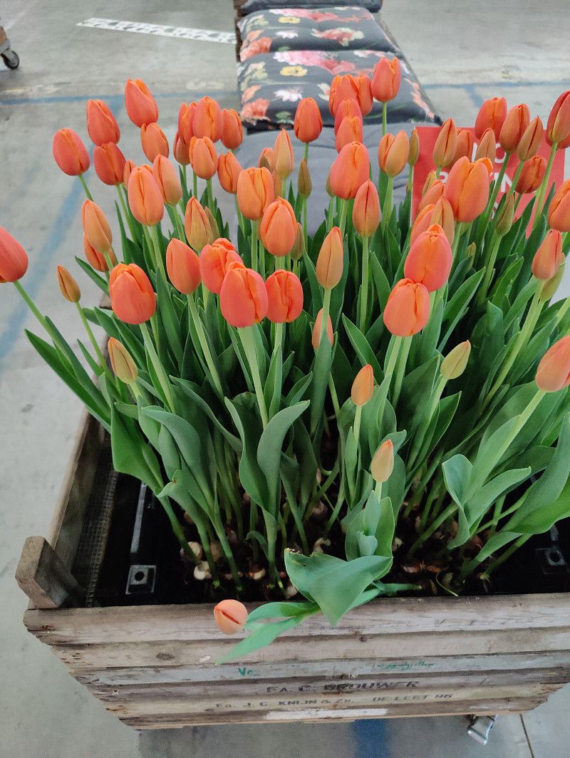
The first big trip with my motorhome "Zitty" will take me to the Netherlands in spring 2025 – in search of blooming tulip fields, impressive photo opportunities, and a touch of adventure.
Day - - - Fr - 28.03.2025 - - -
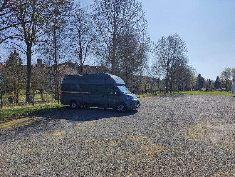
Start in Weißenfels
Well prepared and with a touch of chaos – off to adventure! 😆🚀
Burgenlandkreis, Sachsen-Anhalt, Deutschland
51° 11' 59.9" N 11° 58' 0.4" E
51.1999793 11.9667857
• Head toward Jüdenstraße on Friedrichsstraße. Go for 242 m.
• Take the 3rd exit from Niemöllerplatz roundabout onto Merseburger Straße toward Markröhlitz/Weißenfels-Nord/Bahnhof. Go for 2.7 km.
• Turn right and take ramp onto B91 toward A38/Halle/Merseburg. Go for 4.8 km.
• Take ramp onto A38 toward Göttingen. Go for 173 km.
• Take the left exit toward Frankfurt a.M./Kassel onto A7. Go for 38.1 km.
• Take the exit toward Dortmund/Paderborn/Kreuz Kassel-West onto A44. Go for 148 km.
• Continue on B1 (Ruhrschnellweg). Go for 11.9 km.
• Keep left onto Westfalendamm (B1) toward Essen/A40/Frankfurt/A45/B54. Go for 18.1 km.
• Take exit 36 toward Bochum-Ruhrstadion/Bochum-Ruhrcongress onto Stadionring. Go for 490 m.
• Turn left onto Stadionring. Go for 157 m.
• Arrive at Stadionring. Your destination is on the right.
☍
397,4 km
(3 hrs. 37 min.)
Starlight-Express-Theater Bochum & Stellplatzübernachtung auf P3
https://www.atgtickets.de/musicals-shows/starlight-express
28 Stadium Ring
44791 Bochum
Parking P3 - directly behind the theater
10 € for 24h
https://park4night.com/de/lieu/160049/open/
https://www.parken-in-bochum.de/parkhaeuser/parkhaus/ph-stadionring/
Only card payment or via EasyPark app
Stadionring 24, Bochum, Nordrhein-Westfalen, Deutschland
51° 29' 33.7" N 7° 14' 3.1" E
51.4926815 7.2341962
• Head toward Quellenweg on Stadionring. Go for 375 m.
• Turn right onto Stadionring. Go for 18 m.
• Take ramp onto A40 (Ruhrschnellweg) toward Dortmund. Go for 2.3 km.
• Take exit 38 toward Münster/Recklinghausen onto A43. Go for 30.7 km.
• Take exit 8 toward Wesel/Wulfen/Lippramsdorf. Go for 400 m.
• Turn left onto Weseler Straße (B58) toward Wesel/Wulfen/Lippramsdorf. Go for 4.5 km.
• Turn right onto Lembecker Straße (K55) toward Lembeck. Go for 8.1 km.
• Turn right onto Rekener Straße (K48). Go for 774 m.
• Turn left onto Heidener Straße (K55). Go for 3.1 km.
• Continue on K55. Go for 296 m.
• Continue on Lembecker Straße (K55). Go for 3.7 km.
• Pass 3 roundabouts and continue on Ostring (L829). Go for 2.1 km.
• Take the 2nd exit from roundabout onto Nordring (K55). Go for 438 m.
• Take the 1st exit from roundabout onto Ramsdorfer Straße (K55) toward Ramsdorf. Go for 2.4 km.
• Continue on K55. Go for 125 m.
• Continue on Zum Lünsberg (K55). Go for 2.8 km.
• Take the 2nd exit from roundabout onto Dlugoleka Ring (K55) toward Velen/Südlohn/Weseke. Go for 1.8 km.
• Take the 3rd exit from roundabout onto Weseker Straße (K40) toward Borken-Weseke. Go for 985 m.
• Continue on Ramsdorfer Straße (K40). Go for 2.3 km.
• Take the 3rd exit from roundabout onto Nordvelener Straße (K6) toward Borken. Go for 1.1 km.
• Turn right onto B70 toward Ahaus/A70. Go for 2.9 km.
• Turn left onto Südlohner Straße (B70) toward Winterswijk/Oeding/Coesfeld. Go for 863 m.
• Turn left onto Fresenhorst (B70) toward Winterswijk/Oeding. Go for 3.7 km.
• Continue on Kottenseweg (N319). Go for 5.4 km.
• Turn slightly right onto Rondweg Zuid (N319). Go for 584 m.
• Take the 2nd exit from roundabout onto Rondweg Zuid (N319) toward Winterswijk/Industrieterrein Veeneslat/Aalten/Groenlo/Zutphen. Go for 1.7 km.
• Take the 3rd exit from roundabout onto Misterweg (N318) toward Aalten/Bocholt/Arnhem. Go for 1.3 km.
• Turn left onto Misterweg. Go for 32 m.
• Continue toward Misterweg. Go for 33 m.
• Turn left onto Misterweg. Go for 53 m.
• Arrive at Misterweg. Your destination is on the right.
☍
84,8 km
(1 hrs. 12 min.)
Bericht: Starlight Express
Starlight Express – The fast-paced musical on roller skates
Since its premiere in London in 1984, Starlight Express has delighted audiences around the world with a unique blend of thrilling music, spectacular roller skating action, and a heartwarming story. Composed by Andrew Lloyd Webber, the musical tells the story of Rusty, a steam engine who must prove himself in a great race against modern high-speed trains – and learns to believe in himself in the process.
Starlight Express is particularly well-known for its energetic choreography on roller skates, which immerses the audience in the action. In Germany, the musical has been running continuously since 1988 in Bochum – in a purpose-built theater. With over 19 million viewers, it is the most successful musical to be performed at a permanent location worldwide.
Whether it's nostalgic memories or breathtaking thrills, Starlight Express continues to captivate audiences even decades later. If you haven't seen it yet, don't miss this fast-paced experience! 🚂✨
Bericht: Stellplatz
Parking report: Parking at the Starlight Express Theater, Bochum
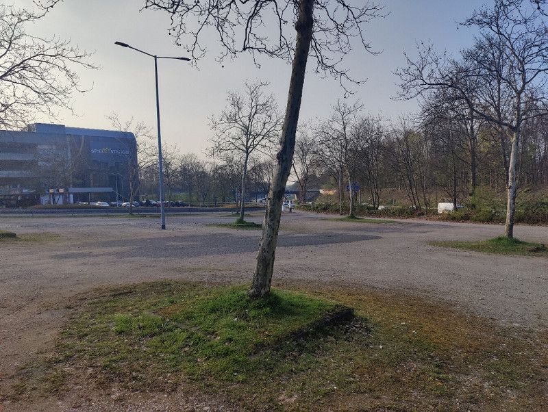
On my trip through the Ruhr region, I stopped at the large parking lot at the Starlight Express Theater in Bochum. The area is paved in places, but not entirely flat—those traveling with a campervan may want to have chocks ready.
Access is via a barrier with license plate recognition, and payment is possible at the machine in the adjacent parking garage. Important: Cashless payments are accepted only! The parking lot is available during performances of the musical and on match days at the nearby stadium.
Due to the direct location near the highway, you have to expect a certain amount of noise. Fortunately, this didn't really bother me. However, the infrastructure within walking distance is convenient: In about ten minutes, you can reach a bakery, an Edeka supermarket, and other shops for daily needs.
For a short overnight stay or a musical, the parking lot is a practical option—although not particularly comfortable. If you're passing through and looking for convenient parking, this is a good option.
Day - - - Sa - 29.03.2025 - - -
Obelink Freizeitmarkt
Opening hours:
Status: 02 2025
Monday 9:00–18:00
Tuesday 9:00–18:00
Wednesday 9:00–18:00
Thursday 9:00–18:00
Friday 9:00–18:00
Saturday 9:00–17:00
Sunday Closed
Address: Misterweg 179, 7102 EN Winterswijk, Netherlands
https://www.obelink.eu/?utm_source=google&utm_medium=organic&utm_campaign=Local_serp
Geldern, Niederlande
51° 57' 31.4" N 6° 41' 10.7" E
51.9587227 6.6863152
• Head southwest on Misterweg. Go for 53 m.
• Turn left toward Misterweg. Go for 104 m.
• Turn right onto Misterweg. Go for 63 m.
• Turn left onto Misterweg. Go for 14 m.
• Turn right onto Eekelerweg. Go for 363 m.
• Turn left onto Misterweg. Go for 269 m.
• Turn left onto Veldhorstweg. Go for 1.0 km.
• Turn left onto Vreehorstweg. Go for 388 m.
• Turn right. Go for 27 m.
• Arrive at your destination on the right.
☍
2,3 km
( 7 min.)
Bericht: Obelink
Obelink Leisure Market – A paradise for camping and outdoor enthusiasts
Anyone who loves camping can't miss Obelink . The huge leisure market in Winterswijk, Netherlands, is considered one of the best addresses for campers, motorhome owners, and outdoor enthusiasts. With a sales area of over 72,500 square meters, Obelink offers an incredible selection – from tents, camping furniture, and awnings to technical equipment and spare parts.
As soon as you enter the market, it's clear: you'll find almost everything a camper's heart desires. The variety of accessories is particularly impressive, rarely found in such abundance. From affordable basic equipment to high-quality premium brands, there's something for every budget. The large tent exhibition is also a highlight, as you can get a firsthand look at various models here.
Of course, there are also a few disadvantages. It can get very busy on weekends, so you should be prepared for long waits at the checkouts and for customer service. Furthermore, not all products are consistently cheaper than those offered by German online retailers, so it's a good idea to compare prices.
Nevertheless, Obelink remains a worthwhile destination for me—not just for shopping, but also for inspiration. Anyone interested in camping or traveling with a motorhome should definitely check this market out. And a quick detour to nearby Winterswijk perfectly rounds off the visit.⛺🛒
Tip:
The restaurant is recommended; there is something to suit every taste, especially the lunch which is great value for money.
Camping Vreehorst
https://park4night.com/de/place/113410
https://www.vreehorst.de/
Important information about arrival and departure:
- Arrival: From 12:30 p.m. – Barrier opens automatically based on license plate number, check-in is automatic. Your pitch number will be sent via email on the day of arrival. Personal check-in is possible at reception.
- Departure: By 12:00 PM . If you have booked private bathroom facilities, please return the key to reception.
Vreehorstweg, 7102 EK, Winterswijk, Netherlands
51° 56' 56.5" N 6° 41' 28.1" E
51.9490168 6.6911432
• Head toward Vreehorstweg. Go for 19 m.
• Turn left onto Vreehorstweg. Go for 418 m.
• Turn right onto Veldhorstweg. Go for 550 m.
• Turn left onto Driemarkweg. Go for 264 m.
• Turn right onto Driemarkweg. Go for 443 m.
• Turn left onto Misterweg (N318). Go for 3.7 km.
• Pass 6 roundabouts and continue on Oostelijke Rondweg (N318). Go for 12.5 km.
• Continue toward Oostelijke Rondweg/N318. Go for 38 m.
• Turn left onto Twenteroute (N18). Go for 2.1 km.
• Turn left onto A18 toward Doetinchem/Arnhem. Go for 22.5 km.
• Continue on A12. Go for 25.9 km.
• Take the exit toward Rotterdam/Eindhoven/Nijmegen onto A50. Go for 7.6 km.
• Take exit 19 toward Renkum/Wageningen/Oosterbeek. Go for 424 m.
• Turn left onto N225 toward Doorwerth/Oosterbeek/Arnhem/Industrieterrein Schaapsdrift. Go for 1.6 km.
• Turn right onto Van der Molenallee. Go for 27 m.
• Turn right onto Schaapsdrift. Go for 722 m.
• Continue on Boersberg. Go for 731 m.
• Turn slightly left onto Fonteinallee. Go for 584 m.
• Turn slightly right onto Fonteinallee. Go for 109 m.
• Continue on Fonteinallee. Go for 307 m.
• Turn left. Go for 19 m.
• Arrive at your destination on the right.
☍
80,6 km
(1 hrs. )
Bericht: Camping Vreehorst
Camping Vreehorst offers the perfect camping holiday for every taste. Whether you're looking for a standard Comfort pitch or a pitch with private sanitary facilities, there's something for everyone here. The modern sanitary facilities meet the highest standards, and for campervan travelers, there are specially paved pitches outside the campsite – ideal for short stays, such as when visiting the Obelink leisure market.
Four-legged friends are also welcome, so vacationing with your dog is no problem. In addition to comfortable pitches, the campsite offers numerous recreational opportunities: an outdoor and indoor pool, a cozy food corner, and much more ensure a relaxing stay.
Day - - - So - 30.03.2025 - - -
Kasteel Doorwerth
Opening hours:
Tuesday to Sunday 11:00 – 17:00
Reservation required!
https://www.glk.nl/doorwerth/kasteel-doorwerth
Address:
Fonteinallee 2B, 6865 ND Doorwerth
Parking available at the castle
Fonteinallee, Doorwerth, Geldern, Niederlande
51° 58' 0.2" N 5° 47' 18.7" E
51.9667334 5.7885276
• Head southwest. Go for 19 m.
• Turn right onto Fonteinallee. Go for 382 m.
• Turn left onto Fonteinallee. Go for 618 m.
• Turn slightly right onto Boersberg. Go for 731 m.
• Continue on Schaapsdrift. Go for 722 m.
• Turn left onto Van der Molenallee. Go for 27 m.
• Turn left onto N225. Go for 1.6 km.
• Turn left and take ramp onto A50 toward Heteren/Nijmegen/Rotterdam. Go for 6.8 km.
• Take the exit toward Bemmel onto A15. Go for 12.0 km.
• Turn right onto Van Elkweg (N839). Go for 1.2 km.
• Take the 2nd exit from roundabout onto Van der Mondeweg (N839). Go for 2.4 km.
• Continue on Langstraat (N839). Go for 245 m.
• Turn left onto Zandvoort. Go for 808 m.
• Arrive at Zandvoort. Your destination is on the right.
☍
27,6 km
( 24 min.)
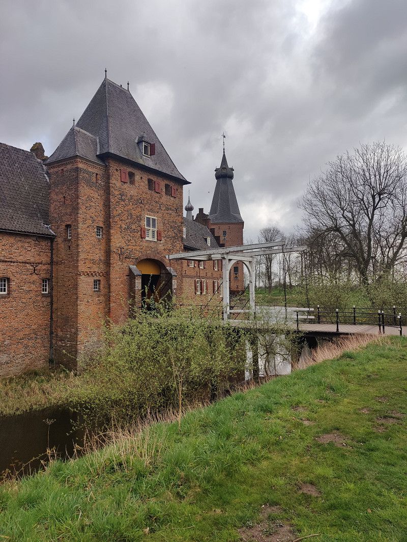
Bericht: Kasteel Doorwerth
Kasteel Doorwerth – A historic gem with a unique atmosphere
Nestled in the picturesque landscape of the Veluwe, Kasteel Doorwerth rises as one of the most impressive castles in the Netherlands. With its centuries-old history, idyllic location on the Rhine, and lovingly restored architecture, the castle captivates not only history buffs but also nature lovers.
Even the drive through the green surroundings transports you back to another time. The moated castle, whose origins date back to the 13th century, impresses with its mighty walls, historic interiors, and manicured gardens. Particularly fascinating is the detailed exhibition inside, which recounts the castle's eventful history – from medieval battles to the devastation of World War II to the extensive restoration.
For me, the atmosphere was particularly special: While walking through the ancient walls, you can vividly imagine how knights, noblemen, and servants once lived here. Anyone who enjoys historic buildings and the romanticism of castles will feel at home here. A visit is especially worthwhile on a sunny day, as the surrounding hiking trails and castle gardens are perfect for exploring.
One small drawback is that the exhibition is mostly in Dutch—those who don't speak the language should read up on the history beforehand. Nevertheless, I still highly recommend Kasteel Doorwerth , a destination that perfectly combines history, nature, and a fairytale setting.
Camperpark Lingewaard
Camper Park Lingewaard
https://park4night.com/de/place/107369
https://www.camperparklingewaard.nl/camperpark-eng.html
Zandvoort 64, Gendt, Geldern, Niederlande
51° 53' 9.5" N 5° 57' 0.3" E
51.8859829 5.9500923
• Head toward Langstraat on Zandvoort. Go for 808 m.
• Turn right onto Langstraat (N839). Go for 245 m.
• Continue on Van der Mondeweg (N839). Go for 2.4 km.
• Take the 2nd exit from roundabout onto Van Elkweg (N839). Go for 1.2 km.
• Turn left onto A15. Go for 2.5 km.
• Take ramp onto A325 toward Elst/Arnhem. Go for 7.9 km.
• Keep right onto Nijmeegseweg (A325). Go for 108 m.
• Keep left onto Nijmeegseweg (A325) toward Rijnhal/Centrum. Go for 88 m.
• Continue on Nijmeegseweg Oost toward Rijnhal/Centrum. Go for 1.2 km.
• Continue on Nijmeegseweg. Go for 908 m.
• Take the 2nd exit from Airborneplein roundabout onto Nijmeegseweg toward Ziekenhuis Rijnstate/Utrecht/Apeldoorn. Go for 368 m.
• Continue on Eusebiusbuitensingel. Go for 104 m.
• Continue on Velperbuitensingel. Go for 352 m.
• Turn right onto Apeldoornsestraat toward Ziekenhuizen Rijnstate/Apeldoorn. Go for 161 m.
• Continue on Apeldoornseweg. Go for 2.8 km.
• Take ramp toward Rozendaal/Openluchtmuseum/Burgers' Zoo. Go for 173 m.
• Turn left onto Monnikensteeg. Go for 169 m.
• Turn left onto Schelmseweg (N785). Go for 837 m.
• Turn right onto Waterbergseweg. Go for 172 m.
• Arrive at Waterbergseweg.
☍
22,4 km
( 24 min.)
Bericht: Camper Park Lingewaard
A fantastic campsite! The spacious pitches are surrounded by hedges and offer plenty of space. Each pitch has an electrical connection. The water and waste disposal station is located at the entrance and exit (electricity, water, and waste disposal are subject to a fee).
Registration is straightforward via the information box at the restroom building using a form and a cash box. Coins are required for all services.
Day - - - Mo - 31.03.2025 - - -
Openluchtmuseum
Opening hours:
depending on the season, open daily from 10:00 to 17:00
https://www.openluchtmuseum.nl/
Address: Hoeferlaan 4, 6816 SG Arnhem, Netherlands
Combination tickets with a visit to Burgers' Zoo are available
Hoeferlaan 4, Arnheim, Geldern, Niederlande
52° 0' 38.4" N 5° 54' 38.5" E
52.0106550 5.9107051
• Head toward Schelmseweg on Waterbergseweg. Go for 172 m.
• Turn left onto Schelmseweg. Go for 837 m.
• Turn left and take ramp onto Apeldoornseweg (N784) toward Zutphen/Oberhausen/Utrecht/Apeldoorn. Go for 906 m.
• Turn left and take ramp onto A12 toward Utrecht/Nijmegen. Go for 7.0 km.
• Continue on A12 toward Den Haag/Utrecht. Go for 47.7 km.
• Keep left onto A12 toward Den Haag/E30/Rotterdam/Amsterdam. Go for 9.1 km.
• Take exit 15 toward De Meern/Montfoort. Go for 432 m.
• Turn right onto C. H. Letschertweg (N198). Go for 299 m.
• Turn right onto Meerndijk (N228). Go for 6.5 km.
• Pass 2 roundabouts and continue on Willeskop (N228). Go for 8.1 km.
• Take the 3rd exit from roundabout onto Goudsestraatweg (N228) toward Haastrecht/Gouda. Go for 6.3 km.
• Arrive at Provincialeweg Oost (N228). Your destination is on the left.
☍
87,3 km
(1 hrs. )
Bericht: Openluchtmuseum
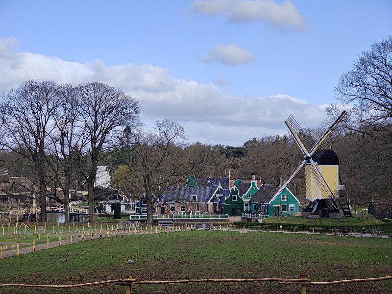
The Nederlands Openluchtmuseum in Arnhem – A journey through 350 years of Dutch history
The Netherlands Open Air Museum is an impressive open-air museum in Arnhem that offers a comprehensive insight into life in the Netherlands over the past 350 years. The slogan of the museum's German website is "Experience Holland in one day." And you should take that literally—a whole day is needed to discover even remotely all the facets of this special place.
Historical insights and authentic atmosphere
The museum extends over extensive grounds with numerous historic buildings that were relocated here from various regions of the Netherlands. Farms, houses, workshops, mills, and even a church are perfectly integrated into the landscape and appear as if they had always stood here.
The authenticity is particularly impressive: In a 17th-century farmhouse, the aroma of freshly cooked bacon wafts as a farmer's wife cooks on a wood-burning stove. Laundry flutters in the wind, cats sleep in the straw, and sheep, cows, and pigs graze in the pastures. Life in past centuries comes alive here.
Traditional craftsmanship and living history
Many of the buildings are brought to life by actors during opening hours: The fisherman mends his nets, the baker bakes bread in the wood-fired oven, and the blacksmith works glowing iron in his workshop. Visitors have the opportunity to purchase traditional handicrafts such as freshly pressed linseed oil or hand-woven tea towels. The museum also has a lot to offer in terms of culinary delights – from freshly baked bread to nostalgic ice cream from the 1960s.
When no actors are present, lifelike puppets ensure an immersive experience. Particularly impressive is the 1950s hospital ward, where a strict nurse and the smell of disinfectant create an almost eerily realistic atmosphere.
Interactive experiences and historical perspectives
With more than 100 buildings on the site, there are countless stories to discover. Information panels in Dutch, English, and German provide information about the buildings' history, and former residents recount their former lives through film and audio recordings. What's particularly exciting is that marginalized groups are also given a voice: insights into the lives of newcomers from the former colony of Indonesia or residents of a caravan camp reveal the diversity of Dutch society over time.
Conclusion
The Netherlands Open Air Museum is more than just an open-air museum—it's a vibrant journey through Dutch history. With its authentic design, interactive experiences, and diverse historical insights, it offers a unique and fascinating day out for visitors of all ages. Anyone who wants to experience the Netherlands in all its diversity shouldn't miss this museum.
Aantjes-Blokhuis
https://park4night.com/de/place/316237
https://aantjes-blokhuis.nl/camperplaats/
Cost per night: 23€
Provincialeweg Oost, Haastrecht, Südholland, Niederlande
52° 0' 7.5" N 4° 47' 18.7" E
52.0020758 4.7885403
• Head southwest on Provincialeweg Oost (N228). Go for 830 m.
• Take the 2nd exit from roundabout onto Provincialeweg (N228). Go for 4.0 km.
• Keep left toward Gouderak/Bergambacht/Gouda-West/Rotterdam/Den Haag/N207. Go for 23 m.
• Take the 3rd exit from Verkeersplein Stolwijkersluis roundabout onto Schoonhovenseweg toward Gouderak/Bergambacht/Gouda-West/Rotterdam/Den Haag/N207. Go for 486 m.
• Keep right toward Gouda-West/Rotterdam/Den Haag/Gouderak. Go for 30 m.
• Take the 1st exit from roundabout onto Polderweg (N207) toward Gouda-West/Rotterdam/(A20)/Den Haag/(A12). Go for 2.3 km.
• Take the 1st exit from roundabout onto Gouderaksebrug (N207). Go for 508 m.
• Keep left toward Gouda-West/Waddinxveen/Rotterdam/Den Haag/Utrecht. Go for 19 m.
• Pass 3 roundabouts and continue on Provincialeweg (N457). Go for 3.5 km.
• Turn right onto N457. Go for 393 m.
• Turn right and take ramp onto A20 toward Nieuwerkerk a/d IJssel/Rotterdam. Go for 10.1 km.
• Take the exit toward E19/Ring Rotterdam (oost)/Dordrecht/Breda/A16 onto Knooppunt Terbregseplein. Go for 2.2 km.
• Continue on A16 (Ring Rotterdam). Go for 867 m.
• Keep left onto A16 (Ring Rotterdam) toward Dordrecht/Breda/Havens 1200-9900. Go for 7.4 km.
• Take the exit toward Gorinchem/Nijmegen onto A15 (Knooppunt Ridderkerk). Go for 4.3 km.
• Take exit 21 toward Hendrik-Ido-Ambacht/Ridderkerk/P+R. Go for 592 m.
• Turn left onto N915 toward Ridderkerk-Oostendam/Hendrik-Ido-Ambacht. Go for 1.9 km.
• Continue on Grote Beer (N915). Go for 964 m.
• Turn left toward De Helling. Go for 181 m.
• Turn left onto De Helling. Go for 604 m.
• Continue on Dam. Go for 322 m.
• Turn left onto Haven toward Kinderdijk/Nw. Lekkerland/Fast Ferry. Go for 481 m.
• Continue on Cortgene. Go for 366 m.
• Continue on Oost Kinderdijk. Go for 1.0 km.
• Continue on West Kinderdijk. Go for 1.6 km.
• Continue on Molenstraat. Go for 1.2 km.
• Continue on Lekdijk. Go for 1.6 km.
• Turn right onto Hoogaarslaan. Go for 128 m.
• Turn right onto Koggeplantsoen. Go for 50 m.
• Continue straight ahead. Go for 91 m.
• Arrive at your destination on the right.
☍
48,2 km
( 43 min.)
Bericht: Camperplaats Aantjes-Blokhuis
Report on the motorhome parking space next to the dairy farm
The RV park is located in the immediate vicinity of a dairy farm and offers guests a peaceful, natural environment. There are no set departure and arrival times, but we ask that you respect your own peace and quiet as well as that of other guests.
Pets
Dogs are welcome at the motorhome parking area.
Parking spaces and power supply
The site has a total of 25 pitches, 9 of which are paved and 16 are unpaved. A 10A power connection is available for 21 pitches.
Sanitary facilities and infrastructure
In the information room, guests can find useful information about the site and the surrounding area. The following restroom facilities are also available:
- 4 showers
- 4 toilets
- 4 sinks
Drinking water is available at a water point near the sanitary facilities. There is also a wastewater disposal point for greywater and cassette toilets. A garbage collection point is also available to ensure proper waste disposal.
Conclusion
The RV park offers a well-equipped infrastructure for travelers who appreciate a natural environment. With its comprehensive amenities and the absence of fixed arrival and departure times, it allows for a pleasant and flexible stay.
Day - - - Di - 01.04.2025 - - -
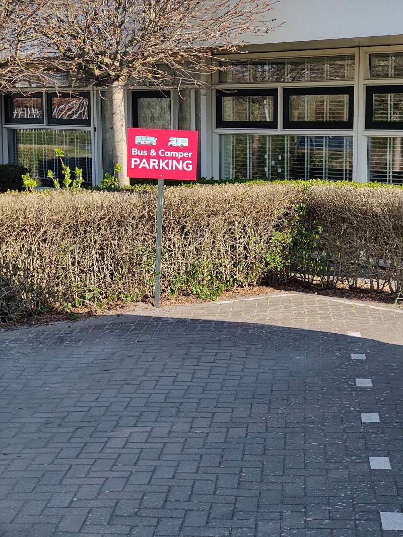
Bus & Camper parking Kinderdijk
https://kinderdijk.com/practical-information/directions-address/camper/
https://kinderdijk.com/
https://park4night.com/de/place/403691
Address:
Lekdijk 432a - Nieuw-Lekkerland
Arrival: from 09:00
Closes: at 8:00 PM
Costs €9.50 (as of April 2025)
Lekdijk 432A, Nieuw-Lekkerland, Südholland, Niederlande
51° 53' 11.3" N 4° 39' 30.1" E
51.8864827 4.6583602
• Head northeast. Go for 91 m.
• Continue on Koggeplantsoen. Go for 50 m.
• Turn left onto Hoogaarslaan. Go for 128 m.
• Turn left onto Lekdijk. Go for 1.6 km.
• Turn left onto Nederwaard. Go for 287 m.
• Arrive at Nederwaard.
☍
2,2 km
( 4 min.)
Bericht: Bus & Camper parking Kinderdijk
The parking lot is located 1.7 km from the entrance to the UNESCO World Heritage Site.
From here, visitors can take a walk or bike ride to the windmills, enjoying the impressive views of the World Heritage Site from start to finish.
Parking hours are from 8:00 a.m. to 8:00 p.m. The parking fee is €9.50 per camper.
Visitors must purchase their parking ticket online, together with their Kinderdijk entrance ticket
.
Overnight parking is not permitted. Bicycles are also available for rental on-site. These are accessible via a smart lock system and offer a convenient option for exploring the surrounding area.
Museummolen Nederwaard (Kinderdijk)
https://kinderdijk.com/
Status 02 | 2025
Until February 28
Friday to Sunday: 10:30 a.m. - 4:00 p.m.
The Kinderdijk Café and gift shop are open daily from 10:30 a.m. to 4:00 p.m. during this time.
March to November 2
Daily from: 9.00 - 17.30
3. November to December
10:30 a.m. - 4:00 p.m.
Nederwaard 5, Kinderdijk, Südholland, Niederlande
51° 53' 0.2" N 4° 38' 23.9" E
51.8833848 4.6399690
• Head toward Molenstraat on Nederwaard. Go for 287 m.
• Turn right onto Lekdijk. Go for 3.2 km.
• Take the 3rd exit from roundabout onto Lekdijk. Go for 773 m.
• Continue on Schoonenburglaan. Go for 1.1 km.
• Continue on Schoonenburgweg (N480). Go for 2.5 km.
• Turn right onto N481. Go for 1.0 km.
• Continue on Zijdeweg (N481). Go for 1.9 km.
• Continue on Noordzijde (N481). Go for 156 m.
• Continue on Peilmolenweg (N481). Go for 155 m.
• Turn left onto Oosteinde. Go for 120 m.
• Arrive at Oosteinde. Your destination is on the right.
☍
11,1 km
( 12 min.)
Bericht: Museummolen Nederwaard (Kinderdijk)
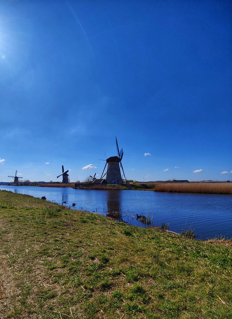
The UNESCO World Heritage Site of Kinderdijk is one of the most impressive sights in the Netherlands. The famous windmills, which have existed since the 18th century, offer a unique insight into the history of Dutch water management.
Experiences and sights
The Kinderdijk walking tour offers breathtaking views of the 19 historic windmills, some of which are still in operation today. Visitors can learn about the history and operation of the mills in various exhibitions or take a boat tour through the canals to experience the area from a different perspective.
Conclusion
A visit to Kinderdijk is an unforgettable experience and provides fascinating insights into Dutch engineering. The combination of nature, history, and technology makes this place a special destination for visitors from all over the world.
Vertoeven bij Verhoeven
https://park4night.com/de/place/496109
https://www.vertoevenbijverhoeven.nl/
Reservations are possible via email.
As of February 2025
Important information about the motorhome parking spaces:
- Seats: Numbered from 1 to 20 , free choice upon arrival.
- Registration: Ring the bell at Oosteinde 8 or send a WhatsApp/SMS to +31 630 326 417 with your name, number of people, overnight stays, place of residence and pitch number.
- Prices:
- Low season: 20 €/night (incl. electricity, water, tourist tax for 2 people).
- High season: €22.50/night (Ascension Day, Whitsun, 1 July – 31 August).
- Additional persons: €2.50/night.
- Showers: €1 per use (coin machine).
- Arrival/Departure:
- Arrival: From 1:00 p.m. to 8:00 p.m.
- Departure: Until 11:00 am .
- Wi-Fi & information: Available in the sanitary building.
Oosteinde 8a, Oud-Alblas, Südholland, Niederlande
51° 51' 37.1" N 4° 43' 49.9" E
51.8603116 4.7305188
• Head toward Peilmolenweg on Oosteinde. Go for 120 m.
• Turn left onto Peilmolenweg (N481). Go for 1.0 km.
• Take the 1st exit from roundabout onto Provincialeweg (N214). Go for 2.1 km.
• Turn right and take ramp onto A15 toward Alblasserdam/Rotterdam. Go for 7.9 km.
• Take the exit toward Ring-Oost/E19/Rotterdam/Amsterdam/Den Haag onto A16 (Knooppunt Ridderkerk). Go for 3.3 km.
• Keep left onto A16 (Knooppunt Ridderkerk) toward Den Haag/Havens 200-1000. Go for 8.3 km.
• Keep right onto Prins Alexander. Go for 470 m.
• Take the exit onto A20 (Knooppunt Terbregseplein). Go for 6.4 km.
• Take the exit toward Vliegveld/Amsterdam/Den Haag onto A13 (Knooppunt Kleinpolderplein). Go for 17.1 km.
• Continue on A4. Go for 9.0 km.
• Take the exit toward Katwijk/Leiden onto N434. Go for 5.0 km.
• Take ramp onto A44 (Rijksstraatweg) toward Amsterdam/Katwijk/Leiden. Go for 11.4 km.
• Take exit 3 toward Noordwijkerhout/Lisse onto N208 (Noordwijkerhout). Go for 424 m.
• Take the 2nd exit from roundabout onto Van Pallandtlaan (N208) toward Sassenheim/Lisse/Noordwijk/Noordwijkerhout. Go for 1.0 km.
• Keep right toward Lisse/Noordwijk/Noordwijkerhout. Go for 26 m.
• Take the 2nd exit from roundabout onto Van Pallandtlaan (N208) toward Lisse/Noordwijk/Noordwijkerhout. Go for 310 m.
• Turn right onto Hoofdstraat (N208). Go for 1.8 km.
• Pass 2 roundabouts and continue on Heereweg (N208). Go for 2.4 km.
• Keep left onto Westelijke Randweg (N208) toward Langevelderslag (Strand). Go for 42 m.
• Take the 3rd exit from roundabout onto Stationsweg toward Langevelderslag (Strand). Go for 375 m.
• Turn right onto Stationsweg. Go for 138 m.
• Arrive at Stationsweg.
☍
78,9 km
( 53 min.)
Bericht: Vertoeven bij Verhoeven
The Vertoeven bij Verhoeven campsite is located in an idyllic setting for campers seeking relaxation and comfort. The well-maintained site is set in a rural location and is an ideal base for exploring the surrounding area.
Facilities and services
The site features spacious pitches with electrical hookups and a well-equipped water and waste disposal station. Clean sanitary facilities with showers and toilets ensure a pleasant stay. Free Wi-Fi is also available.
.
Location and surroundings
The area surrounding Vertoeven bij Verhoeven is ideal for long walks and bike rides. In the immediate vicinity are picturesque villages with traditional buildings and regional specialties, inviting you to linger. The UNESCO World Heritage Site of Kinderdijk, with its famous windmills, is also easily accessible and offers an impressive day trip destination.
Booking and prices
The pitch fees are moderate. Payment is conveniently made by card or cash on site. Due to the site's popularity, early booking is recommended, especially during peak season.
Conclusion
The Vertoeven bij Verhoeven campsite is an excellent choice for campers seeking peace and quiet in nature. Its well-maintained facilities and convenient location make it an attractive destination for short and medium-length stays.
Day - - - Mi - 02.04.2025 - - -
Keukenhof
https://keukenhof.nl/de/
Keukenhof opening hours 2025:
- Opening hours: March 20 to May 11, 2025
- Daily: 8:00 to 19:00
Address:
Stationsweg 166A, 2161 AM Lisse, Netherlands
A notice:
- Parking for motorhomes is P2
- Online tickets are cheaper
Keukenhof, Lisse, Südholland, Niederlande
52° 16' 11.5" N 4° 32' 50.1" E
52.2698728 4.5472566
• Head northeast on Stationsweg. Go for 122 m.
• Turn right onto Stationsweg. Go for 75 m.
• Turn left. Go for 495 m.
• Turn right toward Stationsweg. Go for 126 m.
• Continue on Stationsweg. Go for 226 m.
• Take the 3rd exit from roundabout onto Heereweg (N208) toward Hillegom/Haarlem/Amsterdam/Den Haag/Bedrijventerrein Meer en Duin. Go for 409 m.
• Keep right toward Hillegom/Haarlem/Amsterdam/Den Haag. Go for 30 m.
• Take the 2nd exit from roundabout onto Heereweg (N208) toward Hillegom/Haarlem/Amsterdam/Den Haag. Go for 880 m.
• Turn right onto Leimuiderweg (N207). Go for 1.3 km.
• Turn left onto Drie Merenweg (N205). Go for 3.0 km.
• Turn right onto Noordelijke Randweg. Go for 866 m.
• Take the 3rd exit from roundabout onto Ijweg. Go for 445 m.
• Arrive at Ijweg.
☍
8,0 km
( 8 min.)
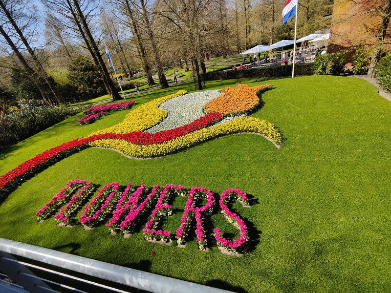
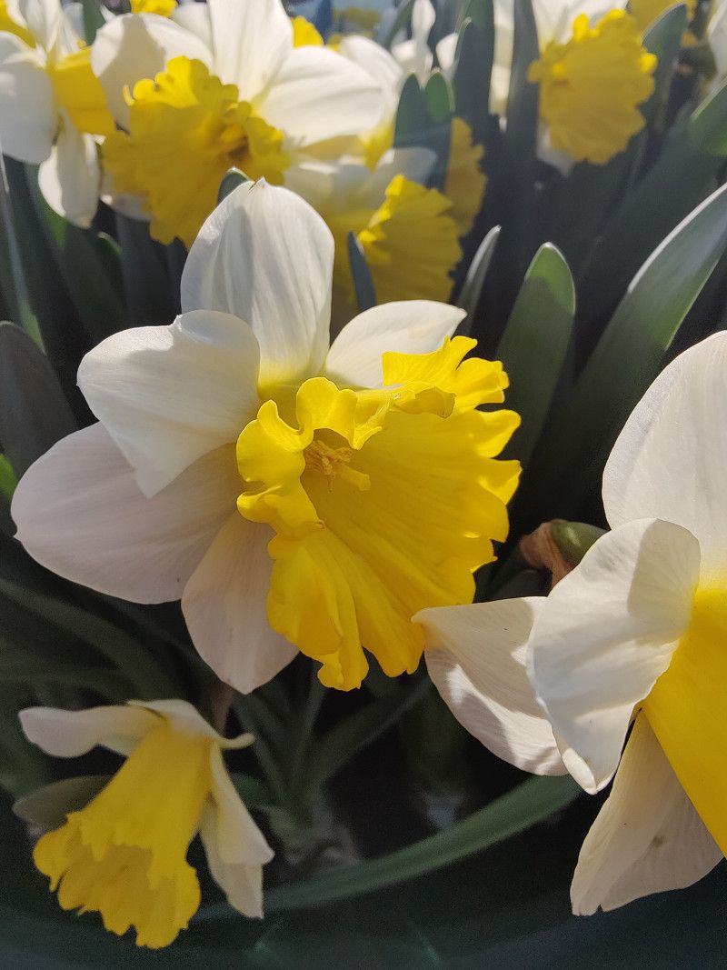
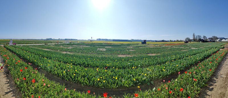
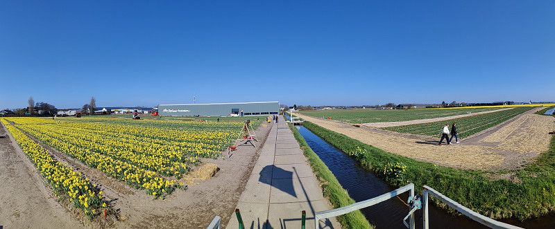
Bericht: Keukenhof
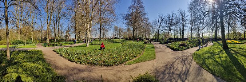
Keukenhof, located near Lisse in the Netherlands, is particularly known for its colorful tulip fields. This report describes my impressions of the visit, the highlights of the exhibition, and practical information for future visitors.
Arrival and first impression
I arrived by camper van, and even on the way there, I was able to admire the vast flower fields that characterize the region. At the entrance, I was greeted by an impressive display of blossoms that immediately reflected the special atmosphere of Keukenhof. The park was very well organized, and despite the large number of visitors, admission went smoothly.
The gardens
Keukenhof covers an area of approximately 32 hectares and is home to millions of tulips and numerous other spring flowers. The various themed and display gardens offered a diverse experience:
- Historical Garden : Here you can learn about old tulip varieties and the development of tulip breeding.
- Inspirational gardens : Various modern garden concepts showed creative design options for the home garden.
- Pavilions : The pavilions featured impressive flower displays, including orchids and hyacinths.
Special experiences
A highlight of my visit was the view of the surrounding tulip fields, stretching out in vibrant colors. Furthermore, various art installations in the park offered a successful connection between nature and culture. Particularly impressive was the water feature, which blended harmoniously into the garden architecture.
Practical information
- Gastronomy : Several restaurants and snack bars offered regional and international dishes.
- Accessibility : The park is easily accessible for people with reduced mobility.
Conclusion
My visit to Keukenhof was an unforgettable experience. The variety of flowers, the meticulously designed gardens, and the relaxed atmosphere made the day a special highlight. I highly recommend Keukenhof to any flower lover and photography enthusiast.
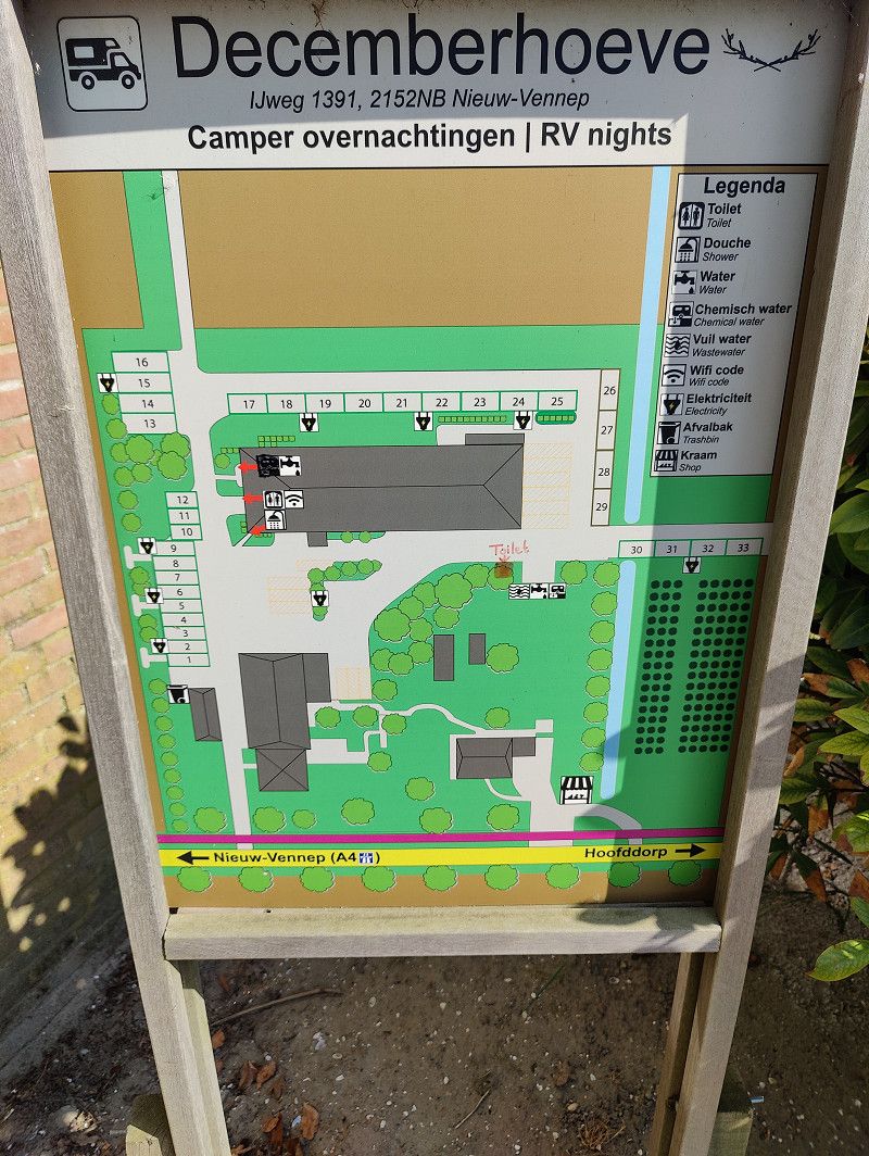
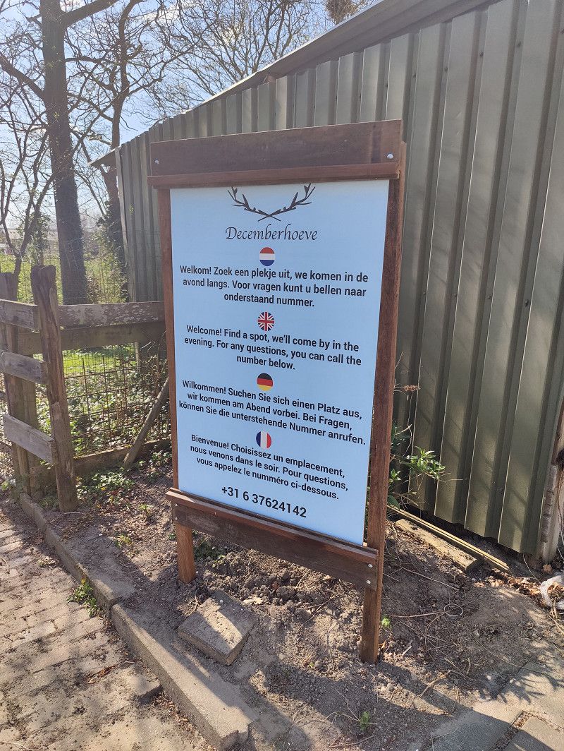
Decemberhoeve
https://park4night.com/de/place/22807
https://www.decemberhoeve.nl/campers
Overnight stay without electricity: 15,00 €
Overnight stay with electricity: 19,00€
IJweg, Nieuw-Vennep, Nordholland, Niederlande
52° 17' 18" N 4° 37' 31.6" E
52.2883291 4.6254428
• Head southwest on Ijweg. Go for 372 m.
• Take the 3rd exit from roundabout onto Noordelijke Randweg. Go for 982 m.
• Take the 2nd exit from roundabout onto Noordelijke Randweg. Go for 2.1 km.
• Take the 1st exit from roundabout onto Spoorlaan. Go for 687 m.
• Take the 1st exit from roundabout onto Luzernestraat. Go for 216 m.
• Take the 2nd exit from roundabout onto Noorderdreef. Go for 284 m.
• Turn right onto Gersteweg. Go for 88 m.
• Arrive at Gersteweg. Your destination is on the right.
☍
4,7 km
( 5 min.)
Bericht: Decemberhoeve
The Decemberhoeve motorhome park is located in Nieuw-Vennep in the Dutch province of North Holland and is part of a traditional farm. The pitches are paved and surrounded by agricultural land, creating a peaceful and natural atmosphere.
Special features:
The farm offers seasonal products such as potatoes, onions, honey, cheese and flowers.
Decemberhoeve offers a comfortable and well-equipped pitch in a rural setting with a variety of recreational opportunities nearby.
Day - - - Do - 03.04.2025 - - -
Wohnmobil Waschplatz
https://park4night.com/de/place/345513
The Berg Wash & Zo camper wash is a modern self-service car wash specifically designed with a station for cleaning motorhomes and other large vehicles. The facility offers spacious outdoor wash bays, providing ample space for larger vehicles such as camper vans. Covered wash bays are also available for smaller vehicles. The wash bays are equipped with high-quality cleaning equipment that ensures effective yet gentle cleaning.
Gersteweg 7, Nieuw-Vennep, Nordholland, Niederlande
52° 15' 56.1" N 4° 38' 44.7" E
52.2655787 4.6457568
• Head toward Noorderdreef on Gersteweg. Go for 88 m.
• Turn left onto Noorderdreef. Go for 229 m.
• Take the 2nd exit from roundabout onto Luzernestraat. Go for 247 m.
• Take the 2nd exit from roundabout onto Spoorlaan toward Hoofddorp/Spoorzicht Pionier/Haarlem/Beinsdorp. Go for 732 m.
• Take the 2nd exit from roundabout onto Noordelijke Randweg. Go for 2.1 km.
• Pass 2 roundabouts and continue on Noordelijke Randweg. Go for 1.9 km.
• Turn right onto Drie Merenweg (N205) toward Hoofddorp/Haarlem. Go for 8.3 km.
• Turn right onto Vijfhuizerweg. Go for 1.1 km.
• Turn left onto Ijweg. Go for 432 m.
• Arrive at Ijweg.
☍
15,0 km
( 14 min.)
Spotterplatz Polderbaan
Polderbaan spotting site – a paradise for aviation enthusiasts
The spotting area on the Polderbaan at Amsterdam Schiphol Airport is one of the best aircraft observation points in Europe. It is located directly on runway 18R/36L, which, at 3,800 meters long, is one of the main runways for takeoffs and landings.
Perfect view of flight operations
The spotter area offers an unobstructed view of the runway, allowing aviation enthusiasts to experience takeoffs and landings up close. The heavy long-haul aircraft that often operate on this runway are particularly impressive.
Facilities and accessibility
The spotting area features a spacious parking lot, seating, and informational signs about aircraft and flight routes. It's easily accessible by car or bicycle. A small snack bar offers snacks and drinks, so there's nothing stopping you from staying longer.
Best time to visit
The morning hours are particularly recommended, as the light is optimal for photographers. Even in the late afternoon, the low sun offers impressive shots.
Whether for photographers, aviation enthusiasts or families – the spotting site at the Polderbaan is a worthwhile destination for anyone who wants to experience the fascination of flying up close.
Nordholland, Niederlande
52° 20' 27.7" N 4° 42' 13.3" E
52.3410408 4.7036829
• Head toward Vijfhuizerweg on Ijweg. Go for 432 m.
• Turn right onto Vijfhuizerweg. Go for 1.1 km.
• Turn left onto Drie Merenweg (N205). Go for 11.3 km.
• Turn right onto Leimuiderweg (N207). Go for 1.3 km.
• Turn left onto Leidsestraat (N208). Go for 803 m.
• Keep right toward Lisse/Sassenheim. Go for 33 m.
• Take the 2nd exit from roundabout onto Heereweg (N208) toward Lisse/Sassenheim. Go for 386 m.
• Keep right toward Lisse-Centrum/Sassenheim/Leiden/Industrieterrein Dever. Go for 36 m.
• Take the 2nd exit from roundabout onto Westelijke Randweg (N208) toward Lisse-Centrum/Sassenheim/Leiden/Industrieterrein Dever. Go for 785 m.
• Keep right toward Noordwijkerhout/Langevelderslag (Strand). Go for 37 m.
• Take the 1st exit from roundabout onto Stationsweg toward Noordwijkerhout/Langevelderslag (Strand). Go for 1.9 km.
• Continue on Delfweg. Go for 916 m.
• Arrive at Delfweg. Your destination is on the right.
☍
19,0 km
( 17 min.)
Tulip Experience Amsterdam
https://www.tulipexperienceamsterdam.nl/de
Address:
Delfweg 37, 2211 VK Noordwijkerhout, Netherlands
Open:
from March 20 to May 11, 2025
Daily from 9:00 - 18:00
From FAQ:
Yes, we have a limited number of RV parking spaces. Reservations are not required.
- The entrance fee includes a bouquet of tulips, which you can pick yourself in the indoor garden.
- Parking in the car park is free during your visit to Tulip Experience Amsterdam.
- A visit to the Tulip Experience Amsterdam lasts on average 60 - 75 minutes.
Delfweg, Noordwijk, Südholland, Niederlande
52° 17' 8.4" N 4° 31' 56.4" E
52.2856762 4.5323301
• Head toward Zilkerbinnenweg on Delfweg. Go for 795 m.
• Take the 2nd exit from roundabout onto Ruigenhoekerweg. Go for 723 m.
• Continue on Vogelaardreef. Go for 1.8 km.
• Turn right onto Langevelderslag. Go for 1.5 km.
• Turn right onto Langevelderslag. Go for 18 m.
• Arrive at Langevelderslag. Your destination is on the left.
☍
4,9 km
( 5 min.)
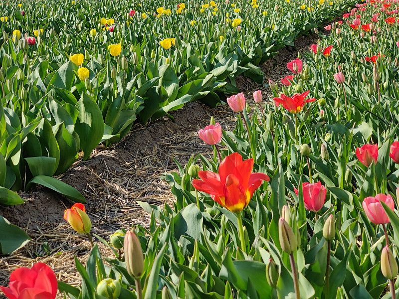
Bericht: Tulip Experience Amsterdam
The Tulip Experience Amsterdam is an interactive exhibition that offers visitors a comprehensive insight into the history, cultivation, and significance of the tulip in the Netherlands. In addition to numerous photo opportunities, the experience also offers the chance to experience the vibrant colors of the tulip fields up close.
Arrival and first impression
The Tulip Experience is located in Noordwijkerhout, just a few kilometers from the famous Keukenhof Gardens. Getting there was easy, with well-marked parking for cars and camper vans. Upon entering the grounds, the vast tulip fields in a variety of colors immediately impressed. The entrance area was modern and immediately invited you to explore.
Exhibition and experiences
The exhibition began with an informative tour through the history of tulips in the Netherlands. Historical exhibits and multimedia presentations explained how tulips sparked "tulip mania" in the 17th century and their significance for the Dutch flower trade today. Particularly impressive was the re-creation of a traditional tulip farm, which vividly depicted the entire process from cultivation to harvest.
Another highlight was the large tulip field, which offered visitors the opportunity to stroll among thousands of tulips and take unique photos. There was also a station where visitors could create their own tulip bouquet.
Special experiences
In addition to the classic exhibitions, there were interactive areas, including:
- Photo spots: Creatively designed backdrops with tulips in every imaginable color for perfect souvenir photos.
- Pick your own tulips: Each visitor was allowed to take home a selection of tulips as a souvenir at the end of their stay.
- Café and shop: The adjacent café offered typical Dutch delicacies, while the shop offered a wide selection of tulip bulbs and souvenirs.
Conclusion
The Tulip Experience Amsterdam was a worthwhile excursion that not only impressed the eye, but also provided interesting insights into the history and cultivation of tulips. This attraction is a must-see during the tulip bloom in the Netherlands, especially for photography enthusiasts and flower lovers.
Recommendation: Arrive early in the day to avoid the large crowds and wear comfortable shoes.
Strand Noordwijk
Arrival
The journey to Langevelderslag was made in the Zitty motorhome. The road conditions were good, and the route led through picturesque Dutch landscapes. Upon arrival in Noordwijk, there were several parking options near the beach.
Langevelderslag, Noordwijk, Südholland, Niederlande
52° 17' 56.2" N 4° 28' 46.6" E
52.2989436 4.4796248
• Head southwest on Langevelderslag. Go for 18 m.
• Turn left onto Langevelderslag. Go for 1.5 km.
• Turn left onto Vogelaardreef. Go for 1.9 km.
• Continue on Ruigenhoekerweg. Go for 658 m.
• Take the 2nd exit from roundabout onto Delfweg. Go for 1.8 km.
• Continue on Stationsweg. Go for 1.9 km.
• Keep left toward Hillegom/Haarlem/Amsterdam/Den Haag. Go for 51 m.
• Take the 3rd exit from roundabout onto Westelijke Randweg (N208) toward Hillegom/Haarlem/Amsterdam/Den Haag. Go for 857 m.
• Take the 2nd exit from roundabout onto Heereweg (N208) toward Hillegom/Haarlem/Amsterdam/Den Haag/Bedrijventerrein Meer en Duin. Go for 375 m.
• Keep right toward Hillegom/Haarlem/Amsterdam/Den Haag. Go for 30 m.
• Take the 2nd exit from roundabout onto Heereweg (N208) toward Hillegom/Haarlem/Amsterdam/Den Haag. Go for 880 m.
• Turn right onto Leimuiderweg (N207). Go for 7.5 km.
• Turn left and take ramp onto A4 (Knooppunt Burgerveen) toward Amsterdam. Go for 13.1 km.
• Take the exit toward Groningen/Utrecht/Amstelveen onto A9. Go for 12.6 km.
• Take the exit toward Utrecht/E35 onto A2. Go for 26.4 km.
• Take the exit toward E30/Arnhem/Amersfoort onto A12. Go for 61.3 km.
• Continue on A12 toward Arnhem/Doetinchem/Oberhausen. Go for 20.2 km.
• Take the exit toward Enschede/Doetinchem onto A18. Go for 23.1 km.
• Turn right onto Twenteroute (N18) toward Varsseveld/Winterswijk/Enschede. Go for 2.0 km.
• Turn right onto Oostelijke Rondweg (N318) toward Varsseveld/Aalten/Winterswijk/Industrieterrein Hofskamp. Go for 1.5 km.
• Pass 6 roundabouts and continue on Bredevoortsestraatweg (N318). Go for 14.7 km.
• Turn right onto Driemarkweg. Go for 707 m.
• Turn right onto Veldhorstweg. Go for 550 m.
• Turn left onto Vreehorstweg. Go for 388 m.
• Turn right. Go for 27 m.
• Arrive at your destination on the right.
☍
193,9 km
(2 hrs. )
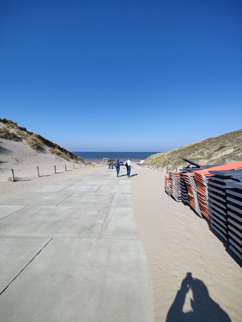
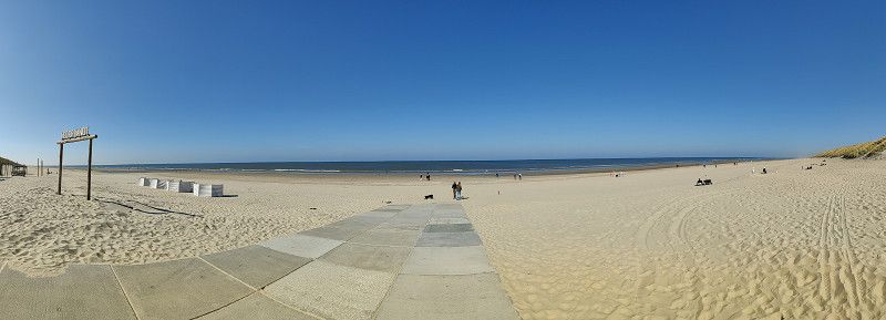
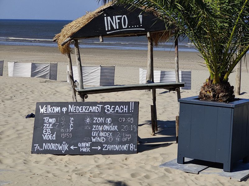
Bericht: Strand Noordwijk
Impression of the beach
Langevelderslag beach was a spacious, clean stretch of sand with an impressive dune landscape. The North Sea water was refreshing, and despite the fresh breeze, the weather was inviting. The atmosphere was relaxed, and there were both walkers and water sports enthusiasts out and about.
Activities:
- A long walk along the coast with a view of the setting sun.
- Visit one of the numerous beach pavilions to enjoy a typical Dutch specialty.
- Photography of the dune landscape, the beach and the North Sea.
- Relaxing on the sand and watching the activity on the water.
gastronomy
The beach restaurants offered a wide selection of food and drinks. [Name of restaurant visited] was particularly recommended, offering freshly prepared seafood and a cozy atmosphere.
Conclusion
The visit to Langevelderslag Beach was a successful combination of relaxation and exploration. The wide sandy expanses, pleasant atmosphere, and good infrastructure make this place a perfect destination for a day trip or a longer stay with your motorhome.
Camping Vreehorst
https://park4night.com/de/place/113410
https://www.vreehorst.de/
https://www.vreehorst.de/
Important information about arrival and departure:
- Arrival: From 12:30 p.m. – Barrier opens automatically based on license plate number, check-in is automatic. Your pitch number will be sent via email on the day of arrival. Personal check-in is possible at reception.
- Departure : By 12:00 PM . If you have booked private bathroom facilities, please return the key to reception.
Vreehorstweg, 7102 EK, Winterswijk, Netherlands
51° 56' 56.5" N 6° 41' 28.1" E
51.9490168 6.6911432
• Head toward Vreehorstweg. Go for 19 m.
• Turn right onto Vreehorstweg. Go for 1.8 km.
• Turn right onto Venemansweg. Go for 180 m.
• Turn left onto Snelliusstraat. Go for 13 m.
• Turn right onto Rondweg Zuid (N319). Go for 852 m.
• Take the 2nd exit from roundabout onto Rondweg Zuid (N319) toward Vreden/A31/Borken. Go for 6.0 km.
• Continue on Winterswyker Straße (L558). Go for 3.7 km.
• Continue on B525 toward A31/Coesfeld. Go for 10.1 km.
• Take the 2nd exit from roundabout onto B525 toward Oberhausen/A31/Emden/Coesfeld/Gewerbegebiet Gescher Süd. Go for 12.1 km.
• Turn right onto Konrad-Adenauer-Ring (B474) toward A43/Dülmen/Lette. Go for 10.2 km.
• Turn right and take ramp onto B474 toward A43/Olfen/Dülmen-Nord. Go for 3.8 km.
• Take ramp onto A43 toward Münster. Go for 21.2 km.
• Take exit 2 toward Dortmund onto A1 (Hansalinie). Go for 45.3 km.
• Take exit 84 toward Kassel/Paderborn onto A44. Go for 130 km.
• Take exit 67 toward Zierenberg/Habichtswald onto B251. Go for 11.9 km.
• Turn right onto Rasenallee (L3217) toward Kassel-Bad Wilhelmshöhe. Go for 1.6 km.
• Turn left onto Ahnatalstraße. Go for 1.3 km.
• Turn right onto Wilhelmshöher Weg. Go for 805 m.
• Turn left onto Wilhelmshöher Weg. Go for 313 m.
• Turn left onto Schanzenstraße. Go for 316 m.
• Turn right toward Ochsenallee. Go for 23 m.
• Turn right onto Ochsenallee. Go for 278 m.
• Arrive at Ochsenallee. Your destination is on the left.
☍
262,1 km
(2 hrs. 40 min.)
Day - - - Fr - 04.04.2025 - - -
Parkplatz Prinzenquelle | Wilhelmshöhe Parkplatz unten am Schloss
https://park4night.com/de/place/46276
Five spacious special pitches for motorhomes in the middle of the parking lot.
Free between October 4 and April 30.
Parking costs 5€
or
Hessen, Deutschland
51° 19' 26.8" N 9° 25' 50.7" E
51.3241005 9.4307536
• Head toward Vor der Prinzenquelle on Ochsenallee. Go for 330 m.
• Continue on Schanzenstraße. Go for 1.2 km.
• Turn right onto Loßbergstraße. Go for 146 m.
• Continue on Heßbergstraße. Go for 855 m.
• Continue on Bertha-von-Suttner-Straße. Go for 776 m.
• Turn right onto Druseltalstraße (L3218). Go for 2.3 km.
• Keep right onto Im Druseltal (L3298). Go for 3.6 km.
• Turn right onto Schloßpark Wilhelmshöhe (K6). Go for 1.2 km.
• Turn slightly left onto Schloßpark Wilhelmshöhe. Go for 69 m.
• Arrive at Schloßpark Wilhelmshöhe. Your destination is on the right.
☍
10,4 km
( 14 min.)
Besucherzentrum | Wilhelmshöhe Parkplatz oben am Herkules
https://park4night.com/de/place/112168
Parking directly at Kassel's landmark, the Hercules.
Parking costs €5 per day from 6:00 a.m. to 11:00 p.m. From the Hercules, you can enjoy wonderful views of the city. There are many hiking opportunities.
Schlosspark 28, Kassel, Hessen, Deutschland
51° 19' 1.7" N 9° 23' 27.3" E
51.3171439 9.3909191
• Head east on Schloßpark Wilhelmshöhe.
• Turn slightly left onto Schloßpark Wilhelmshöhe. Go for 18 m.
• Turn slightly left onto Schloßpark Wilhelmshöhe. Go for 76 m.
• Turn slightly right onto Schloßpark Wilhelmshöhe. Go for 1.2 km.
• Turn left onto Ehlener Straße (L3298). Go for 3.5 km.
• Continue on Druseltalstraße (L3218). Go for 673 m.
• Turn left onto Baunsbergstraße (L3217). Go for 1.4 km.
• Turn left onto Wilhelmshöher Allee (L3217). Go for 1.6 km.
• Arrive at Schloßpark Wilhelmshöhe (L3217).
☍
8,4 km
( 11 min.)
Bergpark Wilhelmshöhe
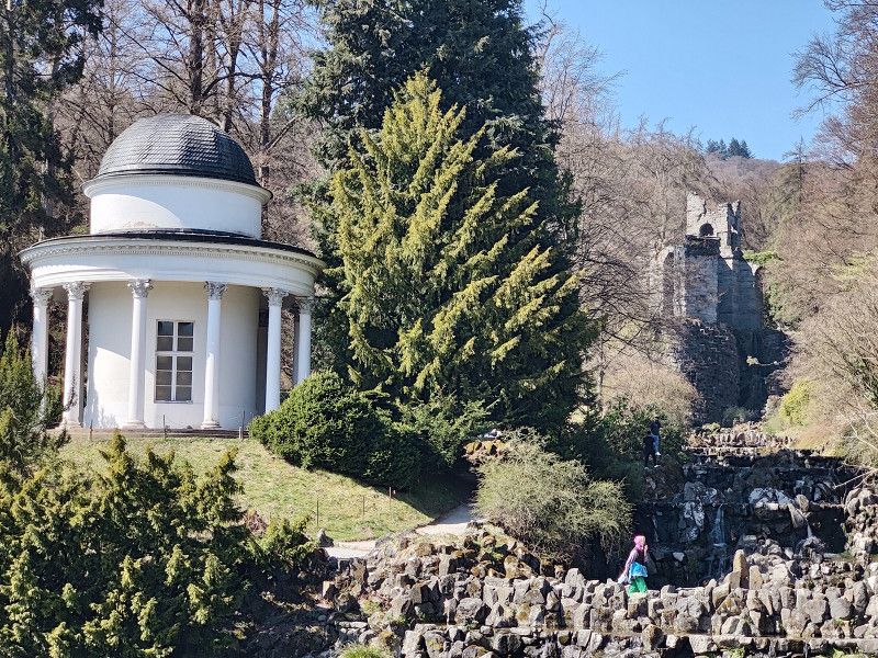
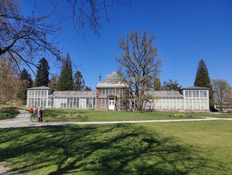
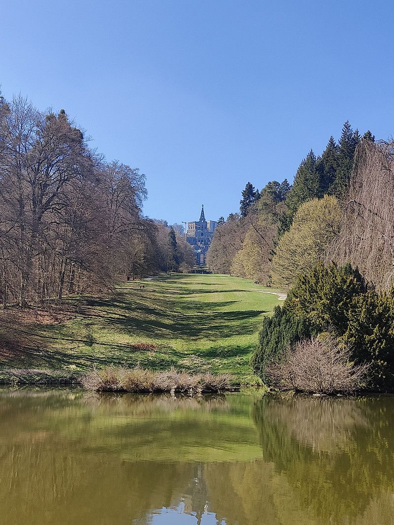
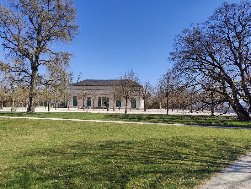
The Bergpark Wilhelmshöhe in Kassel is the largest mountain park in Europe and has been a UNESCO World Heritage Site since 2013. It was laid out in 1689 under Landgrave Karl of Hesse-Kassel in the style of a baroque terraced garden and later expanded in the English landscape style.
Highlights of the mountain park:
- Hercules Monument: Kassel's landmark, a monumental copper statue of Hercules on a pyramid with a cascade below. The famous water features start from here.
- Water features: Historic water system with artificial waterfalls, cascades, ponds and fountains (May to October, Wednesdays and Sundays).
- Wilhelmshöhe Palace: Former summer residence of the Landgraves, today a museum with a picture gallery (Old Masters) and a collection of antiquities.
- Löwenburg: Picturesque castle ruins in neo-Gothic style, built as a romantic backdrop.
- Greenhouses and parks: Diverse botanical gardens and impressive landscaping.
The park is freely accessible, although some attractions, such as the castle and Löwenburg, require a fee. It offers impressive views, numerous hiking trails, and is a popular destination for nature and culture lovers.
Deutschland
51° 18' 51.8" N 9° 24' 53.9" E
51.3143850 9.4149824
• Head west on Schloßpark Wilhelmshöhe (L3217). Go for 4.2 km.
• Turn left onto Wolfhager Straße (B251) toward A44/Korbach/Wolfhagen/Istha. Go for 7.5 km.
• Turn right onto L3390. Go for 4.6 km.
• Continue on Am Kratzenbusch (L3390). Go for 243 m.
• Continue on L3390. Go for 902 m.
• Continue on Dörnbergstraße (L3390). Go for 930 m.
• Continue on Bärenbergstraße (L3390). Go for 3.2 km.
• Turn left onto L3214. Go for 2.2 km.
• Turn right onto Bunsenstraße. Go for 218 m.
• Turn left onto Siemensstraße. Go for 295 m.
• Turn slightly left onto Bruchweg. Go for 36 m.
• Arrive at Bruchweg. Your destination is on the left.
☍
24,3 km
( 24 min.)
Bericht: Bergpark Wilhelmshöhe
Conclusion: The visit to Bergpark Wilhelmshöhe was a fascinating blend of culture, history, and nature. The Hercules Monument, the water features, and the art collection in the palace were particularly impressive. The park offers numerous opportunities for relaxation and is an absolute highlight for visitors interested in architecture, art, and landscape design. A visit is highly recommended!
04. Apr. 2025 -
06. Apr. 2025
Stellplatz Bruchwiesen
Wolfhagen - Bruchweg
https://park4night.com/de/place/74586
https://wolfhagen.de/wohnmobilstellplatz/
45 pitches for motorhomes near the city park, partly gravel, partly meadow
- Power connection
- Fresh water and wastewater on site (access code for V/E at the parking meter)
- Barbecue hut can be rented
- Parking for a fee including Wi-Fi
- Dogs are allowed
- Motorhome parking space can be used all year round
Garbage disposal is not available directly at the parking lot. Restaurants and shops are within a 5-minute walk.
Bruchweg, 34466, Wolfhagen, Germany
51° 19' 49" N 9° 10' 16" E
51.3302778 9.1711111
• Head southwest on Bruchweg. Go for 111 m.
• Arrive at Bruchweg. Your destination is on the left.
☍
0,1 km
( )
Day - - - Sa - 05.04 - - -
Wolfhagen
Report on the city of Wolfhagen
1. General Information Wolfhagen is a small town in the Kassel district of northern Hesse. It is located approximately 25 kilometers west of Kassel and belongs to the GrimmHeimat NordHessen region. With approximately 12,000 residents, the town offers a blend of historic charm and modern infrastructure.
2. History
The town of Wolfhagen was first mentioned in a document in 1231. It played an important role as a trading and market town in the Middle Ages. The historic old town, with its well-preserved half-timbered houses, the city wall, and the Landgrave's Castle, still bears witness to this eventful past.
3. Economy and Infrastructure Wolfhagen has a solid economic structure characterized by small and medium-sized enterprises. Energy supply is particularly important, as Wolfhagen was one of the first municipalities in Germany to implement a virtually self-sufficient, citizen-supported electricity supply using renewable energy.
In terms of transport, Wolfhagen is well connected via the B450 federal highway, and the Kassel-Korbach railway line provides a connection to the national rail network.
4. Sights and culture Wolfhagen offers numerous sights, including:
- The old town with its picturesque half-timbered houses
- The town church of St. Anna , a Gothic church with impressive stained glass windows
- The market square with the historic town hall
- The Wolfhager Land Regional Museum , which documents the history of the region
- The Weidelsburg , one of the largest castle ruins in Northern Hesse
There are also numerous cultural events such as city festivals, concerts and theatre performances that enrich social life.
5. Leisure and nature
The area surrounding Wolfhagen offers numerous recreational activities. Hiking and biking trails lead through the charming low mountain landscape of the Habichtswald Nature Park. Particularly popular are the "Habichtswaldsteig" and the Twistesee, which is located not far from the town and offers opportunities for water sports.
6. Conclusion
Wolfhagen is a city with a high quality of life, combining tradition and modernity. With its historic architecture, a sustainable energy policy, and numerous recreational activities, it offers an attractive environment for both residents and visitors.
Bruchweg, Wolfhagen, Landkreis Kassel, Hesse, Germany
51° 19' 46" N 9° 10' 13.5" E
51.3294508 9.1704230
• Head toward Siemensstraße on Bruchweg. Go for 148 m.
• Turn slightly right onto Siemensstraße. Go for 295 m.
• Turn right onto Bunsenstraße. Go for 218 m.
• Turn right onto Schützeberger Straße (L3214). Go for 98 m.
• Turn left onto B450. Go for 13.3 km.
• Turn right onto L3298 toward Kassel/Ks-Bad Wilhelmshöhe. Go for 9.2 km.
• Continue on Druseltalstraße (L3218). Go for 673 m.
• Turn left onto Baunsbergstraße (L3217). Go for 1.4 km.
• Turn left onto Wilhelmshöher Allee (L3217). Go for 870 m.
• Arrive at Wilhelmshöher Allee (L3217). Your destination is on the right.
☍
26,1 km
( 24 min.)
Zolaq Lightpainting Workshop - Bergpark Wilhelmshöhe
Wilhelmshöher Allee 380, Kassel, Hessen, Deutschland
51° 18' 55.9" N 9° 25' 24.4" E
51.3155406 9.4234533
• Head toward Mulangstraße on Wilhelmshöher Allee (L3217). Go for 848 m.
• Continue on Wilhelmshöher Allee. Go for 2.2 km.
• Keep right onto Wilhelmshöher Allee. Go for 1.7 km.
• Turn right onto Brüder-Grimm-Platz. Go for 110 m.
• Turn left onto Obere Karlsstraße. Go for 143 m.
• Turn right onto Fünffensterstraße. Go for 95 m.
• Turn left onto Frankfurter Straße (B3). Go for 212 m.
• Keep right onto Frankfurter Straße (B3). Go for 779 m.
• Turn right onto Leipziger Straße (L3237) toward Bebra/B83/Eisenach/B7/Frankfurt/A7/A44/Marburg/A49/Messehallen. Go for 745 m.
• Take the 3rd exit from Platz der Deutschen Einheit roundabout onto Dresdener Straße (B7/B83) toward Hannover/Warburg/Hofgeismar/Flughafen KS-Calden. Go for 3.8 km.
• Take ramp onto A7 toward Hamburg/Hannover. Go for 30.5 km.
• Take exit 74 toward Leipzig/Halle/Nordhausen onto A38. Go for 173 km.
• Take exit 26 toward Weißenfels onto B91. Go for 4.5 km.
• Take ramp toward Burgwerben/Weißenfels-Nord. Go for 304 m.
• Continue on Merseburger Straße toward Burgwerben/Weißenfels-Nord. Go for 2.7 km.
• Take the 1st exit from Niemöllerplatz roundabout onto Friedrichsstraße toward Stadthalle/A9. Go for 269 m.
• Arrive at Friedrichsstraße. Your destination is on the left.
☍
221,7 km
(2 hrs. 5 min.)
Day - - - So - 06.04 - - -
Heimfahrt / Ende
Burgenlandkreis, Sachsen-Anhalt, Deutschland
51° 11' 59.9" N 11° 58' 0.4" E
51.1999793 11.9667857