After the work is done, one of us unfortunately had to work until 8:00 p.m., it's finally time for our well-deserved vacation.
1330 KM lie ahead of us and we want to get them over with in easy to manage individual sections.
Deutschland
51° 26' 3.9" N 6° 45' 44.4" E
51.4344079 6.7623293
• Head northwest on Schwanenstraße (L78). Go for 318 m.
• Make a U-Turn at Schwanentor onto Calaisplatz (L78). Go for 325 m.
• Turn right onto Steinsche Gasse. Go for 232 m.
• Turn left onto Friedrich-Wilhelm-Platz (K5). Go for 103 m.
• Keep right onto Friedrich-Wilhelm-Straße (K5). Go for 747 m.
• Turn right onto Mercatorstraße. Go for 349 m.
• Turn left onto L60 toward Dinslaken/A59/A3/Mülheim an der Ruhr/Neudorf/Zoo/Universität. Go for 2.9 km.
• Turn right onto Bissingheimer Straße (L60) toward Köln. Go for 397 m.
• Turn left and take ramp onto A3 toward Köln. Go for 58.3 km.
• Continue on A3 toward Frankfurt a.M. Go for 161 km.
• Take exit 48 toward Basel/Stuttgart/Darmstadt/Mainz onto A67. Go for 25.1 km.
• Continue on E35 (Darmstädter Kreuz) toward Basel/Karlsruhe/Heidelberg/A5. Go for 1.1 km.
• Continue on A5. Go for 84.1 km.
• Arrive at A5.
☍
335,1 km
(3 hrs. 2 min.)
Day
A5
motorway rest stop
First break around 00:30.
It then continued at around 10:00 a.m. We didn't set an alarm. We have to ask that every working day. When on vacation, therefore, as seldom as possible.
Bruchsal, Deutschland
49° 7' 53" N 8° 33' 3.4" E
49.1313765 8.5509583
• Head south on A5. Go for 206 km.
• Continue on A2. Go for 14.1 km.
• Keep right onto A2 (Verzweigung Augst) toward Chiasso/Gotthard/Luzern/Bern/Arisdorf. Go for 28.2 km.
• Take the left exit toward Chiasso/Gotthard/Luzern/Zürich/Rothrist onto A1/A2. Go for 8.9 km.
• Take exit 47 toward Chiasso/Gotthard/Luzern/Reiden onto A2 (Verzweigung Wiggertal). Go for 236 km.
• Take exit 54 toward Chiasso Centro. Go for 182 m.
• Turn slightly left onto Via Como (2) toward Chiasso Centro. Go for 825 m.
• Pass 2 roundabouts and continue on Via Como (2). Go for 337 m.
• Take the 3rd exit from roundabout onto Via dei Pedroni (2). Go for 678 m.
• Continue on Via Bellinzona. Go for 71 m.
• Continue on Via Bellinzona. Go for 38 m.
• Pass 2 roundabouts and continue on Via Bellinzona. Go for 1.8 km.
• Take the 2nd exit from roundabout onto Via Luigi Camozzi toward Milano/A9/Varese. Go for 158 m.
• Take the 2nd exit from Largo Ceresio roundabout onto Via Nino Bixio. Go for 1.7 km.
• Continue on Piazzale Santa Teresa. Go for 58 m.
• Take the 1st exit from roundabout onto Viale Fratelli Rosselli. Go for 122 m.
• Turn right onto Viale Massenzio Masia. Go for 217 m.
• Keep right onto Via Fratelli Recchi. Go for 151 m.
• Continue on Piazzale San Rocchetto. Go for 51 m.
• Continue on Viale Innocenzo XI. Go for 783 m.
• Continue on Viale Franklin Delano Roosevelt. Go for 345 m.
• Continue on Via Achille Grandi toward Milano-Chiasso/A9/Cantù/Milano/Varese. Go for 413 m.
• Take the 1st exit from roundabout onto Piazza San Rocco. Go for 1.3 km.
• Turn left onto Via Filippo Turati toward Bergamo/Lecco/Cantù. Go for 85 m.
• Turn left onto Via Donatori di Sangue. Go for 230 m.
• Turn left onto Via Oltrecolle. Go for 209 m.
• Take the 1st exit from roundabout onto Via dei Lavatoi toward Autostrada/A9/Cantù/Milano/Varese. Go for 483 m.
• Keep left onto Via Canturina. Go for 843 m.
• Pass 2 roundabouts. Go for 924 m.
• Continue straight ahead. Go for 27 m.
• Take the 1st exit from roundabout toward Casnate con B./Villa Guardia/A59. Go for 187 m.
• Turn right onto Tangenziale di Como (A59) toward Villa Guardia/E35/E62/Milano. Go for 2.0 km.
• Take ramp onto A9 (Autostrada dei Laghi) toward E62/A8/Milano. Go for 21.9 km.
• Take the left exit onto A8 (Autostrada dei Laghi). Go for 5.1 km.
• Take the exit toward E64/Torino/A4/Genova/A7/Bologna/A1 onto A50 (Tangenziale Ovest). Go for 6.9 km.
• Take exit 3 toward Fieramilanocity/Settimo M. Centro onto Via Novara. Go for 396 m.
• Continue on Via Antonio Gramsci. Go for 52 m.
• Take the 4th exit from roundabout onto Via Antonio Gramsci toward Milano/Stadio S. Siro/Fieramilanocity/Tangenziale Ovest. Go for 155 m.
• Continue on Via Novara. Go for 297 m.
• Take the 1st exit from roundabout toward Milano Centro. Go for 1.7 km.
• Turn right onto Via San Romanello. Go for 542 m.
• Turn right onto Via Darix Togni. Go for 126 m.
• Continue on Via Vittorio De Sica. Go for 186 m.
• Take the 1st exit from roundabout onto Via Vittorio De Sica. Go for 361 m.
• Continue on Via Gaetano Airaghi. Go for 304 m.
• Continue on Via Quinto Romano toward Baggio. Go for 27 m.
• Arrive at Via Quinto Romano. Your destination is on the left.
☍
545,5 km
(5 hrs. 21 min.)
Camping Village Citta' di Milano
Three and a half hours traffic jam. About 1 of them in front of the Gotthart Tunnel. That was exhausting.
Break in Milan. Campsite under large trees that provide plenty of shade. The next mobile home will definitely have at least one cab air conditioner.
Clean sanitary facilities, friendly reception. For a short night, however, 42 euros.
OK, it's our own fault that we don't use the 24 hours.
But we are drawn further south. The ferry leaves on Sunday and certainly won't wait for us.
Via Gaetano Airaghi 61, 20153, Milano, Italien
45° 28' 22" N 9° 4' 52" E
45.4727700 9.0811100
• Head toward Via Benedetto Diotti on Via Quinto Romano. Go for 1.0 km.
• Turn right onto Via Amantea. Go for 110 m.
• Turn left onto Via Monsignor Oscar Arnulfo Romero. Go for 193 m.
• Take the 2nd exit from roundabout onto Via Monsignor Oscar Arnulfo Romero. Go for 170 m.
• Turn right onto Via Cusago. Go for 277 m.
• Turn left onto Via Noale. Go for 389 m.
• Continue on Via Castrovillari. Go for 317 m.
• Turn right and take ramp onto Via Sandro Pertini. Go for 851 m.
• Take ramp onto A50 (Tangenziale Ovest) toward Bologna/Tangenziale Est/A51/Tangenziale Nord/A52/Genova/A7/Aeroporto Linate. Go for 21.5 km.
• Continue on A1 (Autostrada del Sole). Go for 152 km.
• Take the exit toward Modena Nord/Modena Centro/Tangenziale onto Tangenziale Nord Luigi Pirandello. Go for 7.8 km.
• Keep left onto Tangenziale Nord Giosuè Carducci toward Bologna/A1/SS9. Go for 2.3 km.
• Continue on Tangenziale Nord Boris Leonidovic Pasternak. Go for 2.9 km.
• Keep left onto Via Nuova Estense toward Bologna/A1/Abetone/SS12/Vignola/SP623/Ospedale Civile Baggiovara. Go for 1.2 km.
• Take the 3rd exit from roundabout onto Strada Provinciale del Passo Brasa (SP623) toward Bologna/A1/Vignola. Go for 5.1 km.
• Take the 2nd exit from roundabout onto Strada Provinciale del Passo Brasa (SP623) toward Autostrada/A1/Spilamberto/Vignola. Go for 1.7 km.
• Take the 3rd exit from roundabout onto A1 (Autostrada del Sole) toward Bologna. Go for 17.6 km.
• Keep right onto A14 (Autostrada Adriatica) toward Ancona/Ravenna/Padova/A13/Tangenziale/Bologna Borgo Panigale/Bologna Centro/Aeroporto Bologna/Fiera Bologna. Go for 94.1 km.
• Take the exit toward Cesena Nord/Zona Industriale Pievesestina/Dogana/Forlimpopoli onto Via 2 Giugno. Go for 780 m.
• Take the 2nd exit from Rotonda 8 Marzo roundabout onto Via Dino Rondani (SS71) toward Cesena/Forlì/SS9/Forlimpopoli/Zona Industriale Pievesestina. Go for 1.4 km.
• Take the 2nd exit from Rotonda Napoleone Colajanni roundabout onto Viale del Commercio (SS71). Go for 747 m.
• Turn left onto Viale del Commercio (SS71). Go for 228 m.
• Take the 3rd exit from Rotonda Giuseppe Saragat roundabout onto Via Torino (SP140) toward Cesena Centro/Ospedale/E55/Ancona/A14. Go for 503 m.
• Pass 2 roundabouts and continue on Via Torino (SP140). Go for 2.2 km.
• Take the 2nd exit from Rotonda Martorano roundabout onto Via Vittoria Mariani (SP140). Go for 3.3 km.
• Take the 2nd exit from Rotonda della Solidarietà roundabout toward Bologna/A14/Ancona/Cesena Centro/Ospedale. Go for 37 m.
• Turn right onto Piazzale dell'Accoglienza. Go for 97 m.
• Take the 2nd exit from Rotonda della Pace roundabout toward Bologna/Ancona. Go for 302 m.
• Take the 4th exit from Rotonda Rita Levi Montalcini roundabout onto A14 (Autostrada Adriatica) toward Ancona. Go for 73.9 km.
• Take the exit toward Fano/Fano Centro. Go for 1.2 km.
• Take the 1st exit from roundabout onto Strada Statale di Bocca Trabaria (SS73bis) toward Fano. Go for 1.7 km.
• Take the 2nd exit from roundabout onto Via Papiria toward Centro. Go for 696 m.
• Continue on Via 4 Novembre. Go for 574 m.
• Arrive at Via Monte Grappa.
☍
397,0 km
(3 hrs. 54 min.)
Day
Fano
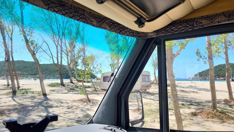
The pitches are all 100% full. We drive into a small street and behind one of the parking spaces there is a small cul-de-sac and we were able to spend the night there.
Pesaro und Urbino, Italien
43° 50' 23.3" N 13° 1' 9.9" E
43.8398164 13.0194201
• Head east on Via Monte Grappa. Go for 12 m.
• Take the 3rd exit from roundabout onto Viale Antonio Gramsci (SS16) toward Pesaro/Autostrada/A14. Go for 589 m.
• Take the 2nd exit from roundabout onto Via Roma toward Autostrada/A14/Flaminia/SP3/Roma/SS73bis. Go for 194 m.
• Take the 2nd exit from roundabout onto Via Roma toward Autostrada/A14/Roma/SS73bis. Go for 665 m.
• Take the 3rd exit from roundabout onto Via Sandro Pertini toward Autostrada/A14/Ancona/SS16/Roma/SS73bis. Go for 381 m.
• Take the 2nd exit from roundabout onto Via Sandro Pertini toward Autostrada/A14/Ancona/SS16/Roma/SS73bis. Go for 464 m.
• Continue on Via Bellandra. Go for 70 m.
• Take the 2nd exit from roundabout onto Strada Statale di Bocca Trabaria (SS73bis) toward Autostrada/A14/Urbino/Roma/Perugia/Gubbio. Go for 709 m.
• Take ramp toward Bologna/E55/Taranto/A14/Flaminia/SP3/Bellocchi. Go for 599 m.
• Take the 3rd exit from roundabout onto A14 (Autostrada Adriatica) toward Ancona. Go for 22.2 km.
• Take the exit toward Senigallia. Go for 553 m.
• Take the 1st exit from roundabout toward Pesaro/SS16/Ancona/Ospedale/Aeroporto. Go for 716 m.
• Take the 1st exit from roundabout onto Complanare Sud di Senigallia toward Ancona/SS16/Aeroporto. Go for 4.1 km.
• Take the 1st exit from roundabout onto Strada Statale Adriatica (SS16) toward Aeroporto/Ancona. Go for 8.3 km.
• Take the 2nd exit from roundabout onto Via Marina (SS16). Go for 3.7 km.
• Take ramp toward Falconara Marittima. Go for 470 m.
• Turn right onto Via Flaminia toward Falconara Centro. Go for 701 m.
• Continue on Piazza Cesare Battisti. Go for 151 m.
• Continue on Via Goffredo Baldelli. Go for 48 m.
• Continue on Via Flaminia. Go for 3.7 km.
• Take the 4th exit from roundabout toward Ancona. Go for 89 m.
• Continue on Via Flaminia toward Ancona. Go for 5.5 km.
• Continue on Via Guglielmo Marconi. Go for 74 m.
• Take the 2nd exit from roundabout onto Via Guglielmo Marconi toward Centro. Go for 244 m.
• Take the 2nd exit from Piazza Italia roundabout onto Via Guglielmo Marconi toward Centro. Go for 332 m.
• Continue on Via Guglielmo Marconi toward Centro. Go for 372 m.
• Continue on Via 29 Settembre. Go for 70 m.
• Take the 1st exit from roundabout onto Galleria San Martino. Go for 622 m.
• Continue on Via San Martino. Go for 501 m.
• Turn left onto Via Antonio Giannelli. Go for 108 m.
• Arrive at Via Antonio Giannelli. Your destination is on the left.
☍
56,2 km
( 54 min.)
Day
Ancona
Ferry 09/11/22 13:30 Anek Olympic Champion
Italien
43° 36' 57" N 13° 31' 8.1" E
43.6158299 13.5189150
• Head north on Via Antonio Giannelli. Go for 135 m.
• Turn left onto Via Terenzio Frediani. Go for 83 m.
• Turn left onto Piazza Camillo Benso di Cavour. Go for 66 m.
• Turn right onto Piazza Camillo Benso di Cavour. Go for 20 m.
• Turn left onto Piazza Camillo Benso di Cavour. Go for 9 m.
• Arrive at Piazza Camillo Benso di Cavour. Your destination is on the right.
• Turn right onto Dionysiou Filosofou. Go for 156 m.
• Turn right onto Grammou. Go for 94 m.
• Turn right onto Xenofontos. Go for 42 m.
• Arrive at Xenofontos.
☍
Distance not available
(Duration not available)
Day
Igoumenitsa
12.09.22 arrival, then immediately off to the beach. Let's see where we land.
Griechenland
39° 30' 22.1" N 20° 15' 55.9" E
39.5061499 20.2655339
• Head toward Aischylou on Xenofontos. Go for 23 m.
• Turn left onto Aischylou. Go for 117 m.
• Turn right onto Patriarchou Athinagora. Go for 373 m.
• Continue on Souliou. Go for 6 m.
• Continue on Vasilakou G. Go for 129 m.
• Turn left onto Eleftherias. Go for 176 m.
• Turn right onto Pindou. Go for 404 m.
• Turn right. Go for 30 m.
• Continue toward Gkoumanis. Go for 15 m.
• Continue on Gkoumanis. Go for 316 m.
• Turn right onto Agiou Dimitriou. Go for 18 m.
• Turn left toward Egnatia Odos/E90/E92. Go for 1.2 km.
• Turn left and take ramp onto E90/E92 (Egnatia Odos) toward Ioannina. Go for 9.6 km.
• Take exit 1Α toward Margariti/Parga/Syvota/Perdika/Preveza. Go for 178 m.
• Turn left onto Ep. Odos Igoumenitsas-Kanalakiou toward Margariti/Parga/Syvota/Perdika/Karteri/Preveza. Go for 7.4 km.
• Turn left onto Prevezas-Igoumenitsas (E55) toward Preveza/Parga/Margariti/Lefkada/Perdika. Go for 18.6 km.
• Turn right toward Ammoudia. Go for 3.3 km.
• Turn left. Go for 210 m.
• Arrive at your destination on the right.
☍
42,1 km
( 33 min.)
Ammoudia
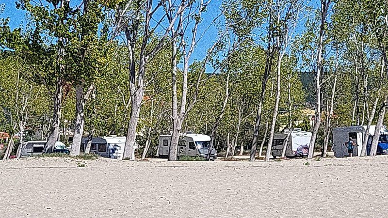
We land at Ammoudia beach. We stop beautifully under the trees. Camping is prohibited there. We stick to it and don't put tables in front of the door, don't grill and the awning stays in.
The police come, or rather drive by, and say nothing. So probably everything is fine. The friendly shop assistant of the small grocery store right on the street next to the tavern tells us that a lot has been checked and sent away this summer.
We were there with about 5 - 6 campers at the same time. Maybe we were lucky, maybe it was because nobody showed the typical camping behavior. I dont know. In any case, we stood super under trees.
We didn't even try the satellite dish. There is no reception there under the trees anyway.
Waste disposal and supply does not exist. But neither does it cost. Such a great place in a prime location without a fee. You cant complain.
We are easily equipped with 120 liters of fresh water and two toilet cassettes for 6 - 7 days.
A tip that most of you probably already know and that we have been using for ages: do not throw toilet paper in the cassette. Firstly, the paper only swells up unnecessarily and uses up capacity, and secondly, it tends to stick together and cleaning the cassette is more difficult.
We're staying a few days.
Griechenland
39° 14' 19.4" N 20° 29' 3.3" E
39.2387227 20.4842425
• Head east.
• Turn right. Go for 293 m.
• Take the 3rd exit from roundabout. Go for 4.3 km.
• Turn left toward Dikorfo. Go for 1.8 km.
• Turn left onto Dikorfo. Go for 915 m.
• Turn left toward Prevezas-Paramythias/18/21. Go for 11.7 km.
• Turn left onto Prevezas-Paramythias (18/21) toward Paramythia/Piges Acheronta/Spring of Acherontas. Go for 181 m.
• Arrive at Prevezas-Paramythias (18/21). Your destination is on the right.
☍
19,2 km
( 20 min.)
Day
Day
Glyki
Acheron Canyon 09/14/22.
Uih is cold, but a big thing.
First at the Acheron along the direction of the source and then further into the river and between the rock faces in the river. Sometimes the water goes up to my wife's chest. Usually only up to the knees. The Acheron is cold, but you get used to it and the view of the steep rocks rising to the right and left is just awesome.
In many places the river is fed by water inflows from mountain cracks or small holes in the rock. This is really worth seeing. Water shoes are a requirement if walking through the river shouldn't be a pain.
Griechenland
39° 19' 37.4" N 20° 36' 23.8" E
39.3270613 20.6066054
• Head west on Prevezas-Paramythias (18/21). Go for 493 m.
• Pass 2 roundabouts and continue on Ep. Odos 9-Paramythias-Morfis (18/21). Go for 18.5 km.
• Turn right onto 49 Prokriton toward Kentro/Center. Go for 289 m.
• Continue on Agiou Donatou toward Igoumenitsa/Ioannina. Go for 1.2 km.
• Take the 1st exit from roundabout onto Ep. Odos Paramythias-Dodonis toward Ioannina/A2/Eleftherochori/Ag. Kyriaki/Petousi/Saloniki/Elataria. Go for 6.7 km.
• Turn left and take ramp onto E90/E92 (Egnatia Odos) toward Ioannina/A2. Go for 90.7 km.
• Take exit 7Β toward Trikala/Athina/6 onto E92. Go for 41.1 km.
• Take the 1st exit from roundabout onto Ethniki Odos Metsovou-Kalampakas (E92). Go for 268 m.
• Turn left. Go for 1.1 km.
• Turn right. Go for 214 m.
• Arrive at your destination on the left.
☍
160,5 km
(2 hrs. )
Day
Campsite Vrachos Kastraki
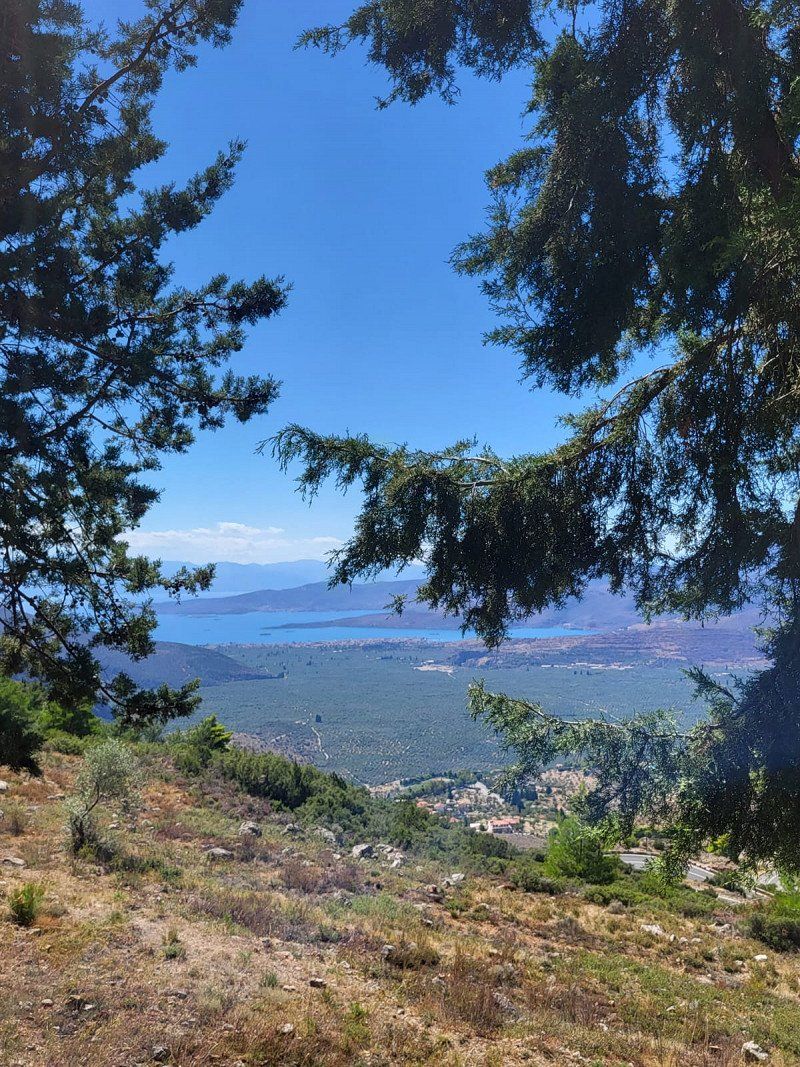
On Thursday, September 15th, 2022, the Womo will take us in the direction of the Meteora monasteries.
Most part via a really well maintained empty autobahn for around 10 euros toll. The last 40 km overland.
Camsite Vrachos Kastraki is a beautiful place close to the monasteries.
42200, Kastraki/kalambaka, Griechenland
39° 42' 47" N 21° 36' 58" E
39.7130500 21.6161100
• Head south. Go for 470 m.
• Continue on Dimitriou Patr. Go for 23 m.
• Continue on Patriarchou Dimitriou. Go for 294 m.
• Turn right onto Meteoron. Go for 292 m.
• Turn right onto Ioanninon. Go for 303 m.
• Keep right onto Pindou (E92). Go for 661 m.
• Take the 2nd exit from roundabout. Go for 544 m.
• Take the 1st exit from roundabout onto E65 (Aftokinitodromos Kentrikis Elladas) toward Lamia/A3/Lamia. Go for 24.7 km.
• Take the exit. Go for 1.3 km.
• Take the 2nd exit from roundabout toward Pertouli Elati/Trikala/Topikes Odoi/Local Roads. Go for 98 m.
• Take the 1st exit from roundabout onto Ethniki Odos Larisas-Trikalon (E92) toward Kalampaka/Meteora/Pertouli Elati/Trikala. Go for 2.5 km.
• Take the 2nd exit from roundabout onto Ethniki Odos Karditsas-Trikalon (30) toward Megalochori. Go for 2.0 km.
• Take the 2nd exit from roundabout onto Ethniki Odos Karditsas-Trikalon (30). Go for 677 m.
• Take the 3rd exit from roundabout onto Ethniki Odos Karditsas-Trikalon (30) toward Karditsa/Lamia. Go for 21.0 km.
• Turn left onto Ethniki Odos Karditsas-Trikalon (30) toward Athina/Larisa. Go for 4.5 km.
• Turn left onto Ethniki Odos Karditsas-Lamias (30) toward Athina/Larisa/Lamia/Myrini/Aerodromio/Airport. Go for 5.5 km.
• Keep right onto Ethniki Odos Karditsas-Lamias (30). Go for 68 m.
• Pass 2 roundabouts and continue on Ethniki Odos Karditsas-Lamias (30). Go for 1.1 km.
• Take the 1st exit from roundabout onto E65 (Aftokinitodromos Kentrikis Elladas) toward Trikala/Larisa/Sofades/Lamia. Go for 79.9 km.
• Take the exit onto E65/E75 (Ethniki Odos Athinon-Lamias). Go for 4.0 km.
• Take the exit toward Thermopyles. Go for 405 m.
• Turn left onto Ethniki Odos Lamias-Amfissas (E65) toward Damasta/Thermopyles/Gorgopotamos. Go for 117 m.
• Continue on Eparchiaki Odos 35-Irakleias-K. Damaston. Go for 58 m.
• Turn right toward Thermopyles/Anavra/Mendenitsa. Go for 7.7 km.
• Turn left. Go for 7.8 km.
• Turn left toward Skarfeia. Go for 1.6 km.
• Turn slightly right. Go for 485 m.
• Take the 3rd exit from roundabout. Go for 589 m.
• Turn right. Go for 1.5 km.
• Turn right. Go for 517 m.
• Turn right. Go for 38 m.
• Turn slightly left. Go for 752 m.
• Turn right toward Lefkes. Go for 750 m.
• Continue on Lefkes. Go for 441 m.
• Turn right. Go for 112 m.
• Arrive at your destination on the left.
☍
172,7 km
(1 hrs. 53 min.)
Day
Meteora Klöster
We took the first public transport bus to the monasteries. According to the timetable, it should run at 9:00 a.m. for a moderate 1.60 euros per person. He actually left at 9:15 a.m., which was OK.
At the end point we got out and then visited a monastery for a moderate 3 euros. We would have had to walk down the narrow road to another monastery, which seemed too strenuous due to the narrowness, the heavy traffic and 33 degrees in the shade.
So we left it at the visit of one, albeit the largest well-preserved monastery. That was OK too.
However, we have a 100 `Honda scooter with us. Because we wouldn't have gotten it out of the Womo on the small plot of the campsite. To do this, it would have been necessary to drive the Womo onto the square and get the scooter out.
I was a little too lazy, but my lover and I both agreed that we'll definitely do it this way on the next similar occasions. We are then much more flexible. So today we would definitely have driven around the mountain on a scooter and would have visited another monastery.
It's also really worth seeing. But two would have been enough. Maybe someday we'll pass Meteora again. Then it is definitely up to the monasteries with the scooter.
Day
Camping Venezuela, Agios Serafim, Griechenland
Saturday the 17th and we're going to the east coast. We need the beach by the sea again.
The site is accessible via gravel and paved roads by the sea, far away from the through road. A bit tricky to drive through the huge olive tree plantations in a large camper van. From time to time some branches grind long on the Womo, but it works. You can't be overly sensitive.
The campsite is on the beach but separated from it by a road. You cannot see the sea from the pitches.
We are received extremely friendly. The middle-aged woman makes a copy of an ID card and immediately shows us the place and explains all the facilities on it. Perfect. We take a nice place and arrived -immediately-. It is 100 meters from our place to the beach. A round thing.
So we enjoy the sun and lie in it for a few more hours. Campsite loungers and fixed parasols are available.
To our surprise, there is always live music on Saturday evenings in the tavern on site. A male duo entertains the guests of the tavern with Greek folk music. In addition, not only campers are present, but it seems that residents of the area also like to attend this event. We had already eaten in the mobile home, so we enjoy the cozy atmosphere with one or two cold drinks.
Paralia, Ag. Serafim 350 09, Griechenland
38° 49' 21.2" N 22° 42' 59" E
38.8225438 22.7163957
• Head north. Go for 112 m.
• Turn left toward Lefkes. Go for 367 m.
• Continue on Lefkes. Go for 188 m.
• Turn left. Go for 2.9 km.
• Turn right. Go for 208 m.
• Turn right. Go for 2.2 km.
• Turn left. Go for 1.6 km.
• Turn right. Go for 7.3 km.
• Keep left toward Eparchiaki Odos 35-Irakleias-K. Damaston. Go for 8.1 km.
• Turn left onto Eparchiaki Odos 35-Irakleias-K. Damaston toward Athina/Lamia/A1/Amfissa/Bralos. Go for 58 m.
• Continue on Ethniki Odos Lamias-Amfissas (E65). Go for 63.8 km.
• Turn left onto Amfissas-Delfon (48) toward Athina/Livadeia/Delfoi. Go for 10.6 km.
• Turn right. Go for 33 m.
• Arrive at your destination on the left.
☍
97,5 km
(1 hrs. 32 min.)
Day
Day
Day
Camping Apollon, Apollonos, Delphi, Griechenland
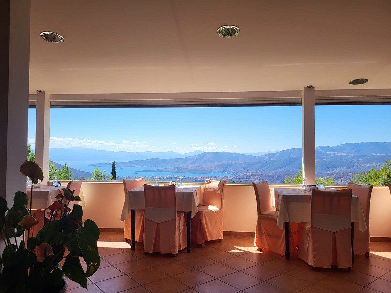
Friendly welcome. On Saturday a group of English campers who have booked should come. So we can't be in the front row. We stand above the beautiful, clean pool and still have a very good view of the valley. Not to the sea, but still very nice.
The best thing about the campsite is the tavern!!!
A view like a postcard motif. Insanity. We had actually planned to cook for ourselves, but when we registered and went to the restaurant to have our passport copied: Unbelievable. I immediately reserved a table, of course the best one in the middle (see picture). What a view. You look into a wide valley and at the end you can see the sea. I'm really excited, still.
The food was good, reasonably priced for the view, but not overly expensive, the service was friendly, and the beer was served with ice-cold glasses. Everything in the green.
But the view... madness!!! (Even if I repeat myself).
Should we drive towards Delphi again, we will use this place again (and eat in the tavern).
Apollonos 2, Delfi 330 54, Griechenland
38° 29' 1.9" N 22° 28' 32.5" E
38.4838503 22.4757031
• Head toward Amfissas-Delfon. Go for 33 m.
• Turn right onto Amfissas-Delfon (48). Go for 847 m.
• Turn left onto Apollonos. Go for 130 m.
• Turn right toward Apollonos. Go for 184 m.
• Turn left onto Apollonos. Go for 130 m.
• Continue on Amfissas-Delfon (48). Go for 9.8 km.
• Turn left toward Itea/Nafpaktos. Go for 3.3 km.
• Turn left onto Ethniki Odos Amfissas-Iteas (E65) toward Itea/Galaxidi/Nafpaktos. Go for 95.8 km.
• Take the 2nd exit from roundabout onto Ethniki Odos Nafpaktou-Antirriou (E65) toward Mesolongi/Ioannina/Patra/A5. Go for 194 m.
• Take the 1st exit from roundabout onto E55 (Ionia Odos) toward Ioannina. Go for 46.1 km.
• Take exit 5 toward Karpenisi/Agrinio. Go for 568 m.
• Take the 2nd exit from roundabout onto Ep. Odos Ioanninon-Antirriou (5) toward Karpenisi/Agrinio. Go for 15.5 km.
• Pass 3 roundabouts and continue on Patras-Agriniou (5). Go for 3.8 km.
• Take the 2nd exit from roundabout onto Pal. Ethn. Odos Agriniou-Amfilochias (E952) toward Ioannina/Arta/Ag. Konstantinos/Kentro/Nosokomeio. Go for 22.0 km.
• Take ramp onto E55 (Ionia Odos) toward Ioannina. Go for 8.6 km.
• Take the exit toward Lefkada/Preveza/Aerodromio/Airport onto E55 (Amvrakia Odos). Go for 35.5 km.
• Take the exit toward Mytikas/Vonitsa-Anatolika/Vonitsa-East. Go for 182 m.
• Turn right onto Ep. Odos 33-Vonitsas-Kandilas. Go for 13.7 km.
• Arrive at Ep. Odos 33-Vonitsas-Kandilas.
☍
256,4 km
(3 hrs. 12 min.)
Day
Das Orakel von Delphi
We learnt.
We unpacked the scooter and now we go to the famous places with the scooter.
Great, impressive what was started to build in 800 BC. What tons of precisely hewn stones. Incredible proportions. A 5000-seat amphibian theater. A sports facility 178 meters long built at the top of the mountains. And much more.
Really impressive. I had looked in advance for a German tour, but found nothing. So we walked through the site using the English-language signs. But a German-language tour would have been better.
But it's very impressive.
Day
Paleros, Griechenland
Thursday 09/22/2022
After about half the distance back to the west coast we reach the village of Paleros.
There are already a few other mobile homes here on the stone beach.
Camping is forbidden, but the wooden access barrier is broken in several places. We're looking for a nice job. The friendly Dutch camper next to us says that the police don't come here.
Now we are standing here in absolute peace in nature, awning out, table and chairs in front of it. We bought fresh fish from the local fishmonger, which we later put on the grill.
Cool. First a cappuccino and a few cookies.
We stayed until Tuesday as we get along fine with the gray water tank and faecal cassettes and get fresh water here at the tavern. We can then empty it in Italy at a motorway rest area with Womo supply and disposal.
On Tuesday, September 27th, 2022, on the ferry day, we continue to Igoumenitsa around noon and the ferry is scheduled to depart towards Ancona at 11:59 p.m.
Palairos 300 12, Griechenland
38° 47' 0.2" N 20° 52' 57.8" E
38.7834023 20.8827176
• Head south on Ep. Odos 33-Vonitsas-Kandilas. Go for 74 m.
• Turn left toward Ep. Odos 33-Vonitsas-Kandilas. Go for 133 m.
• Turn right onto Ep. Odos 33-Vonitsas-Kandilas. Go for 13.6 km.
• Turn left and take ramp onto E55/E952 (Aktio-Amvrakia) toward Preveza. Go for 13.7 km.
• Pass 5 roundabouts and continue on Prevezas-Igoumenitsas (E55). Go for 69.3 km.
• Turn right onto Ep. Odos Igoumenitsas-Kanalakiou toward Egnatia/A2/Mazarakia/Ioannina/Igoumenitsa. Go for 8.0 km.
• Turn left and take ramp onto E90/E92 (Egnatia Odos) toward Igoumenitsa. Go for 9.1 km.
• Take exit 1 toward Preveza/Igoumenitsa-Kentro/Igoumenitsa-Centre/1/Graikochori. Go for 262 m.
• Turn right toward Graikochori. Go for 1.0 km.
• Turn left onto Ep. Odos 1-Igoumenitsas-Margaritiou toward Limani/Port. Go for 368 m.
• Take the 2nd exit from roundabout onto Pargas. Go for 295 m.
• Take the 1st exit from roundabout onto Leoforos Ethnikis Antistaseos (6). Go for 740 m.
• Turn right onto Dionysiou Filosofou. Go for 246 m.
• Turn right onto Grammou. Go for 94 m.
• Turn right onto Xenofontos. Go for 42 m.
• Arrive at Xenofontos.
☍
116,9 km
(1 hrs. 32 min.)
Day
Day
Day
Day
Day
Igoumenitsa
So are in port. The ferry for the return journey to Ancona Italy is scheduled to depart at 11:59 p.m. Bit late, but we still had something from the day here. However, it only leaves at 1:00 a.m.
Filled up with fuel and sun again. From the ferry in Ancona we want to stop in Lazise (our favorite place) on Lake Garda in a short slide on the way back.
Griechenland
39° 30' 22.1" N 20° 15' 55.9" E
39.5061499 20.2655339
• Head toward Aischylou on Xenofontos. Go for 23 m.
• Turn right onto Aischylou. Go for 107 m.
• Turn left onto Megalou Alexandrou. Go for 54 m.
• Turn right onto Zosimadon. Go for 76 m.
• Continue on Michala F. Go for 106 m.
• Turn left onto Leoforos Ethnikis Antistaseos (6). Go for 145 m.
Unexpectedly, the pitch was 100 percent full at this time of year. We didn't arrive until 10pm so slept on the edge the first night on the road leading to the square.
Alarm clock set for 07:30, teeth brushed and the 20 meters to the reception and whatever. 5' he place. That means about 2-4 hours of waiting in the hope that 5 campers will leave the site. Since we only wanted to stay one more night in Lazise, we decided to use the very large parking lot, which is slightly elevated not far from the parking space.
However, the operator now knows what a gold mine he owns. 20 euros without supply / disposal for one night is a lot. I got the feeling he smiled a little at his Ferrari (different color and a bit bigger than the spring one) behind the wooden booth when I paid.
Well ok for one night. And we definitely wanted to spend another day in beautiful Lazise.
But there is one of the best equipped camping shops in Italy. In the small shop with friendly operators you will find everything your heart desires and whatever accessories / spare parts / household or electrical items you need or just want.
Viale Roma, 7, 37017 Lazise VR, Italien
45° 30' 31.1" N 10° 43' 55.4" E
45.5086259 10.7320426
• Head west on Viale Roma. Go for 47 m.
• Take the 1st exit from roundabout onto Viale Roma. Go for 245 m.
• Turn right onto Via Gardesana (SR249). Go for 287 m.
• Pass 2 roundabouts and continue on Strada Regionale Gardesana Orientale (SR249). Go for 3.2 km.
• Continue on Località Fossalta (SR249). Go for 1.2 km.
• Pass 4 roundabouts and continue on Via Gardesana (SR249). Go for 4.1 km.
• Take the 3rd exit from roundabout onto Via General Bonomi (SR249) toward Autostrade. Go for 1.1 km.
• Turn left toward Milano-Venezia/Milano-Brennero/A22. Go for 63 m.
• Take ramp onto A4 (Autostrada della Serenissima) toward Milano. Go for 135 km.
• Take the exit toward E62/Varese/Aeroporto Malpensa/Gravellona T./A26/E35/Como-Chiasso/A9 onto A8 (Autostrada Milano-Varese). Go for 10.6 km.
• Take the exit toward Como/Chiasso onto A9 (Autostrada dei Laghi). Go for 23.7 km.
• Take the exit toward Como Centro. Go for 725 m.
• Take the 3rd exit from roundabout onto Via del Dos toward Varese/Chiasso. Go for 589 m.
• Take the 2nd exit from roundabout onto Via Gabriele D'Annunzio (SP17) toward Chiasso/S.Fermo. Go for 2.0 km.
• Pass 2 roundabouts and continue on Via Roma (SP17). Go for 539 m.
• Take the 1st exit from roundabout onto Via Alessandro Noseda (SP17). Go for 216 m.
• Take the 2nd exit from roundabout onto Strada Provinciale Garibaldina (SP17). Go for 2.1 km.
• Take the 2nd exit from Largo Ceresio roundabout onto Via Luigi Camozzi. Go for 179 m.
• Take the 3rd exit from roundabout onto Via Bellinzona toward Chiasso/Cernobbio/Menaggio. Go for 748 m.
• Take the 3rd exit from roundabout onto Via Bellinzona toward Milano/A9/Svizzera. Go for 1.1 km.
• Take the 1st exit from roundabout onto Via Bellinzona. Go for 60 m.
• Continue on Via Bellinzona. Go for 142 m.
• Continue on Via Maestri Comacini (2). Go for 538 m.
• Take the 1st exit from roundabout onto Via Como (2). Go for 227 m.
• Take the 1st exit from roundabout toward Lugano. Go for 173 m.
• Take ramp onto A2 toward Lugano. Go for 237 km.
• Take the exit onto A1/A2. Go for 8.5 km.
• Take exit 45 toward E25/Basel/Egerkingen onto A2. Go for 41.2 km.
• Keep right onto A3 (Basel-Kleinhüningen) toward Mulhouse/EuroAirport/Basel-Kleinhüningen/Lörrach/Weil am Rhein. Go for 3.8 km.
• Continue on A35. Go for 25.5 km.
• Take the exit toward Paris/Lyon/Mulhouse onto A35. Go for 40.5 km.
• Continue on D83. Go for 10.7 km.
• Keep left onto A35. Go for 39.0 km.
• Continue on A355 toward E25/A4/Paris/A35/Karlsruhe/Strasbourg. Go for 25.1 km.
• Continue on A4 (Autoroute de l'Est). Go for 80.2 km.
• Take exit 41. Go for 665 m.
• Take the 4th exit from roundabout onto N61 toward Sarreguemines. Go for 3.9 km.
• Take the 2nd exit from roundabout onto N61 toward Sarreguemines. Go for 2.0 km.
• Take the 4th exit from roundabout onto N61 toward Forbach/Saarbrücken/Grosbliederstroff/Sarreguemines-Welferding. Go for 6.0 km.
• Take ramp onto N61 toward Saarbrücken/Kleinblittersdorf/Grosbliederstroff. Go for 604 m.
• Take ramp onto N61 A toward Saarbrücken/Kleinblittersdorf. Go for 169 m.
• Continue on L253. Go for 992 m.
• Take the 3rd exit from roundabout onto B51 toward A6/A620/Saarbrücken. Go for 7.5 km.
• Take ramp onto A620 toward Luxembourg/Saarlouis/Saarbrücken. Go for 4.7 km.
• Take exit 15 toward Koblenz/Trier/A1/Neunkirchen/A623/Cityring onto B268 (Saarbrücken-Westspangenbrücke). Go for 1.0 km.
• Turn left onto Lebacher Straße (B268) toward Caritasklinik St. Theresia. Go for 2.9 km.
• Continue on A1. Go for 23.3 km.
• Keep left onto A1. Go for 46.8 km.
• Take exit 131 toward Mehring/Fell. Go for 279 m.
• Turn left onto L150 toward Mainz/Morbach/Thalfang/Mehring/Büdlicherbrück/Flughafen Hahn. Go for 281 m.
• Turn left onto K85 toward Mehring. Go for 3.9 km.
• Continue on Wiesenflurweg (K85). Go for 160 m.
• Continue on K85. Go for 287 m.
• Continue on Brückenstraße (K85). Go for 71 m.
• Continue on Gartenstraße (K85). Go for 67 m.
• Continue on K85. Go for 72 m.
• Turn left onto Moselweinstraße (B53). Go for 9.1 km.
• Turn right. Go for 18 m.
• Turn right toward Gartenfeldstraße. Go for 262 m.
• Turn right onto Gartenfeldstraße. Go for 127 m.
• Arrive at Gartenfeldstraße.
☍
814,8 km
(8 hrs. 3 min.)
Day
Day
Zell an der Mosel, Deutschland
Today we started early towards home. It is actually planned to drive to the Moselle, but according to the navigation system it is 809 kilometers to the small town of Küsserath.
13 hours later, after unfortunately having to wait for a few smaller traffic jams and a total closure behind Baden Baden, we reached the Moselle.
However, we did not end up in Klüsserath but in Zell an der Mosel. A nice pitch. It should be well worth 9 euros a night. Disposal is behind the square and is possible free of charge and one euro is required for water. I don't know how many liters it was, but I needed 2 euros for my 120 liter tank, which was not completely empty.
54340 Klüsserath, Deutschland
49° 50' 39.1" N 6° 51' 14" E
49.8441918 6.8539016
• Head north on Gartenfeldstraße.
• Turn right onto Mittelstraße. Go for 230 m.
• Turn right onto Fronhofstraße. Go for 138 m.
• Turn right toward B53. Go for 19 m.
• Turn right onto B53. Go for 1.9 km.
• Turn right onto L48 toward Föhren/Bekond/Leiwen/Thörnich. Go for 3.3 km.
• Turn right and take ramp onto A1 toward Koblenz. Go for 52.9 km.
• Take exit 118 toward Köln/Gerolstein/Dockweiler/Dreis-Brück/Nerdlen. Go for 247 m.
• Turn right onto B410 toward Köln/A1/Gerolstein/Hillesheim/Dockweiler. Go for 1.3 km.
• Turn right onto L67 toward Köln/A1/Aachen/Stadtkyll/Hillesheim/Dreis-Brück/B421. Go for 1.8 km.
• Continue on Hillesheimer Straße (B421). Go for 38 m.
• Take the 1st exit from roundabout onto Hillesheimer Straße (B421) toward Köln/A1/Aachen/Stadtkyll/Hillesheim. Go for 4.6 km.
• Turn right onto L68 toward Stroheich/Nohn. Go for 6.2 km.
• Turn left onto Hauptstraße (L70). Go for 1.6 km.
• Continue on L10. Go for 2.3 km.
• Turn left onto L69 toward A1/Blankenheim. Go for 132 m.
• Continue on L167. Go for 3.0 km.
• Turn left onto B258 toward Ahrdorf. Go for 4.3 km.
• Take the 1st exit from roundabout onto L115 toward A1/Köln/Euskirchen. Go for 10.1 km.
• Turn right onto A1 toward Köln/Euskirchen. Go for 37.2 km.
• Take the left exit toward Dortmund/Venlo/Flughafen Köln onto A1/A61. Go for 6.0 km.
• Keep left onto A1 toward Dortmund/Flughafen Köln/Hürth. Go for 33.8 km.
• Take the exit toward Oberhausen onto A3. Go for 45.5 km.
• Take exit 15 toward DU-Wedau/Mülheim a.d.R.-Uhlenhorst. Go for 412 m.
• Turn left onto Uhlenhorststraße (L138) toward Duisburg-Wedau/Duisburg-Universität. Go for 226 m.
• Turn left onto Bissingheimer Straße (L60). Go for 1.1 km.
• Turn left onto Bissingheimer Straße (K3). Go for 650 m.
• Turn right onto Hermann-Grothe-Straße. Go for 381 m.
• Turn slightly left onto Finkenschlag. Go for 238 m.
• Arrive at Finkenschlag. Your destination is on the right.
☍
219,6 km
(2 hrs. 21 min.)
Day
Day
Day
Duisburg - Bissingheim, Dorfplatz
Well back home. It was a very nice vacation.
My neighbor asked me what was the highlight of our tour. I can only answer the question with one word: EVERYTHING!
It was a wonderful journey with so many beautiful things. Each a highlight in itself. One thing is certain, Greece will see us again.
Finally, it should be said that the overview above shows 5324 kilometers as the total distance. But 1690 have to be deducted from that, since we took the ferry back and forth from Ancona. So there are 3624 kilometers left.