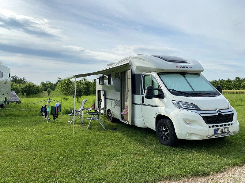
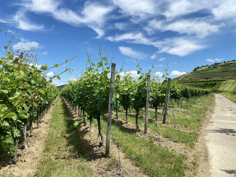
Unfortunately, our pilgrimage by e-bike from Eisenach to Marburg (Elisabeth path) planned for the end of April 2021 fell victim to the lockdown in Corona times. At some point we just had to get out. The small test tour in the spontaneously rented mobile home took us to the "natural garden" Kaiserstuhl, which is visible from afar in the middle of the Rhine plain, surrounded by the highest, often snow-covered low mountain ranges of the Vosges and the Black Forest. The Kaiserstuhl covers an area of around 100 square kilometers - there are vineyards, orchards, forests and much more here. In short, the landscape of the area is indescribably beautiful for biking (hiking) and the soul also dangles naturally.
Looking back, it was fate... with consequences! :-)
Day
Marburg, Deutschland
50° 48' 6.8" N 8° 45' 56.8" E
50.8018843 8.7657677
• Head toward Ubbelohdestraße on Frankfurter Straße (K7). Go for 427 m.
• Turn left onto Gisselberger Straße (K68) toward Kassel/Gießen/Cappel/Kirchhain/Uni-Lahnberge/Richtsberg. Go for 52 m.
• Turn right onto Gisselberger Straße (L3125) toward Kassel/Gießen/Cappel. Go for 1.3 km.
• Turn left onto Südspange (L3125) toward B3/Cappel/Richtsberg/Uniklinikum/Uni-Lahnberge. Go for 457 m.
• Take ramp onto B3 toward Gießen. Go for 18.7 km.
• Continue on A485. Go for 6.4 km.
• Take exit 5 toward Gießen-Licher Straße/Gießen-Stadtmitte/Fernwald/Lich. Go for 275 m.
• Turn right onto Licher Straße (B457) toward Büdingen/Lich/Fernwald/Gewerbegebiet Europaviertel/Gewerbegebiet Rivers Automeile. Go for 6.3 km.
• Take ramp onto A5 toward Frankfurt. Go for 81.2 km.
• Take the exit toward Basel/Karlsruhe/Heidelberg onto A5. Go for 51.4 km.
• Take exit 37 toward Heidelberg onto A656. Go for 1.9 km.
• Continue on B37. Go for 2.0 km.
• Turn left onto B37 toward Eberbach/Universität Campus im Neuenheimer Feld/Universitäts-Klinikum/Kurpfalzkrankenhaus. Go for 108 m.
• Turn right onto Vangerowstraße (B37) toward Eberbach/Weinheim/B3/Zoo/Im Neuenheimer Feld/Universitäts-Klinikum. Go for 326 m.
• Keep left onto Vangerowstraße (B37). Go for 11.3 km.
• Turn slightly left onto An der Friedensbrücke (B37) toward Mosbach/Eberbach/B45. Go for 90 m.
• Turn right onto An der Friedensbrücke. Go for 108 m.
• Turn left. Go for 270 m.
• Arrive at your destination on the left.
☍
182,6 km
(1 hrs. 51 min.)
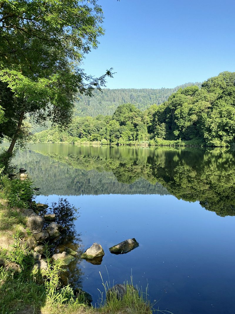
Campingplatz Friedensbrücke
A little bit in love... !
Great place right on the Neckar. Very nice operator.
After 2021 we have been here several times and will be back!
Falltorstr. 4, 69151, Neckargemünd, Germany
49° 23' 45.5" N 8° 47' 29.7" E
49.3959600 8.7915900
• Head east. Go for 204 m.
• Turn right onto Falltorstraße. Go for 109 m.
• Turn right onto An der Friedensbrücke (B37). Go for 96 m.
• Turn right onto Bahnhofstraße (B37) toward Mannheim/Heidelberg. Go for 11.6 km.
• Turn left onto B37 toward Mannheim. Go for 2.2 km.
• Continue on A656. Go for 208 m.
• Take the exit toward Karlsruhe/Stuttgart onto A5. Go for 56.8 km.
• Take exit 47 toward Ettlingen/Bad Herrenalb. Go for 319 m.
• Turn left onto Herrenalber Straße (L561) toward Ettlingen/Bad Herrenalb. Go for 317 m.
• Turn left onto B3 toward Bad Herrenalb/Gewerbegebiet Ettlingen/Gewerbegebiet Albtal. Go for 1.1 km.
• Continue on L562 toward Bad Herrenalb/Gewerbegebiet Ettlingen-Mitte. Go for 3.9 km.
• Continue on Albtalstraße (L564). Go for 207 m.
• Continue on Albtalstraße (L564). Go for 14.2 km.
• Take the 2nd exit from roundabout onto Ettlinger Straße (L564). Go for 829 m.
• Turn right onto Bahnhofstraße. Go for 148 m.
• Turn right onto Schweizerwiese. Go for 155 m.
• Turn right onto Schweizerwiese. Go for 43 m.
• Turn slightly left onto Schweizerwiese. Go for 101 m.
• Turn right onto Schweizerwiese. Go for 78 m.
• Arrive at your destination on the right.
☍
92,6 km
(1 hrs. 7 min.)
Day
Ein bisschen (Welterbe-) Kultur: Heidelberg - Speyer - Heidelberg mit dem E-Bike
https://www.komoot.de/tour/396171679?ref=wtd
Day
Siebentäler Therme Bad Herrenalb, Schweizerwiese, Bad Herrenalb, Deutschland
At the thermal bath there are designated parking spaces (9) for mobile homes, also for larger vehicles. Payment is made at the spa.
Everything is within reach.
We liked it as a starting point for biking.
Schweizerwiese 9, 76332 Bad Herrenalb, Deutschland
48° 48' 16.5" N 8° 26' 29" E
48.8045775 8.4414018
• Head west. Go for 10 m.
• Turn left onto Schweizerwiese. Go for 68 m.
• Turn left onto Schweizerwiese. Go for 101 m.
• Turn slightly right onto Schweizerwiese. Go for 43 m.
• Turn left onto Schweizerwiese. Go for 155 m.
• Turn left onto Bahnhofstraße. Go for 112 m.
• Turn slightly right onto Bahnhofstraße. Go for 48 m.
• Turn right onto Kurpromenade (L564). Go for 497 m.
• Take the 1st exit from Kurpromenade roundabout onto Gernsbacher Straße (L564). Go for 11.6 km.
• Turn right onto Gottlieb-Klumpp-Straße. Go for 227 m.
• Turn left onto Salmengasse. Go for 102 m.
• Continue on Stadtbrücke (L78). Go for 8.2 km.
• Turn left onto Hauptstraße (B500) toward Schwarzwaldhochstr. Go for 106 m.
• Turn left onto Geroldsauer Straße (B500). Go for 3.5 km.
• Turn left toward Wannackerweg. Go for 255 m.
• Turn right onto Wannackerweg. Go for 78 m.
• Arrive at Wannackerweg.
☍
25,1 km
( 34 min.)
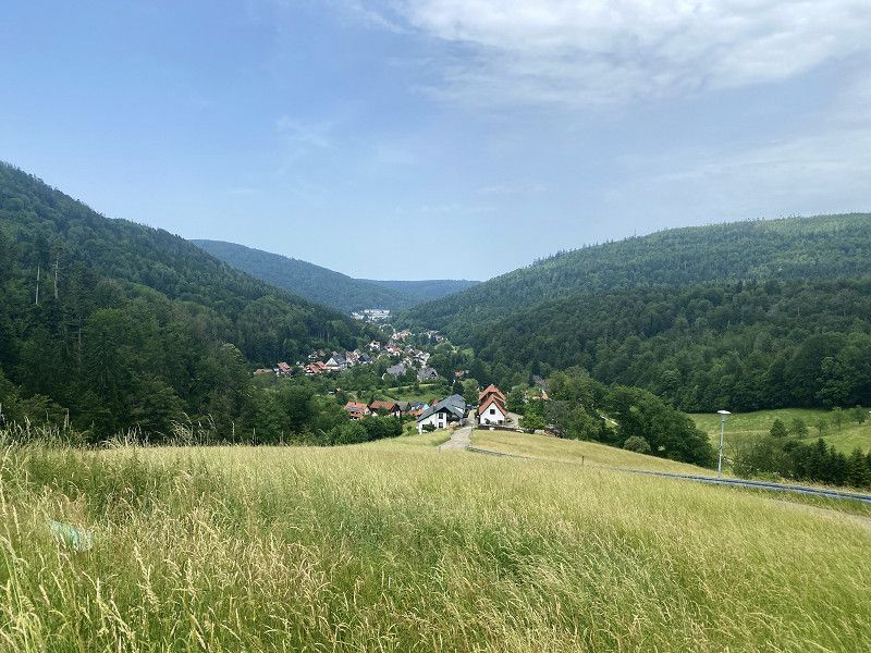
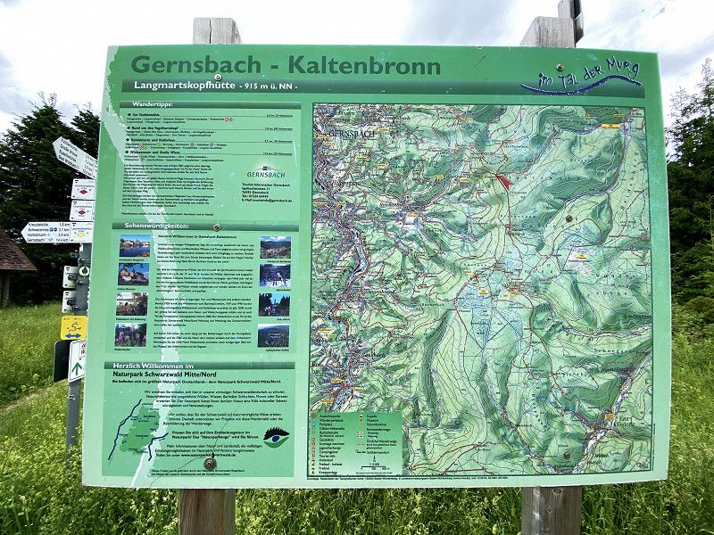
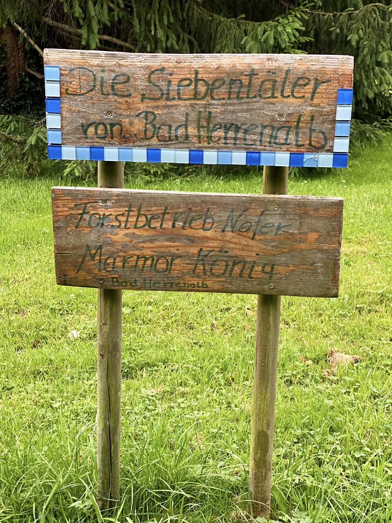
Bad Herrenalb (Albtal und Seitentäler)
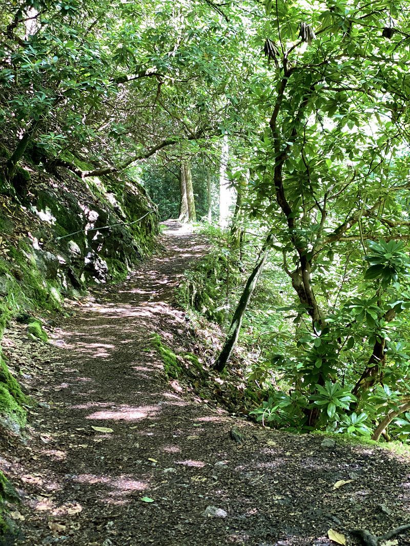
Pure nature and still right in the middle. The Black Forest town of Bad Herrenalb in the idyllic Albtal is certainly a popular holiday destination with lots of charm and unspoiled nature. Due to its unique location and the natural thermal springs, the city bears the rare double title of "climatic health resort" and "health spa" and has been awarded the title of "Sustainable Travel Destination".
If you don't get your money's worth here - hiking or biking. Many signposted paths invite you to do so. You can relax and recharge your batteries in the Siebentäler Therme.
Due to Corona, it was logically closed last year.
https://www.komoot.de/tour/397080494?ref=wtd
Day
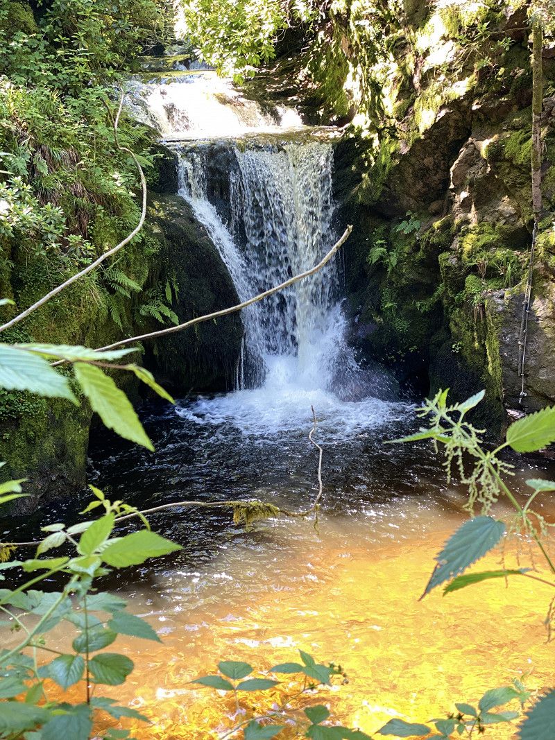
Geroldsauer Wasserfall, Wasserfallstraße, Baden-Baden, Deutschland
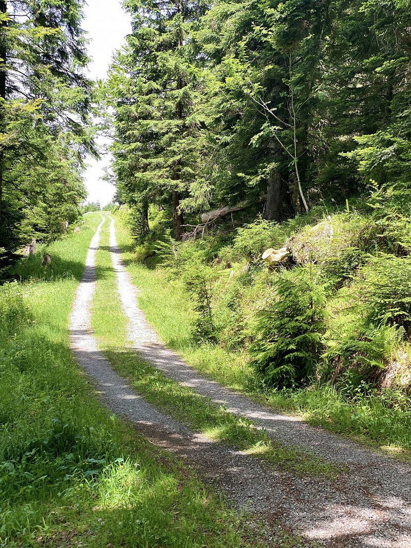
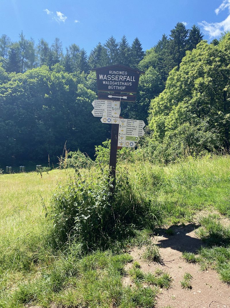
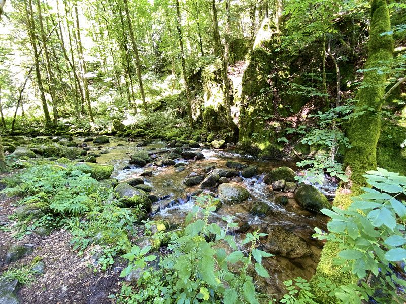
Definitely drive over the Schwarzwaldhochstraße B500. It's an experience... just like the Geroldsau waterfalls.
The "walk" is almost two kilometers long. You walk beautifully through the rippling nature, along the Grobbach. Don't forget good shoes. It can also be slippery on the natural paths.
Motorhomes are also allowed in the parking lot directly on the elevated road. In Corona times it was easy to find a place (free of charge).
At peak times it should be tight today and therefore more difficult.
Wasserfallstraße, 76534 Baden-Baden, Deutschland
48° 42' 42.5" N 8° 14' 57" E
48.7118022 8.2491760
• Head north on Wannackerweg. Go for 78 m.
• Turn left toward Schwarzwaldhochstraße/B500. Go for 255 m.
• Turn left onto Schwarzwaldhochstraße (B500). Go for 1.4 km.
• Turn right onto L84 toward Steinbach/Neuweier/Bühlertal. Go for 6.4 km.
• Continue on Poststraße (L84A) toward Karlsruhe/Basel/Sinzheim/Weitenung/Bühl. Go for 319 m.
• Continue on B3 toward Achern/Bühl/Gewerbegebiet Steinbach. Go for 1.2 km.
• Continue on K9608 toward Vimbuch. Go for 1.0 km.
• Continue on K3763. Go for 369 m.
• Turn right onto L85. Go for 1.5 km.
• Take the 2nd exit from roundabout onto L85 toward Lichtenau/Rheinmünster/Moos/Oberbruch/Flughafen Baden-Airpark. Go for 369 m.
• Take the 2nd exit from roundabout onto A5 toward Basel. Go for 24.3 km.
• Take exit 54 toward Appenweier/Kehl/Strasbourg-Mitte/Bad Peterstal-Griesbach/Oberkirch/Strasbourg/Kehl onto B28. Go for 10.8 km.
• Turn slightly left onto Großherzog-Friedrich-Straße toward Kehl-Zentrum. Go for 191 m.
• Turn left onto Kinzigallee. Go for 38 m.
• Turn right onto Oberländerstraße. Go for 271 m.
• Turn left onto Hauptstraße. Go for 91 m.
• Turn right onto Goldscheuerstraße. Go for 544 m.
• Turn slightly left onto Iringheimer Straße. Go for 333 m.
• Take the 1st exit from roundabout onto Schwimmbadstraße. Go for 560 m.
• Turn left onto Rheindammstraße. Go for 319 m.
• Arrive at Rheindammstraße. Your destination is on the left.
☍
50,4 km
( 42 min.)
Campingplatz Kehl, Rheindammstraße, Kehl, Deutschland
Great little campsite that welcomed us even without a reservation. We did not find the RV park (500 m from the campsite - on the access road) inviting.
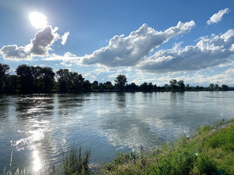
From the campsite it was only a few meters to the Rhine. Very idyllic. For us a great starting point to explore Strasbourg by e-bike.
Rheindammstraße 1, 77694 Kehl, Deutschland
48° 33' 41" N 7° 48' 31" E
48.5613889 7.8086111
• Head north on Rheindammstraße. Go for 319 m.
• Turn right onto Schwimmbadstraße. Go for 537 m.
• Take the 3rd exit from roundabout onto Iringheimer Straße. Go for 533 m.
• Continue on Bierkellerstraße. Go for 402 m.
• Turn slightly right onto Großherzog-Friedrich-Straße. Go for 563 m.
• Turn right onto Straßburger Straße (B28). Go for 10.0 km.
• Take ramp onto A5 toward Basel/Offenburg. Go for 46.5 km.
• Take exit 59 toward Riegel/Emmendingen/Sasbach (Rhein)/Endingen. Go for 231 m.
• Turn right onto L113 toward Marckolsheim/Sasbach a.K./Endingen a.K./Riegel a.K. Go for 3.1 km.
• Take the 3rd exit from roundabout onto L113 toward Marckolsheim/Sasbach a.K./Wyhl a.K./Endingen a.K. Go for 2.3 km.
• Take the 2nd exit from roundabout onto L113 toward Marckolsheim/Sasbach a.K./Wyhl a.K./Königschaffhausen. Go for 1.4 km.
• Turn left onto L105 toward Kiechlinsbergen/Königschaffhausen/Amoltern. Go for 513 m.
• Take the 1st exit from roundabout onto Königschaffhauser Straße (L105). Go for 1.6 km.
• Turn right toward K5127. Go for 290 m.
• Turn right onto K5127. Go for 38 m.
• Turn right onto Königsweghof. Go for 196 m.
• Turn left. Go for 12 m.
• Arrive at your destination on the left.
☍
68,6 km
( 46 min.)
Day
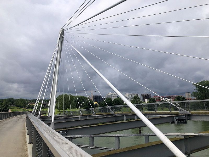
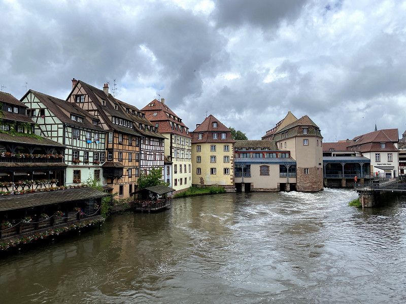
Bike-Tour nach Straßbourg
From Kehl it is only a stone's throw to Straßbourg via the Passerelle des Deux Rives.
https://www.komoot.de/tour/398396071?ref=wtd
At Christmas time we made another stopover with our "Träumchen" directly in Straßbourg. From "Camping de Strasbourg" you can reach the Christmas market relatively quickly by bus and tram. Despite the corona restrictions, it was a wonderful experience. Highly Recommended!
Day
Kirschenhof Schmidt | Endingen am Kaiserstuhl, Königsweg Hof, Endingen am Kaiserstuhl, Deutschland
Wonderful parking space in the middle of the extensive orchards. We like to go to this place again and again, even if there are basically no sanitary facilities (the toilet can be used during the opening hours of the Kirschen-Café).
Königsweg Hof 1, 79346 Endingen am Kaiserstuhl, Deutschland
48° 8' 32" N 7° 39' 44.1" E
48.1422200 7.6622500
• Head toward Königsweghof. Go for 202 m.
• Turn right onto Königsweghof. Go for 222 m.
• Turn left onto K5127. Go for 273 m.
• Continue on Bahnhofstraße (K5127). Go for 342 m.
• Turn right onto Endinger Straße (L105). Go for 405 m.
• Turn right onto Rathausstraße (L105). Go for 693 m.
• Turn left onto L105. Go for 3.6 km.
• Turn left onto L104. Go for 11.4 km.
• Turn left onto B31 toward Freiburg. Go for 722 m.
• Turn left onto K4979 toward Merdingen/Gündlingen/Hochstetten. Go for 139 m.
• Turn left onto Hochstetter Straße. Go for 500 m.
• Turn slightly right onto Dorfstraße. Go for 63 m.
• Arrive at Dorfstraße. Your destination is on the left.
☍
18,5 km
( 20 min.)
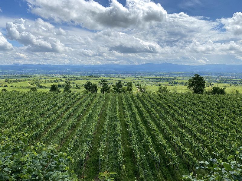
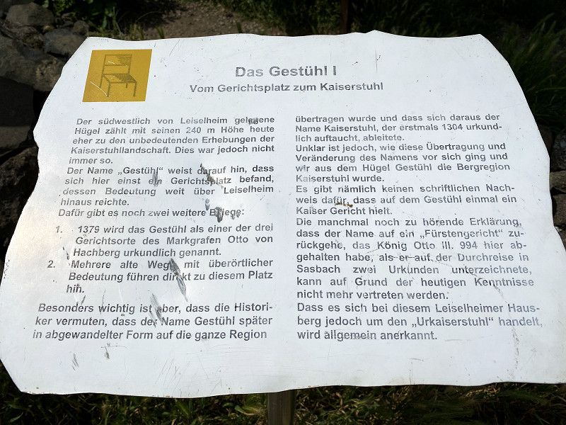
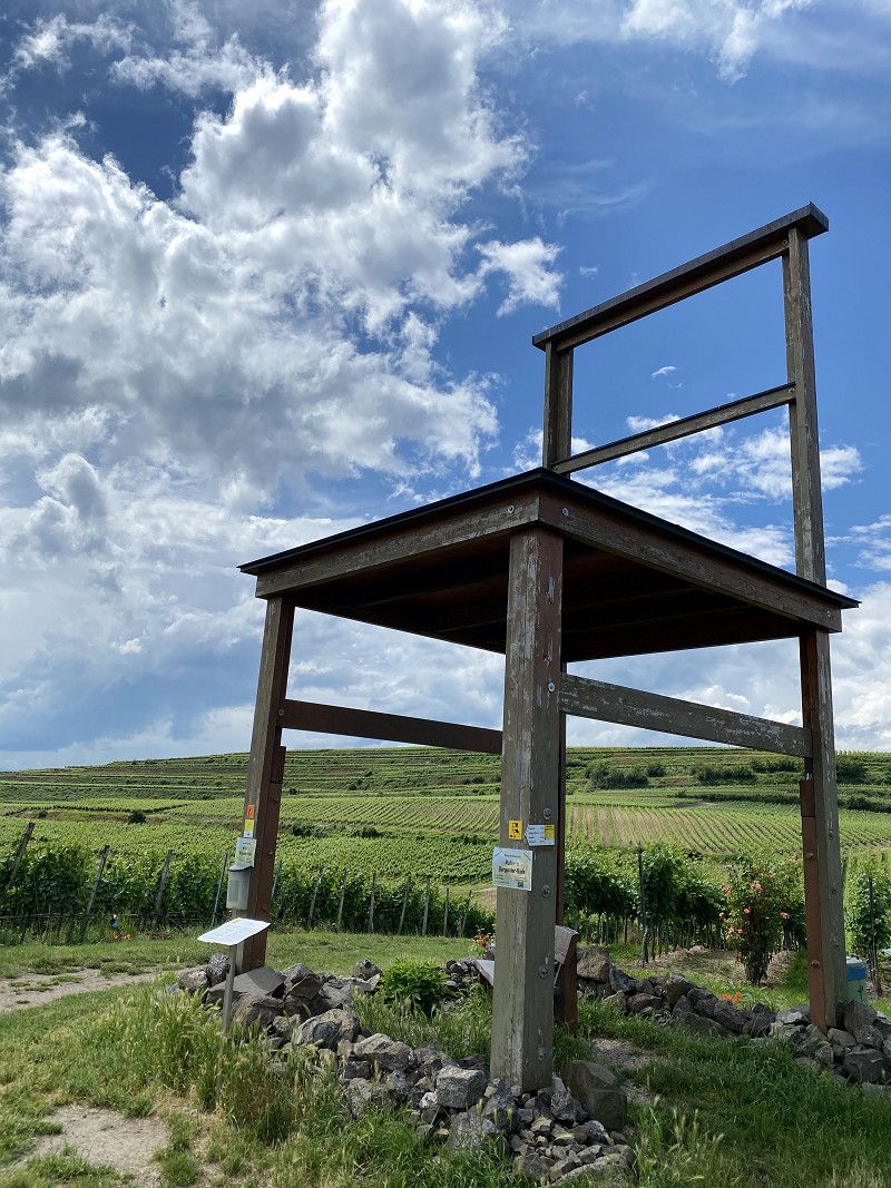
Biken: Sightseeing auf dem Kaiserstuhl-Radweg!
https://www.komoot.de/tour/399150890?ref=wtd
Day
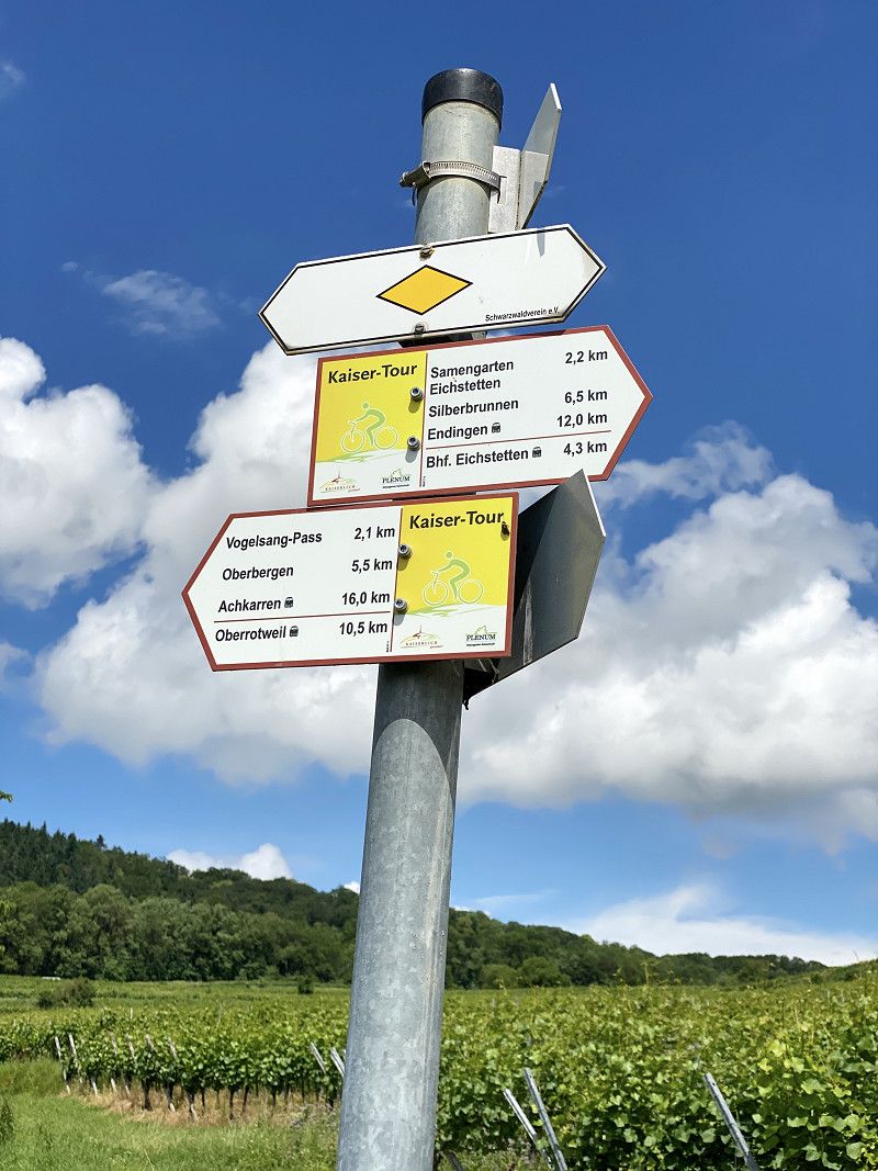
Biken: Kaisertour am Kaiserstuhl
https://www.komoot.de/tour/399900184?ref=wtd
Day
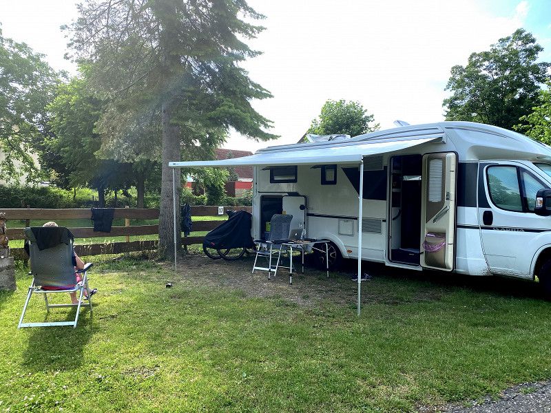
Campingplatz Münsterblick, Hochstetter Straße, Breisach am Rhein, Deutschland
The campsite is relatively manageable, which we found an advantage. The operator is super nice and there was also a bread delivery service.
With the smaller rental vehicle it was no problem for us to get to the site, but for "big battleships" from 8 meters at the latest it should be problematic or impossible. The bottleneck here is definitely the entrance. Not feasible for vehicles that are too high, wide and long (headroom 3.20 meters) ...
Hochstetter Str. 11, 79206 Breisach am Rhein, Deutschland
48° 1' 9.9" N 7° 36' 33" E
48.0194139 7.6091638
• Head north on Dorfstraße. Go for 66 m.
• Turn right onto Pandurenweg. Go for 194 m.
• Turn right onto Kirchweg. Go for 127 m.
• Turn left onto Hochstetter Straße. Go for 366 m.
• Turn right onto K4979. Go for 95 m.
• Keep left toward K4979. Go for 44 m.
• Turn left onto B31. Go for 4.4 km.
• Keep right onto B31. Go for 3.9 km.
• Take ramp onto A5 toward Karlsruhe/Freiburg. Go for 138 km.
• Take exit 46 toward München/Stuttgart/Pforzheim onto A8. Go for 60.6 km.
• Continue on A8 toward München/Ulm/S-Möhringen/Degerloch/Flughafen/Messe. Go for 17.7 km.
• Take exit 54 toward Esslingen/Ostfildern/Denkendorf. Go for 309 m.
• Turn right onto L1202 toward Esslingen a.N./Ostfildern/Denkendorf. Go for 324 m.
• Turn right onto L1202 toward Esslingen/Ostfildern-Nellingen/Denkendorf. Go for 2.1 km.
• Continue on L1192 toward Esslingen a.N./B10/Gewerbegebiet Ostf.-Nellingen/Gewerbegebiet Schwarze Breite. Go for 1.9 km.
• Continue on L1192. Go for 1.9 km.
• Turn left and take ramp onto B10 toward Stuttgart/Esslingen a.N. Go for 1.2 km.
• Take ramp onto Vogelsangbrücke (L1150) toward Esslingen a.N./Esslingen a.N.-Zollberg/Esslingen a.N.-Pliensauvorstadt/Esslingen a.N.-Zentrum/Zentrum. Go for 1.4 km.
• Turn right onto Mülbergerstraße (L1199). Go for 523 m.
• Turn left onto Mülbergerstraße. Go for 720 m.
• Keep right onto Mülbergerstraße. Go for 315 m.
• Turn left onto Am Schönen Rain. Go for 13 m.
• Turn left onto Am Schönen Rain. Go for 31 m.
• Turn slightly left onto Am Schönen Rain. Go for 30 m.
• Turn slightly right onto Schönenbergweg. Go for 37 m.
• Arrive at Schönenbergweg. Your destination is on the left.
☍
236,4 km
(2 hrs. 23 min.)
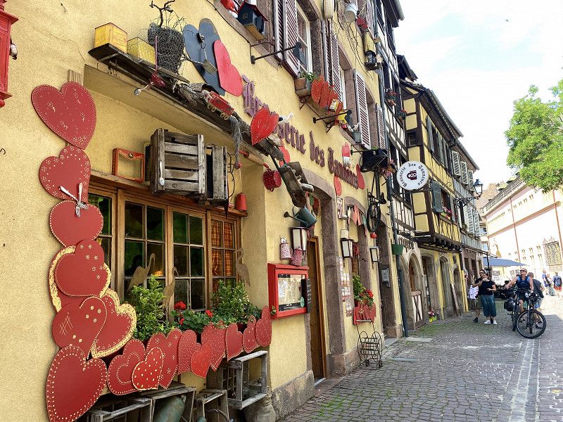
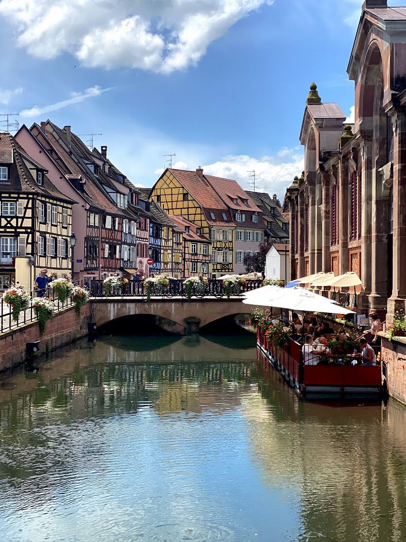
Day
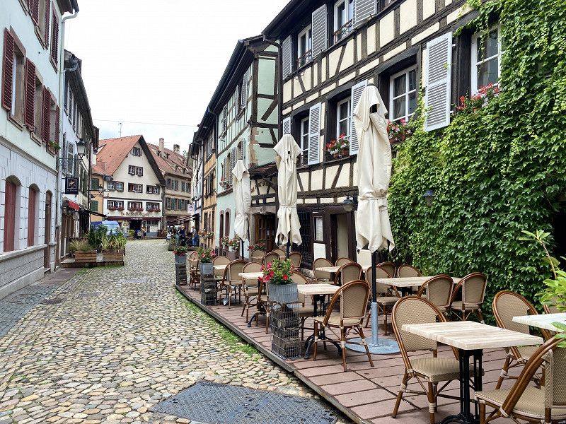
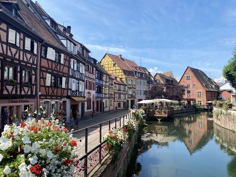
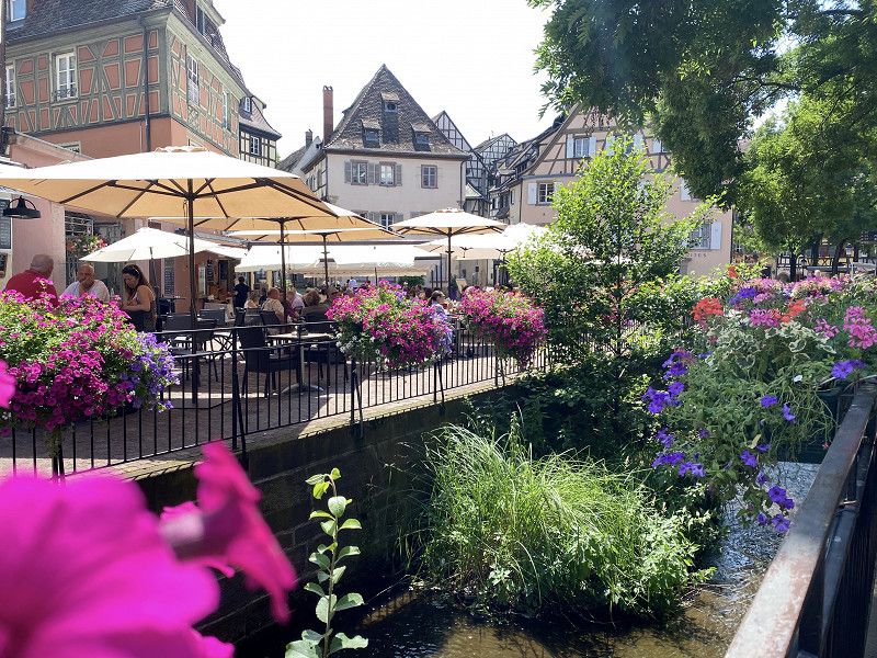
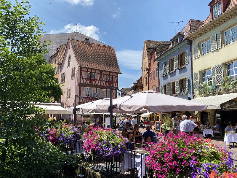
Bike-Tour nach Colmar
Breisach is practically a stone's throw from Colmar. The picturesque town lies between the Vosges and the Rhine, surrounded by the vineyards of Alsace. With almost 70,000 inhabitants, Colmar is the third largest city in the region. Nevertheless, it has retained its "small town charm" thanks to the beautiful half-timbered houses. The facades are decorated with flowers and many other things and always look as if the painter has just done a new coat of paint. :-)
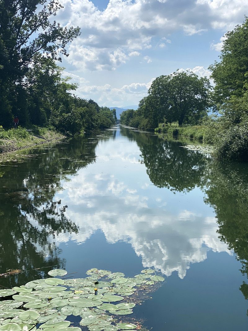
The cycle path along the Canal de Colmar is a dream for every biker.
https://www.komoot.de/tour/402069166?ref=wtd
By the way, we were also here at Christmas time last year. For me personally, Colmar was far too overloaded with the Christmas chichi this time. Sure... a matter of taste!
Day
Wohnmobilstellplatz Esslingen, Esslingen am Neckar, Deutschland
If you want to pay a visit to Esslingen, you have to be lucky. Here it is difficult to find a suitable parking space directly.
The "mobile home parking space" above Esslinger Burg has two spaces. It's free and offers nothing - which is perfectly fine for a night or two.
73728 Esslingen am Neckar, Deutschland
48° 44' 49.6" N 9° 18' 38" E
48.7470996 9.3105597
• Head toward Obere Beutau on Schönenbergweg. Go for 47 m.
• Turn sharp left onto Obere Beutau. Go for 91 m.
• Turn right onto Beutauklinge. Go for 326 m.
• Turn left onto Mittlere Beutau. Go for 106 m.
• Continue on Geiselbachstraße. Go for 256 m.
• Turn right onto Augustinerstraße (K1270). Go for 132 m.
• Turn right onto Mettinger Straße (K1270). Go for 2.0 km.
• Turn left onto Mettinger Brücke (K1271). Go for 458 m.
• Turn right and take ramp onto B10 toward Stuttgart/ES-Brühl. Go for 8.1 km.
• Keep right onto Uferstraße (B10/B14) toward Karlsruhe/Heilbronn/Vaihingen/Enz/B27/Ludwigsburg/S-Nord/S-Bad Cannstatt/Wilhelma. Go for 601 m.
• Keep left onto B10. Go for 1.5 km.
• Keep left onto B10 toward Karlsruhe/A81/Heilbronn/Vaihingen (Enz)/Ludwigsburg/B27/S-Zuffenhausen. Go for 2.2 km.
• Take ramp onto B10/B27 toward A81/Gewerbegebiet Zuffenhausen. Go for 2.0 km.
• Take ramp onto B10 toward Vaihingen (Enz)/A81/Korntal/S-Neuwirtshaus/S-Stammheim/Gewerbegebiet Zuffenhausen. Go for 4.5 km.
• Take ramp onto A81 toward Heilbronn. Go for 37.7 km.
• Keep left onto Autobahnkreuz Weinsberg toward Mannheim/Heilbronn/Neckarsulm/A6. Go for 1.5 km.
• Continue on A6. Go for 84.5 km.
• Continue on A67 toward Hannover/Frankfurt/Köln/Darmstadt. Go for 35.6 km.
• Continue on E451 (Darmstädter Kreuz). Go for 450 m.
• Continue on A5. Go for 70.7 km.
• Take exit 11 toward Köln/Dortmund/Wetzlar/Marburg/Gießen onto A45. Go for 9.5 km.
• Take exit 33 toward Marburg/Gießen/Linden onto A485. Go for 15.0 km.
• Continue on B3. Go for 18.8 km.
• Take ramp onto L3125 toward Marburg-Süd/Marburg-Cappel/Uni. Klinikum/Uni. Lahnberge/Gisselberg/Gisselberger Str./Stadion. Go for 400 m.
• Continue on Südspange (L3125) toward Gisselberg/Gisselberger Str./Stadion. Go for 465 m.
• Turn right onto Gisselberger Straße (L3125) toward Stadtmitte/Gisselberger Str. Go for 1.2 km.
• Turn slightly left onto Gisselberger Straße (K68). Go for 117 m.
• Turn right onto Frankfurter Straße (K7). Go for 427 m.
• Arrive at Frankfurter Straße (K7). Your destination is on the right.
☍
298,7 km
(2 hrs. 55 min.)
Day
Day
Marburg, Deutschland
50° 48' 6.8" N 8° 45' 56.8" E
50.8018843 8.7657677