06.09. - 23.09.2020 We have had to change our planned route several times - with a view to the current corona infection numbers. We have tried to be in the "green zones" whenever possible.
Day
Vita Classica Therme, Thürachstraße, Bad Krozingen, Deutschland
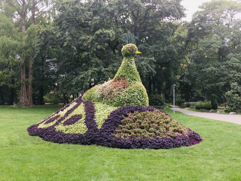
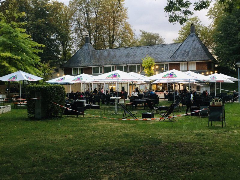
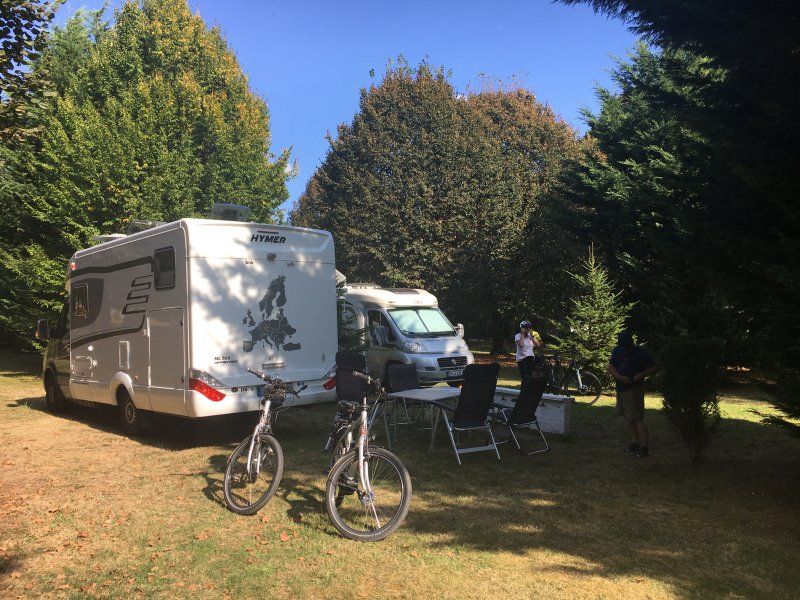
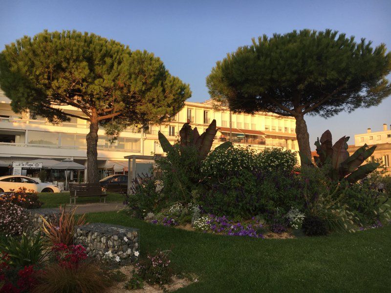
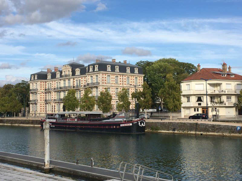
We get one of the last parking spaces at the thermal bath. The site has no toilets or showers, but the facilities in the thermal bath can be used. However, the way can be quite long, depending on where you are. For the shower you would have to buy a ticket for 3 EUR. The place is well suited for a stopover. We take a nice walk through the beautiful spa park with its many extraordinary trees. And in the beer garden we find a nice place for a delicious dinner.
Thürachstraße 4, 79189 Bad Krozingen, Deutschland
47° 55' 6.1" N 7° 41' 23" E
47.9183538 7.6897148
• Head southwest on Thürachstraße. Go for 39 m.
• Continue toward Thermenallee. Go for 139 m.
• Turn right onto Thermenallee. Go for 1.2 km.
• Take the 1st exit from roundabout onto K4939. Go for 721 m.
• Turn left onto L120. Go for 2.9 km.
• Continue on B31. Go for 234 m.
• Turn left and take ramp onto A5 toward Basel. Go for 23.2 km.
• Take exit 66 toward Lyon/Mulhouse/Flughafen Euro onto A5. Go for 611 m.
• Continue on A36 (La Comtoise). Go for 13.5 km.
• Keep left onto A36 (La Comtoise) toward Paris/Lyon/Guebwiller. Go for 223 km.
• Take the exit onto A31. Go for 6.1 km.
• Continue on A6 (Autoroute du Soleil). Go for 2.3 km.
• Take exit 24.1 toward Beaune-Centre/Chagny/Beaune-Hospices onto D470 (Avenue du Général de Gaulle). Go for 657 m.
• Continue on Avenue du Général de Gaulle (D470) toward Beaune. Go for 83 m.
• Take the 1st exit from roundabout onto Avenue du Général de Gaulle (D470). Go for 352 m.
• Take the 3rd exit from Rond-Point Philippe le Bon roundabout onto Avenue André Boisseaux (D1074) toward Centre Ville/Z.A.C. Port de Beaune. Go for 1.0 km.
• Pass 2 roundabouts and continue on Avenue André Boisseaux (D1074). Go for 2.4 km.
• Take the 3rd exit from roundabout onto D974 toward Chalon S/Saône/Meursault/Chagny. Go for 11.5 km.
• Take ramp toward Chalon S/S./Chagny. Go for 436 m.
• Turn right onto D906 toward Chalon S/Saône/Chagny. Go for 1.5 km.
• Turn right onto Avenue Général Leclerc toward Chagny-Z.A. des Creusottes. Go for 119 m.
• Keep right onto Rue des Ponts. Go for 168 m.
• Turn right onto Rue des Prés. Go for 402 m.
• Turn right onto Chemin des Mûriers. Go for 249 m.
• Turn left onto Chemin des Mûriers. Go for 108 m.
• Arrive at Chemin des Mûriers. Your destination is on the right.
☍
293,3 km
(2 hrs. 49 min.)
Day
Camping du Pâquier Fané
As always in France, the journey was quite relaxed. We arrive safely and meet camping friends here. We want to start our tour of France from here. Originally we were going to the south of France, but since the corona situation is already quite tense there, we are changing our travel plans and will decide every day how to proceed.
20 rue du paquier fane, 71150, Chagny, Frankreich
46° 54' 42" N 4° 44' 46" E
46.9116600 4.7461100
• Head south on Chemin des Mûriers.
• Arrive at Chemin des Mûriers. Your destination is on the right.
☍
Distance not available
(Duration not available)
Day
Santenay
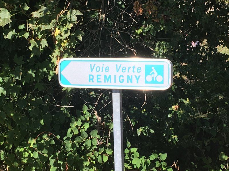
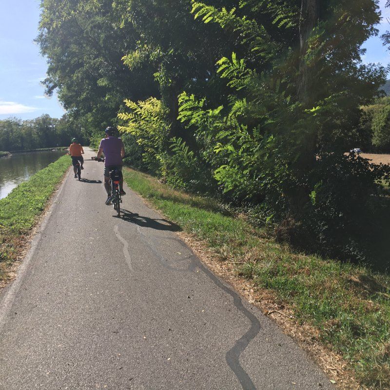
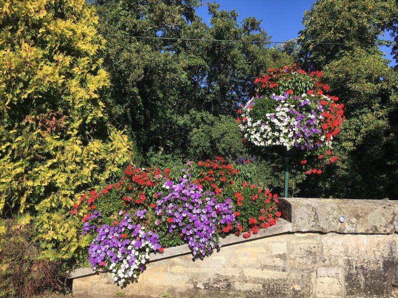
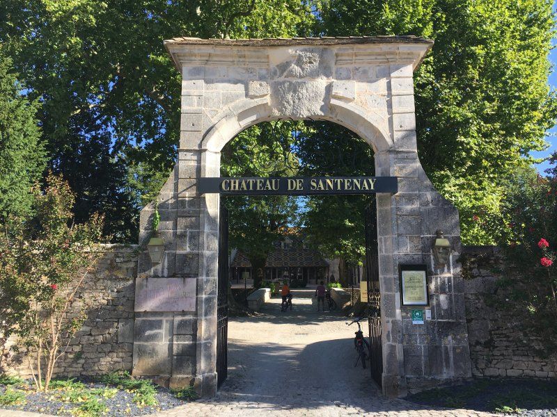
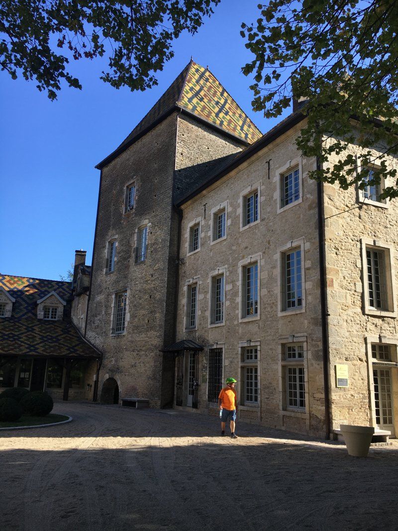
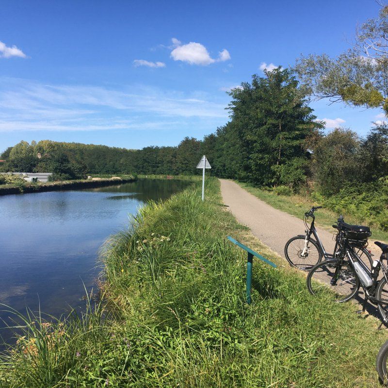
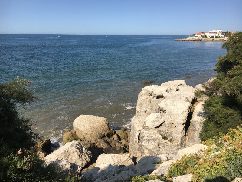
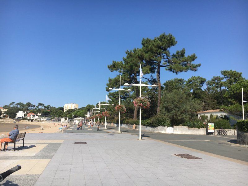
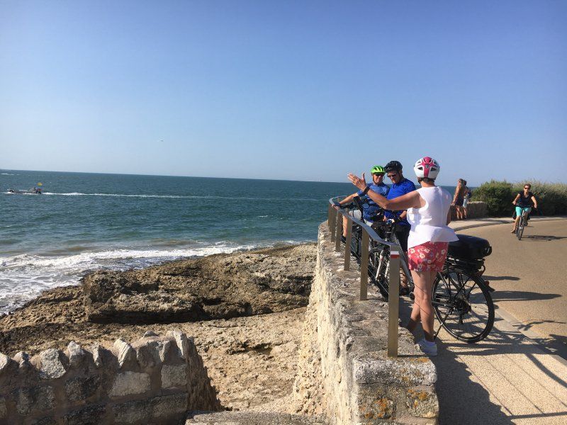
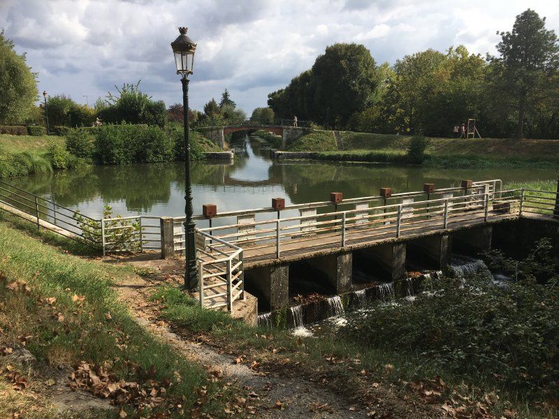
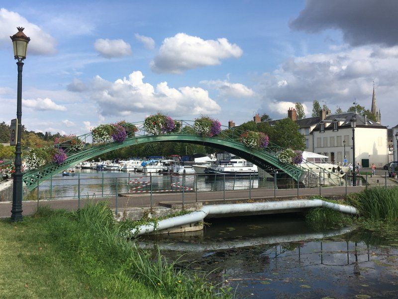
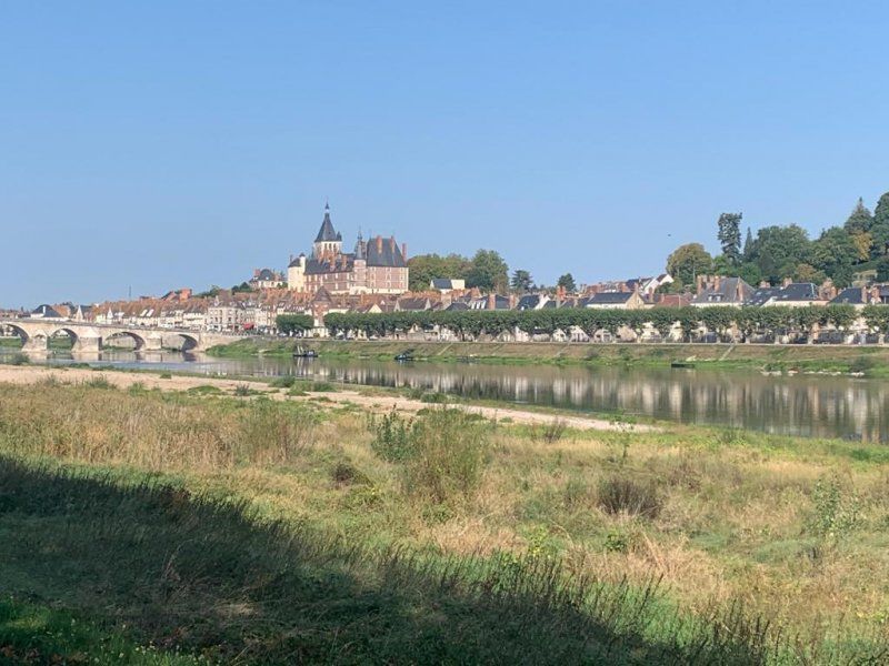
We're going on a bike tour to Santenay. It's a wonderful tour along the Canal du Center. We will visit the Canal several times during our trip. Together with 2 other canals, it forms a canal chain that allows a transition from the Atlantic to the Mediterranean. In Santenay we visit the Château, the roof of which is covered with the typical Burgundian colored tiles. The red wine from Santenay has made the town world famous, and the prices are correspondingly high. What inspires us on the entire tour through France are the beautifully designed and planted roundabouts, bridges and flower beds on the roadside. The flower boxes on the bridges are literally overflowing with a sea of flowers and everything is well cared for.
The campsite is very neat and well-kept and also well attended, but not crowded.
20 rue du paquier fane, 71150, Chagny, Frankreich
46° 54' 42" N 4° 44' 46" E
46.9116600 4.7461100
• Head south on Chemin des Mûriers.
• Turn right onto Rue du Pâquier Fané. Go for 257 m.
• Turn right onto Route de Remigny (D62). Go for 2.7 km.
• Turn left onto D974. Go for 9.5 km.
• Turn right onto Rue du Pont (D978). Go for 105 m.
• Turn left onto Route de Saint-Bérain (D974). Go for 16.8 km.
• Turn left onto Route du Pont Jane Rose (D974). Go for 39 m.
• Continue toward N70. Go for 34 m.
• Take the 2nd exit from Rond-Point Jeanne Rose roundabout onto N70 toward Montceau les M./Moulins/Montchanin-Centre. Go for 43.9 km.
• Continue on N79. Go for 844 m.
• Take ramp toward Paray le M.-Centre. Go for 336 m.
• Take the 3rd exit from roundabout toward Montceau-les M./Chalon S/S./Paray le M. Centre. Go for 432 m.
• Continue toward D352. Go for 45 m.
• Take the 1st exit from Rond-Point du Goloriau roundabout onto D352 toward Paray le Monial-Centre. Go for 254 m.
• Take the 2nd exit from Rond-Point de la Grande Bruyère roundabout onto Avenue de Châlon-sur-Saône. Go for 353 m.
• Take the 3rd exit from Rond-Point des Miquets roundabout onto Avenue de Châlon-sur-Saône. Go for 504 m.
• Take the 2nd exit from roundabout onto Avenue de Châlon-sur-Saône. Go for 276 m.
• Take the 1st exit from roundabout onto Rue de Bourgogne (D248). Go for 130 m.
• Turn left onto Rue du Gué Léger (D352) toward Roanne/Digoin. Go for 322 m.
• Arrive at Rue du Gué Léger (D352). Your destination is on the left.
☍
76,8 km
(1 hrs. 5 min.)
Day
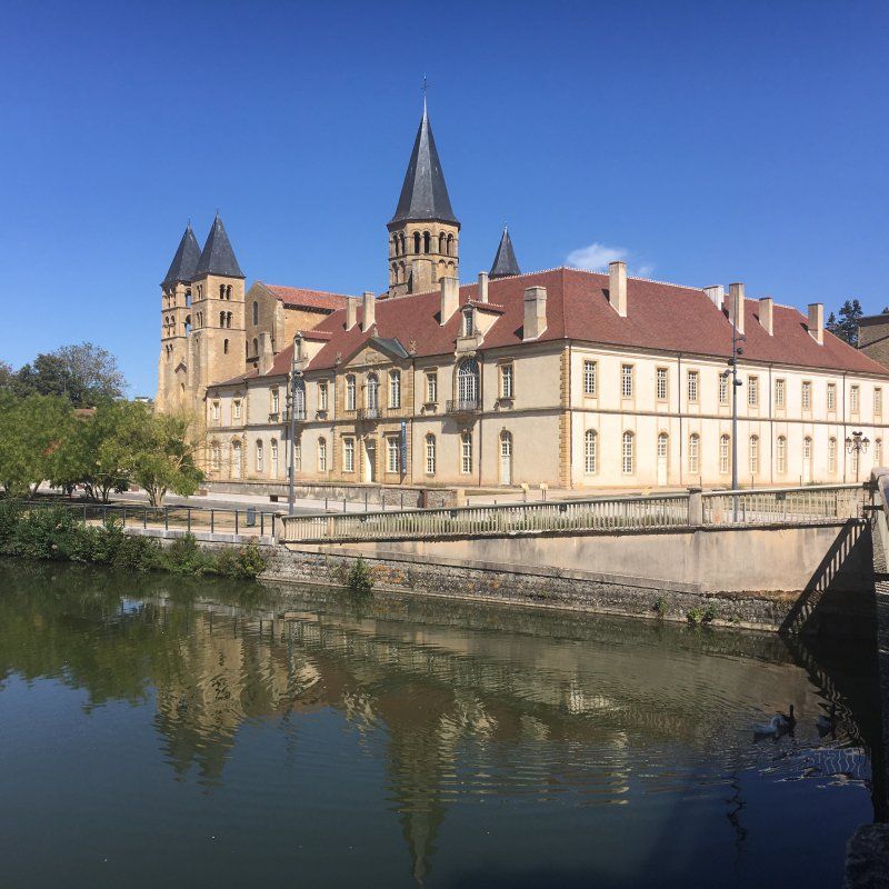
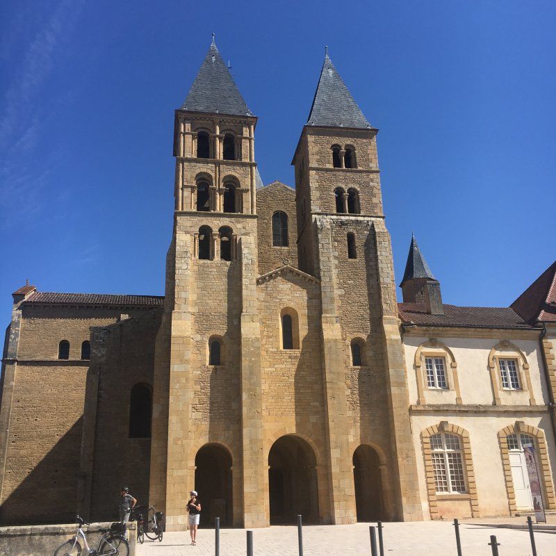
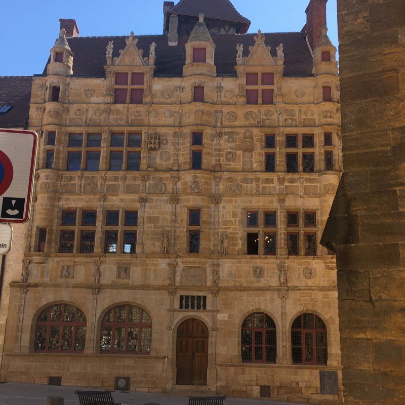
Camping de Mambre
We cycle to the old town of Paray-le-Monial and take a nice tour. We visit the basilica, whose two-door facade is reflected in the water of the river flowing by. The town hall from the 16th century, the former town house of a rich cloth maker, in the Renaissance style with its yellow facade, is particularly interesting for its decorations. Shell ornaments and medallions with portraits of French kings cover the entire facade.
The place is not very crowded and the operator is very friendly. The pool is clean and well tempered. Really refreshing after a warm day!
71600, Paray le Monial, Frankreich
46° 27' 27.7" N 4° 6' 17.6" E
46.4577000 4.1049000
• Head southwest on Rue du Gué Léger (D352). Go for 419 m.
• Turn right onto Impasse des Carrés (D979). Go for 1.6 km.
• Take the 3rd exit from roundabout onto D979 toward Moulins/Vichy/Nevers/Roanne/Digoin/Z.A. de Barberèche. Go for 246 m.
• Take the 2nd exit from roundabout onto N79 toward Nevers/Roanne/Moulins/Vichy/Digoin. Go for 5.9 km.
• Keep left onto A79 toward Montluçon/Nevers/Vichy/Moulins/Digoin-Ouest. Go for 91.3 km.
• Take the left exit toward E62/Paris/Montluçon onto A71. Go for 23.0 km.
• Take exit 10 toward Guéret/Montluçon onto A714. Go for 10.1 km.
• Continue on N145. Go for 108 km.
• Take the 3rd exit from roundabout onto N145 toward Châteauroux/Limoges/Poitiers/Angoulême. Go for 905 m.
• Take the 1st exit from roundabout onto A20 (L'Occitane) toward Angoulême/Limoges. Go for 31.7 km.
• Take exit 27 toward Bonnac la Côte/Chaptelat/St Priest-Taurion/Beaune les Mines. Go for 258 m.
• Turn right onto Route de Tramont (D97) toward Bonnac la Côte. Go for 375 m.
• Continue on Route de Chazelas (D97). Go for 394 m.
• Continue on Route des Pradeaux (D97). Go for 917 m.
• Continue on Rue de la Mazelle (D97). Go for 242 m.
• Continue on Place de l'Europe (D97). Go for 8 m.
• Take the 2nd exit from roundabout onto Place de l'Europe. Go for 30 m.
• Turn slightly right onto Rue du 8 Mai 1945. Go for 1.0 km.
• Turn left onto Allée Moulin de Leychoisier. Go for 82 m.
• Turn slightly right. Go for 19 m.
• Arrive at your destination on the right.
☍
276,8 km
(2 hrs. 33 min.)
Day
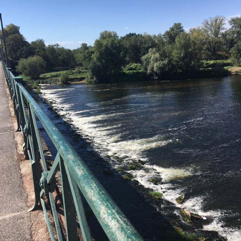
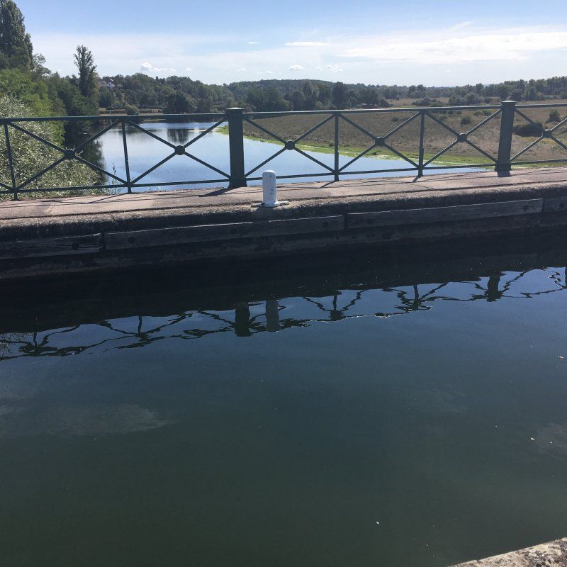
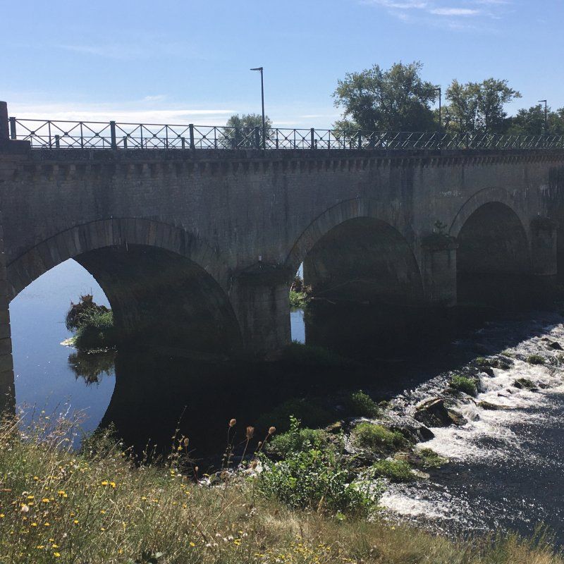
Kanalbrücke von Digoin
We cycle to Digoin, always along the Canal du Center to the famous canal bridge. Here the canal crosses the Loire - a particularly impressive structure. The bridge is 243 m long and has 11 arches and 10 pillars. The trough is 6 m wide and 2.30 m deep, its bottom is 8.30 m above the Loire. It is lined on both sides by a 1.75 m wide towpath, which is great for cycling through the canal and crossing the Loire.
On the recommendation of the campsite operator, we cycle again in the evening to Paray-le-Monial. The entire old town is illuminated with many spotlights and lights, the town hall and the church opposite and of course the basilica shine particularly beautifully. The lights are reflected in the water and the bridge is also a great photo opportunity.
Day
Castel Camping du Chateau de Leychoisier, Route de Leychoisier, Bonnac-la-Côte, Frankreich
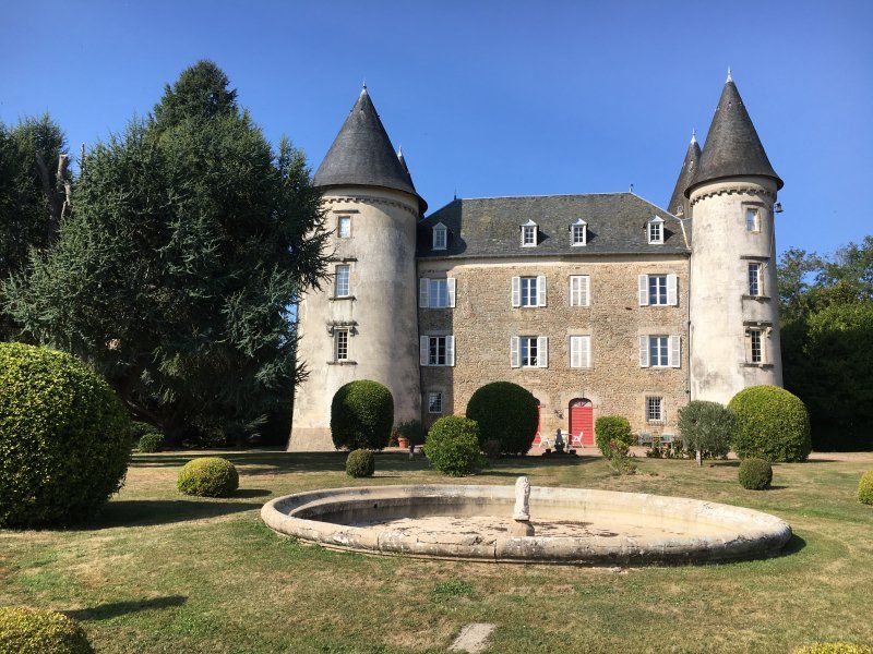
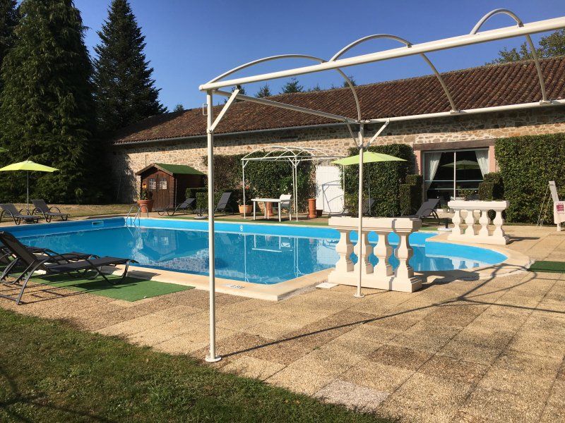
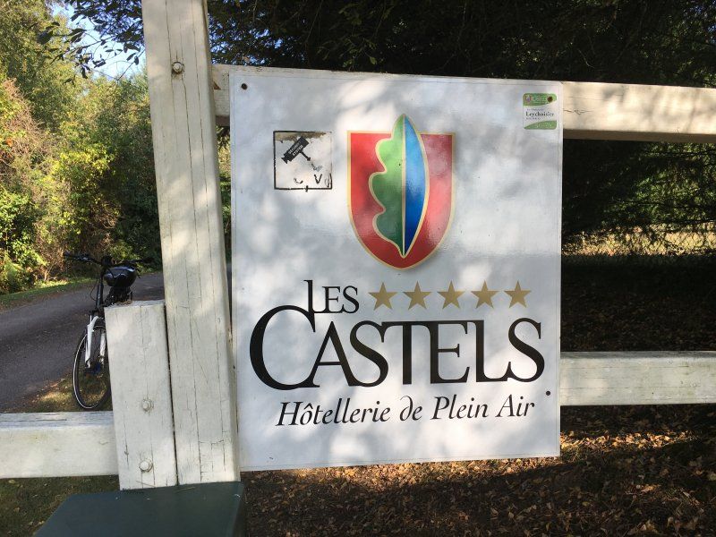
The French camping chain Les Castels has specialized in campsites at castles. These are exceptional campsites that want to keep the spirit of the family alive, open their parks to campers and thus earn money for the high costs of maintaining the castle and park. The place we visited has a great ambience with a castle, spacious parking spaces in the shade of ancient and sometimes rare trees. The pool is also well laid out and we use it extensively in the evening. The sanitary facilities are housed in the small outbuildings, which were probably stables or apartments of the employees in the past. Everything has a special charm, but is clean and well equipped. The tiles in the showers are extraordinary, almost antique. The place is hardly visited, we are almost alone on the huge area.
1 Route de Leychoisier, 87270 Bonnac-la-Côte, Frankreich
45° 55' 58.5" N 1° 17' 22.1" E
45.9329170 1.2894724
• Head toward Allée Moulin de Leychoisier. Go for 19 m.
• Turn slightly left onto Allée Moulin de Leychoisier. Go for 82 m.
• Turn right onto Rue du 8 Mai 1945. Go for 1.0 km.
• Turn slightly left onto Place de l'Europe. Go for 8 m.
• Take the 1st exit from roundabout onto Place de l'Europe (D97). Go for 20 m.
• Continue on Rue de la Mazelle (D97). Go for 242 m.
• Continue on Route des Pradeaux (D97). Go for 917 m.
• Continue on Route de Chazelas (D97). Go for 394 m.
• Continue on Route de Tramont (D97). Go for 375 m.
• Turn right and take ramp onto A20 (L'Occitane) toward Limoges. Go for 4.8 km.
• Take exit 28 toward Angoulême/Périgueux/Couzeix/Rilhac Rancon/Aéroport Bellegarde. Go for 382 m.
• Take the 2nd exit from roundabout onto Rocade Nord-Ouest (N520) toward Poitiers/Angoulême/Saint-Junien/Couzeix/Oradour S/Glane/Aéroport Bellegarde/Périgueux/Z.I.N Centre Routier. Go for 915 m.
• Take the 2nd exit from roundabout onto Rocade Nord-Ouest (N520) toward Poitiers/Angoulême/Périgueux/St Junien/Oradour S/G./Aéroport Bellegarde/Couzeix. Go for 13.3 km.
• Take the 1st exit from roundabout onto N141 toward Angoulême/St Junien/Oradour S/Glane. Go for 51.1 km.
• Take ramp. Go for 263 m.
• Take the 1st exit from roundabout. Go for 248 m.
• Take the 2nd exit from roundabout. Go for 572 m.
• Take the 1st exit from roundabout onto N141. Go for 8.8 km.
• Take the 3rd exit from roundabout onto N141 toward Angoulême/Taponnat/La Rochefoucauld. Go for 30.9 km.
• Continue on N10. Go for 2.9 km.
• Take ramp onto N1141 toward N141/E603/La Rochelle/Royan/Cognac/St Jean d'Angely/St Yrieix. Go for 3.7 km.
• Keep left onto N141. Go for 34.8 km.
• Take the 3rd exit from roundabout onto Avenue d'Angoulême (N141) toward Niort/Saintes/La Rochelle/Merpins. Go for 5.6 km.
• Take the 4th exit from roundabout onto N141 toward Bordeaux/La Rochelle/Saintes/Royan/Pons. Go for 1.5 km.
• Take the 2nd exit from roundabout onto N141 toward Bordeaux/La Rochelle/Saintes/Royan/Pons. Go for 3.0 km.
• Pass 3 roundabouts and continue on Route de Cognac (N141). Go for 18.4 km.
• Take the 2nd exit from roundabout onto N141 toward A10 (A837)/Bordeaux/La Rochelle/Royan/Île d'Oléron. Go for 4.3 km.
• Take the 2nd exit from roundabout onto Lieu-dit Diconche (N137) toward Niort/Bordeaux/Rochefort/La Rochelle/Royan/Île d'Oléron. Go for 695 m.
• Take ramp onto N150 toward Royan/Saujon. Go for 26.4 km.
• Take the 2nd exit from roundabout onto Route de Saujon (N150) toward Royan/Médis. Go for 4.5 km.
• Continue toward Avenue du 4ème Zouaves/D750. Go for 36 m.
• Take the 2nd exit from roundabout onto Avenue du 4ème Zouaves (D750) toward Royan. Go for 1.3 km.
• Take the 3rd exit from roundabout onto Avenue Louis Bouchet (D750). Go for 566 m.
• Take the 1st exit from roundabout toward D25/Vaux S/Mer/St Palais S/Mer. Go for 72 m.
• Take left ramp onto D25. Go for 2.4 km.
• Take the 3rd exit from roundabout onto Avenue Daniel Heddé toward Port Pointe de Grave/Pontaillac/Centre Ville. Go for 496 m.
• Take the 2nd exit from roundabout onto Avenue Daniel Heddé toward Centre Ville/Pontaillac. Go for 585 m.
• Turn right onto Boulevard du Colonel Robert Baillet toward Port Pointe de Grave/Pontaillac/Centre Ville. Go for 1.1 km.
• Turn right onto Boulevard Bellamy. Go for 464 m.
• Turn left onto Boulevard de la Perche. Go for 56 m.
• Continue on Avenue Louise. Go for 166 m.
• Turn right onto Rue du Colonel Lachaud. Go for 249 m.
• Arrive at Rue du Colonel Lachaud. Your destination is on the left.
☍
227,9 km
(2 hrs. 41 min.)
Camping Campéole - Clairefontaine
The place is well filled, but not full. The sanitary facilities are regularly cleaned and disinfected. All the loungers at the pool have been cleared away, so you don't meet many people here, but we still enjoy the evening swim after a warm summer day.
rue du Colonel Lachaud 16, 17200, Royan Pontaillac, Frankreich
45° 37' 52.3" N 1° 3' 0.4" W
45.6312000 -1.0501200
• Head toward Petite Allée des Peupliers on Rue du Colonel Lachaud. Go for 249 m.
• Turn left onto Avenue Louise. Go for 166 m.
• Continue on Boulevard de la Perche. Go for 36 m.
• Turn right onto Boulevard Bellamy. Go for 463 m.
• Turn left onto Boulevard du Colonel Robert Baillet. Go for 1.1 km.
• Turn right onto Avenue Charles Regazzoni (D145). Go for 49 m.
• Turn left onto Rond-Point du Commandant Thibaudeau toward A10/La Gare Carel/Stade d'Honneur. Go for 27 m.
• Continue on Avenue Daniel Heddé toward A10/Clinique Pasteur. Go for 569 m.
• Take the 2nd exit from roundabout onto Avenue Daniel Heddé toward Rochefort/Île d'Oléron/A10. Go for 405 m.
• Take the 2nd exit from roundabout onto Avenue de Rochefort (D733) toward Rochefort/Île d'Oléron/Breuillet/La Tremblade/St Sulpice de Royan. Go for 1.2 km.
• Pass 6 roundabouts and continue on Chemin des 4 Allées (D733). Go for 11.4 km.
• Take the 2nd exit from roundabout onto D733 toward Rochefort. Go for 6.2 km.
• Keep left onto D733 toward Pont Abbé. Go for 16.6 km.
• Keep left onto D733. Go for 2.1 km.
• Take the 2nd exit from Rond-Point Albert Bignon roundabout onto Boulevard Albert Bignon (D733) toward A837 (A10)/Saintes/Niort/La Rochelle/Fouras. Go for 1.3 km.
• Take the 2nd exit from roundabout onto Boulevard Albert Bignon (D733) toward A837/A10/Saintes/La Rochelle. Go for 1.5 km.
• Take the 3rd exit from Rond-Point du Brillouet roundabout onto Route de la Rochelle (D733) toward La Rochelle/St Laurent de la Prée/Fouras/Vergeroux-Nord. Go for 1.1 km.
• Take the 1st exit from roundabout onto Route de la Rochelle (D137) toward La Rochelle/St Laurent de la Prée/Fouras. Go for 19.5 km.
• Take ramp toward Angoulins/La Jarne. Go for 365 m.
• Take the 1st exit from roundabout onto D202. Go for 222 m.
• Take the 1st exit from roundabout onto D202. Go for 119 m.
• Take the 2nd exit from roundabout onto Rue François Personnat. Go for 365 m.
• Take the 2nd exit from roundabout onto Rue François Personnat. Go for 550 m.
• Continue on Rue de Verdun. Go for 109 m.
• Turn right onto Avenue du Commandant Lisiack. Go for 474 m.
• Turn right onto Route du Pont de la Pierre. Go for 1.1 km.
• Turn right onto Chemin du Pontreau. Go for 198 m.
• Arrive at Chemin du Pontreau. Your destination is on the left.
☍
67,4 km
(1 hrs. 2 min.)
Day
Radtour nach Meschers
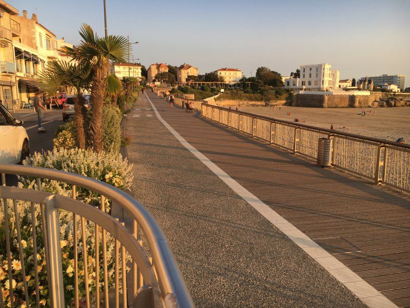
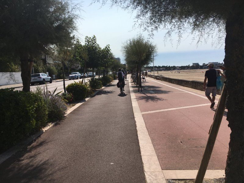
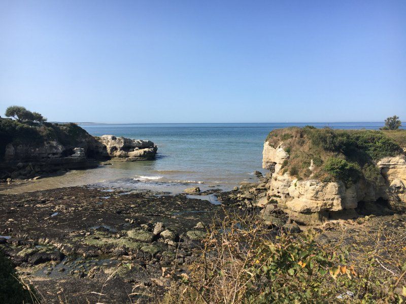
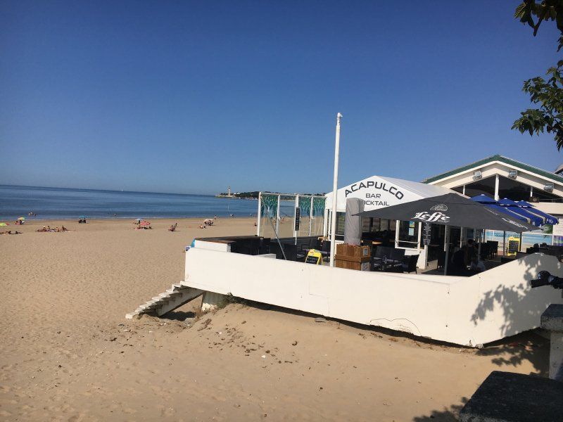
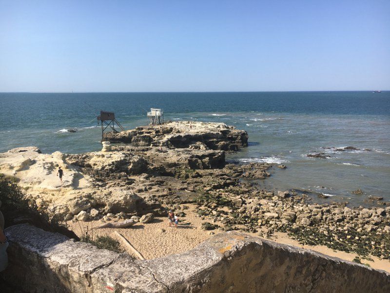
We cycle on the wonderfully laid out bike path always along the coast, past the port of Royan with the countless yachts, to the lighthouse at the Gironde estuary and after passing another beautiful bay we stop at the Acapulco Bar. We enjoy a cool cocktail and the fantastic view of the Atlantic. We cycle on to Meschers. On our last visit 2 years ago, we ate delicious here. This time we forego in view of the crowded restaurants and the small distances between the tables.
Day
Radtour nach La Palmyra
The next day we cycle in the other direction. Here, too, the bike paths are wonderfully laid out, we cycle from one beautiful bay to the next - in the sunshine and in the shady forest, past the golf resort - to La Palmyra. Here we find a nice restaurant with a view of the sea. It's not that crowded here and we find a table on the edge and delicious food.
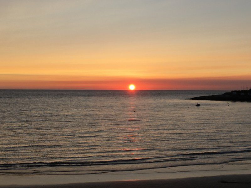
The sunsets by the sea are of course fantastic, bathing everything in a red-golden light - always worth seeing!
Day
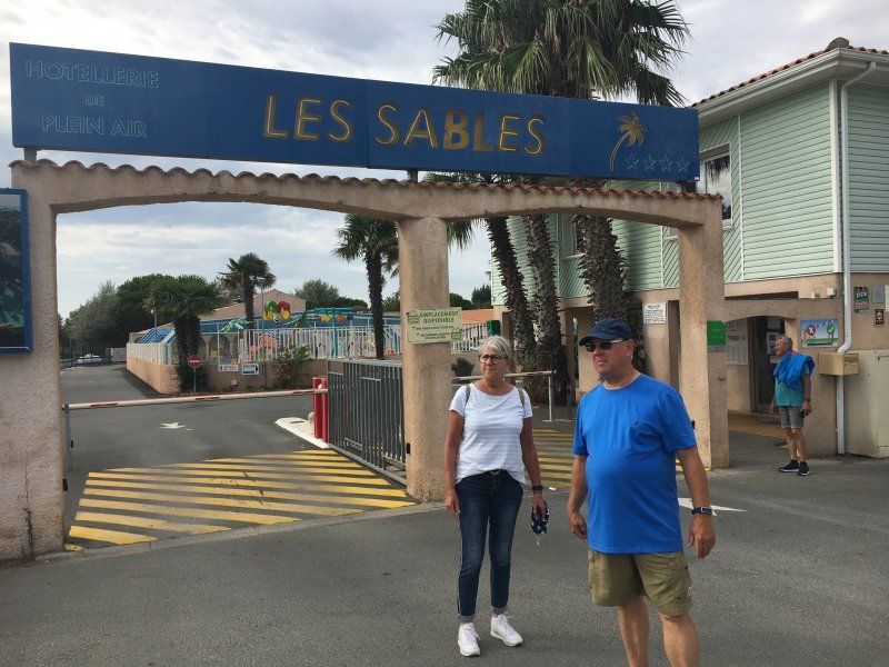
Camping Les Sables, Chemin du Pontreau, Aytré, Frankreich
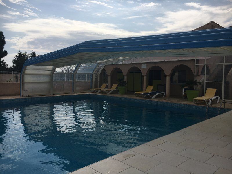
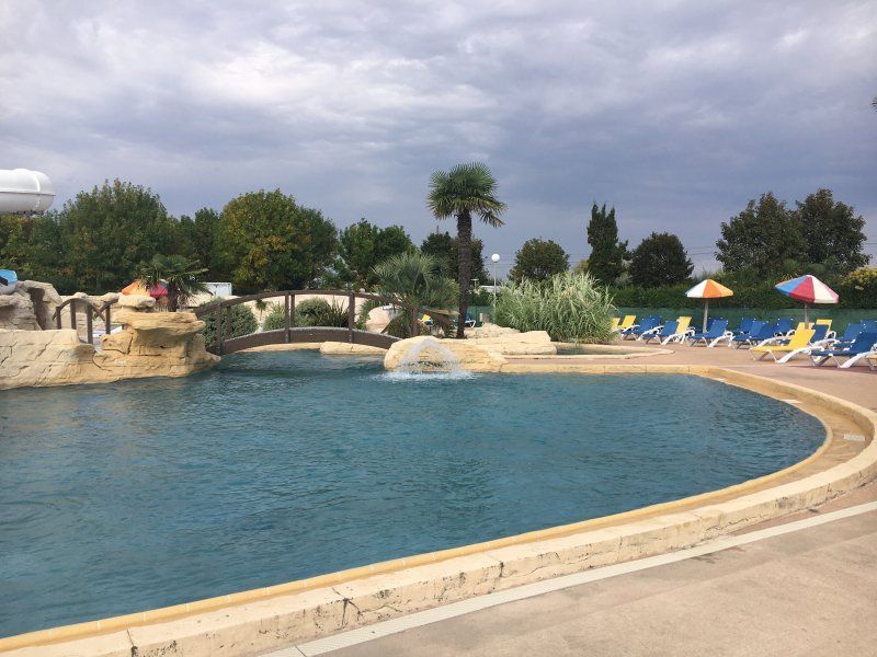
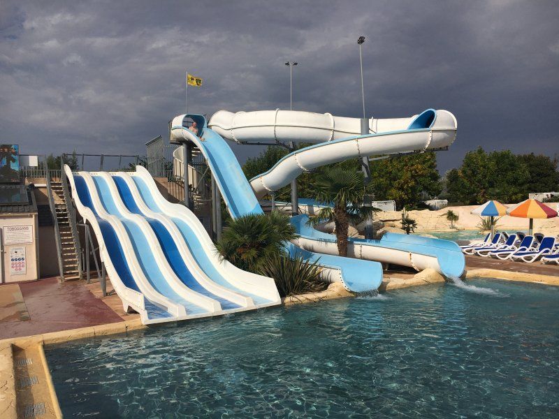
The course is only 300 m from a wonderful sandy beach and only 7 km from La Rochelle. It has a great pool area with a covered swimming pool, an outdoor pool with large slides, a whirlpool and many small pools. The lush vegetation on the square is well-kept and the sanitary facilities are clean.
Chemin du Pontreau, 17440 Aytré, Frankreich
46° 7' 6.3" N 1° 7' 13.8" W
46.1184285 -1.1204981
• Head toward Chemin des Sables on Chemin du Pontreau. Go for 1.1 km.
• Continue on Boulevard de la Mer. Go for 62 m.
• Take the 1st exit from Boulevard de la Mer roundabout onto Boulevard de la Mer. Go for 459 m.
• Continue on Rue du Colonel Fabien. Go for 467 m.
• Turn right onto Avenue Edmond Grasset. Go for 920 m.
• Take the 2nd exit from roundabout onto Avenue Edmond Grasset (D939). Go for 134 m.
• Turn left toward N137. Go for 12 m.
• Take ramp onto N137. Go for 4.7 km.
• Take ramp onto N11 toward E3/Poitiers/Nantes/Niort/La Roche S Yon. Go for 47.0 km.
• Continue on D611 toward A10/Poitiers. Go for 149 m.
• Take ramp onto Route Nationale No248 (N248) toward A10/Poitiers. Go for 8.4 km.
• Continue on N248. Go for 2.2 km.
• Take ramp onto A10 (L'Aquitaine) toward Paris/Nantes/Poitiers. Go for 16.7 km.
• Take the exit toward Angers/Nantes/La Roche S/Yon/St Maixent l'École onto A83. Go for 11.6 km.
• Take exit 10 toward Saumur/Parthenay. Go for 1.2 km.
• Take the 2nd exit from roundabout onto D743 toward Saumur/Angers/Parthenay/Thouars. Go for 2.5 km.
• Continue on D743 toward Parthenay/Champdeniers. Go for 3.2 km.
• Pass 5 roundabouts and continue on Rue du Sépulcre (D949 BIS). Go for 21.8 km.
• Take the 1st exit from Rue du Sépulcre roundabout onto Boulevard Ambroise Paré (D949 BIS). Go for 153 m.
• Take the 3rd exit from Avenue François Mitterrand roundabout onto Avenue François Mitterrand (D949 BIS). Go for 377 m.
• Take the 2nd exit from roundabout onto Avenue du 114ème R.I. Go for 144 m.
• Take the 2nd exit from Rond-Point du 114ème R.I. roundabout onto Avenue du 114ème R.I. (D949 BIS). Go for 120 m.
• Turn left onto Place du Donjon. Go for 92 m.
• Turn right onto Boulevard de la Meilleraye. Go for 373 m.
• Turn left onto Rue Jean Jaurès. Go for 182 m.
• Turn slightly right onto Rue de la Saunerie. Go for 136 m.
• Turn right onto Place Georges Picard. Go for 62 m.
• Turn right onto Rue de la Citadelle. Go for 38 m.
• Arrive at Rue de la Citadelle. Your destination is on the right.
☍
124,2 km
(1 hrs. 26 min.)
Day
La Rochelle
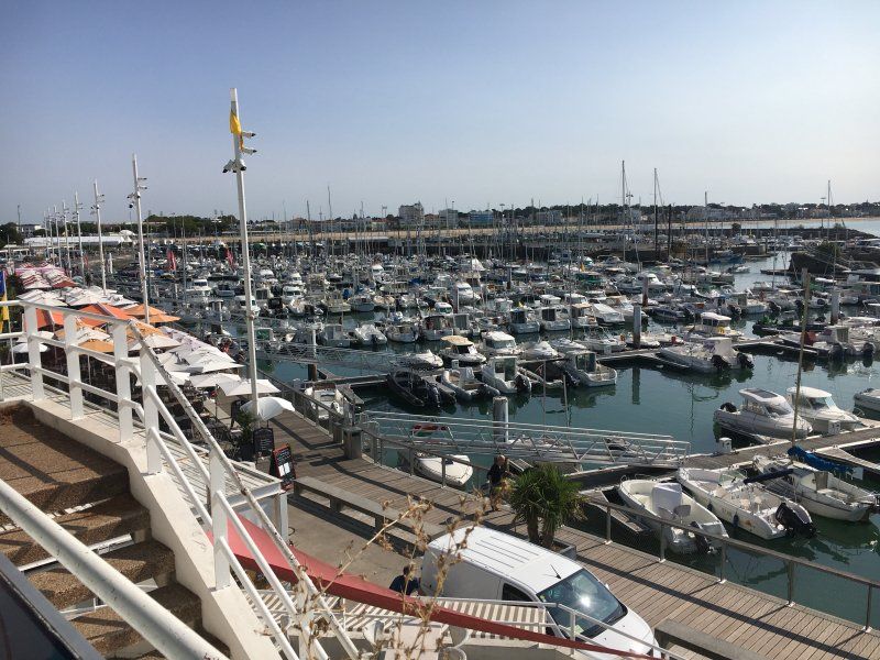
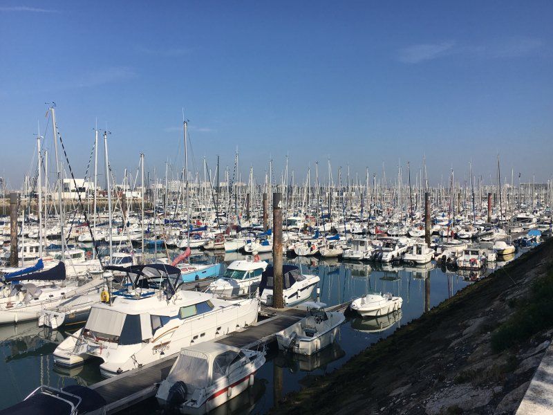
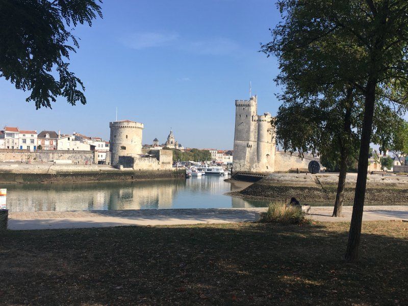
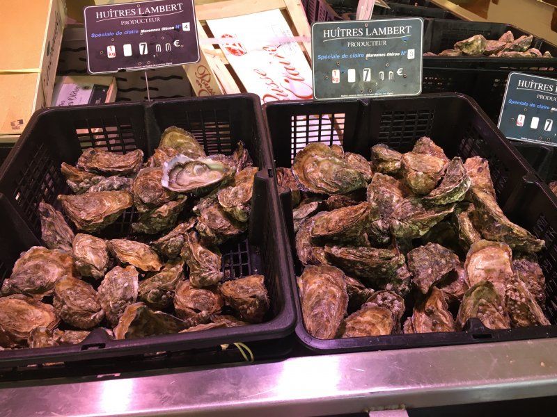
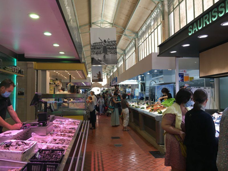
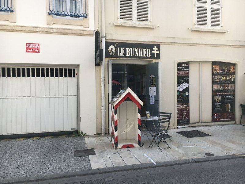
We cycle to La Rochelle. We pass the huge marina, which is approx. 4000 berths is the largest seaport in Europe designed for pleasure craft. The view over the yachts to the old town is just great! Then it's on to the market hall. As everywhere in France, it is richly stocked with specialties from the region. Our camping friends enjoy a portion of fresh oysters and we get truffle cheese and a good bottle of wine for dinner. Right around the corner we find the bunker museum, housed in the basement of an inconspicuous residential building. A black cat was the emblem of the 3rd German submarine flotilla, which was stationed in La-Rochelle. The Germans occupied the port city for five years; Under the hotel where the Nazi officers stayed, they had an air raid shelter built with space for 62 men and a spacious bar. Absolutely worth seeing! Unfortunately, the filming location for “Das Boot” in La Pallice can no longer be visited, the site is cordoned off well in advance. On the way back through the old town and the harbor, we pass the Ferris wheel and quickly decide on a ride. We are rewarded with a fantastic view over the city and the harbor to the sea.
Day
La Rochelle
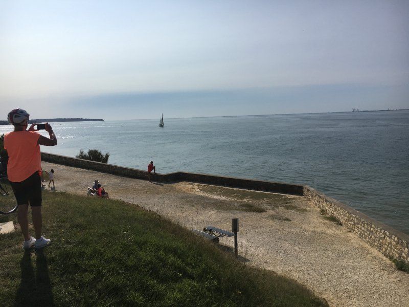
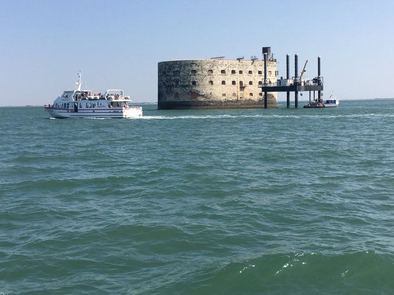
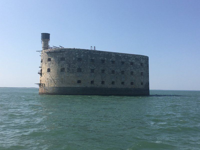
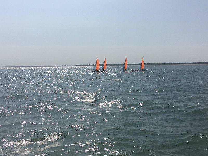
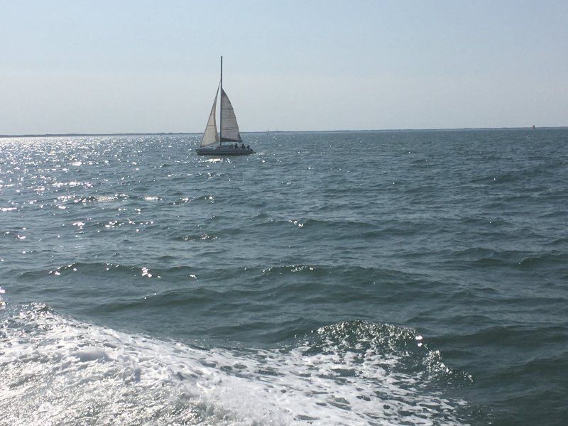
Today we take a boat out onto the Atlantic, the view back to La Rochelle is stunning. Our destination is Fort Boyard. The fort has an oval ground plan, is 61 m long, 31 m wide and 20 m high. In 1801 Napoleon began this strategically important work. Due to strong currents and the tides, construction could only be carried out in summer and at low tide. Completed in 1857, the fort was hardly of any military importance, in the meantime it served as a prisoner of war camp and prison. We enjoy the boat tour in summer temperatures and a light sea breeze, even if mouth and nose protection is a bit annoying.
Day
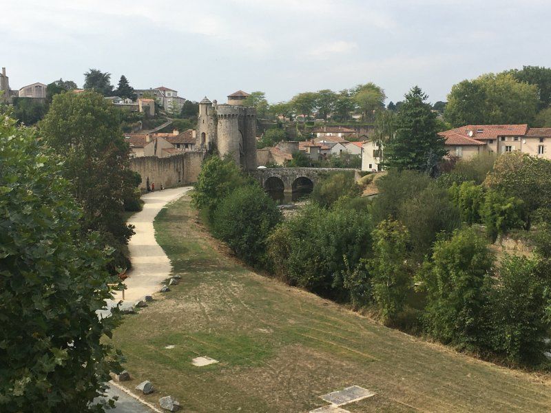
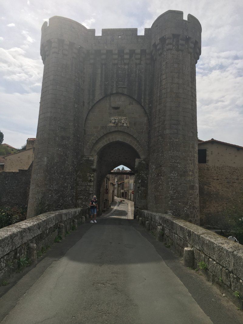
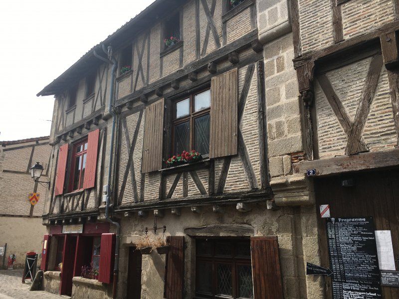
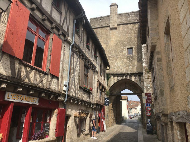
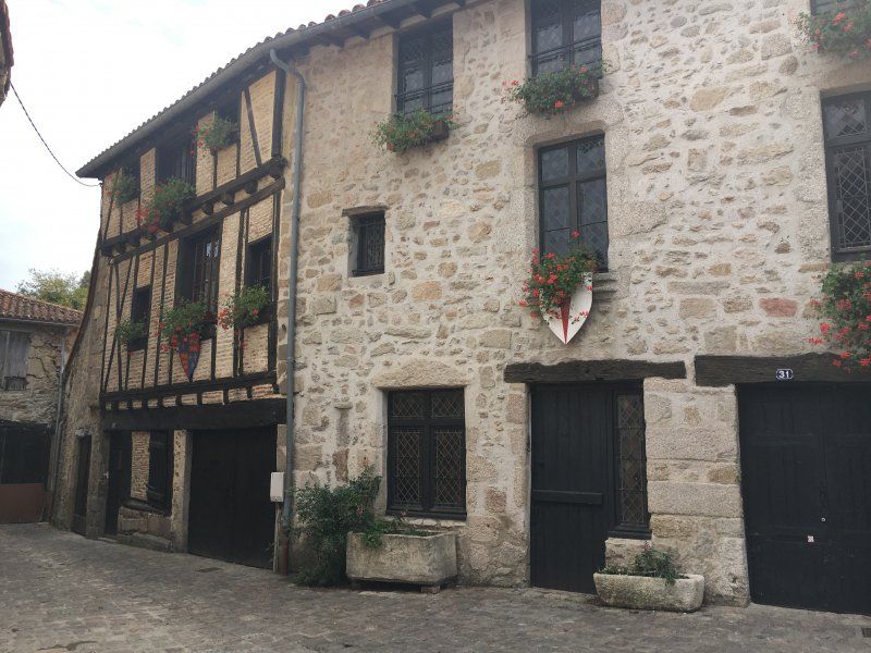
Parthenay, Frankreich
On our onward journey we make a stop in the medieval town of Parthenay. The city lies on the banks of the Thout and has many listed buildings: citadel, castle, city wall with towers, bridges and city gate and many beautiful half-timbered houses. Coats of arms and explanations are attached to many facades, everything is very interesting and absolutely worth seeing! We stop at the Brasserie Le Coupé Gorge - great ambience, small stage for live concerts and a terrace right on the river. 8 different beers are brewed here, some according to long-forgotten recipes.
79200 Parthenay, Frankreich
46° 38' 55.8" N 0° 15' 5.2" W
46.6488250 -0.2514410
• Head southwest on Rue de la Citadelle. Go for 38 m.
• Turn right onto Rue de la Citadelle. Go for 75 m.
• Turn slightly left onto Rue de la Citadelle. Go for 314 m.
• Turn right onto Rue Parmentier. Go for 183 m.
• Turn left onto Rue de la Vau Saint-Jacques. Go for 180 m.
• Continue on Rue du Faubourg-Saint-Jacques. Go for 93 m.
• Turn left onto Grand Rue du Four. Go for 93 m.
• Turn right onto Rue du Rosaire. Go for 33 m.
• Turn left onto Rue du Calvaire. Go for 91 m.
• Turn right onto Route de Moncoutant (D19). Go for 123 m.
• Turn left onto Avenue de la Morinière (D949). Go for 92 m.
• Take the 3rd exit from roundabout onto Avenue de la Morinière (D938/D949). Go for 549 m.
• Keep right onto Avenue de la Morinière (D938). Go for 457 m.
• Take the 1st exit from roundabout onto Boulevard des Grandes Versennes (N149) toward Poitiers/Châtillon-Centre/St Maixent l'École. Go for 851 m.
• Take the 3rd exit from roundabout onto Boulevard du Parnasse (D134) toward Gourgé. Go for 801 m.
• Continue on D134. Go for 1.8 km.
• Continue on Lieu-dit Les Masses (D134). Go for 96 m.
• Continue on D134. Go for 711 m.
• Continue on Lieu-dit Les Sapins (D134). Go for 184 m.
• Continue on D134. Go for 201 m.
• Continue on Lieu-dit Le Chalet (D134). Go for 101 m.
• Continue on D134. Go for 480 m.
• Continue on Lieu-dit La Jalousie (D134). Go for 1.3 km.
• Continue on D134. Go for 2.6 km.
• Continue on Lieu-dit Lerpur (D134). Go for 130 m.
• Continue on Rue de la Commanderie (D134). Go for 643 m.
• Turn right onto Grand Rue (D134). Go for 661 m.
• Take the 2nd exit from roundabout onto Avenue du Thouet (D134). Go for 610 m.
• Continue on D134. Go for 105 m.
• Continue on Lieu-dit Le Bois du Fresne (D134). Go for 95 m.
• Continue on D134. Go for 495 m.
• Continue on Lieu-dit L'Espérance (D134). Go for 74 m.
• Continue on D134. Go for 506 m.
• Continue on Lieu-dit Le Grand Bel Air (D134). Go for 132 m.
• Continue on D134. Go for 619 m.
• Continue on Rue Germain Rallon (D134). Go for 1.7 km.
• Continue on D134. Go for 490 m.
• Continue on Route d'Assais (D134). Go for 2.3 km.
• Continue on D134. Go for 3.6 km.
• Continue on Place des Tilleuls (D134). Go for 245 m.
• Turn right onto Place des Tilleuls (D29). Go for 55 m.
• Continue on Rue Georges Vouilloux (D60). Go for 59 m.
• Turn right onto Rue de la Forge (D29). Go for 590 m.
• Turn left onto D141. Go for 2.0 km.
• Continue on Rue des Cours (D141). Go for 269 m.
• Continue on Rue des Marronniers (D141). Go for 73 m.
• Continue on Rue Bardais (D141). Go for 606 m.
• Continue on D141. Go for 512 m.
• Continue on D127. Go for 2.8 km.
• Continue on Route d'Assais (D141). Go for 1.3 km.
• Continue on Rue de l'Église (D141). Go for 521 m.
• Turn left onto Grand'Rue (D37). Go for 350 m.
• Turn right onto Route de Moncontour (D141). Go for 1.7 km.
• Continue on Rue de la Pierre Levée (D19). Go for 474 m.
• Turn right onto D165. Go for 1.7 km.
• Continue on Rue des Champs Bridards (D52). Go for 5.8 km.
• Take the 2nd exit from roundabout onto Basse Rue (D52). Go for 6.7 km.
• Turn left onto D347. Go for 3.9 km.
• Take the 1st exit from roundabout onto D61 C toward Richelieu. Go for 1.8 km.
• Take the 2nd exit from roundabout onto D61. Go for 1.0 km.
• Take the 1st exit from roundabout onto Rue de la Croix Môquet (D759). Go for 1.4 km.
• Take the 1st exit from roundabout onto D759. Go for 17.3 km.
• Take the 2nd exit from roundabout onto D751 toward A85/Chinon-Ctre/Bourgueil/Tours/Forteresse/Château d'Ussé. Go for 2.6 km.
• Take the 3rd exit from roundabout onto D751. Go for 4.4 km.
• Take the 3rd exit from roundabout onto Route de Huismes (D16). Go for 2.1 km.
• Continue on Rue de la Bourgésière (D16). Go for 44 m.
• Continue on Lieu-dit Les Caves Sautys (D16). Go for 654 m.
• Continue on Route de Chinon à Langeais (D16). Go for 630 m.
• Continue on D16. Go for 373 m.
• Continue on Lieu-dit La Croix Mazarin (D16). Go for 102 m.
• Continue on D16. Go for 318 m.
• Continue on Route de Chinon (D16). Go for 1.2 km.
• Turn left onto Rue des Écoles (D16). Go for 233 m.
• Continue on Place de la Mairie (D16). Go for 61 m.
• Continue on Rue de la Tourette (D16). Go for 536 m.
• Continue on Route de Chinon à Langear (D16). Go for 123 m.
• Continue on Route de Chinon à Langeais (D16). Go for 266 m.
• Take the 1st exit from roundabout onto Route de Rigny-Ussé (D7). Go for 3.4 km.
• Turn left onto Rue de la Loire (D16). Go for 1.1 km.
• Continue on D16. Go for 112 m.
• Continue on Rue de Langeais (D16). Go for 1.7 km.
• Continue on Rue du Franc Rosier (D16). Go for 584 m.
• Continue on D16. Go for 1.6 km.
• Continue on Lieu-dit L'Aireau des Herpins (D16). Go for 873 m.
• Continue on D16. Go for 1.3 km.
• Turn right onto Rue du Becaju. Go for 452 m.
• Turn slightly left toward Lieu-dit La Marmelinière. Go for 80 m.
• Turn right onto Lieu-dit La Marmelinière. Go for 143 m.
• Arrive at Lieu-dit La Marmelinière. Your destination is on the left.
☍
99,9 km
(1 hrs. 33 min.)
Camping Loire et Châteaux
We visited the place last year on our Loire tour. The sanitary facilities are clean, but some things are defective and urgently need to be repaired!
Le Stade, 37130, Brehemont, Frankreich
47° 17' 26.8" N 0° 21' 14" E
47.2907900 0.3538800
• Head toward Rue des Pierrons on Lieu-dit La Marmelinière. Go for 667 m.
• Turn left onto Lieu-dit La Grande Maison (D119). Go for 229 m.
• Continue on Route de Rivarennes (D119). Go for 399 m.
• Turn right onto Avenue du 11 Novembre (D16). Go for 57 m.
• Continue on D16. Go for 361 m.
• Continue on Lieu-dit L'Aireau des Besniers (D16). Go for 564 m.
• Continue on Lieu-dit Le Passage (D16). Go for 725 m.
• Continue on Lieu-dit L'Ouche Marquet (D16). Go for 422 m.
• Continue on Lieu-dit Les Brunets (D16). Go for 373 m.
• Continue on Rue de Chambourg (D16). Go for 777 m.
• Continue on Lieu-dit Les Batailleaux (D16). Go for 109 m.
• Continue on Route de Brehemont (D16). Go for 834 m.
• Turn left onto D57. Go for 769 m.
• Take the 1st exit from roundabout onto Levée de la Loire (D952) toward A85/Tours/Villandry/Azay le R./Cinq Mars la Pile. Go for 1.6 km.
• Take the 1st exit from roundabout onto D952 toward A85/Tours/Luynes/Fondettes. Go for 1.8 km.
• Take the 3rd exit from roundabout toward Angers/Saumur/Tours/Azay le Rideau/Villandry. Go for 311 m.
• Take ramp onto A85 toward Lyon/Tours/Azay le Rideau/Villandry. Go for 126 km.
• Take the exit toward Paris onto A71. Go for 15.5 km.
• Take exit 4 toward Neung S/Beuvron/Salbris/Salbris-Centre/Salbris-Belleville. Go for 937 m.
• Take the 4th exit from roundabout onto Avenue de Romorantin toward Salbris-Centre. Go for 231 m.
• Continue on Avenue de Romorantin-Lanthenay. Go for 697 m.
• Continue on Avenue de Belleville. Go for 834 m.
• Continue on Place du Général de Gaulle. Go for 58 m.
• Continue on Rue du Général Giraud. Go for 239 m.
• Turn right onto Boulevard de la République (D2020). Go for 55 m.
• Turn left onto Rue du Commerce (D724) toward Aubigny/Souesmes/Stade R.Corrèze. Go for 15.7 km.
• Continue on D924. Go for 4.3 km.
• Turn left onto Lieu-dit Le Bout du Pont (D79). Go for 527 m.
• Continue on Route d'Aubigny (D924). Go for 10.6 km.
• Continue on Rue Étienne Soyer (D924). Go for 153 m.
• Take the 3rd exit from Place Chazereau roundabout onto Rue des Dames (D924) toward Centre Ville. Go for 330 m.
• Turn right onto Rue du Château (D923). Go for 110 m.
• Turn left onto Rue Paul Lasnier (D21). Go for 130 m.
• Continue on Rue des Stuarts (D21). Go for 1.4 km.
• Continue on Lieu-dit Le Pont aux Chèvres (D21). Go for 52 m.
• Continue on D21. Go for 2.1 km.
• Continue on Lieu-dit La Pointe (D21). Go for 122 m.
• Continue on D21. Go for 3.7 km.
• Continue on Lieu-dit Les Granges Rouges (D21). Go for 1.1 km.
• Continue on D21. Go for 355 m.
• Continue on Rue de Sologne (D21). Go for 451 m.
• Continue on Lieu-dit Les Vasselots (D21). Go for 95 m.
• Continue on Rue de Sologne (D21). Go for 1.0 km.
• Turn left onto Rue de Sologne (D21). Go for 61 m.
• Turn right onto Rue de Vailly (D11). Go for 14 m.
• Turn left onto Place de l'Église. Go for 27 m.
• Turn right onto Place de l'Église. Go for 37 m.
• Turn right onto Place de l'Église (D11). Go for 28 m.
• Turn right onto Rue du Pont (D21). Go for 469 m.
• Continue on Lieu-dit Le Pont Barroy (D8). Go for 173 m.
• Continue on D21. Go for 4.9 km.
• Continue on Route de Concressault (D50). Go for 2.6 km.
• Continue on Rue de Concressault (D50). Go for 316 m.
• Continue on Grande Rue (D50). Go for 585 m.
• Keep left onto Rue de Châtillon (D50). Go for 257 m.
• Continue on D50. Go for 279 m.
• Continue on Lieu-dit La Grand-Terre (D50). Go for 117 m.
• Continue on D50. Go for 190 m.
• Continue on Lieu-dit La Montagne (D50). Go for 192 m.
• Continue on D50. Go for 473 m.
• Continue on Lieu-dit Les Corbeaux (D50). Go for 538 m.
• Continue on D50. Go for 1.6 km.
• Continue on Lieu-dit Brame-Pain (D50). Go for 96 m.
• Continue on D50. Go for 164 m.
• Continue on Lieu-dit La Moutonne (D50). Go for 203 m.
• Continue on D50. Go for 3.0 km.
• Continue on Lieu-dit La Planche des Marnes (D50). Go for 71 m.
• Continue on D50. Go for 68 m.
• Continue on Route de Cernoy en Berry (D50). Go for 920 m.
• Continue on Rue du Faubourg de Nancray (D50). Go for 233 m.
• Continue on Rue Maréchal Joffre (D50). Go for 279 m.
• Continue on Rue de la Marne (D50). Go for 478 m.
• Turn right onto Rue Champault (D951). Go for 133 m.
• Turn left onto Rue Martial Vuidet (D50). Go for 2.5 km.
• Take the 3rd exit from roundabout onto D2007 toward Montargis/A77/Orléans/Briare. Go for 2.2 km.
• Take the 2nd exit from roundabout onto Avenue de Lattre de Tassigny (D957) toward Briare. Go for 1.3 km.
• Take the 1st exit from roundabout onto Avenue de Lattre de Tassigny (D957). Go for 1.3 km.
• Turn left onto Rue Tissier. Go for 24 m.
• Continue on Quai Alexis Tchékoff. Go for 246 m.
• Continue on Place du Rialto. Go for 39 m.
• Turn slightly right onto Quai du Baradan. Go for 277 m.
• Continue on Pont du Baraban. Go for 31 m.
• Continue on Val du Martinet. Go for 447 m.
• Arrive at Val du Martinet. Your destination is on the right.
☍
223,5 km
(2 hrs. 28 min.)
Day
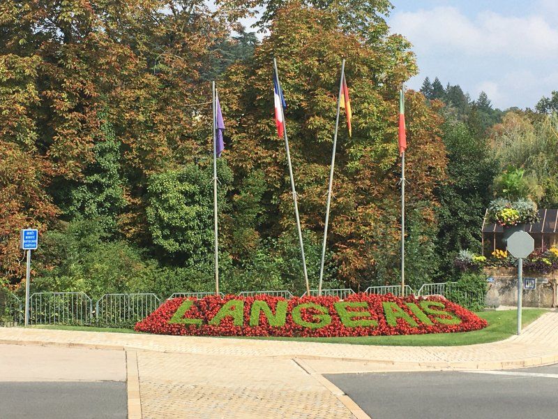
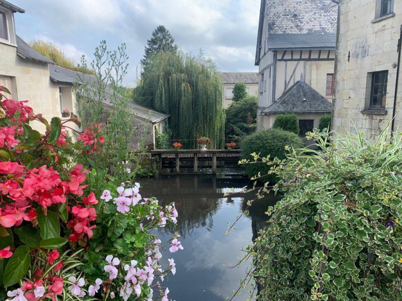
Langeais
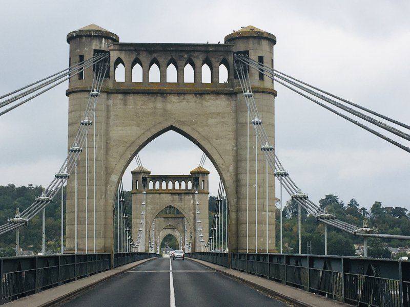
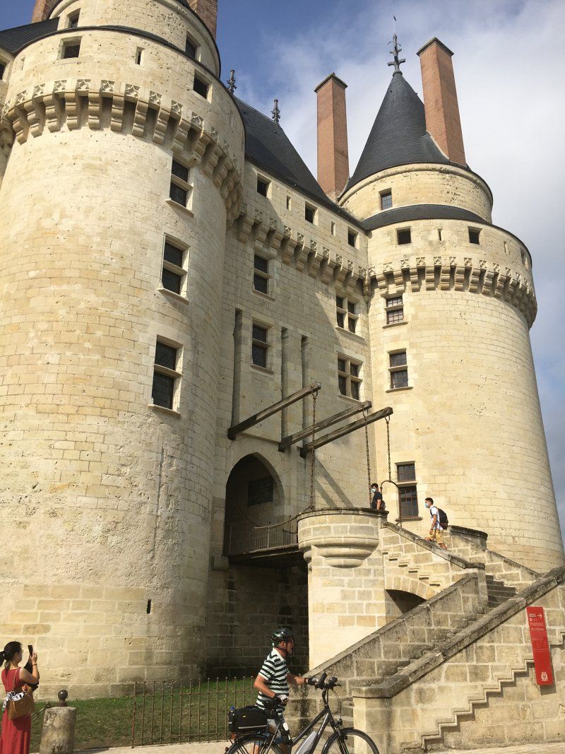
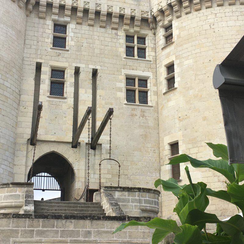
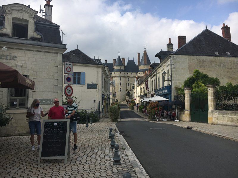
We cycle on the Loire cycle path to the Pont de Langeais, a beautiful 360 m long suspension bridge over the Loire. In the center of Langeais is one of the oldest castles in the Loire. A drawbridge leads to the courtyard and park. The castle became famous in 1491 when the wedding of King Charles VIIII and Anne de Bretagne took place here. Langeais is a magical place, very clean and well-kept.
Marnay
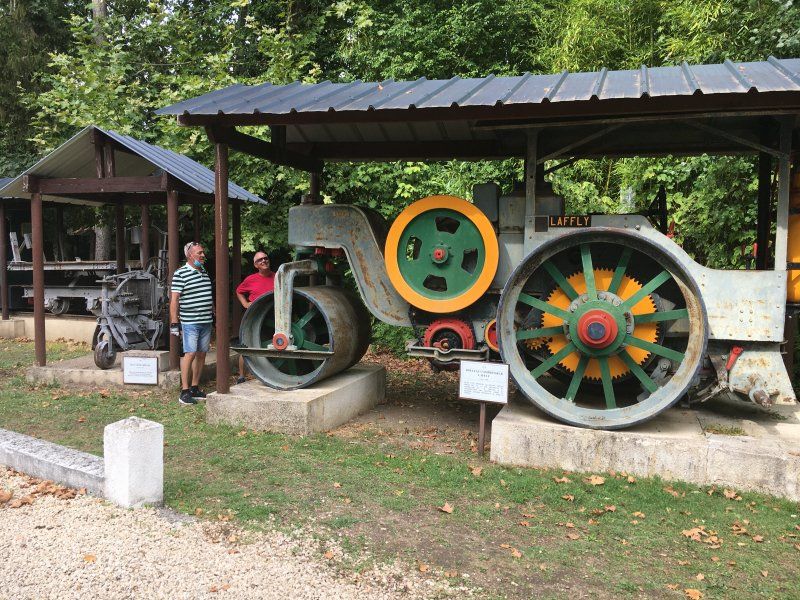
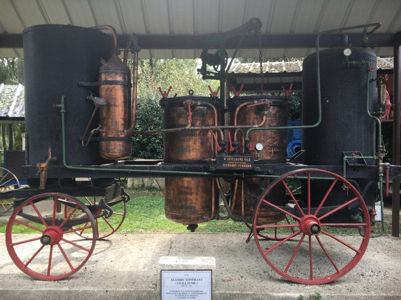
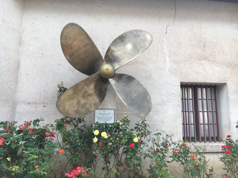
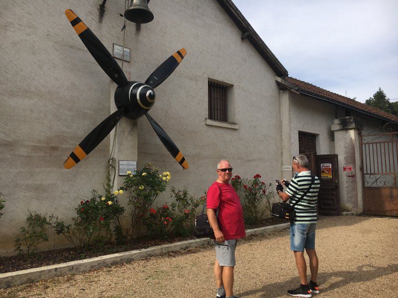
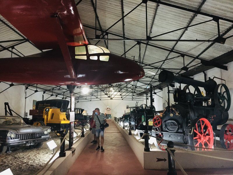
In the afternoon we cycle to the technology museum of Maurice Dufresne in Marnay. It is the work of a passionate collector, a huge area with a lot of old technology. In large halls there are machines, cars, trucks, motorcycles, landscaping and military machines, weaving machines, wine filters, even an original guillotine, 3000 great exhibits! The men are thrilled!
Day
Camping Le Martinet
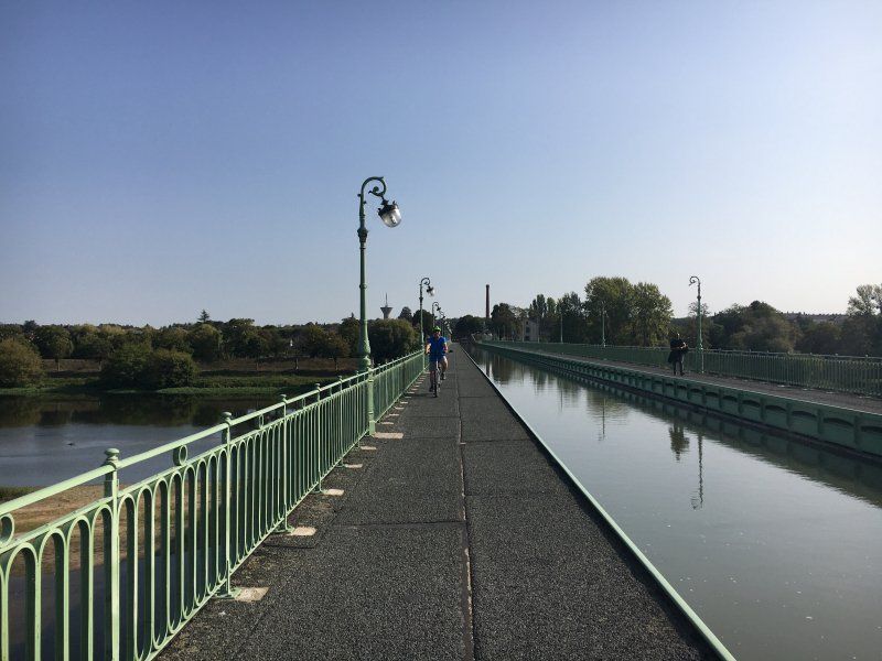
At the campsite we have a large meadow almost to ourselves, the sanitary facilities are very simple, but clean. Briare has many canals, a small marina, a beautiful church with interesting mosaics. We cycle through Briare and admire the lush bridges, beds and planters. Our destination today is the Briare canal bridge. It is 662 m long and a real work of art. The trough holds approx. 14,000 tons of water and rests on 14 pillars in the river bed, the bridge is 9 m above the normal level of the Loire. Towpaths and lamps were set up on both sides of the watercourse, as well as two brick candelabra. A nice photo opportunity and point of attraction for tourists.
45250, Briare, Frankreich
47° 38' 30.1" N 2° 43' 32.2" E
47.6417000 2.7256000
• Head toward Allée des Saules on Val du Martinet. Go for 447 m.
• Continue on Pont du Baraban. Go for 31 m.
• Continue on Quai du Baradan. Go for 277 m.
• Turn slightly left onto Place du Rialto. Go for 39 m.
• Continue on Quai Alexis Tchékoff. Go for 246 m.
• Continue on Rue Tissier. Go for 24 m.
• Turn left onto D957. Go for 476 m.
• Take the 2nd exit from roundabout onto Avenue Yver Bapterosses. Go for 1.4 km.
• Take the 2nd exit from roundabout onto Avenue Yver Bapterosses. Go for 430 m.
• Take the 1st exit from roundabout onto D952 toward A77 (A19)/Montargis/Auxerre/Nevers. Go for 833 m.
• Take the 4th exit from roundabout toward Nevers/Paris/Auxerre. Go for 396 m.
• Take left ramp onto A77 toward Paris/Montargis. Go for 47.1 km.
• Take the exit toward Orléans/Metz/Nancy/Sens. Go for 773 m.
• Keep left toward A19. Go for 454 m.
• Take the exit toward Metz/Nancy/Sens/Montargis-Nord onto A19. Go for 33.7 km.
• Take the exit toward Metz/Nancy/Troyes/Sens onto A19. Go for 29.4 km.
• Take the exit toward Troyes/Metz/Nancy onto A5. Go for 71.0 km.
• Take the exit toward Metz/Reims/Châlons en Champ./St Dizier onto A26. Go for 96.5 km.
• Take the exit toward Strasbourg/Metz/Verdun onto A4 (Autoroute de l'Est). Go for 75.8 km.
• Take exit 28 toward Voie Sacrée/Verdun/Saint-Mihiel. Go for 562 m.
• Continue on Zone d'Activité des Souhesmes (D163). Go for 243 m.
• Take the 2nd exit from roundabout onto D163 toward Verdun/Bar le Duc. Go for 237 m.
• Turn left onto Voie Sacrée (D1916). Go for 4.0 km.
• Take the 1st exit from roundabout onto Route de l'Argonne (D603) toward Metz/Verdun/Zone Industrielle de Baleycourt. Go for 5.4 km.
• Continue on Avenue du Varinot. Go for 702 m.
• Take the 2nd exit from roundabout onto Avenue du Général Boichut (D34 A) toward A4/(Metz)/Centre Ville/Centre Hospitalier/Centre Mondial de la Paix/Citadelle Souterraine. Go for 143 m.
• Take the 1st exit from roundabout onto Allée des Breuils. Go for 277 m.
• Arrive at Allée des Breuils. Your destination is on the left.
☍
370,9 km
(3 hrs. 6 min.)
Day
Gien
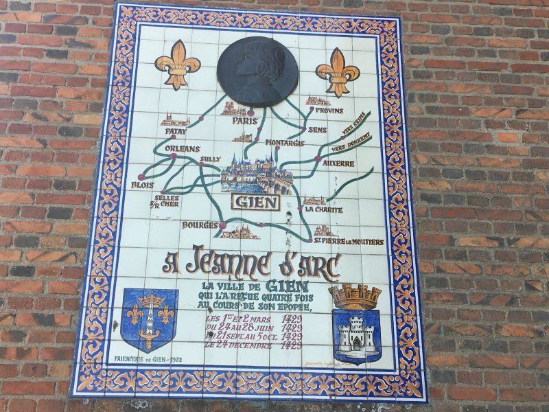
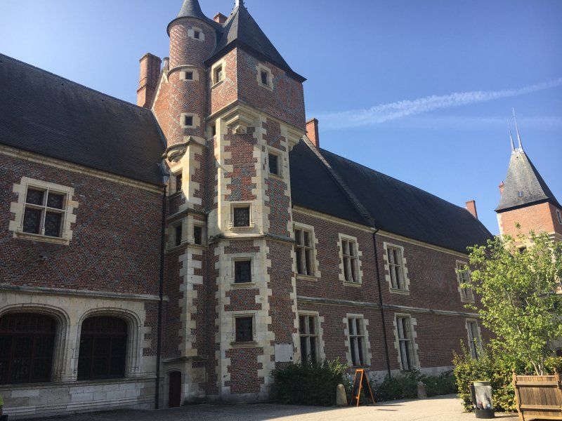
We cycle to Gien. From afar you have a great view over the Loire to the castle of Gien, which dominates the city. The Gien Bridge was fought over during World War II. In June 1940, the German air force bombed the Gien bridge in order to cut off the possibility for the French army to retreat across the Loire. The air raid triggered a major fire that destroyed 80 percent of the city. Only the castle survived the bombardment almost unscathed. We are a little depressed by the history of the city, but we can still enjoy our lunch on the banks of the Loire.
Day
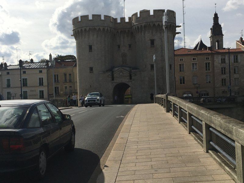
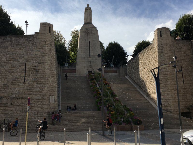
Les Breuils Camping Verdun, Allée des Breuils, Verdun, Frankreich
The last stop on our trip to France this year is Verdun. Like all other places on our tour, the Les Breuils campsite is only moderately full, so you can easily get out of the way! The sanitary facilities are ok, the place also has a pool, but the weather is now a bit cooler and more autumnal, so we don't use it. But in the small bistro we get a cool after-work beer in the evening. The city of Verdun on the Meuse and its surroundings were the scene of the Battle of Verdun in 1916, one of the bloodiest battles of World War I. The battle lasted from February to December 1916, the city suffered severe destruction and some villages in the surrounding area were completely destroyed. 170,000 French and 150,000 German soldiers died in the battle that became a symbol of war.
7 Allée des Breuils, 55100 Verdun, Frankreich
49° 9' 14.1" N 5° 21' 55.9" E
49.1539153 5.3655212
• Head northeast on Allée des Breuils. Go for 282 m.
• Turn right onto Avenue du Général Boichut (D34 A). Go for 2.2 km.
• Take the 2nd exit from roundabout onto DS1 A (D330). Go for 1.3 km.
• Take the 3rd exit from roundabout onto DS1 A (D330) toward (Metz)/A4/Neufchâteau/Nancy/Sedan/Longwy. Go for 286 m.
• Take the 1st exit from Carrefour de l'Europe roundabout onto Boulevard de l'Europe (D964) toward A4/Metz/Neufchâteau/Haudainville/St Mihiel. Go for 3.6 km.
• Turn left toward Metz/Fresnes-en-Woëvre. Go for 87 m.
• Take ramp onto A4 (Autoroute de l'Est). Go for 116 km.
• Take the exit toward Forbach onto A320. Go for 14.6 km.
• Continue on A6. Go for 71.9 km.
• Keep right onto Dreieck Kaiserslautern toward Frankfurt a.M./Mainz/Kaisersl.-Centrum/A63. Go for 523 m.
• Continue on A63. Go for 69.8 km.
• Take exit 2 toward Frankfurt a.M./Darmstadt onto A60. Go for 16.7 km.
• Take the left exit toward Köln/Hannover/Würzburg/Frankfurt onto A67. Go for 6.4 km.
• Take exit 1 toward Würzburg/Frankfurt/Flughafen onto A3. Go for 43.9 km.
• Take exit 57/58 toward Aschaffenburg/Stockstadt onto B469. Go for 20.5 km.
• Take ramp toward Obernburg-Mitte/Eisenfeld/Erlenbach. Go for 216 m.
• Turn right onto Mainbrücke (St2308). Go for 947 m.
• Continue on Umgehungsstraße (St2308). Go for 1.4 km.
• Turn right onto Elsavatalstraße (St2308). Go for 6.1 km.
• Turn right onto Elsavatalstraße (St2441). Go for 4.0 km.
• Turn left onto MIL2 toward Collenberg. Go for 7.3 km.
• Continue on Mönchberger Straße (MIL2). Go for 545 m.
• Turn left onto Hauptstraße (St2315). Go for 850 m.
• Turn right onto Schloßstraße. Go for 61 m.
• Arrive at Schloßstraße. Your destination is on the right.
☍
389,6 km
(3 hrs. 34 min.)
Day
Fort Douaumont
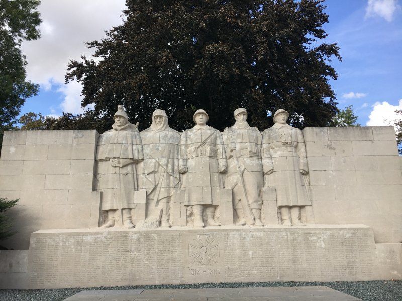
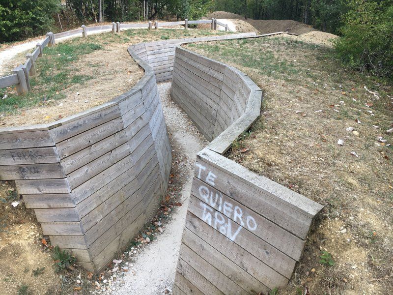
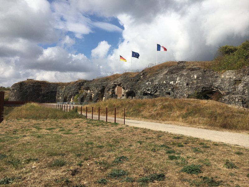
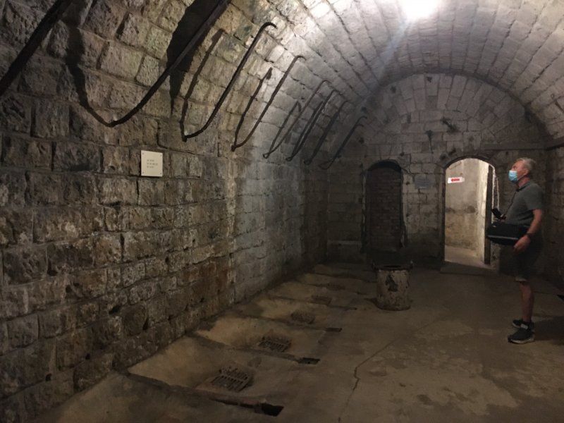
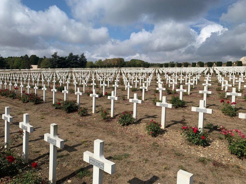
We want to visit Fort Douaumont first, on the way we cycle through a forest with hundreds of hills, this is where the positions and trenches were once. The fort is a huge fortress - built between 1885 and 1913. In February 1916, German soldiers took the fort almost at a stroke. We walk through the underground rooms of the fort, it must have been horrific to live and fight here, for German and French men! We cycle on to the ossuary. The bones of over 130,000 unidentifiable French and German soldiers who were picked up on the battlefields are kept here. In front of the ossuary there is a cemetery with over 16,000 graves. The crosses are lined up and create an impressive and at the same time depressing picture. The central element of the ossuary is the 137 m long vaulted passage with approx. 4000 inscriptions on the walls and ceiling.
Day
Camping Maintal, Schloßstraße, Collenberg, Deutschland
After saying goodbye to our camping friends, we head back to Germany. We make a stop on the Main before we finally go home to Berlin. The conclusion of our trip is quite positive. Despite Corona and the increasing number of infections, we had a great time. The campsites were not very full, we usually had a lot of space to keep our distance and thanks to the ACSI card also very inexpensive. The restaurants were often very full with little spacing (especially in the places on the Atlantic coast).
Schloßstraße 42, 97903 Collenberg, Deutschland
49° 46' 10.3" N 9° 20' 30.5" E
49.7695196 9.3418192