Sindelfingen
A 8;A 81, Sindelfingen, Landkreis Böblingen, Baden-Württemberg, Deutschland
48° 43' 43.2" N 9° 3' 25.2" E
48.7286702 9.0569876
• Head northwest on A8/A81. Go for 5.5 km.
• Take the exit toward Würzburg/Mannheim/Heilbronn onto A81. Go for 133 km.
• Take the exit toward Nürnberg/Kassel onto A3. Go for 7.8 km.
• Take exit 70 toward W.-Heidingsfeld/W.-Zentrum onto B19. Go for 1.2 km.
• Keep right onto B19. Go for 5.7 km.
• Keep left onto B19 toward Kassel/Schweinfurt/Werneck/Wü.-Lengfeld. Go for 2.9 km.
• Keep left onto B19 toward Kassel/A7/Ulm/Nürnberg/Bad Neustadt a.d. Saale/Schweinfurt. Go for 4.1 km.
• Take ramp onto A7 toward Kassel/Schweinfurt. Go for 132 km.
• Continue on A7. Go for 282 km.
• Take exit 46 toward Visselhövede/Dorfmark onto B440. Go for 730 m.
• Take the 1st exit from roundabout onto Klaus-Seckel-Straße. Go for 242 m.
• Turn right onto Klaus-Seckel-Straße. Go for 148 m.
• Turn right onto Am Badeteich. Go for 12 m.
• Turn left. Go for 31 m.
• Arrive at your destination.
☍
576,0 km
(5 hrs. 8 min.)
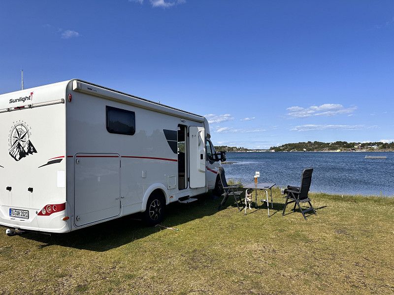
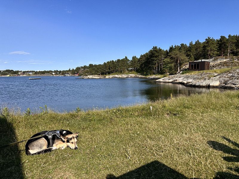
Bad Fallingbostel
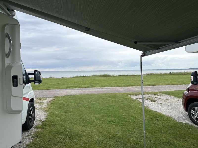
Pitch at a small natural outdoor pool. With your dog, you're right in the middle of nature
Am Badeteich, Bad Fallingbostel, Heidekreis, Niedersachsen, Deutschland
52° 53' 43.3" N 9° 46' 9.5" E
52.8953531 9.7693134
• Head toward Am Badeteich. Go for 31 m.
• Turn right onto Am Badeteich. Go for 12 m.
• Turn left onto Klaus-Seckel-Straße. Go for 364 m.
• Take the 3rd exit from roundabout onto B440. Go for 381 m.
• Take ramp onto A7. Go for 63.1 km.
• Keep left onto Horster Dreieck toward Lübeck/Berlin/Hamburg/Lüneburg/A1. Go for 2.5 km.
• Continue on A1. Go for 13.2 km.
• Take exit 36 toward Lübeck/Berlin/Hamburg-Südost onto A1. Go for 129 km.
• Continue on B207. Go for 21.2 km.
• Keep left onto B207 toward Puttgarden. Go for 126 m.
• Continue on E47. Go for 691 m.
• Arrive at E47. Your destination is on the left.
☍
231,0 km
(2 hrs. 14 min.)
Day
Fehmarn
Ferry port for the crossing to Denmark.
E 47, Fehmarn, Kreis Ostholstein, Schleswig-Holstein, Deutschland
54° 30' 6.5" N 11° 13' 33.5" E
54.5018027 11.2259840
• Head east on E47. Go for 145 m.
• Take the Puttgarden-Rødby Ferry. Stay on for 18.7 km.
• Head northeast. Go for 9 m.
• Arrive at your destination.
☍
18,9 km
( 58 min.)
Rødbyhavn
After the ferry ride from Fehmarn we continue via Malmö to our next pitch
Sydmotorvejen, Rødbyhavn, Region Seeland, Dänemark
54° 39' 15.8" N 11° 21' 3.2" E
54.6543919 11.3508969
• Head northeast. Go for 759 m.
• Keep left toward København/E47. Go for 135 m.
• Continue on Sydmotorvejen (E47). Go for 121 km.
• Continue on E20/E47 (Køge Vest). Go for 26.2 km.
• Continue on E20 (Avedøre) toward Malmø/Lufthavn/København C. Go for 27.7 km.
• Continue on E20 (Öresundsbron). Go for 27.8 km.
• Continue on E6/E20 toward E4/Göteborg/Stockholm. Go for 17.9 km.
• Take exit 23 toward Barsebäck/Centrum. Go for 405 m.
• Take the 1st exit from roundabout onto Köpingevägen toward Centrum. Go for 285 m.
• Take the 2nd exit from roundabout onto Pinhättevägen toward Barsebäck. Go for 782 m.
• Turn right onto Barsebäcksvägen toward Hofterup. Go for 792 m.
• Continue on Barsebäcks Boställe. Go for 328 m.
• Turn left onto Hofterupsvägen. Go for 281 m.
• Continue on Klockarens väg. Go for 287 m.
• Continue on Hofterupsvägen. Go for 148 m.
• Continue on Sjövägen. Go for 1.5 km.
• Turn left onto Kustvägen toward Barsebäckshamn. Go for 268 m.
• Turn right onto Kustvägen. Go for 68 m.
• Arrive at Kustvägen. Your destination is on the right.
☍
226,3 km
(2 hrs. 13 min.)
Barsebäckstrand Camping & Stugby
A lovely little campsite right by the sea. The price is perfectly reasonable. I think €31 for two people is a reasonable price for the site.
The staff is friendly and there are also small snacks available.
24657, Barsebäck, Schweden
55° 46' 13" N 12° 55' 38.4" E
55.7702800 12.9273300
• Head southeast on Kustvägen. Go for 68 m.
• Turn left onto Kustvägen. Go for 5.4 km.
• Continue on Barsebäcksvägen. Go for 540 m.
• Turn right onto Saxtorpsvägen toward Saxtorp/E6/E20. Go for 186 m.
• Take the 3rd exit from roundabout onto E6/E20 toward Göteborg. Go for 31.9 km.
• Continue on E6/E20 toward Göteborg/Höganäs/111/Helsingborg N. Go for 207 km.
• Keep right onto E6 (Olskroksmotet). Go for 99.9 km.
• Take exit 101 toward Lysekil/Dingle/165/Kungshamn/171/Hunnebostrand/Smögen. Go for 210 m.
• Take the 3rd exit from roundabout onto 162. Go for 277 m.
• Turn right toward Lågum. Go for 3.5 km.
• Continue on Lågum. Go for 288 m.
• Continue on Uddevallavägen. Go for 619 m.
• Take the 2nd exit from roundabout onto Strömstadsvägen (165). Go for 6.7 km.
• Continue on Norra Bohusvägen. Go for 1.1 km.
• Continue on Kolstorp. Go for 2.0 km.
• Continue on Klev. Go for 733 m.
• Continue on Klev Tyftet. Go for 1.9 km.
• Continue on Riksvägen. Go for 227 m.
• Continue on Tallstigen. Go for 276 m.
• Continue on Riksvägen. Go for 786 m.
• Continue on Rabbalshedemotet. Go for 233 m.
• Continue straight ahead. Go for 37 m.
• Take the 1st exit from roundabout. Go for 1.6 km.
• Continue on Solhem. Go for 4.1 km.
• Continue on Huds Moar. Go for 2.8 km.
• Continue on Utäng. Go for 121 m.
• Continue on Rungstung. Go for 2.3 km.
• Continue on Riksvägen. Go for 4.3 km.
• Continue on Järpenbacken. Go for 295 m.
• Take the 2nd exit from roundabout onto E6 toward Oslo. Go for 43.6 km.
• Continue on E6 (Svinesundsbroen). Go for 91.9 km.
• Continue on E6 toward Trondheim/Ring 3/Oslo N/Ø. Go for 18.3 km.
• Take ramp toward E18/Kristiansand/Sentrum. Go for 237 m.
• Take the 3rd exit from roundabout toward Sentrum/E18. Go for 195 m.
• Continue on Operatunnelen. Go for 1.4 km.
• Take left ramp onto Operatunnelen (190) toward E18/Sentrum. Go for 4.8 km.
• Keep left onto Frognerstranda (E18). Go for 2.3 km.
• Take ramp toward Ring 2/Majorstuen. Go for 183 m.
• Turn right onto Drammensveien. Go for 18 m.
• Take the 5th exit from roundabout onto Sjølystveien toward Sjølyst Marina. Go for 160 m.
• Take the 1st exit from roundabout. Go for 76 m.
• Turn left. Go for 173 m.
• Arrive at your destination on the left.
☍
542,6 km
(5 hrs. 32 min.)
Day
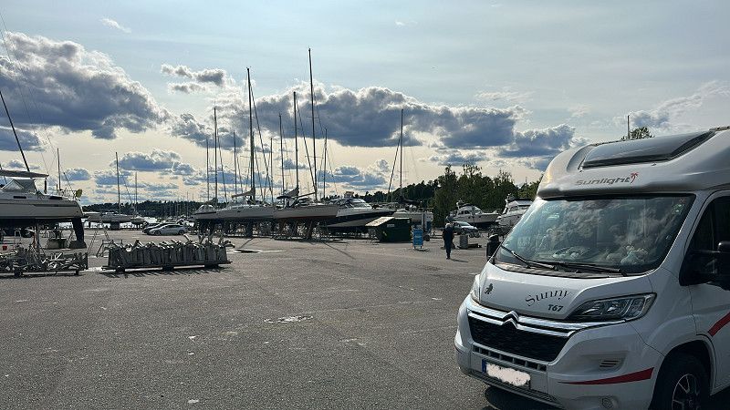
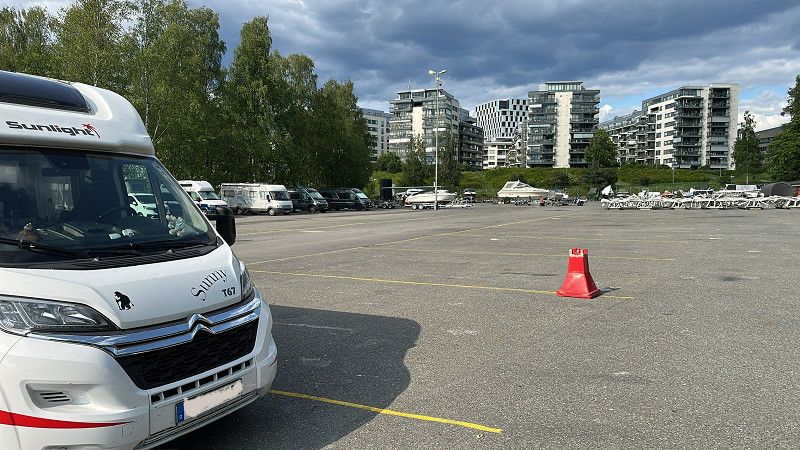
Sjølyst bobilparkering
Large parking space at the harbor. Functional but not very nice. You're stuck between boats that need repairs. But with no other parking options, it has to be this way. 650 NOK is too expensive for the area, in my opinion. Trains into the city are available every two minutes.
Hengsengveien, Oslo, Norwegen
59° 55' 9.3" N 10° 40' 41.5" E
59.9192461 10.6781948
• Head northwest. Go for 173 m.
• Turn right toward Drammensveien. Go for 50 m.
• Take the 2nd exit from roundabout onto Drammensveien toward Ring 2/Majorstuen. Go for 95 m.
• Take the 4th exit from roundabout onto Sjølystveien (E18) toward Drammen. Go for 90.9 km.
• Take the exit toward Tønsberg/Nøtterøy/Tjøme. Go for 251 m.
• Take the 3rd exit from roundabout onto 308. Go for 204 m.
• Pass 4 roundabouts and continue on Jarlsberglinna (308). Go for 4.2 km.
• Take the 2nd exit from roundabout. Go for 280 m.
• Pass 2 roundabouts and continue on Kjelleveien (308). Go for 2.3 km.
• Turn right onto Stoltenbergs gate (308). Go for 300 m.
• Take the 2nd exit from roundabout onto Nøtterøveien (308). Go for 601 m.
• Keep right onto Kirkeveien (308) toward Tjøme. Go for 3.4 km.
• Take the 2nd exit from roundabout onto Kirkeveien (308). Go for 7.2 km.
• Continue on Vestveien (308). Go for 6.9 km.
• Turn right onto Rødsgata (308). Go for 895 m.
• Continue on Helgerødveien (308). Go for 2.9 km.
• Continue on Helgerødveien (308). Go for 2.2 km.
• Turn slightly right onto Helgerødveien (308). Go for 240 m.
• Continue on Helgerødveien (308). Go for 72 m.
• Turn slightly right. Go for 17 m.
• Turn left. Go for 61 m.
• Arrive at your destination on the right.
☍
123,2 km
(1 hrs. 39 min.)
Day Übernachtung
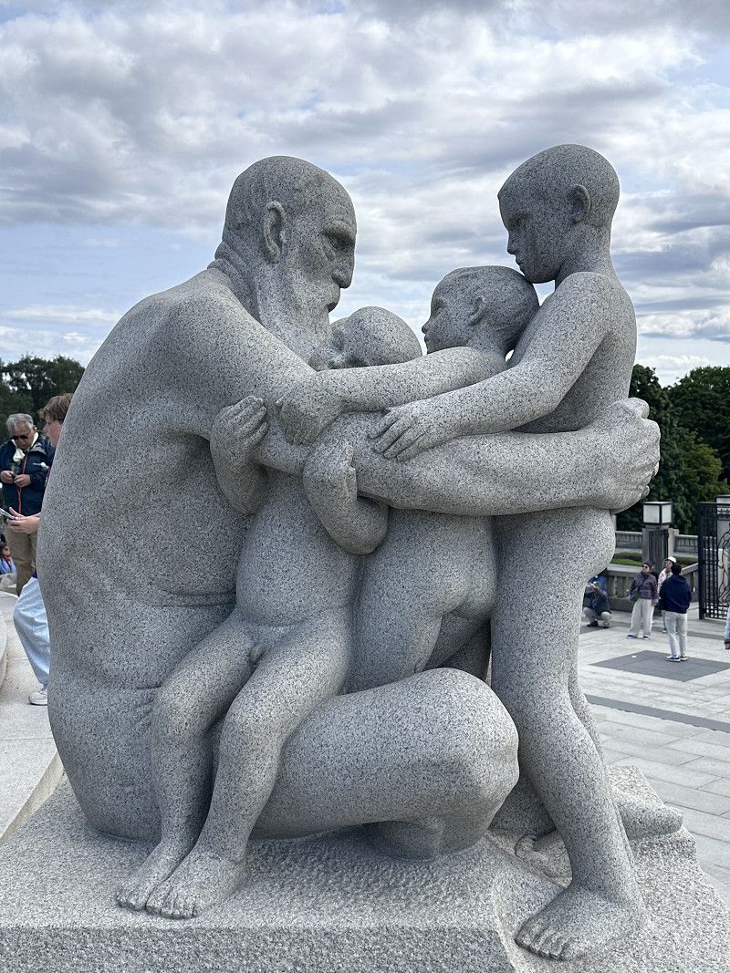
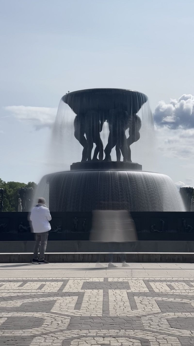
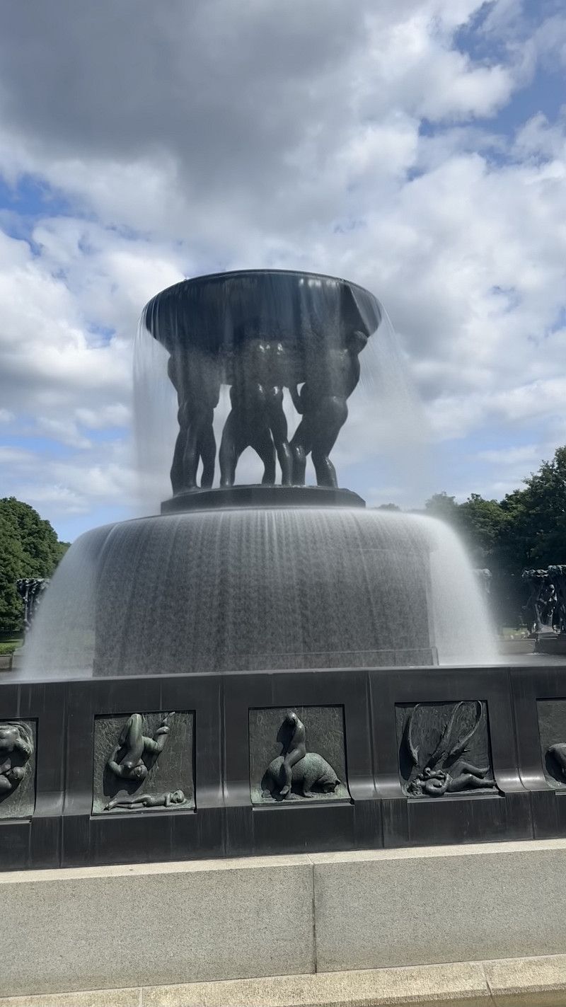
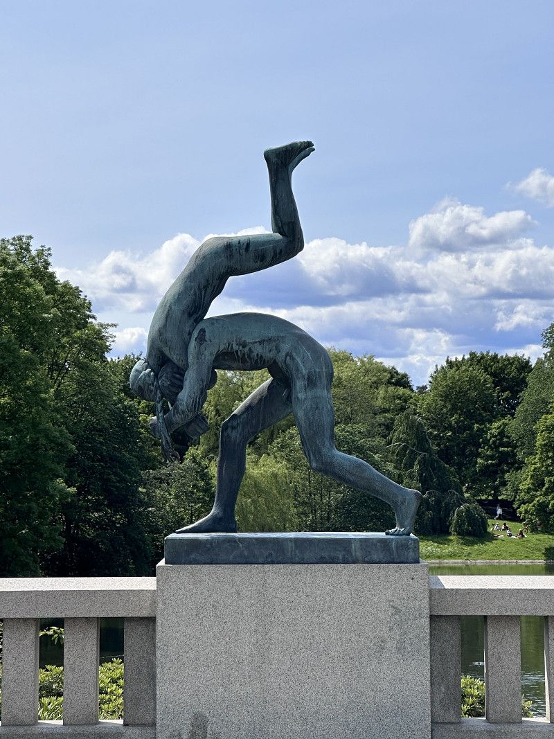
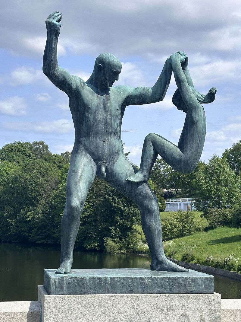
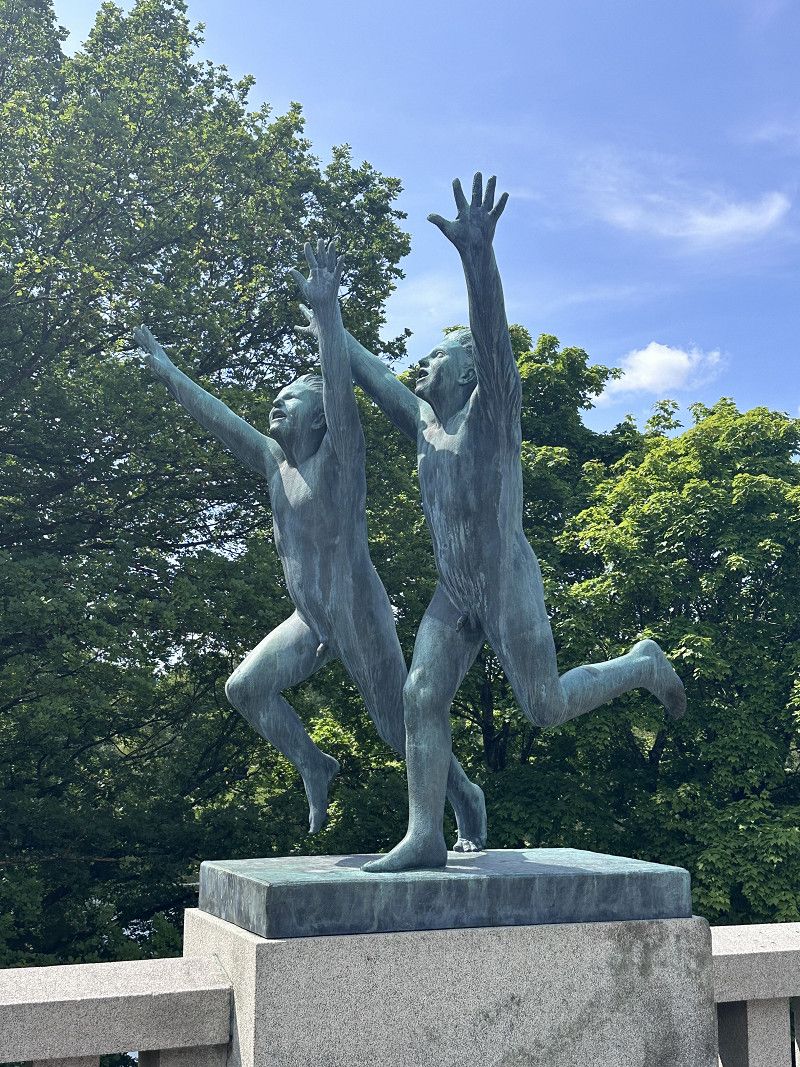
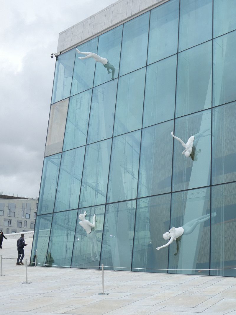
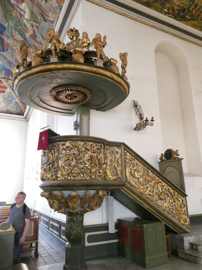
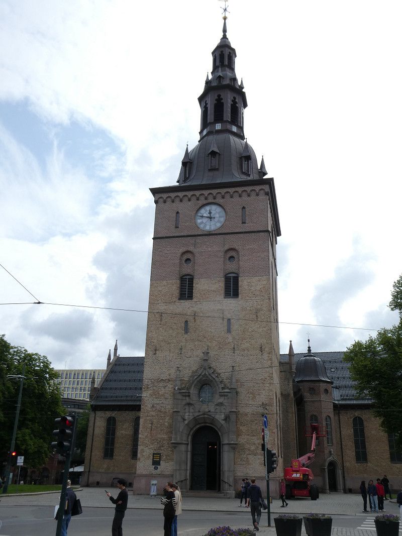
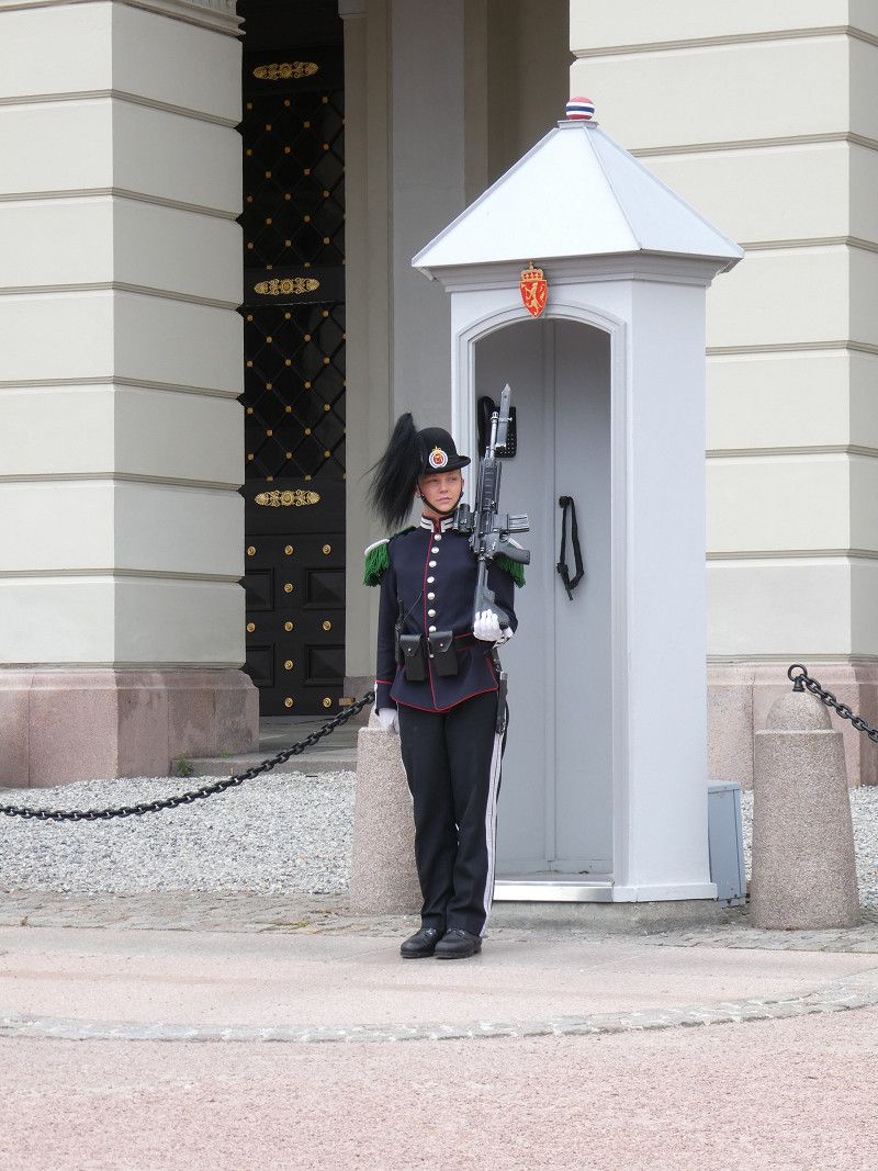
Stadtbummel Oslo
Today, we went on a sightseeing tour of Oslo. We started at the Opera, then went to the Cathedral and then to the castle to watch the changing of the guard.
Day Übernachten
Verdens Ende
Verdens Ende (End of the World) is a headland with an old lighthouse with a historic beacon. There we went for a short hike in the early rain and were rewarded with a wonderful sunset.
Helgerødveien, Vestfold, Norwegen
59° 3' 40.2" N 10° 24' 22.3" E
59.0611588 10.4061810
• Head northwest. Go for 78 m.
• Turn slightly left onto Helgerødveien (308). Go for 312 m.
• Turn slightly left onto Helgerødveien (308). Go for 2.1 km.
• Continue on Helgerødveien (308). Go for 3.0 km.
• Continue on Rødsgata (308). Go for 895 m.
• Turn left onto Vestveien (308). Go for 6.9 km.
• Continue on Kirkeveien (308). Go for 7.2 km.
• Pass 2 roundabouts and continue on Stoltenbergs gate (308). Go for 4.3 km.
• Continue on Stoltenbergs gate (325). Go for 998 m.
• Continue on Grev Wedels gate (3120). Go for 318 m.
• Continue on Farmannsveien (3120). Go for 402 m.
• Continue on Olav Trygvasons gate (3120). Go for 6 m.
• Continue on Farmannsveien (3120). Go for 581 m.
• Take the 1st exit from roundabout. Go for 252 m.
• Take the 2nd exit from roundabout onto Semslinna (300). Go for 2.0 km.
• Pass 3 roundabouts and continue on Ramnesveien (300). Go for 2.2 km.
• Take the 1st exit from roundabout onto E18 toward Kr. Sand/Larvik/Andebu/312. Go for 58.7 km.
• Take the 1st exit from roundabout. Go for 235 m.
• Take ramp. Go for 179 m.
• Take the 2nd exit from roundabout onto E18. Go for 4.3 km.
• Take ramp. Go for 395 m.
• Take the 3rd exit from roundabout onto Europaveien. Go for 6.7 km.
• Turn left onto Åby (3360) toward Valle. Go for 833 m.
• Continue on Valleveien (3360). Go for 8.2 km.
• Turn left onto Grunnsundveien. Go for 577 m.
• Continue on Grunnsundveien. Go for 298 m.
• Turn left onto Grunnsundveien. Go for 433 m.
• Turn left onto Håvøytangen. Go for 142 m.
• Turn left onto Grunnsundveien. Go for 233 m.
• Turn right onto Grunnsundveien. Go for 67 m.
• Arrive at Grunnsundveien. Your destination is on the left.
☍
112,7 km
(1 hrs. 44 min.)
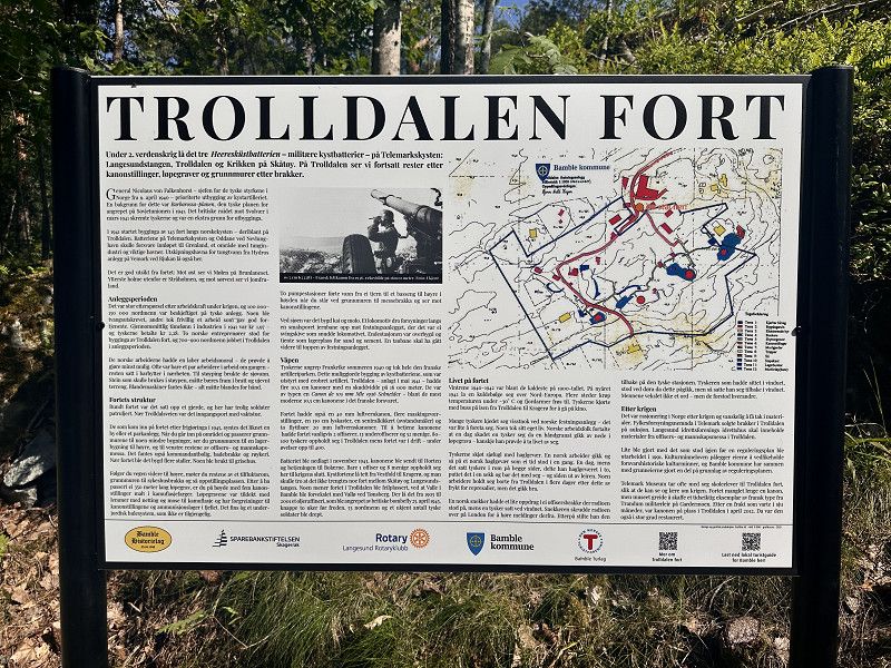
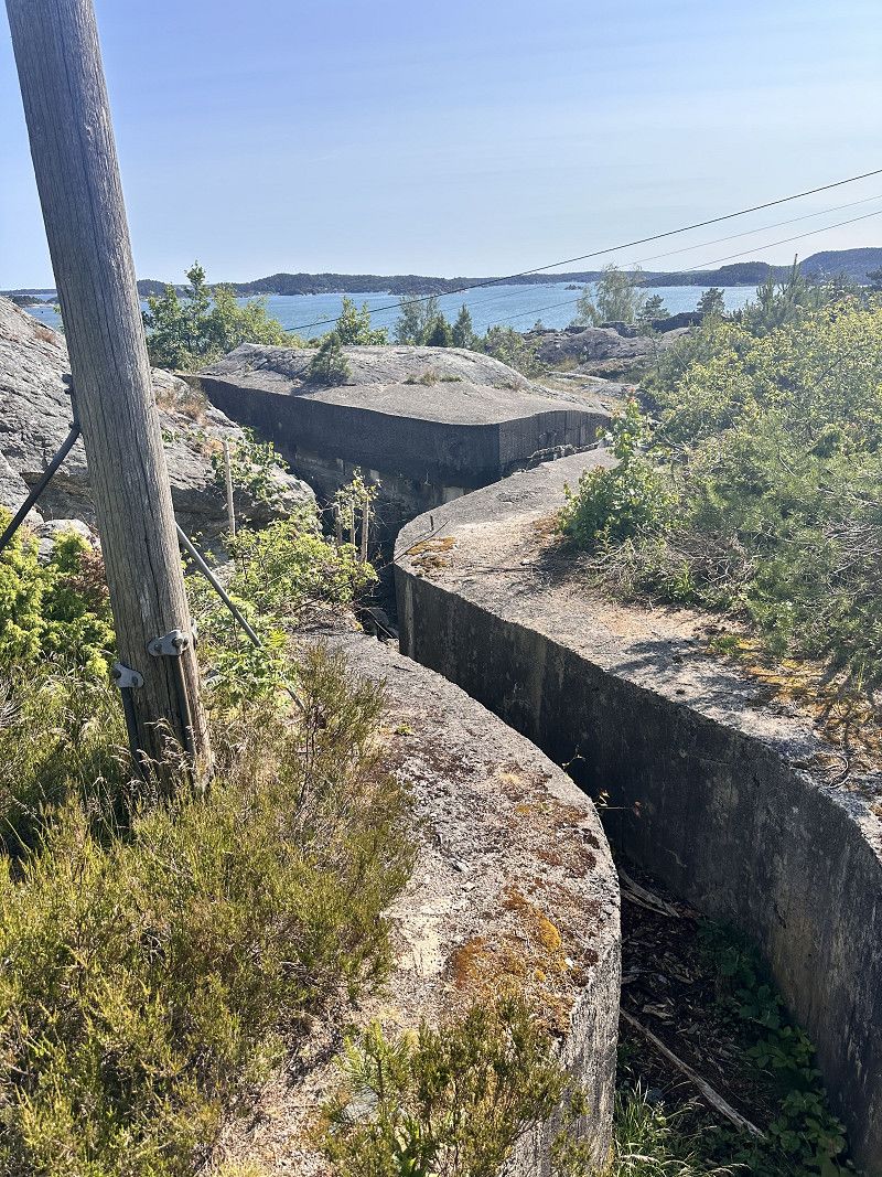
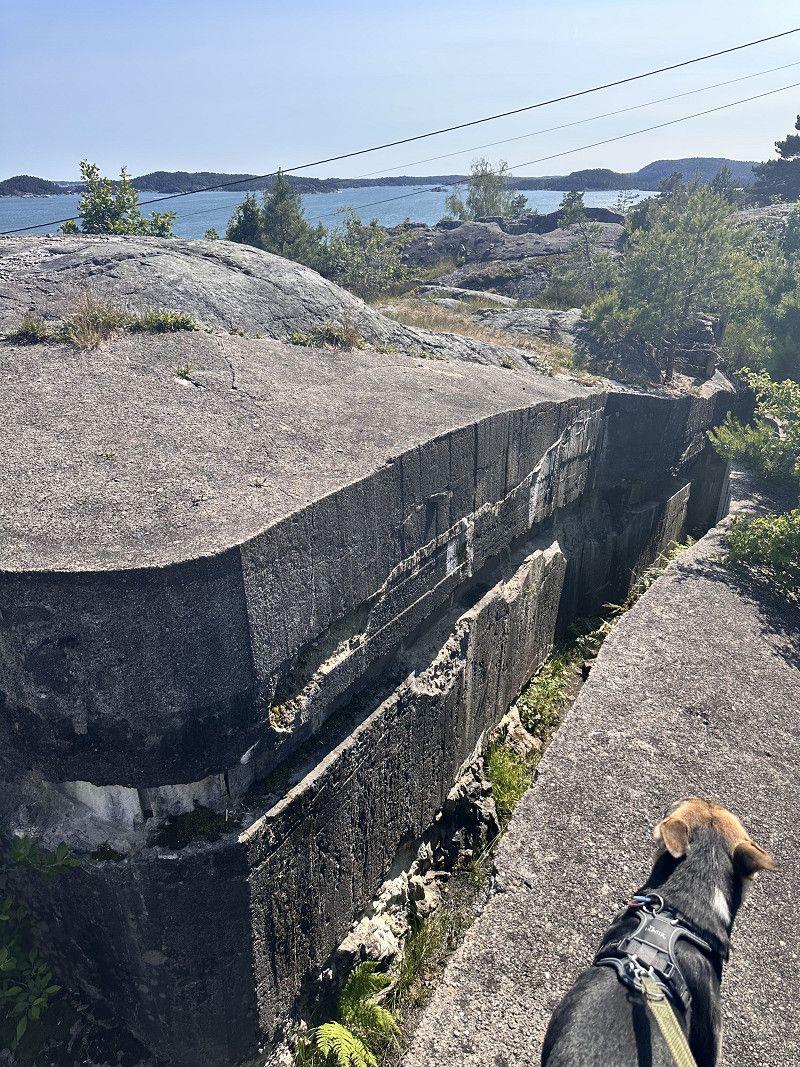
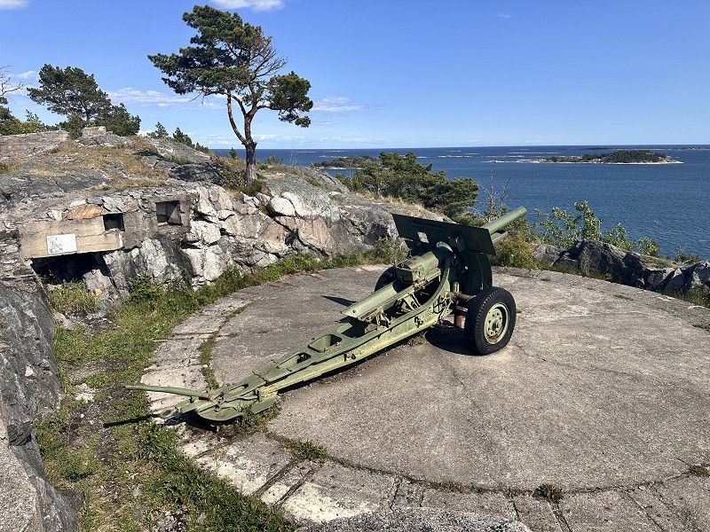
Trolldalen Fort
Short hike (2km) to a position of the German Wehrmacht during World War II.
Nature is slowly taking everything back.
Sjøterrassen
Nice parking spot at the harbor. Access is a bit narrow, but manageable even with large motorhomes, as there's hardly any oncoming traffic and plenty of space to pull over.
Hafsundveien, Bamble, Telemark, Norwegen
58° 56' 20.5" N 9° 36' 16.5" E
58.9390408 9.6045759
• Head toward Håvøytangen on Grunnsundveien. Go for 67 m.
• Turn left onto Grunnsundveien. Go for 233 m.
• Turn right onto Håvøytangen. Go for 142 m.
• Turn right onto Grunnsundveien. Go for 433 m.
• Turn right onto Grunnsundveien. Go for 298 m.
• Continue on Grunnsundveien. Go for 577 m.
• Turn left onto Valleveien (3360). Go for 8.6 km.
• Turn left onto Rønholtveien (3360). Go for 211 m.
• Turn right onto Europaveien. Go for 2.3 km.
• Turn right onto Europaveien (E18). Go for 45 m.
• Take the 2nd exit from roundabout. Go for 117 m.
• Take the 2nd exit from roundabout onto E18 (Europaveien). Go for 44.0 km.
• Take the 1st exit from roundabout onto E18. Go for 69.9 km.
• Take exit 84 toward 420/Lillesand Sentrum/Tingsaker. Go for 504 m.
• Take the 1st exit from roundabout toward Lillesand/Tingsaker. Go for 640 m.
• Take the 1st exit from roundabout onto Østre kystvei (420). Go for 2.9 km.
• Pass 2 roundabouts and continue on Vestre kystvei (420). Go for 1.9 km.
• Turn left onto 3664. Go for 433 m.
• Turn slightly left onto 3664. Go for 1.0 km.
• Continue on Justøyveien (3664). Go for 328 m.
• Continue on 3664. Go for 613 m.
• Continue on Justøyveien (3664). Go for 814 m.
• Continue on 3664. Go for 112 m.
• Continue on Justøyveien (3664). Go for 864 m.
• Continue on 3664. Go for 945 m.
• Continue on Berge (3664). Go for 62 m.
• Continue on 3664. Go for 29 m.
• Turn slightly right onto 3664. Go for 375 m.
• Continue on Nyberg (3664). Go for 6 m.
• Continue on 3664. Go for 734 m.
• Continue on Stuttiveien. Go for 89 m.
• Turn slightly right onto 3664. Go for 148 m.
• Continue on Brekkestø (3664). Go for 375 m.
• Arrive at Brekkestø. Your destination is on the left.
☍
139,8 km
(1 hrs. 54 min.)
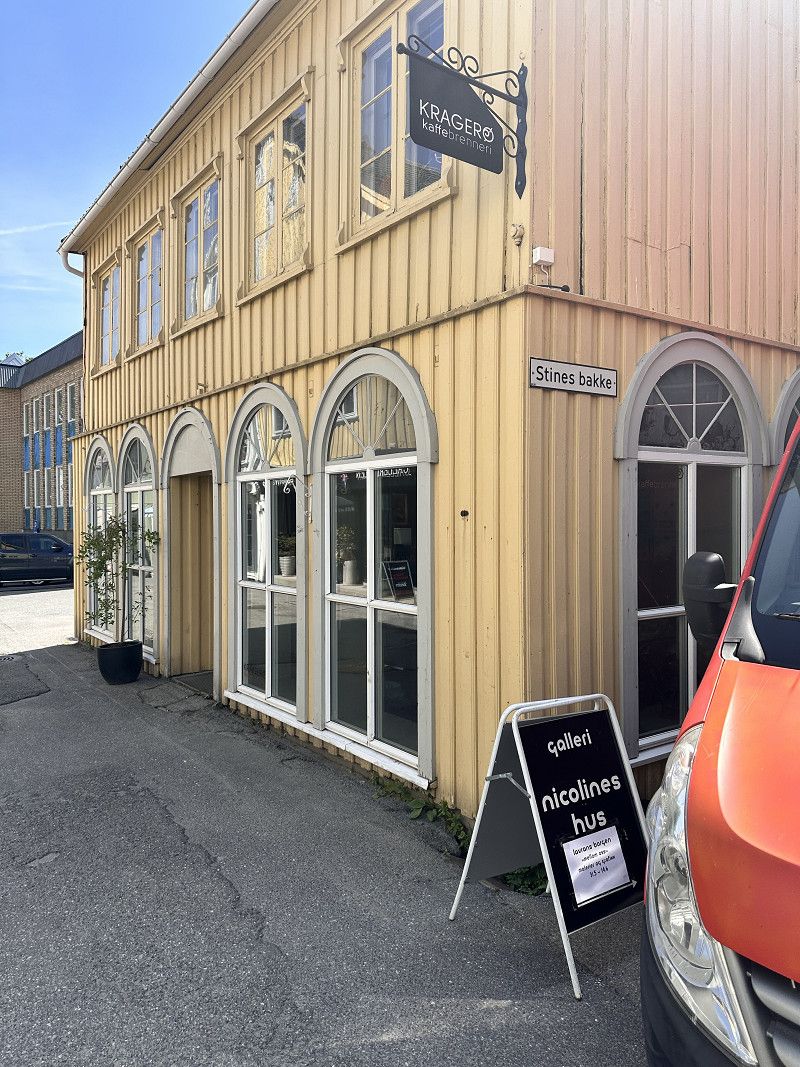
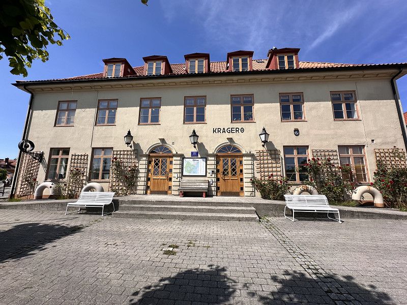
Day Übernachtung
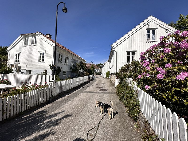
Stadtbummel
Short stroll through Kragero
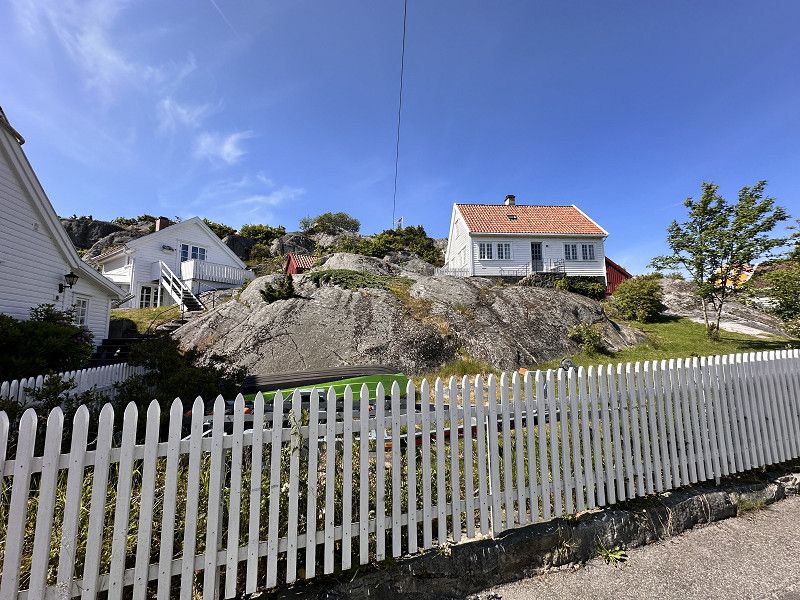
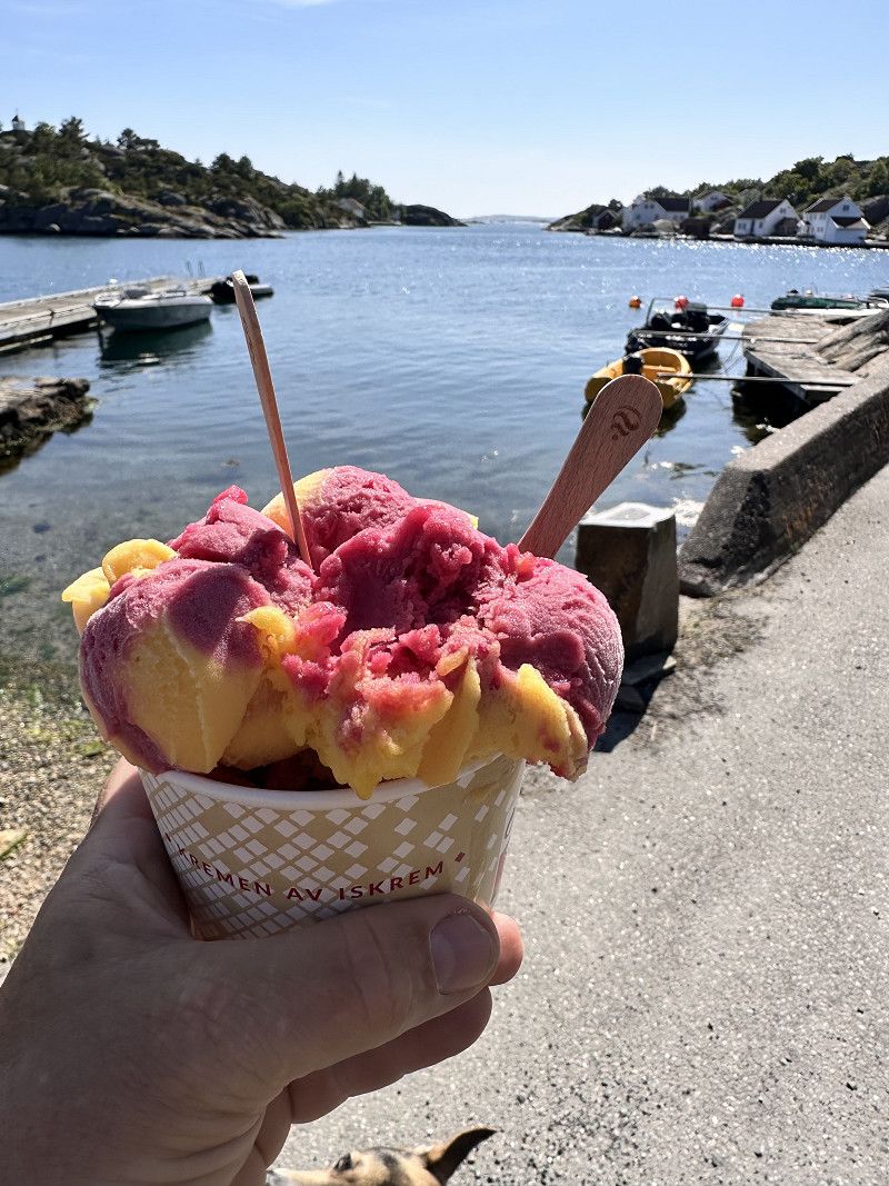
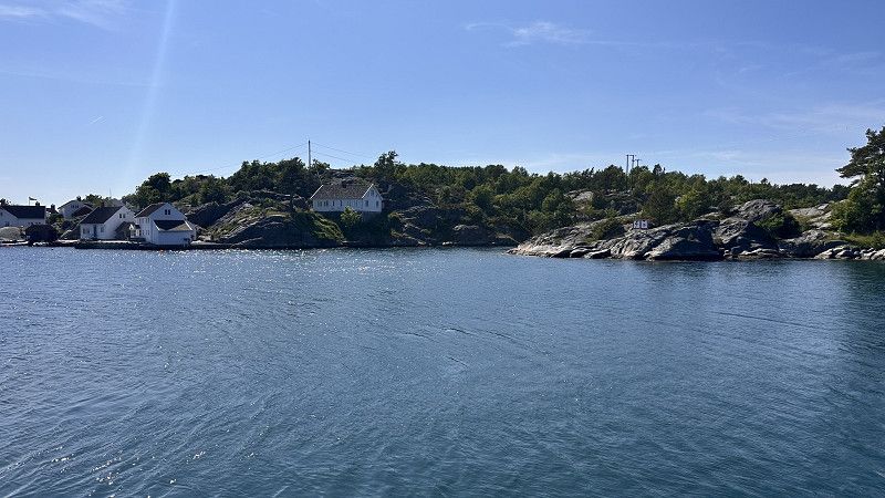
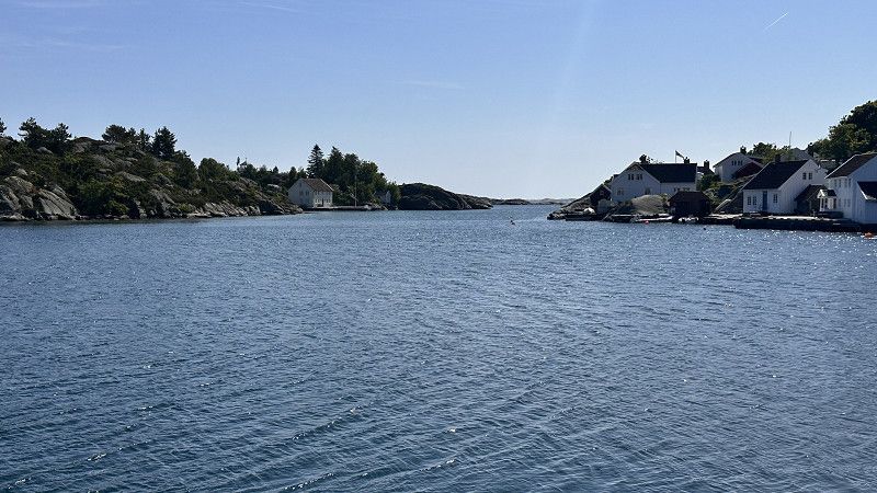
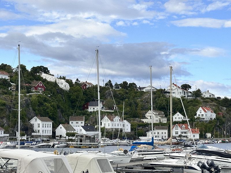
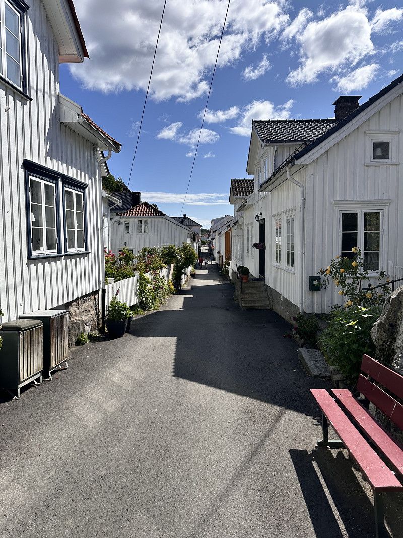
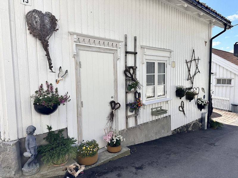
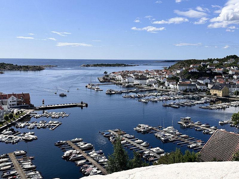
Brekkestø
A short stroll through a small village. Unfortunately, we were there before the season. During the season, they showcase traditional handicrafts. The ice cream at the harbor was delicious, though.
Norwegen
58° 11' 40.5" N 8° 20' 45" E
58.1945901 8.3458418
• Head toward Brekkestøheia on Brekkestø. Go for 375 m.
• Continue on 3664. Go for 148 m.
• Turn slightly left onto Stuttiveien. Go for 89 m.
• Continue toward 3664. Go for 319 m.
• Continue on 3664. Go for 415 m.
• Continue on Nyberg (3664). Go for 6 m.
• Continue on 3664. Go for 404 m.
• Continue on Berge (3664). Go for 62 m.
• Continue on 3664. Go for 300 m.
• Keep right onto 3664. Go for 645 m.
• Continue on Justøyveien (3664). Go for 864 m.
• Continue on 3664. Go for 112 m.
• Continue on Justøyveien (3664). Go for 814 m.
• Continue on 3664. Go for 613 m.
• Continue on Justøyveien (3664). Go for 328 m.
• Continue on 3664. Go for 1.4 km.
• Turn left onto Vestre kystvei (420). Go for 1.4 km.
• Pass 2 roundabouts. Go for 1.2 km.
• Take ramp onto E18. Go for 3.9 km.
• Take exit 85 toward Birkeland/Møglestu. Go for 206 m.
• Take the 1st exit from roundabout onto Birkelandsveien (402). Go for 246 m.
• Pass 2 roundabouts and continue on Birkelandsveien (402). Go for 12.8 km.
• Turn right onto 3750. Go for 1.7 km.
• Continue on 252. Go for 122 m.
• Continue on 3750. Go for 3.1 km.
• Continue on Oggeveien (3750). Go for 1.3 km.
• Turn left onto 3762. Go for 4.2 km.
• Continue on Honnemyrvegen (3762). Go for 353 m.
• Continue on 3762. Go for 2.4 km.
• Turn left onto Venneslavegen (405). Go for 1.9 km.
• Turn right onto Steinsfossvegen. Go for 891 m.
• Turn left onto Steinsfossvegen. Go for 330 m.
• Arrive at Steinsfossvegen. Your destination is on the left.
☍
43,0 km
( 48 min.)
Day
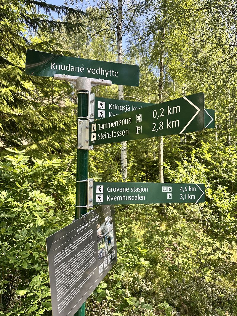
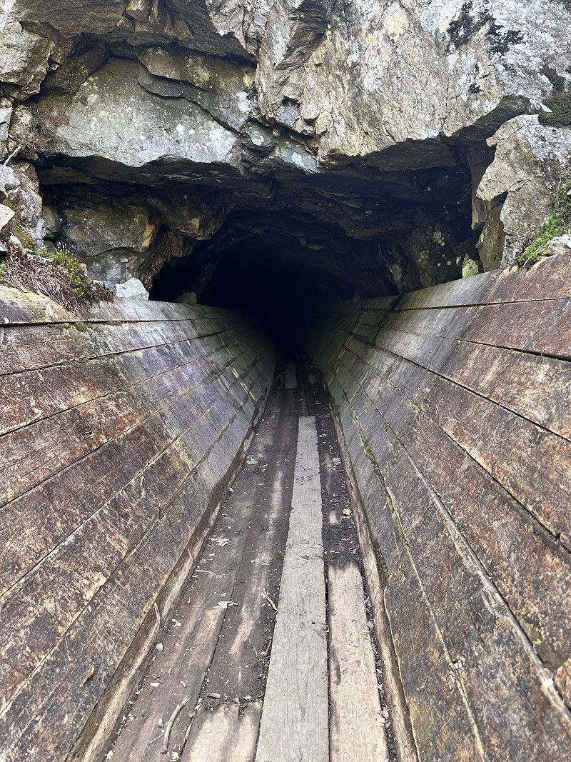
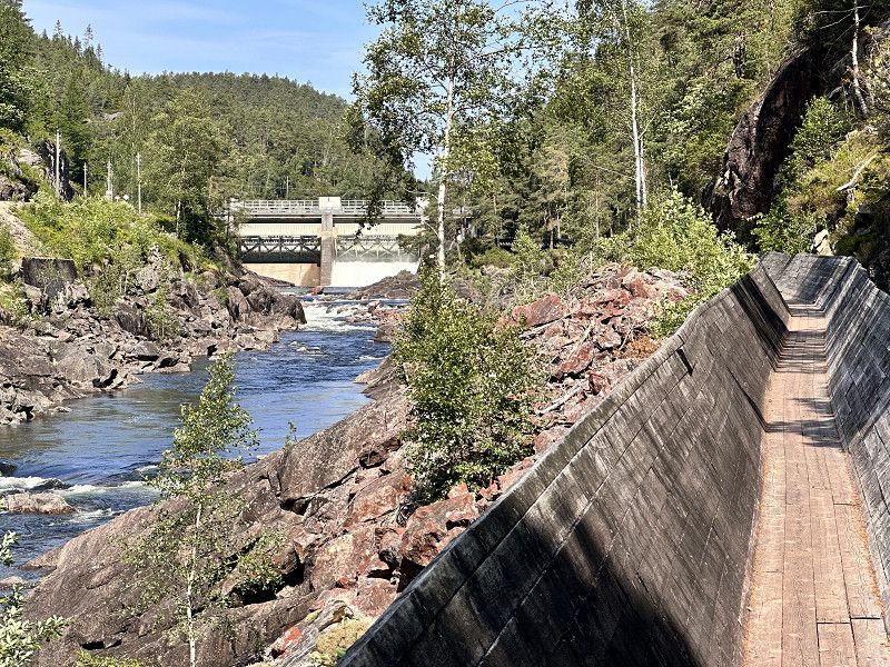
Parkplatz Steinfossen
Overnight stay at the parking lot in front of the Flößerrinne
Steinsfossvegen, Vennesla, Agder, Norwegen
58° 17' 54.8" N 7° 58' 12.5" E
58.2985477 7.9701456
• Head north on Steinsfossvegen. Go for 97 m.
• Arrive at Steinsfossvegen. Your destination is on the right.
☍
0,1 km
( )
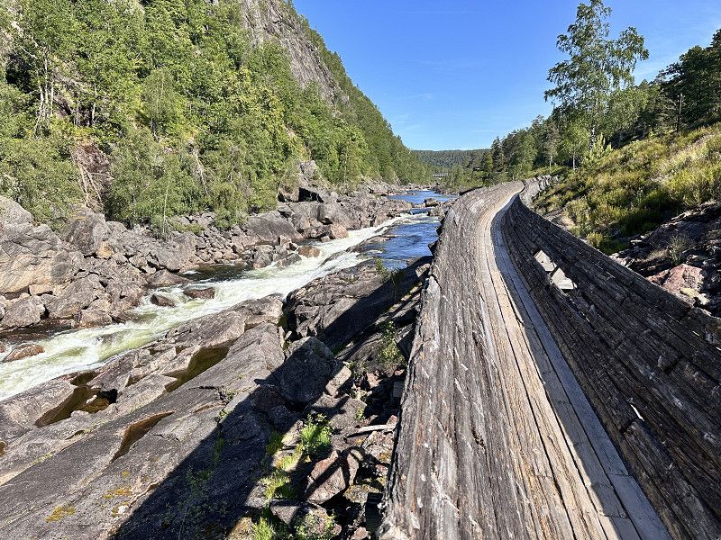
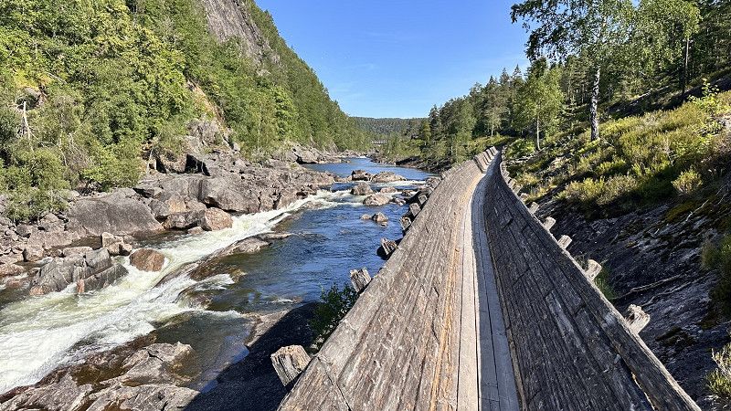
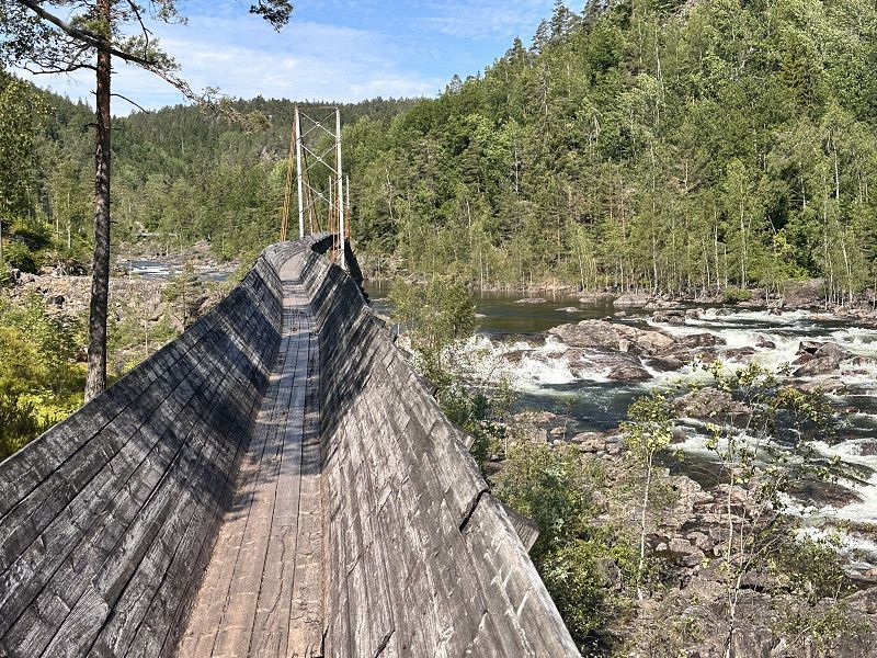
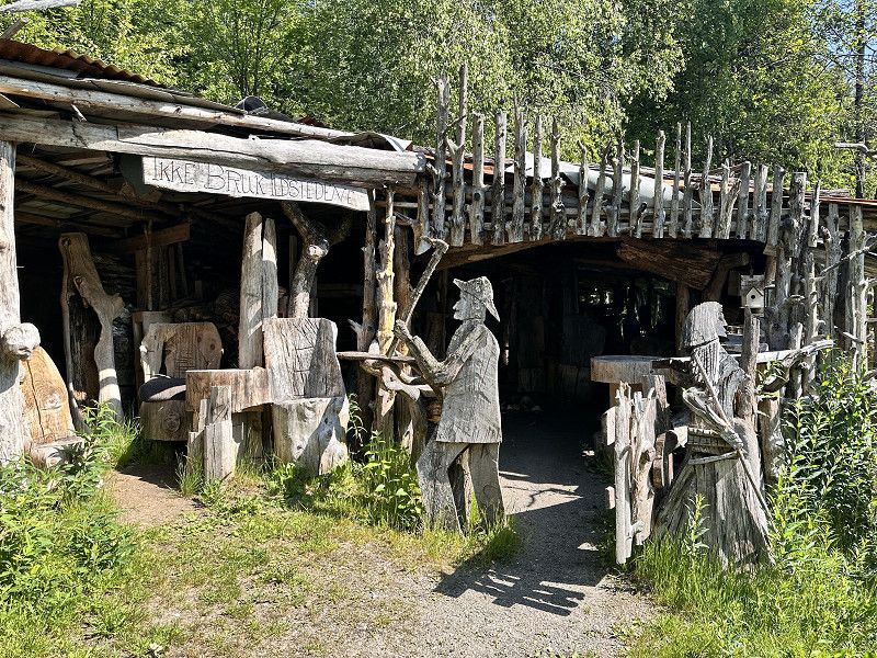
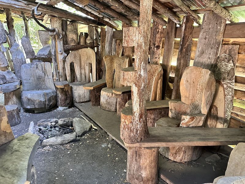
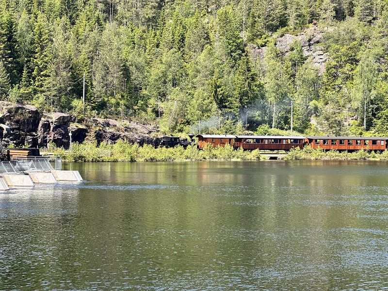
Wanderung durch eine alte Flößerrinne
Today's plan was to hike through an old rafting channel. A lovely tour through a valley with a small steam train and beautiful scenery. Halfway through, we briefly left the channel to check out Tom's huts.
Steinsfossvegen 34, Grovane, Agder, Norwegen
58° 17' 57.9" N 7° 58' 11.5" E
58.2994218 7.9698713
• Head north on Steinsfossvegen. Go for 233 m.
• Turn right onto Steinsfossvegen. Go for 891 m.
• Turn right onto Venneslavegen (405). Go for 3.6 km.
• Take the 3rd exit from roundabout onto Venneslavegen (405). Go for 452 m.
• Pass 2 roundabouts and continue on 405. Go for 7.1 km.
• Take the 2nd exit from roundabout onto Setesdalsveien (9). Go for 1.3 km.
• Turn right onto Kuliaveien (478). Go for 9.5 km.
• Take the 3rd exit from roundabout onto Songdalsvegen (461). Go for 2.4 km.
• Continue on 439. Go for 280 m.
• Take the 1st exit from roundabout onto 439 toward E39/Stavanger/Flekkefjord. Go for 3.0 km.
• Take the 1st exit from roundabout onto E39. Go for 18.8 km.
• Take the exit. Go for 749 m.
• Take the 2nd exit from roundabout onto E39. Go for 180 m.
• Pass 3 roundabouts and continue on Kristiansandsveien (E39). Go for 6.0 km.
• Turn left onto 477 toward Sentrum. Go for 359 m.
• Continue on Marnaveien (477). Go for 180 m.
• Take the 2nd exit from roundabout onto Marnaveien (477). Go for 180 m.
• Take the 3rd exit from roundabout onto Marnaveien (477). Go for 162 m.
• Take the 3rd exit from roundabout onto Store Elvegate (477). Go for 175 m.
• Continue on Bryggegata (477). Go for 198 m.
• Take the 2nd exit from roundabout onto Bryggegata (477). Go for 237 m.
• Continue on Nygata (477). Go for 258 m.
• Turn right onto Fridtjof Nansens vei (477). Go for 223 m.
• Turn left onto Bankeveien (3994). Go for 653 m.
• Turn sharp left onto Sjøsandveien. Go for 248 m.
• Turn left toward Makrellveien. Go for 53 m.
• Turn left onto Makrellveien. Go for 139 m.
• Arrive at Makrellveien. Your destination is on the right.
☍
57,6 km
( 57 min.)
Day
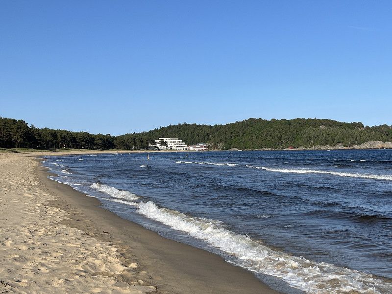
Mandal Topcamp Sjøsanden
Overnight at Sjøsanden Top Camping in Mandal. Beautiful, well-maintained site with adjacent sandy beach
Sjøsandveien 537, 4514, Mandal, Norwegen
58° 1' 11.4" N 7° 26' 23" E
58.0198445 7.4397360
• Head toward Hummerveien on Makrellveien. Go for 139 m.
• Turn right toward Sjøsandveien. Go for 53 m.
• Turn right onto Sjøsandveien. Go for 248 m.
• Turn right onto Bankeveien (3994). Go for 653 m.
• Turn left onto Fridtjof Nansens vei (477). Go for 672 m.
• Continue on Gustav Vigelands vei (477). Go for 647 m.
• Turn left onto Halseveien (474). Go for 440 m.
• Turn right onto Mandalsveien (E39) toward Flekkefjord. Go for 10.2 km.
• Take the 2nd exit from roundabout onto Mandalsveien (E39) toward Stavanger. Go for 3.3 km.
• Take the 1st exit from roundabout onto Mandalsveien (E39) toward Stavanger. Go for 3.2 km.
• Take the 1st exit from roundabout onto Mandalsveien (E39) toward Stavanger. Go for 8.7 km.
• Take the 1st exit from roundabout. Go for 912 m.
• Take the 1st exit from roundabout onto E39. Go for 112 km.
• Turn right onto Nesjane. Go for 91 m.
• Turn right toward Nesjane. Go for 23 m.
• Turn left onto Nesjane. Go for 82 m.
• Arrive at Nesjane.
☍
141,1 km
(1 hrs. 56 min.)
Vikeså
Free parking by the lake. Adjacent park and gas station. Within walking distance to shopping.
Nesjane, Vikeså, Rogaland, Norwegen
58° 37' 51.1" N 6° 4' 54" E
58.6308514 6.0816651
• Head southeast on Nesjane. Go for 73 m.
• Turn right. Go for 108 m.
• Turn left toward Nesjane. Go for 23 m.
• Turn left onto Nesjane. Go for 91 m.
• Turn right onto Bjerkreimsvegen (E39). Go for 23.0 km.
• Pass 3 roundabouts and continue on Sandnesveien (E39). Go for 25.9 km.
• Take the exit. Go for 237 m.
• Pass 3 roundabouts and continue on Motorveien. Go for 926 m.
• Take the 1st exit from roundabout onto Madlaveien (441) toward Sentrum/Ferje/13/Ferge Gb Dk/Turistinformasjon. Go for 433 m.
• Take the 2nd exit from roundabout onto Løkkeveien (4570). Go for 896 m.
• Take the 2nd exit from roundabout onto Løkkeveien (4584). Go for 219 m.
• Take the 2nd exit from roundabout onto Uelandsgate (426). Go for 65 m.
• Take the 1st exit from roundabout onto Uelandsgate (426). Go for 63 m.
• Continue on Uelands gate (426). Go for 51 m.
• Continue on Nedre Strandgate (426). Go for 186 m.
• Turn left. Go for 42 m.
• Arrive at your destination.
☍
52,4 km
( 45 min.)
Day
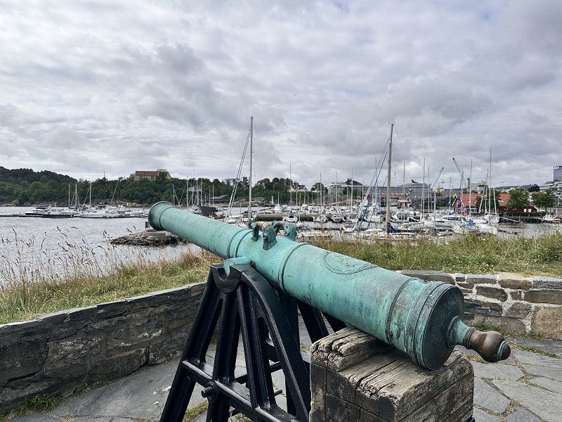
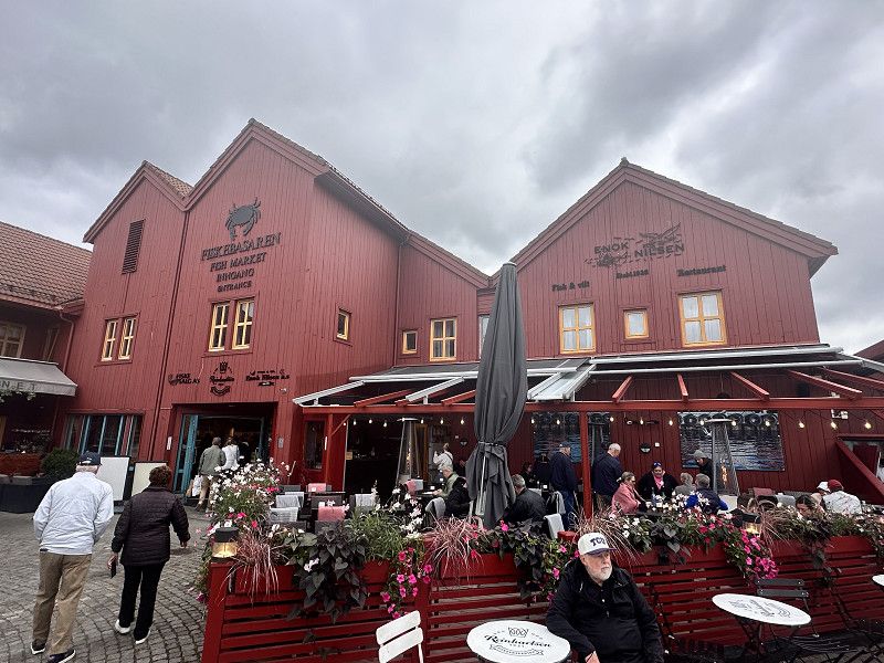
Stavanger Hafenparkplatz
Parking right by the harbor. Ideal for exploring the city
Blå promenade, Stavanger, Rogaland, Norwegen
58° 58' 23.6" N 5° 43' 34.3" E
58.9732321 5.7261952
• Head toward Nedre Strandgate. Go for 73 m.
• Turn right onto Nedre Strandgate (426). Go for 285 m.
• Continue on Uelands gate (426). Go for 51 m.
• Continue on Uelandsgate (426). Go for 54 m.
• Take the 2nd exit from roundabout onto Uelandsgate (426). Go for 63 m.
• Take the 2nd exit from roundabout onto Løkkeveien (4584). Go for 226 m.
• Take the 2nd exit from roundabout onto Løkkeveien (4570). Go for 923 m.
• Take the 1st exit from roundabout onto Madlaveien (441). Go for 425 m.
• Take the 2nd exit from roundabout onto Motorveien toward 510/Kristiansand/Sandnes/Lufthavn Sola. Go for 197 m.
• Pass 3 roundabouts. Go for 809 m.
• Take ramp onto E39 (Motorveien). Go for 25.0 km.
• Pass 3 roundabouts and continue on Sandnesveien (E39). Go for 120 km.
• Turn right toward Dragedalen/4091. Go for 36 m.
• Turn left onto Dragedalen (4091). Go for 9.1 km.
• Continue on 4102. Go for 1.4 km.
• Continue on Utsiktsveien (4102). Go for 795 m.
• Turn right onto Utsiktsveien (464). Go for 933 m.
• Continue on Grøndokktunet. Go for 133 m.
• Turn left onto Alleen (4084). Go for 236 m.
• Turn right onto Agnefestveien (4078). Go for 1.6 km.
• Turn left onto Rosnesveien (4078). Go for 1.2 km.
• Turn left onto Jåsundveien (4078). Go for 7.2 km.
• Continue on 4078. Go for 4 m.
• Continue on Jåsundveien (4078). Go for 2.3 km.
• Continue on Lindalsveien (4078). Go for 4.2 km.
• Turn right onto Spangereidveien (460). Go for 243 m.
• Take the 2nd exit from roundabout onto Lindesnesveien (460). Go for 269 m.
• Take the 2nd exit from roundabout onto Lindesnesveien (460). Go for 2.7 km.
• Turn slightly left onto Lindesnesveien (460). Go for 5.2 km.
• Turn left onto 460. Go for 22 m.
• Continue on Lindesnesveien (460). Go for 2.0 km.
• Continue on 460. Go for 4 m.
• Continue on Lindesnesveien (460). Go for 1.5 km.
• Arrive at Lindesnesveien. Your destination is on the left.
☍
189,4 km
(2 hrs. 52 min.)
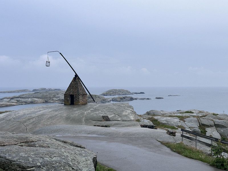
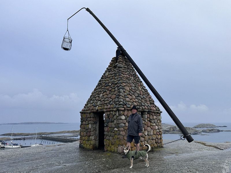
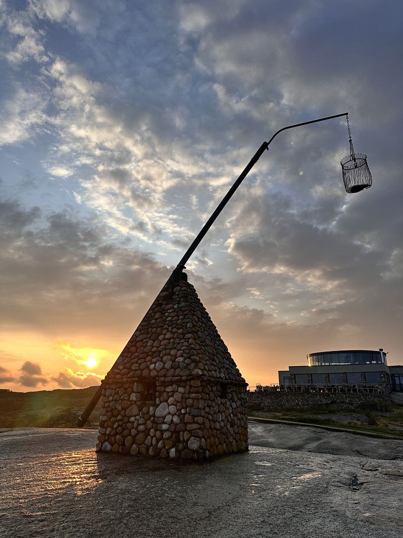
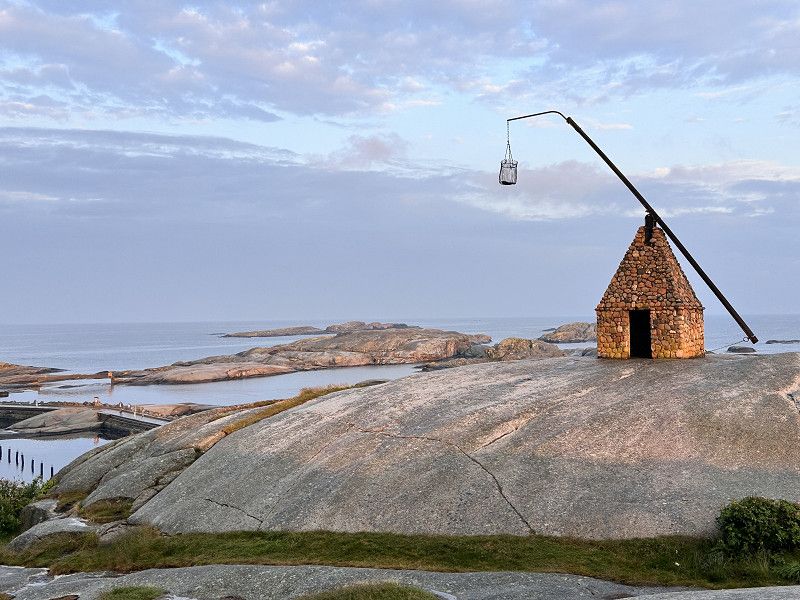
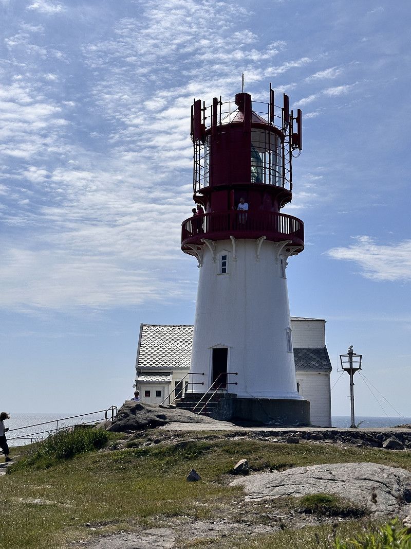
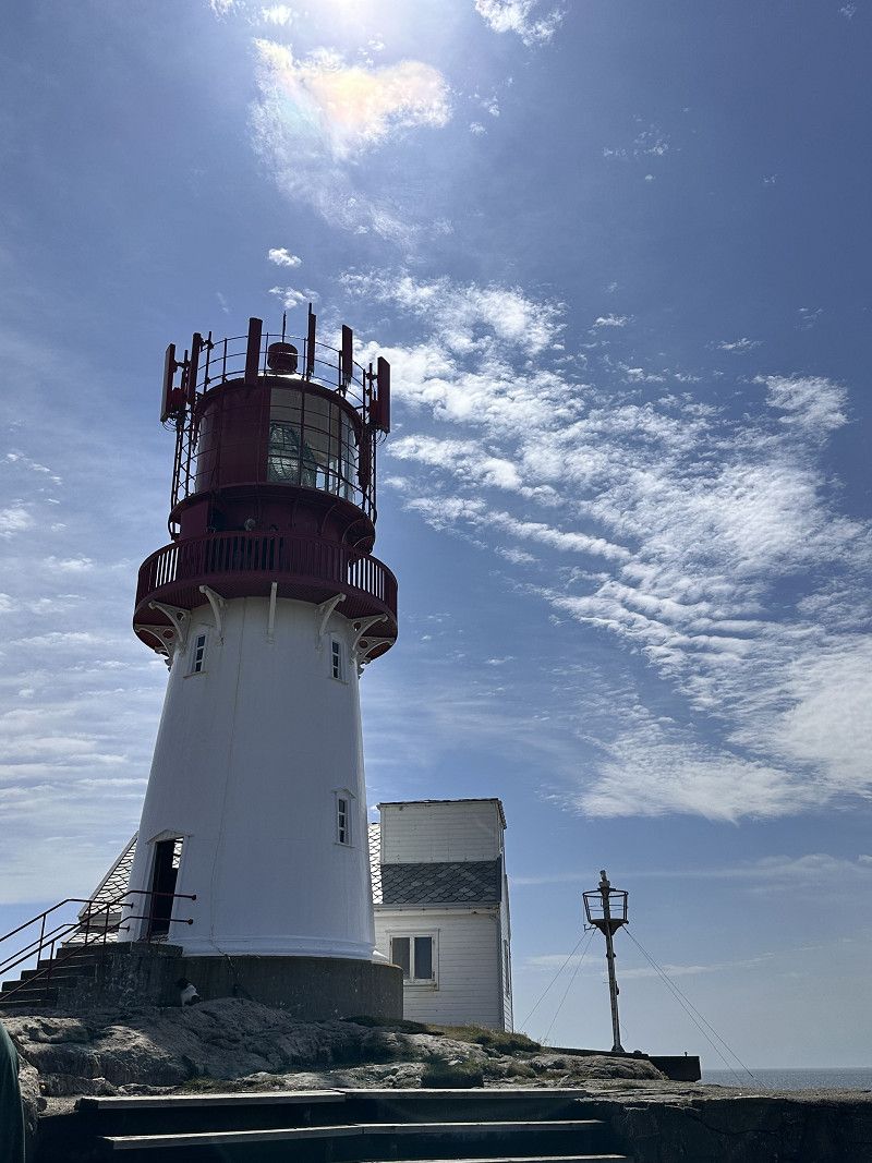
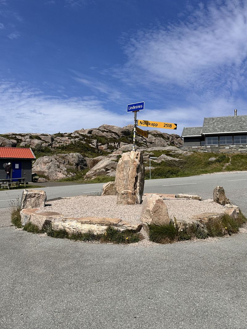
Lindesnes Fyr
The southernmost point of Norway with the Lindesnes Lighthouse (South Cape of Norway). It is the most photographed lighthouse in Norway.
Old bunker complex from World War II
Fyrstien, Agder, Norwegen
57° 58' 57" N 7° 2' 48" E
57.9824978 7.0466733
• Head southeast on Lindesnesveien. Go for 1.5 km.
• Continue on 460. Go for 4 m.
• Continue on Lindesnesveien (460). Go for 2.0 km.
• Continue on 460. Go for 22 m.
• Continue on Lindesnesveien (460). Go for 2.0 km.
• Turn slightly right onto Lindesnesveien (460). Go for 5.9 km.
• Take the 2nd exit from roundabout onto Lindesnesveien (460). Go for 259 m.
• Take the 2nd exit from roundabout onto Spangereidveien (460). Go for 277 m.
• Turn left onto Lindalsveien (4078). Go for 4.2 km.
• Continue on Jåsundveien (4078). Go for 2.3 km.
• Continue on 4078. Go for 4 m.
• Continue on Jåsundveien (4078). Go for 7.2 km.
• Turn right onto Rosnesveien (4078). Go for 1.2 km.
• Continue on Agnefestveien (4078). Go for 1.6 km.
• Turn left onto Alleen (4084). Go for 236 m.
• Turn right onto Grøndokktunet. Go for 133 m.
• Continue on Grøndokkmoen (464). Go for 933 m.
• Turn left onto Utsiktsveien (4102). Go for 795 m.
• Continue on 4102. Go for 1.4 km.
• Continue on Dragedalen (4091). Go for 9.1 km.
• Turn right toward E39. Go for 36 m.
• Turn left onto E39. Go for 21.1 km.
• Take ramp toward 44/Sokndal/Flekkefjord/Sentrum/Sykehus. Go for 277 m.
• Continue toward Austadveien/44. Go for 28 m.
• Take the 2nd exit from roundabout onto Austadveien (44). Go for 31.0 km.
• Turn left. Go for 49 m.
• Arrive at your destination on the left.
☍
93,5 km
(1 hrs. 51 min.)
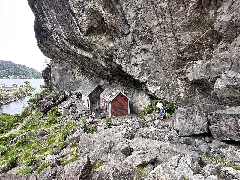
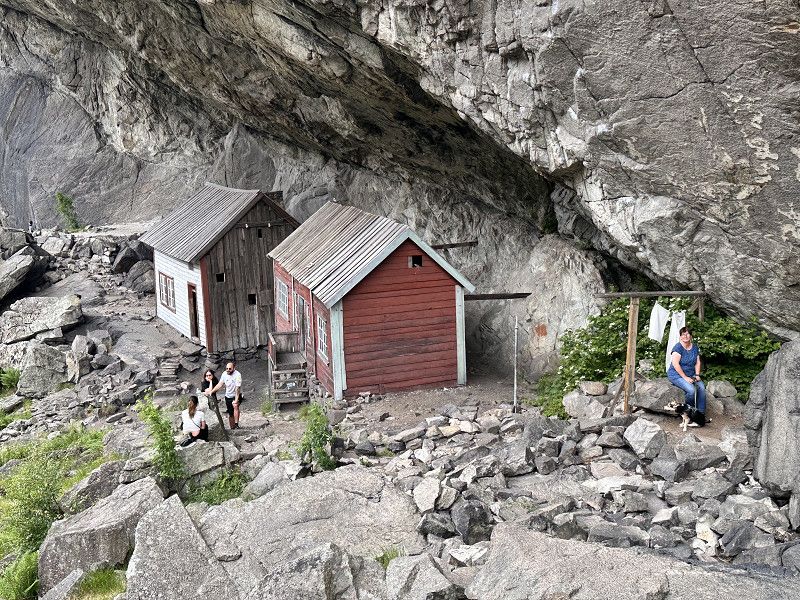
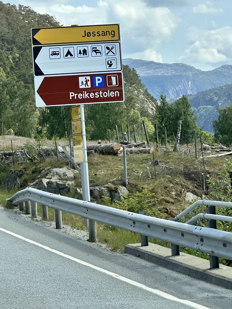
Jøssingfjord Helleren
The houses of Helleren built under a rock
Åna-Sira-veien, Jøssingfjord, Rogaland, Norwegen
58° 19' 44.7" N 6° 21' 19.7" E
58.3290905 6.3554648
• Head northeast. Go for 49 m.
• Turn left onto 44. Go for 6.7 km.
• Take the 2nd exit from roundabout onto Sokndalsveien (44). Go for 26.9 km.
• Take the 3rd exit from roundabout onto Bøckmans gate (44). Go for 373 m.
• Pass 4 roundabouts and continue on Jernbaneveien (44). Go for 979 m.
• Take the 3rd exit from roundabout onto Eigerøyveien (44). Go for 66 m.
• Take the 1st exit from roundabout onto Eigerøyveien (44). Go for 76 m.
• Take the 1st exit from roundabout onto Eigerøyveien (44). Go for 2.4 km.
• Turn right onto Bjerkreimsveien (4296). Go for 4.9 km.
• Continue on Tengesdalsvegen (4296). Go for 4.9 km.
• Continue on Apeland (4296). Go for 651 m.
• Continue on Tengesdalsvegen (4296). Go for 1.8 km.
• Turn left onto Bjerkreimsvegen (E39). Go for 29.9 km.
• Pass 3 roundabouts and continue on Sandnesveien (E39). Go for 27.0 km.
• Keep right onto Hundvågtunnelen (13). Go for 5.7 km.
• Take the 1st exit from roundabout onto Ryfylketunnelen (13). Go for 14.9 km.
• Take the 1st exit from roundabout onto Ryfylkevegen (13). Go for 115 m.
• Pass 3 roundabouts and continue on Ryfylkevegen (523). Go for 10.9 km.
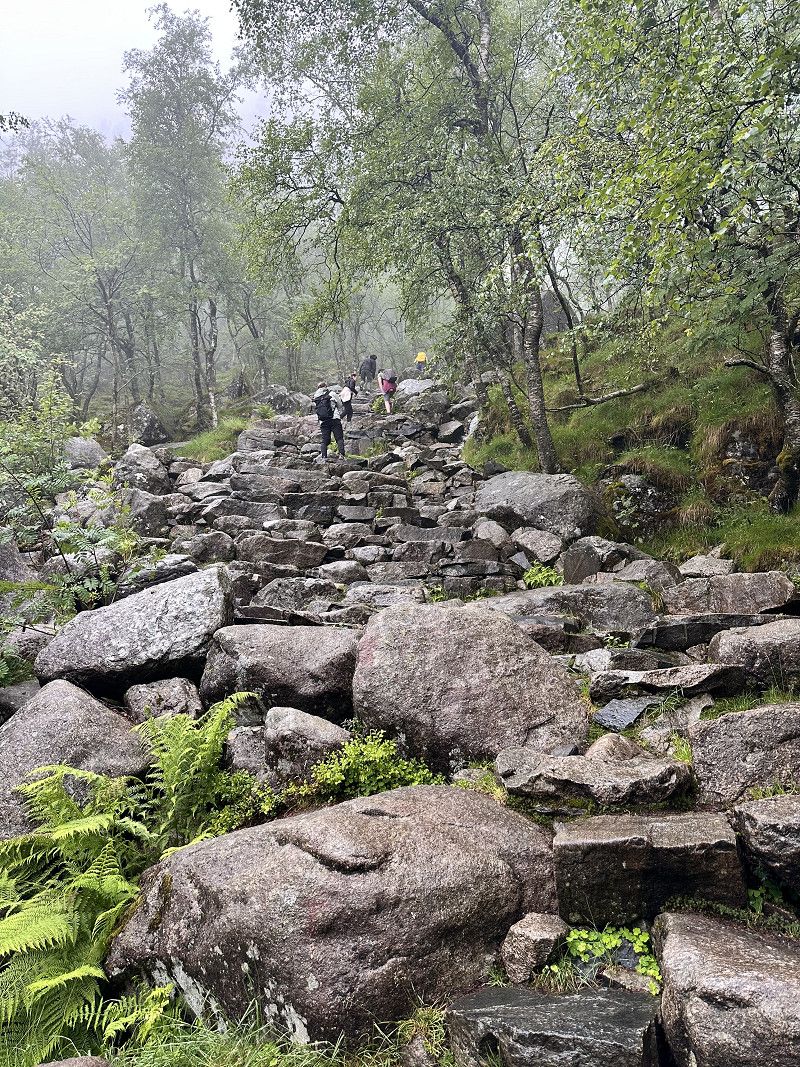
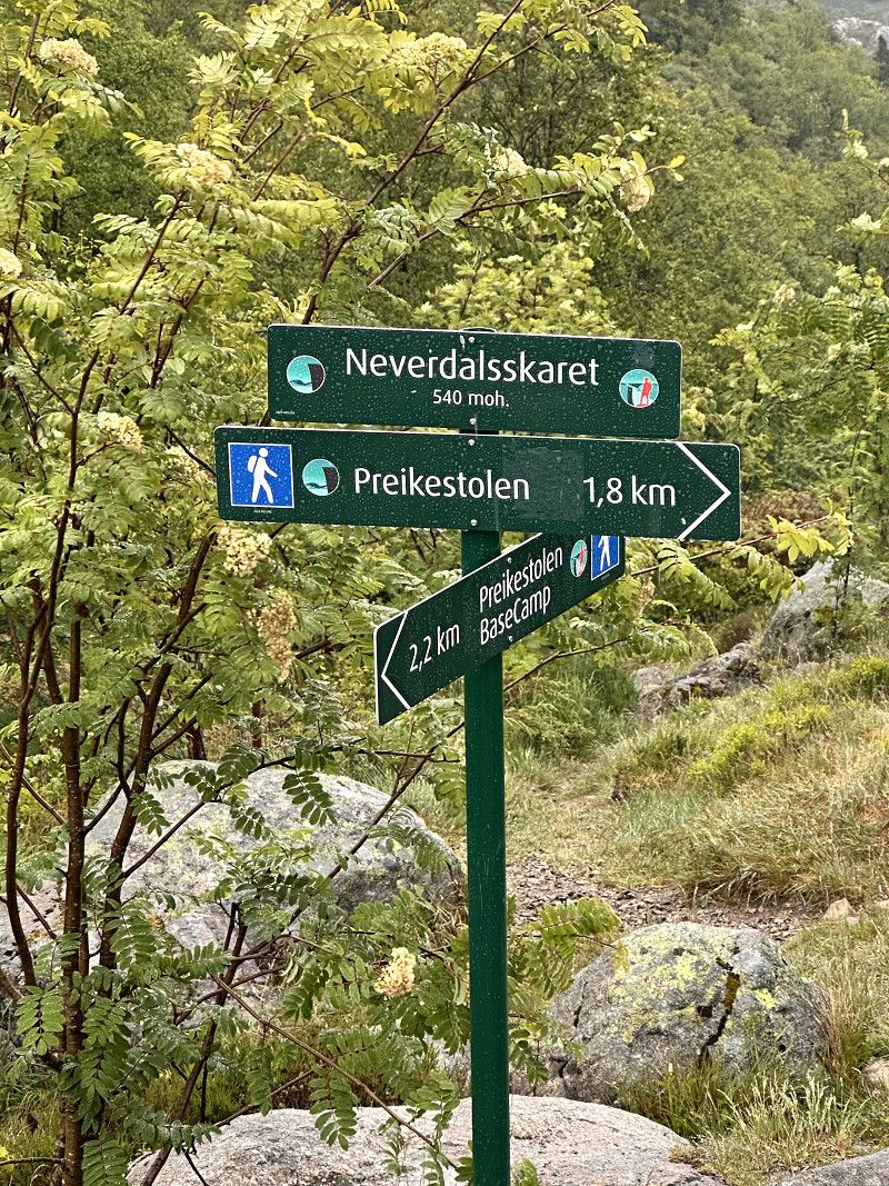
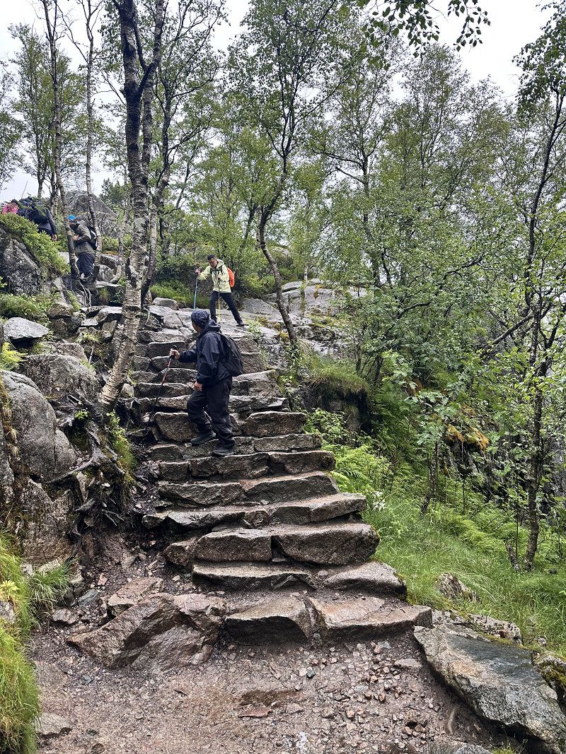
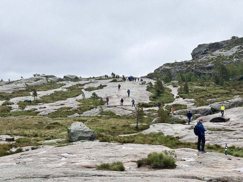
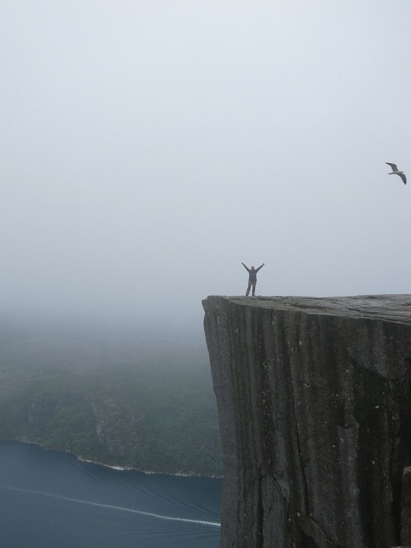
• Turn left onto Preikestolvegen (4642). Go for 934 m.
• Turn right onto Preikestolvegen. Go for 19 m.
• Turn left onto Preikestolvegen. Go for 10 m.
• Arrive at Preikestolvegen. Your destination is on the right.
☍
139,2 km
(2 hrs. 5 min.)
Day
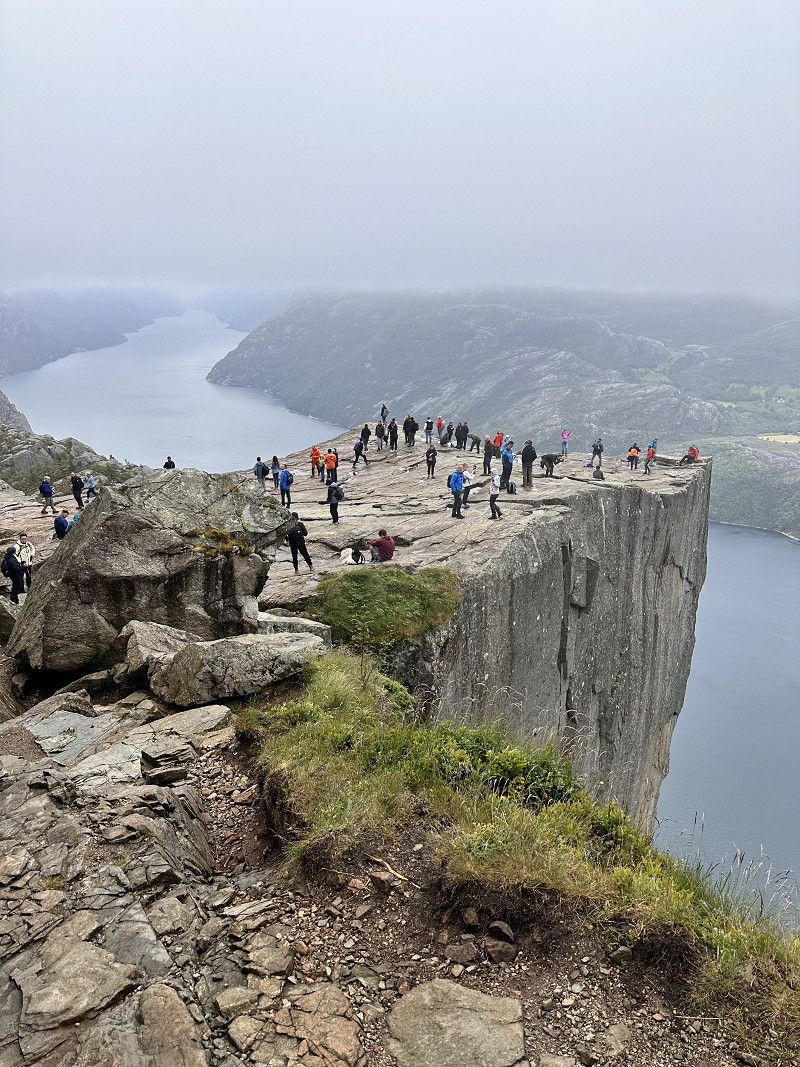
Camping Preikestolen
Overnight stay before the hike to Preikestolen
Preikestolvegen 97, 4100, Jorpeland, Norwegen
58° 59' 57" N 6° 5' 32" E
58.9991700 6.0922200
• Head west on Preikestolvegen. Go for 10 m.
• Turn right onto Preikestolvegen. Go for 19 m.
• Turn right onto Preikestolvegen (4642). Go for 4.2 km.
• Turn right. Go for 19 m.
• Turn left. Go for 23 m.
• Turn slightly right. Go for 34 m.
• Arrive at your destination on the right.
☍
4,3 km
( 5 min.)
Preikestolvegen, Rogaland, Norwegen
58° 59' 29.9" N 6° 8' 14.3" E
58.9916389 6.1373056
• Head west. Go for 37 m.
• Turn left. Go for 19 m.
• Turn left toward Preikestolvegen. Go for 78 m.
• Turn right onto Preikestolvegen. Go for 19 m.
• Turn slightly left onto Preikestolvegen (4642). Go for 5.1 km.
• Turn right onto Ryfylkevegen (523). Go for 3.7 km.
• Pass 3 roundabouts and continue on Ryfylkevegen (13). Go for 7.3 km.
• Take the 2nd exit from roundabout onto 13. Go for 15.0 km.
• Take the 2nd exit from roundabout onto Hundvågtunnelen (13). Go for 5.8 km.
• Take ramp. Go for 543 m.
• Take the 1st exit from roundabout onto Motorveien toward 441/Sentrum. Go for 252 m.
• Take the 2nd exit from roundabout onto E39 (Eiganestunnelen). Go for 4.1 km.
• Pass 2 roundabouts and continue on Mekjarvikveien (E39). Go for 12.8 km.
• Turn right onto Mosterøyveien (4612) toward Askje/Mosterøy. Go for 1.4 km.
• Take the 2nd exit from roundabout onto Mosterøyveien (4612). Go for 2.2 km.
• Continue on Mosterøyveien (4612). Go for 4.4 km.
• Arrive at Mosterøyveien. Your destination is on the right.
☍
62,7 km
(1 hrs. 5 min.)
Day
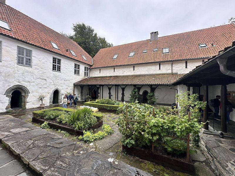
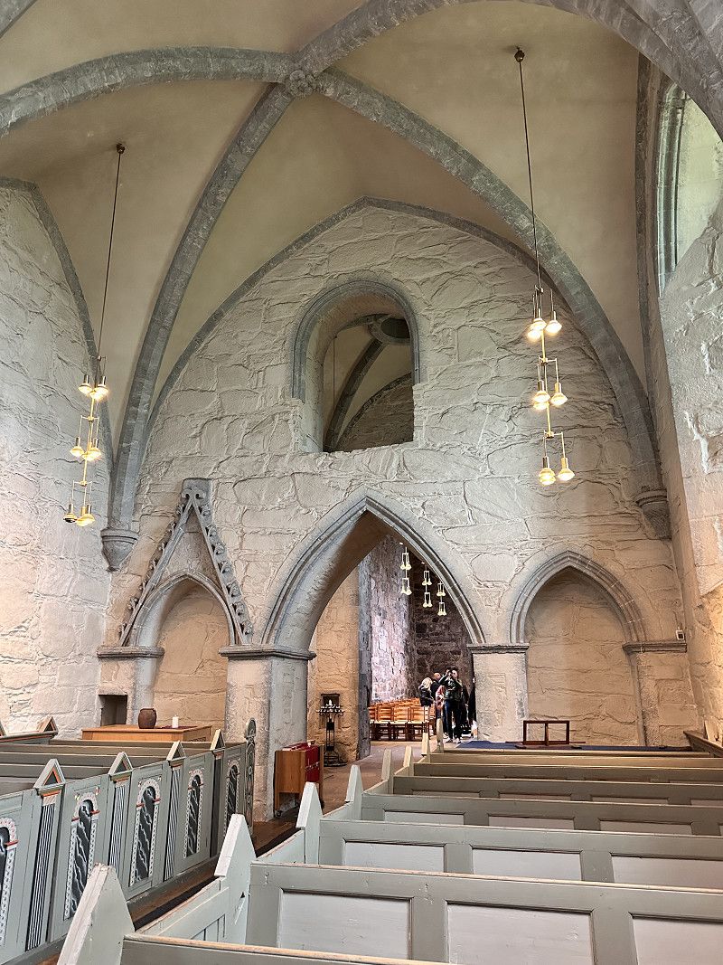
Insel Mosteroy Kloster Utstein
Medieval Augustinian monastery from the 13th century.
Mosterøyveien, Stavanger, Rogaland, Norwegen
59° 6' 12" N 5° 35' 26.4" E
59.1033246 5.5906651
• Head toward Fjøløyveien on Mosterøyveien. Go for 4.4 km.
• Continue on Mosterøyveien (4612). Go for 2.2 km.
• Take the 1st exit from roundabout onto Mosterøyveien (4612). Go for 1.4 km.
• Turn slightly right onto Mosterøyveien (4612). Go for 42 m.
• Turn right onto E39. Go for 13.9 km.
• Take the Mortavika-Arsvågen Ferry. Stay on for 9.2 km.
• Head west on E39. Go for 19.8 km.
• Take the 3rd exit from roundabout onto 553. Go for 155 m.
• Pass 3 roundabouts and continue on Karmøytunnelen (553). Go for 9.4 km.
• Take the 1st exit from roundabout onto Karmøyvegen (547). Go for 2.6 km.
• Pass 4 roundabouts and continue on Karmøyvegen (E134). Go for 3.6 km.
• Take ramp toward Viken. Go for 207 m.
• Take the 2nd exit from roundabout onto 4808 toward Viken. Go for 151 m.
• Take the 1st exit from roundabout onto Storasundvegen (4808). Go for 2.1 km.
• Turn right onto Storasundvegen. Go for 248 m.
• Arrive at your destination on the right.
☍
69,3 km
(1 hrs. 45 min.)
Storasund
Storasundvegen 235, Storasund, Rogaland, Norwegen
59° 23' 25.1" N 5° 16' 32.9" E
59.3902964 5.2758041
• Head northwest. Go for 135 m.
• Continue on Storasundvegen. Go for 113 m.
• Turn left onto Storasundvegen (4808). Go for 2.1 km.
• Take the 2nd exit from roundabout onto 4808. Go for 129 m.
• Take the 1st exit from roundabout onto Karmøyvegen (E134). Go for 1.6 km.
• Take the 2nd exit from roundabout onto E134. Go for 468 m.
• Pass 13 roundabouts and continue on Tittelsnesvegen (47). Go for 25.4 km.
• Turn left onto E39. Go for 32.9 km.
• Take the 2nd exit from roundabout onto E39. Go for 28.1 km.
• Keep right onto 545 toward Husavik. Go for 410 m.
• Turn right onto E39. Go for 100 m.
• Take the Sandvikvåg-Halhjem Ferry. Stay on for 21.5 km.
• Head northeast on Halhjemsvegen (E39). Go for 401 m.
• Pass 2 roundabouts and continue on E39 (Fjøsangerveien). Go for 26.9 km.
• Take ramp toward E39/Sentrum. Go for 212 m.
• Take the 1st exit from roundabout onto Minde allé (582). Go for 520 m.
• Turn right onto Storetveitvegen (582). Go for 115 m.
• Take the 1st exit from roundabout onto Storetveitvegen (582). Go for 429 m.
• Take the 2nd exit from roundabout onto Hagerups vei (5324). Go for 484 m.
• Turn right onto Vilhelm Bjerknes' vei (5322). Go for 435 m.
• Arrive at Vilhelm Bjerknes' vei (5322). Your destination is on the left.
☍
142,5 km
(2 hrs. 51 min.)
Day Übernachtung
Bergen
Starting point: Bergen City. Unfortunately, it's very steep to stand on. But it's right next to the tram line into the city.
Vilhelm Bjerknes' vei, Bergen, Vestland, Norwegen
60° 21' 15" N 5° 21' 29.5" E
60.3541592 5.3582017
• Head south on Vilhelm Bjerknes' vei (5322). Go for 211 m.
• Turn right onto Johan Hjorts vei. Go for 390 m.
• Turn right onto Vilhelm Bjerknes' vei. Go for 422 m.
• Turn slightly left onto Øvre Fantoftåsen. Go for 296 m.
• Turn left onto Fantoftvegen. Go for 604 m.
• Turn slightly right onto Fantoftvegen. Go for 20 m.
• Arrive at Fantoftvegen.
☍
1,9 km
( 5 min.)
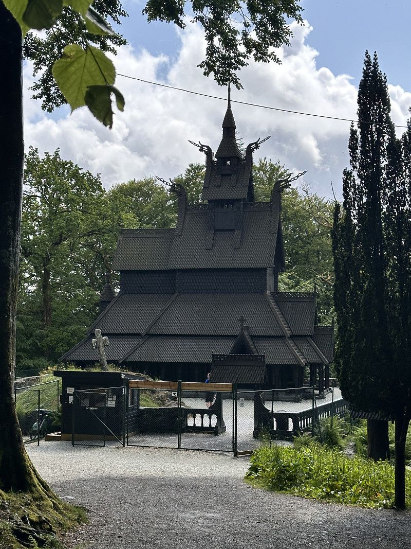
Fantoft Stabkirche Bergen
From the parking space we took a short hike to Fantoft Stave Church.
Birkelundsbakken, Bergen, Vestland, Norwegen
60° 20' 22.9" N 5° 21' 11.3" E
60.3397028 5.3531281
• Head northeast on Fantoftvegen. Go for 780 m.
• Turn left onto Storetveitvegen (582). Go for 1.3 km.
• Turn left onto Sandbrekkevegen (585). Go for 223 m.
• Turn right onto Sandbrekkevegen (186). Go for 2.3 km.
• Take the 4th exit from roundabout onto Hardangervegen (587). Go for 13.9 km.
• Take the 1st exit from roundabout onto Hardangervegen (E16) toward E39/Åsane/Indre Arna. Go for 9.7 km.
• Take the 2nd exit from roundabout onto Vaksdalsvegen (E16) toward Voss. Go for 65.7 km.
• Take the 1st exit from roundabout onto Evangervegen (E16) toward Voss Sentrum. Go for 1.1 km.
• Turn right onto Uttrågata. Go for 46 m.
• Arrive at your destination on the right.
☍
95,0 km
(1 hrs. 29 min.)
Day Übernachtung
Bergen Stadtbummel
Today we visited the sights of Bergen and strolled through the alleys.
Vossavangen
Parking at the entrance to the village with a beautiful adjacent park and within walking distance to the town
Uttrågata, Vossavangen, Vestland, Norwegen
60° 37' 40" N 6° 25' 4.9" E
60.6277829 6.4180412
• Head north. Go for 29 m.
• Continue on Uttrågata. Go for 17 m.
• Turn right onto Uttrågata (E16). Go for 2.1 km.
• Turn right onto Hardangervegen (13). Go for 30.2 km.
• Take the 1st exit from roundabout onto Vallaviktunnelen (13). Go for 3.3 km.
• Take the 1st exit from Butunnelen roundabout onto Eidfjordvegen (7). Go for 32.3 km.
• Turn left. Go for 23 m.
• Turn right. Go for 99 m.
• Turn left. Go for 209 m.
• Arrive at your destination.
☍
68,3 km
(1 hrs. 1 min.)
Day Übernachtung
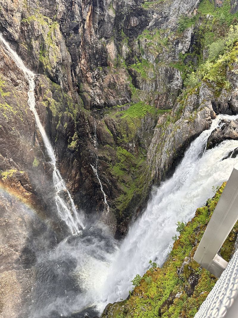
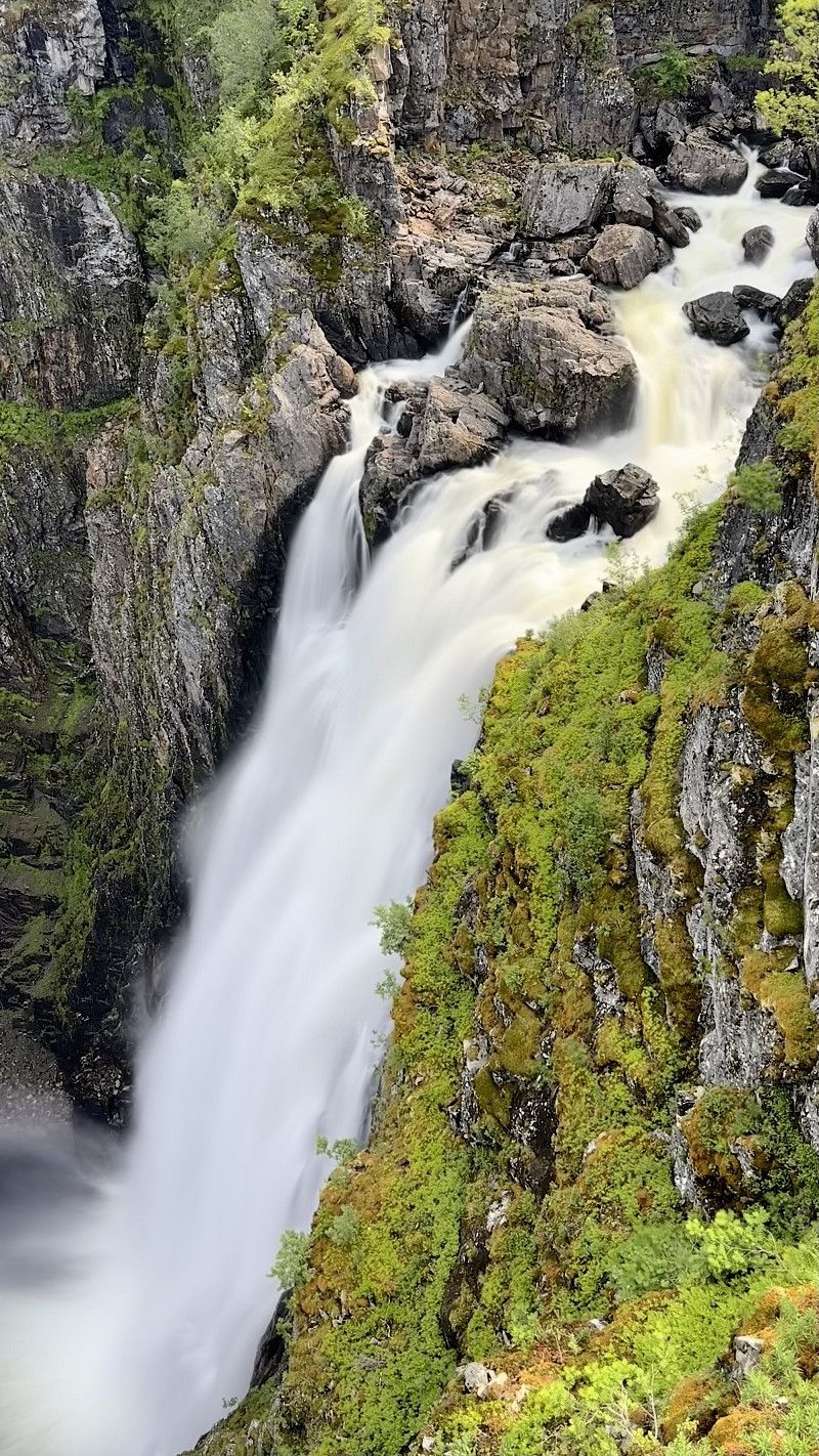
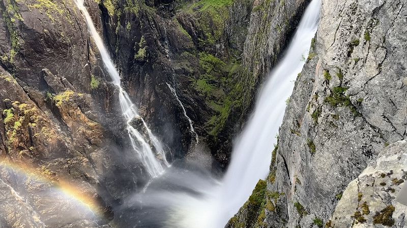
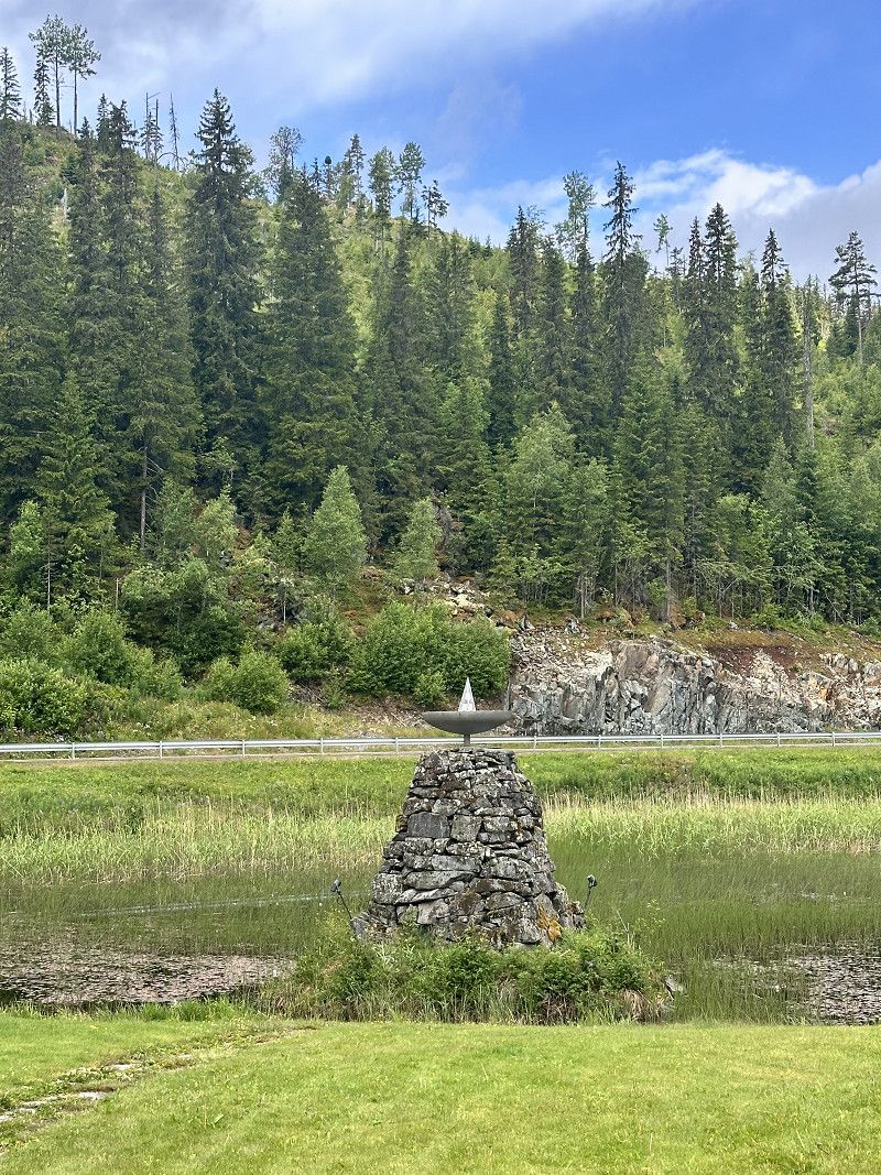
Vøringsfossen, Hardangervidda
Impressive waterfall at the beginning of the Hardanger Vidda. Be sure to allow 1.5 hours to view it. It's well worth it.
Norwegen
60° 25' 36.9" N 7° 15' 3.8" E
60.4269085 7.2510537
• Head west. Go for 209 m.
• Turn right. Go for 99 m.
• Turn left toward Hardangervidda/7. Go for 23 m.
• Turn right onto Hardangervidda (7). Go for 32.3 km.
• Take the 1st exit from Butunnelen roundabout onto Butunnelen (13). Go for 54.6 km.
• Turn left onto Røldalsvegen. Go for 48 m.
• Turn left onto Røldalsvegen. Go for 239 m.
• Turn left onto Tyssedalsvegen. Go for 343 m.
• Arrive at Tyssedalsvegen. Your destination is on the left.
☍
87,8 km
(1 hrs. 28 min.)
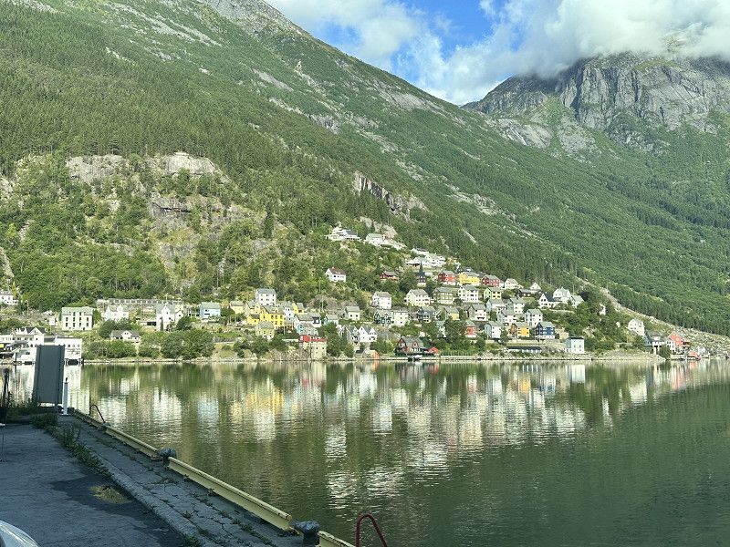
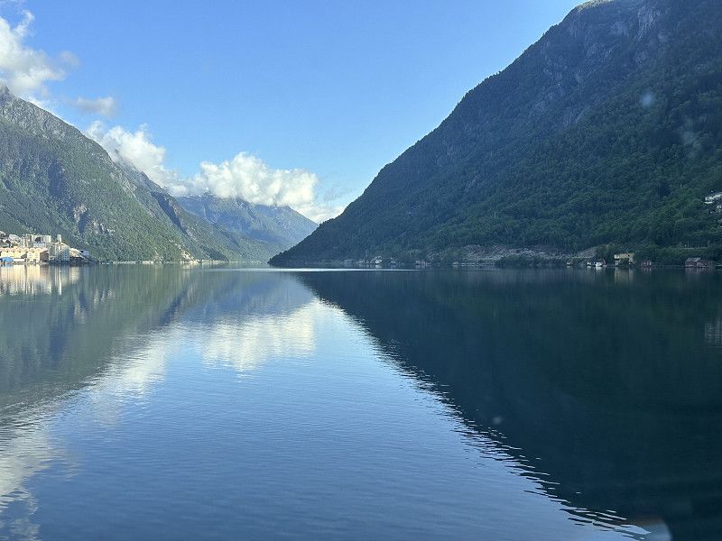
Odda
Large parking space directly at the harbor with a view of the Sjørfjorden
Vestland, Norwegen
60° 4' 18" N 6° 32' 52.4" E
60.0716770 6.5478813
• Head south on Tyssedalsvegen. Go for 343 m.
• Turn right onto Røldalsvegen. Go for 239 m.
• Turn right onto Røldalsvegen. Go for 48 m.
• Turn left onto Røldalsvegen (13). Go for 89 m.
• Take the 2nd exit from roundabout onto Røldalsvegen (13). Go for 14.5 km.
• Arrive at 13. Your destination is on the left.
☍
15,2 km
( 16 min.)
Day Übernachtung
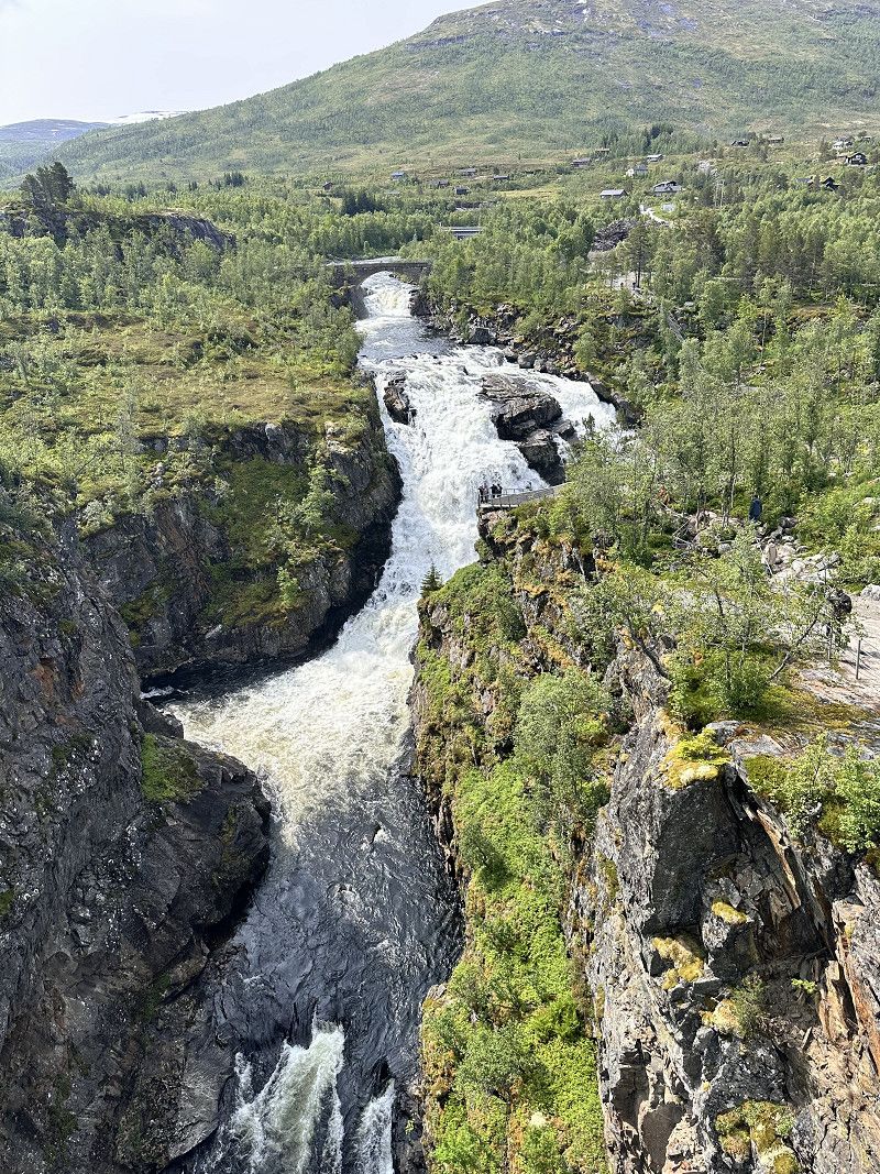
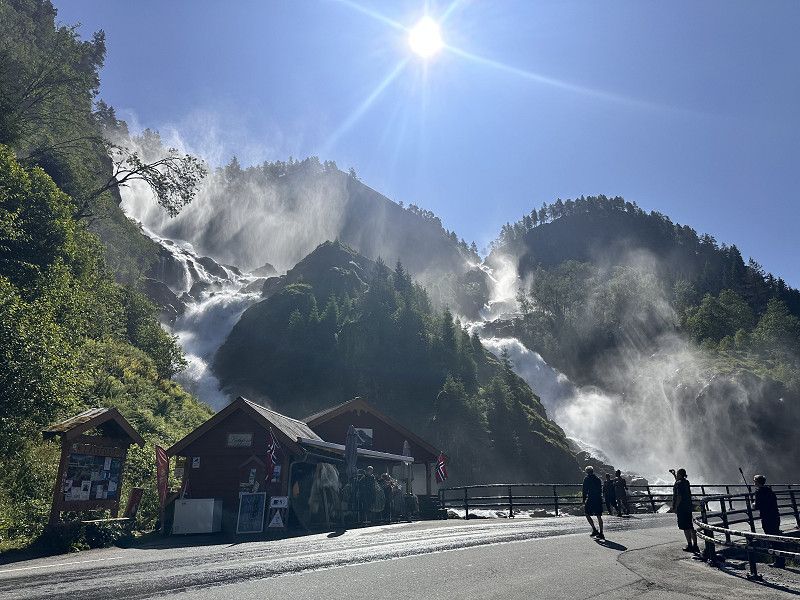
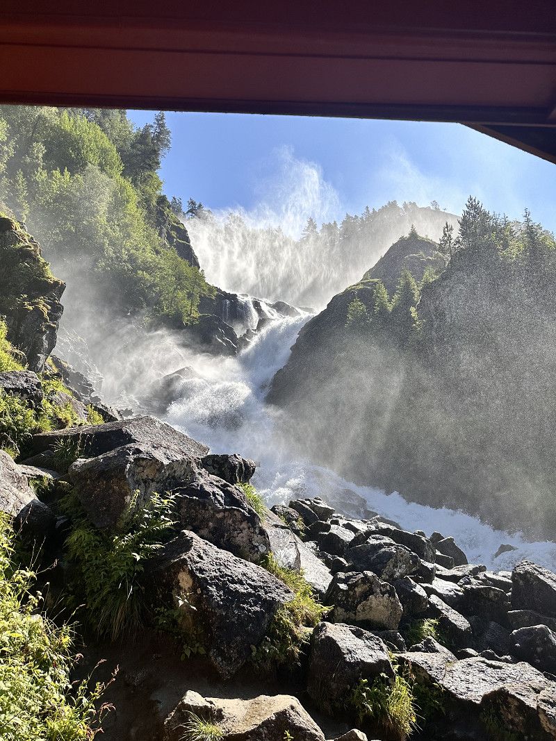
Latefossen
Worth seeing double waterfall
13, Vestland, Norwegen
59° 56' 52.4" N 6° 35' 5.1" E
59.9478953 6.5847600
• Head south on 13. Go for 3.2 km.
• Turn left onto E134 toward Haukeli/Rødal. Go for 23.3 km.
• Turn right onto Kyrkjevegen. Go for 529 m.
• Arrive at Kyrkjevegen. Your destination is on the right.
☍
27,0 km
( 26 min.)
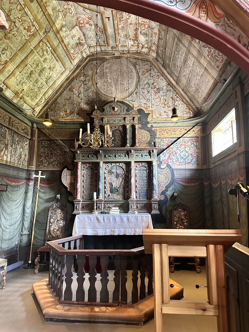
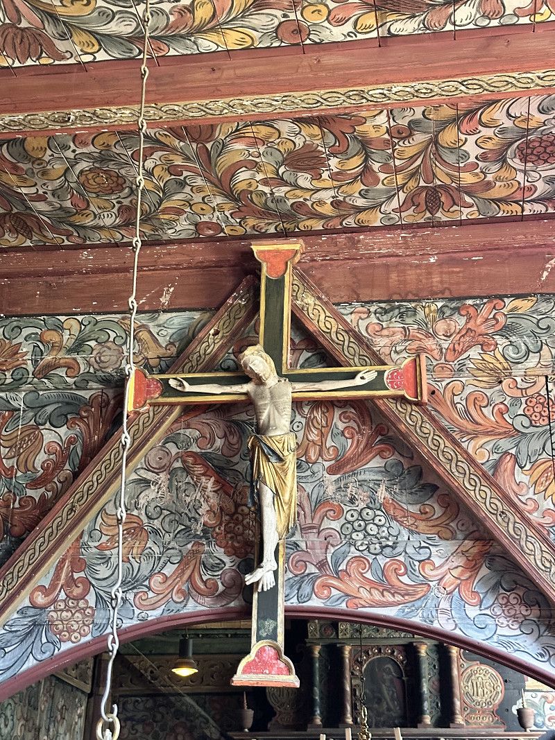
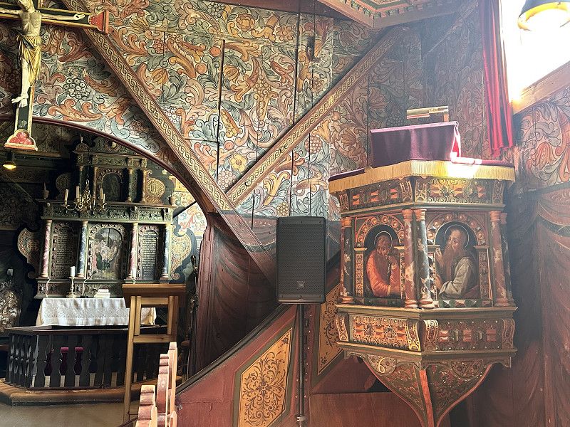
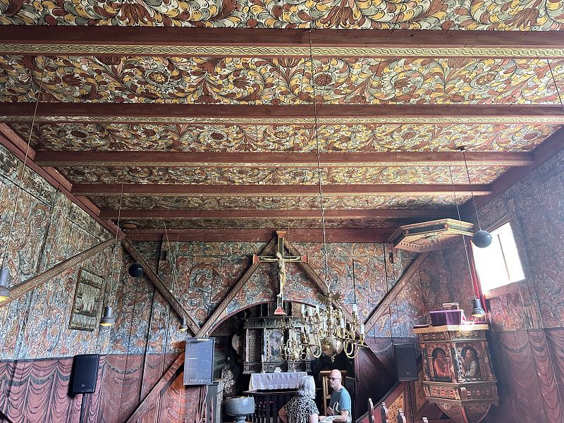
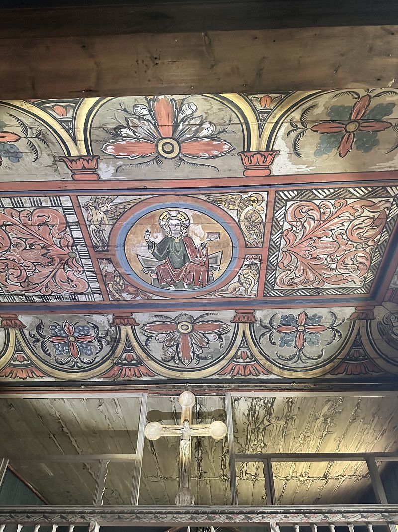
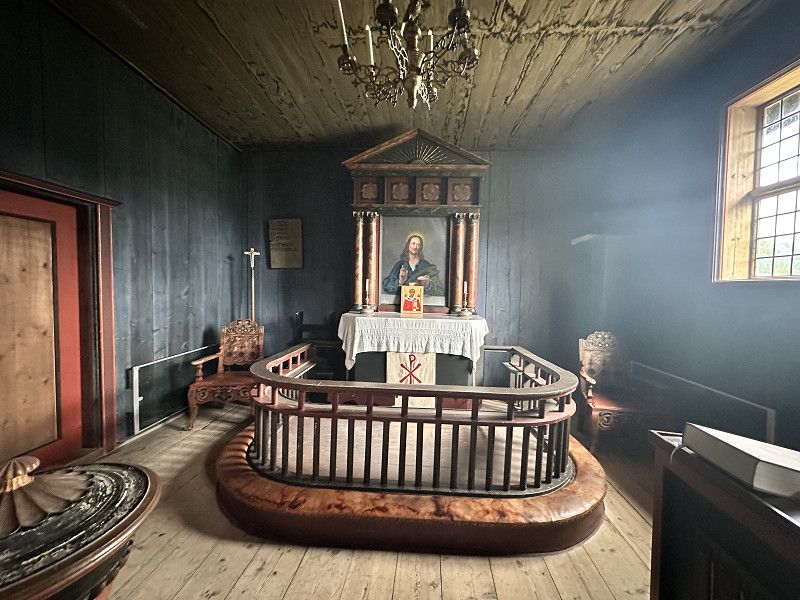
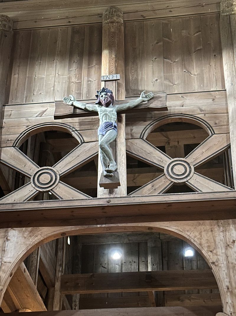
Røldal
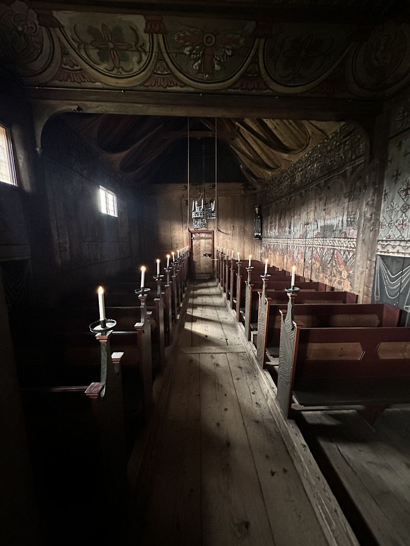
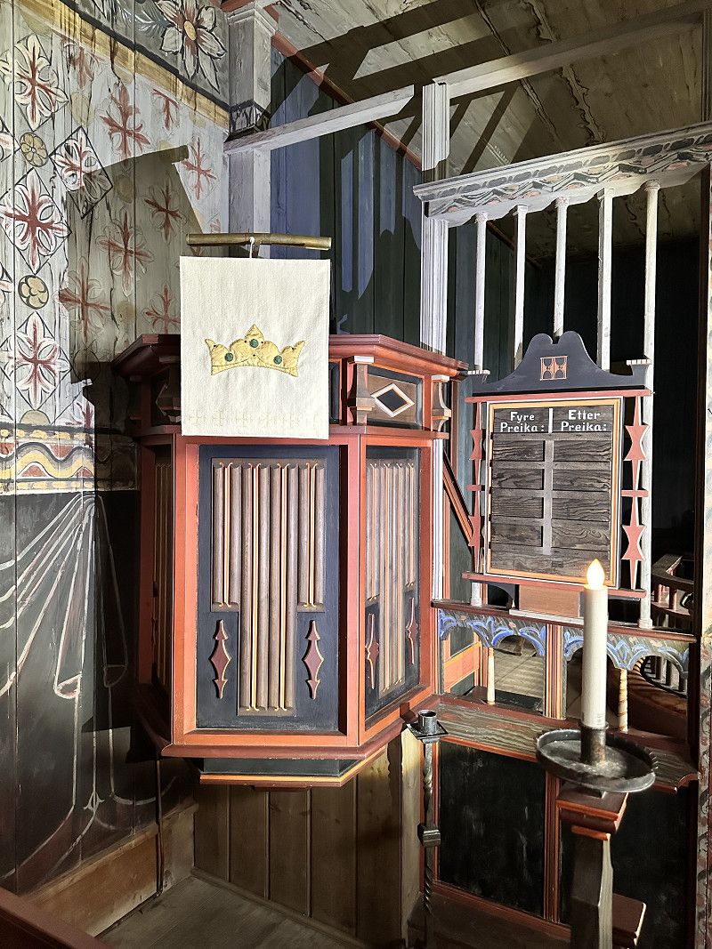
Roldal has a small stave church dating back to the early 13th century. According to legend, the crucifix in the church is said to sweat in early June. This sweat is said to have healing properties.
Kyrkjevegen, Røldal, Vestland, Norwegen
59° 49' 51.1" N 6° 49' 21.2" E
59.8308705 6.8225630
• Head west on Kyrkjevegen. Go for 288 m.
• Turn left toward Runnane. Go for 138 m.
• Turn right onto Runnane. Go for 175 m.
• Turn left onto Seimsvegen. Go for 371 m.
• Turn left onto Seimsvegen. Go for 140 m.
• Arrive at your destination on the right.
☍
1,1 km
( 2 min.)
Seim Camping
Nice little campsite next to the stave church.
Seimsv 35, 5760, Røldal, Norway
59° 49' 48" N 6° 48' 46" E
59.8300000 6.8127800
• Head southwest. Go for 26 m.
• Continue on Seimsvegen. Go for 485 m.
• Turn left onto Seimsvegen. Go for 66 m.
• Turn right onto Haukelivegen (E134). Go for 111 km.
• Turn right onto Eidsborgvegen (45) toward Dalen. Go for 13.0 km.
• Turn right onto Museumsvegen. Go for 220 m.
• Arrive at Museumsvegen. Your destination is on the right.
☍
124,4 km
(1 hrs. 46 min.)
Day Übernachtung
Stabkirche Eidsborg
A 12th-century stave church with an adjoining museum. Due to a lack of visitors, we had a private tour, which was very interesting.
Museumsvegen, Telemark, Norwegen
59° 27' 57.9" N 8° 1' 12.1" E
59.4660939 8.0200395
• Head toward Eidsborgvegen on Museumsvegen. Go for 220 m.
• Turn left onto Eidsborgvegen (45). Go for 13.0 km.
• Turn right onto Høydalsmovegen (E134) toward Oslo/Seljord. Go for 10.2 km.
• Arrive at Brunkebergvegen (E134). Your destination is on the left.
☍
23,4 km
( 21 min.)
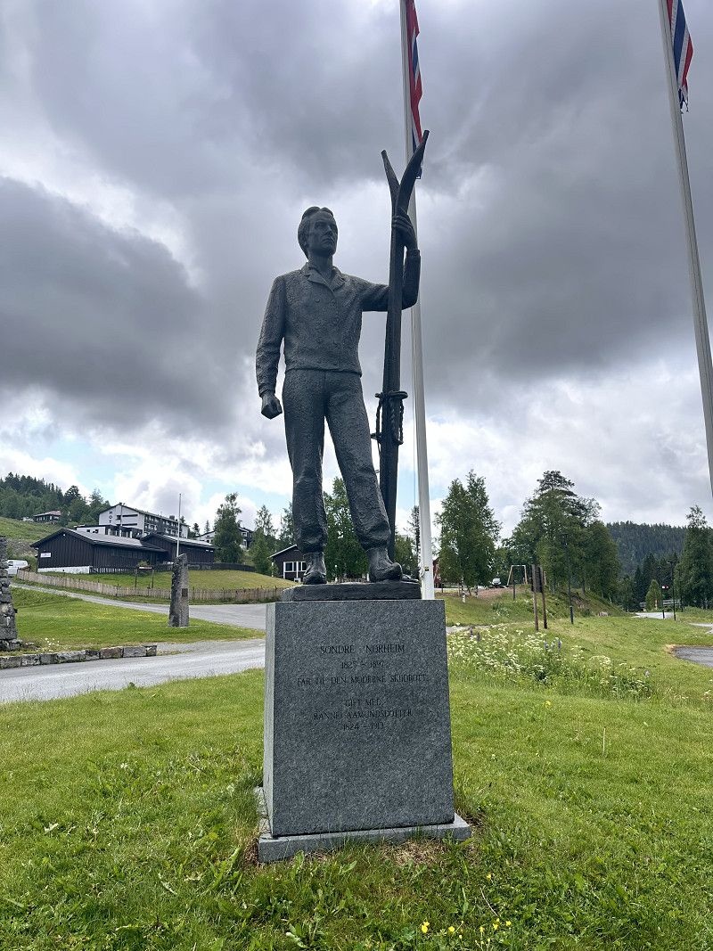
Morgedal
Free space found on the street
Selvassvegen 1699, Morgedal, Telemark, Norwegen
59° 28' 47.6" N 8° 21' 11.5" E
59.4798878 8.3531908
• Head toward Nordskogvegen on Brunkebergvegen (E134). Go for 4.3 km.
• Turn left onto Morgedalvegen toward Morgedal. Go for 375 m.
• Turn right onto Vårstaulvegen. Go for 17 m.
• Turn left onto Vårstaulvegen. Go for 21 m.
• Arrive at Vårstaulvegen. Your destination is on the left.
☍
4,8 km
( 4 min.)
Day Übernachtung
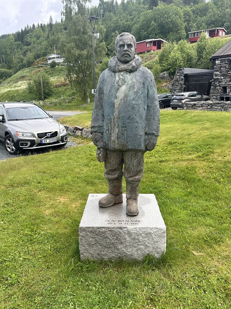
Morgedal
We stopped for breakfast in Mørgedal. We also stopped by the home of ski pioneer Sondre Norheim and the first visitor to the South Pole, Olav Bjaaland, who was there with Asmussen. We also looked at the Olympic flame there.
Telemark, Norwegen
59° 28' 38.6" N 8° 25' 8.7" E
59.4773756 8.4190876
• Head west on Vårstaulvegen. Go for 21 m.
• Turn right onto Vårstaulvegen. Go for 17 m.
• Turn left onto Morgedalvegen. Go for 307 m.
• Turn slightly right onto Morgedalvegen. Go for 68 m.
• Turn left onto Brunkebergvegen (E134). Go for 62.4 km.
• Turn left toward Heddalsvegen. Go for 95 m.
• Turn right onto Heddalsvegen. Go for 169 m.
• Arrive at Heddalsvegen. Your destination is on the left.
☍
63,1 km
( 52 min.)
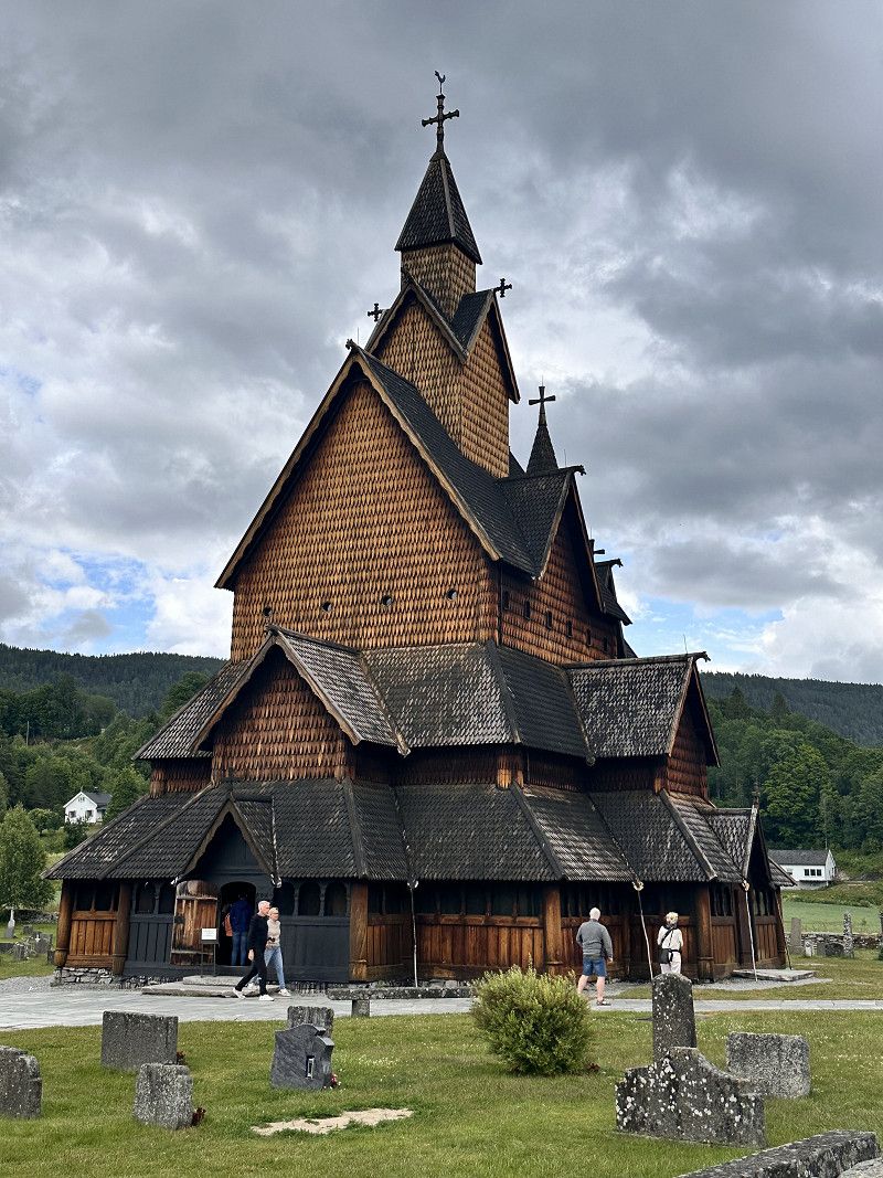
Heddal
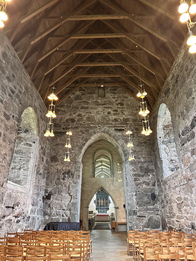
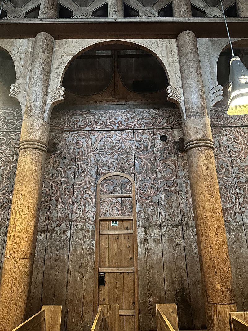
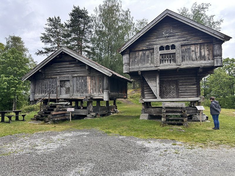
Here we visited Norway's largest stave church and the adjacent open-air museum.
Raud Rygis veg, Heddal, Telemark, Norwegen
59° 34' 46.4" N 9° 10' 34.6" E
59.5795639 9.1762892
• Head toward Raud Rygis veg on Heddalsvegen. Go for 328 m.
• Turn right onto Heddalsvegen. Go for 30 m.
• Turn left onto Heddalsvegen (E134). Go for 536 m.
• Pass 3 roundabouts and continue on Heddalsvegen (E134). Go for 4.1 km.
• Turn right toward Nesøya. Go for 61 m.
• Continue on Nesøya. Go for 95 m.
• Turn right. Go for 21 m.
• Turn right. Go for 161 m.
• Arrive at your destination on the left.
☍
5,3 km
( 7 min.)
Notodden
We spent the night at the Notodden RV park. A large paved area right by the harbor. Within walking distance of the town center.
Heddalsvegen 9, Notodden, Telemark, Norwegen
59° 33' 28.3" N 9° 14' 50.8" E
59.5578505 9.2474508
• Head south. Go for 168 m.
• Turn right toward Nesøya. Go for 21 m.
• Turn left onto Nesøya. Go for 156 m.
• Turn right onto Heddalsvegen (E134). Go for 425 m.
• Take the 2nd exit from roundabout onto Sam Eydes gate (E134). Go for 1.0 km.
• Turn right onto Tinnegrendvegen (360) toward Gvarv/Sykehus Legevakt. Go for 29.2 km.
• Turn left onto Strannavegen (36). Go for 38.7 km.
• Take the 1st exit from roundabout onto Voldsvegen (353). Go for 6.7 km.
• Turn right onto Svanvikvegen (353). Go for 1.3 km.
• Turn left onto Svanvikvegen (353). Go for 15.7 km.
• Take the 2nd exit from roundabout onto Europaveien (354). Go for 83 m.
• Take the 1st exit from roundabout onto E18 (Europaveien). Go for 56.4 km.
• Take the 1st exit from roundabout onto E18. Go for 718 m.
• Take ramp onto E18 toward Risør. Go for 8.6 km.
• Continue on Hestemyrveien (416). Go for 65 m.
• Continue on Risørveien (416). Go for 934 m.
• Continue on Krags gate (416). Go for 1.6 km.
• Take the 1st exit from roundabout onto Krags gate (416). Go for 1.1 km.
• Turn right onto Skolegata. Go for 128 m.
• Continue on Viddefjellveien. Go for 169 m.
• Turn right onto Ringveien. Go for 287 m.
• Turn right onto Heiveien. Go for 26 m.
• Turn slightly right onto Heiveien. Go for 57 m.
• Arrive at Heiveien. Your destination is on the right.
☍
163,5 km
(2 hrs. 16 min.)
Day Übernachtung
Risør
Hasdalgata, Risør, Agder, Norwegen
58° 43' 5.4" N 9° 13' 36.7" E
58.7181695 9.2268626
• Head east on Heiveien. Go for 83 m.
• Turn right onto Ringveien. Go for 216 m.
• Turn right onto Grønningveien. Go for 669 m.
• Take the 1st exit from roundabout onto Grønningveien (3454). Go for 828 m.
• Turn left onto Krags gate (416). Go for 1.5 km.
• Continue on Risørveien (416). Go for 934 m.
• Continue on Hestemyrveien (416). Go for 65 m.
• Continue on Risørveien (416). Go for 3.4 km.
• Turn left onto Lagveien (411). Go for 5.9 km.
• Turn left onto Åkvågveien (3438). Go for 4.0 km.
• Continue on Åkvågveien (3438). Go for 868 m.
• Continue on Åkvågveien (3438). Go for 3.0 km.
• Continue on Åkvågveien (3438). Go for 1.0 km.
• Turn left onto Fiesundveien. Go for 567 m.
• Turn slightly left onto Fiesundveien. Go for 265 m.
• Turn slightly left onto Fiesundveien. Go for 53 m.
• Arrive at Fiesundveien.
☍
23,3 km
( 30 min.)
Day Übernachtung
Risør
Agder, Norwegen
58° 40' 36.6" N 9° 18' 39" E
58.6768313 9.3108313
• Head south on Fiesundveien. Go for 885 m.
• Turn right onto Åkvågveien (3438). Go for 1.0 km.
• Continue on Åkvågveien (3438). Go for 7.8 km.
• Turn right onto 411. Go for 226 m.
• Turn left onto Nævestadveien (3462). Go for 4.8 km.
• Continue on Valleveien (3462). Go for 5.0 km.
• Turn right onto Gamleveien (421/3486). Go for 309 m.
• Continue on Angelstadveien (421/3486). Go for 127 m.
• Continue on Lundeveien (421/3486). Go for 709 m.
• Continue on Gamleveien (421/3486) toward Kristiansand/Arendal. Go for 35 m.
• Take ramp onto E18 toward Kristiansand/Arendal. Go for 87.2 km.
• Take ramp toward Lund Ø/Gimle. Go for 85 m.
• Take the 4th exit from roundabout onto Østerveien (471). Go for 388 m.
• Take the 1st exit from roundabout onto Østre Ringvei (490). Go for 372 m.
• Turn left onto Kongsgård alle. Go for 439 m.
• Turn right onto Ægirs vei. Go for 170 m.
• Turn left onto Ægirs vei. Go for 130 m.
• Turn right. Go for 35 m.
• Arrive at your destination on the right.
☍
109,8 km
(1 hrs. 24 min.)
Kristiansand
Prestebekkstien, Kristiansand, Agder, Norwegen
58° 9' 19.6" N 8° 1' 47.5" E
58.1554349 8.0298585
• Head toward Ægirs vei. Go for 64 m.
• Turn right onto Ægirs vei. Go for 190 m.
• Turn left onto Kongsgård alle. Go for 439 m.
• Turn right onto Østre Ringvei (490). Go for 352 m.
• Take the 2nd exit from roundabout onto Østerveien (471). Go for 388 m.
• Take the 1st exit from roundabout onto E18 toward Stavanger/E39/Sentrum. Go for 4.6 km.
• Keep left onto Vågsbygdveien (456) toward Vågsbygd. Go for 1.7 km.
• Pass 3 roundabouts and continue on Vågsbygdveien (456). Go for 1.9 km.
• Turn right onto Holskogveien (456). Go for 4.3 km.
• Arrive at Langenesveien (456).
☍
13,8 km
( 16 min.)
Day
Kristiansand
Agder, Norwegen
58° 5' 8.3" N 7° 55' 54.7" E
58.0856276 7.9318580
• Head toward Paltosken on Langenesveien (456). Go for 4.3 km.
• Turn left onto Vågsbygdveien (456). Go for 1.1 km.
• Pass 3 roundabouts and continue on Vågsbygdveien (456). Go for 2.8 km.
• Continue on Vesterveien (E39). Go for 746 m.
• Take ramp onto Vesterveien toward Danmark/E39/Evje/9/Ferge Terminal. Go for 263 m.
• Turn right onto Vesterveien. Go for 33 m.
• Turn slightly left. Go for 25 m.
• Arrive at your destination on the left.
☍
9,3 km
( 10 min.)
Day Übernachtung
Kristiansand Fährterminal
E 18, Kristiansand, Agder, Norwegen
58° 8' 36.8" N 7° 58' 55.6" E
58.1435629 7.9821117
• Head toward Vesterveien. Go for 25 m.
• Turn slightly right onto Vesterveien. Go for 33 m.
• Turn right toward Vesterveien. Go for 125 m.
• Take the 1st exit from roundabout onto Vesterveien. Go for 172 m.
• Turn sharp right. Go for 447 m.
• Take the Kristiansand-Hirtshals Ferry. Stay on for 139 km.
• Head southeast on E39. Go for 2.1 km.
• Take the 3rd exit from roundabout onto Aalborgvej (E39) toward Aalborg/Skagen/597. Go for 2.3 km.
• Take the 2nd exit from roundabout onto E39 (Hirtshalsmotorvejen) toward Aalborg. Go for 57.0 km.
• Continue on Vendsyssel. Go for 196 m.
• Continue on E45 (Vendsyssel). Go for 26.7 km.
• Take exit 31 toward Støvring S/Skørping. Go for 407 m.
• Turn left onto Nibevej (519) toward Skørping/Støvring. Go for 342 m.
• Take the 2nd exit from roundabout onto Nibevej (519) toward Skørping/Støvring. Go for 2.2 km.
• Turn right onto Hobrovej (180/519) toward Hobro/Skørping. Go for 4.6 km.
• Turn left onto Vælderskoven toward Skørping. Go for 699 m.
• Turn left onto Rebildvej. Go for 275 m.
• Arrive at Rebildvej. Your destination is on the left.
☍
236,5 km
(5 hrs. 3 min.)
Rebildvej, Region Nordjütland, Dänemark
56° 49' 49.7" N 9° 49' 18.4" E
56.8304735 9.8217777
• Head southwest on Rebildvej. Go for 275 m.
• Continue on Vælderskoven. Go for 1.0 km.
• Turn left onto Hobrovej (180) toward Hobro. Go for 5.3 km.
• Take the 1st exit from roundabout onto Haverslevvej (535) toward E45/Aars/Haverslev. Go for 7.6 km.
• Turn left and take ramp onto E45 (Nordjyske Motorvej) toward Århus. Go for 172 km.
• Continue on E45 (Sønderjyske Motorvej) toward Flensborg. Go for 83.2 km.
• Continue on A7. Go for 156 km.
• Keep left onto A7. Go for 254 km.
• Take exit 71 toward Nörten-Hardenberg/Uslar/Solling/Hardegsen. Go for 328 m.
• Turn right onto B446 toward Duderstadt/Nörten-Hardenberg. Go for 268 m.
• Take the 2nd exit from roundabout onto B446. Go for 561 m.
• Turn right and take ramp onto B3 toward Göttingen. Go for 5.0 km.
• Take ramp toward Bovenden. Go for 556 m.
• Take the 1st exit from roundabout onto Göttinger Straße toward Gö-Weende. Go for 767 m.
• Continue on Hannoversche Straße. Go for 878 m.
• Turn left onto Roter Berg. Go for 105 m.
• Turn left onto James-Franck-Ring. Go for 573 m.
• Turn left onto Heinrich-Albert-Zachariä-Bogen. Go for 200 m.
• Turn right. Go for 30 m.
• Turn left. Go for 31 m.
• Arrive at your destination on the left.
☍
688,7 km
(6 hrs. 47 min.)
Day
Göttingen
Heinrich-Albert-Zachariä-Bogen, Göttingen, Landkreis Göttingen, Niedersachsen, Deutschland
51° 34' 31.5" N 9° 56' 2.5" E
51.5754290 9.9340259
• Head west. Go for 31 m.
• Turn right toward Heinrich-Albert-Zachariä-Bogen. Go for 30 m.
• Turn left onto Heinrich-Albert-Zachariä-Bogen. Go for 200 m.
• Turn right onto James-Franck-Ring. Go for 573 m.
• Turn right onto Roter Berg. Go for 105 m.
• Continue on Hannoversche Straße. Go for 1.3 km.
• Turn right onto B3/B27 toward Hannover/A7/Kassel/Northeim. Go for 3.8 km.
• Take the 2nd exit from roundabout onto A7 toward Kassel. Go for 108 km.
• Keep right onto A7 (Hattenbacher Dreieck) toward München/Stuttgart/Würzburg/Fulda/Basel/Frankfurt/Wiesbaden/Gießen. Go for 131 km.
• Take exit 101 toward Würzburg/Estenfeld/Rimpar onto B19. Go for 6.4 km.
• Keep left onto B19 toward Frankfurt/Stuttgart/Ansbach/B13/Schwäbisch Hall/Stadtring-Süd/Uni-Hubland. Go for 6.6 km.
• Take ramp onto A3 toward Frankfurt/Stuttgart. Go for 6.1 km.
• Take exit 69 toward Stuttgart/Heilbronn/Tauberbischofsheim onto A81. Go for 134 km.
• Take the left exit toward München/Singen/Stuttgart/Flughafen/Messe onto A8. Go for 7.7 km.
• Take exit 51 toward Singen/Böblingen/Sindelfingen onto A81. Go for 3.0 km.
• Take exit 21 toward Sindelfingen-Ost/Böblingen-Ost. Go for 530 m.
• Turn right onto Mahdentalstraße (L1183) toward Sindelfingen. Go for 1.3 km.
• Turn left onto Eschenbrünnlestraße toward Böblingen/P+R/Goldberg. Go for 509 m.
• Take the 2nd exit from roundabout onto Leibnizstraße toward Böblingen/P+R S-Bahn. Go for 345 m.
• Turn left onto K1055. Go for 349 m.
• Take the 1st exit from roundabout onto K1055 toward Stuttgart. Go for 226 m.
• Take the 1st exit from roundabout toward A81/Stuttgart. Go for 309 m.
• Take ramp onto A81 toward Stuttgart. Go for 2.0 km.
• Arrive at A81. Your destination is on the left.
☍
414,7 km
(3 hrs. 56 min.)
Day Übernachtung
Sindelfingen
A 81, Sindelfingen, Landkreis Böblingen, Baden-Württemberg, Deutschland
48° 42' 42.8" N 9° 3' 14.7" E
48.7118867 9.0540889