Day
Camping Landgoed Gejsteren
Beautiful nature campsite. Beautifully situated on the Maas. Toilet block neat and clean. Campsite is run by a twin sister, very cozy and cordial couple!
Maasheseweg 5a, 5862 AP, Geijsteren, Nederland
51° 33' 26.9" N 6° 2' 40.1" E
51.5574600 6.0444600
• Head southeast on Maasheseweg. Go for 786 m.
• Turn left onto Wanssumseweg. Go for 1.4 km.
• Continue on Geijsterseweg. Go for 1.2 km.
• Take the 2nd exit from roundabout onto N270 toward Well/Industrieterrein 6100-7000. Go for 1.3 km.
• Take the 1st exit from roundabout onto Driesstraat toward Wanssum/Blitterswijck/Meerlo. Go for 346 m.
• Continue on Brugstraat. Go for 418 m.
• Take the 3rd exit from roundabout toward Meerlo/Tienray. Go for 83 m.
• Turn slightly left onto Blitterswijckseweg. Go for 727 m.
• Continue on Oude Heerweg. Go for 1.3 km.
• Continue on Ooijenseweg. Go for 1.4 km.
• Arrive at Ooijenseweg. Your destination is on the left.
☍
8,9 km
( 10 min.)
Camping 't Veerhuys
Food at the Veerhuys is great. Really delicious! We also had lunch here before Corona when we were cycling in the area. Also great then. In addition to the ferry house, there is also a campsite. Places directly along the Maas are completely paved. Looks neat but not our thing.
Veerweg 7, 5863 AR, Blitterswijck, Nederland
51° 31' 11.7" N 6° 7' 18.3" E
51.5199300 6.1217600
• Head toward Broekstraat on Ooijenseweg. Go for 1.1 km.
• Continue on Blitterswijckseweg. Go for 1.8 km.
• Continue on Ooijenseweg. Go for 544 m.
• Continue on Broekstraat. Go for 1.4 km.
• Continue on Broekhuizerweg. Go for 225 m.
• Continue on Hoogstraat. Go for 348 m.
• Continue on Lottumseweg (N555). Go for 1.2 km.
• Continue on Broekhuizerweg (N555). Go for 1.5 km.
• Turn right onto Horsterdijk. Go for 4.1 km.
• Continue on Lottumseweg. Go for 1.7 km.
• Continue on Meldersloseweg. Go for 553 m.
• Take the 1st exit from roundabout onto Meldersloseweg. Go for 408 m.
• Turn left and take ramp onto A73 toward Venlo. Go for 14.1 km.
• Keep left onto A74 (Knooppunt Tiglia) toward Koblenz/Mönchengladbach/Nettetal. Go for 1.9 km.
• Continue on A61. Go for 36.0 km.
• Continue on Autobahndreieck Mönchengladbach-Wanlo toward Koblenz/Aachen/Düsseldorf/A61. Go for 375 m.
• Take the exit onto A46. Go for 3.8 km.
• Take exit 11 toward Koblenz/Köln/Aachen/A61 onto A44. Go for 8.2 km.
• Take exit 16 toward Koblenz/Köln onto A61. Go for 40.7 km.
• Continue on A61 toward Koblenz/Weilerswist. Go for 75.7 km.
• Take exit 37 toward Frankfurt a.M./Koblenz onto A48. Go for 6.4 km.
• Take exit 10 toward Koblenz-Nord/Ko.-Zentrum onto B9. Go for 5.4 km.
• Keep left onto Europabrücke (B9) toward Boppard/Montabaur/B49/Krankenhaus Ev. Stift Brüderkrh. St. Josef. Go for 558 m.
• Keep right onto Cusanusstraße (B9) toward Boppard/Lahnstein/B42/Krankenhaus. Go for 2.0 km.
• Keep right toward A61/Hermeskeil/B327/Montabaur/B49/Lahnstein/B42/Südbrücke. Go for 729 m.
• Take left ramp onto Südbrücke (B327) toward Montabaur/B49/Lahnstein/B42. Go for 1.4 km.
• Take ramp onto B42 toward Rüdesheim/Lahnstein Industriegebiet/Bad Ems. Go for 2.1 km.
• Keep left onto B42 toward Rüdesheim/Oberlahnstein/Gewerbegebiet Süd. Go for 1.4 km.
• Turn left and take ramp. Go for 82 m.
• Take the 2nd exit from roundabout onto Rheinhöhenweg (K68). Go for 1.3 km.
• Turn left onto Am Burgweg. Go for 369 m.
• Turn slightly right. Go for 131 m.
• Turn left. Go for 86 m.
• Arrive at your destination on the left.
☍
217,5 km
(2 hrs. 10 min.)
Day
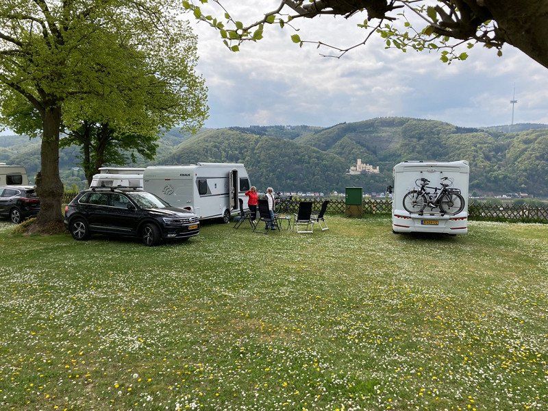
Campingplatz Burg Lahneck
Beautiful view, campsite could be a bit more modern, but it is clean.
Burgweg, 56112, Lahnstein, Duitsland
50° 18' 18.4" N 7° 36' 45.4" E
50.3051200 7.6126100
• Head southeast. Go for 86 m.
• Turn right toward Am Burgweg. Go for 131 m.
• Turn slightly left onto Am Burgweg. Go for 369 m.
• Turn right onto Rheinhöhenweg (K68). Go for 1.2 km.
• Take the 1st exit from roundabout onto B42 toward Koblenz/Rüdesheim/Bad Ems/Niederlahnstein. Go for 3.2 km.
• Take ramp onto B327 toward A61/Koblenz/B9. Go for 1.6 km.
• Take ramp toward Boppard/Koblenz/KO-Oberwerth/Krankenhaus Ev.-Stift/B9. Go for 805 m.
• Continue on Römerstraße (B9). Go for 1.9 km.
• Keep left onto Cusanusstraße (B9) toward Bonn/Cochem/B49/Europabrücke/Zentrum. Go for 245 m.
• Arrive at Karthäuserstraße (B9). Your destination is on the left.
☍
9,5 km
( 10 min.)
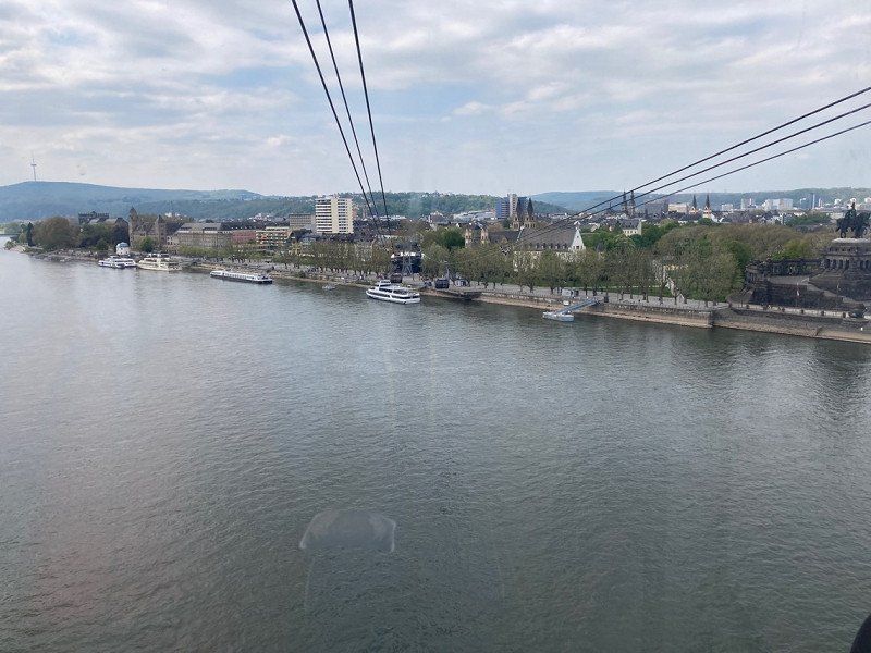
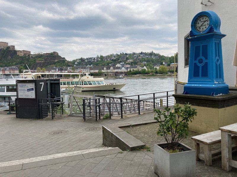
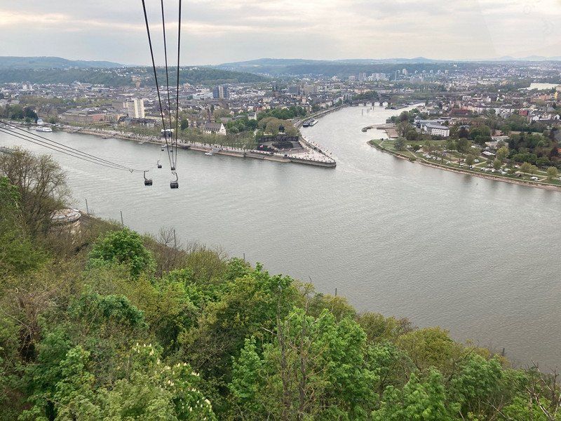
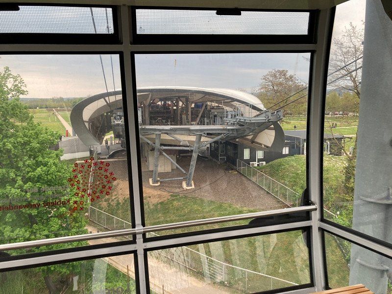
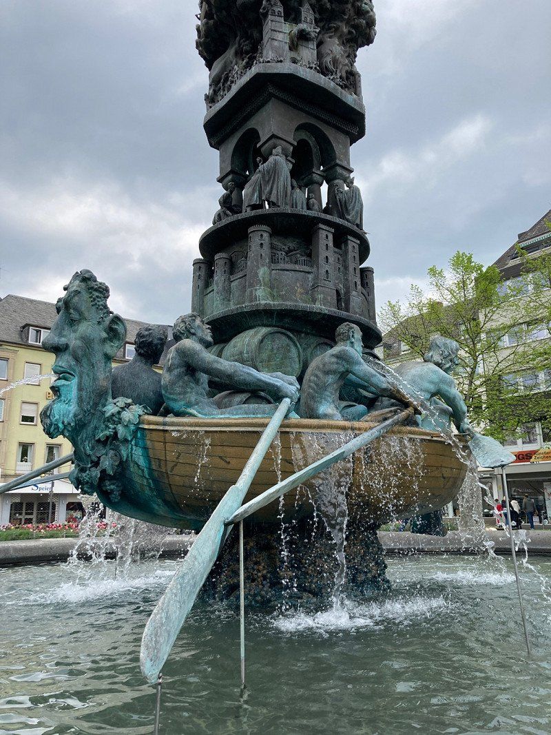
Koblenz, Duitsland
Visit to Koblenz. Too much to see in 1 day.
50° 21' 25" N 7° 35' 20.4" E
50.3569429 7.5889959
• Head toward Moselring on Karthäuserstraße (B9). Go for 275 m.
• Take ramp toward Zentrum/Cochem/B49/Moselweiß/Krankenhaus Kemperhof/Krankenhaus Marienhof/Rauental. Go for 158 m.
• Take the 4th exit from Saarplatz roundabout onto K2 toward KO-Rauental. Go for 192 m.
• Continue on Moselweißer Straße (K2). Go for 1.0 km.
• Continue on Koblenzer Straße (K2). Go for 373 m.
• Turn right onto K6. Go for 79 m.
• Turn right toward K6. Go for 179 m.
• Turn right onto K6. Go for 39 m.
• Continue on Ferdinand-Sauerbruch-Straße. Go for 11 m.
• Continue on K6. Go for 617 m.
• Take ramp toward Cochem/KO-Güls/KO-Metternich (West). Go for 204 m.
• Turn left onto Winninger Straße (B416) toward Cochem/KO-Güls. Go for 6.8 km.
• Turn right onto August-Horch-Straße (L125) toward A61/KO-Rübenach/Gewerbegebiet/Flugplatz-Winningen. Go for 229 m.
• Turn left onto Hahnenstraße. Go for 117 m.
• Turn left onto Bachstraße. Go for 11 m.
• Turn right onto Marktplatz. Go for 63 m.
• Turn right. Go for 33 m.
• Arrive at your destination on the right.
☍
10,4 km
( 13 min.)
Day
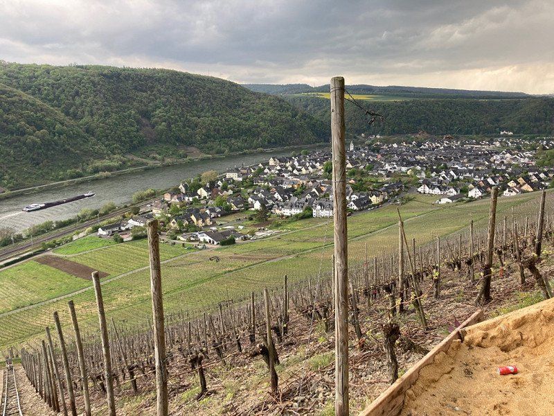
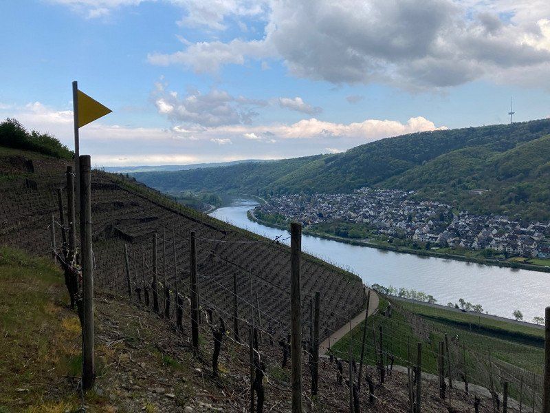
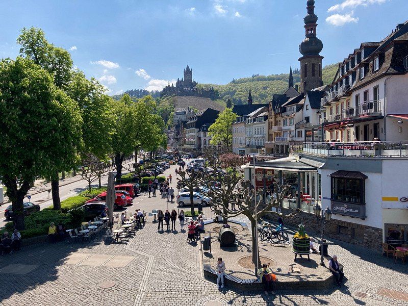
Winningen, Duitsland
Nice village, beautiful walking along the different dream paths.
50° 18' 51.1" N 7° 31' 2.6" E
50.3141877 7.5173764
• Head toward Marktplatz. Go for 33 m.
• Turn right onto Marktstraße. Go for 52 m.
• Turn right onto Fährstraße. Go for 137 m.
• Turn right onto Neustraße. Go for 206 m.
• Turn left onto August-Horch-Straße (L125). Go for 2.0 km.
• Turn left onto K89. Go for 712 m.
• Continue on K21. Go for 1.7 km.
• Turn right onto L52 toward A61/Köln/A48/Trier/Koblenz. Go for 200 m.
• Turn left and take ramp onto A61 toward Köln/A48/Trier. Go for 1.5 km.
• Take exit 37 toward Frankfurt a.M./Koblenz onto A48. Go for 25.1 km.
• Take the exit onto A3. Go for 25.9 km.
• Take exit 42 toward Gießen/Weilburg onto B49/B54. Go for 2.4 km.
• Take ramp toward LM-Offheim/LM-Dietkirchen/Gewerbegebiet Offheimer Höhe/Gewerbegebiet Dietkircher Höhe. Go for 255 m.
• Take the 3rd exit from roundabout onto K473 toward Dietkirchen. Go for 1.0 km.
• Take the 2nd exit from roundabout onto Am Eckert. Go for 78 m.
• Turn right onto Faberstraße. Go for 112 m.
• Continue on Limburger Straße. Go for 125 m.
• Arrive at Limburger Straße. Your destination is on the right.
☍
61,6 km
( 38 min.)
Day
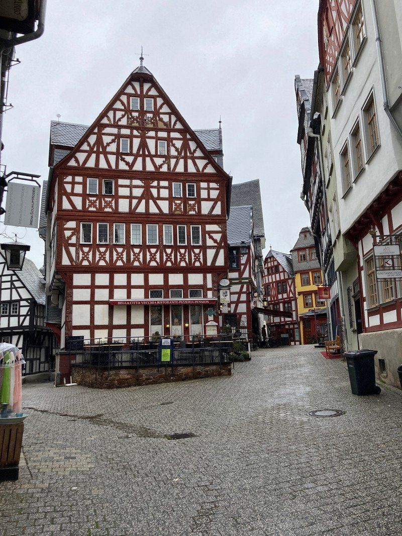
Limburg an der Lahn, Duitsland
Beautiful city. Old city center is great. Tip: Park in one of the covered parking garages in the center and you walk straight into the center. We just weren't lucky with the weather. We will definitely come back again.
50° 23' 55" N 8° 4' 46.5" E
50.3986005 8.0795783
• Head southwest on Limburger Straße. Go for 138 m.
• Turn slightly left onto Höhenstraße. Go for 82 m.
• Turn right onto Höhenstraße. Go for 15 m.
• Turn right onto Höhenstraße. Go for 95 m.
• Turn left onto K472. Go for 187 m.
• Continue on Dietkircher Weg (K472). Go for 643 m.
• Turn right onto Weilburger Straße (K470). Go for 60 m.
• Turn right onto Weilburger Straße (B8/B54). Go for 243 m.
• Continue on Weilburger Straße (B49/B54) toward A3/Köln/Koblenz/Frankfurt/Gießen/Siegen. Go for 439 m.
• Take ramp onto A3 toward Köln. Go for 25.1 km.
• Take exit 39 toward Trier/Koblenz onto A48. Go for 57.9 km.
• Take exit 4 toward Cochem. Go for 365 m.
• Turn left onto L98 toward Cochem/Landkern/Kloster Martental. Go for 11.4 km.
• Turn right onto L98 toward Senheim/Beilstein/Cochem-Cond. Go for 7.6 km.
• Take the 1st exit from roundabout onto Am Moselufer (L98). Go for 6.4 km.
• Turn right onto Wiesenweg. Go for 97 m.
• Turn left. Go for 60 m.
• Turn left. Go for 83 m.
• Arrive at your destination.
☍
111,0 km
(1 hrs. 11 min.)
Day
Family Camping Club
Beautiful campsite right on the Moselle.
Wiesenweg 25, 56820, Mesenich, Duitsland
50° 6' 2.7" N 7° 11' 38.5" E
50.1007600 7.1940400
• Head south. Go for 134 m.
• Turn left toward Am Bühl/L98. Go for 182 m.
• Turn left onto Am Bühl (L98). Go for 6.7 km.
• Take the 2nd exit from roundabout onto Am Moselufer (L98). Go for 1.0 km.
• Turn right onto L98 toward Treis-Karden/Trier-Koblenz. Go for 70 m.
• Take ramp. Go for 122 m.
• Turn right onto K35 toward Treis-Karden. Go for 3.1 km.
• Continue on Auf Allmesch (K35). Go for 420 m.
• Continue on K35. Go for 2.2 km.
• Continue on Bruttiger Straße (K35). Go for 1.0 km.
• Turn left onto Kirchberger Straße (L202). Go for 726 m.
• Continue on Brückenstraße (L108). Go for 234 m.
• Take the 2nd exit from roundabout onto Moselbrücke (B49) toward A48/Cochem/Kaisersesch. Go for 291 m.
• Turn right onto B416 toward Koblenz-Trier/A48/Koblenz/Löf. Go for 6.3 km.
• Turn left onto K33 toward Münstermaifeld/Lasserg. Go for 248 m.
• Continue on Weinbergstraße (K33). Go for 122 m.
• Turn right onto K33. Go for 2.1 km.
• Continue on K39. Go for 3.8 km.
• Turn left onto Kurfürst-Balduin-Straße (K37). Go for 51 m.
• Continue on K37. Go for 1.4 km.
• Continue on Zum Sportplatz (K37). Go for 109 m.
• Continue on Pappelstraße (K37). Go for 349 m.
• Continue on Raiffeisenplatz (K37). Go for 41 m.
• Turn slightly left onto Raiffeisenplatz (K38). Go for 37 m.
• Continue on Burg Eltz Straße (K38). Go for 413 m.
• Continue on K38. Go for 1.5 km.
• Continue straight ahead. Go for 284 m.
• Arrive at your destination.
☍
33,0 km
( 35 min.)
Day
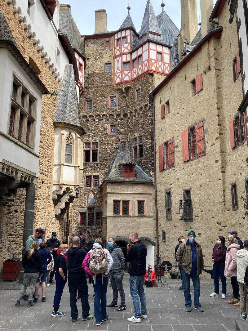
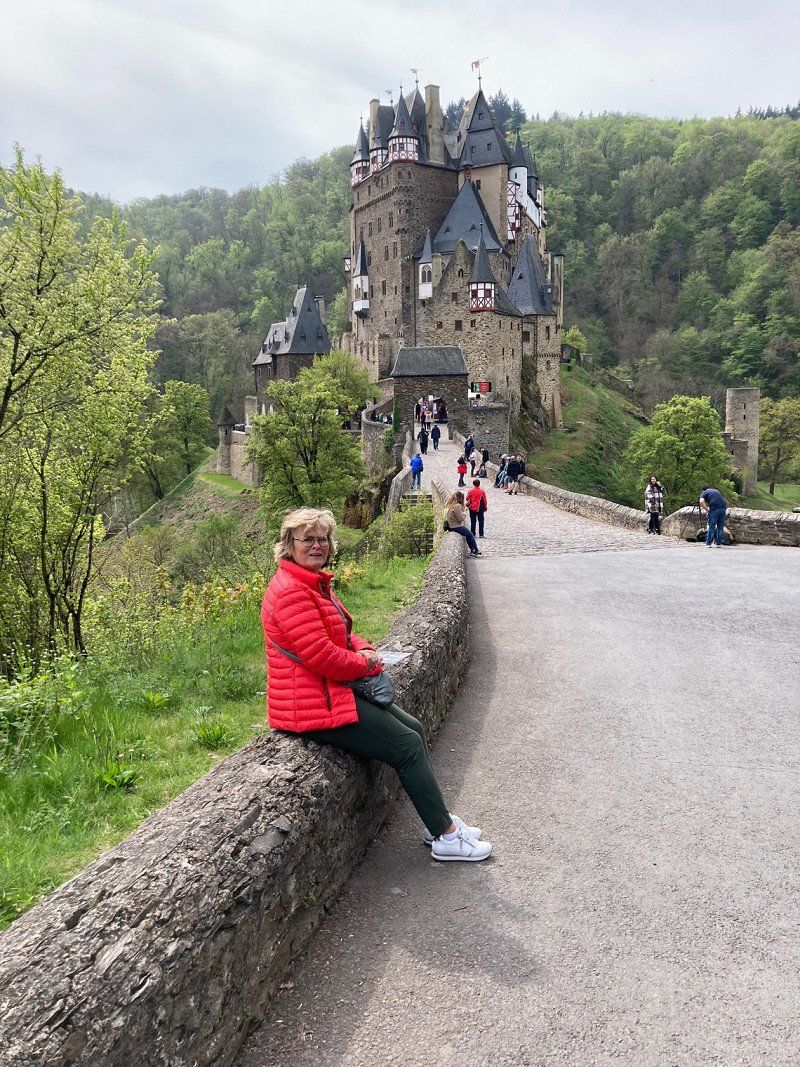
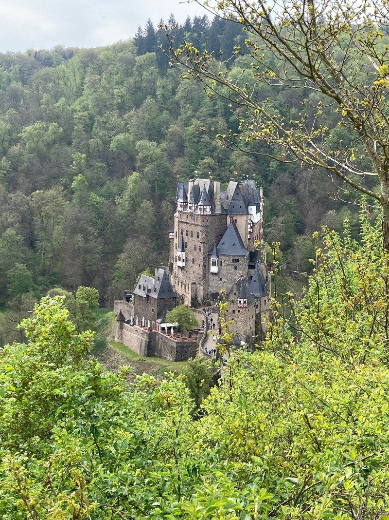
Burg Eltz, Wierschem, Duitsland
Beautiful castle (you must visit one if you are camping along the Moselle). Completely original and beautifully displayed. For people with the worst leg, it is recommended to use the shuttle bus (back and forth). If you have good mobility, it is also wonderful to walk back to the parking lot on the walking route.
56294 Wierschem, Duitsland
50° 12' 18.8" N 7° 20' 11.6" E
50.2052269 7.3365473
• Head northeast. Go for 201 m.
• Turn slightly right toward K38. Go for 83 m.
• Continue on K38. Go for 1.5 km.
• Continue on Burg Eltz Straße (K38). Go for 413 m.
• Continue on Raiffeisenplatz (K38). Go for 37 m.
• Turn slightly right onto Raiffeisenplatz (K37). Go for 41 m.
• Continue on Pappelstraße (K37). Go for 349 m.
• Continue on Zum Sportplatz (K37). Go for 109 m.
• Continue on K37. Go for 1.4 km.
• Continue on Kurfürst-Balduin-Straße (K37). Go for 518 m.
• Turn left onto Josefstraße (K35). Go for 248 m.
• Continue on Pilligertorstraße (K35). Go for 264 m.
• Continue on K35. Go for 2.0 km.
• Continue on Sevenich (K35). Go for 320 m.
• Continue on K35 toward Pillig. Go for 1.7 km.
• Continue on Münsterer Straße (K35). Go for 148 m.
• Turn left onto Hauptstraße (L110). Go for 352 m.
• Turn right onto Pyrmonter Straße (K35). Go for 1.9 km.
• Continue on Pyrmonter Mühle (K27). Go for 2.6 km.
• Take the 2nd exit from roundabout onto L109 toward A48/Kaifenheim. Go for 2.3 km.
• Turn right onto Auf den Äckern. Go for 258 m.
• Continue on Geiersgraben. Go for 377 m.
• Turn left onto Am Franzgarten. Go for 102 m.
• Turn right onto Gamlener Straße (L109). Go for 547 m.
• Take ramp onto A48 toward Trier. Go for 27.3 km.
• Take the exit onto A1. Go for 26.4 km.
• Take exit 125 toward Traben-Trarbach/Bernkastel-Kues. Go for 394 m.
• Turn left onto B49 toward Traben-Trarbach/Bernkastel-Kues/Gewerbegebiet Wengerohr. Go for 247 m.
• Continue on L53. Go for 802 m.
• Turn right onto L53 toward Bernkastel-Kues/Altrich/B50/Gewerbegebiet Wengerohr/Gewerbegebiet WIL 1 u. 3/P+R/Benninghoven. Go for 827 m.
• Take the 3rd exit from roundabout onto L53 toward Gewerbegebiet WIL 1 u. 3/Bernkastel-Kues/B50/Gewerbegebiet Wengerohr. Go for 1.8 km.
• Take the 2nd exit from roundabout onto B50 toward Bernkastel-Kues/Zeltingen-Rachtig/Platten. Go for 5.4 km.
• Take the 1st exit from roundabout onto L47. Go for 3.8 km.
• Turn left onto Hauptstraße (K73). Go for 388 m.
• Arrive at Hauptstraße (K73). Your destination is on the right.
☍
85,2 km
(1 hrs. 5 min.)
Day
MoselCamping Bernkastel (ehemals CampingSchenk)
Beautifully located campsite, new toilet building [2021].
Hauptstraße 165, 54470, Bernkastel-Wehlen, Duitsland
49° 56' 15.4" N 7° 2' 55.2" E
49.9376000 7.0486700
• Head southeast on Hauptstraße (K73). Go for 388 m.
• Turn right onto L47 toward Wittlich/Cochem. Go for 3.8 km.
• Take the 1st exit from roundabout onto B53 toward Bernkastel-Kues/Wehlen/Reha-Kliniken/Cochem/Traben-Trarbach/Kröv/Ürzig/Kloster Machern. Go for 3.3 km.
• Take the 2nd exit from roundabout onto Moselufer (L56) toward Bausendorf/Ortsmitte/Stadion Ürziger Höhe. Go for 1.3 km.
• Turn right onto L56 toward Bausendorf/Kinderbeuern/Bhf. Ürzig/Gewerbegebiet Sengwald. Go for 1.3 km.
• Continue on Bahnhof Ürzig (K34). Go for 2.2 km.
• Turn left onto Kröver Straße (L58) toward B49/B421. Go for 426 m.
• Turn right onto Hauptstraße (B49) toward Zell (Mosel)/Cochem/Alf/B421. Go for 12.8 km.
• Take the 2nd exit from roundabout onto Koblenzer Straße (B49) toward Cochem. Go for 13.7 km.
• Take the 3rd exit from roundabout onto K22 toward A48/Ulmen/Cochem-Brauheck. Go for 5.6 km.
• Take the 2nd exit from roundabout onto K22 toward Ulmen/A48/Cochem-Brauheck/Cochem. Go for 683 m.
• Turn right onto K20. Go for 252 m.
• Continue on Ellerer Straße (K20). Go for 2.6 km.
• Turn left onto K20. Go for 48 m.
• Turn left onto Sehler Anlagen (B49). Go for 1.7 km.
• Turn left onto Josefstraße toward A48/Mayen/Kaisersesch/Senheim. Go for 53 m.
• Continue on Ravenéstraße. Go for 167 m.
• Continue on Endertplatz. Go for 29 m.
• Turn left onto L98 toward Senheim/Beilstein/Valwig. Go for 300 m.
• Arrive at L98. Your destination is on the left.
☍
50,7 km
( 51 min.)
Day
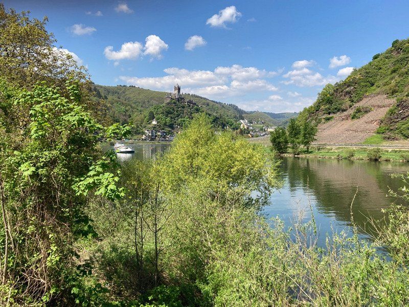
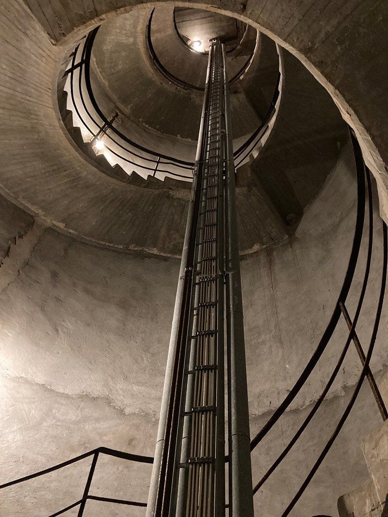
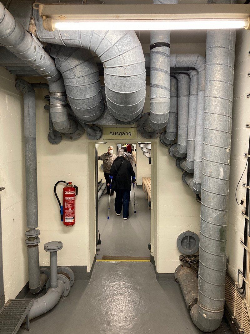
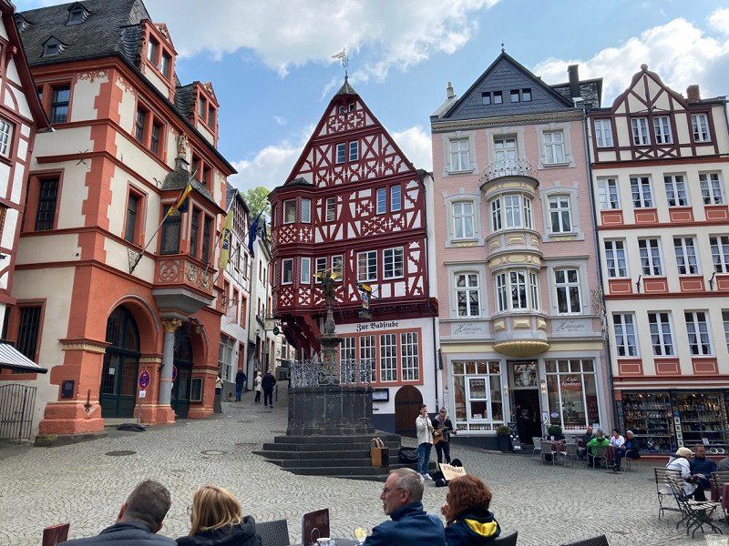
Cochem, Duitsland
Beautiful old town right on the Moselle (very touristy). A visit to the Bundesbunker bank is definitely worth it! Please bring a warm sweater or jacket.
56812 Cochem, Duitsland
50° 8' 50.7" N 7° 10' 12.6" E
50.1474123 7.1701755
• Head northwest on L98. Go for 300 m.
• Turn right onto Endertplatz. Go for 29 m.
• Continue on Ravenéstraße. Go for 167 m.
• Continue on Josefstraße. Go for 53 m.
• Turn right onto Moselstraße (B49). Go for 1.7 km.
• Turn right onto K20. Go for 48 m.
• Turn right onto Ellerer Straße (K20). Go for 2.6 km.
• Continue on K20. Go for 252 m.
• Turn left onto K22 toward Ediger-Eller/Senheim. Go for 627 m.
• Take the 2nd exit from roundabout onto K22 toward Ediger-Eller/Senheim/Calmont-Region. Go for 5.6 km.
• Take the 1st exit from roundabout onto B49 toward Trier/Wittlich/Zell (Mosel). Go for 13.7 km.
• Take the 1st exit from roundabout onto Koblenzer Straße (B49) toward A48/Trier/Wittlich/Daun/B421. Go for 12.8 km.
• Turn left onto Dorfstraße (L58). Go for 426 m.
• Turn right onto Bahnhofstraße (K34) toward Ürzig/Gewerbegebiet Kinheim/Gewerbegebiet Sengwald. Go for 2.2 km.
• Continue on L56 toward Ürzig. Go for 1.3 km.
• Turn left onto Bergstraße (L56) toward Ortsmitte. Go for 1.3 km.
• Take the 1st exit from roundabout onto Moselufer (B53) toward Bernkastel-Kues/Zeltingen-Rachtig/Wittlich. Go for 3.3 km.
• Take the 3rd exit from roundabout onto L47. Go for 4.5 km.
• Take the 3rd exit from roundabout onto Cusanusstraße (L47) toward Bernkastel-Kues/Gewerbegebiet Bornwiese. Go for 902 m.
• Turn right toward Schützenweg. Go for 42 m.
• Turn right onto Schützenweg. Go for 221 m.
• Continue on Rebschulweg. Go for 443 m.
• Turn right onto Bergweg. Go for 178 m.
• Arrive at Bergweg. Your destination is on the right.
☍
52,7 km
( 56 min.)
Day
Bernkastel-Kues, Duitsland
49° 55' 11.2" N 7° 3' 45.6" E
49.9197888 7.0626677
• Head toward Auf der Trift on Bergweg. Go for 178 m.
• Turn right onto Bergweg. Go for 369 m.
• Turn left onto Bergweg. Go for 41 m.
• Turn slightly right onto Brüningstraße. Go for 75 m.
• Turn left onto Arndtstraße. Go for 245 m.
• Take the 1st exit from roundabout onto Cusanusstraße (L47). Go for 259 m.
• Take the 2nd exit from roundabout onto Saarallee (L47). Go for 4.7 km.
• Turn left onto K134. Go for 5.0 km.
• Continue on K53. Go for 5.6 km.
• Turn right onto B53. Go for 1.1 km.
• Turn right onto Sankt Martinstraße. Go for 86 m.
• Turn left onto In der Noo. Go for 65 m.
• Arrive at In der Noo. Your destination is on the left.
☍
17,7 km
( 20 min.)
Day
Stellplatz Weingut Heinz Kirsten
In der Noo, 54498, Piesport, Duitsland
49° 52' 48" N 6° 55' 33" E
49.8800000 6.9258333
• Head northwest on In der Noo. Go for 207 m.
• Turn left onto Karthäuserstraße. Go for 150 m.
• Turn right onto Bahnhofstraße (B53). Go for 268 m.
• Take the 1st exit from roundabout onto Brückenstraße (L50) toward Salmtal/Klausen/Moselbrücke/Piesport. Go for 7.1 km.
• Turn right onto Bernkasteler Straße (K51). Go for 338 m.
• Turn left onto L47. Go for 2.8 km.
• Take ramp onto A1 toward Saarbrücken/Trier. Go for 13.0 km.
• Take exit 130 toward Fell/Longuich onto A602. Go for 1.2 km.
• Take the exit toward Fell/Longuich onto L150. Go for 923 m.
• Continue on L145 toward Fell/Riol/Gewerbegebiet im Paesch. Go for 2.4 km.
• Take the 1st exit from roundabout onto Moselstraße. Go for 102 m.
• Continue straight ahead. Go for 233 m.
• Turn left. Go for 961 m.
• Turn right. Go for 20 m.
• Arrive at your destination on the right.
☍
29,6 km
( 30 min.)
CampingPark Triolago
Sanitary neat but mainly permanent pitches (not really our campsite).
Zum Campingplatz 1, 54340, Riol, Duitsland
49° 47' 25.8" N 6° 48' 29.2" E
49.7905000 6.8081000
• Head west. Go for 20 m.
• Turn left. Go for 961 m.
• Turn right toward Moselstraße. Go for 233 m.
• Continue on Moselstraße. Go for 88 m.
• Take the 2nd exit from roundabout onto L145. Go for 2.4 km.
• Continue on L150 toward Trier/Luxemburg/Köln/Koblenz/Kaiserslautern/Saarbrücken. Go for 291 m.
• Take ramp onto A602 toward Kaiserslautern/Trier/Saarbrücken/A1. Go for 10.1 km.
• Continue on B49. Go for 2.5 km.
• Keep left onto Georg-Schmitt-Platz (B49) toward B51/Saarburg/Konz/Luxemburg/Universität/Wip. Go for 227 m.
• Continue on Katharinenufer (B49) toward Centrum/Alleenring. Go for 1.3 km.
• Turn left onto Südallee (L143) toward Pluwig/Universität/Wip/Alleenring. Go for 672 m.
• Turn left toward Saarstraße. Go for 20 m.
• Arrive at Saarstraße. Your destination is on the right.
☍
18,8 km
( 21 min.)
Day
Day
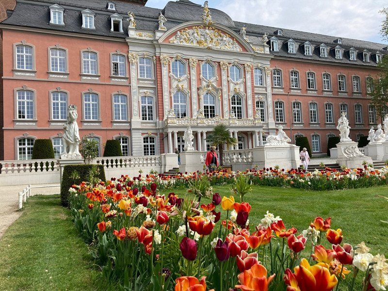
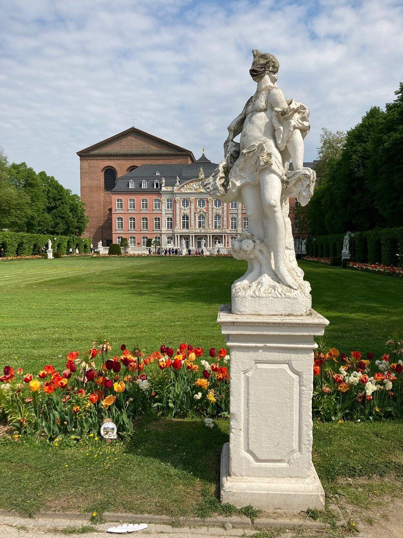
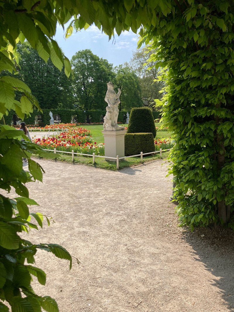
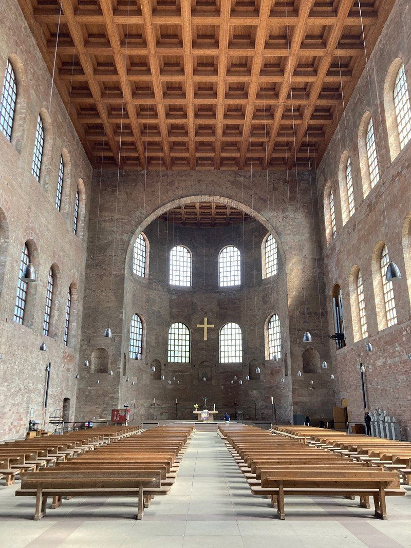
Trier, Duitsland
Oldest city in Germany. You can easily take two days to view it.
49° 44' 60" N 6° 38' 13.7" E
49.7499920 6.6371433
• Head toward Neustraße on Kaiserstraße (L143). Go for 13 m.
• Turn left onto Kaiserstraße (L143). Go for 661 m.
• Turn right onto Sankt-Barbara-Ufer (B49) toward Köln/Aachen/B51. Go for 1.4 km.
• Turn left onto Kaiser-Wilhelm-Brücke toward Luxemburg/A64/B51/Köln/Aachen. Go for 363 m.
• Turn right onto Bitburger Straße (B51) toward Luxemburg/A64/Köln/Aachen. Go for 35.9 km.
• Take ramp onto A60 toward Lüttich/Liège/Köln/Aachen/Prüm. Go for 19.2 km.
• Take the exit toward Prüm/Pronsfeld/Köln. Go for 243 m.
• Turn right onto B51 toward A1/Köln/Prüm/Gewerbegebiet Weinsheim/Gewerbegebiet Dausfeld. Go for 6.9 km.
• Take ramp onto B51 toward A1/Köln/Aachen. Go for 38.2 km.
• Turn right onto L115 toward Ahrhütte/Rohr. Go for 347 m.
• Turn left onto A1 toward Köln/Euskirchen. Go for 37.2 km.
• Take the left exit toward Dortmund/Venlo/Flughafen Köln onto A1/A61. Go for 6.0 km.
• Keep right onto A61 (Autobahndreieck Erfttal) toward Venlo/Mönchengladbach/Aachen. Go for 34.2 km.
• Take left exit 16 toward Venlo/Düsseldorf/Mönchengladbach/A61 onto A44. Go for 7.5 km.
• Take the exit toward Heinsberg/Venlo/Mönchengladbach/A61 onto A46. Go for 4.0 km.
• Take exit 10 toward Venlo/Mönchengladbach onto A61. Go for 37.2 km.
• Continue on A74. Go for 1.8 km.
• Continue on A73 (Knooppunt Tiglia). Go for 25.8 km.
• Take exit 8 toward Venray-Noord/Maashees. Go for 686 m.
• Turn right onto Maasheseweg (N551). Go for 3.7 km.
• Turn right onto Op den Berg. Go for 1.0 km.
• Continue on Maasheseweg. Go for 160 m.
• Arrive at Maasheseweg. Your destination is on the right.
☍
262,6 km
(2 hrs. 42 min.)
Camping Landgoed Gejsteren
On the way home, an overnight stay at our starting campsite and a last visit to the twin sisters (managers of the campsite). Especially the comment '…they're back…' says a lot about these lovely people. Feel free to drop by.
Maasheseweg 5a, 5862 AP, Geijsteren, Nederland
51° 33' 26.9" N 6° 2' 40.1" E
51.5574600 6.0444600
Day