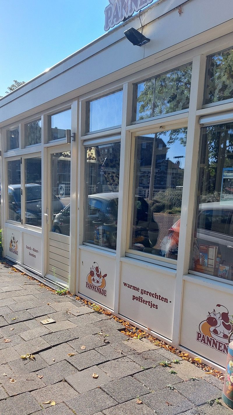
Day
25499 Tangstedt
Tangstedt, Deutschland
53° 39' 59.4" N 9° 50' 14.9" E
53.6665051 9.8374811
• Head toward Dorfstraße on Lehmkoppel. Go for 181 m.
• Turn left onto Dorfstraße (K6). Go for 251 m.
• Turn left onto Pinneberger Weg. Go for 759 m.
• Continue on Tangstedter Straße. Go for 1.2 km.
• Turn left onto Gärtnerstraße. Go for 675 m.
• Turn left onto Hauptstraße (L106). Go for 143 m.
• Turn right and take ramp onto A23 toward Hamburg. Go for 8.2 km.
• Continue on A7 (Autobahndreieck Hamburg-Nordwest). Go for 7.0 km.
• Keep left onto A7. Go for 14.7 km.
• Keep right onto A261 (Autobahndreieck Hamburg-Südwest) toward Bremen/Tötensen. Go for 9.0 km.
• Take exit 4 toward Osnabrück/Bremen/Rade onto A1. Go for 202 km.
• Take exit 72 toward Amsterdam/Rheine onto A30. Go for 49.1 km.
• Take exit 5 toward Oberhausen/Schüttorf-Ost onto A31. Go for 2.9 km.
• Take exit 28 toward Schüttorf-Ost/Bad Bentheim. Go for 237 m.
• Turn left onto Salzbergener Straße (L39) toward Schüttorf. Go for 612 m.
• Take the 3rd exit from roundabout onto Holmers Kamp toward Ohne/Gewerbegebiet Süd. Go for 1.0 km.
• Turn left onto Samernsche Straße (L68). Go for 149 m.
• Continue on Schüttorfer Straße (L68). Go for 1.7 km.
• Turn right onto Schüttorfer Straße (L68) toward Ohne. Go for 956 m.
• Turn right onto Ohner Straße (K8). Go for 891 m.
• Turn left onto Postweg (K9). Go for 2.3 km.
• Continue on Suddendorfer Straße (K9). Go for 238 m.
• Turn right onto Suddendorfer Straße. Go for 235 m.
• Arrive at Suddendorfer Straße. Your destination is on the left.
☍
304,3 km
(2 hrs. 49 min.)
04. Sep. 2025 -
05. Sep. 2025
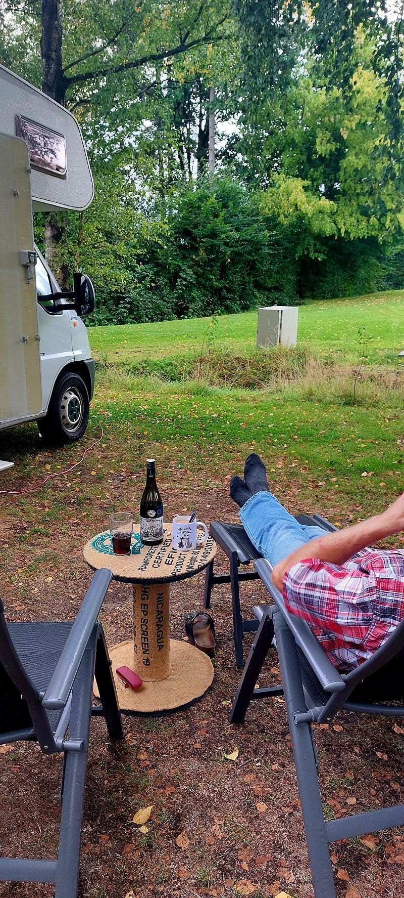
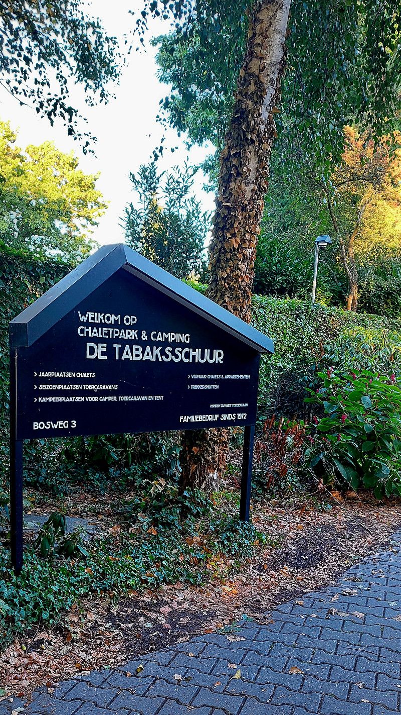
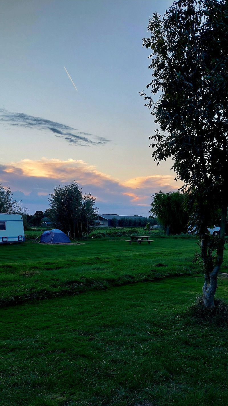
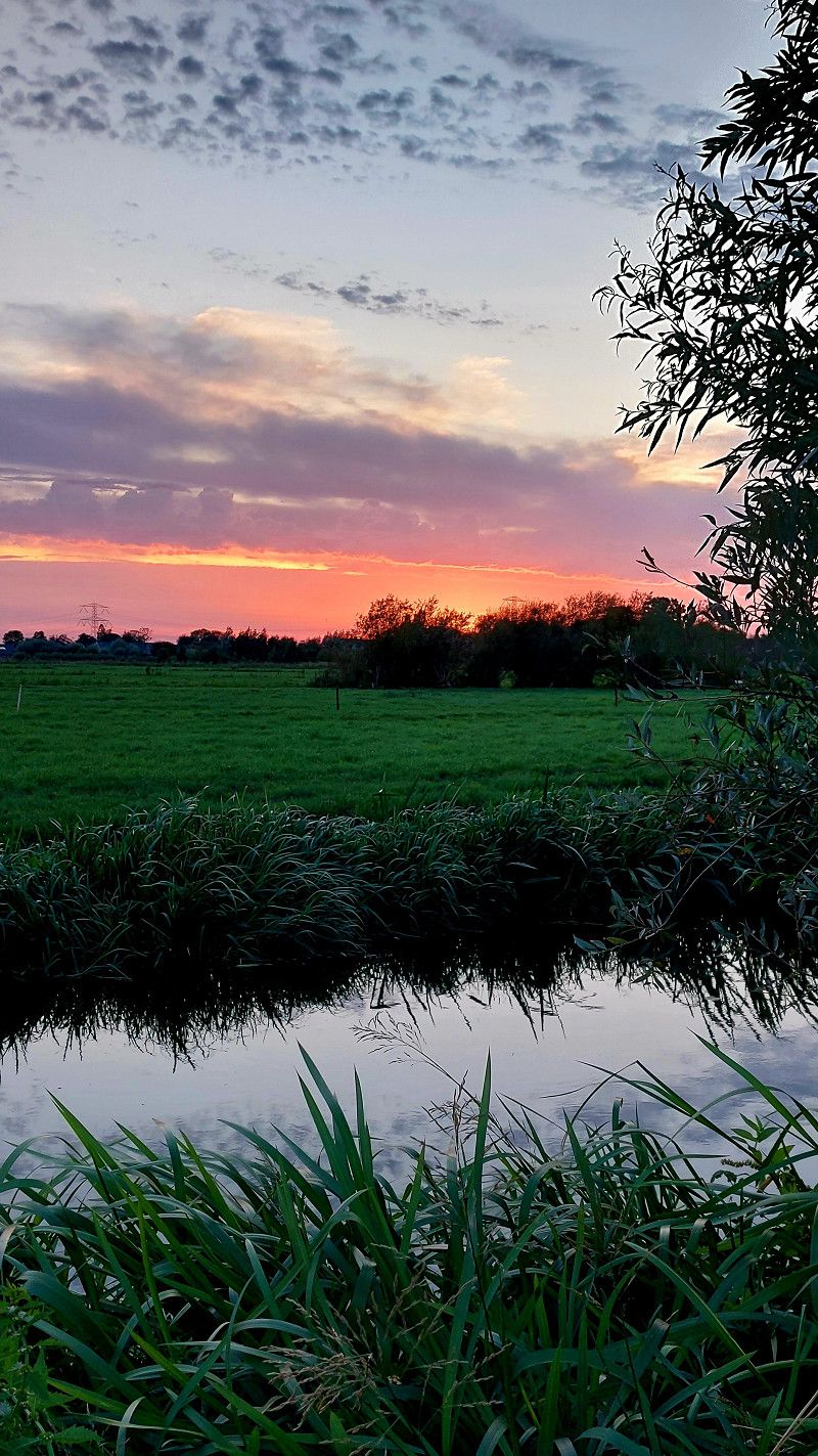
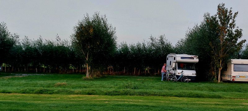
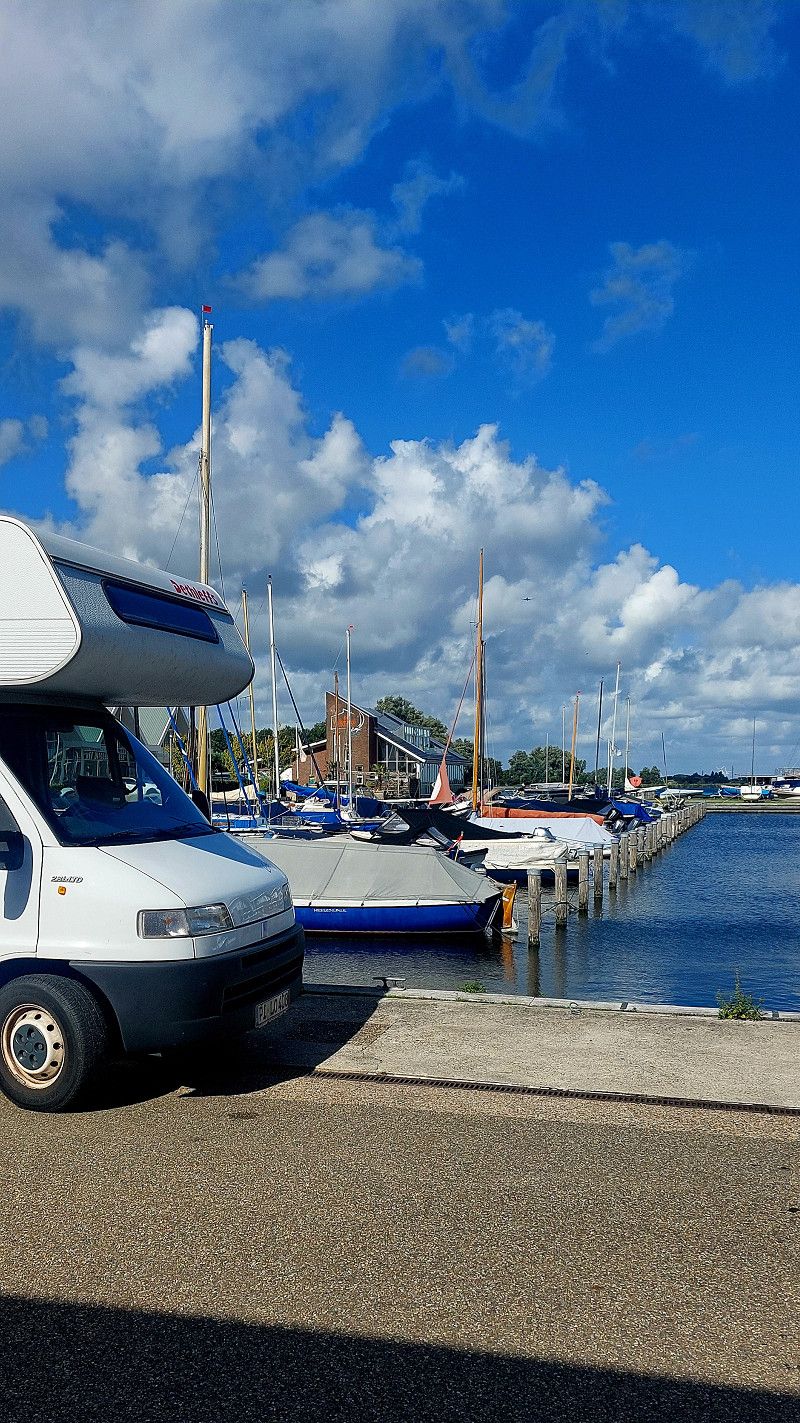
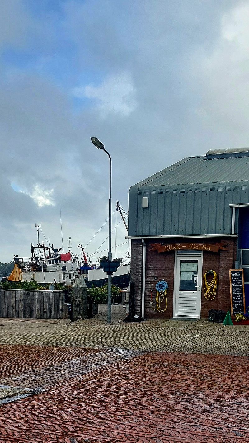
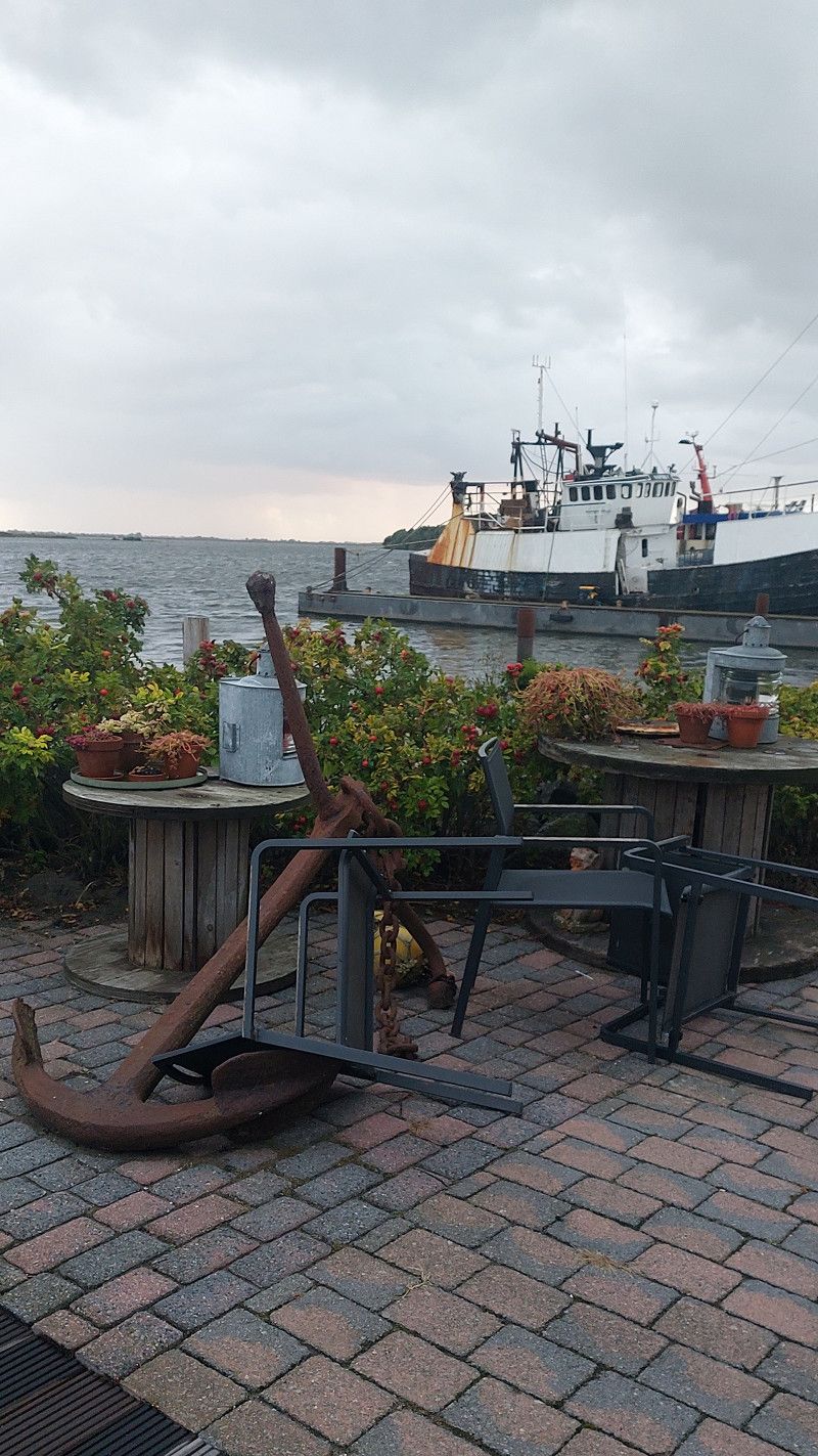
Camping Am Berg
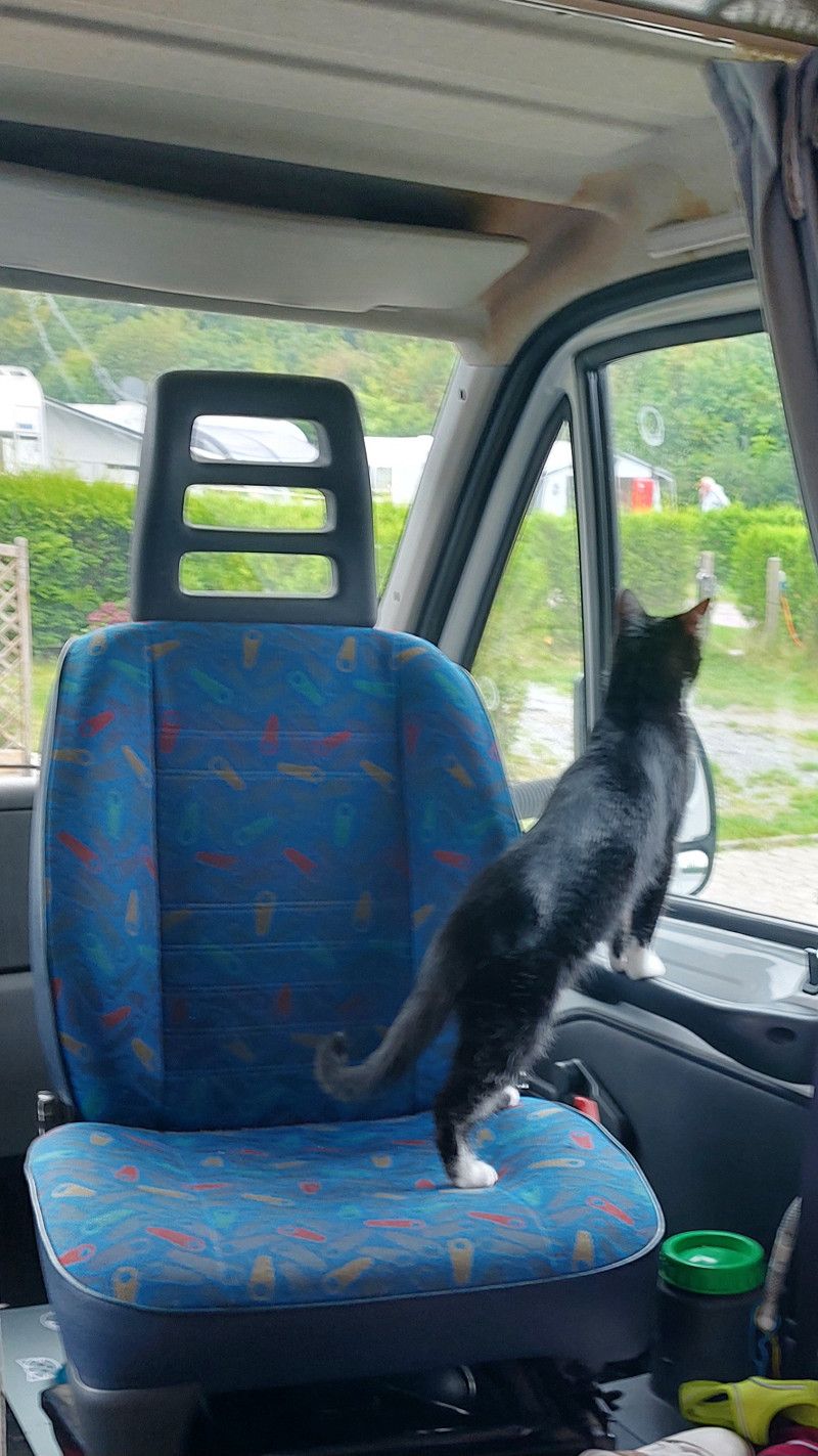
04.09.2025 - small, cozy campsite run by very friendly Dutch people.
Suddendorferstr. 37, 48455, Bad Bentheim, Deutschland
52° 17' 58.7" N 7° 11' 36.4" E
52.2996500 7.1934500
• Head southwest on Suddendorfer Straße. Go for 235 m.
• Turn right onto Suddendorfer Straße (K9). Go for 1.6 km.
• Take the 3rd exit from roundabout onto Ochtruper Straße (K9) toward Ochtrup/Gronau. Go for 1.4 km.
• Turn right onto Ochtruper Straße (B403). Go for 4.4 km.
• Turn left and take ramp onto A31 toward Oberhausen. Go for 36.4 km.
• Take exit 33 toward Gescher/Winterswijk/Velen. Go for 344 m.
• Turn right onto B525 toward Gescher/Winterswijk/Südlohn/Velen. Go for 4.0 km.
• Take the 2nd exit from roundabout onto B525 toward Winterswijk/Südlohn. Go for 10.2 km.
• Continue on Fresenhorst (B70) toward Winterswijk/Oeding. Go for 3.7 km.
• Continue on Kottenseweg (N319). Go for 5.4 km.
• Turn slightly right onto Rondweg Zuid (N319). Go for 584 m.
• Take the 2nd exit from roundabout onto Rondweg Zuid (N319) toward Winterswijk/Industrieterrein Veeneslat/Aalten/Groenlo/Zutphen. Go for 1.7 km.
• Take the 3rd exit from roundabout onto Misterweg (N318) toward Aalten/Bocholt/Arnhem. Go for 1.3 km.
• Turn left onto Misterweg. Go for 32 m.
• Continue toward Misterweg. Go for 33 m.
• Turn left onto Misterweg. Go for 166 m.
• Turn right. Go for 12 m.
• Arrive at your destination on the right.
☍
71,4 km
( 49 min.)
Day
05. Sep. 2025 -
05. Sep. 2025
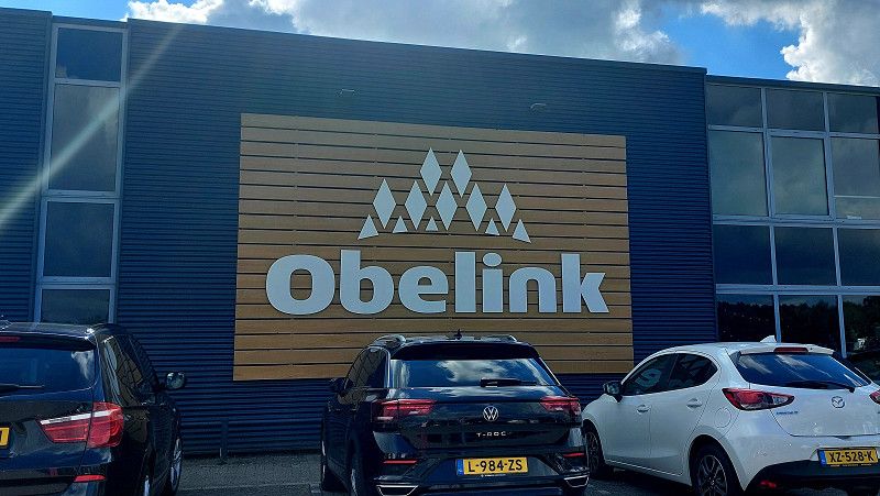
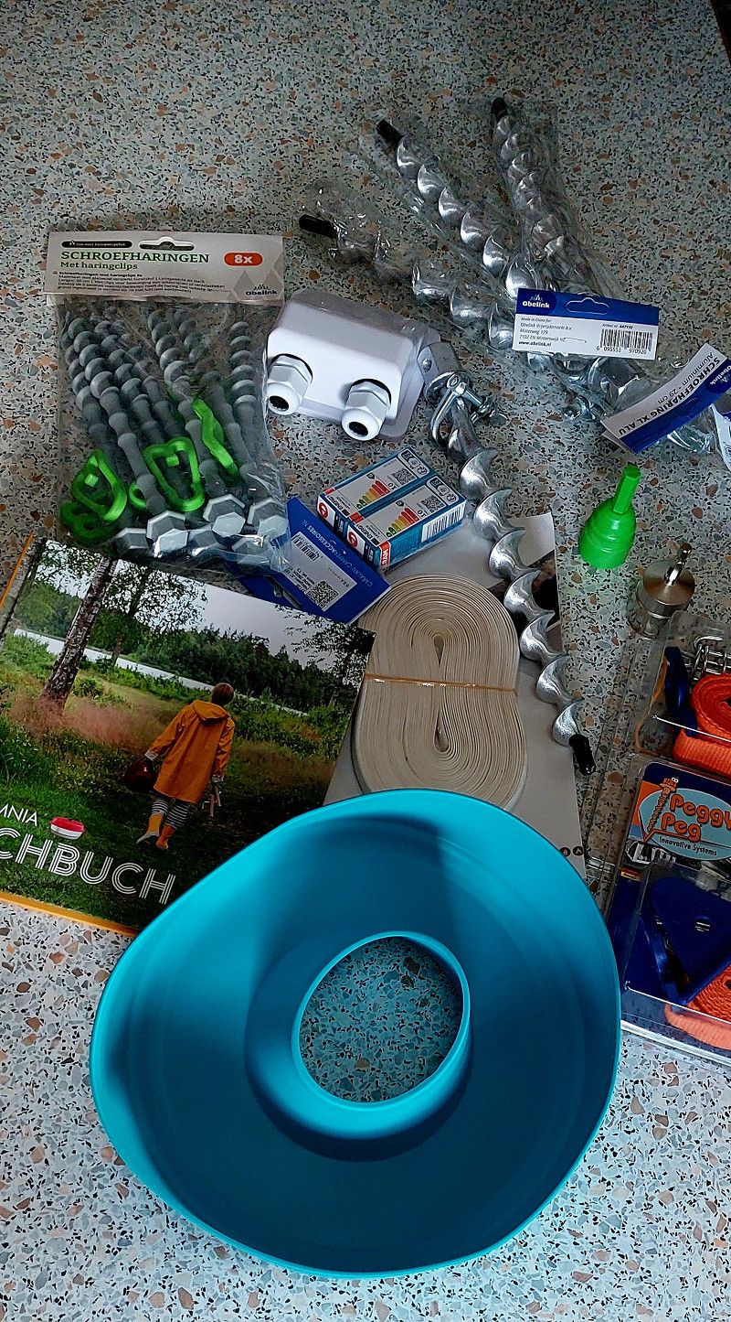
Obelink Vrijetijdsmarkt
Camping equipment....
Today we went shopping for a few little things.
Misterweg 179, Winterswick, Geldern, Niederlande
51° 57' 34.4" N 6° 41' 9.5" E
51.9595441 6.6859812
• Head toward Misterweg. Go for 12 m.
• Turn left onto Misterweg. Go for 166 m.
• Turn left toward Misterweg. Go for 104 m.
• Turn right onto Misterweg. Go for 63 m.
• Turn left onto Misterweg. Go for 14 m.
• Turn right onto Eekelerweg. Go for 363 m.
• Turn left onto Misterweg. Go for 269 m.
• Turn right onto Grote Veldweg. Go for 24 m.
• Turn left onto Misterweg (N318). Go for 4.2 km.
• Pass 6 roundabouts and continue on Oostelijke Rondweg (N318). Go for 12.5 km.
• Continue toward Oostelijke Rondweg/N318. Go for 38 m.
• Turn left onto Twenteroute (N18). Go for 2.1 km.
• Turn left onto A18 toward Doetinchem/Arnhem. Go for 22.5 km.
• Continue on A12. Go for 25.9 km.
• Continue on A12 toward Den Haag/Utrecht. Go for 18.0 km.
• Take exit 23A toward Veenendaal/Rhenen. Go for 508 m.
• Turn right onto Rondweg-Oost (N233). Go for 2.0 km.
• Pass 3 roundabouts and continue on Rondweg-Oost (N233). Go for 3.1 km.
• Keep right toward Elst/Industrieterrein Remmerden. Go for 45 m.
• Take the 1st exit from roundabout onto Cuneraweg toward Elst. Go for 1.2 km.
• Turn left onto Veenendaalsestraatweg (N416). Go for 3.6 km.
• Take the 1st exit from roundabout onto Rijksstraatweg (N225) toward Amerongen/Leersum/Utrecht. Go for 1.6 km.
• Turn right onto Bosweg. Go for 1.1 km.
• Arrive at Bosweg.
☍
99,4 km
(1 hrs. 12 min.)
05. Sep. 2025 -
06. Sep. 2025
Camping De Tabaksschuur
Very friendly "camping father", nice place.
Bosweg 3, 3922 GJ, Elst Ut, Niederlande
51° 59' 50.6" N 5° 29' 16.3" E
51.9974000 5.4878700
• Head toward Paardenkop on Bosweg. Go for 1.1 km.
• Turn right onto Elsterstraatweg (N225). Go for 1.4 km.
• Pass 4 roundabouts and continue on Rijksstraatweg (N225). Go for 4.7 km.
• Take the 1st exit from Rotonde Darthuizerpoort roundabout onto Maarsbergseweg (N226) toward Utrecht/Maarsbergen/Amersfoort. Go for 4.5 km.
• Keep right onto Woudenbergseweg (N226). Go for 78 m.
• Take the 4th exit from Parallelweg roundabout onto Engweg. Go for 262 m.
• Turn left and take ramp onto A12 toward Utrecht. Go for 17.1 km.
• Keep right onto A12 toward Ring Zuid/E311/Utrecht-Centrum/Nieuwegein/Breda/A27. Go for 38 m.
• Take the exit toward E311/'s-Hertogenbosch/Breda/Arnhem onto A12. Go for 5.5 km.
• Take exit 18A toward Houten-Oost onto N421 (Limesbaan). Go for 689 m.
• Arrive at Limesbaan (N421). Your destination is on the left.
☍
35,4 km
( 28 min.)
Day
06. Sep. 2025 -
07. Sep. 2025
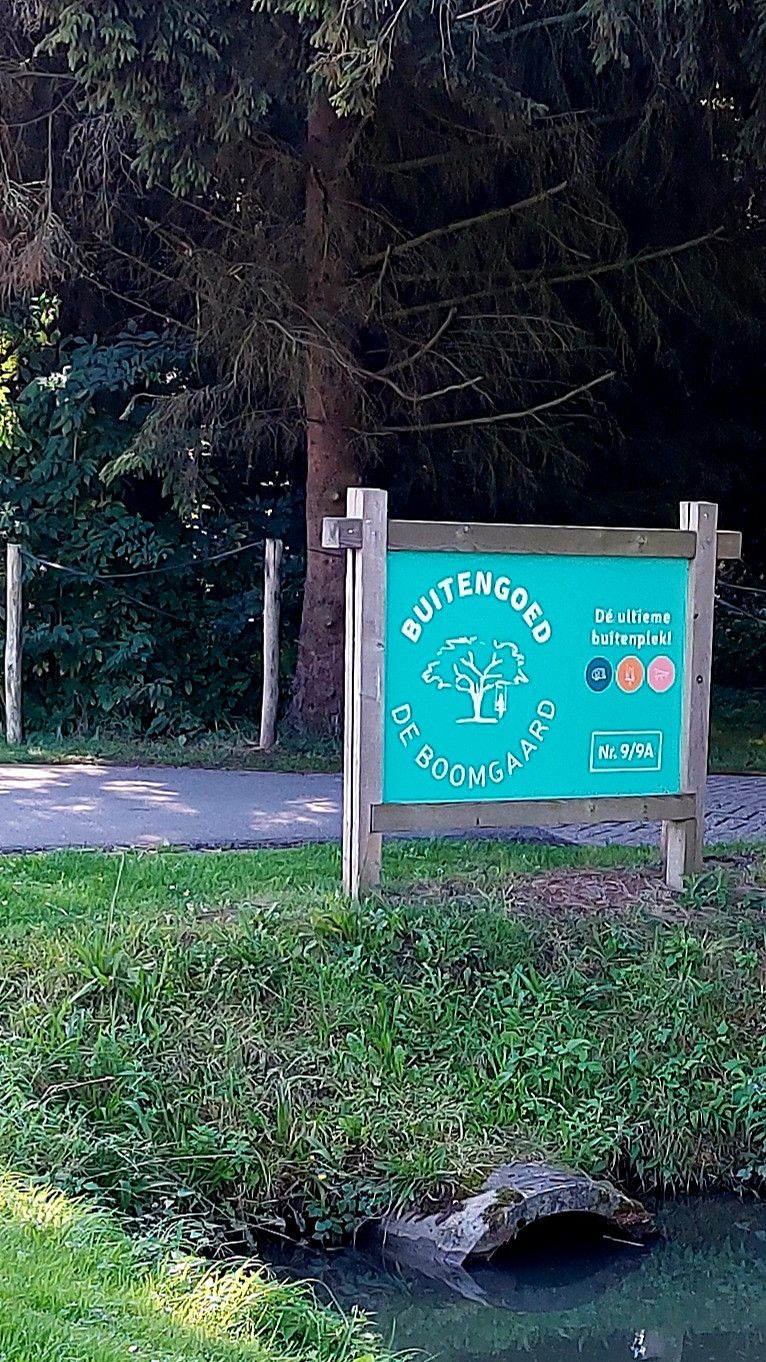
Buitengoed de Boomgaard
Large, very family-friendly campsite. We arrived before 1 p.m. and were still allowed onto the site.
Parallelweg 9, 3981 HG, Bunnik, Niederlande
52° 3' 25.7" N 5° 11' 45" E
52.0571300 5.1958400
• Head toward Binnenweg on Limesbaan (N421). Go for 2.3 km.
• Turn left onto Rondweg. Go for 2.4 km.
• Turn right onto De Tuin. Go for 128 m.
• Turn right onto De Tuin. Go for 10 m.
• Continue on Heidetuin. Go for 186 m.
• Turn left onto Binnentuin. Go for 220 m.
• Arrive at Binnentuin. Your destination is on the left.
☍
5,2 km
( 6 min.)
06. Sep. 2025 -
06. Sep. 2025
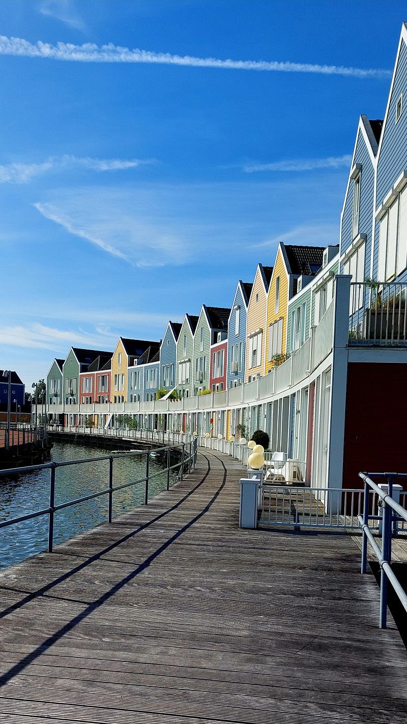
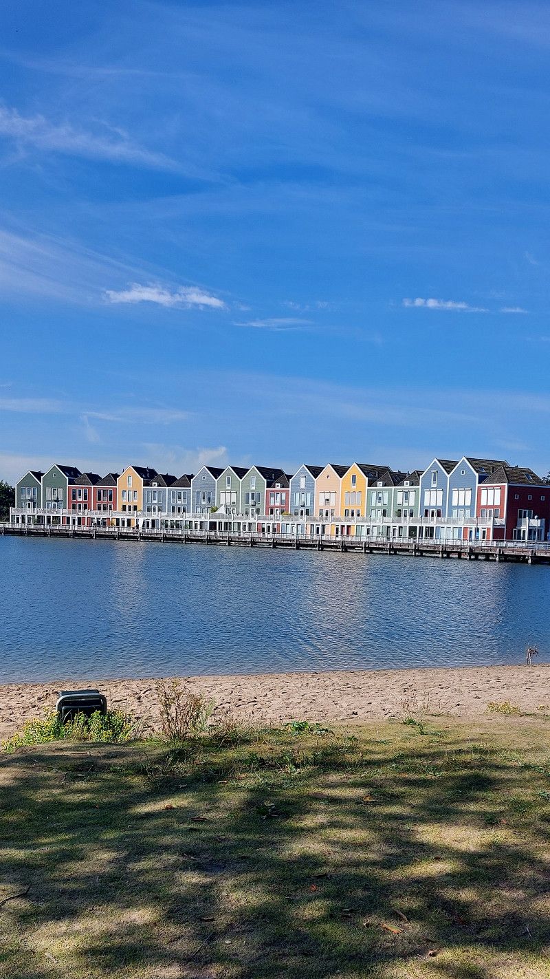
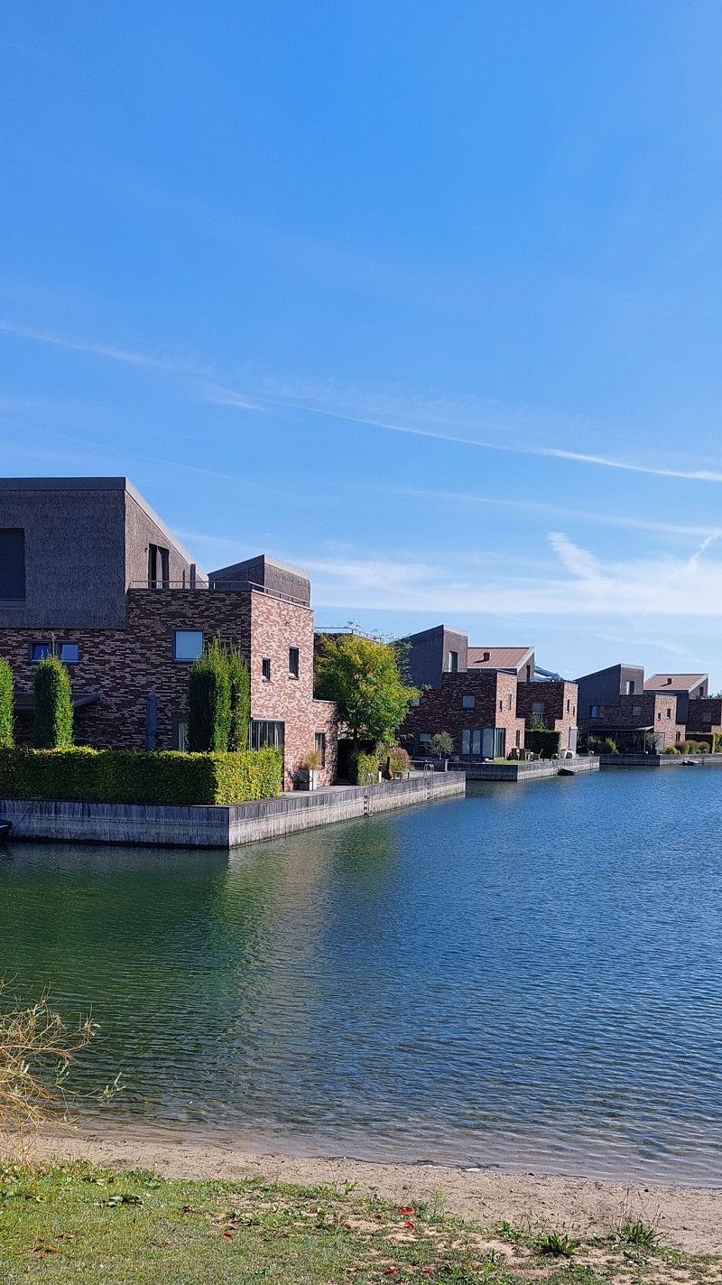
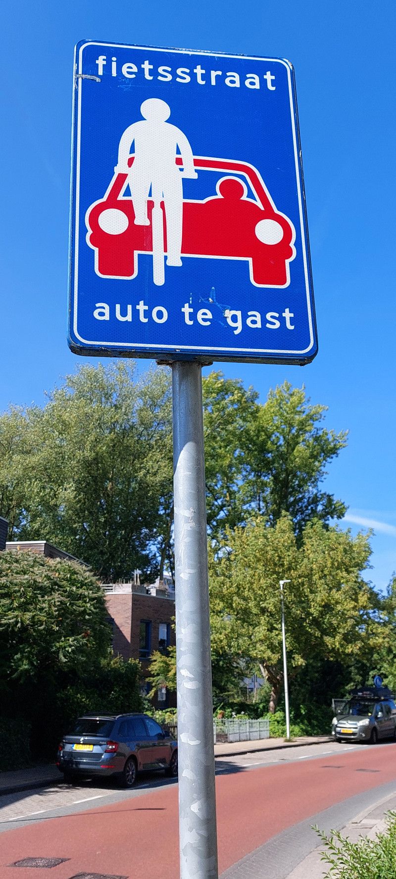
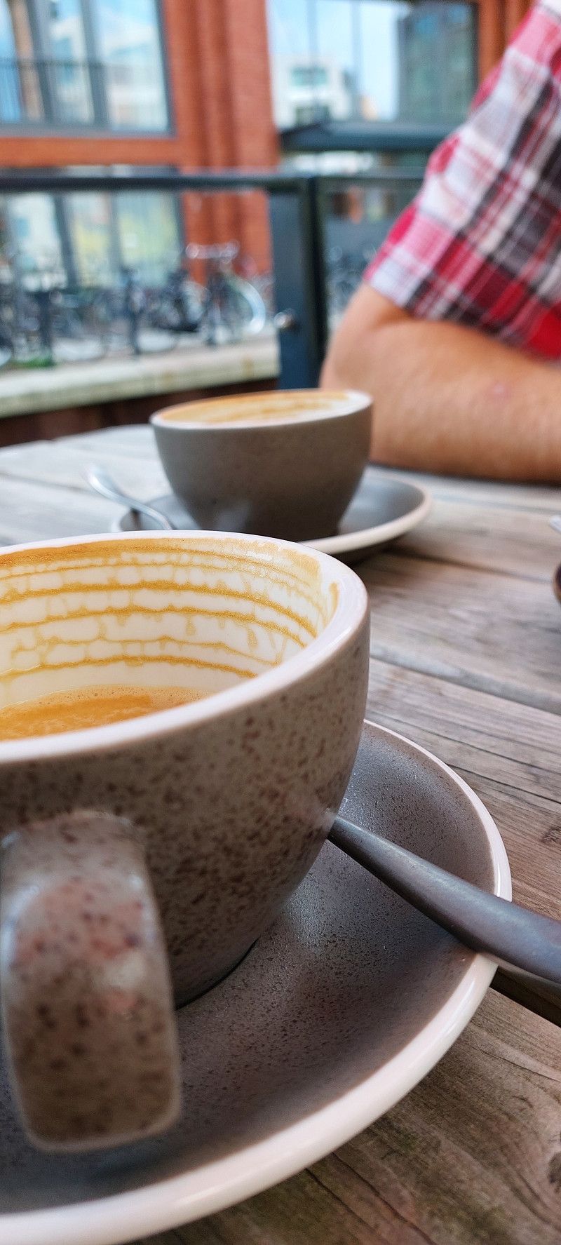
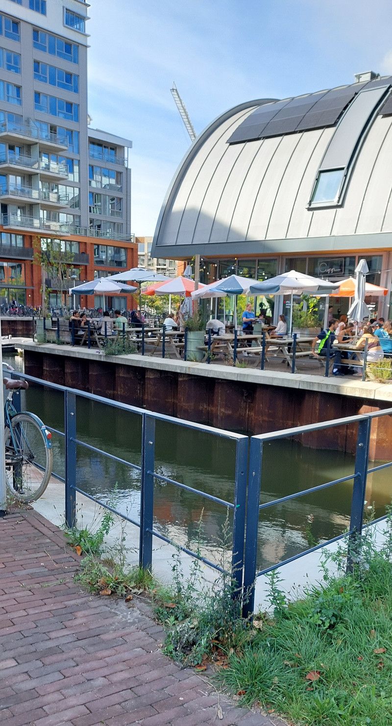
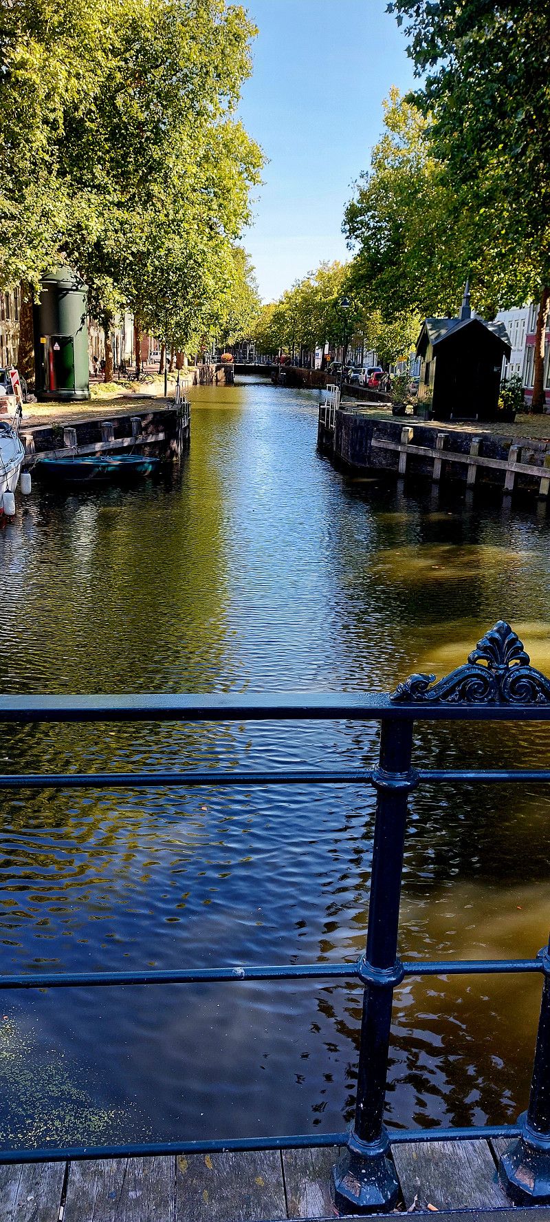
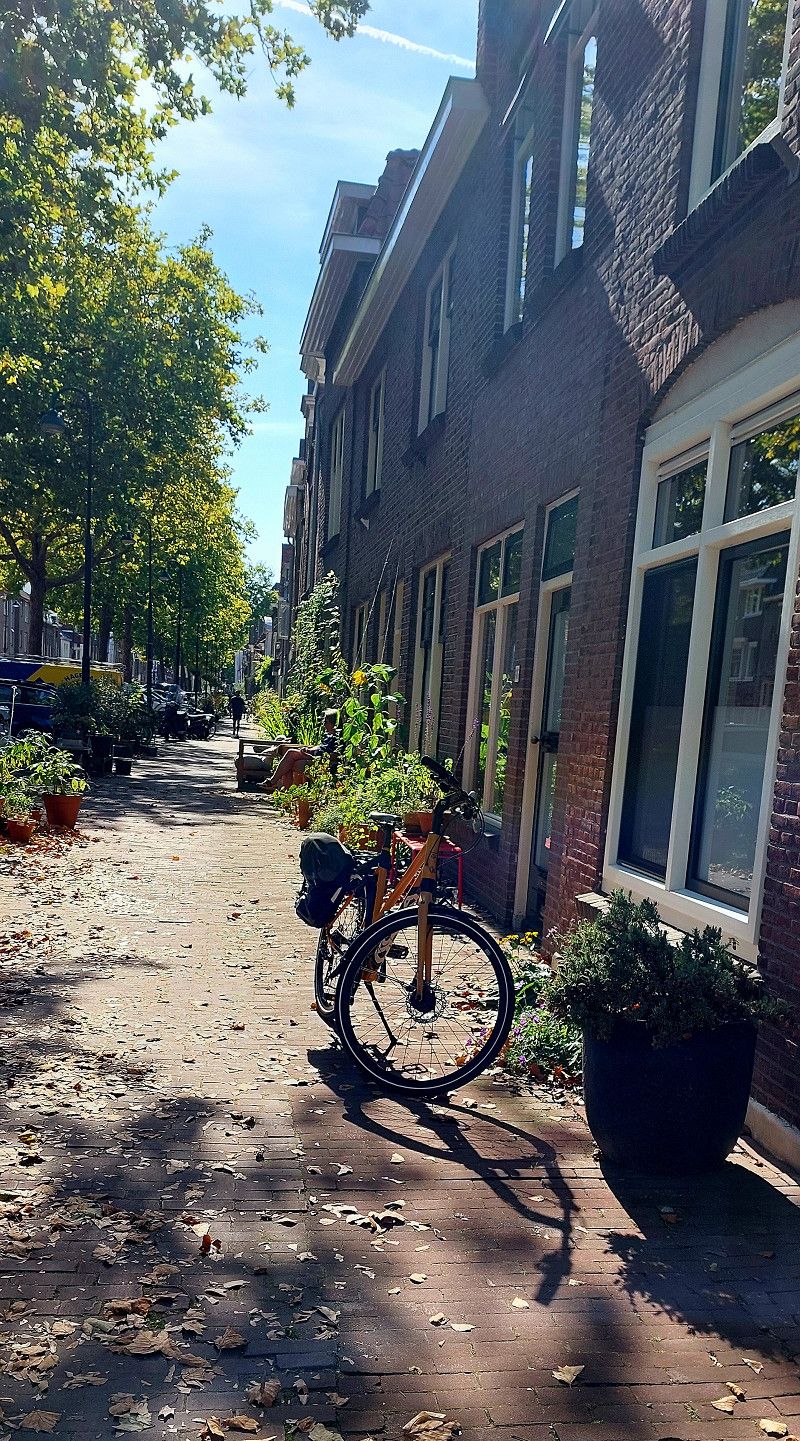
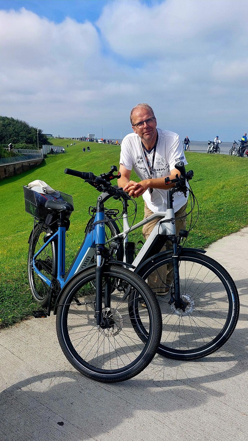
Houten und Utrecht
Houten and Utrecht are very bike-friendly. They have great, wide bike paths, plenty of cycle streets, and all road users are very relaxed.
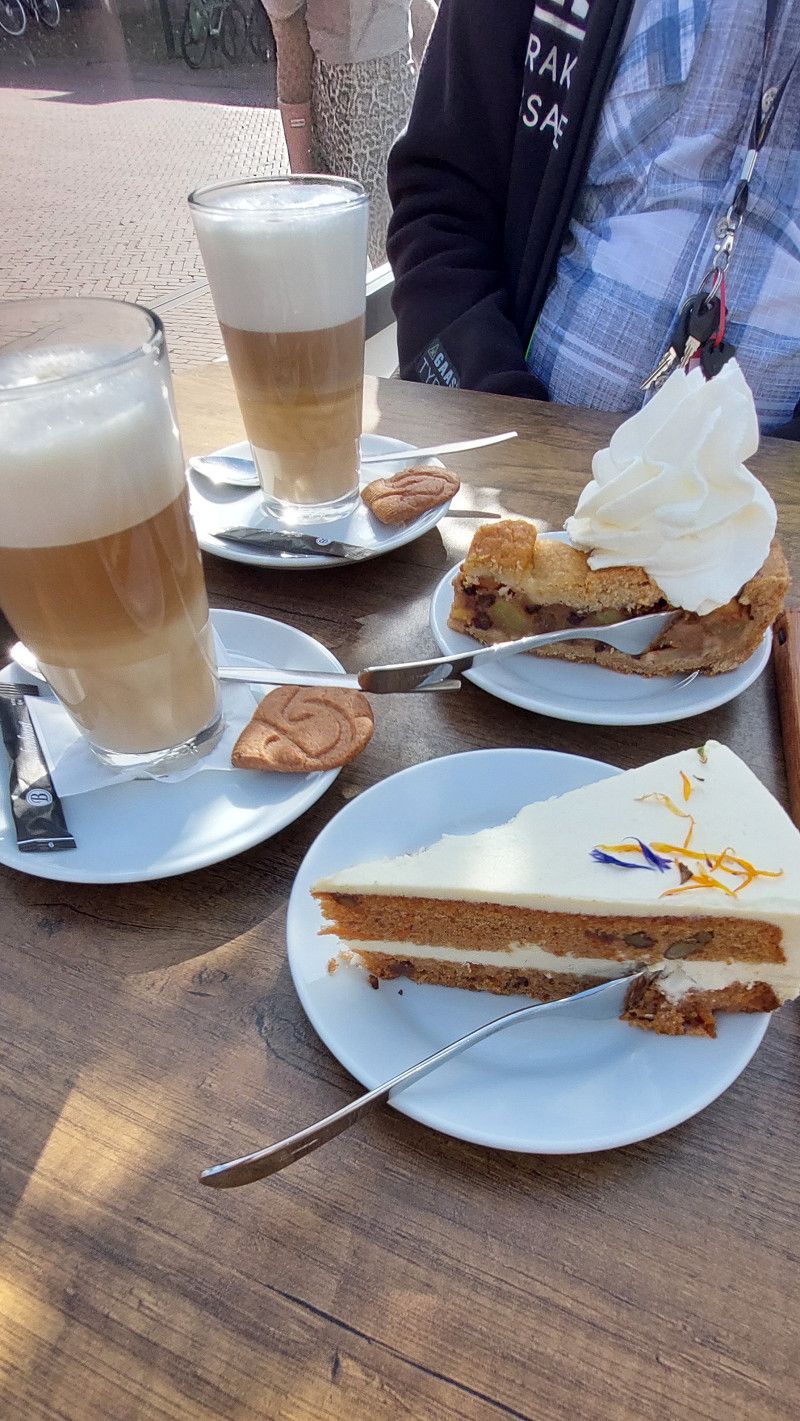
In Houten we looked at the colorful houses and had coffee and cake by the canal in Utrecht.
Binnentuin 34, Houten, Utrecht, Niederlande
52° 1' 19.3" N 5° 11' 17.7" E
52.0220274 5.1882488
• Head north on Binnentuin. Go for 220 m.
• Turn right onto Heidetuin. Go for 186 m.
• Continue on De Tuin. Go for 10 m.
• Turn left onto De Tuin. Go for 128 m.
• Turn left onto Rondweg. Go for 2.4 km.
• Turn right onto Limesbaan (N421). Go for 2.6 km.
• Take ramp onto A12. Go for 2.7 km.
• Keep left onto A12 toward Den Haag/E30/Rotterdam/Amsterdam. Go for 30.3 km.
• Take exit 12 toward Reeuwijk. Go for 269 m.
• Take the 2nd exit from Ir. L. G. H. Fortuijnrotonde roundabout onto Goudsestraatweg (N459) toward Reeuwijk. Go for 271 m.
• Take the 1st exit from Dr. J. Rupkerotonde roundabout onto Reeuwijkse Randweg toward Reeuwijk-Dorp/Industrieterrein Zoutman. Go for 526 m.
• Take the 2nd exit from roundabout onto Reeuwijkse Randweg. Go for 2.8 km.
• Turn right onto Zoutmansweg. Go for 302 m.
• Continue on Bodegraafsestraatweg. Go for 1.0 km.
• Continue on Bodegraafsestraatweg. Go for 404 m.
• Take the 2nd exit from Olympiarotonde roundabout onto Bodegraafsestraatweg. Go for 485 m.
• Take the 2nd exit from Graaf Florisrotonde roundabout onto Graaf Florisweg. Go for 251 m.
• Turn right onto Zwarteweg. Go for 257 m.
• Continue on Zuidelijke Zwarteweg. Go for 145 m.
• Continue on Joubertstraat. Go for 677 m.
• Continue on Sportlaan. Go for 309 m.
• Continue on Goejanverwelledijk. Go for 75 m.
• Turn left onto Schoonhovenseweg. Go for 166 m.
• Keep right toward Gouderak/Bergambacht/Rotterdam/Den Haag/N207. Go for 25 m.
• Take the 2nd exit from Verkeersplein Stolwijkersluis roundabout onto Schoonhovenseweg toward Gouderak/Bergambacht/Rotterdam/Den Haag/N207. Go for 415 m.
• Keep right toward Stolwijk/Bergambacht. Go for 30 m.
• Take the 2nd exit from roundabout onto Schoonhovenseweg (N207) toward Stolwijk/Bergambacht. Go for 2.1 km.
• Turn right onto Beijerscheweg. Go for 337 m.
• Arrive at Beijerscheweg. Your destination is on the left.
☍
49,4 km
( 38 min.)
Day
07. Sep. 2025 -
09. Sep. 2025
Campingplatz hinter einem Bauernhof
Beijerscheweg 11, Stolwijk, Südholland, Niederlande
51° 59' 21.2" N 4° 44' 44.6" E
51.9892106 4.7457267
• Head northeast on Beijerscheweg. Go for 337 m.
• Turn left onto Schoonhovenseweg (N207). Go for 2.1 km.
• Keep right toward Gouda/Haastrecht/N228. Go for 33 m.
• Take the 2nd exit from roundabout onto Schoonhovenseweg toward N228/Gouda/Haastrecht. Go for 386 m.
• Keep right toward Gouda. Go for 22 m.
• Take the 2nd exit from Verkeersplein Stolwijkersluis roundabout onto Schoonhovenseweg toward Gouda. Go for 257 m.
• Turn left onto Goejanverwelledijk. Go for 376 m.
• Continue on Nieuwe Veerstal. Go for 82 m.
• Turn right onto Punt. Go for 29 m.
• Turn slightly right onto Oosthaven. Go for 387 m.
• Continue on Dubbele Buurt. Go for 70 m.
• Turn left onto Wijdstraat. Go for 19 m.
• Turn slightly right onto Lage Gouwe. Go for 375 m.
• Turn right onto Turfmarkt. Go for 60 m.
• Arrive at Turfmarkt. Your destination is on the right.
☍
4,5 km
( 7 min.)
07. Sep. 2025 -
07. Sep. 2025
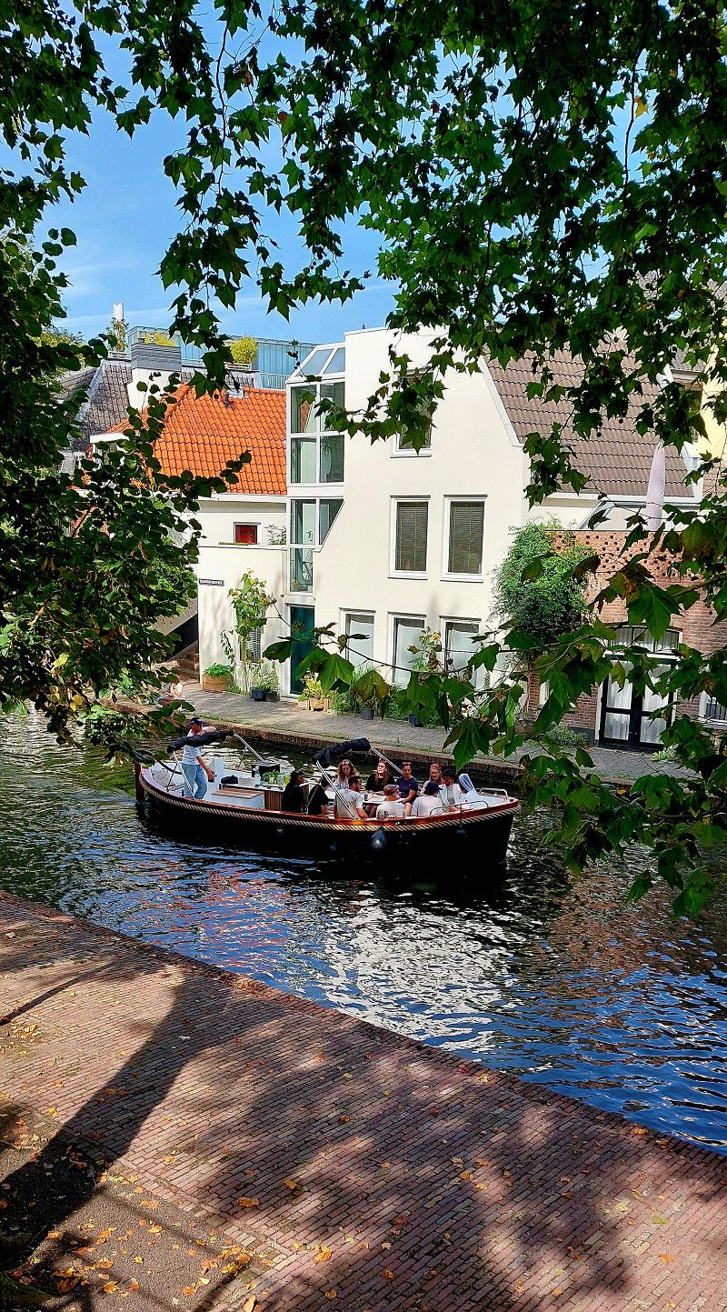
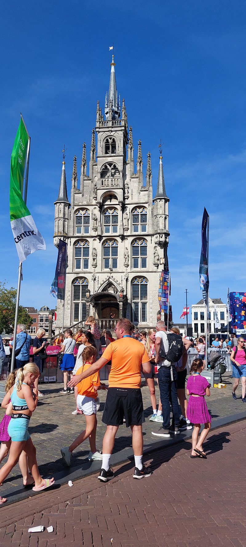
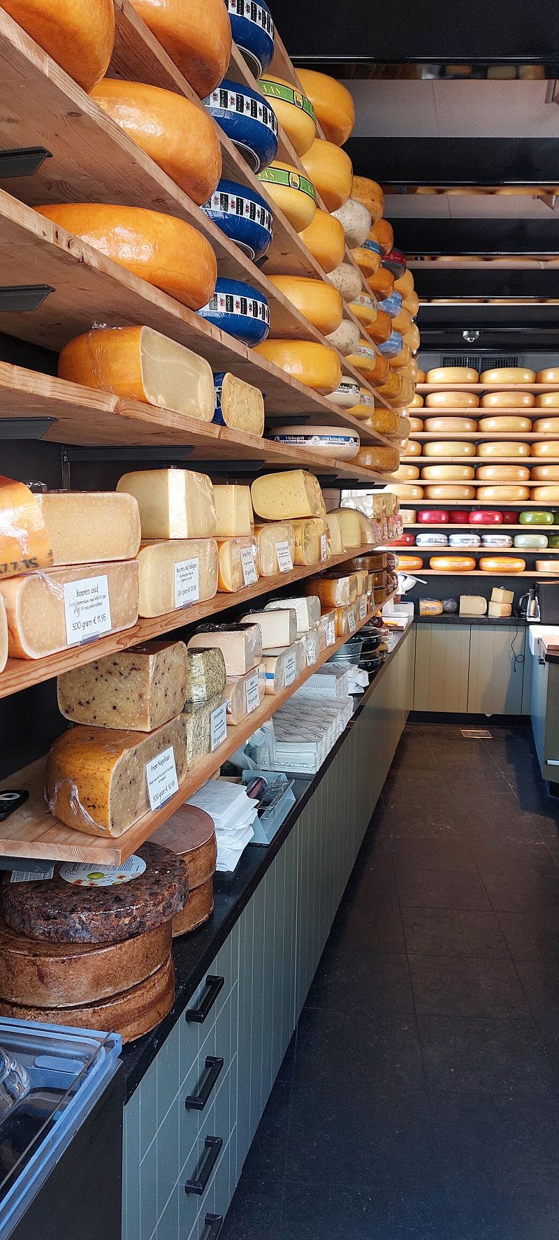
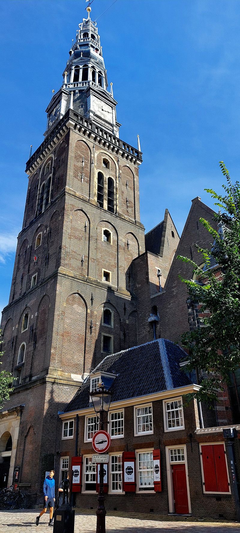
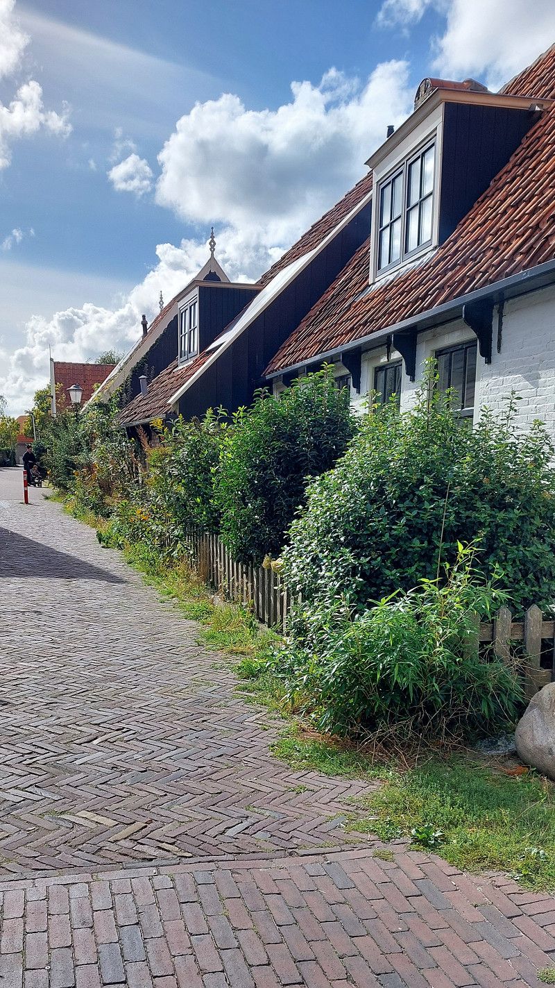
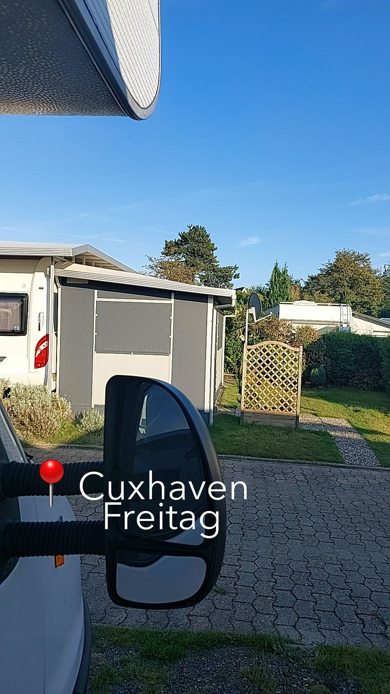
Gouda
Exploring the city of Gouda by bike. Today, however, almost everything around the old market square was closed off due to a race and was extremely crowded. Nevertheless, we saw a few beautiful houses and canals.
Turfmarkt 111, Gouda, Südholland, Niederlande
52° 0' 40.2" N 4° 42' 23.8" E
52.0111664 4.7066188
• Head toward Naaierstraat on Turfmarkt. Go for 205 m.
• Make a U-Turn at Naaierstraat onto Turfmarkt. Go for 283 m.
• Turn right onto Lage Gouwe. Go for 123 m.
• Turn left onto Nieuwehaven. Go for 24 m.
• Continue on Pottersplein. Go for 58 m.
• Turn right onto Hoge Gouwe. Go for 74 m.
• Continue on Nieuwe Gouwe O.Z. Go for 1.8 km.
• Keep left onto Nieuwe Gouwe O.Z. toward A12/A20. Go for 141 m.
• Continue on Goudse Poort toward A12/A20. Go for 1.4 km.
• Turn right and take ramp onto A12 toward Rotterdam/Den Haag. Go for 1.9 km.
• Keep right onto A20 (Knooppunt Gouwe) toward Hoek van Holland/Rotterdam/Gouda-West. Go for 12.9 km.
• Take the exit toward E19/Ring Rotterdam (oost)/Dordrecht/Breda/A16 onto Knooppunt Terbregseplein. Go for 2.2 km.
• Continue on A16 (Ring Rotterdam). Go for 867 m.
• Keep left onto A16 (Ring Rotterdam) toward Dordrecht/Breda/Havens 1200-9900. Go for 7.4 km.
• Take the exit toward Gorinchem/Nijmegen onto A15 (Knooppunt Ridderkerk). Go for 4.3 km.
• Take exit 21 toward Hendrik-Ido-Ambacht/Ridderkerk/P+R. Go for 592 m.
• Turn left onto N915 toward Ridderkerk-Oostendam/Hendrik-Ido-Ambacht. Go for 1.9 km.
• Continue on Grote Beer (N915). Go for 964 m.
• Turn left toward De Helling. Go for 181 m.
• Turn left onto De Helling. Go for 604 m.
• Continue on Dam. Go for 322 m.
• Turn left onto Haven toward Kinderdijk/Nw. Lekkerland/Fast Ferry. Go for 481 m.
• Continue on Cortgene. Go for 366 m.
• Continue on Oost Kinderdijk. Go for 1.0 km.
• Continue on West Kinderdijk. Go for 1.6 km.
• Continue on Molenstraat. Go for 1.2 km.
• Turn right onto Nederwaard. Go for 134 m.
• Arrive at Nederwaard. Your destination is on the right.
☍
43,1 km
( 35 min.)
Day
08. Sep. 2025 -
08. Sep. 2025
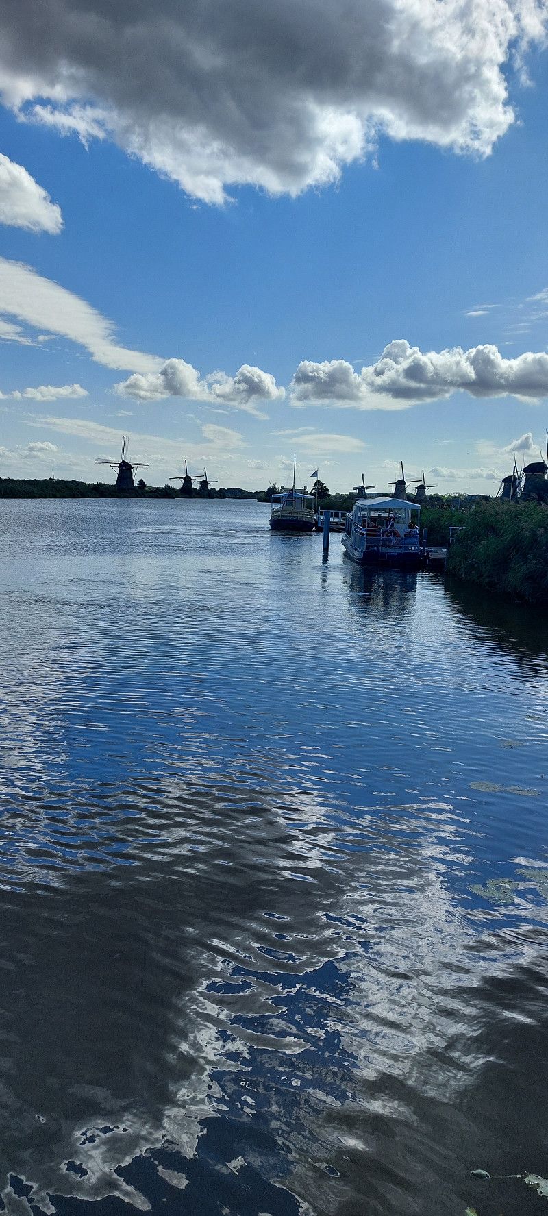
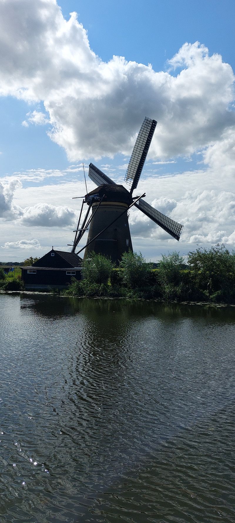
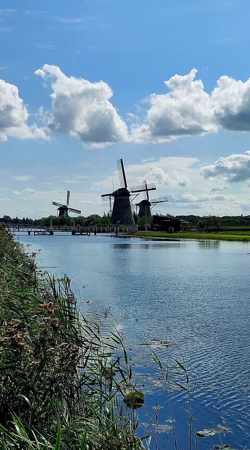
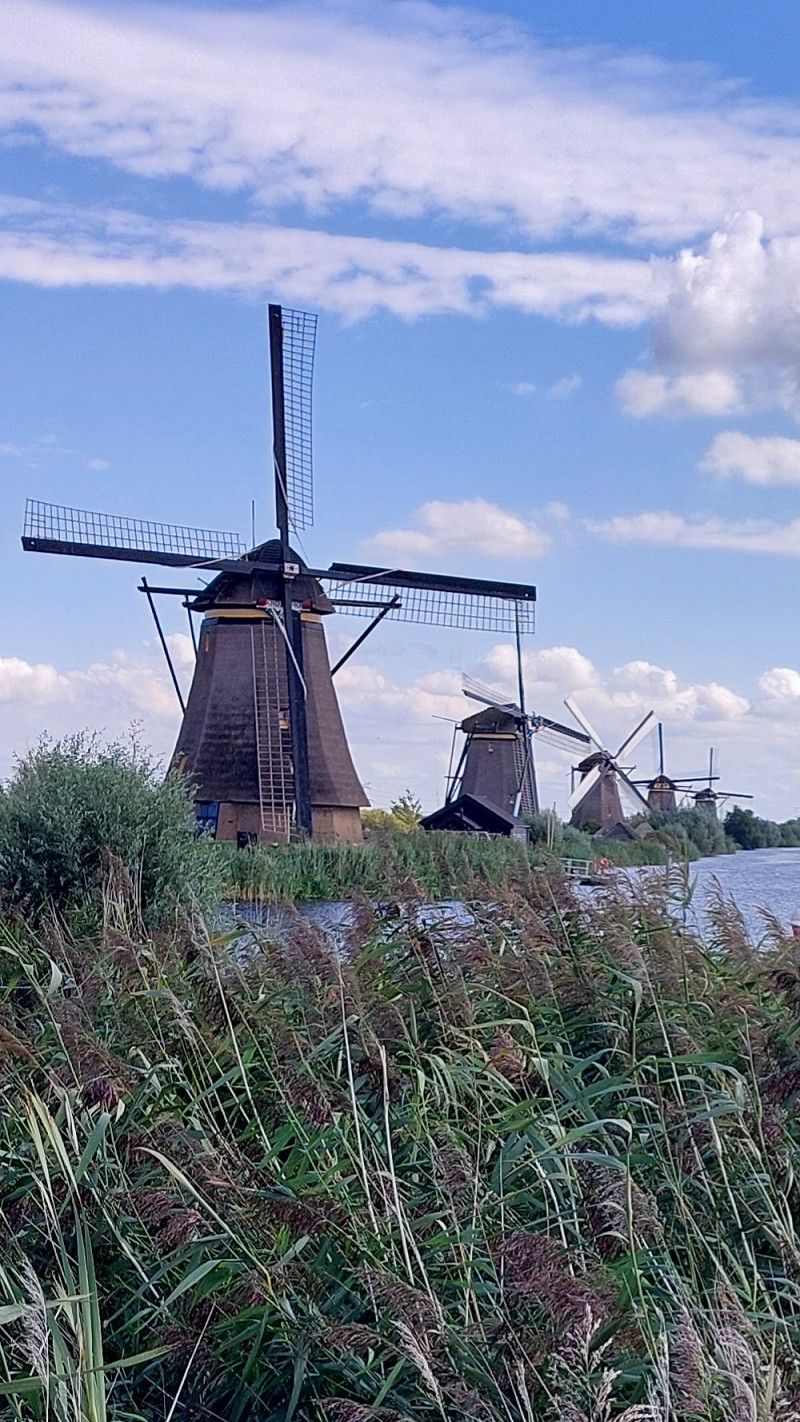
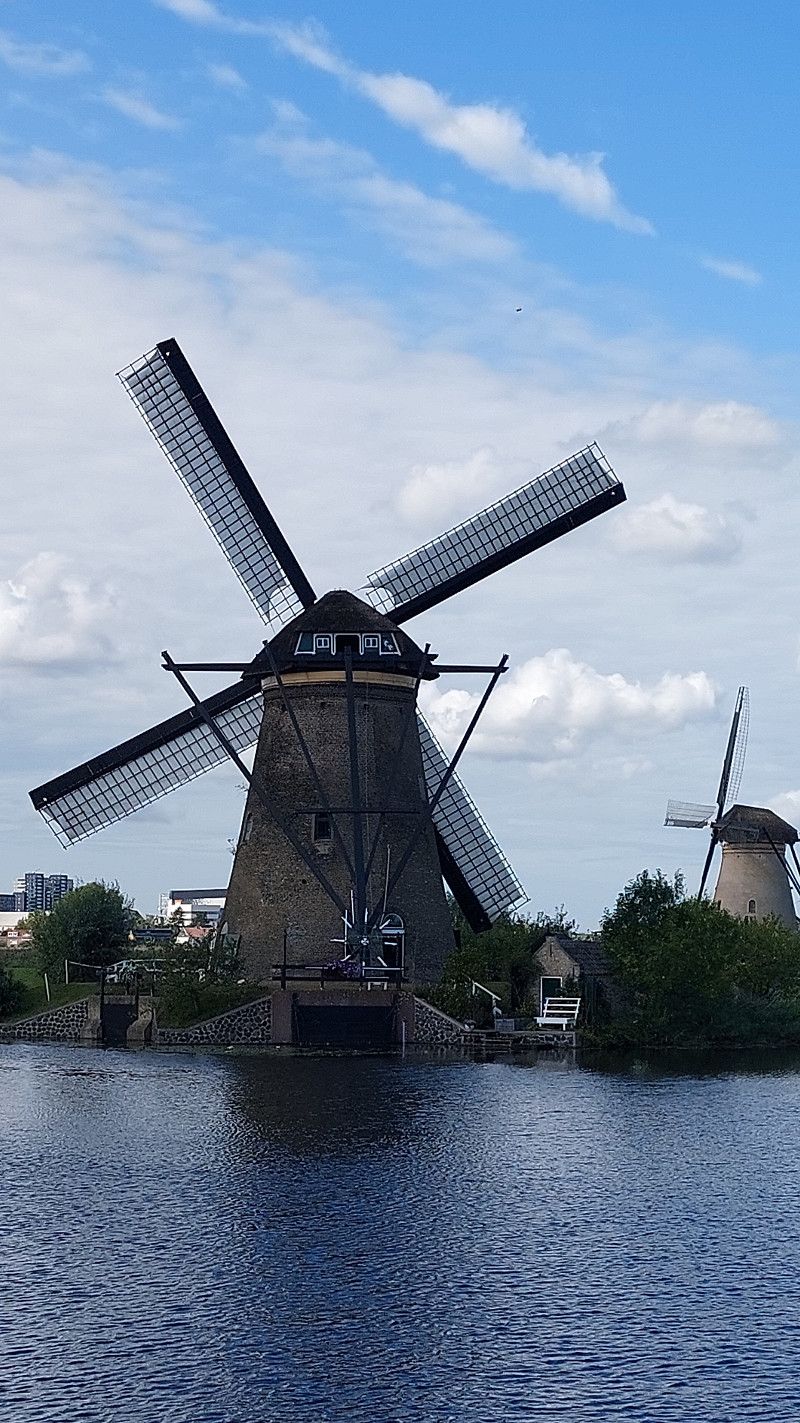
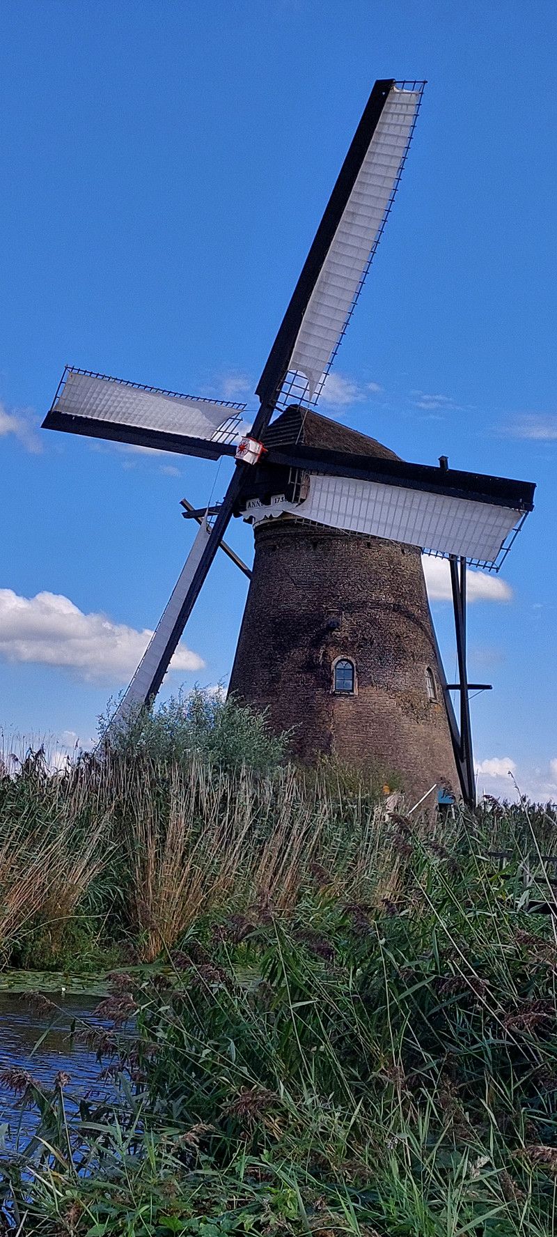
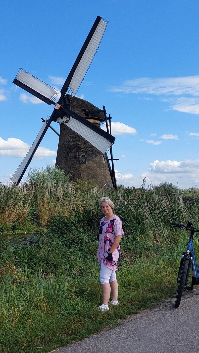
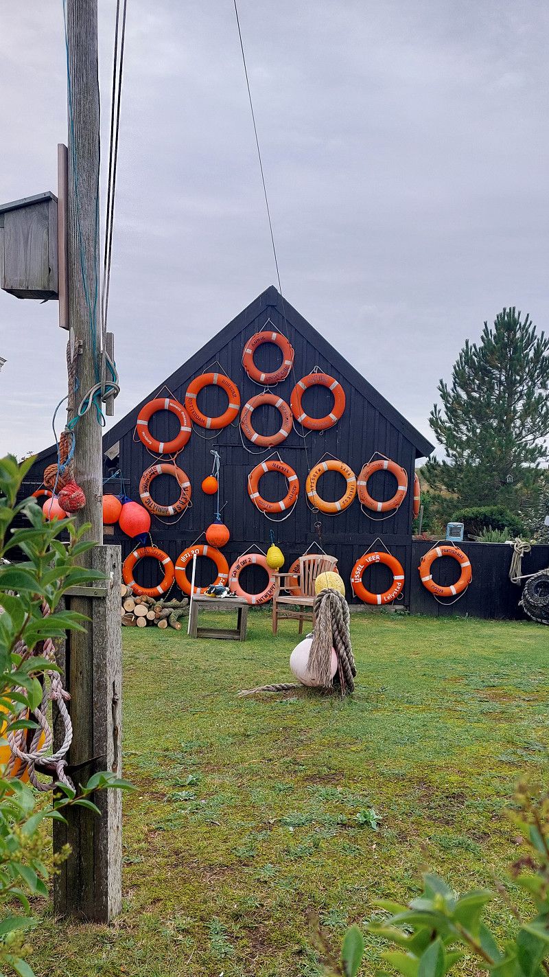
Kinderdijk
Nederwaard 1, Kinderdijk, Südholland, Niederlande
51° 53' 18.1" N 4° 38' 12.5" E
51.8883508 4.6368116
• Head toward Lekdijk on Nederwaard. Go for 134 m.
• Turn left onto Molenstraat. Go for 1.2 km.
• Continue on West Kinderdijk. Go for 1.6 km.
• Continue on Oost Kinderdijk. Go for 1.0 km.
• Continue on Cortgene. Go for 366 m.
• Continue on Haven. Go for 470 m.
• Continue on Dam. Go for 320 m.
• Continue on De Helling. Go for 743 m.
• Turn right onto Grote Beer (N915). Go for 966 m.
• Continue on N915. Go for 1.8 km.
• Turn left and take ramp onto A15 toward Rotterdam/Dordrecht/A16. Go for 1.7 km.
• Take the exit toward Ring-Oost/E19/Rotterdam/Amsterdam/Den Haag onto A16 (Knooppunt Ridderkerk). Go for 3.3 km.
• Keep left onto A16 (Knooppunt Ridderkerk) toward Den Haag/Havens 200-1000. Go for 8.2 km.
• Take exit 27 toward E25/Pr. Alexander/Hillegersberg/Gouda/Utrecht/s109 onto A20 (Knooppunt Terbregseplein). Go for 11.1 km.
• Take exit 18 toward Moordrecht/Gouda-West/Waddinxveen/Den Haag (A12). Go for 427 m.
• Turn right onto N457. Go for 162 m.
• Turn left onto Provincialeweg (N457). Go for 1.4 km.
• Pass 2 roundabouts and continue on Provincialeweg (N207). Go for 2.1 km.
• Keep right toward Haastrecht/Bergambacht. Go for 31 m.
• Take the 2nd exit from roundabout onto N207 toward Haastrecht/Bergambacht. Go for 549 m.
• Take the 2nd exit from roundabout onto Polderweg (N207). Go for 2.3 km.
• Take the 1st exit from roundabout onto Schoonhovenseweg (N207) toward Stolwijk/Bergambacht. Go for 2.1 km.
• Turn right onto Beijerscheweg. Go for 337 m.
• Arrive at Beijerscheweg. Your destination is on the left.
☍
42,4 km
( 34 min.)
07. Sep. 2025 -
09. Sep. 2025
Campingplatz hinter einem Bauernhof
Beijerscheweg 11, Stolwijk, Südholland, Niederlande
51° 59' 21.2" N 4° 44' 44.6" E
51.9892106 4.7457267
• Head northeast on Beijerscheweg. Go for 337 m.
• Turn left onto Schoonhovenseweg (N207). Go for 2.1 km.
• Keep right toward Gouda/Haastrecht/N228. Go for 33 m.
• Take the 2nd exit from roundabout onto Schoonhovenseweg toward N228/Gouda/Haastrecht. Go for 386 m.
• Keep right toward Gouda. Go for 22 m.
• Take the 2nd exit from Verkeersplein Stolwijkersluis roundabout onto Schoonhovenseweg toward Gouda. Go for 257 m.
• Turn right onto Goejanverwelledijk. Go for 75 m.
• Continue on Sportlaan. Go for 317 m.
• Continue on Joubertstraat. Go for 673 m.
• Continue on Zuidelijke Zwarteweg. Go for 145 m.
• Continue on Zwarteweg. Go for 257 m.
• Turn left onto Graaf Florisweg. Go for 197 m.
• Take the 1st exit from Graaf Florisrotonde roundabout onto Bodegraafsestraatweg. Go for 473 m.
• Take the 1st exit from Olympiarotonde roundabout onto Bodegraafsestraatweg. Go for 1.5 km.
• Continue on Zoutmansweg. Go for 302 m.
• Turn right onto Zoutmansweg. Go for 536 m.
• Continue on Raadhuisweg. Go for 1.3 km.
• Take the 2nd exit from De Oude Tol roundabout onto Reeuwijksehoutwal. Go for 529 m.
• Turn left and take ramp onto A12 toward Utrecht. Go for 23.3 km.
• Take the exit toward Amsterdam onto A2 (Ring Utrecht). Go for 3.6 km.
• Continue on Ring Utrecht. Go for 6.7 km.
• Continue on A2. Go for 18.7 km.
• Take the exit toward Almere onto A9 (Gaasperdammerweg). Go for 2.0 km.
• Keep right onto A9 (Gaasperdammerweg) toward Amsterdam-Bijlmermeer/Amsterdam-Gaasperdam/s112/s113. Go for 1.2 km.
• Take the left exit toward Bijlmermeer. Go for 381 m.
• Take the 3rd exit from roundabout onto Gooiseweg (s112) toward Bijlmermeer. Go for 364 m.
• Take ramp toward H-buurt/K-buurt. Go for 222 m.
• Turn right onto Karspeldreef. Go for 964 m.
• Turn right onto Kromwijkdreef (s113) toward Almere/Hengelo. Go for 622 m.
• Continue on Loosdrechtdreef. Go for 351 m.
• Turn right onto Loosdrechtdreef. Go for 51 m.
• Turn left onto Loosdrechtdreef. Go for 75 m.
• Arrive at Loosdrechtdreef.
☍
67,9 km
( 51 min.)
Day
09. Sep. 2025 -
11. Sep. 2025
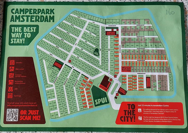
Gaasper Camping Amsterdam
Loosdrechtdreef 7, 1108 AZ, Amsterdam Zuidoost, Niederlande
52° 18' 45.2" N 4° 59' 29" E
52.3125600 4.9913900
• Head north on Loosdrechtdreef. Go for 75 m.
• Turn right onto Loosdrechtdreef. Go for 51 m.
• Turn left onto Loosdrechtdreef. Go for 325 m.
• Continue on Kromwijkdreef (s113). Go for 634 m.
• Turn left onto Karspeldreef. Go for 945 m.
• Take ramp onto Gooiseweg (s112) toward A10/Zaanstad/Den Haag/A'dam-Centrum. Go for 3.2 km.
• Continue on Gooiseweg (s112) toward Centrum. Go for 2.3 km.
• Turn right onto Wibautstraat (s112) toward Centrum/Ziekenhuis OLVG Oost. Go for 2.4 km.
• Turn left onto Waterlooplein toward Centrum. Go for 229 m.
• Continue on Blauwbrug. Go for 92 m.
• Turn right onto Amstel. Go for 459 m.
• Turn right onto Muntplein. Go for 61 m.
• Continue on Rokin. Go for 642 m.
• Arrive at Dam. Your destination is on the left.
☍
11,4 km
( 19 min.)
Day
10. Sep. 2025 -
10. Sep. 2025
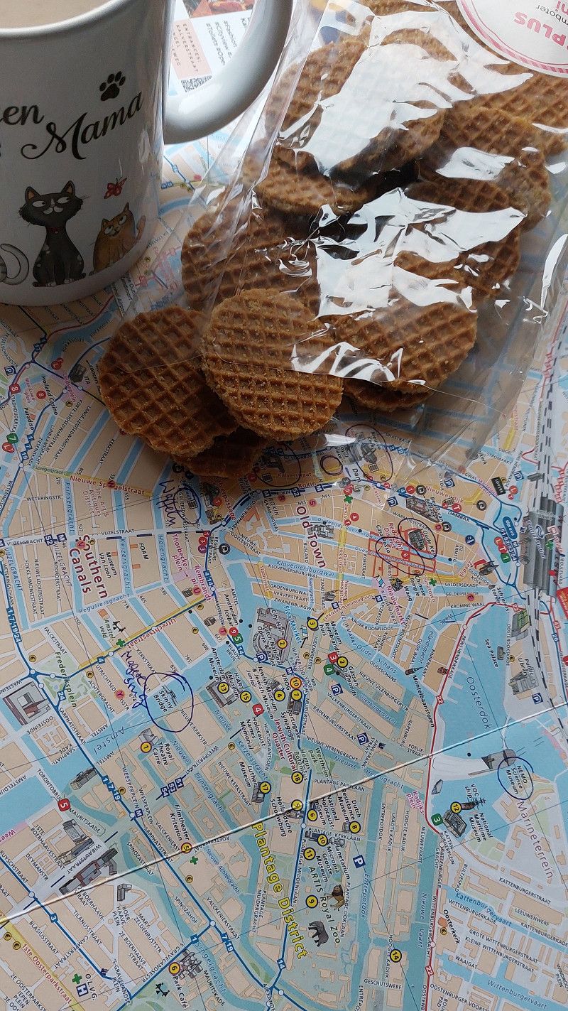
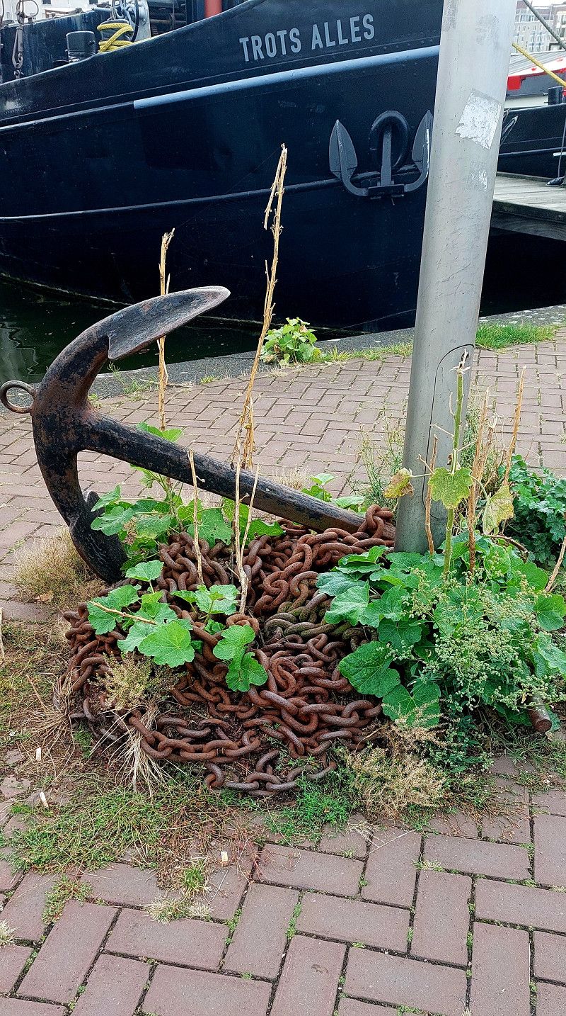
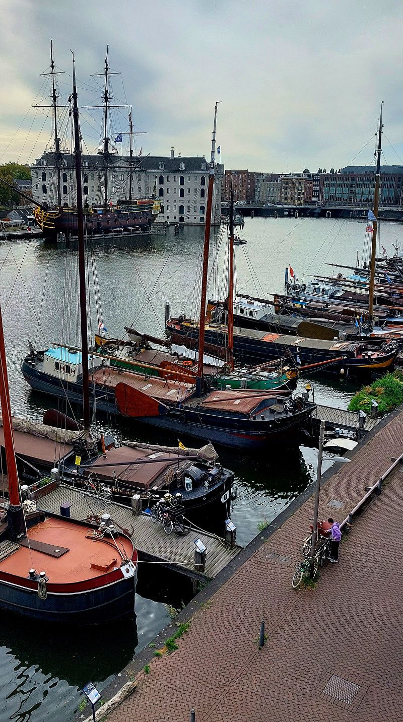
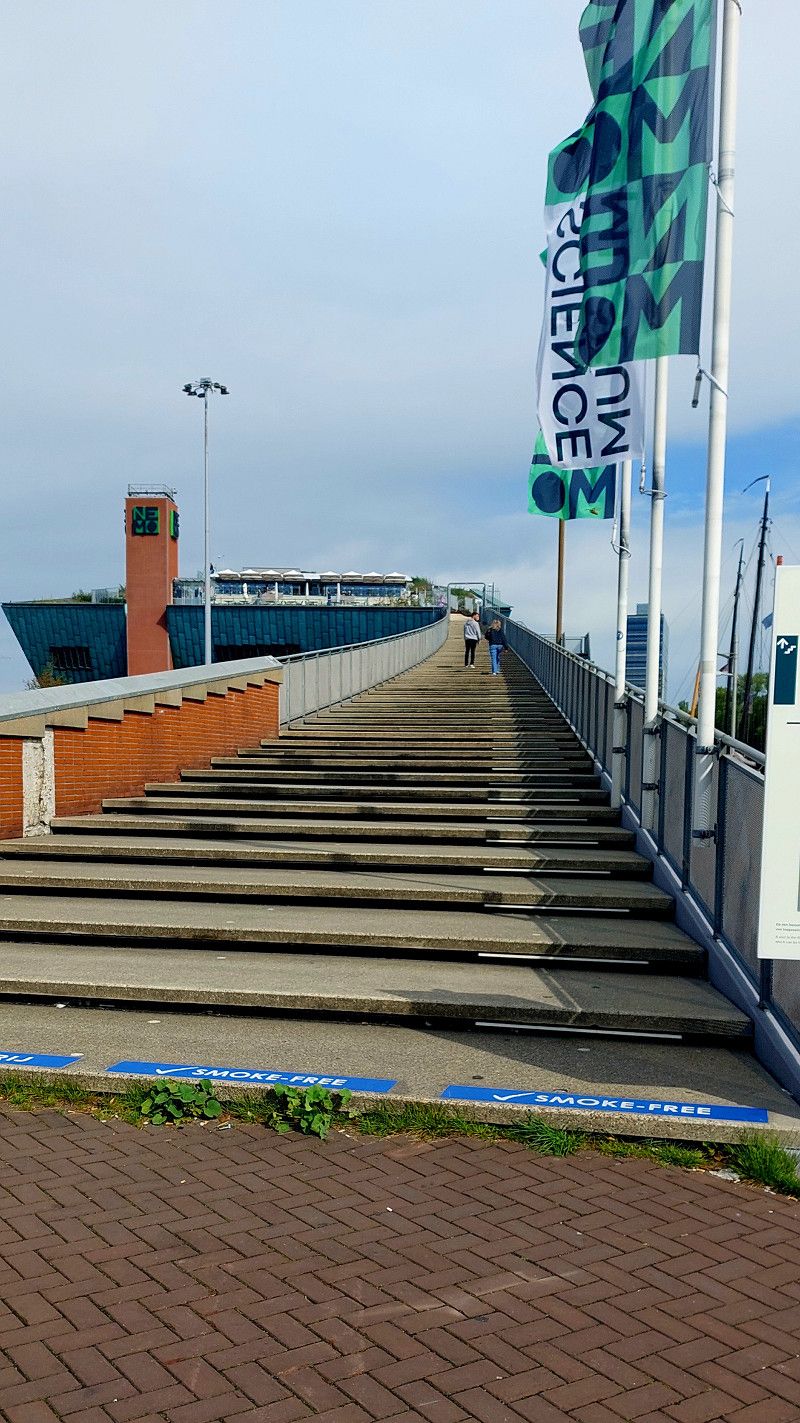
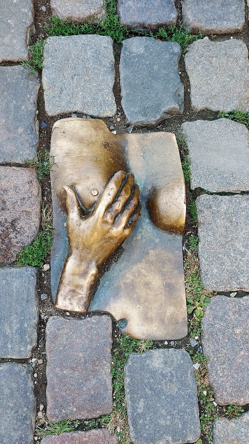
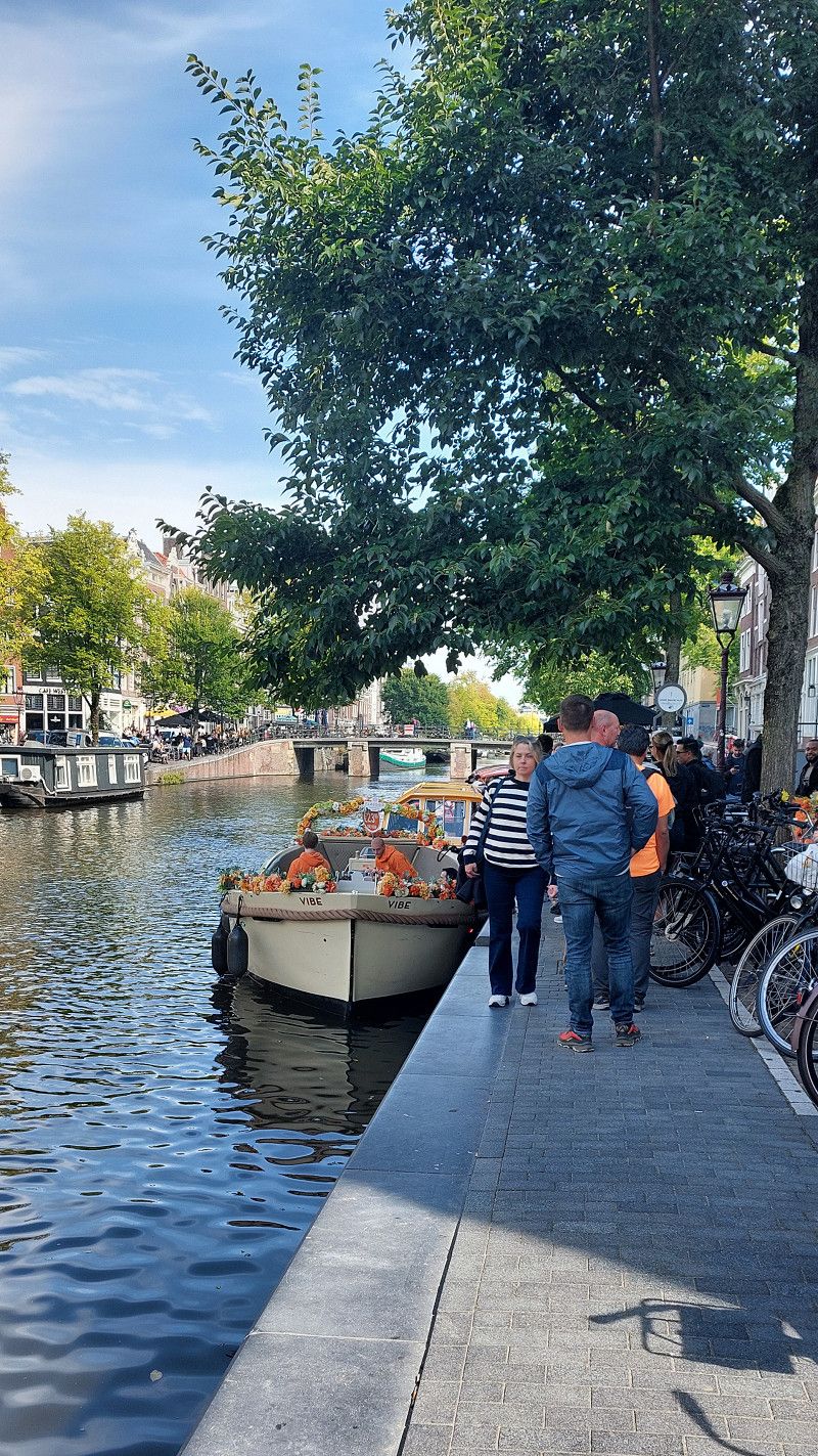
Amsterdam
Nordholland, Niederlande
52° 22' 23.1" N 4° 53' 32.8" E
52.3730796 4.8924534
• Head toward Beursplein on Dam. Go for 27 m.
• Continue on Damrak. Go for 530 m.
• Turn right onto Prins Hendrikkade. Go for 367 m.
• Keep left onto Odebrug. Go for 21 m.
• Turn left onto Odebrug. Go for 262 m.
• Turn right onto De Ruijterkade (s100) toward Ring/A10. Go for 1.2 km.
• Continue on Piet Heinkade (s100). Go for 968 m.
• Turn left onto s114 toward Ring/A10. Go for 2.7 km.
• Turn right and take ramp onto A10 (Ring Amsterdam) toward s113/Amersfoort/Utrecht. Go for 1.8 km.
• Take the exit toward Hengelo/Almere onto A1. Go for 3.1 km.
• Keep right onto A1 toward Hengelo/Groningen/Almere/Utrecht/Haarlem/Luchthaven Schiphol/A9. Go for 735 m.
• Take the exit toward Utrecht/Haarlem/Luchthaven Schiphol onto A9 (Gaasperdammerweg). Go for 2.3 km.
• Keep right onto A9 toward Amsterdam-Gaasperdam/s112. Go for 288 m.
• Take the exit. Go for 474 m.
• Turn left onto Loosdrechtdreef. Go for 369 m.
• Turn right onto Loosdrechtdreef. Go for 51 m.
• Turn left onto Loosdrechtdreef. Go for 75 m.
• Arrive at Loosdrechtdreef.
☍
15,2 km
( 19 min.)
09. Sep. 2025 -
11. Sep. 2025
Gaasper Camping Amsterdam
Loosdrechtdreef 7, 1108 AZ, Amsterdam Zuidoost, Niederlande
52° 18' 45.2" N 4° 59' 29" E
52.3125600 4.9913900
• Head north on Loosdrechtdreef. Go for 75 m.
• Turn right onto Loosdrechtdreef. Go for 51 m.
• Turn left onto Loosdrechtdreef. Go for 325 m.
• Continue on Kromwijkdreef (s113). Go for 634 m.
• Turn left onto Karspeldreef. Go for 1.0 km.
• Turn left and take ramp onto Gooiseweg (s112) toward A9/Almere/Amersfoort/Haarlem/Utrecht. Go for 464 m.
• Take the 1st exit from roundabout onto A9 (Gaasperdammertunnel) toward Almere/Amersfoort/Gaasperdam/s112/Utrecht/(A2)/Haarlem. Go for 2.3 km.
• Take the left exit toward Haarlem/Luchthaven Schiphol onto A9. Go for 22.5 km.
• Take the exit toward Haarlem. Go for 415 m.
• Take the 3rd exit from roundabout onto A200 toward Haarlem. Go for 3.4 km.
• Turn slightly left onto Oudeweg (N200) toward Centrum/Bloemendaal. Go for 2.6 km.
• Continue on Verspronckweg (N200). Go for 467 m.
• Take the 2nd exit from roundabout onto Korte Verspronckweg (N200) toward Overveen/Bloemendaal aan Zee/Zandvoort. Go for 342 m.
• Pass 3 roundabouts and continue on Zeeweg (N200). Go for 5.7 km.
• Turn right onto Zeeweg. Go for 40 m.
• Turn left onto Zeeweg. Go for 150 m.
• Arrive at Zeeweg. Your destination is on the left.
☍
40,5 km
( 37 min.)
Day
11. Sep. 2025 -
12. Sep. 2025
Camping Bloemendaal
Zeeweg 72, 2051 EC, Overveen, Niederlande
52° 24' 7" N 4° 32' 38.6" E
52.4019400 4.5440600
• Head toward Boulevard Barnaart on Zeeweg. Go for 131 m.
• Turn left onto Zeeweg (N200). Go for 402 m.
• Keep right onto Zeeweg (N200). Go for 3.8 km.
• Keep left onto Zeeweg (N200) toward Alkmaar/Haarlem/Amsterdam. Go for 179 m.
• Pass 2 roundabouts and continue on Julianalaan (N200). Go for 1.6 km.
• Take the 1st exit from roundabout onto Julianalaan toward Heemstede/Den Haag. Go for 485 m.
• Turn left onto Zijlweg. Go for 679 m.
• Turn right onto Zijlsingel. Go for 113 m.
• Continue on Zijlsingel. Go for 9 m.
• Continue on Brouwersbrug. Go for 13 m.
• Turn left onto Raaksbrug. Go for 45 m.
• Turn left onto Zijlvest. Go for 136 m.
• Continue on Kinderhuisvest. Go for 247 m.
• Turn right onto Nieuwe Gracht. Go for 158 m.
• Turn right onto Nassauplein. Go for 51 m.
• Turn right onto Kraaienhorst. Go for 162 m.
• Continue on Witte Herenstraat. Go for 173 m.
• Turn left onto Zijlstraat. Go for 73 m.
• Arrive at Zijlstraat.
☍
8,4 km
( 13 min.)
11. Sep. 2025 -
11. Sep. 2025
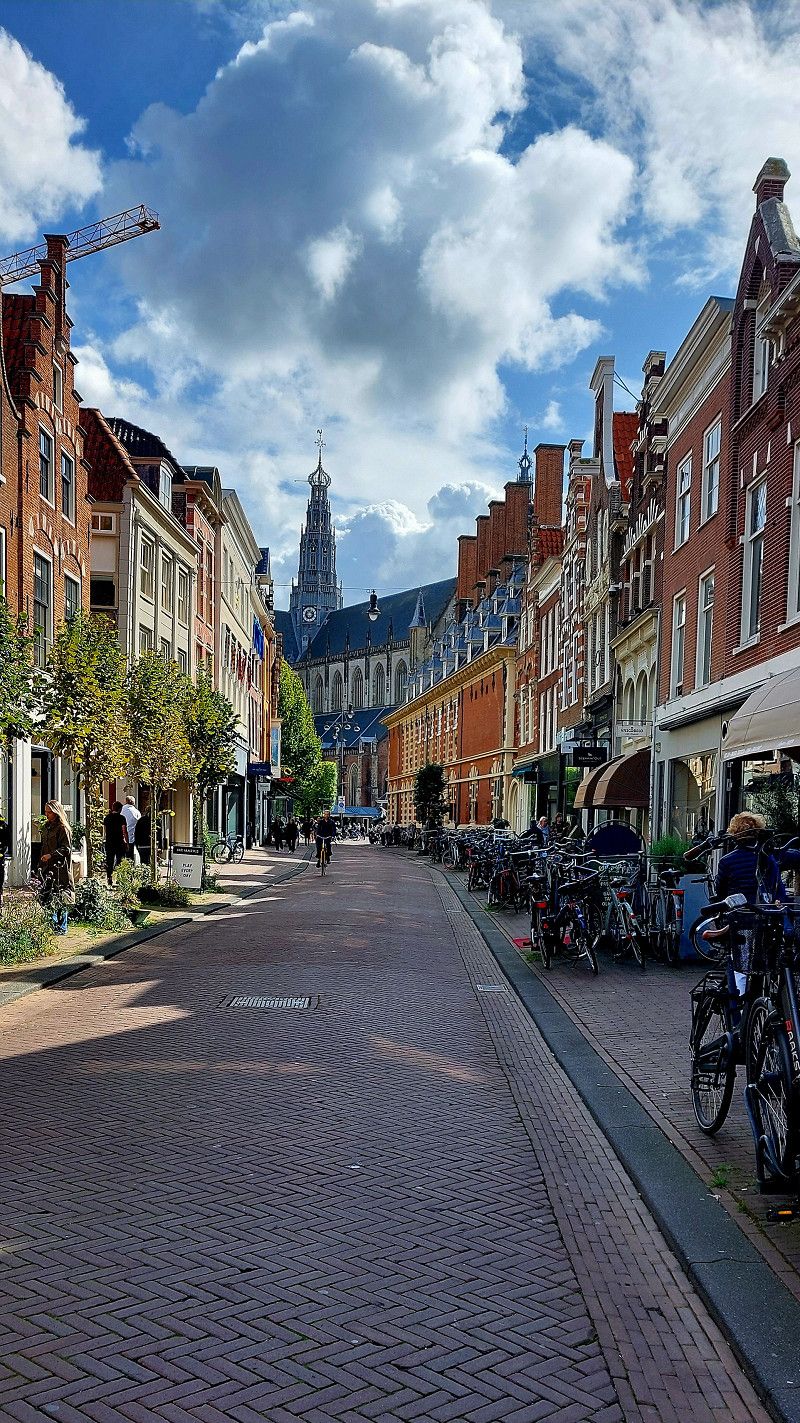
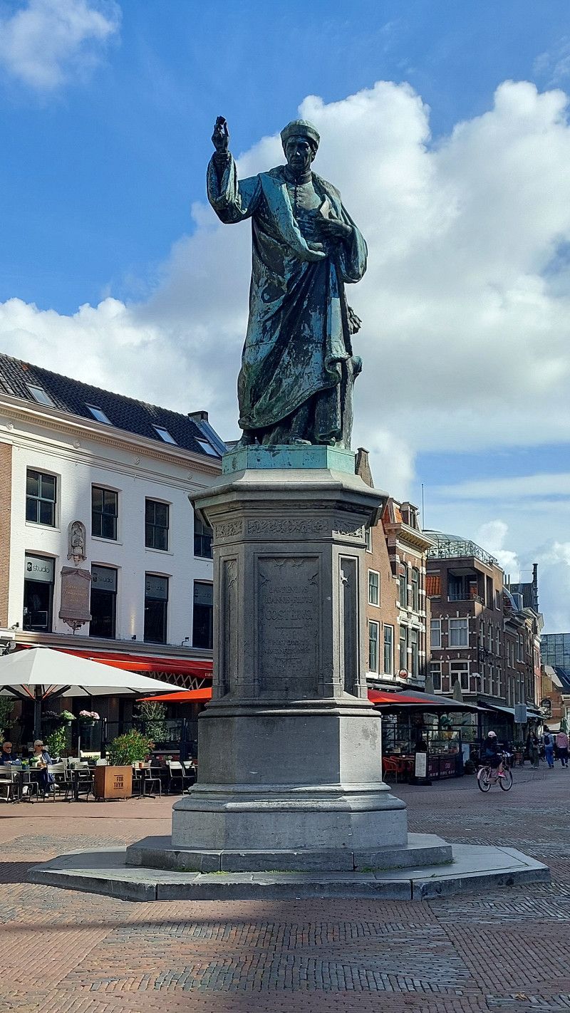
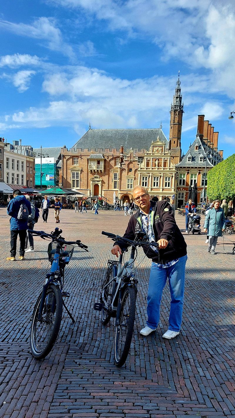
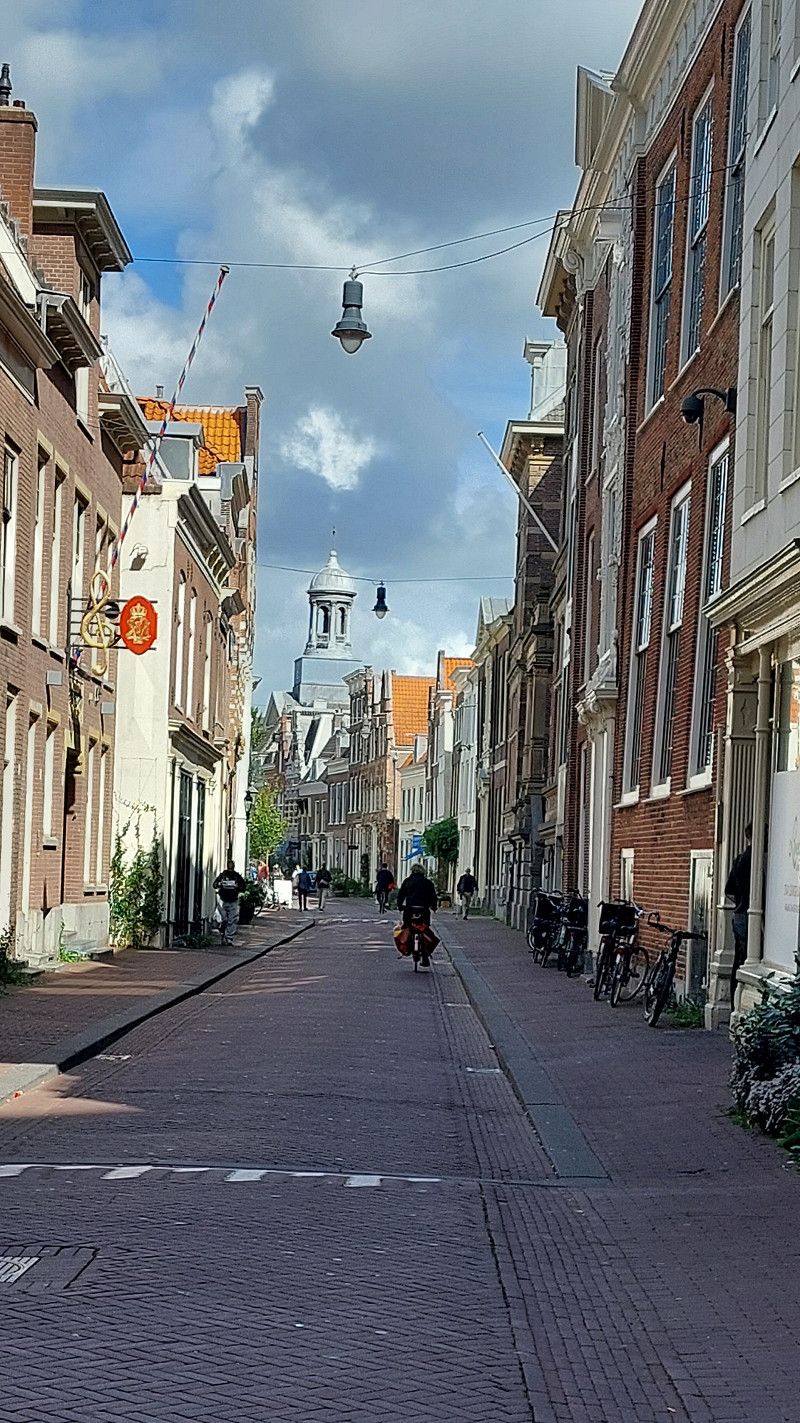
Haarlem Altstadt
Grote Markt 2, Haarlem, Nordholland, Niederlande
52° 22' 53.2" N 4° 38' 6" E
52.3814518 4.6350014
• Head east on Zijlstraat.
• Turn left onto Nassaulaan. Go for 263 m.
• Continue on Nassauplein. Go for 51 m.
• Continue on Nassaubrug. Go for 43 m.
• Turn left onto Nieuwe Gracht. Go for 159 m.
• Turn left onto Kinderhuisbrug. Go for 285 m.
• Continue on Zijlvest. Go for 124 m.
• Turn right onto Raaksbrug. Go for 46 m.
• Turn right onto Zijlsingel. Go for 113 m.
• Turn left onto Zijlweg. Go for 679 m.
• Turn right onto Julianalaan. Go for 465 m.
• Take the 3rd exit from roundabout onto Julianalaan (N200). Go for 855 m.
• Pass 2 roundabouts and continue on Zeeweg (N200). Go for 7.0 km.
• Take the 2nd exit from roundabout onto Burgemeester van Alphenstraat. Go for 167 m.
• Turn left. Go for 487 m.
• Turn slightly right toward Burgemeester van Alphenstraat. Go for 404 m.
• Continue on Burgemeester van Alphenstraat. Go for 40 m.
• Turn slightly left toward Pitstraat. Go for 199 m.
• Turn right onto Pitstraat. Go for 293 m.
• Continue on Circuit Zandvoort. Go for 793 m.
• Turn slightly right onto Chicane. Go for 31 m.
• Turn slightly right onto Chicane. Go for 148 m.
• Arrive at Circuit Zandvoort. Your destination is on the left.
☍
12,6 km
( 20 min.)
11. Sep. 2025 -
11. Sep. 2025
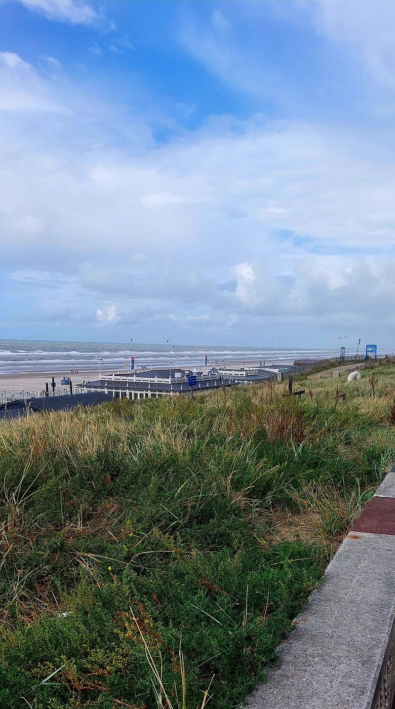
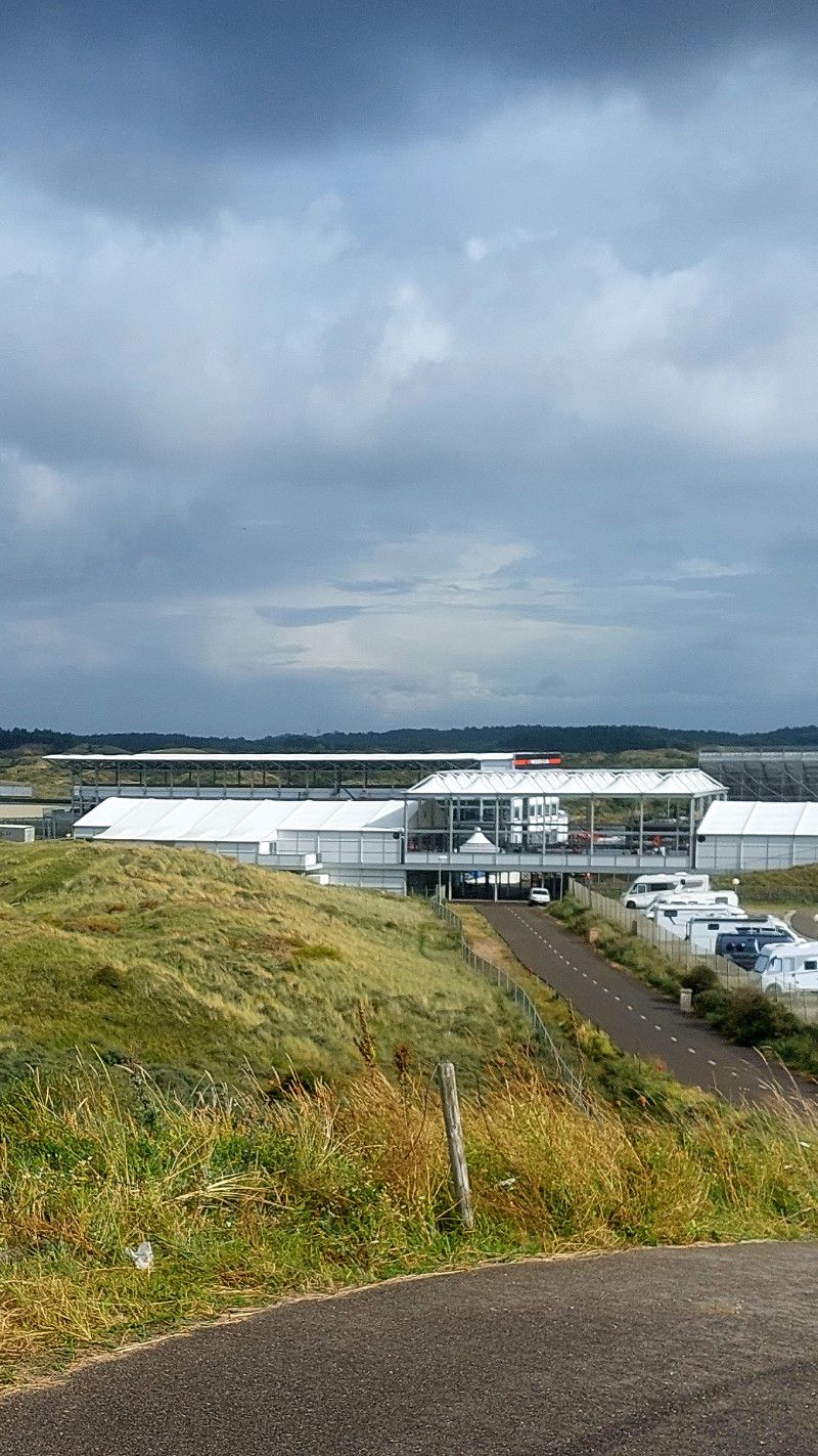
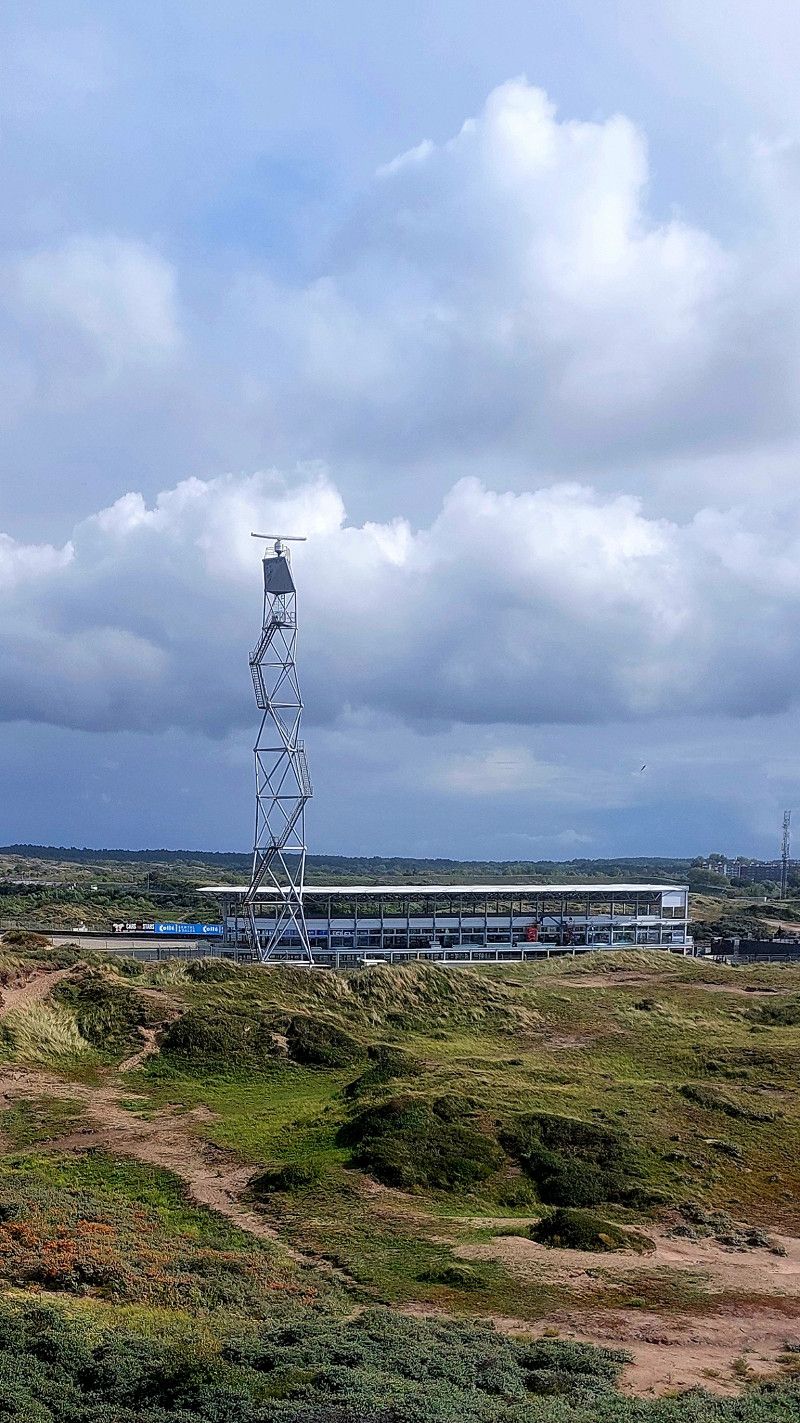
CM.com Circuit Zandvoort
Boulevard Barnaart, Zandvoort, Nordholland, Niederlande
52° 23' 16.1" N 4° 32' 46.5" E
52.3877971 4.5462550
• Head west on Circuit Zandvoort. Go for 1.2 km.
• Keep left onto Circuit Zandvoort. Go for 1.5 km.
• Continue on Circuit Zandvoort. Go for 48 m.
• Turn sharp left toward Burgemeester van Alphenstraat. Go for 2.0 km.
• Turn right onto Burgemeester van Alphenstraat. Go for 115 m.
• Take the 1st exit from roundabout onto Boulevard Barnaart (N200). Go for 2.3 km.
• Keep right onto Zeeweg (N200). Go for 3.8 km.
• Keep left onto Zeeweg (N200) toward Alkmaar/Haarlem/Amsterdam. Go for 179 m.
• Pass 3 roundabouts and continue on N200. Go for 1.9 km.
• Take the 1st exit from roundabout onto Verspronckweg (N200) toward Frans Hals/Teylers. Go for 3.1 km.
• Turn right onto Oudeweg (N200). Go for 1.3 km.
• Continue on A200. Go for 1.3 km.
• Take the exit toward Amsterdam-Zuid/Den Haag/Utrecht/Alkmaar. Go for 582 m.
• Take the 1st exit from roundabout toward Rotterdam/Amsterdam/Utrecht. Go for 130 m.
• Take ramp onto A9. Go for 2.6 km.
• Take the exit toward Zaanstad/Amsterdam-Westpoort onto A5 (Westrandweg). Go for 12.4 km.
• Keep right onto A10 (Ring Amsterdam) toward RING-Noord/Leeuwarden/Zaanstad. Go for 2.5 km.
• Take the left exit toward Leeuwarden/Purmerend/Zaanstad/A8 onto E22 (Knooppunt Coenplein). Go for 1.4 km.
• Continue on A8 (Knooppunt Coenplein). Go for 2.8 km.
• Take the exit toward Leeuwarden/Den Helder/Purmerend onto A7. Go for 2.5 km.
• Take exit 2 toward Zaandijk/Zaanstad-'t Kalf/s153/s155. Go for 445 m.
• Turn slightly left onto Leeghwaterweg (N515). Go for 2.4 km.
• Take the 1st exit from roundabout onto Zeilenmakerspad. Go for 51 m.
• Continue on Schansend. Go for 59 m.
• Arrive at Schansend. Your destination is on the left.
☍
46,6 km
( 47 min.)
Day
12. Sep. 2025 -
12. Sep. 2025
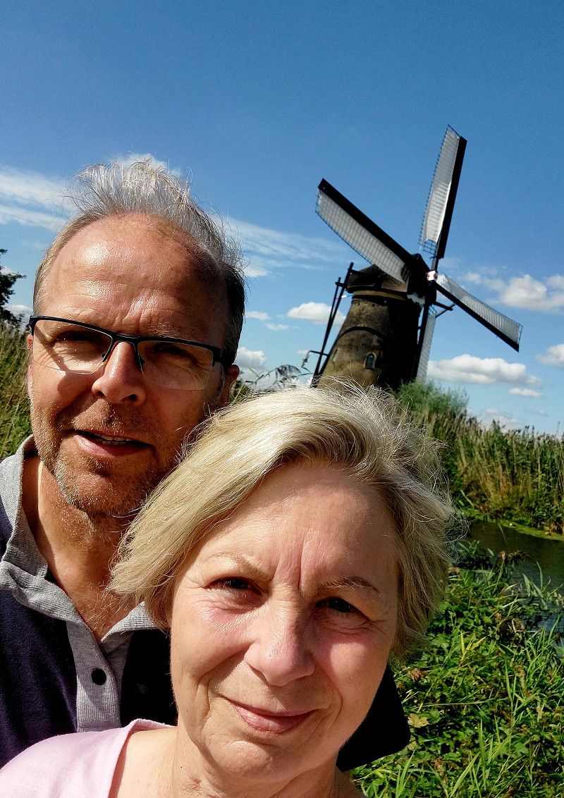
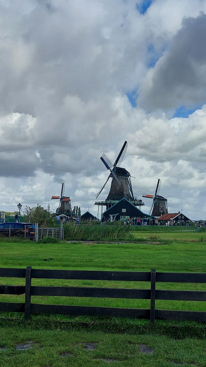
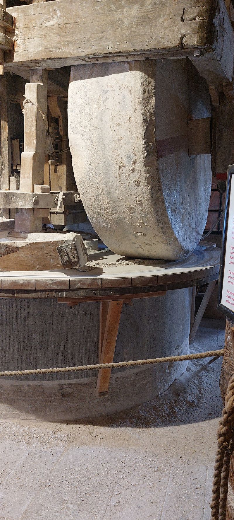
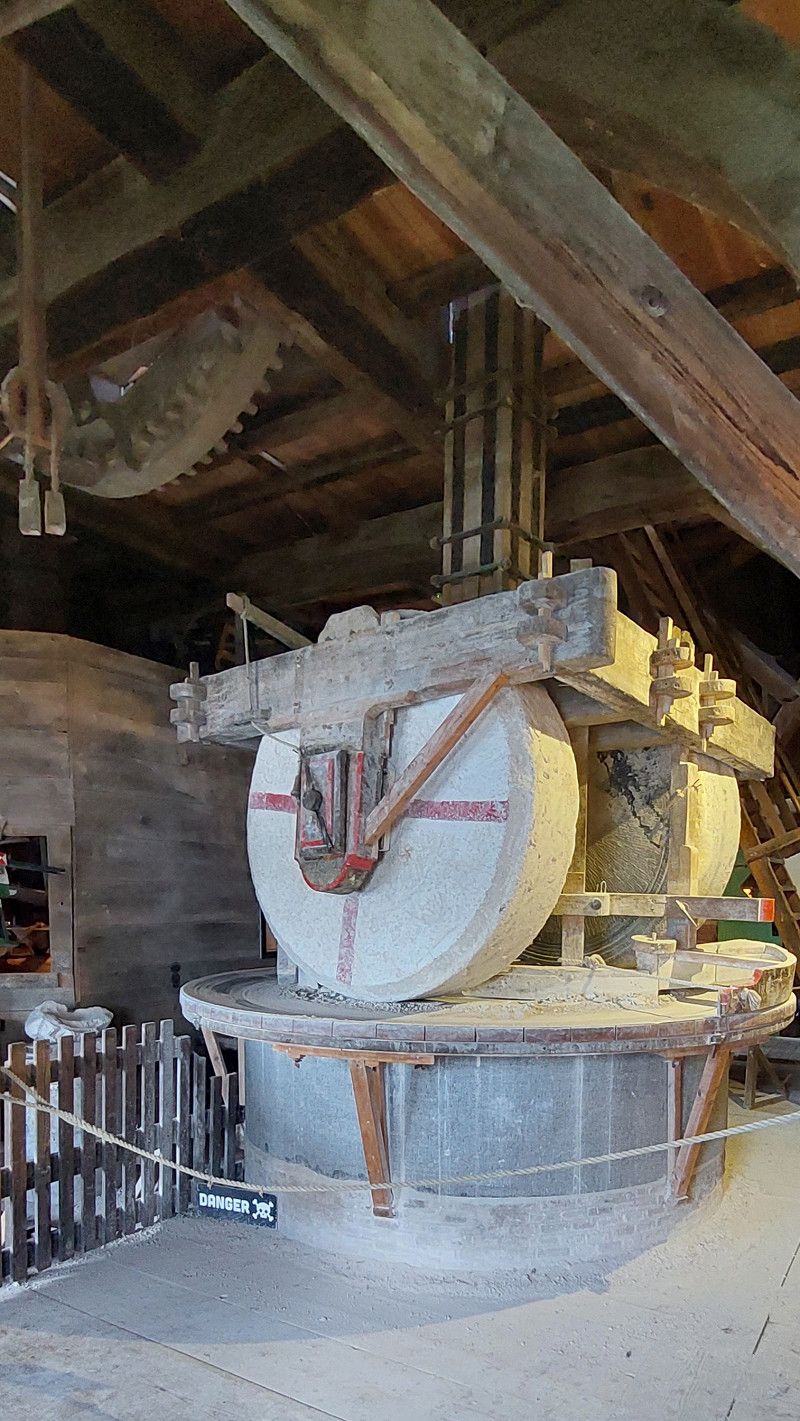
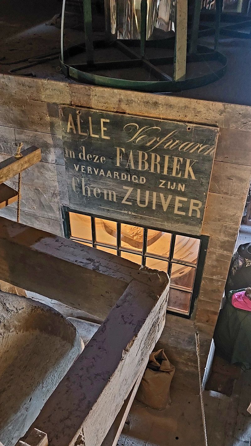
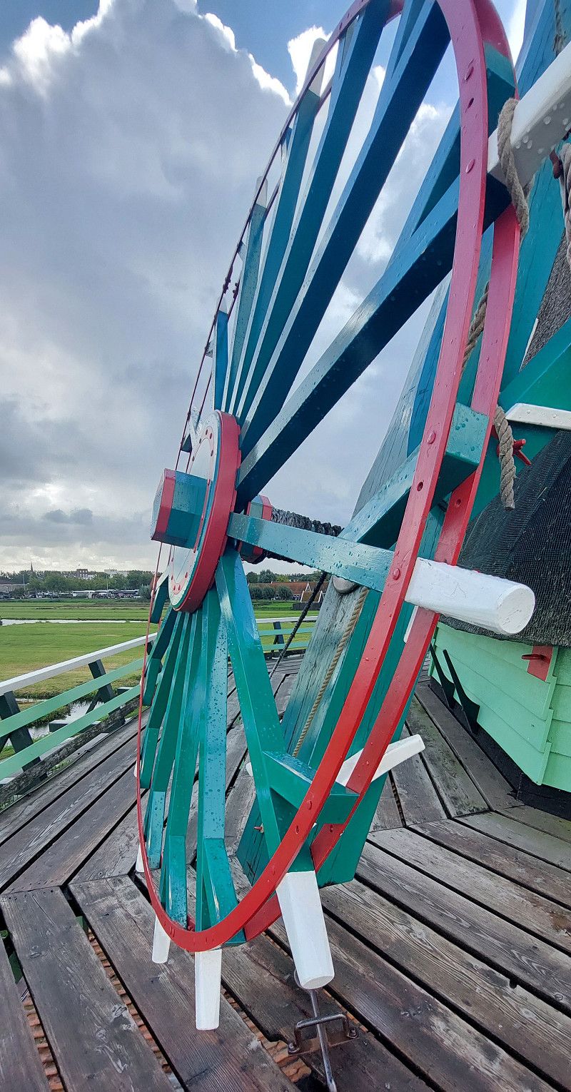
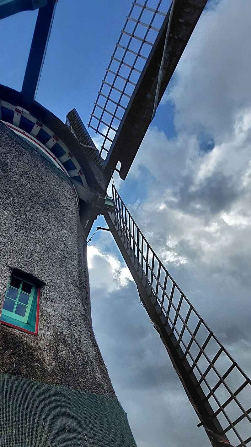
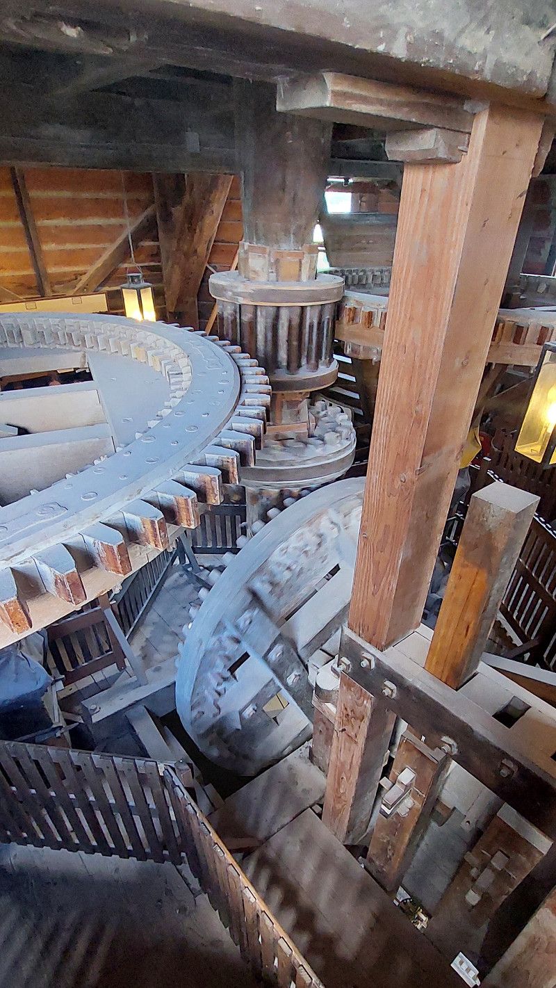
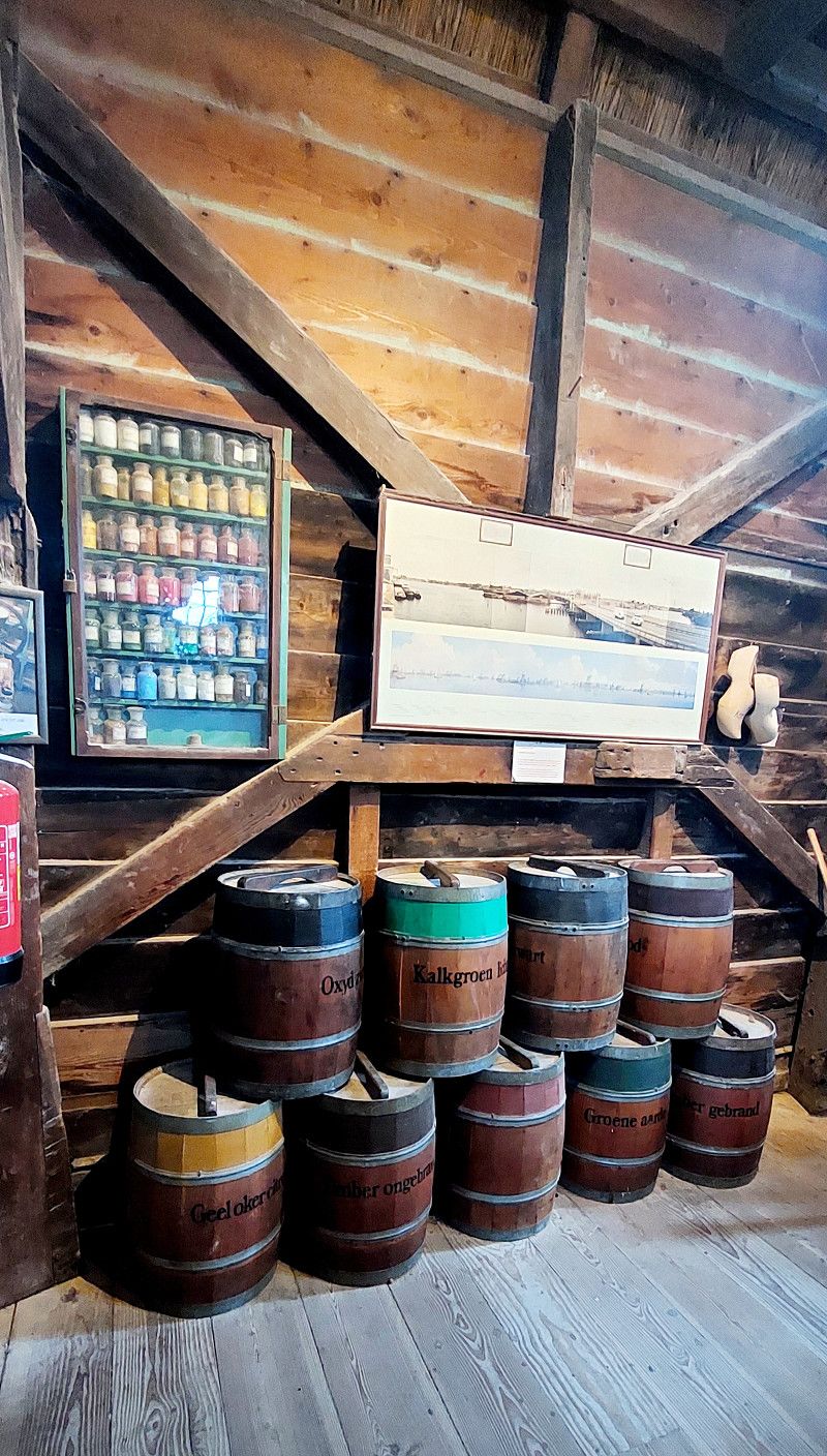
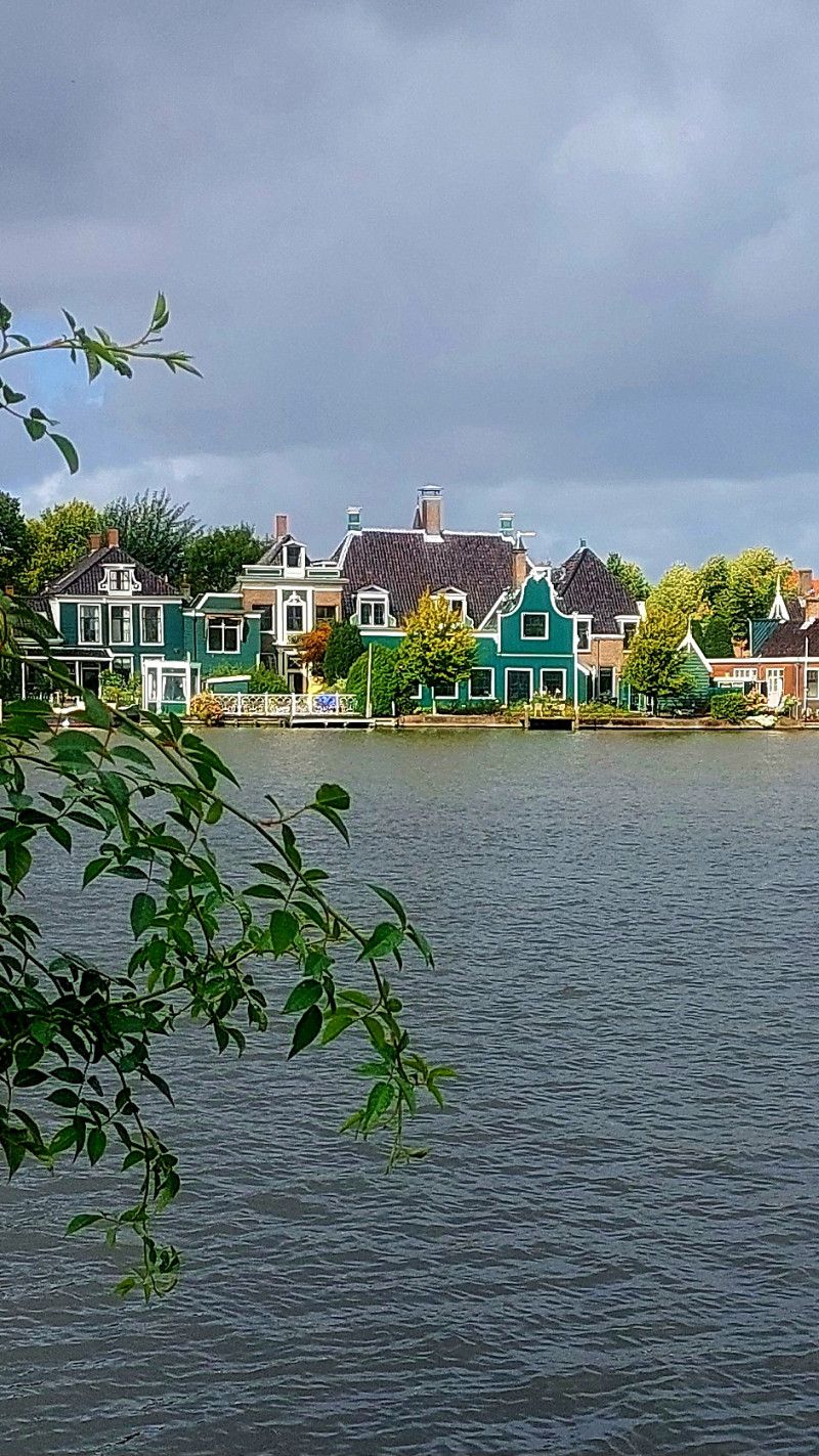
Zaanse Schans Windmühlen
Schansend, Zaandam, Nordholland, Niederlande
52° 28' 25.2" N 4° 49' 16.3" E
52.4736581 4.8212073
• Head toward Zeilenmakerspad on Schansend. Go for 59 m.
• Continue on Zeilenmakerspad. Go for 36 m.
• Take the 1st exit from roundabout onto Leeghwaterweg (s153). Go for 1.2 km.
• Turn right onto Provincialeweg (s152). Go for 3.2 km.
• Pass 2 roundabouts and continue on Provincialeweg (s152). Go for 5.3 km.
• Turn right onto Broekpolderweg. Go for 1.6 km.
• Turn left onto Lagendijk. Go for 118 m.
• Turn right. Go for 12 m.
• Turn right. Go for 110 m.
• Arrive at your destination on the left.
☍
11,6 km
( 16 min.)
12. Sep. 2025 -
13. Sep. 2025
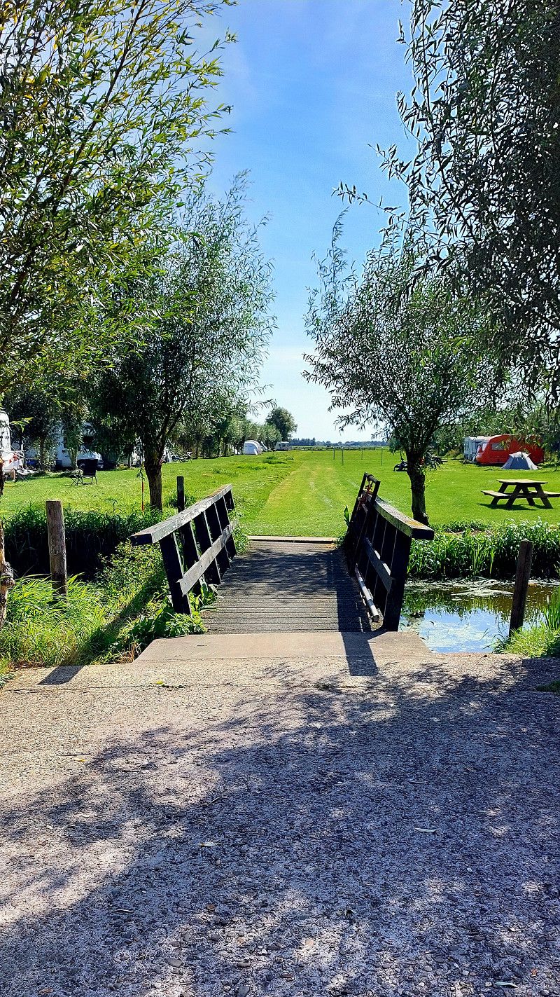
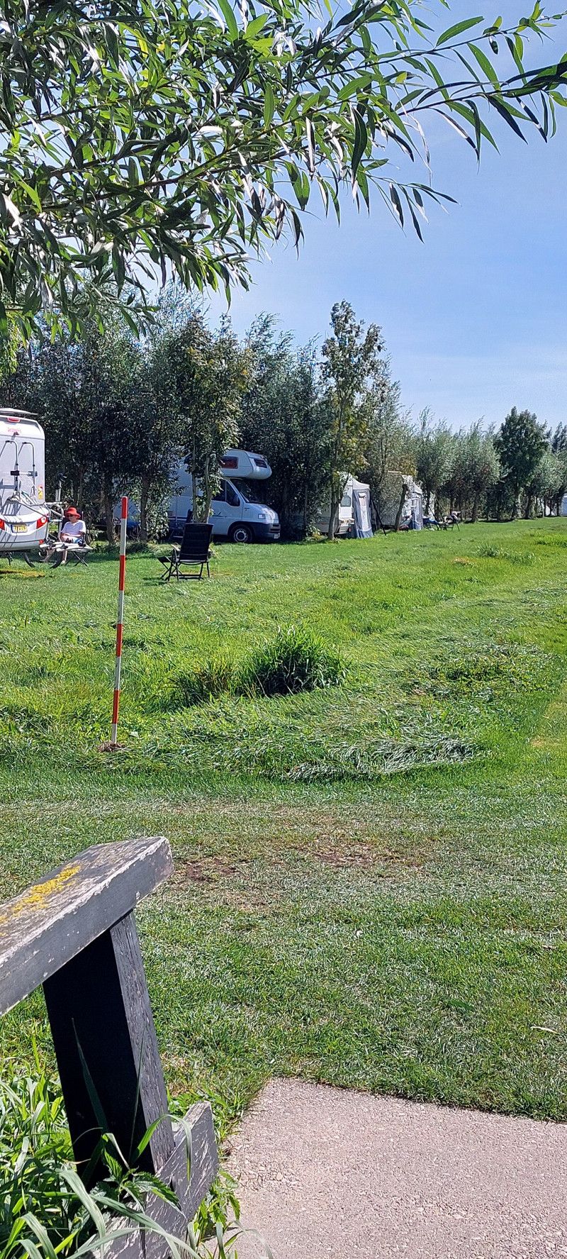
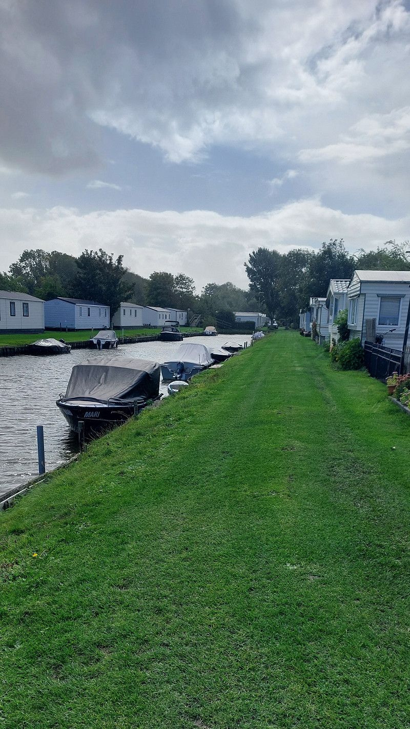
Uitgeest - Stellplatz am Hafen
Very nice parking space. It can accommodate a maximum of six motorhomes.
Lagendijk 9, Uitgeest, Nordholland, Niederlande
52° 31' 37.8" N 4° 43' 23.3" E
52.5271683 4.7231457
• Head west. Go for 110 m.
• Turn left toward Lagendijk. Go for 12 m.
• Turn right onto Lagendijk. Go for 32 m.
• Continue on Sluisbuurt. Go for 100 m.
• Continue on Meldijk. Go for 408 m.
• Turn right onto Bonkenburg. Go for 155 m.
• Turn left onto Populierenlaan. Go for 308 m.
• Turn right onto Geesterweg. Go for 267 m.
• Take the 1st exit from roundabout onto Geesterweg. Go for 1.7 km.
• Take the 2nd exit from roundabout onto A9 toward Alkmaar. Go for 6.9 km.
• Take exit 12 toward Ring-West/Den Helder/Heiloo/Alkmaar-Centrum/N9. Go for 1.2 km.
• Take the 4th exit from Verkeersplein Kooimeer roundabout onto Heilooër Tolweg (N9) toward Egmond/Bergen/Heiloo/Den Helder. Go for 935 m.
• Continue on Heilooër Tolweg (N9) toward Ring Alkmaar/Egmond/Bergen/Den Helder. Go for 3.4 km.
• Continue on Martin Luther Kingweg (N9) toward RING Noord/Schoorl/Den Helder. Go for 2.6 km.
• Continue on Helderseweg (N9) toward Schoorl/Den Helder. Go for 12.0 km.
• Take the 1st exit from roundabout onto Rijksweg (N9) toward Den Helder/Schagen. Go for 22.9 km.
• Keep right toward Veer Texel/Havens. Go for 21 m.
• Take the 1st exit from roundabout onto N250 toward Veer Texel/Havens. Go for 2.6 km.
• Turn right onto Nieuwe Kerkplein. Go for 31 m.
• Continue on Plein 1822. Go for 5 m.
• Continue on Willemsoord. Go for 18 m.
• Turn left onto Plein 1832. Go for 108 m.
• Turn right toward Willemsoord. Go for 140 m.
• Turn right onto Willemsoord. Go for 28 m.
• Arrive at Willemsoord. Your destination is on the right.
☍
56,0 km
( 52 min.)
Day
13. Sep. 2025 -
15. Sep. 2025
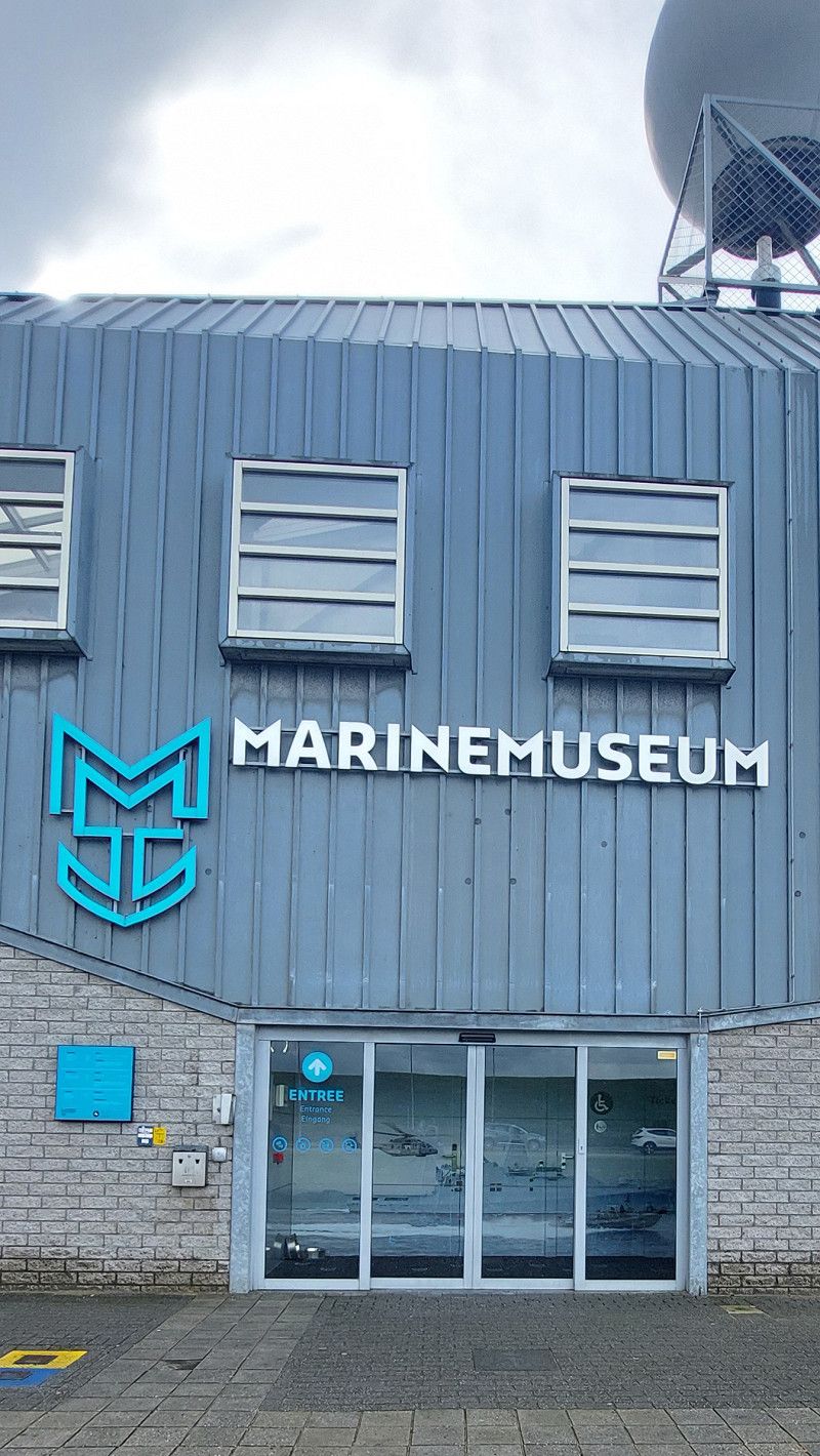
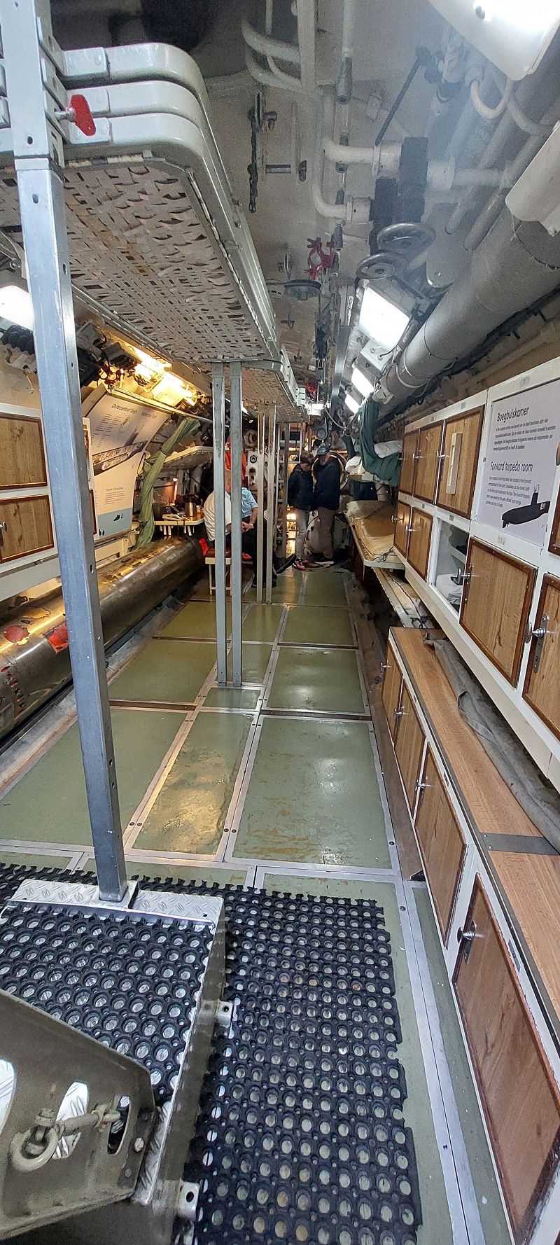
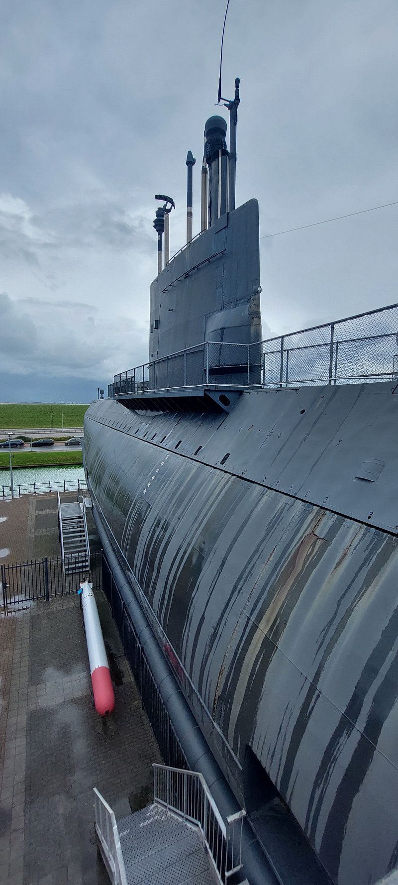
Den Helder - Stellplatz im Hafen
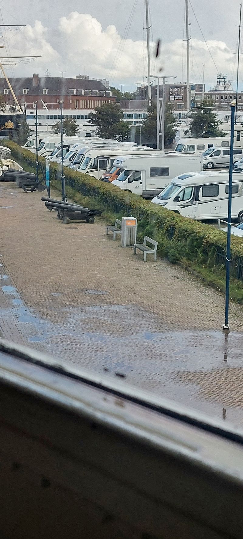
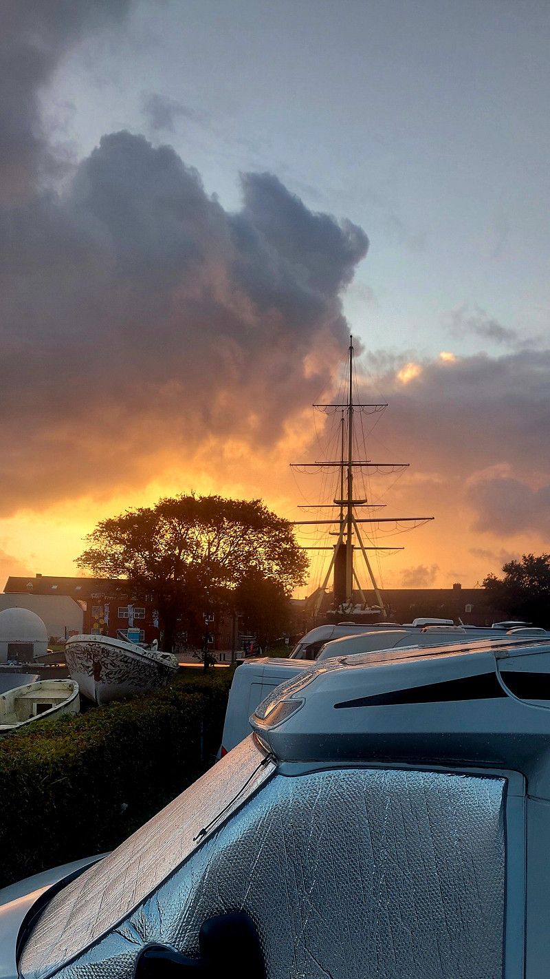
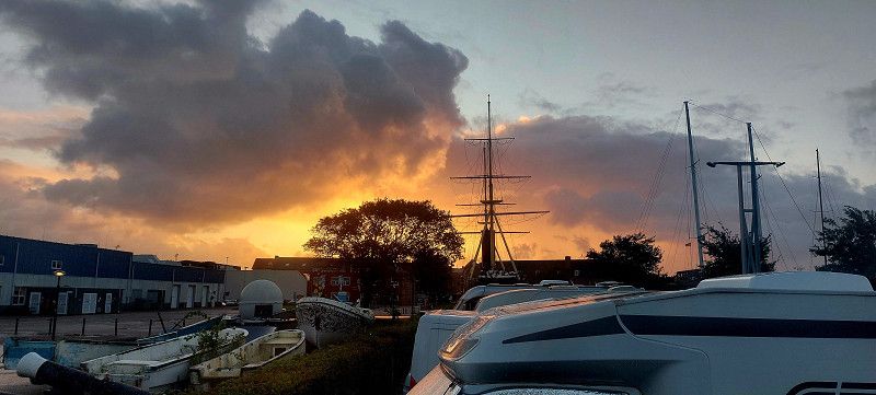
Parking for 45 RVs directly in the harbor. Electricity, toilets, and showers are available.
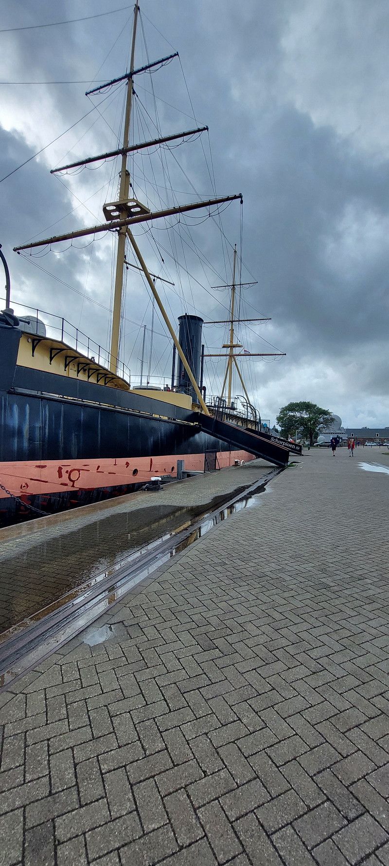
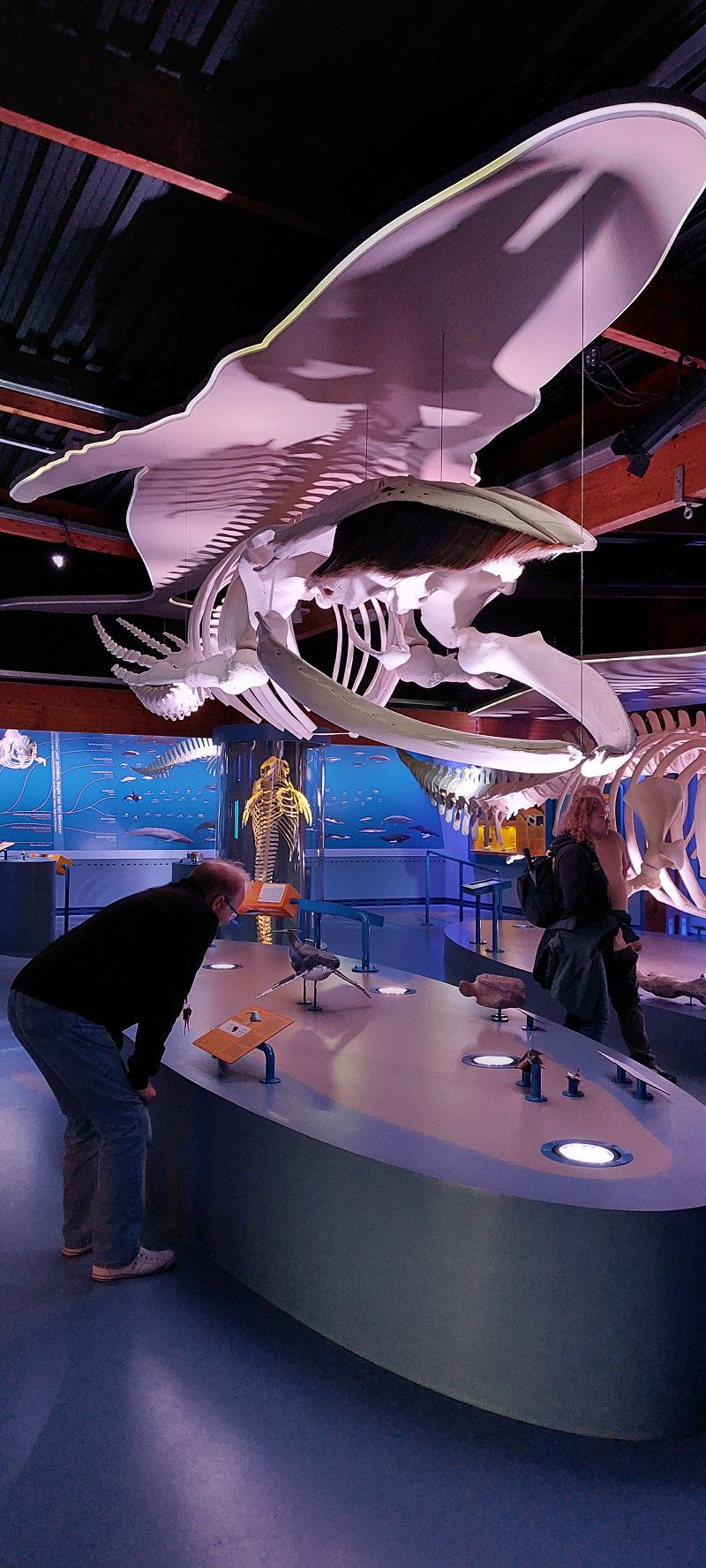
Since it rained today, we visited the Naval Museum.
Willemsoord 41, Den Helder, Nordholland, Niederlande
52° 57' 43.2" N 4° 46' 14.6" E
52.9619919 4.7707331
• Head north on Willemsoord. Go for 104 m.
• Turn right onto Willemsoord. Go for 96 m.
• Continue on Hoofdgracht. Go for 106 m.
• Turn right onto Hoofdgracht. Go for 464 m.
• Turn left onto Bevesierweg. Go for 182 m.
• Turn left onto Havenplein. Go for 44 m.
• Turn left onto Havenplein. Go for 21 m.
• Arrive at Havenplein. Your destination is on the right.
☍
1,0 km
( 2 min.)
Day
14. Sep. 2025 -
14. Sep. 2025
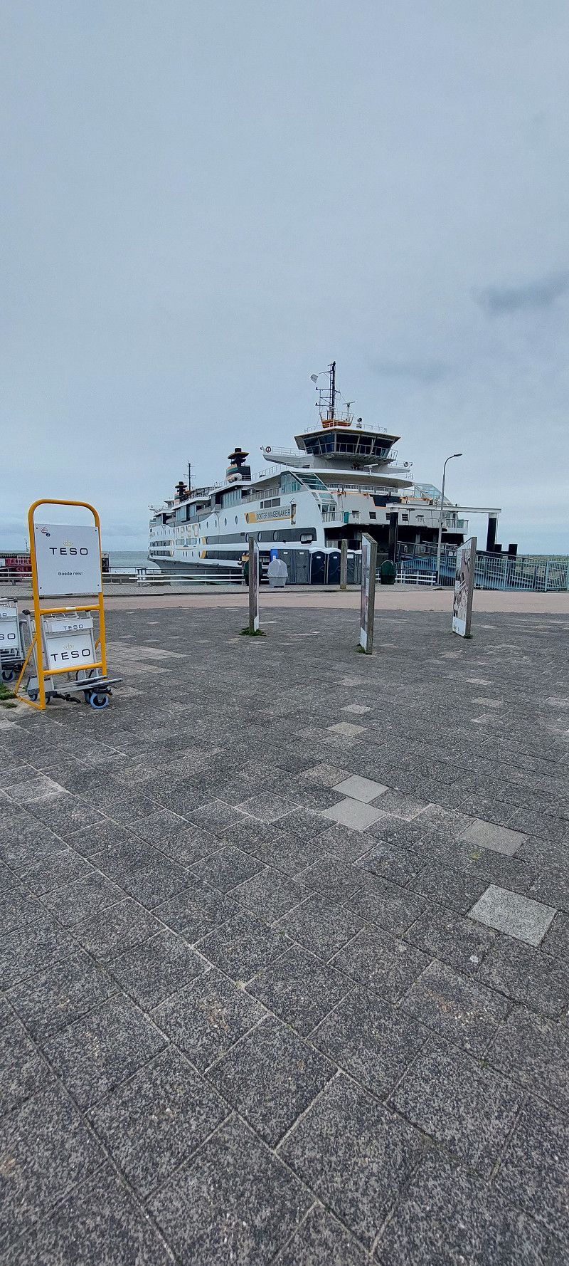
Havenplein - Fähre nach Texel
Havenplein 3, Den Helder, Nordholland, Niederlande
52° 57' 43.8" N 4° 46' 40.9" E
52.9621729 4.7780192
• Head toward Bevesierweg on Havenplein. Go for 16 m.
• Turn slightly right onto Paleiskade. Go for 122 m.
• Turn slightly right onto Bevesierweg. Go for 30 m.
• Turn right onto Hoofdgracht. Go for 711 m.
• Turn right onto Hoofdgracht (N250). Go for 607 m.
• Continue on Havenplein (N250). Go for 263 m.
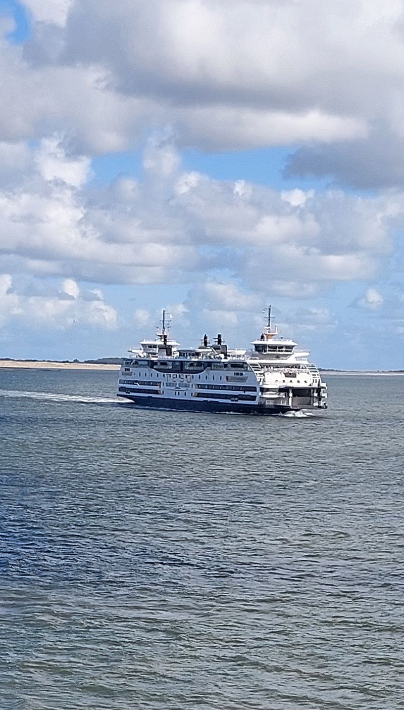
• Take the Den Helder-Texel Ferry. Stay on for 4.6 km.
• Head northwest on Pontweg (N501). Go for 76 m.
• Keep left toward Pontweg/N501. Go for 382 m.
• Continue on Pontweg (N501). Go for 5.4 km.
• Take the 1st exit from roundabout onto Emmalaan. Go for 392 m.
• Take the 2nd exit from roundabout onto Elemert. Go for 392 m.
• Turn left onto Groeneplaats. Go for 61 m.
• Turn right onto Groeneplaats. Go for 5 m.
• Arrive at Groeneplaats.
☍
13,1 km
( 48 min.)
14. Sep. 2025 -
14. Sep. 2025
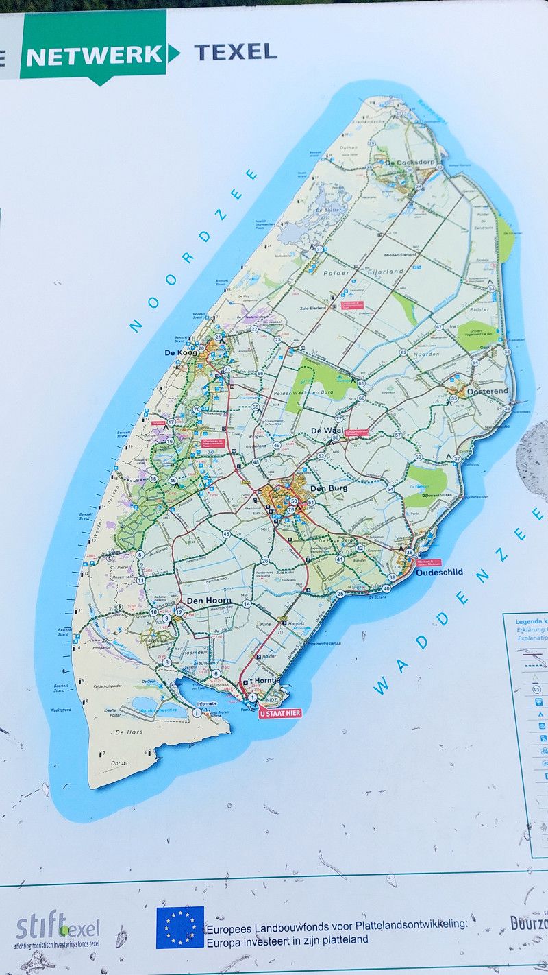
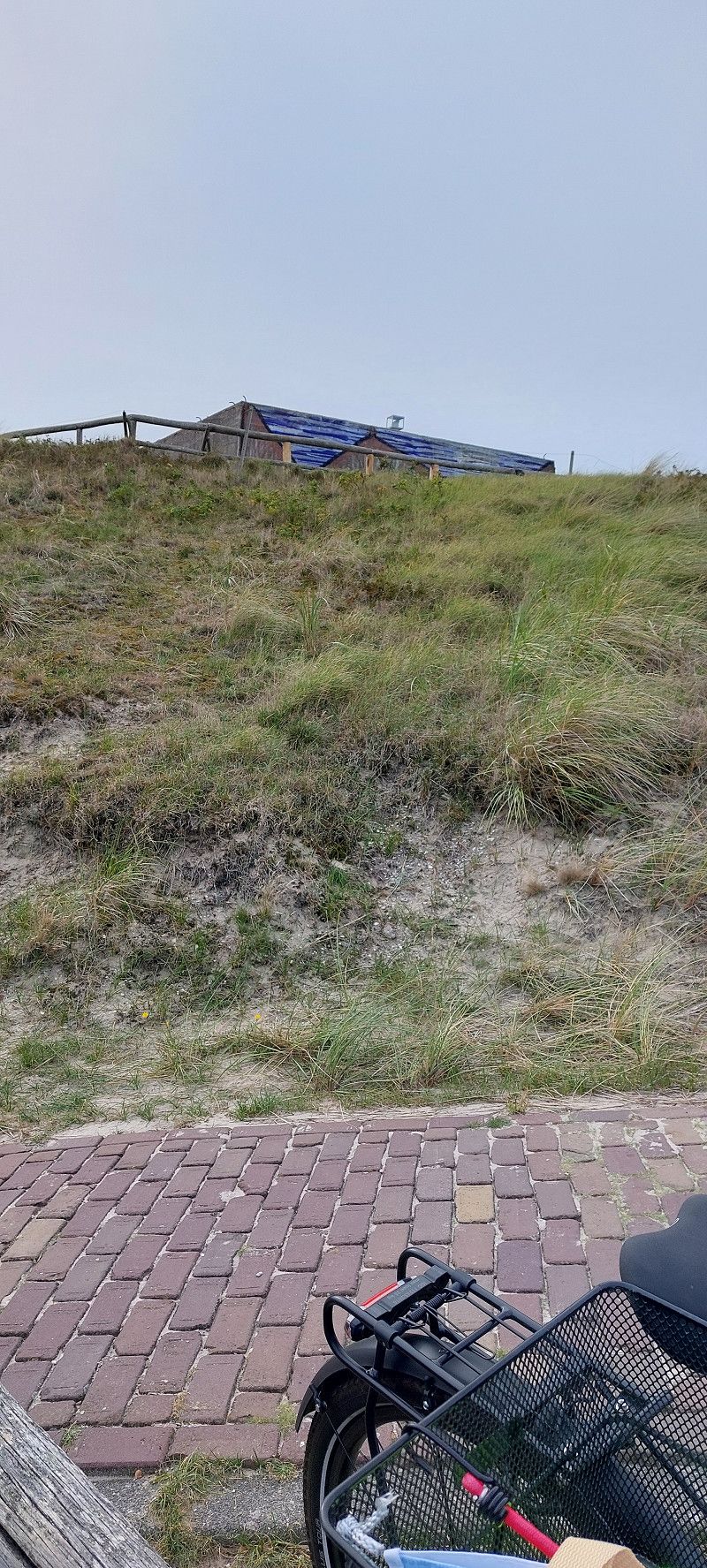
Texel
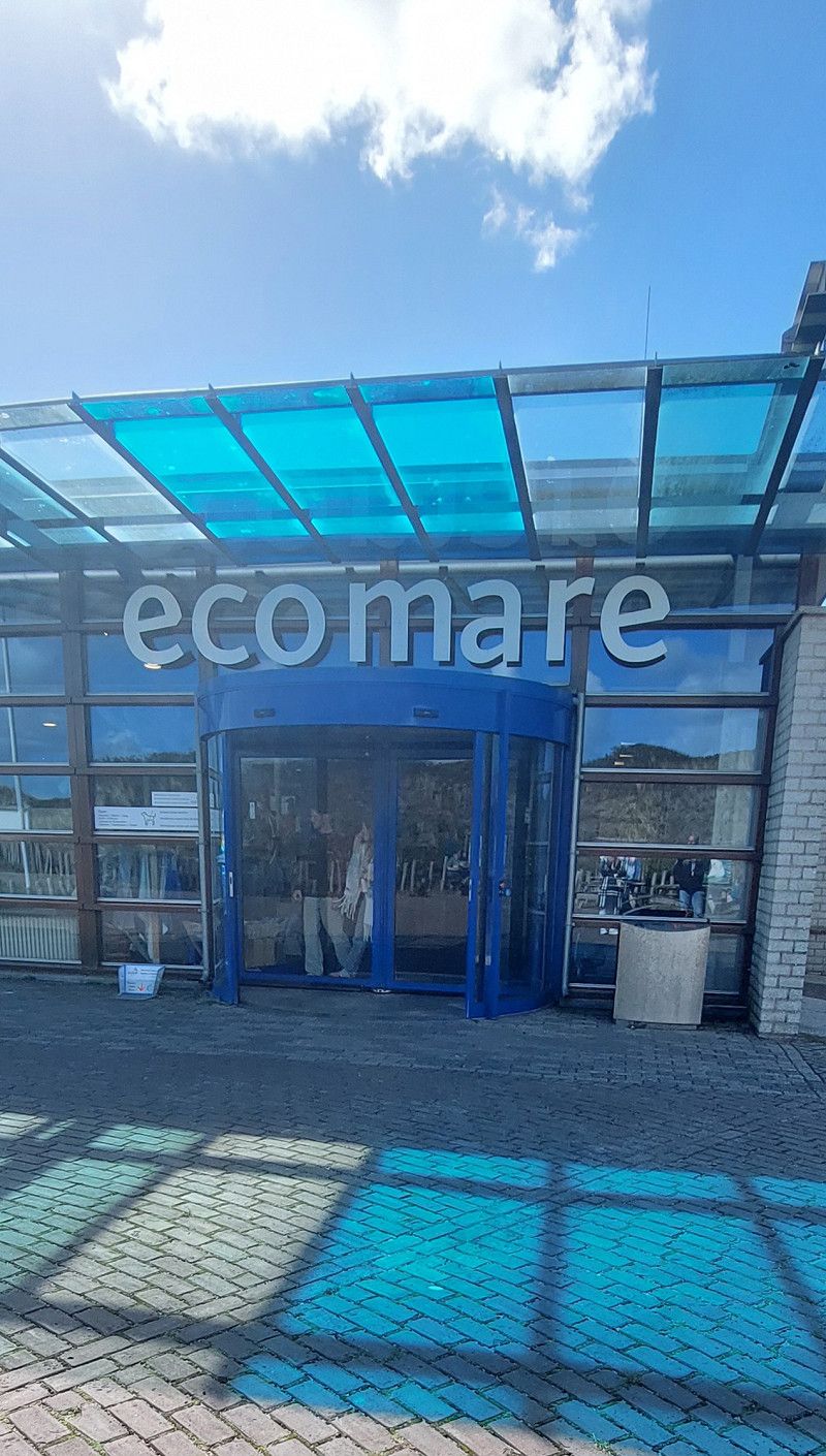
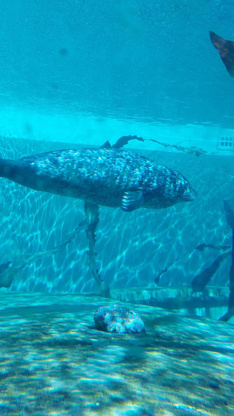
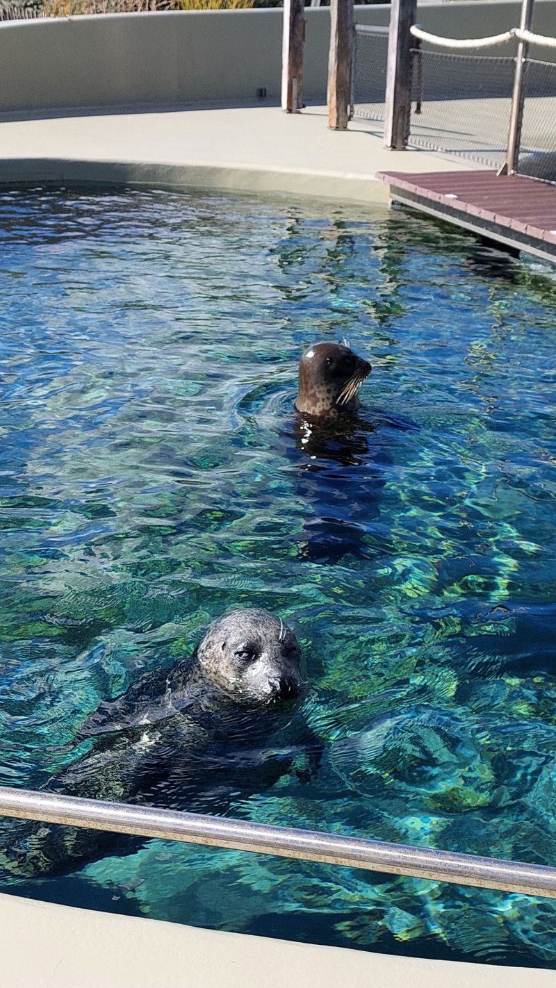
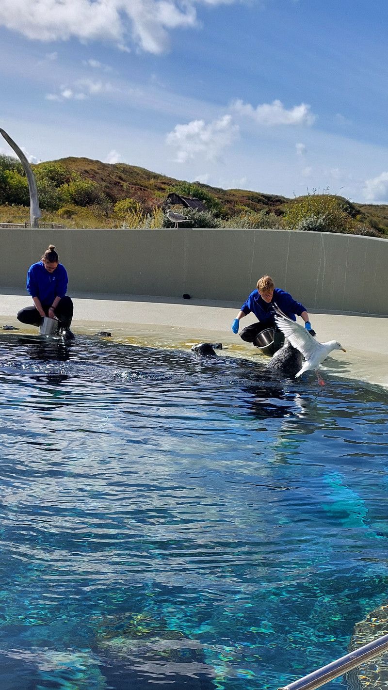
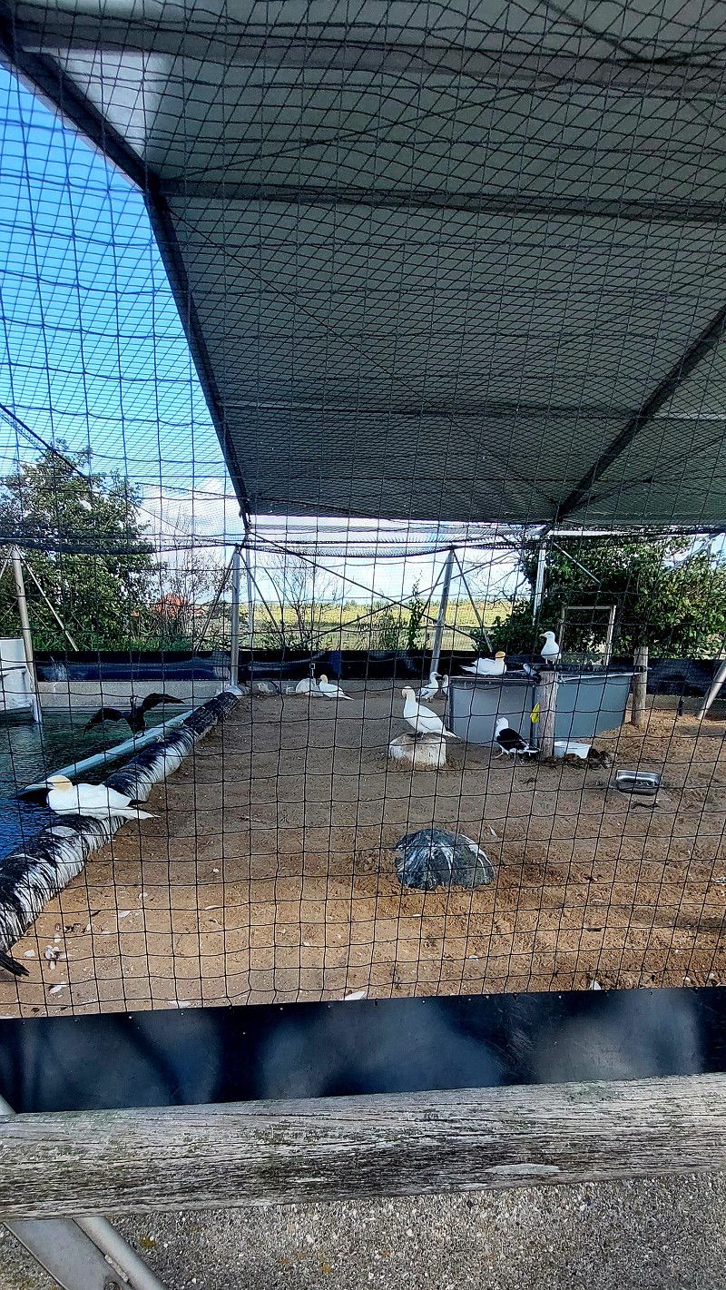
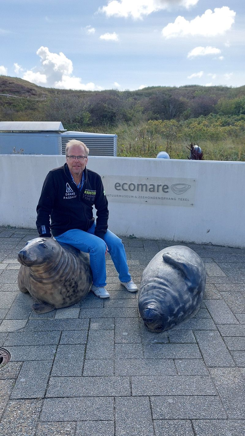
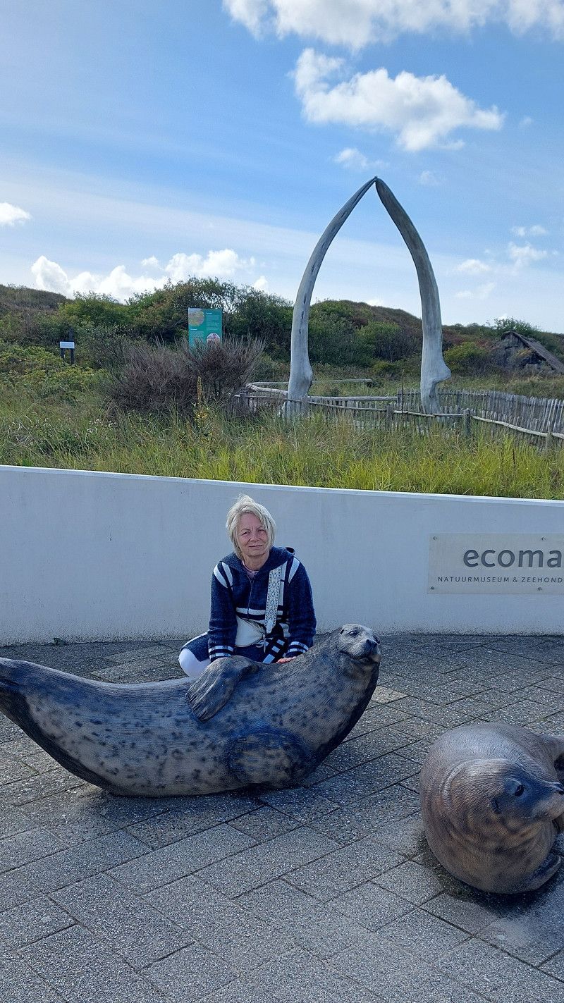
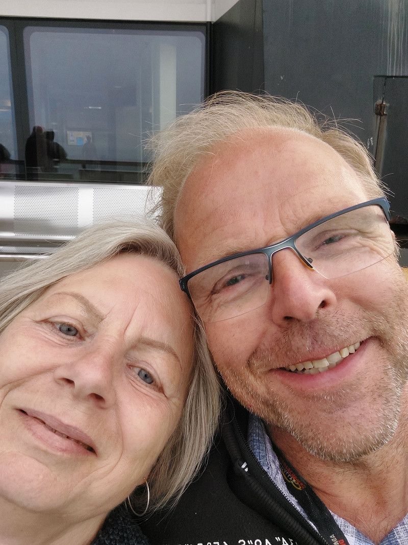
Island visit - seal rescue station in De Koog...it's an island worth seeing.
Niederlande
53° 3' 17.1" N 4° 47' 51.8" E
53.0547626 4.7977149
• Head toward Zwaanstraat on Groeneplaats. Go for 5 m.
• Turn left onto Groeneplaats. Go for 61 m.
• Turn right onto Elemert. Go for 349 m.
• Take the 2nd exit from roundabout onto Emmalaan. Go for 405 m.
• Take the 3rd exit from roundabout onto Pontweg (N501). Go for 5.4 km.
• Continue on Pontweg (N501). Go for 328 m.
• Turn left toward Pontweg/N501. Go for 201 m.
• Continue on Pontweg (N501). Go for 60 m.
• Arrive at Pontweg (N501). Your destination is on the right.
☍
6,8 km
( 7 min.)
14. Sep. 2025 -
14. Sep. 2025
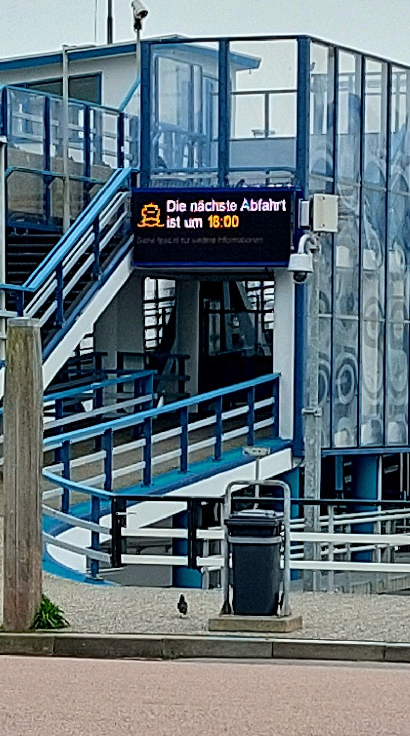
Den Hoorn - Fähre zurück von Texel
Pontweg, Den Hoorn, Nordholland, Niederlande
53° 0' 13" N 4° 46' 51.9" E
53.0036050 4.7810695
• Head southeast on Pontweg (N501). Go for 16 m.
• Take the Den Helder-Texel Ferry. Stay on for 4.6 km.
• Head southwest on Havenplein (N250). Go for 1.2 km.
• Turn left onto Nieuwe Kerkplein. Go for 31 m.
• Continue on Plein 1822. Go for 5 m.
• Continue on Willemsoord. Go for 18 m.
• Turn left onto Plein 1832. Go for 108 m.
• Turn right toward Willemsoord. Go for 140 m.
• Turn right onto Willemsoord. Go for 28 m.
• Arrive at Willemsoord. Your destination is on the right.
☍
6,2 km
( 40 min.)
13. Sep. 2025 -
15. Sep. 2025
Den Helder - Stellplatz im Hafen
Willemsoord 41, Den Helder, Nordholland, Niederlande
52° 57' 43.2" N 4° 46' 14.6" E
52.9619919 4.7707331
• Head north on Willemsoord. Go for 28 m.
• Turn left. Go for 91 m.
• Turn left toward Willemsoord. Go for 30 m.
• Continue on Willemsoord. Go for 145 m.
• Continue on Plein 1822. Go for 5 m.
• Continue on Nieuwe Kerkplein. Go for 31 m.
• Turn left onto Weststraat (N250). Go for 2.6 km.
• Keep left toward Leeuwarden/Alkmaar. Go for 24 m.
• Take the 2nd exit from roundabout onto N250 toward Alkmaar/Leeuwarden. Go for 3.3 km.
• Turn right onto N99. Go for 363 m.
• Turn left onto N99 toward Breezand/Leeuwarden/Amsterdam/Kon. Marine Nieuwe Haven/Industrieterrein Oostoever. Go for 627 m.
• Keep right toward Anna Paulowna/Amsterdam/Leeuwarden. Go for 27 m.
• Pass 6 roundabouts and continue on Rijksstraatweg (N99). Go for 18.0 km.
• Turn left and take ramp onto A7 (Afsluitdijk) toward Leeuwarden/Groningen. Go for 29.1 km.
• Take exit 15 toward Zurich/Harlingen/Leeuwarden/N31. Go for 639 m.
• Keep left onto A31 toward Harlingen/Leeuwarden/N31. Go for 1.5 km.
• Continue on N31. Go for 4.6 km.
• Take ramp toward Kimswerd. Go for 351 m.
• Take the 3rd exit from roundabout onto Kimswerderlaan. Go for 187 m.
• Turn right onto Caspar de Roblesdijk. Go for 657 m.
• Continue on Westerzeedijk. Go for 1.2 km.
• Turn right onto Westerzeedijk. Go for 118 m.
• Turn left onto Westerzeedijk. Go for 27 m.
• Arrive at Westerzeedijk. Your destination is on the left.
☍
63,7 km
( 50 min.)
Day
15. Sep. 2025 -
16. Sep. 2025
Recreatie De Zeehoeve
Westerzeedijk 45, 8862 PK, Harlingen, Niederlande
53° 9' 45" N 5° 25' 6" E
53.1625000 5.4183300
• Head west on Westerzeedijk. Go for 27 m.
• Turn right onto Westerzeedijk. Go for 118 m.
• Turn right onto Westerzeedijk. Go for 947 m.
• Turn left onto Nieuwe Willemshaven. Go for 471 m.
• Turn right onto Nieuwe Willemshaven. Go for 23 m.
• Continue on Willemskade. Go for 187 m.
• Arrive at Willemskade. Your destination is on the right.
☍
1,8 km
( 3 min.)
15. Sep. 2025 -
15. Sep. 2025
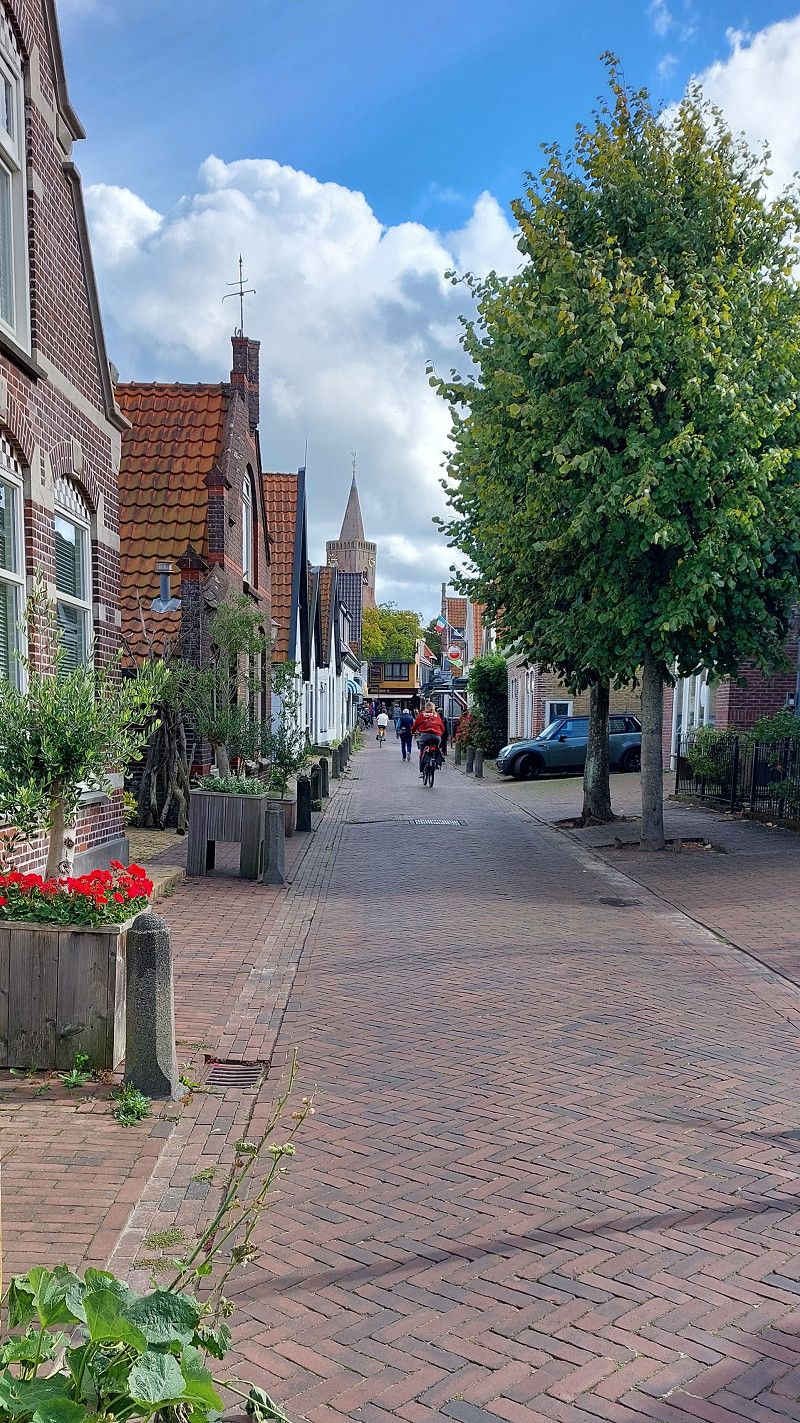
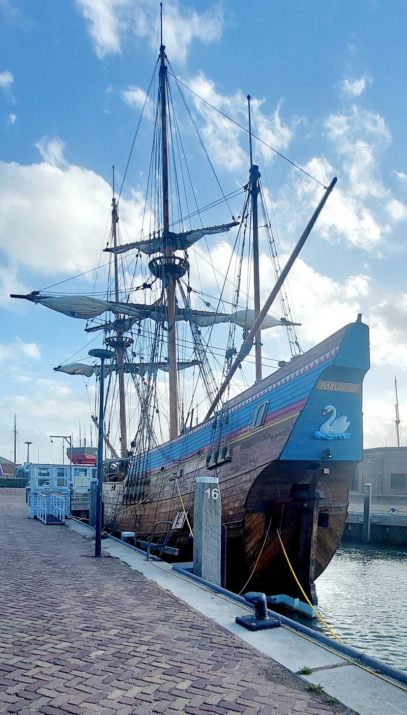
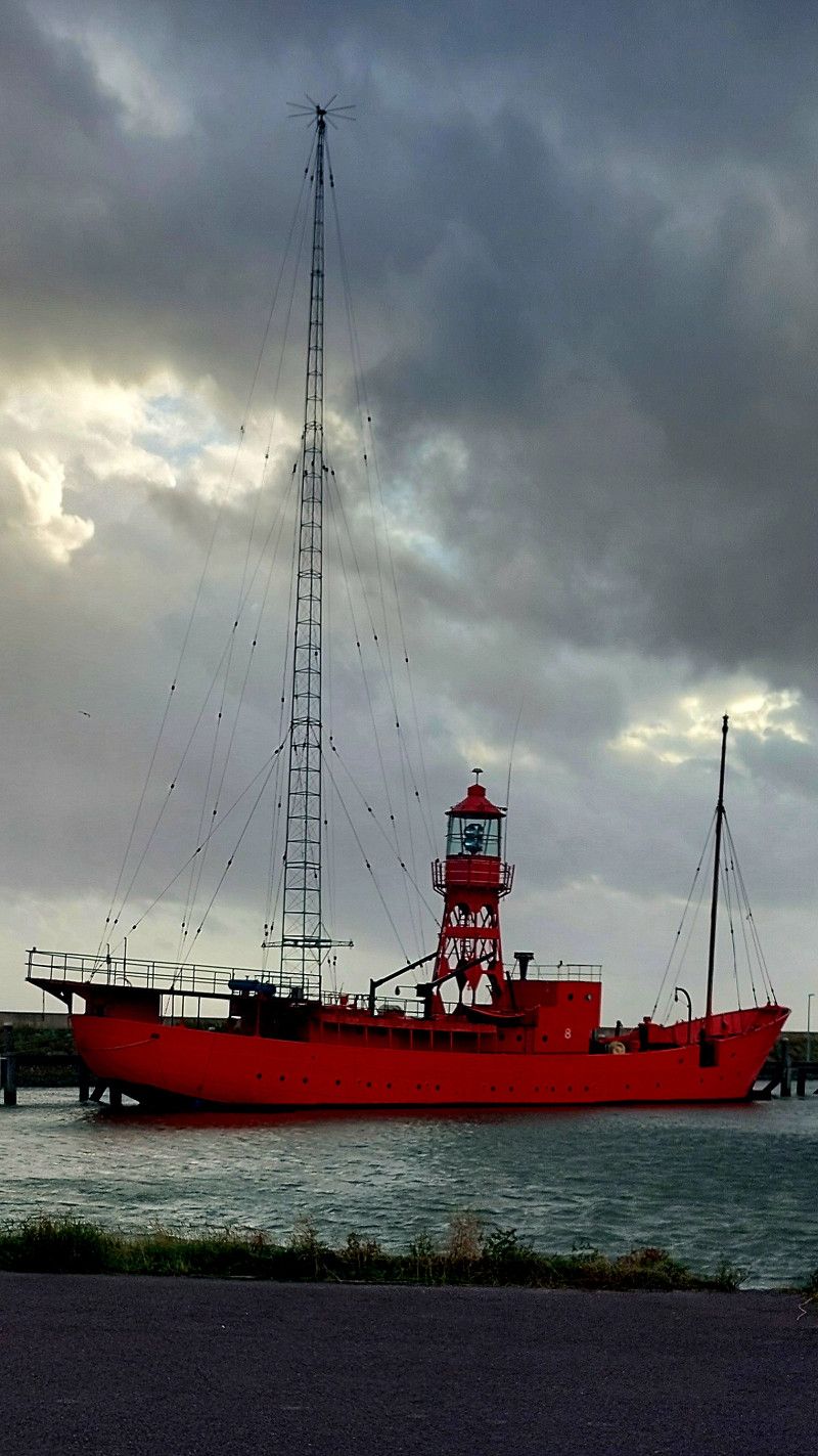
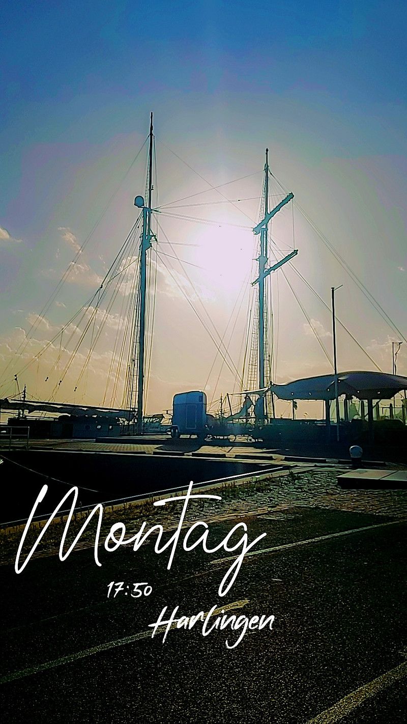
Harlingen
Dokkade, Harlingen, Friesland, Niederlande
53° 10' 29.5" N 5° 24' 40.7" E
53.1748728 5.4113083
• Head toward Dokkade on Willemskade. Go for 187 m.
• Continue on Nieuwe Willemshaven. Go for 23 m.
• Turn left onto Nieuwe Willemshaven. Go for 471 m.
• Turn left onto Westerzeedijk. Go for 55 m.
• Turn right onto Spoorstraat. Go for 483 m.
• Take the 2nd exit from roundabout onto Stationsweg. Go for 343 m.
• Take the 2nd exit from roundabout onto Stationsweg toward Sneek/Amsterdam/Leeuwarden. Go for 209 m.
• Continue on Almenumerweg. Go for 288 m.
• Take the 3rd exit from roundabout onto N31 toward Leeuwarden. Go for 2.1 km.
• Keep left onto A31 toward Franeker. Go for 18.6 km.
• Continue on N31. Go for 538 m.
• Take ramp onto N383 toward Leeuwarden-Noord. Go for 2.9 km.
• Keep left toward Luchthaven/RING/Dokkum/Hurdegaryp. Go for 33 m.
• Take the 3rd exit from roundabout onto Valeriusstraat (N355) toward Hurdegaryp/Dokkum. Go for 2.4 km.
• Pass 2 roundabouts and continue on Noarder Omwei (N355). Go for 11.7 km.
• Keep right toward Sintrale as/N356. Go for 52 m.
• Take the 3rd exit from roundabout onto Sintrale as (N356) toward Damwâld/Dokkum. Go for 11.5 km.
• Keep right toward Industrieterrein Betterwird/Dokkum/Holwerd/Lauwersoog/N361. Go for 38 m.
• Pass 6 roundabouts and continue on Zeedijk (N361). Go for 18.6 km.
• Turn right onto Zeedijk. Go for 39 m.
• Continue on Kustweg. Go for 74 m.
• Arrive at Kustweg. Your destination is on the right.
☍
70,7 km
( 54 min.)
Day
16. Sep. 2025 -
18. Sep. 2025
Stellplatz im Hafen Lauwersoog
Kustweg 30, Lauwersoog, Groningen, Niederlande
53° 24' 21" N 6° 12' 1.2" E
53.4058244 6.2003414
• Head northwest on Kustweg. Go for 74 m.
• Continue on Zeedijk. Go for 39 m.
• Turn left onto Zeedijk (N361). Go for 509 m.
• Take the 2nd exit from roundabout onto Veerhaven. Go for 210 m.
• Turn right onto Veerhaven. Go for 83 m.
• Take the Schiermonnikoog-Lauwersoog Ferry. Stay on for 11.4 km.
• Head northwest on Veerweg. Go for 1.2 km.
• Turn left onto Heereweg. Go for 403 m.
• Turn right onto Herdersdam. Go for 458 m.
• Turn left onto Kooiweg. Go for 483 m.
• Continue on Reddingsweg. Go for 335 m.
• Turn right onto Prins Bernhardweg. Go for 1.7 km.
• Turn right onto Prins Bernhardweg. Go for 118 m.
• Turn right onto Prins Bernhardweg. Go for 75 m.
• Arrive at Prins Bernhardweg. Your destination is on the right.
☍
17,1 km
( 57 min.)
Day
17. Sep. 2025 -
17. Sep. 2025
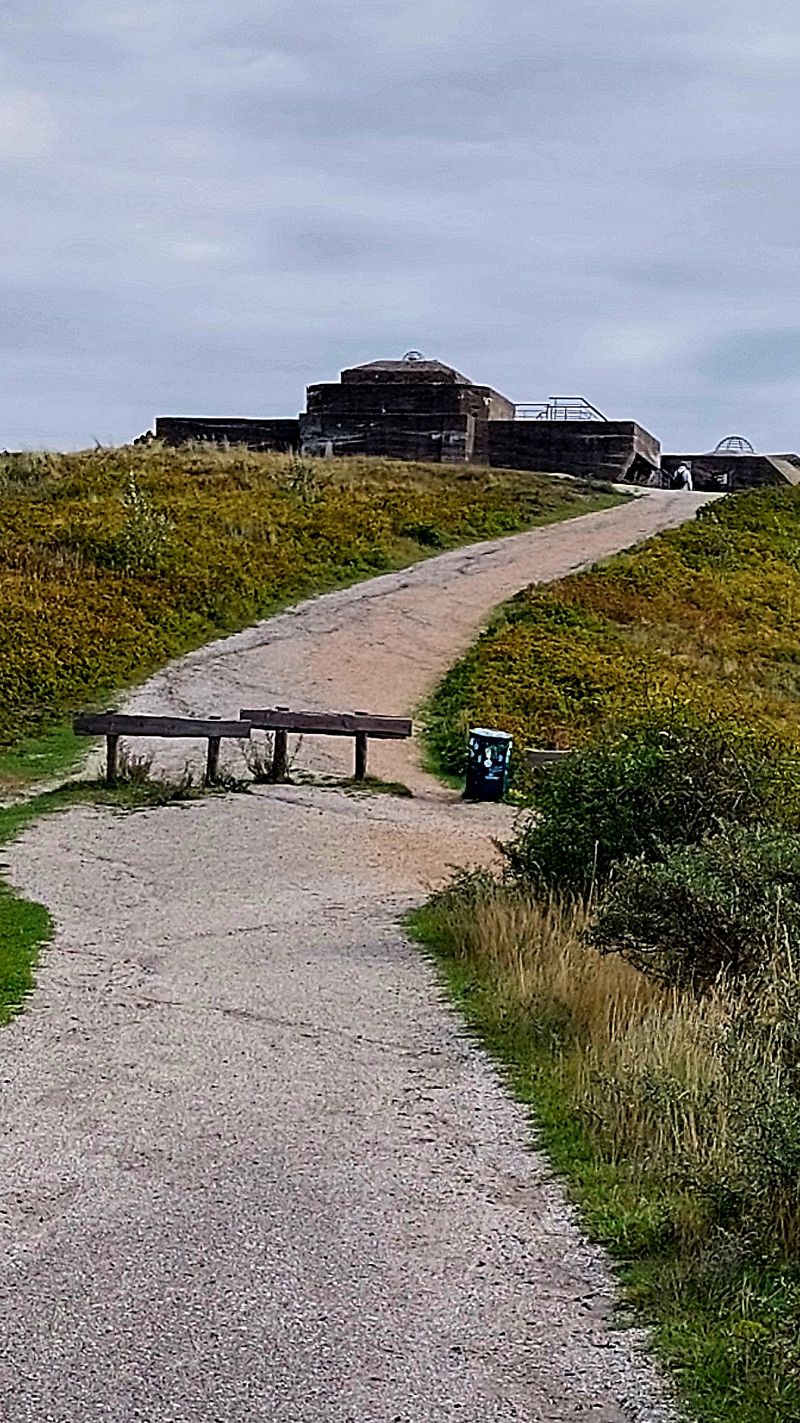
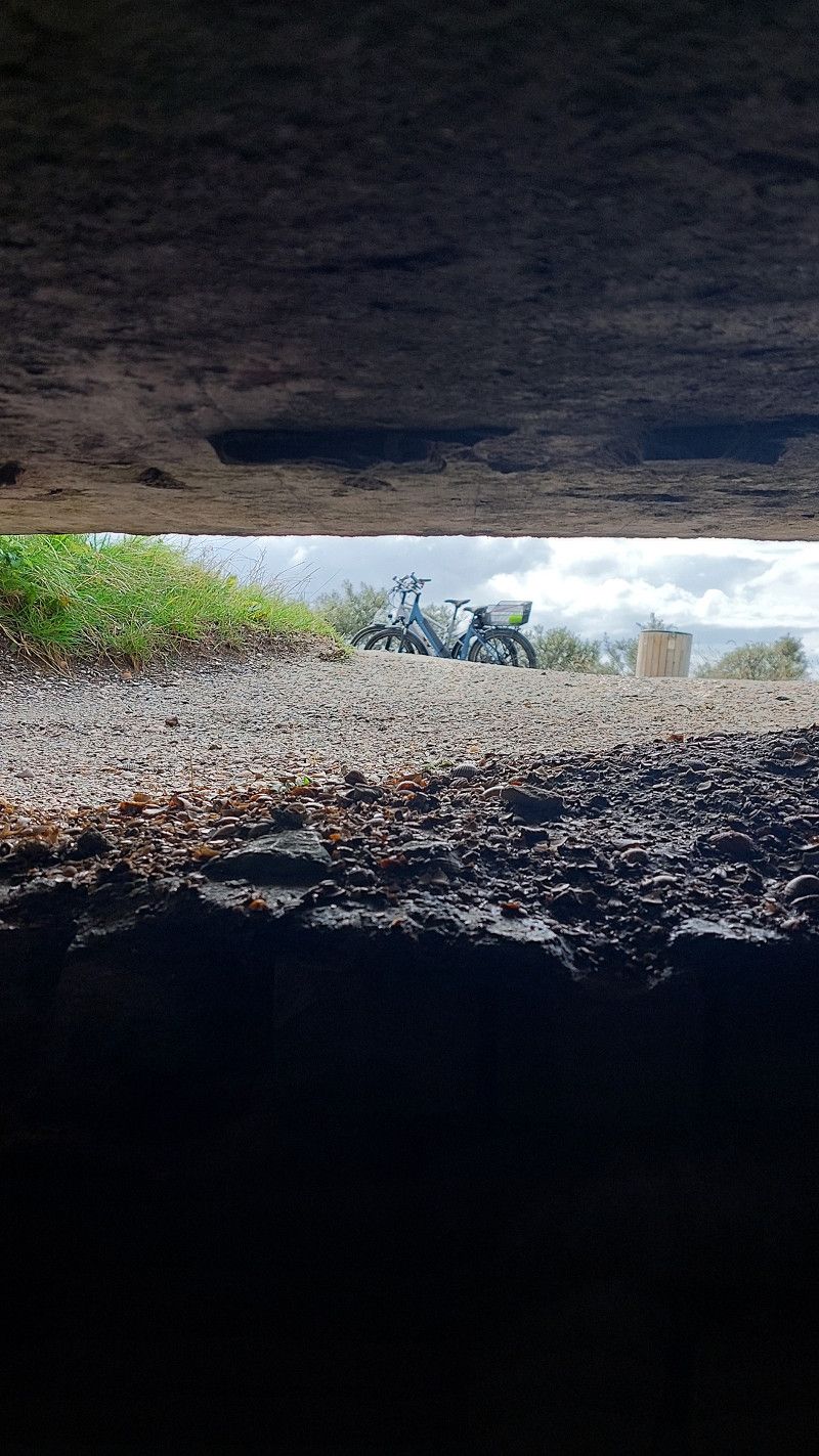
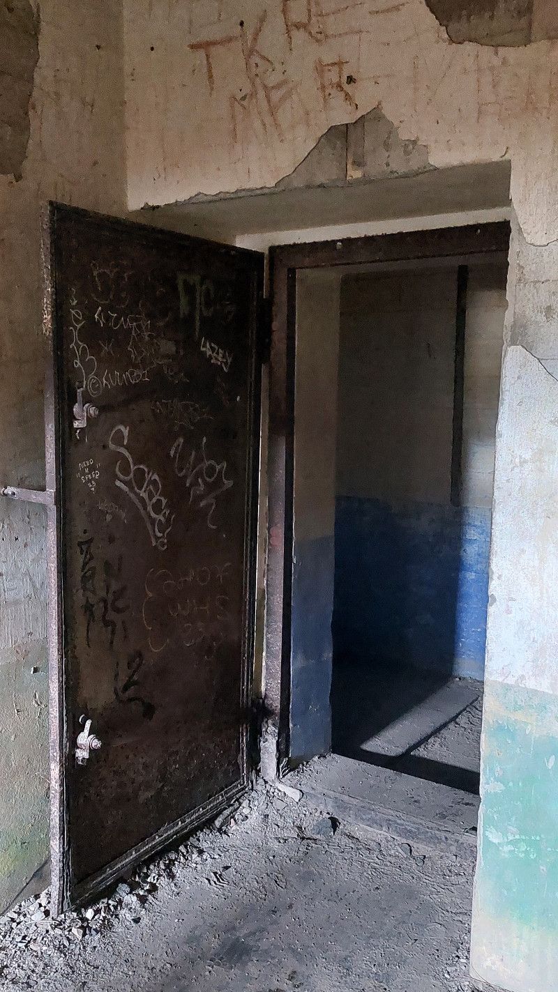
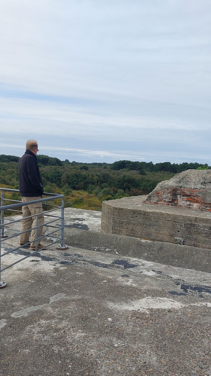
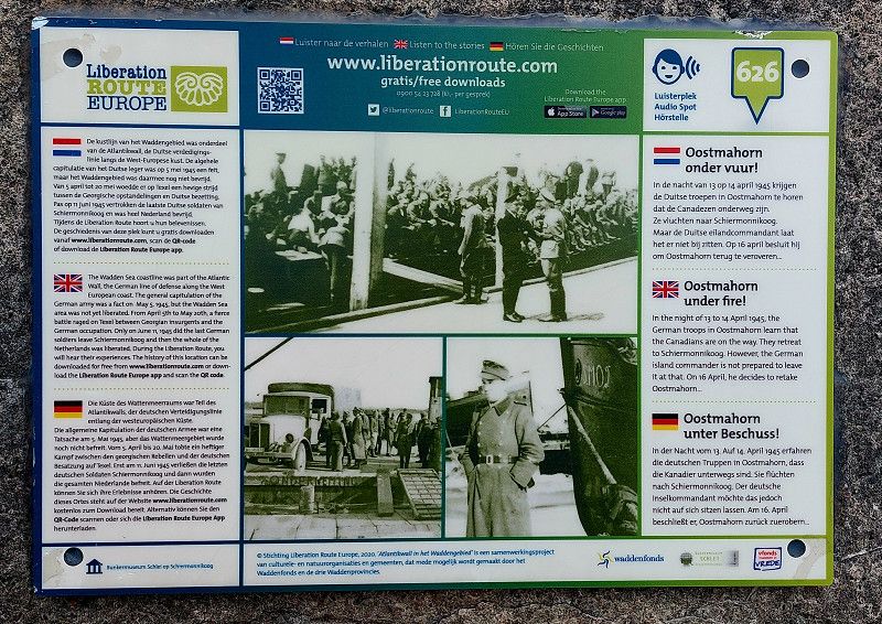
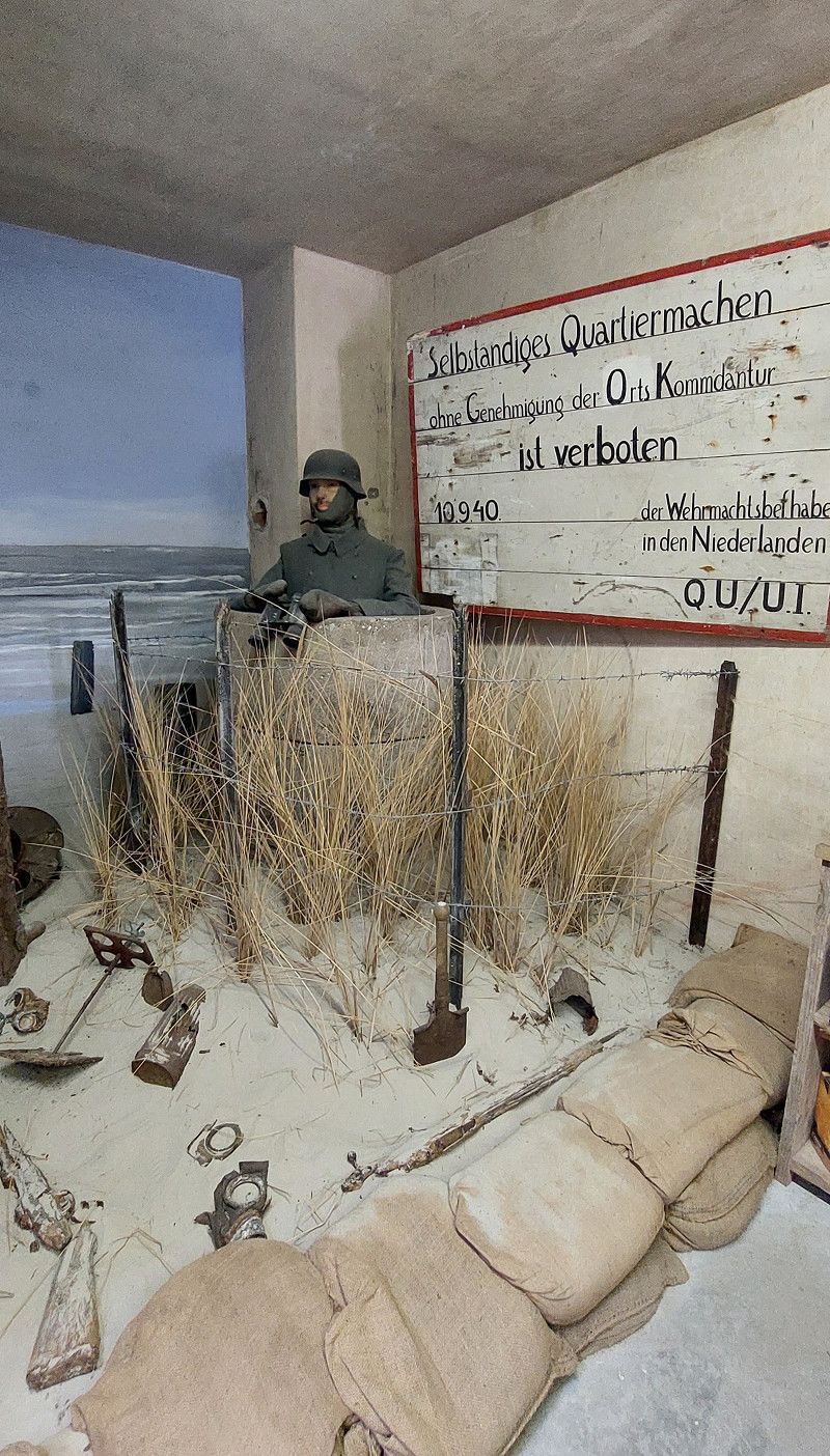
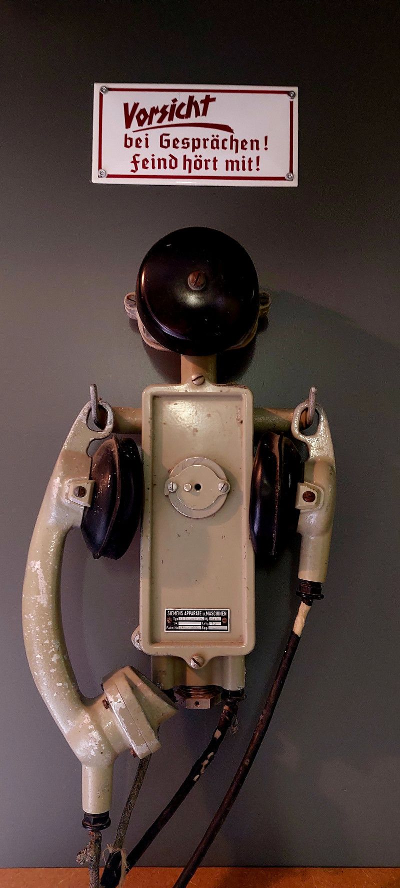
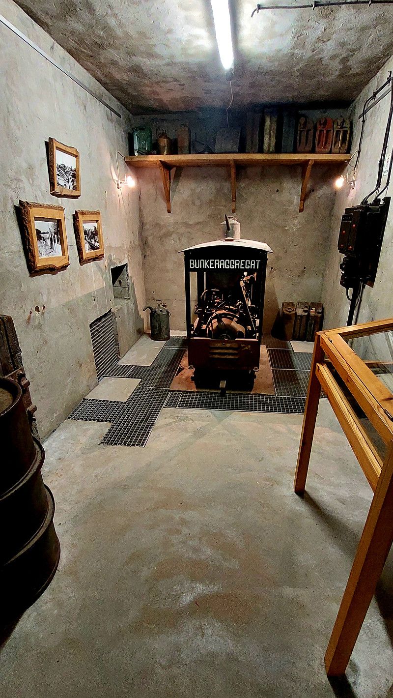
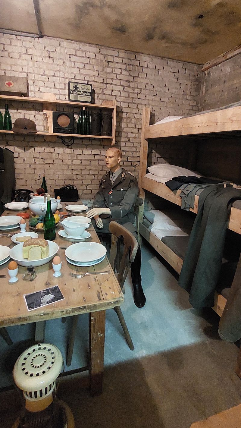
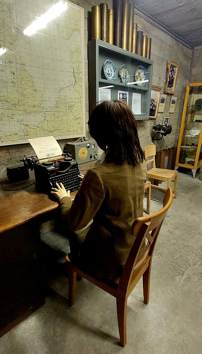
Bunkermuseum Schlei und Bunker Wasserman
Prins Bernhardweg 4, Schiermonnikoog, Friesland, Niederlande
53° 29' 48.8" N 6° 11' 18.1" E
53.4968889 6.1883562
• Head southwest on Prins Bernhardweg. Go for 75 m.
• Turn left onto Prins Bernhardweg. Go for 118 m.
• Turn left onto Prins Bernhardweg. Go for 1.7 km.
• Continue on Reddingsweg. Go for 255 m.
• Turn slightly left onto Rijspolder. Go for 107 m.
• Continue on Knuppeldam. Go for 325 m.
• Continue on Langestreek. Go for 339 m.
• Turn right onto Badweg. Go for 1.1 km.
• Turn left onto Vuurtorenpad. Go for 486 m.
• Arrive at Vuurtorenpad. Your destination is on the right.
☍
4,5 km
( 9 min.)
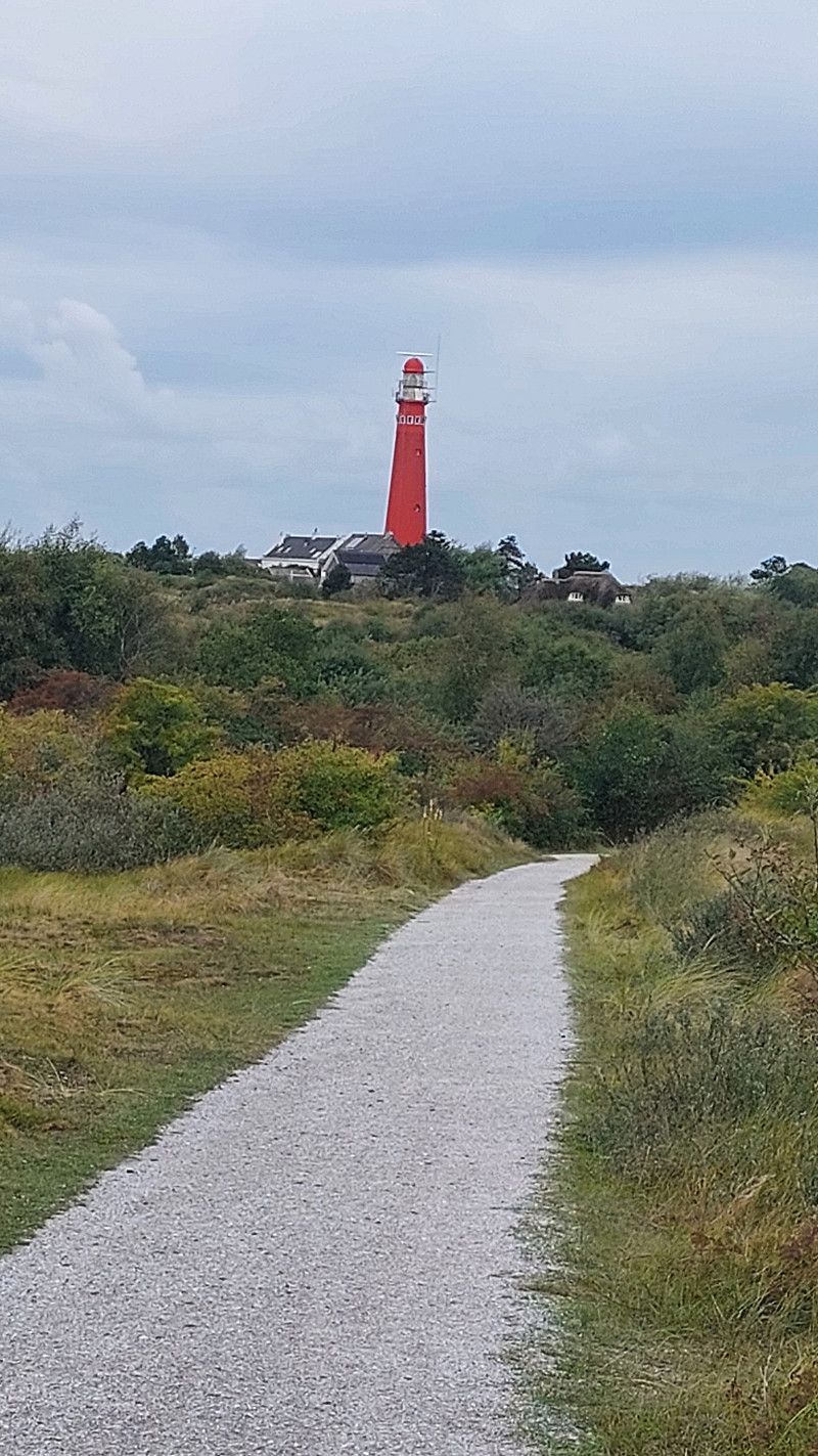
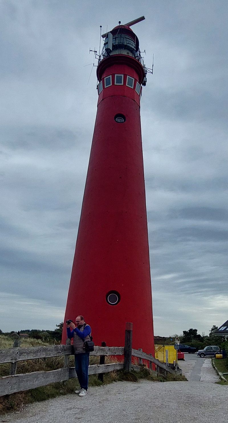
17. Sep. 2025 -
17. Sep. 2025
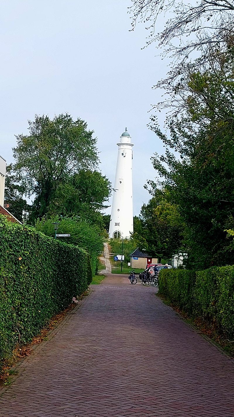
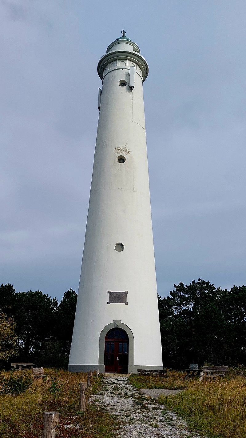
Schiermonnikoog Leuchttürme
...on Schiermonnikoog ... unfortunately both are not open to the public
Vuurtorenpad 28, Schiermonnikoog, Friesland, Niederlande
53° 29' 12.6" N 6° 8' 47.5" E
53.4868372 6.1465323
• Head toward Badweg on Vuurtorenpad. Go for 486 m.
• Turn right onto Badweg. Go for 1.1 km.
• Turn left onto Langestreek. Go for 339 m.
• Continue on Knuppeldam. Go for 325 m.
• Continue on Rijspolder. Go for 107 m.
• Turn slightly right onto Reddingsweg. Go for 255 m.
• Turn right onto Reddingsweg. Go for 335 m.
• Continue on Kooiweg. Go for 483 m.
• Turn right onto Herdersdam. Go for 458 m.
• Turn left onto Heereweg. Go for 403 m.
• Turn right onto Veerweg. Go for 1.2 km.
• Take the Schiermonnikoog-Lauwersoog Ferry. Stay on for 11.4 km.
• Head west on Veerhaven. Go for 36 m.
• Turn right toward Zeedijk. Go for 68 m.
• Turn left onto Zeedijk. Go for 26 m.
• Continue on Veerhaven. Go for 186 m.
• Take the 3rd exit from roundabout onto Zeedijk (N361). Go for 579 m.
• Turn right onto Zeedijk. Go for 39 m.
• Continue on Kustweg. Go for 74 m.
• Arrive at Kustweg. Your destination is on the right.
☍
17,9 km
(1 hrs. 2 min.)
16. Sep. 2025 -
18. Sep. 2025
Stellplatz im Hafen Lauwersoog
Kustweg 30, Lauwersoog, Groningen, Niederlande
53° 24' 21" N 6° 12' 1.2" E
53.4058244 6.2003414
• Head northwest on Kustweg. Go for 74 m.
• Continue on Zeedijk. Go for 39 m.
• Turn right onto Zeedijk (N361). Go for 682 m.
• Pass 9 roundabouts and continue on Provincialeweg (N361). Go for 38.8 km.
• Turn left and take ramp onto Beneluxweg (N46). Go for 5.3 km.
• Continue on A7. Go for 46.0 km.
• Continue on A280. Go for 4.3 km.
• Take the left exit toward Emden/Leer/Oldenburg/Weener onto A31. Go for 20.7 km.
• Continue on A28 toward Bremen/Oldenburg/Leer-Ost. Go for 54.0 km.
• Take the exit toward Bremen/Osnabrück/Oldenburg-Haarentor/Oldenburg-Zentrum onto A28. Go for 880 m.
• Take exit 12 toward OL-Haarentor/OL-Universität/OL-Bloherfelde/OL-Stadtmitte. Go for 239 m.
• Turn left onto Ammerländer Heerstraße (L865) toward Fachhochschule Oldenburg/Pius-Hospital/Ev. Krankenhaus. Go for 239 m.
• Continue on Ofener Straße (L865). Go for 1.1 km.
• Turn right onto Theaterwall. Go for 536 m.
• Continue on Schloßwall. Go for 266 m.
• Turn right onto Damm. Go for 390 m.
• Turn right onto Westfalendamm. Go for 590 m.
• Arrive at Westfalendamm. Your destination is on the left.
☍
174,2 km
(1 hrs. 50 min.)
Day
18. Sep. 2025 -
19. Sep. 2025
Oldenburg - Stellplatz am Küstenkanal
Westfalendamm, Oldenburg, Niedersachsen, Deutschland
53° 7' 45.2" N 8° 12' 52.4" E
53.1292354 8.2145550
• Head southwest on Westfalendamm. Go for 536 m.
• Turn right onto Niedersachsendamm. Go for 287 m.
• Turn right onto Marschweg. Go for 856 m.
• Turn left onto Hauptstraße. Go for 768 m.
• Turn right and take ramp onto A28 toward Emden/Leer/Wilhelmshaven. Go for 2.0 km.
• Continue on A293 toward Wilhelmshaven/Nordenham/OL-Bürgerfelde. Go for 9.4 km.
• Continue on Braker Chaussee (B211) toward Gewerbegebiet Ak Oldenburg-Nord/Nordenham/Brake. Go for 15.6 km.
• Pass 2 roundabouts and continue on B211. Go for 4.8 km.
• Turn left onto B212 toward Bremen/A27/Cuxhaven/Nordenham/Rodenkirchen/Weserfähren. Go for 11.9 km.
• Take ramp onto B437 toward Bremen/A27/Cuxhaven/Stotel. Go for 9.9 km.
• Take ramp onto A27 toward Cuxhaven/Bremerhaven. Go for 45.1 km.
• Take exit 2 toward Altenwalde/Cuxhaven-Duhnen/Cuxhaven-Döse/Sahlenburg/Groden-West Gewerbegebiet onto B73. Go for 3.0 km.
• Keep right toward Altenwalder Chaussee/B73. Go for 90 m.
• Continue on Altenwalder Chaussee (B73). Go for 1.6 km.
• Turn left onto Theodor-Heuss-Allee (K1). Go for 2.2 km.
• Turn left onto Brockeswalder Chaussee (K2). Go for 1.3 km.
• Continue on Brunnenweg (K2). Go for 409 m.
• Continue on Brockeswalder Weg (K2). Go for 663 m.
• Continue on Windeichenweg (K2). Go for 515 m.
• Continue on Duhner Allee (K2). Go for 930 m.
• Take the 1st exit from Cuxhavener Straße roundabout onto Cuxhavener Straße. Go for 586 m.
• Turn right. Go for 149 m.
• Turn right. Go for 31 m.
• Turn sharp right. Go for 54 m.
• Arrive at your destination on the right.
☍
112,7 km
(1 hrs. 20 min.)
Day
19. Sep. 2025 -
20. Sep. 2025
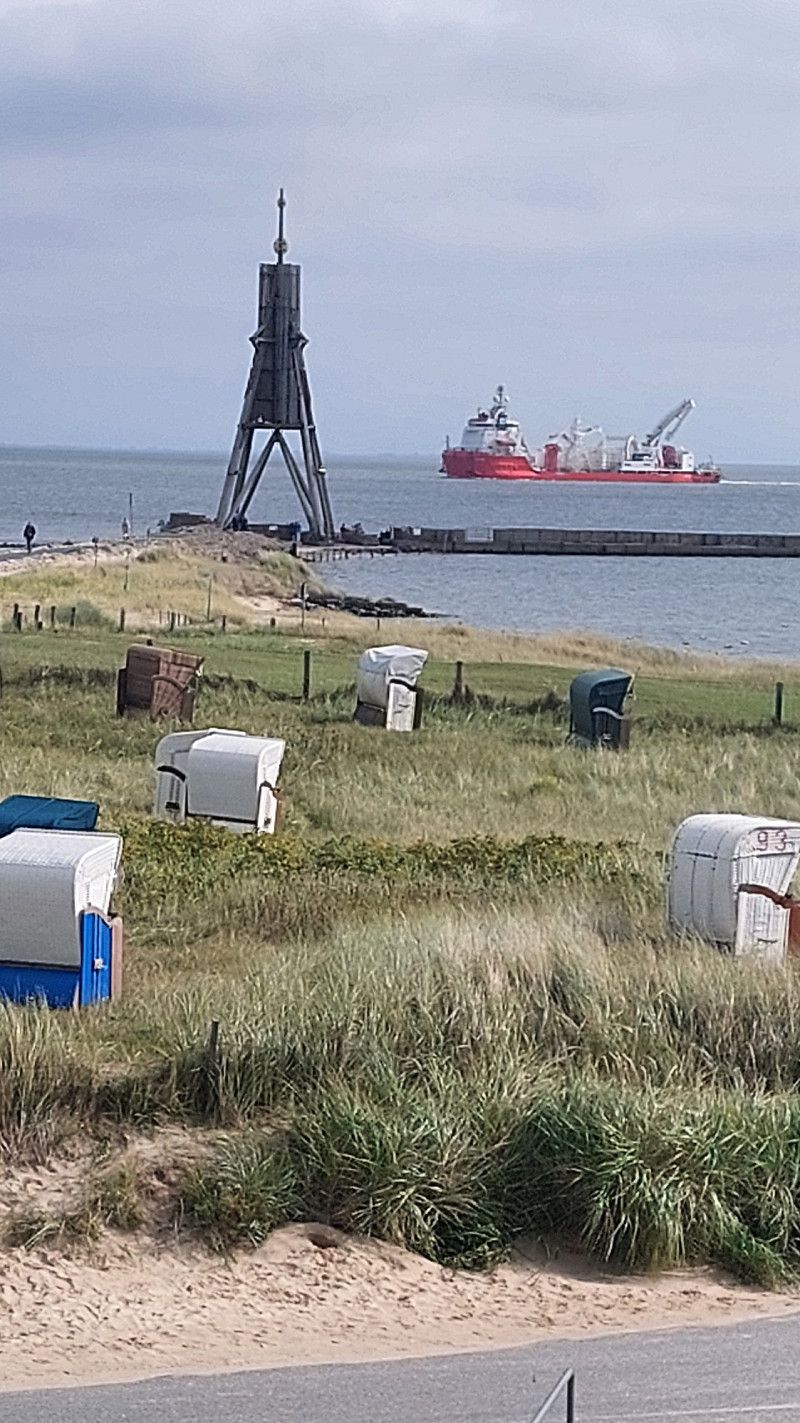
Campingplatz Nordsee
Cuxhavener Straße 17, Cuxhaven, Landkreis Cuxhaven, Niedersachsen, Deutschland
53° 53' 8.5" N 8° 39' 18" E
53.8856984 8.6549924
• Head southeast. Go for 54 m.
• Turn left. Go for 31 m.
• Turn left toward Cuxhavener Straße. Go for 149 m.
• Turn left onto Cuxhavener Straße. Go for 566 m.
• Take the 2nd exit from Cuxhavener Straße roundabout onto Duhner Allee. Go for 446 m.
• Turn left onto Heinrich-Grube-Weg (K1). Go for 1.7 km.
• Continue on Döser Feldweg (K1). Go for 939 m.
• Turn left onto Feldweg (K8) toward Hamburg/Stadtmitte. Go for 1.6 km.
• Turn left onto Karl-Olfers-Platz. Go for 16 m.
• Continue on Werner-Kammann-Straße. Go for 363 m.
• Turn right onto Rathausstraße. Go for 100 m.
• Turn left onto Grüner Weg. Go for 70 m.
• Turn left onto Grandauerstraße. Go for 71 m.
• Turn left. Go for 25 m.
• Arrive at your destination on the left.
☍
6,2 km
( 12 min.)
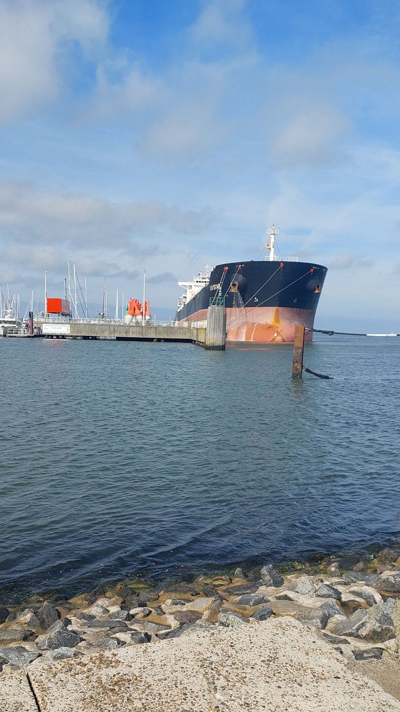
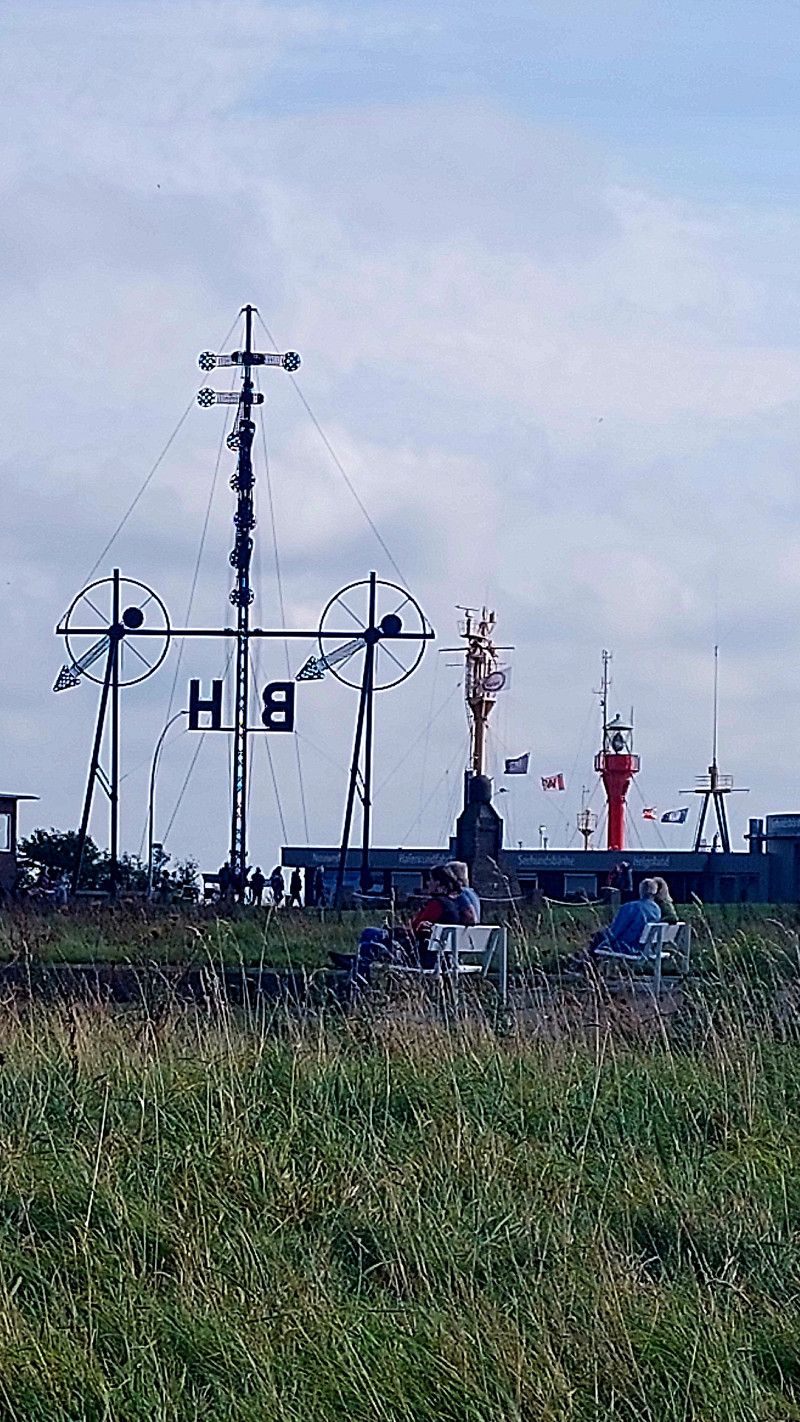
19. Sep. 2025 -
19. Sep. 2025
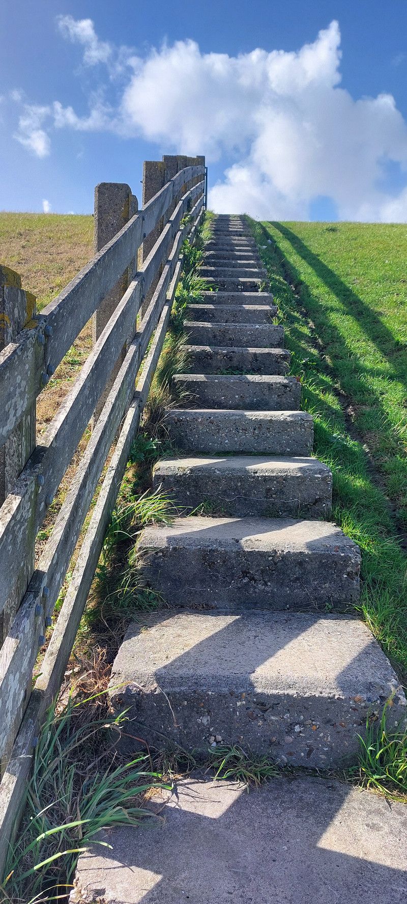
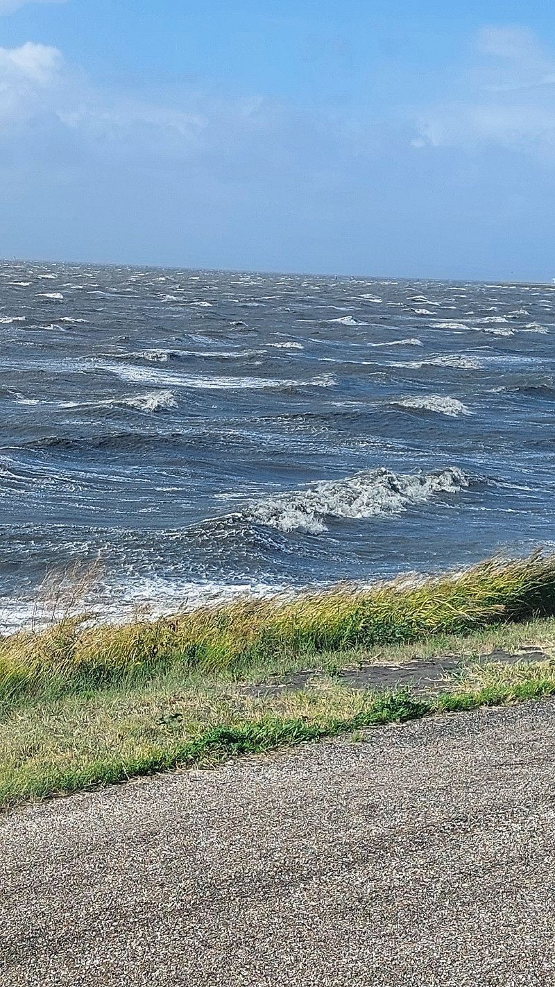
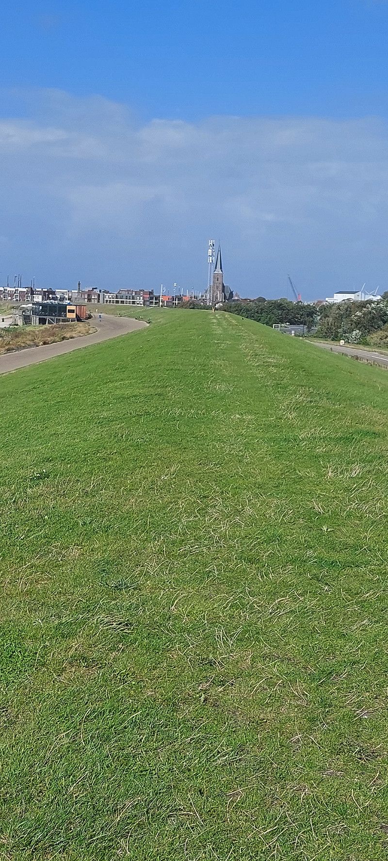
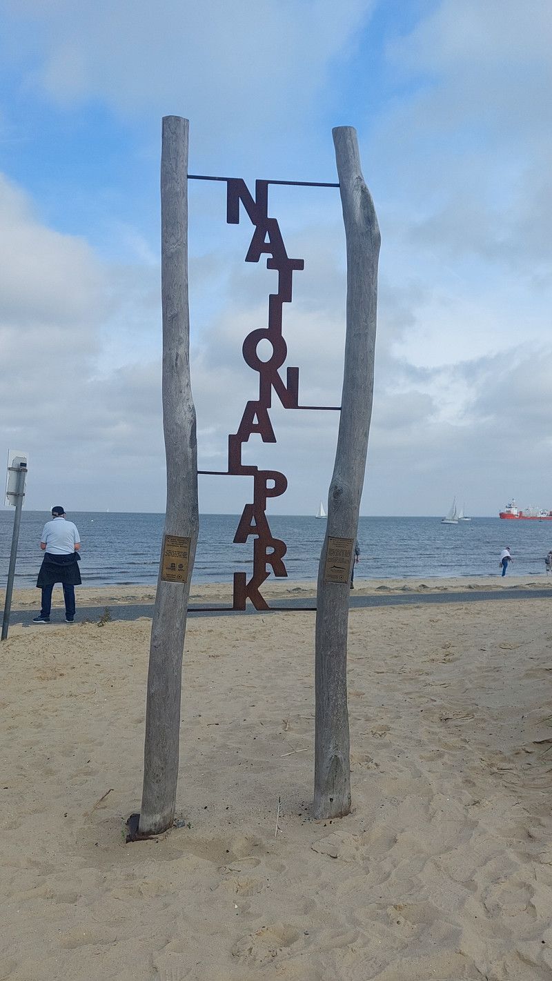
Cuxhaven
Landkreis Cuxhaven, Niedersachsen, Deutschland
53° 52' 7.6" N 8° 41' 53.8" E
53.8687800 8.6982860
• Head toward Grandauerstraße. Go for 25 m.
• Turn right onto Grandauerstraße. Go for 71 m.
• Turn right onto Grüner Weg. Go for 70 m.
• Turn right onto Rathausstraße. Go for 100 m.
• Turn left onto Werner-Kammann-Straße. Go for 363 m.
• Continue on Karl-Olfers-Platz. Go for 16 m.
• Turn left onto Karl-Olfers-Platz (K8). Go for 3.9 km.
• Take the 2nd exit from roundabout toward Hamburg/Stade/Otterndorf. Go for 191 m.
• Continue on B73. Go for 12.9 km.
• Pass 2 roundabouts and continue on B73. Go for 13.3 km.
• Turn left onto Dingwörden (L111) toward Wischhafen/Elbfähre/Freiburg/Geversdorf. Go for 24.5 km.
• Turn left onto Glückstädter Straße (B495). Go for 1.3 km.
• Arrive at Glückstädter Straße (B495). Your destination is on the right.
☍
56,8 km
( 48 min.)
Day
20. Sep. 2025 -
20. Sep. 2025
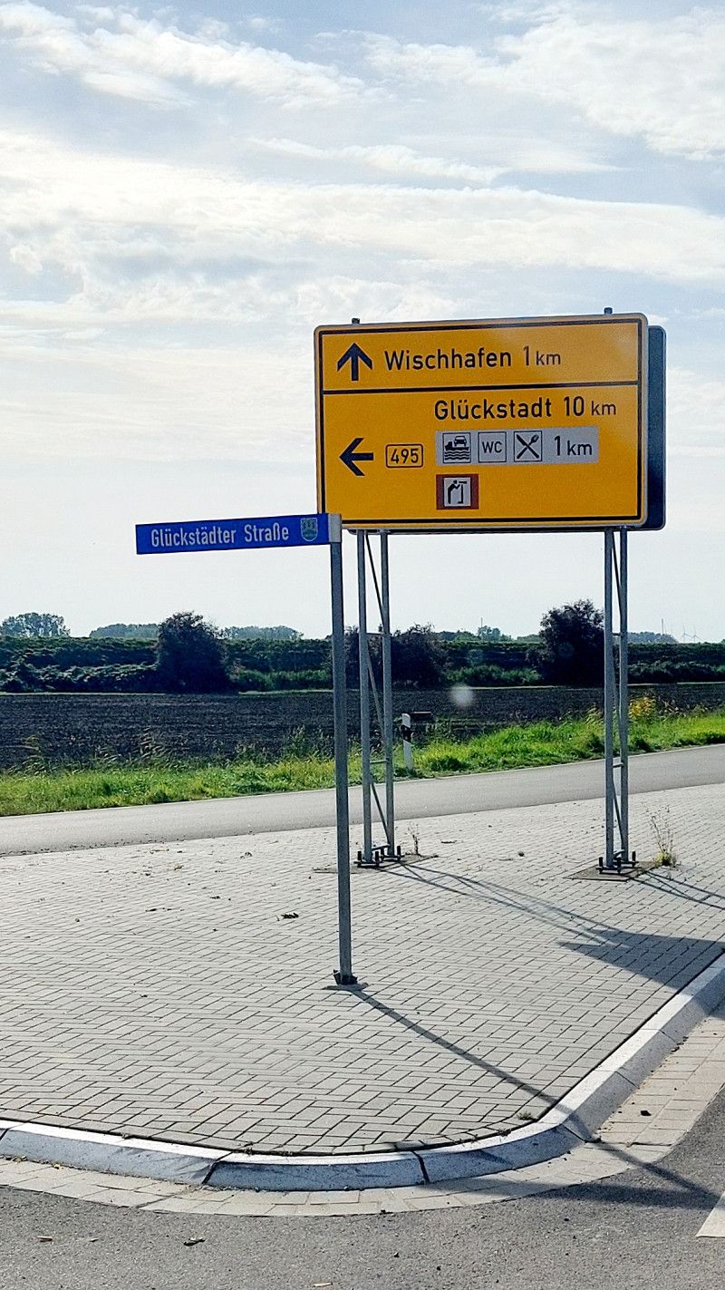
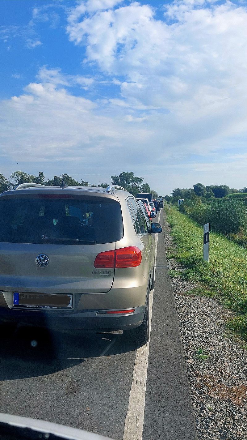
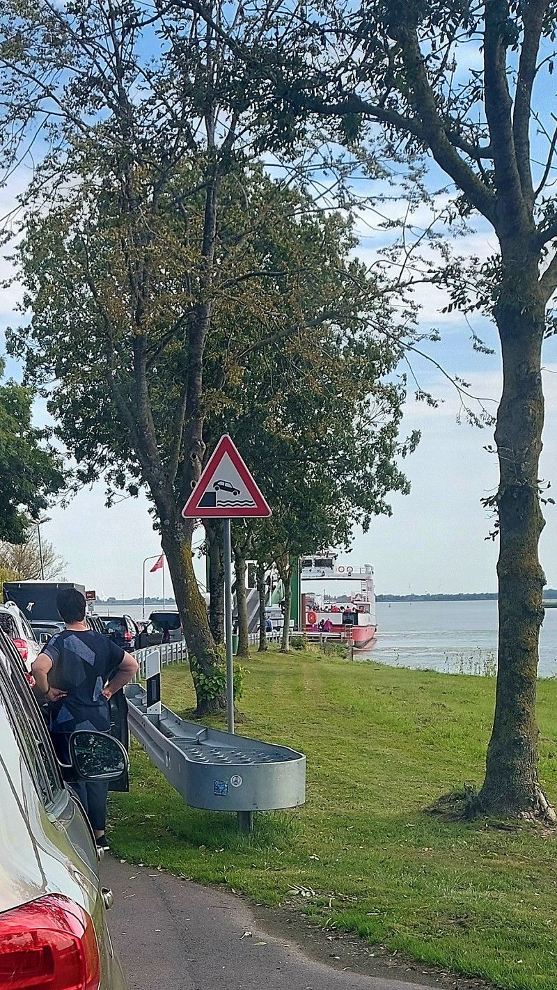
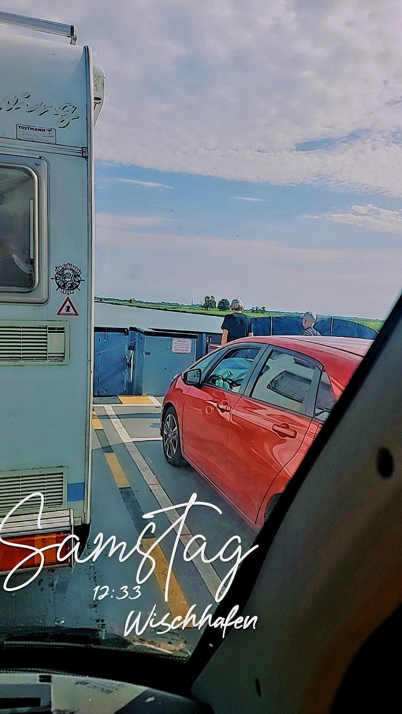
Fähre nach Glückstadt
Glückstädter Straße, Hamelwörden, Landkreis Stade, Niedersachsen, Deutschland
53° 47' 16.2" N 9° 20' 39.9" E
53.7878356 9.3444107
• Head east on Glückstädter Straße (B495).
• Take the Glückstadt-Wischhafen Ferry. Stay on for 5.3 km.
• Head north on Op de Wurt. Go for 2.6 km.
• Turn right onto Am Altendeich (B431) toward A23/Itzehoe/Industriegebiet Blomsche Wildnis. Go for 1.8 km.
• Turn left onto L119. Go for 4.5 km.
• Continue on L119. Go for 5.0 km.
• Turn right onto Hauptstraße (L112). Go for 2.5 km.
• Turn left onto Niederreihe (L112). Go for 1.5 km.
• Turn right and take ramp onto A23 toward Hamburg. Go for 26.9 km.
• Take exit 17 toward Pinneberg-Mitte/Krankenhaus/Rellingen-Nord. Go for 235 m.
• Turn left onto Hauptstraße (L106) toward Pinneberg. Go for 143 m.
• Turn right onto Gärtnerstraße. Go for 675 m.
• Turn right onto Tangstedter Straße. Go for 1.2 km.
• Continue on Pinneberger Weg. Go for 759 m.
• Turn left onto Dorfstraße (K6). Go for 1.6 km.
• Arrive at Dorfstraße (K6). Your destination is on the right.
☍
54,6 km
(1 hrs. 15 min.)
20. Sep. 2025 -
20. Sep. 2025
Tangstedt
Kreis Pinneberg, Schleswig-Holstein, Deutschland
53° 40' 48.4" N 9° 51' 8.9" E
53.6801132 9.8524814