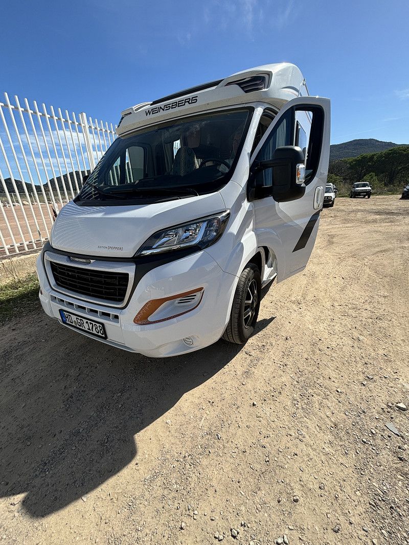
Route description for Corsica - Sardinia - Sicily - Spain - Tour Autumn 2024
That's roughly the plan for this autumn. As always, we're taking things easy. We haven't booked anything except the ferry to Corsica. We're going to the islands for the first time, so we'll see how we like it.
But it could still be Spain again. We just love this country, so it could be that we go to Spain at the end of the year.
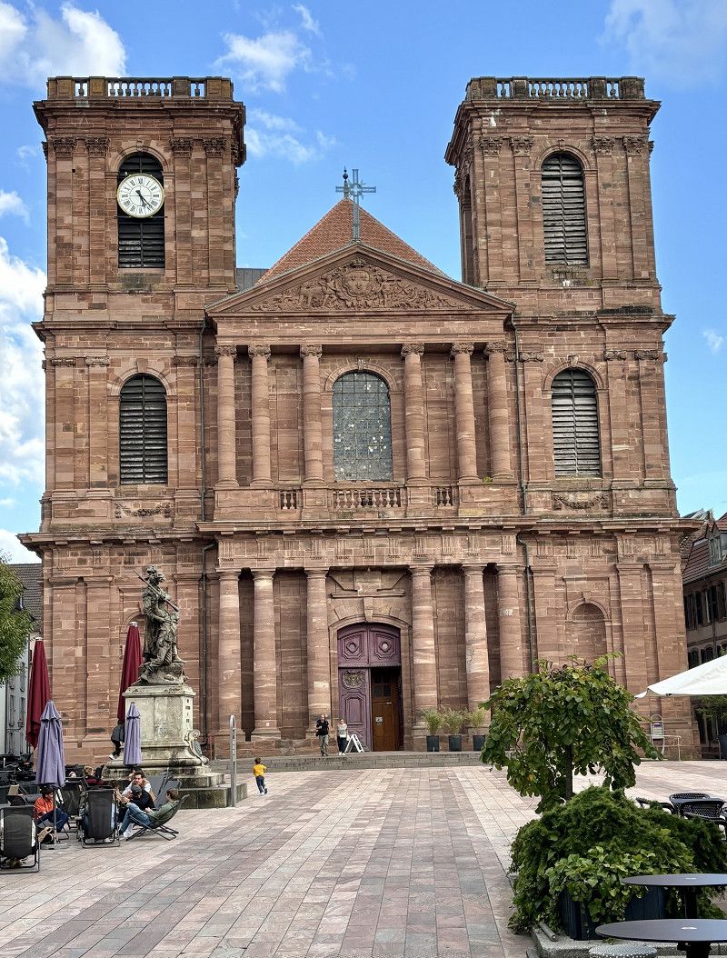
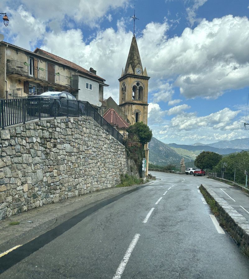
Kreidacher Höhe
Deutschland
49° 33' 46.4" N 8° 48' 44.5" E
49.5628766 8.8123667
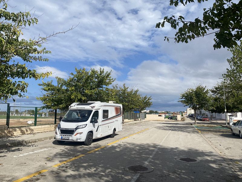
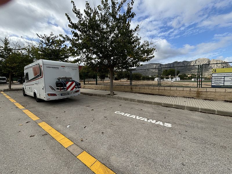
• Follow the roundabout. Go for 98 m.
• Take the 4th exit from roundabout onto L3120 toward Mörlenbach/Kreidach. Go for 7.7 km.
• Take the 2nd exit from roundabout onto Weiherer Straße (L3120). Go for 736 m.
• Turn left onto Weinheimer Straße (B38) toward Mannheim/Heppenheim. Go for 9.3 km.
• Turn right onto B38 toward Mannheim/Gewerbegebiet W.-West. Go for 1.6 km.
• Continue on A659. Go for 352 m.
• Take the exit toward Karlsruhe/Heidelberg onto A5. Go for 230 km.
• Take exit 66 toward Lyon/Mulhouse/Flughafen Euro onto A5. Go for 611 m.
• Continue on A36 (La Comtoise). Go for 13.5 km.
• Keep left onto A36 (La Comtoise) toward Paris/Lyon/Guebwiller. Go for 39.4 km.
• Take exit 13 toward Belfort-Glacis du Château. Go for 455 m.
• Take the 2nd exit from roundabout onto Rue Xavier Bichat. Go for 364 m.
• Take the 2nd exit from Rond-Point du Pied des Gouttes roundabout onto Rue Xavier Bichat. Go for 391 m.
• Turn left onto Rue René Cassin. Go for 210 m.
• Turn right onto Boulevard Pierre Mendès France (D583). Go for 994 m.
• Turn left onto Rue Gabrielle Gehant. Go for 104 m.
• Turn left onto Rue Jean-Pierre Melville. Go for 98 m.
• Turn right onto Rue Sous-le-Rempart. Go for 185 m.
• Turn left onto Porte de l'Ancien Canal. Go for 61 m.
• Continue on Rue du Quai. Go for 47 m.
• Take the 1st exit from roundabout onto Grand'Rue. Go for 38 m.
• Turn left onto Rue Général Lecourbe. Go for 51 m.
• Continue on Place d'Armes. Go for 109 m.
• Continue on Rue Hubert Metzger. Go for 16 m.
• Arrive at Rue Hubert Metzger. Your destination is on the right.
☍
306,4 km
(3 hrs. 2 min.)
18. Sep. 2024 -
18. Sep. 2024
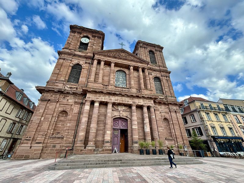
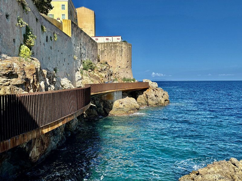
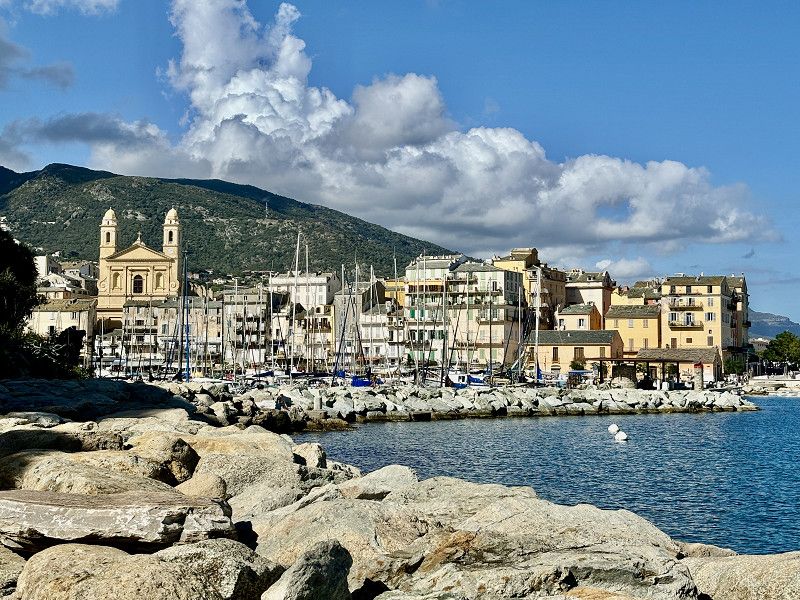
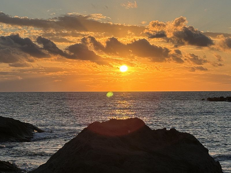
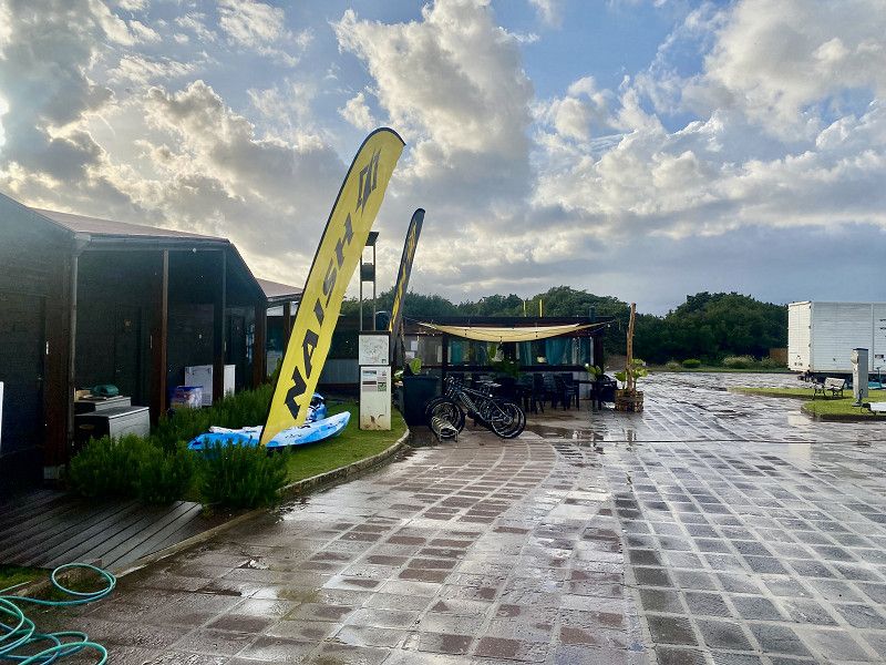
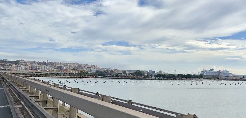
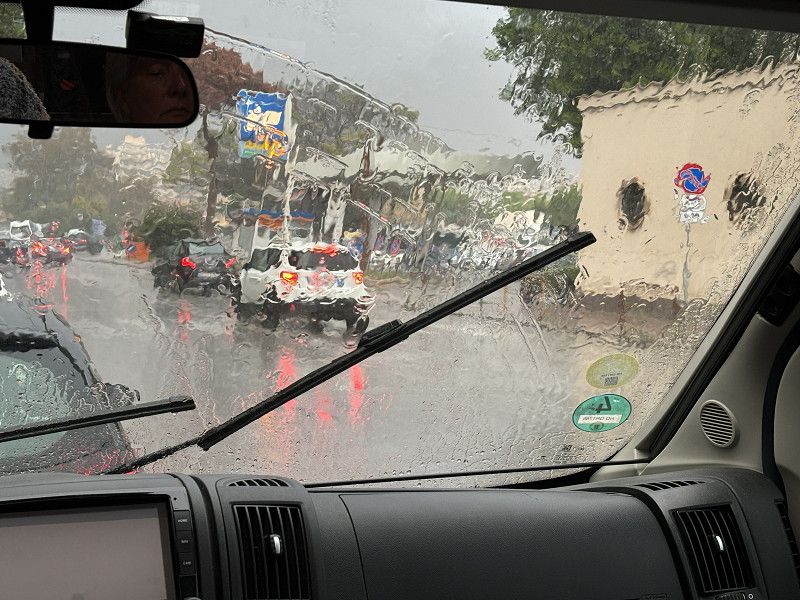
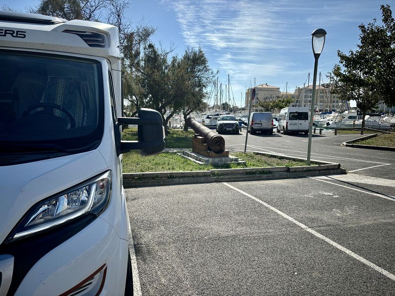
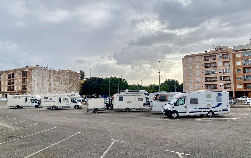
Wir starten bei bestem Wetter bis Belford
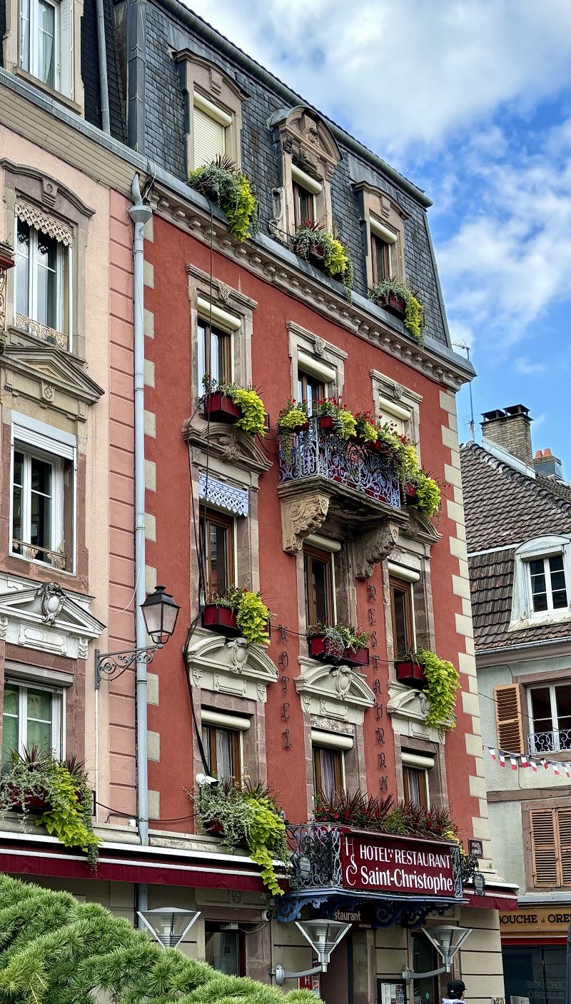
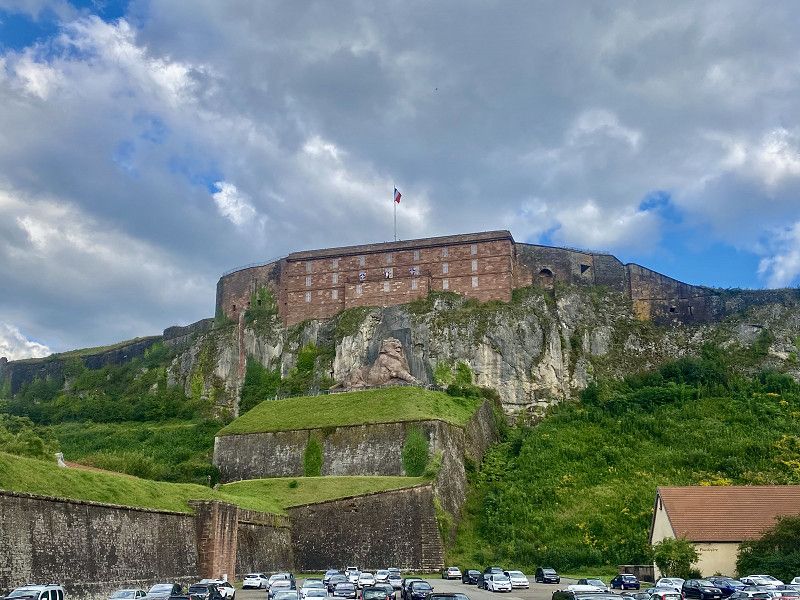
We drove to Belford in the best weather. Here we filled up with cheap gas and in the town there is a large free parking lot for motorhomes. With water and electricity and a few spaces with electricity connections. In the late afternoon we walk into the town.
18. Sep. 2024 -
18. Sep. 2024
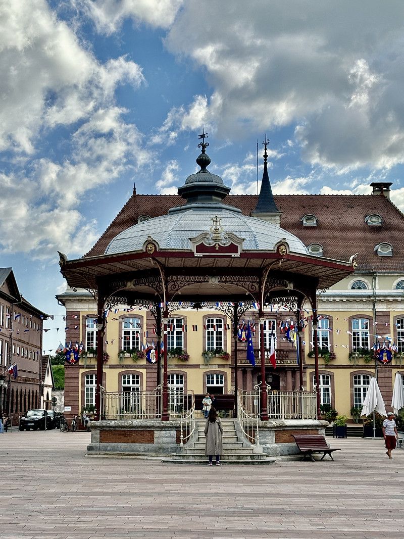
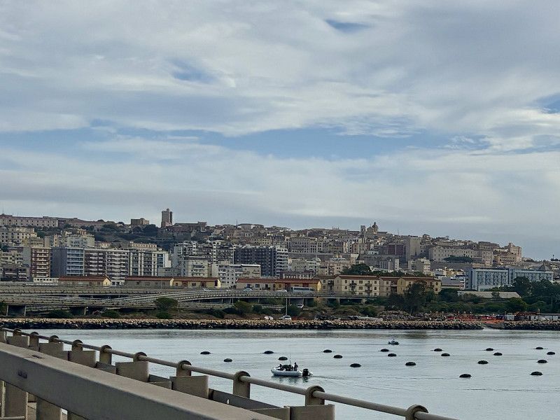
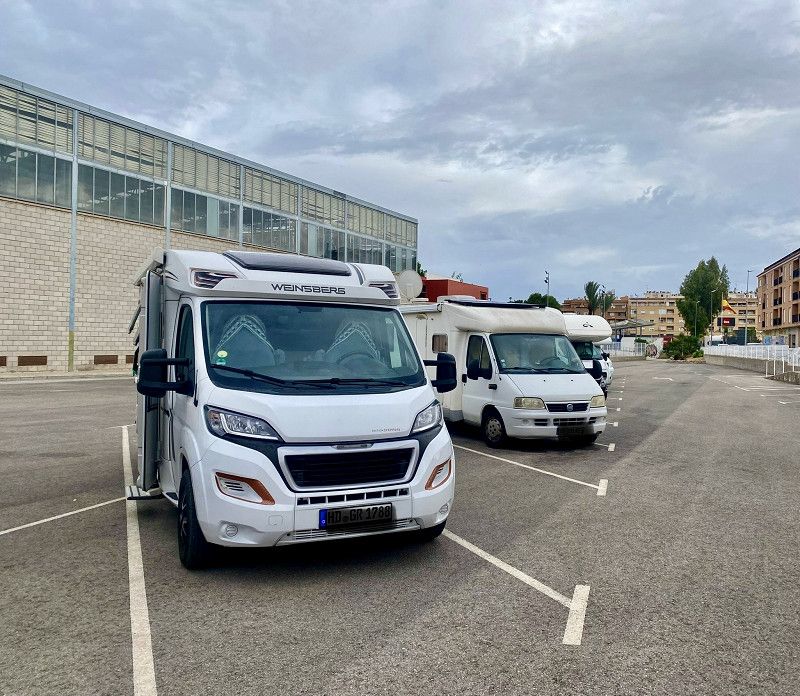
Belfort
18°/23° 🌤️ 10 hours of sunshine
Municipal parking lot for motorhomes with water and electricity and some spaces with electricity.
Close to the old town, 5 minutes walk away.
47° 38' 16.1" N 6° 51' 45.2" E
47.6378057 6.8625539
• Head toward Rue de l'Ancien Théâtre on Rue Hubert Metzger. Go for 30 m.
• Continue on Avenue du Général Sarrail. Go for 240 m.
• Turn left onto Avenue du Général Sarrail (D465). Go for 477 m.
• Turn right onto Pont Richelieu. Go for 39 m.
• Continue on Place de l'Abattoir. Go for 174 m.
• Take the 1st exit from roundabout onto Boulevard du Cardinal de Richelieu. Go for 173 m.
• Take the 2nd exit from roundabout onto Boulevard Henri Dunant. Go for 352 m.
• Turn left onto Avenue de la République. Go for 563 m.
• Take ramp onto A36 (La Comtoise) toward Paris/Lyon/Montbéliard/Vesoul/Épinal. Go for 140 km.
• Take the exit toward Lyon/Lons le S./Dole/Choisey onto A39 (Autoroute Verte). Go for 113 km.
• Continue on A40. Go for 22.4 km.
• Continue on A42 toward Grenoble/Chambéry/Lyon/Aéroport Saint-Exupéry. Go for 48.9 km.
• Take the left exit toward Marseille/Grenoble/Lyon/N346 onto A42. Go for 990 m.
• Take the exit toward Lyon onto A42. Go for 3.6 km.
• Take the left exit toward Marseille/Grenoble/Périphérique Sud/Porte de Cusset onto D383 (Boulevard Laurent Bonnevay). Go for 6.0 km.
• Keep left onto Boulevard Laurent Bonnevay (D383) toward St Étienne/Marseille/Vénissieux. Go for 1.9 km.
• Keep left onto Boulevard Laurent Bonnevay (D383) toward Paris/Saint-Étienne/Marseille/Lyon-Centre/Vénissieux-Centre. Go for 3.3 km.
• Keep left onto D383 toward Paris/Marseille/Saint-Étienne/Pierre Bénite/Saint Fons-Centre/Port E. Herriot. Go for 2.3 km.
• Keep left onto Boulevard Pierre Sémard (D383) toward A7/Paris/Lyon/Pierre-Bénite/Marseille/St Étienne/Vénissieux/Feyzin. Go for 188 m.
• Take ramp onto A7 (Autoroute du Soleil) toward St Étienne/Feyzin/Marseille. Go for 77.3 km.
• Take exit 13 toward Romans/Tournon/Tain l'Hermitage. Go for 718 m.
• Take the 2nd exit from roundabout. Go for 176 m.
• Take the 5th exit from roundabout onto D532 B toward Annonay/St Étienne/Lyon/Tain l'Hermitage/Tournon/St Vallier. Go for 763 m.
• Take the 3rd exit from roundabout onto D532 B toward Annonay/St Étienne/Lyon/Tain l'Hermitage/Tournon/St Vallier/Z.I. les Fleurons. Go for 889 m.
• Take the 2nd exit from roundabout onto D532 B toward Annonay/St Étienne/Lyon/Tain l'Hermitage/Tournon/St Vallier/Pont de l'Isère/La Roche de Glun. Go for 1.0 km.
• Continue toward Valence/Pont de l'Isère/La Roche de Glun. Go for 41 m.
• Take the 2nd exit from roundabout toward Valence/Pont de l'Isère/La Roche de Glun. Go for 125 m.
• Continue on Route du Dauphine (N7). Go for 2.6 km.
• Turn right onto Route des Alpes (D259) toward La Roche de Glun. Go for 804 m.
• Continue on Rue des Crêtes (D259). Go for 192 m.
• Continue on D259. Go for 529 m.
• Take the 1st exit from roundabout onto Avenue du Vercors (D220 A) toward D220/La Roche de Glun/Tain l'Hermitage/Z.A. Croix des Marais/Z.A. de l'Île Neuve. Go for 648 m.
• Take the 2nd exit from roundabout onto Rue des Cévennes (D220 A). Go for 109 m.
• Turn right onto Lotissement Les Magnaneries. Go for 159 m.
• Turn slightly right onto Rue des Écoles. Go for 46 m.
• Arrive at Rue des Écoles. Your destination is on the right.
☍
430,4 km
(3 hrs. 53 min.)
19. Sep. 2024 -
19. Sep. 2024
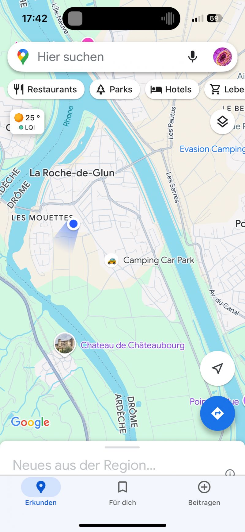
La Roche de Glun
12°/24° ☀️ 11 hours of sunshine
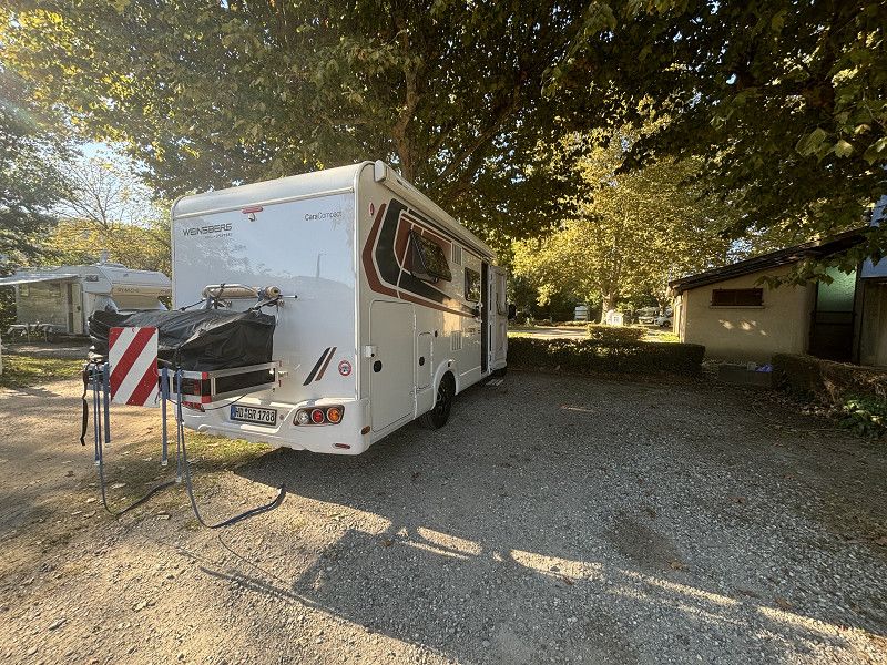
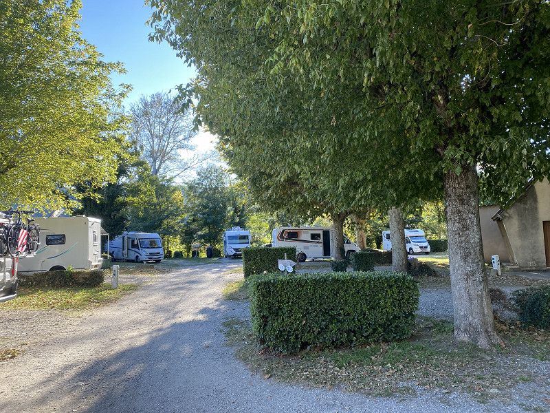
CCP pitch, supplies/disposal/electricity as always at CCP pitches. It is a former CP, but without sanitary facilities. In the evening all pitches are taken. Tomorrow we will drive further down, perhaps we will find a spot on the coast. Unfortunately the weather forecast for the weekend is not so good. We'll see.
Rue des Écoles 21 A, La Roche-de-Glun, Tain-l'Hermitage, Drôme, France
45° 0' 43" N 4° 50' 45.8" E
45.0119524 4.8460550
• Head toward Lotissement Les Magnaneries on Rue des Écoles. Go for 46 m.
• Turn slightly left onto Lotissement Les Magnaneries. Go for 159 m.
• Turn left onto Rue des Cévennes (D220 A). Go for 83 m.
• Take the 2nd exit from roundabout onto Avenue du Vercors (D220 A). Go for 640 m.
• Take the 1st exit from roundabout toward D220/Pont de l'Isère/Z.I. les Serres. Go for 748 m.
• Continue on Avenue du Canal. Go for 1.3 km.
• Take the 1st exit from roundabout onto Avenue du Canal. Go for 249 m.
• Turn left onto Rue du Stade toward D220/Valence. Go for 280 m.
• Turn right onto N7. Go for 4.0 km.
• Take the 6th exit from roundabout toward Marseille/Avignon/Montélimar/St Étienne/Lyon. Go for 525 m.
• Take ramp onto A7 (Autoroute du Soleil) toward Marseille/Avignon/Montélimar. Go for 102 km.
• Keep right onto A9 (Échangeur d'Orange) toward Barcelone/Toulouse/Montpellier/Nîmes. Go for 29.0 km.
• Take exit 23 toward Beaucaire/Tarascon/Remoulins/Uzès/Pont du Gard. Go for 732 m.
• Take the 4th exit from roundabout onto D192 toward Fournes/Théziers/Z.A. la Pale. Go for 1.2 km.
• Take the 2nd exit from roundabout onto D19. Go for 331 m.
• Turn right onto Route des Esquirades (D19 B). Go for 1.0 km.
• Continue on Route de Montfrin (D19 B). Go for 426 m.
• Continue on D19 B. Go for 418 m.
• Continue on D19. Go for 2.5 km.
• Continue on Avenue de l'Égalité. Go for 200 m.
• Turn left onto Avenue de Saint-Amant (D19). Go for 126 m.
• Continue on Rue des Faubourgs (D19). Go for 316 m.
• Continue on Avenue de Saint-Amant (D19). Go for 20 m.
• Continue on D19. Go for 1.3 km.
• Continue on Lieu-dit La Velle (D19). Go for 829 m.
• Continue on Route d'Uzès à Aramon (D19). Go for 2.4 km.
• Take the 1st exit from roundabout onto Rue Émile Jamais (D235) toward Avignon/Centre Ville. Go for 482 m.
• Turn left onto Boulevard Gambetta. Go for 8 m.
• Turn right onto Rue du Portail Matheron. Go for 60 m.
• Turn left onto Rue des Cardinaux. Go for 26 m.
• Turn left onto Rue Voltaire. Go for 27 m.
• Arrive at Rue Voltaire. Your destination is on the right.
☍
151,1 km
(1 hrs. 31 min.)
20. Sep. 2024 -
20. Sep. 2024
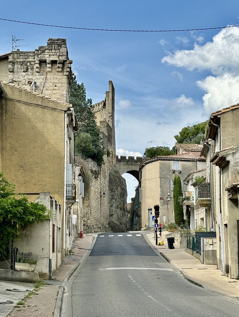
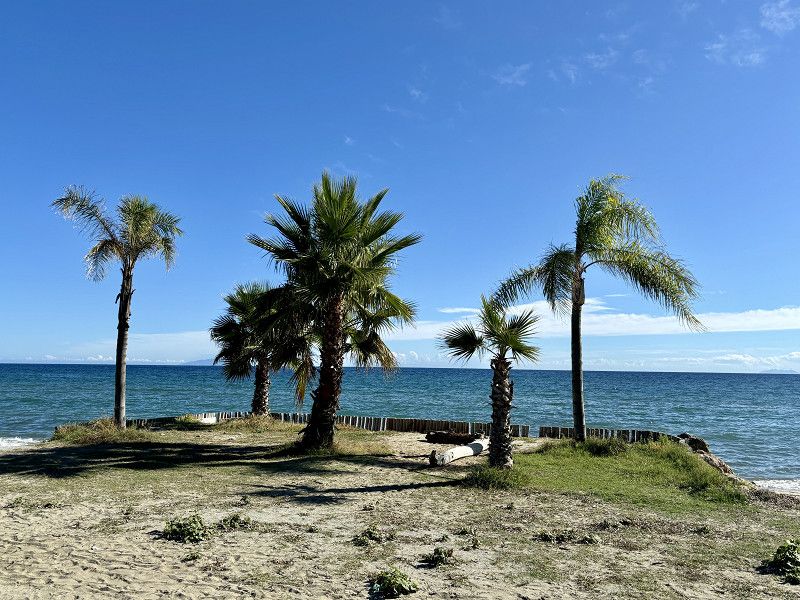
Aramon - Balkon der Languedoc Provence
26° 🌤️ 8 hours of sunshine
Today we didn't drive that many kilometers, we have until Tuesday to get to the ferry. Before we got here we were in Avignon and actually wanted to go to a SP there, but it was full!! The CP was also very full and all had a lot of shade, which we don't really want now (solar should work)
Luckily, we were in Avignon 15 years ago, so we didn't miss anything.
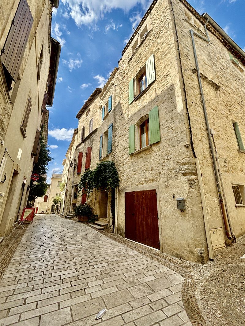
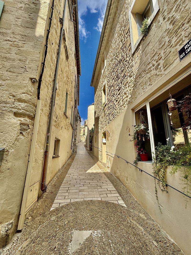
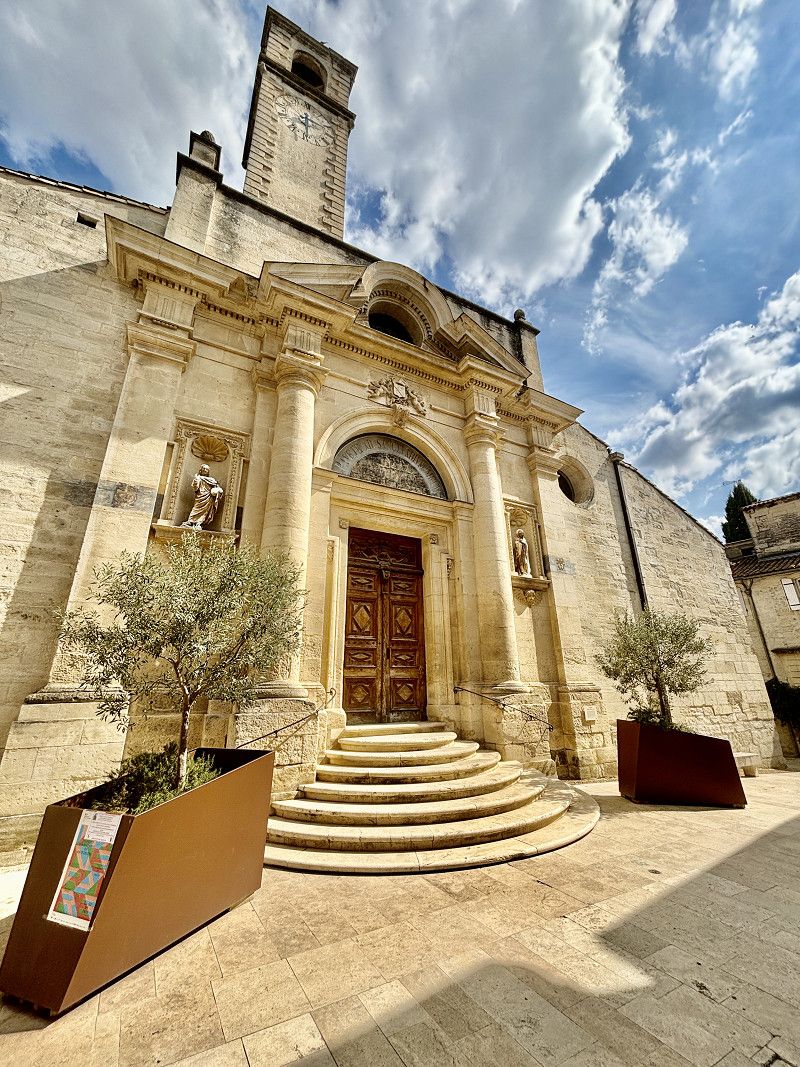
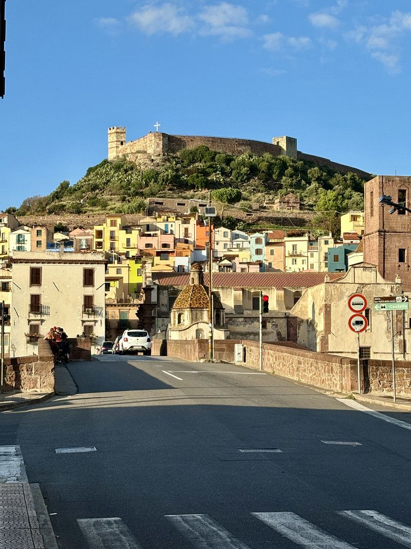
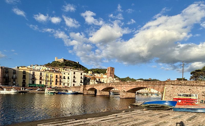
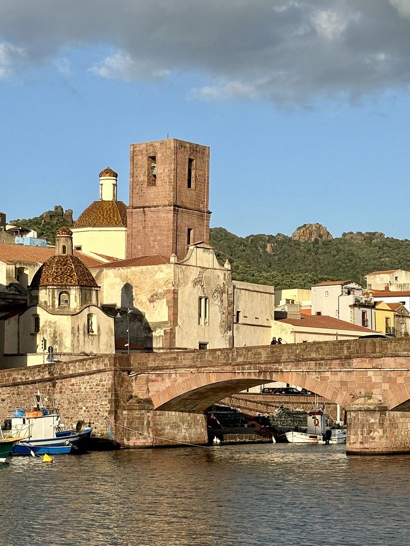
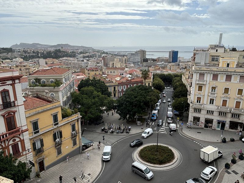
We chose this CCP parking space, which is located near the medieval town of Aramon. A short walk into the historic center, perfectly adequate at 26° and sunshine.
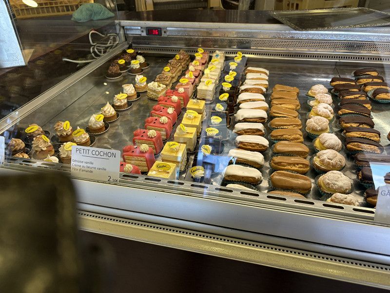
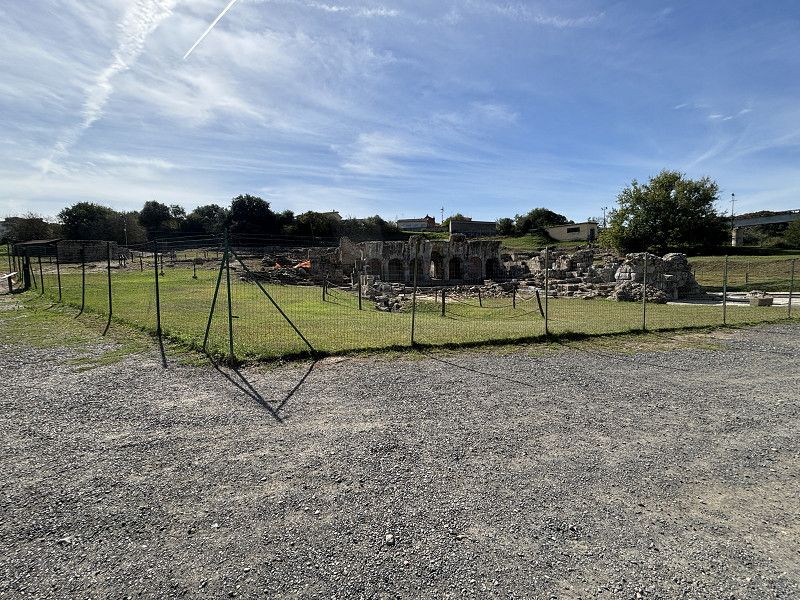
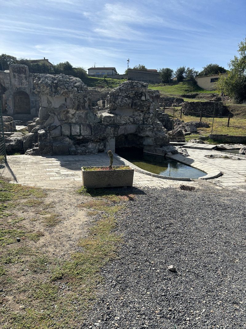
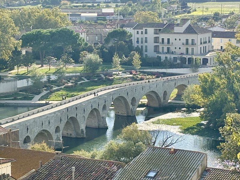
One of the most important civil engineers, Henri de Pitot, was born in Aramon. He planned and supervised the construction of many bridges and aqueducts. The most famous of these is the "Pont du Gard".
Pitot's theorem was also named after him in mathematics (geometry) and the Pitot tube was developed according to his calculations.
Gard, Okzitanien, Frankreich
43° 53' 27.1" N 4° 40' 51.8" E
43.8908652 4.6810542
• Head south on Rue Voltaire. Go for 27 m.
• Turn right onto Rue des Cardinaux. Go for 26 m.
• Turn right onto Rue du Portail Matheron. Go for 60 m.
• Turn left onto Boulevard Gambetta. Go for 27 m.
• Continue on Avenue de la Libération (C126). Go for 519 m.
• Turn left onto Avenue Jean Moulin (D126). Go for 478 m.
• Continue on D126. Go for 223 m.
• Turn right onto Route de Beaucaire (D2). Go for 8.4 km.
• Take the 3rd exit from roundabout onto D986 L. Go for 1.3 km.
• Continue on D90. Go for 1.5 km.
• Take the 3rd exit from roundabout onto D90 toward Cavaillon/Arles/St Gilles/Tarascon/Beaucaire-Z.I. Domitia. Go for 4.4 km.
• Take the 1st exit from roundabout onto Route de Fourques (D15) toward Fourques. Go for 9.9 km.
• Pass 2 roundabouts and continue on D15. Go for 1.7 km.
• Take the 4th exit from roundabout onto Route d'Arles (D6113). Go for 837 m.
• Take the 2nd exit from roundabout onto Route d'Arles (D6113). Go for 510 m.
• Continue on D113. Go for 815 m.
• Take the 4th exit from Rond-Point du Vittier roundabout onto Route de Dours (N113/N572) toward Arles-Centre/Aix en Pce/Marseille/Avignon. Go for 12.3 km.
• Take ramp toward A55/Fos/Martigues. Go for 982 m.
• Continue on Route de Boujan (N568). Go for 4.8 km.
• Turn right onto Route de Mas-Thibert au Pont de Bompas (D24) toward Port St Louis/Salin de Giraud/Mas Thibert/Mas de Pernes/La Dynamite. Go for 4.6 km.
• Turn left onto Route Napoléon (D35). Go for 19.6 km.
• Turn right onto D268. Go for 100 m.
• Continue on Route du Pont de Rognonas (D35). Go for 394 m.
• Take the 3rd exit from roundabout onto Avenue Maurice Thorez (D35). Go for 1.6 km.
• Arrive at Avenue du Port (D35).
☍
75,2 km
(1 hrs. 3 min.)
21. Sep. 2024 -
21. Sep. 2024
Port Saint Louis du Rhône
26° 🌤️ 9 hours of sunshine
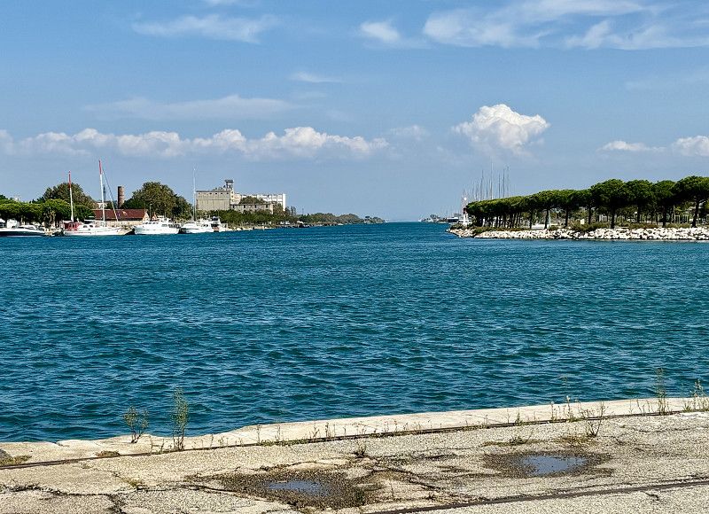
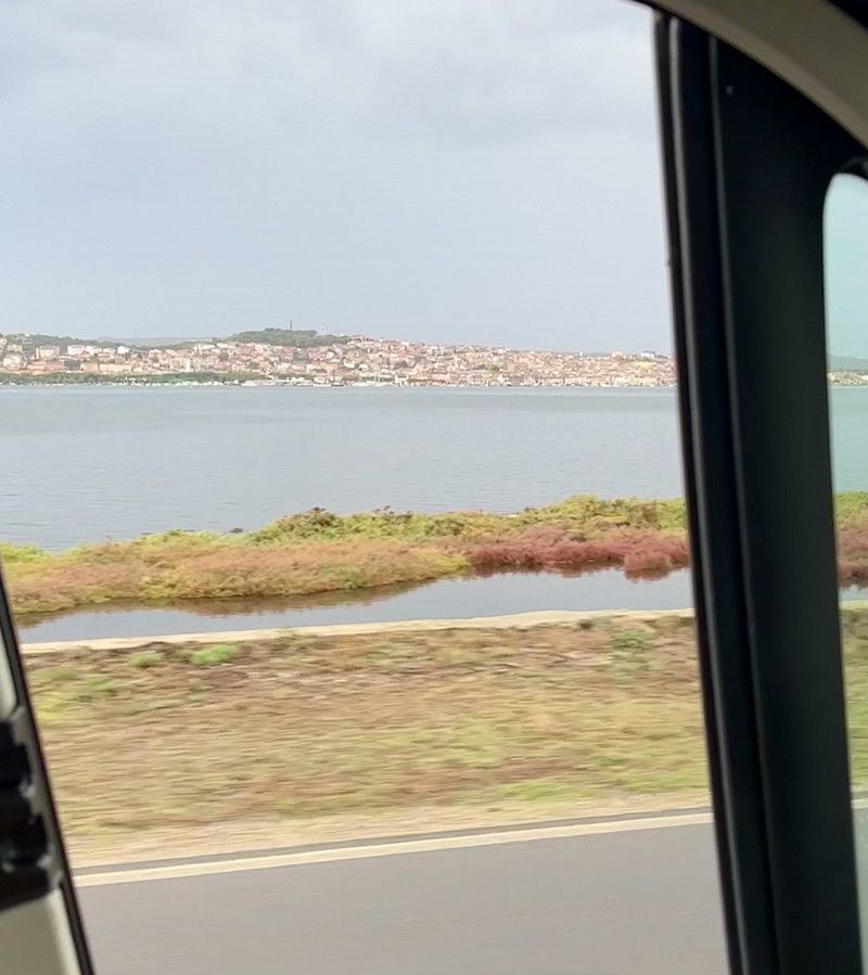
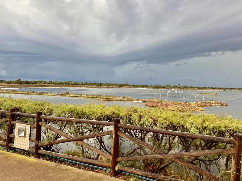
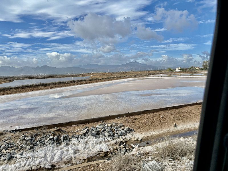
Today we continued to the Rhône Delta below Arles. We drove past salt pans and flamingos. We are now in Port Saint Louis du Rhône at a CCP site.
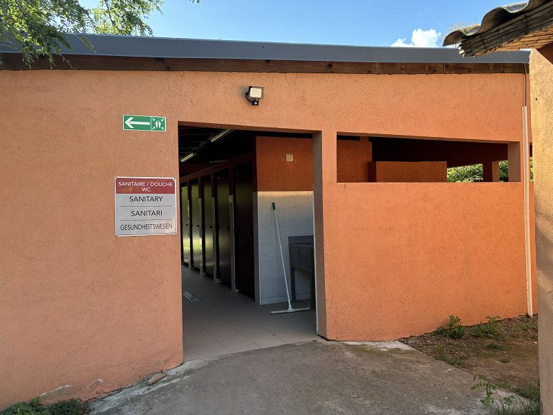
New place with all the usual, but no sanitary facilities.
Short walk to the harbor with a stormy wind but sunshine. I think it would be too hot without the wind.
Heavy rain is expected to start tonight and all day tomorrow. Let's see what we do tomorrow.
Rue Du 19 Mars 1962 3, Port-Saint-Louis-du-Rhône, Port-Saint-Louis-du-Rhône, Bouches-du-Rhône, France
43° 23' 17.4" N 4° 48' 11.5" E
43.3881533 4.8031974
• Head toward Impasse Orcel on Avenue du Port (D35). Go for 1.6 km.
• Take the 1st exit from roundabout onto Route du Pont de Rognonas (D35). Go for 416 m.
• Continue on D268. Go for 3.1 km.
• Take the 3rd exit from Carrefour du Mat du Ricca roundabout onto D268. Go for 3.7 km.
• Take the 2nd exit from roundabout onto D268. Go for 1.7 km.
• Continue on D268. Go for 3.4 km.
• Take the 3rd exit from roundabout onto D268 toward Marseille/Arles/Fos sur Mer/Istres. Go for 1.4 km.
• Keep right toward N568. Go for 349 m.
• Continue on N568. Go for 3.7 km.
• Pass 2 roundabouts and continue on N568. Go for 3.8 km.
• Take the 2nd exit from Carrefour Saint-Gervais roundabout onto N568 toward Martigues/Marseille/Port de Bouc. Go for 7.8 km.
• Continue on A55. Go for 24.2 km.
• Take the exit toward Marseille-Vieux Port/L'Estaque/Les Ports onto A55. Go for 14.7 km.
• Continue on Tunnel du Vieux-Port. Go for 792 m.
• Continue on Tunnel Prado-Carénage. Go for 2.5 km.
• Keep left toward Autoroute Est/A50. Go for 33 m.
• Continue on Autoroute Est (A50). Go for 25.2 km.
• Take exit 9 toward La Ciotat. Go for 958 m.
• Take the 2nd exit from roundabout. Go for 1.0 km.
• Continue on Avenue Émile Bodin (D559). Go for 294 m.
• Take the 1st exit from roundabout onto Avenue Caporal Chef Alain Deruy. Go for 234 m.
• Take the 3rd exit from Rond-Point de Lattre de Tassigny roundabout onto Avenue Émile Bodin. Go for 283 m.
• Take the 2nd exit from Rond-Point Guy Patzlaff roundabout onto Avenue Émile Bodin. Go for 330 m.
• Turn right onto Avenue Fernand Gassion toward Centre Ville/La Marine/Virebelle/Vieux Port. Go for 1.2 km.
• Continue on Boulevard Guérin. Go for 159 m.
• Turn right onto Quai François Mitterrand. Go for 23 m.
• Take the 1st exit from Rond-Point des Messageries Maritimes roundabout onto Rue Bouronne. Go for 84 m.
• Arrive at Rue Bouronne. Your destination is on the left.
☍
102,8 km
(1 hrs. 22 min.)
22. Sep. 2024 -
22. Sep. 2024
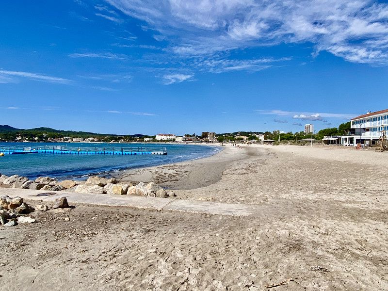
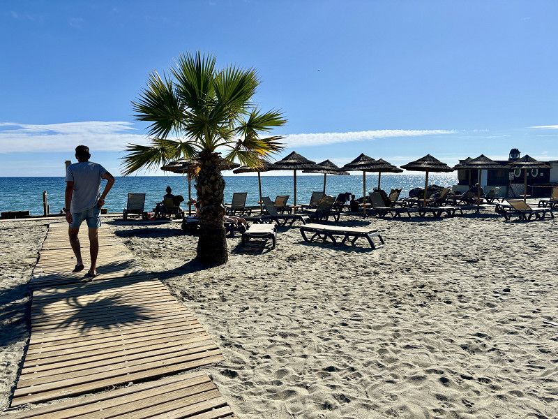
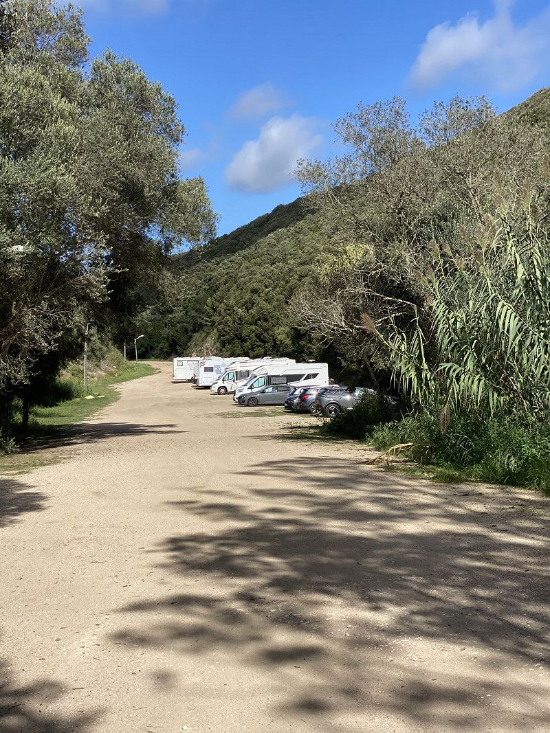
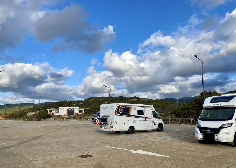
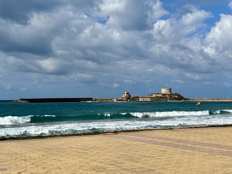
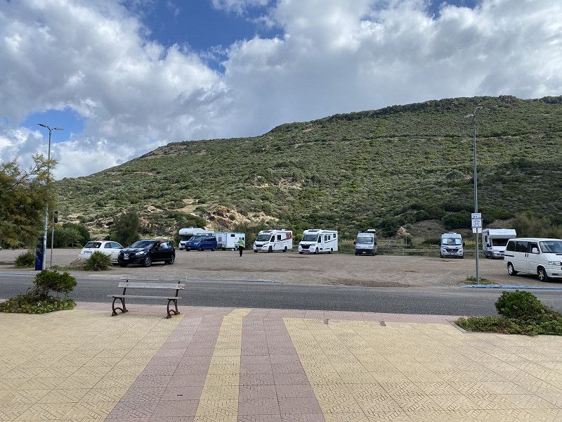
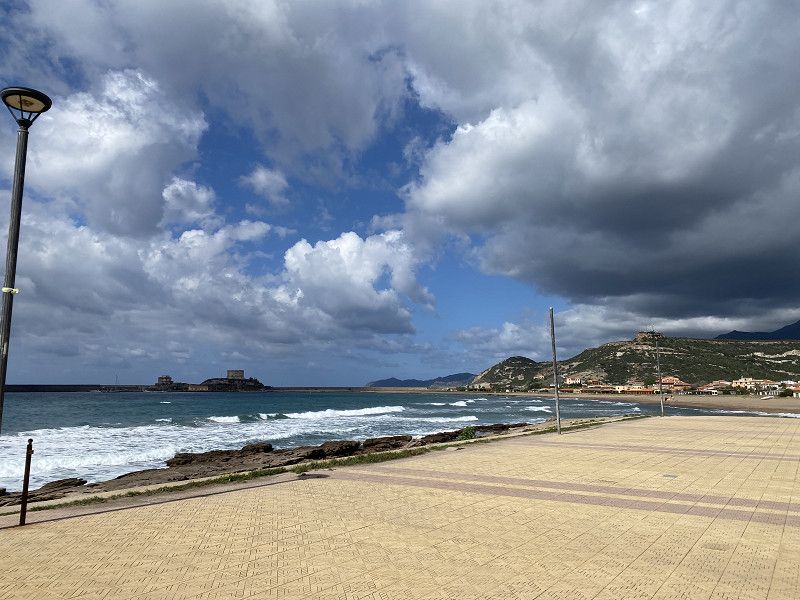
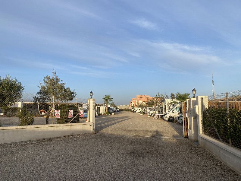
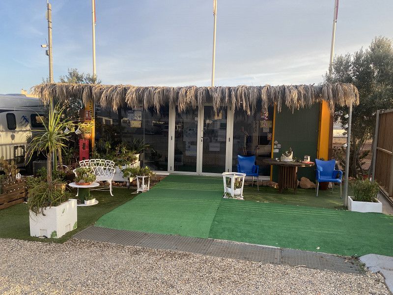
Camping Santa Gusta
26° 🌦️ 7 hours of sun/ rain showers
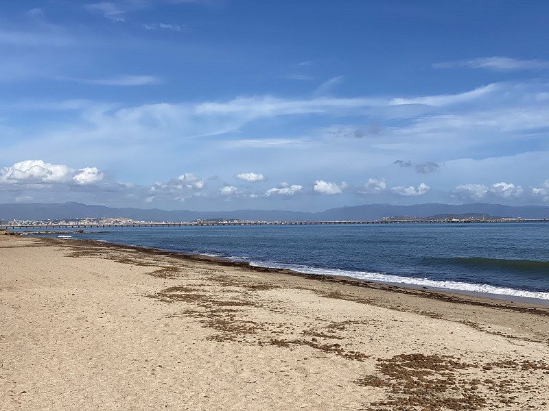
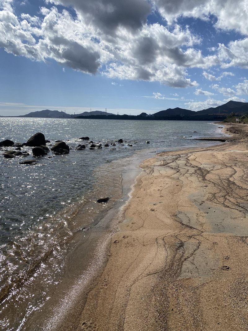
The place is OK as a stopover. Too expensive for our taste (32€/night including electricity). The place is by the sea and therefore costs a bit more.
There's not much walking to be done, either on the main road or the small coastal road right by the sea. The beach isn't a beach, just rubble and garbage.
There are a few other campsites, but they are on the mountain/slope. We didn't find any official parking spaces for motorhomes. Of course, some are parked here in the wild, but it's not allowed.
We won't come here a second time.
Update: Showers are hot and clean.
Rue Bouronne 75, La Ciotat, La Ciotat, Bouches-du-Rhône, France
43° 10' 26.4" N 5° 36' 18.3" E
43.1739886 5.6050801
• Head west on Rue Bouronne. Go for 72 m.
• Take the 2nd exit from roundabout onto Boulevard André Bertolucci. Go for 53 m.
• Continue on Boulevard Bertolucci. Go for 29 m.
• Continue on Boulevard André Bertolucci. Go for 14 m.
• Continue on Boulevard Bertolucci. Go for 8 m.
• Turn right onto Boulevard André Bertolucci. Go for 15 m.
• Continue on Boulevard Michelet. Go for 299 m.
• Continue on Avenue Louis Crozet. Go for 846 m.
• Take the 1st exit from roundabout onto Chemin du Puits de Brunet (D141). Go for 192 m.
• Take the 3rd exit from roundabout onto Chemin du Puits de Brunet (D141). Go for 598 m.
• Take the 2nd exit from Rond-Point Marcel Lallouette roundabout onto Chemin du Puits de Brunet (D141). Go for 189 m.
• Take the 2nd exit from Rond-Point de Lattre de Tassigny roundabout onto Avenue Caporal Chef Alain Deruy. Go for 292 m.
• Take the 2nd exit from roundabout onto Avenue Émile Bodin (D559). Go for 293 m.
• Keep left onto Avenue Émile Bodin (D559). Go for 1.0 km.
• Take the 2nd exit from roundabout. Go for 100 m.
• Take ramp onto A50 toward La Seyne S/Mer/Toulon. Go for 33.9 km.
• Take exit 16 toward Toulon-Centre onto Avenue Lieutenant Estienne d'Orves. Go for 569 m.
• Continue on Carrefour Villevieille. Go for 117 m.
• Keep right onto Carrefour Villevieille. Go for 24 m.
• Keep left onto Carrefour Villevieille toward Place de la Liberté/Centre Ville. Go for 58 m.
• Continue on Avenue du Maréchal Foch (N8) toward Centre-Ville. Go for 777 m.
• Arrive at Boulevard de Strasbourg (N8). Your destination is on the left.
☍
39,5 km
( 30 min.)
23. Sep. 2024 -
23. Sep. 2024
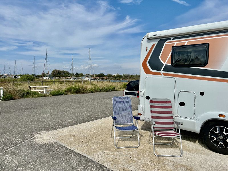
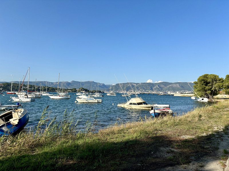
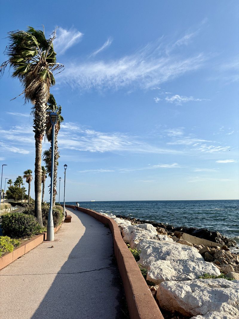
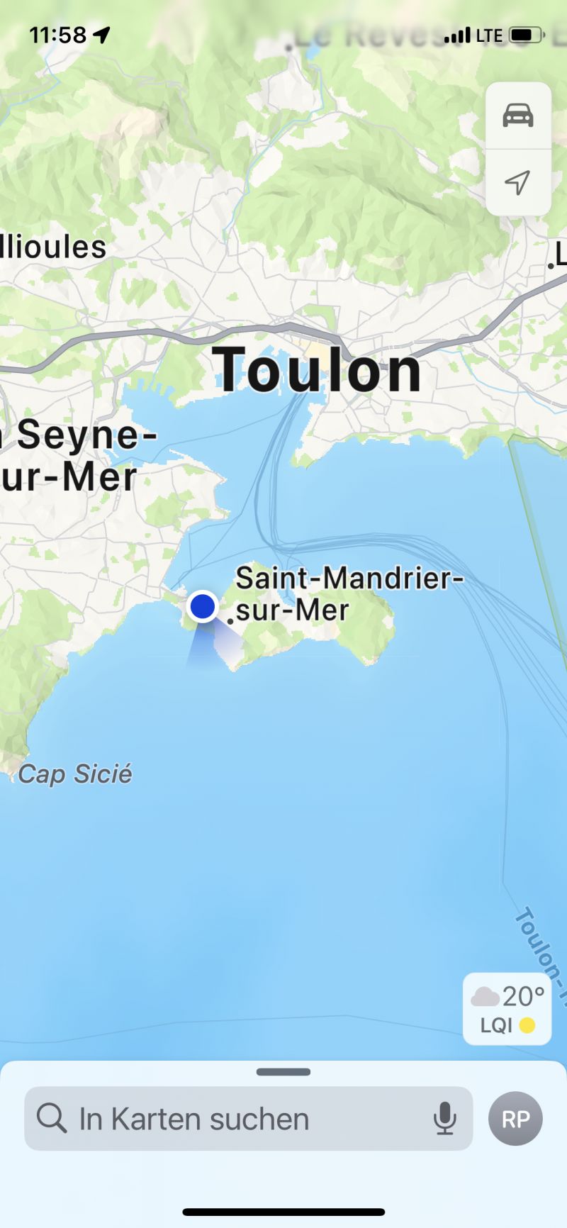
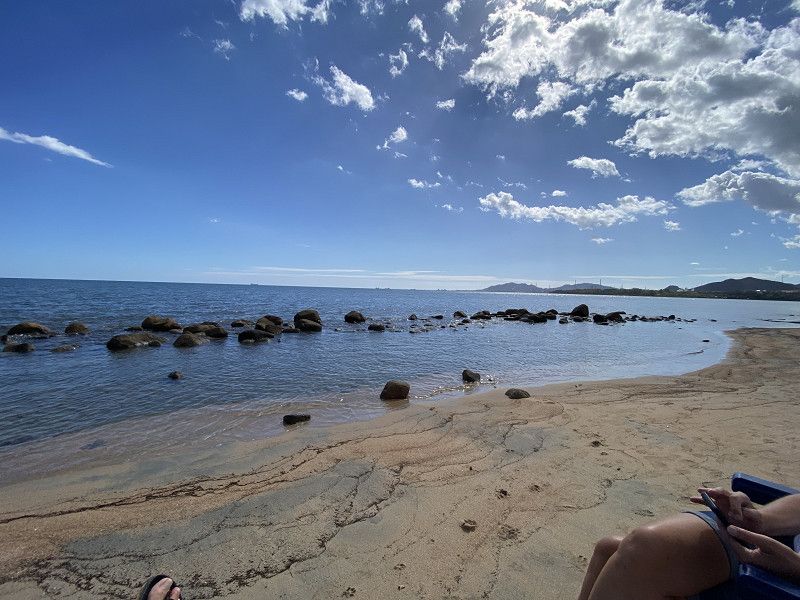
Saint Mandrier sur Mer
25° 🌤️ 10 hours of sunshine
Municipal parking space with a water and electricity station just outside the parking space. There is space for 7 motorhomes. The spaces fill up pretty quickly, but we were there in the morning and were lucky that something became available.
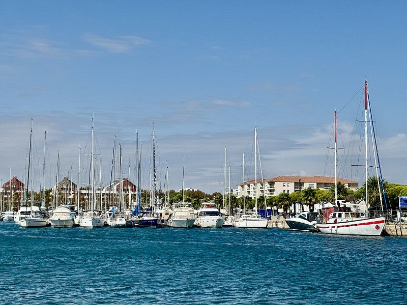
Short walk to a beautiful bay with many restaurants.
Var, Provence-Alpes-Côte d'Azur, Frankreich
43° 7' 32.6" N 5° 55' 49.8" E
43.1257311 5.9304919
• Head east on Boulevard de Strasbourg (N8).
• Arrive at Boulevard de Strasbourg (N8). Your destination is on the left.
☍
Distance not available
(Duration not available)
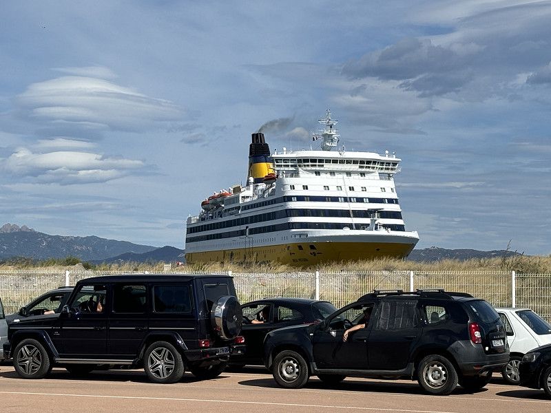
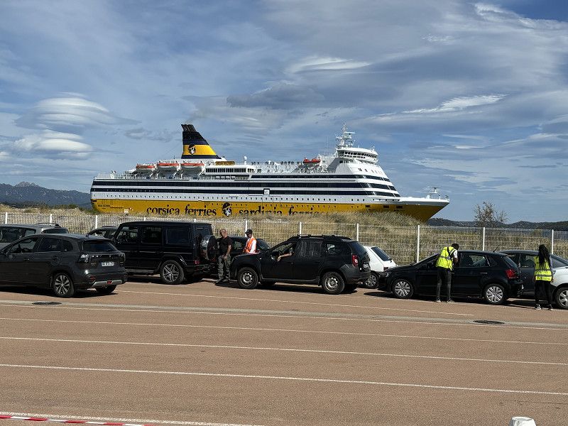
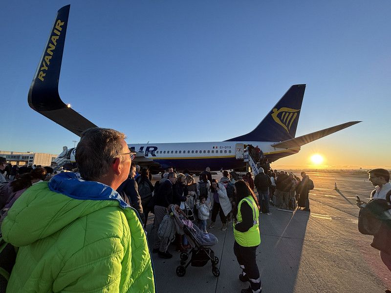
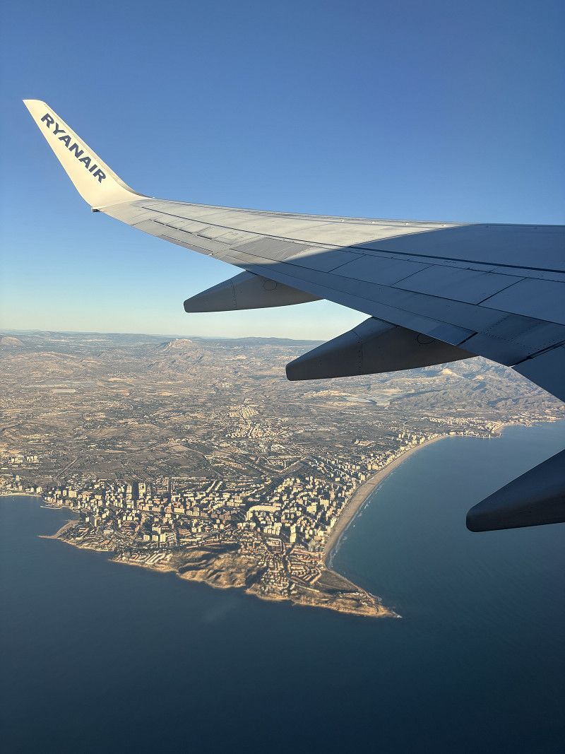
Corsica Ferries
Departure port: Toulon
Var, Provence-Alpes-Côte d'Azur, Frankreich
43.1257311 5.9304919
Arrival port: Ajaccio
Südkorsika, Korsika, Frankreich
41.92639918.7376029
• Head toward Rue Michel Bozzi on Avenue Beverini-Vico. Go for 60 m.
• Turn right onto Cours Napoléon (T21). Go for 869 m.
• Turn right onto Avenue de Paris (D11). Go for 145 m.
• Continue on Place du Diamant (D11). Go for 70 m.
• Turn left onto Avenue du Docteur Ramaroni. Go for 105 m.
• Take the 1st exit from roundabout onto Boulevard Lantivy (D111). Go for 654 m.
• Continue on Boulevard Albert 1er (D111). Go for 444 m.
• Continue on Cours Lucien Bonaparte (D111). Go for 670 m.
• Continue on Boulevard Stéphanopoli de Comène (D111). Go for 764 m.
• Pass 2 roundabouts and continue on Boulevard Stéphanopoli de Comène (D111). Go for 1.9 km.
• Turn right onto Résidence Santa Lina. Go for 65 m.
• Continue on Rue des Arbousiers. Go for 225 m.
• Arrive at Rue des Arbousiers. Your destination is on the left.
☍
Distance not available
(Duration not available)
25. Sep. 2024 -
25. Sep. 2024
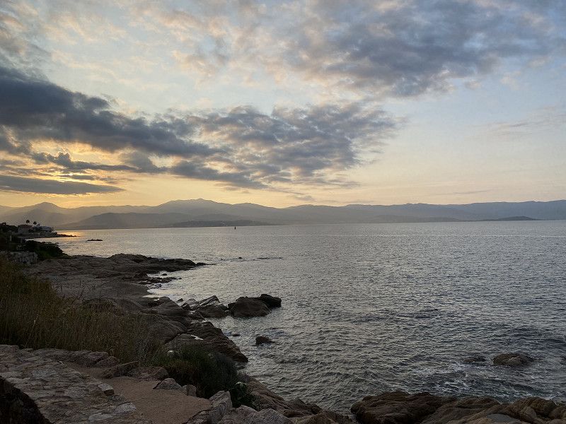
Ankunft auf Korsika
Arrived at 7:00 am in Ajaccio. The ferry staff directed us off the ferry so that we didn't get stranded. Great service.
Now we're looking for a place to have breakfast with a sea view and sunrise. The bakery is right behind the parking lot. Luckily, there's a German camping couple here too. We start chatting
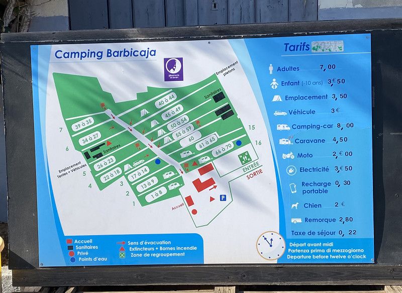
Camping Barbicaja
25.09.2024 - 24° 🌤️ 7 hours of sun / high humidity
We are staying at the simple CP Barbicaja just outside of Ajaccio. A terraced site with a bus connection (L5) to Ajaccio, otherwise we wouldn't be staying here.
Slightly run down CP, it's a shame that no one is interested in renovating anything here.
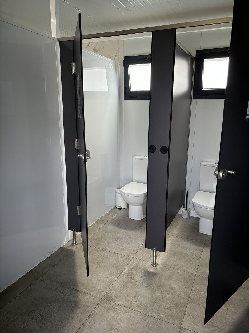
The access was narrow and steep, and the sanitary facilities were in dire need of renovation.
25.94€/night including electricity (we have to book because there are too many trees here and we can hardly charge our solar)
Tomorrow we want to go to Ajaccio and the archipelago.
Résidence Santa Lina, Ajaccio, Südkorsika, Korsika, Frankreich
41° 54' 35.5" N 8° 41' 5.3" E
41.9098477 8.6848103
• Head southeast on Rue des Arbousiers. Go for 225 m.
• Continue on Résidence Santa Lina. Go for 65 m.
• Turn left onto Route des Sanguinaires (D111). Go for 1.2 km.
• Pass 2 roundabouts and continue on Boulevard Stéphanopoli de Comène (D111). Go for 1.4 km.
• Continue on Cours Lucien Bonaparte (D111). Go for 670 m.
• Continue on Boulevard Albert 1er (D111). Go for 444 m.
• Continue on Boulevard Lantivy (D111). Go for 641 m.
• Take the 1st exit from roundabout onto Boulevard Lantivy (D111). Go for 215 m.
• Continue on Boulevard Pascal Rossini. Go for 206 m.
• Continue on Boulevard Danielle Casanova. Go for 350 m.
• Continue on Quai de la République. Go for 137 m.
• Continue on Square Elisa (D111 AE). Go for 248 m.
• Continue on Boulevard Sampiero (D111 AE). Go for 455 m.
• Take the 2nd exit from Place Pierre Colonna d'Istria roundabout onto Route du Bord de Mer toward N193/Calvi/Bastia/Bonifacio/Sartène/Aéroport Napoléon Bonaparte/Port Charles Ornano. Go for 1.5 km.
• Continue on Cours du Prince Impérial (T21). Go for 767 m.
• Take the 2nd exit from roundabout onto Route d'Aspretto (T21) toward Calvi/Bastia/Bonifacio/Sartène/Aéroport Napoléon Bonaparte/Z.I. du Vazzio. Go for 371 m.
• Pass 3 roundabouts and continue on T21. Go for 3.4 km.
• Keep right onto T21 toward Bastia/Calvi/Corte/Bonifacio. Go for 240 m.
• Take the 2nd exit from roundabout onto T20 toward Calvi/Bastia/Corte/Bocognano. Go for 2.6 km.
• Keep right toward T20. Go for 204 m.
• Continue on T20. Go for 1.1 km.
• Pass 4 roundabouts and continue on T20. Go for 27.8 km.
• Take the 4th exit from roundabout onto T20 toward Bastia/Vizzavona. Go for 20.6 km.
• Turn left. Go for 52 m.
• Arrive at your destination on the left.
☍
65,1 km
(1 hrs. 3 min.)
26. Sep. 2024 -
26. Sep. 2024
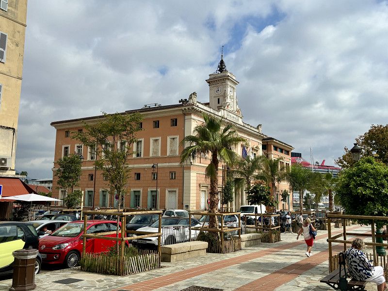
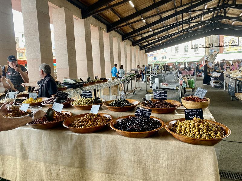
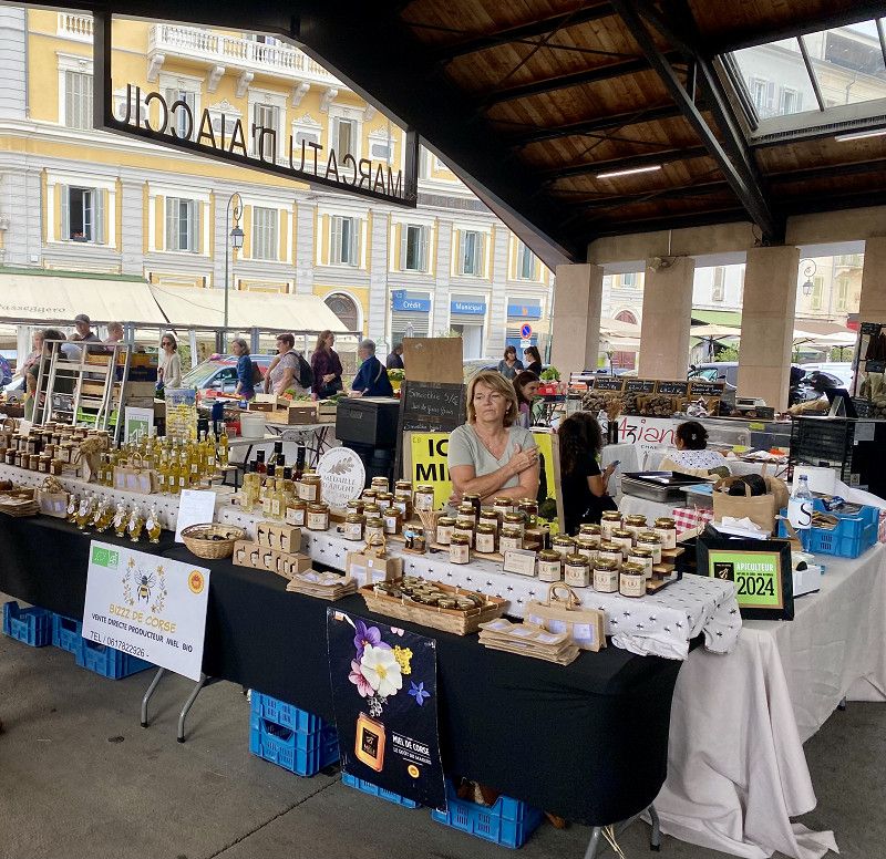
Ajaccio -Hauptstadt von Korsika
26° 🌥️ 1 hour of sun/ again very high humidity/ lots of clouds
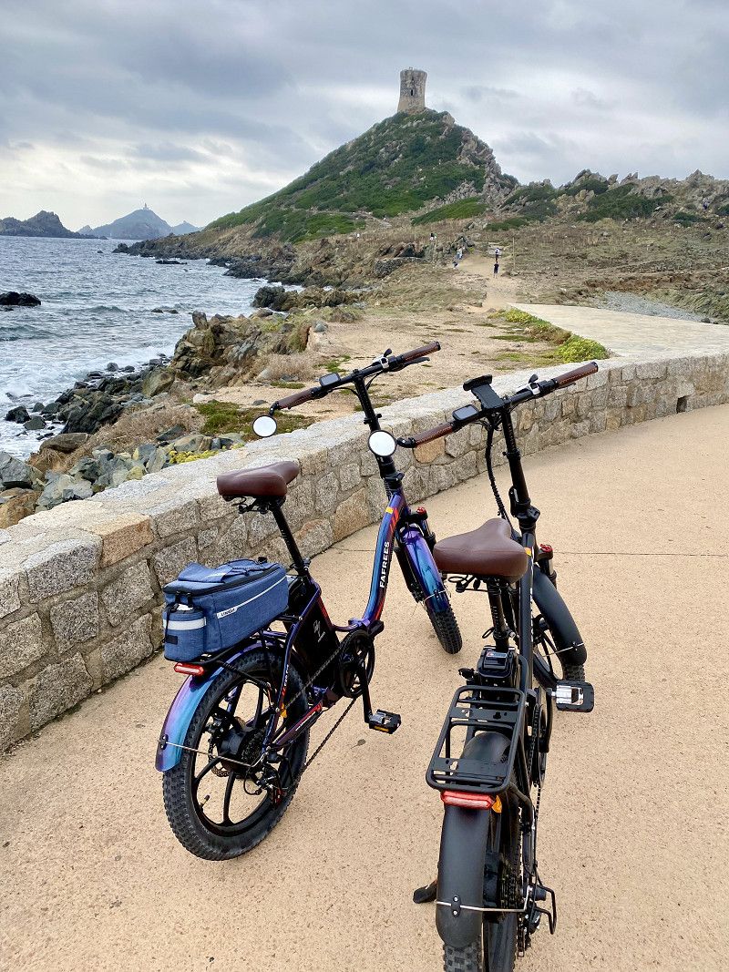
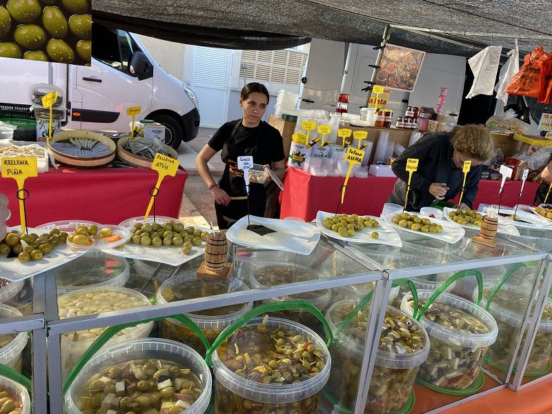
This morning we decided to cycle to Ajaccio instead. We want to visit the market there and get to know and buy some Corsican delicacies.
Since a cruise ship has just docked, the city is full of English people.
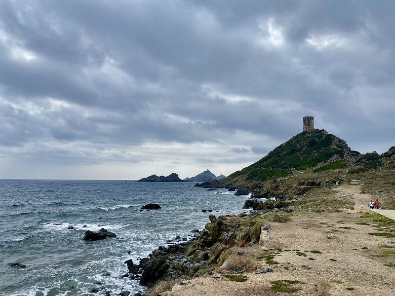
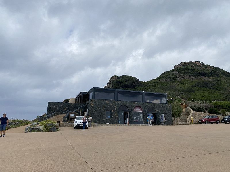
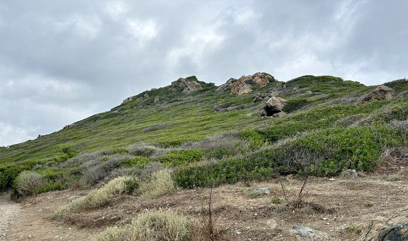
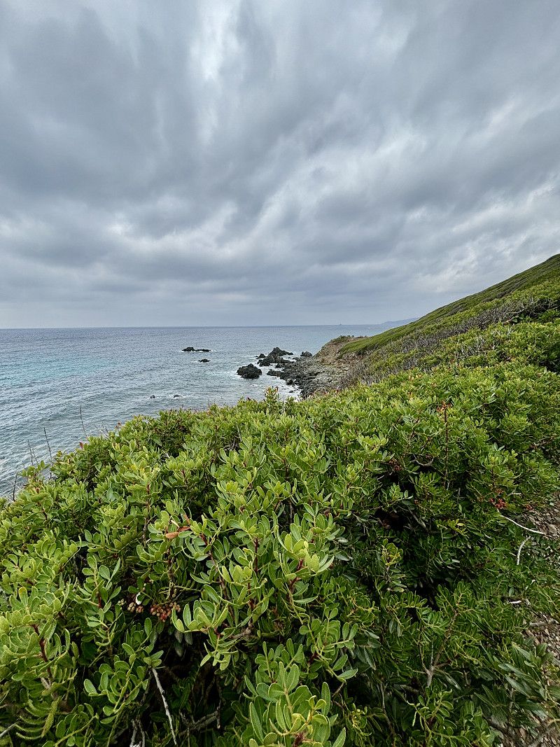
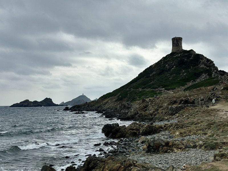
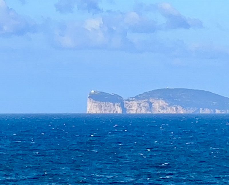
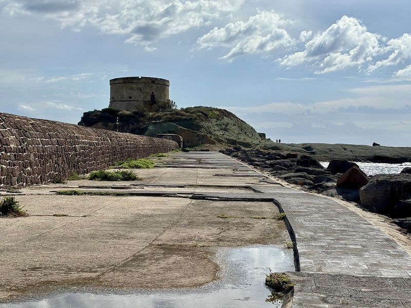
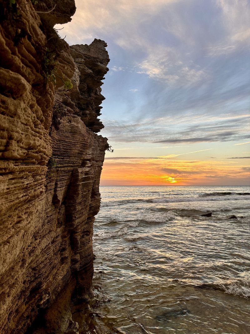
Pointe de la Parata
The archipelago is only 7.5 km from our campsite. However, the view of the archipelago is somewhat obscured today due to the many clouds.
27. Sep. 2024 -
27. Sep. 2024
Fahrt in den Norden von Korsika
26°/32° 🌦️ 4 hours of sun/rain/again very high humidity/lots of clouds
Today we start to drive to the north of Corsica.
We talked to some campers and heard quite different opinions regarding the roads.
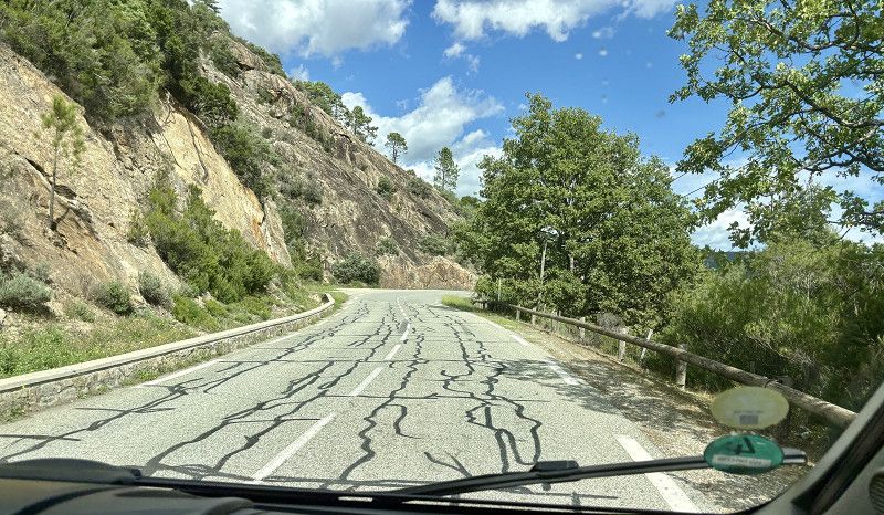
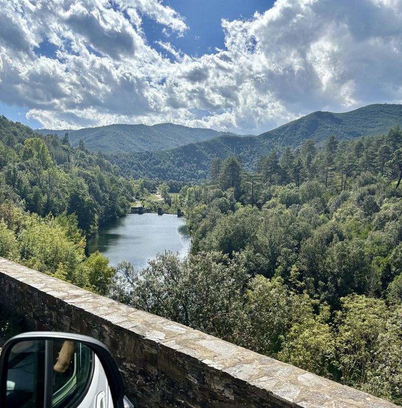
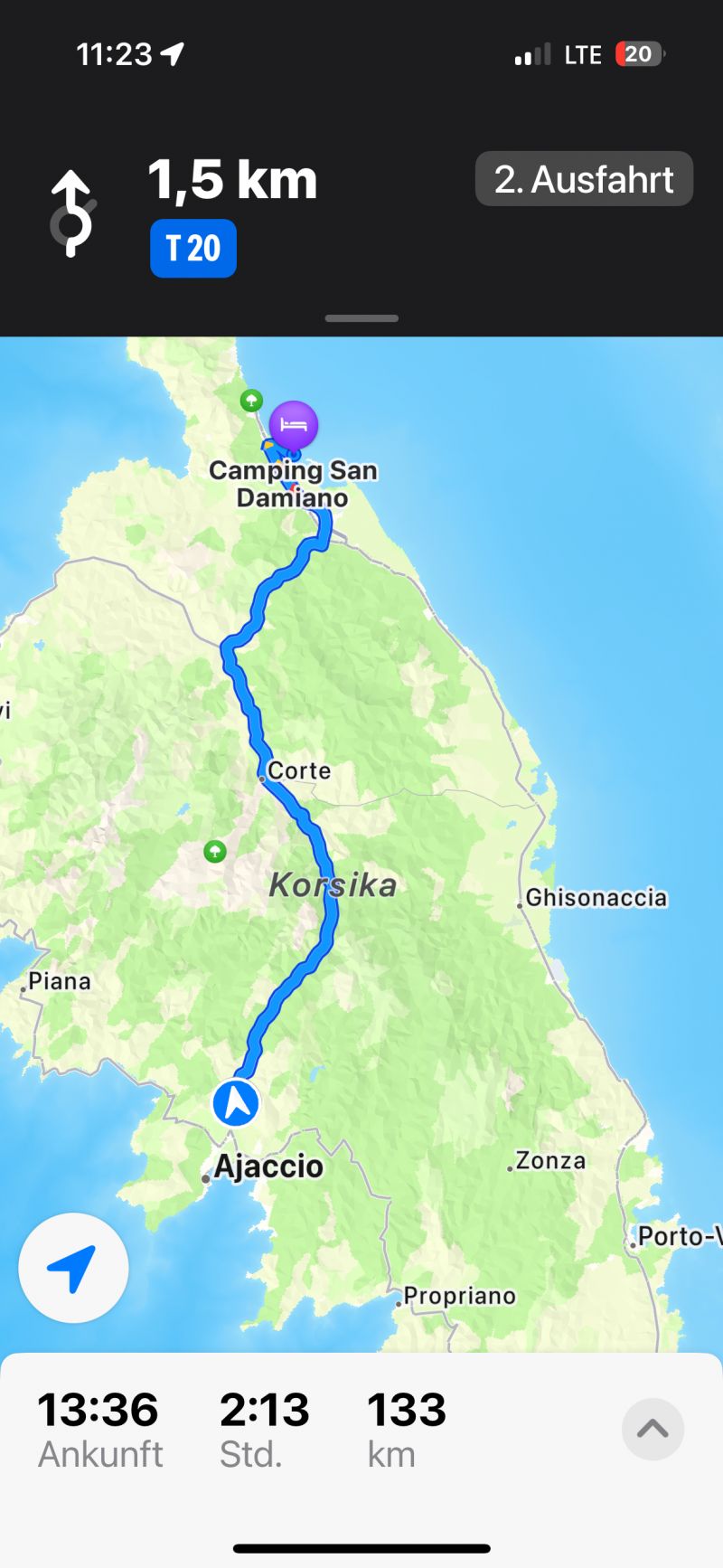
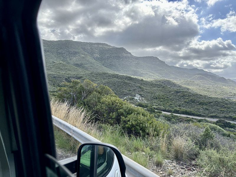
To get to the north we have to take the pass road via Corte.
Time is given as 3 hours for 145km.
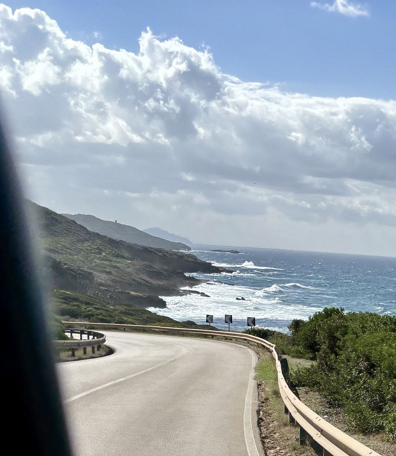
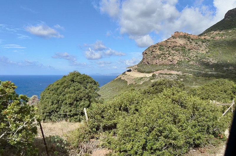
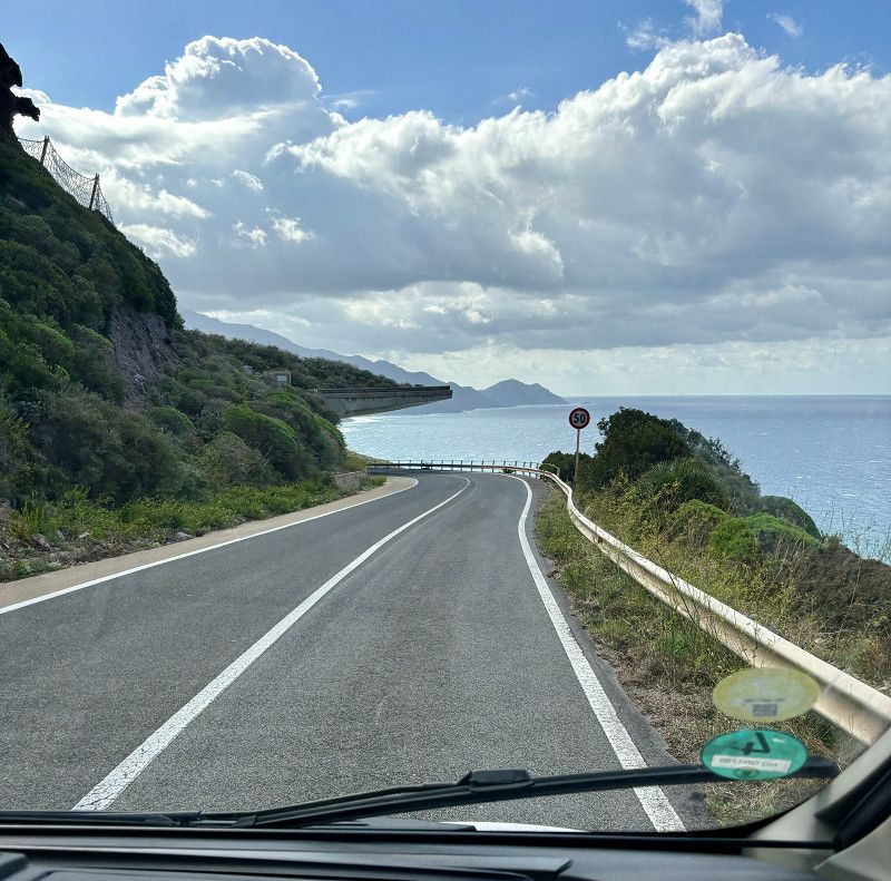
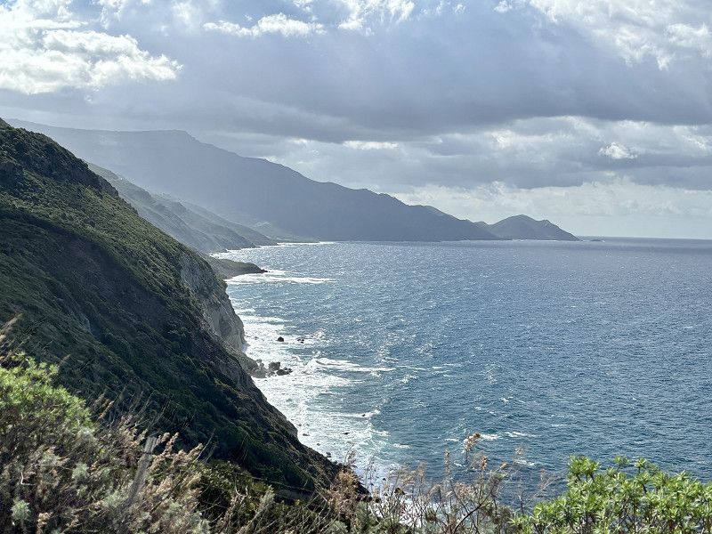
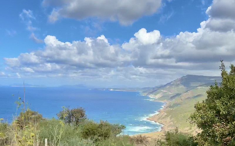
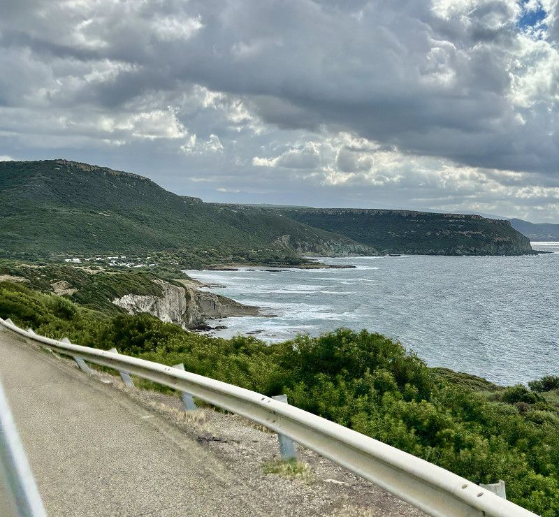
Update: the time is not quite right, or rather our motorhome has to struggle up the pass. We stop several times to give the traffic a chance to overtake us. Shortly before Corte the road is closed to motorhomes and there is a diversion. We take this of course, but after a quick check we drive down to Aléria and then continue up the coastal road. Much more pleasant to drive as it is not very high.
There we drive to 3 CP, only the fourth will be, the other 3 are either worn out or expensive
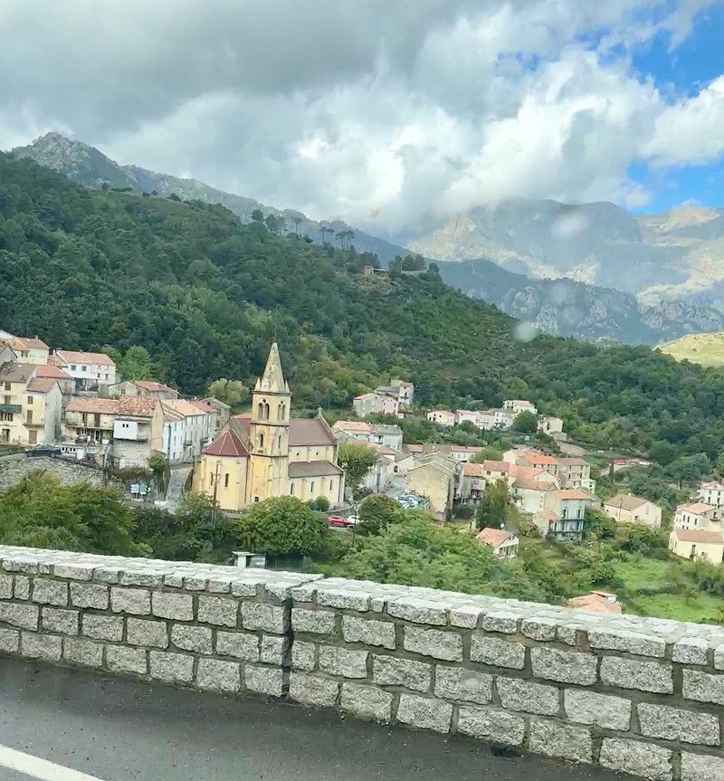
Vivario
Haute-Corse, Korsika, Frankreich
42° 10' 19.7" N 9° 10' 10.7" E
42.1721316 9.1696353
• Head toward Village de Vivari. Go for 52 m.
• Turn left onto T20. Go for 7.8 km.
• Turn right onto D143 toward Noceta/Vezzani/Pont San Ghjuvanni. Go for 8.2 km.
• Turn right onto T50. Go for 31.0 km.
• Turn left toward Bastia/Casamozza. Go for 14 m.
• Turn left onto Avenue Saint-Alexandre Sauli (T10) toward Bastia/Casamozza. Go for 383 m.
• Pass 2 roundabouts and continue on T10. Go for 29.1 km.
• Turn right onto Route de Moriani. Go for 149 m.
• Arrive at Route de Moriani. Your destination is on the left.
☍
76,7 km
(1 hrs. 2 min.)
27. Sep. 2024 -
28. Sep. 2024
Camping Merendella
ACSI CP for 21€/night plus tourist tax
The sanitary building is more modern than it was at our last campsite. The water was warm, even at the sink. But the building is completely open. So in the evenings it's also open to animals and flutterers🤪
Bread can be ordered at reception. The receptionist speaks English.
The best place so far.
Moriani Plage, 20230, San Nicolao, France
42° 21' 49" N 9° 31' 48" E
42.3636100 9.5300000
• Head south on Route de Moriani. Go for 207 m.
• Turn right onto T10. Go for 880 m.
• Pass 7 roundabouts and continue on Lieu-dit Chiosu di a Croce (T10). Go for 16.3 km.
• Take the 2nd exit from roundabout onto T11 toward Vescovato-Arena/Bastia/Aéroport Poretta/La Mer. Go for 1.3 km.
• Pass 2 roundabouts and continue on T11. Go for 14.8 km.
• Take the 3rd exit from roundabout onto T11 toward Bastia. Go for 2.6 km.
• Turn left toward Avenue Sampiero Corso/T11. Go for 423 m.
• Continue on Avenue Sampiero Corso (T11). Go for 843 m.
• Keep right onto Avenue Sampiero Corso (T11). Go for 612 m.
• Turn right onto Chemin Arinella. Go for 212 m.
• Turn left onto Chemin Arinella. Go for 267 m.
• Continue on Plage de l'Arinella. Go for 389 m.
• Turn slightly left toward Route de l'Arinella. Go for 46 m.
• Continue on Route de l'Arinella. Go for 112 m.
• Arrive at your destination on the left.
☍
39,0 km
( 38 min.)
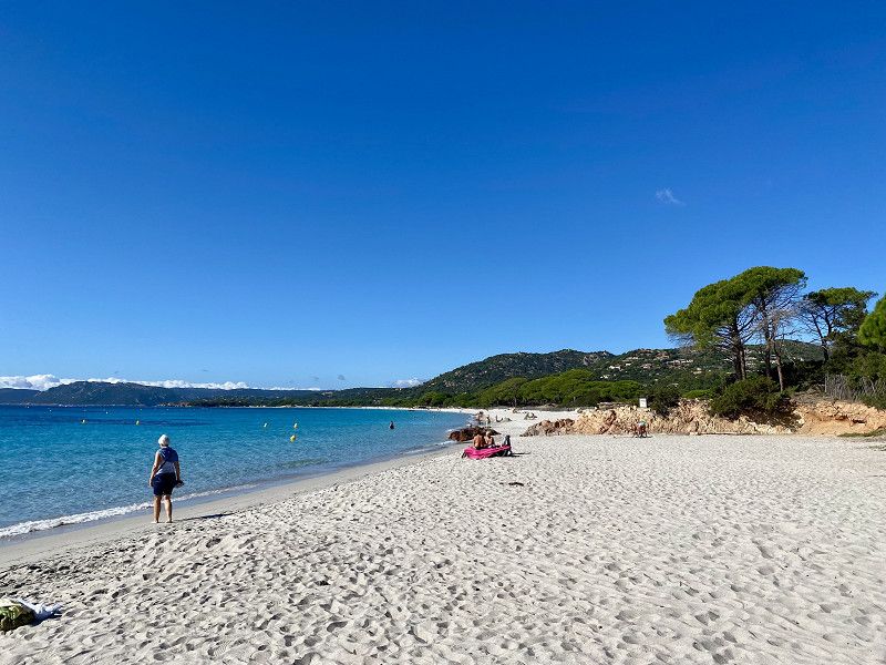
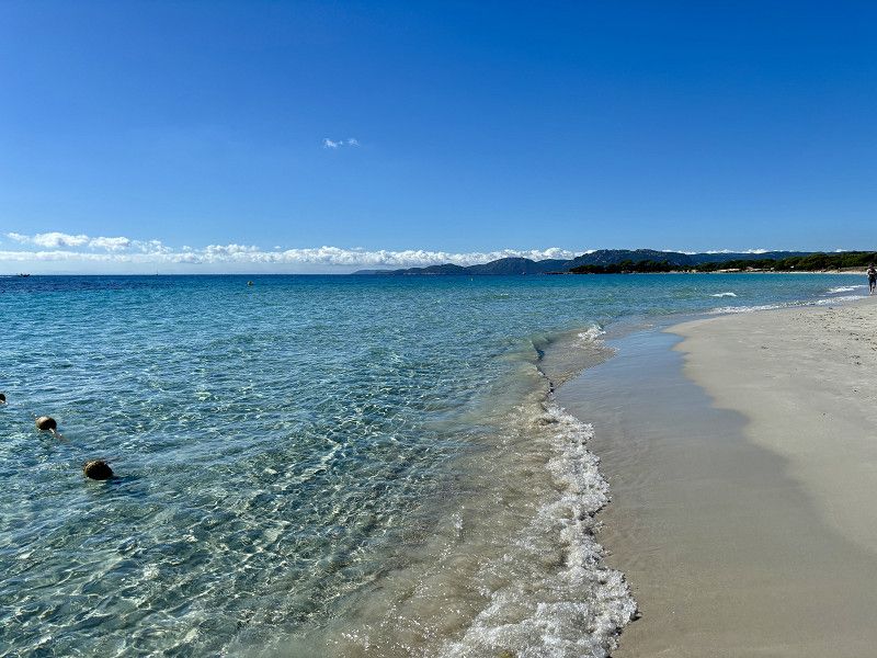
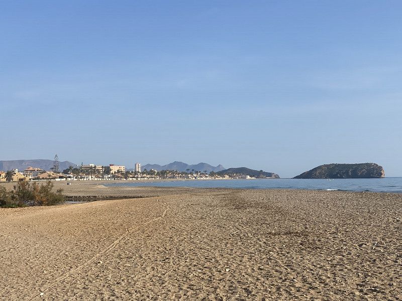
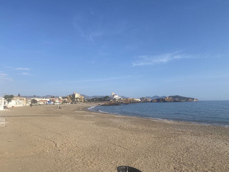
Strandtag - Relaxen
28.10.24 - 25° 🌤️ - 10 hours of sunshine
Beach - do nothing - do a bit of shopping and enjoy!
29. Sep. 2024 -
29. Sep. 2024
Bissl Planung muss doch sein
25°🌤️ - 11 hours of sunshine
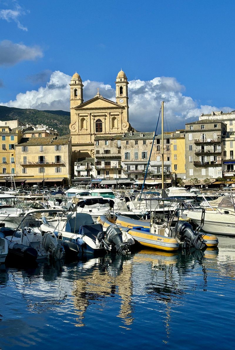
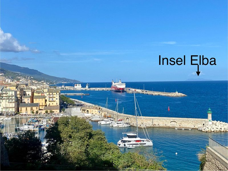
Just under 40km to Bastia, that is our destination today.
After lunch in the pizzeria on the square (we enjoyed it) we walk to Bastia, to the old town and the harbor. This is the part of Bastia worth seeing. In total we walked 7.6km today and that's enough for today 🤪.
We also booked the ferry for Sardinia today. On Wednesday we will sail from Porto Vecchio at 2 p.m. to Porto Torres in Sardinia.
We want to see Bonifacio on Monday and then the beaches around Porto Vecchio on Tuesday. From Wednesday or Thursday onwards it is supposed to only rain here in Corsica. And sitting around in the motorhome for 4 days is not really our thing.
29. Sep. 2024 -
29. Sep. 2024
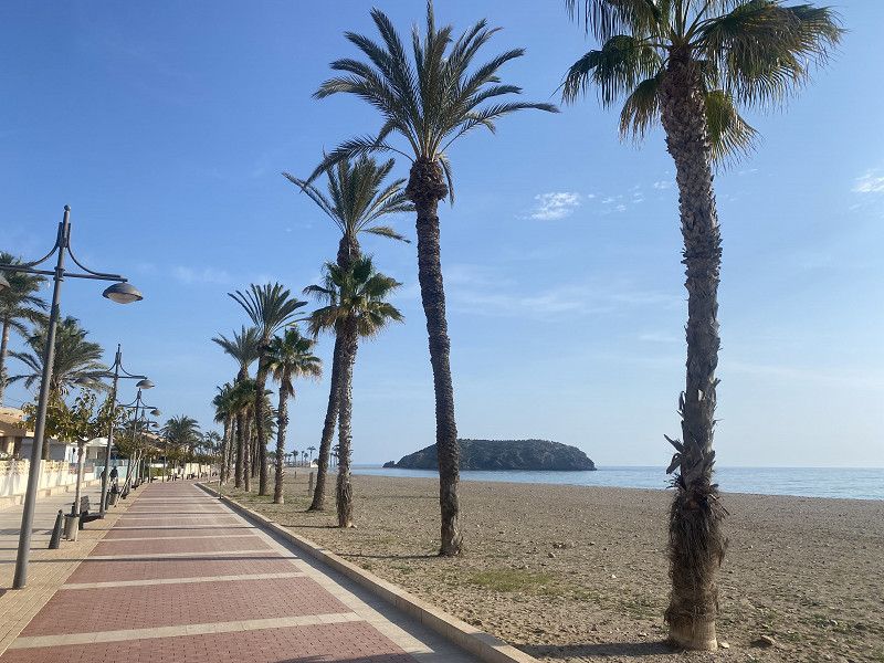
Camping Les Sables Rouges
Simple CP for 1 night 22€ without electricity, very nice location with a view of the sea and the center of Badtia is a 30-minute walk away.
The sanitary facilities are simple, there is only cold water at the sinks/wash basins. I can't say anything about the shower, we didn't use it.
The bakery is 700 meters away and has a very large selection. We tried the pizzeria on the square. We liked it, prices like at home (14€/pizza, 3.50€ -5€ drinks, 1.50€ coffee)
In the afternoon the place fills up, but there are still free spots. Off-season is certainly more relaxed.
20200, Bastia, France
42° 40' 21.7" N 9° 26' 40.9" E
42.6727000 9.4447000
• Head toward Plage de l'Arinella. Go for 30 m.
• Continue on Plage de l'Arinella. Go for 557 m.
• Continue on Chemin Arinella. Go for 42 m.
• Turn slightly right and take ramp. Go for 59 m.
• Turn right onto T11. Go for 64 m.
• Keep left onto T11. Go for 1.7 km.
• Take the 2nd exit from roundabout onto Avenue Sampiero Corso (T11) toward Calvi/Ajaccio/Bonifacio/Aéroport Poretta. Go for 919 m.
• Keep left toward Avenue Sampiero Corso/T11. Go for 418 m.
• Continue on Avenue Sampiero Corso (T11). Go for 2.6 km.
• Pass 3 roundabouts and continue on T11. Go for 16.1 km.
• Take the 3rd exit from roundabout onto T10 toward Aléria. Go for 997 m.
• Pass 19 roundabouts and continue on T10. Go for 117 km.
• Take the 2nd exit from roundabout onto T10 toward Ajaccio/Bonifacio/Aéroport Figari. Go for 680 m.
• Take the 3rd exit from roundabout onto T10 toward Ajaccio/Bonifacio/Aéroport Figari. Go for 1.2 km.
• Pass 2 roundabouts and continue on T10. Go for 998 m.
• Turn right onto T10 toward Ajaccio/Bonifacio/Aéroport Figari. Go for 624 m.
• Take the 1st exit from roundabout onto Route de Sotta (D859) toward Ajaccio/Sartène/Propriano. Go for 6.0 km.
• Take the 3rd exit from roundabout onto D859 toward Ajaccio/Aiacciu/Bonifacio/Bunifaziu/Aéroport Figari/Figari. Go for 1.0 km.
• Pass 2 roundabouts and continue on Rue Principale (D859). Go for 9.1 km.
• Take the 1st exit from roundabout onto D322 A. Go for 1.1 km.
• Take the 2nd exit from roundabout onto D322. Go for 1.4 km.
• Take the 1st exit from roundabout onto D859. Go for 2.8 km.
• Turn left onto T40 toward Bonifacio. Go for 11.7 km.
• Take the 3rd exit from roundabout onto T10 toward Porto Vecchio/Bastia. Go for 1.6 km.
• Turn right onto D60 toward Maora/Sant'Amanza/Z.A. de Musella. Go for 945 m.
• Continue on Lieu-dit Campagru (D60). Go for 101 m.
• Continue on D60. Go for 263 m.
• Continue on Lieu-dit Pomposa (D60). Go for 93 m.
• Arrive at Lieu-dit Pomposa (D60). Your destination is on the left.
☍
179,7 km
(2 hrs. 49 min.)
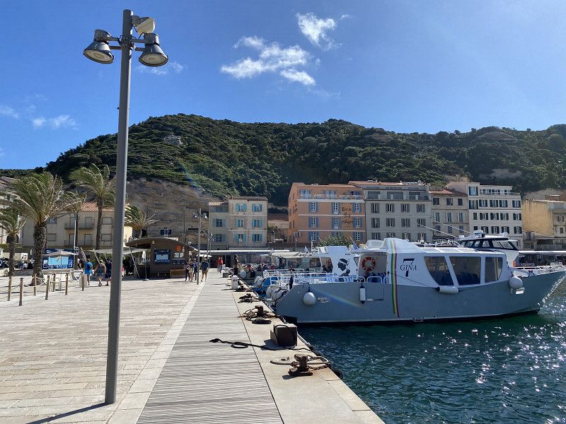
Bastia - Alter Hafen und Altstadt
30. Sep. 2024 -
30. Sep. 2024
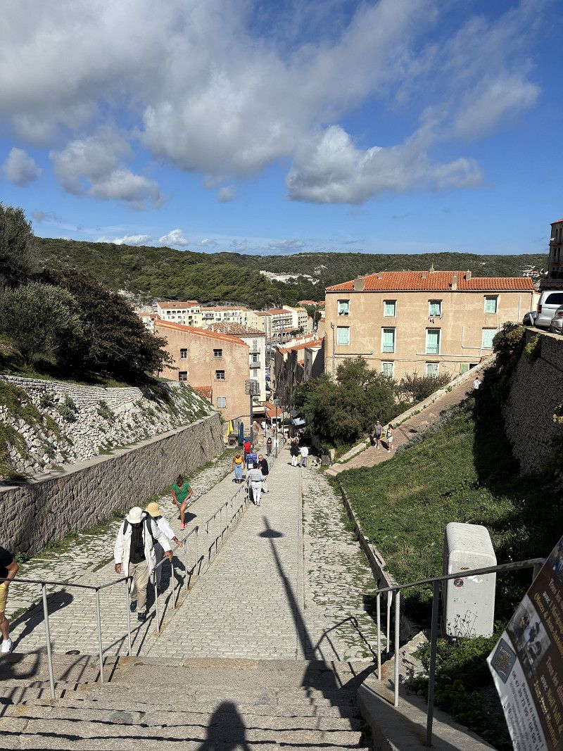
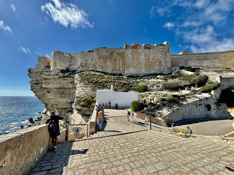
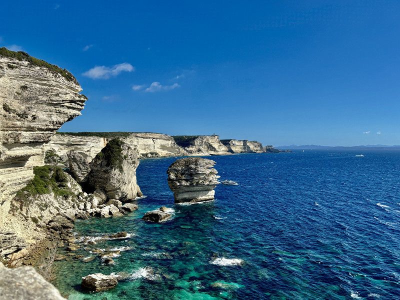
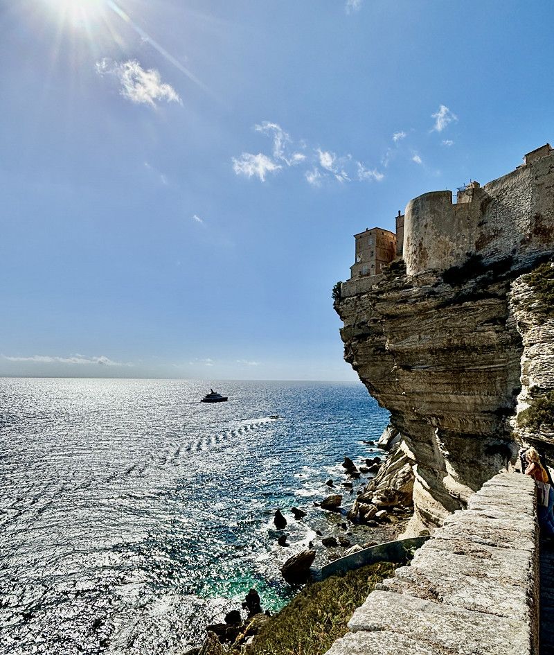
Bonifacio
24°🌤️ - 10 hours of sunshine
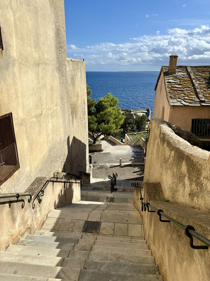
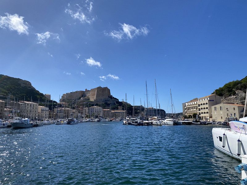
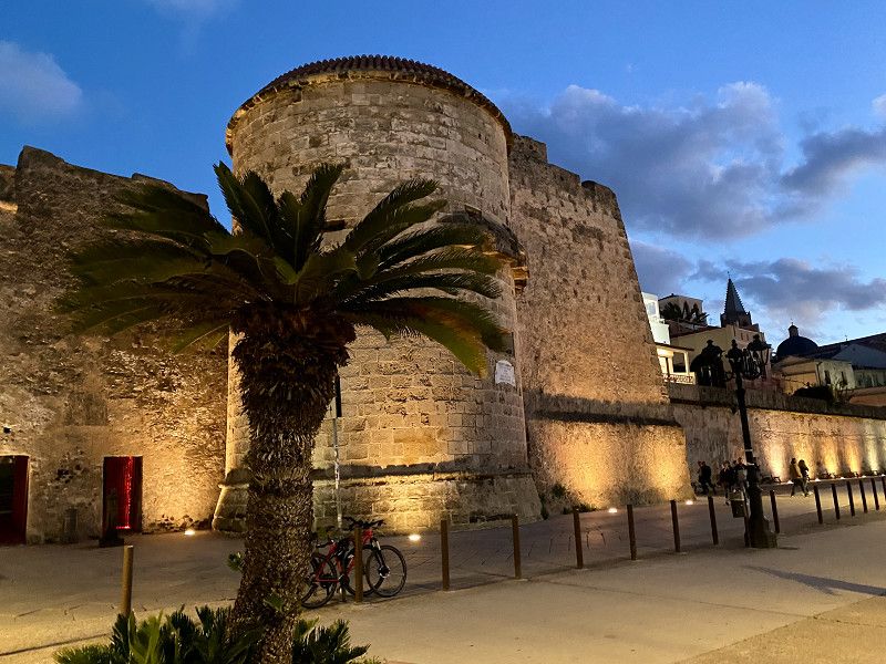
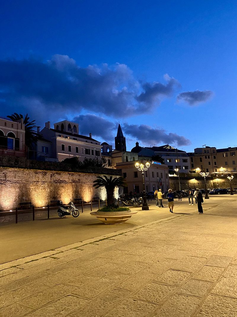
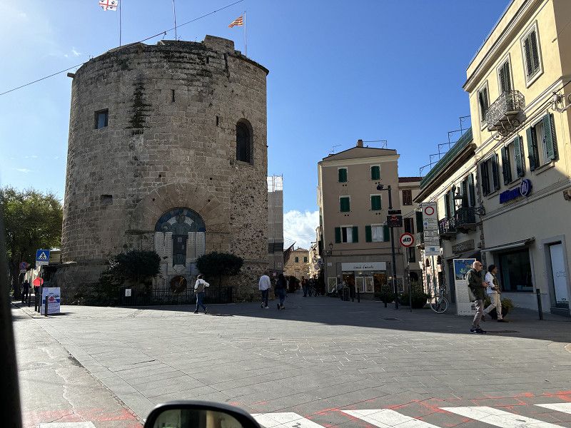
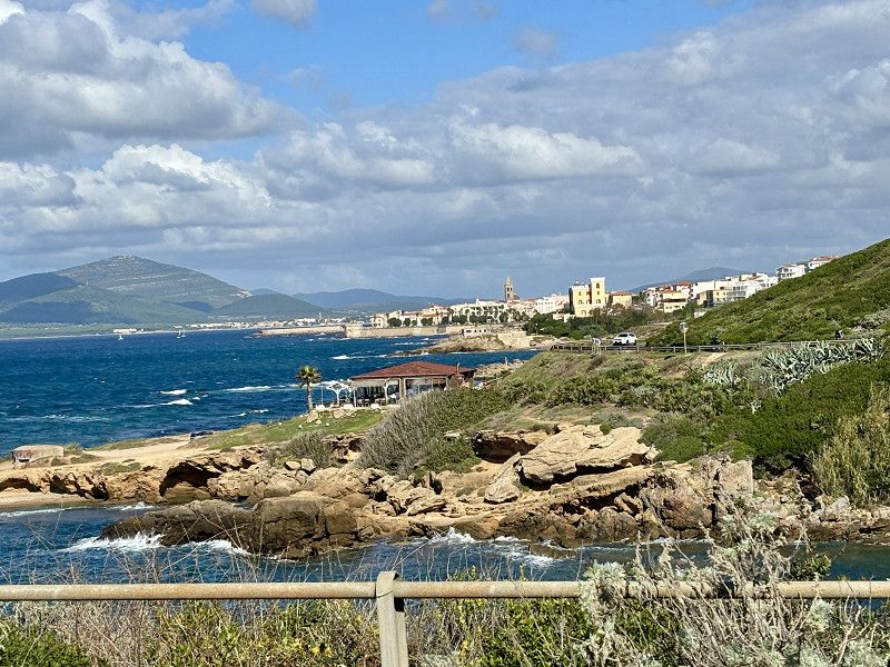
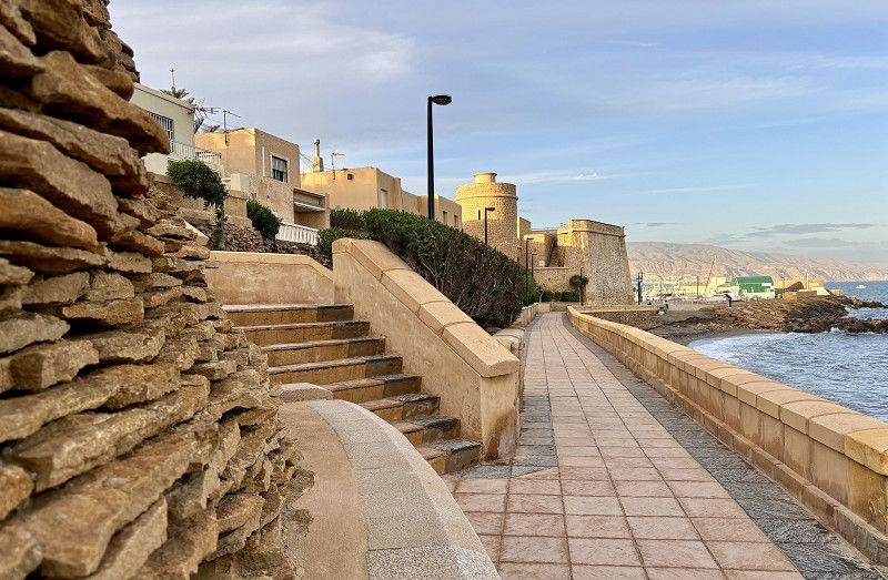
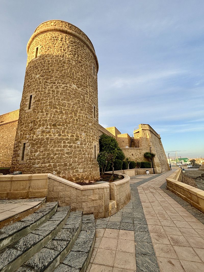
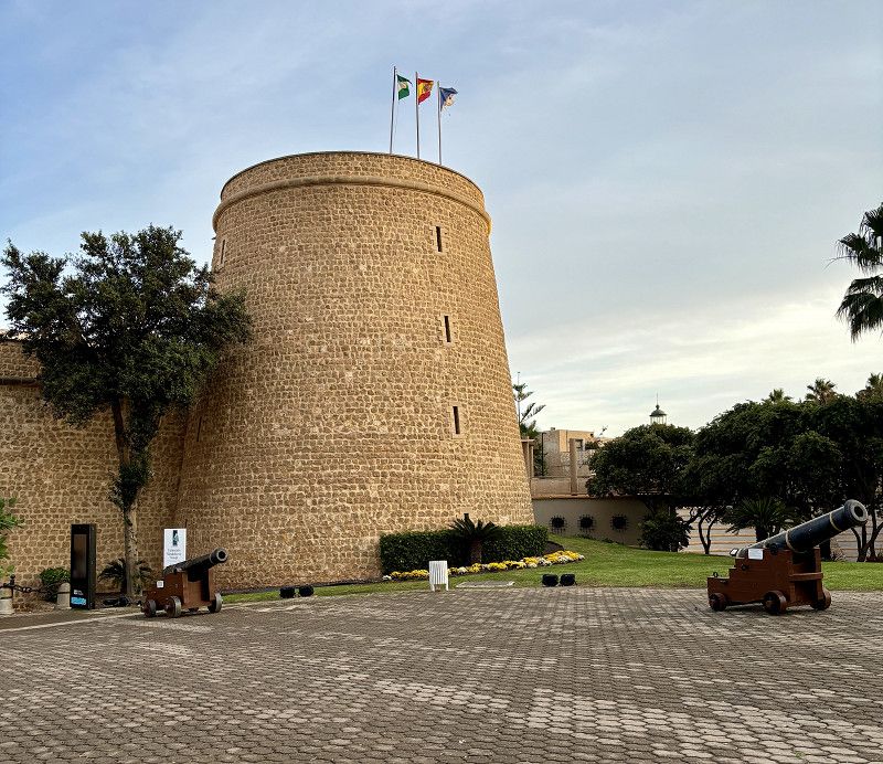
The drive to Bonifacio was always along the coast, and we arrived after about 3.5 hours. Unfortunately, everything was full and cramped. So once again we couldn't find a place to park the camper van. As we left the town, I saw the sign for the parking lot at the roundabout for €10/24 hours. And you can also spend the night here. The way back to Bonifacio is about 25 minutes, first steeply downhill and then, of course, steeply uphill. Bonifacio is a port town with a citadel on the cliffs. Worth seeing. Bonifacio is a beautiful little town, lots of sailing boats and yachts.
We walk up to the rock and have a beautiful view.
Update: there is a free shuttle bus from 10 a.m. to 6 p.m. that takes parking lot visitors to Bonifatio. We didn't know that.
D 60, Bonifacio, Bonifacio, Département Corse-du-Sud, Frankreich
41° 24' 29.1" N 9° 11' 16.6" E
41.4080879 9.1879555
• Head west on Lieu-dit Pomposa (D60). Go for 93 m.
• Continue on D60. Go for 263 m.
• Continue on Lieu-dit Campagru (D60). Go for 101 m.
• Continue on D60. Go for 945 m.
• Turn right onto T10. Go for 18.1 km.
• Pass 4 roundabouts and continue on T10. Go for 3.5 km.
• Take the 2nd exit from roundabout onto T10 toward Bastia/Calvi. Go for 598 m.
• Pass 4 roundabouts and continue on T10. Go for 2.8 km.
• Take the 3rd exit from roundabout onto Route de l'Ospedale (D368) toward L'Ospédale/Zonza. Go for 139 m.
• Turn left onto Route de l'Ospedale. Go for 215 m.
• Arrive at Route de l'Ospedale. Your destination is on the left.
☍
26,7 km
( 26 min.)
01. Oct. 2024 -
01. Oct. 2024
Vorletzter Tag auf Korsika
30°🌤️ - 9 hours of sunshine
This morning there were about 10 motorhomes in this parking lot. It was a quiet and safe night. The ticket must be paid at the machine when leaving (bank card).
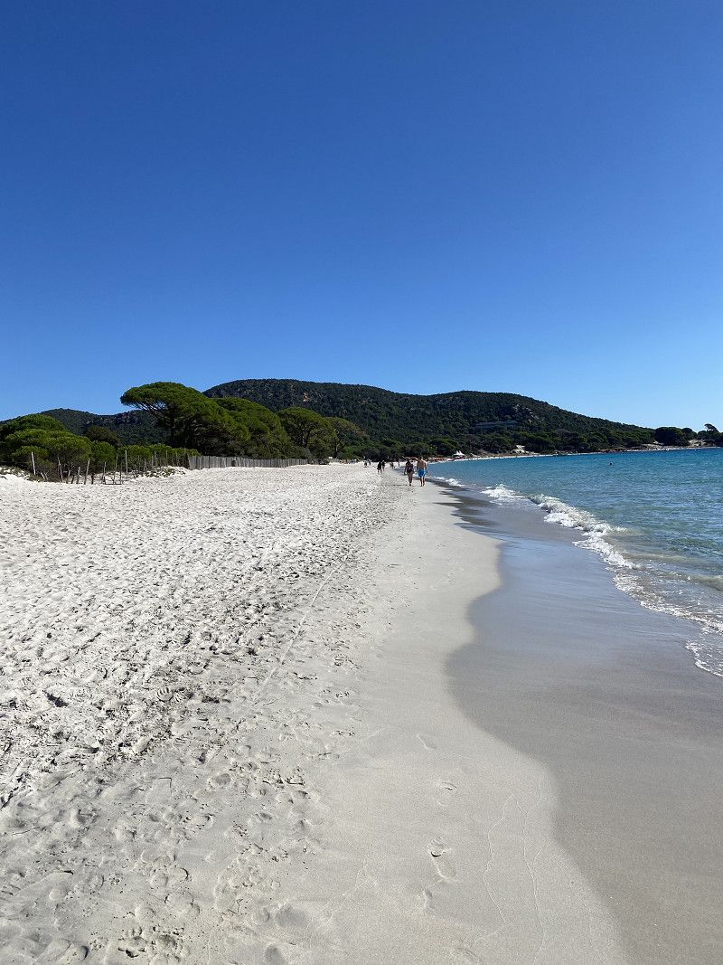
Our first goal is to go to the most beautiful beach in Corsica, the "Santa Giulia" beach. But we can't get there with the motorhome. So we drive to the "Plage de Palombaggia". The road is extremely winding and very narrow at times. There is an I-PINI car camper parking lot for €4, which you can also book as a parking space for one night (€14). But, as you would expect, there are lots of trees and roots. There is a bread roll service and there is also a bar. We see a sign for a service station for motorhomes, but we don't know where it is.
So we'll just walk to the beautiful beach and then look for a place in Porto Vecchio, where we'll take the ferry to Sardinia tomorrow at 2 p.m. The first clouds are coming in this evening and from tomorrow onwards the weather here in Corsica will get worse.
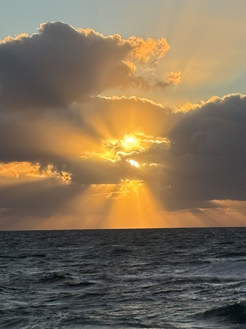
Conclusion about Corsica:
A very beautiful island in terms of landscape, but definitely not suitable for us. It is too narrow, too steep and there is not enough infrastructure for motorhomes. The campsites are expensive and do not offer much for the money. Shopping and eating out are also rather expensive. We like to stay in campsites with few trees so that we can generate electricity with solar power. This autumn there are a lot of mosquitoes and for me that means sitting in the motorhome more than outside, as I am allergic to their bites. (20 bites on my leg and all of them are infected, that's not so funny. There are also bites on the rest of my body, but I have given up counting them).
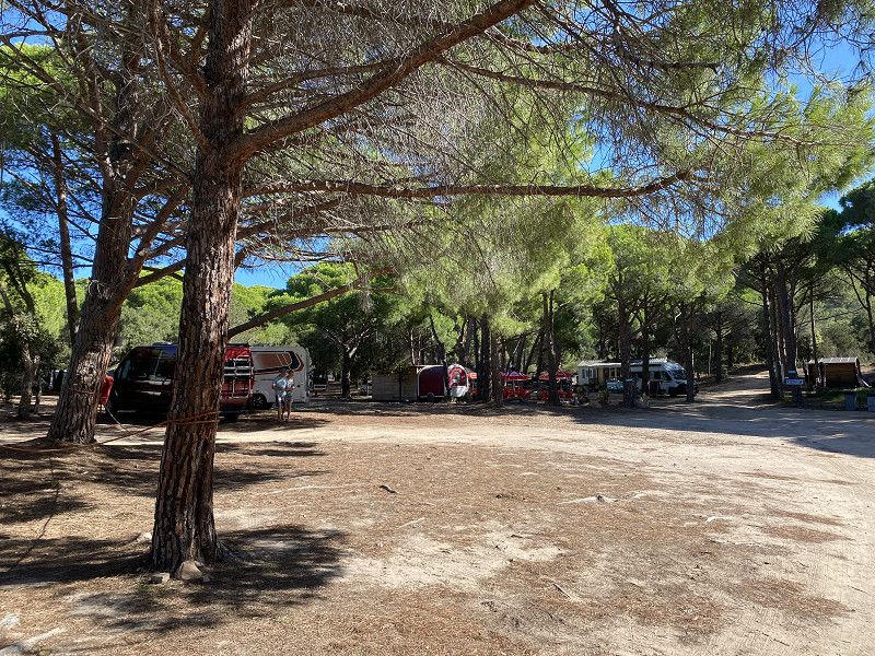
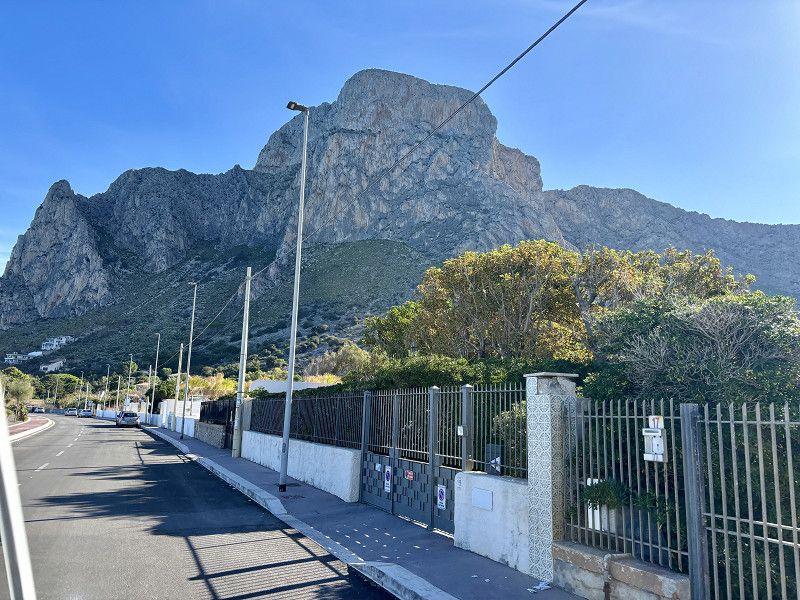
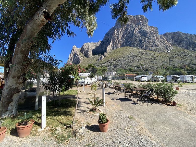
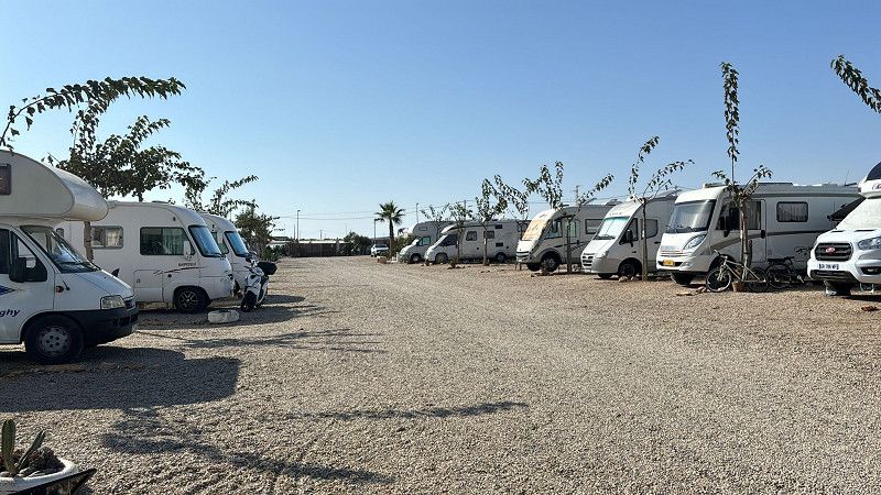
Camping Arutoli
Campsite a little on the outskirts of the city of Porto Vecchio. So far the cheapest campsite (19.68€/night including tourist tax)
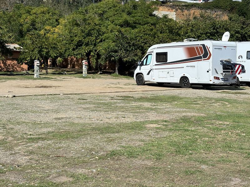
The campsite is also in a forest area, but we still find a place to charge our solar panel. The places are not divided up, which is not possible with all the trees. We have to circle around a lot and look around because of the height and width of our motorhome.
The sanitary building is clean and there is warm water for showering. So far, the price-performance ratio is pretty good.
1 Route de l'ospédale 003495701273, 20137, Porto Vecchio, France
41° 36' 6.5" N 9° 15' 58.3" E
41.6018000 9.2662000
• Head southeast on Route de l'Ospedale. Go for 215 m.
• Turn right onto Route de l'Ospedale (D368). Go for 65 m.
• Take the 2nd exit from roundabout onto Rue Vincentellu d'Istria (D368). Go for 741 m.
• Take the 2nd exit from roundabout onto Rue Giudice de Cinarca (T101). Go for 125 m.
• Take the 2nd exit from roundabout onto Rue Giudice de Cinarca (T101). Go for 142 m.
• Take the 3rd exit from roundabout onto Rue Giudice de Cinarca (T101). Go for 535 m.
• Continue on Rue du Maréchal Leclerc (T101). Go for 314 m.
• Take the 1st exit from roundabout onto Rue du Maréchal Leclerc (T101). Go for 162 m.
• Continue on Rue du Général Leclerc (T101). Go for 9 m.
• Turn left onto Rue du Général de Gaulle (D359). Go for 143 m.
• Continue on Cours Napoléon (D359). Go for 86 m.
• Arrive at Cours Napoléon (D359). Your destination is on the left.
☍
2,5 km
( 7 min.)
02. Oct. 2024 -
02. Oct. 2024
Fahrt zum Fährhafen in Porto Vecchio
24° 🌤️ 10 hours of sunshine
Waiting for the ferry. After we enter the harbor, they check to see if there are any stowaways on board and if our gas is turned off.
Corsica Ferries
Departure port: Porto-Vecchio
Südkorsika, Korsika, Frankreich
41.5911382 9.2794469
Arrival port: Porto Torres Marittima
Via Ponte Romano, Posthudorra/Porto Torres, Sassari, Sardinien, Italien
40.8379388.3973185
• Head toward Via Antonietta Bassu on Via Ponte Romano. Go for 161 m.
• Take the 2nd exit from roundabout onto Via Amerigo Vespucci. Go for 742 m.
• Take the 2nd exit from roundabout onto Via dell'Industria. Go for 367 m.
• Take the 2nd exit from roundabout onto Via dell'Industria toward Sassari/Cagliari/SS131. Go for 2.6 km.
• Take the 1st exit from roundabout onto Via Sassari (SS131). Go for 371 m.
• Take the 2nd exit from roundabout onto SS131. Go for 883 m.
• Turn left onto SP25. Go for 4.5 km.
• Pass 2 roundabouts and continue on Strada Provinciale Sorso-Li Pidriazzi (SP25). Go for 3.9 km.
• Continue on Località Badde Fustiggiu (SP25). Go for 792 m.
• Continue on SP25. Go for 198 m.
• Continue on Località La Pauledda (SP25). Go for 950 m.
• Continue on SP25. Go for 2.2 km.
• Continue on Via Porto Torres (SP25). Go for 648 m.
• Take the 1st exit from roundabout onto Via Porto Torres (SP25). Go for 211 m.
• Turn left onto Viale S. Cottoni. Go for 142 m.
• Turn right onto Piazza Pasquale Marginesu. Go for 46 m.
• Continue on Via Piave. Go for 56 m.
• Turn left onto Via Adelasia. Go for 60 m.
• Turn right onto Via Municipio. Go for 44 m.
• Arrive at Via Municipio. Your destination is on the right.
☍
76,7 km
(1 hrs. 4 min.)
Sòssu/Sorso
The ferry ride was calm and took 5 hours.
Cost: €129 without a cabin (we didn't need it for that time). If we had gone from Bonifacio to Sardinia, the crossing would have only taken 2.5 hours but would have cost almost €80 more. Even if we drove back from Porto Torres along the coast, we would not have used €80 in fuel. That's why we chose this ferry connection.
After our arrival we find a parking space here (P4night), there are 2 other campers there and we stay for the first night. We drink another glass of wine in the small bar at the end of the parking lot.
A car keeps rushing past us. Eventually it's quiet and we sleep.
Sassari, Sardinien, Italien
40° 47' 47.7" N 8° 34' 40.3" E
40.7965949 8.5778501
• Head toward Via Capo Corso on Via Municipio. Go for 70 m.
• Turn right onto Via Capo Corso (SP25). Go for 55 m.
• Continue on Via Vittorio Veneto (SP25). Go for 124 m.
• Turn right onto Via La Marmora (SP25). Go for 37 m.
• Turn right onto Via Adelasia. Go for 167 m.
• Continue on Piazza Giuseppe Garibaldi. Go for 35 m.
• Turn left onto Piazza Giuseppe Garibaldi. Go for 51 m.
• Turn left onto Piazza Giuseppe Garibaldi. Go for 34 m.
• Turn right onto Piazza Pasquale Marginesu. Go for 53 m.
• Turn right onto Corso Vittorio Emanuele II. Go for 197 m.
• Continue on Corso Vittorio Emanuele II. Go for 12.2 km.
• Turn right onto Strada Provinciale Sassari Santa Teresa. Go for 8.9 km.
• Keep left toward SP33. Go for 9.4 km.
• Take ramp onto SP33. Go for 1.4 km.
• Turn left toward Strada Provinciale Castelsardo Santa Teresa/SP90. Go for 2.3 km.
• Turn right onto Strada Provinciale Castelsardo Santa Teresa (SP90). Go for 939 m.
• Continue on SP90. Go for 231 m.
• Turn left. Go for 66 m.
• Turn sharp left. Go for 162 m.
• Take the 2nd exit from roundabout. Go for 148 m.
• Take the 1st exit from roundabout onto SP90. Go for 3.0 km.
• Turn right onto Via Giovanni Pascoli. Go for 459 m.
• Turn sharp right onto Via Edmondo De Amicis. Go for 154 m.
• Turn left onto Via Giuseppe Mazzini. Go for 113 m.
• Turn right onto Via Giuseppe Mazzini. Go for 42 m.
• Arrive at Via Giuseppe Mazzini. Your destination is on the right.
☍
40,4 km
( 37 min.)
03. Oct. 2024 -
03. Oct. 2024
1.Tag auf Sardinien
🌧️💨 19° 🌥️ 1 hour of sunshine
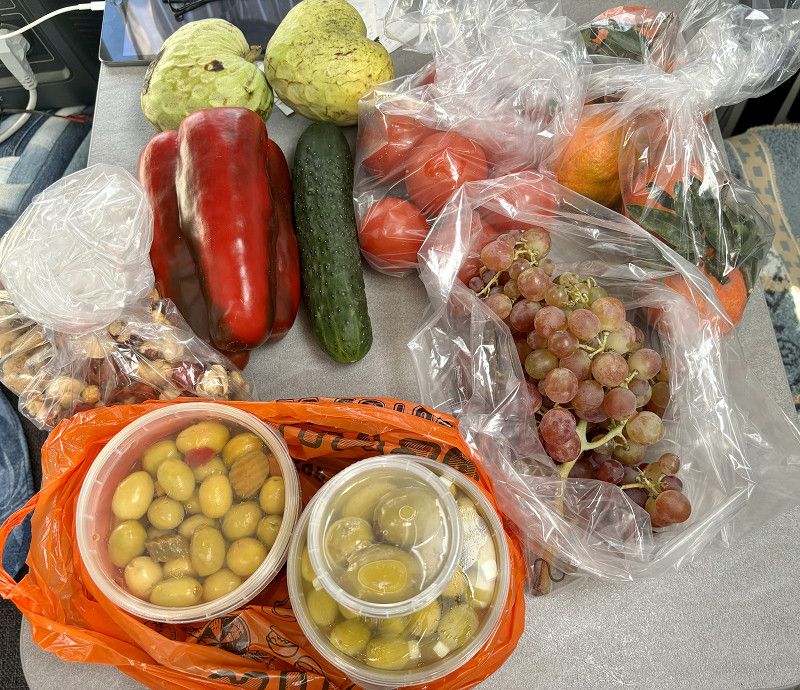
After our first night in Sardinia in the parking lot (lots of cars drove past), we go shopping in Porto Torres. Stock up on everything we need (drinks, fruit, vegetables, bread, pasta).
Then we drive along the coast in very heavy rain, in places the water is several centimeters high on the road or is shooting down the slope.
Badesi
There is a parking space in Badesi, but we arrive here at around 12.30 p.m. and there is no one on the parking space and the barrier is also down.
So we first stop in the parking lot right by the beach.
Here we meet Heike and Karl-Heinz, former Sardinia travelers who recommend that we stay here.
The parking lot is straight and asphalted (ideal in the rain) and from October 1st it is the absolute low season in Sardinia and it would not matter if you were parked here.
We have a very nice chat and stay here for the night. In the late afternoon it stops raining, but a strong wind (8bfr) comes along and blows hard all night.
Sassari, Sardinien, Italien
40° 57' 54.2" N 8° 53' 3.2" E
40.9650690 8.8842160
• Head southwest on Via Giuseppe Mazzini. Go for 42 m.
• Turn right onto Via Giuseppe Mazzini. Go for 17 m.
• Turn left onto Via Caprera. Go for 27 m.
• Turn left onto Via Don Luigi Sturzo. Go for 52 m.
• Turn right onto Via Giuseppe Mazzini. Go for 83 m.
• Turn right onto Via Edmondo De Amicis. Go for 154 m.
• Turn sharp left onto Via Giovanni Pascoli. Go for 459 m.
• Turn left onto Strada Provinciale Castelsardo-Santa Teresa (SP90). Go for 3.0 km.
• Take the 2nd exit from roundabout. Go for 3.3 km.
• Take ramp onto SP33. Go for 4.0 km.
• Continue on SP92. Go for 10.6 km.
• Turn left onto SS127. Go for 538 m.
• Turn right onto SP2. Go for 499 m.
• Turn left and take ramp. Go for 314 m.
• Turn right onto SS672. Go for 20.0 km.
• Continue on SS672. Go for 7.5 km.
• Take ramp onto SS597. Go for 5.3 km.
• Take the 2nd exit from roundabout toward Sassari. Go for 111 m.
• Take ramp onto SS131 toward Sassari/Porto Torres/Alghero. Go for 11.9 km.
• Keep left onto SS131 toward Porto Torres/Alghero. Go for 7.4 km.
• Take ramp onto Strada Statale Variante della Nurra (SS291var) toward Aeroporto/Alghero/Olmedo. Go for 9.2 km.
• Take ramp toward Aeroporto/Fertilia. Go for 210 m.
• Take the 1st exit from roundabout onto Strada Statale della Nurra (SS291) toward Aeroporto/Alghero. Go for 6.4 km.
• Take the 3rd exit from roundabout. Go for 323 m.
• Continue on SP42. Go for 8.7 km.
• Continue toward SP42. Go for 38 m.
• Take the 2nd exit from roundabout onto SP42. Go for 935 m.
• Take the 2nd exit from roundabout onto Via Liguria. Go for 738 m.
• Turn left onto Via Lido. Go for 40 m.
• Turn right. Go for 213 m.
• Turn left. Go for 42 m.
• Arrive at your destination on the left.
☍
102,2 km
(1 hrs. 10 min.)
04. Oct. 2024 -
04. Oct. 2024
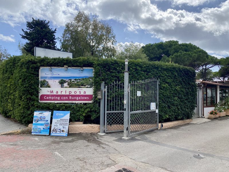
Camping La Mariposa
19° 🌥️
ACSI pitch for 27€/night plus 0.50€ for showering, plus tourist tax.
The place is right on the beach, but we need a place without wind tonight 🤪
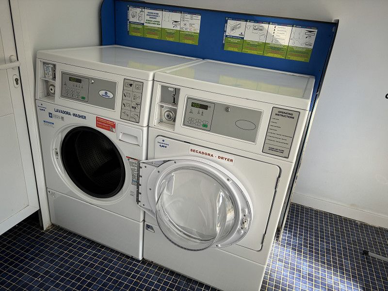
Washing is also necessary, but there is only one washing machine here and it costs 7.00€ (🤨 too much). We have our small machine with us for exactly such cases and do the washing in the motorhome.
Let's see what we do today.
Update: we were in Alghero in the late afternoon, in the bar Focacceria Miles. We met up with Heike and Karlheinz there again and had wine and focaccia.
It's 2.5km to get there on foot. There was also a bike path and a bus would have gone there as well.
Sassari, Sardinien, Italien
40° 34' 41.8" N 8° 18' 44.3" E
40.5782774 8.3122963
• Head west. Go for 255 m.
• Turn right onto Via Lido. Go for 1.3 km.
• Take the 1st exit from roundabout onto Via Giuseppe Garibaldi. Go for 1.1 km.
• Turn right onto Via Sassari. Go for 379 m.
• Turn left onto Via 20 Settembre. Go for 63 m.
• Turn right onto Viale Giovanni XXIII (SS292). Go for 23.6 km.
• Turn right onto Via Guglielmo Marconi. Go for 978 m.
• Continue on Strada Provinciale per Montresta Bivio Strada Statale (SP12). Go for 721 m.
• Continue on SP12. Go for 14.7 km.
• Continue on SP19. Go for 5.8 km.
• Turn sharp right onto SP19. Go for 460 m.
• Continue on Via Alghero (SP19). Go for 877 m.
• Continue on Via Nuoro. Go for 61 m.
• Continue on Via Roma. Go for 444 m.
• Continue on SP19. Go for 130 m.
• Continue on Via Roma (SP19). Go for 368 m.
• Continue on SP19. Go for 12.3 km.
• Continue on Via Planargia (SP19). Go for 372 m.
• Turn right onto Via Gallura. Go for 19 m.
• Turn left onto Via Logudoro. Go for 189 m.
• Continue on Via Trento. Go for 4 m.
• Continue on Via Trento. Go for 191 m.
• Turn right onto Via Pietro Martini. Go for 160 m.
• Turn left onto Via S. Parpaglia. Go for 154 m.
• Continue on Piazza Dante Alighieri (SP19). Go for 22 m.
• Turn right onto Piazza Dante Alighieri (SP49). Go for 27 m.
• Continue on Viale Alghero (SP49). Go for 822 m.
• Take the 3rd exit from roundabout onto SP49. Go for 543 m.
• Take the 1st exit from roundabout. Go for 51 m.
• Continue on Via Cristoforo Colombo (SS129bis). Go for 151 m.
• Turn left onto Via Palermo. Go for 252 m.
• Arrive at Via Palermo. Your destination is on the right.
☍
66,4 km
(1 hrs. 12 min.)
05. Oct. 2024 -
05. Oct. 2024
Küstenstraße
20° ⛅️ - 4 hours of sunshine
In the morning we decide to drive on, the campsite is quite loud at night. We pay €29 per night including tourist tax. That's a lot for so little service and everything being run down.
Our route takes us to the coastal road towards Bosa. Great views of Capo Caccia and the route is generally nice to drive. Sometimes it's difficult for the motorhome with the inclines, but everyone has to go through it (including the following traffic 🤪)
05. Oct. 2024 -
06. Oct. 2024
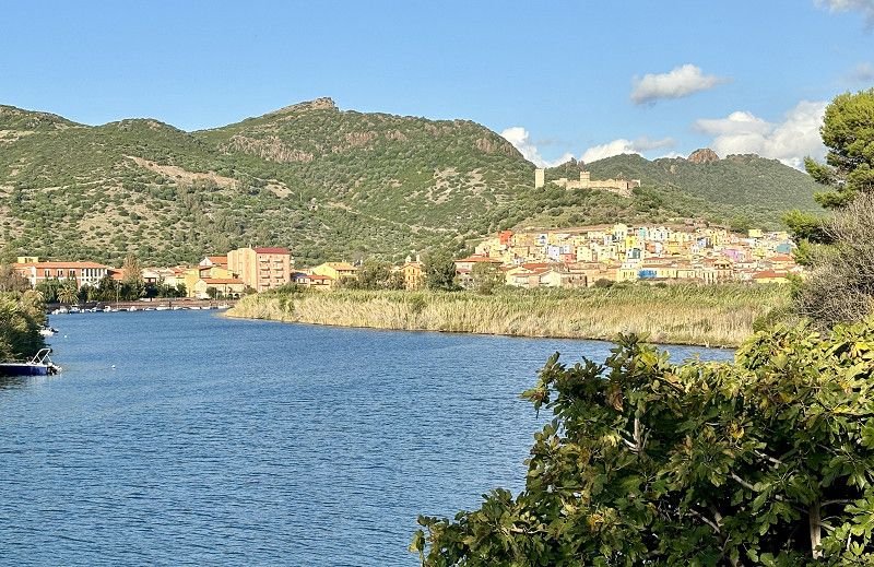
Bosa Marina
In Bosa Marina we drive to the parking lot opposite the beach and I cook first. After lunch we walk along the beach and find a nicer place to park. There are already camper vans here, but there is no main road past it.
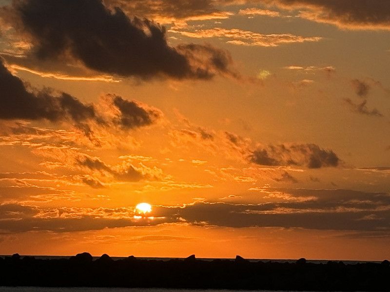
There is a cafe, bakery and a water point around the corner. There are other shopping opportunities in Bosa. After moving the car, we go to the defense tower at the harbor. I then walk to the old town and the old bridge Ponte Vecchio. (Easy walk, about 2.5km)
The old town of Bosa is located a little higher up, with lots of colorful houses and a castle above.
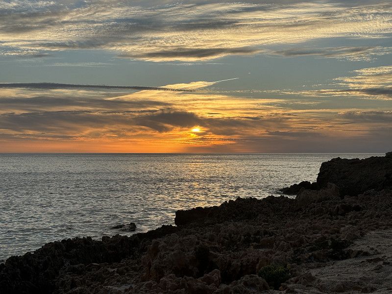
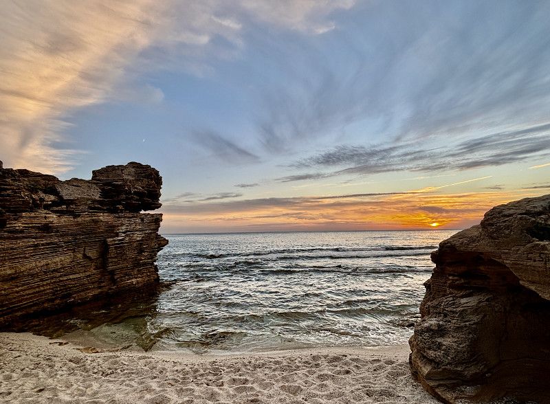
There was a sunset again this time.
Aristanis/Oristano, Sardinien, Italien
40° 17' 23.1" N 8° 28' 53.8" E
40.2897579 8.4816195
• Head toward Via Cagliari on Via Palermo. Go for 252 m.
• Turn right onto Via Cristoforo Colombo (SS129bis). Go for 192 m.
• Take the 1st exit from roundabout onto Via Cristoforo Colombo (SS129bis). Go for 490 m.
• Continue on Via Nazionale (SS129bis). Go for 1.2 km.
• Turn right onto Via Roma (SS129bis). Go for 177 m.
• Continue on Via dei Sarti (SS129bis). Go for 260 m.
• Continue on Via Barisone Seconda (SS129bis). Go for 327 m.
• Continue on SS129bis. Go for 5.1 km.
• Keep left onto Circonvallazione Nord (SS129bis). Go for 5.9 km.
• Continue on Circonvallazione Di Sindia. Go for 5.0 km.
• Turn right and take ramp. Go for 174 m.
• Make a U-Turn. Go for 8.2 km.
• Turn left onto Strada Provinciale Santu Lussurgiu (SP43). Go for 3.7 km.
• Pass 2 roundabouts and continue on Strada Provinciale Santu Lussurgiu (SP43). Go for 2.7 km.
• Turn right onto Piazza della Vittoria. Go for 31 m.
• Continue on Corso Umberto I. Go for 656 m.
• Continue on Ex SS131. Go for 6.3 km.
• Keep left. Go for 49 m.
• Turn left toward Oristano/Cagliari. Go for 41 m.
• Take ramp onto SS131 toward Oristano/Cagliari. Go for 11.8 km.
• Take ramp onto Strada Statale Diramazione Centrale Nuorese (SS131d.C.N.) toward Ospedale/Nuoro/Olbia. Go for 2.3 km.
• Take ramp onto Strada Romana (SP23/SP49) toward Ospedale/Abbasanta/Ghilarza/Fordongianus/Sassari/Fordonigianus. Go for 16.1 km.
• Turn right onto Strada Statale del Tirso e del Mandrolisai (SS388). Go for 492 m.
• Turn left onto Via Umberto I. Go for 25 m.
• Turn slightly left onto Via Umberto I. Go for 10 m.
• Arrive at Via Umberto I. Your destination is on the right.
☍
71,5 km
(1 hrs. 6 min.)
Gammeltag
06.10.24 22° - 🌤️ 3 hours of sunshine
Lazy day - in Bosa Marina.
07. Oct. 2024 -
07. Oct. 2024
Fordongianus
Parking space near the “Alte Therme”,
Here we can fill up our drinking water and water supplies for free. We drive past the thermal baths, but don't stay there.
Aristanis/Oristano, Sardinien, Italien
39° 59' 40.4" N 8° 48' 35.4" E
39.9945490 8.8098280
• Head toward Via Giuseppe Garibaldi on Via Umberto I. Go for 35 m.
• Turn left onto Via Ipsitani (SS388). Go for 15.8 km.
• Take the 3rd exit from roundabout onto Via San Simmaco (SS388). Go for 1.9 km.
• Take the 1st exit from roundabout onto SS388. Go for 6.1 km.
• Turn right onto SP93. Go for 2.3 km.
• Turn right onto SP54. Go for 1.0 km.
• Keep left toward Cabras/Torregrande/San Giovanni di Sinis. Go for 206 m.
• Keep left toward Cabras/Torregrande/S. Giovanni S. Go for 289 m.
• Continue on Via Torre Grande. Go for 3.2 km.
• Take the 4th exit from roundabout onto Strada Provinciale Oristano Torre Grande (SP1). Go for 2.4 km.
• Take the 1st exit from Piazza della Torre roundabout. Go for 55 m.
• Continue on Via Cristoforo Colombo (SP1). Go for 604 m.
• Continue on Via Tharros (SP1). Go for 723 m.
• Take the 3rd exit from roundabout onto SP6. Go for 6.2 km.
• Turn right onto SP7. Go for 290 m.
• Turn right. Go for 1.5 km.
• Turn left toward SP59. Go for 832 m.
• Turn slightly right onto SP59. Go for 5.6 km.
• Turn left. Go for 103 m.
• Turn right. Go for 70 m.
• Arrive at your destination.
☍
49,2 km
( 58 min.)
07. Oct. 2024 -
07. Oct. 2024
Is Arutas
We end up at a free beach parking lot and are not alone here. The beach is said to be one of the most beautiful beaches.
For us it's a normal beach, nothing wild. Everything is fine for one night. There's nothing, the bar is closed, the toilet block on the beach is also closed.
Italien
39° 57' 4.8" N 8° 24' 5.4" E
39.9513409 8.4015005
• Head east. Go for 70 m.
• Turn right. Go for 656 m.
• Turn slightly right. Go for 991 m.
• Turn slightly right. Go for 2.4 km.
• Turn left. Go for 1.8 km.
• Turn left. Go for 342 m.
• Turn right toward SP6. Go for 2.4 km.
• Turn left onto SP6. Go for 7.0 km.
• Continue toward Via Tharros/SP1. Go for 68 m.
• Take the 1st exit from roundabout onto Via Tharros (SP1). Go for 739 m.
• Continue on Via Cristoforo Colombo (SP1). Go for 640 m.
• Take the 3rd exit from Piazza della Torre roundabout onto Via Stella Maris (SP1). Go for 2.3 km.
• Take the 2nd exit from roundabout onto Strada Provinciale Oristano Torre Grande (SP1). Go for 3.5 km.
• Take the 1st exit from roundabout onto SP54. Go for 1.4 km.
• Take the 3rd exit from roundabout onto Via Cagliari (SP54). Go for 239 m.
• Turn right onto SP93. Go for 2.3 km.
• Turn slightly left onto Via Vandalino Casu (SP55). Go for 589 m.
• Turn right onto SP57. Go for 1.8 km.
• Turn right toward SP70. Go for 167 m.
• Turn right onto SP70. Go for 315 m.
• Take left ramp onto Strada Statale Carlo Felice (SS131) toward Cagliari. Go for 50.5 km.
• Take ramp toward SS293/SS197. Go for 1.0 km.
• Take ramp onto SS293. Go for 5.0 km.
• Take the 1st exit from roundabout onto SS293. Go for 1.6 km.
• Pass 2 roundabouts and continue on SS293. Go for 17.0 km.
• Turn right toward SP89. Go for 61 m.
• Continue on SP89. Go for 6.2 km.
• Turn left toward SP88. Go for 113 m.
• Continue on SP88. Go for 7.5 km.
• Turn right onto SP2. Go for 1.0 km.
• Continue on Regione Paucinu (SP2). Go for 3.5 km.
• Continue on SP2. Go for 653 m.
• Continue on Località Santa Barbara (SP2). Go for 982 m.
• Continue on SP2. Go for 95 m.
• Continue on Strada Provinciale per Siliqua (SP2). Go for 1.7 km.
• Continue on Via Carbonia (SP2). Go for 328 m.
• Take the 2nd exit from roundabout onto Via Carbonia (SP2). Go for 17.3 km.
• Take ramp onto SS126. Go for 1.7 km.
• Take the 2nd exit from roundabout onto Via Nazionale (SS126). Go for 1.3 km.
• Take the 3rd exit from roundabout onto Via Nazionale (SS126). Go for 1.3 km.
• Pass 2 roundabouts and continue on Via Nazionale (SS126). Go for 2.8 km.
• Take the 3rd exit from roundabout onto SS126. Go for 1.4 km.
• Continue on SS126. Go for 564 m.
• Continue on Sa Carabia (SS126). Go for 504 m.
• Continue on SS126. Go for 675 m.
• Keep right onto SS126. Go for 1.2 km.
• Take the 2nd exit from roundabout onto SS126. Go for 1.8 km.
• Continue on Is Loddis (SS126). Go for 460 m.
• Continue on SS126. Go for 3.2 km.
• Continue on Località Ponti (SS126). Go for 468 m.
• Continue on SS126. Go for 272 m.
• Continue on Via Nazionale (SS126). Go for 426 m.
• Turn right onto Via Nazionale (SS126). Go for 581 m.
• Turn slightly right onto Via Roma (SS126dir). Go for 46 m.
• Turn right onto Via A. Mannai. Go for 63 m.
• Arrive at Via A. Mannai. Your destination is on the right.
☍
163,5 km
(2 hrs. 15 min.)
08. Oct. 2024 -
08. Oct. 2024
Besuch der Halbinsel - oder ??
20° 🌦️⛈️ - 1 hour of sunshine
This morning it is already very overcast and it starts to rain while we are having breakfast. Heike and Karlheinz were also standing here and we chat again. They are driving inland and we want to go down towards Cagliari.
With all the rain it is not so nice to drive, there is often a lot of water on the road, which the Italians don't seem to care about. We plan to drive to the peninsula to Sant Antiocio.
08. Oct. 2024 -
08. Oct. 2024
Santu Antiogu/Sant'Antioco
There is a parking space at the harbor, but it is on the street. It is too loud for us, so we try to find another parking lot on the island.
After a few kilometers the road becomes too small and hilly for us, who knows where we will end up.
So we decide to drive on. We head off the island and find a parking lot in P4n, 25km south.
Let's see.
Sud Sardegna, Sardinien, Italien
39° 3' 53.4" N 8° 27' 22.7" E
39.0648291 8.4562962
• Head toward Via Gorizia on Via A. Mannai. Go for 39 m.
• Turn left onto Via Gorizia. Go for 146 m.
• Turn right onto Via Perret. Go for 104 m.
• Turn slightly right onto Via Giuseppe Garibaldi. Go for 78 m.
• Turn right onto Lungomare Caduti di Nassirya. Go for 76 m.
• Take the 2nd exit from roundabout onto Lungomare Caduti di Nassirya. Go for 968 m.
• Turn right toward Lungomare Amerigo Vespucci. Go for 42 m.
• Continue on Lungomare Amerigo Vespucci. Go for 64 m.
• Turn left onto SS126. Go for 51 m.
• Keep left onto SS126. Go for 221 m.
• Continue on Località Ponti (SS126). Go for 468 m.
• Continue on SS126. Go for 3.2 km.
• Continue on Is Loddis (SS126). Go for 460 m.
• Continue on SS126. Go for 1.7 km.
• Take the 1st exit from roundabout onto SP77. Go for 657 m.
• Continue on Località S'Arenatzu (SP77). Go for 355 m.
• Continue on SP77. Go for 722 m.
• Continue on Podere Cipresso (SP77). Go for 36 m.
• Continue on SP77. Go for 174 m.
• Continue on Podere Frassino (SP77). Go for 42 m.
• Continue on SP77. Go for 653 m.
• Continue on Podere Noce (SP77). Go for 39 m.
• Continue on SP77. Go for 592 m.
• Continue on Podere Olmo (SP77). Go for 256 m.
• Continue toward SP77. Go for 37 m.
• Turn left and take ramp onto SS195. Go for 5.7 km.
• Turn right onto SP73. Go for 3.1 km.
• Continue on Via Sa Sarina (SP73). Go for 511 m.
• Turn slightly right. Go for 1.1 km.
• Turn right. Go for 929 m.
• Turn right. Go for 1.1 km.
• Turn left. Go for 29 m.
• Arrive at your destination.
☍
23,7 km
( 31 min.)
08. Oct. 2024 -
08. Oct. 2024
area attrezzata camper - Jamaican Beach
Simple parking for 10€/night with fresh water supply and there is a bar. You also pay here. The site is in a nature reserve, you drive past many salt pans and there are also flamingos here.
Because the location is so remote, the night was very quiet. Luckily, everything here is paved and the heavy rain can drain away easily.
Sardinien, Italien
39° 1' 29" N 8° 34' 42.1" E
39.0247312 8.5783583
• Head southeast. Go for 29 m.
• Turn right. Go for 1.1 km.
• Turn left. Go for 929 m.
• Turn left toward Via Sa Sarina/SP73. Go for 1.1 km.
• Turn slightly left onto Via Sa Sarina (SP73). Go for 511 m.
• Continue on SP73. Go for 1.5 km.
• Turn right onto Via Porto Pino. Go for 1.9 km.
• Turn right onto SS195. Go for 3.4 km.
• Continue on Via Principe di Piemonte (SS293). Go for 6.7 km.
• Take the 2nd exit from roundabout onto SS293. Go for 25.7 km.
• Take the 1st exit from roundabout onto SP2. Go for 2.7 km.
• Continue on Strada Provinciale Pedemontana (SP2). Go for 3.2 km.
• Continue on SP2. Go for 8.1 km.
• Take the 2nd exit from roundabout onto SP2. Go for 2.4 km.
• Continue on SP2. Go for 3.5 km.
• Take ramp onto SS130. Go for 3.3 km.
• Continue on SS130. Go for 3.0 km.
• Continue on SS195racc. Go for 2.6 km.
• Continue on Via Ponte Nuovo. Go for 1.2 km.
• Take ramp onto Via Ponte Nuovo toward Cagliari Centro. Go for 931 m.
• Continue on Via San Paolo. Go for 156 m.
• Continue on Viale La Plaia. Go for 13 m.
• Continue on Via Riva di Ponente. Go for 531 m.
• Continue on Via Molo Sant'Agostino. Go for 135 m.
• Continue on Piazza Giacomo Matteotti. Go for 59 m.
• Continue on Lungomare New York 11 Settembre 2001. Go for 454 m.
• Continue on Calata Darsena. Go for 249 m.
• Take the 3rd exit from roundabout onto Piazza Attilio Deffenu. Go for 151 m.
• Keep right onto Piazza Attilio Deffenu. Go for 44 m.
• Turn right onto Piazza Giovanni Amendola. Go for 29 m.
• Continue on Viale Armando Diaz. Go for 670 m.
• Turn left onto Viale Cimitero. Go for 173 m.
• Take the 1st exit from roundabout onto Viale Bonaria. Go for 236 m.
• Continue on Piazza Bonaria. Go for 141 m.
• Continue on Via Ravenna. Go for 61 m.
• Continue on Via Ravenna. Go for 187 m.
• Turn left onto Via Stanislao Caboni. Go for 155 m.
• Arrive at Via Stanislao Caboni.
☍
77,0 km
(1 hrs. 23 min.)
09. Oct. 2024 -
09. Oct. 2024
flexibel auch während der Planung
24° 🌤️ - 5 hours of sunshine
This morning the weather is better. After breakfast we set off again towards Cagliari, we actually chose an ACSI site, but it is 143km further along the east coast. That is the plan for now. The roads are absolutely not great, lots of potholes, now and then there are freshly tarred stretches, what a relief to drive on. Shortly before Cagliari we decide not to go to the ACSI site. We would rather stay here and wait for the ferry.
09. Oct. 2024 -
09. Oct. 2024
Camper Cagliari Park
That was our idea for today, but when we arrived at 11.30am the place was completely full, so we had to look for a new destination.
Via Stanislao Caboni 13, 08040, Cagliari, Italien
39° 12' 37" N 9° 7' 40" E
39.2102778 9.1277778
• Head toward Via Ravenna on Via Stanislao Caboni. Go for 155 m.
• Continue on Via Perugia. Go for 104 m.
• Continue on Via Brescia. Go for 80 m.
• Turn right onto Via Brescia. Go for 85 m.
• Turn slightly right onto Via Ancona. Go for 155 m.
• Continue on Via Sebastiano Caboto. Go for 73 m.
• Turn right onto Viale Cristoforo Colombo. Go for 928 m.
• Take the 1st exit from roundabout onto Piazza Attilio Deffenu. Go for 127 m.
• Keep left onto Piazza Attilio Deffenu. Go for 153 m.
• Continue on Lungomare New York 11 Settembre 2001. Go for 454 m.
• Continue on Piazza Giacomo Matteotti. Go for 59 m.
• Continue on Via Molo Sant'Agostino. Go for 182 m.
• Continue on Viale La Plaia. Go for 490 m.
• Continue on Via San Paolo. Go for 156 m.
• Keep left toward Via Ponte Nuovo. Go for 39 m.
• Continue on Via Ponte Nuovo. Go for 146 m.
• Keep left onto Via Ponte Nuovo toward Pula. Go for 371 m.
• Continue on Strada Statale Sulcitana (SS195). Go for 11.0 km.
• Take the 2nd exit from roundabout onto Strada Statale Sulcitana (SS195). Go for 1.8 km.
• Take the 2nd exit from roundabout onto Viale Sant'Efisio Martire. Go for 129 m.
• Turn left. Go for 19 m.
• Turn right. Go for 58 m.
• Arrive at your destination on the left.
☍
16,7 km
( 17 min.)
08. Oct. 2024 -
09. Oct. 2024
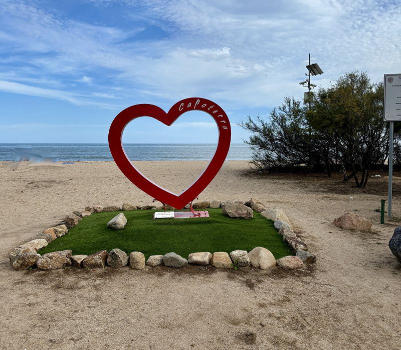
Cabuderra/Capoterra
So we leave the city again. We look for a new place. We find a parking space 16km from Cagliari that is supposed to have water and electricity. Apparently even showers and toilets. We'll see.
Update:
The site is a sandy parking lot with designated parking spaces for 15 camper vans. From October 1st, you can spend the night here for €12.00 per night including electricity and water and electricity. Showers are cold and outside and the toilets are locked. We are only allowed to stay here for 2 days, however, and then we have to go back down. So we have to find somewhere to stay for one more night (the ferry doesn't leave until Saturday afternoon). Unfortunately, it's not that easy here, but we'll manage.
After a bit of research I saw that the bus to Cagliari leaves from here, so we will look at the city tomorrow. There is also a small shopping center with a hardware store, clothing store, perfumery and grocery store. So everything is there.
• Turn right toward Viale Sant'Efisio Martire. Go for 20 m.
• Turn right onto Viale Sant'Efisio Martire. Go for 204 m.
• Take the 1st exit from roundabout onto Strada Statale Sulcitana (SS195). Go for 1.8 km.
• Take the 1st exit from roundabout onto Strada Statale Sulcitana (SS195). Go for 11.0 km.
• Continue on Via Ponte Nuovo. Go for 534 m.
• Continue on Via San Paolo. Go for 156 m.
• Continue on Viale La Plaia. Go for 13 m.
• Continue on Via Riva di Ponente. Go for 444 m.
• Turn left onto Via Sassari toward SS130/SS131/Pula/SS195. Go for 273 m.
• Turn right onto Via Roma. Go for 159 m.
• Turn left onto Largo Carlo Felice. Go for 327 m.
• Enter the roundabout. Go for 49 m.
• Arrive at your destination on the left.
☍
15,0 km
( 14 min.)
kleine Stadtbesichtigung - Ticket für die Fähre ausdrucken
10.10.24 - 27° - ⛅️ 3 hours of sunshine
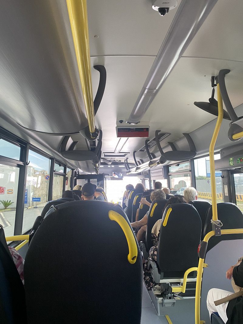
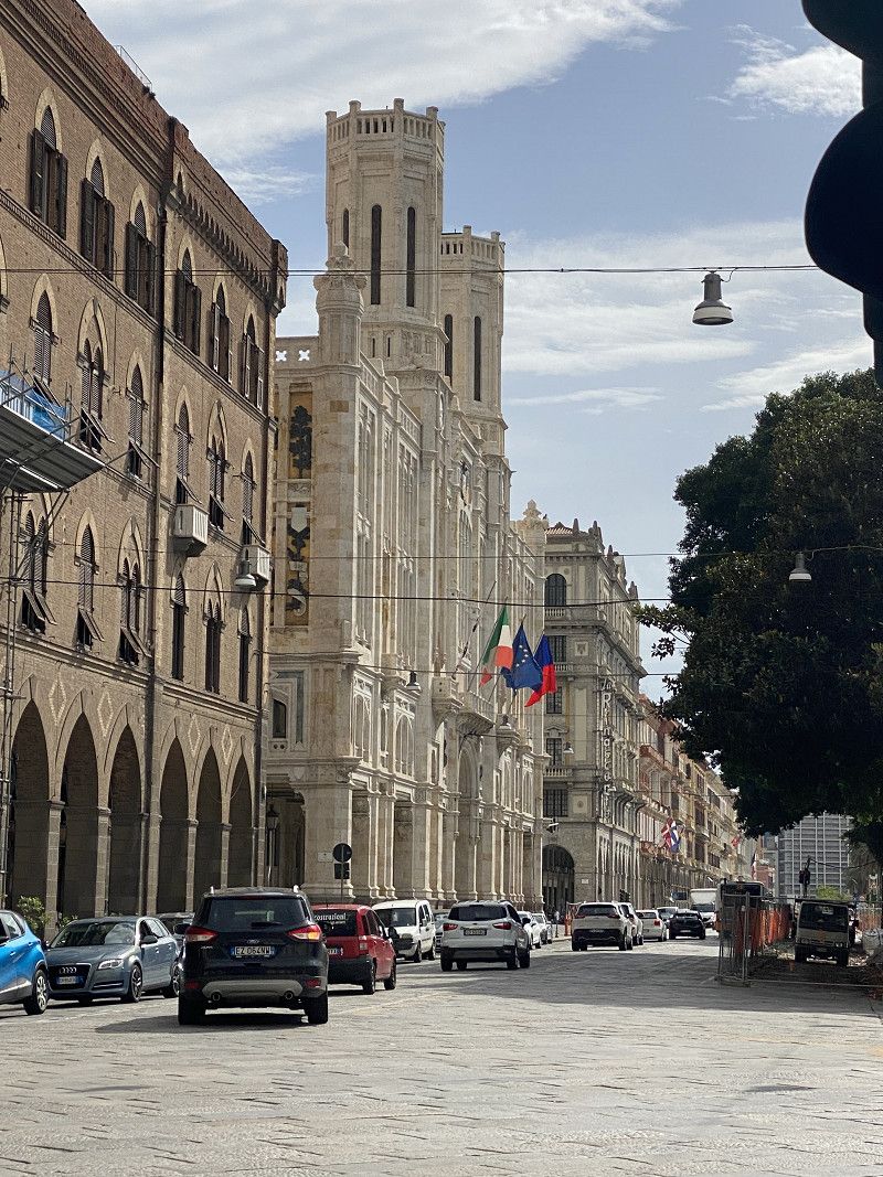
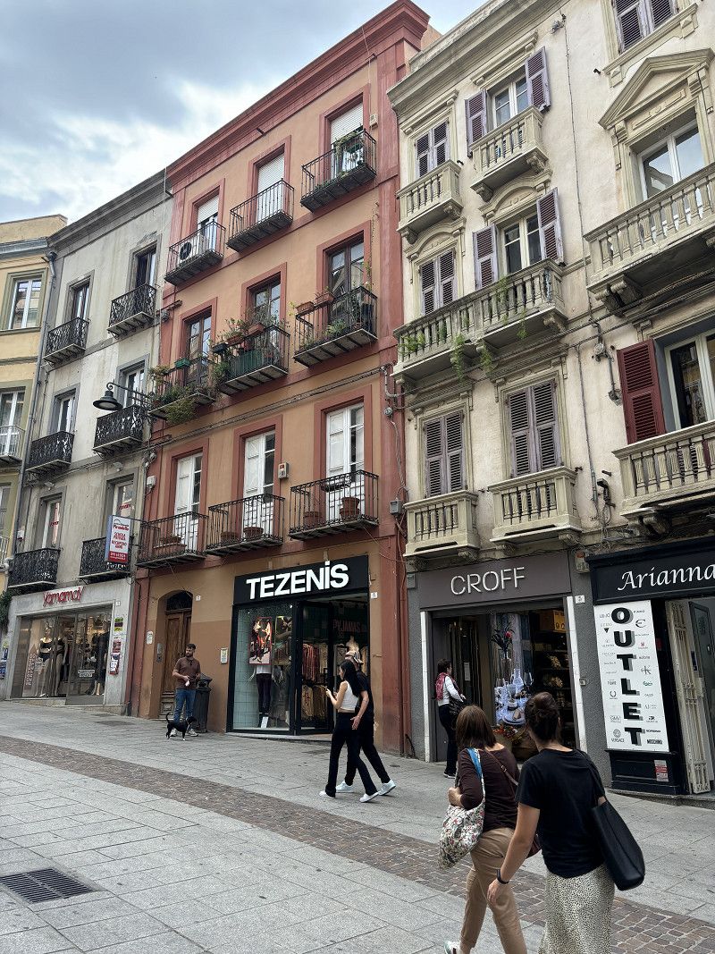
We take the bus (L130/L129) to the bus station in Cagliari.
First we go to the port and try to get our e-ticket printed out for the ferry on Saturday. But we are sent into town to the Grimaldi Lines ticket counter. The e-ticket is printed out here. We don't understand why this has to happen, but that's how they want it. We can't get on the ferry with just the e-ticket. Unbelievable, but it's true.
Afterwards we stroll through the city, up and down hills. Since it is very humid today, we are exhausted after 2 hours and take the bus back.
11. Oct. 2024 -
11. Oct. 2024
Bestes Wetter - allein am Strand
24° 🌤️ 9 hours of sunshine
Today we have to leave the parking space. I pay at the machine, in cash or by card. I think we can stay at the site until the 48 hours are up. This turns out to be a mistake when we leave. After a short time, after paying, the count starts again. So we have to pay €12 for 34 minutes.
If we had paid right before leaving and we had been there within 48 hours, we wouldn't have had to pay anything. That was my mistake. OK 🥴
Since we don't get to the ferry until tomorrow, we'll stay here on the beach.
Tonight we are standing a little behind the shopping center in the hotel parking lot. It is huge and equipped with lanterns and cameras.
Here in the evening we will meet a camper couple from Roststock.
Unser Fazit für Sardinien
Once here with the camper is enough for us.
It didn't blow us away.
The infrastructure is not the best for campers. And for the money they charge, there is hardly any service behind it. We are used to it being completely different.
In the low season many things are closed (seaside bars, campsites, etc.)
The road quality is also only adequate. Lots of holes in the roads.
It is positive that free camping will be tolerated from October 1st, but I would not like to know how some campers dispose of their waste.
You can see it just by looking at the garbage that many locals throw away, it's really horrible!!!
For us, there will be no repeat! The ferry also costs a lot of money.
12. Oct. 2024 -
12. Oct. 2024
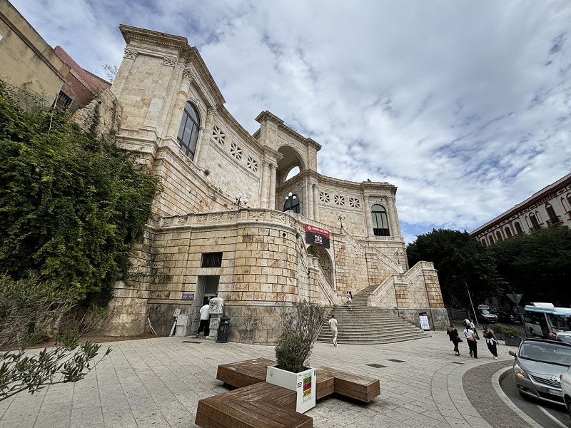
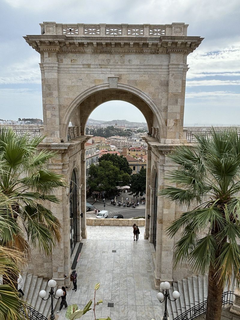
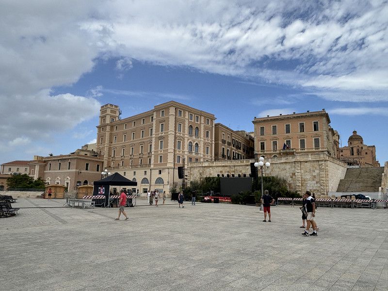
Cagliari- warten auf die Fähre
24° - 8 hours ☀️
We wait for the ferry to arrive. Here, too, everything is checked for stowaways and whether anyone is hanging under the car 😂... everything is searched with a mirror and a policewoman also looked in the small bathroom.
Better one check too many than too few.
Grimaldi Lines
Departure port: Cagliari
Casteddu/Cagliari, Sardinien, Italien
39.2171994 9.1133110
Arrival port: Palermo
Palermo, Sizilien, Italien
38.111226813.3524434
• Head northwest on Piazza Indipendenza. Go for 177 m.
• Turn left onto Corso Calatafimi. Go for 122 m.
• Continue on Corso Calatafimi. Go for 1.6 km.
• Turn right onto Via Giuseppe Arcoleo. Go for 151 m.
• Turn left onto Via Giuseppe Pagano. Go for 283 m.
• Turn right onto Viale della Regione Siciliana Nord Ovest. Go for 327 m.
• Keep left onto Viale della Regione Siciliana Nord Ovest. Go for 4.9 km.
• Continue on A29 (Autostrada Palermo-Mazara del Vallo). Go for 5.7 km.
• Take the exit toward Tommaso Natale. Go for 452 m.
• Take ramp onto Via Rosario Nicoletti. Go for 731 m.
• Make a U-Turn onto Via Rosario Nicoletti. Go for 406 m.
• Keep right onto Via Rosario Nicoletti toward Sferracavallo. Go for 851 m.
• Continue on Via Sferracavallo. Go for 152 m.
• Turn right onto Via Schillaci. Go for 289 m.
• Turn left onto Via Schillaci. Go for 480 m.
• Turn slightly left onto Via Schillaci. Go for 324 m.
• Turn right onto Via Schillaci. Go for 312 m.
• Turn right onto Via Barcarello. Go for 942 m.
• Arrive at Via Barcarello.
☍
38,6 km
( 32 min.)
13. Oct. 2024 -
13. Oct. 2024
Ankunft mit der Fähre in Palermo
25° - 🌤️ 10 hours of sunshine
We are woken up at 3:30 a.m., but we don't arrive until 5:00 a.m. and then it takes another 30 minutes until we can go down to the car. We then drive to a shopping center parking lot and sleep there for another 2 hours. After a coffee and chocolate croissants, the day looks good again. I have chosen a parking spot up on the coast
13. Oct. 2024 -
15. Oct. 2024
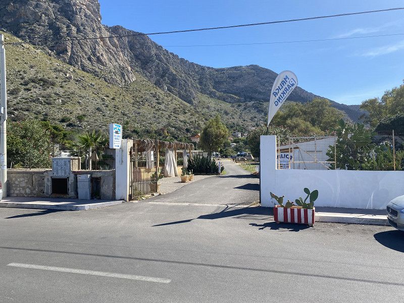
Camper Aera Malica
MALICA-Camper Area, supposed to be quite new. 20€/night with electricity, showers cost 1€ extra. Washing machine available for 4€/60° wash. Everything is perfect. The manager Massimo is very accommodating, translates everything into our language with his cell phone and explains everything in great detail. He assigns us a spot after asking us what we like.
Today it's all about relaxing. There's an Italian camper meeting going on here at the SP, and they've been partying all night long, according to some other campers from Germany. The Italian campers are preparing fresh donuts and handing them out to all the campers.
The mood is good and we have a chat. In the late afternoon all the Italians leave and now there are only 9 motorhomes left at the SP. It becomes quiet. Here too, the majority of the campers are Swiss, Austrians and Germans.
Palermo, Sicily, Italy
38° 13' 20.8" N 13° 17' 34.7" E
38.2224403 13.2929754
• Head southwest on Via Barcarello. Go for 1.6 km.
• Turn left onto Via Virgilio. Go for 244 m.
• Turn right onto Via Dammuso. Go for 242 m.
• Continue on Via Amorello. Go for 10 m.
• Continue on Piazza Santi Cosma e Damiano. Go for 138 m.
• Continue on Via Torretta. Go for 214 m.
• Continue on Via Tito Maccio Plauto (SS113). Go for 3.2 km.
• Turn left toward Autostrada Palermo-Mazara del Vallo/A29. Go for 23 m.
• Take ramp onto A29 (Autostrada Palermo-Mazara del Vallo). Go for 49.1 km.
• Take the exit toward Trapani/E933/Aeroporto Birgi onto A29dir. Go for 29.0 km.
• Take the exit toward E933/Trapani onto A29dir. Go for 8.1 km.
• Turn right toward Erice/Trapani/SS113. Go for 113 m.
• Continue on Strada Mazara Erice. Go for 463 m.
• Take the 2nd exit from roundabout onto Via Leonardo Ximenes. Go for 1.8 km.
• Turn right onto SS187. Go for 4.5 km.
• Turn left onto Via Enrico Toti. Go for 35 m.
• Continue on Via Cristoforo la Porta. Go for 147 m.
• Turn right onto Via Enrico Toti. Go for 491 m.
• Turn left onto Via Enrico Toti (SP20). Go for 197 m.
• Continue on SP20. Go for 2.2 km.
• Continue on Via Cristoforo Colombo (SP20). Go for 1.0 km.
• Turn right onto Via dei Marmi (SP18). Go for 2.1 km.
• Continue on SP18. Go for 3.4 km.
• Continue on Via Asse dei Marmi. Go for 1.9 km.
• Continue on Via Lombardia. Go for 84 m.
• Turn left onto Via Scucina. Go for 479 m.
• Turn left toward Via Purgatorio. Go for 180 m.
• Turn right onto Via Purgatorio. Go for 11 m.
• Turn left toward Via Piano Alastre. Go for 252 m.
• Turn left onto Via Piano Alastre. Go for 1.2 km.
• Turn slightly left onto Contrada Corvo Pignatello. Go for 447 m.
• Turn slightly right onto Contrada Corvo Pignatello. Go for 831 m.
• Turn right onto Contrada Corvo Pignatello. Go for 1.2 km.
• Turn left. Go for 194 m.
• Turn right toward Contrada Tonnara Cofano. Go for 1.6 km.
• Turn right onto Contrada Tonnara Cofano. Go for 699 m.
• Continue on Contrada Tuono. Go for 3.7 km.
• Turn left toward SP16. Go for 1.9 km.
• Turn left onto SP16. Go for 585 m.
• Turn right onto Via Rocca Perciata. Go for 695 m.
• Turn slightly left onto Via Timpone. Go for 1.9 km.
• Continue on Via Savoia (SP16). Go for 1.4 km.
• Turn left toward Via Savoia/SP16. Go for 1.4 km.
• Turn right onto Via Savoia (SP16). Go for 371 m.
• Turn left. Go for 9 m.
• Turn left. Go for 812 m.
• Turn sharp right. Go for 165 m.
• Turn left toward Via La Piana. Go for 123 m.
• Turn left onto Via La Piana. Go for 11 m.
• Turn right onto Via Monsignore Rinaldi. Go for 348 m.
• Turn left toward Via Generale Giuseppe Arimondi. Go for 98 m.
• Turn right onto Via Generale Giuseppe Arimondi. Go for 170 m.
• Turn left onto Via Cristoforo Colombo. Go for 21 m.
• Turn right onto Via Campidoglio. Go for 194 m.
• Turn left onto Via Mondello. Go for 68 m.
• Turn right onto Via Peralta. Go for 96 m.
• Turn left onto Via Regina Margherita (SP63). Go for 22 m.
• Turn right onto Via Savoia. Go for 319 m.
• Turn left onto Via Fratelli Maculati. Go for 78 m.
• Turn right onto Via Faro. Go for 135 m.
• Arrive at Via Faro. Your destination is on the left.
☍
132,0 km
(2 hrs. 6 min.)
Palermo -Stadtbesuch mit dem Bus
14.10.2024 - 27° ☀️ 10 hours of sunshine
Today we're going to Palermo, the old town. We want to take the bus into the city. It's quite cheap at 1.40 per person and a journey time of 1.5 hours, no matter which bus you take. You can buy bus tickets in the tobacco shop in the village. So we walk 20 minutes to the shop and then look for the bus stop. Somehow we're in the right place and a bus 628 comes along and we wave at it. It stops and we ask if it's going into the city. It works. We also find the connecting bus 101 and so we're in the city by the theater.
It is a big city and accordingly there are a lot of visitors. Piazza, Teatro, cathedral and many old buildings with narrow streets lead us to the street food street. We don't eat anything there, but not far from there we find a small pizzeria and eat a very good pizza there (20.50€ including drinks). Really cheap for Italy. 70€ for eating out is somehow normal here. The city of Palermo is a historic old city, but unfortunately also very dirty, a lot of things are broken and somehow we can't shake the feeling that Italians don't value their property. Everything looks very run down.
On the way back we go to a phone shop to buy a prepaid card for our router. Unfortunately they only accept our data with a passport, which we don't have. So it's not possible to buy a phone card. So when we get home I apply for a passport so I can buy a phone card. (I don't understand what that has to do with a passport, but it seems to be true. That was certainly the reason why the other card didn't work. The explanation was that our ID card didn't have an EU symbol on it and was therefore not valid. So much for Europe.)
So now we go to the bus 101, which we take to the stadium and from there bus 616 supposedly goes to the camper area Malica. The first bus comes and we go to the stadium, walk to the stop for bus 616. We wait here for over an hour and no bus comes. Our tickets are no longer valid either and so we walk back (very annoyed) a bit (10 minutes) and buy more tickets there and now go to another stop. Bus 628 is supposed to leave from there, it only goes to Sferracavallo and from there we walk another 15 minutes to the camper area. But we are finally back with boiling feet and dry mouths.
Einfach mal Nix tun
15.10.2024 - 26° ☀️ 10 hours of sun, partly hazy,
Today we only have a few small things to do: buy bread and a little fruit, salad and tomatoes. We'll buy everything else tomorrow when we move on with our motorhome.
We find the groceries we want in the small town and then want to drink a coffee at the harbor/promenade, which is somehow all one and the same. We are sent away because there are only restaurants here and they don't serve coffee. We could get coffee in a bar, but there isn't one here, or rather it's not open. So we go back to the motorhome without drinking coffee and are disappointed.
In the afternoon I go for a walk in the nature reserve “de Capo Gallo”.
We are now increasingly understanding why so many campers prefer to spend the winter in Spain. The infrastructure is simply better there. Much more open, and they also want tourists. Here we have the feeling that it is a necessary evil. Besides, if the tourists are already here, then they should pay.
16. Oct. 2024 -
16. Oct. 2024
San Vito Lo Capo
29° ⛅️ 3 hours of sunshine
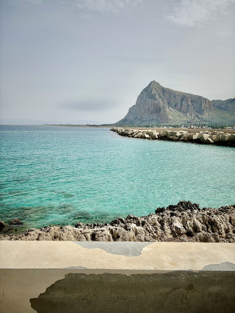
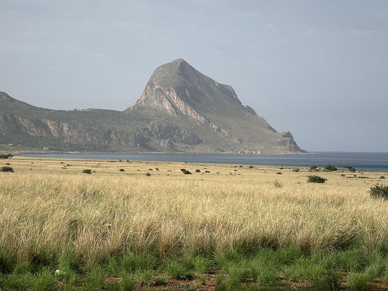
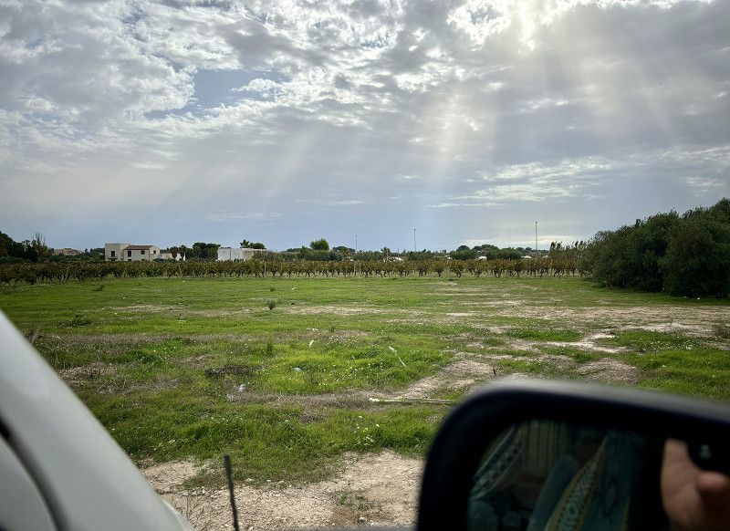
Our journey here first involved filling up with petrol and shopping, then a bit on the A29 (which is toll-free, by the way) to Castellammare del Golfo, where we then continued on the country road to San Vito Lo Capo. The landscape was a bit mountainous and there were lots of olive trees and vines. On the way we kept seeing illegal rubbish dumps right next to the road, unbelievable.
In San Vito Lo Capo the car park (10 parking spaces) is directly behind the port. From October 15th you can park here without paying. The local police have already driven past, had a look and then moved on. We are not alone here either.
The weather has become very cloudy this afternoon, and it is supposed to rain from tomorrow afternoon. Let's see what actually happens.
Trapani, Sicily, Italy
38° 10' 44.5" N 12° 43' 57.3" E
38.1790199 12.7325754
• Head toward Via Fratelli Maculati on Via Faro. Go for 135 m.
• Continue on Via Duca degli Abruzzi. Go for 689 m.
• Turn right onto Via Foritano Biagio. Go for 75 m.
• Turn left onto Via Piersanti Mattarella. Go for 535 m.
• Turn left onto Via Piano di Sopra. Go for 157 m.
• Take the 1st exit from roundabout onto Via Savoia (SP16). Go for 1.1 km.
• Continue on SP16. Go for 9 m.
• Continue on Via Savoia (SP16). Go for 1.5 km.
• Continue on Via Timpone. Go for 1.9 km.
• Turn slightly right onto Via Rocca Perciata. Go for 695 m.
• Turn left onto SP16. Go for 1.5 km.
• Turn slightly left onto Via Verdesca. Go for 839 m.
• Turn right onto Via Verdesca. Go for 363 m.
• Turn right onto Via Amba Alagi. Go for 263 m.
• Turn left onto Via Amba Alagi. Go for 1.2 km.
• Turn right onto Via Amba Alagi. Go for 339 m.
• Turn left onto Viale Cristoforo Colombo (SP16). Go for 623 m.
• Continue on SP16. Go for 966 m.
• Turn right onto SP16. Go for 3.0 km.
• Keep right onto SP16. Go for 578 m.
• Continue on Contrada Purgatorio (SP16). Go for 144 m.
• Continue on SP16. Go for 161 m.
• Continue on Via Purgatorio (SP16). Go for 426 m.
• Turn left onto Via La Spezia. Go for 76 m.
• Turn right onto Via La Spezia. Go for 427 m.
• Turn slightly right toward Contrada Purgatorio/SP16. Go for 79 m.
• Turn left onto Contrada Purgatorio (SP16). Go for 145 m.
• Continue on Via Purgatorio (SP16). Go for 622 m.
• Continue on SP16. Go for 4 m.
• Continue on Via Purgatorio (SP16). Go for 926 m.
• Continue toward SP16. Go for 44 m.
• Turn slightly left toward Via Piano Alastre. Go for 31 m.
• Turn left onto SP16. Go for 334 m.
• Continue on Via Scucina. Go for 432 m.
• Turn right onto Via Lombardia. Go for 578 m.
• Continue on Via Asse dei Marmi. Go for 1.4 km.
• Continue on SP18. Go for 3.4 km.
• Continue on Via dei Marmi (SP18). Go for 2.1 km.
• Turn right onto Via Cristoforo Colombo (SP20). Go for 949 m.
• Continue on Via Asmara (SP20). Go for 881 m.
• Continue on SP20. Go for 250 m.
• Continue on Via Crocifissello (SP20). Go for 505 m.
• Continue on Via Enea (SP20). Go for 1.0 km.
• Pass 3 roundabouts and continue on Via Enea (SP20). Go for 4.1 km.
• Continue on Lungomare Dante Alighieri. Go for 78 m.
• Take the 1st exit from roundabout onto Lungomare Dante Alighieri. Go for 622 m.
• Take the 1st exit from roundabout onto Lungomare Dante Alighieri. Go for 2.8 km.
• Turn left onto Via Abate Palmerio. Go for 266 m.
• Arrive at Via Abate Palmerio. Your destination is on the left.
☍
39,2 km
(1 hrs. 5 min.)
17. Oct. 2024 -
17. Oct. 2024
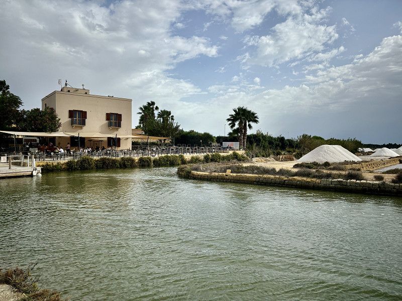
Trapani
26° - 2 hours of sunshine
Actually our destination, but it is very windy and there is a market in the parking lot where we wanted to park.
Trapani, Sizilien, Italien
38° 1' 2.6" N 12° 30' 57.7" E
38.0173961 12.5160225
• Head toward Via Bastioni on Via Abate Palmerio. Go for 126 m.
• Turn right onto Via Giuseppe Osorio. Go for 60 m.
• Turn left onto Via 30 Gennaio. Go for 185 m.
• Continue on Via Porta Galli. Go for 77 m.
• Turn left onto Via Ammiraglio Staiti. Go for 173 m.
• Continue on Via Avvocato Giuseppe Palmeri. Go for 439 m.
• Take the 1st exit from roundabout onto Via Isola Zavorra. Go for 732 m.
• Continue on Via 1 Dorsale Z.I.R. Go for 965 m.
• Turn right onto Via Libica (SP21). Go for 758 m.
• Take the 1st exit from roundabout onto Via Libica (SP21). Go for 12.9 km.
• Take the 2nd exit from roundabout onto SP21 toward Marsala-Birgi. Go for 11.7 km.
• Take the 3rd exit from roundabout onto Via Grotta del Toro. Go for 742 m.
• Continue on Via Trapani (SS115). Go for 79 m.
• Turn left onto Via Marettimo. Go for 209 m.
• Turn left onto Via degli Atleti. Go for 48 m.
• Turn right onto Via degli Atleti. Go for 203 m.
• Continue on Corso Giovanni Amendola. Go for 650 m.
• Turn right onto Via 11 Maggio. Go for 255 m.
• Turn left onto Via Giuseppe Garibaldi. Go for 144 m.
• Turn left onto Via Santa Caterina. Go for 49 m.
• Arrive at Via Santa Caterina. Your destination is on the right.
☍
30,4 km
( 41 min.)
17. Oct. 2024 -
17. Oct. 2024
Marsala
Free parking at the Bar Orio at the salt mines. Very idyllic. Absolutely quiet.
Trapani, Sizilien, Italien
37° 47' 52.5" N 12° 26' 3.2" E
37.7979221 12.4342091
• Head toward Vicolo Bonanno on Via Santa Caterina. Go for 109 m.
• Turn right onto Via Scalilla. Go for 60 m.
• Continue on Piazza del Popolo. Go for 28 m.
• Turn right onto Piazza del Popolo. Go for 66 m.
• Continue on Via Vespri. Go for 85 m.
• Turn left onto Piazza Goffredo Mameli. Go for 25 m.
• Turn right onto Via Sibilla. Go for 391 m.
• Turn right onto Viale Isonzo. Go for 671 m.
• Turn right onto Via del Fante. Go for 785 m.
• Take the 2nd exit from roundabout onto Via Sappusi (SP21). Go for 624 m.
• Pass 2 roundabouts and continue on SP21. Go for 14.7 km.
• Turn left toward Palermo/A29/Mazara del Vallo/Trapani/Alcamo-Trapani/Aeroporto Falcone Borsellino. Go for 56 m.
• Continue on A29dir/A. Go for 12.4 km.
• Continue on A29dir. Go for 29.1 km.
• Take the left exit toward Aeroporto Falcone Borsellino/Palermo onto A29 (Autostrada Palermo-Mazara del Vallo). Go for 59.7 km.
• Take the exit toward Via Belgio/Viale Michelangelo. Go for 225 m.
• Take the 3rd exit from Rotonda Rosario di Salvo roundabout. Go for 161 m.
• Continue on Via Belgio. Go for 214 m.
• Turn right onto Via dei Nebrodi. Go for 279 m.
• Turn left onto Viale Alcide De Gasperi. Go for 128 m.
• Continue on Viale Alcide De Gasperi. Go for 123 m.
• Continue on Viale Alcide De Gasperi. Go for 503 m.
• Take the 3rd exit from Piazza Papa Giovanni Paolo II roundabout onto Via Antonino Cassarà. Go for 299 m.
• Turn right onto Viale del Fante. Go for 664 m.
• Continue on Piazza Leoni. Go for 301 m.
• Turn left onto Via Imperatore Federico. Go for 642 m.
• Turn left. Go for 105 m.
• Arrive at your destination on the left.
☍
122,4 km
(1 hrs. 29 min.)
18. Oct. 2024 -
18. Oct. 2024
Freesbee Parking
⛅️ 22° - 4 hours of sunshine A city parking lot for motorhomes, among others. Up to 8m you pay 20€/night
V+E included. There are 4 showers (unisex) costing 1€/4min. Water is hot. There is also a toilet each.
A safe place to explore the old town of Palermo. Bus tickets are available at the "reception", she spoke good English and also printed out the ticket for the ferry that we booked online.
The night was quiet, despite the cramped conditions and the many mobile homes. Then in the middle of the night we had a violent thunderstorm.
PS: I didn't take any pictures of the parking lot, it was functional, sure, but not pretty.
Via Imperatore Federico 116, 90143, Palermo, Italien
38° 8' 52" N 13° 21' 8" E
38.1477778 13.3522222
• Head toward Via Imperatore Federico. Go for 105 m.
• Turn left onto Via Imperatore Federico. Go for 38 m.
• Take the 1st exit from Rotonda Domenico Intravaia roundabout onto Via Anwar Sadat. Go for 545 m.
• Continue on Piazza Generale Antonino Cascino. Go for 114 m.
• Continue on Via Montepellegrino. Go for 708 m.
• Turn right onto Via dei Cantieri. Go for 96 m.
• Turn left onto Piazza Antonino Caponnetto toward Catania/A19/Messina/A20. Go for 221 m.
• Continue on Via Piano dell'Ucciardone. Go for 371 m.
• Continue on Piazza Ucciardone. Go for 58 m.
• Continue on Via Francesco Crispi. Go for 699 m.
• Keep right onto Via Francesco Crispi. Go for 180 m.
• Continue on Piazza Tredici Vittime. Go for 48 m.
• Turn right onto Piazza Tredici Vittime. Go for 40 m.
• Continue on Via Camillo Benso di Cavour. Go for 281 m.
• Turn left onto Via Roma. Go for 1.3 km.
• Continue on Piazza Giulio Cesare. Go for 32 m.
• Take the 1st exit from Piazza Giulio Cesare roundabout onto Piazza Giulio Cesare. Go for 142 m.
• Continue on Corso Tuköry. Go for 526 m.
• Turn right onto Piazza San Francesco Saverio. Go for 33 m.
• Turn left onto Via Carlo Forlanini. Go for 167 m.
• Continue on Via Sulle Mura di Porta Montalto. Go for 121 m.
• Turn left onto Via dei Benedettini. Go for 12 m.
• Turn right onto Corso Tuköry. Go for 29 m.
• Turn right onto Corso Tuköry. Go for 67 m.
• Turn right onto Corso Re Ruggero. Go for 295 m.
• Continue on Piazza Indipendenza. Go for 67 m.
• Arrive at Piazza Indipendenza. Your destination is on the right.
☍
6,3 km
( 17 min.)
19. Oct. 2024 -
19. Oct. 2024
Was für ein Tag
⛈️19° - heavy rain
Just this morning we drove to the port and asked where we had to go tonight. A very nice Sicilian explained to us in English where we had to go, but that we shouldn't be there before 10 p.m. There was a safe parking lot very close by and he marked us on his cell phone where exactly both places were.
We then drive to the shopping center, where we were when we arrived. We stay here for 5 hours, free of charge and with the amenities of a shopping center (☕️🥐💧🥖)
At 5 p.m. we decide to drive to the parking lot that the nice Sicilian had recommended to us that morning. It's raining, no, it's pouring incessantly. The parking lot is much too narrow and small for us. Luckily we get out again without any damage and without having to pay anything.
So we drive to the ferry terminal. The streets are full of water and holes. They won't let us in at the port, but where do we go? In Palermo, almost all streets are one-way streets and the traffic is extremely stressful. Parking spaces are in short supply. We find a gap on the road 10m before the port entrance. We put it in reverse and drove back illegally, there was no other option and everyone here is just driving all over the place. There are no traffic rules, not even for us. At 10 p.m. we are let in, everything is chaotic, no clear instructions, everyone drives as they think 🤦🏻♀️
We are just happy when we are on the ferry, it is not the right island (country?) for us.
GNV
Departure port: Palermo
Palermo, Sizilien, Italien
38.1112268 13.3524434
Arrival port: Genua
Genua, Ligurien, Italien
44.407268.9338624
• Head southeast on Via di Porta Soprana. Go for 14 m.
• Continue on Via di Porta Soprana. Go for 111 m.
• Turn left onto Via Antonio Meucci. Go for 72 m.
• Turn right onto Via Dante Alighieri. Go for 145 m.
• Turn right onto Piazza Dante. Go for 20 m.
• Continue on Via Gabriele D'Annunzio. Go for 12 m.
• Keep left onto Via Gabriele D'Annunzio. Go for 343 m.
• Take ramp onto Strada Aldo Moro (SS1). Go for 3.5 km.
• Take ramp onto A7 (Autostrada Milano-Genova) toward Aeroporto/Autostrade/Uffici Comunali. Go for 2.0 km.
• Take the exit toward Alessandria/A26/Ventimiglia/Torino/A21/E70/Aeroporto onto A10 (Ponte Genova San Giorgio). Go for 20.3 km.
• Take the exit toward Arenzano/SP1. Go for 615 m.
• Take the 2nd exit from roundabout onto Via di Francia (SS1) toward Genova/Arenzano. Go for 965 m.
• Take the 2nd exit from roundabout onto Via di Francia (SS1). Go for 493 m.
• Turn left onto Via Negrotto Cambiaso toward Centro. Go for 187 m.
• Turn left onto Piazza Salvador Allende. Go for 21 m.
• Turn slightly right. Go for 27 m.
• Turn right. Go for 13 m.
• Arrive at your destination on the left.
☍
68,5 km
( 53 min.)
19. Oct. 2024 -
19. Oct. 2024
Arenzano
⛅️ 20°
After arriving at the port of Genoa (11:15 p.m.) we drove about 25 km. We spent the night at this supermarket. There was a stiff breeze and it shook us quite a bit. Eventually we fell asleep.
Genua, Ligurien, Italien
44° 24' 9.1" N 8° 40' 59.3" E
44.4025183 8.6831317
• Head north. Go for 2 m.
• Turn right toward Piazza Salvador Allende. Go for 24 m.
• Turn right onto Piazza Salvador Allende. Go for 24 m.
• Continue on Piazza della Vecchia Ferrovia. Go for 214 m.
• Turn right onto SS1. Go for 405 m.
• Take the 2nd exit from roundabout onto Via di Francia (SS1) toward Autostrada/Savona/SP1. Go for 884 m.
• Keep right toward Genova/Ventimiglia. Go for 138 m.
• Take ramp onto A10 (Autostrada Genova-Ventimiglia) toward Ventimiglia. Go for 12.5 km.
• Take the exit toward Celle Ligure onto Via Negrin. Go for 1.4 km.
• Turn slightly right onto Via Aurelia Levante (SS1) toward Savona. Go for 3.9 km.
• Take the 2nd exit from roundabout onto Via Aurelia (SS1) toward A10/Savona. Go for 606 m.
• Take the 1st exit from roundabout onto Corso Giuseppe Mazzini (SP334) toward Acqui Terme/Sassello/SP2. Go for 813 m.
• Take the 3rd exit from roundabout onto Corso Giuseppe Mazzini (SP334) toward Genova/Ventimiglia. Go for 129 m.
• Take ramp onto A10 (Autostrada Genova-Ventimiglia) toward Ventimiglia. Go for 92.0 km.
• Take the exit toward Arma di Taggia/Sanremo Est. Go for 1.2 km.
• Continue on Via Beglini. Go for 1.7 km.
• Turn right and take ramp onto Via Aurelia Bis toward Sanremo/SS1bis. Go for 5.8 km.
• Take ramp toward Ospedale/Sanremo/S.Lazzaro. Go for 464 m.
• Turn left onto Via Giovanni Pascoli toward Sanremo/Aurelia/SS1/Ospedale. Go for 220 m.
• Turn right onto Via Giovanni Borea. Go for 202 m.
• Turn right onto Via Giovanni Borea. Go for 69 m.
• Turn left onto Via Giovanni Borea. Go for 268 m.
• Turn left onto Via Giovanni Pascoli. Go for 220 m.
• Continue on Via Giovanni Pascoli. Go for 215 m.
• Turn slightly right onto Via Giovanni Pascoli. Go for 1.3 km.
• Arrive at Via Giovanni Pascoli. Your destination is on the left.
☍
124,7 km
(1 hrs. 27 min.)
21. Oct. 2024 -
21. Oct. 2024
Zügig durch Italien bis nach Frankreich
24° -⛅️ 8 hours of sunshine
Our thoughts for today are:
Quickly through Italy to France.
This time we're taking the motorway; the country road would take 3 hours longer for the same number of kilometres.
In France we will take the A8 up to Marseille. From then on we will take the country road. We will decide spontaneously where we will stop tonight.
Sanremo
Via Giovanni Pascoli, Sanremo, Provincia di Imperia, Ligurien, Italien
43° 49' 34.1" N 7° 47' 2.5" E
43.8261320 7.7840193
• Head south on Via Giovanni Pascoli.
• Arrive at Via Giovanni Pascoli. Your destination is on the left.
☍
Distance not available
(Duration not available)
Sanremo
Via Giovanni Pascoli, Sanremo, Provincia di Imperia, Ligurien, Italien
43° 49' 34.1" N 7° 47' 2.5" E
43.8261320 7.7840193
• Head north on Via Giovanni Pascoli. Go for 1.8 km.
• Continue on Via Giovanni Borea. Go for 719 m.
• Continue on Via Dante Alighieri. Go for 48 m.
• Turn left and take ramp. Go for 143 m.
• Turn right onto Via San Francesco (SP56). Go for 268 m.
• Take the 1st exit from roundabout onto Via San Francesco (SP56). Go for 142 m.
• Keep left onto Via San Francesco (SP56). Go for 138 m.
• Turn slightly right onto Via San Francesco (SP56). Go for 186 m.
• Continue on Piazza Cristoforo Colombo. Go for 50 m.
• Continue on Via Bartolomeo Asquasciati. Go for 125 m.
• Continue on Via Bartolomeo Asquasciati. Go for 12 m.
• Turn right onto Via Roma (SS1). Go for 270 m.
• Pass 2 roundabouts and continue on Corso Matuzia (SS1). Go for 1.7 km.
• Turn right onto Via Padre Semeria toward Genova/A10/Ventimiglia/Coldirodi. Go for 3.8 km.
• Turn right toward Genova/A10/Ventimiglia. Go for 49 m.
• Turn right onto SP80. Go for 1.0 km.
• Take ramp onto A10 (Autostrada dei Fiori) toward Ventimiglia. Go for 19.3 km.
• Continue on A8 (La Provençale). Go for 194 km.
• Take the exit toward Aubagne/Marseille-Est onto A52. Go for 21.0 km.
• Keep left onto A501 toward Marseille/Aubagne-Centre. Go for 5.0 km.
• Continue on A50 (Autoroute Est). Go for 15.8 km.
• Keep left onto Tunnel Prado-Carénage toward Le Pharo/Vieux Port. Go for 22 m.
• Keep right onto Tunnel Prado-Carénage toward Vieux Port. Go for 184 m.
• Take ramp onto Quai de Rive-Neuve toward St Victor. Go for 934 m.
• Continue on Quai des Belges. Go for 244 m.
• Turn left toward Quai du Port. Go for 12 m.
• Continue on Quai du Port. Go for 333 m.
• Arrive at Quai du Port. Your destination is on the right.
☍
266,8 km
(2 hrs. 53 min.)
Marseille
Bouches-du-Rhône, Provence-Alpes-Côte d'Azur, Frankreich
43° 17' 46.2" N 5° 22' 11.8" E
43.2961743 5.3699525
• Head toward Rue de la Prison on Quai du Port. Go for 488 m.
• Continue on Quai du Vieux-Port. Go for 252 m.
• Take the 1st exit from roundabout onto Avenue Vaudoyer. Go for 233 m.
• Continue on Esplanade de la Tourette. Go for 100 m.
• Turn left onto Place de la Major. Go for 46 m.
• Continue on Avenue Robert Schuman. Go for 169 m.
• Continue on Esplanade de la Cathédrale. Go for 6 m.
• Continue on Avenue Robert Schuman. Go for 435 m.
• Continue on Boulevard de Dunkerque toward Aéroport Marignane/Fos/Martigues/Lyon/Aix en Pce. Go for 560 m.
• Take left ramp onto Autoroute du Littoral (A55) toward Fos/Martigues/Aéroport Marignane/Aix en Pce/Lyon/L'Estaque/Les Arnavaux. Go for 12.0 km.
• Take the left exit toward Fos/Martigues onto A55. Go for 19.6 km.
• Take exit 11. Go for 897 m.
• Take the 1st exit from roundabout onto Avenue Charles de Gaulle (N568). Go for 920 m.
• Continue on Rond-Point Sainte-Anne (N568). Go for 82 m.
• Keep right onto Avenue Frédéric Mistral (N568). Go for 281 m.
• Keep right onto Quai Général Leclerc (N568). Go for 415 m.
• Continue on Pont Levant (N568). Go for 99 m.
• Continue on Quai Jean-Baptiste Kléber (N568). Go for 180 m.
• Take the 2nd exit from roundabout onto Quai Jean-Baptiste Kléber. Go for 94 m.
• Turn left onto Rue de la République. Go for 107 m.
• Arrive at Rue de la République. Your destination is on the right.
☍
37,0 km
( 30 min.)
Martigues
Bouches-du-Rhône, Provence-Alpes-Côte d'Azur, Frankreich
43° 24' 20.6" N 5° 3' 17.3" E
43.4057279 5.0548176
• Head toward Rue des Cordonniers on Rue de la République. Go for 75 m.
• Continue on Place de la Libération. Go for 16 m.
• Continue on Place de la Libération. Go for 28 m.
• Continue on Quai des Anglais. Go for 424 m.
• Turn slightly right onto Quai Lucien Toulmond. Go for 470 m.
• Continue on Quai Jean-Baptiste Kléber. Go for 78 m.
• Take the 3rd exit from roundabout onto N568. Go for 92 m.
• Continue on Quai Maurice Tesse. Go for 95 m.
• Continue on Rue du Colonel Fabien. Go for 122 m.
• Continue on Avenue Salvador Allende. Go for 560 m.
• Turn left onto Boulevard Hélène Fournier. Go for 135 m.
• Turn slightly right toward Avenue Francis Turcan/D5. Go for 82 m.
• Turn left onto Avenue Francis Turcan (D5). Go for 1.4 km.
• Continue on Avenue Francis Turcan. Go for 142 m.
• Take ramp onto A55 toward Port-de-Bouc/Fos. Go for 1.1 km.
• Continue on N568. Go for 7.3 km.
• Keep right onto N568 toward Montpellier/Nîmes/Arles/Istres/Port St Louis. Go for 2.2 km.
• Take the 3rd exit from roundabout onto Route d'Arles (N568) toward Nîmes/Montpellier/Istres/Port St Louis. Go for 1.8 km.
• Take the 3rd exit from Carrefour de la Fenouillère roundabout onto N568 toward Arles/Nîmes/Montpellier/Port St Louis/Le Ventillon. Go for 4.0 km.
• Take the 3rd exit from roundabout onto D268 toward Port St Louis/Salin de Giraud/Les Bannes. Go for 1.6 km.
• Take the 1st exit from roundabout onto D268. Go for 3.5 km.
• Continue on D268. Go for 1.5 km.
• Pass 2 roundabouts and continue on D268. Go for 6.6 km.
• Keep left onto D268. Go for 195 m.
• Continue on Route du Pont de Rognonas (D35). Go for 394 m.
• Take the 3rd exit from roundabout onto Avenue Maurice Thorez (D35). Go for 1.6 km.
• Arrive at Avenue Gabriel Péri (D35). Your destination is on the left.
☍
35,6 km
( 36 min.)
20. Oct. 2024 -
20. Oct. 2024
Port-Saint-Louis-du-Rhône
CCP site for 1 night, it is the site that we also visited on the way there.
Bouches-du-Rhône, Provence-Alpes-Côte d'Azur, Frankreich
43° 23' 17.1" N 4° 48' 12.2" E
43.3880925 4.8033753
• Head toward Rue Jean Rouget on Avenue Gabriel Péri (D35). Go for 1.6 km.
• Take the 1st exit from roundabout onto Route du Pont de Rognonas (D35). Go for 416 m.
• Continue on D268. Go for 100 m.
• Turn left toward Route du Pont de Rognonas/D35. Go for 69 m.
• Continue on Route du Pont de Rognonas (D35). Go for 19.5 km.
• Turn right onto Route du Mazet (D24). Go for 4.4 km.
• Turn left onto N568 toward Fos/Marseille/Arles/St Martin de C./Raphèle/Mas de Pernes. Go for 5.0 km.
• Take ramp onto N113. Go for 17.4 km.
• Keep left onto A54 toward Garons/Nîmes/Montpellier. Go for 23.4 km.
• Take the exit onto A9 (La Languedocienne). Go for 31.9 km.
• Keep right onto A709 toward A75/Clermont-Ferrand/Montpellier/Aéroport. Go for 19.7 km.
• Take exit 32 toward Millau/Sète. Go for 1.0 km.
• Take the 2nd exit from Place de l'Europe roundabout onto M116 E1 toward Millau/Montpellier-Mosson. Go for 988 m.
• Take the 1st exit from roundabout onto Route de Sète (M612) toward Sète/Frontignan. Go for 2.8 km.
• Take the 1st exit from roundabout onto M612. Go for 3.5 km.
• Continue on D612. Go for 1.8 km.
• Pass 2 roundabouts and continue on D612. Go for 5.8 km.
• Turn right onto Chemin de la Plaine Haute. Go for 1.2 km.
• Arrive at your destination.
☍
140,7 km
(1 hrs. 35 min.)
22. Oct. 2024 -
22. Oct. 2024
Frontignan
22.10.2024 -24° 🌤️ 5 hours of sunshine
We're taking a lunch break here. Many parking spaces here are prohibited for motorhomes. This parking lot does not prohibit daytime parking, but overnight stays are prohibited. The toilet and shower area leaves a lot to be desired, but we don't need to do anything today.
Then we continue.
Frankreich
43° 28' 22.5" N 3° 45' 41.7" E
43.4729214 3.7615757
• Head northeast. Go for 509 m.
• Continue on Chemin de la Plaine Haute. Go for 740 m.
• Turn right onto Route de Montpellier (D612). Go for 917 m.
• Take the 1st exit from roundabout onto Route de Montpellier toward Frontignan Nord/Frontignan-Nord. Go for 1.0 km.
• Take the 2nd exit from roundabout onto Route de Montpellier. Go for 487 m.
• Continue on Avenue de la Résistance. Go for 200 m.
• Take the 2nd exit from roundabout onto Avenue de la Résistance. Go for 385 m.
• Continue on Avenue de la Libération. Go for 228 m.
• Take the 2nd exit from Rond-Point Gambetta roundabout onto Avenue Général de Gaulle (D129). Go for 163 m.
• Take the 1st exit from roundabout onto Avenue Frédéric Mistral (D129). Go for 304 m.
• Take the 2nd exit from roundabout onto Rue des Thermes (D129). Go for 635 m.
• Take the 3rd exit from Rond-Point Francis Cayuelas roundabout onto Rue des Thermes (D129). Go for 364 m.
• Continue on Route de Balaruc (D129). Go for 2.3 km.
• Take the 2nd exit from roundabout. Go for 219 m.
• Take ramp onto D600. Go for 4.1 km.
• Take ramp onto A9 (La Languedocienne) toward Béziers/Toulouse/Barcelone. Go for 36.9 km.
• Take the exit toward Valras-Plage/Sérignan/Aéroport Béziers-Cap d'Agde/Béziers-Centre onto A75 (La Méridienne). Go for 1.9 km.
• Take exit 64 toward Sérignan. Go for 1.7 km.
• Take the 2nd exit from Rond-Point des Étoiles roundabout toward Sérignan/Villeneuve lès B./Aéroport Béziers Cap d'Agde/Béziers-Gare/Béziers-la Devèze. Go for 193 m.
• Take the 2nd exit from Rond-Point du 9 Mai roundabout onto D612 toward Valras Plage/Sérignan/Villeneuve lès B./Aéroport Béziers-Cap d'Agde. Go for 2.0 km.
• Take the 2nd exit from Rond-Point de la Méditerranée roundabout onto Route de Sérignan (D64) toward Sérignan/Valras-Plage. Go for 5.8 km.
• Take the 2nd exit from Rond-Point François Mitterrand roundabout onto Route de Valras (D19) toward D64/Valras-Plage. Go for 1.4 km.
• Take the 4th exit from Giratoire Jacques Chirac roundabout onto Avenue Charles Cauquil (D19) toward Valras-Plage. Go for 925 m.
• Take the 2nd exit from roundabout onto Avenue Charles Cauquil (D19). Go for 356 m.
• Turn left onto Rue Paul Valéry. Go for 93 m.
• Turn left onto Rue Édouard Herriot. Go for 60 m.
• Turn left onto Rue Maréchal Leclerc. Go for 110 m.
• Arrive at Rue Maréchal Leclerc. Your destination is on the right.
☍
64,0 km
( 51 min.)
Valras-Plage
We have been here before (in spring 2024), this time the ticket machine doesn't work. We also see that another motorhome actually wants to drive out, but nothing works. So we don't solve the technical problem, so we drive to Beziers to the SP, which we also know well.
Hérault, Okzitanien, Frankreich
43° 14' 58.6" N 3° 17' 30.9" E
43.2496196 3.2919200
• Head toward Avenue Charles Cauquil on Rue Maréchal Leclerc. Go for 16 m.
• Turn left onto Avenue Charles Cauquil (D19). Go for 69 m.
• Continue on Avenue du Casino. Go for 387 m.
• Turn right onto Boulevard Roger Audoux (D37 E10) toward A9/Sérignan. Go for 652 m.
• Take the 3rd exit from roundabout onto Avenue Charles Cauquil (D19) toward A9/Sérignan/Béziers. Go for 814 m.
• Take the 2nd exit from Giratoire Jacques Chirac roundabout onto Route de Valras (D19) toward A75/Sérignan/Béziers. Go for 1.4 km.
• Take the 3rd exit from Rond-Point François Mitterrand roundabout onto D64 toward A9-A75/Béziers/Sérignan-Plage. Go for 5.7 km.
• Take the 2nd exit from Rond-Point de la Méditerranée roundabout onto Avenue de la Méditerranée (D612) toward A75/Pézenas. Go for 4.4 km.
• Take ramp. Go for 320 m.
• Take the 3rd exit from Rond-Point Vincent Badie roundabout onto Avenue de la Voie Domitienne (D28) toward Béziers-Centre/Béziers-Arènes. Go for 860 m.
• Pass 2 roundabouts and continue on Avenue Pierre Verdier. Go for 1.3 km.
• Continue on Avenue Émile Claparède. Go for 424 m.
• Continue on Avenue Camille Saint-Saëns. Go for 67 m.
• Turn right onto Avenue du 22 Août 1944. Go for 707 m.
• Take the 4th exit from Place de la Victoire roundabout onto Rue de la République. Go for 330 m.
• Continue on Rue Paul Riquet. Go for 71 m.
• Turn left onto Rue Pierre Flourens. Go for 96 m.
• Arrive at Place Gabriel Péri. Your destination is on the left.
☍
17,7 km
( 25 min.)
22. Oct. 2024 -
22. Oct. 2024
Béziers
Our SP is close to the center, costs 11€ plus tourist tax for 1 night, and you can also book electricity.
We have been here many times.
A walk through the city is a must.
Hérault, Okzitanien, Frankreich
43° 20' 33.6" N 3° 12' 47.3" E
43.3426562 3.2131307
• Head toward Rue Pépezut on Place Gabriel Péri. Go for 293 m.
• Turn right onto Rue du Puits des Arènes. Go for 113 m.
• Continue on Rue Canterelles. Go for 223 m.
• Turn sharp left onto Avenue Valentin Duc. Go for 32 m.
• Continue on Rue de l'Orb. Go for 78 m.
• Continue on Avenue Colonel d'Ornano (D609). Go for 280 m.
• Turn left onto Place des Alliés. Go for 58 m.
• Continue on Rue du Canal. Go for 66 m.
• Continue toward Avenue du Port-Notre-Dame/D19. Go for 26 m.
• Continue on Avenue du Port-Notre-Dame (D19). Go for 54 m.
• Turn right onto Rue des Écluses. Go for 666 m.
• Take the 3rd exit from Rond-Point Bachaga Boualam roundabout onto Route de Narbonne (D609) toward A9/Narbonne/Colombiers. Go for 1.3 km.
• Take ramp onto D64 toward A9/Narbonne/Vendres/Valras-Plage. Go for 3.5 km.
• Take the 3rd exit from Rond-Point de la Mer roundabout onto A9 (La Languedocienne) toward Narbonne. Go for 114 km.
• Continue on AP-7 (Autopista de la Mediterrània). Go for 20.3 km.
• Take exit 3 toward Figueres N./Roses/Figueres/Girona/Barcelona/Olot/Ripoll. Go for 391 m.
• Take the 3rd exit from roundabout onto N-2 toward Figueres/Girona/Barcelona. Go for 5.4 km.
• Take ramp onto Carretera de Roses (C-260) toward Roses. Go for 1.6 km.
• Pass 2 roundabouts and continue on C-260. Go for 3.4 km.
• Take the 3rd exit from roundabout onto C-260 toward Castelló d'Empúries/Roses/Cadaqués. Go for 1.9 km.
• Take the 4th exit from roundabout onto C-260 toward Roses/Cadaqués. Go for 1.8 km.
• Take the 4th exit from roundabout onto C-260 toward Empuriabrava/Roses/Cadaqués. Go for 2.0 km.
• Pass 5 roundabouts and continue on Carretera de Besalú a Roses (C-260). Go for 5.5 km.
• Take the 3rd exit from roundabout onto Carretera de Besalú a Roses (C-260) toward Centre Ciutat. Go for 749 m.
• Take the 1st exit from roundabout onto Carrer Bernat Metge. Go for 166 m.
• Arrive at Carrer Bernat Metge. Your destination is on the left.
☍
164,3 km
(1 hrs. 39 min.)
23. Oct. 2024 -
23. Oct. 2024
Camping Joncar Mar
- 🌤️ 26° - 9 hours of sunshine Our arrival in Spain, at our usual place in Roses. Here we go to the CP Joncar Mar.
We have been to this campsite several times, once again it is very full and it is still mid-season and it costs almost €10 more than in low season. Even though we don't use electricity, we pay €29.80, but we stay for one night to eat on the promenade. This has to be the case now!!!! We need this now 😂
Also the ice cream from the delicious ice cream parlor in Roses.
C/ Bernat Metge 9-10, 17480, Roses, Spain
42° 15' 56" N 3° 9' 47" E
42.2655600 3.1630600
• Head toward Carrer Joanot Martorell on Carrer Bernat Metge. Go for 148 m.
• Take the 3rd exit from roundabout onto Carretera de Besalú a Roses (C-260) toward Santa Margarida/Figueres/Girona/AP-7/N-2. Go for 750 m.
• Take the 2nd exit from roundabout onto Carretera de Besalú a Roses (C-260) toward AP-7/Figueres/Girona/Sta. Margarida. Go for 655 m.
• Take the 3rd exit from roundabout onto Carretera de Besalú a Roses (C-260) toward AP-7/Empuriabrava/Figueres/Girona. Go for 1.1 km.
• Pass 4 roundabouts and continue on C-260. Go for 5.7 km.
• Take the 4th exit from roundabout onto Carretera de Sant Miquel de Fluvià (GIV-6216) toward St. Pere Pescador/l'Escala. Go for 297 m.
• Continue on GIV-6216. Go for 6.5 km.
• Continue on Carretera de Sant Miquel de Fluvià (GIV-6216). Go for 278 m.
• Take the 1st exit from roundabout toward Girona/AP-7/Vilamacolum/Torroella de Fluvià. Go for 57 m.
• Turn left onto Carrer de les Delícies toward Girona/AP-7/Torroella de Fluvià/Vilamacolum. Go for 946 m.
• Continue on GIV-6217. Go for 3.6 km.
• Take the 2nd exit from roundabout toward Figueres. Go for 187 m.
• Keep left. Go for 372 m.
• Take the 4th exit from roundabout toward La Bisbal E./Figueres/Torroella F./St. Pere P. Go for 131 m.
• Take ramp onto C-31 toward Torroella de M./La Bisbal E. Go for 14.4 km.
• Take the 2nd exit from roundabout onto Carrer del Baix Empordà (C-252) toward La Bisbal d'Empordà. Go for 4.5 km.
• Take the 3rd exit from roundabout onto Carretera de Torroella de Montgrí a Parlavà (GI-643) toward Torroella de M. Go for 377 m.
• Continue on GI-643. Go for 2.9 km.
• Continue on Carrer de Torroella (GI-643). Go for 20 m.
• Continue on Carretera a Ullastret (GI-643). Go for 50 m.
• Take the 1st exit from roundabout toward GI-644/Ullastret/Vulpellac/La Bisbal d'Empordà. Go for 90 m.
• Continue on Carretera a Ullastret (GI-644). Go for 349 m.
• Continue on GI-644. Go for 175 m.
• Take the 2nd exit from roundabout onto GI-644 toward Ullastret/Vulpellac/La Bisbal d'Empordà. Go for 2.4 km.
• Continue on Carretera de Vulpellac a Serra de Daró (GI-644). Go for 283 m.
• Take the 2nd exit from roundabout onto Carretera de Vulpellac a Serra de Daró (GI-644) toward Vulpellac/La Bisbal d'Empordà. Go for 313 m.
• Continue on GI-644. Go for 2.4 km.
• Take the 2nd exit from roundabout onto GI-644 toward Vulpellac/La Bisbal d'E./Palamós. Go for 2.3 km.
• Take the 4th exit from roundabout onto C-66 toward Pals/Palafrugell/Palamós. Go for 582 m.
• Pass 4 roundabouts and continue on Carretera de Girona a Palamós (C-66). Go for 7.8 km.
• Keep right onto C-31 (Carretera de Girona a Palamós) toward Paratge del Sobira. Go for 7.2 km.
• Take exit 326 toward La Fosca/St. Joan de Palamós/Palamós/Hospital. Go for 519 m.
• Take the 4th exit from roundabout toward AP-7/Palamós/St. Joan P./La Fosca. Go for 201 m.
• Keep left toward Palafrugell/La Fosca/Sant Joan de Palamós/Palamós. Go for 469 m.
• Take the 1st exit from roundabout onto Carrer Àngel Guimerà toward Palamós/St. Joan de Palamós. Go for 510 m.
• Take the 2nd exit from roundabout onto Carrer Àngel Guimerà toward Centre Urbà/Estadi. Go for 402 m.
• Continue on Avinguda de la Llibertat. Go for 499 m.
• Continue on Avinguda del President Lluís Companys. Go for 354 m.
• Continue on Avinguda Onze de Setembre toward Centre Ciutat Barri Vell. Go for 28 m.
• Take the 2nd exit from roundabout onto Avinguda Onze de Setembre toward Centre Ciutat Barri Vell. Go for 157 m.
• Turn right onto Carrer Sant Antoni. Go for 103 m.
• Arrive at Carrer Sant Antoni. Your destination is on the left.
☍
70,0 km
(1 hrs. 5 min.)
25. Oct. 2024 -
25. Oct. 2024
Palamós. Aera Camper Park
Pitch Aera Camper Park Palamos for 16€/night including electricity and water supply with new sanitary building. 1€/shower and 4€/washing machine. Everything tidy.
Niederampurien, Katalonien, Spanien
41° 50' 58.3" N 3° 7' 40.4" E
41.8495354 3.1278785
• Head toward Carrer Alba on Carrer Sant Antoni. Go for 222 m.
• Turn right onto Carrer d'Enric Vincke. Go for 152 m.
• Take the 3rd exit from roundabout onto Avinguda Catalunya toward Girona/Barcelona. Go for 313 m.
• Pass 2 roundabouts and continue on Avinguda Catalunya. Go for 452 m.
• Continue on Carrer del Mar. Go for 116 m.
• Take the 1st exit from roundabout onto Riera Aubi (C-256) toward Hospital/Palafrugell/Girona. Go for 307 m.
• Take the 1st exit from roundabout onto Riera Aubi (C-256) toward AP-7/C-31/Girona/Palafrugell/Vall-Llobrega/Sant Joan de Palamós/Hospital. Go for 112 m.
• Continue on C-256. Go for 146 m.
• Take the 3rd exit from roundabout onto C-256 toward Calonge/Platja d'Aro/AP-7. Go for 349 m.
• Take the 2nd exit from roundabout onto C-31 toward Calonge/Platja d'Aro/AP-7. Go for 14.6 km.
• Continue on C-65. Go for 6.3 km.
• Continue on C-35 toward Barcelona/AP-7 sud/Lloret de Mar. Go for 17.3 km.
• Take the 1st exit from roundabout onto AP-7 (Autopista de la Mediterrània) toward Barcelona. Go for 51.9 km.
• Keep right onto AP-7 (Autopista de la Mediterrània) toward Lleida/E-90/AP-2/Tarragona/Sabadell/C-58/Túnels de Vallvidrera/E-9/Manresa/C-16/Polígon Industrial de Zona Franca/Fira. Go for 343 km.
• Keep left onto V-21 toward Valencia (Norte)/Puçol/V-23/Sagunt/Sagunto. Go for 9.2 km.
• Take exit 9 toward Massalfassar/E-15/A-7. Go for 369 m.
• Pass 2 roundabouts and continue on CV-32. Go for 2.1 km.
• Turn right toward Massalfassar. Go for 24 m.
• Take the 1st exit from roundabout toward Massalfassar/N-221/Valencia/Castelló. Go for 769 m.
• Take the 3rd exit from roundabout onto CV-317 toward Massalfassar. Go for 151 m.
• Continue on Carretera de Massalfassar (CV-317). Go for 98 m.
• Take the 2nd exit from roundabout onto Carretera de Massalfassar. Go for 43 m.
• Arrive at Carretera de Massalfassar. Your destination is on the left.
☍
448,4 km
(4 hrs. 10 min.)
Küstenweg -Spaziergang bis an den Strand
October 25, 2024
We walk along the coastal path to the harbor and into the old town. Since we have been here several times before, we know the routes.
In the other direction there is a beautiful hiking trail directly along the coast, but this time we don't walk there for long.
As the weather forecast for this weekend is very bad for the northern Spanish coast, we want to drive to Valencia tomorrow. The bad weather is not expected to arrive there until Monday. Then we will drive further down.
26. Oct. 2024 -
27. Oct. 2024
Normandic Camper Car
October 26, 2024
Here we are as always... just before Valencia and today our first ☀️ rays.
We drove for 4 hours in heavy rain, unfortunately as predicted, which is obviously important for the region as it rains very little here. The result is that there is water everywhere on the plantations.
Tomorrow we want to go to the city of Valencia, let's hope for good weather.
Update:
We were already in Valencia this evening, and it's supposed to rain tomorrow. That won't be much fun
Carrer la Bàscula, Massalfassar, Valencian Community, Spain
39° 33' 27.5" N 0° 19' 22.2" W
39.5576281 -0.3228312
• Head north on Carretera de Massalfassar. Go for 19 m.
• Take the 1st exit from roundabout onto Carretera de Massalfassar (CV-317). Go for 111 m.
• Continue on CV-317. Go for 77 m.
• Take the 2nd exit from roundabout onto CV-32 toward Massamagrell/Museros. Go for 1.7 km.
• Take the 3rd exit from roundabout onto CV-32 toward Valencia/N-221/Castelló/València/Castelló de la Plana/V-21/Polígon Industrial Mediterrani (est). Go for 468 m.
• Take the 2nd exit from roundabout toward València. Go for 217 m.
• Take ramp onto V-21. Go for 10.0 km.
• Take the 2nd exit from Plaza Cardenal Vicente Enrique y Tarancón roundabout onto Avenida de Aragón toward Estadi Mestalla/Av. Aragón/Av. d'Aragó/Grans Víes. Go for 749 m.
• Take the 2nd exit from roundabout onto Avenida de Aragón. Go for 209 m.
• Take the 4th exit from Plaza Zaragoza roundabout onto Paseo de la Alameda toward Alicante/Alacant. Go for 222 m.
• Continue on Paseo de la Alameda. Go for 371 m.
• Take the 1st exit from roundabout onto Paseo de la Alameda. Go for 94 m.
• Take the 1st exit from roundabout onto Puente del Ángel Custodio. Go for 222 m.
• Continue on Avenida de Peris y Valero toward Alicante/Alacant/Aeropuerto/A-3/Madrid. Go for 1.4 km.
• Turn right onto Plaza de Manuel Sanchis Guarner toward Alicante/Alacant/N-340/Albacete/Centre Ciutat/Centro Ciudad. Go for 40 m.
• Turn left onto Plaza de Manuel Sanchis Guarner toward V-30/Alacant/Albacete. Go for 114 m.
• Turn right onto Avenida de Ausiàs March. Go for 1.3 km.
• Take the 3rd exit from roundabout onto Avenida de Ausiàs March (V-31) toward V-30/Hospital La Fe/Hospital Urgències/Urgencias. Go for 13.0 km.
• Keep right toward E-15/Alacant/Alicante/AP-7/Gandia/A-38. Go for 868 m.
• Continue on AP-7 (Autopista del Mediterráneo). Go for 78.8 km.
• Take exit 62 toward Ondara. Go for 1.5 km.
• Keep left toward Hospital/Denia. Go for 486 m.
• Continue on CV-725. Go for 4.8 km.
• Pass 5 roundabouts and continue on Avenida de Valencia. Go for 2.0 km.
• Turn left onto Calle Abu Zeyan. Go for 187 m.
• Take the 2nd exit from Plaza Cholet roundabout onto Avenida de Miguel Hernández. Go for 728 m.
• Turn right onto Avenida Libro del Repartimiento. Go for 138 m.
• Turn right onto Avenida Doctor Fleming. Go for 34 m.
• Turn left onto Calle Ronda de las Murallas. Go for 233 m.
• Continue on Calle del Templo de San Telmo. Go for 14 m.
• Continue on Calle de Fuera Muro. Go for 158 m.
• Turn right onto Calle de la Mar. Go for 256 m.
• Turn slightly right onto Calle de Loreto. Go for 7 m.
• Arrive at Calle de Loreto. Your destination is on the left.
☍
120,4 km
(1 hrs. 20 min.)
Regen-Regen-Regen
October 27, 2024
We have never had this much rain before. But the region needs it, just not in such large quantities and all at once. The soil does not absorb it that quickly.
27. Oct. 2024 -
27. Oct. 2024
Unsere Planung
October 28, 2024
This morning it stopped raining. We are driving further down. Yesterday we reserved a place for a month, this morning we received confirmation. So we still have about 500km ahead of us.
The next 2 days will bring a lot of rain.
Dénia
It rained so much during the night that the place where we wanted to stand is covered in large puddles of water. We won't stand there
la Marina Alta, Valencianische Gemeinschaft, Spanien
38° 50' 27" N 0° 6' 22" E
38.8408382 0.1061105
• Head toward Plaza de la Constitución on Calle de Loreto. Go for 18 m.
• Turn slightly left onto Calle de Loreto. Go for 49 m.
• Turn right onto Calle El Olivo. Go for 73 m.
• Turn right onto Calle del Hospital. Go for 108 m.
• Turn slightly right onto Plaza del Consejo. Go for 27 m.
• Turn left onto Calle del Trinquete. Go for 181 m.
• Turn right onto Calle de Fuera Muro. Go for 46 m.
• Turn right onto Calle de la Mar. Go for 80 m.
• Turn left onto Calle Carlos Sentí. Go for 193 m.
• Turn right onto Calle Colón. Go for 140 m.
• Turn left onto Calle Diana. Go for 52 m.
• Turn right onto Calle de la Vía. Go for 206 m.
• Continue on Plaza Archiduque Carlos. Go for 39 m.
• Continue on Avenida de Alicante. Go for 583 m.
• Take the 3rd exit from roundabout onto Avenida de Valencia (CV-725). Go for 226 m.
• Pass 4 roundabouts and continue on CV-725. Go for 2.7 km.
• Keep left onto CV-725 toward C-3311/Ondara/N-332/AP-7. Go for 2.3 km.
• Take ramp toward Ondara. Go for 230 m.
• Continue on CV-7221. Go for 1.3 km.
• Continue on Avenida de la Marina Alta (CV-7221). Go for 245 m.
• Take the 1st exit from roundabout onto Avenida de la Marina Alta (CV-7221). Go for 230 m.
• Continue on Calle de la Paz (N-332a). Go for 122 m.
• Continue on Calle Santo Domingo (N-332a). Go for 189 m.
• Take the 1st exit from roundabout onto Plaza del País Valenciano (N-332a). Go for 42 m.
• Turn left onto Calle Picasso (CV-7311). Go for 128 m.
• Continue on CV-7311. Go for 119 m.
• Take the 4th exit from roundabout onto Carretera de Orba (CV-731). Go for 342 m.
• Take the 1st exit from roundabout onto Carretera de Orba (CV-731). Go for 1.1 km.
• Take the 1st exit from roundabout onto CV-732. Go for 96 m.
• Continue on Avenida Denia (CV-732). Go for 422 m.
• Continue on Calle San Roque (CV-729). Go for 66 m.
• Turn left onto Avenida de la Paz. Go for 28 m.
• Arrive at Avenida de la Paz. Your destination is on the right.
☍
11,7 km
( 19 min.)
Beniarbeig
Free place for 1 night or lunch break. We only have lunch here
la Marina Alta, Valencianische Gemeinschaft, Spanien
38° 49' 19.8" N 0° 0' 6.7" W
38.8221689 -0.0018612
• Head toward Calle San Roque on Avenida de la Paz. Go for 28 m.
• Turn right onto Calle San Roque (CV-729). Go for 66 m.
• Continue on Avenida Denia (CV-729). Go for 14 m.
• Continue on Avenida Denia (CV-732). Go for 408 m.
• Continue on CV-732. Go for 79 m.
• Take the 3rd exit from roundabout. Go for 98 m.
• Continue on Carretera de Orba (CV-731). Go for 1.0 km.
• Take the 2nd exit from roundabout onto Carretera de Orba (CV-731). Go for 224 m.
• Take the 1st exit from roundabout. Go for 591 m.
• Make a U-Turn. Go for 35 m.
• Turn right toward N-332. Go for 62 m.
• Continue on N-332. Go for 253 m.
• Keep right toward E-15/AP-7/Alacant/Alicante/Valencia/Dénia. Go for 467 m.
• Take ramp onto AP-7 (Autopista del Mediterráneo) toward Alacant. Go for 99.3 km.
• Continue on A-7 (Circunvalación de Alicante). Go for 19.4 km.
• Keep right onto AP-7 (Autopista del Mediterráneo) toward Torrevieja/Cartagena. Go for 14.0 km.
• Take exit 737 toward Almoradí. Go for 357 m.
• Take the 2nd exit from roundabout onto CV-910 toward Almoradí/Daya Nueva. Go for 90 m.
• Continue on Partida Eralta (CV-910). Go for 85 m.
• Take the 1st exit from roundabout onto Partida Eralta (CV-910). Go for 599 m.
• Take the 3rd exit from roundabout onto CV-910. Go for 327 m.
• Continue on Avenida Príncipe de España (CV-910). Go for 307 m.
• Continue on Calle Europa (CV-910). Go for 84 m.
• Take the 3rd exit from Plaza Almoradidenses Ausentes roundabout onto Calle Canalejas (CV-910). Go for 411 m.
• Continue on Calle Pablo Picasso (CV-910). Go for 123 m.
• Arrive at Plaza La Constitución (CV-905). Your destination is on the right.
☍
138,4 km
(1 hrs. 18 min.)
27. Oct. 2024 -
27. Oct. 2024
Almoradí
Free city parking space in a car park for around 10 mobile homes. You can park here for a maximum of 48 hours. Garbage cans are in the immediate vicinity. Fresh water can be used for filling up. There is also a floor cover for disposing of black water.
Sewage gully in the rear part of the parking lot for grey water.
It was a safe place to pass through, and we preferred to stand on asphalt for the heavy rain that was forecast. And the high-rise buildings keep the wind off a little.
el Baix Segura / La Vega Baja del Segura, Valencianische Gemeinschaft, Spanien
38° 6' 34.8" N 0° 47' 31" W
38.1096615 -0.7919322
• Head toward Calle Donadores on Plaza La Constitución (CV-905). Go for 112 m.
• Continue on Calle Virgen del Rosario (CV-905). Go for 211 m.
• Continue on Avenida Doctor Marañón (CV-905). Go for 1.1 km.
• Continue on Calle Orihuela (CV-905). Go for 195 m.
• Take the 2nd exit from roundabout onto CV-905. Go for 533 m.
• Take the 4th exit from roundabout onto AP-7 (Autopista del Mediterráneo) toward Torrevieja/Cartagena. Go for 59.1 km.
• Take exit 800 toward Murcia/Almería onto AP-7. Go for 78.8 km.
• Take exit 878 toward Águilas. Go for 944 m.
• Take the 3rd exit from roundabout onto RM-D24 toward Águilas/Los Arejos. Go for 147 m.
• Take the 1st exit from roundabout onto RM-11 toward Águilas. Go for 3.9 km.
• Take the 2nd exit from roundabout onto Vial de Circunvalación (RM-333) toward Vera. Go for 1.0 km.
• Take the 1st exit from roundabout onto RM-333 toward Calarreona/Almería. Go for 1.1 km.
• Take the 2nd exit from roundabout onto RM-333 toward Calarreona/Almería. Go for 656 m.
• Take the 2nd exit from roundabout onto RM-333 toward Vera. Go for 745 m.
• Take the 2nd exit from Carretera Vera roundabout onto Carretera Vera (RM-333) toward Vera. Go for 428 m.
• Take the 2nd exit from roundabout onto Carretera Vera (RM-333) toward Vera. Go for 1.6 km.
• Continue on N-332. Go for 121 m.
• Continue on A-332. Go for 7.8 km.
• Take ramp. Go for 235 m.
• Take the 3rd exit from roundabout onto AL-7107 toward A-332/Villaricos/Garrucha. Go for 985 m.
• Pass 4 roundabouts and continue on Valle de Almanzora (AL-7107). Go for 14.0 km.
• Turn left. Go for 218 m.
• Arrive at your destination.
☍
173,9 km
(1 hrs. 40 min.)
29. Oct. 2024 -
29. Oct. 2024
Villaricos
A free parking space on a large open area on the beach. It is tolerated that there are a lot of mobile homes here. Today, however, we are not in the first row with a view of the sea. It is too stormy, so we park a little further back and have the greenery as protection from the wind. It rains late at night, but the wind dies down and everything is fine for us.
Please it is “nature” that we should treat with respect.
Ps: the bakery van came by again around 10:00 a.m. Just for your information.
AL-7107, Villaricos, Andalusien, Spanien
37° 14' 28.8" N 1° 46' 32" W
37.2413435 -1.7755578
• Head northwest. Go for 218 m.
• Turn left onto Valle de Almanzora (AL-7107). Go for 2.4 km.
• Pass 7 roundabouts and continue on AL-7107. Go for 4.7 km.
• Take the 3rd exit from roundabout onto A-370 toward Los Gallardos/E-15/A-7/Almería. Go for 2.8 km.
• Keep right onto A-370 toward Los Gallardos/E-15/Almería/A-7. Go for 9.9 km.
• Turn slightly left onto N-340a. Go for 685 m.
• Take the 4th exit from roundabout onto N-340a. Go for 1.5 km.
• Take the 2nd exit from roundabout onto A-7 (Autovía del Mediterráneo) toward Níjar/Almería. Go for 88.0 km.
• Take exit 800 toward Roquetas de Mar/Aguadulce/Vícar (Este). Go for 162 m.
• Take the 3rd exit from roundabout onto A-391 toward E-15/A-7/Almería/El Parador/A-1051/Roquetas de Mar/Aguadulce. Go for 241 m.
• Take the 1st exit from roundabout onto A-1051 toward El Parador/Roquetas de Mar. Go for 401 m.
• Take the 2nd exit from roundabout onto A-1051 (Variante de Roquetas de Mar) toward Roquetas de Mar/N-340a. Go for 9.0 km.
• Take the 3rd exit from roundabout onto Variante de Roquetas de Mar (A-1051R4). Go for 724 m.
• Take the 4th exit from roundabout onto Camino de la Solana. Go for 130 m.
• Turn right onto Camino de los Baños. Go for 1.2 km.
• Continue on Carretera Los Mercados. Go for 82 m.
• Turn left onto Calle Colombia. Go for 262 m.
• Continue on Carretera La Marina. Go for 117 m.
• Arrive at Carretera La Marina. Your destination is on the right.
☍
122,3 km
(1 hrs. 16 min.)
30. Oct. 2024 -
15. Dec. 2024
CamperPark Roquetas de Mar
November 30, 2024
SP with everything a camper❤️ needs. Large water and electricity supply, fresh water, waste disposal, shower (1€/5min.), toilets, sink, washing machine (4€), dryer (4€), a boules court and a corner with chairs and tables to meet.
The site currently costs 12€/night plus electricity, those who stay for a longer period of time get the first discount from the 8th day onwards (11€/night plus electricity) and those who stay for more than 30 days pay 11€/night including 4 kWh of electricity.
From Monday to Saturday the bakery van comes by at 9.30 am.
Calle Martinica 9, Roquetas de Mar, Almería, Andalusien, Spanien
36° 44' 41.4" N 2° 37' 5.1" W
36.7448392 -2.6180748
• Head south on Carretera La Marina. Go for 117 m.
• Continue on Calle Colombia. Go for 262 m.
• Turn right onto Carretera Los Mercados. Go for 82 m.
• Continue on Camino de los Baños. Go for 1.2 km.
• Turn left onto Camino de la Solana. Go for 38 m.
• Take the 1st exit from roundabout onto Variante de Roquetas de Mar (A-1051R4). Go for 603 m.
• Take the 2nd exit from roundabout onto A-1051 (Variante de Roquetas de Mar) toward A-7/Almería/Málaga. Go for 8.9 km.
• Take the 2nd exit from roundabout onto A-1051 toward A-391/La Envía/Felix/Enix/E-15/A-7/Almería/Málaga/Aguadulce (Norte). Go for 457 m.
• Take the 3rd exit from roundabout onto A-7 (Autovía del Mediterráneo) toward Almería/Murcia. Go for 101 km.
• Take exit 695A toward E-15/AP-7/Cartagena. Go for 1.3 km.
• Continue on AP-7. Go for 66.3 km.
• Take exit 845 toward Mazarrón. Go for 749 m.
• Take the 3rd exit from roundabout onto D-4 toward Mazarrón. Go for 1.6 km.
• Continue on Calle Lorca (D-4). Go for 286 m.
• Take the 1st exit from roundabout onto Avenida de las Moreras toward Puerto/Mazarrón. Go for 450 m.
• Take the 2nd exit from roundabout onto RM-332 toward N-332/E-15/AP-7/Vera/Almería/Cartagena/Águilas/RM-3/Murcia/D-6/Bolnuevo/D-4/Morata. Go for 331 m.
• Take the 2nd exit from roundabout onto D-6 toward Bolnuevo. Go for 285 m.
• Continue on Moreras (D-6). Go for 165 m.
• Continue on D-6. Go for 3.0 km.
• Take the 1st exit from roundabout onto Avenida de Pedro López Meca toward Bolnuevo. Go for 430 m.
• Arrive at Avenida de Pedro López Meca. Your destination is on the left.
☍
187,1 km
(1 hrs. 41 min.)
Roquetas de Mar - Abendspaziergang
Wochenmarkt in Roquetas de Mar
06.11.2024 - 24° - 9 hours of sunshine
Perfect for visiting the weekly market; I can't resist the vegetables.
Almeria mit dem Bus
10.11.2024 - ⛅️ 24° light wind
This morning we decide to take the bus to Almeria.
The bus stop is 12 minutes away from the SP. The M330 bus runs every hour and costs €2 per person to Almeria. The route goes along the coast and in Almeria we get off at the second stop.
We walk towards the marina to the Park de la Estation or the observation deck.
Below, in the park, there is a festival with street food stalls and music.
It smells absolutely delicious, and it tastes that way too.
Afterwards we walk to the cathedral, unfortunately everything is closed.
So we set off on the way back.
We will stay in Roquetas de Mar for a while and will take the bus to Almeria again. There is definitely still a lot to see
Aquadulce - mit dem Fahrrad
12.11.2024 - 23° - 9 hours of sunshine
By bike you can cycle along the beach all the way to Aquadulce.
The cycle paths are very good, apart from a few metres. There was a heavy thunderstorm yesterday, so a lot of the nature reserve in front of Aquadulce was flooded, but nothing dramatic.
Alcazaba - maurische Festung aus dem 10. Jahrhundert
20.11.2024 - 24° -10 hours of sunshine
Today is ideal weather for another bus trip to Almeria.
We want to see the oldest citadel in Spain.
Entry is free for EU citizens and it is well worth seeing. Part of it is currently being restored and rebuilt.
16. Dec. 2024 -
19. Dec. 2024
Camping Playa De Mazarrón
ACSI CP that we know well. Everything clean and available.
We are staying here for 3 nights.
Ctra. Puerto de Mazarrón-bolnuevo Mazarrón, 30877, Bolnuevo, Spain
37° 33' 47.3" N 1° 18' 14.6" W
37.5631400 -1.3040600
• Head northeast on Avenida de Pedro López Meca. Go for 412 m.
• Take the 3rd exit from roundabout onto D-6. Go for 3.0 km.
• Continue on Moreras (D-6). Go for 165 m.
• Continue on D-6. Go for 199 m.
• Take the 2nd exit from roundabout onto RM-332 toward N-332/E-15/AP-7/Vera/Almería/Cartagena/Águilas/RM-3/Murcia/RM-D4/Morata. Go for 2.3 km.
• Take the 1st exit from roundabout onto RM-3 (Autovía de Mazarrón) toward Águilas/Vera/E-15/AP-7/Almería/Cartagena/Totana/Alhama de Murcia/Murcia. Go for 825 m.
• Take exit 25 toward E-15/AP-7/Vera/Almería/Cartagena/Morata/RM-D4/Mazarrón onto D-4. Go for 335 m.
• Take the 2nd exit from roundabout onto AP-7 toward Cartagena. Go for 45.1 km.
• Take the left exit toward E-15/Los Alcázares/Alicante onto AP-7 (Autopista del Mediterráneo). Go for 37.8 km.
• Take exit 763 toward La Zenia/Orihuela Costa onto Calle del Ópalo. Go for 628 m.
• Turn right onto Carretera de Villamartín. Go for 251 m.
• Take the 3rd exit from roundabout onto Carretera de Villamartín. Go for 274 m.
• Take the 4th exit from roundabout onto N-332 toward Alicante. Go for 1.6 km.
• Take the 2nd exit from roundabout onto N-332 toward Alicante. Go for 1.3 km.
• Take the 2nd exit from roundabout onto Carretera de Circunvalación (N-332) toward Alicante. Go for 951 m.
• Keep left onto Carretera de Circunvalación (N-332) toward Guardamar del Segura/Alicante. Go for 3.6 km.
• Keep left onto Carretera de Circunvalación (N-332) toward Alacant/Alicante. Go for 4.3 km.
• Take the 2nd exit from roundabout onto N-332 toward Guardamar/Alacant/Alicante. Go for 1.3 km.
• Take the 2nd exit from roundabout onto Carretera de Alicante (N-332) toward Guardamar/Alacant/Alicante. Go for 1.2 km.
• Pass 6 roundabouts and continue on N-332. Go for 9.8 km.
• Take the 3rd exit from roundabout onto Calle del Mar Cantábrico toward San Fulgencio (Urbanizaciones). Go for 232 m.
• Take the 2nd exit from roundabout onto Calle del Mar Cantábrico. Go for 358 m.
• Arrive at Calle del Mar Cantábrico. Your destination is on the left.
☍
116,0 km
(1 hrs. 12 min.)
Spaziergang
Beach walk to the swing
Camper Park San Fulgencio
We are at the SP Dumas y Mar in San Fulgencio. We pay 30€ for 2 nights with electricity.
On the second day we hike along the coast. We have been here several times before. For us it is a beautiful area.
We can leave the site at 6:00 a.m. on December 21st because we have to go to the airport.
Mar Cantabrico 7, 03177, San Fulgencio, Spain
38° 7' 15" N 0° 39' 36" W
38.1208333 -0.6600000
• Head west on Calle del Mar Cantábrico. Go for 66 m.
• Turn left. Go for 67 m.
• Turn left toward Calle Mar Menor. Go for 112 m.
• Turn left onto Calle Mar Menor. Go for 96 m.
• Turn right onto Calle del Mar Cantábrico. Go for 199 m.
• Take the 2nd exit from roundabout onto Calle del Mar Cantábrico. Go for 177 m.
• Take the 3rd exit from roundabout onto N-332 toward Santa Pola/Alicante. Go for 31.7 km.
• Turn left onto Calle de Moratín. Go for 165 m.
• Turn right onto Avenida Catedrático Soler. Go for 71 m.
• Turn left onto Avenida Óscar Esplá. Go for 158 m.
• Turn right onto Calle Reyes Católicos. Go for 514 m.
• Turn left onto Plaza Calvo Sotelo. Go for 74 m.
• Continue on Avenida Federico Soto. Go for 34 m.
• Turn right onto Calle Pintor Agrasot. Go for 81 m.
• Turn right onto Plaza de la Montañeta. Go for 26 m.
• Turn right onto Plaza Calvo Sotelo. Go for 10 m.
• Arrive at Plaza Calvo Sotelo. Your destination is on the left.
☍
33,5 km
( 32 min.)
Alicante Airport
Today we are flying home. Next year in February we will come back to Spain and continue our journey.