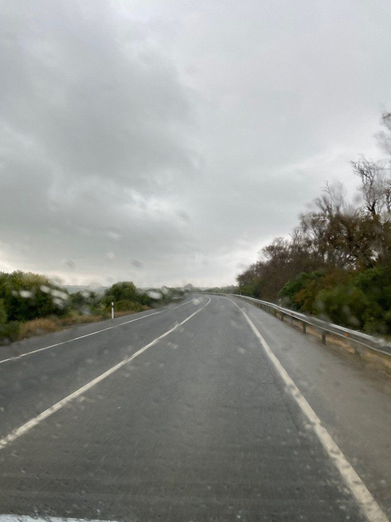
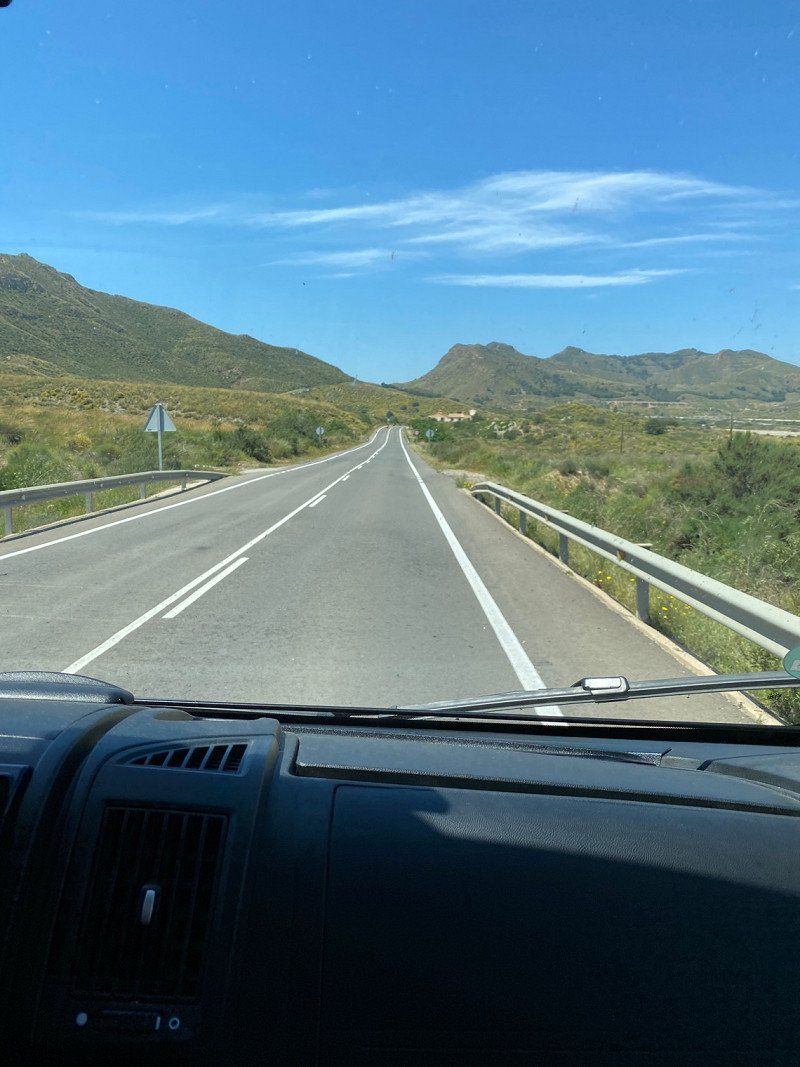
Finally our long planned tour to circumnavigate the Iberian Peninsula. We start at the end of March 22 via Luxembourg to the English Channel, along the Atlantic in Brittany and then along to Portugal. Then it goes around Gibraltar and on the Mediterranean side to Marseille. We only drive on the motorway when there is no other way, or when we want to go many kilometers further quickly because of bad weather.
We have enough time, where it is nice (weather has to be right) we also stay longer. 2 months are planned.
Day
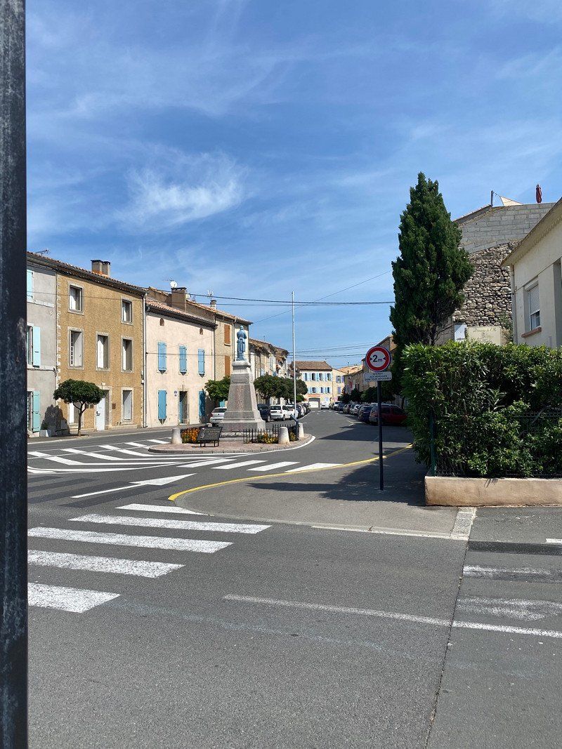
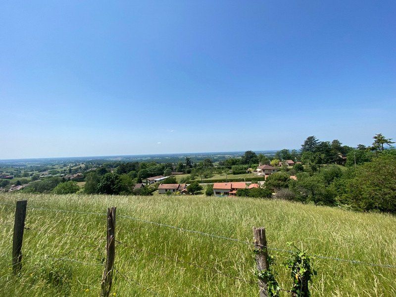
Wald-Michelbach, Deutschland
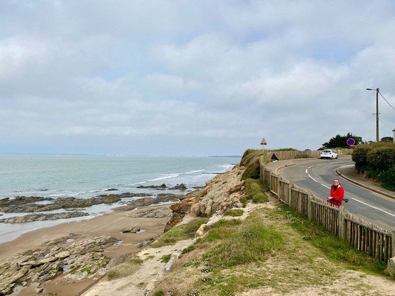
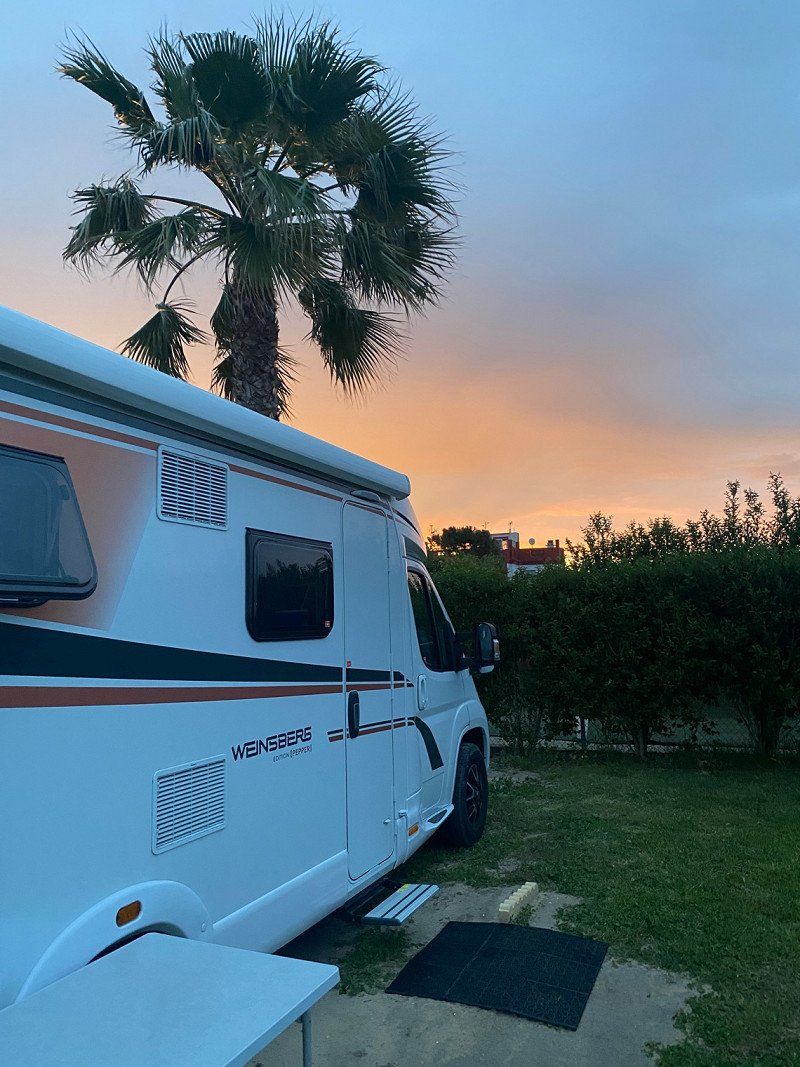
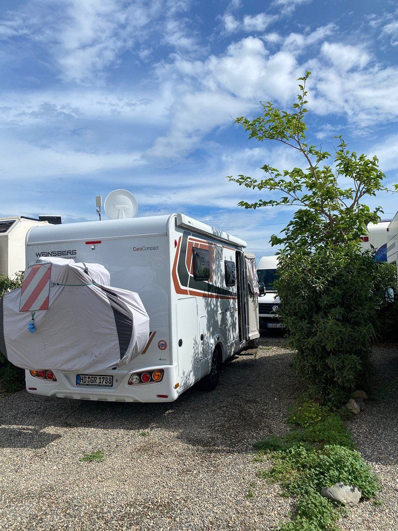
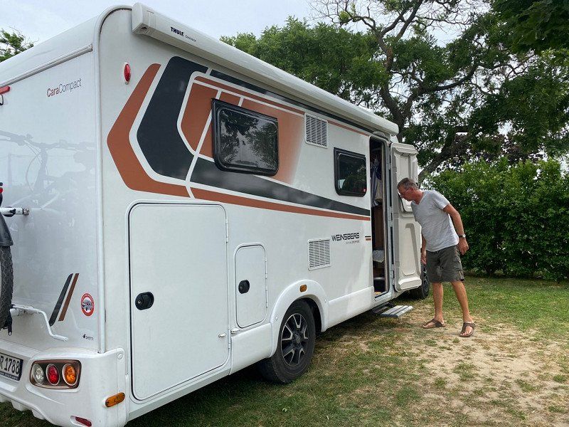
It's finally starting! After surviving the corona infection, it's finally starting. After the weather forecast for the Mediterranean is not so good, we first drive to the Atlantic. So first in the direction of Luxembourg, then via Belgium or France to drive to the English Channel. We haven't even been to Brittany yet. Hope the weather stays good!
69483 Wald-Michelbach, Deutschland
49° 34' 12.7" N 8° 49' 51.4" E
49.5701937 8.8309380
• Head toward Ludwigstraße on Friedhofsweg. Go for 56 m.
• Turn right onto Ludwigstraße (L3120). Go for 2.5 km.
• Pass 2 roundabouts and continue on Weiherer Straße (L3120). Go for 8.5 km.
• Turn left onto Weinheimer Straße (B38) toward Mannheim/Heppenheim. Go for 9.3 km.
• Turn right onto B38 toward Mannheim/Gewerbegebiet W.-West. Go for 1.6 km.
• Continue on A659. Go for 5.6 km.
• Take the exit toward Hannover/Frankfurt/Köln/Saarbrücken onto A6. Go for 2.9 km.
• Take exit 25 toward Saarbrücken/Kaiserslautern/Ludwigshafen onto A6. Go for 118 km.
• Take exit 5 toward St. Ingbert/Sulzbach/Dudweiler/Flughafen Saarbrücken. Go for 316 m.
• Turn right onto L126 toward Sankt Ingbert City/Dudweiler/Sulzbach. Go for 3.0 km.
• Turn slightly left onto L252. Go for 6.2 km.
• Turn left onto Dudweilerstraße (B41). Go for 203 m.
• Turn right onto Schubertstraße. Go for 79 m.
• Turn left onto Sulzbachstraße. Go for 64 m.
• Turn right onto Ursulinenstraße. Go for 55 m.
• Turn left onto Ursulinenstraße. Go for 148 m.
• Arrive at Ursulinenstraße. Your destination is on the left.
☍
158,6 km
(1 hrs. 43 min.)
Saarbrücken, Deutschland
49° 14' 24.6" N 6° 59' 49" E
49.2401572 6.9969327
• Head toward Mozartstraße on Ursulinenstraße. Go for 338 m.
• Turn right onto Sankt-Johanner-Straße (B51). Go for 433 m.
• Keep left onto Sankt-Johanner-Straße toward Metz/A1/A8/A620/Cityring/Kongresszentrum. Go for 31 m.
• Keep right onto Sankt-Johanner-Straße. Go for 255 m.
• Take the 2nd exit from roundabout onto Saarbrücken-Westspangenbrücke (B268). Go for 369 m.
• Take ramp onto A620 toward Luxembourg/A8/Metz/A6/Messe/Völklingen. Go for 26.4 km.
• Continue on A8. Go for 36.2 km.
• Take exit 2 toward Thionville/Perl/Moselweinstraße/Gewerbegebiet Besch. Go for 685 m.
• Turn left onto B419 toward Thionville/Perl/Moselweinstraße. Go for 1.3 km.
• Take the 1st exit from roundabout onto Am Dreiländereck (B407/B419). Go for 241 m.
• Take the 1st exit from roundabout onto B407 toward Luxembourg/Schengen. Go for 344 m.
• Continue straight ahead. Go for 93 m.
• Turn left toward Route du Vin/CR152. Go for 56 m.
• Continue on Route du Vin (CR152). Go for 85 m.
• Turn slightly left onto Hemmeberreg. Go for 29 m.
• Arrive at Hemmeberreg. Your destination is on the right.
☍
66,9 km
( 42 min.)
Schengen, Luxemburg
49° 28' 15.4" N 6° 21' 54.2" E
49.4709461 6.3650460
• Head toward Baachergaass on Hemmeberreg. Go for 29 m.
• Turn slightly right onto Route du Vin (CR152). Go for 141 m.
• Turn left toward N10. Go for 55 m.
• Continue on N10. Go for 951 m.
• Turn left and take ramp onto A13 toward Luxembourg/Mondorf les Bains. Go for 20.7 km.
• Take the exit toward Luxembourg/Bruxelles onto A3. Go for 8.8 km.
• Take the exit toward E29/Aéroport/Trier/Ettelbruck/A7/Bruxelles/Liège/Esch/Alzette/A4 onto A6. Go for 21.7 km.
• Continue on E25/E411. Go for 42.5 km.
• Continue on E411 toward Bruxelles/Namur. Go for 14.6 km.
• Take exit 25 toward Reims/Sedan/Bouillon/Bertrix. Go for 408 m.
• Take the 3rd exit from roundabout onto Avenue de Bouillon (E46) toward Reims/Sedan/Bouillon/Bertrix. Go for 334 m.
• Keep right onto Avenue de Bouillon (E46). Go for 4.8 km.
• Pass 2 roundabouts and continue on E46. Go for 25.4 km.
• Continue on N58. Go for 10.9 km.
• Take ramp onto N43 toward Charleville-M./Sedan/Reims. Go for 6.3 km.
• Keep left onto A34 toward Donchery/Charleville-Mézières/Reims. Go for 15.9 km.
• Take the exit toward Châlons S/M/Reims/Rethel/La Francheville onto A34. Go for 2.4 km.
• Take the exit toward E44/E420/Bruxelles/Charleroi/Cambrai/Maubeuge onto A304. Go for 20.8 km.
• Take exit 9 toward Cambrai/St Quentin/Laon/Maubeuge/Hirson. Go for 562 m.
• Take the 3rd exit from roundabout onto N43 toward Cambrai/Laon/Maubeuge/Hirson/Tremblois lès R. Go for 232 m.
• Pass 2 roundabouts and continue on Lieu-dit Le Piquet (D8043). Go for 33.0 km.
• Take the 4th exit from roundabout onto D1043 toward Cambrai/St Quentin/Maubeuge/Vervins. Go for 2.0 km.
• Take the 3rd exit from roundabout onto D963 toward Laon/Vervins. Go for 4.2 km.
• Turn right onto Rue les Coutures (D36) toward Origny en Thiérache. Go for 487 m.
• Turn right onto Rue de Vervins (D36). Go for 313 m.
• Take the 2nd exit from roundabout onto Place de Verdun. Go for 49 m.
• Continue on Rue de la Maladrerie (D38). Go for 819 m.
• Continue on D38. Go for 234 m.
• Continue on Rue des Routières (D38). Go for 1.1 km.
• Turn left onto D38. Go for 1.9 km.
• Continue on Lieu-dit Foigny (D38). Go for 301 m.
• Continue on Hameau La Cloperie (D38). Go for 1.5 km.
• Continue on Hameau des Étots (D38). Go for 790 m.
• Continue on Lieu-dit Ferme d'Origny (D38). Go for 99 m.
• Continue on D38. Go for 1.4 km.
• Continue on Rue de la Libération (D38). Go for 461 m.
• Turn left onto Rue du Général de Gaulle (N2). Go for 356 m.
• Turn right onto Route d'Autreppes (D31) toward Autreppes/Guise. Go for 10.0 km.
• Continue on Rue de Gomont (D26). Go for 964 m.
• Turn right onto Rue de Guise (D31). Go for 7.5 km.
• Continue on Grand'Rue (D960). Go for 4.7 km.
• Turn left onto Rue Chantraine. Go for 169 m.
• Arrive at Rue Chantraine. Your destination is on the right.
☍
270,1 km
(3 hrs. )
Guise, Frankreich
02120 Guise, Frankreich
49° 53' 52.9" N 3° 37' 30.2" E
49.8980140 3.6250570
• Head toward Impasse Magodaine on Rue Chantraine. Go for 169 m.
• Turn right onto Place du Jeu de Paume (D960). Go for 165 m.
• Turn right onto Rue du Général de Gaulle (D1029). Go for 23.5 km.
• Take the 4th exit from roundabout onto D1029 toward Amiens/Laon/Chauny/Tergnier/St Quentin-Centre/Gauchy. Go for 591 m.
• Pass 6 roundabouts and continue on D1029. Go for 23.5 km.
• Take the 2nd exit from roundabout onto D44 toward Arras/Péronne. Go for 7.5 km.
• Continue on D937. Go for 2.3 km.
• Turn left onto Route de Péronne (D5937) toward Péronne-Centre. Go for 440 m.
• Turn left onto Rue du Faubourg de Bretagne (D1017). Go for 829 m.
• Turn right onto Rue de la Caisse d'Épargne (D43) toward A1 (Lille)/A2/Moislains/Albert/Centre Hospitalier. Go for 303 m.
• Turn left onto Boulevard du Poilu. Go for 57 m.
• Turn right onto Chemin Noir. Go for 78 m.
• Arrive at Chemin Noir. Your destination is on the right.
☍
59,4 km
( 55 min.)
Péronne, Frankreich
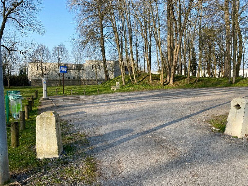
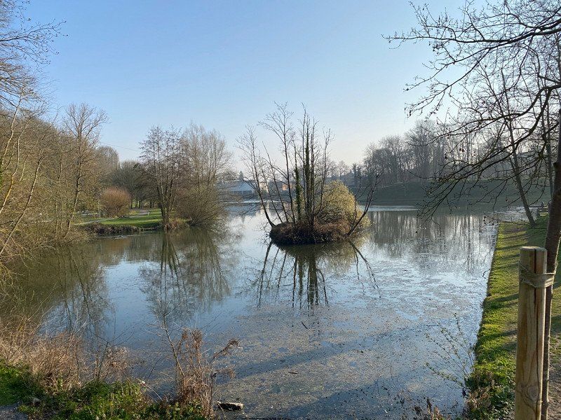
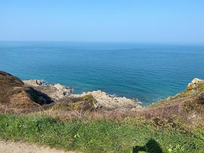
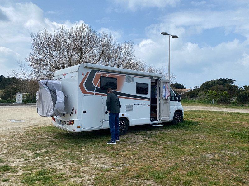
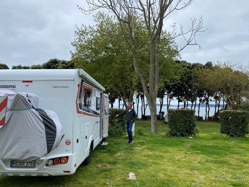
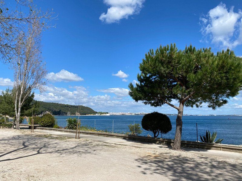
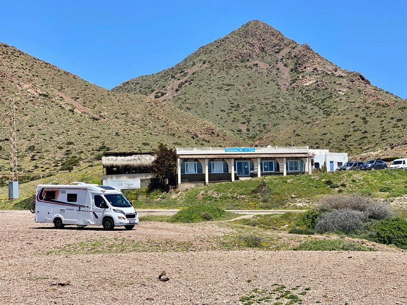
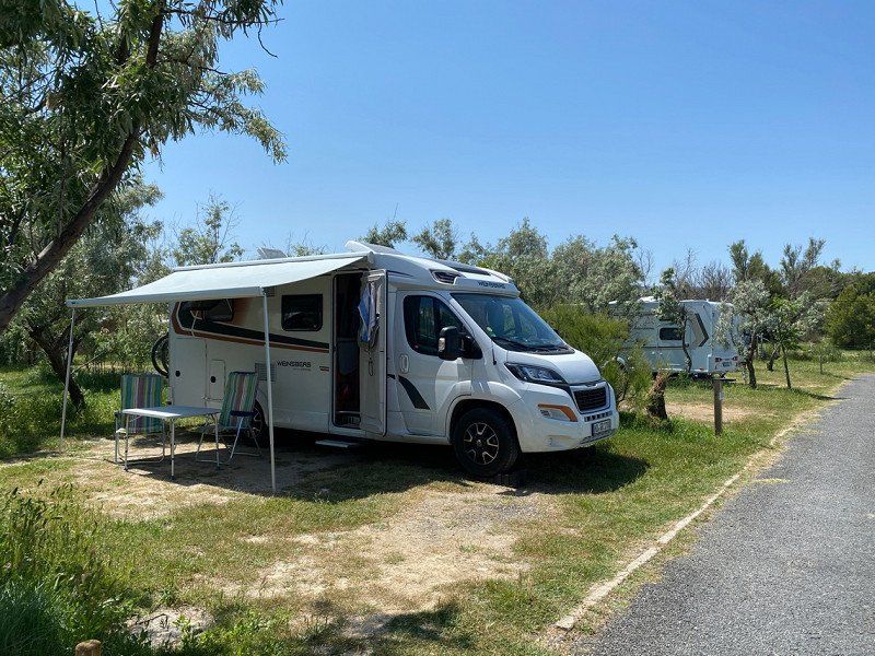
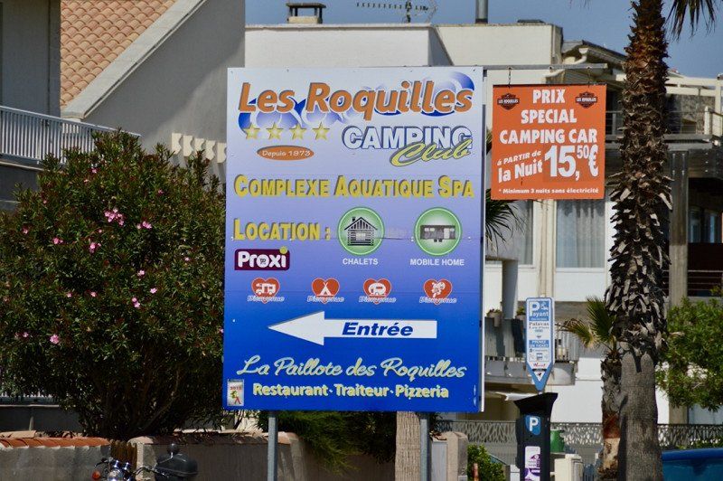
Simple parking space, free of charge, V+E available, not used by usVery nice morning walk on the lake/nature reserve.
80200 Péronne, Frankreich
49° 55' 59.1" N 2° 56' 0.1" E
49.9330710 2.9333530
• Head toward Rue Jean Mermoz on Chemin Noir. Go for 193 m.
• Turn right onto Rue Jean Mermoz. Go for 44 m.
• Turn right onto Avenue Charles Boulanger (D43). Go for 554 m.
• Turn right onto Rue Saint-Sauveur (D1017). Go for 2.8 km.
• Take the 2nd exit from roundabout onto Route de Paris (D1017) toward Compiègne/Senlis/Creil/Roye. Go for 4.5 km.
• Take the 1st exit from roundabout onto D1029 toward Amiens/A29/Estrées-D./Bray S/S. Go for 3.9 km.
• Take ramp onto A1 (Autoroute du Nord) toward Paris/Amiens/St Quentin. Go for 3.3 km.
• Take the exit toward E44/A29/Reims/Rouen/St Quentin/Amiens. Go for 1.5 km.
• Take the exit toward Amiens/Rouen/Paris-Ouest onto A29. Go for 33.0 km.
• Take the left exit toward Rouen/Calais/Paris/Amiens-Centre/Amiens-Sud onto A29 (Viaduc de l'Avre). Go for 10.9 km.
• Take the exit toward Calais/Rouen/Amiens-Ouest onto A16 (L'Européenne). Go for 4.0 km.
• Take the exit toward Le Havre/Rouen/Dieppe/Poix de Picardie onto A29. Go for 59.5 km.
• Take the exit onto A28. Go for 20.7 km.
• Keep right onto A29 toward Le Havre/Caen. Go for 83.8 km.
• Continue on N1029. Go for 7.1 km.
• Keep left onto A29 toward Deauville/Trouville/Caen. Go for 16.0 km.
• Take the exit toward Lisieux/Caen onto A13 (Autoroute de Normandie). Go for 51.2 km.
• Take the exit onto N814 (Périphérique). Go for 5.7 km.
• Take ramp onto Avenue de la Côte de Nacre (D7) toward Douvres la Délivrande. Go for 3.3 km.
• Take the 3rd exit from Rond-Point de la Bijude roundabout onto D7. Go for 5.5 km.
• Take the 4th exit from roundabout onto D404. Go for 2.5 km.
• Take the 2nd exit from roundabout onto D404. Go for 2.3 km.
• Continue on D79. Go for 718 m.
• Pass 3 roundabouts and continue on Route de Caen (D79). Go for 3.3 km.
• Take the 2nd exit from roundabout onto Rue Charles Benoïst (D12). Go for 504 m.
• Turn left onto Rue de la Mer (D514). Go for 443 m.
• Turn right onto Rue de la Mer. Go for 36 m.
• Arrive at Rue de la Mer. Your destination is on the right.
☍
327,4 km
(3 hrs. 5 min.)
Day
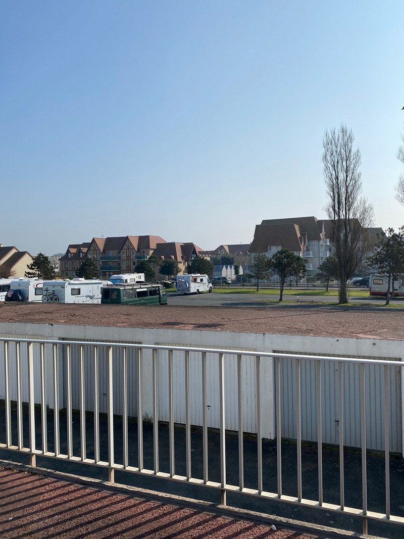
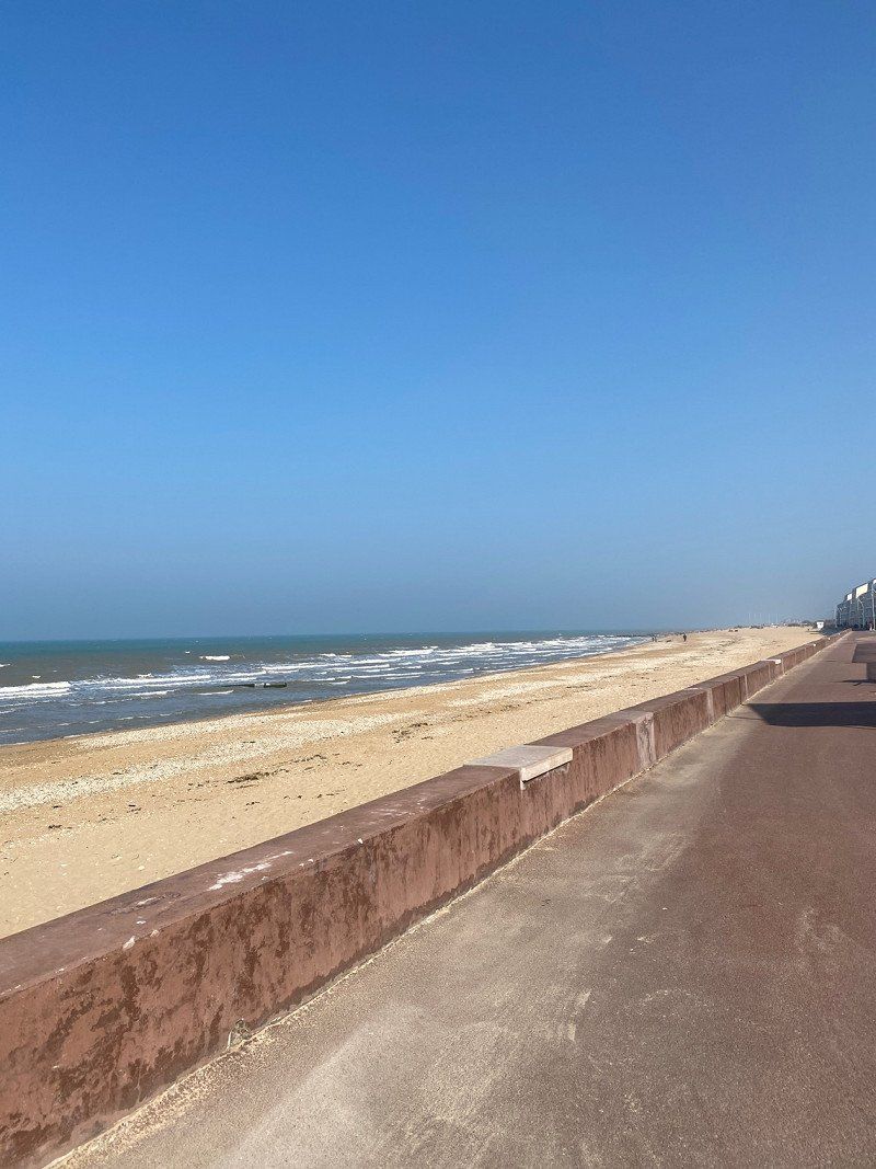
Courseulles-sur-Mer, Frankreich
Free parking space without service
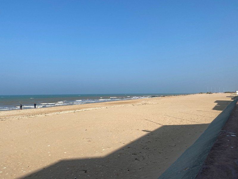
Restaurant right next door, ate delicious pizza. English Channel in the immediate vicinity. We want to continue the next morning. Very windy at night.
14470 Courseulles-sur-Mer, Frankreich
49° 20' 0.3" N 0° 27' 26.5" W
49.3334059 -0.4573650
• Head west on Rue de la Mer. Go for 36 m.
• Turn right onto Rue de la Mer (D514). Go for 65 m.
• Turn right onto Rue Arthur Leduc. Go for 162 m.
• Turn right onto Rue Pierre Villey. Go for 346 m.
• Turn slightly left onto Rue de l'Épinette. Go for 156 m.
• Turn right onto Rue Émile Héroult (D514). Go for 563 m.
• Take the 2nd exit from roundabout onto Route de Caen (D79). Go for 778 m.
• Pass 2 roundabouts and continue on D79. Go for 2.5 km.
• Take the 3rd exit from roundabout onto D79. Go for 785 m.
• Continue on D404. Go for 2.3 km.
• Take the 2nd exit from roundabout onto D404. Go for 2.2 km.
• Turn right onto D7. Go for 5.6 km.
• Take the 2nd exit from Rond-Point de la Bijude roundabout onto D7. Go for 3.0 km.
• Take ramp onto Périphérique (N814) toward Cherbourg/Rennes/Bayeux/Z.I. Mont-Coco. Go for 4.5 km.
• Take ramp onto Périphérique (N814) toward Le Mont-St Michel/Rennes/Flers. Go for 3.4 km.
• Take ramp onto A84 toward Saint-Lô/Le Mt-St-Michel/Rennes/Vire/Z.I. Verson. Go for 90.7 km.
• Continue on N175. Go for 10.6 km.
• Take ramp onto N175 toward St Brieuc/St Malo/Le Mont-St Michel/Pontorson. Go for 13.2 km.
• Keep left onto N176. Go for 20.5 km.
• Take ramp onto D155 toward Cancale. Go for 770 m.
• Take the 2nd exit from roundabout onto D4 toward St Malo/Dinard/La Fresnais/Barrage de la Rance. Go for 6.9 km.
• Turn right onto Rue des Frênes (D207) toward La Fresnais-Centre/Vildé la Marine. Go for 669 m.
• Continue on Rue du Bief Briand (D7). Go for 1.5 km.
• Continue on Route de la Fresnais (D7). Go for 754 m.
• Take the 2nd exit from roundabout onto Grande Rue (D155). Go for 4.8 km.
• Turn right and take ramp. Go for 519 m.
• Continue on D76. Go for 2.8 km.
• Take the 2nd exit from roundabout onto Avenue Olivier Biard (D76). Go for 332 m.
• Turn slightly right onto Avenue Pasteur (D76) toward Cancale-Centre. Go for 235 m.
• Take the 3rd exit from roundabout onto Avenue Pasteur (D76). Go for 464 m.
• Take the 3rd exit from roundabout onto Avenue Pasteur (D76). Go for 70 m.
• Continue on Rue du Maréchal Juin (D76). Go for 241 m.
• Turn left onto Rue Esprit Bailly. Go for 158 m.
• Turn right onto Rue Saint-Malo. Go for 116 m.
• Turn right onto Rue du Port. Go for 47 m.
• Turn right onto Rue du Maréchal Juin. Go for 47 m.
• Arrive at Rue du Maréchal Juin. Your destination is on the right.
☍
181,8 km
(1 hrs. 55 min.)
Day
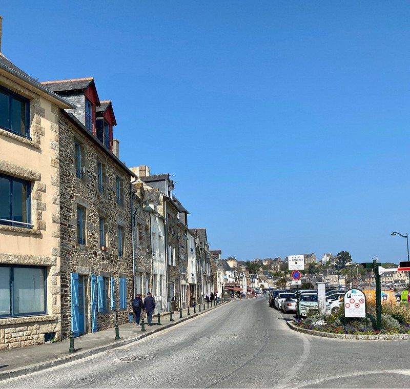
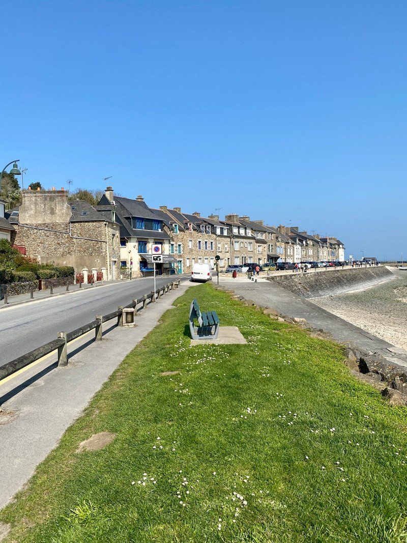
Cancale, Frankreich
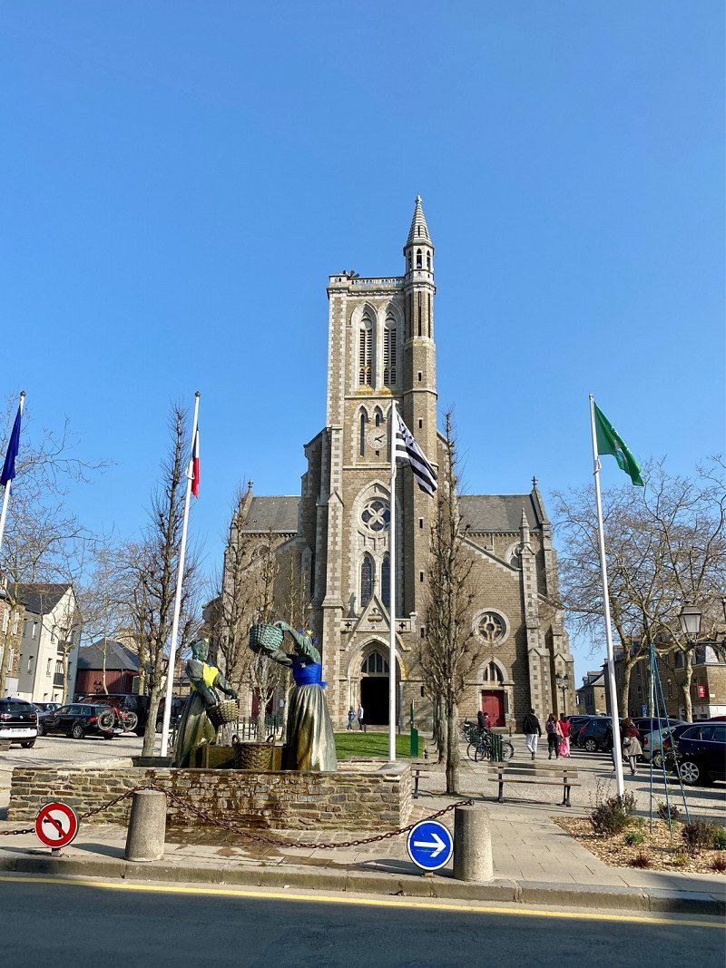
Cancale Beautiful bay but very busy at the entrance to the town on the right is a parking space for €12 with V+E per night. We stay for 2 nights, because the sun is shining, our solar system produces enough electricity. There are oysters everywhere, for us it's nothing. 20 minutes on foot to the old town, very busy.
48° 40' 37.5" N 1° 51' 8.2" W
48.6770700 -1.8522790
• Head toward Rue du Port on Rue du Maréchal Juin. Go for 47 m.
• Turn sharp right onto Rue du Maréchal Juin. Go for 395 m.
• Continue on Avenue Pasteur (D76). Go for 52 m.
• Pass 2 roundabouts and continue on Avenue Pasteur (D76). Go for 657 m.
• Turn left onto Avenue Olivier Biard (D201). Go for 336 m.
• Take the 2nd exit from roundabout onto Avenue Olivier Biard (D76). Go for 2.8 km.
• Keep left toward D76. Go for 1.0 km.
• Continue on D76. Go for 1.1 km.
• Take the 3rd exit from roundabout onto D76. Go for 3.6 km.
• Take the 2nd exit from roundabout onto D76 toward Châteauneuf-d'Ille et Vilaine/St Guinoux/Dinan/Rennes. Go for 3.2 km.
• Continue on D74. Go for 1.9 km.
• Take the 2nd exit from roundabout onto D74 toward Rennes/Dinan/Châteauneuf d'I. et V./St Suliac. Go for 119 m.
• Take the 3rd exit from roundabout onto D137 toward Rennes/Dinan. Go for 52.3 km.
• Keep left onto D137 toward Rennes/Z.A. Nord/Lorient/Nantes/P+R Villejean-U. Go for 450 m.
• Take ramp onto Rocade Nord (N136) toward Rocade Ouest/Lorient/Nantes. Go for 9.3 km.
• Take ramp onto N137 toward Porte de Nantes/Nantes/Noyal-Châtillon/Bain de Bgne. Go for 62.7 km.
• Take ramp onto N171 toward St Nazaire/La Grigonnais/Blain. Go for 4.1 km.
• Pass 2 roundabouts and continue on Lieu-dit La Bretonnière (N171). Go for 7.2 km.
• Take the 3rd exit from Rond-Point de l'Europe roundabout onto N171 toward St Nazaire/Le Château. Go for 1.1 km.
• Pass 2 roundabouts and continue on Boulevard de la Résistance (N171). Go for 813 m.
• Take the 3rd exit from roundabout onto Rue de la Croix Rouge (N171) toward St Nazaire/Bouvron/Le Port/Le Château. Go for 747 m.
• Pass 3 roundabouts and continue on N171. Go for 6.4 km.
• Take the 3rd exit from roundabout onto N171. Go for 1.6 km.
• Take the 2nd exit from roundabout onto N171. Go for 2.2 km.
• Take the 3rd exit from roundabout onto N171. Go for 2.2 km.
• Take the 2nd exit from roundabout onto Lieu-dit La Croix Blanche (N171) toward St Nazaire/Savenay. Go for 3.7 km.
• Take the 2nd exit from roundabout onto N171 toward St Nazaire/La Baule/Savenay-Centre. Go for 24.3 km.
• Take the 3rd exit from roundabout onto Route Bleue (D213) toward Noirmoutier/La Rochelle/St Brevin les Pins/Méan Penhoët. Go for 6.5 km.
• Take ramp onto D277 toward St Brevin-Nord/Paimboeuf/Corsept/St Viaud. Go for 473 m.
• Take the 3rd exit from roundabout onto Avenue Raymond Poincaré (D205). Go for 120 m.
• Turn right onto Avenue des Tilleuls. Go for 234 m.
• Turn right onto Avenue de Mindin (D5). Go for 29 m.
• Turn left onto Avenue Léa. Go for 128 m.
• Arrive at Avenue Léa. Your destination is on the right.
☍
201,9 km
(2 hrs. 10 min.)
Day
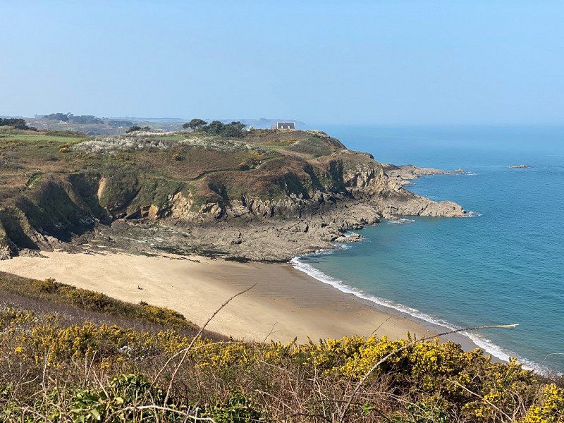
Saint Malo und die Küste
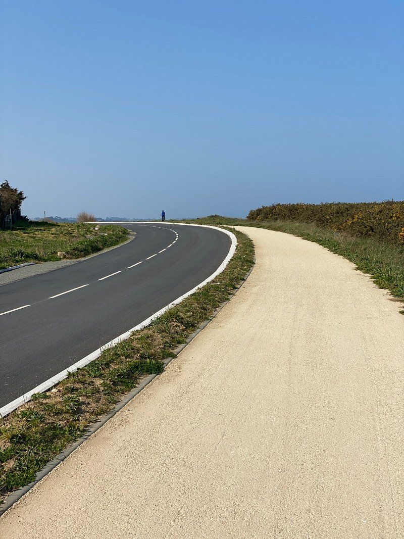
On the second day we do a bike tour in the direction of Saint Malo, always along the coast and then through the middle. The Komoot app helps well.
Day
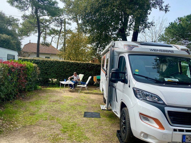
Camping de Mindin - Camping Qualité
Right at the bridge. 2 nights with electricity for a total of €46.10 Since we only arrive here in the afternoon, we don't visit the area until the next day.
32 Avenue du Bois, 44250, Saint Brévin les Pins, Frankreich
47° 15' 50.5" N 2° 10' 8.9" W
47.2640300 -2.1691350
• Head toward Avenue de Verdun on Avenue Léa. Go for 128 m.
• Turn right onto Avenue de Mindin (D5). Go for 29 m.
• Turn left onto Avenue des Tilleuls. Go for 234 m.
• Turn left onto Avenue Raymond Poincaré (D205). Go for 55 m.
• Take the 1st exit from roundabout onto D277. Go for 198 m.
• Take ramp onto Route Bleue (D213). Go for 31.0 km.
• Take the 3rd exit from Giratoire Les Puymains roundabout onto Route Bleue (D13) toward Noirmoutier/La Roche S/Yon/La Rochelle/Bourgneuf en Retz/Machecoul. Go for 542 m.
• Take the 2nd exit from Giratoire du Moulin Saint-Laurent roundabout onto Route Bleue (D13) toward Noirmoutier/La Roche S/Yon/La Rochelle/Nantes/Machecoul. Go for 909 m.
• Take the 2nd exit from Giratoire de la Corderie roundabout onto D758 toward Noirmoutier/Les Sables d'Olne/Bouin. Go for 8.0 km.
• Pass 2 roundabouts and continue on Rue du Pays de Retz (D758). Go for 843 m.
• Turn left onto Rue du Marais Doux (D21). Go for 794 m.
• Continue on Lieu-dit La Petite Claie (D21). Go for 48 m.
• Continue on D21. Go for 158 m.
• Continue on Lieu-dit Pont de Claie (D21). Go for 155 m.
• Continue on D21. Go for 223 m.
• Continue on Route de Bois-de-Céné (D21). Go for 3.0 km.
• Continue on D21. Go for 579 m.
• Continue on Lieu-dit La Frandière (D21). Go for 93 m.
• Continue on D21. Go for 390 m.
• Continue on Lieu-dit Ker Rosa (D21). Go for 139 m.
• Continue on D21. Go for 195 m.
• Continue on Lieu-dit Le Village Potia (D21). Go for 105 m.
• Continue on Lieu-dit Le Village Besson (D21). Go for 99 m.
• Continue on Lieu-dit Les Petits Bois (D21). Go for 104 m.
• Continue on D21. Go for 409 m.
• Continue on Lieu-dit Le Pré Leger (D21). Go for 131 m.
• Continue on Lieu-dit Le Pré Long (D21). Go for 57 m.
• Continue on D21. Go for 680 m.
• Continue on Lieu-dit L'Aisance (D21). Go for 99 m.
• Continue on D21. Go for 375 m.
• Continue on Lieu-dit Le Chardonneret (D21). Go for 102 m.
• Continue on D21. Go for 619 m.
• Continue on Rue de la Motte (D21). Go for 736 m.
• Turn right onto Rue Jan et Joël Martel (D21). Go for 392 m.
• Take the 2nd exit from roundabout onto Rue de Challans (D58). Go for 685 m.
• Continue on Lieu-dit Le Manoir (D58). Go for 102 m.
• Continue on D58. Go for 304 m.
• Continue on Lieu-dit Le Chêne Vert (D58). Go for 100 m.
• Continue on Route de Challans (D58). Go for 298 m.
• Continue on Lieu-dit Saint-Joseph (D58). Go for 180 m.
• Continue on Lieu-dit Le Fourin (D58). Go for 100 m.
• Continue on Route de Challans (D58). Go for 147 m.
• Continue on Lieu-dit L'Égalité (D58). Go for 83 m.
• Continue on Route de Challans (D58). Go for 507 m.
• Continue on Lieu-dit Le Progrès (D58). Go for 49 m.
• Continue on Route du Marais (D58). Go for 2.7 km.
• Continue on Route du Marais (D58). Go for 1.3 km.
• Continue on Route de Bois-de-Céné (D58). Go for 1.6 km.
• Continue on Rue de Bois de Cène (D58). Go for 199 m.
• Pass 3 roundabouts and continue on Rue de Bois de Cène (D58). Go for 976 m.
• Take the 3rd exit from roundabout onto Boulevard Viaud Grand Marais. Go for 347 m.
• Take the 2nd exit from Rond-Point Victor Charbonnel roundabout onto Boulevard Viaud Grand Marais. Go for 351 m.
• Take the 2nd exit from Rond-Point du Guy roundabout onto Boulevard Guérin. Go for 309 m.
• Take the 2nd exit from Rond-Point de l'Hôpital roundabout onto Boulevard de la Gare (D5 A). Go for 340 m.
• Take the 2nd exit from roundabout onto Rue des Marzelles. Go for 251 m.
• Take the 3rd exit from roundabout onto Rue des Sables (D32). Go for 482 m.
• Pass 5 roundabouts and continue on Route de Challans (D32). Go for 9.8 km.
• Take the 2nd exit from roundabout onto Route de Commequiers (D754). Go for 2.3 km.
• Take the 2nd exit from roundabout onto D32. Go for 4.9 km.
• Take the 2nd exit from roundabout onto D32. Go for 3.0 km.
• Take the 1st exit from Rue de Lattre de Tassigny roundabout onto Rue de Lattre de Tassigny (D32). Go for 2.9 km.
• Take the 1st exit from roundabout onto Rue de l'Épinay (D12). Go for 615 m.
• Take the 2nd exit from roundabout onto Route de Brétignolles (D40). Go for 723 m.
• Continue on Route de la Cavée Paulin (D40). Go for 71 m.
• Continue on Route de la Chaize (D40). Go for 287 m.
• Take the 2nd exit from roundabout onto D40. Go for 1.5 km.
• Continue on Route de la Chaize Giraud (D40). Go for 724 m.
• Continue on Rue de la Cavée Paulin (D40). Go for 690 m.
• Continue on D40. Go for 30 m.
• Continue on Rue du Moulin (D40). Go for 443 m.
• Take the 1st exit from roundabout onto Rue du Moulin (D40). Go for 509 m.
• Turn right onto Rue de l'Océan. Go for 199 m.
• Turn left onto Rue du Chaponnet (D38). Go for 345 m.
• Take the 2nd exit from Rond-Point du Noyau de Terre roundabout onto Rue du 8 Mai (D38). Go for 646 m.
• Take the 2nd exit from roundabout onto D80. Go for 1.6 km.
• Continue toward Route des Amis de la Nature/D80. Go for 45 m.
• Take the 2nd exit from roundabout onto Route des Amis de la Nature (D80). Go for 5.2 km.
• Take the 1st exit from Route des Amis de la Nature roundabout onto Route de la Mer (D87 A). Go for 3.0 km.
• Continue on Rue de la Forêt (D87 A). Go for 496 m.
• Continue on Route de l'Aubraie (D87 A). Go for 709 m.
• Take the 2nd exit from roundabout onto Route de l'Aubraie. Go for 630 m.
• Take the 3rd exit from roundabout onto Rue Joseph Bénatier. Go for 779 m.
• Take the 2nd exit from Rond-Point Honoré d'Estienne d'Orves roundabout onto Rue Joseph Bénatier. Go for 499 m.
• Continue on Quai Rousseau Méchin. Go for 216 m.
• Continue on Promenade George V. Go for 259 m.
• Continue on Place Anselme Maraud. Go for 193 m.
• Turn right onto Rue du Roi Albert 1er. Go for 33 m.
• Arrive at Rue du Roi Albert 1er. Your destination is on the left.
☍
106,4 km
(1 hrs. 33 min.)
Day
Fahrradtour um die Küste zu erkunden
Today we make another bike tour to see the coast.
Day
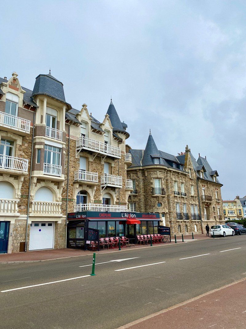
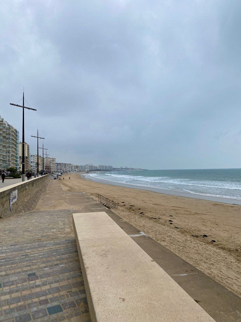
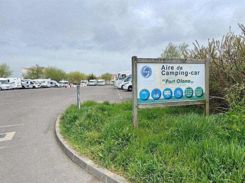
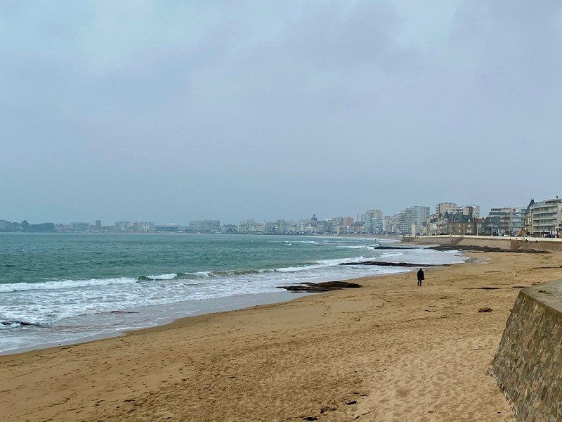
Les Sables-d'Olonne, Frankreich
Parking for Womo in the city for 8 €/night including electricity. Walk to the beach and walk a total of 10 km. Actually to the viewpoint Le Puit's de Enfer But the weather is getting worse and worse. The next morning we want to continue driving and will try to stop by there again. Unfortunately it didn't work out because there is no parking space for campers.
46° 29' 34.6" N 1° 47' 43.8" W
46.4929580 -1.7954930
• Head toward Rue Saint-Nicolas on Rue du Roi Albert 1er. Go for 94 m.
• Turn right onto Rue Saint-Nicolas. Go for 214 m.
• Turn right onto Rue de l'Ormeau. Go for 99 m.
• Turn left onto Promenade George V. Go for 259 m.
• Continue on Quai Rousseau Méchin. Go for 216 m.
• Continue on Rue Joseph Bénatier. Go for 454 m.
• Take the 1st exit from Rond-Point Honoré d'Estienne d'Orves roundabout onto Boulevard du Souvenir Français. Go for 730 m.
• Take the 4th exit from roundabout onto Boulevard du Vendée Globe. Go for 1.2 km.
• Pass 5 roundabouts and continue on Boulevard du Vendée Globe. Go for 2.7 km.
• Take the 3rd exit from Rond-Point de la Vannerie roundabout onto D160. Go for 882 m.
• Take the 2nd exit from roundabout onto D949 toward Niort Par RD/La Rochelle/Grosbreuil/Talmont-St Hilaire. Go for 3.5 km.
• Take the 2nd exit from roundabout onto D949 toward Niort/La Rochelle/Talmont-St Hilaire. Go for 3.5 km.
• Take the 2nd exit from roundabout onto Avenue de Talmont (D949) toward Niort/La Rochelle/Talmont-St Hilaire/Luçon. Go for 1.3 km.
• Pass 2 roundabouts and continue on Lieu-dit La Petite Malbrande (D949). Go for 2.8 km.
• Take the 1st exit from roundabout onto D949 toward Niort/La Rochelle/Luçon/La Tranche S/Mer/Jard S/Mer/La Guittière. Go for 4.2 km.
• Take the 3rd exit from roundabout onto D949 toward Niort/La Rochelle/Talmont-St H./Luçon/Avrillé/La Tranche S/M. Go for 1.0 km.
• Take the 2nd exit from roundabout onto Avenue de Luçon (D949) toward Niort/La Rochelle/Luçon/La Tranche S/M./Avrillé. Go for 8.4 km.
• Turn left onto Rue du Centre (D19). Go for 144 m.
• Take the 1st exit from roundabout onto Avenue du Maréchal de Lattre de Tassigny (D949) toward Niort/La Rochelle/Luçon/La Tranche S/Mer/St Cyr en T./Z.A. de la Belle Étoile. Go for 3.1 km.
• Take the 2nd exit from roundabout onto D949 toward Niort/La Rochelle/Luçon/Le Givre/Indian Forest. Go for 3.0 km.
• Keep left onto D747. Go for 118 m.
• Continue on D949. Go for 12.7 km.
• Take the 2nd exit from roundabout onto D949 toward Luçon. Go for 6.1 km.
• Take the 2nd exit from Giratoire des Anciens d'A.F.N. roundabout onto D949 toward A83/Niort/La Rochelle. Go for 3.1 km.
• Take the 2nd exit from Rond-Point Jean Monnet roundabout onto Avenue du Maréchal Juin (D949) toward A83/Niort/La Rochelle/Marans/Chantonnay/Fontenay le Cte/Ste Gemme la P. Go for 1.1 km.
• Take the 3rd exit from Rond-Point de l'Atlantique roundabout onto Route de Fontenay (D949). Go for 447 m.
• Pass 2 roundabouts and continue on Chemin de Fontenay-le-Comte (D949). Go for 1.7 km.
• Take the 1st exit from roundabout onto D137 toward La Rochelle/Marans. Go for 4.8 km.
• Take the 2nd exit from roundabout onto D10 A toward Puyravault. Go for 6.2 km.
• Take the 2nd exit from roundabout onto D10 A. Go for 6.6 km.
• Continue on D9. Go for 1.4 km.
• Take the 2nd exit from roundabout onto Route de Villedoux (D9). Go for 6.3 km.
• Take the 1st exit from roundabout onto D10. Go for 1.6 km.
• Take the 2nd exit from roundabout onto D10. Go for 3.9 km.
• Take the 3rd exit from roundabout onto D105. Go for 2.7 km.
• Take the 2nd exit from roundabout onto D105. Go for 2.5 km.
• Take the 3rd exit from roundabout onto Avenue du 8 Mai 1945 (D104). Go for 1.3 km.
• Take the 1st exit from roundabout. Go for 290 m.
• Take ramp onto N237. Go for 4.6 km.
• Take ramp toward Île de Ré. Go for 251 m.
• Take the 3rd exit from roundabout onto D735. Go for 3.8 km.
• Take the 2nd exit from roundabout onto Pont de l'Île de Ré (D735). Go for 669 m.
• Take the 2nd exit from roundabout onto Avenue des Dunes (D201). Go for 2.0 km.
• Pass 4 roundabouts and continue on D201. Go for 8.2 km.
• Take the 1st exit from roundabout onto D201 E2. Go for 2.3 km.
• Take the 2nd exit from roundabout onto D735. Go for 457 m.
• Take the 2nd exit from roundabout onto Route de la Couarde (D735). Go for 2.1 km.
• Continue on D735. Go for 1.6 km.
• Take the 1st exit from roundabout onto D735. Go for 1.1 km.
• Take the 1st exit from roundabout onto Route d'Ars (D735). Go for 2.4 km.
• Take the 2nd exit from roundabout onto Route d'Ars (D735). Go for 3.5 km.
• Continue on D735. Go for 1.3 km.
• Take the 2nd exit from roundabout onto Route de Saint-Clément-des-Baleines (D735). Go for 174 m.
• Continue on D735. Go for 186 m.
• Continue on Route de Saint-Clément (D735). Go for 133 m.
• Continue on D735. Go for 186 m.
• Continue on Route de Saint-Clément (D735). Go for 325 m.
• Continue on Rue de Grignon (D735). Go for 47 m.
• Continue on D735. Go for 344 m.
• Continue on Route de Saint-Clément-les-Baleines (D735). Go for 1.8 km.
• Continue on D735. Go for 152 m.
• Continue on Route des Portes (D735). Go for 825 m.
• Continue on Place de Salorges (D735). Go for 57 m.
• Continue on Rue du Godinand (D735). Go for 197 m.
• Continue on D735. Go for 810 m.
• Take the 2nd exit from roundabout onto Route du Grand Fossé (D735). Go for 794 m.
• Turn left onto Rue du Chaume. Go for 46 m.
• Turn slightly right onto Rue de la Madeleine. Go for 141 m.
• Continue on Rue du Phare. Go for 391 m.
• Turn right onto Chemin des Pérouses. Go for 177 m.
• Arrive at Chemin des Pérouses. Your destination is on the left.
☍
141,8 km
(2 hrs. 2 min.)
Day
Camping Les Baleines
Continue to La Rochelle, then drove to the island of Ile de Re. Drove almost to the end there. Stood on SP next to the CP in Baleines. €17 a night with electricity and water, gray water disposal but no chemical toilet disposal. Beautiful coastal path to the lighthouse, we walk there in the afternoon.
Le Gillieux, 17590, SAINT CLEMENT DES BALEINES, Frankreich
46° 14' 25" N 1° 33' 39.2" W
46.2402719 -1.5608857
• Head toward Rue des Tadornes on Chemin des Pérouses. Go for 177 m.
• Turn left onto Rue du Phare. Go for 391 m.
• Turn left onto Rue du Phare (D735 E1). Go for 216 m.
• Take the 1st exit from roundabout onto Route du Grand Fossé (D735). Go for 894 m.
• Take the 1st exit from roundabout onto D735. Go for 836 m.
• Continue on Rue du Godinand (D735). Go for 197 m.
• Continue on Place de Salorges (D735). Go for 57 m.
• Continue on Route des Portes (D735). Go for 825 m.
• Continue on D735. Go for 152 m.
• Continue on Route de Saint-Clément-les-Baleines (D735). Go for 1.8 km.
• Continue on D735. Go for 341 m.
• Continue on Rue de Grignon (D735). Go for 372 m.
• Continue on D735. Go for 186 m.
• Continue on Route de Saint-Clément (D735). Go for 133 m.
• Continue on D735. Go for 186 m.
• Continue on Route de Saint-Clément-des-Baleines (D735). Go for 136 m.
• Take the 1st exit from roundabout onto D735. Go for 1.4 km.
• Continue on Route d'Ars (D735). Go for 3.4 km.
• Take the 1st exit from roundabout onto Route d'Ars (D735). Go for 2.4 km.
• Take the 3rd exit from roundabout onto D735. Go for 1.2 km.
• Take the 2nd exit from roundabout onto D735. Go for 1.6 km.
• Continue on Route de la Couarde (D735). Go for 2.0 km.
• Take the 1st exit from roundabout onto D735. Go for 421 m.
• Take the 1st exit from roundabout onto D201 E2. Go for 2.3 km.
• Take the 3rd exit from roundabout onto Route de Sainte-Marie (D201). Go for 4.2 km.
• Take the 2nd exit from roundabout onto D201. Go for 1.4 km.
• Take the 3rd exit from roundabout onto D201. Go for 731 m.
• Take the 3rd exit from roundabout onto D201. Go for 1.9 km.
• Take the 2nd exit from roundabout onto D201. Go for 2.0 km.
• Take the 2nd exit from roundabout onto Avenue Gustave Perreau (D735). Go for 658 m.
• Take the 2nd exit from roundabout onto Pont de l'Île de Ré (D735). Go for 3.7 km.
• Keep right toward N237. Go for 252 m.
• Continue on N237. Go for 8.0 km.
• Keep left onto N137. Go for 6.3 km.
• Continue on D137. Go for 57.5 km.
• Continue on A10 (L'Aquitaine). Go for 107 km.
• Take exit 1 toward Toulouse/Bayonne/Bassin d'Arcachon/Bordeaux/Périgueux onto N230 (Rocade de Bordeaux). Go for 19.8 km.
• Take exit 15 toward Saint Sébastien/Bayonne/Mont de Marsan/Bassin d'Arcachon onto A63. Go for 62.5 km.
• Take exit 17 toward Parentis en Born/Liposthey. Go for 373 m.
• Take the 1st exit from roundabout onto Route d'Ychoux (D43) toward Ychoux/Parentis-en-B./Biscarosse. Go for 3.5 km.
• Pass 5 roundabouts and continue on Avenue Nicolas Brémontier (D43). Go for 12.5 km.
• Continue on Avenue Henri Guillaumet (D652). Go for 604 m.
• Take the 4th exit from roundabout onto Avenue Henri Guillaumet (D652). Go for 1.1 km.
• Take the 3rd exit from roundabout onto Route de Dupart. Go for 616 m.
• Turn right onto Route de Lahitte. Go for 122 m.
• Continue on Route de Lahitte. Go for 690 m.
• Keep right onto Route de Lahitte. Go for 629 m.
• Turn left onto Route de Calède. Go for 507 m.
• Turn left onto Route des Campings. Go for 212 m.
• Arrive at Route des Campings. Your destination is on the left.
☍
318,3 km
(3 hrs. 15 min.)
Day
Camping La Forêt, Route des Campings, Parentis-en-Born, Frankreich
We drive on because it is very windy and cold. We land a little below Bordeaux.
For one night €10 with electricity right on the lake, it's a clear, very cold night. We decide to drive faster towards Portugal. It should be warmer there.
Rte des Campings, 40160 Parentis-en-Born, Frankreich
44° 21' 0.7" N 1° 6' 27.5" W
44.3501904 -1.1076473
• Head southeast on Route des Campings. Go for 1.1 km.
• Turn left onto Route du Lac (D43). Go for 986 m.
• Turn right onto Rue du Garbail. Go for 9 m.
• Turn slightly left onto Rue du Garbail. Go for 376 m.
• Turn left onto Chemin de la Mahouna. Go for 152 m.
• Turn left onto Route de Ponteux-les-Forges (D652). Go for 459 m.
• Take the 3rd exit from roundabout onto Avenue du 8 Mai 1945 (D652). Go for 346 m.
• Turn right onto Avenue du 11 Novembre (D140). Go for 113 m.
• Continue on Rue des Sables (D140). Go for 1.0 km.
• Take the 1st exit from roundabout onto Route de Lüe (D140). Go for 15.2 km.
• Take the 3rd exit from roundabout onto Route de Labouheyre (D626). Go for 5.3 km.
• Take the 1st exit from roundabout onto Route d'Escource (D63). Go for 1.9 km.
• Take the 2nd exit from roundabout onto A63 toward Bayonne. Go for 130 km.
• Continue on AP-8 (Autopista del Cantábrico). Go for 12.2 km.
• Continue on GI-20 toward Errenteria/Beraun/Pasaia/Donostia/S. Sebastián. Go for 7.1 km.
• Take exit 7 toward Donostia Erdialdea/San Sebastián/Loiola/Hirigunea/S. Sebastián/Amara onto Paseo Ribera de Loyola. Go for 474 m.
• Continue on Paseo de la Ribera de Loiola. Go for 774 m.
• Continue on Paseo de Bizkaia. Go for 648 m.
• Turn left onto Calle de Azpeitia. Go for 76 m.
• Turn right onto Avenida de Sancho El Sabio. Go for 168 m.
• Continue on Plaza del Centenario. Go for 102 m.
• Turn slightly left onto Calle de Easo. Go for 579 m.
• Turn left onto Calle de San Martín. Go for 389 m.
• Continue on Paseo de Miraconcha. Go for 1.1 km.
• Turn right onto Avenida de Satrustegi toward Igeldo/La Galera. Go for 403 m.
• Turn left onto Paseo de Igeldo. Go for 1.7 km.
• Continue on Paseo Cristóbal Balenciaga. Go for 2.0 km.
• Continue on Calle de Itsasalde. Go for 459 m.
• Continue on Paseo del Padre Orkolaga. Go for 713 m.
• Arrive at Paseo del Padre Orkolaga. Your destination is on the left.
☍
185,6 km
(2 hrs. 1 min.)
Day
Camping Bungalows Igueldo San Sebastián
Still very cold and the weather is very unsettled.
We are in Spain, in San Sebastian. ACSI place for 1 night 22 € unfortunately cold sanitary building and only lukewarm water. Approach is narrow and steep up. In the night heavy rain and sometimes it snows. (0°-3°) The next day we continue in the hope that it will be warmer and the weather will be better
P.º del Padre Orkolaga 69, 20008, San Sebastián, Spanien
43° 18' 17.4" N 2° 2' 45.3" W
43.3048300 -2.0459200
• Head northeast on Paseo del Padre Orkolaga. Go for 713 m.
• Continue on Calle de Itsasalde. Go for 459 m.
• Continue on Paseo Cristóbal Balenciaga. Go for 2.0 km.
• Continue on Paseo de Igeldo. Go for 1.4 km.
• Turn right onto Calle de Pamplona. Go for 315 m.
• Turn right onto Avenida de Zumalakárregi. Go for 171 m.
• Continue on Avenida de Tolosa. Go for 707 m.
• Take the 4th exit from Plaza de Europa roundabout onto Avenida de Tolosa toward A-8/N-634/A-15/N-1. Go for 600 m.
• Turn right onto Avenida de Tolosa toward Vitoria/N-1/Gasteiz/N-634/Bilbao/A-8/Pamplona/A-15/Iruña. Go for 91 m.
• Take ramp onto Avenida Zarautz. Go for 529 m.
• Take ramp onto GI-20. Go for 3.6 km.
• Continue on AP-1/AP-8 (Autopista del Cantábrico). Go for 41.4 km.
• Continue on AP-8 (Autopista del Cantábrico) toward Eibar/Bilbao. Go for 34.2 km.
• Take exit 103 toward N-637/Aireportua/Centro Ciudad Bilbao/Barakaldo/Getxo onto BI-30. Go for 19.8 km.
• Take the exit toward Sestao/Portua/Santander onto A-8 (Autovía del Cantábrico). Go for 77.4 km.
• Take exit 199 toward Torrelavega/Oviedo onto A-8 (Autovía del Cantábrico). Go for 162 km.
• Take exit 360 toward Gijón/A Coruña/Aeropuerto de Asturias onto A-8 (Autovía del Cantábrico). Go for 69.9 km.
• Take exit 431 toward Cudillero/San Juan. Go for 476 m.
• Take the 4th exit from roundabout onto N-632 toward Las Dueñas/Rellayo/Artedo. Go for 681 m.
• Keep right onto N-632a toward Concha de Artedo/San Martín de Luiña/Rellayo. Go for 2.4 km.
• Turn left. Go for 38 m.
• Turn left. Go for 21 m.
• Arrive at your destination on the right.
☍
418,4 km
(3 hrs. 53 min.)
Day
Camping Yolimar, Nacional 632A, Cudillero, Spanien
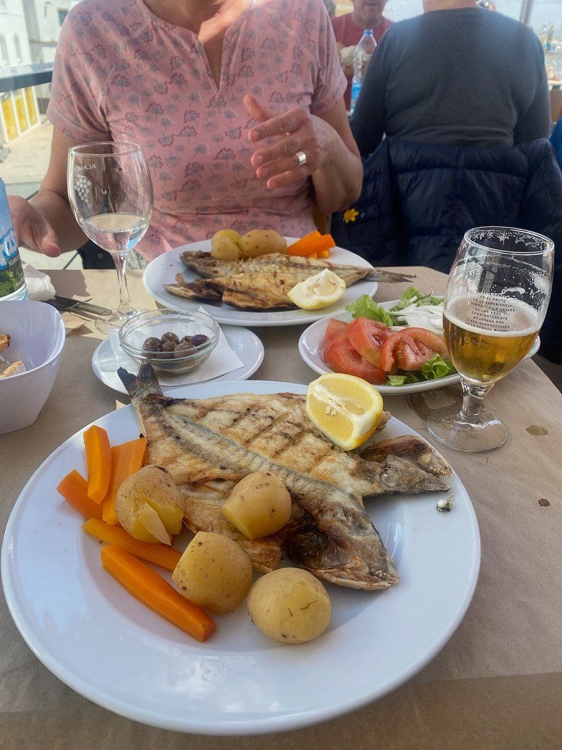
On the way in Asturias a small place near the highway. 15€/1 night with electricity There is a village restaurant Yolimar. Ate fish and prawns. YummyVery friendly everyone
Nacional 632A, Km 127, 33150 Cudillero, Asturias, Spanien
43° 33' 9.9" N 6° 11' 45.5" W
43.5527471 -6.1959779
• Head east. Go for 222 m.
• Turn right onto N-632a. Go for 2.2 km.
• Turn left onto N-632. Go for 692 m.
• Take the 2nd exit from roundabout onto A-8 (Autovía del Cantábrico) toward A Coruña. Go for 145 km.
• Take exit 575 toward Ferrol onto AG-64 (Autovía Ferrol-Vilalba). Go for 51.4 km.
• Take exit 5 toward Valdoviño/Narón onto AC-566 (Nelle). Go for 6.3 km.
• Take the 2nd exit from roundabout onto O Barreiro-Valdoviño (AC-566). Go for 1.5 km.
• Take the 3rd exit from roundabout onto Avenida Almirante Pedro Fernández Martín. Go for 364 m.
• Continue on Avenida Almirante Pedro Fernández Martín. Go for 191 m.
• Continue on Rúa Playa. Go for 140 m.
• Continue on Carretera Playa. Go for 109 m.
• Continue on Barrio Robaleira. Go for 153 m.
• Turn left onto Barrio Robaleira. Go for 156 m.
• Turn left onto As Campeiras. Go for 199 m.
• Arrive at As Campeiras. Your destination is on the left.
☍
208,6 km
(1 hrs. 54 min.)
Day
Camping A Lagoa, Aldea a Lagoa, Valdoviño, Spanien
ACSI pitch for €18/night incl. electricity. Sanitary building open and cold. Nice view of the bay. We hope for finally better warmer weather.
We will stay here for 2 nights.
Aldea a Lagoa, 9, 15552 Valdoviño, A Coruña, Spanien
43° 36' 43.8" N 8° 9' 13.3" W
43.6121755 -8.1536932
• Head toward Travesía Carretera Lago C on As Campeiras. Go for 904 m.
• Continue on O Muíño. Go for 897 m.
• Continue toward Barrio Robaleira. Go for 22 m.
• Turn left onto O Muíño (AC-116). Go for 314 m.
• Take the 1st exit from roundabout onto O Barreiro-Valdoviño (AC-566). Go for 7.0 km.
• Take the 2nd exit from roundabout onto AC-566. Go for 209 m.
• Continue on A Areosa (AC-566). Go for 419 m.
• Continue on Gadoi (AC-566). Go for 516 m.
• Continue on Estrada Cedeira (AC-566). Go for 380 m.
• Take the 1st exit from roundabout onto Segunda Travesía Río Seco. Go for 194 m.
• Continue on Rúa Río Seco. Go for 96 m.
• Turn left onto Rúa Uxío López. Go for 46 m.
• Take the 3rd exit from Rúa Uxío López roundabout onto Rúa Uxío López. Go for 217 m.
• Take the 3rd exit from roundabout onto FE-12 toward Ferrol. Go for 2.2 km.
• Take the 3rd exit from roundabout onto AP-9 (Autoestrada do Atlántico) toward A Coruña. Go for 33.5 km.
• Take the left exit toward Santiago/A-6/Lugo/Arteixo onto AP-9 (Autoestrada do Atlántico). Go for 2.3 km.
• Keep left onto AP-9 toward E-70/Lugo/A-6/Madrid/Arteixo. Go for 2.5 km.
• Take the exit toward Arteixo onto A-6 (Autovía do Noroeste). Go for 4.7 km.
• Take exit 573 toward Abegondo/AC-542/Carral/CP-1704 onto CP-0106. Go for 859 m.
• Continue on Taramuño (CP-0106). Go for 249 m.
• Continue on CP-0106. Go for 421 m.
• Continue on A Agrela de San Vicente (CP-0106). Go for 313 m.
• Continue on CP-0106. Go for 55 m.
• Continue on A Agrela de San Vicente (CP-0106). Go for 166 m.
• Continue on CP-0106. Go for 125 m.
• Turn left onto CP-1704. Go for 8 m.
• Continue on A Agrela de San Vicente (CP-1704). Go for 130 m.
• Continue on A Regueira (CP-1704). Go for 56 m.
• Continue on Barbaín (CP-1704). Go for 337 m.
• Continue on Ameás (CP-1704). Go for 562 m.
• Continue on CP-1704. Go for 434 m.
• Continue on Valiños (CP-1704). Go for 214 m.
• Continue on CP-1704. Go for 98 m.
• Continue on Bacelo (CP-1704). Go for 197 m.
• Continue on CP-1704. Go for 24 m.
• Continue on Vista Real-Cañás (CP-1704). Go for 170 m.
• Continue on Casanova (CP-1704). Go for 83 m.
• Continue on CP-1704. Go for 7 m.
• Continue on Casanova (CP-1704). Go for 273 m.
• Continue on A Atalaia (CP-1704). Go for 311 m.
• Continue on A Bailía (CP-1704). Go for 118 m.
• Turn left onto A Bailía. Go for 81 m.
• Turn slightly right onto A Bailía. Go for 416 m.
• Continue on Aquelabanda. Go for 337 m.
• Turn right onto Aquelabanda. Go for 114 m.
• Turn slightly left onto A Calle (CP-0103). Go for 350 m.
• Continue on A Calle. Go for 113 m.
• Continue on Fontán. Go for 50 m.
• Arrive at Fontán. Your destination is on the left.
☍
63,0 km
( 49 min.)
Abegondo
37/16, O Rueiro, Abegondo, Corunna, Spanien
43° 13' 10.2" N 8° 20' 3.5" W
43.2195099 -8.3343166
• Head toward A Calle on Fontán. Go for 50 m.
• Continue on A Calle. Go for 463 m.
• Continue on Aquelabanda (CP-0103). Go for 715 m.
• Continue on Ardexurxo (CP-0103). Go for 592 m.
• Turn slightly right onto Rúa Rosalía de Castro (CP-0103). Go for 600 m.
• Turn left onto Rúa Paraíso (N-550). Go for 9.0 km.
• Pass 2 roundabouts and continue on Rúa Santiago Apostol (N-550). Go for 7.5 km.
• Take the 3rd exit from roundabout onto Polígono Industrial de Ordes (AC-524) toward E-1/AP-9/A Coruña/Santiago. Go for 2.0 km.
• Take the 2nd exit from roundabout onto A Gorita (AC-524). Go for 639 m.
• Take the 2nd exit from roundabout onto AC-524. Go for 2.7 km.
• Take ramp onto AP-9 (Autoestrada do Atlántico) toward Santiago. Go for 78.0 km.
• Take exit 119 toward Cambados/Sanxenxo/O Grove onto AG-41. Go for 19.3 km.
• Take exit 19 toward Sanxenxo/PO-504/Portonovo/Vilalonga. Go for 419 m.
• Take the 3rd exit from roundabout onto VG-4.1. Go for 300 m.
• Turn left onto VG-4.1. Go for 44 m.
• Take the 4th exit from roundabout onto Estrada a Vilalonga (PO-504). Go for 647 m.
• Take the 4th exit from roundabout onto Rúa Progreso (PO-308). Go for 296 m.
• Turn right onto Rúa Ourense. Go for 152 m.
• Enter the roundabout. Go for 13 m.
• Arrive at your destination on the left.
☍
123,3 km
(1 hrs. 16 min.)
Day
Fahrradtour
to the lighthouse at 15° and lots of 💨 and ☀️ food at Mare Nostramus with a great view
Day
Sanxenxo, Spanien
Actually, we wanted to continue to Portugal straight away, hoping for better weather. But suddenly it's great here and so we stay here for one night.
Pitch right on the water. 1 night without electricity €10 with shower and toilet. Great view, great spaceFootpath right on the beach
Sanxenxo, Pontevedra, Spanien
42° 24' 11.9" N 8° 48' 40.9" W
42.4033003 -8.8113591
• Follow the roundabout. Go for 38 m.
• Take the 2nd exit from roundabout onto Rúa dos Quinteiro. Go for 145 m.
• Turn right onto Rúa Progreso (PO-308). Go for 104 m.
• Take the 4th exit from roundabout onto Rúa Progreso (PO-308). Go for 574 m.
• Take the 1st exit from roundabout onto Rúa Progreso (PO-504). Go for 592 m.
• Take the 4th exit from roundabout onto VG-4.1. Go for 360 m.
• Take the 2nd exit from roundabout toward E-1/AP-9/Santiago/Pontevedra. Go for 51 m.
• Take ramp onto AG-41. Go for 19.0 km.
• Take the exit toward Pontevedra onto AP-9 (Autoestrada do Atlántico). Go for 57.9 km.
• Take the exit toward Tui (sur)/Portugal onto A-55. Go for 4.9 km.
• Continue on A3 (Autoestrada do Minho). Go for 33.9 km.
• Take exit 12 toward Viana C.lo/A.cos Valdevez/P.te Barca/Refóios/Calheiros/Peneda Gerês. Go for 909 m.
• Take the 2nd exit from roundabout onto A27 (Autoestrada do Vale do Lima) toward Paredes de Coura/V.na Castelo/A.cos Valdevez/P.te Barca. Go for 25.1 km.
• Continue on A28 (Autoestrada do Litoral Norte). Go for 445 m.
• Take exit 23 toward P.te de Lima/V.na Castelo. Go for 274 m.
• Keep left toward Variante IC1. Go for 198 m.
• Continue on Variante IC1. Go for 1.8 km.
• Take the 2nd exit from roundabout onto Estrada da Papanata (N202). Go for 767 m.
• Turn left onto Rua do Carmo (N13). Go for 104 m.
• Turn right onto Avenida Luís de Camões (N13). Go for 49 m.
• Turn right onto Rua Abel Viana. Go for 80 m.
• Take the 1st exit from Praça Dom Afonso III roundabout onto Avenida Afonso III. Go for 1.2 km.
• Take the 1st exit from roundabout onto Avenida do Cabedelo (N13-5). Go for 522 m.
• Take the 1st exit from roundabout onto Avenida do Cabedelo (N13-5). Go for 734 m.
• Turn left onto Rua Dom Manuel I. Go for 297 m.
• Turn left onto Rua Diogo Álvares O Caramuru. Go for 67 m.
• Turn right onto Rua Diogo Álvares O Caramuru. Go for 71 m.
• Arrive at Rua Diogo Álvares O Caramuru. Your destination is on the right.
☍
150,2 km
(1 hrs. 30 min.)
Day
Orbitur Viana do Castelo, Travessa Diogo Alvares "O Caramuru", Viana do Castelo, Portugal
Simple CP, but expensive for our feel. 1 night with electricity €26.87The restaurant and supermarket are closed. Unfortunately, because it was one of the reasons why we went to a campsite. Luckily we have enough on board, because we would have to drive or cycle to go shopping (not if it rained) because a bad weather area gave us a whole day of rain , we stay here 3 nights.
Tv. Diogo Alvares "O Caramuru" 161, 4935-161 Viana do Castelo, Portugal
41° 40' 43" N 8° 49' 35" W
41.6786122 -8.8263891
• Head toward Travessa Diogo Álvares O Caramuru on Rua Diogo Álvares O Caramuru. Go for 71 m.
• Turn left onto Rua Diogo Álvares O Caramuru. Go for 67 m.
• Turn right onto Rua Dom Manuel I. Go for 297 m.
• Turn right onto Avenida do Cabedelo (N13-5). Go for 702 m.
• Take the 2nd exit from roundabout onto Avenida do Cabedelo (N13-5). Go for 507 m.
• Keep right toward Ponte Eiffel/N13. Go for 33 m.
• Take the 2nd exit from roundabout onto Ponte Eiffel (N13). Go for 1.3 km.
• Take the 1st exit from Praça Dom Afonso III roundabout onto Avenida Afonso III. Go for 442 m.
• Continue on Largo Trindade Coelho. Go for 170 m.
• Continue on Rua Emídio Navarro. Go for 81 m.
• Continue on Rua dos Bombeiros. Go for 113 m.
• Continue on Avenida Conde da Carreira. Go for 259 m.
• Keep right onto Avenida Batalhão de Caçadores 9. Go for 449 m.
• Continue on Praça General Barbosa. Go for 75 m.
• Take the 3rd exit from roundabout onto Praça General Barbosa. Go for 215 m.
• Turn slightly right onto Largo São Domingos. Go for 32 m.
• Arrive at Largo São Domingos. Your destination is on the left.
☍
4,8 km
( 9 min.)
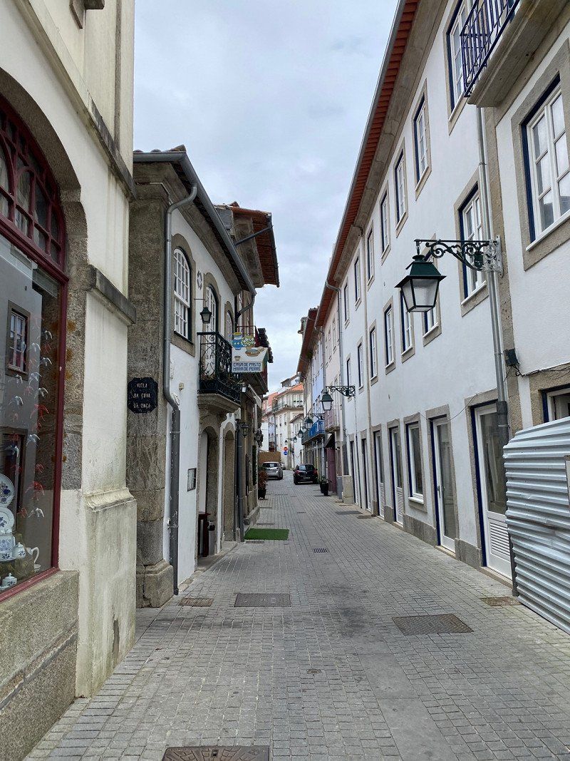
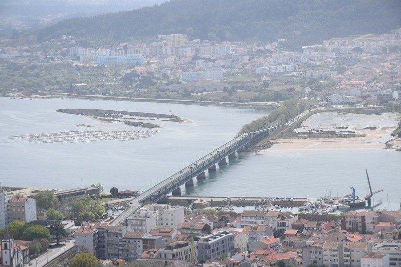
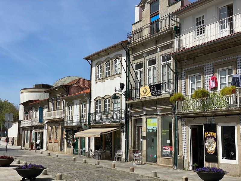
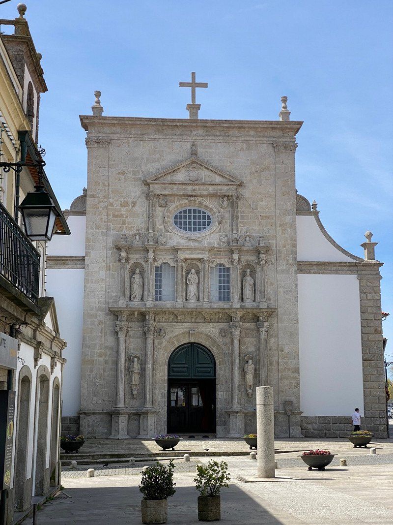
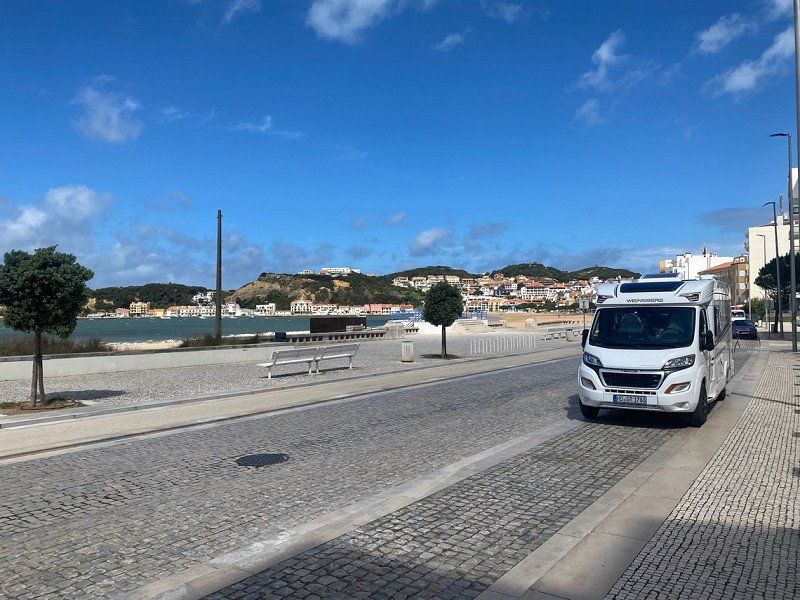
Viana do Castelo, Portugal
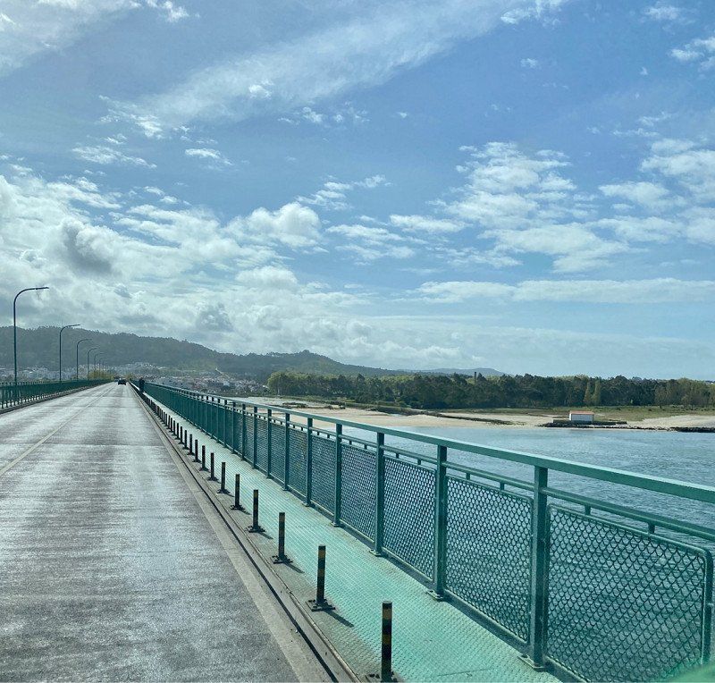
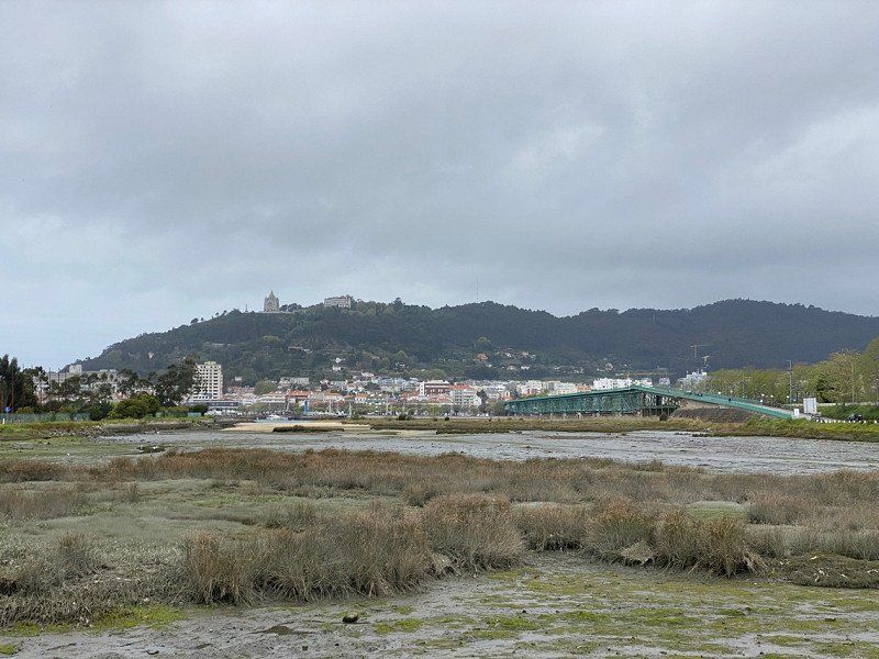
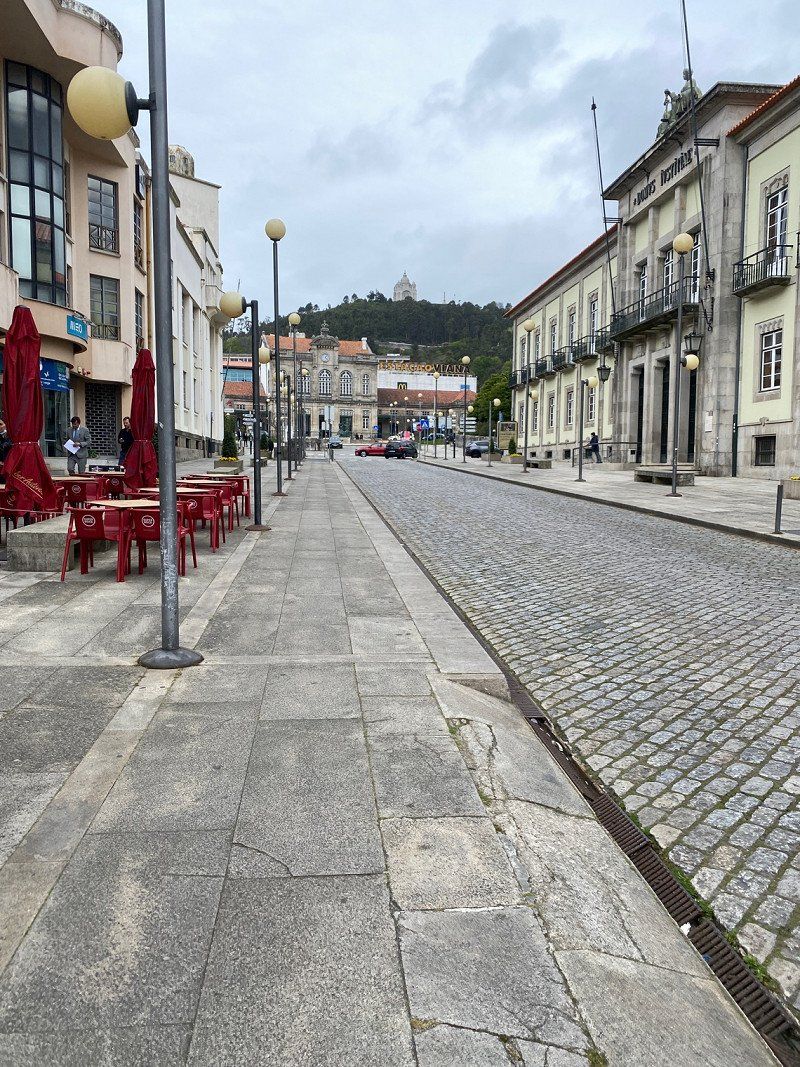
On the day of arrival we will visit Viana do Castelo. Unfortunately we have to walk over this bridge twice because the ferry only starts on May 1st. is back in operation. In Viana we got a prepaid card (from MEO) for our router. So we can use the internet with our router in the camper for 15 days. We need our data on our cell phones when we are out and about by bike.
We visited the Café Natario (it was recommended to us). Great different sweets. Very nice service. We decided on a little thing, didn't try it 😜 but very seductive.
41° 41' 30.6" N 8° 50' 3.9" W
41.6918275 -8.8344101
• Head toward Rua Gois Pinto on Largo São Domingos. Go for 132 m.
• Continue on Rua Altamira. Go for 125 m.
• Continue on Largo Amadeu Costa. Go for 33 m.
• Continue on Largo Vasco da Gama. Go for 84 m.
• Continue on Rua dos Manjovos. Go for 113 m.
• Turn right onto Rua das Flores. Go for 41 m.
• Turn right onto Avenida dos Combatentes da Grande Guerra. Go for 44 m.
• Turn right onto Praça da Liberdade. Go for 44 m.
• Turn left onto Praça da Liberdade. Go for 34 m.
• Continue on Praça do Eixo Atlântico. Go for 42 m.
• Continue on Praça da Liberdade. Go for 84 m.
• Turn right onto Alameda 5 de Outubro. Go for 27 m.
• Continue on Largo 5 de Outubro. Go for 20 m.
• Continue on Alameda 5 de Outubro. Go for 96 m.
• Continue on Avenida Luís de Camões. Go for 13 m.
• Continue on Alameda 5 de Outubro. Go for 113 m.
• Continue on Avenida Luís de Camões. Go for 94 m.
• Continue on Alameda 5 de Outubro. Go for 259 m.
• Continue on Avenida Luís de Camões. Go for 64 m.
• Continue on Praça da Galiza. Go for 135 m.
• Continue on Estrada da Papanata (N202). Go for 700 m.
• Take the 1st exit from roundabout onto Variante IC1. Go for 1.8 km.
• Take ramp onto A28 (Autoestrada do Litoral Norte) toward Porto/P. Varzim. Go for 67.2 km.
• Take ramp onto A20/A28 (Autoestrada do Litoral Norte) toward P.te Arrábida/Gaia/Lisboa/A1. Go for 438 m.
• Continue on A28 (Autoestrada do Litoral Norte). Go for 2.1 km.
• Continue on A1 (Autoestrada do Norte). Go for 55.2 km.
• Take exit 16 toward Aveiro onto A25 (Autoestrada da Costa da Prata). Go for 10.7 km.
• Take the exit toward Aveiro onto A25 (Autoestrada Beiras Litoral e Alta). Go for 14.2 km.
• Continue on Avenida de Nossa Senhora da Saúde (N109-7). Go for 1.1 km.
• Continue on Avenida José Estevão (N109-7). Go for 1.8 km.
• Continue on M592. Go for 5.1 km.
• Take the 1st exit from roundabout onto Avenida João Vaz da Silva. Go for 417 m.
• Continue on Avenida João Vaz. Go for 27 m.
• Turn left onto Rua Onze. Go for 71 m.
• Turn left onto Avenida Claudino Santos Costa (M592). Go for 16 m.
• Turn right onto Rua António Labrego. Go for 252 m.
• Turn right onto M592. Go for 1.4 km.
• Turn right. Go for 32 m.
• Arrive at your destination on the right.
☍
164,1 km
(1 hrs. 51 min.)
Day
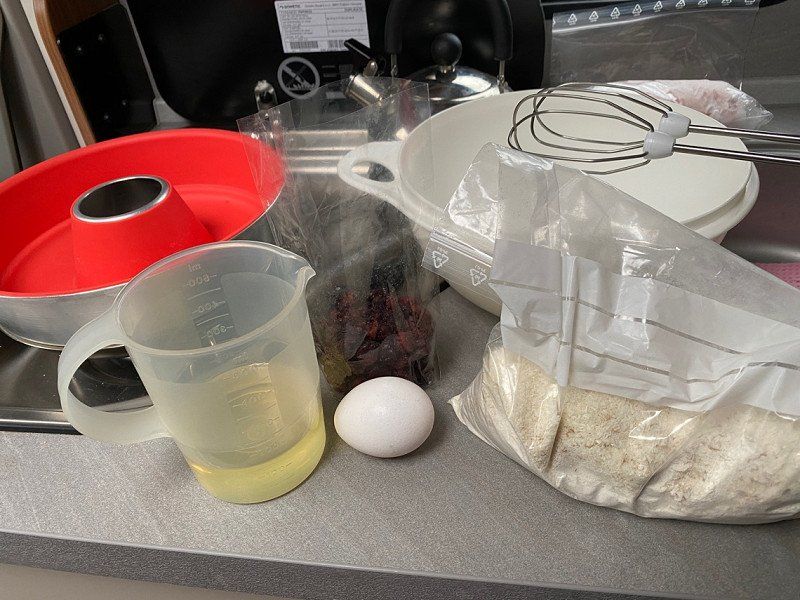
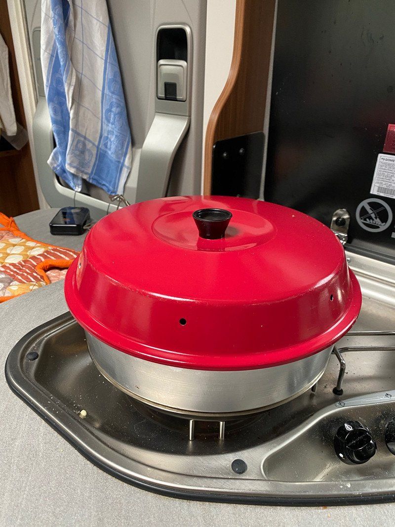
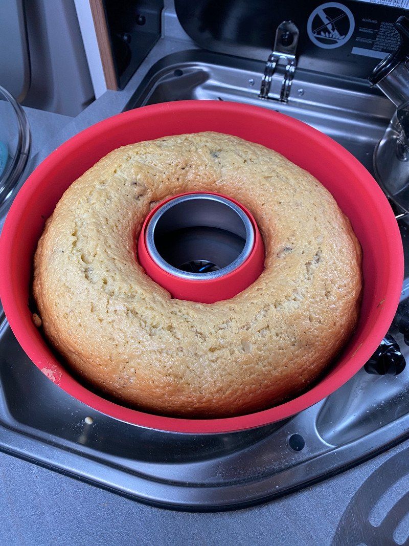
Nix tun - Regentag
Today it rains all day and we relax in the camper.
We bake cakes and cook together.
Day
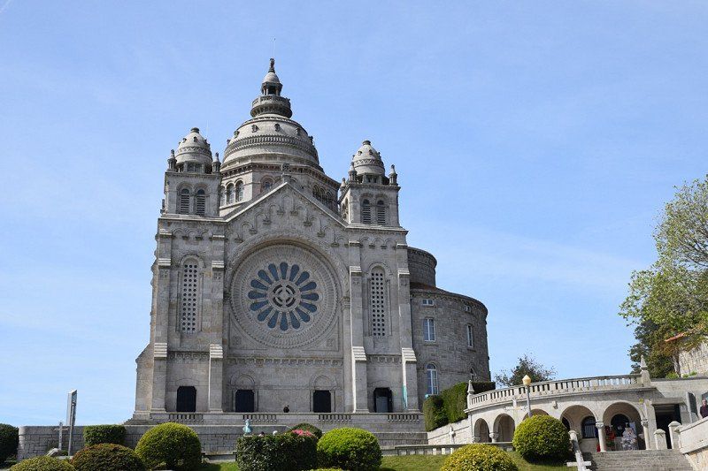
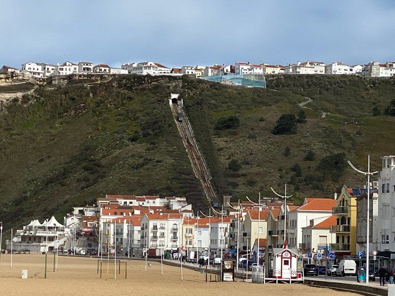
Viana do Castelo - Santa Luzia - Seilbahnfahrt
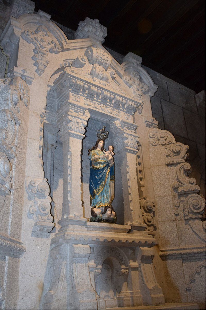
The sun is shining and we decide to take the train to Viana do Castelo. Then with the cable car up to the Cathedral of Santa Luzia. Should be a great view. The train left in Areia Darque (walked there, approx. 3.5 km from the campsite) (€1.45 per person). We drove to one station. Within walking distance from the train station to the cable car station in 6 minutes. Round trip 3€/pers. Every 15 minutes runs a cable car. Great view at the top, cathedral open, small cafe too.
It was totally worth it!!
Day
Área de Autocaravanas
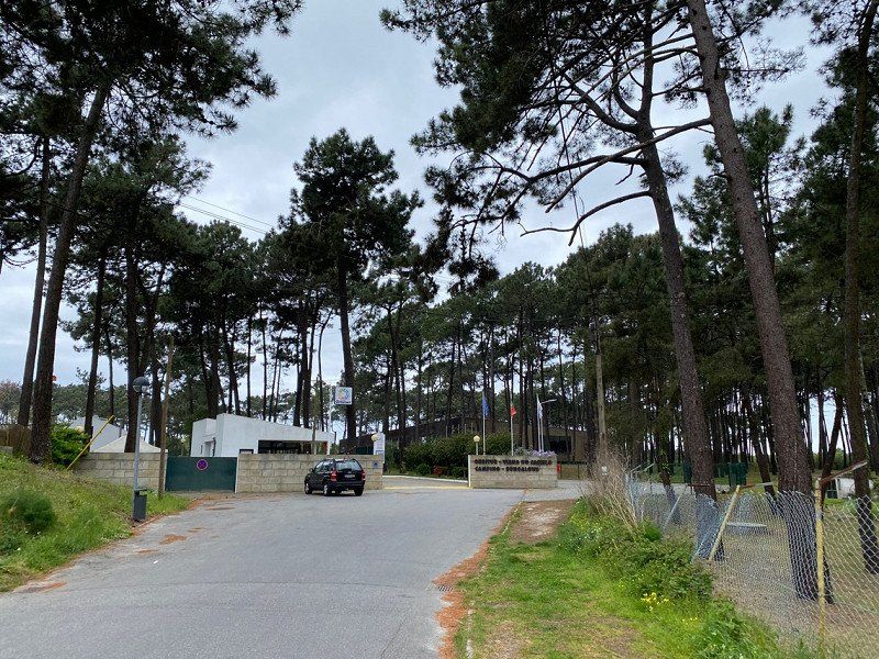
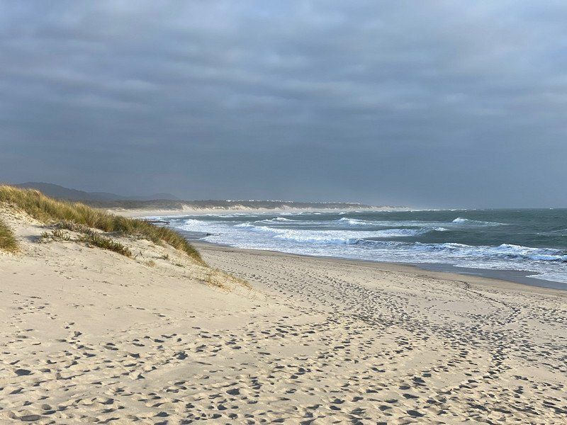
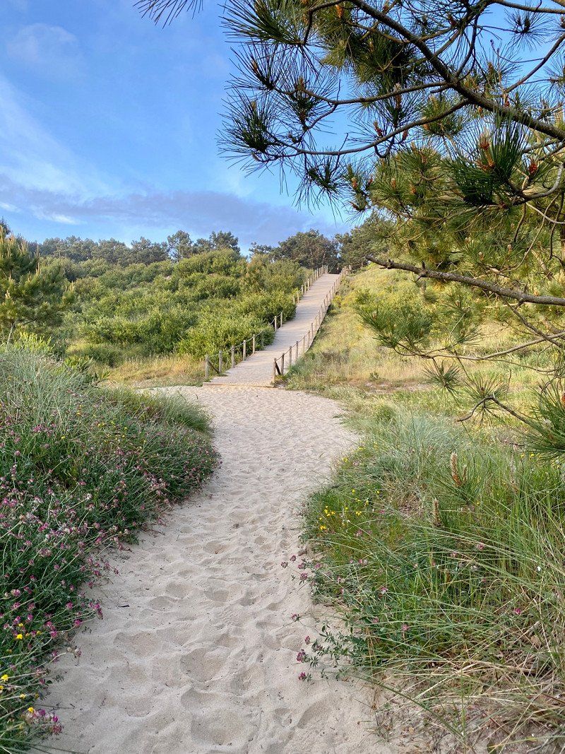
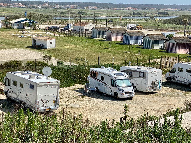
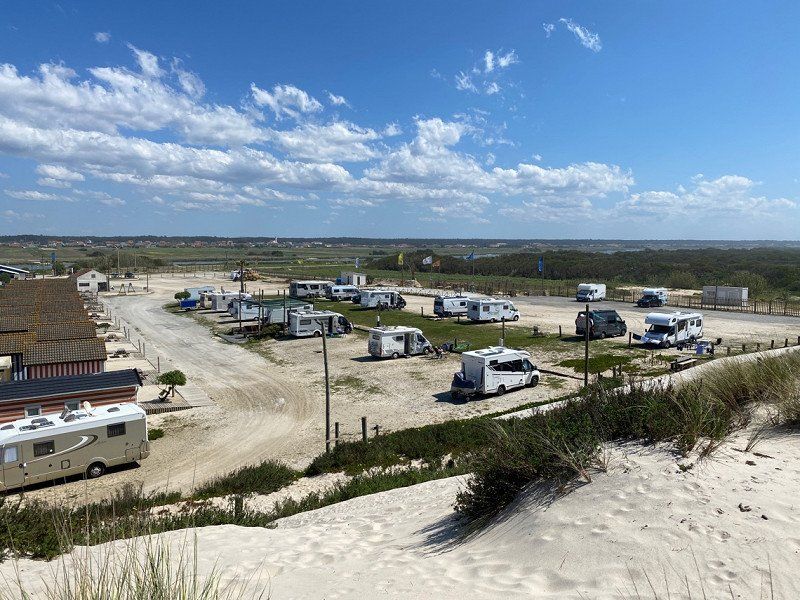
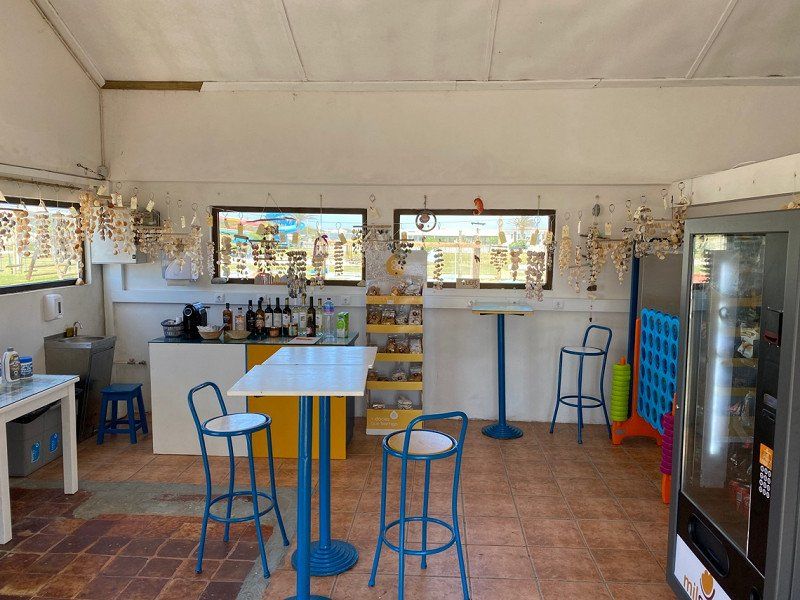
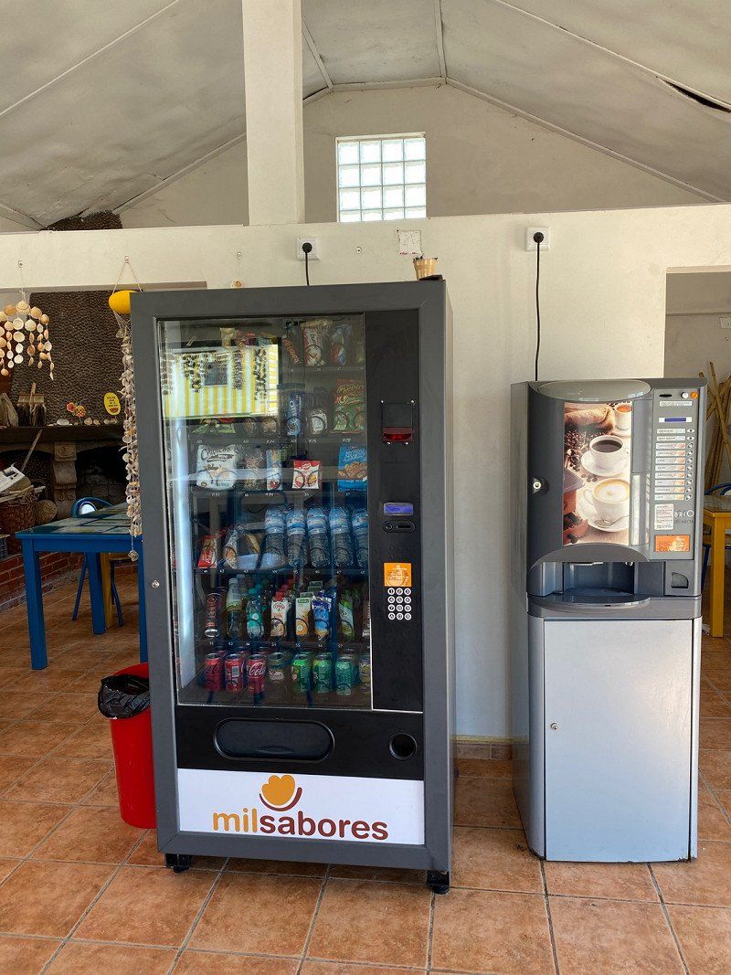
Very nice pitch for €8.50 without electricity, with sanitary building, there are pitches with electricity, V+E available, bread service, lounge with TV, fireplace, vending machines for drinks, sweets and coffee, beer and wine. Great for smaller children there is a pool (pre-season not yet) mini golf possible. Very friendly staff.The beach is just a few steps from the site, the site is protected by a dune. We would love to come back here.
Ria do Governador, 3840-254, Vagos, Portugal
40° 32' 58" N 8° 46' 14" W
40.5494444 -8.7705556
• Head east. Go for 32 m.
• Turn right onto M592. Go for 3.3 km.
• Turn left toward Rua Principal/M591. Go for 556 m.
• Turn right onto Rua Principal (M591). Go for 3.7 km.
• Turn left onto Rua do Leque Florestal. Go for 7.0 km.
• Continue straight ahead. Go for 731 m.
• Continue straight ahead. Go for 260 m.
• Continue toward Autoestrada do Litoral Centro/A17. Go for 32 m.
• Take the 3rd exit from roundabout onto A17 (Autoestrada do Litoral Centro) toward Lisboa/Fig.ra Foz. Go for 93.9 km.
• Continue on A8 (Autoestrada do Oeste). Go for 19.6 km.
• Take exit 22 toward Nazaré. Go for 1.1 km.
• Take the 2nd exit from roundabout onto N8-5 toward Tomar/Nazaré. Go for 663 m.
• Take the 3rd exit from roundabout onto N8-5 toward Nazaré. Go for 228 m.
• Take the 2nd exit from roundabout onto Avenida da Nazaré (N8-5). Go for 1.9 km.
• Continue on N8-5. Go for 1.9 km.
• Pass 2 roundabouts and continue on N8-5. Go for 439 m.
• Take the 1st exit from roundabout onto N8-5 toward Nazaré. Go for 396 m.
• Continue on Rua Combatentes do Ultramar (N8-5). Go for 392 m.
• Take the 1st exit from Rotunda do Matadouro roundabout onto Avenida Nogent-Sur Marne (N242). Go for 256 m.
• Take the 4th exit from Rotunda da Cerâmica roundabout onto Avenida Circular Norte. Go for 206 m.
• Turn left onto Avenida Circular Norte. Go for 40 m.
• Turn slightly right onto Avenida da Independência Nacional. Go for 30 m.
• Continue on Avenida de Olivença. Go for 90 m.
• Continue on Rua Adrião Batalha. Go for 143 m.
• Turn left onto Rua Mouzinho de Albuquerque. Go for 14 m.
• Turn right onto Rua França Borges. Go for 25 m.
• Arrive at Rua França Borges. Your destination is on the left.
☍
136,9 km
(1 hrs. 27 min.)
Day
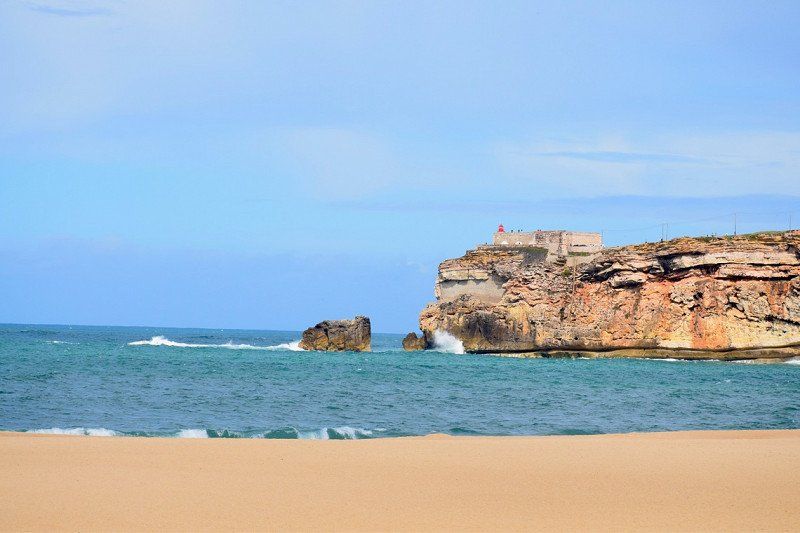
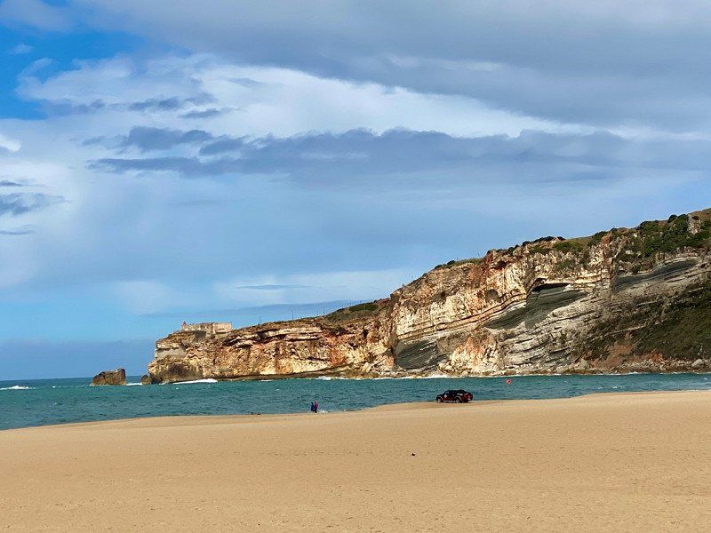
Nazaré, Portugal
The place on the coast is known for high waves. We finally had sun and no waves.
We take pictures of the beach and have a light lunch with a nice view.
Then we continue.
2450 Nazaré, Portugal
39° 36' 4.4" N 9° 4' 12.4" W
39.6012147 -9.0700991
• Head toward Travessa do Açougue on Rua França Borges. Go for 37 m.
• Turn slightly left onto Travessa do Açougue. Go for 4 m.
• Turn left onto Travessa do Açougue. Go for 17 m.
• Turn left onto Rua Joaquim Bernardo de Souza Lobo. Go for 68 m.
• Turn right onto Rua Mouzinho de Albuquerque. Go for 83 m.
• Keep left onto Rua Mouzinho de Albuquerque. Go for 142 m.
• Continue on Avenida dos Bombeiros Voluntários (N242). Go for 148 m.
• Take the 2nd exit from Rotunda do Matadouro roundabout onto Rua Combatentes do Ultramar (N8-5). Go for 421 m.
• Continue on N8-5. Go for 367 m.
• Take the 3rd exit from roundabout onto N8-5 toward Lisboa/Leiria/Valado dos Frades. Go for 198 m.
• Pass 2 roundabouts and continue on N8-5. Go for 2.2 km.
• Continue on Avenida da Nazaré (N8-5). Go for 1.8 km.
• Take the 2nd exit from roundabout onto N8-5. Go for 237 m.
• Take the 2nd exit from roundabout onto N8-5 toward Alcobaça/A8. Go for 664 m.
• Take the 3rd exit from roundabout onto A8 (Autoestrada do Oeste) toward Lisboa. Go for 35.2 km.
• Take exit 14 toward Peniche onto IP6. Go for 16.5 km.
• Pass 3 roundabouts and continue on Avenida Mons. Manuel Bastos Rod. de Sousa (IP6). Go for 4.1 km.
• Take the 3rd exit from roundabout onto Avenida 25 de Abril. Go for 547 m.
• Turn right onto Rua António da Conceição Bento. Go for 186 m.
• Take the 1st exit from roundabout onto Avenida Paulo VI. Go for 55 m.
• Take the 3rd exit from roundabout onto Rua Estado Português da Índia. Go for 161 m.
• Turn right onto Rua Arquitecto Paulino Montez. Go for 189 m.
• Turn left onto Rua Heróis do Ultramar. Go for 175 m.
• Continue on Rua Doutor João de Matos Bilhau. Go for 35 m.
• Turn right onto Rua Doutor João de Matos Bilhau. Go for 176 m.
• Continue on Rua Doutor Francisco Sá Carneiro. Go for 164 m.
• Arrive at Rua Doutor Francisco Sá Carneiro. Your destination is on the right.
☍
63,8 km
( 46 min.)
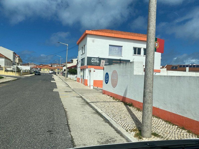
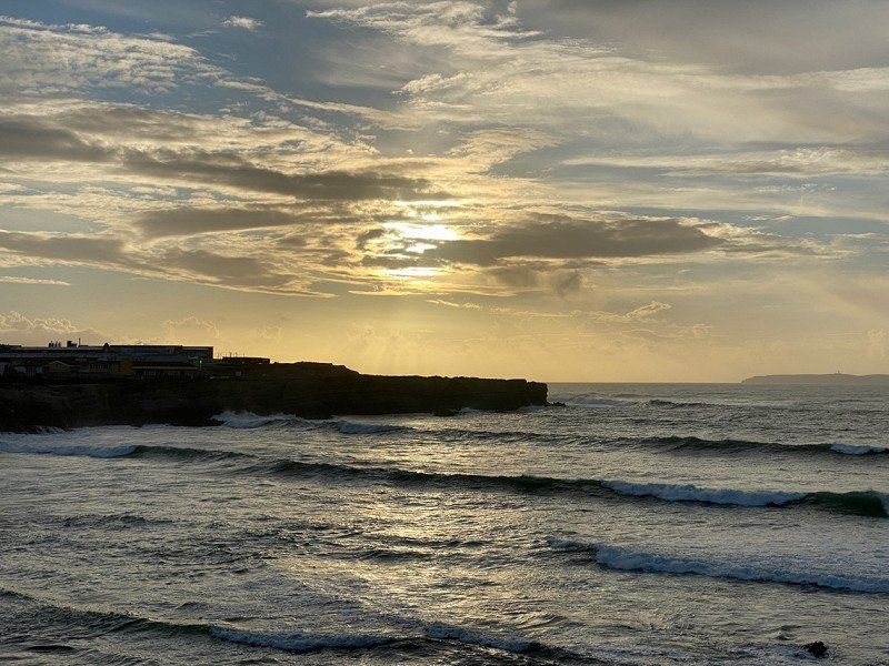
Peniche, Portugal
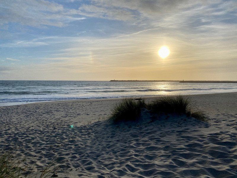
ASA Peniche - pitch per night with electricity 10€, 1€ showers, -.50€ toilet. Everything clean and very friendly. English Safe place as completely surrounded by a wall. Aldi and Lidl just around the corner. In the evening we walk to the coast and take pictures of the sunset
2520 Peniche, Portugal
39° 21' 37.2" N 9° 23' 15.4" W
39.3603291 -9.3876220
• Head toward Travessa 7 Chaves on Rua Doutor Francisco Sá Carneiro. Go for 49 m.
• Turn right onto Rua José Cândido Azevedo e Melo. Go for 134 m.
• Turn right onto Rua Arquitecto Paulino Montez. Go for 634 m.
• Turn right onto Rua Estado Português da Índia. Go for 99 m.
• Continue on Largo Bispo Mariana. Go for 104 m.
• Continue on Rua Dom Luís de Atayde. Go for 66 m.
• Continue on Largo Dom Figueiredo Faria. Go for 27 m.
• Turn right onto Rua Alexandre Herculano. Go for 38 m.
• Continue on Praça Jacob Rodrigues Pereira. Go for 52 m.
• Continue on Rua 13 de Infantaria. Go for 172 m.
• Take the 3rd exit from Largo do Município roundabout onto Avenida do Porto de Pesca. Go for 206 m.
• Pass 2 roundabouts and continue on Avenida do Porto de Pesca. Go for 781 m.
• Take the 3rd exit from roundabout. Go for 308 m.
• Continue toward Avenida Mons. Manuel Bastos Rod. de Sousa/IP6. Go for 31 m.
• Take the 1st exit from roundabout onto Avenida Mons. Manuel Bastos Rod. de Sousa (IP6). Go for 1.1 km.
• Take the 3rd exit from roundabout onto IP6. Go for 1.8 km.
• Take the 2nd exit from roundabout onto IP6. Go for 1.8 km.
• Take ramp onto N247 toward Lourinhã/Atouguia. Go for 8.3 km.
• Turn right onto Estrada da Areia Branca. Go for 715 m.
• Take the 2nd exit from roundabout onto Estrada Nossa Senhora dos Remédios. Go for 99 m.
• Continue on Rua Heróis do Ultramar. Go for 374 m.
• Turn left onto Rua do Moinho. Go for 1.0 km.
• Continue on Rua Bela Vista. Go for 538 m.
• Continue on Estrada da Bela Vista. Go for 161 m.
• Continue on Rua Bela Vista. Go for 266 m.
• Continue on Estrada da Bela Vista. Go for 373 m.
• Continue on Estrada Nossa Senhora da Guia. Go for 747 m.
• Continue on Estrada dos Moinhos. Go for 464 m.
• Continue on Estrada da Cabaceira. Go for 944 m.
• Continue on Estrada Alto Félix. Go for 192 m.
• Continue on Estrada do Alto do Félix. Go for 268 m.
• Turn right toward Estrada Nacional 247. Go for 276 m.
• Continue on Estrada Nacional 247. Go for 127 m.
• Continue on Travessa da Moagem. Go for 474 m.
• Continue on Avenida da Liberdade. Go for 1.0 km.
• Arrive at Avenida da Liberdade. Your destination is on the right.
☍
23,8 km
( 30 min.)
Day
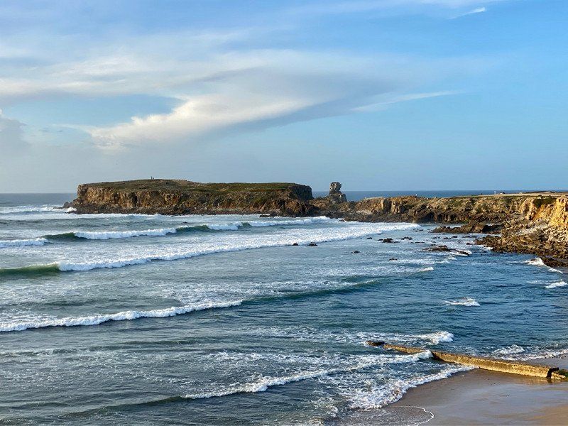
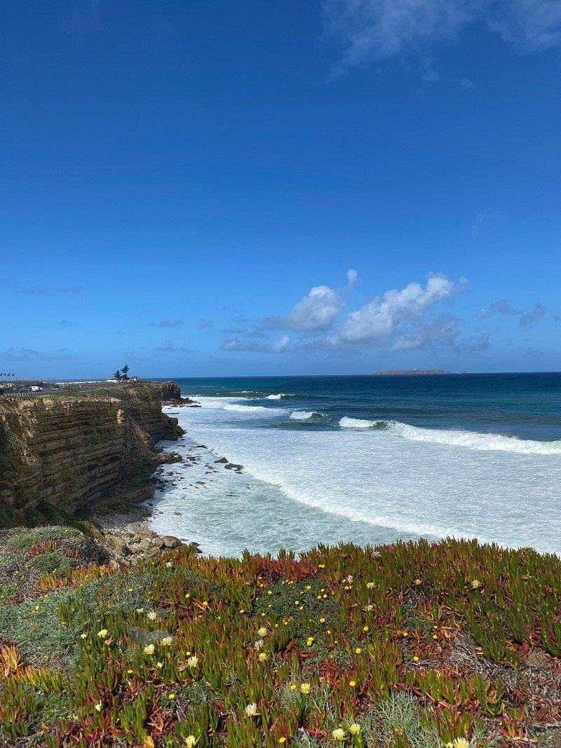
Fahrradtour - Umrandung der Halbinsel
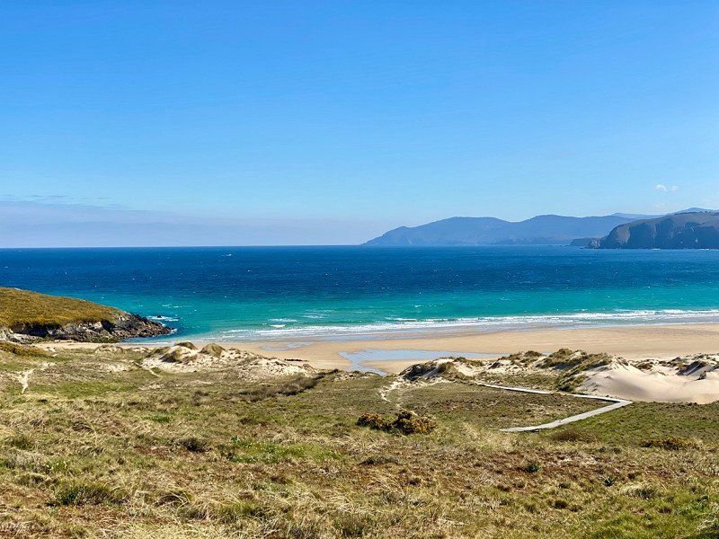
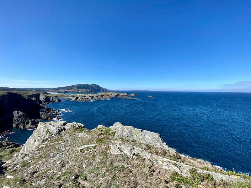
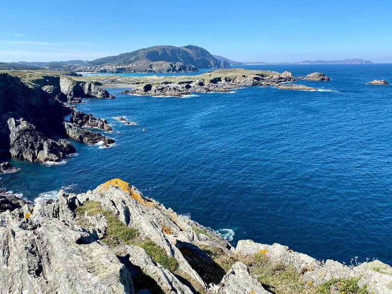
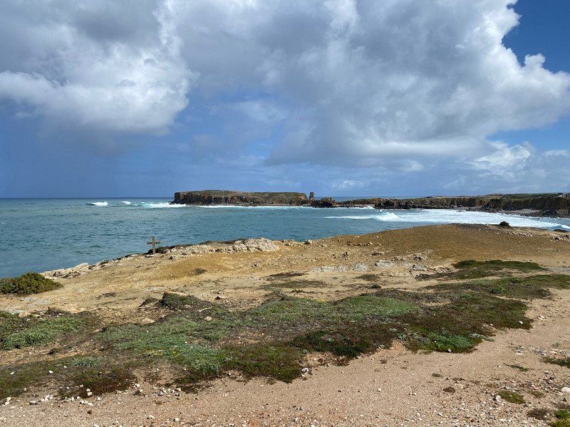
Very beautiful peninsula. We cycled around it once. Delicious fish eaten in the harbor The coast here is very natural. Womos are free at the lighthouse (the police are there too), and there are also Womos from time to time on the coast.
We like it here very much!!
Day
Ribamar, Portugal
2530 Ribamar, Portugal
39° 12' 9.7" N 9° 19' 43.1" W
39.2027080 -9.3286491
• Head southwest on Avenida da Liberdade. Go for 480 m.
• Continue on Largo das Camélias. Go for 9 m.
• Continue on Avenida da Liberdade. Go for 569 m.
• Continue on Rua das Mós (M625). Go for 844 m.
• Continue on Rua Rainha Santa Isabel (M625). Go for 674 m.
• Take the 1st exit from roundabout onto Rua José dos Santos Pereira (M561-1). Go for 221 m.
• Continue on Rua Joaquim Pedro Fernandes (M561-1). Go for 1.4 km.
• Continue on M561-1. Go for 1.3 km.
• Take the 2nd exit from roundabout onto M561-1. Go for 1.2 km.
• Continue on Estrada Seixo (M561-1). Go for 430 m.
• Continue on M561-1. Go for 862 m.
• Continue on Rua António Franco (M561-1). Go for 992 m.
• Take the 1st exit from roundabout onto N247. Go for 52 m.
• Continue on Rua João Paulo II (N247). Go for 608 m.
• Take the 4th exit from roundabout onto N247. Go for 1.3 km.
• Take the 2nd exit from roundabout onto N247. Go for 484 m.
• Continue on Urbanização Mar Azul (N247). Go for 320 m.
• Continue on N247. Go for 529 m.
• Continue on Estrada Nacional (N247). Go for 577 m.
• Continue on N247. Go for 18 m.
• Continue on Rua Pinhal do Abrigo (N247). Go for 428 m.
• Continue on N247. Go for 8 m.
• Continue on Rua Inácio Nunes da Costa (N247). Go for 233 m.
• Take the 1st exit from roundabout onto Rua Inácio Nunes da Costa (N247). Go for 390 m.
• Continue on Largo Irmã Benedita do Vale Jordão (N247). Go for 72 m.
• Take the 2nd exit from roundabout onto Rua Antonino Gomes (M1367). Go for 260 m.
• Continue on M1367. Go for 156 m.
• Take the 2nd exit from roundabout onto M1367. Go for 604 m.
• Continue on Estrada Municipal Silveira Coutada (M1367). Go for 1.6 km.
• Continue on Rua José Francisco Roque (M1367). Go for 526 m.
• Continue on M1367. Go for 103 m.
• Continue on Rua do Lavadouro (M1367). Go for 78 m.
• Continue on M1367. Go for 188 m.
• Take the 1st exit from roundabout onto N9/N247. Go for 389 m.
• Arrive at N9/N247. Your destination is on the left.
☍
17,8 km
( 21 min.)
N 9 EN 9 km 55,65 Casal do, R. da Aranha, 2560-192 São Pedro da Cadeira, Portugal
39° 4' 47.7" N 9° 22' 19.1" W
39.0799178 -9.3719585
• Head southwest on N9/N247. Go for 263 m.
• Take the 3rd exit from roundabout onto Rua da Pedreira (N9). Go for 514 m.
• Continue on N9. Go for 305 m.
• Continue on Avenida Álvaro Vaz do Urmeiro (N9). Go for 621 m.
• Continue on N9. Go for 3.1 km.
• Continue on Rua Nossa Senhora da Nazaré (N9). Go for 314 m.
• Continue on Rua Doutor César Raúl da Costa Andrade (N9). Go for 600 m.
• Continue on Rua Dom Jorge de Figueiredo (N9). Go for 417 m.
• Continue on Rua das Labruscas (N9). Go for 411 m.
• Continue on N9. Go for 1.5 km.
• Keep right onto N9. Go for 1.7 km.
• Continue on Charneca-Mafra (N9). Go for 135 m.
• Continue on N9. Go for 1.0 km.
• Continue on Casal do Vale Grande (N9). Go for 83 m.
• Continue on N9. Go for 2.3 km.
• Take the 3rd exit from roundabout onto Circular Rodoviária Interior Mafra. Go for 2.9 km.
• Take the 3rd exit from roundabout onto N116. Go for 1.8 km.
• Take the 2nd exit from roundabout onto Avenida da Liberdade. Go for 734 m.
• Take the 2nd exit from roundabout onto Avenida 25 de Abril (N9). Go for 205 m.
• Take the 3rd exit from roundabout onto Avenida 25 de Abril (N9). Go for 496 m.
• Continue on Terreiro Dom João V (N9). Go for 35 m.
• Take the 1st exit from roundabout onto Terreiro Dom João V (N9). Go for 272 m.
• Take the 2nd exit from roundabout onto Avenida Movimento das Forças Armadas (N9). Go for 363 m.
• Turn left onto Avenida Movimento das Forças Armadas (N9). Go for 94 m.
• Take the 2nd exit from roundabout onto Avenida Movimento das Forças Armadas (N9). Go for 1.2 km.
• Continue on N9. Go for 240 m.
• Take the 1st exit from roundabout onto Rua Dom João V (N9). Go for 8.8 km.
• Take ramp onto IC30 toward Cascais/Sintra. Go for 5.0 km.
• Take the 2nd exit from roundabout onto IC30. Go for 2.4 km.
• Take ramp onto A16 toward Cascais/Sintra/IC19/Lisboa. Go for 12.2 km.
• Continue on Avenida de Sintra (N9). Go for 247 m.
• Take the 2nd exit from roundabout onto Avenida de Sintra (N9). Go for 307 m.
• Take the 2nd exit from roundabout onto Variante à N9. Go for 585 m.
• Continue on Avenida de Sintra (N9). Go for 220 m.
• Take the 3rd exit from roundabout onto Avenida de Sintra (N9). Go for 482 m.
• Pass 3 roundabouts and continue on Avenida de Sintra (N9). Go for 1.1 km.
• Take the 1st exit from roundabout onto Avenida Dom Pedro I. Go for 26 m.
• Turn left onto Avenida Marginal (N6). Go for 228 m.
• Continue on Praça Doutor Francisco Sá Carneiro. Go for 24 m.
• Turn left toward Praça Doutor Francisco Sá Carneiro. Go for 28 m.
• Turn left onto Praça Doutor Francisco Sá Carneiro. Go for 28 m.
• Continue on Alameda dos Combatentes da Grande Guerra. Go for 126 m.
• Take the 1st exit from roundabout onto Rua Visconde da Luz. Go for 71 m.
• Turn left onto Travessa do Visconde da Luz. Go for 138 m.
• Turn right onto Travessa do Visconde da Luz. Go for 63 m.
• Turn left onto Rua dos Navegantes. Go for 150 m.
• Turn right onto Travessa do Prior. Go for 47 m.
• Turn right onto Rua do Gama. Go for 18 m.
• Arrive at Rua do Gama. Your destination is on the left.
☍
54,0 km
( 56 min.)
Cascais, Portugal
2750 Cascais, Portugal
38° 41' 49.4" N 9° 25' 20.3" W
38.6970565 -9.4222945
• Head toward Largo Doutor Passos Vella on Rua do Gama. Go for 38 m.
• Turn right onto Largo Doutor Passos Vella. Go for 4 m.
• Turn left onto Largo Doutor Passos Vella. Go for 17 m.
• Turn right onto Travessa dos Navegantes. Go for 133 m.
• Turn left onto Rua Nova da Alfarrobeira. Go for 44 m.
• Turn slightly right onto Rua Alexandre Herculano. Go for 64 m.
• Take the 3rd exit from roundabout onto Alameda dos Combatentes da Grande Guerra. Go for 161 m.
• Turn right onto Praça Doutor Francisco Sá Carneiro. Go for 75 m.
• Turn right onto Avenida Marginal (N6). Go for 223 m.
• Take the 2nd exit from roundabout onto Avenida de Sintra (N9). Go for 261 m.
• Pass 3 roundabouts and continue on Avenida de Sintra (N9). Go for 1.3 km.
• Take the 2nd exit from roundabout onto Avenida de Sintra (N9). Go for 285 m.
• Continue on Variante à N9. Go for 526 m.
• Take the 1st exit from roundabout onto Avenida de Sintra (N9). Go for 315 m.
• Take the 2nd exit from roundabout onto Avenida de Sintra (N9). Go for 65 m.
• Take ramp onto A5 (Autoestrada da Costa do Estoril) toward Lisboa/Carcavelos. Go for 21.9 km.
• Keep right toward Pr. de Espanha/Sul/A2. Go for 734 m.
• Take the exit toward A2/Sul/Ponte onto IP7 (Eixo Norte-Sul). Go for 4.8 km.
• Continue on A2 (Autoestrada do Sul). Go for 32.0 km.
• Take exit 5 toward Setúbal onto A12 (Autoestrada Sul do Tejo). Go for 5.4 km.
• Take the 2nd exit from roundabout onto Avenida Pedro Álvares Cabral toward Setúbal. Go for 483 m.
• Take the 2nd exit from roundabout onto Avenida Pedro Álvares Cabral toward Setúbal Nascente. Go for 214 m.
• Take the 1st exit from Praça de Portugal roundabout onto Avenida Dom João II. Go for 633 m.
• Take the 2nd exit from roundabout onto Avenida Bento Gonçalves. Go for 533 m.
• Continue on Praça General Luís Domingues. Go for 204 m.
• Continue on Rua do Doutor Vicente José de Carvalho. Go for 45 m.
• Turn right onto Ladeira da Ponte de São Sebastião. Go for 166 m.
• Continue on Avenida Luísa Todi. Go for 943 m.
• Keep right onto Avenida Luísa Todi (N10-4). Go for 489 m.
• Turn right onto Rua Amália Rodrigues (N10-4). Go for 331 m.
• Continue on Estrada da Rasca (N10-4). Go for 3.5 km.
• Continue on Rua Orlando Curto (N379-1). Go for 172 m.
• Arrive at Rua Orlando Curto (N379-1). Your destination is on the left.
☍
76,1 km
( 57 min.)
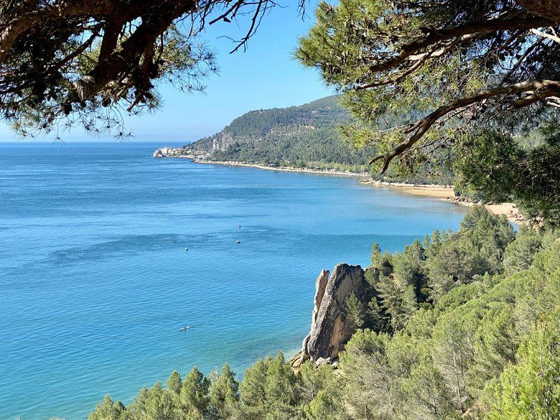
Ecoparque do Outão
Actually we wanted to drive to Cabo de Roca, then to Cascais.
But the small roads and tight corners stressed us out. So we decided without further ado to go to Cascais. We can't find a quiet spot or parking space here, let alone a CP, so we continue to Setubal.
Here we find this beautiful pitch, which is laid out more like a CP. Sanitary building new and clean, but there is no hot water for rinsing. The camper costs €10.80 including the driver, the second person €5.80 and €3.60 for electricity/night. So we pay €20.20/night. It's Easter week and we're paying for the sea view here. We're staying here for 2 days to see Setubal.
R. do Outão n/n, 2900 - 182, Setúbal, Portugal
38° 30' 9.9" N 8° 55' 43" W
38.5027500 -8.9286000
• Head northeast on Rua Orlando Curto (N379-1). Go for 172 m.
• Continue on Estrada da Rasca (N10-4). Go for 847 m.
• Turn sharp left onto M1056. Go for 2.2 km.
• Turn right onto N10. Go for 3.4 km.
• Take the 2nd exit from Bairro General Daniel de Sousa roundabout. Go for 156 m.
• Continue on Variante da Várzea. Go for 23 m.
• Take the 2nd exit from roundabout onto Avenida da Europa. Go for 257 m.
• Pass 3 roundabouts and continue on Avenida da Europa. Go for 1.2 km.
• Turn left onto Estrada dos Ciprestes (N252) toward Lisboa/A12/Algarve/Alcácer/N10/Palmela/Montijo. Go for 384 m.
• Turn right onto Avenida Antero de Quental (N10) toward Lisboa/A2/Algarve/A12/Pte. Vasco da Gama. Go for 858 m.
• Take the 3rd exit from roundabout onto Autoestrada Sul do Tejo (A12) toward Lisboa/Algarve/Espanha. Go for 4.8 km.
• Keep right onto Nó Pinhal Novo toward A2/Lisboa (Sul)/Almada/Palmela/Algarve/Évora. Go for 185 m.
• Take exit 1 toward Algarve/Évora onto A2 (Autoestrada do Sul). Go for 67.1 km.
• Take exit 9 toward Sines/IC1/Grândola. Go for 1.1 km.
• Continue on IP8. Go for 38.1 km.
• Continue on A26 (Autoestrada do Baixo Alentejo). Go for 7.6 km.
• Keep left onto Autoestrada do Baixo Alentejo (A26) toward Sines. Go for 1.4 km.
• Continue on R261-5. Go for 573 m.
• Pass 2 roundabouts and continue on R261-5. Go for 894 m.
• Take ramp toward Sines. Go for 374 m.
• Take the 3rd exit from roundabout onto Avenida Dom Pedro I. Go for 480 m.
• Take the 2nd exit from roundabout onto Avenida Dom Pedro I. Go for 178 m.
• Take the 1st exit from roundabout onto Rua Maria Lamas. Go for 393 m.
• Turn right onto Bairro 1 de Maio. Go for 31 m.
• Arrive at Bairro 1 de Maio. Your destination is on the left.
☍
132,6 km
(1 hrs. 22 min.)
Day
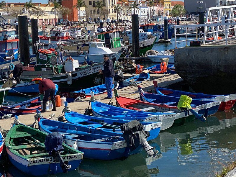
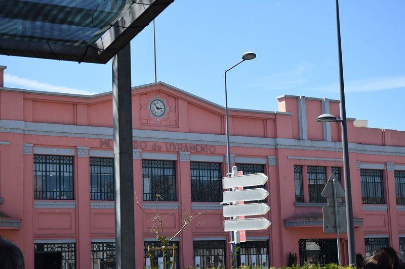
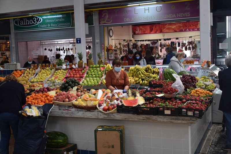
Sétubal - Fischereihafen, Markthalle
Excursion by bike to Setubal, market hall and fortress is on the plan. We may see the dolphins that live in the Rio Sado.
Day
Sines, Portugal
Continue towards the Algarve.
Lunch with a great view
37° 57' 25.8" N 8° 51' 39.2" W
37.9571555 -8.8608907
• Head toward Rua Maria Lamas on Bairro 1 de Maio. Go for 31 m.
• Turn right onto Rua Maria Lamas. Go for 150 m.
• Turn left onto Rua Júlio Gomes da Silva. Go for 52 m.
• Turn right onto Rua Pedro Álvares Cabral. Go for 276 m.
• Continue on Rua Gago Coutinho. Go for 126 m.
• Turn left onto Rua João de Deus. Go for 98 m.
• Turn right onto Rua Pedro Nunes. Go for 311 m.
• Turn left onto Avenida Vasco da Gama (IC4). Go for 445 m.
• Take the 2nd exit from roundabout onto IC4. Go for 1.1 km.
• Pass 2 roundabouts and continue on IC4. Go for 4.3 km.
• Turn right onto M1109 toward Porto Covo/São Torpes. Go for 1.6 km.
• Take the 1st exit from roundabout onto M1109. Go for 6.8 km.
• Continue on Rua do Mar (M1109). Go for 903 m.
• Turn right onto Rua Conde Bandeira. Go for 177 m.
• Arrive at your destination on the left.
☍
16,4 km
( 17 min.)
Parque de Campismo de Porto Covo
CP for 2 nights without electricity for 16.80 €/night Most beautiful weather, lots of local campers. Sanitary building simple but clean. Small restaurant on site, as well as a mini supermarket. In the afternoon we walk down to the coast. Tomorrow we will use the bikes to explore the coast.
Estrada Municipal 554, 7520 - 437, Porto Côvo, Portugal
37° 51' 2" N 8° 47' 42" W
37.8505500 -8.7950000
• Head southeast. Go for 46 m.
• Turn left toward Rua da Praia Pequena. Go for 62 m.
• Turn left onto Rua da Praia Pequena. Go for 24 m.
• Turn right onto Rua José Faial. Go for 95 m.
• Turn left onto Rua do Mar (M1109). Go for 50 m.
• Turn sharp right onto Rua Conde Bandeira. Go for 203 m.
• Turn right onto Rua do Norte. Go for 69 m.
• Turn left onto M554. Go for 2.5 km.
• Take the 1st exit from roundabout onto M554-1. Go for 335 m.
• Turn left onto M1116. Go for 2.4 km.
• Turn left onto Rua 1 de Maio. Go for 3.7 km.
• Turn right toward IC4. Go for 152 m.
• Turn right onto IC4. Go for 1.7 km.
• Continue on N120 toward Lagos/Odemira/Cercal. Go for 7.2 km.
• Take the 2nd exit from Largo dos Caieiros roundabout onto Largo dos Caieiros (N120) toward Odemira. Go for 69 m.
• Continue on Rua de Odemira (N120). Go for 265 m.
• Continue on Estrada de São Luís (N120). Go for 70 m.
• Continue on Estrada de Odemira (N120). Go for 581 m.
• Continue on N120. Go for 5.8 km.
• Continue on Ferraria (N120). Go for 67 m.
• Continue on N120. Go for 2.8 km.
• Continue on Avenida 25 de Abril (N120). Go for 329 m.
• Turn right onto Estrada de Milfontes (M532). Go for 307 m.
• Continue on M532. Go for 7.3 km.
• Arrive at M532. Your destination is on the right.
☍
36,1 km
( 33 min.)
P7H8+9Q São Luís, Portugal
37° 43' 42.6" N 8° 43' 59.1" W
37.7284983 -8.7330911
• Head southeast on M532. Go for 7.3 km.
• Continue on Estrada de Milfontes (M532). Go for 307 m.
• Turn right onto Avenida 25 de Abril (N120). Go for 570 m.
• Continue on N120. Go for 14.4 km.
• Turn left onto Rua Capitão Salgueiro Maia. Go for 137 m.
• Arrive at Rua Capitão Salgueiro Maia. Your destination is on the left.
☍
22,7 km
( 19 min.)
J948+6X Odemira, Portugal
37° 36' 19.9" N 8° 37' 57" W
37.6055282 -8.6325073
• Head northwest on Rua Capitão Salgueiro Maia. Go for 137 m.
• Turn left onto N120. Go for 1.6 km.
• Take the 3rd exit from Rotunda do Lagar roundabout onto Avenida Poole da Costa (N120). Go for 3.2 km.
• Take the 2nd exit from roundabout onto N120 toward Lagos/Aljezur/S. Teotónio. Go for 9.5 km.
• Pass 2 roundabouts and continue on N120. Go for 28.1 km.
• Take the 1st exit from roundabout onto Avenida General Humberto Delgado (N120) toward Lagos/Bordeira. Go for 7.5 km.
• Turn right onto N268 toward V. do Bispo/Sagres/Alfambras/Bordeira/Carrapateira. Go for 27.4 km.
• Turn right toward Praça da República. Go for 64 m.
• Turn right onto Praça da República. Go for 7 m.
• Turn left onto Praça da República. Go for 37 m.
• Arrive at Praça da República. Your destination is on the right.
☍
77,5 km
(1 hrs. 10 min.)
Day
Fahrradtour
bike ride. Actually planned to go to Vila Nova Milfontes, but since the route is very uneven and not so easy for us to drive on (certainly doable for younger, more adventurous people with a mountain bike)
We go to a small pizzeria in the fishing village of Porto Covo for dinner, highly recommended.
Best weather!
Day
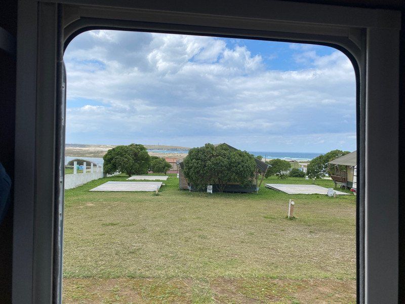
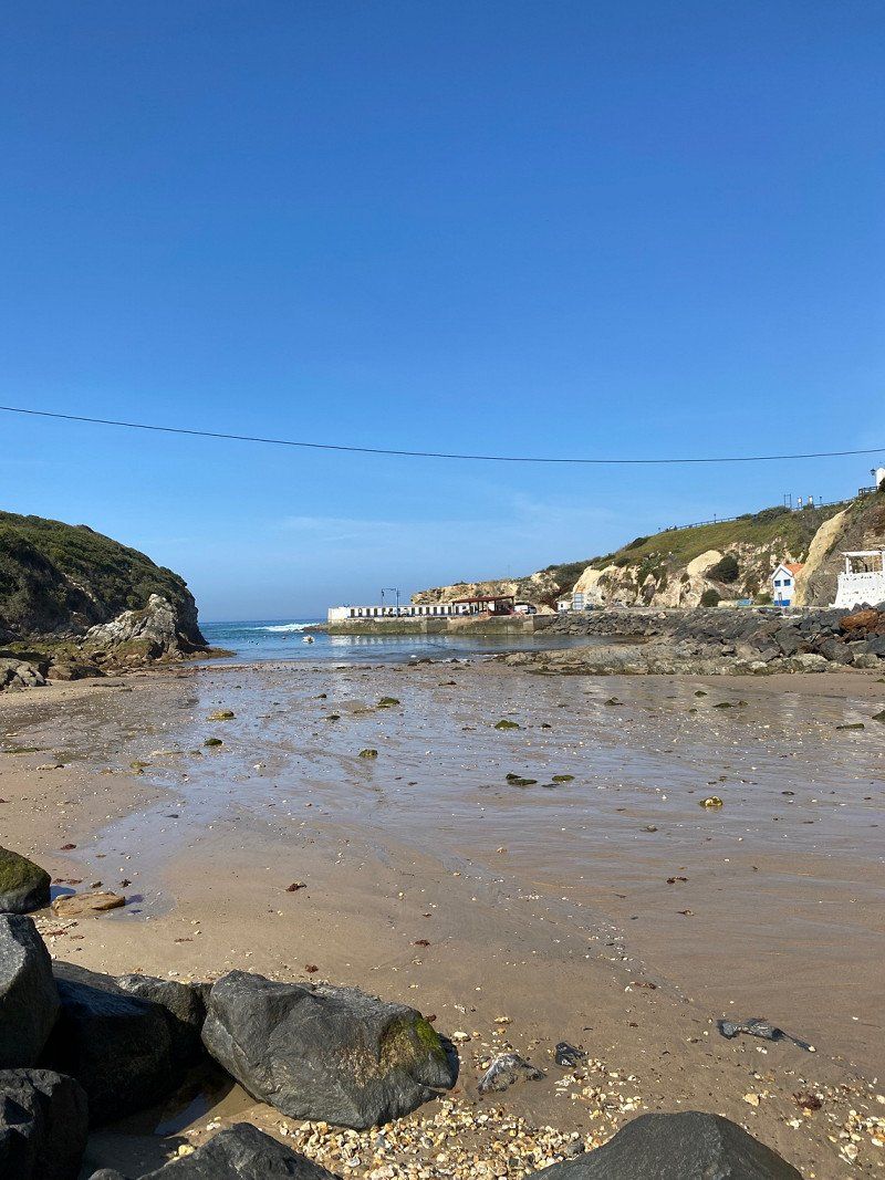
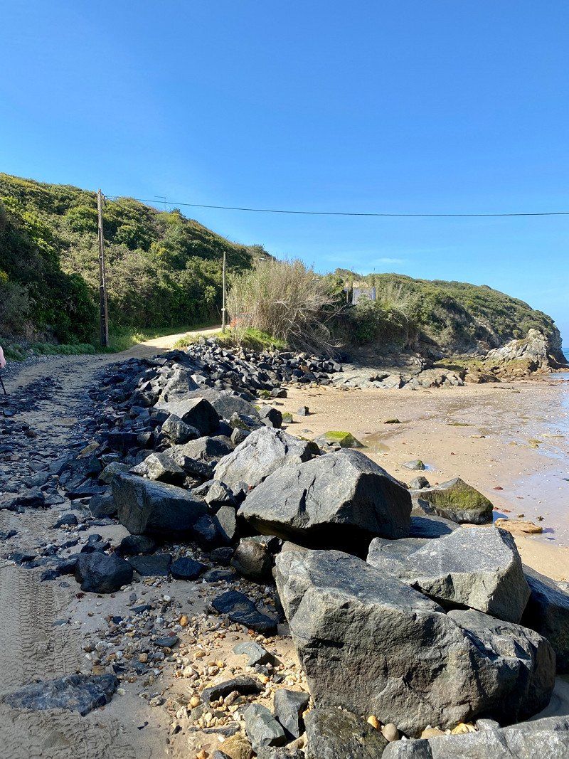
Vila do Bispo, Portugal
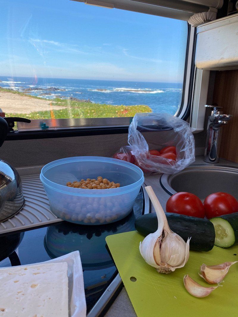
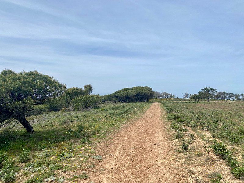
Good pitch with shower and V+E for 10€/night. Here we stay 2 nights. Very nice young operator couple. Explains everything.On arrival day I go for a hike,
8650 Vila do Bispo, Portugal
37° 4' 58.7" N 8° 54' 33.1" W
37.0829726 -8.9091832
• Head north on Praça da República. Go for 12 m.
• Turn left onto Praça da República. Go for 35 m.
• Turn left onto Praça da República. Go for 56 m.
• Continue straight ahead. Go for 64 m.
• Continue toward N125. Go for 399 m.
• Turn right onto N125 toward Portimão/Lagos/A22. Go for 3.5 km.
• Pass 6 roundabouts and continue on N125. Go for 10.9 km.
• Take the 3rd exit from roundabout onto N125. Go for 1.9 km.
• Pass 2 roundabouts and continue on N125. Go for 4.0 km.
• Take the 3rd exit from roundabout toward Lagos/A22/Portimão. Go for 145 m.
• Continue straight ahead. Go for 836 m.
• Take the 2nd exit from roundabout toward Lagos. Go for 761 m.
• Take the 2nd exit from roundabout onto Avenida da Fonte Coberta toward Meia Praia. Go for 840 m.
• Take the 2nd exit from roundabout onto Avenida dos Descobrimentos (N125). Go for 396 m.
• Take the 2nd exit from roundabout onto Avenida dos Descobrimentos (N125). Go for 1.1 km.
• Arrive at Avenida dos Descobrimentos (N125). Your destination is on the right.
☍
24,9 km
( 24 min.)
Day
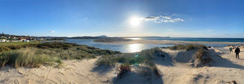
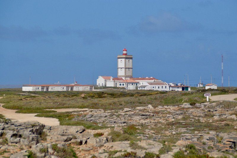
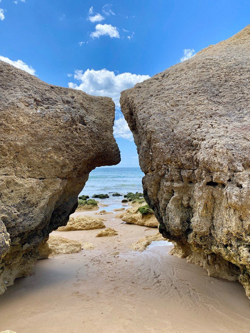
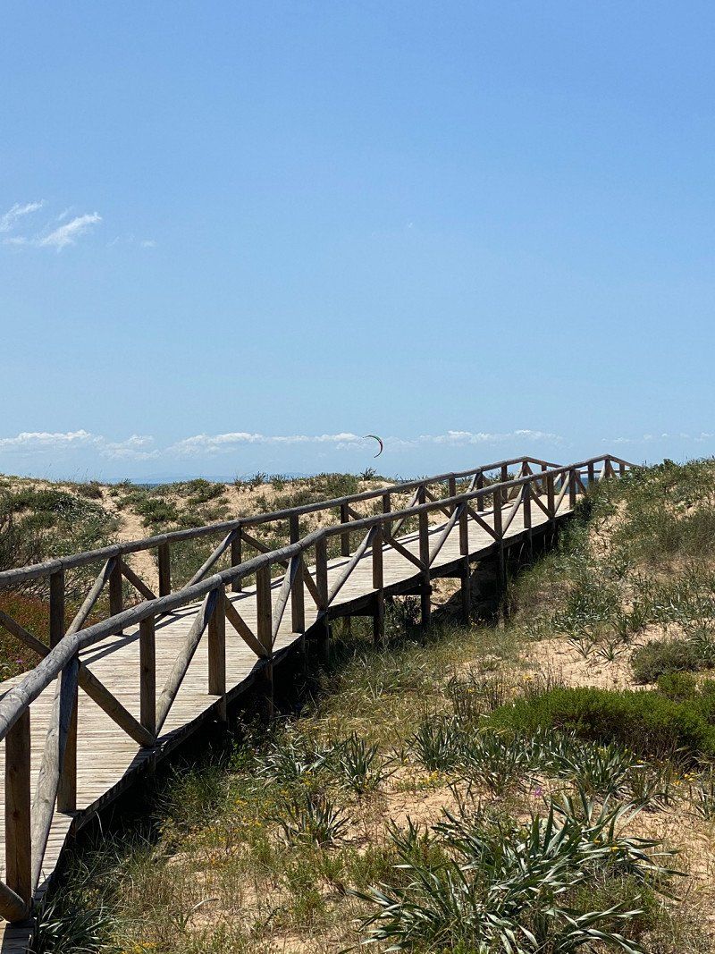
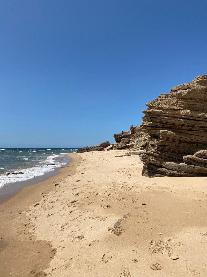
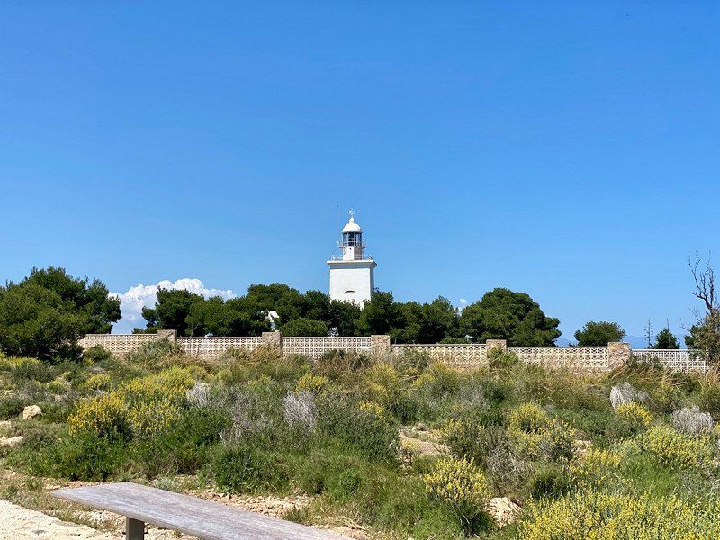
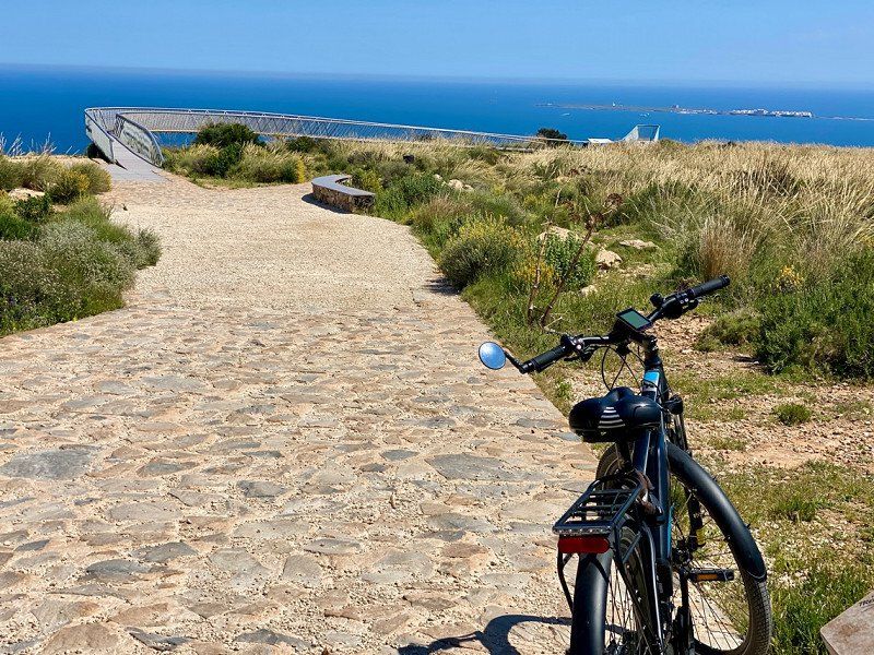
Sagres
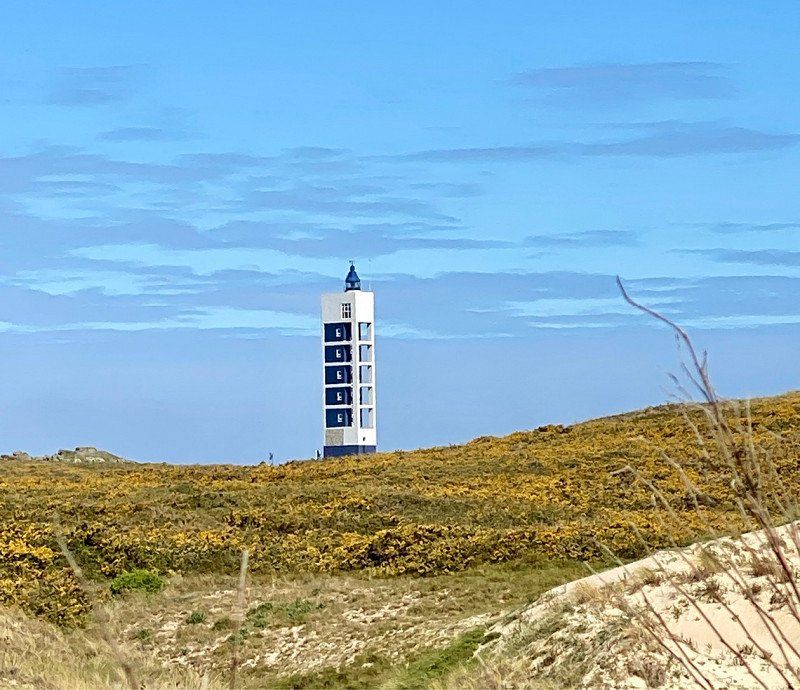
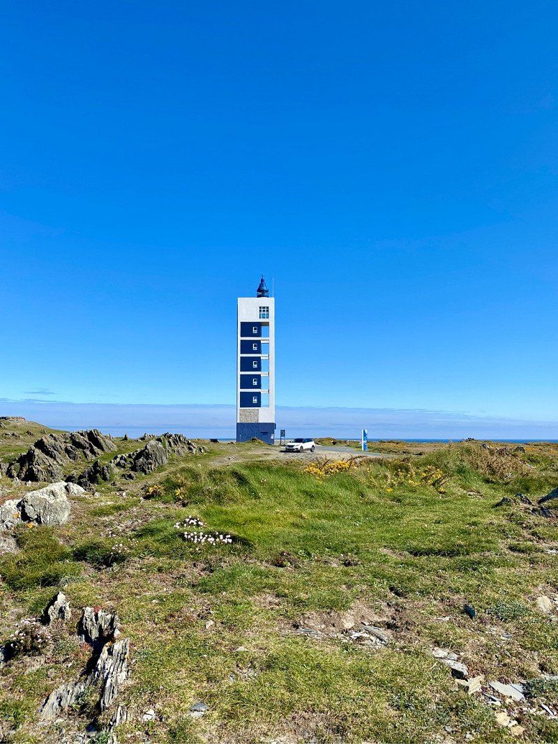
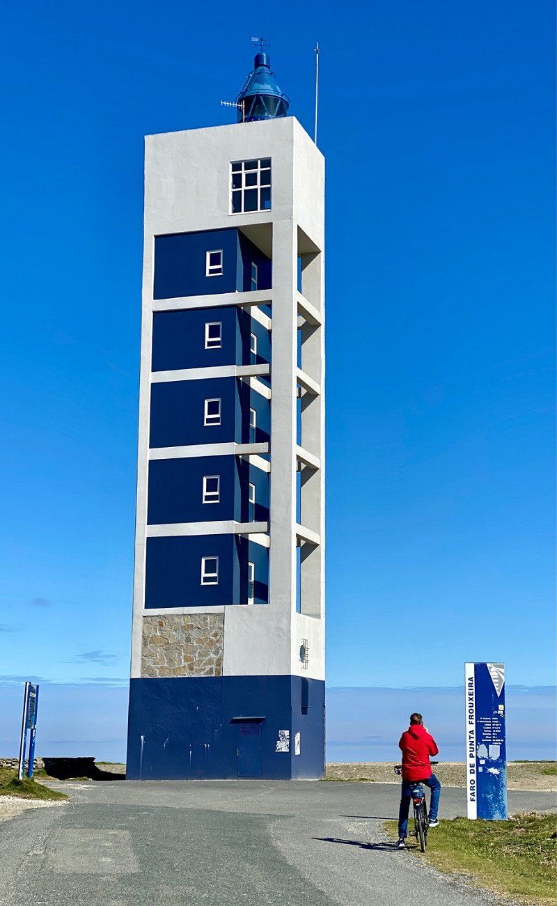
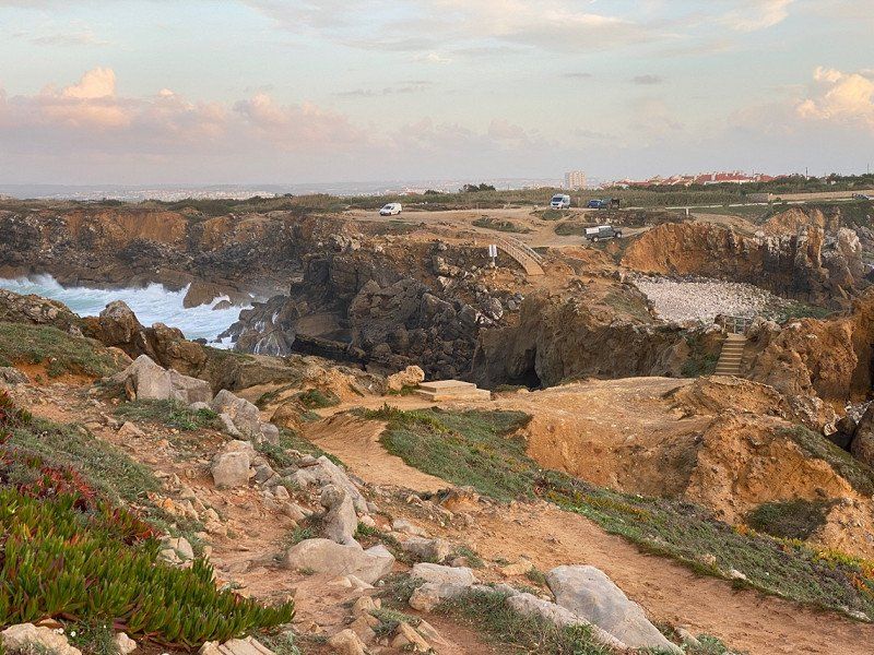
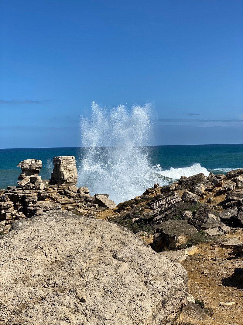
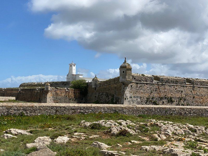
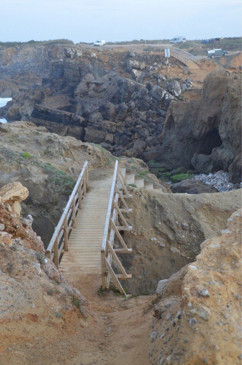
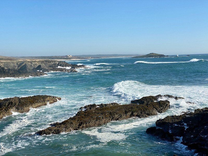
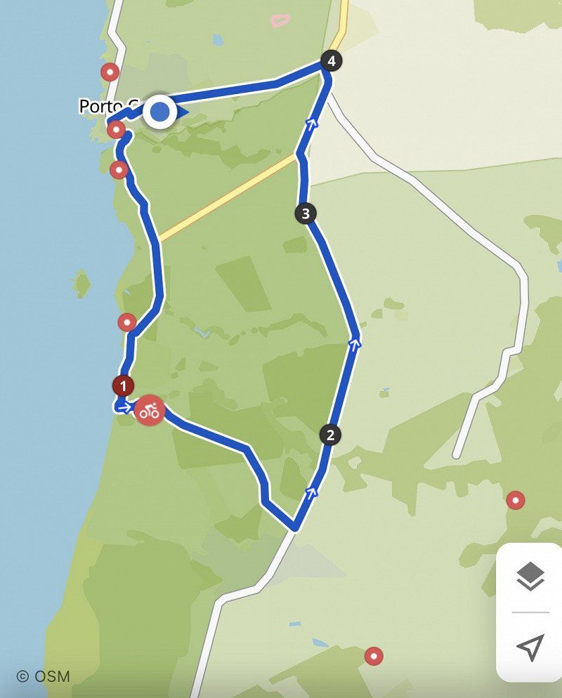
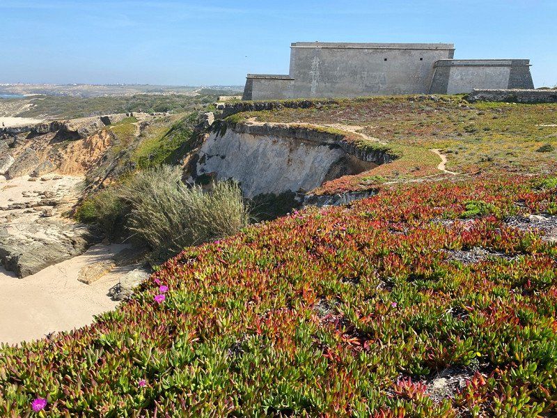
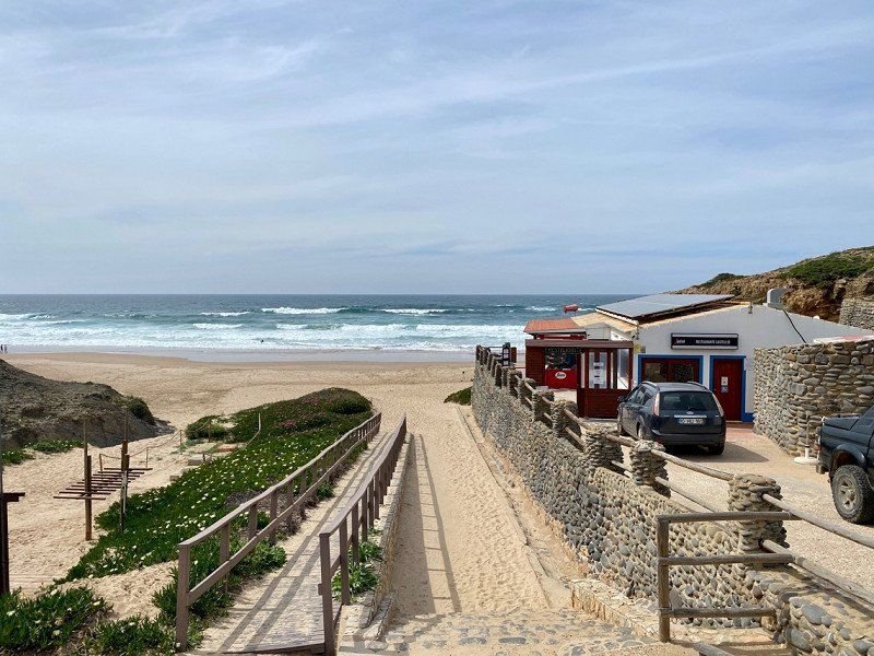
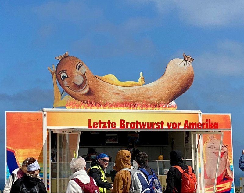
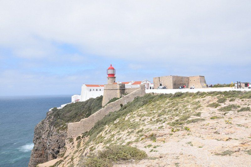
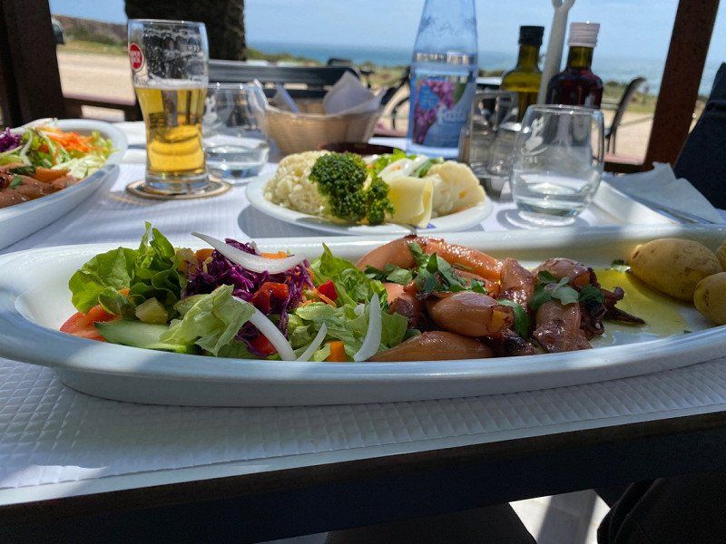
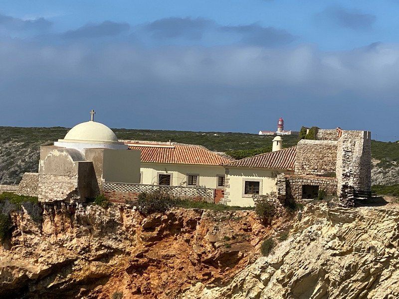
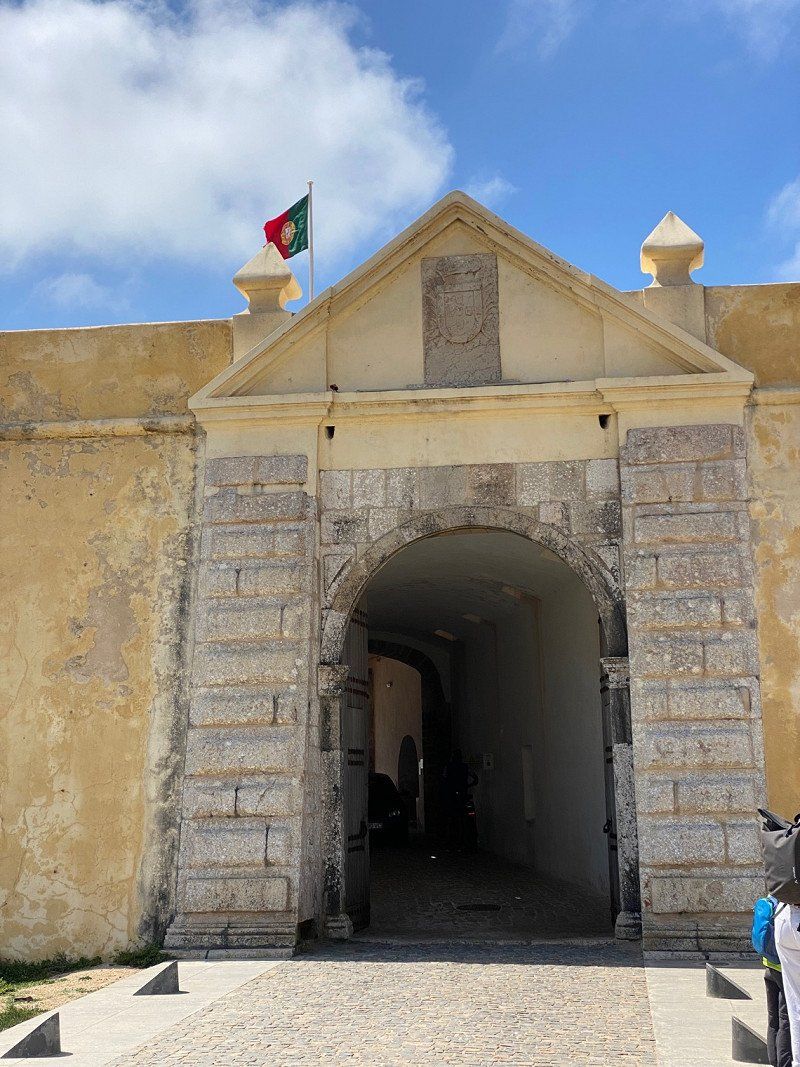
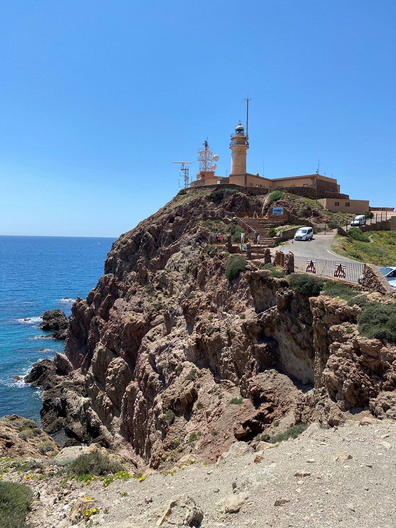
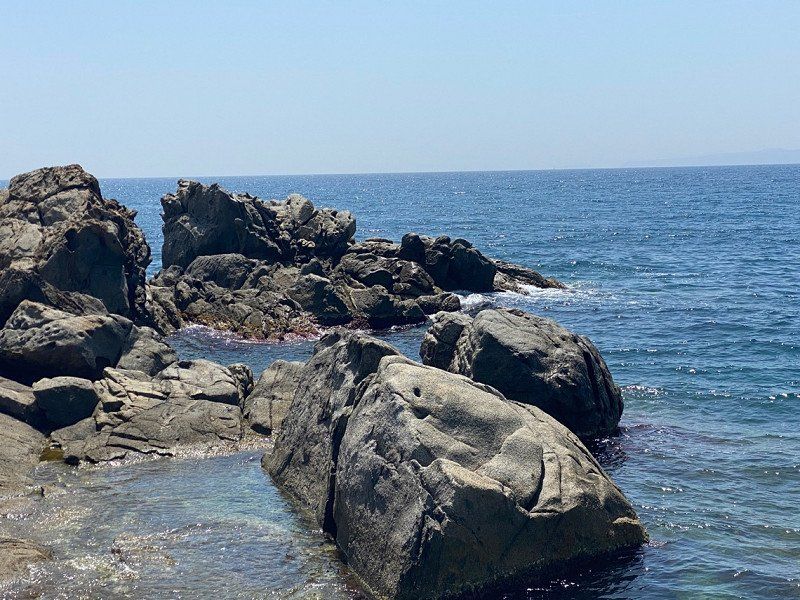
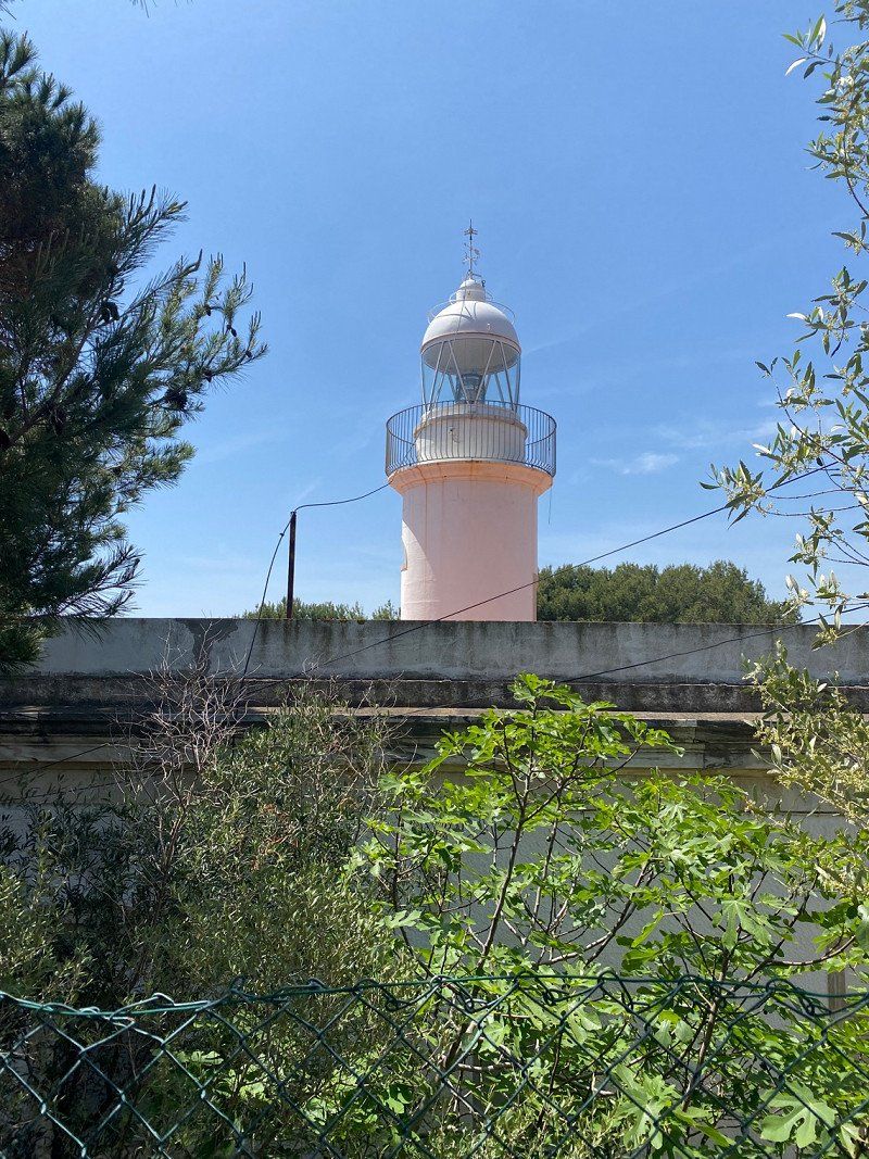
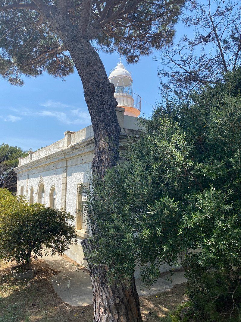
Again by bike to the lighthouse "To the other end of the world" and to the "Last sausage before America". Afterwards we cycle to the fortress, then to the town of Sagres and have lunch here. A total of 28km by bike with wind (8bft), we are very happy to be back at the Womo.
Day
Parque de Campismo da Trindade
Simple place, ok for one night. €11.50 without electricity. But I don't want to use more here. (Sanitary building is very old and really ugly, but clean)
We also want to explore the city and go for a walk on the beach. Since there is a lot of wind, short distances are best. A breathtaking beach with rock formations, probably similar to Benagil. In the pre-season it is not that crowded, it does not want to know what would be going on here in midsummer. The city of Lagos, or the old town center, is full of small streets, touristy, many nice restaurants, bars, cafes and in places Live music. There are knick knacks and souvenirs for sale. The city walls, a fortress and a large marina. Everything is here. One day with so much tourism is enough for us 😂
Estrada da Ponta da Piedade, 8600 - 669, Lagos, Portugal
37° 6' 6.8" N 8° 40' 16.2" W
37.1018800 -8.6711800
• Head toward Praça Infante Dom Henrique on Avenida dos Descobrimentos (N125). Go for 292 m.
• Turn left toward Avenida dos Descobrimentos/N125. Go for 79 m.
• Continue on Avenida dos Descobrimentos (N125). Go for 1.3 km.
• Take the 1st exit from roundabout onto N125. Go for 50 m.
• Continue on Ponte Dona Maria II (N125). Go for 211 m.
• Continue on N125. Go for 112 m.
• Take the 2nd exit from roundabout onto N125. Go for 99 m.
• Turn right onto N125 toward Portimão/Faro. Go for 1.3 km.
• Pass 3 roundabouts and continue on N125. Go for 5.6 km.
• Continue toward N125. Go for 35 m.
• Take the 1st exit from roundabout onto N125. Go for 2.0 km.
• Take the 2nd exit from roundabout onto N125. Go for 1.4 km.
• Take the 1st exit from roundabout onto Estrada do Apeadeiro. Go for 99 m.
• Turn right. Go for 44 m.
• Turn left. Go for 83 m.
• Turn right. Go for 105 m.
• Arrive at your destination on the left.
☍
12,9 km
( 15 min.)
R. Calçada da Fonte 23, 8500-132, Portugal
37° 9' 31.9" N 8° 36' 6.6" W
37.1588581 -8.6018322
• Head southeast. Go for 105 m.
• Turn left toward Estrada do Apeadeiro. Go for 127 m.
• Turn left onto Estrada do Apeadeiro. Go for 74 m.
• Take the 1st exit from roundabout onto N125 toward Portimão. Go for 673 m.
• Pass 2 roundabouts and continue on N125. Go for 13.2 km.
• Take the 1st exit from roundabout. Go for 417 m.
• Take the 2nd exit from roundabout. Go for 635 m.
• Continue straight ahead. Go for 38 m.
• Take the 2nd exit from roundabout. Go for 378 m.
• Arrive at your destination on the right.
☍
15,6 km
( 15 min.)
4GPG+9G Estômbar, Portugal
37° 8' 9.2" N 8° 28' 25.4" W
37.1358948 -8.4737255
• Head east. Go for 312 m.
• Continue straight ahead. Go for 30 m.
• Take the 1st exit from roundabout. Go for 626 m.
• Take the 1st exit from roundabout. Go for 424 m.
• Take the 1st exit from roundabout onto N125. Go for 612 m.
• Take the 3rd exit from Largo Marques roundabout onto N125. Go for 508 m.
• Take the 2nd exit from roundabout onto N125. Go for 2.5 km.
• Turn right onto M1154 toward Caramujeira. Go for 1.3 km.
• Turn right. Go for 405 m.
• Arrive at your destination.
☍
6,6 km
( 8 min.)
4HCH+CG Lagoa, Portugal
37° 7' 15.8" N 8° 25' 16.3" W
37.1210440 -8.4211931
• Head southeast. Go for 405 m.
• Turn left onto M1154. Go for 1.2 km.
• Take the 1st exit from roundabout onto N125. Go for 1.8 km.
• Pass 4 roundabouts and continue on N125. Go for 5.3 km.
• Continue toward N125. Go for 43 m.
• Take the 2nd exit from roundabout onto N125. Go for 537 m.
• Take the 3rd exit from roundabout onto N125. Go for 604 m.
• Turn right onto Rua Alexandre Herculano. Go for 287 m.
• Continue on Rua Almeida Garrett. Go for 1.5 km.
• Take the 4th exit from roundabout onto M526. Go for 2.8 km.
• Take the 1st exit from roundabout onto Estrada de Vale Rabelho. Go for 518 m.
• Turn right onto Rua do Barranco. Go for 165 m.
• Arrive at Rua do Barranco. Your destination is on the left.
☍
15,1 km
( 18 min.)
Day
Parque da Galé
Very warm welcome when we drive into the square. Pitch very well occupied, but we find a place. Parking space costs 10€/night with electricity, showers 1€, V+E everything is there, except for the toilet, but that's not a problem for us. There is also a 12kg/5€ washing machine (so washing is done here). A lounge with books, billiard table and chairs is also offered.
The heated outdoor pool with 25 degrees warm water will be tested by me right away!
On the first day we walk to the beach (1.4km). We are likely to stay here over the weekend. It's supposed to rain on the entire southern coast on Friday anyway (also in Spain up to Malaga). Shops are also very close.
Albufeira by bike is also pending.
Rua do Barranco, 8200-248, Albufeira, Portugal
37° 5' 33" N 8° 18' 42" W
37.0925000 -8.3116667
• Head toward Travessa do Barranco on Rua do Barranco. Go for 165 m.
• Turn left onto Estrada de Vale Rabelho. Go for 508 m.
• Take the 2nd exit from roundabout onto M1281. Go for 2.7 km.
• Continue on Caminho Municipal (M1281). Go for 330 m.
• Continue on M1281. Go for 272 m.
• Turn left onto Rua do Mercado toward Faro/N125/Portimão. Go for 185 m.
• Continue on Rua Nossa Senhora da Guia. Go for 173 m.
• Continue on Rua da Liberdade (M526-1). Go for 119 m.
• Take the 1st exit from roundabout onto N125 toward Faro/A22. Go for 1.6 km.
• Keep left onto N125 toward Faro/Albufeira/(A22). Go for 2.4 km.
• Take ramp onto IC1 toward Ourique/Faro/A22/Portimão/Lisboa/A2. Go for 1.0 km.
• Take ramp onto A22 (Via Infante de Sagres) toward Faro/Espanha/Lisboa/(A2). Go for 56.6 km.
• Take exit 16 toward Tavira/N270. Go for 306 m.
• Take ramp. Go for 50 m.
• Take the 3rd exit from roundabout onto N270. Go for 3.7 km.
• Take the 3rd exit from roundabout onto N125. Go for 2.4 km.
• Take the 2nd exit from roundabout. Go for 154 m.
• Continue on N125. Go for 486 m.
• Take the 1st exit from roundabout. Go for 39 m.
• Continue toward Rua de Vale de Caranguejo. Go for 448 m.
• Take the 4th exit from roundabout onto Rua de Vale de Caranguejo. Go for 669 m.
• Arrive at Rua de Vale de Caranguejo. Your destination is on the left.
☍
74,5 km
( 50 min.)
Albufeira mit dem Fahrrad
We cycled again today. Still quite a lot of wind, but with the e-bike it's no problem. But it's not raining anymore!
Albufeira is very touristy. Lots of English football fans sitting in the pubs and watching football on Saturday afternoons.
Not our thing.
We drive back towards the parking space and enjoy the sun a little longer.
Day
Day
Day
Day
Algarve Motorhome Park Tavira, Tavira, Portugal
Large parking space, with sanitary facilities, V + E, bread service. With electricity and fresh water on site. For 2 nights with electricity for a total of €22. The weather should stay nice now. The wind has finally stopped.
The place is well located for visiting Tavira on foot.
Tomorrow we want to cycle to this Ria Famosa nature reserve. Possibly also take the ferry to the island. Let's see what we're doing.
8800-228 Tavira, Portugal
37° 7' 57.8" N 7° 37' 52" W
37.1327183 -7.6311136
• Head southwest on Rua de Vale de Caranguejo. Go for 546 m.
• Take the 1st exit from roundabout. Go for 442 m.
• Continue toward N125. Go for 60 m.
• Take the 1st exit from roundabout onto N125. Go for 1.2 km.
• Pass 5 roundabouts and continue on N125. Go for 13.0 km.
• Take the 2nd exit from roundabout onto N125. Go for 319 m.
• Take the 3rd exit from roundabout toward A22/Faro/Espanha. Go for 1.9 km.
• Take ramp onto A22 (Via Infante de Sagres) toward Espanha/Beja. Go for 9.1 km.
• Continue on A-49 (Autopista del V Centenario). Go for 133 km.
• Continue on Avenida Expo 92 (N-630). Go for 1.3 km.
• Keep left toward Centro Ciudad. Go for 36 m.
• Turn right onto Avenida Cristo de la Expiración. Go for 427 m.
• Keep right onto Calle Arjona toward Centro Ciudad. Go for 404 m.
• Continue on Paseo Cristóbal Colón. Go for 875 m.
• Continue on Paseo Las Delicias. Go for 459 m.
• Continue on Paseo de las Delicias. Go for 233 m.
• Turn right onto Glorieta Marineros Voluntarios. Go for 166 m.
• Turn right onto Avenida María Luisa. Go for 408 m.
• Take the 2nd exit from roundabout onto Avenida del Cid. Go for 260 m.
• Take the 2nd exit from Plaza Don Juan de Austria roundabout onto Avenida Menéndez Pelayo. Go for 813 m.
• Turn right onto Calle La Florida. Go for 157 m.
• Turn left onto Calle Luis Montoto toward Centro Ciudad. Go for 116 m.
• Arrive at Calle Luis Montoto. Your destination is on the left.
☍
165,4 km
(1 hrs. 44 min.)
Day
Ilha de Tavira - mit der Personen-Fähre
Today we're going to take it easy. Here in Portugal today is a public holiday (Freedom Day) and we have the best weather to visit the island.
We walk from the pitch va.30min. to the ferry terminal in Tavira. A return trip costs €2.20 per person, and there is a ferry every hour.
The island has a beautiful long sandy beach and despite a full ferry, it gets a lot lost on the island. Many small restaurants and bars/cafe's to linger. There are loungers and umbrellas on the beach.
The visit was just right for us, comfortable, walk on the beach, eat out and back again.
Day
Sevilla, Spanien
The plan is to go to Seville because I really want to see the Plaza de España. We were also in Seville and of course we looked out for a mobile home pitch. But after we drove to 2 parking spaces in Seville (urban traffic for us villagers rather nothing) (creepy, we didn't even want to stand here for 1 night) we drove back to the coast.
Sevilla, Provinz Sevilla, Spanien
37° 23' 20.7" N 5° 59' 4.1" W
37.3890924 -5.9844589
• Head northwest on Calle Luis Montoto.
• Turn left onto Avenida Menéndez Pelayo. Go for 121 m.
• Keep right onto Avenida Menéndez Pelayo. Go for 826 m.
• Take the 2nd exit from Plaza Don Juan de Austria roundabout onto Avenida del Cid. Go for 221 m.
• Take the 1st exit from roundabout onto Avenida María Luisa. Go for 417 m.
• Turn right onto Glorieta Marineros Voluntarios toward Cádiz/E-5/A-4/Estadio Benito Villamarín. Go for 147 m.
• Turn right onto Paseo de las Delicias toward Cádiz/E-5/A-4/Estadio Benito Villamarín. Go for 673 m.
• Turn right onto Avenida Molini toward Puerto. Go for 120 m.
• Take the 3rd exit from roundabout onto Avenida La Raza. Go for 1.1 km.
• Continue on Avenida de la Raza. Go for 1.4 km.
• Take the 2nd exit from roundabout onto Avenida de la Raza toward SE-30. Go for 706 m.
• Take the 1st exit from roundabout toward Dos Hermanas/E-5/Cadiz/A-4/Granada/A-92/Córdoba/A-4. Go for 216 m.
• Take the 2nd exit from roundabout onto A-4 (Autovía del Sur) toward Dos Hermanas/A-92/Córdoba/Cádiz. Go for 13.3 km.
• Continue on AP-4 (Autopista del Sur). Go for 31.6 km.
• Take exit 44 toward Lebrija/A-471. Go for 1.2 km.
• Take the 2nd exit from roundabout onto A-471R toward Lebrija/A-471/Sanlúcar/Chipiona/A-480. Go for 751 m.
• Take the 2nd exit from roundabout onto A-471 toward Sanlúcar de Bda. Go for 46.0 km.
• Continue on A-480. Go for 5.0 km.
• Take the 2nd exit from roundabout onto Camino de la Reyerta toward La Jara. Go for 1.2 km.
• Arrive at Camino de la Reyerta. Your destination is on the right.
☍
105,0 km
(1 hrs. 14 min.)
Paseo de la Reyerta, 11540 Sanlúcar de Barrameda, Spanien
Here we have a pitch right by the sea, with toilet and shower, electricity, fresh water, and V+E, pitches freely selectable, which are separated by hedges and with a lawn (then cost €12/night without electricity) the others on the gravel are for 10 €/night without electricity. Very friendly and warm welcome. We stay here 3 nights to see Chipiona and Sañlucar de Barrameda. By the way, the weather isn't that great again tonight, let's hope for tomorrow that the sun will shine. Otherwise it's going to be stupid riding a bike in the rain.
Cam. de la Reyerta, Sanlúcar de Barrameda, Cádiz, Spanien
36° 45' 17.9" N 6° 23' 17.6" W
36.7549598 -6.3882148
• Head southeast on Camino de la Reyerta. Go for 1.1 km.
• Take the 3rd exit from roundabout onto A-480 toward Jerez de la Frontera/A-471/Trebujena. Go for 5.2 km.
• Take the exit toward Jerez de la Frontera onto A-480. Go for 15.1 km.
• Take the exit toward Cádiz onto A-4 (Autovía del Sur). Go for 27.6 km.
• Keep left onto N-4 toward Chiclana/A-48/Algeciras. Go for 781 m.
• Take ramp onto A-48 (Autovía de la Costa de la Luz) toward Chiclana de la F./Algeciras/Málaga. Go for 26.5 km.
• Take exit 26 toward N-340/Conil. Go for 349 m.
• Take the 1st exit from roundabout toward N-340/Conil. Go for 582 m.
• Take the 2nd exit from roundabout onto A-2232 toward Conil/Conil de la Frontera. Go for 174 m.
• Take the 2nd exit from roundabout onto A-2232. Go for 1.9 km.
• Take the 2nd exit from roundabout onto A-2232 toward A-2233/Zahora/Caños de Meca. Go for 174 m.
• Take the 2nd exit from roundabout onto A-2233 toward Barbate/Los Caños de Meca. Go for 6.8 km.
• Pass 3 roundabouts and continue on A-2233. Go for 3.2 km.
• Take the 2nd exit from roundabout onto A-2233. Go for 430 m.
• Take the 2nd exit from roundabout onto A-2233 toward Caños de Meca/Barbate. Go for 1.6 km.
• Continue on Venta Alfardía (A-2233). Go for 140 m.
• Continue on Avenida de Trafalgar (A-2233). Go for 492 m.
• Turn left. Go for 138 m.
• Arrive at your destination.
☍
92,0 km
(1 hrs. 5 min.)
Day
Chipiona - Fahrrad
The weather is kind to us, apart from the fact that it's windy (we're used to that by now) it's glorious sunshine.
We cycle to Chipiona this morning. Coast, lighthouse, cathedral and most importantly, we buy a prepaid card for our mobile router in the camper again. It's just convenient and we don't depend on the weak internet at the campsite/pitches. Besides, it's mine!!
In Portugal we were very spoiled when it came to the internet, here it was easy!!! and very cheap. €1 a day no matter how much data volume, we also bought a prepaid card from MEO here. This is valid for 15 days and can then be topped up via Xoom if you are in Portugal for longer than 15 days. There is also 20 days, but we didn't know how long we would stay in Portugal, so we decided to go for 15 days.
So now to Chipiona. Very nice coastal town, mainly Spanish tourists, probably because of the off-season. We also saw the promenade (because there was the Orange shop for our prepaid card). Beautiful beach and the town is very well maintained and spruced up.
Day
Sañlucar de Barramada - Tapas essen
Today we cycle to Sañlucar. Long beach with a bike path and many small cafes. In the old town is a beautiful square and many small tapas bars. There is something for every taste
Day
Barbate, Spanien, Area Caños de Meca
Brand new parking space for Womos. Very nice with gravel, every pitch has electricity. V+E generously laid out. Showers and toilet new containers. Small kiosk run by the operator of the parking space. 12€/night without electricity. As always, we produce our own electricity with our solar system. Very friendly reception, even if we can only stay here for one night. Sunday, May 1st is a public holiday in Spain, so the Spaniards also have Monday off. This is being used and the place is fully booked from Saturday, a pity. The coast is not far and the constant wind means that people kite and surf here. The lighthouse is not far away. There are small bars, pubs and small stalls to buy handicrafts or souvenirs. I think the bear tap-dances here in midsummer. We walked along the beach to the lighthouse and it was wonderfully quiet and very little going on. Tomorrow we have to drive on, trying to get a place over the holiday on the way to Tarifa. We would really like to see Tarifa.
C. Levante, 5, 11159 Barbate, Cádiz, Spanien
36° 11' 21" N 6° 1' 17.4" W
36.1891712 -6.0215117
• Head toward Avenida de Trafalgar. Go for 138 m.
• Turn right onto Avenida de Trafalgar (A-2233). Go for 492 m.
• Continue on Venta Alfardía (A-2233). Go for 140 m.
• Continue on A-2233. Go for 1.5 km.
• Take the 2nd exit from roundabout onto A-2233 toward Vejer/Conil. Go for 437 m.
• Take the 2nd exit from roundabout onto A-2233. Go for 379 m.
• Take the 2nd exit from roundabout onto A-2233. Go for 1.8 km.
• Take the 1st exit from roundabout onto A-2230. Go for 5.6 km.
• Continue on Montecote (A-2230). Go for 115 m.
• Continue on A-2230. Go for 1.6 km.
• Take the 6th exit from roundabout toward A-4200/La Muela/E-5/A-48/Cadiz/Algeciras. Go for 238 m.
• Take the 1st exit from roundabout onto A-48 (Autovía de la Costa de la Luz) toward N-340/Algeciras/Málaga. Go for 659 m.
• Continue on N-340. Go for 1.3 km.
• Take the 1st exit from roundabout onto N-340. Go for 441 m.
• Take the 2nd exit from roundabout onto N-340. Go for 40.4 km.
• Turn left onto Calle Torrejón. Go for 448 m.
• Turn right. Go for 346 m.
• Arrive at your destination.
☍
56,1 km
( 46 min.)
Day
Camping Torre de la Peña I
CP with a great view. €20.80/night with electricity. We have to economize a bit with our gas. So now with electricity. Here we stay 4 nights. We definitely want to visit Tarifa. To enjoy the weather. And don't do anything. Oh, we've been doing it all the time, so keep enjoying it. It's supposed to rain at home, so we'd rather be here. 🤪
CN- 340 Km 78, 11380, Tarifa, Spanien
36° 3' 39" N 5° 39' 40" W
36.0608300 -5.6611100
• Head toward Calle Torrejón. Go for 346 m.
• Turn left onto Calle Torrejón. Go for 448 m.
• Turn left onto N-340. Go for 7.4 km.
• Take the 2nd exit from roundabout onto N-340 toward Algeciras/Málaga. Go for 16.9 km.
• Take the 1st exit from roundabout onto N-340 toward Málaga. Go for 572 m.
• Take the 3rd exit from roundabout onto Calle Maestro Luis Cano Toba toward Barriada Los Pastores. Go for 449 m.
• Turn right onto Pasaje Carretera del Cobre. Go for 131 m.
• Turn right onto Carretera al Cobre (CA-9208). Go for 369 m.
• Keep right onto Carretera al Cobre. Go for 22 m.
• Turn right toward Autovía del Mediterráneo/A-7. Go for 74 m.
• Take the 5th exit from roundabout onto A-7 (Autovía del Mediterráneo) toward Estepona/Málaga. Go for 4.8 km.
• Continue on N-340 toward A-7/San Roque/Málaga/Sevilla. Go for 1.3 km.
• Continue on A-7 (Autovía del Mediterráneo). Go for 24.5 km.
• Continue on AP-7 (Autopista del Mediterráneo) toward Estepona/Málaga. Go for 9.7 km.
• Keep right onto AP-7. Go for 12.0 km.
• Continue on A-7 (Autopista del Mediterráneo). Go for 528 m.
• Take exit 155 toward Estepona onto Avenida Juan Carlos I. Go for 882 m.
• Take the 2nd exit from roundabout onto Avenida Puerta del Mar. Go for 272 m.
• Pass 3 roundabouts and continue on Avenida Puerta del Mar. Go for 1.0 km.
• Take the 4th exit from roundabout onto Avenida Reina Sofía. Go for 90 m.
• Take the 2nd exit from roundabout onto Urbanización Puerto Paraíso. Go for 67 m.
• Continue on Avenida Reina Sofía. Go for 55 m.
• Arrive at your destination on the right.
☍
82,0 km
(1 hrs. 9 min.)
Day
Sonne pur
Most wonderful weather, great view our best place so far.
Today we ride the bikes again. Tarifa is on the agenda.
Day
Day
Relaxen
Look at the weather map and decide where and when to continue. I met very nice campers from Germany and Switzerland. Tomorrow we want to continue in the direction of Algeciras, or shortly after Algeciras. The weather is still dry there. Only rain in Malaga and before Malaga. 😩 Maybe we can take a look at Gibraltar, we were here 35 years ago with the motorcycles. Oh, by the way, because of Corona, here in Spain (by the way, it was also very relaxed in Portugal) everything is easy. We wear a mask in the registrations/receptions, even when shopping, some wear one and some don't. We just carry one so as not to jeopardize our trip. But otherwise everything is very relaxed here. A mask is also worn in the restaurants, up to the square and then it's good too. No mask is worn in the outdoor restaurants, only the waiters wear one.
Day
Estepona Marina, Avenida del Carmen, Estepona, Spanien
Was probably nothing with the weather. It rained heavily again and again. We take a break in Estepona. very close to a parking lot. After inspecting this parking space, it is clear to us that we will not be staying overnight.
That's why we drove to Malaga today. Are now on a very large pitch. 2 nights with electricity for €33.00.
Av. del Carmen, 29680 Estepona, Málaga, Spanien
36° 24' 57.7" N 5° 9' 26.7" W
36.4160170 -5.1574154
• Head southeast.
• Turn right onto Plaza de Poniente. Go for 160 m.
• Turn slightly right onto Plaza del Club Náutico. Go for 18 m.
• Continue on Calle Doctor Martorell. Go for 159 m.
• Turn left onto Avenida Reina Sofía. Go for 21 m.
• Continue on Urbanización Puerto Paraíso. Go for 38 m.
• Take the 2nd exit from roundabout onto Avenida Reina Sofía. Go for 74 m.
• Take the 1st exit from roundabout onto Avenida Puerta del Mar. Go for 254 m.
• Pass 2 roundabouts and continue on Avenida Puerta del Mar. Go for 783 m.
• Take the 3rd exit from roundabout onto Avenida Puerta del Mar. Go for 246 m.
• Take the 3rd exit from roundabout onto Avenida Juan Carlos I. Go for 782 m.
• Take ramp onto A-7 (Autovía del Mediterráneo) toward Málaga. Go for 2.1 km.
• Continue on AP-7 (Autopista del Mediterráneo) toward Marbella/Málaga. Go for 15.1 km.
• Keep right toward Autopista del Mediterráneo/AP-7. Go for 321 m.
• Continue on AP-7 (Autopista del Mediterráneo). Go for 8.9 km.
• Continue on A-7 (Autovía del Mediterráneo). Go for 5.2 km.
• Keep left onto AP-7 (Autopista del Mediterráneo) toward Fuengirola/Málaga. Go for 14.7 km.
• Keep right toward Autopista del Mediterráneo/AP-7. Go for 375 m.
• Continue on AP-7 (Autopista del Mediterráneo). Go for 12.0 km.
• Continue on A-7 (Autopista del Mediterráneo). Go for 23.4 km.
• Take the exit toward Málaga-Cártama/Cártama/Mercamálaga. Go for 1.6 km.
• Take the 3rd exit from roundabout onto Calle Offenbach. Go for 166 m.
• Take the 1st exit from roundabout toward Almería/E-15/A-7. Go for 486 m.
• Take the exit toward Málaga/Campanillas. Go for 289 m.
• Take the 2nd exit from roundabout onto Carretera de la Colonia de Santa Inés (A-7076). Go for 557 m.
• Take the 3rd exit from roundabout onto Carretera de la Colonia de Santa Inés (A-7076). Go for 1.0 km.
• Take the 5th exit from roundabout onto Carretera de la Colonia de Santa Inés (A-7076). Go for 250 m.
• Turn right toward Camino Medio Ambiental. Go for 70 m.
• Turn slightly right onto Camino Medio Ambiental. Go for 650 m.
• Take the 1st exit from roundabout onto Camino Medio Ambiental. Go for 749 m.
• Turn left. Go for 123 m.
• Continue straight ahead. Go for 53 m.
• Arrive at your destination on the left.
☍
90,4 km
(1 hrs. )
PFJW+PF Málaga, Spanien
36° 43' 54.6" N 4° 30' 13.8" W
36.7318425 -4.5038446
• Head southeast. Go for 176 m.
• Turn right onto Camino Medio Ambiental. Go for 720 m.
• Take the 2nd exit from roundabout onto Camino Medio Ambiental. Go for 726 m.
• Turn right onto Carretera de la Colonia de Santa Inés (A-7076). Go for 748 m.
• Take the 3rd exit from roundabout onto Carretera de la Colonia de Santa Inés (A-7076). Go for 646 m.
• Take the 1st exit from roundabout toward Córdoba/Almería. Go for 822 m.
• Continue on A-7 (Autovía del Mediterráneo). Go for 18.7 km.
• Keep right toward La Cala del Moral/El Candado/Olías/La Araña. Go for 230 m.
• Continue on MA-24. Go for 4.3 km.
• Take exit 2 toward La Cala del Moral. Go for 213 m.
• Arrive at your destination on the right.
☍
27,4 km
( 21 min.)
Area Malaga Beach, Spanien
Pitch for 100 mobile homes, with showers (1€), toilets, electricity (4Amp./6Amp.), fresh water and V+E. Map for the beach. Friendly reception, many explanations about taking the bus to Malaga (we won't need it, we'll cycle there) The individual spaces are narrow, so there's not really enough space to put a chair or table out comfortably ( we still do it behind the camper on the way). Dogs are probably not allowed here. Gravel places, many still free. (Easter - the holiday season in Spain is over for now) For the shower you pay another €1 for 3.5 minutes. Dishwashing place again only cold water. Bread/rolls are available in the small kiosk on site. It's ok to see Malaga, but otherwise we find it quite expensive and too cramped.
MA-24 S/N, 29720, Málaga, Spanien
36° 42' 52.3" N 4° 18' 58.9" W
36.7145247 -4.3163589
• Head northeast. Go for 4 m.
• Turn left toward MA-24. Go for 30 m.
• Take ramp onto MA-24. Go for 1.7 km.
• Take the 1st exit from roundabout onto A-7 (Autovía del Mediterráneo) toward Rincón de la Victoria/Almería. Go for 202 km.
• Take exit 769 toward Hospital/El Alquián/El Toyo/Retamar/AL-3115. Go for 364 m.
• Take the 1st exit from roundabout onto N-349 toward El Alquián/AL-3115. Go for 2.1 km.
• Take the 4th exit from roundabout onto N-344. Go for 2.3 km.
• Take the 2nd exit from roundabout onto N-344 toward Níjar/E-15/Murcia/A-7/Retamar/San Jose. Go for 670 m.
• Take the 2nd exit from roundabout onto Carretera de Cabo de Gata (AL-3115) toward Retamar/Cabo de Gata. Go for 454 m.
• Take the 2nd exit from roundabout onto Carretera de Cabo de Gata (AL-3115). Go for 749 m.
• Take the 3rd exit from roundabout toward Cabo de Gata/San Jose. Go for 114 m.
• Continue on Carretera de Cabo de Gata (AL-3115). Go for 7.2 km.
• Take the 1st exit from roundabout onto Carretera de Cabo de Gata (AL-3115) toward Cabo de Gata. Go for 2.0 km.
• Continue on AL-3115. Go for 259 m.
• Continue on Carretera de Cabo de Gata (AL-3115). Go for 2.6 km.
• Continue on AL-3115. Go for 509 m.
• Take the 1st exit from roundabout onto Calle Mazarulleque. Go for 138 m.
• Arrive at Calle Mazarulleque. Your destination is on the left.
☍
222,9 km
(2 hrs. 16 min.)
Day
Besichtigung von Malaga
It is no problem at all to cycle from the parking space to the old town of Malaga. About 9km one way.
Pictures speak for themselves.
Day
Cabo de Gata, Spanien
Today we drive on the Autobahn, it's very warm and we want to go a few kilometers further, as usual. We are interested in the Cabo da Gata nature reserve, but before that we have to do some shopping.
Along the A7 (free) the view is sometimes beautiful and sometimes very frightening. So many plastic greenhouses. We were here on motorbikes 35 years ago and can't remember seeing so many greenhouses. Dreadful. The Sierra Nevada mountains still have snow at the very top.
In Cabo da Gata we read that there is a campsite. We saw a parking space for Womos, but today we want to be free. We also want to go to the lighthouse.
04150 Cabo de Gata, Almería, Spanien
36° 46' 54.3" N 2° 14' 32.1" W
36.7817465 -2.2422484
• Head toward Calle Atarazanas on Calle Mazarulleque. Go for 120 m.
• Take the 2nd exit from roundabout onto AL-3115. Go for 4.6 km.
• Continue on Paseo Sirenas (AL-3115). Go for 388 m.
• Continue on Carretera Faro de Gata (AL-3115). Go for 112 m.
• Continue on AL-3115. Go for 460 m.
• Continue on AL-3115. Go for 54 m.
• Take the 3rd exit from roundabout onto AL-3115. Go for 2.7 km.
• Continue on El Corralete (AL-3115). Go for 672 m.
• Arrive at your destination on the right.
☍
9,0 km
( 21 min.)
Faro de Cabo de Gata, Parque Natural Cabo de Gata-Nijar, San José, Spanien
I want to go there 😁
The last stretch to Faro de Cabo de Gata is a bit steep and narrow. But we are rewarded with the magnificent view. Some campers stay here for a night, which is probably tolerated. We'd rather go back to the small town at the foot of the mountain.
Parque Natural Cabo de Gata-Nijar, s/n, 04150 San José, Almería, Spanien
36° 43' 18.1" N 2° 11' 34.4" W
36.7216961 -2.1929000
• Head northwest. Go for 424 m.
• Continue on El Corralete. Go for 248 m.
• Continue on AL-3115. Go for 2.6 km.
• Take the 1st exit from roundabout. Go for 253 m.
• Arrive at your destination.
☍
3,5 km
( 8 min.)
La Fabriquilla, Spanien
Here we are free (free) in a parking lot in front of a kiosk. Buy ice cream 😍 right away, we'll stay here for one night. Sea-view!
4.30 p.m.: Not anymore, in the narrow gap another camper is right in front of us. There are campers, you wouldn't believe that!!
04151 La Fabriquilla, Almería, Spanien
36° 44' 27" N 2° 12' 24" W
36.7408330 -2.2066670
• Head southwest. Go for 35 m.
• Turn slightly right toward AL-3115. Go for 105 m.
• Turn right onto AL-3115. Go for 312 m.
• Continue on Carretera Faro de Gata (AL-3115). Go for 112 m.
• Continue on Paseo Sirenas (AL-3115). Go for 388 m.
• Continue on AL-3115. Go for 4.5 km.
• Take the 1st exit from roundabout onto AL-3115. Go for 126 m.
• Keep right onto AL-3115. Go for 410 m.
• Continue on Carretera de Cabo de Gata (AL-3115). Go for 2.6 km.
• Continue on AL-3115. Go for 259 m.
• Continue on Carretera de Cabo de Gata (AL-3115). Go for 1.8 km.
• Turn left onto Carretera de Cabo de Gata (AL-3115). Go for 121 m.
• Take the 3rd exit from roundabout onto Carretera de Cabo de Gata (AL-3115) toward Almería. Go for 7.3 km.
• Take the 2nd exit from roundabout onto Carretera de Cabo de Gata (AL-3115) toward Hospital de Alta Resolución El Toyo/Almería/N-340a/AL-12. Go for 778 m.
• Take the 3rd exit from roundabout onto Carretera de Cabo de Gata (AL-3115). Go for 351 m.
• Turn sharp right onto Carretera Níjar-Retamar (N-344) toward E-15/A-7/Níjar/Murcia. Go for 536 m.
• Take the 2nd exit from roundabout onto Carretera Níjar-Retamar (N-344) toward Murcia/AL-12. Go for 3.6 km.
• Take ramp onto A-7 (Autovía del Mediterráneo) toward Níjar/Murcia. Go for 65.5 km.
• Take exit 695A toward E-15/AP-7/Cartagena. Go for 1.3 km.
• Continue on AP-7. Go for 54.3 km.
• Take exit 857 toward Cañada de Gallego/Ramonete/P. Calnegre. Go for 992 m.
• Take the 1st exit from roundabout onto RM-332. Go for 5.2 km.
• Take the 1st exit from roundabout toward Cañada de Gallego. Go for 414 m.
• Continue on Cañada de Gallego. Go for 1.3 km.
• Continue on Avenida Constitución-Gallego. Go for 440 m.
• Turn right onto Cañada de Gallego. Go for 76 m.
• Arrive at Cañada de Gallego. Your destination is on the right.
☍
152,8 km
(1 hrs. 48 min.)
Day
Cañada de Gallego, Spanien
Snake Bay - wonderful beach Directions a bit outside, last few meters only gravel. There is almost nothing in the place. 6€/ night. No electricity, which is not a problem for us. The bar is closed. Fresh water is available for 50 cents. Toilet and gray water disposal simple. It's ok for 1 night, we didn't want to stay here longer because it was too remote for us.
30876 Cañada de Gallego, Murcia, Spanien
37° 33' 19" N 1° 22' 54" W
37.5552710 -1.3816530
• Head toward Avenida Constitución-Gallego on Cañada de Gallego. Go for 76 m.
• Turn left onto Avenida Constitución-Gallego. Go for 440 m.
• Continue on Cañada de Gallego. Go for 1.3 km.
• Continue toward RM-332. Go for 367 m.
• Take the 2nd exit from roundabout onto RM-332 toward Mazarrón. Go for 5.2 km.
• Take the 2nd exit from roundabout onto RM-3 (Autovía de Mazarrón) toward Vera/E-15/AP-7/Almería/Cartagena/Totana/Alhama de Murcia/Murcia. Go for 954 m.
• Take exit 25 toward E-15/AP-7/Vera/Almería/Cartagena/Morata/RM-D4/Mazarrón onto D-4. Go for 335 m.
• Take the 2nd exit from roundabout onto AP-7 toward Cartagena. Go for 45.1 km.
• Take the left exit toward E-15/Los Alcázares/Alicante onto AP-7 (Autopista del Mediterráneo). Go for 37.8 km.
• Take exit 763 toward La Zenia/Orihuela Costa onto Calle del Ópalo. Go for 628 m.
• Turn right onto Carretera de Villamartín. Go for 251 m.
• Take the 3rd exit from roundabout onto Carretera de Villamartín. Go for 274 m.
• Take the 4th exit from roundabout onto N-332 toward Alicante. Go for 1.6 km.
• Take the 2nd exit from roundabout onto N-332 toward Alicante. Go for 1.3 km.
• Take the 2nd exit from roundabout onto Carretera de Circunvalación (N-332) toward Alicante. Go for 951 m.
• Keep left onto Carretera de Circunvalación (N-332) toward Guardamar del Segura/Alicante. Go for 3.6 km.
• Turn right onto Carretera de Circunvalación toward AP-7/Crevillent/Cartagena/CV-905/Torrevieja. Go for 69 m.
• Take ramp toward CV-905/Torrevieja. Go for 210 m.
• Take the 1st exit from roundabout onto Calle Orihuela toward CV-905/Torrevieja. Go for 70 m.
• Take the 3rd exit from roundabout onto Ronda Don Ricardo Lafuente Aguado toward Ronda Norte. Go for 478 m.
• Continue on Calle Manuel Martínez Guirao. Go for 95 m.
• Turn left onto Ronda Don Ricardo Lafuente Aguado. Go for 45 m.
• Turn left onto Ronda Don Ricardo Lafuente Aguado. Go for 14 m.
• Turn left. Go for 13 m.
• Arrive at your destination on the right.
☍
101,3 km
(1 hrs. 8 min.)
Day
Torrevieja, Spanien
After inspecting the paid parking space in a residential complex, we drove on. The place actually has everything, very well maintained and costs only €10 without electricity. Showers and toilets are also on site.
BUT no awning may be extended, no chair and table may be put out.
If you are only passing through, the place is ideal. But to stand here for 2 nights, the parceled pitches were too small for us and the restrictions were stupid.
Torrevieja, Provinz Alicante, Spanien
37° 59' 4.9" N 0° 40' 51" W
37.9847003 -0.6808233
• Head south on Calle Manuel Martínez Guirao. Go for 34 m.
• Turn left onto Ronda Don Ricardo Lafuente Aguado. Go for 45 m.
• Turn left onto Ronda Don Ricardo Lafuente Aguado. Go for 492 m.
• Take the 1st exit from roundabout onto Calle Orihuela. Go for 86 m.
• Take the 4th exit from roundabout onto Carretera de Circunvalación toward N-332/Alacant. Go for 4.2 km.
• Take the 2nd exit from roundabout onto N-332 toward Guardamar/Alacant/Alicante. Go for 1.3 km.
• Take the 2nd exit from roundabout onto Carretera de Alicante (N-332) toward Guardamar/Alacant/Alicante. Go for 1.2 km.
• Pass 7 roundabouts and continue on N-332. Go for 23.3 km.
• Take ramp toward CV-865/Santa Pola/Elx/Elche. Go for 416 m.
• Take the 3rd exit from roundabout onto CV-865. Go for 233 m.
• Arrive at CV-865.
☍
31,4 km
( 28 min.)
Camping Bahía De Santa Pola
ACSI place without electricity 40€ for 2 nights. The place is close to the N332 but quiet. Good facilities with sanitary buildings and a pool.
We cycle into town to go shopping. There are Lidl and Aldi and various supermarkets.
At the harbor a long "pedestrian food court"
We went to the Capricho for dinner on the second day. We recommend. But it's not in the food court, but towards the north on the beach/sea in Santa Pola.
Ctra. Alicante-cartagena, 03130, Santa Pola, Spanien
38° 12' 2" N 0° 34' 13" W
38.2005500 -0.5702700
• Head northwest on CV-865. Go for 252 m.
• Pass 13 roundabouts and continue on Carretera de Elche a Santa Pola (C-3317). Go for 11.0 km.
• Take the 1st exit from roundabout onto EL-20 toward E-15/A-7/Murcia/A-70/Alicante/Alacant/Aeropuerto/A-31/Madrid. Go for 1.1 km.
• Take the 2nd exit from roundabout onto EL-20 toward Murcia/Alacant/Alicante/Aeropuerto/Madrid. Go for 4.1 km.
• Keep left onto Ronda Este de Elche (EL-20) toward A-31/Monforte del Cid/Madrid/AP-7/Valencia. Go for 1.0 km.
• Continue on A-7 (Circunvalación de Alicante). Go for 6.5 km.
• Continue on A-31 (Autovía Alicante). Go for 10.0 km.
• Take exit 213 toward Novelda (Norte). Go for 304 m.
• Turn left onto N-325. Go for 590 m.
• Turn right onto Calle Camino de Castilla. Go for 61 m.
• Turn left. Go for 197 m.
• Turn left toward Partida Molinos. Go for 702 m.
• Continue on Partida Molinos. Go for 204 m.
• Turn left onto Partida Molinos. Go for 14 m.
• Turn right onto Partida Molinos (CV-835). Go for 1.2 km.
• Continue on CV-835. Go for 199 m.
• Continue on Partida Molinos. Go for 277 m.
• Turn slightly right onto Partida Molinos. Go for 206 m.
• Turn left onto Partida Molinos. Go for 463 m.
• Arrive at Partida Molinos. Your destination is on the left.
☍
38,5 km
( 35 min.)
Day
Fahrrad fahren und das Cap erkunden
We had lunch in Santa Pola at the Capricho. The menu of the day was delicious and a lot for only 16€/person.
Day
Santuario de Santa María Magdalena, Paseo de los Molinos, Novelda, Spanien
We made a small detour because I wanted to see the Art Nouveau church Impressive Then we continue to Alfaz del Pi
Paseo de los Molinos, 151, 03660 Novelda, Alicante, Spanien
38° 24' 29.4" N 0° 47' 31.8" W
38.4081604 -0.7921745
• Head west on Partida Molinos. Go for 463 m.
• Turn right onto Partida Molinos. Go for 483 m.
• Continue on CV-835. Go for 199 m.
• Continue on Partida Molinos (CV-835). Go for 1.2 km.
• Turn left onto Partida Molinos. Go for 14 m.
• Turn right onto Partida Molinos. Go for 204 m.
• Continue straight ahead. Go for 685 m.
• Turn right. Go for 17 m.
• Turn right toward Calle Camino de Castilla. Go for 197 m.
• Turn right onto Calle Camino de Castilla. Go for 61 m.
• Turn left onto N-325. Go for 415 m.
• Take ramp onto A-31 (Autovía Alicante) toward Alicante/Murcia. Go for 11.3 km.
• Take the exit. Go for 812 m.
• Take ramp onto AP-7 (Circunvalación de Alicante) toward Benidorm/Valencia. Go for 56.5 km.
• Take exit 65 toward N-332/Benidorm/Llevant/CV-70/La Nucia onto Avenida de la Comunidad Europea. Go for 827 m.
• Take ramp onto N-332 toward Altea/Valencia. Go for 4.3 km.
• Take the 3rd exit from roundabout onto CV-763 toward l'Alfàs del Pi. Go for 917 m.
• Take the 2nd exit from roundabout onto Partida Cabut (CV-763) toward l'Alfàs del Pi. Go for 455 m.
• Take the 1st exit from roundabout onto Calle Herrería (CV-763) toward Centre Urbà/l'Alfàs. Go for 515 m.
• Take the 4th exit from roundabout onto Calle Herrería (CV-763). Go for 161 m.
• Turn right onto Calle Herrería. Go for 27 m.
• Turn left onto Calle Río Guadalest. Go for 27 m.
• Arrive at Calle Río Guadalest. Your destination is on the left.
☍
79,8 km
( 53 min.)
Alfaz del Pi, L’Alfàs del Pi, Spanien
Orange Grove parking space for the next 2 or 3 days in L'Alfaz del Pi. Very friendly welcome in German 😃 Sanitary building very well maintained, small pool, washing machine, drying rack, everything is fine. The supermarket (there are 2 in L'Alfaz del Pi ) can be reached by bike in 5 minutes, the ride went through the orange plantations. In Albir there is the Lidl/Aldi and other supermarkets. We know the area well, because we have been here (Albir/Altea) quite often, even with our children. We visit a friend and then we continue. Altea is definitely a place to visit, it has a lovely old town and a beautiful little church on top of the hill. In Albir there is a campsite (Cap Blanch) and lots of restaurants and bars/cafes on the promenade. Benidorm, if you like tourism and lots of high-rise buildings, you will of course also find many campsites there. There is a bus from Altea/Albir/L`Alfaz del Pi to Benidorm. But everything is also very easy to reach by bike.
Alfaz del Pi, 03580 Alfaz del Pi, Alicante, Spanien
38° 34' 31.4" N 0° 6' 1.7" W
38.5753980 -0.1004810
• Head toward Calle Herrería on Calle Río Guadalest. Go for 27 m.
• Turn right onto Calle Herrería. Go for 27 m.
• Turn right onto Calle Herrería (CV-763). Go for 404 m.
• Take the 3rd exit from roundabout onto Paseo de la Media Legua (CV-763) toward Benidorm/Altea. Go for 442 m.
• Take the 2nd exit from roundabout onto CV-763 toward N-332/Alicante/Valencia. Go for 836 m.
• Take the 1st exit from roundabout onto Avenida de Europa (N-332) toward Benidorm/Alicante. Go for 3.8 km.
• Take ramp onto AP-7 (Autopista del Mediterráneo) toward Valencia. Go for 121 km.
• Continue on A-7 (Autovía del Mediterráneo). Go for 45.8 km.
• Keep left onto A-7 (Autovía del Mediterráneo) toward AP-7/Castelló/Castellón/Barcelona. Go for 485 m.
• Continue on AP-7 (Autovía del Mediterráneo). Go for 8.5 km.
• Keep right onto A-7 (Autovía del Mediterráneo) toward Almenara/Castelló/Castellón/Barcelona. Go for 19.2 km.
• Take exit 279 toward CV-226/Nules. Go for 374 m.
• Take the 1st exit from roundabout onto N-340 toward CV-226/Nules/Valencina/Centre Ciutat Nules/Sagunt/Sagunto. Go for 86 m.
• Take the 3rd exit from roundabout onto CV-226 toward Centre Ciutat Nules/Castelló/A-7/Castellón. Go for 1.1 km.
• Continue on Avenida de Europa (CV-226). Go for 152 m.
• Take the 2nd exit from roundabout onto Avenida de Europa (CV-226) toward Nules. Go for 412 m.
• Take the 3rd exit from roundabout onto Calle de San Bartolomé (CV-226). Go for 287 m.
• Take the 2nd exit from roundabout onto Calle de San Bartolomé (CV-226) toward Burriana/CV-18. Go for 279 m.
• Continue on Calle de Santa Bárbara (CV-226). Go for 79 m.
• Turn right onto Calle San Antonio. Go for 138 m.
• Turn right onto Calle San Félix. Go for 16 m.
• Arrive at Calle San Félix.
☍
203,3 km
(1 hrs. 50 min.)
Day
Altea/Albir
rode a bike. It has changed again in Altea (last visit in autumn 2021), now the large car park by the sea/promenade is gone and the promenade is being extended. We have known Altea for 40 years now and it used to be a small fishing village. Albir has always been touristy, but it has become increasingly violent over the years. We still know the beach without hotels and without a promenade, with small huts to eat tapas/paella. It had the better charm for me.
Day
Nules, Spanien
There are other mobile homes here too, the Policia comes by, but only looks for the right one. It's all good if everyone takes their rubbish with them and leaves it as they find it. That's my opinion.
Surely campers will also stay overnight here, but that's nothing for us. But just right for the lunch break with a view of the sea.
12520 Nules, Castellón, Spanien
39° 51' 14.2" N 0° 9' 19.3" W
39.8539503 -0.1553504
• Head toward Calle Pedro Alcázar on Calle San Félix. Go for 78 m.
• Turn right onto Calle Matías Torrejón. Go for 136 m.
• Turn right onto Calle de San Bartolomé (CV-226). Go for 9 m.
• Continue on Calle de Santa Bárbara (CV-226). Go for 181 m.
• Continue on Calle de la Purísima (CV-226). Go for 442 m.
• Take the 4th exit from Plaza del Pilar roundabout onto Avenida Nyons (N-340) toward Les Alqueries/Castelló. Go for 361 m.
• Continue on N-340. Go for 1.1 km.
• Take the 2nd exit from roundabout onto N-340 toward Castelló/Castellón. Go for 3.7 km.
• Keep left onto Calle Camino Real (N-340). Go for 546 m.
• Take ramp onto CV-222 toward Betxi/E-15/Valencia/AP-7/Barcelona. Go for 736 m.
• Take the 3rd exit from roundabout toward E-15/AP-7/Barcelona/Alacant. Go for 586 m.
• Take ramp onto AP-7 (Autopista del Mediterráneo) toward Barcelona. Go for 78.1 km.
• Take exit 43 toward Benicarló. Go for 1.3 km.
• Take the 2nd exit from roundabout onto N-340a toward Benicarló. Go for 823 m.
• Continue on N-340. Go for 34 m.
• Continue on N-340a. Go for 470 m.
• Turn right onto Camino de la Ratlla del Terme toward Benicarló/Peñíscola. Go for 2.1 km.
• Take the 1st exit from roundabout onto Carretera Vieja Peñíscola-Benicarló toward Centre Ciutat Peñíscola. Go for 997 m.
• Take the 2nd exit from roundabout onto Carretera Vieja Peñíscola-Benicarló toward Centre Ciutat Peñíscola. Go for 248 m.
• Arrive at Carretera Vieja Peñíscola-Benicarló. Your destination is on the right.
☍
92,0 km
( 58 min.)
Camping Vizmar, Peniscola, Spanien
ACSI CP place for 12€/night with electricity. Old sanitary building simple but everything there and apparently clean. Washing is done outside, cold water 😞 There is also a washing machine and dryer. We're staying here for the next 2 days and tomorrow we're going to see Peñiscola. We were immediately asked about our license plate number, because they are compatriots here from our neighboring town in Germany. How small is the world. Today we have coffee and a view of the sea.
The area is very nice, but if we wanted to stay longer we would look for another pitch.
Carretera Benicario Peñíscola, 0 S-N, 12598 Peñíscola, Castellón, Spanien
40° 23' 31.9" N 0° 24' 24.8" E
40.3922000 0.4068890
• Head southwest on Carretera Vieja Peñíscola-Benicarló. Go for 542 m.
• Take the 1st exit from roundabout toward Peñíscola/Centre Ciutat Peñíscola. Go for 60 m.
• Continue on Carretera Vieja Peñíscola-Benicarló. Go for 682 m.
• Pass 2 roundabouts and continue on Carretera Vieja Peñíscola-Benicarló. Go for 1.8 km.
• Take the 1st exit from roundabout onto Avenida de la Estación (CV-141) toward Parc Natural de la Serra d'Irta/E-15/AP-7/Castelló/Tarragona. Go for 1.3 km.
• Take the 3rd exit from roundabout onto Avenida de la Estación (CV-141). Go for 3.6 km.
• Continue on CV-141 toward Benicarló/Tarragona/E-15/AP-7/Valencia/Barcelona. Go for 72 m.
• Take the 2nd exit from roundabout onto N-340 toward Benicarló/Tarragona/E-15/AP-7/Valencia/Barcelona. Go for 1.8 km.
• Take ramp toward N-340a/Benicarló sud/Benicarló Sur/Castelló/Castellón/E-15/AP-7/Tarragona. Go for 332 m.
• Take the 1st exit from roundabout onto AP-7 (Autopista del Mediterráneo) toward Barcelona. Go for 215 km.
• Take exit 21 toward Cerdanyola/U. Autònoma/Parc de l'Alba-Sincrotró/C-58/Barcelona/Sabadell onto B-30. Go for 1.0 km.
• Keep left onto B-30. Go for 1.6 km.
• Take ramp onto C-58 toward Barcelona/Cerdanyola/Barberà del Vallès. Go for 8.0 km.
• Continue on B-10 toward Barcelona Rondes/A-2/A-7/C-32/B-20/N-2/Aeroport. Go for 1.8 km.
• Take the exit toward Montgat/Sta. Coloma-Badalona/C-32/Mataró/N-2 onto B-20 (Ronda de Dalt). Go for 2.7 km.
• Arrive at Túnel de la Pallaresa (B-20). Your destination is on the left.
☍
240,5 km
(2 hrs. 13 min.)
Day
Besichtigung von Peñiscola mit dem Fahrrad
Today the weather is wonderful again for cycling.
We cycle the first stretch of road to Peñiscola on a well-marked bike path. And of course it's drawn to the Castello.
At noon we go to a pizzeria for a delicious meal and then we cycle back to the beach.
We let the afternoon end comfortably (it's getting too hot for me now)
Day
B-20
41° 27' 43.9" N 2° 13' 15.4" E
41.4621832 2.2209423
• Head east on B-20 (Túnel de la Pallaresa). Go for 6.7 km.
• Continue on C-32. Go for 37.4 km.
• Take exit 122 toward Calella/Pineda de Mar/Sta. Susanna. Go for 1.1 km.
• Continue on Carrer del Torrent dels Frares toward Calella Platges/Pineda de Mar/Sta. Susanna/Girona/N-2. Go for 23 m.
• Continue on Carrer Torrent del Convent toward Calella Platges/Pineda de Mar/Sta. Susanna/Girona/N-2. Go for 27 m.
• Keep left toward Calella Platges/Pineda de Mar/Sta. Susanna/Girona/N-2. Go for 204 m.
• Continue on Avinguda del Rierany dels Frares toward Pineda Centre/Sta. Susanna/N-2/Girona. Go for 120 m.
• Turn left onto Carrer Andorra toward Pineda Centre/Sta. Susanna/N-2/Girona. Go for 72 m.
• Turn left onto Carrer Montecarlo. Go for 138 m.
• Continue on Carrer Garbí (N-2) toward Pineda Centre Ciutat/Sta. Susanna/Girona. Go for 217 m.
• Take the 3rd exit from roundabout onto Carrer Garbí (N-2) toward Girona. Go for 367 m.
• Pass 2 roundabouts and continue on Carrer Garbí (N-2). Go for 800 m.
• Turn right onto Avinguda Montserrat toward Centre Urbà/Barri de les Creus. Go for 59 m.
• Turn left onto Avinguda Montserrat. Go for 219 m.
• Turn slightly right onto Plaça de la Pagesia. Go for 179 m.
• Take the 1st exit from roundabout onto Avinguda de la Mare de Déu de la Mercè. Go for 54 m.
• Turn right onto Plaça de l'Estatut. Go for 137 m.
• Turn right. Go for 12 m.
• Arrive at your destination on the left.
☍
47,8 km
( 29 min.)
Camping Enmar
We had first approached the pitch here in Pineda de Mar, but it was full. That's why we decided to spend the night at ACSI PLATZ, which is only a few minutes away. We paid €21.32 with electricity, very well maintained, everything very clean and quite tidy. I would also like to take a shower here 😊 There is a shop, a washing machine room and also a restaurant/bar. here we got vouchers for one sangria each. Let's see. The pitches are spacious and this is a great way to end the day. The beach is not far away and we will explore it on foot tonight.
Conclusion: Here you can endure it longer!
Avda. de la Mercé Pineda de Mar, 08397, Pineda de Mar, Spanien
41° 37' 19" N 2° 41' 11" E
41.6219400 2.6863800
• Head toward Avinguda de la Mare de Déu de la Mercè. Go for 12 m.
• Turn left onto Plaça de l'Estatut. Go for 137 m.
• Turn left onto Avinguda de la Mare de Déu de la Mercè. Go for 29 m.
• Take the 1st exit from roundabout onto Avinguda de la Mare de Déu de la Mercè. Go for 30 m.
• Continue on Carrer Barcelona. Go for 59 m.
• Turn left onto Carrer de la Tribala. Go for 102 m.
• Take the 2nd exit from roundabout onto Plaça de la Pagesia. Go for 128 m.
• Continue on Avinguda Montserrat. Go for 219 m.
• Turn left onto Avinguda Montserrat toward C-32/Girona. Go for 109 m.
• Continue on Carrer Extremadura toward C-32/Girona. Go for 41 m.
• Continue on Carrer de Santa Susanna. Go for 27 m.
• Continue on Passeig d'Hortsavinyà. Go for 446 m.
• Continue on Camí de Sant Pere. Go for 659 m.
• Turn slightly left toward Autopista de Barcelona a Mataró/C-32. Go for 615 m.
• Take ramp onto C-32 (Autopista de Barcelona a Mataró) toward Girona. Go for 10.0 km.
• Take exit 134 toward Blanes/Lloret de Mar/Tossa de Mar/Tordera/Girona. Go for 371 m.
• Take the 3rd exit from roundabout onto GI-600 toward Tordera/Girona/N-2. Go for 2.1 km.
• Take the 1st exit from roundabout onto N-2 toward E-15/AP-7/Girona/França/Francia/Aeroport. Go for 9.7 km.
• Take ramp onto C-35 toward Lloret de Mar/Tossa de Mar/Vidreres. Go for 16.9 km.
• Continue on C-65. Go for 5.8 km.
• Continue on C-31 toward Palamós/Platja d'Aro/St. Feliu G. nord. Go for 5.9 km.
• Take exit 316 toward La Platja d'Aro nord/St. Feliu de Guíxols/Fenals d'Aro/El Masnou. Go for 281 m.
• Take the 4th exit from roundabout toward Fenals d'Aro/El Masnou. Go for 547 m.
• Turn left onto Avinguda de Fanals toward C-31/St. Feliu G./AP-7. Go for 254 m.
• Turn right toward Carrer Rocacorba. Go for 19 m.
• Turn right onto Carrer Rocacorba. Go for 145 m.
• Turn left onto Carrer Ginesta. Go for 28 m.
• Turn right onto Carrer de Roques Martines. Go for 207 m.
• Arrive at Carrer de Roques Martines. Your destination is on the left.
☍
54,9 km
( 39 min.)
Day
C-31
41° 49' 16.1" N 3° 3' 23.1" E
41.8211293 3.0564285
• Head toward Avinguda Castell d'Aro on Carrer de Roques Martines. Go for 770 m.
• Turn right onto Avinguda Castell d'Aro (GI-662). Go for 54 m.
• Take the 1st exit from roundabout onto Carrer Tramuntana (GI-666) toward Calonge/Palamós/Palafrugell. Go for 209 m.
• Take ramp onto C-31 toward Calonge/Palamós. Go for 18.3 km.
• Take the 2nd exit from roundabout onto Carretera de Girona a Palamós (C-66) toward Girona. Go for 629 m.
• Pass 4 roundabouts and continue on C-66. Go for 7.7 km.
• Take the 1st exit from roundabout onto GI-644 toward Peratallada/Ullastret/Torroella de Montgrí. Go for 2.3 km.
• Take the 3rd exit from roundabout onto GI-644 toward Ullastret. Go for 2.5 km.
• Continue on Carretera de Vulpellac a Serra de Daró (GI-644). Go for 266 m.
• Take the 2nd exit from roundabout onto Carretera de Vulpellac a Serra de Daró (GI-644) toward Serra de Daró/Torroella de Montgrí/Poblat Ibèric. Go for 333 m.
• Continue on GI-644. Go for 2.3 km.
• Take the 2nd exit from roundabout onto GI-644 toward Girona/Serra de Daró. Go for 226 m.
• Continue on Carretera a Ullastret (GI-644). Go for 349 m.
• Turn left toward AP-7/Girona. Go for 45 m.
• Take the 3rd exit from roundabout onto Carretera a Ullastret (GI-643) toward AP-7/Girona/Banyoles. Go for 111 m.
• Continue on Carrer de Torroella (GI-643). Go for 20 m.
• Continue on GI-643. Go for 2.9 km.
• Continue on Carretera de Torroella de Montgrí a Parlavà (GI-643). Go for 299 m.
• Take the 1st exit from roundabout onto Carrer de la Salvetat (C-252) toward Figueres. Go for 4.5 km.
• Take the 2nd exit from roundabout onto Carrer del Baix Empordà (C-31) toward Figueres/Roses. Go for 14.0 km.
• Take ramp toward Torroella F./St. Pere P./St. Miquel F. Go for 344 m.
• Take the 2nd exit from roundabout onto GIV-6217 toward St. Pere Pescador. Go for 3.6 km.
• Continue on Carretera de Sant Miquel de Fluvià (GIV-6217). Go for 946 m.
• Turn right toward Carretera de Sant Miquel de Fluvià/GIV-6216. Go for 40 m.
• Take the 3rd exit from roundabout onto Carretera de Sant Miquel de Fluvià (GIV-6216) toward França/AP-7/Castelló d'Empúries/Roses/Figueres/Parc Natural dels Aiguamolls. Go for 323 m.
• Continue on GIV-6216. Go for 6.5 km.
• Continue on Carretera de Sant Miquel de Fluvià (GIV-6216). Go for 173 m.
• Take the 2nd exit from roundabout onto C-260 toward Empuriabrava/Roses/Cadaqués. Go for 1.9 km.
• Take the 2nd exit from roundabout onto C-260 toward Empuriabrava/Roses/Cadaqués. Go for 897 m.
• Take the 1st exit from roundabout onto Avinguda Tramuntana toward Empuriabrava. Go for 560 m.
• Take the 2nd exit from Plaça de la Font roundabout onto Avinguda de Joan Carles I. Go for 944 m.
• Take the 2nd exit from roundabout onto Avinguda de Joan Carles I. Go for 1.0 km.
• Turn slightly left onto Carrer Falconera. Go for 339 m.
• Continue on Passatge Port Grec. Go for 74 m.
• Continue on Carrer Falconera. Go for 294 m.
• Continue on Passatge Port Rodes. Go for 257 m.
• Arrive at your destination on the right.
☍
76,1 km
(1 hrs. 3 min.)
Rubina Resort, Empuriabrava, Spanien
Large ACSI site, many permanent campers, 70 square meters costs 17 € with electricity and 4 € / person / night. Sanitary building sufficiently available, modern and clean. Shops, restaurants, children's entertainment and playgrounds, swimming pool everything that makes the holiday heart beat faster here in town our son, who is on vacation here. Roses, San Pere Pescador, and Empuriabrava are always worth a visit.
Platja de la Rubina, s/n, 17487 Ampuriabrava, Girona, Spanien
42° 15' 11.6" N 3° 7' 50.3" E
42.2532350 3.1306310
• Head west. Go for 63 m.
• Continue on Passatge Port Rodes. Go for 194 m.
• Continue on Carrer Falconera. Go for 294 m.
• Continue on Passatge Port Grec. Go for 74 m.
• Continue on Carrer Migjorn. Go for 360 m.
• Turn right onto Avinguda de Joan Carles I. Go for 943 m.
• Take the 2nd exit from roundabout onto Avinguda de Joan Carles I. Go for 921 m.
• Take the 1st exit from Plaça de la Font roundabout onto Avinguda Tramuntana toward Centre Històric/Roses/Cadaqués/Figueres/AP-7. Go for 560 m.
• Take the 2nd exit from roundabout onto Carretera de Roses (C-260) toward AP-7/Castelló E./Figueres/Girona/Perpinyà. Go for 882 m.
• Pass 6 roundabouts. Go for 9.0 km.
• Keep left onto C-260. Go for 696 m.
• Take ramp onto Cinturó de Ronda (N-2) toward La Jonquera/Perpinyà. Go for 5.4 km.
• Take ramp onto AP-7 (Autopista de la Mediterrània) toward La Jonquera. Go for 21.8 km.
• Continue on A9 (La Catalane). Go for 24.9 km.
• Take exit 42 toward Andorre la V./Perpignan-Centre/Prades/Canet en Roussillon/Thuir/St Charles Internal. Go for 1.3 km.
• Take the 3rd exit from Rond-Point de l'Euro-Méditerranée roundabout onto D900 A toward Andorre la Vieille/Narbonne/Perpignan-Centre/Canet en Roussillon/Prades/St Charles Internal. Go for 218 m.
• Continue on Rocade Saint-Charles (D900 A). Go for 318 m.
• Take ramp. Go for 646 m.
• Take the 2nd exit from Rond-Point de Hambourg roundabout onto Avenue Saint-Charles. Go for 394 m.
• Take the 1st exit from Rond-Point d'Amsterdam roundabout onto Avenue de Rome. Go for 785 m.
• Take the 2nd exit from roundabout onto Avenue de Londres. Go for 253 m.
• Continue on Avenue de Berlin. Go for 14 m.
• Arrive at Avenue de Berlin. Your destination is on the left.
☍
69,9 km
( 51 min.)
Day
Relaxen mit der Familie
Today is a day with his son and family. Tomorrow we continue to go home.
Day
191 Av. de Berlin, 66000 Perpignan, Frankreich
42° 41' 12.7" N 2° 51' 34.7" E
42.6868693 2.8596449
• Head toward Rue de Turin on Avenue de Berlin. Go for 256 m.
• Take the 2nd exit from Avenue de Berlin roundabout onto Avenue Georges Caustier. Go for 673 m.
• Take the 2nd exit from roundabout onto Avenue de Prades. Go for 453 m.
• Take the 2nd exit from roundabout onto Avenue de Prades. Go for 198 m.
• Take the 2nd exit from roundabout. Go for 111 m.
• Take the 2nd exit from Rond-Point de la Garrigole roundabout onto D900 toward A9 (Narbonne)/Narbonne/Foix/St Estève/Aéroport/Centre Hospitalier. Go for 311 m.
• Take the 3rd exit from roundabout toward A9 (Narbonne)/Narbonne/Foix/St Estève/Aéroport/Centre Hospitalier. Go for 395 m.
• Continue on D900. Go for 9.2 km.
• Take ramp onto D83 toward A9. Go for 612 m.
• Take the 2nd exit from roundabout onto D83 toward Barcelone/Toulouse/Montpellier/Narbonne. Go for 209 m.
• Take ramp onto A9 (La Catalane) toward Toulouse/Montpellier/Narbonne. Go for 22.1 km.
• Take exit 40 toward Port la Nouvelle/Leucate. Go for 574 m.
• Continue on D627. Go for 2.4 km.
• Take the 2nd exit from roundabout onto D627. Go for 962 m.
• Take ramp toward La Franqui/Gare de Leucate. Go for 310 m.
• Turn right onto D427. Go for 1.2 km.
• Continue on Rue des Chalets (D427). Go for 212 m.
• Continue on Résidence les Cyclades la Franqui (D427). Go for 101 m.
• Keep left onto Rue des Chalets (D427). Go for 679 m.
• Continue on D427. Go for 12 m.
• Continue on Avenue de la Méditerranée (D427). Go for 317 m.
• Turn slightly left onto Avenue du Front de Mer (D427). Go for 146 m.
• Turn left onto Avenue du Front de Mer. Go for 162 m.
• Continue on Avenue Henri de Monfreid. Go for 72 m.
• Arrive at Avenue Henri de Monfreid. Your destination is on the right.
☍
41,7 km
( 31 min.)
La Franqui, Frankreich
lunch break
La Franqui, 11370, Frankreich
42° 55' 55.9" N 3° 2' 18.7" E
42.9322024 3.0385300
• Head northwest on Avenue Henri de Monfreid. Go for 580 m.
• Take the 2nd exit from roundabout onto Avenue Henri de Monfreid. Go for 125 m.
• Turn right onto Avenue du Languedoc la Franqui (D427). Go for 341 m.
• Continue on Résidence les Cyclades la Franqui (D427). Go for 101 m.
• Continue on Rue des Chalets (D427). Go for 212 m.
• Continue on D427. Go for 1.1 km.
• Turn left and take ramp onto D627. Go for 1.4 km.
• Continue toward D627. Go for 36 m.
• Take the 2nd exit from roundabout onto D627. Go for 2.4 km.
• Take ramp onto A9 (La Catalane) toward Narbonne/Montpellier/Toulouse. Go for 30.8 km.
• Take exit 37 toward Narbonne-Plage/Gruissan onto D168. Go for 3.0 km.
• Keep left onto D168. Go for 171 m.
• Take the 3rd exit from roundabout onto D168 toward St Pierre la Mer/Narbonne-Plage. Go for 10.1 km.
• Take the 2nd exit from roundabout onto D332 toward A9-(A61)/Gruissan/Narbonne. Go for 1.9 km.
• Take the 1st exit from roundabout. Go for 56 m.
• Turn left. Go for 266 m.
• Arrive at your destination on the right.
☍
52,5 km
( 37 min.)
Flower Camping Soleil d'Oc
ACSI pitch, 16€/night with electricity. Very friendly welcome in German, small space with everything we need. Restaurant, bread service, sanitary building, washing machine room and V+E for the camper. Children's playground, need. we no longer but is there. Large beach 2.5 km away, but within sight of the road. We also received bicycle maps (in both directions Narbonne-Plage and Gruissan) straight away, as we mentioned that we want to be on the road by bike. Very good service. Very quiet place, today and tomorrow it's going to be really hot here (28°-31°), phew I don't really need that. The mosquito spray must be there, it's teeming here.
Route de Gruissan, D 332, 11100, Narbonne-Plage, France
43° 8' 42.8" N 3° 8' 31.9" E
43.1452338 3.1421852
• Head southeast. Go for 266 m.
• Turn right toward D332. Go for 40 m.
• Take the 3rd exit from roundabout onto D332. Go for 1.8 km.
• Take the 3rd exit from roundabout onto D168 toward A9-(A61)/Narbonne/Armissan/Coursan. Go for 10.2 km.
• Take the 2nd exit from roundabout onto D168 toward A9/Narbonne. Go for 2.3 km.
• Take the 3rd exit from roundabout onto A9 (La Languedocienne) toward A61/A9/A61/Montpellier/Béziers/Barcelone/Perpignan/Toulouse/Carcassonne. Go for 66.4 km.
• Take exit 33 toward Sète/Frontignan/Balaruc/Mèze. Go for 711 m.
• Keep left onto D600 toward Sète/Montpellier/Balaruc/Frontignan/Gigean/Fabrègues/Villeveyrac/Z.I. des Trouyaux. Go for 6.8 km.
• Take the 3rd exit from Rond-Point Salvador Allende roundabout onto D600 toward Montpellier/Sète/Frontignan-Plage/Z.I. les Eaux Blanches. Go for 742 m.
• Keep left onto D600 toward Montpellier. Go for 54 m.
• Take the 4th exit from roundabout onto D600 toward A9/Béziers/Frontignan-Centre/Balaruc/Z.I. les Eaux Blanches/La Peyrade. Go for 732 m.
• Turn right onto Rue des Péniches. Go for 145 m.
• Turn right onto Avenue de la Méditerranée. Go for 116 m.
• Arrive at Avenue de la Méditerranée. Your destination is on the right.
☍
90,4 km
( 55 min.)
Day
Gruissan mit dem Fahrrad
Today we start cycling again.
It's already 25°C at 10:00 this morning
And a lot of sun, hardly any wind.
Day
CPCG+68 Frontignan, Frankreich
43° 25' 13.9" N 3° 43' 33" E
43.4205276 3.7258352
• Head south on Avenue de la Méditerranée. Go for 66 m.
• Turn right onto Lotissement Z.C. de l'Ancien Pont. Go for 386 m.
• Turn right onto Lotissement Z.C. de l'Ancien Pont. Go for 46 m.
• Turn right onto D600. Go for 385 m.
• Keep left onto D600 toward Montpellier. Go for 54 m.
• Take the 3rd exit from roundabout onto D612 toward Montpellier/Frontignan-Plage. Go for 7.4 km.
• Pass 3 roundabouts and continue on D612. Go for 8.6 km.
• Continue on M612. Go for 2.0 km.
• Take ramp onto Route de Fabrègues (M185) toward Villeneuve-les Maguelone/Palavas/Fabrègues/Z.A.E. du Larzat. Go for 2.1 km.
• Continue on M185. Go for 834 m.
• Take the 3rd exit from roundabout onto M185. Go for 1.1 km.
• Take the 2nd exit from roundabout onto M185 toward Lattes. Go for 2.3 km.
• Take the 1st exit from roundabout onto Route de Montpellier (M986). Go for 2.5 km.
• Take the 3rd exit from Rond-Point de l'Europe roundabout onto D62 E2. Go for 483 m.
• Take the 2nd exit from roundabout onto D62 E2. Go for 1.2 km.
• Take the 2nd exit from roundabout onto D62 E2. Go for 2.7 km.
• Take the 1st exit from roundabout onto Avenue de la Pourquière (D21 E). Go for 247 m.
• Take the 2nd exit from Rond-Point de la Légion d'Honneur roundabout onto Avenue de Saint-Maurice. Go for 375 m.
• Pass 2 roundabouts and continue on Avenue de Saint-Maurice. Go for 423 m.
• Turn right onto Avenue de Saint-Maurice. Go for 14 m.
• Arrive at Avenue de Saint-Maurice. Your destination is on the right.
☍
33,2 km
( 35 min.)
Camping Club Des Roquilles
ACSI CP for one night. Very quiet because there are not many campers there yet. It's very muggy and warm today. We had just walked to the beach, otherwise you have to go to Palavas. Here on the CP there is a restaurant, swimming pool, holiday homes and a playground for the children. The sanitary buildings are functional (French standard - some still have plumbing toilets)
Since we are on our way home, it is only one last stop for us before we leave the region (the sea).
34250, Palavas Les Flots, France
43° 32' 17.5" N 3° 57' 38.9" E
43.5382000 3.9608000
• Head southeast on Avenue de Saint-Maurice. Go for 14 m.
• Turn left onto Avenue de Saint-Maurice. Go for 82 m.
• Pass 2 roundabouts and continue on Avenue de Saint-Maurice. Go for 699 m.
• Take the 2nd exit from Rond-Point de la Légion d'Honneur roundabout onto Avenue de la Pourquière (D21 E). Go for 267 m.
• Take the 1st exit from roundabout onto D62 E2. Go for 289 m.
• Take the 2nd exit from roundabout onto D21 E. Go for 239 m.
• Continue on M62 E3. Go for 290 m.
• Take the 1st exit from roundabout onto M62 E3. Go for 513 m.
• Continue on M62 E3. Go for 150 m.
• Take left ramp onto Avenue Georges Frêche (M66). Go for 1.2 km.
• Keep left onto M66. Go for 2.2 km.
• Continue on D66. Go for 2.0 km.
• Continue on M66. Go for 834 m.
• Take ramp onto A709 toward Nîmes/Alès/Marseille/Lyon/Vendargues/Baillargues. Go for 10.8 km.
• Continue on A9 (La Languedocienne). Go for 57.3 km.
• Take exit 23 toward Uzès/Remoulins/Pont du Gard. Go for 1.0 km.
• Take the 3rd exit from roundabout onto D6100 toward Nîmes/Alès/Beaucaire/Tarascon/Remoulins/Uzès/Pont du Gard. Go for 1.9 km.
• Take the 3rd exit from Carrefour de l'Arnède roundabout onto Avenue Geoffroy Perret (D6100) toward Nîmes/Beaucaire/Tarascon. Go for 1.6 km.
• Take the 1st exit from roundabout onto Avenue du Pont du Gard (D981) toward Pont du Gard. Go for 1.3 km.
• Continue on Lieu-dit La Couasse (D981). Go for 185 m.
• Continue on Avenue du Pont du Gard (D981). Go for 213 m.
• Continue on D981. Go for 149 m.
• Arrive at D981.
☍
83,2 km
( 55 min.)
Day
Pont du Gard rive droite, D981, Remoulins, Frankreich
Since we are not driving on the Autobahn, the Pont du Gard is on the way.
D981, 30210 Remoulins, Frankreich
43° 56' 54.2" N 4° 32' 18.1" E
43.9483983 4.5383633
• Head east on D981. Go for 149 m.
• Continue on Avenue du Pont du Gard (D981). Go for 213 m.
• Continue on Lieu-dit La Couasse (D981). Go for 185 m.
• Continue on Avenue du Pont du Gard (D981). Go for 1.3 km.
• Take the 2nd exit from roundabout onto D6086 toward A9/Avignon/Montélimar/Alès/Uzès/Bagnols S/C./Pont du Gard. Go for 1.6 km.
• Take the 2nd exit from Carrefour de l'Arnède roundabout onto D6100 toward A9/Montélimar/Nîmes/Avignon/Les Angles/Villeneuve lez A./Fournes/Roquemaure. Go for 1.8 km.
• Take the 2nd exit from roundabout onto A9 (La Languedocienne) toward Nîmes/Orange/Lyon. Go for 30.7 km.
• Continue on A7 (Autoroute du Soleil). Go for 19.8 km.
• Take exit 19 toward Pierrelatte/Bollène. Go for 1.1 km.
• Take the 3rd exit from Rond-Point des Portes de Provence roundabout onto Avenue Jean Monnet (D994) toward Alès/Pont St Esprit/Orange/Z.I. la Croisière/Z.A. la Préférence. Go for 677 m.
• Take the 4th exit from Rond-Point de l'Europe roundabout onto Avenue Jean Monnet (D994) toward Alès/Pont St Esprit/Orange/Lapalud/Z.I. la Croisiere. Go for 1.3 km.
• Take the 1st exit from roundabout onto D8 toward Z.A Pragelinet/Z.A.C Pan Euro Parc. Go for 1.8 km.
• Take the 2nd exit from roundabout onto D8. Go for 1.1 km.
• Take ramp onto D204. Go for 1.4 km.
• Turn left toward Chemin des Girardes. Go for 70 m.
• Turn right onto Chemin des Girardes. Go for 64 m.
• Turn left. Go for 54 m.
• Arrive at your destination on the right.
☍
63,3 km
( 44 min.)
Lac de Lapalud, Lapalud, Frankreich
lunch break
84840 Lapalud, Frankreich
44° 18' 42.1" N 4° 42' 19.6" E
44.3116806 4.7054431
• Head north. Go for 54 m.
• Turn right onto Chemin des Girardes. Go for 64 m.
• Turn left toward D204. Go for 70 m.
• Turn right onto D204. Go for 1.1 km.
• Take ramp onto D8. Go for 1.4 km.
• Take the 1st exit from roundabout onto D8. Go for 1.8 km.
• Take the 3rd exit from roundabout onto Avenue Jean Monnet (D994). Go for 1.4 km.
• Take the 2nd exit from Rond-Point de l'Europe roundabout onto Avenue Jean Monnet (D994) toward A7/A9/St-Paul Trois Châteaux/Pierrelatte. Go for 625 m.
• Take the 5th exit from Rond-Point des Portes de Provence roundabout toward A7-A9/Lyon/Montélimar/Marseille/Nîmes/Orange. Go for 398 m.
• Take ramp onto A7 (Autoroute du Soleil) toward Montélimar/Valence/Lyon. Go for 91.4 km.
• Take exit 13 toward Tournon S/R./Tain l'Hermitage. Go for 1.1 km.
• Take the 2nd exit from roundabout. Go for 176 m.
• Take the 4th exit from roundabout onto Avenue du Vercors et de la Résistance (D532 A) toward Tain l'Hermitage. Go for 417 m.
• Pass 2 roundabouts and continue on Avenue du Vercors et de la Résistance (D532 A). Go for 800 m.
• Continue on Avenue Jules Nadi (D532 A). Go for 274 m.
• Turn left onto Rue Paul Bourret. Go for 315 m.
• Turn left onto Avenue du Président Franklin Roosevelt (N7). Go for 180 m.
• Arrive at Avenue du Président Franklin Roosevelt (N7). Your destination is on the right.
☍
101,6 km
(1 hrs. 1 min.)
Camping Les Lucs
Small ACSI place for €16 plus tourist tax/night. Located directly on the N7 with a view of the Rhone. Sanitary building clean, very friendly reception, even if the places are assigned twice 😂, we found a solution without any problems. Shops just 100m from the square, restaurants a little further but easy to reach.
For us it is a place to stay overnight on the way home. Tomorrow we continue towards home.
26600, Tain l'hermitage, Frankreich
45° 4' 1" N 4° 50' 58.9" E
45.0669500 4.8496900
• Head toward Promenade Robert Schuman on Avenue du Président Franklin Roosevelt (N7). Go for 1.6 km.
• Turn left onto Rue de la Mulé Blanche (D101) toward Beaumont-Monteux/Châteauneuf S/Isère/La Teppe. Go for 202 m.
• Take the 3rd exit from roundabout onto D532 B toward La Teppe. Go for 931 m.
• Take the 2nd exit from roundabout onto D532 B. Go for 638 m.
• Take the 1st exit from roundabout toward A7/St Étienne/Lyon/Marseille/Valence. Go for 223 m.
• Take the 1st exit from roundabout. Go for 138 m.
• Take ramp onto A7 (Autoroute du Soleil) toward St Étienne/Lyon. Go for 52.4 km.
• Take exit 11 toward L'Isle d'Abeau/Vienne. Go for 463 m.
• Keep right toward A43/Lyon/Vienne/L'Isle d'Abeau. Go for 212 m.
• Continue on N7. Go for 322 m.
• Take the 2nd exit from roundabout onto N7 toward Lyon/L'Isle d'Abeau/Vienne-Centre. Go for 1.1 km.
• Take the 3rd exit from roundabout onto Boulevard du Rhône Sud (N7) toward Lyon/L'Isle d'Abeau/Vience-Centre. Go for 1.7 km.
• Turn slightly left onto Quai Jean Jaurès (N7) toward Grenoble/St Romain en Gal/Estressin. Go for 1.5 km.
• Turn right onto N7 toward St Symphorien d'O./Seyssuel-Village/Vienne-Bon Accueil/Z.I. Leveau. Go for 195 m.
• Take the 3rd exit from roundabout onto Avenue Marcellin Berthelot (N7). Go for 3.2 km.
• Arrive at Route Nationale 7 (N7). Your destination is on the left.
☍
64,8 km
( 45 min.)
Day
1859 N7, 38200 Seyssuel, Frankreich
45° 33' 37.4" N 4° 51' 37.4" E
45.5603841 4.8603843
• Head northwest on Route Nationale 7 (N7). Go for 4.2 km.
• Take the 2nd exit from roundabout onto D307 toward A46/Givors/St Symphorien d'Ozon/Communay. Go for 463 m.
• Take the 4th exit from roundabout onto A46 toward Corbas/Lyon/Paris. Go for 18.1 km.
• Continue on Rocade Est (N346). Go for 196 m.
• Keep left onto Rocade Est (N346) toward Paris/Genève. Go for 12.4 km.
• Keep left onto A42/A46 toward Paris/Villefranche S/Saône/Genève/Aéroport Saint-Exupéry. Go for 560 m.
• Take the exit onto A42/A46. Go for 988 m.
• Take the exit toward Bourg en B./Genève/Strasbourg/Aéroport Saint-Exupéry onto A42. Go for 49.0 km.
• Continue on A40. Go for 20.3 km.
• Take exit 6 toward Bourg en B/St Étienne du Bois/Treffort/Cuisiat onto Échangeur de Viriat. Go for 1.1 km.
• Continue toward Bourg en B./Lons le S. Go for 369 m.
• Continue on Route de Meillonnas (D52 F). Go for 302 m.
• Take the 1st exit from roundabout onto Route de Strasbourg (D1083) toward Treffort/Cuisiat/St Étienne du Bois. Go for 3.9 km.
• Take the 2nd exit from roundabout onto Route de Bourg (D1083). Go for 6.9 km.
• Take the 3rd exit from roundabout onto D1083 toward Lons le Saunier/Coligny/Villemotier. Go for 6.5 km.
• Turn right. Go for 57 m.
• Arrive at your destination on the right.
☍
125,3 km
(1 hrs. 20 min.)
Coligny, Frankreich
lunch break
01270 Coligny, Frankreich
46° 22' 58.6" N 5° 20' 45.7" E
46.3829540 5.3460380
• Head toward Grande Rue. Go for 28 m.
• Turn right onto Grande Rue (D1083). Go for 191 m.
• Turn left onto Route de Bourgogne (D52) toward Beaupont/Domsure. Go for 7.5 km.
• Take the 4th exit from Giratoire de Beaupont roundabout onto D52 toward A39/Varennes St S/Cormoz. Go for 3.3 km.
• Take the 2nd exit from Giratoire du Biolay roundabout toward A39/Lyon/Bourg en B./Strasbourg/Lons le S. Go for 219 m.
• Turn slightly right toward A39. Go for 86 m.
• Take ramp onto A39 (Autoroute Verte) toward Strasbourg/Lons le S. Go for 53.5 km.
• Take exit 7 toward Pontarlier/Poligny onto A391. Go for 4.5 km.
• Take the 3rd exit from roundabout onto N83 toward Poligny/Arbois/Salins les B. Go for 5.6 km.
• Take the 1st exit from roundabout onto Route de Lons (N5) toward Genève/Champagnole/Poligny-Centre. Go for 1.8 km.
• Turn left onto Place des Déportés. Go for 51 m.
• Turn slightly right onto Rue H. Friand. Go for 41 m.
• Continue on Rue Hyacinthe Friant. Go for 67 m.
• Continue on Rue du Collège. Go for 167 m.
• Turn left onto Rue de la Congrégation. Go for 60 m.
• Turn left onto Grande Rue. Go for 58 m.
• Arrive at Grande Rue. Your destination is on the left.
☍
77,0 km
( 50 min.)
Poligny, Frankreich
46° 50' 11.1" N 5° 42' 32.8" E
46.8364290 5.7091000
• Head toward Rue Voltaire on Grande Rue. Go for 182 m.
• Turn left onto Rue H. Friand. Go for 12 m.
• Turn left onto Rue H. Friand. Go for 8 m.
• Continue on Rue Hyacinthe Friant. Go for 67 m.
• Continue on Rue du Collège. Go for 403 m.
• Continue on Rue de la Doye. Go for 78 m.
• Turn right onto Avenue Wladimir Gagneur. Go for 442 m.
• Turn right onto Rue de Besançon (N83) toward Besançon/Arbois. Go for 543 m.
• Take ramp onto N83 toward Besançon/Arbois. Go for 10.2 km.
• Pass 3 roundabouts and continue on Route de Lyon (D683). Go for 43.7 km.
• Take the 1st exit from Rond-Point de Huddersfield-Kirklees roundabout onto Tunnel de la Citadelle. Go for 503 m.
• Continue toward Avenue Arthur Gaulard/D572. Go for 35 m.
• Take the 2nd exit from Rond-Point de Neuchâtel roundabout onto Avenue Arthur Gaulard (D572) toward Montbéliard/Belfort/Bregille/Gare Besançon Viotte. Go for 610 m.
• Turn right onto Pont Bregille (E23). Go for 153 m.
• Take the 2nd exit from roundabout onto Avenue Édouard Droz (E23) toward A36/Vesoul/Montbéliard/Gare Besançon Viotte. Go for 392 m.
• Turn right onto Place René Payot toward Montbéliard. Go for 95 m.
• Continue on Boulevard Diderot. Go for 641 m.
• Turn right onto Rue Jean Mermoz. Go for 10 m.
• Continue on Rue Jacqueline Auriol. Go for 117 m.
• Continue on Rue de Chalezeule. Go for 433 m.
• Turn left onto Rue Duet. Go for 195 m.
• Turn right onto Rue Tristan Bernard. Go for 803 m.
• Continue on Rue du Docteur Albert Schweitzer. Go for 173 m.
• Turn right onto Rue de Belfort (D683). Go for 746 m.
• Take the 2nd exit from roundabout. Go for 204 m.
• Take left ramp onto Rue de Belfort (D683). Go for 1.6 km.
• Turn right. Go for 31 m.
• Take the 2nd exit from roundabout. Go for 60 m.
• Arrive at your destination on the left.
☍
62,4 km
(1 hrs. 4 min.)
Camping de Besançon-Chalezeule
ACSI-CP for €19.40/night with electricity and tourist tax. Very friendly welcome in German. Lots of free places despite WE and sunny weather. Our last day before we arrive home after 60 days on the road. There is a bread service and a restaurant here. The sanitary building is impeccable. We enjoy our last day/evening. Somehow it's a pity that it's over (60 days wasn't exactly short) and that's why I'm already looking forward to the next tour. 😁
route de Belfort 12, 25220, Chalezeule, Frankreich
47° 15' 55.4" N 6° 4' 15.6" E
47.2654000 6.0710000
• Head east. Go for 44 m.
• Take the 2nd exit from roundabout. Go for 61 m.
• Turn right onto Route de Belfort (D683). Go for 1.1 km.
• Continue toward Thise. Go for 60 m.
• Take the 3rd exit from roundabout onto Rue de l'Aérodrome (D431) toward Thise. Go for 2.0 km.
• Turn left onto Rue de Besançon (D431). Go for 305 m.
• Turn right onto Rue Jean d'Abbans (D431). Go for 1.1 km.
• Continue on D431. Go for 264 m.
• Turn right onto Route de Marchaux (D486). Go for 8.2 km.
• Take the 2nd exit from roundabout toward Mulhouse/Montbéliard/Paris/Lyon/Besançon. Go for 374 m.
• Take ramp onto A36 (La Comtoise). Go for 56.9 km.
• Keep left onto A36 (La Comtoise) toward Strasbourg/Mulhouse/Belfort/Montbéliard. Go for 74.2 km.
• Continue on A5. Go for 191 m.
• Take the left exit toward Karlsruhe/Stuttgart/Freiburg onto A5. Go for 230 km.
• Take exit 33 toward Weinheim onto A659. Go for 670 m.
• Continue on B38. Go for 1.6 km.
• Turn left onto Westtangente (B38) toward Fürth/Odw./W.-Sulzbach/Gewerbegebiet W.-Nord/Industriepark Freudenberg/Zwei Burgen. Go for 9.4 km.
• Turn right onto Weiherer Straße (L3120). Go for 697 m.
• Pass 2 roundabouts and continue on L3120. Go for 10.3 km.
• Turn left onto Friedhofsweg. Go for 56 m.
• Arrive at Friedhofsweg.
☍
397,2 km
(3 hrs. 50 min.)
Day
Wald-Michelbach, Deutschland
Our conclusion: We loaded a few apps onto our cell phones beforehand: Stellplatz-Radar, Park4night, Caramaps - we used these 3 to search for parking spaces. ACSI app and Campingapp.eu for the CP. We used the Komoot app for cycling. We also had a tank app. Everything else we found with Google. (how was it in the past without smartphones 😂)
It's a good thing that we always had internet, since the data volume on our mobile phone wasn't sufficient, we bought different prepaid cards for our router in the respective country. It is cheapest in Portugal. The prepaid card for 15 days without a limit is easy to install and top up. In Spain we bought a prepaid card for €20/4 weeks with roaming, so we could also use it for France. There are also parking spaces in Portugal (if none can be found) at Lidl (4 pieces/for one night with V+E but without electricity and plumbing), sometimes a parking space is also available at Intermarche. Ideal if you go shopping and then probably want to stay there. Parking spaces that were described in any parking lot without any V+E, we no longer approached after the 3rd time. Free standing is nothing for us.
In France on the Atlantic very few CP were before 15.4. open, next time we will buy the pass for CampingCars here to be able to drive to these pitches. This pass is valid for 1 year, includes access to the parking spaces, and you will also be shown these spaces.
Tanken: This year really an abomination with the prices. In southern Spain we were lucky, the Penoil gas stations were by far the cheapest (20 cents/litre were deducted from the bill). So we were even able to fill up for €1.50/diesel.
Toll: Since all 3 countries have toll highways, we decided to use the Bip & Go device. Everything worked very well and easily, especially in Portugal where there are very different motorway toll systems. We didn't drive a lot of toll roads, but thanks to the simple system we were completely free and spontaneous in our route decisions.
69483 Wald-Michelbach, Deutschland
49° 34' 12.7" N 8° 49' 51.4" E
49.5701937 8.8309380