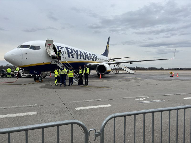
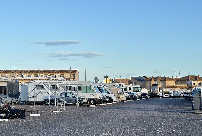
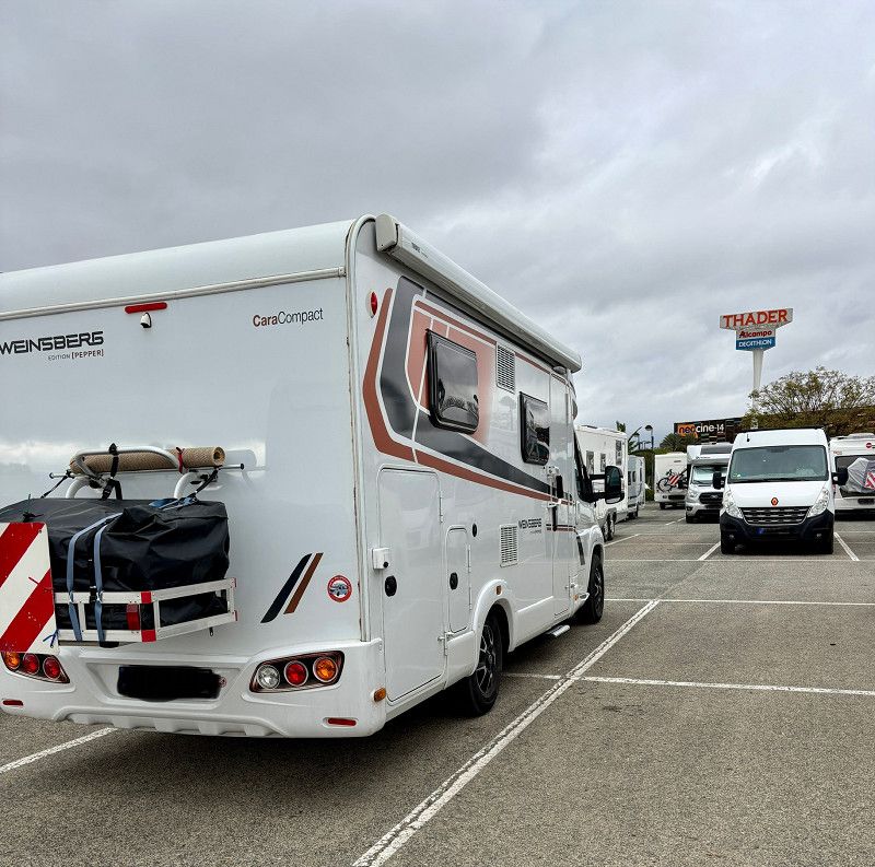
We flew home from Alicante in December. Our motorhome stayed in a secure parking lot in Spain.
Now we're flying back and continuing our journey. Of course, we hope it's not quite as crowded and warmer than it was in December. (Complaining on a high level, I know.) But we also had a nice, warm home.
Day Ankunft bei Regen und Kälte
22. Feb. 2025 -
22. Feb. 2025
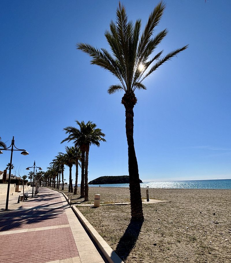
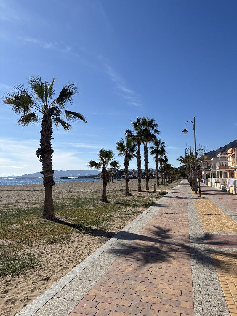
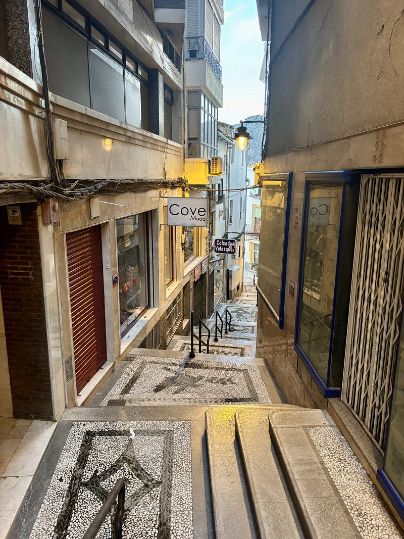
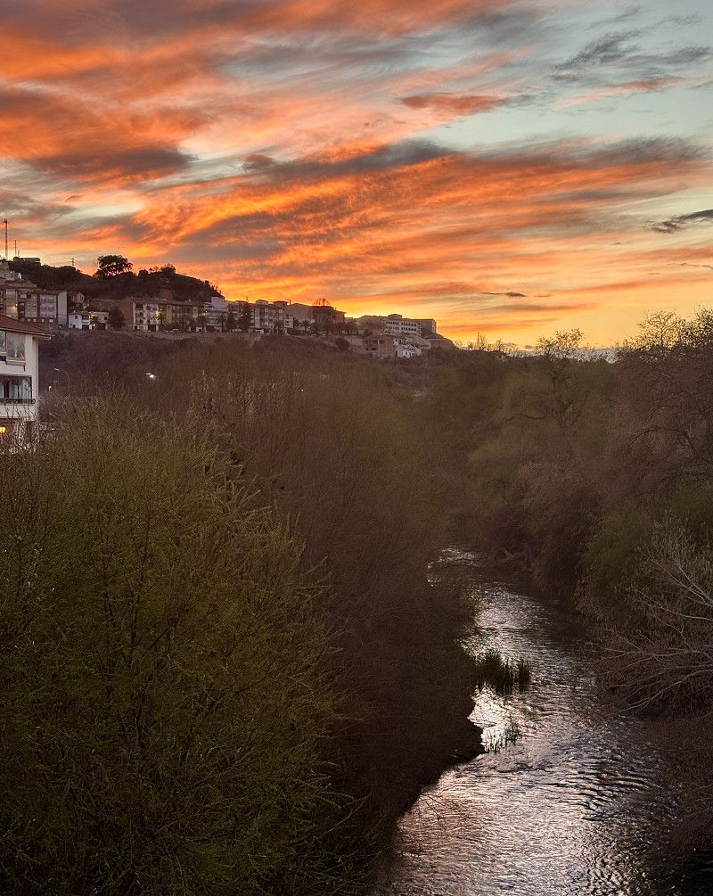
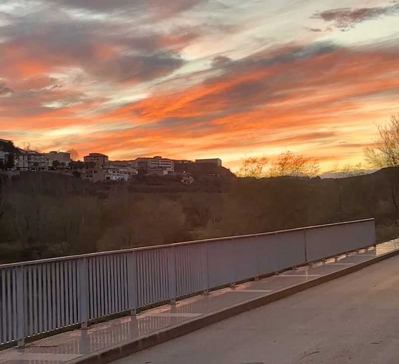
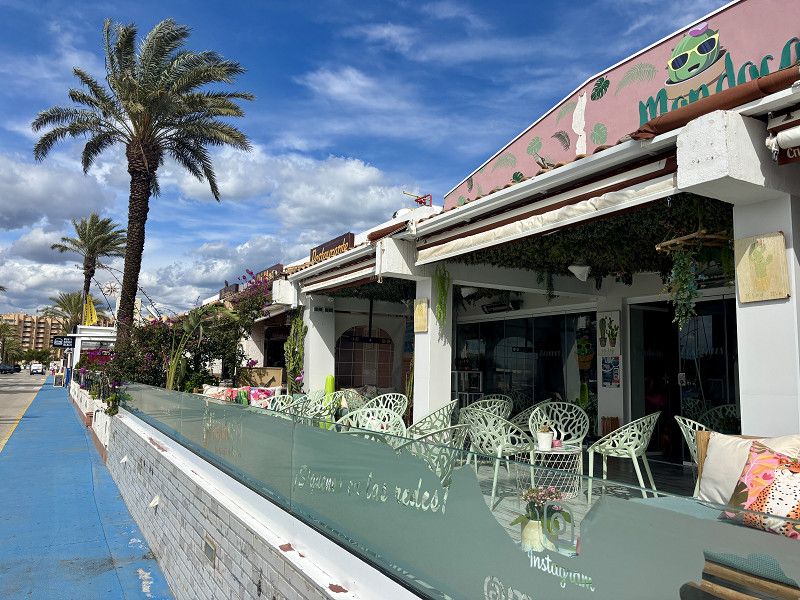
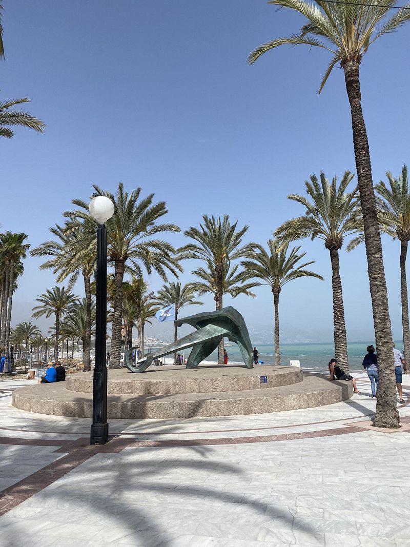
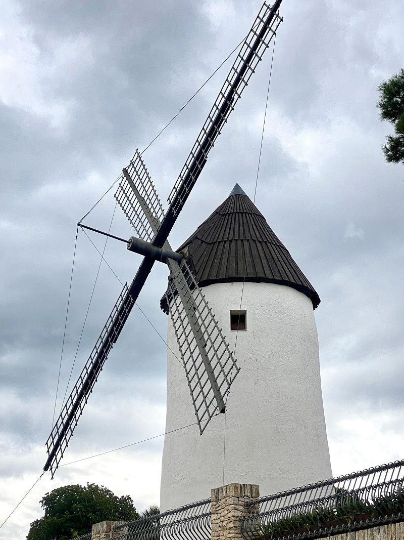
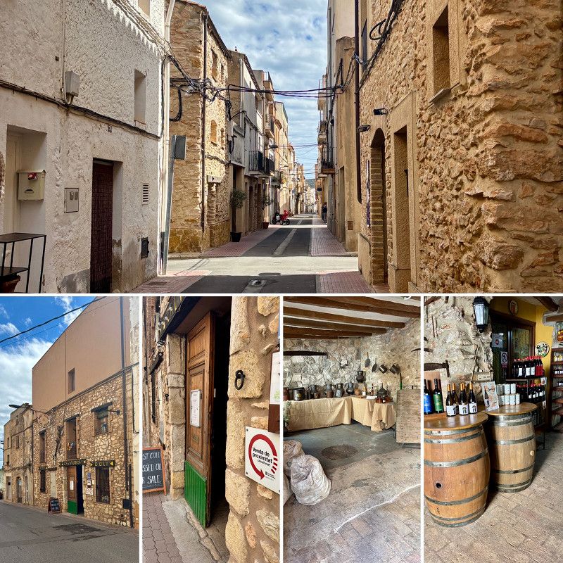
Elx / Elche
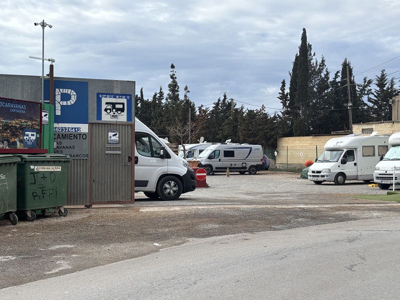
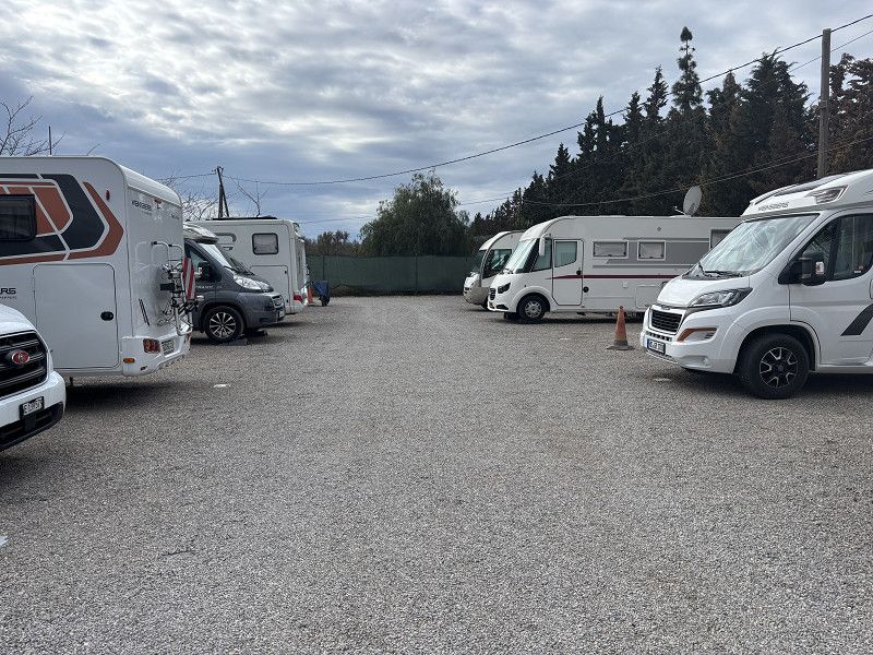
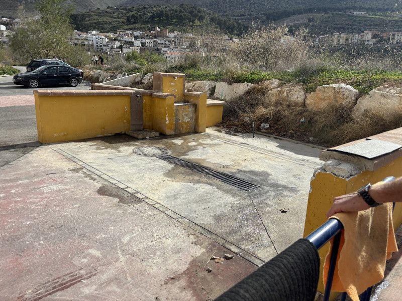
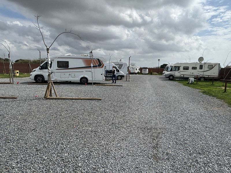
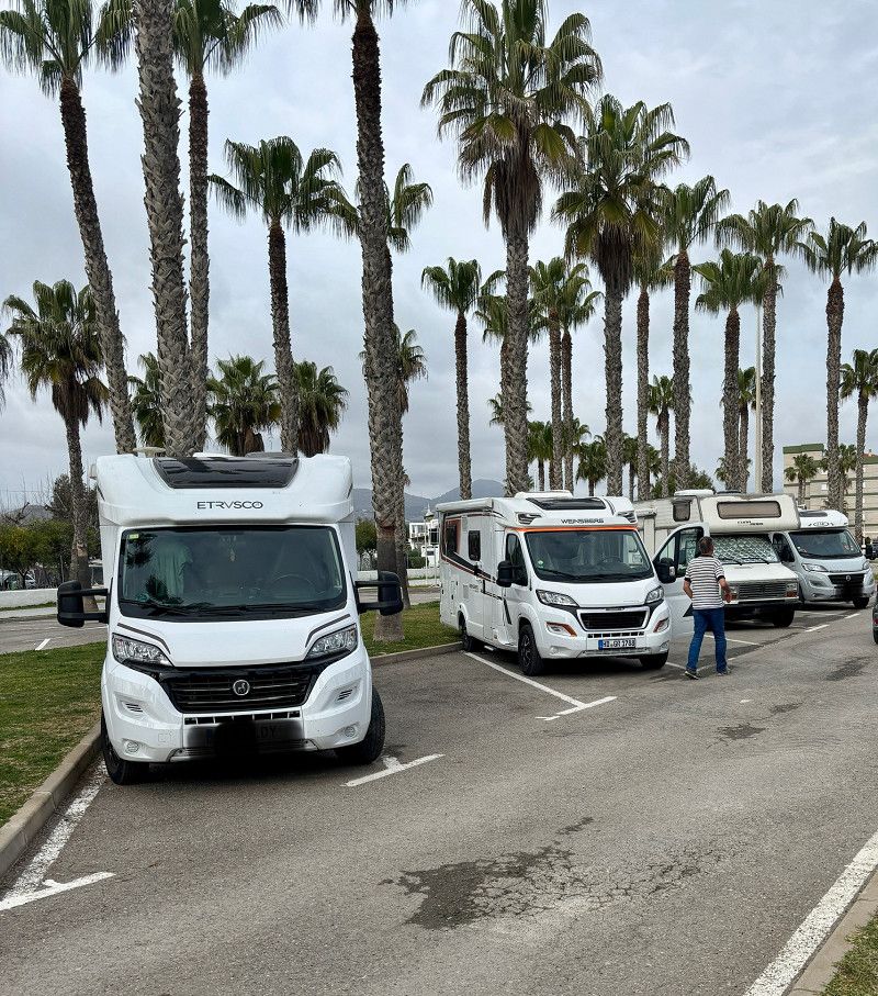
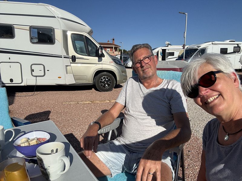
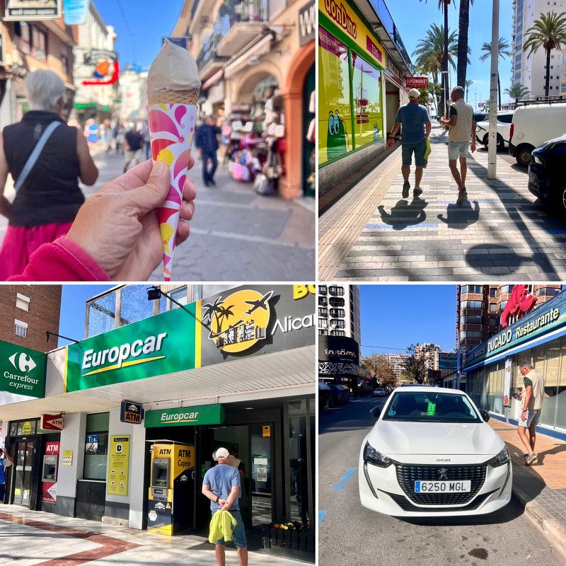
We arrive at the airport in Alicante and are picked up and taken to our motorhome.
Now it's time to go shopping, fill up with water and then head to a campsite that has been reserved for us by a fellow camper.
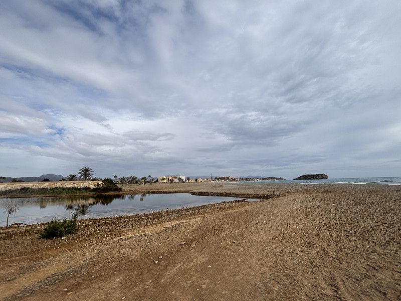
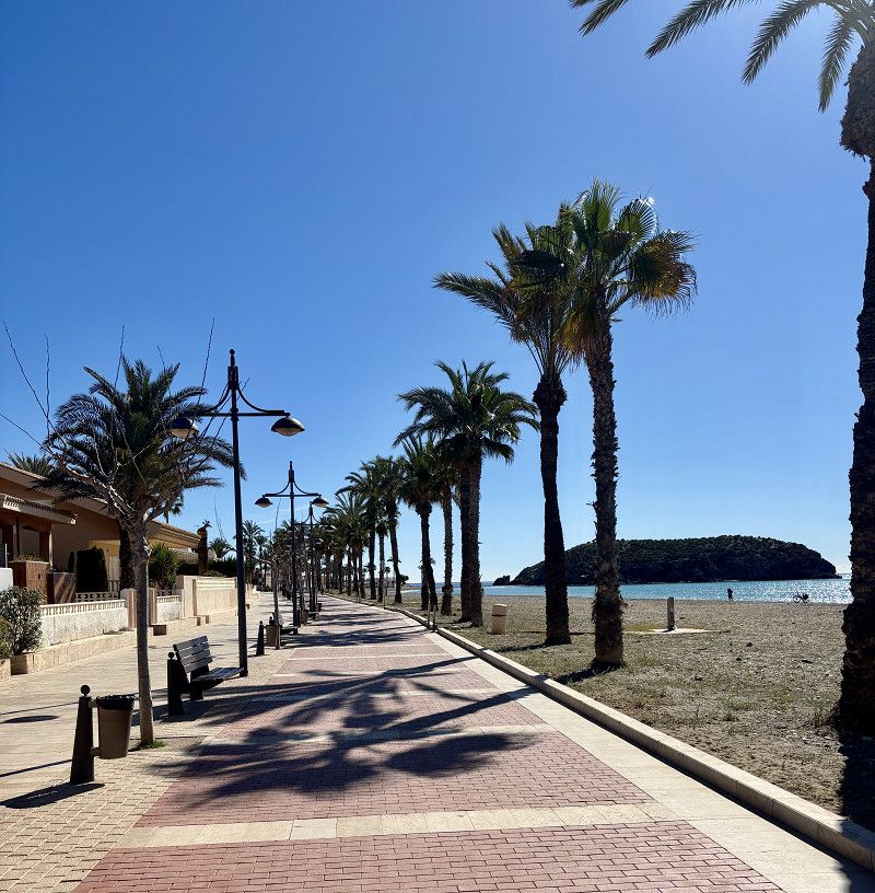
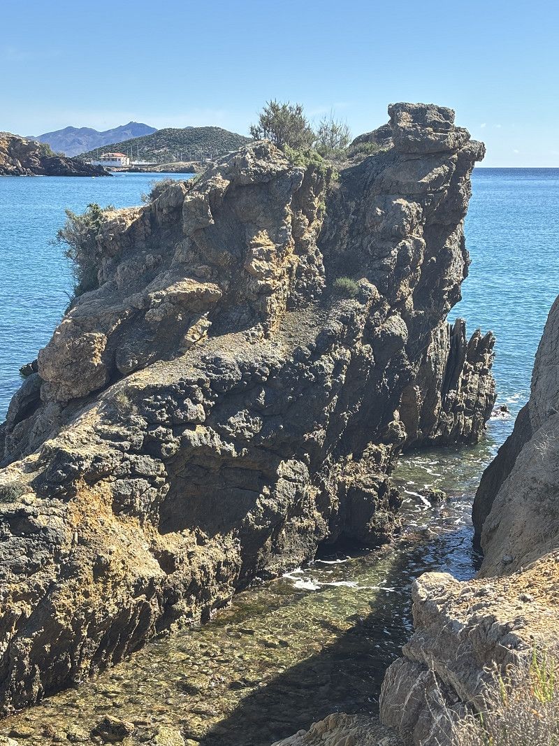
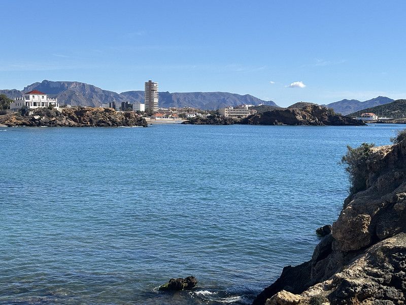
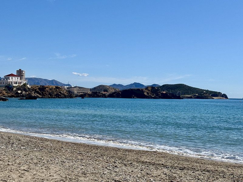
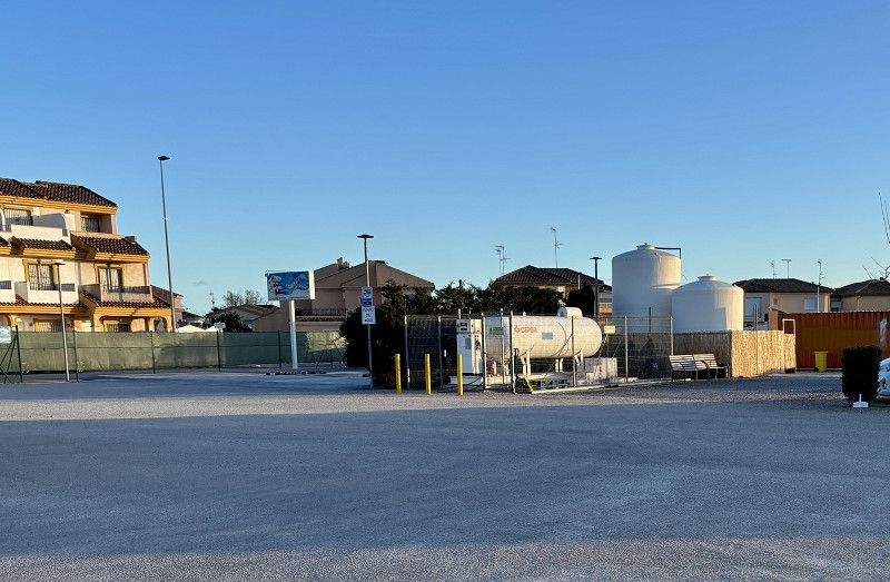
We're going to Cartagena today.
Camí de Xalefa a Alacant, Elx / Elche, Valencianische Gemeinschaft, Spanien
38° 17' 36.8" N 0° 33' 35.1" W
38.2935634 -0.5597597
• Head east on Camino de Chalefa-Alicante. Go for 89 m.
• Turn left toward Partida Altet. Go for 89 m.
• Continue on Partida Altet. Go for 371 m.
• Turn left onto Partida Altet (N-340). Go for 448 m.
• Continue on N-340. Go for 138 m.
• Take the 3rd exit from roundabout onto N-338 (Carretera al Aeropuerto) toward València/A-70/Murcia/A-31/Madrid. Go for 1.7 km.
• Take the left exit toward Elx/Elche/Murcia/A-31/Madrid onto A-70 (Autovía del Mediterráneo). Go for 10.0 km.
• Continue on A-7 (Autovía del Mediterráneo). Go for 14.4 km.
• Keep right onto AP-7 (Autopista del Mediterráneo) toward Torrevieja/Cartagena. Go for 76.0 km.
• Take exit 800 toward Murcia/Almería onto AP-7. Go for 6.2 km.
• Take exit 805 toward La Palma/La Aparecida. Go for 475 m.
• Take the 2nd exit from roundabout toward La Palma. Go for 996 m.
• Turn left onto F-36. Go for 728 m.
• Continue on Los Salazares (F-36). Go for 102 m.
• Continue on F-36. Go for 140 m.
• Continue on Pasaje Francos (F-36). Go for 739 m.
• Continue on F-36. Go for 329 m.
• Take the 1st exit from roundabout onto F-37 toward Santa Ana/Sta. Ana. Go for 1.7 km.
• Turn right toward Pasaje Los Conesas. Go for 189 m.
• Continue on Pasaje Los Conesas. Go for 458 m.
• Turn left. Go for 429 m.
• Turn right. Go for 1.1 km.
• Arrive at your destination.
☍
116,7 km
(1 hrs. 11 min.)
22. Feb. 2025 -
23. Feb. 2025
Barriada San Cristobal -Stellplatz
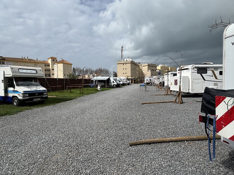
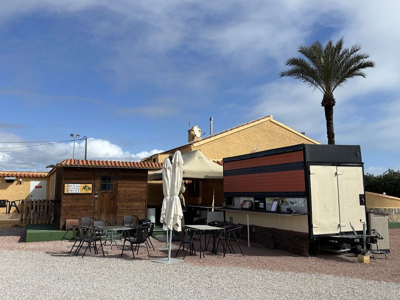
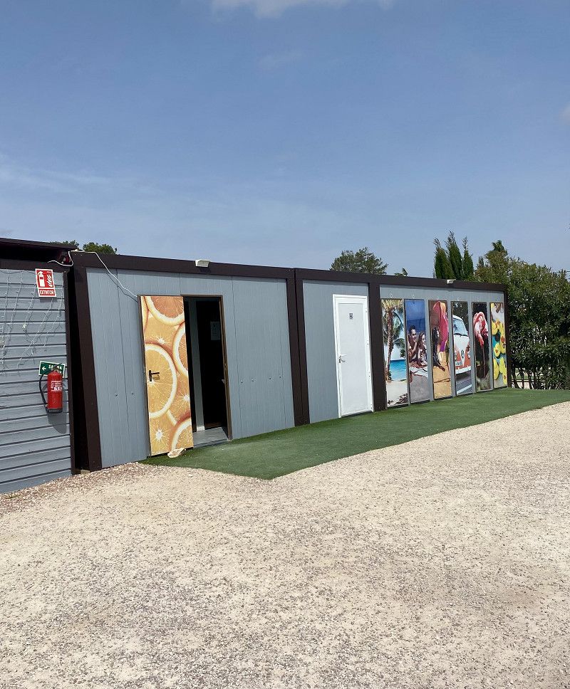
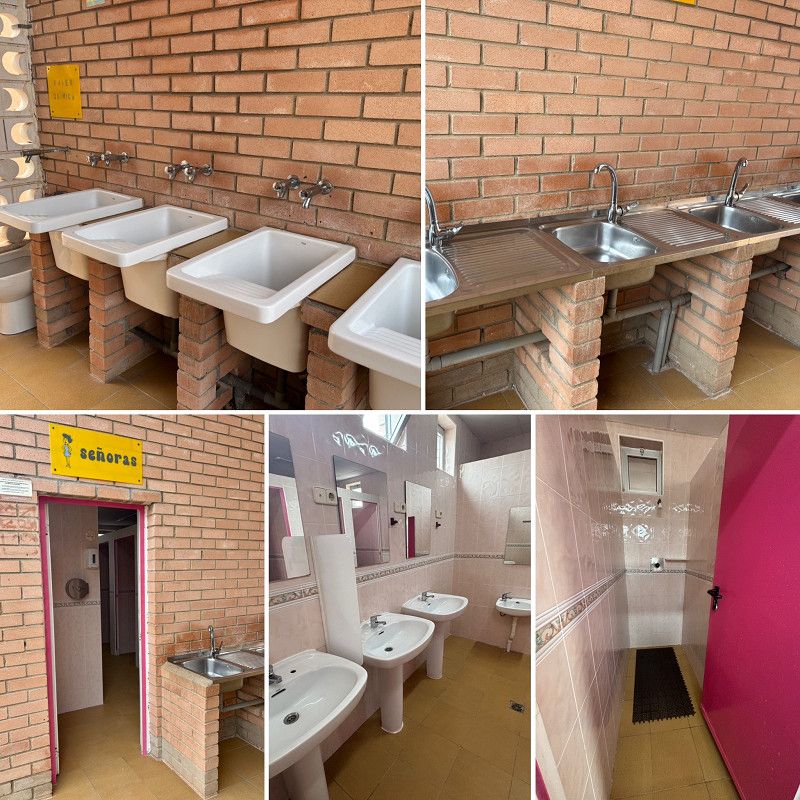
We're located in Barriada San Cristobal, north of Cartagena, on a simple campsite. Water and electricity are available, and there are sanitary containers for men and women (2 showers, 2 toilets each).
There is also a dishwashing area, but we won't be using it.
The surroundings are rather rural and also a bit outside the suburbs of Cartagena.
There is a supermarket within walking distance and a gas station is also nearby.
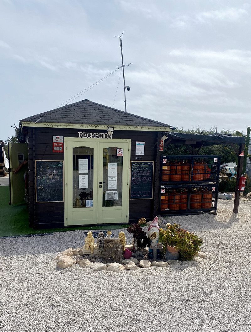
The site was requested in advance by phone by camper friends we met here and then reserved.
12€/night without electricity, including Wi-Fi.
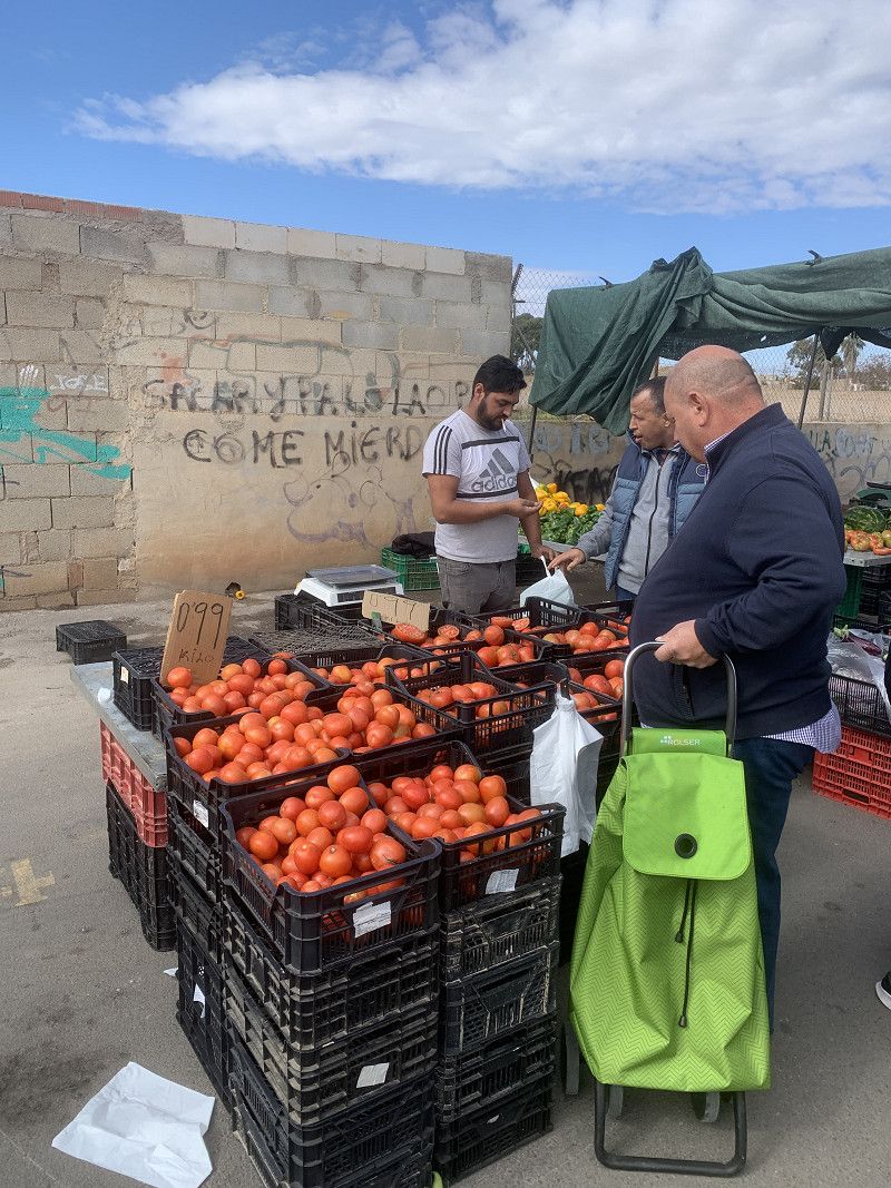
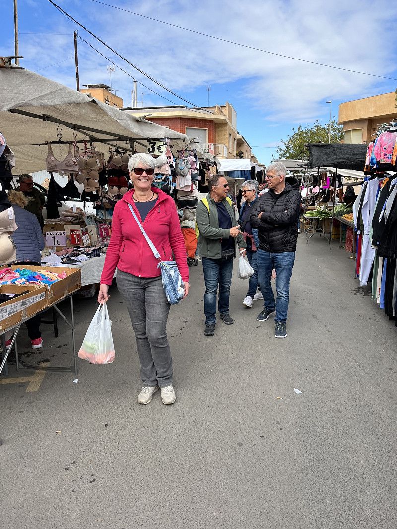
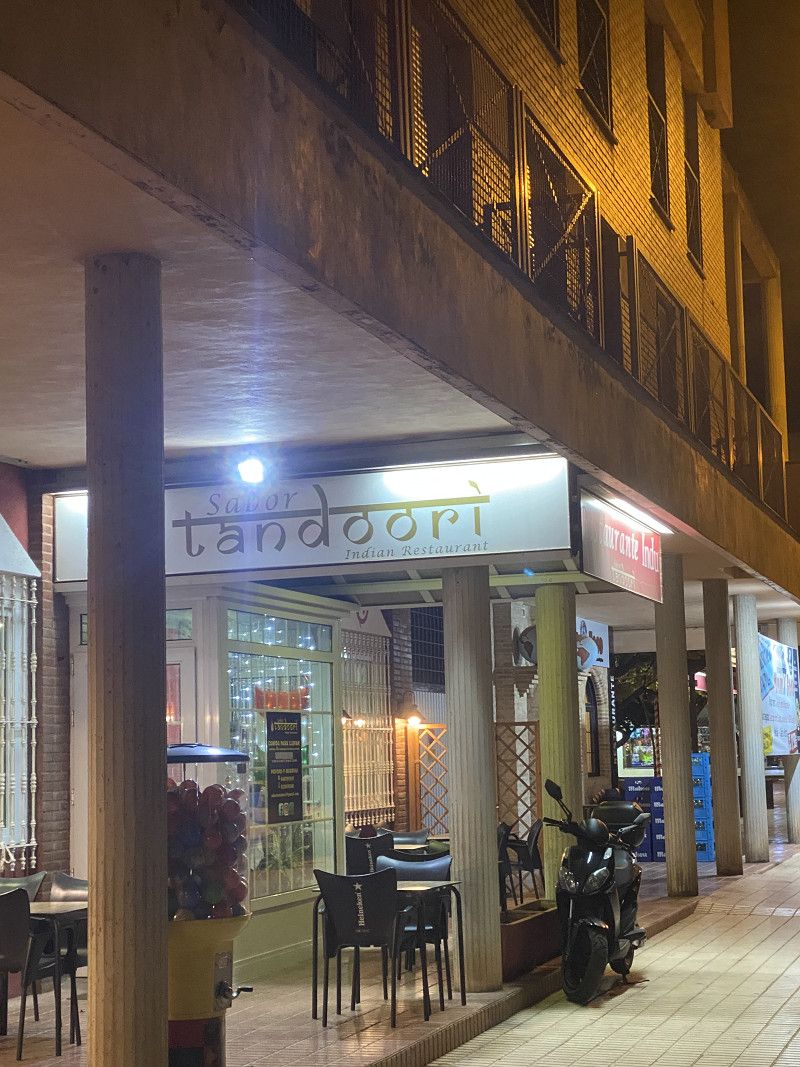
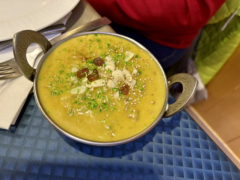
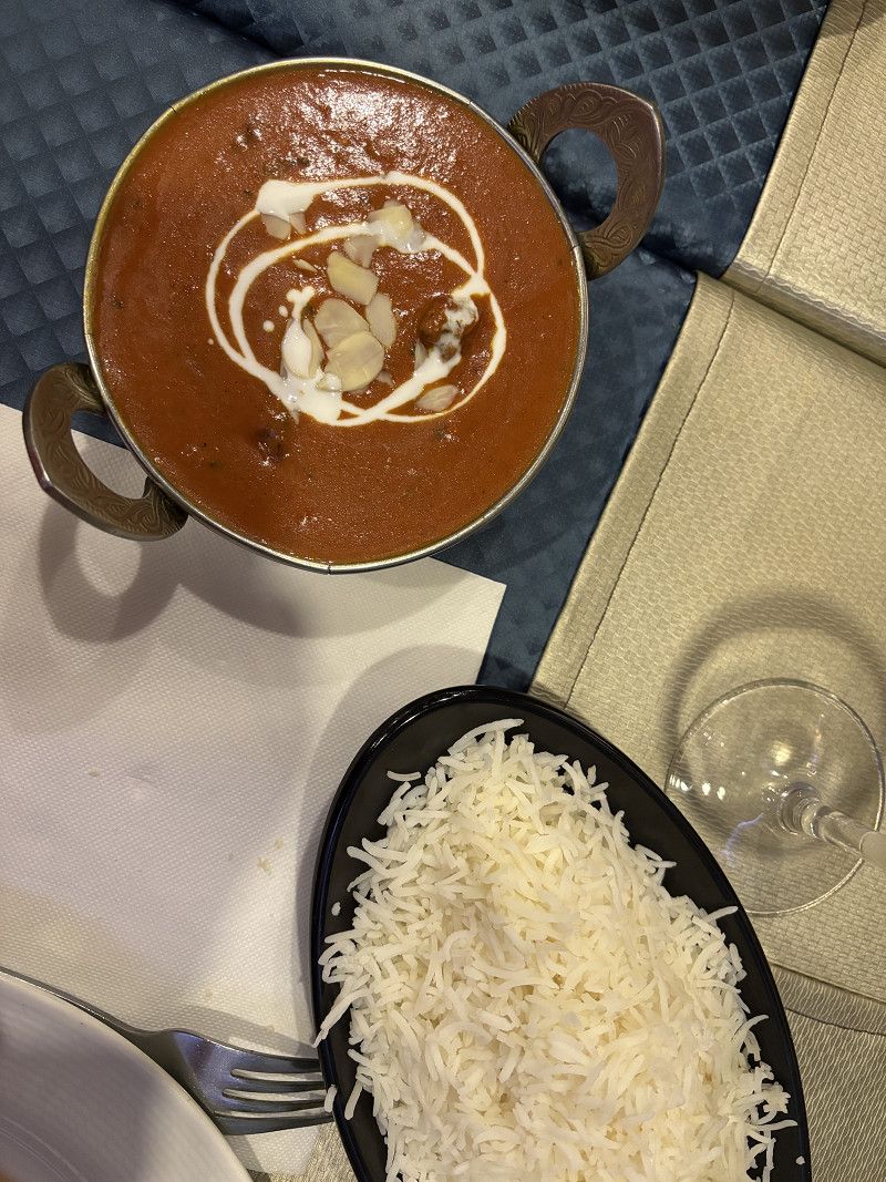
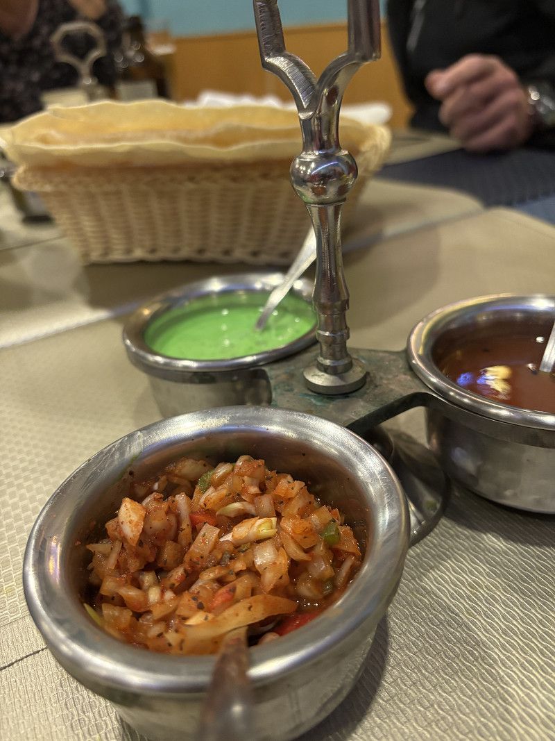
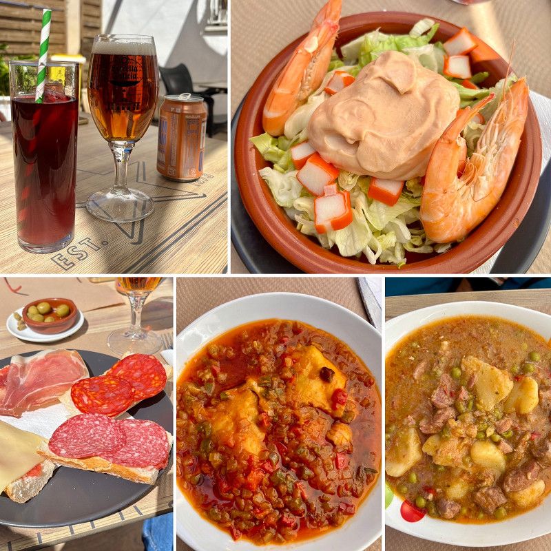
On the second day, we visit the weekly market, and in the evening, we enjoy a delicious meal at an Indian restaurant (recommended by Guido, the SP operator). Everything is within easy walking distance.
Campo de Cartagena y Mar Menor, Region of Murcia, Spain
37° 40' 7" N 0° 59' 13.9" W
37.6686076 -0.9871874
• Head toward Pasaje Segados. Go for 1.1 km.
• Turn left toward Pasaje Los Conesas. Go for 429 m.
• Turn right onto Pasaje Los Conesas. Go for 458 m.
• Continue toward F-37. Go for 189 m.
• Turn left onto F-37. Go for 1.6 km.
• Take the 1st exit from roundabout onto F-36 toward Cartagena/Murcia/Alicante/Los Barreros. Go for 428 m.
• Take the 2nd exit from roundabout onto Finca Lo Comadrón toward F-36/Cartagena/Los Barreros/CT-32/Alicante/La Manga/Cartagena/A-30. Go for 275 m.
• Pass 2 roundabouts and continue on RM-F-36. Go for 2.1 km.
• Take the 2nd exit from roundabout onto Ronda Transversal (RM-36) toward Los Dolores/Almería/N-332/Mazarrón. Go for 2.4 km.
• Take the 2nd exit from roundabout onto Ronda Transversal (RM-36) toward Cartagena Oeste/N-332/Mazarrón/Almería. Go for 1.0 km.
• Take the 2nd exit from roundabout onto N-332 toward Canteras/Centro Ciudad. Go for 391 m.
• Arrive at N-332. Your destination is on the left.
☍
10,4 km
( 14 min.)
Cartagena
Here we fill up with LPG (€0.918/l) and diesel (€1.329/l). Now we're back to full capacity.
Campo de Cartagena y Mar Menor, Region Murcia, Spanien
37° 37' 7" N 1° 0' 42.5" W
37.6186033 -1.0117928
• Head southeast on N-332. Go for 652 m.
• Take the 4th exit from roundabout onto Pasaje Blases (N-332). Go for 919 m.
• Take the 2nd exit from roundabout onto RM-332 toward Almería/Mazarrón. Go for 725 m.
• Take the 2nd exit from roundabout onto RM-332. Go for 798 m.
• Take the 3rd exit from roundabout onto Cuesta Ladrillares (RM-332) toward N-332-1/Molinos Marfagones/Mazarrón. Go for 2.2 km.
• Arrive at Carretera a Mazarrón (RM-332). Your destination is on the right.
☍
5,3 km
( 7 min.)
Cartagena
Carretera a Mazarrón, Cartagena, Campo de Cartagena y Mar Menor, Region Murcia, Spanien
37° 37' 52.2" N 1° 3' 1.9" W
37.6311768 -1.0505365
• Head toward Calle Puerto Acosta on Carretera a Mazarrón (RM-332). Go for 169 m.
• Take the 2nd exit from roundabout onto RM-332 toward N-332/Mazarrón. Go for 3.6 km.
• Take the 3rd exit from roundabout onto RM-332 toward Mazarrón. Go for 479 m.
• Pass 3 roundabouts and continue on RM-332. Go for 4.0 km.
• Take the 3rd exit from roundabout onto RM-332 toward Mazarrón. Go for 1.7 km.
• Take the 3rd exit from roundabout onto RM-332 toward Mazarrón. Go for 1.5 km.
• Take the 4th exit from roundabout onto RM-332 toward RM-E17/Tallante/Los Ruices/Mazarrón. Go for 698 m.
• Pass 2 roundabouts and continue on Los Ruices (RM-332). Go for 4.7 km.
• Arrive at Puerto de Montaña la Cuesta (RM-332). Your destination is on the left.
☍
16,9 km
( 16 min.)
Cartagena
Carretera a Mazarrón, Cartagena, Campo de Cartagena y Mar Menor, Region Murcia, Spanien
37° 37' 30.4" N 1° 11' 47.5" W
37.6251084 -1.1965222
• Head toward Pasaje Valdelentisco on Puerto de Montaña la Cuesta (RM-332). Go for 7.5 km.
• Take the 3rd exit from roundabout onto RM-332 toward RM-E22/Isla Plana/La Azohía/Puerto de Mazarrón/Mazarrón. Go for 880 m.
• Take the 2nd exit from roundabout onto Avenida Cabo de Gata (RM-332) toward Mazarrón/N-332. Go for 2.1 km.
• Take the 3rd exit from roundabout toward Pto. de Mazarrón. Go for 217 m.
• Turn right. Go for 25 m.
• Turn right toward Calle Vencejo. Go for 17 m.
• Turn left onto Calle Vencejo. Go for 144 m.
• Turn right. Go for 52 m.
• Arrive at your destination on the right.
☍
11,0 km
( 12 min.)
Mazarrón
Bajo Guadalentín, Region Murcia, Spanien
37° 34' 18.7" N 1° 16' 8.2" W
37.5718516 -1.2689410
• Head northwest. Go for 68 m.
• Turn right. Go for 147 m.
• Turn slightly right toward Calle Vencejo. Go for 114 m.
• Turn slightly right onto Calle Vencejo. Go for 370 m.
• Turn right onto Avenida del Águila Imperial. Go for 72 m.
• Take the 2nd exit from roundabout onto Calle del Vivero. Go for 470 m.
• Turn slightly right onto Calle del Vivero. Go for 532 m.
• Continue toward Ronda Oeste. Go for 420 m.
• Continue on Ronda Oeste. Go for 58 m.
• Arrive at Ronda Oeste. Your destination is on the left.
☍
2,3 km
( 5 min.)
Mazarrón
Calle Alcazaba, Mazarrón, Bajo Guadalentín, Region Murcia, Spanien
37° 33' 56.5" N 1° 17' 10.5" W
37.5657083 -1.2862372
• Head west on Ronda Oeste. Go for 420 m.
• Turn left onto Calle Estribore. Go for 16 m.
• Turn right onto Calle Babor. Go for 333 m.
• Turn right onto Avenida del Castellar. Go for 10 m.
• Continue on Avenida de Bolnuevo. Go for 760 m.
• Take the 2nd exit from roundabout onto Avenida de Pedro López Meca. Go for 449 m.
• Turn left. Go for 130 m.
• Turn left. Go for 37 m.
• Arrive at your destination.
☍
2,2 km
( 5 min.)
Day Wir werden erwartet in Bolnuevo
24. Feb. 2025 -
02. Mar. 2025
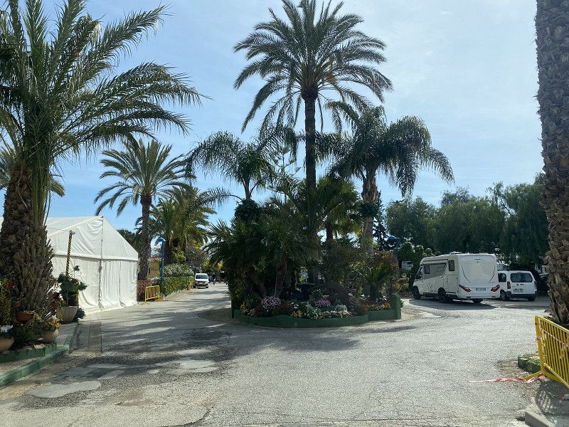
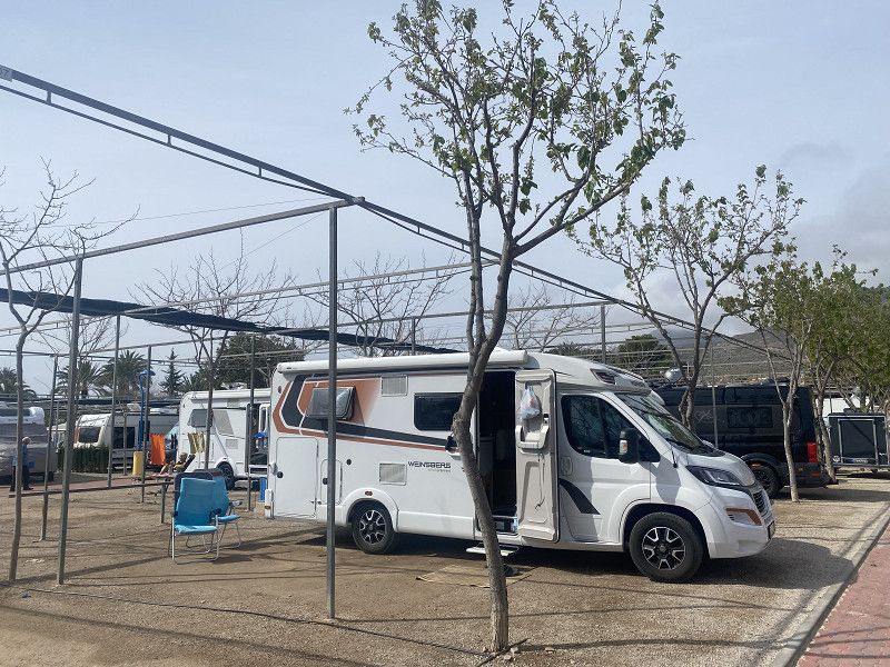
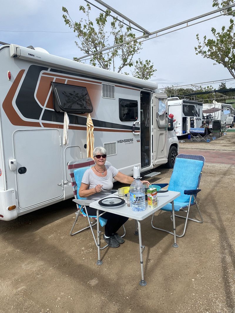
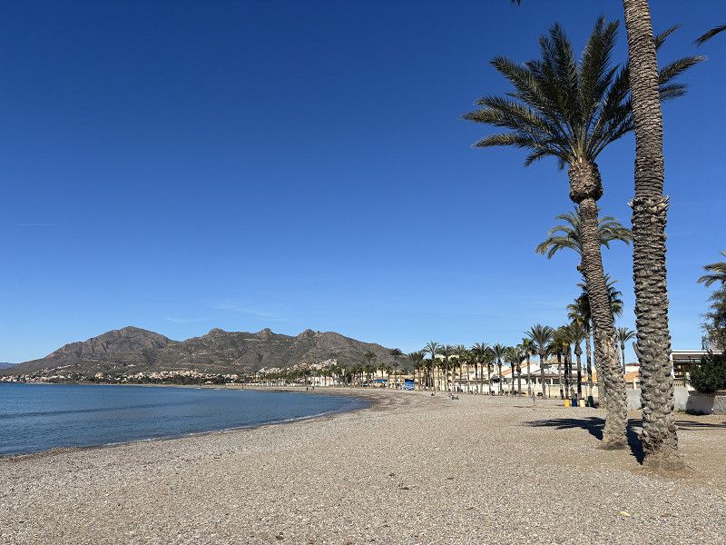
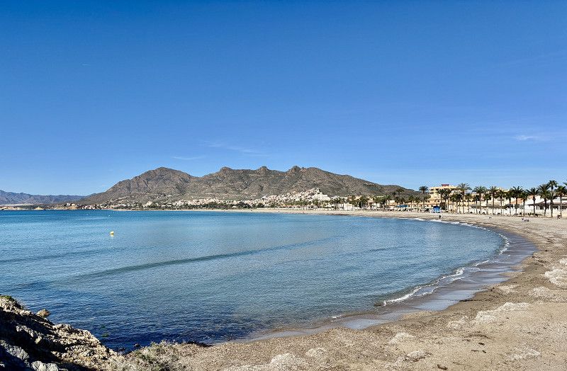
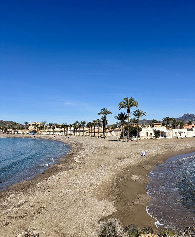
Camping Playa de Mazarrón
Very well-maintained ACSI campsite that we know well and like.
Here we also meet camper acquaintances and a former work colleague.
We'll stay here over Carnival because the places are full.
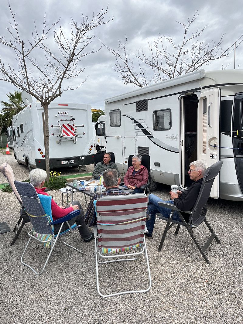
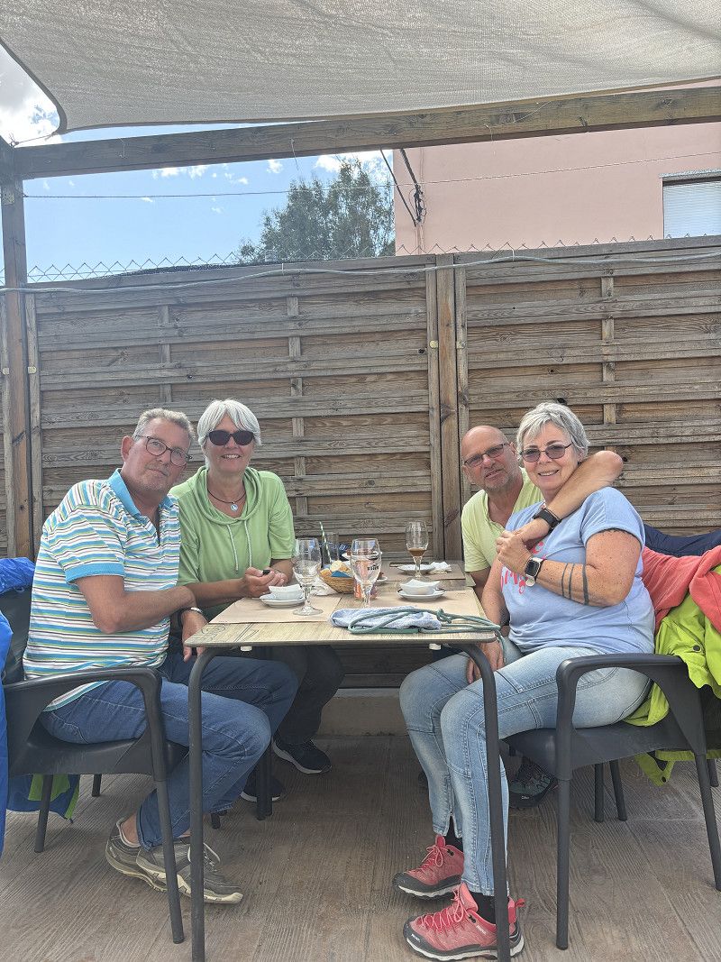
On the third day, our friends from Cartagena also arrive here, and now we are a big, fun group.
Calle Mistral, Mazarrón, Bajo Guadalentín, Region Murcia, Spanien
37° 33' 46.6" N 1° 18' 9.2" W
37.5629365 -1.3025545
• Head northeast. Go for 11 m.
• Turn left. Go for 71 m.
• Turn left. Go for 59 m.
• Turn right toward Avenida de Pedro López Meca. Go for 47 m.
• Turn right onto Avenida de Pedro López Meca. Go for 400 m.
• Take the 3rd exit from roundabout onto D-6. Go for 3.0 km.
• Continue on Moreras (D-6). Go for 165 m.
• Continue on D-6. Go for 199 m.
• Take the 2nd exit from roundabout onto RM-332 toward N-332/E-15/AP-7/Vera/Almería/Cartagena/Águilas/RM-3/Murcia/RM-D4/Morata. Go for 2.3 km.
• Take the 1st exit from roundabout onto RM-3 (Autovía de Mazarrón) toward Águilas/Vera/E-15/AP-7/Almería/Cartagena/Totana/Alhama de Murcia/Murcia. Go for 20.2 km.
• Continue on RM-3 (Autovía de Mazarrón). Go for 5.9 km.
• Take the 1st exit from roundabout onto C-3315 toward A-7/Lorca/Totana. Go for 185 m.
• Continue toward E-17. Go for 16 m.
• Take left ramp onto A-7 (Autovía del Mediterráneo) toward Almería/Granada. Go for 40.7 km.
• Take exit 651 toward Vélez Rubio/Granada onto A-91. Go for 17.0 km.
• Continue on A-92N. Go for 119 km.
• Continue on A-92. Go for 102 km.
• Take exit 193 toward Hospital de Alta Resolución. Go for 477 m.
• Take the 3rd exit from roundabout onto Avenida Andalucía toward A-4154/Loja. Go for 204 m.
• Pass 4 roundabouts and continue on Avenida Andalucía. Go for 2.2 km.
• Turn right onto Cuesta San Roque. Go for 110 m.
• Turn slightly left onto Calle de Haros. Go for 140 m.
• Continue on Calle Pilar y Calvo. Go for 118 m.
• Turn right onto Calle Tamayo. Go for 162 m.
• Continue on Plaza La Virgen. Go for 10 m.
• Continue on Cuesta de Posadilla. Go for 89 m.
• Turn slightly left onto Calle Zacatín. Go for 12 m.
• Turn right onto Carrera de San Agustín. Go for 65 m.
• Arrive at Carrera de San Agustín. Your destination is on the left.
☍
314,5 km
(2 hrs. 47 min.)
26. Feb. 2025 -
26. Feb. 2025
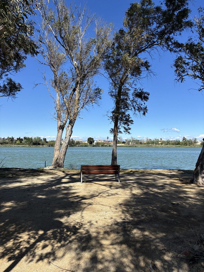
Strand von Bolnuevo
27. Feb. 2025 -
27. Feb. 2025
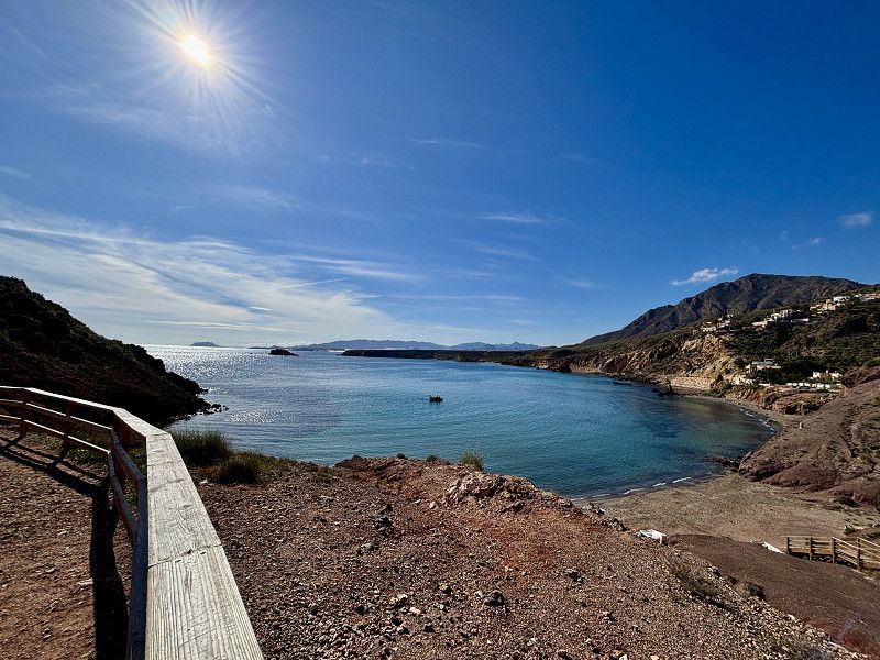
Tolle Aussicht
Day auf dem Weg zum eigentlichen Ziel - Atlantik und Portugal
02. Mar. 2025 -
02. Mar. 2025
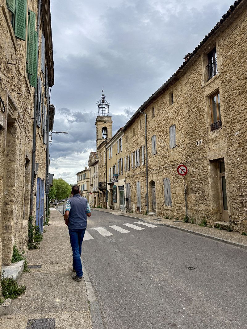
Loja
Municipal parking space, easily accessible from the A92. Free, with water and electricity, registration via QR code. Permitted to stay for 72 hours. For us, it's a transit spot. Nevertheless, we walk into the town in the late afternoon.
Comarca de Loja, Andalusien, Spanien
37° 9' 59.3" N 4° 8' 58.7" W
37.1664839 -4.1496374
• Head toward Cuesta Campos on Carrera de San Agustín. Go for 153 m.
• Continue on Avenida de los Ángeles. Go for 35 m.
• Turn right onto Cuesta del Arca. Go for 155 m.
• Turn slightly left onto Calle Juan XXIII. Go for 47 m.
• Turn right onto Calle Reyes Católicos. Go for 76 m.
• Turn left onto Calle San Isidro. Go for 207 m.
• Continue on Calle Pío XII. Go for 19 m.
• Continue on Calle Túnel. Go for 76 m.
• Continue on Calle Nueva de San Roque. Go for 54 m.
• Turn right onto Carril de los Pinos. Go for 17 m.
• Turn left onto Avenida Andalucía. Go for 1.3 km.
• Take the 2nd exit from roundabout onto Avenida Andalucía toward Pol. Ind. Fuente Santa/Málaga/A-92/Sevilla/Iznájar/A-328/Venorros. Go for 208 m.
• Take the 2nd exit from roundabout onto A-328 toward Málaga/A-92/Sevilla. Go for 899 m.
• Turn right toward A-92/Málaga/Sevilla. Go for 30 m.
• Continue on Calle Plines. Go for 1.5 km.
• Turn left and take ramp onto A-92 toward Málaga/Sevilla. Go for 150 km.
• Take exit 37 toward Utrera/Cádiz/E-5/AP-4. Go for 426 m.
• Continue on A-394. Go for 18.2 km.
• Take the 2nd exit from roundabout onto A-394. Go for 472 m.
• Take the 3rd exit from roundabout onto A-394. Go for 741 m.
• Pass 2 roundabouts and continue on A-394. Go for 1.2 km.
• Take the 3rd exit from roundabout onto Carretera Madrid-Cádiz (A-394) toward El Palmar de Troya/Cádiz/N-4/Cádiz/E-5/Sevilla/AP-4. Go for 589 m.
• Take the 3rd exit from roundabout onto A-394 toward El Palmar de Troya/N-4/Cádiz/E-5/Sevilla/AP-4. Go for 13.1 km.
• Turn left onto Avenida de Utrera (SE-9015). Go for 99 m.
• Take the 1st exit from roundabout onto Avenida de Utrera (SE-9015). Go for 97 m.
• Turn right onto Calle Gladiolos. Go for 102 m.
• Continue on Calle Geranio. Go for 182 m.
• Arrive at Calle Geranio. Your destination is on the left.
☍
189,7 km
(1 hrs. 48 min.)
03. Mar. 2025 -
03. Mar. 2025
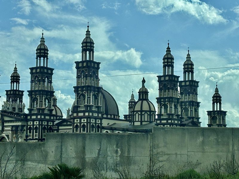
El Palmar de Troya
Lunch break very close to the Basilica of Nuestra Madre de Palmar Coronada. Unfortunately, it's closed.
Sevilla, Andalusien, Spanien
37° 3' 38.4" N 5° 48' 11.4" W
37.0606590 -5.8031769
• Head southeast on Calle Geranio.
• Turn right toward Calle Orquídeas. Go for 27 m.
• Turn right onto Calle Orquídeas. Go for 176 m.
• Turn right onto Calle Gardenia. Go for 25 m.
• Turn left onto Calle Gladiolos. Go for 102 m.
• Turn left onto Avenida de Utrera (SE-9015). Go for 76 m.
• Take the 2nd exit from roundabout onto Avenida de Utrera (SE-9015). Go for 125 m.
• Turn left onto A-394. Go for 3.9 km.
• Take ramp onto N-4 toward Jerez de la Frontera/Cadiz. Go for 42.9 km.
• Continue on A-4 (Autovía del Sur). Go for 13.0 km.
• Take exit 641AB toward Sanlúcar de Barrameda/Rota/Chipiona onto A-480. Go for 3.0 km.
• Take exit 22 toward Rota onto A-2078. Go for 11.3 km.
• Take the 2nd exit from roundabout onto A-491. Go for 7.9 km.
• Take ramp. Go for 211 m.
• Take the 3rd exit from roundabout onto A-2076. Go for 912 m.
• Take the 3rd exit from roundabout onto A-2076. Go for 1.2 km.
• Pass 2 roundabouts and continue on A-2076. Go for 1.8 km.
• Take the 3rd exit from roundabout. Go for 145 m.
• Take the 1st exit from roundabout onto Calle Playa de Punta Candor. Go for 393 m.
• Arrive at Calle Playa de Punta Candor.
☍
87,3 km
( 58 min.)
03. Mar. 2025 -
03. Mar. 2025
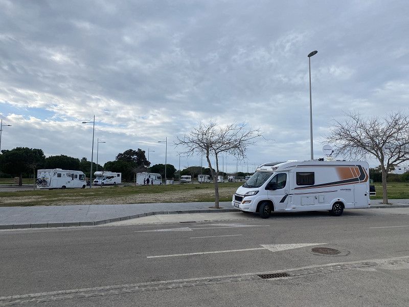
Rota
We stay one night on the side of the road, very close to the SP north of Rota. We're not alone here either.
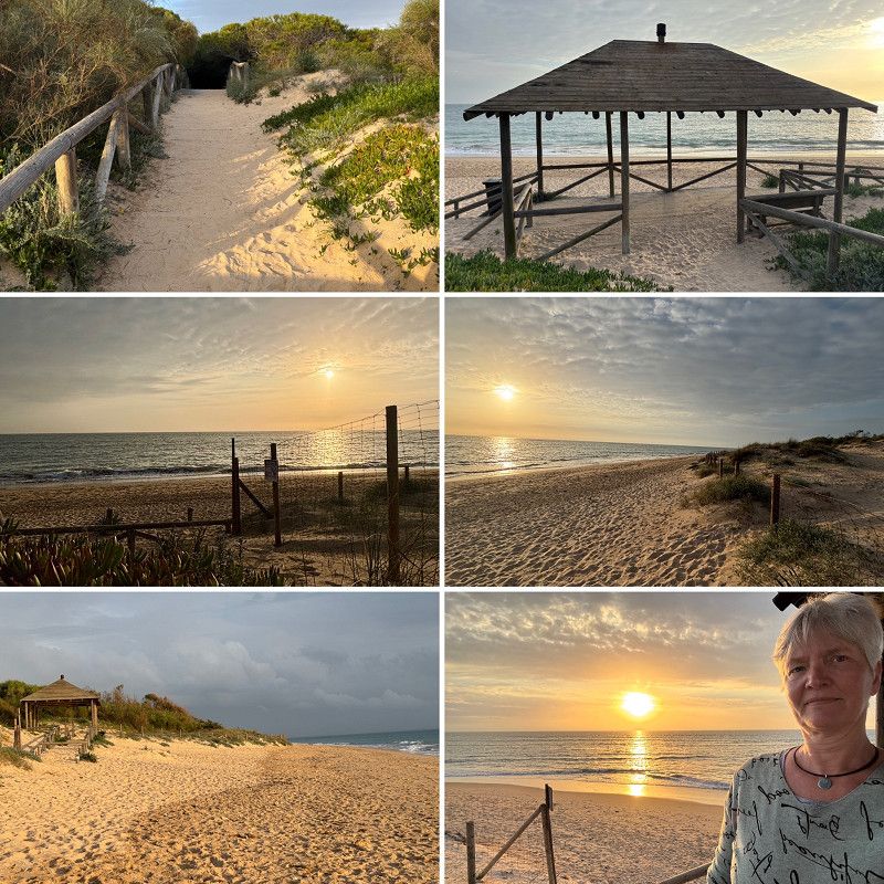
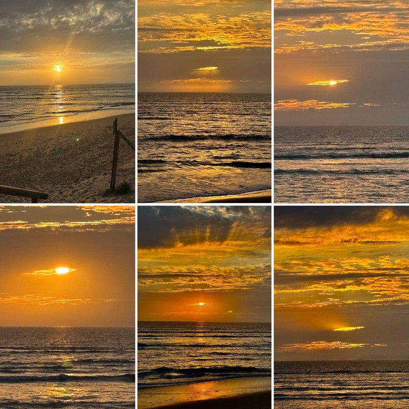
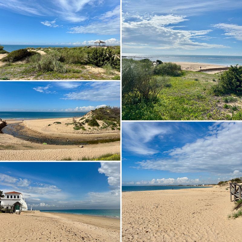
In the evening I walk to the beach and enjoy a sunset
Avenida Punta Candor, Rota, Costa Noroeste, Andalusien, Spanien
36° 38' 5" N 6° 23' 23.1" W
36.6347249 -6.3897584
• Head north on Calle Playa de Punta Candor. Go for 368 m.
• Take the 4th exit from roundabout. Go for 170 m.
• Take the 1st exit from roundabout onto A-2076. Go for 232 m.
• Take the 2nd exit from roundabout onto A-2076. Go for 1.6 km.
• Take the 3rd exit from roundabout onto A-2076. Go for 1.2 km.
• Take the 1st exit from roundabout onto A-2076. Go for 857 m.
• Take the 2nd exit from roundabout onto A-491. Go for 1.4 km.
• Take the 3rd exit from roundabout onto A-491. Go for 6.2 km.
• Take the 3rd exit from roundabout onto Avenida de Rota. Go for 620 m.
• Take the 4th exit from roundabout onto Avenida de Rota. Go for 663 m.
• Turn left onto Calle Lope de Vega. Go for 301 m.
• Arrive at Calle Lope de Vega. Your destination is on the left.
☍
13,6 km
( 15 min.)
Day Atlantik - irgendwie nur kalt und regen
04. Mar. 2025 -
05. Mar. 2025
Chipiona
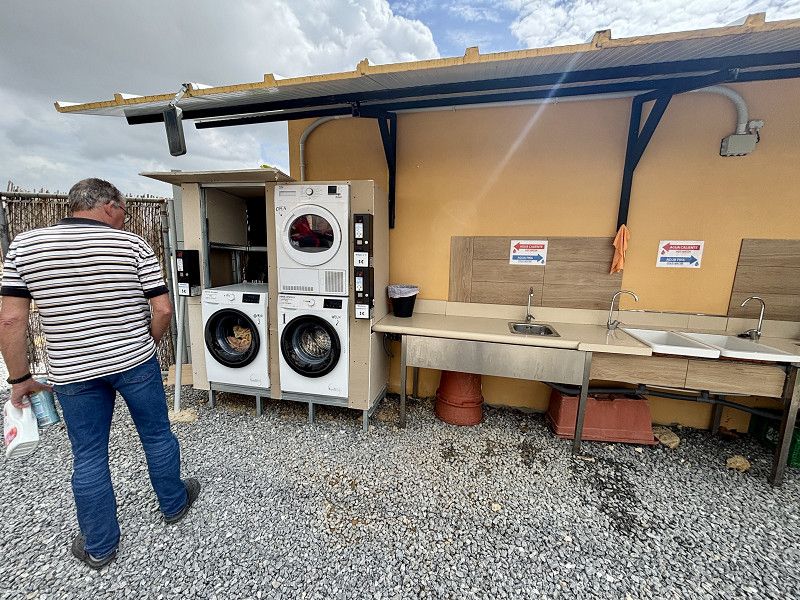
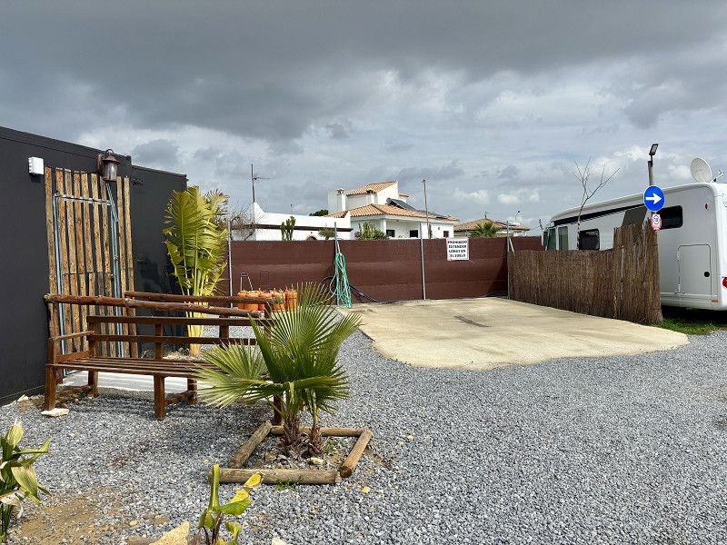
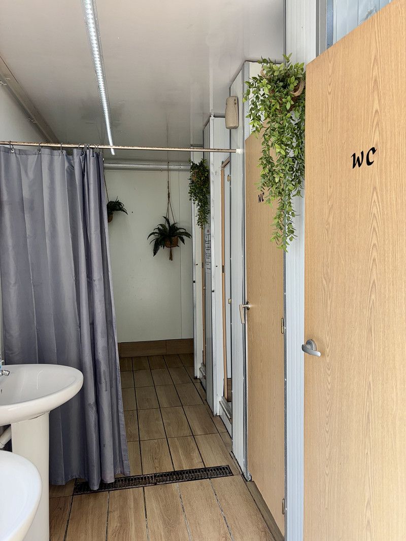
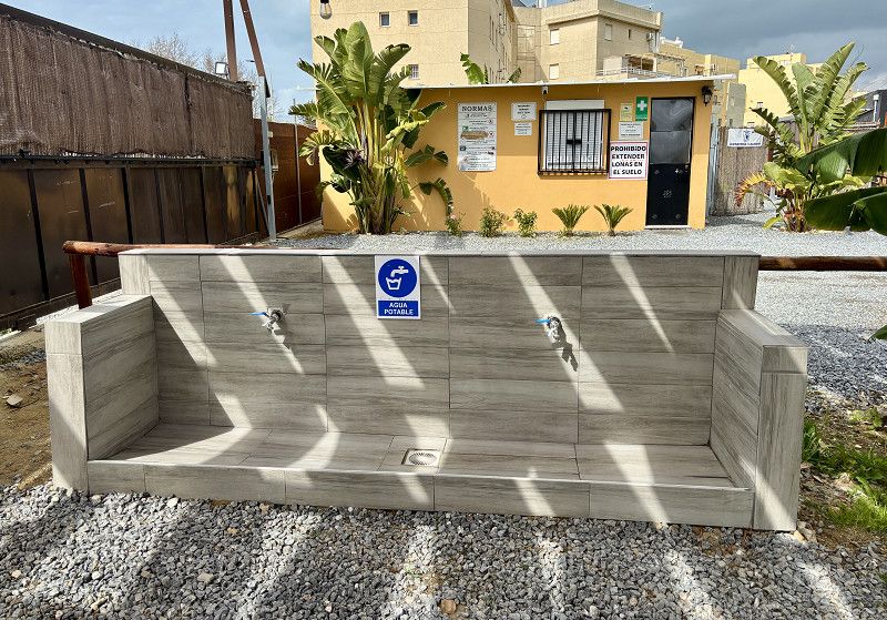
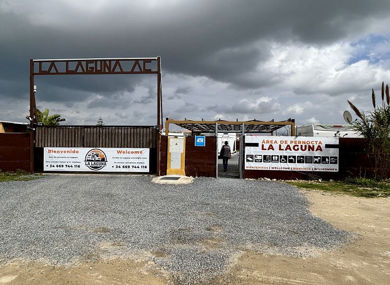
We stay at the La Laguna campsite for two nights. It costs €15 per night without electricity, but it includes hot showers, a dishwashing area with hot water, and a washing machine (€3) and dryer (€3).
We'll use both right away.
Unfortunately the weather is very mixed, it rains all day on the second day.
Costa Noroeste, Andalusien, Spanien
36° 44' 8" N 6° 26' 5.4" W
36.7355451 -6.4348221
• Head southwest on Calle Lope de Vega. Go for 29 m.
• Turn left onto Calle Calderón de la Barca. Go for 62 m.
• Turn left onto Avenida del Ejército. Go for 347 m.
• Turn right onto Avenida de Rota toward Cadiz/Pto. Sta. María. Go for 478 m.
• Take the 2nd exit from roundabout onto Avenida de Rota toward Cadiz/Rota/Costa Ballena/Pto. Sta. María. Go for 646 m.
• Take the 2nd exit from roundabout onto A-491. Go for 6.2 km.
• Take the 3rd exit from roundabout onto A-491. Go for 1.3 km.
• Take ramp onto A-2076 toward Rota (Norte). Go for 838 m.
• Take the 3rd exit from roundabout onto A-2076. Go for 1.2 km.
• Pass 2 roundabouts and continue on A-2076. Go for 1.8 km.
• Take the 1st exit from roundabout onto Avenida de la Diputación. Go for 134 m.
• Turn left. Go for 20 m.
• Turn right. Go for 70 m.
• Arrive at your destination on the right.
☍
13,2 km
( 15 min.)
06. Mar. 2025 -
06. Mar. 2025
Rota
Here we meet Britta and Peter and enjoy a wonderful day. Starting tomorrow, heavy rain and storms are expected on the Atlantic.
We will leave the Atlantic again tomorrow.
Avenida de la Diputación, Rota, Costa Noroeste, Andalusien, Spanien
36° 38' 13" N 6° 23' 32.4" W
36.6369573 -6.3923437
• Head south. Go for 37 m.
• Turn right. Go for 124 m.
• Turn left toward Avenida de la Diputación. Go for 7 m.
• Turn right onto Avenida de la Diputación. Go for 117 m.
• Take the 3rd exit from roundabout onto A-2076. Go for 269 m.
• Take the 2nd exit from roundabout onto A-2076. Go for 1.6 km.
• Take the 3rd exit from roundabout onto A-2076. Go for 1.2 km.
• Take the 1st exit from roundabout onto A-2076. Go for 581 m.
• Take ramp onto A-491. Go for 8.1 km.
• Take the 2nd exit from roundabout onto A-491. Go for 11.7 km.
• Take exit 27 toward Puerto Sta. María/Centro Urbano. Go for 285 m.
• Take the 4th exit from roundabout onto Avenida del Rey Felipe VI. Go for 828 m.
• Take the 3rd exit from roundabout onto Avenida del Rey Felipe VI toward N-4/Jerez/Sevilla. Go for 616 m.
• Take the 2nd exit from roundabout onto Avenida del Rey Felipe VI toward N-4/Jerez/Sevilla. Go for 700 m.
• Take the 1st exit from roundabout onto A-2002 toward Sevilla. Go for 5.6 km.
• Continue on Lugar El Portal (A-2002). Go for 857 m.
• Turn right onto CA-3109. Go for 25 m.
• Continue on Calle Paso a Nivel (CA-3109). Go for 672 m.
• Continue on CA-3109. Go for 7.0 km.
• Take the 2nd exit from roundabout toward Medina Sidonia/Algeciras/A-7. Go for 198 m.
• Continue on A-381. Go for 83.3 km.
• Take the left exit toward San Roque/Estepona/Málaga onto A-7 (Autovía del Mediterráneo). Go for 23.2 km.
• Continue on AP-7 (Autopista del Mediterráneo) toward Estepona/Málaga. Go for 9.7 km.
• Keep right onto AP-7. Go for 12.0 km.
• Continue on A-7 (Autopista del Mediterráneo). Go for 2.8 km.
• Continue on AP-7 (Autopista del Mediterráneo) toward Marbella/Málaga. Go for 15.1 km.
• Keep right toward Autopista del Mediterráneo/AP-7. Go for 321 m.
• Continue on AP-7 (Autopista del Mediterráneo). Go for 8.9 km.
• Continue on A-7 (Autovía del Mediterráneo). Go for 5.2 km.
• Keep left onto AP-7 (Autopista del Mediterráneo) toward Fuengirola/Málaga. Go for 14.7 km.
• Keep right toward Autopista del Mediterráneo/AP-7. Go for 375 m.
• Continue on AP-7 (Autopista del Mediterráneo). Go for 12.0 km.
• Continue on A-7 (Autopista del Mediterráneo). Go for 13.1 km.
• Keep right onto AP-7 toward Torremolinos/Málaga (Oeste)/MA-20/MA-21/Aeropuerto. Go for 3.7 km.
• Continue on MA-20. Go for 12.9 km.
• Continue on A-7 (Autovía del Mediterráneo). Go for 84.7 km.
• Take exit 903 toward GR-5300/Lobres/Molvízar/N-340/Salobreña. Go for 406 m.
• Take the 1st exit from roundabout toward GR-5300/Lobres/Molvízar/N-340/Salobreña. Go for 309 m.
• Take the 3rd exit from roundabout onto GR-5300 toward Lobres/N-340/Salobreña. Go for 844 m.
• Take the 1st exit from roundabout onto GR-5300 toward N-340/Salobreña/Motril. Go for 870 m.
• Take the 1st exit from roundabout onto N-323 toward Salobreña/Motril. Go for 1.4 km.
• Take the 2nd exit from roundabout onto Autovía Acceso Oeste al Puerto de Motril (GR-14) toward Motril/Salobreña. Go for 554 m.
• Take the 3rd exit from roundabout onto N-340 toward Motril/Almería. Go for 2.0 km.
• Take the 1st exit from roundabout onto N-340. Go for 1.5 km.
• Take ramp toward Centro Ciudad/Motril/Puerto/Varadero/Sta. Adela/Centro Ciudad Motril. Go for 272 m.
• Take the 4th exit from roundabout onto N-347 toward Centro Ciudad Motril. Go for 746 m.
• Take the 2nd exit from roundabout onto Avenida Nuestra Sra. de la Cabeza toward Centro Ciudad. Go for 583 m.
• Take the 3rd exit from roundabout onto Calle Narciso González Cervera. Go for 141 m.
• Continue on Calle Carrera. Go for 88 m.
• Continue on Plaza de los Jardinillos. Go for 46 m.
• Turn slightly right onto Calle Zapateros. Go for 47 m.
• Turn right onto Calle García Pizarro. Go for 48 m.
• Turn left onto Calle Romero Civantos. Go for 58 m.
• Continue on Callejón Teatro. Go for 12 m.
• Turn right onto Plaza España. Go for 39 m.
• Arrive at Plaza España. Your destination is on the left.
☍
352,6 km
(3 hrs. 25 min.)
Day Rückfahrt ans Mittelmeer wegen Sturmwarnung
07. Mar. 2025 -
07. Mar. 2025
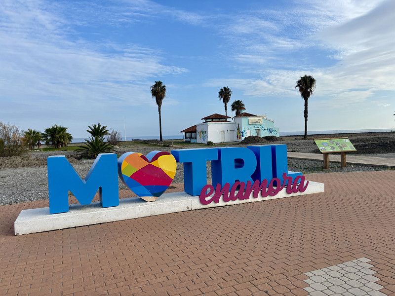
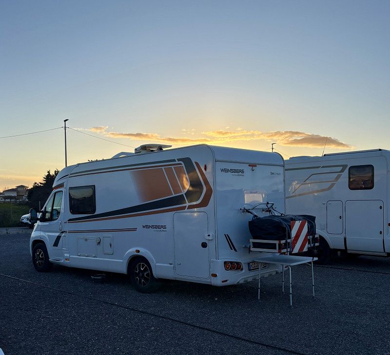
Motril - Parkplatz für 1 Nacht
Our journey here was without heavy rain (a drizzle, but nothing more). Fortunately, there was little wind.
For today, we're in Motril, across from the Playa Granada campsite. There are even more campers in the parking lot.
It's important that we park the camper within the markings, don't extend any chocks or jack stands (we didn't even have them 😂), and don't extend the step, as other campers have told us. Of course, no chairs or tables should be put out either.
Otherwise, some have been here for weeks.
We enjoy the late afternoon sun with a coffee on the promenade.
The old parking lot (we had parked there before) has a height limit. The beach has been dug out and isn't very nice.
Plaza de España 1, Motril, Comarca de la Costa Granadina, Andalusia, Spain
36° 44' 42.7" N 3° 31' 14.7" W
36.7451855 -3.5207451
• Head toward Calle Trinidad on Plaza España. Go for 25 m.
• Turn left onto Calle Trinidad. Go for 23 m.
• Continue on Calle Puerta Granada. Go for 88 m.
• Continue on Calle de San Francisco. Go for 241 m.
• Turn right onto Avenida de Salobreña. Go for 15 m.
• Take the 4th exit from roundabout onto Avenida de Salobreña. Go for 339 m.
• Take the 2nd exit from roundabout onto Avenida de Salobreña. Go for 295 m.
• Keep left toward Avenida de Salobreña. Go for 37 m.
• Take the 2nd exit from roundabout onto Avenida de la Constitución. Go for 345 m.
• Continue on Calle Pablo Picasso. Go for 87 m.
• Turn right onto Calle Pablo Picasso toward Puntalón/Ventilla/Almería/Málaga. Go for 32 m.
• Take the 4th exit from roundabout onto Ronda de Levante toward Campo de Fútbol (Escribano Castilla)/Puntalón/Ventilla/Vadillo. Go for 121 m.
• Take the 3rd exit from roundabout onto Camino de las Ventillas (GR-5209) toward Puntalón/Las Ventillas. Go for 262 m.
• Take the 2nd exit from roundabout onto Camino de las Ventillas (GR-5209). Go for 233 m.
• Take the 3rd exit from roundabout onto Camino de las Ventillas (GR-5209) toward Puntalón/Las Ventillas. Go for 915 m.
• Take the 2nd exit from roundabout onto GR-5209 toward Puntalón/GR-16. Go for 543 m.
• Take the 3rd exit from roundabout onto GR-16 (Autovía Acceso Este al Puerto de Motril) toward Almería/A-7/Málaga/Granada/A-44. Go for 1.1 km.
• Take the 1st exit from roundabout onto A-7 (Autovía del Mediterráneo) toward Adra/Almería. Go for 190 km.
• Take exit 695A toward E-15/AP-7/Cartagena. Go for 1.3 km.
• Continue on AP-7. Go for 54.3 km.
• Take exit 857 toward Cañada de Gallego/Ramonete/P. Calnegre. Go for 992 m.
• Take the 2nd exit from roundabout onto RM-332. Go for 1.1 km.
• Turn right toward Lorca/Morata/Puntas de Calnegre/D-21. Go for 41 m.
• Turn slightly left. Go for 9 m.
• Continue toward RM-D21. Go for 25 m.
• Turn right onto RM-D21. Go for 1.4 km.
• Turn slightly left onto RM-D21. Go for 1.2 km.
• Continue on Los Curas (RM-D21). Go for 164 m.
• Continue on RM-D21. Go for 3.0 km.
• Arrive at RM-D21. Your destination is on the right.
☍
258,8 km
(2 hrs. 27 min.)
08. Mar. 2025 -
08. Mar. 2025
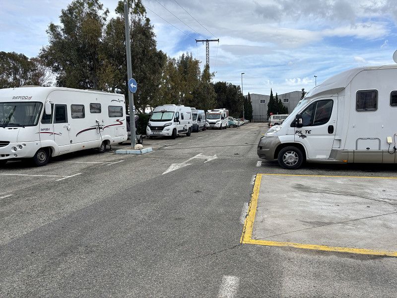
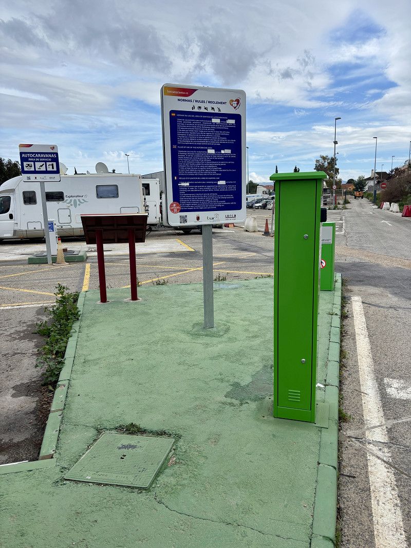
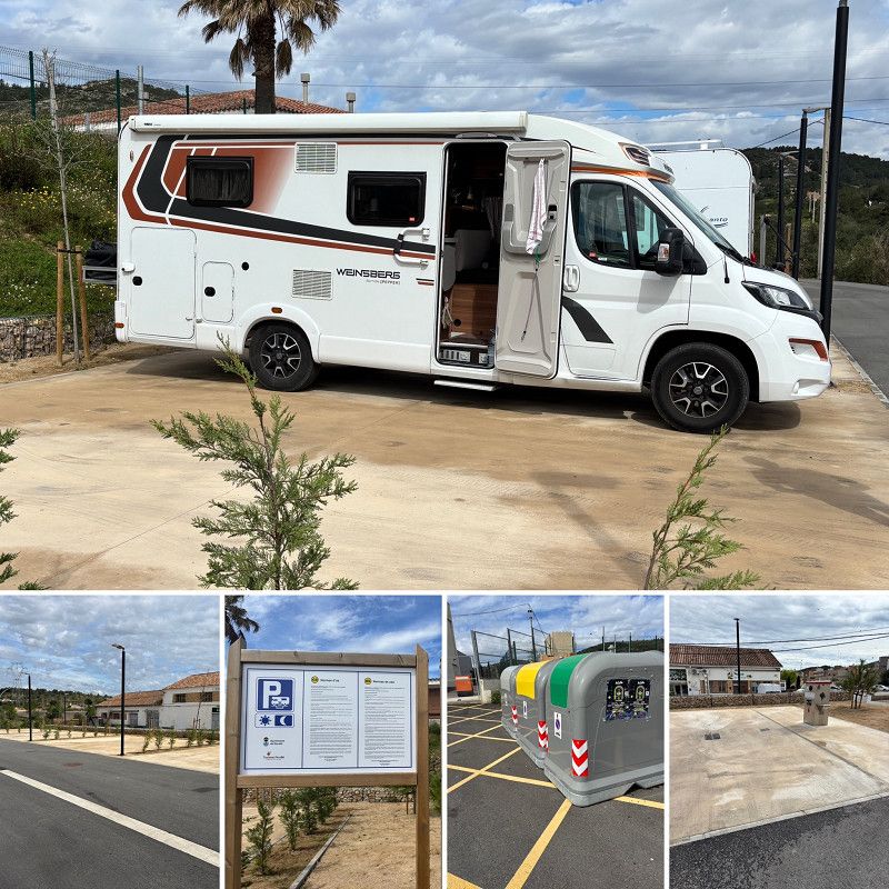
Aparcamientos y Servicios para Autocaravanas
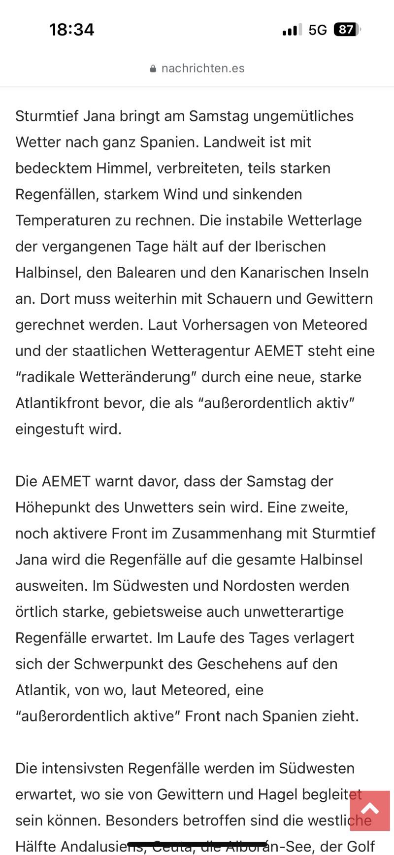
So we'll stay here. The rain is supposed to come out tomorrow, but today it's just cloudy, with hardly any rain, and if it rains, it'll only be a little in the evening. It's bearable.
The site is owned by CCP and has everything we need. Two nights are allowed here, for just €1 per night, including electricity. Amazing.
The square isn't exactly beautiful, but it's a great place to walk into town and take a look around. We've been here before.
Update: the weather forecast for tomorrow afternoon is not very good, so we're moving on.
RM-D 21, 30876, Lorca, Spain
37° 30' 43" N 1° 24' 45" W
37.5119444 -1.4125000
• Head northwest on RM-D21. Go for 3.0 km.
• Continue on Los Curas (RM-D21). Go for 15 m.
• Turn slightly left onto Los Curas (RM-D21). Go for 149 m.
• Continue on RM-D21. Go for 2.6 km.
• Turn right. Go for 15 m.
• Turn slightly left toward RM-332. Go for 11 m.
• Turn right onto RM-332. Go for 1.0 km.
• Take the 1st exit from roundabout onto AP-7 toward Cartagena. Go for 57.6 km.
• Take the left exit toward E-15/Los Alcázares/Alicante onto AP-7 (Autopista del Mediterráneo). Go for 17.5 km.
• Take exit 784 toward San Javier (Sur)/Santiago de la Ribera/San Javier. Go for 305 m.
• Take the 4th exit from roundabout onto Carretera Los Alcázares-Cartagena (N-332) toward San Javier. Go for 690 m.
• Take the 3rd exit from roundabout onto Carretera Los Alcázares-Cartagena (N-332). Go for 310 m.
• Take the 4th exit from roundabout onto Carretera Los Alcázares-Cartagena (N-332). Go for 310 m.
• Take the 1st exit from roundabout onto Calle Neptuno. Go for 584 m.
• Take the 1st exit from roundabout onto Calle Neptuno. Go for 158 m.
• Take the 3rd exit from roundabout onto Calle Totana. Go for 331 m.
• Turn left onto Calle Archena. Go for 110 m.
• Arrive at Calle Archena. Your destination is on the left.
☍
84,7 km
( 55 min.)
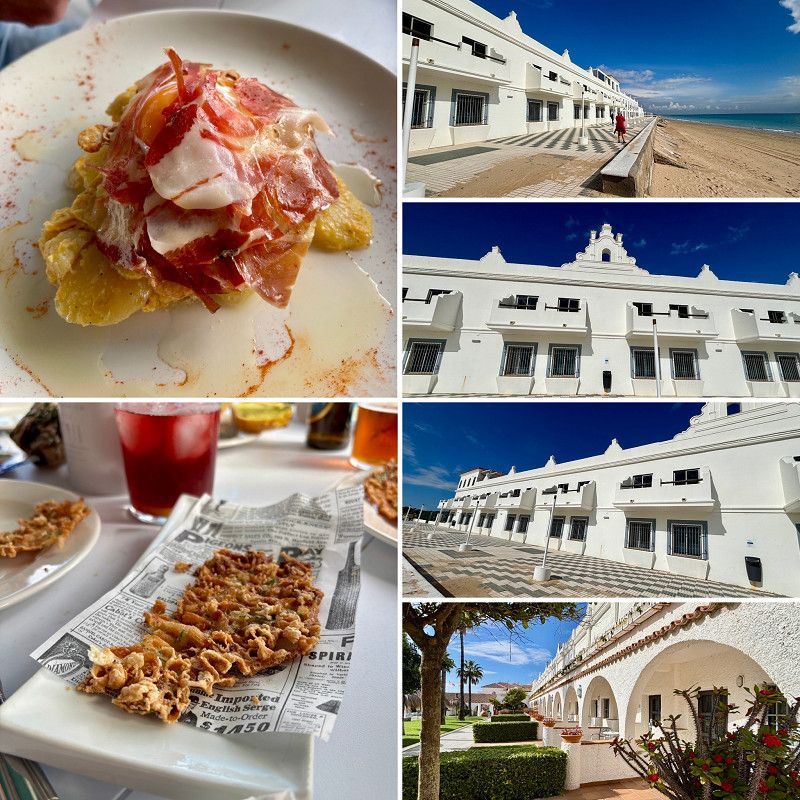
Day Mar Menor - hoffentlich besseres Wetter
08. Mar. 2025 -
14. Mar. 2025
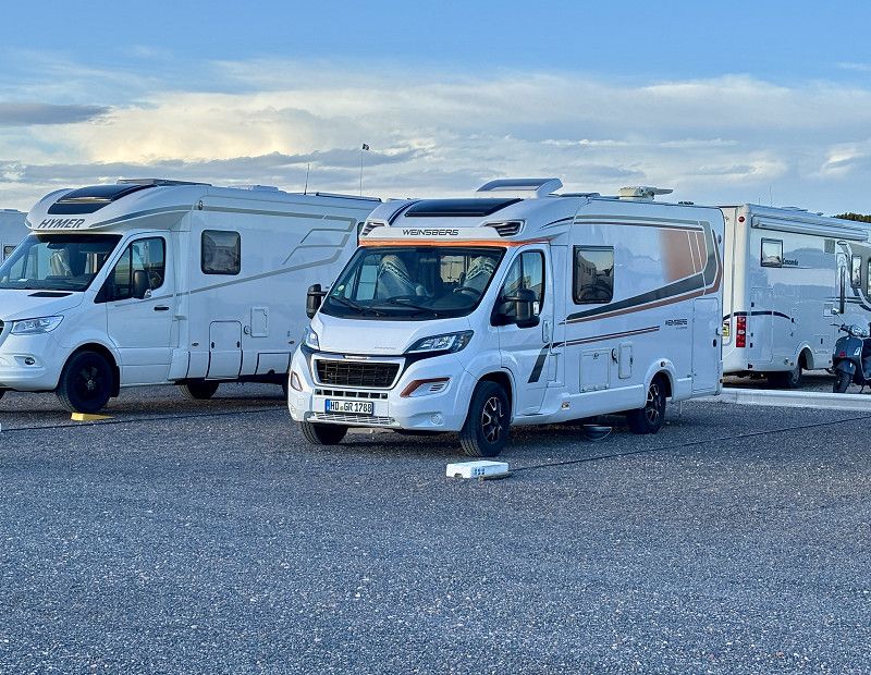
Stellplatz La Ribera in San Javier
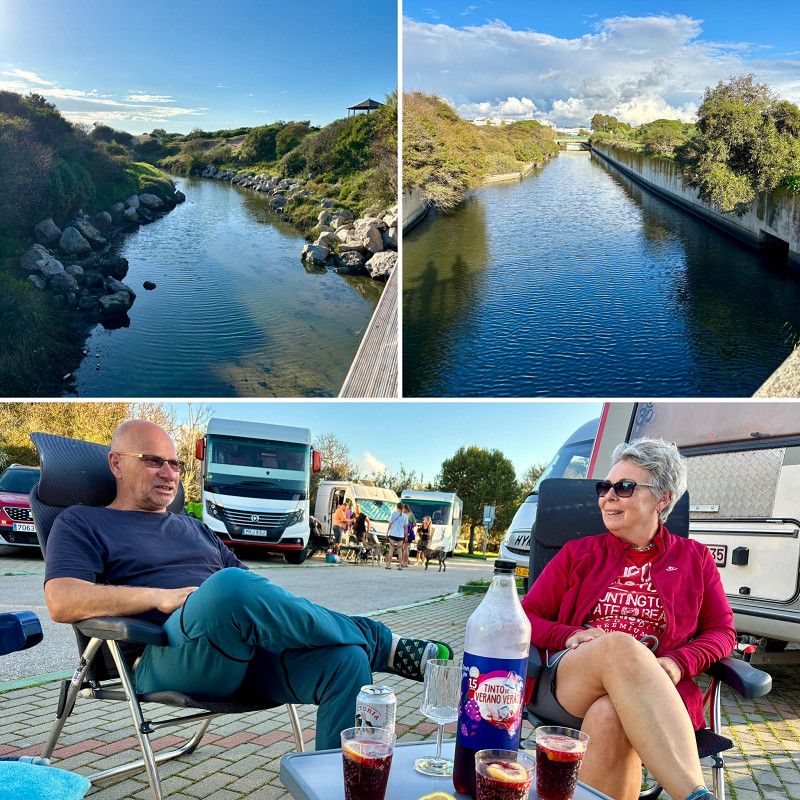
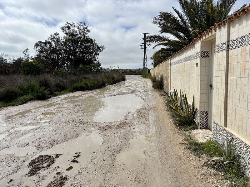
This morning we set off in perfect weather, albeit cool temperatures, with sunshine. Our destination is the Mar Menor, where there's supposed to be little rain in the near future. We really don't need any more of it right now.
So we are standing on the SP we know, on the Mar Menor, in San Javier.
The sun continues to shine with plenty of wind. The weather forecast for Spain is the main topic of conversation, as it has rained here, or rather inland, as much as it normally does in a year.
On our journey we saw many flooded fields.
We can stay for 1 week, let's see how we will do it.
The site has expanded a bit, and we're in the newer section. The sites are without electricity, but they're very spacious. Another restroom building will be built soon.
Today, more camper friends (Jürgen and Rosi, Britta and Peter) arrived here, all of them having fled the rainy area or were looking for a campsite.
Avenida del Recuerdo, San Javier, Campo de Cartagena y Mar Menor, Region of Murcia, Spain
37° 48' 6.6" N 0° 49' 41.9" W
37.8018252 -0.8283091
• Head northwest on Calle Archena.
• Turn left onto Avenida del Recuerdo. Go for 236 m.
• Continue on Calle de Saturno. Go for 176 m.
• Take the 2nd exit from roundabout onto Calle Neptuno. Go for 574 m.
• Take the 2nd exit from roundabout onto Carretera Los Alcázares-Cartagena (N-332). Go for 331 m.
• Take the 2nd exit from roundabout onto Carretera Los Alcázares-Cartagena (N-332). Go for 271 m.
• Take the 3rd exit from Plaza Chica roundabout onto Avenida de Balsicas toward Pozo Aledo/Murcia/Alicante. Go for 1.2 km.
• Take the 2nd exit from roundabout onto RM-19 toward Balsicas/Murcia. Go for 25.4 km.
• Take ramp onto A-30 (Autovía de Murcia) toward Murcia. Go for 7.1 km.
• Keep left onto A-30 (Autovía de Murcia) toward Murcia/Albacete/E-15/Alicante/A-7. Go for 14.1 km.
• Take exit 136 toward Universidad de Murcia (Este). Go for 218 m.
• Take the 2nd exit from roundabout. Go for 91 m.
• Continue on Avenida Severo Ochoa. Go for 371 m.
• Turn right onto Ronda Parque Universidad. Go for 87 m.
• Arrive at Ronda Parque Universidad. Your destination is on the left.
☍
50,2 km
( 36 min.)
05. Mar. 2025 -
05. Mar. 2025
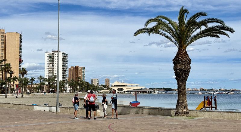
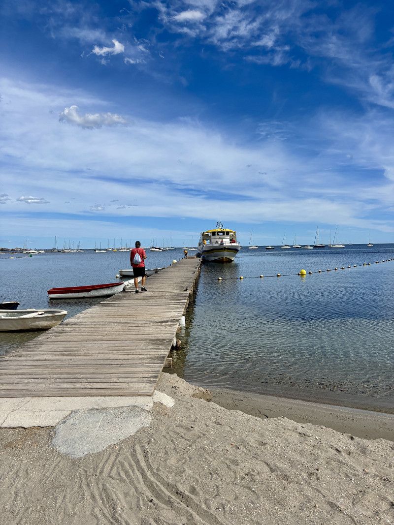
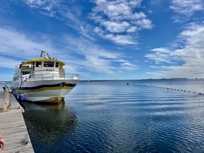
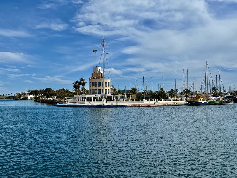
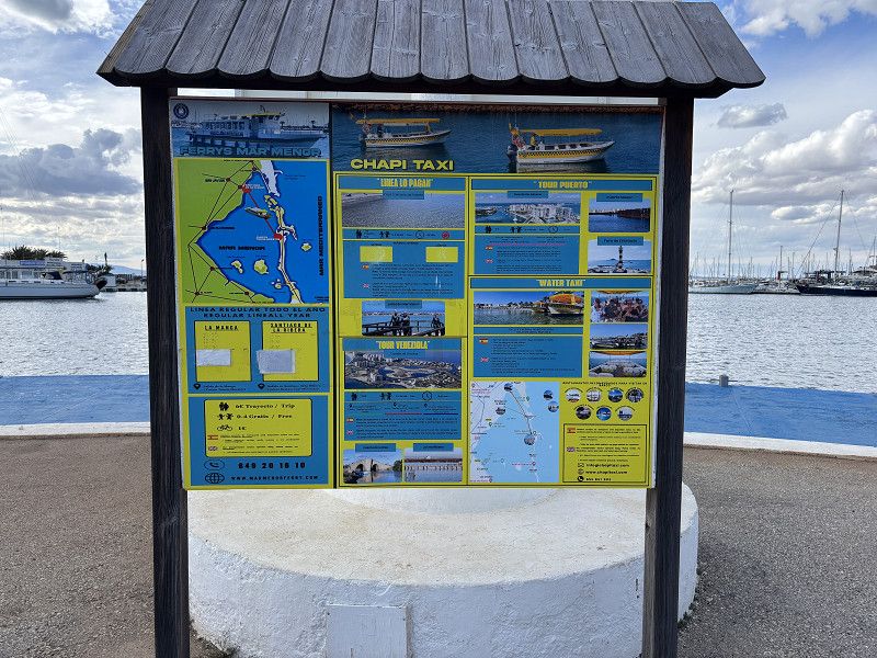
Ausflug nach La Manga
By ferry to La Manga
Cost: 6€/person per trip
Day Regentage aussitzen
16. Mar. 2025 -
16. Mar. 2025
Einkaufszentrum-Murcia
Ronda Parque Universidad, Murcia, Área Metropolitana de Murcia, Region of Murcia, Spain
38° 0' 57.7" N 1° 9' 44.6" W
38.0160360 -1.1623946
• Head toward Calle Olmo on Ronda Parque Universidad. Go for 87 m.
• Turn left onto Avenida Severo Ochoa. Go for 21 m.
• Turn right onto Costera Norte. Go for 204 m.
• Take the 2nd exit from roundabout onto Costera Norte. Go for 1.6 km.
• Take the 6th exit from roundabout onto Avenida Don Juan de Borbón (A-30) toward Alicante/A-7/Albacete/Madrid/Andalucía/A-7. Go for 776 m.
• Take ramp onto A-7 (Autovía del Mediterráneo) toward Alicante. Go for 31.6 km.
• Take exit 535 toward Albatera/San Isidro/S. Isidro onto CV-909. Go for 2.0 km.
• Continue on Calle la Estación (CV-909). Go for 49 m.
• Continue on Paseo de la Estación (CV-909). Go for 10 m.
• Continue on Calle la Estación (CV-909). Go for 32 m.
• Continue on Paseo de la Estación (CV-909). Go for 48 m.
• Continue on Calle la Estación (CV-909). Go for 166 m.
• Continue on Paseo de la Estación (CV-909). Go for 12 m.
• Take the 1st exit from roundabout onto CV-909. Go for 607 m.
• Take the 2nd exit from roundabout onto CV-909 toward Catral. Go for 478 m.
• Take the 2nd exit from roundabout onto CV-909 toward Catral/CV-913/Torrevieja/AP-7/Cartagena. Go for 633 m.
• Continue on El Racó de los Pablos (CV-909). Go for 68 m.
• Continue on CV-909. Go for 1.4 km.
• Take the 2nd exit from roundabout toward Torrevieja/Cartagena. Go for 241 m.
• Take ramp onto AP-7 (Autopista del Mediterráneo). Go for 7.3 km.
• Take exit 740 toward Hospital. Go for 297 m.
• Take the 6th exit from roundabout onto CV-91/CV-905 toward Torrevieja/AP-7/Cartagena. Go for 380 m.
• Take the 2nd exit from roundabout onto CV-91 toward Guardamar del Segura. Go for 9.2 km.
• Take the 3rd exit from roundabout toward Alicante. Go for 494 m.
• Take the 1st exit from roundabout onto N-332 toward Alicante. Go for 1.9 km.
• Pass 2 roundabouts and continue on N-332. Go for 1.3 km.
• Take ramp toward La Marina. Go for 205 m.
• Turn left toward N-332. Go for 66 m.
• Take ramp onto N-332. Go for 443 m.
• Arrive at N-332. Your destination is on the right.
☍
61,6 km
( 46 min.)
17. Mar. 2025 -
18. Mar. 2025
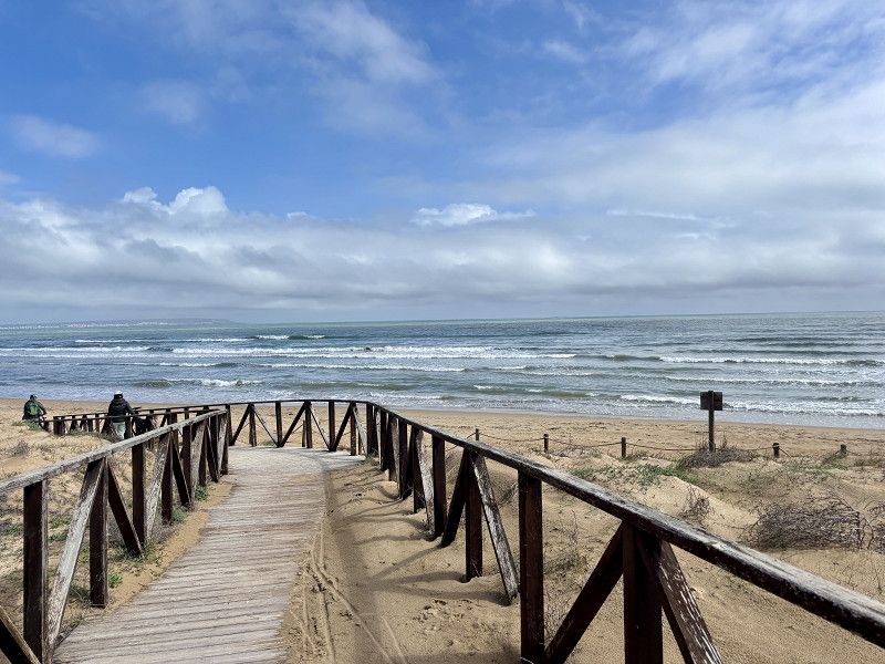
San Fulgencio Dunas y Mar- SP
Here we stand again,
Everything is available at the campsite; electricity is billed according to consumption. Shopping facilities are within walking distance.
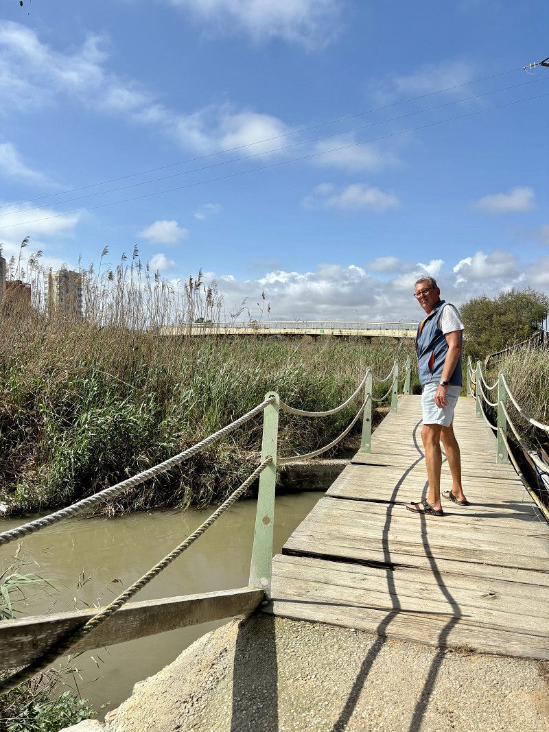
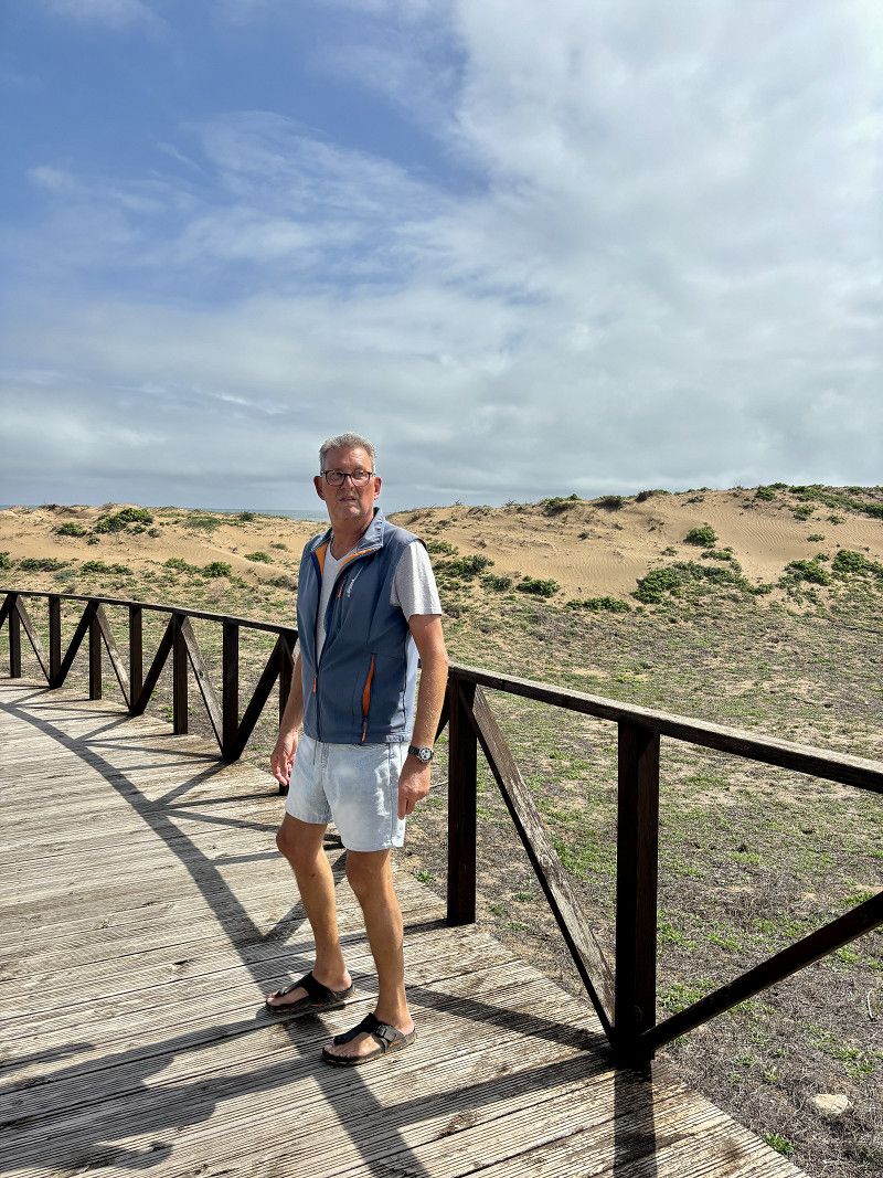
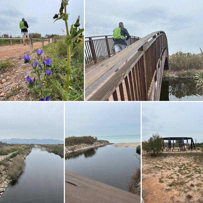
Walk along the dunes and the Rio Sagura.
N-332, San Fulgencio, el Baix Segura / La Vega Baja, Valencianische Gemeinschaft, Spanien
38° 7' 12" N 0° 39' 17.9" W
38.1200133 -0.6549812
• Head southwest on N-332. Go for 139 m.
• Take the 4th exit from roundabout onto N-332 toward Santa Pola/Alicante. Go for 24.0 km.
• Take ramp onto N-338 (Carretera del Aeropuerto) toward Aeropuerto/A-70/Valencia/València/Murcia/A-31/Madrid. Go for 4.8 km.
• Take the exit toward Alacant/Alicante/Benidorm/València/Valencia onto A-70 (Autovía del Mediterráneo). Go for 21.7 km.
• Continue on AP-7 (Autovía del Mediterráneo). Go for 30.3 km.
• Take exit 65 toward N-332/Benidorm/Llevant/CV-70/La Nucia onto Avenida de la Comunidad Europea. Go for 827 m.
• Take ramp onto N-332 toward Altea/Valencia. Go for 4.3 km.
• Pass 2 roundabouts and continue on Avenida de Europa (N-332). Go for 1.1 km.
• Turn right onto Avenida del Albir (CV-753). Go for 392 m.
• Take the 3rd exit from roundabout onto Camino Viejo de Altea. Go for 979 m.
• Take the 2nd exit from roundabout. Go for 74 m.
• Continue toward Partida Cap-Blanch. Go for 159 m.
• Continue on Partida Cap-Blanch. Go for 406 m.
• Take the 1st exit from roundabout onto Calle Carretera del Albir (CV-765). Go for 547 m.
• Turn right. Go for 41 m.
• Arrive at your destination on the right.
☍
89,8 km
(1 hrs. 7 min.)
Day das Wetter wird besser - 2. Heimat seit 43 Jahren
17. Mar. 2025 -
24. Mar. 2025
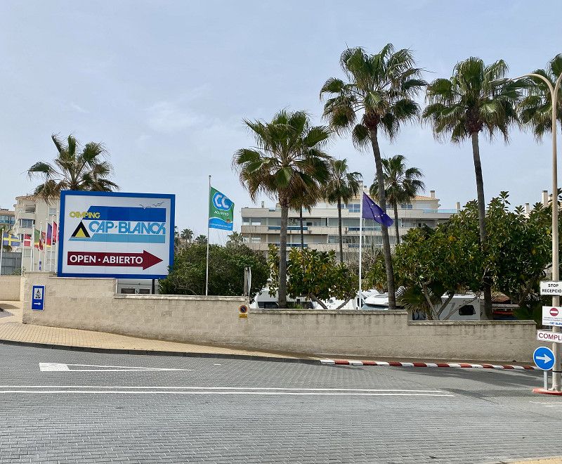
Camping Cap Blanch
We're staying here for a week and hope to get a spot up at the SP Orange Grove.
The campsite is full and we spend the first night in the waiting area, but something should be available the next day.
Britta and Peter are coming too, so we'll have a lovely week together here.
Playa de Cap-blanch, 03590, Altea, Spain
38° 34' 40" N 0° 3' 53" W
38.5777700 -0.0647200
• Head toward Calle Carretera del Albir. Go for 41 m.
• Turn right onto Calle Carretera del Albir (CV-765). Go for 38 m.
• Continue on Carretera del Albir (CV-765). Go for 26 m.
• Take the 1st exit from roundabout onto Calle Bach. Go for 299 m.
• Take the 2nd exit from roundabout. Go for 64 m.
• Continue on Camino Viejo de Altea. Go for 904 m.
• Take the 1st exit from roundabout. Go for 35 m.
• Continue on Avenida del Albir (CV-753). Go for 339 m.
• Take the 2nd exit from roundabout. Go for 43 m.
• Turn right onto Avenida del Albir. Go for 185 m.
• Turn right onto Camino del Sarandó. Go for 508 m.
• Turn left onto Camino dels Alguers. Go for 953 m.
• Arrive at Camino dels Alguers. Your destination is on the right.
☍
3,4 km
( 8 min.)
25. Mar. 2025 -
31. Mar. 2025
Camper Park Orange Grove
Together we moved to the SP.
14€/night without electricity and everything is provided, including sanitary facilities.
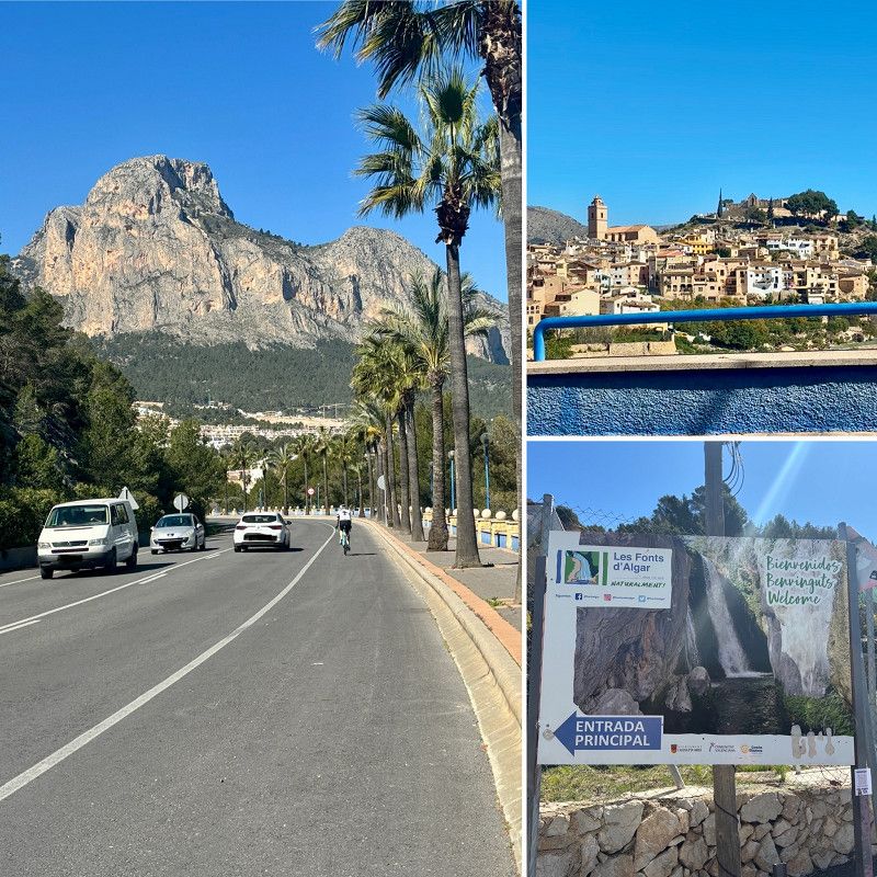
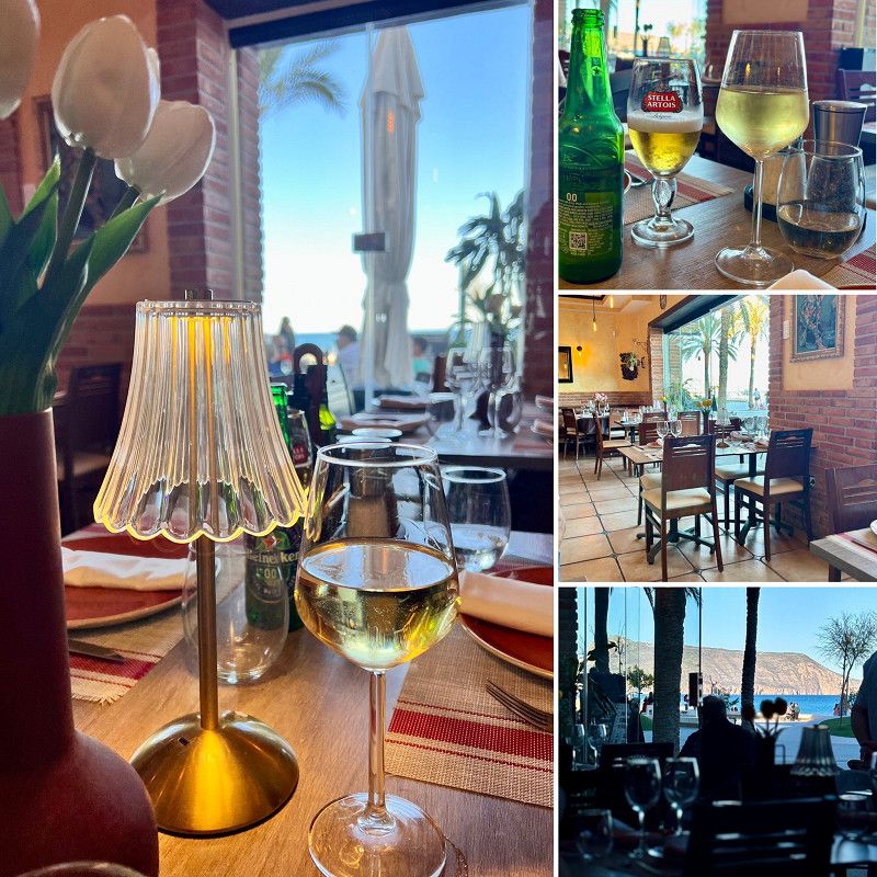
We want to rent a car in Benidorm for 4 days (100€) and show Britta and Peter our old second home.
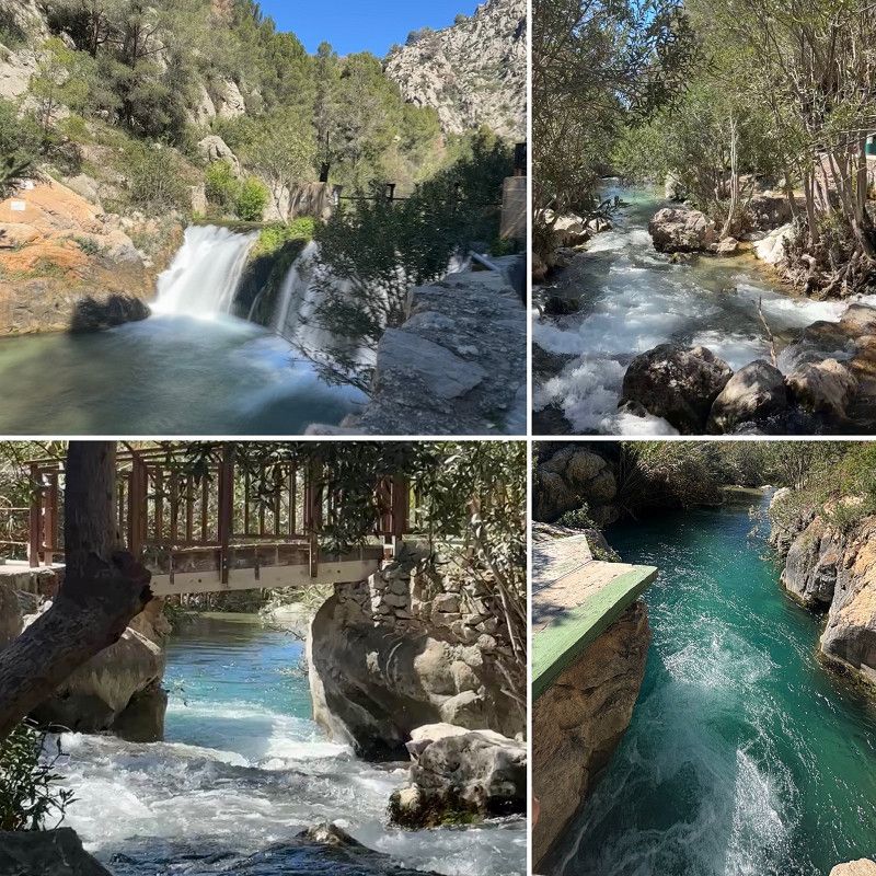
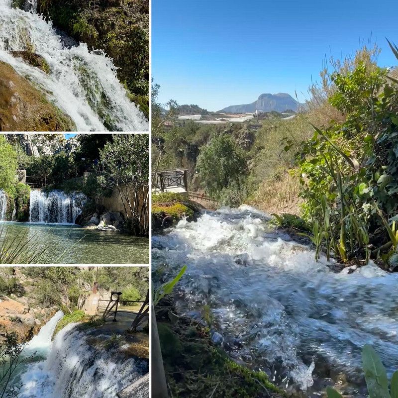
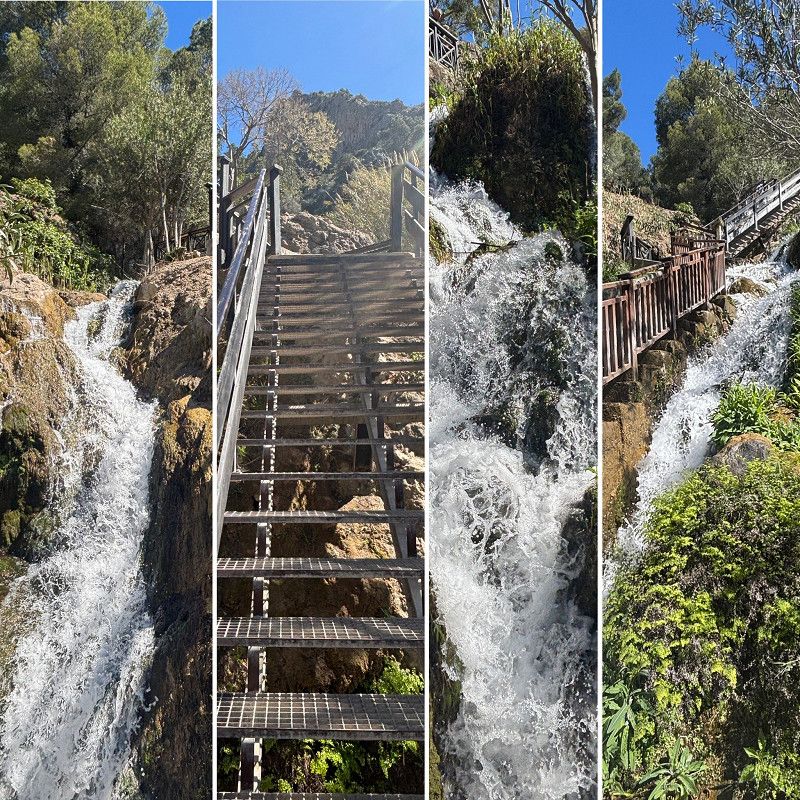
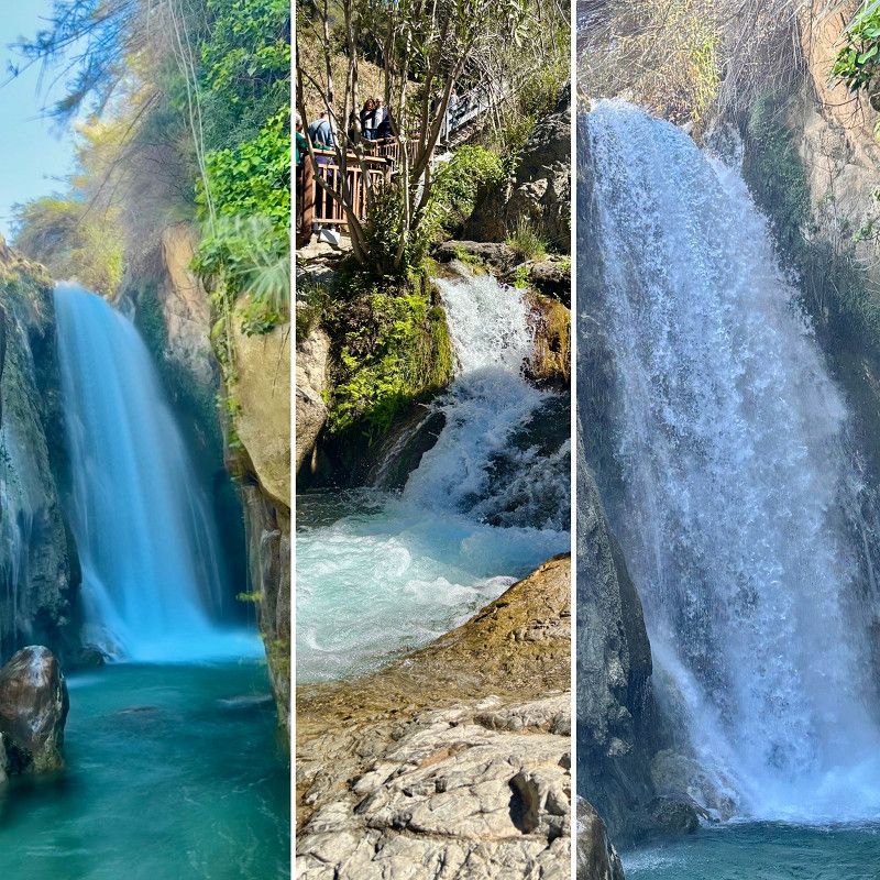
On the list is: 1x go to the mountains for dinner, 2. to Moraira, 3. Villa Jojosa and Amodorio reservoir, 4. Agar de Fonte and Polop waterfalls.
Let's see if we can achieve everything.
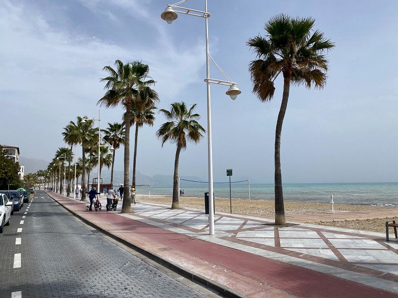
Benidorm has to be included, of course, as we pick up the car here, we take the bus and walk to the viewing platform.
It's so crowded in Benidorm, not really our thing, luckily the four of us are pretty much on the same page.
Camino de Alguers 65, 03580, Alfàs del Pi, Spain
38° 35' 7" N 0° 5' 2" W
38.5852778 -0.0838889
• Head toward Camino Les Flors on Camino dels Alguers. Go for 953 m.
• Turn right onto Camino del Sarandó. Go for 528 m.
• Turn left toward Avenida del Albir. Go for 63 m.
• Continue on Avenida del Albir. Go for 124 m.
• Take the 1st exit from roundabout onto Avenida de Europa (N-332). Go for 262 m.
• Pass 2 roundabouts and continue on Avenida de Europa (N-332). Go for 4.6 km.
• Take ramp onto AP-7 (Autopista del Mediterráneo) toward Alacant/Alicante. Go for 27.1 km.
• Keep right onto AP-7 (Autovía del Mediterráneo) toward A-70/Alacant/Alicante/Murcia/Madrid. Go for 4.9 km.
• Continue on A-70 (Autovía del Mediterráneo). Go for 21.0 km.
• Take exit 26 toward Torrellano/N-340/El Altet/N-332/Santa Pola/Aeropuerto onto N-338. Go for 5.0 km.
• Take the exit toward El Altet/Santa Pola onto N-332 (Carretera del Aeropuerto). Go for 17.9 km.
• Take ramp toward La Marina. Go for 213 m.
• Take the 3rd exit from roundabout onto N-332 toward La Marina. Go for 279 m.
• Continue on Carretera de Cartagena a Alicante (N-332a). Go for 654 m.
• Turn left onto Camino de Elche. Go for 61 m.
• Turn right. Go for 498 m.
• Arrive at your destination on the left.
☍
84,1 km
(1 hrs. 1 min.)
Day Treffen und Besuch in Torrevieja und Alicante
03. Apr. 2025 -
05. Apr. 2025
La Marina - El Pinet
SP El Pinet has everything you need for €14/night without electricity. We're visiting friends here.
We spend one day in Alicante and one day in Torreveja.
Have a great time together!
Camino de los Cipreses, Elx / Elche, Valencianische Gemeinschaft, Spanien
38° 9' 7.2" N 0° 38' 20.3" W
38.1520072 -0.6389700
• Head toward Camino del Pinet. Go for 132 m.
• Turn right onto Camino del Pinet. Go for 353 m.
• Take the 1st exit from roundabout onto Carretera de Cartagena a Alicante (N-332a) toward N-332/Alacant/Alicante. Go for 1.2 km.
• Take ramp onto Partida Baya Baja (N-332) toward Alacant/Alicante. Go for 17.6 km.
• Take ramp onto N-338 (Carretera del Aeropuerto) toward Aeropuerto/A-70/Valencia/València/Murcia/A-31/Madrid. Go for 4.8 km.
• Take the exit toward Alacant/Alicante/Benidorm/València/Valencia onto A-70 (Autovía del Mediterráneo). Go for 21.7 km.
• Continue on AP-7 (Autovía del Mediterráneo). Go for 57.7 km.
• Take exit 63 toward Benissa/Teulada/Gata de Gorgos. Go for 1.3 km.
• Continue toward Variante de Benissa/N-332. Go for 34 m.
• Take the 3rd exit from roundabout onto Variante de Benissa (N-332) toward Teulada/Gata de Gorgos/Oliva/València. Go for 2.7 km.
• Take the 1st exit from roundabout onto Avenida de Europa (CV-740). Go for 286 m.
• Take the 2nd exit from roundabout onto Avenida de Europa (CV-740). Go for 276 m.
• Take the 3rd exit from roundabout onto Avenida de Europa (CV-740) toward Centre Urbà/Moraira. Go for 121 m.
• Take the 2nd exit from roundabout onto Avenida del Mediterráneo (CV-740). Go for 1.0 km.
• Take the 2nd exit from Plaza Gabriel Miró roundabout onto CV-740 toward Benitatxell/Xàbia. Go for 1.4 km.
• Continue on Carretera Teulada-Benitaxell (CV-740). Go for 188 m.
• Continue on CV-740. Go for 1.5 km.
• Continue on Avenida de Alicante (CV-740). Go for 314 m.
• Turn left onto Avenida de Alicante (CV-740). Go for 203 m.
• Turn left onto Avenida Valencia (CV-740). Go for 46 m.
• Turn right onto Avenida Valencia (CV-740). Go for 202 m.
• Take the 2nd exit from roundabout onto Carretera de Jávea (CV-740). Go for 375 m.
• Continue on CV-740. Go for 34 m.
• Continue on Carretera de Benitachell (CV-740). Go for 1.0 km.
• Turn left onto Carretera de Benitachell (CV-740). Go for 3.1 km.
• Take the 4th exit from roundabout onto Carretera de Benitachell (CV-740) toward Xàbia. Go for 1.1 km.
• Take the 2nd exit from roundabout onto Avenida de Gata (CV-734) toward Xàbia. Go for 988 m.
• Take the 2nd exit from roundabout onto Avenida Valencia (CV-734). Go for 162 m.
• Turn slightly right onto Calle Virgen de los Desamparados (CV-734). Go for 14 m.
• Continue on Calle San Joaquín (CV-734). Go for 128 m.
• Continue on Ronda Sur (CV-734). Go for 303 m.
• Continue on Avenida Amanecer de España (CV-734). Go for 20 m.
• Continue on Ronda Sur. Go for 200 m.
• Continue on Ronda Norte. Go for 58 m.
• Turn left onto Calle Roques. Go for 52 m.
• Turn right onto Plaza Celestino Pons. Go for 42 m.
• Arrive at Plaza Celestino Pons. Your destination is on the left.
☍
120,8 km
(1 hrs. 30 min.)
Day Javea - noch bisschen Küste bei Sonnenschein
06. Apr. 2025 -
06. Apr. 2025
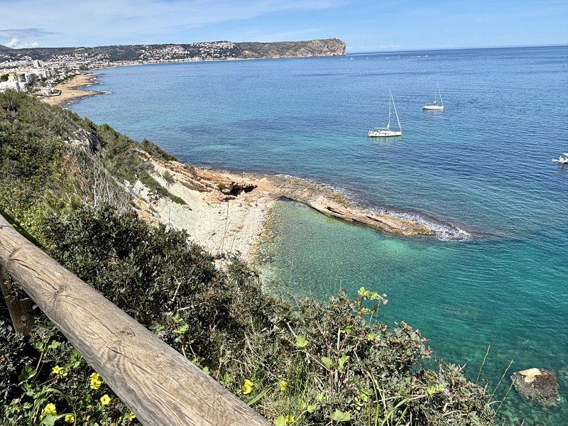
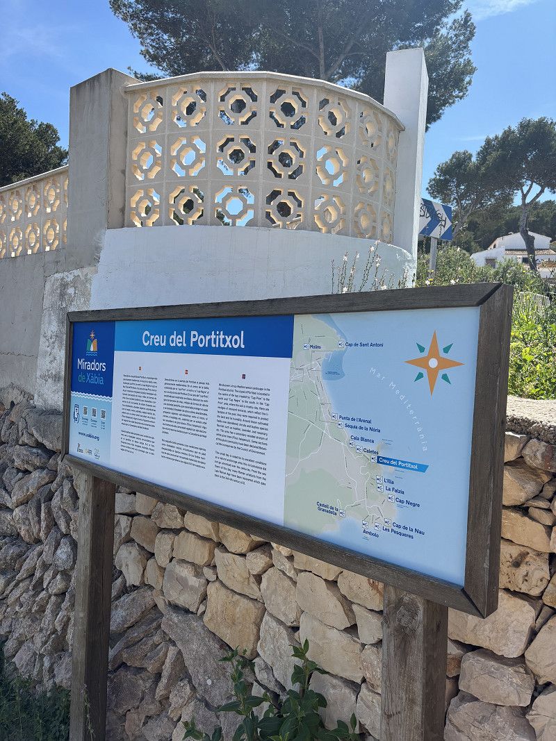
Xàbia / Jávea
Today we're driving to Javea and parked in the parking lot behind a small supermarket. There are only trash cans.
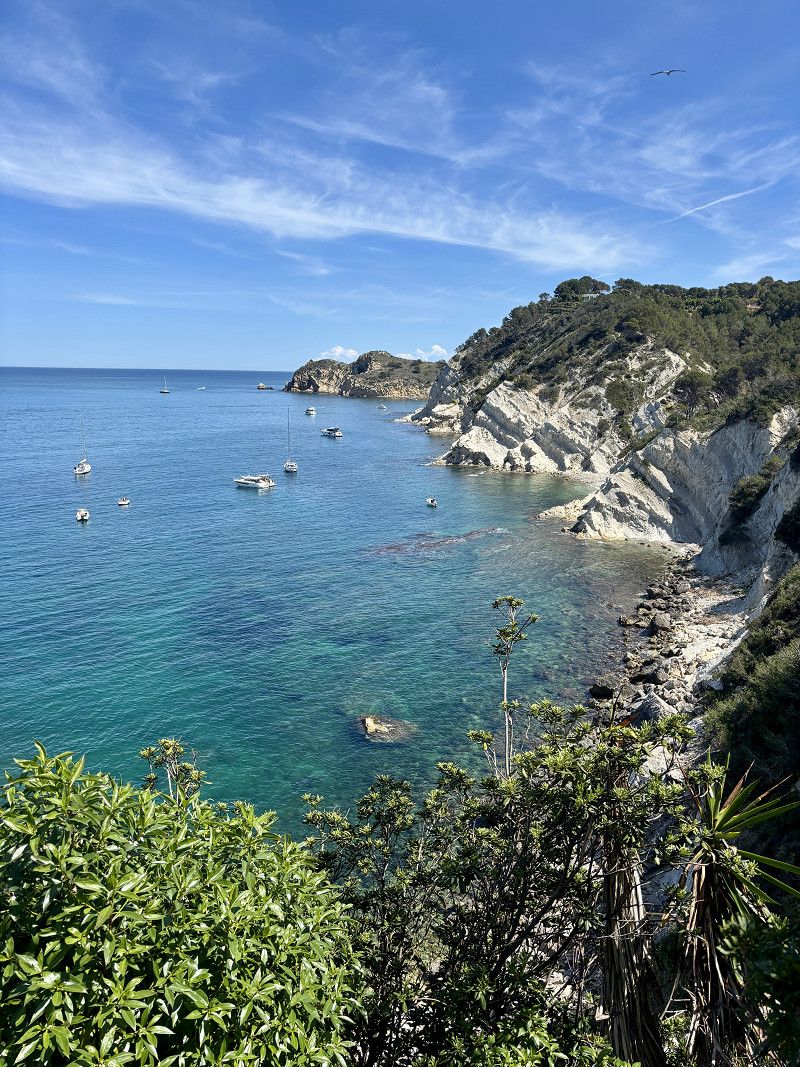
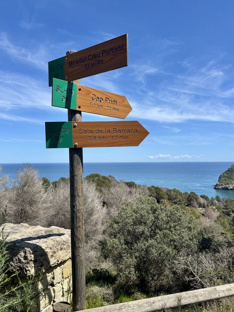
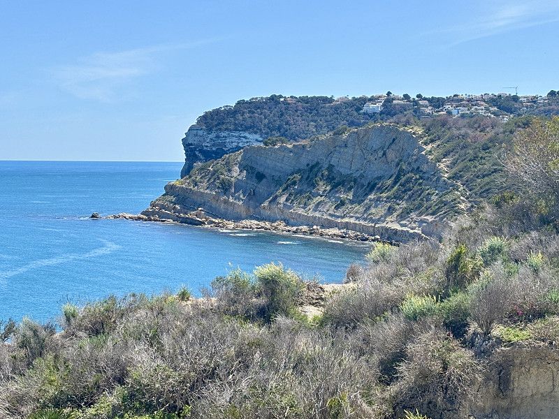
I'm going for a hike to Cap Mari at noon
Very nice hike, with lots of sun.
la Marina Alta, Valencianische Gemeinschaft, Spanien
38° 47' 21.8" N 0° 9' 48.3" E
38.7893804 0.1634168
• Head toward Plaza Església on Plaza Celestino Pons. Go for 42 m.
• Turn right onto Plaza Celestino Pons. Go for 6 m.
• Continue on Calle Roques. Go for 11 m.
• Turn left onto Calle Escola. Go for 58 m.
• Turn left onto Ronda Sur. Go for 19 m.
• Continue on Ronda Norte. Go for 170 m.
• Continue on Avenida Príncipe de Asturias. Go for 272 m.
• Continue on Plaza Convento. Go for 29 m.
• Continue on Calle Doctor Borrull. Go for 174 m.
• Take the 2nd exit from roundabout onto Avenida Ondara (CV-736). Go for 296 m.
• Turn right onto Avenida de Gata (CV-734). Go for 930 m.
• Take the 4th exit from roundabout onto Carretera Gata de Gorgos (CV-734) toward Gata de Gorgos. Go for 1.1 km.
• Pass 4 roundabouts and continue on CV-734. Go for 5.7 km.
• Take ramp onto N-332. Go for 5.7 km.
• Turn right onto Vía Caragús (N-332a) toward Ondara/CV-7222/Denia/E-15/AP-7/Alacant/Alicante/Valencia. Go for 332 m.
• Take ramp toward E-15/AP-7/Alacant/Alicante/Valencia. Go for 555 m.
• Take ramp onto AP-7 (Autopista del Mediterráneo) toward Valencia. Go for 20.1 km.
• Take exit 61 toward N-332/Oliva/Gandia. Go for 947 m.
• Continue toward Oliva/Alacant. Go for 51 m.
• Take the 1st exit from roundabout onto N-332 toward Oliva/Alacant. Go for 866 m.
• Turn right toward La Font d'en Carròs/Platja Miramar/Platja Daimús. Go for 51 m.
• Turn right onto Ronda Rebollet toward La Font d'en Carròs. Go for 675 m.
• Continue on Partida Calzada. Go for 449 m.
• Continue on Carretera de Oliva. Go for 2.8 km.
• Take the 1st exit from roundabout. Go for 338 m.
• Continue toward Calle Beniarjó/CV-683. Go for 20 m.
• Take the 2nd exit from roundabout onto Calle Beniarjó (CV-683). Go for 165 m.
• Continue on CV-683. Go for 1.2 km.
• Take the 2nd exit from roundabout onto CV-683 toward Beniarjó/Beniflà/Gandía/CV-60. Go for 604 m.
• Take the 3rd exit from roundabout onto CV-680 toward Polígon Industrial de Beniflá/CV-60/l'Olleria/Potries/Villalonga. Go for 749 m.
• Take the 2nd exit from roundabout onto CV-60 toward Ròtova/l'Olleria. Go for 30.1 km.
• Take ramp toward Montaverner/CV-620/Alfarrasí. Go for 373 m.
• Take the 4th exit from roundabout onto Carretera Vp 2039 a Játiva toward Centre Ciutat Montaverner/CV-620/Alfarrasí. Go for 765 m.
• Take the 3rd exit from roundabout onto N-340 toward CV-620/Alfarrasí. Go for 447 m.
• Take the 2nd exit from roundabout onto CV-620 toward Alfarrasí/Xàtiva. Go for 3.1 km.
• Take the 2nd exit from roundabout onto CV-620. Go for 2.6 km.
• Turn right toward Calle Real. Go for 95 m.
• Turn slightly right onto Calle Real. Go for 88 m.
• Turn slightly left onto Avenida Balneario. Go for 39 m.
• Turn left onto Camino Calvario. Go for 65 m.
• Arrive at Camino Calvario. Your destination is on the right.
☍
82,0 km
(1 hrs. 9 min.)
Day Stausee- Burgbesichtigung - Hafen
06. Apr. 2025 -
07. Apr. 2025
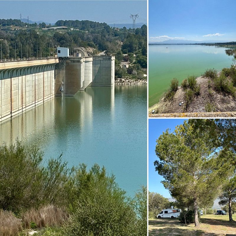
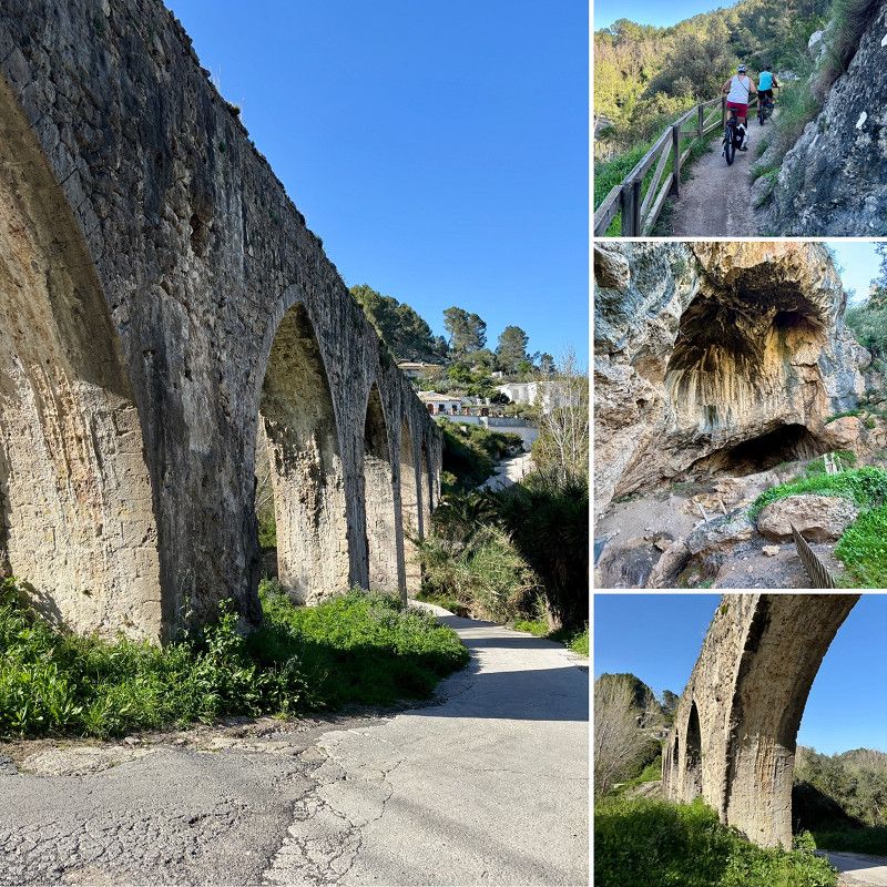
Bellús
Parking space of the municipality of Bellus for 3€/night
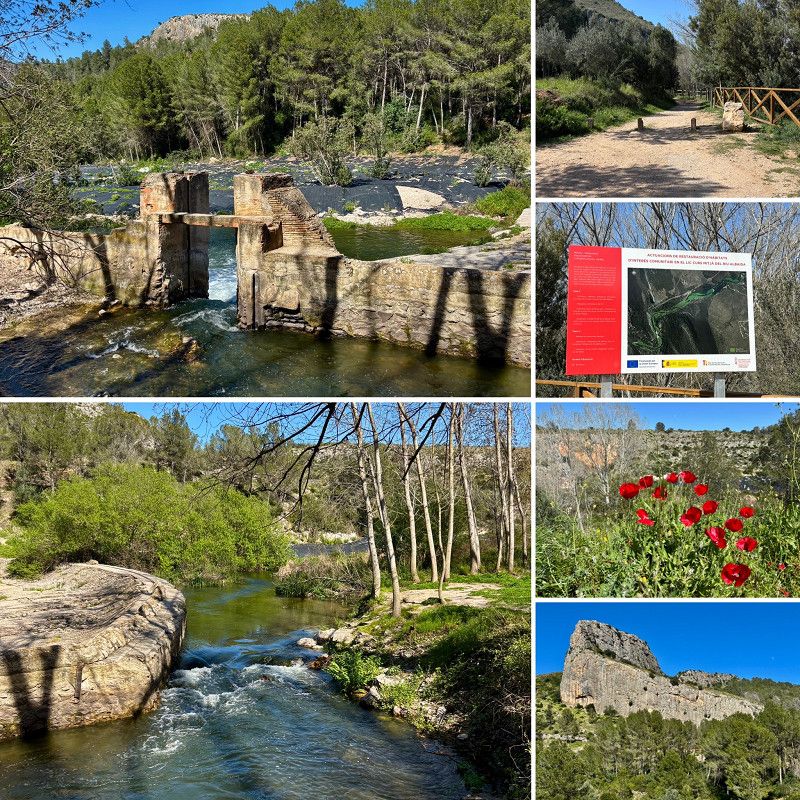
We cycle to Cova Negra and the arcades.
The reservoir is huge, the village very tranquil and almost quiet.
Our plan for the next few days is definitely to go to the fortress and the cathedral in Xativa.
la Vall d'Albaida, Valencianische Gemeinschaft, Spanien
38° 56' 43" N 0° 29' 10" W
38.9452803 -0.4861100
• Head toward Avenida Balneario on Camino Calvario. Go for 65 m.
• Turn right onto Avenida Balneario. Go for 39 m.
• Turn slightly right onto Calle Real. Go for 207 m.
• Turn right onto CV-620. Go for 10.5 km.
• Continue on Calle Virrey Lluís Despuig (CV-41). Go for 80 m.
• Turn left onto Calle Porta Cocentaina. Go for 83 m.
• Continue on Calle de San Pedro. Go for 308 m.
• Continue on Calle del Ángel. Go for 98 m.
• Continue on Plaza de la Trinidad. Go for 40 m.
• Continue on Calle Moncada. Go for 70 m.
• Turn left onto Calle Padre Urios. Go for 133 m.
• Turn right onto Calle de la Noguera. Go for 75 m.
• Continue on Plaza del Mercado. Go for 4 m.
• Turn right onto Plaza del Mercado. Go for 21 m.
• Turn left onto Plaza del Mercado. Go for 15 m.
• Arrive at Plaza del Mercado. Your destination is on the left.
☍
11,7 km
( 15 min.)
07. Apr. 2025 -
07. Apr. 2025
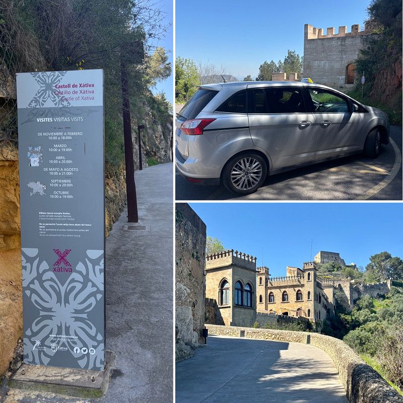
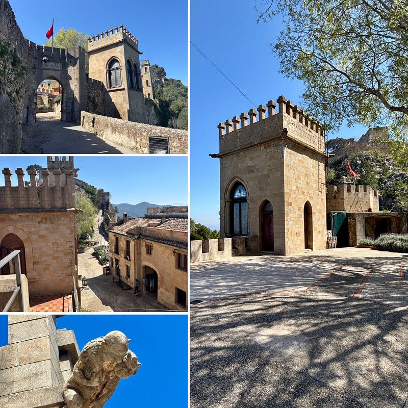
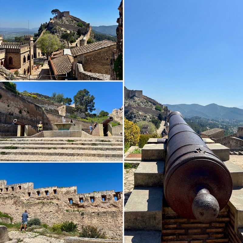
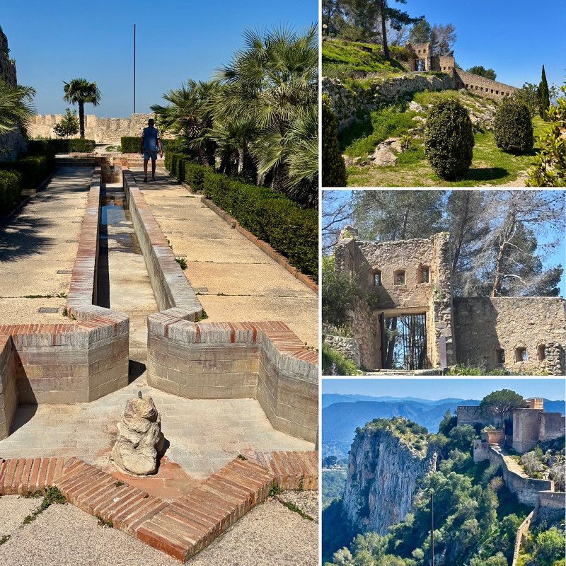
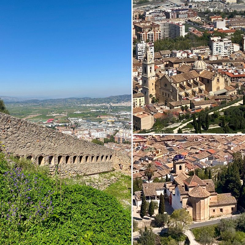
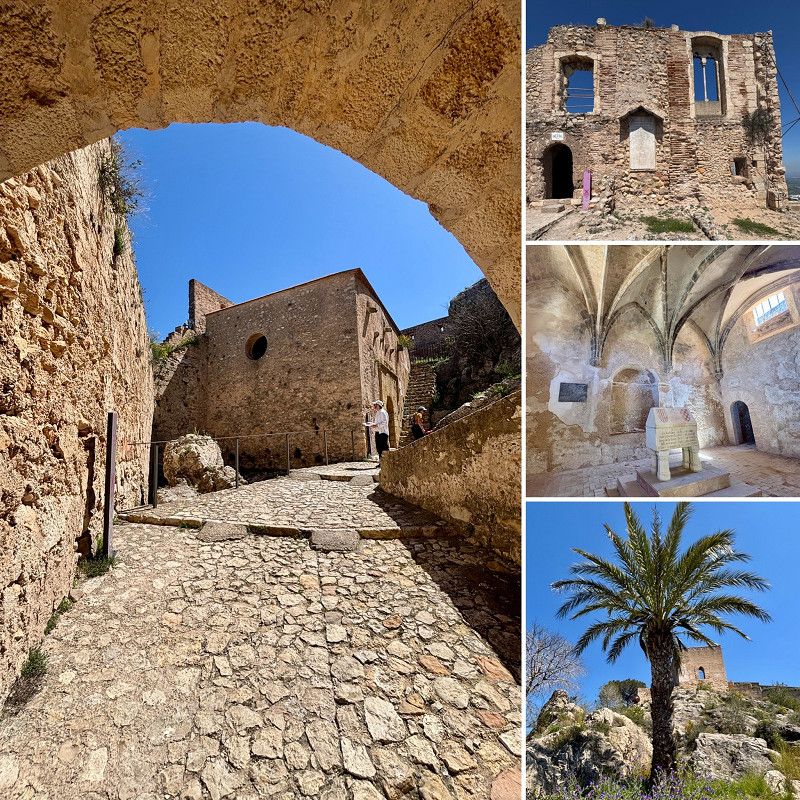
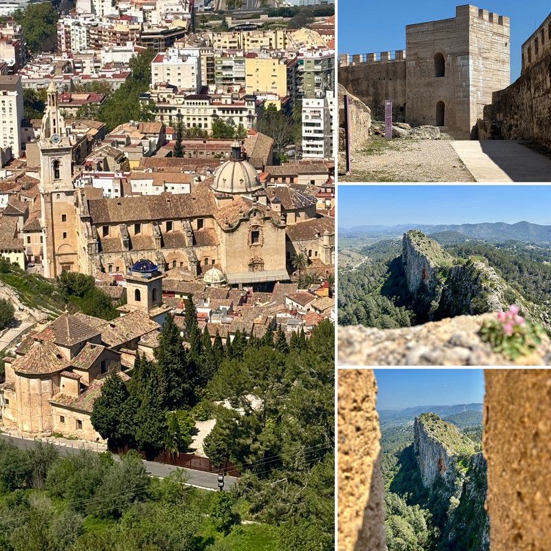
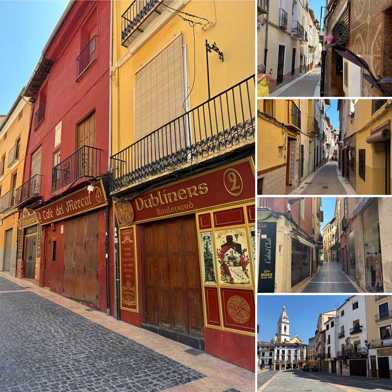
Xàtiva
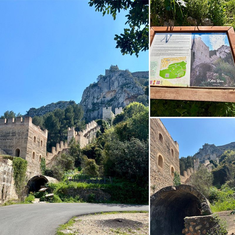
We drive to Xativa to see the fortress and the cathedral.
The fortress costs €6 per person and is open all day. The four of us take a taxi (€12) up to the top.
The view is also very worth seeing
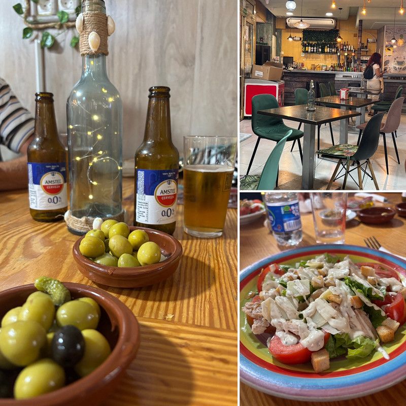
The cathedral was only open in the morning, so we didn't go there. We went to eat at Plaça Mercat.
We park on a public 🅿️
In the afternoon we parked in the parking lot 🅿️ at the stadium, where it was tolerated (information from the tourist office) to park overnight.
There is a large shopping center opposite, and Lidl and Mercadona are not far away.
la Costera, Valencianische Gemeinschaft, Spanien
38° 59' 17.1" N 0° 31' 12.2" W
38.9880850 -0.5200428
• Head toward Calle de las Tiendas on Plaza del Mercado. Go for 68 m.
• Turn right onto Calle Pescadería. Go for 13 m.
• Turn right onto Calle Calderería. Go for 95 m.
• Turn left onto Calle del Vallés. Go for 75 m.
• Turn left onto Calle Moncada. Go for 162 m.
• Turn right onto Plaza de la Puerta de San Francisco. Go for 82 m.
• Turn right onto Calle Alameda Jaime I. Go for 42 m.
• Turn left onto Calle Carlos Sarthou. Go for 69 m.
• Turn right onto Avenida de la República Argentina. Go for 167 m.
• Continue on Calle Académico Maravall. Go for 117 m.
• Continue on Calle Maulets. Go for 120 m.
• Take the 2nd exit from Plaza del País Valenciano roundabout onto Carretera Llosa de Ranes. Go for 435 m.
• Take the 3rd exit from roundabout onto Carretera Llosa de Ranes (CV-58) toward A-7/Valencia/Albacete. Go for 564 m.
• Pass 2 roundabouts and continue on CV-58. Go for 3.6 km.
• Take ramp onto A-7 (Autovía del Mediterráneo) toward València. Go for 39.7 km.
• Keep left onto V-31 toward Centre Ciutat València/Av. Ausiàs March. Go for 13.9 km.
• Take the 1st exit from roundabout onto Calle de Antonio Ferrandis Actor toward Ciutat de les Arts i les Ciències. Go for 1.6 km.
• Take the 3rd exit from roundabout onto Puente Azud del Oro. Go for 529 m.
• Take the 3rd exit from roundabout onto Calle de Menorca. Go for 868 m.
• Continue on Calle de Ibiza. Go for 199 m.
• Continue on Calle de la Serrería toward Ronda nord. Go for 840 m.
• Continue on Calle Marino Blas de Lezo toward Renfe Valencia/Cabañal. Go for 180 m.
• Take the 1st exit from Calle Marino Blas de Lezo roundabout onto Calle Marino Blas de Lezo. Go for 316 m.
• Continue on Calle Luis Peixó. Go for 378 m.
• Take the 2nd exit from roundabout onto Calle del Ingeniero Fausto Elio toward Teruel/A-23/Castelló. Go for 1.1 km.
• Take the 2nd exit from roundabout onto Avenida de la Sierra de Aitana (CV-312) toward Teruel/A-23/Castelló/A-7. Go for 526 m.
• Take the 2nd exit from roundabout onto CV-312 toward Teruel/A-23/Castelló/A-7. Go for 2.0 km.
• Take ramp toward CV-311/Almàssera/Alboraya. Go for 322 m.
• Turn right toward Camino Acequia de la Mosquera. Go for 150 m.
• Continue on Camino Acequia de la Mosquera. Go for 368 m.
• Turn left. Go for 160 m.
• Turn left. Go for 219 m.
• Arrive at your destination on the right.
☍
69,0 km
( 56 min.)
10. Apr. 2025 -
10. Apr. 2025
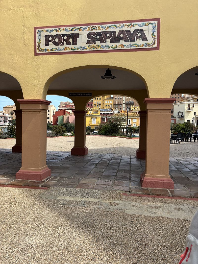
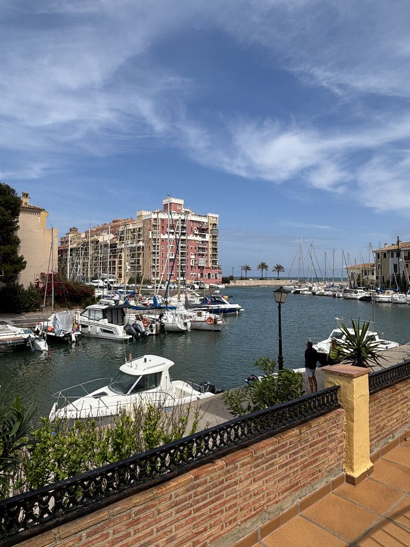
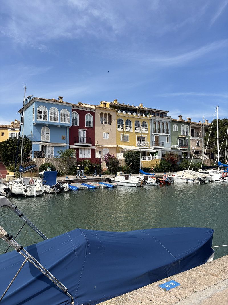
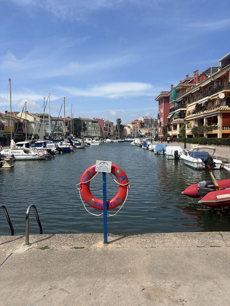
Platja de Port Saplaya
Parking space at a shopping center. Parking is permitted here for 72 hours and is also monitored by the local police.
We walk to Port Saplaya; we like the small town.
Spanien
39° 30' 23.2" N 0° 19' 18.4" W
39.5064360 -0.3217705
• Head north. Go for 135 m.
• Take the 3rd exit from roundabout. Go for 198 m.
• Take the 1st exit from roundabout onto V-21 toward Barcelona/E-15/AP-7/V-23. Go for 15.0 km.
• Continue on AP-7 (Autovía del Mediterráneo). Go for 8.2 km.
• Keep right onto A-7 (Autovía del Mediterráneo) toward Almenara/Castelló/Castellón/Barcelona. Go for 5.7 km.
• Take exit 293 toward Almenara. Go for 306 m.
• Take the 3rd exit from roundabout onto N-340 toward Almenara. Go for 3.8 km.
• Take the 3rd exit from roundabout onto N-340 toward Castello/Castellón. Go for 437 m.
• Take the 3rd exit from roundabout onto Avenida Comunidad Valenciana (N-340) toward Castello/Castellón. Go for 1.5 km.
• Take ramp onto CV-230 toward Chilches/La Vall d'Uixó. Go for 639 m.
• Take the 2nd exit from roundabout onto Avenida Constitución (CV-230). Go for 385 m.
• Continue toward CV-230. Go for 27 m.
• Take the 1st exit from roundabout onto CV-230. Go for 2.5 km.
• Turn left onto Partida Serradal. Go for 511 m.
• Take the 2nd exit from roundabout onto Calle de Aragón. Go for 315 m.
• Continue on Calle Camí Serradal. Go for 598 m.
• Continue on Camino Serradal. Go for 240 m.
• Turn left onto Camino Cabras. Go for 127 m.
• Arrive at Camino Cabras. Your destination is on the left.
☍
40,7 km
( 30 min.)
Day Campingplatz Los Naranjas
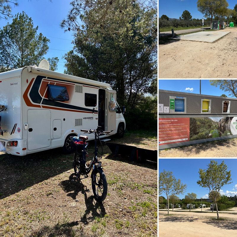
11. Apr. 2025 -
14. Apr. 2025
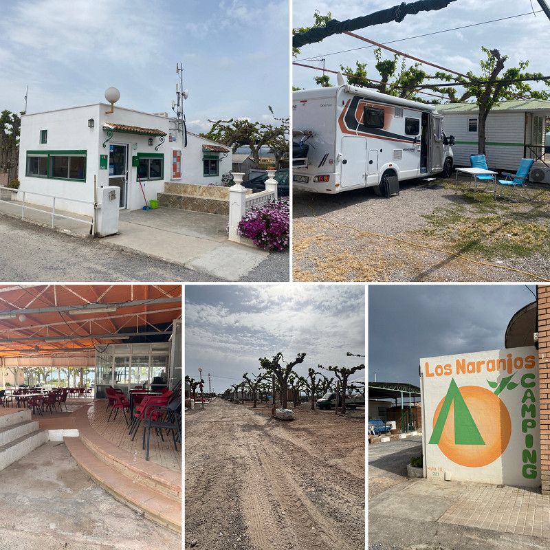
Camping los Naranjos
ACSI - campsite that is in the middle of renovations but is still open.
We get a place, 17€/night including everything including electricity, which we just need right now due to lack of sun
From the square we walk to Moncofa one day and to Xixles beach the next day.
Camí Cabres s/n, 12593, Moncofa, Spain
39° 46' 52" N 0° 8' 55.4" W
39.7811100 -0.1487100
• Head toward Camino de Viniesma on Camino Cabras. Go for 3.3 km.
• Take the 1st exit from roundabout onto N-340 toward Castelló/Castellón. Go for 1.5 km.
• Continue toward Moncofa/E-15/AP-7/Valencia/Barcelona. Go for 52 m.
• Take the 2nd exit from roundabout onto N-225 toward Moncofa/E-15/AP-7/Valencia/Barcelona/A-7/Castelló/N-340/Castellón/Nules/La Vall d'Uixó/Teruel/València. Go for 949 m.
• Take the 2nd exit from roundabout toward Valencia/Barcelona. Go for 43 m.
• Take ramp onto AP-7 (Autopista del Mediterráneo) toward Barcelona. Go for 89.5 km.
• Take exit 43 toward N-340/Peníscola/Peñíscola/Benicarló/Vinarós. Go for 808 m.
• Turn right. Go for 24 m.
• Turn right. Go for 442 m.
• Turn left toward Avenida de la Estación/CV-141. Go for 600 m.
• Turn left onto Avenida de la Estación (CV-141). Go for 2.2 km.
• Pass 2 roundabouts and continue on Avenida de la Estación (CV-1410). Go for 1.7 km.
• Take the 3rd exit from roundabout toward Carrer de Tramuntana. Go for 156 m.
• Continue on Camino Peñíscola a Benicarló. Go for 109 m.
• Turn left onto Camino Peñíscola a Benicarló. Go for 83 m.
• Arrive at Camino Peñíscola a Benicarló. Your destination is on the left.
☍
101,5 km
(1 hrs. 8 min.)
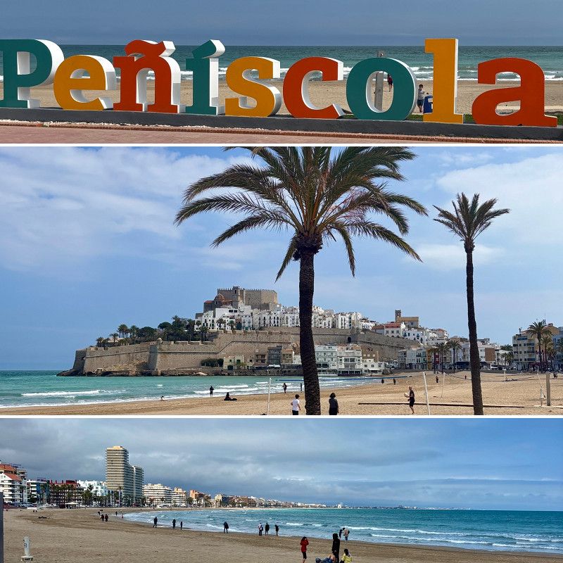
Day Peñiscola - El Perello -Ebro-Delta
14. Apr. 2025 -
14. Apr. 2025
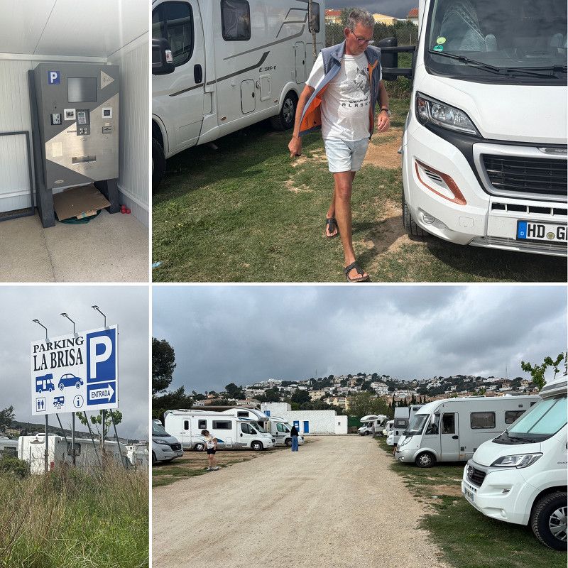
Parking La Brisa
The parking space in Peñiscola is basic and only costs €10.50. There's a water and electricity supply, a toilet, and a shower in the building. But we didn't use any of them.
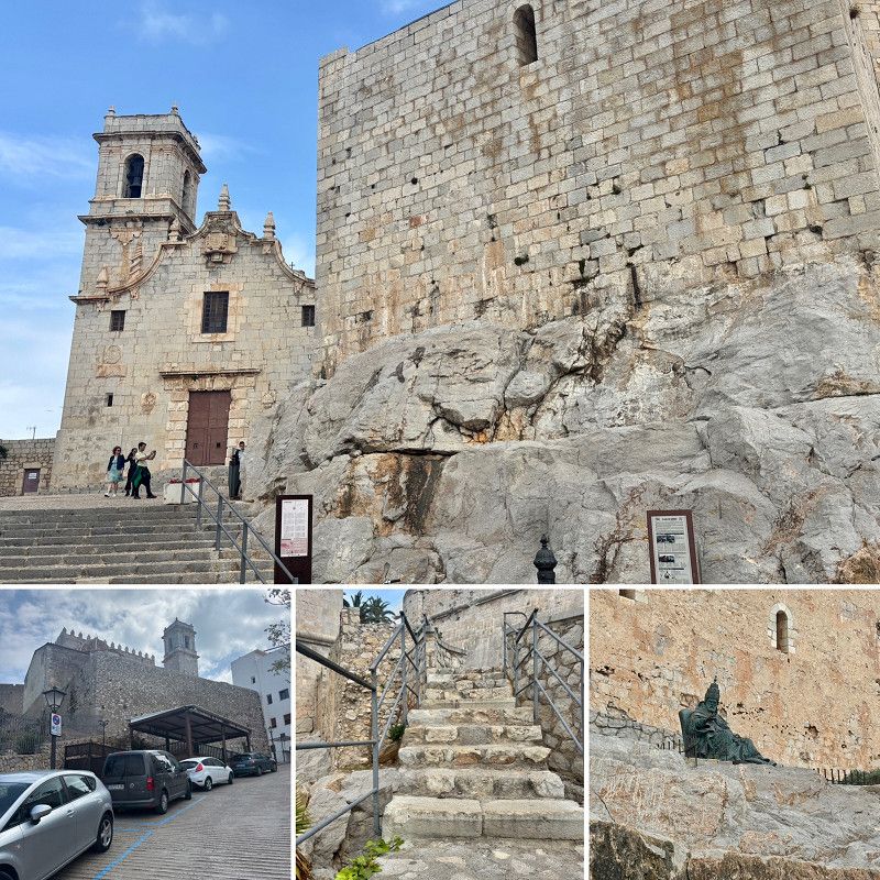
We walk into the old town in the afternoon
Via Poligono, Peníscola / Peñíscola, el Baix Maestrat, Valencianische Gemeinschaft, Spanien
40° 21' 59.7" N 0° 23' 48" E
40.3665886 0.3966670
• Head toward Calle Pigmalión on Camino Peñíscola a Benicarló. Go for 83 m.
• Turn right onto Camino Peñíscola a Benicarló. Go for 176 m.
• Take the 1st exit from roundabout onto Avenida de la Estación (CV-1410) toward N-340/E-15/AP-7/Castelló/Tarragona/Benicarló. Go for 310 m.
• Take the 3rd exit from roundabout onto Avenida de la Estación (CV-141) toward E-15/AP-7/Castelló/Tarragona. Go for 1.3 km.
• Take the 3rd exit from roundabout onto Avenida de la Estación (CV-141). Go for 3.6 km.
• Continue on CV-141 toward Benicarló/Tarragona/E-15/AP-7/Valencia/Barcelona. Go for 72 m.
• Take the 2nd exit from roundabout onto N-340 toward Benicarló/Tarragona/E-15/AP-7/Valencia/Barcelona. Go for 1.8 km.
• Take ramp toward N-340a/Benicarló sud/Benicarló Sur/Castelló/Castellón/E-15/AP-7/Tarragona. Go for 332 m.
• Take the 1st exit from roundabout onto AP-7 (Autopista del Mediterráneo) toward Barcelona. Go for 57.7 km.
• Take exit 39A toward l'Ampolla/N-340/El Perelló. Go for 409 m.
• Continue toward N-340. Go for 38 m.
• Take the 4th exit from roundabout onto N-340 toward Tarragona. Go for 8.7 km.
• Take the 3rd exit from roundabout onto N-340a toward El Perelló nord/Rasquera/Móra. Go for 513 m.
• Turn right onto Carretera de Rasquera (TV-3022) toward Rasquera/Móra E./Gandesa. Go for 495 m.
• Turn left toward El Perelló. Go for 21 m.
• Take the 1st exit from roundabout onto Carrer tres toward Centre Ciutat el Perelló. Go for 154 m.
• Continue on Avinguda Sant Jordi. Go for 137 m.
• Arrive at Avinguda Sant Jordi. Your destination is on the right.
☍
75,8 km
( 48 min.)
15. Apr. 2025 -
15. Apr. 2025
Perelló,El
Fairly new parking space, 72-hour parking permit. Water and sewage disposal, garbage disposal, and all water must be paid for, and can be paid for by card or digitally.
16 concrete pitches, parceled in pairs, separated by greenery.
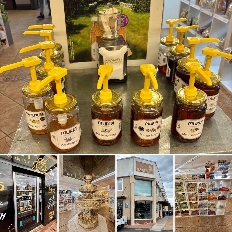
In the village you can buy good honey as well as oil in an old oil mill.
There are also bars, restaurants, and shops. All small, cramped, but nice.
There was a festival here last weekend and a large tent was being dismantled
Plaça de la cooperativa 121, Perelló,El, Tarragona, Spanien
40° 52' 36.7" N 0° 42' 36" E
40.8768573 0.7100104
• Head southeast on Avinguda Sant Jordi. Go for 127 m.
• Continue on Plaça de la Constitució. Go for 26 m.
• Continue on Carrer Trajacapita. Go for 176 m.
• Continue on Carrer Lluís Companys (N-340a). Go for 259 m.
• Continue on Avinguda Catalunya (N-340a). Go for 700 m.
• Take the 1st exit from roundabout toward Castelló. Go for 108 m.
• Take left ramp onto Carretera de Cádiz a Barcelona (N-340) toward l'Ampolla/Castelló/València. Go for 8.5 km.
• Turn sharp left toward l'Ampolla/Deltebre/Jesús i Maria/La Cava/Delta de l'Ebre. Go for 28 m.
• Turn right onto TV-3401. Go for 1.2 km.
• Take the 3rd exit from roundabout onto TV-3401 toward Deltebre. Go for 7.9 km.
• Continue on Carretera Camarles (TV-3401). Go for 306 m.
• Turn left onto TV-3401/TV-3409 toward Deltebre. Go for 143 m.
• Take the 3rd exit from roundabout onto T-340 toward Deltebre/La Cava/Riumar. Go for 1.5 km.
• Take the 2nd exit from roundabout onto Avinguda Goles de l'Ebre (T-340) toward Deltebre/La Cava/Sant Jaume d'Enveja. Go for 168 m.
• Take the 1st exit from roundabout onto Avinguda Generalitat. Go for 425 m.
• Turn right toward Avinguda de Robert Graupera/TV-3402. Go for 62 m.
• Turn right onto Avinguda de Robert Graupera (TV-3402). Go for 352 m.
• Take the 3rd exit from roundabout onto Carrer Girona (TV-3404) toward St. Jaume d'Enveja. Go for 422 m.
• Take the 2nd exit from roundabout onto Carrer Girona (TV-3404). Go for 533 m.
• Take the 3rd exit from roundabout onto Avinguda de l'Ebre (TV-3404). Go for 319 m.
• Turn left onto Carrer Pau Casals. Go for 141 m.
• Continue on Carrer Girona. Go for 192 m.
• Turn left onto Carrer de València. Go for 17 m.
• Arrive at Carrer de València. Your destination is on the left.
☍
23,5 km
( 26 min.)
16. Apr. 2025 -
16. Apr. 2025
Sant Jaume d'Enveja
Free parking with water and electricity in the Ebro Delta.
We take a walk to the Ebro River, which is very, very crowded this year. We've never seen it like this before.
Afterwards there's something to eat.
Montsià, Katalonien, Spanien
40° 42' 22.6" N 0° 43' 5.8" E
40.7062849 0.7182888
• Head toward Carrer de la Caserna on Carrer de València. Go for 47 m.
• Turn left onto Carrer de la Caserna. Go for 182 m.
• Continue on Partida Ribes. Go for 355 m.
• Turn left toward Avinguda de l'Ebre. Go for 62 m.
• Continue on Avinguda de l'Ebre. Go for 31 m.
• Take the 1st exit from roundabout onto Carrer Girona (TV-3404) toward Deltebre. Go for 520 m.
• Take the 2nd exit from roundabout onto Carrer Girona (TV-3404) toward Centre Ciutat. Go for 415 m.
• Turn right onto Avinguda de Robert Graupera (TV-3402). Go for 356 m.
• Turn left toward Avinguda Generalitat. Go for 62 m.
• Turn left onto Avinguda Generalitat. Go for 407 m.
• Take the 2nd exit from roundabout onto Avinguda Goles de l'Ebre (T-340). Go for 168 m.
• Take the 2nd exit from roundabout onto T-340 toward Camarles/l'Aldea/Tarragona. Go for 1.5 km.
• Take the 1st exit from roundabout onto TV-3401/TV-3409 toward Camarles. Go for 162 m.
• Turn right onto Carretera Camarles (TV-3401) toward l'Ampolla. Go for 306 m.
• Continue on TV-3401. Go for 7.8 km.
• Take the 1st exit from roundabout onto TV-3401 toward N-340/l'Ampolla. Go for 1.2 km.
• Turn right onto N-340. Go for 1.3 km.
• Take ramp toward E-15/AP-7/l'Ampolla Centre. Go for 346 m.
• Take the 4th exit from roundabout toward Tarragona/Castelló. Go for 249 m.
• Take ramp onto AP-7 (Autopista de la Mediterrània) toward Barcelona. Go for 182 km.
• Take exit 12B toward Centre Ciutat la Roca del V./Granollers est/Mataró/C-60. Go for 1.0 km.
• Take the left exit toward La Roca del V./Mataró onto C-60 (Autovia Mataró Granollers). Go for 9.8 km.
• Take the exit toward Mataró oest Hospital/Girona onto C-32 (Autopista de Barcelona a Mataró). Go for 35.5 km.
• Take exit 134 toward Blanes/Lloret de Mar/Tossa de Mar. Go for 371 m.
• Take the 1st exit from roundabout onto GI-600 toward Blanes/Lloret de Mar/Tossa de Mar. Go for 2.1 km.
• Take the 1st exit from roundabout onto Carretera de Tordera (GI-600) toward Blanes/Lloret M. Go for 357 m.
• Take the 2nd exit from roundabout onto Avinguda d'Europa toward Blanes. Go for 252 m.
• Take the 2nd exit from roundabout onto Avinguda d'Europa. Go for 192 m.
• Take the 4th exit from roundabout onto Carretera Accés Costa Brava (GI-682) toward Centre Ciutat. Go for 830 m.
• Take the 1st exit from roundabout onto Carrer Anselm Clavé (GIP-6831) toward Centre Urbà/Centre Ciutat. Go for 231 m.
• Take the 2nd exit from roundabout onto Carrer Anselm Clavé toward Centre Ciutat/Centre Vila. Go for 522 m.
• Turn right onto Rambla de Joaquim Ruyra. Go for 423 m.
• Take the 3rd exit from Plaça de Catalunya roundabout onto Passeig de Cortils i Vieta toward Hospital Comarcal/Casa Saladrigas/Teatre de Blanes/Jardí Botànic/Marimurtra. Go for 343 m.
• Continue on Passeig de Pau Casals. Go for 106 m.
• Turn left onto Carrer de la Porta Nova. Go for 93 m.
• Turn right onto Carrer Unió. Go for 43 m.
• Arrive at Carrer Unió. Your destination is on the left.
☍
249,5 km
(2 hrs. 32 min.)
Day Heimreise
17. Apr. 2025 -
17. Apr. 2025
Blanes
Municipal RV parking, nothing special but allowed for 48 hours.
We'll continue tomorrow. Maybe we can get a spot in Palamos; we always like it there.
la Selva, Katalonien, Spanien
41° 40' 32.2" N 2° 47' 35.7" E
41.6756178 2.7932391
• Head toward Carrer Camadasa on Carrer Unió. Go for 23 m.
• Turn right onto Carrer Camadasa. Go for 88 m.
• Turn right onto Passeig de Pau Casals. Go for 162 m.
• Turn right onto Carrer Ample. Go for 193 m.
• Continue on Carrer Jaume Ferrer. Go for 126 m.
• Turn right onto Rambla de Joaquim Ruyra toward AP-7/C-32/N-2/Hospital Comarcal/Lloret de Mar. Go for 229 m.
• Take the 2nd exit from roundabout onto Carrer de Mas Enlaire toward Barcelona/Girona. Go for 75 m.
• Turn left onto Carrer de Sebastià Llorens toward AP-7/C-32/N-2. Go for 158 m.
• Continue on Carrer Anselm Clavé toward AP-7/C-32/N-2. Go for 179 m.
• Take the 2nd exit from roundabout onto Carrer Anselm Clavé (GIP-6831). Go for 210 m.
• Take the 2nd exit from roundabout onto Carretera de Tordera (GI-600) toward Mas Carolet/Ca la Guidó/Mas Cremat. Go for 312 m.
• Pass 4 roundabouts and continue on GI-600. Go for 5.2 km.
• Take the 1st exit from roundabout onto N-2 toward E-15/AP-7/Girona/França/Francia/Aeroport. Go for 27.6 km.
• Take the exit onto AP-7 (Autopista de la Mediterrània). Go for 67.2 km.
• Continue on A9 (La Catalane). Go for 24.9 km.
• Take exit 42 toward Andorre la V./Perpignan-Centre/Prades/Canet en Roussillon/Thuir/St Charles Internal. Go for 1.3 km.
• Take the 3rd exit from Rond-Point de l'Euro-Méditerranée roundabout onto D900 A toward Andorre la Vieille/Narbonne/Perpignan-Centre/Canet en Roussillon/Prades/St Charles Internal. Go for 218 m.
• Continue on Rocade Saint-Charles (D900 A). Go for 318 m.
• Keep left onto Rocade Saint-Charles (D900 A) toward Perpignan-Centre/Narbonne/Andorre la V./Prades/Canet en R. Go for 2.2 km.
• Take the 2nd exit from Rond-Point de Copenhague roundabout onto Rocade Saint-Charles (D900 A) toward Perpignan-Centre/Narbonne/Andorre la V./Prades/Canet en R. Go for 1.6 km.
• Keep left toward Perpignan-Centre/Canet en Roussillon. Go for 87 m.
• Continue on Boulevard Edmond Michelet. Go for 1.6 km.
• Keep left onto Boulevard Edmond Michelet toward Narbonne/Foix/St Estève/Canet en R./Aéroport/Le Vernet. Go for 237 m.
• Continue on Boulevard de la France Libre. Go for 57 m.
• Keep left onto Boulevard de la France Libre (D82) toward Canet/Les Platanes. Go for 479 m.
• Pass 3 roundabouts and continue on Boulevard de la France Libre (D82). Go for 1.6 km.
• Take the 2nd exit from Rond-Point des Platanes roundabout onto D617. Go for 8.9 km.
• Take ramp. Go for 215 m.
• Take the 3rd exit from Rond-Point Charles de Gaulle roundabout onto D81. Go for 3.8 km.
• Take the 5th exit from roundabout onto D12. Go for 342 m.
• Take the 2nd exit from roundabout onto Avenue de la Salanque (D12). Go for 924 m.
• Take the 2nd exit from roundabout onto D11. Go for 169 m.
• Turn right onto Chemin du Mas Nérel. Go for 364 m.
• Arrive at Chemin du Mas Nérel.
☍
150,9 km
(1 hrs. 37 min.)
18. Apr. 2025 -
18. Apr. 2025
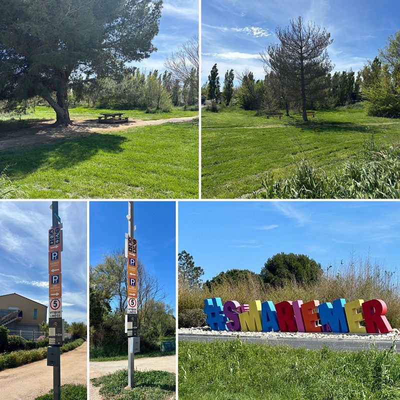
Sainte Marie la Mar
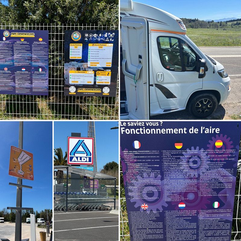
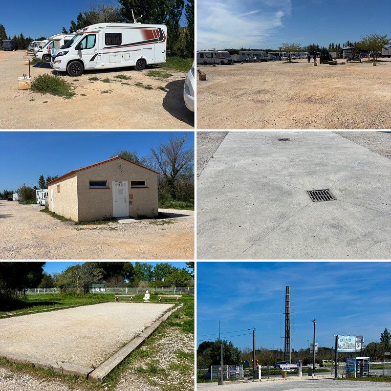
So, after the spots in Spain were all full (Easter is always full), we continued on. We filled up at a reasonable price in Empuriabrava before continuing on to France.
We cross the border on the motorway (the 3€ toll is bearable) then we take the D900, always following the green signs to Perpignan.
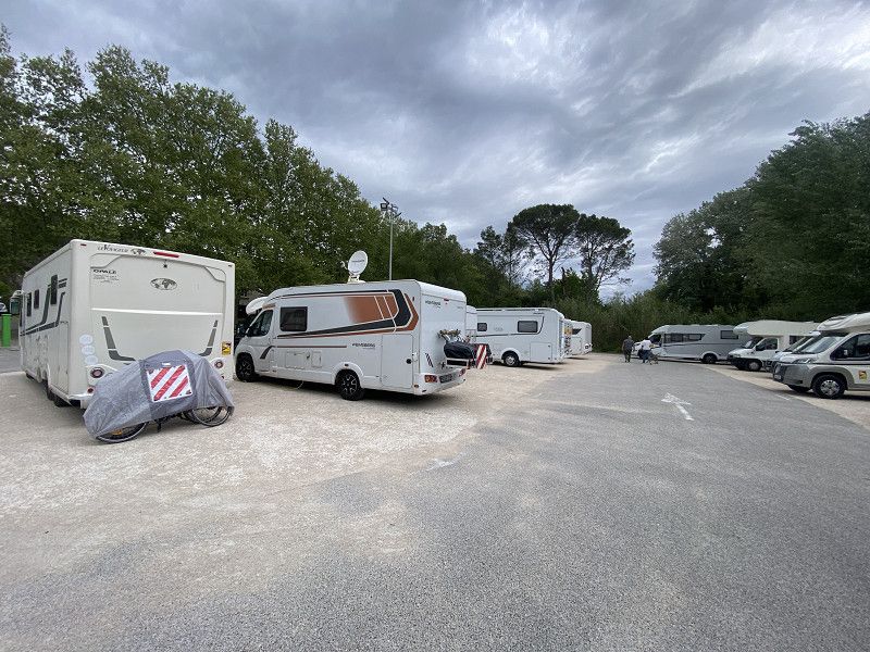
In Perpignan, we decided to find a campsite. After a bit of searching for the right exit (my head is useless today), we drove to the coast to Saint Marie. There's a motorhome park with over 120 pitches.
At the machine, you must enter your license plate number and how long you intend to stay. It costs €7.50 for 24 hours, €5 for electricity, and €2.50 for a shower, so there's something for everyone. Those who only want water and electricity pay €4 per hour.
Aldi is right next door. The lot has three large parking areas: one right next to the roundabout (hmm, I wonder who would park there), a second with electricity, and a third without electricity, although there are also spaces with charging stations.
2 V+E stations and 1 shower house (4 showers and 4 toilets) which is opened via code.
There is also some green space with seating and there is a boules court for the boules players.
What a huge place, it's busy but not full. Aldi is open despite it being Good Friday.
I'm not doing anything else today except going to bed early, hoping that I'll feel better tomorrow.
Pyrénées-Orientales, Occitania, France
42° 43' 55.5" N 3° 0' 33.7" E
42.7320965 3.0093715
• Head southeast on Chemin du Mas Nérel. Go for 364 m.
• Turn left onto D11. Go for 120 m.
• Take the 1st exit from roundabout onto Avenue de la Salanque (D12). Go for 919 m.
• Take the 4th exit from roundabout onto D12. Go for 289 m.
• Take the 4th exit from roundabout. Go for 358 m.
• Continue on D81. Go for 3.1 km.
• Take the 2nd exit from roundabout onto D81. Go for 2.4 km.
• Take ramp onto D83 toward Le Barcarès/Leucate. Go for 5.8 km.
• Take the 3rd exit from roundabout onto D83. Go for 1.1 km.
• Continue on D627. Go for 8.6 km.
• Take the 2nd exit from roundabout onto D627. Go for 5.8 km.
• Continue toward D627. Go for 36 m.
• Take the 2nd exit from roundabout onto D627. Go for 2.4 km.
• Take ramp onto A9 (La Catalane) toward Narbonne/Montpellier/Toulouse. Go for 190 km.
• Take exit 23 toward Uzès/Remoulins/Pont du Gard. Go for 1.0 km.
• Take the 3rd exit from roundabout onto D6100 toward Nîmes/Alès/Beaucaire/Tarascon/Remoulins/Uzès/Pont du Gard. Go for 1.9 km.
• Take the 3rd exit from Carrefour de l'Arnède roundabout onto Avenue Geoffroy Perret (D6100) toward Nîmes/Beaucaire/Tarascon. Go for 891 m.
• Arrive at Avenue Geoffroy Perret (D6086). Your destination is on the right.
☍
225,3 km
(2 hrs. 1 min.)
19. Apr. 2025 -
19. Apr. 2025
Remoulins CCP Platz
We've been here before, and the weather was very good. That's why we're not going to the Pont de Gard, but just to the village and La Gardon.
Avenue Geoffroy Perret 60, Remoulins, Remoulins, Gard, France
43° 56' 20.1" N 4° 33' 50.9" E
43.9389272 4.5641438
• Head toward Rue de l'Égalité on Avenue Geoffroy Perret (D6086). Go for 814 m.
• Take the 2nd exit from Carrefour de l'Arnède roundabout onto D6100 toward A9/Montélimar/Nîmes/Avignon/Les Angles/Villeneuve lez A./Fournes/Roquemaure. Go for 1.8 km.
• Take the 2nd exit from roundabout onto A9 (La Languedocienne) toward Nîmes/Orange/Lyon. Go for 30.7 km.
• Continue on A7 (Autoroute du Soleil). Go for 41.4 km.
• Take exit 18 toward Le Puy en Velay/Aubenas/Montélimar/Dieulefit/Viviers. Go for 980 m.
• Take the 1st exit from roundabout onto N7 toward Montélimar/Aubenas/Le Puy/Malataverne-Centre/Viviers/Dieulefit. Go for 2.3 km.
• Turn sharp left toward Châteauneuf du R./Viviers. Go for 98 m.
• Continue on Route de Montelimar (D844). Go for 1.1 km.
• Turn right onto D126. Go for 1.2 km.
• Continue on Lieu-dit Le Clos (D126). Go for 152 m.
• Continue on D126. Go for 273 m.
• Continue on Montée de la Molle (D126). Go for 447 m.
• Take the 3rd exit from roundabout onto Avenue du Viviers (D73). Go for 1.6 km.
• Continue on D86 I. Go for 699 m.
• Take the 1st exit from roundabout onto Faubourg Latrau (D86) toward Aubenas/Villeneuve de Berg/Rochemaure/Le Teil/Centre Ville. Go for 45 m.
• Turn right onto Porte de la Trau. Go for 30 m.
• Turn left onto Grande Rue. Go for 269 m.
• Turn sharp right onto Rue du Château. Go for 32 m.
• Turn sharp left onto Impasse de l'Estrade. Go for 18 m.
• Arrive at Impasse de l'Estrade. Your destination is on the right.
☍
84,0 km
( 49 min.)
20. Apr. 2025 -
20. Apr. 2025
Viviers
Ardèche, Auvergne-Rhone-Alpen, Frankreich
44° 28' 58.9" N 4° 41' 23.4" E
44.4830206 4.6898398
• Head toward Rue du Château on Impasse de l'Estrade. Go for 18 m.
• Turn sharp right onto Rue du Château. Go for 32 m.
• Continue on Place de la République. Go for 19 m.
• Turn right onto Grande Rue. Go for 68 m.
• Turn right onto Rue de la Roubine. Go for 75 m.
• Continue on Chemin Rural du Creux. Go for 10 m.
• Continue on Place du Creux. Go for 55 m.
• Turn right onto Chemin Rural du Creux. Go for 61 m.
• Turn right onto Chemin Rural du Creux. Go for 240 m.
• Turn right onto Île des Bornes. Go for 440 m.
• Turn left onto Avenue Pierre Mendès France (D86 I). Go for 184 m.
• Continue on D73. Go for 1.6 km.
• Take the 1st exit from roundabout onto Montée de la Molle (D126). Go for 465 m.
• Continue on D126. Go for 273 m.
• Continue on Lieu-dit Le Clos (D126). Go for 152 m.
• Continue on D126. Go for 1.2 km.
• Turn right onto D844. Go for 39 m.
• Turn left onto D126. Go for 796 m.
• Continue on Rue de la Mairie (D126). Go for 169 m.
• Turn right onto Grande Rue (D206). Go for 12 m.
• Continue on D126. Go for 251 m.
• Keep right onto N7. Go for 631 m.
• Take the 2nd exit from roundabout toward Valence/Marseille/Nîmes/Orange. Go for 258 m.
• Take ramp onto A7 (Autoroute du Soleil) toward Valence/Lyon. Go for 147 km.
• Take the exit toward Genève/Grenoble/St Fons onto D383 (Boulevard Pierre Sémard). Go for 2.7 km.
• Keep right onto D383 toward Paris/Genève/Grenoble/Chambéry/Périphérique/Porte du Moulin à Vent. Go for 814 m.
• Keep left onto Boulevard Laurent Bonnevay (D383) toward Chambéry/Grenoble/Bourg/Genève/Paris/Vénissieux/Villeurbanne. Go for 3.4 km.
• Keep left onto Boulevard Laurent Bonnevay (D383) toward Bourg/Genève/Paris/Villeurbanne/Bron-Centre. Go for 2.5 km.
• Keep left onto Boulevard Laurent Bonnevay (D383) toward Bourg/Genève/Paris/Lyon-Centre/Villeurbanne-Centre. Go for 4.5 km.
• Take ramp onto A42 (Pont de Croix Luizet) toward Genève/Rocade Est. Go for 3.2 km.
• Take the left exit toward Paris/Genève/Bourg en B./Aéroport Saint Exupéry onto A42/A46. Go for 1.1 km.
• Continue on A46 (Viaduc Sermenaz) toward Rillieux/Villefranche S/Saône/Paris. Go for 5.9 km.
• Take exit 3 toward Bourg en B./Villefranche S/ S./Villars les D. onto D1083. Go for 1.3 km.
• Pass 4 roundabouts and continue on Route de Bourg-en-Bresse (D1083). Go for 19.0 km.
• Turn left onto Rue Carnot. Go for 154 m.
• Turn right onto Place du Marché. Go for 61 m.
• Turn slightly right onto Rue Pierre Duverger. Go for 107 m.
• Arrive at Rue Pierre Duverger. Your destination is on the right.
☍
198,8 km
(2 hrs. 2 min.)
20. Apr. 2025 -
20. Apr. 2025
Vogelpark Lyon - Bourg en Bresse
Parking lot at the bird park; the back spaces are used by many RVs. The park closes at 6:00 PM, and the front parking spaces are available after that. However, there's nothing there except trash disposal. So, it was perfect for us for one night.
Rue Pierre Duverger, Villars-les-Dombes, Ain, Auvergne-Rhône-Alpes, France
46° 0' 12.7" N 5° 1' 46.8" E
46.0035275 5.0296724
• Head toward Rue de l'Agriculture on Rue Pierre Duverger. Go for 27 m.
• Turn right onto Rue de l'Agriculture (D70). Go for 231 m.
• Continue on Rue de l'Industrie (D70). Go for 251 m.
• Take the 3rd exit from roundabout onto D1083 toward Bourg en B./St Paul de Varax. Go for 16.1 km.
• Turn right onto D64 A. Go for 337 m.
• Continue on Lieu-dit Travant (D64 A). Go for 676 m.
• Continue on D64 A. Go for 1.4 km.
• Continue on Montée de la Vierge (D64 A). Go for 238 m.
• Continue on Lieu-dit Granges Piroux (D64 A). Go for 100 m.
• Continue on Montée de la Vierge (D64 A). Go for 115 m.
• Continue on D64 A. Go for 29 m.
• Continue on Lieu-dit Le Pavillon (D64 A). Go for 170 m.
• Continue on Montée de la Vierge (D64 A). Go for 222 m.
• Turn left onto Grande Rue (D22) toward Bourg en Bresse/Certines. Go for 119 m.
• Turn right onto Rue de la Poste (D23) toward Certines. Go for 217 m.
• Continue on D23. Go for 63 m.
• Continue on Montée de la Cure (D23). Go for 225 m.
• Continue on Route de Certines (D23). Go for 50 m.
• Turn right onto Route de Certines (D64). Go for 172 m.
• Continue on D64. Go for 653 m.
• Continue on Route de Certines (D64). Go for 2.0 km.
• Continue on Route de Lent (D64). Go for 2.7 km.
• Continue on Route de Tossiat (D64) toward Tossiat. Go for 1.4 km.
• Continue on D64. Go for 409 m.
• Continue on Place de la Gare (D64). Go for 80 m.
• Take the 3rd exit from roundabout onto Lieu-dit La Vavrette (D1075) toward A40/Bourg en Bresse/Z.A. les Rippes/Z.A. la Grande Vavrette. Go for 1.3 km.
• Take the 1st exit from roundabout toward Genève/Lyon/Mâcon/Strasbourg. Go for 299 m.
• Take ramp onto A40 toward A39/Strasbourg/Mâcon. Go for 13.7 km.
• Keep left onto A39 (Autoroute Verte) toward Strasbourg/Lille/Paris Par A5/Dijon/Lons le S. Go for 111 km.
• Take the exit toward Strasbourg/Besançon/Dole/Authume onto A36 (La Comtoise). Go for 123 km.
• Keep left onto A36 (La Comtoise) toward Strasbourg/Mulhouse/Belfort/Montbéliard. Go for 45.1 km.
• Take exit 15 toward Colmar/Guebwiller/Cernay/Thann onto D83. Go for 19.5 km.
• Take the 3rd exit from roundabout onto D429 toward Soultz. Go for 1.8 km.
• Take the 1st exit from Place du 17 Novembre roundabout onto Rue de la Marne. Go for 335 m.
• Arrive at Rue de la Marne. Your destination is on the left.
☍
344,2 km
(3 hrs. 5 min.)
21. Apr. 2025 -
21. Apr. 2025
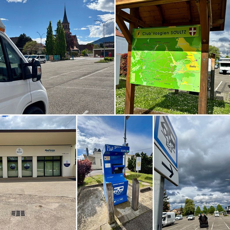
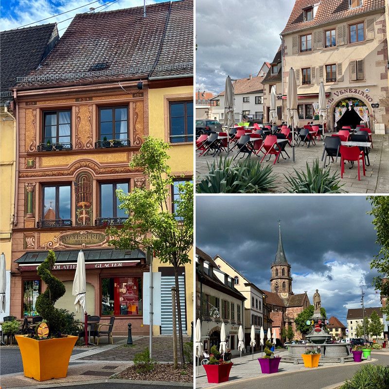
Soultz Haut Rhin - Komunaler Parkplatz
Communal parking lot with a V+E, where fresh water, electricity and the disposal of black water must be paid for, only the grey water can be disposed of free of charge.
However, the drain here is blocked and the grey water is not draining away.
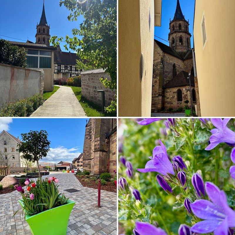
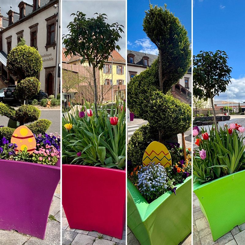
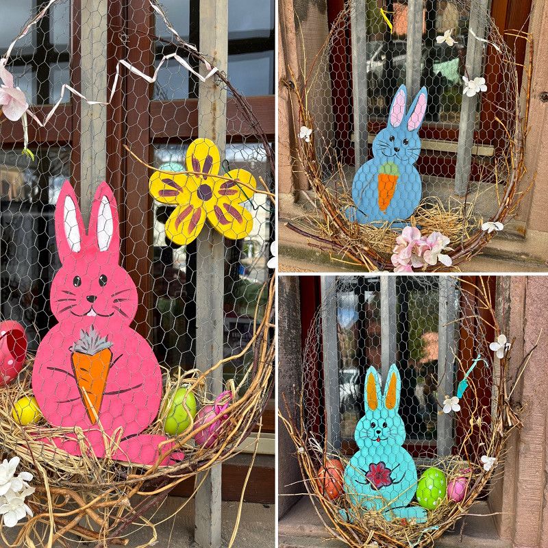
For us, it's just a place to pass through/stay overnight. It's a very quiet little town with a church square and restaurants (which are closed?). Since today is Easter Monday, I'm hoping the bakery, which is right across the parking lot, will open tomorrow.
Hiking trails also start from here.
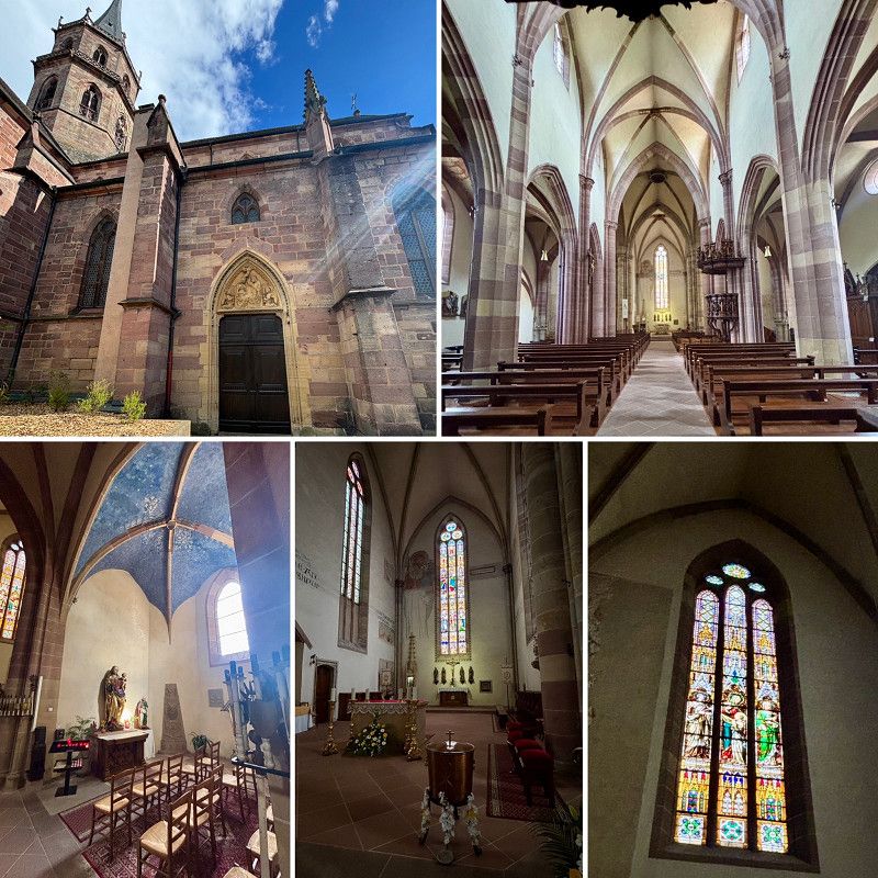
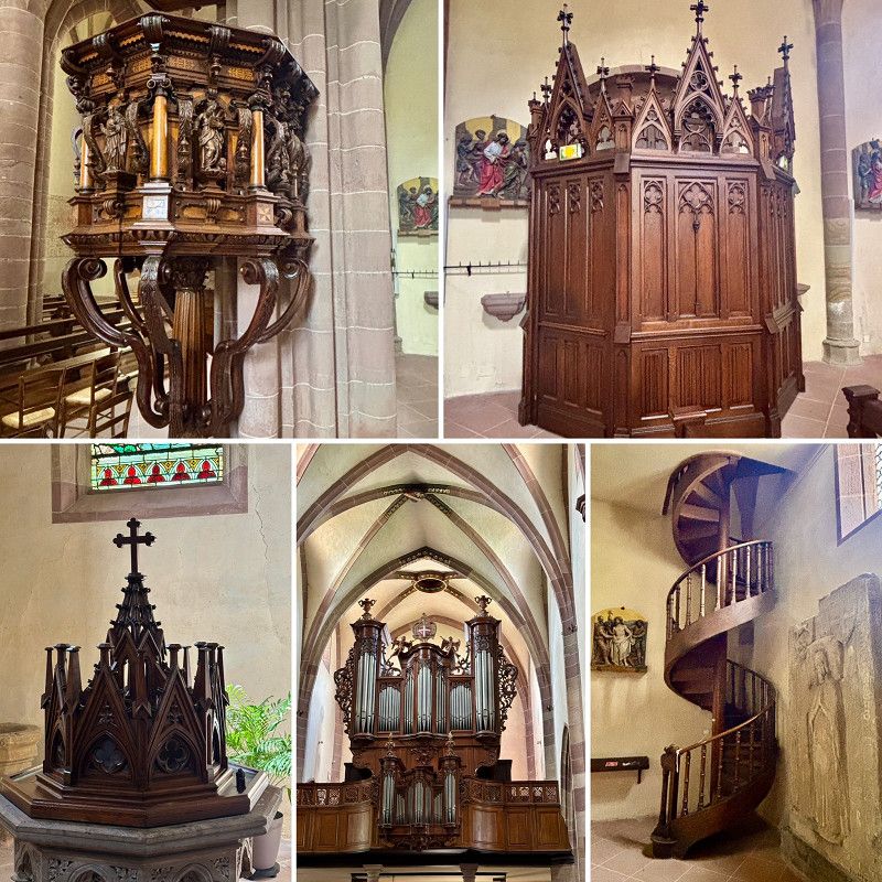
I also take a tour of the church and the town.
Rue de l'École, Soultz-Haut-Rhin, Haut-Rhin, Grand Est, France
47° 53' 11.6" N 7° 13' 54.6" E
47.8865612 7.2318472
• Head north on Rue de la Marne. Go for 4 m.
• Turn left onto Rue de l'École. Go for 72 m.
• Continue on Place de l'Église. Go for 54 m.
• Turn right onto Place de l'Église. Go for 16 m.
• Turn right onto Place de l'Église. Go for 52 m.
• Turn right onto Place de l'Église. Go for 17 m.
• Turn left onto Rue de l'École. Go for 72 m.
• Turn right onto Rue de la Marne. Go for 324 m.
• Take the 2nd exit from Place du 17 Novembre roundabout onto Place du 17 Novembre (D429). Go for 113 m.
• Turn left onto Route de Raedersheim (D4 BIS). Go for 2.1 km.
• Continue on D4 BIS toward Mulhouse/Petit Prince/Écomusée. Go for 48 m.
• Take ramp onto D430 toward Mulhouse/Petit Prince/Écomusée/Ensisheim/Pulversheim. Go for 15.6 km.
• Take ramp onto A36 (La Comtoise) toward Strasbourg/Freiburg/Basel/Euroairport. Go for 15.6 km.
• Continue on A5. Go for 191 m.
• Take the left exit toward Karlsruhe/Stuttgart/Freiburg onto A5. Go for 230 km.
• Take exit 33 toward Weinheim onto A659. Go for 670 m.
• Continue on B38. Go for 1.6 km.
• Turn left onto Westtangente (B38) toward Fürth/Odw./W.-Sulzbach/Gewerbegebiet W.-Nord/Industriepark Freudenberg/Zwei Burgen. Go for 9.4 km.
• Turn right onto Weiherer Straße (L3120). Go for 697 m.
• Pass 2 roundabouts and continue on L3120. Go for 11.3 km.
• Continue on Neckarstraße (L3105) toward Hirschhorn/Heddesbach/U.-Schönmattenwag. Go for 2.7 km.
• Turn right onto Straßburg. Go for 470 m.
• Continue on Seckenrain. Go for 532 m.
• Turn slightly left onto Seckenrain. Go for 82 m.
• Arrive at Seckenrain.
☍
291,3 km
(3 hrs. 2 min.)
22. Apr. 2025 -
22. Apr. 2025
Wald-Michelbach
Bergstraße, Hessen, Deutschland
49° 32' 58.9" N 8° 50' 34.8" E
49.5497000 8.8430000