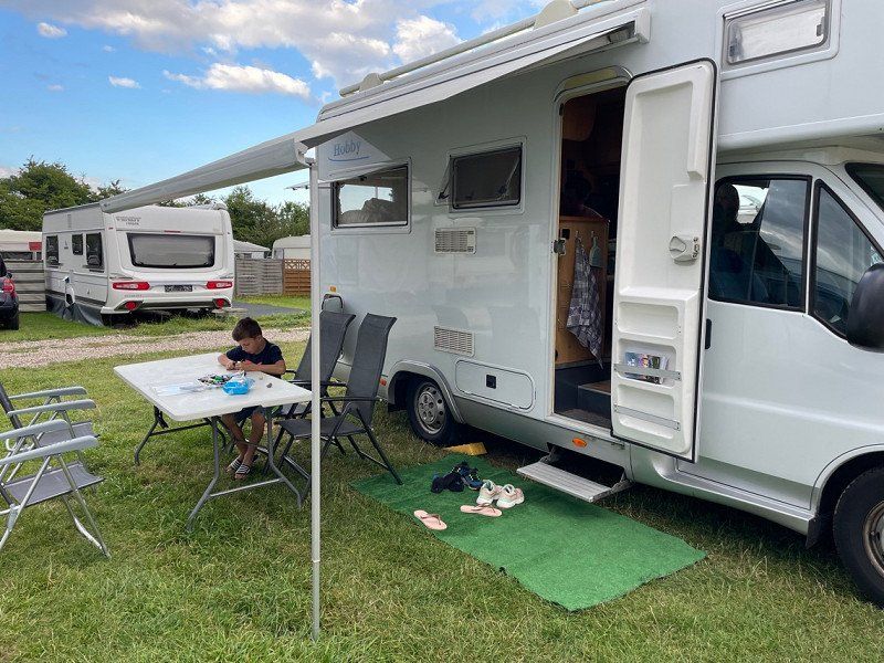
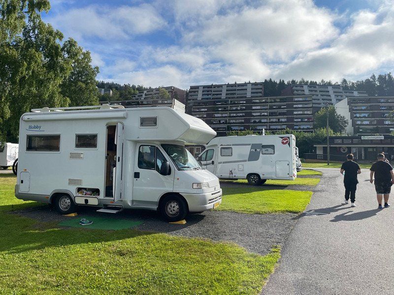
For 21 days we go out with the camper to Norway via Denmark. Earlier we mapped out the route somewhat, this has become the actual route.
H. Reptonstraat 96
52° 25' 37.9" N 4° 40' 1.6" E
52.4272025 4.6671232
• Head toward H. Reptonstraat on L. Brownstraat. Go for 224 m.
• Turn right onto D. Marotstraat. Go for 76 m.
• Continue on Velserbroekse Dreef. Go for 453 m.
• Take the 1st exit from roundabout onto Velserbroekse Dreef. Go for 438 m.
• Take the 2nd exit from roundabout onto Velserbroekse Dreef. Go for 316 m.
• Take the 1st exit from roundabout onto Velserbroekse Dreef. Go for 158 m.
• Turn left toward IJmuiden/Alkmaar/Utrecht. Go for 143 m.
• Take ramp onto N208 toward IJmuiden/Alkmaar/Utrecht. Go for 427 m.
• Continue on A208. Go for 1.3 km.
• Take the exit toward IJmuiden/Velsen-Zuid/Amsterdam (A9). Go for 1.0 km.
• Turn left onto Amsterdamseweg (N202) toward Utrecht/Velserbroek/Velsen-Zuid/Driehuis/IJmuiden/Beverwijk. Go for 143 m.
• Turn left and take ramp onto A22 (IJmuiden) toward Rotterdam/Utrecht. Go for 2.5 km.
• Continue on A9 (Knooppunt Velsen). Go for 14.3 km.
• Take the exit toward Amsterdam onto A4. Go for 6.0 km.
• Continue on A10 (Ring Amsterdam). Go for 8.8 km.
• Take the exit toward Hengelo/Groningen/Almere onto A1. Go for 3.1 km.
• Keep left onto A1. Go for 129 km.
• Take the exit toward Osnabrück/Enschede/Hengelo onto A1/A35. Go for 3.9 km.
• Continue on A1 toward Osnabrück/Hengelo/Borne. Go for 23.4 km.
• Continue on A30. Go for 64.0 km.
• Take exit 14 toward Bremen/Osnabrück-Hafen onto A1 (Hansalinie). Go for 213 km.
• Take the exit toward Lübeck/Berlin/Hamburg onto A1. Go for 14.6 km.
• Take exit 36 toward Lübeck/Berlin/Hamburg-Südost onto A1. Go for 129 km.
• Continue on B207. Go for 21.2 km.
• Keep right onto Fährhafenstraße toward Bahnhof. Go for 490 m.
• Continue on Fährbahnhof. Go for 201 m.
• Arrive at Fährbahnhof. Your destination is on the right.
☍
638,6 km
(5 hrs. 57 min.)
Day
Campingplatz Puttgarden- Vogelfluglinie
August 5, 2022. In order to catch the Ferry in time the next day, we spend the night at this campsite. The campsite is really around the corner from where the Ferry departs.
Day
Puttgarden ferry terminal, Fehmarn, Duitsland
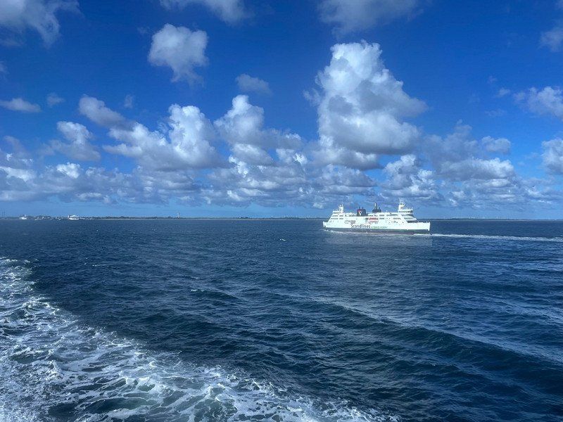
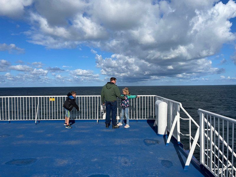
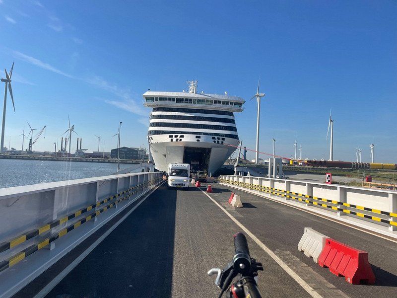
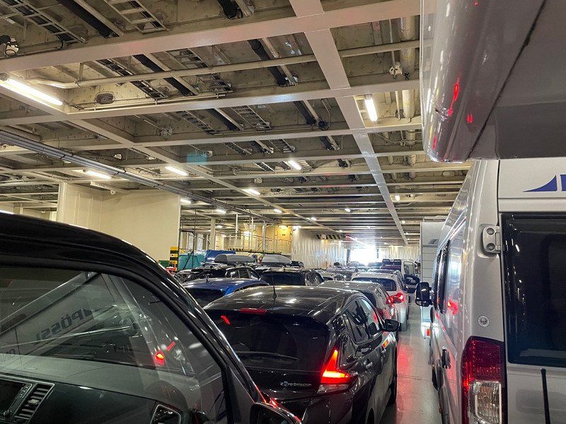
August 6, 2022. From here we take the Ferry to Rødby, Denmark. The crossing takes 45 minutes.
23769 Fehmarn, Duitsland
54° 30' 2.8" N 11° 13' 33" E
54.5007640 11.2258430
• Head north on Fährbahnhof. Go for 43 m.
• Continue on Fährhafenstraße. Go for 45 m.
• Turn slightly left onto Fährbahnhof. Go for 237 m.
• Continue on Fährhafenstraße. Go for 392 m.
• Turn right onto E47. Go for 836 m.
• Take the Puttgarden-Rødby Ferry. Stay on for 18.7 km.
• Head northeast. Go for 447 m.
• Arrive at your destination on the left.
☍
20,7 km
(1 hrs. 4 min.)
Rødby Færge, Rødby, Denemarken
54° 39' 25.3" N 11° 21' 21" E
54.6570269 11.3558467
• Head toward Færgestationsvej. Go for 322 m.
• Keep left toward København/E47. Go for 135 m.
• Continue on Sydmotorvejen (E47). Go for 121 km.
• Continue on E20/E47 (Køge Vest). Go for 26.2 km.
• Take the exit toward E55/Helsingør/København N onto E47 (Motorring 3). Go for 5.0 km.
• Take exit 24 toward Roskildevej/Glostrup/Frederiksberg. Go for 724 m.
• Turn right onto Roskildevej (156) toward Brøndbyvester/Rødovre/Frederiksberg/København. Go for 655 m.
• Turn slightly left toward Roskildevej/156. Go for 81 m.
• Turn slightly left onto Korsdalsvej. Go for 182 m.
• Turn left onto Korsdalsvej. Go for 85 m.
• Arrive at Korsdalsvej. Your destination is on the left.
☍
153,9 km
(1 hrs. 29 min.)
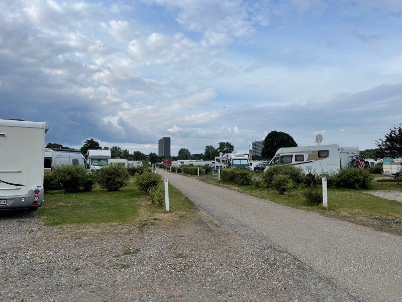
DCU-Camping København - Absalon
We have booked this campsite for 2 nights so that we have a day without traveling. The campsite is ideally located for visiting Copenhagen by train.
The campsite is neat and equipped with many conveniences.
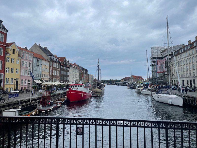
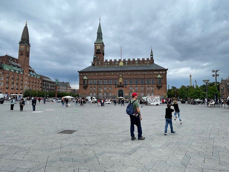
We will visit Copenhagen on Saturday and Sunday.
Korsdalsvej 132, 2610, Rødovre, Denemarken
55° 40' 15" N 12° 26' 2" E
55.6708300 12.4338900
• Head west on Korsdalsvej.
• Arrive at Korsdalsvej. Your destination is on the left.
☍
Distance not available
(Duration not available)
Day
DCU-Camping København - Absalon
August 7, 2022. Into Copenhagen by train.
Korsdalsvej 132, 2610, Rødovre, Denemarken
55° 40' 15" N 12° 26' 2" E
55.6708300 12.4338900
• Head east on Korsdalsvej. Go for 85 m.
• Turn right onto Korsdalsvej. Go for 127 m.
• Turn right onto Roskildevej (156). Go for 1.0 km.
• Turn right and take ramp onto E47 (Motorring 3) toward Rødby/E55/E20/Lufthavn. Go for 4.2 km.
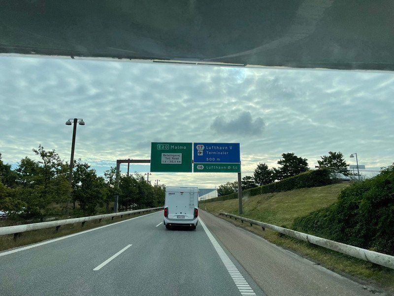
• Take the left exit toward Lufthavn/Malmø/København C onto E20 (Amagermotorvejen). Go for 27.8 km.
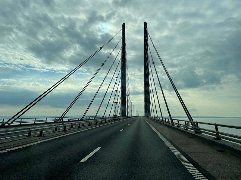
• Continue on E20 (Öresundsbron). Go for 9.8 km.
• Take the exit toward Malmö V/Limhamn. Go for 760 m.
• Continue on Lorensborgsgatan. Go for 387 m.
• Take the 4th exit from roundabout onto Lorensborgsgatan toward E6/E20/E22/E65. Go for 486 m.
• Turn right and take ramp onto E20 (Yttre Ringvägen) toward Köpenhamn. Go for 7.2 km.
• Arrive at Öresundsbron (E20). Your destination is on the left.
☍
51,8 km
( 34 min.)
Day
Öresundbrücke, Malmö, Zweden
August 8, 2022. From Copenhagen we continue today to Sweden. We take the Øresøndsbron to enter Sweden.
Malmö, Zweden
55° 34' 14.3" N 12° 50' 55.1" E
55.5706287 12.8486371
• Head west on E20 (Öresundsbron). Go for 2.7 km.
• Continue on E20 (Øresundsbroen). Go for 11.0 km.
• Take exit 15 toward Lufthavn. Go for 559 m.
• Continue on Amager Strandvej. Go for 236 m.
• Take the 4th exit from roundabout onto Amager Strandvej toward København/E20/Kastrup. Go for 310 m.
• Turn right and take ramp onto E20 (Øresundsmotorvejen) toward Malmø. Go for 11.5 km.
• Continue on E20 (Öresundsbron). Go for 27.8 km.
• Continue on E6/E20 toward E4/Göteborg/Stockholm. Go for 56.8 km.
• Continue on E6/E20 toward Göteborg/Höganäs/111/Helsingborg N. Go for 207 km.
• Keep right onto E6 (Olskroksmotet). Go for 133 km.
• Take exit 106 toward Grebbestad/Tanumshede. Go for 516 m.
• Take the 1st exit from roundabout onto Järpenbacken (163) toward Grebbestad. Go for 2.6 km.
• Take the 1st exit from roundabout onto 163. Go for 2.8 km.
• Turn right toward Greby. Go for 349 m.
• Continue on Greby. Go for 760 m.
• Continue on Ulmekärrsvägen. Go for 572 m.
• Continue on Norra Edsvik. Go for 157 m.
• Turn left. Go for 22 m.
• Arrive at your destination on the right.
☍
458,4 km
(4 hrs. 23 min.)
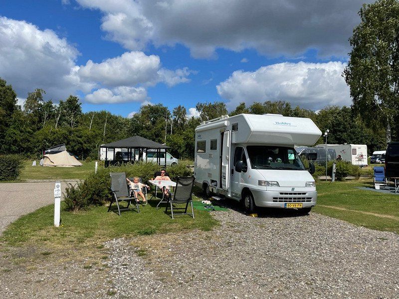
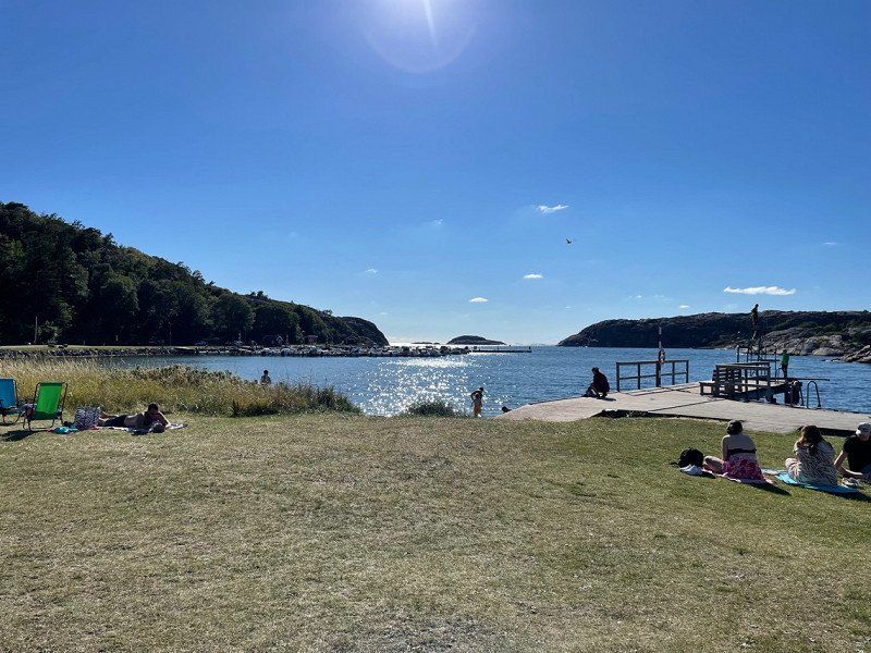
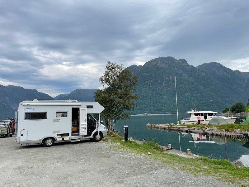
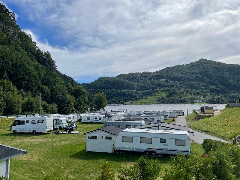
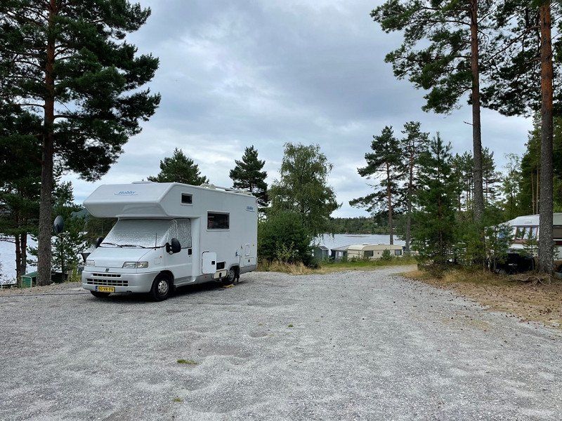
First Camp Edsvik-Grebbestad
We chose this campsite because of its location on the water. Beautiful and well-maintained campsite and we are lucky with the weather.
Norra Edsvik 2, 457 95, Grebbestad, Zweden
58° 42' 43.1" N 11° 14' 7" E
58.7119690 11.2352910
• Head southwest.
• Turn left toward Södra Edsvik. Go for 98 m.
• Turn left onto Södra Edsvik. Go for 81 m.
• Turn right toward Ulmekärrsvägen. Go for 362 m.
• Continue on Ulmekärrsvägen. Go for 210 m.
• Continue straight ahead. Go for 39 m.
• Turn slightly left toward Greby. Go for 217 m.
• Continue on Greby. Go for 853 m.
• Turn left onto 163. Go for 2.8 km.
• Take the 2nd exit from roundabout onto 163. Go for 2.6 km.
• Take the 3rd exit from roundabout onto E6 toward Oslo. Go for 43.7 km.
• Continue on E6 (Svinesundsbroen). Go for 91.9 km.
• Continue on E6 toward Trondheim/Ring 3/Oslo N/Ø. Go for 18.3 km.
• Keep left onto Ring 3 (E6) toward Trondheim/Gardermoen Lufthavn/Sinsen. Go for 3.6 km.
• Keep left onto Hjalmar Brantings vei (150) toward Sinsen/4/Stovner/163. Go for 3.2 km.
• Keep left onto Ring 3 (150) toward Smestad. Go for 4.7 km.
• Take ramp onto Slemdalsveien toward Slemdal. Go for 1.3 km.
• Turn right onto Risalléen. Go for 45 m.
• Turn left onto Stasjonsveien. Go for 1.1 km.
• Turn right onto Holmenkollveien. Go for 906 m.
• Turn left onto Ankerveien. Go for 1.7 km.
• Turn right onto Ankerveien. Go for 19 m.
• Turn right. Go for 100 m.
• Arrive at your destination on the left.
☍
177,8 km
(2 hrs. 1 min.)
Day
Bogstad Camp.Og Turistsenter -pluscamp
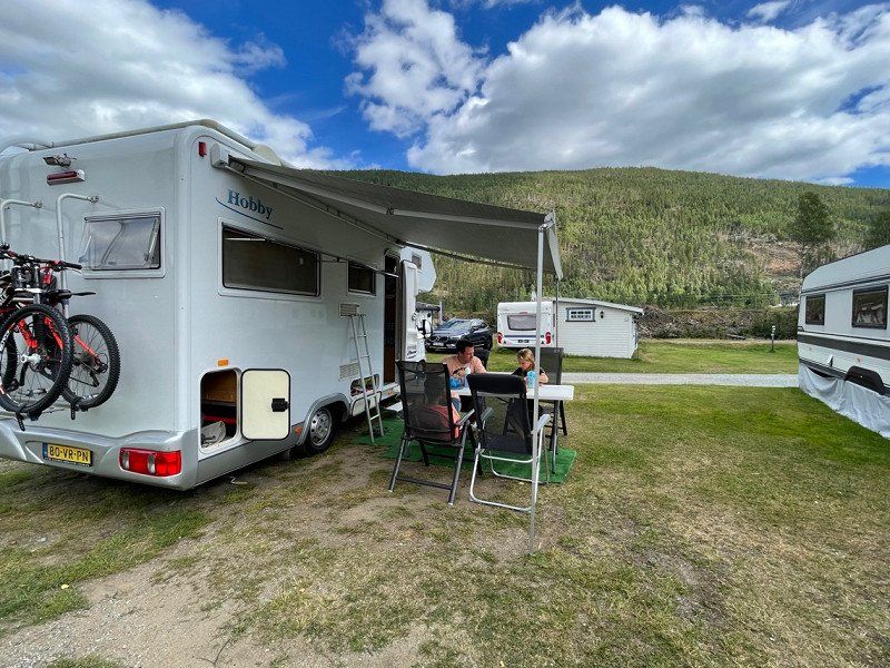
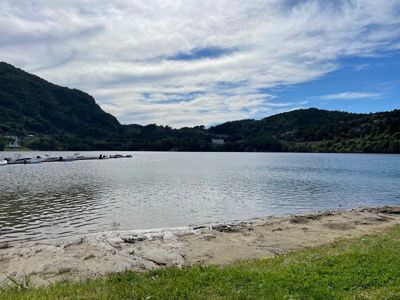
August 9, 2022. Today we left around 11 am and drove to Oslo. Here we stay 1 night. We want to go out into nature and don't necessarily want to see the city. The campsite is ideally located to visit the city. It is a neat campsite with all amenities. A short walk and you come to a lake.
Ankerveien 117, 0757, Oslo, Noorwegen
59° 57' 45" N 10° 38' 38" E
59.9625000 10.6438900
• Head west. Go for 100 m.
• Turn left toward Ankerveien. Go for 11 m.
• Continue on Ankerveien. Go for 8 m.
• Turn right onto Ankerveien. Go for 92 m.
• Turn left onto Sørkedalsveien. Go for 1.3 km.
• Take the 1st exit from roundabout onto Vækerøveien. Go for 3.0 km.
• Take the 2nd exit from roundabout onto Vækerøveien (160) toward Vækerø/E18. Go for 1.1 km.
• Turn right and take ramp onto Drammensveien (E18) toward Drammen. Go for 24.9 km.
• Take exit 22 toward Tranby/Sylling/285/Industriområde Gjellebekk. Go for 349 m.
• Turn right onto Kirkelina (282) toward Sylling/285/Tranby. Go for 919 m.
• Take the 2nd exit from roundabout onto Kirkelina (282). Go for 1.9 km.
• Take the 1st exit from roundabout onto Ringeriksvegen (285). Go for 20.7 km.
• Take the 2nd exit from roundabout onto 285. Go for 1.2 km.
• Take ramp onto Holeveien (E16). Go for 20.3 km.
• Take the 2nd exit from roundabout onto Osloveien (E16). Go for 6.0 km.
• Take the 2nd exit from roundabout onto Soknedalsveien (7) toward Bergen/Gol/Geilo/Bergen/Via Gol. Go for 20.5 km.
• Pass 3 roundabouts and continue on 7. Go for 74.5 km.
• Turn right onto Hallingdalsvegen. Go for 54 m.
• Turn right onto Hallingdalsvegen. Go for 24 m.
• Arrive at Hallingdalsvegen.
☍
177,1 km
(2 hrs. 28 min.)
Day
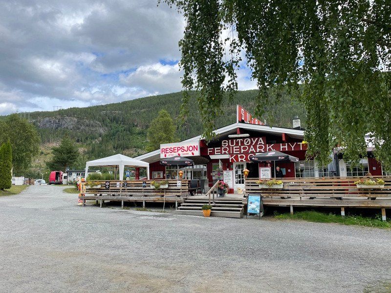
Sutøya Feriepark
August 10, 2022. Today we drove to Nesbyen. The children like to go fishing and romp with the water. It is a lovely campsite. There is also a large lake a 10-minute drive away.
3540, Nesbyen, Noorwegen
60° 35' 55" N 9° 4' 48" E
60.5986100 9.0800000
• Head south on Hallingdalsvegen. Go for 42 m.
• Turn left. Go for 66 m.
• Turn left toward Hallingdalsvegen. Go for 53 m.
• Turn slightly right onto Hallingdalsvegen. Go for 54 m.
• Turn left onto Hallingdalsvegen (7). Go for 3.6 km.
• Turn right and take ramp toward Rødberg/40/Nesbyen. Go for 106 m.
• Continue on Rukkedalsvegen (2910). Go for 99 m.
• Turn right onto Rukkedalsvegen (2908) toward Hedalen/243/Blingsmo/Nesbyen St/Industriområde Stupa. Go for 52 m.
• Continue on Stasjonsvegen (2908). Go for 669 m.
• Continue on Vassfarvegen. Go for 112 m.
• Continue on Jerpevegen. Go for 189 m.
• Continue on Vassfarvegen. Go for 4.5 km.
• Arrive at Vassfarvegen.
☍
9,6 km
( 10 min.)
Day
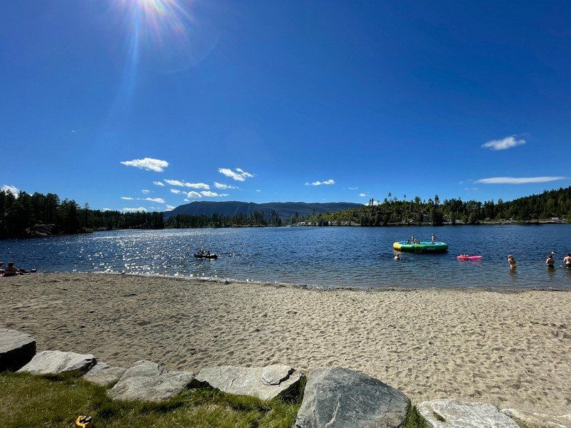
Vassfarvegen
A beautiful recreation area (Trytetjern ) with a swimming lake, a water trampoline and a kiosk. For 300 NOK you can also spend the night here in the parking lot (no electricity). We stay here for an afternoon.
60° 34' 38.8" N 9° 9' 21.4" E
60.5774536 9.1559487
• Head southwest on Vassfarvegen. Go for 4.5 km.
• Continue on Jerpevegen. Go for 189 m.
• Continue on Vassfarvegen. Go for 112 m.
• Continue on Stasjonsvegen (2908). Go for 669 m.
• Continue on Rukkedalsvegen (2908). Go for 52 m.
• Turn left onto Rukkedalsvegen (2910) toward Hønefoss/Gol. Go for 99 m.
• Take ramp. Go for 63 m.
• Turn left onto Hallingdalsvegen (7). Go for 3.7 km.
• Turn right onto Hallingdalsvegen. Go for 54 m.
• Turn right onto Hallingdalsvegen. Go for 24 m.
• Arrive at Hallingdalsvegen.
☍
9,5 km
( 9 min.)
Sutøya Feriepark
August 11, 2022
3540, Nesbyen, Noorwegen
60° 35' 55" N 9° 4' 48" E
60.5986100 9.0800000
• Head south on Hallingdalsvegen. Go for 42 m.
• Turn left. Go for 66 m.
• Turn left toward Hallingdalsvegen. Go for 53 m.
• Turn slightly right onto Hallingdalsvegen. Go for 54 m.
• Turn right onto Hallingdalsvegen (7). Go for 15.9 km.
• Pass 2 roundabouts and continue on Rotneimvegen (7). Go for 39.4 km.
• Turn left onto Mogrendvegen (7). Go for 11.0 km.
• Take the 2nd exit from roundabout onto Ustedalen (7) toward Eidfjord. Go for 105 km.
• Take the 2nd exit from Butunnelen roundabout onto Butunnelen (13). Go for 3.3 km.
• Take the 2nd exit from roundabout onto Vallaviktunnelen (13). Go for 30.3 km.
• Turn right onto 13 toward E16. Go for 874 m.
• Continue on Strandavegen (E16). Go for 232 m.
• Turn left onto Rognshagen. Go for 187 m.
• Turn right onto Lunden. Go for 269 m.
• Turn right onto Stegen. Go for 193 m.
• Turn left onto Ringheimsvegen (5402). Go for 50 m.
• Arrive at Ringheimsvegen (5402). Your destination is on the left.
☍
207,4 km
(2 hrs. 57 min.)
Day
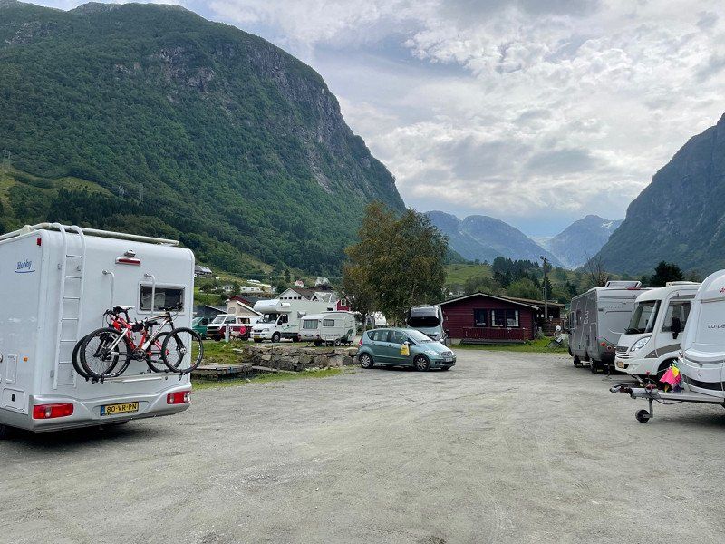
Voss Camping
August 12, 2022. Our residence for a few days (we thought). We hadn't made a reservation, we went by chance. Unfortunately the campsite was full last night, but you can park in the parking lot for 300 NOK and you have power and you can use all facilities.
The campsite is ideally located in relation to the center of Voss. Sanitary is very neat, just a pity that there are only 4 showers and toilets. Really a minus if you have to wait that long.
Postboks 54, 5701, Voss, Noorwegen
60° 38' 6.3" N 6° 25' 49.8" E
60.6350900 6.4305100
• Head toward Stegen on Ringheimsvegen (5402). Go for 2.0 km.
• Take the 3rd exit from roundabout onto Strandavegen (E16). Go for 475 m.
• Pass 3 roundabouts and continue on Vinjadalen (E16). Go for 61.6 km.
• Turn right onto Flåmsdalsvegen (5624). Go for 189 m.
• Turn left onto Nedre Brekkevegen (5624). Go for 427 m.
• Turn left onto Nedre Brekkevegen. Go for 35 m.
• Arrive at Nedre Brekkevegen. Your destination is on the left.
☍
64,7 km
( 56 min.)
Day
Flåm Camping Og Vandrarheim
August 13, 2022. We have moved on to Flåm. The terraced campsite is beautifully situated.
Nedre Brekkevegen 12 nr 12, 5743, Flåm, Noorwegen
60° 51' 46.9" N 7° 6' 34.1" E
60.8630400 7.1094600
• Head northwest on Nedre Brekkevegen.
• Arrive at Nedre Brekkevegen. Your destination is on the left.
☍
Distance not available
(Duration not available)
Day
Flåm Camping Og Vandrarheim
August 14, 2022
Nedre Brekkevegen 12 nr 12, 5743, Flåm, Noorwegen
60° 51' 46.9" N 7° 6' 34.1" E
60.8630400 7.1094600
• Head southeast on Nedre Brekkevegen. Go for 35 m.
• Turn right onto Nedre Brekkevegen (5624). Go for 427 m.
• Turn right onto Flåmsdalsvegen (5624). Go for 189 m.
• Turn left onto E16. Go for 44.2 km.
• Pass 5 roundabouts and continue on Strandavegen (E16). Go for 19.5 km.
• Continue on 13. Go for 874 m.
• Turn left onto Hardangervegen (13). Go for 30.2 km.
• Take the 1st exit from roundabout onto Vallaviktunnelen (13). Go for 3.3 km.
• Take the 2nd exit from Butunnelen roundabout onto Butunnelen (13). Go for 54.5 km.
• Turn right onto Eitrheimsvegen. Go for 185 m.
• Turn right onto Eitrheimsvegen. Go for 216 m.
• Take the 1st exit from roundabout onto Eitrheimsvegen (49). Go for 2.7 km.
• Take the 2nd exit from roundabout onto 49. Go for 12.5 km.
• Continue on 500. Go for 3.8 km.
• Turn left onto Sunndalsvegen. Go for 319 m.
• Arrive at Sunndalsvegen.
☍
173,0 km
(2 hrs. 34 min.)
Day
Sundal Camping
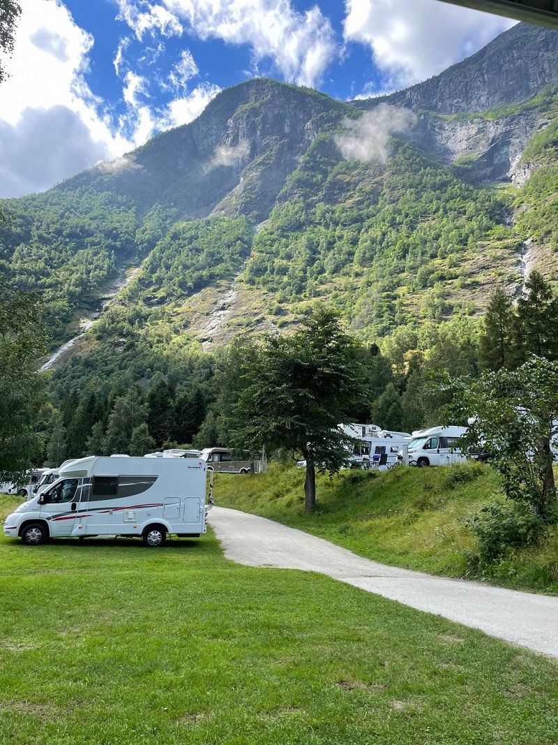
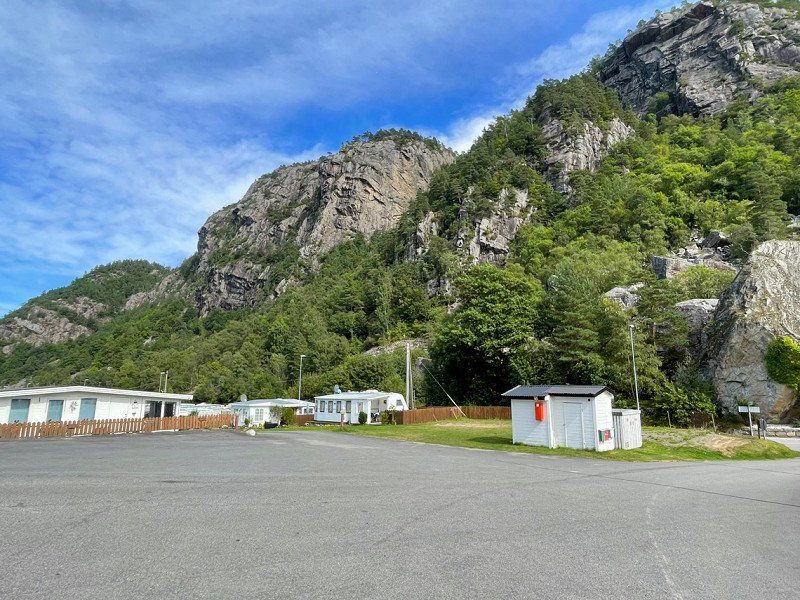
August 15, 2022. It looks more like a motorhome when you arrive. You put your camper down and you pay later. In the course of the afternoon the campsite fills up. It is beautifully situated between the fjords and you have a view of the glacier.
The route is also fantastic here from Flåm.
5476, Mauranger, Noorwegen
60° 6' 47" N 6° 15' 52" E
60.1130600 6.2644400
• Head north on Sunndalsvegen. Go for 319 m.
• Turn right onto Sunndalsvegen (500). Go for 3.8 km.
• Continue on 49. Go for 12.5 km.
• Take the 1st exit from roundabout onto Eitrheimsvegen (49). Go for 2.7 km.
• Take the 1st exit from roundabout onto Eitrheimsvegen (49). Go for 641 m.
• Take the 1st exit from roundabout onto Røldalsvegen (13). Go for 17.7 km.
• Turn right onto E134 toward Haugesund. Go for 98.7 km.
• Take the 2nd exit from roundabout onto Grindafjordvegen (E39/E134). Go for 1.2 km.
• Take the 3rd exit from roundabout onto Tysværvegen (E39) toward Stavanger. Go for 13.3 km.
• Take the 2nd exit from roundabout onto Tysværvegen (E39). Go for 19.9 km.
• Take the Arsvågen-Mortavika Ferry. Stay on for 9.2 km.
• Head south on E39. Go for 24.4 km.
• Pass 2 roundabouts and continue on Ytre Ringvei Vest (E39). Go for 18.2 km.
• Take the exit toward Bryne/Lufthavn Sola/509 onto 444. Go for 585 m.
• Take the 3rd exit from roundabout onto Sandnesveien (334). Go for 344 m.
• Take the 1st exit from roundabout onto Årsvollveien (4522). Go for 1.1 km.
• Turn right onto Gamle Austvollvei. Go for 151 m.
• Turn left onto Gamle Austvollvei. Go for 239 m.
• Arrive at Gamle Austvollvei. Your destination is on the right.
☍
224,9 km
(3 hrs. 50 min.)
Day
Vølstadskogen Hytte Og Campinganlegg
August 16, 2022. The campsite for our transit further. Drove a little further on a rainy day.
Not a particularly cozy campsite. Good to visit Stavanger.
Gamle Austvollvei 5, 4312, Sandnes, Noorwegen
58° 51' 31" N 5° 41' 11" E
58.8586100 5.6863900
• Head west on Gamle Austvollvei. Go for 163 m.
• Turn left toward Årsvollveien/4522. Go for 159 m.
• Turn left onto Årsvollveien (4522). Go for 1.5 km.
• Take the 1st exit from roundabout onto Sandnesveien (334). Go for 66 m.
• Turn right and take ramp onto E39 toward Kristiansand. Go for 13.3 km.
• Pass 3 roundabouts and continue on Sandnesveien (E39). Go for 102 km.
• Turn left onto 4156 toward Seland/Egenes/Kabelbane. Go for 288 m.
• Continue on Selandsvegen (4156). Go for 473 m.
• Continue on 4156. Go for 60 m.
• Continue on Selandsvegen (4156). Go for 621 m.
• Turn right. Go for 11 m.
• Arrive at your destination on the right.
☍
118,8 km
(1 hrs. 40 min.)
Day
Egenes Camping, Ferie Og Fritidssenter
August 17, 2022. Campsite very nicely located on the lake. For people who stay longer, there is the main campsite and for travelers the asphalt campsite. Because it is quiet, we can stay at the main campsite. The campsite is full of seasonal pitches.
Nuland, 4400, Flekkefjord, Noorwegen
58° 17' 20" N 6° 43' 4" E
58.2888800 6.7177700
• Head toward Selandsvegen. Go for 11 m.
• Turn left onto Selandsvegen (4156). Go for 621 m.
• Continue on 4156. Go for 60 m.
• Continue on Selandsvegen (4156). Go for 473 m.
• Continue on 4156. Go for 288 m.
• Turn left onto E39. Go for 8.5 km.
• Take ramp toward 465/Kvinesdal. Go for 1.1 km.
• Take the 2nd exit from roundabout onto 465. Go for 11.2 km.
• Turn left onto Hunsbedtvegen (4194). Go for 2.2 km.
• Continue on Austerdalsvegen (4194). Go for 21.4 km.
• Turn right onto 42. Go for 6.6 km.
• Turn left onto 42. Go for 45.0 km.
• Turn left onto Kjetsåvegen (42). Go for 1.6 km.
• Turn left onto Setesdalsvegen (9). Go for 1.1 km.
• Take the 1st exit from roundabout onto Setesdalsvegen (9). Go for 2.4 km.
• Take the 2nd exit from roundabout onto Setesdalsvegen (9). Go for 8.1 km.
• Turn right onto Syrtveit. Go for 39 m.
• Turn right onto Syrtveit. Go for 47 m.
• Arrive at Syrtveit. Your destination is on the right.
☍
110,7 km
(1 hrs. 44 min.)
Day
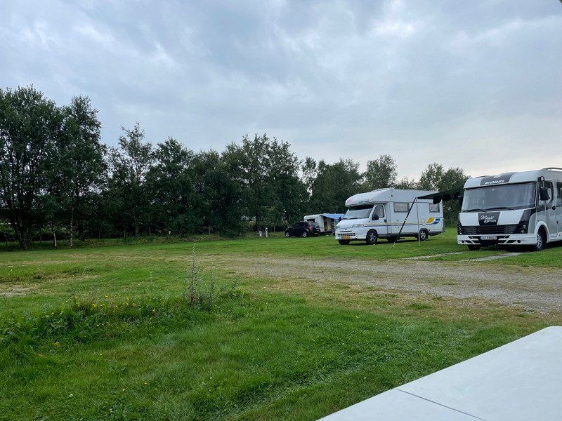
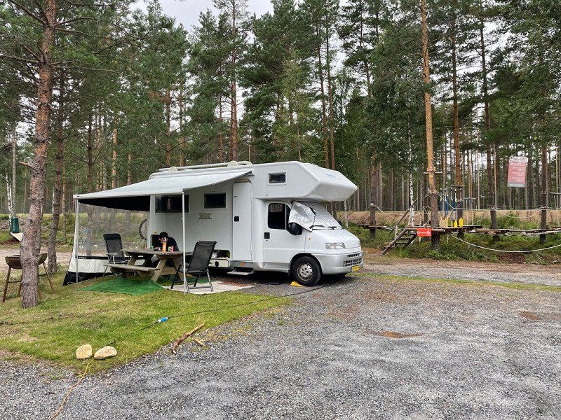
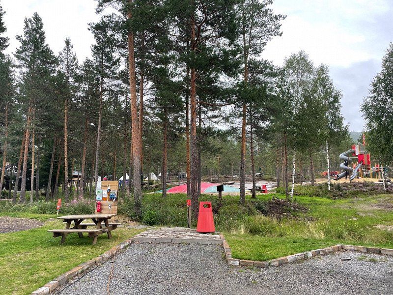
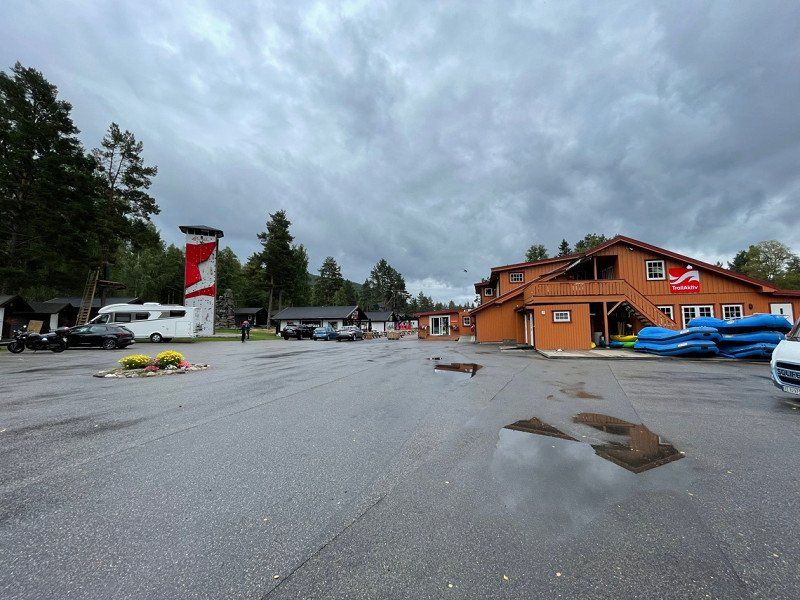
TrollAktiv AS, Syrtveit, Evje, Noorwegen
August 18, 2022. A “campsite” at an activity center where you can go rafting, climbing, cycling, etc. The campsite consists of 2 places for campers, grass and a part with asphalt. It's very quiet and it's not a real camping feeling, but the kids have fun!
Syrtveit 4, 4735 Evje, Noorwegen
58° 38' 9.2" N 7° 48' 27.8" E
58.6359010 7.8077340
• Head south on Syrtveit. Go for 122 m.
• Turn right onto Syrtveit. Go for 90 m.
• Turn left onto 9. Go for 7.8 km.
• Take the 2nd exit from roundabout onto Setesdalsvegen (9). Go for 2.4 km.
• Take the 2nd exit from roundabout onto Setesdalsvegen (9). Go for 11.3 km.
• Turn left onto Ivelandsvegen (403). Go for 678 m.
• Turn left onto Østre Hodne. Go for 444 m.
• Turn left onto Ivelandsveien. Go for 304 m.
• Arrive at Ivelandsveien. Your destination is on the left.
☍
23,2 km
( 21 min.)
Day
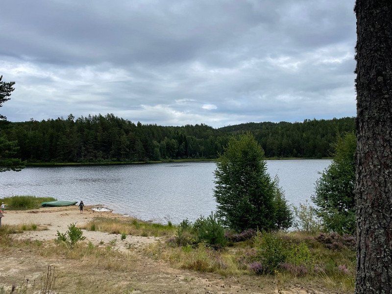
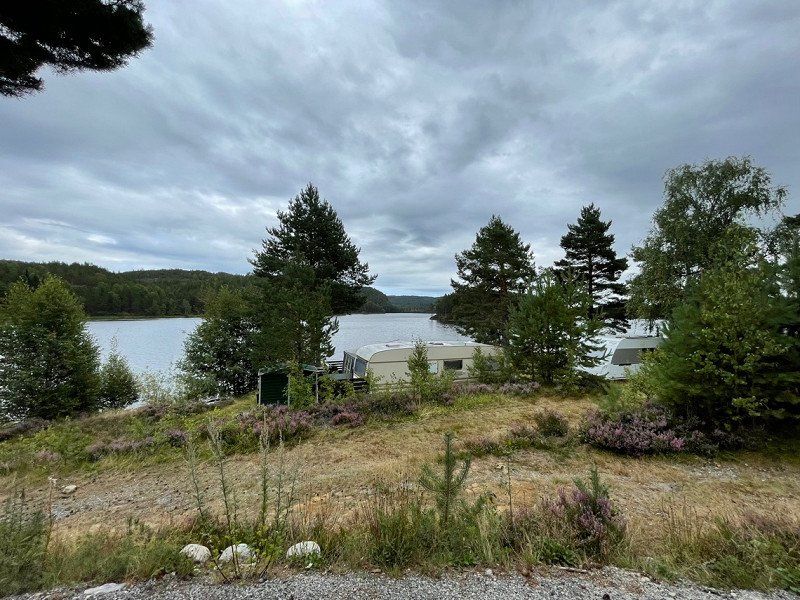
Kilefjorden Camping
August 19, 2022. Lovely riverside site. Sanitary has been renewed, 2 showers available, pay with coins. Quiet campsite in a beautiful setting.
crossroad RV9/rv403, 4737, Hornes, Noorwegen
58° 28' 8" N 7° 47' 57" E
58.4688900 7.7991700
• Head south on Ivelandsveien.
• Arrive at Ivelandsveien. Your destination is on the left.
☍
Distance not available
(Duration not available)
Day
Kilefjorden Camping
August 20, 2022.
crossroad RV9/rv403, 4737, Hornes, Noorwegen
58° 28' 8" N 7° 47' 57" E
58.4688900 7.7991700
• Head toward Østre Hodne on Ivelandsveien. Go for 304 m.
• Turn right onto Østre Hodne. Go for 444 m.
• Turn right onto Ivelandsveien (403). Go for 678 m.
• Turn left onto Setesdalsvegen (9). Go for 36.2 km.
• Take the 3rd exit from roundabout onto Venneslaveien (405). Go for 1.5 km.
• Turn sharp right onto Torridalsvegen (482). Go for 660 m.
• Continue on Torridalsveien (482). Go for 8.9 km.
• Take the 3rd exit from roundabout onto Torridalsveien (482). Go for 215 m.
• Take the 1st exit from roundabout onto E18 toward Oslo. Go for 4.9 km.
• Take ramp toward Høvåg V/Hånes. Go for 344 m.
• Take the 1st exit from roundabout onto Høvågveien (401). Go for 152 m.
• Take the 2nd exit from roundabout onto Høvågveien (401). Go for 487 m.
• Turn right onto Dvergsnesveien (494). Go for 2.9 km.
• Turn right onto Dvergsnesveien. Go for 15 m.
• Turn slightly right onto Dvergsnesbakken. Go for 22 m.
• Turn left onto Dvergsnesbakken. Go for 102 m.
• Arrive at Dvergsnesbakken. Your destination is on the right.
☍
57,8 km
( 54 min.)
Day
Kristiansand Feriesenter
August 21, 2022. Our last campsite of this trip before we get on the boat. We stay here for 3 nights.
The campsite is quite large with many permanent places.
The sanitary facilities are very neat, you have a full bathroom if you go to the toilet or take a shower. We are pretty much at the end of the season, so no more paying for showers, but also no longer open a cafe, etc.
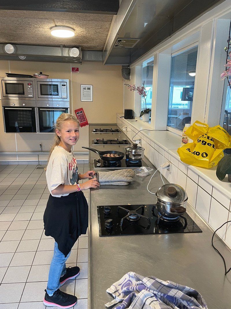
The shared kitchen and sitting area is nice and big and we make use of that!
Dvergsnesveien 571, 4639, Kristiansand, Noorwegen
58° 7' 60" N 8° 4' 23" E
58.1333300 8.0730600
• Head south on Dvergsnesbakken.
• Arrive at Dvergsnesbakken. Your destination is on the right.
☍
Distance not available
(Duration not available)
Day
Kristiansand Feriesenter
August 22, 2022
Dvergsnesveien 571, 4639, Kristiansand, Noorwegen
58° 7' 60" N 8° 4' 23" E
58.1333300 8.0730600
• Head south on Dvergsnesbakken.
• Arrive at Dvergsnesbakken. Your destination is on the right.
☍
Distance not available
(Duration not available)
Day
Kristiansand Feriesenter
August 23, 2022
Dvergsnesveien 571, 4639, Kristiansand, Noorwegen
58° 7' 60" N 8° 4' 23" E
58.1333300 8.0730600
• Head north on Dvergsnesbakken. Go for 29 m.
• Turn right toward Dvergsnesveien/3906. Go for 66 m.
• Turn left onto Dvergsnesveien (3906). Go for 51 m.
• Take the 2nd exit from roundabout onto Dvergsnesveien (494). Go for 1.4 km.
• Continue on Dvergsnesveien (494). Go for 1.6 km.
• Turn left onto Høvågveien (401). Go for 455 m.
• Take the 2nd exit from roundabout onto Høvågveien (401). Go for 170 m.
• Take the 3rd exit from roundabout onto E18 toward Kristiansand. Go for 6.4 km.
• Take ramp toward Evje/Terminalen/E39/Danmark/Terminal. Go for 174 m.
• Take the 2nd exit from roundabout onto Vesterveien toward Stavanger/E39/Danmark. Go for 373 m.
• Take the 3rd exit from roundabout onto Vesterveien toward E39/Danmark. Go for 219 m.
• Turn sharp right. Go for 371 m.
• Arrive at your destination on the right.
☍
11,2 km
( 13 min.)
Day
Kristiansand ferjeterminal, Vesterveien, Kristiansand, Noorwegen
August 24, 2022. From here we take the boat to Eemshaven.
Vesterveien 21, 4613 Kristiansand, Noorwegen
58° 8' 34.2" N 7° 58' 58.4" E
58.1428365 7.9828781
• Head southeast. Go for 76 m.
• Take the Kristiansand-Hirtshals Ferry. Stay on for 139 km.
• Head southeast on E39. Go for 2.1 km.
• Take the 3rd exit from roundabout onto Aalborgvej (E39) toward Aalborg/Skagen/597. Go for 2.3 km.
• Take the 2nd exit from roundabout onto E39 (Hirtshalsmotorvejen) toward Aalborg. Go for 57.0 km.
• Continue on Vendsyssel. Go for 196 m.
• Continue on E45 (Vendsyssel). Go for 212 km.
• Continue on E45 (Sønderjyske Motorvej) toward Flensborg. Go for 83.2 km.
• Continue on A7. Go for 156 km.
• Keep left onto A7. Go for 14.7 km.
• Keep right onto A261 (Autobahndreieck Hamburg-Südwest) toward Bremen/Tötensen. Go for 9.0 km.
• Take exit 4 toward Osnabrück/Bremen/Rade onto A1. Go for 93.3 km.
• Take exit 58A toward Oldenburg onto A28. Go for 42.6 km.
• Take the exit toward Groningen/Emden/Leer/Bad Zwischenahn/OL-Wechloy onto A28. Go for 55.2 km.
• Continue on A31. Go for 19.5 km.
• Take exit 14 toward Groningen/Bunde-West onto A280. Go for 4.8 km.
• Continue on A7. Go for 24.9 km.
• Take the exit toward Eemshaven/Delfzijl onto N33. Go for 28.6 km.
• Turn left onto Hogelandsterweg (N363). Go for 4.5 km.
• Turn right toward N46. Go for 722 m.
• Take ramp onto N46. Go for 3.1 km.
• Take the 3rd exit from roundabout onto Kwelderweg. Go for 567 m.
• Turn right onto Westereemsweg. Go for 738 m.
• Turn left onto Westlob. Go for 843 m.
• Take the 2nd exit from roundabout onto Borkumkade. Go for 2.2 km.
• Turn right onto Borkumkade. Go for 412 m.
• Turn left onto Borkumkade. Go for 68 m.
• Turn left. Go for 100 m.
• Turn left. Go for 10 m.
• Arrive at your destination on the left.
☍
957,4 km
(11 hrs. 35 min.)
Day
Eemshaven Parken, Borkumkade, Spijk, Nederland
Arrival by Ferry from Kristiansand
Borkumkade, 9909 TA Spijk, Nederland
53° 27' 28.1" N 6° 49' 48.8" E
53.4577973 6.8302167
• Head north. Go for 10 m.
• Turn right toward Borkumkade. Go for 100 m.
• Turn right onto Borkumkade. Go for 68 m.
• Turn right onto Borkumkade. Go for 412 m.
• Turn left onto Borkumkade. Go for 2.2 km.
• Take the 1st exit from roundabout onto Westlob. Go for 876 m.
• Turn right onto Westereemsweg. Go for 738 m.
• Turn left onto Kwelderweg. Go for 482 m.
• Take the 1st exit from roundabout onto N46. Go for 32.5 km.
• Take ramp onto Friesestraatweg (N370) toward Ring Groningen/Drachten/A7/Leeuwarden/Assen/A28. Go for 4.3 km.
• Keep right onto N370 toward Leeuwarden/Amsterdam/Drachten/Martini/Stadspark/N7. Go for 108 m.
• Take ramp onto Weg Der Verenigde Naties (N7). Go for 3.1 km.
• Continue on A7 (Weg Der Verenigde Naties). Go for 58.1 km.
• Continue on A6. Go for 30.1 km.
• Take the exit toward Industrieterrein Nagelerweg/Lelystad/Amsterdam onto A6. Go for 55.0 km.
• Keep left onto A6 toward Amsterdam. Go for 6.7 km.
• Keep left onto A6. Go for 5.9 km.
• Keep left onto A1. Go for 9.9 km.
• Take the exit toward Rotterdam/Luchthaven Schiphol onto A10 (Watergraafsmeer). Go for 10.3 km.
• Continue on A4 (Knooppunt de Nieuwe Meer) toward Rotterdam/Den Haag/Luchthaven Schiphol/Haarlem. Go for 3.4 km.
• Take exit 2 toward Haarlem/Badhoevedorp onto A9. Go for 9.6 km.
• Take the exit toward Haarlem. Go for 415 m.
• Take the 3rd exit from roundabout onto A200 toward Haarlem. Go for 5.6 km.
• Continue on Spaarndamseweg. Go for 204 m.
• Continue on Vondelweg. Go for 2.3 km.
• Continue on Delftplein. Go for 247 m.
• Turn right onto Vlietweg. Go for 495 m.
• Continue on Zwanebloemplantsoen. Go for 38 m.
• Continue on Westbroekerweg. Go for 795 m.
• Take the 1st exit from roundabout onto Velserbroekse Dreef. Go for 456 m.
• Continue on D. Marotstraat. Go for 76 m.
• Turn left onto L. Brownstraat. Go for 206 m.
• Turn right onto H. Reptonstraat. Go for 13 m.
• Arrive at H. Reptonstraat. Your destination is on the left.
☍
244,7 km
(2 hrs. 25 min.)
H. Reptonstraat 96, Velserbroek, Nederland
Homecoming
H. Reptonstraat 96, 1992 JK Velserbroek, Nederland
52° 25' 38.1" N 4° 40' 1.5" E
52.4272568 4.6670806