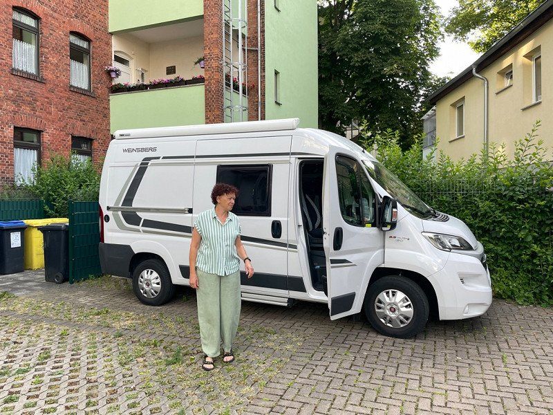
Like every year, we go on a hut tour. But this time we're still on for a week! It would be a shame to only go to the Zillertal for three days. Let's see where the wind takes us! Our "Frida" is packed and let's go!!!!
Day
Erfurt, Deutschland
50° 59' 5.2" N 11° 1' 47.6" E
50.9847679 11.0298799
• Head northeast on Wallstraße. Go for 43 m.
• Turn right onto Wallstraße. Go for 166 m.
• Turn left onto Juri-Gagarin-Ring. Go for 1.1 km.
• Turn left onto Trommsdorffstraße toward A4/A71. Go for 266 m.
• Turn right onto Stadtring (K54). Go for 302 m.
• Turn left onto Weimarische Straße (K16). Go for 8.8 km.
• Take ramp onto L1056 toward A4/Klettbach/Hayn. Go for 2.4 km.
• Take ramp onto A4 toward Dresden. Go for 50.9 km.
• Take exit 56A toward München/Berlin onto A9. Go for 336 km.
• Take the exit toward Salzburg/Innsbruck/Messe/ICM onto A99. Go for 29.4 km.
• Take exit 21 toward Salzburg/Innsbruck onto A8. Go for 41.3 km.
• Take exit 100A toward Bad Aibling/Bad Feilnbach. Go for 258 m.
• Turn right onto St2089 toward Bad Feilnbach/Au bei Bad Aibling. Go for 1.1 km.
• Take the 3rd exit from roundabout onto St2010. Go for 4.8 km.
• Turn right onto Kehlweg. Go for 183 m.
• Turn right onto Filzenweg. Go for 893 m.
• Continue on Panger Straße. Go for 1.8 km.
• Turn left onto Panger Straße. Go for 128 m.
• Arrive at Panger Straße. Your destination is on the right.
☍
479,5 km
(4 hrs. 19 min.)
Start von zu Hause
Here we go! The car is packed and we are looking forward to beautiful days! We want to go hiking, so we don't have bikes with us. In an emergency, we simply borrow some. Unfortunately, our first planned stopover fell through. The hotel is full and no longer has a parking space for us. Then we have to see how far we go.
Panger Straße 22
Reached our first station after midnight. A parking space at the Inntaler Dreieck. Pretty quiet here. There was a glass of wine and then bed! Everything fine so far!!
47° 47' 56.8" N 12° 4' 19.7" E
47.7991028 12.0721296
• Head west on Panger Straße. Go for 128 m.
• Turn left onto Panger Straße. Go for 830 m.
• Turn left onto Hauptstraße (RO25). Go for 951 m.
• Continue on Nicklheimer Straße (RO25). Go for 1.3 km.
• Continue on Neue Kreisstraße (RO25). Go for 841 m.
• Turn right onto Bahnhofstraße (RO25). Go for 83 m.
• Continue on RO25. Go for 201 m.
• Turn left onto St2363 toward A8/A93/Kufstein/Kiefersfelden/Rosenheim. Go for 138 m.
• Turn left onto St2363. Go for 2.9 km.
• Turn left and take ramp onto A93 toward Innsbruck. Go for 19.3 km.
• Continue on A12 (Inntal Autobahn). Go for 39.4 km.
• Take exit 39 toward Zillertal. Go for 477 m.
• Continue on Achensee Bundesstraße (B181). Go for 758 m.
• Continue on Zillertal Bundesstraße (B169). Go for 14.1 km.
• Pass 3 roundabouts and continue on Umfahrungstraße (B169). Go for 17.0 km.
• Continue on Stillupklamm (L6). Go for 3.2 km.
• Turn right onto Persal. Go for 45 m.
• Turn slightly left onto Persal. Go for 108 m.
• Turn right onto Persal. Go for 398 m.
• Continue on Astegg. Go for 3.0 km.
• Turn left onto Astegg. Go for 886 m.
• Turn left. Go for 5.5 km.
• Arrive at your destination.
☍
111,4 km
(1 hrs. 42 min.)
Day
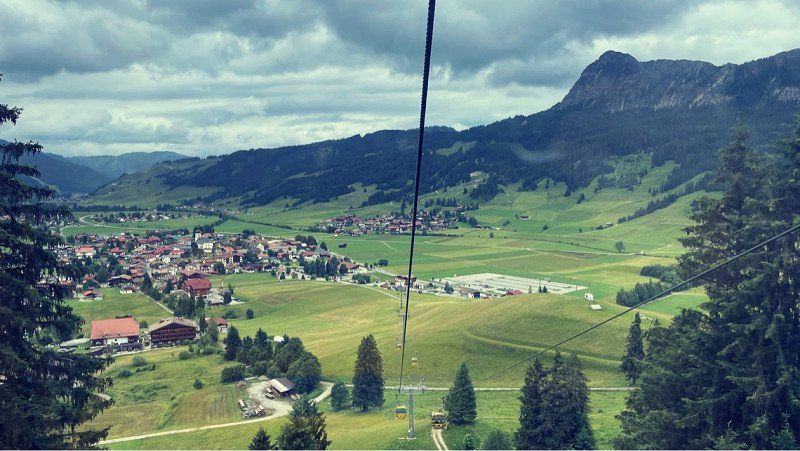
Penken (Skigebiet)
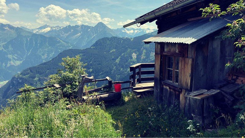
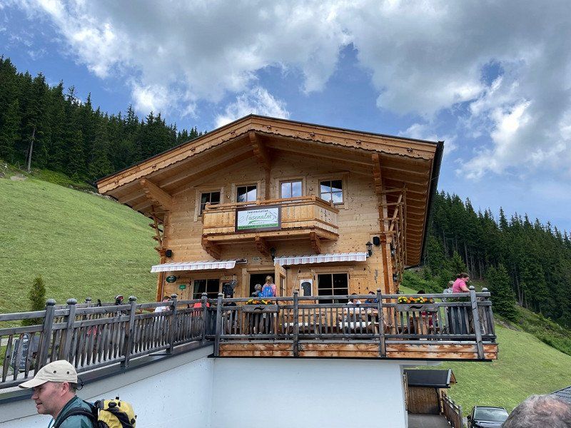
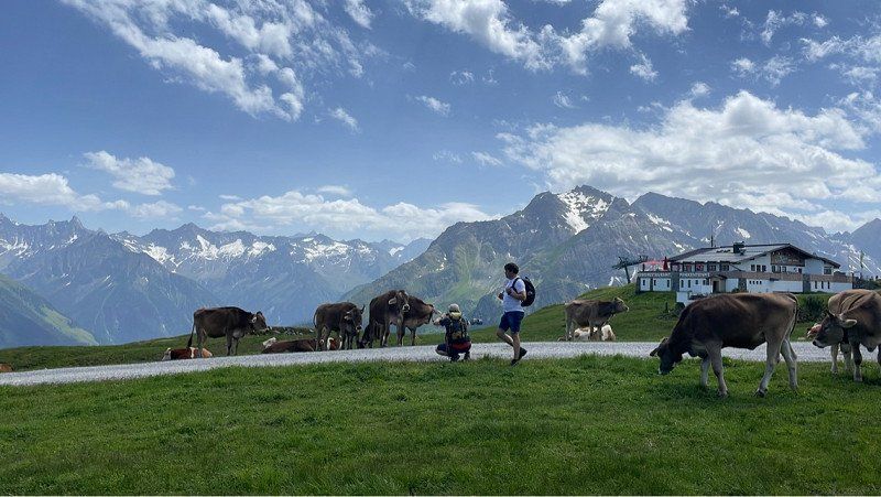
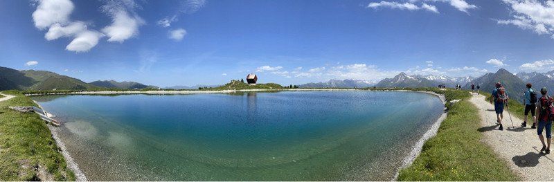
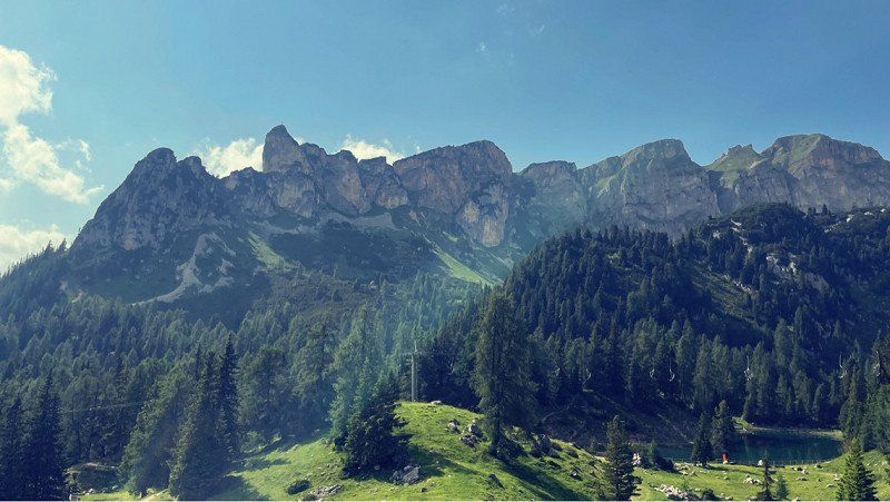
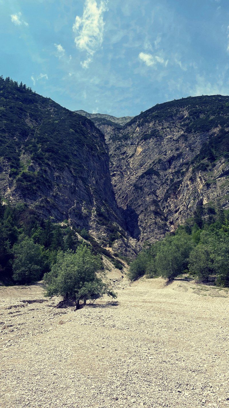
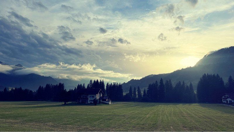
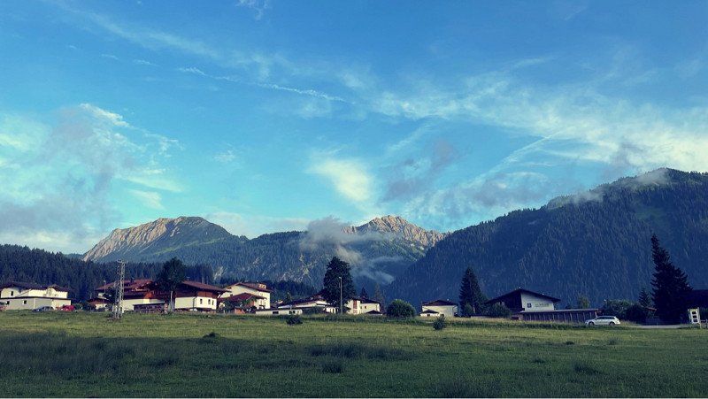
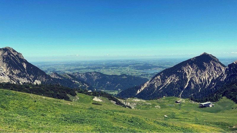
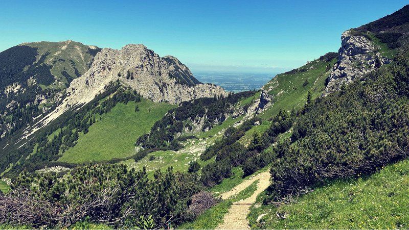
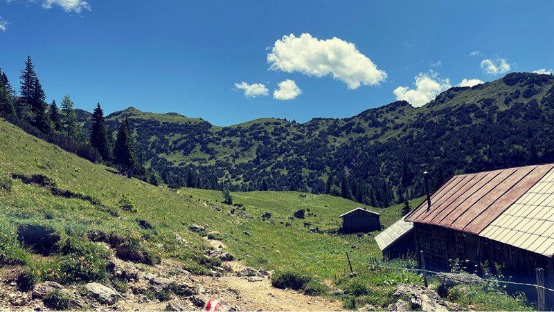
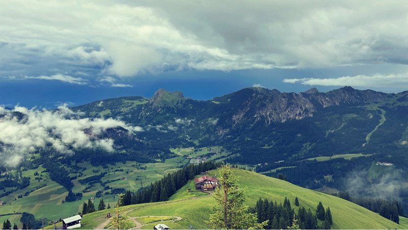
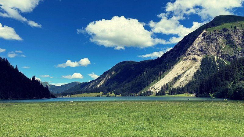
So beautiful here!! Our hiking buddies have been waiting for us. We have rented a self-catering cabin and are moving shortly. Two nights in a rustic multi-bed room. Granted and walked another round. To the Nasealm! Was very funny! Always a pleasure to be here in the mountains. With nice people too. We look forward to the next few days! The weather is a dream. Just blue skies!
47° 10' 9.7" N 11° 48' 2.3" E
47.1693726 11.8006358
• Head southwest.
• Arrive at your destination.
☍
Distance not available
(Duration not available)
Day
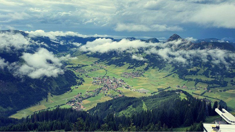
Penken (Skigebiet)
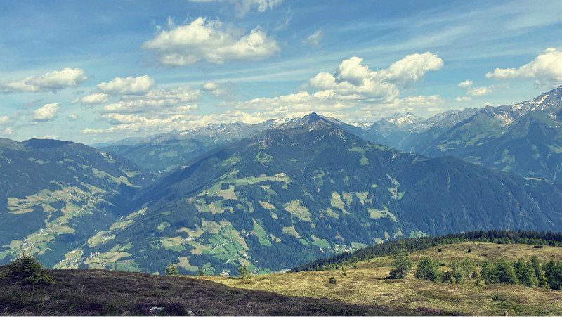
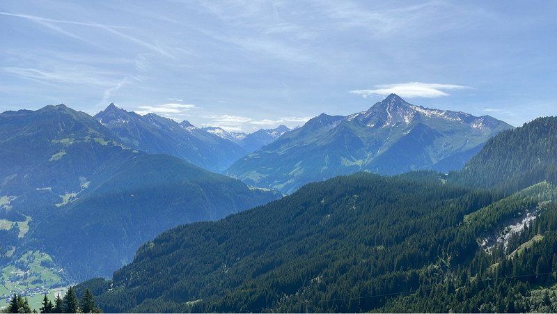
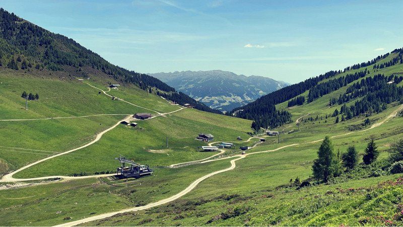
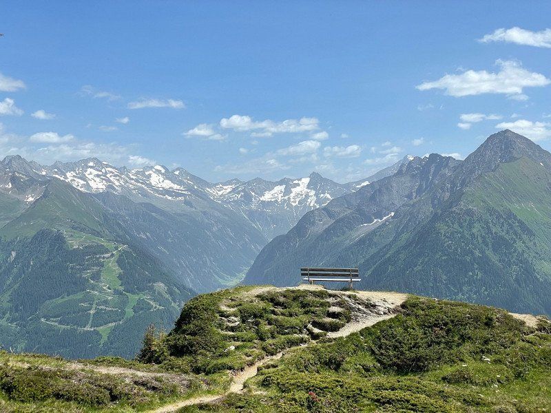
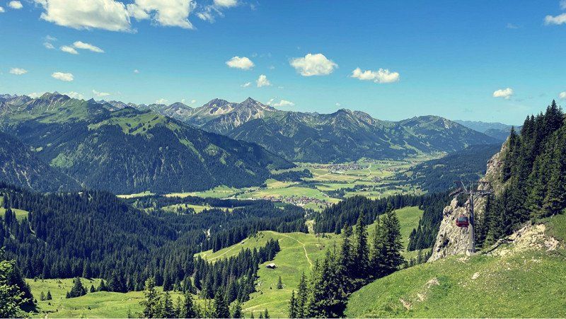
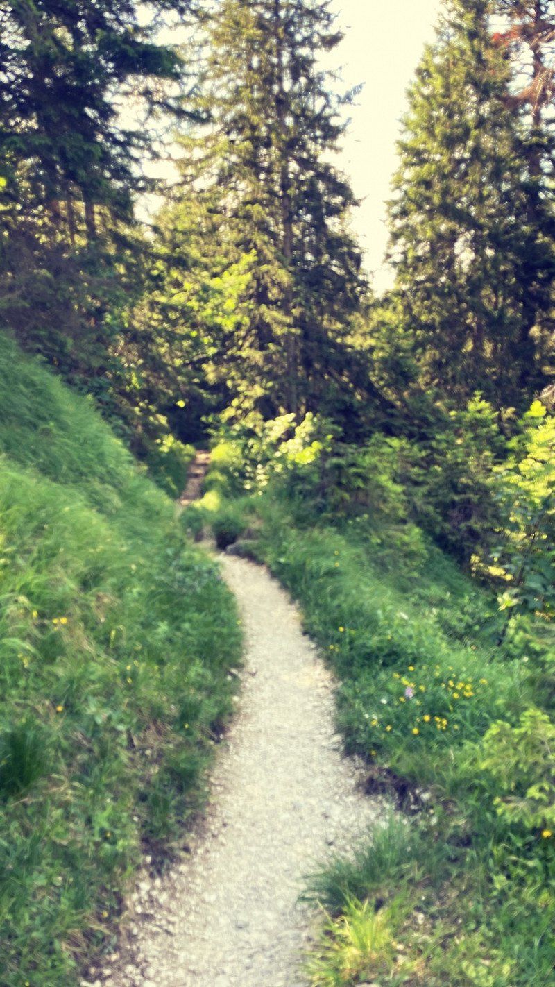
There is also hiking on the second day. A decent tour this time. But it was gorgeous! Nice view and delicious food!! Pretty broken when we got back to our hut!! The last piece went up quite a bit! We deserve a delicious meal! The grill is already burning! That was maybe tasty..... Was a really great day here on the mountain!!
47° 10' 9.7" N 11° 48' 2.3" E
47.1693726 11.8006358
• Head northeast. Go for 5.5 km.
• Turn right onto Astegg. Go for 886 m.
• Turn right onto Astegg. Go for 3.0 km.
• Continue on Persal. Go for 398 m.
• Turn left onto Persal. Go for 153 m.
• Turn left onto Persal (L6). Go for 3.2 km.
• Continue on Stillupklamm (B169). Go for 1.9 km.
• Pass 2 roundabouts and continue on Talstraße (B169). Go for 6.4 km.
• Continue on Steinfeld (B169). Go for 8.7 km.
• Take the 2nd exit from roundabout onto Gewerbegebiet (B169). Go for 14.1 km.
• Continue on Achensee Bundesstraße (B181). Go for 825 m.
• Take the 2nd exit from roundabout onto Achensee Bundesstraße (B181) toward Wiesing. Go for 10.8 km.
• Arrive at Achenseestraße (B181). Your destination is on the left.
☍
55,7 km
(1 hrs. 7 min.)
Day
Seecamping Wimmer
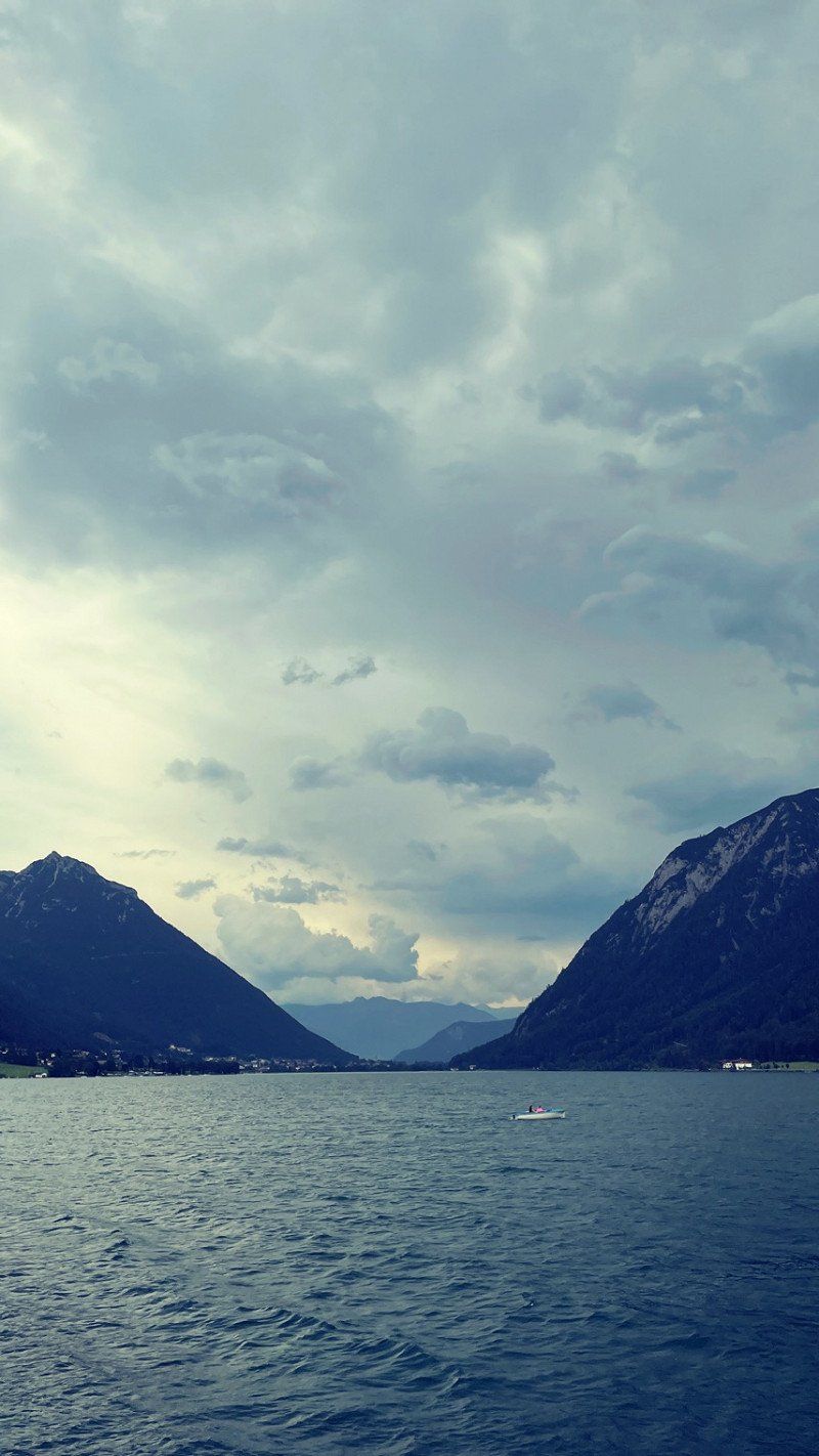
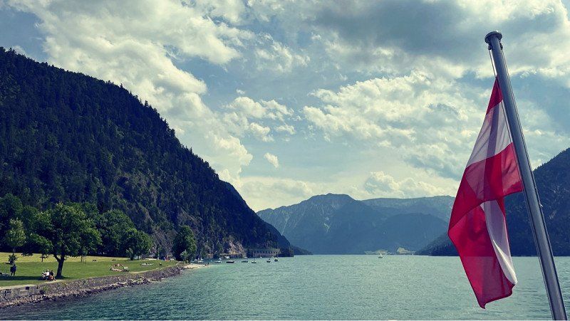
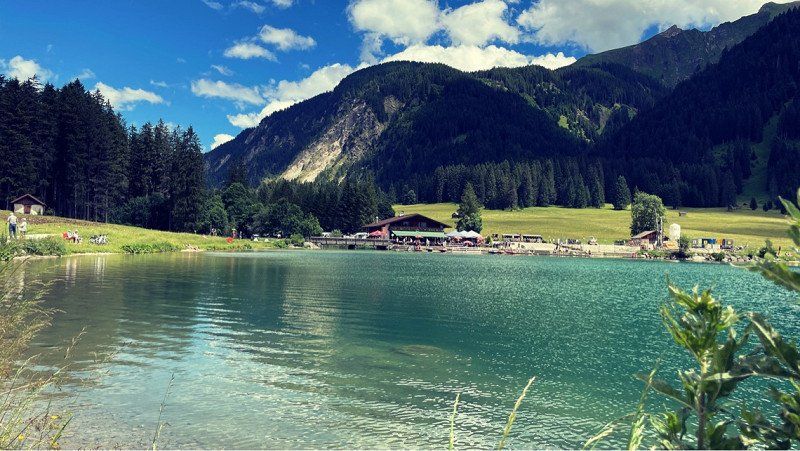
Phew, that's a heat in the valley. Have driven from the Zillertal and are looking for cooling off at the Achensee. Good operation on the streets and also here at the lake. Got a great pitch and are clearing out. We look forward to beautiful days here at the lake. Two days are planned. The location is really gorgeous. A few steps and you are on the water. We also used it right away and went swimming. There are free bathing bays and also a public beach. With children certainly the better choice. The water was very clear and cool. A boon!
Achenseestraße 73
47° 25' 57.3" N 11° 44' 5.8" E
47.4325867 11.7349331
• Head northwest on Achenseestraße (B181). Go for 41 m.
• Arrive at Achenseestraße (B181). Your destination is on the left.
☍
0,0 km
( )
Day
Seecamping Wimmer, Achensee Straße, Maurach, Österreich
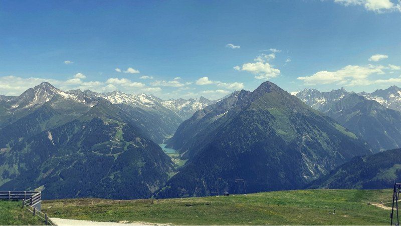
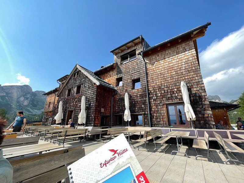
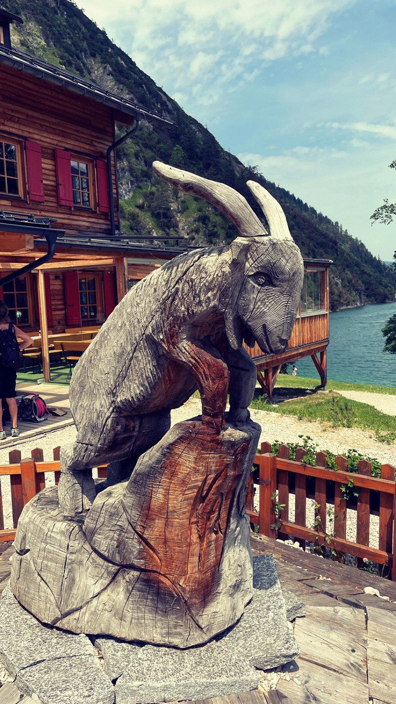
And another beautiful day here at the Achensee. Went hiking today. You can board right here at the seat. Goes up the mountain quite steeply. At the top, cool drinks and delicious food await the thirsty hiker. Then we went on to the Erfurter Hütte. Located directly at the lift. It was so beautiful up there! Another cyclist drunk and took the train down. Ate something else in town. At "Marios Imbiss" you are in good hands. This hospitality inspires again and again! What a beautiful day. Just stay one more day. Tomorrow we're going on the water. looking forward to it!
Achensee Str. 75, 6212 Maurach, Österreich
47° 25' 59.1" N 11° 44' 5.4" E
47.4330769 11.7348436
• Head southeast on Achenseestraße (B181). Go for 544 m.
• Turn right onto Dorfstraße. Go for 948 m.
• Take the 1st exit from roundabout onto Pertisauer Straße (L220). Go for 2.5 km.
• Continue on Pertisauer Straße (L220). Go for 201 m.
• Continue on Pertisauer Landesstraße (L220). Go for 929 m.
• Turn left onto Pertisau (L220). Go for 716 m.
• Turn left. Go for 51 m.
• Arrive at your destination on the left.
☍
5,9 km
( 8 min.)
Day
Achensee - Pertisau, Naturparkstrasse, Pertisau, Österreich
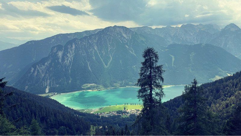
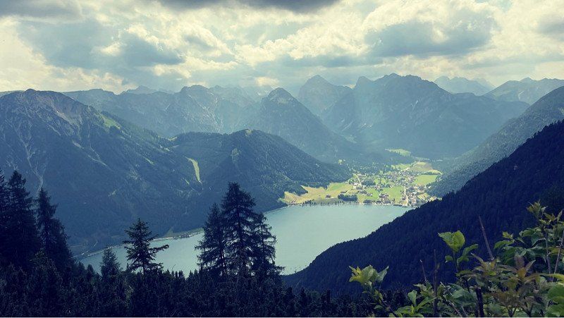
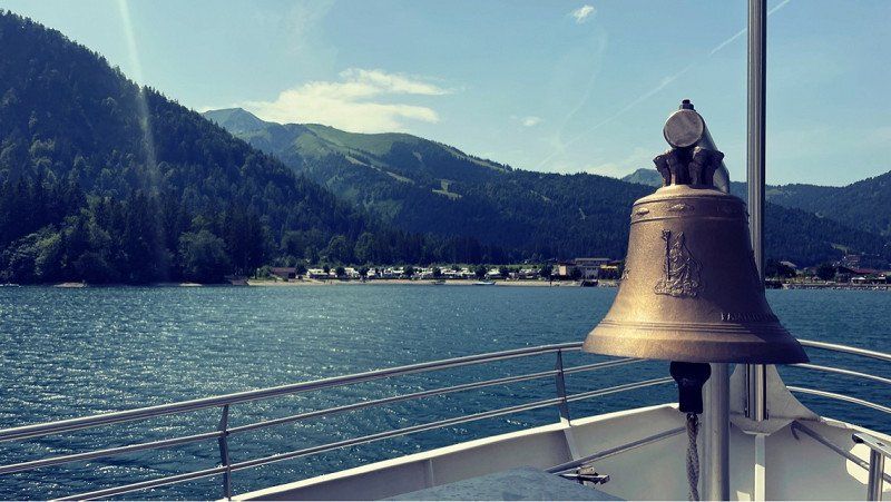
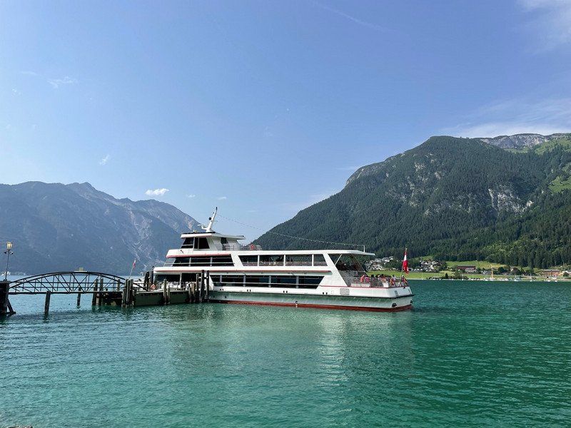
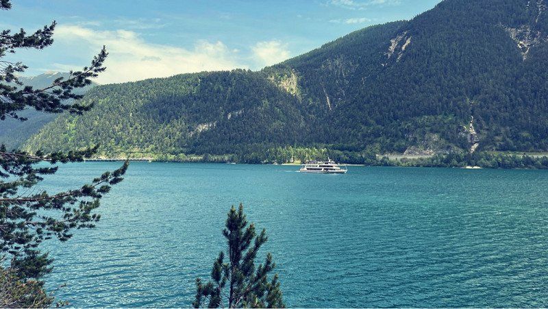
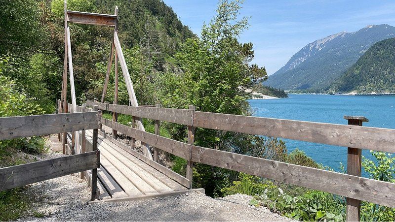
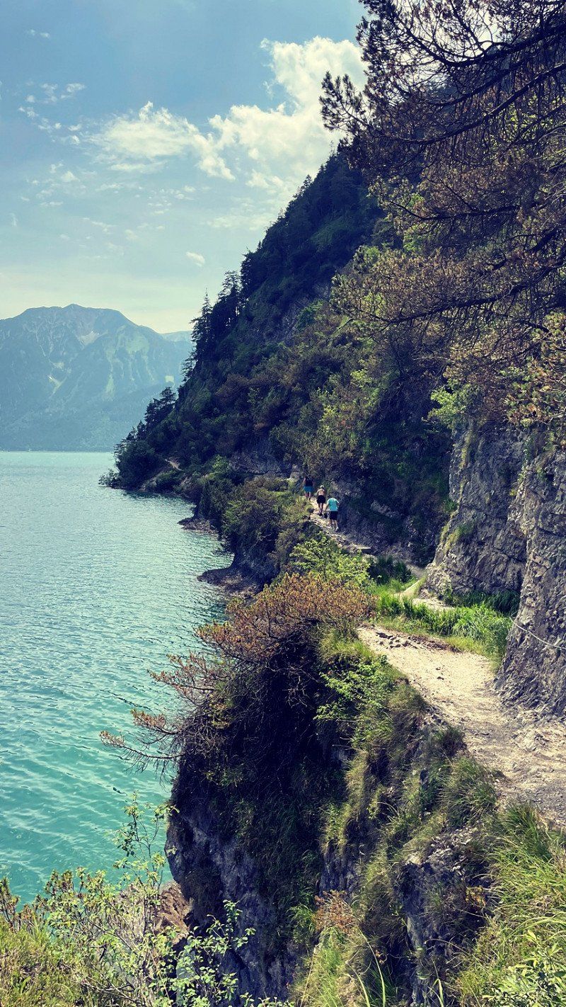
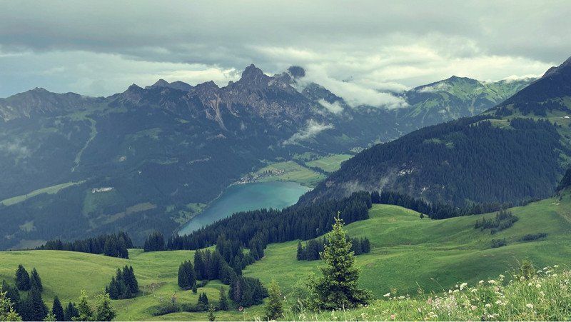
Today is the last day here at the lake. Were hiking and went by ship. You can combine that perfectly. Jump up and run back. With the day ticket you can sail the whole day and simply explore different areas of the lake. We think it's a good idea. The hiking trails are much nicer on the west side. There is no road there and it is super quiet. Beautiful views of the lake and the adjacent mountains. It really doesn't get much nicer than this. A dream. In the evening there was a great thunderstorm. It's always something special in the mountains. I like it a lot!! We pack up and had a great evening under the protective awning. We'll continue tomorrow!!
Naturparkstrasse 31, 6213 Pertisau, Österreich
47° 26' 13.3" N 11° 41' 48.4" E
47.4370331 11.6967843
• Head north. Go for 16 m.
• Turn left toward Naturparkstraße/L220. Go for 26 m.
• Turn right onto Naturparkstraße (L220). Go for 1.7 km.
• Continue on Pertisauer Straße (L220). Go for 201 m.
• Continue on Pertisauer Landesstraße (L220). Go for 2.5 km.
• Take the 1st exit from roundabout onto Dorfstraße (L7). Go for 5.0 km.
• Continue on Tratzbergstraße (L215). Go for 5.0 km.
• Turn right onto Kirchfeld. Go for 285 m.
• Arrive at Kirchfeld. Your destination is on the left.
☍
14,6 km
( 19 min.)
Day
Wolfsklamm
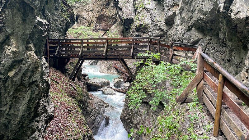
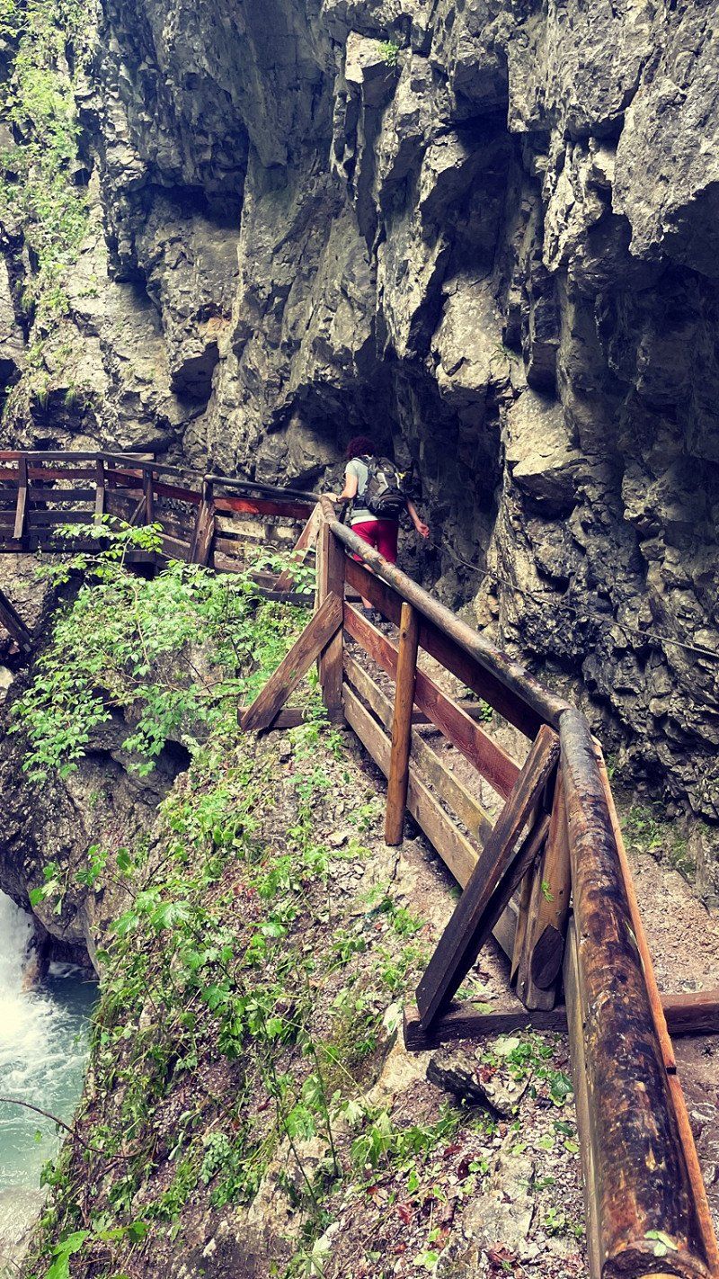
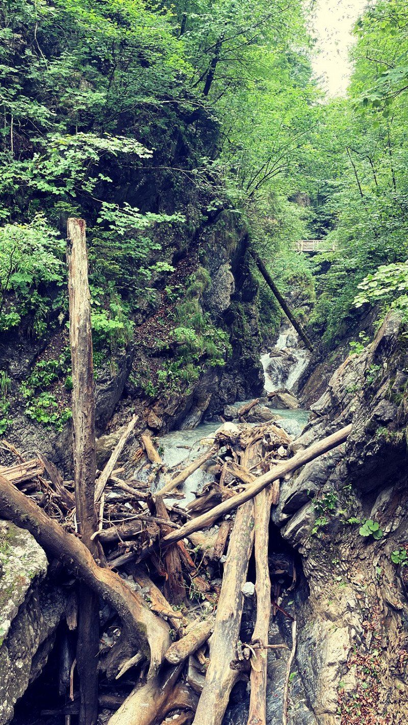
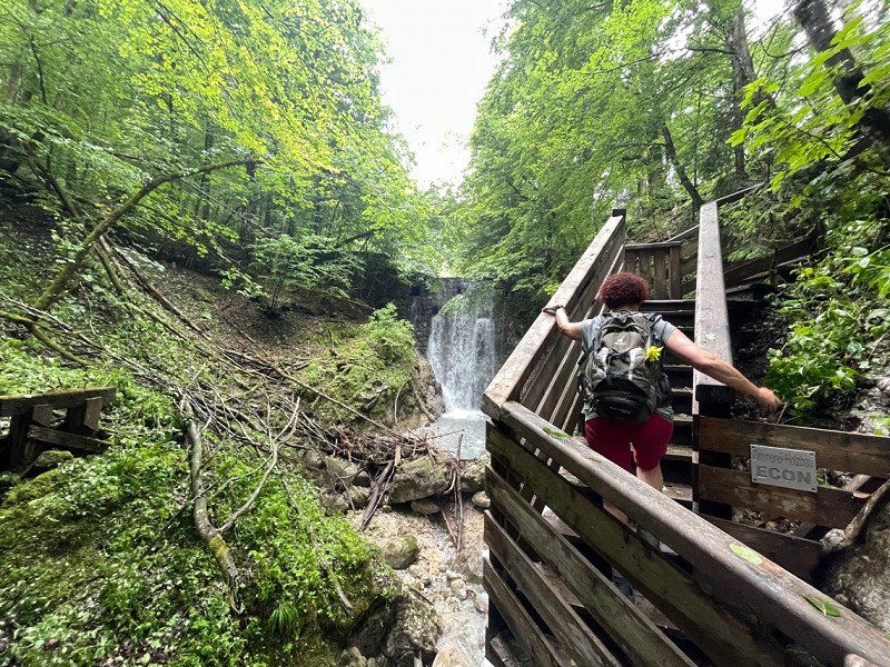
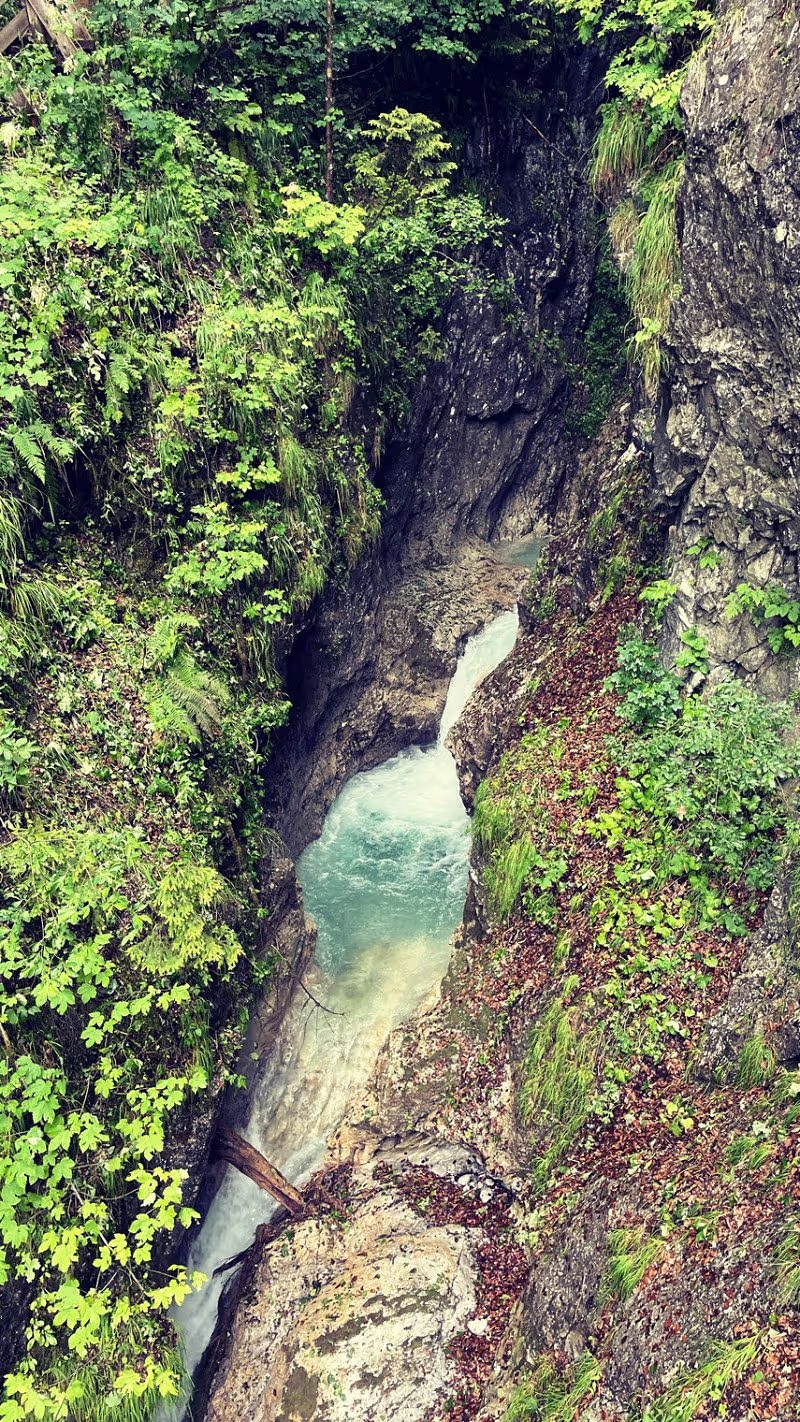
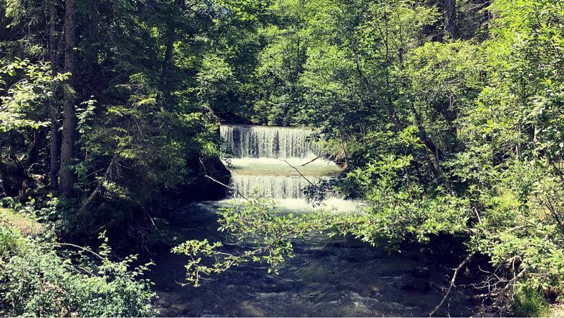
On the way to the next campsite, we made a short stop. The Wolf's Gorge is a worthwhile destination. It should be the most beautiful gorge in Tyrol. And so she was. It takes a while before things really get going. But then the gorge is just breathtaking! The circular route is about 7 km. Goes well. We left out the monastery on top of the mountain. Didn't have enough time. But you should definitely take it with you!! You can give yourself the parking lot directly at the gorge. Is very crowded and also chargeable. At the church is a free place. It's a great start and you're in the gorge in a few minutes. The toll is 5 euros. Money well spent. Please think of good shoes. It can be very slippery. There are also a few meters of altitude. Some condition is necessary. But really nice here!
Oberdorf 86
47° 22' 18" N 11° 43' 4.7" E
47.3716736 11.7179762
• Head southeast on Kirchfeld. Go for 32 m.
• Turn right onto Oberdorf. Go for 316 m.
• Turn right onto Oberdorf (L215). Go for 1.6 km.
• Take the 4th exit from roundabout onto Au. Go for 295 m.
• Take ramp onto A12 (Inntal Autobahn) toward Innsbruck. Go for 64.6 km.
• Take exit 113 toward Mötz/Reutte/Fernpass. Go for 319 m.
• Turn right onto Mötzer Landesstraße (L236). Go for 4.8 km.
• Take the 2nd exit from roundabout onto Mieminger Bundesstraße (B189) toward Reutte/Fernpaß/Nassereith. Go for 13.4 km.
• Keep left onto Mieminger Bundesstraße (B189) toward Reutte/Garmisch. Go for 91 m.
• Continue on Fernpass Bundesstraße (B179). Go for 36.0 km.
• Take ramp toward Reutte Süd/Tannheimertal/Lechtal. Go for 203 m.
• Continue on Innsbrucker Straße (B198) toward Reutte. Go for 614 m.
• Take the 2nd exit from roundabout onto Innsbrucker Straße (B198). Go for 539 m.
• Turn left onto Kög (L260). Go for 8.3 km.
• Turn left onto Lechtal Bundesstraße (B198). Go for 210 m.
• Take the 1st exit from roundabout onto Kirchplatz (B199) toward Sonthofen/Weißenbach Zentrum. Go for 12.7 km.
• Take the 1st exit from roundabout onto Gräner Landesstraße (L261) toward Pfronten/Grän. Go for 1.8 km.
• Turn left. Go for 63 m.
• Arrive at your destination on the left.
☍
145,9 km
(2 hrs. 5 min.)
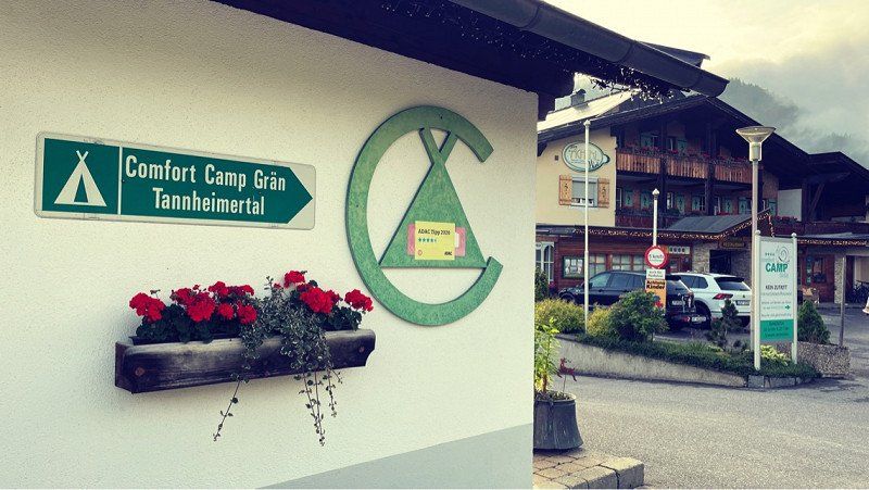
Comfortcamp Grän Tannheimertal
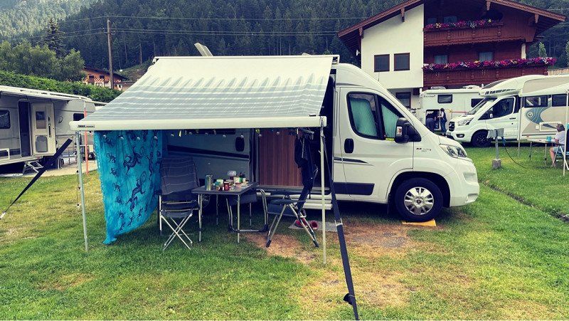
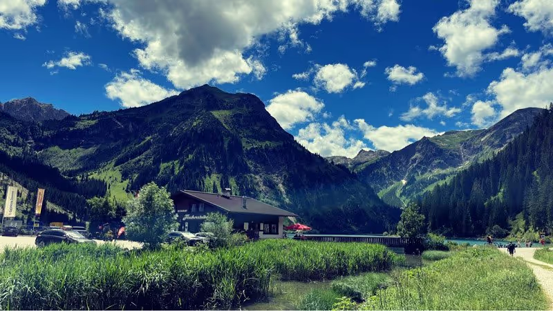
So, that's the second stop of the day. How lucky we were! The gorge committed in the best weather and then came great to the Tannheimer Tal. Even the Fernpass was free. Great. Then it started to rain here. Finally some cooling. Those days were unbearably hot. Got our place straight away. A bit muddy here due to the rain. Don't put anything out there. Everything is quite large and smartly furnished. If you come from a simple place, it is already strikingly luxurious here. Also clean and tidy. The registration team is friendly and happy to give out tips. We want to go hiking. With this weather we didn't feel like cooking anymore and went straight to the restaurant here on the square. A good deal and very quick too. It was delicious too. Then explore the area. You can't see much from here. Do I have to do it again on my cell phone in the evening? Hope the WiFi works. Look forward to tomorrow!
Engetalstraße 13, 6673, Grän, Österreich
47° 30' 40.6" N 10° 33' 16.9" E
47.5112900 10.5546900
• Head toward Grän. Go for 63 m.
• Turn right onto Grän (L261). Go for 1.0 km.
• Turn left onto Am Kohlbichl. Go for 97 m.
• Turn left onto Füssner-Jöchle-Straße. Go for 620 m.
• Turn slightly right onto Füssner-Jöchle-Straße. Go for 34 m.
• Continue on Füssner-Jöchle-Straße. Go for 166 m.
• Arrive at Füssner-Jöchle-Straße.
☍
2,0 km
( 3 min.)
Day
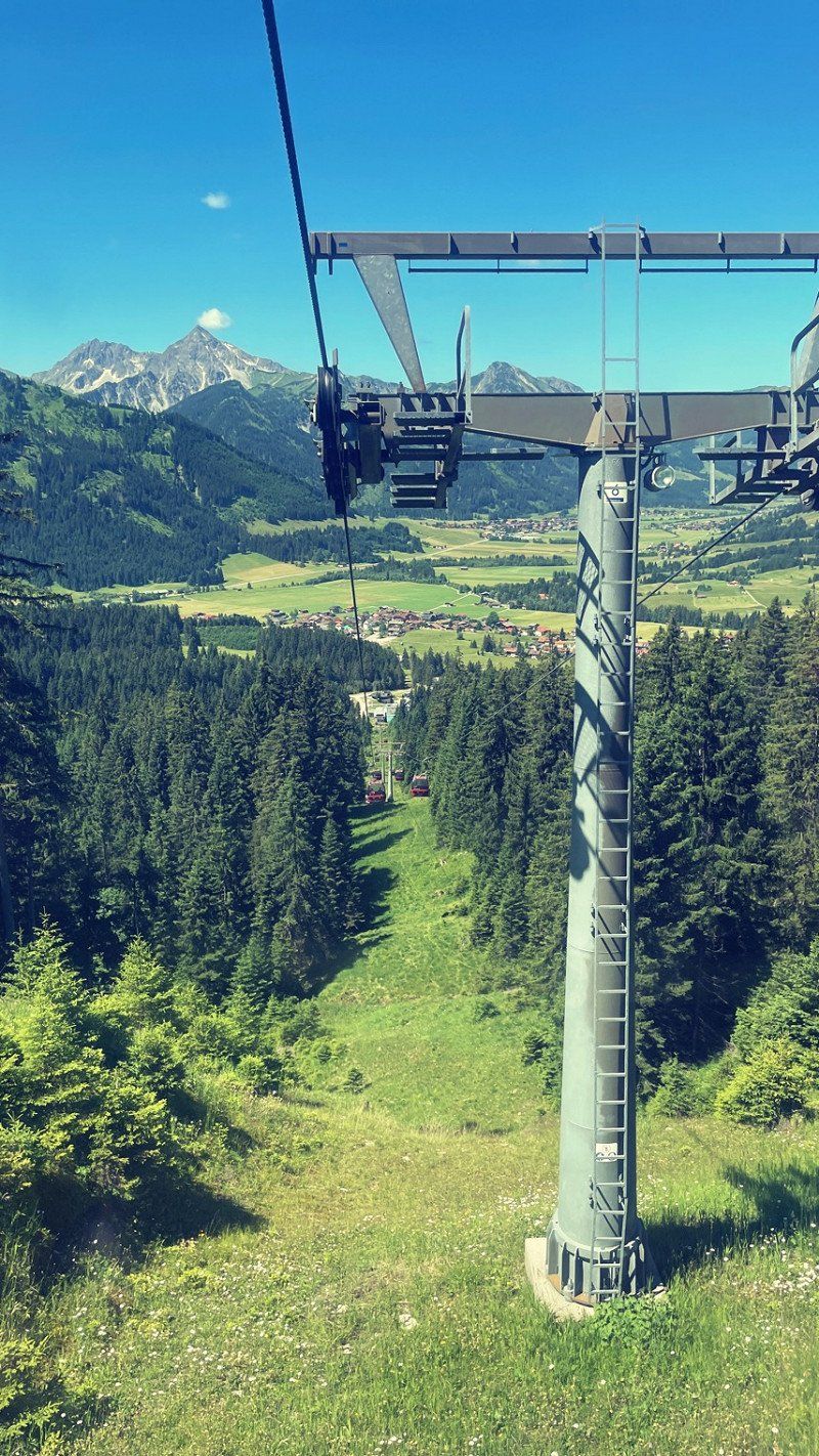
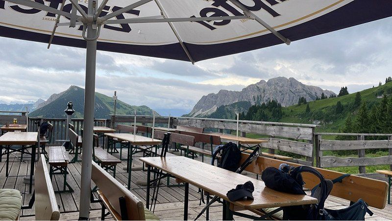
Sonnenalpe
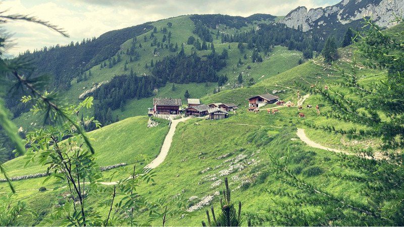
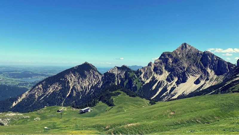
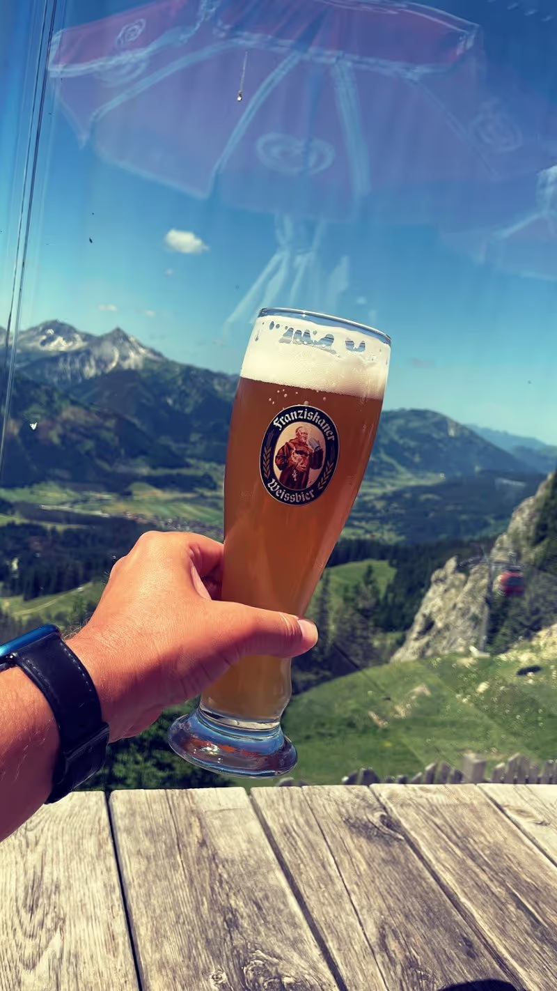
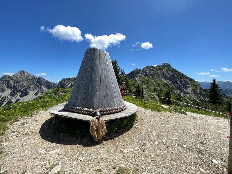
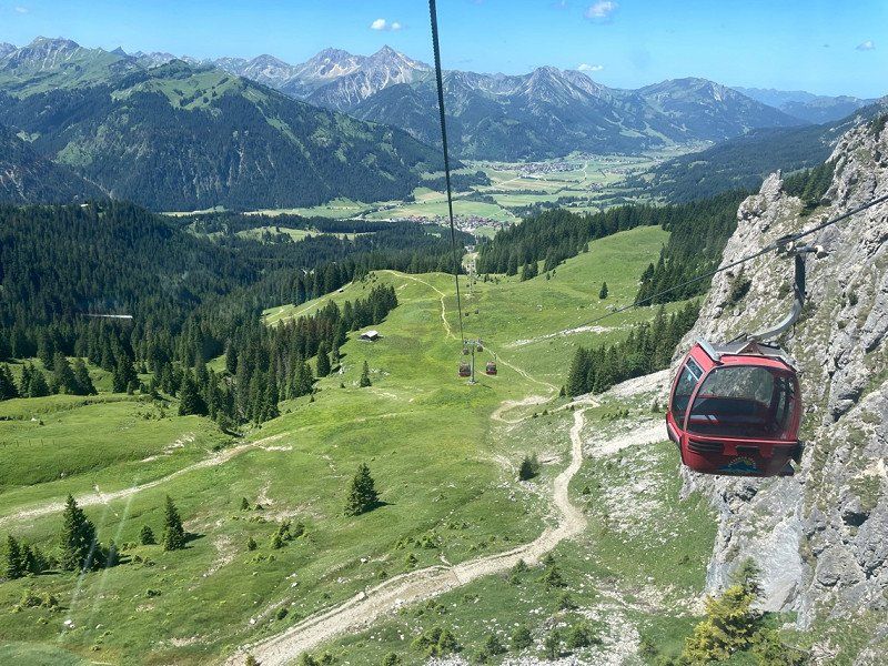
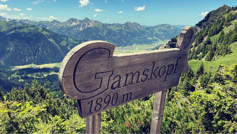
What a weather…. Today we took the lift up the mountain. Actually wanted to hike to the first hut. Our neighbor said, however, that the path would be too steep and we should rather take the train. It is not far from the campsite to the valley station. The trip is included in the price of the campsite. Very cool. The ride is very nice. What a great mountain world. The restaurant is a recommendation. Very tasty and nice people. Money can't buy the view anyway. A dream. Short break with beer and Kaiserschmarren and on we go. Want to go to the Bad Kissingen Hütte!
Füssner-Jöchle-Straße 10
47° 30' 47" N 10° 35' 45" E
47.5130615 10.5958353
• Head northeast on Füssner-Jöchle-Straße. Go for 24 m.
• Continue on Füssner-Jöchle-Straße. Go for 176 m.
• Turn slightly left onto Füssner-Jöchle-Straße. Go for 620 m.
• Turn right onto Am Kohlbichl. Go for 97 m.
• Turn right onto Gräner Landesstraße (L261). Go for 1.4 km.
• Turn right onto Enge. Go for 255 m.
• Turn slightly right onto Enge. Go for 16 m.
• Turn right onto Enge. Go for 205 m.
• Arrive at Enge.
☍
2,8 km
( 4 min.)
Bad Kissinger Hütte, Österreich
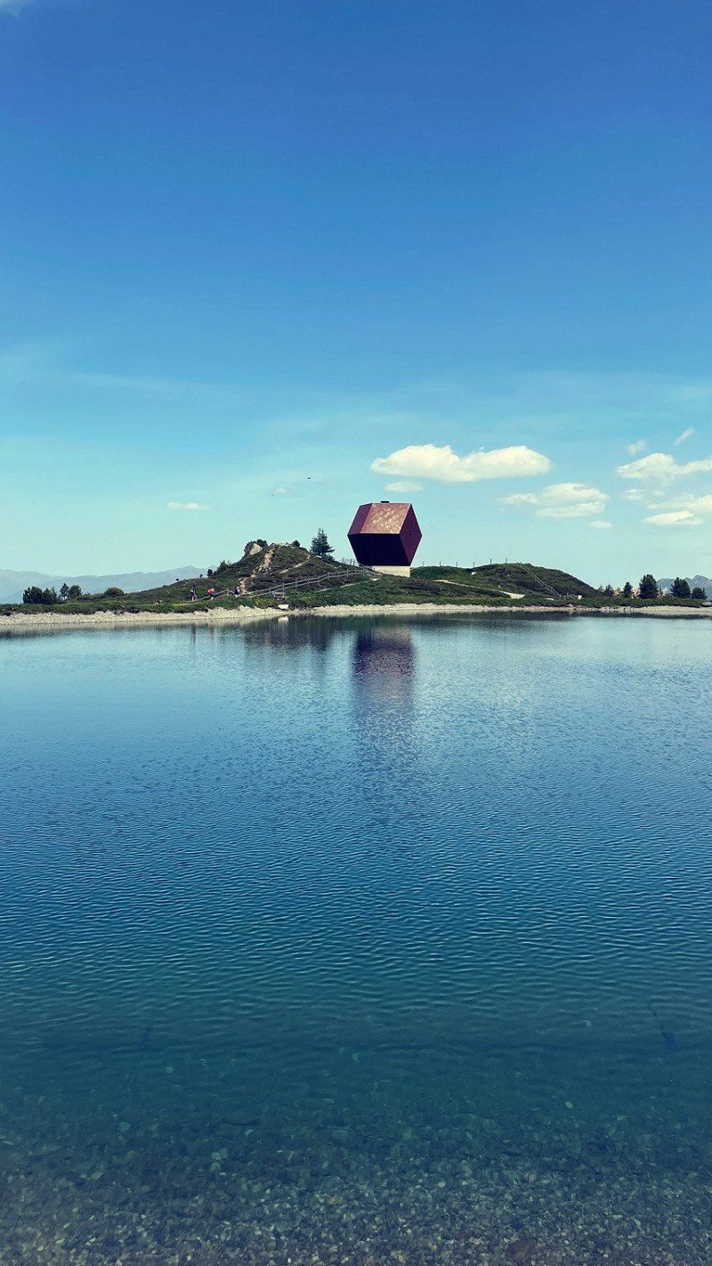
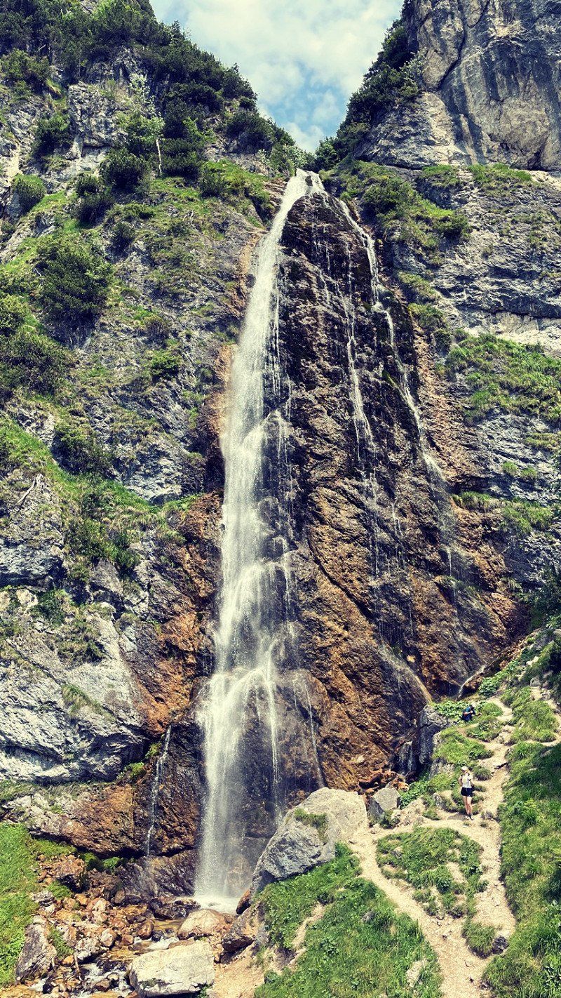
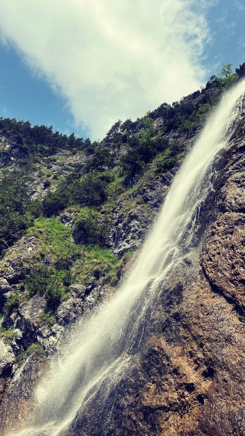
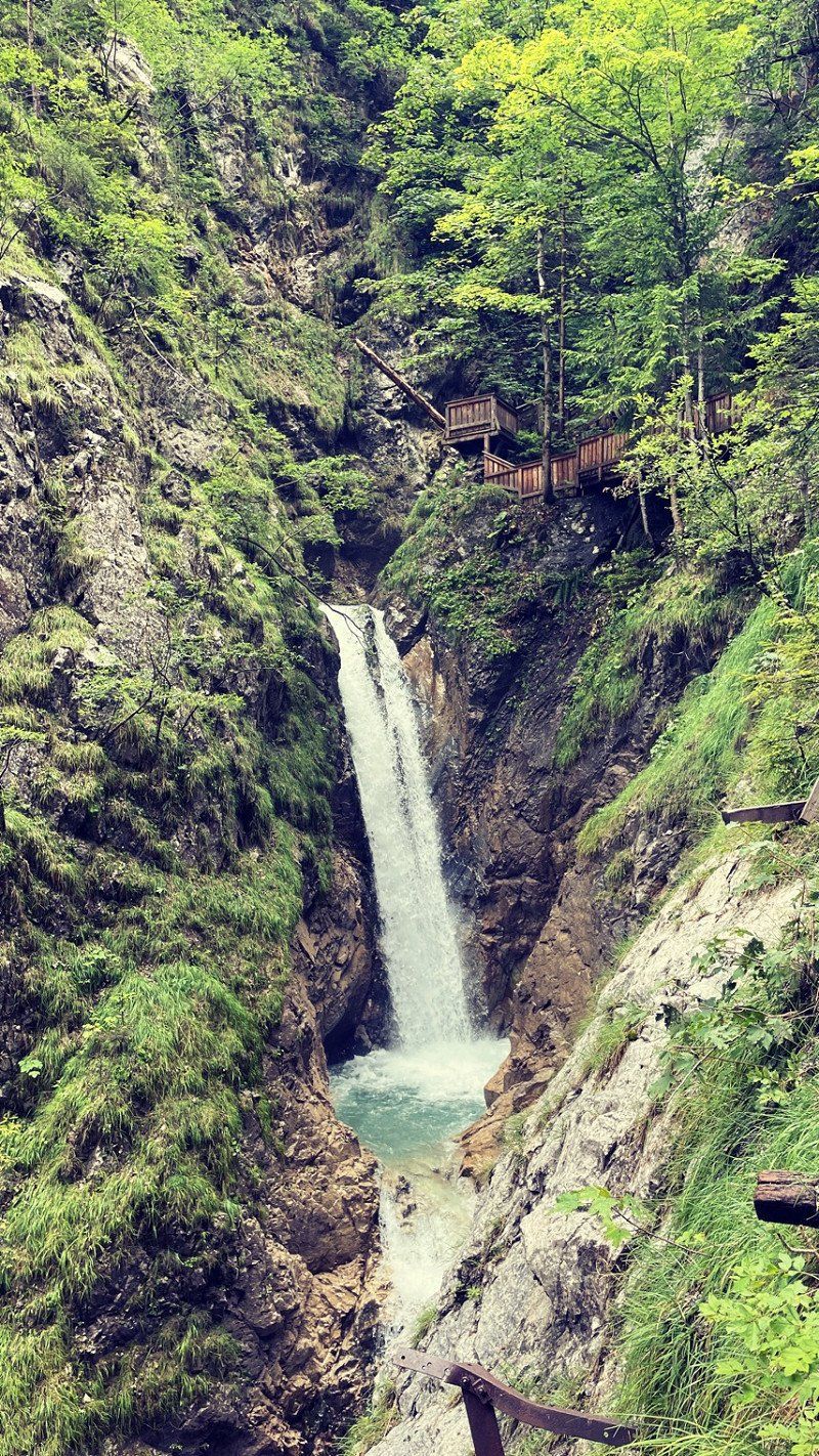
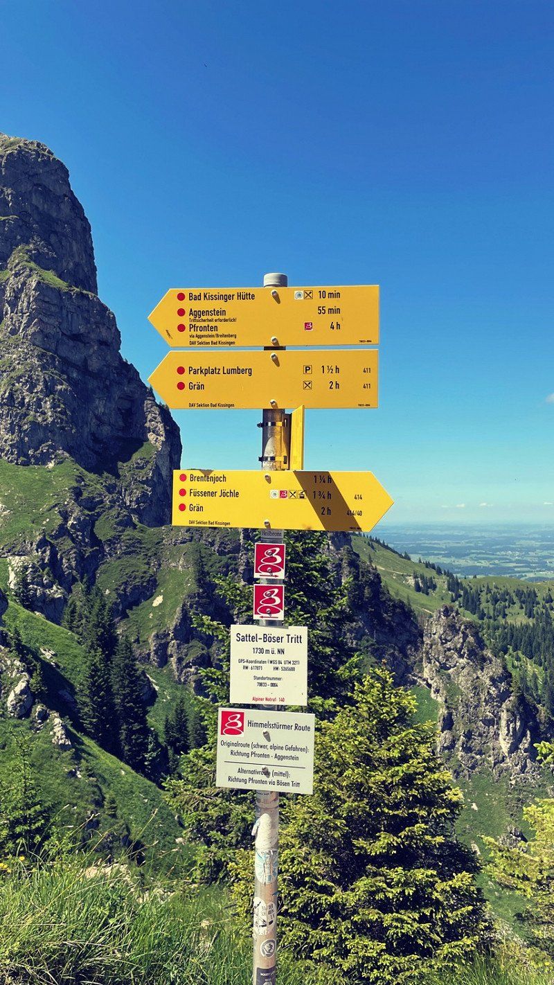
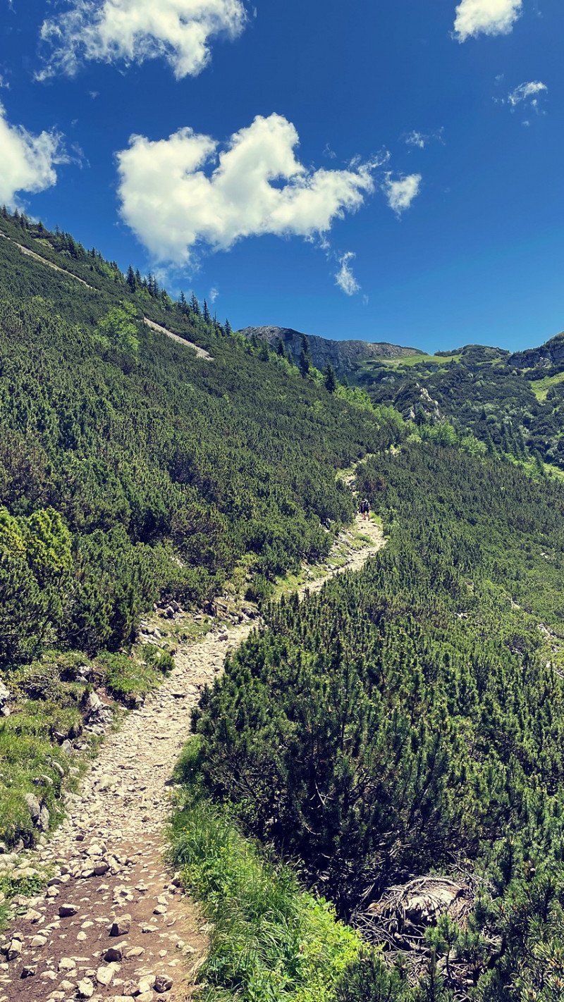
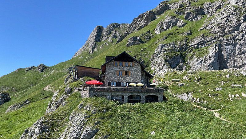
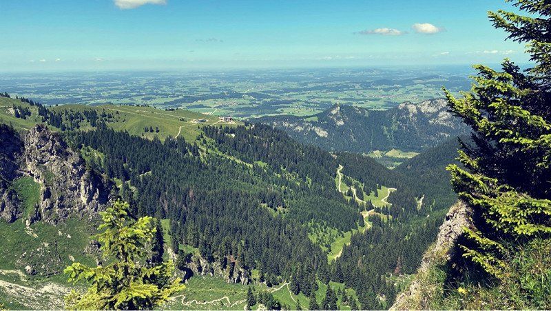
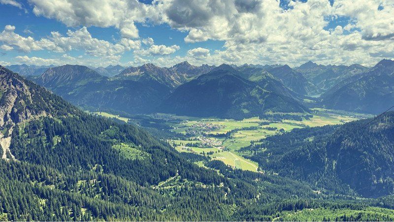
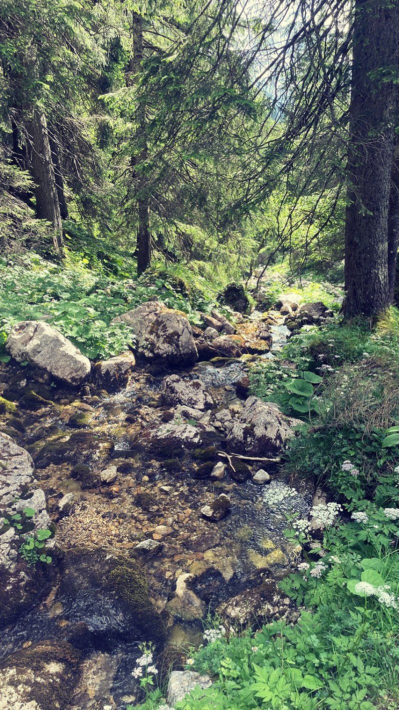
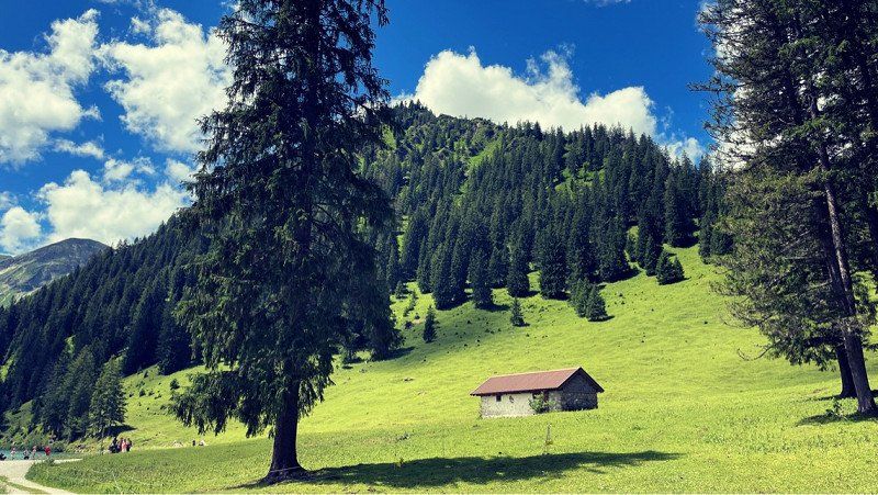
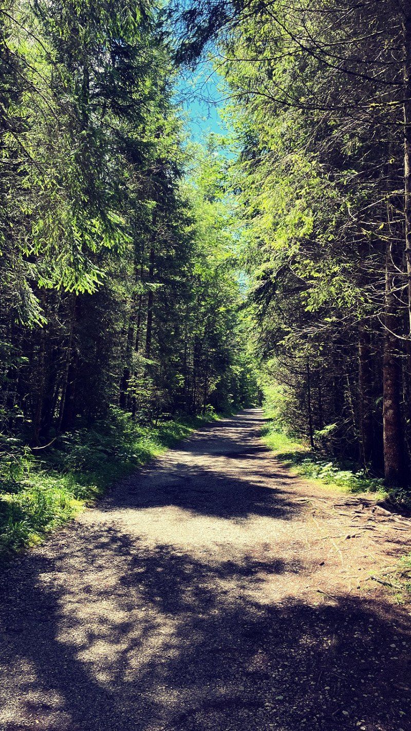
Well, that was a hike over here... oh dear! Over hill and dale. Walked up and down a lot. If you then have to walk everything back, you should start earlier. The way back to the train will probably take almost three hours. And good shoes should be included. The path is very rocky. Certainly a challenge in the rain! But a really nice way over there. Once at the top, there is something to drink first. And again a great view. This is where the border with Germany runs. There are even landmarks! Cool. You can always jump over and over! :-) We were no longer on the neighboring summit. It takes an extra hour. We didn't have that anymore. If you still have the 2 hours, you should not shy away from the way! The panoramic view is spectacular! In any case, we descended into the valley via hiking trail 40. That was the best idea ever. A great path through the forest that ends almost at the campsite. What a great day!! Quickly changed and jumped into the indoor pool! That might have done you good... A nice place with all amenities! That also has its price. But if you use everything you get away quite cheap. The guest card is also valid on the hiking buses, in the outdoor pool and in three mountain railways. That's really great. It also motivates you to perceive everything.
47° 31' 28.9" N 10° 33' 36.5" E
47.5246835 10.5601501
• Head southeast on Enge.
• Continue on Am Lumberg. Go for 198 m.
• Turn right onto Am Lumberg. Go for 278 m.
• Turn left onto Grän (L261). Go for 1.9 km.
• Take the 1st exit from roundabout onto Tannheimer Bundesstraße (B199). Go for 2.5 km.
• Turn left onto Vilsalpseestraße (L262) toward Tannheim. Go for 102 m.
• Take the 2nd exit from roundabout onto Vilsalpseestraße (L262). Go for 686 m.
• Continue on Vilsalpseestraße (L262). Go for 269 m.
• Turn left toward Schmieden. Go for 134 m.
• Continue on Schmieden. Go for 297 m.
• Arrive at Schmieden.
☍
6,5 km
( 9 min.)
Day
Neunköpfele
Today the weather wasn't the best and that's why we took the train again! On foot from the campsite to the valley station in Tannheim! About four km. The trail and the ride were a lot of fun. Once at the top, we wanted to run a nice lap and possibly get off again. A heavy thunderstorm threw a spanner in the works. A downpour with lightning and thunder. Nothing more with mountain tours. Nice sitting in a hut and waiting. There are worse ways to spend your time! Yeast and Obstler. Plus nice hikers. So time flies by. After the rain, the sun came out again and you could go outside again. Are then still on the summit and could enjoy the view! What a view!! Well, it was already late and we took the gondola down. A stroll through town and the bus ride ended the very nice day! Were swimming in the evening. That feels good!!
6675
47° 28' 55.7" N 10° 32' 33.5" E
47.4821472 10.5426440
• Head northwest on Schmieden. Go for 431 m.
• Turn left onto Vilsalpsee Landesstraße (L262). Go for 3.1 km.
• Arrive at Vilsalpseestraße (L262).
☍
3,5 km
( 7 min.)
Day
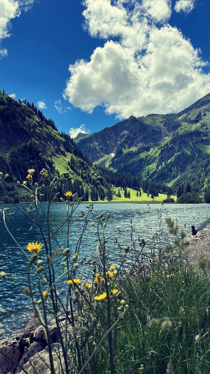
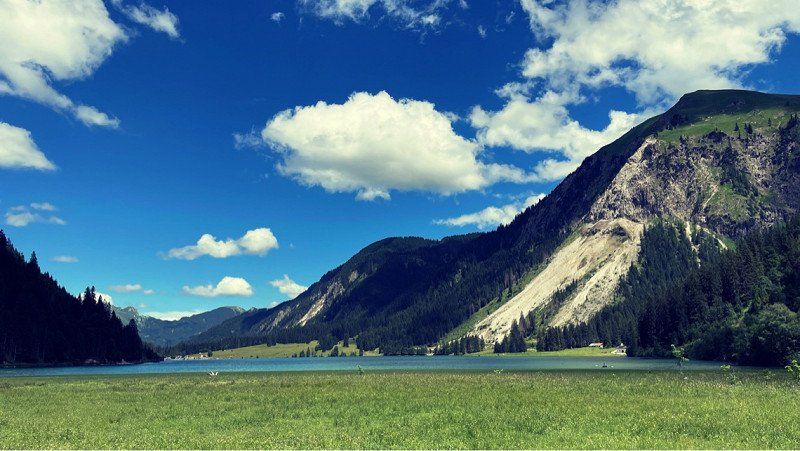
Vilsalpsee, Österreich
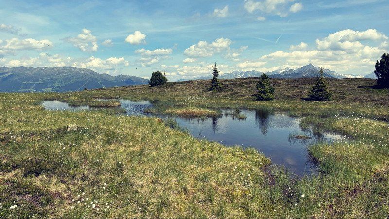
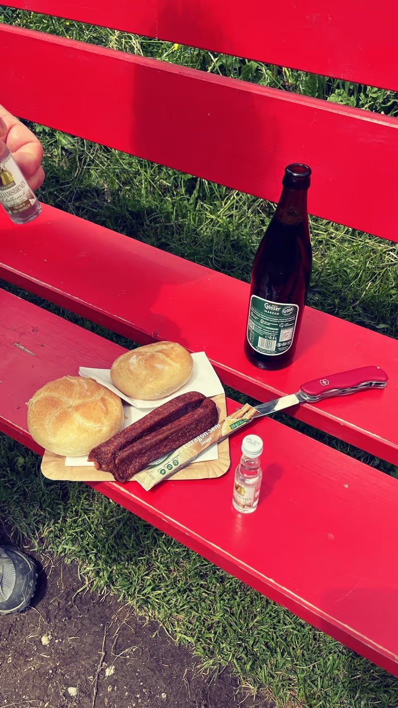
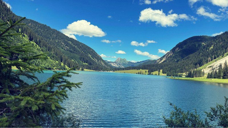
So, there it is now - our last day of vacation. Cleared the place in the morning and parked the car in a parking lot in Tannheim. There is plenty of space at the lift. You can come a little later. Camp must be vacated by 11:30am. A really good time. It also fills up easily at the weekend. No wonder given the weather. It's supposed to be very hot in the valley. The temperatures are still very pleasant on the mountain. Packed the backpack and hiked to the Vilsalpsee. It's a good 13 km if you circle it. You should definitely do that! Fantastic views of the surrounding mountains and of course the picturesque lake. A classic cliché with the pastures and the cows. But that's part of it. Have made a nice snack at the lake. With Krakauer, beer and rolls. Hmm... It has a kiosk and a fish restaurant there. Depending on your mood, you can feed yourself. And if your legs don't want to keep up, the bus or train will bring the tired hiker back to Tannheim. Discovered a great cheese dairy on the way back and spent the last holiday euros. What could be better than being able to experience the holiday taste again at home? We already knew the cheese factory and bought our favourites. Delicious fir honey has also found its way into the backpack. hmmm... Visited for a little coffee in town. There was also an apple strudel and a really good coffee. In addition again the extremely nice hospitality. Like visiting friends. But we couldn't extend the day any longer and hiked to the car. Enjoy the mountains and the blue sky again. We always like to drive anti-cyclically and that's why we start on Saturday evening. The day trippers are already sitting at the news and we start our Frida. As planned, the streets have been swept empty and we are making good progress. In thoughts still on the mountains. But after the holiday is before the holiday. The mountains are always a worthwhile destination. Here you can quickly find inner peace and quickly realize how small we actually are and how important nature is to us. It's all worth getting.
Vilsalpsee, 6675, Österreich
47° 27' 47.8" N 10° 30' 10.4" E
47.4632639 10.5028896
• Head northeast on Vilsalpseestraße (L262). Go for 25 m.
• Turn right onto Vilsalpseestraße (L262). Go for 3.3 km.
• Continue on Bogen (L262). Go for 656 m.
• Take the 2nd exit from roundabout onto Oberhöfen (L262). Go for 134 m.
• Turn left onto Tannheimer Bundesstraße (B199). Go for 7.3 km.
• Continue on Paßstraße (B308). Go for 3.2 km.
• Take the 1st exit from roundabout onto B310. Go for 11.4 km.
• Continue on B310. Go for 4.5 km.
• Pass 2 roundabouts and continue on B310. Go for 3.1 km.
• Take ramp onto A7 toward Ulm/Kempten. Go for 300 km.
• Take exit 99 toward Bamberg/Schweinfurt/Werneck/Erfurt onto A70. Go for 6.6 km.
• Take exit 4 toward Erfurt/Suhl/Bad Neustadt/Schweinfurt-West onto A71. Go for 142 km.
• Take exit 12 toward Dresden/Erfurt-West onto A4. Go for 4.0 km.
• Take exit 46 toward Erfurt-West/Erfurt-Zentrum/Erfurt-Molsdorf/Eischleben/Zentrum/Waltersleben. Go for 335 m.
• Turn right onto L3004 toward Erfurt-Zentrum/Erfurt-Waltersleben. Go for 7.8 km.
• Keep left onto Martin-Andersen-Nexö-Straße (K35) toward Klinikum. Go for 1.5 km.
• Continue on Löberstraße. Go for 412 m.
• Turn right onto Juri-Gagarin-Ring toward Zentrum/Altstadt. Go for 1.9 km.
• Turn right onto Wallstraße. Go for 166 m.
• Turn left onto Wallstraße. Go for 43 m.
• Arrive at Wallstraße. Your destination is on the left.
☍
498,7 km
(4 hrs. 57 min.)
Day
Erfurt, Deutschland
Traveling in a mobile home is part of the holiday. All the conveniences of a mobile home are included. We have so much fun with it. Make a coffee during the break and eat delicious sandwiches. What's better...? As planned, we drove on almost empty roads and got home on time. The car can also be cleared out later. We'll start again soon anyway and can leave most of it inside. It was once again a great short vacation. Seen and experienced so much... The mountains in their mightiness adjust one's own horizon and help to master the daily madness. Especially in these incredible times. We greet all of the traveling and wandering people. Have a good time and enjoy the moment!
50° 59' 5.2" N 11° 1' 47.6" E
50.9847679 11.0298799