There is a lot to discover along the Loire. Here is a proposal for a 14-day tour through one of the most beautiful regions in France.
Day
Orléans, Frankreich
Arrival from Germany to Orleans.
Orleans is one of the oldest cities in France and has some attractions to offer.
47° 54' 10.7" N 1° 54' 33.3" E
47.9029640 1.9092510
• Head toward Rue Théophile Chollet on Rue Paul Fourche. Go for 41 m.
• Keep right onto Rue de la Bretonnerie. Go for 191 m.
• Turn right onto Rue des Huguenots. Go for 177 m.
• Turn right onto Boulevard Alexandre Martin (D97). Go for 737 m.
• Continue on Place du 6 Juin 1944 (D97) toward Nevers/Fontainebleau/Montargis/D2060. Go for 1.0 km.
• Continue on Avenue des Droits de l'Homme. Go for 796 m.
• Pass 2 roundabouts and continue on Avenue des Droits de l'Homme. Go for 1.5 km.
• Take the 2nd exit from roundabout onto D2060 toward Nevers/Fontainebleau/Montargis/Chécy/Semoy/St. Jean-de-Braye. Go for 23.6 km.
• Take ramp onto D952/D960 toward Nevers/Auxerre/Châteauneuf S/L./St Benoit S/L./Sully S/L./Gien. Go for 442 m.
• Take the 3rd exit from roundabout onto D952. Go for 3.4 km.
• Take the 2nd exit from roundabout onto Grande Rue (D952) toward Centre Ville. Go for 491 m.
• Turn right onto Route de Germigny (C5) toward Germigny des Prés/Oratoire Carolingien. Go for 739 m.
• Continue on Route de Saint-Martin. Go for 490 m.
• Continue on Route de Saint-Benoît (D60). Go for 11.7 km.
• Arrive at Rue d'Orléans (D60). Your destination is on the right.
☍
45,3 km
( 39 min.)
Camping le jardin de sully
Rue d'Orléans 1, 45600, St Père sur Loire, Frankreich
47° 46' 18.5" N 2° 21' 44.6" E
47.7718000 2.3624000
• Head west on Rue d'Orléans (D60). Go for 5.9 km.
• Turn right onto Rue du Gué de Margot (D148). Go for 544 m.
• Continue on Route de Bray-en-Val (D148). Go for 170 m.
• Continue on D148. Go for 10 m.
• Turn right onto Route de Saint-Aignan (D148). Go for 980 m.
• Continue on Lieu-dit Réveillon (D148). Go for 16 m.
• Continue on Route de Saint-Aignan (D148). Go for 1.6 km.
• Continue on D148. Go for 753 m.
• Continue on Rue Augustin Pignault (D148). Go for 285 m.
• Continue on Route de Saint-Benoît-sur-Loire (D148). Go for 168 m.
• Turn left onto D952. Go for 4.7 km.
• Pass 2 roundabouts and continue on D952/D960. Go for 3.8 km.
• Take ramp onto D2060 toward Orléans. Go for 23.9 km.
• Take ramp toward Vierzon/Orléans-Centre/Orléans-la Source/Orléans-La Fontaine/P+R Droits de l'Homme. Go for 175 m.
• Take the 3rd exit from roundabout onto Avenue des Droits de l'Homme toward Vierzon/Orléans-Centre/Orléans-la Source/Orléans-La Fontaine. Go for 1.2 km.
• Pass 2 roundabouts and continue on Avenue des Droits de l'Homme. Go for 1.3 km.
• Continue on Avenue Jean Zay. Go for 974 m.
• Continue on Avenue Jean Zay (D97) toward Paris/Blois/Orléans-Centre/Gare S.N.C.F. d'Orléans. Go for 578 m.
• Turn left onto Esplanade du Souvenir Français toward St Jean de Braye/Centre Ville/Cathédrale. Go for 64 m.
• Turn slightly right onto Place Halma Grand. Go for 218 m.
• Turn right onto Rue Paul Fourche. Go for 43 m.
• Arrive at Rue Paul Fourche. Your destination is on the left.
☍
47,2 km
( 40 min.)
Day
Orléans, Frankreich
Of course, when visiting Orleans you can not miss a theme: Joan of Arc. Visit the Maison de Joan of Arc (Jeanne d'Arc House) and visit the Sainte-Croix Cathedral. With its two imposing towers, it is a masterpiece of gothic architecture. The impressive facade is illuminated in the evening.
For relaxation, a walk along the newly landscaped banks of the Loire is recommended. When the weather is nice you can make yourself comfortable here with a glass of wine.
47° 54' 10.7" N 1° 54' 33.3" E
47.9029640 1.9092510
• Head toward Rue Théophile Chollet on Rue Paul Fourche. Go for 41 m.
• Keep right onto Rue de la Bretonnerie. Go for 191 m.
• Turn right onto Rue des Huguenots. Go for 177 m.
• Turn right onto Boulevard Alexandre Martin (D97). Go for 737 m.
• Continue on Place du 6 Juin 1944 (D97) toward Nevers/Fontainebleau/Montargis/D2060. Go for 1.0 km.
• Continue on Avenue des Droits de l'Homme. Go for 796 m.
• Pass 2 roundabouts and continue on Avenue des Droits de l'Homme. Go for 1.5 km.
• Take the 2nd exit from roundabout onto D2060 toward Nevers/Fontainebleau/Montargis/Chécy/Semoy/St. Jean-de-Braye. Go for 23.6 km.
• Take ramp onto D952/D960 toward Nevers/Auxerre/Châteauneuf S/L./St Benoit S/L./Sully S/L./Gien. Go for 442 m.
• Take the 3rd exit from roundabout onto D952. Go for 3.4 km.
• Take the 2nd exit from roundabout onto Grande Rue (D952) toward Centre Ville. Go for 491 m.
• Turn right onto Route de Germigny (C5) toward Germigny des Prés/Oratoire Carolingien. Go for 739 m.
• Continue on Route de Saint-Martin. Go for 490 m.
• Continue on Route de Saint-Benoît (D60). Go for 11.7 km.
• Arrive at Rue d'Orléans (D60). Your destination is on the right.
☍
45,3 km
( 38 min.)
Camping le jardin de sully
Rue d'Orléans 1, 45600, St Père sur Loire, Frankreich
47° 46' 18.5" N 2° 21' 44.6" E
47.7718000 2.3624000
• Head east on Rue d'Orléans (D60). Go for 706 m.
• Take the 1st exit from roundabout onto D948. Go for 698 m.
• Continue on Rue du Faubourg Saint-Germain (D951). Go for 362 m.
• Turn left onto Rue des Marronniers. Go for 80 m.
• Continue on Avenue du Chemin de Fer. Go for 399 m.
• Take the 2nd exit from roundabout onto Route d'Isdes (D59). Go for 1.2 km.
• Take the 2nd exit from roundabout onto Route d'Isdes (D59). Go for 12.6 km.
• Turn left onto Grande Rue (D59). Go for 220 m.
• Turn right onto Route de Souvigny (D59). Go for 2.7 km.
• Continue on D101. Go for 13.0 km.
• Turn left onto Grande Rue (D101). Go for 75 m.
• Turn right onto Rue d'Orléans (D153). Go for 759 m.
• Continue on D153. Go for 25 m.
• Continue on Rue d'Orléans (D153). Go for 101 m.
• Continue on D153. Go for 1.3 km.
• Continue on Lieu-dit La Petite Grisonnière (D153). Go for 76 m.
• Continue on Lieu-dit La Grisonnière (D153). Go for 83 m.
• Continue on D153. Go for 846 m.
• Continue on Lieu-dit La Baronnière (D153). Go for 146 m.
• Continue on D153. Go for 1.7 km.
• Continue on C1. Go for 2.6 km.
• Continue on Lieu-dit Le Corvier (C1). Go for 73 m.
• Continue on C1. Go for 1.3 km.
• Continue on Lieu-dit La Mairie (C1). Go for 107 m.
• Continue on C1. Go for 142 m.
• Continue on Lieu-dit Bois Tiger (C1). Go for 98 m.
• Continue on C1. Go for 1.3 km.
• Continue on Lieu-dit Chaumerolle (C1). Go for 37 m.
• Continue on C1. Go for 193 m.
• Continue on Lieu-dit La Forcière (C1). Go for 38 m.
• Continue on C1. Go for 187 m.
• Continue on Lieu-dit Le Trezel (C1). Go for 30 m.
• Continue on C1. Go for 130 m.
• Continue on Lieu-dit La Folière (C1). Go for 111 m.
• Continue on Lieu-dit L'Épinette (C1). Go for 184 m.
• Continue on Lieu-dit Le Charbonneaux (C1). Go for 849 m.
• Continue on C1. Go for 907 m.
• Continue on C6. Go for 1.5 km.
• Continue on Rue de Vouzon (C6). Go for 1.0 km.
• Continue on Grande Rue (D104). Go for 243 m.
• Take the 2nd exit from roundabout onto Route de Villeny (D88/D104). Go for 755 m.
• Continue on Lieu-dit La Genêtière (D88/D104). Go for 195 m.
• Turn right onto D88. Go for 266 m.
• Continue on Lieu-dit Saint-Marc (D88). Go for 64 m.
• Continue on D88. Go for 4.9 km.
• Continue on Rue des Acacias (D88). Go for 612 m.
• Continue on Lieu-dit Maison Rouge (D88). Go for 45 m.
• Continue on Rue des Acacias (D88). Go for 564 m.
• Continue on Grande Rue (D113). Go for 207 m.
• Turn left onto Rue de la Garenne (D113). Go for 1.2 km.
• Turn right onto D18. Go for 4.6 km.
• Continue on Lieu-dit La Belle Fontaine (D18). Go for 74 m.
• Continue on D18. Go for 384 m.
• Continue on Lieu-dit Le Patis des Bouleaux (D18). Go for 103 m.
• Continue on D18. Go for 662 m.
• Continue on Lieu-dit La Boulaie (D18). Go for 34 m.
• Continue on D18. Go for 789 m.
• Continue on Lieu-dit Le Patis d'Aveau (D18). Go for 191 m.
• Continue on D18. Go for 248 m.
• Continue on Rue de Villeny (D18). Go for 626 m.
• Turn right onto Place Saint-Pierre (D13). Go for 71 m.
• Turn left onto Place Saint-Pierre (D22). Go for 38 m.
• Continue on Place Saint-Pierre (D22). Go for 569 m.
• Continue on D22. Go for 1.2 km.
• Continue on Lieu-dit Le Pelemont (D22). Go for 49 m.
• Continue on D22. Go for 522 m.
• Continue on Rue de Dhuizon (D22). Go for 2.0 km.
• Continue on Route de Dhuizon (D22). Go for 2.2 km.
• Turn left onto Route de Chambord (D33). Go for 6.2 km.
• Turn right onto Route de la Commission (D33). Go for 177 m.
• Turn sharp right onto Rue de la Grange aux Dîmes. Go for 113 m.
• Arrive at Rue de la Grange aux Dîmes.
☍
77,8 km
(1 hrs. 9 min.)
Day
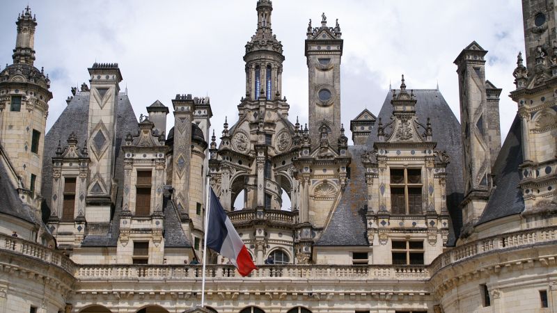
Schloss Chambord, Chambord, Frankreich
Castle visit with a number of special events, such as escape games, walks on the river or exhibitions on the construction of the castle.
Château, 41250 Chambord, Frankreich
47° 36' 58.1" N 1° 31' 2" E
47.6161260 1.5172180
• Head toward Route de la Commission on Rue de la Grange aux Dîmes. Go for 113 m.
• Turn right onto Route de la Commission (D33). Go for 632 m.
• Turn right onto D112. Go for 973 m.
• Pass 2 roundabouts and continue on D112. Go for 4.8 km.
• Turn left onto D103. Go for 260 m.
• Turn left onto Rue de Chambord (D103). Go for 566 m.
• Turn right onto Rue de l'Étang. Go for 273 m.
• Arrive at Rue de l'Étang. Your destination is on the right.
☍
7,6 km
( 8 min.)
Camping Sandaya - Le Château Des Marais
rue de chambord 27, 41500, Muides Sur Loire, Frankreich
47° 39' 59" N 1° 31' 48" E
47.6664000 1.5300000
• Head north on Rue de l'Étang. Go for 273 m.
• Turn right onto Rue de Chambord (D103). Go for 308 m.
• Turn left onto Rue Nationale (D951). Go for 15.9 km.
• Pass 3 roundabouts and continue on Levée de Saint-Dyé (D951). Go for 865 m.
• Continue on Quai Henri Chavigny (D951). Go for 647 m.
• Continue on Quai Amédée Contant (D951). Go for 244 m.
• Continue on Carrefour de la Libération (D951). Go for 23 m.
• Turn right onto Carrefour de la Libération (D956 B). Go for 841 m.
• Turn right onto Rue Gallois (D924). Go for 93 m.
• Keep left onto Rue du Père Monsabré. Go for 155 m.
• Turn left onto Rue Jean Moulin. Go for 258 m.
• Turn left onto Boulevard Chanzy. Go for 80 m.
• Turn left onto Avenue Gambetta (D766). Go for 310 m.
• Turn right onto Rue des Fossés du Château. Go for 115 m.
• Arrive at Rue des Fossés du Château. Your destination is on the left.
☍
20,1 km
( 25 min.)
Day
Schloss Blois, Place du Château, Blois, Frankreich
Visit to the castle and stroll through the town.
6 Place du Château, 41000 Blois, Frankreich
47° 35' 7.4" N 1° 19' 50.1" E
47.5853918 1.3305829
• Head toward Rue Saint-Lubin on Rue des Fossés du Château. Go for 76 m.
• Turn right onto Rue des Trois Marchands. Go for 140 m.
• Continue on Place Saint-Laumer. Go for 112 m.
• Continue on Espace des Fondateurs du Musée. Go for 23 m.
• Turn left onto Quai de l'Abbé Grégoire (D952). Go for 2.1 km.
• Take ramp onto Avenue de Verdun (D956) toward Blois-Sud/D174/Vierzon. Go for 1.0 km.
• Take ramp toward Orléans/Chambord. Go for 229 m.
• Take the 1st exit from roundabout onto D951 toward Chambord. Go for 179 m.
• Take the 3rd exit from roundabout onto D951 toward Chambord. Go for 2.3 km.
• Turn left onto Lieu-dit Le Lac de Loire. Go for 45 m.
• Turn right onto Lieu-dit Le Lac de Loire. Go for 84 m.
• Turn left onto Lieu-dit Le Lac de Loire. Go for 31 m.
• Turn left toward Lieu-dit Le Lac de Loire. Go for 299 m.
• Turn slightly left onto Lieu-dit Le Lac de Loire. Go for 5 m.
• Arrive at Lieu-dit Le Lac de Loire. Your destination is on the right.
☍
6,7 km
( 11 min.)
Camping Val de Blois
Right on the Loire. Locks are also accessible via bicycle paths.
Lac de Loire RD 951, 41350, Vineuil, Frankreich
47° 36' 19.4" N 1° 22' 27.8" E
47.6054000 1.3744000
• Head west on Lieu-dit Le Lac de Loire. Go for 304 m.
• Turn right onto Lieu-dit Le Lac de Loire. Go for 31 m.
• Turn right onto Lieu-dit Le Lac de Loire. Go for 84 m.
• Turn left onto Lieu-dit Le Lac de Loire. Go for 45 m.
• Turn right onto D951. Go for 2.2 km.
• Pass 3 roundabouts and continue on Levée de Saint-Dyé (D951). Go for 865 m.
• Continue on Quai Henri Chavigny (D951). Go for 647 m.
• Continue on Quai Amédée Contant (D951). Go for 244 m.
• Continue on Carrefour de la Libération (D951). Go for 23 m.
• Continue on Carrefour de la Libération (D751). Go for 1.5 km.
• Take the 1st exit from Rond-Point Joseph-Paul Boncour roundabout onto Pont François Mitterrand toward Tours/Le Château/Centre Ville. Go for 456 m.
• Turn left onto Quai Ulysse Besnard (D952) toward Tours/Amboise/Chaumont S/L. Go for 8.2 km.
• Pass 2 roundabouts and continue on D952. Go for 8.7 km.
• Continue on N152. Go for 3.0 km.
• Continue on Route Nationale (D952). Go for 12.8 km.
• Take the 3rd exit from Rue de Blois roundabout onto Rue de Blois (D952) toward Tours/Centre Ville. Go for 154 m.
• Take the 2nd exit from Rue de Blois roundabout onto Pont Général Leclerc (D431) toward Centre Ville. Go for 820 m.
• Make a U-Turn onto Quai du Général de Gaulle (D751). Go for 200 m.
• Keep right onto Quai du Général de Gaulle (D751). Go for 49 m.
• Turn right onto Rue François 1er. Go for 62 m.
• Continue on Place Michel Debré. Go for 189 m.
• Arrive at Place Michel Debré. Your destination is on the left.
☍
40,6 km
( 42 min.)
Day
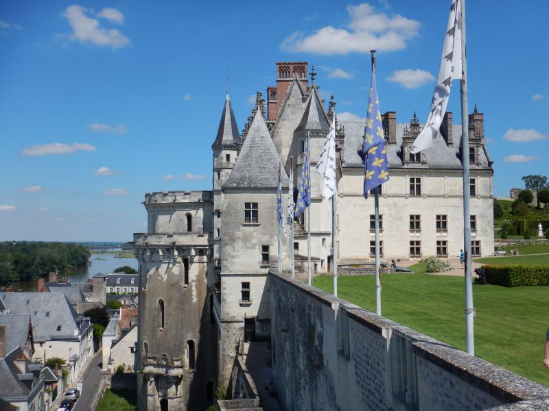
Schloss Amboise, Montée de l'Emir Abd el Kader, Amboise, Frankreich
Visit to the castle with a visit to the exhibitions.
Montée de l'Emir Abd el Kader, 37400 Amboise, Frankreich
47° 24' 48.1" N 0° 59' 13.3" E
47.4133609 0.9870190
• Head east on Place Michel Debré.
• Continue on Rue Victor Hugo. Go for 489 m.
• Continue on Rue de la Malonnière. Go for 497 m.
• Turn left onto Rue du Vallum. Go for 152 m.
• Turn left onto Rue Augustin Thierry. Go for 350 m.
• Turn right onto Rue Rouget de Lisle. Go for 187 m.
• Turn right onto Rue Rouget de Lisle. Go for 75 m.
• Arrive at Rue Rouget de Lisle. Your destination is on the right.
☍
1,8 km
( 4 min.)
Village Club Les Châteaux de la Loire
3 star campsite in Amboise with many quality services including children's club, restaurant, and entertainment.
37400, Amboise, Frankreich
47° 24' 53.3" N 0° 59' 40.2" E
47.4148000 0.9945000
• Head southeast on Rue Rouget de Lisle. Go for 75 m.
• Turn left onto Rue Rouget de Lisle. Go for 187 m.
• Turn right onto Rue Augustin Thierry. Go for 14 m.
• Turn left onto Rue du Petit Bonheur. Go for 95 m.
• Turn left onto Rue du Petit Bonheur. Go for 339 m.
• Turn sharp right onto Rue de la Malonnière. Go for 474 m.
• Turn left onto Rue du Clos Lucé. Go for 19 m.
• Arrive at Rue du Clos Lucé. Your destination is on the right.
☍
1,2 km
( 3 min.)
Day
Schloss Clos Lucé, Rue du Clos Lucé, Amboise, Frankreich
Visit to the Clos Lucé chateau, connected to Amboise Castle by a 400-meter corridor.
Da Vinci lived and worked in Clos Lucé Castle until his death.
2 Rue du Clos Lucé, 37400 Amboise, Frankreich
47° 24' 36.8" N 0° 59' 31.5" E
47.4102346 0.9920814
• Head toward Allée du Pont-Moulin on Rue du Clos Lucé. Go for 260 m.
• Arrive at Rue du Clos Lucé. Your destination is on the right.
☍
0,3 km
( )
Parking Château du Clos Lucé
Parking space for 10 caravans in the visitor parking lot of the castle Clos Lucé near the Da Vinci Museum. Scattered subsoil next to trees only 1 km from the city center. Pitch is payable and available all year round.
Rue du Clos Luce, 37400, Amboise, Frankreich
47° 24' 30" N 0° 59' 39" E
47.4083333 0.9941667
• Head south on Rue du Clos Lucé. Go for 167 m.
• Turn left onto Avenue Léonard de Vinci (D61). Go for 701 m.
• Pass 3 roundabouts and continue on Route de Montrichard (D61). Go for 9.1 km.
• Turn right onto D80. Go for 2.3 km.
• Continue on Lieu-dit La Drolinière (D80). Go for 399 m.
• Continue on Lieu-dit Le Patouilleau (D80). Go for 134 m.
• Continue on D80. Go for 144 m.
• Continue on Lieu-dit La Bécasserie (D80). Go for 627 m.
• Continue on Rue de la Forêt (D80). Go for 1.4 km.
• Turn right onto Rue Nationale (D40). Go for 776 m.
• Turn left onto Rue de la Gare (D80). Go for 343 m.
• Continue on D80. Go for 334 m.
• Turn right. Go for 1.1 km.
• Arrive at your destination on the right.
☍
17,5 km
( 20 min.)
Day
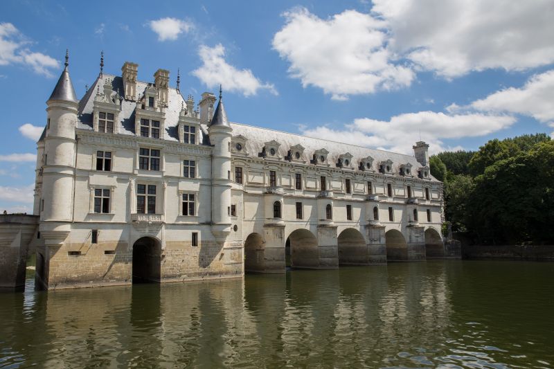
Schloss Chenonceau, Chenonceaux, Frankreich
Visit to the noble moated castle where only women lived for centuries.
37150 Chenonceaux, Frankreich
47° 19' 29.5" N 1° 4' 13.1" E
47.3248696 1.0703005
• Head northeast. Go for 1.1 km.
• Turn left onto D80. Go for 87 m.
• Turn right onto Lieu-dit Le Port Olivier. Go for 443 m.
• Arrive at Lieu-dit Le Port Olivier. Your destination is on the left.
☍
1,6 km
( 4 min.)
Camping le Moulin Fort
From the site, located directly on the banks of the Cher, you can reach Chenonceau Castle on foot. Quiet location with leisure activities and entertainment possibilities.
37150, Francueil Chenonceaux, Frankreich
47° 19' 40.1" N 1° 5' 21.1" E
47.3278000 1.0892000
• Head west on Lieu-dit Le Port Olivier. Go for 443 m.
• Turn left onto D80. Go for 87 m.
• Turn right. Go for 1.1 km.
• Arrive at your destination on the right.
☍
1,6 km
( 4 min.)
Day
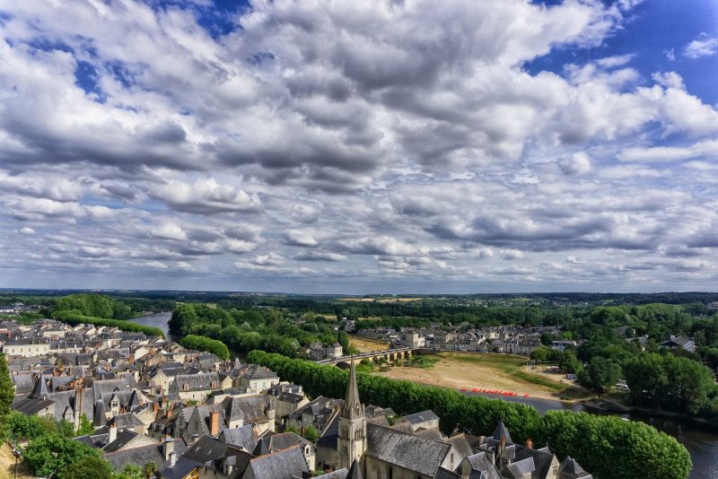
Chenonceau, Chenonceaux, Frankreich
Discover the historic and romantic city on the Loire.
37150 Chenonceaux, Frankreich
47° 19' 29.5" N 1° 4' 13.1" E
47.3248696 1.0703005
• Head northeast. Go for 1.1 km.
• Turn left onto D80. Go for 87 m.
• Turn right onto Lieu-dit Le Port Olivier. Go for 443 m.
• Arrive at Lieu-dit Le Port Olivier. Your destination is on the left.
☍
1,6 km
( 4 min.)
Camping le Moulin Fort
37150, Francueil Chenonceaux, Frankreich
47° 19' 40.1" N 1° 5' 21.1" E
47.3278000 1.0892000
• Head west on Lieu-dit Le Port Olivier. Go for 443 m.
• Turn left onto D80. Go for 460 m.
• Take the 1st exit from roundabout onto Route de Tours (D976) toward A85/Tours/Bléré/Loches. Go for 3.7 km.
• Take the 3rd exit from roundabout onto D976 toward Amboise/Montlouis S/L./Loches. Go for 3.6 km.
• Take ramp toward A85/Bléré/Reignac/Loches. Go for 317 m.
• Turn left onto D31 toward A85/Reignac/Sublaines/Genillé/Loches. Go for 3.5 km.
• Take the 1st exit from roundabout onto A85 toward Tours. Go for 40.8 km.
• Take exit 8 toward Villandry/Lignières de Touraine. Go for 444 m.
• Turn left onto D7 toward Villandry/Savonnières. Go for 2.6 km.
• Take the 2nd exit from roundabout onto Rue Principale (D7). Go for 637 m.
• Turn right onto Lieu-dit Le Château. Go for 181 m.
• Arrive at Lieu-dit Le Château.
☍
56,8 km
( 37 min.)
Day
Schloss Villandry, Rue Principale, Villandry, Frankreich
Wander through the beautiful gardens and then stroll through the town.
3 Rue Principale, 37510 Villandry, Frankreich
47° 20' 23.5" N 0° 30' 51.5" E
47.3398534 0.5143152
• Head toward Rue Principale on Lieu-dit Le Château. Go for 181 m.
• Turn left onto Rue Principale (D7). Go for 258 m.
• Turn right onto Rue Principale. Go for 31 m.
• Turn left. Go for 27 m.
• Turn left. Go for 44 m.
• Arrive at your destination on the right.
☍
0,5 km
( 2 min.)
Aire du Camping-cars
Rue Principale, 37510, Villandry, Frankreich
47° 20' 28" N 0° 30' 38" E
47.3411111 0.5105556
• Head east. Go for 44 m.
• Turn right toward Rue Principale. Go for 27 m.
• Turn right onto Rue Principale. Go for 31 m.
• Turn right onto Rue Principale (D7). Go for 347 m.
• Take the 2nd exit from roundabout onto Rue Principale (D7). Go for 3.1 km.
• Turn left onto Rue du Val de Loire (D39). Go for 1.5 km.
• Continue on Voie d'Azay (D39). Go for 253 m.
• Take the 1st exit from roundabout onto Voie d'Azay (D39). Go for 1.8 km.
• Continue on Route de Villandry (D39). Go for 3.2 km.
• Take the 1st exit from roundabout onto Route de Cosne à la Pointe-Saint-Gildas (D751). Go for 18.1 km.
• Take the 2nd exit from roundabout onto Route de Tours (D751). Go for 940 m.
• Take the 3rd exit from roundabout onto Avenue François Mitterrand. Go for 1.1 km.
• Pass 2 roundabouts and continue on Avenue François Mitterrand. Go for 1.7 km.
• Take the 2nd exit from roundabout onto Quai Charles VII (D749). Go for 366 m.
• Take the 2nd exit from roundabout onto Quai Jeanne d'Arc (D8). Go for 141 m.
• Take the 2nd exit from roundabout onto Rue Neuve de l'Hôtel de Ville. Go for 71 m.
• Continue on Place du Général de Gaulle. Go for 41 m.
• Turn right onto Place du Général de Gaulle. Go for 113 m.
• Arrive at Place du Général de Gaulle. Your destination is on the right.
☍
32,9 km
( 32 min.)
Day
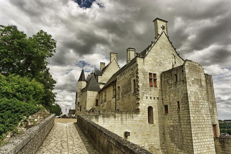
Chinon, Frankreich
Get to know the winding old town.
37500 Chinon, Frankreich
47° 10' 2.3" N 0° 14' 25.4" E
47.1672960 0.2403850
• Head north on Place du Général de Gaulle.
• Turn left onto Place du Général de Gaulle. Go for 148 m.
• Continue on Rue Neuve de l'Hôtel de Ville. Go for 39 m.
• Take the 1st exit from roundabout onto Quai Jeanne d'Arc (D8). Go for 124 m.
• Take the 2nd exit from roundabout onto Quai Charles VII (D749). Go for 356 m.
• Take the 1st exit from roundabout onto Avenue François Mitterrand. Go for 476 m.
• Arrive at Avenue François Mitterrand. Your destination is on the right.
☍
1,1 km
( 3 min.)
Burg Chinon, Chinon, Frankreich
Visit the defiant castle of Chinon.
37500 Chinon, Frankreich
47° 10' 5.2" N 0° 14' 8.2" E
47.1681000 0.2356150
• Head toward Rue du Pavé Neuf on Avenue François Mitterrand. Go for 459 m.
• Take the 2nd exit from roundabout onto Quai Charles VII (D749). Go for 366 m.
• Take the 1st exit from roundabout onto D749. Go for 246 m.
• Turn right onto Quai Danton. Go for 298 m.
• Turn left onto Rue de la Digue Saint-Jacques. Go for 30 m.
• Arrive at Rue de la Digue Saint-Jacques. Your destination is on the left.
☍
1,4 km
( 3 min.)
Camping Intercommunal De L'ile Auger
Large parking space opposite the old town Chinon and castle.
Quai Danton, 37500, Chinon, Frankreich
47° 9' 47.9" N 0° 14' 4.9" E
47.1633000 0.2347000
• Head toward Rue Porte du Bourg on Rue de la Digue Saint-Jacques. Go for 79 m.
• Turn slightly left onto Rue des Ursulines. Go for 342 m.
• Turn right onto Rue du Faubourg Saint-Jacques (D749). Go for 1.2 km.
• Take the 1st exit from roundabout onto Rue de Saumur (D751 E) toward A85/Saumur/Chinon/La Roche-Clermault/Candes St Martin/Bourgueil/Loudun/La Devinière. Go for 2.8 km.
• Take the 2nd exit from roundabout onto D751 toward Saumur. Go for 10.5 km.
• Turn right onto D7 toward D751/Candes St Martin/Écomusée du Véron/Bourgueil. Go for 640 m.
• Take the 2nd exit from roundabout onto Lieu-dit Les Basses Vignes (D7). Go for 361 m.
• Turn left onto Rue du Bac. Go for 94 m.
• Continue on Route de Compostelle. Go for 889 m.
• Take the 1st exit from roundabout onto Route de Compostelle. Go for 87 m.
• Continue on Quai Alexandre Dumas (D751 A). Go for 796 m.
• Continue on Avenue de la Loire (D947). Go for 938 m.
• Take the 1st exit from roundabout onto D952 A toward Villebernier/Varennes S/Loire/Chouzé S/Loire. Go for 882 m.
• Take the 3rd exit from roundabout onto Rue Nationale des Redouets (D952) toward Saumur. Go for 10.3 km.
• Take the 3rd exit from Rond-Point Noëlla Rouget roundabout onto Pont des Cadets de Saumur (D947) toward Centre Ville/Les Ponts. Go for 261 m.
• Take the 3rd exit from roundabout onto Avenue du Général de Gaulle (D947). Go for 173 m.
• Pass 2 roundabouts and continue on Avenue du Général de Gaulle (D947). Go for 440 m.
• Take the 1st exit from roundabout onto Quai Carnot. Go for 261 m.
• Turn left onto Place Kléber. Go for 112 m.
• Continue on Place Chanzy. Go for 14 m.
• Continue on Rue des Carabiniers de Monsieur. Go for 136 m.
• Continue on Rue Chanzy. Go for 109 m.
• Turn left onto Rue Beaurepaire (D161). Go for 63 m.
• Arrive at Rue Beaurepaire (D161). Your destination is on the right.
☍
31,5 km
( 35 min.)
Day
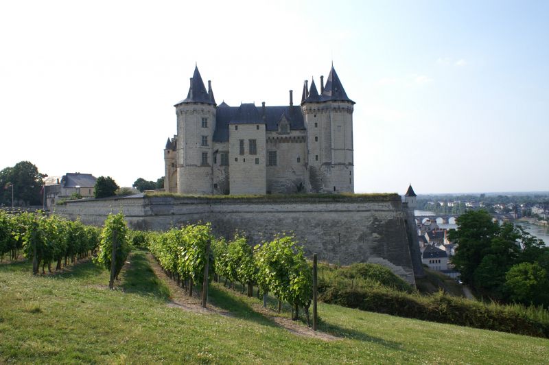
Saumur, Frankreich
Welcome to the medieval wine town of Saumur, where you should visit one of the beautiful wine cellars or wineries in the area.
49400 Saumur, Frankreich
47° 15' 36.5" N 0° 4' 51.2" W
47.2601350 -0.0808930
• Head southeast on Rue Beaurepaire (D161). Go for 23 m.
• Continue on Place Beaurepaire (D161). Go for 66 m.
• Turn left onto Rue de la Fidélité. Go for 282 m.
• Turn right onto Quai Carnot. Go for 86 m.
• Take the 2nd exit from roundabout onto Pont Cessart (D947). Go for 426 m.
• Take the 1st exit from roundabout onto Rue Paul Bert. Go for 245 m.
• Continue on Rue des Capucins-d'Offard. Go for 258 m.
• Turn right onto Rue de Verden. Go for 339 m.
• Turn left. Go for 33 m.
• Arrive at your destination on the left.
☍
1,8 km
( 5 min.)
Flower Camping l'Ile D'offard
Campsite on an island fringed by the Loire. Exceptionally beautiful and quiet location with 4.5 acres of park. The city of Saumur can be reached in just 15 minutes.
rue de Verden, 49400, Saumur, Frankreich
47° 15' 37.1" N 0° 3' 55.1" W
47.2603000 -0.0653000
• Head northeast.
• Turn left onto Rue de Verden. Go for 202 m.
• Turn slightly left onto Rue des Aulnes. Go for 252 m.
• Turn right onto Rue des Capucins-d'Offard. Go for 45 m.
• Turn left onto Rue des Capucins-d'Offard. Go for 67 m.
• Continue on Rue Paul Bert. Go for 238 m.
• Take the 2nd exit from roundabout onto Avenue du Général de Gaulle (D947). Go for 408 m.
• Take the 1st exit from roundabout onto Quai Carnot. Go for 261 m.
• Turn left onto Place Kléber. Go for 112 m.
• Continue on Place Chanzy. Go for 14 m.
• Continue on Rue des Carabiniers de Monsieur. Go for 136 m.
• Continue on Rue Chanzy. Go for 109 m.
• Turn left onto Rue Beaurepaire (D161). Go for 63 m.
• Arrive at Rue Beaurepaire (D161). Your destination is on the right.
☍
1,9 km
( 5 min.)
Day
Saumur, Frankreich
Visit of the castle Saumur.
49400 Saumur, Frankreich
47° 15' 36.5" N 0° 4' 51.2" W
47.2601350 -0.0808930
• Head southeast on Rue Beaurepaire (D161). Go for 23 m.
• Turn right onto Place Beaurepaire. Go for 118 m.
• Turn left onto Rue de la Maremaillette. Go for 34 m.
• Turn right onto Place de l'Europe. Go for 58 m.
• Turn slightly right onto Rue d'Orléans. Go for 138 m.
• Turn right onto Rue d'Orléans. Go for 26 m.
• Take the 2nd exit from Place Maupassant roundabout onto Rue du Maréchal Leclerc. Go for 528 m.
• Take the 3rd exit from roundabout onto Boulevard Louis Renault (D93). Go for 161 m.
• Continue on Boulevard de la Marne (D93). Go for 460 m.
• Pass 2 roundabouts and continue on Boulevard de la Marne (D93). Go for 2.0 km.
• Continue on Route de Saumur (D93). Go for 574 m.
• Continue on Boulevard Saint-Vincent (D93). Go for 1.6 km.
• Continue on D93. Go for 326 m.
• Take the 1st exit from roundabout onto Rue de Champigny (D205). Go for 492 m.
• Take the 3rd exit from roundabout onto Route Nouvelle. Go for 420 m.
• Take the 2nd exit from roundabout onto Rue de la Perrière. Go for 1.3 km.
• Turn right onto Route de Samoussay. Go for 49 m.
• Arrive at Route de Samoussay. Your destination is on the right.
☍
8,3 km
( 13 min.)
Cave de Saumur
Toll-free parking space for 15 caravans. Asphalted area directly at the winery. Wine tasting and cellar tour possible with registration. Shops and restaurants in the village of Saumur only 1 km away.
Route de Saumoussay, 49260, St.-Cyr-en-Bourg, Frankreich
47° 11' 59" N 0° 4' 12" W
47.1997222 -0.0700000
• Head toward Rue de la Perrière on Route de Samoussay. Go for 49 m.
• Turn left onto Rue de la Perrière. Go for 1.3 km.
• Take the 2nd exit from roundabout onto Route Nouvelle. Go for 414 m.
• Take the 1st exit from roundabout onto Rue de Champigny (D205). Go for 479 m.
• Take the 4th exit from roundabout onto D93. Go for 429 m.
• Continue on Boulevard Saint-Vincent (D93). Go for 1.6 km.
• Continue on Route de Saumur (D93). Go for 573 m.
• Continue on Boulevard de la Marne (D93). Go for 1.6 km.
• Take the 2nd exit from roundabout onto Boulevard de la Marne (D93). Go for 369 m.
• Take the 3rd exit from roundabout onto Boulevard de la Marne (D93). Go for 508 m.
• Continue on Boulevard Louis Renault (D93). Go for 134 m.
• Take the 2nd exit from roundabout onto Boulevard Benjamin Delessert. Go for 741 m.
• Take the 2nd exit from roundabout onto Boulevard Maréchal de Lattre de Tassigny. Go for 341 m.
• Take the 2nd exit from roundabout onto Boulevard du Général Weygand. Go for 216 m.
• Take the 2nd exit from Rond-Point du Général Weygand roundabout onto D347 toward Angers/Le Mans/Tours/Z.I. St Lambert. Go for 4.3 km.
• Take the 2nd exit from Rond-Point du Fleuret roundabout onto D347 toward Tours/Le Mans/Angers/Longué/Vivy. Go for 2.3 km.
• Take the 2nd exit from Rond-Point de la Ronde roundabout onto D767 toward Angers/Tours/Le Mans/Allonnes/Vernantes. Go for 577 m.
• Take the 3rd exit from roundabout toward Le Mans/Angers/Tours. Go for 161 m.
• Take ramp onto A85 toward Nantes/Le Mans/Angers. Go for 36.9 km.
• Continue toward Nantes/Angers. Go for 212 m.
• Take the exit onto A11 (L'Océane). Go for 17.9 km.
• Take exit 15 toward Angers-Centre. Go for 598 m.
• Keep left onto D323 toward Angers-Centre. Go for 2.5 km.
• Take ramp onto Quai Ligny toward Château. Go for 200 m.
• Turn left onto Boulevard du Général de Gaulle. Go for 348 m.
• Turn left onto Place du Président Kennedy. Go for 73 m.
• Turn left onto Place du Président Kennedy. Go for 118 m.
• Continue on Promenade du Bout du Monde. Go for 81 m.
• Arrive at Promenade du Bout du Monde.
☍
75,1 km
( 54 min.)
Day
Château d'Angers, Promenade du Bout du Monde, Angers, Frankreich
Marvel at Angers Castle with its 7 slate-roofed tuff towers and experience the summer festival from May to September.
2 Promenade du Bout du Monde, 49100 Angers, Frankreich
47° 28' 12" N 0° 33' 36" W
47.4700000 -0.5600000
• Head toward Rue Saint-Aignan on Promenade du Bout du Monde. Go for 81 m.
• Continue on Place du Président Kennedy. Go for 118 m.
• Turn right onto Place du Président Kennedy. Go for 73 m.
• Turn right onto Boulevard du Général de Gaulle. Go for 327 m.
• Turn left and take ramp onto D323 toward Nantes/Laval/Rennes/La Roseraie/Angers-Technopole. Go for 2.2 km.
• Take ramp toward Belle-Beille. Go for 641 m.
• Take the 3rd exit from roundabout onto Rue du Grand Launay. Go for 333 m.
• Take the 3rd exit from roundabout onto Rue de la Chambre aux Deniers. Go for 141 m.
• Take the 1st exit from roundabout onto Avenue du Lac de Maine (D111). Go for 498 m.
• Take the 2nd exit from roundabout onto Avenue du Lac de Maine (D111). Go for 704 m.
• Turn left. Go for 81 m.
• Arrive at your destination on the right.
☍
5,1 km
( 7 min.)
Camping d'Angers - Lac de Maine
Located in the immediate vicinity of the historic city of Angers, the campsite is in the heart of the Anjou wine region.
Avenue du Lac de Maine, 49000, Angers, Frankreich
47° 27' 15.1" N 0° 35' 47" W
47.4542000 -0.5964000
• Head northwest. Go for 81 m.
• Turn right onto Route d'Angers (D111). Go for 656 m.
• Pass 2 roundabouts and continue on Avenue du Lac de Maine (D111). Go for 1.2 km.
• Take left ramp onto Avenue de l'Atlantique (D323) toward Nantes/Laval/Rennes/Beaucouzé/Châteaubriant/Patton-Université. Go for 1.7 km.
• Keep right onto Avenue de l'Atlantique (D523) toward Nantes/Bouchemaine/Beaucouzé/Angers. Go for 1.0 km.
• Keep left onto D523 toward Nantes/Ancenis/Châteaubriant. Go for 5.2 km.
• Take ramp onto A11 (L'Océane). Go for 65.2 km.
• Take exit 22 toward Bordeaux/Nantes-Centre onto A811. Go for 6.6 km.
• Take the 1st exit from roundabout onto A811 toward Nantes-Centre. Go for 369 m.
• Take the 1st exit from roundabout onto Boulevard de la Prairie de Mauves toward Nantes-Centre/Cité Internationale des Congrès. Go for 489 m.
• Take the 2nd exit from roundabout onto Boulevard de la Prairie de Mauves toward Nantes-Centre. Go for 2.8 km.
• Turn left onto Boulevard de Seattle toward Île de Nantes/Malakoff/C.H.U. Hôtel Dieu/Cité Intale des Congrès. Go for 245 m.
• Take the 2nd exit from roundabout onto Boulevard de Sarrebruck toward Nantes-Sud/Île de Nantes/Centre Ville/Malakoff/C.H.U. Hôtel Dieu/Cité Intale des Congrès. Go for 296 m.
• Pass 6 roundabouts and continue on Boulevard de Sarrebruck. Go for 1.3 km.
• Continue on Quai Malakoff. Go for 151 m.
• Pass 2 roundabouts and continue on Quai Malakoff. Go for 256 m.
• Take the 5th exit from roundabout onto Pont de Tbilissi toward Vannes/Saint Herblain/Rezé/Centre Ville/C.H.U. Hôtel Dieu. Go for 326 m.
• Continue on Rue de Fleurus. Go for 22 m.
• Take the 1st exit from roundabout onto Rue de Fleurus toward Bordeaux/Rezé/Île de Nantes-Beaulieu/Centre Ville. Go for 89 m.
• Take the 1st exit from roundabout onto Avenue Jean-Claude Bonduelle toward Centre Ville. Go for 175 m.
• Continue on Avenue Carnot. Go for 439 m.
• Take the 1st exit from roundabout onto Allée des Généraux Patton et Wood toward Centre Ville. Go for 182 m.
• Take the 2nd exit from roundabout toward C.H.U. Hôtel Dieu. Go for 227 m.
• Take the 1st exit from Square Elsa Mercoeur roundabout onto Rue de Strasbourg toward Nord-Centre Ville/Est-Centre Ville/Place Pt Morand. Go for 454 m.
• Turn left onto Rue Général Leclerc de Hautecloque. Go for 111 m.
• Turn right onto Rue de la Commune. Go for 88 m.
• Arrive at Rue de la Commune. Your destination is on the left.
☍
89,6 km
(1 hrs. 1 min.)
Day
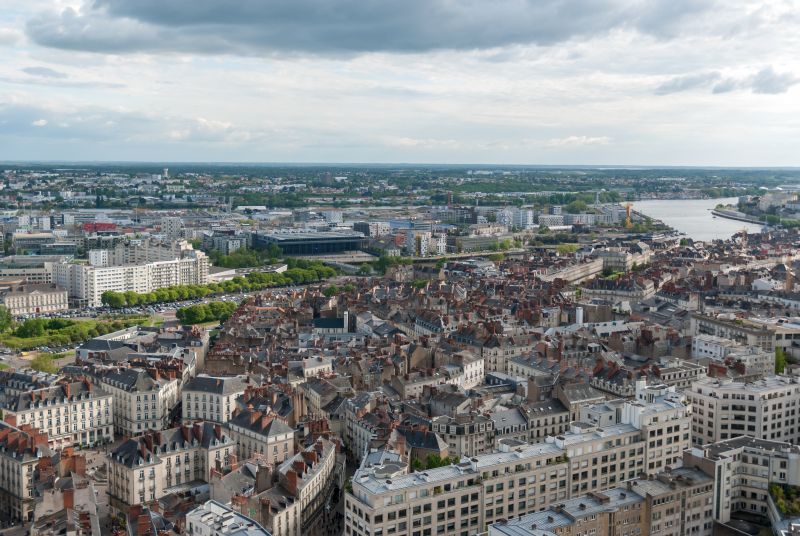
Nantes, Frankreich
End your trip at the "cultural gateway" to the Loire Valley, in the port city of Nantes. Get to know the city better with its artistic exhibition "Les Machines de Nantes" and its lively culture.
47° 13' 6.1" N 1° 33' 13" W
47.2183710 -1.5536210