Dear 303 fans,
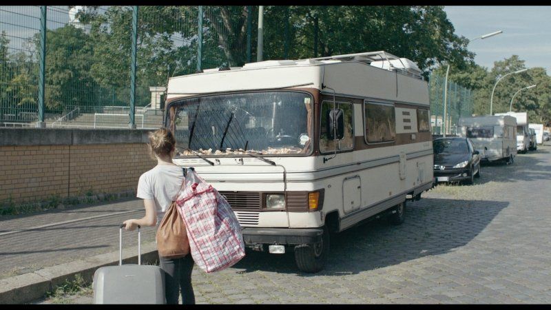
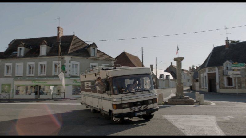
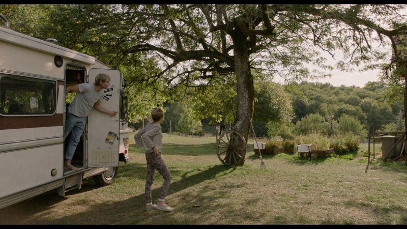
cool that you are interested in my itinerary from Berlin to Portugal! You won't regret it because the luck of the world is on the road. And especially when you're traveling in the best, best motorhome, my incomparable 303 Wonder Power Magic hypermobile, which we christened "Rudi" somewhere near Bilbao.
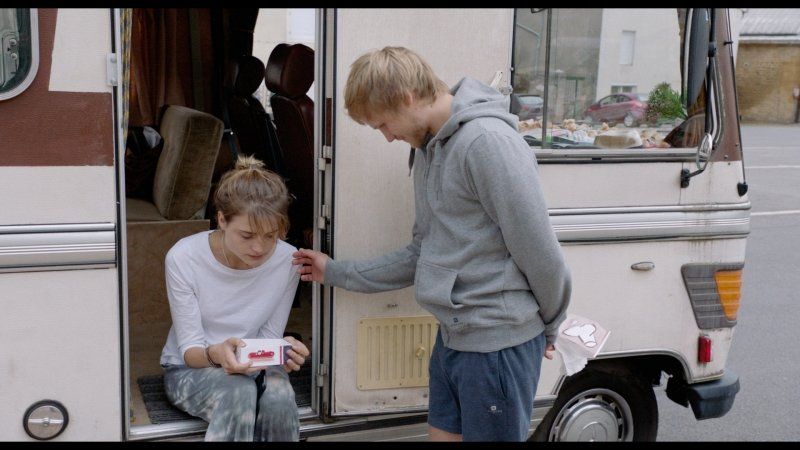
It all started pretty wildly and spontaneously as an unplanned road trip down south. I finally wanted to clarify things that had been postponed for a long time and make new decisions, get my future under control, of course I set out to clear my head again, but then everything turned out differently than expected..
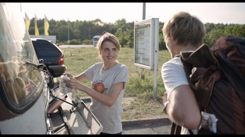
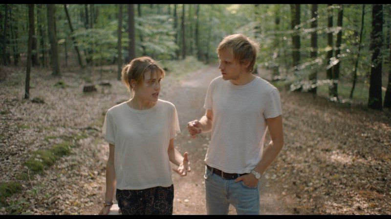
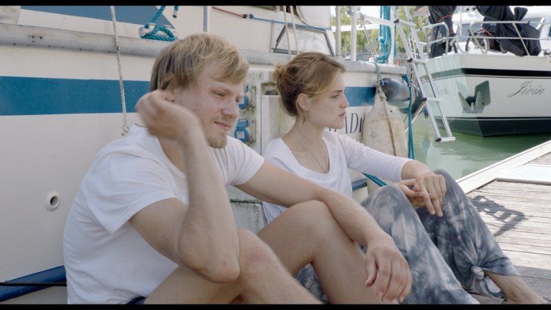
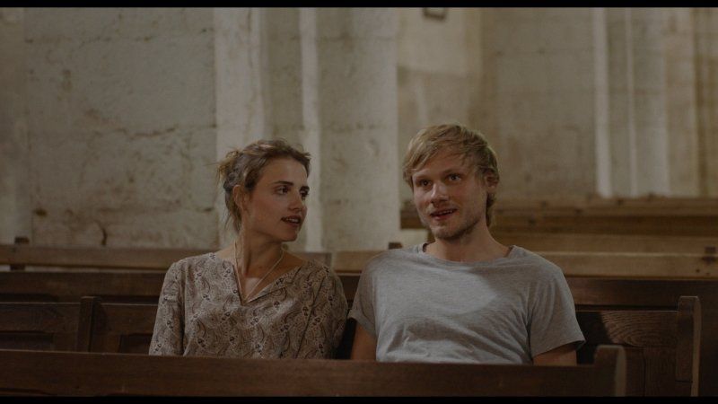
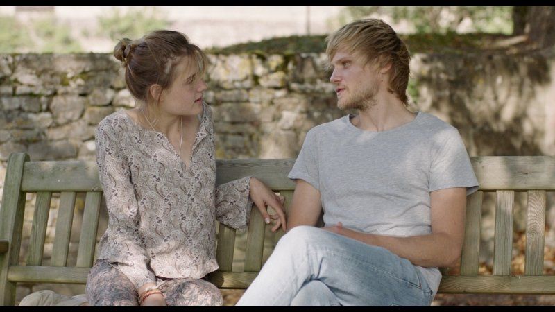
I don't want to reveal too much: the road and chance brought me to a wonderful person and a unique encounter (which had some initial difficulties, I have to admit ;)), became a great adventure of my heart, perhaps the most unforgettable journey of my life .
From July 19th, 2018 you can see my/our trip in cinemas throughout Germany with all the highlights and some difficult situations. Of course we will also be there and look forward to seeing you. Get on the Magic Bus! ✨?✨
But now to the practical and what you all want: dare to use it up on an adventure yourself!
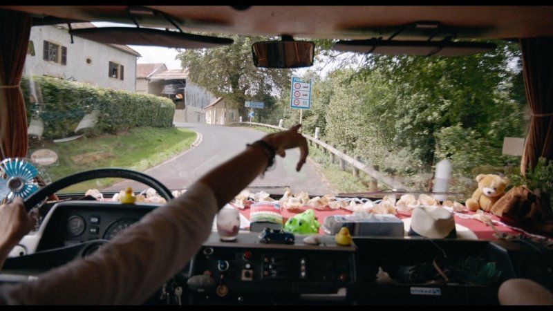
The order of our campsites and visits here is in the same order as in the film because it best reflects our journey. The order in which we shot the footage is different in two places, in Berlin and at Lac-Du-Der.
I hope you like our route and you will drive your own trip with your very own adventures and experiences. Let's see who you get to know. Write me that in the comments below. :)
There is also a little riddle. A location in the film consists of two locations. :) Whoever finds out - also from below the comments!
So far so good..
See you at the cinema! :)
Your Jule
PS: Join the Ride!
Day
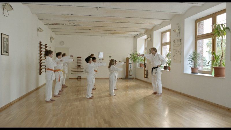
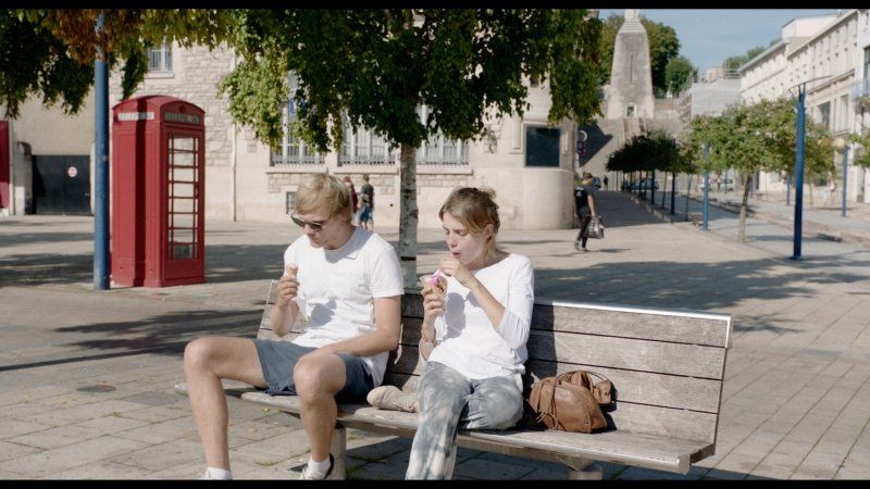
1. Berlin: nix wie weg!
Berlin, Deutschland
52° 31' 12" N 13° 24' 17.8" E
52.5200066 13.4049540
• Head toward Karl-Liebknecht-Straße on Spandauer Straße. Go for 204 m.
• Turn right onto Anna-Louisa-Karsch-Straße. Go for 115 m.
• Turn left onto An der Spandauer Brücke. Go for 213 m.
• Continue on Hackescher Markt. Go for 83 m.
• Continue on Oranienburger Straße. Go for 1.0 km.
• Turn right onto Friedrichstraße. Go for 92 m.
• Continue on Chausseestraße. Go for 1.7 km.
• Continue on Müllerstraße. Go for 127 m.
• Continue on Müllerstraße (B96). Go for 3.6 km.
• Continue on Scharnweberstraße. Go for 1.9 km.
• Turn right and take ramp onto A111 (Autobahnzubringer Hamburg) toward Hamburg. Go for 9.7 km.
• Keep right. Go for 362 m.
• Turn slightly left. Go for 17 m.
• Arrive at your destination on the left.
☍
19,1 km
( 27 min.)
2. Begegnung an der Tankstelle
A111, 16761 Hohen Neuendorf, Deutschland
52° 38' 20.7" N 13° 14' 38.7" E
52.6390930 13.2440722
• Head northwest. Go for 336 m.
• Turn slightly left. Go for 19 m.
• Continue toward Autobahnzubringer Hamburg/A111. Go for 632 m.
• Continue on A111 (Autobahnzubringer Hamburg). Go for 6.4 km.
• Keep right onto Kreuz Oranienburg toward Stralsund/Oranienburg/Frankfurt (Oder)/Prenzlau. Go for 475 m.
• Take the exit toward Frankfurt (Oder)/Prenzlau onto A10 (Berliner Ring). Go for 12.3 km.
• Take exit 33 toward Wensickendorf. Go for 469 m.
• Turn left onto Liebenwalder Straße (L21) toward Liebenwalde/Wensickendorf/Summt. Go for 4.8 km.
• Take the 1st exit from roundabout onto Birkenwerderstraße (K6503) toward Wandlitz/Zühlsdorf. Go for 1.5 km.
• Continue on Dorfstraße (K6503). Go for 653 m.
• Turn left onto Wandlitzer Chaussee (K6503). Go for 1.8 km.
• Continue on Zühlsdorfer Chaussee (K6004). Go for 1.6 km.
• Take the 1st exit from roundabout onto Wensickendorfer Chaussee (B273) toward Bernau/Wandlitz. Go for 1.8 km.
• Take the 3rd exit from roundabout onto Prenzlauer Chaussee (L100) toward Prenzlau/B109/Klosterfelde. Go for 3.2 km.
• Take the 1st exit from roundabout onto L29 toward Biesenthal/Lanke. Go for 4.7 km.
• Turn right onto Wandlitzer Straße. Go for 31 m.
• Continue straight ahead. Go for 76 m.
• Arrive at your destination.
☍
40,9 km
( 36 min.)
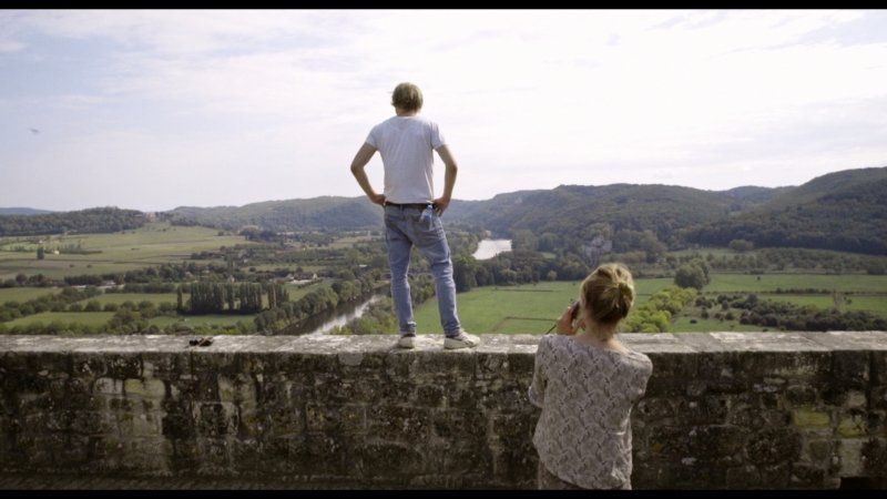
3. Liepnitzsee: GRUNDSÄTZE
Competition or cooperation
Unnamed Road, 16359 Wandlitz, Deutschland
52° 44' 46.5" N 13° 31' 12.5" E
52.7462461 13.5201359
• Head toward Wandlitzer Straße. Go for 76 m.
• Continue on Wandlitzer Straße. Go for 31 m.
• Turn left onto Wandlitzer Straße (L29). Go for 4.7 km.
• Take the 3rd exit from roundabout onto Prenzlauer Chaussee (L100) toward Berlin/Wandlitz/B109. Go for 3.3 km.
• Take the 1st exit from roundabout onto Wensickendorfer Chaussee (B273) toward Oranienburg. Go for 1.8 km.
• Take the 3rd exit from roundabout onto Zühlsdorfer Chaussee (K6004) toward Zühlsdorf. Go for 1.7 km.
• Continue on Wandlitzer Chaussee (K6503). Go for 1.8 km.
• Continue on Dorfstraße (K6503). Go for 653 m.
• Continue on Birkenwerderstraße (K6503). Go for 1.5 km.
• Take the 3rd exit from roundabout onto Summter Chaussee (L21) toward Berliner Ring/A10/Berlin/Mühlenbeck. Go for 4.6 km.
• Turn right and take ramp onto A10 (Berliner Ring) toward Hamburg. Go for 24.1 km.
• Take exit 29 toward Leipzig/Magdeburg/Potsdam onto A10 (Autobahndreieck Havelland). Go for 47.5 km.
• Take exit 21 toward Hannover/Magdeburg onto A2 (Autobahndreieck Werder). Go for 411 km.
• Take exit 16 toward Köln/Frankfurt a.M./Flughafen Dortmund onto A1. Go for 87.5 km.
• Take exit 98 toward Frankfurt a.M./Flughafen Köln/Leverkusen onto A3. Go for 11.2 km.
• Take exit 27 toward K-Zentrum/K-Deutz/Koelnmesse/Lanxess Arena onto B55A. Go for 3.9 km.
• Take ramp onto Pfälzischer Ring (L188) toward Deutz/Tanzbrunnen/Messehochhaus. Go for 1.3 km.
• Turn right onto Opladener Straße (L111) toward Zentrum/Deutzer Brücke/Tanzbrunnen/Rheinterrassen/Koelnmesse/Flughafen. Go for 1.2 km.
• Arrive at Deutzer Brücke (L111). Your destination is on the left.
☍
607,8 km
(5 hrs. 31 min.)
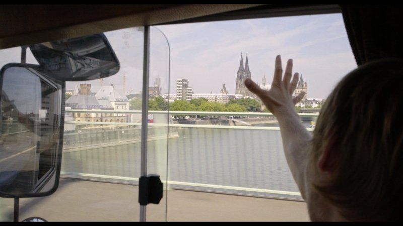
4. Kölle Alaaaf!
Deutzer Brücke, Köln, Deutschland
50° 56' 11.3" N 6° 57' 57.1" E
50.9364601 6.9658685
• Head west on Deutzer Brücke (L111). Go for 905 m.
• Turn left and take ramp onto Neuköllner Straße toward Barbarossaplatz/Severins-Brücke. Go for 389 m.
• Turn right onto Blaubach. Go for 271 m.
• Continue on Rothgerberbach (B55). Go for 667 m.
• Keep left onto Luxemburger Straße (B265) toward Klettenberg/Universität. Go for 4.0 km.
• Turn left and take ramp onto A4. Go for 57.4 km.
• Take exit 4 toward Brüssel/Liège onto A44. Go for 12.1 km.
• Continue on E40. Go for 22.8 km.
• Take the exit toward Verviers onto E42. Go for 10.4 km.
• Take exit 7 toward Theux/Aéroport Laboru. Go for 870 m.
• Take the 1st exit from roundabout onto Chaussée de Verviers (N657). Go for 4.0 km.
• Continue on Rue du Pont (N690). Go for 100 m.
• Take the 2nd exit from roundabout onto Rue Chinrue. Go for 245 m.
• Turn right onto Rue de la Chaussée. Go for 111 m.
• Take the 1st exit from roundabout onto Rue Tillot (N62) toward E25/Sprimont/Banneux. Go for 8.2 km.
• Continue on Rue de la Gendarmerie (N678). Go for 1.1 km.
• Take the 2nd exit from roundabout onto Rue de Louveigné (N678) toward E25/Sprimont. Go for 758 m.
• Take the 4th exit from roundabout onto E25 toward Sprimont/Luxembourg/Bastogne. Go for 83.0 km.
• Take the exit toward Bruxelles/Namur/Neufchâteau onto E411. Go for 14.3 km.
• Take exit 25 toward Reims/Sedan/Bouillon/Bertrix. Go for 408 m.
• Take the 3rd exit from roundabout onto Avenue de Bouillon (E46) toward Reims/Sedan/Bouillon/Bertrix. Go for 334 m.
• Keep right onto Avenue de Bouillon (E46). Go for 4.8 km.
• Take the 2nd exit from roundabout onto E46 toward Zone Industrielle Rouvrou-Corettes/Reims/Sedan/Bouillon/Paliseul/Bertrix. Go for 1.5 km.
• Take the 3rd exit from roundabout onto Rue des Corettes (N884) toward Bertrix. Go for 1.2 km.
• Pass 2 roundabouts and continue on Rue des Corettes (N884). Go for 362 m.
• Continue on Rue de Burhaimont (N884). Go for 592 m.
• Turn right onto Rue de Renaumont (N853). Go for 54 m.
• Turn left onto Place des 3 Fers. Go for 184 m.
• Turn right onto Rue du Culot. Go for 424 m.
• Take the 1st exit from roundabout. Go for 50 m.
• Take the 1st exit from roundabout onto Rue des Munos. Go for 2.7 km.
• Continue on Rue des Munos. Go for 2.5 km.
• Continue on Rue de Linglé. Go for 1.1 km.
• Continue on Linglé. Go for 112 m.
• Turn left onto Linglé (N865). Go for 403 m.
• Turn right onto Rue Champs Simon (N884). Go for 4.8 km.
• Turn left onto Rue du Champ le Monde. Go for 426 m.
• Arrive at Rue du Champ le Monde. Your destination is on the left.
☍
243,7 km
(2 hrs. 35 min.)
5. Herbeumont: Angrillen..
Idyllic campsite under a Roman viaduct.
The owner Arno is very nice.
http://www.retro-camping.be
https: //www.facebook.com/campi ...
Rue du champ le monde n4, 6887 Herbeumont / semois, Belgien
49° 46' 18.9" N 5° 14' 26.6" E
49.7719177 5.2407253
• Head toward Rue de Bravy on Rue du Champ le Monde. Go for 426 m.
• Turn left onto Rue de Bravy (N884). Go for 6.2 km.
• Turn left onto Rue de Bouillon (N83). Go for 8.1 km.
• Take the 3rd exit from roundabout onto Rue de France (N83/N85) toward Arlon/Virton/Centre. Go for 634 m.
• Turn right onto Rue d'Orval (N88). Go for 13.2 km.
• Arrive at Route d'Orval (N88). Your destination is on the left.
☍
28,5 km
( 24 min.)
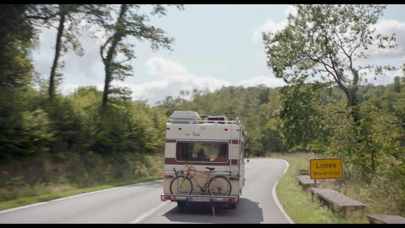
6. Auf nach Frankreich: Limes
6769 Limes, Belgien
49° 36' 59.9" N 5° 24' 3.6" E
49.6166400 5.4009900
• Head toward Route de la Soye on Route d'Orval (N88). Go for 7 m.
• Turn right onto N895. Go for 298 m.
• Continue on Route d'Orval (D110). Go for 8.7 km.
• Turn left onto Rue Henri de Premorel (D643). Go for 3.7 km.
• Turn right onto Rue Vauban (D110 D) toward Citadelle/Ville-Haute. Go for 70 m.
• Turn left onto Rue du Général Leclerc. Go for 328 m.
• Continue on Rue de Chiny. Go for 31 m.
• Turn left onto Rue de Chiny. Go for 166 m.
• Turn slightly left onto Place Raymond Poincaré. Go for 42 m.
• Turn left onto Place Raymond Poincaré. Go for 47 m.
• Arrive at Place Raymond Poincaré. Your destination is on the left.
☍
13,4 km
( 14 min.)
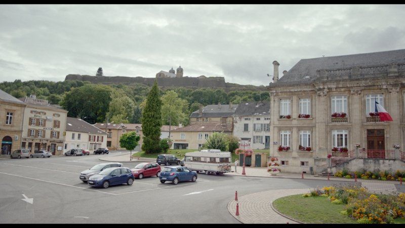
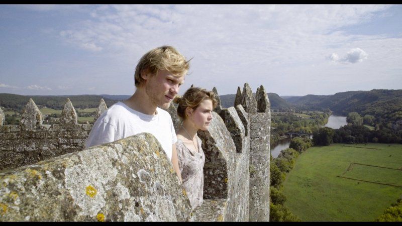
7. Zärtliche Berührung in Montmédy
the floweriest town hall square i know ..
55600 Montmédy, Frankreich
49° 31' 10.1" N 5° 21' 59.8" E
49.5194670 5.3666090
• Head north on Place Raymond Poincaré.
• Take the 1st exit from roundabout onto Place Raymond Poincaré. Go for 53 m.
• Turn right onto Rue Ernest Mabille (D643). Go for 303 m.
• Turn left onto Rue du Docteur Poulain (D643) toward Longwy/Luxembourg/Metz/Verdun/Longuyon. Go for 7.0 km.
• Turn right onto D905 toward Jametz/Damvillers/Verdun/Z.I. Marville. Go for 18.6 km.
• Turn right onto D125. Go for 484 m.
• Continue on Rue de la Mairie (D125). Go for 260 m.
• Continue on D125. Go for 4.0 km.
• Turn right onto D905. Go for 7.1 km.
• Take the 3rd exit from roundabout onto D964 toward Verdun/Bras S/M./Belleville S/M. Go for 1.7 km.
• Turn right onto Route de Charny (D115) toward Charny S/M. Go for 6.5 km.
• Pass 2 roundabouts and continue on Avenue Pierre Goubet et Jean van Heeghe (D38). Go for 1.7 km.
• Take the 1st exit from Carrefour du Souvenir Français roundabout onto Voie Sacrée (D603) toward A4/Paris/Châlons/Reims/Bar le Duc/Z.I. Baleycourt. Go for 6.9 km.
• Take the 2nd exit from roundabout onto Voie Sacrée (D1916) toward A4/Bar le Duc/Souilly/Lemmes/Les Souhesmes. Go for 24.6 km.
• Turn right onto D902 toward Rembercourt aux P./Givry en A./Clermont en A. Go for 5.6 km.
• Turn left onto Rue du Chanoine Joignon. Go for 111 m.
• Arrive at Rue du Chanoine Joignon. Your destination is on the right.
☍
85,0 km
(1 hrs. 10 min.)
8. Rembercourt-Sommaisne & der MHC-Faktor
1 Rue du Chanoine Joignon, 55250 Rembercourt-Sommaisne, Frankreich
48° 54' 35.3" N 5° 10' 49.5" E
48.9098192 5.1804239
• Head toward Rue Milaville on Rue du Chanoine Joignon. Go for 39 m.
• Turn right onto Rue Milaville (D148). Go for 50 m.
• Turn right onto Rue du 29ème B.C.P. (D902). Go for 5.7 km.
• Turn left onto Voie Sacrée (D1916). Go for 24.6 km.
• Take the 1st exit from roundabout onto Route de l'Argonne (D603) toward Metz/Verdun/Zone Industrielle de Baleycourt. Go for 5.4 km.
• Continue on Avenue du Varinot. Go for 702 m.
• Take the 2nd exit from roundabout onto Avenue du Général Boichut (D34 A) toward A4/(Metz)/Centre Ville/Centre Hospitalier/Centre Mondial de la Paix/Citadelle Souterraine. Go for 143 m.
• Take the 2nd exit from roundabout onto Avenue du Général Boichut (D34 A) toward A4/(Metz)/Nancy/Neufchâteau/Centre Ville. Go for 222 m.
• Turn left toward Centre Hospitalier St Nicolas/Centre Mondial de la Paix/Citadelle Souterraine. Go for 51 m.
• Continue on Avenue du Soldat Inconnu. Go for 652 m.
• Take the 2nd exit from roundabout onto Rue de Rû. Go for 323 m.
• Continue on Rue Victor Hugo. Go for 68 m.
• Take the 2nd exit from Place du Marché Couvert roundabout onto Place du Marché Couvert. Go for 64 m.
• Continue on Rue Pasteur. Go for 51 m.
• Arrive at Rue Pasteur. Your destination is on the left.
☍
38,0 km
( 31 min.)
9. In Verdun gibts leckres Eis
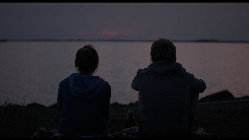
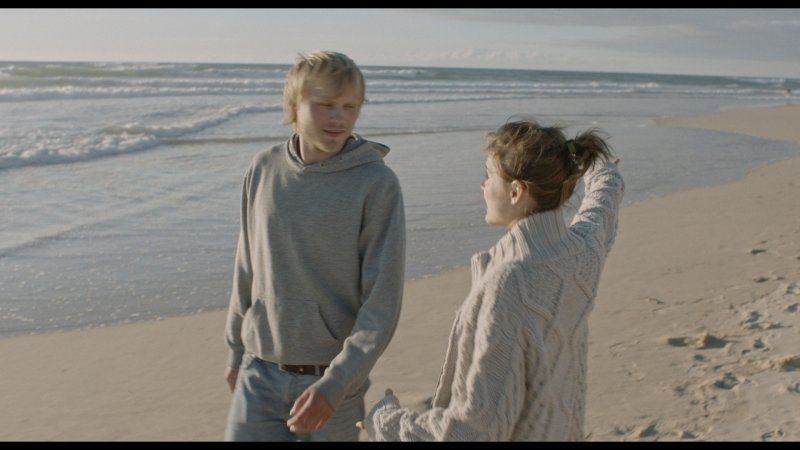
I fall in love here and here.
Arrondissement Verdun, Frankreich
49° 9' 35.6" N 5° 23' 3.9" E
49.1598764 5.3844231
• Head northeast on Rue Pasteur.
• Turn right onto Place du Maréchal Foch (D903). Go for 14 m.
• Continue on Rue Beaurepaire (D903). Go for 39 m.
• Continue on Pont Fernand Legay (D903). Go for 53 m.
• Continue on Place Chevert (D903). Go for 15 m.
• Take the 1st exit from roundabout onto Rue du Président Poincaré (D903). Go for 119 m.
• Turn right onto Rue Léon Gambetta. Go for 108 m.
• Continue on Rue d'Anthouard. Go for 80 m.
• Turn right onto Rue Victor Schleiter. Go for 59 m.
• Turn left onto Rue Saint-Louis. Go for 243 m.
• Continue on Place Saint-Nicolas. Go for 142 m.
• Turn right onto Rue du 61ème R.A. Go for 164 m.
• Take the 3rd exit from roundabout onto Avenue du 5ème Régiment d'Artillerie à Pied. Go for 674 m.
• Continue toward Avenue du 5ème Régiment d'Artillerie à Pied. Go for 13 m.
• Turn right onto Avenue du Général Boichut (D34 A). Go for 227 m.
• Take the 2nd exit from roundabout onto Avenue du Général Boichut (D34 A) toward A4/(Paris). Go for 133 m.
• Take the 2nd exit from roundabout onto Avenue du Varinot toward Châlons en Ch./Reims/Bar le Duc/Z.I. de Baleycourt. Go for 729 m.
• Continue on Route de l'Argonne (D603). Go for 5.3 km.
• Take the 2nd exit from roundabout onto Voie Sacrée (D1916) toward A4/Bar le Duc/Souilly/Lemmes/Les Souhesmes. Go for 4.0 km.
• Turn right onto D163 toward Paris/Metz/Les Souhesmes/Châlons en Ch. Go for 215 m.
• Take the 2nd exit from roundabout onto Zone d'Activité des Souhesmes (D163) toward A4/Paris/Metz/Les Souhesmes/Rampont. Go for 300 m.
• Take ramp onto A4 (Autoroute de l'Est) toward Paris. Go for 75.8 km.
• Take the exit toward St Gibrien/Épernay/Troyes/Orléans onto A26. Go for 96.4 km.
• Take the exit toward Orléans/Paris/Auxerre/Sens onto A5. Go for 69.8 km.
• Take the exit toward Sens/Provins/Orléans onto A19. Go for 28.5 km.
• Take the exit toward Orléans/Montargis onto A19. Go for 35.3 km.
• Take the exit toward Paris/Fontainebleau/Nevers. Go for 1.2 km.
• Take the exit onto A77. Go for 7.1 km.
• Take exit 18 toward Orléans/Montargis/Sully S/L./Châteauneuf S/L. Go for 436 m.
• Take the 3rd exit from roundabout onto Rue des Camélias toward A77/Montargis/Orléans/Sully S/L./Châteauneuf S/L. Go for 1.1 km.
• Take the 2nd exit from roundabout toward Orleans/Châteauneuf S/L. Go for 175 m.
• Take ramp onto D2060. Go for 23.9 km.
• Take the 2nd exit from roundabout onto D2060 toward Orléans. Go for 12.8 km.
• Take ramp toward St Martin d'Abbat/Châteauneuf S/ L./Combreux/Vitry aux Loges. Go for 324 m.
• Continue on D952 toward D10/Châteauneuf S/Loire/St Martin d'Abbat. Go for 355 m.
• Take the 3rd exit from roundabout onto D952. Go for 3.4 km.
• Take the 2nd exit from roundabout onto Grande Rue (D952) toward Centre Ville. Go for 491 m.
• Turn right onto Route de Germigny (C5) toward Germigny des Prés/Oratoire Carolingien. Go for 739 m.
• Continue on Route de Saint-Martin. Go for 490 m.
• Continue on Route de Saint-Benoît (D60). Go for 387 m.
• Turn right onto Lieu-dit Les Casseaux. Go for 35 m.
• Continue on Lieu-dit Les Casseaux. Go for 106 m.
• Continue on Route du Mesnil. Go for 405 m.
• Continue on Lieu-dit La Grosse Pierre. Go for 56 m.
• Turn right onto Route du Mesnil. Go for 390 m.
• Turn right onto Route du Mesnil. Go for 104 m.
• Turn left onto Rue Creuse. Go for 1.1 km.
• Arrive at Rue Creuse.
☍
373,5 km
(3 hrs. 21 min.)
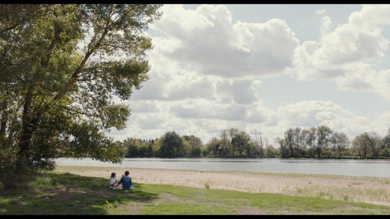
10. Picknick an der Loire
live like god in France, literally ..
Rue Creuse, 45110 Germigny-des-Prés, Frankreich
47° 49' 54" N 2° 14' 42.6" E
47.8316612 2.2451591
• Head toward Chemin des Varannes on Rue Creuse. Go for 1.1 km.
• Turn right onto Route du Mesnil. Go for 104 m.
• Turn left onto Route du Mesnil. Go for 390 m.
• Turn left onto Lieu-dit La Grosse Pierre. Go for 56 m.
• Continue on Route du Mesnil. Go for 405 m.
• Continue on Lieu-dit Les Casseaux. Go for 141 m.
• Turn left onto Route de Saint-Benoît (D60). Go for 387 m.
• Continue on Route de Saint-Martin. Go for 490 m.
• Continue on Route de Germigny. Go for 739 m.
• Turn left onto Grande Rue (D952). Go for 464 m.
• Pass 2 roundabouts and continue on D952/D960. Go for 3.5 km.
• Take ramp onto D2060 toward Montargis/Bellegarde. Go for 13.1 km.
• Take the 2nd exit from roundabout onto D2060 toward A77/Montargis/Bellegarde. Go for 23.7 km.
• Take ramp toward A77/Fontainebleau/Paris/Nevers/Parc d'Activités Arboria. Go for 410 m.
• Take the 4th exit from roundabout toward Fontainebleau/Paris/Nevers/Parc d'Activités Arboria. Go for 270 m.
• Continue toward Fontainebleau/Paris/Parc d'Activités Arboria. Go for 31 m.
• Take the 1st exit from roundabout onto Rue des Camélias toward Fontainebleau/Paris/Parc d'Activités Arboria. Go for 439 m.
• Take ramp onto A77 toward Fontainebleau/Paris. Go for 7.2 km.
• Take the exit toward Orléans/Metz/Nancy/Sens. Go for 773 m.
• Keep left toward A19. Go for 454 m.
• Take the exit toward Metz/Nancy/Sens/Montargis-Nord onto A19. Go for 33.7 km.
• Take the exit toward Metz/Nancy/Troyes/Sens onto A19. Go for 29.4 km.
• Take the exit toward Troyes/Metz/Nancy onto A5. Go for 51.1 km.
• Take exit 20 toward Troyes-Centre/Sainte Savine onto E511. Go for 2.9 km.
• Take the 2nd exit from roundabout onto D660 toward Troyes/Sainte Savine/Romilly S/Seine/La Rivière de Corps/Z.I. Torvilliers. Go for 1.5 km.
• Take the 3rd exit from roundabout onto D660 toward Troyes/La Chapelle St-Luc/Ste-Savine/Romilly S/Seine. Go for 1.6 km.
• Take the 2nd exit from roundabout onto Voie des Charrières (D660). Go for 1.6 km.
• Take the 4th exit from roundabout onto Rocade Ouest (D610) toward A26/Troyes-Centre/Barberey St S./Pont Ste Marie/Romilly S/Seine. Go for 10.0 km.
• Take ramp toward St Dizier/Nancy/Brienne le Ch. Go for 353 m.
• Turn left onto D960. Go for 140 m.
• Take the 2nd exit from roundabout onto Route Saint-Aventin (D960) toward St Dizier/Nancy/Creney près T./Brienne le Ch. Go for 384 m.
• Turn slightly left onto Rue de la République (D5) toward Creney-Centre. Go for 1.7 km.
• Continue on Rue Saint-Louis (D5). Go for 13 m.
• Continue on Route de Luyeres (D5). Go for 2.8 km.
• Continue on Lieu-dit Montmoret (D5). Go for 141 m.
• Continue on Rue des Commandos "M" (D5). Go for 3.6 km.
• Continue on D5. Go for 5.1 km.
• Continue on Lieu-dit Mortée (D5). Go for 62 m.
• Continue on D5. Go for 4.6 km.
• Continue on Route de Troyes (D5). Go for 4.3 km.
• Continue on D5. Go for 855 m.
• Continue on Lotissement Les Brichards (D5). Go for 39 m.
• Continue on D5. Go for 102 m.
• Turn right onto Grande Rue (D441). Go for 335 m.
• Turn left onto Rue du Moulin (D5). Go for 500 m.
• Turn right onto Rue Principale (D5). Go for 442 m.
• Continue on D5. Go for 1.1 km.
• Continue on Rue Principale (D5). Go for 6.6 km.
• Continue on D5. Go for 379 m.
• Continue on Rue de la Borde (D5). Go for 323 m.
• Turn right onto D5. Go for 328 m.
• Continue on Rue du Moulin (D5). Go for 1.2 km.
• Continue on Rue de la Sourdine (D5). Go for 846 m.
• Continue on D5. Go for 2.0 km.
• Continue on Rue de Cléreuil (D5). Go for 1.9 km.
• Continue on D5. Go for 510 m.
• Continue on D56. Go for 361 m.
• Continue on Lieu-dit Fontenay (D56). Go for 55 m.
• Continue on D56. Go for 1.2 km.
• Continue on Rue Principale (D56). Go for 805 m.
• Continue on D56. Go for 1.8 km.
• Continue on Rue du Fort Levesque (D56). Go for 114 m.
• Continue on Rue du Voyeu du Four (D56). Go for 351 m.
• Turn right onto Rue du Gilliard (D6). Go for 172 m.
• Continue on Rue du Bois (D6). Go for 273 m.
• Continue on Rue du Bois (D56). Go for 2.3 km.
• Continue on D56. Go for 1.1 km.
• Continue on Lieu-dit Surmont (D56). Go for 100 m.
• Continue on D56. Go for 2.8 km.
• Continue on Rue du Bois (D56). Go for 474 m.
• Continue on Rue Qui Boue (D127). Go for 3.7 km.
• Continue on Rue du Montier (D13). Go for 1.2 km.
• Continue on D13. Go for 1.6 km.
• Turn left onto D191. Go for 1.1 km.
• Turn slightly right onto D191. Go for 2.2 km.
• Continue on Rue Principale (D191). Go for 1.5 km.
• Take the 2nd exit from roundabout onto Route de Montier en der (D384) toward St Dizier/Éclaron. Go for 4.0 km.
• Turn left onto Rue du Lac (D153). Go for 650 m.
• Continue on D153. Go for 3.0 km.
• Arrive at D153.
☍
257,2 km
(2 hrs. 54 min.)
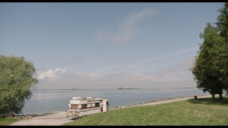
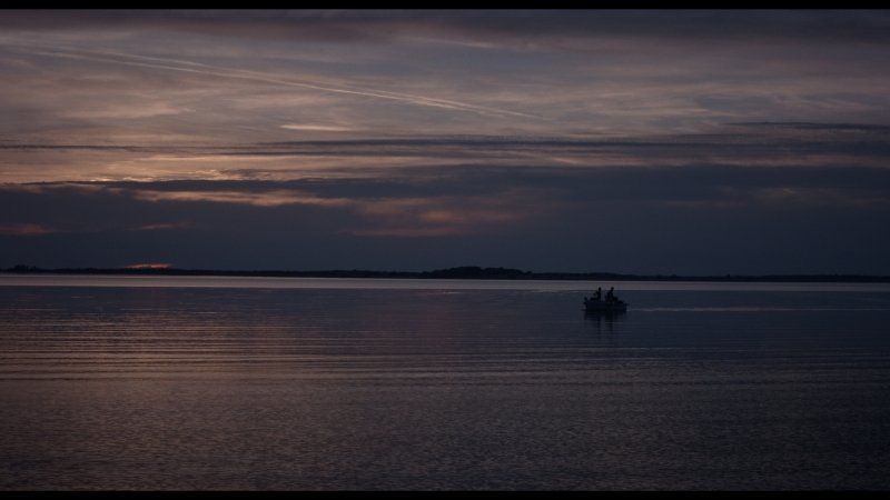
11. der Lac-du-Der - ein Traum!
32 D153, 52290 Éclaron-Braucourt-Sainte-Livière, Frankreich
48° 33' 34.7" N 4° 47' 24.8" E
48.5596325 4.7902107
• Head south on D153. Go for 3.0 km.
• Continue on Rue du Lac (D153). Go for 650 m.
• Turn right onto Rue du Souvenir (D384). Go for 4.0 km.
• Take the 2nd exit from roundabout onto Route de Montier-en-Der (D384) toward Troyes/Montier en D. Go for 3.7 km.
• Turn right onto Rue des Ponts (D384) toward Troyes/Ceffonds/Brienne le Ch./Bar S/Aube. Go for 1.5 km.
• Continue on D400. Go for 5.1 km.
• Take the 2nd exit from roundabout onto Rue Enson la Ville (D400) toward Troyes/Épothémont/Brienne le Ch. Go for 14.2 km.
• Keep right onto Route Juzanvigny (D400) toward Troyes/Zone Andra. Go for 322 m.
• Continue on Avenue Pasteur (D400). Go for 440 m.
• Take the 1st exit from roundabout onto Boulevard Napoléon (D396) toward A26/Troyes/Rosnay l'Hôpital/Vitry le François. Go for 699 m.
• Turn left onto Route de Lesmont (D960 A) toward A26/Troyes/St Leger S/S B./Piney/Arcis S/Aube/Lesmont. Go for 822 m.
• Continue on D960. Go for 22.7 km.
• Continue on D960. Go for 11.9 km.
• Take the 2nd exit from roundabout toward A26/Arcis S/Aube/Écrevolles/Aérodrome Troyes-Barberey. Go for 248 m.
• Continue on D610. Go for 9.7 km.
• Take ramp toward Paris-Lyon/A5/Sens/Estissac/Les Noës près T. Go for 296 m.
• Take the 2nd exit from roundabout onto D660 toward A5/Sens/Torvillers/Estissac/Montgueux. Go for 1.5 km.
• Take the 2nd exit from roundabout onto Voie des Charrières (D660). Go for 1.6 km.
• Take the 2nd exit from roundabout onto D660 toward A5/A26/Sens/Fontvannes/La Grange au Rez. Go for 1.5 km.
• Take the 2nd exit from roundabout onto E511 toward A5/E54/Sens/Paris/Orléans/Reims/Metz/Nancy/Lyon. Go for 2.2 km.
• Take ramp onto A5 toward Orléans/Paris/Sens. Go for 50.4 km.
• Take the exit toward Sens/Provins/Orléans onto A19. Go for 28.5 km.
• Take the exit toward Orléans/Montargis onto A19. Go for 35.3 km.
• Take the exit toward Paris/Fontainebleau/Nevers. Go for 1.2 km.
• Take the exit onto A77. Go for 87.8 km.
• Take exit 24 toward Sancerre/Suilly La Tour/Tracy S/Loire. Go for 385 m.
• Take the 1st exit from roundabout onto D4 toward Maltaverne/Tracy S/Loire/St Satur/Sancerre. Go for 287 m.
• Take the 2nd exit from roundabout onto Route des Braults (D4). Go for 5.2 km.
• Continue on Rue du Commerce (D9). Go for 314 m.
• Take the 2nd exit from roundabout onto Rue Paul Cannier (D955). Go for 1.5 km.
• Take the 3rd exit from roundabout onto Lieu-dit Le Petit Morice (D955). Go for 1.3 km.
• Take the 2nd exit from Carrefour Saint-Ladre roundabout onto Avenue de Verdun (D955). Go for 1.8 km.
• Keep right onto D955. Go for 22.9 km.
• Continue on Rue de la République (D12). Go for 101 m.
• Turn left onto Rue de la République (D955). Go for 949 m.
• Take the 3rd exit from roundabout onto Rue de la République (D955). Go for 13.4 km.
• Turn right onto N151. Go for 579 m.
• Pass 2 roundabouts and continue on Route de la Charité (N151). Go for 911 m.
• Take the 3rd exit from Porte de Saint-Germain du Puy roundabout onto Rocade Est (N142) toward A71/Montluçon/Châteauroux/Nevers. Go for 1.5 km.
• Pass 2 roundabouts and continue on Rocade Sud (N142). Go for 8.1 km.
• Take the 3rd exit from Porte de Saint-Amand-Montrond roundabout onto D2144 toward A71/Guéret/Montluçon/Levet/St Amand/La Châtre. Go for 29.0 km.
• Arrive at Route de Bourges (D2144). Your destination is on the left.
☍
377,5 km
(3 hrs. 58 min.)
12. Bruère-Allichamps: Le centre ...
.. de la france.
Bonjour!
Centre Géographique de la France Bruère-Allichamps, Rue Jean Rameau, 18200 Bruère-Allichamps, Frankreich
46° 46' 10.5" N 2° 25' 59.2" E
46.7695721 2.4331069
• Head south on Route de Bourges (D2144).
• Turn left onto Rue Jean Rameau (D92) toward La Celle/Meillant/Château de Meillant. Go for 448 m.
• Continue on Route de Bruère (D92). Go for 399 m.
• Continue on Place Saint-Blaise (D92). Go for 48 m.
• Arrive at Rue des Pèlerins (D92). Your destination is on the left.
☍
0,9 km
( 1 min.)
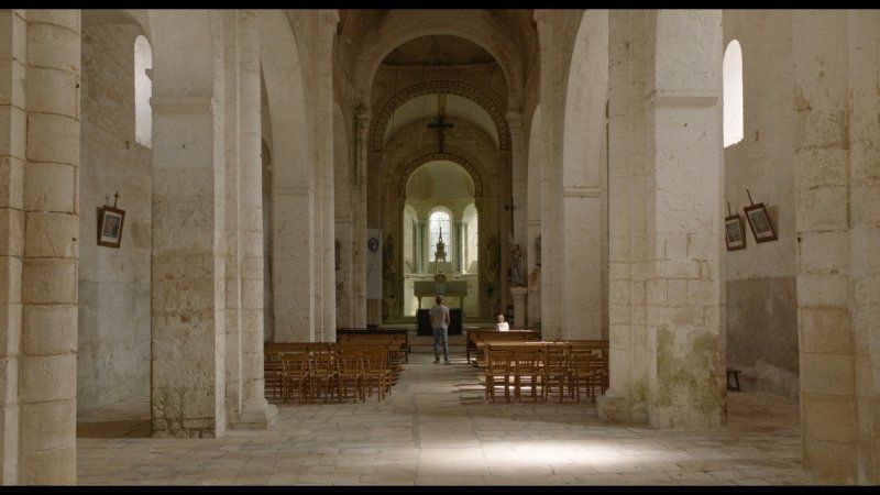
13. Die Kirche Sainte Blaise
2 Rue des Pèlerins, 18200 La Celle, Frankreich
46° 46' 6.1" N 2° 26' 38.7" E
46.7683557 2.4440718
• Head west on Rue des Pèlerins (D92). Go for 28 m.
• Turn left onto Rue de la Forêt (D92 E). Go for 1.0 km.
• Turn left onto D2144. Go for 2.6 km.
• Turn sharp right onto Route de Noirlac (D35) toward Abbaye de Noirlac. Go for 770 m.
• Arrive at Route de Noirlac (D35). Your destination is on the left.
☍
4,5 km
( 4 min.)
14. Lustwandeln in Klostergarten Noirlac
357 Noirlac, 18200 Bruère-Allichamps, Frankreich
46° 44' 44" N 2° 27' 37.1" E
46.7455516 2.4603111
• Head toward Lieu-dit Les Chevilles on Route de Noirlac (D35). Go for 770 m.
• Turn right onto D2144. Go for 1.9 km.
• Take the 2nd exit from roundabout onto Route de Bourges (D2144) toward Montluçon/Centre Ville. Go for 810 m.
• Take the 1st exit from roundabout onto Allée de la Vigne du Prince (D300) toward A71/Châteauroux/Orval/Culan/Lignières. Go for 655 m.
• Take the 2nd exit from roundabout onto D300 toward Châteauroux/Lignières. Go for 2.8 km.
• Take the 2nd exit from roundabout toward Montluçon/Clermont-Fd/Bourges/Paris. Go for 574 m.
• Take left ramp onto A71 toward Montluçon/Clermont-Fd. Go for 114 km.
• Take the exit toward Bordeaux/Limoges onto A89. Go for 161 km.
• Take the left exit toward E70/Toulouse/Bordeaux/Périgueux/Brive la G. onto A20 (L'Occitane). Go for 16.7 km.
• Take the exit toward Bordeaux/Périgueux/Sarlat onto A89 (Viaduc du Maumont). Go for 28.4 km.
• Take exit 17 toward St Yrieix la Perche. Go for 775 m.
• Take the 4th exit from roundabout toward Brive/Clermont-Fd/Le Lardin/Montignac/Terrasson/Jardins du Manoir d'Eyrignac. Go for 156 m.
• Continue on D6089. Go for 2.8 km.
• Turn right onto Route des Farges (D46) toward Les Farges. Go for 372 m.
• Continue on D46. Go for 91 m.
• Continue on Route des Chênes (D46). Go for 5.7 km.
• Continue on D46. Go for 106 m.
• Continue on Lieu-dit Le Blanquet (D46). Go for 85 m.
• Continue on D46. Go for 248 m.
• Continue on Lieu-dit Les Granges (D46). Go for 126 m.
• Continue on D46. Go for 624 m.
• Continue on Lieu-dit Le Charmont (D46). Go for 75 m.
• Continue on D46. Go for 200 m.
• Continue on Lieu-dit Basteboeuf (D46). Go for 182 m.
• Continue on D46. Go for 530 m.
• Take the 2nd exit from roundabout onto Avenue du Chambon (D704). Go for 985 m.
• Take the 1st exit from roundabout onto Rue de Juillet (D704). Go for 603 m.
• Continue on Rue du Docteur Mazel (D706). Go for 1.4 km.
• Pass 2 roundabouts and continue on D706. Go for 22.7 km.
• Take the 1st exit from Rond-Point de la Forge roundabout onto Avenue de la Forge (D706). Go for 452 m.
• Take the 2nd exit from roundabout onto Avenue du Cingle (D706). Go for 2.3 km.
• Turn left onto Lieu-dit Le Moulinet. Go for 346 m.
• Turn slightly left onto Lieu-dit Pagenal. Go for 483 m.
• Arrive at Lieu-dit Pagenal. Your destination is on the right.
☍
368,4 km
(3 hrs. 22 min.)
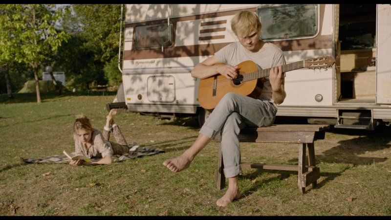
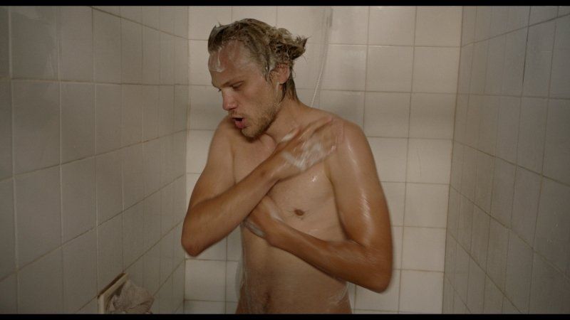
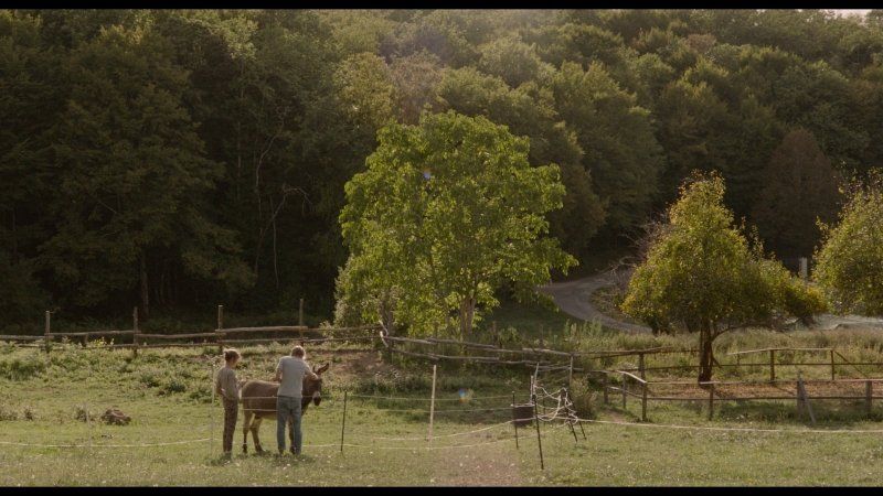
15. Leben wie die Hippies im Forêt Domaniale Barade
Lesen. Gitarre spielen und unter der Dusche singen ...
uund chillen mit dem Esel :)
gedreht auf dem wunderschönen Campingplatz
Garrigue Josette
Le Queylou, 24620 Les Eyzies-de-Tayac-Sireuil
fahrt da auf jeden Fall vorbei!
Unnamed Road, 24620 Les Eyzies-de-Tayac-Sireuil, Frankreich
44° 55' 17.6" N 0° 59' 46.8" E
44.9215590 0.9963226
• Head north on Lieu-dit Pagenal. Go for 483 m.
• Turn slightly right onto Lieu-dit Le Moulinet. Go for 346 m.
• Turn right onto D706. Go for 2.3 km.
• Take the 2nd exit from roundabout onto Avenue de la Préhistoire (D47). Go for 4.8 km.
• Turn right onto D31. Go for 408 m.
• Continue on Lieu-dit La Sablière (D31). Go for 115 m.
• Continue on D31. Go for 1.5 km.
• Turn left onto Route de Saint-Exupéry (D31). Go for 5.5 km.
• Continue on D31. Go for 295 m.
• Continue on Lieu-dit Le Malpas (D31). Go for 74 m.
• Continue on D31. Go for 1.3 km.
• Continue on Route du Périgord Noir (D31). Go for 818 m.
• Continue on Lieu-dit Boujou (D31). Go for 155 m.
• Continue on Route du Périgord Noir (D31). Go for 533 m.
• Take the 2nd exit from roundabout onto Route du Périgord Noir (D32). Go for 227 m.
• Turn left onto Route des Tuilières (D6). Go for 681 m.
• Take the 1st exit from roundabout onto Route de Jacquou le Croquant. Go for 25 m.
• Continue on D31. Go for 33 m.
• Continue on Route de Jacquou le Croquant (D31). Go for 4.8 km.
• Continue on D31. Go for 558 m.
• Continue on Lieu-dit Les Landes de la Salvetat (D31). Go for 89 m.
• Continue on D31. Go for 4.0 km.
• Continue on Lieu-dit Le Grand Bonnel (D31). Go for 110 m.
• Continue on D31. Go for 1.3 km.
• Continue on Lieu-dit Les Brandes (D31). Go for 93 m.
• Continue on D31. Go for 1.7 km.
• Continue on D6089. Go for 10.7 km.
• Take the 2nd exit from roundabout onto D6089 toward A89/Brive/Clermont-Fd/Le Lardin/Terrasson. Go for 658 m.
• Take the 1st exit from roundabout toward Brive/Clermont-Fd/Le Lardin/Terrasson. Go for 83 m.
• Continue on D6089. Go for 8.7 km.
• Take the 1st exit from roundabout onto D6089 toward A89 (Clermont Fd)/Brive/Terrasson. Go for 4.2 km.
• Pass 2 roundabouts and continue on Route de Brive (D6089). Go for 6.6 km.
• Take the 3rd exit from roundabout onto D1089 toward A20/Brive. Go for 673 m.
• Pass 2 roundabouts and continue on Avenue d'Aquitaine (D1089). Go for 4.0 km.
• Take the 3rd exit from roundabout onto Rue de Clermont (D1089) toward Brive/Clermont-Fd. Go for 1.0 km.
• Take the 2nd exit from roundabout onto Avenue Pierre Mendès France (D1089) toward A20. Go for 439 m.
• Take the 2nd exit from Rond-Point Rhin et Danube roundabout onto Avenue Jean-Charles Rivet (D1089) toward A20/Brive-Centre/Clermont-Fd. Go for 633 m.
• Take the 2nd exit from Rond-Point de la Vézère roundabout onto Avenue Jean-Charles Rivet (D1089) toward Tulle/Limoges/Brive-Centre/Z.I. Beauregard/Zones d'Activités de Cana/Lac du Causse. Go for 309 m.
• Take the 1st exit from Rond-Point André Lalande roundabout onto A20 (L'Occitane) toward Limoges/Tulle/Brive-Nord/Z.A. de Cana. Go for 21.2 km.
• Take exit 46.1 toward Lyon/Clermont-Fd/Tulle/St-Germain les V. onto A89. Go for 161 km.
• Take the left exit toward E11/Paris/Montluçon/Vichy onto A71. Go for 114 km.
• Take exit 8 toward Châteauroux/St Amand-Md. Go for 812 m.
• Take the 2nd exit from roundabout onto D300 toward Bourges. Go for 2.8 km.
• Continue toward Bourges/St Amand-Md/Dun S/A./Sancoins. Go for 40 m.
• Take the 3rd exit from roundabout onto D300 toward Bourges/St Amand-Md/Sancoins. Go for 742 m.
• Take the 3rd exit from roundabout onto Avenue du Général de Gaulle (D2144) toward Bourges/Bruère A. Go for 779 m.
• Continue toward Bourges/Bruère A. Go for 35 m.
• Take the 2nd exit from roundabout onto Avenue du Général de Gaulle (D2144) toward Bourges. Go for 1.9 km.
• Turn left onto Route de Noirlac (D35) toward Abbaye de Noirlac. Go for 869 m.
• Arrive at Route de Noirlac (D35). Your destination is on the left.
☍
373,8 km
(3 hrs. 36 min.)
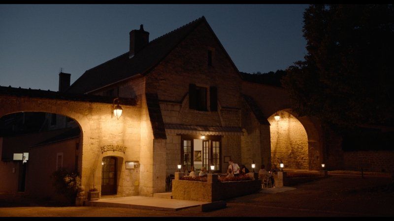
16. Französische Küche in der Auberge de l'Abbaye
http://aubergeabbayenoirlac.fr/
mmmmmhhh ..
363-455 Noirlac, 18200 Bruère-Allichamps, Frankreich
46° 44' 46.3" N 2° 27' 33.2" E
46.7462000 2.4592316
• Head southeast on Route de Noirlac (D35). Go for 869 m.
• Turn right onto D2144. Go for 1.9 km.
• Take the 2nd exit from roundabout onto Route de Bourges (D2144) toward Montluçon/Centre Ville. Go for 810 m.
• Take the 1st exit from roundabout onto Allée de la Vigne du Prince (D300) toward A71/Châteauroux/Orval/Culan/Lignières. Go for 655 m.
• Take the 2nd exit from roundabout onto D300 toward Châteauroux/Lignières. Go for 2.8 km.
• Take the 2nd exit from roundabout toward Montluçon/Clermont-Fd/Bourges/Paris. Go for 574 m.
• Take left ramp onto A71 toward Montluçon/Clermont-Fd. Go for 114 km.
• Take the exit toward Bordeaux/Limoges onto A89. Go for 161 km.
• Take the left exit toward E70/Toulouse/Bordeaux/Périgueux/Brive la G. onto A20 (L'Occitane). Go for 52.0 km.
• Take exit 55 toward Sarlat/Souillac. Go for 2.3 km.
• Take the 3rd exit from roundabout onto Route de Martel (D804) toward Sarlat/Souillac. Go for 1.8 km.
• Take the 3rd exit from roundabout onto Avenue du Général de Gaulle (D820) toward Cahors/Sarlat/Centre Ville. Go for 335 m.
• Take the 1st exit from roundabout onto Avenue Jean Jaurès (D103) toward Sarlat. Go for 901 m.
• Take the 3rd exit from roundabout onto Avenue de Verdun (D231). Go for 364 m.
• Take the 2nd exit from roundabout onto Avenue de Sarlat (D804) toward Sarlat/Cazoulès/Carlux/Jardins du Manoir d'Eyrignac. Go for 15.4 km.
• Continue on D703 toward D704 A/Sarlat/Montignac/Z.A.E Périgord Noir. Go for 116 m.
• Continue on Route de l'Enéa (D704 A). Go for 6.0 km.
• Take the 2nd exit from roundabout onto Route de Souillac (D704 A) toward Sarlat. Go for 755 m.
• Continue on Avenue du Périgord (D704) toward Sarlat. Go for 1.8 km.
• Take the 3rd exit from roundabout onto Avenue Simone Veil (D704) toward Sarlat/Brive/Périgueux/Bergerac/Sarlat-Centre Ville. Go for 668 m.
• Pass 2 roundabouts and continue on Avenue du Colonel Beltrame (D704). Go for 814 m.
• Take the 3rd exit from roundabout onto Avenue de la Dordogne (D46) toward Bergerac/St André Allas/Vézac/Vitrac. Go for 206 m.
• Take the 2nd exit from roundabout onto Avenue de la Dordogne (D46) toward Bergerac. Go for 586 m.
• Take the 1st exit from roundabout onto Avenue Joséphine Baker (D57) toward Bergerac. Go for 7.1 km.
• Continue on D49 toward Bergerac/Lalinde/Beynac/Château de Beynac. Go for 817 m.
• Continue on D703 toward Bergerac/Lalinde/Beynac/Château de Beynac. Go for 1.3 km.
• Turn right onto Rue de la Laïcité toward Château Féodal du XIIème-X VIIème. Go for 77 m.
• Turn left onto Chemin de Peirelène. Go for 110 m.
• Arrive at Chemin de Peirelène. Your destination is on the right.
☍
375,4 km
(3 hrs. 30 min.)
17. Burg Beynac: die Weite des Doretals
D703, 24220 Beynac-et-Cazenac, Frankreich
44° 50' 26.2" N 1° 8' 28.6" E
44.8406000 1.1412770
• Head toward Chemin de la Balmette on Chemin de Peirelène. Go for 74 m.
• Turn slightly right onto Chemin de Peirelène. Go for 12 m.
• Turn right onto Lieu-dit La Balme. Go for 42 m.
• Turn right onto Rue de la Laïcité. Go for 39 m.
• Turn right onto Route des Gabarriers (D703). Go for 16.3 km.
• Take the 3rd exit from roundabout onto Avenue de la Dordogne (D710) toward Fumel/Belvès. Go for 4.6 km.
• Take the 3rd exit from roundabout onto D710 toward Monpazier/Fumel. Go for 1.8 km.
• Turn right onto D52 toward Belvès/Monpazier/Z.I le Martoulet. Go for 547 m.
• Turn left toward Lieu-dit La Crout. Go for 135 m.
• Continue on Lieu-dit La Crout. Go for 1.0 km.
• Continue on Lieu-dit Taillefer. Go for 98 m.
• Continue on Lieu-dit Le Pinier. Go for 747 m.
• Continue on Lieu-dit Grand Castang. Go for 782 m.
• Turn slightly left onto D53. Go for 12.1 km.
• Turn left onto Route de Cahors (D660). Go for 363 m.
• Turn right onto Route de Villeréal (D2) toward Villeréal/Monflanquin/Biron/Château de Biron. Go for 5.5 km.
• Turn left onto D2 E4. Go for 1.4 km.
• Continue on Lieu-dit Cladet (D2 E4). Go for 709 m.
• Continue on D2 E4. Go for 1.0 km.
• Continue on Lieu-dit Beauséjour (D2 E4). Go for 84 m.
• Continue on D2 E4. Go for 483 m.
• Continue on Lieu-dit Benne (D2 E4). Go for 141 m.
• Continue on D2 E4. Go for 514 m.
• Continue on D272. Go for 1.1 km.
• Continue on Lieu-dit Chapeyrou (D272). Go for 116 m.
• Continue on D272. Go for 372 m.
• Continue on D255. Go for 107 m.
• Continue on D272. Go for 359 m.
• Continue on Lieu-dit Las Tres Peyres (D272). Go for 99 m.
• Continue on D272. Go for 674 m.
• Continue on Lieu-dit Fraysse (D272). Go for 73 m.
• Continue on Lieu-dit le moulin de Fraysse (D272). Go for 121 m.
• Continue on D272. Go for 458 m.
• Continue on Lieu-dit Chopine (D272). Go for 40 m.
• Continue on D272. Go for 564 m.
• Continue on Lieu-dit Moulin Blanc (D272). Go for 60 m.
• Continue on Route de Monpazier (D272). Go for 119 m.
• Continue on D272. Go for 1.9 km.
• Continue on Lieu-dit Rougeal (D272). Go for 98 m.
• Continue on D272. Go for 465 m.
• Continue on Lieu-dit La Tuilerie (D272). Go for 107 m.
• Continue on D272. Go for 246 m.
• Continue on Lieu-dit Le Maynet (D272). Go for 101 m.
• Continue on D272. Go for 520 m.
• Take the 1st exit from roundabout onto Route de Monpazier (D272). Go for 244 m.
• Take the 1st exit from roundabout onto Lieu-dit Laurès (D272). Go for 164 m.
• Continue on D272. Go for 43 m.
• Continue on Route de Monflanquin (D272). Go for 1.5 km.
• Continue on D272. Go for 194 m.
• Continue on Lieu-dit Peyrearnaud (D272). Go for 84 m.
• Continue on D272. Go for 968 m.
• Continue on Lieu-dit Malaoudes (D272). Go for 149 m.
• Continue on D272. Go for 354 m.
• Continue on Route de Montagnac (D150). Go for 213 m.
• Turn right onto Route de Lacaussade (D124). Go for 230 m.
• Turn left onto Avenue de la Libération (D124). Go for 711 m.
• Keep left onto D676. Go for 9.0 km.
• Turn right onto D216. Go for 408 m.
• Continue on Lieu-dit Taberne (D216). Go for 95 m.
• Continue on Route de Ledat (D216). Go for 2.8 km.
• Turn slightly left onto Route de Ledat (D216). Go for 1.6 km.
• Continue on Lieu-dit Laurissol (D216). Go for 67 m.
• Continue on D216. Go for 1.1 km.
• Continue on Lieu-dit Carme (D216). Go for 83 m.
• Continue on D216. Go for 131 m.
• Continue on Lieu-dit Laroudière (D216). Go for 80 m.
• Continue on D216. Go for 276 m.
• Continue on Route de la Lède (D216). Go for 719 m.
• Continue on D216. Go for 606 m.
• Continue on Lieu-dit Claret (D216). Go for 74 m.
• Continue on Lieu-dit Darrey Laborde (D216). Go for 357 m.
• Continue on Lieu-dit Les Moulins (D216). Go for 489 m.
• Continue on Lieu-dit Fauconnié (D216). Go for 179 m.
• Continue on D216. Go for 38 m.
• Continue on Lieu-dit La Palue (D216). Go for 110 m.
• Continue on D216. Go for 411 m.
• Turn right onto Remparts Rovinhan Balencs (D133). Go for 336 m.
• Take the 3rd exit from Place Saint-Joseph roundabout onto D225. Go for 1.8 km.
• Continue on Lieu-dit Malpas (D225). Go for 95 m.
• Continue on D225. Go for 284 m.
• Continue on Lieu-dit Gary (D225). Go for 135 m.
• Continue on Route du Pruneau (D225). Go for 2.8 km.
• Continue on Route de Hauterive (D225). Go for 1.8 km.
• Continue on D225. Go for 285 m.
• Continue on Lieu-dit La Clède (D225). Go for 7 m.
• Continue on D225. Go for 198 m.
• Continue on Lieu-dit Martines (D225). Go for 102 m.
• Continue on D225. Go for 172 m.
• Continue on Route de Castelmoron (D225). Go for 833 m.
• Continue on Lieu-dit Ramonjavel (D225). Go for 66 m.
• Continue on D225. Go for 388 m.
• Continue on Lieu-dit Baladas (D225). Go for 157 m.
• Continue on D225. Go for 414 m.
• Continue on Lieu-dit La Croix de Michelet (D225). Go for 101 m.
• Continue on D225. Go for 258 m.
• Continue on Lieu-dit Régnié (D225). Go for 79 m.
• Continue on D225. Go for 788 m.
• Continue on Lieu-dit Pupilles (D225). Go for 101 m.
• Continue on D225. Go for 701 m.
• Continue on Lieu-dit Cornière (D225). Go for 150 m.
• Continue on Route de Saint-Étienne-de-Fougères (D225). Go for 581 m.
• Take the 2nd exit from roundabout onto Avenue de Comarque (D13). Go for 415 m.
• Take the 1st exit from roundabout onto Chemin de Ronde (D314). Go for 228 m.
• Turn left onto Chemin de Ronde (D249). Go for 228 m.
• Continue on Route de Laparade (D249). Go for 428 m.
• Continue on D249. Go for 792 m.
• Continue on Route de Clairac (D249). Go for 2.2 km.
• Continue on Lieu-dit Jacquet du Plet (D249). Go for 158 m.
• Continue on Lieu-dit Le Plet (D249). Go for 114 m.
• Continue on D249. Go for 184 m.
• Arrive at D249. Your destination is on the left.
☍
97,2 km
(1 hrs. 31 min.)
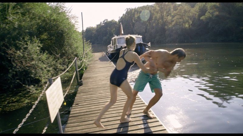
18. Erfrischung im Lot
off to the lively cool water :)
D249, 47260 Laparade, Frankreich
44° 23' 1.3" N 0° 26' 58.8" E
44.3836941 0.4496670
• Head toward Lieu-dit Roussannes on D249. Go for 1.6 km.
• Turn right onto Lieu-dit Roussannes (D911). Go for 87 m.
• Continue on D911. Go for 1.6 km.
• Continue on Lieu-dit Mourès (D911). Go for 138 m.
• Continue on D911. Go for 620 m.
• Continue on Lieu-dit La Bique (D911). Go for 97 m.
• Continue on D911. Go for 1.1 km.
• Continue on Lieu-dit Béziat (D911). Go for 53 m.
• Continue on D911. Go for 662 m.
• Continue on Rue Saffin (D911). Go for 593 m.
• Take the 2nd exit from roundabout onto Place Viçoze (D911). Go for 151 m.
• Turn left onto Place de l'Hôtel de Ville (D271). Go for 154 m.
• Turn right onto Rue Porte Pinte (D271). Go for 176 m.
• Continue on D271. Go for 31 m.
• Continue on Lieu-dit Gaillardy (D271). Go for 175 m.
• Continue on D271. Go for 181 m.
• Continue on Lieu-dit Le Vigan (D271). Go for 179 m.
• Continue on D271. Go for 426 m.
• Continue on Lieu-dit Le Barrail (D271). Go for 187 m.
• Continue on D271. Go for 223 m.
• Continue on Lieu-dit Veyrines (D271). Go for 781 m.
• Continue on Lieu-dit Le Vignau (D271). Go for 134 m.
• Continue on Lieu-dit Fernand (D271). Go for 613 m.
• Continue on D271. Go for 371 m.
• Continue on Route de Clairac (D271). Go for 1.4 km.
• Continue on D271. Go for 1.3 km.
• Keep right onto Rue du Maréchal Foch (D271). Go for 846 m.
• Turn left onto Avenue du Général Leclerc (D813). Go for 1.3 km.
• Keep right onto Avenue Jean-François Poncet (D642) toward Aiguillon/Damazan. Go for 1.8 km.
• Turn right onto Route des Landes (D8) toward A62/Damazan/Buzet S/Baïse. Go for 4.3 km.
• Take the 3rd exit from roundabout onto Lieu-dit Bagnoque (D8). Go for 262 m.
• Pass 2 roundabouts and continue on D8. Go for 24.9 km.
• Take the 3rd exit from roundabout onto Route des Landes (D933) toward Mt de Marsan/Lubbon/Gabarret. Go for 48.0 km.
• Take the 3rd exit from roundabout onto D933 toward Mt de Marsan. Go for 1.1 km.
• Continue toward Mt de Marsan. Go for 35 m.
• Take the 2nd exit from roundabout onto Route de Bordeaux (D932) toward Mt de Marsan. Go for 1.1 km.
• Take the 2nd exit from roundabout onto Route de Bordeaux (D932). Go for 3.4 km.
• Take the 4th exit from roundabout onto Rocade Est (D932 E) toward Dax/Bayonne. Go for 3.2 km.
• Pass 3 roundabouts and continue on Rocade Sud (N124 E). Go for 8.8 km.
• Take ramp onto D824 toward Dax/Bayonne/St Pierre du Mt/Le Manot/Mt de Marsan-Centre. Go for 533 m.
• Pass 3 roundabouts and continue on D824. Go for 52.6 km.
• Take ramp toward St Paul lès Dax-la Pince/Magescq/Léon. Go for 187 m.
• Turn right onto Avenue des Lacs (D16). Go for 3.2 km.
• Continue on Lieu-dit Le Grand Denis (D16). Go for 915 m.
• Continue on Route de Dax (D16). Go for 3.0 km.
• Continue on D16. Go for 18 m.
• Continue on Avenue de la Chalosse (D16). Go for 2.8 km.
• Pass 2 roundabouts and continue on Avenue de la Chalosse (D16). Go for 459 m.
• Turn right onto Rue Marie Curie. Go for 207 m.
• Turn left onto Avenue de la Forêt (D150). Go for 47 m.
• Turn slightly right onto Rue de la République (D16). Go for 51 m.
• Take the 2nd exit from roundabout onto Avenue du Marensin (D16). Go for 847 m.
• Turn left onto Route d'Azur (D150). Go for 2.4 km.
• Continue on Lieu-dit Ireye (D150). Go for 149 m.
• Continue on D150. Go for 841 m.
• Continue on Lieu-dit Lessègues (D150). Go for 85 m.
• Continue on Lieu-dit Bergan (D150). Go for 2.7 km.
• Turn right onto Rue Bel Air (D50). Go for 820 m.
• Take the 1st exit from roundabout onto Avenue Émile Sescousse (D50). Go for 78 m.
• Take the 2nd exit from roundabout onto Rue de la Fontaine (D50). Go for 379 m.
• Continue on D50. Go for 767 m.
• Continue on Route de Messanges (D50). Go for 1.4 km.
• Continue on D50. Go for 3.3 km.
• Continue on Avenue de la Gemme (D50). Go for 252 m.
• Continue on Lieu-dit Pierroulet (D50). Go for 416 m.
• Continue on Avenue de la Gemme (D50). Go for 178 m.
• Take the 2nd exit from roundabout onto Avenue de la Gemme (D50). Go for 427 m.
• Take the 1st exit from roundabout onto Route des Lacs (D652). Go for 1.8 km.
• Turn left onto Lieu-dit Étang de la Prade. Go for 885 m.
• Keep right. Go for 1.3 km.
• Arrive at your destination.
☍
195,1 km
(2 hrs. 30 min.)
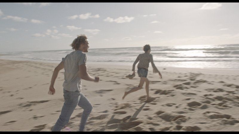
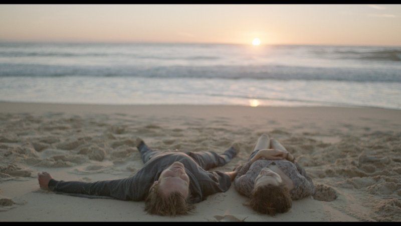
19. ENDLICH AM MEER! Messanges
the destination of every traveler
Unnamed Road, 40660 Messanges, Frankreich
43° 50' 14.1" N 1° 23' 52.5" W
43.8372592 -1.3979244