Day
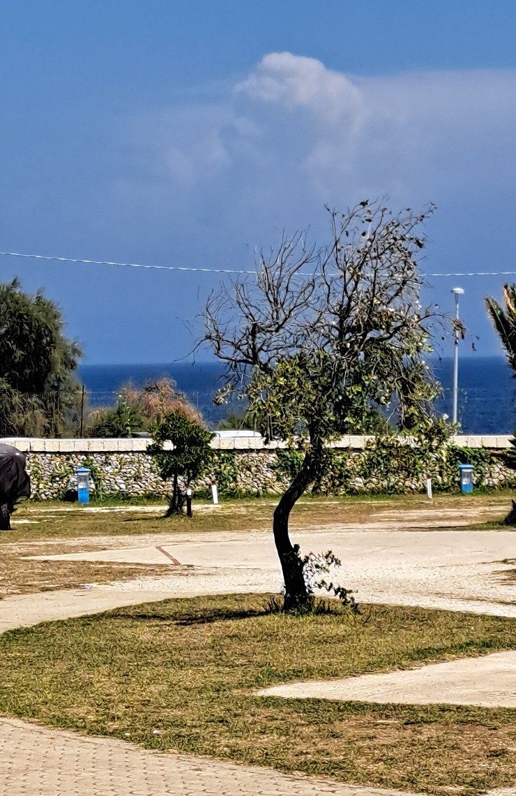
Herrieden
Deutschland
49° 14' 7.3" N 10° 29' 41.9" E
49.2353489 10.4949623
• Head toward Altmühlhaag on Ansbacher Straße (St2248). Go for 62 m.
• Turn right onto Neunstetterstraße (St2249). Go for 1.2 km.
• Take the 2nd exit from roundabout onto St2249. Go for 3.3 km.
• Turn left onto Dorfplatz (St1066). Go for 1.5 km.
• Take ramp onto A6 toward Heilbronn. Go for 15.9 km.
• Take exit 48 toward Füssen/Ulm/Feuchtwangen-West onto A7. Go for 222 km.
• Continue on Grenztunnel Füssen (B179). Go for 49.1 km.
• Continue on Mieminger Bundesstraße (B189). Go for 13.4 km.
• Take the 1st exit from roundabout onto Krebsbach (L236) toward Innsbruck/Bregenz/Mötz. Go for 5.0 km.
• Turn right and take ramp onto A12 (Inntal Autobahn) toward Innsbruck. Go for 35.6 km.
• Keep right onto A13 (Knoten Innsbruck-Wilten) toward E45/Bozen/Brenner/Innsbruck-Süd. Go for 33.5 km.
• Continue on A22 (Autostrada del Brennero). Go for 131 km.
• Take the exit toward Trento Nord/Centro. Go for 745 m.
• Take the 1st exit from roundabout onto Strada dell'Interporto (SP235) toward Trento Centro/Arco-Riva D/G/Verona/Padova. Go for 2.8 km.
• Take ramp onto Strada Statale dell'Abetone e del Brennero (SS12) toward Trento Centro/Brennero-Modena/A22/Verona/Riva del Garda/SS45bis/Trento Sud. Go for 2.0 km.
• Take ramp toward Brennero-Modena/A22/Riva del Garda/SS45bis. Go for 353 m.
• Turn right onto Via Dotto Vela (SS45bis) toward Arco/Riva del Garda/Comano T.-Tione. Go for 14.7 km.
• Take the 2nd exit from roundabout onto Strada Statale Gardesana Occidentale (SS45bis) toward Madonna di Campiglio/SP245/Riva del Garda. Go for 2.6 km.
• Take the 1st exit from roundabout onto Via Caffaro (SS237) toward Madonna di Campiglio/Tione di Trento/Comano Terme. Go for 8.3 km.
• Take the 2nd exit from roundabout. Go for 66 m.
• Continue on Strada Statale del Caffaro (SS237). Go for 2.3 km.
• Take the 2nd exit from roundabout onto Via Guglielmo Marconi (SS237). Go for 10.8 km.
• Take the 2nd exit from roundabout onto Strada Statale del Caffaro (SS237) toward M.Campiglio. Go for 2.4 km.
• Take the 3rd exit from roundabout onto Via Circonvallazione (SS237) toward Brescia/Storo. Go for 10.7 km.
• Take the 2nd exit from roundabout. Go for 2.4 km.
• Take the 2nd exit from roundabout onto Via Palazzo. Go for 1.4 km.
• Take the 3rd exit from roundabout onto Strada Statale del Caffaro (SS237). Go for 2.2 km.
• Take the 2nd exit from roundabout onto Strada Statale del Caffaro (SS237) toward Storo/Brescia. Go for 5.4 km.
• Take the 2nd exit from roundabout toward Storo/Brescia. Go for 152 m.
• Continue on Strada Statale del Caffaro (SS237). Go for 2.3 km.
• Take the 1st exit from roundabout onto Strada Statale del Caffaro (SS237) toward Brescia. Go for 5.1 km.
• Turn left onto Via Campini. Go for 1.4 km.
• Continue on Località Ponte dei Tedeschi. Go for 315 m.
• Turn right onto Via Strada Provinciale (SP69) toward Bondone/Baitoni. Go for 316 m.
• Continue on Via Aldo Sette (SP69). Go for 545 m.
• Continue on Via Lago (SP69). Go for 894 m.
• Turn right onto Via Porto Camarelle. Go for 346 m.
• Turn right. Go for 117 m.
• Arrive at your destination on the left.
☍
593,0 km
(6 hrs. 16 min.)
Day
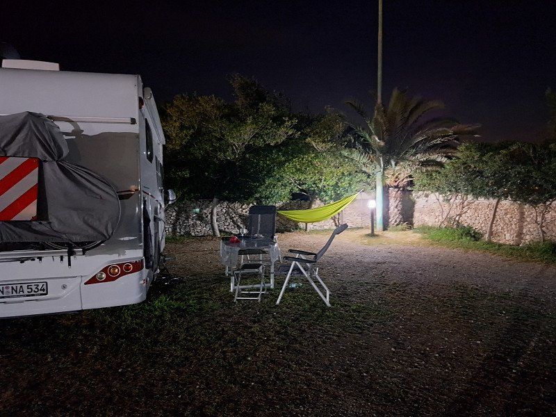
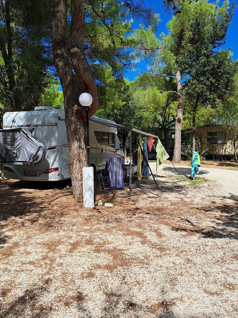
Camping Miralago
Very nice, small, family-run campsite with an adjacent biotope for walking
Porto Camarelle 3, 38080, Baitoni di Bondone, Italien
45° 48' 10" N 10° 32' 6.1" E
45.8027700 10.5350400
• Head northeast.
• Arrive at your destination on the left.
☍
Distance not available
(Duration not available)
Day
Camping Miralago
Porto Camarelle 3, 38080, Baitoni di Bondone, Italien
45° 48' 10" N 10° 32' 6.1" E
45.8027700 10.5350400
• Head toward Via Porto Camarelle. Go for 117 m.
• Turn left onto Via Porto Camarelle. Go for 346 m.
• Turn left onto Via Lago (SP69). Go for 719 m.
• Turn slightly left onto Via Lago (SP69). Go for 175 m.
• Continue on Via Aldo Sette (SP69). Go for 545 m.
• Continue on Via Strada Provinciale (SP69). Go for 306 m.
• Turn left onto Località Ponte dei Tedeschi. Go for 335 m.
• Continue on Via Campini. Go for 1.4 km.
• Turn left onto Strada Provinciale del Caffaro (SPBS237). Go for 3.6 km.
• Take the 2nd exit from roundabout onto Strada Provinciale del Caffaro (SPBS237) toward Anfo/Salò/Brescia. Go for 4.6 km.
• Pass 2 roundabouts and continue on Strada Provinciale del Caffaro (SPBS237). Go for 12.6 km.
• Take the 3rd exit from roundabout onto Strada Provinciale del Caffaro (SPBS237) toward Autostrada/A4/Brescia/Salò/Barghe. Go for 431 m.
• Take the 2nd exit from roundabout onto Strada Provinciale del Caffaro (SPBS237). Go for 12.9 km.
• Continue on La Guarda. Go for 1.9 km.
• Continue on Monte Castello. Go for 1.6 km.
• Continue on Via Fibbia. Go for 176 m.
• Take left ramp onto Strada Statale Gardesana Occidentale (SS45bis) toward Trento/Salò-Desenzano/Autostrade/A4/A35/Brescia. Go for 18.4 km.
• Continue on Tangenziale Est. Go for 550 m.
• Take ramp toward Torino/A21/Piacenza/Milano/A4/Venezia. Go for 528 m.
• Take the 2nd exit from roundabout onto Svincolo Brescia Est toward A4/A21. Go for 178 m.
• Take ramp onto A4 (Autostrada della Serenissima) toward Venezia. Go for 47.3 km.
• Take the exit toward Brennero-Modena/Verona Nord/Aeroporto/Mantova/Modena/Bologna/A1 onto A22 (Autostrada del Brennero). Go for 84.5 km.
• Take the exit toward Campogalliano. Go for 846 m.
• Take the 3rd exit from roundabout onto Viale del Lavoro toward Campogalliano/Autoporto Doganale/Rubiera. Go for 669 m.
• Take the 2nd exit from roundabout onto Viale del Lavoro toward Modena/Carpi/Reggio Emilia. Go for 297 m.
• Take the 1st exit from roundabout onto Strada Provinciale di Campogalliano (SP13) toward Bologna/Modena/Soliera. Go for 1.4 km.
• Take the 2nd exit from roundabout onto Strada Campogalliano (SP13) toward Modena. Go for 1.6 km.
• Keep right onto Strada Nazionale per Carpi Nord (SP413) toward Autostrade/Modena/Bologna/SS9/Milano/Ospedale Civile Baggiovara. Go for 1.4 km.
• Take left ramp onto Tangenziale Nord Luigi Pirandello toward Bologna. Go for 2.5 km.
• Keep left onto Tangenziale Nord Giosuè Carducci toward Bologna/A1/SS9. Go for 2.3 km.
• Continue on Tangenziale Nord Boris Leonidovic Pasternak. Go for 2.9 km.
• Keep left onto Via Nuova Estense toward Bologna/A1/Abetone/SS12/Vignola/SP623/Ospedale Civile Baggiovara. Go for 1.2 km.
• Take the 3rd exit from roundabout onto Strada Provinciale del Passo Brasa (SP623) toward Bologna/A1/Vignola. Go for 5.1 km.
• Take the 2nd exit from roundabout onto Strada Provinciale del Passo Brasa (SP623) toward Autostrada/A1/Spilamberto/Vignola. Go for 1.7 km.
• Take the 3rd exit from roundabout onto A1 (Autostrada del Sole) toward Bologna. Go for 17.6 km.
• Keep right onto A14 (Autostrada Adriatica) toward Ancona/Ravenna/Padova/A13/Tangenziale/Bologna Borgo Panigale/Bologna Centro/Aeroporto Bologna/Fiera Bologna. Go for 94.1 km.
• Take the exit toward Cesena Nord/Zona Industriale Pievesestina/Dogana/Forlimpopoli onto Via 2 Giugno. Go for 780 m.
• Take the 2nd exit from Rotonda 8 Marzo roundabout onto Via Dino Rondani (SS71) toward Cesena/Forlì/SS9/Forlimpopoli/Zona Industriale Pievesestina. Go for 1.4 km.
• Take the 2nd exit from Rotonda Napoleone Colajanni roundabout onto Viale del Commercio (SS71). Go for 747 m.
• Turn left onto Viale del Commercio (SS71). Go for 228 m.
• Take the 3rd exit from Rotonda Giuseppe Saragat roundabout onto Via Torino (SP140) toward Cesena Centro/Ospedale/E55/Ancona/A14. Go for 503 m.
• Pass 2 roundabouts and continue on Via Torino (SP140). Go for 2.2 km.
• Take the 2nd exit from Rotonda Martorano roundabout onto Via Vittoria Mariani (SP140). Go for 3.3 km.
• Take the 2nd exit from Rotonda della Solidarietà roundabout toward Bologna/A14/Ancona/Cesena Centro/Ospedale. Go for 37 m.
• Turn right onto Piazzale dell'Accoglienza. Go for 97 m.
• Take the 2nd exit from Rotonda della Pace roundabout toward Bologna/Ancona. Go for 302 m.
• Take the 4th exit from Rotonda Rita Levi Montalcini roundabout onto A14 (Autostrada Adriatica) toward Ancona. Go for 56.6 km.
• Take the exit toward Pesaro/Urbino. Go for 604 m.
• Keep right onto Strada di Montefeltro (SP423). Go for 261 m.
• Take the 1st exit from roundabout onto Strada di Montefeltro (SP423) toward Pesaro Centro/Rimini/SS16/Ancona. Go for 960 m.
• Continue toward Strada di Montefeltro/SP423. Go for 48 m.
• Take the 2nd exit from roundabout toward Ancona/Rimini/Pesaro Centro. Go for 103 m.
• Continue on Strada di Montefeltro (SP423). Go for 899 m.
• Take the 1st exit from roundabout onto Via Jurij Gagarin. Go for 355 m.
• Take the 3rd exit from roundabout onto Via Jurij Gagarin toward Pesaro Centro/Ancona. Go for 367 m.
• Continue toward Ponte Papa Giovanni Paolo II. Go for 38 m.
• Take the 1st exit from roundabout onto Ponte Papa Giovanni Paolo II toward Fano/Ancona/Candelara. Go for 573 m.
• Continue on Via Sandro Pertini. Go for 1.3 km.
• Take the 3rd exit from roundabout onto Via Sandro Pertini toward Centro. Go for 418 m.
• Take the 2nd exit from roundabout onto Via Sandro Pertini toward Fano/S.Veneranda/S.M.dell'Arzilla/Candelara/Novilara. Go for 1.0 km.
• Take the 3rd exit from roundabout onto Via Sandro Pertini. Go for 653 m.
• Take the 1st exit from roundabout onto Via Sandro Pertini. Go for 217 m.
• Take the 2nd exit from roundabout onto Strada Pantano Castagni. Go for 170 m.
• Turn right. Go for 259 m.
• Pass 2 roundabouts. Go for 1.3 km.
• Take the 1st exit from roundabout onto Via Cesare Lombroso (SP25). Go for 424 m.
• Take the 2nd exit from roundabout onto Strada Provinciale Panoramica Ardizio (SP25). Go for 3.1 km.
• Turn right onto Strada Nazionale Adriatica Nord (SS16). Go for 185 m.
• Turn right onto Località San Biagio. Go for 146 m.
• Turn slightly left onto Strada Comunale della Galassa. Go for 949 m.
• Turn right onto Strada Comunale della Galassa. Go for 796 m.
• Arrive at Località Roncosambaccio.
☍
408,0 km
(4 hrs. 34 min.)
Day
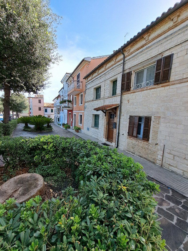
Strada Comunale di Galassa
Motorhome pitch "Sosta Camper il Rospo"
Very modern Womo parking space with dog run. Showers cost an extra €0.50 for 4 minutes.
Unfortunately the train and road traffic is to the detriment of the site but we found it ok for 1 night.
Fano, Pesaro und Urbino, Italien
43° 52' 0.8" N 12° 57' 55.9" E
43.8668904 12.9655238
• Head north on Località Roncosambaccio. Go for 75 m.
• Turn right onto Località Roncosambaccio. Go for 421 m.
• Continue on Località San Biagio. Go for 972 m.
• Take the 2nd exit from roundabout onto Strada Comunale della Galassa. Go for 210 m.
• Turn right onto Strada Nazionale Adriatica Nord (SS16). Go for 3.4 km.
• Take the 1st exit from roundabout onto Viale Bruno Buozzi (SS16) toward Ancona/Roma/Autostrada/A14. Go for 489 m.
• Take the 1st exit from roundabout onto Via Roma toward Autostrada/A14/Flaminia/SP3/Roma/SS73bis. Go for 174 m.
• Take the 2nd exit from roundabout onto Via Roma toward Autostrada/A14/Roma/SS73bis. Go for 665 m.
• Take the 3rd exit from roundabout onto Via Sandro Pertini toward Autostrada/A14/Ancona/SS16/Roma/SS73bis. Go for 381 m.
• Take the 2nd exit from roundabout onto Via Sandro Pertini toward Autostrada/A14/Ancona/SS16/Roma/SS73bis. Go for 464 m.
• Continue on Via Bellandra. Go for 70 m.
• Take the 2nd exit from roundabout onto Strada Statale di Bocca Trabaria (SS73bis) toward Autostrada/A14/Urbino/Roma/Perugia/Gubbio. Go for 709 m.
• Take ramp toward Bologna/E55/Taranto/A14/Flaminia/SP3/Bellocchi. Go for 599 m.
• Take the 3rd exit from roundabout onto A14 (Autostrada Adriatica) toward Ancona. Go for 22.2 km.
• Take the exit toward Senigallia. Go for 553 m.
• Take the 1st exit from roundabout toward Pesaro/SS16/Ancona/Ospedale/Aeroporto. Go for 716 m.
• Take the 1st exit from roundabout onto Complanare Sud di Senigallia toward Ancona/SS16/Aeroporto. Go for 4.1 km.
• Take the 1st exit from roundabout onto Strada Statale Adriatica (SS16) toward Aeroporto/Ancona. Go for 8.3 km.
• Take the 2nd exit from roundabout onto Via Marina (SS16). Go for 586 m.
• Turn right onto Via Alessandro Manzoni toward Montemarciano. Go for 118 m.
• Turn left onto Via Gioacchino Rossini. Go for 28 m.
• Turn right onto Via Roma (SP2). Go for 1.7 km.
• Turn slightly left onto Strada Provinciale Sirolo Senigallia (SP2). Go for 1.1 km.
• Take the 2nd exit from roundabout. Go for 116 m.
• Take the 4th exit from roundabout. Go for 446 m.
• Take ramp onto A14 (Autostrada Adriatica) toward Ancona. Go for 94.0 km.
• Take the exit toward Grottammare/Grottammare Centro/SS16/S. Benedetto D. T./Cupra M./Acquaviva P. Go for 528 m.
• Turn left toward Viale della Fratellanza. Go for 208 m.
• Continue on Viale della Fratellanza. Go for 468 m.
• Take the 1st exit from roundabout toward Grottammare Sud/S. Benedetto D.I. Go for 50 m.
• Continue on Strada Statale Adriatica (SS16). Go for 6.0 km.
• Take the 2nd exit from roundabout onto Superstrada Ascoli Mare (SP227) toward Autostrade/Raccordo Autostradale/A14. Go for 4.0 km.
• Take ramp onto RA11 (Raccordo Autostradale Ascoli-Porto d'Ascoli) toward Ascoli Piceno/E55/A14/A24. Go for 1.3 km.
• Take the exit toward Bologna-Taranto/Pescara onto A14 (Autostrada Adriatica). Go for 197 km.
• Take the exit toward Poggio Imperiale/Lesina. Go for 897 m.
• Take the 2nd exit from roundabout onto Strada Scorrimento Veloce del Gargano (SS693) toward Poggio I.-Rodi G./Peschici-Vieste. Go for 52.3 km.
• Keep right onto Strada Scorrimento Veloce del Gargano (SS693) toward Vieste/Vico del Gargano/Peschici. Go for 8.2 km.
• Turn left onto SP528. Go for 332 m.
• Continue on SP144. Go for 71 m.
• Continue on SP528. Go for 5.7 km.
• Turn right onto SS89 toward Peschici/Vieste. Go for 6.4 km.
• Turn left onto SS89. Go for 2.6 km.
• Take the 1st exit from roundabout onto SS89 toward Vieste/Mattinata/Manfredonia. Go for 10.5 km.
• Continue on Cascina Mandrione (SS89). Go for 266 m.
• Continue on SS89. Go for 8.8 km.
• Continue on Località Pietà toward Centro/Peschici Litoranea. Go for 20 m.
• Continue on Via Dante Alighieri. Go for 1.0 km.
• Continue on Via Guglielmo Marconi. Go for 41 m.
• Take the 3rd exit from roundabout onto Via Guglielmo Marconi. Go for 242 m.
• Turn left onto Via Madonna della Libera toward Centro. Go for 251 m.
• Turn left onto Viale 24 Maggio. Go for 21 m.
• Turn right onto Via Milano. Go for 11 m.
• Arrive at Via Milano. Your destination is on the right.
☍
449,3 km
(5 hrs. 1 min.)
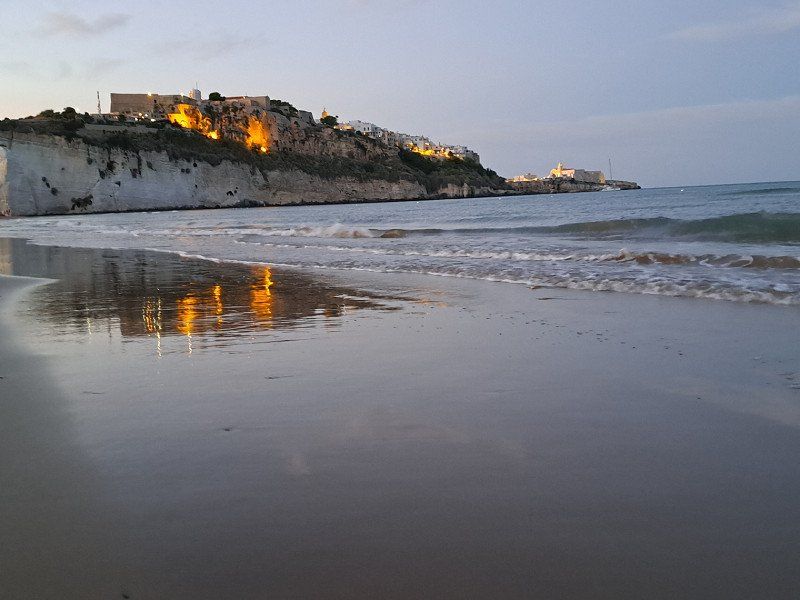
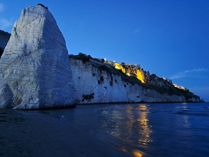
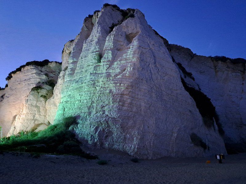
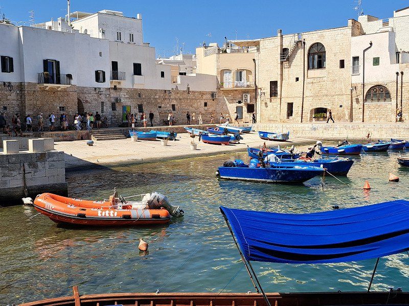
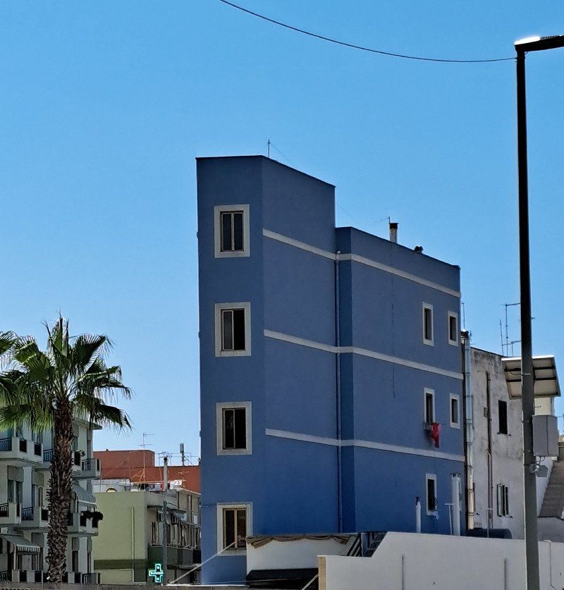
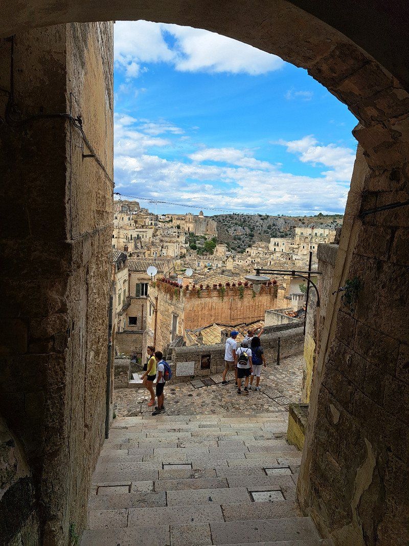
Day
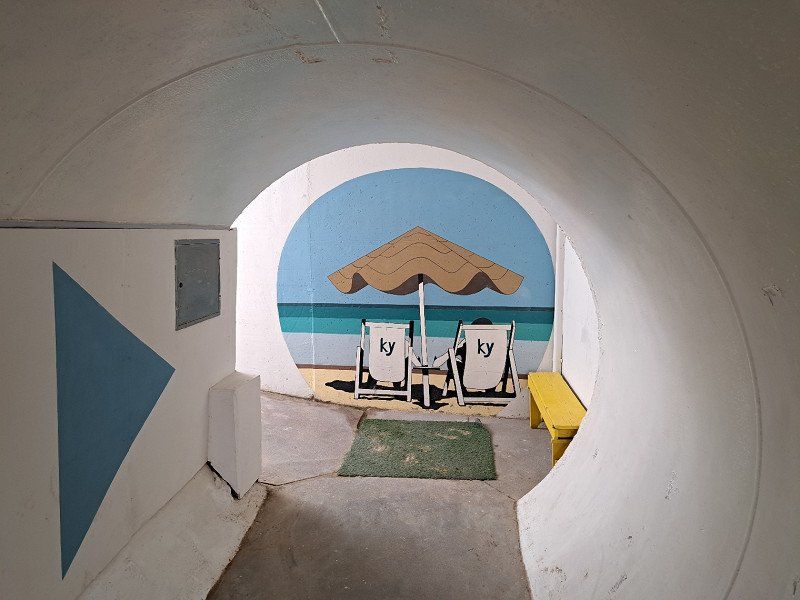
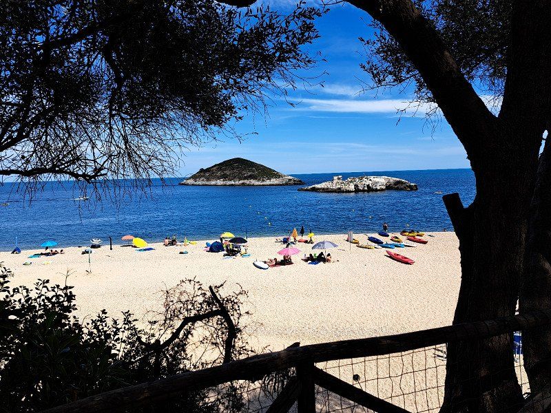
Vieste
Camping Arizona
not our first choice to stay but in August without a reservation you have to take the place where you get what.
And the place was well located for a trip to Vieste.
There by bike in 10 minutes.
Evening walk on the beach
Foggia, Italien
41° 52' 56.9" N 16° 10' 36.3" E
41.8824764 16.1767489
• Head north on Via Milano.
• Arrive at Via Milano. Your destination is on the right.
☍
Distance not available
(Duration not available)
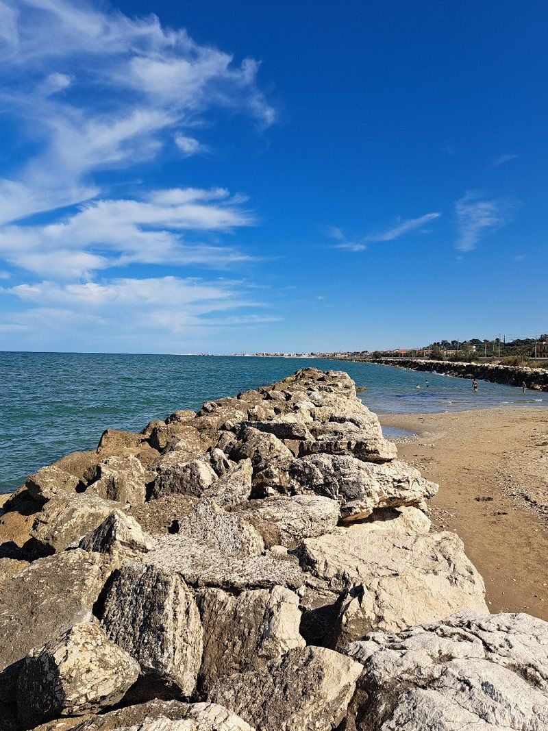
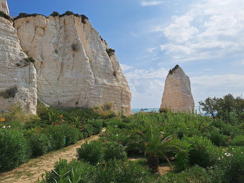
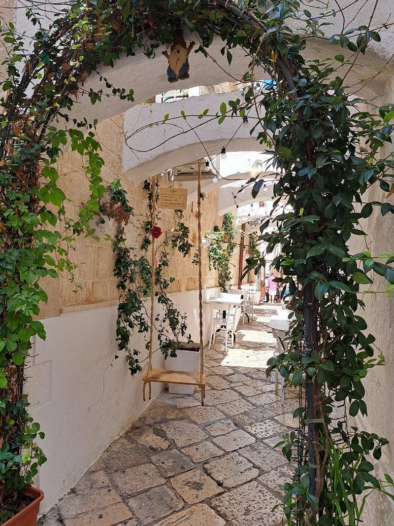
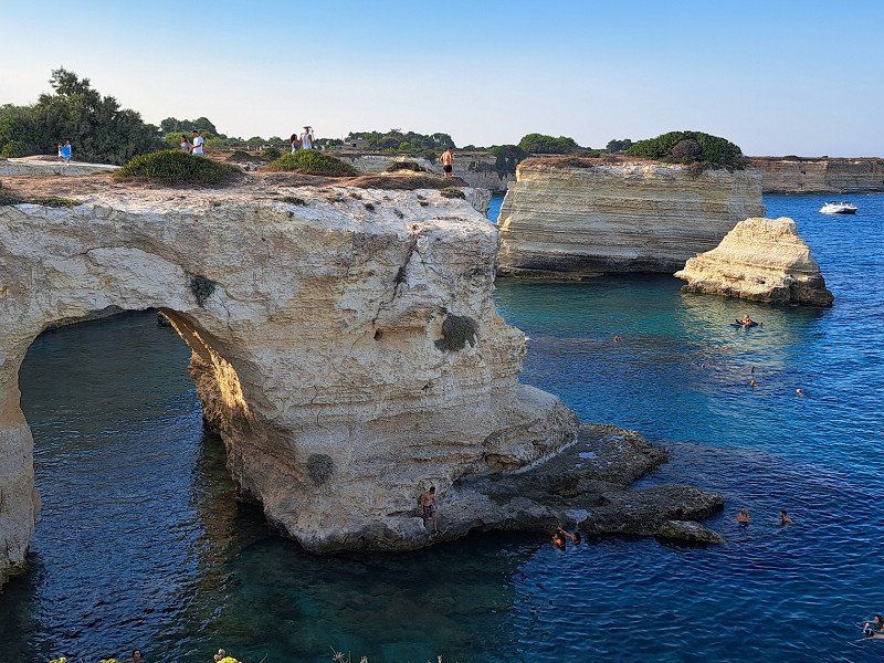
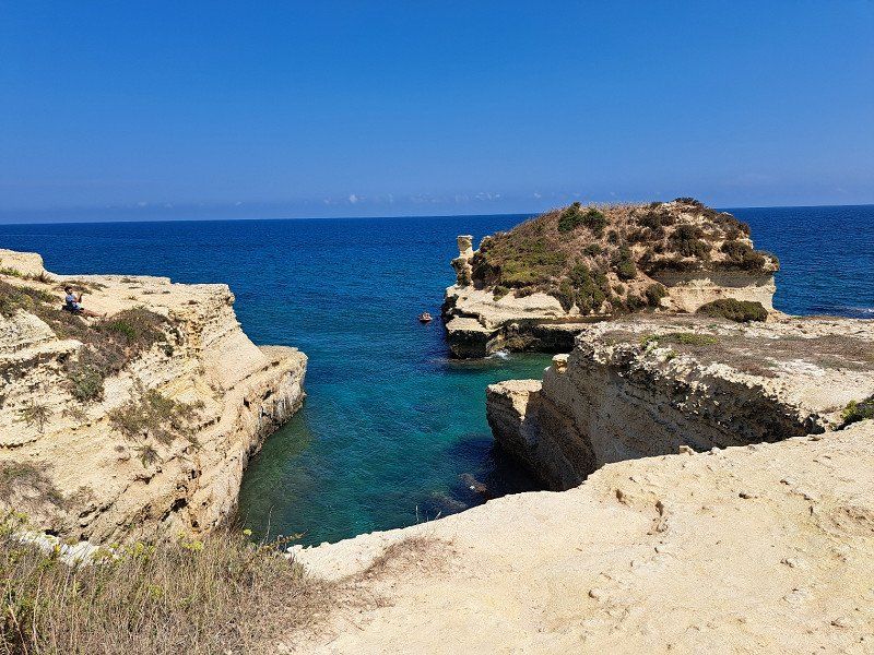
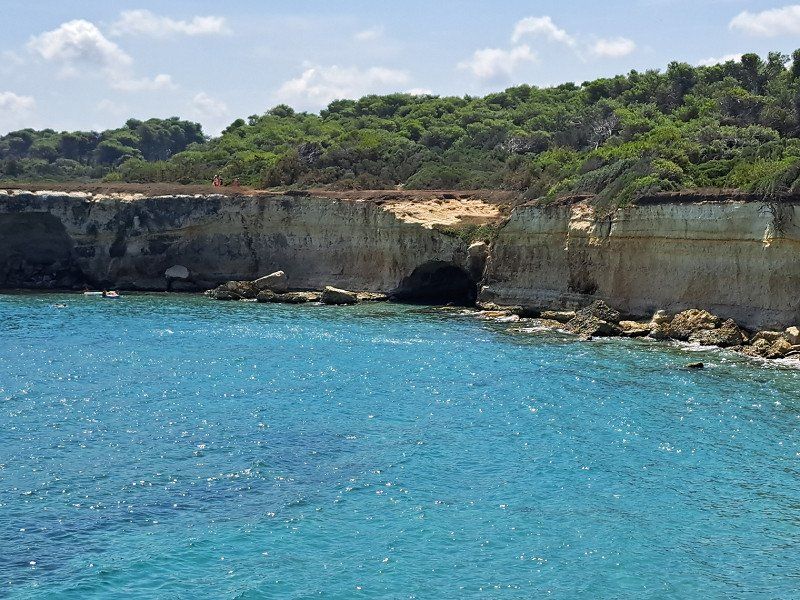
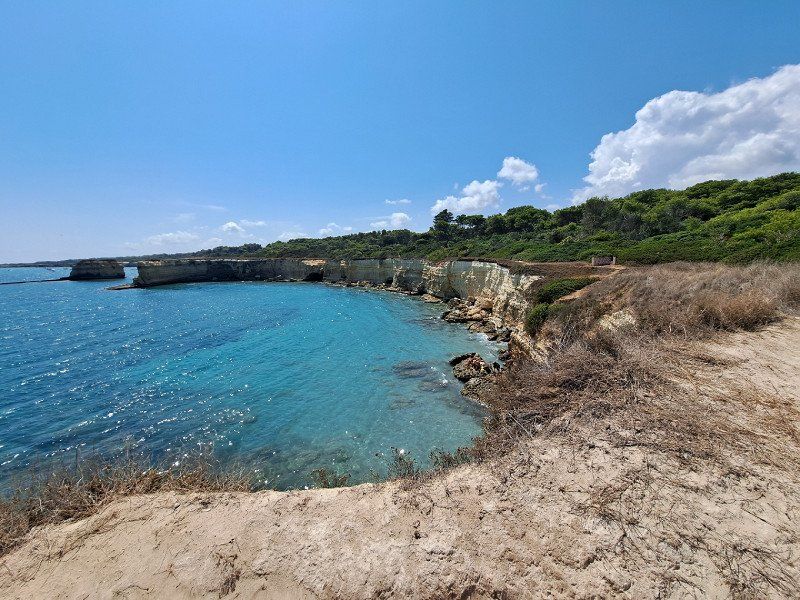
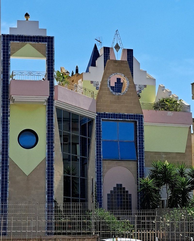
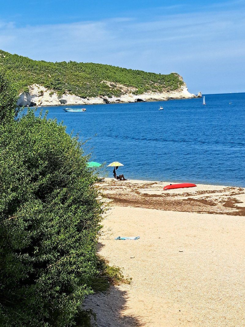
Day
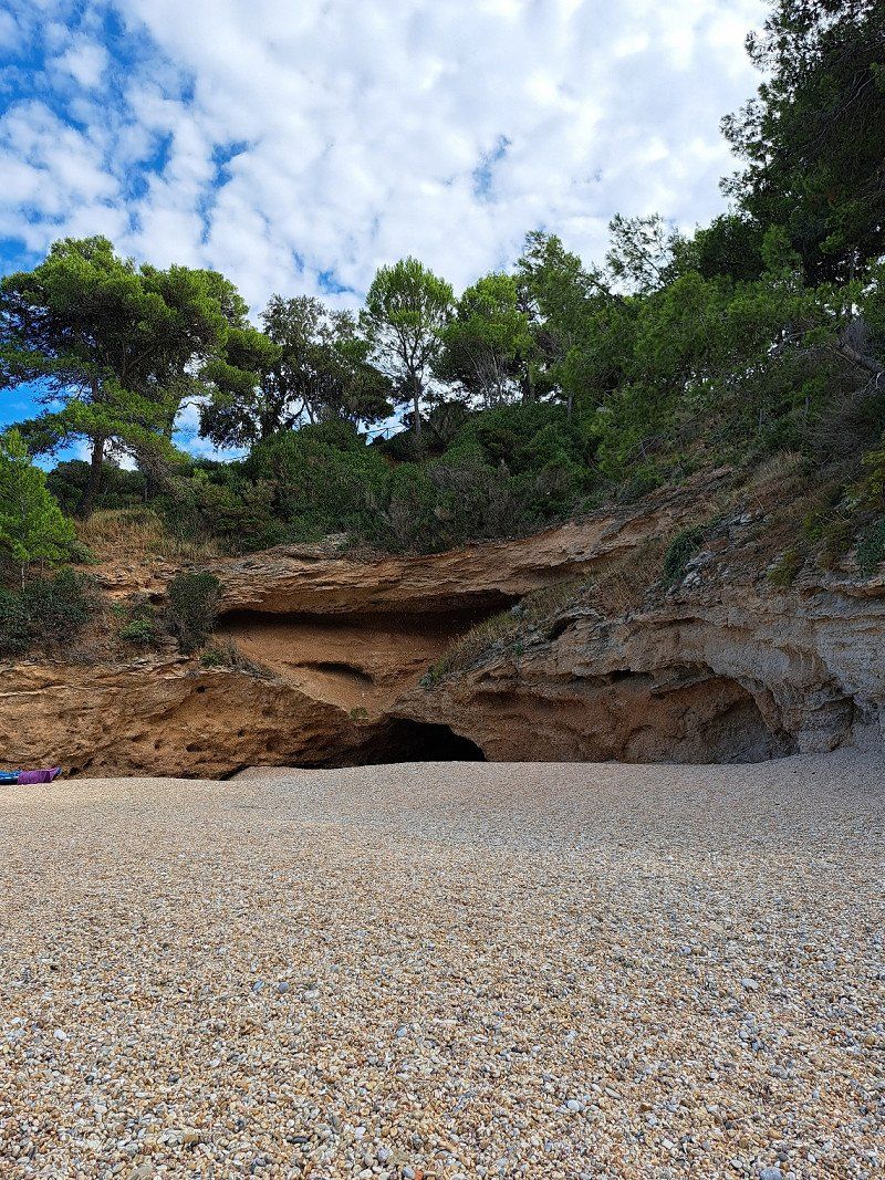
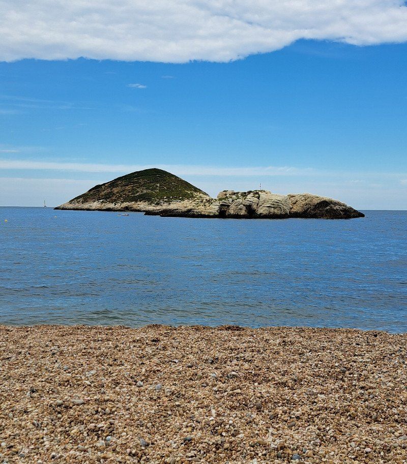
Vieste
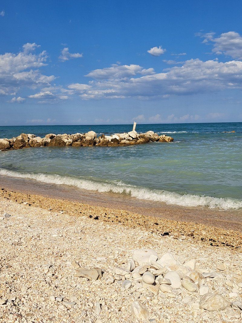
Camping Arizona
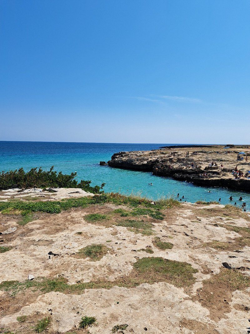
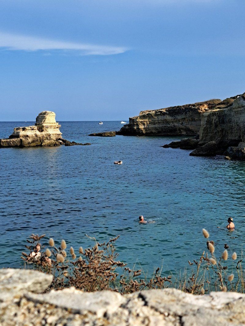
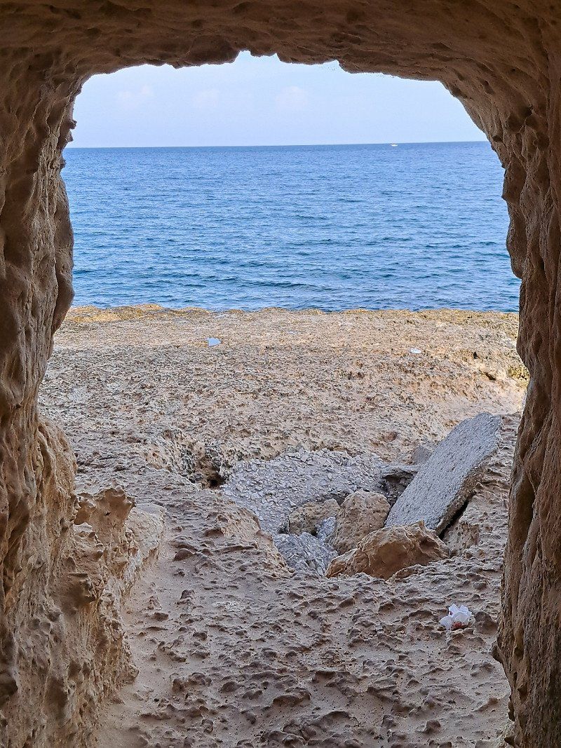
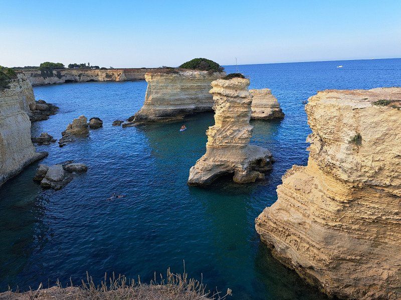
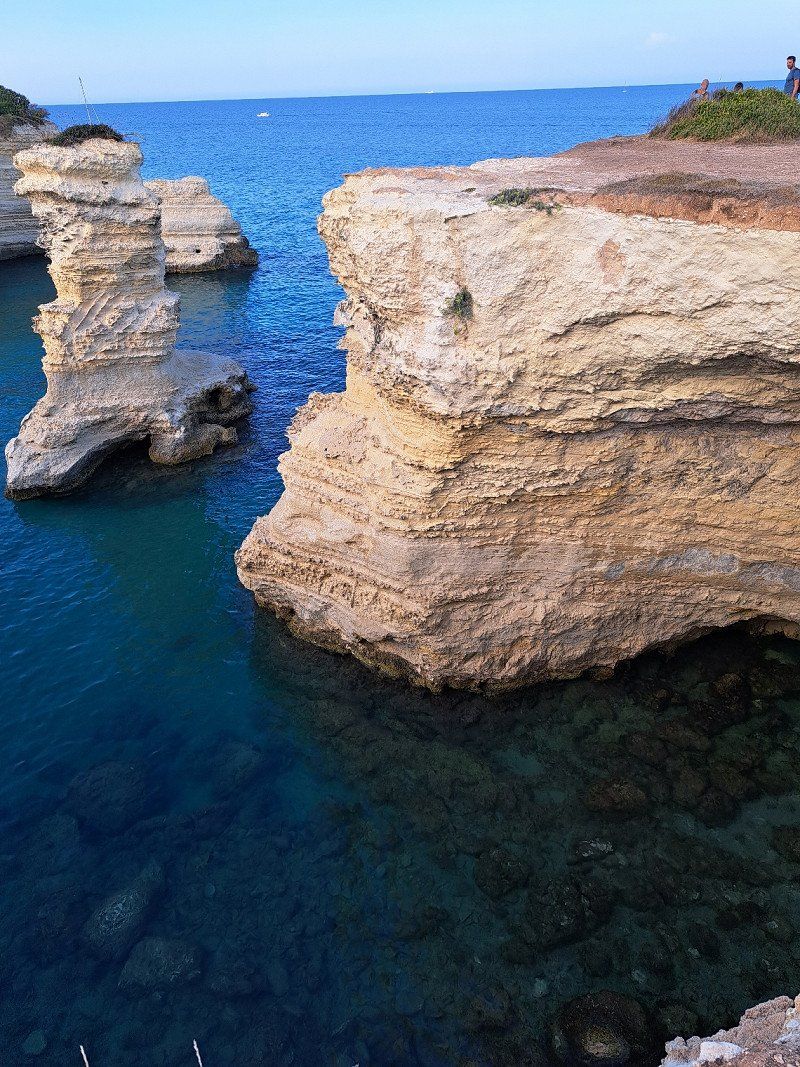
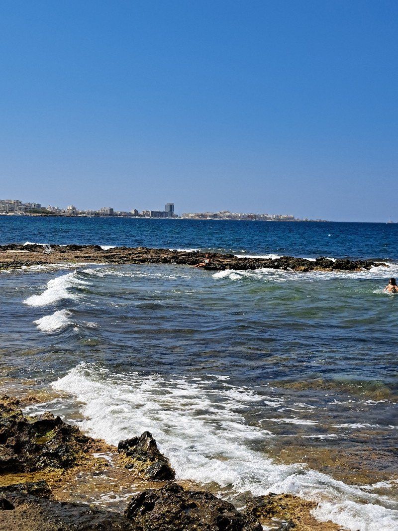
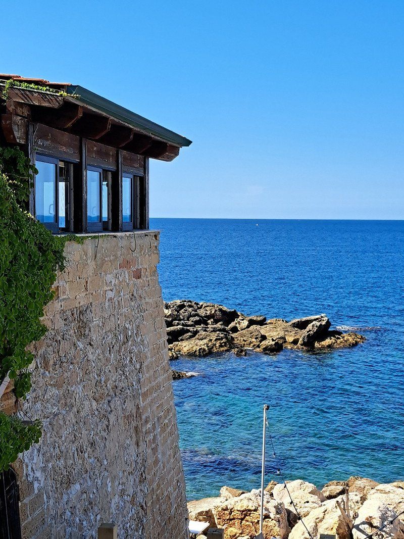
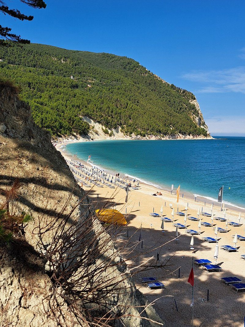
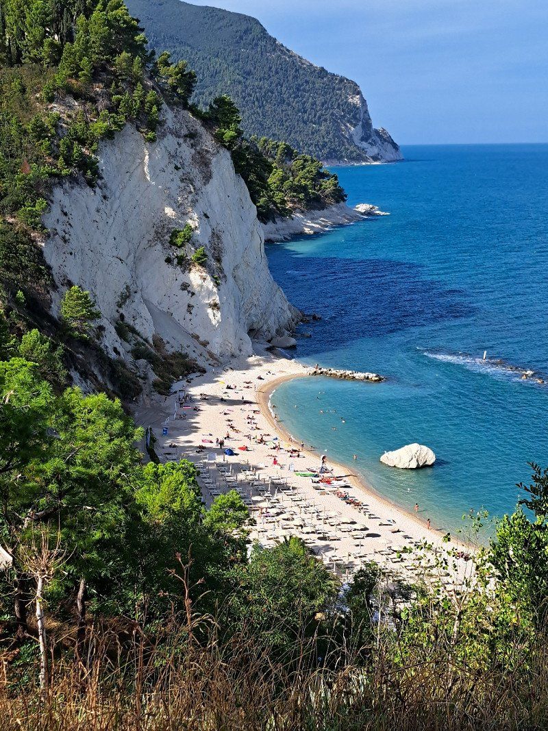
Visiting the town of Vieste and exploring the beach to the right
Foggia, Italien
41° 52' 56.9" N 16° 10' 36.3" E
41.8824764 16.1767489
• Head toward Via Papa Giovanni XXIII on Via Milano. Go for 43 m.
• Turn left onto Via Papa Giovanni XXIII. Go for 33 m.
• Turn right onto Via Trieste. Go for 75 m.
• Turn right onto Via Santa Maria di Merino. Go for 34 m.
• Turn right onto Via Vittorio Veneto. Go for 106 m.
• Turn right onto Viale 24 Maggio. Go for 300 m.
• Take the 4th exit from roundabout onto Via Guglielmo Marconi. Go for 254 m.
• Continue on Lungomare Enrico Mattei toward Mattinata/Litoranea/Autostrada. Go for 31.3 km.
• Continue on SS89. Go for 14.5 km.
• Take the 2nd exit from roundabout onto SS89 toward Autostrada/San Giovanni R.Do. Go for 4.5 km.
• Take the 2nd exit from roundabout onto SS89 toward Autostrada/Foggia/S. Giovanni R.Do/Manfredonia. Go for 9.3 km.
• Take ramp onto SS89 toward Manfredonia Sud. Go for 1.7 km.
• Turn right onto SP141. Go for 8.3 km.
• Take the 2nd exit from roundabout onto SP141. Go for 5.0 km.
• Turn right onto Strada Statale Rivolese (SS545) toward Autostrade/Cerignola/Foggia. Go for 12.2 km.
• Pass 2 roundabouts and continue on Strada Statale Rivolese (SS545). Go for 7.0 km.
• Take ramp onto A14 (Autostrada Adriatica) toward Bari. Go for 108 km.
• Take the exit toward Acquaviva delle Fonti/Turi/Putignano/Castellana Grotte/Conversano/Casamassima/Rutigliano/Sammichele di Bari. Go for 982 m.
• Turn slightly left onto Strada Provinciale Acquaviva delle Fonti-Sammichele (SP125). Go for 5.9 km.
• Take ramp onto SS100 toward Taranto. Go for 10.1 km.
• Take ramp toward Noci. Go for 887 m.
• Turn left onto Strada Provinciale di Alberobello (SP239). Go for 12.5 km.
• Take the 2nd exit from roundabout onto Strada Provinciale di Alberobello (SP239) toward Noci. Go for 1.1 km.
• Take the 2nd exit from roundabout onto Strada Provinciale delle Grotte (SP237) toward Putignano/Monopoli. Go for 2.9 km.
• Continue on Strada Provinciale di Alberobello (SS377). Go for 10.4 km.
• Turn right onto Via 7 Liberatori della Selva (SS604) toward Mottola/Taranto/Monopoli/Bari. Go for 195 m.
• Take the 3rd exit from roundabout onto Via Giuseppe Capecelatro. Go for 334 m.
• Continue on Via Don Francesco Gigante. Go for 30 m.
• Take the 1st exit from roundabout onto Via Don Francesco Gigante. Go for 215 m.
• Turn right. Go for 20 m.
• Turn left. Go for 64 m.
• Arrive at your destination on the left.
☍
248,1 km
(2 hrs. 58 min.)
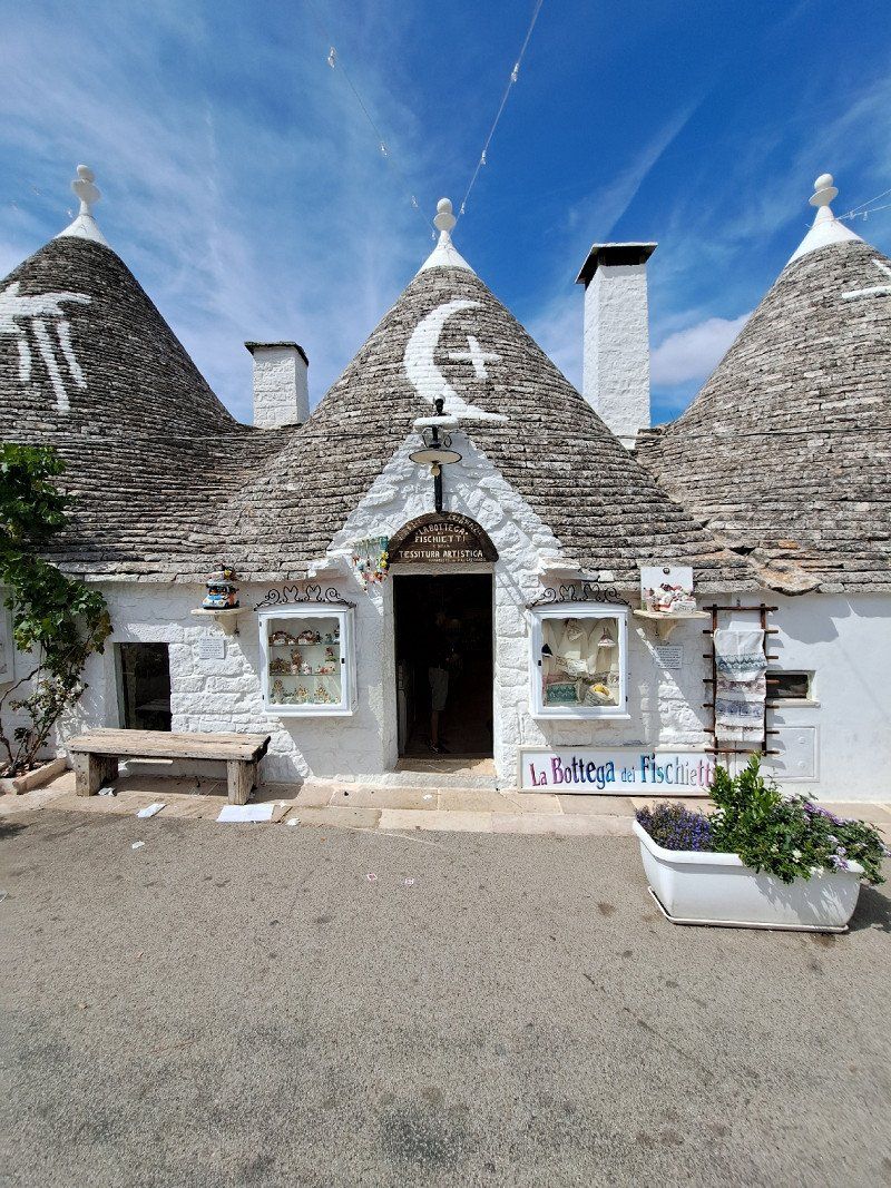
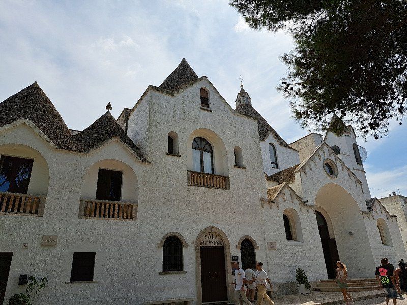
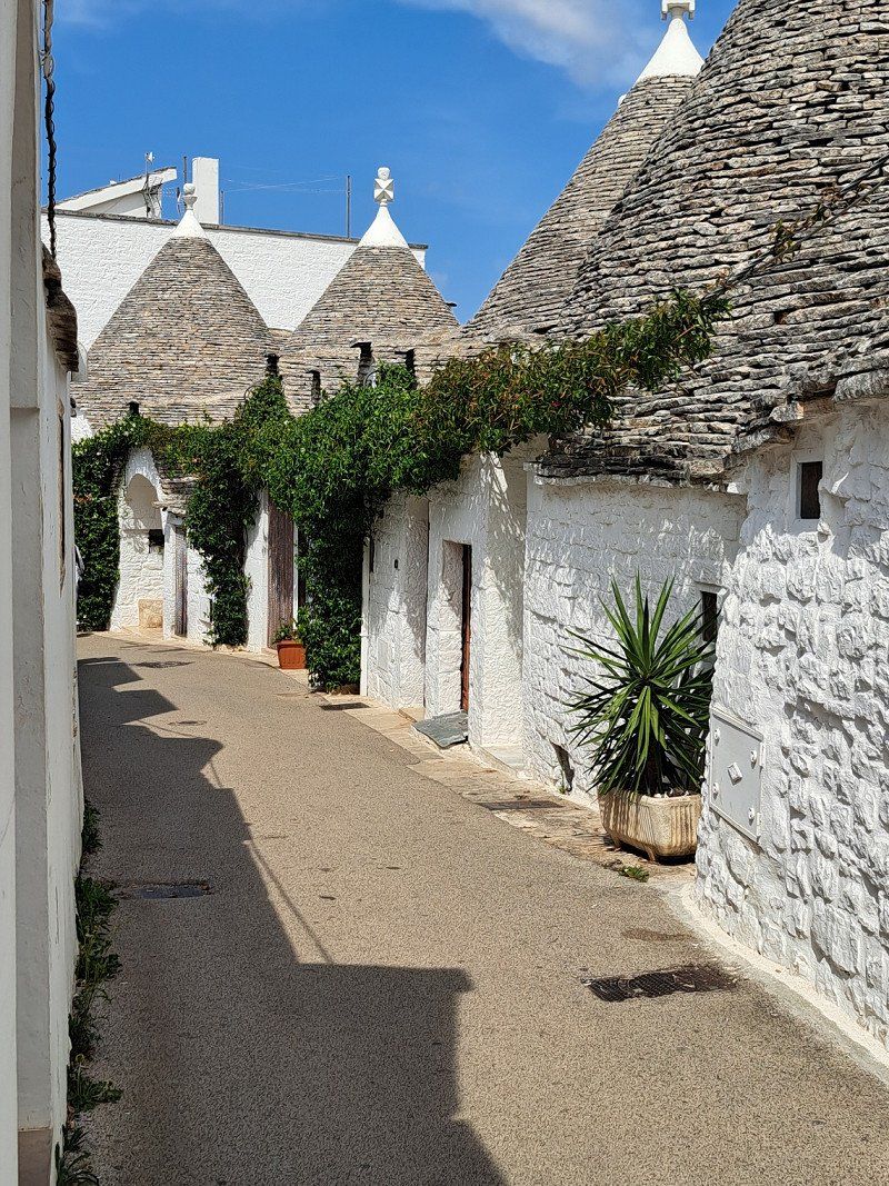
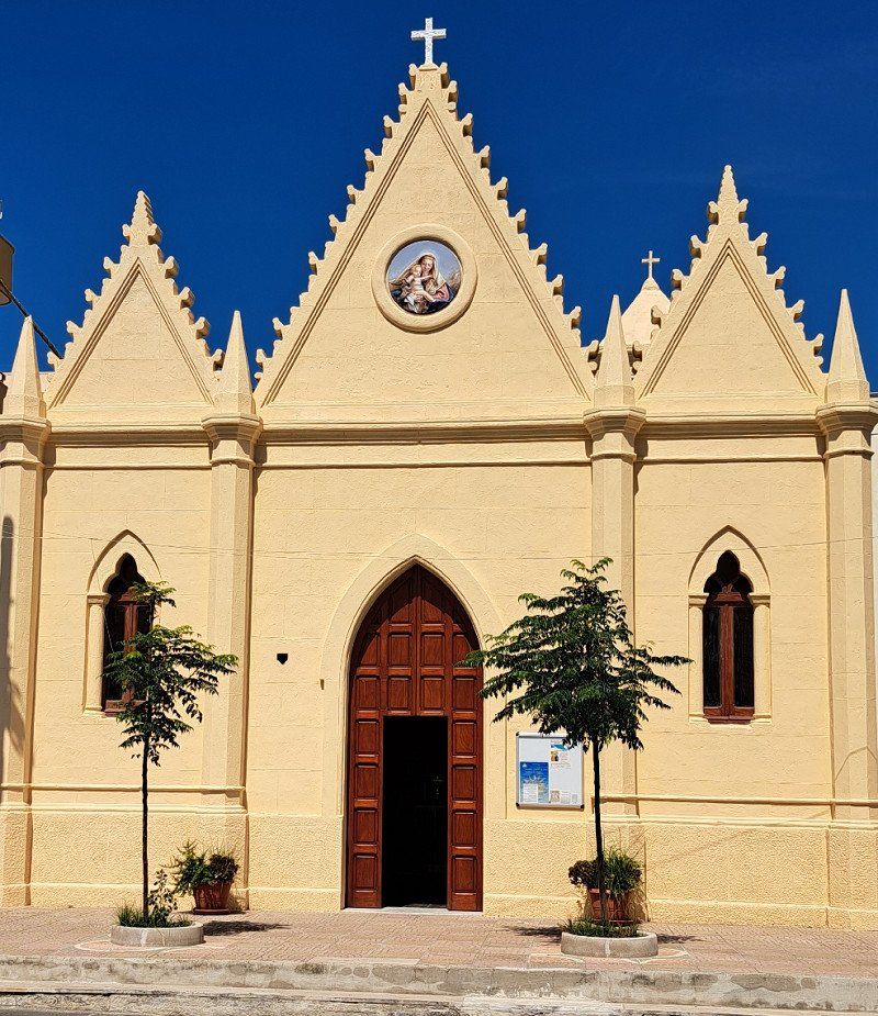
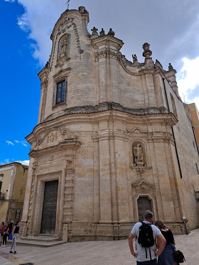
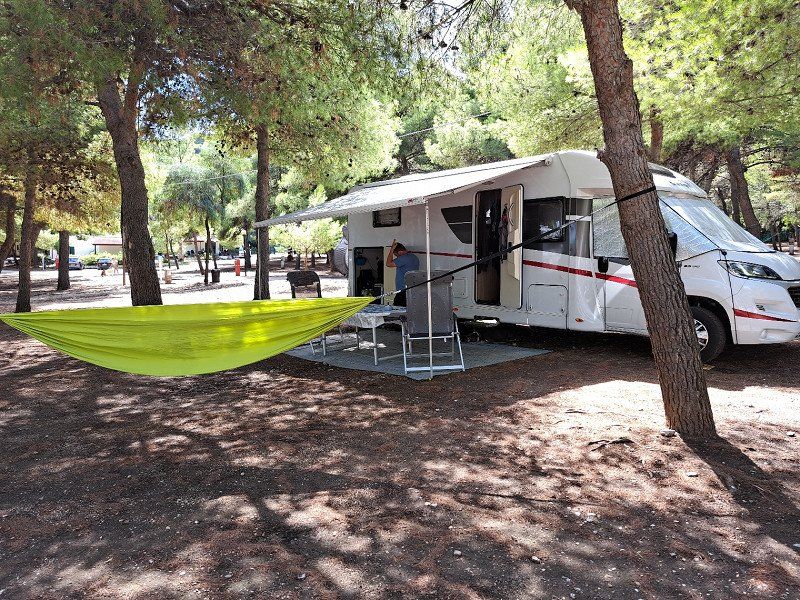
Day
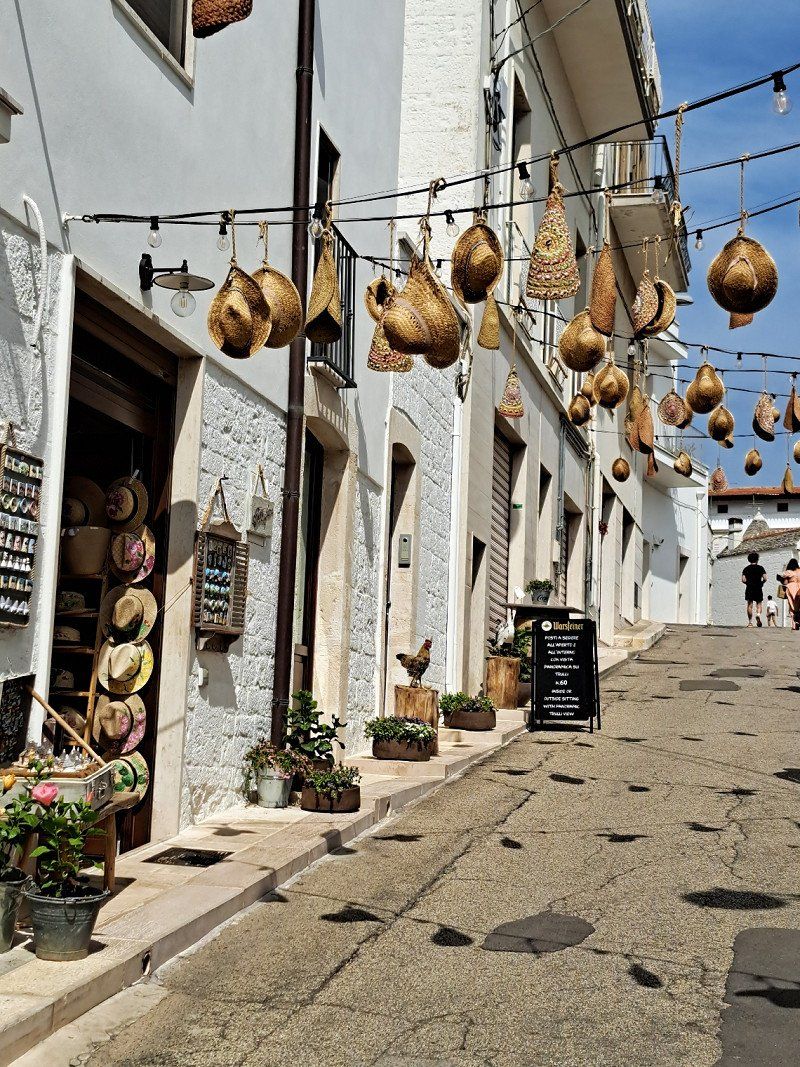
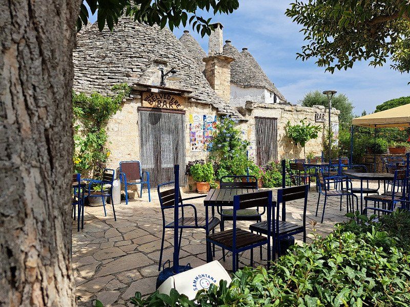
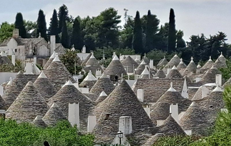
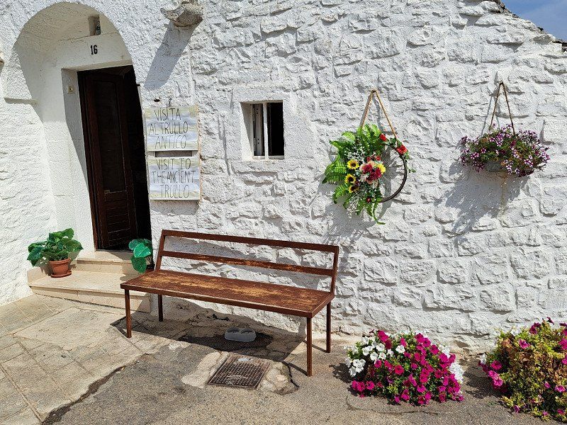
Area Sosta Alberobello
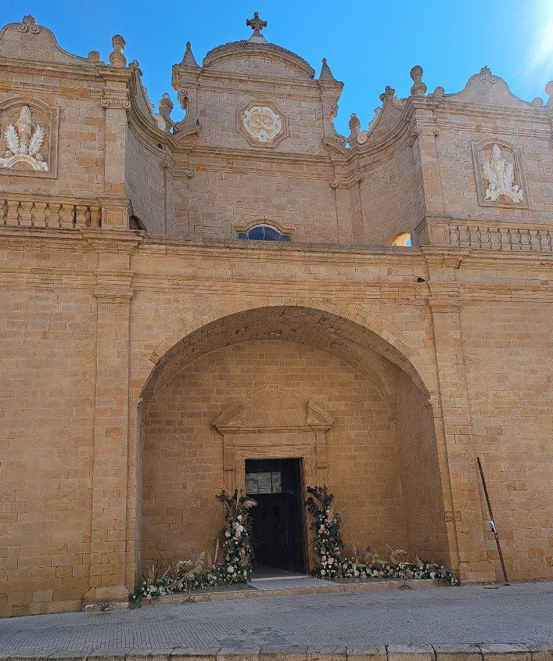
Visit to Alberobello to visit the trulli houses
https://www.areasostaalberobello.it/
Parking for mobile homes 6 hours for 10 euros including electricity in Alberobello.
Please note the directions videos on the website, as there are many one-way streets that the navigation system has not yet fully recognized.
Via Cadore 2, 70011, Alberobello, Italien
40° 46' 58" N 17° 14' 2" E
40.7827778 17.2338889
• Head south. Go for 38 m.
• Turn right toward Via Don Francesco Gigante. Go for 132 m.
• Turn left onto Via Don Francesco Gigante. Go for 35 m.
• Turn right onto Largo Michelangelo la Sorte. Go for 112 m.
• Turn right onto Via Alessandro Manzoni. Go for 181 m.
• Continue on Via Cesare Battisti. Go for 210 m.
• Continue on Corso Trento e Trieste. Go for 260 m.
• Turn right onto Via Vittime del Fascismo. Go for 114 m.
• Turn sharp left onto Viale Bari. Go for 347 m.
• Continue on Viale Putignano. Go for 283 m.
• Continue toward Strada Provinciale Monopoli-Alberobello/SP113. Go for 22 m.
• Take the 2nd exit from roundabout onto Strada Provinciale Monopoli-Alberobello (SP113) toward Coreggia/Monopoli/Fasano. Go for 291 m.
• Keep left toward Castellana G./Monopoli. Go for 58 m.
• Continue on Strada Provinciale Monopoli-Alberobello (SP113). Go for 3.8 km.
• Take the 2nd exit from roundabout onto Strada Provinciale Monopoli-Alberobello (SP113) toward Monopoli/Castellana G. Go for 6.5 km.
• Take the 2nd exit from roundabout toward Monopoli. Go for 63 m.
• Continue on Strada Provinciale Monopoli-Alberobello (SP113). Go for 9.8 km.
• Take the 1st exit from roundabout. Go for 55 m.
• Continue on Viale Aldo Moro. Go for 324 m.
• Pass 2 roundabouts and continue on Viale Aldo Moro. Go for 1.9 km.
• Turn left onto Contrada Santo Stefano Traversa 1. Go for 520 m.
• Turn right onto Contrada Santo Stefano. Go for 203 m.
• Arrive at Contrada Santo Stefano. Your destination is on the right.
☍
25,3 km
( 30 min.)
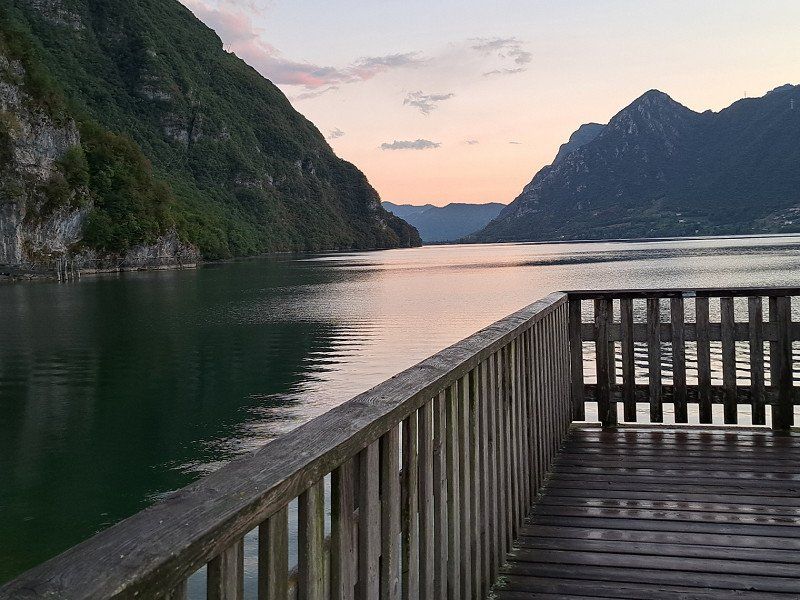
Campeggio Santo Stefano
great little bathing bay
Contrada Santo Stefano, 70043, Monopoli, Italien
40° 55' 40.5" N 17° 19' 12.6" E
40.9279300 17.3201600
• Head south on Contrada Santo Stefano.
• Arrive at Contrada Santo Stefano. Your destination is on the right.
☍
Distance not available
(Duration not available)
Day
Campeggio Santo Stefano
Visit to Monopoli
Contrada Santo Stefano, 70043, Monopoli, Italien
40° 55' 40.5" N 17° 19' 12.6" E
40.9279300 17.3201600
• Head south on Contrada Santo Stefano.
• Turn left onto Contrada Santo Stefano. Go for 15 m.
• Turn right onto Contrada Santo Stefano. Go for 109 m.
• Turn right toward Contrada Santo Stefano. Go for 10 m.
• Turn right onto Contrada Santo Stefano. Go for 312 m.
• Turn left onto Contrada Santo Stefano Traversa 1. Go for 520 m.
• Turn left onto Viale Aldo Moro toward Bari/Brindisi. Go for 296 m.
• Turn slightly left toward Brindisi. Go for 101 m.
• Continue on Viale Aldo Moro. Go for 827 m.
• Take ramp onto Strada Statale Adriatica (SS16) toward Brindisi. Go for 11.2 km.
• Keep left onto Strada Statale di Egnazia (SS379) toward Brindisi/Lecce/Ostuni. Go for 51.2 km.
• Continue on Strada Statale Adriatica (SS16). Go for 4.4 km.
• Continue on SS613. Go for 32.6 km.
• Take ramp onto Tangenziale Ovest di Lecce (SS694) toward Tangenziale Ovest/Gallipoli/Galatina. Go for 10.0 km.
• Take ramp onto SS16 toward Maglie/S. M. di Leuca. Go for 11.0 km.
• Take ramp onto Strada Comunale Madonna delle Grazie toward Martignano. Go for 415 m.
• Continue on Strada Provinciale Sternatia Calimera Melendugno. Go for 1.5 km.
• Turn right onto Via Circonvallazione Sud (SP368) toward Otranto/Martano/Calimera. Go for 2.2 km.
• Take the 1st exit from roundabout onto Strada Provinciale Cavallino Caprarica Martano toward Martano. Go for 718 m.
• Continue on Strada Provinciale Cavallino Caprari-Martano. Go for 479 m.
• Continue on Strada Provinciale Cavallino Caprarica Martano (SP28). Go for 1.5 km.
• Take the 2nd exit from roundabout toward Borgagne/Otranto. Go for 593 m.
• Continue straight ahead. Go for 25 m.
• Take the 2nd exit from roundabout toward Otranto. Go for 1.2 km.
• Continue toward Strada Comunale di Borgagne/SP147. Go for 45 m.
• Take the 3rd exit from roundabout onto Strada Comunale di Borgagne (SP147) toward Otranto/Borgagne. Go for 5.5 km.
• Continue on Strada Comunale Martano (SP147). Go for 559 m.
• Continue on SP148. Go for 1.8 km.
• Turn right onto SP148. Go for 1.0 km.
• Continue on Strada Vicinale Sant'Andrea (SP148). Go for 133 m.
• Continue on SP148. Go for 3.7 km.
• Take the 2nd exit from roundabout. Go for 90 m.
• Continue on Località Sant'Andrea. Go for 358 m.
• Arrive at Località Sant'Andrea. Your destination is on the left.
☍
144,4 km
(1 hrs. 30 min.)
Day
Camping I Faraglioni
Camper pitch
73026, Torre S. Andrea, Italien
40° 15' 18" N 18° 26' 35.2" E
40.2550000 18.4431000
• Head east on Località Sant'Andrea.
• Arrive at Località Sant'Andrea. Your destination is on the left.
☍
Distance not available
(Duration not available)
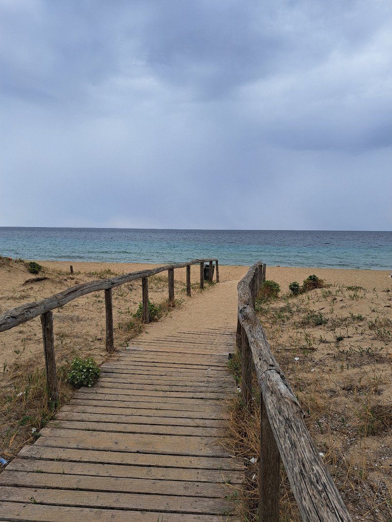
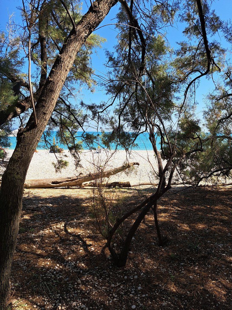
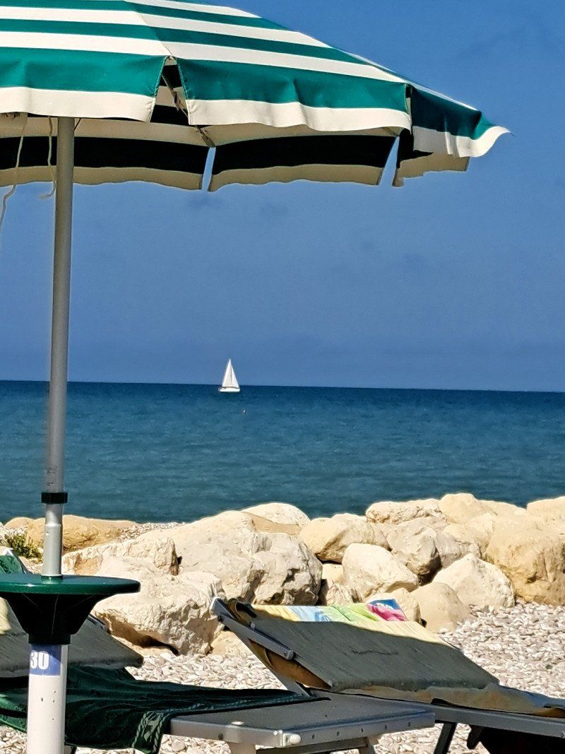
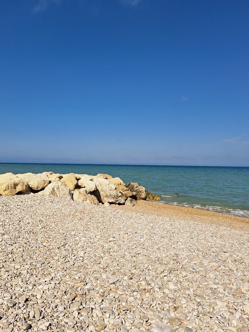
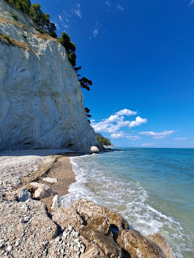
Day
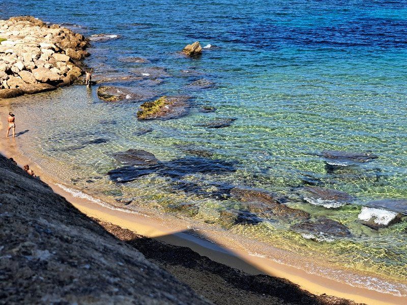
Camping I Faraglioni
great coast
73026, Torre S. Andrea, Italien
40° 15' 18" N 18° 26' 35.2" E
40.2550000 18.4431000
• Head east on Località Sant'Andrea.
• Arrive at Località Sant'Andrea. Your destination is on the left.
☍
Distance not available
(Duration not available)
Day
Camping I Faraglioni
Because it was so great, stayed a 3rd night
73026, Torre S. Andrea, Italien
40° 15' 18" N 18° 26' 35.2" E
40.2550000 18.4431000
• Head toward Via dei Faraglioni on Località Sant'Andrea. Go for 382 m.
• Take the 2nd exit from roundabout onto SP148 toward Borgagne/Martano. Go for 3.7 km.
• Continue on Strada Vicinale Sant'Andrea (SP148). Go for 133 m.
• Continue on SP148. Go for 1.1 km.
• Turn left onto SP148. Go for 1.8 km.
• Turn slightly left onto Strada Comunale Martano (SP147). Go for 536 m.
• Continue on Strada Comunale Nuova Martano Borgagne (SP147). Go for 5.4 km.
• Take the 2nd exit from roundabout onto Strada Comunale di Borgagne (SP147) toward Martano. Go for 211 m.
• Continue on SP147. Go for 98 m.
• Take the 1st exit from roundabout onto Via Alcide De Gasperi. Go for 703 m.
• Continue on Via Goffredo Mameli. Go for 265 m.
• Turn left onto Via Zaca. Go for 82 m.
• Turn right onto Via Giuseppe Pisanelli. Go for 304 m.
• Turn right onto Via C. Antonaci. Go for 99 m.
• Turn left onto Via Goffredo Mameli. Go for 298 m.
• Turn left onto Via Fratelli Cervi. Go for 242 m.
• Turn right onto Via Soleto toward Galatina/Soleto/Lecce-Maglie/SS16. Go for 161 m.
• Take the 2nd exit from roundabout. Go for 63 m.
• Continue on Via Soleto (SP48). Go for 3.3 km.
• Continue on SP47. Go for 1.6 km.
• Take ramp onto SP367 toward Lecce. Go for 9.4 km.
• Continue on SS664. Go for 3.5 km.
• Take left ramp onto SS101 toward Gallipoli. Go for 25.6 km.
• Take ramp toward Gallipoli. Go for 382 m.
• Continue on Via Lecce toward Gallipoli. Go for 184 m.
• Turn right onto Via Tenuta di Torre Sabea. Go for 156 m.
• Arrive at your destination.
☍
59,7 km
( 44 min.)
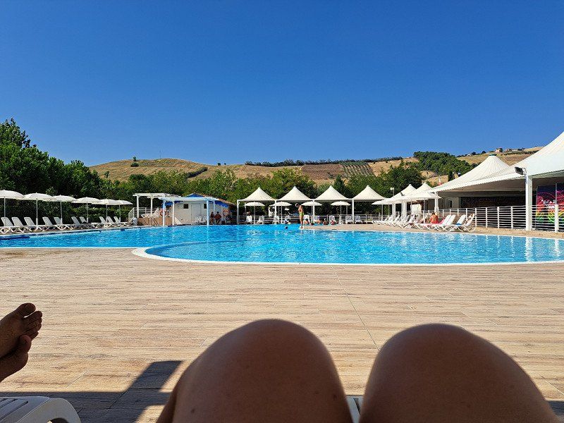
Day
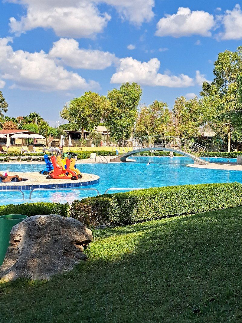
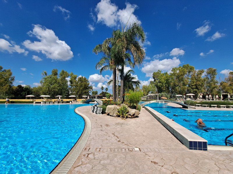
Centro Vacanze La Masseria
Campsite la Masseria with pool area
s.s. 101 km. 34,5, 73014, Gallipoli, Italien
40° 4' 26" N 18° 0' 33" E
40.0738800 18.0091600
• Head northwest.
• Arrive at your destination.
☍
Distance not available
(Duration not available)
Day
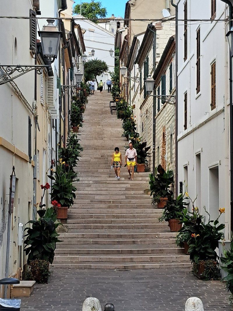
Centro Vacanze La Masseria
Visit to Gallipoli
s.s. 101 km. 34,5, 73014, Gallipoli, Italien
40° 4' 26" N 18° 0' 33" E
40.0738800 18.0091600
• Head southeast. Go for 122 m.
• Turn slightly left onto Via Tenuta di Torre Sabea. Go for 34 m.
• Turn left onto Via Lecce. Go for 186 m.
• Take ramp onto SS101 toward Lecce. Go for 3.5 km.
• Take ramp toward Taranto/SS174/Nardò. Go for 235 m.
• Turn left toward Strada Provinciale 17/SP17. Go for 3.5 km.
• Continue toward Nardò. Go for 34 m.
• Take the 2nd exit from roundabout onto SP17 toward Nardò. Go for 1.0 km.
• Turn slightly left onto SP112 toward S.Isidoro/P.Cesareo/Taranto/S.Caterina/S.Maria al B. Go for 2.0 km.
• Continue toward Via Antonio Martano/SP112. Go for 16 m.
• Take the 2nd exit from roundabout onto Via Antonio Martano (SP112). Go for 9.9 km.
• Take the 2nd exit from roundabout onto Strada Provinciale Avetrana Gallipoli (SP112) toward Avetrana/Porto Cesareo. Go for 3.4 km.
• Continue on SP359. Go for 3.6 km.
• Pass 2 roundabouts and continue on SP359. Go for 4.7 km.
• Take the 2nd exit from roundabout onto SP359 toward Taranto. Go for 4.9 km.
• Turn left toward Maruggio. Go for 2.8 km.
• Continue on Strada Provinciale Tarantina (SP141). Go for 2.8 km.
• Take the 3rd exit from roundabout onto Strada Provinciale Avetrana Torre Colimena (SP140) toward Porto Cesareo. Go for 1.2 km.
• Continue toward Taranto. Go for 39 m.
• Take the 1st exit from roundabout onto Via Venezia (SP122) toward Taranto. Go for 3.9 km.
• Arrive at Via Litoranea Salentina (SP122). Your destination is on the right.
☍
47,7 km
( 42 min.)
Day
Via Litoranea Salentina
camper place
https://brezzadimarecamper.it/
74024 San Pietro In Bevagna, TA, Italien
40° 18' 14.1" N 17° 42' 2.5" E
40.3039227 17.7006904
• Head west on Via Litoranea Salentina (SP122). Go for 2.5 km.
• Turn right onto Via della Marina (SP137). Go for 1.8 km.
• Take the 3rd exit from roundabout toward Maruggio/Taranto. Go for 108 m.
• Continue on Strada Provinciale Tarantina (SP141). Go for 2.7 km.
• Continue toward SP141. Go for 54 m.
• Continue on Strada Provinciale Tarantina (SP141). Go for 2.0 km.
• Continue on Strada Provinciale Da Maruggio a Avetrana (SP141). Go for 2.2 km.
• Continue on Strada Provinciale Maruggio Avetrana (SP141). Go for 759 m.
• Continue on Via Virgilio. Go for 11 m.
• Continue on Via Crocifisso. Go for 177 m.
• Turn left onto Via Roma (SP136). Go for 112 m.
• Take the 1st exit from roundabout onto Via Vittorio Emanuele II (SP131) toward Torricella/Sava/Taranto. Go for 743 m.
• Turn right onto Strada Provinciale Taranto Maruggio (SP130) toward Sava/Torricella/Taranto. Go for 6.0 km.
• Take the 1st exit from roundabout onto SP130. Go for 832 m.
• Continue toward Circonvallazione Ovest Torricella/SP129dir. Go for 46 m.
• Take the 2nd exit from roundabout onto Circonvallazione Ovest Torricella (SP129dir). Go for 822 m.
• Turn right onto SP128. Go for 4.2 km.
• Take the 2nd exit from roundabout onto SP128. Go for 475 m.
• Turn left onto Via Cupelle. Go for 167 m.
• Turn left onto Via Giosuè Carducci. Go for 157 m.
• Turn right onto Via Extra Murale. Go for 656 m.
• Take the 1st exit from roundabout onto Via Fontanelle. Go for 211 m.
• Take the 2nd exit from roundabout onto Via Fontanelle. Go for 640 m.
• Take the 2nd exit from roundabout onto Corso Europa (SP112). Go for 1.7 km.
• Take the 1st exit from roundabout onto SP110 toward Pulsano. Go for 4.7 km.
• Take the 2nd exit from roundabout toward Taranto. Go for 39 m.
• Continue on Corso Europa (SP110). Go for 604 m.
• Continue on SP110dir toward Talsano/SP107. Go for 1.8 km.
• Take the 2nd exit from roundabout onto Strada Provinciale Da Pulsano a San Giorgio (SP109). Go for 1.3 km.
• Turn left toward Masseria Ruina/SP110. Go for 41 m.
• Continue on SP110. Go for 15 m.
• Continue on Strada Provinciale Da Taranto a Faggiano (SP110). Go for 714 m.
• Continue on Strada Provinciale Baronia Faggiano San Crispieri (SP110) toward Talsano. Go for 1.6 km.
• Take the 3rd exit from roundabout onto SS7ter toward Taranto. Go for 5.0 km.
• Take the 2nd exit from roundabout onto Via per San Giorgio Jonico (SS7ter). Go for 454 m.
• Turn right onto Via Tarantola. Go for 102 m.
• Continue on Via Cesare Battisti. Go for 206 m.
• Take ramp onto SS7ter toward Reggio C./SS106/Bari/Martina F./SS172. Go for 5.9 km.
• Take ramp onto Via Appia (SS7) toward Taranto Porto/Bari/Taranto Tamburi/Autostrade/Reggio C. Go for 5.1 km.
• Take ramp onto Via Appia (SS7) toward Autostrada/A14/E55/Matera/Bari/SS100. Go for 809 m.
• Pass 5 roundabouts and continue on Via Appia (SS7). Go for 12.9 km.
• Take the 3rd exit from roundabout onto Via Appia (SS7) toward Autostrada/A14/Bari-Matera. Go for 530 m.
• Take the 1st exit from roundabout onto Via Appia (SS7). Go for 3.2 km.
• Continue on SS100. Go for 14.1 km.
• Turn left onto Strada Provinciale 23 (SP23) toward Castellaneta/Ginosa/Matera/Laterza/Mottola Zona Industriale/Autostrade. Go for 7.2 km.
• Take the 1st exit from roundabout onto Via Appia (SS7) toward Laterza/Matera. Go for 25.5 km.
• Turn right onto Strada Provinciale Matera Gioia del Colle toward Gioia del Colle. Go for 361 m.
• Turn left onto Contrada Pedale della Palomba. Go for 759 m.
• Arrive at Contrada Pedale della Palomba.
☍
121,9 km
(1 hrs. 38 min.)
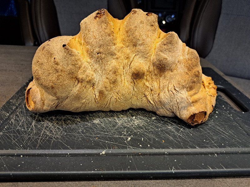
Day
Contrada Pedale Della Palomba, 75100
https://www.areacamper-matera.it/
RV park with a totally nice and warm welcome and a gift (Bread from Matera)
Shuttle service to Matera possible
Unfortunately on a very busy road.
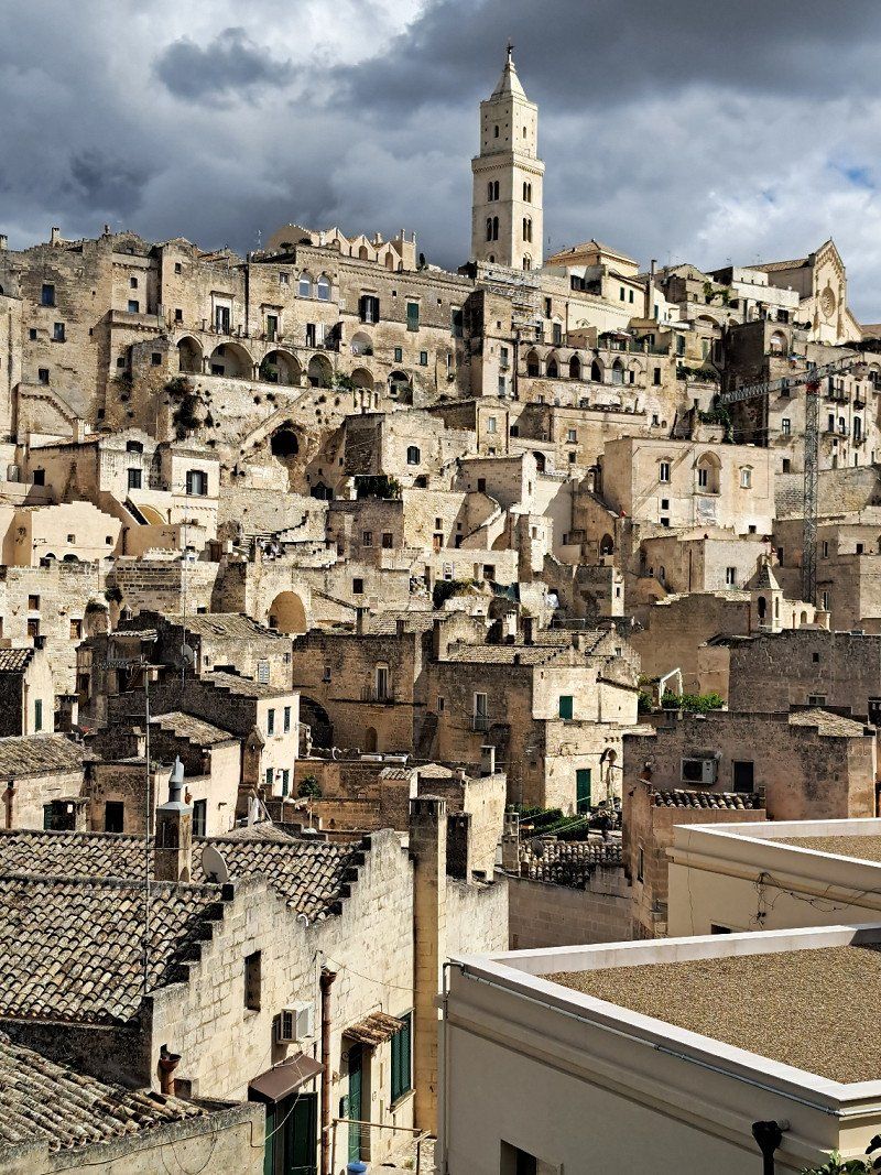
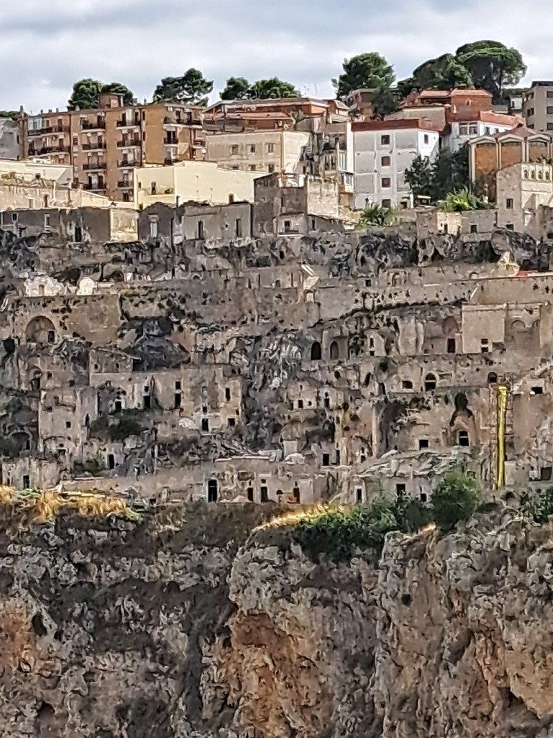
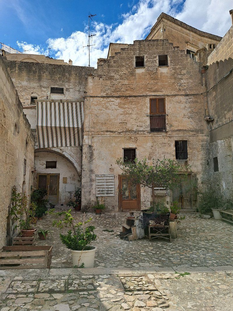
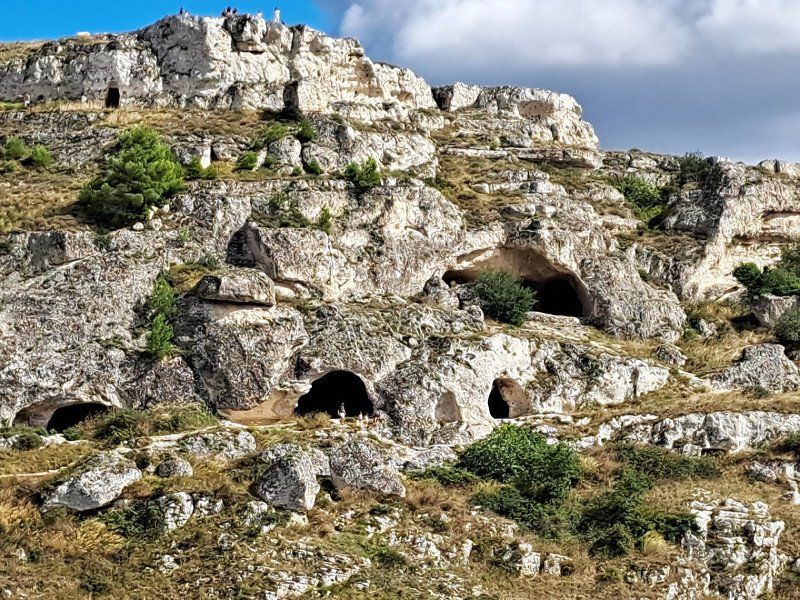
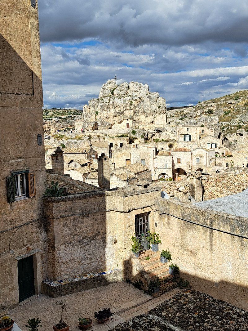
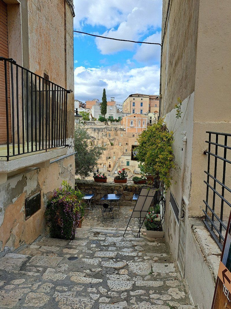
Matera, Italien
40° 40' 55.9" N 16° 37' 12.4" E
40.6821907 16.6201099
• Head west on Contrada Pedale della Palomba. Go for 929 m.
• Continue on Contrada Pedale della Madonna. Go for 157 m.
• Turn right onto Via Appia (SS7). Go for 536 m.
• Take the 2nd exit from roundabout onto Via Appia (SS7). Go for 909 m.
• Take ramp onto Via Appia (SS7) toward Matera/Potenza. Go for 407 m.
• Continue on SS99. Go for 12.1 km.
• Take ramp toward Gravina in P. Go for 142 m.
• Take the 2nd exit from roundabout toward Matera/SS99/Gravina di P./Laterza/Santeramo in C./SP27. Go for 287 m.
• Take the 3rd exit from roundabout onto Strada Provinciale Appia (SP28) toward Matera/SS99/Gravina di P. Go for 631 m.
• Turn left onto Strada Provinciale Tarantina (SP27) toward Gravina di P. Go for 10.0 km.
• Continue toward Viale dei Giudici Falcone e Borsellino. Go for 33 m.
• Take the 3rd exit from roundabout onto Viale dei Giudici Falcone e Borsellino. Go for 934 m.
• Take the 1st exit from roundabout onto Viale dei Giudici Falcone e Borsellino. Go for 792 m.
• Continue on Strada Provinciale Gravina in Puglia Bivio Parisi (SP137). Go for 251 m.
• Take the 2nd exit from roundabout onto Circumvallazione Teresa Orsini. Go for 686 m.
• Take the 2nd exit from roundabout onto Strada Provinciale delle Murge (SS97). Go for 25.7 km.
• Turn right onto SP138. Go for 1.3 km.
• Turn right toward Autostrade/Minervino M/Canosa di P. Go for 725 m.
• Continue on Sp Ex SR6. Go for 5.9 km.
• Continue on Sp Ex SR6. Go for 8.0 km.
• Continue on Strada Vicinale San Cosimo. Go for 720 m.
• Turn left onto Strada Provinciale Spinazzola Minervino (SS97). Go for 4.7 km.
• Take the 2nd exit from roundabout onto SR6 toward Canosa di P./Barletta/SS93/Bari/SP231. Go for 15.1 km.
• Take ramp onto SS93. Go for 586 m.
• Turn left and take ramp onto A14 (Autostrada Adriatica) toward Pescara. Go for 21.6 km.
• Take the exit toward Cerignola Est/Mattinata/Vieste/Pugnochiuso/Trinitapoli/Margherita di Savoia/Manfredonia. Go for 894 m.
• Turn left onto Strada Statale Rivolese (SS545) toward Manfredonia. Go for 3.3 km.
• Pass 2 roundabouts and continue on Strada Statale Rivolese (SS545). Go for 15.9 km.
• Continue on Strada Statale delle Salline per Manfredonia Corso (SS159) toward Monte San'Angelo. Go for 4.9 km.
• Take the 2nd exit from roundabout onto SP141. Go for 8.3 km.
• Turn left toward Viale Giuseppe Di Vittorio. Go for 61 m.
• Continue on SS89. Go for 887 m.
• Take ramp onto SS89 toward Mattinata/Vieste/San Giovanni R./Monte San'Angelo. Go for 9.8 km.
• Pass 2 roundabouts and continue on SS89. Go for 12.1 km.
• Keep left onto Strada Antica Benedetto (SS89) toward Peschici/Vieste. Go for 7.0 km.
• Continue on Strada Provinciale Mattinata Vieste (SP53). Go for 20.6 km.
• Turn right. Go for 326 m.
• Turn slightly right. Go for 85 m.
• Arrive at your destination on the left.
☍
197,2 km
(2 hrs. 20 min.)
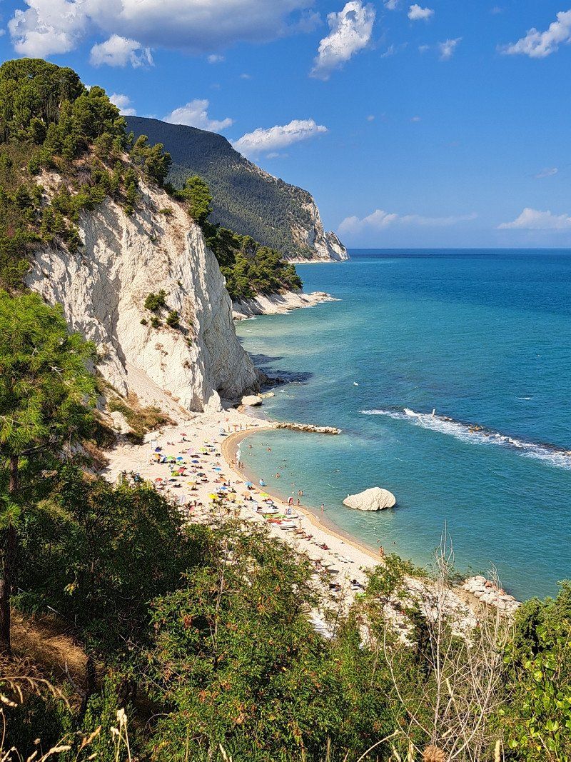
Day
Campeggio Baia dei Campi
Campsite with Acsi price from 18 € from 28.08.
Litoranea per Pugnochiuso, 71019, Vieste, Italien
41° 48' 56" N 16° 11' 40" E
41.8155500 16.1944400
• Head southeast.
• Arrive at your destination on the left.
☍
Distance not available
(Duration not available)
Day
Campeggio Baia dei Campi
Litoranea per Pugnochiuso, 71019, Vieste, Italien
41° 48' 56" N 16° 11' 40" E
41.8155500 16.1944400
• Head toward Strada Provinciale Campi-Pugnochiuso Coppa San Tecla. Go for 259 m.
• Turn right onto Strada Provinciale Campi-Pugnochiuso Coppa San Tecla (SP54). Go for 448 m.
• Turn left onto Strada Provinciale Mattinata Vieste (SP53). Go for 1.1 km.
• Arrive at Strada Provinciale Mattinata Vieste (SP53). Your destination is on the left.
☍
1,8 km
( 2 min.)
Day
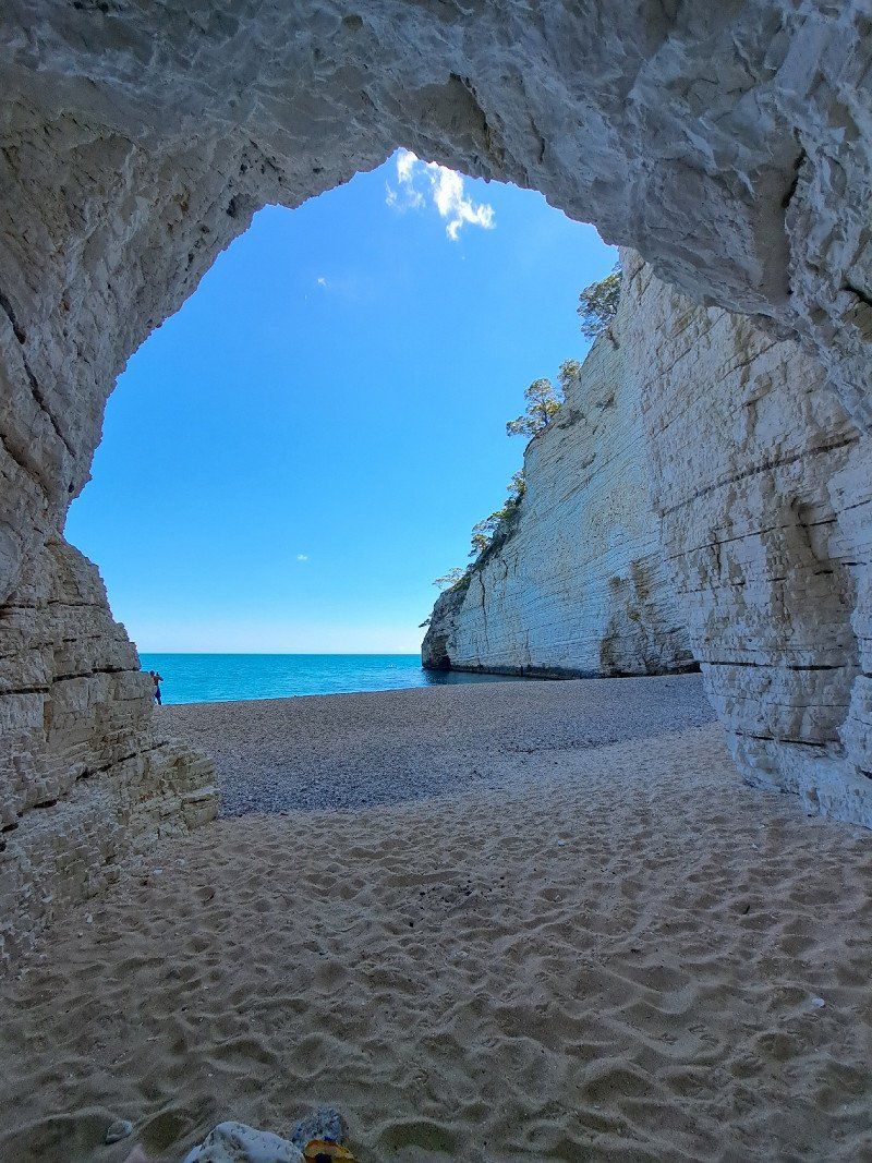
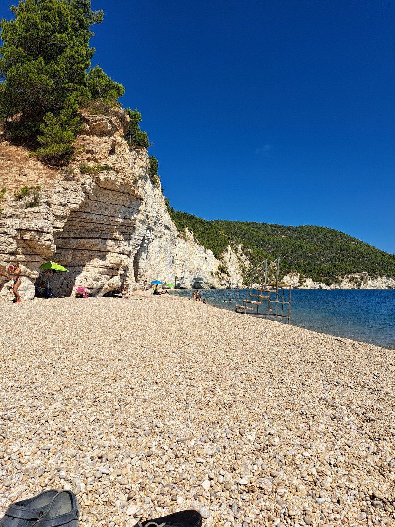
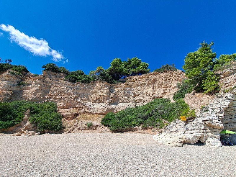
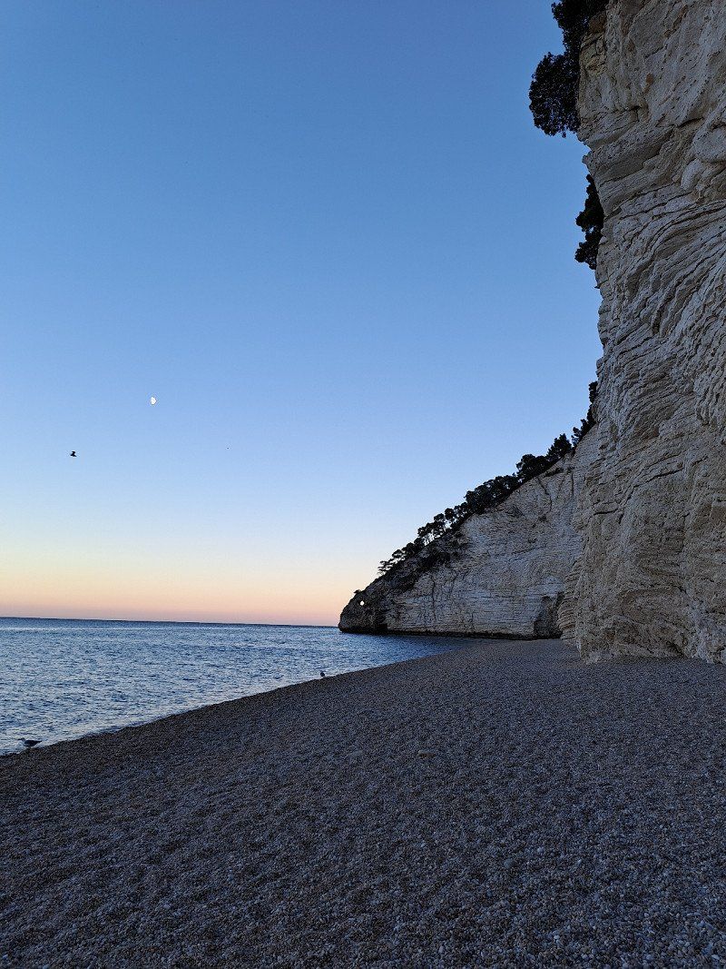
SP53
Camping Vignanotica
visit to the beach
Vieste, Foggia, Italien
41° 48' 28.6" N 16° 10' 48.6" E
41.8079567 16.1801595
• Head southwest on Strada Provinciale Mattinata Vieste (SP53). Go for 19.4 km.
• Continue on SS89. Go for 14.5 km.
• Take the 2nd exit from roundabout onto SS89 toward Autostrada/San Giovanni R.Do. Go for 4.5 km.
• Take the 2nd exit from roundabout onto SS89 toward Autostrada/Foggia/S. Giovanni R.Do/Manfredonia. Go for 37.6 km.
• Take ramp onto A14 (Autostrada Adriatica) toward Bologna/Bari/Pescara/E55. Go for 204 km.
• Take the exit toward Atri-Pineto/Fiera Adriatica/Pineto/Silvi onto SP28 (Strada Provinciale Atri Stazione). Go for 2.3 km.
• Take the 2nd exit from roundabout onto Via Nazionale Nord (SS16). Go for 175 m.
• Pass 2 roundabouts and continue on Via Nazionale Nord (SS16). Go for 798 m.
• Turn left onto Via Giuseppe Giusti. Go for 94 m.
• Turn right onto Via Mario Rapisardi. Go for 53 m.
• Turn right onto Via Ignazio Silone. Go for 281 m.
• Turn right onto Via 25 Aprile. Go for 795 m.
• Arrive at Via 25 Aprile. Your destination is on the right.
☍
284,7 km
(2 hrs. 44 min.)
Day
Camping & Village Pineto Beach
Acsiplatz for the price of 18 €, unfortunately with a train line right next to it
XXV Aprile, 64025, Pineto, Italien
42° 37' 26" N 14° 3' 25" E
42.6238800 14.0569400
• Head northwest on Via 25 Aprile.
• Arrive at Via 25 Aprile. Your destination is on the right.
☍
Distance not available
(Duration not available)
Day
Camping & Village Pineto Beach
XXV Aprile, 64025, Pineto, Italien
42° 37' 26" N 14° 3' 25" E
42.6238800 14.0569400
• Head southeast on Via 25 Aprile. Go for 795 m.
• Turn left onto Via Ignazio Silone. Go for 281 m.
• Turn left onto Via Mario Rapisardi. Go for 53 m.
• Turn left onto Via Giuseppe Giusti. Go for 94 m.
• Turn right onto Via Nazionale Nord (SS16). Go for 191 m.
• Pass 2 roundabouts and continue on Strada Statale Adriatica (SS16). Go for 709 m.
• Take the 1st exit from roundabout onto Strada Provinciale Atri Stazione (SP28). Go for 1.7 km.
• Turn left and take ramp onto A14 (Autostrada Adriatica) toward Ancona. Go for 40.1 km.
• Take the exit toward San Benedetto T./Ascoli Piceno/San Benedetto del Tronto/Adriatica/SS16/Martinsicuro/SS16/Monteprandone/Zona Industriale Centobuchi di Monteprandone onto RA11 (Raccordo Autostradale Ascoli-Porto d'Ascoli). Go for 2.2 km.
• Take the exit toward S. Benedetto T. Go for 464 m.
• Keep right toward S. Benedetto T. Go for 257 m.
• Continue on Raccordo Ascoli Mare-Porto d'Ascoli (SP227). Go for 3.9 km.
• Take the 1st exit from roundabout onto Strada Statale Adriatica (SS16) toward Ancona/San Benedetto del Tronto Centro. Go for 6.0 km.
• Take the 3rd exit from roundabout toward Ripatransone/Pescara/A14/Ancona. Go for 136 m.
• Continue on Viale della Fratellanza. Go for 563 m.
• Take ramp onto A14 (Autostrada Adriatica) toward Ancona. Go for 57.3 km.
• Take the exit toward Loreto/P. To Recanati. Go for 790 m.
• Turn left and take ramp onto Strada Statale Adriatica (SS16) toward Ancona. Go for 7.0 km.
• Turn right onto Strada Provinciale degli Svarchi (SP23) toward Sirolo/Numana. Go for 4.4 km.
• Pass 2 roundabouts and continue on Via Lauretana (SP1). Go for 1.9 km.
• Turn sharp right onto Via Montalbano. Go for 62 m.
• Arrive at Via Montalbano. Your destination is on the right.
☍
128,9 km
(1 hrs. 25 min.)
Day
Camping Village Riviera
Small campsite in Numana
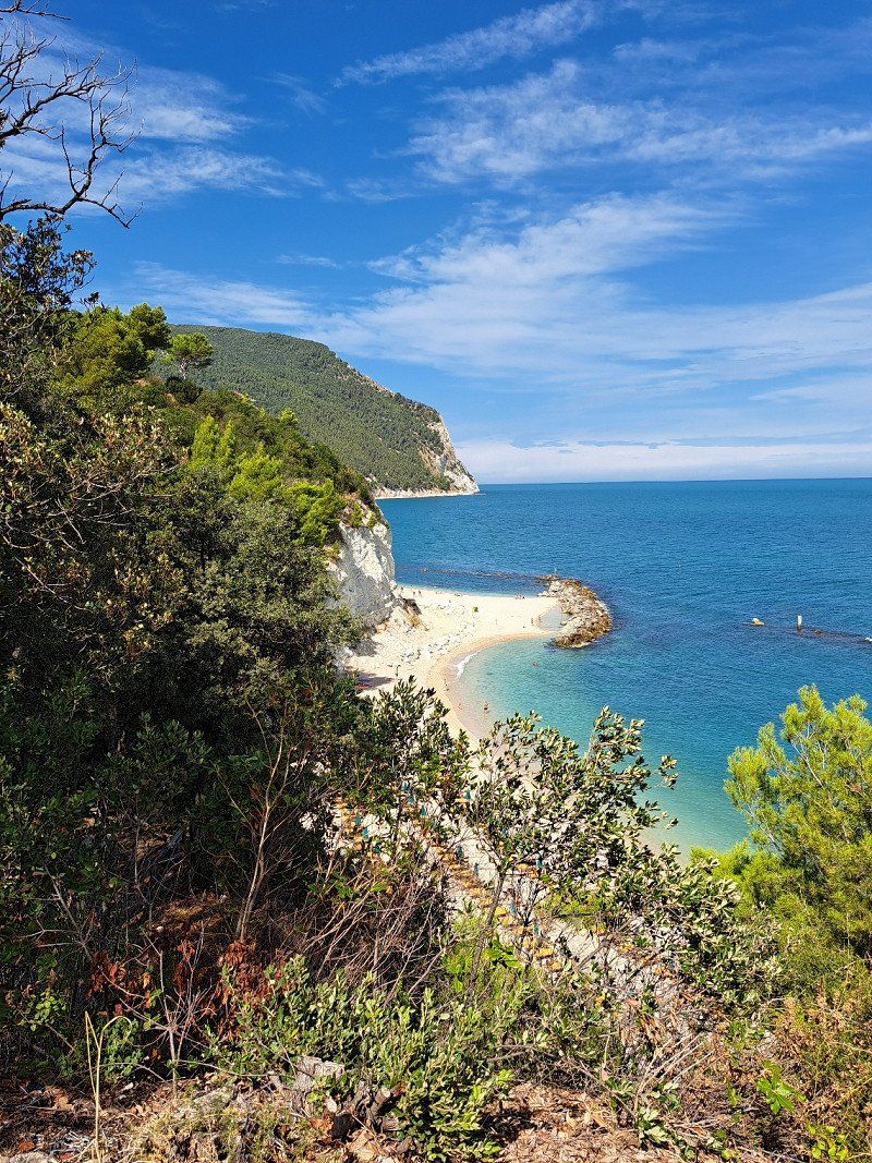
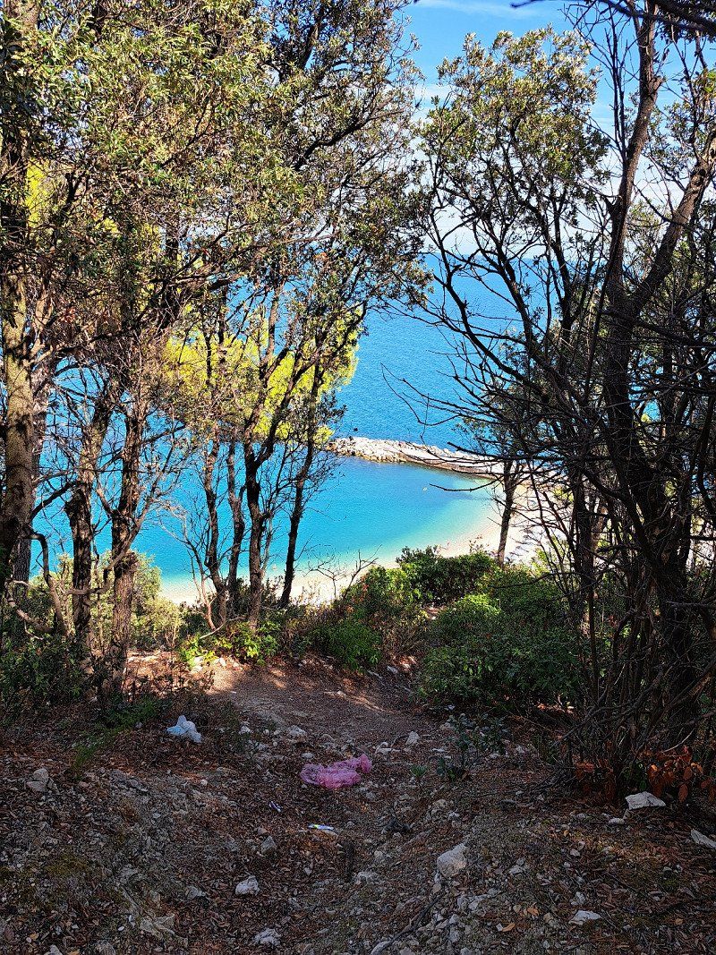
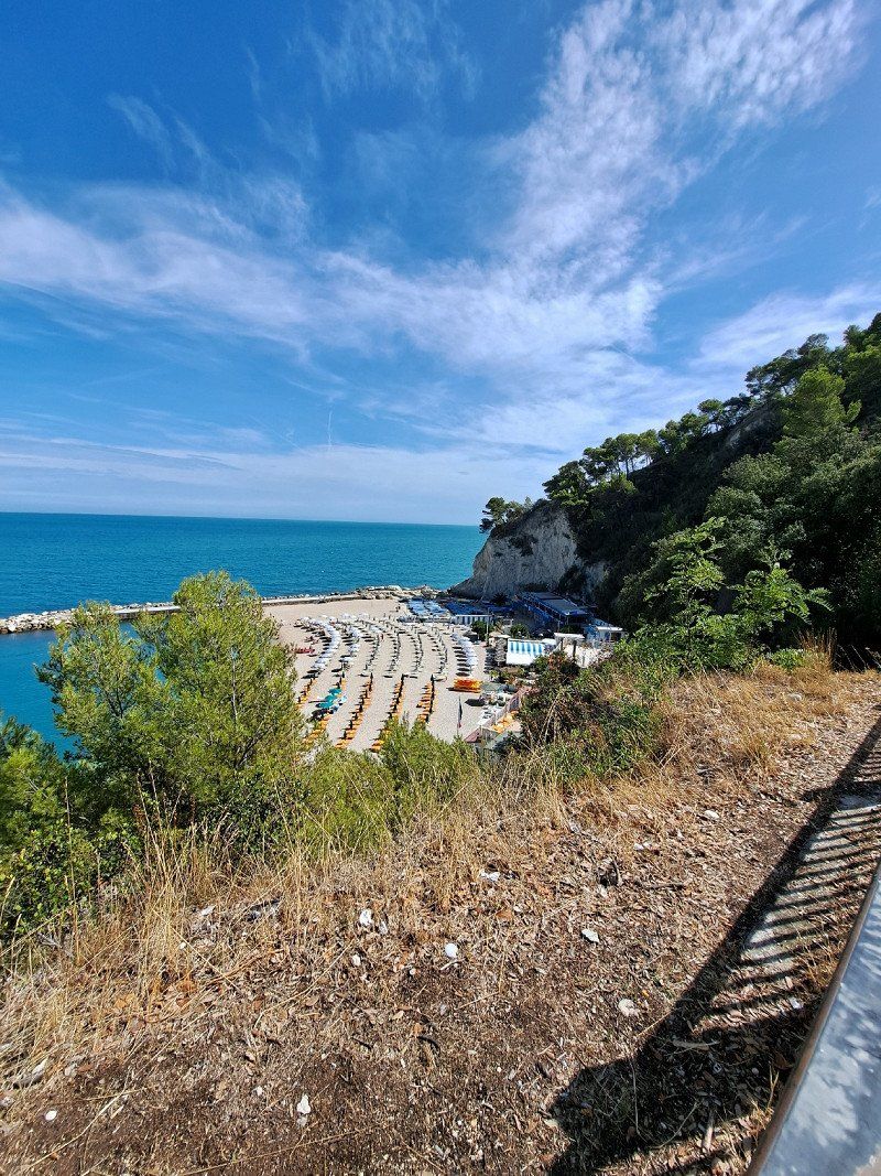
Walk to Sirolo, Spiaggia urbani, Numana and Spiaggia del Frate
Via Montalbano 20, 60026, Numana, Italien
43° 30' 42.5" N 13° 36' 59" E
43.5118000 13.6163800
• Head southeast on Via Montalbano.
• Arrive at Via Montalbano. Your destination is on the right.
☍
Distance not available
(Duration not available)
Day
Camping Village Riviera
Via Montalbano 20, 60026, Numana, Italien
43° 30' 42.5" N 13° 36' 59" E
43.5118000 13.6163800
• Head toward Via Circonvallazione Conero on Via Montalbano. Go for 62 m.
• Turn slightly right onto Via Maratta (SP1). Go for 677 m.
• Continue toward Via Molini 2/SP2. Go for 57 m.
• Take the 3rd exit from roundabout onto Via Molini 2 (SP2). Go for 5.0 km.
• Keep left onto Strada Provinciale Sirolo Senigallia (SP2) toward A14/Ancona/Offagna. Go for 1.8 km.
• Pass 2 roundabouts and continue on Via Direttissima del Conero (SP2). Go for 1.9 km.
• Keep left onto Strada Provinciale Sirolo Senigallia (SP2). Go for 1.6 km.
• Take the 1st exit from roundabout onto Via Direttissima del Conero (SP2). Go for 639 m.
• Take the 2nd exit from roundabout onto Strada Statale Adriatica (SS16) toward Bologna/A14/E55/Osimo. Go for 1.2 km.
• Take ramp onto A14 (Autostrada Adriatica) toward Bologna. Go for 216 km.
• Take the exit toward Padova/Bologna Arcoveggio onto A13 (Autostrada Bologna-Padova). Go for 117 km.
• Take the exit toward Venezia onto A4 (Autostrada della Serenissima). Go for 10.0 km.
• Take the exit toward Venezia/Aeroporto onto A57. Go for 7.4 km.
• Take the exit toward Mira-Oriago. Go for 871 m.
• Keep left toward Ravenna/SS309/Venezia/SR11. Go for 29 m.
• Continue toward Ravenna/SS309/Venezia/SR11. Go for 31 m.
• Take the 2nd exit from roundabout onto Via Brianza (SP81) toward Ravenna/SS309/Venezia Centro/SR11. Go for 651 m.
• Take the 1st exit from roundabout onto Via Ghebba toward Oriago Centro/Mira. Go for 95 m.
• Turn left onto Via Ca' Rubaldi. Go for 854 m.
• Arrive at Via Ca' Rubaldi. Your destination is on the left.
☍
365,1 km
(3 hrs. 8 min.)
Day
Via Ca' Rubaldi, 19f
Aladin Camp RV Park
30034 Mira, VE, Italien
45° 27' 40.3" N 12° 11' 8.9" E
45.4612025 12.1858034
• Head northeast on Via Ca' Rubaldi.
• Arrive at Via Ca' Rubaldi. Your destination is on the left.
☍
Distance not available
(Duration not available)
Day
Via Ca' Rubaldi, 19f
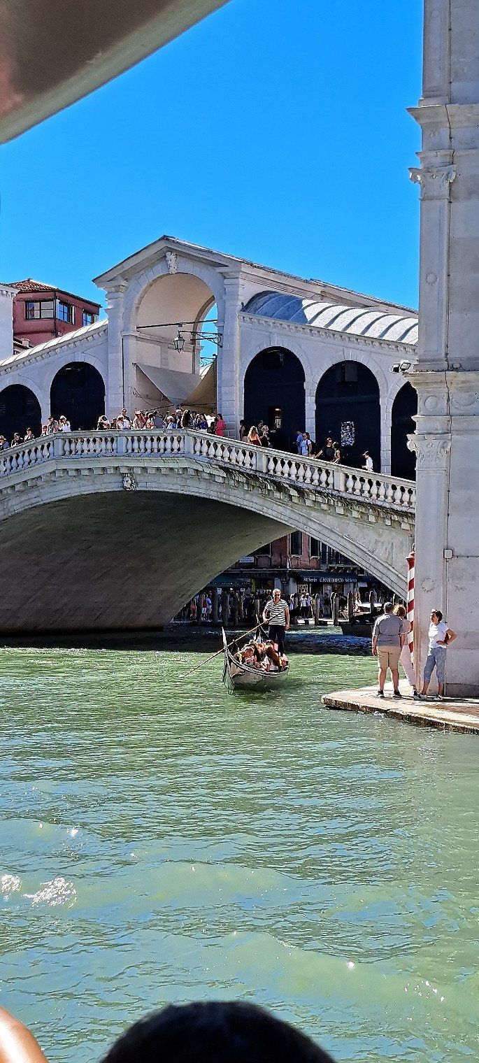
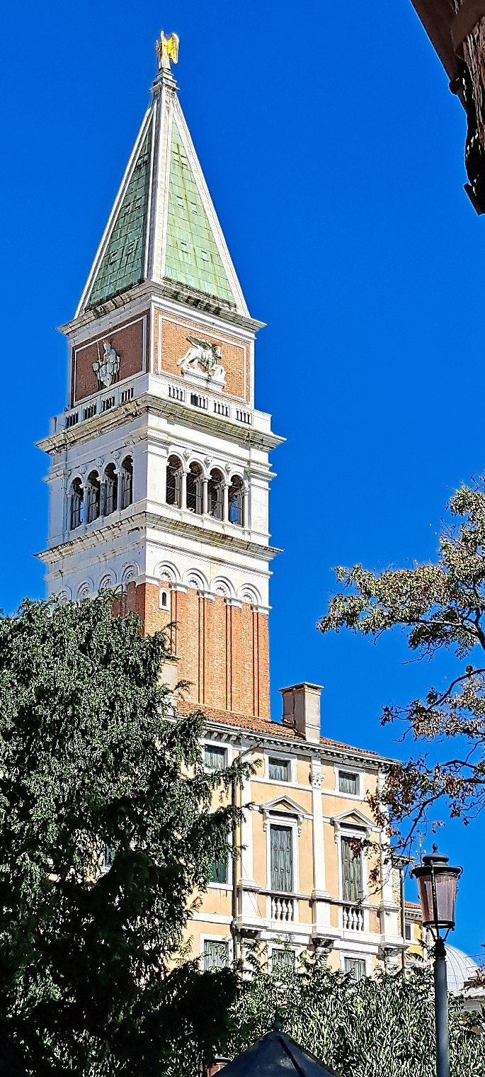
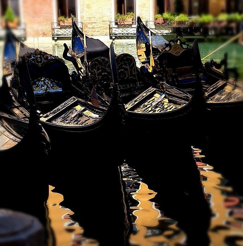
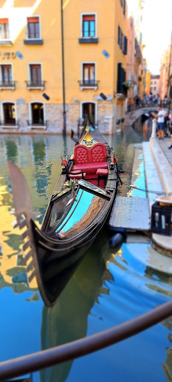
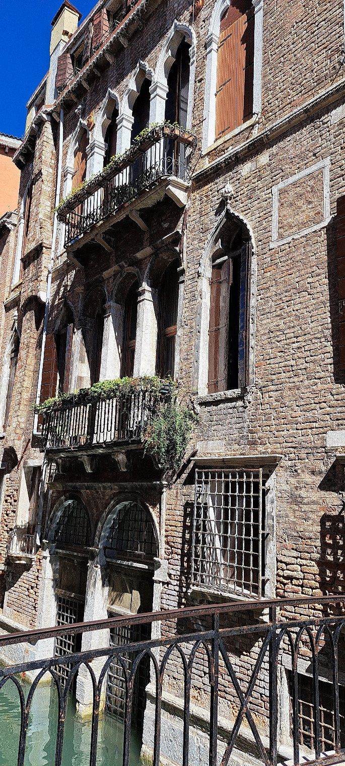
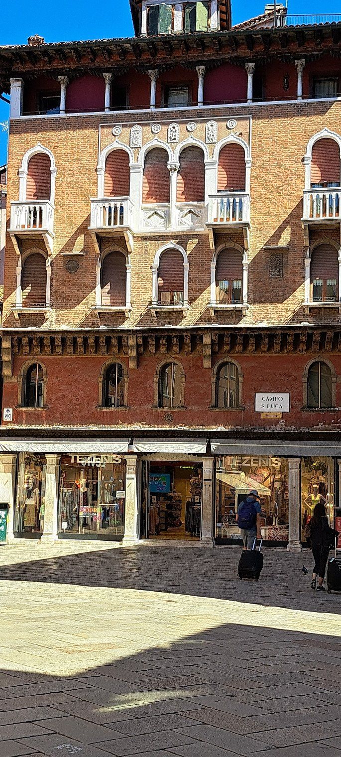
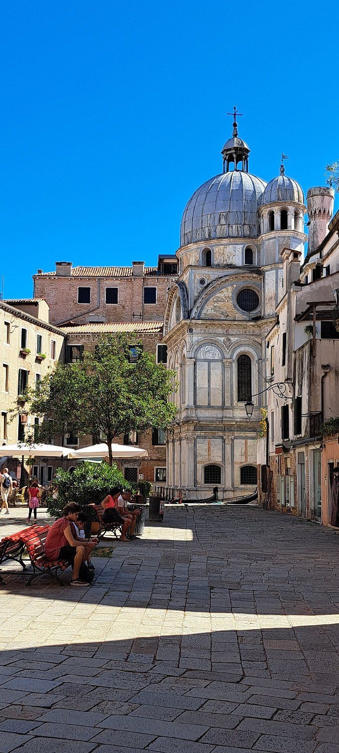
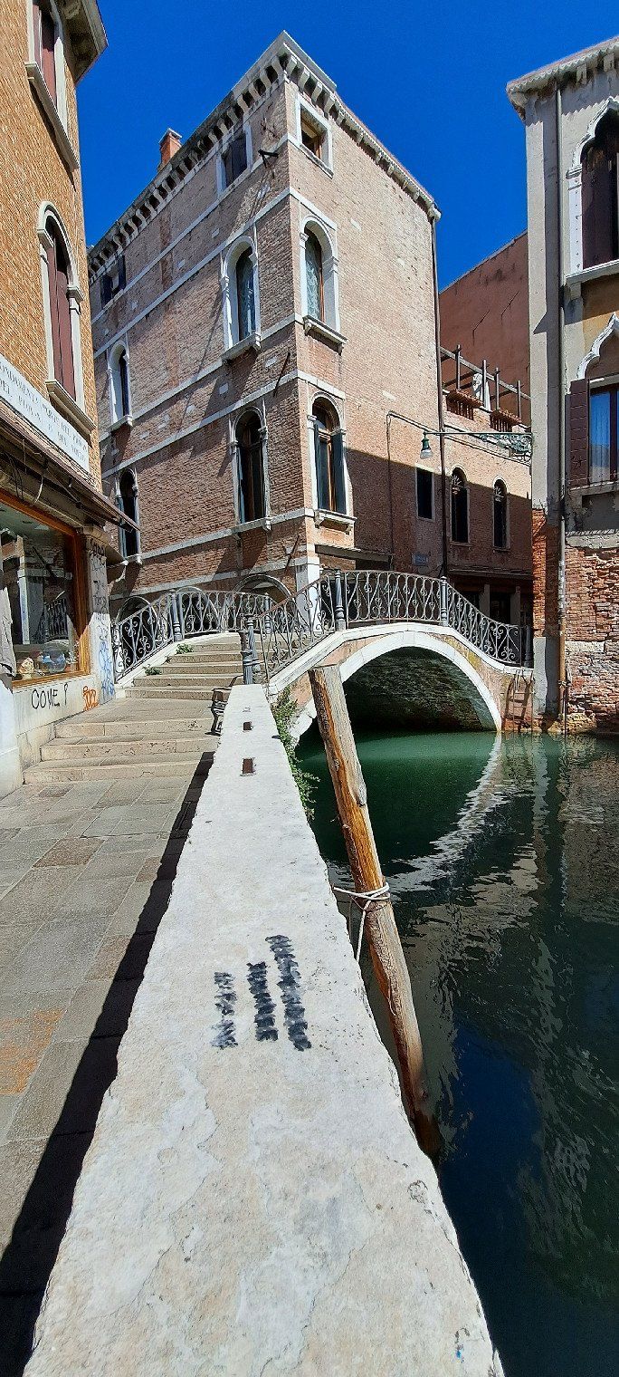
Aladdin Camp
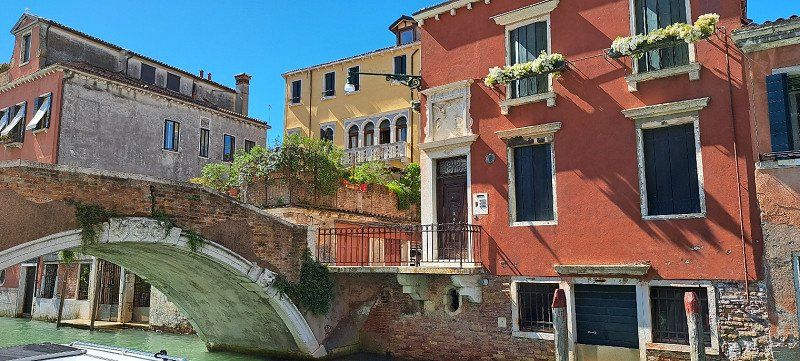
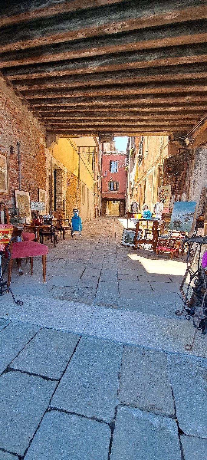
Venice excursion
30034 Mira, VE, Italien
45° 27' 40.3" N 12° 11' 8.9" E
45.4612025 12.1858034
• Head southwest on Via Ca' Rubaldi. Go for 182 m.
• Turn left onto Via Ca' Rubaldi. Go for 148 m.
• Turn right onto Via Cittadella (SP81). Go for 670 m.
• Take the 2nd exit from roundabout onto Via Brianza (SP81) toward Milano/A4/Venezia/Spinea. Go for 408 m.
• Keep right toward Autostrada/A57. Go for 522 m.
• Take left ramp onto A57 toward Milano/A4/Bologna/A13. Go for 7.1 km.
• Take the exit onto A4 (Passante di Mestre). Go for 99.2 km.
• Take the exit toward Verona Nord/Aeroporto onto A22 (Autostrada del Brennero). Go for 228 km.
• Continue on A13 (Brennerpass). Go for 31.7 km.
• Keep right onto A13 (Knoten Innsbruck-Berg Isel) toward Bregenz/Garmisch/Innsbruck-West. Go for 2.0 km.
• Continue on A12 (Inntal Autobahn). Go for 35.0 km.
• Take exit 113 toward Mötz/Reutte/Fernpass. Go for 319 m.
• Turn right onto Mötzer Landesstraße (L236). Go for 4.8 km.
• Take the 2nd exit from roundabout onto Mieminger Bundesstraße (B189) toward Reutte/Fernpaß/Nassereith. Go for 13.4 km.
• Keep left onto Mieminger Bundesstraße (B189) toward Reutte/Garmisch. Go for 91 m.
• Continue on Fernpass Bundesstraße (B179). Go for 49.1 km.
• Continue on Grenztunnel Füssen (A7). Go for 220 km.
• Take exit 110 toward Nürnberg/Feuchtwangen-Nord onto A6. Go for 17.3 km.
• Take exit 50 toward Leutershausen onto St1066. Go for 2.2 km.
• Turn right onto Hauptstraße (St2249) toward Herrieden. Go for 3.3 km.
• Take the 2nd exit from roundabout onto St2249. Go for 1.2 km.
• Turn left onto Ansbacher Straße (St2248). Go for 62 m.
• Arrive at Ansbacher Straße (St2248). Your destination is on the right.
☍
717,0 km
(7 hrs. 4 min.)
Day
Herrieden
Deutschland
49° 14' 7.3" N 10° 29' 41.9" E
49.2353489 10.4949623