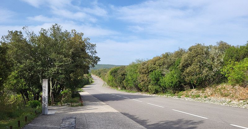
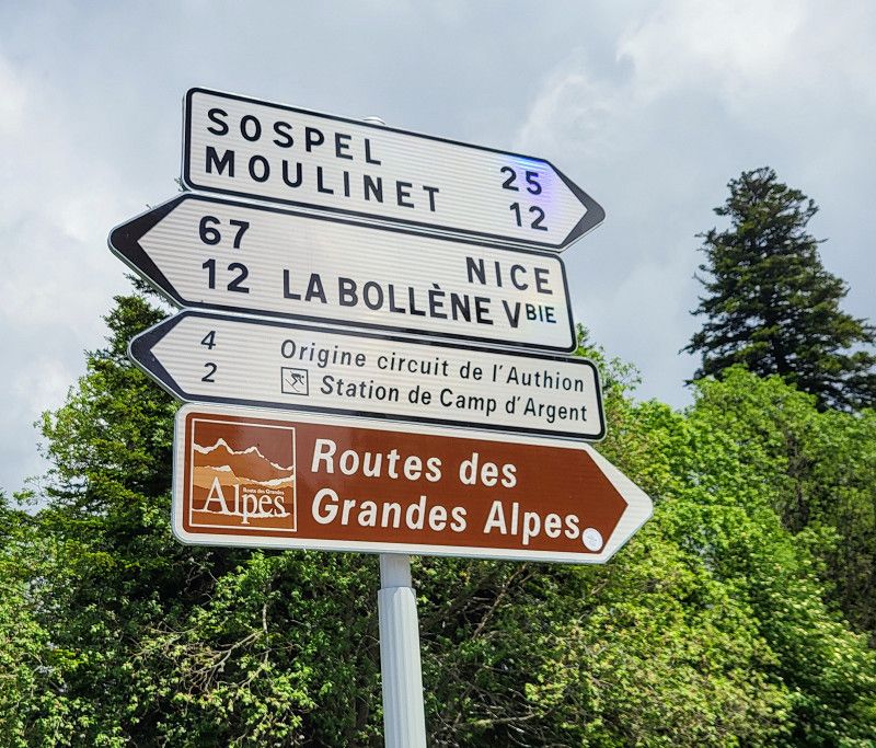
France - Ardèche - Southern Pyrenees via N260 with Andorra - Carcasson - Menton - Route de Grand Alps - Aosta - Maloja Pass - St. Moritz - Rum
Duration: 8 weeks - May/June 2025
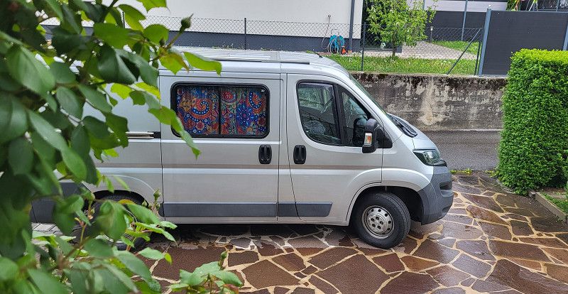
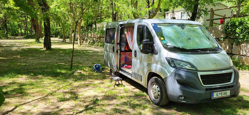
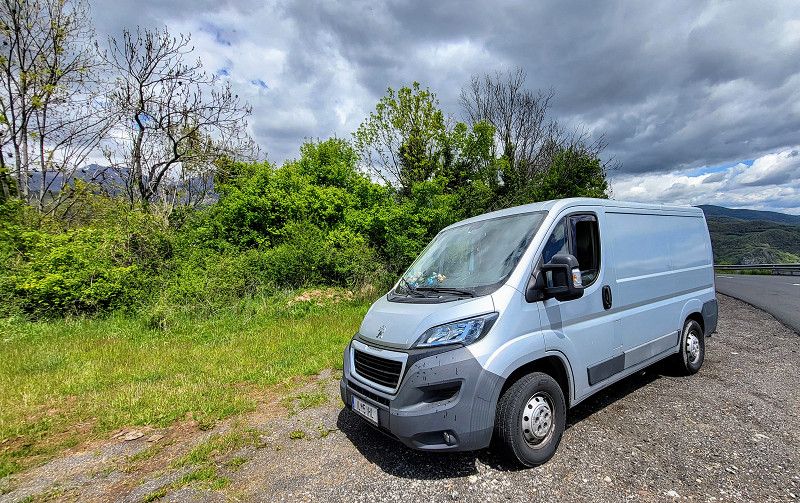
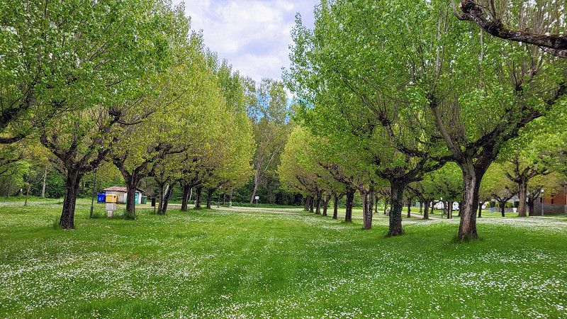
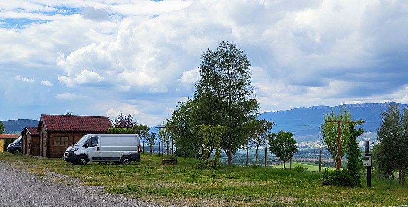
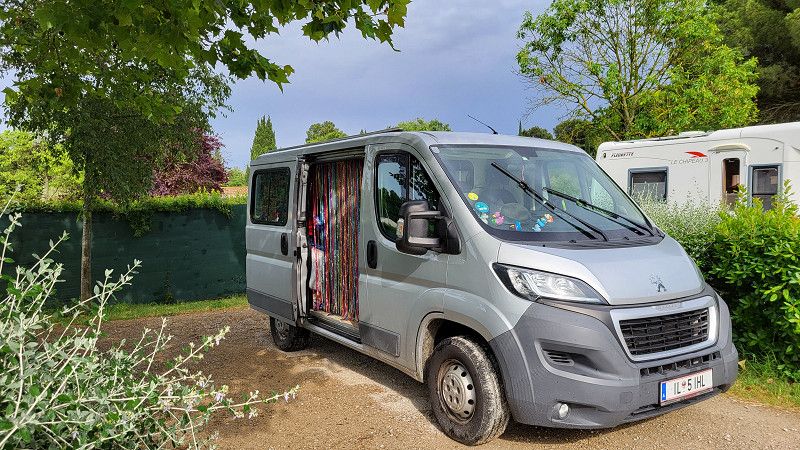
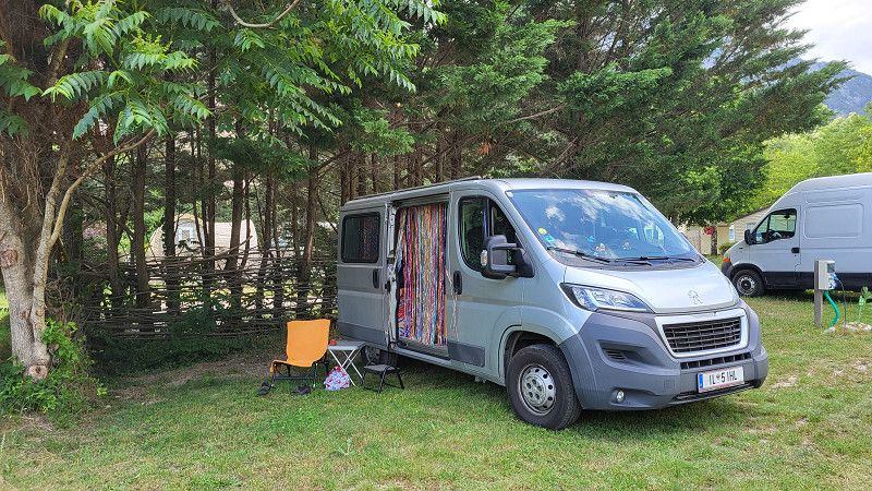
The rough plan is in place. I'm curious to see how well I stick to it. Pauli is still at the service station; most importantly, he's getting new all-season tires. It starts on April 28th, and I can hardly wait.
Approx. 5,000 km
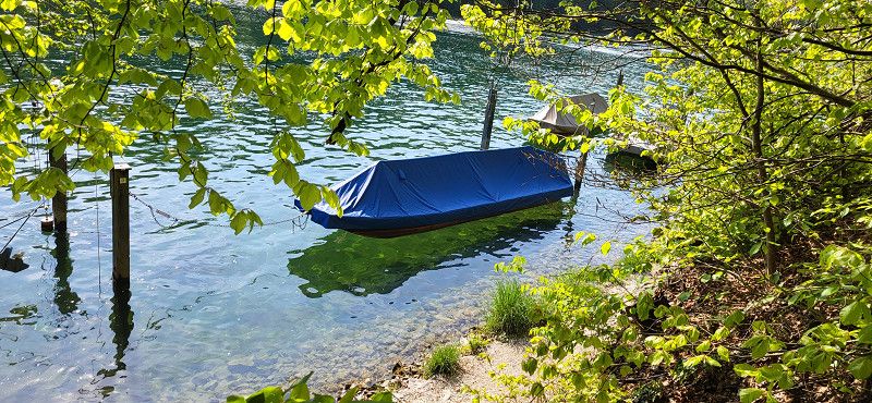
Rum
The day: Friday, April 25, 2025
The plan: Munich Airport, Terminal 2
The day's schedule: It's finally starting! Today I'm the airport shuttle for my daughter, who's flying from Birmingham with Lufthansa. We're driving to Jochberg today and having a big family celebration tomorrow. Just in time for departure, it starts to rain.
Munich Airport has extremely poor signage! We still found each other.
The drive to Jochberg took a whopping three and a half hours instead of two. An accident on the Irschenberg meant an eternity of waiting in the pouring rain.
Bezirk Innsbruck-Land, Tirol, Österreich
47° 17' 12.4" N 11° 27' 26.6" E
47.2867829 11.4573834
• Head toward Sankt-Georg-Weg on Langer Graben. Go for 441 m.
• Turn right onto Schulstraße. Go for 176 m.
• Turn left onto Bahnhofstraße. Go for 277 m.
• Continue on Gartenweg toward Bundesstraße/B171. Go for 470 m.
• Turn left onto Bundesstraße (B171). Go for 1.8 km.
• Turn right onto Löfflerweg toward Thaur. Go for 324 m.
• Take the 2nd exit from roundabout onto A12 (Inntal Autobahn) toward Salzburg/München. Go for 71.0 km.
• Continue on A93 (Grenzübergang Kiefersfelden). Go for 24.8 km.
• Take the left exit toward München/Rosenheim-West onto A8. Go for 45.6 km.
• Take exit 95 toward Nürnberg/Stuttgart/Messe/ICM/Flughafen München onto A99. Go for 29.9 km.
• Take exit 13 toward Berlin/Nürnberg/Deggendorf/Flughafen München onto A9. Go for 10.9 km.
• Take exit 68 toward Landshut/Flughafen München-Franz Josef Strauß onto A92. Go for 9.2 km.
• Keep right onto Dreieck Flughafen München toward Hallbergmoos/Flughafen München-Franz Josef Strauß. Go for 1.1 km.
• Continue on Zentralallee. Go for 1.2 km.
• Take ramp. Go for 697 m.
• Turn left toward Nordallee. Go for 304 m.
• Turn right onto Nordallee toward Nordallee 1-28, 30/FMG Verwaltung/P53 Busse/P52 Besucherpark/P50/P51. Go for 843 m.
• Turn slightly right onto Nordallee. Go for 61 m.
• Continue straight ahead. Go for 209 m.
• Turn right. Go for 140 m.
• Turn right. Go for 300 m.
• Arrive at your destination.
☍
199,8 km
(2 hrs. 20 min.)
Day Anreise auf Jochberg mit Umweg Müchner Flughafen
Flughafen München
Parkstraße, Oberding, Landkreis Erding, Bayern, Deutschland
48° 21' 14.3" N 11° 46' 42.9" E
48.3539625 11.7785925
• Head north. Go for 300 m.
• Turn left toward Nordallee. Go for 151 m.
• Continue on Nordallee. Go for 48 m.
• Turn left onto Nordallee. Go for 133 m.
• Turn left onto Nordallee. Go for 61 m.
• Turn right onto Nordallee. Go for 899 m.
• Take the 2nd exit from roundabout toward Terminal/Terminal 1+2. Go for 221 m.
• Turn left and take ramp onto Zentralallee toward München/Freising. Go for 2.2 km.
• Continue on Dreieck Flughafen München. Go for 1.0 km.
• Continue on A92. Go for 7.3 km.
• Take exit 4 toward Salzburg/München/Messe/ICM onto A9. Go for 11.4 km.
• Take the exit toward Salzburg/Innsbruck/Messe/ICM onto A99. Go for 29.3 km.
• Take exit 21 toward Salzburg/Innsbruck onto A8. Go for 47.3 km.
• Take the exit toward Verona/Brenner/Innsbruck/Kufstein onto A93. Go for 25.4 km.
• Continue on A12 (Inntal Autobahn). Go for 5.8 km.
• Take exit 6 toward Kufstein-Süd/Felbertauern onto B173 (Eiberg Bundesstraße). Go for 1.0 km.
• Take the 2nd exit from roundabout onto Eiberg Bundesstraße (B173) toward St. Johann i. T. Go for 692 m.
• Keep right toward Kitzbühel/St. Johann i. T./Felbertauern. Go for 110 m.
• Continue on Eibergstraße (B173). Go for 9.0 km.
• Take left ramp onto Loferer Bundesstraße (B178) toward Salzburg/Kitzbühel/St. Johann i. T./Felbertauern. Go for 15.5 km.
• Take ramp onto Pass-Thurn-Straße (B161) toward Lienz/Kitzbühel/Oberndorf/St. Johann-Süd/St. Johann i. T. Go for 9.6 km.
• Pass 2 roundabouts and continue on Jochberger Straße (B161). Go for 8.3 km.
• Turn right onto Martengasse. Go for 58 m.
• Turn right onto Martengasse. Go for 61 m.
• Arrive at Martengasse. Your destination is on the left.
☍
175,8 km
(2 hrs. 18 min.)
Day Familienfeier
Jochberg
Bezirk Kitzbühel, Tirol, Österreich
47° 22' 49.7" N 12° 25' 4.8" E
47.3804596 12.4180047
• Head south on Martengasse. Go for 61 m.
• Turn left onto Martengasse. Go for 58 m.
• Turn left onto Dorf (B161). Go for 7.8 km.
• Pass 2 roundabouts and continue on Sportfeld (B161). Go for 9.6 km.
• Take left ramp onto Loferer Bundesstraße (B178) toward Innsbruck/München/Kufstein. Go for 16.0 km.
• Take ramp toward München/Kufstein. Go for 433 m.
• Continue on Eiberg Bundesstraße (B173). Go for 8.9 km.
• Take the 2nd exit from roundabout onto Eiberg Bundesstraße (B173) toward München/A12/Innsbruck. Go for 746 m.
• Take the 2nd exit from roundabout onto Eiberg Bundesstraße (B173) toward München/Salzburg/Innsbruck. Go for 539 m.
• Take ramp onto A12 (Inntal Autobahn) toward Salzburg/München. Go for 5.8 km.
• Continue on A93 (Grenzübergang Kiefersfelden). Go for 24.8 km.
• Take the left exit toward München/Rosenheim-West onto A8. Go for 45.6 km.
• Take exit 95 toward Nürnberg/Stuttgart/Messe/ICM/Flughafen München onto A99. Go for 29.9 km.
• Take exit 13 toward Berlin/Nürnberg/Deggendorf/Flughafen München onto A9. Go for 10.9 km.
• Take exit 68 toward Landshut/Flughafen München-Franz Josef Strauß onto A92. Go for 9.2 km.
• Keep right onto Dreieck Flughafen München toward Hallbergmoos/Flughafen München-Franz Josef Strauß. Go for 1.1 km.
• Continue on Zentralallee. Go for 2.7 km.
• Keep left onto Knoten West 2 toward Flughafen Terminal 1/Bus/Taxi Terminal 2/General Aviation/Erding. Go for 1.1 km.
• Take ramp toward Flughafen Terminal 1/Rental Car Return. Go for 409 m.
• Continue on Terminalstraße West. Go for 562 m.
• Turn left. Go for 27 m.
• Arrive at your destination on the left.
☍
176,1 km
(2 hrs. 7 min.)
Day Reisetag
München Flughafen Terminal
Nordallee 25, Freising, Landkreis Freising, Bayern, Deutschland
48° 21' 13.6" N 11° 47' 10.1" E
48.3537694 11.7861263
• Head toward Terminalstraße West. Go for 27 m.
• Turn left onto Terminalstraße West. Go for 452 m.
• Take ramp onto Flughafen Südring toward Zone West/München/Freising. Go for 1.2 km.
• Continue on Knoten West 2. Go for 476 m.
• Continue on Zentralallee. Go for 2.7 km.
• Continue on Dreieck Flughafen München. Go for 1.0 km.
• Continue on A92. Go for 21.2 km.
• Take the left exit toward Stuttgart/Augsburg/Lindau/München-West onto A99. Go for 8.3 km.
• Keep left onto A99 (Autobahndreieck München-Allach) toward Lindau/Kreuz München-West. Go for 10.0 km.
• Take exit 4 toward Lindau/Memmingen/Germering-Süd onto A96. Go for 144 km.
• Take exit 5 toward Wangen-West/Ravensburg/Weingarten/Amtzell. Go for 421 m.
• Turn right onto B32 toward Ravensburg/Weingarten/Amtzell/Waldburg. Go for 10.3 km.
• Take the 2nd exit from roundabout onto Eichelstraße (B32) toward Ravensburg. Go for 10.3 km.
• Keep left onto Schussenstraße (K7975). Go for 214 m.
• Turn left onto Georgstraße (K7975). Go for 406 m.
• Turn right onto Meersburger Straße (K7975). Go for 3.0 km.
• Turn left onto L288. Go for 197 m.
• Turn right onto B33. Go for 8.1 km.
• Turn right onto Lupinenstraße (L204) toward Pfullendorf/Deggenhausertal. Go for 9.1 km.
• Take the 2nd exit from roundabout onto Badener Straße (L204). Go for 7.4 km.
• Take the 3rd exit from roundabout onto K7759 toward Markdorf/Neufrach. Go for 927 m.
• Arrive at K7759. Your destination is on the right.
☍
239,1 km
(2 hrs. 29 min.)
Salem, Neufrach Campinghof Gern
The day: Sunday, April 27, 2025
The plan: Jochberg - Munich Airport - Salem on Lake Constance
The day's schedule: We set off shortly before noon after a great lunch. Despite heavy traffic, the drive to Munich Airport went smoothly, taking about 2 hours and 15 minutes. My daughter flew back to Birmingham, and I continued on to Salem via Ulm.
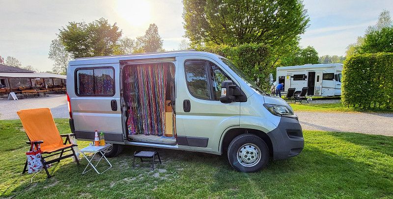
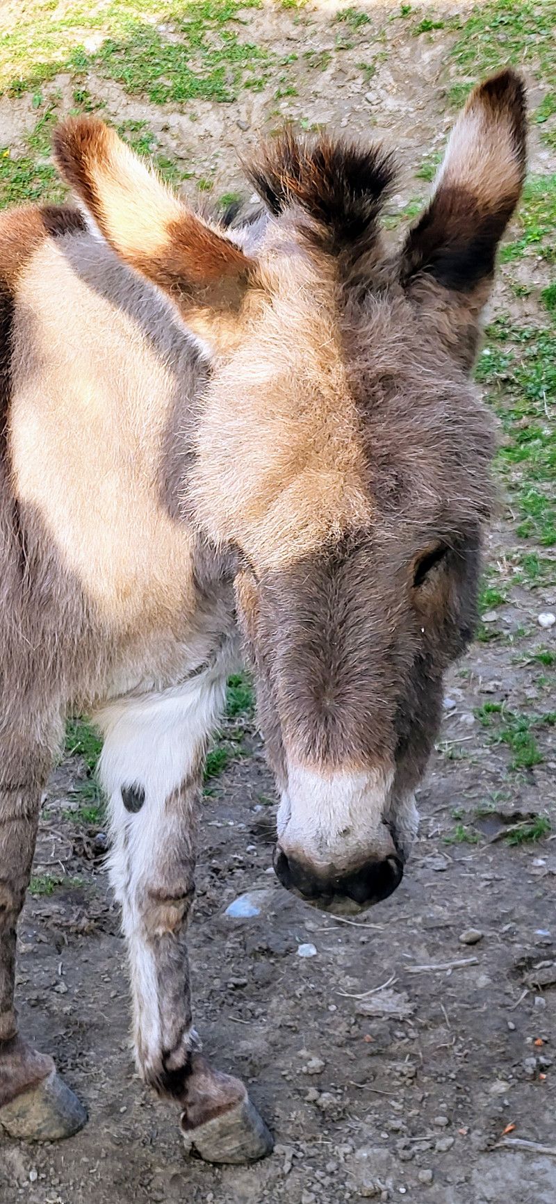
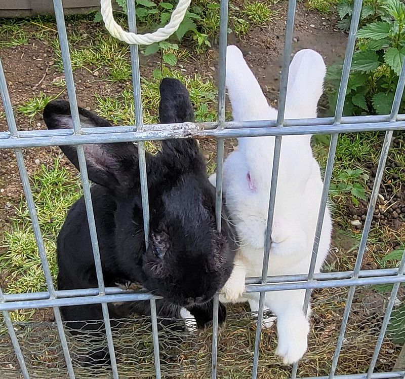
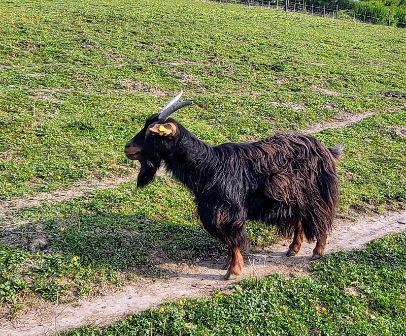
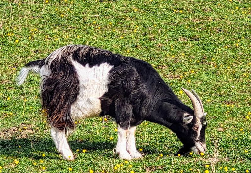
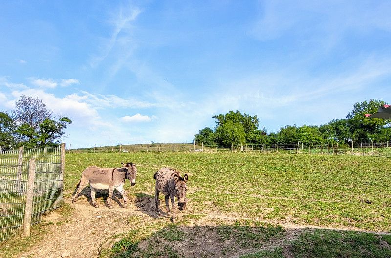
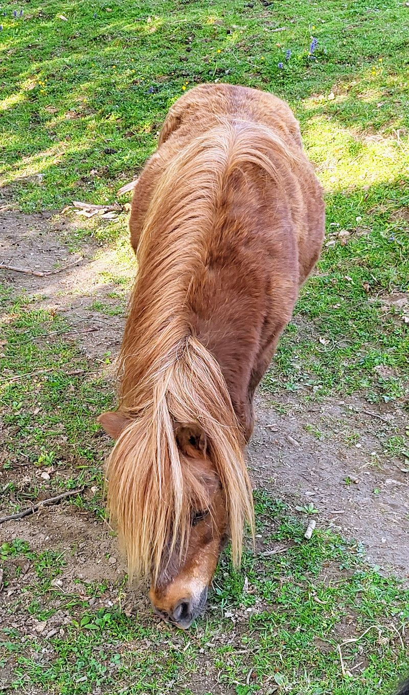
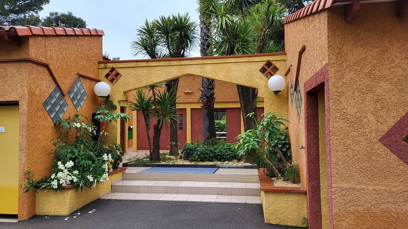
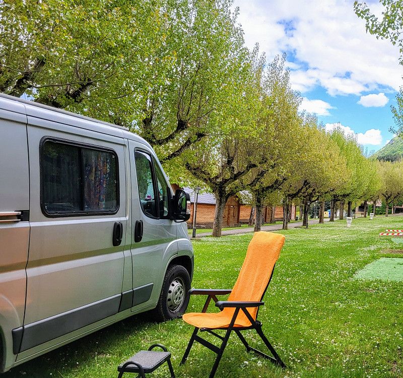
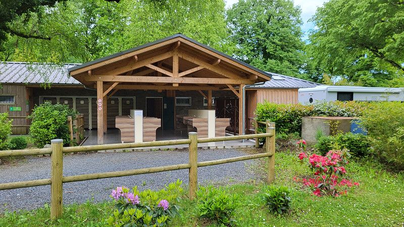
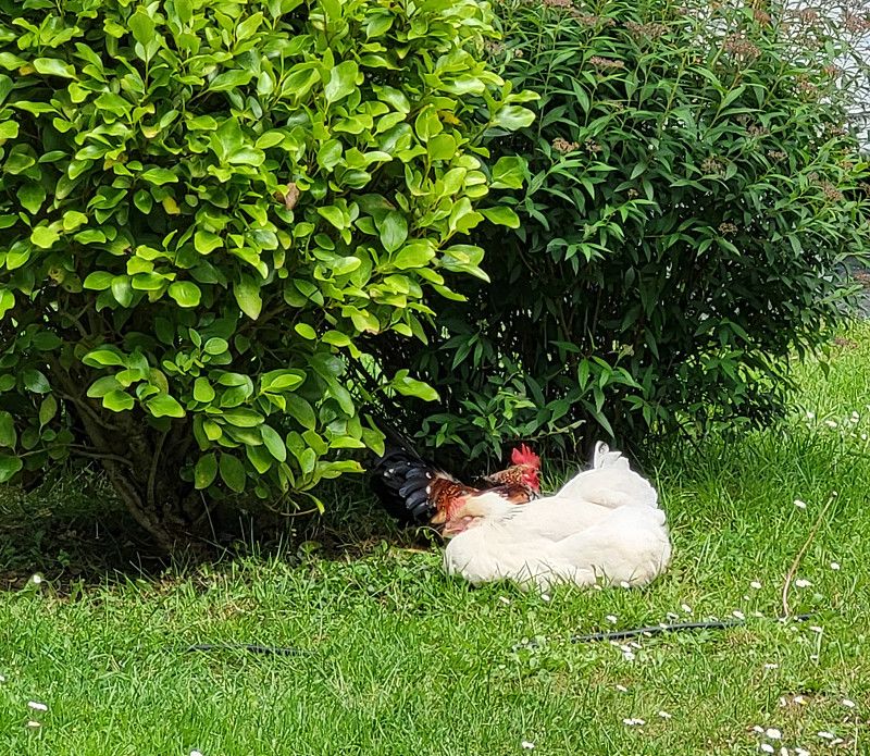
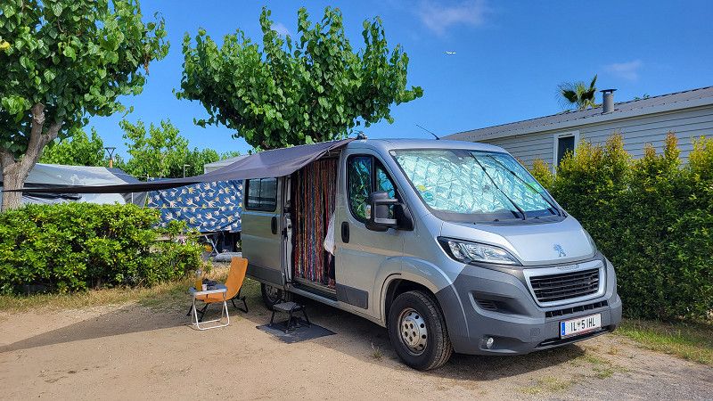
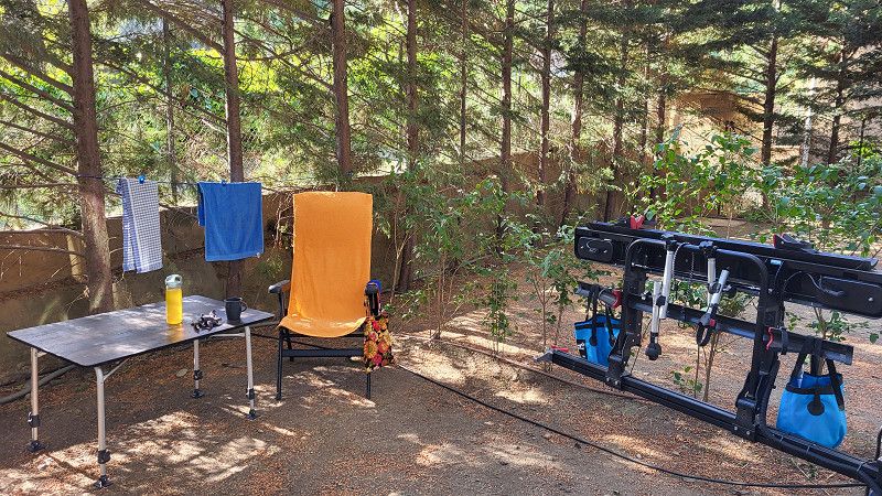
The campsite is small and simple, but has lots of animals—all of them close enough to touch. Costs are €20, plus electricity with meter.
Bodenseekreis, Baden-Württemberg, Deutschland
47° 46' 9.4" N 9° 18' 23.7" E
47.7692723 9.3065929
• Head north on K7759. Go for 854 m.
• Take the 3rd exit from roundabout onto L204 toward Überlingen/Salem. Go for 1.2 km.
• Turn left onto Heiligenberger Straße (L201). Go for 109 m.
• Take the 2nd exit from Brunnenplatz roundabout onto Schloßstraße (L205) toward Überlingen/Frickingen. Go for 1.0 km.
• Continue on L200A toward Überlingen/Tüfingen. Go for 6.7 km.
• Pass 2 roundabouts and continue on L200A. Go for 1.2 km.
• Take the 2nd exit from roundabout onto L200 toward Überlingen. Go for 413 m.
• Take the 1st exit from roundabout toward Stockach/Pfullendorf. Go for 181 m.
• Take ramp onto B31N. Go for 14.8 km.
• Continue on A98. Go for 12.5 km.
• Take the left exit toward Schaffhausen/Singen onto A81. Go for 12.6 km.
• Keep left onto A81 toward Schaffhausen/Bietingen. Go for 64 m.
• Take the 1st exit from roundabout onto B34 toward Schaffhausen/Bietingen. Go for 2.0 km.
• Continue on E41/E54. Go for 992 m.
• Continue on A4 toward SH-Herblingen. Go for 7.1 km.
• Take ramp toward Schaffhausen-Nord/Zentrum. Go for 781 m.
• Turn right onto Fulachstrasse (4/15). Go for 1.5 km.
• Turn right onto Rheinuferstrasse (4/13/14). Go for 293 m.
• Turn right onto Klosterstrasse. Go for 174 m.
• Turn right onto Klosterstrasse. Go for 48 m.
• Turn left onto Münsterplatz. Go for 35 m.
• Turn right onto Klosterbogen. Go for 16 m.
• Continue on Münstergasse. Go for 38 m.
• Arrive at Münstergasse. Your destination is on the left.
☍
64,5 km
( 51 min.)
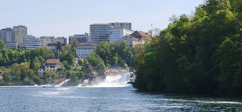
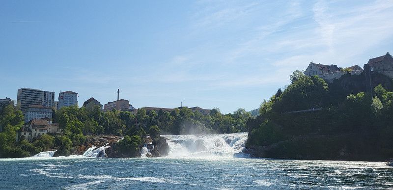
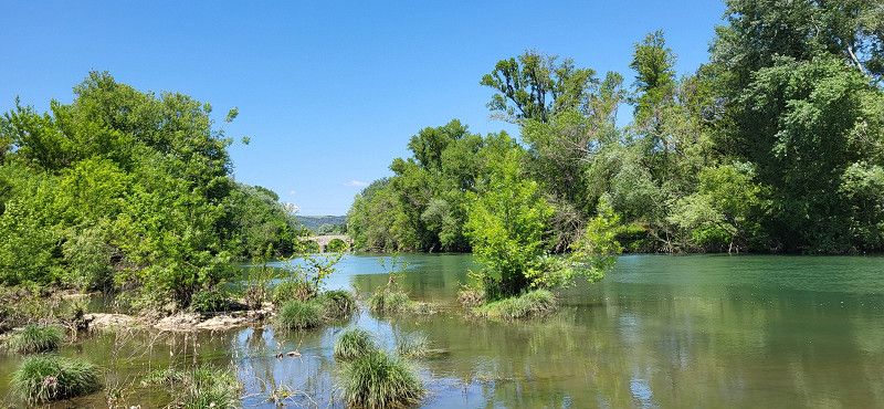
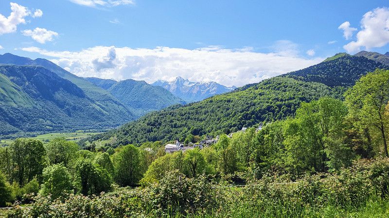
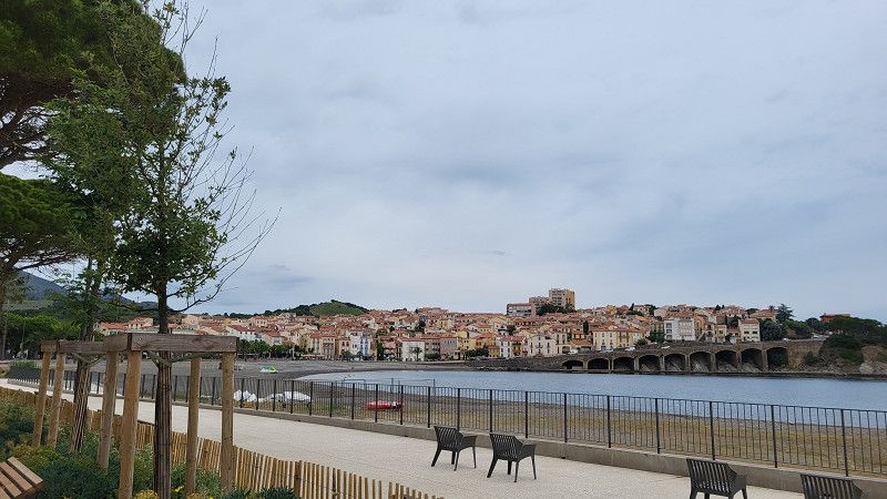
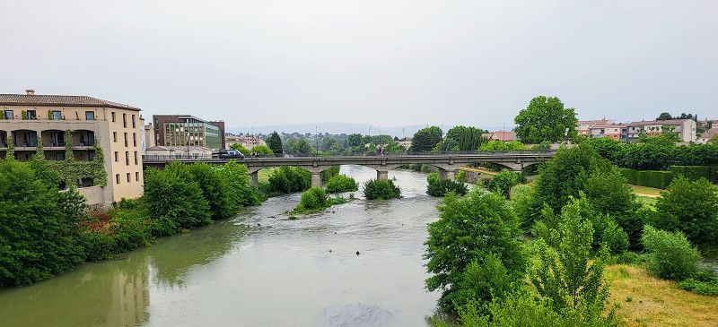
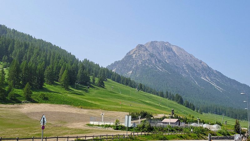
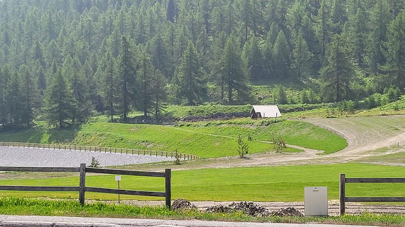
Day Rheinfall in Schaffhausen und Anreise nach Cerdon
Schaffhausen
The day: Monday, April 28, 2025
The plan: Driving day from Salem - Schaffhausen Rheinfall via the motorway to Geneva and then on to Cerdon.
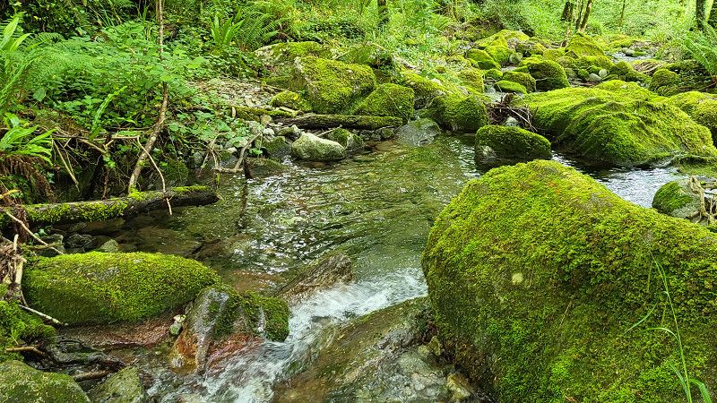
In nice weather, we went for a short hike at the Rhine Falls. Then we drove for 5 hours.
Schaffhausen, Schweiz
47° 41' 45.8" N 8° 38' 4.2" E
47.6960491 8.6345130
• Head toward Beckenstube on Münstergasse. Go for 38 m.
• Continue on Klosterbogen. Go for 63 m.
• Turn right onto Klosterstrasse. Go for 174 m.
• Turn right onto Rheinuferstrasse (4/13/14). Go for 997 m.
• Turn right onto Bahntalstrasse toward E41/A4/Zürich/Winterthur. Go for 157 m.
• Take ramp onto A4. Go for 22.1 km.
• Take exit 70 toward Zürich/Wülflingen onto A1/A4. Go for 33.7 km.
• Take the exit toward Bern/Basel/Dietikon onto A1 (Limmattaler Kreuz). Go for 16.4 km.
• Continue on A1 (Verzweigung Birrfeld) toward Bern/Aarau/Mägenwil. Go for 40.6 km.
• Continue on A1 (Härkingen) toward E25/Lausanne/Bern/Biel/Bienne/Oensingen. Go for 50.8 km.
• Take the exit toward Lausanne/Fribourg/Neuchâtel/Bern-Neufeld onto A1 (Wankdorf). Go for 99.9 km.
• Continue on A1. Go for 2.7 km.
• Take the exit toward Genève onto A1. Go for 65.2 km.
• Continue on A41. Go for 1.1 km.
• Take the exit toward Paris/Lyon onto A40 (Autoroute Blanche). Go for 58.2 km.
• Take exit 8 toward Hauteville-L. Go for 1.3 km.
• Continue toward Grand'Rue/D1084. Go for 24 m.
• Turn right onto Grand'Rue (D1084) toward Lyon/Maillat/Poncin/Pont d'Ain/Cerdon. Go for 5.5 km.
• Turn right onto D11 H toward St Alban/Ceignes. Go for 699 m.
• Continue on Lieu-dit La Levée (D11 H). Go for 98 m.
• Continue on D11 H. Go for 164 m.
• Continue on D11. Go for 4.0 km.
• Continue on Rue de la Grand'Côte (D11). Go for 507 m.
• Continue on Rue du Maquis (D11). Go for 59 m.
• Arrive at Rue du Maquis (D11). Your destination is on the right.
☍
404,4 km
(3 hrs. 51 min.)
Cerdon
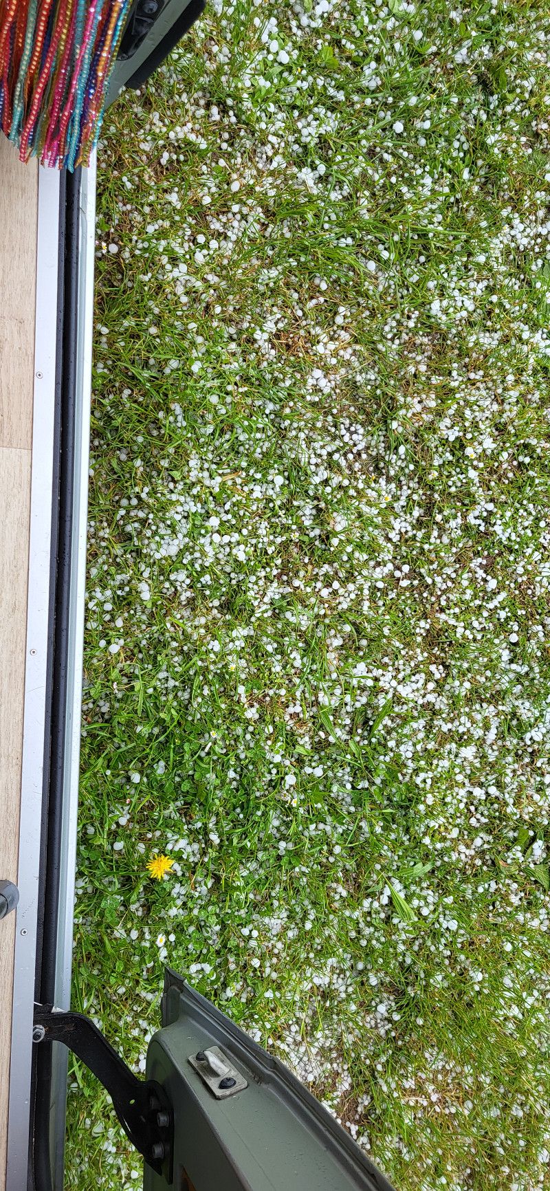
You can spend the night for free in the Cerdon Cave parking lot. At the end of the day, there was a heavy thunderstorm with hail.
Ain, Auvergne-Rhone-Alpen, Frankreich
46° 4' 48.7" N 5° 27' 52.6" E
46.0802000 5.4646000
• Head toward Place de la Mairie on Rue du Maquis (D11). Go for 59 m.
• Turn right onto Rue du Maquis (D11 B). Go for 1.0 km.
• Turn left onto D1084 toward Nantua/Labalme. Go for 4.6 km.
• Turn left. Go for 273 m.
• Turn right. Go for 25 m.
• Arrive at your destination.
☍
6,0 km
( 7 min.)
Day
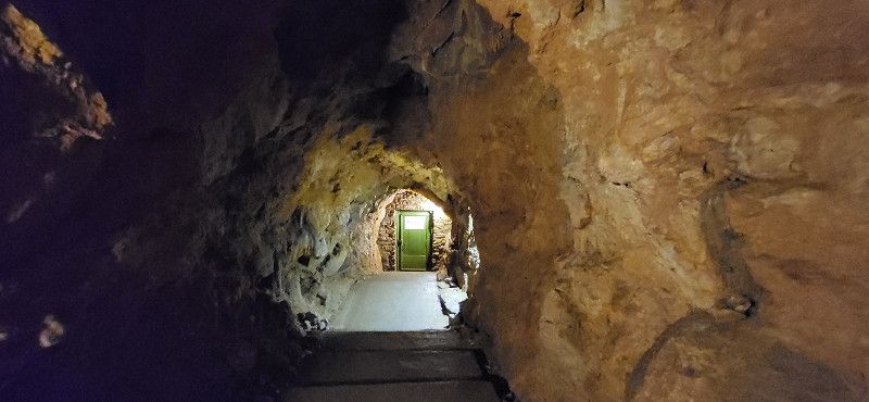
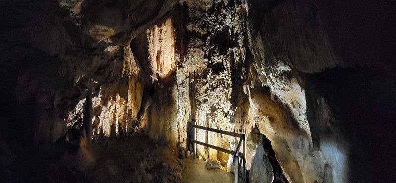
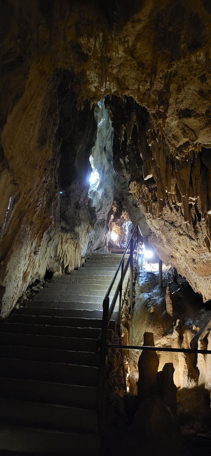
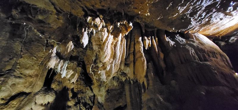
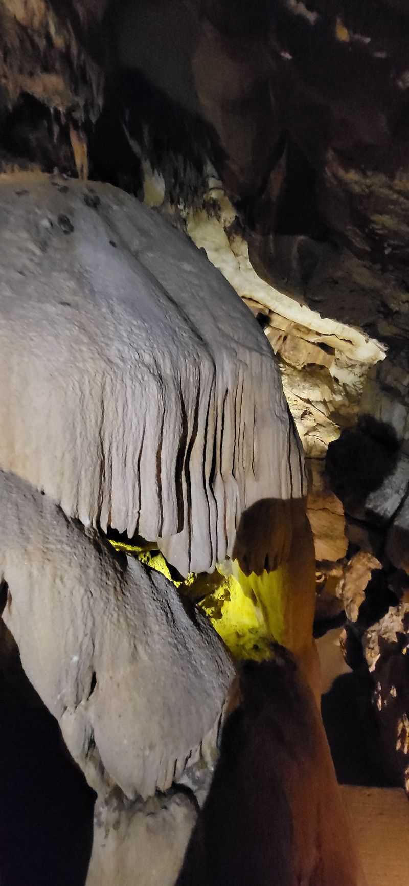
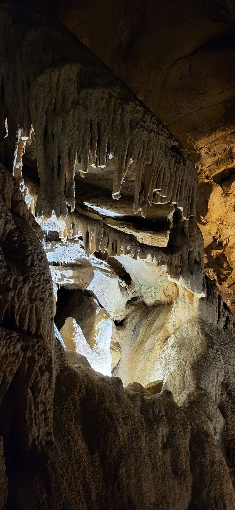
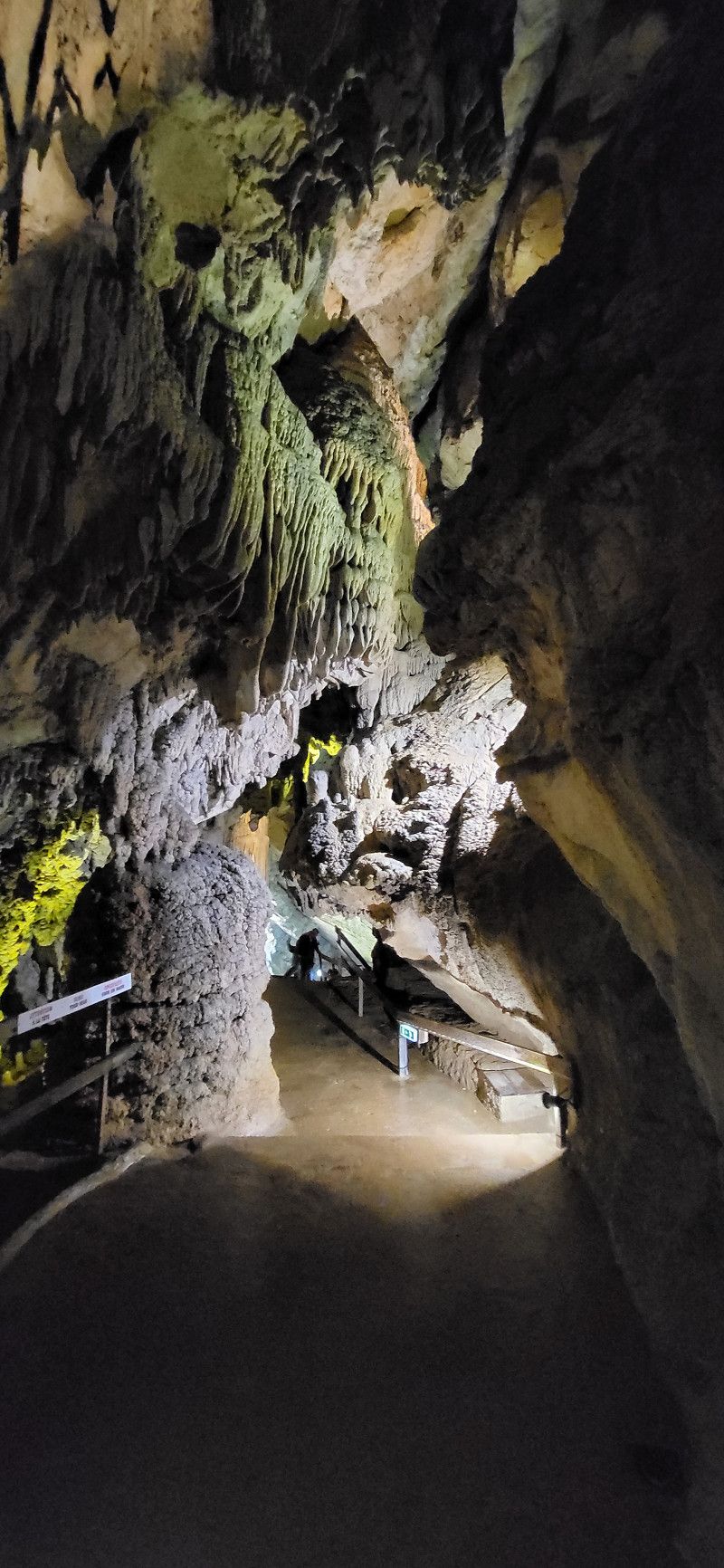
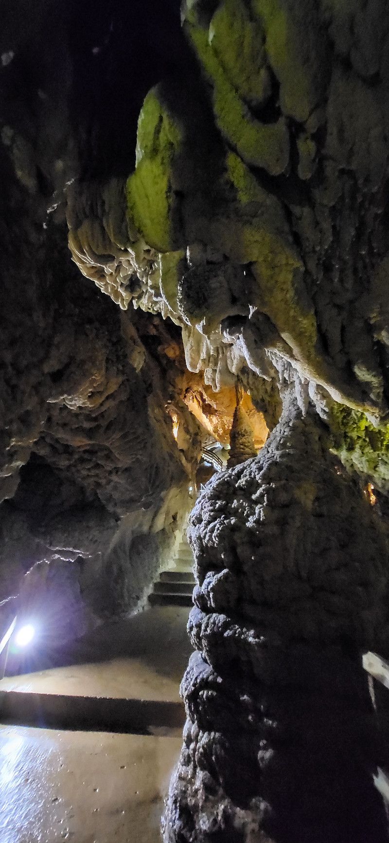
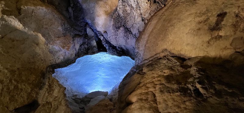
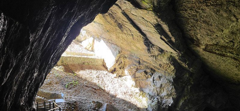
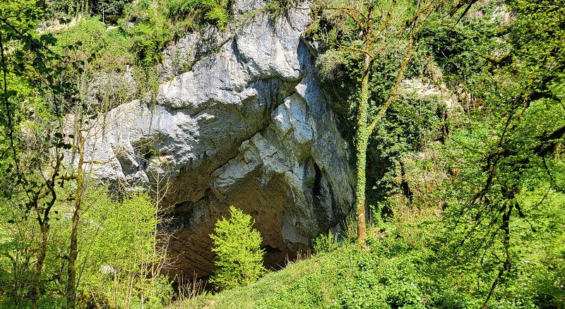
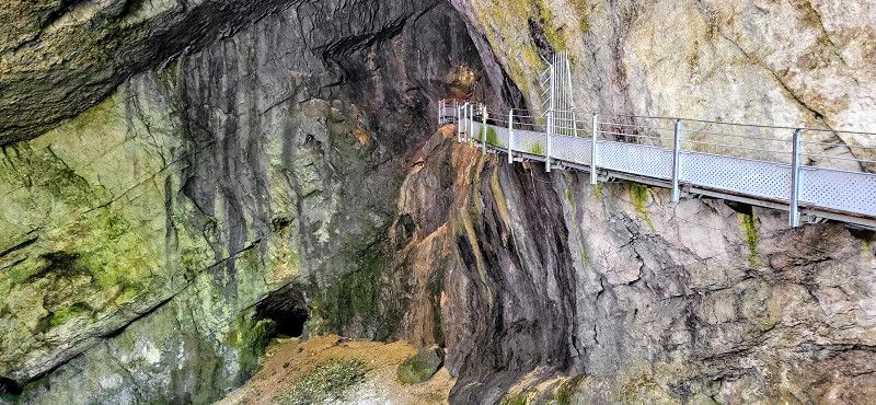
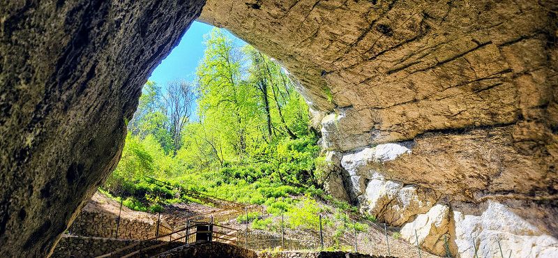
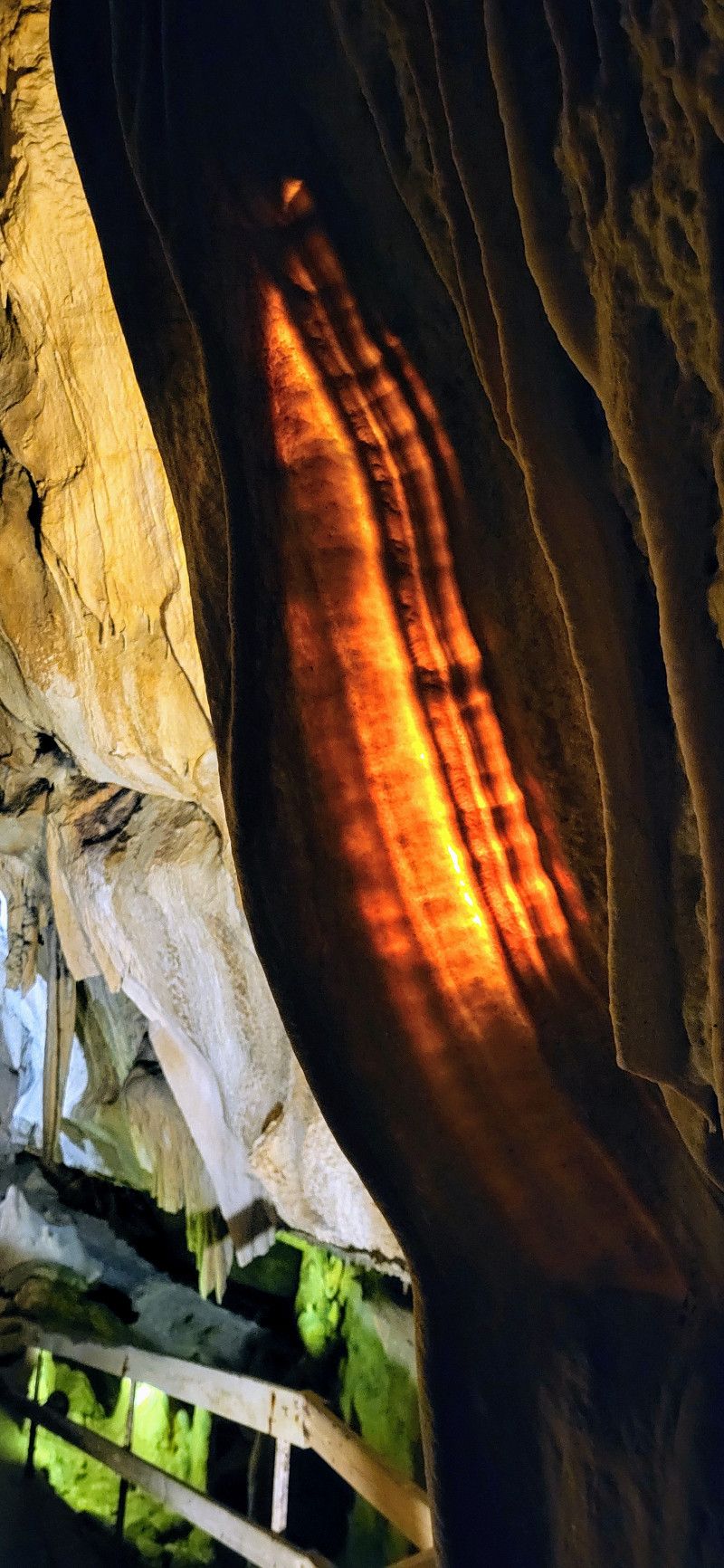
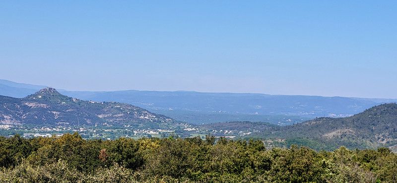
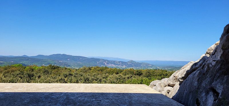
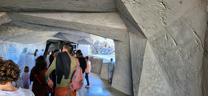
Grottes du Cerdon
The day: Tuesday, April 29, 2025
The plan: Visit the Cave of Cerdon, then continue on country roads to
Prehistoric cave - stunningly beautiful! €11 entrance fee but worth every cent. Very impressive, without any unnecessary light shows.
Chemin des Grottes, Labalme, Ain, Auvergne-Rhone-Alpen, Frankreich
46° 5' 51.3" N 5° 28' 47.6" E
46.0975925 5.4798918
• Head southwest. Go for 25 m.
• Turn left toward Grande Rue/D1084. Go for 178 m.
• Turn slightly right toward Grande Rue/D1084. Go for 83 m.
• Turn left onto Grande Rue (D1084). Go for 7.8 km.
• Turn left toward Annecy/Genève/Lyon/Bourg en B./Oyonnax. Go for 324 m.
• Take ramp onto A40 toward Lyon/Bourg en B. Go for 19.8 km.
• Take the exit toward Lyon/Aéroport Saint Exupéry onto A42. Go for 39.7 km.
• Take the exit toward Marseille/Grenoble/St Étienne/Aéroport Saint-Exupéry onto A432. Go for 22.5 km.
• Take the exit toward E70/Turin/Milan/Grenoble/Chambéry/L'Isle d'Abeau onto A43. Go for 27.8 km.
• Take the exit toward Valence/Grenoble onto A48. Go for 41.6 km.
• Take the exit toward Marseille/Valence onto A49. Go for 32.4 km.
• Take exit 9 toward Pont en Royans/St Marcellin. Go for 393 m.
• Continue on Lieu-dit Les Echavagnes. Go for 109 m.
• Take the 1st exit from roundabout onto D518 toward St Romans/Pont en Royans/Villard de Lans. Go for 3.5 km.
• Continue on Grande Rue (D518). Go for 3.9 km.
• Turn left onto Route de Bluvinaye (D518). Go for 5.2 km.
• Turn left onto Place de la Porte de France. Go for 42 m.
• Turn slightly left onto Rue du Souvenir Français. Go for 68 m.
• Arrive at Rue du Souvenir Français. Your destination is on the left.
☍
205,6 km
(1 hrs. 52 min.)
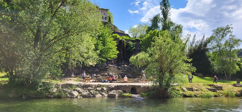
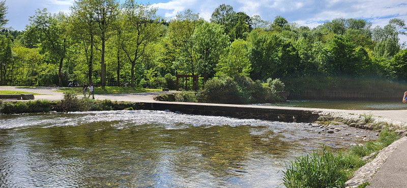
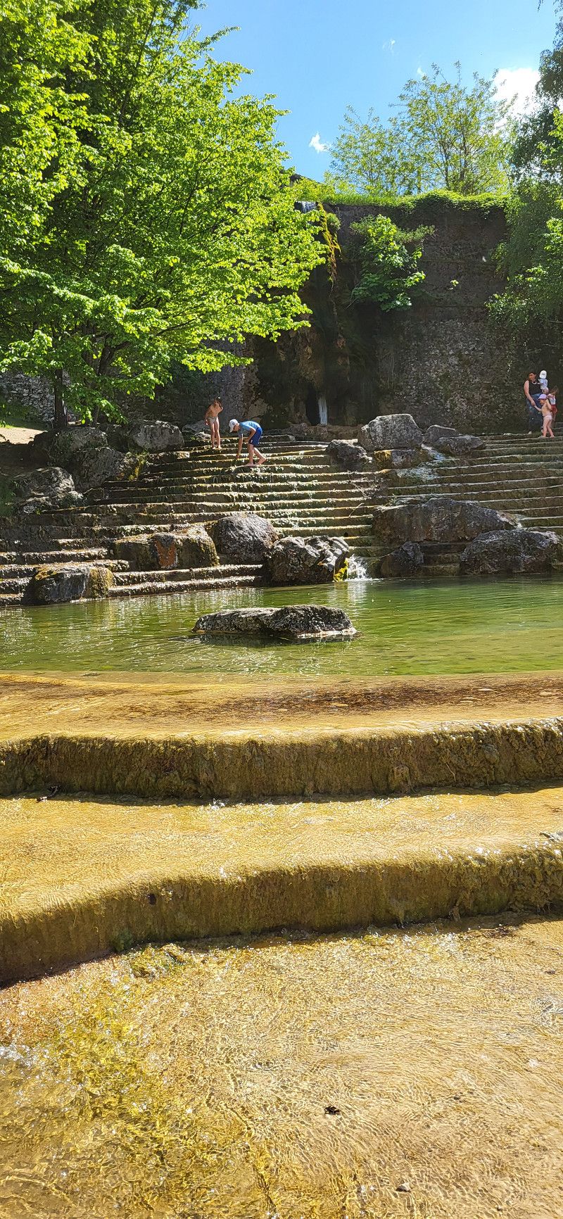
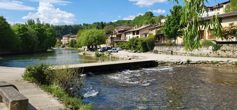
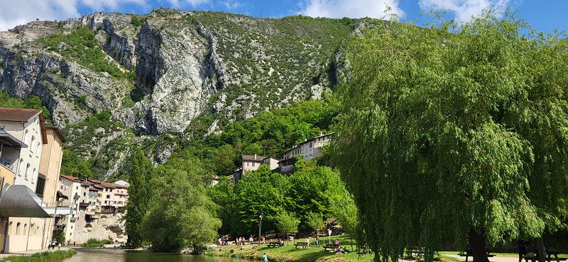
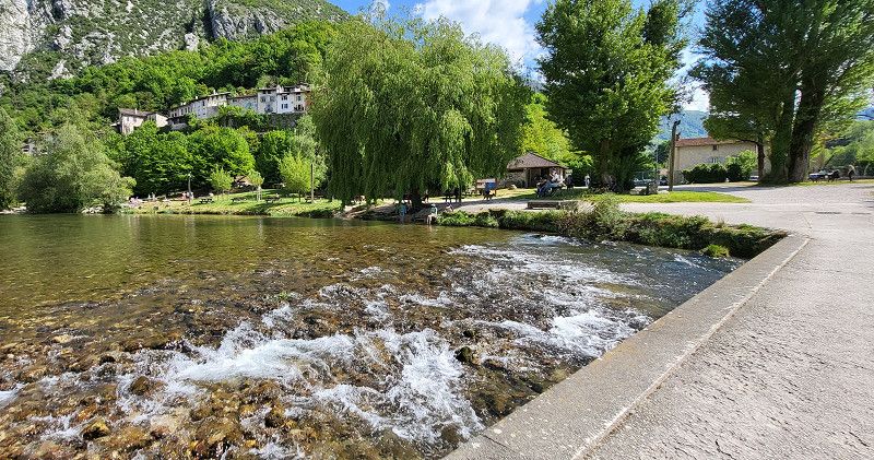
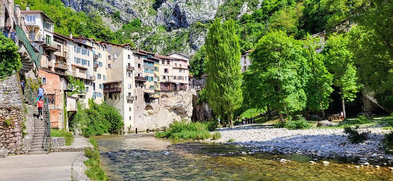
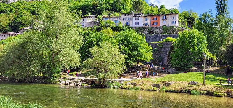
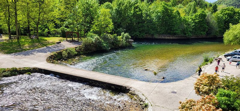
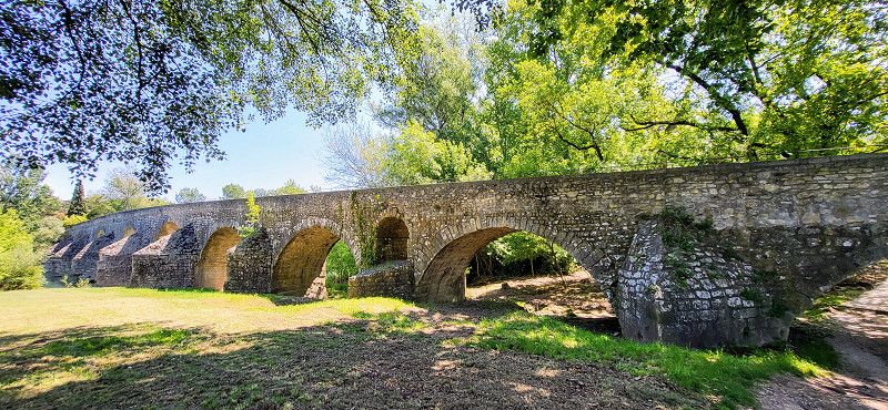
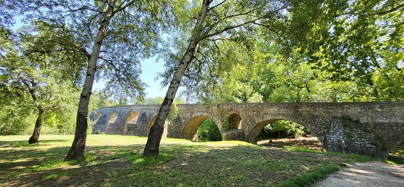
Pont-en-Royans
A wonderfully beautiful spot. I parked right at the entrance to town and walked to the bridge.
Isère, Auvergne-Rhone-Alpen, Frankreich
45° 3' 43.9" N 5° 20' 33" E
45.0622000 5.3425100
• Head toward Rue de la Salle des Fêtes on Rue du Souvenir Français. Go for 67 m.
• Continue on Rue du 19 Mars 1962. Go for 143 m.
• Continue on Rue du 19 Mars 1962. Go for 194 m.
• Turn right onto Rue Gambetta (D518/D531). Go for 470 m.
• Turn left onto Lieu-dit Le Pavillon (D531). Go for 6.6 km.
• Take the 3rd exit from roundabout onto Route de Provence (D1532) toward A49/Valence/St Nazaire en R./Bourg-de-Péage. Go for 1.8 km.
• Continue on Place de la Tour Potevine (D532). Go for 72 m.
• Turn left onto Avenue Léon Laurent (D76). Go for 660 m.
• Turn left onto Rue des Condamines. Go for 123 m.
• Turn right. Go for 92 m.
• Arrive at your destination on the right.
☍
10,2 km
( 11 min.)
Camping Côté Vercors
The pitches are nice but noisy due to the traffic. I also find them quite expensive at €27. The owner checks the pitches in the evening and asks if anyone needs anything or if they're happy. I think that's a really nice gesture.
Rue des Condamines 100 B, Saint-Nazaire-en-Royans, Drôme, Auvergne-Rhone-Alpen, Frankreich
45° 3' 33" N 5° 15' 16.1" E
45.0591548 5.2544596
• Head north. Go for 35 m.
• Turn left. Go for 36 m.
• Turn right toward Rue des Condamines. Go for 31 m.
• Turn left onto Rue des Condamines. Go for 37 m.
• Turn right onto Avenue Léon Laurent. Go for 120 m.
• Turn right onto Avenue Léon Laurent (D76). Go for 511 m.
• Turn left onto Route de Romans (D532). Go for 3.4 km.
• Take the 1st exit from roundabout onto D325 A toward A49/Romans/Valence/Eymeux. Go for 274 m.
• Take the 2nd exit from roundabout onto A49 toward Valence. Go for 15.9 km.
• Continue on N532. Go for 9.5 km.
• Take ramp toward Le Plovier/Z.A. Laye. Go for 279 m.
• Take the 3rd exit from roundabout onto D432. Go for 886 m.
• Take the 3rd exit from Giratoire du Chantre roundabout onto D432 toward A7/Marseille/Valence-Centre/Z.A. le Plateau des Couleures/Stade Pompidou. Go for 191 m.
• Take the 1st exit from Giratoire des Couleures roundabout onto Route de Romans (D432) toward Valence-Centre/Z.A. le Plateau des Couleures/Stade Pompidou. Go for 241 m.
• Take the 3rd exit from roundabout onto Route de Romans (D432) toward Valence-Centre. Go for 1.8 km.
• Take the 1st exit from roundabout onto Boulevard Gustave André (D261) toward Bourg-lès-Valence/Valence-Centre/Polygone. Go for 167 m.
• Take the 2nd exit from roundabout onto Boulevard Gustave André (D261) toward Bourg-lès-Valence/Valence-Centre/Polygone. Go for 1.4 km.
• Take the 2nd exit from roundabout onto Avenue du Président Herriot toward Valence-Centre. Go for 339 m.
• Continue on Avenue du Président Herriot. Go for 148 m.
• Turn right onto Rue Belle Image. Go for 127 m.
• Turn left onto Rue Farnérie. Go for 85 m.
• Continue on Rue Dauphine. Go for 56 m.
• Turn left onto Place de la Liberté. Go for 30 m.
• Arrive at Place de la Liberté. Your destination is on the left.
☍
35,6 km
( 28 min.)
Day
St. Nazaire en Royans
The day: Wednesday, April 30, 2025
The plan: St. Nazaire en Royans to La Roque sur Ceze (Air camping car park) via the motorway, about a 2-hour drive.
St. Nazaire en Royans walk
Drôme, Auvergne-Rhone-Alpen, Frankreich
44° 55' 59.6" N 4° 53' 31.5" E
44.9332277 4.8920811
• Head toward Rue Dauphine on Place de la Liberté. Go for 30 m.
• Turn right onto Rue Dauphine. Go for 56 m.
• Continue on Rue Farnérie. Go for 102 m.
• Continue on Rue Farnérie. Go for 101 m.
• Continue on Place Louis Le Cardonnel. Go for 23 m.
• Take the 2nd exit from roundabout onto Boulevard du Cire. Go for 119 m.
• Take the 2nd exit from roundabout onto Rue de la Manutention. Go for 279 m.
• Take the 2nd exit from roundabout. Go for 244 m.
• Turn right onto Avenue du Tricastin (D2007 N). Go for 2.9 km.
• Take the 2nd exit from roundabout onto Avenue de Provence (D2007 N) toward A7 (Lyon)/A7 (Marseille)/Le Puy en Velay/Guilherand-Granges/Portes les Valence. Go for 580 m.
• Take the 4th exit from roundabout onto Rue du Pont des Anglais (N7) toward A7/A7 (Lyon)/A7 (Marseille). Go for 428 m.
• Take the 1st exit from roundabout onto E713 toward A7/Lyon/Marseille/Avignon/Montélimar/Privas. Go for 388 m.
• Keep left onto Échangeur de Valence-Sud (E713) toward Marseille/Avignon/Montélimar/Privas. Go for 153 m.
• Take ramp onto A7 (Autoroute du Soleil). Go for 72.0 km.
• Take exit 19 toward Alès/Vaison la Romaine/Pont St Esprit/Bollène. Go for 1.5 km.
• Take the 3rd exit from Rond-Point des Portes de Provence roundabout onto Avenue Jean Monnet (D994) toward Alès/Pont St Esprit/Orange/Z.I. la Croisière/Z.A. la Préférence. Go for 677 m.
• Take the 4th exit from Rond-Point de l'Europe roundabout onto Avenue Jean Monnet (D994) toward Alès/Pont St Esprit/Orange/Lapalud/Z.I. la Croisiere. Go for 1.3 km.
• Take the 3rd exit from roundabout onto D994 toward Z.I la Croisière. Go for 2.7 km.
• Continue on N86 toward N7/Montélimar/Pierrelatte/Lapalud. Go for 2.0 km.
• Take the 3rd exit from roundabout onto N86 toward Alès/Pont St Esprit. Go for 1.6 km.
• Take the 3rd exit from roundabout onto N86 toward Alès/Bagnols S/Cèze/St Étienne des Sorts. Go for 1.8 km.
• Take the 2nd exit from roundabout onto N86 toward Nîmes/Alès/Bagnols S/C. Go for 1.3 km.
• Take the 3rd exit from roundabout onto Route Nationale (N86) toward Nîmes/Alès/Bagnols S/C. Go for 4.6 km.
• Pass 2 roundabouts and continue on Route de Lyon (N86). Go for 2.9 km.
• Take the 1st exit from Rue des Grenadiers roundabout onto Route de Saint-Gervais (D980) toward Barjac/St Gervais. Go for 2.8 km.
• Take the 2nd exit from roundabout onto D980. Go for 5.7 km.
• Turn left onto Route de Saint-Laurent (D166). Go for 882 m.
• Continue on Lieu-dit Montagnac (D166). Go for 94 m.
• Continue on Lieu-dit Ferme de l'Islon (D166). Go for 205 m.
• Continue on Route de Saint-Laurent (D166). Go for 306 m.
• Keep right onto D166. Go for 37 m.
• Continue on Route de Donnat (D166). Go for 40 m.
• Arrive at Route de Donnat (D166).
☍
107,8 km
(1 hrs. 10 min.)
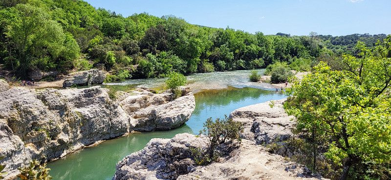
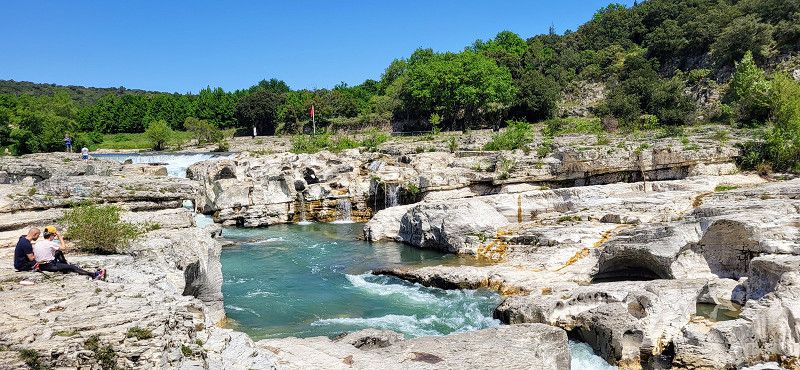
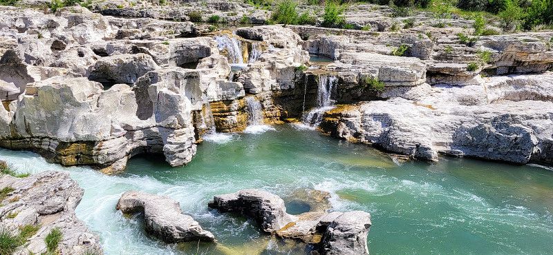
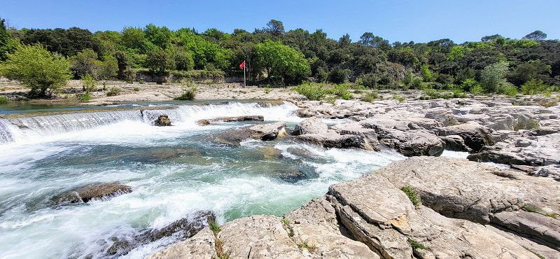
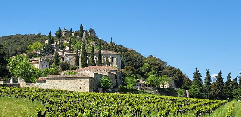
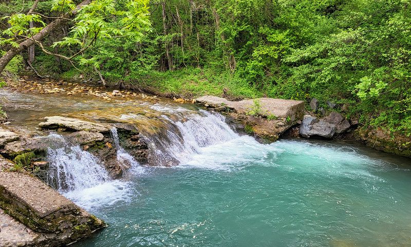
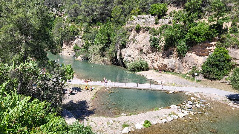
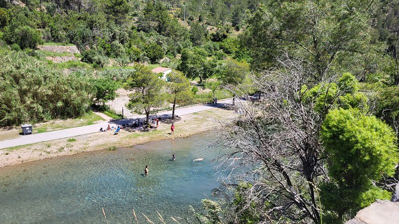
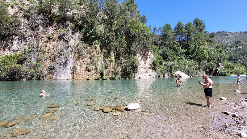
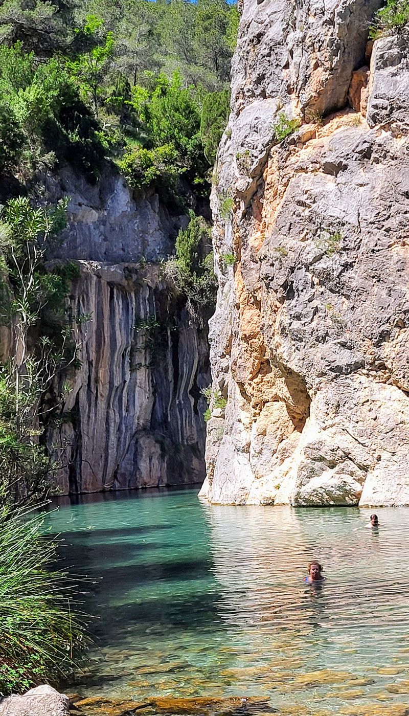
Les Cascades du Sautadet
Beautiful walk in glorious weather.
Frankreich
44° 11' 21.8" N 4° 31' 37.1" E
44.1893983 4.5269680
• Head toward Chemin du Moulin de Cors on Route de Donnat (D166). Go for 40 m.
• Continue on D166. Go for 37 m.
• Continue on Route de Saint-Laurent (D166). Go for 306 m.
• Turn right. Go for 213 m.
• Arrive at your destination on the left.
☍
0,6 km
( 1 min.)
La Roque sur Ceze - Camping Car Park
Nice little parking space - typical car park
Route De Saint-Laurent 573, La Roque-sur-Cèze, Bagnols-sur-Cèze, Gard, France
44° 11' 53.5" N 4° 31' 25.6" E
44.1981982 4.5237775
• Head toward Route de Saint-Laurent. Go for 213 m.
• Turn right onto Lieu-dit Ferme de l'Islon (D166). Go for 205 m.
• Continue on Lieu-dit Montagnac (D166). Go for 94 m.
• Continue on Route de Saint-Laurent (D166). Go for 882 m.
• Turn left onto D980. Go for 12.7 km.
• Continue on Route de Bagnols (D901). Go for 9.0 km.
• Turn right onto Avenue Chaillot (D979). Go for 142 m.
• Continue on Place Joseph Comte (D979). Go for 92 m.
• Continue on Avenue Raoul Heyraud (D979). Go for 285 m.
• Turn left onto Route d'Orgnac (D979). Go for 19 m.
• Take the 1st exit from roundabout onto D979. Go for 1.3 km.
• Take the 2nd exit from roundabout onto Clos du Portail (D979) toward Vallon Pont d'Arc/Vagnas. Go for 2.1 km.
• Continue on D579. Go for 6.8 km.
• Continue toward D579. Go for 32 m.
• Take the 2nd exit from roundabout toward Gorges de l'Ardèche/Vallon Pont d'Arc. Go for 37 m.
• Continue on D579. Go for 514 m.
• Take the 1st exit from roundabout onto Route de Salavas (D290) toward Gorges de l'Ardèche. Go for 672 m.
• Take the 2nd exit from roundabout onto Vieille Route du Pont-d'Arc (D390) toward La Caverne du Pont-d'Arc-Ardèche. Go for 725 m.
• Take the 2nd exit from roundabout onto D390 toward Bourg St Andéol/St Maurice d'Ibie/St Remèze/Lagorce/La Caverne du Pont-d'Arc-Ardèche. Go for 812 m.
• Take the 2nd exit from roundabout onto Route de Bourg (D4) toward Bourg St Andéol/Aven Marzal/St Remèze/La Caverne du Pont-d'Arc-Ardèche. Go for 3.7 km.
• Turn left. Go for 161 m.
• Arrive at your destination.
☍
40,6 km
( 39 min.)
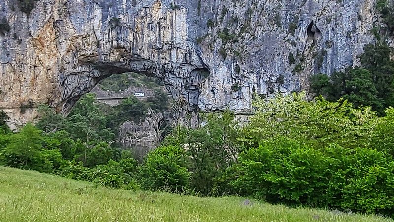
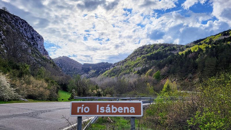
Day Anreise ins Tal der Ardeche
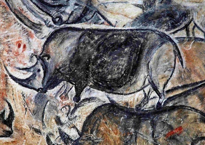
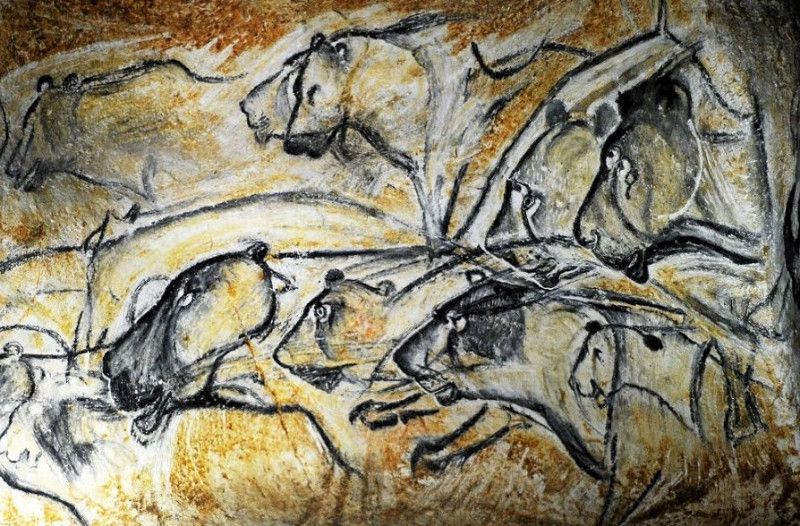
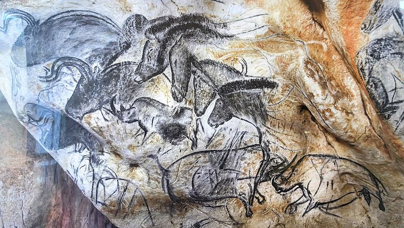
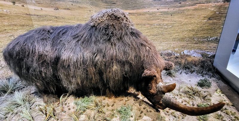
Grotte Chauvet 2 Ardèche
Route de Bourg Saint-Andéol, Vallon-Pont-d'Arc, Ardèche, Auvergne-Rhone-Alpen, Frankreich
44° 24' 22.1" N 4° 25' 44.5" E
44.4061271 4.4290376
• Head toward Route de Bourg. Go for 161 m.
• Turn right onto Route de Bourg (D4). Go for 3.6 km.
• Take the 3rd exit from roundabout onto D390 toward Aven d'Orgnac/Gorges de l'Ardèche-Le Pont d'Arc. Go for 842 m.
• Take the 2nd exit from roundabout onto D390 toward Aven d'Orgnac/Gorges de l'Ardèche-Le Pont d'Arc. Go for 698 m.
• Take the 3rd exit from roundabout onto Route des Gorges (D290) toward St Martin d'Ardèche/Gorges de l'Ardèche. Go for 1.8 km.
• Arrive at Route Touristique des Gorges de l'Ardèche (D290). Your destination is on the right.
☍
7,1 km
( 8 min.)
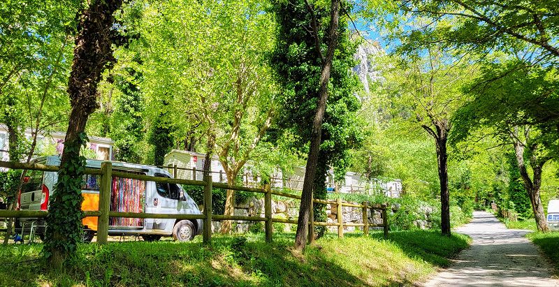
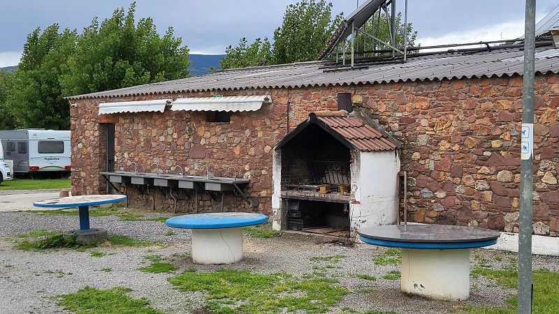
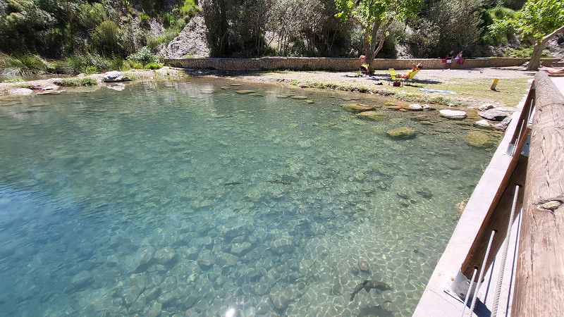
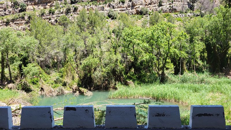
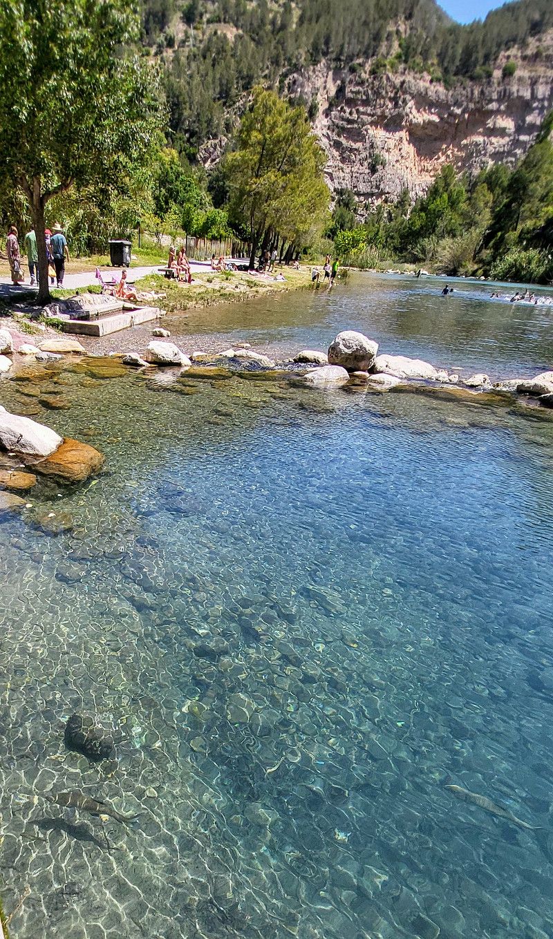
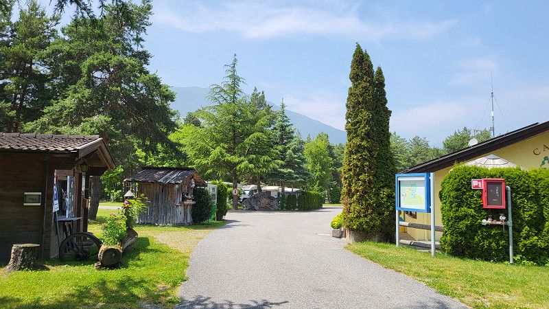
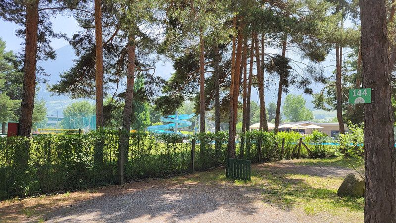
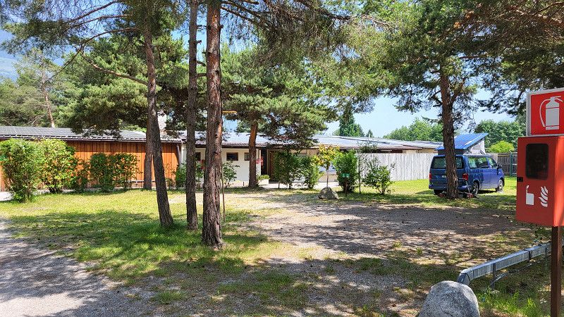
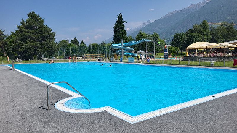
CAMPING DES TUNNELS
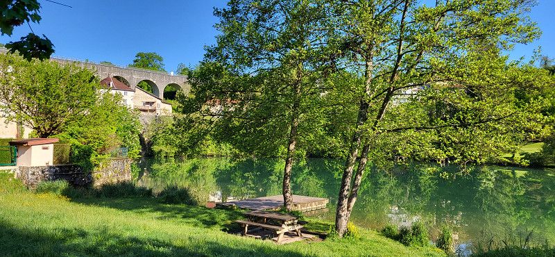
The site is located directly on the Ardèche River. Swimming is wonderful. The restroom facilities are poor, cell phone reception is poor, and Wi-Fi costs €2 per day. German is spoken at the reception, and dogs are allowed.
Route des gorges, 07150, VALLON PONT D'ARC, France
44° 23' 21.8" N 4° 24' 22.7" E
44.3894000 4.4063000
• Head east on Route Touristique des Gorges de l'Ardèche (D290). Go for 2.5 km.
• Arrive at Route Touristique des Gorges de l'Ardèche (D290).
☍
2,5 km
( 3 min.)
Day Reisepause
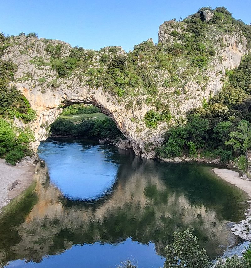
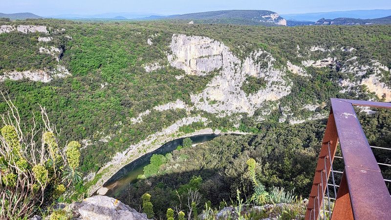
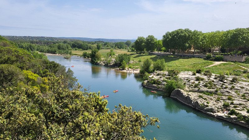
Day Gorges de l'Ardeche / Pont du Gard
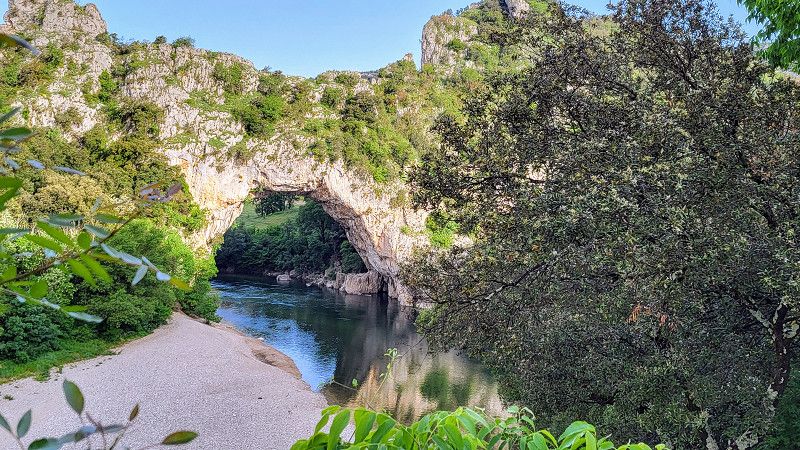
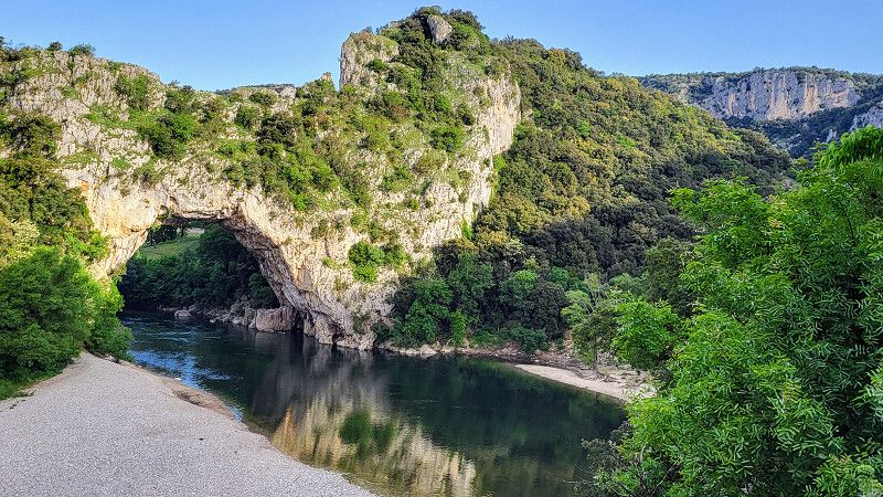
Le Pont d'Arc
The day: Saturday, May 3, 2025
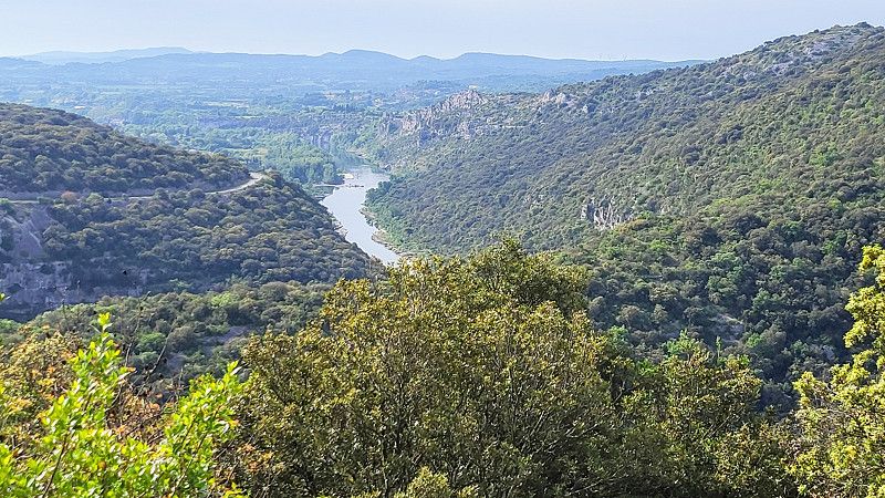
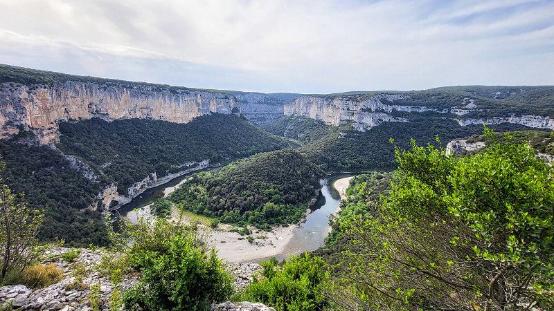
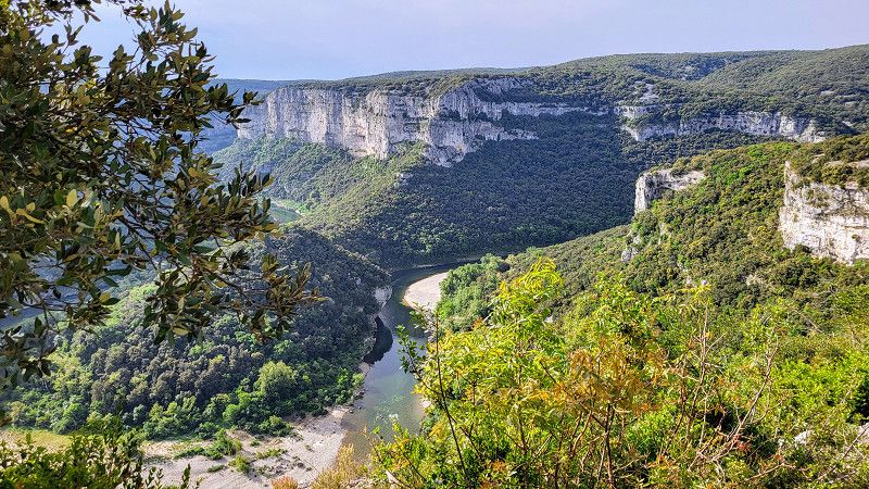
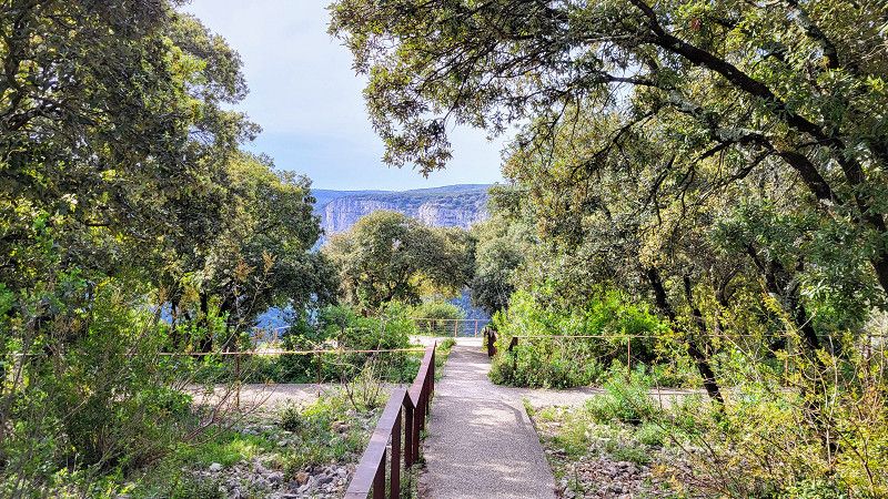
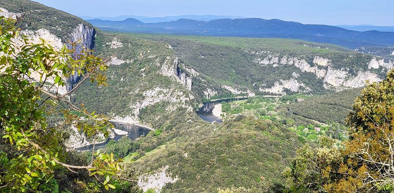
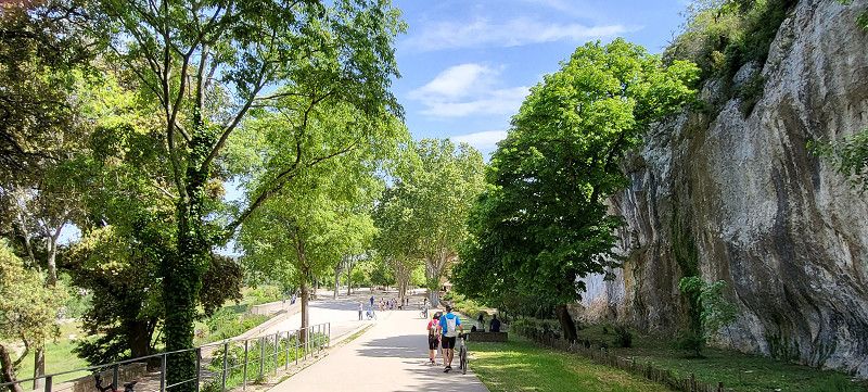
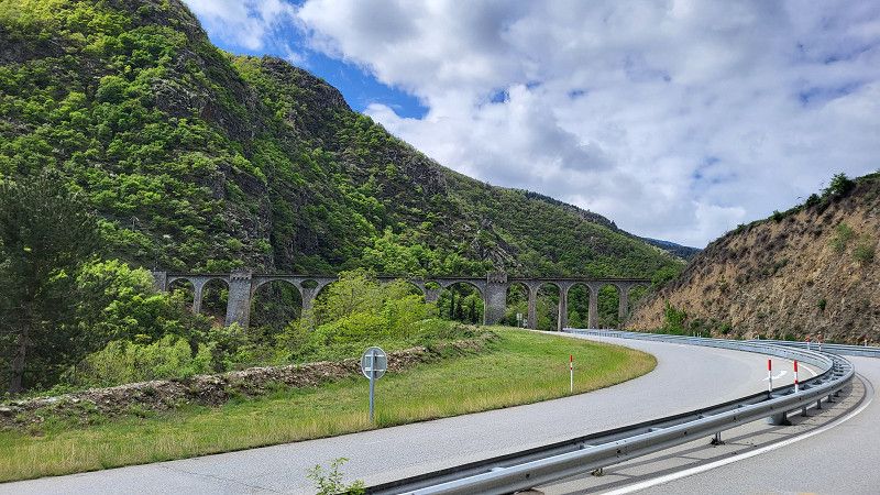
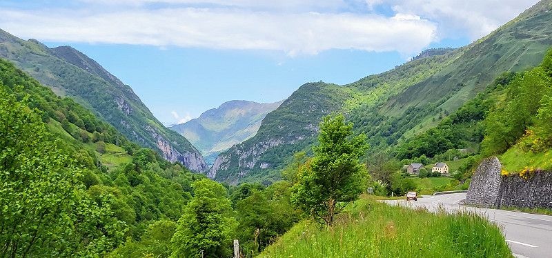
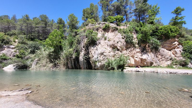
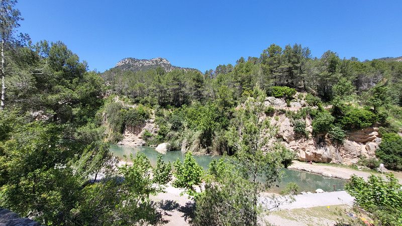
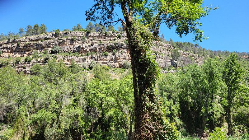
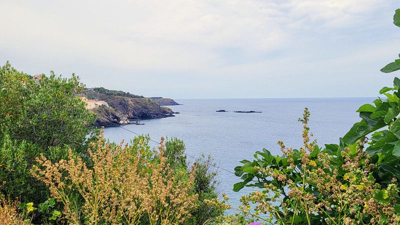
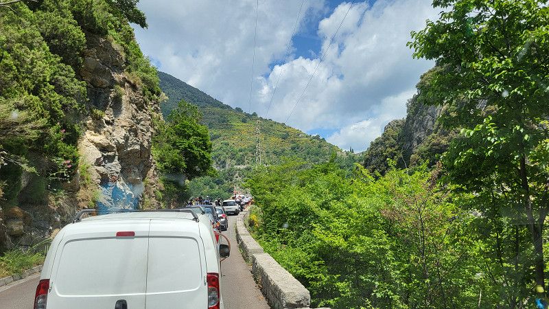
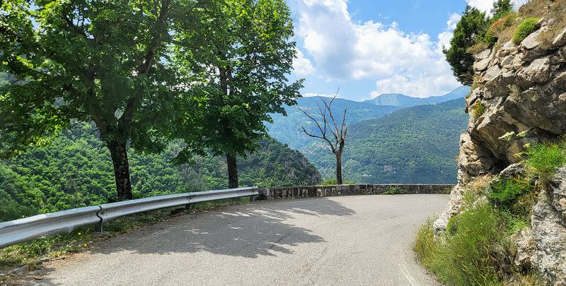
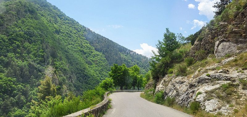
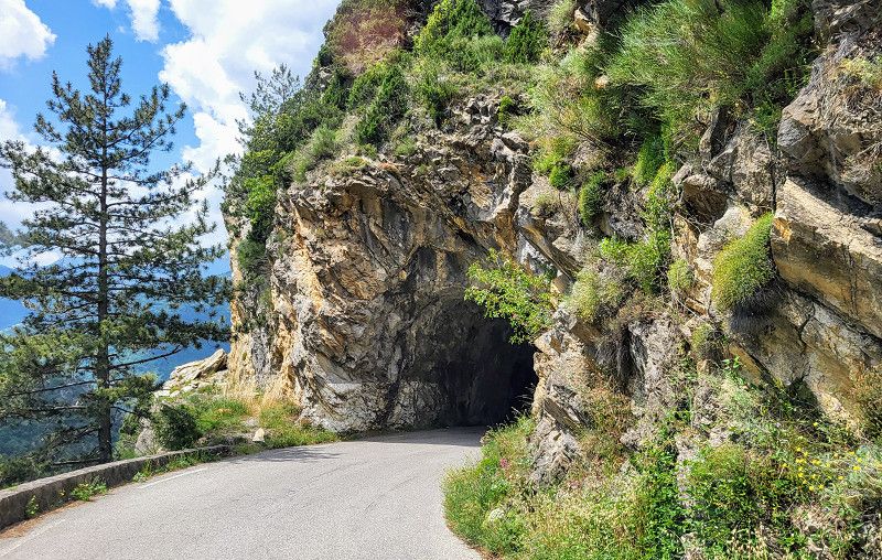
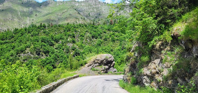
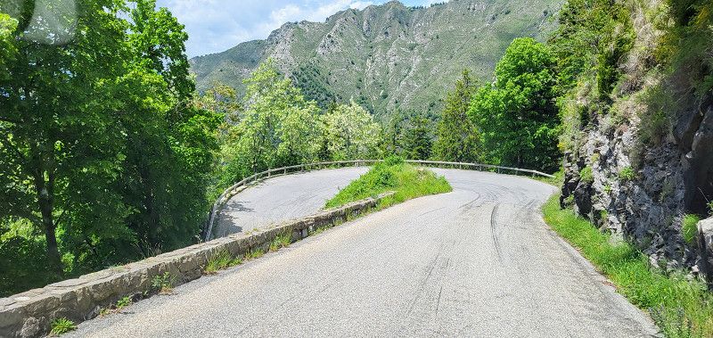
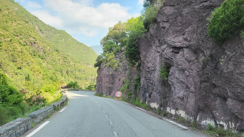
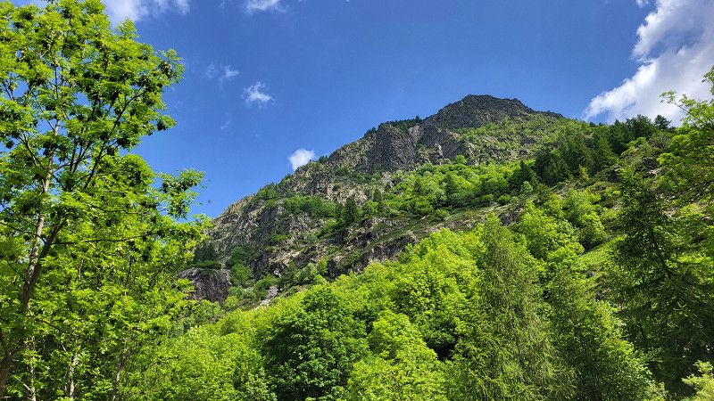
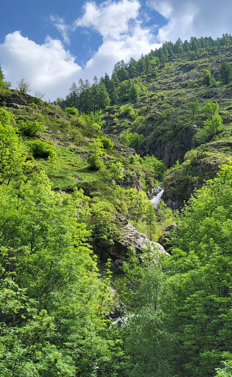
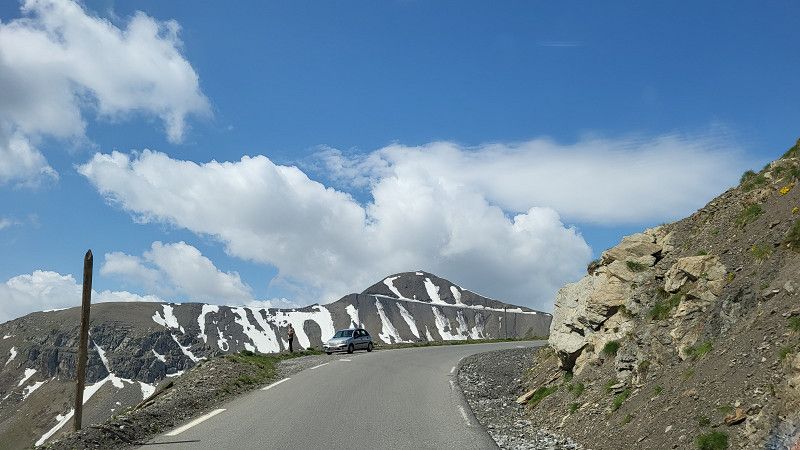
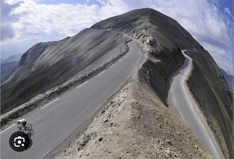
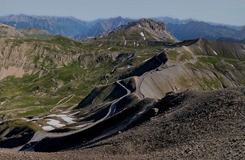
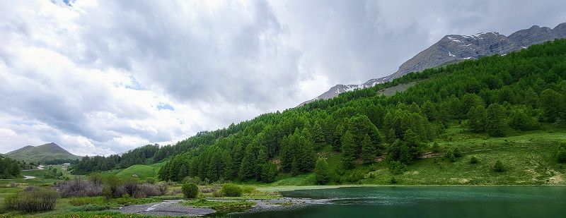
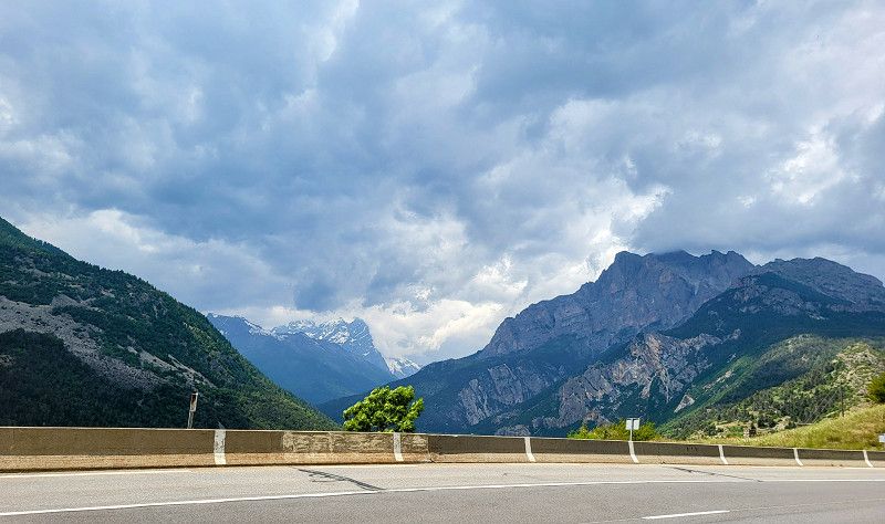
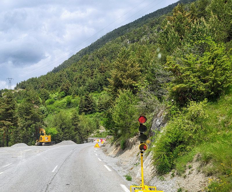
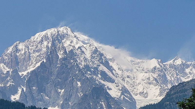
It was sensational! I drove through the Gorges de L'Ardèche between 8 and 10 a.m. and was almost alone! The road is in excellent condition, and you see rockfalls all the time.
For me, it was both beautiful and, given my fear of heights, a real challenge. I wouldn't have done it as a passenger!
Ardèche, Auvergne-Rhone-Alpen, Frankreich
44° 22' 55.2" N 4° 24' 58.3" E
44.3820076 4.4162049
• Head north on Route Touristique des Gorges de l'Ardèche (D290). Go for 4.2 km.
• Take the 3rd exit from roundabout onto D290 toward Aven d'Orgnac/Barjac/Ruoms/Salavas. Go for 700 m.
• Take the 3rd exit from roundabout onto Route de Salavas (D579) toward Aven d'Orgnac/Barjac/Salavas. Go for 613 m.
• Take the 2nd exit from roundabout onto Route de Barjac (D579) toward Aven d'Orgnac/Barjac/Salavas/Labastide-de-Virac. Go for 6.9 km.
• Continue on Pont de Vagnas (D979). Go for 2.1 km.
• Pass 4 roundabouts and continue on Route d'Alès (D979). Go for 9.6 km.
• Turn left onto Route du Pont (D979). Go for 1.2 km.
• Continue on D979. Go for 9.5 km.
• Continue on Lieu-dit La Lèque (D979). Go for 214 m.
• Continue on D979. Go for 1.3 km.
• Continue on Lieu-dit Mas Veissière (D979). Go for 90 m.
• Continue on D979. Go for 3.2 km.
• Pass 4 roundabouts and continue on Route de Saint-Ambroix (D979). Go for 17.3 km.
• Continue on Rue des Carmélites. Go for 268 m.
• Turn left onto Avenue des Cévennes (D981). Go for 425 m.
• Take the 2nd exit from roundabout onto Avenue Georges Pompidou (D981) toward A9/Avignon/Nîmes/St Ambroix/Pont du Gard. Go for 657 m.
• Take the 1st exit from roundabout onto Route de Nîmes (D979) toward A9/Avignon/Pont du Gard/Nîmes/Musée du Bonbon. Go for 459 m.
• Take the 2nd exit from roundabout onto Route de Nîmes (D979) toward Avignon/Nîmes. Go for 479 m.
• Take the 2nd exit from roundabout onto Route de Remoulins (D981) toward A9/Avignon/Remoulins/Pont du Gard. Go for 854 m.
• Pass 2 roundabouts and continue on Route de Remoulins (D981). Go for 2.5 km.
• Take the 3rd exit from roundabout onto Route de Remoulins (D981) toward A9/Avignon/Remoulins/Pont du Gard. Go for 4.3 km.
• Take the 2nd exit from roundabout onto D981 toward A9/Avignon/Remoulins/Pont du Gard. Go for 3.2 km.
• Take the 2nd exit from roundabout onto Route de Rémoulins (D981) toward A9/Avignon/Remoulins/Pont du Gard. Go for 730 m.
• Take the 1st exit from roundabout toward Pont du Gard/Rive Gauche. Go for 44 m.
• Continue on Route du Pont du Gard (D981). Go for 335 m.
• Arrive at Route du Pont du Gard (D981).
☍
71,1 km
(1 hrs. 5 min.)
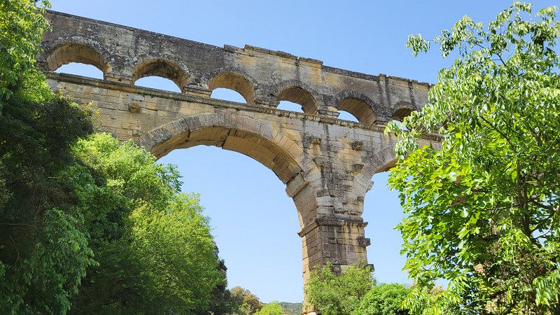
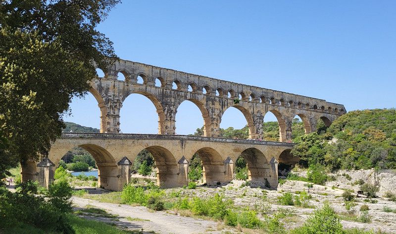
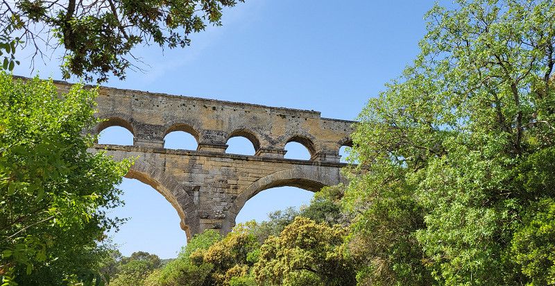
Pont du Gard
Busy, but still the most beautiful aqueduct in the world.
No entry fee, but €9 for 50 minutes parking.
Route du Pont du Gard 400, Vers-Pont-du-Gard, Gard, Okzitanien, Frankreich
43° 56' 49.5" N 4° 32' 8.2" E
43.9470703 4.5356005
• Head east on Route du Pont du Gard (D981). Go for 335 m.
• Continue toward Route de Rémoulins/D19. Go for 37 m.
• Take the 1st exit from roundabout onto Route de Rémoulins (D19) toward A9/Avignon/Bagnols S/C. Go for 515 m.
• Take the 2nd exit from roundabout onto Chemin des Croisées (D19 A) toward A9/Avignon/Bagnols S/C./Nîmes. Go for 510 m.
• Take the 2nd exit from roundabout onto Chemin des Croisées (D19 A) toward A9/Avignon/Bagnols S/C. Go for 1.3 km.
• Take the 1st exit from roundabout onto D6086 toward A9/Nîmes/Avignon/Remoulins. Go for 1.2 km.
• Take the 2nd exit from roundabout onto D6101 toward A9/Avignon/Nîmes/Beaucaire/Tarascon. Go for 618 m.
• Take the 3rd exit from Carrefour de l'Arnède roundabout onto D6100 toward A9/Nîmes/Avignon/Les Angles. Go for 1.8 km.
• Take the 2nd exit from roundabout onto A9 (La Languedocienne) toward Nîmes/Aéroport Garons/Arles/Montpellier/Toulouse/Barcelone. Go for 43.2 km.
• Take the exit onto A9. Go for 3.4 km.
• Take the 3rd exit from roundabout onto D6313 toward Vauvert/Aimargues. Go for 1.6 km.
• Take the 2nd exit from roundabout onto Route des Plages (D6313) toward Arles/Le Grau du Roi/Aigues-Mortes/Vauvert/Aimargues. Go for 1.2 km.
• Take the 2nd exit from roundabout onto D979 toward Aigues-Mortes/Le Grau du Roi. Go for 716 m.
• Pass 6 roundabouts and continue on D979. Go for 12.0 km.
• Keep right onto D979. Go for 321 m.
• Take the 2nd exit from roundabout onto Route de Nîmes (D979). Go for 975 m.
• Continue on Avenue de la Tour de Constance (D979). Go for 183 m.
• Turn right toward D979. Go for 82 m.
• Continue on D979. Go for 99 m.
• Take the 2nd exit from roundabout onto D979 toward Le Grau du Roi/Domaine de Jarras Listel. Go for 5.0 km.
• Continue on Lieu-dit Pêcherie (D979). Go for 126 m.
• Continue on D979. Go for 92 m.
• Take the 2nd exit from roundabout onto Quai du Maréchal de Lattre de Tassigny (D979). Go for 396 m.
• Continue on Quai Colbert (D979). Go for 138 m.
• Keep left onto Quai Colbert (D979). Go for 23 m.
• Turn left onto Rue des Alliés. Go for 36 m.
• Continue on Rue de la Victoire. Go for 39 m.
• Turn right onto Rue Alsace-Lorraine. Go for 102 m.
• Arrive at Rue Alsace-Lorraine. Your destination is on the left.
☍
76,1 km
( 52 min.)
Le Grau-du-Roi
Gard, Okzitanien, Frankreich
43° 32' 9.6" N 4° 8' 13.8" E
43.5360061 4.1371755
• Head toward Place de la République on Rue Alsace-Lorraine. Go for 116 m.
• Turn left onto Rue Marcel Deleuze. Go for 49 m.
• Turn left onto Rue Victor Granier. Go for 145 m.
• Continue on Rue de la Rotonde. Go for 46 m.
• Turn left onto Rue de la Rotonde. Go for 201 m.
• Continue on Rue des Arènes. Go for 349 m.
• Keep right onto Rue des Arènes. Go for 50 m.
• Continue on Quai du Maréchal de Lattre de Tassigny (D979). Go for 74 m.
• Take the 3rd exit from roundabout onto D62 B. Go for 1.3 km.
• Turn right onto D62 A. Go for 1.5 km.
• Take the 4th exit from roundabout onto D62. Go for 2.6 km.
• Take the 2nd exit from roundabout onto D62. Go for 2.4 km.
• Keep left onto D62 toward A9/Carnon/La Grande Motte/Montpellier/(Barcelone)/Aéroport de Méditerranée. Go for 11.2 km.
• Continue on M62. Go for 744 m.
• Continue on Avenue Georges Frêche (M66). Go for 984 m.
• Keep left onto M66. Go for 2.2 km.
• Continue on D66. Go for 2.0 km.
• Continue on M66. Go for 1.4 km.
• Take ramp toward A9/Barcelone/Grammont. Go for 157 m.
• Take the 3rd exit from Rond-Point du Zénith roundabout onto A709 toward A9/Barcelone/A75/Clermont-Fd/Palavas les Flots/Prés d'Arènes. Go for 10.8 km.
• Continue on A9 (La Languedocienne). Go for 133 km.
• Take exit 41 toward Perpignan-Centre/Canet en Roussillon/Le Barcarès/Aéroport Rivesaltes onto D83. Go for 1.0 km.
• Take the 3rd exit from roundabout onto D83 toward Narbonne/Perpignan/Canet en Roussillon/Le Barcarès/Salses le Château/Aéroport Rivesaltes. Go for 167 m.
• Take ramp onto D900 toward Perpignan. Go for 7.5 km.
• Take ramp onto Pénétrante Nord toward Perpignan-Centre. Go for 2.5 km.
• Continue on Cours Lazare Escarguel. Go for 178 m.
• Turn right onto Avenue du Général Charles de Gaulle. Go for 640 m.
• Turn left onto Place Salvador Dali. Go for 17 m.
• Arrive at Place Salvador Dali. Your destination is on the right.
☍
183,3 km
(1 hrs. 42 min.)
Day Reisetag auf Landstraßen bis Roussillon
Perpignan
Place Salvador Dalí, Perpignan, Ostpyrenäen, Okzitanien, Frankreich
42° 41' 46.5" N 2° 52' 46.9" E
42.6962438 2.8796929
• Head toward Avenue du Général Charles de Gaulle on Place Salvador Dali. Go for 17 m.
• Continue on Boulevard du Conflent. Go for 322 m.
• Turn left onto Avenue de Grande-Bretagne. Go for 51 m.
• Continue on Avenue de Prades. Go for 27 m.
• Turn right toward Boulevard Edmond Michelet. Go for 137 m.
• Continue on Boulevard Edmond Michelet. Go for 383 m.
• Keep left onto Boulevard Edmond Michelet toward Narbonne/Foix/St Estève/Canet en R./Aéroport/Le Vernet. Go for 237 m.
• Continue on Boulevard de la France Libre. Go for 57 m.
• Keep left onto Boulevard de la France Libre (D82) toward Canet/Les Platanes. Go for 479 m.
• Pass 3 roundabouts and continue on Boulevard de la France Libre (D82). Go for 1.6 km.
• Take the 2nd exit from Rond-Point des Platanes roundabout onto D617. Go for 8.9 km.
• Take ramp. Go for 215 m.
• Take the 3rd exit from Rond-Point Charles de Gaulle roundabout onto D81. Go for 843 m.
• Turn right toward CR30. Go for 203 m.
• Take the 2nd exit from roundabout onto CR30. Go for 380 m.
• Turn left onto Avenue des Anneaux du Roussillon. Go for 924 m.
• Turn left. Go for 23 m.
• Arrive at your destination on the left.
☍
14,8 km
( 15 min.)
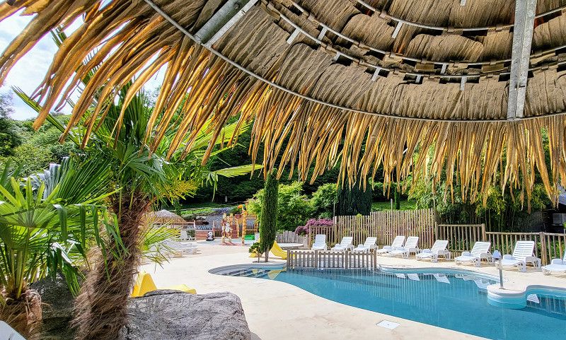
Yelloh! Village Le Brasilia in Roussillon
The weather has changed. Heavy rain and temperatures around 17 degrees.
I'm staying here for 3 nights because with this weather the Pyrenees don't make much sense at the moment.
The place is worth its 5 stars! The patisserie is fantastic. I probably won't use the pools; they're heated, but the outside temperature is a whopping 15 degrees.
Avenue les Anneaux du Roussillon 2, 66140, Canet En Roussillon, France
42° 42' 30.5" N 3° 2' 7.8" E
42.7084800 3.0355000
• Head toward Avenue des Anneaux du Roussillon. Go for 23 m.
• Turn right onto Avenue des Anneaux du Roussillon. Go for 924 m.
• Turn right onto CR30. Go for 327 m.
• Take the 1st exit from roundabout. Go for 62 m.
• Take ramp onto D81. Go for 1.1 km.
• Take the 2nd exit from Rond-Point Charles de Gaulle roundabout toward A9/Perpignan/Canet-Village/St Nazaire/Elne. Go for 267 m.
• Continue on Voie de la Méditerranée (D617). Go for 8.9 km.
• Take the 2nd exit from Rond-Point des Platanes roundabout onto Boulevard de la France Libre (D82). Go for 701 m.
• Pass 3 roundabouts and continue on Boulevard de la France Libre (D82). Go for 1.1 km.
• Keep right onto Boulevard de la France Libre (D82). Go for 652 m.
• Continue on Boulevard Edmond Michelet. Go for 1.6 km.
• Continue on D900 A. Go for 907 m.
• Take ramp onto D66 toward Andorre la V./Le Soler/Prades. Go for 24.9 km.
• Pass 6 roundabouts and continue on D66. Go for 21.6 km.
• Take the 1st exit from roundabout onto D66 toward Andorre la V./Serdinya/Olette/Font-Romeu/Bourg-Madame. Go for 29.5 km.
• Take the 2nd exit from roundabout onto Route Nationale (D66) toward Andorre la V./Saillagouse/Bourg-Madame/Bolquère-Village/Col de la Perche. Go for 16.6 km.
• Turn right onto D30 toward Caldégas. Go for 3.4 km.
• Take the 2nd exit from roundabout onto D30. Go for 1.9 km.
• Turn right onto Route d'Espagne (N20). Go for 15.9 km.
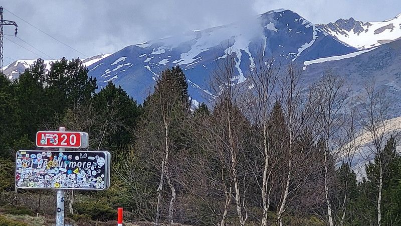
• Turn right onto Lieu-dit Los Camps de Bau (N320) toward Andorre la V./Foix/Toulouse Par Col/Pas de la Case/Ax les Thermes Par Col/Porté-Puymorens. Go for 7.9 km.
• Arrive at Col de Puymorens (N320).
☍
138,1 km
(2 hrs. 5 min.)
Day Regenpause
Day Regenpause mit umplanen der Reiseroute
Day Weiterreise auf neuer Route
Col de Puymorens
Frankreich
42° 33' 34.6" N 1° 48' 39" E
42.5596188 1.8108423
• Head northwest on Col de Puymorens (N320). Go for 2.9 km.
• Turn left onto N22 toward Andorre la V./Pas de la Case. Go for 4.9 km.
• Take the 1st exit from roundabout onto Tunnel d'Envalira toward Andorre la V. Par Tunnel/Pas de la Case/Andorra la Vella. Go for 301 m.
• Continue on Túnel d'Envalira. Go for 39 m.
• Take the 1st exit from roundabout onto Túnel d'Envalira. Go for 3.7 km.
• Take the 2nd exit from roundabout onto CG2 toward Andorra la Vella. Go for 3.2 km.
• Pass 11 roundabouts and continue on Carretera Nou Vial (CG2). Go for 14.0 km.
• Take the 3rd exit from roundabout onto CG2 toward Andorra la Vella/Escaldes-Engordany. Go for 785 m.
• Pass 8 roundabouts and continue on Avinguda de Tarragona (CG1). Go for 4.7 km.
• Take the 2nd exit from roundabout onto Avinguda de Tarragona (CG1) toward Espanya/Sant Julià de Lòria. Go for 280 m.
• Take the 3rd exit from roundabout onto Avinguda de Salou (CG1) toward Espanya/Sant Julià de Lòria. Go for 1.0 km.
• Take the 1st exit from roundabout onto Avinguda de Salou (CG1). Go for 687 m.
• Take the 2nd exit from roundabout onto Carrer Prat Salit. Go for 293 m.
• Turn right onto Avinguda d'Enclar. Go for 55 m.
• Turn left onto Passatge del Cedre. Go for 28 m.
• Arrive at Passatge del Cedre. Your destination is on the right.
☍
36,9 km
( 48 min.)
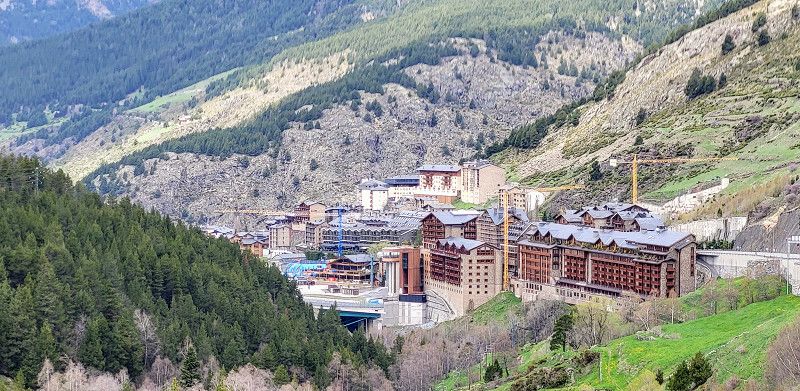
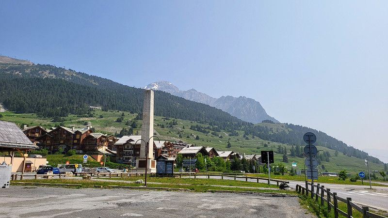
Andorra la Vella
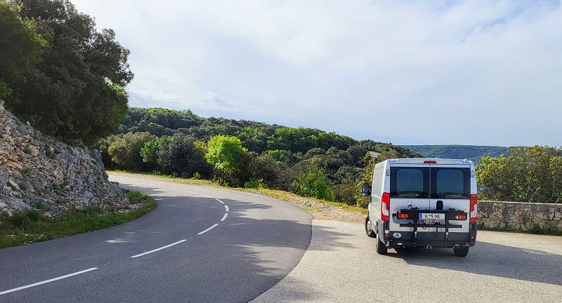
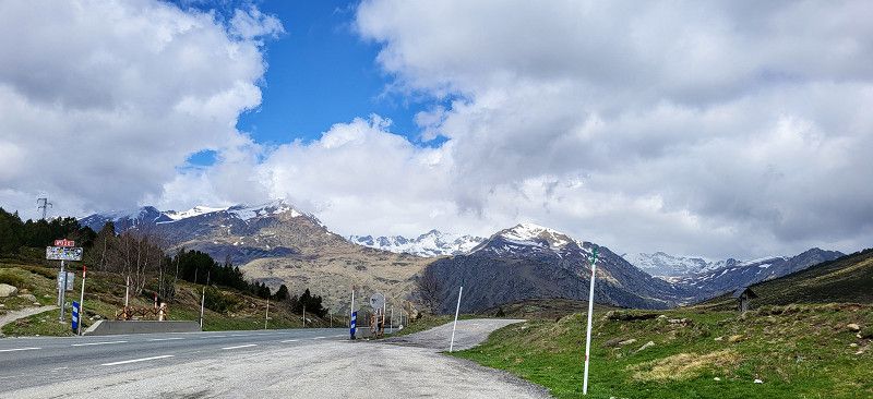
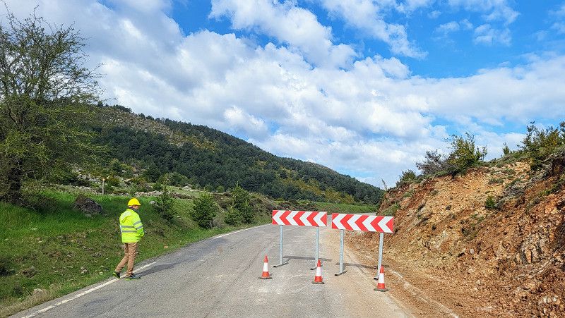
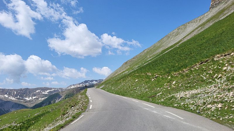
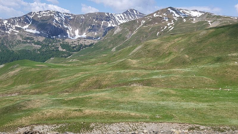
Due to the cold snap, snowfall is forecast in the Pyrenees over the next two weeks. Pauli is equipped with winter tires, but unfortunately, in this weather, there are only clouds and no views at altitude.
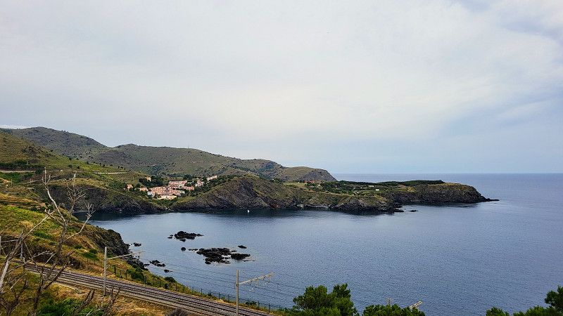
I'll try it on the Spanish side of the N260. I'm curious to see if it works.
The result:
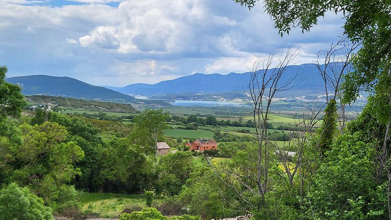
Beautiful route, well-maintained roads. Light traffic. 5.5 hours drive. It's relatively cold, and there's a lot of snow on the mountains.
The price of diesel in Andorra is sensational: €1.16 with fuel. Filling up is a real pleasure.
Andorra
42° 29' 52.5" N 1° 30' 11.6" E
42.4979185 1.5032264
• Head toward Avinguda d'Enclar on Passatge del Cedre. Go for 28 m.
• Turn right onto Avinguda d'Enclar. Go for 199 m.
• Take the 2nd exit from roundabout onto Avinguda d'Enclar. Go for 286 m.
• Take the 3rd exit from Avinguda d'Enclar roundabout onto Avinguda d'Enclar (CG1). Go for 599 m.
• Take the 2nd exit from roundabout onto Avinguda d'Enclar (CG1). Go for 441 m.
• Continue on Prat de la Tresa (CG1). Go for 273 m.
• Take the 1st exit from roundabout onto CG1. Go for 136 m.
• Turn right onto Prat de la Tresa (CG1) toward Espanya/Sant Julià de Lòria. Go for 880 m.
• Take the 2nd exit from roundabout toward Espanya/Sant Julià de Lòria. Go for 66 m.
• Continue on Túnel de la Tàpia toward Espanya. Go for 1.1 km.
• Take the 1st exit from roundabout onto Avinguda Francesc Cairat (CG1) toward Espanya. Go for 345 m.
• Turn right onto CG1. Go for 370 m.
• Take the 3rd exit from roundabout onto Carretera d'Espanya (CG1). Go for 360 m.
• Pass 5 roundabouts and continue on Carretera d'Espanya (CG1). Go for 3.1 km.
• Continue on N-145. Go for 472 m.
• Keep right onto N-145. Go for 952 m.
• Take the 2nd exit from roundabout onto N-145 toward La Seu d'Urgell. Go for 7.7 km.
• Turn right onto N-260 toward Adrall/C-14/Lleida/Barcelona/Sort. Go for 518 m.
• Pass 2 roundabouts and continue on N-260. Go for 2.3 km.
• Arrive at N-260. Your destination is on the left.
☍
20,2 km
( 24 min.)
Camping Gran Sol
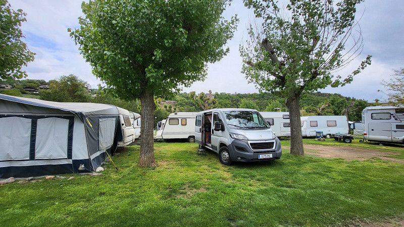
Unfortunately, the campsite is terrible, and at €27, it's not cheap either. The showers look terrible—I'll pass. It's only for one night.
C.N.-260, Km. 230 Montferrer, 25711, Montferrer i Castellbò, Spain
42° 20' 53" N 1° 25' 53" E
42.3480500 1.4313800
• Head southwest on N-260. Go for 3.6 km.
• Take the 1st exit from roundabout onto N-260 toward Sort/El Pont de Suert. Go for 44.6 km.
• Turn left onto Avinguda Comtes de Pallars (N-260). Go for 26.9 km.
• Turn left onto Avinguda de Sant Miquel del Pui (N-260). Go for 442 m.
• Take the 1st exit from roundabout onto N-260. Go for 37.2 km.
• Turn right onto N-230. Go for 492 m.
• Turn left onto Carrer de la Canaleta. Go for 75 m.
• Continue on Carrer de la Canaleta. Go for 226 m.
• Arrive at Carrer de la Canaleta. Your destination is on the left.
☍
113,6 km
(1 hrs. 48 min.)
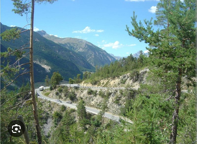
Day Weiter auf der N260 in Spanien von La seu d' urgell bis Baliera
El Pont de Suert
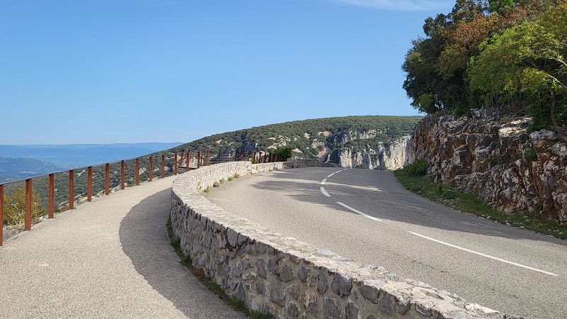
I only started it at 12 o'clock today. Pauli had to go to the garage; it had too much oil. That's never happened to me before. I got it back from the oil change like this! I found a very nice Peugeot garage, and the gentleman got me in! Thumbs up and thank you very much!
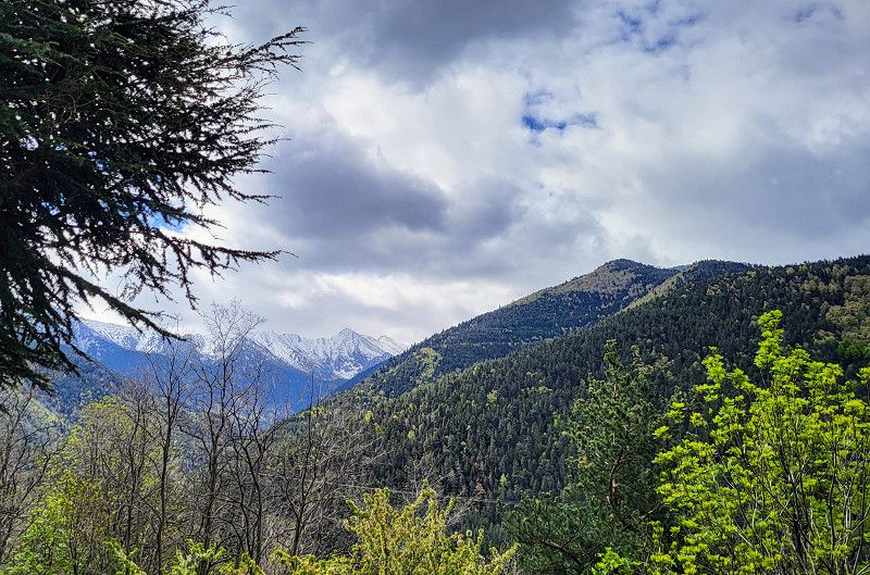
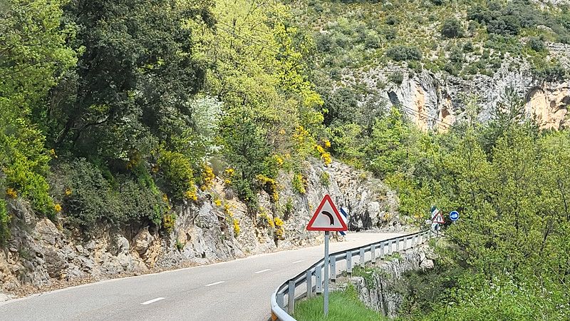
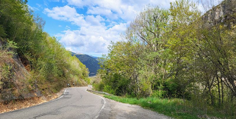
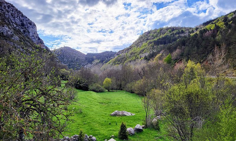
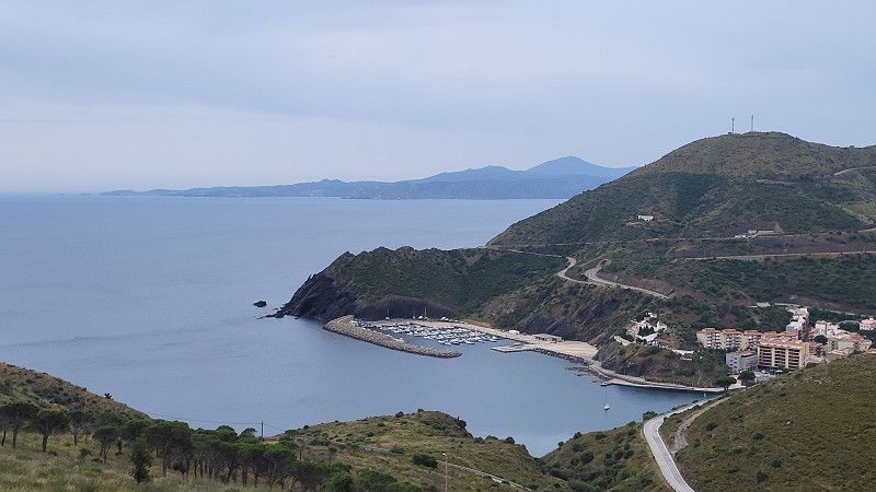
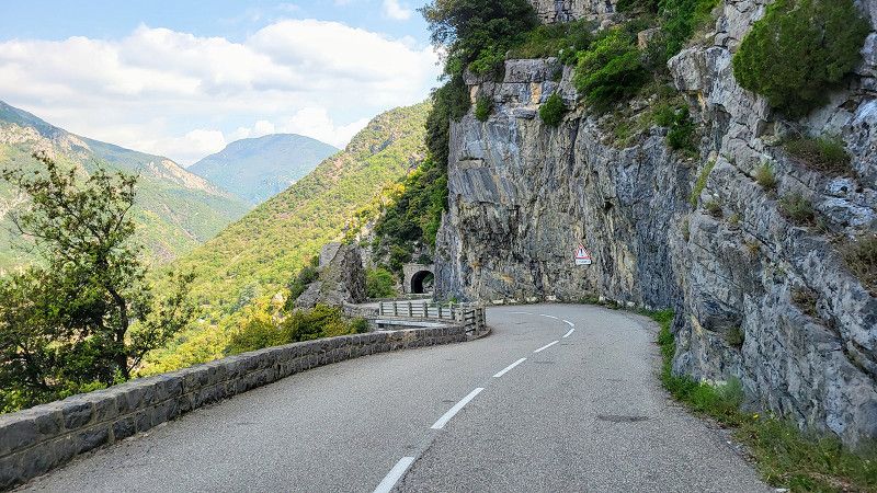
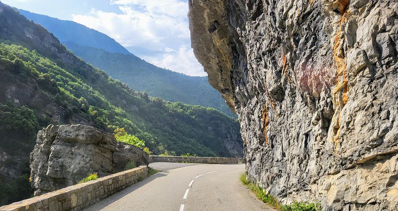
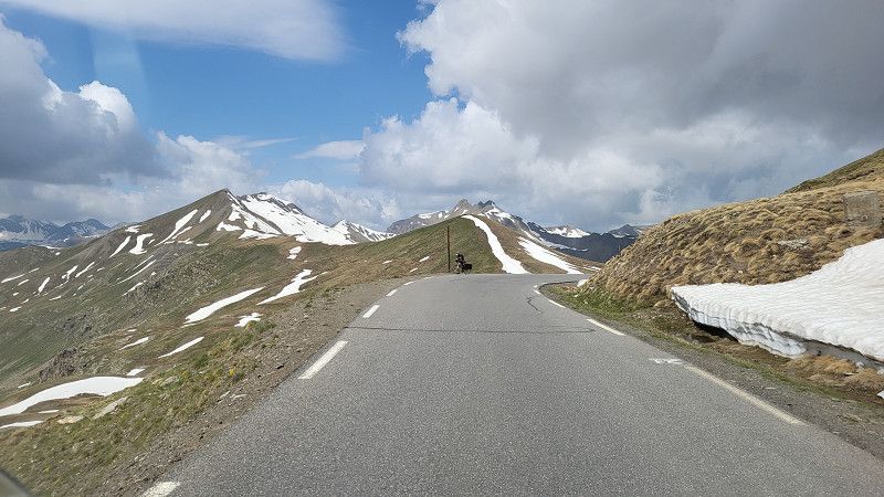
The N260 is a beautiful route, always two-lane, with a good surface, some very steep and exposed sections, but the views are breathtaking. Today it was brilliantly beautiful with 15-18 degrees.
Alta Ribagorça, Katalonien, Spanien
42° 24' 28.6" N 0° 44' 24.6" E
42.4079576 0.7401693
• Head northwest on Carrer de la Canaleta.
• Continue on Plaça del Mercadal. Go for 13 m.
• Turn right onto Carrer del Roser. Go for 49 m.
• Turn right onto Carrer de l'Església. Go for 110 m.
• Turn left onto Avinguda de Victoriano Muñoz (N-230). Go for 5.8 km.
• Turn left onto N-260 toward Castejón de Sos. Go for 2.4 km.
• Turn left onto A-1605. Go for 627 m.
• Arrive at A-1605.
☍
9,0 km
( 9 min.)
Camping Baliera
Nice little campsite, showers OK. €15.00 without electricity. That would have cost €9!!!
Aragon, Spain
42° 25' 56.8" N 0° 42' 28.6" E
42.4324324 0.7079546
• Head toward Carretera a Castame on A-1605. Go for 3.5 km.
• Continue on Calle Baja (A-1605). Go for 164 m.
• Continue on Calle Medio (A-1605). Go for 97 m.
• Continue on A-1605. Go for 10.4 km.
• Turn sharp left. Go for 254 m.
• Arrive at your destination on the right.
☍
14,4 km
( 16 min.)
Day Baliera bis Artieda
Monasterio de Obarra
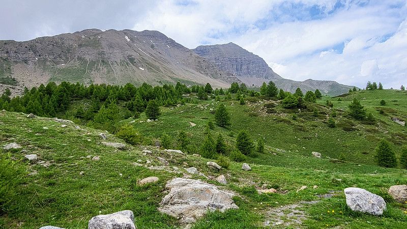
The day: Thursday, May 8, 2025
The plan: continue west on the N260.
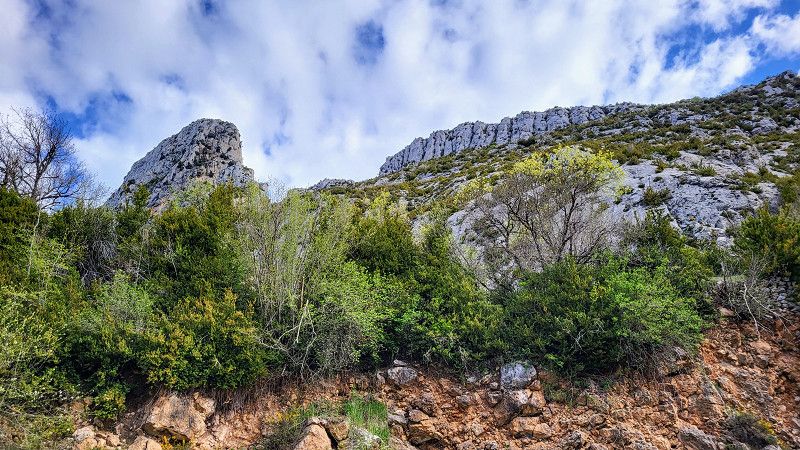
I took the wrong turn and drove into a different valley. But it doesn't matter—each valley is more beautiful than the last. Eventually, I ended up back on the right road.
Huesca, Aragonien, Spanien
42° 23' 51.5" N 0° 35' 50.4" E
42.3976324 0.5973215
• Head south. Go for 254 m.
• Turn left onto A-1605. Go for 9.6 km.
• Continue on Carretera Graus a Viella (A-1605). Go for 386 m.
• Continue on A-1605. Go for 3.0 km.
• Continue on Carretera Graus a Viella (A-1605). Go for 383 m.
• Continue on A-1605. Go for 11.8 km.
• Continue on Salanova (A-1605). Go for 185 m.
• Continue on A-1605. Go for 13.8 km.
• Continue on Carretera Capella (A-1605). Go for 61 m.
• Continue on Calle Valle de Arán (A-1605). Go for 863 m.
• Take the 5th exit from Glorieta Joaquín Costa roundabout onto Paseo del Río Ésera. Go for 287 m.
• Turn right onto Paseo del Río Ésera. Go for 50 m.
• Arrive at Paseo del Río Ésera. Your destination is on the right.
☍
40,6 km
( 31 min.)
Graus
Huesca, Aragonien, Spanien
42° 11' 25.5" N 0° 20' 20.3" E
42.1904249 0.3389797
• Head east on Paseo del Río Ésera. Go for 50 m.
• Turn right onto Paseo del Río Ésera. Go for 459 m.
• Turn left onto Carretera de Benasque (A-139). Go for 871 m.
• Continue on N-123a. Go for 7.3 km.
• Take ramp onto N-123. Go for 12.8 km.
• Take ramp onto A-138 toward El Grado/Aínsa/Francia. Go for 9.3 km.
• Turn left onto A-2210. Go for 99 m.
• Continue on Carretera Boltaña (A-2210). Go for 130 m.
• Continue on A-2210. Go for 8.4 km.
• Continue on Caserío Cosolla (A-2210). Go for 86 m.
• Continue on A-2210. Go for 2.3 km.
• Turn left onto A-2208. Go for 82 m.
• Turn right toward Calle Entrada. Go for 45 m.
• Continue on Calle Entrada. Go for 282 m.
• Turn left onto Calle Mayor. Go for 59 m.
• Turn slightly right onto Calle Landas. Go for 51 m.
• Turn right onto Calle Mayor. Go for 157 m.
• Continue on Calle Palacio. Go for 19 m.
• Turn right onto Calle Daniel Ballarín. Go for 52 m.
• Turn right onto Calle Mayor. Go for 16 m.
• Arrive at Calle Mayor. Your destination is on the right.
☍
42,4 km
( 37 min.)
Naval
Somontano de Barbastro, Aragonien, Spanien
42° 11' 41.2" N 0° 9' 6.5" E
42.1947793 0.1518008
• Head toward Calle Daniel Ballarín on Calle Mayor. Go for 16 m.
• Turn left onto Calle Daniel Ballarín. Go for 52 m.
• Turn left onto Calle Palacio. Go for 19 m.
• Continue on Calle Mayor. Go for 157 m.
• Turn left onto Calle Landas. Go for 51 m.
• Turn slightly left onto Calle Mayor. Go for 59 m.
• Turn right onto Calle Entrada. Go for 69 m.
• Turn slightly left onto Calle Entrada. Go for 6 m.
• Turn slightly left onto Calle Entrada. Go for 207 m.
• Continue toward A-2208. Go for 45 m.
• Turn left onto A-2208. Go for 82 m.
• Turn left onto A-2210. Go for 2.0 km.
• Continue on La Sierra (A-2210). Go for 84 m.
• Continue on A-2210. Go for 2.0 km.
• Continue on Soliva (A-2210). Go for 124 m.
• Continue on A-2210. Go for 7.4 km.
• Turn left onto A-138. Go for 22.5 km.
• Take the 1st exit from roundabout onto Avenida Sobrarbe (A-138) toward Campo/N-260/Boltaña. Go for 244 m.
• Turn left onto Avenida Ordesa (N-260) toward Boltaña. Go for 414 m.
• Turn right onto Avenida Ordesa. Go for 14 m.
• Turn right onto Plaza de la Fuenteta. Go for 225 m.
• Continue on Calle Eras Abajo. Go for 481 m.
• Turn sharp right onto Calle Eras Abajo. Go for 67 m.
• Turn slightly right onto Plaza Mayor. Go for 57 m.
• Arrive at Plaza Mayor. Your destination is on the left.
☍
36,3 km
( 40 min.)
Aínsa
Huesca, Aragonien, Spanien
42° 25' 1.9" N 0° 8' 19.1" E
42.4171898 0.1386444
• Head toward Calle Fuente on Plaza Mayor. Go for 57 m.
• Turn slightly left onto Calle Eras Abajo. Go for 67 m.
• Turn sharp left onto Calle Eras Abajo. Go for 481 m.
• Continue on Plaza de la Fuenteta. Go for 249 m.
• Turn slightly left onto Plaza de la Fuenteta. Go for 14 m.
• Turn right onto Calle de la Fuenteta (N-260). Go for 26.0 km.
• Turn left onto Avenida Jesús. Go for 491 m.
• Turn slightly left onto Calle la Iglesia. Go for 22 m.
• Turn slightly right onto Plaza Iglesia. Go for 35 m.
• Turn slightly left onto Calle Borrastre. Go for 35 m.
• Arrive at Calle Borrastre. Your destination is on the left.
☍
27,4 km
( 29 min.)
Fiscal
From here, we switched to the N260a. It started to rain and it was 6 degrees. This road is still two-lane, but significantly narrower and not as well paved.
Huesca, Aragonien, Spanien
42° 29' 43.7" N 0° 7' 11.2" W
42.4954746 -0.1197784
• Head toward Plaza Iglesia on Calle Borrastre. Go for 35 m.
• Turn slightly right onto Plaza Iglesia. Go for 35 m.
• Turn slightly left onto Calle la Iglesia. Go for 22 m.
• Turn slightly right onto Avenida Jesús. Go for 491 m.
• Turn left onto N-260. Go for 248 m.
• Take the 1st exit from roundabout onto N-260. Go for 12.7 km.
• Continue on Avenida de Ordesa (N-260). Go for 864 m.
• Turn left onto Calle Santa Cruz. Go for 69 m.
• Arrive at Calle Santa Cruz. Your destination is on the left.
☍
14,5 km
( 18 min.)
Broto
Huesca, Aragonien, Spanien
42° 36' 11.9" N 0° 7' 18.6" W
42.6033008 -0.1218449
• Head south on Calle Santa Cruz.
• Turn left onto Calle Santa Cruz. Go for 72 m.
• Turn left onto Avenida de Ordesa (N-260). Go for 490 m.
• Continue on N-260. Go for 8.4 km.
• Continue on Avenida Ordesa (N-260). Go for 185 m.
• Continue on N-260. Go for 14.7 km.
• Continue on Calle Única (N-260). Go for 266 m.
• Continue on N-260. Go for 2.0 km.
• Continue on Avenida Ordesa (N-260). Go for 487 m.
• Turn left onto Calle Ramón y Cajal. Go for 288 m.
• Continue on Plaza Ayuntamiento. Go for 31 m.
• Arrive at Plaza Ayuntamiento. Your destination is on the left.
☍
26,9 km
( 34 min.)
Biescas
Alto Gállego, Aragonien, Spanien
42° 37' 42.9" N 0° 19' 17.7" W
42.6285893 -0.3215867
• Head southeast on Plaza Ayuntamiento. Go for 9 m.
• Turn slightly left onto Plaza Ayuntamiento. Go for 18 m.
• Turn left onto Plaza Ayuntamiento. Go for 31 m.
• Turn left onto Plaza Ayuntamiento. Go for 45 m.
• Turn slightly right onto Calle Ramón y Cajal. Go for 288 m.
• Turn left onto Avenida Ordesa (N-260). Go for 302 m.
• Continue on N-260. Go for 66 m.
• Turn left onto Carretera Huesca a Francia (N-260). Go for 12.2 km.
• Continue on N-260. Go for 309 m.
• Take ramp onto N-330. Go for 1.0 km.
• Take the 1st exit from roundabout onto Carretera Biescas toward N-330/Huesca/Pol. Industrial SEPES/Sabiñánigo. Go for 129 m.
• Continue on Avenida de Biescas. Go for 190 m.
• Pass 2 roundabouts and continue on Avenida de Biescas. Go for 480 m.
• Turn slightly right onto Calle Serrablo. Go for 523 m.
• Take the 1st exit from Calle Serrablo roundabout onto Calle Serrablo (N-330a). Go for 61 m.
• Arrive at Calle Serrablo (N-330a). Your destination is on the right.
☍
15,6 km
( 15 min.)
Sabiñánigo
Here I was shopping for groceries
Alto Gállego, Aragonien, Spanien
42° 31' 6.1" N 0° 21' 53.2" W
42.5183640 -0.3647899
• Head west on Calle Serrablo (N-330a). Go for 722 m.
• Continue on Carretera Jaca (N-330a). Go for 368 m.
• Continue on N-330a. Go for 2.7 km.
• Take the 2nd exit from roundabout toward Jaca. Go for 254 m.
• Continue on A-23 (Autovía Mudéjar). Go for 10.0 km.
• Take exit 424 toward Jaca (Este)/N-240/Pamplona. Go for 353 m.
• Take the 3rd exit from roundabout onto N-330a toward Jaca (Este)/N-240/Pamplona. Go for 253 m.
• Pass 2 roundabouts and continue on Avenida Perimetral (N-330a). Go for 3.2 km.
• Take the 2nd exit from roundabout onto Avenida Regimiento de Galicia (N-240) toward Pamplona. Go for 1.1 km.
• Take the 2nd exit from roundabout onto Avenida Nuestra Señora de la Victoria (N-240). Go for 2.2 km.
• Take the 1st exit from roundabout onto Aragón toward Pamplona/A-21. Go for 1.0 km.
• Take the 1st exit from roundabout toward Pamplona/A-21. Go for 131 m.
• Take the 2nd exit from roundabout onto A-21 (Autovía del Pirineo) toward Pamplona. Go for 15.0 km.
• Take the exit toward Puente La Reina/N-240/A-21/Jaca/Huesca. Go for 349 m.
• Take the 1st exit from roundabout onto A-176 toward Puente La Reina/N-240/Jaca/A-21. Go for 415 m.
• Take the 3rd exit from roundabout onto A-176 toward Puente La Reina/Pamplona/N-240. Go for 591 m.
• Take the 1st exit from roundabout onto N-240 toward Pamplona. Go for 13.8 km.
• Take the 1st exit from roundabout toward Pamplona. Go for 698 m.
• Continue on A-21 (Autovía del Pirineo). Go for 7.2 km.
• Take exit 65 toward Artieda/Sos del Rey Católico. Go for 646 m.
• Take the 2nd exit from roundabout onto A-1601 toward Pamplona/N-240. Go for 1.8 km.
• Turn left. Go for 1.1 km.
• Turn slightly right toward Camino Los Cerros. Go for 800 m.
• Continue on Camino Los Cerros. Go for 231 m.
• Turn slightly left onto Camino Pintano. Go for 82 m.
• Turn right onto Calle Ramón y Cajal. Go for 29 m.
• Continue on Calle Luis Buyuel. Go for 101 m.
• Turn left onto Calle Horno. Go for 33 m.
• Arrive at Calle Horno. Your destination is on the right.
☍
65,2 km
( 52 min.)
Camping Artieda
Nice little campsite. You have to register online and then walk 15 minutes to the restaurant in town to pay.
La Jacetania, Aragonien, Spanien
42° 35' 12.6" N 0° 59' 0.4" W
42.5868450 -0.9834508
• Head toward Calle Mayor on Calle Horno. Go for 47 m.
• Turn right onto Calle Mayor. Go for 36 m.
• Turn left onto Calle Luis Buyuel. Go for 19 m.
• Turn left onto Camino a Artieda. Go for 147 m.
• Turn right onto Calle Ramón y Cajal. Go for 82 m.
• Turn slightly right onto Camino Los Cerros. Go for 2.2 km.
• Continue on A-1601. Go for 1.6 km.
• Take the 1st exit from roundabout onto A-21 (Autovía del Pirineo) toward Pamplona. Go for 59.6 km.
• Take the exit toward Noáin/PA-31/Aeropuerto/N-121/Tudela/Zaragoza/Madrid onto AP-15 (Autopista de Navarra). Go for 1.6 km.
• Continue on A-15 (Iruñako autobidea) toward Francia/Logroño/Vitoria-Gasteiz/Donostia/San Sebastián. Go for 638 m.
• Take exit 83B toward Pamplona/Iruña/Pamplona Centro Ciudad onto PA-31. Go for 1.5 km.
• Take the 1st exit from roundabout onto Carretera de Zaragoza (PA-31) toward Pamplona Centro Ciudad. Go for 445 m.
• Keep left onto Carretera de Zaragoza toward Centro Ciudad/Hiriaren Erdialdea. Go for 147 m.
• Continue on Avenida de Zaragoza. Go for 196 m.
• Turn slightly left onto Avenida de Zaragoza. Go for 285 m.
• Pass 2 roundabouts and continue on Avenida de Zaragoza. Go for 1.2 km.
• Take the 4th exit from roundabout onto Calle de Yanguas y Miranda. Go for 130 m.
• Keep right onto Calle de Yanguas y Miranda. Go for 264 m.
• Continue on Plaza de la Paz. Go for 19 m.
• Turn slightly left onto Avenida del Ejército. Go for 645 m.
• Keep right onto Avenida del Ejército. Go for 124 m.
• Keep right onto Plaza de Juan XXIII. Go for 63 m.
• Turn right onto Calle Cuesta de la Reina. Go for 140 m.
• Turn sharp right onto Calle Cuesta de la Reina. Go for 206 m.
• Arrive at your destination on the left.
☍
71,2 km
( 48 min.)
Day Artieda nach Pamplona
Pamplona/Iruña
Metropolialdea / Área Metropolitana, Navarra, Spanien
42° 48' 56.5" N 1° 39' 8" W
42.8156860 -1.6522353
• Head west. Go for 151 m.
• Continue on Calle Cuesta de la Reina. Go for 55 m.
• Turn slightly right onto Calle Cuesta de la Reina. Go for 512 m.
• Take the 2nd exit from roundabout onto Avenida de Guipúzcoa. Go for 420 m.
• Take the 1st exit from roundabout onto Calle Trinitarios. Go for 117 m.
• Turn left onto Avenida de Guipúzcoa. Go for 365 m.
• Turn right onto Avenida de D. Marcelo Celayeta. Go for 688 m.
• Take the 3rd exit from roundabout onto Avenida de D. Marcelo Celayeta. Go for 373 m.
• Turn right onto Calle de Garde. Go for 17 m.
• Arrive at Calle de Garde. Your destination is on the left.
☍
2,7 km
( 6 min.)
Area de Autocaravanas Pamplona
Pitch in the middle of the city - 24 hours € 10 incl. electricity
Calle Garde / Garde Kalea 6, Pamplona, Navarre, Spain
42° 49' 43.8" N 1° 38' 45.8" W
42.8288288 -1.6460692
• Head toward Calle de Vidángoz on Calle de Garde. Go for 41 m.
• Turn left onto Calle de Vidángoz. Go for 129 m.
• Turn left onto Calle Ansoáin. Go for 57 m.
• Turn right onto Avenida de D. Marcelo Celayeta. Go for 313 m.
• Take the 2nd exit from roundabout onto Avenida de D. Marcelo Celayeta. Go for 145 m.
• Take the 2nd exit from roundabout onto Avenida de Villava. Go for 1.5 km.
• Take the 2nd exit from roundabout onto Avenida de Villava. Go for 259 m.
• Continue straight ahead. Go for 55 m.
• Take the 4th exit from roundabout. Go for 232 m.
• Take the 3rd exit from roundabout. Go for 192 m.
• Keep right onto PA-30. Go for 1.3 km.
• Take the 3rd exit from roundabout onto Calle Santiago Apóstol (N-121-A) toward Oronoz-Mugairi/Francia/Frantzia. Go for 1.5 km.
• Pass 3 roundabouts and continue on Carretera Irún (N-121-A). Go for 52.5 km.
• Keep left onto N-121-A. Go for 14.6 km.
• Take the 2nd exit from roundabout onto N-121-A. Go for 408 m.
• Take the 3rd exit from roundabout onto AP-8 (Autopista del Cantábrico) toward Francia. Go for 613 m.
• Continue on A63 (Autoroute de la Côte Basque). Go for 21.8 km.
• Take exit 4 toward Biarritz/Aéroport Biarritz-Parme. Go for 1.1 km.
• Turn right toward Biarritz. Go for 135 m.
• Continue on Boulevard Marcel Dassault (D810). Go for 579 m.
• Turn right onto D254 toward Arbonne/Arcangues/St Pée S/Nivelle. Go for 489 m.
• Take the 3rd exit from Rond-Point Luis Mariano roundabout onto Carrefour de la Négresse. Go for 223 m.
• Take the 3rd exit from Rond-Point de la Négresse roundabout onto Avenue du Président John F. Kennedy (D910). Go for 1.2 km.
• Pass 2 roundabouts and continue on Avenue du Président John F. Kennedy (D910). Go for 265 m.
• Turn right onto Impasse Saint-Michel. Go for 88 m.
• Turn left onto Impasse Saint-Michel. Go for 64 m.
• Arrive at Impasse Saint-Michel. Your destination is on the left.
☍
99,7 km
(1 hrs. 20 min.)
Day Pamplona - 1 Tag Pause
Day Pamplona - Biarritz
Biarritz
Frankreich
43° 28' 16.1" N 1° 33' 9.8" W
43.4711438 -1.5527266
• Head west on Impasse Saint-Michel. Go for 64 m.
• Turn right onto Impasse Saint-Michel. Go for 88 m.
• Turn left onto Avenue du Président John F. Kennedy (D910). Go for 93 m.
• Take the 1st exit from roundabout onto Avenue du Président John F. Kennedy (D910). Go for 139 m.
• Take the 2nd exit from Rond-Point André Dassary roundabout onto Rue de Salon. Go for 1.1 km.
• Continue on Rue Francis Jammes. Go for 24 m.
• Continue on Rue d'Harcet. Go for 641 m.
• Continue on Rue des Landes de Cristobal. Go for 129 m.
• Take the 1st exit from roundabout onto Avenue de la Milady. Go for 135 m.
• Take the 1st exit from Avenue de la Milady roundabout onto Avenue de la Milady (D911). Go for 373 m.
• Take the 1st exit from Avenue de la Milady roundabout onto Chemin des Prés. Go for 58 m.
• Continue on Avenue de la Milady. Go for 51 m.
• Arrive at your destination on the right.
☍
2,9 km
( 5 min.)
Parking de la Milady
Avenue de la Milady, 64200, Biarritz, France
43° 27' 58" N 1° 34' 18" W
43.4661111 -1.5716667
• Head north. Go for 95 m.
• Continue on Avenue de la Milady. Go for 52 m.
• Turn right onto Avenue de la Milady. Go for 18 m.
• Continue on Chemin des Prés. Go for 46 m.
• Take the 3rd exit from Avenue de la Milady roundabout onto Avenue de la Milady (D911). Go for 382 m.
• Take the 2nd exit from Avenue de la Milady roundabout onto Avenue de la Milady (D911). Go for 500 m.
• Keep right onto Avenue de Biarritz (D911). Go for 39 m.
• Take the 2nd exit from Rond-Point Maïté Barnetche roundabout onto Avenue de Biarritz (D911). Go for 870 m.
• Turn left onto Rue de l'Étape (D655). Go for 475 m.
• Take the 3rd exit from roundabout onto Parc d'Acivités de la Source (D810). Go for 362 m.
• Take the 3rd exit from roundabout. Go for 75 m.
• Continue on Avenue de Bayonne (D810). Go for 1.4 km.
• Take the 2nd exit from roundabout toward A63/A63-A64/Saint Jean de Luz/San Sébastien/Bayonne/Bordeaux. Go for 130 m.
• Take ramp onto A63 (Autoroute de la Côte Basque) toward Bordeaux/Bayonne. Go for 10.0 km.
• Take the exit toward A64/E80/Toulouse/Pau/Bayonne-Mousserolles onto D1 (Échangeur de Bayonne-Mousserolles). Go for 10.9 km.
• Keep left onto A64 (La Pyrénéenne). Go for 107 km.
• Take exit 11 toward Lourdes/Soumoulou/Pontacq. Go for 761 m.
• Continue toward Lourdes/Tarbes/Toulouse/Soumoulou/Pontacq/Grottes de Bétharram. Go for 39 m.
• Take the 3rd exit from roundabout onto Route Nationale 117 (D817) toward Lourdes/Tarbes/Toulouse/Grottes de Bétharram/Soumoulou/Pontacq. Go for 525 m.
• Pass 2 roundabouts and continue on Avenue Las Bordes (D817). Go for 1.3 km.
• Take the 1st exit from roundabout onto Rue du Pic du Ger toward Lourdes/Espoey/Pontacq. Go for 2.8 km.
• Take the 2nd exit from roundabout onto Route de Lourdes (D940) toward Lourdes/Nay/Pontacq. Go for 1.7 km.
• Take the 4th exit from roundabout onto Route de Lourdes (D940) toward Lourdes/Pontacq. Go for 5.2 km.
• Take the 2nd exit from roundabout onto D940 toward Lourdes/Grottes de Bétharram. Go for 11.1 km.
• Turn right onto Avenue de Vizens (D937) toward Peyrouse/St Pé de B./Bétharram/Grottes de Bétharram. Go for 1.3 km.
• Turn left onto Route de Pau. Go for 906 m.
• Turn right onto Route de Batsurguère. Go for 593 m.
• Turn right onto Route de Batsurguère (D13). Go for 497 m.
• Arrive at Route de Batsurguère (D13). Your destination is on the left.
☍
158,9 km
(1 hrs. 34 min.)
Day Biarritz - Lourdes
Camping La Foret Lourdes
Nice little campsite with a very good restaurant. Dogs must be kept on a leash because chickens roam freely.
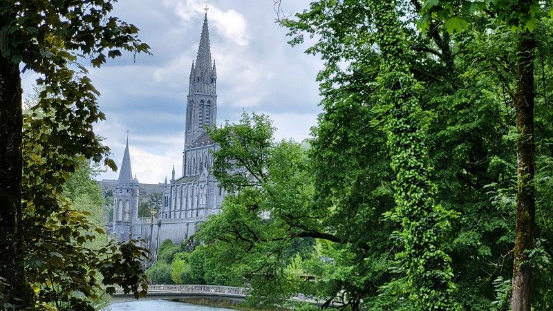
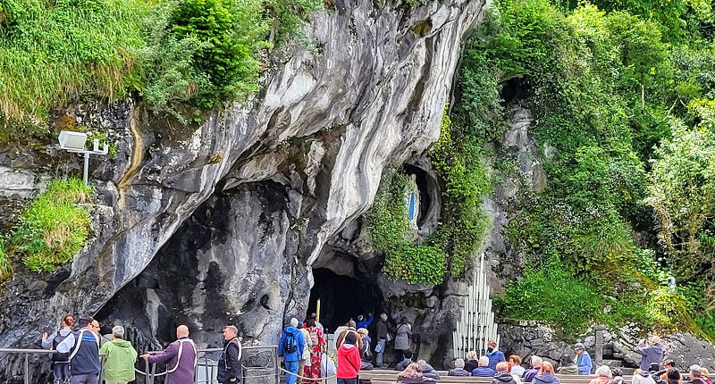
It is a 15-minute walk to the Grotto of Lourdes.
65100, Lourdes, France
43° 5' 43.1" N 0° 4' 29.3" W
43.0953000 -0.0748000
• Head toward Chemin de la Forêt on Route de Batsurguère (D13). Go for 497 m.
• Turn left onto Route de Batsurguère. Go for 593 m.
• Turn right onto Route de Pau. Go for 1.2 km.
• Continue on Rue de Pau. Go for 626 m.
• Take the 1st exit from Rond-Point Michel Crauste roundabout onto Avenue du Général Baron Maransin (D914). Go for 291 m.
• Continue on Rue Saint-Pierre (D914). Go for 115 m.
• Continue on Place du Marcadal (D914). Go for 181 m.
• Continue on Place du Champ Commun (D914). Go for 9 m.
• Turn right onto Place du Champ Commun. Go for 27 m.
• Arrive at Place du Champ Commun. Your destination is on the left.
☍
3,5 km
( 6 min.)
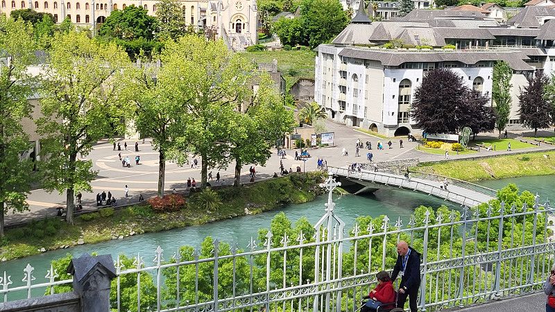
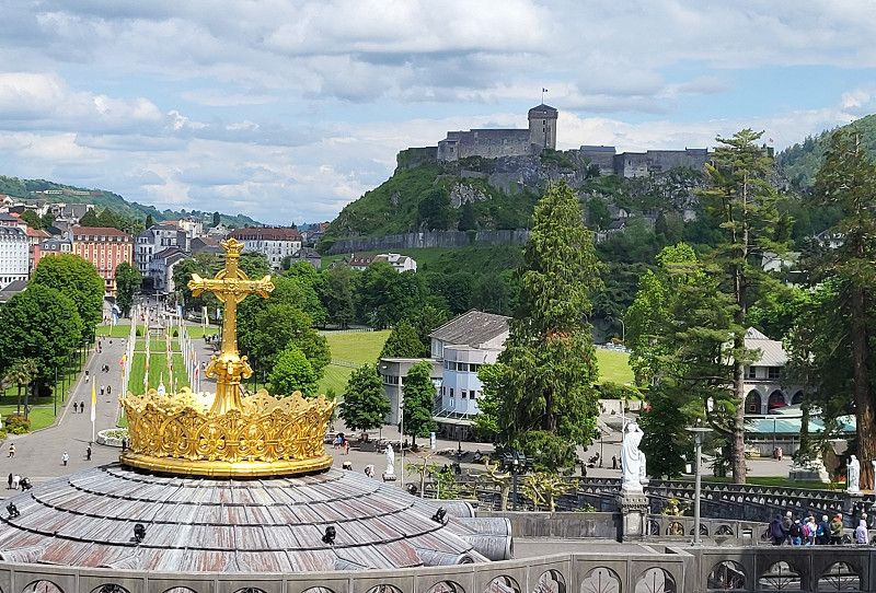
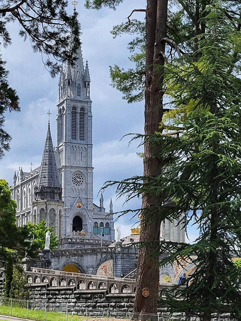
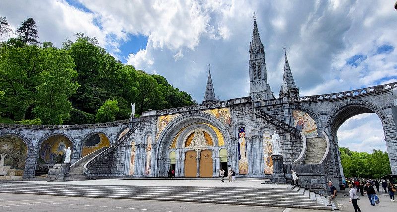
Lourdes
A place between deep faith and commerce. A great deal of hope and confidence is palpable. I was deeply moved.
Hautes-Pyrénées, Okzitanien, Frankreich
43° 5' 38.7" N 0° 2' 47.4" W
43.0940904 -0.0464975
• Head toward Rue de la Halle on Place du Champ Commun. Go for 76 m.
• Turn right onto Rue du Foirail. Go for 36 m.
• Turn left onto Petite Rue de la Paix. Go for 33 m.
• Turn right onto Chaussée du Bourg. Go for 81 m.
• Turn right onto Rue de la Grotte. Go for 142 m.
• Turn left onto Place du Marcadal (D914). Go for 40 m.
• Continue on Rue Saint-Pierre (D914). Go for 115 m.
• Continue on Avenue du Général Baron Maransin (D914). Go for 276 m.
• Take the 3rd exit from Rond-Point Michel Crauste roundabout onto Boulevard de la Grotte. Go for 721 m.
• Continue on Route de Pau. Go for 2.1 km.
• Continue on Avenue de Vizens (D937). Go for 15.7 km.
• Turn left onto Route d'Ossau (D35). Go for 3.0 km.
• Take the 2nd exit from roundabout onto Rue de la Bastide (D35). Go for 17.2 km.
• Turn left onto Avenue Aristide Briand (D934). Go for 156 m.
• Take the 1st exit from roundabout onto D934. Go for 136 m.
• Take the 3rd exit from roundabout onto D934. Go for 3.0 km.
• Take the 3rd exit from roundabout onto D934. Go for 2.6 km.
• Take the 3rd exit from roundabout onto D934. Go for 1.5 km.
• Take the 3rd exit from roundabout onto D934. Go for 4.4 km.
• Take the 2nd exit from Place de la Mairie roundabout onto Rue Barthèque. Go for 221 m.
• Turn left onto Rue de Versailles. Go for 119 m.
• Turn left onto Rue du Foirail. Go for 81 m.
• Turn right onto Rue du Port (D934). Go for 29.2 km.
• Continue on A-136. Go for 524 m.
• Pass 2 roundabouts and continue on A-136. Go for 38.7 km.
• Continue on N-260. Go for 309 m.
• Take ramp onto N-330. Go for 1.0 km.
• Take the 2nd exit from roundabout onto N-330 toward Sabiñánigo/Huesca/Pol. Industrial SEPES. Go for 1.2 km.
• Take the 3rd exit from roundabout onto N-330. Go for 1.5 km.
• Take the 1st exit from roundabout onto N-330. Go for 1.1 km.
• Continue on A-23. Go for 3.1 km.
• Take the 3rd exit from roundabout onto N-330 toward Huesca. Go for 8.2 km.
• Continue on A-23 (Autovía Mudéjar). Go for 106 km.
• Continue on Z-40. Go for 13.5 km.
• Take left exit 28A toward Cariñena/Teruel onto A-23 (Autovía Mudéjar). Go for 37.1 km.
• Take exit 240 toward Cariñena. Go for 366 m.
• Take the 1st exit from roundabout onto Carretera de Sagunto Burgos (N-330) toward Cariñena. Go for 3.6 km.
• Turn left onto Calle Arrabal Alto (A-220). Go for 6.7 km.
• Turn left onto Calle Cruz. Go for 665 m.
• Turn left. Go for 1.6 km.
• Arrive at your destination on the left.
☍
305,9 km
(3 hrs. 43 min.)
Day Reisepause
Day Lourdes - Carinena
Cariñena
The journey was adventurous and lasted 6 hours.
The route: Lourdes -
Aragonien, Spanien
41° 21' 18.6" N 1° 9' 33.8" W
41.3551720 -1.1593994
• Head southeast. Go for 1.6 km.
• Turn right. Go for 344 m.
• Turn slightly left toward Calle Cruz. Go for 206 m.
• Continue on Calle Cruz. Go for 115 m.
• Turn right onto A-220. Go for 7.4 km.
• Turn left onto Avenida de la Estación. Go for 216 m.
• Arrive at your destination on the left.
☍
9,9 km
( 12 min.)
Cariñena, 51 Calle die Carmen
Spent the night at the town's public parking lot. It rained all night. We left by 7 a.m.
Avenida Estación, Cariñena, Campo de Cariñena, Aragonien, Spanien
41° 20' 9" N 1° 13' 44.3" W
41.3358251 -1.2289621
• Head northwest. Go for 77 m.
• Turn right onto Calle Maestro Don Faustino Hernández. Go for 100 m.
• Turn left onto Calle General Enrique Briz. Go for 11 m.
• Turn right onto Calle Maestro Don Faustino Hernández. Go for 139 m.
• Turn right onto Avenida del Ejército (A-220). Go for 720 m.
• Turn right onto N-330. Go for 4.2 km.
• Take the 1st exit from roundabout onto A-23 (Autovía Mudéjar) toward Daroca/Teruel. Go for 214 km.
• Take exit 18 toward N-225/A-7/Algar/La Vall d'Uixó/Castelló/Castellón. Go for 490 m.
• Keep right toward N-225/Algar/La Vall d'Uixó/Castelló/Castellón. Go for 239 m.
• Continue on N-225. Go for 15.5 km.
• Take the left exit toward E-15/AP-7/Nules/Castelló/Castellón onto A-7 (Autovía del Mediterráneo). Go for 3.2 km.
• Take exit 283 toward N-340/E-15/AP-7/Moncofa. Go for 271 m.
• Take the 2nd exit from roundabout onto N-225 toward Moncofa/N-340/E-15/AP-7. Go for 4.3 km.
• Take the 3rd exit from roundabout onto CV-2250 toward Moncofa. Go for 698 m.
• Take the 2nd exit from roundabout onto CV-2250 toward Moncofa. Go for 143 m.
• Continue on Camino La Vall (CV-2250). Go for 12 m.
• Turn right toward Camp de Futbol/C. de Salut. Go for 73 m.
• Turn right onto Calle Las Alquerías. Go for 133 m.
• Continue on Avenida del Llaurado. Go for 556 m.
• Continue on Calle Ausiás March. Go for 175 m.
• Turn left onto Calle Vicent Ramón Alós. Go for 270 m.
• Turn right onto Avenida Ramón y Cajal. Go for 322 m.
• Take the 2nd exit from roundabout onto Avenida Científico Avelino Corma. Go for 602 m.
• Turn left onto Calle Marjals Noves. Go for 85 m.
• Continue on Camino Marjals Noves. Go for 835 m.
• Arrive at Camino Marjals Noves. Your destination is on the right.
☍
246,9 km
(2 hrs. 12 min.)
Day Carinena - Moncofa 3635 Kilometer
Camping Monmar
The day: Thursday, May 15, 2025
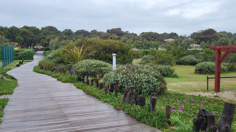
A typical Spanish campsite, with lots of long-term campers who haven't arrived yet. The town seems deserted due to the many holiday apartments. But the site is very affordable, has a pool, very fast Wi-Fi, and a sink on every pitch!
Cami Serratelles 95, 12593, Moncofa, Spain
39° 48' 35.1" N 0° 7' 45.2" W
39.8097500 -0.1292300
• Head toward Camino Serratella on Camino Marjals Noves. Go for 131 m.
• Turn right onto Camino Serratella. Go for 307 m.
• Turn right onto Camino de les Serratelles. Go for 1.0 km.
• Turn right onto Camino de les Serratelles. Go for 76 m.
• Turn right onto Avenida Científico Avelino Corma. Go for 783 m.
• Take the 2nd exit from roundabout onto Avenida Ramón y Cajal. Go for 229 m.
• Turn right onto Calle Burriana. Go for 200 m.
• Turn left onto Calle del Matadero. Go for 219 m.
• Continue on Avenida Guillem de Montcada. Go for 650 m.
• Continue on Calle de Segorbe. Go for 119 m.
• Turn right toward Camino La Vall/CV-2250. Go for 89 m.
• Turn right onto Camino La Vall (CV-2250). Go for 12 m.
• Continue on CV-2250. Go for 92 m.
• Take the 2nd exit from roundabout onto CV-2250 toward Valencia/Barcelona. Go for 678 m.
• Take the 2nd exit from roundabout onto N-225 toward N-340/Castelló/Valencia/La Vall d'Uixó. Go for 4.3 km.
• Take the 2nd exit from roundabout toward A-7/Valencia/N-225/Teruel/La Vall d'Uixó. Go for 276 m.
• Continue toward N-225/Teruel/Almenara/Valencia. Go for 40 m.
• Take the 4th exit from roundabout onto A-7 (Autovía del Mediterráneo) toward Almenara/Valencia/N-225/Teruel. Go for 3.1 km.
• Take exit 287B toward Segorbe/Teruel onto N-225. Go for 16.0 km.
• Keep right toward A-23/Segorbe/Teruel. Go for 1.1 km.
• Take ramp onto A-23 (Autovía Mudéjar) toward Teruel/Zaragoza. Go for 22.0 km.
• Take exit 42 toward Caudiel. Go for 403 m.
• Take the 2nd exit from roundabout onto CV-195 toward Benafer/Caudiel. Go for 2.7 km.
• Continue on Avenida Valencia (CV-195). Go for 223 m.
• Continue on Plaza La Virgen (CV-195). Go for 56 m.
• Continue on Avenida Valencia (CV-195) toward Salón/Socio-Cultural/El Olivar. Go for 122 m.
• Continue on Calle Paulino Carabella (CV-195) toward Salón/Socio-Cultural/El Olivar. Go for 110 m.
• Continue on Avenida Montán (CV-195). Go for 370 m.
• Continue on CV-195. Go for 528 m.
• Continue on CV-203. Go for 46 m.
• Continue on CV-195. Go for 17.3 km.
• Continue on Calle Valencia (CV-195). Go for 213 m.
• Continue on Carretera Valencia (CV-195). Go for 158 m.
• Continue on Avenida Fuente de Baños (CV-195). Go for 160 m.
• Turn left onto Avenida Fuente de Baños (CV-20/CV-195) toward Puebla de Arenoso/Olba. Go for 704 m.
• Turn right. Go for 197 m.
• Turn left. Go for 463 m.
• Arrive at your destination on the right.
☍
75,1 km
(1 hrs. 3 min.)
Day Reisepause
Day Reisepause
Day Reisepause
Day Reisepause - Dienstag, 20.05.2025
Day Moncofa - Fuente de los Banos - Sant Jaume d' Enveja
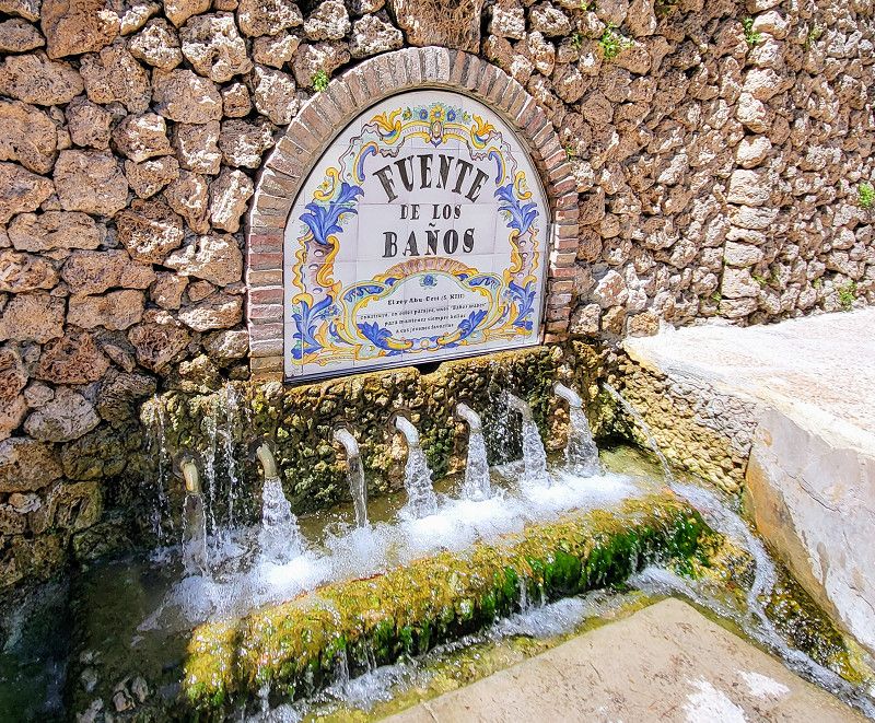
Fuente de Los Baños
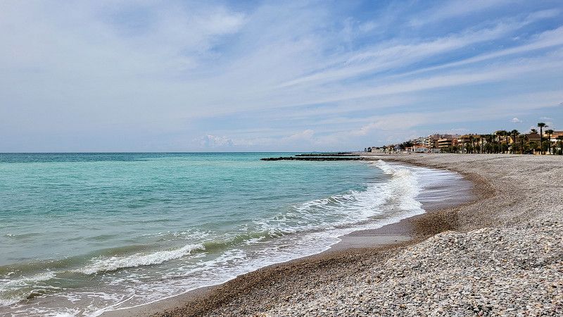
After a 6-day break in beautiful weather, we continue today!
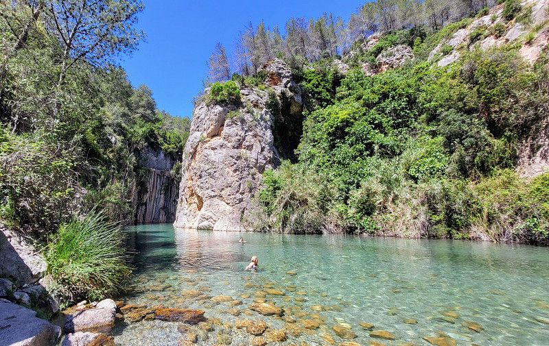
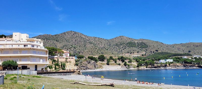
Fuente de los Banos is a beautiful destination, lots of people but beautiful nature.
The CV 195 road is a two-lane stretch—a dream for every biker. From Montanejos, the route to the springs is on foot.
Then on the CV 20 to Onda – also beautiful. Onda is an industrial town, so I skipped the city center.
Paseo Paraje Fuente de Los Baños, Montanejos, l'Alt Millars, Valencianische Gemeinschaft, Spanien
40° 4' 26.8" N 0° 32' 2.2" W
40.0741158 -0.5339374
• Head northwest. Go for 463 m.
• Turn right toward CV-20. Go for 197 m.
• Turn left onto CV-20. Go for 704 m.
• Continue on Carretera de Tales (CV-20). Go for 38.6 km.
• Pass 2 roundabouts and continue on Avenida Montendre (CV-20). Go for 407 m.
• Turn left onto Avenida del País Valenciano (CV-20) toward Villarreal/Castellón. Go for 333 m.
• Take ramp. Go for 109 m.
• Turn sharp right onto Calle Ceramista Alós. Go for 123 m.
• Turn left onto Calle Jaén. Go for 36 m.
• Turn right onto Calle Jaén. Go for 6 m.
• Turn left onto Calle Jaén. Go for 51 m.
• Turn left onto Calle Jaén. Go for 16 m.
• Turn right onto Calle Jaén. Go for 78 m.
• Turn left onto Calle Jaén. Go for 24 m.
• Turn right onto Calle Castell. Go for 60 m.
• Continue straight ahead. Go for 147 m.
• Arrive at your destination on the right.
☍
41,4 km
( 46 min.)
Onda
I only made a quick stop at Decathlon and McDonald's.
la Plana Baixa, Valencianische Gemeinschaft, Spanien
39° 57' 43.7" N 0° 15' 33.8" W
39.9621514 -0.2593846
• Head toward Calle Castell. Go for 147 m.
• Turn left onto Calle Castell. Go for 27 m.
• Turn right onto Calle Castell. Go for 21 m.
• Turn left onto Plaza de la Morera. Go for 19 m.
• Turn right onto Plaza de la Morera. Go for 14 m.
• Turn left onto Calle San Juan. Go for 97 m.
• Continue on Calle la Safona. Go for 14 m.
• Turn right onto Calle Camino Castellón. Go for 35 m.
• Turn left onto Calle Bonaire. Go for 160 m.
• Turn right onto Avenida del País Valenciano (CV-20). Go for 924 m.
• Pass 6 roundabouts and continue on Avenida del Mediterráneo (CV-20). Go for 5.3 km.
• Take the 3rd exit from roundabout onto Avenida del Mediterráneo (CV-20) toward CV-10/Vila-real. Go for 718 m.
• Take the 2nd exit from roundabout onto CV-20 toward CV-10/Vila-real. Go for 475 m.
• Take the 3rd exit from roundabout onto CV-10 toward Castelló/E-15/AP-7/Barcelona. Go for 35.9 km.
• Continue on CV-13. Go for 15.1 km.
• Take ramp onto AP-7 (Autopista del Mediterráneo) toward Barcelona. Go for 26.0 km.
• Take exit 43 toward N-340/Peníscola/Peñíscola/Benicarló/Vinarós/Vinaròs/Tarragona. Go for 1.3 km.
• Take the 5th exit from roundabout onto N-340 toward Tarragona. Go for 22.4 km.
• Pass 2 roundabouts and continue on N-340. Go for 11.3 km.
• Take ramp onto Camí Salt toward Sant Carles de la Ràpita nord/St. Jaume d'Enveja. Go for 232 m.
• Turn left onto Camí Salt (TV-3406) toward Sant Carles de la Ràpita/Sant Jaume d'Enveja/IRTA. Go for 193 m.
• Continue on TV-3406. Go for 342 m.
• Take the 2nd exit from roundabout onto TV-3406 toward St. Jaume d'Enveja. Go for 9.9 km.
• Turn right onto TV-3405 toward Sant Jaume d'Enveja/Deltebre/els Muntells. Go for 1.7 km.
• Continue on Finca Iceberg (TV-3405). Go for 84 m.
• Continue on TV-3405. Go for 615 m.
• Take the 2nd exit from roundabout onto TV-3404 toward Sant Jaume d'Enveja/Illa de Buda/Deltebre. Go for 2.8 km.
• Continue on Avinguda Mallorca (TV-3404). Go for 10 m.
• Turn left toward Avinguda Mallorca. Go for 125 m.
• Continue on Avinguda Mallorca. Go for 514 m.
• Arrive at Avinguda Mallorca.
☍
136,4 km
(1 hrs. 29 min.)
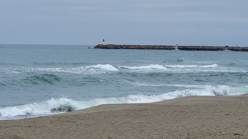
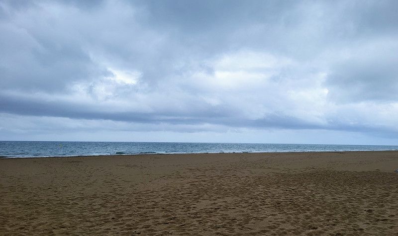
Saint Jaume d' Enveja Stellplatz öffentlich
Clay court in the Ebro Delta.
The Ebro Delta is the second-largest river delta in the Mediterranean after the Nile Delta. You drive past miles of rice fields. There's also a large nature reserve here.
Carrer del Cid, Sant Jaume d'Enveja, Tarragona, Spain
40° 42' 9.7" N 0° 42' 46.9" E
40.7027027 0.7130167
• Head southeast on Avinguda Mallorca. Go for 514 m.
• Turn right toward Avinguda Mallorca/TV-3404. Go for 126 m.
• Turn left onto Avinguda Mallorca (TV-3404). Go for 338 m.
• Take the 4th exit from roundabout onto Carretera d'Amposta a Sant Jaume d'Enveja (TV-3403) toward Amposta/AP-7/St. Carles de la Ràpita. Go for 501 m.
• Continue on TV-3403 toward Deltebre. Go for 67 m.
• Take the 1st exit from roundabout onto TV-3403 toward Deltebre. Go for 812 m.
• Take the 3rd exit from roundabout onto Carrer Girona (TV-3404) toward Deltebre. Go for 563 m.
• Take the 2nd exit from roundabout onto Carrer Girona (TV-3404) toward Centre Ciutat. Go for 415 m.
• Turn right onto Avinguda de Robert Graupera (TV-3402). Go for 356 m.
• Turn left toward Avinguda Generalitat. Go for 62 m.
• Turn left onto Avinguda Generalitat. Go for 407 m.
• Take the 2nd exit from roundabout onto Avinguda Goles de l'Ebre (T-340). Go for 168 m.
• Take the 2nd exit from roundabout onto T-340 toward Camarles/l'Aldea/Tarragona. Go for 1.5 km.
• Take the 1st exit from roundabout onto TV-3401/TV-3409 toward Camarles. Go for 162 m.
• Turn right onto Carretera Camarles (TV-3401) toward l'Ampolla. Go for 306 m.
• Continue on TV-3401. Go for 7.8 km.
• Take the 1st exit from roundabout onto TV-3401 toward N-340/l'Ampolla. Go for 1.2 km.
• Turn right onto N-340. Go for 1.3 km.
• Take ramp toward E-15/AP-7/l'Ampolla Centre. Go for 346 m.
• Take the 4th exit from roundabout toward Tarragona/Castelló. Go for 249 m.
• Take ramp onto AP-7 (Autopista de la Mediterrània) toward Barcelona. Go for 87.5 km.
• Take exit 31 toward El Vendrell/N-340/Coma-ruga/Aeroport/Barcelona per Vilanova i la G. onto C-32 (Autopista Pau Casals). Go for 44.9 km.
• Take exit 44 toward Castelldefels sud. Go for 364 m.
• Keep left onto Avinguda de Castelldefels (C-31) toward Barcelona/Gavà. Go for 6.4 km.
• Turn right onto Carrer Autovia de Castelldefels. Go for 63 m.
• Turn right. Go for 107 m.
• Turn right. Go for 35 m.
• Turn slightly left. Go for 18 m.
• Arrive at your destination on the left.
☍
156,6 km
(1 hrs. 35 min.)
Day Saint Jaume - Gava mar
Camping 3 Estrellas
The drive here took a good two hours, mostly on the highway. It was very cloudy, with heavy rain in the afternoon and 18 degrees Celsius.
The campsite (ACSI) is well-visited and has a direct bus connection to the center of Barcelona. However, it's located next to the airport. It's impressive how different the aircraft are in terms of noise.
Apartado De Correos 238, 08850, Gavà, Spain
41° 16' 18" N 2° 2' 36" E
41.2716600 2.0433300
• Head east. Go for 77 m.
• Turn left. Go for 70 m.
• Turn left. Go for 66 m.
• Turn right toward Carrer Autovia de Castelldefels. Go for 36 m.
• Turn left onto Carrer Autovia de Castelldefels. Go for 39 m.
• Turn right onto Carrer Autovia de Castelldefels. Go for 40 m.
• Turn right onto Autovia de Castelldefels (C-31). Go for 9.6 km.
• Take exit 196AB toward Polígon Industrial de Z. Franca-ZAL onto B-10 (Ronda del Litoral). Go for 7.1 km.
• Take exit 21 toward Ciutat Vella/Paral.lel/La Rambla onto Passeig de Josep Carner. Go for 881 m.
• Take the 3rd exit from Plaça de les Drassanes roundabout onto Passeig de Josep Carner toward Terminals F1 N S/Pg. Colom/Port Olímpic/Moll d'Espanya. Go for 313 m.
• Take the 2nd exit from Plaça del Portal de la Pau roundabout onto Plaça del Portal de la Pau toward Pl. Catalunya/Urgències Hospital. Go for 811 m.
• Turn right onto Pla de la Boqueria. Go for 14 m.
• Turn right onto Carrer de la Boqueria. Go for 186 m.
• Turn slightly left onto Carrer del Call. Go for 131 m.
• Turn right onto Plaça de Sant Jaume. Go for 24 m.
• Turn left onto Plaça de Sant Jaume. Go for 61 m.
• Continue on Carrer de Jaume I. Go for 11 m.
• Arrive at Carrer de Jaume I. Your destination is on the right.
☍
19,4 km
( 22 min.)
Day Besichtigung Barcelona
Barcelona
We took the L95 bus from the campsite to the city center (45 minutes). Taking the blue and red bus routes once, it took 5 hours.
Barcelona is very impressive, extremely diverse, and bustling. A wonderful and amazing city.
Return on the L95 bus. The bus fare is €2.65 each way, and the Barcelona Bustour tour is €28 for seniors.
Barcelonès, Katalonien, Spanien
41° 22' 58.4" N 2° 10' 38.8" E
41.3828939 2.1774322
• Head toward Carrer de la Dagueria on Carrer de Jaume I. Go for 127 m.
• Continue on Plaça de l'Àngel. Go for 35 m.
• Turn right onto Via Laietana. Go for 428 m.
• Continue on Moll d'Espanya toward Port Vell/Hospital del Mar/Ronda Litoral Besòs/Parc Ciutadella. Go for 83 m.
• Continue on Moll de Bosch i Alsina toward Hospital del Mar/Port Olímpic/Ronda Litoral/B-10/Besòs/Parc Ciutadella. Go for 90 m.
• Continue on Plaça de Pau Vila. Go for 215 m.
• Continue on Carrer del Doctor Aiguader toward Hospital del Mar/Port Olímpic/Ronda Litoral/B-10. Go for 349 m.
• Take left ramp onto B-10 (Ronda del Litoral) toward Ronda Litoral/Besòs. Go for 10.7 km.
• Continue on C-58. Go for 365 m.
• Keep right toward Girona/A-7/França. Go for 559 m.
• Continue on C-33 (Autopista de Barcelona a la Jonquera). Go for 12.2 km.
• Continue on AP-7 (Autopista de Barcelona a Mollet del Vallès). Go for 107 km.
• Take exit 4 toward Figueres S/Roses. Go for 1.5 km.
• Take the 3rd exit from roundabout toward La Jonquera/Perpignan/C-260/Roses/Cadaqués/N-260/Llançà/Centre Duaner Vilamalla. Go for 308 m.
• Take ramp onto N-2. Go for 7.1 km.
• Take ramp toward Figueres/Portbou/Llançà. Go for 396 m.
• Continue on N-260 toward Portbou. Go for 56 m.
• Take the 2nd exit from roundabout onto N-260 toward Portbou. Go for 24.4 km.
• Turn right onto Lloc Sector Ponent toward Colera/Centre Urbà. Go for 110 m.
• Turn right onto Carrer de Garbí. Go for 28 m.
• Turn left onto Carrer de Sant Miquel. Go for 255 m.
• Turn right onto Carrer del Pla de les Portes. Go for 19 m.
• Arrive at Carrer del Pla de les Portes.
☍
166,0 km
(1 hrs. 48 min.)
Day Reisepause
Day Gava mar - Colera
Camping Sant Miquel
Beautiful little campsite with heated pool, shaded pitches, takeaway, restaurant, gelateria, creperie, diving school, etc.
Reparked in between.
Great Wi-Fi!
Pla de les Portes 1, 17496, Colera, Spain
42° 24' 10.1" N 3° 8' 55.9" E
42.4028100 3.1488700
• Head south on Carrer del Pla de les Portes. Go for 48 m.
• Turn right onto Carrer de Catalunya nord. Go for 254 m.
• Turn right onto Carrer de Garbí. Go for 80 m.
• Turn right onto Lloc Sector Ponent. Go for 130 m.
• Turn left onto Carrer de l'Onze de Setembre. Go for 67 m.
• Turn slightly right onto Carrer de Francesc Ribera. Go for 72 m.
• Arrive at Carrer de Francesc Ribera. Your destination is on the left.
☍
0,7 km
( 1 min.)
Colera
Small town, beautiful and secluded beaches
Oberampurien, Katalonien, Spanien
42° 24' 13.3" N 3° 8' 56.1" E
42.4036867 3.1489254
• Head toward Carrer Horts on Carrer de Francesc Ribera. Go for 248 m.
• Turn left onto Carrer Horts. Go for 44 m.
• Continue on Carrer Pujada Estació. Go for 42 m.
• Turn left onto Carrer l'Església. Go for 259 m.
• Turn sharp right onto N-260. Go for 7.4 km.
• Continue on D914. Go for 6.5 km.
• Take the 3rd exit from roundabout onto D914. Go for 5.7 km.
• Take the 2nd exit from roundabout onto Route de Cerbère (D914). Go for 1.1 km.
• Take the 1st exit from Rond-Point Maréchal Leclerc roundabout onto Place Paul Reig (D914) toward Port-Vendres/Collioure/Argelès S/Mer. Go for 1.0 km.
• Take the 1st exit from roundabout onto Avenue Alain Gerbault (D914) toward Perpignan/Argelès S/Mer/Collioure/Port Vendres. Go for 1.2 km.
• Take the 2nd exit from roundabout onto D914 toward Perpignan/Argelès S/Mer/Collioure/Port Vendres. Go for 1.2 km.
• Take the 1st exit from roundabout onto D914 toward Perpignan/Collioure/Port Vendres. Go for 7.8 km.
• Take ramp toward Argelès S/Mer-le Racou/Argelès S/Mer-les Criques. Go for 183 m.
• Take the 2nd exit from roundabout onto Route de Collioure (D114). Go for 1.8 km.
• Take the 2nd exit from Rond-Point Valmy roundabout onto Route de Collioure (D114). Go for 1.0 km.
• Take the 1st exit from Rond-Point des Évadés de France roundabout onto Avenue du 8 Mai 1945 (D2 E). Go for 51 m.
• Turn left onto Boulevard Édouard Herriot. Go for 219 m.
• Turn right onto Avenue du Marasquer. Go for 162 m.
• Turn left onto Avenue du Marasquer. Go for 45 m.
• Turn left onto Avenue de la Libération (D618). Go for 25 m.
• Turn right onto Rue Danton. Go for 90 m.
• Turn left onto Rue de la Convention. Go for 19 m.
• Arrive at Rue de la Convention. Your destination is on the left.
☍
36,2 km
( 53 min.)
Day Colera - Carcassonne
Cerberes, Argelès-sur-Mer
A beautiful, very winding mountain and coastal route along the Côte Vermeille. Hardly any traffic. It's part of the French wine routes.
Ostpyrenäen, Okzitanien, Frankreich
42° 32' 51.6" N 3° 1' 31.3" E
42.5476734 3.0253613
• Head toward Rue du 14 Juillet on Rue de la Convention. Go for 93 m.
• Continue on Rue des Remparts. Go for 200 m.
• Continue on Rue Blanqui. Go for 116 m.
• Turn right onto D114. Go for 65 m.
• Continue on Avenue de Hürth (D114). Go for 255 m.
• Turn left onto Avenue de Montgat (D618). Go for 736 m.
• Take the 2nd exit from roundabout onto D914. Go for 16.1 km.
• Keep left onto D914 toward A9/Porte d'Espagne/Gd St Charles. Go for 1.3 km.
• Pass 2 roundabouts and continue on D914. Go for 2.0 km.
• Continue on D900. Go for 771 m.
• Take the 2nd exit from Rond-Point du Serrat-d'en-Vaquer roundabout onto Rocade Sud (D900) toward A9/Narbonne/Andorre la V./Prades/Gd St Charles. Go for 479 m.
• Keep right toward A9/Andorre la V./Narbonne/Prades/Thuir/Gd St Charles. Go for 429 m.
• Continue on D900. Go for 1.1 km.
• Keep right toward Narbonne/Aéroport. Go for 171 m.
• Continue on Rocade Ouest (D900). Go for 860 m.
• Take the 4th exit from roundabout onto Rocade Ouest (D900) toward Narbonne/Canet en Roussillon/Aéroport. Go for 4.9 km.
• Take ramp toward Foix/Tautavel/St Estève-Z.A./Aéroport/Centre Hospitalier. Go for 281 m.
• Turn right onto Avenue de l'Aérodrome (D117) toward Foix/Tautavel/St Estève-Z.A. Go for 358 m.
• Pass 2 roundabouts and continue on Route de Saint-Paul (D117). Go for 7.6 km.
• Take the 3rd exit from roundabout onto D117 toward Foix/St Paul de Fenouillet/Tautavel/Estagel/Cases de Pène. Go for 3.2 km.
• Pass 2 roundabouts and continue on D117. Go for 8.1 km.
• Take the 2nd exit from roundabout onto Avenue de la Coopérative (D117) toward Foix/St Paul de Fenouillet/Tautavel. Go for 674 m.
• Pass 5 roundabouts and continue on Avenue Jean Moulin (D117). Go for 17.7 km.
• Turn slightly left onto Avenue Jean Moulin (D117) toward Foix/Caudiès de Fenouillèdes. Go for 614 m.
• Pass 3 roundabouts and continue on D117. Go for 33.3 km.
• Continue on Avenue de Carcassonne (D118). Go for 325 m.
• Continue on Coste de Laval. Go for 301 m.
• Arrive at Coste de Laval.
☍
102,0 km
(1 hrs. 34 min.)
Quillan
Aude, Okzitanien, Frankreich
42° 52' 35.7" N 2° 11' 38.8" E
42.8765847 2.1941009
• Head toward Rue de la Rhode on Coste de Laval. Go for 278 m.
• Turn sharp right onto Avenue François Mitterrand (D118). Go for 2.0 km.
• Take the 3rd exit from roundabout onto Route de Limoux (D118) toward Limoux/Couiza/Espéraza/Campagne S/Aude. Go for 7.3 km.
• Pass 9 roundabouts and continue on Route du Piémont (D118). Go for 28.0 km.
• Take the 3rd exit from roundabout onto D118 toward A61/Carcassonne/Rouffiac. Go for 9.9 km.
• Take the 2nd exit from roundabout onto Route de Limoux (D118) toward A61/Carcassonne/Maquens. Go for 1.1 km.
• Take the 2nd exit from roundabout onto Route de Limoux (D118) toward A61/Carcassonne. Go for 1.3 km.
• Take the 1st exit from roundabout onto Pont du Garigliano (D6161) toward Narbonne/St Hilaire/La Cité. Go for 617 m.
• Take the 3rd exit from roundabout onto Lieu-dit Plaine de Mayrevieille (D104). Go for 1.4 km.
• Turn left. Go for 76 m.
• Arrive at your destination on the right.
☍
51,8 km
( 51 min.)
Aire de camping-cars de Carcassonne
Quite nice, with small hedges between the pitches. Ideal for sightseeing the town and the fortress.
Chemin de la Jasso, Carcassonne, Aude, Okzitanien, Frankreich
43° 12' 1" N 2° 21' 9.3" E
43.2002836 2.3525952
• Head southeast. Go for 76 m.
• Turn right onto Chemin Bernard Délicieux (D104). Go for 1.3 km.
• Take the 1st exit from roundabout onto Rocade Sud (D6161). Go for 629 m.
• Take the 1st exit from roundabout onto Route de Limoux (D118) toward Centre-Ville/Centre Ville/La Cité. Go for 487 m.
• Continue on Avenue Bunau Varilla. Go for 796 m.
• Continue on Boulevard Barbès. Go for 385 m.
• Turn left onto Rue Jules Sauzède. Go for 303 m.
• Arrive at Rue Jules Sauzède. Your destination is on the left.
☍
4,0 km
( 7 min.)
Carcassonne
Aude, Okzitanien, Frankreich
43° 12' 46.9" N 2° 20' 56.8" E
43.2130358 2.3491069
• Head north on Rue Jules Sauzède.
• Arrive at Rue Jules Sauzède. Your destination is on the left.
☍
Distance not available
(Duration not available)
Day Besichtigung Festung - Weiterfahrt nach Bezier
Carcassonne
Aude, Okzitanien, Frankreich
43° 12' 46.9" N 2° 20' 56.8" E
43.2130358 2.3491069
• Head toward Rue Victor Hugo on Rue Jules Sauzède. Go for 43 m.
• Turn right onto Rue Victor Hugo. Go for 85 m.
• Turn right onto Rue du Docteur Albert Tomey. Go for 173 m.
• Turn left onto Rue Aimé Ramond. Go for 405 m.
• Continue on Square Gambetta. Go for 202 m.
• Turn right onto Avenue Arthur Mullot. Go for 123 m.
• Continue on Avenue du Général Leclerc. Go for 2.1 km.
• Take the 2nd exit from Rond-Point de l'Europe roundabout onto Avenue du Général Leclerc. Go for 174 m.
• Continue on Avenue du 3ème R.P.I.M.A. Go for 3.3 km.
• Take the 2nd exit from roundabout onto Avenue des Capucins (D6113) toward Narbonne/Lézignan-Corbières/Trèbes/Lagrasse/Capendu. Go for 893 m.
• Turn left onto Avenue Général Charles de Gaulle (D610) toward Marseillette/Trèbes-Centre. Go for 870 m.
• Turn right onto D610. Go for 26.7 km.
• Continue on D11 toward Pouzols-Minervois/Olonzac. Go for 4.2 km.
• Continue on D5. Go for 6.8 km.
• Take the 2nd exit from roundabout onto Route de Carcassonne (D5). Go for 3.7 km.
• Take the 3rd exit from roundabout onto D426 toward Argeliers. Go for 149 m.
• Continue on Avenue Pierre de Coubertin (D426). Go for 108 m.
• Continue on D426. Go for 37 m.
• Continue on Avenue Pierre de Coubertin (D426). Go for 846 m.
• Continue on Rue du 1er Mai (D426). Go for 16 m.
• Turn right onto Rue Alphonse Daudet. Go for 67 m.
• Turn left onto Rue Élie Bernard. Go for 9 m.
• Turn right onto Rue Jean Clavel. Go for 100 m.
• Turn right onto Avenue des 87. Go for 27 m.
• Arrive at Avenue des 87. Your destination is on the right.
☍
51,0 km
( 49 min.)
Argeliers
Beautiful route. I took the main road because I wanted to see the Canal du Midi. But you can't see it! I finally ended up in Beziers, and I was more than compensated.
Aude, Okzitanien, Frankreich
43° 18' 43.9" N 2° 54' 41" E
43.3121894 2.9113792
• Head toward Rue de l'Éolienne on Avenue des 87. Go for 67 m.
• Turn right onto Allée Marcelin Albert. Go for 58 m.
• Turn left onto Avenue Michel Bernard. Go for 133 m.
• Continue on Avenue Jean Jaurès (D826). Go for 753 m.
• Turn left onto D5 toward Béziers/Capestang/Quarante/Ouveillan. Go for 7.3 km.
• Continue on Route de Carcassonne (D11). Go for 2.6 km.
• Pass 7 roundabouts and continue on Avenue Pierre de Coubertin (D11). Go for 14.2 km.
• Continue on Rue Paul Dardé. Go for 51 m.
• Keep left onto Rue Paul Dardé toward Centre Ville. Go for 46 m.
• Continue on Route de Narbonne (D609). Go for 153 m.
• Keep right onto Route d'Espagne (D609) toward Centre Ville/Aéroport Béziers-Vias. Go for 572 m.
• Keep right onto Avenue Colonel d'Ornano (D609). Go for 16 m.
• Turn right onto Rue des Minimes toward Murviel. Go for 63 m.
• Turn right onto Rue Rozier. Go for 89 m.
• Continue on Rue de l'Abreuvoir. Go for 294 m.
• Turn left onto Avenue Valentin Duc. Go for 46 m.
• Turn right onto Boulevard de Tourventouse. Go for 383 m.
• Continue on Boulevard d'Angleterre. Go for 296 m.
• Take the 1st exit from roundabout onto Rue Porte Olivier. Go for 225 m.
• Turn right onto Rue Paul Riquet. Go for 41 m.
• Continue on Rue de la République. Go for 21 m.
• Continue on Rue Paul Riquet. Go for 71 m.
• Turn left onto Rue Pierre Flourens. Go for 96 m.
• Arrive at Place Gabriel Péri. Your destination is on the left.
☍
27,6 km
( 33 min.)
Béziers
I came to Beziers by chance along the Canal MIDI and fell in love with this city.
I took the "La Petit Train" once and a half times because it was so beautiful. The charming train driver let me off along the way so I didn't have to walk too far to get to my parking spot!!! So nice!
Hérault, Okzitanien, Frankreich
43° 20' 33.6" N 3° 12' 47.3" E
43.3426562 3.2131307
• Head toward Rue Pépezut on Place Gabriel Péri. Go for 293 m.
• Turn right onto Rue du Puits des Arènes. Go for 113 m.
• Continue on Rue Canterelles. Go for 224 m.
• Turn sharp left onto Avenue Valentin Duc. Go for 33 m.
• Continue on Rue de l'Orb. Go for 78 m.
• Continue on Avenue Colonel d'Ornano (D609). Go for 280 m.
• Turn left onto Place des Alliés. Go for 58 m.
• Continue on Rue du Canal. Go for 66 m.
• Continue toward Avenue du Port-Notre-Dame/D19. Go for 26 m.
• Continue on Avenue du Port-Notre-Dame (D19). Go for 54 m.
• Turn right toward Route de Narbonne/D609. Go for 666 m.
• Take the 3rd exit from Rond-Point Bachaga Boualam roundabout onto Route de Narbonne (D609) toward A9/Narbonne/Colombiers. Go for 1.3 km.
• Take ramp onto D64 toward A9/Narbonne/Vendres/Valras-Plage. Go for 3.5 km.
• Take the 3rd exit from Rond-Point de la Mer roundabout onto A9 (La Languedocienne) toward Montpellier. Go for 113 km.
• Take the exit toward Nîmes-Centre/Aéroport Garons/Arles/Aix en Pce/Marseille onto A54. Go for 48.0 km.
• Continue on A54. Go for 23.9 km.
• Take the exit toward Aix en Pce/Toulon/Nice/Aéroport Marignane/Berre l'Étang/Marseille onto A7 (Autoroute du Soleil). Go for 11.7 km.
• Keep left onto A8 (Échangeur de la Croix de Coudoux) toward Nice/Toulon/Aix en Pce. Go for 30.3 km.
• Take the exit toward Toulon/Aubagne onto A52. Go for 20.5 km.
• Keep right onto A52 (Échangeur du Pont de l'Étoile) toward Toulon/Aubagne-les Passons/Z.I. les Paluds. Go for 5.0 km.
• Continue on A50. Go for 46.8 km.
• Continue on A57. Go for 1.2 km.
• Take exit 2 toward Carqueiranne/Le Pradet/Toulon-Est. Go for 164 m.
• Turn right onto Avenue Joseph Gasquet (D559). Go for 59 m.
• Pass 3 roundabouts and continue on Avenue Jules Charleux (D559). Go for 3.2 km.
• Turn left onto Avenue Maréchal de Lattre de Tassigny (D559) toward Le Pradet/Hyères/Aéroport Hyères. Go for 973 m.
• Pass 2 roundabouts and continue on Avenue de la 1ère D.F.L. (D559). Go for 1.0 km.
• Continue on Place Charles de Gaulle (D559). Go for 23 m.
• Continue on Avenue Gabriel Péri (D559). Go for 91 m.
• Take the 2nd exit from roundabout onto Rue Paulin David toward L'Artaude. Go for 192 m.
• Continue on Rue Docteur Coulet. Go for 270 m.
• Take the 1st exit from roundabout onto Rue Docteur Coulet. Go for 212 m.
• Take the 1st exit from roundabout onto Chemin de l'Artaude. Go for 542 m.
• Turn left onto Chemin de l'Artaude. Go for 69 m.
• Arrive at Chemin de l'Artaude. Your destination is on the right.
☍
313,4 km
(3 hrs. 8 min.)
Day Beziere - Le Padet
Camping Artaudois
Unfortunately, it's not quite as described by ACSI. The magnificent view is only available from a very few pitches, some of the sanitary facilities are dirty, and Wi-Fi is available only for a fee – meaning you can only book Wi-Fi via an app! There's hardly any cell reception, so how are you supposed to download an app?
Chemin de l'Artaude, Le Pradet, Var, Provence-Alpes-Côte d'Azur, Frankreich
43° 5' 56" N 6° 1' 55.4" E
43.0988917 6.0320688
• Head west on Chemin de l'Artaude. Go for 69 m.
• Turn right onto Chemin de l'Artaude. Go for 527 m.
• Take the 2nd exit from roundabout onto Rue Docteur Coulet. Go for 201 m.
• Take the 2nd exit from roundabout onto Rue Paul Guiol. Go for 233 m.
• Turn right onto Avenue Ganzin (D559). Go for 147 m.
• Pass 3 roundabouts and continue on Avenue Ganzin (D559). Go for 1.4 km.
• Take the 2nd exit from Carrefour de la Diligence roundabout onto Route de la Moutonne (D76) toward A570/La Crau/La Moutonne/Z.A. les Castors. Go for 1.1 km.
• Continue on Avenue Jean Monnet (D76). Go for 1.5 km.
• Pass 2 roundabouts and continue on Avenue Jean Monnet. Go for 775 m.
• Continue on Route des Loubes (D276). Go for 1.5 km.
• Take the 2nd exit from Rond-Point Jean Bruno roundabout onto Route des Loubes (D276). Go for 788 m.
• Take the 2nd exit from Rond-Point Saint-Martin roundabout onto Impasse Saint-Jean. Go for 237 m.
• Take the 1st exit from Rond-Point du Maréchal Juin roundabout onto Impasse Saint-Jean toward Toulon/Draguignan/Hyères-Centre/Centre Hospitalier. Go for 91 m.
• Take ramp onto D98 toward N98/Hyères-Centre/St Tropez/Hyères-Aéroport. Go for 1.0 km.
• Take the 2nd exit from Rond-Point Henri Petit roundabout onto Avenue Léopold Ritondale (D98) toward Saint-Tropez/La Londe/Centre Ville/Le Port/Giens-les Îles/Aéroport Hyères. Go for 412 m.
• Turn sharp left onto Avenue Gambetta (D559) toward Centre Ville. Go for 520 m.
• Turn right onto Rue Jean Aicard. Go for 129 m.
• Continue on Rue de Provence. Go for 133 m.
• Turn left onto Avenue Ambroise Thomas. Go for 117 m.
• Continue on Rond-Point du Casino. Go for 27 m.
• Continue on Avenue Maréchal Foch. Go for 100 m.
• Turn left onto Avenue Joseph Clotis. Go for 44 m.
• Arrive at Avenue Joseph Clotis. Your destination is on the right.
☍
11,1 km
( 19 min.)
Day Le Padet - Antibes
Hyères
Var, Provence-Alpes-Côte d'Azur, Frankreich
43° 7' 12.9" N 6° 7' 48.6" E
43.1202573 6.1301614
• Head toward Rue Jean Ribier on Avenue Joseph Clotis. Go for 136 m.
• Turn left onto Avenue Gambetta (D559). Go for 84 m.
• Take the 2nd exit from roundabout onto Avenue Gambetta (D559). Go for 628 m.
• Turn sharp left onto Avenue Léopold Ritondale (D98) toward Pierrefeu/La Londe/Le Lavandou. Go for 8.0 km.
• Pass 4 roundabouts and continue on D98. Go for 33.2 km.
• Take the 2nd exit from Rond-Point de l'Armée d'Afrique roundabout onto Avenue Georges Clemenceau (D558) toward Grimaud/Le Luc/Cogolin-Centre. Go for 526 m.
• Turn left onto Rue Henri Barbusse. Go for 104 m.
• Arrive at Rue Henri Barbusse. Your destination is on the right.
☍
42,7 km
( 41 min.)
Cogolin
Var, Provence-Alpes-Côte d'Azur, Frankreich
43° 15' 0" N 6° 32' 11.7" E
43.2500000 6.5365900
• Head toward Avenue Georges Clemenceau on Rue Henri Barbusse. Go for 104 m.
• Turn right onto Avenue Georges Clemenceau (D558). Go for 389 m.
• Take the 2nd exit from Rond-Point de l'Armée d'Afrique roundabout onto D98 toward St-Tropez/Ste Maxime. Go for 260 m.
• Pass 3 roundabouts and continue on D98. Go for 2.9 km.
• Turn right onto D559 toward D98/St Tropez/Fréjus/St Raphaël/Ste Maxime. Go for 248 m.
• Keep left onto D559 toward A8/Fréjus/St Raphaël/Ste Maxime. Go for 209 m.
• Keep right onto D559 toward A8/Fréjus/St Raphaël/Ste Maxime. Go for 2.0 km.
• Take the 1st exit from roundabout onto Route du Littoral (D559). Go for 495 m.
• Pass 3 roundabouts and continue on Boulevard Jean Moulin (D559). Go for 5.1 km.
• Continue on Boulevard Jean Moulin (D559). Go for 179 m.
• Keep right onto Avenue du Maréchal de Lattre de Tassigny (D559) toward Casino. Go for 325 m.
• Continue on Avenue Charles de Gaulle (D559). Go for 155 m.
• Pass 2 roundabouts and continue on Avenue Charles de Gaulle (D559). Go for 462 m.
• Continue on Avenue du Général Leclerc (D559). Go for 2.7 km.
• Continue on Avenue Général Touzet du Vigier (D559). Go for 1.2 km.
• Take the 1st exit from Rond-Point du Débarquement roundabout onto Avenue Général Touzet du Vigier (D559) toward Fréjus/St Raphaël/St Aygulf/Roquebrune S/A. Go for 2.6 km.
• Turn left onto Avenue du Mont Cabasse (D8) toward Col du Bougnon/Roquebrune sur Argens. Go for 419 m.
• Continue on Résidence Le Parc Anais (D8). Go for 69 m.
• Continue on Route du Col de Bougnon (D8). Go for 1.1 km.
• Continue on D8. Go for 8.1 km.
• Take the 1st exit from roundabout onto D7 toward Fréjus/St Raphaël/St Aygulf. Go for 1.2 km.
• Take the 2nd exit from roundabout onto D8 toward Fréjus/St Raphaël. Go for 3.7 km.
• Take the 2nd exit from Rond-Point des Harquis roundabout onto Rue du Capitaine Blazy (D98 B) toward D98/St Raphaël/St Tropez/St Aygulf/Ste Maxime/Port Fréjus/Centre-Ville. Go for 423 m.
• Take the 2nd exit from roundabout onto Rue du Capitaine Blazy (D98 B). Go for 485 m.
• Take the 2nd exit from Boulevard Séverin Decuers roundabout onto Rue des Moulins. Go for 298 m.
• Take the 2nd exit from roundabout onto Place de la Porte Dorée. Go for 43 m.
• Continue on Rue Grisolle. Go for 166 m.
• Turn right onto Rue Montgolfier. Go for 27 m.
• Continue on Rue Jean Jaurès. Go for 53 m.
• Turn right onto Place du Couvent. Go for 43 m.
• Continue on Place Paul Albert Février. Go for 24 m.
• Arrive at Place Paul Albert Février. Your destination is on the left.
☍
35,3 km
( 46 min.)
Fréjus
Var, Provence-Alpes-Côte d'Azur, Frankreich
43° 25' 58.9" N 6° 44' 9.7" E
43.4330308 6.7360182
• Head toward Rue de Fleury on Place Paul Albert Février. Go for 26 m.
• Turn left onto Rue de Fleury. Go for 71 m.
• Turn right onto Rue Jean Jaurès. Go for 148 m.
• Take the 4th exit from roundabout onto Rue Gustave Bret. Go for 111 m.
• Take the 1st exit from roundabout onto Rue Gustave Bret. Go for 749 m.
• Take the 2nd exit from Rond-Point Paola roundabout onto Avenue de l'Agachon (DN7) toward A8/Cannes/St Raphaël/Mandelieu/Ste Brigitte/Centre Hospitalier Bonnet. Go for 219 m.
• Continue toward Route de Malpasset/D37. Go for 49 m.
• Take the 2nd exit from Rond-Point de l'Europe roundabout onto Route de Malpasset (D37) toward A8/Cannes/Aix en Pce. Go for 776 m.
• Pass 3 roundabouts and continue on Route de Malpasset (D37). Go for 2.5 km.
• Take the 2nd exit from Rond-Point du Gargalon roundabout onto A8 (La Provençale) toward Mandelieu/Cannes/Nice. Go for 37.7 km.
• Take exit 44 toward Antibes/Sophia Antipolis. Go for 583 m.
• Take the 4th exit from Rond-Point des Semboules roundabout onto D35 toward Antibes/Juan les Pins/Marineland. Go for 811 m.
• Keep right toward Antibes/Juan les Pins. Go for 148 m.
• Continue on Route de Grasse (D35). Go for 222 m.
• Take the 3rd exit from Rond-Point Weisweiller roundabout onto Route de Grasse (D35) toward Antibes/Juan les Pins/Saint Jean. Go for 490 m.
• Take the 3rd exit from Rond-Point de la Croix Rouge roundabout onto Route de Grasse (D35) toward Antibes-Centre/Anthéa. Go for 351 m.
• Turn left onto Chemin des Âmes du Purgatoire. Go for 14 m.
• Turn right onto Route de Grasse (D35). Go for 2.5 km.
• Turn right onto Boulevard Général Vautrin toward D6007/Centre Ville. Go for 104 m.
• Keep left onto Boulevard Général Vautrin toward Centre Ville. Go for 80 m.
• Continue on Carrefour du Marseillais. Go for 10 m.
• Keep left onto Carrefour du Marseillais. Go for 51 m.
• Keep right onto Rue Sadi Carnot. Go for 48 m.
• Turn right onto Avenue Robert Soleau (N98) toward Centre Ville. Go for 331 m.
• Continue on Place du Général de Gaulle (N98). Go for 74 m.
• Turn right onto Place du Général de Gaulle (N98). Go for 18 m.
• Turn left onto Boulevard Albert 1er (D255 9). Go for 488 m.
• Keep left onto Boulevard Maréchal Leclerc. Go for 81 m.
• Turn slightly left onto Avenue Barquier. Go for 94 m.
• Turn right onto Avenue Général Maizière. Go for 134 m.
• Continue on Rue de la Tourraque. Go for 228 m.
• Continue on Cours Masséna. Go for 36 m.
• Arrive at Cours Masséna.
☍
49,3 km
( 41 min.)
Antibes
Seealpen, Provence-Alpes-Côte d'Azur, Frankreich
43° 34' 52.6" N 7° 7' 34.3" E
43.5812868 7.1262071
• Head toward Rue Christian Chessel on Cours Masséna. Go for 117 m.
• Continue on Rue Aubernon. Go for 44 m.
• Turn right onto Rue Aubernon. Go for 127 m.
• Turn slightly left onto Rue Aubernon. Go for 17 m.
• Continue on Avenue de Verdun. Go for 50 m.
• Take the 1st exit from roundabout onto Avenue de Verdun. Go for 473 m.
• Take the 2nd exit from Rond-Point Saint-Roch roundabout onto Avenue du 11 Novembre. Go for 389 m.
• Continue on Avenue du Bord de Mer (N98). Go for 756 m.
• Continue on Route du Bord-de-Mer (D6098). Go for 1.2 km.
• Take the 1st exit from roundabout onto Route du Bord-de-Mer (D6098). Go for 846 m.
• Take the 3rd exit from roundabout onto D6098. Go for 106 m.
• Turn right onto Route de Nice (D6007). Go for 109 m.
• Take the 2nd exit from Rond-Point de la Mer roundabout onto Route de Biot (D4) toward A8/Biot/Sophia Antipolis/Musée National Fernand Léger/Parc Marineland. Go for 625 m.
• Take the 2nd exit from Rond-Point de la Brague roundabout onto Chemin des Groules. Go for 98 m.
• Turn right onto Avenue Georges Bizet. Go for 380 m.
• Arrive at Avenue Georges Bizet.
☍
5,3 km
( 9 min.)
Avenue Georges Bizet - Camping des Trelles
Seealpen, Provence-Alpes-Côte d'Azur, Frankreich
43° 36' 57.3" N 7° 7' 29.6" E
43.6159236 7.1248907
• Head toward Chemin des Groules on Avenue Georges Bizet. Go for 380 m.
• Turn left onto Chemin des Groules. Go for 72 m.
• Take the 2nd exit from Rond-Point de la Brague roundabout onto Route de Biot (D4). Go for 625 m.
• Take the 2nd exit from Rond-Point de la Mer roundabout onto Route de Nice (D6007) toward Nice/Aéroport Nice-Côte d'Azur/Villeneuve-Loubet/Cagnes S/Mer. Go for 3.0 km.
• Take the 3rd exit from roundabout onto D6007 toward Nice/Roquefort les Pins/Cagnes S/ Mer/Villeneuve Loubet-Village. Go for 478 m.
• Take the 1st exit from roundabout onto Avenue des Rives toward Nice/Bouches du Loup. Go for 79 m.
• Take ramp onto A8 (La Provençale) toward A8/Nice. Go for 6.5 km.
• Take exit 50 toward Nice-Ouest/Nice-Centre onto M6202 (Boulevard Georges Pompidou). Go for 686 m.
• Keep right toward Boulevard René Cassin/M6007. Go for 123 m.
• Keep right onto Boulevard René Cassin (M6007) toward Nice. Go for 821 m.
• Turn slightly left onto N7 toward Monaco/Menton/Nice-Centre/Nice-Est. Go for 6.3 km.
• Take ramp toward Cimiez. Go for 252 m.
• Turn right onto Boulevard de Cimiez. Go for 393 m.
• Continue on Avenue Desambrois. Go for 183 m.
• Turn right onto Boulevard Dubouchage. Go for 507 m.
• Turn right. Go for 98 m.
• Arrive at your destination on the right.
☍
20,5 km
( 22 min.)
Day Antibes - Roquebilliere
Nizza
Seealpen, Provence-Alpes-Côte d'Azur, Frankreich
43° 42' 3.4" N 7° 16' 6.2" E
43.7009358 7.2683912
• Head toward Boulevard Victor Hugo. Go for 145 m.
• Continue on Boulevard Victor Hugo. Go for 89 m.
• Turn left onto Rue Eugène Emanuel. Go for 97 m.
• Turn left onto Rue Maréchal Joffre. Go for 182 m.
• Continue on Rue Pastorelli. Go for 525 m.
• Continue on Rue Pierre Devoluy. Go for 189 m.
• Turn right onto Boulevard Carabacel toward Monaco/Menton. Go for 328 m.
• Continue on Place Jean Moulin. Go for 40 m.
• Continue on Traverse Barla (N7). Go for 97 m.
• Turn sharp left onto D2204. Go for 79 m.
• Continue on Tunnel André Liautaud. Go for 343 m.
• Keep left onto Tunnel André Liautaud. Go for 475 m.
• Keep left onto Tunnel André Liautaud. Go for 1.1 km.
• Continue on Pénétrante du Paillon (M2204 B). Go for 1.5 km.
• Take ramp toward A8/St André/L'Ariane. Go for 173 m.
• Turn right onto Square Cunéo toward Menton/Gênes/Bon Voyage/La Trinité/Contes. Go for 48 m.
• Turn left onto Route de Turin toward Monaco/Menton/Gênes/La Trinité/Contes. Go for 197 m.
• Take the 1st exit from roundabout toward Menton/Monaco/Gênes. Go for 50 m.
• Take ramp onto A8 (La Provençale). Go for 19.8 km.
• Take exit 59 toward Menton/Sospel. Go for 618 m.
• Turn right onto D22 A toward Menton/Sospel. Go for 192 m.
• Take the 2nd exit from roundabout onto Route de Sospel (D2566) toward Sospel/Castillon. Go for 9.0 km.
• Turn left onto Route de la Pénétrante (D2566 A). Go for 5.7 km.
• Take the 4th exit from roundabout onto D2566. Go for 135 m.
• Turn slightly left onto Avenue Jean Médecin (D2204). Go for 569 m.
• Turn right onto Route du Moulinet (D2566) toward Moulinet/Col de Turini/Camp d'Argent. Go for 96 m.
• Arrive at Route du Moulinet (D2566). Your destination is on the right.
☍
41,8 km
( 45 min.)
Aire de Camping-cars
Emmanuel Donato, Rue du stade, 06380 Sospel
Unfortunately, I couldn't log in due to Camping Car's internet problems, so I kept driving.
Boulevard de l'Egalité, 06380, Sospel, France
43° 52' 43" N 7° 26' 32" E
43.8786111 7.4422222
• Head toward Chemin de la Condamine on Route du Moulinet (D2566). Go for 23.9 km.
• Turn right onto Route de la Bollène-Vésubie (D70). Go for 65 m.
• Turn slightly left onto Route de la Bollène-Vésubie (M70). Go for 19 m.
• Arrive at Route de la Bollène-Vésubie (M70). Your destination is on the right.
☍
23,9 km
( 31 min.)
Col de Turini
The most strenuous pass I've ever ridden. The road is extremely exposed, with 44 hairpin bends up top and over 20 hairpin bends down.
The route down is part of the Tour de France.
Seealpen, Provence-Alpes-Côte d'Azur, Frankreich
43° 58' 39.7" N 7° 23' 29.2" E
43.9776866 7.3914557
• Head northwest on Route de la Bollène-Vésubie (M70). Go for 11.9 km.
• Turn left onto Rue Constant Cassini. Go for 41 m.
• Arrive at Placette des Tilleuls. Your destination is on the left.
☍
12,0 km
( 16 min.)
La Bollène-Vésubie
This is a tiny place, high on the mountain.
Seealpen, Provence-Alpes-Côte d'Azur, Frankreich
43° 59' 23.8" N 7° 19' 51.9" E
43.9899444 7.3310809
• Head toward Avenue de Verdun on Placette des Tilleuls. Go for 41 m.
• Turn left onto Avenue de Verdun (M170). Go for 132 m.
• Turn right onto Route de la Bollène-Vésubie (M70). Go for 2.9 km.
• Turn right onto Lieu-dit Boutaus (M2565) toward Roquebillière/Belvédère/St Martin-Vbie. Go for 1.6 km.
• Turn left onto M69. Go for 360 m.
• Continue on Lieu-dit Pontillart (M69). Go for 896 m.
• Continue on M69. Go for 106 m.
• Continue on Avenue Philippe Corniglion Molinier (M69). Go for 16 m.
• Take the 2nd exit from roundabout onto Avenue Philippe Corniglion Molinier (M69). Go for 287 m.
• Continue on Boulevard Georges Demonfaucon (M69). Go for 214 m.
• Turn left toward Chemin de Giboël. Go for 49 m.
• Turn right onto Chemin de Giboël. Go for 216 m.
• Arrive at Chemin de Giboël.
☍
6,8 km
( 10 min.)
Camping Les Templiers
Very nice little place, located right next to the stream.
Access very narrow and steep with three hairpin bends.
Quartier La Bourgade, 06450, Roquebillière, France
44° 0' 55.2" N 7° 18' 37.2" E
44.0153400 7.3103300
• Head southwest on Chemin de Giboël. Go for 216 m.
• Turn left toward Boulevard Georges Demonfaucon/M69. Go for 49 m.
• Turn right onto Boulevard Georges Demonfaucon (M69). Go for 214 m.
• Continue on Avenue Philippe Corniglion Molinier (M69). Go for 44 m.
• Turn right onto Rue André Blanc. Go for 97 m.
• Continue on Place Général Corniglion-Molinier. Go for 39 m.
• Turn right onto Rue du 24 Novembre 1926. Go for 10 m.
• Arrive at Rue du 24 Novembre 1926. Your destination is on the right.
☍
0,7 km
( 1 min.)
Day Roquebilliere - Briancon
Roquebillière
Nice little place, extremely wide stream bed.
Seealpen, Provence-Alpes-Côte d'Azur, Frankreich
44° 0' 45.8" N 7° 18' 27.6" E
44.0127173 7.3076730
• Head toward Rue du Planet on Rue du 24 Novembre 1926. Go for 71 m.
• Turn right onto Rue du Plateau Carlon. Go for 42 m.
• Turn slightly right onto Rue du Plateau Carlon. Go for 198 m.
• Turn left onto Boulevard Georges Demonfaucon (M69). Go for 658 m.
• Continue on Lieu-dit La Bourgade (M69). Go for 176 m.
• Continue on M69. Go for 150 m.
• Take the 2nd exit from roundabout onto Avenue de Verdun (M2565). Go for 8.6 km.
• Turn right onto Place Félix Faure. Go for 17 m.
• Arrive at Place Félix Faure.
☍
10,0 km
( 13 min.)
Saint-Martin-Vésubie
Seealpen, Provence-Alpes-Côte d'Azur, Frankreich
44° 4' 12.3" N 7° 15' 23.4" E
44.0700773 7.2565002
• Head toward Place des Allées on Place Félix Faure. Go for 95 m.
• Turn right onto Place des Allées (M2565). Go for 7.9 km.
• Take the 2nd exit from roundabout onto M2565. Go for 261 m.
• Arrive at Col Saint-Martin (M2565).
☍
8,3 km
( 10 min.)
Col Saint-Martin. 1560m
Nice to ride, no traffic, lots of cyclists because of the Tour de France
Frankreich
44° 4' 15.4" N 7° 13' 16.9" E
44.0709578 7.2213726
• Head toward Lieu-dit Les Grêles on Col Saint-Martin (M2565). Go for 7.6 km.
• Take the 2nd exit from roundabout onto Route Nationale (M2565). Go for 8.8 km.
• Turn sharp right onto Lieu-dit La Fraissinea (M2205). Go for 4.5 km.
• Keep right onto M2205. Go for 13.6 km.
• Take the 2nd exit from roundabout onto M2205. Go for 204 m.
• Turn right onto Lieu-dit Predi. Go for 99 m.
• Arrive at Lieu-dit Predi. Your destination is on the left.
☍
34,8 km
( 37 min.)
Isola
Seealpen, Provence-Alpes-Côte d'Azur, Frankreich
44° 11' 9.8" N 7° 3' 7.2" E
44.1860506 7.0519874
• Head southwest on Lieu-dit Predi. Go for 99 m.
• Turn right onto M2205. Go for 12.9 km.
• Take the 2nd exit from roundabout onto Boulevard d'Auron (M2205). Go for 23.8 km.
• Arrive at M2205. Your destination is on the right.
☍
36,8 km
( 39 min.)
Col de Raspaillon 2513m
That's when the difficult part began for me! Technically, it wasn't a problem at all, but my fear of heights really took over. The next three passes were almost impossible for me to manage, but turning around wasn't an option either. I've never been so scared in my life!
The photos don't even look that spectacular, but I couldn't photograph the really extreme spots. Especially not guardrails, small walls, or road shoulders.
Seealpen, Provence-Alpes-Côte d'Azur, Frankreich
44° 20' 26.1" N 6° 49' 55.9" E
44.3405737 6.8321964
• Head west on M2205. Go for 3.0 km.
• Turn sharp left toward M2205. Go for 807 m.
• Continue on M2205. Go for 271 m.
• Arrive at M2205.
☍
4,1 km
( 6 min.)
Col de la Cime de la Bonette. 2802m
On the ridge, there's a hairpin bend from one side of the mountain ridge to the other. I've never seen anything like it. I couldn't take a photo; I was too scared.
Addendum: 2 drone photos from the internet.
Frankreich
44° 19' 13.9" N 6° 48' 26.9" E
44.3205167 6.8074635
• Head northeast on M2205. Go for 155 m.
• Continue on Cime de la Bonette (M2205). Go for 47 m.
• Turn left onto M2205. Go for 665 m.
• Turn sharp left onto Col de la Bonette (M2205). Go for 14 m.
• Arrive at Col de la Bonette (M2205).
☍
0,9 km
( 2 min.)
Col de la Bonette 2715m
The descent back is absolutely stunning. My fears disappeared for a moment because it was no longer exposed.
Frankreich
44° 19' 35.9" N 6° 48' 26.8" E
44.3266504 6.8074465
• Head northwest on Col de la Bonette (M2205). Go for 689 m.
• Continue on Route de Restefond la Bonette. Go for 1.1 km.
• Continue on Route de Restefond la Bonette. Go for 115 m.
• Continue on Route de la Bonnette-Restefond. Go for 3.2 km.
• Arrive at Route de la Bonnette-Restefond. Your destination is on the left.
☍
5,1 km
( 6 min.)
Route du Col de la Bonette - Restefond
Photographers on the side of the road taking pictures of bikers as they lie in the curve!
Route de la Bonette, Jausiers, Alpes-de-Haute-Provence, Provence-Alpes-Côte d'Azur, Frankreich
44° 20' 17.3" N 6° 47' 31.8" E
44.3381365 6.7921587
• Head south on Route de la Bonnette-Restefond. Go for 10.2 km.
• Continue on Route de Restefond la Bonette. Go for 1.5 km.
• Continue on Lieu-dit Les Caïres. Go for 5.3 km.
• Turn right onto D900. Go for 7.2 km.
• Continue on D902. Go for 14.5 km.
• Arrive at D902.
☍
38,6 km
( 42 min.)
Col de Vars. 2109m
A beautiful pass—even for me. Very easy to drive. I even passed a Dutchman with a caravan.
Frankreich
44° 32' 19.4" N 6° 42' 10.4" E
44.5387259 6.7028765
• Head north on D902. Go for 18.8 km.
• Take the 1st exit from Lieu-dit Le Château roundabout onto D902 A. Go for 558 m.
• Take the 1st exit from Porte du Queyras roundabout onto Route des Gorges (D902). Go for 15.9 km.
• Turn left onto Route de l'Izoard. Go for 14.1 km.
• Arrive at D902. Your destination is on the left.
☍
49,4 km
( 53 min.)
Col de l'Izoard 2360m
Unspectacular for today. Enough excitement ;-)
Route du Col d'Izoard, Arvieux, Hochalpen, Provence-Alpes-Côte d'Azur, Frankreich
44° 49' 12.2" N 6° 44' 1.8" E
44.8200576 6.7338441
• Head north on D902. Go for 19.0 km.
• Take the 4th exit from Rond-Point du Queyras roundabout onto Rue Pasteur (D36). Go for 129 m.
• Turn slightly right onto Rue de la Soie (D36). Go for 248 m.
• Take the 1st exit from roundabout onto Avenue du Général de Gaulle (D136). Go for 191 m.
• Take the 2nd exit from roundabout onto Avenue Maurice Petsche (D2). Go for 280 m.
• Turn left onto Route de Gap (N94). Go for 1.7 km.
• Take the 1st exit from roundabout onto Traversée de Chamandrin (N2094) toward Saint-Blaise/Chamandrin. Go for 61 m.
• Continue on N2094. Go for 22 m.
• Continue on Traversée de Chamandrin (N2094). Go for 459 m.
• Arrive at Traversée de Chamandrin (N2094). Your destination is on the right.
☍
22,1 km
( 27 min.)
Camping des 5 Vallées
Nice little campsite. Brand new sanitary facilities. Costs €16.50, very fast WiFi €2.
Hameau Saint-Blaise, 05100, Briançon, France
44° 52' 41.9" N 6° 36' 57.2" E
44.8783000 6.6159000
• Head northeast on Traversée de Chamandrin (N2094). Go for 459 m.
• Continue on N2094. Go for 22 m.
• Continue on Traversée de Chamandrin (N2094). Go for 38 m.
• Take the 3rd exit from roundabout onto Route de Gap (N94). Go for 1.7 km.
• Turn right onto Route de Gap (D2) toward Briançon-Ste Catherine/Col d'Izoard/Centre Ville. Go for 243 m.
• Pass 2 roundabouts and continue on Avenue de la République (D2). Go for 804 m.
• Turn right onto Porte d'Embrun. Go for 165 m.
• Continue on Place Médecin Général Blanchard. Go for 87 m.
• Turn left onto Rue de Roche. Go for 16 m.
• Turn right onto Rue de Roche. Go for 41 m.
• Arrive at Rue de Roche. Your destination is on the right.
☍
3,6 km
( 6 min.)
Day Briancon - Aostatal
Briançon
Briançon is the highest town in France. It has a large fortress and a fortified old town.
Hochalpen, Provence-Alpes-Côte d'Azur, Frankreich
44° 53' 54.3" N 6° 38' 37.1" E
44.8984037 6.6436313
• Head south on Rue de Roche. Go for 41 m.
• Turn right onto Place Médecin Général Blanchard. Go for 43 m.
• Turn right onto Place Médecin Général Blanchard. Go for 35 m.
• Continue on Porte d'Embrun. Go for 165 m.
• Turn right onto Avenue de la Libération (D2). Go for 401 m.
• Turn right onto Avenue Baldenberger (N94). Go for 374 m.
• Take the 4th exit from Place Champ-de-Mars roundabout onto Place Champ-de-Mars (N94). Go for 10.6 km.
• Take the 2nd exit from roundabout onto N94 toward Montgenèvre/Hameau de l'Obélisque. Go for 629 m.
• Arrive at N94.
☍
12,3 km
( 16 min.)
Col de Montgenèvre
There is a golf course at the top of the pass!!!
Frankreich
44° 55' 52.7" N 6° 43' 32.6" E
44.9312974 6.7257274
• Head northeast on N94. Go for 230 m.
• Take the 1st exit from roundabout onto N94 toward Turin (Torino)/Clavière/Suse. Go for 1.5 km.
• Continue on Via Nazionale (SS24). Go for 1.5 km.
• Take the 2nd exit from roundabout onto Strada Statale del Monginevro (SS24). Go for 5.9 km.
• Take the 2nd exit from roundabout onto Viale 5 Novembre (SS24). Go for 271 m.
• Take the 1st exit from roundabout onto Via Roma toward S. Sicario/SS23/Sestriere. Go for 279 m.
• Take the 3rd exit from roundabout onto Piazza Vittorio Amedeo (SP23) toward Sestriere. Go for 10.4 km.
• Turn right onto Via Cesana toward Bessen Alto/Grangesises/Bessen Bas/Sauze di Cesana/Bousson. Go for 229 m.
• Take the 4th exit from roundabout onto Via Sauze. Go for 141 m.
• Arrive at Via Sauze. Your destination is on the right.
☍
20,4 km
( 24 min.)
Sestriere
Passeggiata del Senatore, Sestriere, Turin, Piemont, Italien
44° 57' 13.8" N 6° 52' 27.3" E
44.9538471 6.8742448
• Head south on Via Sauze. Go for 48 m.
• Turn right toward Via Cesana. Go for 159 m.
• Take the 3rd exit from roundabout onto Via Cesana toward T4/Frejus/A32/Cesana T.Se/Pinerolo/Torino. Go for 301 m.
• Turn left onto Via Cesana (SP23). Go for 10.4 km.
• Take the 2nd exit from roundabout onto Via Roma toward Claviere/Bardonecchia/Torino/A32. Go for 283 m.
• Take the 1st exit from roundabout onto Strada Statale del Monginevro (SS24) toward T4/Autostrada/A32/Torino. Go for 8.6 km.
• Take middle ramp onto Raccordo Di Oulx toward Torino/A32/Bardonecchia/Susa/T4/Frejus. Go for 2.0 km.
• Take ramp onto A32 (Autostrada Torino-Bardonecchia). Go for 62.0 km.
• Continue on A55 (Tangenziale Nord). Go for 3.4 km.
• Take the left exit toward Stadio Juventus/Milano/A4/E64/Aosta/A5/E25/Monte Bianco/A5 onto A55 (Tangenziale Nord). Go for 17.2 km.
• Continue on A5 (Autostrada Torino-Aosta). Go for 127 km.
• Take the exit toward Morgex/SS26. Go for 880 m.
• Turn left onto Strada Statale della Valle d'Aosta (SS26) toward P.S.Bernardo/Courmayeur/Morgex/Monte Bianco/T1/E25/La Thuile/Mont Blanc. Go for 622 m.
• Take the 3rd exit from roundabout onto Strada Statale della Valle d'Aosta (SS26) toward La Thuile/Courmayeur/SS26dir/Monte-Bianco/T1. Go for 864 m.
• Arrive at Strada Statale della Valle d'Aosta (SS26). Your destination is on the left.
☍
233,2 km
(2 hrs. 19 min.)
Morgex
We drove to the end of the Aosta Valley to see Mont Blanc, the second highest mountain in Europe.
Wanted to go up with the gondola, but it was storming heavily up there
Aostatal, Italien
45° 45' 28.9" N 7° 2' 7.6" E
45.7580223 7.0354328
• Head toward Via Condemines on Strada Statale della Valle d'Aosta (SS26). Go for 400 m.
• Take the 2nd exit from Rue du Mont Blanc roundabout onto Strada Statale della Valle d'Aosta (SS26) toward T1/Mont Blanc/Valico/P.S.Bernardo/Courmayeur. Go for 3.4 km.
• Keep right onto Route Mont Blanc (SS26dir) toward Courmayeur/Francia/Monte Bianco/T1. Go for 4.4 km.
• Take the 2nd exit from roundabout onto Strada Statale SS. 26 (SS26dir) toward Monte Bianco/T1/Courmayeur. Go for 802 m.
• Keep left toward Monte Bianco/T1. Go for 43 m.
• Take the 2nd exit from roundabout onto Strada Statale SS. 26 (SS26dir) toward Monte Bianco/T1/Entreves. Go for 1.3 km.
• Turn left onto Strada La Montoux. Go for 112 m.
• Turn right onto Strada Larzey-Entrèves. Go for 88 m.
• Turn left onto Via Val Veny. Go for 182 m.
• Turn right onto Via Val Veny. Go for 2.5 km.
• Continue on Località Plan Plonquet. Go for 1.1 km.
• Turn right toward Località Purtud. Go for 30 m.
• Turn left onto Località Purtud. Go for 268 m.
• Continue on Località Peuterey. Go for 348 m.
• Turn slightly right onto Località Peuterey. Go for 68 m.
• Arrive at Località Peuterey. Your destination is on the right.
☍
15,0 km
( 20 min.)
Camping Monte Bianco La Sorgente
Nice little campsite. The owner accommodated me in an emergency spot – Pentecost and Father's Day! Very nice and helpful! 😃
Costs € 19 including electricity and WiFi
Loc.Val Veny Peuterey 1, 11013, Courmayeur, Italy
45° 48' 19.6" N 6° 55' 26.4" E
45.8054413 6.9239963
• Head northwest on Località Peuterey. Go for 5 m.
• Turn left onto Località Peuterey. Go for 63 m.
• Turn left onto Località Peuterey. Go for 405 m.
• Continue on Località Purtud. Go for 268 m.
• Turn right. Go for 30 m.
• Turn left toward Località Plan Plonquet. Go for 884 m.
• Continue on Località Plan Plonquet. Go for 208 m.
• Continue on Via Val Veny. Go for 2.5 km.
• Turn left onto Via Val Veny. Go for 182 m.
• Turn right onto Strada Larzey-Entrèves. Go for 88 m.
• Turn left onto Strada La Montoux. Go for 112 m.
• Turn right onto Strada Statale SS. 26 (SS26dir). Go for 1.3 km.
• Pass 2 roundabouts and continue on SS26dir. Go for 2.0 km.
• Take ramp onto A5 (Autostrada Torino-Aosta) toward Aosta/Torino/Milano/A4/Genova/A26. Go for 100 km.
• Take the exit onto A5 (Diramazione A4/A5). Go for 24.3 km.
• Take the exit toward Milano onto A4 (Autostrada Torino-Trieste). Go for 81.6 km.
• Take the exit toward Milano Centro/Viale Certosa/Fieramilanocity onto A8 (Autostrada Milano-Varese). Go for 1.2 km.
• Continue on Svincolo Autostradale Viale Certosa. Go for 1.1 km.
• Keep left onto Svincolo Autostradale Viale Certosa. Go for 638 m.
• Keep left toward Centro. Go for 622 m.
• Continue on Viale Alcide De Gasperi. Go for 182 m.
• Keep right onto Viale Alcide De Gasperi toward Centro/Stadio S. Siro/V.le Scrampo-P.Le Lotto/Novara-Pavia. Go for 836 m.
• Keep left onto Viale Alcide De Gasperi toward Novara/Pavia/Piacenza. Go for 236 m.
• Continue on Viale Lodovico Scarampo. Go for 729 m.
• Continue on Viale Eginardo. Go for 317 m.
• Continue on Piazzale Arduino. Go for 116 m.
• Continue on Viale Berengario. Go for 333 m.
• Continue on Piazza Giovanni Amendola. Go for 51 m.
• Continue on Viale Ezio. Go for 166 m.
• Continue on Piazzale Giulio Cesare. Go for 283 m.
• Continue on Viale Belisario. Go for 158 m.
• Continue on Viale Cassiodoro. Go for 29 m.
• Turn right onto Via Gabriele Rossetti toward Centro/Aeroporto Linate/Pavia/Piacenza. Go for 388 m.
• Continue on Via Lorenzo Mascheroni. Go for 627 m.
• Continue on Piazza Giovine Italia. Go for 89 m.
• Continue on Via Giovanni Boccaccio. Go for 272 m.
• Take the 2nd exit from Piazza Virgilio roundabout onto Via Vincenzo Monti. Go for 294 m.
• Turn slightly left onto Largo Paolo d'Ancona. Go for 382 m.
• Continue on Via Meravigli. Go for 13 m.
• Turn slightly right onto Via Santa Maria alla Porta. Go for 165 m.
• Continue on Via Borromei. Go for 110 m.
• Continue on Piazza Borromeo. Go for 60 m.
• Turn left onto Piazza Borromeo. Go for 46 m.
• Continue on Via Santa Maria Podone. Go for 63 m.
• Continue on Via Bocchetto. Go for 88 m.
• Turn right onto Via Moneta. Go for 92 m.
• Turn right onto Via dell'Ambrosiana. Go for 40 m.
• Turn slightly left onto Piazza San Sepolcro. Go for 66 m.
• Turn left onto Via Zecca Vecchia. Go for 50 m.
• Turn left onto Via Fosse Ardeatine. Go for 75 m.
• Turn left onto Via Valpetrosa. Go for 50 m.
• Continue on Piazza San Sepolcro. Go for 21 m.
• Continue on Via Cardinal Federico. Go for 39 m.
• Turn right onto Via delle Asole. Go for 48 m.
• Continue on Piazza Santa Maria Beltrade. Go for 51 m.
• Turn left onto Via Torino. Go for 89 m.
• Turn left onto Via Spadari. Go for 124 m.
• Turn right onto Via Cesare Cantù. Go for 74 m.
• Turn right onto Via Orefici. Go for 119 m.
• Arrive at Via Orefici.
☍
224,8 km
(2 hrs. 25 min.)
Day Aostatal - Prosto
Mailand
Mailand, Lombardei, Italien
45° 27' 51.1" N 9° 11' 22.7" E
45.4641943 9.1896346
• Head south on Via Orefici.
• Continue on Via Torino. Go for 77 m.
• Turn right onto Via Spadari. Go for 124 m.
• Continue on Via Armorari. Go for 118 m.
• Turn left onto Via Cordusio. Go for 22 m.
• Turn slightly right onto Piazza Tommaso Edison. Go for 54 m.
• Continue on Via della Posta. Go for 112 m.
• Turn slightly right onto Via Santa Maria Fulcorina. Go for 118 m.
• Continue on Via Santa Maria alla Porta. Go for 131 m.
• Turn slightly left onto Via Meravigli. Go for 13 m.
• Continue on Corso Magenta. Go for 171 m.
• Continue on Corso Magenta. Go for 88 m.
• Turn slightly left onto Corso Magenta. Go for 123 m.
• Turn right onto Via Giosuè Carducci. Go for 202 m.
• Continue on Piazzale Luigi Cadorna. Go for 27 m.
• Turn right onto Piazzale Luigi Cadorna. Go for 48 m.
• Keep right onto Piazzale Luigi Cadorna. Go for 54 m.
• Continue on Foro Buonaparte. Go for 315 m.
• Take the 1st exit from Largo Benedetto Cairoli roundabout onto Foro Buonaparte. Go for 523 m.
• Continue on Largo Antonio Greppi. Go for 215 m.
• Turn right onto Viale Gerolamo Gadio. Go for 134 m.
• Turn left onto Via Legnano. Go for 386 m.
• Continue on Piazza Lega Lombarda. Go for 91 m.
• Continue on Piazzale Biancamano. Go for 59 m.
• Continue on Bastioni di Porta Volta. Go for 278 m.
• Turn left onto Via Alessandro Volta toward Stadio San Siro/Autostrade/Como/Varese/Novara. Go for 146 m.
• Continue on Piazzale Antonio Baiamonti. Go for 24 m.
• Continue on Via Ceresio. Go for 38 m.
• Turn slightly right onto Via Carlo Farini. Go for 635 m.
• Turn right onto Via Ugo Bassi. Go for 251 m.
• Continue on Piazza Fidia. Go for 66 m.
• Continue on Via Luigi Porro Lambertenghi. Go for 232 m.
• Continue on Via Perasto. Go for 109 m.
• Continue on Piazzale Lagosta. Go for 102 m.
• Take the 3rd exit from Piazzale Lagosta roundabout onto Viale Zara toward Aeroporto Linate/A1/A7/Bergamo/Pavia. Go for 1.5 km.
• Continue on Piazzale Istria. Go for 110 m.
• Continue on Viale Fulvio Testi. Go for 8.1 km.
• Keep left onto Strada Statale Nuova Valassina (SS36) toward Lecco/Monza/Ospedale San Gerardo. Go for 14.1 km.
• Keep left onto Strada Statale del Lago di Como e dello Spluga (SS36) toward Lecco/Sondrio. Go for 67.0 km.
• Take ramp toward Colico/SP72/Chiavenna/SS36/Madesimo. Go for 311 m.
• Take the 3rd exit from roundabout onto Strada Statale del Lago di Como e dello Spluga (SS36) toward Chiavenna/Menaggio/SS148/St.Moritz. Go for 723 m.
• Pass 2 roundabouts and continue on Strada Statale del Lago di Como e dello Spluga (SS36). Go for 3.2 km.
• Take the 3rd exit from roundabout onto Strada Statale del Lago di Como e dello Spluga (SS36) toward Chiavenna/Spluga/St.Moritz/Lugano/Como. Go for 6.5 km.
• Pass 4 roundabouts and continue on Strada Statale del Lago di Como e dello Spluga (SS36). Go for 13.6 km.
• Take the 3rd exit from Piazza Giuseppe Verdi roundabout toward St.Moritz/SS37/Madesimo. Go for 46 m.
• Continue on Via Consoli Chiavennaschi (SS36). Go for 269 m.
• Take the 2nd exit from Largo Valichi Alpini Antonio Pio roundabout onto Viale Maloggia (SS37) toward St.Moritz. Go for 1.9 km.
• Turn left onto Via Roganti. Go for 352 m.
• Turn right onto Via delle Palazzo Vertemate. Go for 12 m.
• Arrive at Via delle Palazzo Vertemate. Your destination is on the left.
☍
122,7 km
(1 hrs. 55 min.)
Prosto
Today I only drove on the motorway and expressway. It took me five hours, with some heavy rush hour traffic and trucks.
Sondrio, Lombardei, Italien
46° 19' 46.9" N 9° 25' 14.6" E
46.3296814 9.4207312
• Head toward Strada Comunale dei Bassani on Via delle Palazzo Vertemate. Go for 332 m.
• Turn left onto Strada Statale della Maloja (SS37). Go for 1.0 km.
• Turn left onto Strada Comunale per Sant'Abbondio toward S.Abbondio. Go for 40 m.
• Turn left onto Strada Comunale per Sant'Abbondio. Go for 127 m.
• Arrive at Strada Comunale per Sant'Abbondio. Your destination is on the right.
☍
1,5 km
( 2 min.)
Camping Acquafraggia
Great little campsite in the forest, next to a waterfall. Nice and clean restrooms.
Strada per Sant'Abbondio 1b, Plurs, Sondrio, Lombardei, Italien
46° 19' 46.8" N 9° 25' 58.1" E
46.3296781 9.4328002
• Head east on Strada Comunale per Sant'Abbondio. Go for 127 m.
• Turn right onto Strada Comunale per Sant'Abbondio. Go for 40 m.
• Turn left onto Strada Comunale di Borgonuovo (SS37). Go for 6.5 km.
• Take the 1st exit from roundabout onto Strada Statale della Maloja (SS37) toward Confine di Stato/St.Moritz. Go for 345 m.
• Continue on Vecchia Dogana (3). Go for 112 m.
• Pass 2 roundabouts and continue on Strada Cantonale (3). Go for 21.5 km.
• Arrive at Strada Cantonale (3).
☍
28,6 km
( 33 min.)
Day Reisepause
Day Prosto - St. Moritz - Prad am Stilfserjoch
Malojapass 1850 Meter
Schweiz
46° 23' 59.8" N 9° 41' 44.9" E
46.3999357 9.6958071
• Head toward Via Ca d'Maté on Strada Cantonale (3). Go for 7.7 km.
• Pass 2 roundabouts and continue on Via Chantunela (3). Go for 3.6 km.
• Take the 3rd exit from roundabout onto Via dal Farrer toward Chur/Julierpass/Silvaplana. Go for 173 m.
• Turn left onto Via Traviers. Go for 39 m.
• Arrive at Via Traviers. Your destination is on the right.
☍
11,5 km
( 12 min.)
Silvaplana
Maloja, Graubünden, Schweiz
46° 27' 35.8" N 9° 47' 45.3" E
46.4599334 9.7959165
• Head toward Via dal Farrer on Via Traviers. Go for 39 m.
• Turn right onto Via dal Farrer. Go for 121 m.
• Take the 3rd exit from roundabout onto Via Chantunela (3/27) toward Chur/Julierpass/St. Moritz. Go for 1.1 km.
• Pass 4 roundabouts and continue on Via Grevas (27). Go for 5.0 km.
• Take the 2nd exit from roundabout onto Via Serlas toward St.Moritz-Dorf. Go for 216 m.
• Turn right toward Plazza da la Staziun. Go for 23 m.
• Turn slightly left onto Plazza da la Staziun. Go for 50 m.
• Arrive at Plazza da la Staziun. Your destination is on the right.
☍
6,6 km
( 8 min.)
St. Moritz
Plazza da la Staziun, Sankt Moritz, Maloja, Graubünden, Schweiz
46° 29' 52.9" N 9° 50' 45.4" E
46.4980210 9.8459437
• Head southwest on Plazza da la Staziun. Go for 73 m.
• Turn left onto Via Serlas. Go for 157 m.
• Take the 2nd exit from roundabout onto Via Grevas (27) toward Zernez/Celerina/Schlarigna/29/Berninapass/Pontresina. Go for 331 m.
• Take the 2nd exit from roundabout onto 27. Go for 3.1 km.
• Take the 2nd exit from roundabout onto 27/29. Go for 2.1 km.
• Pass 2 roundabouts and continue on Sviamaint (27). Go for 26.8 km.
• Turn right onto Davo Röven. Go for 81 m.
• Continue on Ospiz Pitschen. Go for 76 m.
• Turn right onto Clüs. Go for 100 m.
• Continue on Clüs. Go for 19 m.
• Arrive at Clüs. Your destination is on the left.
☍
32,8 km
( 29 min.)
Zernez
Region Unterengadin/Münstertal, Graubünden, Schweiz
46° 41' 52.7" N 10° 5' 39.6" E
46.6979839 10.0943311
• Head northwest on Clüs. Go for 19 m.
• Continue on Clüs. Go for 225 m.
• Turn right onto Röven (27). Go for 13.3 km.
• Take the 1st exit from roundabout onto 27. Go for 12.6 km.
• Take the 1st exit from roundabout onto Via da la Staziun. Go for 468 m.
• Continue on Stradun. Go for 527 m.
• Arrive at Stradun. Your destination is on the left.
☍
27,1 km
( 28 min.)
Scuol
Region Unterengadin/Münstertal, Graubünden, Schweiz
46° 47' 51.5" N 10° 17' 58.6" E
46.7976371 10.2996234
• Head toward Bagnera on Stradun. Go for 303 m.
• Turn right onto Clozza. Go for 801 m.
• Turn right onto 27. Go for 16.6 km.
• Turn right onto Plan da La Punt. Go for 29 m.
• Continue on Martinsbrucker Bundesstraße (B185). Go for 7.6 km.
• Turn right onto Bundesstraße (B180) toward Italien/Reschenpass. Go for 4.4 km.
• Continue on Via Nazionale (SS40). Go for 18.3 km.
• Take the 2nd exit from roundabout onto Strada Statale del Passo Resia (SS40) toward Mals/Malles/Meran/Merano. Go for 4.4 km.
• Turn right onto Strada Provinciale Glorenza-Malles Venosta (SP85) toward Glurns/Glorenza/Industriegebiet Mals/Zona Industriale Malles V. Go for 100 m.
• Take the 1st exit from roundabout onto Via Glorenza (SP85). Go for 166 m.
• Continue on Via Glorenza (SP85). Go for 1.8 km.
• Turn slightly right onto Via Flora (SS41). Go for 231 m.
• Turn left onto Strada Provinciale Prato-Glorenza (SP50) toward Lichtenberg/Montechiaro/Prato A.Stelvio. Go for 4.2 km.
• Pass 2 roundabouts and continue on Agumes (SP50). Go for 2.7 km.
• Turn left onto Via Principale (SS38). Go for 272 m.
• Turn right onto Via Argentieri. Go for 117 m.
• Turn right onto Via Argentieri. Go for 13 m.
• Turn left onto Hintergasse. Go for 136 m.
• Turn left onto Vicolo San Giovanni. Go for 1.7 km.
• Continue on Valnera. Go for 1.6 km.
• Turn sharp left onto Valnera. Go for 782 m.
• Arrive at Valnera. Your destination is on the left.
☍
66,1 km
(1 hrs. 17 min.)
Prad am Stilfserjoch
Bozen, Trentino-Südtirol, Italien
46° 36' 13.6" N 10° 34' 54.9" E
46.6037673 10.5819093
• Head southwest on Valnera. Go for 782 m.
• Turn sharp right onto Valnera. Go for 3.1 km.
• Continue on Vicolo San Giovanni. Go for 124 m.
• Turn right onto Hintergasse. Go for 136 m.
• Turn right onto Via Argentieri. Go for 13 m.
• Turn left onto Via Argentieri. Go for 117 m.
• Turn left onto Via Principale (SS38). Go for 114 m.
• Turn right onto Via Nuova. Go for 400 m.
• Take the 2nd exit from roundabout onto Via Pineta. Go for 88 m.
• Turn right onto Via Pineta. Go for 489 m.
• Turn left onto Via Pineta. Go for 81 m.
• Arrive at Via Pineta. Your destination is on the right.
☍
5,4 km
( 14 min.)
Camping Kiefernhain
Kiefernhainweg 37, 39026, Prad am Stilfserjoch, Italy
46° 37' 29.8" N 10° 35' 36.2" E
46.6249400 10.5933900
• Head southeast on Via Pineta. Go for 81 m.
• Turn right onto Via Pineta. Go for 170 m.
• Turn right onto Via Pineta. Go for 254 m.
• Turn left onto Via Pineta. Go for 30 m.
• Turn right onto Via Pineta. Go for 82 m.
• Turn right onto Via Neu Ulm. Go for 67 m.
• Turn slightly left onto Prad28. Go for 241 m.
• Turn slightly left onto Agumes. Go for 152 m.
• Take the 1st exit from roundabout onto Strada Provinciale Prato-Glorenza (SP50) toward Lichtenberg/Montechiaro/Glurns/Glorenza/Schweiz/Svizzera. Go for 1.7 km.
• Take the 2nd exit from roundabout onto Strada Provinciale Prato-Glorenza (SP50) toward Glurns/Glorenza/Scheiz/Svizzera. Go for 4.2 km.
• Turn right onto Strada Statale di Val Monastero (SS41) toward Glurns/Glorenza/Meran/Merano. Go for 231 m.
• Turn slightly left onto Via Malles (SP85) toward Mals/Malles Venosta. Go for 2.0 km.
• Take the 2nd exit from roundabout onto Strada Provinciale Glorenza-Malles Venosta (SP85) toward Ortsmitte/Centro/Meran/Merano. Go for 127 m.
• Turn left onto Via Nazionale (SS40). Go for 4.3 km.
• Take the 2nd exit from roundabout onto Strada Statale del Passo Resia (SS40) toward Landeck. Go for 18.3 km.
• Continue on Reschenpass (B180). Go for 46.6 km.
• Take ramp onto A12 (Inntal Autobahn) toward Innsbruck/Mils-Schönwies. Go for 73.9 km.
• Take exit 70 toward Hall-West/B171/Rum/Hall. Go for 688 m.
• Take the 2nd exit from roundabout onto Löfflerweg toward B171/Rum. Go for 354 m.
• Turn left onto Innsbrucker Straße (B171) toward Innsbruck/Rum. Go for 1.8 km.
• Turn right onto Gartenweg. Go for 470 m.
• Continue on Bahnhofstraße. Go for 277 m.
• Turn slightly left onto Murstraße. Go for 405 m.
• Turn right onto Krautfeldweg. Go for 184 m.
• Turn left onto Langer Graben. Go for 118 m.
• Arrive at Langer Graben. Your destination is on the left.
☍
156,7 km
(2 hrs. 1 min.)
Day
Rum
Bezirk Innsbruck-Land, Tirol, Österreich
47° 17' 12.4" N 11° 27' 26.6" E
47.2867829 11.4573834