A long-cherished wish to see the Northern Lights live is now about to come true.
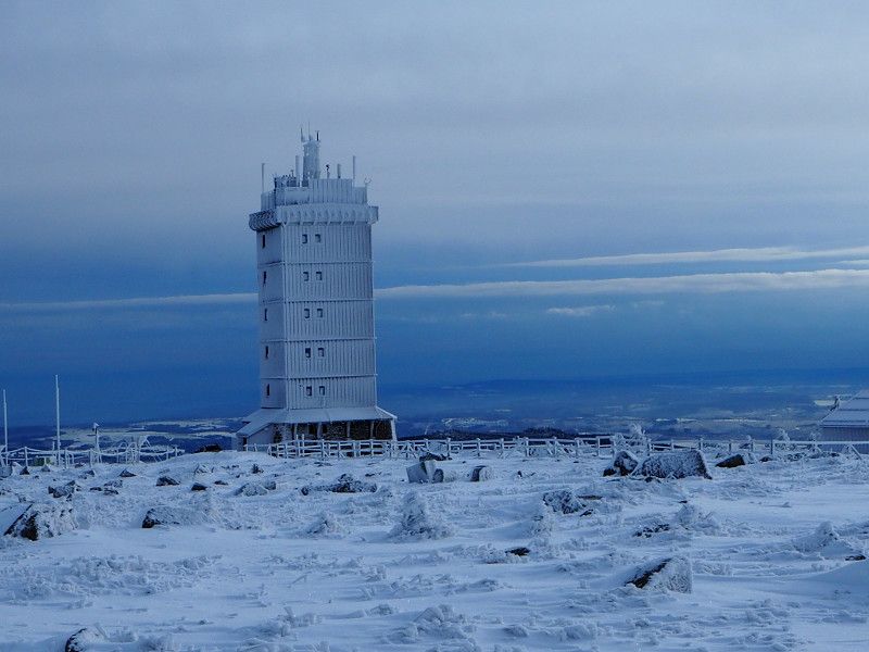
After we got to know Sweden on a few summer trips, a winter trip to the winter market in Jokkmokk and the surrounding area is now on the agenda. We will start our tour on January 16th, 2023 in Weisenbach and make the first stop in Wernigerode. If the weather cooperates, a hike to the Brocken is planned. The next destination will then be Kiel on January 20th, 2023, where we will use the ferry to Gothenburg in the evening.
Unfortunately, the map does not record the ferry connection, which has a negative effect on the km indication.
Day
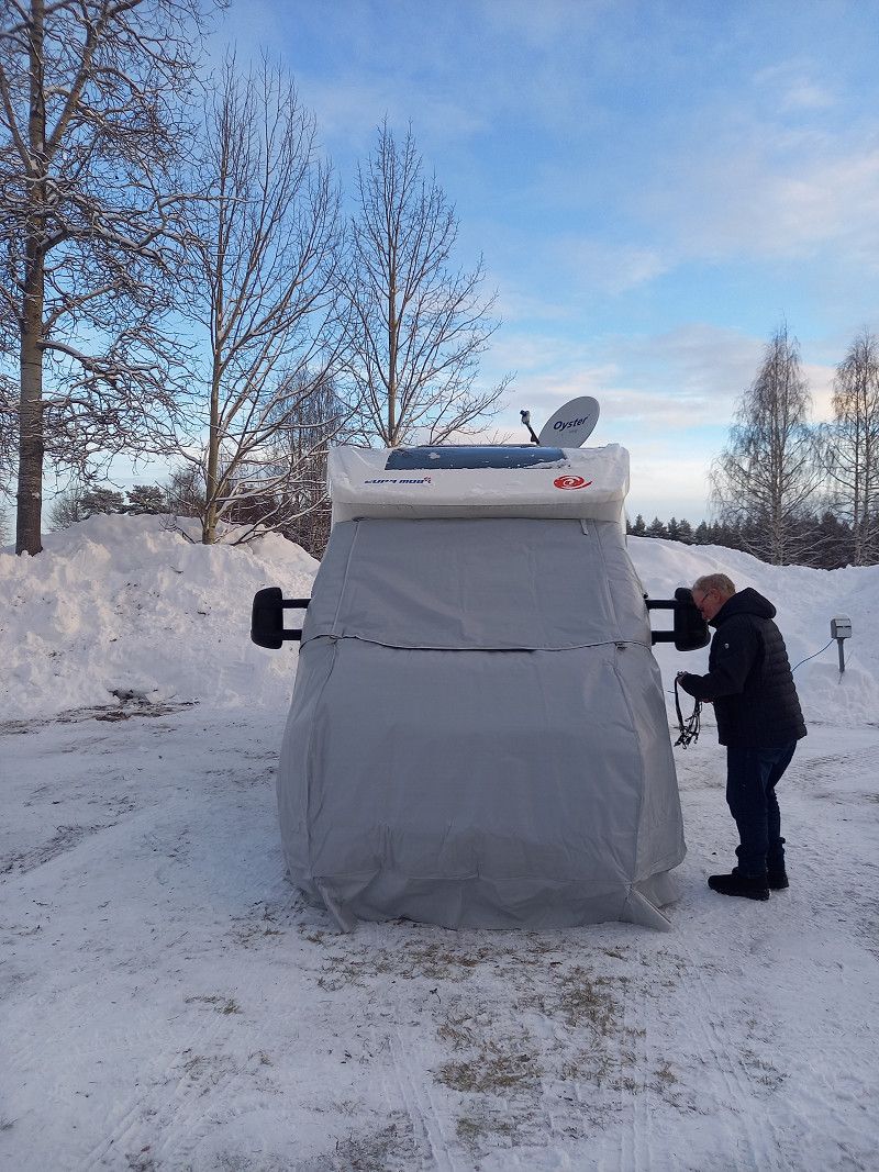
Weisenbach, Deutschland
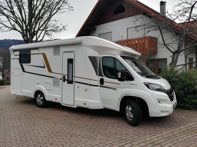
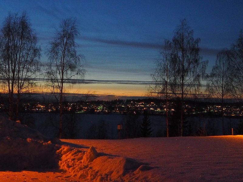
Finally the time has come.
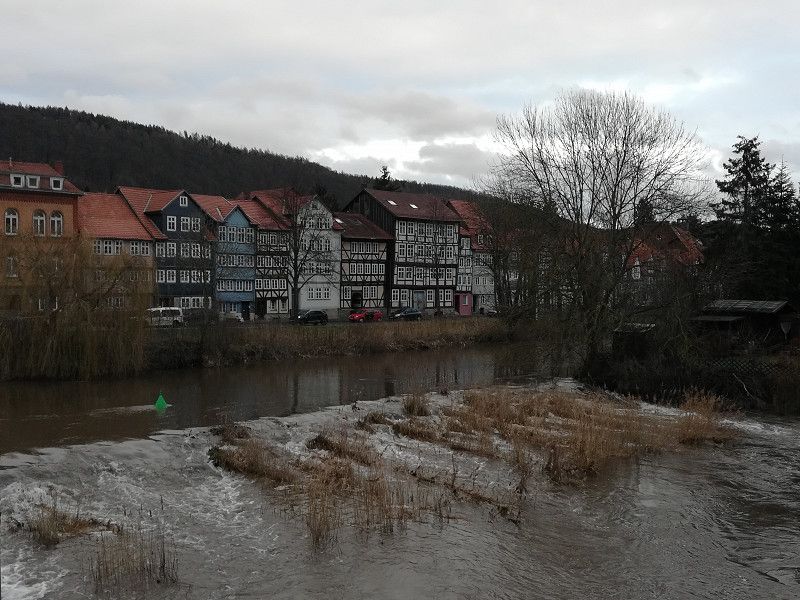
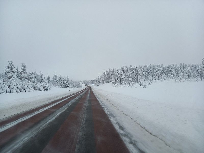
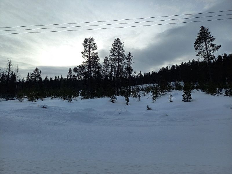
The Womo packed and headed north. Via Frankfurt, Kassel in the rain and sleet to Hann.Münden, where we visited the beautiful old town and spent the night on a parking space near the old town.
76599 Weisenbach, Germany
48° 43' 44" N 8° 21' 16" E
48.7288830 8.3544377
• Head toward An der Murg on Hauptstraße (B462). Go for 19.4 km.
• Take ramp onto A5. Go for 125 km.
• Take the exit toward Hannover/Kassel/Frankfurt/Darmstadt onto A5. Go for 111 km.
• Take left exit 4 toward Kassel/Dortmund onto A49. Go for 79.2 km.
• Take exit 7 toward Hannover/Frankfurt onto A44. Go for 4.7 km.
• Take the left exit toward Hamburg/Hannover/Kassel onto A7. Go for 101 km.
• Take exit 66 toward Rhüden/Harz/Lamspringe/Bad Harzburg/Goslar. Go for 355 m.
• Turn right onto B82 toward Bad Harzburg/Goslar/Langelsheim. Go for 20.3 km.
• Turn left onto B82 toward Bad Harzburg/GS-Zentrum/B6. Go for 688 m.
• Turn right onto B6 toward Braunschweig/A36/B82/Wernigerode/Bad Harzburg/GS-Zentrum. Go for 11.4 km.
• Take ramp onto A369. Go for 4.6 km.
• Continue on A36. Go for 14.5 km.
• Take exit 18 toward Wernigerode-Nord Gewerbegebiet/Schierke/B244. Go for 345 m.
• Turn right onto Hasseröder Straße toward Elbingerode/Schierke/Gewerbegebiet WR Nord-West. Go for 3.0 km.
• Turn right onto Hasseröder Straße. Go for 340 m.
• Turn left onto Ilsenburger Straße (L85) toward Elbingerode/B244/Schierke/WR-Zentrum. Go for 1.9 km.
• Turn left onto Alte Poststraße (B244) toward Helmstedt/Halberstadt/Zentrum. Go for 578 m.
• Turn right onto Bahnhofstraße. Go for 51 m.
• Continue on Heltauer Platz. Go for 106 m.
• Take the 2nd exit from roundabout onto Pfarrstraße. Go for 174 m.
• Arrive at Pfarrstraße. Your destination is on the left.
☍
498,8 km
(4 hrs. 43 min.)
Day
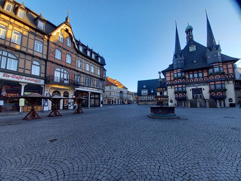
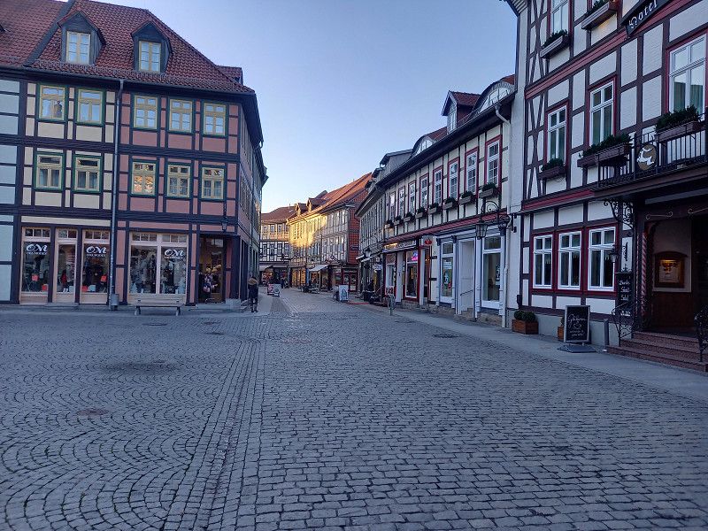
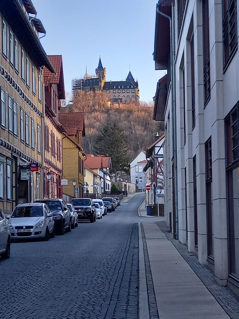
Wernigerode, Deutschland
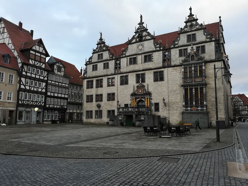
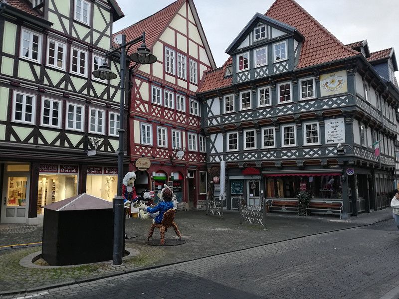
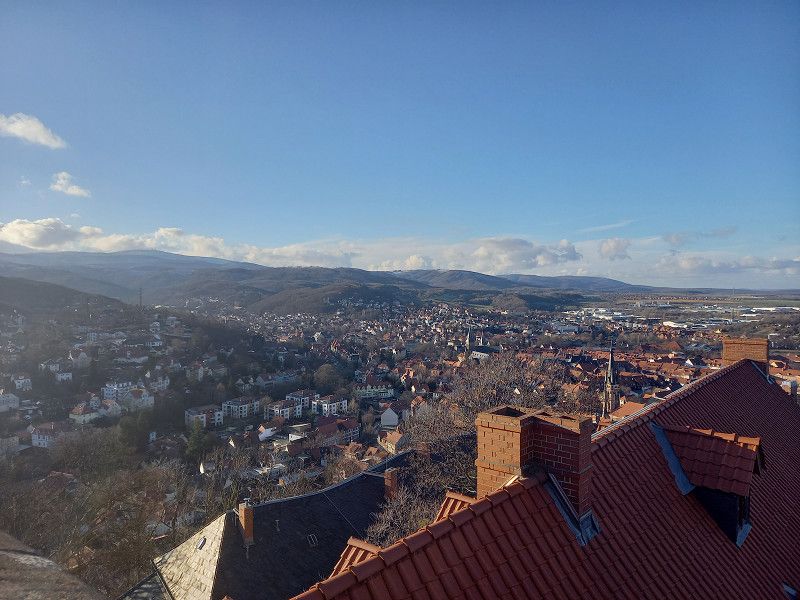
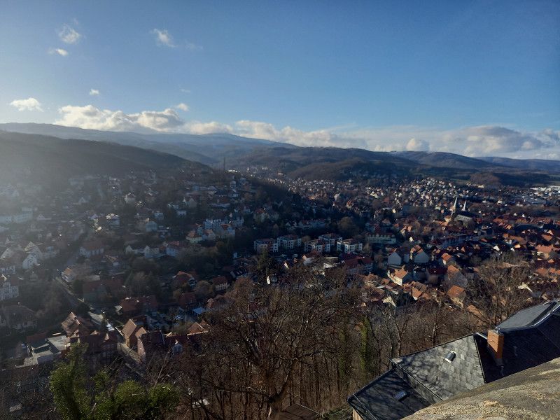
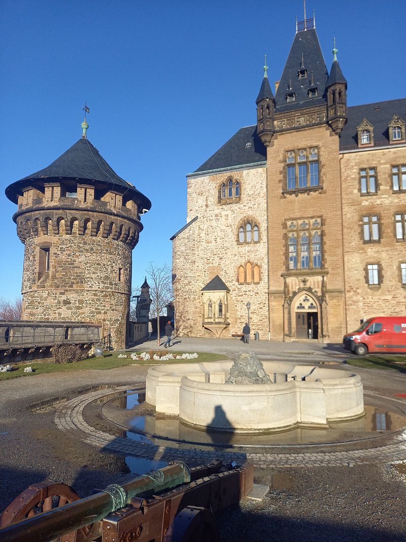
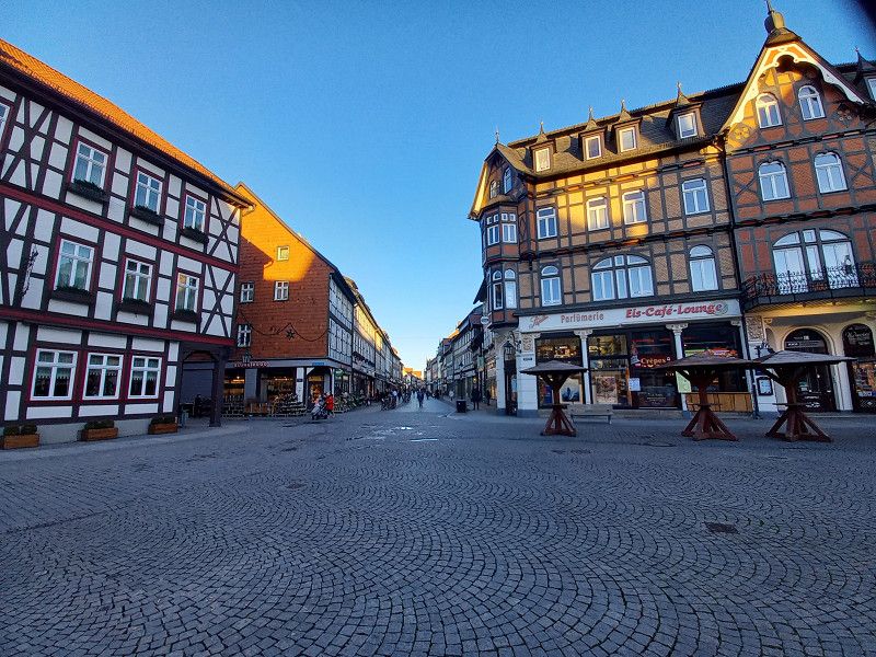
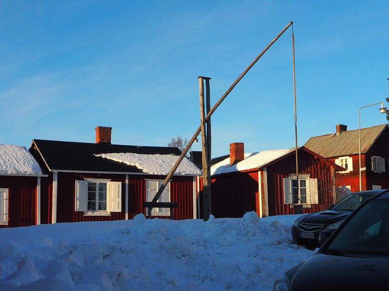
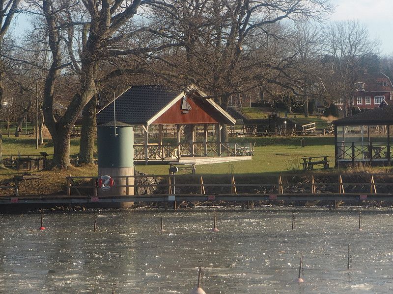
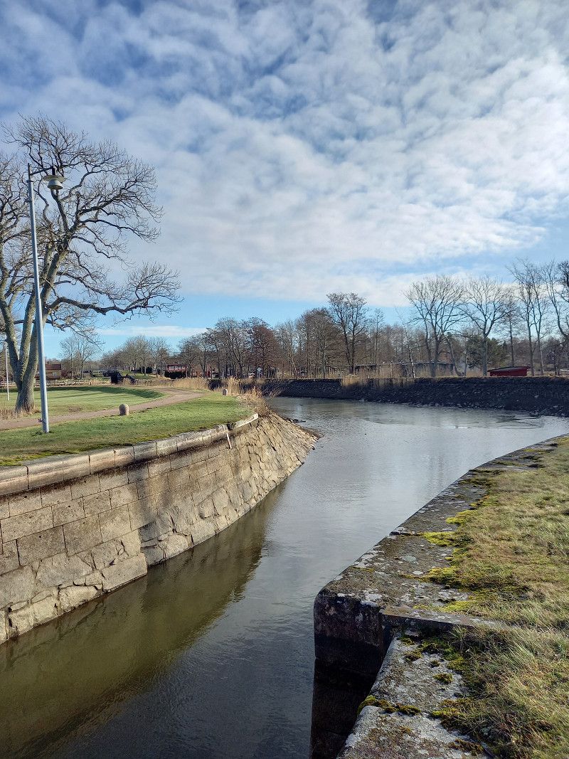
City tour: City Hall, Marktstraße in the old town with wonderful half-timbered houses and a trip to Wernigerode Castle in wonderful weather with a unique view of the city.
Wernigerode, Germany
51° 50' 12.5" N 10° 47' 3.9" E
51.8368113 10.7844266
• Head east on Pfarrstraße. Go for 119 m.
• Turn left onto Albert-Bartels-Straße. Go for 152 m.
• Turn left onto Bahnhofstraße (B244). Go for 195 m.
• Turn right onto Altstadtkreisel (L86). Go for 271 m.
• Turn left onto Am Katzenteich. Go for 111 m.
• Turn left. Go for 35 m.
• Turn right. Go for 69 m.
• Arrive at your destination on the left.
☍
1,0 km
( 3 min.)
Day
Wernigerode Tag 2
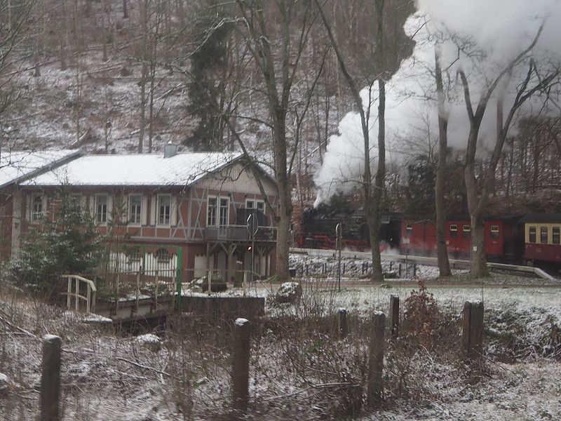
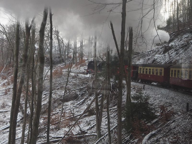
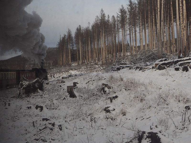
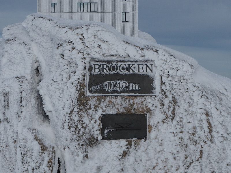
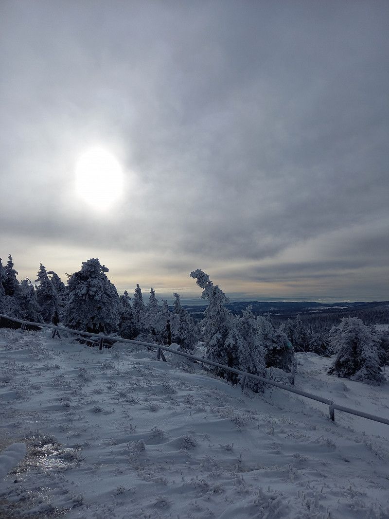
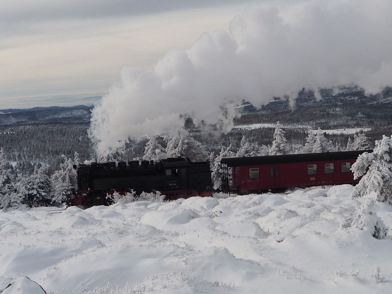
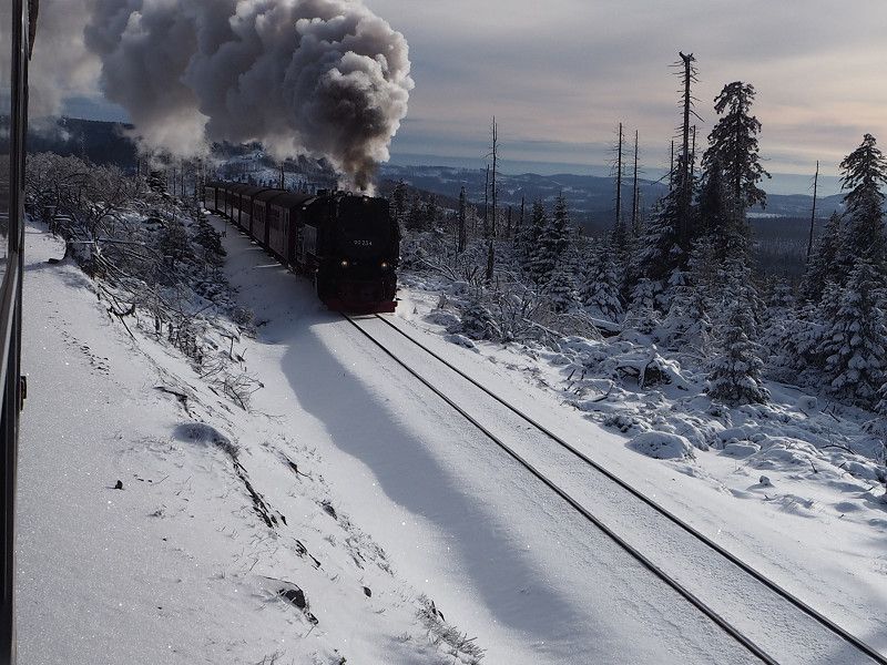
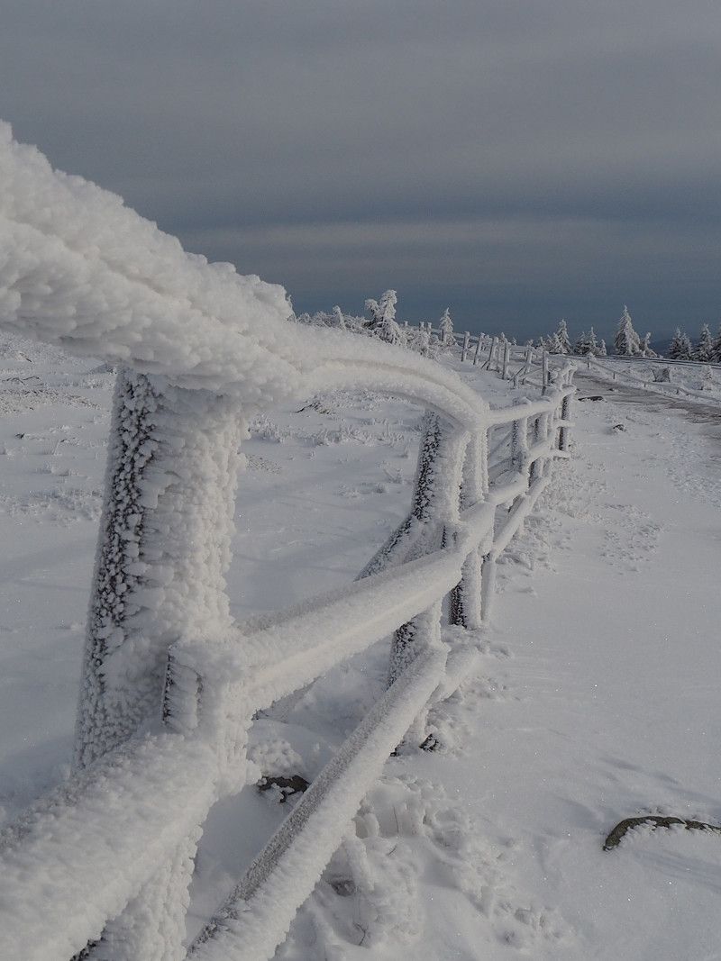
Ride on the Harz narrow-gauge railway to the Brocken. At -7 degrees, no wind, wonderful tour around the Brocken, very interesting visit to the Brocken Museum with "stairs" ascent to the former listening booth.
Am Katzenteich, 38855, Wernigerode, Germany
51° 50' 18" N 10° 46' 52" E
51.8383333 10.7811111
• Head northeast. Go for 69 m.
• Turn left toward Am Katzenteich. Go for 35 m.
• Turn right onto Am Katzenteich. Go for 111 m.
• Turn left onto Dornbergsweg (L86). Go for 733 m.
• Take the 2nd exit from roundabout onto Dornbergsweg (L86). Go for 1.0 km.
• Take the 3rd exit from roundabout onto An der Teichmühle (B244). Go for 3.1 km.
• Turn left onto Hasseröder Straße (B244S) toward Goslar/A36/Blankenburg/Gewerbegebiet WR Nord-West. Go for 720 m.
• Turn left and take ramp onto A36 toward Goslar. Go for 15.2 km.
• Take exit 14 toward Hannover/Braunschweig/Vienenburg-Ost onto A36. Go for 35.3 km.
• Continue on B4. Go for 524 m.
• Take ramp onto A39 toward Kassel/Lüneburg/Celle/Hannover/BS-Südwest. Go for 1.1 km.
• Take exit 35 toward Hannover/Lüneburg/Celle/BS-Gartenstadt onto A391. Go for 12.6 km.
• Continue on B4. Go for 26.0 km.
• Pass 3 roundabouts and continue on B4. Go for 80.2 km.
• Keep left onto Harz-Heide Straße (B4) toward Lüneburg/Stadtmitte. Go for 513 m.
• Take the 2nd exit from roundabout onto Harz-Heide Straße. Go for 137 m.
• Continue on Neu-Häcklingen. Go for 205 m.
• Continue on Harz-Heide Straße. Go for 86 m.
• Continue on Uelzener Straße. Go for 1.3 km.
• Continue on Universitätsallee. Go for 828 m.
• Continue on Willy-Brandt-Straße. Go for 2.2 km.
• Arrive at Willy-Brandt-Straße. Your destination is on the left.
☍
182,1 km
(2 hrs. 21 min.)
Day
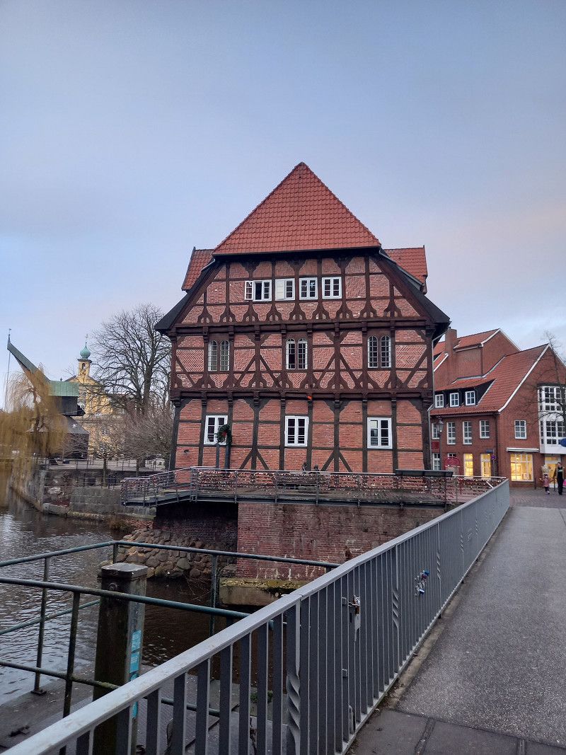
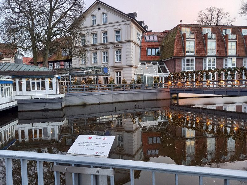
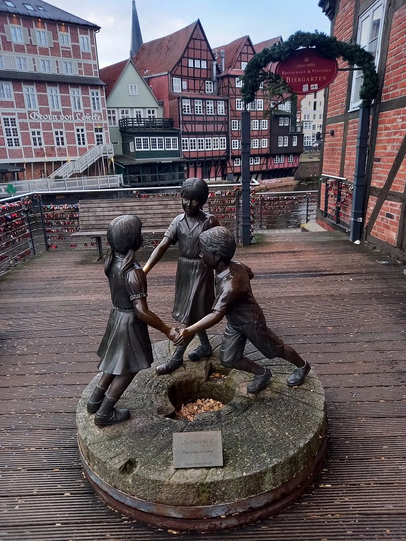
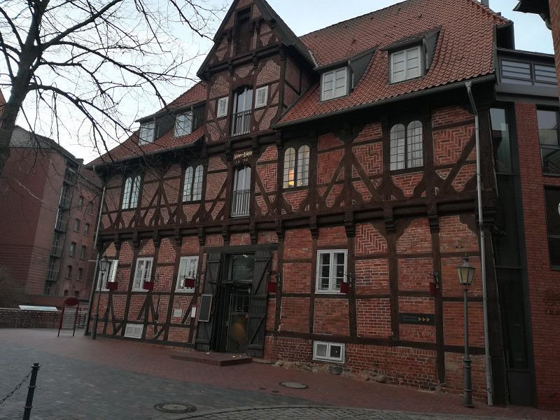
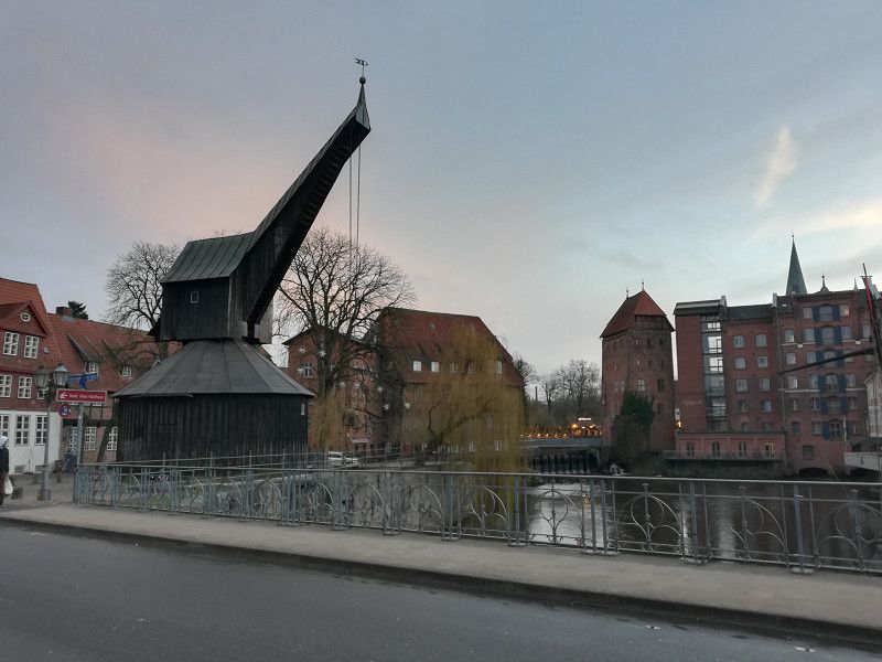
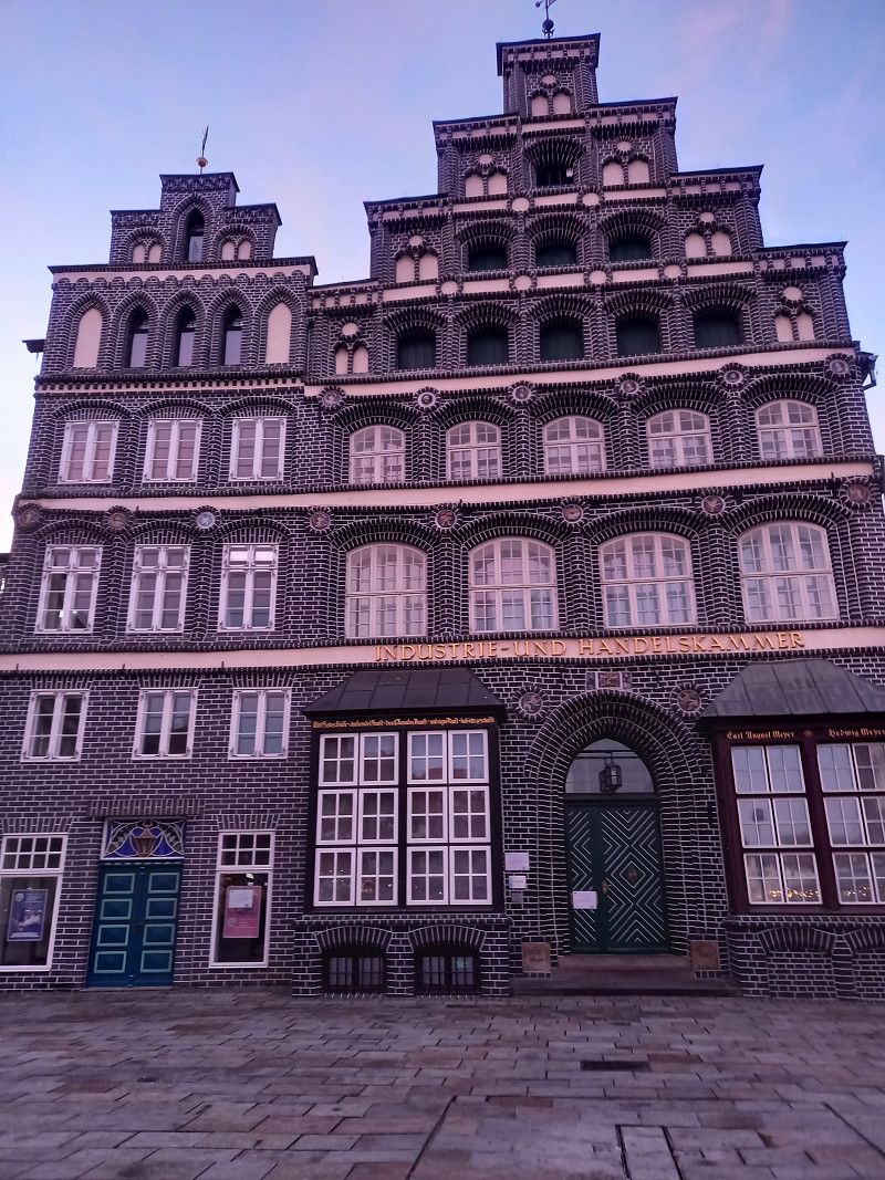
Lüneburg, Deutschland
Continue on the A391 and B4 to Lüneburg in sunshine. Tour of the old town in Lüneburg. Overnight stay at the Sülzwiesen campsite.
Lüneburg, Germany
53° 14' 52.3" N 10° 24' 57.8" E
53.2478704 10.4160637
• Head north on Willy-Brandt-Straße.
• Continue on Schießgrabenstraße. Go for 379 m.
• Continue on Am Schifferwall. Go for 169 m.
• Continue on Bockelmannstraße. Go for 2.0 km.
• Continue on Bockelmannstraße (B209). Go for 103 m.
• Take ramp onto B4 toward Berlin/Hamburg/Bardowick/Gewerbegebiet Goseburg. Go for 2.4 km.
• Continue on A39. Go for 31.4 km.
• Continue on A7. Go for 18.8 km.
• Keep right onto A7. Go for 74.0 km.
• Keep right onto A215 (Autobahndreieck Bordesholm) toward Kiel. Go for 20.9 km.
• Continue on Schützenwall (L325) toward Zentrum/Wunderino Arena. Go for 1.2 km.
• Turn right onto Exerzierplatz (L194) toward Ostufer/Fähre. Go for 671 m.
• Keep left onto Bollhörnkai. Go for 385 m.
• Continue on Schwedenkai. Go for 72 m.
• Turn right. Go for 43 m.
• Arrive at your destination on the right.
☍
152,6 km
(1 hrs. 32 min.)
Day
Schwedenkai Kiel, Deutschland
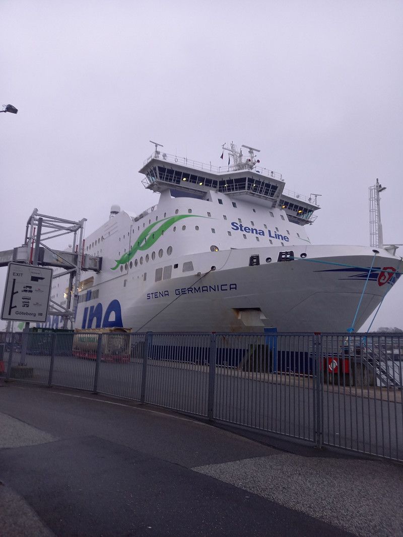
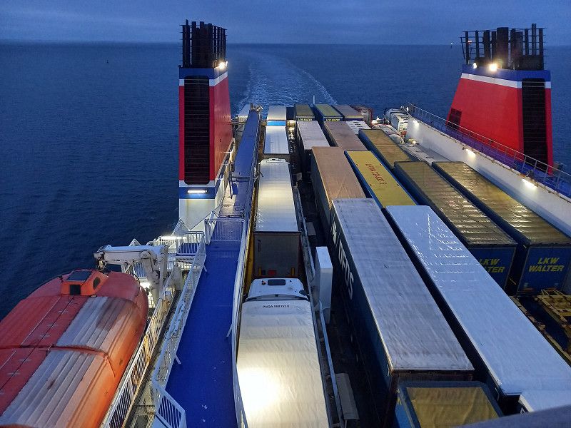
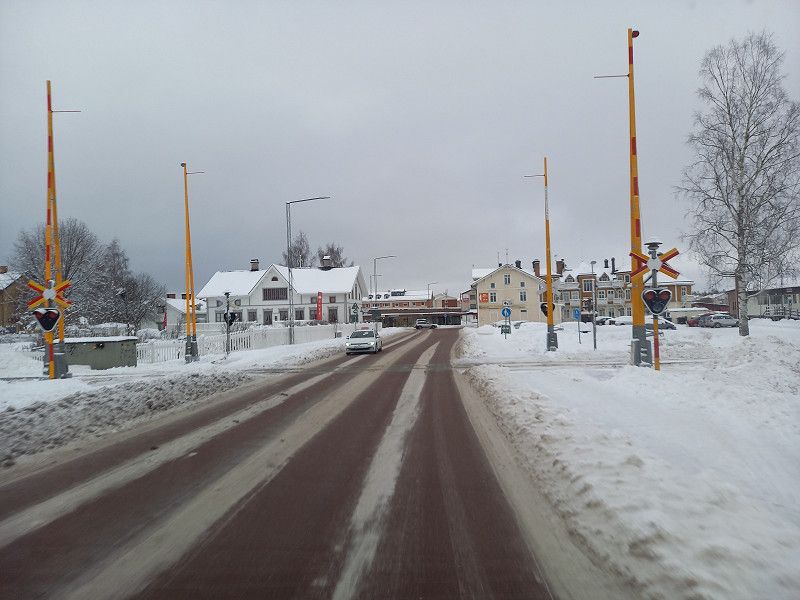
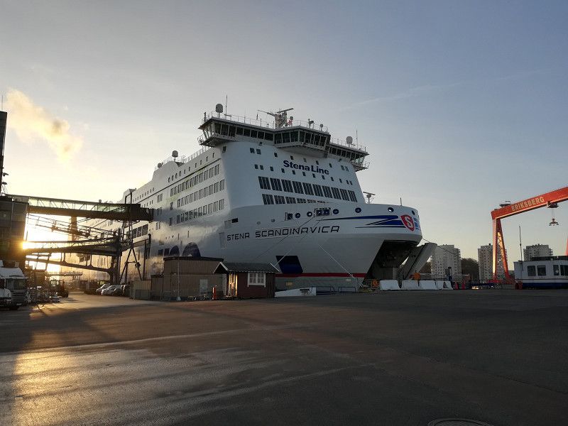
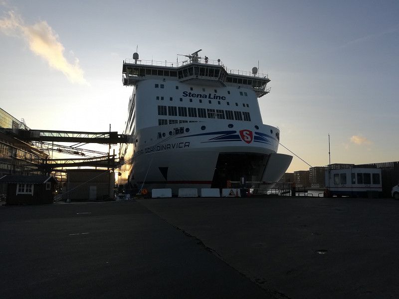
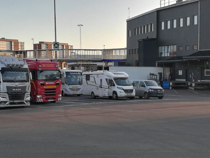
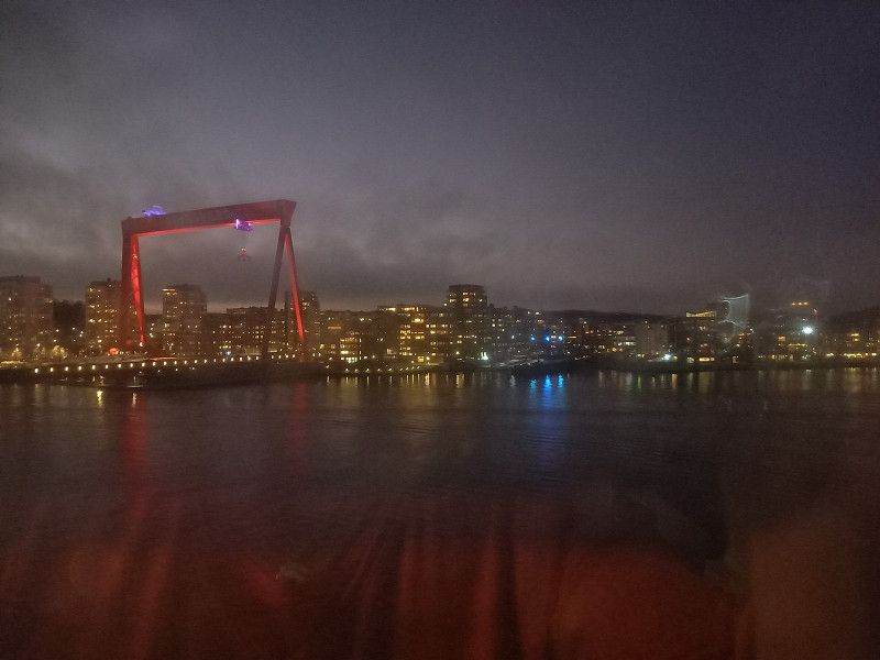
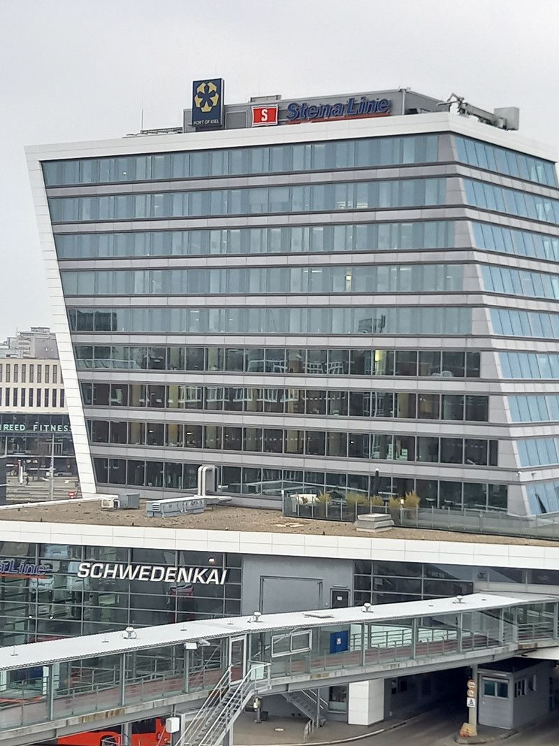
Continue to Kiel. A short flying visit to a shopping street before boarding the Stena Germanica at 5 p.m. for the crossing to Gothenburg. After the Womo was well stowed away, we went to the Skand. Buffet on deck 7. Then a deck tour before we went to our cabin.
Schwedenkai 1, 24103 Kiel, Deutschland
54° 19' 12" N 10° 8' 20.8" E
54.3200075 10.1391171
• Head southeast. Go for 72 m.
• Turn right onto Schwedenkai. Go for 142 m.
• Turn left onto Kaistraße (L321). Go for 304 m.
• Turn right onto Stresemannplatz (L194). Go for 715 m.
• Turn left onto Schützenwall (L325). Go for 1.2 km.
• Continue on A215 toward Hamburg/A7/Flensburg/A210/Rendsburg/Ki-Mettenhof/Eckernförde/B76/Flughafen. Go for 3.0 km.
• Take the exit toward Flensburg/Rendsburg onto A210. Go for 20.6 km.
• Take exit 3 toward Flensburg onto A7. Go for 64.3 km.
• Continue on E45 (Sønderjyske Motorvej). Go for 89.5 km.
• Keep right onto E20 (Kolding) toward Odense/Fredericia. Go for 209 km.
• Continue on E20 (Avedøre) toward Malmø/Lufthavn/København C. Go for 27.7 km.
• Continue on E20 (Öresundsbron). Go for 27.8 km.
• Continue on E6/E20 toward E4/Göteborg/Stockholm. Go for 56.8 km.
• Continue on E6/E20 toward Göteborg/Höganäs/111/Helsingborg N. Go for 199 km.
• Take exit 66 toward Göteborg V/Mölndal S C/Göteborg västra/Åby onto E6.20 (Söderleden). Go for 11.7 km.
• Keep left onto Västerleden (E45.1) toward E20/Stockholm/Centrum. Go for 1.1 km.
• Take ramp toward Kiel. Go for 169 m.
• Turn slightly left onto Majnabbegatan. Go for 70 m.
• Turn left onto Adolf Edelsvärds gata. Go for 50 m.
• Turn right onto Elof Lindälvs gata. Go for 414 m.
• Arrive at Elof Lindälvs gata. Your destination is on the right.
☍
713,7 km
(6 hrs. 55 min.)
Day
Stena Line, Elof Lindälvs gata, 414 55 Göteborg, Schweden
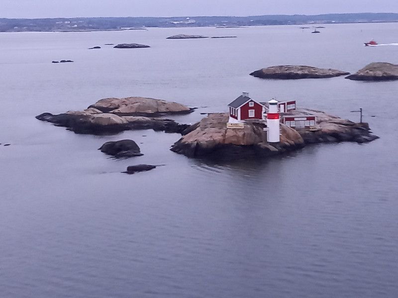
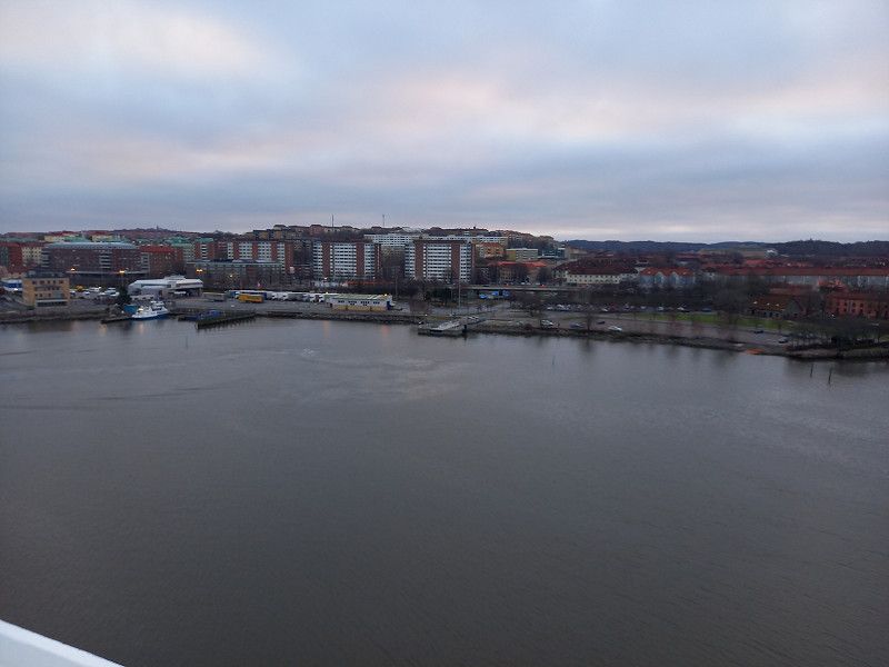
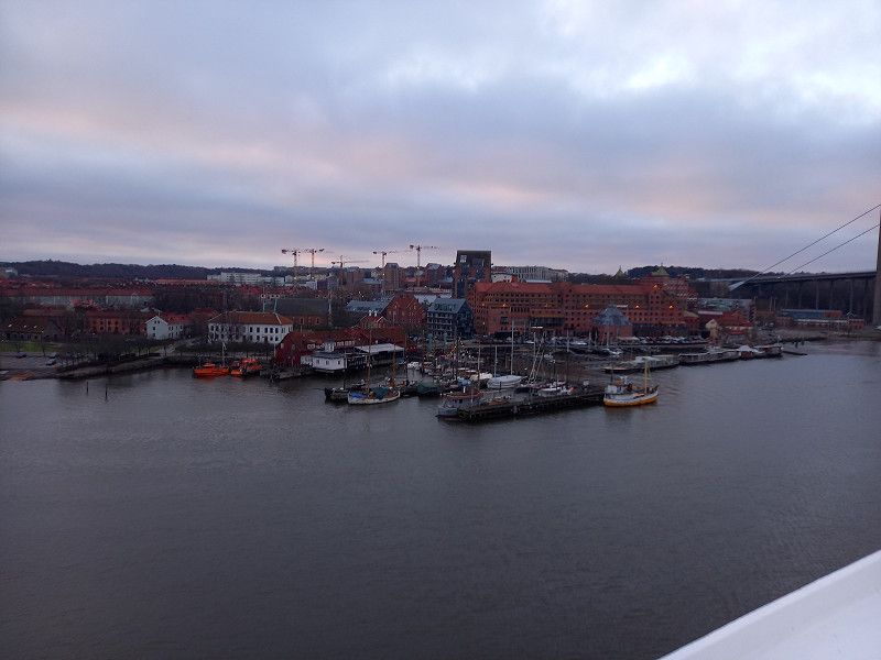
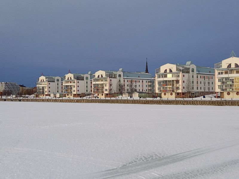
Morning arrival at the port of Gothenburg and check out. Continue on the roads 190 and E 20 towards Falköping through a powdery landscape to the Mösseberg campsite, which is located on a hill.
Elof Lindälvs gata 11, 414 55 Göteborg, Schweden
57° 41' 42.2" N 11° 54' 52.2" E
57.6950543 11.9144881
• Head west on Elof Lindälvs gata. Go for 378 m.
• Turn slightly left onto Elof Lindälvs gata. Go for 29 m.
• Turn left onto Adolf Edelsvärds gata. Go for 50 m.
• Turn right onto Majnabbegatan. Go for 70 m.
• Turn left and take ramp onto Oscarsleden (E45.1) toward E20/E45/40/Centrum. Go for 6.2 km.
• Take left ramp onto Partihallsviadukten (E20) toward Stockholm. Go for 43.5 km.
• Take the 2nd exit from roundabout onto Sveaplan (E20) toward 180/Stockholm. Go for 22.8 km.
• Take ramp toward 181/Falköping/Herrljunga. Go for 206 m.
• Take the 1st exit from roundabout onto 181 toward Falköping/Herrljunga. Go for 13.8 km.
• Take the 2nd exit from roundabout onto Ringleden (181). Go for 1.4 km.
• Turn right onto Stora Skolgatan (181/183). Go for 1.9 km.
• Turn left onto 181. Go for 27.2 km.
• Turn right onto Gökhem Anguntorp (47). Go for 4.4 km.
• Turn left toward Falköping V. Go for 112 m.
• Continue on Marka Skyberg. Go for 1.6 km.
• Continue on Göteborgsvägen. Go for 1.3 km.
• Take the 2nd exit from roundabout onto Danska vägen. Go for 1.1 km.
• Take the 3rd exit from roundabout onto Scheelegatan. Go for 2.3 km.
• Turn left onto Mössebergs camping. Go for 199 m.
• Arrive at Mössebergs camping. Your destination is on the left.
☍
128,4 km
(1 hrs. 40 min.)
Day
Mössebergs Camping & Stugby AB, Scheelegatan, Falköping, Schweden
An overcast day in Falköping, Mösseberg campsite. Evening walk and spectators at a downhill race of young Swedish skiers.
Scheelegatan, 521 30 Falköping, Schweden
58° 10' 33.2" N 13° 31' 38" E
58.1758881 13.5272179
• Head toward Mösseberg Liastugan on Mössebergs camping. Go for 199 m.
• Turn right onto Scheelegatan. Go for 2.3 km.
• Take the 3rd exit from roundabout onto Danska vägen. Go for 2.0 km.
• Turn left onto Norra Tvärvägen (184). Go for 24.1 km.
• Turn left toward Stockholm/Mariestad. Go for 85 m.
• Take ramp. Go for 140 m.
• Turn right onto E20. Go for 55.7 km.
• Turn left onto 26 toward Mora/Kristinehamn/Gullspång. Go for 36.9 km.
• Turn right onto Rudskogavägen (204) toward Örebro/Karlskoga/Svartå. Go for 14.9 km.
• Continue on 243. Go for 15.8 km.
• Turn right onto Nysundsvägen (243). Go for 279 m.
• Turn left onto Jannelundsvägen (205/243). Go for 170 m.
• Pass 4 roundabouts and continue on Degerforsvägen (205/243). Go for 9.9 km.
• Continue on Degerforsvägen (205/243). Go for 1.7 km.
• Take the 1st exit from roundabout onto Örebrovägen (E18) toward Stockholm/Nora. Go for 1.1 km.
• Take the 2nd exit from roundabout onto Viaduktgatan toward Centrum. Go for 163 m.
• Take the 1st exit from roundabout onto Loviselundsvägen. Go for 421 m.
• Take the 2nd exit from roundabout onto Bergrumsvägen. Go for 264 m.
• Turn left onto Herrgårdsvägen. Go for 64 m.
• Continue on Bergrumstigen. Go for 36 m.
• Arrive at Bergrumstigen. Your destination is on the left.
☍
166,2 km
(2 hrs. 11 min.)
Day
Karlskoga, Schweden
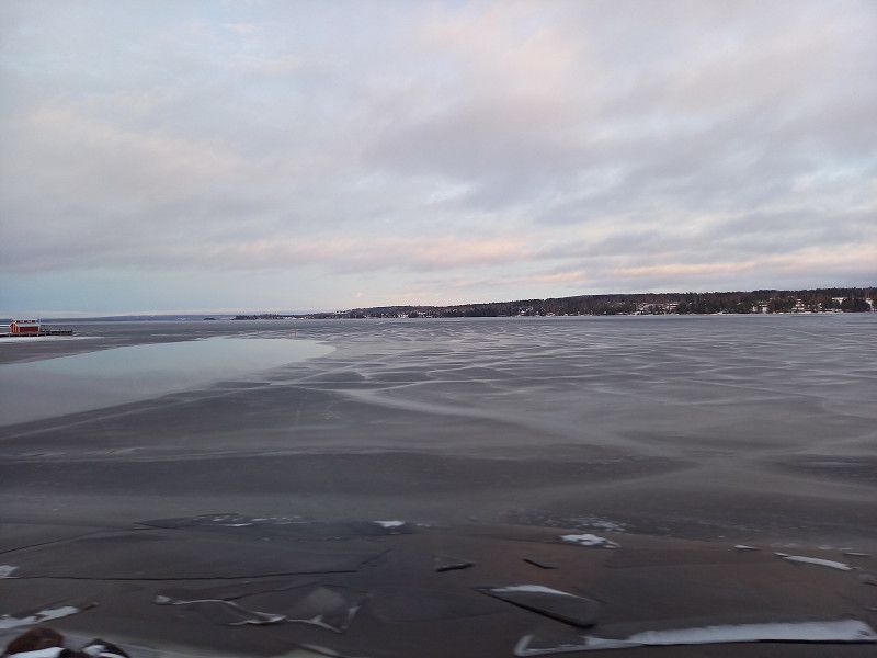
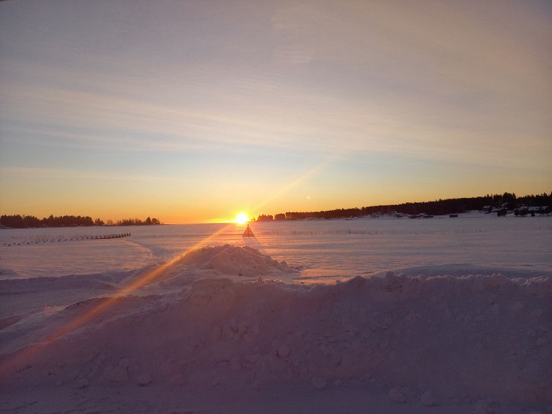
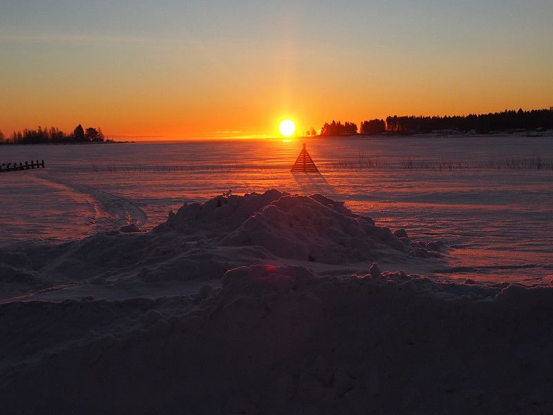
In search of an LPG filling station (Autogas) we had to make an unscheduled stop in Karlskoga, as the filling stations were only open again on Mondays. The LPG filling stations are very sparsely located in Sweden, therefore: take precautions and inform yourself in good time!!
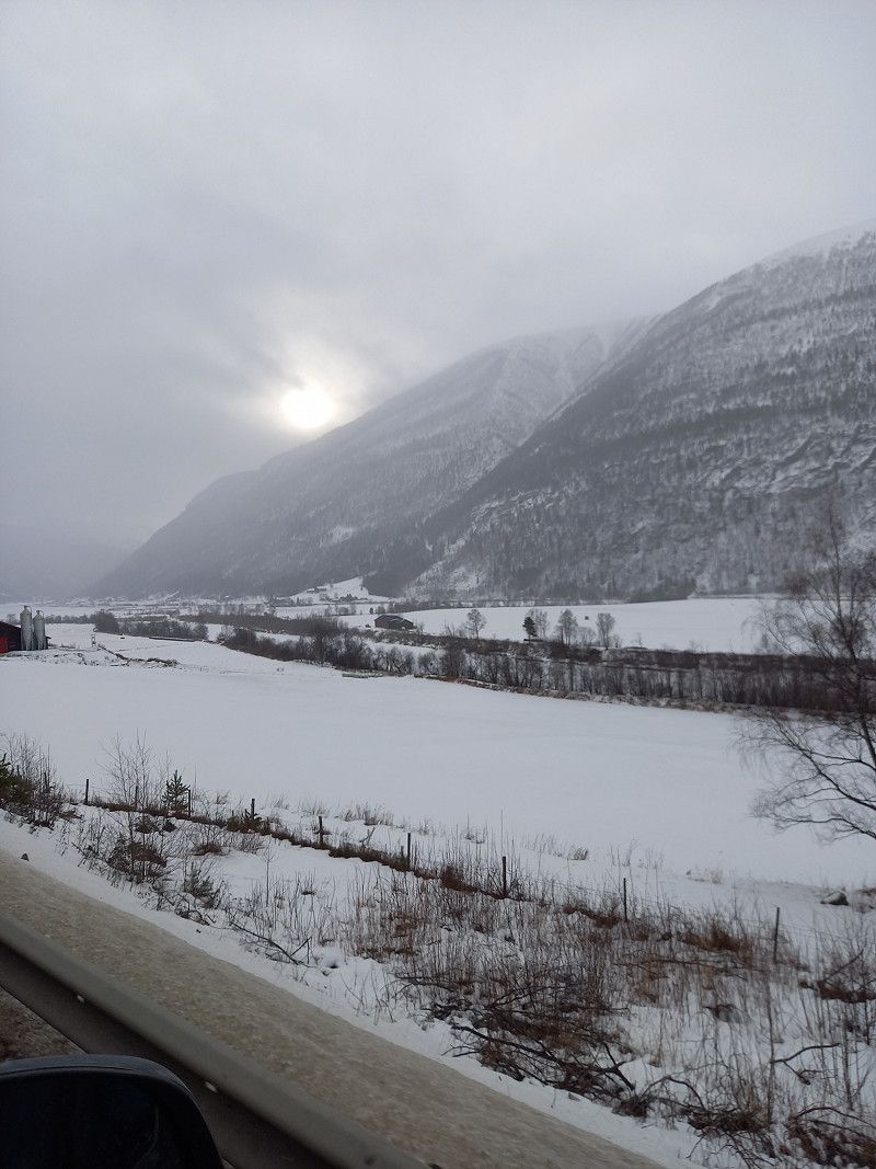
Overnight in a public parking lot by a snowy frozen lake.
Karlskoga, Sweden
59° 19' 43.1" N 14° 32' 11.1" E
59.3286340 14.5364140
• Head south on Bergrumstigen. Go for 36 m.
• Continue on Herrgårdsvägen. Go for 64 m.
• Turn right onto Bergrumsvägen. Go for 204 m.
• Take the 1st exit from roundabout onto Boåsvägen. Go for 701 m.
• Turn left onto Filipstadsvägen. Go for 792 m.
• Turn left onto Norrleden. Go for 879 m.
• Take the 1st exit from roundabout onto Filipstadsvägen (205). Go for 4.3 km.
• Turn left onto 237. Go for 23.5 km.
• Turn right onto 26. Go for 456 m.
• Pass 3 roundabouts and continue on Nykroppavägen (26). Go for 21.3 km.
• Turn right onto Hertig Karlsgatan (26/63) toward Ludvika/Mora. Go for 8.6 km.
• Turn left onto 26 toward Mora/Lesjöfors. Go for 87.7 km.
• Turn left and take ramp onto Järnavägen (E16) toward Gävle/Mora/Västerås. Go for 406 m.
• Take the 3rd exit from roundabout onto Moravägen (26) toward Mora. Go for 37.7 km.
• Continue on Johannisholm (E45) toward Mora. Go for 26.1 km.
• Turn right onto Ryssa bygata toward Ryssa/Leksand/Sollerön/Gesunda. Go for 1.5 km.
• Continue on Bönhusvägen. Go for 74 m.
• Continue on Ryssa bygata. Go for 3.0 km.
• Continue on Gesundavägen. Go for 1.9 km.
• Turn left onto Siljansvägen. Go for 1.4 km.
• Continue on Soldvägen. Go for 1.6 km.
• Turn right onto Jugen Jons väg. Go for 21 m.
• Turn slightly right toward Soldvägen. Go for 182 m.
• Continue on Soldvägen. Go for 26 m.
• Arrive at Soldvägen. Your destination is on the right.
☍
222,5 km
(2 hrs. 36 min.)
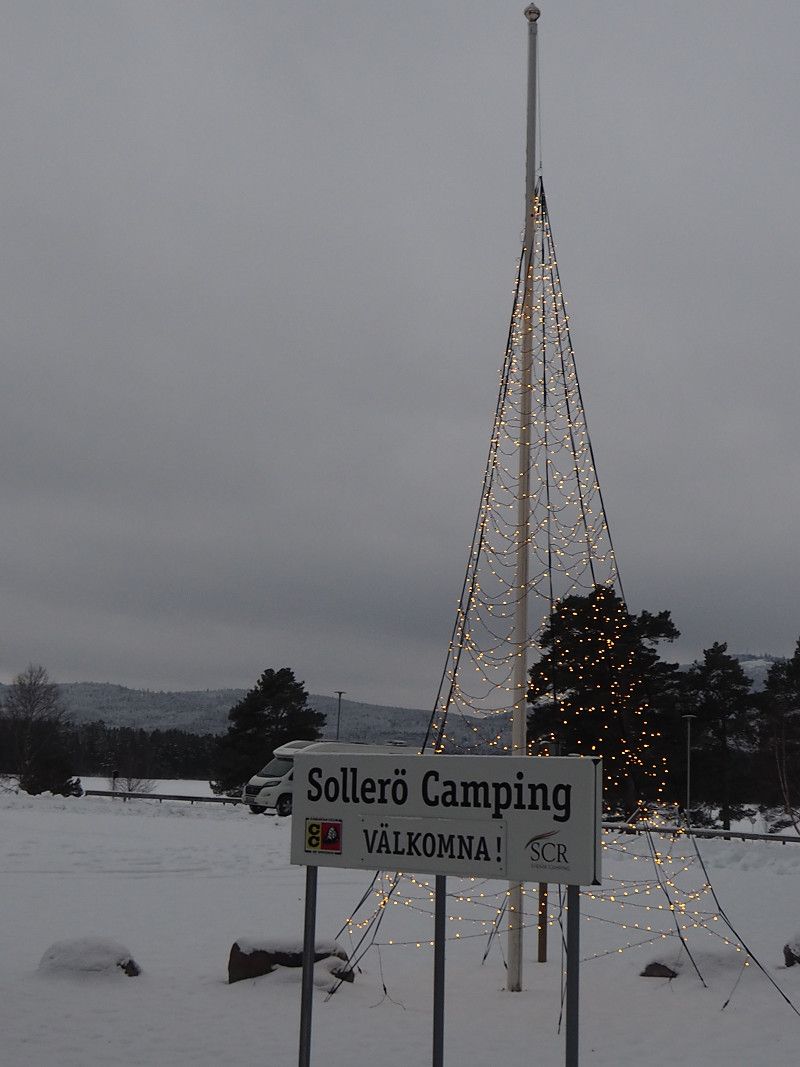
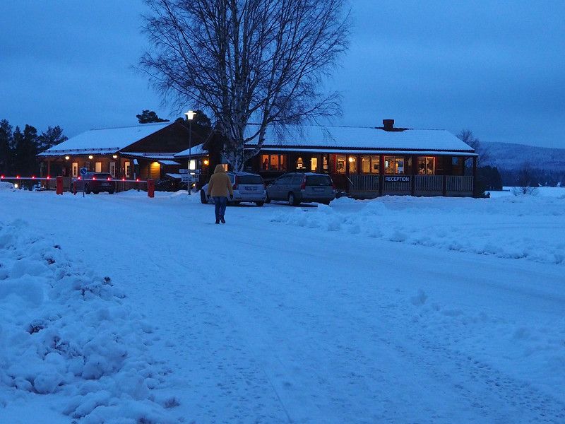
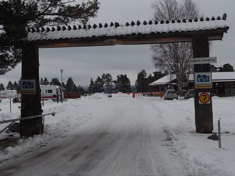
Day
Ccs Sollerö Camping
Instead of the planned stop at a campsite in Eg, we drove further north to the campsite in Sollerö, where we had already stopped twice in previous years. Here we stay 2 days and tomorrow maybe go skiing and/or visit Tomte (Santa Claus) in nearby Tomteland where we will send mail/greetings for our grandchildren (as promised).
It's evening and it's starting to snow again.
Levsnäs, 79290, Sollerön, Sweden
60° 54' 4" N 14° 34' 54" E
60.9011100 14.5816700
• Head toward Roteslogsvägen on Soldvägen. Go for 187 m.
• Continue on Jugen Jons väg. Go for 135 m.
• Turn left onto Jugen Jons väg. Go for 75 m.
• Turn right onto Soldvägen. Go for 2.6 km.
• Continue on Sundsvägen. Go for 1.3 km.
• Continue on Sundsvägen. Go for 2.4 km.
• Continue on Sundet. Go for 692 m.
• Continue on Sundsvägen. Go for 4.2 km.
• Continue on Vinäs byväg. Go for 1.6 km.
• Turn right onto E45 toward Mora. Go for 2.4 km.
• Pass 4 roundabouts and continue on Vasagatan (E45). Go for 3.1 km.
• Take the 2nd exit from Cirkulationsplats Broåkern roundabout onto Vasagatan (E45). Go for 1.4 km.
• Take the 3rd exit from roundabout onto E45 toward Östersund/Sjukhus. Go for 876 m.
• Pass 3 roundabouts and continue on E45. Go for 74.9 km.
• Turn right onto Västbacka Hamravägen (310) toward Ljusdal/Los. Go for 24.6 km.
• Turn left onto Los Kyrkbyväg (296). Go for 33.8 km.
• Turn left onto Härjedalsvägen (84/296). Go for 3.0 km.
• Turn right onto Ytterhogdalsvägen (296) toward E45/Östersund/Ytterhogdal. Go for 22.6 km.
• Turn right onto E45. Go for 69.6 km.
• Turn right onto Olstavägen. Go for 79 m.
• Arrive at Olstavägen. Your destination is on the right.
☍
249,7 km
(2 hrs. 55 min.)
Day
Sollerö Tag 2
Planned visit to Santa Claus unfortunately failed, he was now on vacation after the stressful Christmas season.
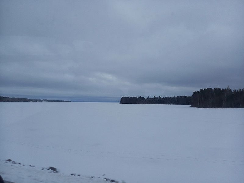
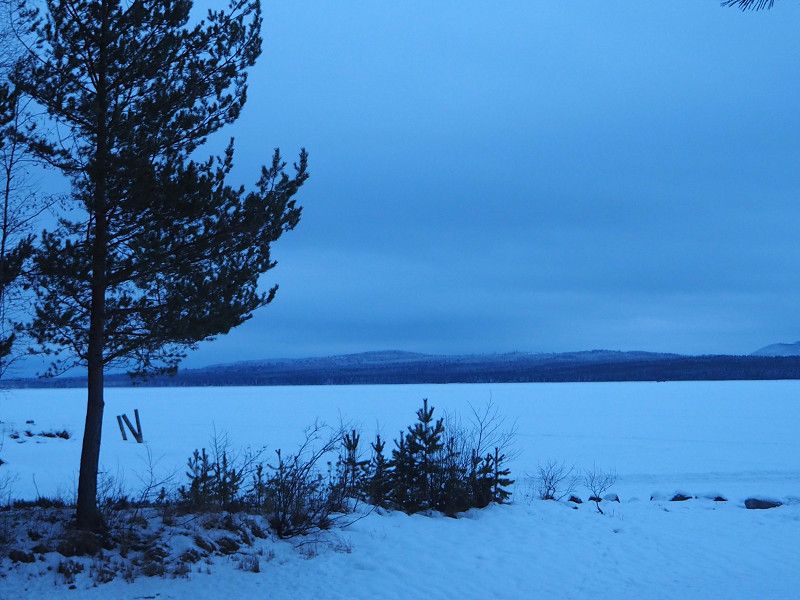
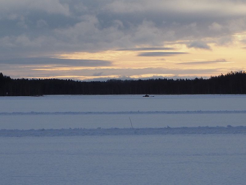
Round trip around Lake Siljan, which was mostly frozen and on which numerous ice skaters were out and about.
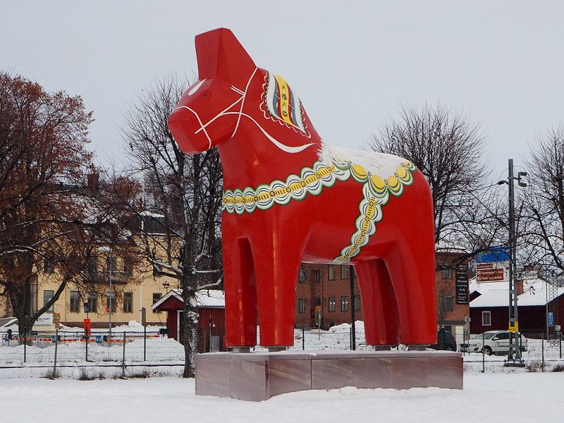
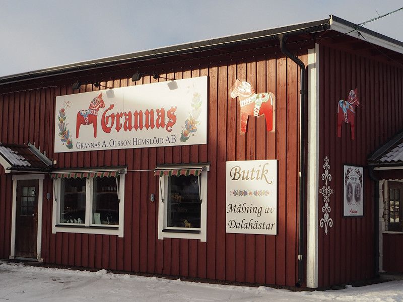
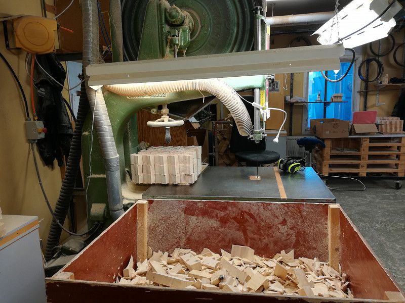
City tour of Mora, where an oversized Dalarna horse is displayed on the edge of the lake. Afterwards visit to the production site of the Dalarna horses, which are all made exclusively by hand, in Nusnäs.
Via the town of Rättvik, where we also made a short stopover, we went back to Sollerö at the campsite.
In the evening it began to rain, resulting in a glassy campsite that had to be walked on with caution.
Day
Åsarna Skicenter
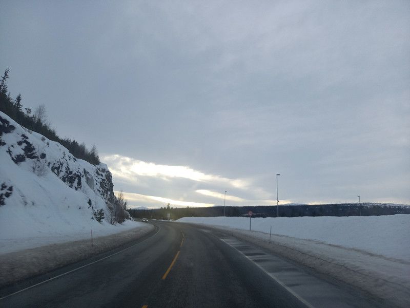
The onward journey this morning was delayed because of the mirror-smooth, icy square. It went in the direction of Orsa to the Asarna ski center over various snow-covered roads and required prudent action from the driver.
After this technically strenuous day, we arrived safely at our planned destination.
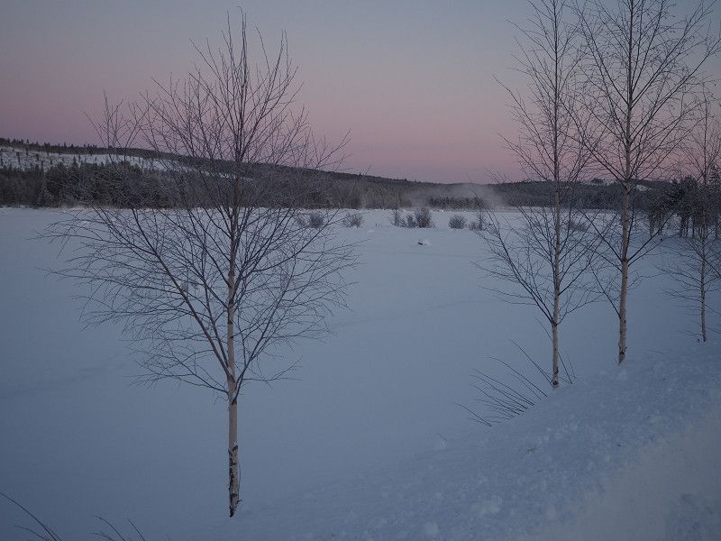
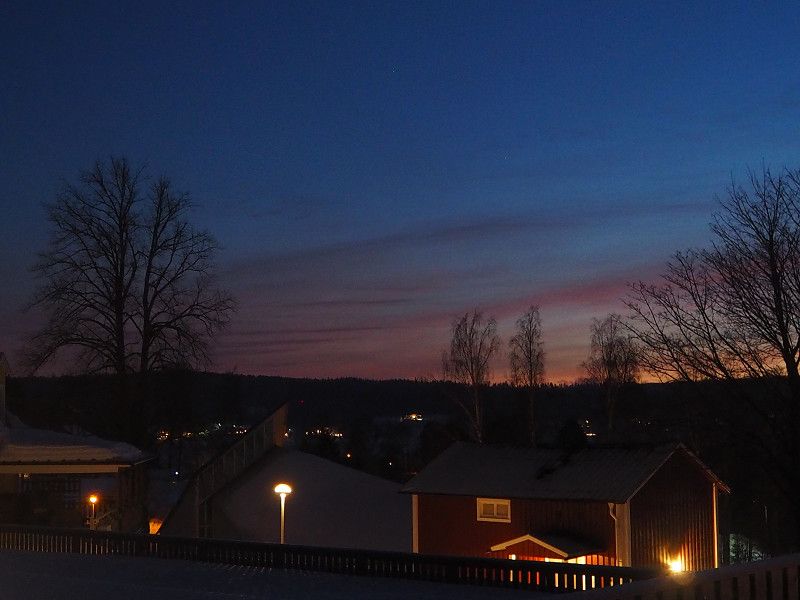
The weather was mixed, sunshine alternated with cloudy skies and rain. Overcast in the evening, with no prospect of the long-awaited Northern Lights. But we don't give up hope.
Olstav. 45, 84031, Åsarna, Sweden
62° 38' 29" N 14° 22' 17" E
62.6413900 14.3713900
• Head south on Olstavägen. Go for 72 m.
• Turn right. Go for 8 m.
• Turn right. Go for 75 m.
• Turn right toward E45. Go for 31 m.
• Turn right onto E45. Go for 58.7 km.
• Take the 3rd exit from roundabout onto Centrumvägen (E14/E45) toward Trondheim/Östersund. Go for 18.2 km.
• Take ramp toward Arvidsjaur/Strömsund/Östersund. Go for 282 m.
• Turn right onto E45 toward Arvidsjaur/Strömsund. Go for 95.8 km.
• Pass 2 roundabouts and continue on Lövbergavägen (E45). Go for 70.5 km.
• Turn right onto E45 toward Arvidsjaur/Dorotea/Storuman. Go for 123 km.
• Turn left onto Blå vägen (E12/E45). Go for 1.6 km.
• Turn left onto Torggatan. Go for 83 m.
• Turn right onto Skolgatan. Go for 228 m.
• Turn right onto Järnvägsgatan. Go for 77 m.
• Continue on Vallnäsvägen. Go for 111 m.
• Turn left onto Lokgränd. Go for 43 m.
• Arrive at Lokgränd. Your destination is on the left.
☍
369,1 km
(4 hrs. 29 min.)
Day
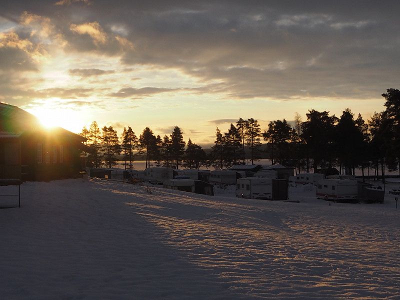
Storumans bad och camping, Lokgränd, Storuman, Schweden
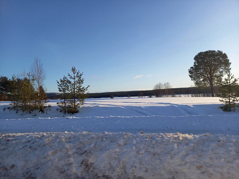
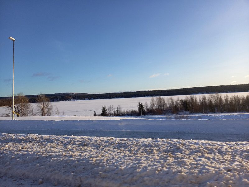
The further journey along the E 45 led in glorious sunshine to our next destination, the campsite in Storuman, where we were almost alone, apart from a few overnight guests in the huts on the site. There was also a sauna on site that you could use for free.
The starry sky gave hope for more, but unfortunately there was no polar light in sight.
It was an icy night at -14 degrees, but we mastered it without any problems.
Lokgränd 3, 923 31 Storuman, Schweden
65° 5' 57.8" N 17° 6' 59.4" E
65.0993864 17.1164924
• Head toward Vallnäsvägen on Lokgränd. Go for 43 m.
• Turn left onto Vallnäsvägen. Go for 275 m.
• Continue on Materialvägen. Go for 89 m.
• Take the 1st exit from roundabout onto Blå vägen (E12). Go for 400 m.
• Turn left onto E45 toward Arvidsjaur. Go for 144 km.
• Turn right onto Inlandsvägen (E45) toward Flygplats/Arvidsjaur/Skellefteå. Go for 7.9 km.
• Take the 1st exit from roundabout onto 95 toward Skellefteå/Arvidsjaur flygplats. Go for 2.0 km.
• Take the 2nd exit from roundabout onto Storgatan (95). Go for 155 m.
• Take the 3rd exit from roundabout onto Västlundavägen. Go for 92 m.
• Arrive at Västlundavägen. Your destination is on the right.
☍
154,6 km
(1 hrs. 53 min.)
Day
Arvidsjaur, Schweden
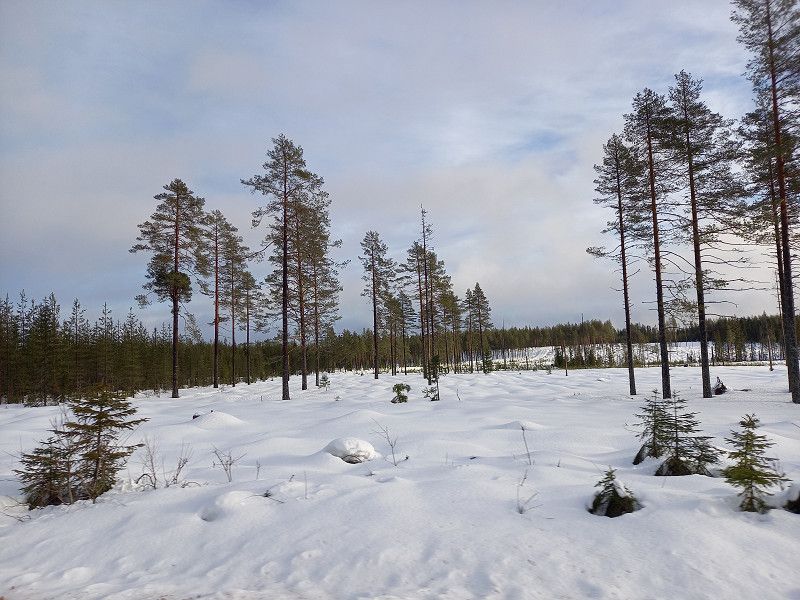
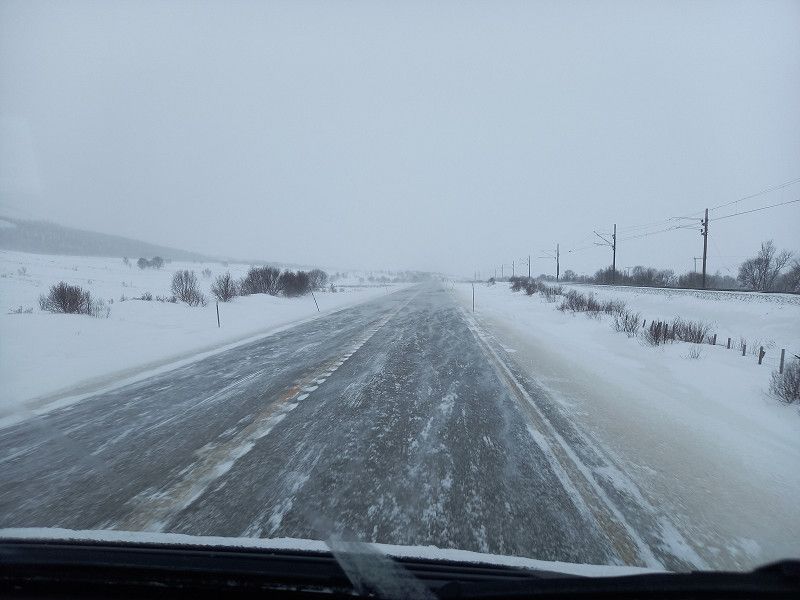
Today it didn't want to get light at all in the morning. The sun fought behind the clouds. The weather was dreary, with occasional light snowfall.
On the way we met our first reindeer, which relaxedly crossed the road.
In Arvidsjaur we took a little walk through the town where we also came across a "wooden" moose family.
It was already getting dark at 3:30 p.m. and the day felt a lot shorter.
Arvidsjaur, Sweden
65° 35' 31.5" N 19° 10' 49" E
65.5920768 19.1802828
• Head southwest on Västlundavägen. Go for 62 m.
• Take the 1st exit from roundabout onto Storgatan (95). Go for 146 m.
• Take the 2nd exit from roundabout onto Storgatan (95). Go for 2.0 km.
• Take the 1st exit from roundabout onto Inlandsvägen (E45) toward Gällivare/Jokkmokk. Go for 152 km.
• Take the 1st exit from roundabout onto Storgatan (97) toward Luleå/Centrum/Ájtte. Go for 707 m.
• Pass 2 roundabouts and continue on Storgatan (97). Go for 2.7 km.
• Turn left onto Notudden. Go for 140 m.
• Arrive at Notudden. Your destination is on the left.
☍
157,8 km
(1 hrs. 54 min.)
Day
Gästställplats Husbil Ettan
Our gas supply was running out and since there was no LPG filling station in the area, we drove towards Pitea, where we wanted to fill up the next day.
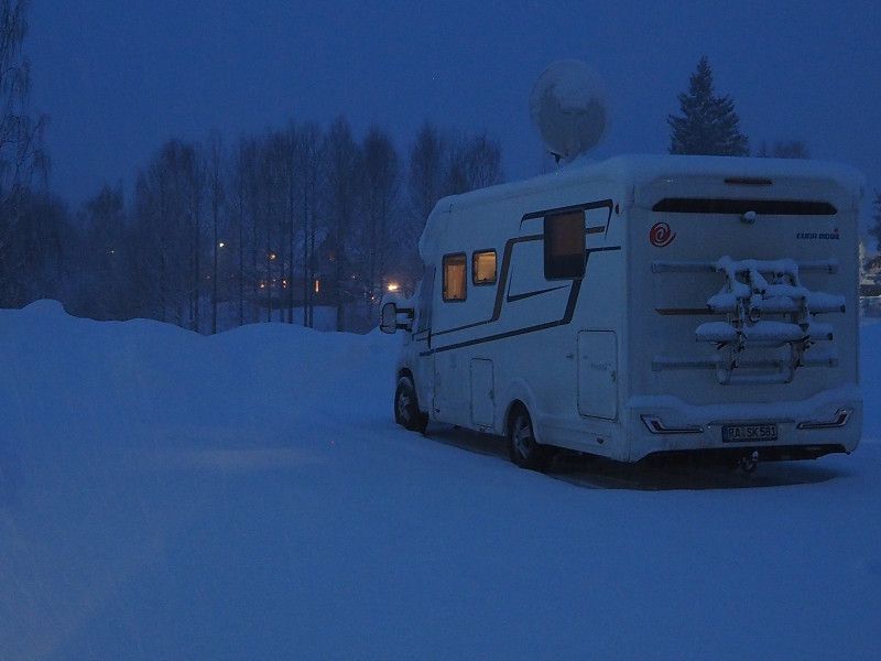
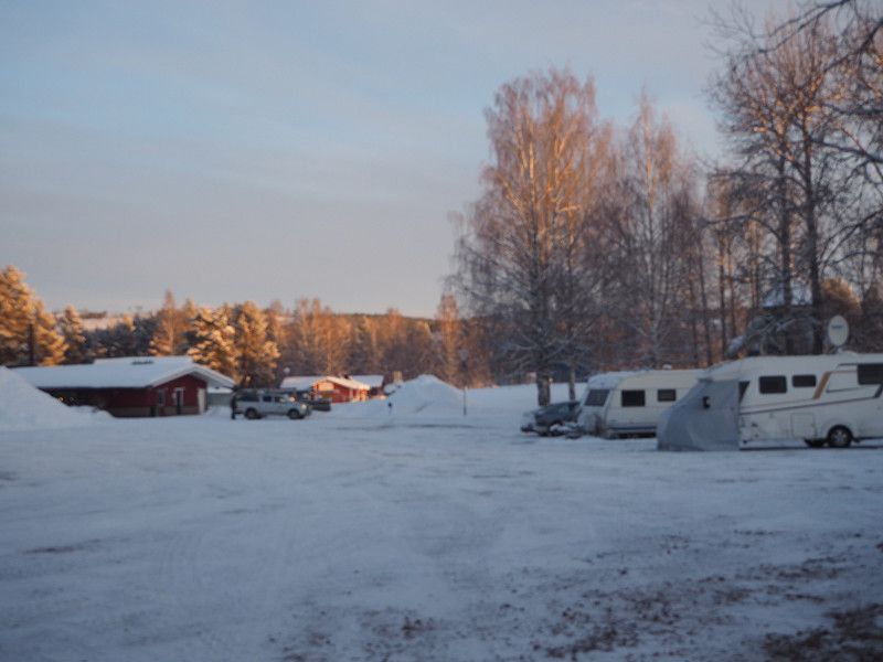
Overnight stay on a pitch in Lulea, where we spent an interesting evening with other campers in a nearby restaurant.
The next morning we saw many walkers and skaters doing their laps on the frozen lake.
After a hearty breakfast we drove to Pitea to refuel.
Day
Gammlakirken
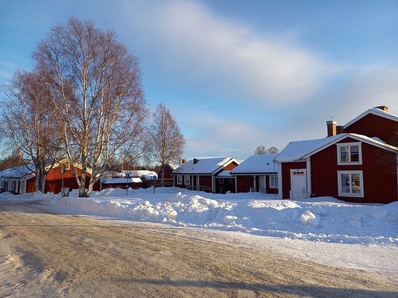
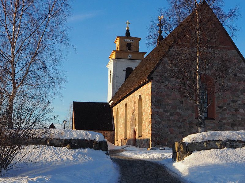
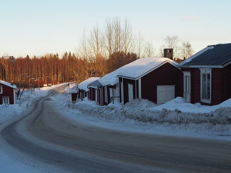
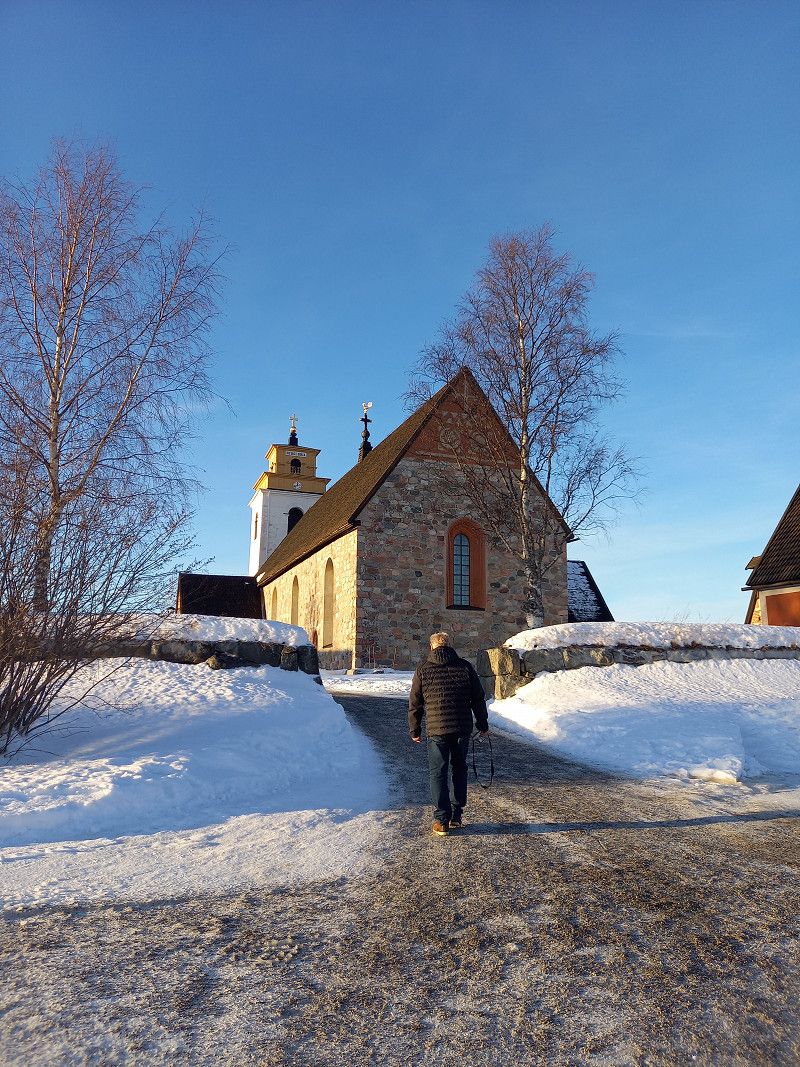
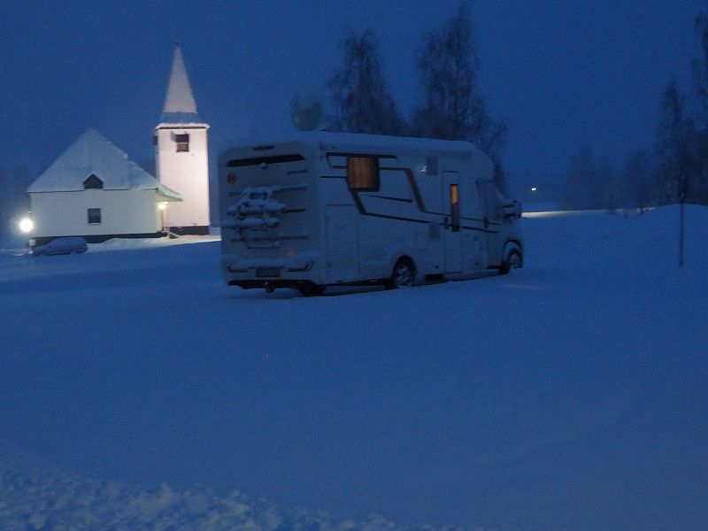
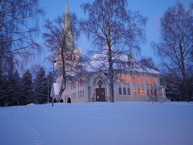
On the way to Jokkmokk we passed a sight, the place of origin of today's town of Lulea.
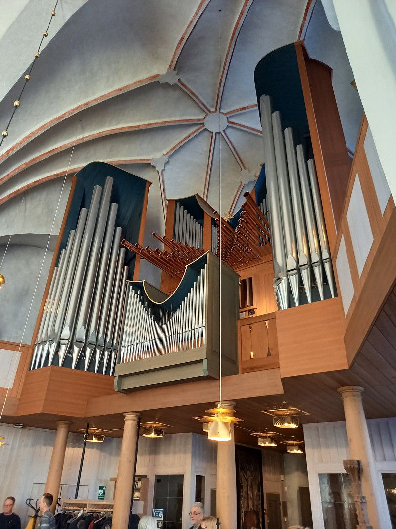
An old settlement, consisting of numerous wooden houses, which the visitors of the Kirchentag used to spend the night and a church as the central point of the place. Very impressive.
Since no parking space could be found in the evening, we stayed in a parking lot near the local church about 40 km before Jokkmokk.
Übernachtung auf einem Parkplatz bei der Kirche
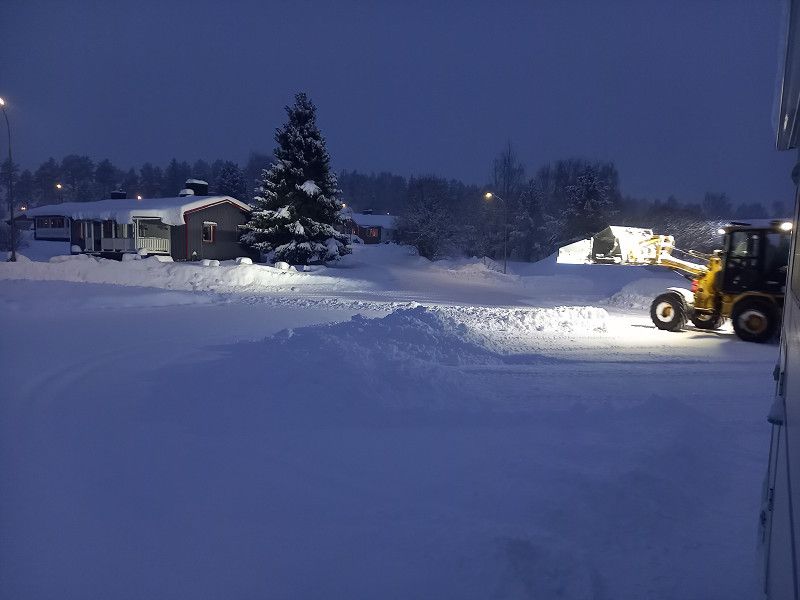
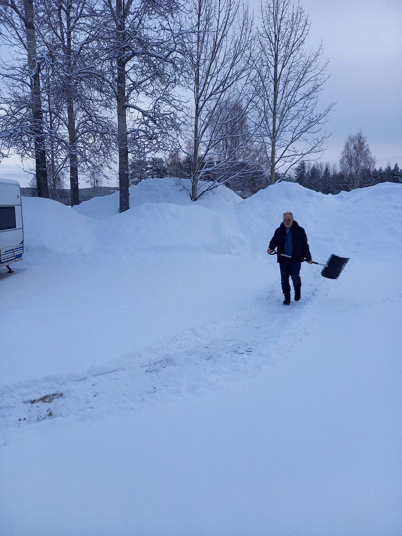
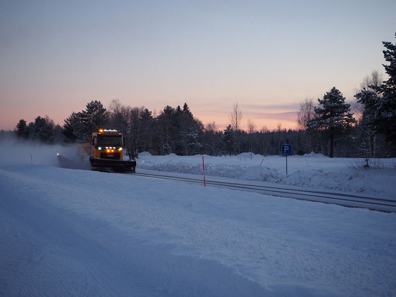
Surprise in the morning: we were snowed in and first had to laboriously shovel our mobile home free again. A clearing vehicle from the municipality also came by and freed us from the snow.
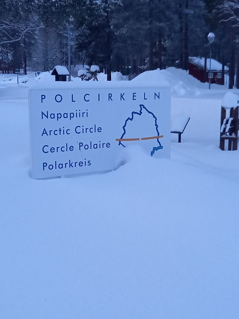
The next stage took us to Jokkmokk.
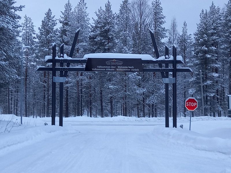
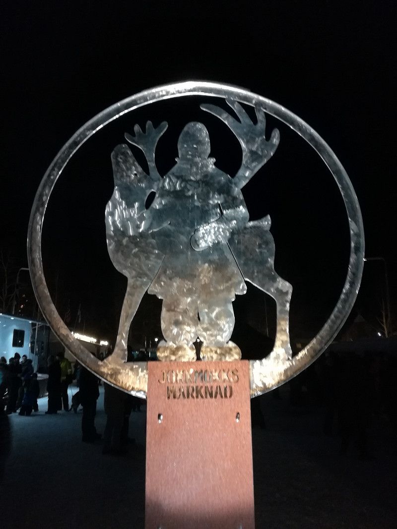
Day
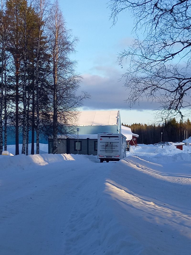
Arctic Camp Jokkmokk, Jokkmokk, Schweden
The Artic Camp was still pretty snowed up and again it was time to clear the site. A clearing vehicle also came by here, but it was too late for us or we were too fast.
We made a short trip into the city to see the closer conditions.
In the village itself, people were already busy making preparations for the upcoming winter market.
We spent the evening comfortably in the mobile home with an outside temperature of -20 degrees.
Notudden, 962 22 Jokkmokk, Schweden
66° 35' 40.4" N 19° 53' 30.7" E
66.5945510 19.8918500
• Head toward Jokkmokksvägen on Notudden. Go for 140 m.
• Turn right onto Ludvigsudde (97). Go for 2.3 km.
• Pass 2 roundabouts and continue on Storgatan (97). Go for 1.2 km.
• Take the 3rd exit from roundabout onto Klockarvägen (E45) toward Arvidsjaur/Piteå. Go for 152 km.
• Take the 2nd exit from roundabout onto 95 toward Skellefteå/Arvidsjaur flygplats. Go for 2.1 km.
• Pass 2 roundabouts and continue on Storgatan (95). Go for 41.9 km.
• Turn right onto Brännberg (365) toward Lycksele/Norsjö. Go for 110 km.
• Take the 2nd exit from roundabout onto Blå vägen (E12). Go for 311 m.
• Take the 1st exit from roundabout onto Blå vägen (E12). Go for 307 m.
• Turn left onto Vilhelminavägen (365). Go for 43.6 km.
• Turn left toward Fredrika. Go for 4.0 km.
• Continue on Långbäcken. Go for 10.1 km.
• Continue on Nordanås. Go for 7.2 km.
• Continue on Norrfors. Go for 2.3 km.
• Continue on Norrfors Lögdån. Go for 4.0 km.
• Continue on Lögda Lögdån. Go for 2.4 km.
• Continue on Lögda Bursjön. Go for 768 m.
• Continue on Lögda. Go for 11.2 km.
• Continue on Lyckselevägen. Go for 1.2 km.
• Continue on Viskavägen. Go for 77 m.
• Continue on Lyckselevägen. Go for 598 m.
• Continue on 352. Go for 64.9 km.
• Turn right onto Öviksvägen (352). Go for 32.2 km.
• Turn right onto Krokstavägen. Go for 1.4 km.
• Continue on Målevägen. Go for 2.9 km.
• Turn right onto Översjälavägen. Go for 877 m.
• Turn left onto Karlslundsvägen. Go for 145 m.
• Turn left onto Hampnäsvägen. Go for 461 m.
• Turn right onto E4. Go for 92.4 km.
• Turn right toward Norrstig. Go for 24 m.
• Continue on Norrstig. Go for 345 m.
• Continue on Långslätten. Go for 1.4 km.
• Continue on Söderstig. Go for 1.1 km.
• Continue on Byåker. Go for 639 m.
• Turn right toward Billsta. Go for 2.6 km.
• Continue on Billsta. Go for 748 m.
• Turn left toward Nyland Erikslund. Go for 134 m.
• Continue on Nyland Erikslund. Go for 145 m.
• Continue on Nyland. Go for 3.6 km.
• Continue on Tjärnsjö. Go for 1.2 km.
• Continue on Tjärnsjö. Go for 140 m.
• Continue on Antjärn. Go for 406 m.
• Turn right onto E4. Go for 407 km.
• Continue on E4 (Uppsalavägen) toward Stockholm/E20. Go for 11.1 km.
• Take left exit 155 toward Nynäshamn/73/Årsta/222/Älvsjö/226 onto 75 (Årstalänken). Go for 1.1 km.
• Take exit 1 toward Älvsjö/Årsta. Go for 238 m.
• Take the 1st exit from Åbyrondellen roundabout onto Åbyvägen toward Älvsjö. Go for 2.4 km.
• Turn right onto Huddingevägen (226). Go for 3.6 km.
• Turn left onto Ågestavägen toward Farsta. Go for 1.1 km.
• Pass 2 roundabouts and continue on Ågestavägen. Go for 1.9 km.
• Turn right onto Hammardalsslingan. Go for 928 m.
• Turn left onto Hammardalsslingan. Go for 57 m.
• Arrive at Hammardalsslingan. Your destination is on the right.
☍
1,035,1 km
(11 hrs. 38 min.)
Day
Jokkmokk Tag 2
We walked into town (about 3 km), well packed and informed by our receptionists at the campsite.
Visit to the Swedish Fell and Sami Museum in Jokkmokk, which showed everything about the life of the Sami in great detail and impressively. Delicious midday lunch at the museum.
Visit to an old pharmacy, which was mainly stocked with lots of knitting and handicraft items, and to Jokkmokk Tenn's workshop, where interesting jewelery is made, including "Mitternatsol" - midnight sun pendants, earrings, candlesticks and much more.
We walked back to Arctic Camp, and it was getting dark again.
The northern lights were originally announced for the evening, but were obscured by clouds.
Day
Jokkmokk Tag 3
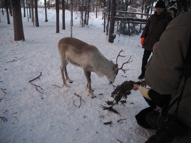
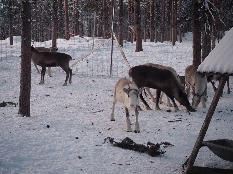
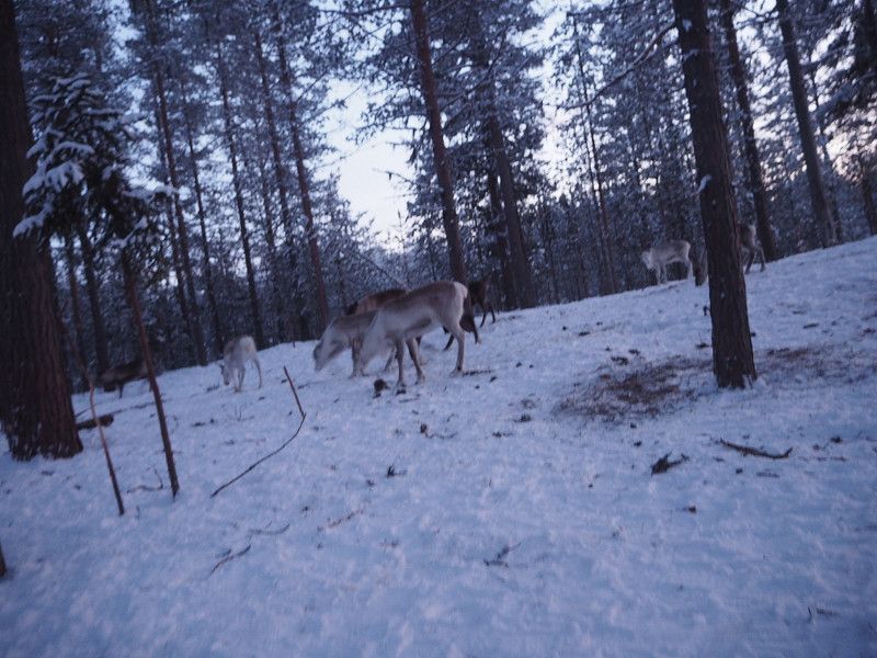
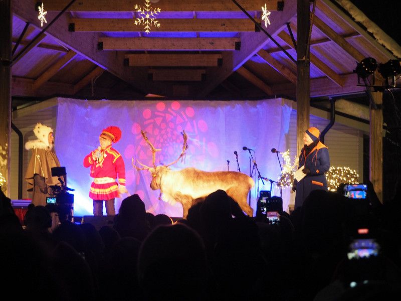
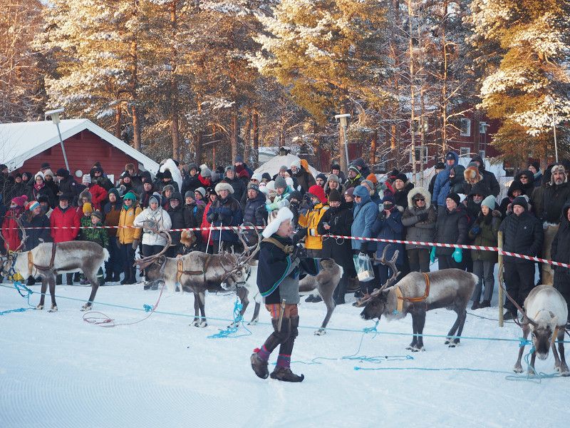
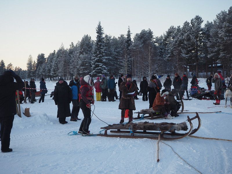
For today we have booked a tour with a guide to a herd of reindeer, and the official opening of the winter market is in the evening.
We're going straight to the city... we're looking forward to an interesting day.
Weather: - 11 degrees, dry, partly cloudy, the sun is fighting.
The encounter with the reindeer was impressive, we were informed, among other things, about the feeding and the difficulties of the reindeer herders, who are also faced with ever greater problems due to climate change.
It was really cold and we were happy to be able to go back into town after an hour, where we attended the opening ceremonies, which were very impressive.
Then we walked back to Arctic Camp (about 3 km) and warmed up in the mobile home.
Day
Jokkmokk Tag 4
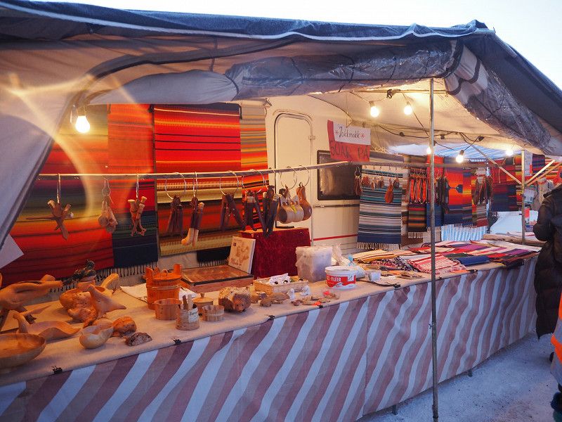
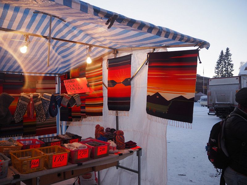
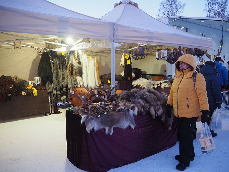
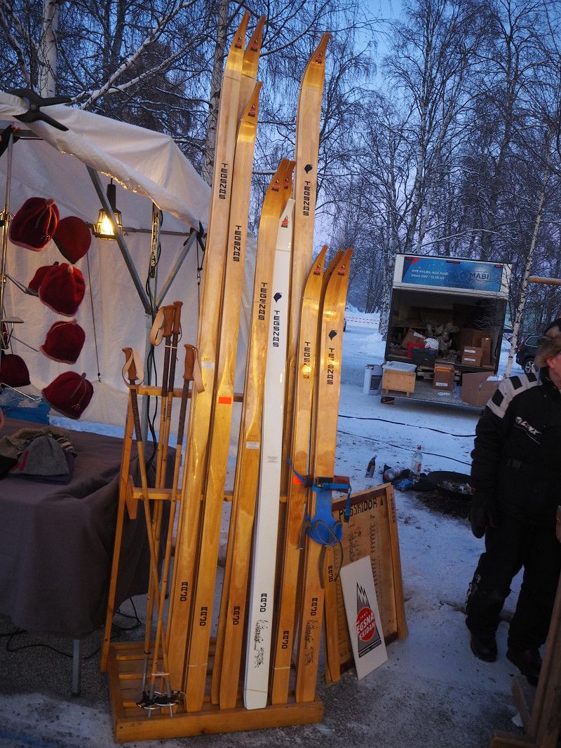
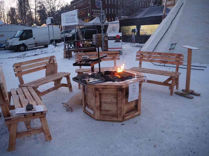
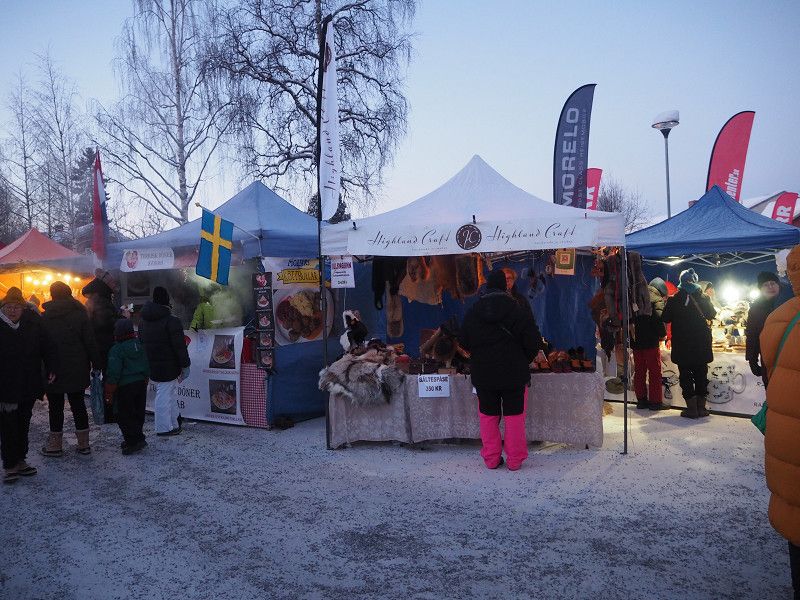
Today was market day for us. We were lucky enough to be driven to the market by car.
We strolled through the market and enjoyed the great atmosphere, less the icy cold - 18 degrees!
For lunch there was - in the open air - flam salmon, super delicious, and also cold feet.
Buying warm insoles made the cold more bearable.
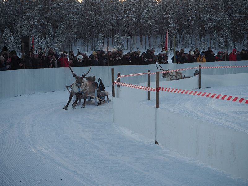
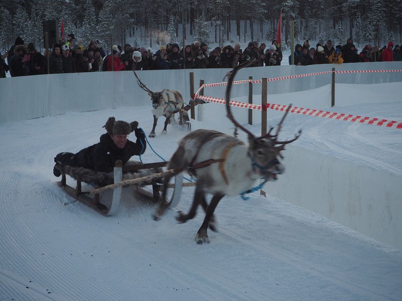
In the afternoon we went to the nearby lake where a reindeer race was taking place. The cold was even more intense at the lake and we warmed up with a cup of coffee afterwards.
Then we went to numerous Sami exhibitions and boutiques that documented the Sami's craftsmanship.
It was a very interesting and varied day.
Day
Stellplatz Jävre
After an icy night - minus 25 degrees - our gas supplies ran out. We therefore had to leave early and drove to the next gas filling station in Pitea.
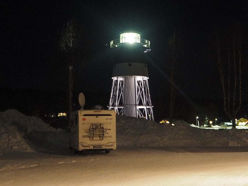
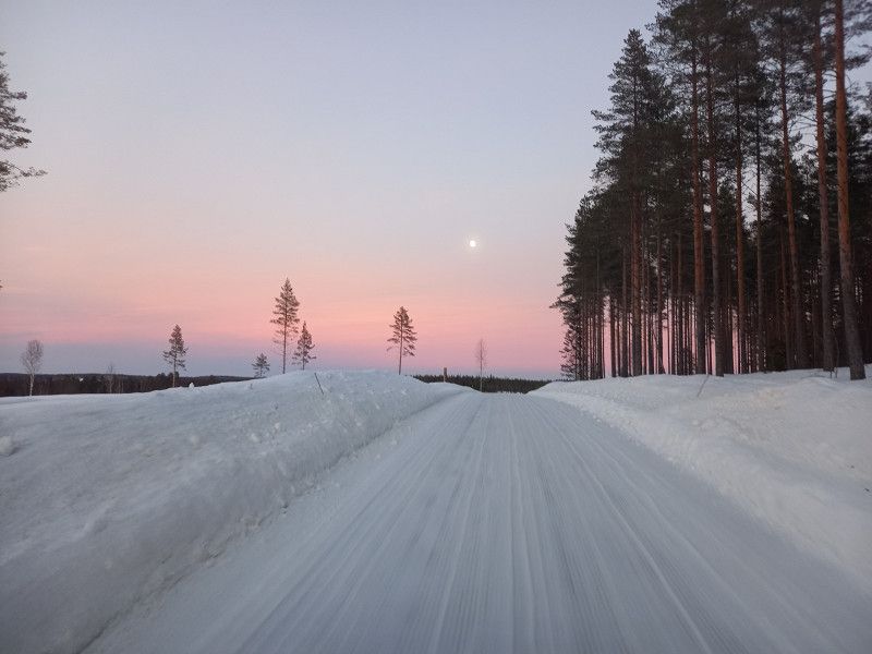
We spent the night, quite idyllically, in a parking lot near a parking space in Jävre, which was equipped with a super clean and cozy warm (free) sanitary facility (open 24 hours). There was a lighthouse in the parking lot, showing the proximity to the Baltic Sea.
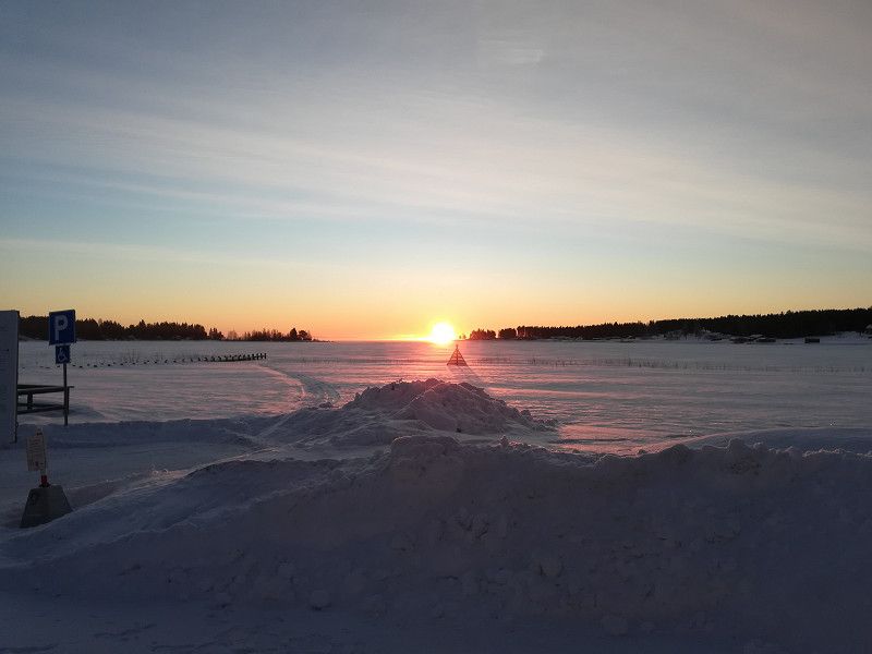
After a great sunrise and a good breakfast we drove further south.
Day
Solbacken, Schweden
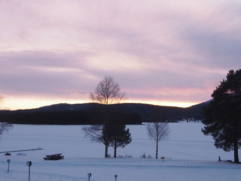
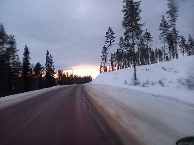
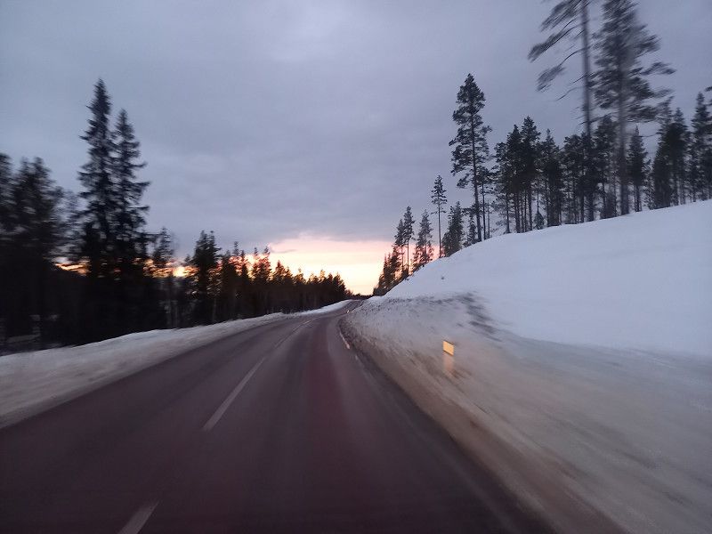
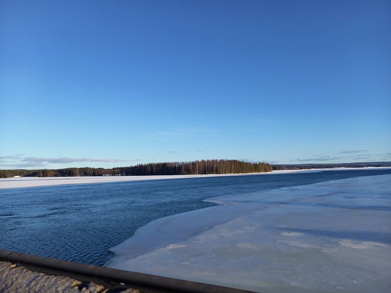
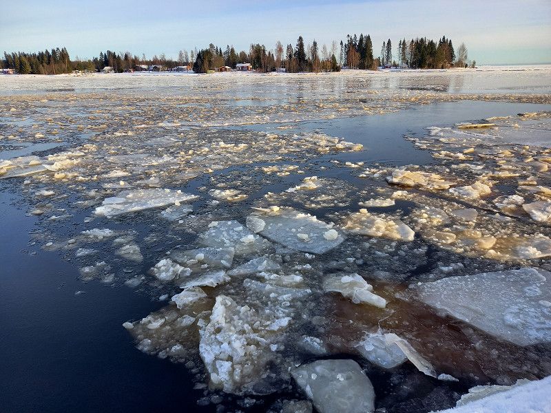
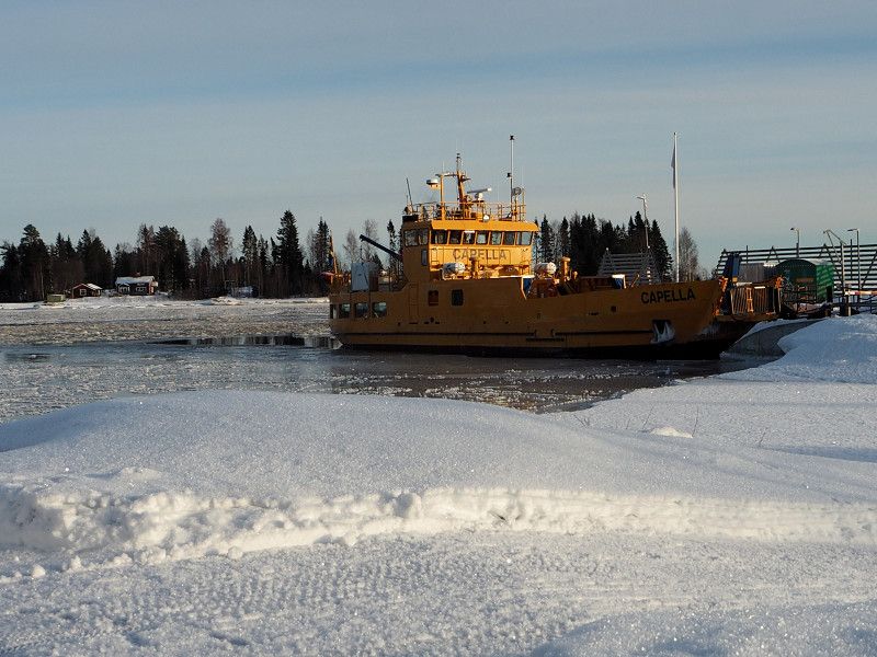
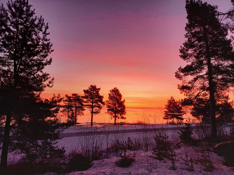
The day was very varied in terms of weather, great sunrise in the morning, sometimes a little overcast during the day, beautiful sunset in the evening.
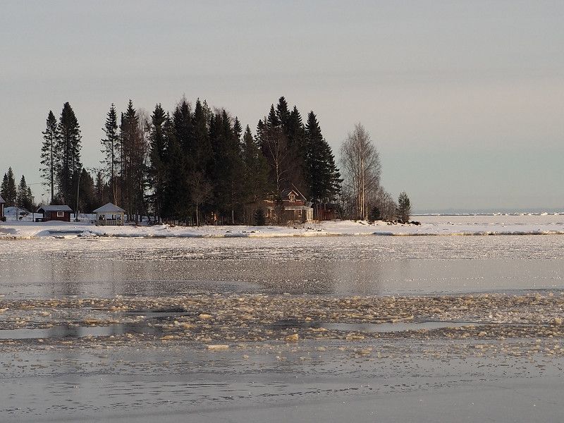
Interesting impressions in between, eg ice crystals in a harbour, a ferry making its way through the partially frozen Baltic Sea....
As there weren't many open campsites/carports, finding one here was a little tricky.
However, we found a campsite for "spontaneous" campers in Solbacken, which was open with confidence.
A delicious dinner in the mobile home rounded off this day in a relaxed manner.
Solbacken , Huddinge kommun, Schweden
59° 13' 43.1" N 18° 2' 17.5" E
59.2286362 18.0382013
• Head east on Hammardalsslingan. Go for 57 m.
• Turn right onto Hammardalsslingan. Go for 928 m.
• Turn left onto Ågestavägen. Go for 745 m.
• Pass 2 roundabouts and continue on Ågestavägen. Go for 2.2 km.
• Turn right onto Huddingevägen (226). Go for 3.6 km.
• Turn left onto Åbyvägen toward E4/E20. Go for 2.5 km.
• Take the 3rd exit from Åbyrondellen roundabout onto 75 (Årstalänken) toward E4/E20/Stockholm centrum. Go for 563 m.
• Take exit 155 toward Sundsvall/Stockholm C onto E4/E20 (Essingeleden). Go for 7.8 km.
• Keep left onto E4 (Hagatunneln) toward Sundsvall/E18/Flygplats. Go for 6.5 km.
• Continue on E4 (Uppsalavägen). Go for 358 km.
• Take exit 224 toward Bredsand/Stockvik. Go for 424 m.
• Take the 1st exit from roundabout toward Bredsand/Stockvik. Go for 92 m.
• Take the 2nd exit from roundabout onto Kemivägen. Go for 373 m.
• Take the 3rd exit from roundabout onto Kustvägen. Go for 1.7 km.
• Take the 2nd exit from roundabout onto Kustvägen. Go for 858 m.
• Turn right onto Norrstigen. Go for 127 m.
• Arrive at Norrstigen. Your destination is on the left.
☍
386,6 km
(3 hrs. 51 min.)
Day
First Camp Sundsvall-Höga Kusten
The journey continued towards Sundsvall, where we refueled on gas the next day.
In Sundsvall we happened upon a place to stay at First-Camp. The place was right on the Baltic Sea, was unfortunately totally icy and very difficult to commit. The situation between the road and the railroad was also somewhat unsettled.
In the morning we experienced a sensational sunrise and after a good breakfast the journey continued.
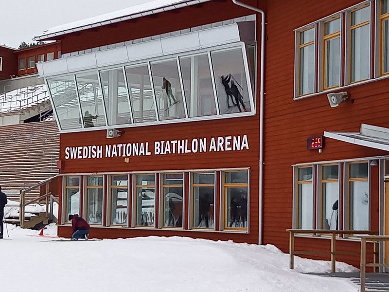
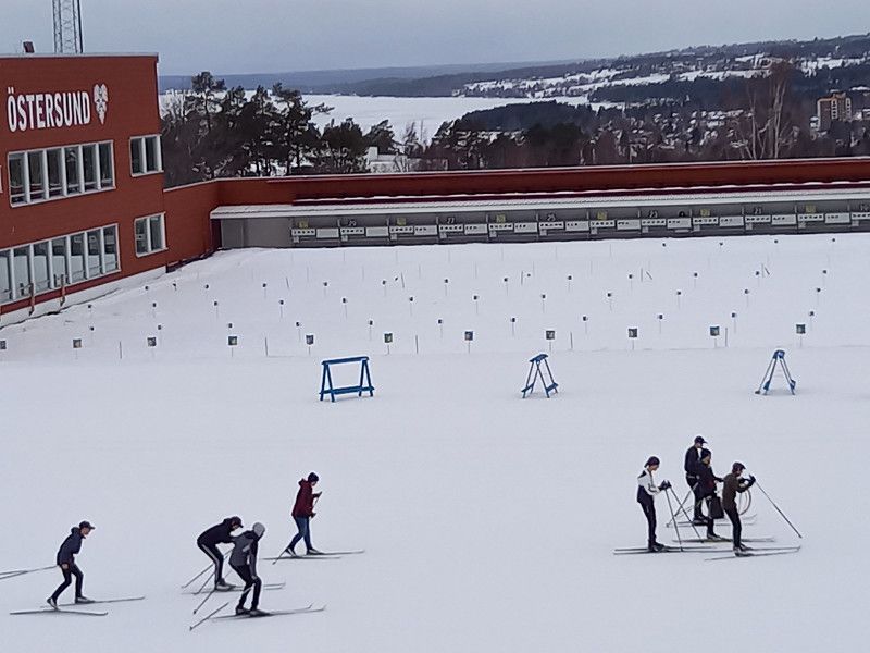
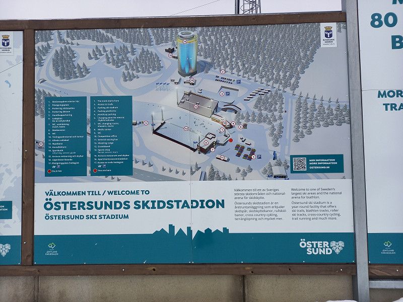
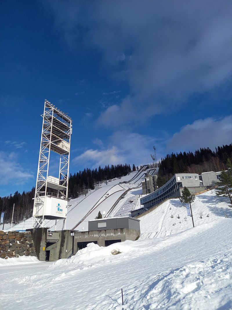
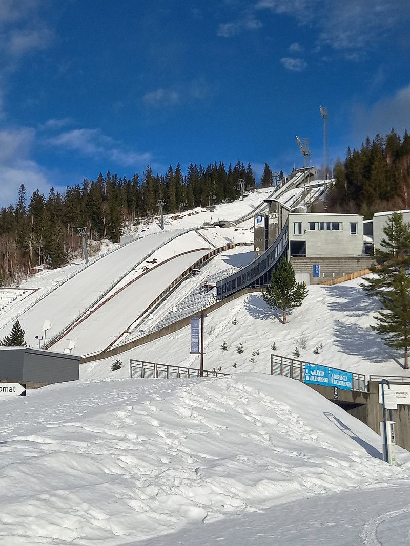
We drove to Östersund and visited the ski stadium, where the 2019 Biathlon World Championships took place.
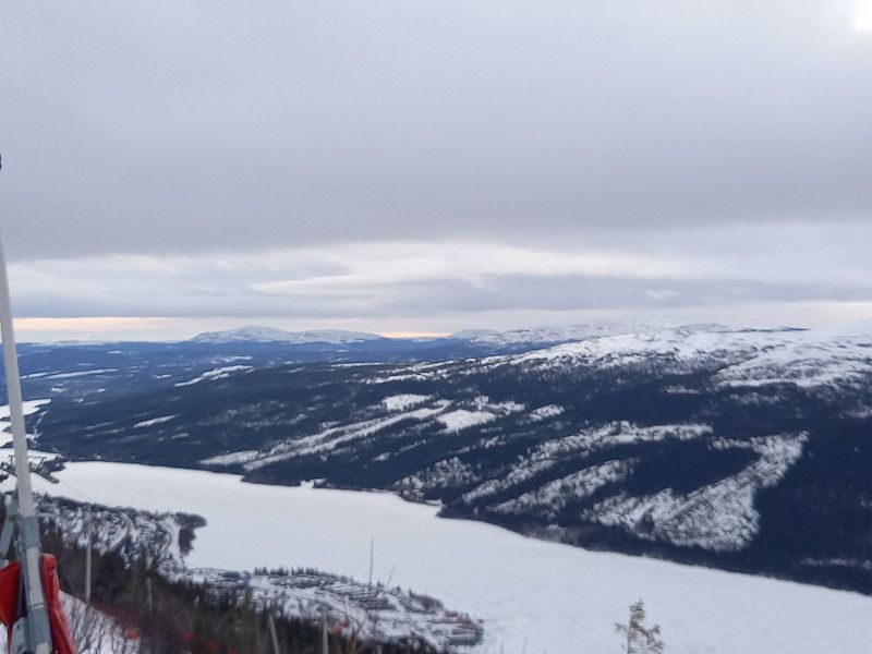
Then it was on to the large, well-known ski area in Are.
Norrstigen 15, 854 68, Sundsvall, Sweden
62° 21' 30.7" N 17° 22' 13" E
62.3585200 17.3702650
• Head north on Norrstigen. Go for 127 m.
• Turn right onto Kustvägen. Go for 1.9 km.
• Continue on Landsvägsallén. Go for 888 m.
• Take the 2nd exit from roundabout onto Landsvägsallén toward 86/Härnösand/Centrum. Go for 255 m.
• Take the 3rd exit from roundabout onto Björneborgsgatan (E14) toward 86. Go for 5.3 km.
• Take the 2nd exit from roundabout onto Bergsgatan (E14). Go for 557 m.
• Take ramp onto E14. Go for 318 m.
• Take ramp onto E14 toward Trondheim. Go for 114 km.
• Pass 3 roundabouts and continue on E14. Go for 166 km.
• Turn right toward Centrum. Go for 36 m.
• Turn left onto Tottvägen. Go for 132 m.
• Arrive at Tottvägen. Your destination is on the right.
☍
290,1 km
(3 hrs. 30 min.)
Day
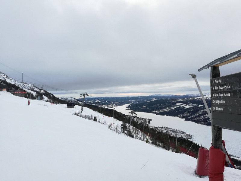
Åre, Schweden
The journey to Are was very time-consuming and finding accommodation was initially quite difficult.
However, we found a campsite just before Are that was "öppet" and checked in briefly.
Then we went to the village, where we took care of lift tickets and looked for a nearby parking lot so that it was already taken care of for the following day of skiing.
Then we went back to the campsite, where we again spent a relaxing evening.
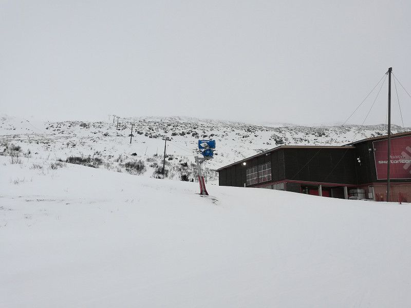
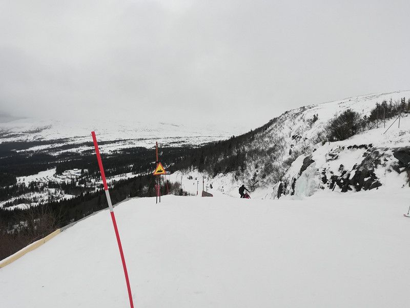
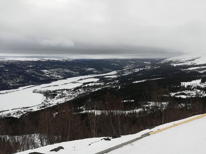
The next morning we went to the valley station of the cable car. The weather was a bit overcast and unfortunately no sun in sight. But there were great descents and not so busy due to the weekday, so there was enough space on the slopes.
In the afternoon we finished our day of skiing and, after everything was in the right place in the mobile home, we drove on towards Trondheim/Norway.
Åre , Schweden
63° 24' 3.9" N 13° 4' 56" E
63.4010888 13.0822241
• Head southeast on Tottvägen. Go for 132 m.
• Turn right toward Trondheimsleden/E14. Go for 36 m.
• Turn right onto Trondheimsleden (E14). Go for 64.4 km.
• Continue on Mellomriksveien (E14). Go for 65.5 km.
• Pass 3 roundabouts and continue on E14. Go for 1.6 km.
• Take the 3rd exit from roundabout onto E6 toward Trondheim/Værnes Lufthavn. Go for 3.0 km.
• Pass 2 roundabouts and continue on E6. Go for 24.0 km.
• Take ramp onto 706 toward 715. Go for 4.3 km.
• Take the 2nd exit from roundabout onto 706 toward E6/Oslo/Havna/Sentrum. Go for 406 m.
• Take the 3rd exit from roundabout onto Havnegata (6692). Go for 398 m.
• Continue on Havnegata. Go for 16 m.
• Continue on Brattørbrua. Go for 33 m.
• Continue on Kjøpmannsgata. Go for 222 m.
• Turn right onto Olav Tryggvasons gate (6690). Go for 182 m.
• Turn left onto Søndre gate. Go for 336 m.
• Turn right onto Kongens gate. Go for 228 m.
• Arrive at Kongens gate. Your destination is on the right.
☍
164,8 km
(2 hrs. 20 min.)
Day
Trondheim, Norwegen
Unscheduled, we continued towards Trondheim/Norway.
We found an RV site in town that we have stayed at in previous years. Here, too, everything was totally frozen.
In the morning we went to the center of Trondheim for "shopping". It was slightly cloudy and had + 5 degrees. After a successful tour we went back to the mobile home and we decided to continue the route south via Norway to Oslo.
Trondheim , Norwegen
63° 25' 50" N 10° 23' 42.7" E
63.4305658 10.3951929
• Head toward Apotekerveita on Kongens gate. Go for 296 m.
• Turn right onto Kjøpmannsgata. Go for 171 m.
• Turn right onto Erling Skakkes gate. Go for 391 m.
• Turn left onto Prinsens gate (6690). Go for 3.6 km.
• Continue on E6. Go for 2.9 km.
• Keep left onto E6 toward Oslo/E39. Go for 79.0 km.
• Keep left onto Trondheimsveien (E6). Go for 31.4 km.
• Pass 3 roundabouts and continue on E6. Go for 8.2 km.
• Turn right. Go for 38 m.
• Arrive at your destination on the right.
☍
126,0 km
(1 hrs. 48 min.)
Day
Oppdal, Norwegen
By chance we met mobile home owners from Switzerland who gave us a tip for a small parking space in Oppdahl, which we gladly accepted.
We were warmly addressed in German by the owner of Magalaupet Camping. Her mother was German, hence the good language skills. This also made it easier for us to communicate with each other.
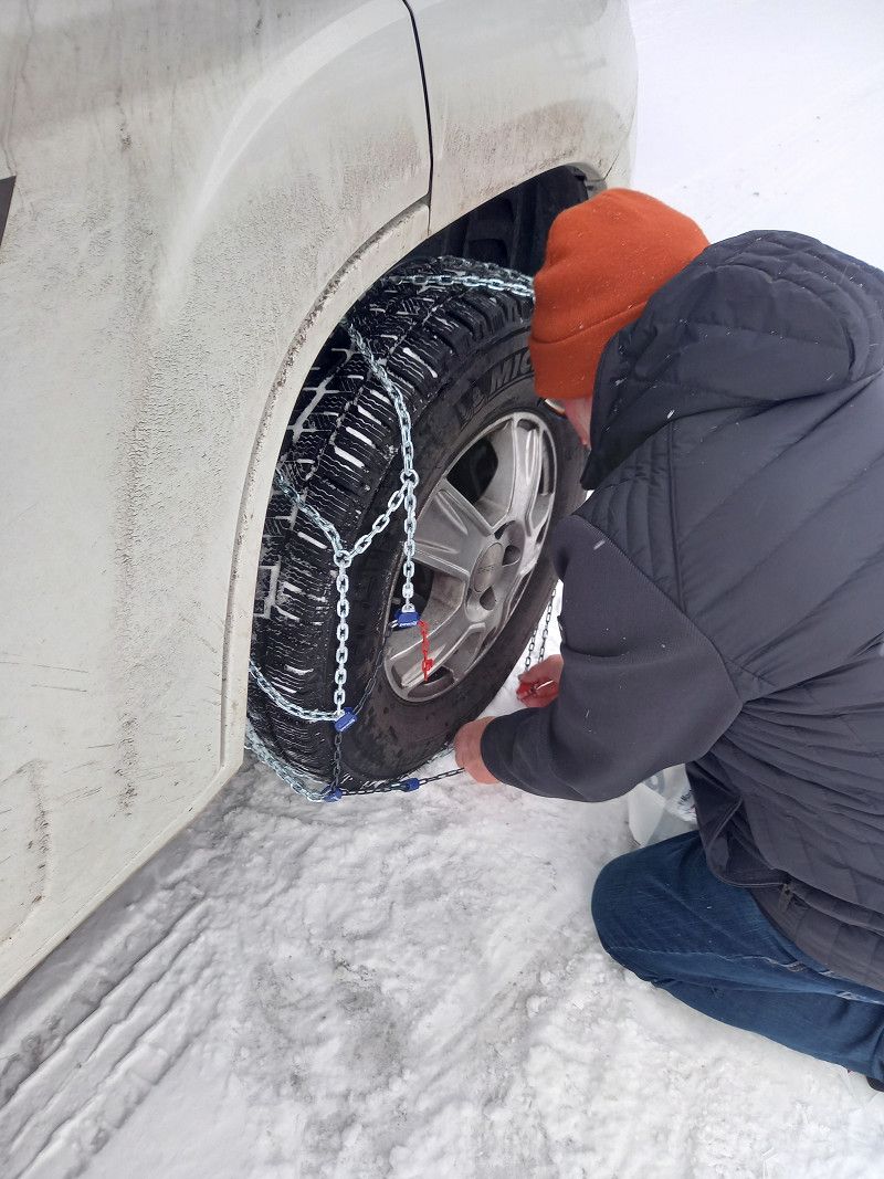
After an extremely stormy night, it had snowed in the morning and we put on snow chains as a precaution. The descent from the campsite to the road was quite steep and we didn't want to take any chances.
When we reached the street, the snow chains were packed up again and we continued with icy gusts of wind and snow flurries on snowy, partly icy roads to an altitude of 1,068 m in the direction of Otta to Lillehammer, where blue skies greeted us again.
The search for a place to stay was no problem today and we were happy to be welcomed by a nice host at the family campsite in Granli.
However, the place was quite icy and so we spent the rest of the evening comfortably, with the appropriate comfortable temperature, in the mobile home.
Oppdal , Norwegen
62° 32' 6.6" N 9° 37' 23.9" E
62.5351785 9.6233041
• Head toward Dovrevegen. Go for 38 m.
• Turn right onto Dovrevegen (E6). Go for 40.0 km.
• Turn left onto Folldalsvegen (29) toward Folldal. Go for 28.6 km.
• Turn right onto 27. Go for 48.2 km.
• Continue on 219. Go for 38.7 km.
• Turn right onto 3. Go for 113 km.
• Take the 2nd exit from roundabout toward 25/Trysil/Elverum/2/Kongsvinger. Go for 448 m.
• Take the 1st exit from roundabout onto 25 toward 2. Go for 642 m.
• Pass 2 roundabouts and continue on Hamarvegen (25). Go for 1.5 km.
• Turn right onto Vestsivegen (210) toward Eid/36/Industriområde Vestad. Go for 106 m.
• Continue on Bakketungata (210). Go for 171 m.
• Turn left onto Vestheimgata (210). Go for 54 m.
• Continue on Vindheiavegen (210). Go for 214 m.
• Continue on Vestsivegen (210). Go for 20.5 km.
• Continue on Vestsidevegen (210). Go for 750 m.
• Continue on Nordvi (210). Go for 134 m.
• Continue on Vestsidevegen (210). Go for 6.1 km.
• Continue on Fosseid (210). Go for 108 m.
• Continue on Vestsidevegen (210). Go for 48.9 km.
• Turn left onto Bruvegen (2006). Go for 1.0 km.
• Turn left and take ramp. Go for 50 m.
• Turn right onto Østre Solørveg (2). Go for 14.9 km.
• Take the 2nd exit from roundabout onto Kongevegen (2034). Go for 906 m.
• Turn right onto Lerkevegen (2034). Go for 121 m.
• Take the 3rd exit from roundabout onto Arko-vegen (2) toward Magnor. Go for 1.0 km.
• Take the 2nd exit from roundabout onto Arko-vegen (2). Go for 4.7 km.
• Arrive at Arko-vegen (2).
☍
370,5 km
(5 hrs. 3 min.)
Day
Sigernessjøen Camping
The overnight stay at the family campsite was very pleasant, the sun was shining and after a good breakfast and a warm shower we continued towards Avika.
Sometimes there was no more snow here and sometimes the green meadows were already visible.
We continued towards Karlstad. There we found a nice parking space at Vänern (lake) and went for a stroll into the city.
Strengelsrud Gård, 2210, Granli, Norway
60° 7' 56" N 12° 2' 20" E
60.1322200 12.0388800
• Head toward Mariåsvegen on Arko-vegen (2). Go for 28.5 km.
• Continue on Kungsvägen (61). Go for 6.7 km.
• Take the 2nd exit from roundabout onto 61 toward Karlstad. Go for 33.6 km.
• Take the 3rd exit from Graningerondellen roundabout onto 61 toward Karlstad/Sjukhus. Go for 1.6 km.
• Take the 3rd exit from Gaterondellen roundabout onto 61 toward Karlstad. Go for 66.2 km.
• Take ramp onto E18. Go for 3.5 km.
• Take the exit toward Centrum/Sjukhus onto Karl IX:s gata. Go for 532 m.
• Turn left onto Våxnäsgatan. Go for 553 m.
• Turn right onto Sandbäcksgatan. Go for 181 m.
• Turn left onto Kungsgatan. Go for 111 m.
• Arrive at Kungsgatan. Your destination is on the right.
☍
141,5 km
(1 hrs. 48 min.)
Day
Karlstad, Schweden
The sunrise in the morning was glorious again and promised a wonderful day.
Karlstad is a beautiful small town. We also visited Park Mariebersskogen which has something outdoors for all ages; Unfortunately, many things were currently not open.
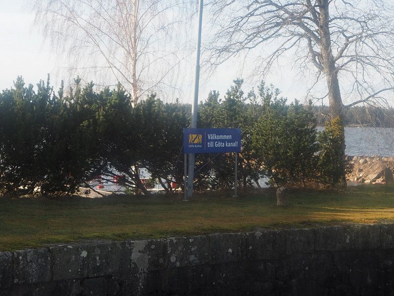
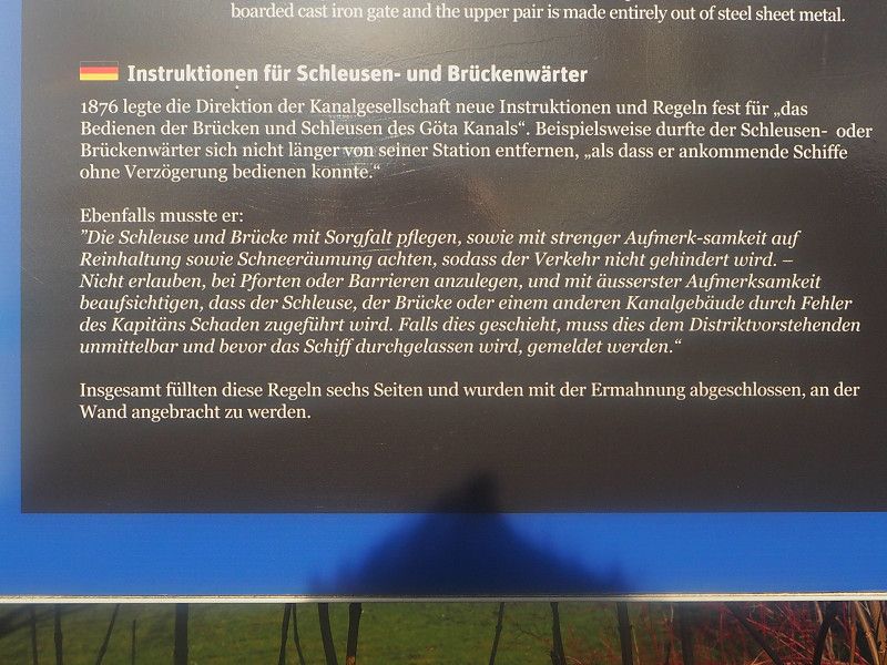
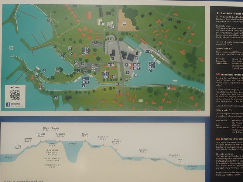
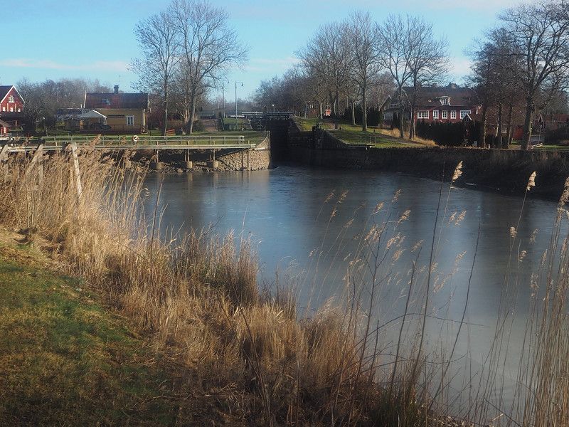
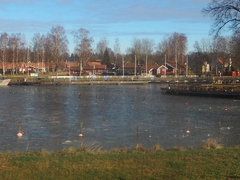
We continued south towards Mariestad, passing the Götekanal. However, there is currently no business here, but the area is beautiful and very interesting.
Karlstad , Schweden
59° 22' 51.3" N 13° 30' 9.9" E
59.3809146 13.5027631
• Head east on Kungsgatan.
• Turn left onto Kungsgatan. Go for 95 m.
• Turn right onto Museigatan. Go for 98 m.
• Turn right onto Herrgårdsgatan. Go for 229 m.
• Turn right onto Östra torggatan. Go for 173 m.
• Continue on Östra torggatan. Go for 144 m.
• Turn left onto Drottninggatan. Go for 253 m.
• Take the 2nd exit from roundabout onto Hagaleden. Go for 1.7 km.
• Take ramp onto Örsholmsleden (236). Go for 1.3 km.
• Turn left and take ramp onto E18 toward Stockholm. Go for 40.0 km.
• Take ramp toward Mariestad/Kristinehamn Ö C. Go for 339 m.
• Turn left onto Närkevägen (26) toward Mariestad/Centrum. Go for 2.7 km.
• Take the 3rd exit from roundabout onto 26 toward Mariestad. Go for 65.4 km.
• Turn right onto E20 toward Göteborg/Mariestad. Go for 5.6 km.
• Take ramp onto Stockholmsvägen toward 202/Karlsborg/Töreboda/Mariestad N C. Go for 1.1 km.
• Pass 2 roundabouts and continue on Stockholmsvägen (E20.4). Go for 2.2 km.
• Continue on Nya torget. Go for 76 m.
• Turn left onto Österlånggatan. Go for 16 m.
• Arrive at Österlånggatan. Your destination is on the left.
☍
121,3 km
(1 hrs. 34 min.)
Day
Mariestad, Schweden
In Mariestad, which is also by Vänern (lake), we found a large pitch by the water, where we were happy to check in.
Strolling into town in the afternoon, we recognized a few places that we had visited years earlier on a summer vacation.
Mariestad , Schweden
58° 42' 33.6" N 13° 49' 22.4" E
58.7093225 13.8228754
• Head toward Kyrkogatan on Österlånggatan.
• Turn right onto Esplanaden. Go for 83 m.
• Turn left onto Karlagatan. Go for 121 m.
• Turn left onto Kungsgatan. Go for 156 m.
• Turn right onto Nygatan. Go for 98 m.
• Continue on Göteborgsvägen. Go for 144 m.
• Continue on Gärdesbron. Go for 82 m.
• Continue on Göteborgsvägen. Go for 1.4 km.
• Pass 3 roundabouts and continue on Göteborgsvägen (E20.2). Go for 2.0 km.
• Take the 1st exit from roundabout onto E20. Go for 7.8 km.
• Continue on E20 toward Göteborg. Go for 117 km.
• Take the 2nd exit from roundabout onto Sveaplan (E20) toward Göteborg. Go for 41.1 km.
• Take exit 76 toward Munkebäckstorget/Sävenäs. Go for 233 m.
• Take the 3rd exit from Munkebäcksmotet roundabout onto Munkebäcks allé. Go for 778 m.
• Take the 2nd exit from roundabout onto Munkebäcksgatan. Go for 542 m.
• Continue on Munkebäcksgatan. Go for 262 m.
• Continue on Delsjövägen. Go for 558 m.
• Take the 3rd exit from roundabout onto Olbersgatan. Go for 247 m.
• Turn right onto Olbersgatan. Go for 23 m.
• Turn slightly left onto Olbersgatan. Go for 234 m.
• Arrive at your destination on the left.
☍
172,4 km
(1 hrs. 59 min.)
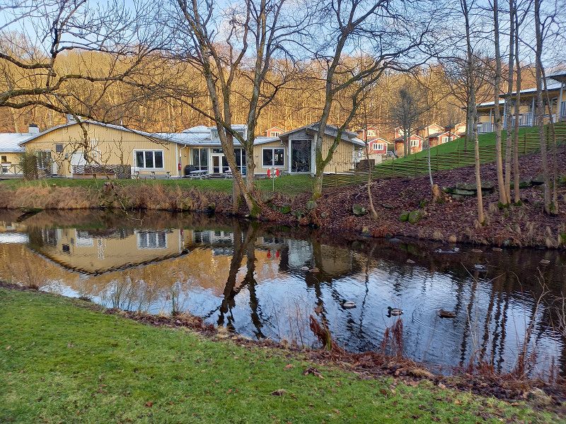
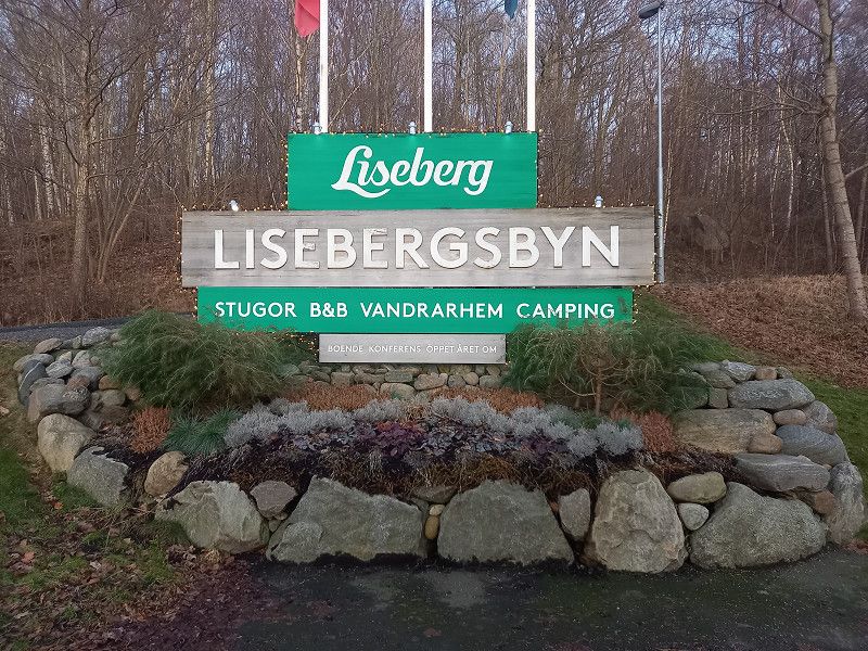
Day
Lisebergsbyn
Overnight at Lyseberg Camping, near Gothenburg.
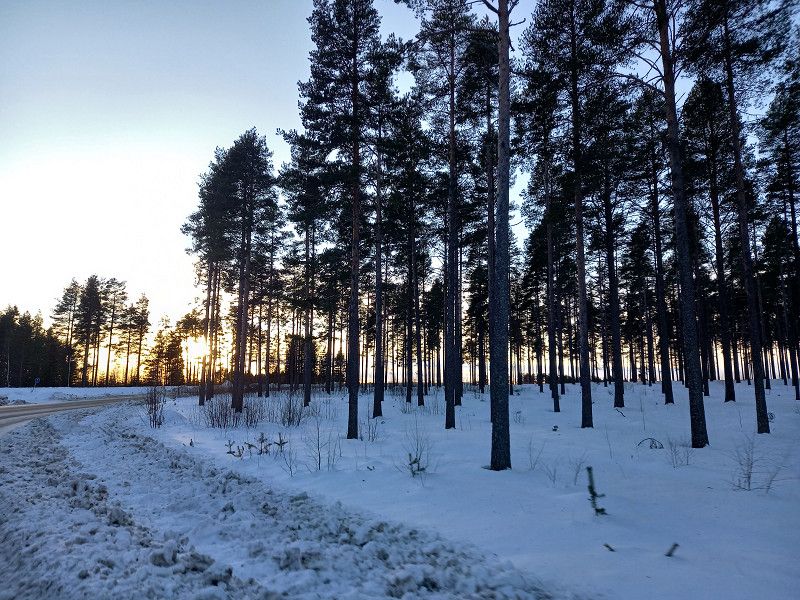
Before that hike in good weather through the nearby forest.
Olbersgatan 9, 41655, Göteborg, Sweden
57° 42' 16.2" N 12° 1' 48.3" E
57.7044996 12.0300933
• Head north. Go for 62 m.
• Continue on Olbersgatan. Go for 195 m.
• Turn left onto Olbersgatan. Go for 214 m.
• Take the 3rd exit from roundabout onto Delsjövägen. Go for 891 m.
• Take the 2nd exit from roundabout onto Delsjövägen. Go for 1.1 km.
• Continue on Sankt Sigfrids plan. Go for 11 m.
• Turn left onto Sankt Sigfrids plan. Go for 49 m.
• Turn right onto Örgrytevägen. Go for 214 m.
• Turn right onto Fabriksgatan. Go for 140 m.
• Turn right and take ramp onto E6/E20 (Kungsbackaleden) toward Malmö/Flygplats/40/158. Go for 212 km.
• Continue on E6/E20 (Trafikplats Helsingborg S). Go for 64.4 km.
• Continue on E20 (Yttre Ringvägen) toward Flygplats/Köpenhamn/Limhamn. Go for 13.7 km.
• Continue on E20 (Øresundsbroen). Go for 53.5 km.
• Keep left onto E20 (Køge Vest) toward Odense. Go for 174 km.
• Keep left onto E20 (Fredericia) toward Esbjerg/E45s/Kolding/Flensborg. Go for 15.5 km.
• Continue on E45 (Sønderjyske Motorvej) toward Flensborg. Go for 83.2 km.
• Continue on A7. Go for 63.5 km.
• Take exit 9 toward Kiel onto A210. Go for 21.6 km.
• Take the exit onto A215. Go for 3.5 km.
• Continue on Schützenwall (L325) toward Zentrum/Wunderino Arena. Go for 1.2 km.
• Turn right onto Exerzierplatz (L194) toward Ostufer/Fähre. Go for 180 m.
• Turn left onto Exerzierplatz (K29). Go for 126 m.
• Continue on Rathausstraße (K29). Go for 523 m.
• Continue on Martensdamm (K29). Go for 20 m.
• Arrive at Martensdamm (K29). Your destination is on the right.
☍
709,9 km
(6 hrs. 34 min.)
Day
Schwedenkai 1, 24103 Kiel, Deutschland
Last day in Sweden. We booked the ferry at short notice. After an extensive buffet in the evening and a restful night, we reached Kiel the next morning and drove from there to friends in East Friesland.
Kiel , Deutschland
54° 19' 21.8" N 10° 8' 8" E
54.3227085 10.1355550
• Head toward Willestraße on Martensdamm (K29). Go for 20 m.
• Continue on Rathausplatz (K29). Go for 523 m.
• Continue on Exerzierplatz (K29). Go for 126 m.
• Turn right onto Exerzierplatz (L194). Go for 190 m.
• Turn left onto Schützenwall (L325). Go for 1.2 km.
• Continue on A215 toward Hamburg/A7/Flensburg/A210/Rendsburg/Ki-Mettenhof/Eckernförde/B76/Flughafen. Go for 23.0 km.
• Continue on A7. Go for 68.9 km.
• Keep left onto A7. Go for 14.7 km.
• Keep right onto A261 (Autobahndreieck Hamburg-Südwest) toward Bremen/Tötensen. Go for 9.0 km.
• Take exit 4 toward Osnabrück/Bremen/Rade onto A1. Go for 93.3 km.
• Take exit 58A toward Oldenburg onto A28. Go for 42.6 km.
• Take the exit toward Groningen/Emden/Leer/Bad Zwischenahn/OL-Wechloy onto A28. Go for 55.2 km.
• Continue on A31. Go for 2.3 km.
• Take exit 10 toward Leer-Nord/Neermoor. Go for 298 m.
• Turn right onto Heisfelder Straße (B70) toward Leer/Gewerbegebiet Leer-Nord. Go for 1.7 km.
• Turn right onto Am Ehrenmal. Go for 118 m.
• Arrive at Am Ehrenmal. Your destination is on the left.
☍
313,1 km
(2 hrs. 53 min.)
Day
Leer (Ostfriesland), Deutschland
Leer (Ostfriesland) , Deutschland
53° 15' 0.8" N 7° 27' 22.7" E
53.2502087 7.4563035
• Head toward Heisfelder Straße on Am Ehrenmal. Go for 118 m.
• Turn left onto Heisfelder Straße (B70). Go for 1.5 km.
• Turn right and take ramp onto A31 toward A28/Oldenburg/Emden. Go for 2.9 km.
• Continue on A28 toward Bremen/Oldenburg/Leer-Ost. Go for 54.0 km.
• Take the exit toward Bremen/Osnabrück/Oldenburg-Haarentor/Oldenburg-Zentrum onto A28. Go for 33.3 km.
• Take exit 21 toward Osnabrück/A1/Wildeshausen. Go for 269 m.
• Turn left onto Wildeshauser Landstraße (B213) toward Osnabrück/A1/Wildeshausen. Go for 940 m.
• Take the 2nd exit from roundabout onto Wildeshauser Landstraße (B213) toward Osnabrück/A1/Wildeshausen. Go for 5.7 km.
• Turn left onto Harpstedter Straße (K286) toward Harpstedt/Klein Henstedt. Go for 1.2 km.
• Continue on Sether Mühle (K286). Go for 1.1 km.
• Continue on Henstedter Straße (K286). Go for 2.1 km.
• Continue on Hauptstraße (K286). Go for 1.5 km.
• Continue on Stiftenhöfter Straße (K286). Go for 540 m.
• Continue on Stiftenhöfte (K286). Go for 145 m.
• Continue on Stiftenhöfter Straße (K286). Go for 1.1 km.
• Continue on Nordstraße (K286). Go for 2.3 km.
• Continue on Mullstraße (K286). Go for 311 m.
• Arrive at Mullstraße (K286). Your destination is on the right.
☍
109,0 km
(1 hrs. 7 min.)
Day
Harpstedt, Deutschland
Overnight stay on the journey home on a pitch in Harpstedt.
Harpstedt , Deutschland
52° 54' 32.8" N 8° 35' 13" E
52.9091178 8.5869313
• Head southeast on Mullstraße (K286).
• Turn right onto Burgstraße (L338). Go for 10.3 km.
• Turn right onto Delmenhorster Straße (L338) toward Bremen/Osnabrück/Oldenburg/Delmenhorst/Ahlhorn. Go for 906 m.
• Turn right onto Bundesstraße (L873). Go for 1.2 km.
• Turn left and take ramp onto A1 toward Osnabrück. Go for 88.3 km.
• Take exit 72 toward Hannover/Osnabrück onto A30. Go for 12.6 km.
• Take exit 19 toward Bielefeld/Harderberg onto A33. Go for 96.8 km.
• Take exit 31 toward Kassel onto A44. Go for 67.6 km.
• Take exit 69 toward Marburg/Fritzlar/Baunatal onto A49 (Südtangente). Go for 79.4 km.
• Take the left exit toward Basel/Frankfurt/Wiesbaden/Gießen onto A5. Go for 47.5 km.
• Take exit 13 toward Bad Nauheim/Butzbach-Süd/Friedberg-Nord. Go for 380 m.
• Turn right onto B3 toward Friedberg/Bad Nauheim. Go for 7.8 km.
• Turn right toward A5/Friedberg/B275/Bad Nauheim-Süd. Go for 236 m.
• Take the 2nd exit from roundabout onto Schwalheimer Straße (L3134). Go for 817 m.
• Take the 4th exit from roundabout onto Friedberger Straße (K13). Go for 623 m.
• Take the 3rd exit from roundabout onto In der Au. Go for 122 m.
• Turn left. Go for 17 m.
• Turn left. Go for 79 m.
• Arrive at your destination on the right.
☍
414,6 km
(4 hrs. 9 min.)
Day
Am Usa-Wellenbad, Deutschland
Last stop/overnight stay before the final drive home.
Friedberger Straße , Bad Nauheim, Deutschland
50° 21' 12.9" N 8° 44' 32.4" E
50.3535914 8.7423262
• Head south. Go for 79 m.
• Turn right toward In der Au. Go for 17 m.
• Turn right onto In der Au. Go for 54 m.
• Take the 3rd exit from roundabout onto Friedberger Straße (K13). Go for 858 m.
• Turn left and take ramp toward A5/Gießen/Friedberg-Süd/Stadthalle/Krankenhaus. Go for 173 m.
• Turn left onto B3. Go for 3.2 km.
• Keep right toward B455. Go for 60 m.
• Take ramp. Go for 177 m.
• Turn left onto B455 toward A5/Bad Homburg/Rosbach. Go for 6.0 km.
• Take ramp onto A5 toward Frankfurt. Go for 50.9 km.
• Take the exit toward Basel/Karlsruhe/Heidelberg onto A5. Go for 125 km.
• Take exit 49 toward Freudenstadt/Gernsbach/Gaggenau. Go for 488 m.
• Turn left onto B462 toward Freudenstadt/Gernsbach/Gaggenau. Go for 19.7 km.
• Turn right toward Kelterstraße. Go for 52 m.
• Turn right onto Kelterstraße. Go for 64 m.
• Turn left onto Kelterstraße. Go for 19 m.
• Arrive at Kelterstraße. Your destination is on the left.
☍
206,7 km
(2 hrs. 13 min.)
Day
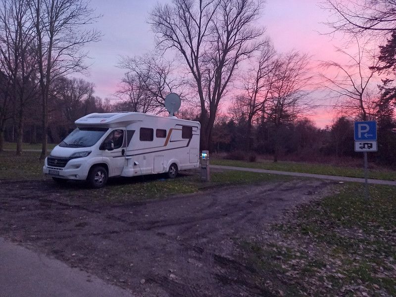
Weisenbach, Deutschland
End of a wonderful, interesting and varied journey.
Almost all expectations were met except for the "Northern Lights", which unfortunately did not appear as we had hoped.
But: After the trip is before the trip......
Weisenbach , Deutschland
48° 43' 46.8" N 8° 21' 13.9" E
48.7296780 8.3538550