At the beginning of September 2020 we 🙋 ♀️🙋 ♂️ went on a big autumn trip in the 🚐💨 box van to 🇮🇹 Tuscany. In total it was 🛣 3,177 KM in 15 days.
Our journey takes us via Füssen in the Allgäu and north of Lake Garda along the Ligurian coast into the heart of Tuscany. In the varied natural and 🇺🇳 cultural landscape between the coast, valleys and the Chianti vineyards, we also visit the medieval cities 🏰 Volterra, San Gimignano, Siena, Pienza and Montepulciano.
This was our least planned trip yet with the biggest surprises one 😴 night before departure.
You can also find our travel report on our 🎥 YouTube channel (https://tinyurl.com/ErstmalDurchEuropa) and also as a playlist (https://tinyurl.com/EdE-Toskana2020).
Day
Day
Parkplatz an der Abt-Hafner-Straße, 87629 Füssen, Deutschland
On the way south we stop in the Allgäu. Here in Füssen we are already soaking up the sun before we continue to Austria tomorrow. Our parking space is located directly at the glider airfield.
Abt-Hafner-Straße, 87629 Füssen, Deutschland
47° 34' 56.9" N 10° 42' 4" E
47.5824861 10.7011040
• Head east on Abt-Hafner-Straße. Go for 214 m.
• Turn right onto Hopfener Straße (St2008). Go for 319 m.
• Take the 2nd exit from roundabout onto Augsburger Straße (B16) toward A7/Ulm/Innsbruck/Kaufbeuren/Kempten/B310. Go for 348 m.
• Turn left onto B310 toward Ulm/A7/Innsbruck/Kempten/Pfronten/Weißensee/Gewerbegebiet Füssen-West. Go for 3.8 km.
• Take ramp onto A7 toward Innsbruck/Reutte/Fernpass. Go for 2.3 km.
• Continue on Grenztunnel Füssen (B179). Go for 49.1 km.
• Continue on Mieminger Bundesstraße (B189). Go for 13.4 km.
• Take the 1st exit from roundabout onto Krebsbach (L236) toward Innsbruck/Bregenz/Mötz. Go for 5.0 km.
• Turn right and take ramp onto A12 (Inntal Autobahn) toward Innsbruck. Go for 35.6 km.
• Keep right onto A13 (Knoten Innsbruck-Wilten) toward E45/Bozen/Brenner/Innsbruck-Süd. Go for 33.5 km.
• Continue on A22 (Autostrada del Brennero). Go for 166 km.
• Take the exit toward Rovereto Sud/Lago di Garda Nord. Go for 1.3 km.
• Take the 4th exit from roundabout toward Mori/Riva D/G/Arco. Go for 306 m.
• Continue on SS240. Go for 6.2 km.
• Pass 2 roundabouts and continue on Strada Rivana (SS240). Go for 5.1 km.
• Take the 4th exit from roundabout onto Strada Statale di Loppio e Val di Ledro (SS240) toward Torbole/Riva del Garda. Go for 2.0 km.
• Take the 1st exit from roundabout onto Via Giacomo Matteotti (SS240) toward Arco/SS249/Limone S/G./SS45. Go for 768 m.
• Take the 2nd exit from roundabout onto Via Gardesana (SS240). Go for 1.8 km.
• Take the 2nd exit from roundabout onto Viale Rovereto (SS240). Go for 163 m.
• Turn left onto Via Rainer Maria Rilke. Go for 161 m.
• Arrive at Via Rainer Maria Rilke.
☍
327,8 km
(4 hrs. 1 min.)
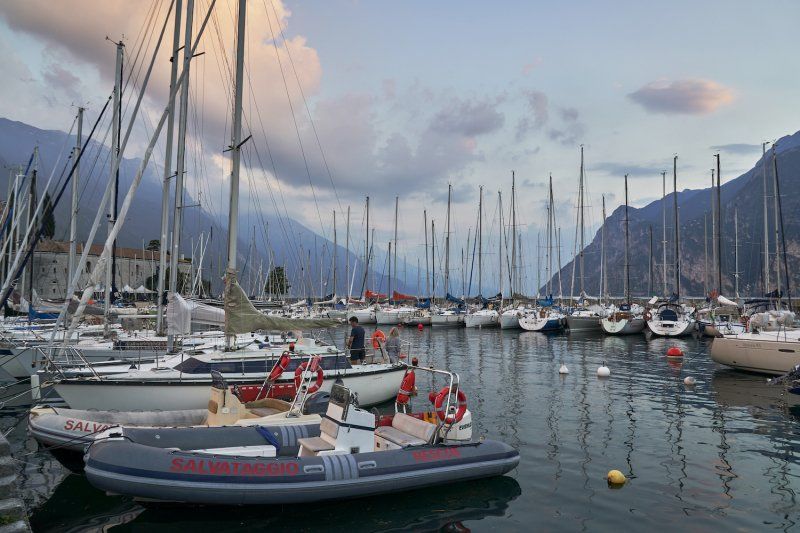
Parkplatz an der Via Rainer Maria Rilke in Riva del Garda
Finally accepted after a long drive over Fernpass and Brenner, with a lot of traffic jams around Lake Garda. First drink at the Bulli? enjoyed and then counted the stars over the lake.
Via Rainer Maria Rilke, 38066 Riva del Garda TN, Italien
45° 52' 55.2" N 10° 51' 5" E
45.8820057 10.8513833
• Head toward Viale Rovereto on Via Rainer Maria Rilke. Go for 161 m.
• Turn right onto Viale Rovereto (SS240). Go for 117 m.
• Pass 2 roundabouts and continue on Via Gardesana (SS240). Go for 2.5 km.
• Take the 2nd exit from roundabout onto Strada Statale di Loppio e Val di Ledro (SS240) toward Autostrada/A22/Nago/Rovereto. Go for 1.9 km.
• Pass 3 roundabouts and continue on Località Loppio (SS240). Go for 11.4 km.
• Keep right toward Brennero/Modena. Go for 196 m.
• Take ramp onto A22 (Autostrada del Brennero) toward Modena/Verona. Go for 147 km.
• Take the exit toward Reggio E.-Milano/Parma/A15/La Spezia onto A1 (Autostrada del Sole). Go for 53.2 km.
• Take the exit toward La Spezia/Parma Ovest onto A15 (Autostrada della Cisa). Go for 74.9 km.
• Take the exit toward Pontremoli. Go for 405 m.
• Continue on Strada Provinciale della Val di Magra (SP31). Go for 1.3 km.
• Turn left onto Via Campolonghi (SS62). Go for 1.4 km.
• Turn left onto Via Bonaventuri Galli. Go for 50 m.
• Turn left onto Via Pietro Cocchi. Go for 49 m.
• Arrive at Via Pietro Cocchi. Your destination is on the left.
☍
294,6 km
(2 hrs. 49 min.)
Day
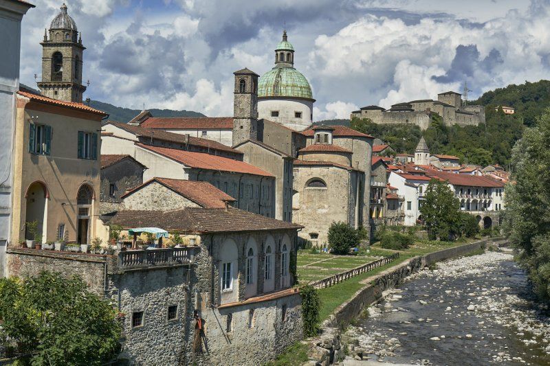
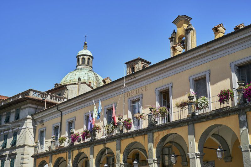
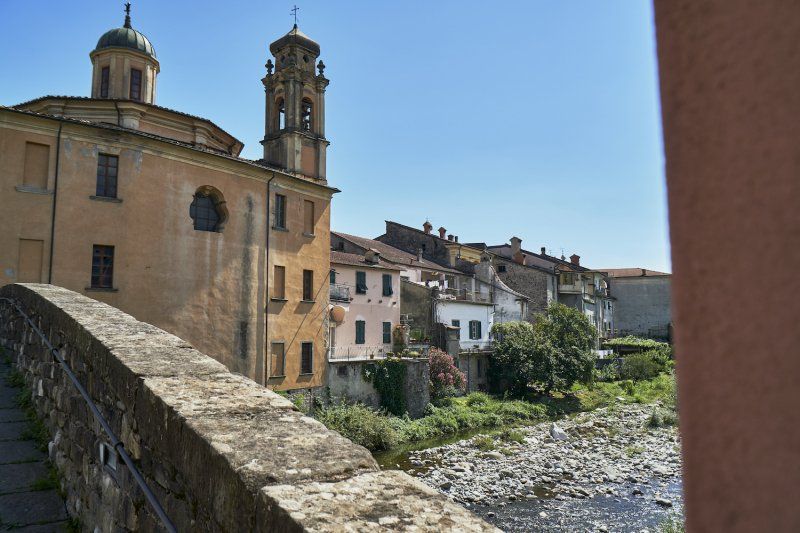
Parkplatz an der Via Giuseppe Mazzini 85 in Pontremoli
The first destination on the way to Tuscany is the town of Pontremoli, which is well worth seeing and which definitely wants to be discovered on foot.
Via Giuseppe Mazzini, 85, 54027 Pontremoli MS, Italien
44° 22' 26" N 9° 53' 9.7" E
44.3738790 9.8860194
• Head toward Via Paolo Belmesseri on Via Pietro Cocchi. Go for 153 m.
• Continue on Via Alessandro Malaspina. Go for 240 m.
• Turn left onto Via della Madonna del Buon Consiglio. Go for 30 m.
• Turn right onto Viale dei Mille (SS62). Go for 960 m.
• Turn right onto Strada Provinciale della Val di Magra (SP31). Go for 1.3 km.
• Turn left and take ramp onto A15 (Autostrada della Cisa) toward E80/Genova/A12/Livorno/La Spezia. Go for 25.8 km.
• Take the exit toward Firenze/A11/E76/Livorno onto A12 (Autostrada Azzurra). Go for 42.9 km.
• Take the exit toward Viareggio/Camaiore. Go for 2.4 km.
• Keep left toward Viareggio/Torre del Lago/Aurelia-Pisa/SS1. Go for 1.4 km.
• Take ramp onto Strada Statale Aurelia (SS1) toward Torre del Lago/Aurelia-Pisa. Go for 3.6 km.
• Take ramp toward Bicchio/Quartiere Varignano. Go for 288 m.
• Take the 3rd exit from Rotonda dei Venti roundabout onto Via Scirocco. Go for 634 m.
• Turn right onto Vietta dei Comparini. Go for 387 m.
• Pass 2 roundabouts and continue on Vietta dei Comparini. Go for 1.4 km.
• Turn left onto Viale dei Tigli. Go for 212 m.
• Turn left onto Quartiere Ermete Zacconi. Go for 222 m.
• Turn left onto Quartiere Ermete Zacconi. Go for 115 m.
• Turn left onto Via dei Contadini. Go for 50 m.
• Arrive at Via dei Contadini. Your destination is on the right.
☍
82,2 km
( 53 min.)
Campeggio Paradiso
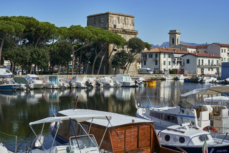
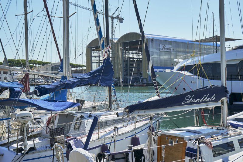
Very relaxing stay in Viareggio, Tuscany. The times of the bathing beaches (ital. bagno) do not seem to want to end here. We stroll through the alleys and along the beach promenade to the marina with its Bianetti shipyard and its super yachts.
Viale dei Tigli 34, 55049, Viareggio, Italien
43° 50' 59" N 10° 15' 49.9" E
43.8497300 10.2638600
• Head toward Via dei Lecci on Via dei Contadini. Go for 351 m.
• Turn right onto Via dei Lecci. Go for 2.2 km.
• Make a U-Turn onto Via dei Lecci. Go for 95 m.
• Keep right onto Via dei Lecci. Go for 88 m.
• Continue on Via Giovanni Falcone e Paolo Borsellino. Go for 626 m.
• Continue on Cavalcavia dell'Arcobaleno. Go for 295 m.
• Take the 2nd exit from roundabout onto Via Fosso Guidario. Go for 571 m.
• Take the 2nd exit from roundabout onto Strada Statale Aurelia (SS1) toward Firenze/A11/Livorno/A12/Pisa. Go for 2.1 km.
• Take the 2nd exit from roundabout onto Strada Statale Aurelia (SS1) toward Firenze/A11/Livorno/A12/Pisa. Go for 5.5 km.
• Take the 1st exit from roundabout onto SS1 toward Pisa. Go for 153 m.
• Take the 2nd exit from roundabout onto Autostrada Firenze Mare (A11) toward E80/A12/Livorno/Genova/E74/Firenze. Go for 379 m.
• Take the exit toward E80/Genova/A12/Livorno/Rosignano M. onto Svincolo Pisa Nord. Go for 509 m.
• Take the left exit toward Rosignano M./Roma/Livorno onto A12 (Autostrada Azzurra). Go for 59.5 km.
• Continue on Strada Statale Aurelia (SS1). Go for 8.0 km.
• Take ramp toward La California. Go for 362 m.
• Take ramp onto Via Aurelia Sud (SP39) toward Bibbona. Go for 3.5 km.
• Take the 2nd exit from roundabout onto Strada Provinciale Vecchia Aurelia (SP39). Go for 2.8 km.
• Turn left onto Strada Provinciale San Guido (SP16). Go for 118 m.
• Arrive at Strada Provinciale San Guido (SP16).
☍
87,1 km
( 56 min.)
Day
Zypressenalle bei Bolgheri
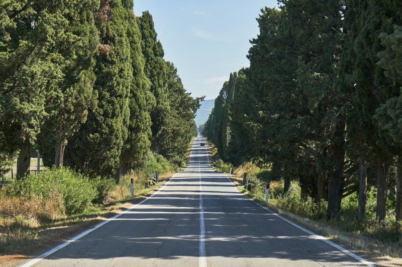
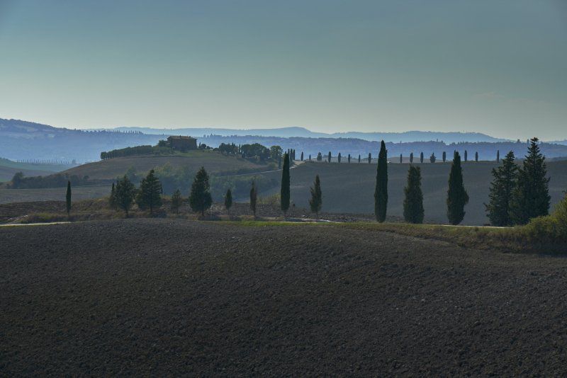
After leaving Viareggio in a southerly direction, we drove near the coast past Pisa and Livorno to Bolgheri. Along an approximately 5 km long cypress avenue you drive towards the medieval city wall. We ate excellent regional dishes (including tagliatelle al tartufo fresco) and strolled through this picturesque village. We left this town via the Etruscan wine and coast road (Strada del vino costa degli etruschi).
Località S. Guido, 50, 57022 Bolgheri LI, Italien
43° 13' 34.5" N 10° 33' 41" E
43.2262445 10.5613988
• Head toward Strada Provinciale Vecchia Aurelia on Strada Provinciale San Guido (SP16). Go for 118 m.
• Turn right onto Strada Provinciale Vecchia Aurelia (SP39). Go for 1.8 km.
• Turn right onto Via Campigliese. Go for 4.5 km.
• Turn left onto Strada Provinciale Bolgherese (SP16). Go for 559 m.
• Turn right onto Strada Provinciale della Camminata (SP15). Go for 2.1 km.
• Continue on Strada Provinciale Camminata (SP19). Go for 7.6 km.
• Turn left onto Strada Provinciale dei Quattro Comuni (SP18). Go for 2.0 km.
• Take the 1st exit from roundabout onto Strada Regionale di Val di Cecina (SR68). Go for 7.8 km.
• Continue toward Via di Val di Cecina. Go for 34 m.
• Take the 1st exit from roundabout onto Via di Val di Cecina. Go for 211 m.
• Continue on Strada Regionale di Val di Cecina (SR68). Go for 5.3 km.
• Take the 1st exit from Via Volterrana roundabout onto Via Volterrana (SR68). Go for 9.0 km.
• Take the 1st exit from roundabout onto Viale Giuseppe Garibaldi (SR68). Go for 779 m.
• Turn right onto Via della Stazione. Go for 203 m.
• Turn slightly right onto Piazzale Principe Piero Ginori Conti. Go for 22 m.
• Turn left. Go for 23 m.
• Turn left. Go for 126 m.
• Arrive at your destination on the right.
☍
42,0 km
( 47 min.)
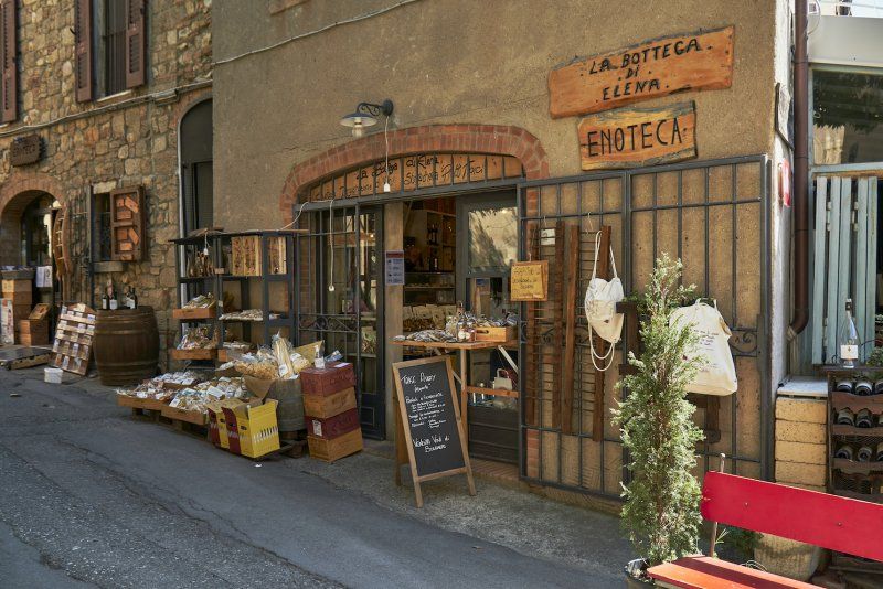
Parkplatz an der Piazzale ex Stazione Ferroviaria in Volterra
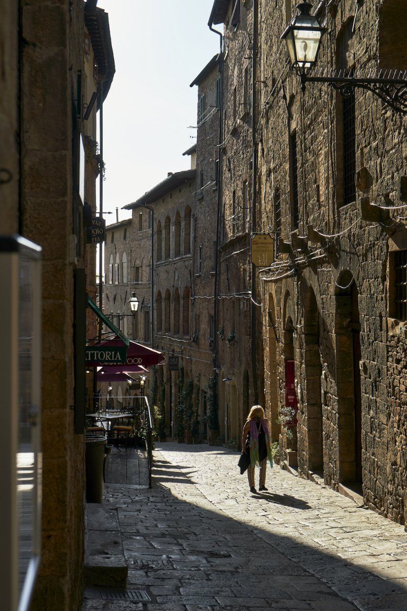
We reach the destination of Volterra after a very varied journey along the Etruscan wine and coast road (Strada del vino costa degli etruschi). We are just below the Medici Castle. The more than 100 steps are quickly climbed. We stroll through the streets and visited the old town around the Piazza dei Priori, which is well worth seeing and includes the oldest town hall in Tuscany.
Piazzale ex Stazione Ferroviaria, 56048 Volterra PI, Italien
43° 23' 56.7" N 10° 52' 14.3" E
43.3990882 10.8706391
• Head west. Go for 126 m.
• Turn right toward Piazzale Principe Piero Ginori Conti. Go for 23 m.
• Turn right onto Piazzale Principe Piero Ginori Conti. Go for 22 m.
• Turn slightly left onto Via della Stazione. Go for 131 m.
• Turn sharp right onto Via della Stazione. Go for 71 m.
• Continue on Viale Giosuè Carducci (SR68). Go for 11.1 km.
• Turn left onto Strada Provinciale del Cornocchio (SP53). Go for 6.8 km.
• Continue on Strada Provinciale di Camporbiano (SP62). Go for 3.6 km.
• Turn right onto Strada Provinciale di S. Gimignano (SP63). Go for 645 m.
• Continue on Strada Provinciale di Cellole (SP69). Go for 6.1 km.
• Take the 2nd exit from roundabout onto Via Martiri di Citerna (SP1) toward S.Gimignano Centro/Colle Val d'Elsa/Poggibonsi/Siena-Firenze. Go for 1.1 km.
• Turn sharp right onto Via Don E. Castaldi. Go for 28 m.
• Turn slightly left onto Via Giachi. Go for 61 m.
• Turn right onto Via Giachi. Go for 108 m.
• Arrive at Via Giachi.
☍
29,9 km
( 35 min.)
Day
Parkplatz an der Via Delfo Giachi in San Gimignano
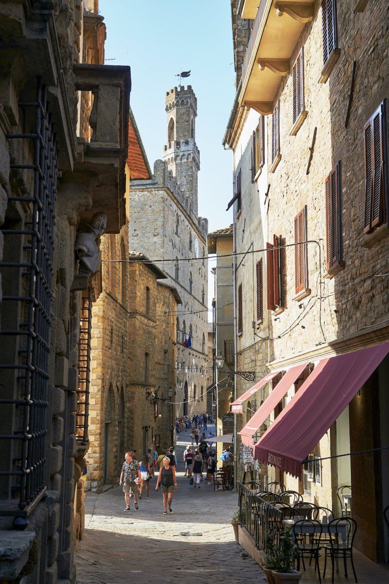
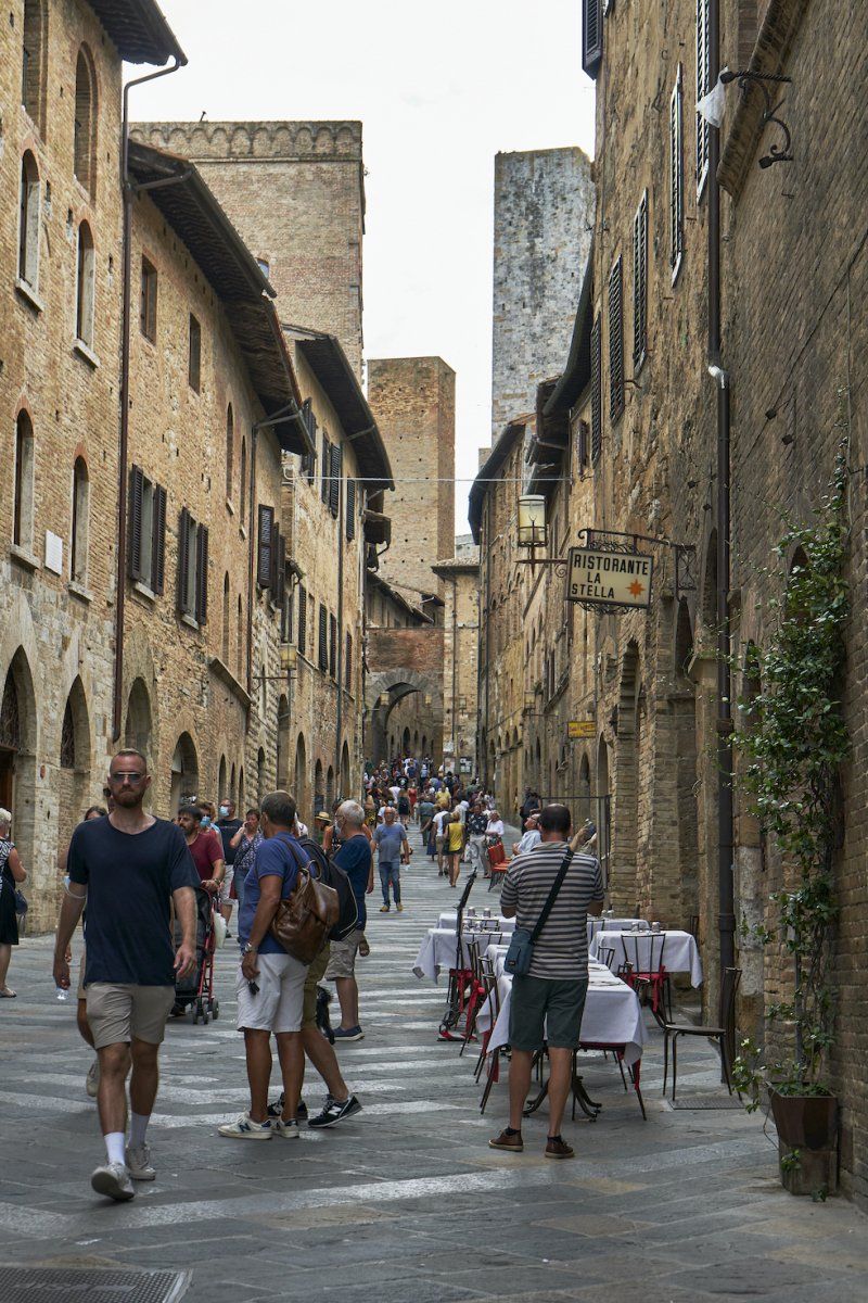
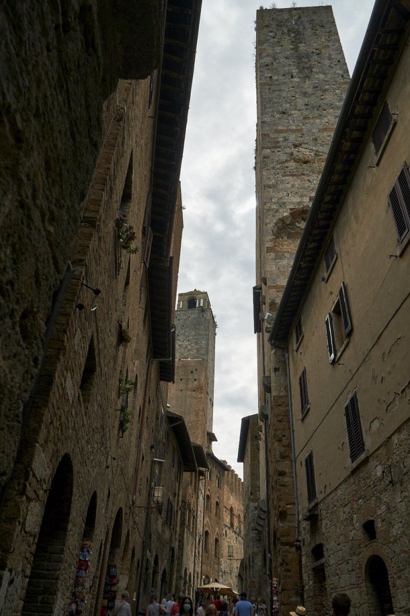
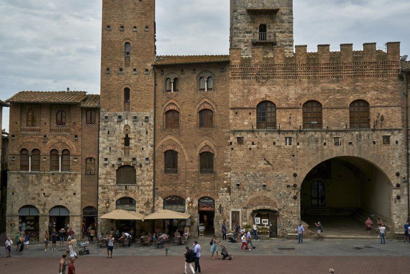
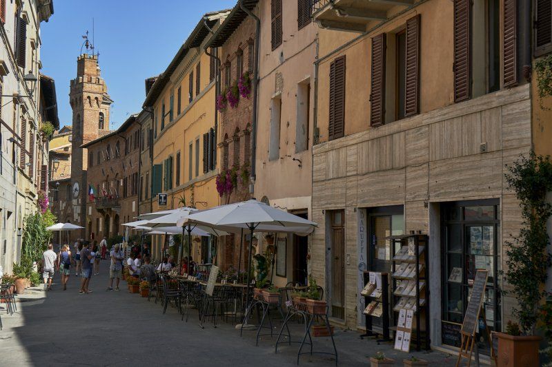
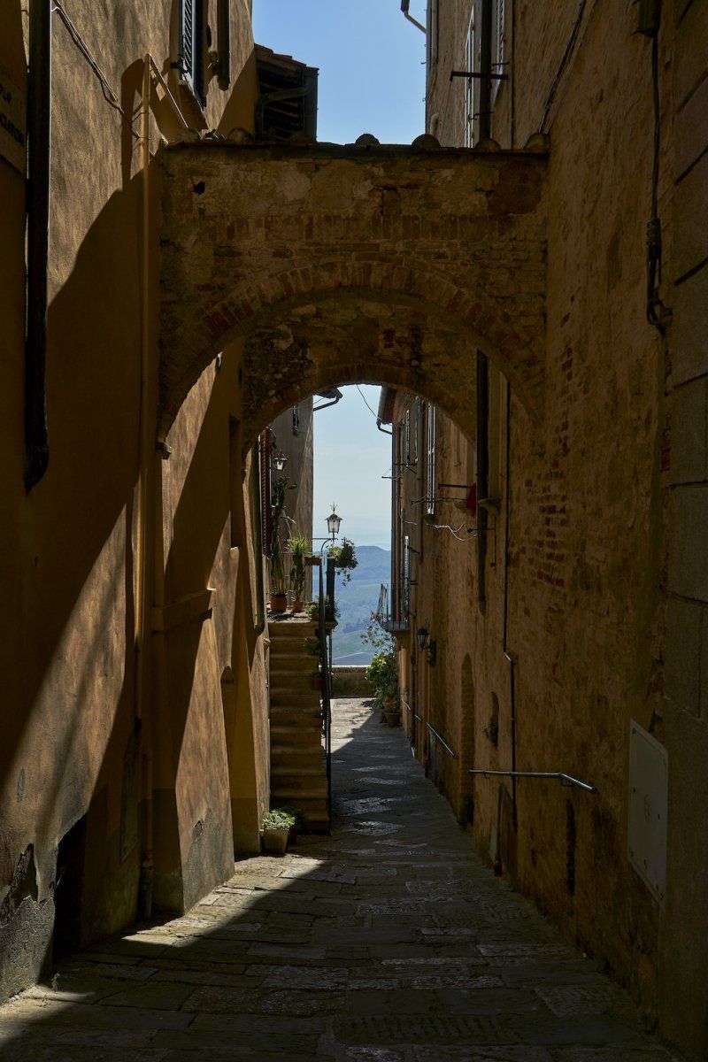
San Gimignano is referred to in our travel guide as the "Manhattan of the Middle Ages". This description speaks to us directly (got married in NYC) and we drive off. Despite the medieval architecture, the narrow and sometimes steep streets around the Piazza Duomo actually give us the feeling of being surrounded by high-rise buildings, as the towers tower conspicuously above the building height that is otherwise typical of this era. The world's best ice cream was of course also available here.
Via Delfo Giachi, 53037 San Gimignano SI, Italien
43° 28' 12.9" N 11° 2' 12.9" E
43.4702385 11.0369151
• Head northeast on Via Giachi. Go for 108 m.
• Turn left onto Via Giachi. Go for 61 m.
• Turn slightly right onto Via Don E. Castaldi. Go for 28 m.
• Turn right onto Strada Provinciale di San Gimignano (SP1). Go for 197 m.
• Turn left onto Strada Provinciale di Ulignano (SP127) toward Ulignano/Cusona. Go for 7.8 km.
• Turn right onto Via Sottobosco (SP95). Go for 542 m.
• Turn left toward Poggibonsi/Certaldo/Empoli. Go for 131 m.
• Take the 1st exit from roundabout onto Strada Regionale di Val d'Elsa (SR429) toward Poggibonsi/Raccordo Si-Fi. Go for 1.7 km.
• Take the 2nd exit from roundabout onto Strada Regionale di Val d'Elsa (SR429) toward Poggibonsi/Raccordo Si-Fi. Go for 2.4 km.
• Continue on Collegamento Siena-Firenze SS429 (SR429bis). Go for 2.1 km.
• Take the 2nd exit from roundabout onto Superstrada Firenze-Siena (RA3) toward Zona Industriale Pian dei Peschi/Siena. Go for 14.7 km.
• Take ramp toward Monteriggioni. Go for 229 m.
• Take the 2nd exit from roundabout onto Strada Regionale Cassia (SR2) toward Monteriggioni/Siena. Go for 1.2 km.
• Arrive at Strada Regionale Cassia (SR2). Your destination is on the left.
☍
31,1 km
( 28 min.)
Stellplatz an der Strada Regionale 2 in Monteriggioni
SR2, 142, 53035 Monteriggioni SI, Italien
43° 23' 8.5" N 11° 13' 35.1" E
43.3857067 11.2264118
• Head east on Strada Regionale Cassia (SR2). Go for 1.2 km.
• Turn left. Go for 148 m.
• Turn right toward Via Cassia Nord/SR2. Go for 103 m.
• Turn sharp right onto Via Cassia Nord (SR2). Go for 2.6 km.
• Pass 3 roundabouts and continue on Strada Regionale Cassia (SR2). Go for 2.5 km.
• Turn right onto Strada Provinciale di Castellina in Chianti (SP51) toward Castellina in Ch./SR222/Radda in Ch./SR429/Zona Industriale Via Abate. Go for 10.4 km.
• Continue on Strada Provinciale di Castagnoli (SP51). Go for 46 m.
• Turn left onto Via 4 Novembre (SR222). Go for 2.7 km.
• Turn right onto Strada Regionale di Val d'Elsa (SR429) toward Radda in C/Gaiole in C/Montevarchi. Go for 9.4 km.
• Turn right onto Circonvallazione Santa Maria. Go for 172 m.
• Turn left onto Via degli Ulivi. Go for 25 m.
• Turn slightly left onto Via degli Ulivi. Go for 49 m.
• Arrive at Via degli Ulivi. Your destination is on the right.
☍
29,4 km
( 33 min.)
Day
Parkplatz an der Via degli Ulivi in Radda in Chianti
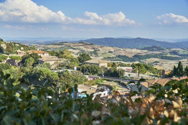
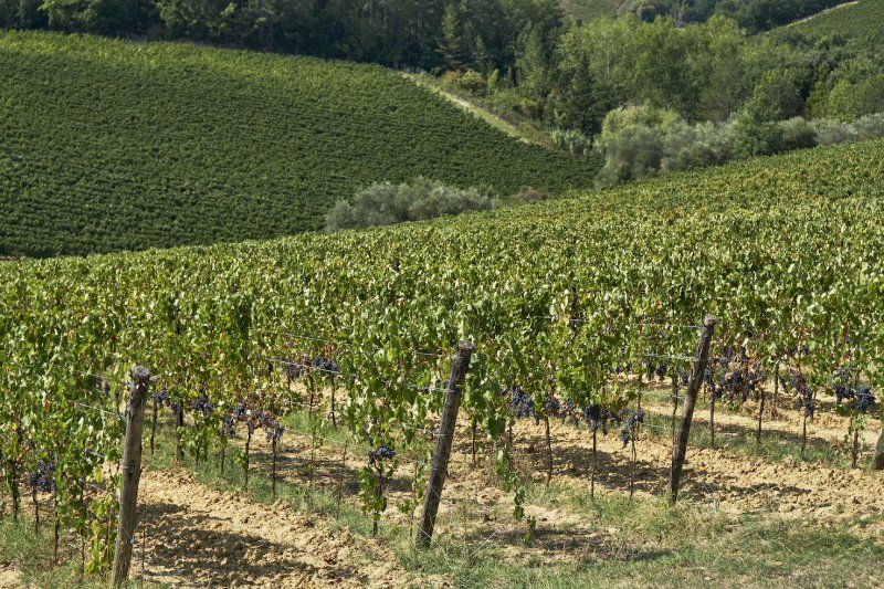
Today we drive through the Chianti wine region in Tuscany. On our way to Siena we stop near Poggibonsi and Radda where we have lunch.
Via degli Ulivi, 53017 Radda in Chianti SI, Italien
43° 29' 9.5" N 11° 22' 30.9" E
43.4859749 11.3752404
• Head south on Via degli Ulivi. Go for 74 m.
• Turn right onto Circonvallazione Santa Maria. Go for 172 m.
• Turn left onto Viale 20 Settembre (SR429). Go for 9.4 km.
• Turn left onto Strada Regionale Chiantigiana (SR222) toward SS222/Castellina in C./San Donato in P./Siena/Poggibonsi. Go for 8.5 km.
• Turn right onto Strada Provinciale delle Badesse (SP119). Go for 6.5 km.
• Take the 2nd exit from roundabout onto Via della Resistenza (SP119). Go for 359 m.
• Turn left onto Strada di Basciano. Go for 1.0 km.
• Take ramp onto Superstrada Firenze-Siena (RA3) toward Siena. Go for 9.5 km.
• Take ramp onto Strada Statale 73 Ponente toward Siena Ovest/Porta San Marco/Centro/Strada Statale Senese Aretina/SS73/Monticiano/Massa Marittima/Siena/Roma/SS2. Go for 365 m.
• Continue toward Siena S.Marco. Go for 92 m.
• Turn right onto Strada Massetana toward Siena Centro/SS2/Roma/Montalcino. Go for 134 m.
• Turn slightly left onto Strada Massetana (SP6). Go for 302 m.
• Take the 3rd exit from roundabout onto Strada Massetana Romana (SP6). Go for 313 m.
• Turn right onto Strada Massetana. Go for 973 m.
• Make a U-Turn onto Strada di Pescaia. Go for 320 m.
• Turn left toward Strada di Pescaia. Go for 25 m.
• Turn sharp left onto Strada di Pescaia. Go for 160 m.
• Arrive at Strada di Pescaia. Your destination is on the right.
☍
38,2 km
( 42 min.)
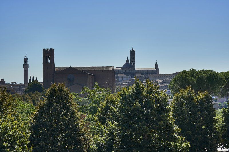
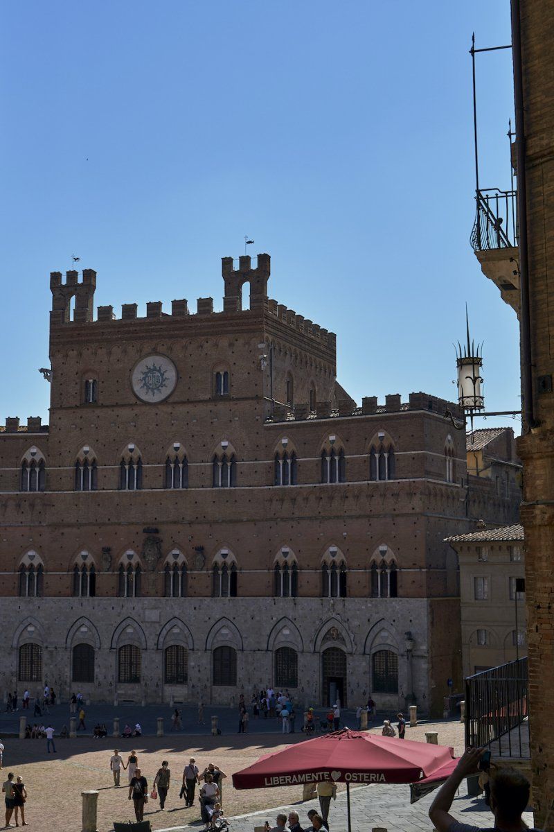
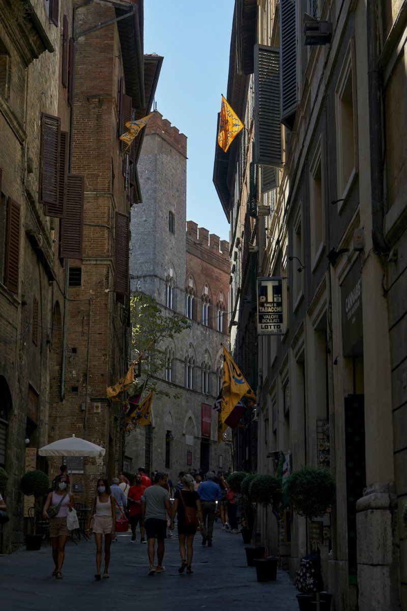
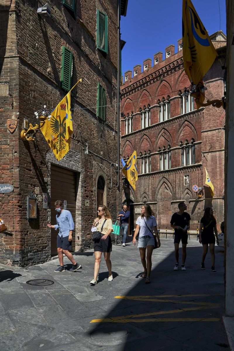
Stellplatz Parcheggio Il Fagiolone in Siena
We end the evening with a spritz at Campo in Siena.
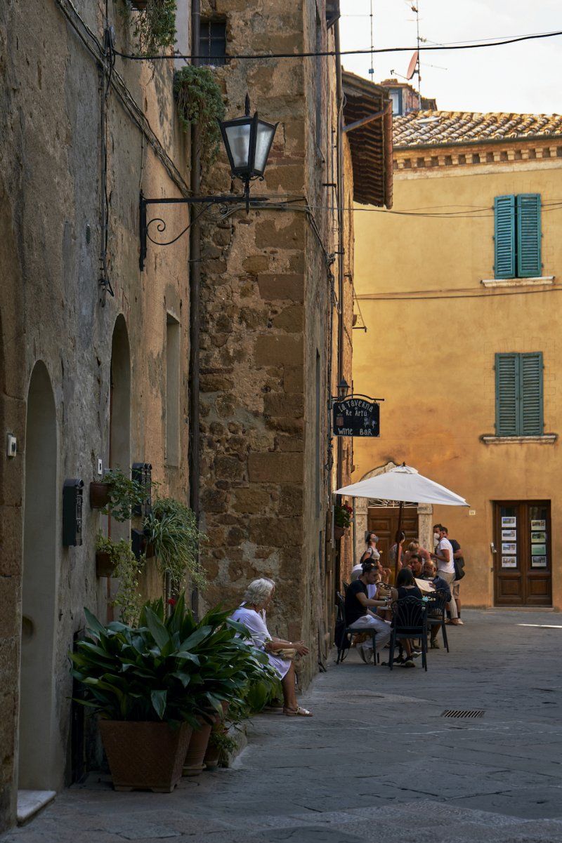
We also spend the next day here. The streets are decorated with the flag of the eagle (aquila). We drank Café Shakerato and Cappuccino at Il Bargello. At Manganelli we ate calzones with delicious local ingredients. A wedding party is celebrating next door. A long and beautiful day comes to an end
-50, Str. di Pescaia, 42, 53100 Siena SI, Italien
43° 18' 55" N 11° 19' 0.4" E
43.3152878 11.3167793
• Head north on Strada di Pescaia. Go for 134 m.
• Turn left onto Strada di Pescaia. Go for 851 m.
• Keep right toward Tangenziale Siena Ovest. Go for 107 m.
• Take ramp onto Tangenziale Siena Ovest toward Firenze. Go for 15.4 km.
• Take ramp toward Monteriggioni. Go for 340 m.
• Turn slightly left onto Strada Regionale Cassia (SR2) toward Monteriggioni/Zona Industriale Casone. Go for 222 m.
• Take the 3rd exit from roundabout onto Strada Regionale Cassia (SR2) toward Monteriggioni/Siena. Go for 119 m.
• Arrive at Strada Regionale Cassia (SR2). Your destination is on the left.
☍
17,1 km
( 12 min.)
Day
Stellplatz an der Strada Regionale 2 in Monteriggioni
SR2, 142, 53035 Monteriggioni SI, Italien
43° 23' 34.8" N 11° 13' 8" E
43.3930024 11.2188944
• Head southeast on Strada Regionale Cassia (SR2). Go for 28 m.
• Turn left toward Strada Regionale Cassia/SR2. Go for 31 m.
• Turn right onto Strada Regionale Cassia (SR2). Go for 66 m.
• Take the 2nd exit from roundabout toward Siena/A RA3. Go for 94 m.
• Take ramp onto Superstrada Firenze-Siena (RA3). Go for 17.0 km.
• Take ramp toward Siena Sud/Centro/Cassia/SS2. Go for 349 m.
• Turn left onto Strada di Sant'Apollinare toward Centro/Monteroni d'Arbia/Buonconvento/Montalcino/Roma/SS1. Go for 283 m.
• Turn right toward Strada di Sant'Apollinare. Go for 24 m.
• Take the 1st exit from Strada Massetana Romana roundabout onto Strada Massetana Romana (SP6) toward Porta Tufi/Porta Romana/Siena Centro/Monteroni d'Arbia/Buonconvento/Montalcino/Roma/SR2. Go for 743 m.
• Take the 1st exit from roundabout onto Strada Massetana Romana (SP6) toward Porta Romana/Porta Pispini/Monteroni d'Arbia/Buonconvento/Montalcino/Roma/SS2. Go for 889 m.
• Turn right onto Strada Regionale Cassia (SR2) toward Roma/SS2/Montalcino/Piancastagnaio/Abbadia S. S./Buonconvento/Monteroni d'Arbia. Go for 5.2 km.
• Take the 2nd exit from roundabout onto Strada Regionale Cassia (SR2) toward Roma/Buonconvento/Monteroni d'Arbia. Go for 3.4 km.
• Turn left onto Svincolo Monteroni d'Arbia Nord (SR2) toward Buonconvento/Asciano/Roma. Go for 4.1 km.
• Take the 2nd exit from roundabout onto Strada Regionale Cassia (SR2) toward Buonconvento/Roma. Go for 11.4 km.
• Arrive at Strada Regionale Cassia (SR2).
☍
43,7 km
( 37 min.)
Day
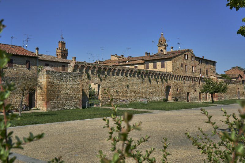
Parcheggio Gratuito in Buonconvento
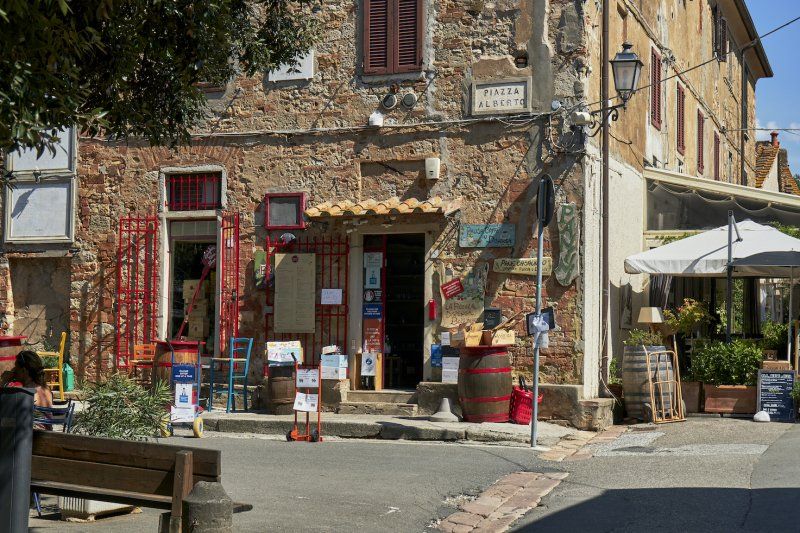
We pass by Buonconvento on our way through the Val d'Orcia and stop to visit this gem.
SR2, Buonconvento SI, Italien
43° 7' 53.9" N 11° 28' 56.5" E
43.1316403 11.4823677
• Head south on Strada Regionale Cassia (SR2). Go for 15.6 km.
• Take ramp toward Chiusi/A1/Montepulciano. Go for 191 m.
• Turn left onto Strada Provinciale di Chianciano (SP146) toward Chiusi/A1/Chianciano/Montepulciano/Pienza/S. Quirico. Go for 8.8 km.
• Take the 1st exit from roundabout onto Strada Provinciale di Chianciano (SP146). Go for 796 m.
• Continue on Via Enzo Mangiavacchi toward Montepulciano/Chianciano T./A1/Firenze-Roma. Go for 262 m.
• Turn left onto Via Mario Mencattelli. Go for 108 m.
• Turn left onto Via Mario Mencattelli. Go for 40 m.
• Arrive at Via Mario Mencattelli. Your destination is on the right.
☍
25,9 km
( 24 min.)
Punto Sosta Comunale an der Via Mario Mencatelli 40 in Pienza
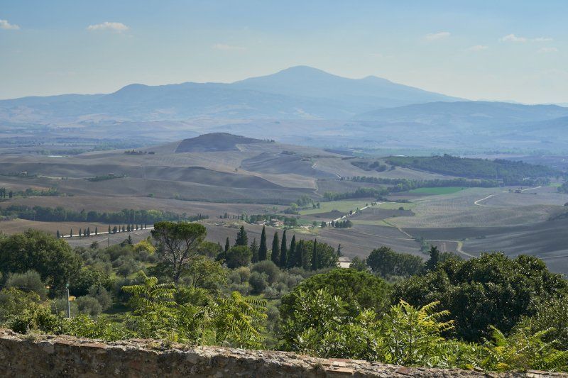
On our road trip today we drive through the Val d'Orcia with its numerous film sets and past well-known film locations. Ridley Scott shot the film Gladiator near Pienza, where the first scenes of the film began. From the city wall you have a very nice view of the valley. The many small streets with their numerous bistros and shops provide shade.
Via Mario Mencatelli, 40, 53026 Pienza SI, Italien
43° 4' 41.6" N 11° 40' 49.4" E
43.0782159 11.6803828
• Head west on Via Mario Mencattelli. Go for 274 m.
• Turn left onto Via di Circonvallazione. Go for 887 m.
• Turn right onto Via Fonti. Go for 176 m.
• Turn left. Go for 1.4 km.
• Turn left. Go for 88 m.
• Turn slightly left. Go for 20 m.
• Arrive at your destination on the left.
☍
2,8 km
( 7 min.)
Cipressi del Il Gladiatore
This is where Ridley Scott filmed the first scenes of the film "Gladiator". The waypoint is the field of view used for the Gladiator's Homecoming scenes early in the movie. The house is privately owned and not open to the public.
Podere Terrapille, 80, 53026 Pienza SI, Italien
43° 3' 56.6" N 11° 39' 54.6" E
43.0657200 11.6651630
• Head north. Go for 108 m.
• Turn right toward Via Fonti. Go for 1.4 km.
• Turn right onto Via Fonti. Go for 176 m.
• Turn left onto Via di Circonvallazione. Go for 887 m.
• Continue on Via Enzo Mangiavacchi. Go for 149 m.
• Turn right onto Via Tenente Niccolò Piccolomini. Go for 115 m.
• Turn slightly right onto Strada Provinciale di Chianciano (SP146) toward A1/Roma/Firenze/Montepulciano/Chianciano T. Go for 700 m.
• Take the 1st exit from roundabout onto Strada Provinciale di Chianciano (SP146). Go for 11.5 km.
• Continue on Via della Circonvallazione (SP17). Go for 1.4 km.
• Turn right onto Via delle Lettere. Go for 206 m.
• Turn right onto Piazzale Pietro Nenni. Go for 15 m.
• Turn right onto Piazzale Pietro Nenni. Go for 100 m.
• Turn left onto Piazzale Pietro Nenni. Go for 27 m.
• Arrive at Piazzale Pietro Nenni. Your destination is on the left.
☍
16,8 km
( 22 min.)
Stellplatz an der Piazza Pietro Nenni in Montepulciano
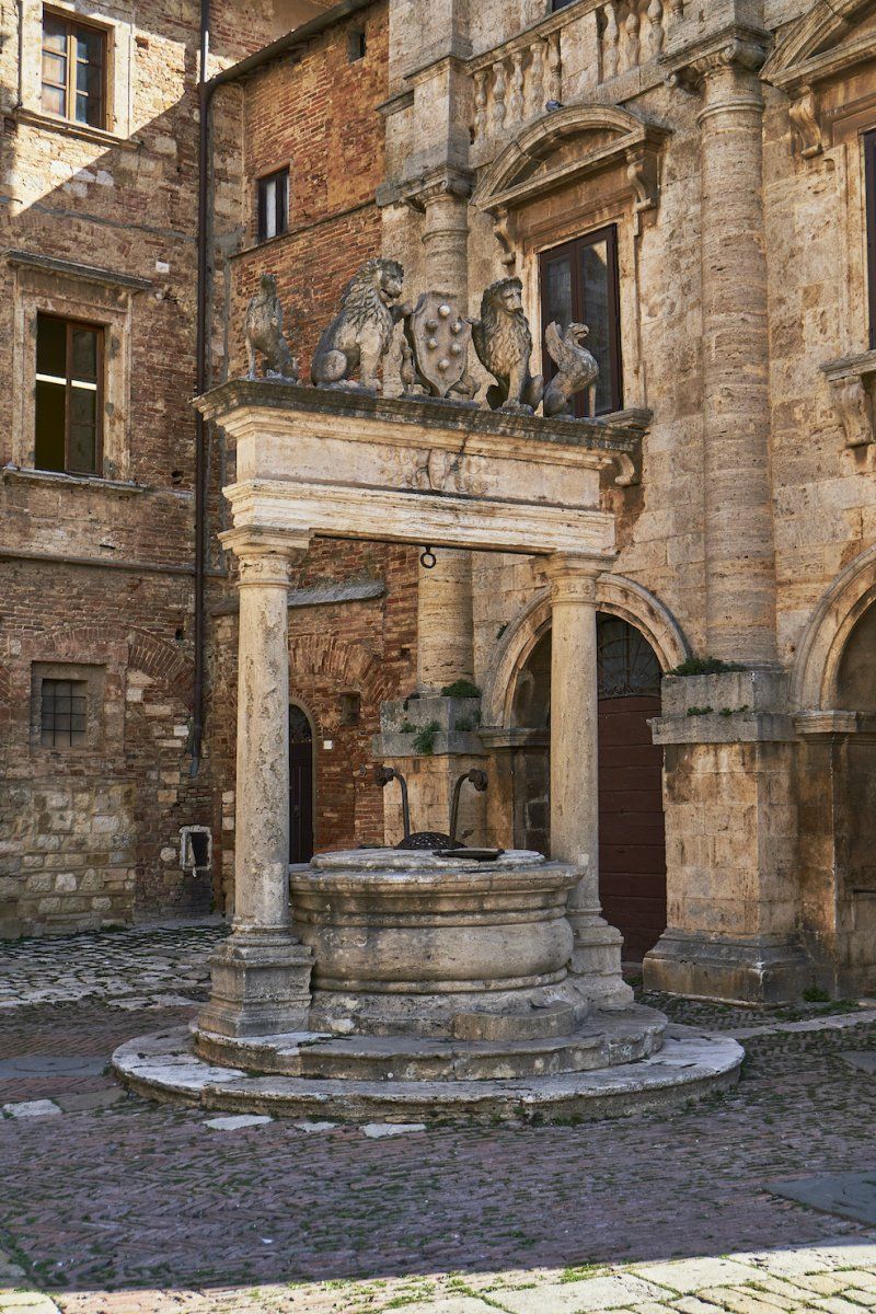
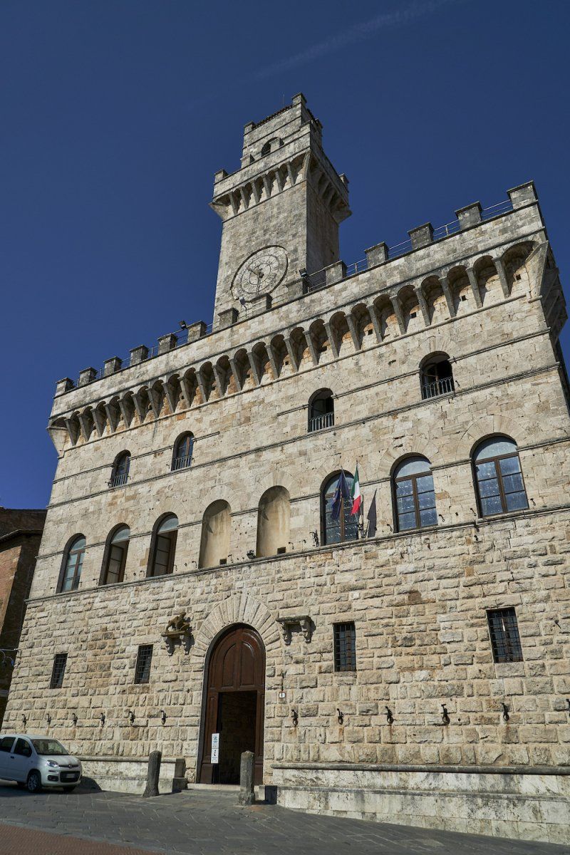
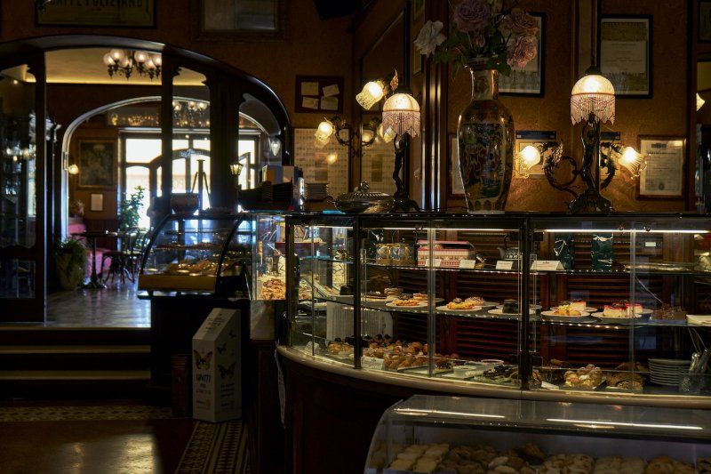
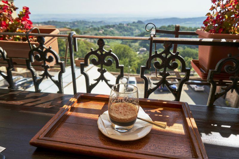
Up here in Montepulciano we enjoy cappuccino and caffe shakerato in Caffe Poliziano 1868 with a sunny view over the numerous hills of Tuscany, after we climbed the steep mountain and visited the Piazza Grande. Even Federico Fellini was inspired up here!
Piazza Pietro Nenni, 53045 Montepulciano SI, Italien
43° 5' 46.3" N 11° 47' 14.8" E
43.0961986 11.7874570
• Head east on Piazzale Pietro Nenni. Go for 160 m.
• Turn slightly left onto Piazzale dello Sterro. Go for 136 m.
• Continue on Via delle Lettere. Go for 173 m.
• Take the 3rd exit from roundabout onto Via Elio Bernabei. Go for 194 m.
• Turn right onto Viale Piero Calamandrei (SP17). Go for 1.4 km.
• Turn left onto Via di Torrita (SP135). Go for 60 m.
• Continue on SP135. Go for 2.1 km.
• Continue on Via di Torrita (SP135). Go for 1.2 km.
• Continue on SP135. Go for 35 m.
• Continue on Via di Torrita (SP135). Go for 1.8 km.
• Continue on SP135. Go for 858 m.
• Continue on Località Passaccio (SP135). Go for 218 m.
• Continue on SP135. Go for 1.0 km.
• Take the 2nd exit from roundabout toward Firenze-Roma/A1/Siena-Bettole/E70/Perugia/Arezzo/Foiano. Go for 1.0 km.
• Take the 2nd exit from roundabout. Go for 595 m.
• Take the 2nd exit from roundabout onto Via Basilicata toward Firenze-Roma/A1/Siena-Bettole/Perugia-Arezzo/Folano/SP327. Go for 255 m.
• Continue on Località Stradella. Go for 185 m.
• Continue on Via Basilicata. Go for 411 m.
• Take the 1st exit from roundabout onto Via Traversa Valdichiana Est (SP327) toward Firenze-Roma/A1/Bettolle. Go for 4.5 km.
• Take ramp onto A1 (Autostrada del Sole) toward Firenze. Go for 27.3 km.
• Take the exit toward Arezzo. Go for 384 m.
• Take the 2nd exit from roundabout toward Arezzo/Bibbiena/Sansepolcro/E78. Go for 122 m.
• Continue on Raccordo Arezzo-Battifolle. Go for 6.9 km.
• Keep left onto Viale Gaetano Salvemini. Go for 1.0 km.
• Turn right onto Viale dei Carabinieri. Go for 844 m.
• Take the 3rd exit from roundabout onto Via Baldaccio d'Anghiari. Go for 369 m.
• Take the 2nd exit from roundabout onto Via Bernardo Rossellino. Go for 247 m.
• Continue on Via Benedetto Varchi. Go for 254 m.
• Continue on Via della Chimera. Go for 301 m.
• Turn right onto Via Emilia. Go for 268 m.
• Take the 2nd exit from roundabout onto Via Bernardo Dovizi. Go for 129 m.
• Take the 2nd exit from roundabout onto Via Guido Tarlati. Go for 319 m.
• Take the 2nd exit from roundabout onto Via Guido Tarlati. Go for 379 m.
• Turn left onto Via Giovanni Pierluigi da Palestrina. Go for 235 m.
• Turn left onto Via Giovanni Pierluigi da Palestrina. Go for 23 m.
• Arrive at Via Giovanni Pierluigi da Palestrina. Your destination is on the right.
☍
55,5 km
( 45 min.)
Day
Area Attrezzata Camper Comunale, Via Pier Luigi da Palestrina 26 in Arezzo
We spent the afternoon in Arezzo. In this rather large city you have to look for the typical Tuscan shops, bars and bistros, but you can still find them in the small streets. Otherwise, this city is an alternative to the small towns in Tuscany that we liked so much.
Via Pier Luigi da Palestrina, 26, 52100 Arezzo AR, Italien
43° 28' 19.2" N 11° 53' 16.3" E
43.4720084 11.8878486
• Head toward Via Campaldino on Via Giovanni Pierluigi da Palestrina. Go for 133 m.
• Turn left onto Via Certomondo. Go for 53 m.
• Turn right onto Via Certomondo. Go for 65 m.
• Turn left onto Via Buonconte da Montefeltro (SP44). Go for 129 m.
• Turn right onto Via Guido Tarlati. Go for 192 m.
• Take the 2nd exit from roundabout onto Via Guido Tarlati. Go for 366 m.
• Take the 2nd exit from roundabout onto Via Bernardo Dovizi. Go for 127 m.
• Take the 2nd exit from roundabout onto Via Emilia. Go for 326 m.
• Turn right onto Via della Chimera. Go for 914 m.
• Take the 3rd exit from roundabout onto Viale Giovanni Amendola toward Cortona/Sansepolcro/Siena/Firenze/Perugia/Cesena/Forlì/Ospedale/Zona Industriale Pratacci. Go for 854 m.
• Continue on Via Fiorentina. Go for 165 m.
• Continue on Viale Don Giovanni Minzoni. Go for 190 m.
• Take ramp onto Viale Gaetano Salvemini toward Ospedale S. Donato/Ospedale Pronto Soccorso/Centro/Autostrada/Ponte a Chiani/Zona Industriale Pratacci/Firenze-Roma/A1/Ponte a Chianni. Go for 1.1 km.
• Continue on Raccordo Arezzo-Battifolle. Go for 1.9 km.
• Keep left onto Raccordo Arezzo-Battifolle toward Firenze/A1/Roma. Go for 5.0 km.
• Take the 2nd exit from roundabout toward Firenze/Roma. Go for 64 m.
• Take ramp onto A1 (Autostrada del Sole) toward Firenze. Go for 57.5 km.
• Take the exit toward Firenze Sud onto SP127 (Raccordo Di Varlungo). Go for 4.1 km.
• Continue on Via Generale Carlo Alberto Dalla Chiesa toward Settignano/Stadio Coverciano/Fiesole. Go for 834 m.
• Turn right. Go for 143 m.
• Arrive at your destination.
☍
74,1 km
( 46 min.)
Day
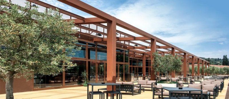
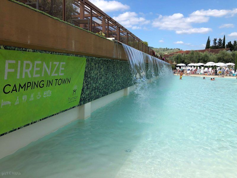
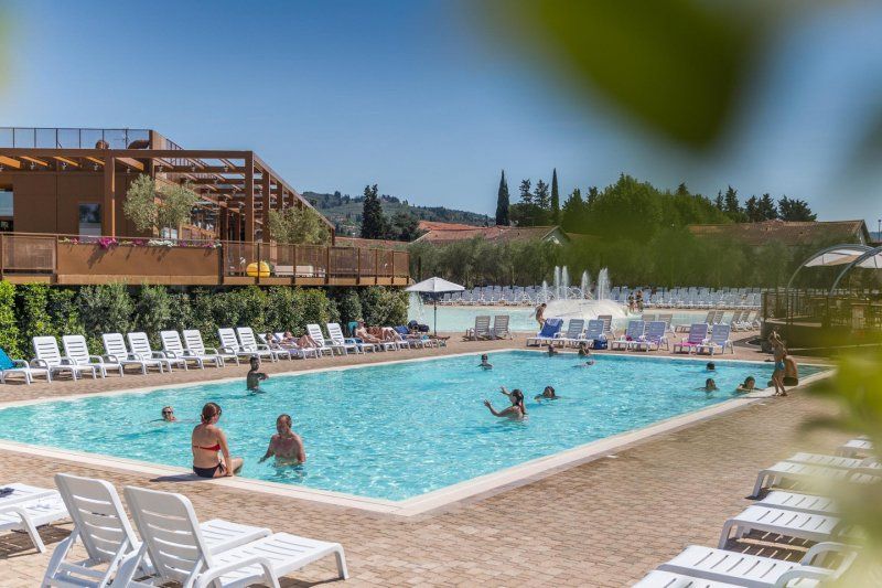
Firenze Camping in Town
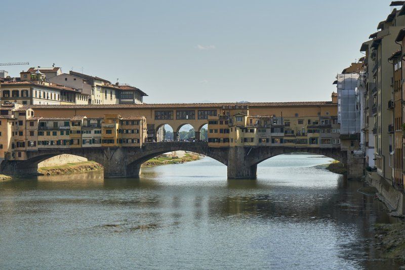
Time out in the largest city in Tuscany. We spend the next few days at the pool or in the Uffizi.
Viale Generale C. A. dalla Chiesa, 1/3, 50136, Italy
43° 45' 52.8" N 11° 18' 57.8" E
43.7646751 11.3160582
• Head south.
• Arrive at your destination.
☍
Distance not available
(Duration not available)
Day
Firenze Camping in Town
Time out in the largest city in Tuscany. We spend the next few days at the pool or in the Uffizi.
Viale Generale C. A. dalla Chiesa, 1/3, 50136, Italy
43° 45' 52.8" N 11° 18' 57.8" E
43.7646751 11.3160582
• Head north. Go for 143 m.
• Turn right onto Via Generale Carlo Alberto Dalla Chiesa (SS67). Go for 489 m.
• Take the 4th exit from Piazzale Renato Cappugi roundabout onto Via Aretina (SS67) toward Centro/A1/Autostrade/A11/Siena. Go for 1.5 km.
• Continue on Via Enrico De Nicola. Go for 204 m.
• Turn left onto Ponte Paolo Borsellino (SP127) toward Aeroporto A. Vespucci/Autostrade/A11/A1/Siena-Pisa/Via Villamagna/Bagno a Ripoli. Go for 3.7 km.
• Take left ramp onto A1 (Autostrada del Sole) toward Bologna/Siena/Firenze/A11/Pisa Nord. Go for 38.8 km.
• Keep right onto A1var toward Bologna/Barberino. Go for 39.1 km.
• Continue on A1 (Autostrada del Sole). Go for 63.7 km.
• Take the exit toward Brennero onto A22 (Autostrada del Brennero). Go for 313 km.
• Continue on A13 (Brennerpass). Go for 34.5 km.
• Continue on A12 (Inntal Autobahn). Go for 1.3 km.
• Take exit 73 toward Innsbruck-Ost onto B174 (Amraser-See-Straße). Go for 1.4 km.
• Keep left onto Innsbrucker Bundesstraße (B174) toward Zentrum Innsbruck. Go for 683 m.
• Turn slightly right onto Amraser Straße. Go for 707 m.
• Turn left onto Roseggerstraße. Go for 64 m.
• Turn right onto Anzengruberstraße. Go for 409 m.
• Turn left onto Purtschellerstraße. Go for 105 m.
• Turn right. Go for 18 m.
• Arrive at your destination on the right.
☍
500,1 km
(4 hrs. 28 min.)
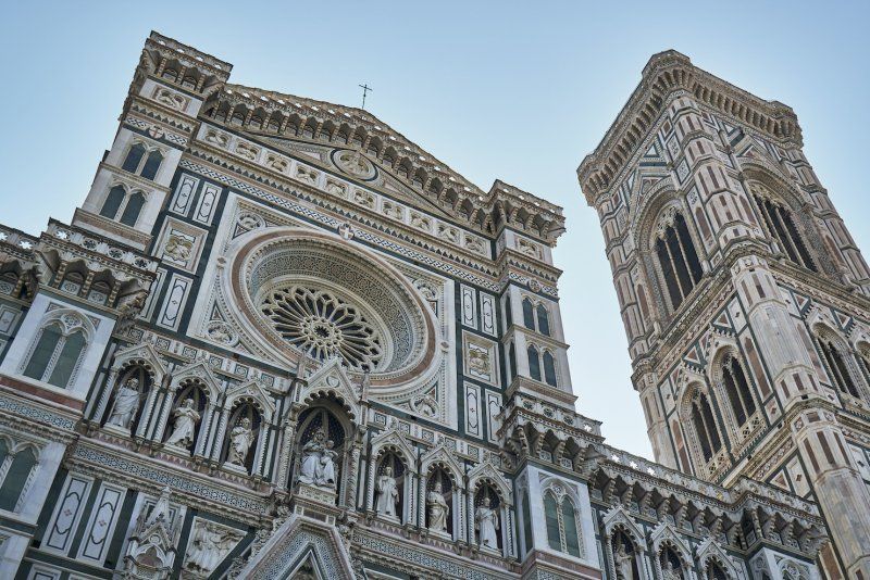
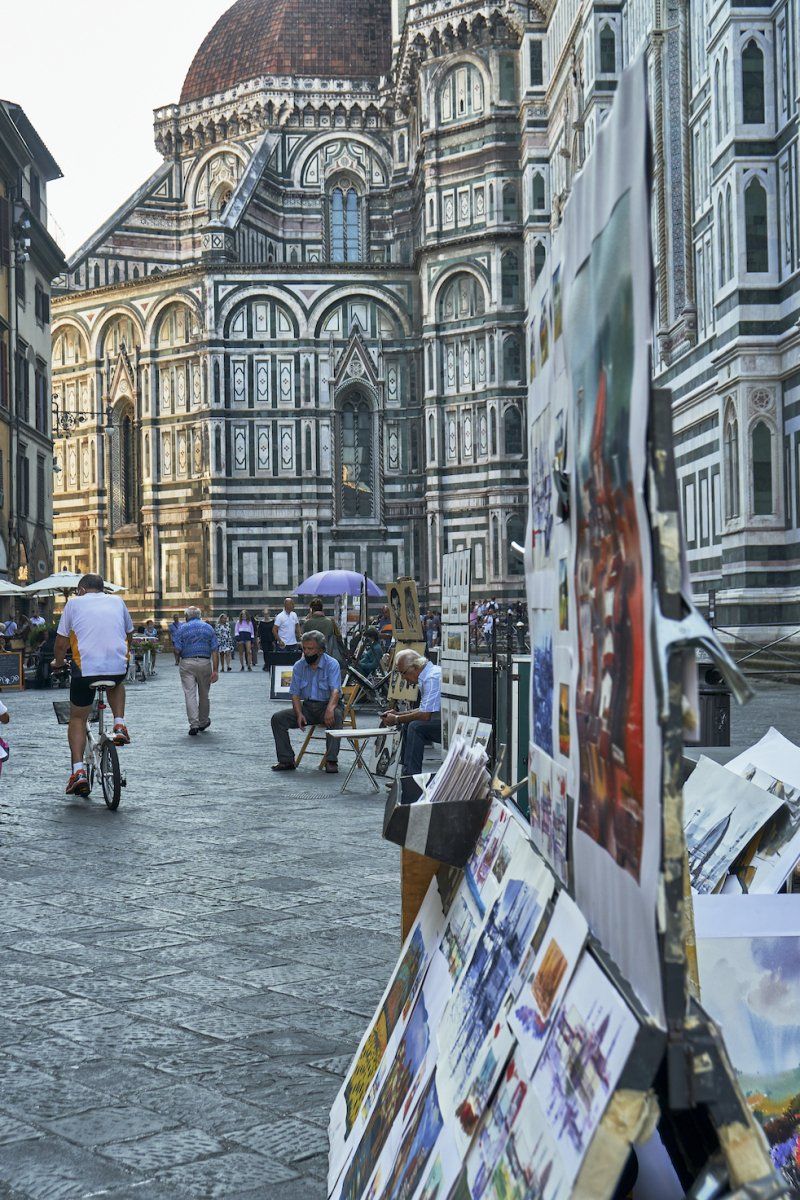
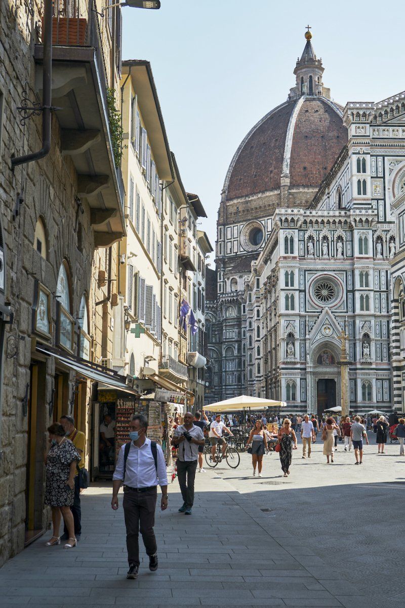
Frühstück in der Hochburg der Renaissance
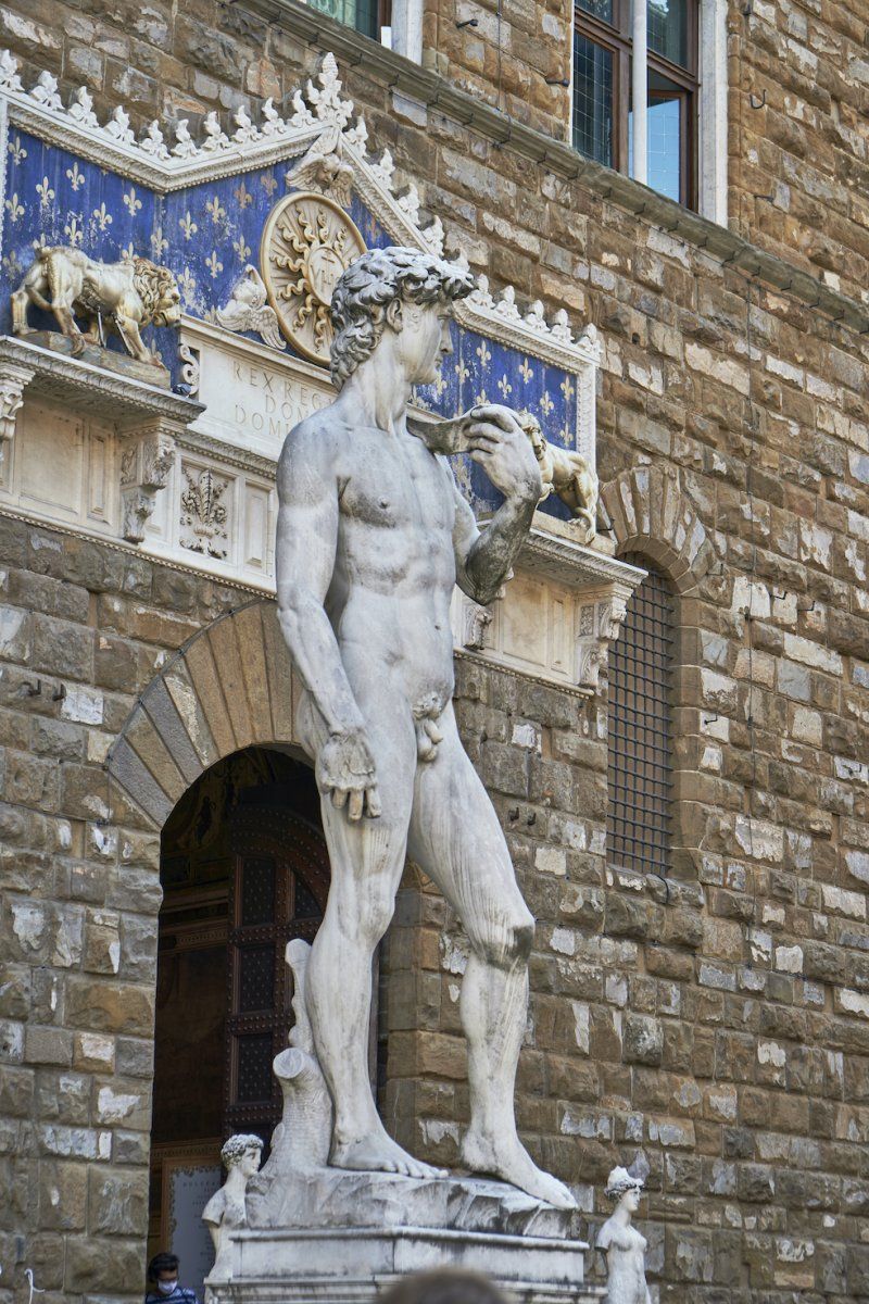
Breakfast at Il Bottegone in Florence in Piazza del Dumo in the shadow of the beautiful Duomo. Then past Palazzo Vecchio, Uffizi Gallery and through the small streets to the Orsanmichele Church.
Day
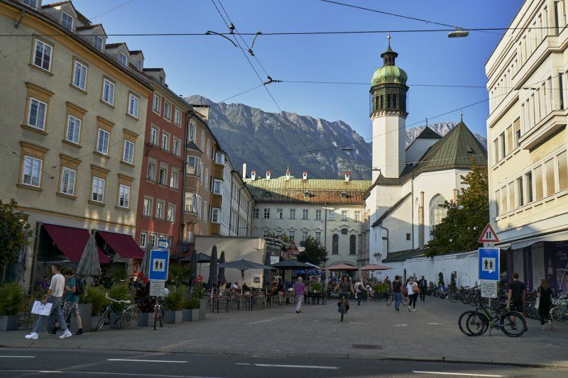
Parkplatz am Freibad Tivoli in Innsbruck
Purtschellerstraße 10, 6020 Innsbruck, Österreich
47° 15' 37.9" N 11° 24' 22" E
47.2605349 11.4061085