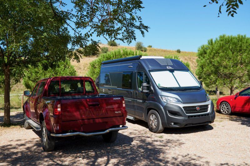
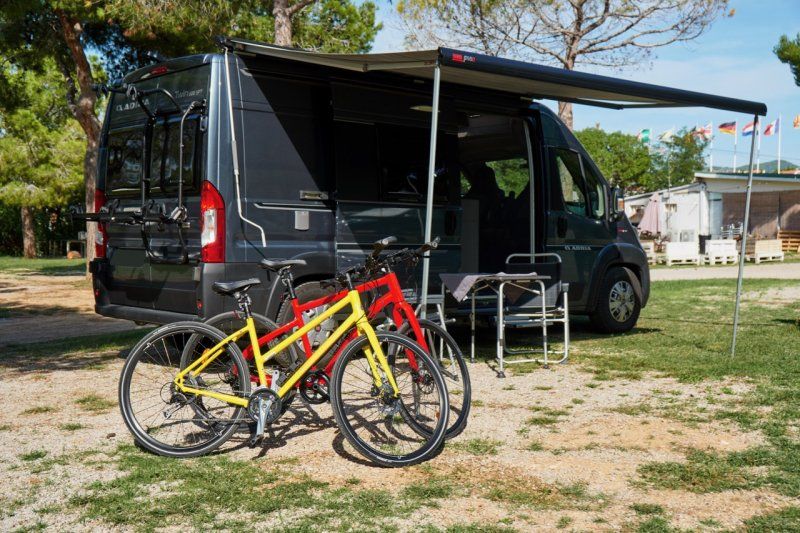
At the end of September 2019 we 🙋♀️🙋♂️ went on a big autumn trip in the 🚐💨 box van via 🇫🇷 France to 🇪🇸 Spain. In total it was 🛣 3,860 KM in 20 days.
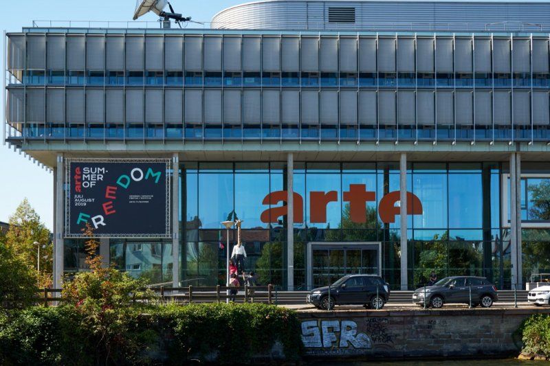
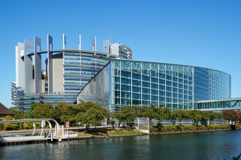
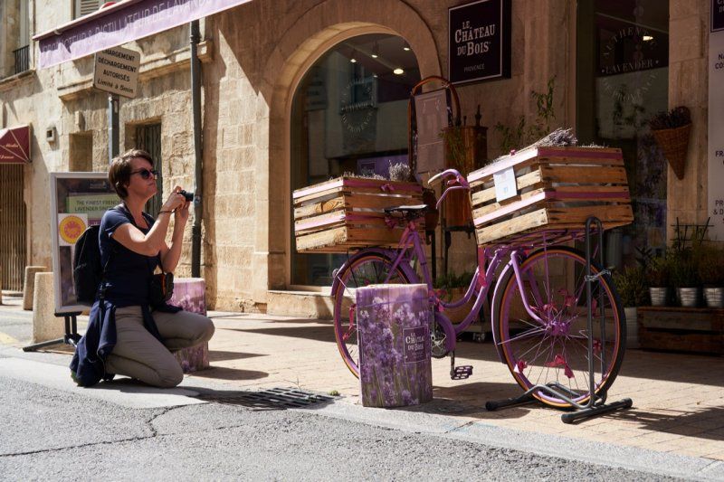
Our journey begins with a detour to the Alsace metropolis of Strasbourg during a bike tour along the 🇪🇺 European Parliament. We continue through Provence with a visit to the former ⛪️ papal city of Avignon and along the Costa Brava to the Costa Dorada with its Ebro Delta and its 🌾 rice fields.
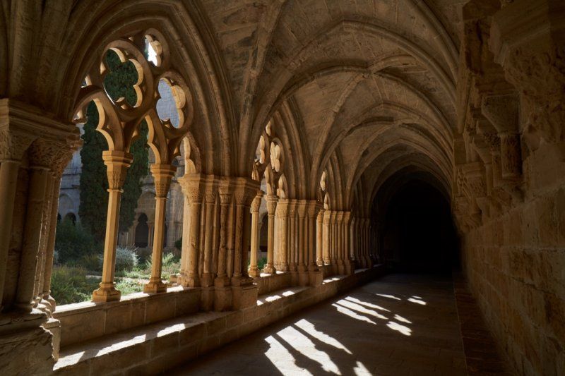
In Tortosa we get a good impression of the ☪️ Moorish influence and discover the monasteries ⛪️ Escaladei and Poblet in the hinterland of Catalonia.
It goes back via 🇫🇷 France with the 🏰 medieval city of Carcassonne and Nancy and its classicistic baroque.
You can also find our travel report on our 🎥 YouTube channel (https://tinyurl.com/ErstmalDurchEuropa) and also as a playlist (https://tinyurl.com/EdE-Katalonien).
Day
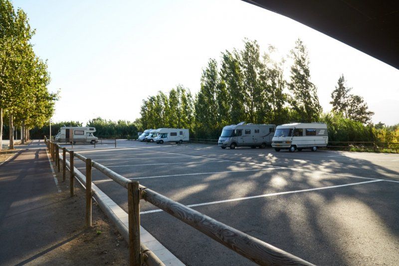
Stellplatz in Kehl, Deutschland
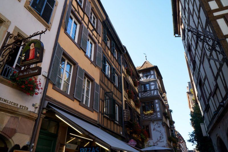
The parking space at the water tower in Kehl is located directly opposite Strasbourg and is only 20 minutes by bike from the Alsace metropolis.
Schwimmbadstraße, 77694, Kehl, Deutschland
48° 33' 49" N 7° 48' 50" E
48.5636111 7.8138889
• Head toward Schwimmbadstraße. Go for 31 m.
• Turn right onto Schwimmbadstraße. Go for 76 m.
• Take the 3rd exit from roundabout onto Iringheimer Straße. Go for 533 m.
• Continue on Bierkellerstraße. Go for 402 m.
• Turn slightly right onto Großherzog-Friedrich-Straße. Go for 415 m.
• Turn left onto Am Läger. Go for 357 m.
• Turn left onto Straßburger Straße (B28). Go for 847 m.
• Continue on Pont de l'Europe (N4). Go for 469 m.
• Keep right onto Avenue du Pont de l'Europe (N4) toward Strasbourg. Go for 5.0 km.
• Take left ramp onto A35 toward Illkirch-Graff./Aéroport Entzheim/St-Dié/Colmar/Mulhouse. Go for 14.4 km.
• Take the exit toward Mulhouse/Colmar/Obernai onto A35. Go for 40.7 km.
• Continue on D83. Go for 10.7 km.
• Keep left onto A35. Go for 38.5 km.
• Take the left exit toward A35/Mulhouse/Lyon/Paris onto A36 (La Comtoise). Go for 4.6 km.
• Keep left onto A36 (La Comtoise) toward Paris/Lyon/Guebwiller. Go for 223 km.
• Take the exit onto A31. Go for 6.1 km.
• Continue on A6 (Autoroute du Soleil). Go for 108 km.
• Take exit 30 toward Châtillon S/ C./Belleville. Go for 677 m.
• Take the 4th exit from roundabout toward Lyon Par RN6. Go for 151 m.
• Turn left onto D109. Go for 802 m.
• Take the 1st exit from roundabout onto D109. Go for 1.3 km.
• Take the 4th exit from roundabout onto D306 toward Villefranche S/S./Lyon/St Georges de Reneins. Go for 4.0 km.
• Arrive at Avenue Charles de Gaulle (D306). Your destination is on the left.
☍
461,6 km
(4 hrs. 11 min.)
Fahrradtour durch die Elsass-Metropole
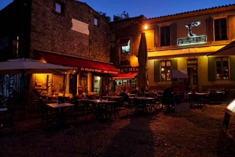
We arrive in Kehl at noon and take a bike ride to Strasbourg to the European Parliament. In the Alsace metropolis we then go to the cathedral in the old town and to the attractive district of "Petite France", before we cycle back to Kehl to the parking space at the water tower.
Day
Parkplatz in Saint-Georges-de-Reneins, Frankreich
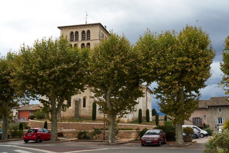
After a day of driving and just before Lyon, we come to sleepy Saint-Georges-de-Reneins. We will stay here tonight and continue towards Spain tomorrow. Our parking lot for the night is in a quiet location, not far from the church and off the main road by the tennis courts.
69830 Saint-Georges-de-Reneins, Frankreich
46° 3' 51.2" N 4° 43' 21.8" E
46.0642261 4.7227102
• Head southwest on Avenue Charles de Gaulle (D306).
• Take the 2nd exit from Avenue Charles de Gaulle roundabout onto Avenue Charles de Gaulle (D306) toward Villefranche S/S./Lyon. Go for 1.4 km.
• Take the 3rd exit from roundabout onto D306. Go for 3.6 km.
• Take the 3rd exit from roundabout toward Paris/Lyon/Villefranche-Sud. Go for 142 m.
• Continue on Échangeur de Villefranche-Nord. Go for 82 m.
• Take ramp onto A6 (Autoroute du Soleil) toward Lyon/Roanne/Villefranche-Sud. Go for 29.9 km.
• Keep left onto Autoroute du Soleil (M6) toward Lyon-Centre. Go for 6.8 km.
• Keep left onto Autoroute du Soleil (M7). Go for 194 km.
• Keep right onto A9 (Échangeur d'Orange) toward Barcelone/Toulouse/Montpellier/Nîmes. Go for 14.1 km.
• Take exit 22 toward Roquemaure/Villeneuve-les-A./Avignon/Z.I. l'Ardoise/Marcoule onto Échangeur de Roquemaure. Go for 838 m.
• Take the 1st exit from roundabout onto D6580. Go for 884 m.
• Take the 2nd exit from roundabout onto D6580 toward Avignon. Go for 1.7 km.
• Pass 3 roundabouts. Go for 3.8 km.
• Continue on D6580. Go for 2.1 km.
• Take the 3rd exit from roundabout onto N100 toward A7/Avignon/Aramon. Go for 3.6 km.
• Take ramp onto Rue d'Aramon (D2) toward Beaucaire/Aramon/Villeneuve lez A./Font d'Irac. Go for 330 m.
• Turn left onto Rue d'Aramon (D2) toward Bagnols S/ Cèze/Nîmes/Villeneuve les A. Go for 818 m.
• Turn left toward Avignon. Go for 45 m.
• Turn right onto Avenue Général Leclerc (D900). Go for 576 m.
• Turn right and take ramp. Go for 146 m.
• Take the 1st exit from roundabout onto Chemin de l'Île de Piot. Go for 247 m.
• Arrive at Chemin de l'Île de Piot.
☍
264,8 km
(2 hrs. 28 min.)
Day
Parkplatz in Avignon, Frankreich
The car park is within walking distance of the Pont d'Avignon on the banks of the Rhône and is an ideal starting point for our city tour.
Chemin de l'Île de Piot, 84000 Avignon, Frankreich
43° 56' 56.9" N 4° 47' 50.6" E
43.9491430 4.7973950
• Head toward Impasse Henri Maire on Chemin de l'Île de Piot. Go for 228 m.
• Take the 2nd exit from roundabout. Go for 190 m.
• Turn right onto Pont Édouard Daladier. Go for 372 m.
• Turn right and take ramp. Go for 205 m.
• Keep left toward Allée de l'Oulle. Go for 103 m.
• Continue on Allée de l'Oulle. Go for 329 m.
• Keep left onto Allée de l'Oulle toward A9/Nîmes. Go for 112 m.
• Take left ramp onto Pont de l'Europe toward A9/Nîmes/Bagnols S/Cèze. Go for 5.1 km.
• Take the 3rd exit from roundabout onto N100 toward A9/Alès/Rochefort/Remoulins. Go for 1.1 km.
• Take the 2nd exit from roundabout onto N100 toward A9/Nîmes/Alès/Remoulins/Uzès. Go for 4.4 km.
• Pass 3 roundabouts and continue on N100. Go for 7.9 km.
• Take the 4th exit from roundabout onto A9 (La Languedocienne) toward Montpellier. Go for 58.2 km.
• Keep right onto A709 toward A75/Clermont-Ferrand/Montpellier/Aéroport. Go for 14.1 km.
• Take exit 30 toward Montpellier-Sud/Prés d'Arènes/Lattes/Palavas les Flots onto Avenue de Palavas. Go for 637 m.
• Keep left onto Avenue de Palavas. Go for 37 m.
• Continue on M986. Go for 20 m.
• Take the 4th exit from Rond-Point des Prés d'Arènes roundabout onto M986 toward A9/Palavas les Flots/Lattes/Arena/Parc des Expositions. Go for 6.0 km.
• Take the 2nd exit from roundabout onto Route de Montpellier (M986). Go for 2.5 km.
• Take the 2nd exit from Rond-Point de l'Europe roundabout onto Boulevard Frédéric Fabrèges. Go for 263 m.
• Take the 2nd exit from roundabout onto Rue Frédéric Mistral. Go for 229 m.
• Turn left. Go for 47 m.
• Turn left. Go for 34 m.
• Arrive at your destination on the left.
☍
102,1 km
(1 hrs. 4 min.)
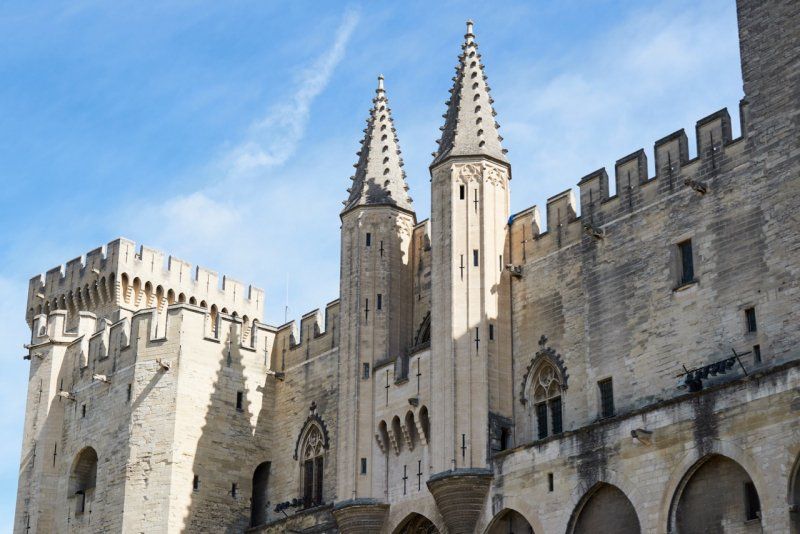
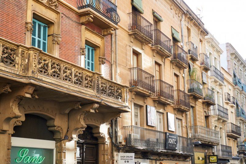
Stadt der Päpste
Today we visit the papal city of Avignon in the heart of Provence with the Gothic papal palace "Palais des Papes" and the landmark "Pont d'Avignon" on the banks of the Rhône. The city wall, which is still completely preserved and completely surrounds the old town with a good 4 kilometers, is one of the best-preserved complexes in Europe. Its origins go back to the 13th century.
Stellplatz in Montpellier, Frankreich
After a beautiful day in Provence, we end the evening with a wonderful Mediterranean sunset near Montpellier.
Avenue du Général de Gaulle, 34250, Palavas-les-Flots, Frankreich
43° 31' 51" N 3° 55' 24" E
43.5308333 3.9233333
• Head northeast. Go for 34 m.
• Turn right toward Rue Frédéric Mistral. Go for 47 m.
• Turn right onto Rue Frédéric Mistral. Go for 193 m.
• Take the 1st exit from roundabout onto Boulevard Frédéric Fabrèges. Go for 157 m.
• Take the 2nd exit from Rond-Point de l'Europe roundabout onto Avenue de Lattre de Tassigny (D986). Go for 2.5 km.
• Take the 2nd exit from roundabout onto Route de Palavas (M986). Go for 5.6 km.
• Take ramp onto A709 toward Barcelone/Toulouse/Béziers/Sète. Go for 6.8 km.
• Continue on A9 (La Languedocienne). Go for 172 km.
• Continue on AP-7 (Autopista de la Mediterrània). Go for 20.3 km.
• Take exit 3 toward Figueres N./Roses/Figueres/Girona/Barcelona/Olot/Ripoll. Go for 391 m.
• Take the 3rd exit from roundabout onto N-2 toward Figueres/Girona/Barcelona. Go for 874 m.
• Turn right onto N-2A toward Figueres/Olot. Go for 3.2 km.
• Turn right onto Ronda del Rector Arolas. Go for 358 m.
• Turn right onto Carrer de Joaquim Cusí i Fortunet. Go for 192 m.
• Turn right onto Carrer de Marià Pujulà. Go for 140 m.
• Turn left onto Carrer de Marià Pujulà. Go for 89 m.
• Turn left onto Carrer de Marià Pujulà. Go for 118 m.
• Turn left onto Carrer de Marià Pujulà. Go for 38 m.
• Arrive at Carrer de Marià Pujulà. Your destination is on the left.
☍
213,4 km
(1 hrs. 53 min.)
Day
Parkplatz in Figueres, Spanien
Above Figueres there are spacious parking areas in a park that can be used free of charge. We park up here and walk through the park down to town.
Carrer de Marià Pujulà, 17600 Figueres, Girona, Spanien
42° 16' 8" N 2° 57' 2.4" E
42.2688975 2.9506589
• Head west on Carrer de Marià Pujulà. Go for 38 m.
• Turn left onto Carrer de Marià Pujulà. Go for 103 m.
• Turn left onto Carrer de Joaquim Cusí i Fortunet. Go for 276 m.
• Turn left onto Ronda del Rector Arolas. Go for 358 m.
• Turn left onto Ronda Cardenal Gomà (N-2A). Go for 119 m.
• Turn right onto Carrer dels Sants Celi i Rústic. Go for 119 m.
• Turn left onto Carrer Tramuntana. Go for 62 m.
• Turn right. Go for 118 m.
• Arrive at your destination on the right.
☍
1,2 km
( 4 min.)
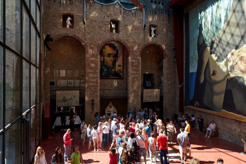
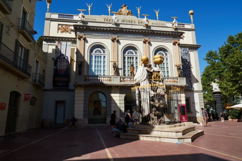
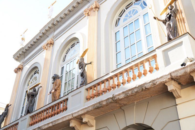
Teatre-Museu Dalí in Figueres, Spanien
We reach Spain and visit the Teatre-Museu Dalí in Figueres. Here everything revolves around the most famous surrealist and his works. A special exhibition of photographs gives insights into his work from 1964 until a few years before his death.
Plaça Gala i Salvador Dalí, 5, 17600 Figueres, Girona, Spanien
42° 16' 4.8" N 2° 57' 34.8" E
42.2679879 2.9596627
• Head toward Carrer Tramuntana. Go for 118 m.
• Turn left onto Carrer Tramuntana. Go for 62 m.
• Turn right toward Pujada del Castell. Go for 39 m.
• Turn right onto Pujada del Castell. Go for 97 m.
• Turn left onto Ronda Cardenal Gomà (N-2A). Go for 323 m.
• Turn right toward Ronda Mossèn Cinto Verdaguer/N-2A. Go for 22 m.
• Take the 3rd exit from roundabout onto Ronda Firal (N-2A) toward Roses/C-260/Llançà/N-260. Go for 1.2 km.
• Take the 3rd exit from roundabout onto Ronda de Barcelona (N-2A) toward Ronda/Llançà/Cadaqués/Roses. Go for 163 m.
• Take the 2nd exit from roundabout onto Ronda de Barcelona (N-2A). Go for 265 m.
• Take the 1st exit from roundabout onto Carrer Nou (N-2a) toward Girona/N-2/Barcelona/E-15/AP-7/C-252/l'Escala. Go for 655 m.
• Take the 2nd exit from roundabout onto N-2A toward Girona/N-2/AP-7. Go for 884 m.
• Pass 2 roundabouts and continue on N-2A. Go for 832 m.
• Take the 3rd exit from roundabout onto C-31 toward l'Escala. Go for 862 m.
• Take the 2nd exit from roundabout onto C-31. Go for 24.1 km.
• Take the 3rd exit from roundabout onto Carrer Girona (C-31) toward Torroella de Montgrí/l'Escala. Go for 548 m.
• Continue on C-31. Go for 2.8 km.
• Take the 1st exit from roundabout onto C-31. Go for 1.3 km.
• Continue on Carretera de Torroella de Montgrí a Verges (C-31). Go for 39 m.
• Continue on C-31. Go for 203 m.
• Take the 2nd exit from roundabout onto Carretera de Torroella de Montgrí a Verges (C-31) toward Torroella de Montgrí/Torroella M. Go for 216 m.
• Continue on C-31. Go for 22 m.
• Continue on Carretera de Torroella de Montgrí a Verges (C-31). Go for 94 m.
• Continue on C-31. Go for 72 m.
• Continue on Carretera de Torroella de Montgrí a Verges (C-31). Go for 18 m.
• Continue on C-31. Go for 592 m.
• Take the 2nd exit from roundabout onto Carretera de Sant Jordi (C-31) toward Torroella de Montgrí. Go for 806 m.
• Take the 2nd exit from roundabout onto Avinguda Lluís Companys (C-31) toward l'Estartit/Palafrugell. Go for 504 m.
• Take the 5th exit from Plaça Lledoner roundabout onto Carretera de l'Estartit (GI-641) toward Zona Esportiva/l'Estartit/Illes Medes. Go for 761 m.
• Take the 2nd exit from roundabout onto Carretera de l'Estartit (GI-641) toward Illes Medes/l'Estartit. Go for 534 m.
• Continue on GI-641. Go for 1.6 km.
• Continue on Carretera Torroella (GI-641). Go for 172 m.
• Turn right toward Camí del Mar. Go for 222 m.
• Turn left onto Camí del Mar. Go for 938 m.
• Turn right onto Camí Caminassa. Go for 727 m.
• Turn left onto Camí Caminassa. Go for 148 m.
• Turn left. Go for 26 m.
• Arrive at your destination on the left.
☍
41,9 km
( 42 min.)
Camping les Medes in L‘Estartit, Spanien
Overnight stay in L'Estartit by the sea.
Paratge Camp de l'arbre L'estartit, 17258, L'Estartit, Spanien
42° 2' 34.1" N 3° 10' 59.2" E
42.0428000 3.1831000
• Head toward Camí Caminassa. Go for 26 m.
• Turn right onto Camí Caminassa. Go for 148 m.
• Turn right onto Camí Caminassa. Go for 727 m.
• Turn left onto Camí del Mar. Go for 938 m.
• Turn right toward Carretera Torroella/GI-641. Go for 222 m.
• Turn left onto Carretera Torroella (GI-641). Go for 172 m.
• Continue on GI-641. Go for 1.6 km.
• Continue on Carretera de l'Estartit (GI-641). Go for 481 m.
• Take the 2nd exit from roundabout onto Carretera de l'Estartit (GI-641). Go for 703 m.
• Take the 1st exit from Plaça Lledoner roundabout onto Avinguda Lluís Companys (C-31) toward Girona/Figueres. Go for 500 m.
• Take the 2nd exit from roundabout onto Carretera de Sant Jordi (C-31) toward Ullà/Verges/l'Escala. Go for 766 m.
• Take the 2nd exit from roundabout onto C-31 toward Verges/l'Escala/Figueres. Go for 645 m.
• Continue on Carretera de Torroella de Montgrí a Verges (C-31). Go for 18 m.
• Continue on C-31. Go for 72 m.
• Continue on Carretera de Torroella de Montgrí a Verges (C-31). Go for 94 m.
• Continue on C-31. Go for 22 m.
• Continue on Carretera de Torroella de Montgrí a Verges (C-31). Go for 164 m.
• Take the 2nd exit from roundabout onto C-31 toward Verges/l'Escala/Figueres. Go for 264 m.
• Continue on Carretera de Torroella de Montgrí a Verges (C-31). Go for 39 m.
• Continue on C-31. Go for 1.2 km.
• Continue toward GI-632/Bellcaire E./l'Escala. Go for 32 m.
• Take the 2nd exit from roundabout onto C-31. Go for 2.9 km.
• Continue on Carrer Girona (C-31). Go for 498 m.
• Take the 2nd exit from roundabout onto Carrer Girona (GI-634) toward Jafre/Girona. Go for 565 m.
• Continue on GI-634. Go for 2.5 km.
• Continue on Carretera de Verges a Colomers (GI-634). Go for 975 m.
• Continue on GI-634. Go for 1.8 km.
• Continue on Carretera Costa Brava (GI-634). Go for 108 m.
• Continue on GI-634. Go for 99 m.
• Continue on Carretera Costa Brava (GI-634). Go for 315 m.
• Continue on GI-633. Go for 3.6 km.
• Take the 1st exit from roundabout onto GI-633 toward Cervià de ter/Girona. Go for 2.3 km.
• Continue on Carretera de Colomers (GI-633). Go for 1.5 km.
• Take the 3rd exit from roundabout onto Carretera de Colomers (GI-633). Go for 490 m.
• Continue on GI-633. Go for 2.1 km.
• Turn left onto N-2 toward Medinyà/Girona. Go for 2.1 km.
• Turn right toward E-15/AP-7/St. Julià de Ramis/Sarrià de Ter/Girona Nord. Go for 274 m.
• Keep right toward E-15/AP-7/St. Julià de Ramis/Sarrià de ter/Girona nord. Go for 102 m.
• Continue on N-2A. Go for 2.2 km.
• Take ramp onto C-66 toward E-15/AP-7/A-2/Banyoles/Olot. Go for 658 m.
• Take ramp toward Girona sud/Perpinyà/Barcelona. Go for 771 m.
• Take ramp onto AP-7 (Autopista de la Mediterrània) toward Barcelona/Girona S. Go for 81.1 km.
• Keep right onto AP-7 (Autopista de la Mediterrània) toward Lleida/E-90/AP-2/Tarragona/Sabadell/C-58/Túnels de Vallvidrera/E-9/Manresa/C-16/Polígon Industrial de Zona Franca/Fira. Go for 47.1 km.
• Take exit 27 toward St. Sadurní d'Anoia/Subirats. Go for 1.1 km.
• Take the 2nd exit from roundabout onto BP-2427 toward Polígon Industrial de Subirats/St. Sadurní d'Anoia/Gelida. Go for 375 m.
• Take the 1st exit from roundabout onto BP-2427 toward St. Sadurní de l'Heura/Gelida/St. Sadurní A./Igualada. Go for 566 m.
• Take ramp toward St. Sadurní/d'Andia sud/Estació. Go for 272 m.
• Continue on Carrer de Joan Sala. Go for 138 m.
• Arrive at Carrer de Joan Sala. Your destination is on the right.
☍
165,1 km
(1 hrs. 51 min.)
Day
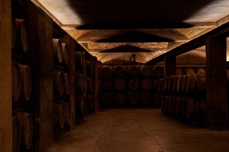
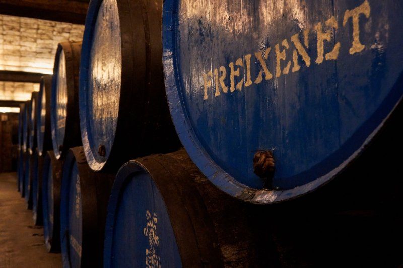
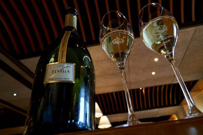
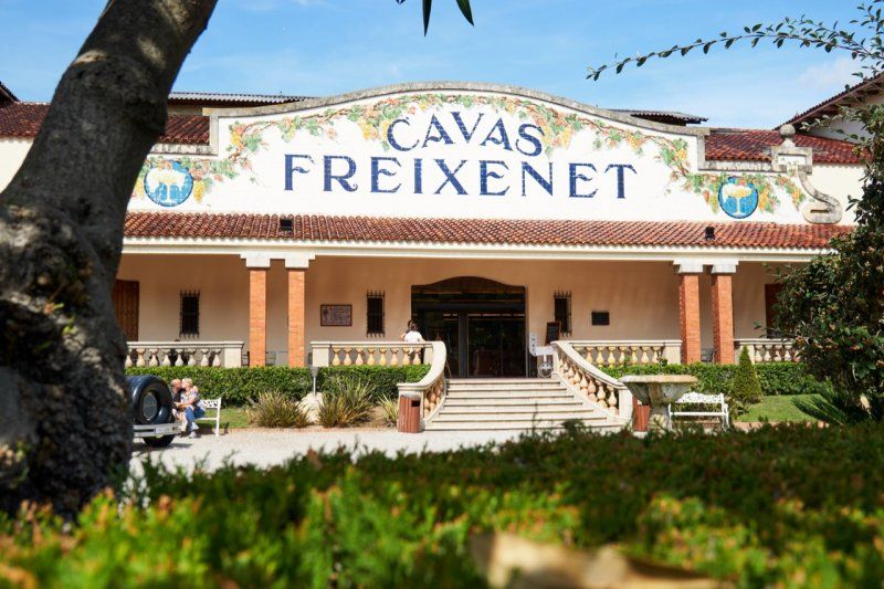
Freixenet in Sant Sadurní d'Anoia, Spanien
We pass through the Villafranca wine region on our route and make a stop in Sant Sadurní d'Anoia to visit the most famous producer of cava. With luck we can complete a Spanish group without a reservation and are more than enthusiastic about the wine cellar. The crowning glory is a tasting after the factory tour. Tip!
Plaça Joan Sala, 08770 Sant Sadurní d'Anoia, Barcelona, Spanien
41° 25' 16.2" N 1° 47' 39.5" E
41.4211680 1.7942951
• Head south on Carrer de Joan Sala. Go for 250 m.
• Take ramp. Go for 149 m.
• Turn left onto BP-2427. Go for 532 m.
• Take the 2nd exit from roundabout onto BP-2427 toward E-15/E-90/AP-7/Barcelona/Girona/Lleida/Tarragona/N-340/Ordal. Go for 338 m.
• Take the 1st exit from roundabout onto AP-7 (Autopista de la Mediterrània) toward Lleida/Tarragona. Go for 12.3 km.
• Take exit 29 toward C-15/Sitges. Go for 721 m.
• Take the 3rd exit from roundabout onto C-15z toward C-15/Sitges. Go for 368 m.
• Take the 2nd exit from roundabout toward C-15/Vilanova i la Geltrú/Igualada/Manresa. Go for 94 m.
• Take ramp onto C-15 toward Vilanova i la Geltrú. Go for 9.4 km.
• Take exit 3 toward Barcelona/Sitges onto C-32 (Autopista Pau Casals). Go for 3.7 km.
• Take exit 26 toward Sitges/C-246a/C-32/Castelldefels/Barcelona onto BV-2113. Go for 1.3 km.
• Take the 5th exit from roundabout onto BV-2113 toward C-32/Castelldefels/Barcelona/C-246a/Vilanova i la G./Sitges. Go for 625 m.
• Take the 3rd exit from roundabout onto Carretera de Barcelona a Valls (C-246a) toward C-32/Barcelona/Tarragona/Sitges. Go for 2.0 km.
• Turn right. Go for 91 m.
• Arrive at your destination on the right.
☍
32,1 km
( 23 min.)
Camping el Garrofer in Sitges, Spanien
Camping Garrofer is located high above Sitges in the middle of a pine forest.
Carretera C-246a Km. 39, 08870, Sitges, Spanien
41° 14' 0.2" N 1° 46' 51.2" E
41.2334000 1.7809000
• Head south.
• Arrive at your destination on the right.
☍
Distance not available
(Duration not available)
Day
Reise entlang der Costa Daurada
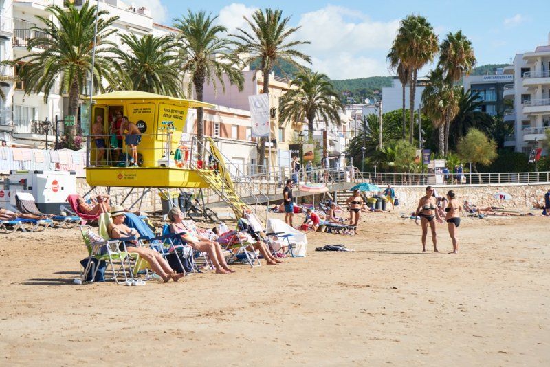
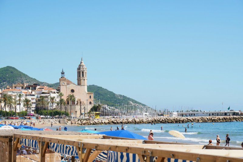
The journey along the Gold Coast begins in Sitges. Those returning from South America already appreciated this place and had their magnificent villas built here. The water is crystal clear and invites you to swim with its residual warmth. In the village, after the siesta, the first shops open again in the early afternoon.
Camping el Garrofer in Sitges, Spanien
Camping Garrofer is located high above Sitges in the middle of a pine forest.
Carretera C-246a Km. 39, 08870, Sitges, Spanien
41° 14' 0.2" N 1° 46' 51.2" E
41.2334000 1.7809000
• Head north. Go for 82 m.
• Turn left onto C-246a. Go for 2.0 km.
• Take the 1st exit from roundabout onto BV-2113 toward Barcelona/C-32/Tarragona. Go for 504 m.
• Take the 4th exit from roundabout onto C-32 (Autopista Pau Casals) toward El Vendrell/Tarragona. Go for 25.4 km.
• Take the left exit toward Tarragona/València onto AP-7 (Autopista de la Mediterrània). Go for 12.2 km.
• Take exit 32 toward Torredembarra/Altafulla. Go for 460 m.
• Take the 3rd exit from roundabout onto T-214 toward AP-7/Lleida/Torredembarra/Altafulla/Tarragona/Barcelona. Go for 226 m.
• Take the 1st exit from roundabout onto Carretera de Cádiz a Barcelona (N-340) toward Tarragona. Go for 4.5 km.
• Take ramp toward Altafulla/Tarragona. Go for 369 m.
• Take the 3rd exit from roundabout onto Carretera de Cádiz a Barcelona (N-340) toward Tarragona. Go for 3.1 km.
• Turn sharp left onto Camí Platja Llarga. Go for 228 m.
• Arrive at Camí Platja Llarga. Your destination is on the right.
☍
49,1 km
( 31 min.)
Day
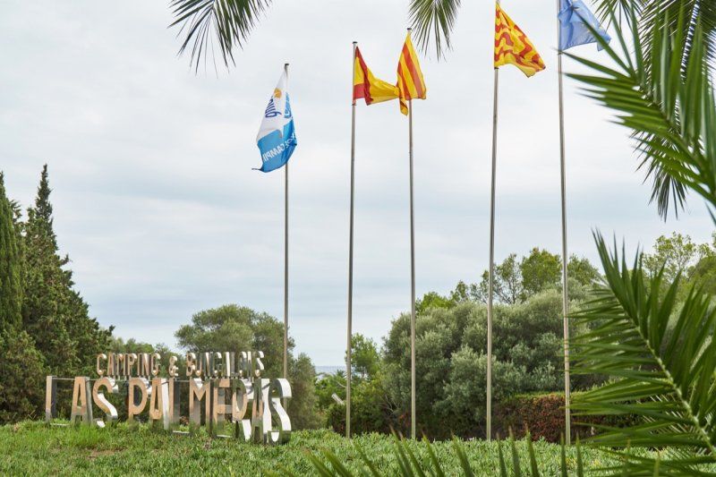
Camping las Palmeras in Tarragona, Spanien
Camping las Palmeras is just outside Tarragona and offers direct access to a fine sandy beach.
Carretera N-340 P.Km. 1168, 43007, Tarragona, Spanien
41° 7' 49.8" N 1° 18' 42.8" E
41.1305000 1.3119000
• Head south on Camí Platja Llarga.
• Arrive at Camí Platja Llarga. Your destination is on the right.
☍
Distance not available
(Duration not available)
Day
Camping las Palmeras in Tarragona, Spanien
Camping las Palmeras is just outside Tarragona and offers direct access to a fine sandy beach. Immediately after our arrival we lay down on the beach.
Carretera N-340 P.Km. 1168, 43007, Tarragona, Spanien
41° 7' 49.8" N 1° 18' 42.8" E
41.1305000 1.3119000
• Head north on Camí Platja Llarga. Go for 193 m.
• Turn sharp right onto Carretera de Cádiz a Barcelona (N-340). Go for 2.8 km.
• Take ramp. Go for 249 m.
• Take the 5th exit from roundabout onto A-7 toward Tarragona/Castelló. Go for 25.5 km.
• Take exit 1148 toward Cambrils est/TV-3141/Reus. Go for 990 m.
• Take ramp toward Cambrils/A-7/Tarragona/Barcelona. Go for 202 m.
• Take the 3rd exit from roundabout toward Cambrils/A-7/Tarragona/Barcelona. Go for 324 m.
• Continue on Avinguda de Vilafortuny. Go for 98 m.
• Take the 2nd exit from roundabout onto Avinguda de Vilafortuny toward Cambrils est. Go for 479 m.
• Pass 2 roundabouts and continue on Avinguda de Vilafortuny. Go for 1.0 km.
• Take the 1st exit from roundabout onto Avinguda Cavet toward Centre. Go for 616 m.
• Take the 2nd exit from roundabout onto Avinguda Cavet toward Centre Ciutat. Go for 381 m.
• Take the 2nd exit from roundabout onto Carrer del Corralet. Go for 425 m.
• Continue on Carrer Francolí. Go for 194 m.
• Continue on Camí del Corralet. Go for 160 m.
• Turn right onto Carrer Riu Glorieta. Go for 302 m.
• Continue on Carrer Polígon 12. Go for 165 m.
• Turn right. Go for 28 m.
• Arrive at your destination on the left.
☍
34,1 km
( 26 min.)
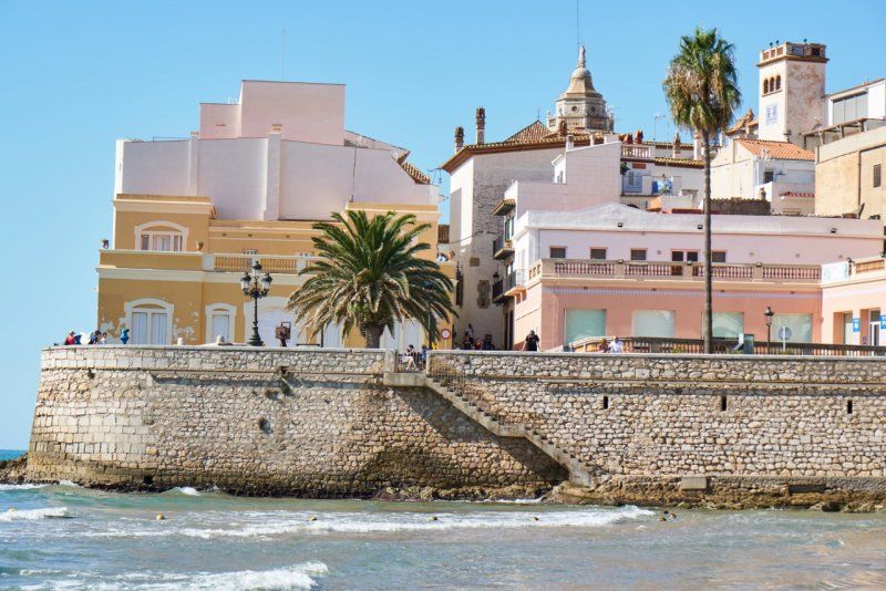
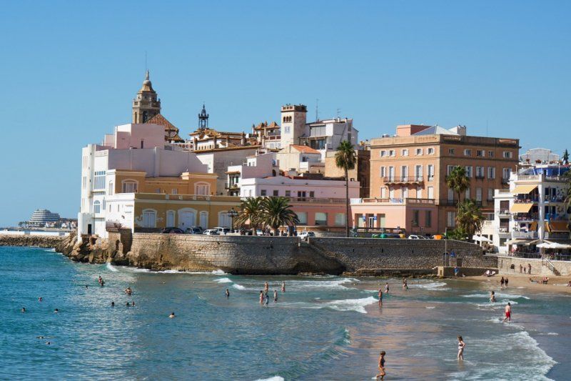
Balcón del Mediterráneo
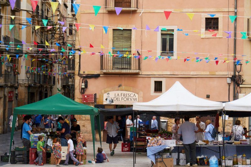
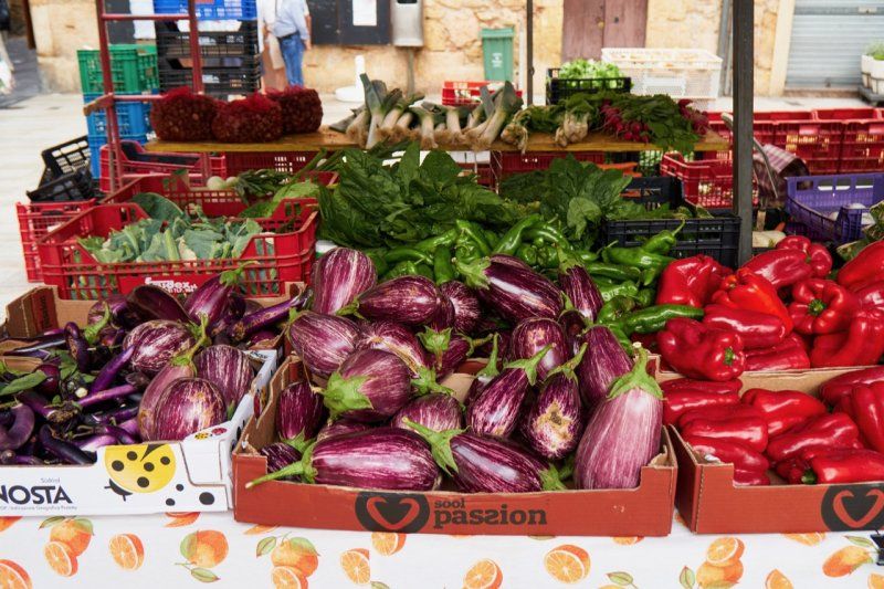
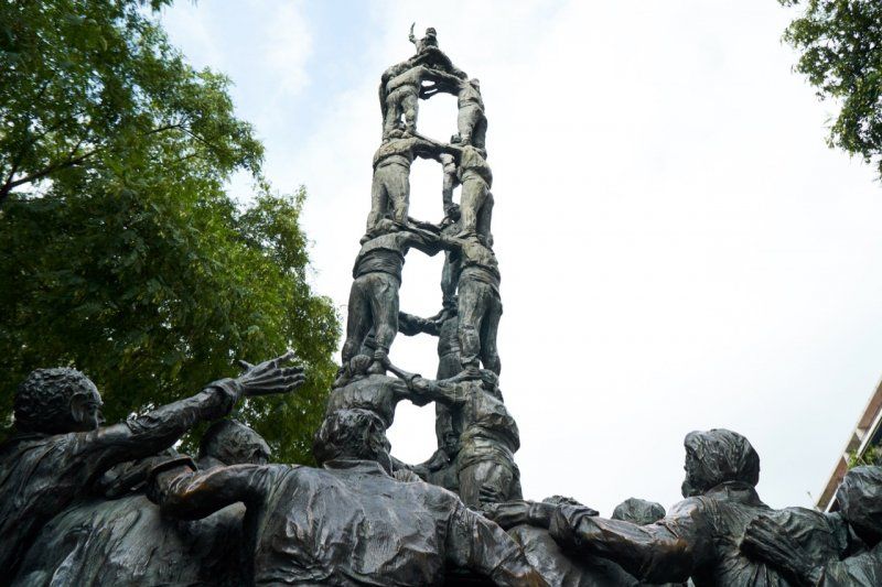
Tarragona (140,000 inhabitants) is worth a visit. In addition to a Roman amphitheater, there is a lot to discover in the narrow streets of the old town. If the conditions are ideal, you should be able to see Mallorca from the Balcón del Mediterráneo, which we think is simply a myth. After a detour to the market, head along the Rambla Nova to the Monumento de les Castellers.
Day
Camping Playa Cambrils, Spanien
Camping Playa Cambrils is located directly on the beach promenade on the outskirts of Cambrils. The complex offers private shaded plots and is just minutes from the beach.
Av. Oleastrum 12, 43850, Cambrils, Spanien
41° 4' 0.5" N 1° 4' 58.4" E
41.0668000 1.0829000
• Head northeast.
• Arrive at your destination on the left.
☍
Distance not available
(Duration not available)
Strandpromenade und Fischrestaurants
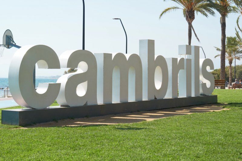
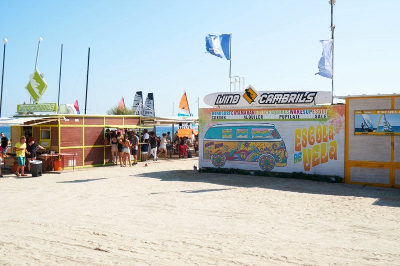
We continue south along the Costa Daurada and put down roots in Cambrils. This place is still one of the best fishing areas in Spain. Along the promenade with the fine sandy beaches you can cycle for kilometers to Salou or even Tarragona. We cycle to the Marina of Cambrils and eat an ice cream.
Day
Camping Playa Cambrils, Spanien
Camping Playa Cambrils is located directly on the beach promenade on the outskirts of Cambrils. The complex offers private shaded plots and is just minutes from the beach.
Av. Oleastrum 12, 43850, Cambrils, Spanien
41° 4' 0.5" N 1° 4' 58.4" E
41.0668000 1.0829000
• Head east. Go for 219 m.
• Turn sharp right toward Carrer del Riu Gaià. Go for 61 m.
• Continue on Carrer del Riu Gaià. Go for 280 m.
• Turn left onto Carrer Francolí. Go for 210 m.
• Continue on Carrer del Corralet. Go for 335 m.
• Take the 2nd exit from roundabout onto Camí Cavet de Barenys toward Centre Urbà/Centre Ciutat. Go for 895 m.
• Take the 1st exit from roundabout onto Carrer de Francesc Català Roca toward Barri Molí de la Torre. Go for 660 m.
• Take the 1st exit from roundabout toward Reus/TV-3147/València/Barcelona/N-340/Vilafortuny. Go for 248 m.
• Turn left onto Camí del Castell toward Tarragona/Reus. Go for 539 m.
• Continue on Carrer Afores Mas Ara. Go for 174 m.
• Turn right onto N-340. Go for 196 m.
• Take the 3rd exit from roundabout onto A-7 (Autovia de la Mediterrània) toward Castelló/València. Go for 17.4 km.
• Take exit 1129 toward E-15/l'Hospitalet I./AP-7/Vandellòs/Móra E. Go for 153 m.
• Take the 2nd exit from roundabout toward Barcelona/València. Go for 348 m.
• Keep left toward València. Go for 14 m.
• Take ramp onto AP-7 (Autopista de la Mediterrània). Go for 16.8 km.
• Take exit 39 toward l'Ametlla de Mar. Go for 439 m.
• Take the 1st exit from roundabout onto TV-3025 toward l'Ametlla de Mar. Go for 227 m.
• Take the 2nd exit from roundabout onto TV-3025 toward Centre Urbà. Go for 204 m.
• Continue on Avinguda Amistat Hispano Italiana. Go for 151 m.
• Turn right onto Avinguda del Batlle Josep Pijoan. Go for 158 m.
• Turn left onto Carrer de la Llibertat toward Platges nord/Urb. les tres Cales. Go for 146 m.
• Turn slightly left onto Camí Cementiri. Go for 48 m.
• Arrive at Camí Cementiri. Your destination is on the left.
☍
39,9 km
( 31 min.)
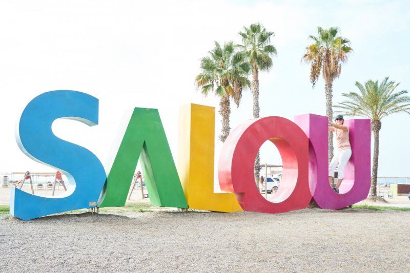
Radtour nach Salou
We cycled along the beach promenade to Salou. The fine sandy beaches of the Costa Daurada are already crowded in the late morning. The sun still has enough power up here at the end of September and makes us sweat a lot. We spend a good time eating and drinking on the promenade and then drive back along the sea.
Day
Camping Nàutic in l'Ametlla de Mar, Spanien
A little further south on the Costa Daurada is the town of L'Amettla de Mar on a natural bay. We are standing above the sea on a terrace, under pine and olive trees, with a view of the bay.
Libertad s/n, 43860, L'ametlla de Mar, Spanien
40° 53' 13.9" N 0° 48' 13" E
40.8872000 0.8036000
• Head north on Camí Cementiri. Go for 104 m.
• Turn left. Go for 110 m.
• Turn left. Go for 288 m.
• Turn right toward Autopista de la Mediterrània/AP-7. Go for 327 m.
• Take the 2nd exit from roundabout onto AP-7 (Autopista de la Mediterrània) toward Barcelona/València/Valencia. Go for 11.5 km.
• Take exit 39A toward l'Ampolla/N-340. Go for 797 m.
• Continue toward N-340. Go for 38 m.
• Take the 2nd exit from roundabout onto N-340 toward l'Aldea/Castelló. Go for 1.6 km.
• Turn sharp left toward l'Ampolla/Deltebre/Jesús i Maria/La Cava/Delta de l'Ebre. Go for 28 m.
• Turn right onto TV-3401. Go for 1.2 km.
• Take the 3rd exit from roundabout onto TV-3401 toward Deltebre. Go for 7.9 km.
• Continue on Carretera Camarles (TV-3401). Go for 306 m.
• Turn left onto TV-3401/TV-3409 toward Deltebre. Go for 143 m.
• Take the 3rd exit from roundabout onto T-340 toward Deltebre/La Cava/Riumar. Go for 1.5 km.
• Take the 3rd exit from roundabout onto Barri de Lepanto (TV-3454) toward Riumar. Go for 1.4 km.
• Take the 2nd exit from roundabout onto Barri de Lepanto (TV-3454). Go for 1.8 km.
• Continue toward TV-3454. Go for 49 m.
• Continue on T-340. Go for 5.0 km.
• Take the 2nd exit from roundabout onto T-340 toward Bassa de l'Arena/Illa de Buda/Riumar. Go for 1.6 km.
• Take the 3rd exit from roundabout toward Riumar/Port de Deltebre. Go for 1.0 km.
• Continue on Carrer Riomar II. Go for 269 m.
• Take the 2nd exit from roundabout onto Carrer Àguila Pescatera. Go for 150 m.
• Continue on Carrer del Coll Verd. Go for 196 m.
• Turn left onto Carrer de la Guatlla. Go for 41 m.
• Turn slightly left. Go for 35 m.
• Arrive at your destination on the left.
☍
37,3 km
( 33 min.)
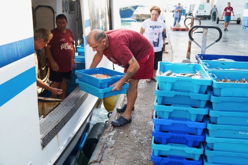
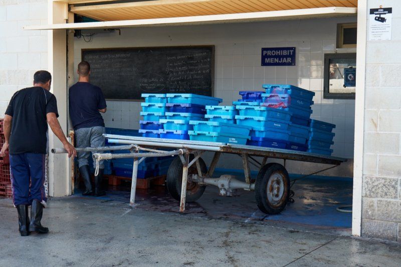
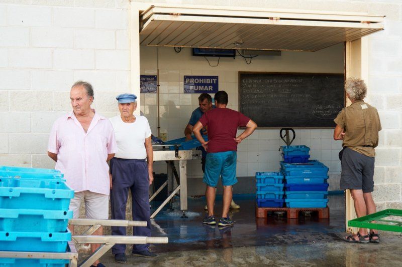
Fischauktion
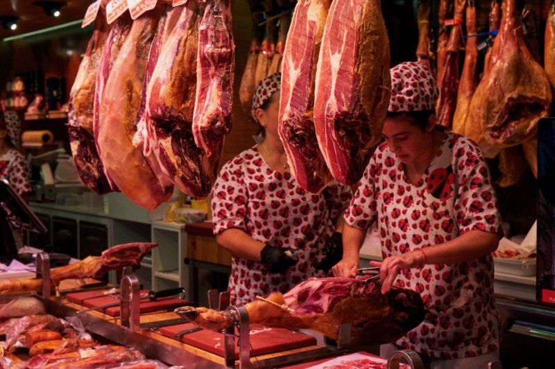
In the afternoon the fishermen bring their catch into the harbor and we watched the sale in the fish auction house. This place is significantly less touristy than the ones we have visited before and thus shows its very special charm.
Day
Parkplatz in Riumar, Spanien
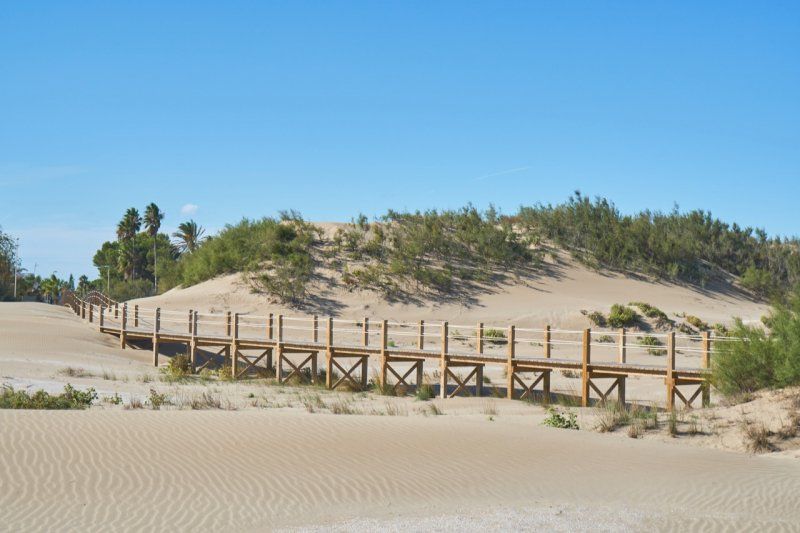
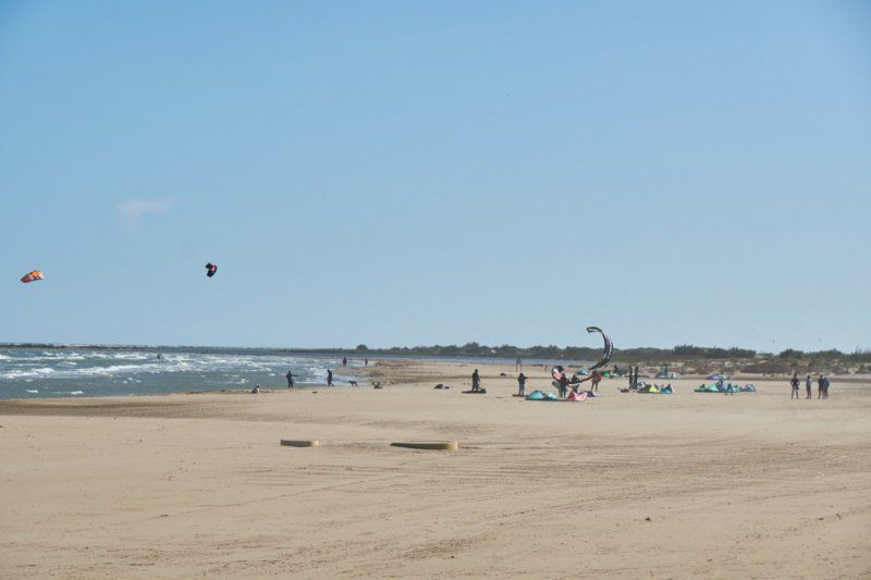
At the extreme tip of the Mediterranean Sea and in the middle of the Ebro Delta lies Riumar. A notable collection of high-priced tourist bungalows and apartments bear comparison with Palm Springs. Along the fine sandy beach, in the middle of the dune landscape, there is a kilometer-long boardwalk along the sea. A group trains in kite surfing at the local school. On the way here you drive through one of the largest rice-growing areas in Europe and can observe the remaining harvest.
Passeig Marítim, 52, 43580 Riumar, Tarragona, Spanien
40° 43' 32.8" N 0° 50' 21.1" E
40.7257726 0.8391918
• Head southeast on Carrer de la Guatlla. Go for 35 m.
• Turn slightly right onto Carrer de la Guatlla. Go for 41 m.
• Turn right onto Carrer del Coll Verd. Go for 196 m.
• Continue on Carrer Àguila Pescatera. Go for 82 m.
• Take the 2nd exit from roundabout onto Carrer Riomar II. Go for 1.3 km.
• Take the 2nd exit from roundabout onto T-340. Go for 1.6 km.
• Take the 2nd exit from roundabout onto T-340. Go for 5.0 km.
• Continue toward TV-3454. Go for 49 m.
• Continue on Barri de Lepanto (TV-3454). Go for 1.7 km.
• Take the 4th exit from roundabout onto Barri de Lepanto (TV-3454). Go for 1.4 km.
• Take the 2nd exit from roundabout onto Barri de Lepanto (TV-3454) toward AP-7/Deltebre/Amposta. Go for 2.4 km.
• Take the 1st exit from roundabout onto Carrer Pintor Sorolla (TV-3402) toward l'Aldea/Tarragona. Go for 43 m.
• Turn left onto T-340 toward l'Aldea/Tarragona. Go for 411 m.
• Continue on Barri de Lepanto (T-340). Go for 102 m.
• Continue on T-340. Go for 27 m.
• Continue on Barri de Lepanto (T-340). Go for 110 m.
• Continue on T-340. Go for 4.9 km.
• Continue on Avinguda del Delta (T-340). Go for 356 m.
• Continue on Carrer Sant Joan (T-340). Go for 23 m.
• Continue on Avinguda del Delta (T-340). Go for 867 m.
• Continue on Carrer Polígon 383. Go for 777 m.
• Take the 3rd exit from roundabout onto N-340a toward l'Aldea N/l'Aldea. Go for 379 m.
• Continue on Avinguda Catalunya (N-340a). Go for 1.7 km.
• Take the 1st exit from roundabout onto Carretera de Tortosa (N-235) toward E-15/AP-7/Tortosa/C-42/Tarragona/N-340/Castelló/Estació. Go for 608 m.
• Continue on N-235. Go for 826 m.
• Take the 2nd exit from roundabout onto N-235 toward AP-7/C-42/Tortosa. Go for 659 m.
• Take the 3rd exit from roundabout onto C-42 toward Tortosa. Go for 7.6 km.
• Pass 4 roundabouts and continue on Avinguda de la Generalitat (C-42). Go for 2.2 km.
• Take the 3rd exit from roundabout onto Pont del Mil.lenari (C-42) toward Tivenys/T-301/Amposta/C-12/Móra/C-12/Lleida/C-12. Go for 171 m.
• Turn right onto Carrer Enric d'Ossó Cervelló. Go for 103 m.
• Turn left onto Carrer de Mossèn Manyà. Go for 51 m.
• Continue on Passeig de Mossèn Manyà. Go for 95 m.
• Continue on Carrer de Mossèn Manyà. Go for 192 m.
• Turn left onto Passeig de Ribera. Go for 100 m.
• Take the 1st exit from roundabout. Go for 49 m.
• Arrive at your destination on the right.
☍
36,2 km
( 35 min.)
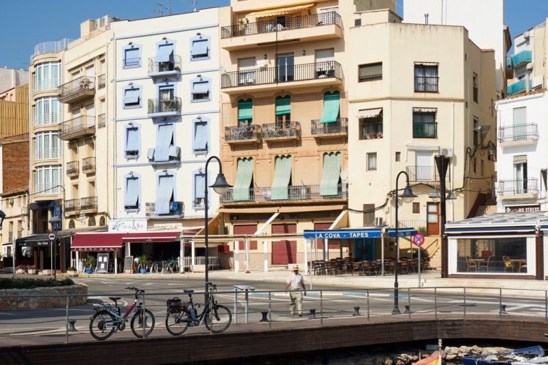
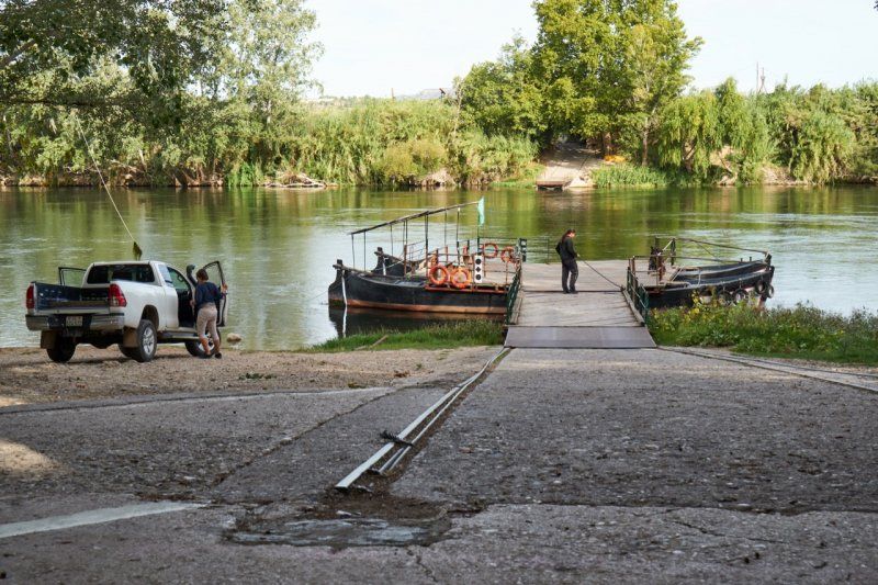
Stellplatz in Tortosa, Spanien
We sleep under a bridge, right on the Ebro. For us this is a first. The designated camper place is neat and clean, we feel safe and comfortable. A cycling and hiking trail runs 2 kilometers along the river from the parking space up to the historic old town and the Castell de la Zuda.
Passeig de Ribera, 96017, Tortosa, Spanien
40° 48' 11" N 0° 30' 51" E
40.8030556 0.5141667
• Head northeast. Go for 31 m.
• Take the 1st exit from roundabout onto Passeig de Ribera. Go for 379 m.
• Turn left onto Camí del Mig. Go for 56 m.
• Turn right onto Pont del Mil.lenari (C-42). Go for 88 m.
• Take the 4th exit from roundabout onto Pont del Mil.lenari (C-42) toward Tivenys/T-301/Amposta/C-12/Móra/C-12/Lleida/C-12/Castelló/C-12. Go for 1.3 km.
• Turn right onto Carretera València Sector J (C-12). Go for 710 m.
• Pass 3 roundabouts and continue on Avinguda de Jesús (C-12). Go for 22.7 km.
• Turn left onto C-43 toward El Pinell de Brai/Gandesa. Go for 4.4 km.
• Take the 1st exit from roundabout onto N-230c toward El Pinell de Brai. Go for 646 m.
• Continue on Carrer Carretera (N-230c). Go for 116 m.
• Continue on N-230c. Go for 11 m.
• Continue on Carrer Carretera (N-230c). Go for 159 m.
• Continue on N-230c. Go for 6 m.
• Continue on Carrer Carretera (N-230c). Go for 153 m.
• Continue on Avinguda Catalunya (N-230c). Go for 289 m.
• Continue on N-230c. Go for 4.4 km.
• Continue on T-324. Go for 7.2 km.
• Continue on Carrer Mora (T-324). Go for 128 m.
• Turn right onto Carrer la Creu (TV-3023) toward Centre Ciutat. Go for 152 m.
• Turn slightly right onto Plaça dels Caiguts (TV-3023). Go for 45 m.
• Turn left onto Plaça dels Caiguts (TV-3023). Go for 9 m.
• Turn right onto Carrer La Verge de Gràcia (TV-3023). Go for 127 m.
• Continue on Carrer La Verge de Gràcia. Go for 13 m.
• Turn left onto Carrer Gandesa. Go for 46 m.
• Continue on Carrer del Mitg. Go for 105 m.
• Continue on Plaça Major. Go for 8 m.
• Continue on Plaça de l'Arenal (TV-3023). Go for 35 m.
• Turn right onto Plaça de l'Arenal. Go for 20 m.
• Turn left toward TV-3023. Go for 95 m.
• Continue on TV-3023. Go for 164 m.
• Arrive at TV-3023. Your destination is on the right.
☍
43,6 km
( 44 min.)
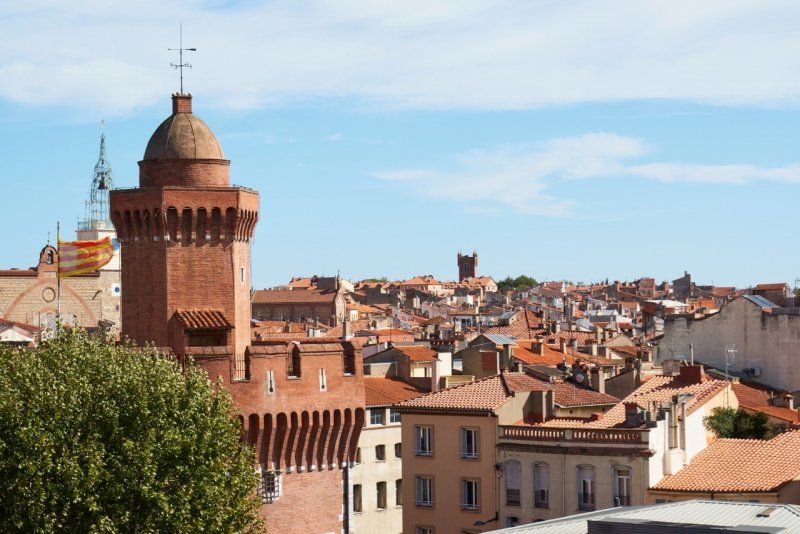
Streifzug durch das historische Tortosa
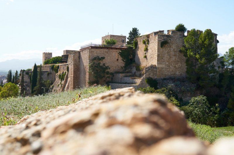
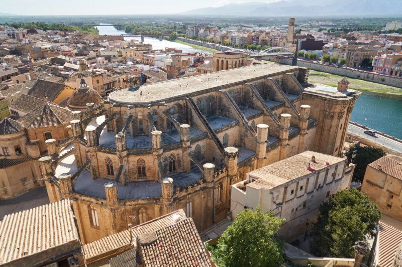
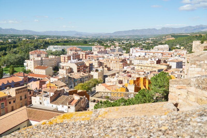
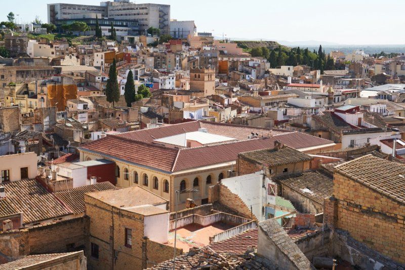
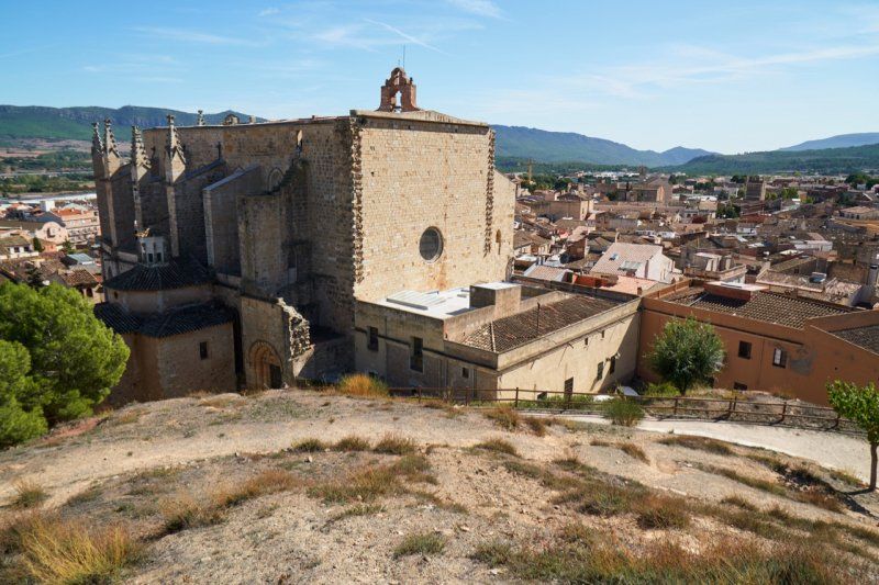
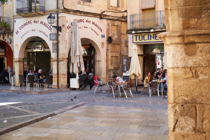
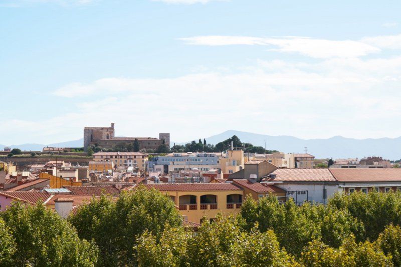
After crossing the Ebro Delta, we leave the coast and drive along the Ebro to Tortosa. As we stroll through historic Tortosa, we discover Franco's memorial to the Battle of the Ebro and climb the Castell de la Suda fortress. The sweaty climb is worth all the effort. The view of the cathedral and the lower town is spectacular. The Islamic-Moorish influence is particularly evident here. It goes down through the former Jewish quarter to the Teodor González Park, where the elderly play petanca (boules) in the afternoon.
Day
Letzte Ebro-Fähre in Miravet, Spanien
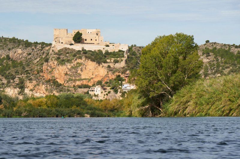
We leave the coast and drive up the Ebro. The last ferry crosses the Ebro at a Templar castle near Miravet. Driven only by the current, up to three cars can cross on two connected river boats. On our further journey into the hinterland we drive through THE wine-growing region near Falset and stop on a hill to let the panorama of the surrounding steep terraces and mountain villages of the Serra de Montsant work on us.
Camí de la Barca, 43747 Miravet, Tarragona, Spanien
41° 2' 10.9" N 0° 36' 1.5" E
41.0363666 0.6004213
• Head northwest on TV-3023. Go for 135 m.
• Turn right toward Barri Raval. Go for 688 m.
• Continue on Barri Raval. Go for 112 m.
• Turn right onto Carretera Mora (T-324). Go for 268 m.
• Continue on T-324. Go for 2.5 km.
• Continue on Carretera de Pinell de Brai a Mora d'Ebre (T-324). Go for 57 m.
• Turn right onto Carrer Sant Jordi (T-324). Go for 440 m.
• Continue on Plaça Espanya (T-324). Go for 91 m.
• Continue on Carrer Sant Jordi (T-324). Go for 399 m.
• Continue on Plaça Catalunya (T-324). Go for 36 m.
• Continue on Carrer Reus (T-324). Go for 438 m.
• Continue on T-324. Go for 2.3 km.
• Take the 1st exit from roundabout onto N-420 toward Móra la Nova/Tarragona. Go for 17.3 km.
• Take ramp onto N-420a toward Falset oest/TP-7101/Bellmunt del Priorat. Go for 539 m.
• Pass 2 roundabouts and continue on N-420a. Go for 382 m.
• Continue on Carrer d'Alcolea del Pinar (N-420a). Go for 168 m.
• Continue on Carrer Miquel Barceló (N-420a). Go for 437 m.
• Continue on Avinguda Catalunya (N-420a). Go for 181 m.
• Take the 3rd exit from roundabout onto Plaça de les Escoles (T-710) toward Gratallops/La Vilella Baixa. Go for 724 m.
• Continue on T-710 toward Gratallops. Go for 8.5 km.
• Continue on Carretera de Falset (T-710). Go for 118 m.
• Continue on T-710. Go for 4.9 km.
• Turn right onto T-702 toward La Vilella Alta/Poboleda/La Morera de Montsant. Go for 6.1 km.
• Turn left onto TV-7022 toward Escaladei/La Morera de Montsant/Cartoixa d'Escaladei. Go for 327 m.
• Turn left onto Rambla de la Cartoixa toward Escaladei Centre Ciutat/Cartoixa. Go for 23 m.
• Turn right. Go for 81 m.
• Turn slightly left toward Camí de la Cartoixa. Go for 108 m.
• Continue on Camí de la Cartoixa. Go for 879 m.
• Arrive at your destination on the left.
☍
48,2 km
( 51 min.)
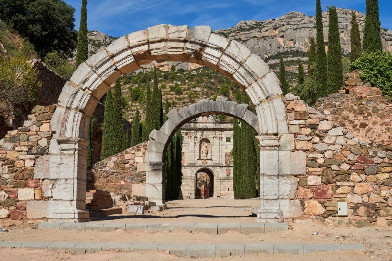
Cartoixa d'Escaladei, Spanien
In a wine-growing region in the middle of the Parc Natural Serra de Montsant, in a sheltered valley, lies a former Carthusian monastery, the origins of which can be dated back to the 12th century. The restorations are in progress and a significant area can already be visited again.
Rambla de la Cartoixa, s/n, 43379 Escaladei, Tarragona, Spanien
41° 15' 20.9" N 0° 48' 36.1" E
41.2557975 0.8100365
• Head southeast. Go for 92 m.
• Continue on Camí de la Cartoixa. Go for 895 m.
• Turn slightly right toward Rambla de la Cartoixa. Go for 81 m.
• Turn left onto Rambla de la Cartoixa. Go for 23 m.
• Turn right onto TV-7022 toward Tarragona/Falset. Go for 327 m.
• Turn left onto T-702 toward Poboleda. Go for 5.0 km.
• Continue on Carrer Major (T-702). Go for 99 m.
• Continue on Carretera d'Esplugues a Flix (T-702). Go for 194 m.
• Continue on T-702. Go for 5.3 km.
• Turn left onto C-242 toward Cornudella de Montsant. Go for 16.9 km.
• Turn right onto TV-7004 toward Vilanova P./Vimbodí. Go for 8.8 km.
• Continue on Carrer de la Closa (TV-7004). Go for 92 m.
• Continue on Plaça l'Església (TV-7004). Go for 143 m.
• Continue on Carrer de Sant Antoni (TV-7004). Go for 220 m.
• Enter the roundabout. Go for 87 m.
• Arrive at your destination.
☍
38,3 km
( 48 min.)
Camping Serra De Prades in Vilanova De Prades, Spanien
Tonight we sleep up here in the middle of the vineyards of Vilanova de Prades and on the edge of the Serra de Montsant.
Av. Sant Antoni, S/n, 43439, Vilanova de Prades, Spanien
41° 20' 56" N 0° 57' 33.8" E
41.3489000 0.9594000
• Follow the roundabout. Go for 75 m.
• Take the 5th exit from roundabout onto TV-7004 toward Vallclara/Vimbodí. Go for 5.2 km.
• Continue on Avinguda Font Vella (TV-7004). Go for 457 m.
• Continue on TV-7004. Go for 5.5 km.
• Take the 2nd exit from roundabout onto TV-7004 toward Vimbodí/Poblet. Go for 779 m.
• Continue on Carrer de Vallclara (TV-7004). Go for 121 m.
• Take the 2nd exit from roundabout onto TV-7002 toward Centre Urbà. Go for 245 m.
• Continue on Viaducte de Milans (TV-7002). Go for 142 m.
• Continue on TV-7002. Go for 3.5 km.
• Take the 2nd exit from roundabout onto T-700 toward AP-2/Montblanc/Tarragona. Go for 389 m.
• Turn right. Go for 68 m.
• Turn left. Go for 287 m.
• Arrive at your destination on the right.
☍
16,8 km
( 17 min.)
Day
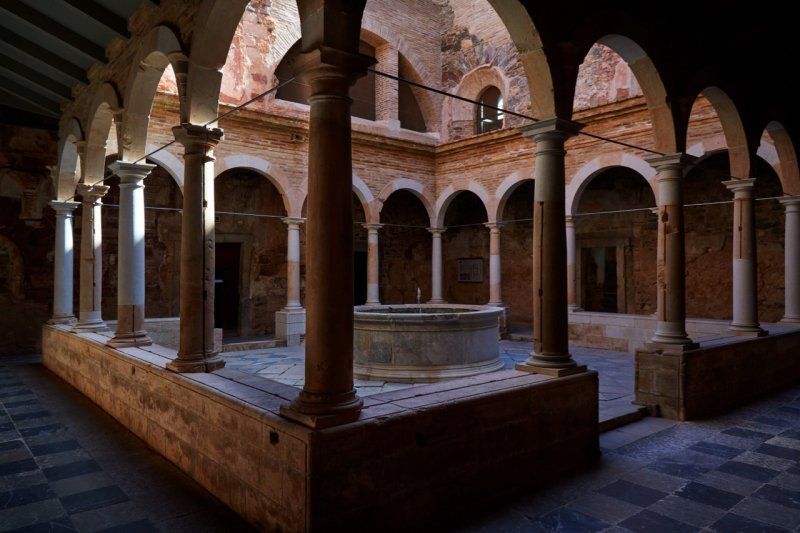
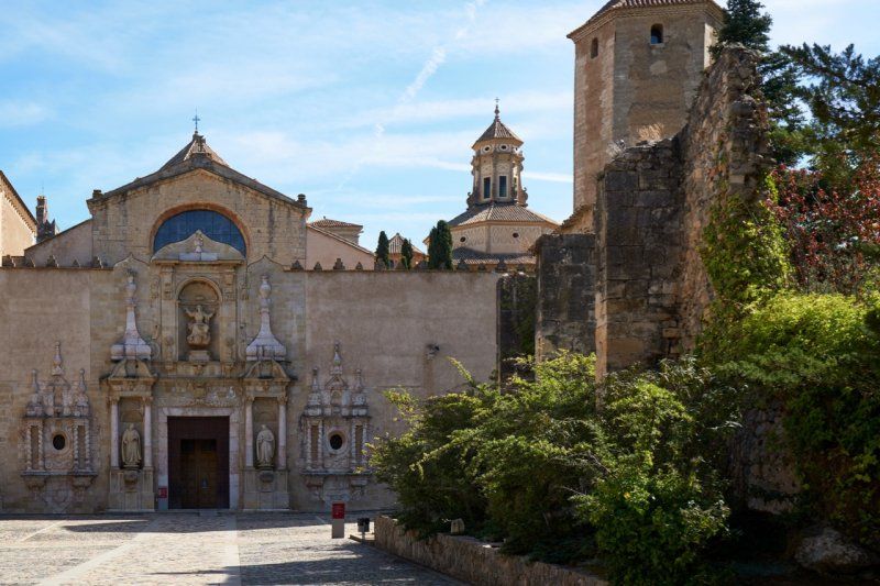
Monestir de Santa Maria de Poblet, Spanien
A short drive down takes us to the village of Poblet. Here, in the middle of the vineyards, is the Cistercian monastery Monestir de Poblet, which is still in use. We tour the extensive complex and buy local products from the monastery: honey, bee pollen and souvenirs for those who stayed at home.
Plaza Corona de Aragón, 11, 43448 Poblet, Tarragona, Spanien
41° 22' 50.6" N 1° 5' 0.7" E
41.3807334 1.0835227
• Head north. Go for 287 m.
• Turn right toward T-700. Go for 68 m.
• Turn right onto T-700. Go for 1.2 km.
• Continue on Carretera de Espluga de Francolí Flix (T-700). Go for 199 m.
• Continue on Carretera de Poblet (T-700). Go for 444 m.
• Continue on Plaça del Centenari (T-700). Go for 125 m.
• Take the 2nd exit from roundabout onto Avinguda de Catalunya (T-700). Go for 117 m.
• Continue on Plaça de Montserrat Canals (T-700) toward AP-2/N-240. Go for 19 m.
• Take the 1st exit from roundabout onto Avinguda de Catalunya (T-700) toward AP-2/N-240. Go for 801 m.
• Take the 2nd exit from roundabout onto Avinguda de Catalunya. Go for 280 m.
• Take the 3rd exit from roundabout onto Carretera Montblanc (TV-7001) toward Barcelona/AP-2/Tarragona/N-240. Go for 308 m.
• Continue on TV-7001. Go for 1.3 km.
• Keep right toward N-240/TV-7001/Montblanc/Tarragona. Go for 80 m.
• Continue toward N-240. Go for 48 m.
• Take ramp onto N-240. Go for 2.1 km.
• Take ramp onto N-240a toward Montblanc nord. Go for 540 m.
• Pass 2 roundabouts and continue on Carrer Muralla Santa Anna (N-240a). Go for 1.0 km.
• Turn right onto Plaça Santa Anna toward Santuari de la Mare de Déu de la Serra. Go for 79 m.
• Continue on Carrer del Baluard de Santa Anna. Go for 225 m.
• Turn right onto Passeig de Josep Conangle. Go for 252 m.
• Arrive at your destination.
☍
9,5 km
( 12 min.)
Parkplatz in Montblanc, Spanien
We look for a parking space along the city wall and find it near an entrance at one of the city gates to Montblanc on Passeig Josep Conangla.
Passeig Josep Conangla, 43400 Montblanc, Tarragona, Spanien
41° 22' 44.3" N 1° 9' 23.9" E
41.3789806 1.1566331
• Head toward Carrer de la Pujada de la Serra. Go for 3 m.
• Continue on Passeig de Josep Conangle. Go for 249 m.
• Turn left onto Carrer del Baluard de Santa Anna. Go for 225 m.
• Continue on Plaça Santa Anna. Go for 79 m.
• Turn right onto Carrer de Santa Tecla (N-240a) toward Tarragona/N-240/Reus/C-14. Go for 667 m.
• Take the 3rd exit from roundabout onto Carretera Montblanc a Tarragona (N-240a) toward N-240/Tarragona/C-14/Reus/Hospital Cap. Go for 1.0 km.
• Take left ramp onto C-14 toward Reus. Go for 23.0 km.
• Take exit 10 toward Reus Centre Ciutat. Go for 1.4 km.
• Take the 1st exit from roundabout onto C-14 toward Centre Ciutat Reus. Go for 2.1 km.
• Take the 1st exit from roundabout onto Avinguda de Marià Fortuny toward Av. de Sant Jordi/Av. de L'Onze de Setembre/N-420. Go for 240 m.
• Take the 2nd exit from roundabout onto Avinguda de Marià Fortuny. Go for 187 m.
• Take the 1st exit from Plaça Pompeu Fabra roundabout onto Avinguda de l'Onze de Setembre. Go for 894 m.
• Take the 2nd exit from roundabout onto Avinguda de l'Onze de Setembre. Go for 121 m.
• Take the 2nd exit from Plaça J. M. Folch i Torres roundabout onto Passeig Mata. Go for 328 m.
• Take the 3rd exit from Plaça de Joan Rebull roundabout onto Passeig de Sunyer. Go for 369 m.
• Take the 1st exit from Plaça de les Oques roundabout onto Passeig de Sunyer. Go for 225 m.
• Arrive at Passeig de Sunyer. Your destination is on the right.
☍
31,0 km
( 30 min.)
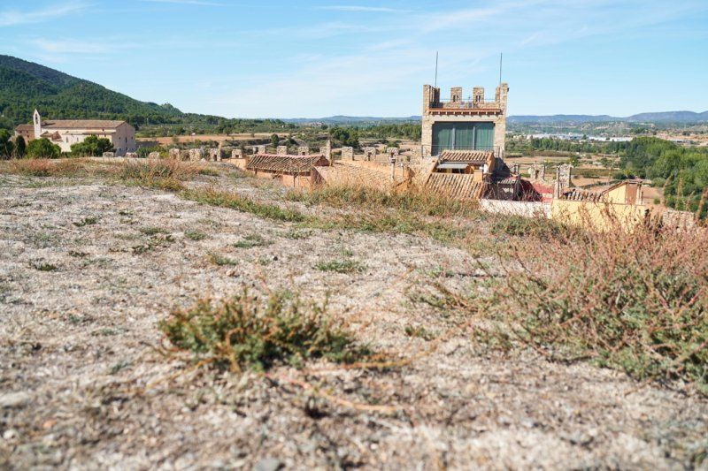
Mittelalterstadt Montblanc
The city is proud of the 14th-century city wall that surrounds it and is still intact. During the siesta there is not much going on, so that we walk through the medieval streets almost alone. From the Plaça de Santa Barbara, near the former castle, you have an excellent view down to the cathedral. The city does not fascinate us in the afternoon and we are drawn to nearby Reus for the evening.
Stellplatz in Reus, Spanien
We are drawn back to the Costa Daurada: soak up the sun for the rest of the year! On the way back we make a stop in Reus. Our parking lot is in the middle of the hustle and bustle of the city center and we arrive in Reus right at rush hour. In the evening you can walk through the Art Nouveau and Gaudí metropolis.
Carrer del Dr. Frias, 43202 Reus, Tarragona, Spanien
41° 9' 15.4" N 1° 6' 6.2" E
41.1542776 1.1017157
• Head south on Passeig de Sunyer. Go for 49 m.
• Turn right onto Camí Riudoms. Go for 100 m.
• Continue on Camí Riudoms. Go for 267 m.
• Take the 3rd exit from roundabout onto Avinguda dels Països Catalans (T-316) toward Hospital Universitari Sant Joan. Go for 439 m.
• Pass 2 roundabouts and continue on Avinguda dels Països Catalans (T-316). Go for 690 m.
• Take the 2nd exit from Plaça de la Mare de la Misericòrdia roundabout onto TV-3141 toward Club de Golf Reus Aigüesverds. Go for 474 m.
• Take the 3rd exit from roundabout onto T-11 toward Tarragona. Go for 6.8 km.
• Take exit 12 toward Barcelona/València/TV-3145/La Canonja. Go for 340 m.
• Take the 3rd exit from roundabout toward Barcelona/València. Go for 385 m.
• Take ramp onto AP-7 (Autopista de la Mediterrània) toward Barcelona/Lleida. Go for 252 km.
• Continue on A9 (La Catalane). Go for 24.9 km.
• Take exit 42 toward Andorre la V./Perpignan-Centre/Prades/Canet en Roussillon/Thuir/St Charles Internal. Go for 1.3 km.
• Take the 3rd exit from Rond-Point de l'Euro-Méditerranée roundabout onto D900 A toward Andorre la Vieille/Narbonne/Perpignan-Centre/Canet en Roussillon/Prades/St Charles Internal. Go for 218 m.
• Continue on Rocade Saint-Charles (D900 A). Go for 318 m.
• Keep left onto Rocade Saint-Charles (D900 A) toward Perpignan-Centre/Narbonne/Andorre la V./Prades/Canet en R. Go for 2.2 km.
• Take the 2nd exit from Rond-Point de Copenhague roundabout onto Rocade Saint-Charles (D900 A) toward Perpignan-Centre/Narbonne/Andorre la V./Prades/Canet en R. Go for 1.6 km.
• Keep left toward Perpignan-Centre/Canet en Roussillon. Go for 87 m.
• Continue on Boulevard Edmond Michelet. Go for 1.6 km.
• Keep left onto Boulevard Edmond Michelet toward Narbonne/Foix/St Estève/Canet en R./Aéroport/Le Vernet. Go for 237 m.
• Continue on Boulevard de la France Libre. Go for 57 m.
• Keep left onto Boulevard de la France Libre (D82) toward Canet/Les Platanes. Go for 479 m.
• Take the 1st exit from Rond-Point de la Têt roundabout onto Rue Marguerite Jaulent. Go for 104 m.
• Turn right onto Avenue du Général Leclerc (D31 A). Go for 40 m.
• Turn left onto Rue Pierre Rameil. Go for 118 m.
• Turn left onto Boulevard Georges Clemenceau (D88). Go for 134 m.
• Continue on Pont Général de Larminat (D617). Go for 71 m.
• Turn left onto Place du Colonel Dominique Cayrol. Go for 87 m.
• Continue on Cours Palmarole. Go for 246 m.
• Arrive at Cours Palmarole. Your destination is on the left.
☍
295,4 km
(2 hrs. 52 min.)
Day
Gaudí-Metropole
In the morning we explore the Routa del Modernisme along Plaça de la Llibertat, Plaça de Prim to Plaça del Mercadal, where the City Hall (Ayuntamiento) stands. Around the turn of the century (18th/19th century), rich merchants had magnificent houses built in the modernist style. The pioneer was Antoni Gaudí, who was very popular at the time, and his students and comrades-in-arms.
Day
Historisches Katalonien
Perpignan was once part of Catalonia and Catalan is still spoken here today, as the identity associated with it has not been given up for a long time. The most beautiful thing about Perpignan is the past, hence the charm of decay. We climb “La Terrasse” on the fourth floor of Galeries Lafayette and catch a glimpse of the sights that surround us. A stroll through the winding streets of the old town - and with a few well-intentioned tips we reach the cathedral.
Parkplatz in Perpignan, Frankreich
Our car park is in the heart of the city and only a few minutes away from Galeries Lafayette.
Cours François Palmarole, 66000 Perpignan, Frankreich
42° 42' 11.3" N 2° 53' 50.2" E
42.7031407 2.8972745
• Head west on Cours Palmarole. Go for 246 m.
• Continue on Place du Colonel Dominique Cayrol. Go for 87 m.
• Turn right onto Pont Général de Larminat (D617). Go for 23 m.
• Turn slightly right onto Place de la Résistance (D31 A). Go for 172 m.
• Turn right onto Rue Marguerite Jaulent. Go for 84 m.
• Take the 2nd exit from Rond-Point de la Têt roundabout onto Boulevard de la France Libre (D82). Go for 301 m.
• Keep right onto Boulevard de la France Libre (D82). Go for 652 m.
• Continue on Boulevard Edmond Michelet. Go for 1.6 km.
• Continue on D900 A. Go for 907 m.
• Keep left onto Rocade Saint-Charles (D900 A) toward A9/Gérone/Thuir/Argelès/Gd St Charles. Go for 30 m.
• Keep left onto Rocade Saint-Charles (D900 A) toward A9/Gérone/Thuir/Argelès/Gd St Charles. Go for 597 m.
• Take the 2nd exit from Rond-Point de Copenhague roundabout onto Rocade Saint-Charles (D900 A) toward A9/Gérone. Go for 2.6 km.
• Continue on D900 A toward Le Boulou/Narbonne/Barcelone/Gérone. Go for 113 m.
• Take the 3rd exit from Rond-Point de l'Euro-Méditerranée roundabout toward Barcelone/Gérone/Le Boulou/Narbonne. Go for 408 m.
• Take ramp onto A9 (La Catalane) toward Barcelone/Gérone/Le Boulou. Go for 25.7 km.
• Continue on AP-7 (Autopista de la Mediterrània). Go for 136 km.
• Keep right onto AP-7 (Autopista de la Mediterrània) toward Lleida/E-90/AP-2/Tarragona/Sabadell/C-58/Túnels de Vallvidrera/E-9/Manresa/C-16/Polígon Industrial de Zona Franca/Fira. Go for 120 km.
• Take exit 35 toward Salou. Go for 1.8 km.
• Take ramp onto Autovia de Tarragona a Salou (C-31B). Go for 1.1 km.
• Take the 1st exit from roundabout onto Carretera a Cambrils (T-325). Go for 514 m.
• Pass 5 roundabouts and continue on Carrer Castell de Vilafortuny (T-325). Go for 2.9 km.
• Take the 2nd exit from roundabout onto Avinguda Cavet toward Centre. Go for 636 m.
• Take the 2nd exit from roundabout onto Avinguda Cavet toward Centre Ciutat. Go for 381 m.
• Take the 2nd exit from roundabout onto Carrer del Corralet. Go for 425 m.
• Continue on Carrer Francolí. Go for 194 m.
• Continue on Camí del Corralet. Go for 160 m.
• Turn right onto Carrer Riu Glorieta. Go for 302 m.
• Continue on Carrer Polígon 12. Go for 165 m.
• Turn right. Go for 28 m.
• Arrive at your destination on the left.
☍
298,3 km
(2 hrs. 53 min.)
Camping Playa Cambrils, Spanien
Camping Playa Cambrils is located directly on the beach promenade on the outskirts of Cambrils. The complex offers private shaded plots and is just minutes from the beach.
Camping Platja Cambrils, Avinguda d'Oleastrum, 12, 43850 Cambrils, Tarragona, Spain
41° 4' 0.5" N 1° 4' 58.4" E
41.0668000 1.0829000
• Head east. Go for 219 m.
• Turn sharp right toward Carrer del Riu Gaià. Go for 61 m.
• Continue on Carrer del Riu Gaià. Go for 280 m.
• Turn left onto Carrer Francolí. Go for 210 m.
• Continue on Carrer del Corralet. Go for 335 m.
• Take the 1st exit from roundabout onto Avinguda Cavet. Go for 360 m.
• Take the 2nd exit from roundabout onto Avinguda Cavet toward Salou. Go for 630 m.
• Take the 2nd exit from roundabout onto Carrer Cavet (T-325) toward Salou. Go for 712 m.
• Pass 5 roundabouts and continue on Carretera a Cambrils (T-325). Go for 2.6 km.
• Take the 4th exit from roundabout onto Autovia de Tarragona a Salou (C-31B) toward A-7/VIla-Seca/Reus. Go for 745 m.
• Take ramp toward AP-7/Barcelona/Castellolí/València. Go for 718 m.
• Take ramp onto AP-7 (Autopista de la Mediterrània) toward Tarragona/Barcelona/Lleida/AP-2. Go for 258 km.
• Continue on A9 (La Catalane). Go for 86.1 km.
• Take the exit toward Toulouse/E80/Carcassonne onto A61 (Autoroute des Deux Mers). Go for 49.5 km.
• Take exit 24 toward Carcassonne-Centre/Trèbes/Carcassonne-la Cité. Go for 677 m.
• Continue on Bretelle Echangeur Carcassonne-Est. Go for 522 m.
• Keep left toward Carcassonne/La Cité. Go for 395 m.
• Take ramp onto Route de Marseille à Bordeaux (D6113). Go for 2.2 km.
• Take ramp toward A61/Toulouse/Foix/Castres/Mazamet. Go for 300 m.
• Take the 3rd exit from roundabout onto D6113 toward A61/Narbonne. Go for 284 m.
• Continue on D6161. Go for 17 m.
• Keep left onto D6161. Go for 1.2 km.
• Turn right onto Voie Médiévale toward La Cité. Go for 455 m.
• Turn right onto Chemin de Montlegun. Go for 52 m.
• Turn right. Go for 44 m.
• Turn right. Go for 19 m.
• Arrive at your destination on the left.
☍
406,6 km
(3 hrs. 47 min.)
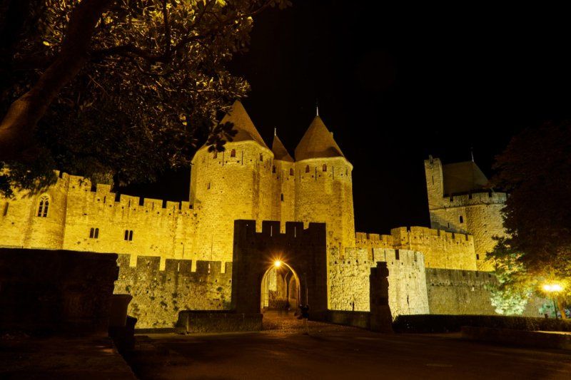
La Cité formidable!
The Cité of Carcassonne houses the Château Comte, a medieval fortress above Carcassonne. In the late afternoon we reach the city at the beginning of twilight and stroll through the streets until late in the evening, in which the smells of the bars spread: C'est formidable!
Stellplatz in Carcassonne, Frankreich
On P2 there is a caravan and mobile home parking space within walking distance of the Château Comtal. Overnight stays between 8 p.m. and 8 a.m. are free of charge, outside these times 1€/15 minutes will be charged.
Chemin de Montlegun, 11000, Carcassonne, Frankreich
43° 12' 18" N 2° 22' 20" E
43.2050000 2.3722222
• Head toward Chemin de Montlegun. Go for 53 m.
• Turn slightly left onto Chemin de Montlegun. Go for 64 m.
• Turn left onto Voie Médiévale. Go for 270 m.
• Turn right toward Voie Médiévale. Go for 45 m.
• Turn left toward Voie Médiévale. Go for 33 m.
• Turn left onto Rocade Sud (D6161). Go for 1.3 km.
• Turn right toward A61/Narbonne/Lézignan-Corbières/Lagrasse/Capendu/Trèbes. Go for 139 m.
• Take the 2nd exit from roundabout onto Route de Narbonne (D6113) toward A61/Narbonne/Lézignan-Corbières/Lagrasse/Capendu/Trèbes. Go for 1.9 km.
• Take ramp onto Bretelle Echangeur Carcassonne-Est toward A61/Narbonne/Perpignan/Toulouse. Go for 1.2 km.
• Take ramp onto A61 (Autoroute des Deux Mers) toward Narbonne/Perpignan/Montpellier. Go for 48.2 km.
• Take the left exit toward E15/Lyon/Montpellier/Béziers onto A9 (La Languedocienne). Go for 165 km.
• Take exit 23 toward Uzès/Remoulins/Pont du Gard. Go for 1.0 km.
• Take the 3rd exit from roundabout onto D6100 toward Nîmes/Alès/Beaucaire/Tarascon/Remoulins/Uzès/Pont du Gard. Go for 1.9 km.
• Take the 2nd exit from Carrefour de l'Arnède roundabout onto Impasse des Oliviers (D6101) toward Alès/Bagnols S/C./Pont du Gard. Go for 565 m.
• Take the 3rd exit from roundabout onto Route de Bagnols (D6086) toward Montélimar/Alès/Bagnols S/C./Uzès/Pont du Gard. Go for 1.3 km.
• Take the 3rd exit from roundabout toward Alès/Uzès/Pont du Gard. Go for 53 m.
• Turn right onto Chemin des Croisées (D19 A). Go for 1.2 km.
• Take the 2nd exit from roundabout onto Route Impériale (D19 A) toward Alès/Uzès/Pont du Gard. Go for 486 m.
• Take the 2nd exit from roundabout onto Route d'Uzès (D19) toward Alès/Uzès/Pont du Gard. Go for 587 m.
• Take the 2nd exit from roundabout onto D981 toward Alès/Vers/Uzès. Go for 717 m.
• Continue toward Alès/Uzès/Collias. Go for 34 m.
• Take the 2nd exit from roundabout onto D981 toward Alès/Uzès/Collias. Go for 1.1 km.
• Turn left onto Chemin du Passeur toward Les Gorges du Gardon/La Bégude St Pierre. Go for 175 m.
• Turn left onto Chemin des Bégudes (VC2). Go for 310 m.
• Turn right onto Chemin des Bégudes. Go for 23 m.
• Arrive at Chemin des Bégudes. Your destination is on the left.
☍
227,6 km
(2 hrs. 2 min.)
Day
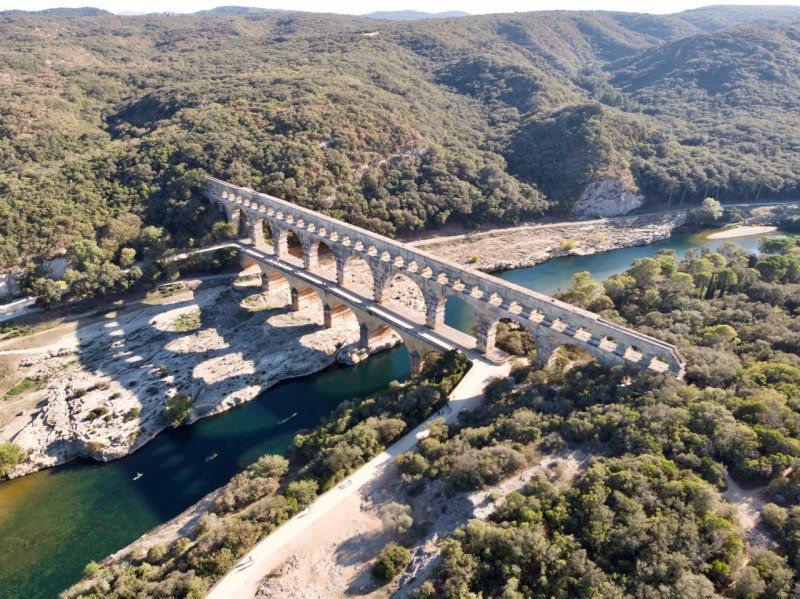
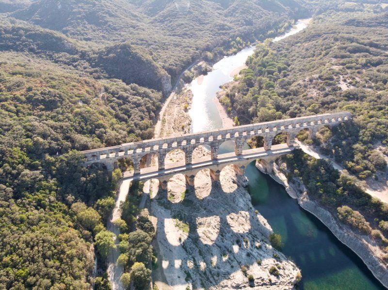
Römisches Viadukt
In the afternoon we reach the Pont du Gard. The Romans once again demonstrated their skills in construction and architecture on this monumental structure.
Parkplatz in Vers-Pont-du-Gard, Frankreich
By means of a not easy manoeuvre, we reach a hill in a clearing in the forest, from where we cycle to the left bank of the Gard in order to have a free and unregulated access to the Pont.
295 Chemin des Bégudes, 30210 Vers-Pont-du-Gard, Frankreich
43° 57' 27.8" N 4° 31' 18.3" E
43.9577120 4.5217399
• Head northwest on Chemin des Bégudes. Go for 23 m.
• Turn right onto Chemin de la Bégude. Go for 33 m.
• Turn right onto D981. Go for 751 m.
• Take the 2nd exit from roundabout onto Route de Rémoulins (D981) toward A9/Avignon/Remoulins/Pont du Gard. Go for 730 m.
• Take the 2nd exit from roundabout onto Route de Rémoulins (D19) toward A9/Avignon/Bagnols S/C. Go for 540 m.
• Take the 2nd exit from roundabout onto Chemin des Croisées (D19 A) toward A9/Avignon/Bagnols S/C./Nîmes. Go for 510 m.
• Take the 2nd exit from roundabout onto Chemin des Croisées (D19 A) toward A9/Avignon/Bagnols S/C. Go for 1.3 km.
• Take the 1st exit from roundabout onto D6086 toward A9/Nîmes/Avignon/Remoulins. Go for 1.2 km.
• Take the 2nd exit from roundabout onto D6101 toward A9/Avignon/Nîmes/Beaucaire/Tarascon. Go for 618 m.
• Take the 3rd exit from Carrefour de l'Arnède roundabout onto D6100 toward A9/Nîmes/Avignon/Les Angles. Go for 1.8 km.
• Take the 2nd exit from roundabout onto A9 (La Languedocienne) toward Nîmes/Orange/Lyon. Go for 30.7 km.
• Continue on A7 (Autoroute du Soleil). Go for 41.4 km.
• Take exit 18 toward Le Puy en Velay/Aubenas/Montélimar/Dieulefit/Viviers. Go for 980 m.
• Take the 1st exit from roundabout onto N7 toward Montélimar/Aubenas/Le Puy/Malataverne-Centre/Viviers/Dieulefit. Go for 644 m.
• Turn left onto D126 toward Malataverne. Go for 278 m.
• Continue on Grande Rue (D206). Go for 136 m.
• Turn right onto Chemin de la Riaille. Go for 22 m.
• Turn slightly right onto Chemin de la Riaille. Go for 56 m.
• Turn left onto Chemin du Clarinas. Go for 73 m.
• Arrive at Chemin du Clarinas. Your destination is on the right.
☍
81,9 km
( 46 min.)
Parkplatz in Malataverne, Frankreich
Overnight stay at Montélimar.
Le Village, 26780 Malataverne, Frankreich
44° 29' 15.3" N 4° 45' 9.3" E
44.4875729 4.7525943
• Head toward Chemin de la Riaille on Chemin du Clarinas. Go for 73 m.
• Turn right onto Chemin de la Riaille. Go for 78 m.
• Turn left onto Grande Rue (D206). Go for 136 m.
• Continue on D126. Go for 251 m.
• Keep right onto N7. Go for 631 m.
• Take the 2nd exit from roundabout toward Valence/Marseille/Nîmes/Orange. Go for 258 m.
• Take ramp onto A7 (Autoroute du Soleil) toward Valence/Lyon. Go for 155 km.
• Keep right onto Autoroute du Soleil (M7) toward Paris/A6/Clermont-Fd/A89/Roanne. Go for 152 km.
• Continue on A31. Go for 114 km.
• Take the exit toward Metz/Nancy/Épinal/Langres-Nord onto A31. Go for 132 km.
• Take the left exit toward Pont-à-Mousson/Metz/Luxembourg/Nancy-Centre/Laxou onto D400 (Avenue de la Résistance). Go for 1.2 km.
• Keep left onto Avenue de la Résistance (D400) toward Metz/Maxéville/Nancy. Go for 2.9 km.
• Turn slightly left onto Rue de Verdun toward Faculté de Lettres/La Manufacture. Go for 195 m.
• Turn left onto Boulevard Albert 1er. Go for 247 m.
• Turn right onto Rue de Boudonville toward Sarreguemines/Malzéville/St Max. Go for 233 m.
• Continue on Rue du Chanoine Jacob. Go for 236 m.
• Continue on Rue Jean Lamour. Go for 331 m.
• Turn left onto Boulevard Charles V. Go for 18 m.
• Turn right onto Rue du Faubourg des Trois Maisons (D570). Go for 82 m.
• Turn right onto Rue de la Citadelle. Go for 54 m.
• Turn left onto Rue Henri Deglin. Go for 125 m.
• Continue on Rue Henri Deglin. Go for 253 m.
• Turn left onto Rue Charles de Foucauld (D570). Go for 123 m.
• Turn right onto Rue de Malzéville toward Malzéville. Go for 95 m.
• Turn right onto Rue Oberlin. Go for 359 m.
• Arrive at Rue Oberlin.
☍
560,6 km
(4 hrs. 52 min.)
Day
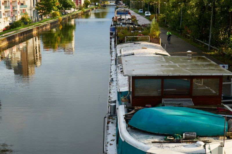
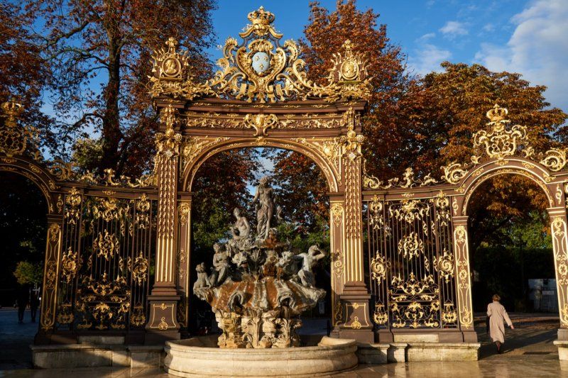
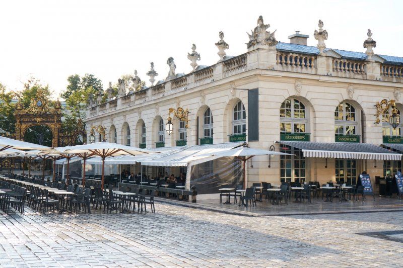
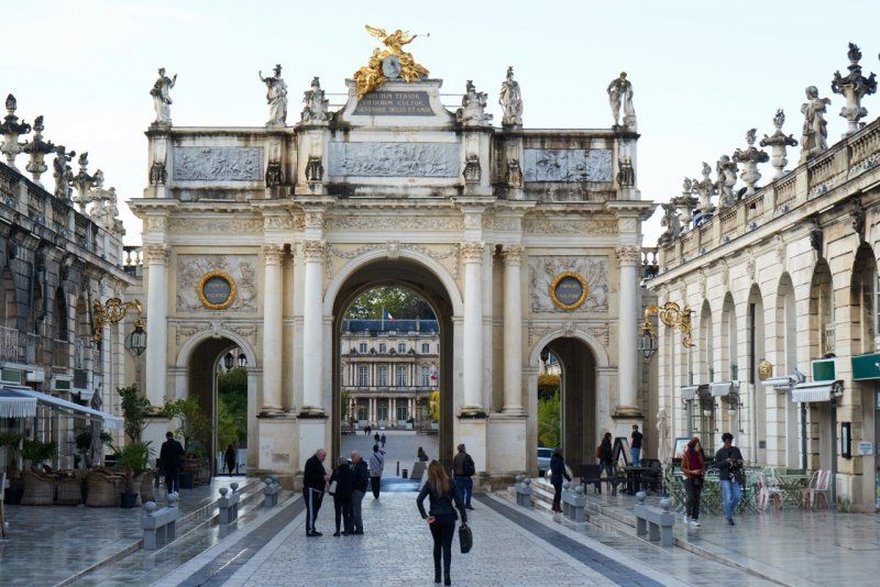
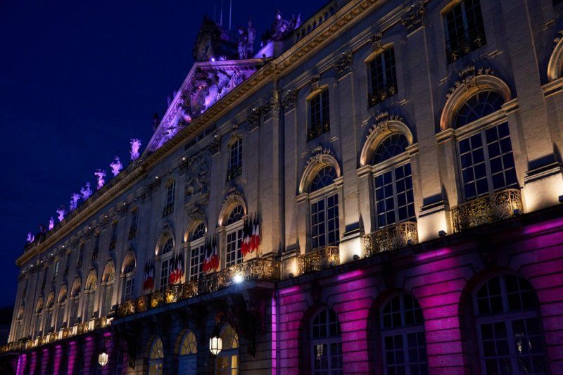
Polnischer Klassizismus in Nancy
We leave after our arrival in the afternoon, walk along the Canal de la Marne au Rhin and the houseboats that are moored there, until we finally arrive at Place Stanislas. The sun that comes out again lets the golden decorations shine in the brightest light and we can enjoy the last day in France to the full until the evening, including an excellent dinner in the old town.
Parkplatz in Nancy, Frankreich
The sky has opened its floodgates on our return journey and we are drowning in rain until we make a stop in Nancy. We spend our second night under a bridge.
Rue Oberlin, 54000 Nancy, Frankreich
48° 42' 8.1" N 6° 11' 10.6" E
48.7022570 6.1862690