In mid-September 2018 we 🙋♀️🙋♂️ went on a big autumn trip for the first time in a 🚐💨 box van through 🇨🇭 Switzerland to 🇮🇹 Italy. In total it was 🛣 3,373 KM in 18 days.
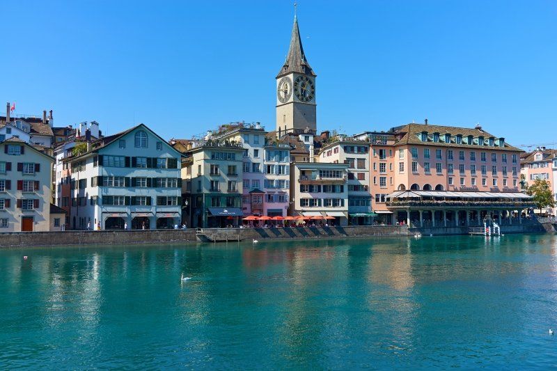
Our journey leads via Zurich to Central Switzerland to 🏔 Engelberg and past the 🚤 Lake Lucerne, to the northern Italian lakes Lago Maggiore and Lago d'Orta, along the Po plain to the lagoon city on the 🌊 Adria and via Liguria's coast with the Cinque Terre back in the Swiss Alps to Locarno and Lucerne.
You can also find our travel report on our 🎥 YouTube channel (https://tinyurl.com/ErstmalDurchEuropa) and also as a playlist (https://tinyurl.com/EdE-CHmIT).
Day
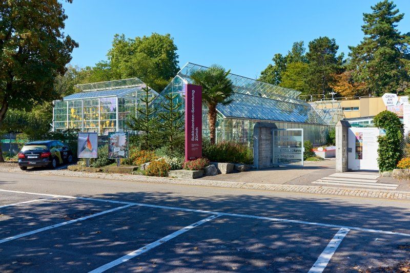
Sukkulenten-Sammlung Zürich
From the parking lot of the succulent collection, located at the Mythenquai lido and in the immediate vicinity of Lake Zurich, we explore Zurich's old town. The old town can be reached on foot in 20 minutes.
Free standing for 4 SFR or EUR/night, to be paid in coins and only 1.5 km away from the city center, for vans and short motorhomes a good value alternative to explore Zurich. In the morning we woke up with a clear view of Lake Zurich and had a leisurely breakfast with an unobstructed view of the still calm lake.
Mythenquai 88, 8002 Zürich, Schweiz
47° 21' 21.9" N 8° 32' 4.6" E
47.3560957 8.5346193
• Head north on Mythenquai (3). Go for 53 m.
• Turn left onto Alfred-Escher-Strasse (3). Go for 1.7 km.
• Continue on Manessestrasse (4). Go for 159 m.
• Keep left onto A3W toward A3. Go for 2.5 km.
• Take exit 32 toward Basel/Westring-Zürich onto A3. Go for 5.2 km.
• Take the left exit toward Gotthard/Luzern onto A4. Go for 23.1 km.
• Continue on A14 toward Luzern/Gisikon-Root. Go for 15.8 km.
• Continue on A2. Go for 16.9 km.
• Take exit 33 toward Stans-Süd/Engelberg/Dallenwil/Ennetbürgen. Go for 186 m.
• Continue on Buochserstrasse. Go for 265 m.
• Turn right toward Riedenstrasse. Go for 65 m.
• Continue on Riedenstrasse. Go for 652 m.
• Continue on Kantonsstrasse. Go for 30 m.
• Pass 3 roundabouts and continue on Kantonsstrasse (374). Go for 5.1 km.
• Continue on Dorfstrasse (374). Go for 2.0 km.
• Continue on Dörfli (374). Go for 234 m.
• Continue on Langacher (374). Go for 121 m.
• Continue on Mittel Ey (374). Go for 355 m.
• Continue on Ober Ey (374). Go for 69 m.
• Continue on Hinter Ey (374). Go for 54 m.
• Continue on Allmend (374). Go for 457 m.
• Continue on Bannerlen (374). Go for 828 m.
• Continue on Parketterie (374). Go for 165 m.
• Continue on Waldheim (374). Go for 85 m.
• Continue on Rietli (374). Go for 484 m.
• Continue on 374. Go for 483 m.
• Continue on Grafenort (374). Go for 163 m.
• Continue on 374. Go for 4.9 km.
• Continue on Grünenwald (374). Go for 58 m.
• Continue on 374. Go for 1.4 km.
• Continue on Engelbergerstrasse (374). Go for 2.4 km.
• Turn right onto Klosterstrasse. Go for 63 m.
• Continue on Klosterhof. Go for 467 m.
• Turn right onto Wasserfallstrasse. Go for 1.2 km.
• Turn right. Go for 62 m.
• Turn left. Go for 166 m.
• Arrive at your destination on the right.
☍
87,8 km
(1 hrs. 6 min.)
Day
Camping Eienwäldli
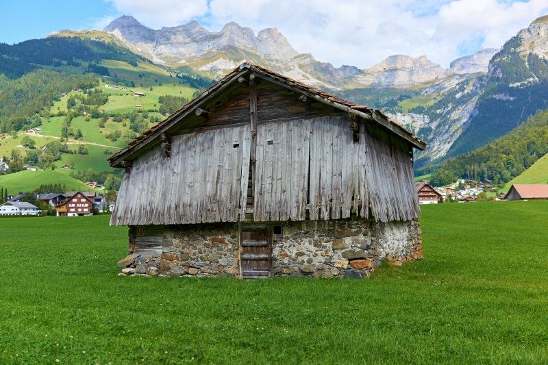
Camping Eienwäldli is located in a valley high in the Swiss Alps in Engelberg, outside the tranquil winter sports resort. The highlights are long hikes past the Benedictine monastery and the Olympic ski jump back to the waterfall near Camping Eienwäldli. The adjoining restaurant and the wellness area of the associated hotel invite you to linger.
Wasserfallstraße 108, 6390, Engelberg, Schweiz
46° 48' 33.8" N 8° 25' 21" E
46.8094000 8.4225000
• Head southeast. Go for 166 m.
• Turn right toward Wasserfallstrasse. Go for 62 m.
• Turn left onto Wasserfallstrasse. Go for 1.2 km.
• Turn left onto Wydenstrasse. Go for 467 m.
• Continue on Klosterstrasse. Go for 63 m.
• Turn left onto Engelbergerstrasse (374). Go for 2.4 km.
• Continue on 374. Go for 1.4 km.
• Continue on Grünenwald (374). Go for 58 m.
• Continue on 374. Go for 4.9 km.
• Continue on Grafenort (374). Go for 163 m.
• Continue on 374. Go for 483 m.
• Continue on Rietli (374). Go for 484 m.
• Continue on Waldheim (374). Go for 85 m.
• Continue on Parketterie (374). Go for 165 m.
• Continue on Bannerlen (374). Go for 828 m.
• Continue on Allmend (374). Go for 457 m.
• Continue on Hinter Ey (374). Go for 54 m.
• Continue on Ober Ey (374). Go for 69 m.
• Continue on Mittel Ey (374). Go for 355 m.
• Continue on Langacher (374). Go for 121 m.
• Continue on Dörfli (374). Go for 234 m.
• Continue on Hauptstrasse (374). Go for 2.0 km.
• Continue on Kantonsstrasse (374). Go for 2.1 km.
• Pass 3 roundabouts and continue on Kantonsstrasse. Go for 3.1 km.
• Continue on Riedenstrasse. Go for 684 m.
• Take the 2nd exit from roundabout. Go for 153 m.
• Take ramp onto A2 toward Luzern. Go for 17.6 km.
• Keep middle onto A14 toward Zürich/Zug/Buchrain. Go for 15.5 km.
• Continue on A4. Go for 5.1 km.
• Take exit 32 toward Zug/Cham-Ost onto A14. Go for 8.7 km.
• Continue on Sihlbruggstrasse (4) toward Chur/Zürich/Sihlbrugg. Go for 1.4 km.
• Take the 2nd exit from roundabout onto Sihlbruggstrasse (4) toward Chur/A3/Zürich/Wädenswil/Hirzel. Go for 308 m.
• Take the 2nd exit from roundabout onto 388 toward A3/Chur/Wädenswil/Hirzel. Go for 6.4 km.
• Continue on Zugerstrasse toward Chur/Wädenswil. Go for 1.9 km.
• Turn right and take ramp onto A3 toward Chur. Go for 38.7 km.
• Take exit 44 toward Niederurnen/Klausen/Glarus/Näfels. Go for 955 m.
• Keep left toward Zubringerstrasse. Go for 272 m.
• Continue on Zubringerstrasse. Go for 1.2 km.
• Continue toward Stichstrasse. Go for 31 m.
• Take the 2nd exit from roundabout onto Stichstrasse. Go for 979 m.
• Take the 1st exit from roundabout. Go for 344 m.
• Turn left onto Molliserstrasse (3). Go for 13.7 km.
• Take the 1st exit from roundabout onto A3 toward Chur/Sargans/Walenstadt. Go for 25.8 km.
• Continue on A13. Go for 136 km.
• Take the left exit toward E35/Milano/Lugano/Locarno/Bellinzona Sud onto A2. Go for 26.0 km.
• Take exit 49 toward Lugano Nord/Ponte Tresa/Aeroporto/Lugano. Go for 1.5 km.
• Take the 2nd exit from roundabout onto Autostrada Lugano-Centro toward Lugano. Go for 1.8 km.
• Take the 1st exit from roundabout onto Via Bioggio (401) toward Lugano/Massagno/Breganzona. Go for 1.5 km.
• Turn right onto Via Clemente Maraini (2/399). Go for 288 m.
• Take the 2nd exit from roundabout onto Via Clemente Maraini (2/399). Go for 691 m.
• Turn right onto Via Tassino. Go for 163 m.
• Arrive at Via Tassino. Your destination is on the left.
☍
328,9 km
(3 hrs. 45 min.)
Besichtigung des Benediktinerklosters
The monastery, founded in 1120 (https://www.kloster-engelberg....) is located in a beautiful mountain valley and also houses a show dairy (https://www.schaukaeserei-enge...). From Camping Eienwaeldli (https://www.eienwaeldli.ch/de/...) along the course of the stream, you can manage the visit with an easy hike of 4 km there and back.
Day
Area Sosta Camper Lugano
This parking space with a view of Monte San Salvatore and the Paradiso district is located high above Lugano and about a 20-minute walk from the old town. The one with SFR or EUR coins! The paid parking space is expensive, but ideally located in terms of traffic and for sightseeing.
Via Tassino, 6900 Lugano, Schweiz
46° 0' 1.5" N 8° 56' 41.1" E
46.0004067 8.9447384
• Head southeast on Via Tassino. Go for 154 m.
• Turn right toward Via Quiete. Go for 44 m.
• Turn left onto Via Quiete. Go for 14 m.
• Turn right onto Via Clemente Maraini (2/399). Go for 876 m.
• Turn right toward Lugano Sud. Go for 594 m.
• Continue on Lugano Sud toward Milano/Chiasso. Go for 202 m.
• Keep left onto Lugano Sud toward Milano/Chiasso. Go for 342 m.
• Take ramp onto A2 toward Milano/Chiasso. Go for 22.7 km.
• Continue on A9 (Autostrada dei Laghi). Go for 689 m.
• Take the left exit toward Como Centro/Lago/Cernobbio Menaggio/SS340/Bellagio/SS583 onto Raccordo SS340-A9. Go for 2.0 km.
• Take the 3rd exit from roundabout toward Menaggio. Go for 132 m.
• Continue on Via Ponte Nuovo. Go for 41 m.
• Take left ramp onto SS340 toward Menaggio. Go for 21.6 km.
• Turn right onto Via degli Artigiani. Go for 82 m.
• Turn slightly left onto Via degli Artigiani. Go for 318 m.
• Continue on Via Comoedia. Go for 145 m.
• Arrive at Via Comoedia.
☍
49,9 km
( 45 min.)
Hinauf auf den Monte San Salvatore
First, take the funicular in Paradiso (http://www.montesansalvatore.c...) to 912 m above sea level. M. up - to Monte San Salvatore - on which there is a chapel, a museum and an open-air exhibition on historical tourism. From here, in 10 minutes, you can reach a viewpoint with a 360° panorama over Lake Lugano, the Po Valley and the mountain ranges of the Swiss and Savoy Alps.
Day
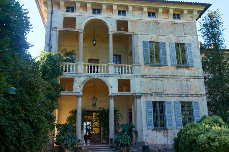
Villa del Balbianello
Located on the tip of the Lavedo peninsula in Lenno on Lake Como, the expansive grounds of Villa del Balbianello serve as an ideal wedding photo opportunity for Asian bridal couples. The summer residence dates back to the 18th century and has already served as a film set for James Bond Casino Royale , among others. Originally there was a small Franciscan monastery, of which the two church towers still stand. The Italian garden is located directly around the villa, towards the lake shore. From here you can book a boat trip on Lake Como or just stroll in the terraced garden.
There is a very small, free car park not far from the non-barrier-free access to the site in Lenno.
Via Guido Monzino, 1, 22016 Tremezzo CO, Italien
45° 57' 54.9" N 9° 12' 8.9" E
45.9652637 9.2024814
• Head toward Via G. Delmati on Via Comoedia. Go for 145 m.
• Continue on Via degli Artigiani. Go for 400 m.
• Turn right onto Via Statale (SS340). Go for 6.4 km.
• Continue on Galleria Crocetta. Go for 1.8 km.
• Continue on SS340dir. Go for 14.0 km.
• Pass 2 roundabouts and continue on Via Statale (SS340dir). Go for 11.4 km.
• Arrive at Via Regina (SS340dir). Your destination is on the right.
☍
34,2 km
( 38 min.)
Camping La Riva
This well-kept small complex is located on the northern shore of Lake Como in Sorico and in direct proximity to the Mera river delta. A nearby cycling and hiking trail leads to other offerings such as water sports and local attractions.
Via Poncione 3, 22010, Sorico, Italien
46° 10' 18.1" N 9° 23' 39.1" E
46.1717000 9.3942000
• Head toward Via Palate on Via Regina (SS340dir). Go for 945 m.
• Take the 2nd exit from roundabout onto SS340dir toward Colico/Sondrio/Milano. Go for 2.2 km.
• Take the 1st exit from roundabout onto Strada Statale del Lago di Como e dello Spluga (SS36) toward Colico/Piantedo/Sondrio. Go for 1.2 km.
• Take the 2nd exit from roundabout onto Strada Statale del Lago di Como e dello Spluga (SS36) toward Colico/SS38/Sondrio/Lecco. Go for 374 m.
• Take left ramp onto SS38 toward Lecco/SS36/Milano/Sondrio. Go for 755 m.
• Continue on Strada Statale del Lago di Como e dello Spluga (SS36). Go for 30.5 km.
• Keep right. Go for 150 m.
• Turn right toward Strada per Maggiana. Go for 546 m.
• Take the 2nd exit from roundabout onto Strada per Maggiana. Go for 851 m.
• Take the 2nd exit from roundabout onto Strada per Maggiana. Go for 666 m.
• Take the 1st exit from roundabout onto Via degli Alpini. Go for 121 m.
• Take the 2nd exit from roundabout onto Viale Combattenti. Go for 47 m.
• Turn right onto Viale Combattenti. Go for 47 m.
• Take the 1st exit from roundabout onto Via Emanuele Vittorio Parodi. Go for 76 m.
• Continue on Piazza Repubblica. Go for 18 m.
• Continue on Via Risorgimento. Go for 47 m.
• Turn left onto Via Camillo Benso di Cavour. Go for 163 m.
• Turn right onto Via Statale (SP72). Go for 291 m.
• Take the 1st exit from roundabout onto Via Statale (SP72). Go for 3.4 km.
• Continue on Via Roma (SP72). Go for 2.7 km.
• Continue on Via Statale (SP72). Go for 2.5 km.
• Arrive at Via Statale (SP72).
☍
47,6 km
( 41 min.)
Day
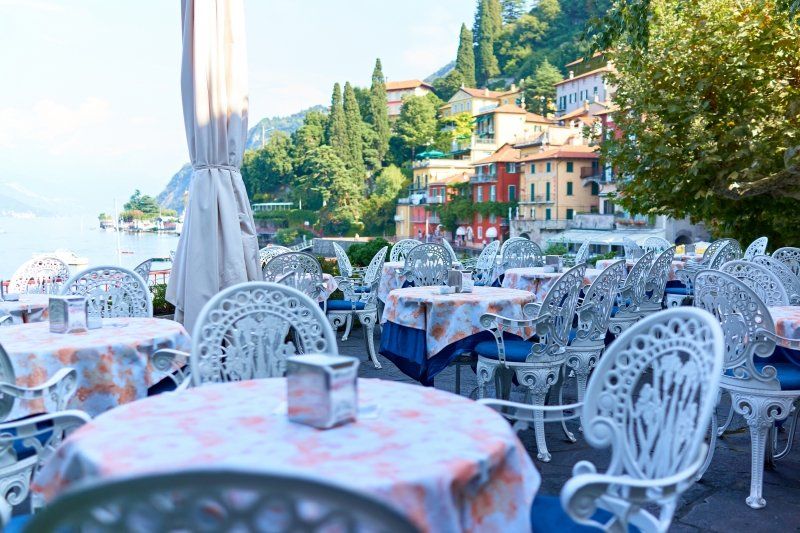
Varenna
Varenna is probably the most beautiful place on Lake Como.
23829 Varenna, Lecco, Italien
45° 59' 21.7" N 9° 17' 23.7" E
45.9893616 9.2899277
• Head north on Via Statale (SP72). Go for 1.8 km.
• Keep right onto SP72 toward Sondrio. Go for 1.4 km.
• Take the 2nd exit from roundabout toward Varenna/Perledo/Esino Lario. Go for 143 m.
• Continue on Viale dei Giardini. Go for 356 m.
• Continue on Via Corrado Venini toward Lecco/Varenna Centro. Go for 21 m.
• Turn right onto Via Imbarcadero toward Perledo/Esino Lario. Go for 150 m.
• Turn right onto Via Imbarcadero. Go for 20 m.
• Take the Varenna-Bellagio Ferry. Stay on for 4.1 km.
• Head toward Via Lungolago Europa. Go for 21 m.
• Continue on Salita Genazzini. Go for 1.3 km.
• Turn right onto Viale Domenico Vitali. Go for 187 m.
• Turn left onto Via Lazzaretto. Go for 206 m.
• Arrive at Via Lazzaretto. Your destination is on the left.
☍
9,8 km
( 44 min.)
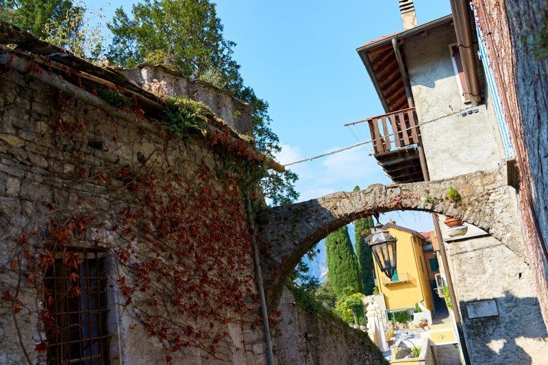
Bellagio
The most famous place on Lake Como is probably the Bellagio, which grows on a mountain on a peninsula in the lake. Tourists flock to one of the many cafés and restaurants along the waterfront or shop in the countless boutiques.
Via Lazzaretto, 22021 Bellagio CO, Italien
45° 58' 36.3" N 9° 15' 31.6" E
45.9767511 9.2587656
• Head toward Vicolo Lazzaretto on Via Lazzaretto. Go for 94 m.
• Turn slightly left onto Via Lazzaretto. Go for 72 m.
• Turn right onto Via Alessandro Volta. Go for 354 m.
• Turn left onto Strada Provinciale Lariana (SP583). Go for 5.1 km.
• Continue on Strada Provinciale Lariana (SP583). Go for 3.6 km.
• Continue on Località Crotto (SP583). Go for 19.6 km.
• Continue on Piazza Giovanni Amendola. Go for 43 m.
• Continue on Piazza Giacomo Matteotti. Go for 74 m.
• Take the 2nd exit from roundabout onto Lungolario Trieste. Go for 258 m.
• Continue on Lungo Lario Trento. Go for 388 m.
• Continue on Viale Fratelli Rosselli. Go for 473 m.
• Take the 1st exit from roundabout onto Via Borgo Vico toward Menaggio. Go for 755 m.
• Continue on Via Bellinzona. Go for 153 m.
• Take the 1st exit from roundabout onto Via Cernobbio. Go for 969 m.
• Continue on Via per Cernobbio. Go for 688 m.
• Turn left onto Via Conciliazione. Go for 783 m.
• Turn right onto Via Francesco Borromini. Go for 240 m.
• Turn left onto Via Brennero. Go for 145 m.
• Arrive at Via Brennero. Your destination is on the left.
☍
33,8 km
( 49 min.)
Arra Sosta Camper Como
This small parking space in Como is just a few kilometers from the city center, very conveniently located and with a view of Brunate and the Faro Voltiano.
Via Brennero, 7, 22100 Como CO, Italien
45° 50' 6.2" N 9° 3' 39.4" E
45.8350613 9.0609582
• Head west on Via Brennero.
• Arrive at Via Brennero. Your destination is on the left.
☍
Distance not available
(Duration not available)
Day
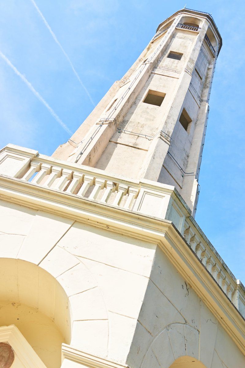
Hinauf nach San Maurizio Brunate
High above Como, in San Maurizio Brunate, a 29 m high lighthouse was built in 1927 in honor of Alessandro Volta. The view of Lake Como from the tower is breathtaking. The Faro Voltiano can be reached with the funicular from Como (FUNICOLARE COMO-BRUNATE ...www.funicolarecomo.it/) and a 30 minute climb. Those who need more excitement can combine the climb with a fast-paced jeep safari in an old military Piaggio.
Arra Sosta Camper Como
This small parking space in Como is just a few kilometers from the city center, very conveniently located and with a view of Brunate and the Faro Voltiano.
Via Brennero, 7, 22100 Como CO, Italien
45° 50' 6.2" N 9° 3' 39.4" E
45.8350613 9.0609582
• Head toward Via Adamello on Via Brennero. Go for 145 m.
• Turn left onto Via Francesco Borromini. Go for 222 m.
• Turn right onto Via Asiago toward Cernobbio/Como Centro/SS340. Go for 217 m.
• Take the 5th exit from roundabout onto Via Asiago toward Milano/A9/Svizzera. Go for 924 m.
• Keep left onto Raccordo SS340-A9 toward Milano/A9/Como Sud. Go for 752 m.
• Take ramp onto A9 (Autostrada dei Laghi). Go for 31.0 km.
• Take the left exit onto A8 (Autostrada dei Laghi). Go for 11.0 km.
• Take the left exit toward E64/Venezia/A51/A52/Tangenziali/A58/Milano V.le Zara/Aeroporto Linate/Aeroporto Orio al Serio onto A4 (Svincolo Viale Certosa). Go for 249 km.
• Take the exit toward Venezia/Aeroporto onto A57. Go for 19.1 km.
• Take the exit toward Aeroporto onto Raccordo Marco Polo. Go for 6.5 km.
• Keep left onto Raccordo Marco Polo toward Jesolo/SS14/Trieste/Aeroporto. Go for 93 m.
• Take the 2nd exit from roundabout onto Via Triestina (SS14) toward Trieste/Jesolo. Go for 9.1 km.
• Take ramp onto Strada Regionale del Mare (SP43) toward Jesolo/SP42/Eraclea. Go for 9.4 km.
• Pass 4 roundabouts and continue on Via Adriatico. Go for 11.6 km.
• Keep left toward Punta/Sabbioni/Cavallino/SP42/Treporti. Go for 152 m.
• Continue on Via John Lennon. Go for 611 m.
• Continue on Strada Provinciale Jesolana (SP42). Go for 1.3 km.
• Pass 3 roundabouts and continue on Strada Provinciale Jesolana (SP42). Go for 4.2 km.
• Turn left onto Via Danubio. Go for 126 m.
• Turn right onto Via dell'Artigliere. Go for 502 m.
• Turn left onto Via del Granatiere. Go for 22 m.
• Take the 1st exit from roundabout onto Via Francesco Baracca. Go for 458 m.
• Continue on Via Francesco Baracca. Go for 363 m.
• Pass 3 roundabouts and continue on Via Francesco Baracca. Go for 827 m.
• Take the 2nd exit from roundabout onto Via Fausta (SP42) toward Ca' Savio/Punta Sabbioni/Venezia. Go for 6.4 km.
• Take the 2nd exit from roundabout onto Via Fausta (SP42) toward Punta Sabbioni. Go for 1.3 km.
• Take the 3rd exit from roundabout onto Via Fausta (SP42) toward Punta Sabbioni/Venezia. Go for 2.4 km.
• Take the 4th exit from roundabout onto Via Carso toward Punta Sabbioni/Cavallino. Go for 400 m.
• Turn slightly right onto Via Carso. Go for 1.5 km.
• Turn left onto Via Montello. Go for 667 m.
• Turn right. Go for 13 m.
• Arrive at your destination on the left.
☍
370,9 km
(4 hrs. 3 min.)
Day
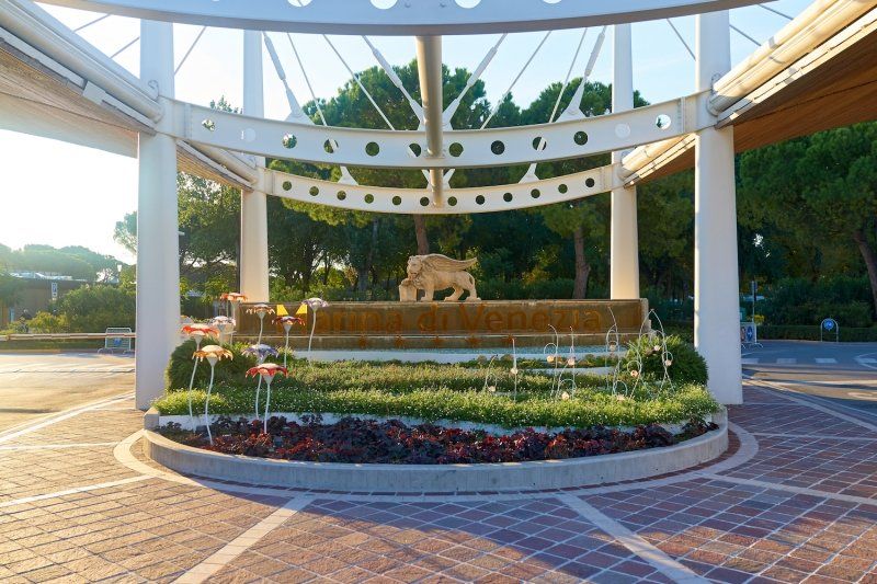
Camping Village Marina di Venezia
Marina di Venezia is Europe's largest campsite on the Venice Lido in Cavallino Treporti. The very well-kept and spacious complex has all the refinements of a modern campsite: leisure pool with direct access to the beach, various shopping markets including Italian specialty shops, grocery stores, restaurants/bars/cafes and various entertainment, sports and leisure facilities.
Via Montello 6, 30013, Cavallino, Italien
45° 26' 14.6" N 12° 26' 17.2" E
45.4374000 12.4381000
• Head southeast.
• Arrive at your destination on the left.
☍
Distance not available
(Duration not available)
Erkundung der Lagune
Directly on the Adriatic Sea lies the Lagoon of Venice with its metropolitan metropolis La Serenissima (the Most Serene), which is one of the most visited cities in Europe and whose most famous means of transport is the gondola.
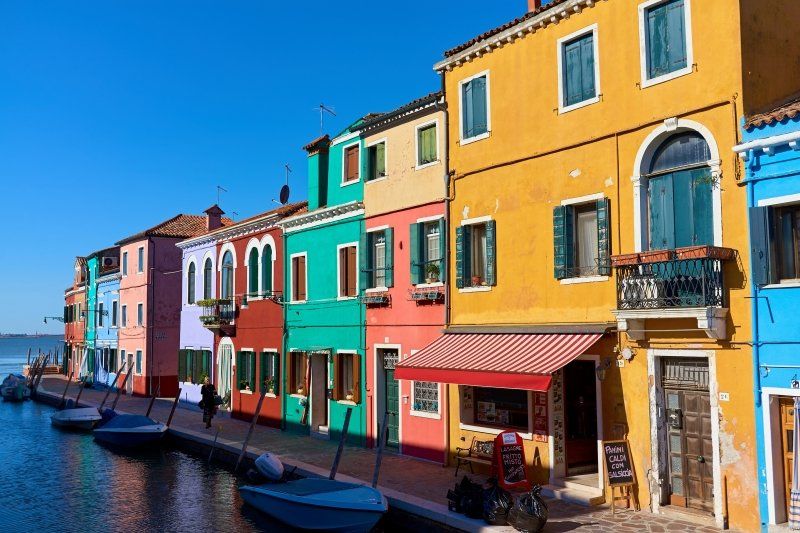
Good ferry connections (vaporetto) also take you to the other islands of Burano (known for textile craftsmanship and the colorful old town) and Murano (known for glass production). Marina di Venezia is only a few minutes away from the ferry terminal Punta Sabbioni (https://www.veneziaunica.it/de...), in the summer months a shuttle runs.
Day
Camping Village Marina di Venezia
Marina di Venezia is Europe's largest campsite on the Venice Lido in Cavallino Treporti. The very well-kept and spacious complex has all the refinements of a modern campsite: leisure pool with direct access to the beach, various supermarkets including Italian specialty shops, grocery stores, restaurants/bars/cafes and various entertainment, sports and leisure facilities.
Via Montello 6, 30013, Cavallino, Italien
45° 26' 14.6" N 12° 26' 17.2" E
45.4374000 12.4381000
• Head southeast.
• Arrive at your destination on the left.
☍
Distance not available
(Duration not available)
Day
Camping Village Marina di Venezia
Marina di Venezia is Europe's largest campsite on the Venice Lido in Cavallino Treporti. The very well-kept and spacious complex has all the refinements of a modern campsite: leisure pool with direct access to the beach, various supermarkets including Italian specialty shops, grocery stores, restaurants/bars/cafes and various entertainment, sports and leisure facilities.
Via Montello 6, 30013, Cavallino, Italien
45° 26' 14.6" N 12° 26' 17.2" E
45.4374000 12.4381000
• Head southeast. Go for 21 m.
• Turn left. Go for 24 m.
• Turn left toward Via Montello. Go for 37 m.
• Turn left onto Via Montello. Go for 689 m.
• Turn right onto Via Carso. Go for 1.8 km.
• Take the 1st exit from roundabout onto Via Fausta (SP42) toward Ca' Savio/Jesolo. Go for 2.4 km.
• Pass 2 roundabouts and continue on Via Fausta (SP42). Go for 7.6 km.
• Take the 2nd exit from roundabout onto Via Francesco Baracca toward Via F.Baracca/Jesolo. Go for 211 m.
• Pass 3 roundabouts and continue on Via Francesco Baracca. Go for 1.5 km.
• Take the 3rd exit from roundabout onto Via del Granatiere. Go for 90 m.
• Turn right onto Via dell'Artigliere. Go for 502 m.
• Turn left onto Via Danubio. Go for 126 m.
• Turn right onto Via Fausta (SP42). Go for 1.5 km.
• Pass 3 roundabouts and continue on Via Roma Destra (SP42). Go for 4.0 km.
• Keep left toward Autostrade/Trieste/Udine/Venezia/Treviso. Go for 488 m.
• Continue on Via John Lennon. Go for 275 m.
• Continue on Via Adriatico (SR43). Go for 3.2 km.
• Take the 3rd exit from roundabout onto Via Adriatico toward Venezia/Treviso. Go for 4.6 km.
• Take the 2nd exit from roundabout onto Via Adriatico (SR43) toward Venezia/San Donà di Piave/SS14/A4/Autostrade/A27. Go for 3.2 km.
• Take the 5th exit from roundabout onto Via Armellina (SR43) toward Venezia/A4. Go for 1.2 km.
• Take the 2nd exit from roundabout onto Strada Provinciale Portegrandi-Caposile-Jesolo (SP43) toward Venezia. Go for 8.0 km.
• Turn right onto Via Trezze (SP43) toward Trieste/S. Donà. Go for 615 m.
• Turn left onto Via Trieste (SS14). Go for 318 m.
• Turn left onto Strada Statale della Venezia Giulia (SS14) toward Aeroporto/Venezia/A4. Go for 9.7 km.
• Keep right toward Trieste/A4/Milano/A57/Venezia/Treviso/A27/Belluno. Go for 193 m.
• Continue on Raccordo Marco Polo. Go for 5.0 km.
• Take the exit toward Tangenziale/E70/Milano/A4/Bologna/A13 onto A57. Go for 19.9 km.
• Take the exit onto A4 (Passante di Mestre). Go for 10.5 km.
• Take the exit toward Bologna/Padova Zona Ind. onto A13 (Autostrada Bologna-Padova). Go for 117 km.
• Take the left exit toward Milano/A1/Firenze/Bologna/Casalecchio/Borgo Panigale onto A14 (Autostrada Adriatica). Go for 11.2 km.
• Take the left exit toward Firenze onto A1 (Autostrada del Sole). Go for 11.7 km.
• Continue on SS64var. Go for 927 m.
• Continue on Raccordo Autostradale Sasso Marconi SS64 Porretana. Go for 2.4 km.
• Continue on A1 (Autostrada del Sole). Go for 10.6 km.
• Keep right onto A1var (Variante di Valico) toward Direttissima/A1/Firenze/Badia. Go for 34.8 km.
• Continue on A1 (Viadotto Lora). Go for 91 m.
• Continue on A1var (Variante di Valico). Go for 32 m.
• Continue on A1 (Galleria Manganaccia). Go for 434 m.
• Continue on A1var (Galleria Manganaccia). Go for 1.9 km.
• Continue on A1 (Viadotto Sieve). Go for 139 m.
• Continue on A1var (Viadotto Sieve). Go for 216 m.
• Continue on A1 (Autostrada del Sole). Go for 19 m.
• Continue on A1var (Variante di Valico). Go for 116 m.
• Continue on A1 (Autostrada del Sole). Go for 39.2 km.
• Take the exit toward Firenze Sud/Forlì onto SP127 (Raccordo Di Varlungo). Go for 4.5 km.
• Continue on Via Generale Carlo Alberto Dalla Chiesa toward Settignano/Stadio Coverciano/Fiesole. Go for 738 m.
• Arrive at Via Generale Carlo Alberto Dalla Chiesa.
☍
323,4 km
(3 hrs. 31 min.)
Day
Camping In Town
The relatively new Camping In Town Firenze complex has its own supermarket, a spacious leisure pool and its own restaurant. A low-cost shuttle connects regularly to Florence's historic center.
Via Generale C. A. dalla Chiesa, 3, 50136 Firenze FI, Italien
43° 45' 55.2" N 11° 18' 53.1" E
43.7653376 11.3147396
• Head northeast on Via Generale Carlo Alberto Dalla Chiesa. Go for 585 m.
• Take the 3rd exit from Piazzale Renato Cappugi roundabout onto Via di Rocca Tedalda toward Fiesole. Go for 328 m.
• Take the 2nd exit from roundabout onto Via di Rocca Tedalda. Go for 357 m.
• Turn right onto Via Giuseppe Manfredi. Go for 30 m.
• Turn left onto Via Giuseppe Manfredi. Go for 154 m.
• Turn left onto Via di Rocca Tedalda. Go for 333 m.
• Turn right. Go for 101 m.
• Arrive at your destination on the right.
☍
1,9 km
( 3 min.)
Kunst und Eis in der toskanischen Hauptstadt
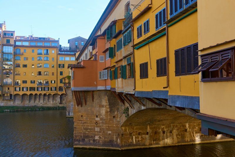
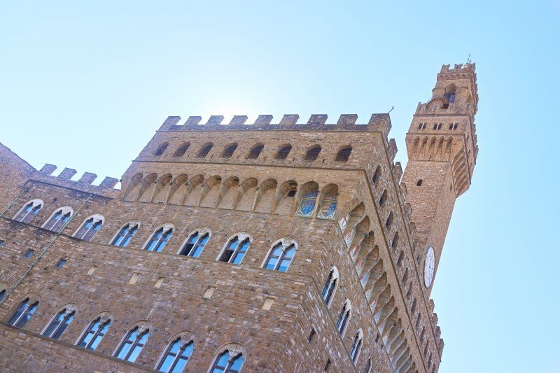
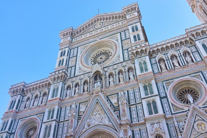
In the Tuscan capital, a detour to the Galleria degli Uffizi (https://www.uffizi.it/) is a must, which has housed the most famous art collection in the world since its beginnings around 1580. The Arno metropolis also has a lot to offer in other respects: Ponte Vecchio, Palazzo Vecchio and, of course, the magnificent cathedral. Tip: The tastiest and most expensive ice cream in Italy can be found on the Ponte Vecchio.
Day
Camping In Town
The relatively new Camping In Town Firenze complex has its own supermarket, a spacious leisure pool and its own restaurant. A low-cost shuttle connects regularly to Florence's historic center.
Via Generale Carlo Alberto dalla Chiesa 1/3, 50136, Firenze, Italien
43° 46' 3" N 11° 18' 59" E
43.7675000 11.3164000
• Head toward Via di Rocca Tedalda. Go for 101 m.
• Turn right onto Via di Rocca Tedalda. Go for 118 m.
• Take the 1st exit from roundabout onto Via di Rocca Tedalda. Go for 213 m.
• Take the 1st exit from Piazzale Renato Cappugi roundabout onto Via Aretina (SS67). Go for 1.3 km.
• Continue on Via Enrico De Nicola. Go for 204 m.
• Turn left onto Ponte Paolo Borsellino (SP127) toward Aeroporto A. Vespucci/Autostrade/A11/A1/Siena-Pisa/Via Villamagna/Bagno a Ripoli. Go for 3.7 km.
• Take left ramp onto A1 (Autostrada del Sole) toward Bologna/Siena/Firenze/A11/Pisa Nord. Go for 14.0 km.
• Take the exit toward Firenze Scandicci/S.G.C. FI-PI-LI/Pisa-Livorno/Scandicci Centro onto Strada di Grande Comunicazione Fi-Pi-Li. Go for 56.0 km.
• Take ramp onto Strada di Grande Comunicazione Fi-Pi-Li toward Aeroporto G. Galilei/Genova/A12/Firenze/A11/Pisa. Go for 17.7 km.
• Take ramp onto Via Ponte A Piglieri (SS1) toward Pisa. Go for 453 m.
• Pass 4 roundabouts and continue on Strada Statale Aurelia (SS1). Go for 2.4 km.
• Take the 1st exit from roundabout onto Viale delle Cascine toward Centro/Lucca. Go for 260 m.
• Arrive at Viale delle Cascine. Your destination is on the left.
☍
96,5 km
(1 hrs. 9 min.)
Day
Campeggio Torre Pendente
Located in the immediate vicinity of the Piazza dei Miracoli, the very simple but clean facility offers a good starting point for exploring the tourist attraction on the Arno that has become a city. A bar and a small restaurant are also available.
Via delle Cascine 86, 56122, Pisa, Italien
43° 43' 26" N 10° 22' 57" E
43.7239000 10.3825000
• Head east on Viale delle Cascine. Go for 127 m.
• Turn right onto Viale delle Cascine. Go for 425 m.
• Turn left onto Via Montelungo. Go for 10 m.
• Turn right onto Viale delle Cascine. Go for 401 m.
• Take the 1st exit from roundabout onto Strada Statale Aurelia (SS1). Go for 2.0 km.
• Take the 1st exit from roundabout onto Via Aurelia Madonna dell'Acqua (SS1). Go for 512 m.
• Turn right onto Via Aurelia Madonna dell'Acqua (SS1). Go for 4.8 km.
• Turn right toward Genova/A12/Livorno/E80/Rosignano Marittimo/Firenze/Roma. Go for 82 m.
• Continue on Autostrada Firenze Mare toward Genova/A12/Livorno/E80/Rosignano Marittimo/Firenze/Roma. Go for 359 m.
• Take the exit toward E80/Genova/A12/Livorno/Rosignano M. onto Svincolo Pisa Nord. Go for 509 m.
• Take the exit toward Genova/Viareggio onto A12 (Autostrada Azzurra). Go for 90.6 km.
• Take the exit toward Deiva Marina. Go for 4.1 km.
• Continue on Località Piazza. Go for 198 m.
• Turn right onto SP40 toward Centro/Mezzana/Colle/Passo del Bracco. Go for 1.5 km.
• Continue on Località Gea (SP40). Go for 199 m.
• Turn left toward Località Ronco. Go for 65 m.
• Turn left onto Località Ronco. Go for 24 m.
• Turn slightly right. Go for 52 m.
• Arrive at your destination on the right.
☍
105,9 km
(1 hrs. 8 min.)
Im Schatten von Florenz
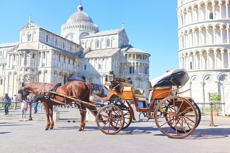
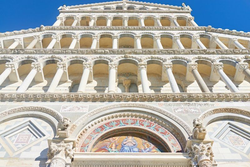
Not far from the Campeggio Torre Pendente and within walking distance in a few minutes are the most famous sights of Tuscany. The free-standing bell tower (campanile) from the 12th century has become world-famous for its crooked position. Its architecture, 55 meters high and made of Carrara marble, clearly stands out over the Cathedral of Santa Maria Assunta and the Baptistery. To the north, Camposanto Monumentale borders on an imposing cemetery and rounds off the old town of the Tuscan city of Pisa, which is well worth seeing.
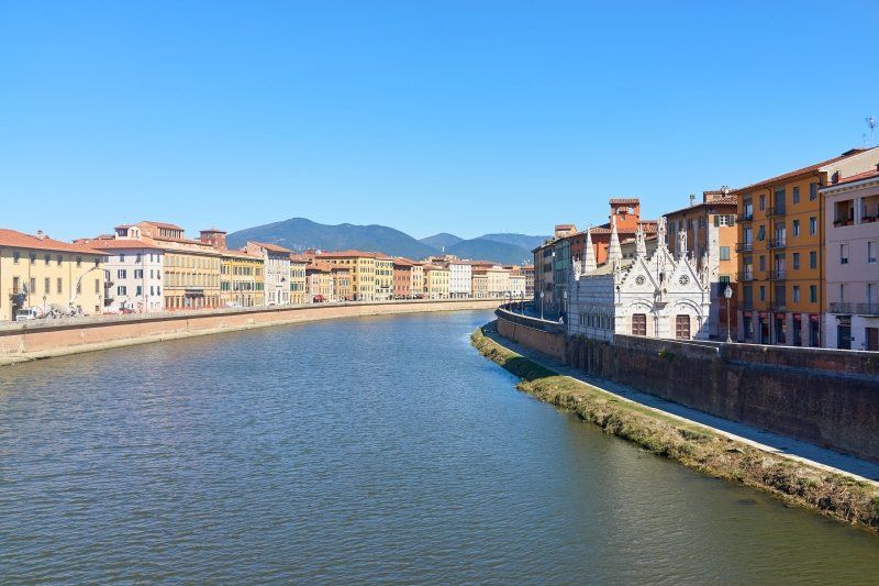
Also worth seeing is a replica of the Church of the Holy Sepulchre, as well as a 14th-century prayer house honoring the Crown of Thorns and keeping a piece of thorns, situated on the banks of the Arno. Unfortunately, today's chapel is not open to the public. To do this, leave the Piazza dei Miracoli around the Torre Pendente and walk about 15 minutes through the wonderful old town to the banks of the Arno.
Day
Camping Valdeiva
This tranquil campsite is situated in the middle of a terraced area in the mountains high above Deiva Marina. The spacious, branched and very natural facility has a free shuttle to the train station of Deiva Marina, from which Portofino and the Cinque Terre can be reached in just 1 hour.
Località Ronco, 19013 , Deiva Marina, Italien
44° 13' 29.3" N 9° 33' 4" E
44.2248000 9.5511000
• Head southeast.
• Arrive at your destination on the right.
☍
Distance not available
(Duration not available)
Im teuersten Fischerdorf der Welt
Portofino is a fishing village located southeast of Genoa on the Italian Riviera. Pastel-colored houses, luxury boutiques and seafood restaurants line the Piazzetta, a small, cobblestone square overlooking the harbor where super yachts are moored. Portofino can be reached from the Cinque Terre in 1 hour via the Genoa-La Spezia regional express.
Day
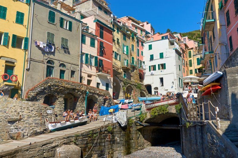
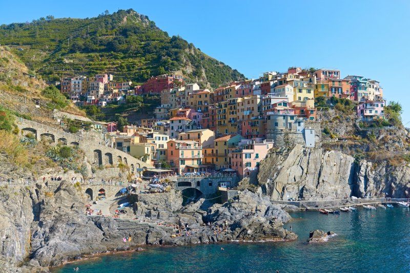
Weltkulturerbe der Cinque Terre
The World Heritage Site on the Ligurian coast owes its name to the five neighboring centuries-old coastal villages, known for their colorful houses and terraced vineyards on the steep slopes: Monterosso, Manarola and Riomaggiore are the best known. Fishing boats are anchored in the harbors and the trattorias serve seafood specialties and pesto, the region's famous sauce. The Sentiero Azzurro hiking trail connects the villages, offering panoramic views of the sea.
Camping Valdeiva
This tranquil campsite is situated in the middle of a terraced area in the mountains high above Deiva Marina. The spacious, branched and very natural facility has a free shuttle to the train station of Deiva Marina, from where Portofino and the Cinque Terre can be reached in just 1 hour.
Località Ronco, 19013 , Deiva Marina, Italien
44° 13' 29.3" N 9° 33' 4" E
44.2248000 9.5511000
• Head toward Località Ronco. Go for 52 m.
• Turn slightly left onto Località Ronco. Go for 24 m.
• Turn right toward Località Gea/SP40. Go for 65 m.
• Turn right onto Località Gea (SP40). Go for 199 m.
• Continue on SP40. Go for 1.5 km.
• Turn left onto Località Piazza toward Genova/A12/E80/Aurelia/SS1. Go for 3.2 km.
• Turn right toward Autostrada Azzurra/A12. Go for 36 m.
• Turn left and take ramp onto A12 (Autostrada Azzurra) toward Genova. Go for 61.1 km.
• Continue on A7 (Autostrada Milano-Genova). Go for 2.6 km.
• Take the exit toward Alessandria/A26/Ventimiglia/Aeroporto onto A10 (Ponte Genova San Giorgio). Go for 12.0 km.
• Take the exit toward Alessandria onto A26 (Autostrada Genova Voltri-Gravellona Toce). Go for 160 km.
• Take the exit toward Gravellona T./Strada Provinciale del Sempione/SP33 onto A26 (Autostrada Genova Voltri-Gravellona Toce). Go for 20.8 km.
• Take the exit toward Carpugnino/Stresa/Gignese. Go for 1.4 km.
• Take the 2nd exit from roundabout toward Stresa/Gignese. Go for 92 m.
• Continue on Via per Carpugnino. Go for 569 m.
• Turn right onto Via per Gignese. Go for 1.7 km.
• Turn left onto Via per Vedasco. Go for 670 m.
• Continue on Via per Binda. Go for 1.6 km.
• Continue on Via Eugenio Gignous. Go for 93 m.
• Continue on Via Roma. Go for 20 m.
• Turn right onto Via Giosuè Carducci. Go for 147 m.
• Take the 2nd exit from roundabout onto Via Giosuè Carducci. Go for 234 m.
• Turn right onto Via Duchessa di Genova. Go for 301 m.
• Turn left onto Corso Umberto I (SS33). Go for 530 m.
• Turn right onto Via Giberto Borromeo. Go for 135 m.
• Arrive at Via Giberto Borromeo. Your destination is on the right.
☍
269,4 km
(2 hrs. 41 min.)
Day
Parken am Ufer des Lago Maggiore
More by chance we discovered this half-shaded car park right on the shore of Lake Maggiore and just a few minutes' walk from the boat docks from which the Borromean Islands can be explored.
Basically, there is nothing wrong with using this as a parking space for one night and we will put this into practice on our next visit.
Via Gilberto Borromeo, 28838 Stresa VB, Italien
45° 53' 21.1" N 8° 31' 44" E
45.8891946 8.5288968
• Head northwest on Via Giberto Borromeo. Go for 19 m.
• Turn left onto Via Ugo Foscolo. Go for 104 m.
• Turn right onto Via Sempione Nord (SS33). Go for 3.7 km.
• Pass 2 roundabouts and continue on Strada Nazionale Sempione Feriolo (SS33). Go for 2.7 km.
• Take the 2nd exit from roundabout onto Via 42 Martiri (SP167). Go for 2.0 km.
• Take the 1st exit from Piazzale Caduti dei Lager Nazisti roundabout onto Via Quarantadue Martiri (SS34). Go for 5.0 km.
• Pass 6 roundabouts and continue on Corso Goffredo Mameli (SS34). Go for 12.6 km.
• Turn sharp left onto Strada Martiri Oggebbiesi. Go for 22 m.
• Arrive at Strada Martiri Oggebbiesi. Your destination is on the right.
☍
26,2 km
( 33 min.)
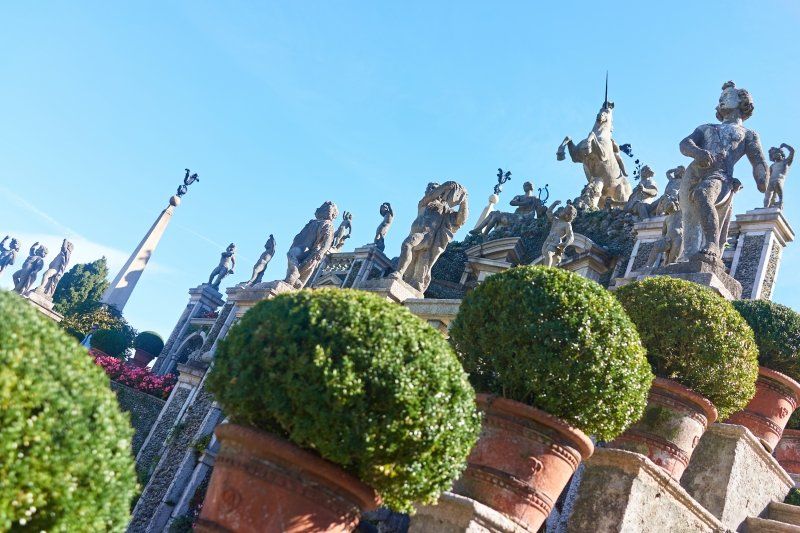
Auf der Schönen Insel
The small island can be reached quickly by boat from Stresa. The palazzo and gardens are a jewel of Baroque art. On the tour of the palace you will pass through elegantly furnished salons with the magnificent views of the lake, see numerous paintings by famous artists, precious furniture, marble, neoclassical stucco, antique sculptures, armor and Flemish tapestries with gold thread and silk.
Tip: A combined ticket allows you to travel to the three largest Borromean islands: Isola Madre, Isola Pescatori and Isola Bella. Another combination ticket allows you to visit the gardens and palaces on Isola Madre and Isola Bella.
Area Camper Super Attrezzata
This parking space is located high above Lake Maggiore and can only be reached at breakneck speed via a steep, narrow access road to a mountain village. Once up here, you can enjoy the view from one of the private terraces associated with each pitch.
Strada Martiri Oggebbiesi 6, 28824, Oggebbio, Italien
45° 59' 58" N 8° 39' 21" E
45.9994444 8.6558333
• Head toward Via Nazionale on Strada Martiri Oggebbiesi. Go for 22 m.
• Turn left onto Via Nazionale (SS34). Go for 14.9 km.
• Continue on Via Valmara (13). Go for 9.6 km.
• Keep left onto A13. Go for 973 m.
• Take ramp onto 13 toward Minusio/Muralto/Locarno. Go for 759 m.
• Take the 3rd exit from Piazza Castello roundabout onto Via Giovanni Antonio Orelli (13). Go for 329 m.
• Turn right onto Via Serafino Balestra. Go for 835 m.
• Continue on Via alla Lanca degli Stornazzi. Go for 201 m.
• Arrive at Via alla Lanca degli Stornazzi. Your destination is on the right.
☍
27,7 km
( 34 min.)
Day
Wallfahrt in das Kaminfegertal
The jagged and wooded rocky panorama accompanies us on the passage of the Centovalli (engl. hundred valleys). Not far from Malesco stands the Santuario della Madonna del Sangue, on the site of which, according to tradition, a miracle happened in 1494 when the fresco of a Virgin Mary, struck by a stone, began to bleed.
Locarno, Schweiz
Locarno is a great city with a long promenade along the Lago Maggiore and an interesting old town. For just a few SFR and for free at night you can stand freely near the thermal baths on the shore of Lake Maggiore, just minutes from the old town.
Via Gioacchino Respini 8, 6600 Locarno, Schweiz
46° 9' 36.8" N 8° 48' 6.1" E
46.1602262 8.8017076
• Head toward Via Gioacchino Respini on Via alla Lanca degli Stornazzi. Go for 70 m.
• Turn left onto Via Gioacchino Respini. Go for 221 m.
• Continue on Viale al Lido. Go for 280 m.
• Continue on Lungolago Giuseppe Motta. Go for 1.7 km.
• Turn right onto Via San Gottardo (13). Go for 2.7 km.
• Take left ramp onto A13 toward Lugano/Bellinzona. Go for 4.0 km.
• Take the 1st exit from roundabout onto 406 toward E35/E43/A2/A13/Lugano/Gambarogno/Aeroporto. Go for 1.4 km.
• Keep left onto Via Monte Ceneri (406). Go for 373 m.
• Pass 5 roundabouts and continue on Via Cantonale (406). Go for 4.3 km.
• Take the 3rd exit from roundabout onto Via San Gottardo (406). Go for 3.6 km.
• Take the 1st exit from roundabout onto In Tirada (2). Go for 213 m.
• Take ramp onto A2 toward San Gottardo/E43/San Bernardino/A13. Go for 142 km.
• Take exit 27 toward Luzern onto Luzernerstrasse. Go for 660 m.
• Continue on Obergrundstrasse. Go for 614 m.
• Turn right onto Obergrundstrasse (4). Go for 456 m.
• Keep right onto Bundesplatz. Go for 228 m.
• Continue on Tribschenstrasse. Go for 276 m.
• Turn left onto Werkhofstrasse. Go for 116 m.
• Take the 1st exit from roundabout onto Werkhofstrasse. Go for 368 m.
• Turn right onto Alpenquai. Go for 241 m.
• Arrive at Alpenquai. Your destination is on the left.
☍
163,3 km
(1 hrs. 55 min.)
Day
Alpenquai, Luzern
Only 2 km from the Chapel Bridge, the city's landmark, you can park in the "Ufschötti" park. The city can be explored perfectly on foot and has a lot of beautiful things to offer: art museum, Chapel Bridge with water tower and Spreuerbrücke as well as a great old town.
Alpenquai, 6005 Luzern, Schweiz
47° 2' 41.9" N 8° 19' 12.8" E
47.0449695 8.3202167