In eight days it goes from Hamburg along the coast through Denmark via Skagen, Aalborg and Odense to Copenhagen.
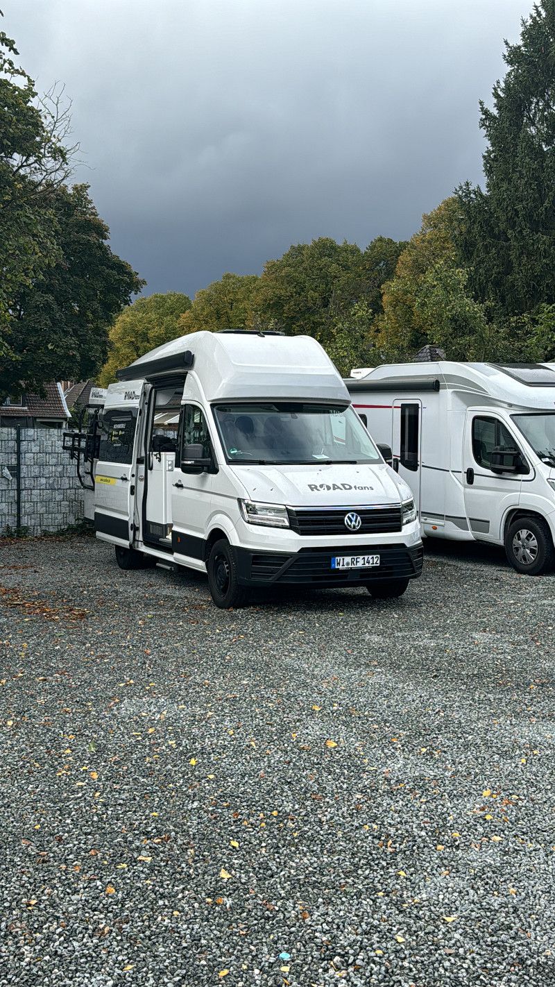
Join us, Lena and Eric, on our first tour ever with a camper van.
You can follow us on Instagram (@ericwik) and also at www.twitch.com/holzapfel. There will be stories, contributions and live streams.
The following tour is planned, but we are also open to spontaneous alternatives:
We start the tour in our car near Cologne and from 1 p.m. we change to the van in Hamburg.
Due to the long journey, our only destination on day 1 is the campsite in Vejers Strand.
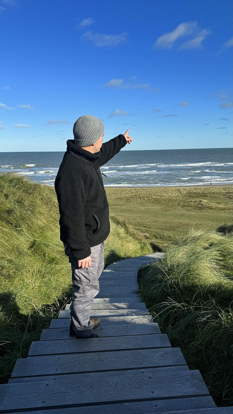
On day 2 we go along the west coast to Klitmøller where we want to take a surfing course in "Cold Hawaii". The overnight stay is planned at “Hanstholm Camping - Thy Feriepark”.
On the morning of day 3 we continue driving north. The excursion destinations Bulbjerg Knude and Thorup Strand are planned along the way.
Originally we were supposed to go to Skagen on this day, but since we want to celebrate Lena's birthday with a nice meal that evening, the destination for the day is the city of Aalborg including a visit to the street food market.
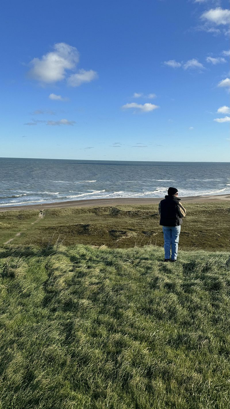
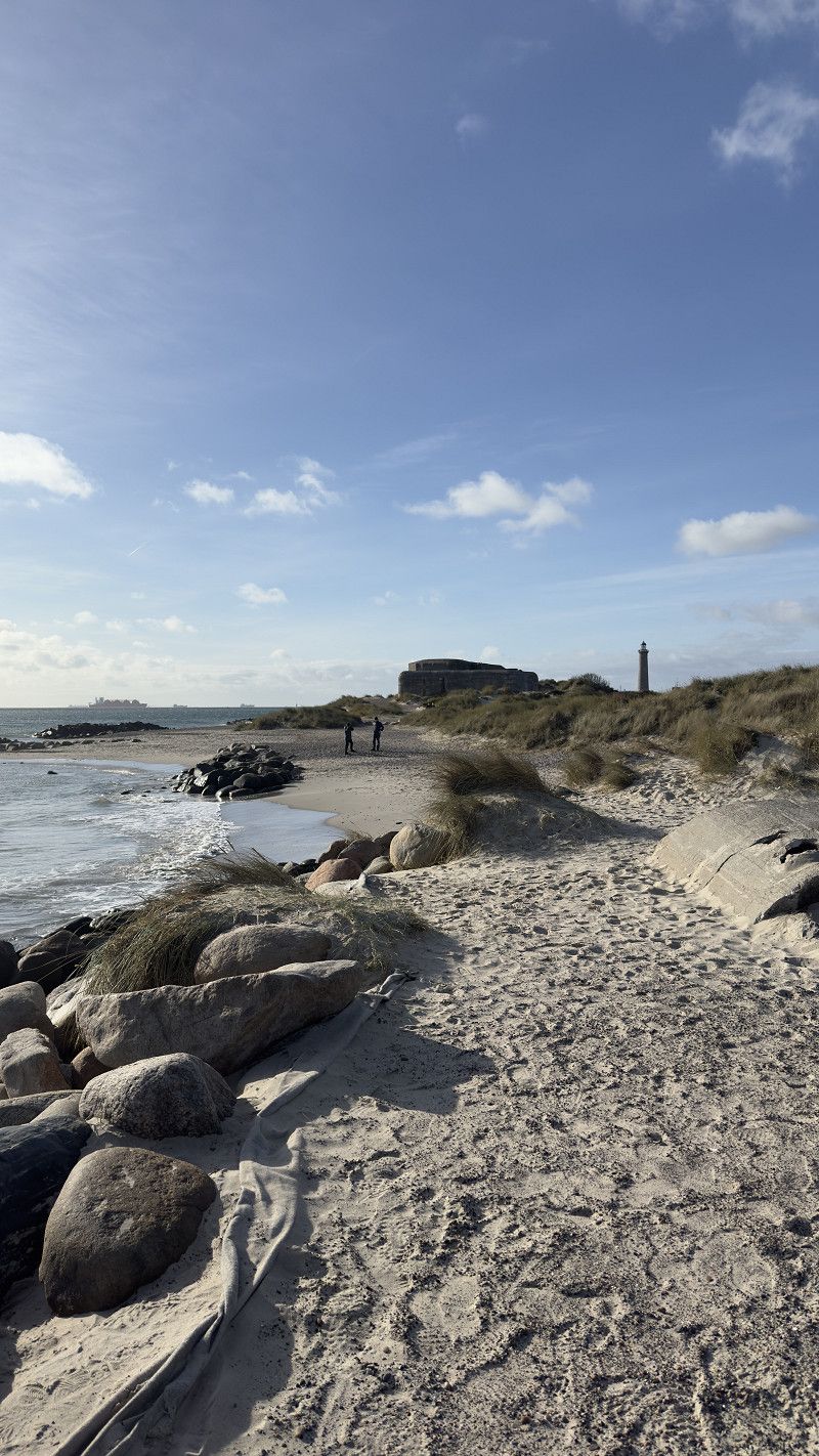
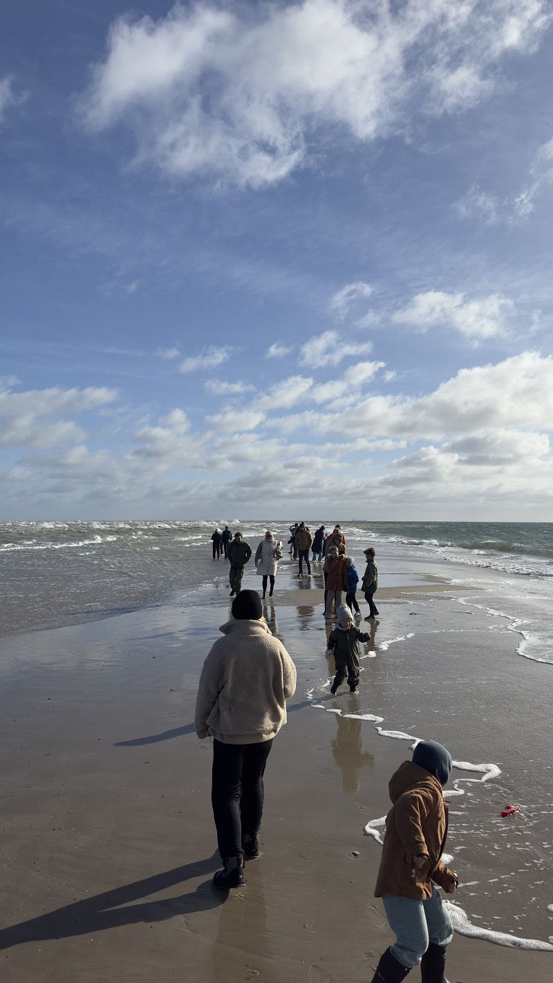
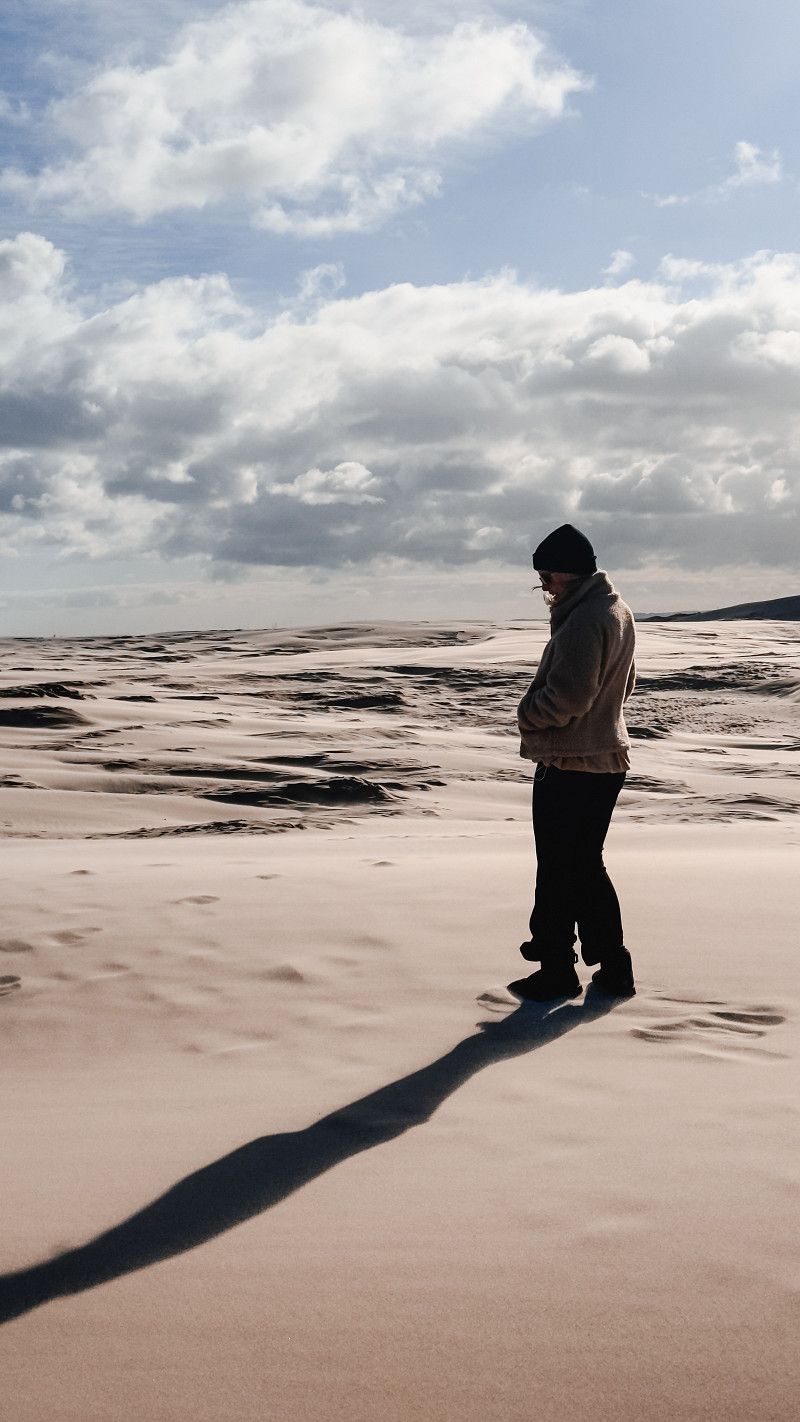
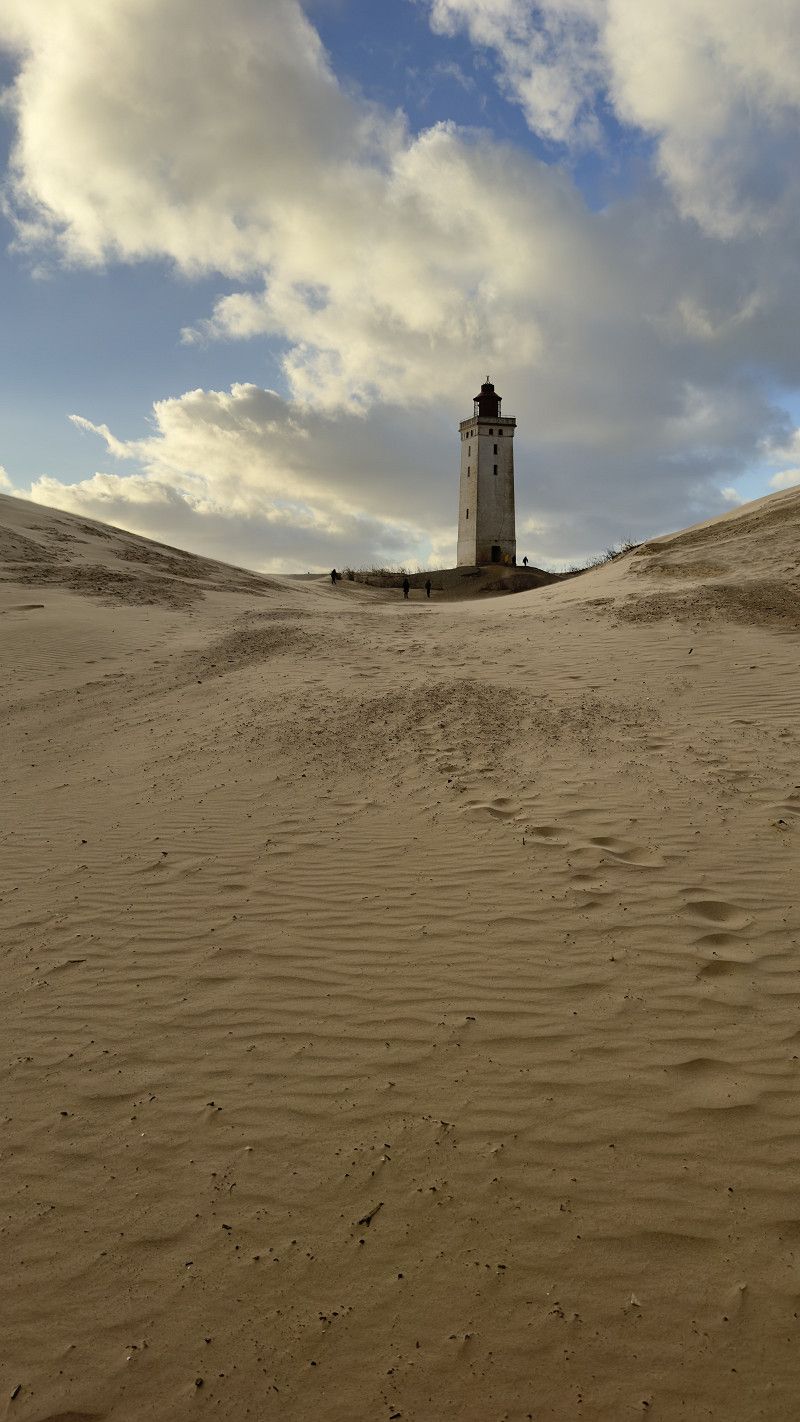
We then spend day 4 entirely in the north. We go to Skagen, where the North and Baltic Seas meet. On the way back we plan to take a walk through the Danish "desert" Rajberg Mile. The day will conclude with a visit to the famous lighthouse Rubjerg Knude Fyr and an overnight stay directly on the cliffs.
We will probably cover the longest distance on day 5, because then we go to the island of Funen. On this route we are completely flexible and want to spontaneously see beautiful places. We are looking for a parking space or a campsite in or around Odense for the night.
On day 6, the capital Copenhagen awaits us. We take the whole day (except for the journey) in the city and want to toast my birthday in the evening (yes, we both get a year older on the tour).
After we slept in the city, we went to the next island of Møn on the penultimate day. There we visit the highest cliffs in Denmark "Møns Klint". From the chalk cliffs we then head to Lolland where the last campsite awaits us.
On the 8th and last day we take the ferry to Puttgarden and drive back to Hamburg via Fehmarn.
We are open to questions and suggestions! :-)
Day
ROADfans
We rented a van in the “Journey” category from 1 p.m.
Schiffbeker Weg 307, Hamburg, Deutschland
53° 34' 10.5" N 10° 7' 24.8" E
53.5695787 10.1235562
• Head south. Go for 21 m.
• Turn left toward Schiffbeker Weg. Go for 20 m.
• Turn right onto Schiffbeker Weg. Go for 207 m.
• Take ramp onto A24 toward HH-Horn/HH-Centrum. Go for 3.6 km.
• Take the 1st exit from Horner Kreisel roundabout onto Sievekingsallee toward Elbbrücken/Stadion Arena/Centrum. Go for 2.1 km.
• Turn right onto Landwehr (B5) toward Flensburg/A7/Husum/Flughafen. Go for 2.4 km.
• Continue on Herderstraße (B5). Go for 2.6 km.
• Turn left onto Winterhuder Marktplatz (B5) toward A7/Husum/Stadion Arena/Eppendorf. Go for 562 m.
• Continue on Ludolfstraße (B5) toward Husum/Altona/Stadion Arena. Go for 92 m.
• Turn right onto Ludolfstraße (B5). Go for 182 m.
• Keep right onto Ludolfstraße. Go for 96 m.
• Continue on Lokstedter Weg. Go for 744 m.
• Continue on Osterfeldstraße. Go for 978 m.
• Turn right onto Kollaustraße (B447) toward Flensburg/A7/Quickborn/Schnelsen. Go for 2.2 km.
• Keep left onto Niendorfer Marktplatz (B447). Go for 2.4 km.
• Take ramp onto A7. Go for 146 km.
• Continue on E45 (Sønderjyske Motorvej). Go for 6.2 km.
• Take exit 75 toward Bov/Kruså/Tinglev. Go for 423 m.
• Turn left onto Tøndervej (401) toward Tønder. Go for 368 m.
• Take the 2nd exit from roundabout onto Tøndervej (401) toward Tinglev/Tønder. Go for 12.2 km.
• Turn left onto Hovedgaden (8/401) toward Løgumkloster/Tønder. Go for 663 m.
• Take the 1st exit from roundabout onto Vippelvej (401) toward Løgumkloster. Go for 7.9 km.
• Take the 3rd exit from roundabout onto Bredevadvej (443). Go for 8.1 km.
• Turn left onto Adelvadvej (435). Go for 1.7 km.
• Turn right onto Sølstedvej. Go for 2.3 km.
• Continue on Adelvadvej. Go for 5.4 km.
• Take the 2nd exit from roundabout onto Adelvadvej. Go for 2.8 km.
• Take the 1st exit from roundabout onto Ribelandevej (11) toward Ribe/175/Rømø. Go for 5.6 km.
• Take the 2nd exit from roundabout onto Hovedvejen (11) toward Ribe/175/Rømø. Go for 5.1 km.
• Arrive at Landevejen (11). Your destination is on the right.
☍
223,2 km
(2 hrs. 29 min.)
Los geht’s!
After just 5 hours of driving, we arrived in Hamburg around 12:30 and were able to set up our home for the next few days before we finally got started.
Wegpunkt
Used to adjust the route.
77B, Landevejen, Scherrebek, Kommune Tondern, Region Süddänemark, 6780, Dänemark
55° 6' 20.6" N 8° 48' 52" E
55.1057155 8.8144532
• Head north on Landevejen (11). Go for 8.1 km.
• Pass 2 roundabouts and continue on Tøndervej (11). Go for 17.8 km.
• Take the 2nd exit from roundabout onto Ringvejen (11/24) toward Varde/Esbjerg/Ribe N. Go for 2.4 km.
• Take the 2nd exit from roundabout onto Ringvejen (11/24) toward Varde/Esbjerg. Go for 2.2 km.
• Take the 2nd exit from roundabout onto Varde Hovedvej (11/24) toward Varde/Esbjerg. Go for 9.3 km.
• Keep left onto Tjæreborgvej (24) toward Esbjerg. Go for 10.7 km.
• Take the 2nd exit from roundabout onto Tjæreborgvej (24). Go for 3.1 km.
• Turn right toward Esbjerg N-V. Go for 294 m.
• Continue on E20 (Esbjergmotorvejen). Go for 4.4 km.
• Take exit 75 toward Blåvand. Go for 437 m.
• Take the 3rd exit from roundabout onto Vestkystvej (12/463) toward Blåvand. Go for 2.6 km.
• Take the 1st exit from roundabout onto Vestkystvej (12/463) toward Blåvand/Varde. Go for 15.6 km.
• Take the 3rd exit from roundabout onto Vesterhavsvej (431). Go for 1.4 km.
• Continue on Blåvandvej (431). Go for 5.6 km.
• Turn right onto Vejers Havvej. Go for 6.2 km.
• Turn left onto Vejers Sydstrand. Go for 136 m.
• Turn slightly right onto Vejers Sydstrand. Go for 804 m.
• Arrive at Vejers Sydstrand. Your destination is on the left.
☍
91,0 km
(1 hrs. 16 min.)
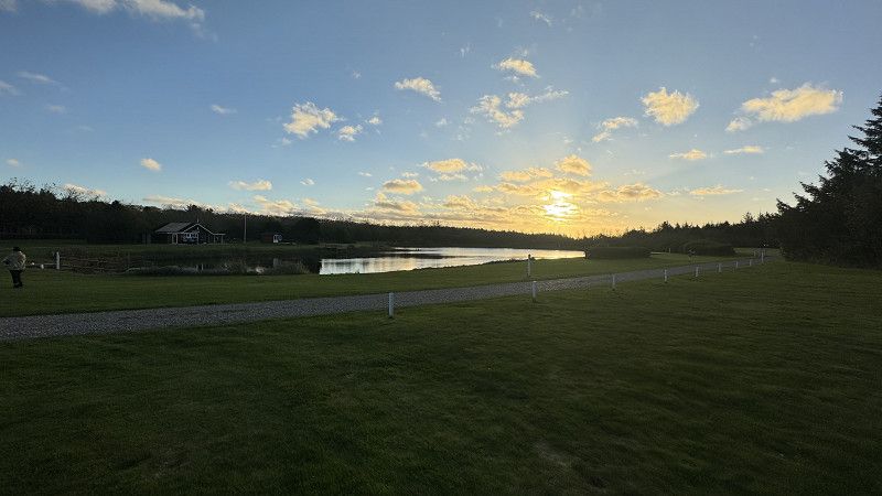
Vejers Strand Camping
A highly recommended campsite with pitches in the dunes.
Report:
We arrived at 6 p.m. Self check-in was super easy and uncomplicated. The sanitary facilities are super clean and modern. There are also opportunities to cook and do laundry etc.
The path over the dunes is also super short and you are on the beach. Unfortunately the wind was very extreme today and it was hard to enjoy the view from the dunes.
Vejers Sydstrand 3, 6853, Vejers Strand, Denmark
55° 37' 11" N 8° 7' 12" E
55.6197200 8.1200000
• Head toward Spurvevej on Vejers Sydstrand. Go for 940 m.
• Turn right onto Vejers Havvej. Go for 6.2 km.
• Turn left onto Blåvandvej (431). Go for 5.6 km.
• Continue on Vesterhavsvej (431). Go for 1.3 km.
• Take the 2nd exit from roundabout onto Vesterhavsvej (431). Go for 6.7 km.
• Take the 1st exit from roundabout onto Vestre Landevej (181/431). Go for 2.1 km.
• Turn left onto Nordre Boulevard (181). Go for 1.7 km.
• Turn left onto Ringkøbingvej. Go for 261 m.
• Take the 2nd exit from roundabout onto Ringkøbingvej. Go for 4.2 km.
• Turn left onto Østre Omfartsvej (11) toward Holstebro/Skjern. Go for 28.0 km.
• Take the 3rd exit from roundabout onto Åboulevarden (11/28) toward Holstebro/Skjern. Go for 2.0 km.
• Turn right onto Ringvejen (11/28) toward Holstebro/Ringkøbing/439/467. Go for 2.5 km.
• Pass 3 roundabouts and continue on Brejningvej (11). Go for 46.4 km.
• Turn right onto Ringvejen (11/16) toward Thisted/Viborg/18/189. Go for 1.2 km.
• Continue on Ringvejen (11/16) toward Thisted/Viborg. Go for 15.1 km.
• Take the 2nd exit from roundabout onto Holstebrovej (11/513) toward Thisted/Lemvig/Struer. Go for 879 m.
• Continue on Holstebrovej (11/513). Go for 3.9 km.
• Take the 1st exit from roundabout onto Oddesundvej (11) toward Thisted. Go for 28.0 km.
• Turn left onto Ydbyvej (527) toward Vestervig. Go for 11.5 km.
• Turn left onto Kystvejen (181). Go for 16.6 km.
• Take the 2nd exit from roundabout onto Kystvejen (181). Go for 14.6 km.
• Turn left onto Vangsåvej. Go for 1.3 km.
• Turn left onto Ørhagevej. Go for 807 m.
• Turn slightly left onto Ørhagevej. Go for 229 m.
• Arrive at Ørhagevej. Your destination is on the right.
☍
202,2 km
(2 hrs. 52 min.)
Day
Klitmøller
Here we take a surfing course in the so-called "Cold Hawaii".
The surfing course didn't take place due to very strong winds and heavy waves, but we visited the spot anyway.
Ørhagevej, Klitmøller, Region Nordjütland, Dänemark
57° 2' 39.4" N 8° 28' 43.1" E
57.0442866 8.4786346
• Head east on Ørhagevej. Go for 2.5 km.
• Turn left onto Kystvejen (181). Go for 8.9 km.
• Continue on Kystvejen. Go for 1.8 km.
• Turn right onto Christian Hansens Vej. Go for 1.7 km.
• Take the 1st exit from roundabout onto Thistedvej (26). Go for 3.5 km.
• Turn left onto Febberstedvej. Go for 1.4 km.
• Continue on Hamborgvej. Go for 618 m.
• Turn left. Go for 11 m.
• Turn right. Go for 10 m.
• Arrive at your destination on the left.
☍
20,5 km
( 22 min.)
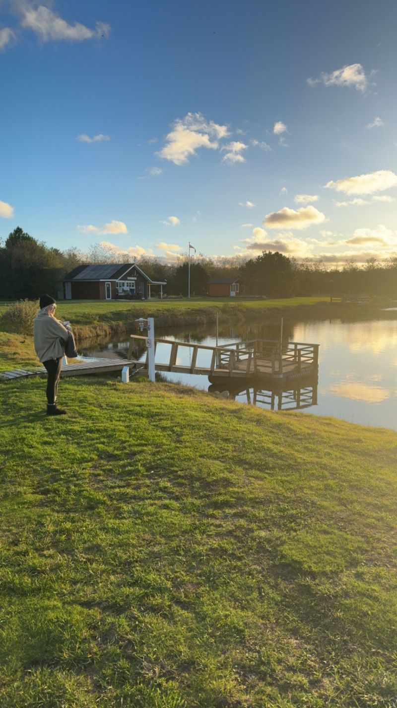
Hanstholm Camping - Thy Feriepark
Another camping site that is right by the sea.
We spontaneously decided on another place nearby.
“Thy Minicamping” is an incredibly beautiful little place with around 30 places, very modern sanitary facilities, a kitchen and a small fishing lake with an attached fishing shop.
Hamborgvej 95, 7730, Hanstholm, Denmark
57° 6' 30" N 8° 40' 5" E
57.1083300 8.6680600
• Head southeast. Go for 10 m.
• Turn left toward Hamborgvej. Go for 11 m.
• Turn right onto Hamborgvej. Go for 618 m.
• Continue on Febberstedvej. Go for 1.4 km.
• Turn left onto Thistedvej (26). Go for 829 m.
• Take the 2nd exit from roundabout onto Hjardemålvej (29). Go for 12.9 km.
• Turn left onto Gammel Aalborgvej (569). Go for 13.8 km.
• Turn left onto Bulbjergvej. Go for 4.4 km.
• Arrive at Bulbjergvej.
☍
34,0 km
( 34 min.)
Day
Parkplatz Bulbjerg Knude
Visit to Bulbjerg Knude and the on-site bunker.
Definitely worth a stop. Very nice cliff and beautiful beach. You can get from the bunker complex down to the beach via stairs.
Nice view, parking space and toilet available.
Bulbjergvej, Region Nordjütland, Dänemark
57° 9' 24.4" N 9° 1' 42.2" E
57.1567699 9.0283751
• Head southeast on Bulbjergvej. Go for 362 m.
• Turn left onto Bulbjergvej. Go for 1.7 km.
• Turn right onto Ellidsbølvej. Go for 2.1 km.
• Turn left onto Thistedvej (569). Go for 5.4 km.
• Turn left onto Thorup Strandvej. Go for 4.3 km.
• Turn left onto Thorup Strandvej. Go for 14 m.
• Arrive at Thorup Strandvej. Your destination is on the right.
☍
13,8 km
( 19 min.)
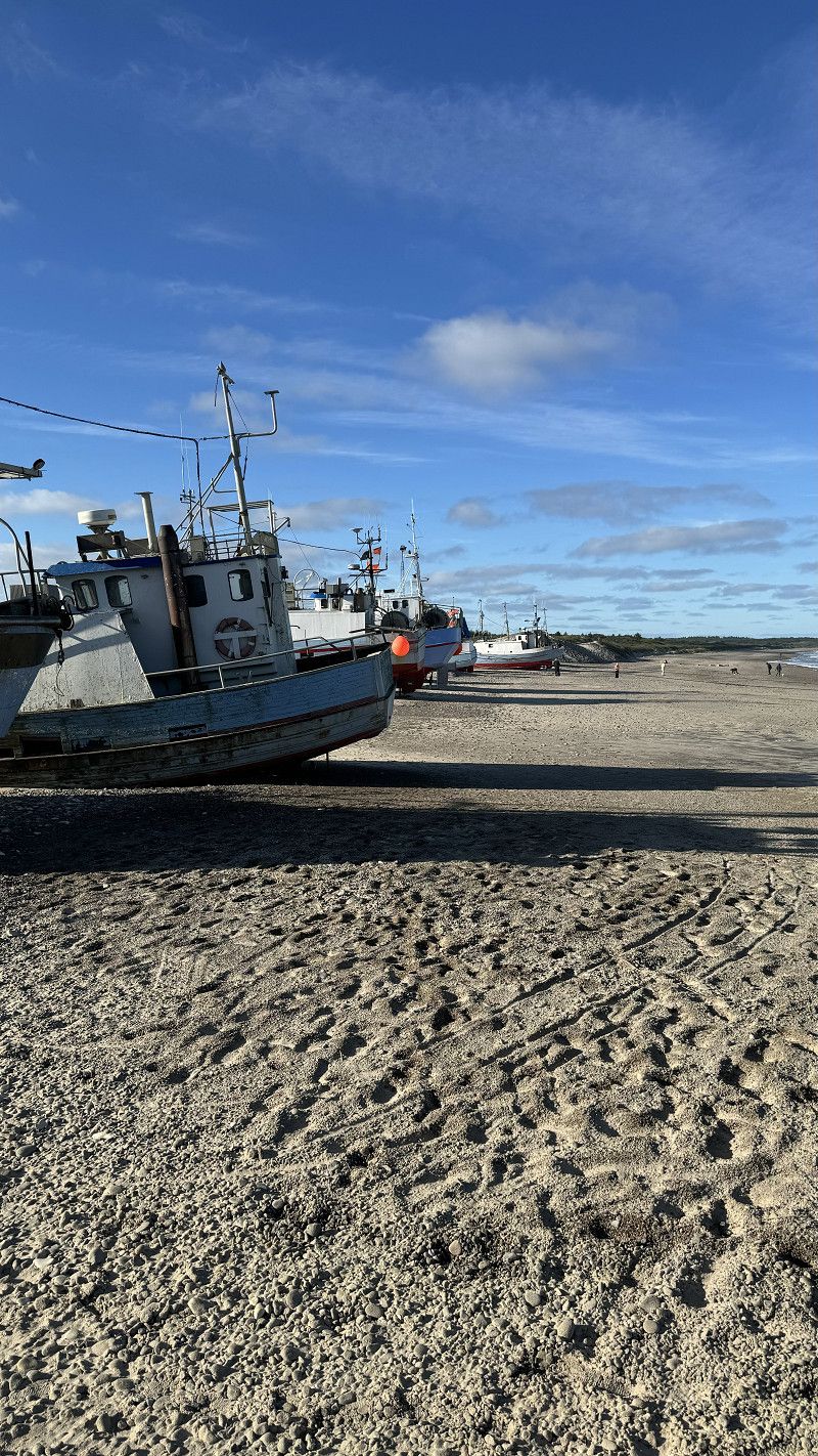
Thorup Strand
Thorup beach with the fishing boats being pulled ashore.
It wasn't anything incredibly special for us, but it was a nice little beach with traditional fishing boats. There is a small but good snack bar (we didn't try it).
Thorup Strandvej 329, Fjerritslev, Region Nordjütland, Dänemark
57° 8' 21.9" N 9° 7' 33.5" E
57.1394110 9.1259710
• Head west on Thorup Strandvej. Go for 35 m.
• Turn left onto Markstien. Go for 39 m.
• Turn left onto Thorup Strandvej. Go for 52 m.
• Turn right onto Thorup Strandvej. Go for 717 m.
• Turn left onto Havvejen. Go for 8.1 km.
• Turn right onto Kollerup Strandvej. Go for 2.5 km.
• Continue on Brøndumvej. Go for 1.1 km.
• Take the 2nd exit from roundabout onto Sandagervej. Go for 327 m.
• Turn right onto Algade. Go for 203 m.
• Continue on Østergade (569). Go for 992 m.
• Continue on Lejrmarksvej (569). Go for 72 m.
• Turn left onto Ålborgvej (11). Go for 7.4 km.
• Turn left onto Mellemmøllevej toward Tranum/Lerup K. Go for 841 m.
• Continue on Bonderupvej. Go for 2.0 km.
• Turn right onto Hjortdalvej. Go for 3.5 km.
• Take the 2nd exit from roundabout onto Dybdalsvej. Go for 951 m.
• Continue on Drosselvej. Go for 12 m.
• Continue on Dybdalsvej. Go for 1.3 km.
• Continue on Tranum Engevej. Go for 5.0 km.
• Take the 2nd exit from roundabout onto Tranum Engevej. Go for 2.1 km.
• Continue on Tranumvej. Go for 4.7 km.
• Take the 2nd exit from roundabout onto Tranumvej. Go for 422 m.
• Turn left onto Thisted Landevej (11) toward Aalborg/Nørresundby/55. Go for 2.0 km.
• Pass 2 roundabouts and continue on Aalborgvej (11/55). Go for 9.8 km.
• Take the 2nd exit from roundabout onto Thisted Landevej (11/55) toward Aalborg/Nørresundby/Lufthavn. Go for 2.1 km.
• Pass 3 roundabouts and continue on Thistedvej (55). Go for 5.9 km.
• Continue on Vesterbro (180). Go for 648 m.
• Turn right onto Gammel Strandvej (O1) toward Aalborg Ø/Aalborg V. Go for 160 m.
• Turn left onto Strandvejen. Go for 626 m.
• Continue on Peder Skrams Gade. Go for 811 m.
• Turn left onto Vestre Fjordvej. Go for 124 m.
• Turn right onto Skydebanevej. Go for 424 m.
• Turn right onto Skydebanevej. Go for 51 m.
• Arrive at Skydebanevej. Your destination is on the right.
☍
65,0 km
(1 hrs. 3 min.)
Aalborg Familie Camping Strandparken
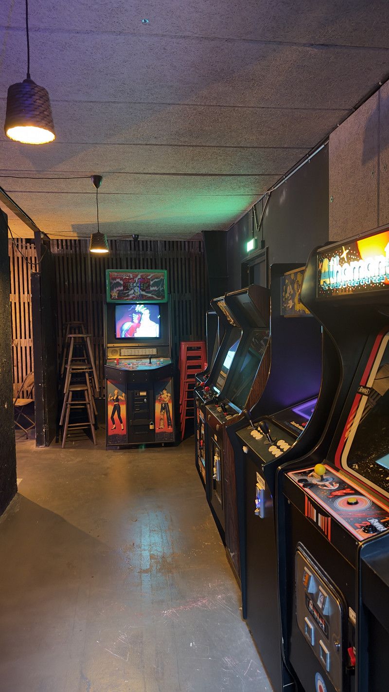
We spend the rest of the day in the city. We look at the beautiful place, go to the street food market and look for a nice restaurant to celebrate the day (Lena's birthday).
Street food market a little more expensive, but worth a visit. There is a relatively large arcade and the usual German snack specialties (gyros, sushi, pizza, burgers, etc.)
Camping site is nothing special but offers everything you need and was mostly clean.
Skydebanevej 20, 9000, Aalborg, Dänemark
57° 3' 20" N 9° 53' 8" E
57.0555600 9.8855600
• Head south on Skydebanevej. Go for 51 m.
• Turn right onto Skydebanevej. Go for 105 m.
• Turn left onto Vestre Kærvej. Go for 492 m.
• Turn left onto Annebergvej. Go for 523 m.
• Turn left onto Vestre Fjordvej. Go for 596 m.
• Turn right onto Peder Skrams Gade. Go for 811 m.
• Continue on Strandvejen. Go for 909 m.
• Turn right onto Toldbodgade (O1). Go for 126 m.
• Turn right onto Vesterbro (180). Go for 648 m.
• Keep right onto Østerbrogade (180) toward E39/E45/Havn/Centrum. Go for 1.3 km.
• Keep left onto Hjørringvej (180) toward Vodskov/Hirtshals/E39/Frederikshavn/E45. Go for 78 m.
• Continue on Hjørringvej (180). Go for 776 m.
• Turn right onto Sundsholmen toward Fr Havn/E45/Hirtshals/E39/Løkken/55. Go for 435 m.
• Take ramp onto E45 (Nordjyske Motorvej) toward Frederikshavn/Hirtshals/E39/Løkken/55. Go for 1.1 km.
• Keep right onto E39 (Vendsyssel) toward Hirtshals/Hjørring/Brønderslev/Høvejen/Thisted. Go for 57.6 km.
• Take the 1st exit from roundabout onto Tverstedvej (597) toward Skagen/Tversted. Go for 10.6 km.
• Take the 2nd exit from roundabout onto Skagensvej (597). Go for 15.4 km.
• Take the 3rd exit from roundabout onto Ålbækvej (40). Go for 6.4 km.
• Take the 2nd exit from roundabout onto Ålbækvej (40). Go for 9.3 km.
• Continue on Frederikshavnsvej (40). Go for 1.7 km.
• Take the 2nd exit from roundabout onto Kattegatvej. Go for 651 m.
• Turn left onto Buttervej. Go for 365 m.
• Take the 2nd exit from roundabout onto Bøjlevejen. Go for 3.3 km.
• Take the 2nd exit from roundabout onto Fyrvej (40). Go for 1.8 km.
• Take the 2nd exit from roundabout onto Åkandevej. Go for 143 m.
• Turn right. Go for 52 m.
• Arrive at your destination on the left.
☍
115,2 km
(1 hrs. 25 min.)
Day
Grenen Parking
Visit to Skagen where the North and Baltic Seas meet.
Skagen was also a goal that we ticked off, but didn't really knock our socks off.
We walked the way to the top and then took the shuttle back for just under 3 euros per person.
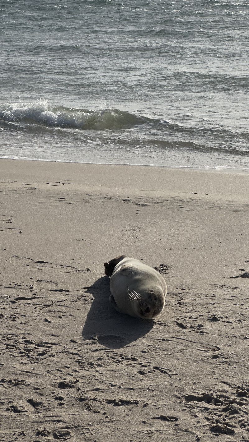
The highlight here was the seal, although I don't know if it was doing so well 🥺.
Fyrvej, 9990, Skagen, Dänemark
57° 44' 21" N 10° 37' 59" E
57.7391667 10.6330556
• Head southeast. Go for 96 m.
• Turn left toward Åkandevej. Go for 13 m.
• Turn left onto Åkandevej. Go for 54 m.
• Take the 1st exit from roundabout onto Fyrvej (40). Go for 1.8 km.
• Take the 1st exit from roundabout onto Bøjlevejen. Go for 3.3 km.
• Take the 3rd exit from roundabout onto Buttervej. Go for 430 m.
• Turn right onto Kattegatvej. Go for 562 m.
• Take the 1st exit from roundabout onto Frederikshavnsvej (40). Go for 10.9 km.
• Take the 1st exit from roundabout onto Kandestedvej. Go for 3.0 km.
• Turn left onto Milevejen. Go for 8 m.
• Continue on Råbjerg Mile Vej. Go for 271 m.
• Turn slightly right onto Råbjerg Mile Vej. Go for 25 m.
• Turn slightly left onto Råbjerg Mile Vej. Go for 160 m.
• Arrive at Råbjerg Mile Vej. Your destination is on the right.
☍
20,6 km
( 23 min.)
Rajberg Mile
The “desert” of Denmark.
Unfortunately it was too windy for the view. to enjoy, but a visit here is still a must!
Råbjerg Mile Vej 2, Skagen, Region Nordjütland, Dänemark
57° 39' 14.4" N 10° 24' 31.4" E
57.6539870 10.4087130
• Head south on Råbjerg Mile Vej. Go for 48 m.
• Turn left onto Råbjerg Mile Vej. Go for 479 m.
• Continue on Milevejen. Go for 8 m.
• Turn right onto Kandestedvej. Go for 3.0 km.
• Take the 1st exit from roundabout onto Ålbækvej (40). Go for 6.3 km.
• Take the 1st exit from roundabout onto Hirtshalsvej (597). Go for 15.3 km.
• Take the 2nd exit from roundabout onto Skagensvej (597). Go for 10.6 km.
• Take the 3rd exit from roundabout onto E39 (Hirtshalsmotorvejen) toward Aalborg. Go for 5.8 km.
• Take exit 2 toward Hjørring N/Bjergby. Go for 447 m.
• Take the 2nd exit from roundabout onto Ringvejen (190) toward Hjørring. Go for 3.4 km.
• Take the 1st exit from roundabout onto Vellingshøjvej. Go for 3.5 km.
• Turn left onto Krustrupvej (55) toward Løkken/Hjørring C/35. Go for 801 m.
• Turn right onto Skallerupvej toward Skallerup Klit/Lønstrup/Sønderlev. Go for 8.4 km.
• Turn right onto Lønstrupvej. Go for 1.5 km.
• Continue on Strandvejen. Go for 562 m.
• Turn left onto Rubjergvej. Go for 325 m.
• Turn right onto Mårup Kirkevej. Go for 737 m.
• Turn left onto Mårup Kirkevej. Go for 237 m.
• Arrive at Mårup Kirkevej. Your destination is on the right.
☍
61,5 km
( 54 min.)
Stellplatz an der Klippe
A very nice little parking space right on the cliffs.
The view here is also really breathtaking, but staying overnight was out of the question due to the strong wind.
Instead we drove to the lighthouse, about 2km away.
Instead of looking for an alternative place here, we drove another 2 1/2 hours towards Odense, our next destination.
I now add our sleeping place:
Mårup Kirkevej 70, Lønstrup, Region Nordjütland, Dänemark
57° 27' 45" N 9° 47' 4.5" E
57.4625130 9.7845860
• Head west on Mårup Kirkevej.
• Turn slightly left onto Mårup Kirkevej. Go for 381 m.
• Continue on Blokkenbovej. Go for 659 m.
• Turn right onto Rubjergvej. Go for 3.5 km.
• Continue on Lønstrupvej. Go for 4.1 km.
• Turn left onto Løkkensvej (55). Go for 3.3 km.
• Turn right onto Sejlstrupvej toward Vejby/Vrå/Rakkeby/Sejlstrup. Go for 2.4 km.
• Turn left onto Vejbyvej. Go for 941 m.
• Turn right onto Smidstrupvej. Go for 5.8 km.
• Continue on Granlyvej. Go for 245 m.
• Continue on Smidstrupvej. Go for 711 m.
• Continue on Vråvej. Go for 83 m.
• Turn left onto Vråvej (593). Go for 972 m.
• Pass 2 roundabouts and continue on Vrejlev Klostervej (593). Go for 4.7 km.
• Turn right and take ramp onto E39 (Hirtshalsmotorvejen) toward Aalborg. Go for 33.2 km.
• Continue on Vendsyssel. Go for 196 m.
• Continue on E45 (Vendsyssel). Go for 198 km.
• Keep left onto E20 (Skærup) toward Odense/Fredericia. Go for 12.6 km.
• Take exit 59 toward Fredericia S/Snoghøj/161/Middelfart V. Go for 374 m.
• Turn left onto Snoghøj Landevej (28). Go for 811 m.
• Turn left onto Kolding Landevej (161). Go for 2.2 km.
• Turn left onto Slengeriksvej. Go for 185 m.
• Turn left onto Indevejen. Go for 659 m.
• Turn left onto Kongebrovej. Go for 17 m.
• Arrive at Kongebrovej. Your destination is on the left.
☍
275,6 km
(2 hrs. 50 min.)
Day
Middelfart
In order to use the time, as I said, we drove further towards the next destination. On the route we looked for a place just to spend the night.
There are two parking spaces here that can be found in Park4Night. They probably (also) belong to the adjacent hotel.
But one was too dark for us, so we used the large parking lot and stood in the last row.
There is a public toilet at the harbor. It was enough for an overnight stay.
Indevejen, Middelfart, Region Süddänemark, Dänemark
55° 30' 42.6" N 9° 42' 36.5" E
55.5118250 9.7101391
• Head south on Kongebrovej. Go for 17 m.
• Turn right onto Indevejen. Go for 659 m.
• Turn right onto Slengeriksvej. Go for 185 m.
• Turn right onto Brovejen (161). Go for 2.2 km.
• Turn right onto Snoghøj Landevej (28). Go for 788 m.
• Turn right and take ramp onto E20 (Taulovmotorvejen) toward Odense. Go for 47.4 km.
• Take exit 51 toward Odense S/Faaborg/Centrum. Go for 524 m.
• Take the 4th exit from roundabout onto Stenløsevej toward Centrum. Go for 1.8 km.
• Turn left onto Odensevej. Go for 697 m.
• Turn left onto Odensevej. Go for 117 m.
• Turn right onto Odensevej. Go for 204 m.
• Turn right onto Odensevej. Go for 125 m.
• Arrive at Odensevej. Your destination is on the left.
☍
54,8 km
( 35 min.)
DCU-Camping Odense
We spend day 5 on the road towards Odense and spontaneously choose places to visit.
We changed our plan to have a shorter journey to Copenhagen on the 6th day. We skipped Odense and continued to Frederiksværk.
I'm now also adding the campsite:
Odensevej 102, 5260, Odense S., Dänemark
55° 22' 15.3" N 10° 23' 25.1" E
55.3709100 10.3903100
• Head northeast on Odensevej. Go for 329 m.
• Turn left onto Odensevej. Go for 107 m.
• Turn right onto Odensevej. Go for 613 m.
• Turn right onto Stenløsevej. Go for 1.6 km.
• Take the 5th exit from roundabout onto E20 (Fynske Motorvej) toward København. Go for 84.2 km.
• Take exit 37 toward Holbæk. Go for 543 m.
• Turn left onto Elmebjergvej (57/219) toward Holbæk/Kalundborg/Sorø N. Go for 181 m.
• Pass 4 roundabouts and continue on Holbæk Landevej (57). Go for 24.4 km.
• Turn right and take ramp onto 23 (Kalundborgmotorvejen) toward København. Go for 7.0 km.
• Continue on 21 (Holbæk). Go for 1.5 km.
• Take exit 16 toward Kr. Sonnerup/Frederikssund/Tølløse. Go for 394 m.
• Turn left onto Elverdamsvej (53) toward Ejby/Frederikssund/Kr. Sonnerup. Go for 3.1 km.
• Continue on Elverdamsvej (53). Go for 2.2 km.
• Take the 2nd exit from roundabout onto Elverdamsvej (53) toward Frederikssund/Skibby. Go for 2.9 km.
• Pass 3 roundabouts and continue on 53. Go for 20.8 km.
• Take the 2nd exit from roundabout toward Frederikssund. Go for 373 m.
• Turn right onto Frederikssundsvej (53/211). Go for 1.6 km.
• Pass 2 roundabouts and continue on Frederikssundsvej (53/211). Go for 2.3 km.
• Take the 2nd exit from roundabout onto Frederikssundsvej (211) toward Frederiksværk. Go for 1.6 km.
• Take the 2nd exit from roundabout onto Frederikssundsvej (211) toward Frederiksværk. Go for 5.4 km.
• Pass 2 roundabouts and continue on Frederikssundsvej (211). Go for 4.8 km.
• Turn slightly left onto Hillerødvej (16/211) toward Hundested/Frederiksværk. Go for 3.0 km.
• Take the 3rd exit from roundabout onto Sandskårsvej toward Centrum. Go for 532 m.
• Turn left onto Jernbanegade. Go for 232 m.
• Continue on Hermannsgade. Go for 383 m.
• Turn left onto Strandgade. Go for 176 m.
• Continue straight ahead. Go for 11 m.
• Arrive at your destination on the right.
☍
170,4 km
(2 hrs. 3 min.)
Frederiksværk Camping
This was our alternative spot for the day and night.
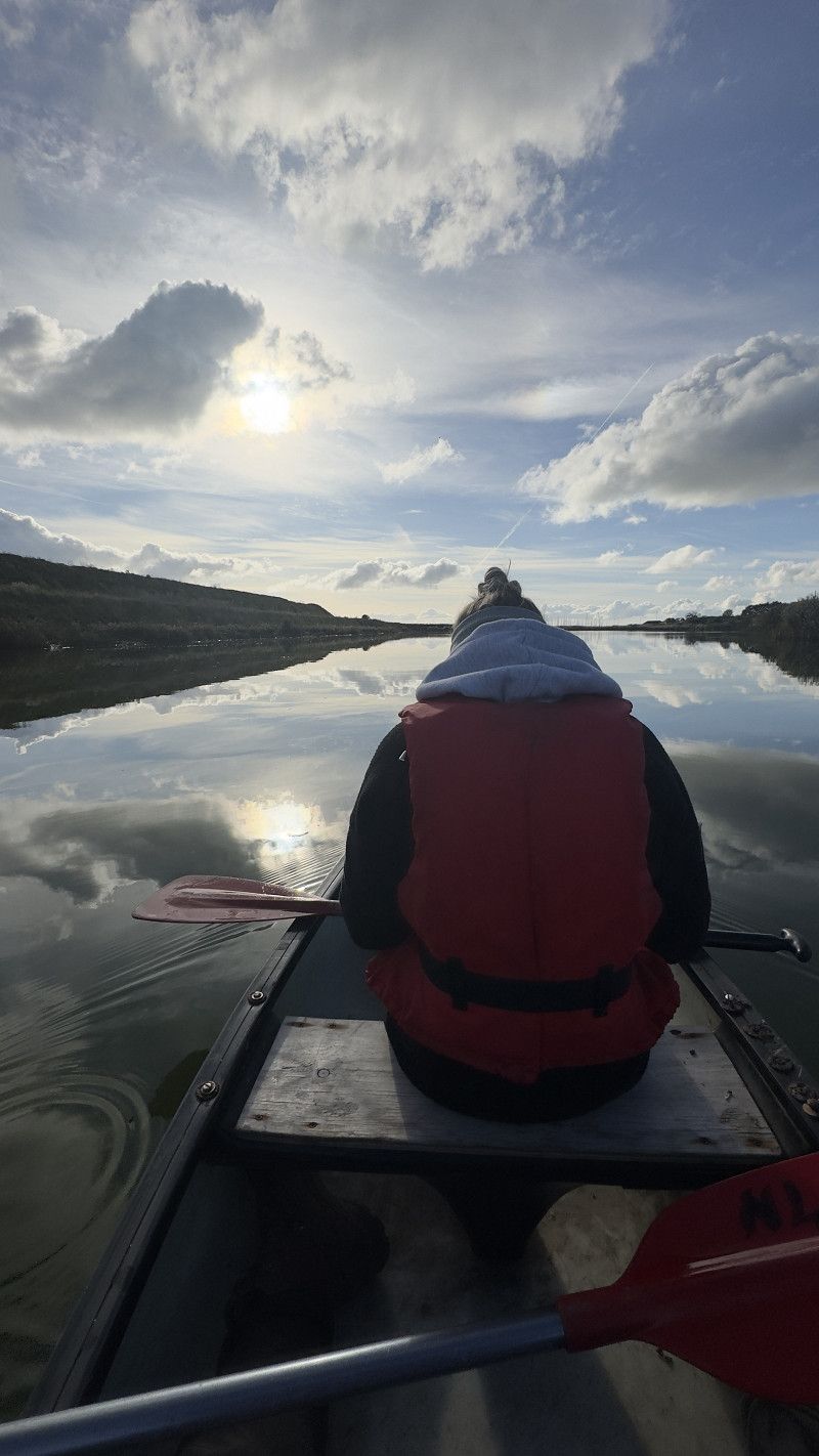
In terms of price, the place is top. The kitchen and sanitary facilities are older and fairly simple. If you want luxury, this is the wrong place. But everything worked out for us. When you book, you can borrow a canoe for free and sail down the canal towards the harbor.
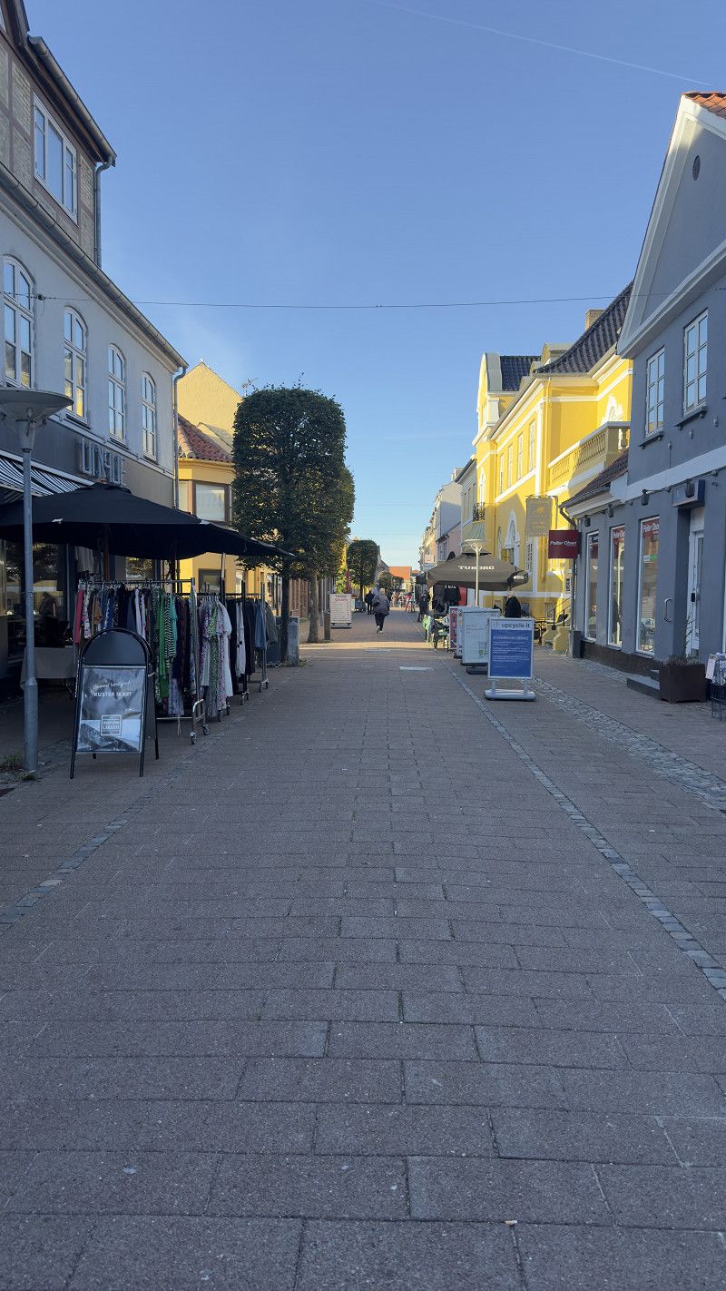
Frederiksværk is a beautiful little town with a great pedestrian zone. You can reach everything on foot.
Strandgade 25, 3300, Frederiksværk, Denmark
55° 58' 19" N 12° 0' 52" E
55.9719400 12.0144400
• Head toward Strandgade. Go for 11 m.
• Continue on Strandgade. Go for 176 m.
• Turn right onto Hermannsgade. Go for 383 m.
• Continue on Jernbanegade. Go for 232 m.
• Turn right onto Sandskårsvej. Go for 460 m.
• Take the 1st exit from roundabout onto Hillerødvej (16/211) toward Frederikssund/Hillerød. Go for 2.9 km.
• Turn slightly left onto Hillerødvej (16). Go for 10.8 km.
• Take ramp onto Herredsvejen (16) toward København/Helsinge/267/Hillerød C-S/O2. Go for 2.6 km.
• Turn right and take ramp onto 16 toward København/6/Roskilde. Go for 31.4 km.
• Keep left onto Hareskovvej (16) toward Centrum. Go for 1.7 km.
• Continue on Bispeengbuen toward Centrum. Go for 1.2 km.
• Continue on Ågade. Go for 720 m.
• Continue on Åboulevard. Go for 957 m.
• Continue on Gyldenløvesgade. Go for 126 m.
• Keep right onto Gyldenløvesgade. Go for 315 m.
• Continue on H. C. Andersens Boulevard. Go for 74 m.
• Turn slightly left toward H. C. Andersens Boulevard. Go for 86 m.
• Turn slightly left onto Jarmers Plads. Go for 27 m.
• Turn right onto Vester Voldgade. Go for 165 m.
• Turn left onto Studiestræde. Go for 171 m.
• Turn right onto Larsbjørnsstræde. Go for 111 m.
• Continue on Kattesundet. Go for 169 m.
• Turn right onto Lavendelstræde. Go for 126 m.
• Turn right onto Rådhuspladsen. Go for 120 m.
• Arrive at Rådhuspladsen. Your destination is on the left.
☍
55,0 km
( 45 min.)
Day
Kopenhagen
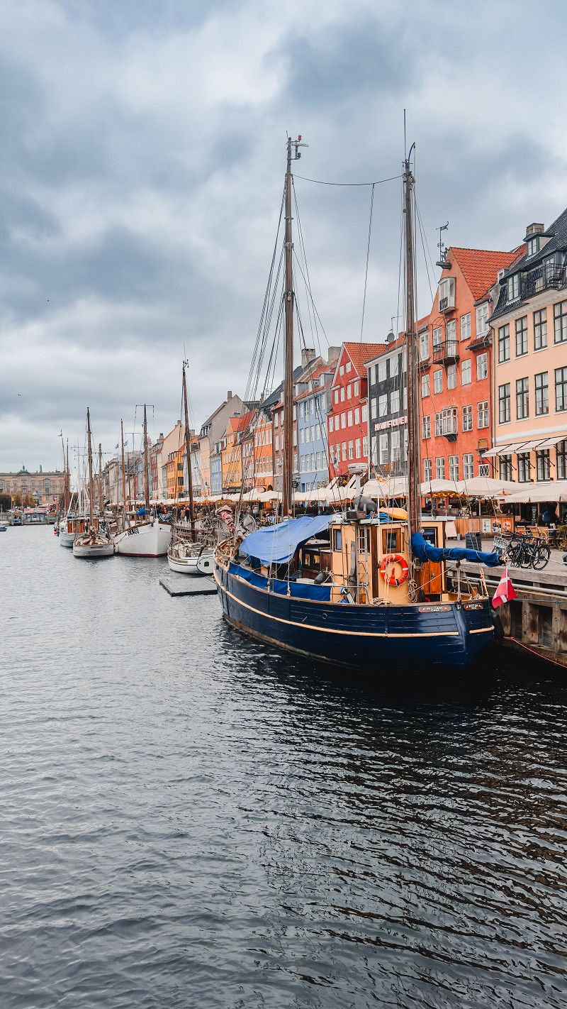
We visit the capital on Eric's birthday.
We spent my birthday in Copenhagen. Unfortunately, the weather wasn't as good as expected. Nevertheless, Copenhagen is a beautiful city with some good restaurants.
Flooding was reported on the Baltic Sea coasts for the next day. Since we had actually planned to travel back via Fehmarn, we had to change our plans and drove back towards Hamburg overland. We stayed overnight again directly behind the border in a free motorhome parking lot.
Vesterbrogade, Kopenhagen, Hauptstadtregion, Dänemark
55° 40' 33.8" N 12° 34' 8.1" E
55.6760623 12.5689089
• Head southwest on Rådhuspladsen.
• Turn left onto Rådhuspladsen. Go for 203 m.
• Continue on Vester Voldgade. Go for 111 m.
• Turn right onto Stormgade. Go for 108 m.
• Continue on Tietgensgade. Go for 359 m.
• Turn left onto Bernstorffsgade. Go for 457 m.
• Turn right onto Kalvebod Brygge (O2) toward E20/21. Go for 2.6 km.
• Continue on Scandiagade toward Malmø/E20/Lufthavn/Odense/E47/Bella Center. Go for 372 m.
• Continue on Sydhavnsgade. Go for 510 m.
• Continue on Sjællandsbroen. Go for 832 m.
• Keep right onto Centrumforbindelsen toward Odense/E20/E47/E55/Malmø/Lufthavn. Go for 829 m.
• Take left ramp onto E20 (Amagermotorvejen) toward Odense/E47/E55/21. Go for 35.8 km.
• Keep right onto E47/E55 (Køge Vest) toward Rødby/Gedser. Go for 57.9 km.
• Take exit 41 toward Vordingborg/Møn. Go for 408 m.
• Turn left onto Mønsvej (22/59) toward Møn/Kalvehave. Go for 806 m.
• Take the 2nd exit from roundabout onto Kalvehavevej (59). Go for 10.0 km.
• Take the 2nd exit from roundabout onto Præstøvej (59). Go for 10.1 km.
• Continue on 59/287. Go for 118 m.
• Continue on Storegade (287). Go for 1.3 km.
• Continue on Klintevej (287). Go for 5.5 km.
• Turn right toward Søndre Landevej. Go for 41 m.
• Continue on Søndre Landevej. Go for 7.4 km.
• Turn left onto Klintholm Havnevej. Go for 121 m.
• Turn right onto Hovvejen. Go for 697 m.
• Continue on Busenevej. Go for 1.1 km.
• Continue on Busenevej. Go for 2.4 km.
• Turn left onto Stengårdsvej. Go for 1.3 km.
• Turn right toward Stengårdsvej. Go for 29 m.
• Turn slightly right onto Stengårdsvej. Go for 122 m.
• Arrive at Stengårdsvej. Your destination is on the right.
☍
141,4 km
(1 hrs. 44 min.)
Day
Mons Klint
The chalk cliff is located in the east of the Baltic Sea island
of Møn and is up to 128m high.
Due to the storm and flood warnings, we unfortunately had to cancel this destination and left today and brought the camper back.
Maglevandstrappen, Region Seeland, Dänemark
54° 57' 57.8" N 12° 32' 54" E
54.9660600 12.5483374
• Head north on Stengårdsvej. Go for 165 m.
• Turn left onto Stengårdsvej. Go for 1.5 km.
• Turn right onto Busenevej. Go for 3.4 km.
• Continue on Hovvejen. Go for 697 m.
• Turn left onto Klintholm Havnevej. Go for 121 m.
• Turn right onto Søndre Landevej. Go for 7.4 km.
• Turn left onto Klintevej (287). Go for 5.5 km.
• Continue on Storegade (287). Go for 1.3 km.
• Continue on 59/287. Go for 118 m.
• Continue on Støvvasen (59/287). Go for 4.4 km.
• Turn left onto Æbelnæsvej (287). Go for 21.2 km.
• Take ramp onto E47/E55 (Sydmotorvejen) toward Rødby/Gedser. Go for 14.7 km.
• Continue on E47 (Sydmotorvejen) toward Rødby. Go for 27.1 km.
• Take exit 48 toward Maribo/153. Go for 623 m.
• Turn left onto Vestre Landevej (9) toward Maribo/153. Go for 747 m.
• Take the 3rd exit from roundabout onto Rydsmarken. Go for 182 m.
• Turn left onto Skovvænget. Go for 287 m.
• Turn right onto Bangshavevej. Go for 21 m.
• Turn left onto Bangshavevej. Go for 242 m.
• Arrive at Bangshavevej. Your destination is on the right.
☍
89,6 km
(1 hrs. 13 min.)
Maribo Sø Camping
Bangshavevej, 4930, Maribo, Dänemark
54° 46' 21" N 11° 29' 37" E
54.7725000 11.4936100
• Head northwest on Bangshavevej. Go for 242 m.
• Turn right onto Bangshavevej. Go for 21 m.
• Turn left onto Skovvænget. Go for 287 m.
• Turn right onto Rydsmarken. Go for 131 m.
• Take the 3rd exit from roundabout onto Vestre Landevej toward E47/9/Tårs/Nakskov. Go for 779 m.
• Turn right and take ramp onto E47 (Sydmotorvejen) toward Rødby. Go for 17.5 km.
• Take the Rødby-Puttgarden Ferry. Stay on for 18.7 km.
• Head southwest on E47. Go for 865 m.
• Continue on B207. Go for 21.3 km.
• Continue on A1. Go for 116 km.
• Take exit 31 toward Hamburg/HH-Jenfeld onto A24. Go for 3.6 km.
• Take exit 2 toward Rahlstedt onto Schiffbeker Weg. Go for 432 m.
• Turn left. Go for 20 m.
• Turn right. Go for 21 m.
• Arrive at your destination on the right.
☍
180,3 km
(2 hrs. 38 min.)
Day
ROADfans
Schiffbeker Weg 307, Hamburg, Deutschland
53° 34' 10.5" N 10° 7' 24.8" E
53.5695787 10.1235562