Caught up on some Loire Valley places I missed in 2022. Decided on the Mediterranean coast.
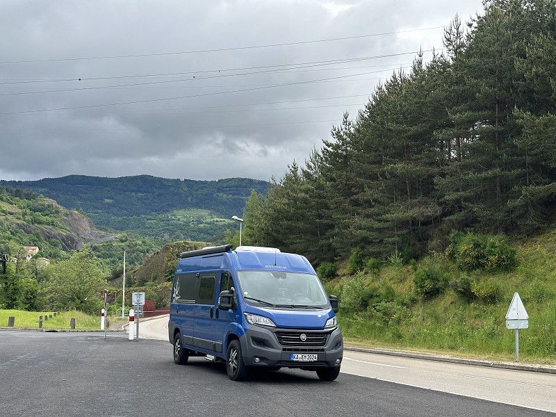
Ettlingen
Landkreis Karlsruhe, Baden-Württemberg, Deutschland
48° 56' 23" N 8° 24' 15.4" E
48.9397149 8.4042700
• Head toward Bernhardusstraße. Go for 46 m.
• Turn right onto Bernhardusstraße. Go for 18 m.
• Turn right onto Rastatter Straße. Go for 181 m.
• Continue on Schillerstraße. Go for 305 m.
• Take the 2nd exit from roundabout onto Karlsruher Straße. Go for 294 m.
• Pass 2 roundabouts and continue on Karlsruher Straße. Go for 1.7 km.
• Take ramp onto A5 toward Basel. Go for 27.1 km.
• Take exit 51 toward Iffezheim/Flughafen Baden-Airpark onto B500. Go for 6.7 km.
• Continue on D504. Go for 1.2 km.
• Take the 3rd exit from roundabout onto D504 toward D4/Strasbourg/Haguenau/Lauterbourg/Roppenheim/Beinheim. Go for 2.6 km.
• Take the 2nd exit from roundabout onto D504 toward Paris/Strasbourg/Haguenau/Lauterbourg/Soufflenheim. Go for 903 m.
• Take ramp onto A35. Go for 32.6 km.
• Take the exit toward Paris/Haguenau onto A4 (Autoroute de l'Est). Go for 44.0 km.
• Take exit 43 toward Lunéville/Nancy/Phalsbourg/Sarrebourg. Go for 1.3 km.
• Take the 2nd exit from roundabout onto N4 toward Lunéville/Nancy/Metz/Sarrebourg. Go for 36.5 km.
• Take the 1st exit from roundabout onto N4 toward Nancy/Lunéville. Go for 38.3 km.
• Keep left onto A33. Go for 25.8 km.
• Take the exit toward Toul/Paris onto Échangeur de Nancy-Gentilly. Go for 1.2 km.
• Continue on A31. Go for 18.3 km.
• Take exit 12 toward Paris/Reims/Troyes Par RN/Bar le Duc onto N4. Go for 723 m.
• Take ramp toward Vaucouleurs. Go for 214 m.
• Turn slightly left onto D960. Go for 176 m.
• Take ramp onto N4 toward Nancy/Chaumont/Dijon. Go for 806 m.
• Take left ramp toward Nancy/Toul-Croix de Metz. Go for 444 m.
• Arrive at Échangeur de Toul. Your destination is on the right.
☍
241,4 km
(2 hrs. 26 min.)
Toul
A 31, Toul, Mörthe und Mosel, Grand Est, Frankreich
48° 39' 7.1" N 5° 52' 53.8" E
48.6519667 5.8816032
• Take ramp onto A31. Go for 4.8 km.
• Take exit 15 toward Dommartin-les-T./Hôpital Jeanne d'Arc/Gondreville/Parc de Haye. Go for 548 m.
• Turn left onto D400 toward Gondreville. Go for 343 m.
• Take left ramp onto A31 toward Dijon/Paris. Go for 119 km.
• Take the exit toward Paris/Troyes/Chaumont onto A5. Go for 91.6 km.
• Take the exit toward Lille/Reims/Châlons en Champ./Troyes-Est onto A26. Go for 7.1 km.
• Take exit 23 toward St Dizier/Troyes-Est/Pont Ste Marie/Forêt d'Orient. Go for 1.0 km.
• Take the 2nd exit from roundabout onto D619 toward Troyes/St Dizier/St Parres aux T./Pont Ste Marie. Go for 2.0 km.
• Take the 1st exit from roundabout onto D610 toward Nancy/Châlons-en-Ch./Pont Ste-Marie/Aérodrome Troyes-Barberey. Go for 2.9 km.
• Take ramp toward Troyes-Centre. Go for 796 m.
• Continue on Boulevard Georges Pompidou. Go for 1.6 km.
• Take ramp onto Avenue du Maréchal de Lattre de Tassigny toward Lyon/A5/Chaumont/Dijon/Troyes-Est/St Parres aux T. Go for 741 m.
• Turn left onto Carrefour de l'Europe. Go for 67 m.
• Continue on Avenue du 1er Mai. Go for 376 m.
• Continue on Rue Kléber. Go for 146 m.
• Turn left onto Boulevard Henri Barbusse. Go for 51 m.
• Turn left. Go for 70 m.
• Arrive at your destination on the right.
☍
232,8 km
(1 hrs. 59 min.)
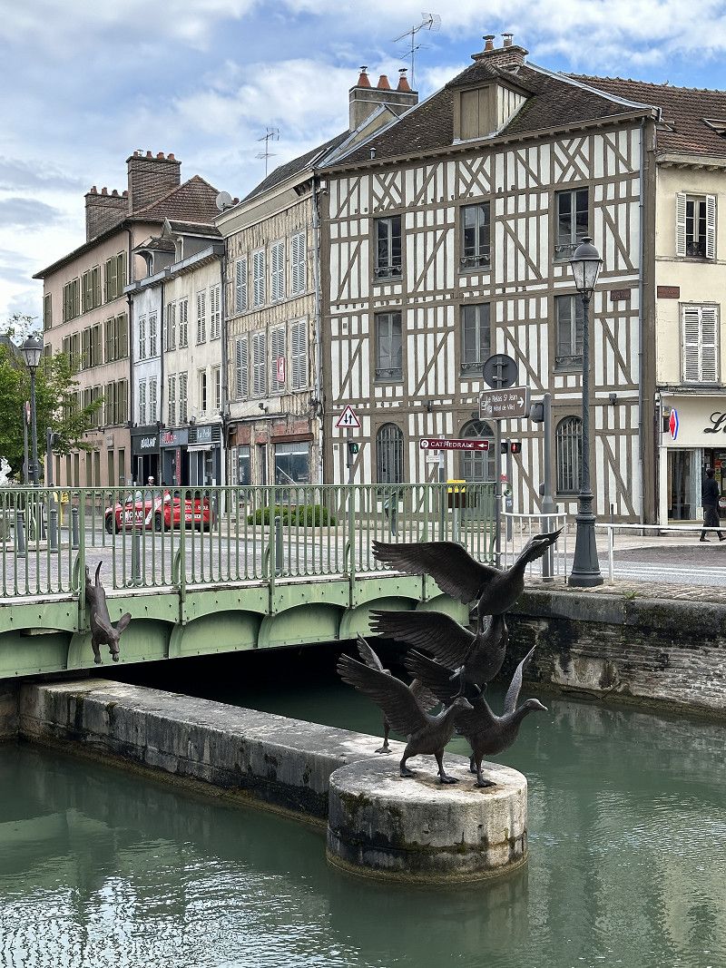
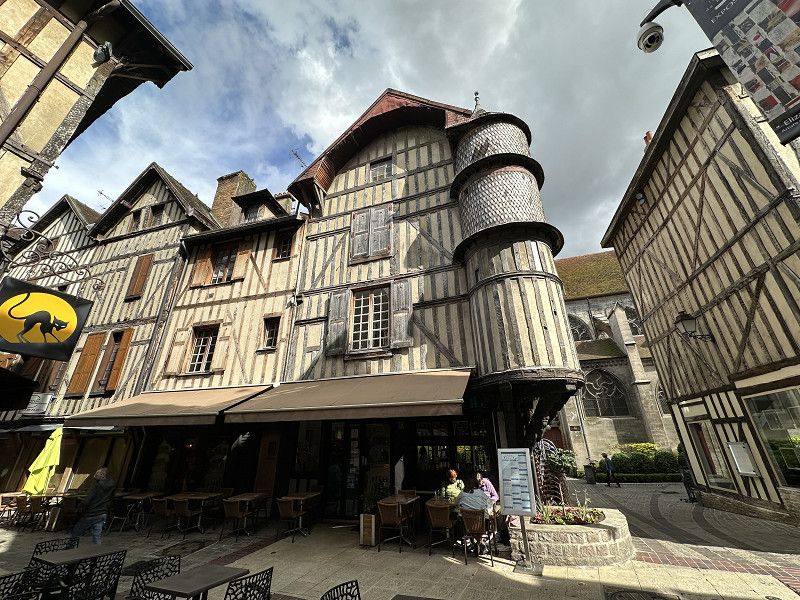
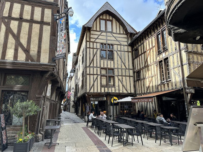
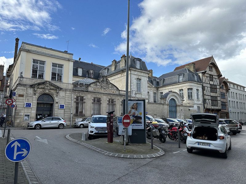
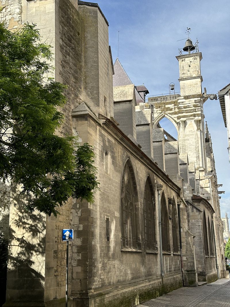
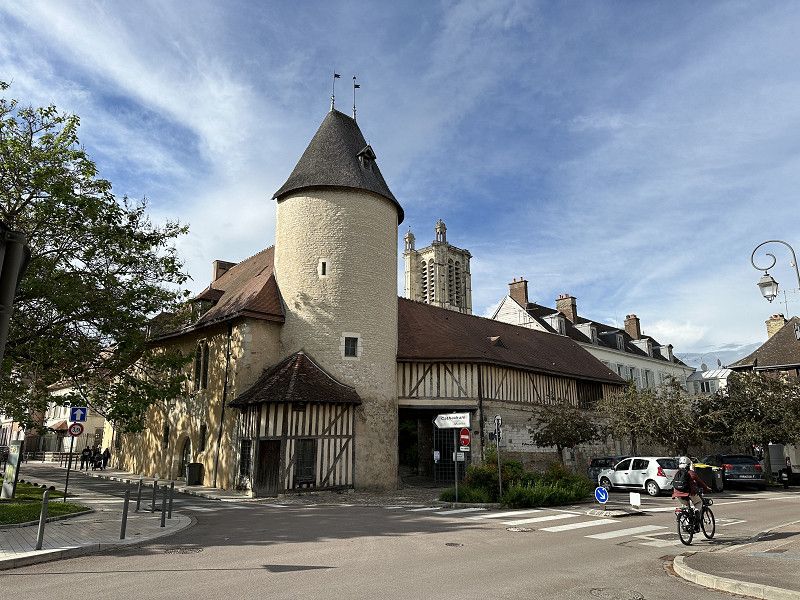
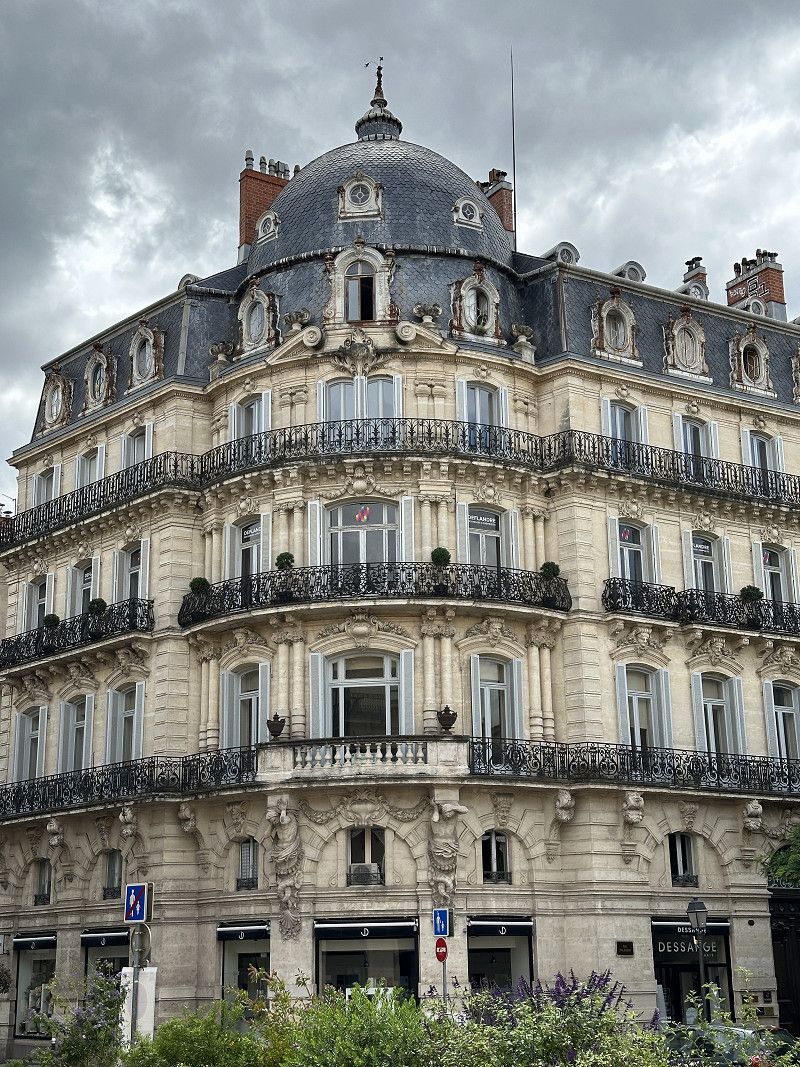
Troyes
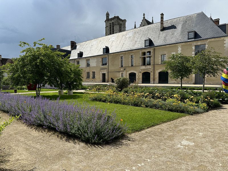
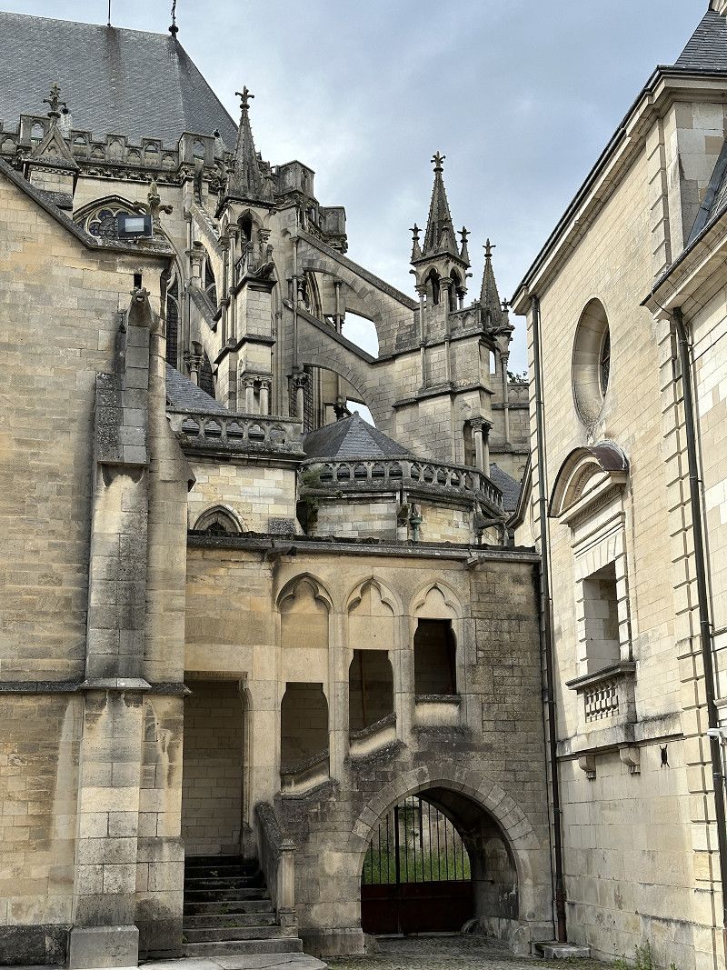
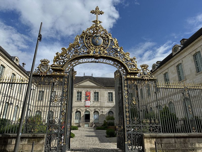
Easy Park4Night parking close to the historic city. Troyes was worth a quick visit. The Museum of Modern Art was also worth seeing for €8.
Boulevard Henri Barbusse, Troyes, Aube, Grand Est, Frankreich
48° 18' 8.9" N 4° 5' 10.3" E
48.3024684 4.0861954
• Head toward Boulevard Henri Barbusse. Go for 78 m.
• Continue on Boulevard Henri Barbusse. Go for 799 m.
• Continue on Quai Saint-Dominique. Go for 123 m.
• Take the 2nd exit from Place du Vouldy roundabout onto Place du Vouldy. Go for 73 m.
• Continue on Boulevard du 14 Juillet. Go for 621 m.
• Take the 2nd exit from Rond-Point François Mitterrand roundabout onto Boulevard du 1er R.A.M. Go for 278 m.
• Turn right onto Boulevard Victor Hugo. Go for 423 m.
• Continue toward Place du Général Patton. Go for 40 m.
• Take the 3rd exit from Place du Général Patton roundabout onto Rue Voltaire. Go for 255 m.
• Turn right onto Rue Chalmel. Go for 225 m.
• Continue on Rue des Noës. Go for 1.0 km.
• Continue on Rue Lamartine (D60). Go for 1.5 km.
• Turn left onto Avenue du Général Sarrail (D20 F). Go for 198 m.
• Take the 3rd exit from roundabout toward Torvilliers/La Rivière de Corps. Go for 201 m.
• Take the 3rd exit from roundabout onto D660 toward Sens. Go for 1.6 km.
• Take the 2nd exit from roundabout onto Voie des Charrières (D660). Go for 1.6 km.
• Take the 2nd exit from roundabout onto D660 toward A5/A26/Sens/Fontvannes/La Grange au Rez. Go for 1.5 km.
• Take the 2nd exit from roundabout onto E511 toward A5/E54/Sens/Paris/Orléans/Reims/Metz/Nancy/Lyon. Go for 2.2 km.
• Take ramp onto A5 toward Orléans/Paris/Sens. Go for 50.4 km.
• Take the exit toward Sens/Provins/Orléans onto A19. Go for 28.5 km.
• Take the exit toward Orléans/Montargis onto A19. Go for 51.1 km.
• Take exit 6 toward Malesherbes/Bellegarde/Beaune la R. Go for 619 m.
• Take the 3rd exit from roundabout. Go for 673 m.
• Continue toward D975. Go for 46 m.
• Take the 3rd exit from roundabout onto D975 toward Nemours/Malesherbes/Puiseaux/Beaumont-du-G./Gare d'Auxy. Go for 482 m.
• Turn left onto Route de la Gare (D975). Go for 445 m.
• Turn left onto La Gare d'Auxy (D165). Go for 90 m.
• Continue on Rue de la Chapelle (D165). Go for 1.9 km.
• Continue on D165. Go for 1.1 km.
• Continue on Rue des Brières (D165). Go for 520 m.
• Turn left onto Grande Rue (D28). Go for 14 m.
• Turn right onto Rue des Marguerites (D165). Go for 207 m.
• Continue on Rue de la Fontaine (D165). Go for 87 m.
• Continue on D165. Go for 1.2 km.
• Continue on Route d'Égry (D165). Go for 1.2 km.
• Continue on Rue Saint-Martin (D165). Go for 169 m.
• Turn left onto Grande Rue (D87). Go for 487 m.
• Turn right onto D950. Go for 5.6 km.
• Turn right onto Rue du Château (D523). Go for 1.1 km.
• Continue on D523. Go for 2.2 km.
• Turn left onto Route de Givraines (D123). Go for 489 m.
• Turn left onto Rue du Bas de la Poterne. Go for 222 m.
• Turn sharp right onto Rue des Tours. Go for 36 m.
• Turn slightly right onto Place du Bourg. Go for 104 m.
• Continue on Place du Château. Go for 24 m.
• Arrive at Place du Château. Your destination is on the left.
☍
162,0 km
(1 hrs. 43 min.)
Day
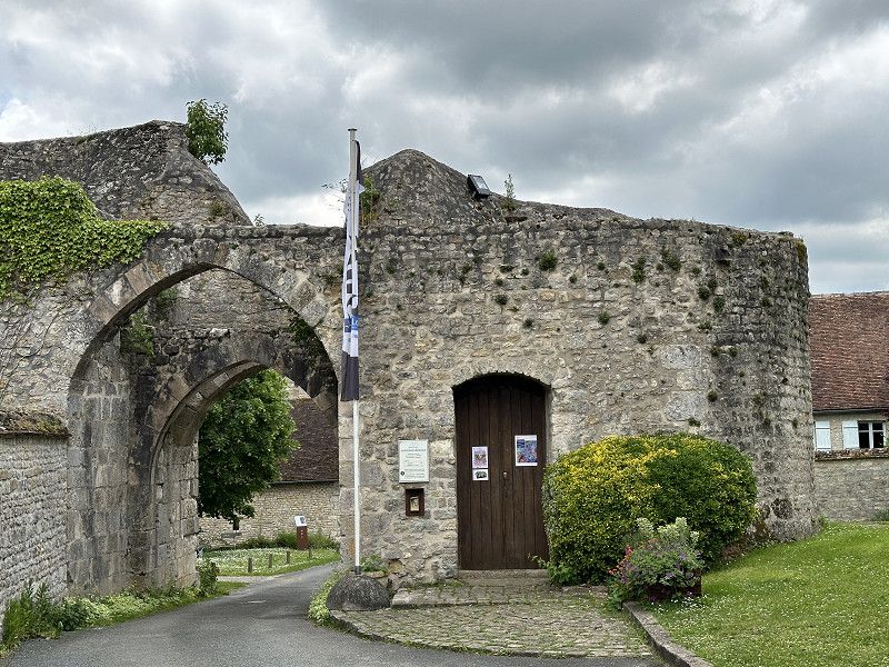
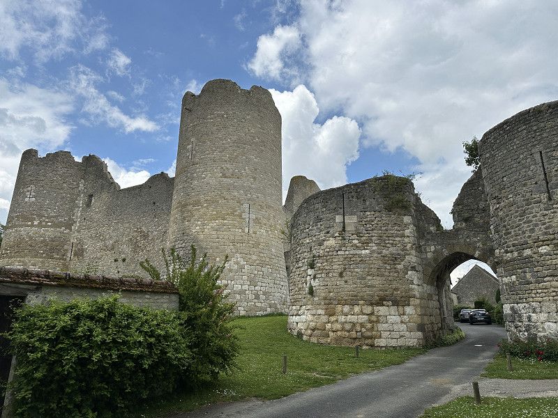
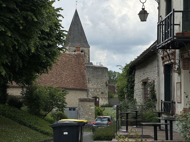
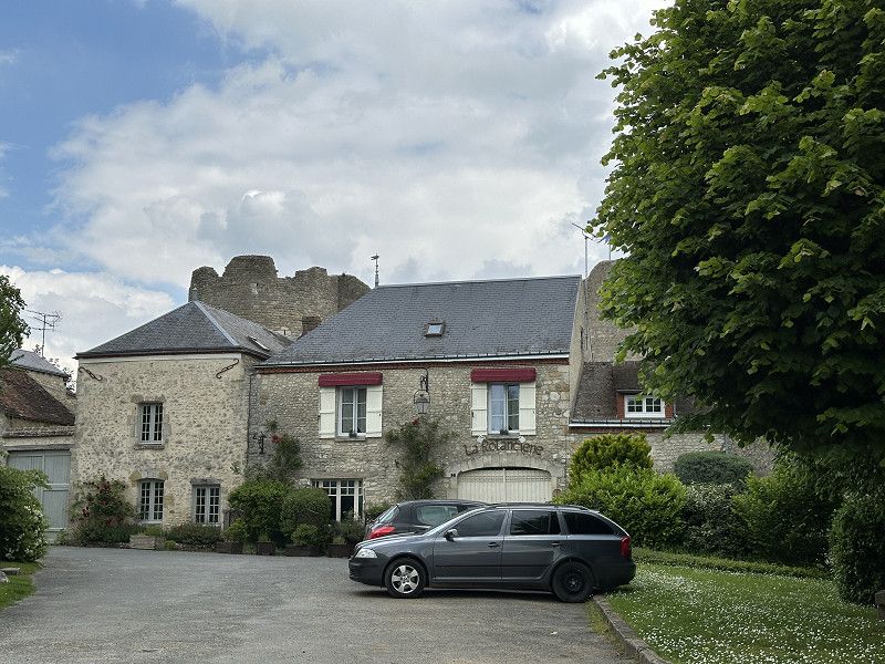
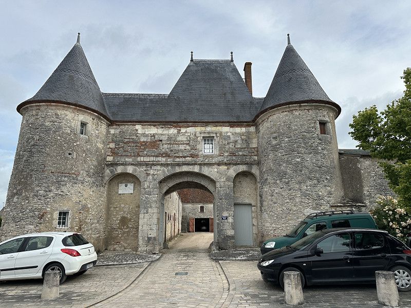
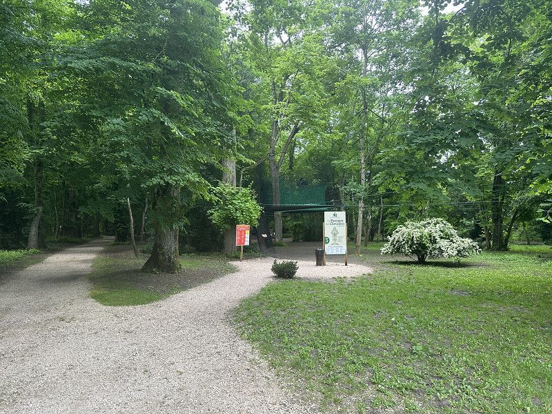
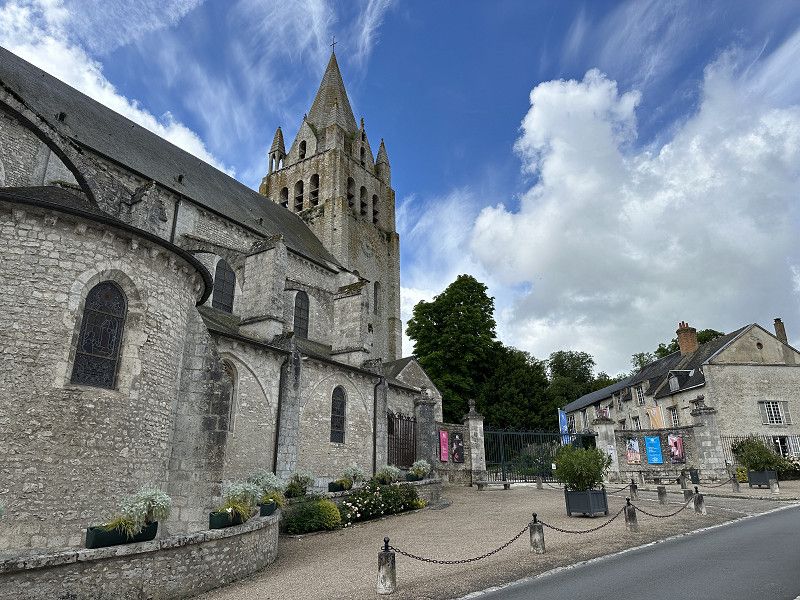
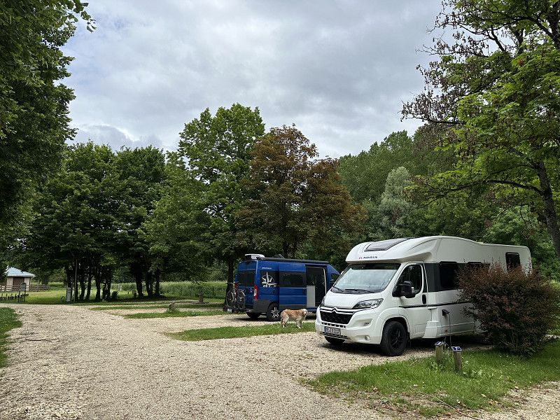
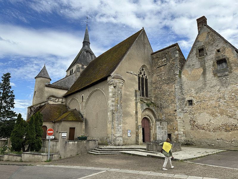
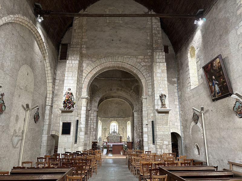
Yèvre-la-Ville
Nice little castle. If you're nearby, you can take a look. I took the toll, because without it it would have taken an hour longer to get to Orléans. On the way there was an Intermarché and a Carrefour where you could fill up relatively cheaply (20 cents cheaper).
Place du Château 4, Yèvre-la-Ville, Loiret, Zentrum-Loiretal, Frankreich
48° 9' 37.9" N 2° 20' 6.1" E
48.1605184 2.3350303
• Head toward Rue de la Basse-Cour on Place du Château. Go for 6 m.
• Turn slightly left onto Rue des Remparts. Go for 163 m.
• Turn right onto Rue des Tours. Go for 263 m.
• Turn slightly left onto Route de Pithiviers (D123). Go for 2.0 km.
• Continue on D123. Go for 1.5 km.
• Continue on Rue d'Yèvre le Chatel (D123). Go for 1.6 km.
• Turn left onto D623/D1000. Go for 239 m.
• Take the 1st exit from roundabout onto D623/D1000. Go for 393 m.
• Turn right onto Route de Boynes (D950). Go for 164 m.
• Take the 2nd exit from Rond-Point Porte du Gâtinais roundabout onto D928. Go for 1.8 km.
• Take the 4th exit from roundabout onto D2152 toward A19/Orléans/Chilleurs aux Bois. Go for 4.6 km.
• Pass 2 roundabouts and continue on D2152. Go for 7.8 km.
• Turn left onto Route de Gallerand (D109) toward Courcy aux L./Château de Chamerolles/Gallerand. Go for 2.5 km.
• Arrive at Route de Gallerand (D109). Your destination is on the left.
☍
23,1 km
( 20 min.)
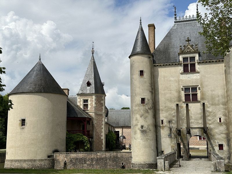
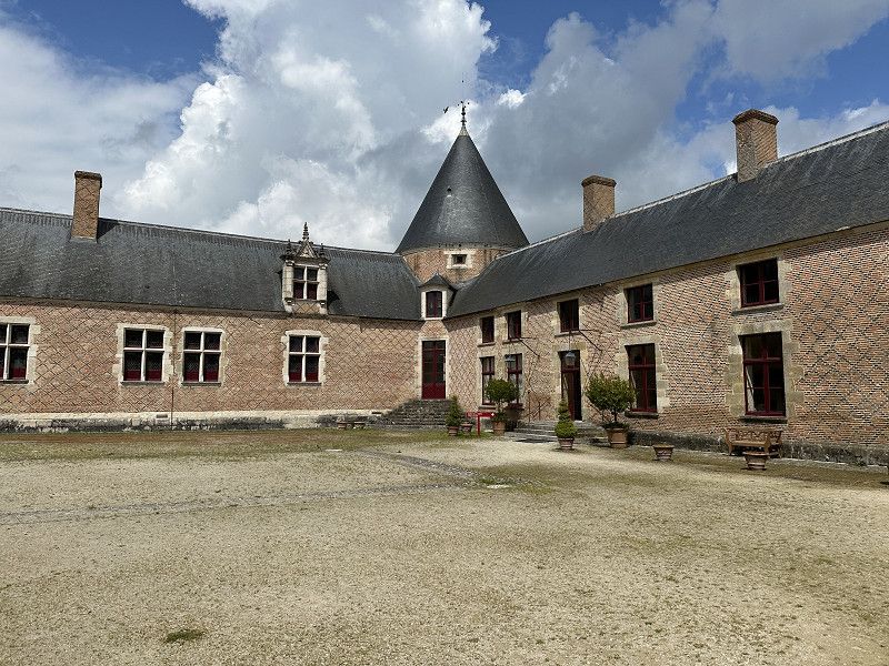
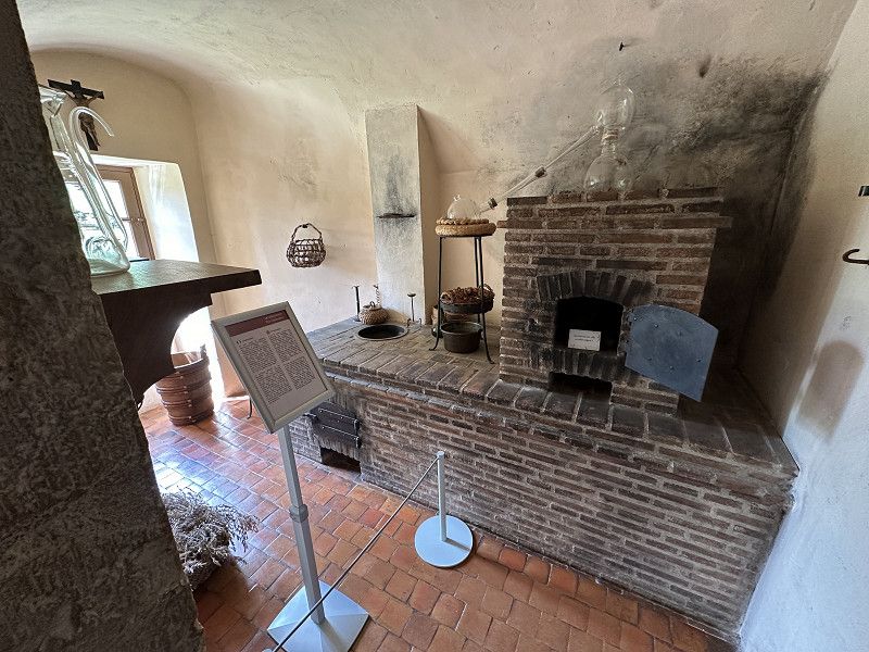
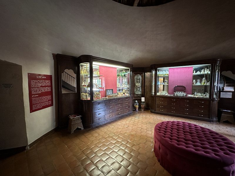
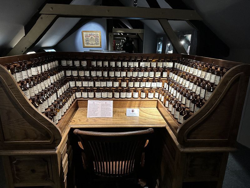
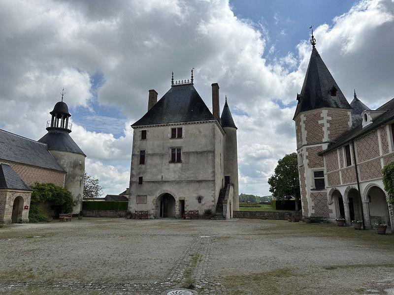
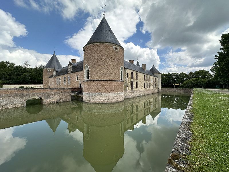
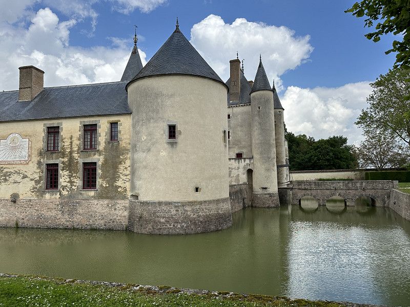
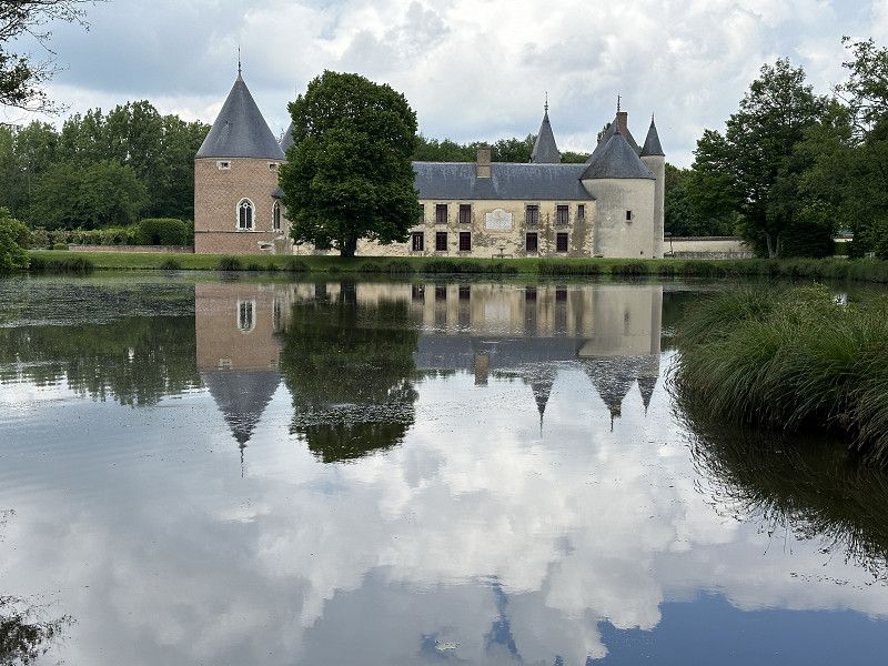
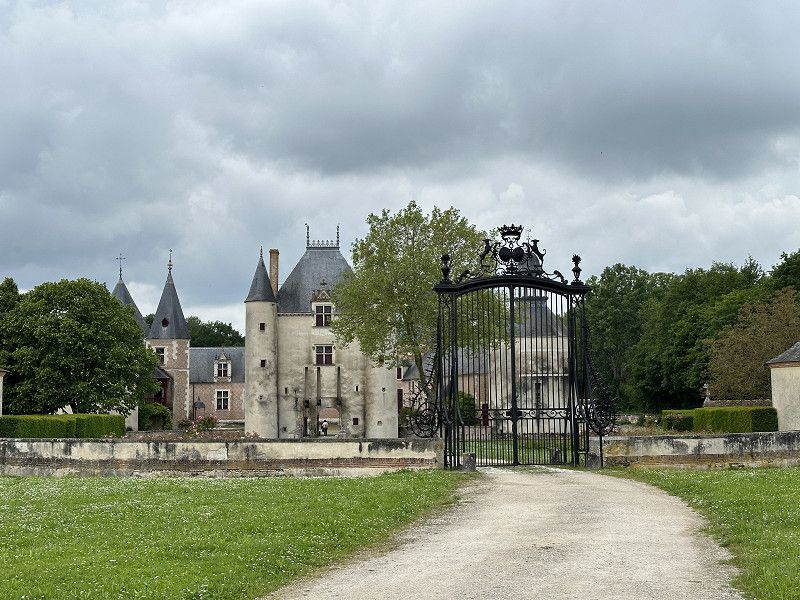
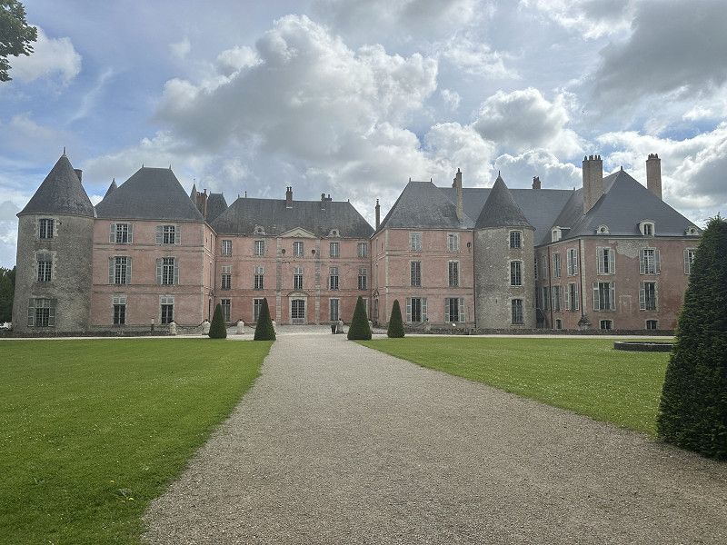
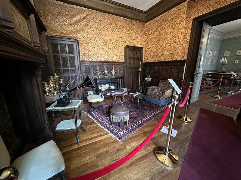
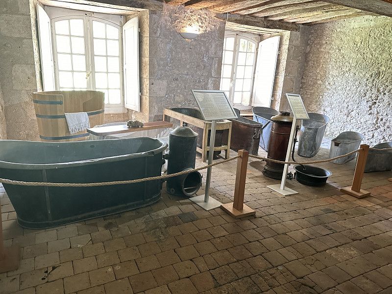
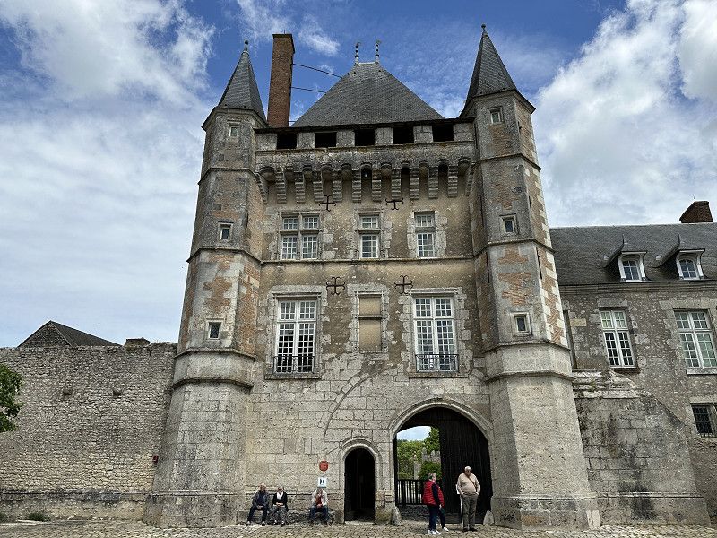
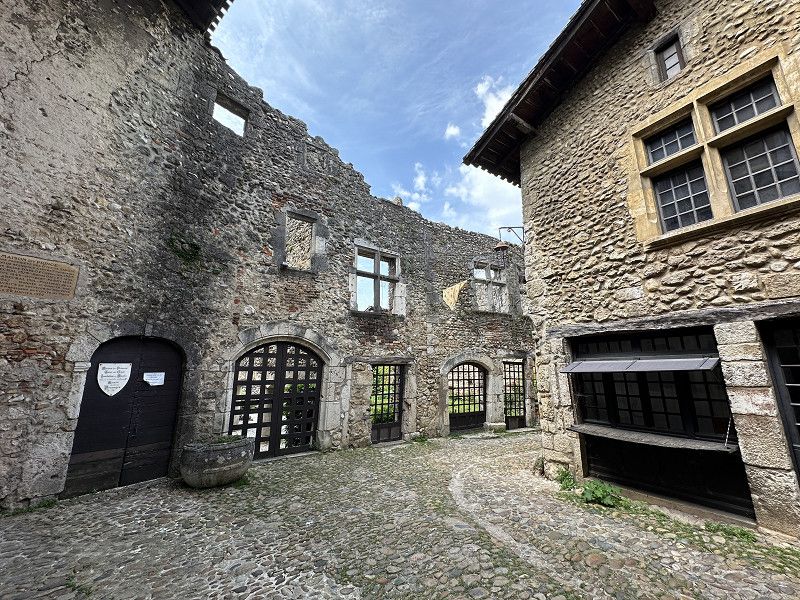
Château de Chamerolles
An interesting château with a focus on the history of perfume, its production and the corresponding bottles. The journey to Orléans was toll-free.
Route de Gallerand, Chilleurs-aux-Bois, Loiret, Zentrum-Loiretal, Frankreich
48° 3' 39.5" N 2° 9' 50.9" E
48.0609681 2.1641506
• Head east on Route de Gallerand (D109). Go for 164 m.
• Turn right toward Route de Gallerand/D109. Go for 325 m.
• Turn left onto Route de Gallerand (D109). Go for 2.8 km.
• Turn right onto Grande Rue (D2152). Go for 6.4 km.
• Take the 1st exit from roundabout onto A19 toward A19/Metz/Nancy/Montargis/Orléans. Go for 29.5 km.
• Continue toward Bordeaux/Orléans. Go for 464 m.
• Take the exit onto A10 (L'Aquitaine). Go for 15.1 km.
• Take the exit toward Toulouse/A20/Clermont-Fd/Vierzon/Orléans-la Source/Orléans-Centre/St Jean de la Ruelle onto Échangeur d'Orléans-Centre. Go for 2.3 km.
• Take the 2nd exit from roundabout onto Avenue Georges Pompidou toward Orléans-Centre/La Chapelle St Min. Go for 432 m.
• Turn right onto Route d'Orléans (D2152) toward Blois/La Chapelle St Min-Centre/Meung S/Loire/Beaugency. Go for 374 m.
• Pass 2 roundabouts and continue on Route d'Orléans (D2152). Go for 865 m.
• Turn left onto Rue de Verdun. Go for 288 m.
• Turn right onto Rue du Four. Go for 81 m.
• Turn left onto Rue du Château. Go for 129 m.
• Continue on Chemin de Fourneaux. Go for 58 m.
• Turn right onto Chemin de Fourneaux. Go for 338 m.
• Turn slightly left onto Chemin des Grèves. Go for 311 m.
• Arrive at Chemin des Grèves.
☍
60,0 km
( 40 min.)
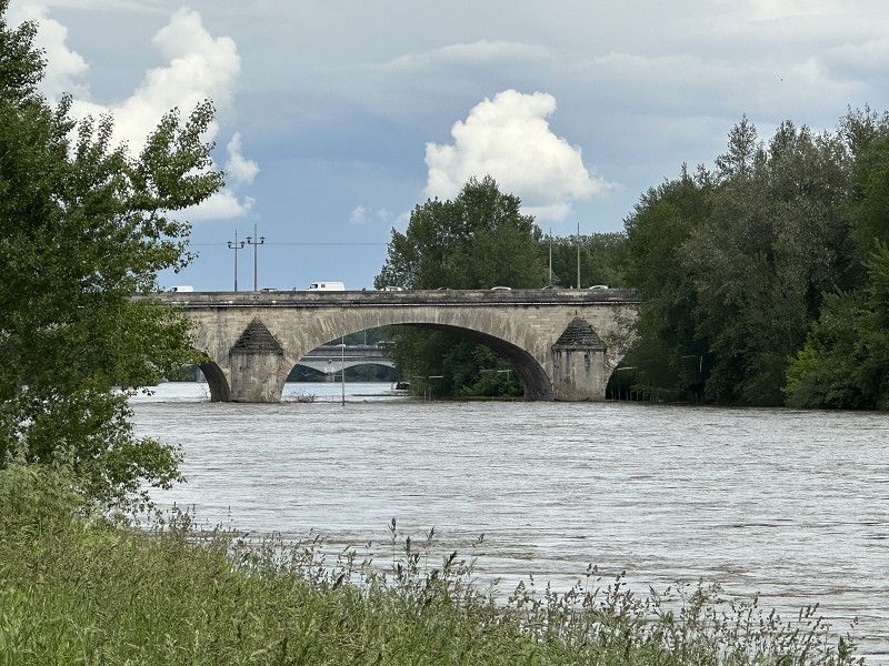
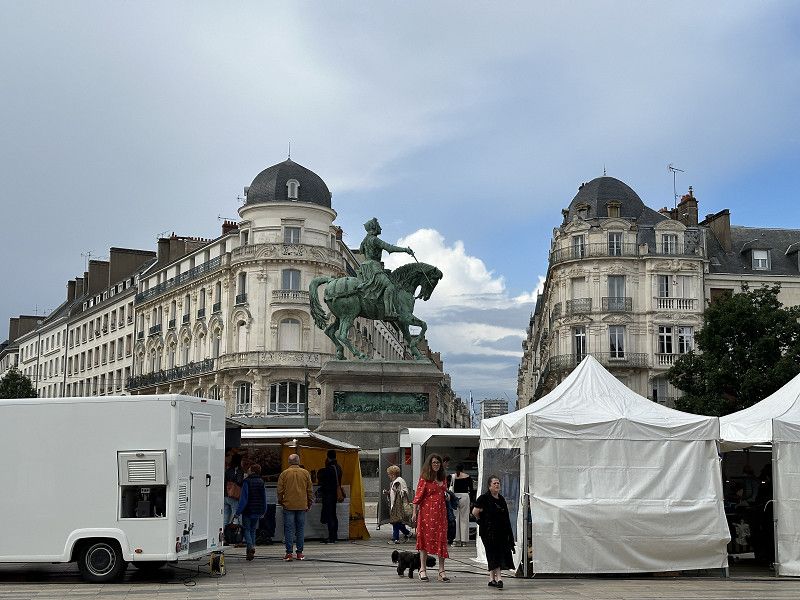
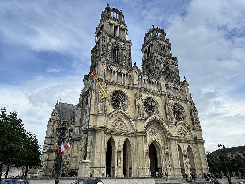
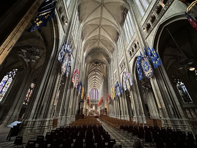
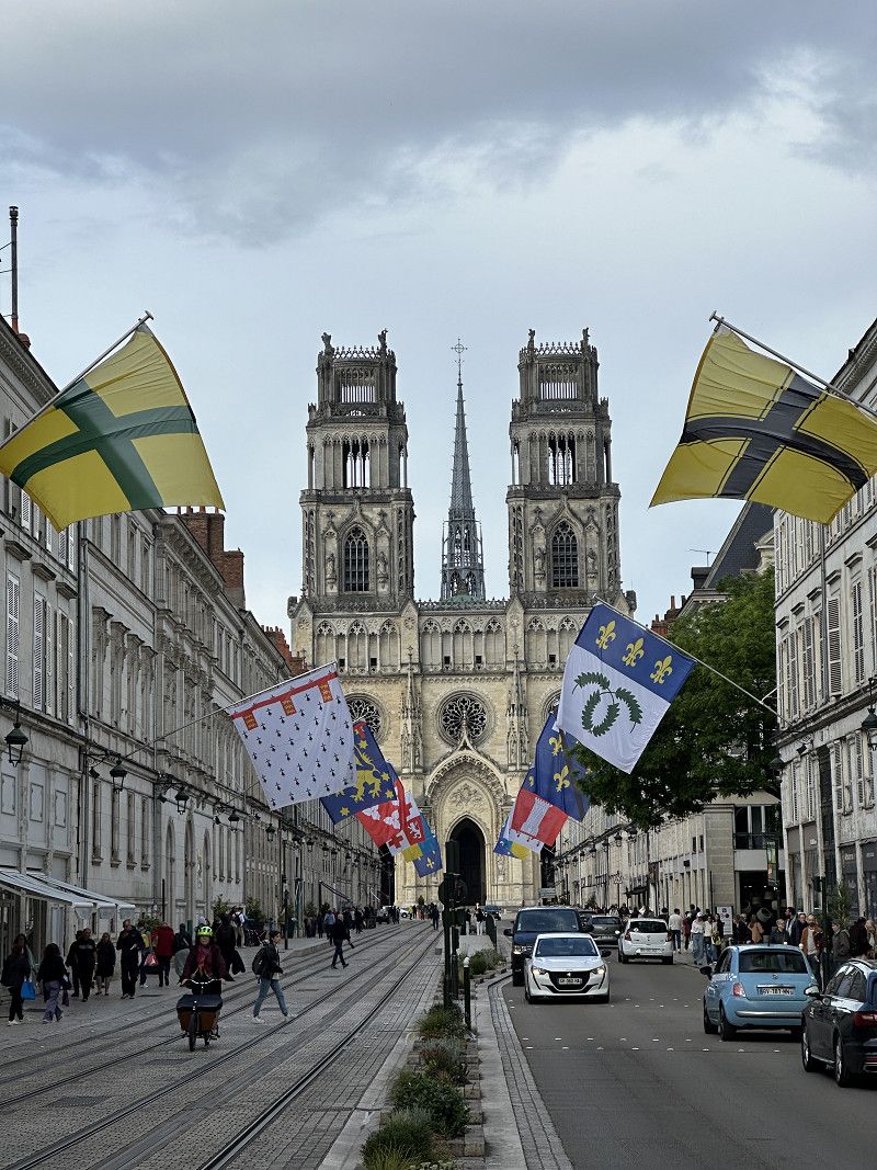
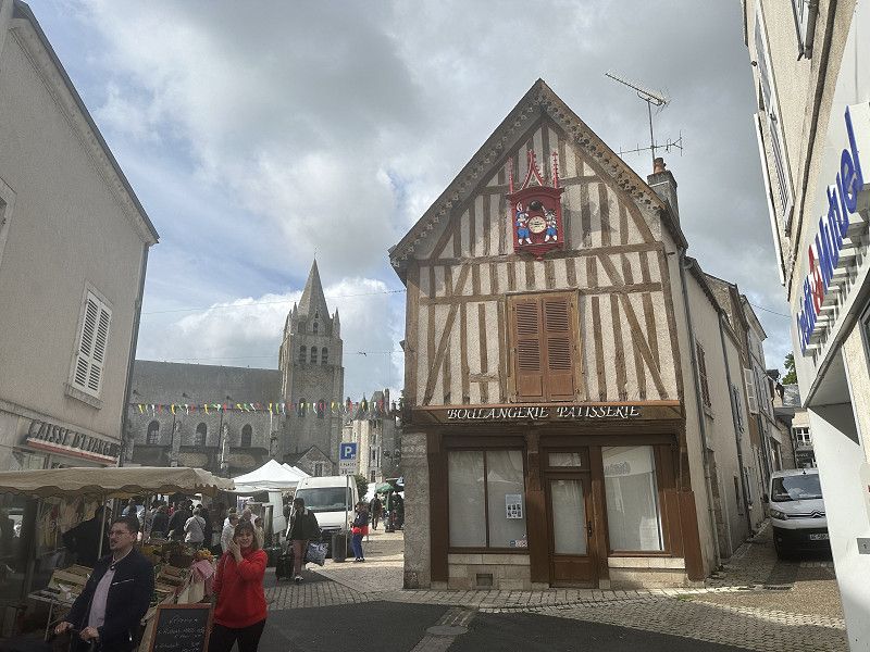
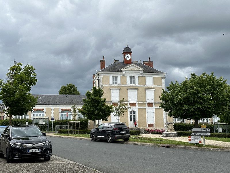
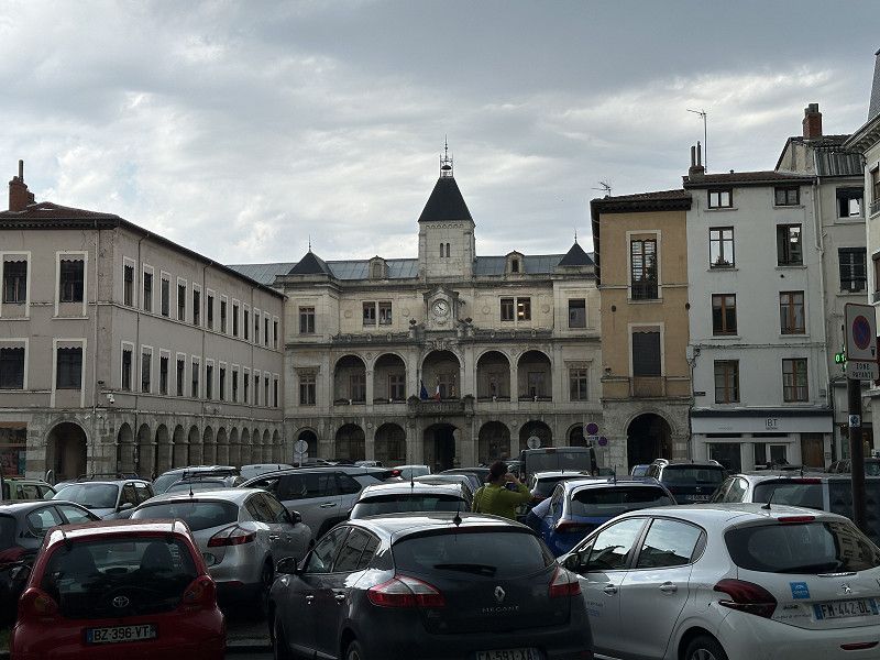
Orléans
Arrived in the afternoon and did a quick tour of the city. The historic city center is easy to reach by bike. Tomorrow I will explore the city more thoroughly. The parking space cost €19.20 for 2 nights including tourist tax.
Loiret, Zentrum, Frankreich
47° 52' 57.1" N 1° 50' 3.6" E
47.8825208 1.8343363
• Head northeast on Chemin des Grèves. Go for 311 m.
• Turn slightly right onto Chemin de Fourneaux. Go for 338 m.
• Turn left onto Chemin de Fourneaux. Go for 58 m.
• Turn right onto Rue du Petit Château. Go for 162 m.
• Continue on Place de l'Église. Go for 33 m.
• Continue on Rue de l'Église. Go for 41 m.
• Continue on Place du Bourg. Go for 25 m.
• Turn left onto Place du Bourg. Go for 60 m.
• Turn right onto Rue de la Bredauche. Go for 374 m.
• Turn left onto Rue Nationale (D2152). Go for 3.0 km.
• Pass 2 roundabouts and continue on Route Nationale (D2152). Go for 6.9 km.
• Take the 1st exit from roundabout toward Huisseau S/M./Patay/Château-Musée van Oeveren. Go for 1.9 km.
• Continue on D3. Go for 1.1 km.
• Turn left toward Rue de Préau/C. Go for 170 m.
• Turn right onto Rue de Préau (C). Go for 81 m.
• Turn left onto Route de Prelefort. Go for 564 m.
• Turn left toward Lieu-dit Prélefort. Go for 252 m.
• Continue on Lieu-dit Prélefort. Go for 31 m.
• Arrive at Lieu-dit Prélefort.
☍
15,4 km
( 21 min.)
Day
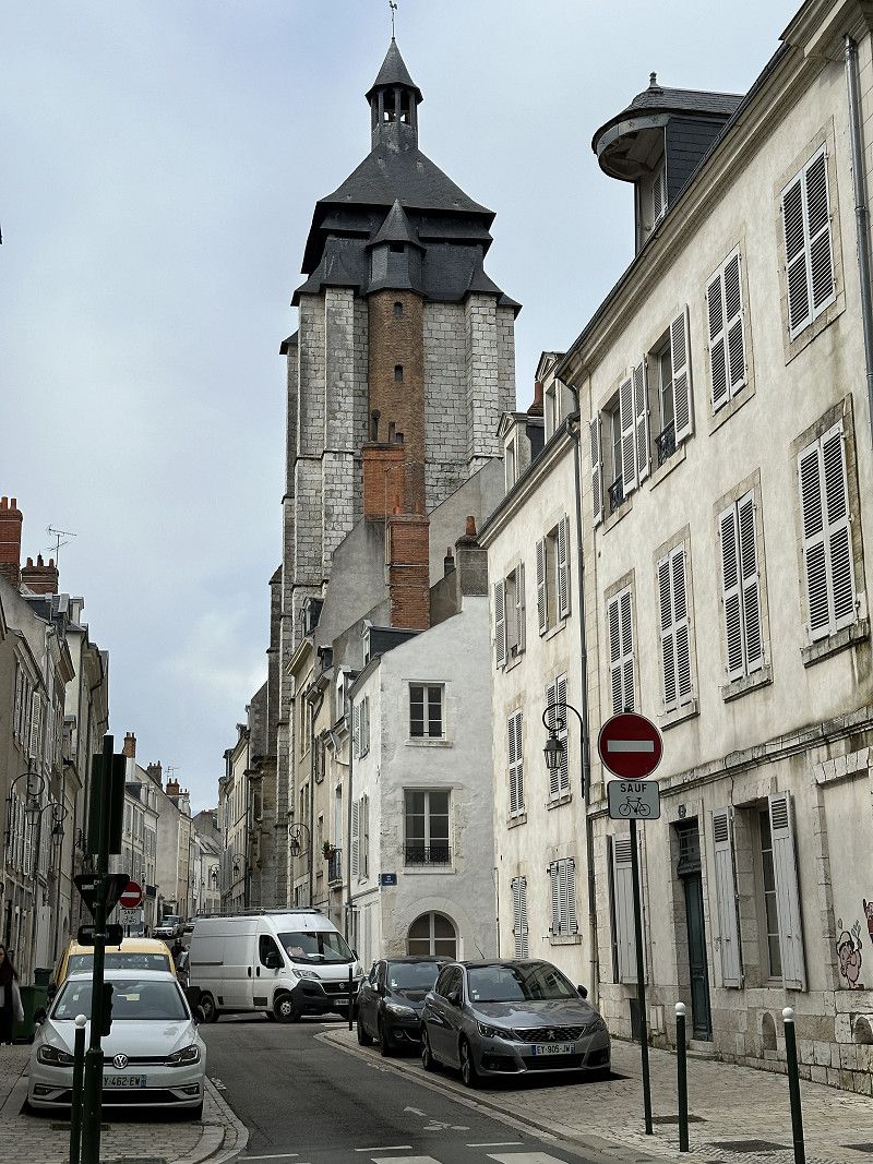
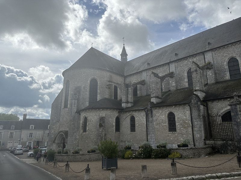
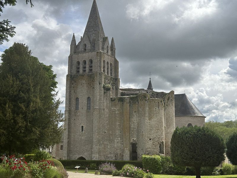
Besichtigung von Orléans
Went to the Jeanne d'Arc house and the Musée du Beaux Artes. The Jeanne d'Arc exhibition in Rouen was better, but covered more of the end. In Orléans it was more of the beginning. I also cycled through the old town and along the Loire.
Day
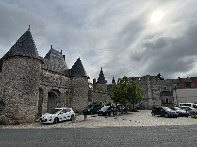
Château de Huisseau
The château is privately owned and was not open for tours. However, the local pastry shop had very tasty items.
Route de Prelefort, Huisseau-sur-Mauves, Loiret, Zentrum-Loiretal, Frankreich
47° 51' 48.3" N 1° 41' 18.6" E
47.8634125 1.6884973
• Head toward Impasse de Prélaville on Lieu-dit Prélefort. Go for 283 m.
• Turn right toward Route de Prelefort. Go for 277 m.
• Continue on Route de Prelefort. Go for 287 m.
• Turn right onto Rue de Préau (C). Go for 81 m.
• Turn left toward D3. Go for 170 m.
• Turn right onto D3. Go for 3.0 km.
• Take the 1st exit from roundabout onto Rue d'Orléans (D2152) toward A10/Blois/Meung S/L. Go for 3.0 km.
• Turn left onto Rue des Cordeliers (D18) toward La Ferté St Aubin/Cléry St A./Basilique de Cléry St A./Centre Ville/Château et Collégiale. Go for 370 m.
• Turn right onto Quai du Mail. Go for 125 m.
• Continue on Rue Emmanuel Troulet. Go for 123 m.
• Turn left onto Rue Jehan de Meung. Go for 24 m.
• Turn slightly left onto Place du Martroi. Go for 57 m.
• Turn left onto Place du Martroi. Go for 14 m.
• Continue on Rue du Cloître Saint-Liphard. Go for 63 m.
• Turn right onto Rue du Cloître Saint-Liphard. Go for 45 m.
• Arrive at Rue du Cloître Saint-Liphard. Your destination is on the right.
☍
7,9 km
( 11 min.)
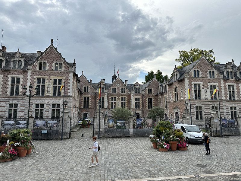
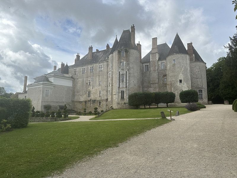
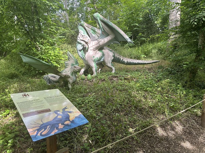
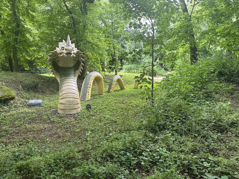
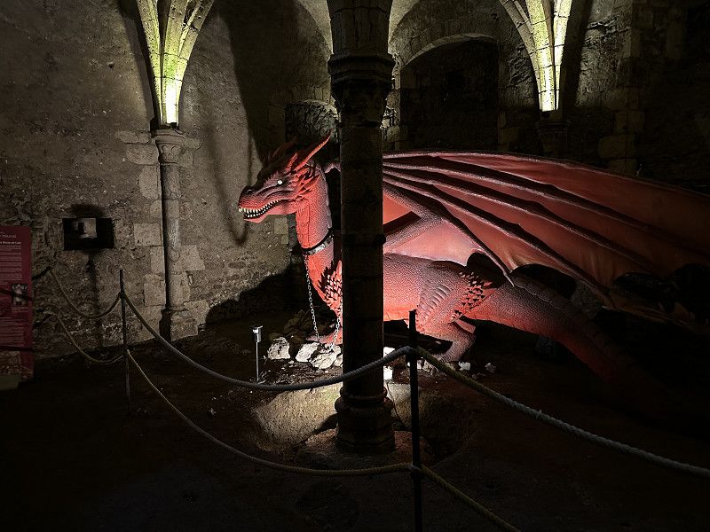
Château de Meung sur Loire
A good destination for families with children. Their main focus was the presentation of dragons from different cultures.
Impasse du Château, Meung-sur-Loire, Loiret, Zentrum, Frankreich
47° 49' 23.7" N 1° 41' 40.1" E
47.8232517 1.6944827
• Head northeast on Rue du Cloître Saint-Liphard. Go for 45 m.
• Continue on Rue du Docteur Henri Michel. Go for 48 m.
• Turn left onto Rue Emmanuel Troulet. Go for 78 m.
• Continue on Rue Porte d'Amont. Go for 160 m.
• Continue on Place du Maupas. Go for 45 m.
• Continue on Rue de la Barre. Go for 62 m.
• Turn left onto Rue Thibault Chemin. Go for 88 m.
• Turn right onto Rue de Blois. Go for 77 m.
• Turn right onto Rue de Blois (D2152). Go for 228 m.
• Turn left onto Rue de la Gare (D202). Go for 1.2 km.
• Take the 1st exit from roundabout onto D2 toward A10/Ouzouer le M. Go for 595 m.
• Take the 3rd exit from roundabout onto A10 (L'Aquitaine) toward Tours/Blois. Go for 17.5 km.
• Take exit 16 toward Chambord/Mer. Go for 751 m.
• Continue on D205. Go for 563 m.
• Take the 1st exit from roundabout onto Avenue Robert Bauer (D15) toward Marchenoir/Talcy/Z.I. des Portes de Chambord. Go for 265 m.
• Take the 2nd exit from roundabout onto Avenue Robert Bauer (D15). Go for 488 m.
• Take the 1st exit from roundabout onto Avenue Robert Bauer (D15). Go for 460 m.
• Take the 2nd exit from roundabout onto Rue Haute d'Aulnay (D15). Go for 200 m.
• Continue on Route de Talcy (D15). Go for 2.4 km.
• Continue on D15. Go for 2.9 km.
• Continue on Route de la Rose (D15). Go for 245 m.
• Turn right onto Route de la Rose (D15). Go for 96 m.
• Continue on D15. Go for 412 m.
• Continue on Rue du Moulin (D15). Go for 503 m.
• Turn left onto Rue du Château (D70 A). Go for 159 m.
• Arrive at Place Cassandre Salviati (D70 A). Your destination is on the right.
☍
29,5 km
( 25 min.)
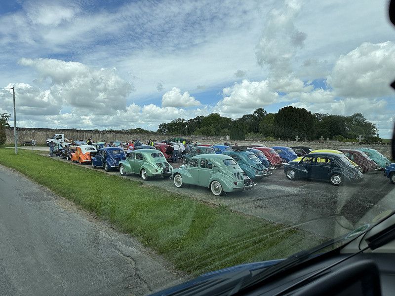
Château de Talcy
It would certainly have been interesting if I had paid more attention to the opening times. Lunch break from 12-2pm. But it was the start of a vintage car tour.
Rue du Château, Talcy, Loir-et-Cher, Zentrum, Frankreich
47° 46' 9.9" N 1° 26' 40.4" E
47.7694220 1.4445631
• Head toward Rue Fortuneau on Place Cassandre Salviati (D70 A). Go for 2.0 km.
• Continue on Rue de la Grande Ferme (D70 A). Go for 274 m.
• Continue on D50. Go for 1.5 km.
• Continue on Rue Pelée (D50). Go for 146 m.
• Turn right onto Grande Rue (D97). Go for 307 m.
• Continue on D50. Go for 1.2 km.
• Continue on Rue des Moissons (D50). Go for 1.5 km.
• Continue on Rue de la Pierre Maille (D112). Go for 238 m.
• Continue on D112. Go for 721 m.
• Turn right onto D50 A. Go for 655 m.
• Continue on Rue des Charmes (D50). Go for 299 m.
• Continue on Rue Principale (D50). Go for 982 m.
• Continue on Lieu-dit La Fouardière (D50). Go for 113 m.
• Continue on Rue Principale (D50). Go for 646 m.
• Continue on D50. Go for 71 m.
• Continue on Route de Blois (D50). Go for 2.9 km.
• Continue on D50. Go for 682 m.
• Continue on Rue des Bouleaux (D50). Go for 525 m.
• Continue on D50. Go for 683 m.
• Continue on Route du Moulin (D50). Go for 815 m.
• Continue on Route du Moulin (D50). Go for 151 m.
• Continue on D50. Go for 1.0 km.
• Continue on Lieu-dit La Vallée Saint-Jean (D50). Go for 112 m.
• Continue on D50. Go for 424 m.
• Continue toward D50. Go for 39 m.
• Take the 1st exit from roundabout onto D50. Go for 3.5 km.
• Take the 3rd exit from Rond-Point des Châteaux roundabout onto D956 toward Blois/D952 A. Go for 1.1 km.
• Take the 3rd exit from roundabout onto Boulevard des Cités Unies (D956) toward Blois-Sud. Go for 1.7 km.
• Take ramp. Go for 234 m.
• Turn right onto Avenue de Verdun (D952). Go for 11.2 km.
• Take the 2nd exit from roundabout onto D952 toward Onzain/Amboise. Go for 6.8 km.
• Take the 1st exit from roundabout onto Avenue du Général de Gaulle (D1) toward Onzain. Go for 568 m.
• Arrive at Avenue du Général de Gaulle (D1).
☍
43,1 km
( 43 min.)
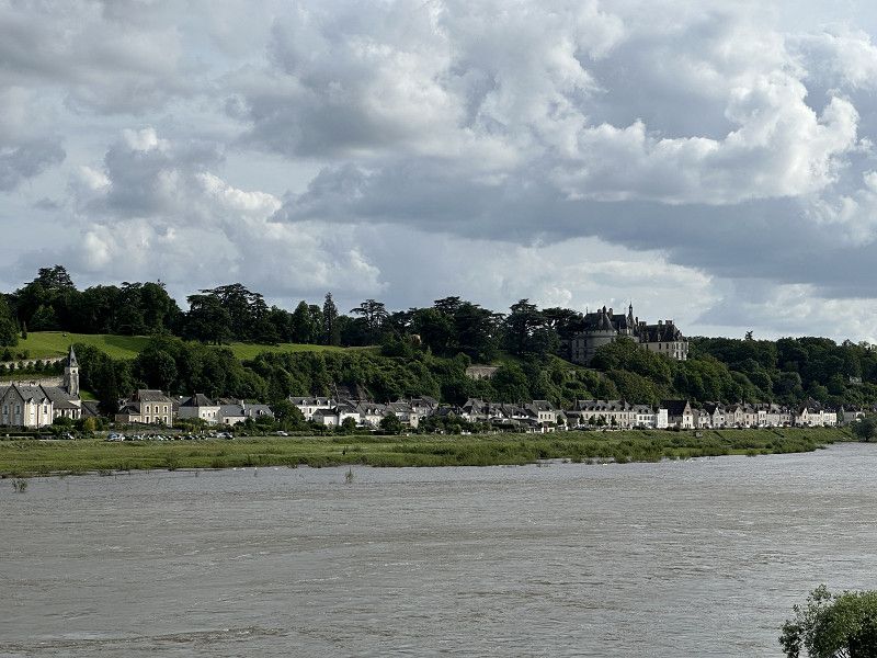
Veuzain-sur-Loire/Château Chaumont-sur-Loire
Pitch close to my favorite château, Château de Chaumont-sur-Loire
Avenue du Général de Gaulle 1, Veuzain-sur-Loire, Loir-et-Cher, Zentrum-Loiretal, Frankreich
47° 29' 28.4" N 1° 11' 7.8" E
47.4912116 1.1855086
• Head toward Allée des Grillons on Avenue du Général de Gaulle (D1). Go for 536 m.
• Take the 2nd exit from roundabout onto D1 toward Chaumont S/L. Go for 646 m.
• Turn right onto Rue du Maréchal Leclerc (D114). Go for 302 m.
• Turn left onto Rue du Village Neuf (D114). Go for 688 m.
• Take the 2nd exit from roundabout onto Rue du Village Neuf (D114). Go for 7.0 km.
• Keep right onto D114. Go for 9 m.
• Continue on D139. Go for 8.0 km.
• Continue on Route des Roches (D62). Go for 1.2 km.
• Turn slightly right onto Rue des Anciens Combattants (D62). Go for 296 m.
• Turn left onto Route de Vierzon (D176). Go for 1.0 km.
• Turn right onto Route d'Ange (D158). Go for 255 m.
• Continue on D158. Go for 765 m.
• Take the 3rd exit from roundabout onto D976. Go for 9.4 km.
• Take the 3rd exit from roundabout toward A85/Tours/Bourges/Vierzon. Go for 132 m.
• Take ramp onto A85 toward Bourges/Vierzon. Go for 55.6 km.
• Take the left exit toward Lyon/Bourges/Vierzon onto A71. Go for 5.4 km.
• Take the exit toward Toulouse/Limoges/Châteauroux/Vierzon-Centre onto A20 (L'Occitane). Go for 10.5 km.
• Take exit 8 toward Massay/Reuilly. Go for 130 m.
• Continue on D2020. Go for 565 m.
• Turn right onto Lieu-dit Les Boirreaux (D2020). Go for 2.2 km.
• Turn left onto Rue Édouard Vaillant (D75). Go for 573 m.
• Take the 2nd exit from roundabout onto Route de Reuilly (D75). Go for 5.4 km.
• Continue on D28 C. Go for 1.8 km.
• Continue on Avenue du Président Wilson (D28). Go for 688 m.
• Continue on Place des Écoles (D27). Go for 192 m.
• Turn left onto Rue de la République. Go for 241 m.
• Turn right onto Rue de la Gare. Go for 184 m.
• Continue on Rue des Ponts. Go for 100 m.
• Arrive at Rue des Ponts.
☍
113,9 km
(1 hrs. 15 min.)
Day
Reuilly
Camping Car Park pitch, former campsite also with sanitary facilities, although they have become outdated over the years. It was nice to have a proper shower again.
Rue des Ponts, Reuilly, Indre, Zentrum-Loiretal, Frankreich
47° 5' 8.7" N 2° 2' 55.5" E
47.0857441 2.0487626
• Head southeast on Rue des Ponts. Go for 293 m.
• Turn left onto D918. Go for 685 m.
• Take the 1st exit from roundabout onto D23. Go for 9.6 km.
• Take the 2nd exit from roundabout onto Lieu-dit Les Ronces (D23). Go for 13.4 km.
• Take the 1st exit from roundabout onto Rocade Ouest (D400) toward A71/Montluçon/Châteauroux/Moulins/La Chapelle St Ursin. Go for 716 m.
• Take the 2nd exit from roundabout onto Rocade Ouest (D400) toward A71. Go for 3.2 km.
• Take the 3rd exit from roundabout onto Rocade Sud (N142) toward A71/Vierzon/Orléans/Montluçon/Moulins/Bourges-Sud. Go for 500 m.
• Take the 2nd exit from roundabout onto A71 toward Montluçon. Go for 71.4 km.
• Take exit 9 toward Vallon en Sully. Go for 698 m.
• Continue on D553. Go for 70 m.
• Turn slightly right toward A714/Montluçon/Desertines/Estivareilles. Go for 52 m.
• Turn left onto D2144 toward A714/Montluçon/Desertines/Estivareilles. Go for 12.1 km.
• Pass 3 roundabouts and continue on Route de Paris (D2144). Go for 6.5 km.
• Turn right onto Avenue du Général de Gaulle toward Centre Ville. Go for 129 m.
• Take the 2nd exit from Avenue du Général de Gaulle roundabout onto Avenue du Général de Gaulle. Go for 300 m.
• Turn right onto Avenue du 8 Mai 1945. Go for 36 m.
• Continue on Boulevard de Courtais. Go for 256 m.
• Turn right onto Place Jean Jaurès. Go for 26 m.
• Arrive at Place Jean Jaurès. Your destination is on the right.
☍
119,9 km
(1 hrs. 17 min.)
Day
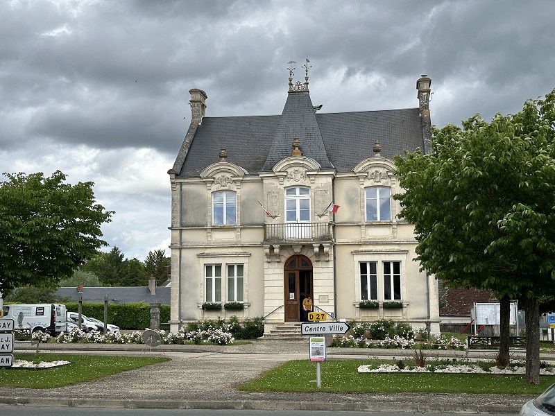
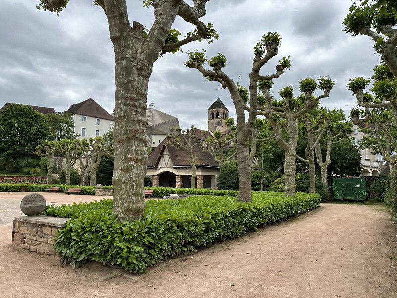
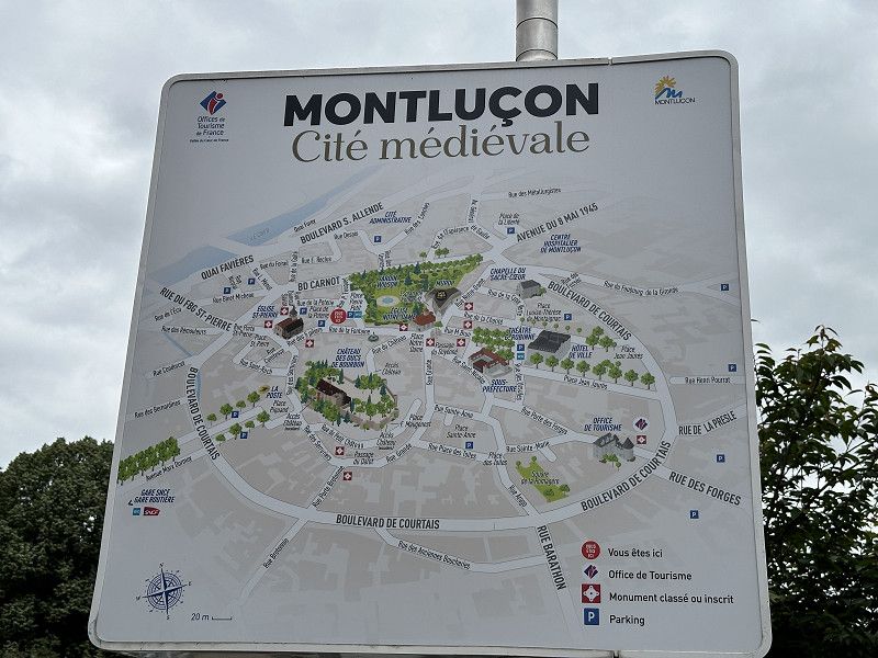
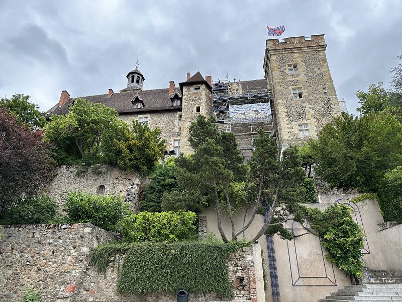
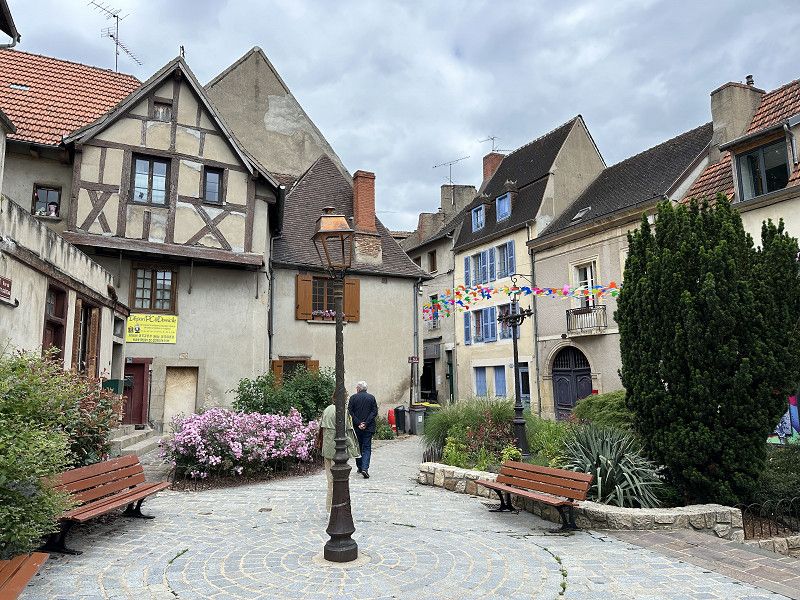
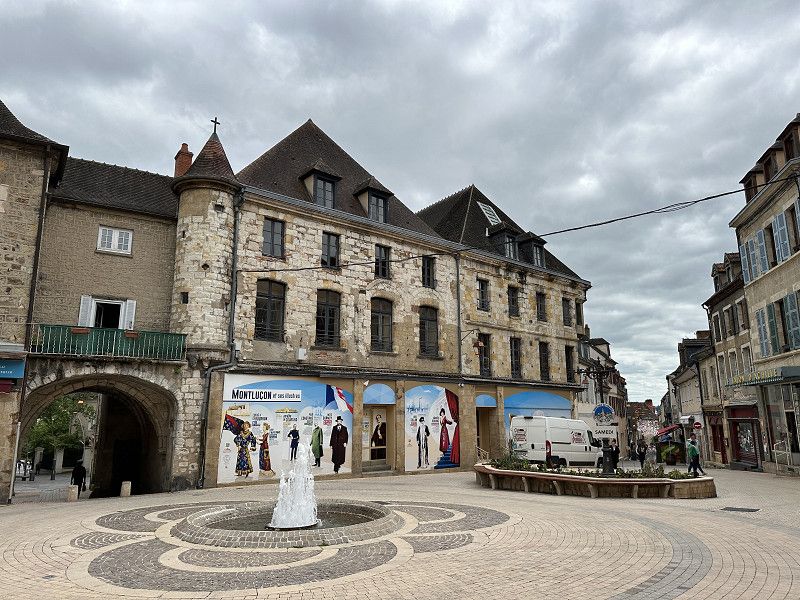
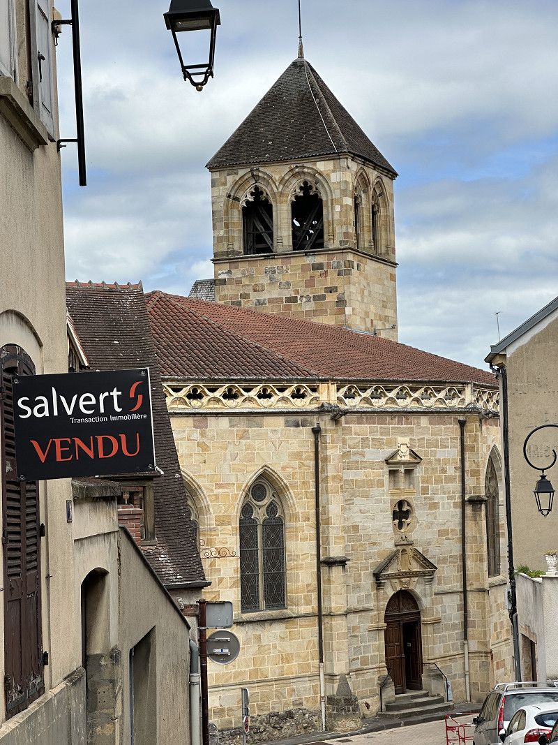
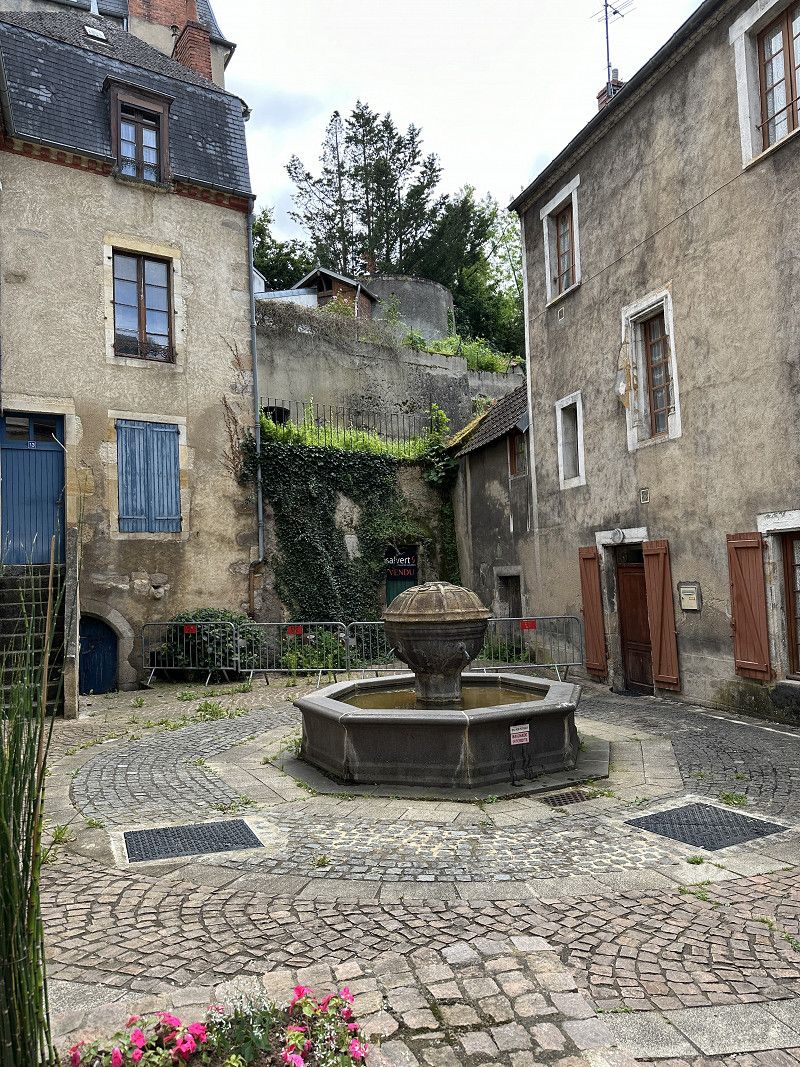
Montluçon
Interesting place near Neris-les-Bains
Allier, Auvergne-Rhone-Alpen, Frankreich
46° 20' 24.1" N 2° 36' 26.6" E
46.3400296 2.6073963
• Head west on Place Jean Jaurès. Go for 82 m.
• Turn left onto Place Jean Jaurès. Go for 18 m.
• Continue on Place de la Comédie. Go for 63 m.
• Turn left onto Place Jean Jaurès. Go for 125 m.
• Turn right onto Boulevard de Courtais. Go for 91 m.
• Turn left onto Rue des Forges. Go for 240 m.
• Turn right onto Rue des Forges (D2144). Go for 7.0 km.
• Take the 2nd exit from roundabout onto Boulevard des Arènes (D2144) toward Clermont Fd/Commentry/Gannat. Go for 1.5 km.
• Arrive at D2144. Your destination is on the right.
☍
9,1 km
( 11 min.)
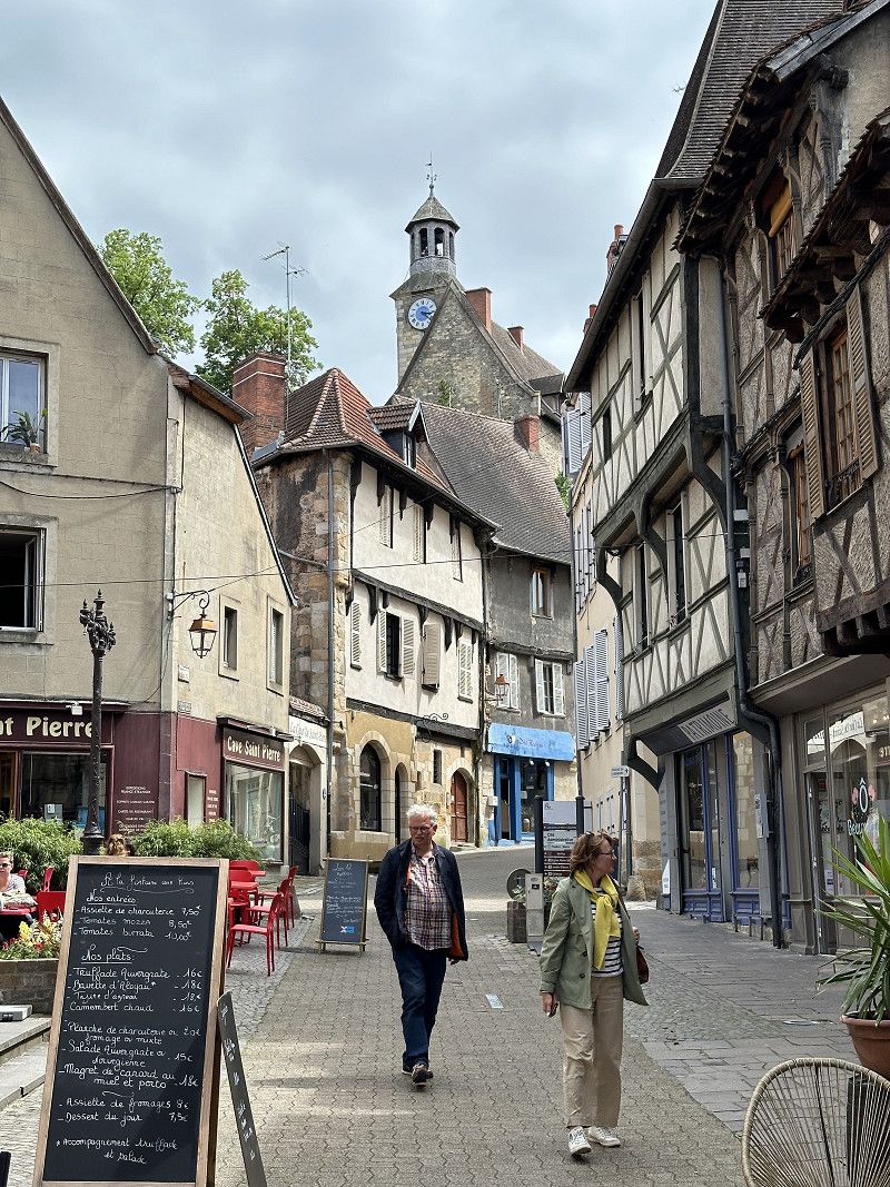
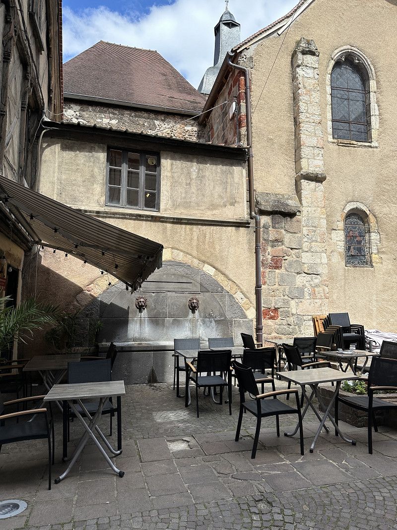
Néris-les-Bains
Camping Car Park very quiet, nice view
Allier, Auvergne-Rhone-Alpen, Frankreich
46° 16' 51" N 2° 40' 20.8" E
46.2808324 2.6724421
• Head southeast on D2144. Go for 4.0 km.
• Pass 2 roundabouts and continue on Avenue du Bourbonnais (D2144). Go for 15.9 km.
• Take the 3rd exit from roundabout onto Rue du Puy de Dôme (D2144) toward Clermont Fd/A71/Riom/Menat. Go for 3.7 km.
• Pass 2 roundabouts and continue on D2144. Go for 29.0 km.
• Take the 3rd exit from roundabout toward Paris/Bordeaux/Clermont-Fd/Riom. Go for 1.3 km.
• Turn right toward A71. Go for 95 m.
• Turn right and take ramp onto A71 toward Bordeaux/Lyon/Clermont-Fd/Riom. Go for 22.1 km.
• Continue on A71. Go for 200 m.
• Take the exit toward E70/Lyon/St Étienne/Thiers onto A89. Go for 29.0 km.
• Take exit 29 toward Vichy/Thiers-Centre/Courpière. Go for 568 m.
• Continue toward D906. Go for 46 m.
• Pass 3 roundabouts and continue on D906. Go for 11.6 km.
• Take the 3rd exit from roundabout onto Avenue Jean Jaurès (D906) toward Le Puy/Olliergues/Ambert. Go for 2.1 km.
• Pass 2 roundabouts and continue on Route de Clermont (D906). Go for 36.4 km.
• Take the 3rd exit from Place Georges Courtial roundabout onto Place Georges Courtial toward D106/St Étienne/Valcivières. Go for 191 m.
• Turn slightly right onto Boulevard de l'Europe. Go for 104 m.
• Turn right onto Rue Fontaine de Goye. Go for 37 m.
• Arrive at Rue Fontaine de Goye. Your destination is on the left.
☍
156,4 km
(1 hrs. 51 min.)
Day
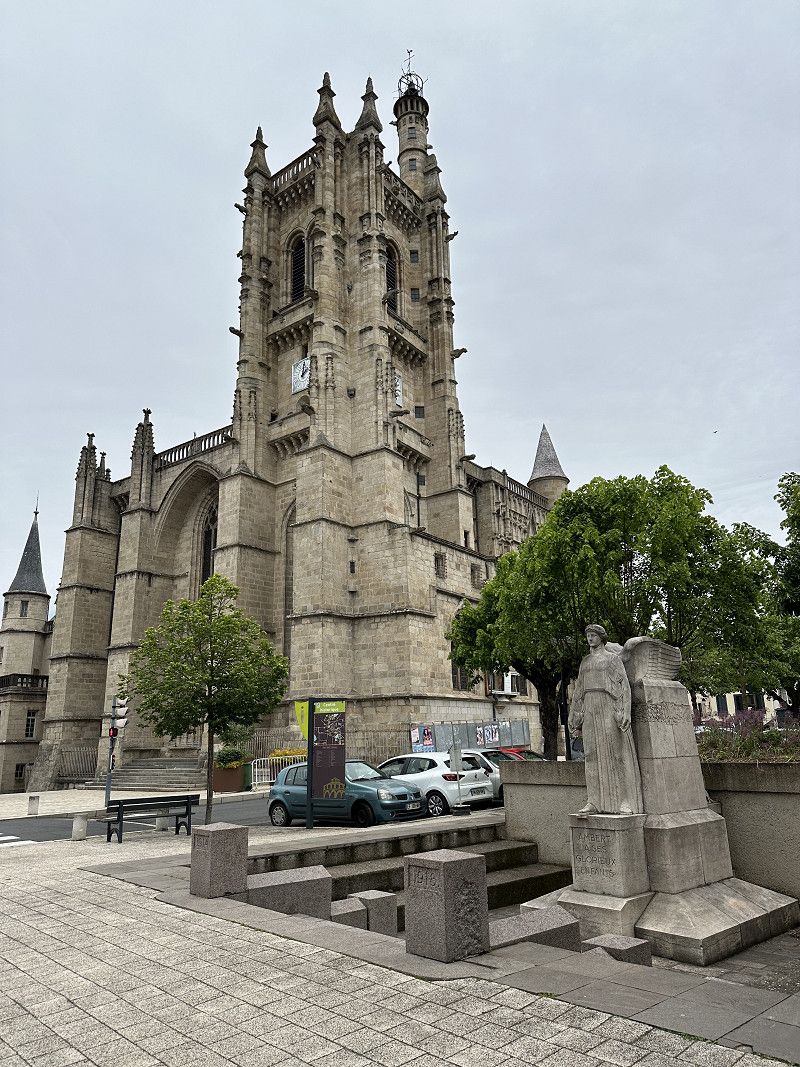
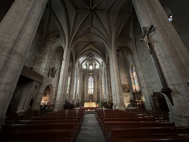
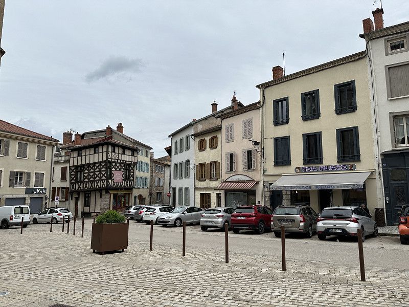
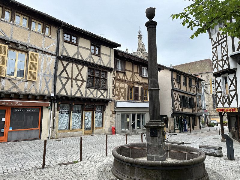
Ambert
Small town. Medieval town centre.
Puy-de-Dôme, Auvergne-Rhone-Alpen, Frankreich
45° 33' 1.6" N 3° 44' 33.5" E
45.5504338 3.7426390
• Head toward Boulevard de l'Europe on Rue Fontaine de Goye. Go for 37 m.
• Turn left onto Boulevard de l'Europe. Go for 104 m.
• Turn slightly left onto Boulevard de la Portette. Go for 154 m.
• Take the 3rd exit from Place Georges Courtial roundabout onto Avenue Georges Clemenceau (D906) toward Le Puy en V. Go for 1.7 km.
• Take the 2nd exit from roundabout onto Route du Puy (D906) toward Le Puy/Marsac en L./Arlanc/La Chaise-Dieu. Go for 1.3 km.
• Take the 3rd exit from roundabout onto Route du Puy toward Le Puy/Arlanc/Marsac en L. Go for 32.0 km.
• Continue on Route de la Chaise Dieu (D13). Go for 21.3 km.
• Take the 3rd exit from roundabout onto Avenue Pierre Julien (D906) toward Le Puy en Velay. Go for 3.8 km.
• Take the 3rd exit from roundabout onto Route Nationale (D902). Go for 5.8 km.
• Take the 1st exit from roundabout onto D902 toward Le Puy en Velay. Go for 4.2 km.
• Turn left onto Avenue d'Aiguilhe (D13) toward St Étienne/Annonay/Valence/Dyke St Michel. Go for 815 m.
• Arrive at Rocade d'Aiguilhe (D13).
☍
71,1 km
( 55 min.)
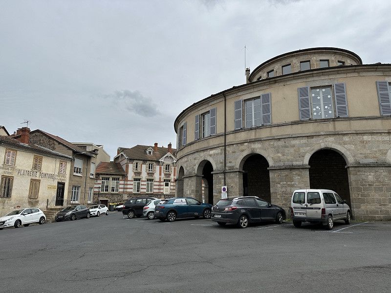
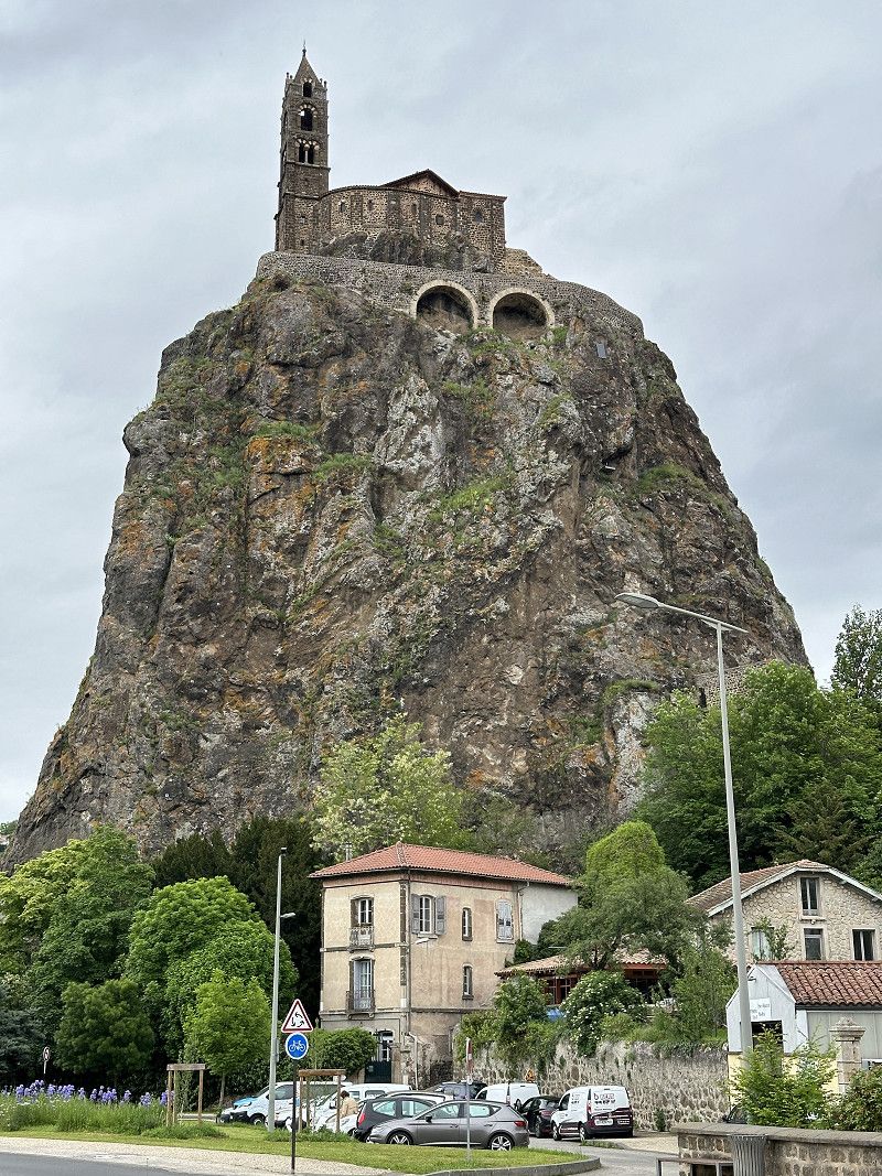
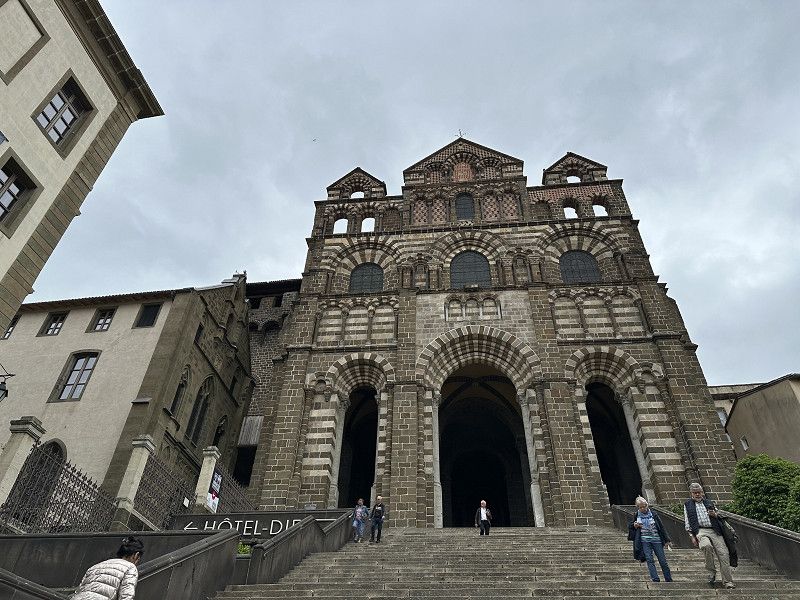
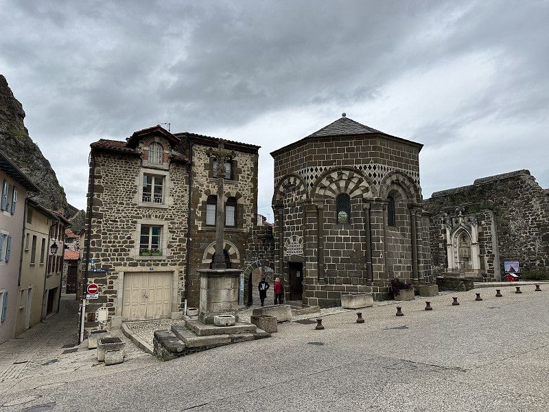
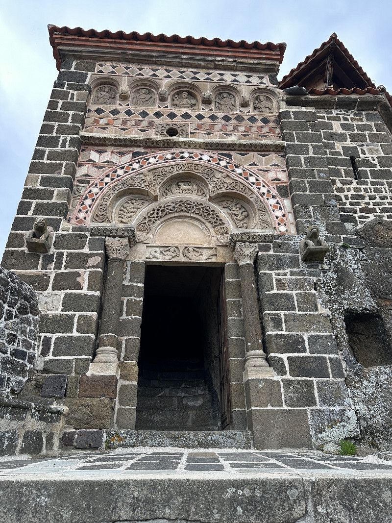
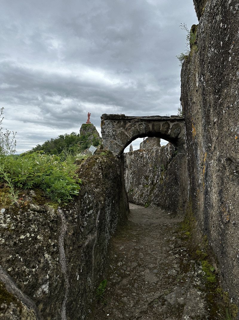
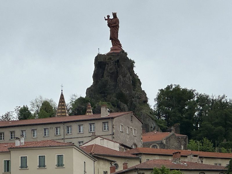
Le Puy-en-Velay
Free parking at the Rocher St. Michel. The place is definitely worth seeing. Entrance to the Rocher 7€
Haute-Loire, Auvergne-Rhone-Alpen, Frankreich
45° 3' 0.4" N 3° 53' 10" E
45.0501091 3.8861042
• Head southeast on Rocade d'Aiguilhe (D13). Go for 131 m.
• Take the 4th exit from roundabout onto Rocade d'Aiguilhe (D13) toward Clermont-Fd/Aurillac/Vichy. Go for 1.0 km.
• Turn left onto Boulevard Carnot toward Aubenas/Mende/Montélimar/Centre Ville. Go for 311 m.
• Turn right onto Boulevard Gambetta (D589) toward Espaly/Saugues/Aéroport Loudes. Go for 389 m.
• Take the 3rd exit from roundabout onto D589. Go for 8.4 km.
• Pass 2 roundabouts and continue on Route de Malzieu (D589). Go for 48.4 km.
• Continue on D989. Go for 4.2 km.
• Turn left onto D989. Go for 12.3 km.
• Turn right onto Boulevard Robert de Flers. Go for 257 m.
• Continue on Faubourg du Pont (D47). Go for 175 m.
• Turn right onto Route de Saint-Chély (D989). Go for 8.0 km.
• Take the 2nd exit from roundabout onto D989. Go for 467 m.
• Take the 3rd exit from roundabout onto Avenue du Malzieu (D989). Go for 434 m.
• Take the 1st exit from roundabout onto Rue de la Chicane (D989). Go for 372 m.
• Take the 2nd exit from roundabout onto Avenue de la République (D989). Go for 165 m.
• Keep right onto Rue Théophile Roussel (D989). Go for 230 m.
• Turn right onto Avenue de la Gare (D989). Go for 276 m.
• Take the 3rd exit from roundabout onto Boulevard Guérin d'Apcher (D809). Go for 344 m.
• Take the 1st exit from roundabout onto Rue des Martyrs du Maquis (D10). Go for 812 m.
• Continue on D10. Go for 441 m.
• Continue on Route des Bessons (D10). Go for 214 m.
• Continue on Lieu-dit La Roueyre (D10). Go for 469 m.
• Continue on D10. Go for 8.3 km.
• Continue on Lieu-dit La Baraque des Gouttes (D10). Go for 101 m.
• Continue on D10. Go for 2.9 km.
• Turn right onto D10. Go for 2.9 km.
• Turn right onto D987. Go for 19.2 km.
• Turn left onto D987. Go for 21.3 km.
• Take the 1st exit from roundabout onto Avenue de l'Argent (D987). Go for 4.5 km.
• Continue on Boulevard de Guizard (D921). Go for 89 m.
• Take the 2nd exit from roundabout onto Boulevard de Guizard (D920). Go for 465 m.
• Continue on Place Saint-Georges (D920) toward Rodez/Bozouls/Millau/Château de Calmont. Go for 3.2 km.
• Turn right onto Chemin de l'Église toward La Remise. Go for 177 m.
• Turn left onto D108. Go for 504 m.
• Continue on Lieu-dit Les Quatre Routes (D920). Go for 4.6 km.
• Take the 2nd exit from roundabout onto Route d'Espalion (D920) toward Rodez. Go for 588 m.
• Take the 2nd exit from roundabout onto Route de Rodez (D988) toward Rodez. Go for 9.7 km.
• Continue on D1088. Go for 3.4 km.
• Take the 2nd exit from roundabout onto D1088 toward A75/Rodez/Onet le Château. Go for 2.9 km.
• Turn right toward Albi/Rodez/Onet le Château. Go for 320 m.
• Continue on Rocade de Saint-Mayme (N88). Go for 1.4 km.
• Take the 3rd exit from Giratoire de Saint-Marc roundabout onto Rocade de Saint-Mayme (N88) toward Decazeville/Montauban/Albi. Go for 1.8 km.
• Take the 2nd exit from Giratoire des Moutiers roundabout onto N88 toward Decazeville/Montauban/Aéroport. Go for 504 m.
• Take the 3rd exit from Giratoire de Saint-Félix roundabout onto N88 toward Carmaux/Albi/Olemps/La Primaube/Baraqueville/Pont de Salars/C.H.S. Ste-Marie. Go for 60.6 km.
• Take the 3rd exit from Giratoire de la Tête roundabout onto Lieu-dit La Piboulette (N88) toward Albi/Lescure d'Albigeois/St Juéry. Go for 3.8 km.
• Pass 3 roundabouts and continue on Route de Rodez (N88). Go for 2.9 km.
• Take the 1st exit from Giratoire de Larquipeyre roundabout onto Avenue Albert Thomas (D988) toward Albi-Centre/Cordes/Cagnac les M. Go for 214 m.
• Take the 2nd exit from roundabout onto Avenue Albert Thomas (D90). Go for 1.8 km.
• Turn left onto Rue de Litou (D600). Go for 862 m.
• Arrive at Lices Georges Pompidou (D600). Your destination is on the right.
☍
246,9 km
(3 hrs. 12 min.)
Day
Auf dem Weg nach Albi
The path was very beautiful, although quite strenuous.
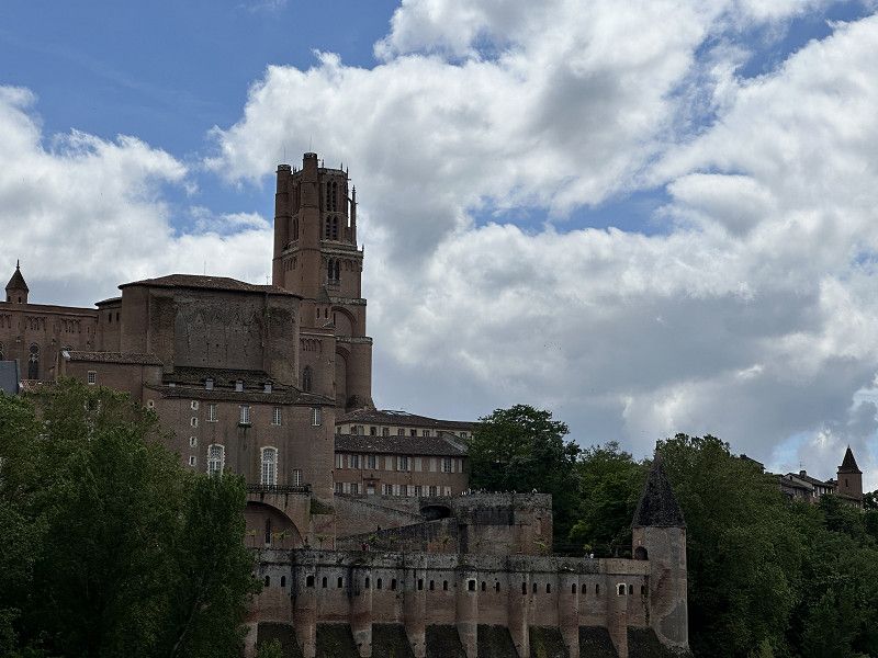
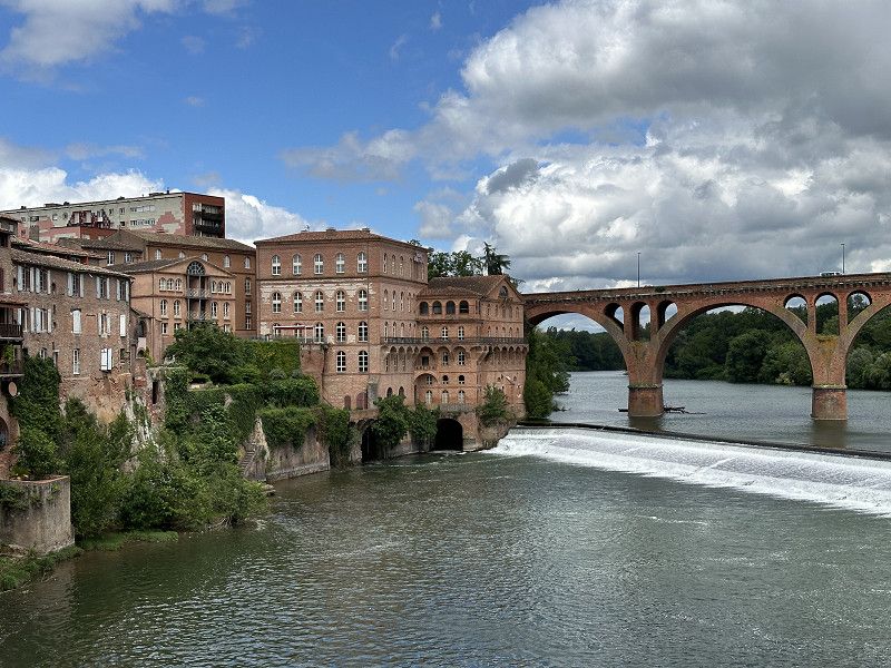
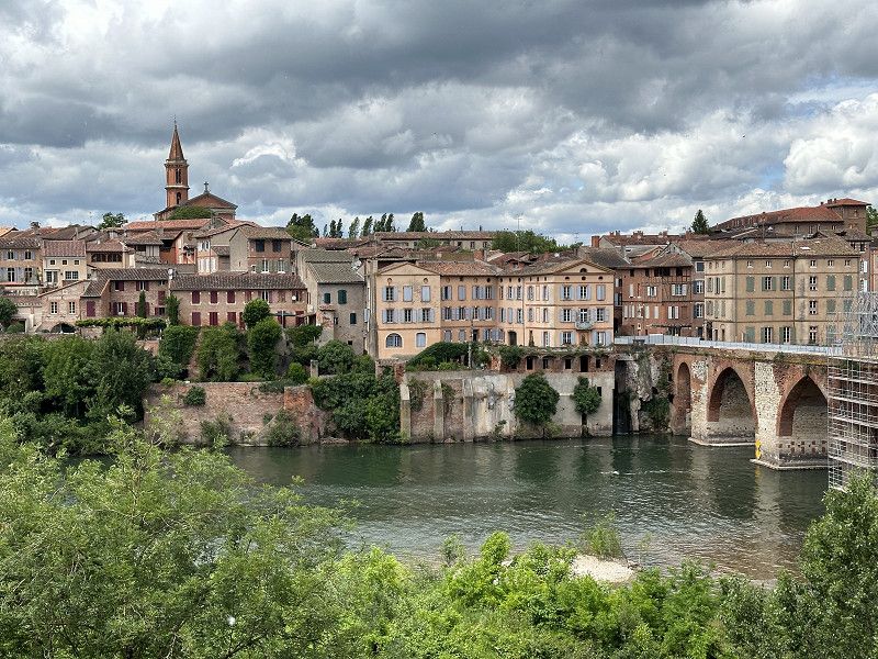
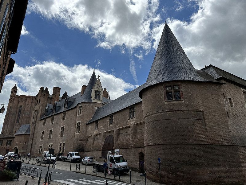
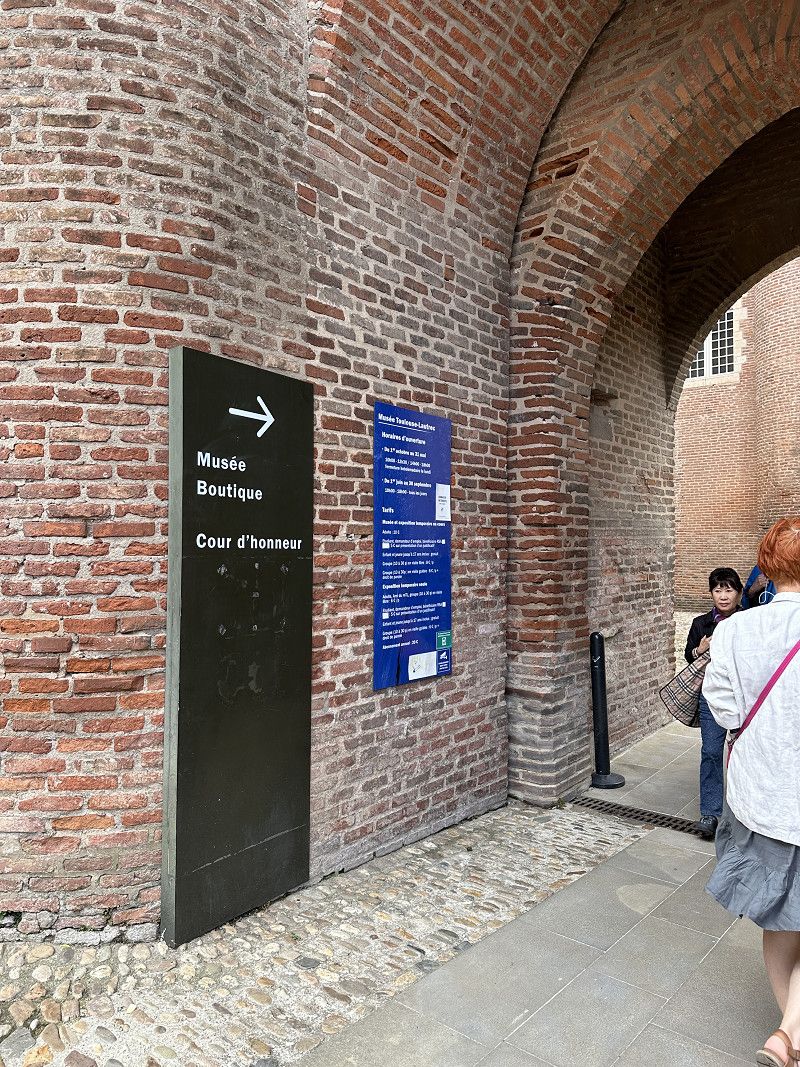
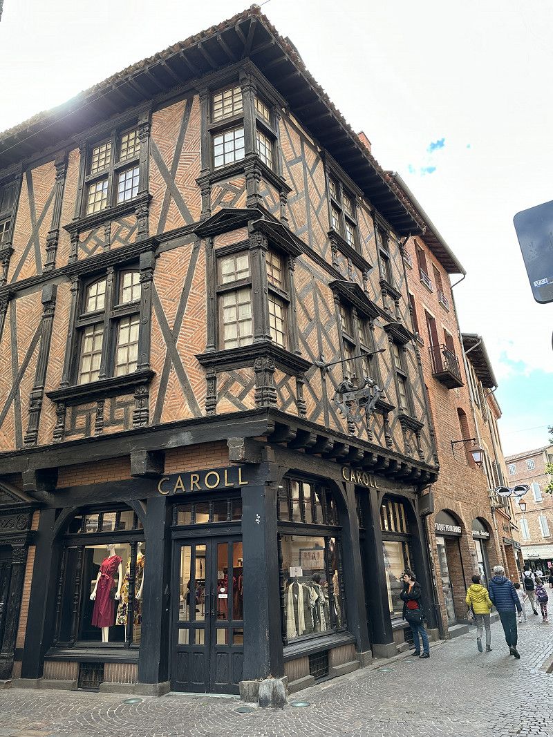
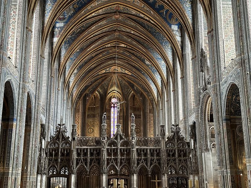
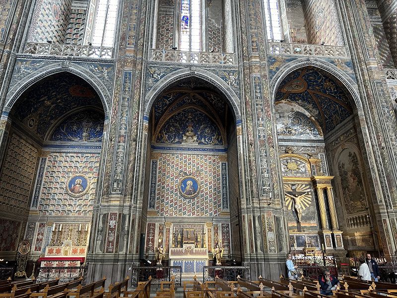
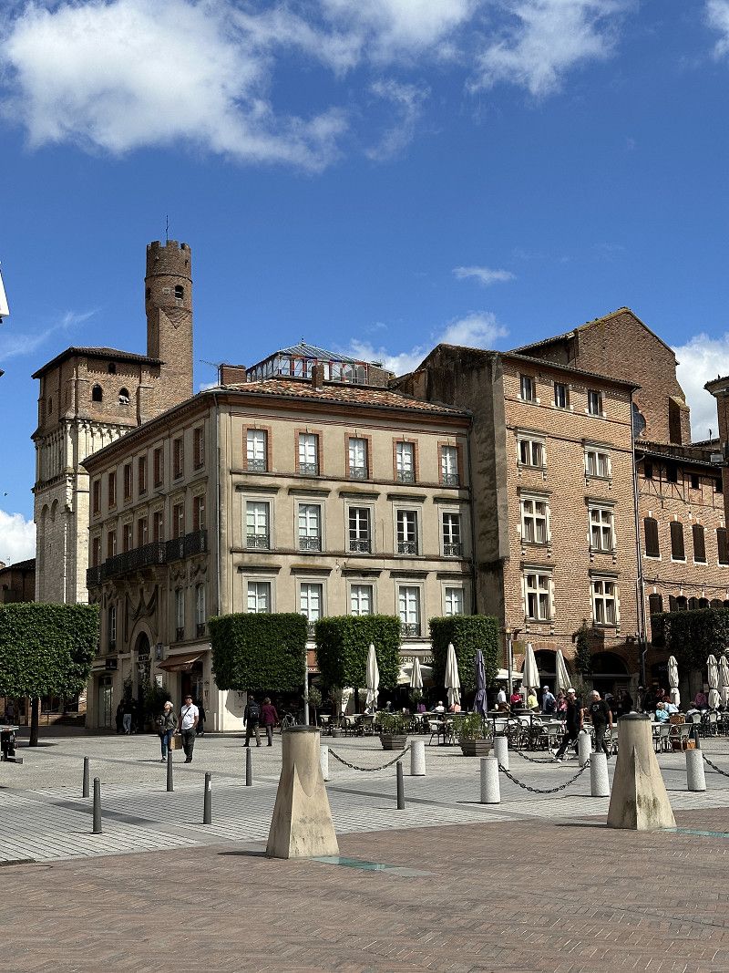
Albi
Free parking space about 20 minutes walk from the historic city center. Former bishop's seat with impressive cathedral and Toulouse Lautrec Museum.
Tarn, Okzitanien, Frankreich
43° 55' 39.9" N 2° 8' 52.4" E
43.9277552 2.1478990
• Head toward Rue Séré de Rivières on Lices Georges Pompidou (D600). Go for 332 m.
• Take the 1st exit from Place Jean Jaurès roundabout onto Place Jean Jaurès (D600). Go for 1.5 km.
• Take the 2nd exit from roundabout onto Route de Castres (D612) toward Castres/Graulhet/Réalmont/Puygouzon. Go for 271 m.
• Take the 3rd exit from roundabout onto Route de Castres (D612) toward Castres/Graulhet/Réalmont/Puygouzon. Go for 527 m.
• Pass 3 roundabouts and continue on Route de Castres (D612). Go for 16.6 km.
• Continue on Avenue Flandres-Dunkerque (D4). Go for 12 m.
• Turn left onto Avenue Flandres-Dunkerque. Go for 29 m.
• Turn right onto Avenue Jules Pelissier (D612). Go for 207 m.
• Turn right onto Avenue du Général de Gaulle (D612) toward Castres/Graulhet. Go for 744 m.
• Take the 3rd exit from roundabout onto D612 toward Castres/Venes. Go for 4.6 km.
• Take the 2nd exit from roundabout onto Route Dalbi (D612) toward Castres/Vénès. Go for 11.2 km.
• Take the 2nd exit from roundabout onto D1012 toward Mazamet/Béziers/Toulouse/Brassac/Lacaune/Castres-l'Albinque. Go for 5.9 km.
• Take the 1st exit from roundabout onto Rocade Sud (N112) toward Mazamet/Béziers/Labruguière. Go for 9.5 km.
• Take the 2nd exit from roundabout onto N112 toward Mazamet/Béziers/Caucalières/Aussillon/Aiguefonde/Z.I. de la Rougearié. Go for 5.3 km.
• Pass 3 roundabouts and continue on Boulevard du Thoré (N112). Go for 3.8 km.
• Keep right toward Mazamet-Centre/Béziers. Go for 20 m.
• Keep left toward Béziers. Go for 22 m.
• Continue on Avenue du Maréchal Juin (D612). Go for 1.0 km.
• Take the 3rd exit from Rond-Point de la Chevalière roundabout onto Rue de la Richarde (D612) toward Béziers/St Pons/St Amans Soult. Go for 816 m.
• Pass 2 roundabouts and continue on D612. Go for 21.7 km.
• Turn right onto Place des Maquisards (D64) toward Narbonne. Go for 99 m.
• Turn left onto Rue Pierre et François Crouzet (D64). Go for 518 m.
• Continue on Quartier Le Pouissant (D64) toward Narbonne. Go for 2.1 km.
• Continue on D147. Go for 1.6 km.
• Continue on Lieu-dit Métairie Neuve (D147). Go for 117 m.
• Continue on D147. Go for 843 m.
• Continue on Place de la Mairie (D147). Go for 137 m.
• Continue on D147. Go for 38 m.
• Turn left. Go for 35 m.
• Turn left toward D920. Go for 61 m.
• Turn left onto D920. Go for 383 m.
• Turn right onto D147. Go for 5.5 km.
• Continue on D147. Go for 942 m.
• Continue on Lieu-dit Sainte-Colombe (D147). Go for 79 m.
• Turn right onto D907 toward Narbonne/Rieussec/Minerve. Go for 16.4 km.
• Take the 2nd exit from roundabout onto Route de Saint-Pons (D907) toward Aigues-Vives/Narbonne/Béziers. Go for 479 m.
• Take the 3rd exit from roundabout onto Place de la Mairie (D907). Go for 2.2 km.
• Continue on D607. Go for 4.9 km.
• Take the 3rd exit from roundabout onto D607. Go for 2.4 km.
• Continue toward D607. Go for 22 m.
• Take the 2nd exit from roundabout onto D607. Go for 2.2 km.
• Turn left onto Rue du Canalet. Go for 361 m.
• Arrive at Rue du Canalet. Your destination is on the right.
☍
125,6 km
(1 hrs. 45 min.)
Day
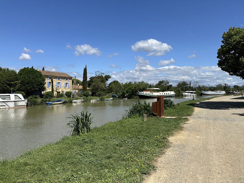
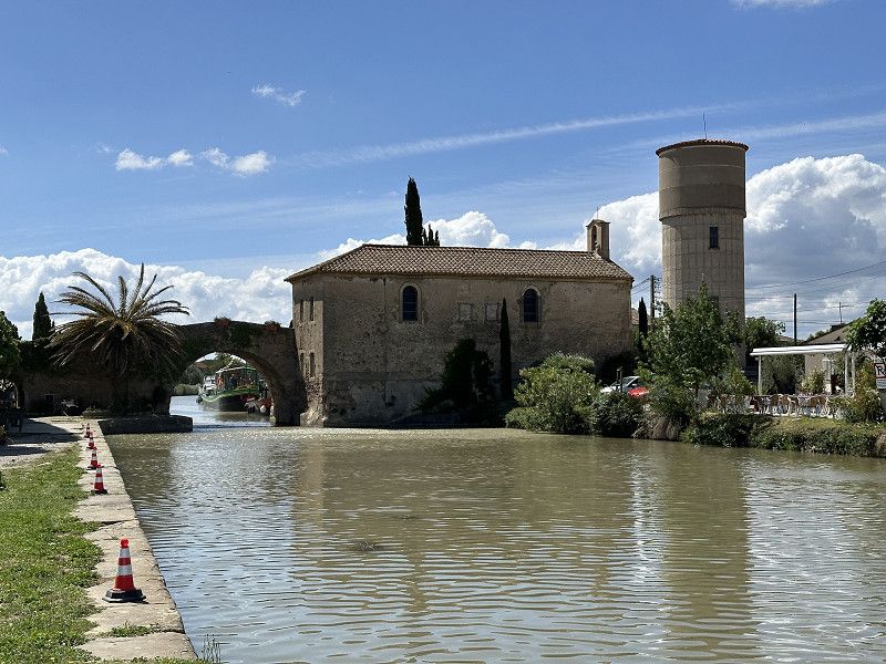
Le Somail
Small town on the Canal du Midi
Aude, Okzitanien, Frankreich
43° 15' 52.9" N 2° 54' 26.4" E
43.2646992 2.9073441
• Head southwest on Rue du Canalet. Go for 361 m.
• Turn left onto D607. Go for 758 m.
• Take the 3rd exit from roundabout onto D607. Go for 4.3 km.
• Pass 4 roundabouts and continue on Route de Marcorignan (D607). Go for 5.9 km.
• Take the 1st exit from roundabout onto D6009 toward A9/Perpignan/Carcassonne/Lézignan Corbières/Marcorignan/St Jean-St Pierre. Go for 958 m.
• Take the 2nd exit from roundabout onto D6009 toward Perpignan/Carcassonne/Lézignan Corbières/Montredon des C./Hauts de Narbonne. Go for 3.0 km.
• Keep left onto D6009 toward A9/A61/Z.I. Croix Sud. Go for 454 m.
• Keep right toward A9/Béziers/Montpellier/Sigean/Perpignan/Barcelone/A61/Lézignan C./Carcassonne/Toulouse. Go for 59 m.
• Take ramp onto A9 (La Languedocienne) toward Béziers/Montpellier/Lyon. Go for 43.9 km.
• Take exit 34 toward Agde/Vias/Bessan. Go for 670 m.
• Take the 1st exit from roundabout onto D612 A toward Vias/Agde/Cap d'Agde/Aéroport Béziers-Cap d'Agde/Europark. Go for 7.7 km.
• Keep left onto D612 A toward D612/Sète/Agde. Go for 364 m.
• Take ramp onto D612. Go for 7.5 km.
• Take ramp onto D612 toward Sète/Marseillan-Plage. Go for 2.6 km.
• Take the 2nd exit from roundabout onto Avenue du Clavelet (D612) toward Sète/Marseillan. Go for 997 m.
• Take the 3rd exit from roundabout onto D51 E5 toward Sète/Montpellier/Marseillan. Go for 306 m.
• Take the 2nd exit from roundabout onto N112 toward Sète/Montpellier. Go for 1.5 km.
• Pass 3 roundabouts and continue on N112. Go for 6.4 km.
• Take the 1st exit from roundabout. Go for 66 m.
• Turn right. Go for 61 m.
• Turn left. Go for 63 m.
• Arrive at your destination on the right.
☍
87,9 km
(1 hrs. )
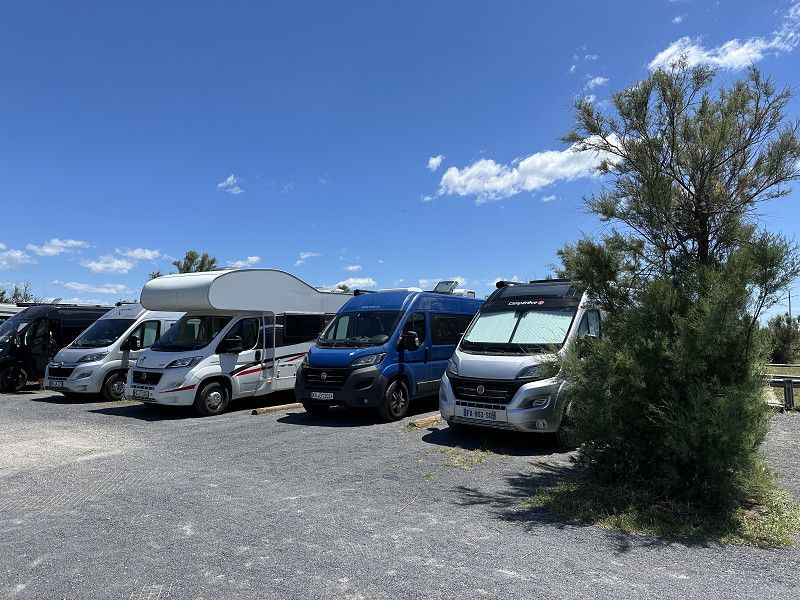
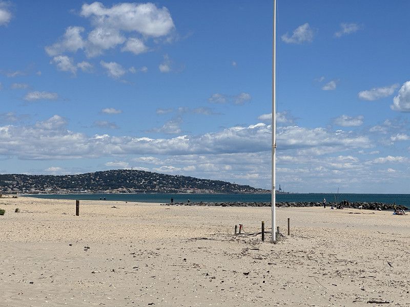
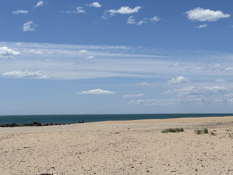
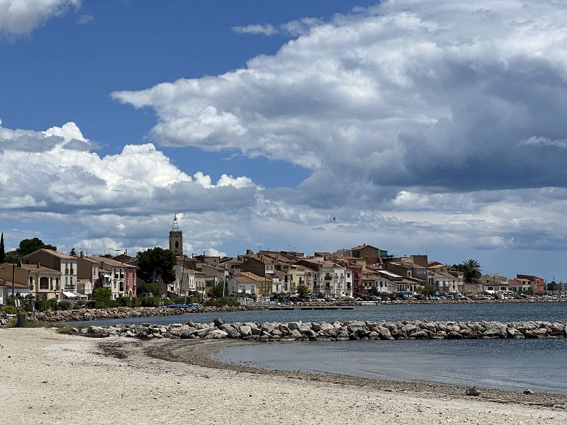
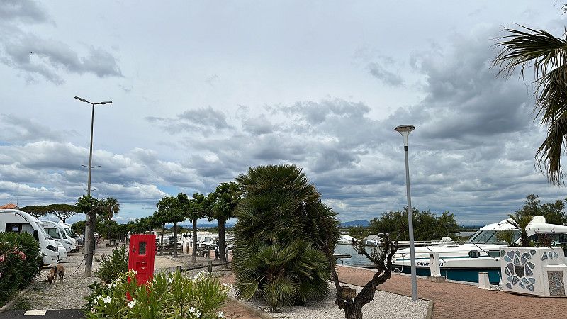
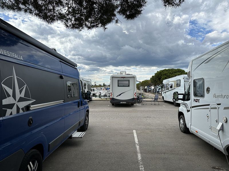
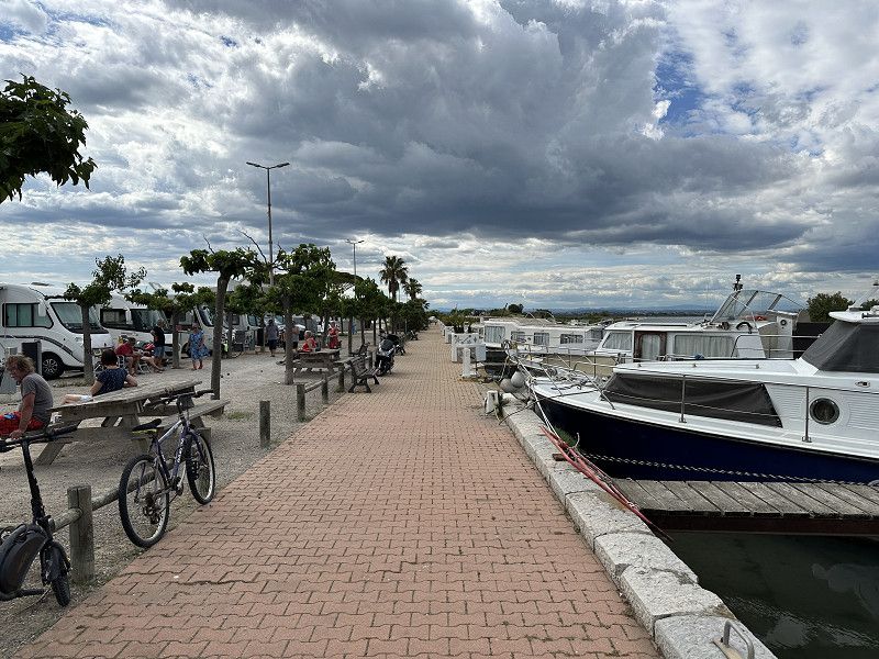
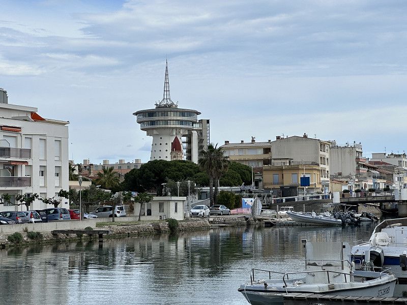
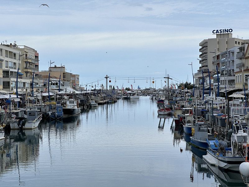
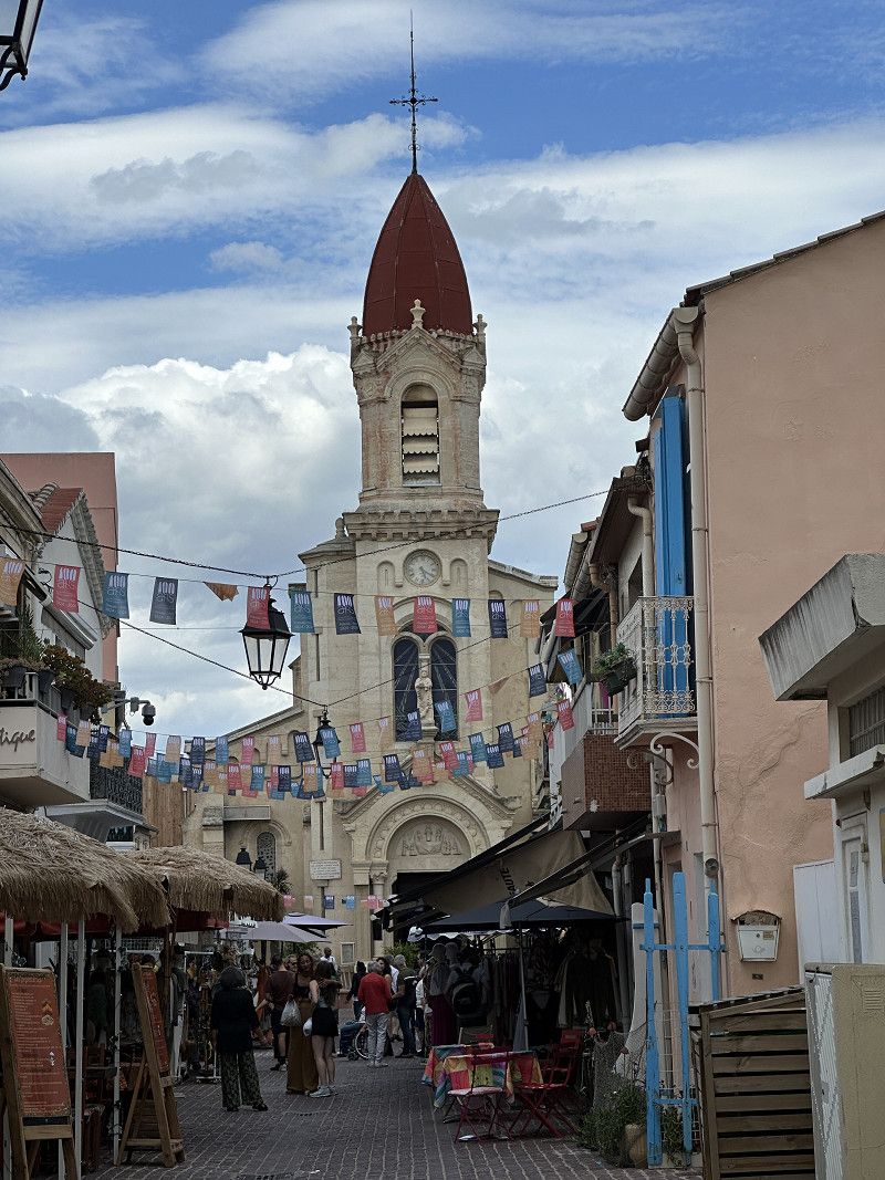
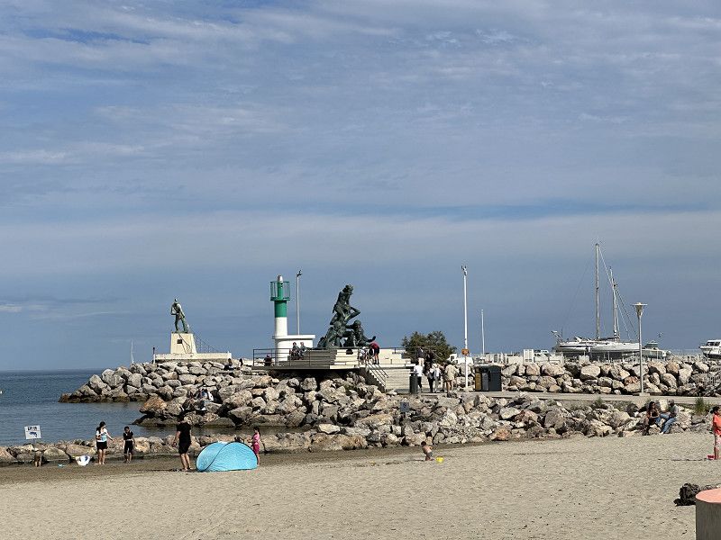
Sète
Pitch right by the sea, about 10 km from Séte. Be sure to bring Antibrum or other mosquito repellent!
D 612, Sète, Hérault, Okzitanien, Frankreich
43° 21' 56.9" N 3° 36' 52.7" E
43.3658085 3.6146522
• Head northeast. Go for 124 m.
• Turn left toward N112. Go for 42 m.
• Take the 1st exit from roundabout onto N112 toward A9/Sète/Montpellier. Go for 1.7 km.
• Pass 3 roundabouts and continue on Route des 4 Chansons. Go for 3.9 km.
• Take the 3rd exit from Rond-Point du Vignerai roundabout onto Boulevard Camille Blanc (D2) toward A9/Montpellier/Île de Thau/Le Barrou. Go for 848 m.
• Keep left onto Boulevard Camille Blanc (D2) toward A9/Montpellier. Go for 2.3 km.
• Take the 2nd exit from roundabout onto Pont Sadi Carnot (D2) toward A9/Montpellier/Balaruc-Gare. Go for 213 m.
• Take ramp. Go for 25 m.
• Take the 1st exit from roundabout onto Quai Maréchal Joffre (D2 E6) toward A9/Frontignan/Montpellier. Go for 2.3 km.
• Take ramp toward D2/A9/Montpellier/Frontignan la Peyrade/Z.A. la Peyrade. Go for 193 m.
• Turn left onto Avenue de la Bordelaise (D2 E2) toward A9/Montpellier/Frontignan-la Peyrade/Z.A. la Peyrade. Go for 1.1 km.
• Take the 3rd exit from Rond-Point Salvador Allende roundabout onto D600 toward A9/Montpellier/Béziers. Go for 7.1 km.
• Take ramp onto A9 (La Languedocienne) toward Montpellier/Lyon. Go for 14.9 km.
• Keep right onto A709 toward Montpellier/Aéroport. Go for 4.7 km.
• Take exit 31 toward Montpellier-Ouest/Croix d'Argent. Go for 675 m.
• Take the 2nd exit from Rond-Point Paul-Louis Bret roundabout onto Rue de Montels Église (M132 E) toward Port Marianne/Prés d'Arènes/P.A. Tournezy/P.A. Puéch-Radier. Go for 1.4 km.
• Continue on Avenue du Mas d'Argelliers (M132 E). Go for 222 m.
• Take the 2nd exit from Rond-Point de Saporta roundabout onto Avenue du Mas d'Argelliers (M132 E). Go for 452 m.
• Take the 2nd exit from Rond-Point des Prés d'Arènes roundabout onto Avenue de Palavas (M986) toward Les Aiguerelles/Saint-Martin/Port Marianne/Antigone/Gare Saint-Roch. Go for 470 m.
• Keep right onto Chemin de Moularès. Go for 936 m.
• Turn left onto Rue du Moulin des Sept Cans. Go for 151 m.
• Continue on Avenue du Petit Train. Go for 186 m.
• Continue on Avenue Albert Dubout. Go for 190 m.
• Continue on Rue du Comté de Melgueil. Go for 55 m.
• Continue on Quai Laurens. Go for 197 m.
• Continue on Avenue des États du Languedoc. Go for 274 m.
• Take the 2nd exit from Place d'Olympie roundabout onto Rue du Bastion Ventadour. Go for 317 m.
• Continue on Boulevard d'Antigone. Go for 119 m.
• Arrive at Boulevard d'Antigone. Your destination is on the right.
☍
44,9 km
( 40 min.)
Day
Radtour nach Bouzigues
About 42 km bike ride to Bouzigues. A lot of it was on bike paths, but only beautiful at times. I definitely saw flamingos.
Day
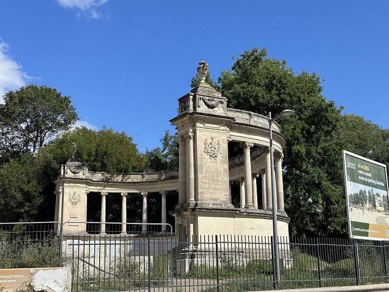
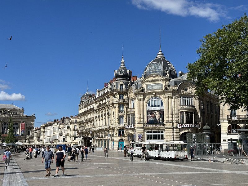
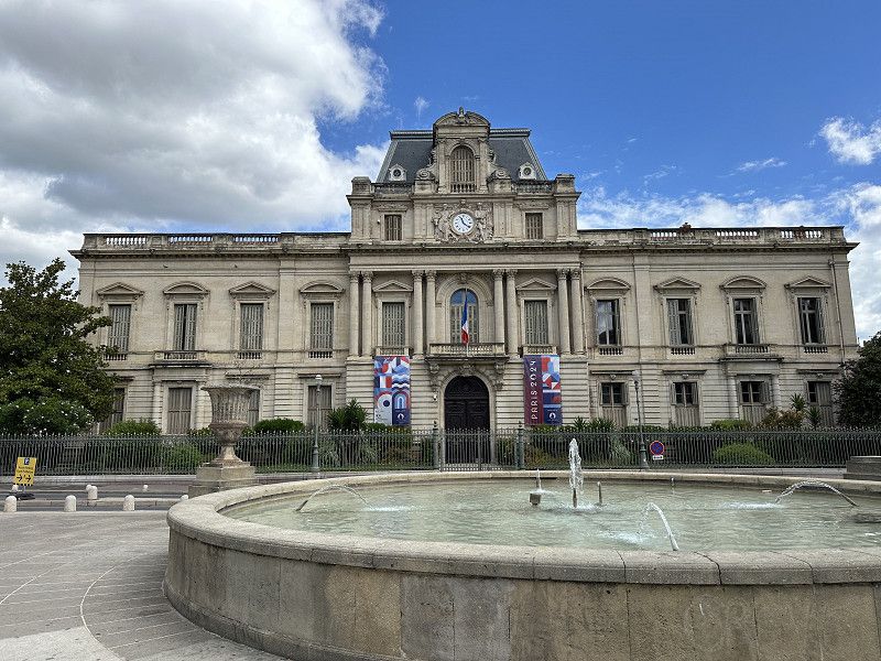
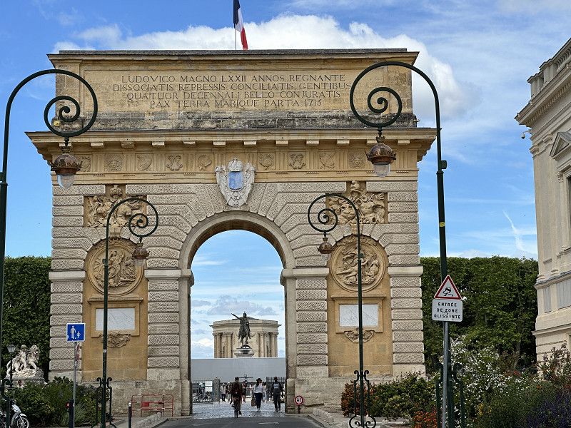
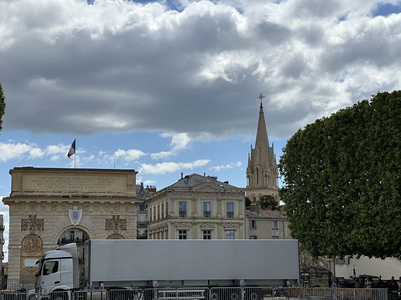
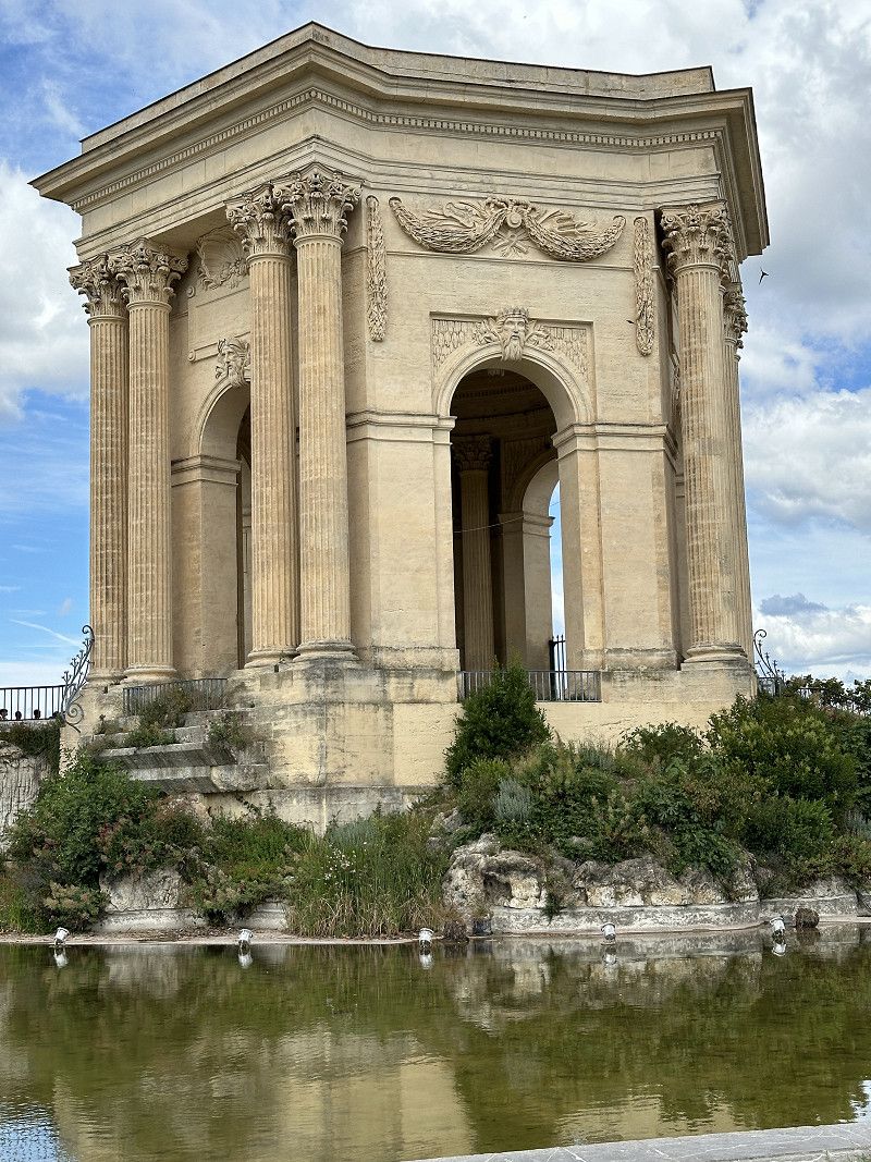
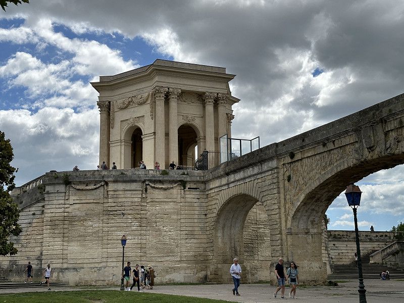
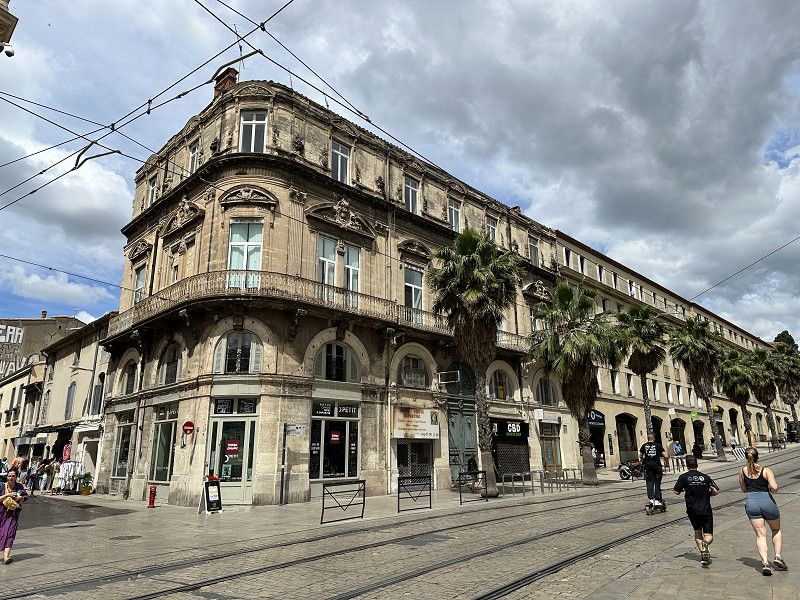
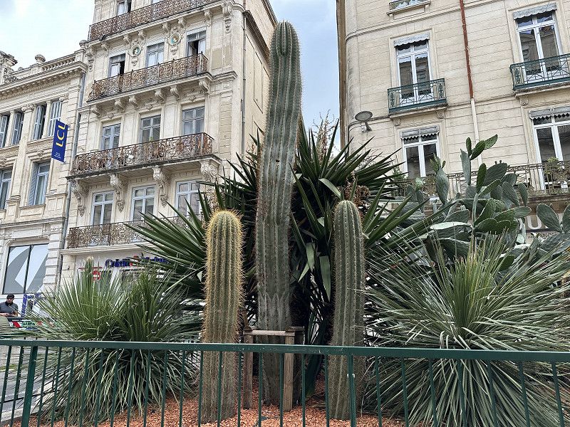
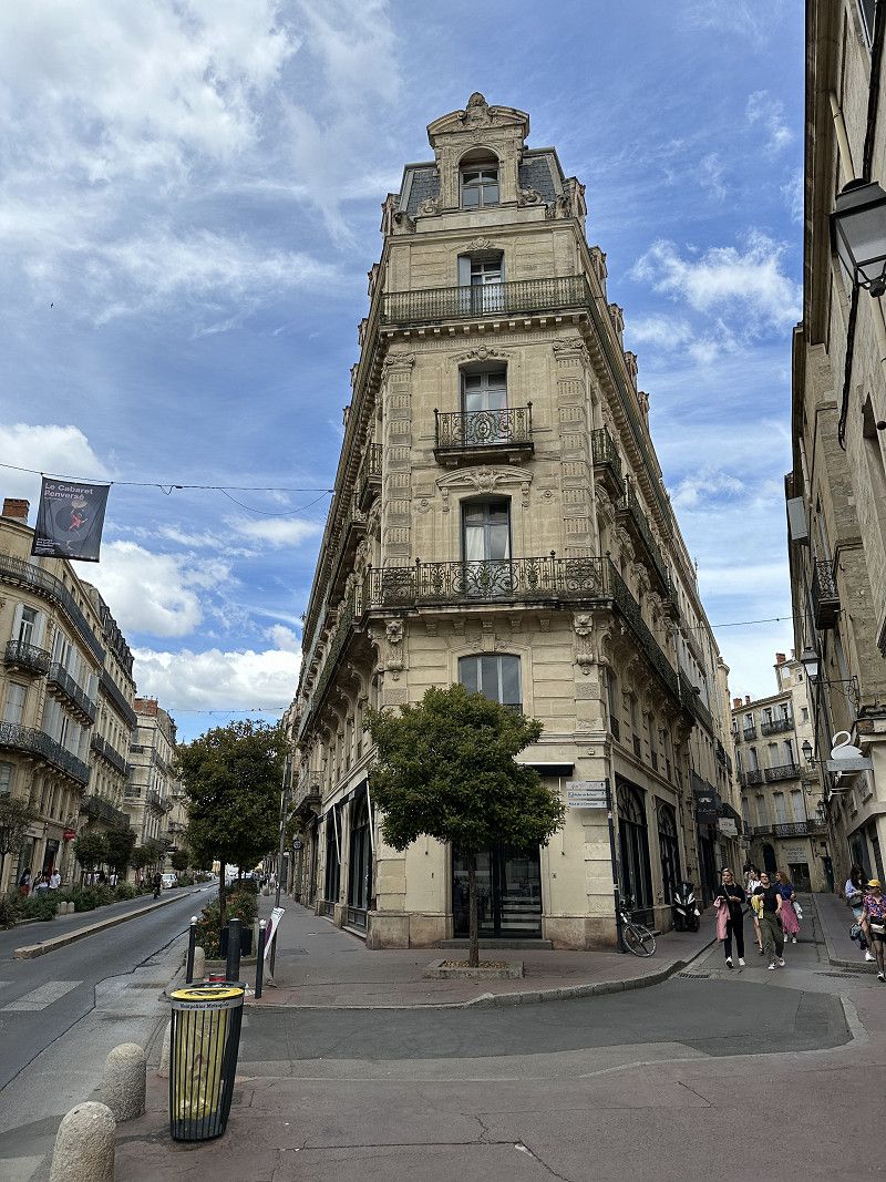
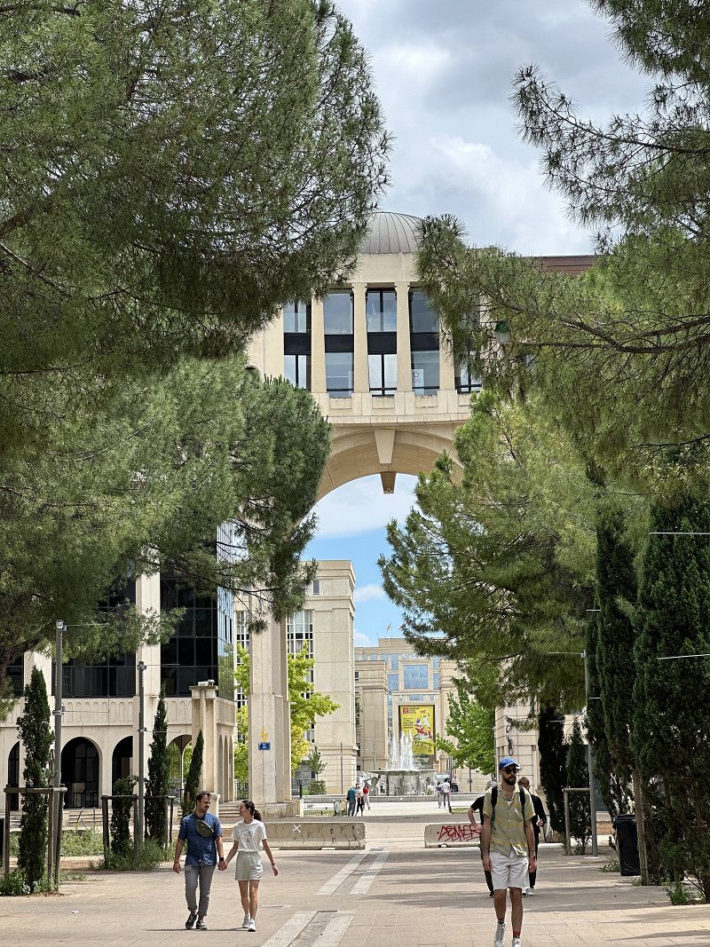
Montpellier
University town with a lot of history
Boulevard d'Antigone 500, Montpellier, Hérault, Okzitanien, Frankreich
43° 36' 32.3" N 3° 53' 19" E
43.6089697 3.8886231
• Head east on Boulevard d'Antigone. Go for 167 m.
• Continue on Boulevard de l'Aéroport International. Go for 294 m.
• Continue on Carrefour de l'Aéroport International. Go for 36 m.
• Turn left onto Carrefour de l'Aéroport International. Go for 69 m.
• Turn right onto Carrefour de l'Aéroport International. Go for 20 m.
• Turn right onto Avenue du Pirée. Go for 813 m.
• Take the 2nd exit from Place Jean Bène roundabout onto Avenue du Pirée. Go for 284 m.
• Continue on Place André Lévy. Go for 1.1 km.
• Continue on Avenue de Palavas (M986). Go for 410 m.
• Take the 3rd exit from Rond-Point des Prés d'Arènes roundabout onto M986 toward A9/Palavas les Flots/Lattes/Arena/Parc des Expositions. Go for 5.9 km.
• Take the 2nd exit from roundabout onto Route de Montpellier (M986). Go for 2.5 km.
• Take the 2nd exit from Rond-Point de l'Europe roundabout onto Boulevard Frédéric Fabrèges. Go for 263 m.
• Take the 2nd exit from roundabout onto Rue Frédéric Mistral. Go for 229 m.
• Turn left. Go for 71 m.
• Arrive at your destination on the left.
☍
12,2 km
( 14 min.)
Palavas-les-Flots
Holiday resort for the residents of Montpellier
Avenue de Gaulle, Palavas-les-Flots, Hérault, Okzitanien, Frankreich
43° 31' 52.1" N 3° 55' 23.8" E
43.5311304 3.9232873
• Head southeast. Go for 71 m.
• Turn right onto Rue Frédéric Mistral. Go for 193 m.
• Take the 1st exit from roundabout onto Boulevard Frédéric Fabrèges. Go for 157 m.
• Take the 1st exit from Rond-Point de l'Europe roundabout onto D62 E2. Go for 335 m.
• Take the 2nd exit from roundabout onto D62 E2. Go for 1.2 km.
• Take the 2nd exit from roundabout onto D62 E2. Go for 2.7 km.
• Pass 2 roundabouts and continue on D62 E2. Go for 1.2 km.
• Continue toward D62. Go for 720 m.
• Take left ramp onto D62. Go for 9.9 km.
• Keep right onto D62 toward Le Grau du Roi/Aigues Mortes/Grand Chaumont. Go for 2.1 km.
• Take the 2nd exit from roundabout onto D62. Go for 2.5 km.
• Take the 4th exit from roundabout onto D62. Go for 2.3 km.
• Take the 1st exit from roundabout onto Chemin de la Pataquière (D718). Go for 988 m.
• Continue on Rue de la Fraternité (D718). Go for 328 m.
• Take the 2nd exit from roundabout onto D979 toward Nîmes/Centre Ville. Go for 160 m.
• Turn left onto Avenue de la Tour de Constance (D979). Go for 62 m.
• Turn right onto Avenue de la Liberté. Go for 237 m.
• Continue on Avenue Frédéric Mistral. Go for 59 m.
• Arrive at Avenue Frédéric Mistral. Your destination is on the left.
☍
25,2 km
( 22 min.)
Day
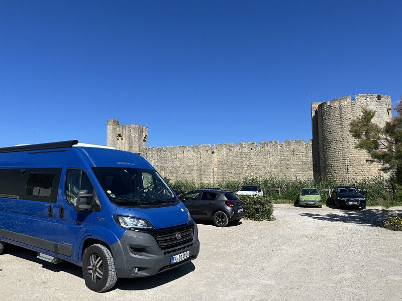
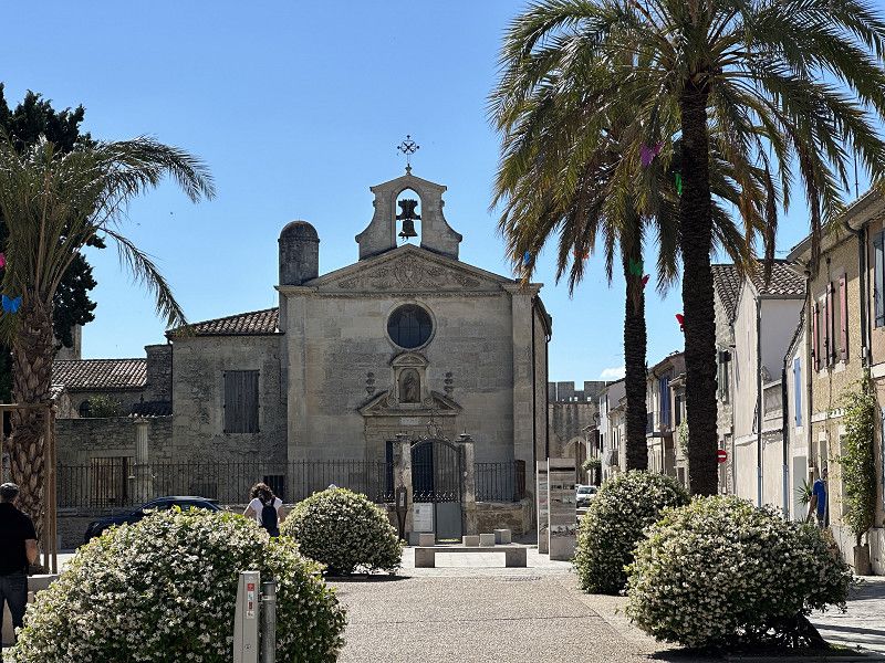
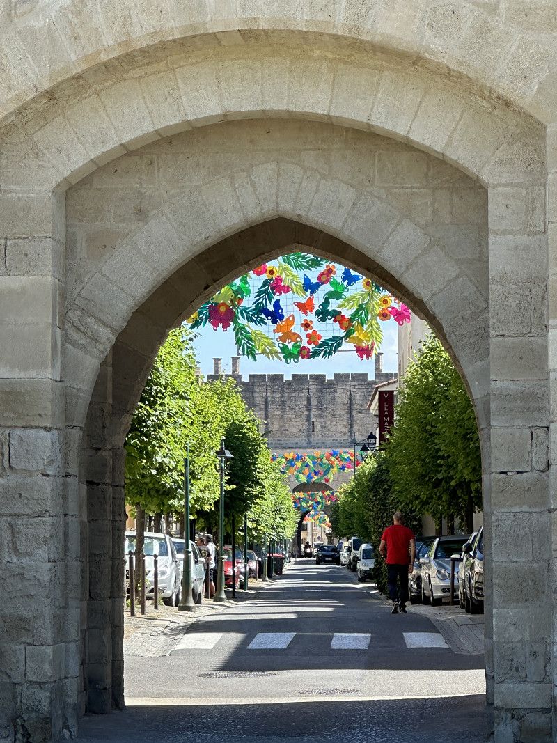
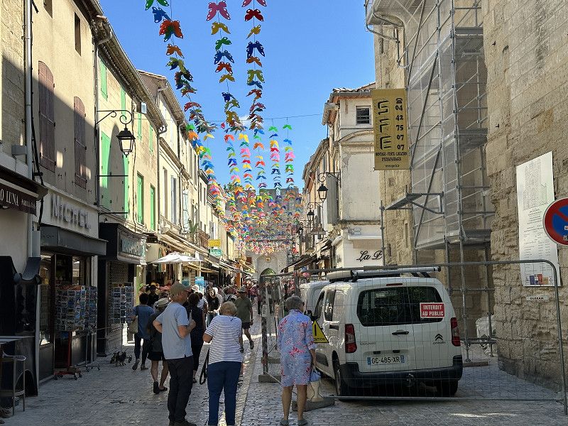
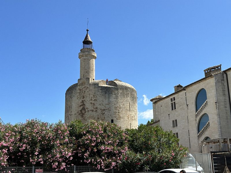
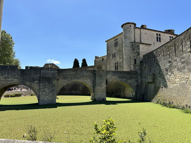
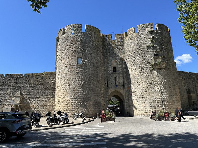
Aigues-Mortes
A medieval town in the Carmarque that is worth seeing. Great city walls and towers. Was very well visited by tourists like me.
Gard, Okzitanien, Frankreich
43° 34' 6.1" N 4° 11' 42.5" E
43.5683546 4.1951425
• Head toward Rue des Gardians on Avenue Frédéric Mistral. Go for 59 m.
• Continue on Avenue de la Liberté. Go for 237 m.
• Turn right onto Avenue de la Tour de Constance (D979). Go for 183 m.
• Continue on Route de Nîmes (D979). Go for 963 m.
• Take the 3rd exit from roundabout. Go for 48 m.
• Continue on Route de Nîmes (D979). Go for 184 m.
• Continue on D979. Go for 126 m.
• Turn left onto D979. Go for 56 m.
• Take the 4th exit from roundabout onto D979. Go for 4.7 km.
• Take the 2nd exit from roundabout onto D979. Go for 1.3 km.
• Take the 2nd exit from roundabout onto Route du Grau du Roi (D979) toward Nîmes/Aimargues. Go for 1.6 km.
• Take the 3rd exit from roundabout onto D979 toward A9/Nîmes/Lunel/Vauvert. Go for 2.0 km.
• Take the 2nd exit from roundabout onto D979 toward A9/Nîmes/Lunel/Vauvert/Aimargues. Go for 1.7 km.
• Take the 3rd exit from roundabout onto D979 toward A9/Nîmes/Vauvert/Lunel/Aimargues. Go for 1.3 km.
• Take the 2nd exit from roundabout onto D979. Go for 700 m.
• Take the 2nd exit from roundabout onto Route des Plages (D6313) toward A9/Montpellier/Nîmes/Lunel. Go for 1.3 km.
• Take the 2nd exit from roundabout onto D6313 toward A9/Montpellier/Nîmes/Lunel. Go for 1.6 km.
• Take the 2nd exit from roundabout onto A9 toward Montpellier/Nîmes. Go for 2.0 km.
• Take the exit toward Nîmes/Lyon onto A9 (La Languedocienne). Go for 18.1 km.
• Take exit 25 toward Alès/Nîmes-Quartiers Ouest onto A54. Go for 1.3 km.
• Turn right onto Avenue du Président Salvador Allende (N113) toward Nîmes-Centre. Go for 581 m.
• Take the 2nd exit from Rond-Point Paul-Émile Victor roundabout onto Boulevard du Président Salvador Allende (N113) toward Nîmes-Centre/Arles/Avignon/Aéroport Garons/Stade des Costières. Go for 446 m.
• Take the 3rd exit from Rond-Point de Meknès roundabout onto Chemin du Capouchiné (D13). Go for 524 m.
• Turn right onto Rue Albert Soboul. Go for 160 m.
• Continue on Square Albert Soboul. Go for 42 m.
• Turn left toward Avenue Jean Jaurès. Go for 92 m.
• Continue on Avenue Jean Jaurès. Go for 210 m.
• Continue on Avenue Jean Jaurès. Go for 357 m.
• Take the 3rd exit from Avenue Jean Jaurès roundabout onto Avenue Jean Jaurès. Go for 712 m.
• Continue on Place Jules Guesde. Go for 43 m.
• Continue on Avenue Jean Jaurès. Go for 146 m.
• Turn right onto Rue de Sauve. Go for 68 m.
• Continue on Rue Grétry. Go for 62 m.
• Turn left onto Rue Rabaut Saint-Étienne. Go for 114 m.
• Turn right onto Rue Gaston Boissier. Go for 172 m.
• Continue on Rue Molière. Go for 79 m.
• Continue on Rue Général Perrier. Go for 76 m.
• Continue on Rue Général Perrier. Go for 345 m.
• Continue on Rue Crémieux. Go for 69 m.
• Continue on Place Belle Croix. Go for 22 m.
• Turn right onto Grand'Rue. Go for 85 m.
• Arrive at Grand'Rue.
☍
43,9 km
( 38 min.)
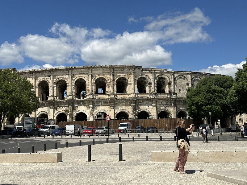
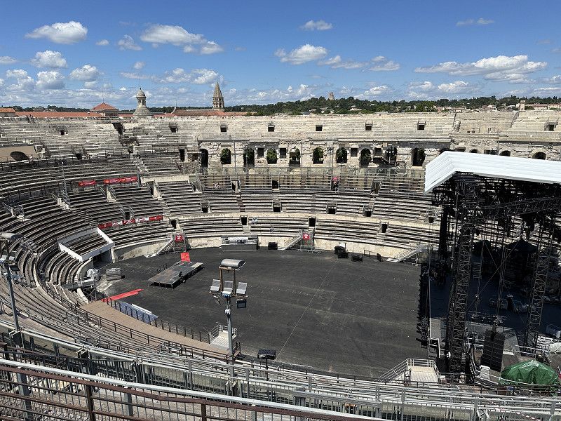
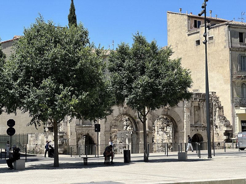
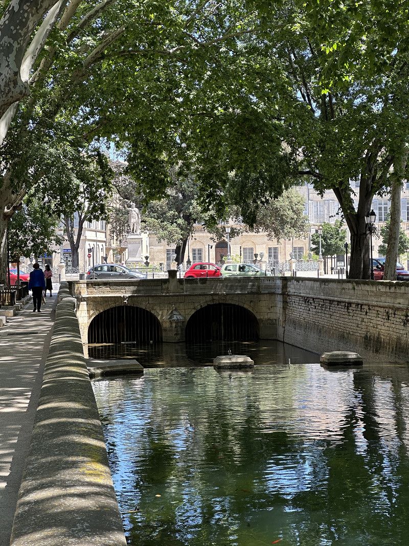
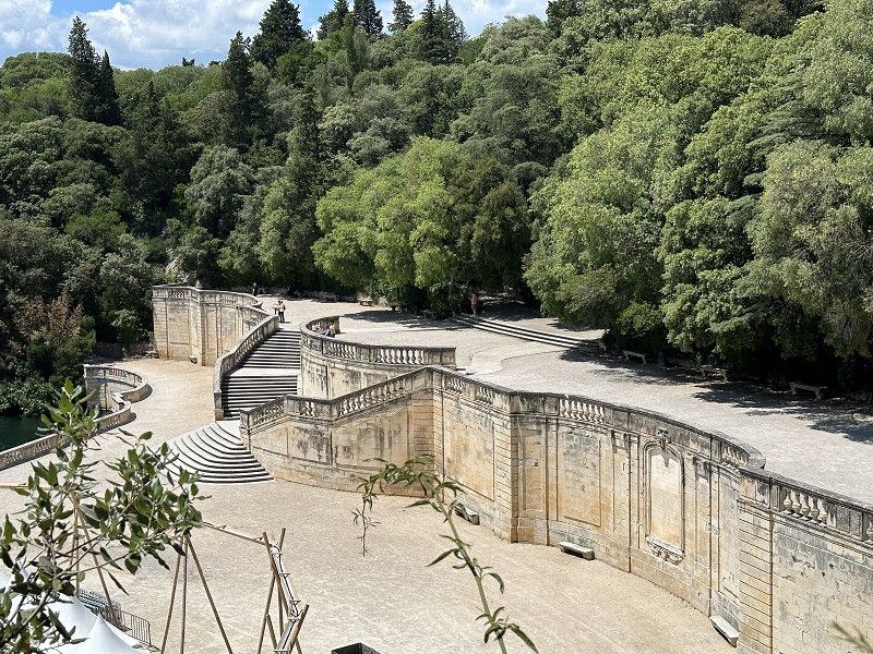
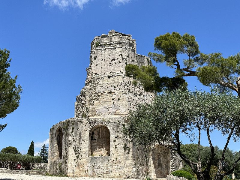
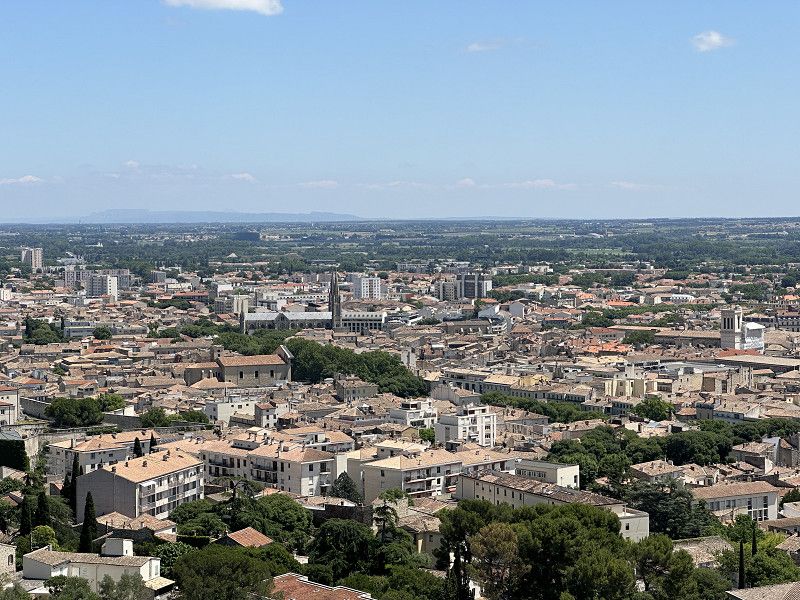
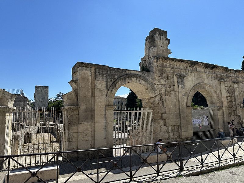
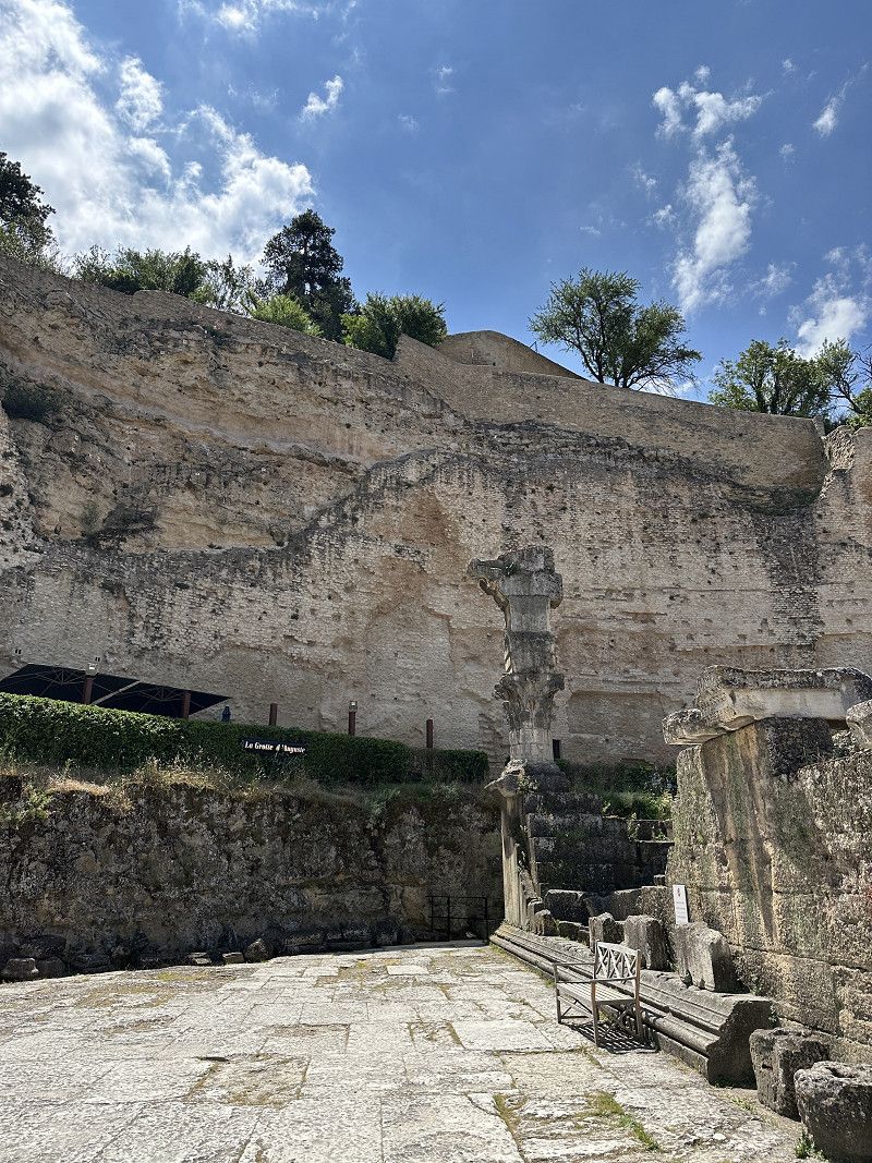
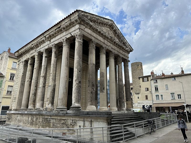
Nîmes
Pont du Gard was built to bring water from Uzés (trip 2021) to here. So today from the Middle Ages back to Roman times.
Gard, Okzitanien, Frankreich
43° 50' 14.7" N 4° 21' 36.2" E
43.8374249 4.3600687
• Head south on Grand'Rue. Go for 110 m.
• Turn left onto Rue des Greffes. Go for 51 m.
• Turn left onto Boulevard Amiral Courbet. Go for 78 m.
• Turn right onto Rue des Calquières. Go for 159 m.
• Continue on Place de l'Écluse. Go for 69 m.
• Turn left onto Rue Notre-Dame. Go for 86 m.
• Turn right onto Rue Cardinal de Cabrières. Go for 13 m.
• Turn slightly right onto Rue Fénelon. Go for 310 m.
• Turn right onto Boulevard Talabot. Go for 208 m.
• Turn left onto Avenue Général Leclerc. Go for 74 m.
• Turn right onto Allée Boissy d'Anglas. Go for 329 m.
• Turn sharp left onto Boulevard Natoire. Go for 298 m.
• Keep right onto Avenue Général Leclerc. Go for 532 m.
• Turn right onto Boulevard du Président Salvador Allende (D6113). Go for 548 m.
• Take the 2nd exit from Rond-Point du Commandant Cousteau roundabout onto Boulevard du Président Salvador Allende (D6113) toward A9-A54/Arles/Montpellier/Alès/Générac/St Gilles/Aéroport Garons/C.H.U. Carémeau. Go for 465 m.
• Take the 3rd exit from roundabout onto Route de Saint-Gilles (D42 A). Go for 1.8 km.
• Take the 4th exit from Rond-Point de la 1ère Division Française Libre roundabout onto A54 toward Aéroport Garons/Arles. Go for 27.1 km.
• Take ramp toward Arles-Centre/Arles-Barriol/Port St Louis. Go for 323 m.
• Continue on Boulevard Georges Clemenceau (D35). Go for 21 m.
• Turn right onto Boulevard Georges Clemenceau (D35). Go for 396 m.
• Continue on Boulevard Georges Clemenceau (N453). Go for 717 m.
• Take the 3rd exit from roundabout onto Boulevard Émile Combes. Go for 563 m.
• Turn left onto Rue Condorcet. Go for 27 m.
• Turn left onto Rue Simon Bolivar. Go for 147 m.
• Turn left onto Rue Portagnel. Go for 27 m.
• Turn right onto Place du Rempart de Villeneuve. Go for 34 m.
• Arrive at Place du Rempart de Villeneuve. Your destination is on the right.
☍
34,5 km
( 31 min.)
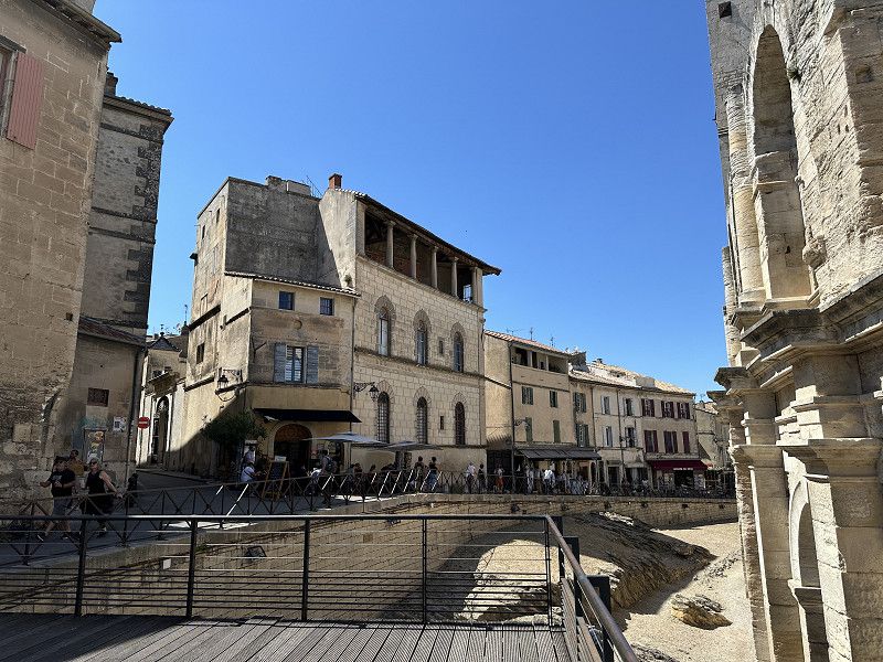
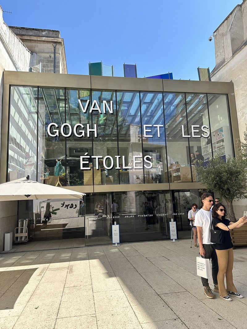
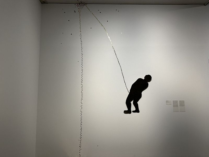
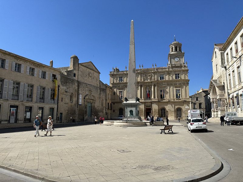
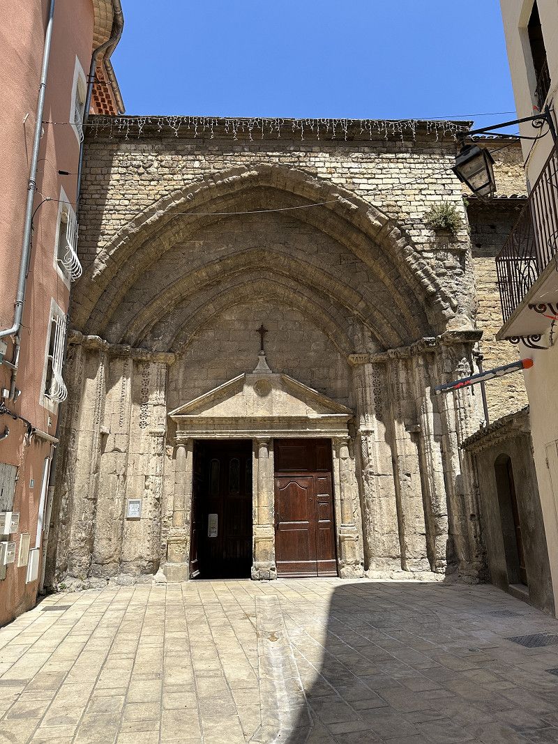
Arles
Also a Roman city. The Fondation Vincent Van Gogh was actually the main reason for the visit. The museum was interesting, only 3-4 works by Van Gogh, but some works by artists who were inspired by him. The thermal baths and theaters were also worth seeing. There was also an amphitheater, but I had already seen that in Nimes
Rue Portagnel 92, Arles, Bouches-du-Rhône, Provence-Alpes-Côte d'Azur, Frankreich
43° 40' 41.4" N 4° 37' 59.2" E
43.6781738 4.6331103
• Head toward Rue Portagnel on Place du Rempart de Villeneuve. Go for 34 m.
• Turn right onto Rue Portagnel. Go for 14 m.
• Turn left onto Boulevard Émile Combes. Go for 461 m.
• Take the 1st exit from Place Lamartine roundabout onto Avenue de Stalingrad. Go for 2.0 km.
• Take the 1st exit from Rond-Point de la Résistance roundabout onto Route de Montmajour toward D570 N/Salon/Fos S/Mer/Nîmes/Arles-Montplaisir/Stes Maries de la Mer/Fontvieille/Les Baux/Abbaye de Montmajour. Go for 241 m.
• Pass 3 roundabouts and continue on Avenue des Baux (D17). Go for 9.0 km.
• Turn left. Go for 610 m.
• Turn right. Go for 185 m.
• Turn left. Go for 351 m.
• Arrive at your destination on the left.
☍
12,9 km
( 18 min.)
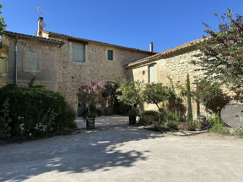
Fontvieille
French Passion pitch. Olive oil, vinegar and honey not far from Arles and a good starting point for tomorrow. Finally used the FP!
Chemin d'Auge, Fontvieille, Bouches-du-Rhône, Provence-Alpes-Côte d'Azur, Frankreich
43° 44' 8.6" N 4° 44' 31.1" E
43.7357247 4.7419655
• Head northeast. Go for 351 m.
• Turn right. Go for 185 m.
• Turn left toward Chemin d'Arles au Département du Var/D17. Go for 610 m.
• Turn left onto Chemin d'Arles au Département du Var (D17). Go for 1.6 km.
• Turn slightly left onto Route des Baux de Provence (D78 F). Go for 552 m.
• Continue on Chemin des Baux (D78 F). Go for 252 m.
• Continue on Route des Baux de Provence (D78 F). Go for 1.2 km.
• Continue on D78 F. Go for 142 m.
• Continue on Lieu-dit Mas du Lion de l'Arcoule (D78 F). Go for 124 m.
• Continue on D78 F. Go for 509 m.
• Continue on Route d'Arles (D78 F). Go for 351 m.
• Turn right onto D27. Go for 101 m.
• Turn left onto Chemin du Saint-Esprit. Go for 253 m.
• Turn slightly left onto Chemin du Dernier Château. Go for 256 m.
• Turn left onto Chemin du Dernier Château. Go for 488 m.
• Turn left onto Chemin du Dernier Château. Go for 232 m.
• Turn sharp left onto Lieu-dit Baubesse (D27 A). Go for 101 m.
• Continue on D27 A. Go for 337 m.
• Turn left onto Rue Porte Mage. Go for 122 m.
• Continue on Esplanade Charles de Gaulle. Go for 15 m.
• Arrive at Esplanade Charles de Gaulle.
☍
7,8 km
( 13 min.)
Day
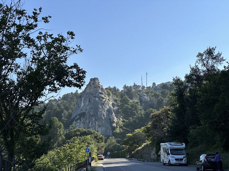
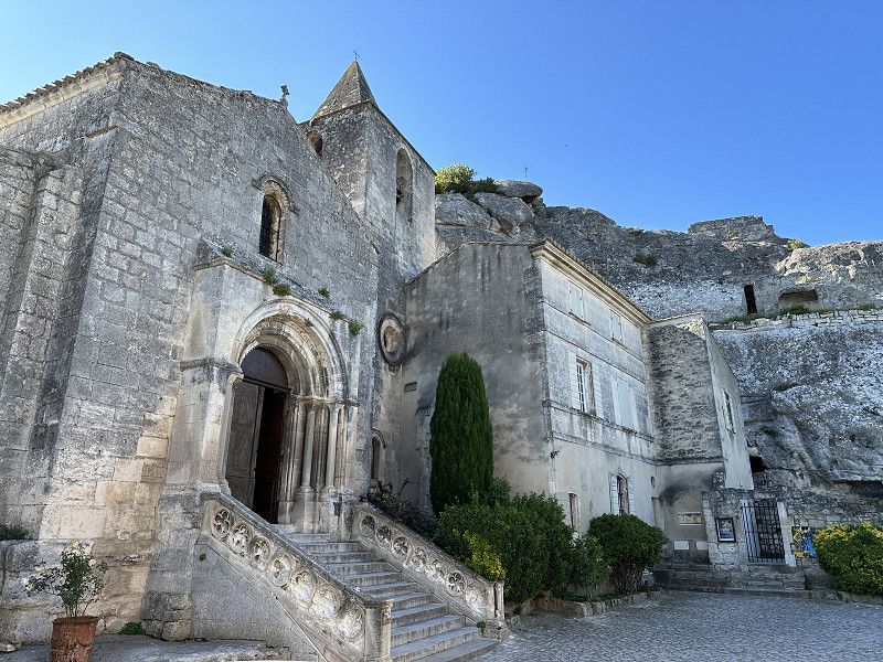
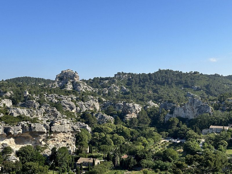
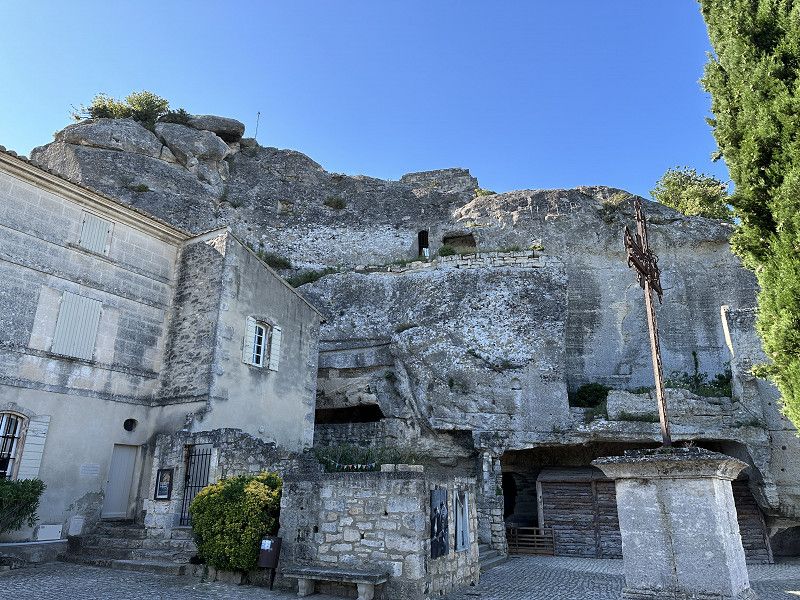
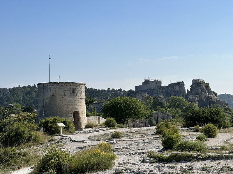
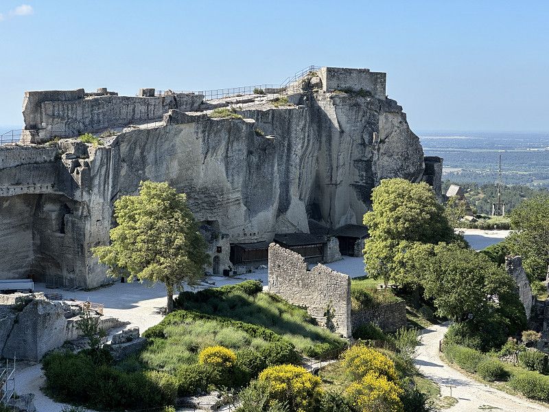
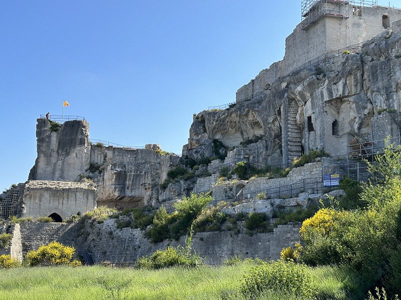
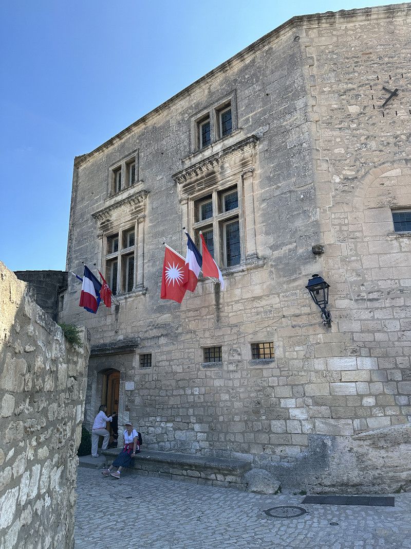
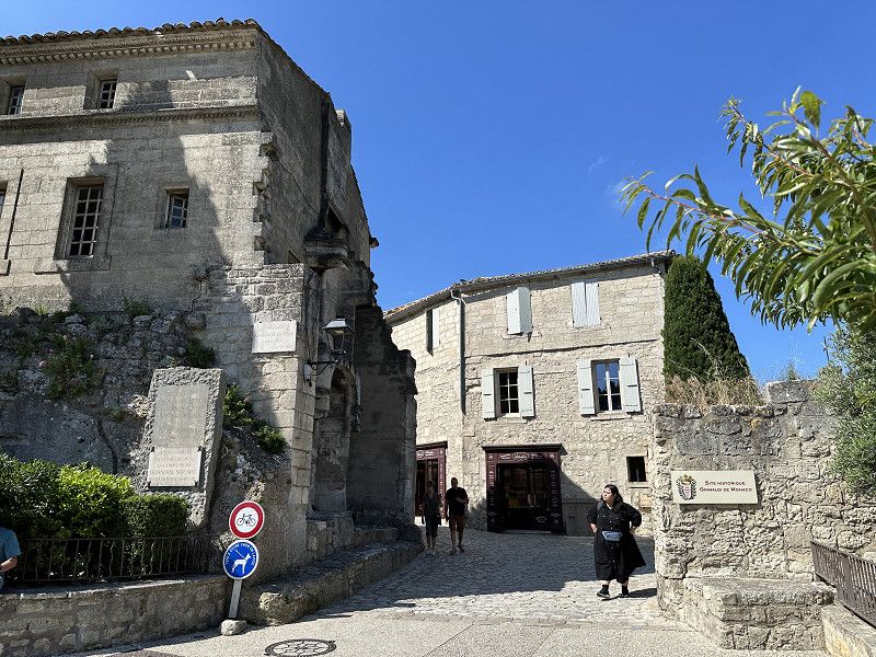
Les Baux-de-Provence
Very beautiful mountain village.
Bouches-du-Rhône, Provence-Alpes-Côte d'Azur, Frankreich
43° 44' 37.1" N 4° 47' 42.1" E
43.7436458 4.7950342
• Head southwest on Esplanade Charles de Gaulle.
• Turn left onto Rue Porte Mage. Go for 217 m.
• Turn left onto D27 A. Go for 239 m.
• Turn right onto D27. Go for 3.9 km.
• Continue on Chemin de Maillane à Saint-Martin-de-Crau (D27). Go for 2.4 km.
• Turn right onto Route du Mas Blanc (D31). Go for 2.9 km.
• Continue on Place Joseph Roumanille (D31). Go for 64 m.
• Turn right onto Avenue Fauconnet (D99 A). Go for 169 m.
• Turn left onto Rue Roger Salengro. Go for 44 m.
• Turn left onto Traverse du Cheval Blanc. Go for 89 m.
• Turn left onto Rue Michel de Servan. Go for 37 m.
• Arrive at Rue Michel de Servan. Your destination is on the right.
☍
10,0 km
( 17 min.)
St Rémy De Provence
Van Gogh was placed in a psychiatric hospital here. He painted over 150 pictures here.
Avenue Fauconnet 14, Saint-Rémy-de-Provence, Bouches-du-Rhône, Provence-Alpes-Côte d'Azur, Frankreich
43° 47' 20.2" N 4° 49' 41.2" E
43.7889567 4.8281057
• Head toward Avenue Fauconnet on Rue Michel de Servan. Go for 11 m.
• Turn left onto Avenue Fauconnet (D99 A). Go for 249 m.
• Turn left onto Boulevard Victor Hugo (D99 A). Go for 345 m.
• Turn slightly left onto Boulevard Mirabeau. Go for 407 m.
• Take the 3rd exit from roundabout onto Avenue du 19 Mars 1962 (D99) toward Beaucaire/Tarascon/Arles/St Étienne du G./Z.A. la Gare/Maillane. Go for 327 m.
• Take the 1st exit from Chemin de Marseille à Graveson roundabout onto Route de Maillane (D5) toward Maillane/Graveson. Go for 6.1 km.
• Take the 2nd exit from roundabout onto D5. Go for 1.6 km.
• Turn left onto Route de Châteaurenard (D28). Go for 473 m.
• Take the 2nd exit from roundabout onto Route de Châteaurenard (D28). Go for 924 m.
• Take the 1st exit from roundabout onto Route d'Avignon (D570 N) toward Avignon/Rognonas/Pôle d'Activités du Sagnon. Go for 597 m.
• Pass 2 roundabouts and continue on Route de Tarascon (D570 N). Go for 5.0 km.
• Take the 3rd exit from Giratoire de l'Escapade roundabout onto D570 N toward Avignon. Go for 1.5 km.
• Take the 3rd exit from Giratoire du Mas du Temple roundabout onto N1007 toward Avignon-Centre/Courtine. Go for 3.7 km.
• Take the 1st exit from roundabout onto N1007 toward Avignon-Centre/Courtine. Go for 438 m.
• Take the 2nd exit from roundabout onto Route du Confluent toward Avignon-Centre/Courtine. Go for 855 m.
• Turn left onto Rocade Charles de Gaulle toward A9/Nîmes. Go for 1.3 km.
• Keep left toward A9/Nîmes/Les Angles. Go for 299 m.
• Keep left toward Barthelasse. Go for 216 m.
• Continue on Boulevard Saint-Dominique. Go for 233 m.
• Turn right onto Porte Saint-Dominique. Go for 27 m.
• Turn slightly left onto Rue Victor Hugo. Go for 249 m.
• Turn right onto Rue Joseph Vernet. Go for 398 m.
• Turn left onto Rue de la République. Go for 393 m.
• Turn left onto Place de l'Horloge. Go for 17 m.
• Turn right onto Place de l'Horloge. Go for 31 m.
• Turn right onto Place de l'Horloge. Go for 13 m.
• Arrive at Place de l'Horloge. Your destination is on the left.
☍
25,7 km
( 30 min.)
Avignon
Vaucluse, Provence-Alpes-Côte d'Azur, Frankreich
43° 56' 57.3" N 4° 48' 21.2" E
43.9492493 4.8059012
• Head southwest on Place de l'Horloge. Go for 13 m.
• Turn slightly right onto Rue Félicien David. Go for 62 m.
• Turn right onto Rue Racine. Go for 138 m.
• Continue on Place de la Madeleine. Go for 16 m.
• Turn left onto Place de la Madeleine. Go for 169 m.
• Turn slightly left onto Rue du Rempart du Rhône. Go for 78 m.
• Turn right onto Porte de l'Oulle. Go for 9 m.
• Turn slightly right onto Boulevard du Rhône. Go for 26 m.
• Turn slightly right onto Boulevard du Rhône. Go for 406 m.
• Continue on Quai Joël Bameule. Go for 516 m.
• Continue on Boulevard Saint-Lazare. Go for 306 m.
• Take ramp onto Route Touristique du Docteur Pons (D225) toward A7/Orange/Carpentras. Go for 2.2 km.
• Take ramp onto D907. Go for 2.3 km.
• Keep left onto D225. Go for 2.3 km.
• Take ramp toward Valence/Marseille. Go for 289 m.
• Take the 2nd exit from roundabout toward A7/Cavaillon/Marseille. Go for 142 m.
• Take ramp onto A7 (Autoroute du Soleil) toward Orange/Valence/Lyon. Go for 16.7 km.
• Take exit 22 toward Vaison la Romaine/Courthézon/Orange-Sud. Go for 517 m.
• Take the 4th exit from roundabout onto Route d'Avignon (N7) toward Orange. Go for 1.3 km.
• Take the 2nd exit from roundabout onto Route d'Avignon (N7) toward A9/Orange. Go for 937 m.
• Take the 1st exit from roundabout onto Avenue de Verdun (N7). Go for 1.8 km.
• Turn right onto Rue des Blanchisseurs. Go for 124 m.
• Arrive at Rue des Blanchisseurs. Your destination is on the left.
☍
30,4 km
( 25 min.)
Day
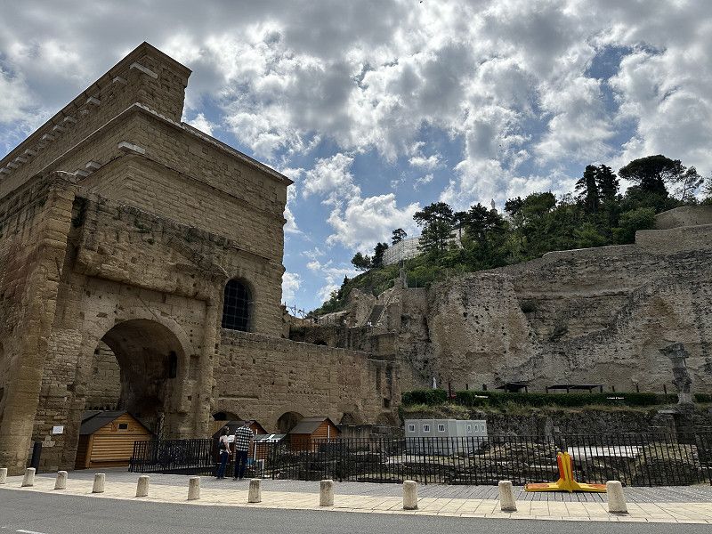
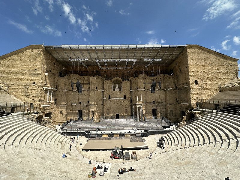
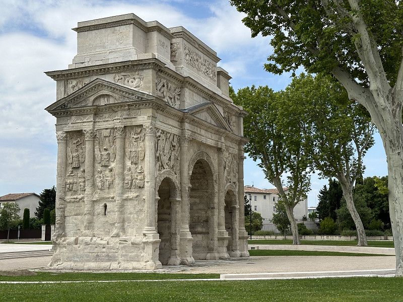
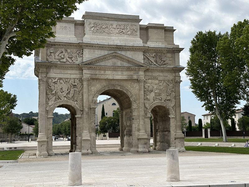
Orange
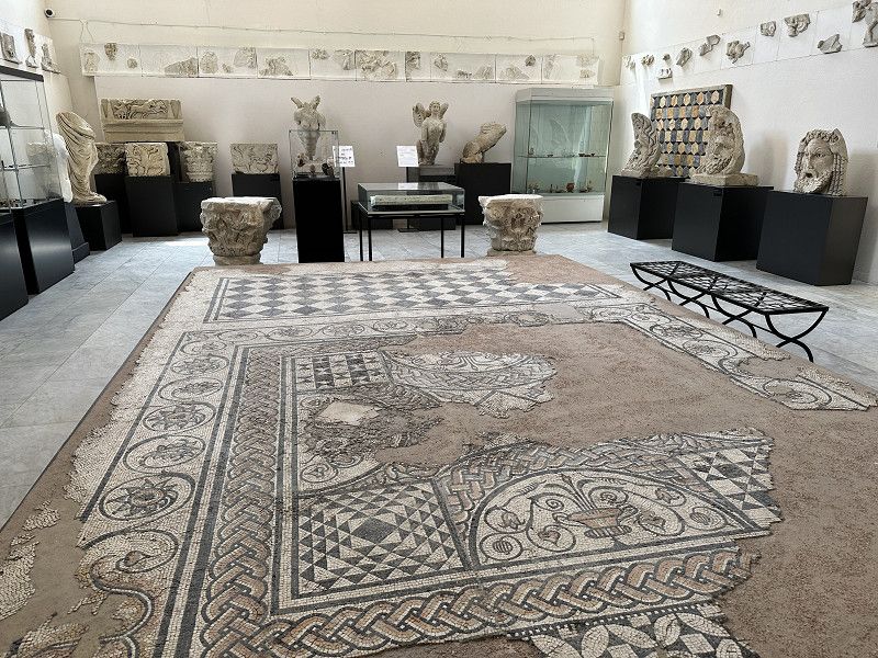
Former Roman town with a great old Roman theater. Interesting museum with the remains of castrum dates carved in stone.
Rue des Blanchisseurs 123, Orange, Vaucluse, Provence-Alpes-Côte d'Azur, Frankreich
44° 8' 2.7" N 4° 48' 49.8" E
44.1340810 4.8138470
• Head east on Rue des Blanchisseurs. Go for 274 m.
• Turn right onto Avenue Rodolphe d'Aymard. Go for 115 m.
• Continue on Rue Paul Painlevé. Go for 152 m.
• Turn right onto Avenue Maréchal Foch (N7). Go for 1.2 km.
• Continue on Rue Auguste Lacour toward A7/A9/Caderousse/Nîmes. Go for 96 m.
• Continue on Cours Aristide Briand. Go for 196 m.
• Take the 1st exit from roundabout onto Avenue Charles de Gaulle (D17) toward A7/A9/Caderousse. Go for 352 m.
• Take the 3rd exit from roundabout onto Avenue Charles de Gaulle (D17) toward A7/A9. Go for 283 m.
• Take the 3rd exit from roundabout onto A9 (Échangeur d'Orange) toward Montélimar/Lyon. Go for 1.5 km.
• Continue on A7 (Autoroute du Soleil). Go for 19.8 km.
• Take exit 19 toward Pierrelatte/Bollène. Go for 1.1 km.
• Take the 4th exit from Rond-Point des Portes de Provence roundabout onto Avenue Jean Giono (D994) toward Centre Ville. Go for 336 m.
• Take the 3rd exit from roundabout onto Rue Jules Verne. Go for 69 m.
• Continue on Rue Jules Verne. Go for 375 m.
• Turn right onto Avenue Salvador Allende (D8). Go for 669 m.
• Turn left onto Rue Alphonse Daudet toward Lembisque. Go for 474 m.
• Take the 1st exit from Rond-Point Gaspard Rispaud roundabout onto Route de l'Embisque. Go for 1.8 km.
• Turn left onto Route de l'Embisque. Go for 101 m.
• Arrive at Route de l'Embisque. Your destination is on the right.
☍
29,0 km
( 28 min.)
Bollène
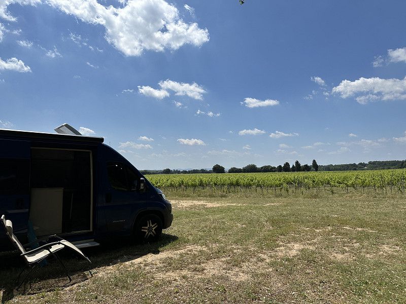
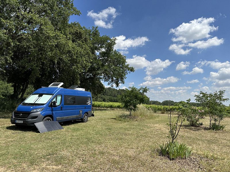
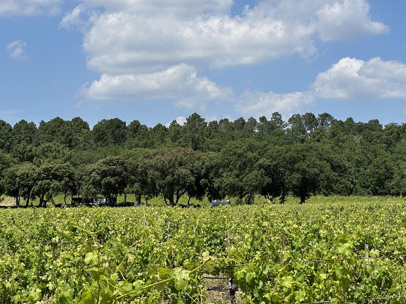
Domaine Julian de l'Embisque. French Passion pitch. Good organic wines. A wine tasting was free. Unfortunately, I liked the taste.
Route De l’Embisque 1791, Bollène, Saint-Paul-Trois-Châteaux, Drôme, Frankreich
44° 17' 14.9" N 4° 47' 12.9" E
44.2874693 4.7869046
• Head southwest on Route de l'Embisque. Go for 101 m.
• Turn right onto Route de l'Embisque. Go for 1.8 km.
• Take the 3rd exit from Rond-Point Gaspard Rispaud roundabout onto Rue Alphonse Daudet. Go for 504 m.
• Turn right onto Avenue Salvador Allende (D8). Go for 932 m.
• Take the 2nd exit from Rond-Point des Portes de Provence roundabout toward Lyon/Montélimar/Marseille/Nîmes/Orange. Go for 164 m.
• Take ramp onto A7 (Autoroute du Soleil) toward Montélimar/Valence/Lyon. Go for 143 km.
• Take exit 11 toward L'Isle d'Abeau/Vienne. Go for 463 m.
• Keep right toward A43/Lyon/Vienne/L'Isle d'Abeau. Go for 212 m.
• Continue on N7. Go for 322 m.
• Take the 2nd exit from roundabout onto N7 toward Lyon/L'Isle d'Abeau/Vienne-Centre. Go for 1.1 km.
• Take the 3rd exit from roundabout onto Boulevard du Rhône Sud (N7) toward Lyon/L'Isle d'Abeau/Vience-Centre. Go for 1.7 km.
• Turn slightly left onto Quai Jean Jaurès (N7) toward Grenoble/St Romain en Gal/Estressin. Go for 1.5 km.
• Turn right onto N7 toward St Symphorien d'O./Seyssuel-Village/Vienne-Bon Accueil/Z.I. Leveau. Go for 195 m.
• Take the 3rd exit from roundabout onto Avenue Marcellin Berthelot (N7). Go for 361 m.
• Turn right onto Place Joseph Muray et Jean Tardy. Go for 19 m.
• Turn left. Go for 73 m.
• Arrive at your destination on the left.
☍
152,7 km
(1 hrs. 27 min.)
Day
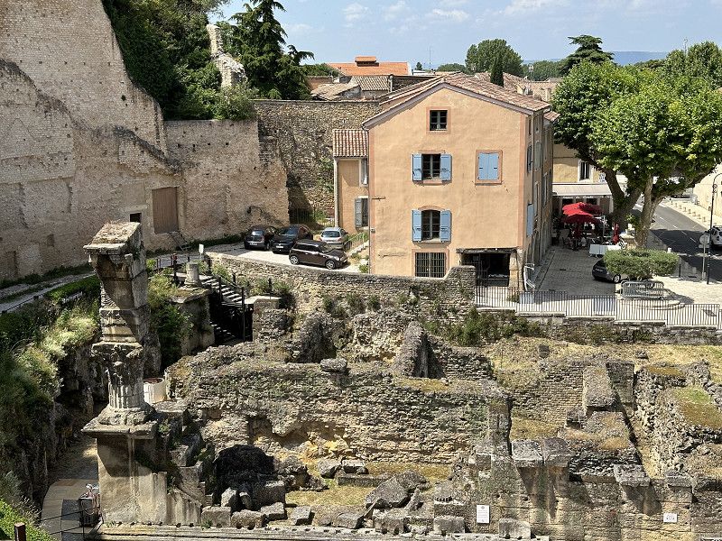
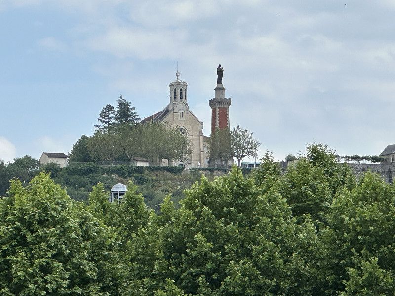
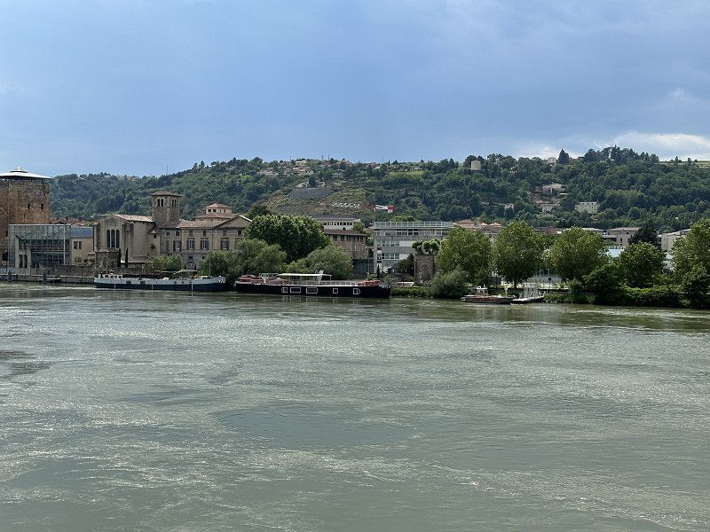
Vienne
I drove on the Route National and not the motorway. I'm parked in a parking lot that is marked as OK in an app but as "forbidden" in Park4Night. No height limit and no prohibition signs. The place is definitely interesting, even if not a "must see". A mixture of Roman and medieval buildings. The Gallo-Roman Museum could have been interesting, but after Nime, Arles and Orange I couldn't see any more museums.
Avenue Marcellin Berthelot 22, Vienne, Vienne, Isère, France
45° 32' 19.5" N 4° 52' 18.1" E
45.5387568 4.8716963
• Head northeast. Go for 17 m.
• Turn left toward Place Joseph Muray et Jean Tardy. Go for 50 m.
• Turn left onto Place Joseph Muray et Jean Tardy. Go for 23 m.
• Turn right onto Avenue Marcellin Berthelot (N7). Go for 7.0 km.
• Take the 2nd exit from roundabout onto D307 toward A46/Givors/St Symphorien d'Ozon/Communay. Go for 463 m.
• Take the 4th exit from roundabout onto A46 toward Corbas/Lyon/Paris. Go for 18.1 km.
• Continue on Rocade Est (N346). Go for 196 m.
• Keep left onto Rocade Est (N346) toward Paris/Genève. Go for 12.4 km.
• Keep left onto A42/A46 toward Paris/Villefranche S/Saône/Genève/Aéroport Saint-Exupéry. Go for 560 m.
• Take the exit onto A42/A46. Go for 988 m.
• Take the exit toward Bourg en B./Genève/Strasbourg/Aéroport Saint-Exupéry onto A42. Go for 20.8 km.
• Take exit 7 toward Pérouges/Meximieux/Lagnieu/P.I. Plaine de l'Ain. Go for 820 m.
• Take the 3rd exit from roundabout onto D65 B toward Meximieux/Cité Médiévale de Pérouges. Go for 4.3 km.
• Take the 4th exit from Giratoire du Stade roundabout onto D1084 toward Lyon/Meximieux/Cité Médiévale de Pérouges. Go for 524 m.
• Take the 1st exit from roundabout onto Route de Lyon (D22 A) toward Chalamont/Meximieux/Pérouges/Cité Médiévale de Pérouges. Go for 248 m.
• Turn left onto Route de Pérouges (D4). Go for 1.5 km.
• Turn right onto D4 B toward Cité Médiéviale de Pérouges. Go for 89 m.
• Turn right onto Route de la Cité (D4 B). Go for 331 m.
• Turn left onto Rue de la Porte d'en Haut. Go for 86 m.
• Continue on Rue des Rondes. Go for 51 m.
• Turn left onto Rue des Rondes. Go for 94 m.
• Turn right onto Rue de la Halle au Four. Go for 48 m.
• Turn right onto Place de la Halle. Go for 17 m.
• Arrive at Place de la Halle. Your destination is on the right.
☍
68,6 km
( 49 min.)
Day
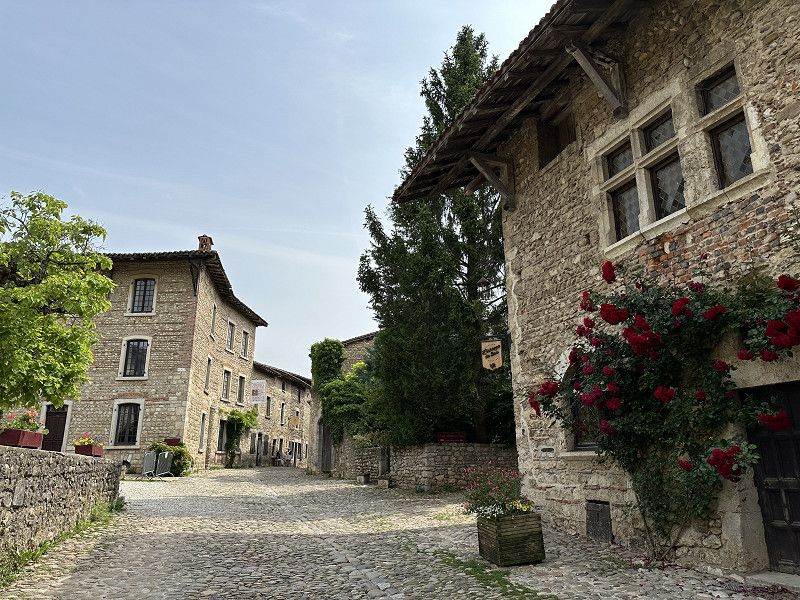
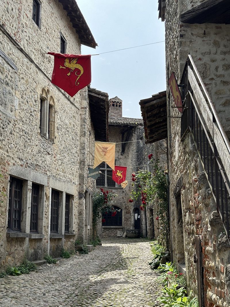
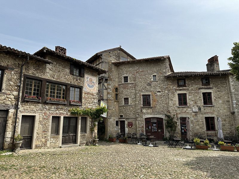
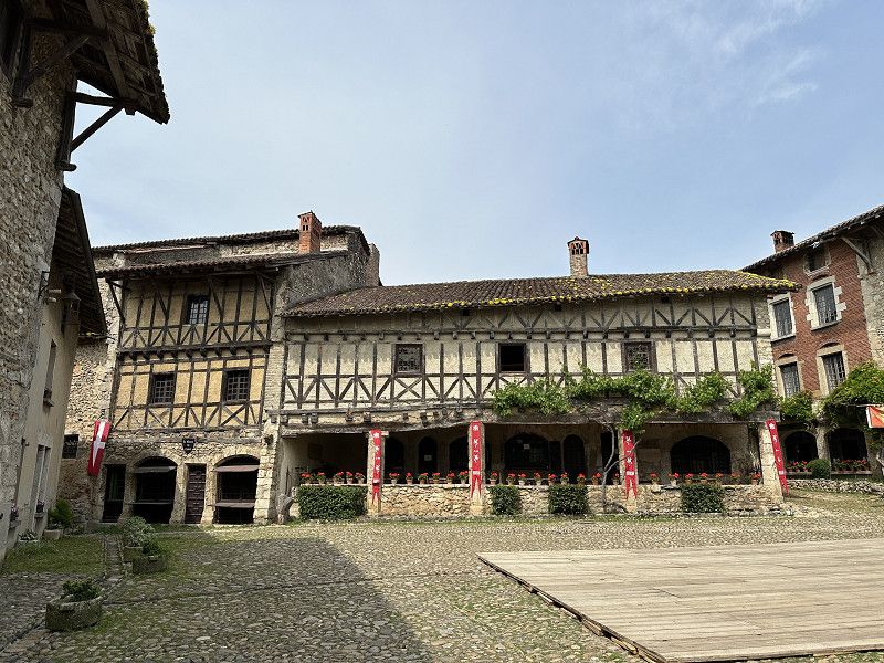
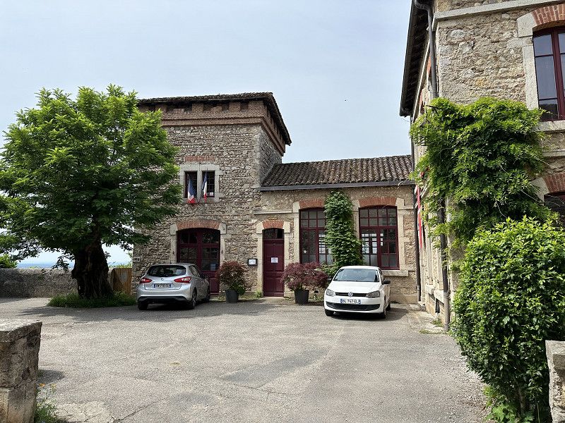
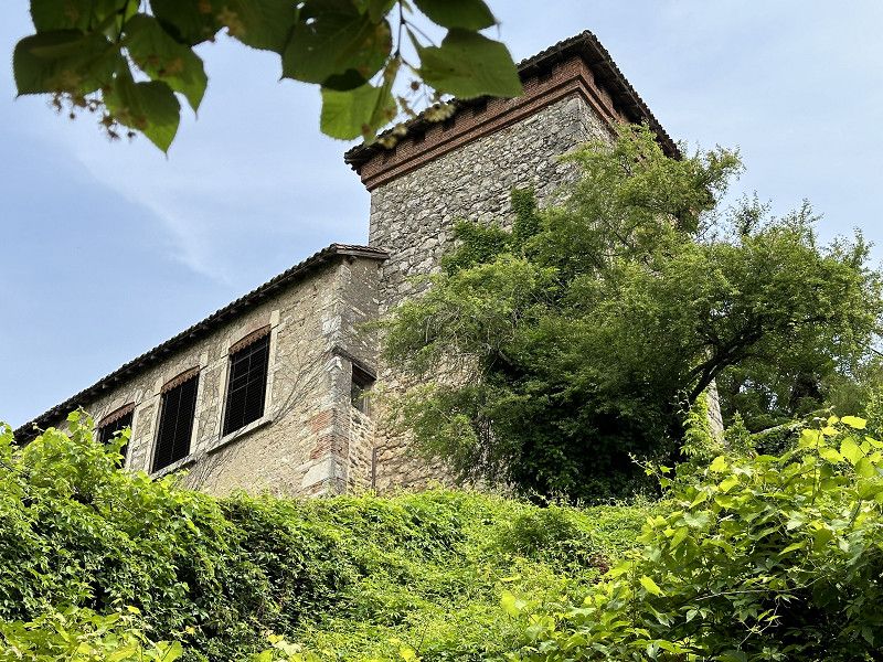
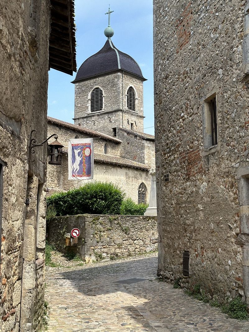
Pérouges
Parking fee €3. Medieval village on a hill. Nice stop on the way.
Ain, Auvergne-Rhone-Alpen, Frankreich
45° 54' 12.3" N 5° 10' 46.1" E
45.9034280 5.1794607
• Head east on Place de la Halle. Go for 17 m.
• Turn left onto Rue de la Halle au Four. Go for 48 m.
• Turn left onto Rue des Rondes. Go for 23 m.
• Turn right onto Rue de la Tour. Go for 160 m.
• Turn right onto Rue de la Porte d'en Haut. Go for 59 m.
• Turn left onto Route de la Cité (D4 B). Go for 310 m.
• Turn left onto Route de Trevoux (D4). Go for 764 m.
• Turn right onto Route de Lyon (D22 A) toward A42/Lyon/Ambérieu en B./Montluel/Z.I. Z.A. Meximieux. Go for 240 m.
• Take the 2nd exit from roundabout onto D1084 toward A42/Genève/Ambérieu en B./Z.I. les Verchères. Go for 497 m.
• Continue toward A42/St Maurice de G./Loyettes/Pont de Chéruy. Go for 48 m.
• Take the 1st exit from Giratoire du Stade roundabout onto Route de Saint-Maurice (D65 B) toward A42/Loyettes/Pont de Chéruy/St Maurice de G. Go for 4.2 km.
• Take the 1st exit from roundabout toward Genève/Bourg en B./Lyon/Aéroport Saint Exupéry. Go for 247 m.
• Take ramp onto A42 toward Genève/Bourg en B. Go for 28.0 km.
• Continue on A40. Go for 23.0 km.
• Keep left onto A39 (Autoroute Verte) toward Strasbourg/Lille/Paris Par A5/Dijon/Lons le S. Go for 22.9 km.
• Take exit 10 toward St Trivier de C./Coligny/St Amour. Go for 910 m.
• Turn right. Go for 66 m.
• Turn right toward D56. Go for 99 m.
• Take the 2nd exit from Giratoire du Biolay roundabout onto D56 toward Cormoz/St Trivier de C./Varennes-St S./Montrevel en B. Go for 2.9 km.
• Take the 3rd exit from roundabout onto D996 toward Bourg en B./Montrevel en B./Marboz. Go for 1.7 km.
• Turn right onto Lieu-dit Le Petit Ronjon. Go for 67 m.
• Continue on Chemin du Petit Ronjon. Go for 178 m.
• Continue toward Chemin du Petit Ronjon. Go for 445 m.
• Continue on Chemin du Petit Ronjon. Go for 176 m.
• Turn right onto Route de la Verne. Go for 424 m.
• Arrive at Route de la Verne. Your destination is on the right.
☍
87,5 km
( 53 min.)
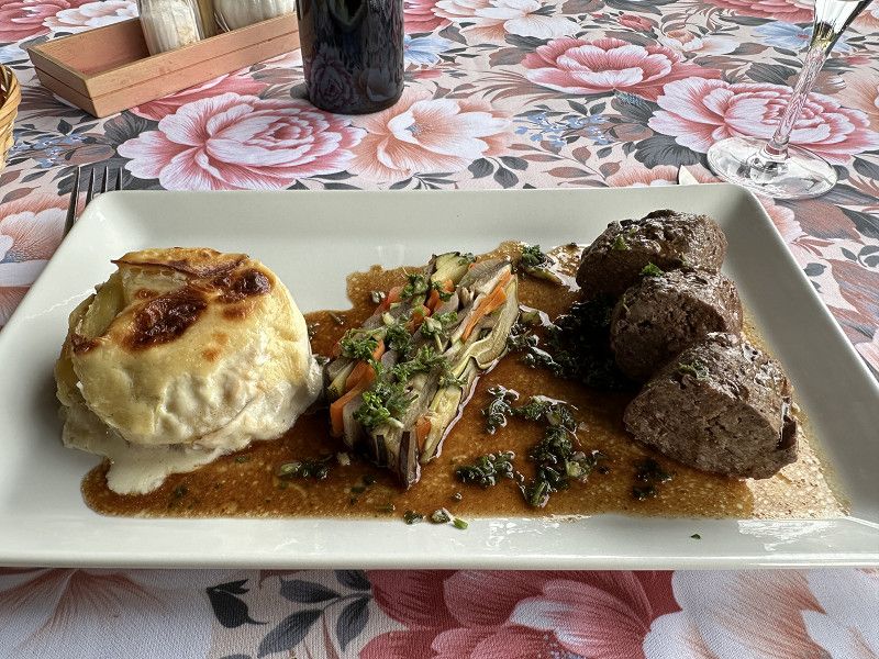
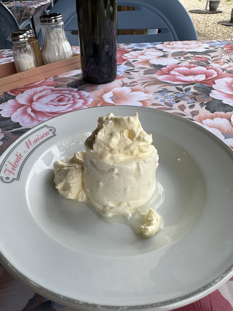
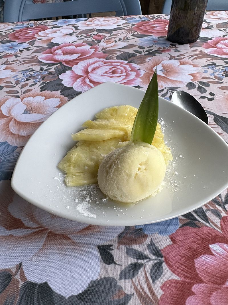
Auberge du Grand Ronjon
Also a French Passion pitch, but great and inexpensive food!
Route de la Verne 2561, Cormoz, Ain, Auvergne-Rhone-Alpen, Frankreich
46° 25' 53.3" N 5° 13' 17.9" E
46.4314820 5.2216520
• Head west on Route de la Verne. Go for 270 m.
• Turn right onto Voie de Cormoz à Foissiat. Go for 1.1 km.
• Turn right onto Lieu-dit Les Montets. Go for 580 m.
• Continue on Lieu-dit La Culée. Go for 84 m.
• Turn left onto D996. Go for 645 m.
• Take the 1st exit from roundabout onto D56 toward A39/St Amour. Go for 2.9 km.
• Take the 3rd exit from Giratoire du Biolay roundabout toward A39/Lyon/Bourg en B./Strasbourg/Lons le S. Go for 270 m.
• Turn slightly right toward A39. Go for 86 m.
• Take ramp onto A39 (Autoroute Verte) toward Strasbourg/Lons le S. Go for 88.6 km.
• Take the exit toward Strasbourg/Besançon/Dole/Authume onto A36 (La Comtoise). Go for 123 km.
• Keep left onto A36 (La Comtoise) toward Strasbourg/Mulhouse/Belfort/Montbéliard. Go for 74.2 km.
• Continue on A5. Go for 191 m.
• Take the left exit toward Karlsruhe/Stuttgart/Freiburg onto A5. Go for 29.5 km.
• Take exit 63 toward Freiburg-Süd/FR-Tiengen. Go for 360 m.
• Turn right onto Freiburger Landstraße (B31). Go for 3.1 km.
• Take the 1st exit from roundabout onto Tiengener Straße (B31) toward Freiburg. Go for 1.2 km.
• Continue on Basler Landstraße (K9863). Go for 203 m.
• Continue on Basler Landstraße. Go for 390 m.
• Turn left onto Gebhard-Kromer-Straße. Go for 119 m.
• Take the 1st exit from roundabout onto Alice-Salomon-Straße. Go for 36 m.
• Arrive at Alice-Salomon-Straße. Your destination is on the left.
☍
327,0 km
(2 hrs. 49 min.)
Day
Freiburg
Baden-Württemberg, Deutschland
47° 59' 0.6" N 7° 48' 1.7" E
47.9834885 7.8004731
• Head west on Alice-Salomon-Straße. Go for 22 m.
• Take the 1st exit from roundabout onto Alice-Salomon-Straße. Go for 287 m.
• Turn right onto Alice-Salomon-Straße. Go for 96 m.
• Take the 2nd exit from roundabout onto Besançonallee (K9863). Go for 1.3 km.
• Continue on Tel-Aviv-Yafo-Allee toward Karlsruhe/Offenburg/Industriegebiet Nord/Gewerbegebiet Hochdorf/Messe/Uni-Kliniken. Go for 1.5 km.
• Take ramp onto Autobahnzubringer Mitte (B31A) toward Karlsruhe-Basel/Umkirch/Mundenhof. Go for 2.3 km.
• Take ramp onto A5 toward Karlsruhe. Go for 122 km.
• Take exit 48 toward Karlsruhe-Süd/Rheinstetten/Messe KA/Landau (Pfalz)/Ettlingen Gewerbegebiet. Go for 398 m.
• Turn right onto B3 toward Ettlingen-Zentrum. Go for 471 m.
• Turn right onto Bulacher Straße. Go for 1.4 km.
• Take the 3rd exit from roundabout onto Rheinstraße. Go for 993 m.
• Turn right onto Rastatter Straße. Go for 242 m.
• Turn left onto Schloßgartenstraße. Go for 52 m.
• Turn left onto Bernhardusstraße. Go for 40 m.
• Turn right. Go for 46 m.
• Arrive at your destination on the left.
☍
130,7 km
(1 hrs. 14 min.)
Day
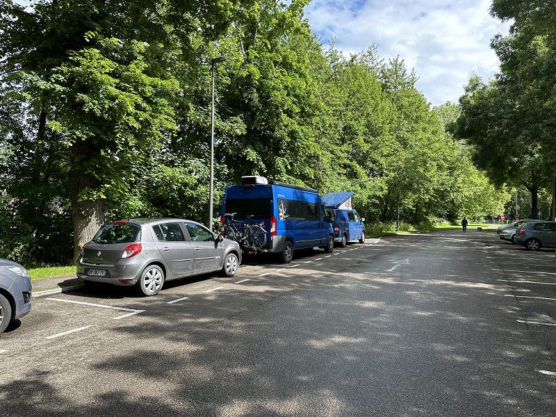
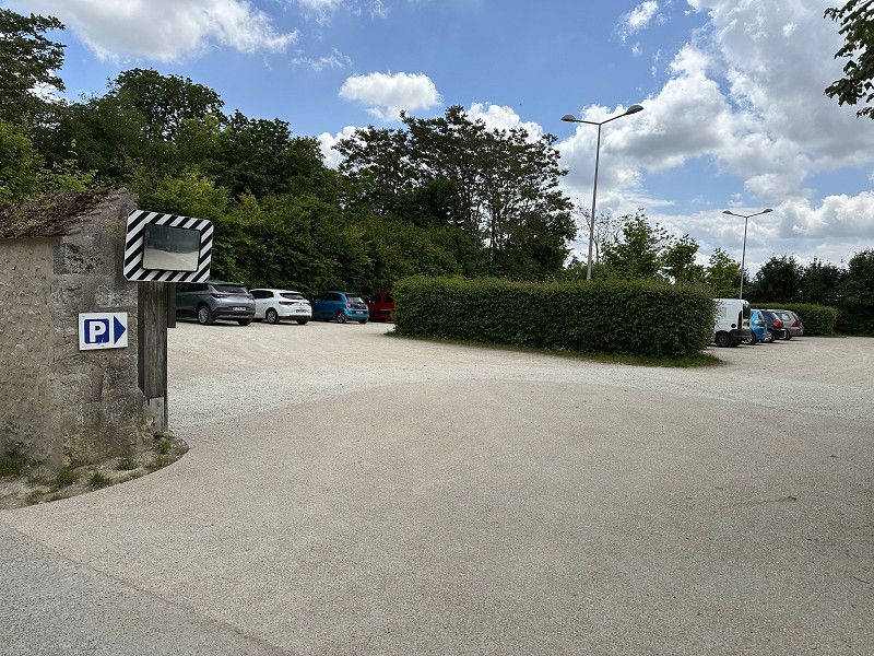
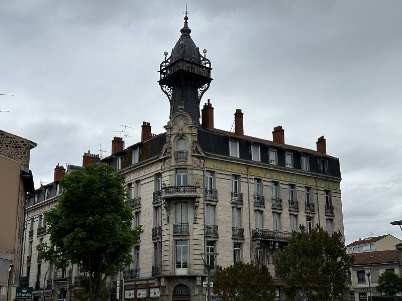
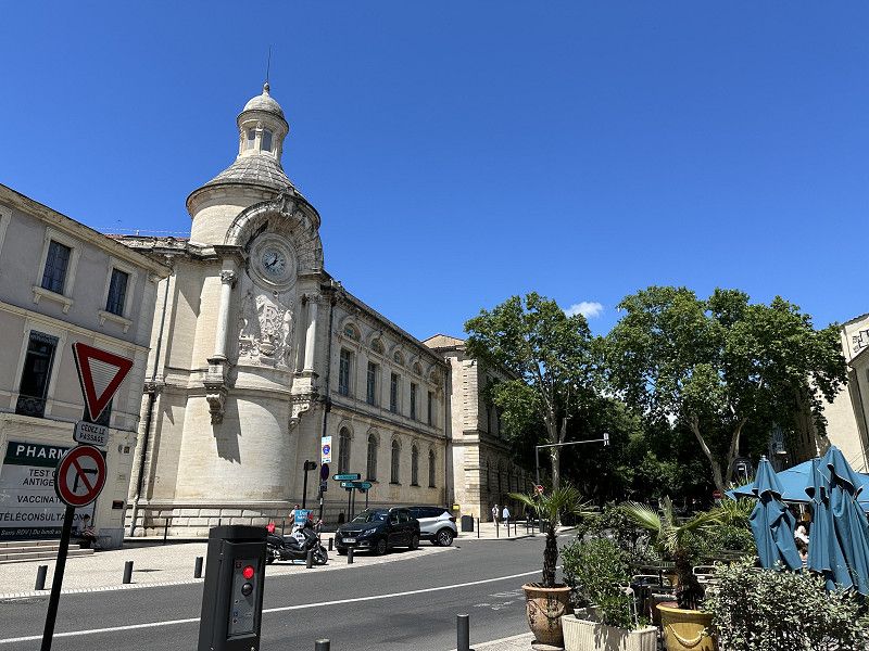
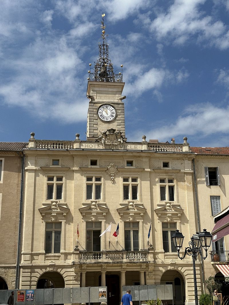
Ettlingen
Landkreis Karlsruhe, Baden-Württemberg, Deutschland
48° 56' 23" N 8° 24' 15.4" E
48.9397149 8.4042700