Since we had tickets for a Udo Lindenberg concert and the weather looked good, we "hung" Palatinate a week before. We wanted to hike, bike, enjoy wine. We chose the pitches so that we could usually do something directly from there.
Day
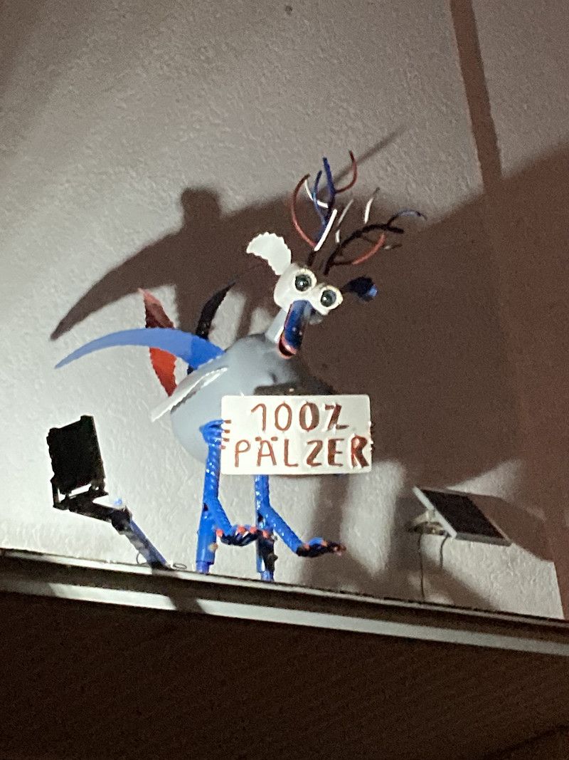
4.7.22 Neustadt - 100% Pfälzer!
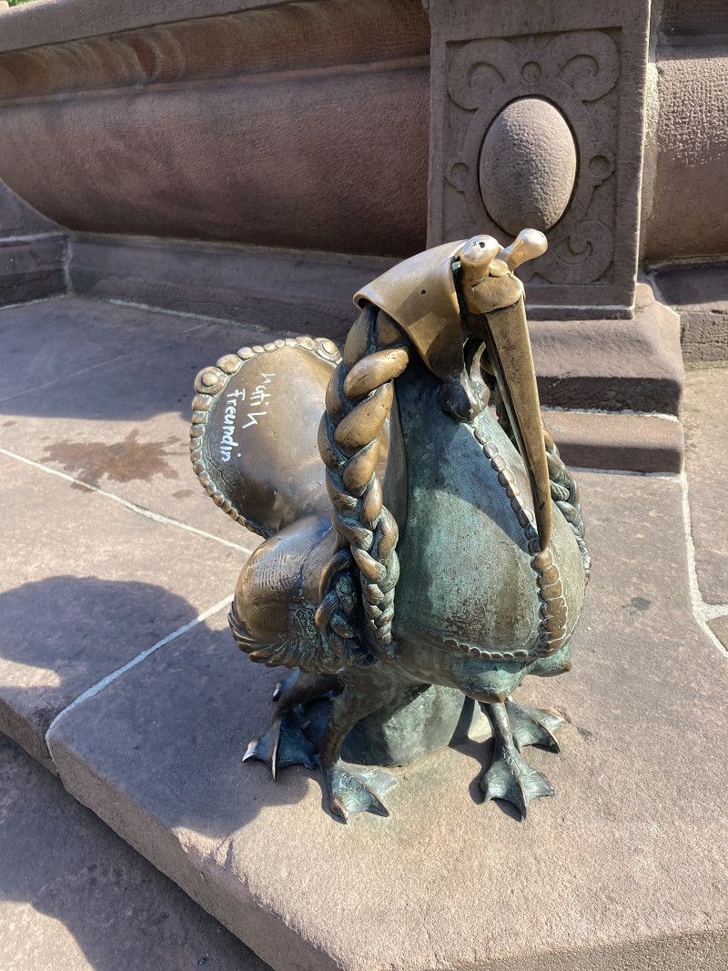
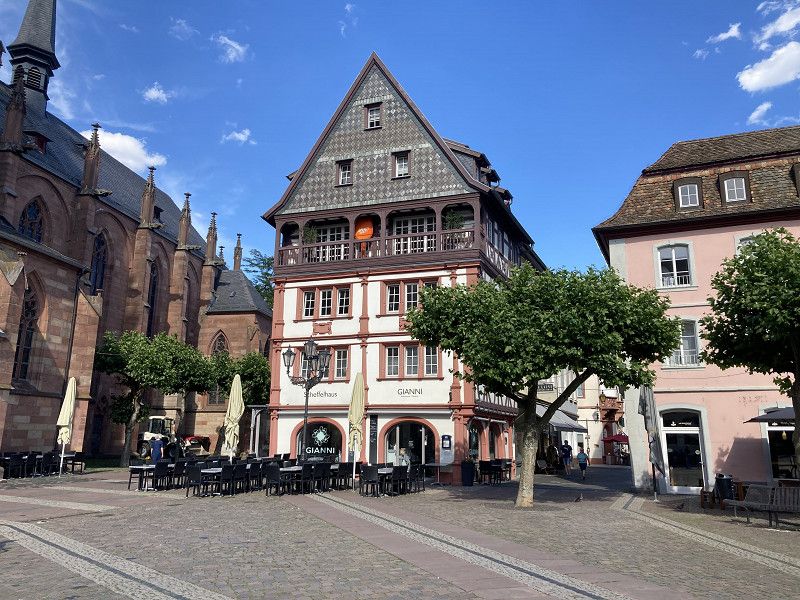
We visit friends in Neustadt and stroll through the beautiful old town together, marvel at the church, which is divided into a Protestant and a Catholic part and thus has two different towers. Of course we also pay a visit to the Elwetritsch, a bird-like mythical creature that is native to the Palatinate.
In the evening we go to the Novalis in the garden for a delicious meal.
Since it is too far from our friends to the official camper place in Neustadt, we spend the night in the parking lot between the outdoor pool and the stadium, where overnight stays are officially allowed.
Neustadt an der Weinstraße, Deutschland
Neustadt an der Weinstraße , Deutschland
49° 21' 14.3" N 8° 8' 6" E
49.3539802 8.1350021
• Head toward Rittergartenstraße on Bachgängel (B38). Go for 568 m.
• Turn right onto Exterstraße toward Zentrum/Altstadt Parkplatz. Go for 508 m.
• Turn left onto Landauer Straße (B39). Go for 1.5 km.
• Take the 2nd exit from roundabout onto Landauer Straße (B39). Go for 375 m.
• Continue on Landauer Straße (L516) toward Landau/NW-Diedesfeld/NW-Hambach/Hambacher Schloß/Gewerbegebiet Landauer Straße Süd. Go for 3.8 km.
• Take the 2nd exit from roundabout onto L516 toward Karlsruhe/A65/Landau/Edenkoben. Go for 853 m.
• Take the 1st exit from roundabout onto An der Südumgehung (K32) toward Maikammer-Süd/Maikammer. Go for 636 m.
• Take the 3rd exit from roundabout onto L512 toward Edenkoben. Go for 1.9 km.
• Turn right onto Klosterstraße (L512). Go for 253 m.
• Turn left onto Radeburger Straße (L512). Go for 309 m.
• Turn left onto Poststraße. Go for 100 m.
• Turn left onto Weinstraße. Go for 62 m.
• Continue on Privatstraße. Go for 75 m.
• Turn slightly right onto Metzgergasse. Go for 153 m.
• Turn left onto Weinstraße. Go for 38 m.
• Turn right onto Ludwigsplatz. Go for 96 m.
• Arrive at Ludwigsplatz. Your destination is on the left.
☍
11,3 km
( 15 min.)
Day
5.7.22 Edenkoben -Radtour durch Weinberge zur Riethburg
The night was pretty quiet, but in the morning at 8 a.m. we were woken up by a loudspeaker announcement from the stadium next door: "Dear students, I wish you a wonderful good morning, have fun and a fair competition!"..... Aha! Federal Youth Games! During breakfast we watch the kids run, throw, cheer and play ball and are happy that something like this can finally take place again after Corona.
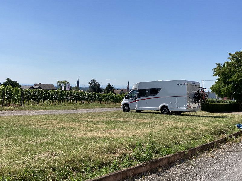
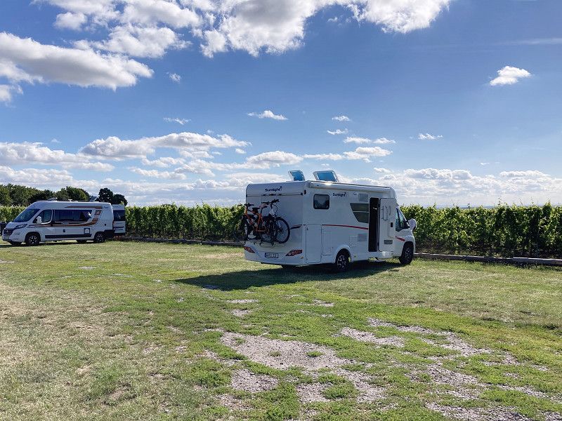
In Edenkoben on the Edel-Brauch winery we find a parking space with a view of the vineyards. Unfortunately, the restaurant is on vacation, but we can buy a few bottles of wine as a parking fee.
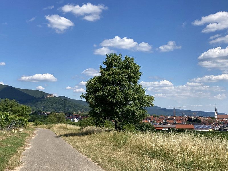
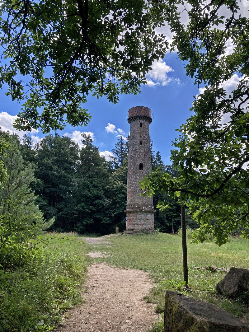
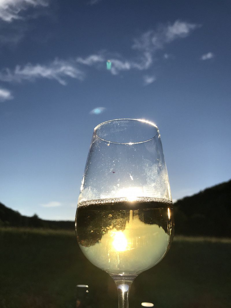
We start our bike tour directly from here: Maikammer, Roth, Villa Ludwigshöhe, from there with the chairlift up to the Riethburg. At the top you hike to the Ludwigsturm (4 km), a real Rapunzel tower! At Burg Riethburg there is a "slate sack" in proper style: liver dumplings, bratwurst, sauerkraut. We drive back via Hainfeld and Burrweiler and enjoy the very tasty white wine in front of the mobile home. So beautiful! Let's go on like this!!
Edenkoben, Deutschland
Edenkoben , Deutschland
49° 16' 56" N 8° 7' 42.4" E
49.2822360 8.1284357
• Head toward Weinstraße on Ludwigsplatz. Go for 96 m.
• Turn right onto Weinstraße. Go for 106 m.
• Continue on Weinstraße (L512). Go for 306 m.
• Keep right onto Weinstraße (L512). Go for 1.6 km.
• Take the 2nd exit from roundabout onto Weinstraße Süd (L512) toward Maikammer-Süd. Go for 891 m.
• Turn left onto Weinstraße Nord (L512). Go for 212 m.
• Arrive at Weinstraße Nord (L512). Your destination is on the left.
☍
3,2 km
( 6 min.)
Maikammer, Rhineland-Palatinate, Germany
2, Weinstraße Nord, Maikammer, Landkreis Südliche Weinstraße, Rhineland-Palatinate, 67487, Germany
49° 18' 17.7" N 8° 7' 51.5" E
49.3049292 8.1309728
• Head toward Sankt-Martiner-Straße on Weinstraße Nord (L512). Go for 261 m.
• Turn right onto Weinstraße Süd (L512). Go for 410 m.
• Take the 2nd exit from roundabout onto L512. Go for 1.9 km.
• Turn right onto Klosterstraße (L512). Go for 253 m.
• Continue on Klosterstraße (K6). Go for 2.0 km.
• Turn left. Go for 327 m.
• Turn left toward Villastraße/K64. Go for 96 m.
• Turn right onto Villastraße (K64). Go for 967 m.
• Turn right onto Villastraße (K64). Go for 342 m.
• Arrive at Villastraße (K64). Your destination is on the right.
☍
6,5 km
( 11 min.)
Rhineland-Palatinate, Germany
Terrassencafé, 67, Villastraße, Edenkoben, Landkreis Südliche Weinstraße, Rhineland-Palatinate, 67480, Germany
49° 16' 41" N 8° 5' 13.4" E
49.2780527 8.0870533
• Head northeast on Villastraße (K64). Go for 342 m.
• Turn right. Go for 471 m.
• Turn right toward Theresienstraße. Go for 297 m.
• Turn right onto Theresienstraße. Go for 888 m.
• Arrive at Theresienstraße.
☍
2,0 km
( 4 min.)
Rhodt unter Rietburg, Rhineland-Palatinate, Germany
Ludwigsturm, Rietburgstraße, Rhodt unter Rietburg, Edenkoben, Landkreis Südliche Weinstraße, Rhineland-Palatinate, 76835, Germany
49° 16' 10.4" N 8° 4' 4.2" E
49.2695687 8.0678272
• Head east on Theresienstraße. Go for 2.0 km.
• Turn right onto Weinstraße (L512). Go for 2.1 km.
• Turn right onto Weinstraße (L507). Go for 1.8 km.
• Turn right onto Gaisbergstraße. Go for 83 m.
• Turn left onto Raiffeisenstraße. Go for 200 m.
• Turn right onto Hauptstraße (K58). Go for 61 m.
• Arrive at Hauptstraße (K58). Your destination is on the right.
☍
6,2 km
( 11 min.)
Burrweiler, Rhineland-Palatinate, Germany
30, Hauptstraße, Burrweiler, Edenkoben, Landkreis Südliche Weinstraße, Rhineland-Palatinate, 76835, Germany
49° 14' 57.9" N 8° 4' 31.1" E
49.2494172 8.0753168
• Head toward Mönchstraße on Hauptstraße (K58). Go for 98 m.
• Turn right onto Gaisbergstraße. Go for 283 m.
• Turn left onto Weinstraße (L507). Go for 1.8 km.
• Continue on Edesheimer Straße (L507). Go for 229 m.
• Arrive at L507. Your destination is on the right.
☍
2,4 km
( 3 min.)
Day
Hainfeld, Rhineland-Palatinate, Germany
Edesheimer Straße, Hainfeld, Edenkoben, Landkreis Südliche Weinstraße, Rhineland-Palatinate, 76835, Germany
49° 15' 18.3" N 8° 6' 15.6" E
49.2550724 8.1043329
• Head toward Leonhard-Eckel-Siedlung on L507. Go for 2.3 km.
• Turn left onto Staatsstraße (L516). Go for 1.1 km.
• Turn left onto Edenkobener Straße (K31) toward Edenkoben. Go for 450 m.
• Continue on Rhodter Straße (K31). Go for 704 m.
• Continue on Weinstraße (K31). Go for 138 m.
• Turn right onto Radeburger Straße (L512) toward Neustadt/Wstr./Maikammer. Go for 472 m.
• Turn left onto Klosterstraße (K6). Go for 159 m.
• Turn right onto Neuweg. Go for 257 m.
• Turn right onto In den Forstwiesen. Go for 92 m.
• Turn right onto Etanger Straße. Go for 45 m.
• Arrive at Etanger Straße. Your destination is on the right.
☍
5,7 km
( 8 min.)
Rhineland-Palatinate, Germany
24, Nonnenstraße, Edenkoben, Landkreis Südliche Weinstraße, Rhineland-Palatinate, 67480, Germany
49° 17' 6.1" N 8° 7' 21.8" E
49.2850157 8.1227175
• Head toward In den Forstwiesen on Etanger Straße. Go for 45 m.
• Turn left onto In den Forstwiesen. Go for 92 m.
• Turn left onto Neuweg. Go for 83 m.
• Turn left onto Nonnenstraße. Go for 161 m.
• Turn right onto Remlingstraße. Go for 165 m.
• Continue on Radeburger Straße (L512). Go for 472 m.
• Turn left onto Weinstraße (K31). Go for 138 m.
• Continue on Rhodter Straße (K31). Go for 704 m.
• Continue on Edenkobener Straße (K31). Go for 450 m.
• Turn right onto L516 toward Landau/Edesheim. Go for 6.1 km.
• Take the 1st exit from roundabout onto B10 toward Saarbrücken/Pirmasens/Annweiler. Go for 14.5 km.
• Turn left and take ramp toward Bad Bergzabern/Annweiler-West/Gewerbegebiet Buchmann HAPA/A.-Sarnstall. Go for 229 m.
• Turn right onto Wernersberger Straße (B48) toward Bad Bergzabern/Waldrohrbach/Klinikum LD-SÜW. Go for 3.2 km.
• Turn right onto L494 toward Silz/Gossersweiler-Stein/Völkersweiler. Go for 5.1 km.
• Turn right onto Hauptstraße (L493). Go for 537 m.
• Turn right onto Hauptstraße. Go for 253 m.
• Arrive at your destination.
☍
32,3 km
( 32 min.)
6.7.22 Wespenstich, Silzer Badesee, Dornröschen und Saumagen
Our breakfast in the sun comes to an abrupt end because Uwe gets stung on the lip by a wasp, which quickly swells up really badly. Thank God we get from the young woman Edel? or custom? the tip with her family doctor in Edenkoben, to which we cycle in a moment. With two cortisone tablets everything swells up quickly.
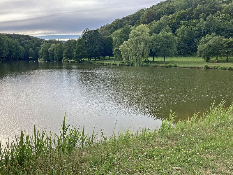
We take our time and take a leisurely gondola to the parking space at the Silz bathing lake. This is a large meadow directly behind the dike of the lake and costs 10 € without electricity.
Unfortunately, it's too fresh for swimming, so we cycle comfortably to Dörrenbach, the "Sleeping Beauty" of the Palatinate. Cute little place with a beautiful church with a church garden. Then it's off to the Kieffer butcher's shop in Bad Bergzabern, where we buy liverwurst and delicious Saumagen. The bike path from Bad Berzabern back to Lake Silz is beautiful. In the evenings, however, it gets chilly, so we like to go in after a beer after work.
Silz, Rhineland-Palatinate, Germany
Wohnmobilstellplatz Silz, L 493, Silz, Annweiler am Trifels, Landkreis Südliche Weinstraße, Rhineland-Palatinate, 76857, Germany
49° 8' 39.6" N 7° 56' 18.2" E
49.1443238 7.9383945
• Head north. Go for 145 m.
• Continue on Hauptstraße. Go for 108 m.
• Turn left onto Hauptstraße (L493). Go for 6.2 km.
• Turn right onto Weinstraße (B48). Go for 2.3 km.
• Take the 2nd exit from roundabout onto B48 toward Strasbourg/Bad Bergzabern/Gewerbegebiet Pleisweiler-Oberhofen. Go for 2.3 km.
• Continue on B38. Go for 3.8 km.
• Turn right onto K22. Go for 672 m.
• Continue on Am Kohlweg (K22). Go for 518 m.
• Continue on Hauptstraße (K22). Go for 665 m.
• Turn left onto Hauptstraße. Go for 12 m.
• Turn right onto Rathausgasse. Go for 50 m.
• Turn slightly left onto Weed-Borngasse. Go for 40 m.
• Arrive at Weed-Borngasse.
☍
16,7 km
( 17 min.)
Dörrenbach, Rhineland-Palatinate, Germany
Weed-Borngasse, Dörrenbach, Bad Bergzabern, Landkreis Südliche Weinstraße, Rhineland-Palatinate, 76889, Germany
49° 5' 20.9" N 7° 57' 38.4" E
49.0891276 7.9606748
• Head toward Brunnenstraße on Weed-Borngasse. Go for 40 m.
• Turn slightly right onto Rathausgasse. Go for 50 m.
• Turn left onto Hauptstraße. Go for 12 m.
• Turn right onto Hauptstraße. Go for 157 m.
• Turn slightly right onto Hauptstraße (K22). Go for 508 m.
• Continue on Am Kohlweg (K22). Go for 518 m.
• Continue on K22. Go for 672 m.
• Turn left onto B38. Go for 396 m.
• Turn left onto L508 toward B427/Pirmasens/Bad Bergzabern-Süd. Go for 1.5 km.
• Turn right onto Weinstraße (B427). Go for 707 m.
• Arrive at Weinstraße (B427). Your destination is on the right.
☍
4,5 km
( 7 min.)
Rhineland-Palatinate, Germany
Autoservice Lavan, 71, Weinstraße, Bad Bergzabern, Landkreis Südliche Weinstraße, Rhineland-Palatinate, 76887, Germany
49° 6' 6.2" N 8° 0' 5.9" E
49.1017312 8.0016358
• Head toward Marktstraße on Weinstraße (B427). Go for 132 m.
• Take the 4th exit from roundabout onto Weinstraße (B427) toward Pirmasens/Birkenhördt. Go for 6.4 km.
• Turn right onto K11 toward Annweiler. Go for 2.2 km.
• Turn right onto L493 toward Klingenmünster/Silz. Go for 3.4 km.
• Arrive at L493. Your destination is on the left.
☍
12,2 km
( 11 min.)
Silz, Rhineland-Palatinate, Germany
L 493, Silz, Annweiler am Trifels, Landkreis Südliche Weinstraße, Rhineland-Palatinate, 76857, Germany
49° 8' 35.1" N 7° 56' 20.7" E
49.1430841 7.9390750
• Head toward Hauptstraße on L493. Go for 6.6 km.
• Turn right onto Weinstraße (B48). Go for 2.3 km.
• Take the 2nd exit from roundabout onto B48 toward Strasbourg/Bad Bergzabern/Gewerbegebiet Pleisweiler-Oberhofen. Go for 2.3 km.
• Continue on B38. Go for 8.6 km.
• Take the 3rd exit from roundabout onto B38 toward Strasbourg/Wissembourg/Schweigen. Go for 339 m.
• Take the 3rd exit from roundabout onto Weinstraße (B38) toward Strasbourg/Wissembourg. Go for 630 m.
• Continue on D264. Go for 687 m.
• Take the 2nd exit from Chemin de Chabanu roundabout onto Rue de la Paix (D264) toward Haguenau/Z.A. des 4 Vents. Go for 326 m.
• Turn right onto Chemin de Chabanu. Go for 34 m.
• Turn slightly right onto Rue des Fleurs. Go for 145 m.
• Continue on Place de la Foire. Go for 90 m.
• Continue on Rue de la Chaîne. Go for 56 m.
• Turn left onto Rue des Cavaliers. Go for 125 m.
• Turn right onto Rue Nationale (D264). Go for 209 m.
• Enter the roundabout. Go for 47 m.
• Arrive at Place de la République. Your destination is on the left.
☍
22,4 km
( 23 min.)
Day
7.7.22 Burg Drachenfels , Baumwipfelpfad und Neudahner Weiher
The weather is gray in grey. We drive to Wissembourg for shopping and via Lemberg back to Germany.
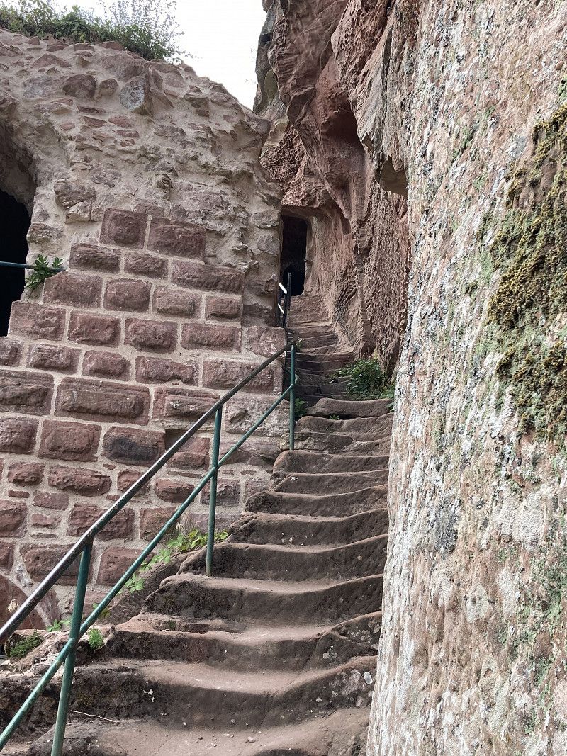
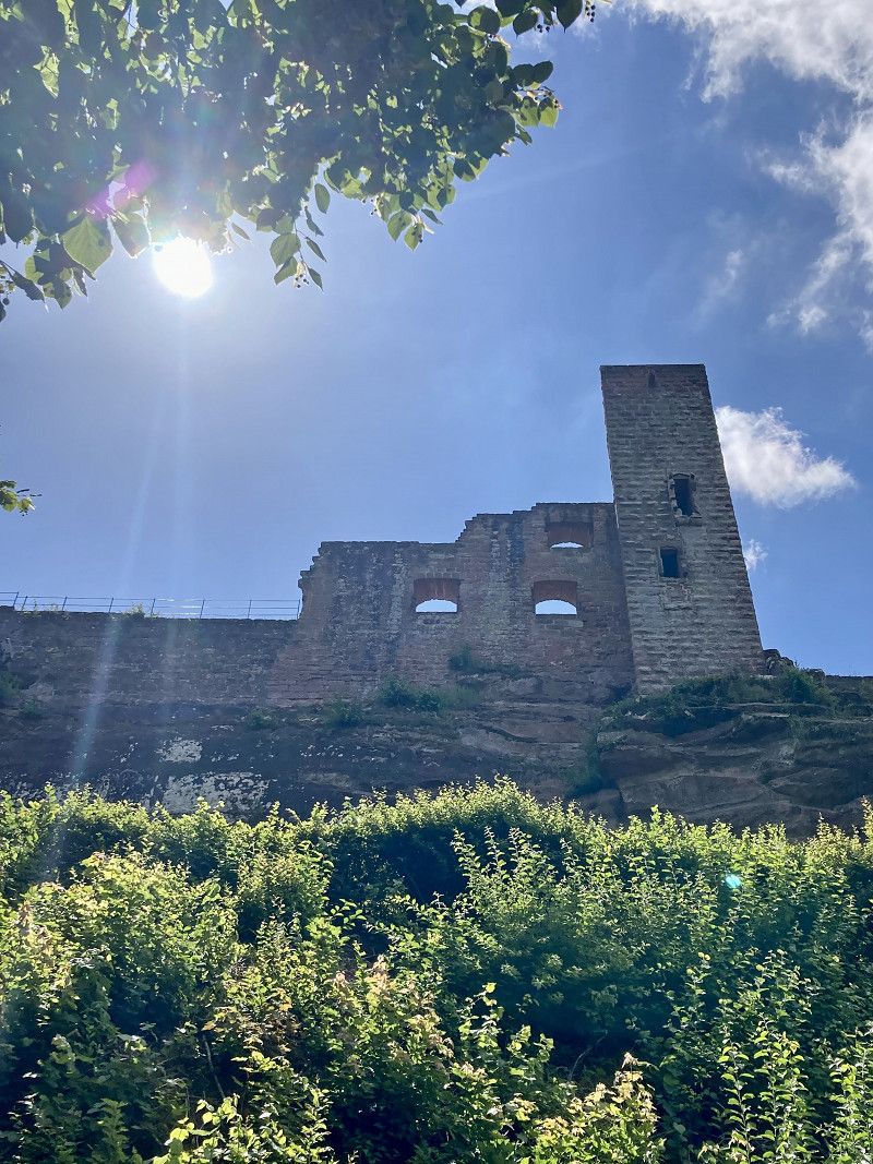
A short detour to Drachenfels Castle is a must! From the Pfälzer Wald Hütte we walk up to the ruins of Drachenfels Castle. Nice!
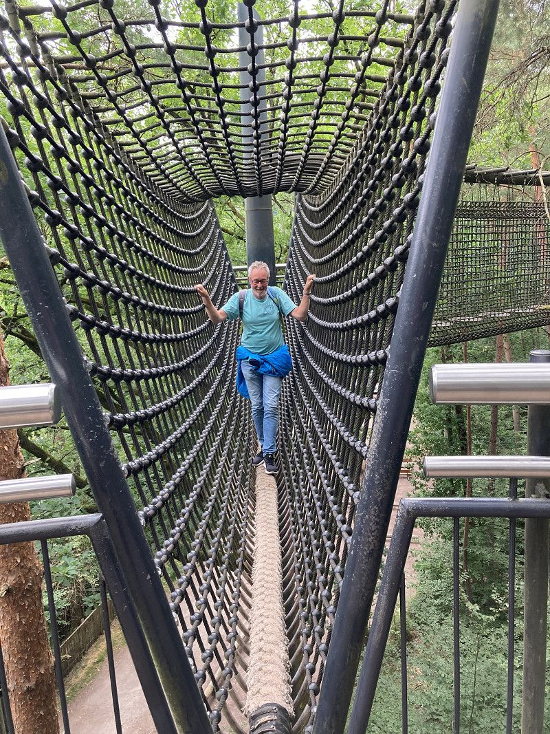
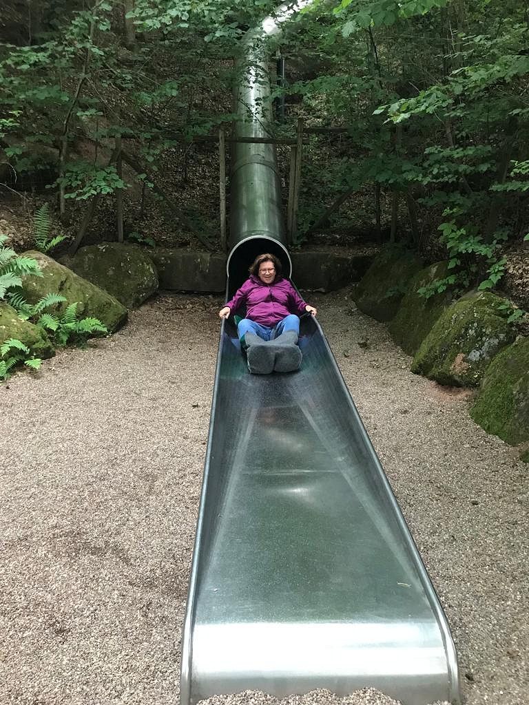
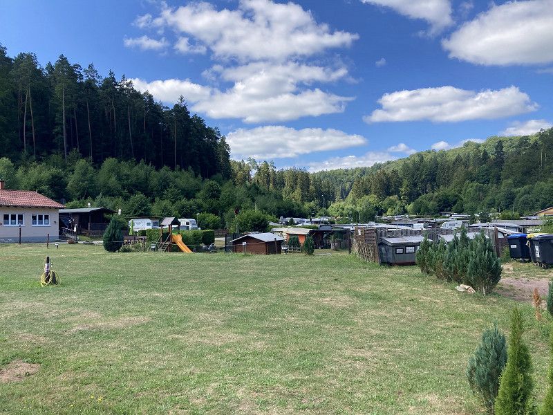
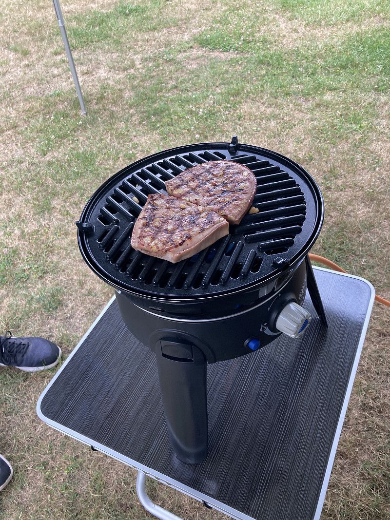
Then we go to the biosphere house near Fischbach, where we learn a lot about the Palatinate Forest biosphere reserve. It's now drizzling, but we can still do the treetop walk, which ends with a slide. There is also a parking space, but it costs €20 and is a parking lot in the forest. We head for the Neudahner Weiher. The front campsite is quite full and costs a whopping 28€, the rear 17€. We'll take that. Since the weather is better again, we are grilling our Saumagen today, along with fried potatoes and a nice white wine. delicious!!
Weißenburg, Frankreich
Weißenburg , Frankreich
49° 2' 11.7" N 7° 56' 40.2" E
49.0365935 7.9445109
• Follow the roundabout. Go for 4 m.
• Take the 1st exit from roundabout onto Place de la République (D264). Go for 48 m.
• Continue on Rue de la République (D264). Go for 132 m.
• Turn slightly left onto Place du Marché aux Choux (D264). Go for 26 m.
• Continue on Rue du Général Leclerc (D264). Go for 131 m.
• Take the 1st exit from Place Stichaner roundabout onto Route des Vosges (D77). Go for 83 m.
• Take the 1st exit from roundabout onto Boulevard Clemenceau (D334). Go for 1.0 km.
• Take the 2nd exit from roundabout onto Route de Weiler (D334). Go for 3.2 km.
• Continue on Sankt Germanshof (L478). Go for 8.5 km.
• Turn left onto Hauptstraße (L478). Go for 3.9 km.
• Turn left onto Rumbacher Straße (L478) toward Lembach/Rumbach/Eppenbrunn. Go for 2.1 km.
• Take the 1st exit from roundabout onto L478. Go for 4.4 km.
• Turn right onto L478 toward Eppenbrunn/Ludwigswinkel/Fischbach. Go for 2.3 km.
• Arrive at Hauptstraße (L478). Your destination is on the right.
☍
25,9 km
( 26 min.)
Biosphärenhaus, Deutschland
Am Königsbruch , Fischbach bei Dahn, Deutschland
49° 5' 13.8" N 7° 43' 28.5" E
49.0871652 7.7245876
• Head toward Fliederstraße on Hauptstraße (L478). Go for 3.4 km.
• Continue on L487. Go for 11.8 km.
• Continue on Lindelstraße (L487). Go for 621 m.
• Continue on Lemberger Straße (L486) toward Bad Bergzabern/Dahn. Go for 2.5 km.
• Turn right onto B427 toward Bad Bergzabern/Dahn. Go for 1.2 km.
• Turn right. Go for 104 m.
• Turn left. Go for 480 m.
• Turn left. Go for 52 m.
• Arrive at your destination on the left.
☍
20,2 km
( 20 min.)
Neudahner Weiher, Deutschland
Neudahner Weiher , Dahn, Deutschland
49° 9' 54.1" N 7° 45' 15.7" E
49.1650176 7.7543642
• Head toward Neudahner Weiher. Go for 52 m.
• Turn right. Go for 480 m.
• Turn right toward B427. Go for 104 m.
• Turn right onto B427. Go for 2.9 km.
• Turn left onto Schulstraße (K39) toward Erfweiler/Felsenland Klinik/Burg Altdahn. Go for 382 m.
• Turn right onto Schloßstraße (K40). Go for 1.4 km.
• Turn left onto K40. Go for 215 m.
• Arrive at K40.
☍
5,5 km
( 9 min.)
Day
8.7.22 Bei den Rittern daheim, mit dem Teufel zu Tisch, mit Flammkuchen im Biergarten - Burg Altdahn, Hauenstein, Quiechquelle, Teufelstisch
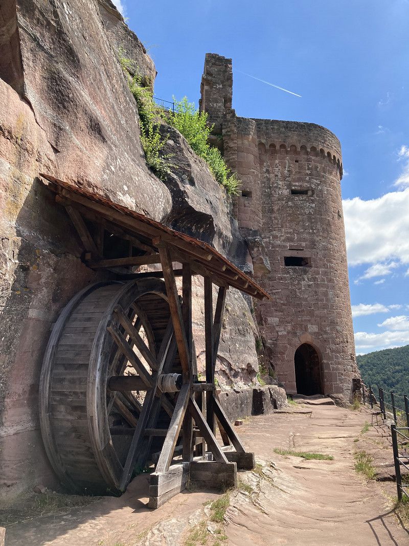
We cycle directly from the campsite on beautiful cycle paths to the Altdahn castle ruins, where we then explore everything on foot.
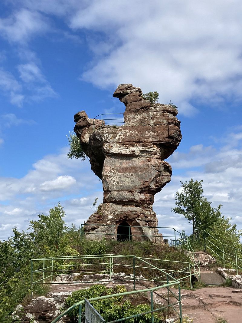
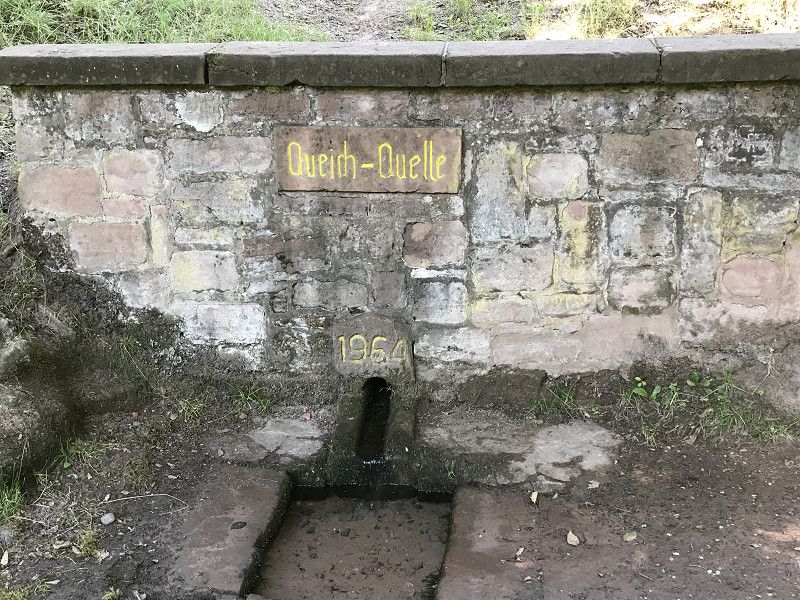
The further way is wonderful to the Quiechquelle and the paddling lake, where we stop for a bit. Then you can walk from Hinterweidental to the impressive Teufelstisch and Teufelsküche. After this exhausting day we really deserved the tarte flambée and the delicious beer in the super beautiful beer garden of the Brauhaus Ehrstein in Hinterweidental and we enjoy it very much. The way home is quite short, it is very relaxed on the planet path back to the campsite.
Burgenmassiv Altdahn, Deutschland
Burgenmassiv Altdahn , Dahn, Deutschland
49° 9' 2.5" N 7° 48' 9.8" E
49.1507068 7.8027218
• Head west on K40. Go for 215 m.
• Turn right onto Schloßstraße (K40). Go for 1.4 km.
• Turn left onto Schulstraße (K39). Go for 382 m.
• Turn right onto Pirmasenser Straße (B427). Go for 7.0 km.
• Turn left onto Kaltenbach (B427) toward A8/A62/Saarbrücken/Pirmasens/B10. Go for 454 m.
• Take the 1st exit from roundabout onto B10 toward Landau. Go for 7.3 km.
• Turn right toward Bad Bergzabern/Lug/Hauenstein. Go for 95 m.
• Continue on Pirmasenser Straße (L495). Go for 1.6 km.
• Arrive at Bahnhofstraße (L495). Your destination is on the left.
☍
18,4 km
( 19 min.)
Hauenstein, Deutschland
Hauenstein , Deutschland
49° 11' 31.9" N 7° 51' 10.4" E
49.1922047 7.8529006
• Head toward Theresienstraße on Bahnhofstraße (L495). Go for 1.6 km.
• Turn right toward B10/Saarbrücken/Pirmasens. Go for 185 m.
• Take the 2nd exit from roundabout onto B10 toward Saarbrücken/Pirmasens. Go for 7.3 km.
• Take ramp toward Bad Bergzabern/Dahn/Hinterweidenthal/Fischbach/B427. Go for 245 m.
• Take the 3rd exit from roundabout toward Bad Bergzabern/Dahn/Hinterweidenthal/Fischbach/B427. Go for 132 m.
• Take the 2nd exit from roundabout onto B427 toward Bad Bergzabern/Dahn/Hinterweidenthal. Go for 513 m.
• Turn right onto Hauptstraße (B427) toward Bad Bergzabern/Dahn/Hinterweidenthal/Gewerbegebiet-Süd. Go for 250 m.
• Turn right onto Bahnhofstraße. Go for 94 m.
• Turn right onto Im Handschuhteich. Go for 182 m.
• Turn left onto Im Handschuhteich. Go for 26 m.
• Turn right onto Im Handschuhteich. Go for 106 m.
• Arrive at Im Handschuhteich.
☍
10,6 km
( 10 min.)
Teufelstisch, Deutschland
Im Handschuhteich , Hinterweidenthal, Deutschland
49° 11' 41.9" N 7° 44' 37.6" E
49.1949652 7.7437900
• Head northeast on Im Handschuhteich. Go for 106 m.
• Turn left onto Im Handschuhteich. Go for 26 m.
• Turn right onto Im Handschuhteich. Go for 182 m.
• Turn left onto Bahnhofstraße. Go for 94 m.
• Turn right onto Hauptstraße (B427). Go for 6.9 km.
• Take the 1st exit from Weißenburger Straße roundabout onto Hasenbergstraße. Go for 268 m.
• Turn right onto Ludwigstraße. Go for 188 m.
• Turn slightly left onto Schillerstraße. Go for 366 m.
• Turn left onto Schillerstraße. Go for 177 m.
• Arrive at Schillerstraße.
☍
8,3 km
( 11 min.)
Day
9.7.22 Felsenland, Felsenarena High Heels und Musikbox
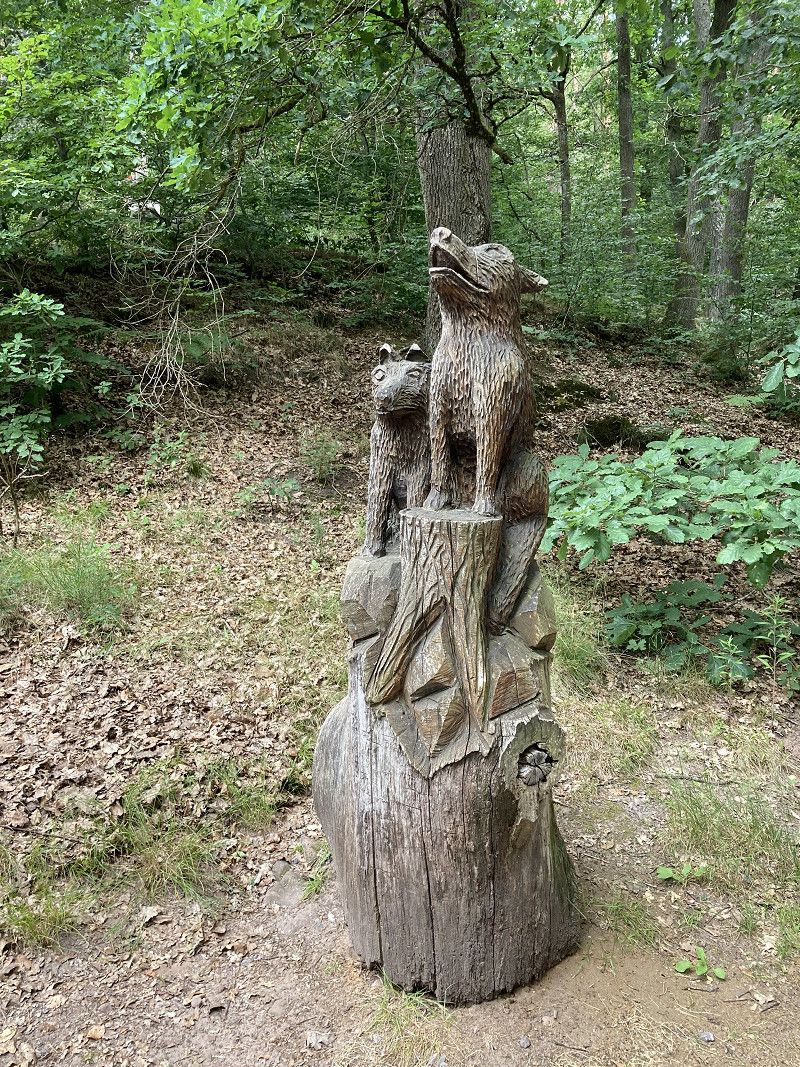
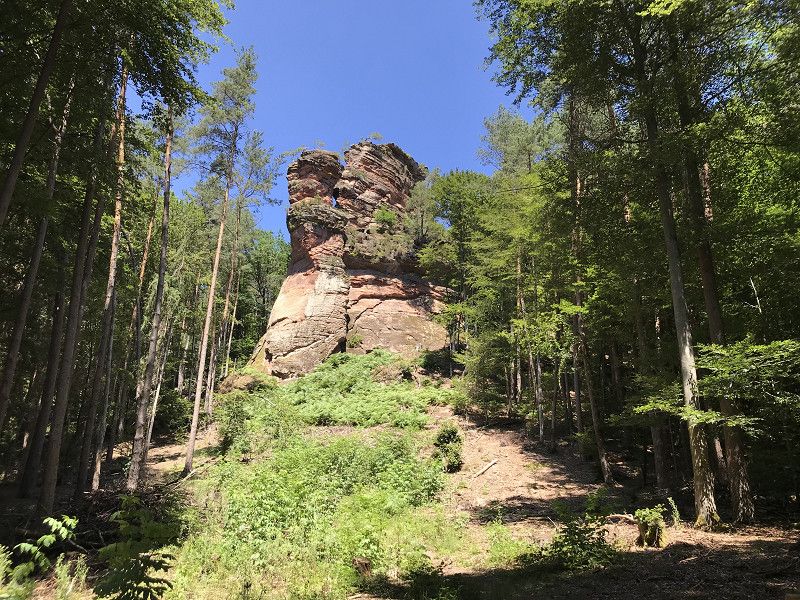
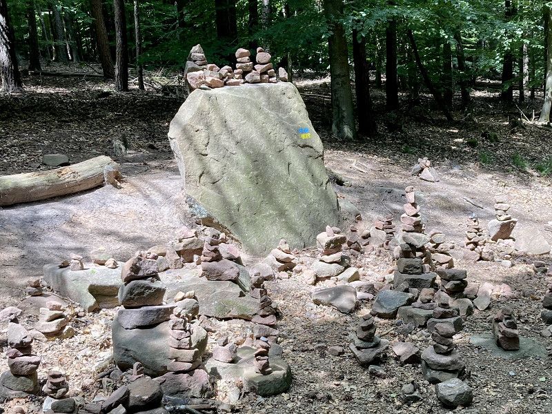
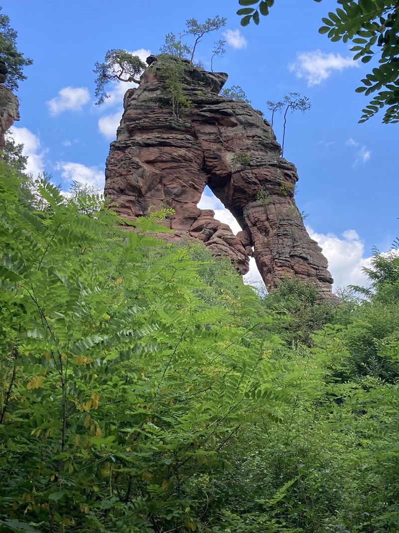
We drive to the Pfälzer Wald Hütte in the mobile home and start our hike through the Felsenarena in the Dahner Felsenland from there. There are countless very well signposted hiking trails, we choose the Kauertweg. It's a great hike that takes in beautiful rock formations and beautiful viewpoints. At the end there is a hearty snack at the hut.
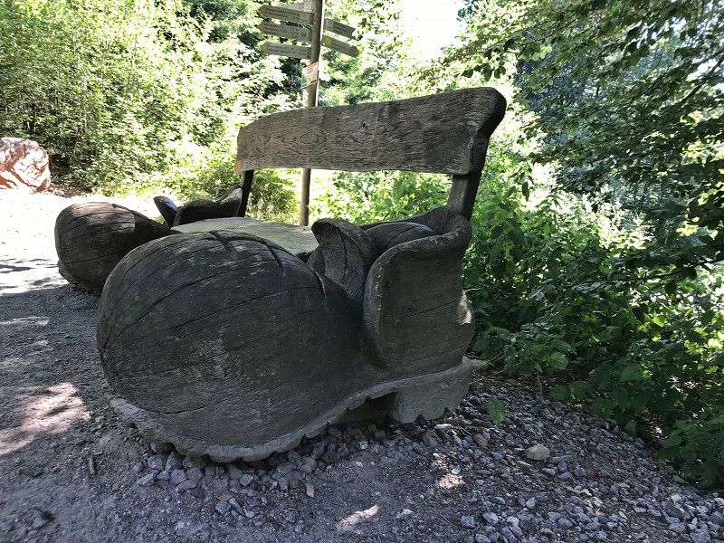
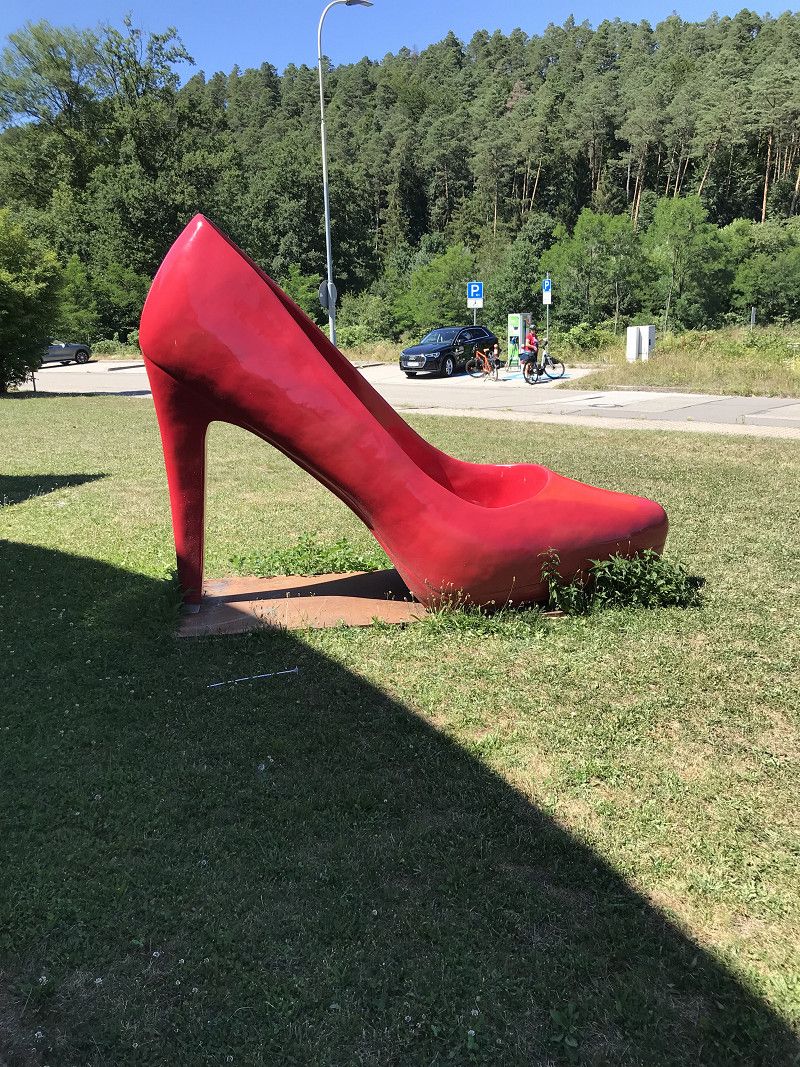
In Hauenstein we take a break at the shoe mile, all shoe outlets. OK, we could have saved that....
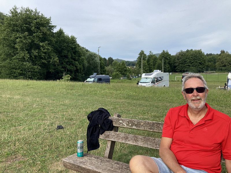
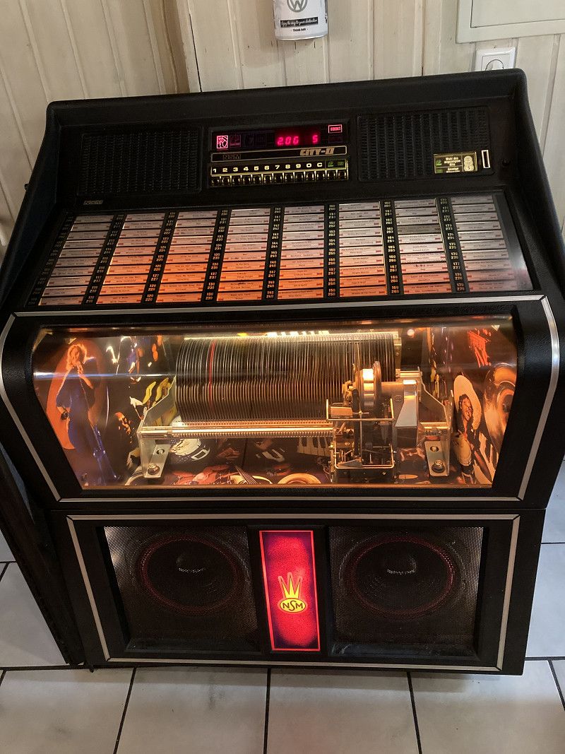
We drive comfortably north again, we want to spend the night again today at the Edel Brauch winery in Edenkoben. Well, everything, everything full! It's Saturday evening and there's a wine festival in St. Martin, so the other pitches are full too. As we happen to pass a meadow in front of Roth, there are already 3 mobile homes. We stand by it. There's nothing but a view and peace and quiet, but that's enough for us! The meadow is not far from the village and so it is not far to eat in a small courtyard restaurant. When it starts raining, we head inside. The dining room fills up quickly, especially with the other campers and we discover an old music box that everyone puts into operation. We all sing along to the old hits at the top of our lungs, the landlord dances with the waitress, the wine tastes better and better... walking home together inspired...
nördlich Felsenarena, Deutschland
Schillerstraße , Dahn, Deutschland
49° 8' 55.1" N 7° 46' 9.2" E
49.1486277 7.7692143
• Head east on Schillerstraße. Go for 543 m.
• Turn left toward Äußermühlstraße. Go for 346 m.
• Turn right onto Äußermühlstraße. Go for 64 m.
• Turn left onto Pirmasenser Straße (B427). Go for 6.7 km.
• Turn left onto Kaltenbach (B427) toward A8/A62/Saarbrücken/Pirmasens/B10. Go for 454 m.
• Take the 1st exit from roundabout onto B10 toward Landau. Go for 25.6 km.
• Take ramp toward Leinsweiler/Siebeldingen/Birkweiler. Go for 292 m.
• Turn right onto Weinstraße (L508). Go for 237 m.
• Turn right onto Weinstraße (L511). Go for 625 m.
• Turn left onto Weinstraße (L508). Go for 2.4 km.
• Turn right onto Weinstraße (L507). Go for 1.4 km.
• Continue on L519. Go for 1.2 km.
• Continue on Weinstraße (L507). Go for 2.2 km.
• Turn left onto Weinstraße (L512). Go for 2.0 km.
• Turn left onto Herrengasse. Go for 174 m.
• Arrive at Herrengasse. Your destination is on the right.
☍
44,1 km
( 41 min.)
Rhodt unter Rietburg, Rhineland-Palatinate, Germany
Herrengasse, Rhodt unter Rietburg, Edenkoben, Landkreis Südliche Weinstraße, Rhineland-Palatinate, 76835, Germany
49° 16' 17.1" N 8° 6' 23.7" E
49.2714154 8.1065810
• Head toward Theresienstraße on Herrengasse. Go for 59 m.
• Turn right onto Theresienstraße. Go for 97 m.
• Turn right onto Weinstraße (L512). Go for 197 m.
• Turn left onto Edesheimer Straße (L506). Go for 481 m.
• Continue on L506. Go for 993 m.
• Continue on Rhodter Straße (L506). Go for 526 m.
• Turn left onto Staatsstraße (L516) toward Ludwigshafen/A65/Neustadt/Weinstr. Go for 2.8 km.
• Take the 1st exit from roundabout onto K6 toward Neustadt/Weinstr./A65/Landau/Speyer/Venningen/Gewerbegebiet Edenkoben-Seewiesen. Go for 484 m.
• Take the 2nd exit from roundabout onto K6 toward Neustadt/Weinstr./A65/Landau/Speyer/Venningen. Go for 755 m.
• Take ramp onto A65 toward Ludwigshafen/Neustadt/Weinstr. Go for 25.9 km.
• Take exit 5 toward Speyer/Ludwigshafen-Süd/Mutterstadt-Zentrum/Gewerbegebiet Mutterstadt onto B9. Go for 4.7 km.
• Take ramp onto B9/B44. Go for 4.7 km.
• Turn right onto Mundenheimer Straße. Go for 2.0 km.
• Turn left onto Mundenheimer Straße (L523) toward Mannheim/Zentrum. Go for 84 m.
• Turn right toward Mannheim. Go for 6 m.
• Take ramp onto Konrad-Adenauer-Brücke (B37) toward Mannheim. Go for 682 m.
• Keep right onto B37 toward Krankenhaus Diakonissen/Rosengarten. Go for 322 m.
• Keep left onto L5 (B37) toward CC Rosengarten/B38. Go for 323 m.
• Turn right onto L7 (B37). Go for 390 m.
• Turn left onto Kaiserring (B38) toward Weinheim/CC-Rosengarten. Go for 377 m.
• Turn right onto Friedrichsplatz. Go for 307 m.
• Turn right onto Augustaanlage. Go for 1.2 km.
• Turn left onto Schubertstraße (L637) toward Ma-Neuostheim/City/Airport. Go for 1.1 km.
• Keep right onto Seckenheimer Landstraße (L637) toward Seckenheim/Gewerbegebiet Mühlfeld/City-Airport. Go for 1.5 km.
• Take the 2nd exit from roundabout onto Seckenheimer Landstraße (L637) toward MA-Seckenheim/Gewerbegebiet Mühlfeld. Go for 1.2 km.
• Turn right toward Seckenheimer Landstraße. Go for 25 m.
• Turn left onto Seckenheimer Landstraße. Go for 44 m.
• Arrive at your destination.
☍
51,3 km
( 43 min.)
Day
10.7.22 in Erinnerungen schwelgen und Udo Lindenberg - Ladenburg und Mannheim
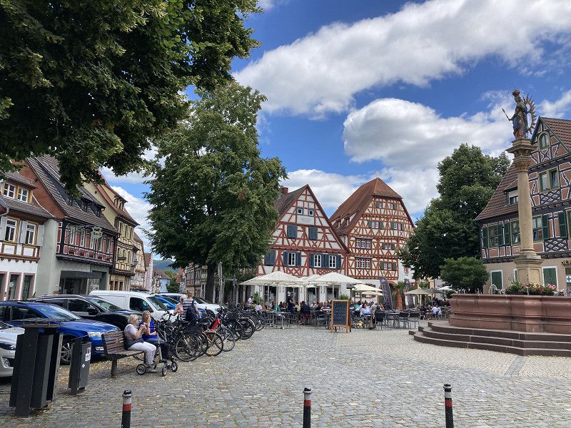
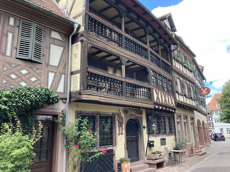
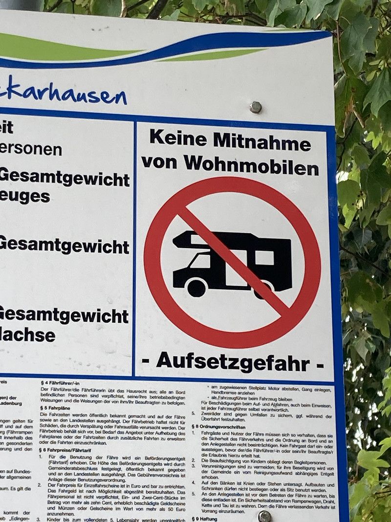
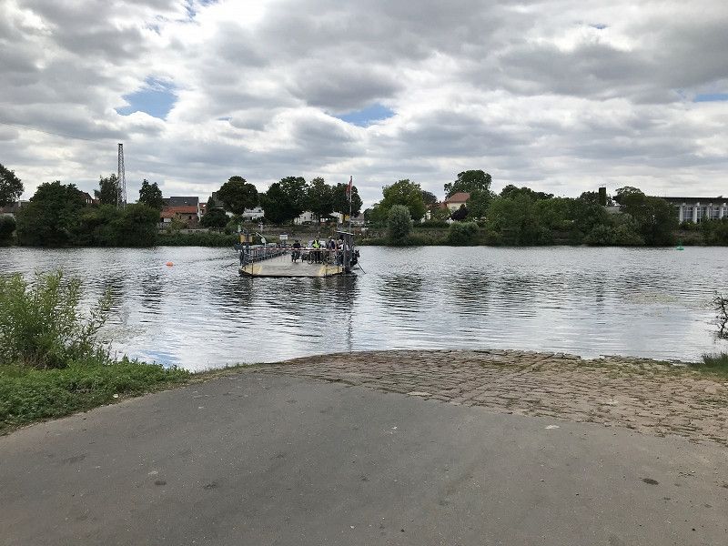
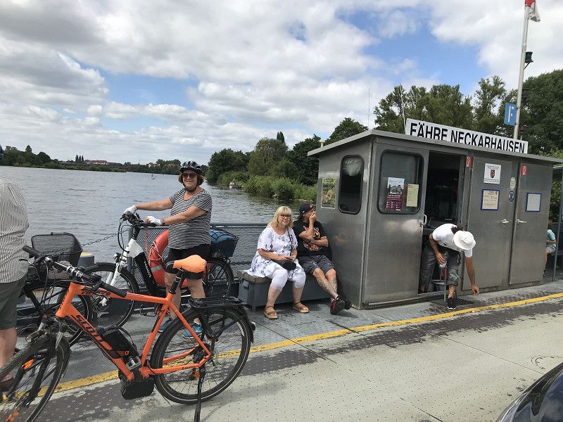
At half past eight someone comes by who collects the - very fair! - 5€ parking fee, so we are already ready for our last stop: parking space in Mannheim, because we have tickets for tonight in the SAP Arena for Udo Lindenberg and absolutely want to get a free parking space. We'll be there at 11, all full... I ask someone who's just rolling up a power cord if they're leaving. Yes, we would just have to wait for your breakfast. OK no problem. More and more mobile homes are driving onto the site. Since Udo fans stick together, the three of us share our pitch. Now we are planning a trip into our past, a bike ride to Ladenburg, where we lived during our studies. A wonderful cycle path always leads along the Neckar to Ladenburg, where we reminisce and take a coffee break on the historic market square. Back with the small Neckar ferry to the other side of the Neckar and back to the parking space.
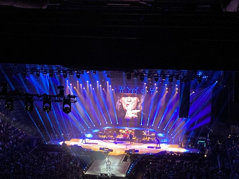
After a BBQ dinner, we're off to the SAP Arena, that's 25 minutes. The concert is of course awesome! Passing all the traffic jams, we walk back to the mobile home.
Hans-Thoma-Straße, Deutschland
Parking space near the SAP Arena. Clean pitches with green strips in between. quite loud. 10€
Hans-Thoma-Straße , Mannheim, Deutschland
49° 28' 27" N 8° 32' 28.2" E
49.4741536 8.5411738
• Head toward Seckenheimer Landstraße. Go for 25 m.
• Turn right toward Seckenheimer Landstraße/L637. Go for 23 m.
• Turn right onto Seckenheimer Landstraße (L637). Go for 330 m.
• Continue on Neuostheimer Straße toward Heidelberg/Ladenburg/Ilvesheim/MA-Friedrichsfeld/MA-Rheinau/MA-Seckenheim. Go for 960 m.
• Take the 1st exit from roundabout onto Neuostheimer Straße. Go for 664 m.
• Take the 3rd exit from roundabout onto Kloppenheimer Straße (L542) toward MA-Seckenh./MA-Zentrum. Go for 337 m.
• Take the 1st exit from Kapellenplatz roundabout onto Kapellenstraße (L542). Go for 240 m.
• Continue on Offenburger Straße (L542). Go for 767 m.
• Turn left onto Seckenheimer Hauptstraße (L542) toward Ilvesheim. Go for 237 m.
• Turn right onto Brückenstraße (L542) toward Ladenburg/Ilvesheim. Go for 545 m.
• Take the 3rd exit from roundabout onto Schloßstraße (L542) toward Schriesheim/Ladenburg. Go for 2.8 km.
• Turn right onto Ilvesheimer Straße toward Altstadt/Zentrum. Go for 503 m.
• Continue on Bahnhofstraße. Go for 435 m.
• Turn left onto Wallstadter Straße (L597). Go for 164 m.
• Turn right onto Cronbergergasse. Go for 229 m.
• Continue on Metzgergasse. Go for 55 m.
• Arrive at Metzgergasse. Your destination is on the left.
☍
8,4 km
( 15 min.)
Ladenburg, Deutschland
Ladenburg , Deutschland
49° 28' 18.8" N 8° 36' 36.7" E
49.4718989 8.6101969
Day
11.7.22 Heimfahrt
With Udo in our ears, we start our journey home after a leisurely breakfast.
Conclusion: Such a week, for which you don't have to drive that far, has something! A whole different world, great change of scenery!
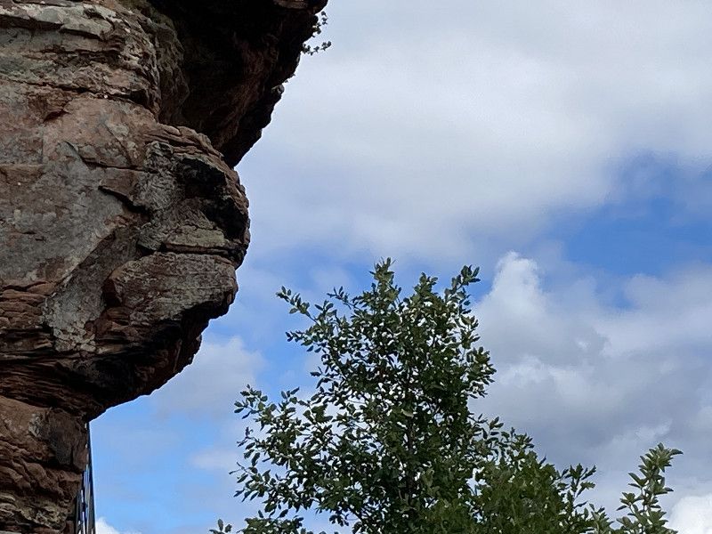
The Palatinate Forest with its castles and rocks is impressive and great for hiking, whether short or long. However, quite dark due to logically a lot of forest.
But the more open, sunnier Palatinate with the vineyards and the many nice little wine villages gave us more of a holiday feeling and is great for cycling.