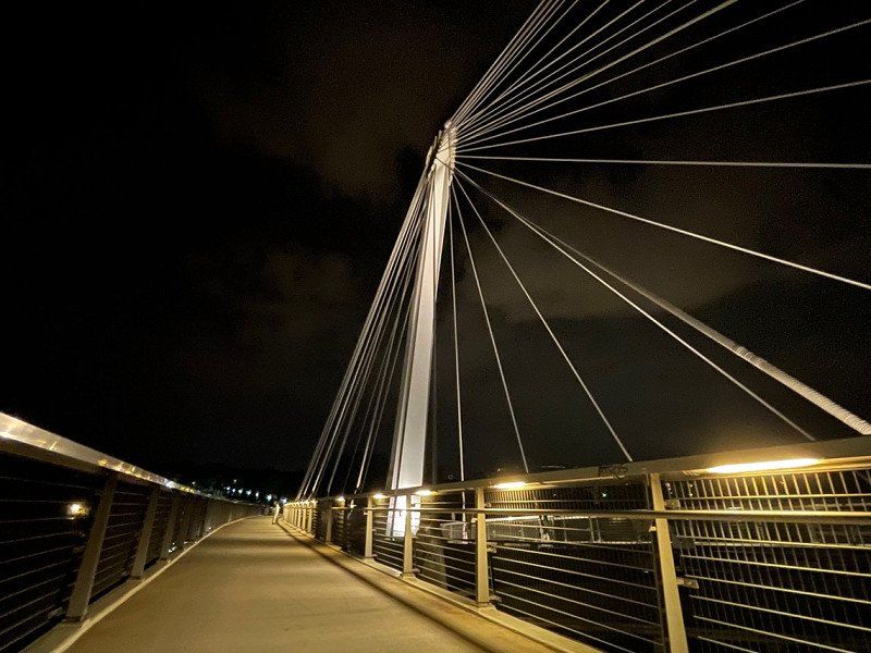
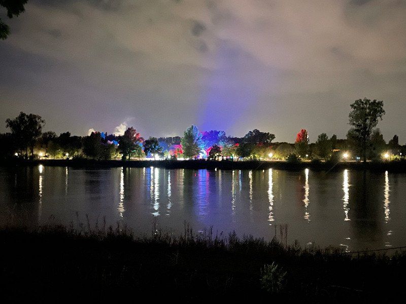
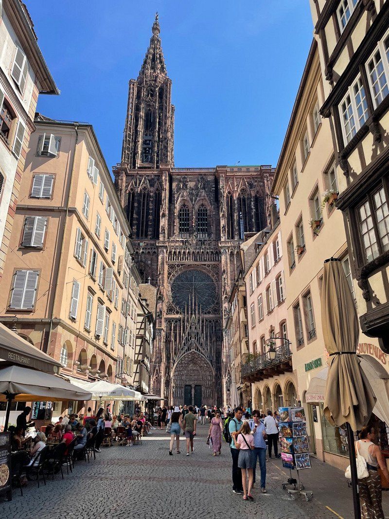
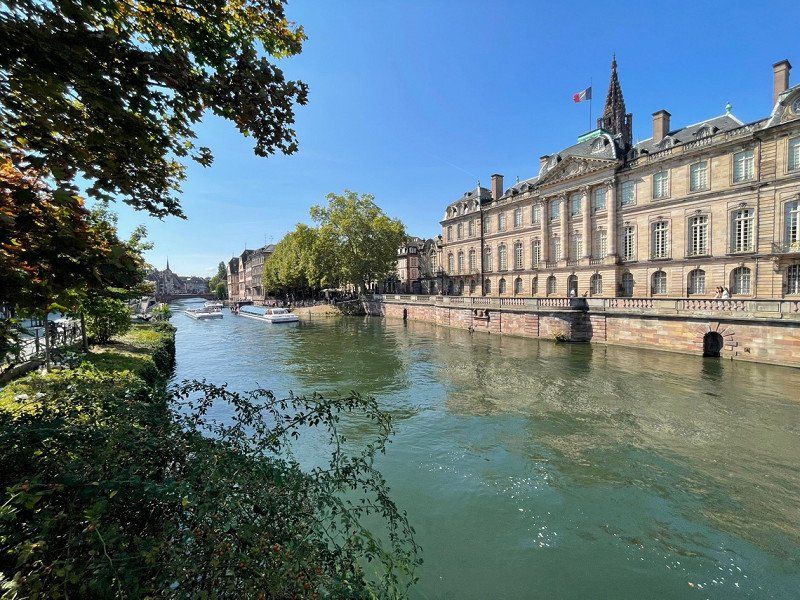
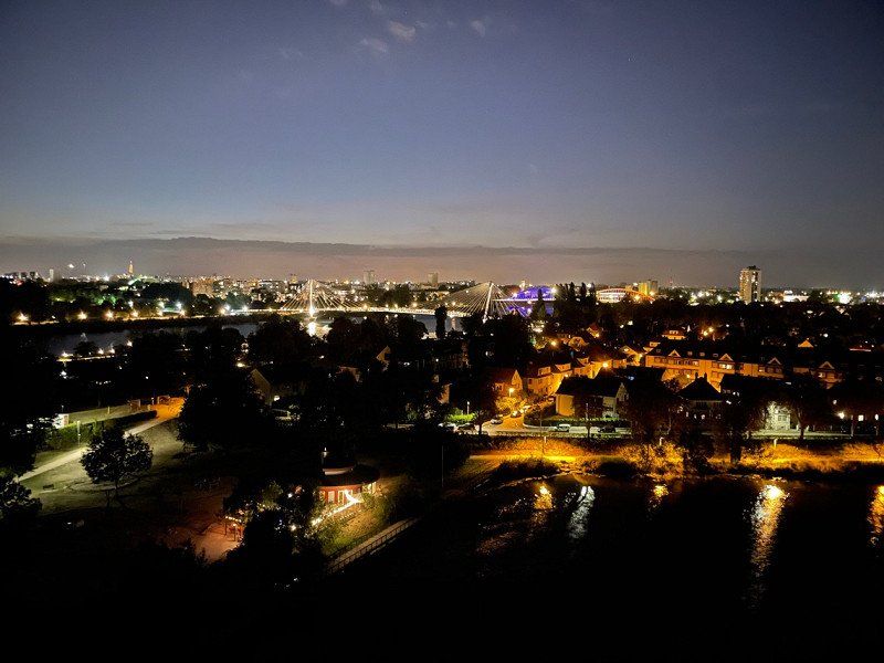
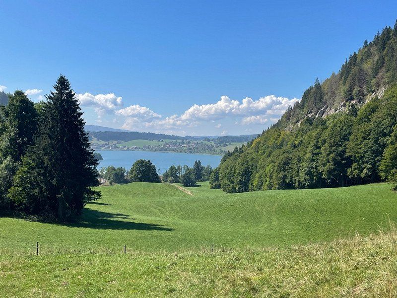
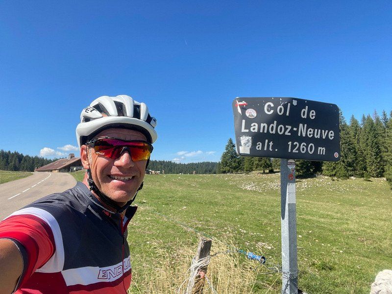
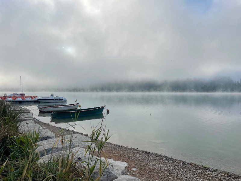
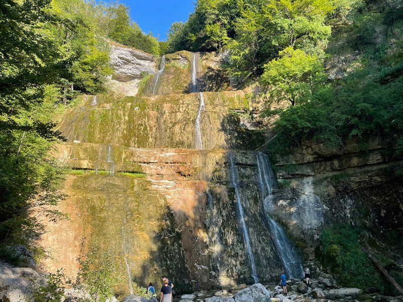
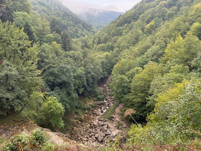
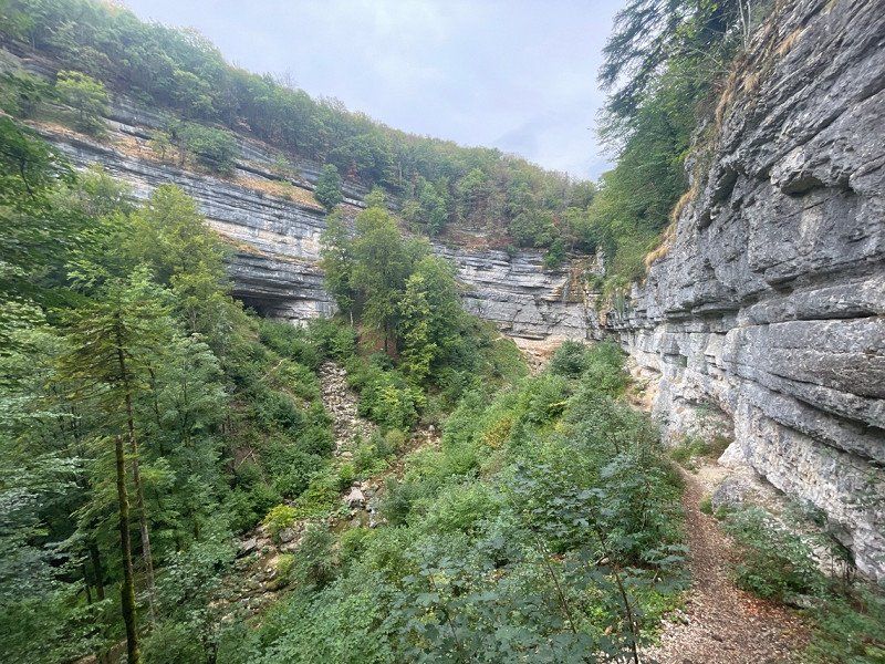
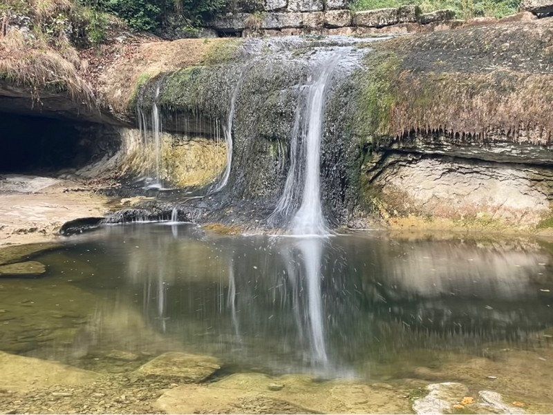
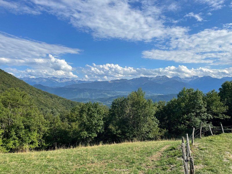
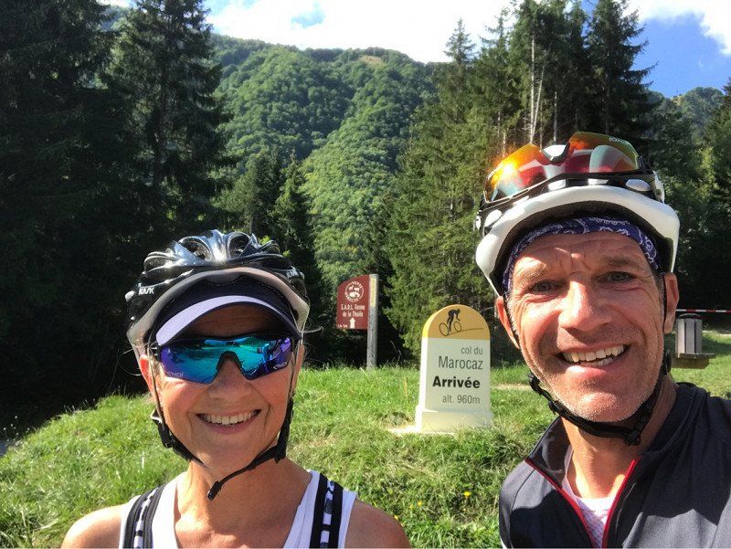
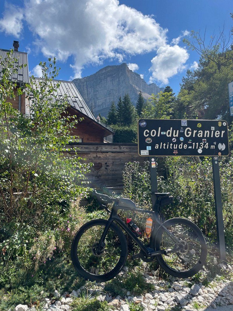
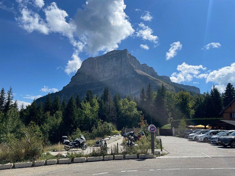
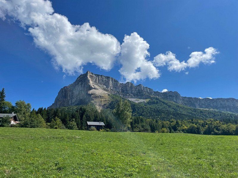
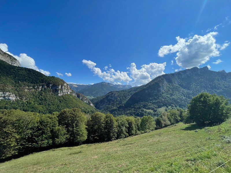
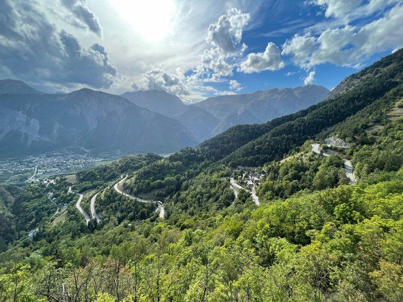
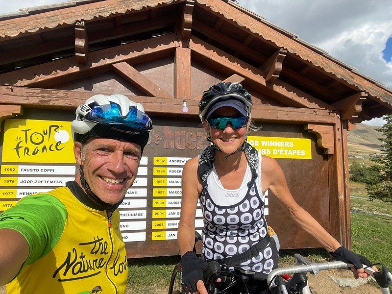
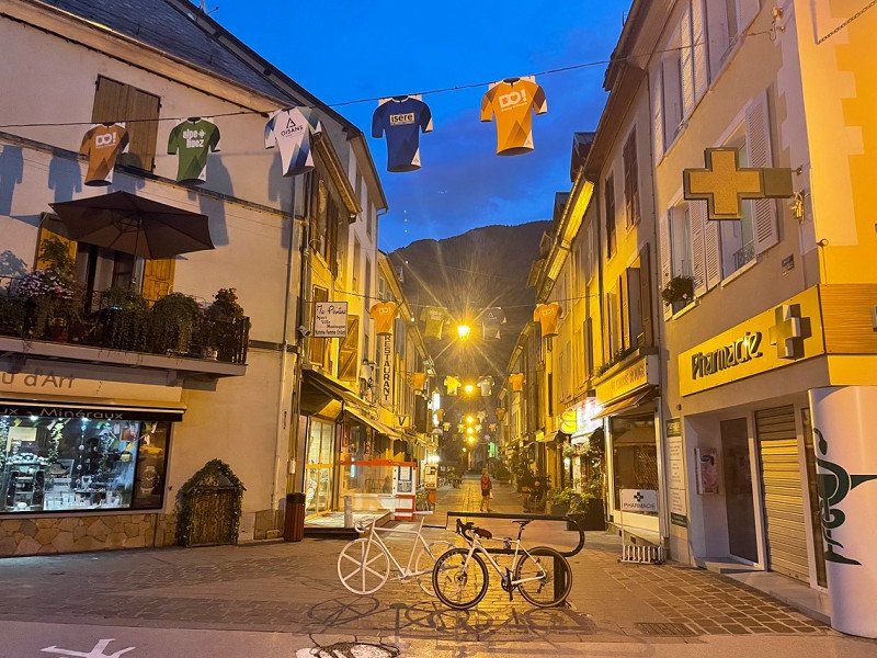
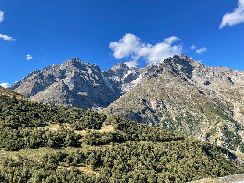
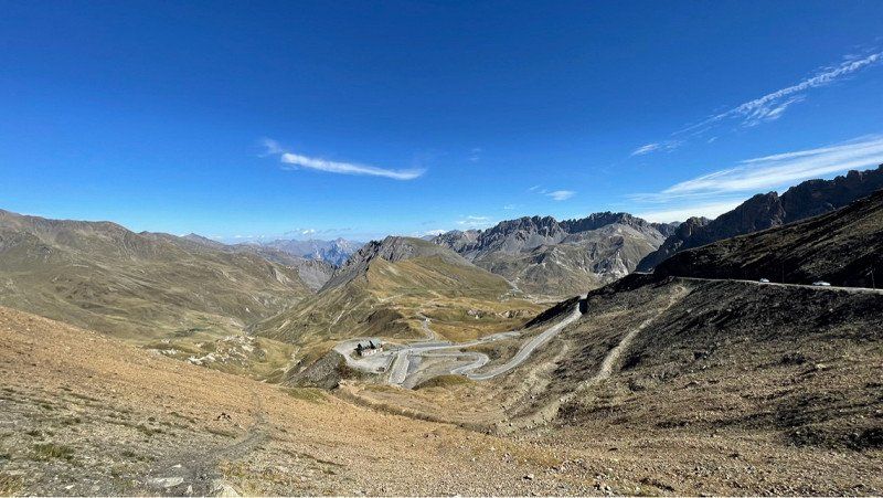
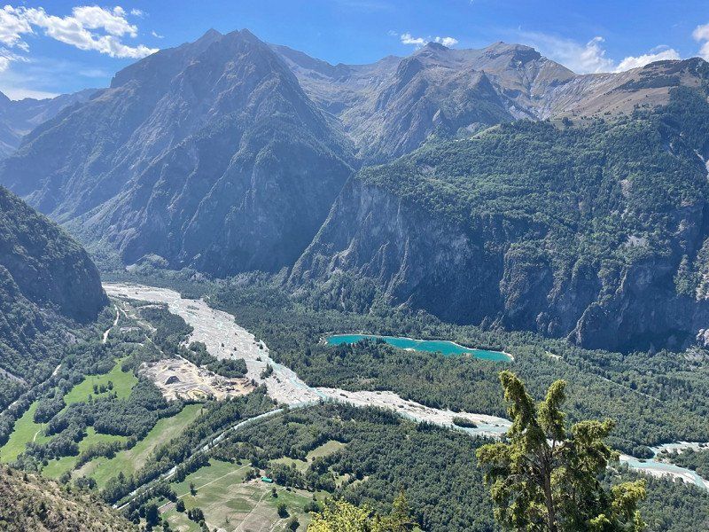
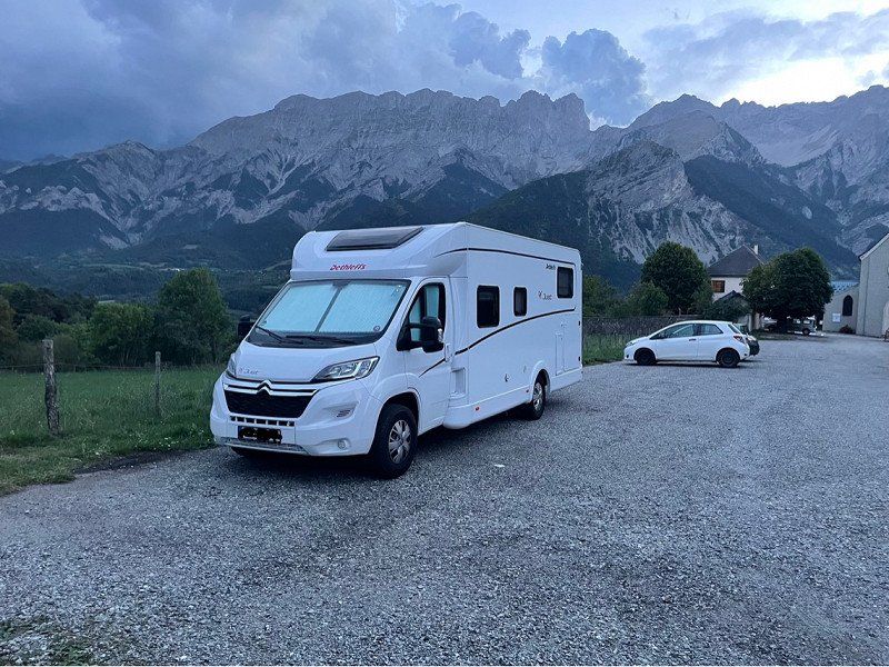
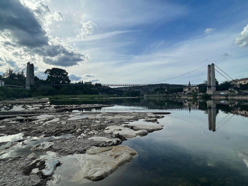
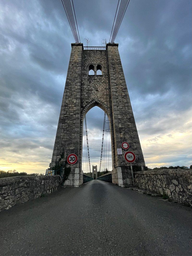
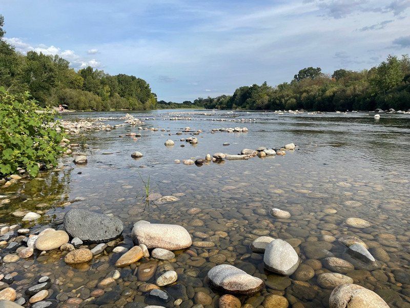
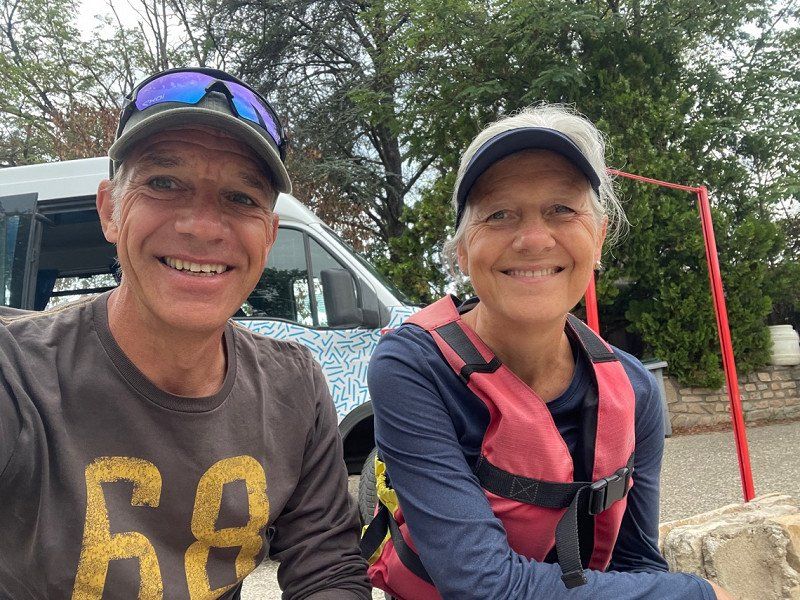
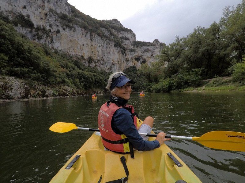
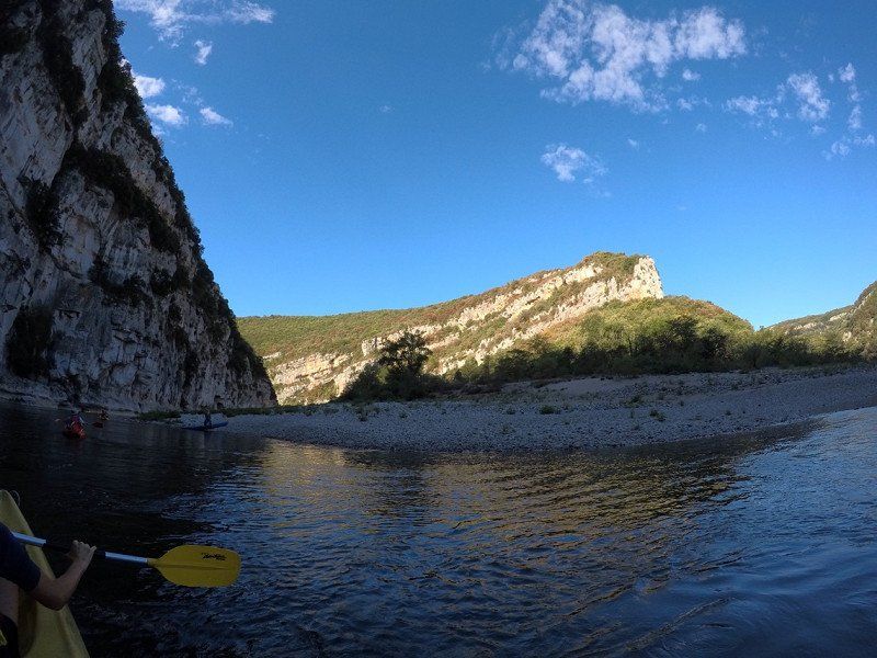
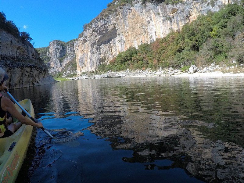
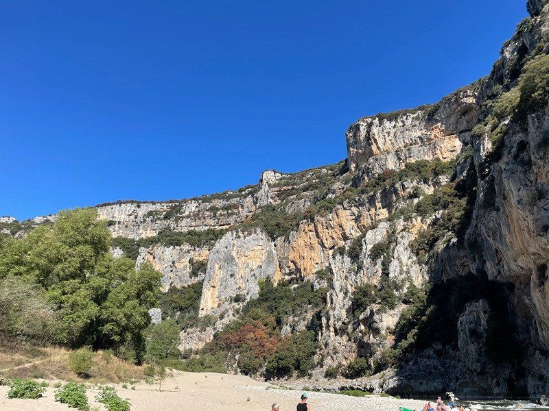
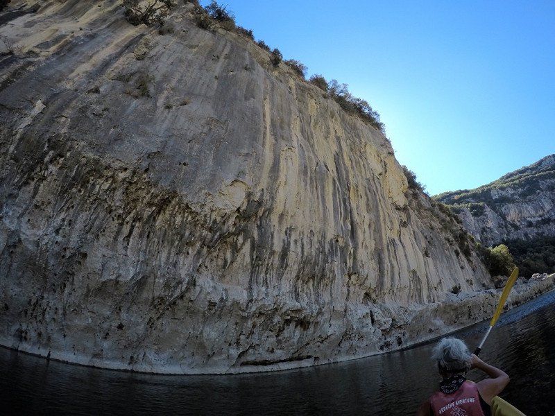
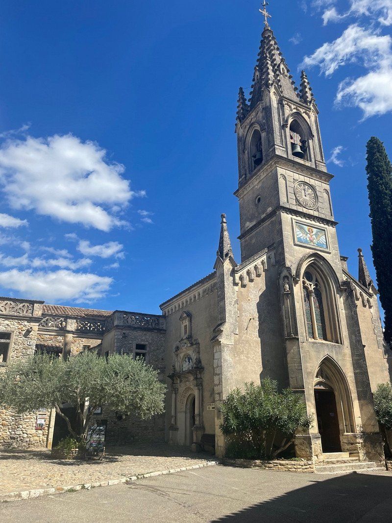
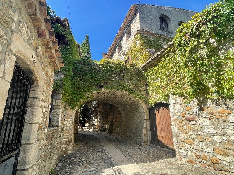
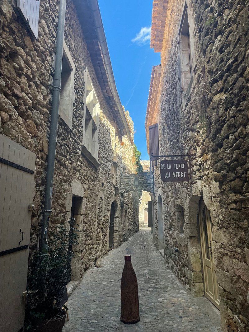
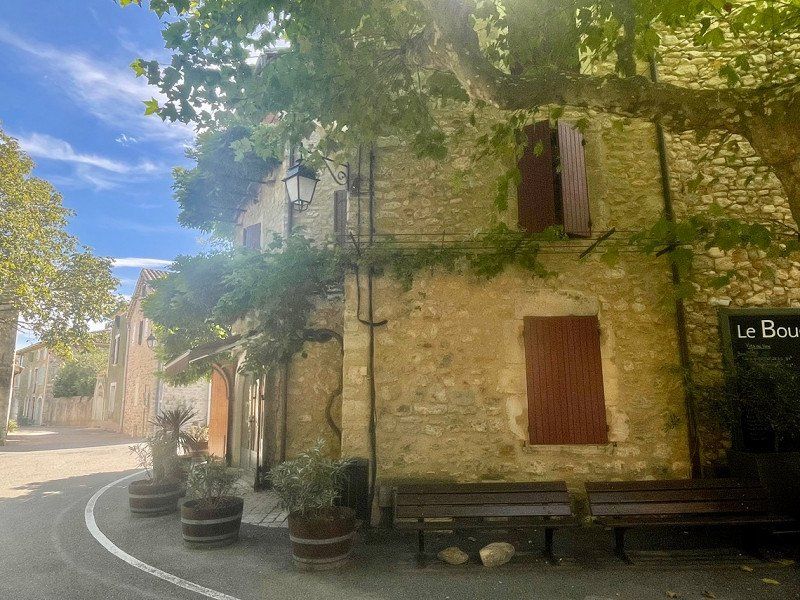
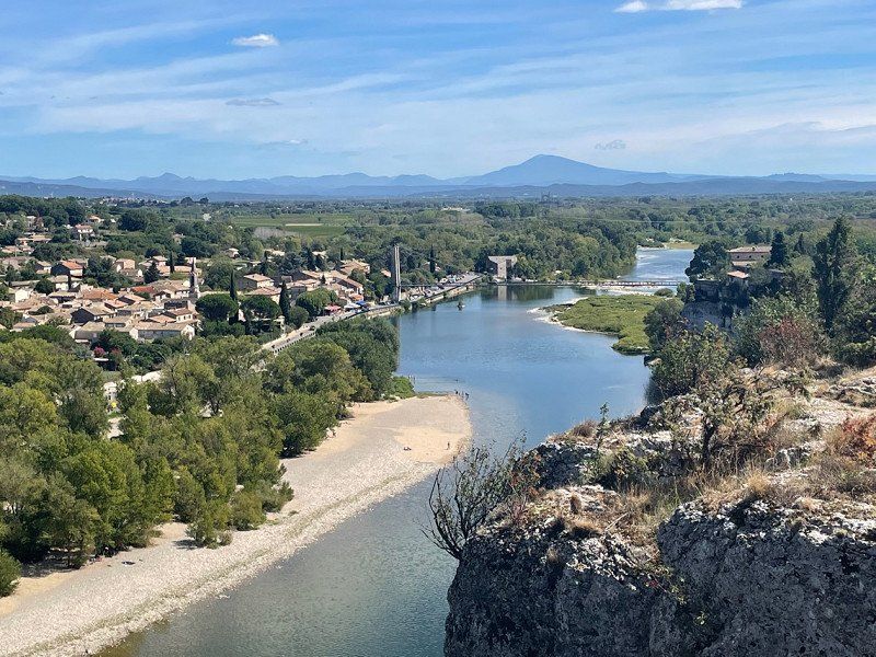
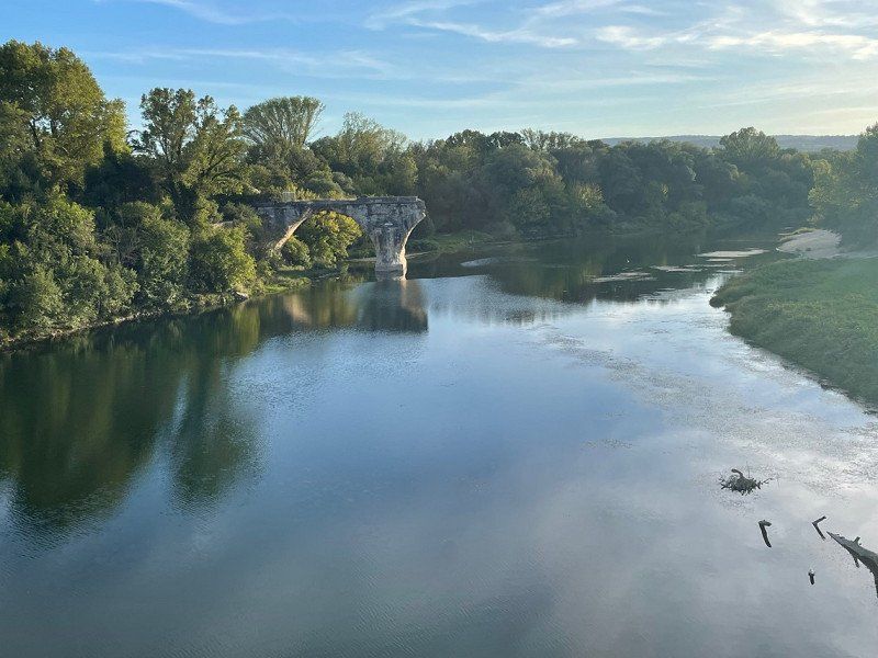
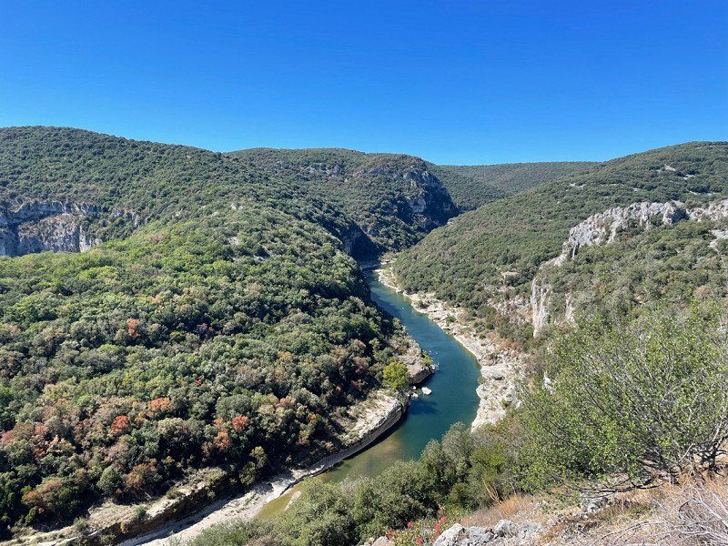
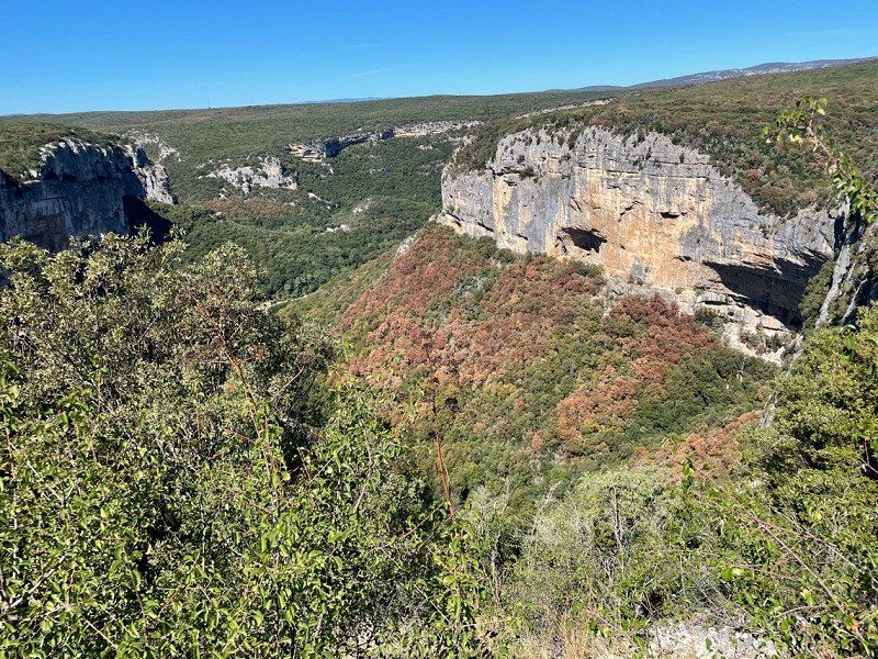
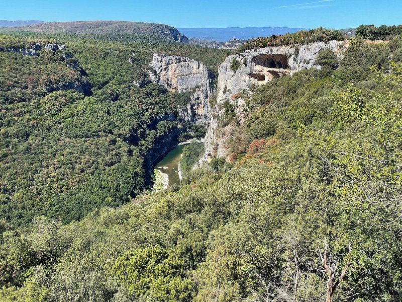
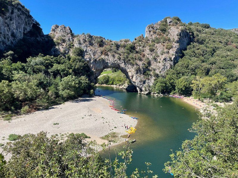
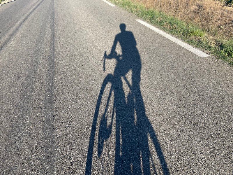
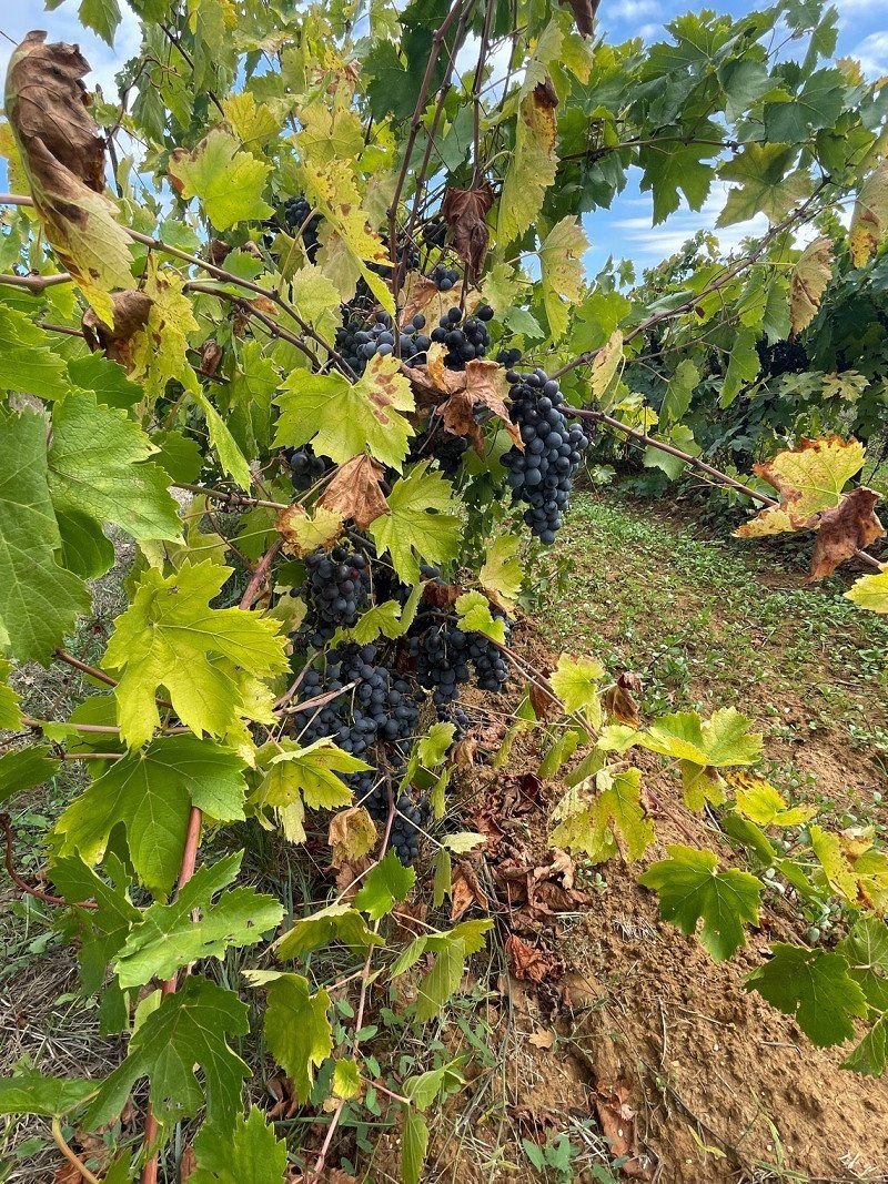
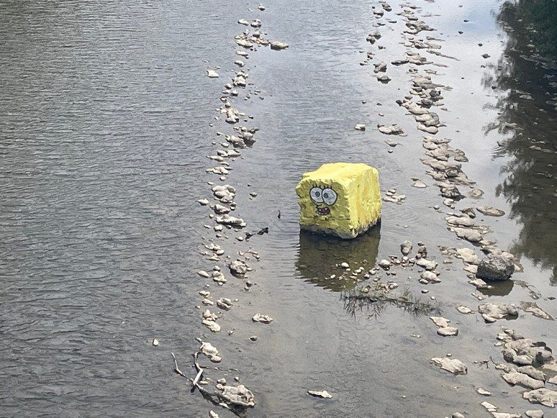
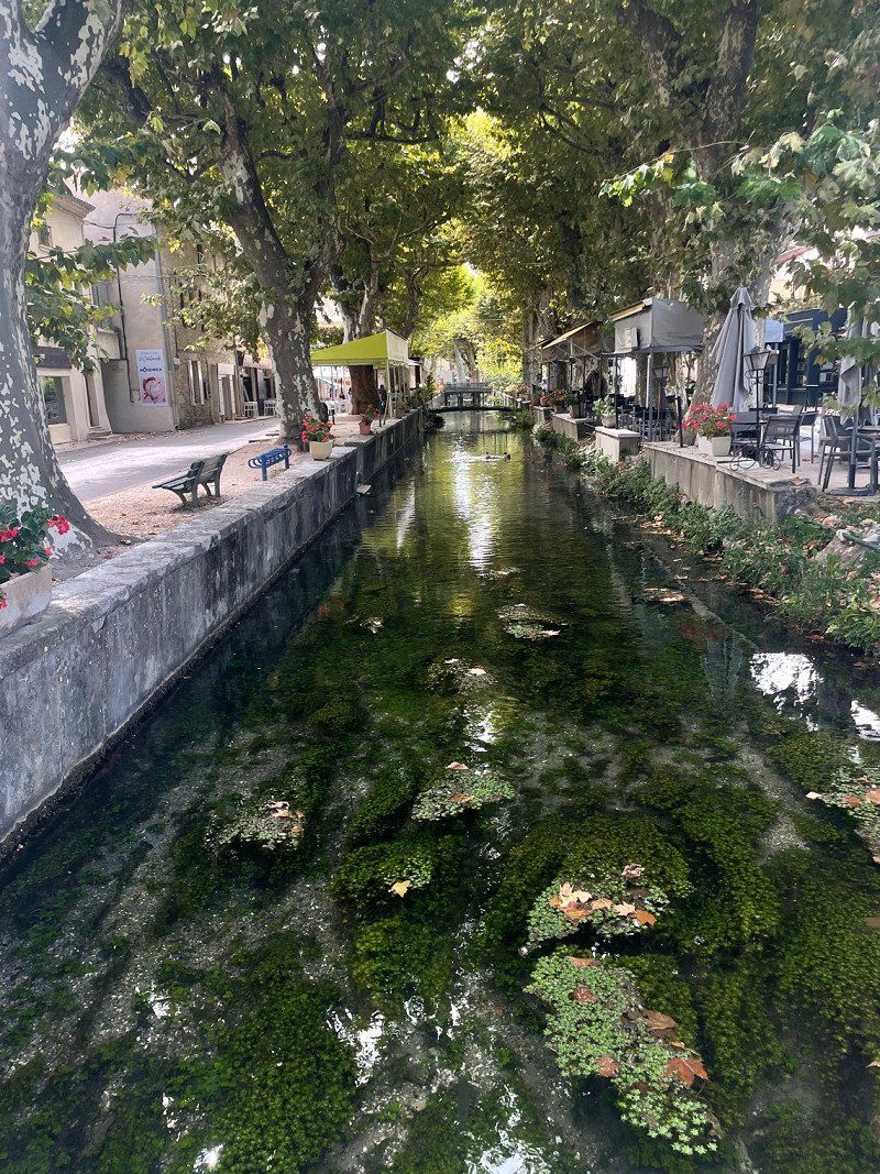
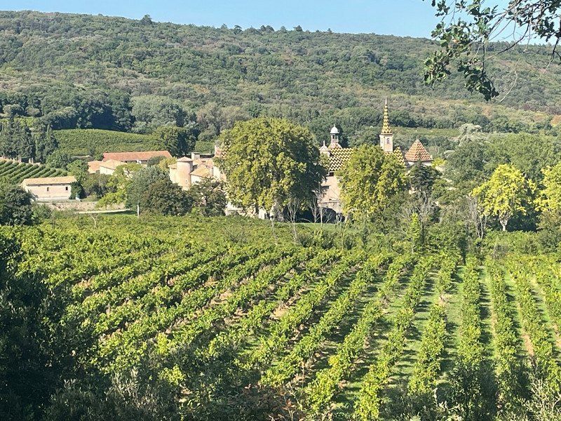
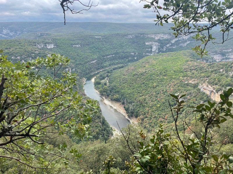
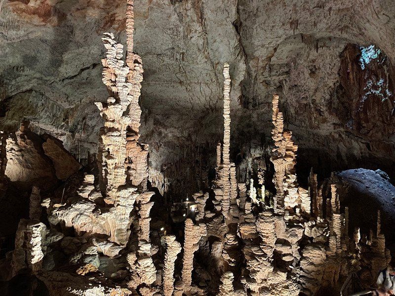
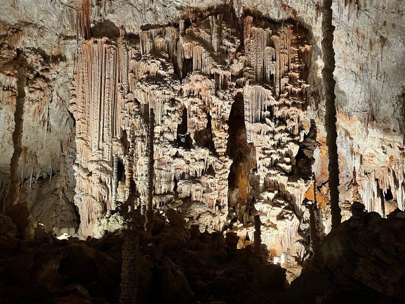
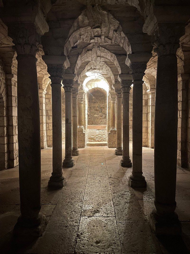
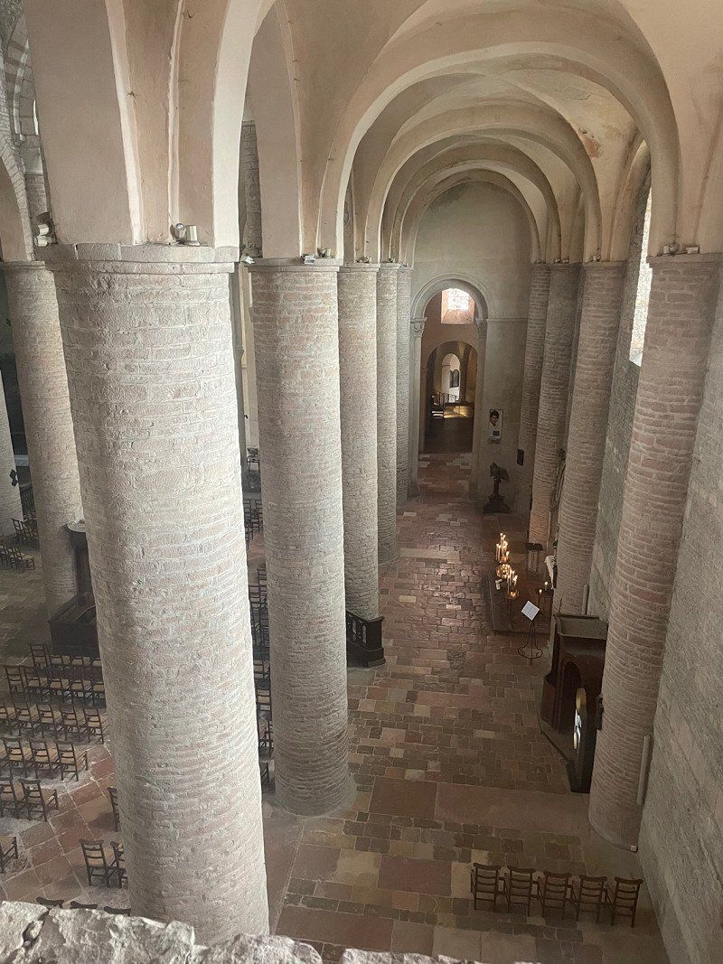
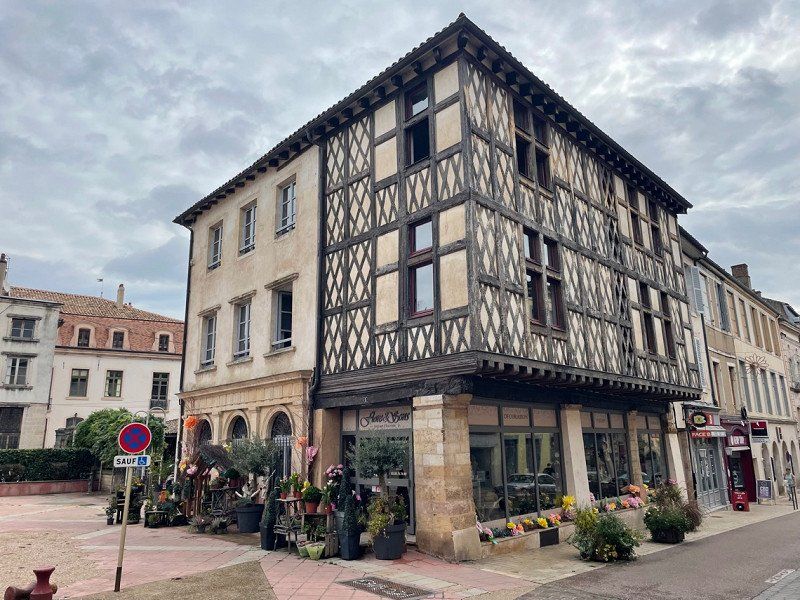
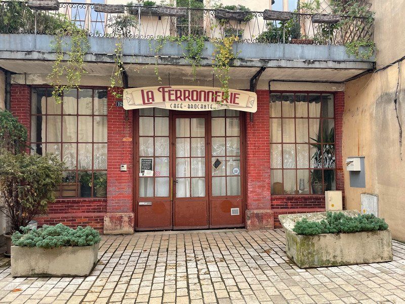
The plan was actually a tour to the Côte d'Azur with stops in Strasbourg, the French Jura and the Alps. But as so often, it turns out differently than you think 😉. In addition to sightseeing and letting your soul dangle, one or the other sporting activity should of course also be part of this holiday.
Day
Wersterholz, Bad Oeynhausen, Deutschland
Wersterholz, 32549 Bad Oeynhausen, Deutschland
52° 13' 43.7" N 8° 45' 55" E
52.2287973 8.7652767
• Head toward Werster Heide on Nordstraße. Go for 76 m.
• Turn left onto Bergkirchener Straße (K29). Go for 393 m.
• Continue on K29. Go for 15 m.
• Continue on Bergkirchener Straße (K29). Go for 838 m.
• Continue on Ringstraße (K29). Go for 213 m.
• Continue on Kirchbreite (K8). Go for 1.3 km.
• Take the 2nd exit from roundabout onto Hahnenkampstraße (K29) toward Minden/Dehme. Go for 233 m.
• Turn left onto Wiekriede (K29). Go for 149 m.
• Continue on Im Keiten (K29). Go for 73 m.
• Continue on Alter Postweg (K29). Go for 1.2 km.
• Continue on K29. Go for 122 m.
• Turn right and take ramp onto A30. Go for 2.8 km.
• Take exit 35 toward Dortmund/Bielefeld onto A2. Go for 38.3 km.
• Take exit 25 toward Paderborn onto A33. Go for 46.8 km.
• Take exit 31 toward Kassel onto A44. Go for 24.0 km.
• Take exit 64 toward Korbach/Bad Arolsen/Diemelstadt onto B252. Go for 29.7 km.
• Take ramp onto B251 toward Marburg/Kassel/B252. Go for 4.0 km.
• Continue on B252 toward Marburg. Go for 31.5 km.
• Take ramp toward Burgwald. Go for 176 m.
• Turn right onto Marburger Straße (K117). Go for 698 m.
• Continue on K117. Go for 2.7 km.
• Continue on Marktstraße (K117). Go for 2.1 km.
• Continue on K117. Go for 1.4 km.
• Continue on Bremer Straße (K117) toward Marburg/Münchhausen. Go for 83 m.
• Turn right onto B252 toward Marburg/Münchhausen. Go for 1.2 km.
• Turn right onto Kirchstraße. Go for 71 m.
• Turn left onto Die Ecke. Go for 22 m.
• Arrive at Die Ecke. Your destination is on the right.
☍
190,1 km
(2 hrs. 5 min.)
Ernsthausen, Burgwald, Deutschland
Ernsthausen, 35099 Burgwald, Deutschland
50° 59' 4.1" N 8° 44' 3.7" E
50.9844765 8.7343532
• Head toward Kirchstraße on Die Ecke. Go for 22 m.
• Turn right onto Kirchstraße. Go for 71 m.
• Turn right onto Marburger Straße (B252). Go for 18.3 km.
• Continue on B62. Go for 2.0 km.
• Take ramp onto B3 toward Gießen/Marburg. Go for 28.0 km.
• Continue on A485. Go for 6.4 km.
• Take exit 5 toward Gießen-Licher Straße/Gießen-Stadtmitte/Fernwald/Lich. Go for 275 m.
• Turn right onto Licher Straße (B457) toward Büdingen/Lich/Fernwald/Gewerbegebiet Europaviertel/Gewerbegebiet Rivers Automeile. Go for 6.3 km.
• Take ramp onto A5 toward Frankfurt. Go for 81.2 km.
• Take the exit toward Basel/Karlsruhe/Heidelberg onto A5. Go for 168 km.
• Take exit 54 toward Appenweier/Kehl/Strasbourg-Mitte/Bad Peterstal-Griesbach/Oberkirch/Strasbourg/Kehl onto B28. Go for 10.8 km.
• Turn slightly left onto Großherzog-Friedrich-Straße toward Kehl-Zentrum. Go for 191 m.
• Turn left onto Kinzigallee. Go for 38 m.
• Turn right onto Oberländerstraße. Go for 271 m.
• Turn left onto Hauptstraße. Go for 91 m.
• Turn right onto Goldscheuerstraße. Go for 544 m.
• Turn slightly left onto Iringheimer Straße. Go for 333 m.
• Take the 1st exit from roundabout onto Schwimmbadstraße. Go for 99 m.
• Turn left. Go for 31 m.
• Arrive at your destination.
☍
323,2 km
(2 hrs. 55 min.)
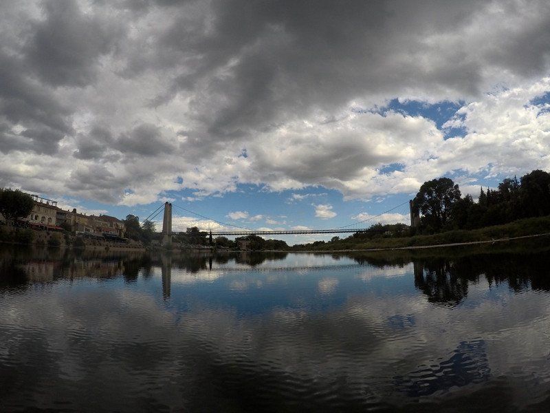
Stellplatz am Wasserturm
Schwimmbadstraße 1, 77694, Kehl, Deutschland
48° 33' 49" N 7° 48' 50" E
48.5636111 7.8138889
• Head south.
• Arrive at your destination.
☍
Distance not available
(Duration not available)
Day
Stellplatz am Wasserturm
Schwimmbadstraße 1, 77694, Kehl, Deutschland
48° 33' 49" N 7° 48' 50" E
48.5636111 7.8138889
• Head north. Go for 12 m.
• Arrive at your destination on the right.
☍
0,0 km
( )
Day
Stellplatz am Wasserturm, Schwimmbadstraße, Kehl, Deutschland
Schwimmbadstraße, 77694 Kehl, Deutschland
48° 33' 49.4" N 7° 48' 50.1" E
48.5637153 7.8139059
• Head north.
• Arrive at your destination on the right.
☍
Distance not available
(Duration not available)
Day
Stellplatz am Wasserturm, Schwimmbadstraße, Kehl, Deutschland
Schwimmbadstraße, 77694 Kehl, Deutschland
48° 33' 49.4" N 7° 48' 50.1" E
48.5637153 7.8139059
• Head toward Schwimmbadstraße. Go for 20 m.
• Turn right onto Schwimmbadstraße. Go for 76 m.
• Take the 3rd exit from roundabout onto Iringheimer Straße. Go for 533 m.
• Continue on Bierkellerstraße. Go for 402 m.
• Turn slightly right onto Großherzog-Friedrich-Straße. Go for 563 m.
• Turn right onto Straßburger Straße (B28). Go for 10.0 km.
• Take ramp onto A5 toward Basel/Offenburg. Go for 98.1 km.
• Take exit 66 toward Lyon/Mulhouse/Flughafen Euro onto A5. Go for 611 m.
• Continue on A36 (La Comtoise). Go for 13.5 km.
• Keep left onto A36 (La Comtoise) toward Paris/Lyon/Guebwiller. Go for 63.9 km.
• Take exit 6.1 toward Pontarlier/Pont de Roide. Go for 632 m.
• Take the 3rd exit from roundabout toward Pontarlier/Voujeaucourt/Bavans/Pont de Roide. Go for 368 m.
• Continue on D53. Go for 845 m.
• Continue on Rue de Montbéliard (D438) toward Pontarlier/Pont de Roide. Go for 2.0 km.
• Take the 2nd exit from roundabout onto Rue de Montbéliard (D438) toward Pontarlier/Mandeure/Pont de Roide. Go for 758 m.
• Continue on Avenue du Général Charles de Gaulle (D437) toward Pontarlier/Bourguignon/Pont de Roide. Go for 576 m.
• Take the 2nd exit from roundabout onto Avenue du Général Charles de Gaulle (D437). Go for 5.7 km.
• Arrive at Rue de Saint-Hippolyte (D437). Your destination is on the left.
☍
198,7 km
(1 hrs. 55 min.)
Pont-de-Roide, Frankreich
25150 Pont-de-Roide, Frankreich
47° 22' 55.7" N 6° 46' 24.4" E
47.3821410 6.7734540
• Head southeast on Rue de Saint-Hippolyte (D437). Go for 4.6 km.
• Take the 2nd exit from roundabout onto Rue du Relais Postal (D437) toward Pontarlier/St Hippolyte/Maîche. Go for 18.3 km.
• Turn sharp left onto Rue Montalembert (D464). Go for 38 m.
• Arrive at Rue Montalembert (D464). Your destination is on the left.
☍
23,0 km
( 22 min.)
Maîche, Frankreich
25120 Maîche, Frankreich
47° 15' 8.2" N 6° 48' 5.2" E
47.2522770 6.8014350
• Head east on Rue Montalembert (D464). Go for 42 m.
• Turn left onto Rue du Général de Gaulle (D464). Go for 48 m.
• Turn left onto Rue du Général de Gaulle (D437). Go for 1.6 km.
• Take the 1st exit from roundabout onto D437 toward Pontarlier/Frambouhans/Morteau/Besançon. Go for 8.1 km.
• Turn right onto D41 toward Le Luhier/Valdahon/Besançon. Go for 11.0 km.
• Continue on D461. Go for 19.3 km.
• Turn left onto Rue du Pont (D397) toward Épenoy. Go for 962 m.
• Take the 2nd exit from roundabout onto Grande Rue (D32). Go for 560 m.
• Arrive at Grande Rue (D32). Your destination is on the right.
☍
41,7 km
( 34 min.)
Épenoy, Frankreich
25800 Épenoy, Frankreich
47° 7' 48.5" N 6° 22' 11.5" E
47.1301340 6.3698490
• Head toward Rue des Noyers on Grande Rue (D32). Go for 437 m.
• Continue on D32. Go for 4.1 km.
• Take left ramp onto N57. Go for 20.7 km.
• Take the 3rd exit from roundabout onto N57 toward Lausanne/Lons le Saunier/Dole/Pontarlier Gare/Champagnole/Métabief Mt d'Or. Go for 1.7 km.
• Pass 3 roundabouts and continue on Rocade Georges Pompidou (N57). Go for 2.6 km.
• Take the 3rd exit from roundabout onto Rocade Georges Pompidou (N57). Go for 437 m.
• Pass 2 roundabouts and continue on Avenue de l'Armée de l'Est (N57). Go for 2.3 km.
• Turn right onto D437 toward Oye et Pallet/Labergement Ste M./Mouthe/Lac St Point. Go for 5.3 km.
• Turn right onto Rue du Barrage (D129). Go for 1.1 km.
• Continue on D129. Go for 674 m.
• Continue on Lieu-dit Port Titi (D129). Go for 160 m.
• Continue on D129. Go for 360 m.
• Continue on Lieu-dit Le Pocot (D129). Go for 47 m.
• Continue on D129. Go for 164 m.
• Continue on Lieu-dit Les Chenées (D129). Go for 97 m.
• Continue on D129. Go for 741 m.
• Continue on Grande Route (D129). Go for 921 m.
• Continue on D129. Go for 161 m.
• Continue on Lieu-dit Les Creux (D129). Go for 62 m.
• Continue on Rue de Damvauthier (D129). Go for 941 m.
• Continue on Rue de la Dauvauthier (D129). Go for 314 m.
• Continue on Rue de Damvauthier (D129). Go for 201 m.
• Turn left onto Rue de Damvauthier. Go for 85 m.
• Arrive at Rue de Damvauthier. Your destination is on the left.
☍
43,5 km
( 40 min.)
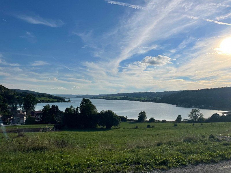
Camping Municipal Saint Point-lac
25160, St Point Lac, Frankreich
46° 48' 43" N 6° 18' 7" E
46.8119400 6.3019400
• Head northeast on Rue de Damvauthier.
• Arrive at Rue de Damvauthier. Your destination is on the left.
☍
Distance not available
(Duration not available)
Day
Camping Municipal Saint Point-lac
25160, St Point Lac, Frankreich
46° 48' 43" N 6° 18' 7" E
46.8119400 6.3019400
• Head northeast on Rue de Damvauthier.
• Arrive at Rue de Damvauthier. Your destination is on the left.
☍
Distance not available
(Duration not available)
Day
Camping Municipal Saint Point-lac
25160, St Point Lac, Frankreich
46° 48' 43" N 6° 18' 7" E
46.8119400 6.3019400
• Head southwest on Rue de Damvauthier. Go for 85 m.
• Turn left onto Rue de Damvauthier (D129). Go for 2.5 km.
• Continue on D129. Go for 827 m.
• Turn left onto Avenue de la Gare (D9). Go for 710 m.
• Turn right onto Avenue de la Gare (D437). Go for 27.9 km.
• Turn right onto Route de Champagnole (D127). Go for 2.5 km.
• Continue on D16. Go for 5.7 km.
• Turn left onto Route de Genève (N5). Go for 256 m.
• Turn right onto D75 toward Le Frasnois/Châtelneuf/Clairvaux les Lacs/Cascades du Hérisson. Go for 7.6 km.
• Turn right onto Route des Lacs (D39). Go for 5.2 km.
• Turn right onto Place Lacuzon. Go for 41 m.
• Arrive at Place Lacuzon. Your destination is on the left.
☍
53,4 km
( 56 min.)
Menétrux-en-Joux, Frankreich
39130 Menétrux-en-Joux, Frankreich
46° 37' 23.3" N 5° 49' 45.9" E
46.6231269 5.8294040
• Head toward Rue des Tilleuls on Place Lacuzon. Go for 41 m.
• Turn left onto Rue des Tilleuls (D39). Go for 5.2 km.
• Continue on Rue des Cascades (D39). Go for 1.2 km.
• Turn left onto D678. Go for 7.9 km.
• Take the 3rd exit from roundabout onto Avenue du Grand Vaux (D678) toward Genève/Morez/St Laurent en G.-Centre. Go for 1.7 km.
• Pass 3 roundabouts and continue on Route Blanche (D1005). Go for 20.7 km.
• Turn left onto Rue de la Frontière (D415) toward Genève Par Nyon/Lausanne/La Cure/Bois d'Amont/Nyon/La Suisse. Go for 345 m.
• Turn right onto Rue de la Frontière (D29) toward Genève Par Nyon/Nyon/Lausanne/La Cure. Go for 205 m.
• Turn left onto Impasse des Douanes. Go for 27 m.
• Continue on Route de France. Go for 128 m.
• Continue on Route de France (123). Go for 7.6 km.
• Take the 1st exit from roundabout onto Route de Nyon (123) toward Nyon. Go for 8.9 km.
• Pass 2 roundabouts and continue on Route Blanche. Go for 1.7 km.
• Take the 3rd exit from roundabout onto Route Blanche toward Nyon. Go for 420 m.
• Take the 3rd exit from roundabout onto Route Blanche toward Nyon/Signy. Go for 358 m.
• Take ramp onto A1 toward Genève. Go for 32.3 km.
• Continue on A41. Go for 18.7 km.
• Take exit 18 toward Allonzier la C. onto Rue des Glaises. Go for 900 m.
• Take the 3rd exit from roundabout onto D1201 toward A41/A410/Annecy/Villy le Pelloux/Pringy. Go for 660 m.
• Take the 1st exit from roundabout onto Route Impériale (D1201) toward Annecy/Pringy/St Martin-Bellevue. Go for 911 m.
• Take the 3rd exit from roundabout onto Route des Diacquenods (D114). Go for 1.6 km.
• Turn left onto D14. Go for 35 m.
• Continue on Route de la Frétallaz (D14). Go for 575 m.
• Continue on D14. Go for 39 m.
• Continue on Route de la Frétallaz (D14). Go for 658 m.
• Turn right onto Route du Mont. Go for 330 m.
• Turn left onto Route de l'Église. Go for 309 m.
• Turn left onto Route du Mont. Go for 111 m.
• Arrive at Route du Mont. Your destination is on the left.
☍
113,7 km
(1 hrs. 43 min.)
Saint-Martin-Bellevue, 74370 Fillière, Frankreich
45° 57' 46.3" N 6° 8' 53.5" E
45.9628600 6.1481980
• Head northeast on Route du Mont.
• Arrive at Route du Mont. Your destination is on the left.
☍
Distance not available
(Duration not available)
Day
Saint-Martin-Bellevue, Fillière, Frankreich
Saint-Martin-Bellevue, 74370 Fillière, Frankreich
45° 57' 46.3" N 6° 8' 53.5" E
45.9628600 6.1481980
• Head southwest on Route du Mont. Go for 111 m.
• Turn right onto Route de l'Église. Go for 1.3 km.
• Turn left onto Route des Diacquenods (D14). Go for 175 m.
• Take the 3rd exit from roundabout onto Route Impériale (D1201). Go for 2.7 km.
• Take the 1st exit from roundabout onto D1201 toward A41 (Chambéry)/Chambéry/Annecy/Épagny Metz-Tessy/Centre Hospitalier/Aéroport Annecy Mont Blanc. Go for 702 m.
• Take the 1st exit from roundabout onto D1201 toward A41 (Chambéry)/Chambéry/Annecy/Épagny Metz-Tessy/Centre Hospitalier. Go for 1.6 km.
• Take the 2nd exit from roundabout onto Route de Frangy (D14) toward A41/Chambéry. Go for 173 m.
• Keep right toward A41. Go for 172 m.
• Take ramp onto A41 toward Lyon/Grenoble/Chambéry. Go for 45.5 km.
• Take the exit toward Turin/Milan/Albertville/Grenoble/Chambéry onto N201 (Avenue du Bourget du Lac). Go for 7.8 km.
• Keep left onto A43. Go for 3.1 km.
• Take exit 20 toward St Baldoph/Myans. Go for 399 m.
• Take the 2nd exit from roundabout onto Route de Saint-Baldoph (D9) toward St Baldoph/Apremont/Myans/Z.I. de l'Albanne/Z.I. de la Villette. Go for 535 m.
• Take the 4th exit from roundabout onto Pont de l'Albanne (D9). Go for 480 m.
• Turn right onto D19. Go for 19 m.
• Continue on Route de Bois Plan (D19). Go for 739 m.
• Continue on D19. Go for 88 m.
• Continue on Route de Bois Plan (D19). Go for 284 m.
• Continue on D19. Go for 288 m.
• Continue on Lieu-dit Ferme Duverger (D19). Go for 56 m.
• Continue on Route de Bois Plan (D19). Go for 345 m.
• Continue on Route des Couards (D19). Go for 493 m.
• Take the 2nd exit from roundabout onto Route des Couards (D19). Go for 542 m.
• Take the 3rd exit from roundabout onto Place de la Mairie (D201). Go for 340 m.
• Turn left onto Route du Sanctuaire (D22 E). Go for 586 m.
• Turn right onto Route des Échelards. Go for 232 m.
• Arrive at Route des Échelards. Your destination is on the right.
☍
68,7 km
( 49 min.)
Aux fruits de la treille, Route des Echelards, Myans, Frankreich
228 Rte des Echelards D22, 73800 Myans, Frankreich
45° 30' 53.1" N 5° 59' 27.1" E
45.5147469 5.9908747
• Head southeast on Route des Échelards.
• Arrive at Route des Échelards. Your destination is on the right.
☍
Distance not available
(Duration not available)
Day
Aux fruits de la treille, Route des Echelards, Myans, Frankreich
228 Rte des Echelards D22, 73800 Myans, Frankreich
45° 30' 53.1" N 5° 59' 27.1" E
45.5147469 5.9908747
• Head northwest on Route des Échelards. Go for 135 m.
• Turn left onto Route des Échelards. Go for 97 m.
• Turn right onto Route du Sanctuaire (D22 E). Go for 1.4 km.
• Turn right onto D1006. Go for 838 m.
• Take the 1st exit from Carrefour de Chignin roundabout onto D1090 toward Grenoble/Chignin-Gare/Les Marches/Pontcharra/Lac de St André. Go for 490 m.
• Turn left and take ramp onto A43 toward A41/Grenoble/Albertville/Turin. Go for 2.6 km.
• Keep left onto A41 toward Grenoble. Go for 38.4 km.
• Take the exit toward Gières Domaine Universitaire onto N87. Go for 11.0 km.
• Take left ramp onto A480. Go for 3.7 km.
• Take exit 8 toward Gap/Briançon/Vizille/Stations de l'Oisans onto N85. Go for 3.9 km.
• Take the 2nd exit from roundabout onto N85 toward Gap/Briançon/Vizille. Go for 1.7 km.
• Keep left onto N85 toward Gap/Briançon/Vizille/La Mure/Stations de l'Oisans. Go for 3.5 km.
• Turn right onto N85. Go for 471 m.
• Keep left onto D1091. Go for 6.9 km.
• Continue on D591 toward Briançon/Livet-Gavet/Bourg d'Oisans. Go for 1.8 km.
• Continue on D1091. Go for 4.0 km.
• Take the 3rd exit from roundabout onto Route des 6 Vallées (D1091) toward Briançon/Les Clavaux/Bourg d'Oisans. Go for 18.4 km.
• Take the 2nd exit from roundabout onto Avenue de la Gare (D1091 B) toward Le Bourg d'Oisans/Villard Notre Dame. Go for 302 m.
• Continue on Avenue de la Gare (D1091 B). Go for 519 m.
• Continue on Avenue de la République (D1091 B). Go for 241 m.
• Continue on Avenue Docteur Louis Faure (D1091 B). Go for 161 m.
• Continue on Avenue Aristide Briand (D1091 B). Go for 7 m.
• Turn right onto Rue du 19 Mars 1962. Go for 392 m.
• Turn right onto Rue des Orpailleurs. Go for 98 m.
• Arrive at Rue des Orpailleurs. Your destination is on the left.
☍
101,1 km
(1 hrs. 18 min.)
Camping Koawa Le Colporteur
rue des colporteurs - le mas du plan, 38520, BOURG D'OISANS, Frankreich
45° 3' 7.3" N 6° 2' 6.9" E
45.0520368 6.0352501
• Head south on Rue des Orpailleurs.
• Arrive at Rue des Orpailleurs. Your destination is on the left.
☍
Distance not available
(Duration not available)
Day
Camping Koawa Le Colporteur
rue des colporteurs - le mas du plan, 38520, BOURG D'OISANS, Frankreich
45° 3' 7.3" N 6° 2' 6.9" E
45.0520368 6.0352501
• Head toward Rue du 19 Mars 1962 on Rue des Orpailleurs. Go for 98 m.
• Turn right onto Rue du 19 Mars 1962. Go for 12 m.
• Turn left onto Rue des Colporteurs. Go for 161 m.
• Continue on Route du Plan. Go for 11 m.
• Continue on Rue des Colporteurs. Go for 79 m.
• Continue on Route du Plan. Go for 19 m.
• Continue on Rue des Colporteurs. Go for 104 m.
• Turn right onto Avenue Aristide Briand (D1091 B). Go for 370 m.
• Continue on D1091 B. Go for 103 m.
• Take the 3rd exit from roundabout onto D1091 toward Grenoble/Briançon/Serre-Chevalier/Col du Lautaret. Go for 1.3 km.
• Keep right onto D1091. Go for 1.2 km.
• Turn left onto D526 toward Briançon/Serre-Chevalier/Col du Lautaret. Go for 33.1 km.
• Turn left onto D526. Go for 1.3 km.
• Keep left onto D26 A. Go for 2.4 km.
• Continue on D212 B. Go for 1.9 km.
• Turn left onto Route Napoléon (N85). Go for 28.9 km.
• Turn left onto D23 toward Les Costes/La Motte/Molines. Go for 13 m.
• Arrive at D23.
☍
71,0 km
(1 hrs. 14 min.)
Aubessagne, Frankreich
44° 45' 18.1" N 6° 0' 33.2" E
44.7550381 6.0092120
• Head southeast on D23.
• Arrive at D23.
☍
Distance not available
(Duration not available)
Day
Aubessagne, Frankreich
44° 45' 18.1" N 6° 0' 33.2" E
44.7550381 6.0092120
• Head toward Route Napoléon on D23. Go for 13 m.
• Turn left onto Route Napoléon (N85). Go for 11.3 km.
• Take the 2nd exit from roundabout onto Route de Gap (N85) toward Gap/Col Bayard/Laye. Go for 13.1 km.
• Take the 1st exit from Rond-Point de Varsie roundabout onto Route Napoléon (N85). Go for 2.1 km.
• Take the 1st exit from roundabout onto Avenue Commandant Dumont (N85). Go for 213 m.
• Take the 1st exit from roundabout onto Cours Ladoucette (N85) toward A51/Sisteron/Valence/Barcelonnette/Centre Ville. Go for 164 m.
• Take the 1st exit from Place Ladoucette roundabout onto Rue Faure du Serre (D994). Go for 504 m.
• Keep right onto Avenue Guillaume Farel (D994) toward A51/Valence/Veynes/Le Dévoluy. Go for 747 m.
• Take the 1st exit from Carrefour du Turrelet roundabout onto Avenue Guillaume Farel (D994). Go for 172 m.
• Take the 4th exit from roundabout onto Avenue de Veynes (D994). Go for 576 m.
• Take the 3rd exit from roundabout onto Avenue de Veynes (D994) toward A51/Valence/Aix en Pce/La Freissinouse/Veynes/Le Dévoluy. Go for 801 m.
• Take the 4th exit from Rond-Point du Sénateur roundabout toward Carpentras/Orange/Valence/Le Freissinouse/Veynes/Le Dévoluy/Station de Ceüse et de Dévoluy. Go for 228 m.
• Continue on D994. Go for 22.5 km.
• Take the 2nd exit from roundabout onto Place du 19 Mars 1962 (D994). Go for 213 m.
• Take the 3rd exit from roundabout onto Boulevard Gambetta (D994) toward A51/Marseille/Orange/Montélimar/Valence/Aspres S/Buëch/Serres/Laragne/Chabestan. Go for 13.0 km.
• Take the 3rd exit from roundabout onto D1075. Go for 2.8 km.
• Take the 1st exit from roundabout onto Rue Varanfrein (D994) toward Carpentras/Orange/Montélimar/Rosans/Montclus. Go for 27.2 km.
• Continue on D94. Go for 32.0 km.
• Take the 2nd exit from roundabout onto Route de Gap (D94) toward Nyons. Go for 3.9 km.
• Take the 2nd exit from roundabout onto Route de Mirabel (D538) toward Orange/Carpentras/Montélimar/Z.A. les Laurons. Go for 1.2 km.
• Take the 1st exit from roundabout onto Lieu-dit Geneston (D538). Go for 1.0 km.
• Take the 1st exit from roundabout toward Orange/Vinsobres/St Paul 3 Chtx/Bollène. Go for 496 m.
• Take the 3rd exit from roundabout onto Lieu-dit Le Paroir (D94) toward Orange/Vinsobres/Tulette/Bollène/St Paul 3 Chtx. Go for 3.6 km.
• Pass 5 roundabouts and continue on Avenue des Côtes du Rhône (D94). Go for 22.2 km.
• Continue on Route de Rochegude (D117). Go for 100 m.
• Take the 1st exit from roundabout onto D94. Go for 2.8 km.
• Continue on D994. Go for 3.6 km.
• Take the 1st exit from roundabout onto Avenue Salvador Allende (D8) toward A7/Pierrelatte/St Paul/Pont St Esprit. Go for 1.7 km.
• Take the 5th exit from Rond-Point des Portes de Provence roundabout onto Avenue Jean Monnet (D994) toward Alès/Pont St Esprit/Orange/Z.I. la Croisière/Z.A. la Préférence. Go for 810 m.
• Take the 4th exit from Rond-Point de l'Europe roundabout onto Avenue Jean Monnet (D994) toward Alès/Pont St Esprit/Orange/Lapalud/Z.I. la Croisiere. Go for 1.3 km.
• Take the 3rd exit from roundabout onto D994 toward Z.I la Croisière. Go for 2.7 km.
• Continue on N86 toward N7/Montélimar/Pierrelatte/Lapalud. Go for 2.0 km.
• Take the 3rd exit from roundabout onto N86 toward Alès/Pont St Esprit. Go for 1.6 km.
• Take the 2nd exit from roundabout toward D994/Pont St Esprit/Chartreuse de Valbonne/Gorges de l'Ardèche. Go for 82 m.
• Continue on Lieu-dit Le Bout du Pont (D994). Go for 1.2 km.
• Take the 1st exit from Carrefour de l'Europe roundabout onto Avenue Kennedy (D6086) toward Aubenas/Bourg St Andéol/Barjac/Gorges de l'Ardèche. Go for 3.2 km.
• Continue on D86. Go for 2.6 km.
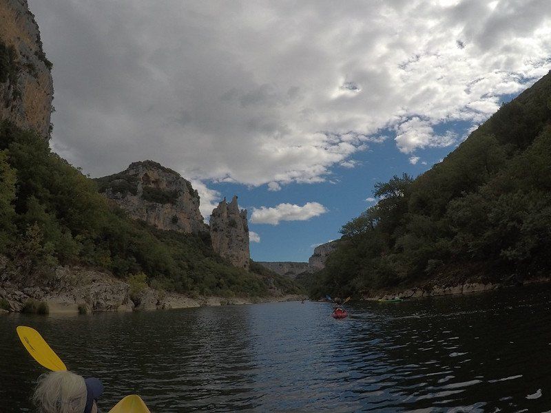
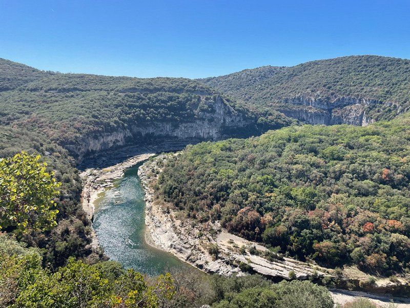
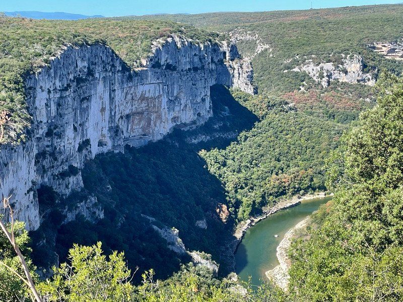
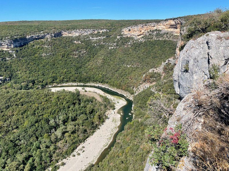
• Take the 2nd exit from roundabout onto Route des Gorges (D290) toward Gorges de l'Ardèche. Go for 3.3 km.
• Turn left onto Lieu-dit La Barotte (D200). Go for 625 m.
• Turn left onto Quai des Pescadous (D200 A). Go for 295 m.
• Arrive at Quai des Pescadous (D200 A). Your destination is on the left.
☍
188,0 km
(2 hrs. 56 min.)
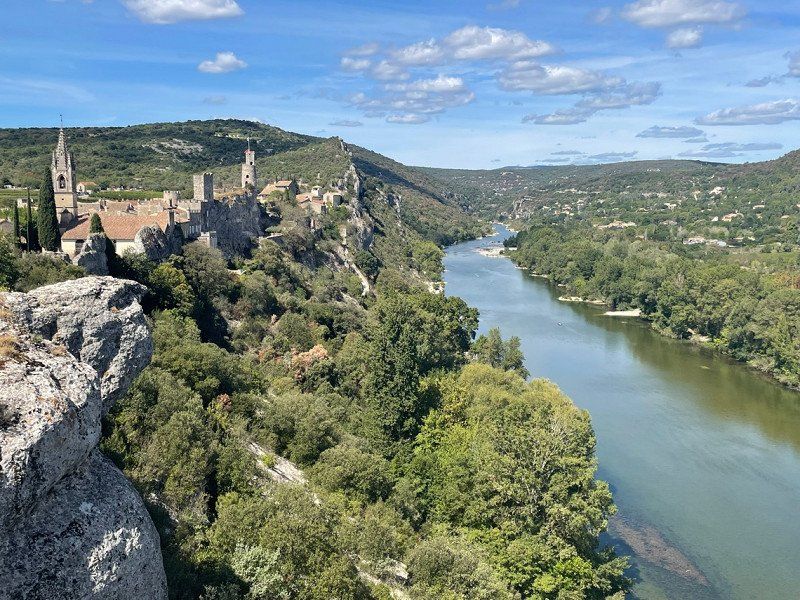
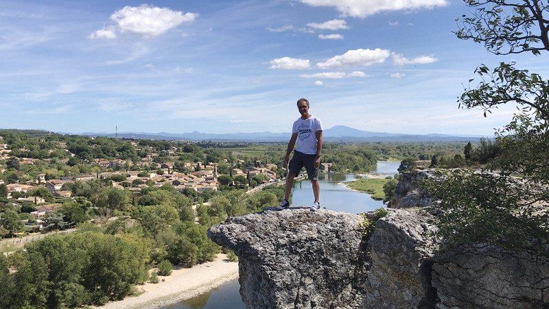
Huttopia le Moulin
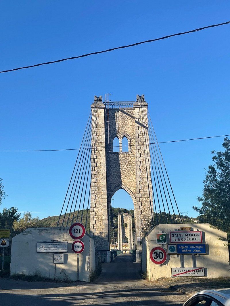
D290, 07700, SAINT MARTIN D'ARDECHE, Frankreich
44° 18' 0.9" N 4° 34' 9.2" E
44.3002600 4.5692180
• Head east on Quai des Pescadous (D200 A).
• Arrive at Quai des Pescadous (D200 A). Your destination is on the left.
☍
Distance not available
(Duration not available)
Day
Huttopia le Moulin
D290, 07700, SAINT MARTIN D'ARDECHE, Frankreich
44° 18' 0.9" N 4° 34' 9.2" E
44.3002600 4.5692180
• Head east on Quai des Pescadous (D200 A).
• Arrive at Quai des Pescadous (D200 A). Your destination is on the left.
☍
Distance not available
(Duration not available)
Day
Huttopia le Moulin
D290, 07700, SAINT MARTIN D'ARDECHE, Frankreich
44° 18' 0.9" N 4° 34' 9.2" E
44.3002600 4.5692180
• Head east on Quai des Pescadous (D200 A).
• Arrive at Quai des Pescadous (D200 A). Your destination is on the left.
☍
Distance not available
(Duration not available)
Day
Huttopia le Moulin
D290, 07700, SAINT MARTIN D'ARDECHE, Frankreich
44° 18' 0.9" N 4° 34' 9.2" E
44.3002600 4.5692180
• Head east on Quai des Pescadous (D200 A).
• Arrive at Quai des Pescadous (D200 A). Your destination is on the left.
☍
Distance not available
(Duration not available)
Day
Huttopia le Moulin
D290, 07700, SAINT MARTIN D'ARDECHE, Frankreich
44° 18' 0.9" N 4° 34' 9.2" E
44.3002600 4.5692180
• Head east on Quai des Pescadous (D200 A).
• Arrive at Quai des Pescadous (D200 A). Your destination is on the left.
☍
Distance not available
(Duration not available)
Day
Huttopia le Moulin
D290, 07700, SAINT MARTIN D'ARDECHE, Frankreich
44° 18' 0.9" N 4° 34' 9.2" E
44.3002600 4.5692180
• Head east on Quai des Pescadous (D200 A).
• Arrive at Quai des Pescadous (D200 A). Your destination is on the left.
☍
Distance not available
(Duration not available)
Day
Huttopia le Moulin
D290, 07700, SAINT MARTIN D'ARDECHE, Frankreich
44° 18' 0.9" N 4° 34' 9.2" E
44.3002600 4.5692180
• Head toward Lieu-dit le moulin on Quai des Pescadous (D200 A). Go for 50 m.
• Turn left onto Rue du Candélas (D200) toward Barjac/Aiguèze/Centre Village. Go for 190 m.
• Turn left onto D290 A toward Barjac/Aven d'Orgnac/Aiguèze/St Julien de Peyrolas. Go for 65 m.
• Continue on D141. Go for 840 m.
• Turn right onto D901. Go for 5.2 km.
• Turn right onto Route du Garn (D174). Go for 1.4 km.
• Continue on D174. Go for 1.9 km.
• Continue on Route de Pont Saint-Esprit (D301). Go for 49 m.
• Continue on Route de Pont Saint-Esprit (D174). Go for 222 m.
• Continue on D174. Go for 1.6 km.
• Continue on Lieu-dit Clos des Agneaux (D174). Go for 154 m.
• Continue on D217. Go for 108 m.
• Continue on Route de Pont Saint-Esprit (D217). Go for 2.8 km.
• Turn left onto Route de l'Aven (D317). Go for 2.2 km.
• Arrive at Route de l'Aven (D317). Your destination is on the right.
☍
16,7 km
( 20 min.)
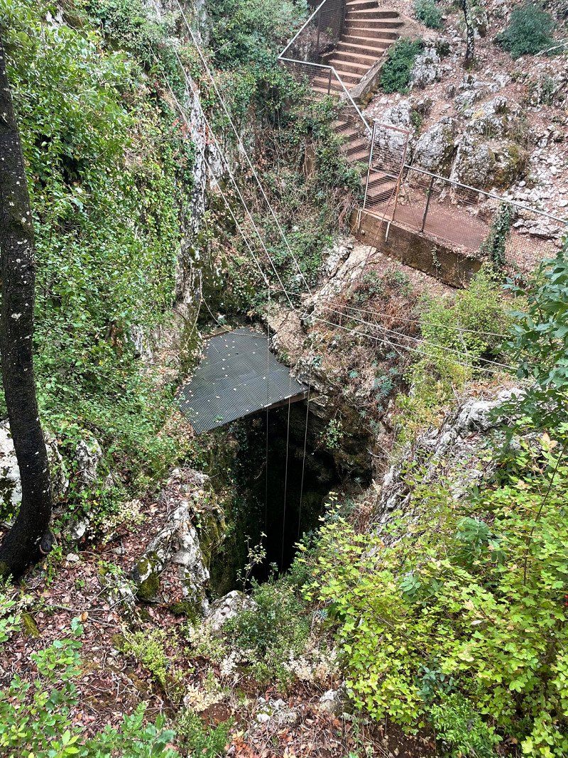
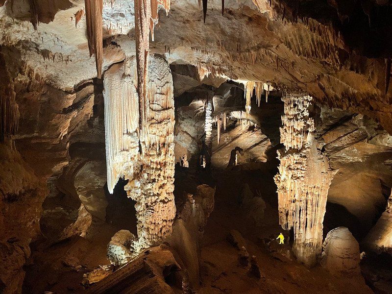
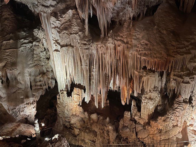
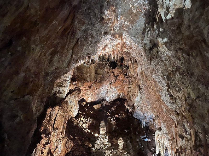
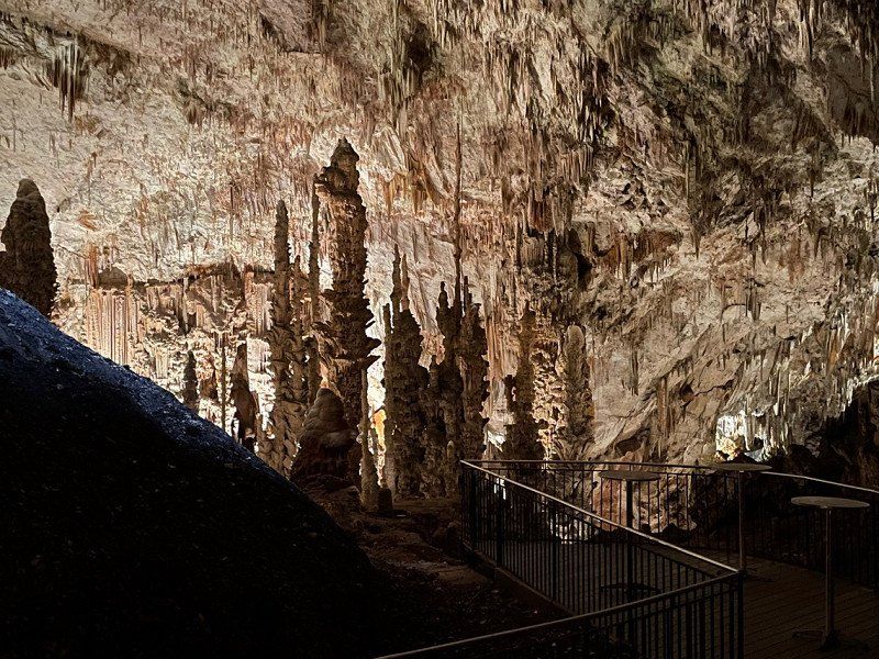
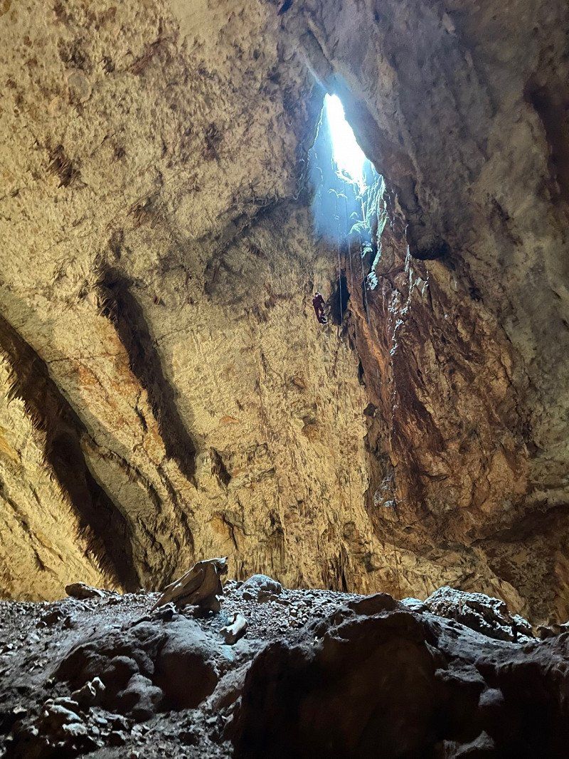
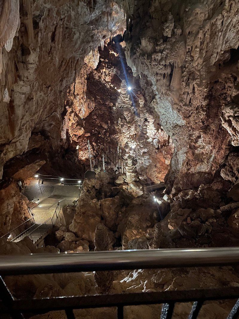
Aven d’Orgnac, L'Aven, Orgnac-l'Aven, Frankreich
2240 Route de, L'Aven, 07150 Orgnac-l'Aven, Frankreich
44° 19' 8.1" N 4° 24' 46.3" E
44.3189123 4.4128484
• Head west on Route de l'Aven (D317). Go for 167 m.
• Continue on D317. Go for 454 m.
• Turn left toward Route de l'Aven/D317. Go for 891 m.
• Turn right onto Route de l'Aven (D317). Go for 1.3 km.
• Turn right onto Route de Pont Saint-Esprit (D217). Go for 2.8 km.
• Continue on D217. Go for 108 m.
• Continue on Lieu-dit Clos des Agneaux (D174). Go for 154 m.
• Continue on D174. Go for 1.6 km.
• Continue on Route de Pont Saint-Esprit (D174). Go for 271 m.
• Continue on D174. Go for 1.9 km.
• Continue on Route du Garn (D174). Go for 1.4 km.
• Turn left onto Rue des Platanes (D901). Go for 11.3 km.
• Turn right onto Avenue Kennedy (D6086). Go for 2.6 km.
• Take the 3rd exit from Carrefour de l'Europe roundabout onto Avenue Pasteur (D994) toward Nîmes/Alès/St Nazaire/Bagnols S C./Centre Ville/A7/Montélimar/Bollène/Mondragon/Orange. Go for 1.2 km.
• Continue toward N86. Go for 56 m.
• Take the 3rd exit from roundabout onto N86 toward Mondragon. Go for 1.5 km.
• Take the 2nd exit from roundabout onto N86 toward A7/Montélimar/Orange/Bollène. Go for 2.0 km.
• Continue on D994 toward Montélimar/Pierrelatte/Lapalud/N7. Go for 2.7 km.
• Pass 2 roundabouts and continue on Avenue Jean Monnet (D994). Go for 2.0 km.
• Take the 5th exit from Rond-Point des Portes de Provence roundabout toward A7-A9/Lyon/Montélimar/Marseille/Nîmes/Orange. Go for 398 m.
• Take ramp onto A7 (Autoroute du Soleil) toward Montélimar/Valence/Lyon. Go for 176 km.
• Keep right onto Autoroute du Soleil (M7) toward Paris/A6/Clermont-Fd/A89/Roanne. Go for 100 km.
• Take exit 27 toward Tournus onto D906 (Avenue du Clos Mouron). Go for 1.9 km.
• Take the 3rd exit from roundabout onto Rue Saint-Laurent. Go for 275 m.
• Turn right onto Quai du Nord. Go for 178 m.
• Arrive at Quai du Nord.
☍
313,2 km
(3 hrs. 4 min.)
Quai du Nord, Tournus, Frankreich
Quai du N, 71700 Tournus, Frankreich
46° 33' 57.2" N 4° 54' 40.4" E
46.5658880 4.9112130
• Head south on Quai du Nord.
• Arrive at Quai du Nord.
☍
Distance not available
(Duration not available)
Day
Quai du Nord, Tournus, Frankreich
Quai du N, 71700 Tournus, Frankreich
46° 33' 57.2" N 4° 54' 40.4" E
46.5658880 4.9112130
• Head south on Quai du Nord. Go for 14 m.
• Turn right onto Rue de la Poterne. Go for 35 m.
• Turn right onto Rue de la Poterne. Go for 69 m.
• Turn slightly right onto Rue des Tonneliers. Go for 35 m.
• Turn right onto Place des Arts. Go for 76 m.
• Turn slightly left onto Place de l'Abbaye. Go for 109 m.
• Turn right onto Rue Albert Thibaudet. Go for 56 m.
• Turn right onto Avenue Gambetta (D906). Go for 156 m.
• Take the 2nd exit from roundabout onto Avenue Gambetta (D906). Go for 1.1 km.
• Take ramp onto A6 (Autoroute du Soleil) toward Paris. Go for 51.8 km.
• Continue on A31. Go for 114 km.
• Take the exit toward Metz/Nancy/Épinal/Langres-Nord onto A31. Go for 132 km.
• Take the left exit toward Metz/Luxembourg onto A31. Go for 101 km.
• Continue on A3. Go for 11.3 km.
• Take the exit toward E29/Aéroport/Trier/Ettelbruck/A7 onto A1. Go for 8.9 km.
• Take exit 8 toward Ettelbruck/Echternach/E29/E421 onto A7. Go for 2.6 km.
• Take exit 1 toward Echternach/Junglinster/E29 onto N11. Go for 7.3 km.
• Continue on E29. Go for 703 m.
• Take the 2nd exit from roundabout onto E29. Go for 2.5 km.
• Continue on N11. Go for 16.2 km.
• Turn right onto Rue des Remparts (E29) toward Bitburg/Wasserbillig/N10/Zone Industrielle Echternach. Go for 749 m.
• Continue on N10. Go for 863 m.
• Take the 2nd exit from roundabout onto N11b toward Bitburg/Z.I. Echternach. Go for 245 m.
• Continue on E29. Go for 52 m.
• Take the 1st exit from roundabout onto N11a. Go for 192 m.
• Continue on B257. Go for 2.2 km.
• Keep left onto B257 toward Bitburg/Wolsfeld. Go for 16.2 km.
• Turn left onto B257 toward Lüttich/A60/Wittlich/Köln/Aachen/Prüm/Bitburg-Zentrum. Go for 207 m.
• Turn right toward Lüttich/A60/Wittlich/Köln/Aachen/Prüm/Bitburg-Zentrum. Go for 182 m.
• Take ramp onto B51. Go for 10.1 km.
• Take ramp onto A60 toward Lüttich/Liège/Köln/Aachen/Prüm. Go for 19.2 km.
• Take the exit toward Prüm/Pronsfeld/Köln. Go for 243 m.
• Turn right onto B51 toward A1/Köln/Prüm/Gewerbegebiet Weinsheim/Gewerbegebiet Dausfeld. Go for 6.9 km.
• Take ramp onto B51 toward A1/Köln/Aachen. Go for 7.1 km.
• Turn left toward Aachen/Olzheim/Schwarzer Mann/Wolfsschlucht. Go for 50 m.
• Take the 2nd exit from roundabout onto L23. Go for 586 m.
• Arrive at Hauptstraße (L23). Your destination is on the right.
☍
515,6 km
(4 hrs. 42 min.)
Hauptstraße, Olzheim, Deutschland
Hauptstraße, 54597 Olzheim, Deutschland
50° 16' 22.4" N 6° 27' 25.1" E
50.2728903 6.4569861
• Head north on Hauptstraße (L23).
• Arrive at Hauptstraße (L23). Your destination is on the right.
☍
Distance not available
(Duration not available)
Day
Hauptstraße, Olzheim, Deutschland
Hauptstraße, 54597 Olzheim, Deutschland
50° 16' 22.4" N 6° 27' 25.1" E
50.2728903 6.4569861
• Head north on Hauptstraße (L23). Go for 45 m.
• Turn right onto Dilling. Go for 41 m.
• Turn right onto Dilling (K169). Go for 110 m.
• Turn left onto Hauptstraße (L23). Go for 485 m.
• Take the 3rd exit from roundabout. Go for 118 m.
• Turn left onto B51. Go for 31.2 km.
• Turn right onto L115 toward Ahrhütte/Rohr. Go for 347 m.
• Turn left onto A1 toward Köln/Euskirchen. Go for 37.2 km.
• Take the left exit toward Dortmund/Venlo/Flughafen Köln onto A1/A61. Go for 6.0 km.
• Keep left onto A1 toward Dortmund/Flughafen Köln/Hürth. Go for 121 km.
• Take exit 82 toward Hannover/Bielefeld onto A2. Go for 114 km.
• Take exit 32 toward Osnabrück/Bad Oeynhausen onto A30. Go for 4.6 km.
• Take exit 33 toward Dehme/Minden/Eidinghausen. Go for 243 m.
• Turn right onto B61. Go for 279 m.
• Continue on K29 toward Eidinghausen. Go for 122 m.
• Continue on Alter Postweg (K29). Go for 1.2 km.
• Continue on Im Keiten (K29). Go for 73 m.
• Continue on Wiekriede (K29). Go for 149 m.
• Turn right onto Hahnenkampstraße (K29). Go for 192 m.
• Take the 2nd exit from roundabout onto Kirchbreite (K8) toward Wulferdingsen/Werste. Go for 1.4 km.
• Continue on Ringstraße (K29). Go for 213 m.
• Continue on Bergkirchener Straße (K29). Go for 838 m.
• Continue on K29. Go for 15 m.
• Continue on Bergkirchener Straße (K29). Go for 393 m.
• Turn right onto Nordstraße. Go for 76 m.
• Arrive at Nordstraße. Your destination is on the left.
☍
319,5 km
(2 hrs. 57 min.)
Wersterholz, Bad Oeynhausen, Deutschland
Wersterholz, 32549 Bad Oeynhausen, Deutschland
52° 13' 43.7" N 8° 45' 55" E
52.2287973 8.7652767