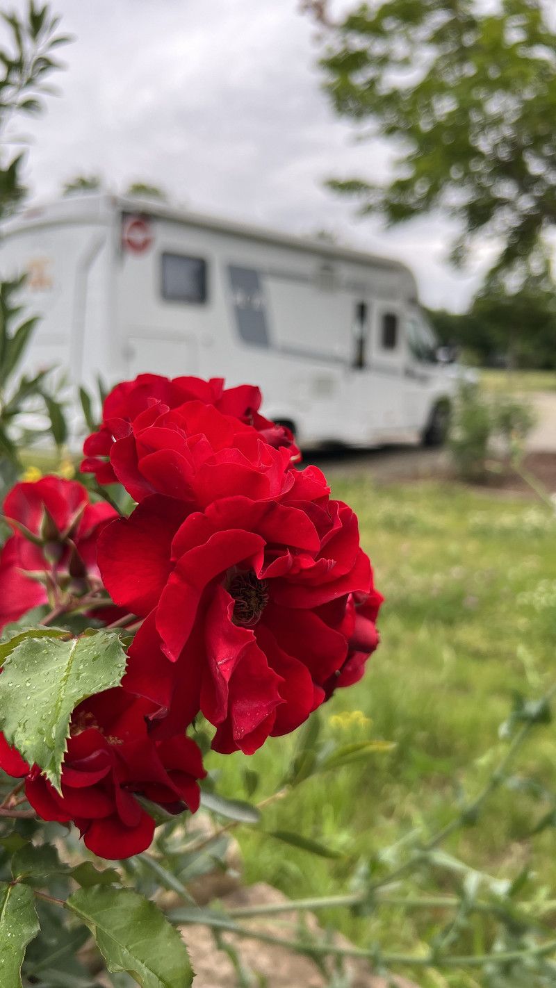
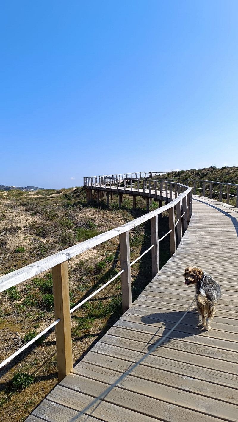
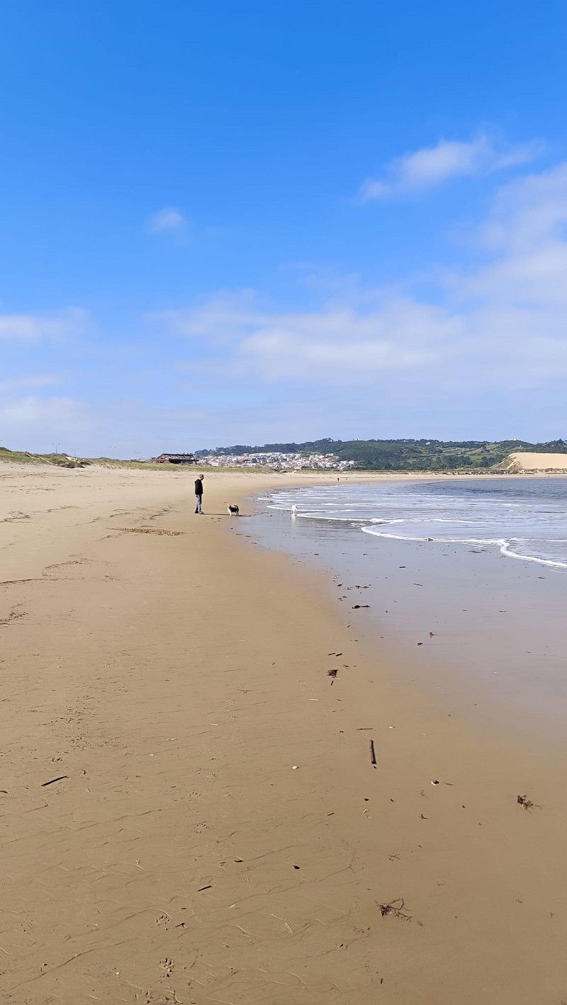
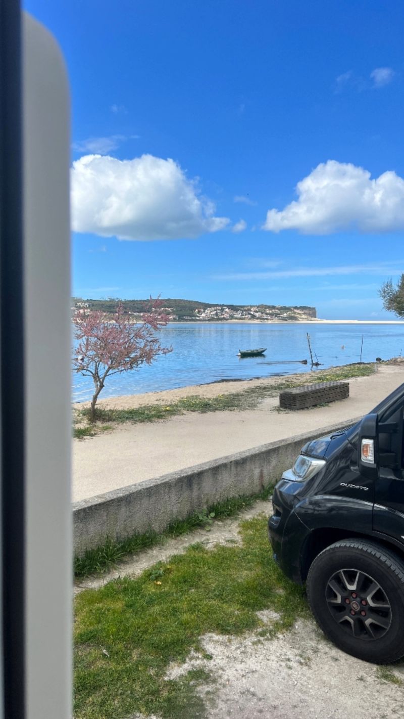
We'll be traveling to and through Portugal for three months in winter/spring 2025 with our two 🐾 furry friends. We enjoy using municipal campsites or small campgrounds, traveling off the beaten track, and enjoying secluded beaches and ancient villages. Big cities aren't really our thing. We'll be recording our experiences on video and documenting all the spots on our campsite map. Check it out on YouTube or www.unterwegsmitdenBeckers.de
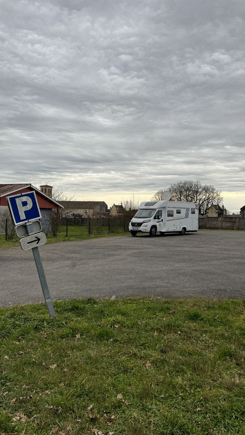
Worms
We're embarking on our journey south and documenting our route here. We've also included travel videos on our YouTube channel, and all our campsites are listed on our campsite map. Take a look.
Portugal 🇵🇹 Wintering 2025
https://www.unterwegsmitdenbeckers.de/2025/01/08/%C3%BCberwintern-in-portugal-2025/
Rheinland-Pfalz, Deutschland
49° 37' 48.9" N 8° 21' 43.5" E
49.6302618 8.3620898
• Head toward Kämmererstraße on Marktplatz. Go for 33 m.
• Continue on Stephansgasse. Go for 213 m.
• Take the 3rd exit from roundabout onto Lutherring. Go for 280 m.
• Take the 2nd exit from roundabout onto Willy-Brandt-Ring (K1) toward Krankenhaus Hochstift. Go for 239 m.
• Continue on Neusatz (K17). Go for 76 m.
• Turn right onto Sophienplatz (K17) toward A61/Monsheim/Hochschule. Go for 543 m.
• Take the 2nd exit from roundabout onto Kolpingstraße (K17) toward A61/Monsheim/B47/Wo.-Horchheim. Go for 938 m.
• Take ramp onto B47 toward A61/Koblenz/Ludwigshafen/Kaiserslautern/Monsheim/Wo.-Pfeddersheim. Go for 2.6 km.
• Take ramp onto A61 toward Ludwigshafen/Kaiserslautern. Go for 8.7 km.
• Take exit 59 toward Saarbrücken/Kaiserslautern onto A6. Go for 114 km.
• Continue on A320. Go for 13.5 km.
• Continue on E50 (Échangeur de Freyming). Go for 259 m.
• Take the left exit toward Paris/Metz/St Avold/Carling onto A4 (Autoroute de l'Est). Go for 41.6 km.
• Keep left onto A314 toward Metz/Nancy. Go for 1.5 km.
• Take the left exit toward Nancy/Aéroport Régional/Technopole/Actipole onto A315. Go for 1.2 km.
• Continue on N431. Go for 14.5 km.
• Take the 2nd exit from roundabout toward Nancy/Pagny S/M./Fey. Go for 178 m.
• Take the 2nd exit from roundabout onto A31 toward Nancy. Go for 25.1 km.
• Take exit 25 toward Pompey. Go for 389 m.
• Turn left onto Route Nationale 57 (D657) toward Marbache/Pompey/Custines/Z.I. P. Cabirol. Go for 1.5 km.
• Turn sharp left onto Route de Millery (D40 B) toward Metz/Millery/Z.I. P. Cabirol. Go for 1.0 km.
• Turn left onto D40 B toward Millery/Z.I.P. Cabirol. Go for 711 m.
• Turn left onto Route de Custines (D40). Go for 620 m.
• Continue on Avenue de la Moselle (D40). Go for 640 m.
• Turn right onto Grande Rue. Go for 112 m.
• Turn left onto Grande Rue. Go for 90 m.
• Turn right onto Place des Mariés. Go for 78 m.
• Arrive at Rue des Mariés. Your destination is on the right.
☍
230,7 km
(2 hrs. 6 min.)
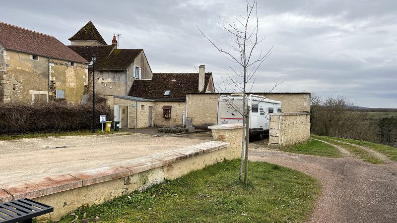
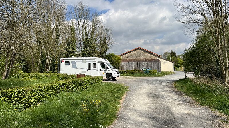
Millery
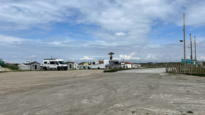
Communal parking space for 7 vehicles. Directly on the Moselle River. Good walking paths.
Accommodation is free, electricity and water are available for a fee. There's a pizza and baguette vending machine on site. Both are delicious 😉
We've already visited this place twice. Learn more in this video.
Return trip to Spain 🇪🇸 7 free pitches | Motorhome travel report Spain
https://youtu.be/hNT8d4N1oyE
Mörthe und Mosel, Grand Est, Frankreich
48° 49' 2.4" N 6° 7' 49.6" E
48.8173382 6.1304583
• Head toward Rue de la Biche on Rue des Mariés. Go for 2 m.
• Turn left onto Rue de la Jonchère. Go for 83 m.
• Turn left onto Rue des Templiers (D44). Go for 63 m.
• Continue on Grande Rue toward Custines/Nancy. Go for 272 m.
• Turn left onto Avenue de la Moselle (D40). Go for 640 m.
• Continue on Route de Custines (D40). Go for 620 m.
• Continue on Zone d'Activtes des Sablons (D40). Go for 3.4 km.
• Take the 1st exit from roundabout onto Rue René II (D40). Go for 173 m.
• Take the 2nd exit from Place de la Libération roundabout onto Avenue du Maréchal de Lattre de Tassigny (D40). Go for 1.3 km.
• Keep right toward Nancy. Go for 146 m.
• Take the 2nd exit from roundabout toward Nancy/Custines. Go for 309 m.
• Take the 2nd exit from roundabout onto A31 toward Nancy. Go for 11.4 km.
• Take the exit toward Lyon/Paris/Dijon/Toul onto A31. Go for 19.2 km.
• Take exit 12 toward Paris/Reims/Troyes Par RN/Bar le Duc onto N4. Go for 75.2 km.
• Take ramp toward Troyes/Wassy/Lac du der-Chantecoq. Go for 307 m.
• Take the 1st exit from roundabout onto D2 toward Chaumont/Troyes/Nancy. Go for 236 m.
• Take the 2nd exit from roundabout onto Avenue du Général Giraud (D2) toward Troyes/Montier en der/Lac du der. Go for 781 m.
• Take the 2nd exit from roundabout onto Route de Moeslains (D384) toward Troyes/Montier en der/Wassy/Lac du der. Go for 869 m.
• Take the 3rd exit from roundabout onto D384 toward Troyes/Wassy/Montier-en-der/Éclaron/Lac du der. Go for 1.6 km.
• Take the 2nd exit from roundabout onto D384 toward Troyes/Montier-en-der/Éclaron. Go for 3.1 km.
• Take the 2nd exit from roundabout onto D384 toward Troyes/Montier-en-der. Go for 2.9 km.
• Continue toward Troyes/Montier-en-der/Braucourt/Giffaumont. Go for 41 m.
• Take the 2nd exit from roundabout onto Route du Der (D384) toward Troyes/Montier-en-der/Braucourt/Giffaumont. Go for 10.0 km.
• Take the 2nd exit from roundabout onto Route de Montier-en-Der (D384) toward Troyes/Montier en D. Go for 3.7 km.
• Turn right onto Rue des Ponts (D384) toward Troyes/Ceffonds/Brienne le Ch./Bar S/Aube. Go for 1.5 km.
• Continue on D400. Go for 5.1 km.
• Take the 2nd exit from roundabout onto Rue Enson la Ville (D400) toward Troyes/Épothémont/Brienne le Ch. Go for 14.2 km.
• Keep right onto Route Juzanvigny (D400) toward Troyes/Zone Andra. Go for 322 m.
• Continue on Avenue Pasteur (D400). Go for 440 m.
• Take the 1st exit from roundabout onto Boulevard Napoléon (D396) toward A26/Troyes/Rosnay l'Hôpital/Vitry le François. Go for 699 m.
• Turn left onto Route de Lesmont (D960 A) toward A26/Troyes/St Leger S/S B./Piney/Arcis S/Aube/Lesmont. Go for 822 m.
• Continue on D960. Go for 17.9 km.
• Turn left onto Rue du Général de Gaulle (D79) toward Lusigny S/B./Vendeuvre S/B./Géraudot. Go for 289 m.
• Turn right onto Rue du Général de Gaulle. Go for 283 m.
• Continue on Place des Anciens Combattants. Go for 16 m.
• Arrive at Place des Anciens Combattants. Your destination is on the left.
☍
178,0 km
(2 hrs. 4 min.)
Piney
Municipal parking space including VE on the outskirts of the village.
We only have a coffee break and do not stay overnight
Rue des Platanes 1, Piney, Aube, Grand Est, Frankreich
48° 21' 31.4" N 4° 20' 4.9" E
48.3587242 4.3346896
• Head southeast on Place des Anciens Combattants. Go for 7 m.
• Turn slightly left onto Rue des Platanes. Go for 134 m.
• Turn left onto Rue des Ponts (D79). Go for 254 m.
• Turn left onto Rue Marcel Chollier (D79). Go for 421 m.
• Turn left onto Place A. Broquin (D960). Go for 4.7 km.
• Continue on D960. Go for 11.9 km.
• Take the 2nd exit from roundabout toward A26/Arcis S/Aube/Écrevolles/Aérodrome Troyes-Barberey. Go for 248 m.
• Continue on D610. Go for 14.1 km.
• Keep right onto Route d'Auxerre toward Auxerre/St-Germain/St-Florentin. Go for 1.5 km.
• Take the 3rd exit from roundabout onto Rue de Troyes (N77) toward Auxerre/St Florentin/Bouilly. Go for 43.7 km.
• Turn right onto Route de la Gare (D43) toward Vérigny. Go for 1.5 km.
• Continue on Rue Bernard Liège (D43). Go for 530 m.
• Continue on Rue Bernard Liège (D43). Go for 714 m.
• Turn left onto D203. Go for 312 m.
• Continue on Chemin d'Auxerre à Saint-Florentin (D203). Go for 5.1 km.
• Continue on Route d'Auxerre à Saint-Florentin (D203). Go for 964 m.
• Continue on Rue d'Auxerre (D203). Go for 130 m.
• Continue on Rue de Saint-Florentin (D203). Go for 2.7 km.
• Take the 2nd exit from roundabout onto Rue de Sougères (D203). Go for 450 m.
• Continue on Route d'Auxerre à Saint-Florentin (D203). Go for 3.1 km.
• Continue on D203. Go for 866 m.
• Continue on Route d'Auxerre à Saint-Florentin (D203). Go for 489 m.
• Continue on Rue Saint-Laurent-Sougères (D203). Go for 70 m.
• Take the 1st exit from roundabout onto Rue Saint-Laurent-Sougères (D203). Go for 550 m.
• Continue on Route d'Auxerre à Saint-Florentin (D203). Go for 2.0 km.
• Turn right onto Route d'Auxerre à Châlons-sur-Marne (N77). Go for 2.4 km.
• Take the 3rd exit from roundabout onto Avenue Jean Mermoz (N77) toward Z.I. Champoulains/Auxerrexpo/Nevers/Auxerre Centre/Z.I. les Champoulains. Go for 904 m.
• Keep left onto Avenue Jean Mermoz (N77) toward A6 (Sud)/Centre Ville. Go for 1.9 km.
• Take the 2nd exit from roundabout onto Place Jean Jaurès (N151) toward Nevers/Bourges/Orléans/Centre Ville. Go for 129 m.
• Turn left onto Quai de la République (N151) toward Nevers/Bourges/Orléans. Go for 955 m.
• Take the 2nd exit from roundabout onto Rue d'Eckmühl (N151) toward Nevers/Bourges/Orléans/Toucy/St Fargeau/Clamecy. Go for 22.4 km.
• Turn right onto Place du Château (D104) toward Druyes/Étais. Go for 10.4 km.
• Turn left onto Rue du Capitaine Coignet (D104). Go for 32 m.
• Arrive at Rue du Capitaine Coignet (D104). Your destination is on the left.
☍
135,7 km
(1 hrs. 50 min.)
Druyes-les-Belles-Fontaines
Free space for about three mobile homes right next to the old city gate. Water and electricity available for a donation. Quiet and pitch-dark at night.
Yonne, Burgund und Freigrafschaft, Frankreich
47° 32' 52.7" N 3° 25' 15.3" E
47.5479763 3.4209038
• Head toward Rue du Bon Dieu Jaune on Rue du Capitaine Coignet (D104). Go for 12.0 km.
• Continue on D1. Go for 4.4 km.
• Turn right onto Rue du Dauphin (D957). Go for 7.5 km.
• Turn left onto Lieu-dit Le Bourg (D14). Go for 433 m.
• Continue on Lieu-dit Les Champs Blancs (D14). Go for 258 m.
• Continue on Lieu-dit La Garenne (D14). Go for 37 m.
• Keep right onto D14. Go for 4.6 km.
• Continue on Lieu-dit Les Grands Champs de Vaill (D14). Go for 165 m.
• Continue on D14. Go for 482 m.
• Continue on Lieu-dit La Cour Froide (D14). Go for 844 m.
• Continue on Lieu-dit Les Babises (D14). Go for 1.6 km.
• Continue on Le Grand Begat (D14). Go for 606 m.
• Continue on Route de Bouhy (D14). Go for 690 m.
• Continue on Route de Cosne (D14). Go for 1.1 km.
• Continue on D14. Go for 2.7 km.
• Continue on Lieu-dit La Villa (D14). Go for 78 m.
• Continue on D14. Go for 507 m.
• Continue on Lieu-dit La Détorbe (D14). Go for 102 m.
• Continue on D14. Go for 342 m.
• Continue on Lieu-dit La Gobette (D14). Go for 87 m.
• Continue on D14. Go for 1.5 km.
• Continue on Lieu-dit Villeprevoir (D14). Go for 180 m.
• Continue on D14. Go for 1.9 km.
• Continue on Lieu-dit Rosières (D14). Go for 402 m.
• Continue on Route d'Alligny (D14). Go for 825 m.
• Take the 2nd exit from roundabout onto D14 toward Nevers/Cosne S/L. Go for 268 m.
• Continue on Rue des Frères Gambon (D14). Go for 899 m.
• Turn left onto Rue du Dahomey (D14). Go for 391 m.
• Turn slightly left onto Rue des Frères Gambon (D14). Go for 214 m.
• Turn slightly right onto Square Ferdinand Gambon. Go for 208 m.
• Turn left onto Rue du Maréchal Leclerc (D955 A). Go for 253 m.
• Take the 1st exit from Rond-Point de la Mairie roundabout onto Rue Alphonse Baudin. Go for 236 m.
• Take the 3rd exit from Rond-Point du Pont de Loire roundabout onto Rue du Général de Gaulle (D955). Go for 2.1 km.
• Take the 2nd exit from roundabout onto Lieu-dit Les Fouchards (D55). Go for 120 m.
• Continue on D55. Go for 3.5 km.
• Turn right onto D55. Go for 986 m.
• Continue on Lieu-dit Chailloux des Moulins à Vents (D55). Go for 569 m.
• Continue on Lieu-dit Les Maillots (D55). Go for 174 m.
• Continue on D55. Go for 1.1 km.
• Continue on Route de Cosne (D55). Go for 60 m.
• Continue on D55. Go for 123 m.
• Continue on Route de Cosne (D55). Go for 73 m.
• Turn right onto Route de Savigny (D54). Go for 14 m.
• Turn left onto Route de Subligny (D55). Go for 485 m.
• Continue on Route George Sand (D55). Go for 1.3 km.
• Continue on D55. Go for 1.8 km.
• Continue on Lieu-dit Le Grand Sorin (D55). Go for 930 m.
• Continue on Rue de la Marniere (D55). Go for 529 m.
• Continue on Rue de la Prée (D55). Go for 677 m.
• Continue on D55. Go for 518 m.
• Continue on Lieu-dit Le Chezal Charpy (D55). Go for 120 m.
• Continue on Lieu-dit Chau Charpi (D55). Go for 49 m.
• Continue on Lieu-dit Le Chezal Charpy (D55). Go for 140 m.
• Continue on D55. Go for 1.6 km.
• Continue on Lieu-dit La Beurrerie (D55). Go for 82 m.
• Continue on Lieu-dit Les Gaudris (D55). Go for 103 m.
• Continue on D55. Go for 1.8 km.
• Turn right onto Route de Sancerre (D923). Go for 480 m.
• Turn left onto Lieu-dit Le Pâtis des Crots (D55). Go for 650 m.
• Continue on D55. Go for 275 m.
• Turn slightly right onto D74. Go for 19 m.
• Continue on Rue du Lavoir (D89). Go for 1.7 km.
• Continue on Lieu-dit Le Pont de Bletteron (D89). Go for 682 m.
• Continue on Lieu-dit La Roptière (D89). Go for 167 m.
• Continue on D89. Go for 163 m.
• Turn left onto D94 E. Go for 25 m.
• Continue on Lieu-dit La Ratière (D94 E). Go for 151 m.
• Continue on Lieu-dit Le Chézal Bédu (D94 E). Go for 1.2 km.
• Continue on D94 E. Go for 723 m.
• Continue on Lieu-dit Les Chênués (D94 E). Go for 88 m.
• Continue on D94 E. Go for 675 m.
• Continue on Lieu-dit Le Petit Gué des Ruesses (D94 E). Go for 95 m.
• Continue on D94 E. Go for 1.3 km.
• Continue on Lieu-dit Monplaisir (D94 E). Go for 185 m.
• Continue on D94 E. Go for 239 m.
• Continue on Lieu-dit Les Sergens (D94 E). Go for 409 m.
• Turn slightly right onto D7. Go for 2.9 km.
• Turn left onto D926. Go for 12.5 km.
• Take the 2nd exit from roundabout onto Rue des Maisons Neuves (D926) toward Vierzon/Méry ès Bois/Neuvy S/Bgeon. Go for 14.7 km.
• Turn left onto Place de la Mairie (D30). Go for 337 m.
• Keep right onto Route de Vierzon (D926). Go for 14.8 km.
• Take the 1st exit from roundabout onto D926. Go for 1.4 km.
• Take the 2nd exit from roundabout onto D926. Go for 1.3 km.
• Take the 2nd exit from roundabout onto D2020 toward A71/A20/Vierzon/Blois/Tours. Go for 325 m.
• Take the 1st exit from roundabout onto A20 (L'Occitane) toward Châteauroux/Limoges/Blois/Tours. Go for 54.8 km.
• Take exit 12 toward Châteauroux-Centre/Déols/La Châtre. Go for 262 m.
• Take the 1st exit from roundabout onto D956 toward Brassioux/Blois/Valençay/C.H. de Valençay/Bouges le C./Ch. de Bouges/Levroux. Go for 2.5 km.
• Take the 3rd exit from roundabout onto D956 toward Châteauroux. Go for 2.7 km.
• Turn slightly left onto Boulevard de l'École Normale. Go for 19 m.
• Take the 1st exit from roundabout onto Avenue de Blois (D956). Go for 337 m.
• Take the 2nd exit from roundabout onto Place Saint-Christophe (D943). Go for 643 m.
• Take the 3rd exit from Rond-Point Lucie Aubrac roundabout onto Avenue Charles de Gaulle. Go for 250 m.
• Take the 2nd exit from Rond-Point Louis Deschizeaux roundabout onto Avenue Charles de Gaulle. Go for 1.0 km.
• Turn right onto Boulevard de Cluis (D943). Go for 272 m.
• Turn right onto Avenue de Verdun. Go for 55 m.
• Turn right onto Impasse Auliard. Go for 75 m.
• Arrive at Impasse Auliard. Your destination is on the left.
☍
185,3 km
(2 hrs. 16 min.)
Châteauroux
Free parking right next to the park. Great for dog walks or strolls.
Parceled, no problem for vehicles up to 8m, quiet at night, VE
Animal clinic on the parallel street, which we unfortunately had to use on our last trip. Learn more in this video.
From Normandy to the South of France 🇫🇷 Pitches for the Autumn Motorhome Tour 2024
https://youtu.be/uEFF93nlEb0
Indre, Zentrum, Frankreich
46° 48' 16.9" N 1° 41' 44.6" E
46.8047000 1.6957099
• Head toward Avenue de Verdun on Impasse Auliard. Go for 75 m.
• Turn right onto Avenue de Verdun. Go for 97 m.
• Turn left onto Rue Louis Blanc. Go for 214 m.
• Continue on Boulevard Croix-Normand (D943). Go for 23 m.
• Turn left onto Avenue John Kennedy (D40). Go for 617 m.
• Keep left onto Avenue John Kennedy (D40). Go for 1.1 km.
• Take the 1st exit from roundabout onto Rocade Sud (D920). Go for 2.5 km.
• Take the 3rd exit from Rond-Point du Pré-Naudin roundabout onto Avenue d'Occitanie (D920) toward A20/Guéret/Limoges/Poitiers/Argenton S/C./Le Blanc. Go for 927 m.
• Pass 2 roundabouts and continue on Avenue d'Occitanie (D920). Go for 2.0 km.
• Take left ramp onto A20 (L'Occitane) toward Poitiers/Guéret/Limoges/Argenton S/C. Go for 69.8 km.
• Take exit 23 toward Magnac-Laval/Bellac. Go for 638 m.
• Take the 1st exit from roundabout onto N145 toward Angoulême/Magnac-Laval/Bellac. Go for 27.5 km.
• Take the 1st exit from roundabout onto N147 toward Poitiers/Châtellerault/Angoulême. Go for 2.0 km.
• Take the 2nd exit from roundabout onto N147 toward Poitiers/Châtellerault/Tours/Angoulême. Go for 5.5 km.
• Take the 3rd exit from roundabout onto D951 toward Angoulême/Mézières S/Issoire/Confolens. Go for 5.4 km.
• Pass 2 roundabouts and continue on D951. Go for 47.9 km.
• Take the 4th exit from roundabout onto D739 toward Nieuil. Go for 2.9 km.
• Turn right onto D60. Go for 63 m.
• Arrive at D60. Your destination is on the right.
☍
169,3 km
(1 hrs. 52 min.)
Nieuil
Free parking directly on the N141 with water and electricity. There's a picnic area and a squat toilet nearby. It was too noisy and quirky for us, but it's perfect for a coffee break.
Charente, Neu-Aquitanien, Frankreich
45° 52' 41.1" N 0° 30' 5.2" E
45.8780700 0.5014349
• Head toward Rue de la Boisselée on D60. Go for 232 m.
• Continue on Lieu-dit Les Juzeaux (D60). Go for 130 m.
• Continue on D60. Go for 216 m.
• Continue on Lieu-dit Le Bournat (D60). Go for 244 m.
• Continue on D60. Go for 2.0 km.
• Turn right onto N141 toward Chasseneuil/La Rochefld. Go for 3.8 km.
• Take the 3rd exit from roundabout onto N141 toward Angoulême/Taponnat/La Rochefoucauld. Go for 30.9 km.
• Continue on N10. Go for 82.3 km.
• Take ramp toward Laruscade/Cavignac/St Mariens. Go for 206 m.
• Take the 3rd exit from roundabout onto Avenue de Paris (D135 E5) toward Cavignac. Go for 1.4 km.
• Take the 2nd exit from roundabout onto Rue de Marlacca (D18). Go for 109 m.
• Take the 2nd exit from roundabout onto Rue de Godineau. Go for 69 m.
• Turn left onto Rue de la Paix. Go for 92 m.
• Arrive at Rue de la Paix. Your destination is on the right.
☍
121,7 km
(1 hrs. 14 min.)
Cavignac
A parking space without services is located between a kindergarten, a cemetery, and a vineyard. No lighting. Near the N10, which can be heard as a constant noise.
The video for part 1 of the journey through France can be found here
https://youtu.be/9aVlpkRpAkY
Rue De La Paix 12, Cavignac, Saint-Savin, Gironde, France
45° 6' 1.2" N 0° 23' 27.7" W
45.1003456 -0.3910302
• Head south on Rue de la Paix. Go for 170 m.
• Turn right onto Avenue de Paris (D18). Go for 613 m.
• Take the 1st exit from roundabout onto Avenue de Paris (D18). Go for 1.1 km.
• Take the 3rd exit from roundabout onto N10 toward Bordeaux/St André de C. Go for 8.5 km.
• Keep left onto N10 toward A10/Bordeaux. Go for 351 m.
• Take ramp onto A10 (L'Aquitaine). Go for 16.4 km.
• Take exit 1 toward Toulouse/Bayonne/Bassin d'Arcachon/Bordeaux/Périgueux onto N230 (Rocade de Bordeaux). Go for 19.8 km.
• Take exit 15 toward Saint Sébastien/Bayonne/Mont de Marsan/Bassin d'Arcachon onto A63. Go for 206 km.
• Continue on AP-8 (Autopista del Cantábrico). Go for 12.2 km.
• Take the exit toward Bilbao/Vitoria-Gasteiz/Burgos/Hernani/A-15/Iruña/Pamplona onto AP-1/AP-8. Go for 6.9 km.
• Take exit 19 toward Hernani/Iruña/Pamplona onto A-15 (Autovía del Urumea). Go for 10.6 km.
• Take the exit onto N-1. Go for 2.7 km.
• Keep right onto A-15 (Agaraitz auzoa) toward Irurtzun/Iruña/Pamplona. Go for 43.3 km.
• Take exit 113 toward Irurtzun. Go for 295 m.
• Turn left onto NA-2410 toward Irurtzun. Go for 287 m.
• Pass 2 roundabouts and continue on NA-2410. Go for 541 m.
• Continue on Calle Dos Hermanas (NA-2409). Go for 55 m.
• Turn right onto Calle de Estella (NA-7010). Go for 50 m.
• Arrive at Calle de Estella (NA-7010). Your destination is on the right.
☍
330,2 km
(3 hrs. 17 min.)
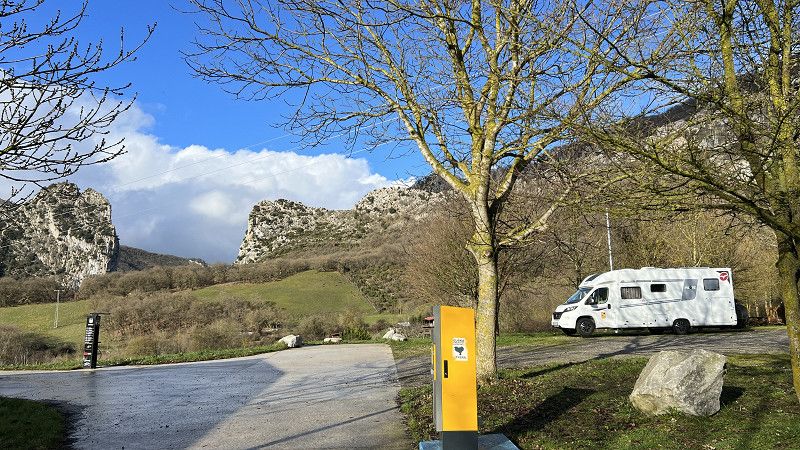
Irurtzun
Parking space directly on the via Verde.
5€/48 hours
Caution when entering. Sloping corner.
More about the pitch can be found in the video, available soon
https://youtu.be/eRGz0HUq03k
Sakana, Navarra, Spanien
42° 55' 6.5" N 1° 49' 43.1" W
42.9184675 -1.8286391
• Head toward Plaza Fueros on Calle de Estella (NA-7010). Go for 415 m.
• Take the 1st exit from roundabout onto Calle de Estella. Go for 28 m.
• Turn right onto Variante de Irurtzun. Go for 449 m.
• Take the 3rd exit from roundabout onto Calle Aralar (NA-2410). Go for 402 m.
• Take the 1st exit from roundabout onto NA-2410. Go for 679 m.
• Take left ramp onto A-10 (Autovía de la Barranca) toward Alsasua/Altsasu/Vitoria/Gasteiz. Go for 28.7 km.
• Take the exit onto A-1. Go for 69.5 km.
• Take exit 328 toward Burgos/Logroño/AP-68/Bilbao onto AP-1 (Autovía del Norte). Go for 83.3 km.
• Continue on A-1 (Autovía del Norte) toward Madrid/A-62/Valladolid/Portugal. Go for 7.1 km.
• Keep right onto BU-30 (Nudo de Landa) toward Palencia/Valladolid/A-62/León/A-231. Go for 4.2 km.
• Continue on A-62 (Autovía de Castilla) toward Palencia/Valladolid. Go for 78.6 km.
• Take exit 86A toward Villamuriel/A-67/Palencia onto P-123. Go for 517 m.
• Take the 3rd exit from roundabout toward A-67/Palencia/Santander/León/Valladolid/Madrid. Go for 198 m.
• Take ramp onto A-67 toward Palencia/Santander/León. Go for 786 m.
• Take exit 2 toward Villamuriel de Cerrato. Go for 1.1 km.
• Take the 4th exit from roundabout onto P-900 toward Pol. Industrial El Arriero/Palencia/P-11/Villamuriel de Cerrato/Venta de Baños/A-67/Valladolid/Madrid. Go for 474 m.
• Take the 3rd exit from roundabout onto Calle Carreterilla toward Villamuriel de Cerrato. Go for 292 m.
• Take the 4th exit from roundabout onto Calle Carreterilla. Go for 225 m.
• Turn slightly right toward Avenida de Portugal. Go for 237 m.
• Turn right onto Avenida de Portugal. Go for 235 m.
• Turn left onto Calle Mariano Rodríguez. Go for 11 m.
• Turn left. Go for 101 m.
• Arrive at your destination on the left.
☍
277,5 km
(2 hrs. 29 min.)
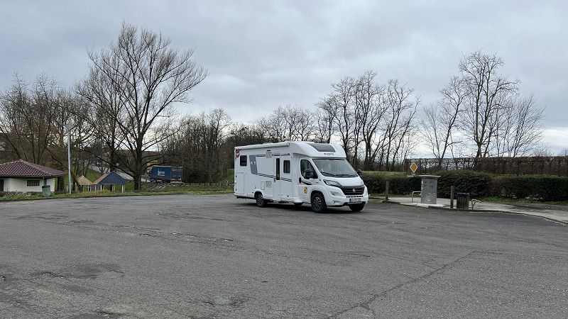
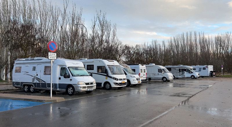
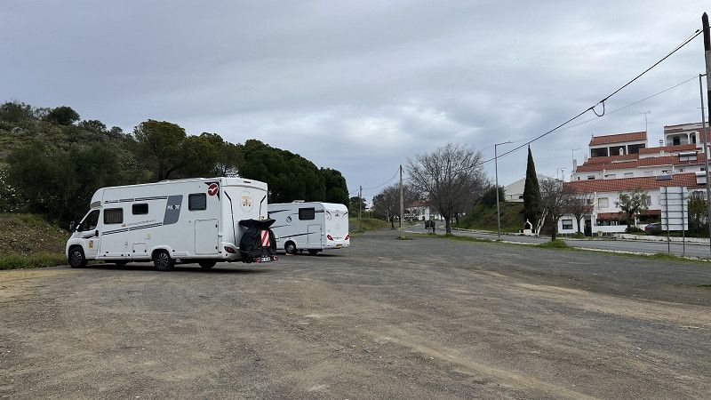
Villamuriel de Cerrato
Free parking is available opposite the swimming pool and multi-sports facility. It's located on the edge of the field. Two waste disposal stations, eight electrical hookups, and space for 10-12 vehicles, depending on parking habits. Quiet at night.
You can see the route for the onward journey here: https://youtu.be/FfcCZNb5zRc
Palencia, Kastilien und León, Spanien
41° 57' 5.5" N 4° 30' 54.7" W
41.9515154 -4.5151999
• Head toward Calle Mariano Rodríguez. Go for 101 m.
• Turn left onto Calle Mariano Rodríguez. Go for 221 m.
• Turn left onto Avenida de la Aguilera. Go for 182 m.
• Continue toward Calle Carreterilla. Go for 266 m.
• Turn slightly left onto Calle Carreterilla. Go for 174 m.
• Take the 2nd exit from roundabout onto Calle Carreterilla. Go for 232 m.
• Take the 2nd exit from roundabout onto A-67 (Autovía Cantabria-Meseta) toward Venta de Baños/Valladolid/Madrid. Go for 3.5 km.
• Take the exit onto A-62 (Autovía de Castilla). Go for 66.0 km.
• Keep right onto A-62 (Autovía de Castilla) toward E-82/Zamora/A-11/Salamanca/Portugal. Go for 91.6 km.
• Take exit 244 toward E-803/A-66/A-50/Madrid. Go for 598 m.
• Take the 1st exit from roundabout onto A-66 (Autovía Ruta de la Plata) toward Cáceres/A-50/Madrid. Go for 161 km.
• Take exit 508 toward N-630/Cañaveral. Go for 369 m.
• Take the 1st exit from roundabout toward Cañaveral/N-630. Go for 483 m.
• Take the 1st exit from roundabout onto N-630. Go for 428 m.
• Turn left onto Callejón Mozas. Go for 1.5 km.
• Turn right onto N-630. Go for 1.8 km.
• Turn right onto Calle Cardal. Go for 48 m.
• Continue straight ahead. Go for 34 m.
• Arrive at your destination on the right.
☍
328,9 km
(2 hrs. 56 min.)
Cáceres Nature camper park
Automated parking space, booking via the Pverde app.
Gravel plots with a slight slope. Shower, washing machine, and dryer available for a fee. Quiet at night. Extensive views of Extremadura.
We visited the place three years ago. You can get more impressions from the video from that time.
https://youtu.be/5ABJCACr65g
Calleja del Abologal, Cañaveral, Cáceres, Extremadura, Spanien
39° 47' 6.9" N 6° 23' 44.1" W
39.7852556 -6.3955785
• Head south. Go for 39 m.
• Turn left toward N-630. Go for 77 m.
• Turn right onto N-630. Go for 12.3 km.
• Turn left onto EX-373. Go for 4.6 km.
• Take ramp onto A-66 (Autovía de la Plata) toward Cáceres. Go for 31.9 km.
• Take exit 555 toward Polígono Industrial Aldea Moret/C. T. Cáceres. Go for 488 m.
• Turn right onto Carretera de Badajoz (N-523) toward Badajoz. Go for 76.9 km.
• Pass 2 roundabouts and continue on N-523. Go for 2.0 km.
• Take the 3rd exit from roundabout onto N-523. Go for 96 m.
• Take ramp onto A-5 (Autovía de Extremadura) toward Portugal. Go for 8.8 km.
• Continue on A6 (Autoestrada do Alentejo Central). Go for 41.2 km.
• Take exit 8 toward Borba/Estremoz onto N4. Go for 11.1 km.
• Continue on N4 toward Lisboa/Arraiolos/(N18)/Évora. Go for 1.9 km.
• Continue on IP2 toward Lisboa/(N18)/Arraiolos/A6/Évora. Go for 3.4 km.
• Turn left onto IP2 toward Évora/Azaruja/Evoramonte. Go for 6.6 km.
• Turn left. Go for 27 m.
• Arrive at your destination on the left.
☍
201,6 km
(2 hrs. 9 min.)
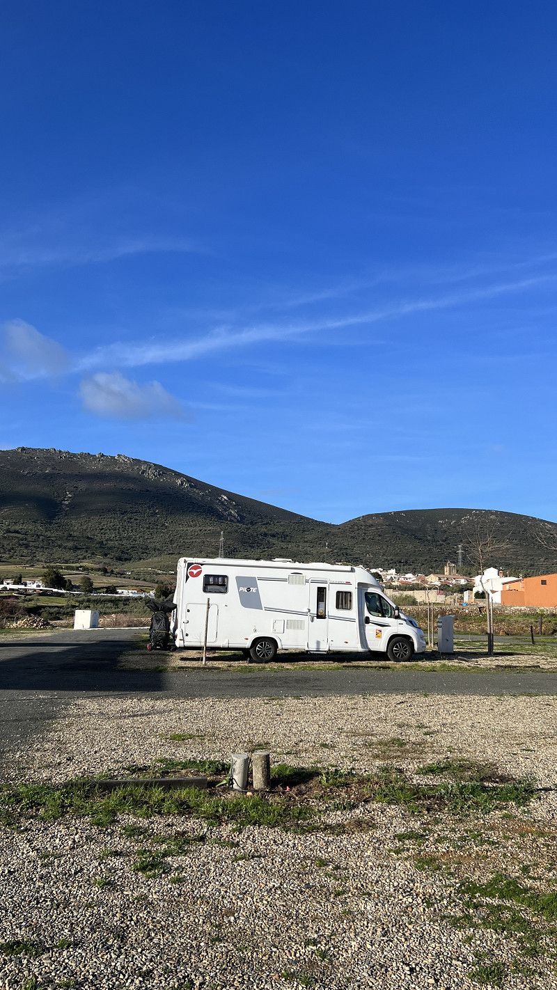
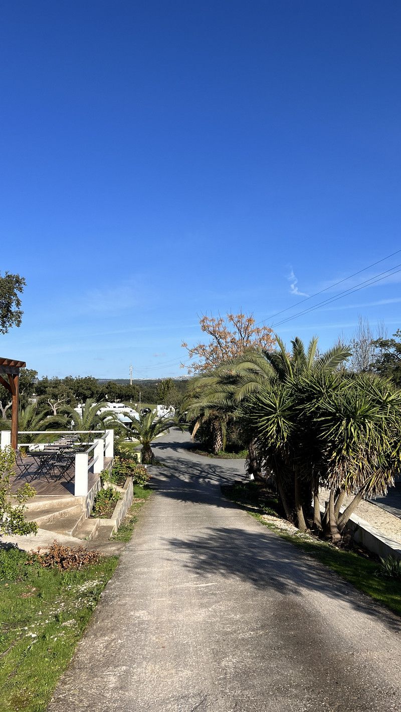
Camping Alentejo
A small campsite, right next to the country road (which you can clearly hear), with a cork oak forest at the rear offering good walking opportunities. Well-maintained restrooms, a pool, various seating areas, lots of greenery, and a very well-maintained location. A bread delivery service and shuttle are available.
Currently, the site is 90% full, with many long-term campers. There were gunshots in the forest (hare hunting), so we moved on to the west coast.
Alentejo | First stops and test solar bag
https://youtu.be/xjoDIqhMIdg
We were here three years ago. For more information, just click on the video.
https://youtu.be/wOmGMm81FuA
EN 18, Arraiolos, Évora, Portugal
38° 47' 37.1" N 7° 41' 9.3" W
38.7936253 -7.6859237
• Head north. Go for 27 m.
• Turn left onto IP2. Go for 22.7 km.
• Take ramp onto A6 (Autoestrada do Alentejo Central) toward Lisboa/Montemor. Go for 74.9 km.
• Take exit 1 toward Algarve/Alcácer onto A2 (Autoestrada do Sul). Go for 63.2 km.
• Take exit 10 toward Grândola/N259/Ferreira/Lisboa/Algarve/Grândola/Ourique onto IC1. Go for 22.2 km.
• Turn right onto N261 toward Alvalade/Lagos/Cercal/V. N.va Milfontes. Go for 983 m.
• Take the 2nd exit from roundabout onto N261. Go for 659 m.
• Continue on N262. Go for 31.9 km.
• Continue on N389. Go for 1.6 km.
• Take the 2nd exit from Largo dos Caieiros roundabout onto Rua 25 de Abril (N390) toward Lagos/Milfontes. Go for 10.7 km.
• Pass 2 roundabouts and continue on N390. Go for 2.4 km.
• Take the 2nd exit from roundabout onto N393 toward Odemira. Go for 9.0 km.
• Take the 2nd exit from roundabout onto N393 toward Odemira. Go for 5.9 km.
• Turn right onto M502 toward Zambujeira. Go for 13.2 km.
• Turn left. Go for 67 m.
• Arrive at your destination on the left.
☍
259,5 km
(2 hrs. 45 min.)
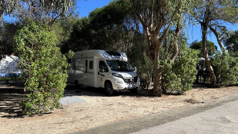
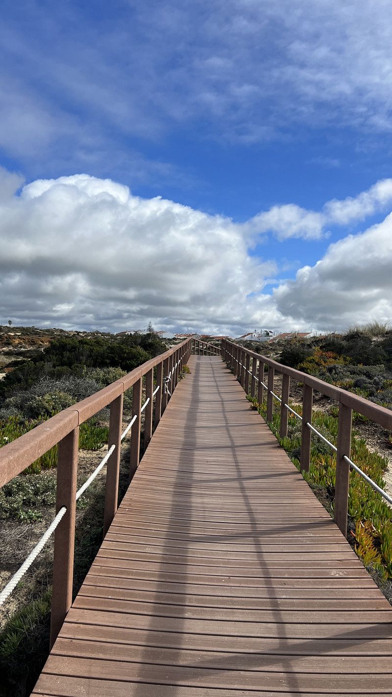
Camping Villa Park Zambujeira do Mar
Natural campsite with very good value for money (ACSI 17€).
There are pitches for tents, caravans, small camper vans, or large motorhomes, either in designated areas or in open spaces, whatever you prefer. The supermarket is well-stocked, there's a bread delivery service, rental cars, a pool/jacuzzi (unheated seawater), very clean restrooms, and very friendly staff. The coast and various cafés and restaurants are just 800 meters away.
Currently (02/2025) the space is 90% occupied.
More insights: into the Camping Villa Park
https://youtu.be/OUGOwRAoAkg
We like Zambujeira do Mar, even if it's a bit of a nuisance. The coast is great, there are a few cafes, and the campsite offers everything we need... what more could we need? We'll be staying here longer. A good five weeks in total 😉
More about the west coast of Portugal 🇵🇹
https://youtu.be/ykUeEqAhCw4
EN 393-1, São Teotónio, Beja, Portugal
37° 31' 31" N 8° 46' 31.2" W
37.5252888 -8.7753351
• Head north. Go for 67 m.
• Turn left onto M502. Go for 502 m.
• Continue on Rua de Miramar (M502). Go for 264 m.
• Turn right onto Rua da Entrada da Barca (M1158). Go for 598 m.
• Continue on M1158. Go for 2.3 km.
• Turn right onto M1158. Go for 4.7 km.
• Continue on Malhadil (M1158). Go for 153 m.
• Continue on M1158. Go for 1.4 km.
• Turn left onto M1124. Go for 2.9 km.
• Continue on Rua da Feira (M1124). Go for 303 m.
• Continue on Estrada do Farol (M1124). Go for 906 m.
• Arrive at your destination on the right.
☍
14,2 km
( 15 min.)
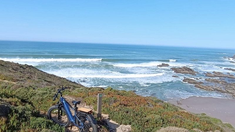
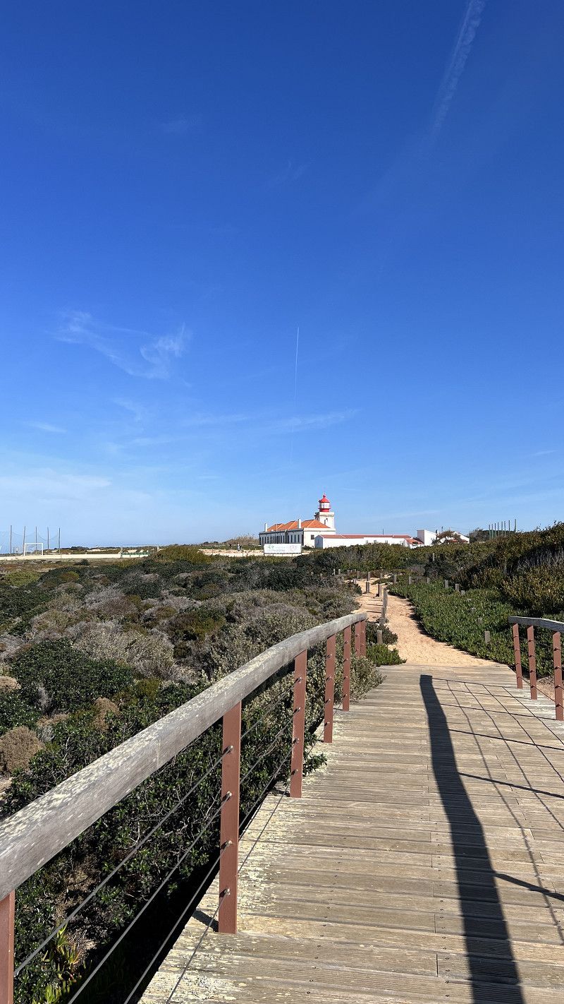
Farol do Cabo Sardão
Cabo Sardão is known for its unique flora and fauna. Storks nest in the cliffs here, a phenomenon unique in the world.
Day parking directly at the lighthouse.
We used the campsite's rental car offer and made a day trip
https://youtu.be/siCXQ9WMpjw
Estrada do Farol, Odemira, Beja, Portugal
37° 35' 55.1" N 8° 48' 58.1" W
37.5986309 -8.8161381
• Head east. Go for 57 m.
• Continue on Estrada do Farol (M1124). Go for 849 m.
• Continue on Rua da Feira (M1124). Go for 66 m.
• Turn left onto Rua Estrada do Almograve (M1122). Go for 290 m.
• Continue on M1122. Go for 1.9 km.
• Continue on Seisseira (M1122). Go for 56 m.
• Continue on M1122. Go for 4.0 km.
• Turn left onto N393 toward Cercal/V. N.va Milfontes. Go for 2.4 km.
• Take the 1st exit from roundabout onto N393 toward Cercal/V. N.va Milfontes. Go for 8.9 km.
• Take the 2nd exit from roundabout toward V. N.va Milfontes. Go for 166 m.
• Continue on Rua Custódio Brás Pacheco. Go for 316 m.
• Take the 2nd exit from Largo Custódio Brás Pacheco roundabout onto Rua Custódio Brás Pacheco. Go for 719 m.
• Turn right onto Rua António Mantas. Go for 130 m.
• Turn left onto Rua de São Sebastião. Go for 124 m.
• Arrive at Rua de São Sebastião. Your destination is on the right.
☍
20,1 km
( 19 min.)
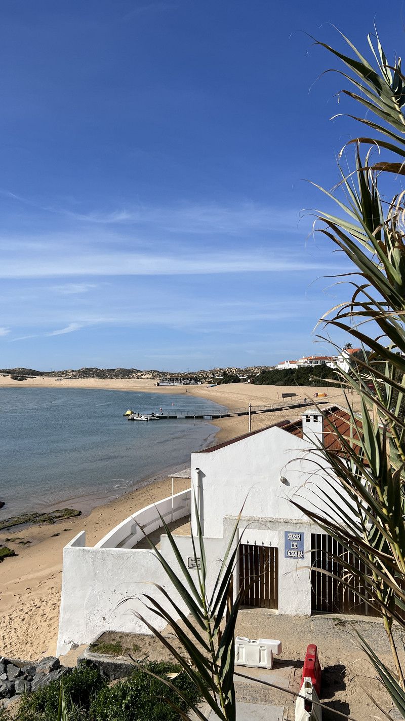
Vila Nova de Milfontes
A jewel on the west coast of the Alentejo… says the guidebook.
The tides extend far into the Rio Mira, which flows into the Atlantic here. Three years ago, we were at Camping Milfontes, this time just for a day trip.
Beja, Portugal
37° 43' 31" N 8° 46' 56.2" W
37.7252803 -8.7822865
• Head toward Rua Vicente Ferreira on Rua de São Sebastião. Go for 44 m.
• Turn slightly left onto Largo do Almada. Go for 8 m.
• Turn left onto Rua Sarmento Beires. Go for 17 m.
• Continue on Rua Custódio Brás Pacheco. Go for 836 m.
• Take the 1st exit from Largo Custódio Brás Pacheco roundabout onto Rua Custódio Brás Pacheco. Go for 418 m.
• Take the 1st exit from roundabout onto N393 toward Odemira. Go for 8.9 km.
• Take the 2nd exit from roundabout onto N393 toward Odemira. Go for 5.9 km.
• Turn right onto M502 toward Zambujeira. Go for 8.3 km.
• Turn left onto M502-1. Go for 4.2 km.
• Take the 1st exit from roundabout onto N120 toward Lagos/Aljezur. Go for 1.1 km.
• Take the 2nd exit from roundabout onto N120 toward Lagos. Go for 26.9 km.
• Take the 1st exit from roundabout onto Avenida General Humberto Delgado (N120) toward Lagos/Bordeira. Go for 7.5 km.
• Turn right onto N268 toward V. do Bispo/Sagres/Alfambras/Bordeira/Carrapateira. Go for 27.7 km.
• Take the 4th exit from roundabout toward Sagres. Go for 125 m.
• Turn right onto N268. Go for 7.4 km.
• Continue on Avenida Infante Dom Henrique (N268). Go for 1.4 km.
• Take the 2nd exit from roundabout. Go for 763 m.
• Arrive at your destination on the right.
☍
101,6 km
(1 hrs. 28 min.)
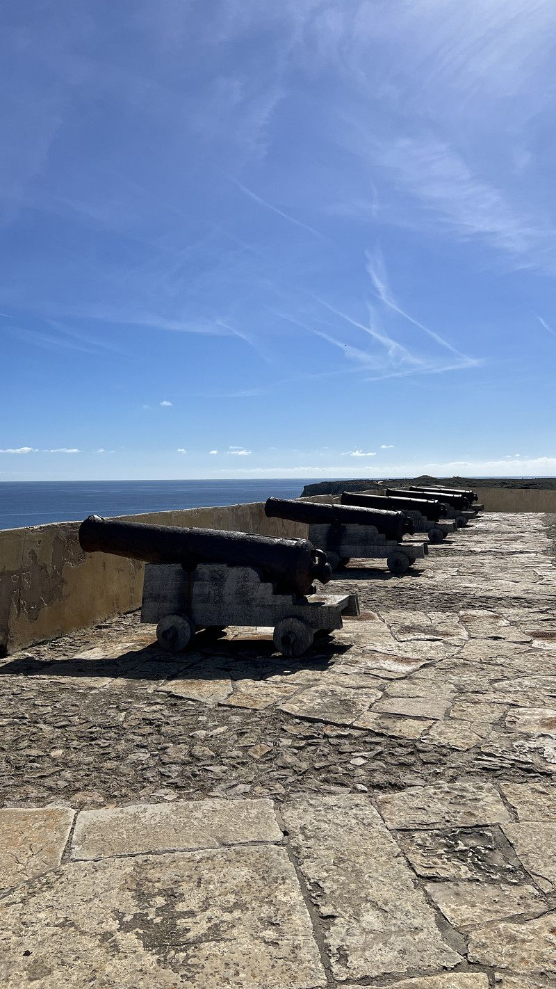
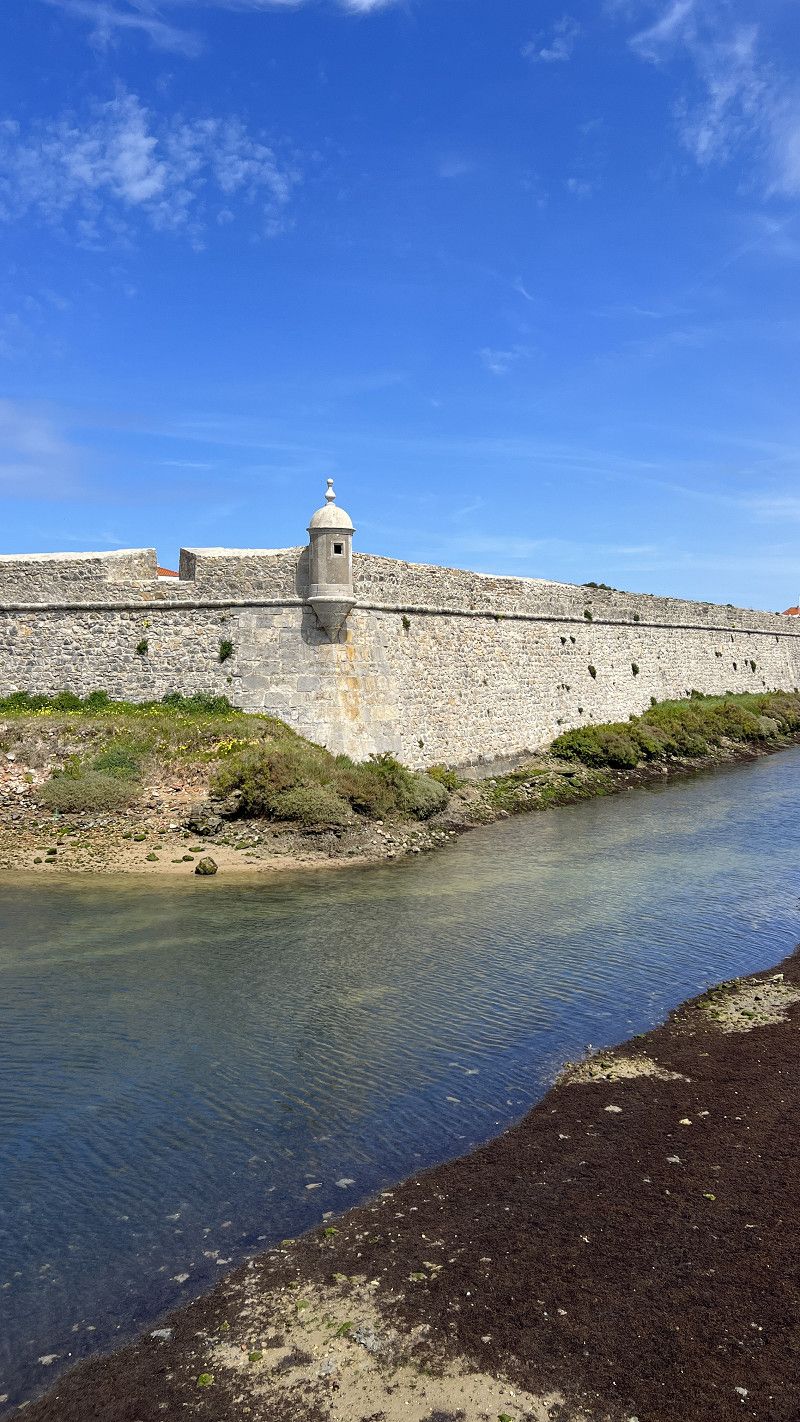
Fortaleza de Sagres
The sea fortress in Sagres is worth seeing, writes our travel guide.
Motorhomes can also stay in the parking lot during the day, but overnight stays are prohibited.
Admission now costs €10 per person, dogs free. In our opinion, it wasn't worth it.
We used the campsite's rental car offer and made a day trip
Sagres 🇵🇹 Cabo Sao Vicente and Fortaleza de Sagres | Overwintering a motorhome with a dog
https://youtu.be/lL67tiuPaMM
Rua da Fortaleza, Vila do Bispo, Faro, Portugal
37° 0' 3.5" N 8° 56' 54.3" W
37.0009758 -8.9484043
• Head southeast. Go for 414 m.
• Turn left. Go for 199 m.
• Turn right. Go for 180 m.
• Continue toward Estrada ao Cabo de São Vicente/N268. Go for 22 m.
• Take the 3rd exit from roundabout onto Estrada ao Cabo de São Vicente (N268). Go for 1.2 km.
• Continue on N268. Go for 1.6 km.
• Turn left onto N268. Go for 3.1 km.
• Arrive at N268. Your destination is on the left.
☍
6,7 km
( 14 min.)
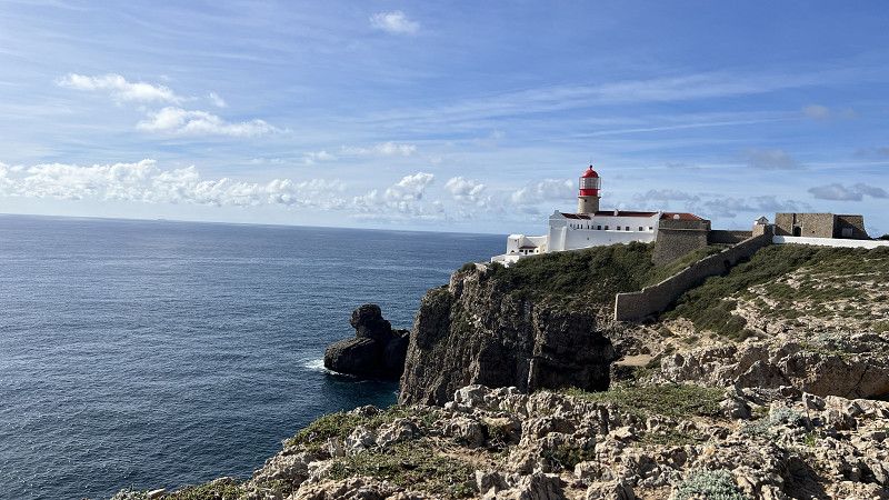
Cabo de São Vicente
About 6 km from the sea fortress lies Cabo São Vicente, the southwesternmost point of continental Europe, with steep cliffs and wild seas.
Faro, Portugal
37° 1' 21.4" N 8° 59' 47.8" W
37.0226155 -8.9966125
• Head northeast on N268. Go for 3.1 km.
• Turn right onto N268. Go for 1.6 km.
• Continue on Estrada ao Cabo de São Vicente (N268). Go for 1.1 km.
• Take the 3rd exit from roundabout onto Avenida Infante Dom Henrique (N268). Go for 1.5 km.
• Continue on N268. Go for 7.3 km.
• Continue on N125. Go for 3.5 km.
• Pass 6 roundabouts and continue on N125. Go for 10.9 km.
• Take the 3rd exit from roundabout onto N125. Go for 1.9 km.
• Pass 2 roundabouts and continue on N125. Go for 4.0 km.
• Take the 3rd exit from roundabout toward Lagos/A22/Portimão. Go for 145 m.
• Continue straight ahead. Go for 836 m.
• Take the 3rd exit from roundabout toward Faro/Portimão. Go for 4.4 km.
• Take ramp onto A22 (Via Infante de Sagres) toward Faro/Lisboa/(A2). Go for 26.2 km.
• Take exit 6 toward Lagoa/Silves. Go for 287 m.
• Take the 3rd exit from roundabout onto N124-1. Go for 289 m.
• Take the 1st exit from roundabout onto N124-1. Go for 4.3 km.
• Turn left onto N124-1. Go for 192 m.
• Turn right onto N124. Go for 771 m.
• Take the 1st exit from roundabout onto N124. Go for 541 m.
• Take the 3rd exit from roundabout onto N124. Go for 12.5 km.
• Turn left onto M1079. Go for 374 m.
• Continue on Rua da Liberdade (M1079). Go for 463 m.
• Turn slightly right onto M1079. Go for 111 m.
• Continue on Caminho Municipal 1079 (M1079). Go for 305 m.
• Continue on M1079. Go for 146 m.
• Turn slightly left onto M1080. Go for 236 m.
• Continue on Caminho Municipal 1080 (M1080). Go for 2.0 km.
• Continue on M1080. Go for 331 m.
• Turn right. Go for 160 m.
• Turn slightly left. Go for 33 m.
• Turn slightly left. Go for 44 m.
• Turn slightly left. Go for 450 m.
• Turn right. Go for 1.3 km.
• Turn right. Go for 115 m.
• Arrive at your destination.
☍
91,3 km
(1 hrs. 22 min.)
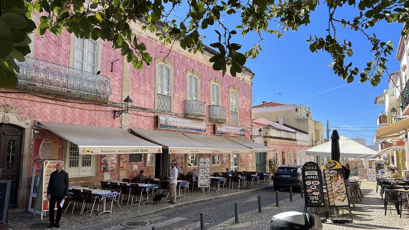
Silves
Silves is the capital of oranges and the highest point in the Algarve. The castle complex is unique in all of southern Portugal, and Silves is considered to be uncrowded by tourists. We really liked it. During our visit at the end of February, it wasn't very busy.
We again took advantage of the campsite's rental car service and went on a day trip.
There are several parking/camping sites you can visit with your motorhome. However, these are usually full in winter.
More impressions of this wonderful city. Silves 🇵🇹 Algarve | Overwintering a motorhome with a dog | Travel report Portugal 2025
https://youtu.be/1l5A8ry_67w
Faro, Portugal
37° 15' 50.3" N 8° 20' 55.4" W
37.2639826 -8.3487311
• Head west. Go for 115 m.
• Turn left. Go for 1.3 km.
• Turn left toward M1080. Go for 687 m.
• Turn left onto M1080. Go for 331 m.
• Continue on Caminho Municipal 1080 (M1080). Go for 2.0 km.
• Continue on M1080. Go for 236 m.
• Turn slightly right onto M1079. Go for 146 m.
• Continue on Caminho Municipal 1079 (M1079). Go for 305 m.
• Continue on M1079. Go for 111 m.
• Turn slightly left onto Rua da Liberdade (M1079). Go for 463 m.
• Continue on M1079. Go for 374 m.
• Turn right onto N124. Go for 12.4 km.
• Pass 2 roundabouts and continue on N124. Go for 1.3 km.
• Turn left onto N124-1. Go for 178 m.
• Turn right onto N124-1. Go for 4.2 km.
• Continue toward Via Infante de Sagres/A22. Go for 43 m.
• Take the 1st exit from roundabout onto A22 (Via Infante de Sagres) toward Lagos/Portimão. Go for 29.5 km.
• Take the 2nd exit from roundabout onto N120 toward Sines/Aljezur. Go for 21.3 km.
• Turn left onto Largo da Liberdade. Go for 64 m.
• Turn left onto Rua da Ladeira. Go for 143 m.
• Continue on Rua da Cadeia Velha. Go for 92 m.
• Continue on Largo 5 de Outubro. Go for 23 m.
• Turn left onto Rua S. João de Deus. Go for 40 m.
• Continue on Largo Rainha Dona Leonor. Go for 3 m.
• Continue on Rua S. João de Deus. Go for 171 m.
• Continue on Rua Dom Paio Peres Correia. Go for 127 m.
• Turn slightly left onto Rua Dom Paio Peres Correia. Go for 17 m.
• Arrive at Rua Dom Paio Peres Correia.
☍
75,7 km
(1 hrs. 4 min.)
Aljezur
Aljezur is the white town on the Costa Vicentina and the surrounding beaches are very popular with surfers.
Parking for motorhomes is rather difficult. Either the parking spaces are too small or there are no-parking signs.
More about Aljezur https://youtu.be/ONe7_nqT7Yc
Rua Dom Paio Peres Correia, Aljezur, Faro, Portugal
37° 19' 0.3" N 8° 48' 18.2" W
37.3167589 -8.8050462
• Head southwest on Rua Dom Paio Peres Correia. Go for 23 m.
• Turn sharp right onto Rua Dom Paio Peres Correia. Go for 161 m.
• Continue on Rua S. João de Deus. Go for 171 m.
• Continue on Largo Rainha Dona Leonor. Go for 3 m.
• Continue on Rua S. João de Deus. Go for 40 m.
• Turn right onto Largo 5 de Outubro. Go for 23 m.
• Continue on Rua da Cadeia Velha. Go for 92 m.
• Continue on Rua da Ladeira. Go for 143 m.
• Turn right onto Largo da Liberdade. Go for 64 m.
• Turn left onto Avenida General Humberto Delgado (N120). Go for 382 m.
• Take the 2nd exit from roundabout onto N120 toward Lisboa/Odeceixe/Rogil/Lagos/Bordeira. Go for 10.4 km.
• Turn slightly left toward João Roupeiro/Monte Novo. Go for 1.2 km.
• Continue on João Roupeiro. Go for 1.2 km.
• Turn left. Go for 266 m.
• Turn right. Go for 777 m.
• Turn slightly left toward Caeiros. Go for 371 m.
• Continue on Caeiros. Go for 744 m.
• Continue on Rua da Praia. Go for 576 m.
• Take the 1st exit from roundabout. Go for 82 m.
• Turn left onto Rua da Praia. Go for 683 m.
• Turn left. Go for 85 m.
• Arrive at your destination on the right.
☍
17,5 km
( 24 min.)
Odeceixe
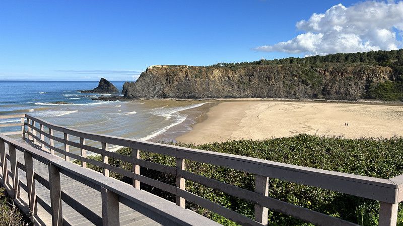
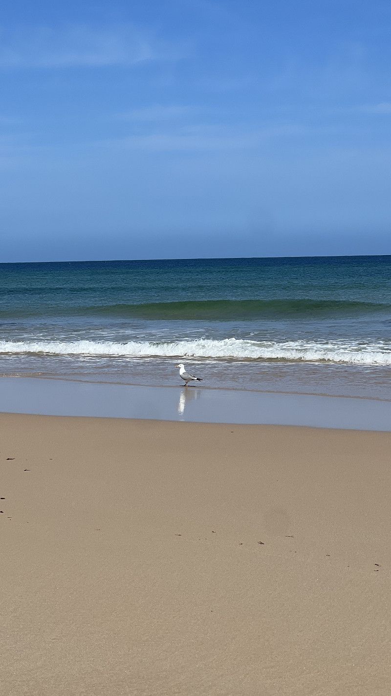
Odeceixe beach is one of the 7 Wonders of Portugal (cliff beaches category).
Odeceixe has a motorhome parking area in the town center, 3 km from the beach, and several day parking spaces where motorhomes can be parked.
More about Odeceixe https://youtu.be/ONe7_nqT7Yc
Faro, Portugal
37° 26' 18.2" N 8° 47' 54" W
37.4383825 -8.7983269
• Head toward Rua da Praia. Go for 85 m.
• Turn sharp left onto Rua da Praia. Go for 188 m.
• Take the 1st exit from roundabout onto Rua da Praia. Go for 613 m.
• Turn left onto Rua da Praia. Go for 304 m.
• Turn right onto Rua da Praia. Go for 2.0 km.
• Continue on Variante 19 de Abril. Go for 647 m.
• Turn left onto N120. Go for 11.6 km.
• Pass 2 roundabouts and continue on N120. Go for 10.6 km.
• Take the 1st exit from roundabout onto N120 toward Cercal/Odemira. Go for 3.2 km.
• Take the 1st exit from Rotunda do Lagar roundabout onto Estrada da Circunvalação (N263). Go for 974 m.
• Take the 2nd exit from roundabout onto N263. Go for 26.6 km.
• Take the 1st exit from roundabout onto N389. Go for 6.7 km.
• Continue on N123. Go for 13.2 km.
• Take the 3rd exit from roundabout onto N123. Go for 363 m.
• Take ramp onto IC1. Go for 2.0 km.
• Take ramp onto IP2 toward Lisboa/Algarve/Beja/C. Verde. Go for 14.0 km.
• Take ramp toward Aljustrel/C. Verde/Mértola. Go for 237 m.
• Turn left onto N2. Go for 197 m.
• Take the 2nd exit from roundabout onto N2. Go for 420 m.
• Take the 3rd exit from Avenida General Humberto Delgado roundabout onto Rua das Orquídeas (N123). Go for 220 m.
• Pass 2 roundabouts and continue on N123. Go for 31.0 km.
• Turn right onto N122. Go for 11.0 km.
• Take the 1st exit from roundabout onto Avenida Aureliano Mira Fernandes. Go for 262 m.
• Take the 2nd exit from roundabout onto Rua José Carlos Ary dos Santos. Go for 235 m.
• Continue on Estrada da Circunvalação. Go for 94 m.
• Arrive at Estrada da Circunvalação. Your destination is on the left.
☍
136,7 km
(1 hrs. 51 min.)
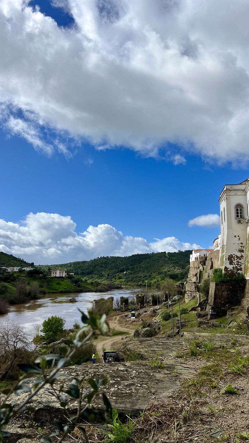
Mértola
Mértola is the most historic town in the Alentejo. The next Islamic Festival will take place at the end of May 2025.
Many travel guides list the area by the river/Cais as a parking space. This is incorrect. It's a parking area where cars and kayaks are also parked. There are no signs permitting or prohibiting overnight stays. Upon inquiry at the tourist information office, they say overnight stays are permitted, but the area opposite the fire station is more suitable, especially during heavy rain.
The official motorhome parking area of Mértola is located in Minas de São Domingos, about 20 km away.
Mertola 🇵🇹 Alentejo | Overwintering a motorhome with a dog | Travel report Portugal 2025
https://youtu.be/PIRJbDFTdLQ
Estrada da Circunvalação, Mértola, Beja, Portugal
37° 38' 33" N 7° 39' 47.6" W
37.6424958 -7.6632133
• Head northeast on Estrada da Circunvalação. Go for 94 m.
• Continue on Rua José Carlos Ary dos Santos. Go for 188 m.
• Take the 1st exit from roundabout onto Avenida Aureliano Mira Fernandes. Go for 247 m.
• Take the 2nd exit from roundabout onto N265. Go for 16.8 km.
• Turn left onto Rua da Liberdade. Go for 151 m.
• Turn slightly right onto Rua da Liberdade. Go for 70 m.
• Turn left onto Rua Longa. Go for 105 m.
• Arrive at Rua Longa. Your destination is on the right.
☍
17,6 km
( 16 min.)
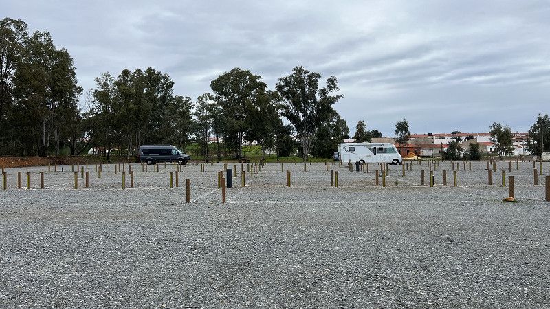
Mina de São Domingos
New parking space with barrier system, payment by card only.
€7 including electricity, water, and waste disposal. €4 for rent without overnight stay.
Completely graveled area, plots marked with wooden posts, little/no shade.
We did not use this spot because there were two dogs running loose nearby.
Mina de São Domingos is an old mining town with rows of one-story houses and a swimming lake.
Beja, Portugal
37° 40' 28.7" N 7° 30' 8.5" W
37.6746407 -7.5023580
• Head south on Rua Longa. Go for 225 m.
• Turn slightly right onto Rua Longa. Go for 73 m.
• Turn left onto Rua Catarina Eufémia (N265). Go for 35.0 km.
• Turn left onto IP8 toward Beja/Ferreira. Go for 241 m.
• Turn left onto Avenida Nossa Senhora de Guadalupe toward Serpa. Go for 621 m.
• Pass 2 roundabouts and continue on Largo da Cruz Nova. Go for 603 m.
• Turn right onto Largo da Cruz Nova. Go for 14 m.
• Turn slightly right onto Largo da Cruz Nova. Go for 17 m.
• Turn left onto Rua das Amendoeiras. Go for 174 m.
• Turn left onto Rua das Amendoeiras. Go for 26 m.
• Turn right onto Rua de São Roque. Go for 57 m.
• Continue on Largo do Salvador. Go for 10 m.
• Turn right onto Largo do Salvador. Go for 39 m.
• Turn left onto Largo do Salvador. Go for 41 m.
• Continue on Largo de 5 de Outubro. Go for 20 m.
• Continue on Rua António Carlos Calixto. Go for 64 m.
• Turn left onto Rua de Sevilha. Go for 30 m.
• Continue on Rua dos Fidalgos. Go for 108 m.
• Turn right onto Travessa do Serra. Go for 30 m.
• Arrive at Travessa do Serra. Your destination is on the right.
☍
37,3 km
( 31 min.)
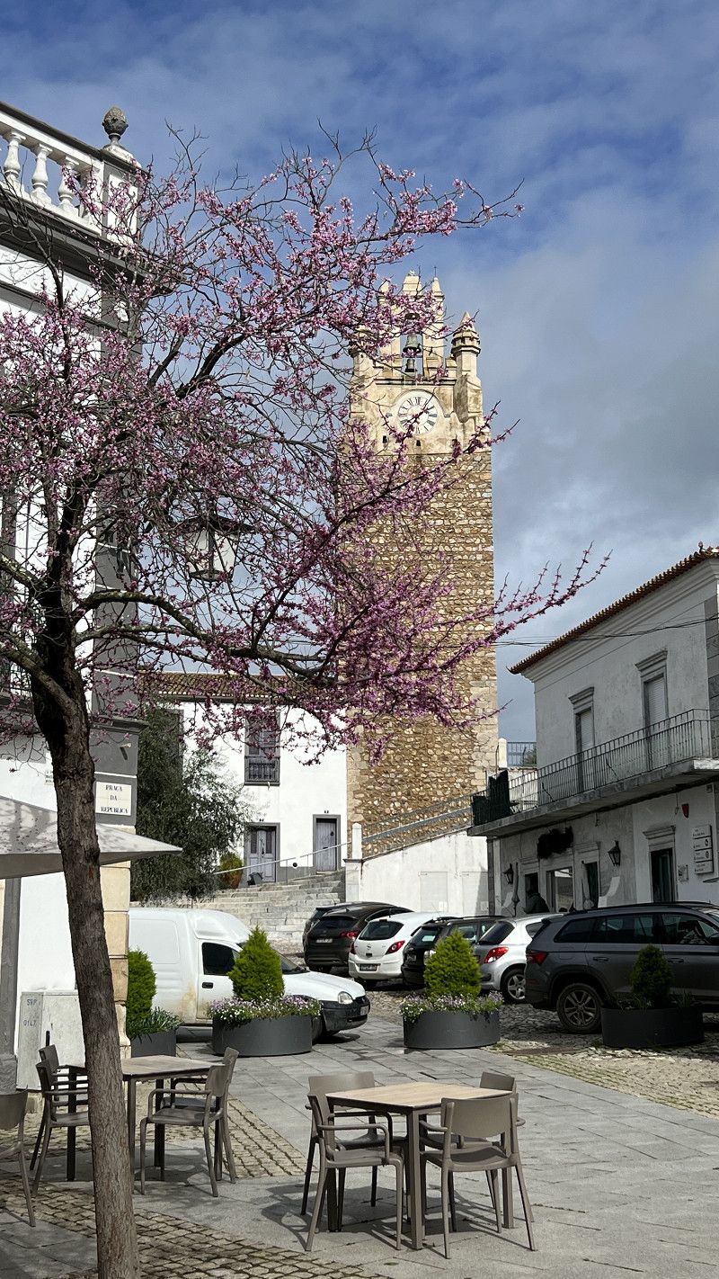
Serpa
Camping Municipal, a simple (somewhat dated) city campsite. Close to the city center and quiet at night.
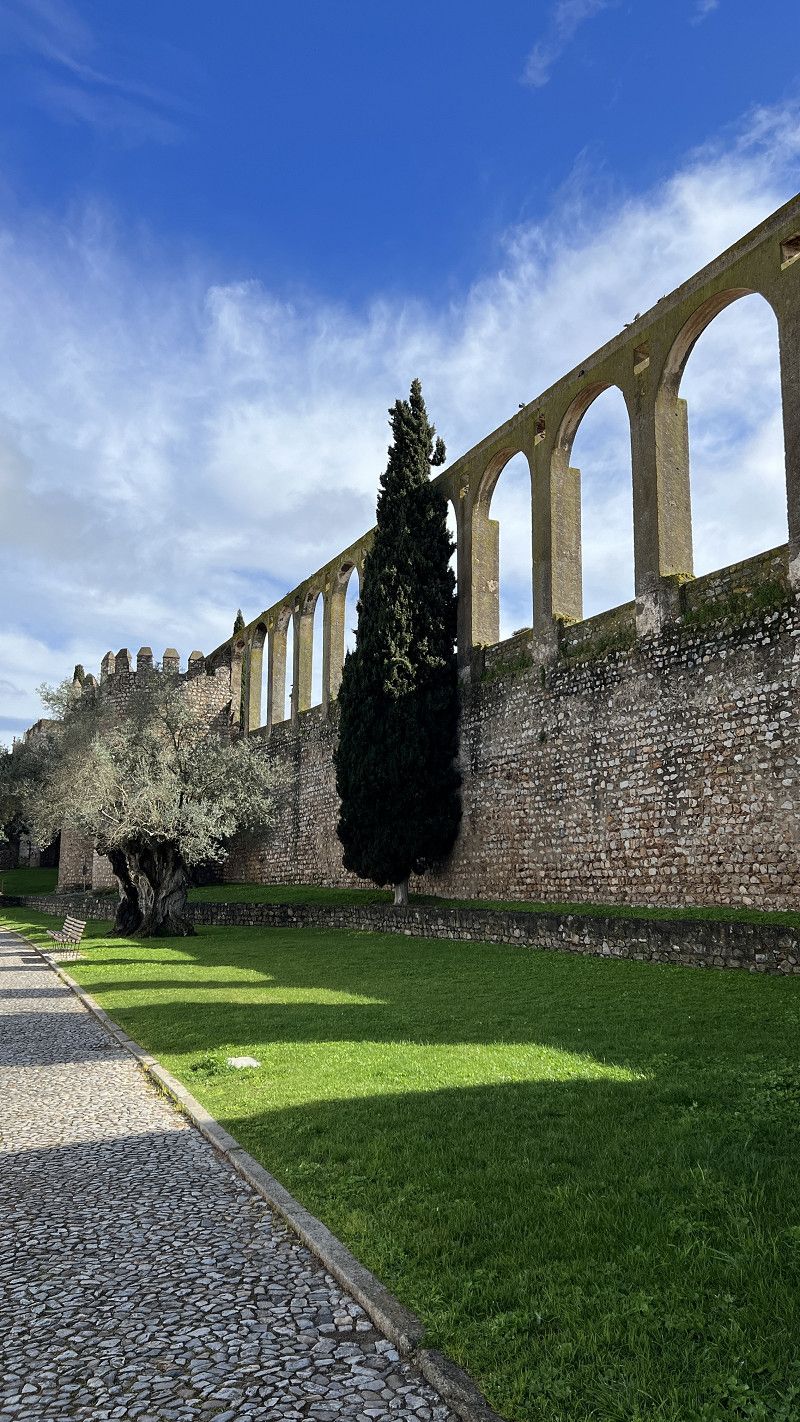
Serpa is the capital of Cante Alentejano, a traditional choral song that has been registered as a UNESCO World Heritage Site.
The town with its aqueduct and castle is definitely worth a stop.
Serpa & Lagoa de Santo Andre 🇵🇹 LPG filling up in Portugal. Overwintering a motorhome. Travel report 2025
https://youtu.be/C4wZUSmeqHw
Beja, Portugal
37° 56' 37.1" N 7° 35' 48.1" W
37.9436517 -7.5966902
• Head toward Rua de Roque da Costa on Travessa do Serra. Go for 53 m.
• Turn left onto Rua de Roque da Costa. Go for 35 m.
• Turn right onto Rua de Pedro Anes. Go for 20 m.
• Continue on Terreiro de São João. Go for 58 m.
• Turn left onto Terreiro de São João. Go for 35 m.
• Turn slightly left onto Largo das Portas de Moura. Go for 19 m.
• Turn right onto Rua de Santo António. Go for 83 m.
• Turn left onto Rua Serpa Pinto. Go for 390 m.
• Take the 2nd exit from roundabout onto Rua Serpa Pinto. Go for 365 m.
• Turn left onto IP8 toward Beja/Ferreira. Go for 25.0 km.
• Pass 2 roundabouts and continue on IP8. Go for 6.9 km.
• Take the 2nd exit from roundabout onto IP8 toward Ferreira do Alentejo/Ferreira. Go for 18.2 km.
• Take the 2nd exit from roundabout onto IP8 toward Lisboa. Go for 15.0 km.
• Take the 2nd exit from roundabout onto A26 toward Lisboa/Algarve. Go for 11.8 km.
• Take exit 1 toward Lisboa onto A2 (Autoestrada do Sul). Go for 16.5 km.
• Take exit 9 toward Sines/IC1/Grândola. Go for 1.3 km.
• Continue on IP8. Go for 14.4 km.
• Take ramp toward Grândola/Melides. Go for 352 m.
• Turn left onto Estrada de Grândola (R261-2) toward Melides. Go for 8.1 km.
• Turn left onto Estrada de Sines (N261). Go for 5.7 km.
• Turn right onto M544. Go for 3.6 km.
• Turn left. Go for 152 m.
• Turn left. Go for 545 m.
• Turn sharp right. Go for 413 m.
• Arrive at your destination on the right.
☍
129,1 km
(1 hrs. 39 min.)
Parque de Campismo Lagoa Santo André
€16 (2 people, motorhome, 2A electricity), dog €3, 6A electricity €4. Plumbing is showing its age.
Located directly on the lagoon, but with no access (a fence). The sea is about 1 km away, with a beautiful sandy beach.
Hiking trails along the lagoon and dune belt. Dogs are not allowed, however. Unfortunately, there are pine processionary moths at the campsite.
Serpa & Lagoa de Santo Andre 🇵🇹 LPG filling up in Portugal. Overwintering a motorhome. Travel report 2025
https://youtu.be/C4wZUSmeqHw
EM544, Santo André, Setúbal, Portugal
38° 6' 33.6" N 8° 47' 14.8" W
38.1093433 -8.7874527
• Head southeast. Go for 413 m.
• Turn sharp left. Go for 545 m.
• Turn right toward M544. Go for 152 m.
• Turn right onto M544. Go for 3.6 km.
• Turn left onto N261. Go for 5.7 km.
• Turn right onto Estrada de Grândola (R261-2). Go for 8.5 km.
• Turn right and take ramp onto IP8 toward Alcácer do Sal/Grândola/Lisboa. Go for 15.5 km.
• Take left ramp onto A2 (Autoestrada do Sul) toward Lisboa/Setúbal/Alcácer. Go for 47.2 km.
• Keep right onto Nó da A2-A6-A13 toward Norte/Santarém. Go for 1.1 km.
• Continue on A13 (Nó da A2-A6-A13). Go for 28.6 km.
• Take exit 3 toward Coruche/S.to Estêvão onto N119. Go for 24.6 km.
• Continue on N251. Go for 9 m.
• Continue on N119. Go for 462 m.
• Take the 3rd exit from roundabout onto Estrada das Pontes (N114). Go for 2.6 km.
• Take the 2nd exit from roundabout onto N114. Go for 63 m.
• Turn left onto Avenida Luís de Camões. Go for 587 m.
• Continue on Rua de Salvaterra de Magos. Go for 308 m.
• Take the 2nd exit from roundabout onto Rua de Salvaterra de Magos (N114-3). Go for 54 m.
• Continue on Estrada da Estação (N114-3). Go for 902 m.
• Arrive at Estrada da Estação (N114-3). Your destination is on the left.
☍
140,8 km
(1 hrs. 42 min.)
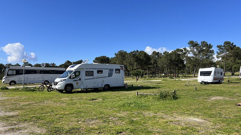
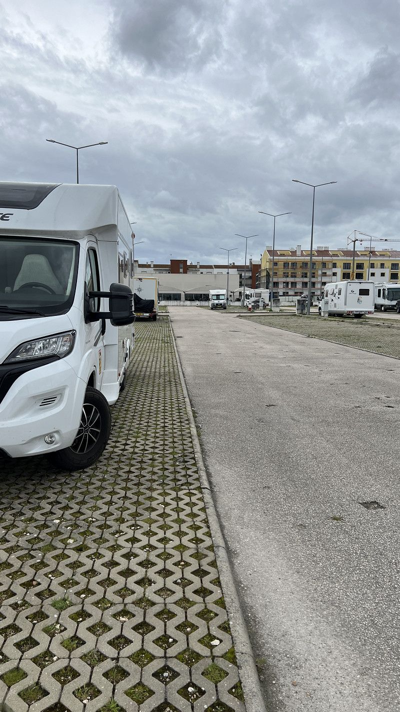
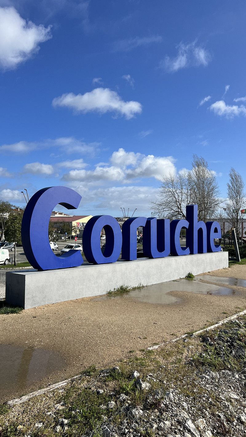
Coruche
Free pitch including VE, maximum stay 72 hours, brightly lit at night. Located right next to the Lidl supermarket and bus station, behind it begins the Parque de Sorraia with a river promenade and an 8 km circular trail. Perfect for anyone traveling with a dog.
Santarém, Portugal
38° 57' 0.9" N 8° 32' 27.1" W
38.9502389 -8.5408638
• Head northeast on Estrada da Estação (N114-3). Go for 902 m.
• Continue on Rua de Salvaterra de Magos (N114-3). Go for 20 m.
• Take the 2nd exit from roundabout onto Avenida da Nossa Senhora do Castelo (N114-3). Go for 611 m.
• Continue on N114. Go for 231 m.
• Pass 2 roundabouts and continue on N114. Go for 27.1 km.
• Take the 2nd exit from roundabout onto A13 (Autoestrada do Pinhal Interior) toward Santarém/IC10. Go for 3.3 km.
• Continue on IC10. Go for 6.9 km.
• Continue on IC10. Go for 743 m.
• Keep left onto IC10 toward A1/Lisboa/Porto/Santarém (Norte)/C.das Rainha/T.res Novas/N3. Go for 532 m.
• Take ramp onto N114. Go for 6.6 km.
• Take ramp onto A1 (Autoestrada do Norte) toward Porto/A15/C.das Rainha. Go for 846 m.
• Take exit 6A toward C.das Rainha/Rio Maior onto A15 (Nó da A1-A15). Go for 21.8 km.
• Take exit 4 toward Leiria/Rio Maior Oeste/Alcobaça onto IC2. Go for 1.6 km.
• Keep left onto IC2 toward Leiria/Alcobaça. Go for 9.8 km.
• Pass 5 roundabouts and continue on IC2. Go for 26.3 km.
• Take the 3rd exit from roundabout toward Cruz da Légua. Go for 116 m.
• Continue on Rua Príncipal (N242-4). Go for 418 m.
• Arrive at Rua Príncipal (N242-4). Your destination is on the right.
☍
107,8 km
(1 hrs. 27 min.)
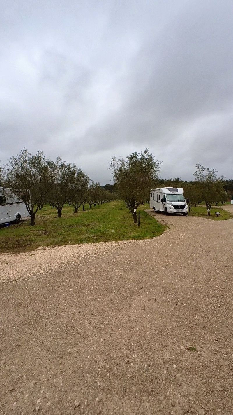
Casa Feteira
If you're looking for a slightly different campsite, this is the place for you. At the olive oil producer Casa Feteira, you'll be in the middle of an olive grove, where you can take a tour of the production process and enjoy typical Portuguese food. (There's no restaurant, but you can get food delivered directly to your motorhome.)
Of course, you can also buy very good olive oil.
€20 includes electricity, water, and plumbing. Shower and washing machine for a fee.
Leiria, Portugal
39° 36' 7.6" N 8° 51' 45.3" W
39.6021124 -8.8625817
• Head east on Rua Príncipal (N242-4). Go for 446 m.
• Take the 1st exit from roundabout onto IC2 toward Lisboa/Rio Maior. Go for 5.5 km.
• Take ramp onto IC9 toward Nazaré/Alcobaça/A8. Go for 6.7 km.
• Take ramp toward N8/Alcobaça/Aljubarrota. Go for 2.0 km.
• Take the 1st exit from roundabout onto Rua de Leiria (N8) toward Alcobaça. Go for 458 m.
• Take the 4th exit from roundabout onto Rua de Leiria (N8). Go for 229 m.
• Turn right onto Avenida Manuel da Silva Carolino. Go for 134 m.
• Turn left onto Rua Dr. Brilhante. Go for 144 m.
• Turn right onto Avenida Prof. Eng. Joaquim Vi. Natividade. Go for 232 m.
• Turn right. Go for 34 m.
• Arrive at your destination on the left.
☍
15,9 km
( 15 min.)
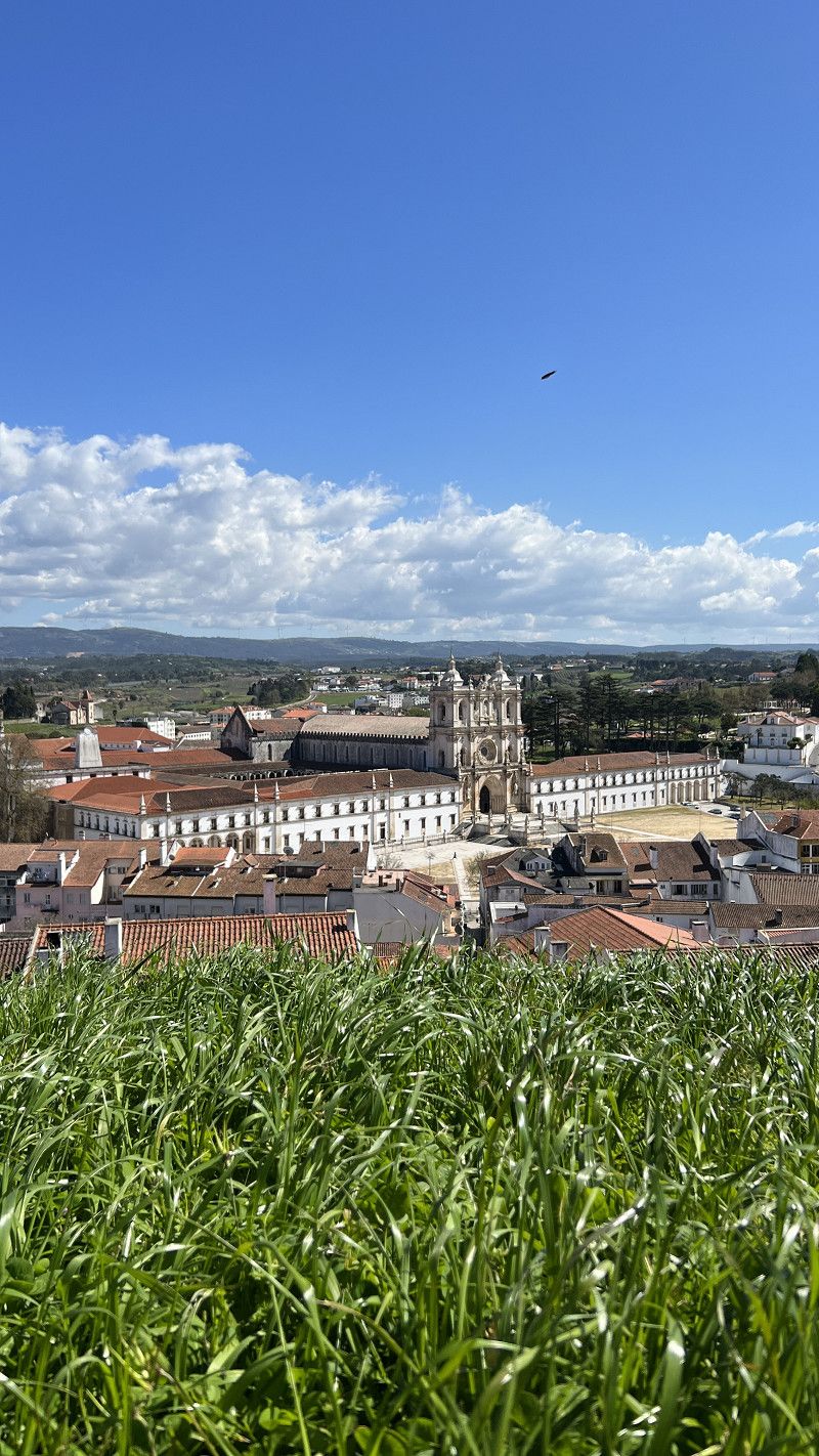
Alcobaça
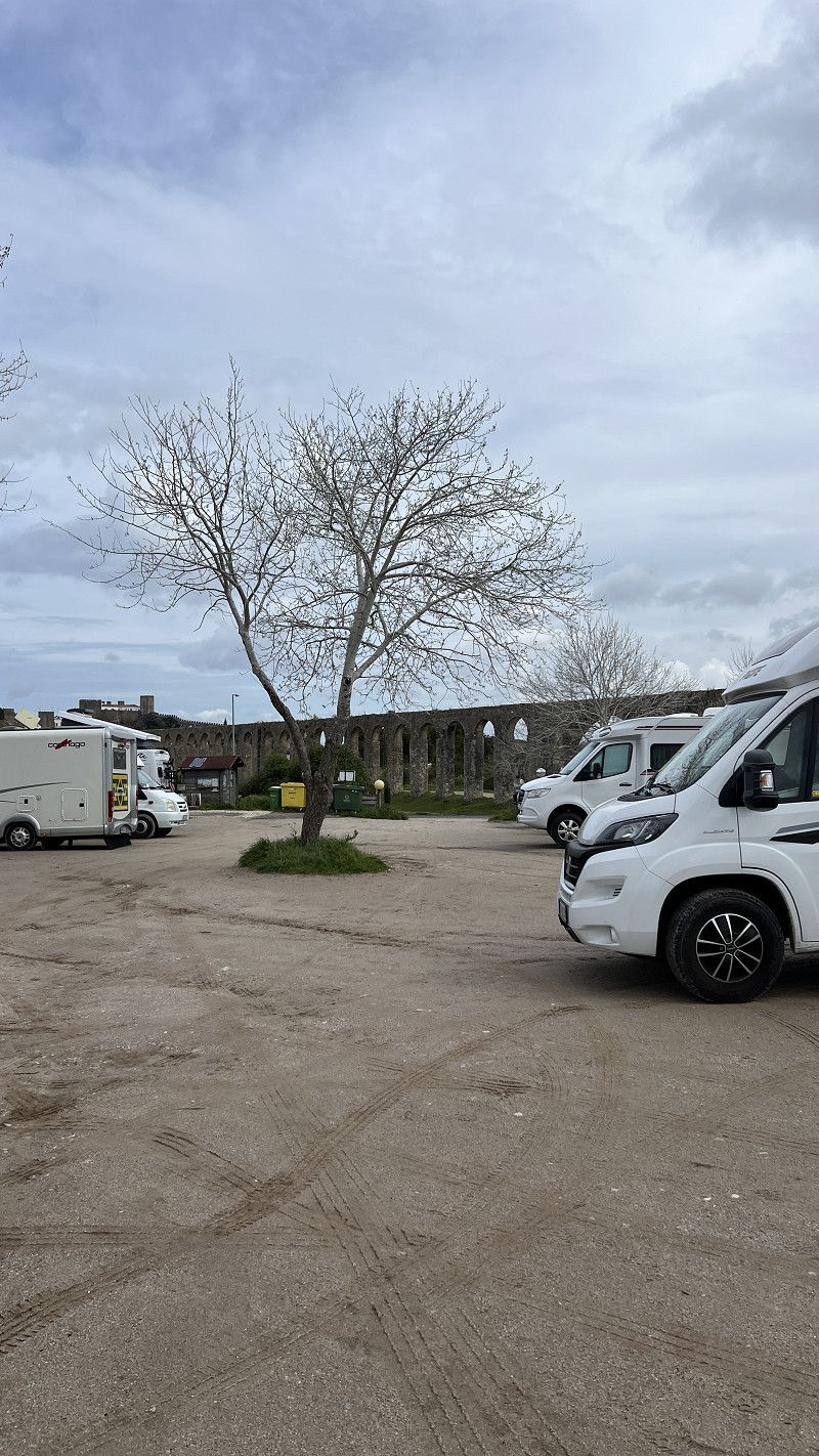
Free parking for approximately 15 vehicles on the former campsite, max. 72 hours. Electricity and electricity are free, water is available for a fee. Located directly next to a park. A market hall, laundromat, cafes, and the historic old town are just a few hundred meters away. The monastery is a UNESCO World Heritage Site.
https://youtu.be/jiT0ZWuIUfg
Rua Professor Engenheiro Joaquim Vieira Natividade 2, Alcobaça, Distrikt Leiria, Portugal
39° 33' 9.3" N 8° 58' 40.4" W
39.5525709 -8.9778995
• Head toward Avenida Prof. Eng. Joaquim Vi. Natividade. Go for 34 m.
• Turn right onto Avenida Prof. Eng. Joaquim Vi. Natividade. Go for 706 m.
• Take the 2nd exit from roundabout. Go for 210 m.
• Continue on N8-5. Go for 1.3 km.
• Take the 2nd exit from Largo das Amoreiras roundabout onto N8-5. Go for 2.6 km.
• Take the 1st exit from roundabout onto A8 (Autoestrada do Oeste) toward Lisboa/C.das Rainha. Go for 12.8 km.
• Take exit 21 toward Alfeizerão/S. Martinho do Porto. Go for 722 m.
• Take the 1st exit from roundabout onto Rua 25 de Abril (N242). Go for 3.6 km.
• Take the 3rd exit from Rotunda de São Martinho roundabout. Go for 107 m.
• Turn right onto Rua Conde de Avellar. Go for 788 m.
• Turn left onto Rua Engenheiro Luís Francisco Cavaleiro. Go for 87 m.
• Turn left onto Avenida Marginal. Go for 875 m.
• Take the 1st exit from Rotunda dos Faróis roundabout. Go for 62 m.
• Arrive at Avenida Marginal. Your destination is on the right.
☍
23,9 km
( 24 min.)
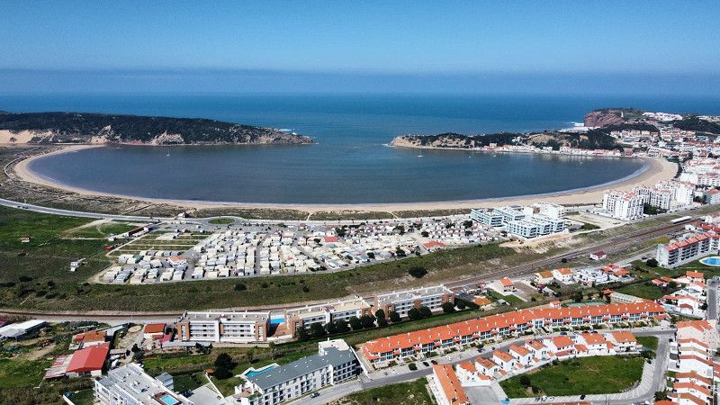
São Martinho do Porto
One of our travel highlights.🍀
The Baía Azul campsite is located directly on the picturesque bay. There are approximately 80 grassy pitches and 20 asphalt pitches. The restrooms are a bit dated. We paid €19.15 for two people, a motorhome, and two dogs without electricity.
The bay of São Martinho do Porto is stunningly beautiful. The town offers numerous restaurants, and you can hike to the lighthouse or chapel or swim in the bay. Dogs are allowed on the beach.
Peniche 🇵🇹 Foz do Arelho - Sao Martinho do Porto. Silver Coast Portugal. Motorhome with dog.
https://youtu.be/W_ynPWy8UTI
Avenida Marginal, Alcobaça, Leiria, Portugal
39° 30' 13.4" N 9° 8' 13" W
39.5037209 -9.1369477
• Head southwest on Avenida Marginal. Go for 1.1 km.
• Continue on Rua da Ponte. Go for 486 m.
• Take the 3rd exit from roundabout onto Rua Professor Montenegro. Go for 190 m.
• Keep right onto Estrada Atlântica. Go for 9.1 km.
• Take the 3rd exit from roundabout onto Avenida Engenheiro Paiva de Sousa. Go for 884 m.
• Arrive at Avenida Engenheiro Paiva de Sousa. Your destination is on the left.
☍
11,7 km
( 11 min.)
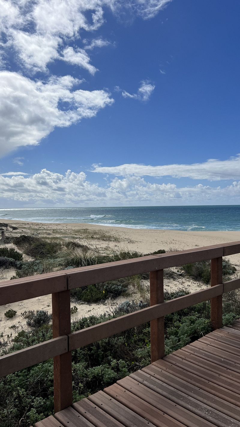
Foz do Arelho
Simple pitch right by the lagoon. 7€ without electricity.
You can walk for miles around the lagoon, and the large sandy beach is also right on your doorstep (dogs are not allowed).
When it rains it gets muddy here
Leiria, Portugal
39° 25' 58.6" N 9° 13' 2.6" W
39.4329582 -9.2173901
• Head southeast on Avenida Engenheiro Paiva de Sousa. Go for 89 m.
• Take the 4th exit from roundabout onto Avenida Engenheiro Paiva de Sousa. Go for 1.0 km.
• Take the 1st exit from roundabout onto Variante Atlântica. Go for 1.0 km.
• Pass 2 roundabouts and continue on Variante Atlântica. Go for 3.7 km.
• Continue on Avenida Infante Dom Henrique. Go for 268 m.
• Take the 3rd exit from roundabout onto Avenida Infante Dom Henrique. Go for 452 m.
• Take the 2nd exit from roundabout onto Avenida Infante Dom Henrique. Go for 464 m.
• Continue on Rua Infante Dom Henrique. Go for 291 m.
• Continue on Avenida Infante Dom Henrique. Go for 266 m.
• Take ramp onto A8 (Autoestrada do Oeste) toward Lisboa/T. Vedras. Go for 11.1 km.
• Take exit 14 toward Peniche onto IP6. Go for 16.5 km.
• Pass 2 roundabouts and continue on Avenida Mons. Manuel Bastos Rod. de Sousa (IP6). Go for 2.9 km.
• Take the 3rd exit from roundabout. Go for 279 m.
• Take the 1st exit from roundabout onto Avenida do Porto de Pesca. Go for 515 m.
• Pass 2 roundabouts and continue on Avenida do Porto de Pesca. Go for 511 m.
• Take the 2nd exit from Largo do Município roundabout onto Travessa dos Mareantes. Go for 81 m.
• Turn right onto Rua Vasco da Gama. Go for 26 m.
• Arrive at Rua Vasco da Gama. Your destination is on the right.
☍
39,5 km
( 31 min.)
Peniche
Ugly place, good location!
ASA Motorhome Park. Base price €9.50 includes meals, dog, and good Wi-Fi. Toilet, shower, electricity, washing machine, dryer, and car wash for a fee.
Asphalted parking lot without shade, walled, and closed at night. Aldi, Lidl, Intermarche, and miles of sandy beaches are in the immediate vicinity.
https://youtu.be/W_ynPWy8UTI
Leiria, Portugal
39° 21' 24.7" N 9° 22' 43.3" W
39.3568749 -9.3786838
• Head toward Travessa dos Mareantes on Rua Vasco da Gama. Go for 26 m.
• Turn right onto Travessa dos Mareantes. Go for 18 m.
• Turn left onto Rua José Estêvão. Go for 40 m.
• Turn right onto Rua Elias Garcia. Go for 47 m.
• Turn right onto Rua Salvador Franco. Go for 187 m.
• Turn right onto Praça Jacob Rodrigues Pereira. Go for 14 m.
• Turn slightly right onto Rua 13 de Infantaria. Go for 172 m.
• Take the 3rd exit from Largo do Município roundabout onto Avenida do Porto de Pesca. Go for 206 m.
• Pass 2 roundabouts and continue on Avenida do Porto de Pesca. Go for 781 m.
• Take the 3rd exit from roundabout. Go for 308 m.
• Continue toward Avenida Mons. Manuel Bastos Rod. de Sousa/IP6. Go for 31 m.
• Take the 1st exit from roundabout onto Avenida Mons. Manuel Bastos Rod. de Sousa (IP6). Go for 1.1 km.
• Take the 3rd exit from roundabout onto IP6. Go for 1.8 km.
• Take the 2nd exit from roundabout onto IP6. Go for 16.2 km.
• Take left ramp onto A8 (Autoestrada do Oeste) toward Leiria/Óbidos/Rio Maior/A15. Go for 2.5 km.
• Take exit 15 toward Óbidos/Peniche. Go for 923 m.
• Take the 2nd exit from roundabout onto N8 toward Peniche. Go for 737 m.
• Take the 1st exit from roundabout onto Rua da Memória. Go for 63 m.
• Turn right onto Rua da Porta da Vila. Go for 194 m.
• Turn slightly left onto Rua Direita. Go for 300 m.
• Turn right onto Praça de Santa Maria. Go for 38 m.
• Arrive at Praça de Santa Maria. Your destination is on the left.
☍
25,7 km
( 22 min.)
Óbidos
A charming medieval town with a city wall and castle. But very touristy.
Parking is available at the aqueduct. 9am-5pm free of charge, 5pm-9am for €6 including parking.
Leiria, Portugal
39° 21' 43" N 9° 9' 25.8" W
39.3619514 -9.1571530
• Head toward Rua Coronel Pacheco on Praça de Santa Maria. Go for 27 m.
• Turn left onto Rua de São Teotónio. Go for 38 m.
• Turn left onto Rua Coronel Pacheco. Go for 20 m.
• Turn left onto Rua dos Aboins. Go for 34 m.
• Turn right onto Rua Direita. Go for 64 m.
• Continue on Largo São Tiago. Go for 30 m.
• Turn slightly left onto Largo São Tiago. Go for 70 m.
• Turn slightly left onto Largo São Tiago. Go for 228 m.
• Turn slightly right onto Estrada da Cerca. Go for 379 m.
• Turn sharp left onto Estrada da Cerca. Go for 321 m.
• Turn sharp right onto Rua Estação. Go for 541 m.
• Turn right onto N8. Go for 613 m.
• Take the 2nd exit from roundabout onto A8 (Autoestrada do Oeste) toward Leiria. Go for 2.6 km.
• Take exit 16 toward Santarém/Rio Maior onto A15 (Autoestrada do Atlântico). Go for 40.1 km.
• Continue on Nó da A1-A15 toward Porto/Torres Novas. Go for 133 m.
• Take the exit onto A1 (Autoestrada do Norte). Go for 27.0 km.
• Take exit 7 toward Abrantes/C.lo Branco/T.res Novas onto A23 (Autoestrada da Beira Interior). Go for 17.2 km.
• Take the exit toward Coimbra/Tomar onto A13 (Autoestrada do Pinhal Interior). Go for 9.1 km.
• Take exit 17 toward N110/Tomar Sul/S.ta Cita. Go for 255 m.
• Take the 1st exit from roundabout onto N110 toward Tomar. Go for 177 m.
• Take the 1st exit from roundabout onto N110. Go for 5.1 km.
• Take the 1st exit from roundabout onto Avenida Dom Nuno Álvares Pereira (N110). Go for 941 m.
• Take the 3rd exit from Praça Alves Redol roundabout onto Avenida Doutor Cândido Madureira (N349-3). Go for 409 m.
• Turn right onto Praça do Infante Dom Henrique. Go for 17 m.
• Turn right onto Rua Pé da Costa de Baixo. Go for 119 m.
• Continue on Rua Pé da Costa de Baixo. Go for 76 m.
• Turn right onto Praça da República. Go for 62 m.
• Arrive at Praça da República. Your destination is on the left.
☍
105,7 km
(1 hrs. 13 min.)
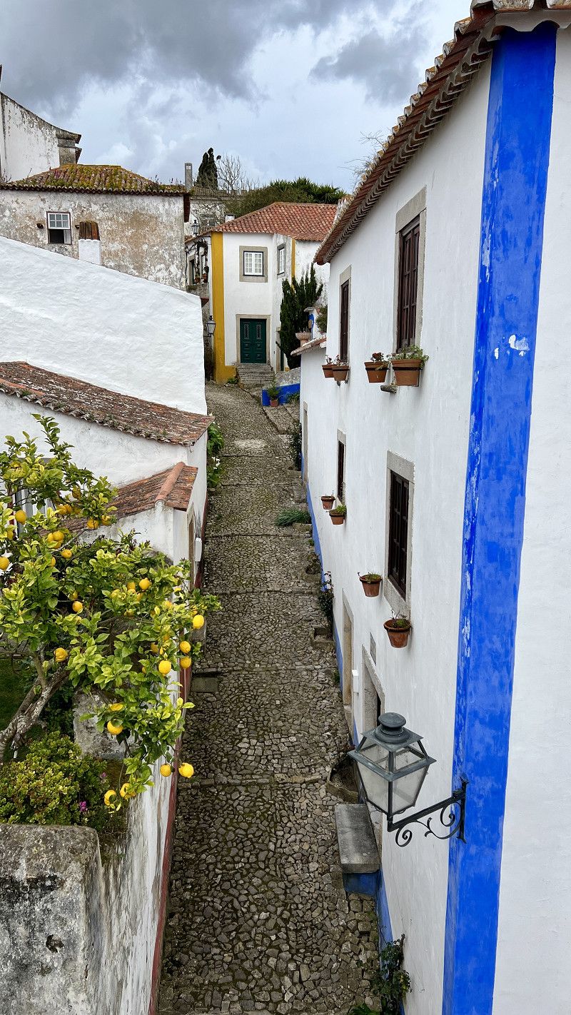
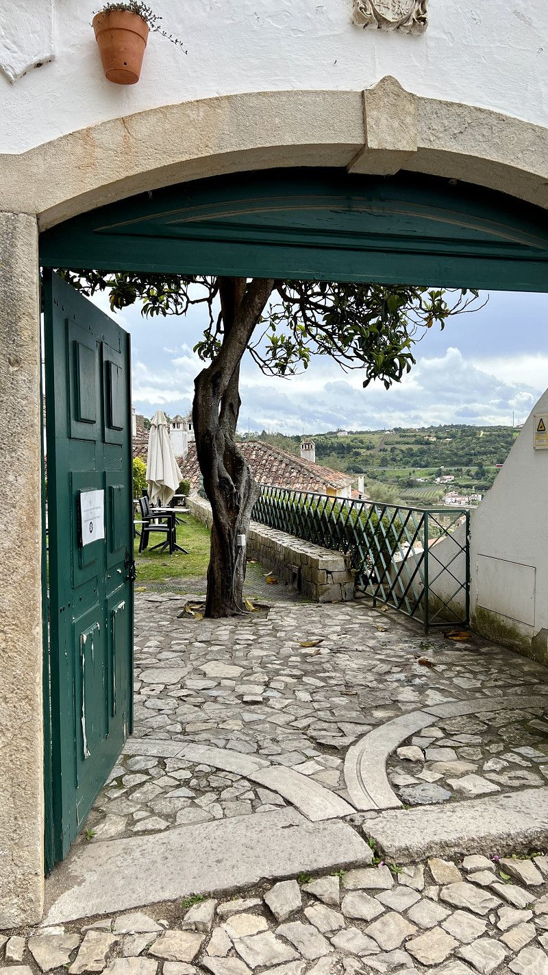
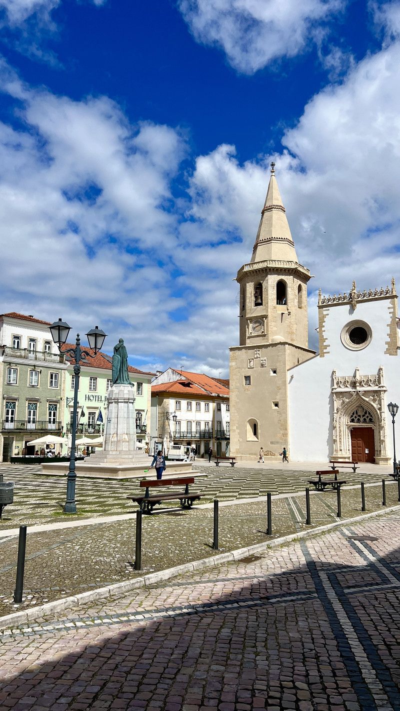
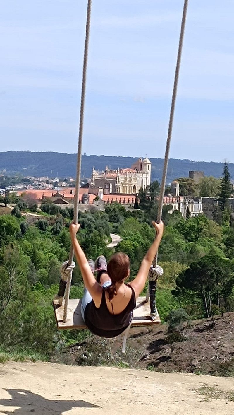
Tomar
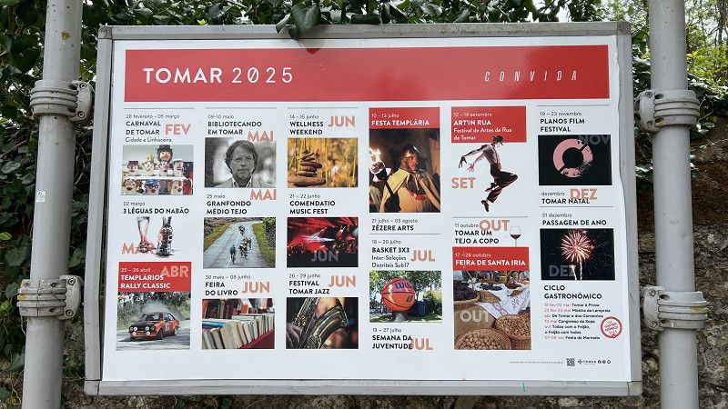
This beautiful town is characterized by the Templar castle and monastery, a UNESCO World Heritage Site. The Medieval Festival takes place in June.
Motorhome parking space on the former campsite, buildings partly very dilapidated, water and sewage disposal working, free of charge and close to the city center
https://youtu.be/irKb3T5d5QE
Santarém, Portugal
39° 36' 13.2" N 8° 24' 54.2" W
39.6036596 -8.4150492
• Head toward Rua de Infantaria 15 on Praça da República. Go for 20 m.
• Continue on Rua de São João. Go for 161 m.
• Turn right onto Rua dos Moínhos. Go for 111 m.
• Turn left onto Rua de Pedro Dias. Go for 35 m.
• Turn right onto Rua de João Carlos Everard. Go for 40 m.
• Take the 3rd exit from Praça Alves Redol roundabout onto Ponte Eng. Eduardo de Arantes Oliveira. Go for 202 m.
• Continue on Avenida Norton de Matos. Go for 81 m.
• Take the 2nd exit from roundabout onto Avenida Norton de Matos. Go for 278 m.
• Continue on Avenida Ângela Tamagnini. Go for 112 m.
• Take the 2nd exit from roundabout onto Avenida Ângela Tamagnini. Go for 235 m.
• Take the 1st exit from Praceta Santo André roundabout onto Rua de Coimbra (N110). Go for 917 m.
• Take the 2nd exit from roundabout onto N110. Go for 863 m.
• Continue on Estrada Nacional 110 (N110). Go for 199 m.
• Continue on N110. Go for 582 m.
• Pass 2 roundabouts and continue on N110. Go for 892 m.
• Take the 1st exit from roundabout onto IC9 toward Coimbra/Entronc.to/F.ra Zêzere/A13. Go for 1.4 km.
• Keep left onto IC9 toward A13/Coimbra/F.ra Zêzere. Go for 282 m.
• Take ramp onto A13 (Autoestrada do Pinhal Interior). Go for 59.5 km.
• Take exit 27 toward Condeixa/Almalaguês onto A13-1. Go for 10.8 km.
• Take the exit toward Porto/Coimbra Sul onto A1 (Autoestrada do Norte). Go for 16.3 km.
• Take exit 13 toward Fig.ra Foz/Cantanhede onto A14 (Autoestrada do Baixo Mondego). Go for 4.5 km.
• Take exit 7 toward N234-1/Cantanhede/Ançã. Go for 964 m.
• Take the 2nd exit from roundabout onto N234-1. Go for 3.6 km.
• Take the 2nd exit from roundabout onto N234-1. Go for 5.7 km.
• Take the 2nd exit from Largo do Freixial roundabout onto N234. Go for 1.0 km.
• Take the 2nd exit from roundabout onto N234. Go for 1.6 km.
• Take the 2nd exit from roundabout onto N234. Go for 2.8 km.
• Take the 2nd exit from roundabout onto N234. Go for 581 m.
• Continue toward N234. Go for 49 m.
• Take the 2nd exit from roundabout onto N234 toward Mira/Aveiro/A17. Go for 2.2 km.
• Pass 4 roundabouts and continue on Via do Infante Dom Pedro (N234). Go for 4.7 km.
• Take the 3rd exit from roundabout onto A17 (Autoestrada do Litoral Centro) toward Porto/Aveiro. Go for 5.2 km.
• Take exit 12 toward N109/Mira. Go for 856 m.
• Continue straight ahead. Go for 22 m.
• Take the 2nd exit from roundabout. Go for 1.1 km.
• Continue toward Rua do Leque Florestal. Go for 7.0 km.
• Turn right onto Rua Principal da Barra (M591). Go for 6.4 km.
• Turn right toward M591-1. Go for 442 m.
• Turn right onto M591-1. Go for 15 m.
• Turn left. Go for 26 m.
• Arrive at your destination on the left.
☍
141,6 km
(1 hrs. 48 min.)
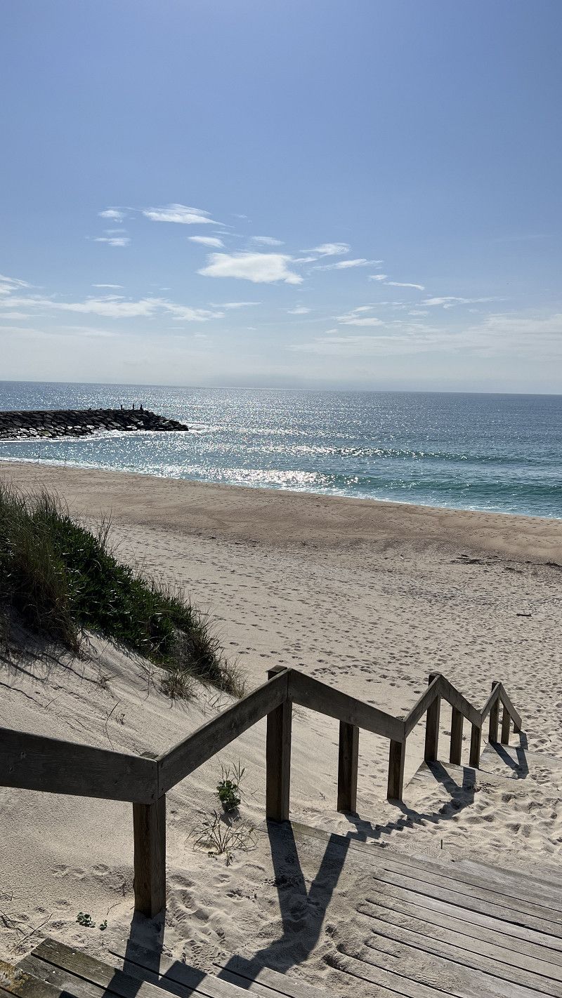
Gafanha da Boa Hora
Vagosplash pitch is located directly on the dune, 10€ without electricity including water, sanitary facilities, barbecue area.
Mega beach, dogs allowed, nice beach bar, about 2 km into town. Costa Nova is about 7 km away via a bike path along the Canal de Mira.
https://youtu.be/XbHvpdmPpvE
Aveiro, Portugal
40° 32' 29.7" N 8° 45' 19.3" W
40.5415762 -8.7553714
• Head toward Rua da Floresta. Go for 26 m.
• Turn right onto M591-1. Go for 15 m.
• Turn left toward Rua Principal/M591. Go for 442 m.
• Turn right onto Rua Principal (M591). Go for 2.0 km.
• Take the 3rd exit from roundabout onto M591-2. Go for 502 m.
• Turn right onto M592. Go for 212 m.
• Take the 1st exit from roundabout onto M592. Go for 5.1 km.
• Continue on Avenida José Estevão (M592). Go for 2.8 km.
• Take ramp onto Autoestrada Beiras Litoral e Alta (A25). Go for 13.5 km.
• Take the left exit toward Viseu/Porto/A29 onto A25 (Autoestrada da Costa da Prata). Go for 186 km.
• Continue on A-62 (Autovía de Castilla). Go for 204 km.
• Keep right onto A-62 (Autovía de Castilla) toward Valladolid/Burgos. Go for 64.3 km.
• Take exit 88 toward Palencia/P-11/Santander onto A-67. Go for 3.1 km.
• Take exit 2 toward Villamuriel de Cerrato. Go for 1.1 km.
• Take the 4th exit from roundabout onto P-900 toward Pol. Industrial El Arriero/Palencia/P-11/Villamuriel de Cerrato/Venta de Baños/A-67/Valladolid/Madrid. Go for 474 m.
• Take the 3rd exit from roundabout onto Calle Carreterilla toward Villamuriel de Cerrato. Go for 292 m.
• Take the 4th exit from roundabout onto Calle Carreterilla. Go for 225 m.
• Turn slightly right toward Avenida de Portugal. Go for 237 m.
• Turn right onto Avenida de Portugal. Go for 235 m.
• Turn left onto Calle Mariano Rodríguez. Go for 11 m.
• Turn left. Go for 101 m.
• Arrive at your destination on the left.
☍
485,0 km
(4 hrs. 49 min.)
Villamuriel de Cerrato
A stopover site. We had already used this site on our arrival. It was fully booked.
Palencia, Kastilien und León, Spanien
41° 57' 5.5" N 4° 30' 54.7" W
41.9515154 -4.5151999
• Head toward Calle Mariano Rodríguez. Go for 101 m.
• Turn left onto Calle Mariano Rodríguez. Go for 221 m.
• Turn left onto Avenida de la Aguilera. Go for 182 m.
• Continue toward Calle Carreterilla. Go for 266 m.
• Turn slightly left onto Calle Carreterilla. Go for 174 m.
• Take the 2nd exit from roundabout onto Calle Carreterilla. Go for 232 m.
• Take the 2nd exit from roundabout onto A-67 (Autovía Cantabria-Meseta) toward Venta de Baños/Valladolid/Madrid. Go for 1.3 km.
• Take exit 1 toward Parque Industrial de Villamuriel/Venta de Baños/E-80/Burgos/A-62. Go for 180 m.
• Pass 2 roundabouts and continue on P-123. Go for 1.3 km.
• Take ramp onto A-62 (Autovía de Castilla) toward Burgos. Go for 79.5 km.
• Continue on BU-30 (Autovía de Castilla). Go for 4.3 km.
• Continue on A-1 (Nudo de Landa). Go for 7.1 km.
• Continue on AP-1 (Autovía del Norte). Go for 81.9 km.
• Take the left exit onto A-1 (Autovía del Norte). Go for 24.7 km.
• Take exit 352 toward E-80/Francia/AP-1/Bilbao/AP-68/Aireportua onto N-622. Go for 2.3 km.
• Take ramp toward Aireportua/Foronda/Etxabarri-Ibiña/Donostia/AP-1/San Sebastián. Go for 273 m.
• Keep left toward Autopista Vitoria-Eibar/AP-1. Go for 862 m.
• Take ramp onto AP-1 (Autopista Vitoria-Eibar) toward Donostia/San Sebastián. Go for 44.7 km.
• Take the exit onto AP-1/AP-8 (Autopista del Cantábrico). Go for 42.6 km.
• Take the exit toward Hernani/Pasaia/Irun/Baiona/Bordeaux onto AP-1/AP-8 (Segundo Cinturón de San Sebastián). Go for 14.6 km.
• Take the exit onto AP-8. Go for 12.7 km.
• Continue on A63 (Autoroute de la Côte Basque). Go for 206 km.
• Take the exit toward Paris/Toulouse/Bordeaux/Talence onto A630 (Rocade de Bordeaux). Go for 9.2 km.
• Keep left onto Rocade de Bordeaux (N230) toward Paris/A10/Lyon/A89. Go for 10.2 km.
• Take left ramp onto A10 toward E606/Paris/Nantes/Angoulême/Saintes. Go for 14.4 km.
• Take exit 40A toward Royan Par R.N./Saintes Par R.N./Blaye. Go for 576 m.
• Take the 4th exit from roundabout onto D1510 toward A10/Paris/Royan/Saintes/Blaye. Go for 1.4 km.
• Keep left onto D1510 toward Saintes/Royan/Blaye. Go for 226 m.
• Take the 2nd exit from roundabout onto Route de Blaye (D137) toward Saintes/Royan/St Savin/Pugnac/St Christoly/Blaye/Château de Bouilh. Go for 608 m.
• Pass 2 roundabouts and continue on Rue du Grand Chemin (D137). Go for 2.2 km.
• Continue on Rue des Vignerons (N137). Go for 1.2 km.
• Take the 2nd exit from roundabout onto Route de Puymorin (N137) toward Pugnac/Blaye. Go for 1.1 km.
• Continue on N137. Go for 215 m.
• Continue on Lieu-dit Le Pont des Rivières (D137). Go for 3.9 km.
• Take the 2nd exit from roundabout onto Route de Saint-André (D137) toward Saintes/Royan/Pugnac/St Christoly/Blaye. Go for 2.2 km.
• Take the 1st exit from roundabout onto Route de Lafossé (D132) toward St Vivien de B./St Christoly de B. Go for 421 m.
• Continue on D132. Go for 17 m.
• Continue on Route de Lafossé (D132). Go for 452 m.
• Continue on Lieu-dit le moulin d'Eau (D132). Go for 98 m.
• Continue on D132. Go for 212 m.
• Turn right onto D132. Go for 37 m.
• Arrive at D132. Your destination is on the left.
☍
573,7 km
(5 hrs. 17 min.)
Saint-Vivien-de-Blaye
A communal parking space outside, next to a church. A park with a playground and fitness trail is right next door. Little traffic, but there are speeding cars at night. We wouldn't stay here again.
https://youtu.be/KcBOUFq7NgI
Gironde, Neu-Aquitanien, Frankreich
45° 5' 58.1" N 0° 31' 1.5" W
45.0994591 -0.5170726
• Head east on D132. Go for 203 m.
• Turn left onto D132. Go for 109 m.
• Continue on Lieu-dit Les Chaintres Est (D132). Go for 613 m.
• Continue on D132. Go for 71 m.
• Continue on Lieu-dit Giron (D132). Go for 481 m.
• Continue on Lieu-dit Au Cormier (D132). Go for 96 m.
• Continue on D132. Go for 793 m.
• Continue on Lieu-dit Ravion (D132). Go for 978 m.
• Continue on Lieu-dit L'Étang (D132). Go for 218 m.
• Continue on Rue des Anciens Combattants (D132). Go for 306 m.
• Turn right onto Route de Saint-Savin (D22) toward St Savin. Go for 36 m.
• Turn left onto Lieu-dit Merlet toward Saugon/Reignac/Étauliers. Go for 196 m.
• Turn left onto Avenue Paul Arnaudin. Go for 287 m.
• Turn right onto Rue de la Gare (D132). Go for 1.2 km.
• Continue on Lieu-dit Les Buissons de Dubraud (D132). Go for 524 m.
• Continue on Lieu-dit Dubraud (D132). Go for 187 m.
• Continue on Lieu-dit Dubraud-Nord (D132). Go for 369 m.
• Continue on Lieu-dit Moulin de Chauvin (D132). Go for 63 m.
• Continue on D132. Go for 1.3 km.
• Continue on Lieu-dit Bellevue (D132). Go for 230 m.
• Continue on Lieu-dit Le Pas du Loup (D132). Go for 339 m.
• Continue on D132. Go for 375 m.
• Continue on Lieu-dit Géniquet (D132). Go for 553 m.
• Continue on D132. Go for 18 m.
• Continue on Lieu-dit Le Bourg (D132). Go for 215 m.
• Continue on D132. Go for 310 m.
• Continue on Lieu-dit Bazille-Ouest (D132). Go for 479 m.
• Continue on D132. Go for 640 m.
• Continue on Chagnas (D132). Go for 428 m.
• Continue on Lieu-dit Chagnas-Est (D132). Go for 256 m.
• Continue on D132. Go for 720 m.
• Continue on Lieu-dit La Grolle (D132). Go for 89 m.
• Continue on Lieu-dit Verdot (D132). Go for 1.1 km.
• Turn left onto D132. Go for 6.4 km.
• Take the 1st exit from roundabout onto D254 toward A10/Marcillac. Go for 308 m.
• Take the 2nd exit from roundabout onto D254 toward A10 (Paris)/Marcillac. Go for 528 m.
• Take ramp onto A10 (L'Aquitaine) toward Paris/Royan/Saintes. Go for 257 km.
• Take exit 25 toward Ste Maure de T./Loches. Go for 981 m.
• Take the 1st exit from roundabout onto D760 toward Loches. Go for 486 m.
• Take the 1st exit from roundabout onto D760 toward Châtellerault/Ste Maure de Tne/Loches. Go for 1.6 km.
• Take the 4th exit from roundabout onto D760 toward Loches/Ligueil. Go for 707 m.
• Pass 4 roundabouts and continue on Route de Loches (D760). Go for 14.5 km.
• Turn left onto Rue Augustin Froger. Go for 125 m.
• Turn right onto Rue René Descartes. Go for 126 m.
• Arrive at Rue René Descartes. Your destination is on the left.
☍
296,8 km
(2 hrs. 37 min.)
Manthelan
A municipal parking space with a water feature for four vehicles was available at a park with a pond. When we arrived at 12:00, all spaces were already taken. So we moved on.
https://youtu.be/KcBOUFq7NgI
Indre-et-Loire, Zentrum, Frankreich
47° 8' 11" N 0° 47' 38" E
47.1363870 0.7938916
• Head toward Rue des Charpes on Rue René Descartes. Go for 47 m.
• Continue on Rue de la Scierie. Go for 223 m.
• Turn right onto Route de Bléré (D58). Go for 11.5 km.
• Take the 2nd exit from roundabout onto Route de Bléré (D58). Go for 2.6 km.
• Turn slightly left onto Rue du Stade. Go for 23 m.
• Turn slightly right onto Rue Louis de Barberin. Go for 5 m.
• Arrive at Rue Louis de Barberin. Your destination is on the left.
☍
14,4 km
( 11 min.)
Reignac-sur-Indre
Municipal parking directly below the river. Dog walking permitted. 4-5 vehicles, no service, free of charge. The main road runs right past. However, it was quiet at night.
https://youtu.be/KcBOUFq7NgI
Indre-et-Loire, Zentrum, Frankreich
47° 13' 56.3" N 0° 54' 58.9" E
47.2323025 0.9163536
• Head northeast on Rue Louis de Barberin. Go for 20 m.
• Turn left onto Rue Louis de Barberin (D58). Go for 3.3 km.
• Take the 1st exit from roundabout onto Rue de Bléré (D58). Go for 5.5 km.
• Take the 2nd exit from roundabout onto D31 toward Bléré/Chenonceaux/Amboise/Montrichard/Z.A. Sublaines-Bléré. Go for 3.5 km.
• Turn left and take ramp onto D976 toward Tours/Montlouis S/L./Amboise. Go for 2.2 km.
• Continue on D31. Go for 7.8 km.
• Pass 6 roundabouts and continue on D31. Go for 20.1 km.
• Take ramp onto A10 (L'Aquitaine) toward Blois/Paris. Go for 95.5 km.
• Take the exit toward E60/A19/Metz/Nancy/Fontainebleau/Montargis. Go for 1.2 km.
• Continue on A19. Go for 98.7 km.
• Take the exit toward Metz/Nancy/Troyes/Sens onto A19. Go for 29.4 km.
• Take the exit toward Troyes/Metz/Nancy onto A5. Go for 71.0 km.
• Take the exit toward Metz/Reims/Châlons en Champ./St Dizier onto A26. Go for 96.5 km.
• Take the exit toward Strasbourg/Metz/Verdun onto A4 (Autoroute de l'Est). Go for 11.7 km.
• Take exit 25 toward St Étienne au Temple/Bar-le-Duc/Châlons en Ch.-Mt Bernard/Suippes onto Échangeur de Saint-Étienne-au-Temple. Go for 626 m.
• Take the 1st exit from roundabout onto D977 toward Sedan/Charleville-M./Bar le Duc/Suippes. Go for 2.4 km.
• Take the 1st exit from roundabout onto D994 toward Bar le Duc/Courtisols/La Cheppe. Go for 4.1 km.
• Turn slightly left onto D66 toward Bussy le Château/La Cheppe. Go for 179 m.
• Continue on Voie Romaine (D66). Go for 434 m.
• Take the 1st exit from roundabout onto Place de la Mairie (D66). Go for 71 m.
• Continue on Rue de l'Église (D66). Go for 179 m.
• Turn left onto Rue de la Capelle. Go for 14 m.
• Turn slightly left onto Rue de la Capelle. Go for 23 m.
• Arrive at Rue de la Capelle. Your destination is on the right.
☍
454,4 km
(3 hrs. 54 min.)
La Cheppe
Free municipal parking space on the outskirts of town with parking space. Very quiet, right next to Camp d'Attila.
There are no parcels, so there's room for about 3-4 vehicles, depending on the size and parking habits. During our stay, the site was completely full with about 10-15 mobile homes parked.
https://youtu.be/KcBOUFq7NgI
Marne, Grand Est, Frankreich
49° 3' 6.4" N 4° 29' 57.2" E
49.0517807 4.4992228
• Head toward Impasse du Hanneton on Rue de la Capelle. Go for 186 m.
• Turn right onto Voie Romaine (D366). Go for 346 m.
• Continue on D366. Go for 2.6 km.
• Turn left onto D977. Go for 2.0 km.
• Take the 2nd exit from roundabout onto D977 toward A4/Châlons en Champagne/St Étienne au Temple. Go for 2.4 km.
• Take the 2nd exit from roundabout onto Échangeur de Saint-Étienne-au-Temple toward Reims/Troyes/Verdun/Metz/Nancy. Go for 189 m.
• Take ramp onto A4 (Autoroute de l'Est) toward Verdun/Metz/Nancy. Go for 191 km.
• Take the exit toward Forbach onto A320. Go for 14.6 km.
• Continue on A6. Go for 113 km.
• Take exit 21 toward Koblenz onto A61. Go for 8.8 km.
• Take exit 58 toward Monsheim/Worms/Worms-Zentr. onto B47. Go for 3.3 km.
• Take ramp onto Kolpingstraße (K17) toward Michelstadt. Go for 1.5 km.
• Take the 2nd exit from roundabout onto Kolpingstraße (K17) toward Michelstadt/B47/B9/Mainz/Gewerbegebiet Nord/Krankenhaus Hochstift/Zentrum. Go for 564 m.
• Turn left onto Neusatz (K17) toward Zentrum. Go for 311 m.
• Take the 2nd exit from roundabout onto Lutherring. Go for 249 m.
• Take the 1st exit from roundabout onto Stephansgasse. Go for 232 m.
• Continue on Marktplatz. Go for 33 m.
• Arrive at Marktplatz. Your destination is on the right.
☍
341,3 km
(3 hrs. 6 min.)
Worms
After 90 days our journey through Portugal ends.
We hope you can take some inspiration for your trip from our route.
If you are interested in our other trips or want to know where we are going next, please visit www.unterwegsmitdenbeckers.de or subscribe to our YouTube channel.
Stay healthy, have a good trip.
Simone and Michael
Rheinland-Pfalz, Deutschland
49° 37' 48.9" N 8° 21' 43.5" E
49.6302618 8.3620898