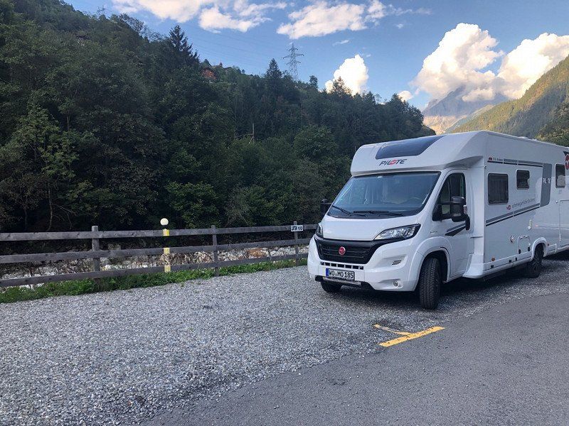
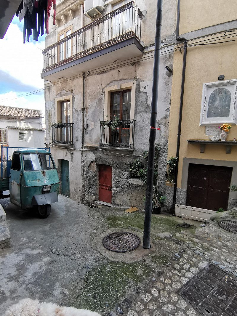
We winter 2022/2023 in Italy. Our journey goes from Germany through Switzerland to southern Italy.
We didn't reserve seats and only roughly planned the route. We stay where we like it. The days in this route are therefore only for a better overview and do not correspond to our actual stay.
We will update the route regularly until the end of our trip. You can also find the pitches on our pitch map
https://www.google.com/mymaps/viewer?mid=1Go9_NlhxRydmuWiQPuTZLw8NZG5wnEU&hl=de
and videos of our trips on our YouTube channel. Have a look.
👉 on the road with the Beckers
Day
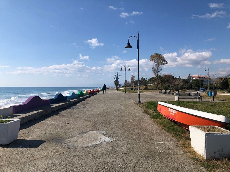
Worms, Deutschland
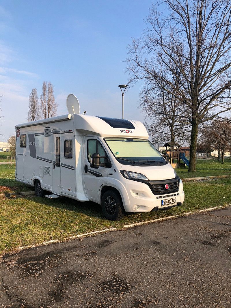
We travel through Europe in a camper van and record our experiences on video.
YouTube 👉 on the road with the Beckers
49° 38' 2.9" N 8° 21' 2.6" E
49.6341372 8.3507182
• Head toward Friedrich-Ebert-Straße on Dirolfstraße. Go for 47 m.
• Continue on Dirolfstraße. Go for 269 m.
• Turn right onto Alzeyer Straße (K1). Go for 110 m.
• Take the 3rd exit from roundabout onto Kirschgartenweg (K18). Go for 242 m.
• Take the 2nd exit from roundabout onto Kirschgartenweg (K18). Go for 380 m.
• Turn right onto Kolpingstraße (K17). Go for 958 m.
• Take ramp onto B47 toward A61/Koblenz/Ludwigshafen/Kaiserslautern/Monsheim/Wo.-Pfeddersheim. Go for 2.6 km.
• Take ramp onto A61 toward Ludwigshafen/Kaiserslautern. Go for 45.9 km.
• Take the left exit toward Stuttgart/Heilbronn/Karlsruhe onto A6. Go for 7.8 km.
• Take exit 31 toward Basel/Karlsruhe onto A5. Go for 15.6 km.
• Take exit 42 toward Bruchsal onto B35. Go for 2.3 km.
• Take ramp toward Bretten/Bruchsal/Stutensee/Forst/B35. Go for 273 m.
• Turn right onto L556. Go for 713 m.
• Turn left onto L618 toward Bruchsal-West/Gewerbegebiet TRIWO-Technopark/Gewerbegebiet Siemens-Technopark. Go for 1.6 km.
• Turn right onto Friedensstraße. Go for 211 m.
• Continue on Schnabel-Henning-Straße. Go for 56 m.
• Arrive at Schnabel-Henning-Straße. Your destination is on the right.
☍
79,1 km
( 51 min.)
Bruchsal, Deutschland
Free parking space at the castle
49° 7' 29.9" N 8° 35' 3.9" E
49.1249712 8.5844108
• Head southwest on Schnabel-Henning-Straße. Go for 367 m.
• Turn right onto Grabener Straße (B35). Go for 1.5 km.
• Continue on L556. Go for 1.3 km.
• Turn left and take ramp onto B35 toward A5/Germersheim/Graben-Neudorf/Karlsdorf-Neuthard. Go for 1.6 km.
• Take ramp onto A5 toward Karlsruhe. Go for 209 km.
• Continue on A2. Go for 14.1 km.
• Keep right onto A2 (Verzweigung Augst) toward Chiasso/Gotthard/Luzern/Bern/Arisdorf. Go for 28.2 km.
• Take the left exit toward Chiasso/Gotthard/Luzern/Zürich/Rothrist onto A1/A2. Go for 8.9 km.
• Take exit 47 toward Chiasso/Gotthard/Luzern/Reiden onto A2 (Verzweigung Wiggertal). Go for 97.9 km.
• Take exit 38 toward Amsteg/Bristen/Gurtnellen. Go for 417 m.
• Turn right onto Gotthardstrasse (2). Go for 697 m.
• Turn left onto Ried. Go for 1.4 km.
• Continue on Ried. Go for 1.0 km.
• Continue on Riedmatt. Go for 130 m.
• Continue on Ried. Go for 376 m.
• Turn left toward Meitschligen. Go for 79 m.
• Turn slightly right onto Meitschligen. Go for 537 m.
• Turn left onto Gotthardstrasse (2). Go for 3.0 km.
• Turn right onto Dorfstrasse. Go for 169 m.
• Turn left onto Dorfstrasse. Go for 38 m.
• Turn right onto Fabrikstrasse. Go for 183 m.
• Turn right onto Grünenwaldstrasse. Go for 58 m.
• Turn left toward Dorfstrasse. Go for 32 m.
• Continue on Dorfstrasse. Go for 434 m.
• Continue on Dorfstrasse. Go for 742 m.
• Turn slightly right onto Dorfstrasse. Go for 538 m.
• Turn slightly left onto Dorfstrasse. Go for 121 m.
• Arrive at Dorfstrasse. Your destination is on the right.
☍
372,5 km
(3 hrs. 35 min.)
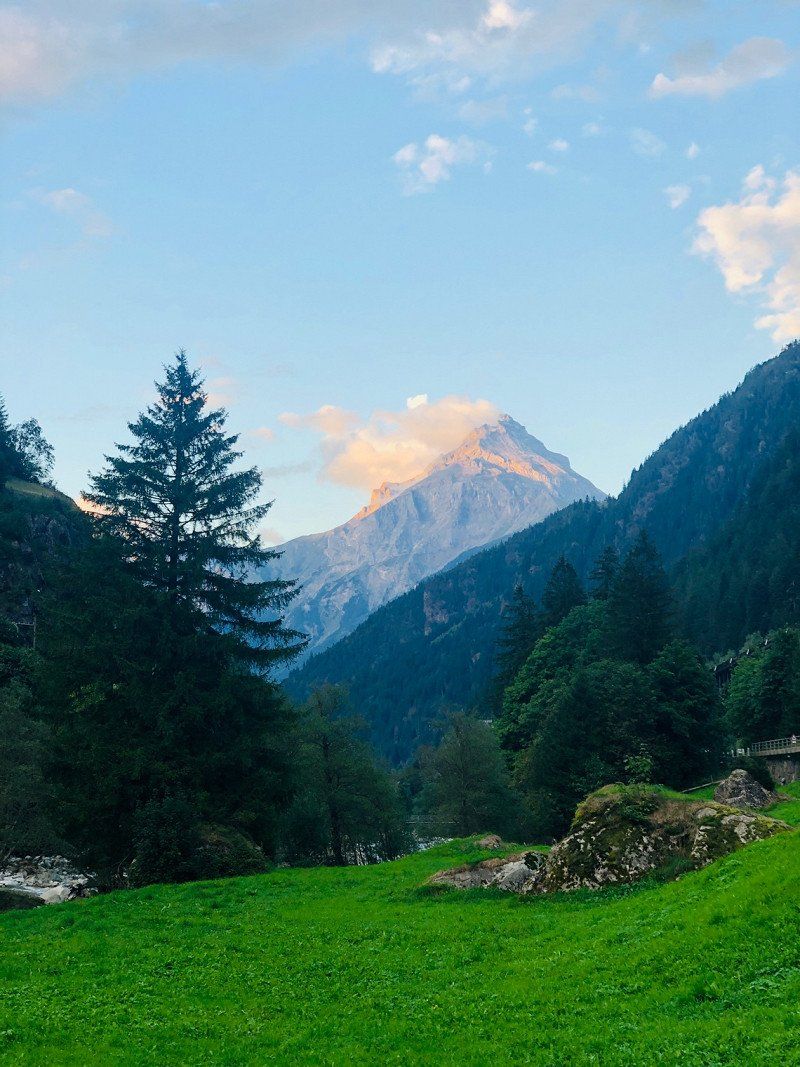
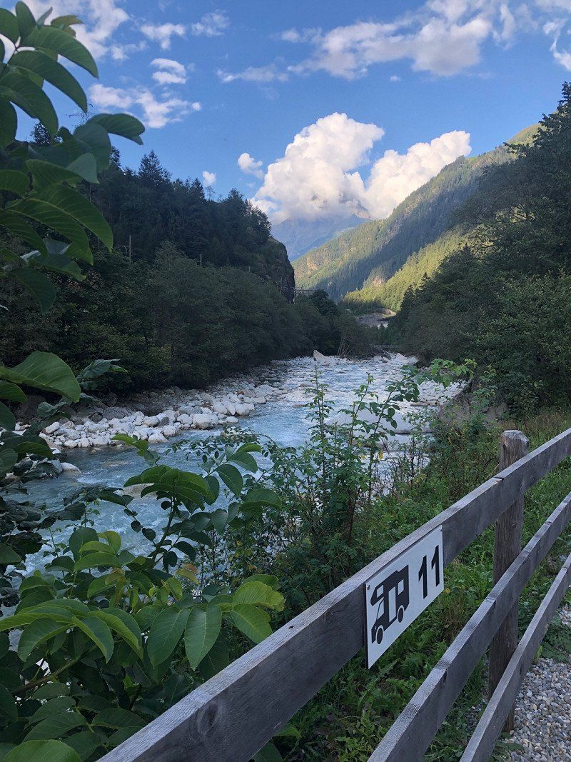
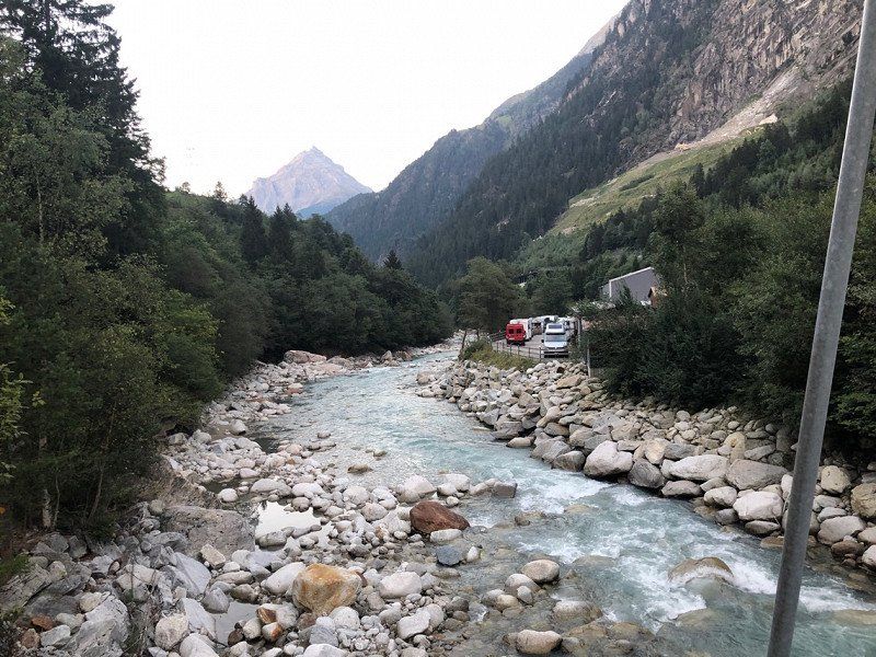
Gurtnellen, Schweiz
Parking space on the Reuss
Perfect as a stopover just before the Gotthard tunnel.
15€/CHF incl V/E, dog, wifi, toilet. Electricity 5€
Motorhome parking space 🇨🇭 on the Reuss, Gurtnellen Switzerland | perfectly located in front of the Gotthard tunnel
https://youtu.be/j3lS4IU-m_Q
46° 44' 16.7" N 8° 37' 40.1" E
46.7379600 8.6278100
• Head toward Waldistrasse on Dorfstrasse. Go for 1.7 km.
• Continue on Dorfstrasse. Go for 201 m.
• Continue on Grünenwaldstrasse. Go for 58 m.
• Turn left onto Fabrikstrasse. Go for 183 m.
• Turn left onto Dorfstrasse. Go for 38 m.
• Turn right onto Dorfstrasse. Go for 169 m.
• Turn right onto Gotthardstrasse (2). Go for 3.3 km.
• Turn right and take ramp onto A2 toward Gotthard/Gotthardtunnel. Go for 80.3 km.
• Take exit 47 toward Locarno onto 2 (In Tirada). Go for 4.6 km.
• Pass 5 roundabouts and continue on Via Monte Ceneri (406). Go for 4.3 km.
• Keep right onto 406. Go for 366 m.
• Turn sharp left onto Via Campiscioni (405). Go for 12.5 km.
• Continue on Corso Europa (SS394). Go for 9.6 km.
• Turn right onto Via Fratelli Monaco. Go for 207 m.
• Turn left onto Via Alberto Martinetti. Go for 86 m.
• Turn right onto Via Gualtiero Berti. Go for 128 m.
• Arrive at Via Gualtiero Berti. Your destination is on the right.
☍
117,7 km
(1 hrs. 36 min.)
Day
Maccagno con Pino e Veddasca, Varese, Italien
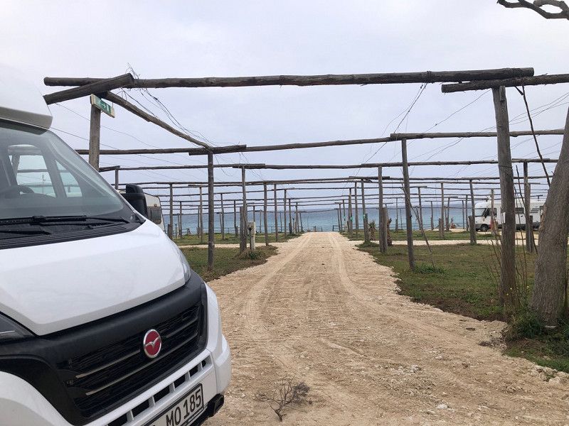
Free parking space at the sports field. Just a few hundred meters from the lake.
From Lake Maggiore towards Lake Garda to Borghetto | heavy rain | Motorhome toll box in Italy 🇮🇹
https://youtu.be/3tT3VvoXqlo
21061 Maccagno con Pino e Veddasca, Varese, Italien
46° 2' 18.7" N 8° 44' 11.9" E
46.0385285 8.7366493
• Head toward Piazzale Franciscos Granados on Via Gualtiero Berti. Go for 326 m.
• Turn right onto Via Giuseppe Garibaldi (SS394). Go for 4.3 km.
• Pass 3 roundabouts and continue on Via Dante Alighieri (SS394). Go for 1.4 km.
• Take the 3rd exit from Rotonda Andrea Ratti roundabout onto Via Dante Alighieri toward Autostrada/A8/A26/Aeroporto Malpensa. Go for 251 m.
• Take the 2nd exit from roundabout onto Via Dante Alighieri. Go for 253 m.
• Continue on Via Roberto Stehli (SS394). Go for 1.3 km.
• Pass 3 roundabouts and continue on Via Provinciale (SS394). Go for 3.7 km.
• Take the 1st exit from roundabout onto Via Provinciale (SS394) toward Varese/Laveno. Go for 672 m.
• Take the 3rd exit from roundabout onto Strada Provinciale della Rocca d'Angera (SP43) toward Milano/A8/Grantola/Cunardo/Montegrino V./Varese/Ponte T. Go for 4.7 km.
• Take the 2nd exit from roundabout onto Via Varesina (SP43). Go for 1.7 km.
• Take the 1st exit from roundabout onto Via Statale (SPEXSS233). Go for 3.1 km.
• Pass 4 roundabouts and continue on Viale Valganna (SPEXSS233). Go for 10.4 km.
• Keep right onto Via Carlo Carcano (SPEXSS233). Go for 43 m.
• Continue on Largo Luciano Comolli (SPEXSS233). Go for 372 m.
• Continue on Piazzale Trieste. Go for 191 m.
• Continue on Via delle Medaglie d'Oro. Go for 176 m.
• Turn left onto Via Magenta (SS394). Go for 557 m.
• Take the 1st exit from Largo Ennio Flaiano roundabout onto Via Autostrada. Go for 1.1 km.
• Keep left onto Via Autostrada. Go for 3.5 km.
• Continue on A8 (Autostrada Milano-Varese) toward E62/Milano. Go for 42.3 km.
• Take the left exit toward E64/Venezia/A51/A52/Tangenziali/A58/Milano V.le Zara/Aeroporto Linate/Aeroporto Orio al Serio onto A4 (Svincolo Viale Certosa). Go for 127 km.
• Take the exit toward Sirmione onto Svincolo Sirmione. Go for 436 m.
• Keep left onto Svincolo Sirmione toward Pozzolengo/Cavriana/Solferino. Go for 60 m.
• Take the 3rd exit from roundabout onto Via dei Colli Storici (SP13) toward Solferino/Cavriana/Pozzolengo. Go for 812 m.
• Take the 2nd exit from roundabout onto Via dei Colli Storici (SP13) toward Solferino/Cavriana/Monzambano/Pozzolengo. Go for 2.7 km.
• Take the 1st exit from roundabout onto Via Sorre toward Solferino/Monzambano/Mantova/Cavriana. Go for 487 m.
• Continue on Via Fontanelle. Go for 22 m.
• Turn right onto Via Italia Libera. Go for 432 m.
• Take the 1st exit from roundabout onto Via Italia Libera. Go for 319 m.
• Continue on Località Irta. Go for 184 m.
• Continue toward Mantova/Solferino. Go for 30 m.
• Take the 1st exit from roundabout onto Località Irta (SP13) toward Mantova/Solferino. Go for 2.0 km.
• Continue on Via Pozzolengo (SP8). Go for 475 m.
• Turn left onto Strada Georgiche. Go for 705 m.
• Continue on Strada Madonna della Porta. Go for 1.4 km.
• Continue toward Strada Cavallara. Go for 32 m.
• Take the 3rd exit from roundabout onto Strada Cavallara. Go for 1.8 km.
• Continue on Via Cavallara (SP15). Go for 5.0 km.
• Take the 2nd exit from roundabout onto Via Cavallara (SP15) toward Borghetto/Valeggio S/M/Villafranca. Go for 298 m.
• Continue on Strada Tononi (SP15). Go for 910 m.
• Continue on SP3. Go for 1.2 km.
• Continue on Via Cavallara (SP3). Go for 447 m.
• Continue on SP3. Go for 328 m.
• Continue on Via Monte Borghetto (SP3). Go for 63 m.
• Turn sharp right onto SP55 toward Volta Mantovana/Ariano. Go for 128 m.
• Turn left onto Via Michelangelo Buonarroti. Go for 307 m.
• Arrive at Via Michelangelo Buonarroti. Your destination is on the left.
☍
227,3 km
(2 hrs. 40 min.)
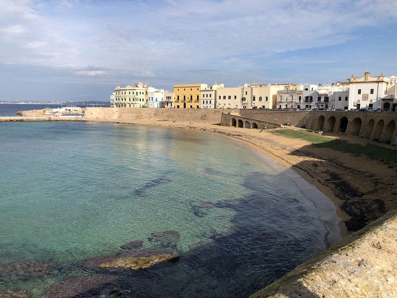
Borghetto, Verona, Italien
Parking space for 200 mobile homes. Partially shaded, lawn, not subdivided. €15/24 hours including electricity, VE, waste disposal, toilet, playground, picnic tables, BBQ grills. Shower €0.50/2 min
Just a few minutes walk to the historic fortified town.
RV parking space 🇮🇹 south of Lake Garda | Area Sosta Parcheggio Virgilio Borghetto | Italy
https://youtu.be/q8u03DIAEdM
37067 Borghetto VR, Italien
45° 21' 13.2" N 10° 43' 23.4" E
45.3536783 10.7231723
• Head toward Via Leonardo da Vinci on Via Michelangelo Buonarroti. Go for 307 m.
• Turn right onto SP55. Go for 131 m.
• Turn right onto Strada Viscontea (SP55) toward Valeggio S/M. Go for 564 m.
• Continue on SP55. Go for 37 m.
• Take the 2nd exit from roundabout onto SP55 toward Valeggio S/M. Go for 365 m.
• Turn right onto SP28. Go for 230 m.
• Continue on Via San Rocco (SP28). Go for 246 m.
• Take the 2nd exit from roundabout onto Via Antonio Murari (SR249). Go for 358 m.
• Turn right onto Via Vittorio Emanuele II. Go for 210 m.
• Continue on Via Trieste. Go for 130 m.
• Turn right onto Viale Papa Giovanni XXIII. Go for 535 m.
• Take the 3rd exit from roundabout onto Via San Giovanni Bosco (SP24) toward A4/Autostrada/Verona/Mantova. Go for 5.6 km.
• Take the 2nd exit from roundabout onto Località Casa Punta (SP24). Go for 1.9 km.
• Continue on Via Valeggio. Go for 701 m.
• Continue toward Via Valeggio. Go for 46 m.
• Take the 2nd exit from roundabout onto Via Valeggio. Go for 541 m.
• Take the 2nd exit from roundabout onto Via Sommacampagna (SP26) toward Verona/Povegliano/Sommacampagna/Aeroporto/A4. Go for 744 m.
• Continue toward Brennero/A22/Modena/Tangenziale Sud Verona/Zona Industriale Polo Postumia. Go for 32 m.
• Take the 1st exit from roundabout onto Via Portogallo toward Brennero-Modena/A22. Go for 763 m.
• Take the 2nd exit from roundabout onto Via Portogallo toward Autostrada/A22/Verona/Z.I. di Villafranca di Verona. Go for 506 m.
• Turn right onto Viale 1 Maggio toward Aeroporto/Centro/Autostrade/Z.I. di Villafranca di Verona. Go for 91 m.
• Keep left toward Aeroporto/Autostrade/Tangenziale/Verona/Z.I. di Villafranca di Verona. Go for 105 m.
• Continue on Viale Postumia (SR62). Go for 217 m.
• Take the 2nd exit from roundabout onto Viale Postumia (SR62) toward Autostrada/A22/Verona. Go for 1.6 km.
• Take the 3rd exit from roundabout onto Via Borgo Bello (SR62) toward Aeroporto. Go for 1.2 km.
• Take the 2nd exit from roundabout onto Via Borgo Bello (SR62) toward Verona/A4/Autostrada/A22/Aeroporto. Go for 944 m.
• Continue toward Verona/Autostrade/A4/A22/Aeroporto. Go for 39 m.
• Take the 3rd exit from roundabout onto SR62 toward Aeroporto/A4/Autostrade/A22/Verona. Go for 2.7 km.
• Take ramp onto Strada Complanare toward Ospedale Borgo Roma. Go for 7.6 km.
• Take ramp onto Strada Statale Transpolesana (SS434) toward Rovigo/Legnago/S.G. Lupatoto/Bovolone. Go for 79.6 km.
• Take the 1st exit from roundabout onto Via Nazionale Adriatica (SS16) toward Bologna/A13/Ferrara. Go for 6.3 km.
• Turn left onto SP40 toward Copparo/Ro Ferrarese/Polesella. Go for 1.3 km.
• Continue on Strada Provinciale Vallalbana (SP14). Go for 1.4 km.
• Turn slightly left onto Strada Provinciale Dazio di Guarda (SP5). Go for 7.3 km.
• Take the 3rd exit from roundabout onto Strada Provinciale di Copparo (SP2). Go for 1.9 km.
• Turn slightly left onto Strada Provinciale di Copparo (SP2). Go for 2.7 km.
• Turn right onto Strada di Copparo (SP2bis). Go for 102 m.
• Take the 3rd exit from roundabout onto Via Provinciale. Go for 596 m.
• Turn right onto Via Valerio Faccini. Go for 2.4 km.
• Turn right onto Via Salmastri. Go for 985 m.
• Turn right onto Via Salmastri (SP44). Go for 1.6 km.
• Turn left onto Strada Provinciale Copparo-Codigoro (SP16). Go for 8.9 km.
• Take the 2nd exit from roundabout onto SP60. Go for 6.0 km.
• Continue toward Strada Gran Linea/SP60. Go for 52 m.
• Take the 2nd exit from roundabout onto Strada Gran Linea (SP60). Go for 8.7 km.
• Turn left onto Strada Statale Romea (SS309). Go for 1.7 km.
• Take the 1st exit from roundabout onto Via Provinciale (SP27). Go for 1.4 km.
• Take the 1st exit from roundabout onto Via Nuova Corriera (SP51). Go for 689 m.
• Pass 2 roundabouts and continue on Strada Provinciale Romea-Goro Cristina (SP27). Go for 7.7 km.
• Turn right onto Via Nuova. Go for 370 m.
• Take the 2nd exit from roundabout onto Via Bonello. Go for 2.6 km.
• Continue on Via Strada Comunale per Gorino. Go for 1.2 km.
• Continue on Via Gorino. Go for 313 m.
• Turn left onto Via della Chiatta. Go for 339 m.
• Continue on Via Gorino. Go for 1.0 km.
• Turn left onto Zona Faro Gorino. Go for 867 m.
• Enter the roundabout. Go for 13 m.
• Arrive at your destination on the left.
☍
176,6 km
(2 hrs. 21 min.)
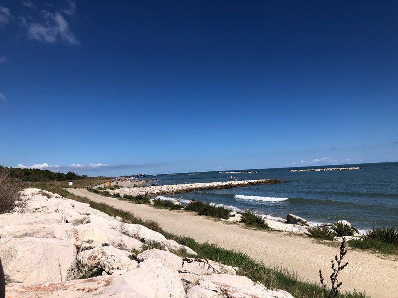
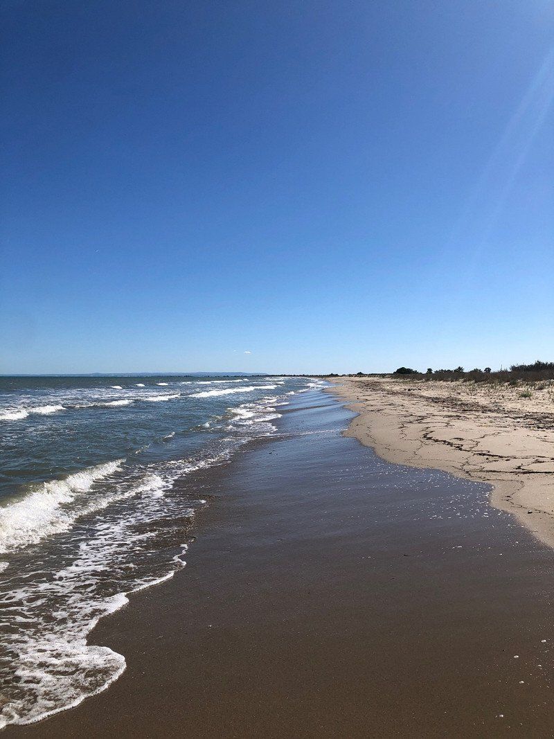
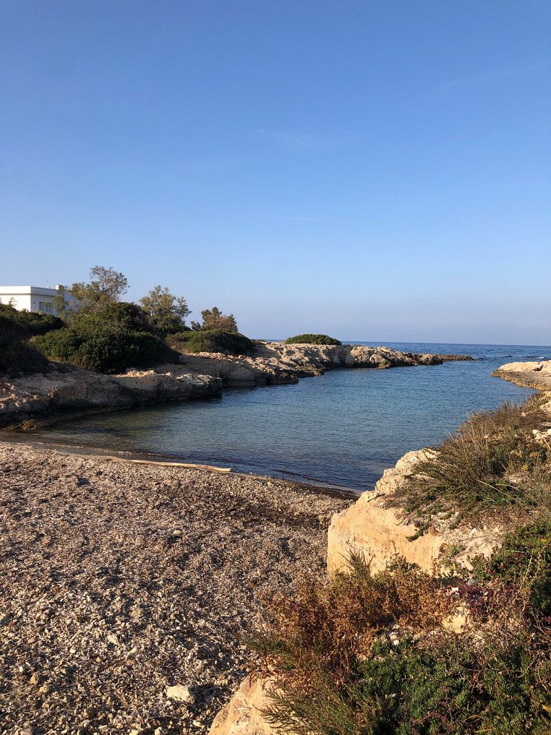
Porto di Gorino
Pitch directly at the small port, right on the water.
We didn't like it, we drove on.
To the Adriatic | Search for pitches | Refueling in Italy 🇮🇹 | Italy in a motorhome
https://youtu.be/e_VedCDQavI
The video will be online shortly. Please subscribe to our channel and you will receive a notification as soon as it is published.
Via al Mare, 44020, Goro, Italien
44° 49' 8" N 12° 21' 1" E
44.8188889 12.3502778
• Follow the roundabout.
• Take the 1st exit from roundabout onto Via al Mare. Go for 140 m.
• Continue on Piazza della Libertà. Go for 38 m.
• Continue on Via Gorino. Go for 1.7 km.
• Keep right onto Via della Chiatta. Go for 339 m.
• Continue on Via Gorino. Go for 313 m.
• Continue on Via Strada Comunale per Gorino. Go for 1.2 km.
• Continue on Via Bonello. Go for 2.6 km.
• Take the 2nd exit from roundabout onto Via Nuova. Go for 416 m.
• Turn left onto Strada Provinciale Romea-Goro Cristina (SP27). Go for 3.2 km.
• Continue toward Strada per Goro/SP27. Go for 29 m.
• Take the 2nd exit from roundabout onto Strada per Goro (SP27). Go for 4.5 km.
• Take the 1st exit from roundabout onto Strada Provinciale Romea-Goro Cristina (SP27). Go for 664 m.
• Take the 2nd exit from roundabout onto Via Provinciale (SP27). Go for 1.4 km.
• Take the 3rd exit from roundabout onto Strada Statale Romea (SS309). Go for 18.3 km.
• Pass 2 roundabouts and continue on Strada Statale Romea (SS309). Go for 19.6 km.
• Take the 3rd exit from roundabout onto Via degli Scariolanti (SP24) toward Casal Borsetti. Go for 2.0 km.
• Take the 1st exit from Rotonda Dello Scirocco roundabout onto Via delle Maone. Go for 1.4 km.
• Take the 2nd exit from Rotonda Del Garbino roundabout onto Via Giovanni Spallazzi. Go for 372 m.
• Turn right onto Via Stefano Ortolani. Go for 213 m.
• Arrive at Via Stefano Ortolani. Your destination is on the right.
☍
58,3 km
( 56 min.)
Area Sosta Mare & Parco
Large pitch a few meters from the sea. Not parceled out, mostly shaded. Very basic equipment.
We paid €19 for 2 nights (without electricity), including V/E. Dogs are free.
To the Adriatic | Search for pitches | Refueling in Italy 🇮🇹 | Italy in a motorhome #vanlife
https://youtu.be/e_VedCDQavI
Via Stefano Ortolani, 48010, Casalborsetti, Italien
44° 33' 0" N 12° 16' 48" E
44.5500000 12.2800000
• Head toward Via Don Franco Stevanato on Via Stefano Ortolani. Go for 213 m.
• Turn left onto Via Giovanni Spallazzi. Go for 318 m.
• Take the 2nd exit from Rotonda Del Garbino roundabout onto Via Giovanni Spallazzi. Go for 2.4 km.
• Continue on Viale Italia. Go for 240 m.
• Turn right onto Strada Provinciale delle Valli (SP112). Go for 3.8 km.
• Take the 2nd exit from roundabout onto Via Romea Nord (SS309) toward Ravenna/Autostrada/A14. Go for 7.6 km.
• Keep left onto Via San Vitale Strada Statale (SS309dir) toward Bologna-Bari/A14/Ferrara-Rimini/SS16/Bologna/SP253/Forlì/SS67/Tiberina/SS3bis/E45. Go for 2.0 km.
• Take the 2nd exit from roundabout onto Via San Vitale Strada Statale (SS309dir) toward Bologna-Ancona/A14/SS3bis/E45/SS16/Bologna. Go for 3.4 km.
• Continue on A14dir. Go for 528 m.
• Take the exit toward Ravenna Centro/Rimini/Cesena-Roma/E45 onto SS16 (Via Reale). Go for 6.1 km.
• Take the 2nd exit from roundabout onto Via Classicana (SS16) toward E45/Cesena/Roma/Rimini. Go for 1.1 km.
• Take ramp onto Innesto SS16 Adriatica (SS3bis) toward Ancona/A14/Roma. Go for 21.2 km.
• Take ramp onto A14 (Autostrada Adriatica) toward Ancona/Bologna-Ancona. Go for 51.1 km.
• Take the exit toward Cattolica/S.Giovanni/Gabicce Mare. Go for 380 m.
• Turn right onto Strada Provinciale Saludecese (SP17). Go for 471 m.
• Take the 2nd exit from roundabout toward Pesaro/SS16. Go for 319 m.
• Continue on Svincolo Strada Provinciale 17. Go for 7 m.
• Turn right onto Strada Statale Adriatica (SS16) toward Gabicce M./Gradara/Pesaro. Go for 311 m.
• Take the 2nd exit from roundabout onto Strada Statale Adriatica (SS16) toward Pesaro. Go for 2.2 km.
• Take ramp toward Gradara/Gabicce Mare. Go for 494 m.
• Continue toward Strada Provinciale Gradara/SP47. Go for 29 m.
• Take the 3rd exit from roundabout toward Gradara. Go for 179 m.
• Continue on Strada Provinciale Gradara (SP47). Go for 751 m.
• Pass 3 roundabouts and continue on Strada Provinciale Gradara (SP47). Go for 2.5 km.
• Turn left toward Via Cattolica. Go for 54 m.
• Turn right onto Via Cattolica. Go for 123 m.
• Turn left onto Via Mercato. Go for 36 m.
• Keep middle onto Via Mancini. Go for 215 m.
• Turn left onto Via Grottaccia. Go for 50 m.
• Turn slightly right onto Via Grottaccia. Go for 72 m.
• Turn right. Go for 88 m.
• Arrive at your destination on the right.
☍
108,3 km
(1 hrs. 16 min.)
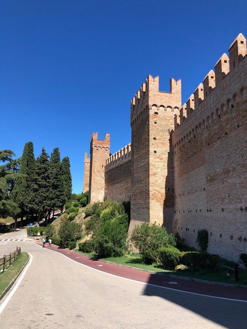
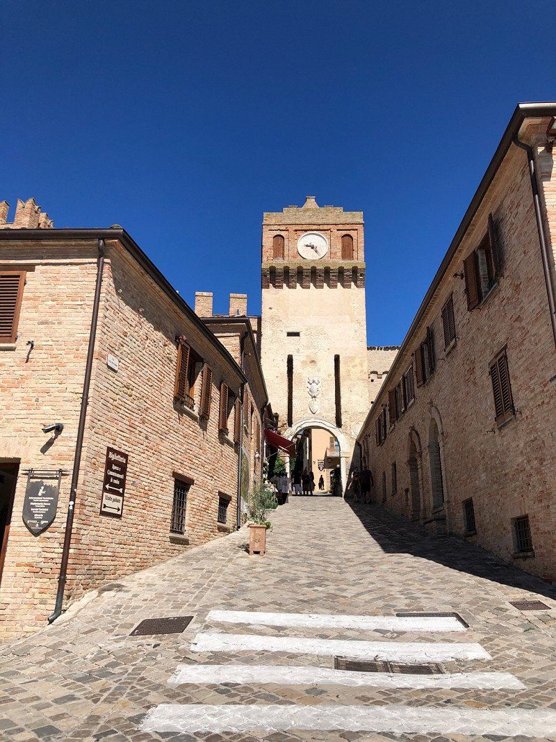
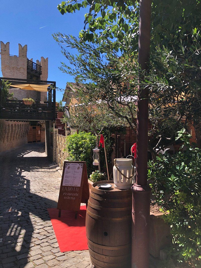
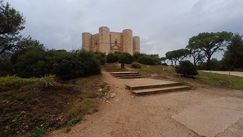
Parcheggio Attrezzato P 1
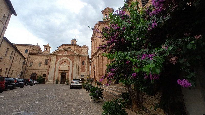
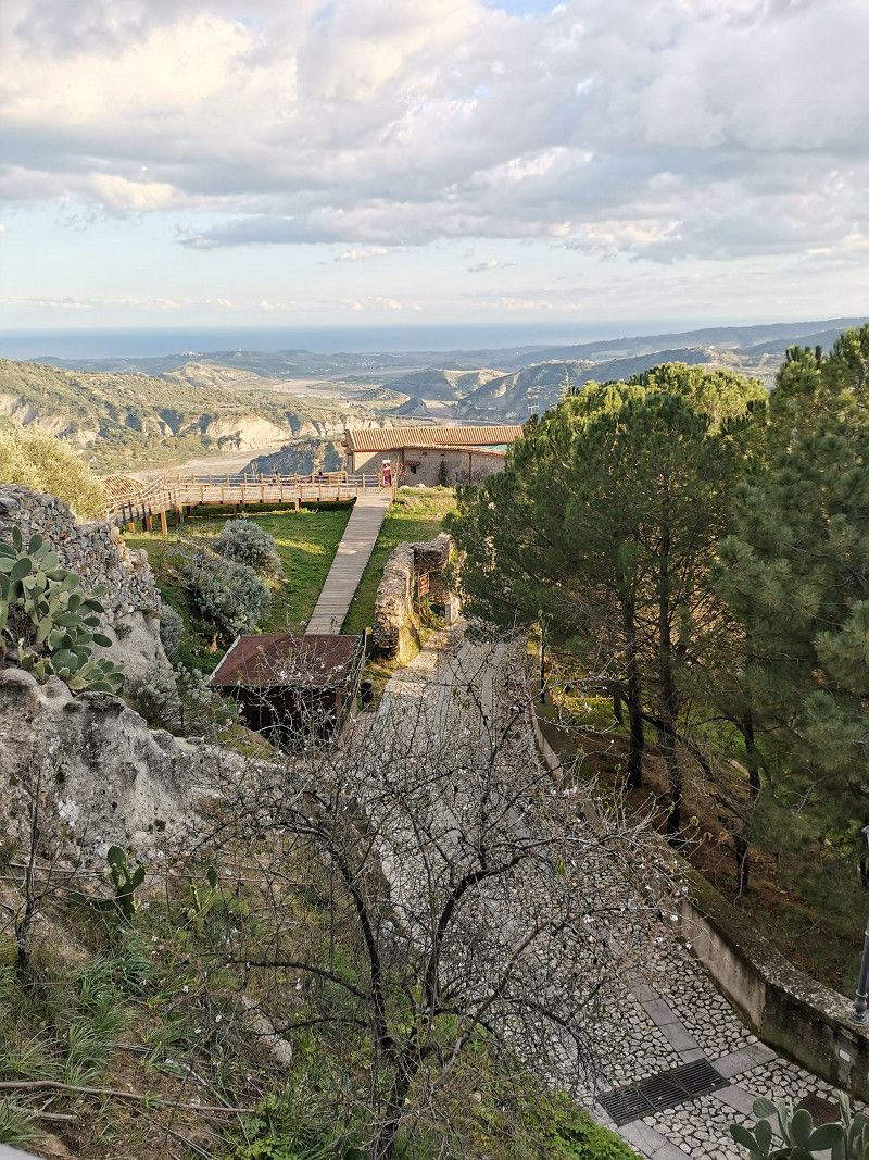
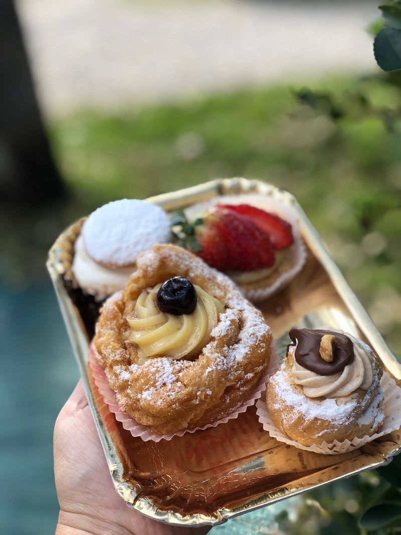
Gradara is a small village in the Marche with a view of the Adriatic Sea and the hinterland. The "old" town is completely surrounded by an 800m intact fortress wall. The castle complex dates back to 1150 and is located at 142m. One looks at Rimini on the Adriatic Sea and at the same time at the gentle hills of the Marches in the hinterland. The Castello can be visited for an entrance fee of €8. The many cafés and restaurants exude a typical Italian charm and you get the feeling that time has stood still. Parking in the designated parking spaces. 2 hours 7€ or 24 hours 15€
The brands are so beautiful | severe storm near Ancona 🇮🇹 | Italy in a motorhome #vanlife
https://youtu.be/Eshf4_Wwuns
Piazzale Paolo e Francesca, 61012, Gradara, Italien
43° 56' 28" N 12° 46' 16" E
43.9411111 12.7711111
• Head south. Go for 70 m.
• Turn left toward Via Mercato. Go for 31 m.
• Turn right onto Via Mercato. Go for 35 m.
• Turn slightly left onto Via Mercato. Go for 34 m.
• Turn left onto Via Mercato. Go for 161 m.
• Turn right onto Via Cattolica. Go for 123 m.
• Turn slightly left toward Strada Provinciale Gradara/SP47. Go for 56 m.
• Turn right onto Strada Provinciale Gradara (SP47). Go for 1.1 km.
• Pass 3 roundabouts and continue on Strada della Romagna (SP47). Go for 2.1 km.
• Continue straight ahead. Go for 28 m.
• Take the 1st exit from roundabout toward Rimini/Bologna-Ancona/A14/Pesaro. Go for 85 m.
• Take ramp onto Strada Statale Adriatica (SS16) toward Rimini. Go for 2.3 km.
• Take the 1st exit from roundabout onto Svincolo Strada Provinciale 17 toward Cattolica Centro/Cattolica. Go for 136 m.
• Take the 2nd exit from roundabout onto Svincolo Strada Provinciale 17 toward A14/Cattolica. Go for 207 m.
• Take the 3rd exit from roundabout onto Strada Provinciale Saludecese (SP17) toward A14/Gabicce/Pesaro/Rimini. Go for 489 m.
• Take the 2nd exit from roundabout onto Strada Provinciale Saludecese (SP17) toward A14/SS17/Morciano di R./S. Giovanni in M. Go for 485 m.
• Take the 4th exit from roundabout onto A14 (Autostrada Adriatica) toward Ancona. Go for 29.6 km.
• Take the exit toward Fano/Gubbio/Cagli/Urbino/Acqualagna/Fossombrone/Fano-Stadio/Roma/Grosseto/Arezzo/Perugia/Sansepolcro/Città di C./E45/Flaminia/SS3 onto SS73bis (Strada Statale di Bocca Trabaria). Go for 28.3 km.
• Take ramp onto Strada Provinciale Flaminia (SP3) toward Flaminia/SS3/Perugia-Roma/Arezzo. Go for 7.5 km.
• Take ramp onto Via Flaminia toward Furlo/Fano. Go for 2.2 km.
• Continue on Località Furlo. Go for 319 m.
• Arrive at Località Furlo. Your destination is on the left.
☍
75,4 km
( 50 min.)
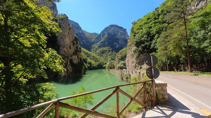
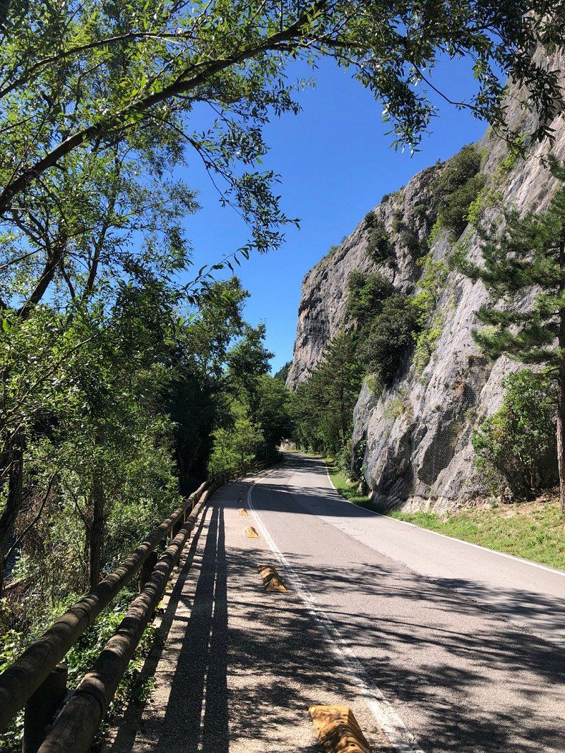
Furlo, Pesaro und Urbino, Italien
We stay overnight at the natural camping parco le querce, directly on the river Candigliano Address: Pianacce, 50, 61041 Acqualagna PU, Italy 18€ incl electricity, fresh water, waste disposal, garbage, sanitary, dogs. Shower €1 From the campsite you can always walk along the river through the Gola dei Furlo Natural Park. The Passo del Furlo gorge is about 4km away
The brands are so beautiful | severe storm near Ancona 🇮🇹 | Italy in a motorhome #vanlife
https://youtu.be/Eshf4_Wwuns
61041 Furlo, Province of Pesaro and Urbino, Italien
43° 38' 17" N 12° 42' 47.4" E
43.6380622 12.7131791
• Head north on Località Furlo. Go for 225 m.
• Continue on Via Flaminia. Go for 4.6 km.
• Keep right onto Strada Provinciale Flaminia (SP3). Go for 357 m.
• Take ramp onto Strada Provinciale Flaminia (SP3). Go for 1.3 km.
• Keep left toward Bologna/A14/Canosa/Fano. Go for 692 m.
• Continue on Strada Statale di Bocca Trabaria (SS73bis). Go for 27.8 km.
• Take ramp toward E55/Bologna/A14/Taranto. Go for 180 m.
• Take the 3rd exit from roundabout toward A14. Go for 673 m.
• Take the 3rd exit from roundabout onto A14 (Autostrada Adriatica) toward Ancona. Go for 22.2 km.
• Take the exit toward Senigallia. Go for 553 m.
• Take the 1st exit from roundabout toward Pesaro/SS16/Ancona/Ospedale/Aeroporto. Go for 716 m.
• Take the 1st exit from roundabout onto Complanare Sud di Senigallia toward Ancona/SS16/Aeroporto. Go for 4.1 km.
• Take the 1st exit from roundabout onto Strada Statale Adriatica (SS16) toward Aeroporto/Ancona. Go for 8.3 km.
• Take the 2nd exit from roundabout onto Via Marina (SS16). Go for 6.2 km.
• Take ramp onto Strada Statale della Val d'Esino (SS76) toward Roma/Bologna-Bari/A14/Aeroporto. Go for 2.8 km.
• Take ramp toward Bologna/A14/Taranto/Chiaravalle. Go for 592 m.
• Continue toward Autostrada Adriatica/A14. Go for 33 m.
• Take the 2nd exit from roundabout onto A14 (Autostrada Adriatica) toward Autostrada/Bologna-Taranto/Pescara. Go for 88.9 km.
• Take the exit toward Grottammare/Grottammare Centro/SS16/S. Benedetto D. T./Cupra M./Acquaviva P. Go for 528 m.
• Turn left toward Viale della Fratellanza. Go for 208 m.
• Continue on Viale della Fratellanza. Go for 468 m.
• Take the 1st exit from roundabout toward Grottammare Sud/S. Benedetto D.I. Go for 50 m.
• Continue on Strada Statale Adriatica (SS16). Go for 6.0 km.
• Take the 2nd exit from roundabout onto Superstrada Ascoli Mare (SP227) toward Autostrade/Raccordo Autostradale/A14. Go for 4.0 km.
• Take ramp onto RA11 (Raccordo Autostradale Ascoli-Porto d'Ascoli) toward Ascoli Piceno/E55/A14/A24. Go for 1.3 km.
• Take the exit toward Bologna-Taranto/Pescara onto A14 (Autostrada Adriatica). Go for 143 km.
• Take the exit toward Montenero di Bisaccia/Vasto Sud-San Salvo. Go for 802 m.
• Take ramp onto Strada Fondo Valle del Trigno (SS650) toward Vasto/SS16/Foggia/S. Salvo Marina/Marina di Montenero di B./Pescara. Go for 852 m.
• Take ramp onto Strada Statale Adriatica (SS16) toward Marina di Montenero di B./Termoli/Foggia. Go for 478 m.
• Take the 2nd exit from roundabout onto SS16 toward Termoli. Go for 7.3 km.
• Take the 1st exit from roundabout onto Strada Statale della Valle del Biferno (SS157) toward Montenero di Bisaccia/Petacciato. Go for 1.1 km.
• Turn left onto Strada Provinciale Litoranea (SP51). Go for 3.2 km.
• Turn right toward Strada Provinciale di Petacciato/SP96. Go for 360 m.
• Turn right onto Strada Provinciale di Petacciato (SP96). Go for 152 m.
• Turn left onto Via Marchesi Battiloro. Go for 385 m.
• Arrive at Via Marchesi Battiloro. Your destination is on the right.
☍
340,8 km
(3 hrs. 35 min.)
Area Attrezzata Piazzale della Liberazione
Free parking space including electricity, V/E, waste disposal, picnic tables and barbecue.
The historic center is only 500m away and is one of the most beautiful villages in Italy.
The brands are so beautiful | severe storm near Ancona 🇮🇹 | Italy in a motorhome #vanlife
https://youtu.be/Eshf4_Wwuns
Petacciato, Campobasso, Italien
86038 Petacciato Province of Campobasso, Italy
From 8 a.m. to 8 p.m. €4.50.
Parking without any service. During our stay there were also trucks on the square in the evening.
Directly at the Lido Eva.
Apulia 🇮🇹 Bella Italia | Gargano, Vieste, Castel del Monte | Italy by motorhome
https://youtu.be/cO4y23nYG1g
86038 Petacciato CB, Italien
42° 0' 35.3" N 14° 51' 39.2" E
42.0097990 14.8608995
• Head west on Via Marchesi Battiloro.
• Continue on Piazza Francesco Jovine. Go for 12 m.
• Turn left onto Via Napoli (SP110). Go for 28 m.
• Turn right onto Via Traversa 8. Go for 19 m.
• Turn right onto Via Torino. Go for 28 m.
• Turn right onto Via Traversa 7. Go for 21 m.
• Continue on Piazza Francesco Jovine. Go for 12 m.
• Continue on Via Marchesi Battiloro. Go for 385 m.
• Turn right onto Strada Provinciale di Petacciato (SP96). Go for 1.4 km.
• Take the 2nd exit from roundabout onto Strada Provinciale Litoranea (SP51). Go for 6.6 km.
• Take the 3rd exit from roundabout onto Strada Provinciale Fondo Valle Sinarca (SP113). Go for 1.5 km.
• Take ramp onto Tangenziale di Termoli (SS709) toward Bari/A14/Termoli/SS16/Foggia/Campobasso. Go for 5.8 km.
• Take ramp onto Strada Statale Sannitica (SS87) toward Bologna-Taranto/A14/Foggia/SS16. Go for 1.3 km.
• Take ramp toward Pescara/A14/Bari. Go for 446 m.
• Take the 1st exit from roundabout toward Pescara/SS16/Campobasso/Pescara/A14/Bari. Go for 623 m.
• Turn slightly left and take ramp. Go for 244 m.
• Take left ramp onto A14 (Autostrada Adriatica) toward Bari. Go for 78.1 km.
• Take the exit toward Foggia/Manfredonia/S.Giovanni Rotondo onto SS89. Go for 29.2 km.
• Take ramp onto SS89 toward Cerignola. Go for 1.4 km.
• Turn right onto SP141. Go for 5.3 km.
• Turn left. Go for 420 m.
• Arrive at your destination on the left.
☍
133,0 km
(1 hrs. 20 min.)
Camping Lido Salpi Manfredonia, Riviera Sud - ex S.S. 159 Km 6,200, Manfredonia, Foggia, Italien
Simple campsite right on the sandy beach, south of Manfredonia.
With ACSI €14 including electricity, V/E, showers, WiFi (theoretically), dogs. Small mini market, restaurant. All pitches under trees, mostly in the shade.
No shops within walking distance. Good starting point for excursions to the Gargano Natural Park
RV parking space 🇮🇹 near Gargano | Camping Lido Salpi Manfredonia | Italy
https://youtu.be/p13d4BcKuiA
Riviera Sud - ex S.S. 159 Km 6,200, 71043 Manfredonia FG, Italien
41° 33' 19.2" N 15° 53' 34.9" E
41.5553245 15.8930200
• Head west. Go for 420 m.
• Turn right onto SP141. Go for 5.3 km.
• Turn left toward Viale Giuseppe Di Vittorio. Go for 61 m.
• Continue on SS89. Go for 887 m.
• Take ramp onto SS89 toward Mattinata/Vieste/San Giovanni R./Monte San'Angelo. Go for 9.8 km.
• Pass 2 roundabouts and continue on SS89. Go for 12.1 km.
• Keep left onto Strada Antica Benedetto (SS89) toward Peschici/Vieste. Go for 7.0 km.
• Continue on Strada Provinciale Mattinata Vieste (SP53). Go for 30.9 km.
• Arrive at Lungomare Enrico Mattei. Your destination is on the left.
☍
66,4 km
(1 hrs. 6 min.)
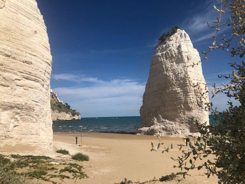
Apeneste, Lungomare Enrico Mattei, Vieste, Foggia, Italien
Camping Apeneste in Vieste. City campsite within walking distance of the limestone monolith and the historic old town.
In September €24 including electricity, V/E, showers, WiFi, dog. Mostly shady. Many restaurants and beach bars in the immediate vicinity. Corresponding background noise
Apulia 🇮🇹 Bella Italia | Gargano, Vieste, Castel del Monte | Italy by motorhome
https://youtu.be/cO4y23nYG1g
Lungomare Enrico Mattei, 42, 71019 Vieste FG, Italien
41° 52' 38.1" N 16° 10' 32.6" E
41.8772485 16.1757093
• Head toward Via Giovanni Giolitti on Lungomare Enrico Mattei. Go for 254 m.
• Turn left onto Via Pizzomunno. Go for 36 m.
• Turn right onto Via Sottotenente Girolamo De Maria. Go for 44 m.
• Turn right onto Via Ruggiero Bonghi. Go for 36 m.
• Turn right onto Lungomare Enrico Mattei. Go for 31.2 km.
• Continue on SS89. Go for 14.5 km.
• Take the 2nd exit from roundabout onto SS89 toward Autostrada/San Giovanni R.Do. Go for 4.5 km.
• Take the 2nd exit from roundabout onto SS89 toward Autostrada/Foggia/S. Giovanni R.Do/Manfredonia. Go for 9.3 km.
• Take ramp onto SS89 toward Manfredonia Sud. Go for 1.7 km.
• Turn right onto SP141. Go for 8.3 km.
• Take the 2nd exit from roundabout onto SP141. Go for 5.0 km.
• Turn right onto Strada Statale Rivolese (SS545) toward Autostrade/Cerignola/Foggia. Go for 12.2 km.
• Pass 2 roundabouts and continue on Strada Statale Rivolese (SS545). Go for 7.0 km.
• Take ramp onto A14 (Autostrada Adriatica) toward Bari. Go for 21.6 km.
• Take the exit toward Canosa onto SS93. Go for 827 m.
• Take ramp toward Minervino/SR6/Spinazzola. Go for 792 m.
• Continue on SR6. Go for 5.1 km.
• Take ramp onto SS98 (SP231). Go for 3.5 km.
• Take the 1st exit from roundabout onto SP149. Go for 1.7 km.
• Continue on Viale dei Condottieri (SP149). Go for 421 m.
• Continue on SP149. Go for 2.5 km.
• Continue on Contrada Iazzo Nuovo (SP149). Go for 3.2 km.
• Continue on Contrada Lama di Corvo (SP149). Go for 1.3 km.
• Continue on SP149. Go for 8.2 km.
• Continue on Contrada Piano di Citulo (SP149). Go for 1.6 km.
• Turn left onto SP234. Go for 4.2 km.
• Turn left onto SS170dir A. Go for 1.0 km.
• Turn left onto Via Castel del Monte (SP234a). Go for 921 m.
• Arrive at Via Castel del Monte (SP234a). Your destination is on the left.
☍
150,7 km
(1 hrs. 59 min.)
Castel del Monte, Strada Statale 170, Andria, Barletta-Andria-Trani, Italien
SS 170 dir A km 0.600, 76123 Andria BT, Italy
Parcheggio Camper Attrezata. Large car park with overnight accommodation, v/E and self-service pizzeria with canteen character
7€ parking (flat rate)
10€ overnight stay, without electricity
to the Castel del Monte it is about 1.5 km. Always along the road and easily doable on foot. If you want to get into the Castel, you need a ticket (7€)
The place isn't pretty, but it's only 50 km/1 hour from the port of Bari
Apulia 🇮🇹 Bella Italia | Gargano, Vieste, Castel del Monte | Italy by motorhome
https://youtu.be/cO4y23nYG1g
Contrada Castel del Monte Ex, Strada Statale 170, 76123 Andria BT, Italien
41° 5' 5.2" N 16° 16' 15.4" E
41.0847664 16.2709360
• Head west on Via Castel del Monte (SP234a). Go for 921 m.
• Turn right onto SS170dir A. Go for 1.0 km.
• Turn left onto SP234. Go for 9.3 km.
• Pass 2 roundabouts and continue on Strada Provinciale di Castel del Monte (SP234). Go for 6.7 km.
• Keep right onto Strada Provinciale di Castel del Monte (SP234) toward Ruvo di P. Centro/Bari. Go for 920 m.
• Continue on Strada Provinciale Andriese-Coratina (SP231). Go for 30.7 km.
• Keep left onto SS96. Go for 248 m.
• Continue on Via Bruno Buozzi. Go for 1.9 km.
• Take the 1st exit from roundabout. Go for 60 m.
• Continue on Strada Glomerelli. Go for 673 m.
• Continue on Strada San Giorgio Martire. Go for 226 m.
• Take the 3rd exit from roundabout onto Strada San Giorgio Martire. Go for 189 m.
• Continue on Via Giuseppe Sangiorgi. Go for 56 m.
• Take the 2nd exit from roundabout onto Via Giuseppe Sangiorgi. Go for 298 m.
• Turn left onto Traversa Prima Strada San Giorgio Martire. Go for 208 m.
• Continue on Strada San Giorgio Martire o San Serio. Go for 61 m.
• Continue on Strada San Giorgio Martire. Go for 371 m.
• Continue on Via Michele Cifarelli. Go for 610 m.
• Continue on Via Giuseppe Capruzzi. Go for 1.0 km.
• Arrive at Via Giuseppe Capruzzi. Your destination is on the right.
☍
55,6 km
( 43 min.)
Bari, Italien
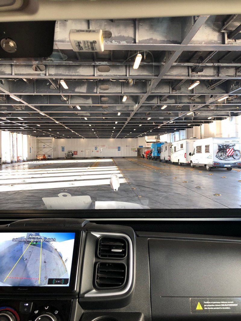
We take the ferry to Igoumenitsa/Greece and actually want to spend the winter.
But unfortunately we have an attempted break-in with a broken window on the first night in Greece and so we decide to return to Italy after 4 weeks and spend the winter there.
If you are interested in the trip to Greece, then simply subscribe to our YouTube channel. Then you will always get a notification about new travel reports. We would be pleased
👉 https://youtube.com/c/UnterwegsmitdenBeckers
41° 7' 1.7" N 16° 52' 18.7" E
41.1171432 16.8718715
• Head toward Corso Benedetto Croce on Via Giuseppe Capruzzi. Go for 83 m.
• Turn right onto Viale Unità d'Italia. Go for 90 m.
• Turn right onto Via Giuseppe Pisanelli. Go for 76 m.
• Turn right onto Corso Benedetto Croce. Go for 100 m.
• Turn left onto Via Giuseppe Capruzzi. Go for 1.1 km.
• Continue on Via Michele Cifarelli. Go for 610 m.
• Continue on Strada San Giorgio Martire. Go for 390 m.
• Continue on Strada San Giorgio Martire o San Serio. Go for 146 m.
• Continue on Traversa Prima Strada San Giorgio Martire. Go for 104 m.
• Turn right onto Via Giuseppe Sangiorgi. Go for 212 m.
• Take the 2nd exit from roundabout onto Via Giuseppe Sangiorgi. Go for 104 m.
• Continue on Strada San Giorgio Martire. Go for 83 m.
• Take the 1st exit from roundabout onto Strada San Giorgio Martire. Go for 243 m.
• Continue on Strada Glomerelli. Go for 706 m.
• Take the 2nd exit from roundabout onto Via Bruno Buozzi. Go for 2.0 km.
• Continue on SS96. Go for 283 m.
• Keep left onto SS96. Go for 3.7 km.
• Take ramp onto SS96 toward Altamura/Matera/Palo del Colle. Go for 52.3 km.
• Continue on Via Appia (SS7). Go for 27 m.
• Take ramp toward Matera Nord/Taranto. Go for 407 m.
• Turn slightly left onto Contrada La Vaglia (SS7) toward Matera Nord/Taranto. Go for 914 m.
• Take the 2nd exit from roundabout onto Via Appia (SS7) toward Autostrada/Taranto. Go for 2.3 km.
• Turn left onto Strada Provinciale Matera Gioia del Colle toward Gioia del Colle. Go for 23 m.
• Turn left onto Contrada Pedale della Madonna. Go for 284 m.
• Arrive at Contrada Pedale della Madonna. Your destination is on the right.
☍
66,3 km
( 44 min.)
Area camper kartodromo Matera, Matera, Italien
Open all year round (except Christmas)
Exceptional parking space on a former kart track. 25€ incl electricity, showers, fresh water, shuttle bus also incl
Very friendly owner. Perfect for visiting Matera.
More information in our video
Motorhome parking space 🇮🇹 Matera | Area Camper Kartodromo | also for caravans and tents | Italy
https://youtu.be/v44eqE8GrL0
Strada Statale 7 Via Appia km 582+538, 75100 Matera MT, Italien
40° 40' 49" N 16° 37' 27.2" E
40.6802787 16.6242256
• Head east on Contrada Pedale della Madonna. Go for 284 m.
• Turn right onto Strada Provinciale Matera Gioia del Colle. Go for 23 m.
• Turn left onto Via Appia (SS7). Go for 25.5 km.
• Take the 2nd exit from roundabout onto SP23 toward Taranto/SS100/Bari/Autostrada. Go for 7.3 km.
• Turn left onto Contrada San Basilio (SS100) toward Bari/Gioia del Colle. Go for 3.3 km.
• Turn right onto Strada Provinciale per Castellaneta (SP116) toward Noci. Go for 2.6 km.
• Continue on Strada Provinciale Noci Verso Castellaneta (SP116). Go for 11.9 km.
• Turn left and take ramp onto Strada Provinciale delle Grotte (SP237). Go for 1.1 km.
• Continue on Strada Provinciale di Alberobello (SS377). Go for 10.4 km.
• Turn right onto Via 7 Liberatori della Selva (SS604) toward Mottola/Taranto/Monopoli/Bari. Go for 195 m.
• Take the 3rd exit from roundabout onto Via Giuseppe Capecelatro. Go for 334 m.
• Continue on Via Don Francesco Gigante. Go for 30 m.
• Take the 1st exit from roundabout onto Via Don Francesco Gigante. Go for 215 m.
• Turn right. Go for 43 m.
• Turn left. Go for 26 m.
• Arrive at your destination.
☍
63,2 km
( 48 min.)
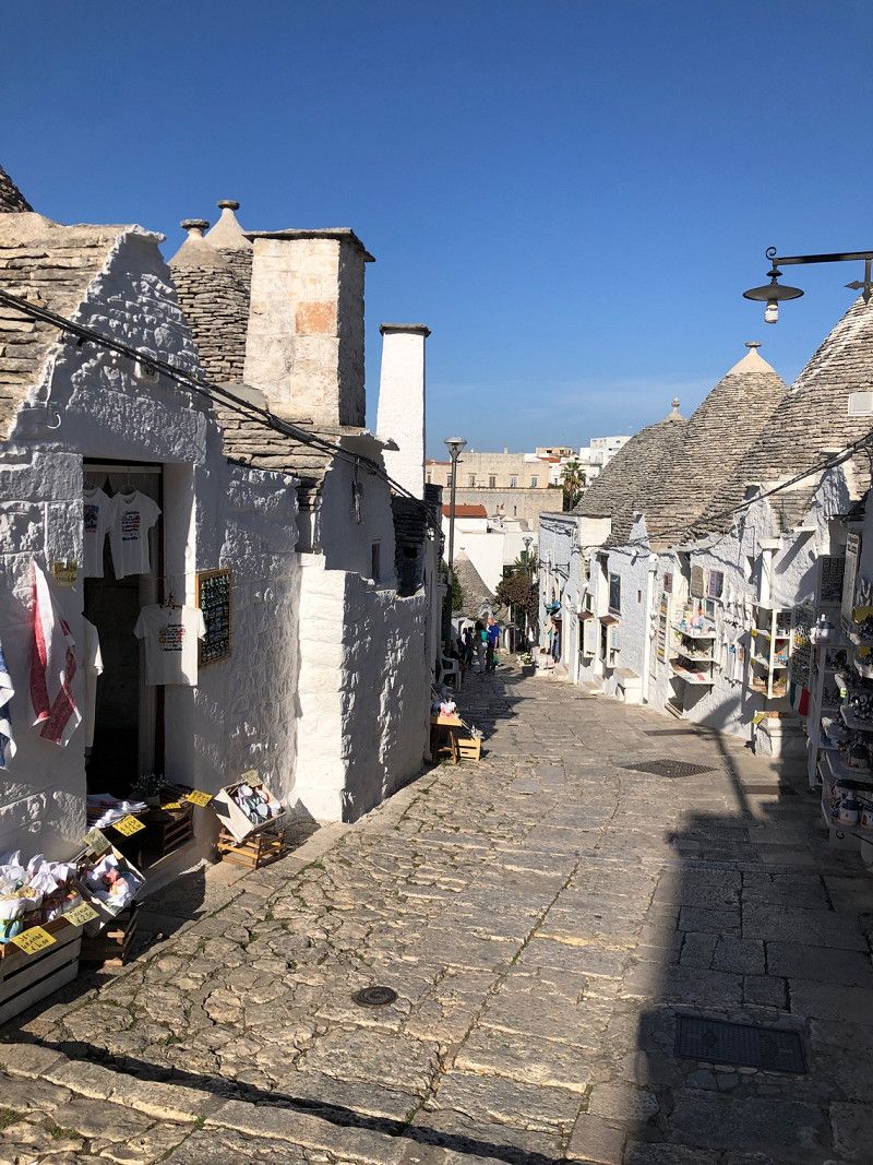
Parking "Nel Verde", Via Cadore, Alberobello, Bari, Italien
Town square with electricity and V/E, €20/24 hours
A few meters from the historic center
More impressions
Trulli in Apulia 🇮🇹From Alberobello via Locorotondo to Villanova | Italy with a camper & dog
https://youtu.be/lIZgFjGJ4cg
Via Cadore, 12, 70011 Alberobello BA, Italien
40° 46' 58" N 17° 14' 1" E
40.7827770 17.2336110
• Head west. Go for 26 m.
• Turn right toward Via Don Francesco Gigante. Go for 43 m.
• Turn left onto Via Don Francesco Gigante. Go for 35 m.
• Turn right onto Largo Michelangelo la Sorte. Go for 112 m.
• Turn right onto Via Alessandro Manzoni. Go for 181 m.
• Continue on Via Cesare Battisti. Go for 210 m.
• Continue on Corso Trento e Trieste. Go for 260 m.
• Turn right onto Via Vittime del Fascismo. Go for 114 m.
• Turn sharp left onto Viale Bari. Go for 347 m.
• Continue on Viale Putignano. Go for 283 m.
• Continue toward Strada Provinciale Monopoli-Alberobello/SP113. Go for 22 m.
• Take the 2nd exit from roundabout onto Strada Provinciale Monopoli-Alberobello (SP113) toward Coreggia/Monopoli/Fasano. Go for 291 m.
• Keep left toward Castellana G./Monopoli. Go for 58 m.
• Continue on Strada Provinciale Monopoli-Alberobello (SP113). Go for 3.8 km.
• Take the 1st exit from roundabout onto Strada Provinciale Barsento-Cavallerizza-Laureto (SP81) toward Putignano. Go for 4.3 km.
• Continue on SP1. Go for 3.7 km.
• Continue on SP2. Go for 713 m.
• Turn left onto SS172dir. Go for 2.1 km.
• Pass 2 roundabouts and continue on SS172dir. Go for 3.1 km.
• Take ramp onto Strada Statale Adriatica (SS16) toward Brindisi/SS379. Go for 2.9 km.
• Keep left onto Strada Statale di Egnazia (SS379) toward Brindisi/Lecce/Ostuni. Go for 17.7 km.
• Take ramp toward Villanova/Ostuni. Go for 98 m.
• Turn left toward Ostuni/Villanova. Go for 594 m.
• Take the 3rd exit from roundabout toward Bari/SS379/E55. Go for 617 m.
• Continue straight ahead. Go for 40 m.
• Take the 1st exit from roundabout. Go for 45 m.
• Continue on Via Consolato Veneziano. Go for 309 m.
• Turn right. Go for 42 m.
• Arrive at your destination on the left.
☍
42,1 km
( 35 min.)
Area Sosta Camper al Mare Ostuni "GETSEMANI", Via Consolato Veneziano, Villanova, Brindisi, Italien
Open all year
Very friendly reception. Currently 70 places, is currently being expanded.
€15 including electricity and a welcome bottle of wine.
Small village, bakery, supermarket, sea 500m away. Ostuni bus stop directly at the parking space
Cycle path along the coast to the nature reserve
There is more information about the parking space here
https://youtu.be/L2CVUbmSzwM
Via Consolato Veneziano, 72017 Villanova BR, Italien
40° 47' 15.3" N 17° 35' 19.6" E
40.7875881 17.5887829
• Head toward Via Consolato Veneziano. Go for 42 m.
• Turn left onto Via Consolato Veneziano. Go for 346 m.
• Take the 4th exit from roundabout toward Ostuni/SP70/Brindisi. Go for 539 m.
• Continue straight ahead. Go for 47 m.
• Take the 1st exit from roundabout toward Brindisi/SS379/E55. Go for 539 m.
• Turn right and take ramp onto Strada Statale di Egnazia (SS379) toward Brindisi/E55. Go for 33.5 km.
• Continue on Strada Statale Adriatica (SS16). Go for 4.4 km.
• Continue on SS613. Go for 32.6 km.
• Take ramp onto Tangenziale Ovest di Lecce (SS694) toward Tangenziale Ovest/Gallipoli/Galatina. Go for 10.0 km.
• Take ramp onto SS16 toward Maglie/S. M. di Leuca. Go for 11.0 km.
• Take ramp onto Strada Comunale Madonna delle Grazie toward Martignano. Go for 415 m.
• Continue on Strada Provinciale Sternatia Calimera Melendugno. Go for 1.5 km.
• Turn right onto Via Circonvallazione Sud (SP368) toward Otranto/Martano/Calimera. Go for 2.2 km.
• Take the 1st exit from roundabout onto Strada Provinciale Cavallino Caprarica Martano toward Martano. Go for 718 m.
• Continue on Strada Provinciale Cavallino Caprari-Martano. Go for 479 m.
• Continue on Strada Provinciale Cavallino Caprarica Martano (SP28). Go for 1.5 km.
• Take the 2nd exit from roundabout toward Borgagne/Otranto. Go for 593 m.
• Continue straight ahead. Go for 25 m.
• Take the 2nd exit from roundabout toward Otranto. Go for 1.2 km.
• Continue toward Strada Comunale di Borgagne/SP147. Go for 45 m.
• Take the 3rd exit from roundabout onto Strada Comunale di Borgagne (SP147) toward Otranto/Borgagne. Go for 5.5 km.
• Continue on Strada Comunale Martano (SP147). Go for 559 m.
• Continue on SP148. Go for 1.8 km.
• Turn right onto SP148. Go for 1.0 km.
• Continue on Strada Vicinale Sant'Andrea (SP148). Go for 133 m.
• Continue on SP148. Go for 3.7 km.
• Take the 1st exit from roundabout onto SP366 toward Otranto. Go for 214 m.
• Continue on Strada Comunale Vecchia Sant'Andrea (SS611). Go for 834 m.
• Arrive at Strada Comunale Vecchia Sant'Andrea (SS611). Your destination is on the left.
☍
115,3 km
(1 hrs. 10 min.)
Solara Camper Area, Villaggio Conca Specchiulla, Otranto, Lecce, Italien
We were all alone in the entire hotel complex in mid-Nov 22. There were no guests on either the pitch or the hotel/apartment complex. The reception was not manned. We left after one night.
€18 incl. electricity, plumbing.
Open all year. In November, however, the place was not particularly well maintained and, for example, the sports facility was not usable.
Villaggio Conca Specchiulla, 73028 Otranto LE, Italien
40° 14' 41.8" N 18° 26' 33.2" E
40.2449311 18.4425447
• Head south on Strada Comunale Vecchia Sant'Andrea (SS611). Go for 217 m.
• Turn left. Go for 72 m.
• Turn slightly left toward Via Palme. Go for 113 m.
• Turn right onto Via Palme. Go for 96 m.
• Turn sharp right toward Strada Comunale Vecchia Sant'Andrea/SS611. Go for 188 m.
• Turn right onto Strada Comunale Vecchia Sant'Andrea (SS611). Go for 1.0 km.
• Continue on SP366. Go for 189 m.
• Take the 3rd exit from roundabout onto SP148 toward Borgagne/Martano. Go for 3.8 km.
• Continue on Strada Vicinale Sant'Andrea (SP148). Go for 133 m.
• Continue on SP148. Go for 1.1 km.
• Turn left onto SP148. Go for 1.8 km.
• Turn slightly left onto Strada Comunale Martano (SP147). Go for 536 m.
• Continue on Strada Comunale Nuova Martano Borgagne (SP147). Go for 5.4 km.
• Take the 2nd exit from roundabout onto Strada Comunale di Borgagne (SP147) toward Martano. Go for 211 m.
• Continue on SP147. Go for 98 m.
• Take the 1st exit from roundabout onto Via Alcide De Gasperi. Go for 703 m.
• Continue on Via Goffredo Mameli. Go for 872 m.
• Turn left onto Via Fratelli Cervi. Go for 242 m.
• Turn right onto Via Soleto toward Galatina/Soleto/Lecce-Maglie/SS16. Go for 161 m.
• Take the 2nd exit from roundabout. Go for 63 m.
• Continue on Via Soleto (SP48). Go for 3.3 km.
• Continue on SP47. Go for 1.6 km.
• Take ramp onto SP367 toward Lecce. Go for 9.4 km.
• Continue on SS664. Go for 3.5 km.
• Take left ramp onto SS101 toward Gallipoli. Go for 25.6 km.
• Take ramp toward Gallipoli. Go for 382 m.
• Continue on Via Lecce toward Gallipoli. Go for 618 m.
• Turn right toward Strada Provinciale Gallipoli-Santa Maria al Bagno/SP108. Go for 157 m.
• Turn right onto Strada Provinciale Gallipoli-Santa Maria al Bagno (SP108). Go for 248 m.
• Arrive at Strada Provinciale Gallipoli-Santa Maria al Bagno (SP108).
☍
61,8 km
( 43 min.)
Agricampeggio & Glamping Torre Sabea, Gallipoli, Lecce, Italien
Very nice and green campsite. Family atmosphere, very well maintained, friendly owners.
Pool, restaurant, farm shop, bread service on site.
Sea across the street (rocks). Free shuttle to the beach. Shuttle to Gallipoli city 3€/person.
Famila supermarket 200m away
current winter offer (Oct22-May23) 400€/month including electricity and showers
https://youtu.be/2PsAbcCRBPE
Litoranea per Santa Maria al Bagno, SP108, 73014 Gallipoli LE, Italien
40° 4' 21.6" N 18° 0' 26.3" E
40.0726563 18.0073010
• Head north on Strada Provinciale Gallipoli-Santa Maria al Bagno (SP108). Go for 2.1 km.
• Continue on SP108. Go for 199 m.
• Take the 1st exit from roundabout onto SP108 toward S.Maria al B./Sannicola. Go for 919 m.
• Turn right onto SP194 toward Sannicola/Lecce/SS101/Porto Cesareo. Go for 1.3 km.
• Turn left. Go for 942 m.
• Continue toward Strada Provinciale 17/SP17. Go for 3.5 km.
• Continue toward Nardò. Go for 34 m.
• Take the 2nd exit from roundabout onto SP17 toward Nardò. Go for 1.0 km.
• Turn slightly left onto SP112 toward S.Isidoro/P.Cesareo/Taranto/S.Caterina/S.Maria al B. Go for 2.0 km.
• Continue toward Via Antonio Martano/SP112. Go for 16 m.
• Take the 2nd exit from roundabout onto Via Antonio Martano (SP112). Go for 9.9 km.
• Take the 2nd exit from roundabout onto Strada Provinciale Avetrana Gallipoli (SP112) toward Avetrana/Porto Cesareo. Go for 3.4 km.
• Continue on SP359. Go for 3.6 km.
• Pass 2 roundabouts and continue on SP359. Go for 4.7 km.
• Take the 2nd exit from roundabout onto SP359 toward Taranto. Go for 4.9 km.
• Turn left toward Maruggio. Go for 2.8 km.
• Continue on Strada Provinciale Tarantina (SP141). Go for 2.8 km.
• Take the 2nd exit from roundabout onto Strada Provinciale Tarantina (SP141). Go for 3.9 km.
• Continue on SP141. Go for 323 m.
• Continue on Strada Provinciale Tarantina (SP141). Go for 2.7 km.
• Continue toward SP137. Go for 33 m.
• Take the 2nd exit from roundabout toward Maruggio/Taranto. Go for 84 m.
• Continue on Strada Provinciale Tarantina (SP141). Go for 2.7 km.
• Continue toward SP141. Go for 54 m.
• Continue on Strada Provinciale Tarantina (SP141). Go for 2.0 km.
• Continue on Strada Provinciale Da Maruggio a Avetrana (SP141). Go for 2.2 km.
• Continue on Strada Provinciale Maruggio Avetrana (SP141). Go for 759 m.
• Continue on Via Virgilio. Go for 11 m.
• Continue on Via Crocifisso. Go for 177 m.
• Turn left onto Via Roma (SP136). Go for 112 m.
• Take the 1st exit from roundabout onto Via Vittorio Emanuele II (SP131) toward Torricella/Sava/Taranto. Go for 743 m.
• Turn right onto Strada Provinciale Taranto Maruggio (SP130) toward Sava/Torricella/Taranto. Go for 6.0 km.
• Take the 3rd exit from roundabout onto SP130. Go for 1.0 km.
• Continue on SP129 toward Monacizzo. Go for 1.1 km.
• Take the 1st exit from roundabout onto Via Taranto (SP129). Go for 1.1 km.
• Continue on Via Loreto (SP129). Go for 151 m.
• Keep right onto Via Loreto. Go for 114 m.
• Turn right onto Via Campofreddo (SP123). Go for 3.7 km.
• Continue on SP123 toward Lizzano/Pulsano. Go for 912 m.
• Continue on Contrada Porvica (SP123) toward Pulsano. Go for 2.1 km.
• Continue on SP123. Go for 100 m.
• Continue on Contrada Morrone (SP123). Go for 2.6 km.
• Continue on SP123. Go for 37 m.
• Continue on Contrada Morrone (SP123). Go for 980 m.
• Continue on Strada Provinciale Pulsano Monacizzo (SP123). Go for 2.2 km.
• Turn left onto Via Cornola. Go for 637 m.
• Turn left onto Viale Unità d'Italia. Go for 222 m.
• Turn sharp right onto Via Vittorio Emanuele (SP121). Go for 82 m.
• Turn left onto Viale Canne (SP120). Go for 2.0 km.
• Take the 1st exit from roundabout onto Via Litoranea Salentina (SP122) toward Taranto/Leporano. Go for 3.6 km.
• Arrive at Via Litoranea Salentina (SP122). Your destination is on the right.
☍
88,3 km
(1 hrs. 16 min.)
Sosta Camper Baia D'Argento, Via Litoranea Salentina, Leporano Marina, Tarent, Italien
Simple pitch, perfect for a stage stop. Fenced and gate with number code. €15 (in January 2023) including electricity, WiFi, VE
Chapter 4
https://youtu.be/CNkj3YXSfn
Via Litoranea Salentina, 4639, 74020 Leporano Marina TA, Italien
40° 21' 47.4" N 17° 19' 24.9" E
40.3631540 17.3235884
• Head toward Via Spari on Via Litoranea Salentina (SP122). Go for 2.3 km.
• Take the 2nd exit from roundabout onto Vai Litoranea Salentina (SP100). Go for 4.6 km.
• Take the 2nd exit from roundabout onto Via Mediterraneo (SP3). Go for 264 m.
• Take the 2nd exit from roundabout onto Via Mediterraneo (SP3) toward Lama/Taranto. Go for 1.3 km.
• Take the 1st exit from roundabout onto Via Vincenzo Martellotta. Go for 206 m.
• Continue on Viale Unità d'Italia (SP101). Go for 125 m.
• Turn left onto SP104 toward S.Giorgio/Faggiano. Go for 506 m.
• Continue toward S.Giorgio J./Lecce. Go for 28 m.
• Take the 2nd exit from roundabout onto Via Lago di Pergusa toward S.Giorgio J./Lecce. Go for 1.4 km.
• Take the 1st exit from roundabout onto Tangenziale Sud. Go for 592 m.
• Take left ramp onto Tangenziale Sud. Go for 4.9 km.
• Continue on SS7ter. Go for 5.7 km.
• Take ramp onto Via Appia (SS7) toward Taranto Porto/Bari/Taranto Tamburi/Autostrade/Reggio C. Go for 5.1 km.
• Take ramp onto Via Appia (SS7) toward Autostrada/A14/E55/Matera/Bari/SS100. Go for 809 m.
• Take the 1st exit from roundabout onto Via Appia (SS7) toward Bari. Go for 2.9 km.
• Take ramp toward Statte. Go for 402 m.
• Continue straight ahead. Go for 70 m.
• Take the 3rd exit from roundabout toward Bari/Taranto/SS106. Go for 221 m.
• Keep left toward Taranto. Go for 318 m.
• Continue straight ahead. Go for 66 m.
• Take the 2nd exit from roundabout toward Taranto. Go for 1.1 km.
• Keep left. Go for 1.3 km.
• Take the 2nd exit from roundabout toward Reggio C. Go for 234 m.
• Take ramp onto Strada Statale Jonica (SS106) toward Reggio C. Go for 80.4 km.
• Take ramp onto Via Raffaello Sanzio toward Montegiordano Nord. Go for 777 m.
• Continue on Corso della Vittoria (SS106). Go for 1.0 km.
• Continue on SS106. Go for 728 m.
• Continue on Via Nazionale (SS106). Go for 583 m.
• Continue on Località Gentile. Go for 415 m.
• Turn left and take ramp onto Via Nazionale (SS106). Go for 35.9 km.
• Continue on SS106radd. Go for 2.1 km.
• Keep left onto SS106radd. toward Reggio Calabria/Catanzaro/Corigliano C./Cosenza/Rossano/Calabro. Go for 6.7 km.
• Turn right onto Contrada Salice toward Zona Industriale Settore 4. Go for 154 m.
• Take the 4th exit from roundabout onto Contrada Salice. Go for 226 m.
• Turn left onto SS106radd. Go for 2.5 km.
• Turn right. Go for 2.4 km.
• Arrive at your destination.
☍
168,4 km
(2 hrs. 1 min.)
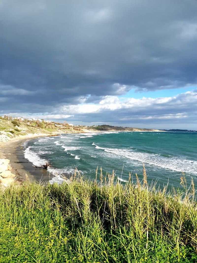
Campeggio Villaggio Onda Azzurra
Open all year round, many winterers. Great beach and adjacent forest.
A pack of dogs lives on the site. We saw at least 7 dogs and drove on after 1 night
Chapter 7
https://youtu.be/CNkj3YXSfn8
Contrada Foggia, 87064, Corigliano Rossano, Italien
39° 42' 14.6" N 16° 31' 32" E
39.7040600 16.5255600
• Head south. Go for 2.4 km.
• Turn right onto SS106radd. Go for 437 m.
• Turn left onto SP173 toward Thurio. Go for 1.9 km.
• Turn right. Go for 755 m.
• Turn right. Go for 287 m.
• Continue toward SP173. Go for 1.0 km.
• Turn left onto SP173. Go for 1.3 km.
• Turn right onto SS106radd. Go for 5.8 km.
• Pass 19 roundabouts and continue on Contrada Gangemi (SS106). Go for 81.6 km.
• Continue straight ahead. Go for 63 m.
• Take the 2nd exit from roundabout toward Crotone/Reggio C. Go for 93 m.
• Continue on Contrada Frasso. Go for 36 m.
• Keep right onto SS106 toward S. Nicola/Strongoli/Savelli/Verzino/Casabona/Pallagorio/Crotone. Go for 2.7 km.
• Continue toward Rocca di Neto/S.Giovanni in Fiore/Belvedere Spinello. Go for 31 m.
• Take the 2nd exit from roundabout onto SS106 toward Rocca di Neto/S.Giovanni in Fiore/Belvedere Spinello. Go for 4.5 km.
• Take the 3rd exit from roundabout onto SS106. Go for 5.3 km.
• Take left ramp onto Strada Statale Silana Crotonese (SS107) toward Crotone/SS106. Go for 1.3 km.
• Take the 2nd exit from roundabout onto SS106 toward Reggio Cal./Catanzaro/Crotone Centro. Go for 6.2 km.
• Take ramp toward Crotone Sud. Go for 477 m.
• Continue on Viale Mohandas Karamchand Gandhi. Go for 817 m.
• Take the 1st exit from Piazza Mohandas Karamchand Gandhi roundabout onto Via Gioacchino da Fiore (SP51). Go for 404 m.
• Take the 2nd exit from roundabout onto Via Nazioni Unite (SP51). Go for 10.8 km.
• Turn sharp right onto Via Astilo. Go for 738 m.
• Turn slightly left onto Via Astilo. Go for 760 m.
• Arrive at Via Astilo. Your destination is on the right.
☍
129,7 km
(2 hrs. 6 min.)
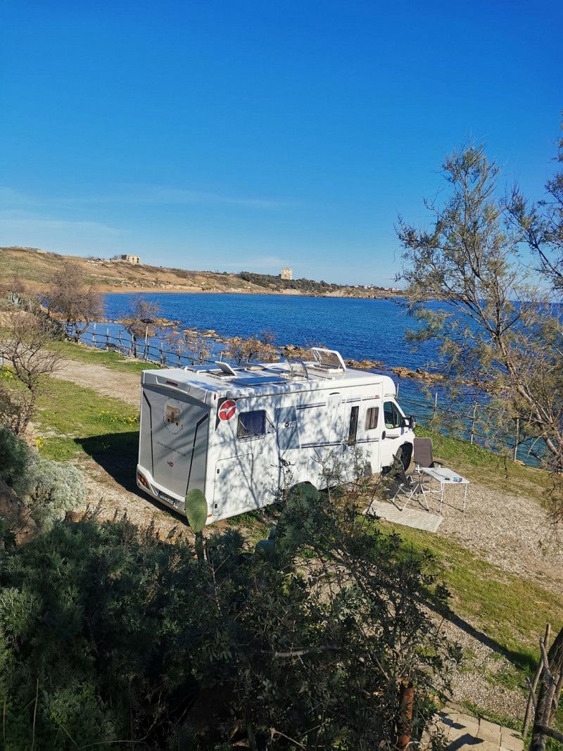
Camping Alfieri, Via Astilo, Crotone, Italien
We were the only motorhome in January 2023 and had the beach to ourselves. All facilities of the square were closed. 20€ including everything.
Fantastic location in the marine reserve
More about the campsite in our video https://youtu.be/7Np4M8c0Pbc
Via Astilo, 128, 88900 Crotone KR, Italien
39° 0' 51.5" N 17° 10' 39.7" E
39.0143060 17.1777040
• Head southwest on Via Astilo. Go for 1.5 km.
• Turn sharp left onto Via Olimpia (SP50). Go for 3.8 km.
• Turn left toward SP50. Go for 70 m.
• Continue on Via Dimante (SP50). Go for 980 m.
• Continue on SP50. Go for 541 m.
• Continue on Contrada Croci (SP50). Go for 915 m.
• Continue on SP50. Go for 633 m.
• Continue toward SP50. Go for 28 m.
• Take the 2nd exit from roundabout onto SP50. Go for 2.7 km.
• Continue on Via Capo delle Colonne (SP50). Go for 1.3 km.
• Turn right onto Via Crotone (SP46). Go for 368 m.
• Continue on SP46. Go for 874 m.
• Take the 2nd exit from roundabout onto Strada Statale Jonica (SS106) toward Catanzaro. Go for 2.1 km.
• Take the 1st exit from roundabout onto SS106 toward Reggio C./Catanzaro/A3. Go for 5.5 km.
• Take ramp. Go for 733 m.
• Take the 2nd exit from roundabout onto SP44. Go for 1.9 km.
• Continue on Strada Comunale Le Castella. Go for 94 m.
• Take the 2nd exit from roundabout onto Strada Comunale Le Castella. Go for 129 m.
• Continue on Via Duomo. Go for 359 m.
• Turn left onto Via A. M. Rigon. Go for 34 m.
• Arrive at Via A. M. Rigon.
☍
24,5 km
( 26 min.)
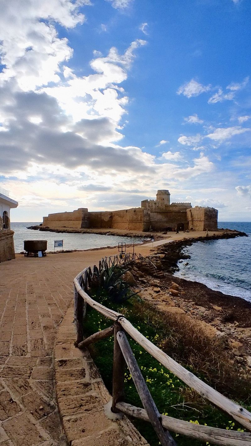
Le Castella, Crotone, Italien
Area Sosta Sun Bay
The pitch is right by the sea, has sanitary facilities, V/E, electricity. The pitches are on grass with a large stock of trees. In Jan 2023 the overnight stay costs 15€ including everything.
The small town of Le Castella is within walking distance.
SunBay Area Sosta Camper 🇮🇹
https://youtu.be/3fLius-KRhs
88841 Le Castella, Crotone, Italien
38° 54' 32.9" N 17° 1' 23" E
38.9091383 17.0230494
• Head toward Traversa 1 A. M. Rigon on Via A. M. Rigon. Go for 34 m.
• Continue on Via Roma. Go for 96 m.
• Turn right onto Via Vittoria. Go for 77 m.
• Turn slightly left onto Piazza Vittoria. Go for 49 m.
• Turn right onto Via del Lupo. Go for 438 m.
• Turn right toward Località Volandrino/SP43. Go for 80 m.
• Turn left onto Località Volandrino (SP43). Go for 2.5 km.
• Take the 3rd exit from roundabout onto SS106 toward Catanzaro. Go for 1.8 km.
• Pass 7 roundabouts and continue on Via Nazionale (SS106). Go for 30.7 km.
• Take the 1st exit from roundabout onto SP16 toward Salerno-Reggio C./A3/Catanzaro/Reggio C./SS106var/A. Go for 980 m.
• Take ramp toward Reggio C./SS106var/A/SA-RC/A3/Aeroporto. Go for 532 m.
• Continue on SS106var/A. Go for 18.0 km.
• Continue on Località Copanello Lido (SS106). Go for 13.2 km.
• Take the 2nd exit from roundabout onto SS106 toward Reggio C./Davoli/Catanzaro/SA-RC/A3. Go for 559 m.
• Pass 3 roundabouts and continue on Via Nazionale (SS106). Go for 40.3 km.
• Continue toward Via Nazionale/SS106. Go for 22 m.
• Take the 2nd exit from roundabout toward Reggio Cal. Go for 58 m.
• Continue on Via Nazionale (SS106). Go for 303 m.
• Turn sharp left toward Viale Mare Jonio. Go for 44 m.
• Turn right onto Viale Mare Jonio. Go for 209 m.
• Turn right onto Via Lungomare. Go for 506 m.
• Arrive at your destination on the right.
☍
110,5 km
(1 hrs. 41 min.)
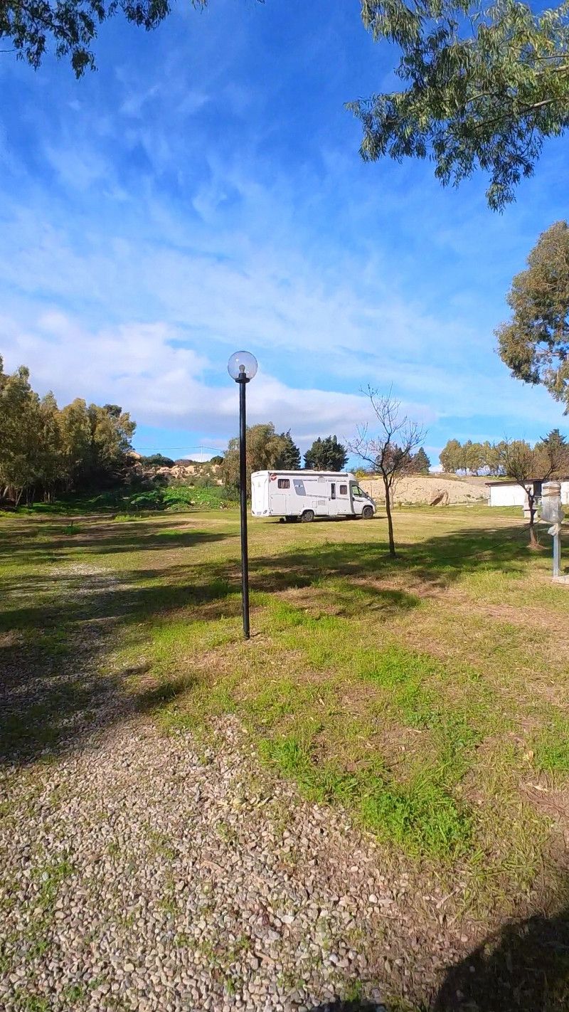
Camping Afrodite, Via Lungomare, Caulonia Marina, Reggio Calabria, Italien
Small family campsite right by the sea and beach promenade. Pizzeria right on the square, bike path to Roccella Ionica
Town center within walking distance. Good infrastructure with supermarket, pharmacy, medical center, pet shop, hairdresser, cafés, etc
There are no strays here, which is always an important criterion for us.
In Feb 2023 we paid €80/week including electricity
open all year
Marina di Caulonia 🇮🇹
https://youtu.be/ojHrTjTBkFo
Via Lungomare, Sud, 89040 Caulonia Marina RC, Italien
38° 20' 19.6" N 16° 27' 42.9" E
38.3387781 16.4619081
• Head northeast. Go for 258 m.
• Continue on Via Lungomare. Go for 248 m.
• Turn left onto Viale Mare Jonio. Go for 209 m.
• Turn right toward Via Nazionale/SS106. Go for 34 m.
• Turn right onto Via Nazionale (SS106). Go for 252 m.
• Take the 2nd exit from roundabout onto Largo Castelvetere (SP88) toward Reggio Cal. Go for 180 m.
• Take the 2nd exit from roundabout onto Via Castelvetere (SP88). Go for 4.6 km.
• Continue on Via Carrubara (SP88). Go for 461 m.
• Continue on Contrada Vasì (SP88). Go for 1.2 km.
• Continue on SP88. Go for 684 m.
• Continue on Via Giuseppe Protospataro (SP88). Go for 389 m.
• Continue on Via Giuseppe Mazzini (SP88). Go for 265 m.
• Continue on Via Roma (SP88). Go for 39 m.
• Continue on Via Tripoli (SP88). Go for 47 m.
• Turn left onto Via Roma (SP88). Go for 337 m.
• Turn left toward Via Vallone. Go for 10 m.
• Turn right onto Via Vallone. Go for 35 m.
• Arrive at Via Vallone. Your destination is on the left.
☍
9,2 km
( 13 min.)
Caulonia, Reggio Calabria, Italien
With a rental car, organized by Camping Afrodite, we drive to Caulonia. The old town should be worth seeing. We were not so enthusiastic and found the narrow, dark streets rather oppressive. Then it was on to Stilo
Stilo and Caulonia |
https://youtu.be/rOMWPIMcNDY
89041 Caulonia, Reggio Calabria, Italien
38° 22' 50.4" N 16° 24' 34.5" E
38.3806793 16.4095860
• Head east on Via Vallone. Go for 35 m.
• Turn left toward Via Roma/SP88. Go for 10 m.
• Turn right onto Via Roma (SP88). Go for 337 m.
• Turn right onto Via Tripoli (SP88). Go for 47 m.
• Continue on Via Roma (SP88). Go for 39 m.
• Continue on Via Giuseppe Mazzini (SP88). Go for 265 m.
• Continue on Via Giuseppe Protospataro (SP88). Go for 389 m.
• Turn right onto SP88. Go for 684 m.
• Continue on Contrada Vasì (SP88). Go for 1.2 km.
• Continue on Via Carrubara (SP88). Go for 461 m.
• Continue on Via Castelvetere (SP88). Go for 4.6 km.
• Take the 2nd exit from roundabout onto Via Castelvetere (SP88). Go for 132 m.
• Take the 2nd exit from roundabout onto Via Nazionale (SS106) toward Catanzaro. Go for 13.1 km.
• Turn slightly left onto Via Nazionale (SS110) toward Stilo/Pazzano/Bivongi/Serra S. Bruno. Go for 935 m.
• Turn left onto Via Nazionale (SS110). Go for 11.3 km.
• Turn right toward Strada Comunale Stilo Nipitino. Go for 707 m.
• Turn sharp right onto Strada Comunale Stilo Nipitino. Go for 502 m.
• Turn right onto Viale Roma (SS110). Go for 36 m.
• Arrive at Viale Roma (SS110). Your destination is on the left.
☍
34,7 km
( 37 min.)
Stilo, Reggio Calabria, Italien
Stilo is part of the Association of the Most Beautiful Villages in Italy and is well worth a visit.
Stilo and Caulonia |
https://youtu.be/rOMWPIMcNDY
89049 Stilo RC, Italien
38° 28' 38.2" N 16° 28' 7.5" E
38.4772870 16.4687502
• Head toward Piazza Luigi Carnovale on Viale Roma (SS110). Go for 36 m.
• Turn left onto Strada Comunale Stilo Nipitino. Go for 355 m.
• Turn left. Go for 386 m.
• Turn left toward SS110. Go for 250 m.
• Turn left onto SS110. Go for 11.3 km.
• Turn right onto Via Nazionale (SS110). Go for 910 m.
• Turn right onto Via Nazionale (SS106). Go for 13.1 km.
• Continue toward Via Nazionale/SS106. Go for 22 m.
• Take the 2nd exit from roundabout toward Reggio Cal. Go for 58 m.
• Continue on Via Nazionale (SS106). Go for 2.8 km.
• Take the 1st exit from roundabout onto SS106 Var/B toward SA-RC/A3/Reggio Cal./SS682/Rosarno. Go for 12.9 km.
• Continue on SS106 Var/B. Go for 10.2 km.
• Take ramp. Go for 228 m.
• Take the 1st exit from roundabout onto SP80 toward SA-RC/A3/Ta-Rc/SS106/Locri-Gerace. Go for 322 m.
• Take the 2nd exit from roundabout onto Contrada Canneti (SP80) toward Reggio C./SS106/Locri-Gerace. Go for 820 m.
• Turn right onto Strada Provinciale toward Reggio C./SS106. Go for 1.3 km.
• Turn right onto Via Cristoforo Colombo (SS106) toward Reggio C. Go for 1.7 km.
• Take the 2nd exit from roundabout onto Contrada Parapezzi (SS106). Go for 42.6 km.
• Take the 1st exit from roundabout. Go for 120 m.
• Continue on Variante di Palizzi (SS106VarD). Go for 3.7 km.
• Continue on SS106. Go for 4.4 km.
• Turn sharp left toward Contrada S. Zaccaria. Go for 48 m.
• Continue on Via Risorgimento. Go for 127 m.
• Turn right onto Via Delia. Go for 38 m.
• Turn left onto Via Antonio Zappia. Go for 103 m.
• Turn left onto Corso Umberto I. Go for 65 m.
• Arrive at Corso Umberto I. Your destination is on the right.
☍
107,9 km
(1 hrs. 35 min.)
Bova Marina, Reggio Calabria, Italien
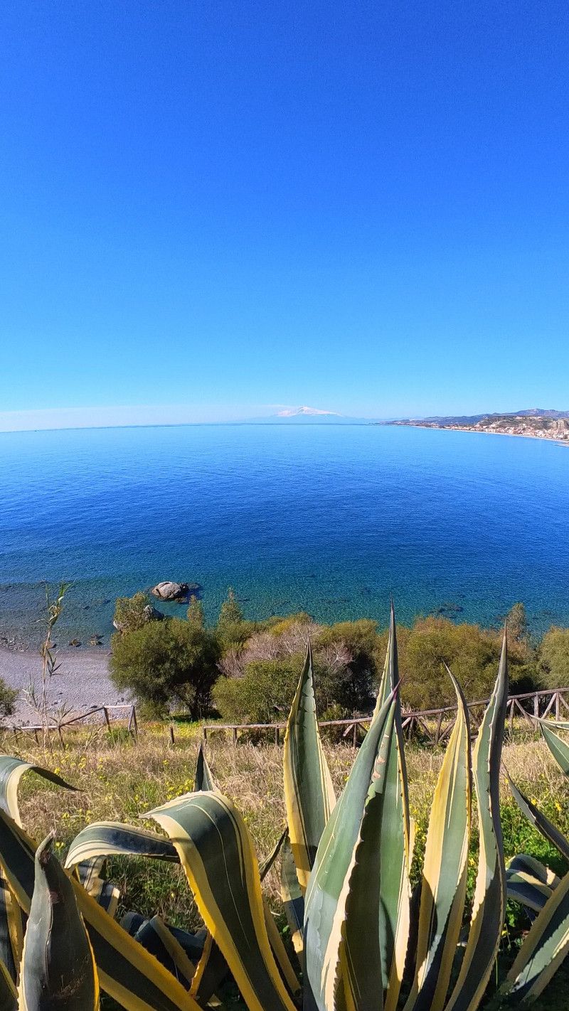
Great view of Mount Etna.
🇮🇹 Gerace and Bova |
https://youtu.be/QCp9ZSxGAIA
89035 Bova Marina, Reggio Calabria, Italien
37° 55' 49.6" N 15° 55' 28.6" E
37.9304476 15.9245973
• Head east on Corso Umberto I.
• Arrive at Corso Umberto I. Your destination is on the right.
☍
Distance not available
(Duration not available)
Bova Marina, Reggio Calabria, Italien
Bova is more than 800m above sea level and belongs to the association of the most beautiful villages in Italy. We really liked the small village with only 400 inhabitants. Access to Bova can be quite challenging for motorhomes. There are no parking facilities in the town itself.
🇮🇹 Gerace and Bova |
https://youtu.be/QCp9ZSxGAIA
89035 Bova Marina, Reggio Calabria, Italien
37° 55' 49.6" N 15° 55' 28.6" E
37.9304476 15.9245973
• Head east on Corso Umberto I.
• Turn left onto Via 20 Settembre. Go for 19 m.
• Turn left onto Via Monsignor Dalmazio d'Andrea. Go for 67 m.
• Turn right onto Via Antonio Zappia. Go for 87 m.
• Turn right onto Via Delia. Go for 38 m.
• Turn left onto Via Risorgimento. Go for 127 m.
• Continue toward SS106. Go for 48 m.
• Turn sharp right onto SS106. Go for 4.4 km.
• Continue on Variante di Palizzi (SS106VarD). Go for 3.8 km.
• Take the 2nd exit from roundabout onto Via Nazionale (SS106) toward Taranto. Go for 42.5 km.
• Take the 1st exit from roundabout onto Strada Statale Jonica (SS106). Go for 1.7 km.
• Turn left onto Strada Provinciale toward SA-RC/A3/Taranto/SS106/Antonimina/Centro/SS111/Canolo. Go for 1.3 km.
• Turn right onto Contrada Canneti (SP80) toward Locri-Gerace. Go for 164 m.
• Turn left onto Strada Provinciale di Gioia Tauro e Locri (SS111) toward Ospedale di Locri. Go for 7.3 km.
• Arrive at Strada Provinciale di Gioia Tauro e Locri (SS111). Your destination is on the left.
☍
61,7 km
(1 hrs. 2 min.)
Gerace, Reggio Calabria, Italien
Gerace belongs to the association of the most beautiful villages in Italy. Here is the largest cathedral in Calabria and through the old city gates you have a wonderful view of the Ionian Sea.
We were the only tourists in February 23.
At the entrance to the village there is a Sosta Camper including a shuttle into town. Closed in Feb.
🇮🇹 Gerace and Bova |
https://youtu.be/QCp9ZSxGAIA
89040 Gerace, Reggio Calabria, Italien
38° 16' 19.3" N 16° 13' 18.4" E
38.2720214 16.2217871
• Head north on Strada Provinciale di Gioia Tauro e Locri (SS111). Go for 24.6 km.
• Turn sharp right onto Via Giuseppe Garibaldi. Go for 31 m.
• Turn left onto Viale Giacomo Matteotti. Go for 52 m.
• Turn slightly right onto Via Giovanni Amendola. Go for 297 m.
• Turn left onto Viale Merano. Go for 973 m.
• Continue on SP33. Go for 3.2 km.
• Continue on Contrada Pozzo Secco (SP33). Go for 1.2 km.
• Continue on Contrada Vutamo (SP33). Go for 1.4 km.
• Continue on Contrada Feudotti (SP33). Go for 1.8 km.
• Continue on Contrada Abessi (SP33). Go for 635 m.
• Continue on Contrada Russo (SP33). Go for 104 m.
• Take the 1st exit from roundabout onto SP40. Go for 427 m.
• Continue on Contrada Audelleria (SP40). Go for 1.8 km.
• Continue on SP40. Go for 348 m.
• Continue on Contrada Ficarella (SP40). Go for 527 m.
• Continue on SP40. Go for 463 m.
• Continue on Contrada Bosco Selvatico (SP40). Go for 896 m.
• Continue on SP40. Go for 643 m.
• Continue on Bosco 2 (SP40). Go for 843 m.
• Continue on SP40. Go for 226 m.
• Continue on Contrada Nespolaro. Go for 1.1 km.
• Continue on Strada Provinciale Quaranta. Go for 1.7 km.
• Continue on Via Antonio De Curtis. Go for 90 m.
• Continue on Strada Provinciale Quaranta. Go for 71 m.
• Continue on Via Provinciale (SS281). Go for 575 m.
• Continue on Via Rizziconi (SS281). Go for 41 m.
• Continue on Via Provinciale (SS281). Go for 15 m.
• Take the 1st exit from roundabout onto Via Provinciale (SS281). Go for 362 m.
• Take the 2nd exit from roundabout onto Via Nazionale (SS18) toward Tropea/Vibo Valentia. Go for 749 m.
• Turn right onto Via Nazionale (SS18). Go for 173 m.
• Turn left onto Strada Comunale per Nicotera toward Nicotera. Go for 455 m.
• Continue on Strada Provinciale per Rosarno (SP48). Go for 1.9 km.
• Turn left onto SP48/SP49. Go for 38 m.
• Turn right onto Località Forestella (SP48). Go for 104 m.
• Continue on SP48. Go for 1.4 km.
• Turn left onto Località Sovereto (SP34). Go for 1.2 km.
• Continue on SP34. Go for 168 m.
• Turn left onto SP35. Go for 1.9 km.
• Continue on Viale Madonna delle Grazie (SP35). Go for 1.3 km.
• Continue on SP35. Go for 57 m.
• Continue on Viale Madonna delle Grazie (SP35). Go for 1.5 km.
• Continue on Via Madonna della Grazie (SP35). Go for 158 m.
• Turn left toward Viale della Madonna/SP23. Go for 986 m.
• Turn right onto Viale della Madonna (SP23). Go for 990 m.
• Turn left onto SP29. Go for 3.5 km.
• Continue on Strada Provinciale di Itala Croce (SP29). Go for 1.0 km.
• Continue on SP29. Go for 5.7 km.
• Continue on Contrada Corigliano (SP29). Go for 174 m.
• Continue on SP29. Go for 1.8 km.
• Turn left onto SP17. Go for 15.5 km.
• Continue on Viale Pietro I Ruffo di Calabria (SP17). Go for 55 m.
• Continue on Viale Pietro I Ruffo di Calabria (SP17). Go for 152 m.
• Turn right onto Via degli Orti. Go for 59 m.
• Turn left onto Via degli Orti. Go for 44 m.
• Turn right onto Via degli Orti. Go for 69 m.
• Turn left onto Via Carmine. Go for 234 m.
• Turn right onto Largo San Michele. Go for 14 m.
• Turn right onto Discesa Belisario. Go for 614 m.
• Turn left toward Via Marina dell'Isola. Go for 12 m.
• Turn slightly left onto Via Marina dell'Isola. Go for 586 m.
• Turn right. Go for 29 m.
• Arrive at your destination on the left.
☍
86,9 km
(1 hrs. 57 min.)
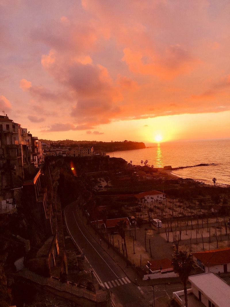
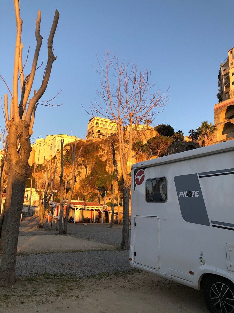
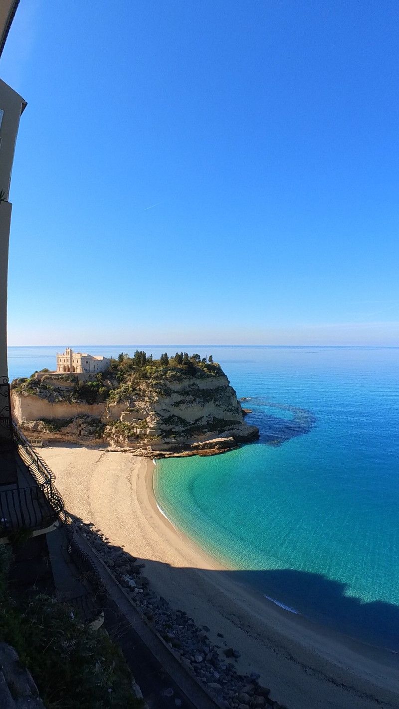
Da Ciccio Parking, dell'Isola, Via Lungomare, Tropea, Vibo Valentia, Italien
Very central parking space, open all year round. Located between the sea and the stairs to the old town.
Tropea belongs to the association of the most beautiful villages in Italy and is really worth seeing, even if a good 90% of all shops and restaurants were closed in February 23.
Space costs €18 including electricity (February 2023), showers €0.50
€40 in high season
More about Tropea in our travel report https://youtu.be/j7ngCYYRIuk
dell'Isola, Via Lungomare, 86861 Tropea VV, Italien
38° 40' 42.6" N 15° 53' 41.6" E
38.6785126 15.8949000
• Head toward Via Marina dell'Isola. Go for 29 m.
• Turn right onto Via Marina dell'Isola. Go for 486 m.
• Continue on Via Marina del Convento. Go for 761 m.
• Turn right onto Viale Don Mottola (SP20). Go for 861 m.
• Take the 2nd exit from roundabout onto Viale Don Mottola (SP20). Go for 511 m.
• Continue on SP20. Go for 1.7 km.
• Turn right toward SP20. Go for 34 m.
• Turn right onto Strada Provinciale Drapia Ciaramiti (SP20). Go for 1.2 km.
• Turn left onto Strada Provinciale Spilinga Tropea (SP22). Go for 2.3 km.
• Turn left onto Strada Provinciale Spilinga Tropea (SP22). Go for 1.9 km.
• Turn right onto Viale Giuseppe Berto. Go for 1.2 km.
• Turn right onto Contrada Torre Tore. Go for 640 m.
• Turn slightly right onto Contrada Torre Tore. Go for 182 m.
• Continue on Contrada Punta Tono. Go for 434 m.
• Arrive at Contrada Punta Tono. Your destination is on the right.
☍
12,2 km
( 21 min.)
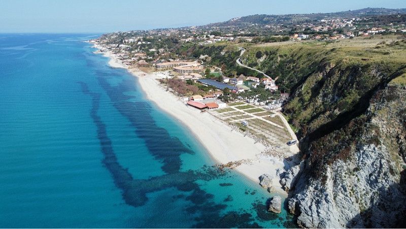
Campeggio La Scogliera
Camping in a fantastic location right by the sea. Open all year.
Simple sanitary facilities, restaurant on site (closed in February)
Space is completely spanned except for three spaces in the rear area, height max 3.50. Problematic for larger vehicles.
During our stay, the owner's two large dogs were running around the property unsupervised. That was a problem for our dog.
23€ incl electricity (February 2023)
contrada punta tono 1, 89865, San Nicolo` di Ricadi Capo Valticano, Italien
38° 37' 37.3" N 15° 49' 50.3" E
38.6270300 15.8306400
• Head northeast on Contrada Punta Tono. Go for 434 m.
• Continue on Contrada Torre Tore. Go for 822 m.
• Turn left onto Viale Giuseppe Berto. Go for 1.1 km.
• Turn right onto Viale G. Berto (SP22). Go for 2.5 km.
• Turn right onto Via Monaci. Go for 809 m.
• Continue on Strada Provinciale Spilinga Tropea (SP22). Go for 916 m.
• Continue on SP22. Go for 241 m.
• Take the 2nd exit from roundabout. Go for 450 m.
• Continue on Strada Provinciale Ventidue. Go for 1.9 km.
• Continue on Via Michele Pugliese. Go for 1.2 km.
• Continue on SP22. Go for 6.3 km.
• Turn right onto SP17. Go for 9.6 km.
• Turn left onto Via Nazionale (SS18). Go for 4.3 km.
• Take ramp. Go for 92 m.
• Turn slightly right onto Via Lacquari. Go for 790 m.
• Continue toward Via Renato Guttuso. Go for 43 m.
• Take the 2nd exit from Largo Renato Guttuso roundabout onto Via Renato Guttuso. Go for 837 m.
• Turn right onto Viale Cassiodoro. Go for 456 m.
• Take the 1st exit from roundabout onto Viale Emanuele Bucciarelli (SS18). Go for 222 m.
• Take the 3rd exit from roundabout onto Viale della Pace (SS606). Go for 2.4 km.
• Take the 2nd exit from roundabout onto Via Giustino Fortunato (SS606). Go for 802 m.
• Take the 2nd exit from roundabout toward Vibo V.Sud/Tropea/S.Onofrio. Go for 98 m.
• Turn right onto SS606. Go for 3.0 km.
• Take the 1st exit from roundabout onto SP5 toward Salerno-Reggio C./A3. Go for 676 m.
• Turn left and take ramp onto A2 (Autostrada del Mediterraneo) toward SA-RC/A3/Salerno. Go for 44.8 km.
• Take the exit toward Falerna/Nocera T./SP164. Go for 512 m.
• Take the 2nd exit from roundabout onto SS18dir toward Falerna/Gizzeria/Amantea/Paola. Go for 829 m.
• Turn right onto Località Cartolano (SS18) toward Salerno/Amantea/Paola. Go for 14.5 km.
• Pass 2 roundabouts and continue on Strada Statale Tirrena Inferiore (SS18). Go for 27.6 km.
• Take the 2nd exit from roundabout. Go for 76 m.
• Continue on Via della Civiltà (SS18). Go for 1.3 km.
• Take the 1st exit from roundabout onto Via della Civiltà (SS18). Go for 1.9 km.
• Take the 3rd exit from roundabout onto Strada Statale Tirrena Inferiore (SS18). Go for 41.3 km.
• Take the 2nd exit from roundabout onto Strada Statale Tirrena Inferiore (SS18). Go for 563 m.
• Turn right toward C.da Pietrarossa/C.da Cucco/C.da Cammarotea/C.da Lauro/C.da Sagarote. Go for 79 m.
• Turn right. Go for 82 m.
• Turn right toward Viale Glauco/SP15. Go for 313 m.
• Turn left onto Viale Glauco (SP15). Go for 16 m.
• Arrive at Viale Glauco (SP15). Your destination is on the right.
☍
173,9 km
(2 hrs. 36 min.)
Lido Tropical - Sosta Camper
Parking space close to the center, open all year round.
Pitches on grass or sand (first row with sea view). Water, electricity and gray water on site. Small sanitary building, showers €1, fenced dog area and dog shower, restaurant/pizzeria on site.
In winter Oct-Mar 10€ incl. electricity, V/E, WLAN
The place is only 700m from the center. This is easy to reach on foot. However, the railway line runs directly behind the square. The train traffic is sometimes very loud.
More about this in our video about the parking space https://youtu.be/-7dMSEPu7Ao
Viale Glauco 9, 87023, Diamante, Italien
39° 41' 30.6" N 15° 48' 54" E
39.6918200 15.8149900
• Head north on Viale Glauco (SP15). Go for 1.5 km.
• Continue on Viale Parthenius (SP15). Go for 752 m.
• Keep right onto Viale Parthenius. Go for 49 m.
• Take the 2nd exit from roundabout onto Via Piane (SS18). Go for 2.2 km.
• Pass 3 roundabouts and continue on Corso Mediterraneo (SS18). Go for 58.2 km.
• Take left ramp onto A2 (Autostrada del Mediterraneo) toward Salerno. Go for 92.5 km.
• Take the exit toward Eboli/Ospedale. Go for 616 m.
• Continue on Via San Vito Martire (SP30). Go for 2.8 km.
• Pass 2 roundabouts and continue on Via Provinciale del Cornito (SP30). Go for 8.0 km.
• Take the 3rd exit from roundabout onto Viale Paestum (SS18). Go for 3.7 km.
• Pass 2 roundabouts and continue on Strada Statale Tirrena Inferiore (SS18). Go for 10.3 km.
• Take ramp onto Via Magna Grecia (SS18) toward Ogliastro/Giungano/Prignano/Cicerale. Go for 2.1 km.
• Turn left onto Via Nettuno (SP189). Go for 286 m.
• Turn left onto Via Licinella (SP278). Go for 1.6 km.
• Turn right onto Via Michelangelo Buonarroti. Go for 22 m.
• Arrive at Via Michelangelo Buonarroti. Your destination is on the right.
☍
184,4 km
(2 hrs. 13 min.)
Camping Villaggio dei Pini
Very green campsite located in a pine forest. Open all year.
In addition to around 130 RV sites, there are also bungalows on the site.
Winter offer: €13 for a 1-week stay (plus €1 visitor's tax), otherwise €25
Nearby there is a buffalo farm with very tasty buffalo mozzarella and ricotta cake, fresh pasta at Massimo, patisserie and 2km away the archaeological center of Paestum.
Via Torre, 84047, Paestum, Italien
40° 24' 14.3" N 15° 0' 3.5" E
40.4039700 15.0009700
• Head toward Via Giacomo Leopardi on Via Michelangelo Buonarroti. Go for 22 m.
• Turn left onto Via Licinella (SP278). Go for 1.6 km.
• Turn left onto Via Nettuno (SP189). Go for 665 m.
• Turn right onto Via Porta Marina (SP276). Go for 1.2 km.
• Take the 2nd exit from roundabout onto Via Laura (SP175). Go for 1.8 km.
• Take the 1st exit from roundabout onto Via Laura (SP175). Go for 3.6 km.
• Turn slightly left onto Via Foce Sele (SP175). Go for 583 m.
• Take the 1st exit from roundabout onto Via Foce Sele (SP175). Go for 8.0 km.
• Take the 1st exit from roundabout onto Via Campolongo (SP262). Go for 517 m.
• Continue on SP262. Go for 1.6 km.
• Take the 3rd exit from roundabout onto Via San Berniero (SP417). Go for 2.3 km.
• Take the 2nd exit from roundabout onto Località Aversana (SP417). Go for 80 m.
• Continue on SP417. Go for 161 m.
• Continue on Via Orto Grande (SP417). Go for 2.9 km.
• Take the 2nd exit from roundabout onto Via Orto Grande (SP417). Go for 2.1 km.
• Take the 2nd exit from roundabout onto Via Lago Laceno (SP417). Go for 1.7 km.
• Pass 6 roundabouts and continue on Strada Provinciale Aversana (SP417). Go for 4.2 km.
• Take the 1st exit from roundabout onto Tangenziale (SS18) toward Salerno/A3/Reggio C. Go for 1.8 km.
• Keep left toward Salerno Est/Autostrade/Pontecagnano. Go for 281 m.
• Keep left toward Autostrade. Go for 689 m.
• Take left ramp onto A2 (Autostrada del Mediterraneo) toward Salerno/A3. Go for 10.1 km.
• Take the exit toward Roma/A30/Avellino/Caserta onto A2 (Autostrada del Mediterraneo). Go for 8.8 km.
• Keep left onto A30 (Autostrada Caserta-Salerno) toward Caserta/Roma/A1. Go for 54.8 km.
• Take the exit toward Roma/E45/Caserta Nord onto A1 (Autostrada del Sole). Go for 97.0 km.
• Take the exit toward Ceprano. Go for 870 m.
• Take the 3rd exit from roundabout onto Via Caragno (SP16) toward Arpino/Falvaterra/Monte S. Giovanni/Campano/Arce/Itri. Go for 245 m.
• Continue on Via Caragno (SP16). Go for 1.6 km.
• Take the 2nd exit from roundabout onto Strada Provinciale Braccio Stazione Ceprano (SP2) toward Falvaterra/Ceprano Scalo. Go for 395 m.
• Turn right onto Via Campo Uccelli (SP205). Go for 25 m.
• Turn slightly left onto Via Padre Domenico Passionista (SP205). Go for 145 m.
• Arrive at Via Padre Domenico Passionista (SP205). Your destination is on the right.
☍
209,8 km
(2 hrs. 2 min.)
Ceprano, Italien
Area Sosta Le Whole
Good stage location, directly near the motorway. However, this cannot be heard through the soundproof walls.
The parking spaces are rather narrow, larger vehicles can be accommodated in the rear area. Fresh water on site and a small sanitary building with 1 shower, toilet, sink. There is a small bar/restaurant on site.
NO walkie opportunities. Right next door are 3 herding dogs defending their territory. We would not approach the place again.
Overnight stay including electricity €20
Ceprano, 03024, Italien
41° 32' 25.5" N 13° 30' 43.9" E
41.5404180 13.5122050
• Head southwest on Via Padre Domenico Passionista (SP205). Go for 29 m.
• Turn right toward Via Caragno. Go for 377 m.
• Continue on Via Caragno. Go for 579 m.
• Turn left onto Via Caragno (SP16). Go for 919 m.
• Take ramp onto A1 (Autostrada del Sole) toward Roma-Napoli/Roma. Go for 271 km.
• Take the exit toward Monte S. Savino. Go for 690 m.
• Turn left onto Localita la Valle (SP25) toward Monte San Savino/Lucignano/Arezzo/Siena. Go for 981 m.
• Turn right and take ramp onto Strada di Grande Comunicazione Grosseto-Fano (E78) toward Arezzo. Go for 13.2 km.
• Keep right onto Ripa dell'Olmo (SS73) toward Arezzo. Go for 1.7 km.
• Pass 2 roundabouts and continue on Strada Statale Senese Aretina (SS73). Go for 28.8 km.
• Take the 2nd exit from roundabout onto Strada Provinciale di Caprese Michelangelo (SP47) toward Anghiari/Caprese Michelangelo. Go for 3.6 km.
• Turn left onto Via della Fossa. Go for 287 m.
• Turn right onto Via della Fossa. Go for 132 m.
• Arrive at Via della Fossa. Your destination is on the right.
☍
322,7 km
(2 hrs. 50 min.)
Agriturismo Val della Pieve, Via della Fossa, Anghiari, Arezzo, Italien
Beautiful agricamper for 8 mobile homes. Great view
Overnight stay 20€ including electricity, showers, V/E WiFi
The town of Anghiari is within walking distance and has a typical Tuscan flair
Via della Fossa, 8, 52031 Anghiari AR, Italien
43° 32' 11.6" N 12° 3' 3.6" E
43.5365620 12.0509871
• Head southeast on Via della Fossa. Go for 132 m.
• Turn left onto Via della Fossa. Go for 287 m.
• Turn left onto Via del Campo della Fiera (SP47). Go for 345 m.
• Turn right onto Via della Libbia (SP43). Go for 1.3 km.
• Turn right onto Via della Battaglia (SP43). Go for 4.3 km.
• Take the 2nd exit from roundabout onto Via dei Tarlati (SP43). Go for 1.4 km.
• Turn left onto Strada Statale Senese Aretina (SS73). Go for 595 m.
• Take the 1st exit from roundabout onto Via Senese Aretina (SS73) toward Perugia/Roma. Go for 228 m.
• Take the 1st exit from roundabout onto Strada Statale Tiberina (SS3bis) toward Cesena. Go for 90.4 km.
• Take ramp onto A14 (Autostrada Adriatica) toward Bologna/Bologna-Ancona. Go for 95.5 km.
• Continue on A1 (Autostrada del Sole). Go for 30.6 km.
• Take the exit toward Modena Nord/Modena Centro/Tangenziale onto Tangenziale Nord Luigi Pirandello. Go for 2.0 km.
• Keep left onto Tangenziale Sud Gabriela Mistral toward Bologna/A1/Centro/Ospedale Civille Baggiovara/Sassuolo-Abetone. Go for 1.7 km.
• Continue on Strada Modena Sassuolo. Go for 11.4 km.
• Take the 2nd exit from roundabout onto Via Pedemontana (SP467) toward Fiorano/Via Ghiarola Vecchia/Abetone/SS12/Bologna/Maranello. Go for 508 m.
• Take ramp toward Spezzano/Fiorano. Go for 122 m.
• Take the 1st exit from roundabout onto Strada Provinciale di Castelnuovo Rangone (SP16) toward Fiorano/Spezzano. Go for 913 m.
• Take the 2nd exit from roundabout onto Circonvallazione San Francesco d'Assisi toward Bologna/Maranello/Ubersetto/Spezzano. Go for 164 m.
• Take the 2nd exit from roundabout onto Circonvallazione San Francesco d'Assisi. Go for 551 m.
• Take the 2nd exit from roundabout onto Via Cameazzo. Go for 215 m.
• Turn right. Go for 36 m.
• Turn left. Go for 71 m.
• Turn right. Go for 30 m.
• Arrive at your destination on the left.
☍
242,7 km
(2 hrs. 21 min.)
Area Sosta Camper - "Terra dei Motori" - Fiorano Modenese, Via Cameazzo, Fiorano Modenese, Modena, Italien
Good stopping place.
Free parking space including picnic benches, barbecue area, slide. Water/electricity for a fee.
Located directly on the street, traffic can be heard.
Via Cameazzo, 6, 41042 Fiorano Modenese MO, Italien
44° 32' 26.3" N 10° 49' 36.3" E
44.5406310 10.8267548
• Head north. Go for 30 m.
• Turn left. Go for 71 m.
• Turn right toward Via Cameazzo. Go for 36 m.
• Turn left onto Via Cameazzo. Go for 157 m.
• Take the 1st exit from roundabout onto Circonvallazione San Francesco d'Assisi. Go for 522 m.
• Take the 1st exit from roundabout onto Circonvallazione San Francesco d'Assisi toward Reggio E./Modena/Formigine/Sassuolo. Go for 135 m.
• Take the 3rd exit from roundabout onto Circonvallazione San Francesco d'Assisi toward Reggio E./Sassuolo. Go for 510 m.
• Take the 1st exit from roundabout onto Via Ghiarola Nuova. Go for 1.1 km.
• Turn right onto Via Pedemontana (SP467) toward A1/A22/Formigine/Maranello/Modena/Bologna. Go for 416 m.
• Take the 2nd exit from roundabout onto Strada Modena Sassuolo toward Modena/Formigine. Go for 11.6 km.
• Continue on Tangenziale Sud Gabriela Mistral. Go for 1.7 km.
• Continue on Tangenziale Nord Luigi Pirandello. Go for 446 m.
• Take ramp toward A1. Go for 731 m.
• Take the 2nd exit from roundabout onto A1 (Autostrada del Sole) toward Milano/Milano-Bologna. Go for 153 km.
• Keep right onto A50 (Tangenziale Ovest) toward E62/Genova/A7/E66/Torino/A4/Varese-Gravellona T./A8/A26/Como-Chiasso/A9/Fiere-Aeroporto Malpensa. Go for 31.7 km.
• Take the exit toward Varese/Gravellona T./A26/Como-Chiasso/A9 onto A8 (Autostrada dei Laghi). Go for 37.2 km.
• Continue on SS707 (Autostrada Milano-Varese). Go for 2.5 km.
• Keep right onto Raccordo Autostradale Gazzada-Varese (SS707) toward Varese Centro. Go for 2.1 km.
• Take the 4th exit from Largo Ennio Flaiano roundabout onto Via Magenta (SPEXSS233). Go for 493 m.
• Keep left onto Via Magenta (SS394). Go for 563 m.
• Take the 2nd exit from Piazza Monte Grappa roundabout onto Via Walter Marcobi (SS394). Go for 152 m.
• Turn right onto Via Carlo Giuseppe Veratti. Go for 358 m.
• Continue on Piazza Cesare Beccaria. Go for 1.9 km.
• Take the 2nd exit from roundabout onto Viale Padre Gian Battista Aguggiari. Go for 247 m.
• Turn right onto Via Guido d'Arezzo. Go for 327 m.
• Continue on Piazza Milite Ignoto. Go for 12.4 km.
• Continue on Strada Provinciale del Sasso Malè (SP62). Go for 17 m.
• Continue on Strada Provinciale del Sasso Mereè (SP62). Go for 52 m.
• Continue on Strada Provinciale del Sasso Malè (SP62). Go for 25 m.
• Continue on Strada Provinciale del Sasso Mereè (SP62). Go for 297 m.
• Continue on Strada Provinciale del Sasso Malè (SP62). Go for 72 m.
• Turn right onto Via Provinciale (SS394). Go for 888 m.
• Pass 2 roundabouts and continue on Via Provinciale (SS394). Go for 3.0 km.
• Take the 3rd exit from roundabout onto Via Provinciale (SS394) toward Germignaga/Zenna. Go for 511 m.
• Pass 2 roundabouts and continue on Via Provinciale (SS394). Go for 3.2 km.
• Take the 4th exit from roundabout onto Via Roberto Stehli (SS394) toward Luino. Go for 1.4 km.
• Turn right onto Via Dante Alighieri toward Luino/Zenna. Go for 221 m.
• Pass 5 roundabouts and continue on Via della Vittoria (SS394). Go for 6.5 km.
• Turn right onto Piazza San Materno (SP5) toward Confine-Idemini/Veddasca-Forcora. Go for 2.5 km.
• Continue on Località Caviggia (SP5). Go for 193 m.
• Continue on Strada Provinciale della Val Veddasca (SP5). Go for 8.6 km.
• Turn sharp left onto Via G. Sartorio. Go for 753 m.
• Turn slightly left onto Via alla Forcora. Go for 1.6 km.
• Turn left. Go for 81 m.
• Arrive at your destination on the right.
☍
290,8 km
(3 hrs. 43 min.)
Maccagno con Pino e Veddasca, Italien
After exactly 200 days we are in the same spot as at the beginning of our trip. It is now spring on Lake Maggiore and everything is starting to bloom.
The parking lot at the stadium is for about 8-10 vehicles, maximum duration 3 days. No service. From the square it is only a few meters to the lake and the promenade.
Football starts at 5 p.m. and there is a lot of hustle and bustle with cars arriving and leaving and noisy children/young people.
Maccagno con Pino e Veddasca, 21061, Italien
46° 4' 25.3" N 8° 46' 35.1" E
46.0736848 8.7764085
• Head northwest. Go for 81 m.
• Turn right onto Via alla Forcora. Go for 1.6 km.
• Turn slightly right onto Via G. Sartorio. Go for 753 m.
• Turn sharp right onto Via Dottor Attilio Ragusa (SP5). Go for 11.4 km.
• Turn right onto Via Giacomo Matteotti (SS394). Go for 9.2 km.
• Continue on Via Cantonale (405). Go for 12.5 km.
• Pass 5 roundabouts and continue on Via Cantonale (406). Go for 4.3 km.
• Take the 3rd exit from roundabout onto Via San Gottardo (406). Go for 3.6 km.
• Take the 1st exit from roundabout onto In Tirada (2). Go for 213 m.
• Take ramp onto A2 toward San Gottardo/E43/San Bernardino/A13. Go for 189 km.
• Take the exit onto A1/A2. Go for 8.5 km.
• Take exit 45 toward E25/Basel/Egerkingen onto A2. Go for 41.2 km.
• Keep left onto A2 (Verzweigung Wiese) toward Karlsruhe/Basel-Rheinhafen. Go for 363 m.
• Continue on A2 (Verzweigung Wiese). Go for 1.5 km.
• Continue on A5. Go for 28.9 km.
• Take exit 65 toward Müllheim/Neuenburg/Badenweiler. Go for 171 m.
• Take the 2nd exit from roundabout onto B378 toward Bad Bellingen/Badenweiler/Mülheim/Neuenburg. Go for 238 m.
• Take the 2nd exit from roundabout onto B378 toward Badenweiler/Müllheim. Go for 2.6 km.
• Turn right onto Richtbergstraße (K4946) toward Richtsberg/Auggen. Go for 675 m.
• Turn left onto K4946. Go for 1.7 km.
• Take the 2nd exit from roundabout onto B3 toward Freiburg/Müllheim. Go for 364 m.
• Take the 1st exit from roundabout onto B3. Go for 310 m.
• Turn right onto K4946 toward Kandern/Stadtmitte/Schloß Bürgeln/Blankenhorn Palais. Go for 1.5 km.
• Pass 2 roundabouts and continue on Östliche Allee (K4946). Go for 404 m.
• Turn right onto Badstraße. Go for 196 m.
• Turn right onto Ziegleweg. Go for 92 m.
• Turn left onto Ziegleweg. Go for 171 m.
• Arrive at Ziegleweg. Your destination is on the right.
☍
321,4 km
(4 hrs. 4 min.)
Stellplatz am Freibad
The pitch is located right between the outdoor pool and the football pitch, on the edge of the forest. There are 3 pitches available for a maximum of 2 days stay. There is no service whatsoever.
When playing or during the outdoor pool season, some noise is to be expected.
A good stopover for us. We had a very quiet night.
From here we set off on the final leg home.
Thank you for joining us on our journey. If you don’t want to miss out on where we go and what we experience in the future, please follow us on
Youtube or Instagram.
Our channel is: unterwegsmitdenbeckers
Until then
Simone and Michael Becker
Ziegleweg, 79379, Müllheim, Germany
47° 48' 9" N 7° 38' 2" E
47.8025000 7.6338889
Neuer Bericht
We enjoyed our winter tour so much that Simone published her diary of the trip. It was self-published and includes the route for you to follow, as well as all the parking spots and information about the individual stages. Perhaps you will find this useful for your trip.
👉 https://amzn.to/4cXeJpg