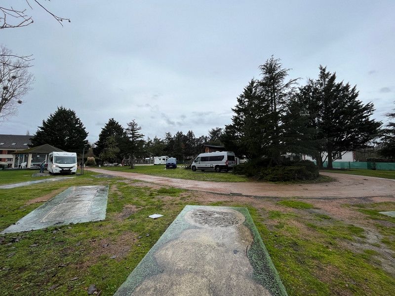
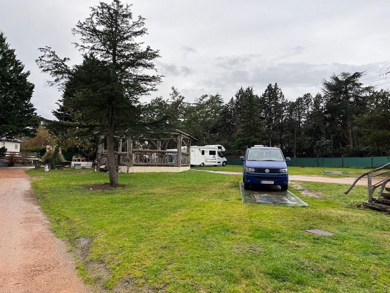
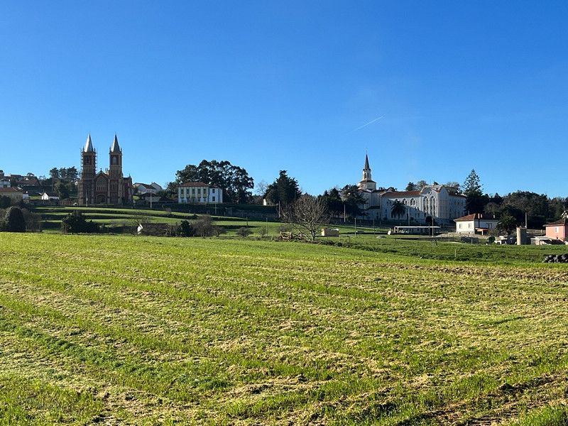
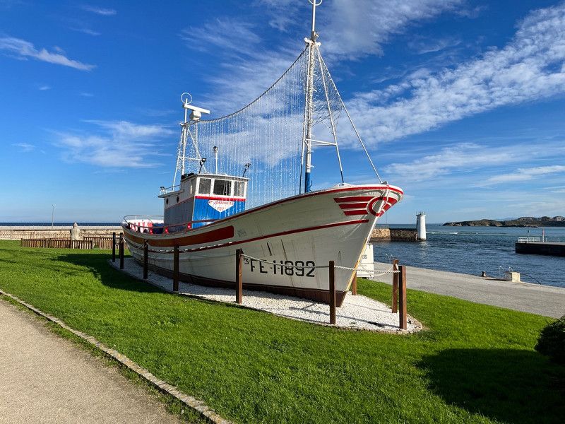
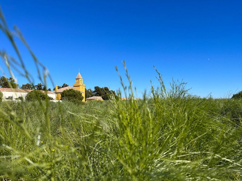
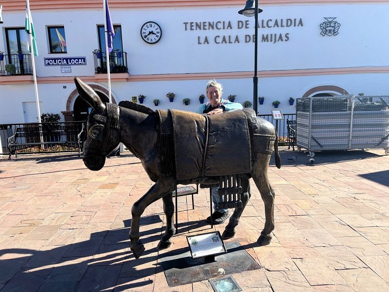
Round trip with the VW T5 Bulli. The trip is still being planned and points are always being added. If you have any ideas, just bring them along 😀. A period of approx. 8 weeks is planned.
Day
Startpunkt
Ritzenseestraße 12
47° 25' 21.7" N 12° 50' 46.2" E
47.4226829 12.8461766
• Head toward Am Mühlrain on Ritzenseestraße. Go for 292 m.
• Turn left onto Almer Straße (B164). Go for 365 m.
• Take the 1st exit from roundabout onto Feuerwehrplatz. Go for 333 m.
• Take the 1st exit from roundabout onto Lofererstraße (B311). Go for 23.2 km.
• Take the 3rd exit from roundabout onto Lofer (B311f). Go for 1.6 km.
• Take ramp onto Loferer Bundesstraße (B178). Go for 15.9 km.
• Turn right onto Kössener Straße (L39) toward Reit im Winkl/Kössen. Go for 11.5 km.
• Turn sharp left onto Walchsee Bundesstraße (B172). Go for 1.9 km.
• Pass 2 roundabouts and continue on Audorfer Straße (B172). Go for 17.7 km.
• Continue on Audorfer Straße (St2093). Go for 206 m.
• Turn left and take ramp onto A93 toward München/Salzburg. Go for 20.1 km.
• Take the left exit toward München/Rosenheim-West onto A8. Go for 45.6 km.
• Take exit 95 toward Nürnberg/Stuttgart/Messe/ICM/Flughafen München onto A99. Go for 45.1 km.
• Keep right onto A99 (Autobahndreieck München-Allach) toward Stuttgart/Augsburg/Dachau/Fürstenfeldbruck. Go for 4.3 km.
• Continue on A8 (Autobahndreieck München/Eschenried). Go for 206 km.
• Continue on A8 toward Karlsruhe/Basel/Leonberg-West. Go for 53.8 km.
• Take the left exit toward Basel/Baden-Baden/Ettlingen onto A5. Go for 30.0 km.
• Take exit 51 toward Baden-Baden onto B500. Go for 4.3 km.
• Keep right toward Europastraße/B500. Go for 42 m.
• Take the 2nd exit from Europaplatz roundabout onto Europastraße (B500) toward Baden-Baden/Centrum/Krankenhaus KMB Balg/Balg/Weststadt. Go for 125 m.
• Take ramp toward Stadtklinik/Balg/Weststadt. Go for 170 m.
• Turn right onto Schwarzwaldstraße (K9604). Go for 446 m.
• Turn left onto Hubertusstraße. Go for 143 m.
• Turn left. Go for 20 m.
• Arrive at your destination on the right.
☍
483,1 km
(4 hrs. 35 min.)
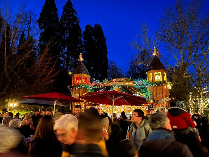
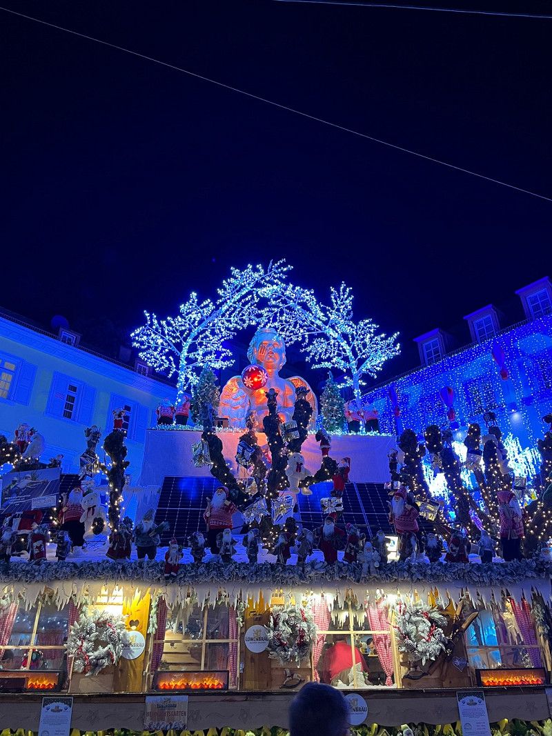
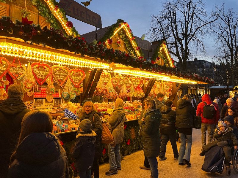
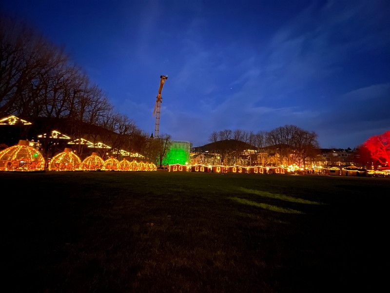
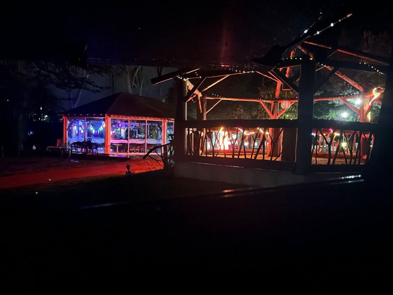
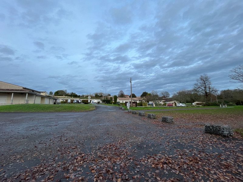
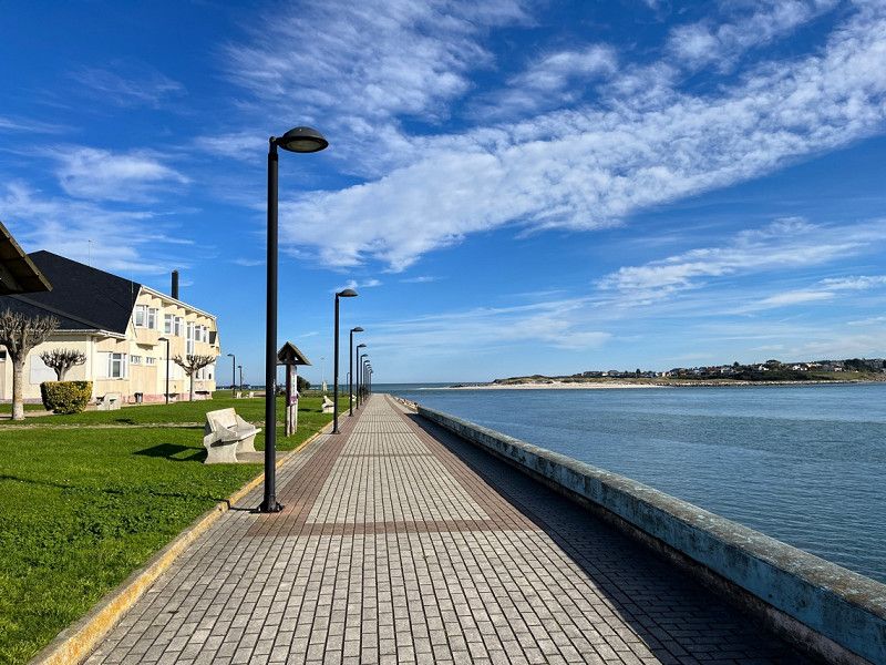
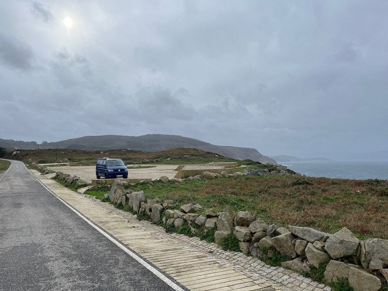
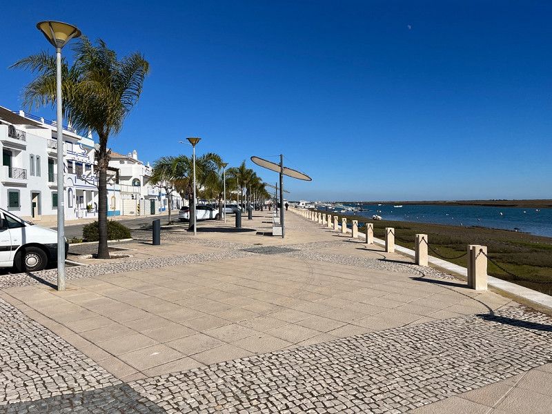
Stellplatz Baden-Baden
Good parking space to look at Baden Baden.
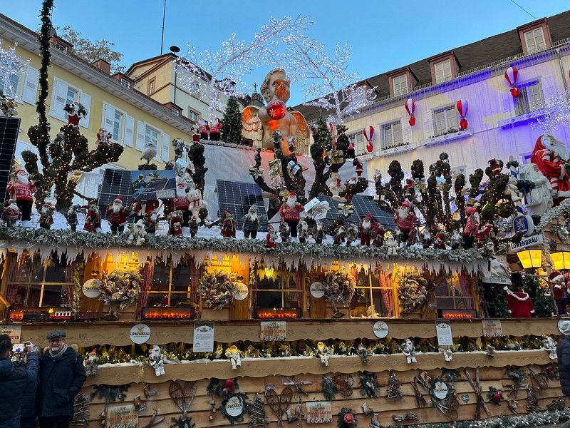
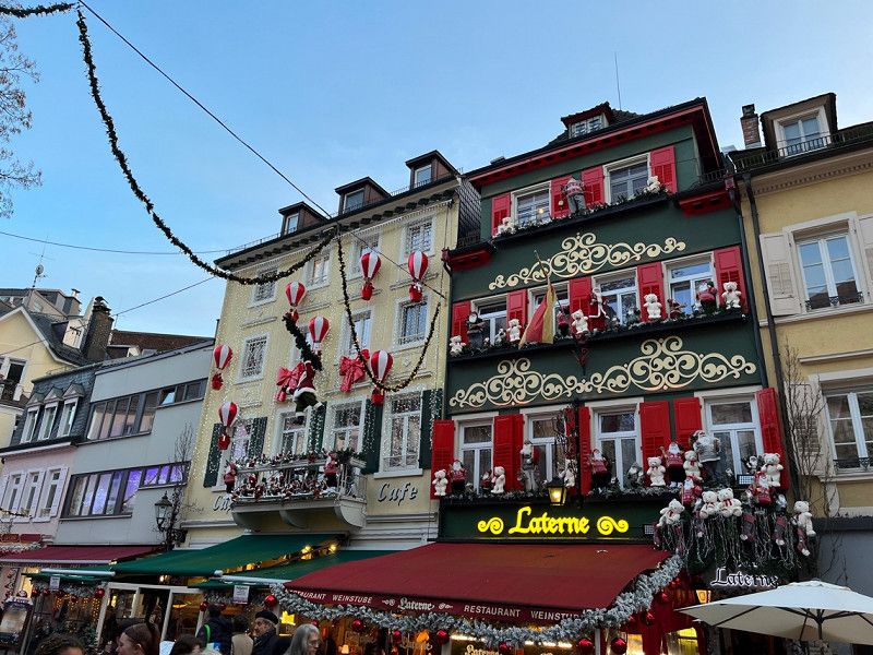
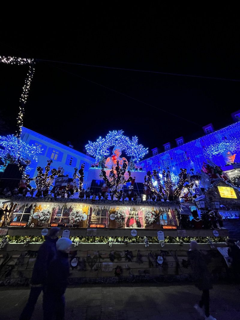
We then took the bus, the bus stop is only a few meters away, to the city of Baden Baden. No problem. We surprisingly looked at the Christmas market.
Hubertusstraße 2, 76532, Baden-Baden, Deutschland
48° 46' 55" N 8° 12' 13" E
48.7819444 8.2036111
• Head toward Hubertusstraße. Go for 20 m.
• Turn right onto Hubertusstraße. Go for 143 m.
• Turn right onto Schwarzwaldstraße (K9604). Go for 650 m.
• Turn left onto Gewerbepark Cité. Go for 101 m.
• Take the 3rd exit from roundabout onto Gewerbepark Cité. Go for 118 m.
• Keep right toward Europastraße/B500. Go for 121 m.
• Continue on Europastraße (B500). Go for 3.1 km.
• Keep left onto B500 toward A5/Basel/Rastatt. Go for 378 m.
• Take ramp onto A5 toward Basel. Go for 132 km.
• Take exit 66 toward Lyon/Mulhouse/Flughafen Euro onto A5. Go for 611 m.
• Continue on A36 (La Comtoise). Go for 13.5 km.
• Keep left onto A36 (La Comtoise) toward Paris/Lyon/Guebwiller. Go for 223 km.
• Take the exit onto A31. Go for 6.1 km.
• Continue on A6 (Autoroute du Soleil). Go for 51.0 km.
• Take exit 27 toward Tournus onto D906 (Avenue du Clos Mouron). Go for 2.2 km.
• Take the 3rd exit from roundabout onto Rue Saint-Laurent. Go for 275 m.
• Turn left onto Rue René Cassin. Go for 147 m.
• Arrive at Rue René Cassin. Your destination is on the left.
☍
433,6 km
(3 hrs. 42 min.)
Day
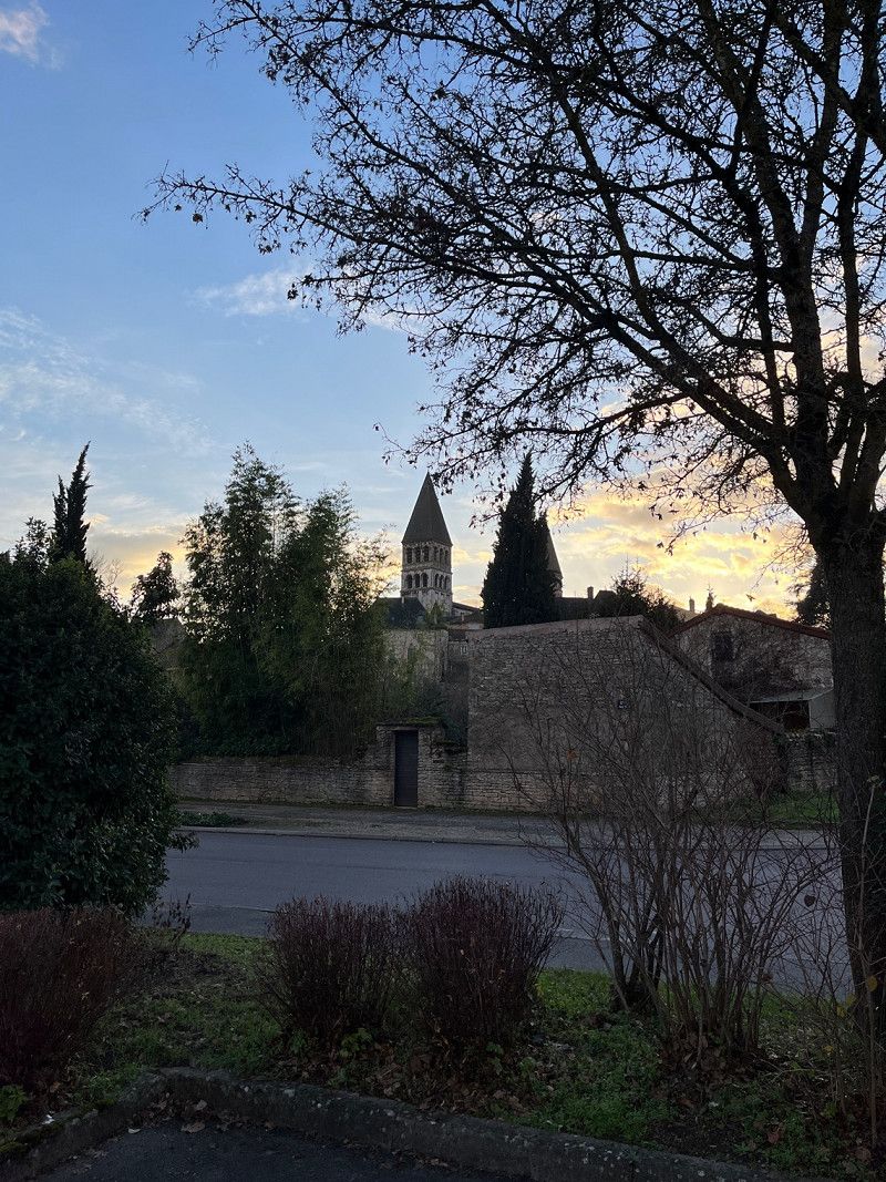
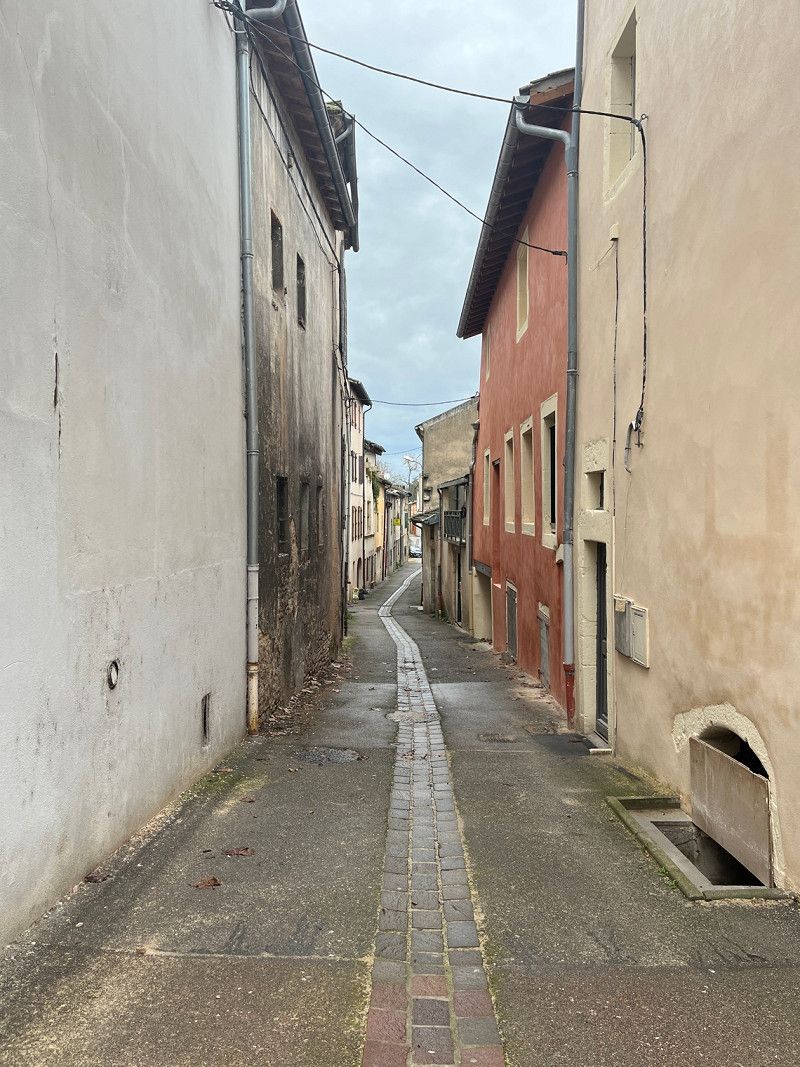
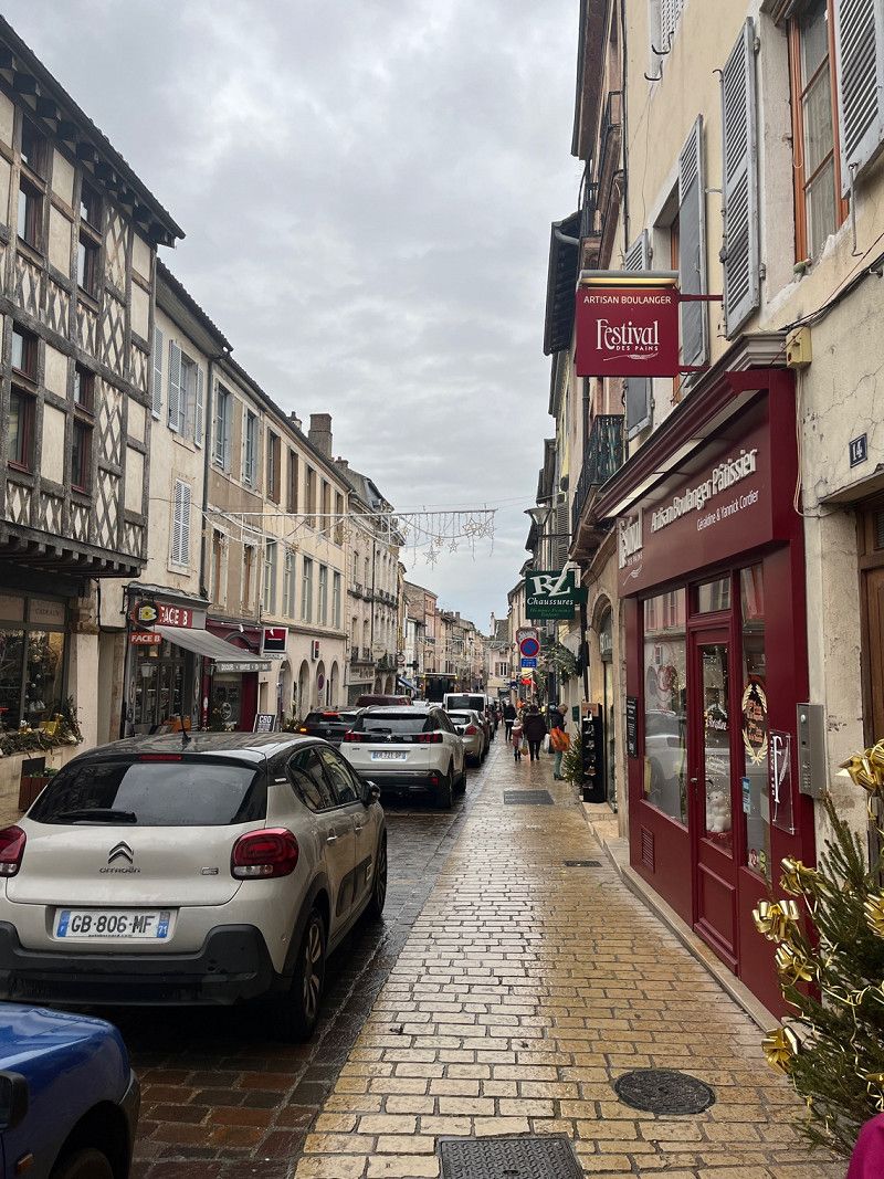
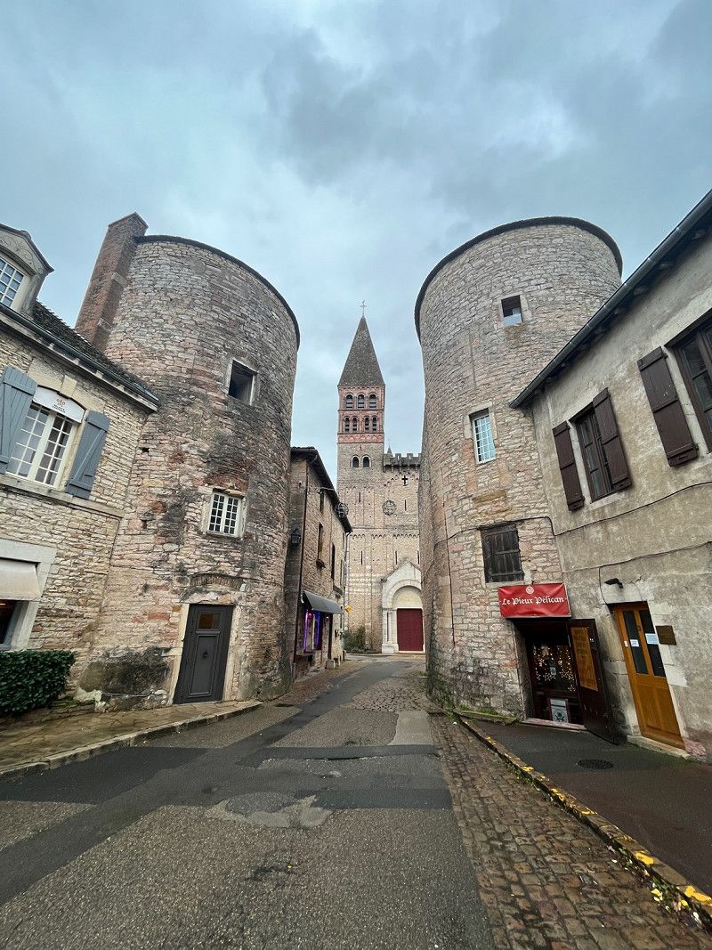
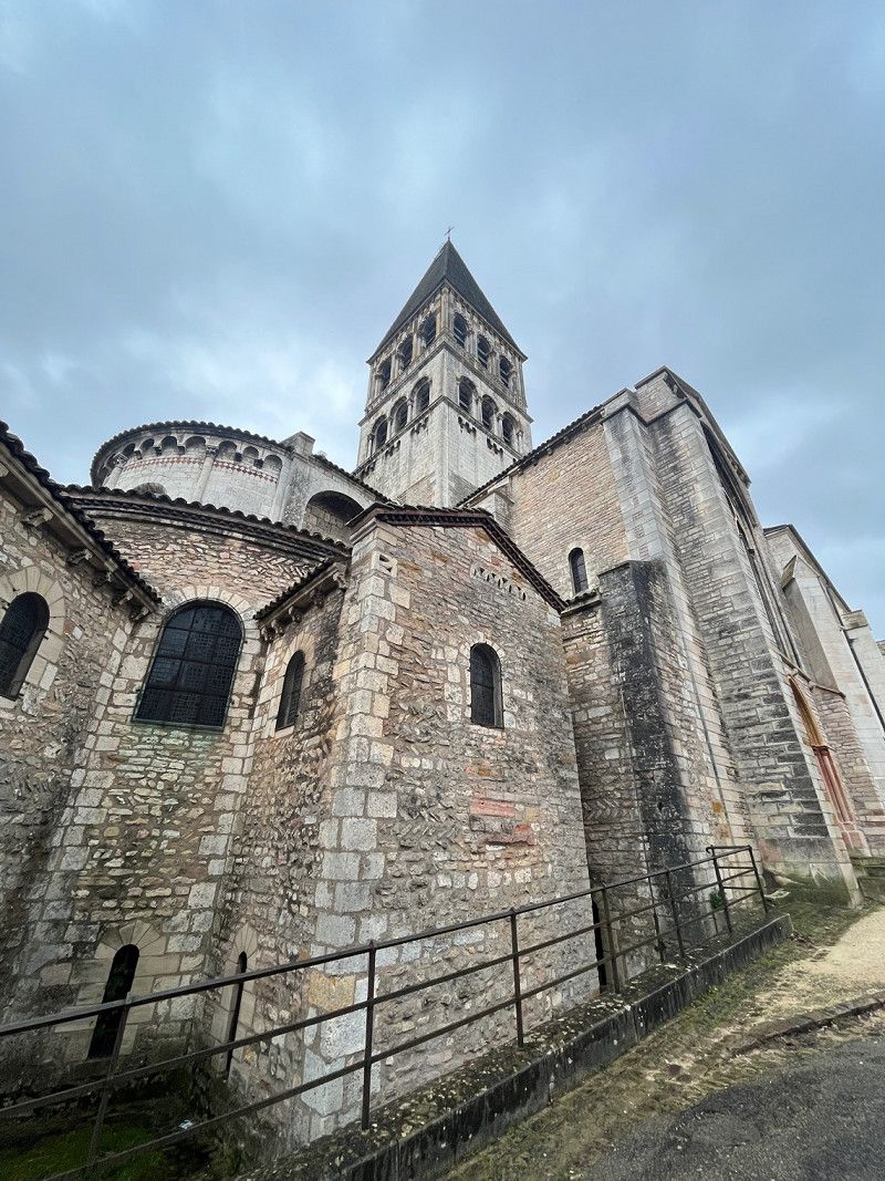
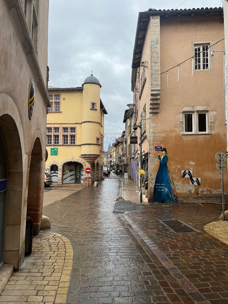
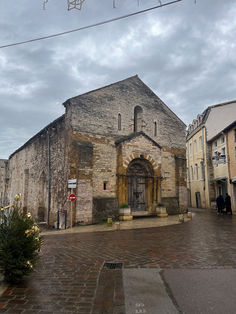
Tournus
A stop in Tournus.
A small town with small narrow streets and many small shops. Rustic to look at. Stayed directly under the old town on a beautiful parking space with water and disposal.
15 Rue Saint-Laurent
46° 34' 6.4" N 4° 54' 33" E
46.5684509 4.9091547
• Head toward Quai du Nord on Rue René Cassin. Go for 147 m.
• Turn right onto Rue Saint-Laurent. Go for 240 m.
• Take the 1st exit from roundabout onto Avenue Gambetta (D906). Go for 1.1 km.
• Take ramp onto A6 (Autoroute du Soleil) toward Paris. Go for 20.6 km.
• Take exit 26 toward Montceau les M./Le Creusot/Chalon S/ Saône. Go for 1.1 km.
• Take the 2nd exit from roundabout onto Route Express Chalon Montceau (N80) toward Moulins/Montceau les M./Le Creusot/Cluny. Go for 746 m.
• Take the 2nd exit from Giratoire de Cortelin roundabout onto Route Express Chalon Montceau (N80) toward Moulins/Montceau les M./Le Creusot. Go for 26.6 km.
• Take the 3rd exit from Rond-Point Jeanne Rose roundabout onto N70 toward Montchanin/Montceau les M./Moulins/Montchanin-Centre. Go for 44.0 km.
• Continue on N79. Go for 844 m.
• Keep left onto N79 toward Moulins/Nevers/Roanne/Vichy/Digoin/Paray le M.-Sud. Go for 9.0 km.
• Keep left onto A79 toward Montluçon/Nevers/Vichy/Moulins/Digoin-Ouest. Go for 91.3 km.
• Take the left exit toward E62/Paris/Montluçon onto A71. Go for 23.0 km.
• Take exit 10 toward Guéret/Montluçon onto A714. Go for 10.1 km.
• Continue on N145. Go for 8.7 km.
• Take ramp toward Prémilhat. Go for 308 m.
• Take the 4th exit from roundabout onto D745 toward Montluçon/Prémilhat. Go for 684 m.
• Take the 2nd exit from roundabout onto Avenue des Martyrs (D745) toward Montluçon-Centre/Prémilhat. Go for 1.8 km.
• Take the 1st exit from roundabout onto Route de l'Étang de Sault (D605) toward Prémilhat. Go for 1.3 km.
• Turn left toward Chemin de la Digue. Go for 58 m.
• Continue on Chemin de la Digue. Go for 76 m.
• Arrive at Chemin de la Digue. Your destination is on the right.
☍
241,5 km
(2 hrs. 17 min.)
Camping de I‘Etang de Sault
A small fine campsite. Very friendly and has everything you need.
8 Route du Plan d'Eau
46° 19' 40.9" N 2° 33' 22.3" E
46.3280334 2.5561840
• Head toward Chemin de la Glacière on Chemin de la Digue. Go for 134 m.
• Turn right onto Route de l'Étang de Sault (D605). Go for 1.3 km.
• Take the 3rd exit from roundabout onto Avenue des Martyrs (D745) toward Guéret/Quinssaines. Go for 1.8 km.
• Take the 1st exit from roundabout onto D745 toward Clermont-Fd/Vichy/Moulins/Guéret/Quinssaines/Domérat. Go for 601 m.
• Take the 1st exit from roundabout onto N145 toward Poitiers/Limoges/Guéret/Lamaids. Go for 99.7 km.
• Take the 3rd exit from roundabout onto N145 toward Châteauroux/Limoges/Poitiers/Angoulême. Go for 905 m.
• Take the 2nd exit from roundabout onto N145 toward Poitiers/Angoulême/Bellac. Go for 27.5 km.
• Take the 1st exit from roundabout onto N147 toward Poitiers/Châtellerault/Angoulême. Go for 2.0 km.
• Take the 2nd exit from roundabout onto N147 toward Poitiers/Châtellerault/Tours/Angoulême. Go for 5.5 km.
• Take the 3rd exit from roundabout onto D951 toward Angoulême/Mézières S/Issoire/Confolens. Go for 5.4 km.
• Pass 2 roundabouts and continue on D951. Go for 47.9 km.
• Take the 3rd exit from roundabout onto D951 toward Angoulême. Go for 6.8 km.
• Take the 2nd exit from roundabout onto N141 toward Angoulême/Taponnat/La Rochefoucauld. Go for 30.8 km.
• Continue on N10. Go for 93.9 km.
• Take ramp toward N10/E5/A10/Paris/Libourne/St-André de C./St-Antoine/Z.A. la Garosse. Go for 248 m.
• Take the 3rd exit from roundabout onto D1010 toward Bordeaux/Libourne/St André de C. Go for 511 m.
• Take the 2nd exit from roundabout onto Route de Paris (D1010) toward Libourne/St André de C./Bourg. Go for 348 m.
• Take the 2nd exit from roundabout onto Route de Paris (D1010) toward Libourne/St André de C./Bourg. Go for 539 m.
• Take the 3rd exit from roundabout onto D1510 toward A89/Bordeaux/A10/Libourne. Go for 1.6 km.
• Take the 1st exit from roundabout onto D248 toward A89/A10/Bordeaux/Libourne/Bourg/St André de C./Cadillac en F. Go for 646 m.
• Take the 2nd exit from roundabout onto Route de Libourne (D670) toward A89/Libourne/Cadillac en F. Go for 1.7 km.
• Turn right onto Chemin du Plantier toward St Romain la Virvée/Asques. Go for 1.2 km.
• Turn slightly left onto Lieu-dit Prade des Planquettes (D137 E6). Go for 261 m.
• Continue on Route de la Virvée (D137 E6). Go for 804 m.
• Continue on Rue de la Chapelle (D137 E6). Go for 483 m.
• Turn right onto Route de Asques (D737). Go for 140 m.
• Turn right onto Rue des Milonis. Go for 136 m.
• Arrive at Rue des Milonis. Your destination is on the right.
☍
332,9 km
(3 hrs. 32 min.)
Day
Day
Stellplatz
We parked here because it was pleasantly quiet.
95 Rue des Milonis
44° 57' 49.4" N 0° 24' 6.6" W
44.9637146 -0.4018236
• Head toward Route de Asques on Rue des Milonis. Go for 76 m.
• Turn left onto Route de Asques (D737). Go for 197 m.
• Turn left onto Rue de la Chapelle (D137 E6). Go for 483 m.
• Continue on Route de la Virvée (D137 E6). Go for 804 m.
• Continue on Lieu-dit Prade des Planquettes (D137 E6). Go for 261 m.
• Turn right onto Chemin du Plantier. Go for 1.2 km.
• Turn left onto Route de Libourne (D670). Go for 1.6 km.
• Take the 2nd exit from roundabout onto Route de Libourne (D670) toward A10/Bordeaux/Bourg/St André en C. Go for 357 m.
• Take the 2nd exit from roundabout onto A10 (L'Aquitaine) toward Bordeaux. Go for 13.9 km.
• Take exit 1 toward Toulouse/Bayonne/Bassin d'Arcachon/Bordeaux/Périgueux onto N230 (Rocade de Bordeaux). Go for 19.8 km.
• Take exit 15 toward Saint Sébastien/Bayonne/Mont de Marsan/Bassin d'Arcachon onto A63. Go for 206 km.
• Continue on AP-8 (Autopista del Cantábrico). Go for 12.2 km.
• Take the exit toward Bilbao/Vitoria-Gasteiz/Burgos/Hernani/A-15/Iruña/Pamplona onto AP-1/AP-8. Go for 14.8 km.
• Take the exit onto AP-1/AP-8 (Autopista del Cantábrico). Go for 10.5 km.
• Take exit 38 toward N-634/Zarautz/Getaria. Go for 578 m.
• Take the 2nd exit from roundabout onto Calle Irita. Go for 119 m.
• Take the 2nd exit from roundabout onto Camino Mendibeltz. Go for 162 m.
• Turn left onto Camino Sorginmuno. Go for 18 m.
• Turn right toward Camino Talaimendi. Go for 203 m.
• Turn slightly left onto Camino Talaimendi. Go for 87 m.
• Turn right toward Camino Talaimendi. Go for 373 m.
• Continue on Camino Talaimendi. Go for 212 m.
• Turn slightly left onto Camino Talaimendi. Go for 262 m.
• Turn right toward Camino Talaimendi. Go for 77 m.
• Turn slightly left onto Camino Talaimendi. Go for 10 m.
• Turn left onto Laurgain kalea. Go for 16 m.
• Continue toward Camino Talaimendi. Go for 57 m.
• Turn left onto Camino Talaimendi. Go for 5 m.
• Turn right. Go for 27 m.
• Turn left. Go for 17 m.
• Turn right. Go for 12 m.
• Arrive at your destination on the left.
☍
284,7 km
(2 hrs. 51 min.)
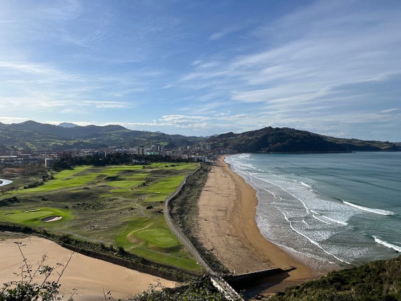
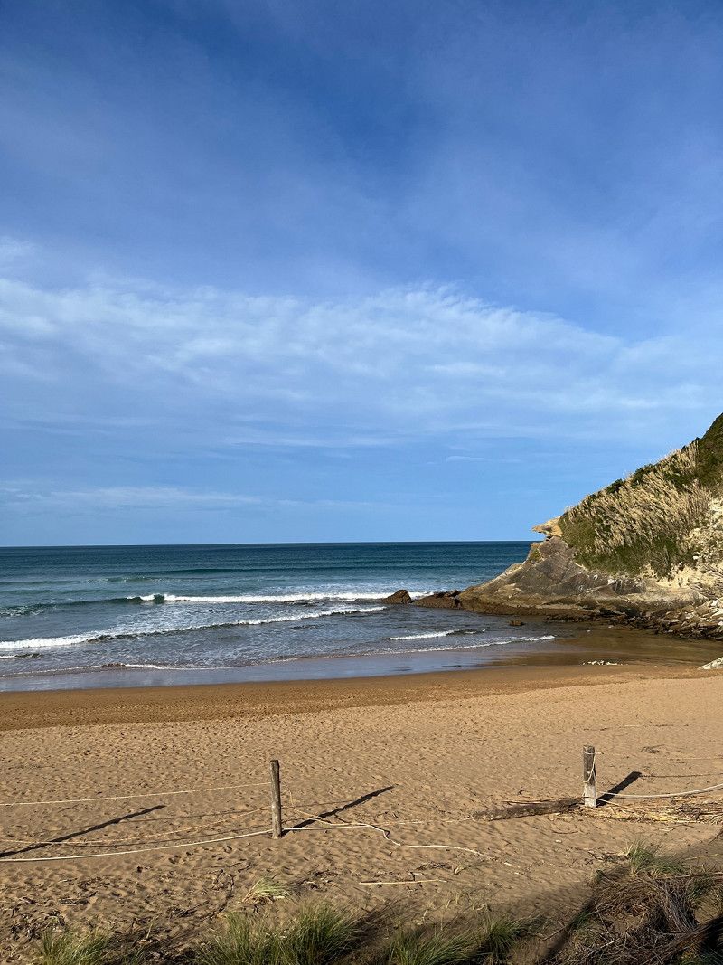
Day
Gran Camping Zarautz
Here we spend a few days to relax and see some things.
43° 17' 26.7" N 2° 8' 47.5" W
43.2907410 -2.1465336
• Head south. Go for 12 m.
• Turn left. Go for 17 m.
• Turn right toward Camino Talaimendi. Go for 27 m.
• Turn left onto Camino Talaimendi. Go for 5 m.
• Turn right toward Laurgain kalea. Go for 57 m.
• Continue on Laurgain kalea. Go for 16 m.
• Turn right onto Camino Talaimendi. Go for 10 m.
• Turn slightly right toward Camino Talaimendi. Go for 77 m.
• Turn left onto Camino Talaimendi. Go for 262 m.
• Turn slightly right onto Camino Talaimendi. Go for 212 m.
• Turn left toward Camino Talaimendi. Go for 373 m.
• Turn left onto Camino Talaimendi. Go for 87 m.
• Turn slightly right toward Camino Sorginmuno. Go for 203 m.
• Turn left onto Camino Sorginmuno. Go for 18 m.
• Turn right onto Camino Mendibeltz. Go for 112 m.
• Take the 2nd exit from roundabout onto Calle Irita toward Bilbao/A-8/Donostia/S. Sebastián. Go for 133 m.
• Take the 2nd exit from roundabout toward Donostia/San Sebastián/Bilbo/Vitoria/Gasteiz. Go for 75 m.
• Take ramp onto AP-1/AP-8 (Autopista del Cantábrico) toward Donostia/S. Sebastián. Go for 10.8 km.
• Continue on GI-20 toward Donostia/S. Sebastián/Lasarte-Oria/GI-11/Pamplona/A-15/Iruña. Go for 5.6 km.
• Take left exit 9A toward Donostia/S. Sebastián/Centro Ciudad/Amara onto Avenida de Carlos I. Go for 1.0 km.
• Continue on Avenida de Madrid toward Erdialdea/Centro Ciudad. Go for 168 m.
• Keep right onto Calle de Zuaznabar toward Frantzia/Francia/Erdialdea/Centro Ciudad. Go for 165 m.
• Turn left onto Paseo de Bizkaia toward Erdialdea/Centro Ciudad. Go for 418 m.
• Continue on Paseo del Árbol de Gernika. Go for 659 m.
• Turn left onto Calle de Valentín Olano. Go for 67 m.
• Turn left onto Calle de Prim. Go for 72 m.
• Turn right onto Calle de Urdaneta. Go for 62 m.
• Turn right onto Calle de Hondarribia. Go for 206 m.
• Arrive at Calle de Hondarribia. Your destination is on the right.
☍
20,9 km
( 22 min.)
Day
Day
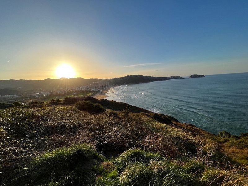
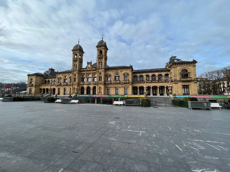
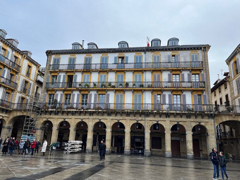
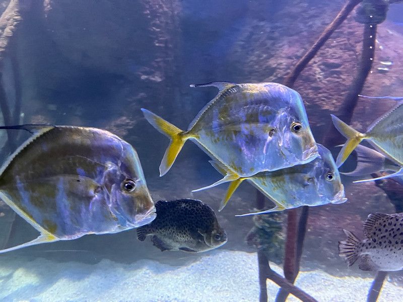
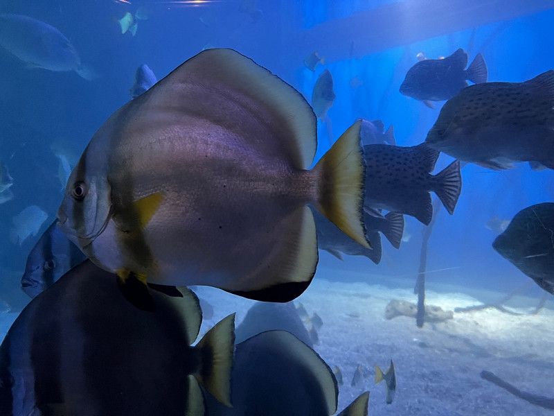
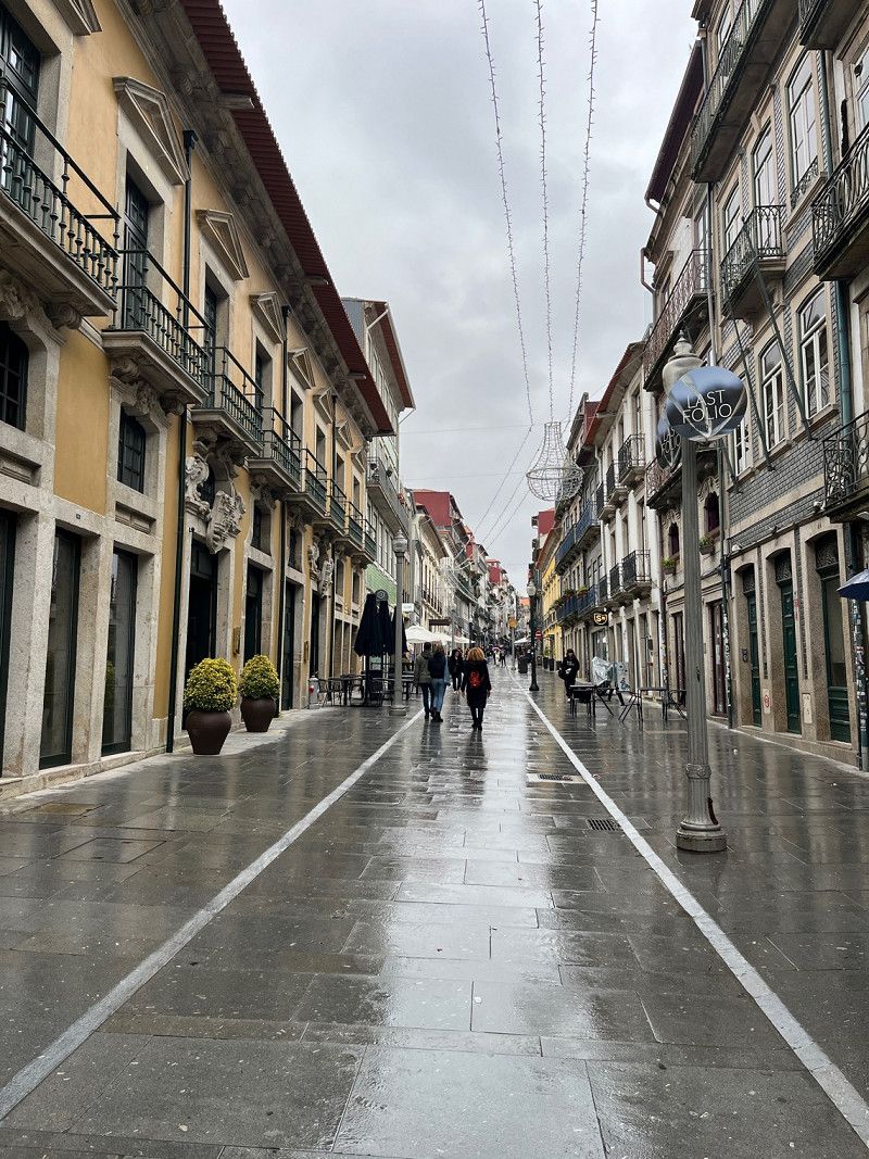
Donostia-San Sebastián, Spanien
Today it was time for a stroll through the city. A very lively city. Then in the aquarium.
Donostia-San Sebastián, Gipuzkoa, Spanien
43° 19' 6" N 1° 58' 52.4" W
43.3183340 -1.9812313
• Head northwest on Calle de Hondarribia. Go for 147 m.
• Turn right onto Avenida de la Libertad. Go for 285 m.
• Continue on Plaza de España. Go for 19 m.
• Keep right onto Puente de Santa Catalina. Go for 187 m.
• Turn right onto Paseo de Francia toward Vitoria/Gasteiz/Bilbao/Amara/Egia. Go for 455 m.
• Continue toward Paseo del Urumea. Go for 35 m.
• Continue on Paseo de Federico García Lorca. Go for 609 m.
• Continue on Paseo del Urumea toward Frantzia/Francia/Vitoria-Gasteiz/Bilbao/Riberas/Amara. Go for 525 m.
• Continue on Puente de Hierro toward Martutene/Ospitaleak/Pamplona/A-15/Iruña/Vitoria/AP-1/N-1/Gasteiz/Bilbao/AP-8/Amara. Go for 98 m.
• Keep left onto GI-41 toward Martutene/Ospitaleak/Pamplona/A-15/Iruña/Vitoria/AP-1/N-1/Gasteiz/Bilbao/AP-8/Amara. Go for 1.4 km.
• Take the 2nd exit from roundabout onto GI-41 toward E-5/E-70/E-80/AP-1/AP-8/Bilbao/Vitoria/Gasteiz/A-15/Hernani/Iruña/Pamplona. Go for 1.5 km.
• Continue on A-15. Go for 10.4 km.
• Take the exit onto N-1. Go for 2.7 km.
• Keep right onto A-15 (Agaraitz auzoa) toward Irurtzun/Iruña/Pamplona. Go for 44.4 km.
• Continue on AP-15 (Autopista de Navarra). Go for 15.5 km.
• Continue on A-15 (Ronda Oeste). Go for 13.2 km.
• Continue on AP-15 (Autopista de Navarra). Go for 69.5 km.
• Take exit 13 toward Castejón/Valtierra/Sendaviva Parque de la Naturaleza. Go for 619 m.
• Take the 4th exit from roundabout onto N-113 toward Valtierra/Pamplona/AP-15/N-121/S. Sebastián. Go for 899 m.
• Continue toward N-113. Go for 49 m.
• Take the 1st exit from roundabout toward Valtierra/Pamplona/N-121/S. Sebastián. Go for 72 m.
• Continue on N-113. Go for 1.4 km.
• Turn right onto NA-134 toward Valtierra/Arguedas/Tudela. Go for 8.4 km.
• Turn left onto NA-6712 toward Arguedas. Go for 688 m.
• Turn right onto Camino de las Bárdenas Reales. Go for 1.2 km.
• Turn right onto Camino de las Bárdenas Reales. Go for 5.7 km.
• Arrive at Camino de las Bárdenas Reales.
☍
180,1 km
(2 hrs. 1 min.)
Day
Day
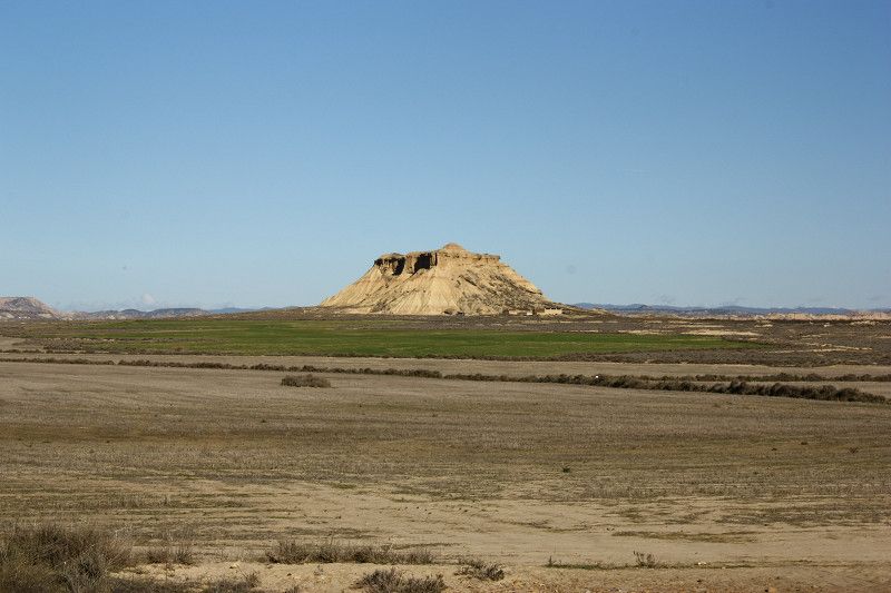
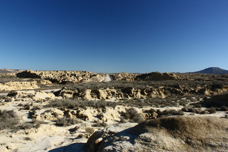
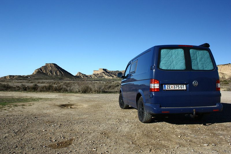
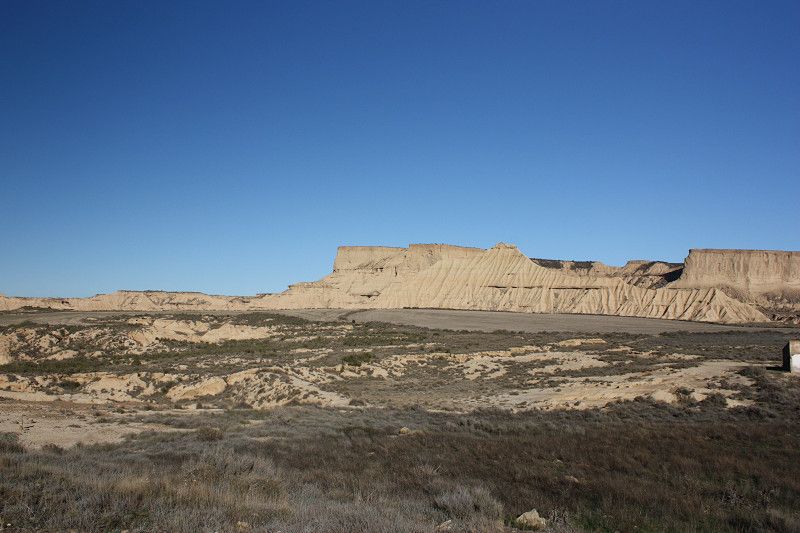
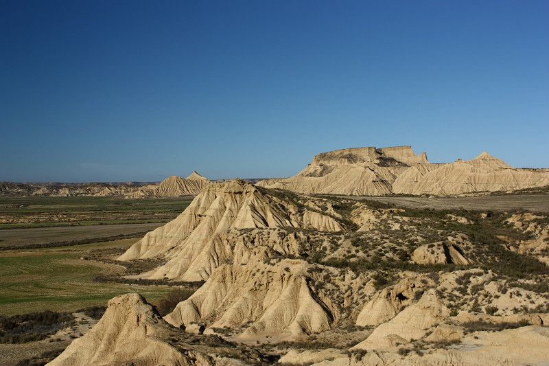
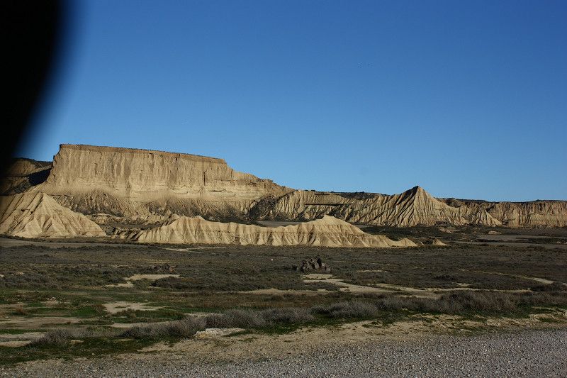
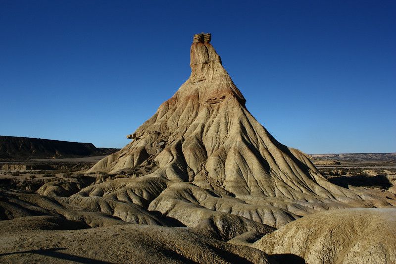
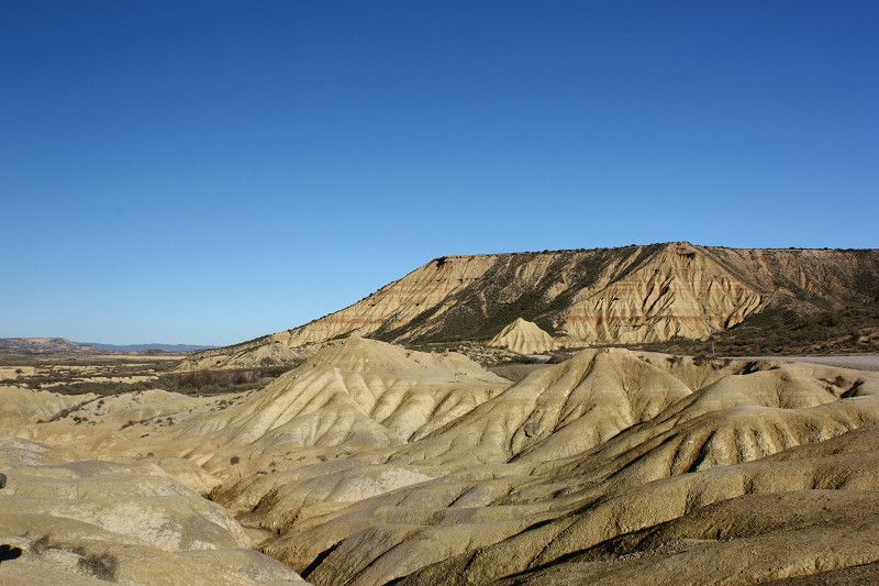
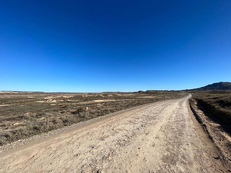
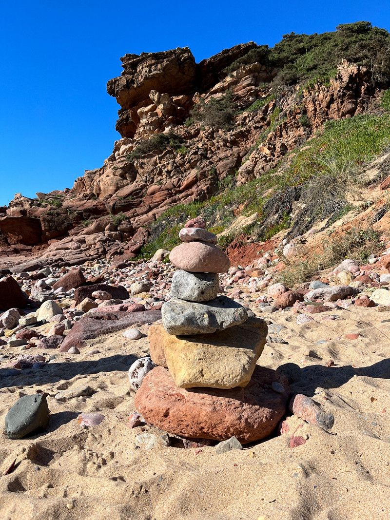
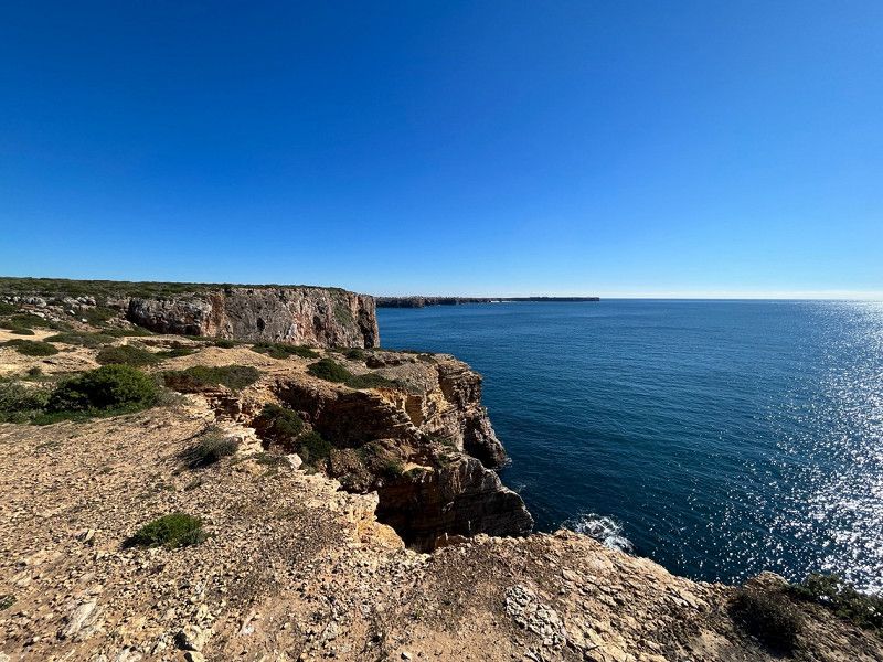
Bardenas Reales
A trip to the desert landscape of Bardenas Reales.
Cam. las Bardenas Reales, 31500 Arguedas, Navarra, Spanien
42° 10' 44.4" N 1° 31' 22.1" W
42.1789885 -1.5228081
• Head northwest on Camino de las Bárdenas Reales. Go for 5.7 km.
• Turn left onto Camino de las Bárdenas Reales. Go for 1.2 km.
• Turn left onto NA-6712. Go for 659 m.
• Turn right onto NA-134 toward Pamplona/Logroño. Go for 8.3 km.
• Keep left toward N-113. Go for 37 m.
• Turn left onto N-113. Go for 1.4 km.
• Continue toward N-113. Go for 48 m.
• Take the 3rd exit from roundabout onto N-113 toward Madrid/N-232/Zaragoza. Go for 875 m.
• Continue toward Logroño/Zaragoza. Go for 39 m.
• Take the 3rd exit from roundabout onto AP-15 (Autopista de Navarra) toward Logroño/Zaragoza. Go for 11.8 km.
• Take the exit toward Alfaro/Logroño onto AP-68 (Autopista del Ebro). Go for 205 km.
• Keep right onto AP-8 toward E-70/BI-636/Balmaseda/Santurtzi/Portua/Santander. Go for 14.5 km.
• Continue on A-8 (Autovía del Cantábrico). Go for 72.8 km.
• Take exit 199 toward Torrelavega/Oviedo onto A-8 (Autovía del Cantábrico). Go for 35.3 km.
• Take exit 234 toward N-634/Puente San Miguel/Santillana del Mar. Go for 267 m.
• Take the 1st exit from roundabout toward N-634. Go for 173 m.
• Pass 2 roundabouts. Go for 802 m.
• Take the 2nd exit from roundabout onto CA-136. Go for 1.4 km.
• Take the 2nd exit from roundabout onto CA-133 toward Santillana del Mar/Suances. Go for 804 m.
• Continue on Avenida del Zoo (CA-133). Go for 451 m.
• Take the 2nd exit from roundabout onto CA-133 toward Santillana del Mar. Go for 265 m.
• Continue on Avenida del Zoo (CA-133). Go for 546 m.
• Continue toward CA-133. Go for 57 m.
• Continue on Avenida Antonio Sandi (CA-133). Go for 311 m.
• Continue on Calle Jesús Tagle (CA-133). Go for 22 m.
• Continue on Avenida Sánchez Tagle (CA-133). Go for 89 m.
• Turn left onto Avenida Dorat (CA-131). Go for 869 m.
• Take the 2nd exit from roundabout. Go for 153 m.
• Continue on CA-131. Go for 8.4 km.
• Turn sharp right onto Barrio Corrales. Go for 200 m.
• Turn right onto Barrio Quintana. Go for 118 m.
• Arrive at Barrio Quintana. Your destination is on the right.
☍
372,9 km
(3 hrs. 39 min.)
Cóbreces, Spanien
Super pitch with a shower and disposal.
Hiking is also very good here.
Very friendly owner.
Thanks
Bº. Los Corrales s/n, 39320 Cóbreces, Cantabria, Spanien
43° 23' 19.9" N 4° 12' 38.6" W
43.3888601 -4.2107255
• Head toward Barrio Corrales on Barrio Quintana. Go for 118 m.
• Turn left onto Barrio Corrales. Go for 200 m.
• Turn right onto Barrio Corrales (CA-131). Go for 7.2 km.
• Take the 2nd exit from roundabout onto Camino de Circunvalación (CA-131). Go for 828 m.
• Continue toward CA-131. Go for 41 m.
• Take the 2nd exit from Rotonda Doctor Santiago García Castellón roundabout onto CA-131. Go for 7.1 km.
• Turn right onto N-634. Go for 2.4 km.
• Take the 2nd exit from roundabout onto Puente Maza (N-634). Go for 631 m.
• Take the 3rd exit from roundabout onto CA-843. Go for 1.7 km.
• Continue toward CA-847. Go for 47 m.
• Take the 1st exit from roundabout onto A-8 (Autovía del Cantábrico) toward Unquera/Oviedo. Go for 97.0 km.
• Take exit 360 toward Gijón/A Coruña/Aeropuerto de Asturias onto A-8 (Autovía del Cantábrico). Go for 163 km.
• Take exit 524 toward Barreiros/N-634/Foz/N-642/San Cibrao/Viveiro. Go for 1.7 km.
• Continue on A Anea. Go for 192 m.
• Turn right toward A Anea/N-634. Go for 25 m.
• Take the 2nd exit from roundabout onto A Anea (N-634) toward Ribadeo/Oviedo/San Cibrao/N-642/Viveiro/LU-862/Hospital da Costa/Burela. Go for 636 m.
• Keep left onto N-634. Go for 96 m.
• Take the 2nd exit from roundabout onto A Anea (N-642). Go for 4.2 km.
• Turn right onto Vilaxuane (N-642). Go for 160 m.
• Continue on Avenida Asturias (N-642). Go for 222 m.
• Continue on Vilaxuane (N-642). Go for 443 m.
• Continue on Rúa de Ribadeo (N-642). Go for 153 m.
• Take the 2nd exit from roundabout onto Foz. Go for 78 m.
• Continue on Rúa Lugo. Go for 114 m.
• Turn right onto Foz. Go for 48 m.
• Continue on Rúa Valle-Inclán. Go for 248 m.
• Turn right. Go for 16 m.
• Arrive at your destination on the left.
☍
288,5 km
(2 hrs. 42 min.)
Day
Day
Avenida del Valle Inclán, 30
Pitch directly at Foz.
fine city
43° 33' 56.9" N 7° 15' 23" W
43.5657959 -7.2563976
• Head toward Rúa Valle-Inclán. Go for 16 m.
• Turn left onto Rúa Valle-Inclán. Go for 248 m.
• Continue on Foz. Go for 48 m.
• Turn left onto Rúa Lugo. Go for 114 m.
• Continue on Foz. Go for 53 m.
• Take the 2nd exit from roundabout onto Rúa de Ribadeo (N-642). Go for 194 m.
• Continue on Avenida Asturias (N-642). Go for 418 m.
• Continue on Vilaxuane (N-642). Go for 247 m.
• Continue on Vilaxuane (N-642). Go for 113 m.
• Take the 1st exit from roundabout onto Caizal (N-642). Go for 3.2 km.
• Pass 2 roundabouts and continue on Estrada Xeneral Fazouro (N-642). Go for 6.6 km.
• Continue on Vilachá (N-642). Go for 10.0 km.
• Take the 2nd exit from roundabout onto Espiñeirido (N-642). Go for 3.5 km.
• Continue on O Castelo (LU-862). Go for 1.3 km.
• Take the 2nd exit from roundabout onto Beltrán. Go for 337 m.
• Take the 1st exit from roundabout onto Vía de Altas Prestacións Costa Norte (CG-2.3) toward Viveiro/Celeiro. Go for 7.9 km.
• Take the 1st exit from roundabout onto LU-862. Go for 4.5 km.
• Take the 2nd exit from roundabout onto Avenida de Benito Galcerán (LU-862). Go for 285 m.
• Turn right onto Estrada a Coruña (LU-862). Go for 483 m.
• Take the 1st exit from Estrada Viveiro roundabout onto Misericordia (LU-862). Go for 2.1 km.
• Take the 3rd exit from roundabout onto LU-862. Go for 13.6 km.
• Continue on AC-862. Go for 1.1 km.
• Turn right onto Rúa Manuel Cora Rodríguez (AC-100). Go for 179 m.
• Continue on Rúa Rafael Campillo (AC-100). Go for 14 m.
• Continue on AC-100. Go for 259 m.
• Continue on O Porto do Barqueiro (AC-100). Go for 281 m.
• Continue on AC-100. Go for 2.6 km.
• Continue on Campelo (AC-100). Go for 1.1 km.
• Continue on AC-100. Go for 732 m.
• Continue on Campelo (AC-100). Go for 541 m.
• Turn left onto Camiño a Semáforo de Bares. Go for 36 m.
• Continue on Campelo. Go for 747 m.
• Continue on O Faro da Estaca de Bares. Go for 752 m.
• Arrive at O Faro da Estaca de Bares.
☍
63,6 km
(1 hrs. 2 min.)
Day
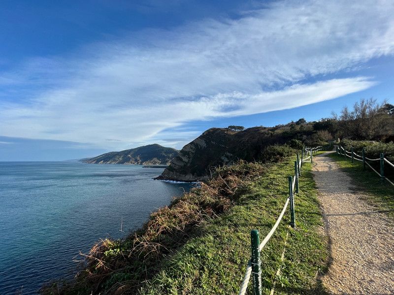
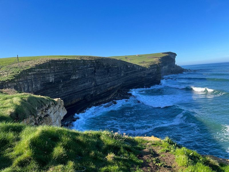
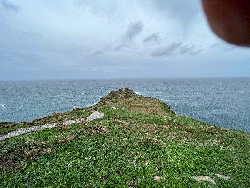
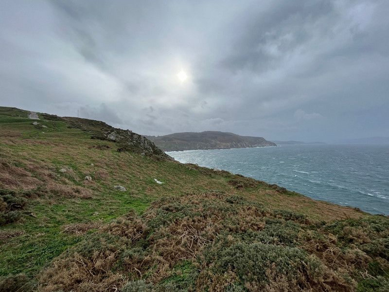
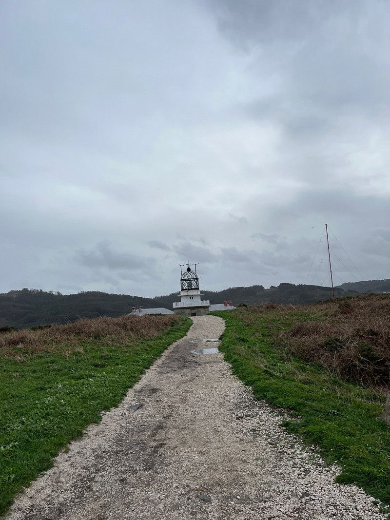
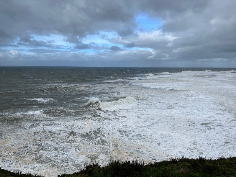
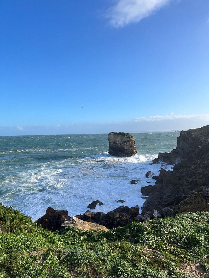
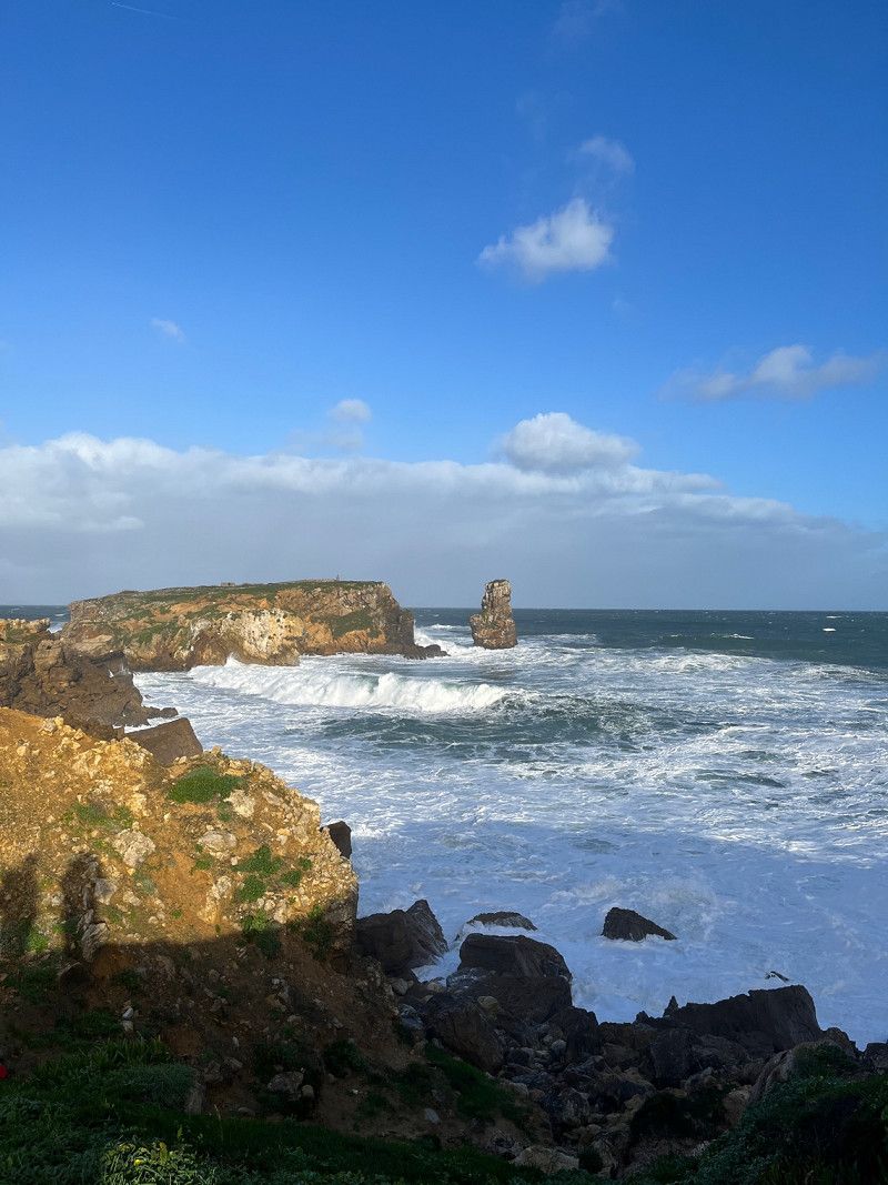
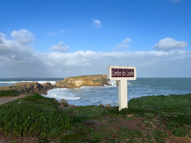
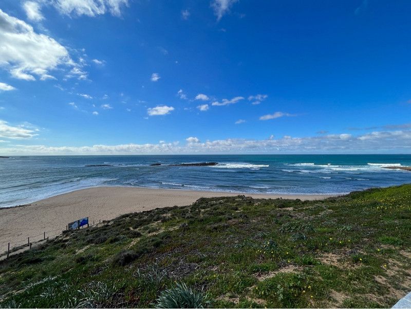
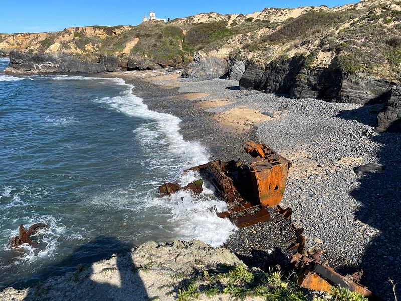
Punta de Estaca de Bares, Spanien
It was very windy and rainy today.
Nice spot to watch when the weather is nice.
Estaca de Bares, Spanien
43° 47' 13.9" N 7° 41' 7.2" W
43.7871911 -7.6853352
• Head south on O Faro da Estaca de Bares. Go for 752 m.
• Continue on Campelo. Go for 747 m.
• Continue on Camiño a Semáforo de Bares. Go for 36 m.
• Turn right onto Campelo (AC-100). Go for 541 m.
• Continue on AC-100. Go for 732 m.
• Continue on Campelo (AC-100). Go for 1.1 km.
• Continue on AC-100. Go for 2.6 km.
• Continue on O Porto do Barqueiro (AC-100). Go for 281 m.
• Continue on AC-100. Go for 259 m.
• Continue on Rúa Rafael Campillo (AC-100). Go for 14 m.
• Continue on Rúa Manuel Cora Rodríguez (AC-100). Go for 179 m.
• Turn right onto Estrada de Viveiro (AC-862). Go for 11.2 km.
• Take the 2nd exit from roundabout. Go for 88 m.
• Continue on San Xoán. Go for 85 m.
• Take the 1st exit from roundabout onto CG-1.3. Go for 7.4 km.
• Take the 1st exit from roundabout onto AC-101 toward Polígono Industrial Cuiña/Ortigueira/AC-862/Ferrol. Go for 356 m.
• Take the 2nd exit from roundabout onto Estrada de As Pontes de García Rodríguez (AC-101). Go for 775 m.
• Take the 2nd exit from roundabout onto Santiago (AC-862). Go for 15.9 km.
• Turn right onto AC-102. Go for 9.3 km.
• Turn left onto AC-566. Go for 13.0 km.
• Take the 3rd exit from roundabout onto Avenida Obispo Souto Vizoso (CP-5404). Go for 561 m.
• Continue on CP-5404. Go for 145 m.
• Arrive at CP-5404. Your destination is on the left.
☍
66,1 km
(1 hrs. )
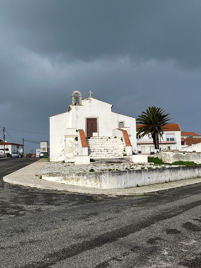
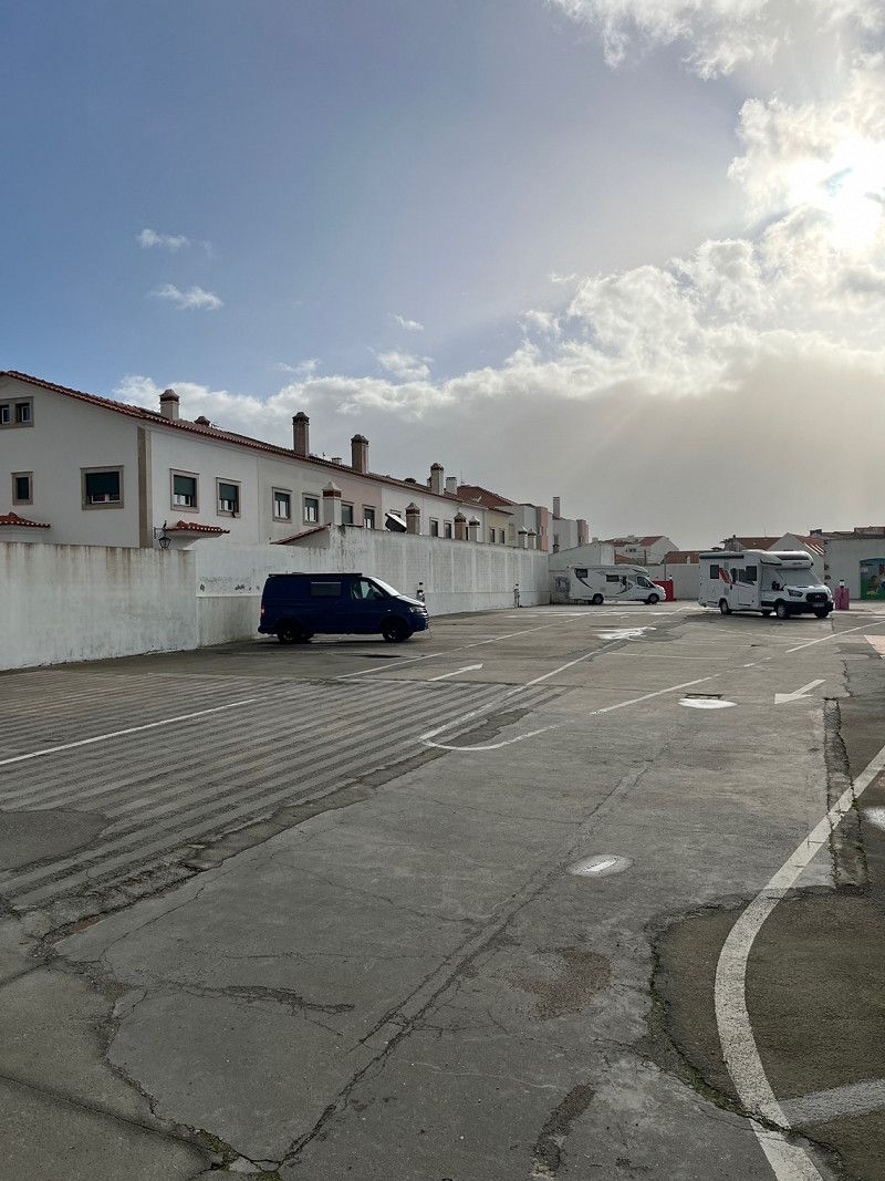
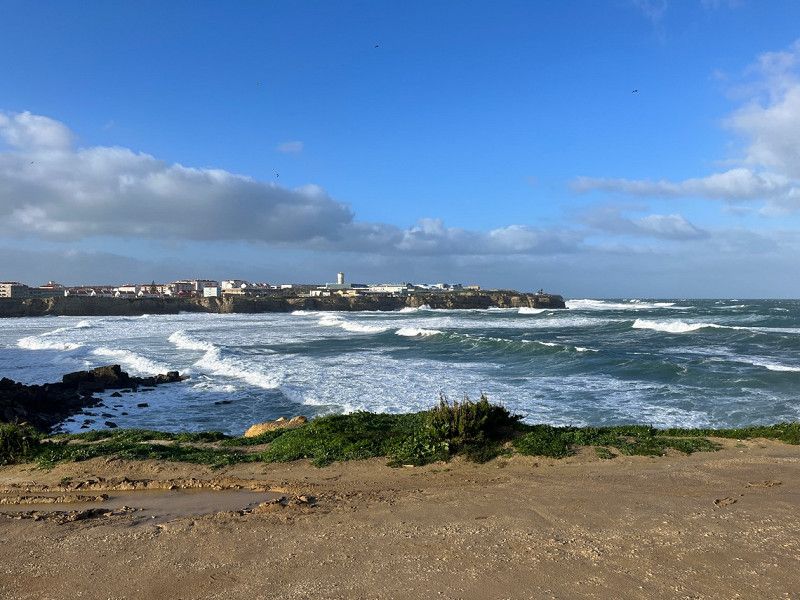
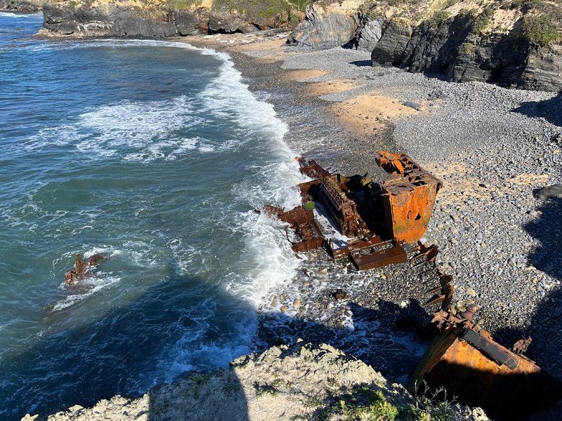
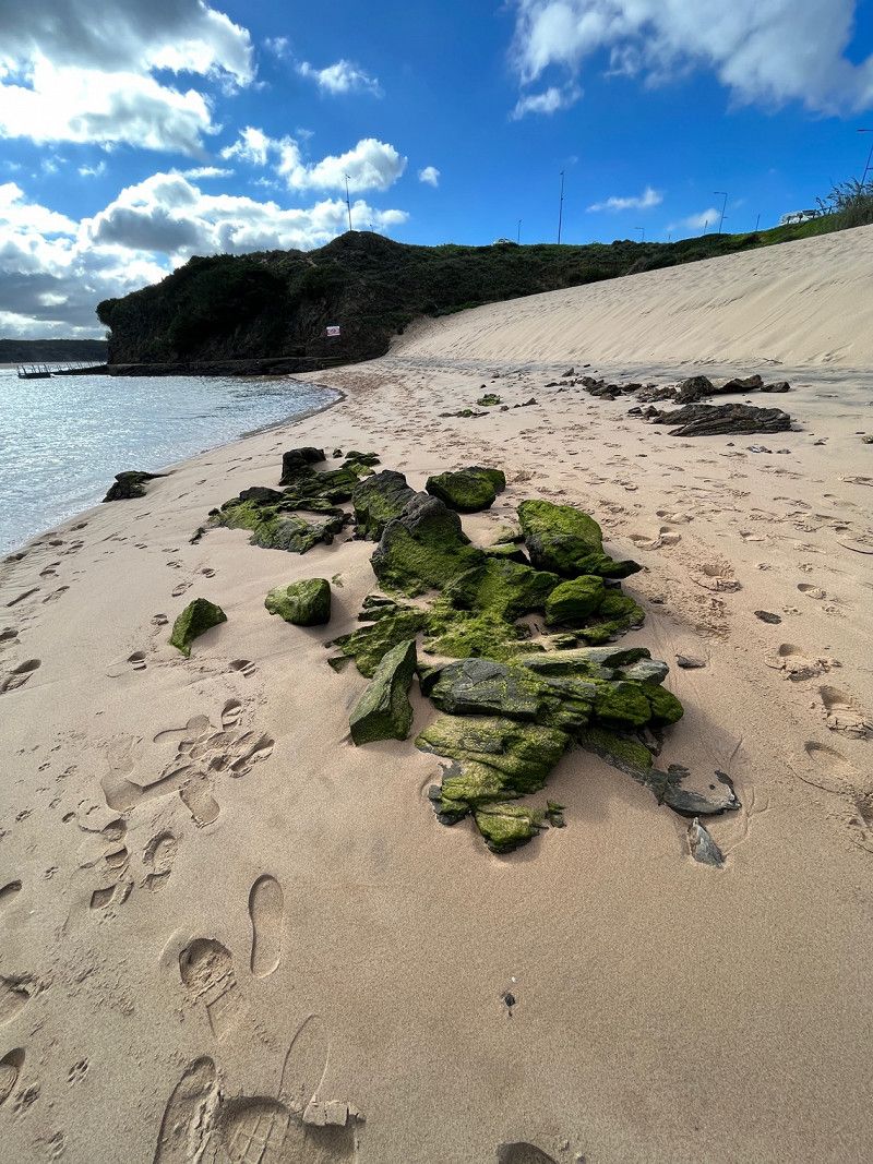
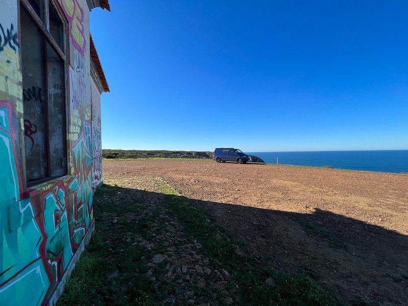
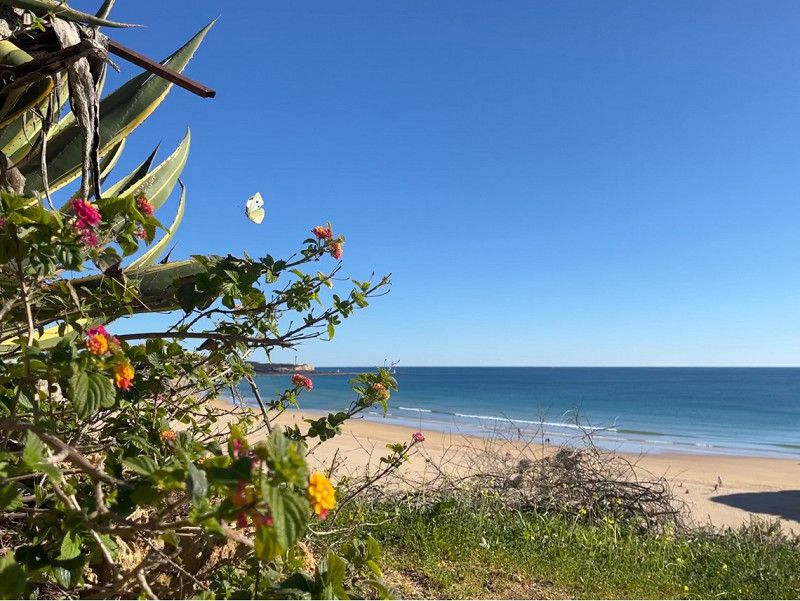
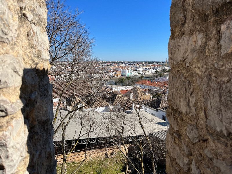
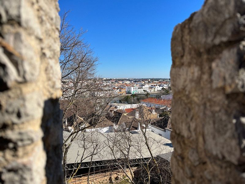
Valldovino
Were previously in Ferrol on a pitch that we didn't like.
This parking space costs €15 and you can do everything online, after that the barrier opens and you will receive your data by email. Code for exit.
Shower for 1 € warm available. Very clean
Avenida do Souto Vizoso, 45
43° 36' 11.7" N 8° 8' 12.9" W
43.6032410 -8.1369143
• Head toward As Covas on CP-5404. Go for 28 m.
• Continue on Meitufe (CP-5404). Go for 65 m.
• Continue on A Pichoca (CP-5404). Go for 188 m.
• Continue on CP-5404. Go for 105 m.
• Continue on A Riba (CP-5404). Go for 160 m.
• Continue on CP-5404. Go for 70 m.
• Continue on A Riba (CP-5404). Go for 221 m.
• Continue on Trandeiras (CP-5404). Go for 266 m.
• Continue on CP-5404. Go for 46 m.
• Continue on Trandeiras (CP-5404). Go for 137 m.
• Continue on A Bergaña (CP-5404). Go for 212 m.
• Continue on CP-5404. Go for 12 m.
• Continue on A Bergaña (CP-5404). Go for 145 m.
• Continue on CP-5404. Go for 32 m.
• Continue on Aviño (CP-5404). Go for 294 m.
• Continue on A Espiñuda (CP-5404). Go for 160 m.
• Continue on CP-5404. Go for 57 m.
• Continue on A Espiñuda (CP-5404). Go for 152 m.
• Continue on CP-5404. Go for 13 m.
• Continue on A Espiñuda (CP-5404). Go for 170 m.
• Continue on CP-5404. Go for 50 m.
• Continue on Mirós (CP-5404). Go for 509 m.
• Continue on Pousada (CP-5404). Go for 665 m.
• Continue on CP-5404. Go for 607 m.
• Continue on O Vilar de Lago (CP-5404). Go for 9 m.
• Continue on O Carballo-Sedes (CP-5404). Go for 293 m.
• Continue on A Feira do Trece (CP-5404). Go for 319 m.
• Continue on As Salgueiras (CP-5404). Go for 302 m.
• Continue on Guiove (CP-5404). Go for 334 m.
• Continue on O Camiño Novo (CP-5404). Go for 177 m.
• Continue on O Pazo (CP-5404). Go for 307 m.
• Continue on Martianes (CP-5404). Go for 235 m.
• Continue on Os Barreiros (CP-5404). Go for 629 m.
• Take the 3rd exit from roundabout onto Avenida Poeta Malde Vizoso (CP-5404). Go for 408 m.
• Take the 3rd exit from roundabout onto Avenida Poeta Malde Vizoso (CP-5404). Go for 3.3 km.
• Turn left onto Estrada de Castela (AC-862). Go for 622 m.
• Turn right onto AC-115. Go for 2.4 km.
• Turn right and take ramp onto AP-9 (Autoestrada do Atlántico) toward A Coruña/Santiago. Go for 30.4 km.
• Take the left exit toward Santiago/A-6/Lugo/Arteixo onto AP-9 (Autoestrada do Atlántico). Go for 53.4 km.
• Take exit 67 toward Santiago/Lugo/A-54/Aeroporto Lavacolla (SCQ)/Centro Histórico/Lavacolla. Go for 606 m.
• Take the 2nd exit from roundabout onto Avenida de Camilo José Cela toward Centro Histórico/Lavacolla/Aeropuerto Lavacolla/San Marcos/Tve Tvg. Go for 497 m.
• Turn right onto Rúa de San Lázaro (N-634) toward Santiago. Go for 158 m.
• Pass 2 roundabouts and continue on Rúa de San Lázaro (N-634). Go for 812 m.
• Turn right onto Rúa de Cruz Gallastegui. Go for 66 m.
• Turn left onto Rúa Pilar Miró. Go for 55 m.
• Turn right onto Rúa Madre Teresa Calcuta. Go for 33 m.
• Turn left onto Rúa da Pena María. Go for 10 m.
• Turn right onto Rúa do Vintecinco de Xullo. Go for 247 m.
• Arrive at Rúa do Vintecinco de Xullo. Your destination is on the right.
☍
100,1 km
(1 hrs. 1 min.)
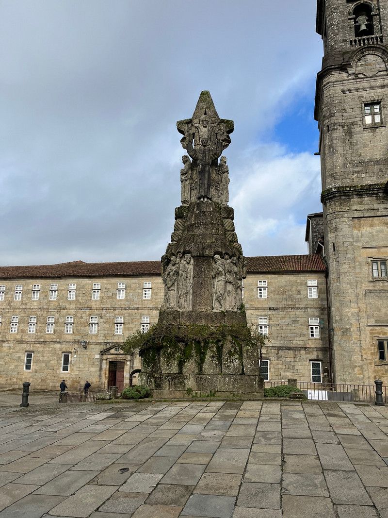
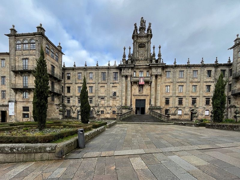
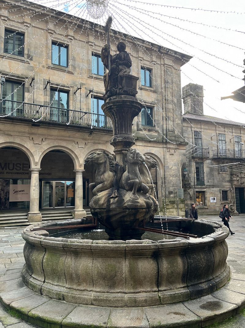
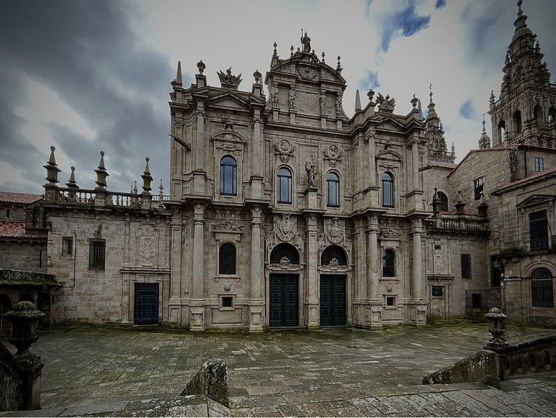
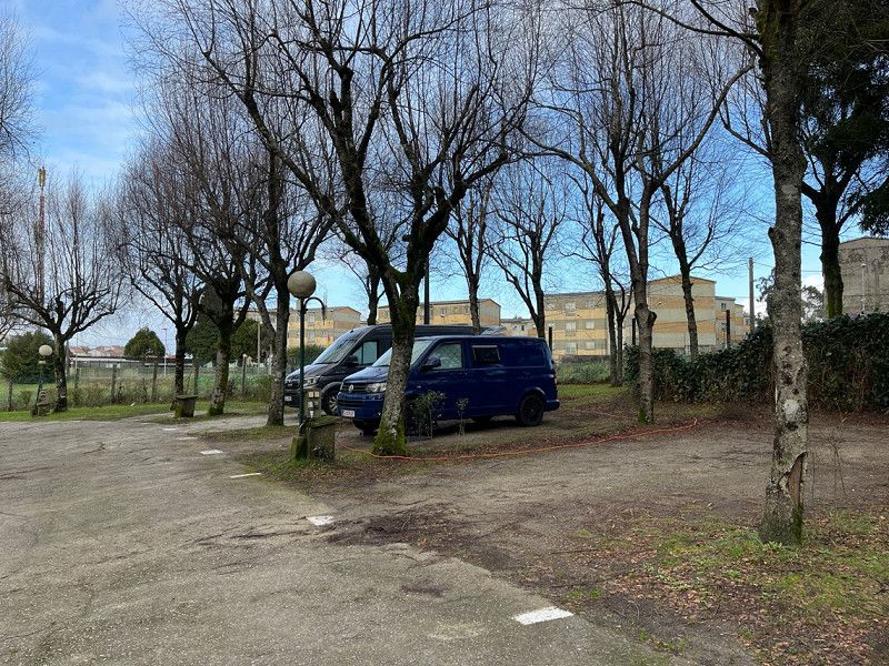
Day
Camping as Cancelas
Here we stood to see Santiago de Compostela. You can easily walk to all places here.
Rúa do 25 de Xullo, 35
42° 53' 23.4" N 8° 31' 27.9" W
42.8898315 -8.5244082
• Head toward Rúa da Pena María on Rúa do Vintecinco de Xullo. Go for 247 m.
• Turn left onto Rúa da Pena María. Go for 10 m.
• Turn right onto Rúa Madre Teresa Calcuta. Go for 33 m.
• Turn left onto Rúa Pilar Miró. Go for 137 m.
• Turn right onto Rúa de Raimundo García Rodríguez. Go for 88 m.
• Turn left onto Rúa de San Lázaro (N-634). Go for 333 m.
• Pass 2 roundabouts and continue on Rúa de San Lázaro (N-634). Go for 544 m.
• Take the 3rd exit from roundabout toward E-1/A-9/A Coruña/Pontevedra/SC-20/N-550/Aeroporto Lavacolla/A-54/Lugo/Oviedo. Go for 420 m.
• Take the 1st exit from roundabout onto AP-9 (Autoestrada do Atlántico) toward Pontevedra/AP-53/N-525/Ourense. Go for 110 km.
• Take the exit toward Tui (sur)/Portugal onto A-55. Go for 4.9 km.
• Continue on A3 (Autoestrada do Minho). Go for 64.7 km.
• Take exit 9 toward Barcelos/Guimarães/Braga onto A11 (Autoestrada do Baixo Minho). Go for 5.4 km.
• Take the left exit toward Braga Oeste. Go for 550 m.
• Continue on Rua Frei José Vilaça (N103). Go for 345 m.
• Take the 4th exit from roundabout onto Rua Padre Cruz (N103) toward Braga. Go for 886 m.
• Take the 2nd exit from roundabout onto Rua Padre Cruz (N103). Go for 370 m.
• Take the 2nd exit from Largo de Maximinos roundabout onto Rua Comendador António Santos da Cunha. Go for 404 m.
• Turn left onto Rua dos Bombeiros Voluntários. Go for 74 m.
• Turn right onto Rua dos Bombeiros Voluntários. Go for 132 m.
• Arrive at Rua dos Bombeiros Voluntários. Your destination is on the right.
☍
189,7 km
(1 hrs. 46 min.)
Day
Day
Day
Day
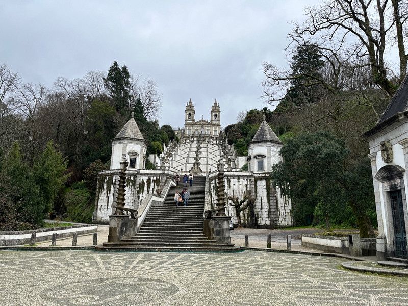
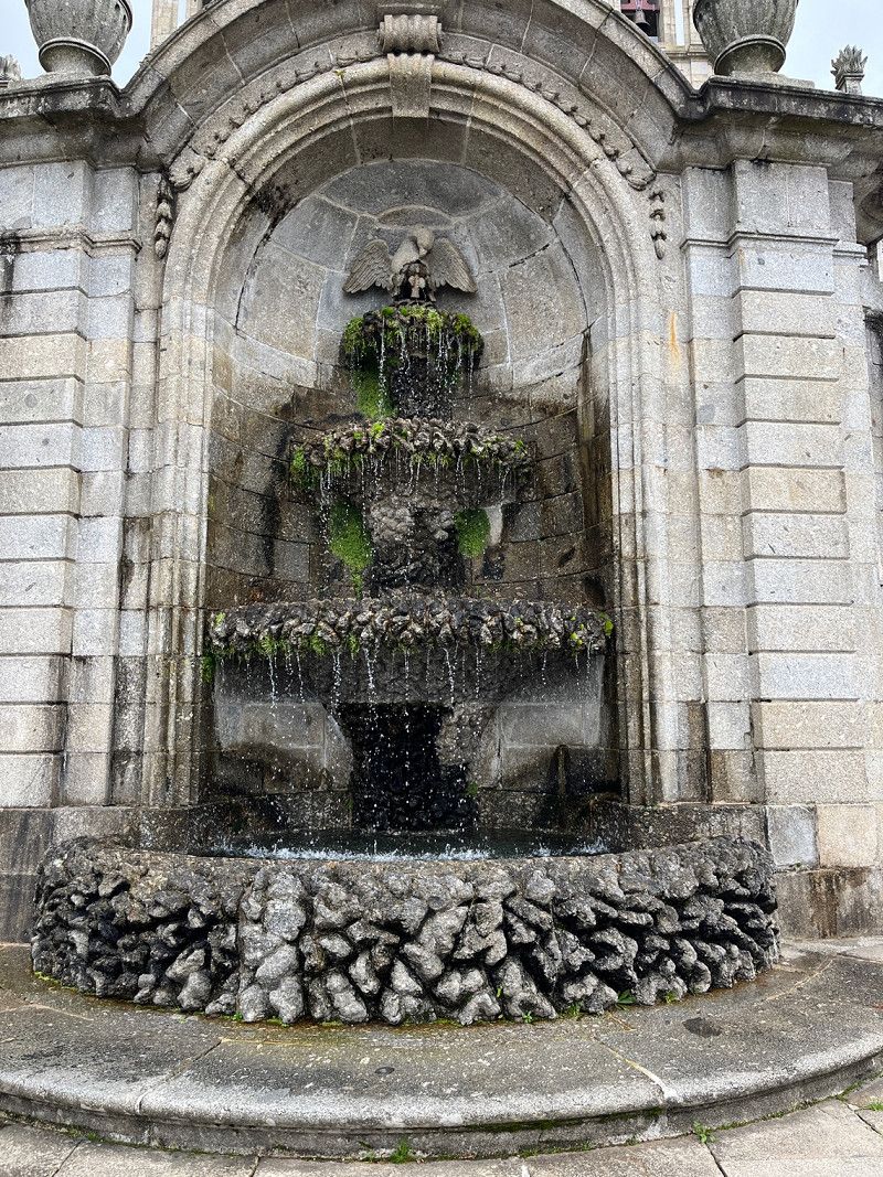
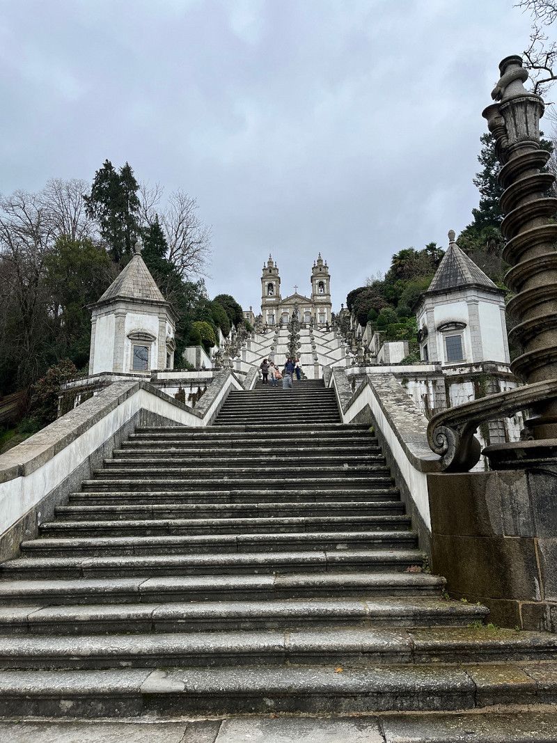
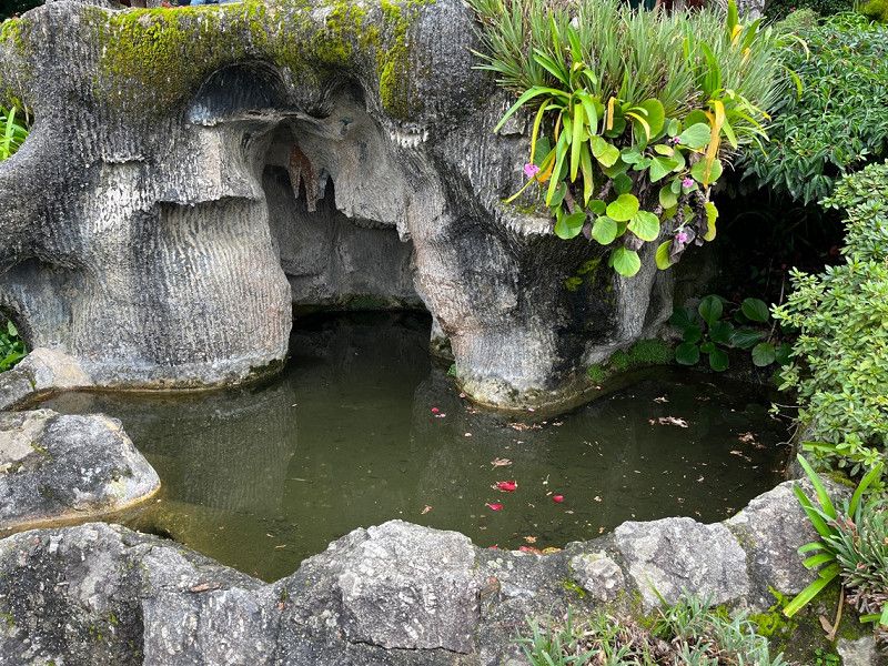
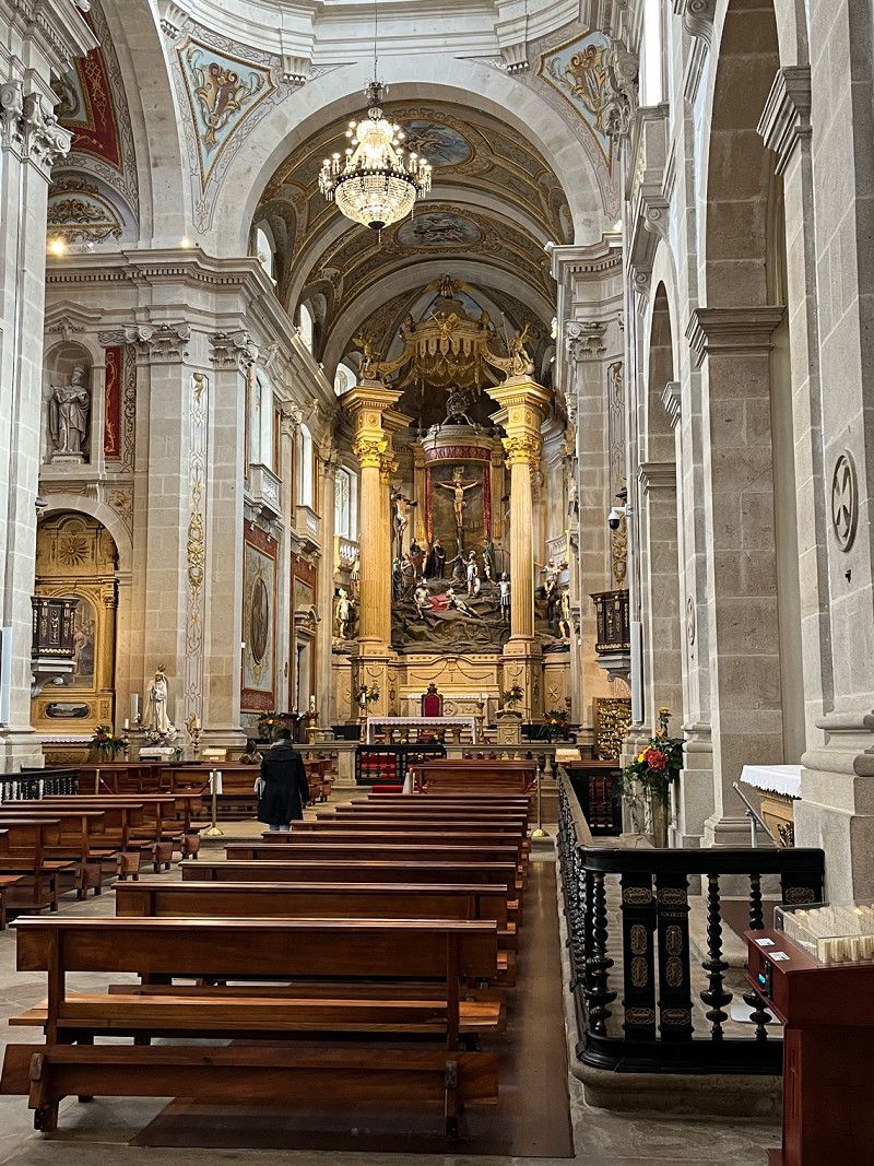
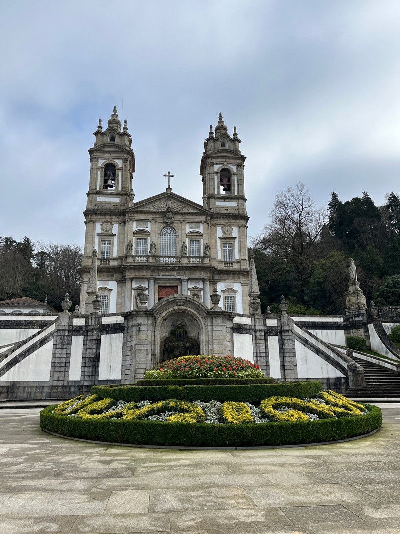
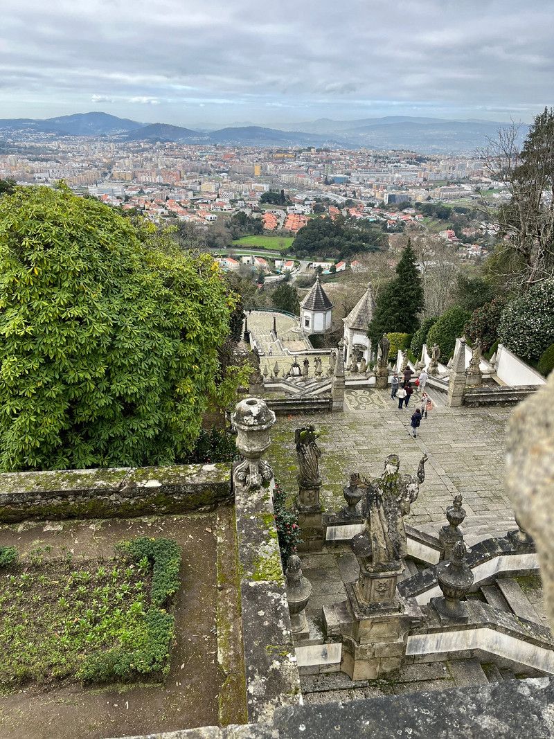
Braga, Portugal
We only looked at the Bom Jesus and then went on to Porto.
GHWF+59 Braga, Portugal
41° 32' 43.6" N 8° 25' 35.4" W
41.5454486 -8.4265070
• Head southwest on Rua dos Bombeiros Voluntários. Go for 132 m.
• Turn left onto Rua dos Bombeiros Voluntários. Go for 163 m.
• Turn right onto Avenida da Imaculada Conceição (N14). Go for 204 m.
• Keep left onto Avenida da Imaculada Conceição (N14) toward Guimarães/A11/Barcelos/Porto/A3/Valença. Go for 502 m.
• Take the 3rd exit from roundabout onto Rua Cidade do Porto (N14). Go for 640 m.
• Take the 1st exit from roundabout onto Rua Frei José Vilaça. Go for 204 m.
• Pass 2 roundabouts and continue on N103. Go for 576 m.
• Take ramp onto Circular Norte de Braga toward Porto/A3/Valença/Guimarães/A11/Barcelos/N14/N101. Go for 676 m.
• Continue on A11 (Autoestrada do Baixo Minho). Go for 3.1 km.
• Continue on Circular Sul de Braga. Go for 1.8 km.
• Take the left exit toward Porto/Famalicão onto A3 (Autoestrada do Minho). Go for 42.5 km.
• Take exit 6 toward VCI/Porto/Boavista/Gaia-Arrábida onto A20 (CRIP). Go for 4.8 km.
• Continue on A28 (Autoestrada do Litoral Norte). Go for 2.1 km.
• Continue on A1 (Autoestrada do Norte). Go for 630 m.
• Take exit 23 toward Afurada. Go for 301 m.
• Take the 3rd exit from roundabout onto Rua Abílio de Azevedo toward Afurada Centro. Go for 876 m.
• Turn left onto Rua da Praia (M627-2). Go for 325 m.
• Continue on Avenida Afonso de Alburquerque. Go for 76 m.
• Continue on Avenida Deocleciano Monteiro toward Cabedelo. Go for 272 m.
• Continue on Avenida Afonso de Alburquerque. Go for 499 m.
• Continue on Rotunda do Lago. Go for 58 m.
• Keep right onto Avenida Agustina Bessa Luís. Go for 729 m.
• Turn right onto Rua da Bélgica (M627). Go for 415 m.
• Turn left onto Rua Jorge Dias. Go for 185 m.
• Turn right onto Rua do Thom. Go for 93 m.
• Continue on Avenida Beira Mar. Go for 605 m.
• Arrive at Avenida Beira Mar. Your destination is on the left.
☍
62,5 km
( 45 min.)
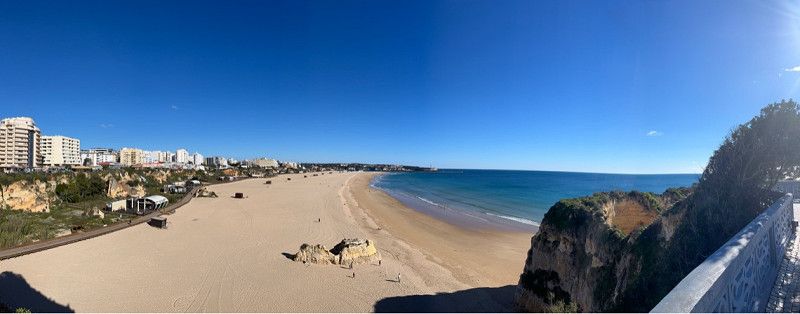
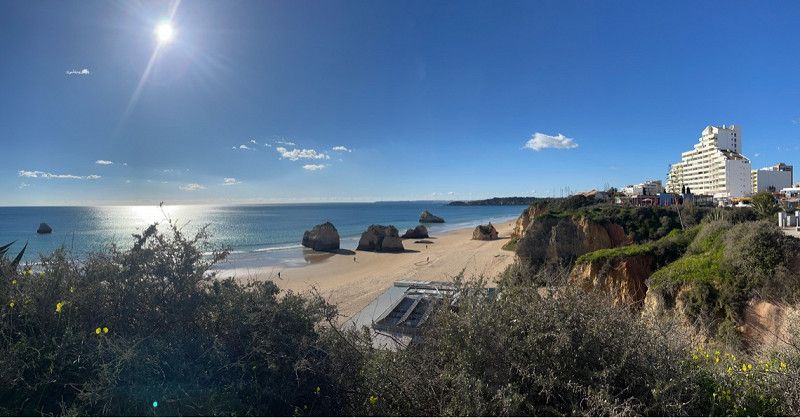
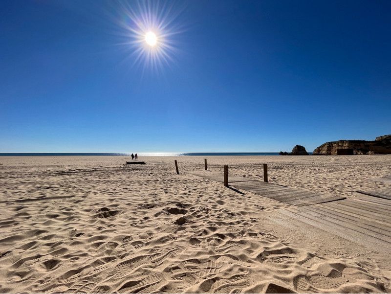
Parque Orbitur Canidelo
Checked in and enjoying the sun on the beach 😌
Avenida Beira-Mar 441, 4400-382, Vila Nova de Gaia, Portugal
41° 7' 26.1" N 8° 39' 58.8" W
41.1239200 -8.6663400
• Head toward Rua da Arca de Noé on Avenida Beira Mar. Go for 351 m.
• Turn left onto Rua de Salgueiros (M627-1). Go for 1.2 km.
• Continue on Rua do Viso (M627-1). Go for 134 m.
• Continue on Rua António Ferreira Braga Júnior. Go for 595 m.
• Turn left onto Rua da Bélgica (M627) toward Afurada. Go for 307 m.
• Turn right onto Rua Manuel Marques Gomes (M627-2) toward Afurada. Go for 162 m.
• Take the 2nd exit from Rua do Fontão roundabout onto Rua Manuel Marques Gomes (M627-2). Go for 677 m.
• Turn slightly right onto Rua Manuel Marques Gomes. Go for 163 m.
• Turn right onto Rua da Praia. Go for 963 m.
• Continue on Cais Lugan. Go for 669 m.
• Continue on Cais Cavaco. Go for 422 m.
• Continue on Cais Capelo Ivens. Go for 534 m.
• Continue on Rua do Cais da Fontaínha. Go for 141 m.
• Continue on Cais de Gaia. Go for 496 m.
• Take the 2nd exit from roundabout onto Avenida Ramos Pinto. Go for 453 m.
• Continue on Avenida Diogo Leite. Go for 526 m.
• Continue on Largo Dom Luís I. Go for 10 m.
• Arrive at Largo Dom Luís I. Your destination is on the left.
☍
7,8 km
( 14 min.)
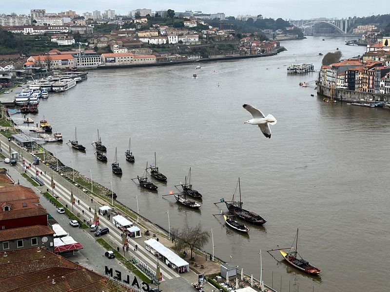
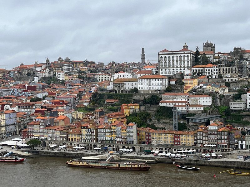
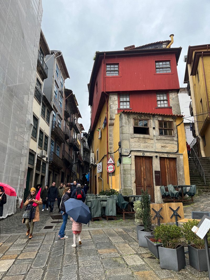
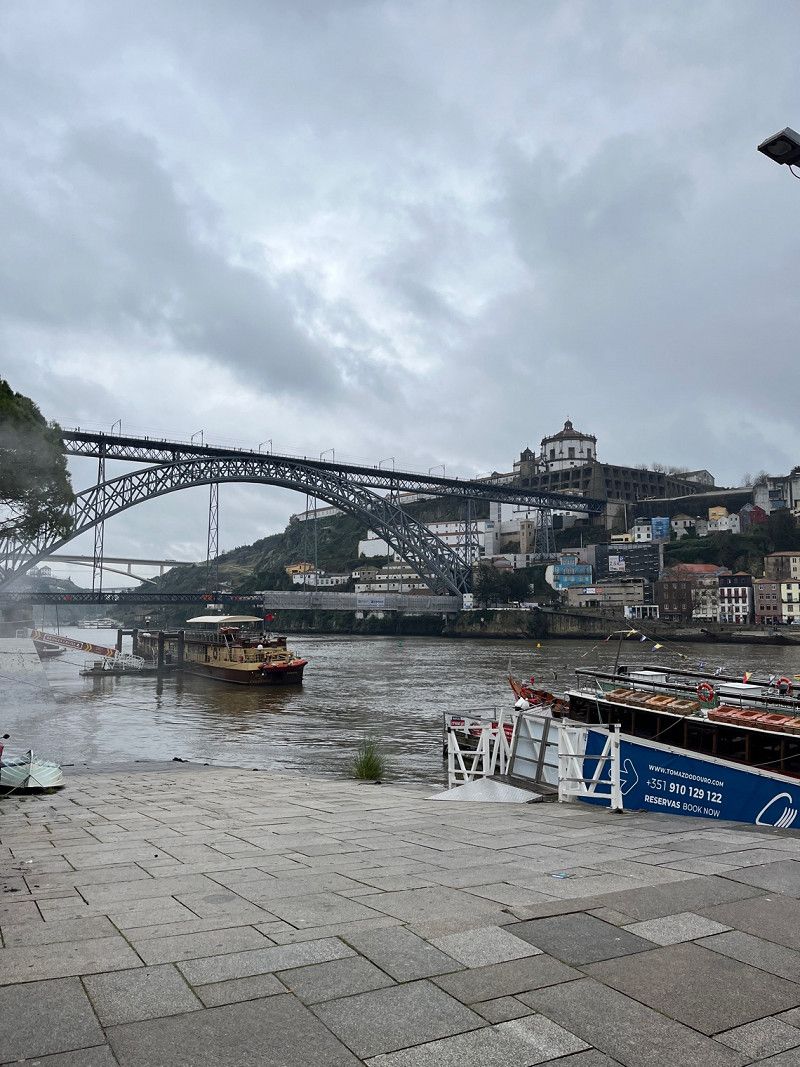
Day
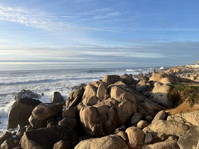
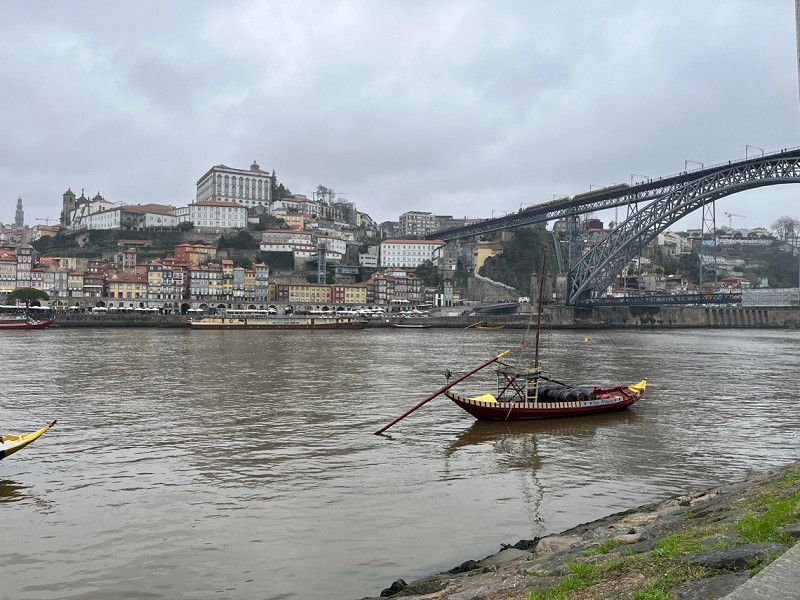
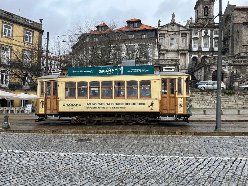
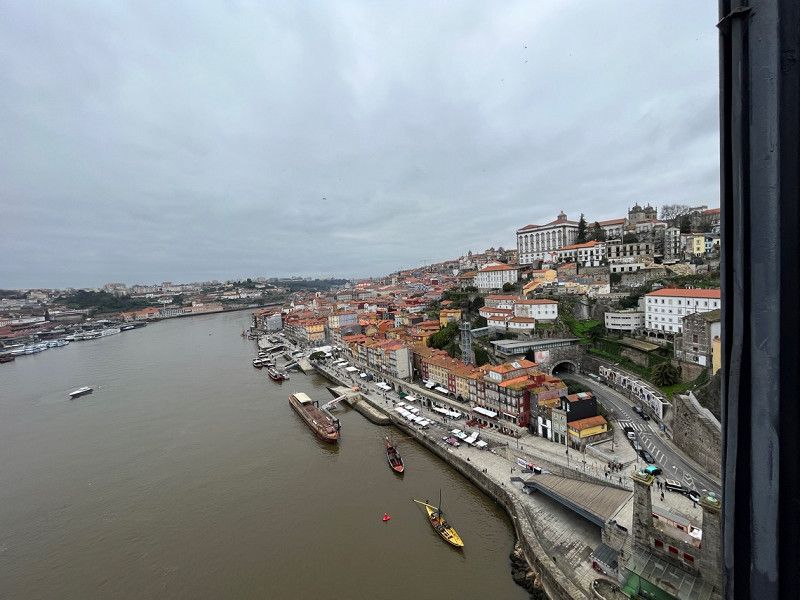
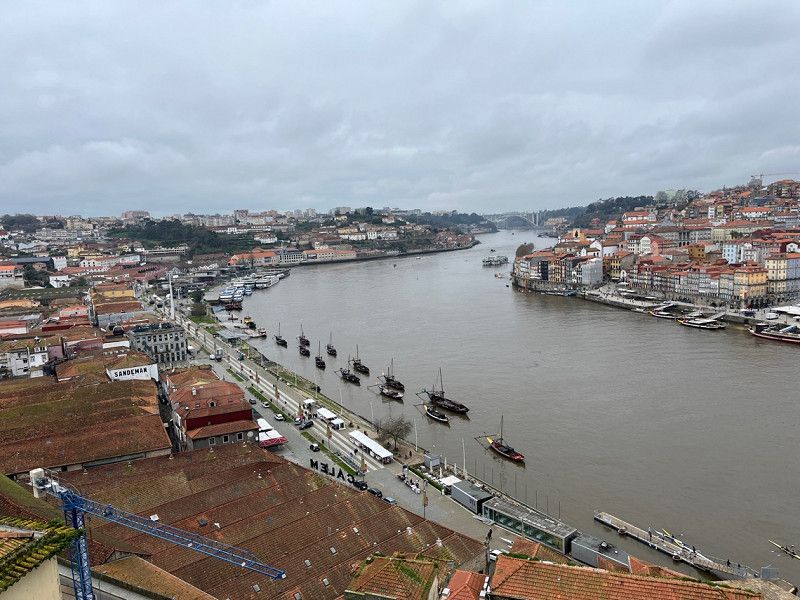
Porto
Porto visit when the weather is not so nice. It's very touristic. The little gases have it 👍
Ponte Dom Luís I
41° 8' 23.6" N 8° 36' 33.8" W
41.1398976 -8.6093924
• Head toward Avenida Diogo Leite on Largo Dom Luís I. Go for 10 m.
• Turn slightly left onto Rua do General Torres toward Centro V. N. Gaia/Estaçáo de General Torres. Go for 677 m.
• Turn left onto Rua Luís de Camões toward Centro V. N. Gaia. Go for 184 m.
• Turn right onto Avenida da República (N1). Go for 2.6 km.
• Take the 2nd exit from roundabout onto Avenida da República. Go for 272 m.
• Take the 2nd exit from roundabout onto A1 (Autoestrada do Norte) toward Lisboa/Carvalhos/Espinho/A29. Go for 49.0 km.
• Take exit 16 toward Aveiro onto A25 (Autoestrada da Costa da Prata). Go for 10.7 km.
• Take the exit toward Aveiro onto A25 (Autoestrada Beiras Litoral e Alta). Go for 6.2 km.
• Take exit 3 toward Aveiro. Go for 336 m.
• Take the 1st exit from roundabout. Go for 251 m.
• Take the 3rd exit from Rotunda dos Marnotos roundabout onto Rua do Alavário. Go for 362 m.
• Continue on Rua do Clube dos Galitos. Go for 22 m.
• Arrive at Rua do Clube dos Galitos. Your destination is on the left.
☍
70,6 km
( 45 min.)
Day
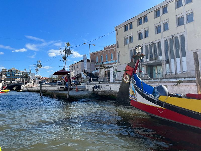
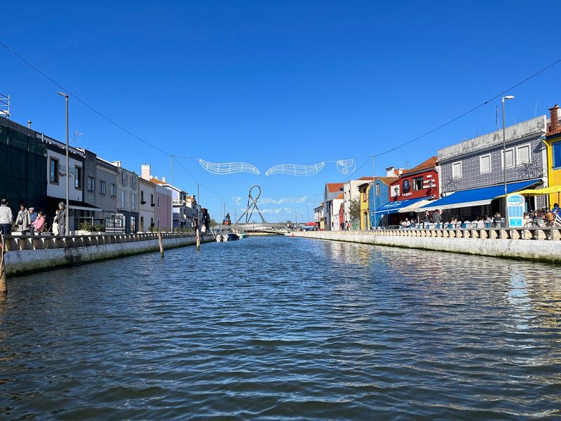
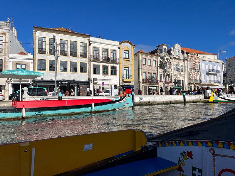
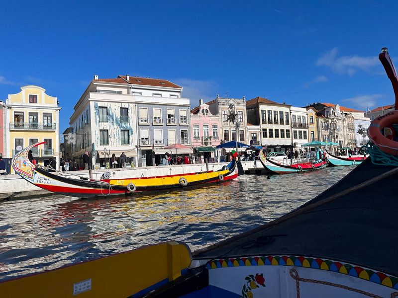
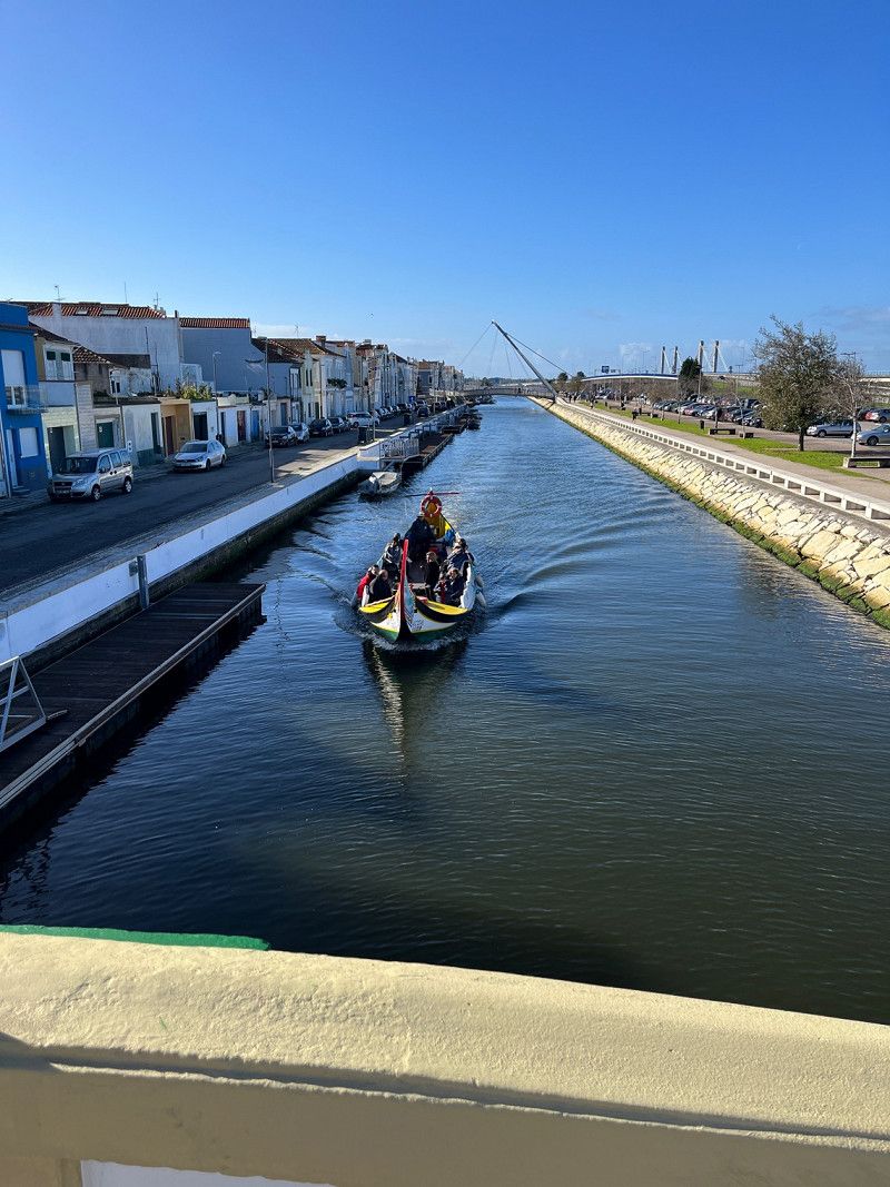
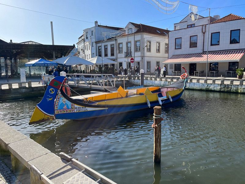
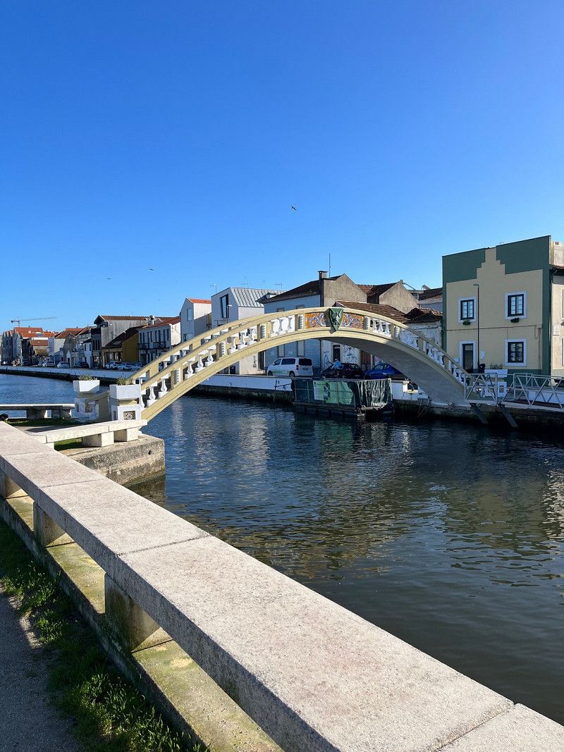
Aveiro
Today a great day to see Aveiro.
Rua do Clube dos Galitos 21–25
40° 38' 27.6" N 8° 39' 22.7" W
40.6409921 -8.6563068
• Head toward Rua José Rabumba on Rua do Clube dos Galitos. Go for 212 m.
• Take the 4th exit from Praça Humberto Delgado roundabout onto Rua do Clube dos Galitos. Go for 342 m.
• Continue on Rua do Alavário. Go for 237 m.
• Take the 1st exit from Rotunda dos Marnotos roundabout. Go for 258 m.
• Take the 2nd exit from roundabout onto A25 (Autoestrada Beiras Litoral e Alta). Go for 8.3 km.
• Continue on Avenida de Nossa Senhora da Saúde (N109-7). Go for 1.1 km.
• Continue on Avenida José Estevão (N109-7). Go for 1.8 km.
• Continue on M592. Go for 5.1 km.
• Take the 1st exit from roundabout onto Avenida João Vaz da Silva. Go for 417 m.
• Continue on Avenida João Vaz. Go for 27 m.
• Turn left onto Rua Onze. Go for 71 m.
• Turn left onto Avenida Claudino Santos Costa (M592). Go for 16 m.
• Turn right onto Rua António Labrego. Go for 252 m.
• Turn right onto M592. Go for 1.4 km.
• Turn right. Go for 32 m.
• Arrive at your destination on the right.
☍
19,5 km
( 22 min.)
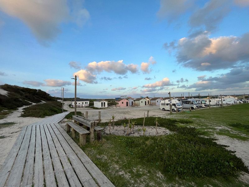
Área de Autocaravanas
Super nice pitch, the owner very friendly.
thanks
Ria do Governador, 3840-254, Vagos, Portugal
40° 32' 58" N 8° 46' 14" W
40.5494444 -8.7705556
• Head east. Go for 32 m.
• Turn right onto M592. Go for 3.3 km.
• Turn left toward Rua Principal/M591. Go for 556 m.
• Turn right onto Rua Principal (M591). Go for 3.7 km.
• Turn left onto Rua do Leque Florestal. Go for 7.0 km.
• Continue straight ahead. Go for 731 m.
• Continue straight ahead. Go for 260 m.
• Continue toward Autoestrada do Litoral Centro/A17. Go for 32 m.
• Take the 3rd exit from roundabout onto A17 (Autoestrada do Litoral Centro) toward Lisboa/Fig.ra Foz. Go for 93.9 km.
• Continue on A8 (Autoestrada do Oeste). Go for 2.7 km.
• Take exit 24 toward M.nha Grande/Maceira. Go for 792 m.
• Keep left toward M.nha Grande/Maceira. Go for 1.2 km.
• Take ramp onto N242 toward Nazaré/Pataias. Go for 8.1 km.
• Take the 2nd exit from roundabout onto Avenida Rainha Santa Isabel (N242). Go for 991 m.
• Take the 2nd exit from roundabout onto N242. Go for 6.9 km.
• Pass 2 roundabouts and continue on N242. Go for 1.3 km.
• Take the 1st exit from roundabout onto Rua 25 de Abril. Go for 624 m.
• Turn right onto Rua das Figueiras. Go for 100 m.
• Turn left onto Largo de Touros. Go for 151 m.
• Continue on Rua da Fonte Nova. Go for 14 m.
• Turn left onto Rua Teófilo Braga. Go for 174 m.
• Turn right onto Largo da Fonte Velha. Go for 110 m.
• Continue on Rua Inacio Aires de Azevedo. Go for 29 m.
• Turn left. Go for 119 m.
• Turn right. Go for 182 m.
• Turn left toward Estrada do Farol. Go for 213 m.
• Turn right onto Estrada do Farol. Go for 303 m.
• Arrive at Estrada do Farol. Your destination is on the left.
☍
133,5 km
(1 hrs. 34 min.)
Day
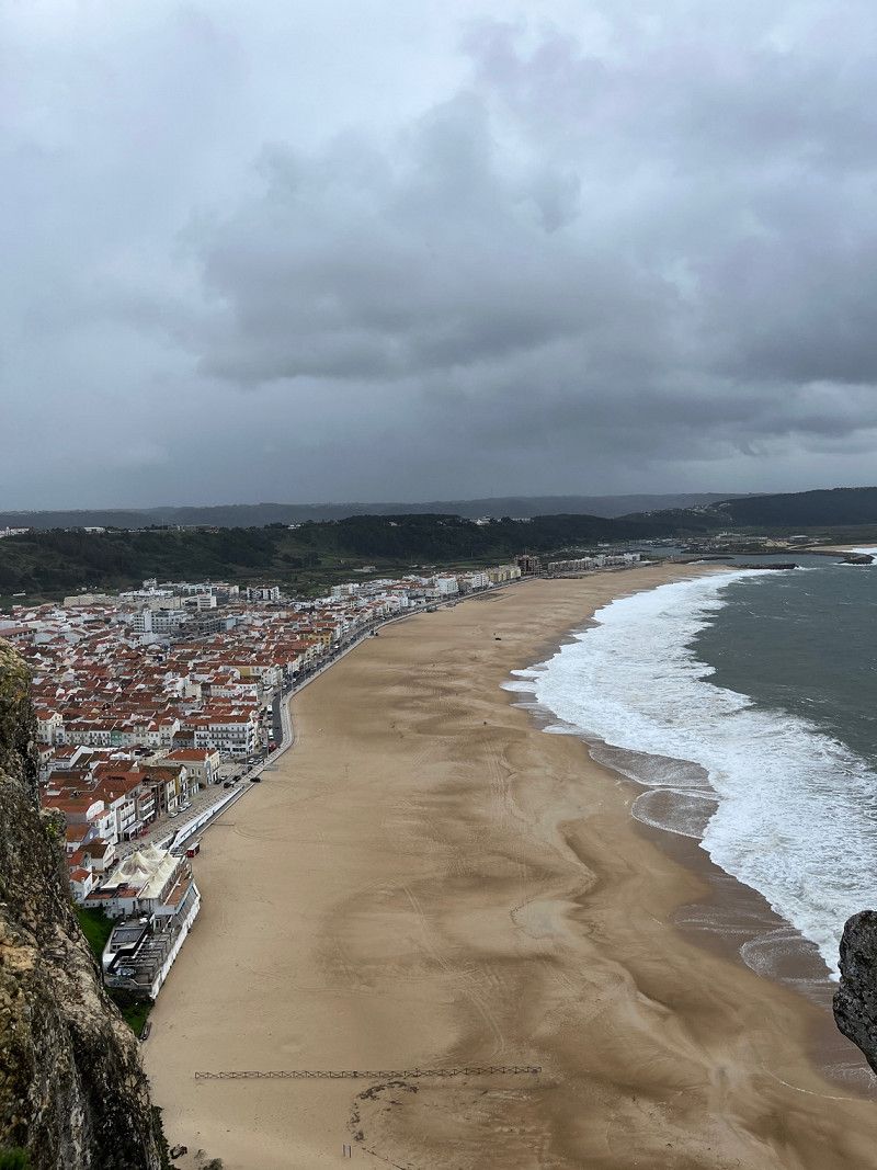
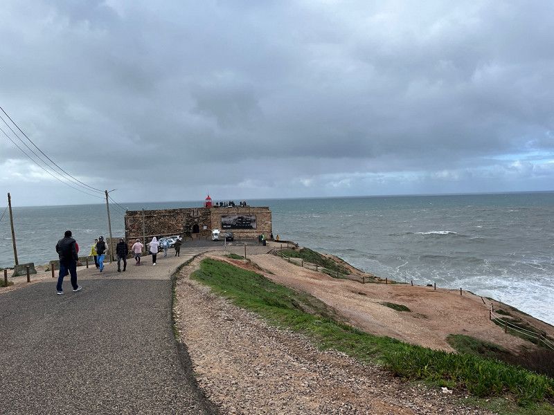
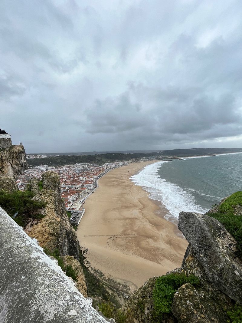
Nazaré, Portugal
We had also looked at Nazare, a lot of tourists mocked, with us it was just super windy and no big waves so we drove on.
JW37+QX Nazaré, Portugal
39° 36' 16" N 9° 5' 6.2" W
39.6044323 -9.0850679
• Head east on Estrada do Farol. Go for 303 m.
• Turn left. Go for 213 m.
• Turn right toward Rua Inacio Aires de Azevedo. Go for 301 m.
• Turn right onto Rua Inacio Aires de Azevedo. Go for 29 m.
• Continue on Largo da Fonte Velha. Go for 110 m.
• Turn right onto Rua Dom Fuas Roupinho. Go for 21 m.
• Turn left onto Praça da República. Go for 41 m.
• Continue on Rua Dr. Joaquim Manso. Go for 80 m.
• Turn left onto Rua 25 de Abril. Go for 837 m.
• Take the 3rd exit from roundabout onto N242. Go for 551 m.
• Take the 2nd exit from roundabout onto N242. Go for 709 m.
• Take the 1st exit from roundabout onto Variante da Nazaré toward Caldas da Rainha/Alcobaça/A8/A17. Go for 1.5 km.
• Take the 4th exit from roundabout onto IC9 toward Tomar/V.do Frades/Alcobaça/A8/A17. Go for 4.3 km.
• Take ramp toward Valado dos Frades/N8-5/A8. Go for 582 m.
• Take the 1st exit from roundabout toward A8/Valado dos Frades. Go for 537 m.
• Take the 4th exit from roundabout onto N8-5 toward A8. Go for 704 m.
• Take the 3rd exit from roundabout onto A8 (Autoestrada do Oeste) toward Lisboa. Go for 35.2 km.
• Take exit 14 toward Peniche onto IP6. Go for 16.5 km.
• Pass 3 roundabouts and continue on Avenida Mons. Manuel Bastos Rod. de Sousa (IP6). Go for 4.1 km.
• Take the 3rd exit from roundabout onto Avenida 25 de Abril. Go for 53 m.
• Turn right onto Rua da Alegria. Go for 202 m.
• Continue on Largo do Pocinho. Go for 125 m.
• Turn right onto Rua da Liberdade. Go for 80 m.
• Arrive at Rua da Liberdade. Your destination is on the right.
☍
67,0 km
( 51 min.)
ASA Peniche - Motorhome Park, Rua da Liberdade, Peniche, Portugal
Here we stayed the night to see Peniche the next day and continue driving because it was so windy.
The place is great and the reception super friendly.
N 39º 21' 58.590'' W 09º 22' 45.264, R. da Liberdade 12, 2520-322 Peniche, Portugal
39° 21' 58.6" N 9° 22' 45.1" W
39.3662807 -9.3791984
• Head northwest on Rua da Liberdade. Go for 92 m.
• Turn slightly right onto Rua 1 de Maio. Go for 154 m.
• Turn right onto Avenida Mariano Calado (N114). Go for 468 m.
• Keep left onto Largo dos Navegantes (N114). Go for 37 m.
• Take the 2nd exit from roundabout onto IP6. Go for 1.1 km.
• Take the 2nd exit from roundabout onto Avenida Mons. Manuel Bastos Rod. de Sousa (IP6). Go for 1.1 km.
• Take the 3rd exit from roundabout onto IP6. Go for 1.8 km.
• Take the 2nd exit from roundabout onto IP6. Go for 16.2 km.
• Take ramp onto A8 (Autoestrada do Oeste) toward Lisboa/Bombarral. Go for 62.4 km.
• Take exit 3A toward A5/IC19/A16/IC22 onto A9 (CREL). Go for 19.4 km.
• Take exit 1 toward Cascais/Oeiras onto A5 (Autoestrada da Costa do Estoril). Go for 15.9 km.
• Take exit 12 toward Malveira/Alda. Juso. Go for 362 m.
• Continue on Estrada da Malveira da Serra (N9-1). Go for 378 m.
• Pass 2 roundabouts and continue on Estrada da Malveira da Serra (N9-1). Go for 3.3 km.
• Continue on Avenida de Nossa Senhora da Assunção (N247-5). Go for 227 m.
• Continue on Rua do Cabo (N247). Go for 4.9 km.
• Turn left onto Estrada do Cabo da Roca (N247-4). Go for 92 m.
• Turn right onto Rua da Escola Nova. Go for 293 m.
• Turn slightly left onto Rua da Escola Nova. Go for 13 m.
• Turn right onto Estrada do Cabo da Roca (N247-4). Go for 2.3 km.
• Turn left. Go for 153 m.
• Turn right. Go for 30 m.
• Enter the roundabout. Go for 37 m.
• Arrive at your destination.
☍
130,7 km
(1 hrs. 28 min.)
Day
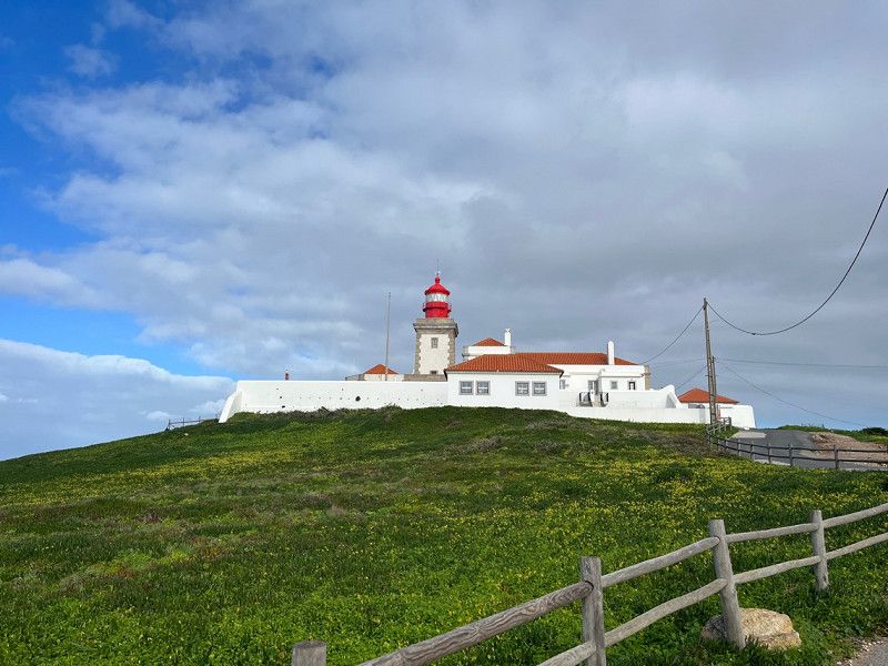
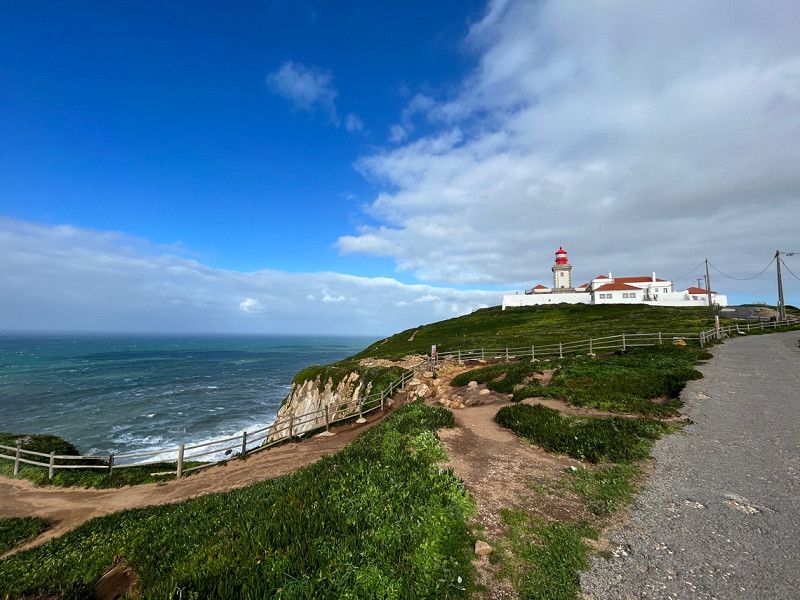
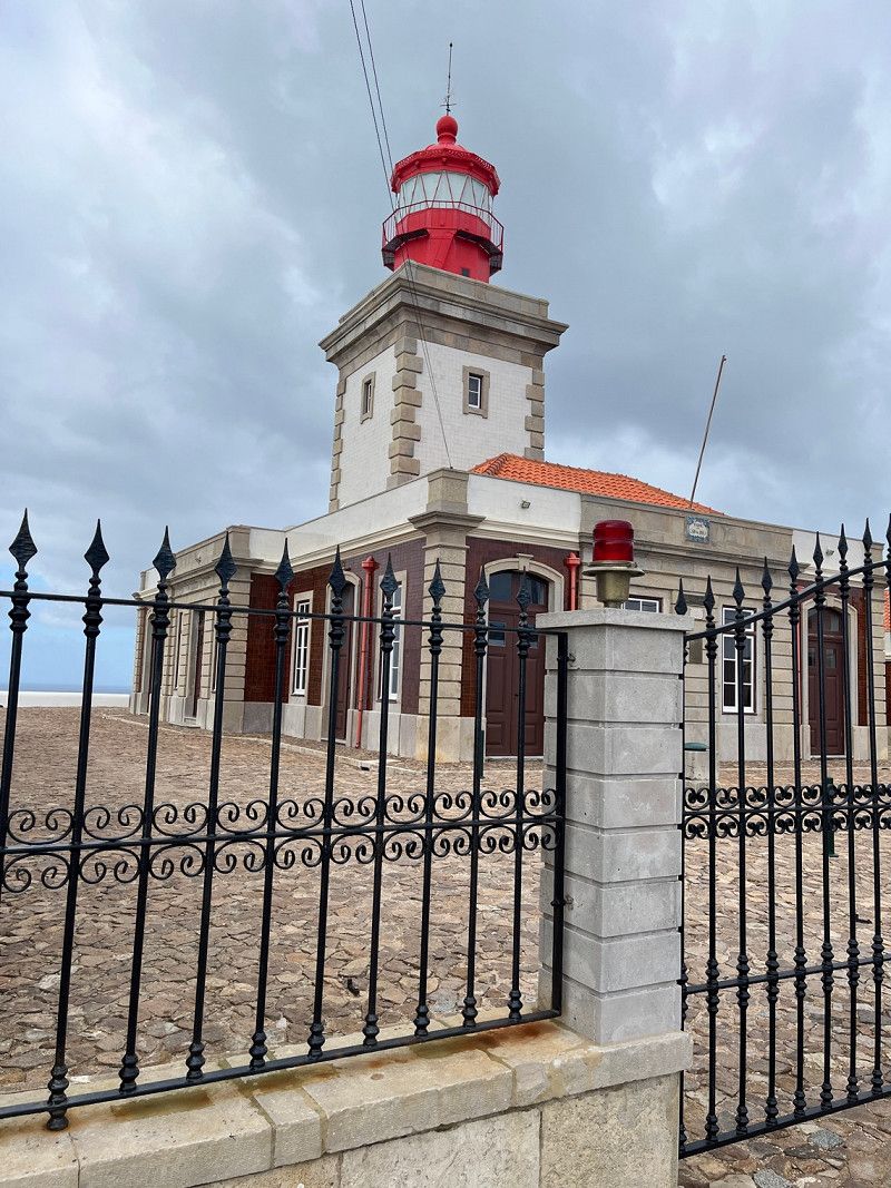
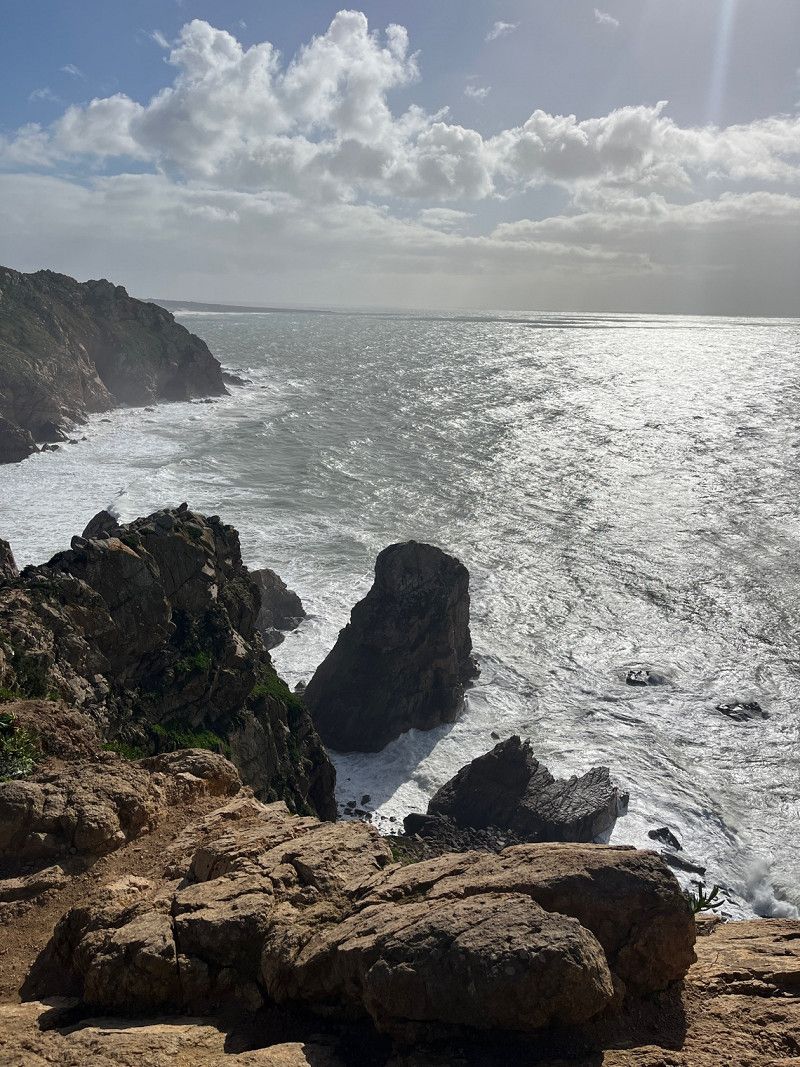
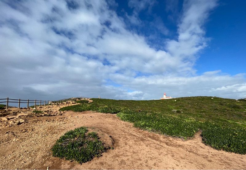
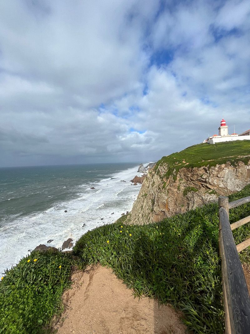
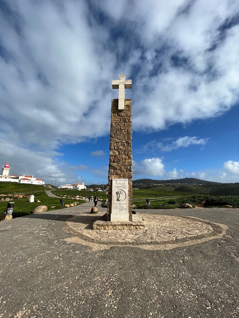
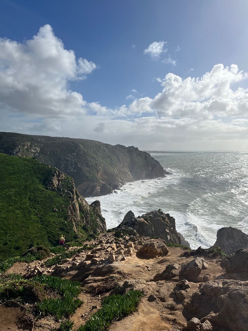
Cabo da Roca, Colares, Portugal
The westernmost point of Europe
Cabo da Roca, 2705-001 Colares, Portugal
38° 46' 49" N 9° 29' 56" W
38.7802778 -9.4988889
• Follow the roundabout. Go for 36 m.
• Take the 1st exit from roundabout. Go for 189 m.
• Turn right onto Estrada do Cabo da Roca (N247-4). Go for 2.2 km.
• Continue on N247-4. Go for 39 m.
• Turn left toward Rua da Escola Nova. Go for 19 m.
• Turn right onto Rua da Escola Nova. Go for 259 m.
• Turn left onto Estrada do Cabo da Roca (N247-4). Go for 92 m.
• Turn right onto N247. Go for 4.9 km.
• Turn left onto Avenida de Nossa Senhora da Assunção (N247-5). Go for 216 m.
• Continue on Rua de Cascais (N9-1). Go for 2.7 km.
• Pass 2 roundabouts and continue on Estrada da Malveira da Serra (N9-1). Go for 1.1 km.
• Take ramp. Go for 347 m.
• Continue on A5 (Autoestrada da Costa do Estoril). Go for 20.6 km.
• Take exit 4 toward Buraca/Norte/A1/Aeroporto onto A36 (CRIL). Go for 1.5 km.
• Take ramp toward Buraca. Go for 248 m.
• Arrive at your destination on the right.
☍
34,4 km
( 32 min.)
Day
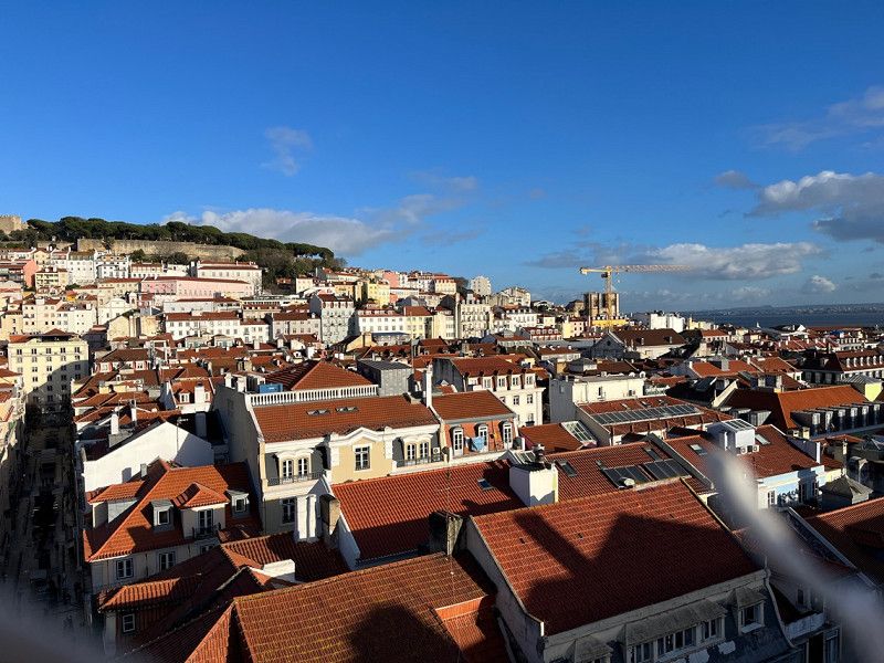
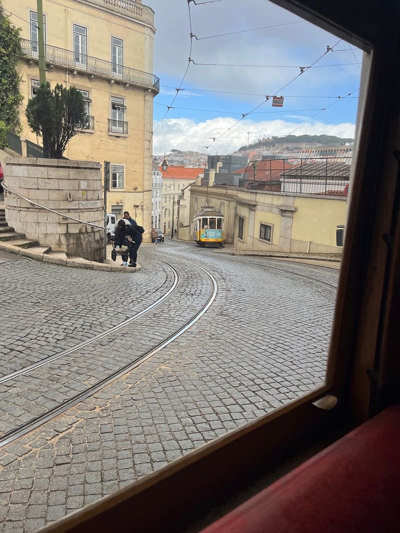
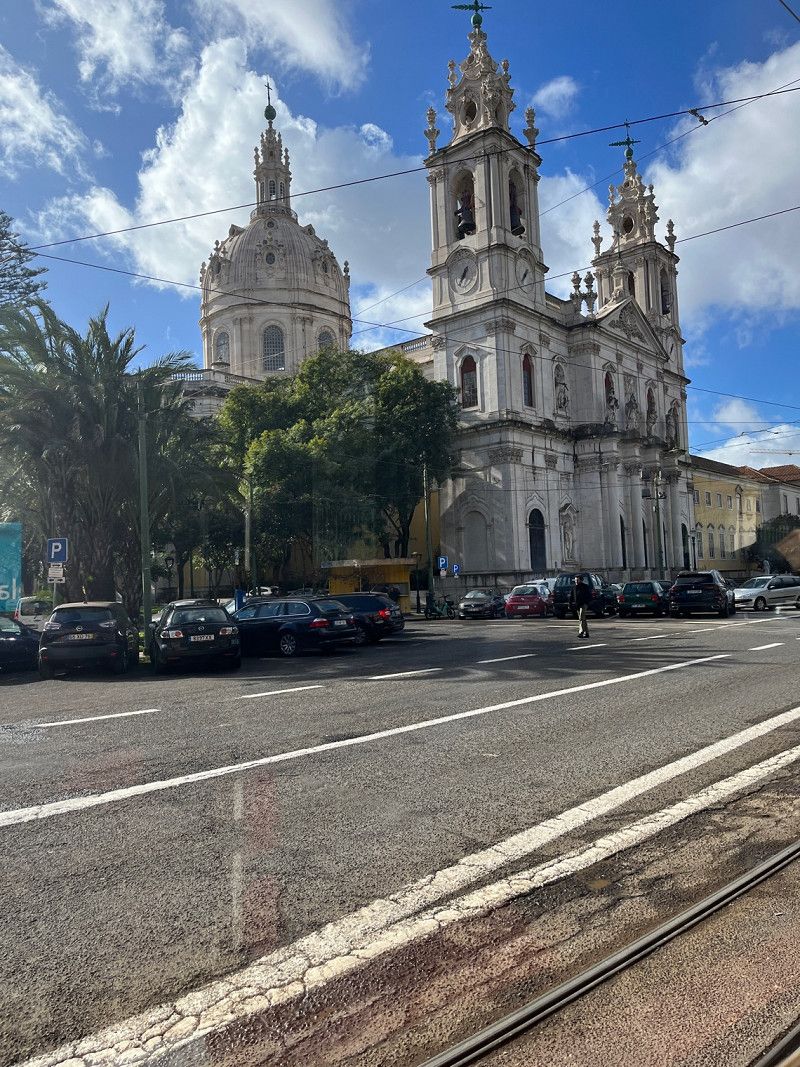
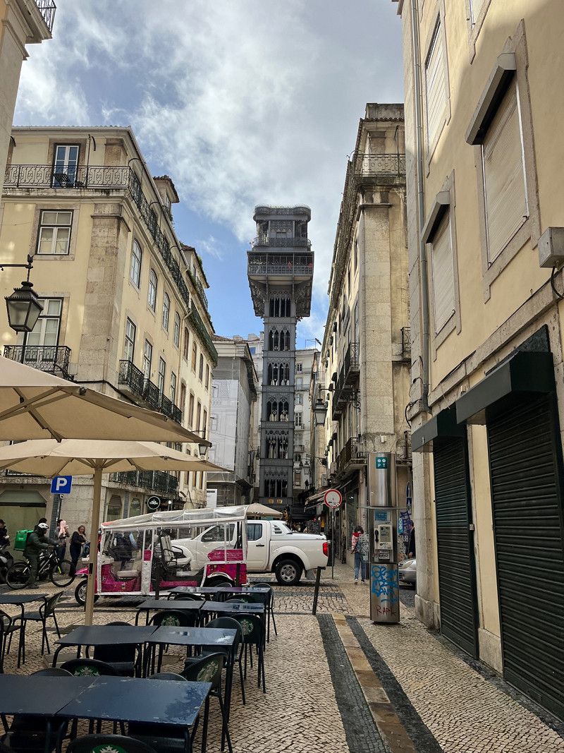
Lisboa Camping & Bungalows
We stand here to see Lisbon. Camping is ok has everything you need. We saw Lisbon with a train, it was very nice
Estrada da Circunvalação, 1400 - 061, Monsanto, Portugal
38° 43' 28.4" N 9° 12' 28.8" W
38.7245600 -9.2080000
• Take ramp. Go for 10 m.
• Continue on Estrada da Circunvalação. Go for 227 m.
• Turn left onto Estrada de Almarjão. Go for 84 m.
• Take the 1st exit from roundabout onto Estrada de Almarjão. Go for 440 m.
• Take the 3rd exit from roundabout onto Estrada de Almarjão toward Amadora/Sintra. Go for 178 m.
• Take ramp onto N117 toward Amadora/Sintra. Go for 2.9 km.
• Take ramp onto Autoestrada Radial de Sintra (A37) toward Sintra/Hospital. Go for 7.0 km.
• Keep left onto Autoestrada Radial de Sintra (A37) toward Sintra/Cacém Poente. Go for 1.2 km.
• Keep left onto Autoestrada Radial de Sintra (A37) toward Sintra/Rio de Mouro. Go for 2.5 km.
• Keep left onto Autoestrada Radial de Sintra (A37) toward Sintra/Mem Martins/Carcavelos/N249-4. Go for 2.4 km.
• Take ramp onto A16 toward Sintra/Mafra/Ericeira/Pêro Pinheiro. Go for 3.0 km.
• Take exit 8 toward Centro Sintra/Colares onto Avenida General Mário Firmino Miguel. Go for 381 m.
• Keep left onto Avenida General Mário Firmino Miguel toward Colares/Sintra. Go for 799 m.
• Take the 2nd exit from Rotunda Doutor Eduardo Lacerda Tavares roundabout onto Avenida Doutor Desidério Cambournac toward Colares/Lourel/Estefânea Norte/Portela. Go for 555 m.
• Take the 2nd exit from roundabout onto Avenida Doutor Desidério Cambournac toward Colares/Estefânea-Norte. Go for 364 m.
• Continue on Avenida Heliodoro Salgado (N9). Go for 34 m.
• Arrive at Avenida Heliodoro Salgado (N9).
☍
22,0 km
( 19 min.)
Day
Day
Sintra, Portugal
Visit the park and the castle in Sintra.
2710 Sintra, Portugal
38° 48' 10.3" N 9° 22' 54" W
38.8028687 -9.3816589
• Head toward Rua Cp. Mário Alberto Soares Pimentel on Avenida Heliodoro Salgado (N9). Go for 82 m.
• Take the 4th exit from roundabout onto Avenida Heliodoro Salgado (N9). Go for 206 m.
• Continue on Avenida Doutor Desidério Cambournac. Go for 311 m.
• Take the 2nd exit from roundabout onto Avenida Doutor Desidério Cambournac. Go for 565 m.
• Take the 1st exit from Rotunda Doutor Eduardo Lacerda Tavares roundabout onto Avenida General Mário Firmino Miguel toward A16/A9/IC19/Algueirão. Go for 578 m.
• Take ramp onto A16 toward Lisboa/IC19/Cascais. Go for 2.7 km.
• Take exit 7 toward Lisboa/Amadora onto A37 (Autoestrada Radial de Sintra). Go for 1.5 km.
• Keep left onto Autoestrada Radial de Sintra (A37) toward Lisboa/Algueirão/Rio de Mouro/N249. Go for 1.5 km.
• Keep left onto Autoestrada Radial de Sintra (A37) toward Lisboa/Rio de Mouro. Go for 2.8 km.
• Keep left onto Autoestrada Radial de Sintra (A37) toward Lisboa/Tercena/Massamá. Go for 4.0 km.
• Keep left onto Autoestrada Radial de Sintra (A37) toward Lisboa/Queluz. Go for 3.4 km.
• Take ramp onto N117 toward Lisboa/Cascais/A5/Algés. Go for 3.1 km.
• Keep left onto N117 toward Lisboa/A5/Sul/A2/Belém. Go for 676 m.
• Take ramp onto A5 (Autoestrada da Costa do Estoril) toward Lisboa/Sul/A2. Go for 2.5 km.
• Keep right toward Pr. de Espanha/Sul/A2. Go for 734 m.
• Take the exit toward A2/Sul/Ponte onto IP7 (Eixo Norte-Sul). Go for 4.8 km.
• Continue on A2 (Autoestrada do Sul). Go for 115 km.
• Take exit 10 toward Grândola/N259/Ferreira/Lisboa/Algarve/Grândola/Ourique onto IC1. Go for 22.2 km.
• Turn right onto N261 toward Alvalade/Lagos/Cercal/V. N.va Milfontes. Go for 983 m.
• Take the 2nd exit from roundabout onto N261. Go for 659 m.
• Continue on N262. Go for 31.9 km.
• Continue on N389. Go for 1.6 km.
• Take the 2nd exit from Largo dos Caieiros roundabout onto Rua 25 de Abril (N390) toward Lagos/Milfontes. Go for 10.7 km.
• Pass 2 roundabouts and continue on N390. Go for 2.4 km.
• Take the 1st exit from roundabout toward V. N.va Milfontes. Go for 115 m.
• Continue on Rua Custódio Brás Pacheco. Go for 316 m.
• Take the 2nd exit from Largo Custódio Brás Pacheco roundabout onto Rua Custódio Brás Pacheco. Go for 212 m.
• Turn right onto Rua dos Combatentes Portugueses. Go for 231 m.
• Turn left toward Rua Pinhal do Moinho. Go for 90 m.
• Continue on Rua Pinhal do Moinho. Go for 311 m.
• Continue on Rua da Praça. Go for 66 m.
• Turn right onto Bairro do Altinho. Go for 132 m.
• Turn right onto Bairro do Altinho. Go for 137 m.
• Arrive at Bairro do Altinho. Your destination is on the right.
☍
216,8 km
(2 hrs. 22 min.)
Day
Parque Natural do Sudoeste Alentejano e Costa Vicentina
We spent three days at the campsite to enjoy the area and the sun.
37° 43' 48.7" N 8° 47' 1.1" W
37.7301976 -8.7836518
• Head southwest on Bairro do Altinho. Go for 137 m.
• Turn left onto Bairro do Altinho. Go for 132 m.
• Turn left onto Rua da Praça. Go for 66 m.
• Continue on Rua Pinhal do Moinho. Go for 401 m.
• Turn right onto Rua dos Combatentes Portugueses. Go for 231 m.
• Turn left onto Rua Custódio Brás Pacheco. Go for 173 m.
• Take the 1st exit from Largo Custódio Brás Pacheco roundabout onto Rua Custódio Brás Pacheco. Go for 418 m.
• Take the 1st exit from roundabout onto N393 toward Odemira. Go for 8.9 km.
• Take the 2nd exit from roundabout onto N393 toward Odemira. Go for 5.9 km.
• Turn right onto M502 toward Zambujeira. Go for 8.3 km.
• Turn left onto M502-1. Go for 4.2 km.
• Take the 1st exit from roundabout onto N120 toward Lagos/Aljezur. Go for 1.1 km.
• Take the 2nd exit from roundabout onto N120 toward Lagos. Go for 26.9 km.
• Take the 1st exit from roundabout onto Avenida General Humberto Delgado (N120) toward Lagos/Bordeira. Go for 7.5 km.
• Turn right onto N268 toward V. do Bispo/Sagres/Alfambras/Bordeira/Carrapateira. Go for 12.1 km.
• Arrive at N268.
☍
76,5 km
(1 hrs. 10 min.)
Day
Day
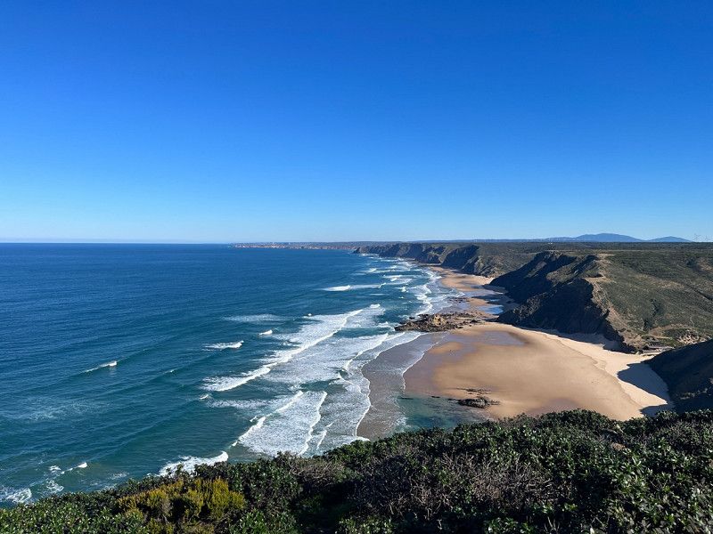
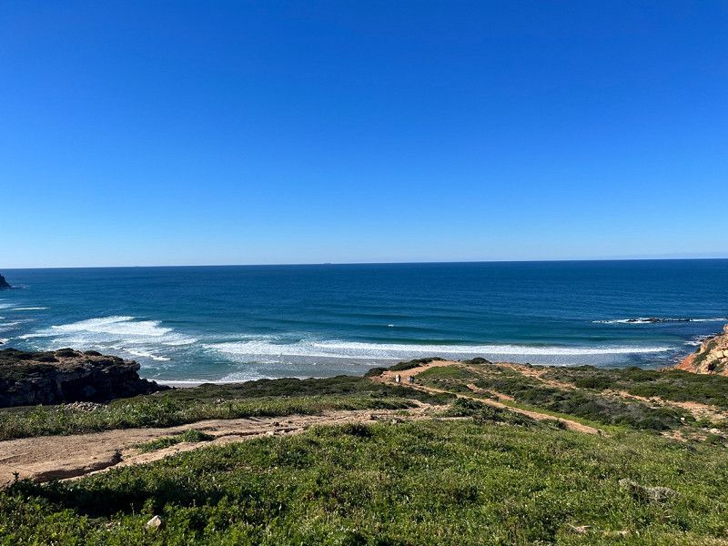
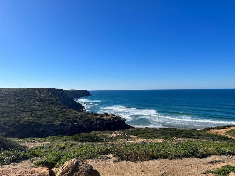
Bordeira's beach, Portugal
Nice beach lots of surfers.
37° 11' 55.8" N 8° 53' 54" W
37.1988255 -8.8983221
• Head south on N268. Go for 15.6 km.
• Take the 4th exit from roundabout toward Sagres. Go for 125 m.
• Turn right onto N268. Go for 7.4 km.
• Continue on Avenida Infante Dom Henrique (N268). Go for 1.4 km.
• Take the 1st exit from roundabout onto Estrada ao Cabo de São Vicente (N268). Go for 1.1 km.
• Continue on N268. Go for 1.6 km.
• Turn left onto N268. Go for 3.0 km.
• Arrive at N268. Your destination is on the left.
☍
30,2 km
( 33 min.)
Cabo de São Vicente, Sagres, Portugal
Cabo de São Vicente, 8650 Sagres, Portugal
37° 1' 24" N 8° 59' 40" W
37.0233333 -8.9944444
• Head northeast on N268. Go for 3.0 km.
• Turn right onto N268. Go for 1.6 km.
• Continue on Estrada ao Cabo de São Vicente (N268). Go for 1.1 km.
• Take the 3rd exit from roundabout onto Avenida Infante Dom Henrique (N268). Go for 1.5 km.
• Continue on N268. Go for 7.3 km.
• Turn right toward N268/Aljezur/V. do Bispo. Go for 472 m.
• Turn right onto N268. Go for 528 m.
• Turn right. Go for 217 m.
• Arrive at your destination on the left.
☍
15,7 km
( 20 min.)
Day
Vila do Bispo
From here we looked at the coast of Sagres and in the evening we stopped at the Bosch workshop because the starter broke.
The next day assessment and order of the starter. We got a rental car and looked at Lagos.
8650-419
37° 5' 8.9" N 8° 54' 27.3" W
37.0858154 -8.9075767
• Head northeast. Go for 43 m.
• Turn left. Go for 187 m.
• Turn left toward N268. Go for 122 m.
• Turn left onto N268. Go for 528 m.
• Turn left toward N125. Go for 399 m.
• Turn right onto N125 toward Portimão/Lagos/A22. Go for 3.5 km.
• Pass 6 roundabouts and continue on N125. Go for 10.9 km.
• Take the 3rd exit from roundabout onto N125. Go for 1.9 km.
• Pass 2 roundabouts and continue on N125. Go for 4.0 km.
• Take the 3rd exit from roundabout toward Lagos/A22/Portimão. Go for 145 m.
• Continue straight ahead. Go for 836 m.
• Take the 3rd exit from roundabout toward Faro/Portimão. Go for 4.4 km.
• Take ramp onto A22 (Via Infante de Sagres) toward Faro/Lisboa/(A2). Go for 14.9 km.
• Take exit 4 toward (M531-1)/Alvor. Go for 1.6 km.
• Take ramp. Go for 30 m.
• Take the 2nd exit from roundabout toward Alvor. Go for 256 m.
• Take the 1st exit from roundabout onto M531-1. Go for 328 m.
• Turn left onto N125. Go for 2.3 km.
• Pass 2 roundabouts and continue on N125. Go for 494 m.
• Take the 1st exit from roundabout onto Avenida São Lourenço da Barrosa (N124). Go for 524 m.
• Take the 2nd exit from roundabout onto Avenida São Lourenço da Barrosa (N124). Go for 569 m.
• Take the 2nd exit from roundabout onto Avenida São João de Deus. Go for 202 m.
• Turn right onto Rua Almirante Pinheiro de Azevedo. Go for 232 m.
• Take the 1st exit from roundabout onto Rua Engenheiro Amaro da Costa. Go for 175 m.
• Take the 4th exit from roundabout onto Estrada do Alvor. Go for 216 m.
• Turn right onto Travessa Pé da Cruz. Go for 107 m.
• Turn left onto Rua do Pé da Cruz. Go for 191 m.
• Continue on Largo 1 de Maio. Go for 53 m.
• Continue on Largo Heliodoro Salgado. Go for 81 m.
• Take the 1st exit from Largo Primeiro de Maio roundabout onto Largo Heliodoro Salgado. Go for 90 m.
• Turn right onto Praça 1 de Maio. Go for 27 m.
• Turn right onto Rua Teófilo Braga. Go for 16 m.
• Arrive at Rua Teófilo Braga. Your destination is on the left.
☍
49,3 km
( 46 min.)
Day
Day
Portimão, Portugal
Visited Portimão and the beaches today. Very fine if there is little tourism.
8500 Portimão, Portugal
37° 8' 10.2" N 8° 32' 15.7" W
37.1361700 -8.5376926
• Head southeast on Rua Teófilo Braga. Go for 16 m.
• Turn left onto Praça 1 de Maio. Go for 27 m.
• Continue on Rua das Comunicações. Go for 49 m.
• Turn left onto Largo Heliodoro Salgado. Go for 71 m.
• Take the 1st exit from Largo Primeiro de Maio roundabout onto Rua Júdice Biker. Go for 129 m.
• Continue on Largo 1 de Dezembro. Go for 80 m.
• Continue on Praça Manuel Teixeira Gomes. Go for 53 m.
• Continue on Praça Visconde Bívar. Go for 97 m.
• Continue on Rua Serpa Pinto. Go for 186 m.
• Turn right onto Rua Infante Dom Henrique (N125). Go for 83 m.
• Continue on N125. Go for 885 m.
• Take the 3rd exit from roundabout onto N125. Go for 300 m.
• Take the 3rd exit from roundabout onto Rua Infante de Sagres (N125). Go for 188 m.
• Take the 2nd exit from roundabout onto Rua Infante de Sagres (N125). Go for 279 m.
• Continue on N125. Go for 304 m.
• Take the 1st exit from roundabout onto N125. Go for 438 m.
• Continue toward N125. Go for 48 m.
• Take the 2nd exit from roundabout onto N125. Go for 699 m.
• Take the 2nd exit from roundabout. Go for 867 m.
• Take ramp onto N125 toward A22/Lagoa. Go for 4.2 km.
• Take the 2nd exit from roundabout onto N125. Go for 648 m.
• Take the 3rd exit from Largo Marques roundabout onto N125. Go for 508 m.
• Take the 1st exit from roundabout. Go for 276 m.
• Take the 2nd exit from roundabout. Go for 2.5 km.
• Take the 1st exit from roundabout. Go for 521 m.
• Continue straight ahead. Go for 21 m.
• Take the 1st exit from roundabout. Go for 1.1 km.
• Take the 3rd exit from roundabout onto M1273. Go for 2.1 km.
• Take the 1st exit from roundabout onto Caminho Municipal 1273. Go for 40 m.
• Turn slightly left. Go for 244 m.
• Arrive at your destination on the right.
☍
17,0 km
( 23 min.)
Day
Benagil, Carvoeiro, Portugal
Some hiking, but didn't really blow my mind.
Benagil, 8400 Carvoeiro, Portugal
37° 5' 13.8" N 8° 25' 39.8" W
37.0871557 -8.4277186
• Head northeast. Go for 244 m.
• Turn slightly right onto Caminho Municipal 1273. Go for 31 m.
• Take the 1st exit from roundabout onto M1273. Go for 1.8 km.
• Turn right onto Estrada da Caramujeira (M1154). Go for 584 m.
• Continue on M1154. Go for 328 m.
• Take the 2nd exit from roundabout onto M1154. Go for 595 m.
• Continue on Caminho Municipal 1154 (M1154). Go for 435 m.
• Continue on M1154. Go for 1.8 km.
• Take the 1st exit from roundabout onto N125. Go for 1.8 km.
• Pass 3 roundabouts and continue on N125. Go for 4.3 km.
• Take the 3rd exit from roundabout onto A22 (Via Infante de Sagres) toward Lisboa/Faro. Go for 55.2 km.
• Take exit 15 toward Olhão. Go for 357 m.
• Take the 1st exit from roundabout onto N398 toward Olhão. Go for 7.5 km.
• Take the 2nd exit from roundabout onto N125. Go for 564 m.
• Turn left onto Avenida Parque Natural da Ria Formosa. Go for 646 m.
• Take the 3rd exit from roundabout. Go for 505 m.
• Turn left. Go for 293 m.
• Arrive at your destination on the right.
☍
76,9 km
( 55 min.)
Camping Olhão
Here we stay overnight.
8970-105
37° 2' 12.6" N 7° 48' 59.2" W
37.0368347 -7.8164480
• Head northwest. Go for 134 m.
• Turn slightly left. Go for 159 m.
• Turn right toward Avenida Parque Natural da Ria Formosa. Go for 483 m.
• Take the 1st exit from roundabout onto Avenida Parque Natural da Ria Formosa. Go for 656 m.
• Turn right onto N125. Go for 526 m.
• Pass 2 roundabouts and continue on N125. Go for 17.7 km.
• Take the 2nd exit from roundabout onto N125. Go for 2.3 km.
• Turn right toward M508. Go for 45 m.
• Turn right onto Rua Álvaro de Campos (M508). Go for 132 m.
• Turn left onto Avenida Zeca Afonso. Go for 55 m.
• Arrive at Avenida Zeca Afonso. Your destination is on the left.
☍
22,2 km
( 24 min.)
Day
Day
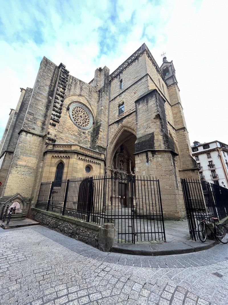
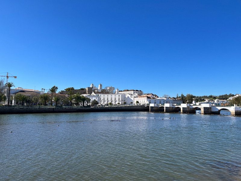
Tavira, Portugal
Today we looked at Tavira and walked around a bit to enjoy the spring.
8800 Tavira, Portugal
37° 8' 0.9" N 7° 38' 34.8" W
37.1335906 -7.6430019
• Head toward Rua Álvaro de Campos on Avenida Zeca Afonso. Go for 55 m.
• Turn right onto Rua Álvaro de Campos (M508). Go for 132 m.
• Continue on M508. Go for 28 m.
• Take the 3rd exit from roundabout onto N125. Go for 2.4 km.
• Take the 2nd exit from roundabout onto N270. Go for 3.7 km.
• Take the 2nd exit from roundabout toward Lisboa/Faro/Espanha. Go for 174 m.
• Take ramp onto A22 (Via Infante de Sagres) toward Monte Gordo/Espanha. Go for 28.9 km.
• Continue on A-49 (Autopista del V Centenario). Go for 132 km.
• Take left exit 0B toward Coria del Río/E-5/Cádiz/A-4/Granada/A-92 onto A-66. Go for 7.8 km.
• Take exit 9A toward Cádiz onto A-4 (Autovía del Sur). Go for 13.3 km.
• Continue on AP-4 (Autopista del Sur). Go for 71.5 km.
• Take exit 84 toward A-381/Algeciras onto A-2004. Go for 725 m.
• Take the 1st exit from roundabout onto A-2004 toward Jerez de la Fra. Go for 1.1 km.
• Take the 2nd exit from roundabout onto A-2002 toward El Portal/El Puerto de Santa María. Go for 794 m.
• Continue on Calle Cactus (A-2002). Go for 235 m.
• Continue on A-2002. Go for 2.0 km.
• Take the 2nd exit from roundabout onto A-2002 toward El Puerto de Santa María. Go for 138 m.
• Continue on Carretera Jerez a El Portal (A-2002). Go for 1.2 km.
• Continue on Lugar El Portal (A-2002). Go for 857 m.
• Continue on A-2002. Go for 5.6 km.
• Take the 4th exit from roundabout onto Avenida del Rey Felipe VI. Go for 791 m.
• Pass 5 roundabouts and continue on Avenida del Rey Felipe VI. Go for 2.6 km.
• Take the 3rd exit from Glorieta Madres de ANDAD roundabout onto Avenida del Rey Felipe VI. Go for 348 m.
• Take the 2nd exit from Plaza de la Estación roundabout onto Avenida del Rey Felipe VI. Go for 171 m.
• Continue toward Calle Pozos Dulces. Go for 78 m.
• Take the 1st exit from roundabout. Go for 78 m.
• Continue on Calle Pozos Dulces. Go for 130 m.
• Continue on Calle Ribera del Río. Go for 94 m.
• Continue on Calle Ribera del Marisco. Go for 364 m.
• Continue on Plaza de las Galeras Reales. Go for 372 m.
• Continue on Plaza Polvorista. Go for 67 m.
• Continue on Calle Aurora. Go for 847 m.
• Turn right onto Ronda Puntilla. Go for 94 m.
• Turn left onto Avenida Menesteo. Go for 244 m.
• Arrive at Avenida Menesteo.
☍
278,9 km
(2 hrs. 39 min.)
Day
Camping Playa Las Dunas
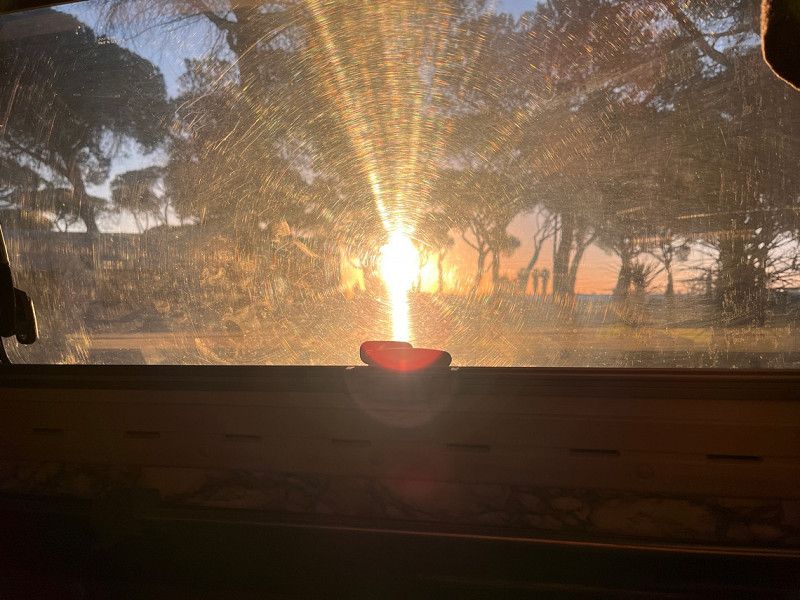
Today we left Portugal and drove to El Puerto de Santa Maria to see Cádiz tomorrow.
We have to leave out some cities and points because over time it would no longer work out.
Sunrise straight into the van.
This campsite is amazing, very clean and quiet. ⛴️ to Cádiz in 15 minutes walking distance.
Ciudad Deportiva Rafael Sanchez
36° 35' 17" N 6° 14' 11.5" W
36.5880432 -6.2365297
• Head toward Calle A on Avenida Menesteo. Go for 220 m.
• Turn right onto Ronda Puntilla. Go for 165 m.
• Turn left onto Avenida Bajamar. Go for 1.1 km.
• Turn left onto Calle Compositor Javier Caballero toward Centro Ciudad. Go for 50 m.
• Turn right onto Avenida Micaela Aramburu de Mora. Go for 201 m.
• Continue on Parque Calderón. Go for 364 m.
• Continue on Calle Ribera del Río. Go for 161 m.
• Continue on Calle Pozos Dulces. Go for 64 m.
• Turn right toward Avenida de Europa. Go for 41 m.
• Take the 1st exit from roundabout onto Avenida de Europa. Go for 893 m.
• Take the 3rd exit from roundabout onto Avenida de Valdelagrana. Go for 1.3 km.
• Take the 2nd exit from roundabout onto Avenida de Valdelagrana. Go for 1.1 km.
• Continue on CA-32. Go for 1.5 km.
• Take the exit toward Puerto Real/CA-35/Cadiz/E-5/Sevilla/AP-4 onto CA-32/CA-37. Go for 2.8 km.
• Take the exit toward Cádiz onto CA-35. Go for 8.1 km.
• Continue on Avenida Cortes de Cádiz. Go for 645 m.
• Take the 2nd exit from Glorieta de Jesús Gargallo roundabout onto Avenida de la Independencia. Go for 380 m.
• Enter the roundabout. Go for 22 m.
• Arrive at Glorieta Lebrón. Your destination is on the left.
☍
19,1 km
( 19 min.)
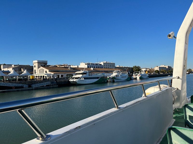
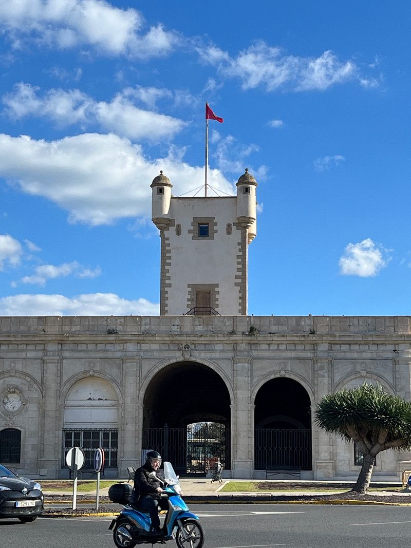
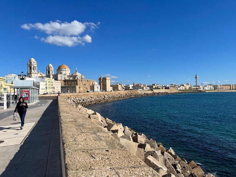
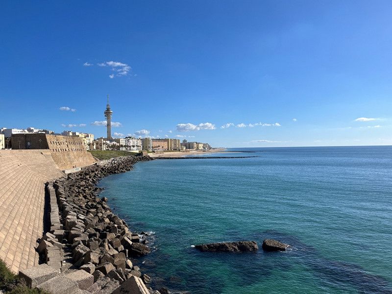
Day
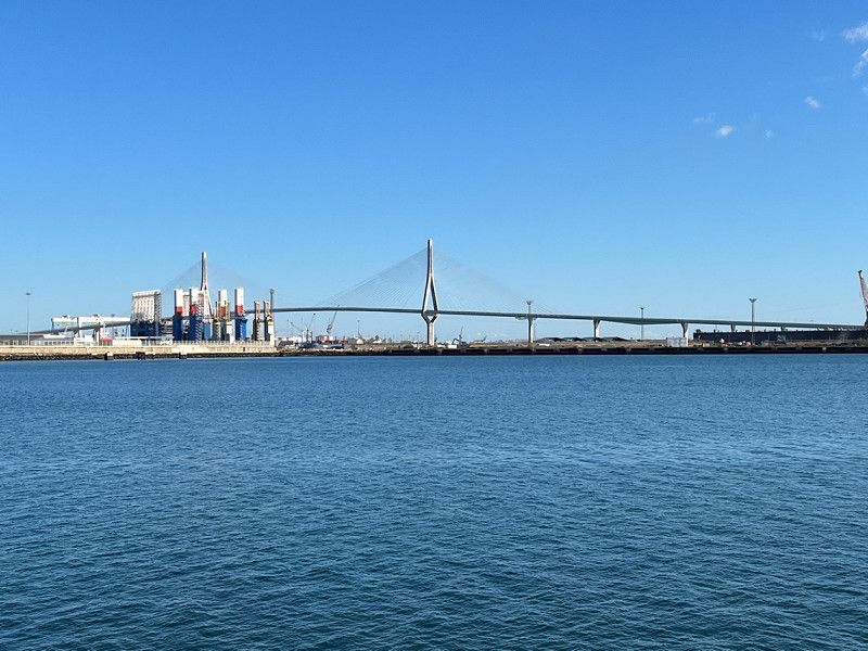
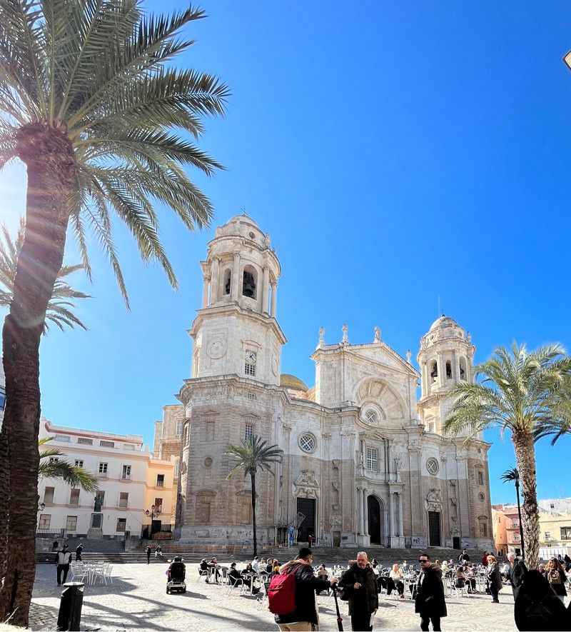
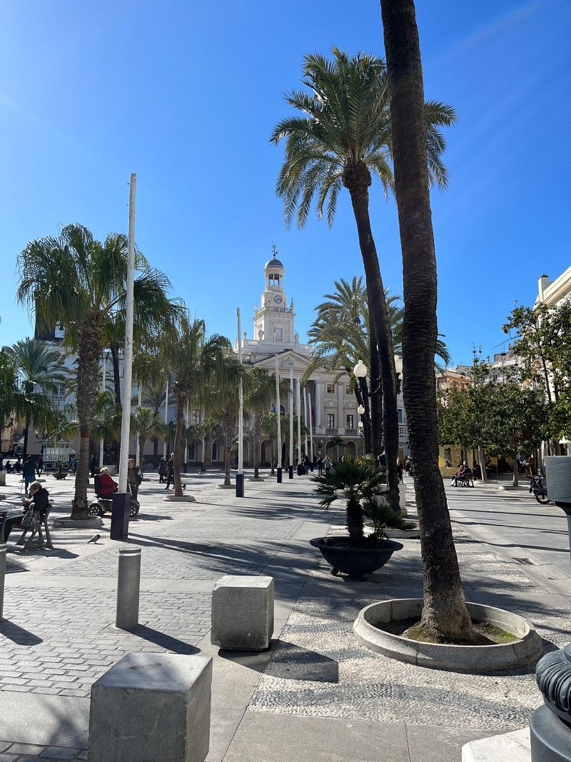
Cádiz, Spanien
Visited the beautiful city of Cádiz by catamaran today.
Cádiz, Provinz Cádiz, Spanien
36° 31' 15.7" N 6° 16' 49.6" W
36.5210142 -6.2804565
• Follow the roundabout. Go for 67 m.
• Take the 4th exit from roundabout onto Avenida de la Independencia. Go for 99 m.
• Turn right onto Calle Carpinteros de Ribera. Go for 163 m.
• Turn right onto Avenida Cortes de Cádiz. Go for 465 m.
• Continue on Puente de la Constitución 1812. Go for 7.2 km.
• Continue on AP-4 (Autopista del Sur). Go for 3.1 km.
• Take exit 102 toward Paterna/A-408/E-5/Jerez de la Frontera/A-4/Sevilla/Algeciras/A-48 onto CA-3113. Go for 324 m.
• Take the 3rd exit from roundabout onto Carretera de Medina. Go for 402 m.
• Take the 3rd exit from roundabout onto A-408. Go for 17.5 km.
• Take the 1st exit from roundabout onto A-381 toward Algeciras. Go for 70.0 km.
• Take the left exit toward San Roque/Estepona/Málaga onto A-7 (Autovía del Mediterráneo). Go for 8.0 km.
• Take exit 1107 toward San Roque (Sur)/La Línea/Gibraltar. Go for 467 m.
• Keep left onto CA-34 toward La Línea/Gibraltar. Go for 1.7 km.
• Pass 5 roundabouts and continue on Avenida de España (CA-34). Go for 4.4 km.
• Take the 1st exit from roundabout onto Avenida Príncipe de Asturias (N-351). Go for 552 m.
• Take the 1st exit from Rotonda Real Balompédica Linense roundabout onto Avenida Príncipe de Asturias (N-351). Go for 326 m.
• Turn right onto Avenida Alcaidesa Marina toward Gibraltar. Go for 49 m.
• Take the 2nd exit from roundabout onto Carretera de la Frontera. Go for 608 m.
• Continue toward Winston Churchill Avenue. Go for 29 m.
• Continue on Winston Churchill Avenue. Go for 63 m.
• Turn left toward Kingsway. Go for 262 m.
• Take the 1st exit from roundabout onto Kingsway. Go for 379 m.
• Continue on Kingsway Tunnel. Go for 529 m.
• Continue on Kingsway. Go for 367 m.
• Take the 1st exit from roundabout onto Devil's Tower Road. Go for 438 m.
• Take the 1st exit from roundabout onto Devil's Tower Road. Go for 358 m.
• Take the 3rd exit from roundabout onto Winston Churchill Avenue toward City Centre/Port. Go for 323 m.
• Take the 1st exit from roundabout onto Smith Dorrien Avenue. Go for 319 m.
• Take the 1st exit from roundabout onto Line Wall Road. Go for 484 m.
• Turn left onto John Mackintosh Square. Go for 104 m.
• Turn slightly left onto City Mill Lane. Go for 6 m.
• Arrive at City Mill Lane. Your destination is on the left.
☍
119,1 km
(1 hrs. 20 min.)
Day
Day
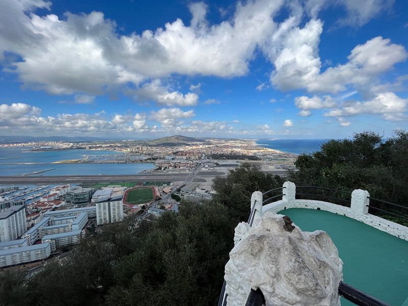
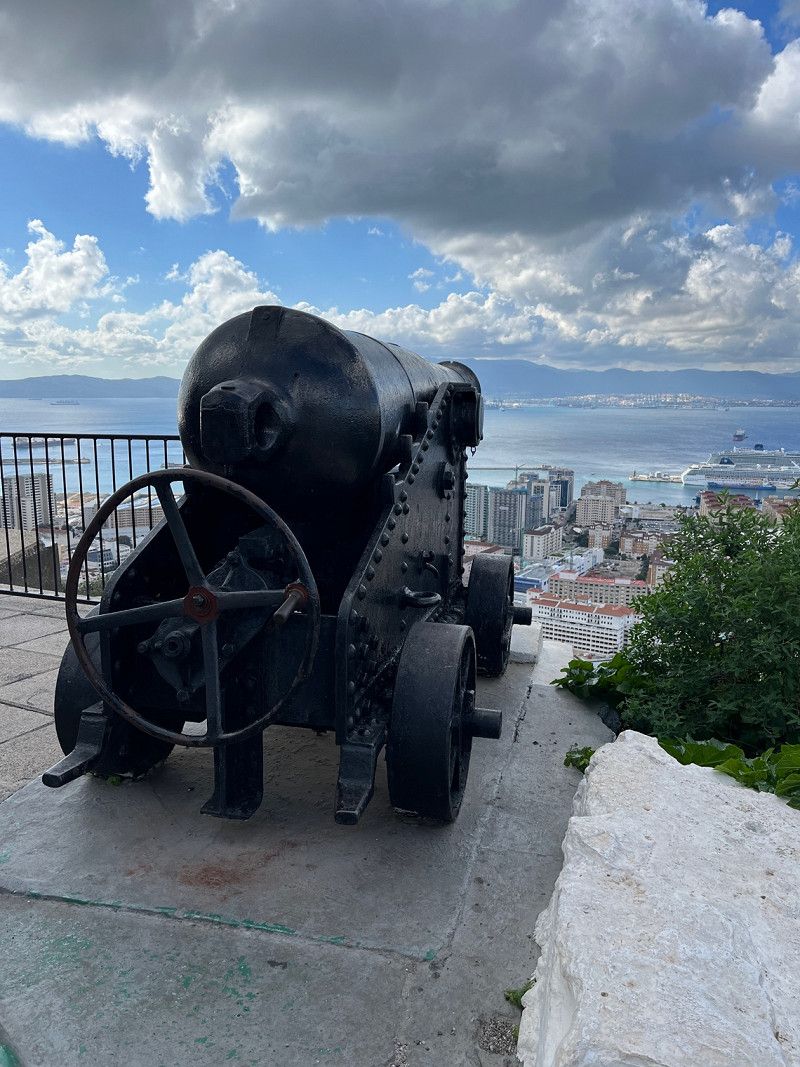
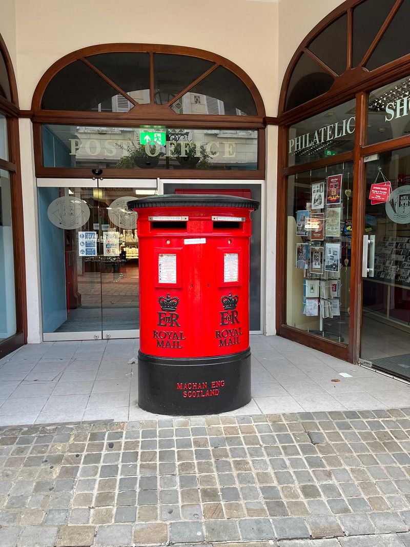
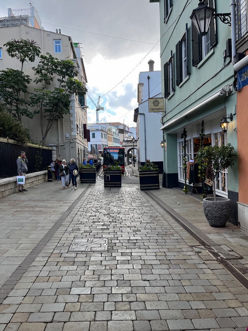
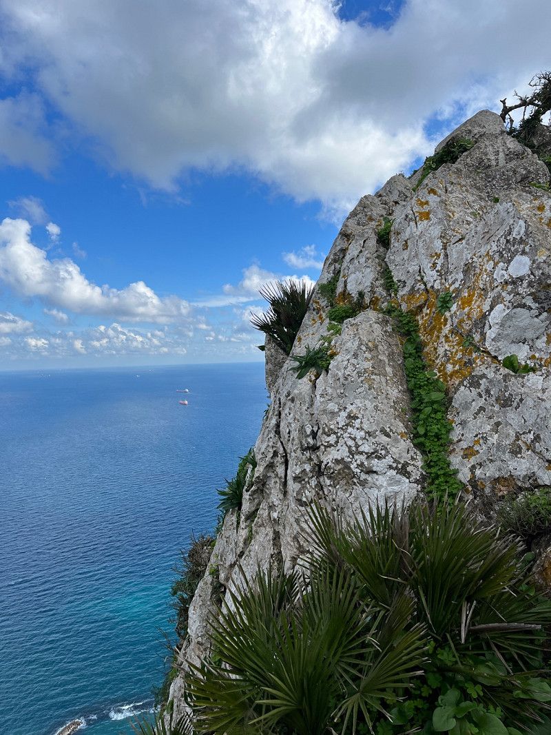
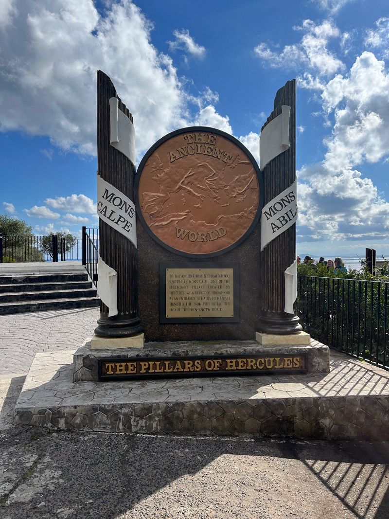
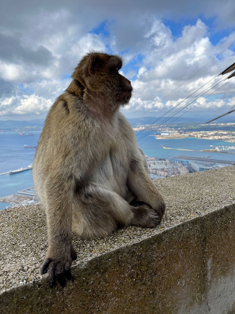
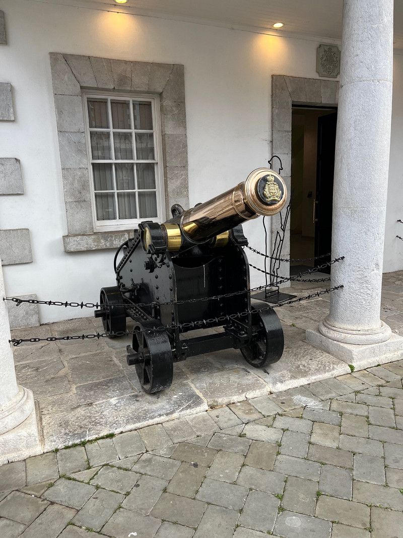
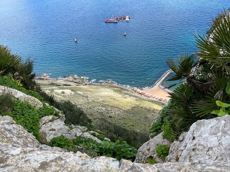
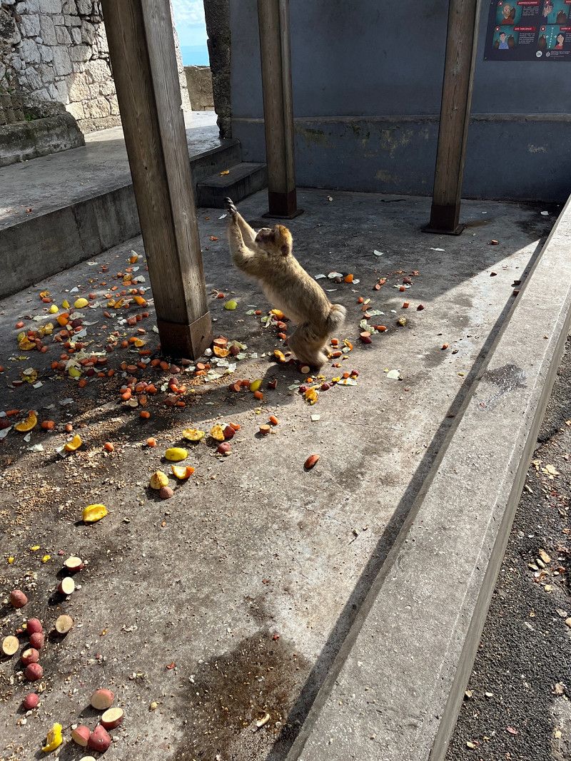
Gibraltar
Today we looked at Gibraltar, a tour on the mountain. Ate fish and chips English style in town, then back to the harbor parking lot and stayed the night.
36° 8' 26.7" N 5° 21' 12.9" W
36.1407510 -5.3535850
• Head toward Cornwall's Lane on City Mill Lane. Go for 25 m.
• Turn slightly right onto City Mill Lane. Go for 121 m.
• Turn right onto Governor's Street. Go for 163 m.
• Continue on Town Range. Go for 54 m.
• Turn right onto George's Lane. Go for 113 m.
• Turn left onto Cathedral Square. Go for 72 m.
• Turn right onto Cathedral Square. Go for 34 m.
• Turn slightly left toward Line Wall Road. Go for 34 m.
• Continue on Line Wall Road. Go for 714 m.
• Take the 1st exit from roundabout onto Smith Dorrien Avenue. Go for 323 m.
• Take the 3rd exit from roundabout onto Winston Churchill Avenue. Go for 301 m.
• Take the 1st exit from roundabout onto Devil's Tower Road. Go for 343 m.
• Take the 1st exit from roundabout onto Devil's Tower Road. Go for 434 m.
• Take the 3rd exit from roundabout onto Kingsway. Go for 466 m.
• Continue on Kingsway Tunnel. Go for 550 m.
• Continue on Kingsway. Go for 336 m.
• Take the 2nd exit from roundabout. Go for 212 m.
• Keep right. Go for 281 m.
• Turn right. Go for 140 m.
• Continue toward Avenida Príncipe de Asturias. Go for 151 m.
• Turn right onto Avenida Príncipe de Asturias. Go for 115 m.
• Make a U-Turn onto Avenida Príncipe de Asturias. Go for 511 m.
• Continue on Avenida Príncipe de Asturias (N-351). Go for 269 m.
• Take the 2nd exit from Rotonda Real Balompédica Linense roundabout onto Avenida Príncipe de Asturias (N-351) toward San Roque/Campamento. Go for 533 m.
• Take the 4th exit from roundabout onto Avenida de España (CA-34). Go for 444 m.
• Take the 3rd exit from roundabout onto Avenida de España (CA-34) toward San Roque. Go for 425 m.
• Take the 3rd exit from roundabout onto Avenida de España (CA-34). Go for 425 m.
• Take the 3rd exit from roundabout onto Avenida de España (CA-34) toward San Roque. Go for 1.9 km.
• Pass 2 roundabouts and continue on CA-34. Go for 2.9 km.
• Take ramp onto A-7 (Autovía del Mediterráneo) toward Estepona/Málaga. Go for 14.6 km.
• Continue on AP-7 (Autopista del Mediterráneo) toward Estepona/Málaga. Go for 9.7 km.
• Keep right onto AP-7. Go for 12.0 km.
• Continue on A-7 (Autopista del Mediterráneo). Go for 2.8 km.
• Continue on AP-7 (Autopista del Mediterráneo) toward Marbella/Málaga. Go for 15.1 km.
• Keep right toward Autopista del Mediterráneo/AP-7. Go for 321 m.
• Continue on AP-7 (Autopista del Mediterráneo). Go for 8.9 km.
• Continue on A-7 (Autovía del Mediterráneo). Go for 3.4 km.
• Take exit 184 toward Marbella/Avd. del Trapiche/Avda. del Trapiche onto Avenida del Trapiche. Go for 309 m.
• Take the 2nd exit from roundabout onto Avenida del Trapiche toward Avda. del Trapiche. Go for 95 m.
• Take the 3rd exit from roundabout onto Avenida Arias de Velasco (A-355). Go for 410 m.
• Take the 1st exit from roundabout onto Avenida Doctor Maíz Viñals. Go for 35 m.
• Continue on Avenida Juan Alameda. Go for 379 m.
• Turn right onto Puente San Cristo del Amor. Go for 47 m.
• Continue on Calle Salvador Rueda. Go for 105 m.
• Turn left onto Calle San Francisco. Go for 80 m.
• Turn right onto Calle Alcantarilla. Go for 41 m.
• Continue on Plaza Leganitos. Go for 31 m.
• Turn left onto Calle Aduar. Go for 249 m.
• Turn left onto Plaza Fuente de Ronda. Go for 29 m.
• Arrive at Plaza Fuente de Ronda. Your destination is on the right.
☍
80,9 km
(1 hrs. 1 min.)
Day
Marbella, Spanien
We actually wanted to stay here for a few days. Unfortunately, nothing came of it, campsite, pitches fully booked with overwinterers. After that, we searched a bit and found a designated free parking space, packed cakes and then the police came at 6 p.m. and sent everyone who no longer fit into the demarcation away, so we slept in a side street. Conclusion, we do without the south and drove up to Denja and are now staying at a campsite for a few days. It is difficult to find places if you are not somewhere around noon, standing freely and lounging around is out of the question for me.
Thanks for reading along.
Lg.Christian
Marbella, Provinz Málaga, Spanien
36° 30' 37" N 4° 53' 6.9" W
36.5102831 -4.8852579
• Head toward Calle Chorrón on Plaza Fuente de Ronda.
• Turn left onto Calle Ancha. Go for 129 m.
• Continue on Plaza Santo Cristo. Go for 20 m.
• Continue on Calle San Francisco. Go for 183 m.
• Turn left onto Calle Salvador Rueda. Go for 182 m.
• Turn right onto Avenida del Mercado. Go for 322 m.
• Continue on Calle José Luis Morales Marín. Go for 155 m.
• Take the 2nd exit from roundabout onto Calle José Luis Morales Marín. Go for 164 m.
• Turn right onto Avenida Cánovas del Castillo (A-355). Go for 114 m.
• Take the 3rd exit from roundabout onto Avenida del Trapiche. Go for 135 m.
• Take the 2nd exit from roundabout onto A-7 (Autovía del Mediterráneo) toward Málaga. Go for 1.5 km.
• Keep left onto AP-7 (Autopista del Mediterráneo) toward Fuengirola/Málaga. Go for 14.7 km.
• Keep right toward Autopista del Mediterráneo/AP-7. Go for 375 m.
• Continue on AP-7 (Autopista del Mediterráneo). Go for 12.0 km.
• Continue on A-7 (Autopista del Mediterráneo). Go for 28.7 km.
• Keep right toward Córdoba/Granada/Sevilla. Go for 430 m.
• Continue on AP-46 (Autopista de Málaga). Go for 26.2 km.
• Continue on A-45 (Autovía de Málaga). Go for 1.2 km.
• Keep right onto A-92M toward Granada. Go for 24.7 km.
• Take the exit onto A-92. Go for 119 km.
• Keep right onto A-92N toward Baza/Murcia. Go for 119 km.
• Continue on A-91. Go for 16.4 km.
• Take the left exit toward Puerto Lumbreras Centro/Lorca/Murcia onto A-7 (Autovía del Mediterráneo). Go for 84.2 km.
• Take the left exit onto A-7/A-30 (Murcia Ronda Oeste). Go for 3.1 km.
• Take exit 134 toward Molina de Segura/Albacete onto A-30 (Autovía de Murcia). Go for 24.0 km.
• Keep right onto A-33 toward Jumilla/Yecla/Valencia. Go for 90.8 km.
• Take the exit onto A-35. Go for 33.4 km.
• Continue on A-7 (Autovía del Mediterráneo). Go for 43.3 km.
• Keep left onto V-31 toward Centre Ciutat València/Av. Ausiàs March. Go for 13.9 km.
• Take the 2nd exit from roundabout onto Avenida de Ausiàs March toward Centre Ciutat. Go for 1.4 km.
• Turn right onto Plaza de Manuel Sanchis Guarner. Go for 79 m.
• Turn right onto Calle Filipinas toward Centre Ciutat. Go for 506 m.
• Continue on Calle de Gibraltar. Go for 190 m.
• Turn right onto Gran Vía de las Germanías. Go for 445 m.
• Continue on Gran Vía Marqués del Turia. Go for 470 m.
• Make a U-Turn onto Gran Vía Marqués del Turia. Go for 40 m.
• Turn right onto Calle Isabel la Católica. Go for 348 m.
• Turn slightly left onto Calle Pérez Bayer. Go for 116 m.
• Continue on Plaza Niños de San Vicente. Go for 30 m.
• Continue on Calle Sagasta. Go for 92 m.
• Continue on Calle Correos. Go for 174 m.
• Arrive at Calle Correos. Your destination is on the right.
☍
662,3 km
(5 hrs. 57 min.)
Valencia, Spanien
Valencia, Provinz Valencia, Spanien
39° 28' 11.7" N 0° 22' 34.6" W
39.4699075 -0.3762881
• Head toward Calle Pérez Pujol on Calle Correos. Go for 89 m.
• Turn left onto Calle Pérez Pujol. Go for 67 m.
• Turn right onto Calle de las Barcas. Go for 67 m.
• Continue on Calle Pintor Sorolla. Go for 296 m.
• Continue on Plaza de Alfonso el Magnánimo. Go for 51 m.
• Turn left onto Plaza de Alfonso el Magnánimo. Go for 109 m.
• Turn right onto Calle Palacio de Justicia. Go for 118 m.
• Take the 1st exit from Plaza Puerta de la Mar roundabout onto Avenida Navarro Reverter toward Alacant/V-31/Albacete/Castelló/V-21/Barcelona/Teruel/Zaragoza. Go for 321 m.
• Keep right onto Plaza América toward Alicante/Alacant/El Saler. Go for 200 m.
• Turn left onto Puente de Aragón. Go for 227 m.
• Continue toward Avenida de Aragón. Go for 57 m.
• Take the 3rd exit from Plaza Zaragoza roundabout onto Avenida de Aragón toward Barcelona/N-234/Zaragoza/Saragossa. Go for 371 m.
• Take the 1st exit from roundabout onto Avenida de Aragón. Go for 707 m.
• Take the 3rd exit from Plaza Cardenal Vicente Enrique y Tarancón roundabout onto Avenida de Cataluña (V-21) toward Castelló/Barcelona/Teruel/Zaragoza. Go for 319 m.
• Keep left onto V-21 toward Castelló/Barcelona/Teruel/Zaragoza. Go for 19.4 km.
• Continue on AP-7 (Autovía del Mediterráneo). Go for 258 km.
• Take exit 31 toward El Vendrell/N-340/Coma-ruga/Aeroport/Barcelona per Vilanova i la G. onto C-32 (Autopista Pau Casals). Go for 56.1 km.
• Continue on B-20. Go for 3.6 km.
• Continue on C-32 (Ronda de Dalt). Go for 4.3 km.
• Continue on B-20 (Ronda de Dalt). Go for 4.4 km.
• Take exit 6 toward Vallcarca/Ctra. de l'Arrabassada/Balmes/Pl. Lesseps. Go for 228 m.
• Take the 1st exit from Plaça d'Alfonso Comín roundabout onto Avinguda de la República Argentina toward CosmoCaixa/Av. República Argentina/Pl. Lesseps. Go for 1.4 km.
• Turn left onto Carrer de Velázquez toward Trav. Dalt/Pl. Alfons el Savi/Parc Güell/Hospital l'Esperança. Go for 95 m.
• Continue on Avinguda de Vallcarca. Go for 29 m.
• Continue on Carrer de Maignon. Go for 72 m.
• Turn right onto Carrer de la Mare de Déu del Coll. Go for 73 m.
• Continue on Carrer del Torrent de l'Olla. Go for 12 m.
• Turn left onto Travessera de Dalt. Go for 530 m.
• Turn right onto Carrer del Torrent de les Flors. Go for 60 m.
• Turn left onto Carrer del Cardener. Go for 158 m.
• Turn left onto Carrer de l'Escorial. Go for 91 m.
• Continue on Carrer de l'Escorial toward Hospital de l'Esperança. Go for 106 m.
• Turn left onto Carrer del Pare Jacint Alegre. Go for 203 m.
• Continue on Carrer de Marianao. Go for 160 m.
• Turn left onto Carrer d'Olot. Go for 35 m.
• Arrive at Carrer d'Olot.
☍
352,3 km
(3 hrs. 27 min.)
Park Güell, Barcelona, Spanien
08024 Barcelona, Provinz Barcelona, Spanien
41° 24' 52.2" N 2° 9' 9.7" E
41.4144948 2.1526945
• Head southwest on Carrer d'Olot. Go for 35 m.
• Turn left onto Carrer de Larrard. Go for 421 m.
• Turn left onto Travessera de Dalt. Go for 990 m.
• Take the 1st exit from Ronda del Guinardó roundabout onto Ronda del Guinardó toward Hospital Sant Paul. Go for 789 m.
• Turn slightly right onto Ronda del Guinardó. Go for 925 m.
• Keep right onto Carrer de Ramon Albó toward Av. Río de Janeiro/Pl. Can Dragó. Go for 420 m.
• Continue on Carrer d'Arnau d'Oms. Go for 100 m.
• Turn right onto Carrer d'Escòcia. Go for 563 m.
• Turn left onto Avinguda Meridiana (C-33). Go for 2.5 km.
• Keep right onto Avinguda Meridiana (C-33) toward Vic/Granollers. Go for 434 m.
• Keep left onto Autopista de Barcelona a la Jonquera (C-33) toward Montpellier/Girona/Manresa/C-58/Sabadell. Go for 13.6 km.
• Continue on AP-7 (Autopista de Barcelona a Mollet del Vallès). Go for 136 km.
• Continue on A9 (La Catalane). Go for 225 km.
• Take the exit toward Nîmes-Centre/Aéroport Garons/Arles/Aix en Pce/Marseille onto A54. Go for 48.0 km.
• Continue on A54. Go for 23.7 km.
• Take the exit toward Aix en Pce/Aéroport Marignane/Nice/Marseille onto A7 (Autoroute du Soleil). Go for 11.8 km.
• Keep left onto A8 (Échangeur de la Croix de Coudoux) toward Nice/Toulon/Aix en Pce. Go for 15.4 km.
• Take exit 29 toward Gap/Les Milles/A51 (Sisteron)/Aix en Provence onto D64 (Route de Galice). Go for 874 m.
• Take the 2nd exit from Rond-Point Luc Vivian roundabout onto Route de Galice (D64) toward A51 (Gap)/Aix-Centre/Aix-Jas de Bouffan/Les Milles. Go for 444 m.
• Take the 3rd exit from Place Lucien Sauze roundabout onto Route de Galice (D64) toward A51 (Gap)/Sisteron/Puyricard/Les Milles. Go for 462 m.
• Take the 2nd exit from Rond-Point Lieutenant-Colonel Jeanpierre roundabout onto Route de Galice (D64) toward Marseille/Puyricard/Les Milles/Aéroport Marignane. Go for 1.1 km.
• Turn left and take ramp onto Rocade Ouest (N296) toward A51/A51 (Sisteron)/Salon/Avignon/Puyricard/Célony/Sisteron. Go for 2.3 km.
• Keep right onto N296 toward Gap/Digne les Bains/Pertuis/Puyricard. Go for 3.3 km.
• Keep left onto A51 (Autoroute du Val de Durance) toward Sisteron/Digne/Gap/Pertuis/Manosque. Go for 46.4 km.
• Take exit 18 toward Valensole/Manosque. Go for 1.2 km.
• Take the 1st exit from Rond-Point des Grandes Terres roundabout onto Route de la Durance (D907) toward Gréoux les Bains/Vinon S/Verdon/Valensole/Z.I. St Maurice. Go for 693 m.
• Take the 2nd exit from roundabout onto Route de la Durance (D907). Go for 1.3 km.
• Take the 2nd exit from roundabout onto D6. Go for 12.9 km.
• Turn left onto D6 A. Go for 1.4 km.
• Turn right onto Route d'Oraison (D15). Go for 1.1 km.
• Turn left onto Route de Digne (D8). Go for 4.9 km.
• Continue on D8. Go for 1.4 km.
• Continue on Lieu-dit Les Logissons (D8). Go for 1.1 km.
• Continue on D8. Go for 2.8 km.
• Continue on Lieu-dit Petit Telle (D8). Go for 193 m.
• Continue on D8. Go for 3.9 km.
• Turn right onto D953. Go for 4.0 km.
• Turn left onto Route de Moustiers (D56). Go for 216 m.
• Continue on D56. Go for 2.4 km.
• Continue on Lieu-dit Grenouillet (D56). Go for 98 m.
• Continue on D56. Go for 2.4 km.
• Turn left onto D952. Go for 7.1 km.
• Pass 2 roundabouts and continue on Route de la Palud (D952). Go for 2.6 km.
• Take the 3rd exit from roundabout onto D952. Go for 18.3 km.
• Turn right onto Route des Crêtes. Go for 33 m.
• Turn left onto D23. Go for 672 m.
• Keep right onto D23. Go for 6.1 km.
• Arrive at D23.
☍
612,7 km
(6 hrs. 26 min.)
Gorges du Verdon, Frankreich
Verdon Gorge
Verdonschlucht, Frankreich
43° 45' 40.9" N 6° 22' 43.8" E
43.7613593 6.3788372
• Head toward Lieu-dit La Valdenay on D23. Go for 6.8 km.
• Turn right onto Route des Crêtes. Go for 33 m.
• Turn right onto D952. Go for 6.1 km.
• Take the 2nd exit from roundabout onto D952. Go for 5.6 km.
• Turn right onto Lieu-dit Pont de Soleils (D955). Go for 13.8 km.
• Turn left toward D21. Go for 384 m.
• Turn left onto D21. Go for 14.8 km.
• Continue on D44. Go for 692 m.
• Take the 3rd exit from roundabout onto Route Napoléon (D6085) toward Digne/St Auban/Castellane. Go for 765 m.
• Take the 1st exit from roundabout onto Route de Saint-Auban (D2211) toward St Auban/Gréolières les Neiges/Thorenc/Valderoure. Go for 2.3 km.
• Turn right onto D2. Go for 15.2 km.
• Take the 2nd exit from roundabout onto Route des Châteaux (D2). Go for 3.9 km.
• Take the 1st exit from roundabout onto Route de Gentelly (D2). Go for 6.8 km.
• Take the 2nd exit from roundabout onto D402. Go for 2.8 km.
• Take the 2nd exit from roundabout onto Route de Grasse (D3) toward Gourdon/Grasse/Tourrettes sur Loup/Nice. Go for 5.1 km.
• Continue on D6. Go for 5.6 km.
• Turn slightly left onto Route de la Colle (D6). Go for 9.5 km.
• Continue on D6. Go for 677 m.
• Turn left onto D6. Go for 754 m.
• Continue on Route du Pont de Pierre (D6). Go for 2.6 km.
• Take the 2nd exit from Rond Point des Arnoux roundabout onto Rue du Maréchal Foch (D6). Go for 164 m.
• Continue on Route de Cagnes (D6). Go for 27 m.
• Turn left onto Boulevard Pierre Sauvaigo. Go for 353 m.
• Pass 2 roundabouts and continue on Chemin du Défoussat (D436). Go for 1.4 km.
• Continue on Avenue du Cheiron (M436). Go for 20 m.
• Take the 2nd exit from roundabout onto Avenue du Cheiron (M436). Go for 359 m.
• Take the 1st exit from Rond-Point Gendarmes d'Ouvéa roundabout onto Avenue des Alpes (M336). Go for 590 m.
• Take the 2nd exit from roundabout onto Avenue des Alpes (M336) toward Nice/Antibes/Centre-Ville. Go for 467 m.
• Pass 2 roundabouts and continue on Avenue des Alpes (M336). Go for 1.4 km.
• Take ramp onto A8 (La Provençale). Go for 4.4 km.
• Take exit 50 toward Nice-Centre/Nice-Ouest/Nice-Les Moulins onto N99 (Route de Grenoble). Go for 1.7 km.
• Turn left onto Rue Jules Bessi toward Menton/Monaco/Nice-Centre/Nice-Est/Gare St Augustin/Caucade. Go for 100 m.
• Continue on Avenue Saint-Augustin. Go for 5.0 km.
• Take ramp toward Nice-Nord. Go for 349 m.
• Turn left onto Rue Miollis. Go for 268 m.
• Turn left onto Rue Clément Roassal. Go for 76 m.
• Turn right onto Rue Alfred Binet. Go for 215 m.
• Turn right onto Boulevard Joseph Garnier. Go for 156 m.
• Arrive at Place du Général de Gaulle. Your destination is on the right.
☍
121,3 km
(2 hrs. 16 min.)
Nice, Frankreich
Nizza, Frankreich
43° 42' 36.6" N 7° 15' 43" E
43.7101728 7.2619532
• Head southwest on Place du Général de Gaulle. Go for 31 m.
• Continue on Boulevard Joseph Garnier. Go for 125 m.
• Turn right onto Rue Théodore de Banville toward Nice-Nord/Musée Prieuré du Vieux Logis. Go for 532 m.
• Continue on Boulevard Auguste Raynaud. Go for 246 m.
• Continue on Boulevard Gorbella. Go for 1.0 km.
• Continue on Boulevard Comte de Falicon. Go for 308 m.
• Turn slightly left onto Boulevard Paul Rémond. Go for 109 m.
• Take right ramp onto A8 (La Provençale) toward Monaco/Menton/Gênes. Go for 26.8 km.
• Continue on A10 (Galleria Cima Giralda). Go for 90.1 km.
• Take the exit toward Pietra Ligure. Go for 968 m.
• Take the 2nd exit from roundabout onto Viale Riviera toward Centro. Go for 1.5 km.
• Take the 3rd exit from roundabout onto Viale Riviera. Go for 400 m.
• Take the 2nd exit from Largo Santa Corona roundabout onto Via 25 Aprile (SS1) toward Centro/Savona/Finale Ligure. Go for 909 m.
• Pass 2 roundabouts and continue on Corso Italia (SS1). Go for 5.1 km.
• Turn left onto Via Caprazoppa (SP490) toward Genova-Ventimiglia/A10/Calizzano/Finalborgo/Calice Ligure. Go for 1.6 km.
• Take the 2nd exit from roundabout onto Via per Gorra (SP490) toward Autostrada/A10. Go for 1.2 km.
• Take the 1st exit from roundabout toward Genova/A10/Ventimiglia. Go for 607 m.
• Take ramp onto A10 (Autostrada dei Fiori) toward Genova. Go for 50.2 km.
• Continue on A26 (Autostrada Genova Voltri-Gravellona Toce) toward Alessandria/Milano/A7/E25. Go for 44.6 km.
• Take the exit toward Milano/A7/Genova onto A26 (Diramazione A26-A7 Predosa-Bettole). Go for 17.0 km.
• Take the left exit toward Milano onto A7 (Autostrada Milano-Genova). Go for 9.5 km.
• Take the exit toward Piacenza/Brescia onto A21 (Autostrada Torino-Piacenza-Brescia). Go for 149 km.
• Take the exit toward E45/Brennero/A22/Venezia onto A4 (Autostrada della Serenissima). Go for 30.5 km.
• Take the exit toward Sirmione onto Svincolo Sirmione. Go for 436 m.
• Keep right onto Via dei Colli Storici (SP13) toward Desenzano/Sirmione/S. Martino della Battaglia. Go for 908 m.
• Take the 4th exit from roundabout onto Via dei Colli Storici. Go for 530 m.
• Take the 2nd exit from roundabout onto Via dei Colli Storici toward Desenzano/Sirmione/Tangenziale. Go for 382 m.
• Continue straight ahead. Go for 35 m.
• Take the 2nd exit from roundabout toward Sirmione. Go for 156 m.
• Continue on Via dei Colli Storici. Go for 139 m.
• Take the 2nd exit from roundabout. Go for 127 m.
• Continue on Via Salvo D'Acquisto. Go for 1.5 km.
• Continue toward Sirmione/Desenzano D/G/Verona. Go for 45 m.
• Take the 2nd exit from roundabout toward Desenzano D/G/Verona. Go for 49 m.
• Continue on Viale della Comunità Europea. Go for 308 m.
• Continue toward Via Brescia. Go for 37 m.
• Take the 2nd exit from roundabout onto Via Brescia toward Colombare Centro/Peschiera D/G/Verona. Go for 380 m.
• Take the 3rd exit from roundabout onto Via Colombare. Go for 60 m.
• Continue on Via Colombare. Go for 40 m.
• Pass 3 roundabouts and continue on Via Colombare. Go for 918 m.
• Continue on Via 25 Aprile. Go for 188 m.
• Take the 1st exit from roundabout onto Via 25 Aprile. Go for 1.4 km.
• Continue on Viale Guglielmo Marconi. Go for 540 m.
• Continue on Largo Johann Wolfgang von Goethe. Go for 92 m.
• Continue on Piazza Castello. Go for 90 m.
• Turn right onto Via Vittorio Emanuele II. Go for 98 m.
• Turn right onto Via San Salvatore. Go for 11 m.
• Turn left onto Via G. Piana. Go for 188 m.
• Turn slightly right onto Via Caio Valerio Catullo. Go for 199 m.
• Turn left onto Via C. Arici. Go for 23 m.
• Arrive at Via C. Arici. Your destination is on the left.
☍
441,2 km
(4 hrs. 21 min.)
Sirmione, Brescia, Italien
25019 Sirmione, Province of Brescia, Italien
45° 29' 49.1" N 10° 36' 19.4" E
45.4969717 10.6053754
• Head toward Parco Maria Callas on Via C. Arici. Go for 23 m.
• Turn right onto Via Caio Valerio Catullo. Go for 199 m.
• Turn slightly right onto Piazza Don Angelo Piatti. Go for 31 m.
• Turn left onto Via Vittorio Emanuele II. Go for 249 m.
• Turn left onto Via Santa Maria Maggiore. Go for 100 m.
• Turn right onto Via Dante Alighieri. Go for 64 m.
• Turn right onto Via Dante. Go for 56 m.
• Turn left onto Piazza Castello. Go for 18 m.
• Continue on Largo Johann Wolfgang von Goethe. Go for 92 m.
• Turn right onto Piazzale Porto. Go for 72 m.
• Turn slightly left onto Lungolago Armando Diaz. Go for 237 m.
• Turn left toward Viale Guglielmo Marconi. Go for 17 m.
• Turn slightly right onto Viale Guglielmo Marconi. Go for 279 m.
• Continue on Via 25 Aprile. Go for 1.4 km.
• Take the 2nd exit from roundabout onto Via 25 Aprile. Go for 216 m.
• Continue on Via Colombare. Go for 196 m.
• Take the 3rd exit from roundabout onto Via Colombare. Go for 166 m.
• Turn right onto Via Aldo Moro. Go for 324 m.
• Take the 2nd exit from roundabout onto Viale Giacomo Matteotti. Go for 262 m.
• Take the 2nd exit from roundabout onto Viale Giacomo Matteotti. Go for 320 m.
• Take the 2nd exit from roundabout toward Aeroporto Montichiari/Autostrada/A4/S. Martino D.B./Lonato/Salò/Brescia/Mantova. Go for 74 m.
• Continue on Viale della Comunità Europea. Go for 304 m.
• Continue toward Via Salvo D'Acquisto. Go for 39 m.
• Take the 2nd exit from roundabout toward MI-VE/A4/Brescia. Go for 51 m.
• Continue on Via Salvo D'Acquisto. Go for 1.6 km.
• Take the 2nd exit from roundabout onto Via dei Colli Storici toward Autostrada/A4/Brescia/Verona. Go for 290 m.
• Take the 3rd exit from roundabout onto Strada Padana Superiore (SPBS11var) toward Rivoltella Centro/Desenzano Est/A4/Verona/Peschiera D G. Go for 3.4 km.
• Continue on SPBS11. Go for 3.2 km.
• Continue on Via Tangenziale (SR11). Go for 2.6 km.
• Keep left onto Paradiso di Sotto toward Autostrada/A22/Affi/SR450/Verona/SR11. Go for 621 m.
• Continue on SS11dir. Go for 3.7 km.
• Continue on Strada Regionale di Affi (SR450). Go for 12.6 km.
• Take the 1st exit from roundabout toward SS12/A22. Go for 359 m.
• Take the 2nd exit from roundabout onto A22 (Autostrada del Brennero) toward Milano/A4/Brennero. Go for 207 km.
• Continue on A13 (Brennerpass). Go for 34.5 km.
• Continue on A12 (Inntal Autobahn). Go for 57.7 km.
• Take exit 17 toward B178/Felbertauern/Brixental onto Anschlussstelle Wörgl Ost. Go for 1.9 km.
• Continue on Loferer Bundesstraße (B178). Go for 30.3 km.
• Take ramp onto Dechant-Wieshofer-Straße (B164) toward Saalfelden/Fieberbrunn/St. Johann i. T. Go for 1.0 km.
• Take the 3rd exit from roundabout onto Fieberbrunner Straße (B164). Go for 9.0 km.
• Pass 2 roundabouts and continue on Leogangerstraße. Go for 27.0 km.
• Take the 3rd exit from roundabout onto Bahnhofstraße (B164). Go for 407 m.
• Turn right onto Ritzenseestraße. Go for 296 m.
• Arrive at Ritzenseestraße. Your destination is on the right.
☍
402,6 km
(4 hrs. 23 min.)
Endpunkt
Ritzenseestraße 12
47° 25' 21.5" N 12° 50' 46.1" E
47.4226379 12.8461306