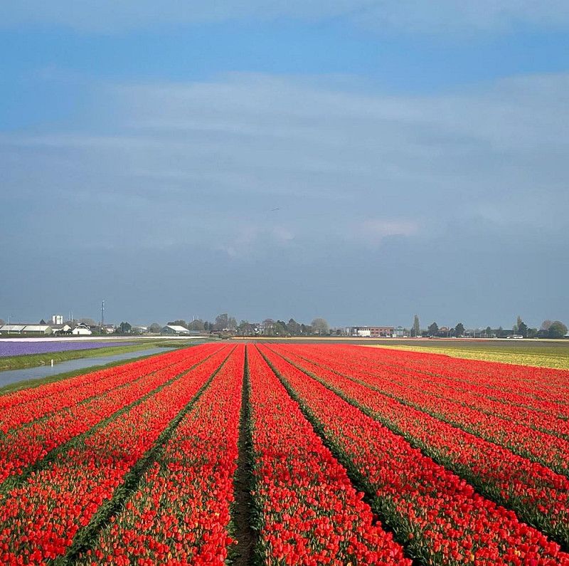
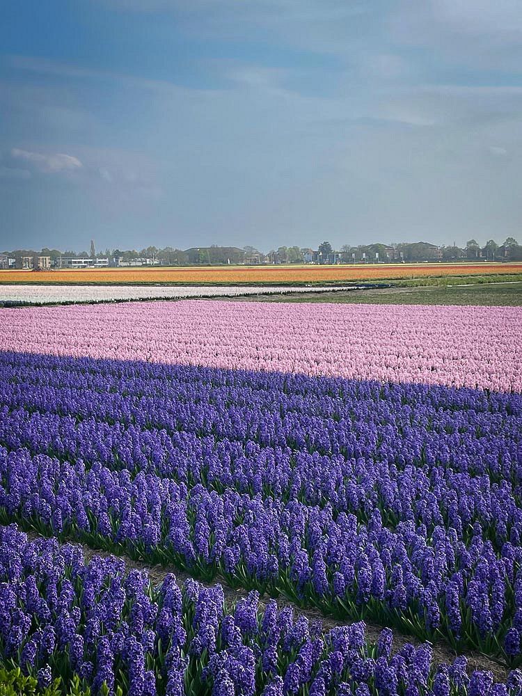
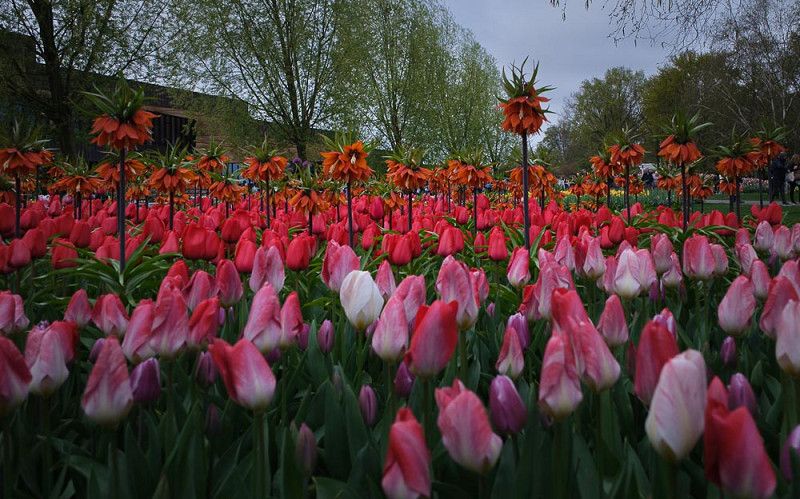
The flowering period of tulips begins in mid-March, the best time is in April, when most tulips and other early bloomers are in full bloom.
Neuwied
Wilhelm-Leuschner-Straße, Neuwied, Landkreis Neuwied, Rheinland-Pfalz, Deutschland
50° 25' 48.9" N 7° 27' 58.7" E
50.4302393 7.4663020
• Head east on Wilhelm-Leuschner-Straße. Go for 44 m.
• Turn right onto Moltkeplatz. Go for 58 m.
• Turn right onto Bismarckstraße. Go for 116 m.
• Turn right onto Bahnhofstraße. Go for 320 m.
• Turn left onto Hermannstraße. Go for 297 m.
• Take ramp onto Raiffeisenbrücke (B256) toward Weißenthurm/Rheinbrücken. Go for 2.2 km.
• Take ramp onto B9/B256 toward Bonn/A61/Mayen/Andernach. Go for 1.9 km.
• Take ramp toward Mayen. Go for 313 m.
• Turn right onto B256 toward A61/Mayen/Andernach-Miesenheim/Gewerbegebiet B9/B256. Go for 6.5 km.
• Turn left and take ramp onto A61 toward Köln/Bonn. Go for 70.0 km.
• Keep right onto A61 (Autobahndreieck Erfttal) toward Venlo/Mönchengladbach/Aachen. Go for 34.2 km.
• Take left exit 16 toward Venlo/Düsseldorf/Mönchengladbach/A61 onto A44. Go for 7.5 km.
• Take the exit toward Heinsberg/Venlo/Mönchengladbach/A61 onto A46. Go for 4.0 km.
• Take exit 10 toward Venlo/Mönchengladbach onto A61. Go for 37.2 km.
• Continue on A74. Go for 1.8 km.
• Continue on A73 (Knooppunt Tiglia). Go for 64.0 km.
• Take the left exit toward Eindhoven/Rotterdam/Arnhem onto A73. Go for 4.9 km.
• Take the exit toward Rotterdam/Arnhem onto A50. Go for 2.3 km.
• Keep left onto A50. Go for 3.9 km.
• Take the exit toward Rotterdam/Tiel onto A15. Go for 40.0 km.
• Take the exit toward Utrecht onto A2. Go for 53.9 km.
• Take the exit toward Haarlem/Luchthaven Schiphol/Amstelveen onto A9. Go for 38.6 km.
• Take exit 10 toward Uitgeest/Castricum/Zaanstad. Go for 452 m.
• Turn right onto Provincialeweg (N8/N203) toward Castricum/Uitgeest/Limmen. Go for 5.8 km.
• Turn left onto Provincialeweg (N513). Go for 590 m.
• Keep right toward Bakkum/Egmond/Castricum aan Zee. Go for 139 m.
• Continue on Provincialeweg (N513) toward Bakkum/Egmond/Castricum aan Zee. Go for 1.7 km.
• Take the 2nd exit from roundabout onto Zeeweg (N513). Go for 212 m.
• Arrive at Zeeweg (N513).
☍
383,2 km
(4 hrs. 15 min.)
Kennemer Duincamping Bakkum
Our way to Keukenhof first took us to Bakkum, as we were only able to book a slot at Keukenhof for Monday.
The campsite is located behind the dunes, is large, beautifully landscaped, offers extensive amenities, and is particularly family-friendly. There's plenty of fun activities for kids and teenagers.
Zeeweg 31, 1901 NZ, Castricum, Niederlande
52° 33' 43" N 4° 39' 6" E
52.5619400 4.6516700
• Head west on Zeeweg (N513). Go for 2.9 km.
• Take the 1st exit from roundabout onto Zeeweg. Go for 100 m.
• Arrive at Zeeweg.
☍
3,0 km
( 3 min.)
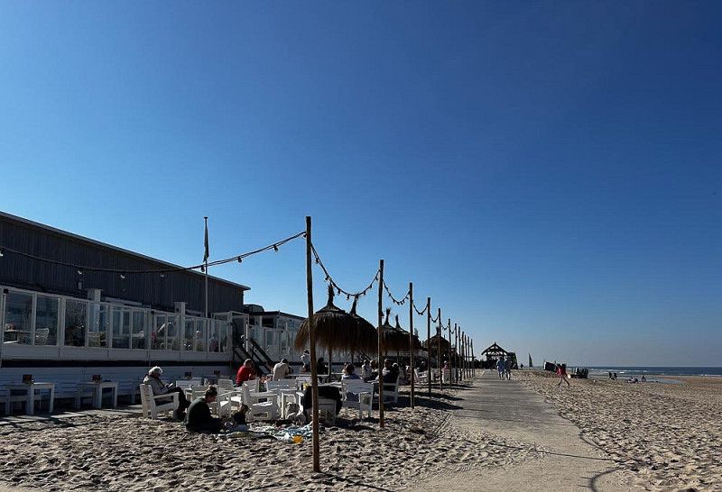
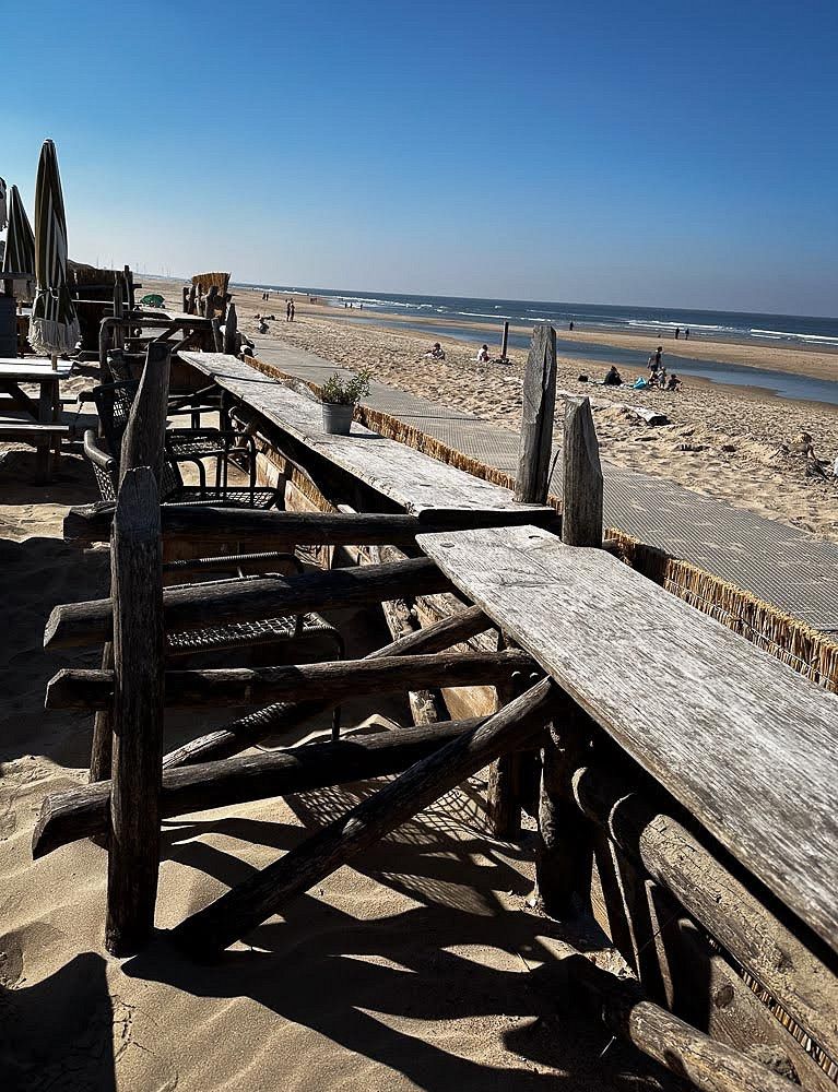
Castricum
The beach is just a few minutes' bike ride from the campsite. You can also explore the nature reserve.
You can go on lovely bike rides or sit comfortably at one of the beach bars. In fact, a few swimmers have already jumped into the water.
Zeeweg 51, Castricum, Nordholland, Niederlande
52° 33' 27.2" N 4° 36' 23.8" E
52.5575679 4.6066122
• Head northeast on Zeeweg. Go for 73 m.
• Take the 2nd exit from roundabout onto Zeeweg (N513). Go for 3.1 km.
• Take the 3rd exit from roundabout onto Heereweg (N512). Go for 6.3 km.
• Turn left onto Heilooër Zeeweg. Go for 412 m.
• Continue on Egmonderstraatweg. Go for 670 m.
• Turn left onto Voorstraat. Go for 187 m.
• Turn right onto Voorstraat. Go for 15 m.
• Arrive at Voorstraat. Your destination is on the left.
☍
10,8 km
( 13 min.)
Bergen
If you like a lot of hustle and bustle, the very touristy town of Egmond aan Zee, which we visited on a bike tour, is a good place to stay.
Kerkhoflaantje, Bergen, Nordholland, Niederlande
52° 37' 8.4" N 4° 38' 6.4" E
52.6190067 4.6351230
• Head south on Voorstraat. Go for 15 m.
• Turn left onto Voorstraat. Go for 180 m.
• Turn right onto Egmonderstraatweg. Go for 665 m.
• Continue on Heilooër Zeeweg. Go for 396 m.
• Turn left onto Hoeverweg (N512) toward Alkmaar/Bergen/Industrieterrein de Weidjes. Go for 804 m.
• Take the 2nd exit from roundabout onto Hoeverweg (N512). Go for 4.9 km.
• Turn left onto Martin Luther Kingweg (N9). Go for 1.0 km.
• Turn right onto Bergerweg toward Bergermeer/Centrum. Go for 214 m.
• Take the 2nd exit from roundabout onto Bergerweg. Go for 780 m.
• Continue on Scharlo. Go for 99 m.
• Turn right onto Vrouwenlaan. Go for 42 m.
• Take the 3rd exit from Bergerhout roundabout onto Geestersingel toward Centrum-Binnenstad/Centrum-Overstad. Go for 565 m.
• Turn right onto Kanaalkade. Go for 450 m.
• Turn right onto Gedempte Nieuwesloot. Go for 68 m.
• Turn right onto Koningsweg. Go for 89 m.
• Arrive at Koningsweg. Your destination is on the right.
☍
10,2 km
( 14 min.)
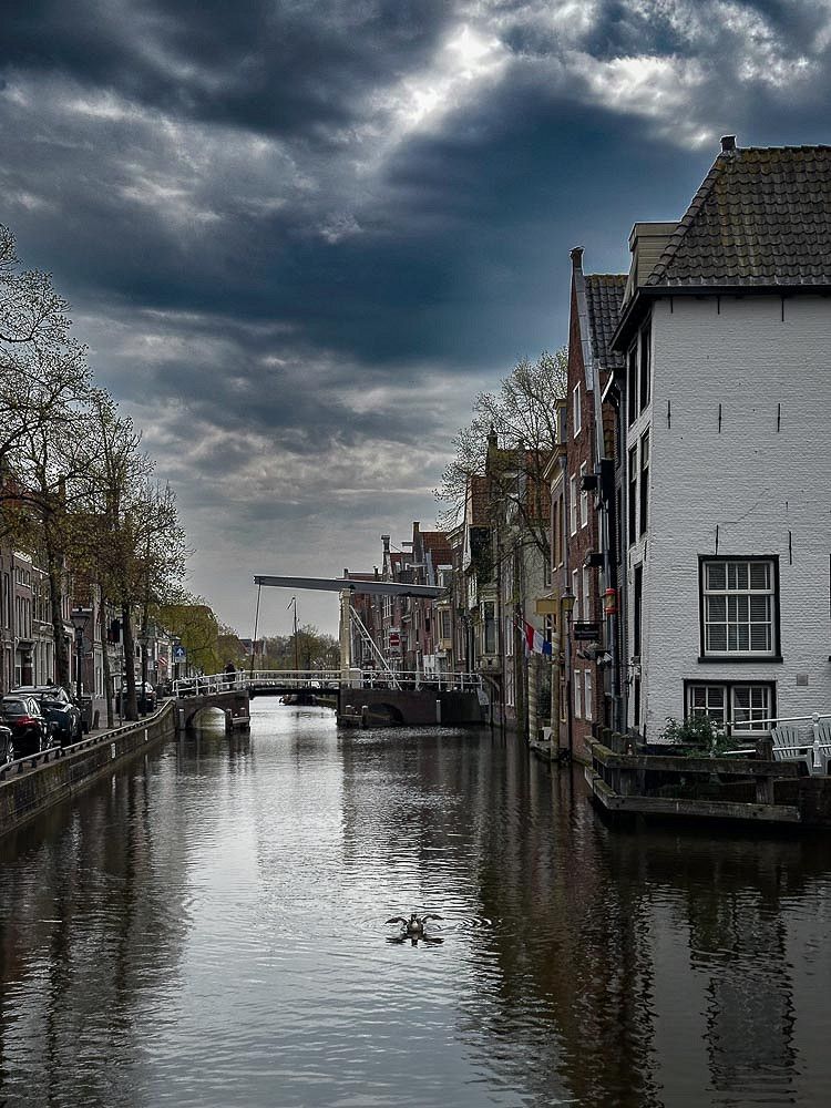
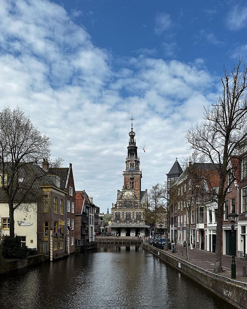
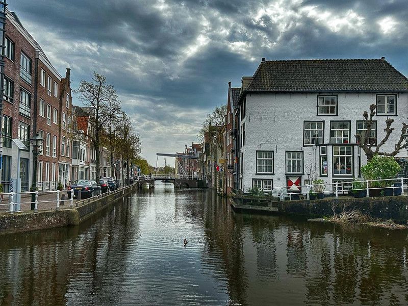
Alkmaar
After unfortunately only two nights, we first visited Alkmaar and later continued on towards Lisse (Keukenhof).
Koningsweg 34, Alkmaar, Nordholland, Niederlande
52° 37' 59.4" N 4° 44' 54.5" E
52.6331747 4.7484590
• Head toward Lombardsteeg on Koningsweg. Go for 256 m.
• Turn right onto Paternosterstraat. Go for 85 m.
• Continue on Kanaalkade. Go for 80 m.
• Turn left onto Geestersingel. Go for 336 m.
• Turn right onto Geesterweg. Go for 96 m.
• Take the 3rd exit from Bergerhout roundabout onto Vrouwenlaan toward Heiloo/Ziekenhuis M.C.A. Go for 210 m.
• Continue on Geestersingel. Go for 168 m.
• Continue on Kennemersingel. Go for 419 m.
• Turn right onto Kennemerstraatweg. Go for 1.3 km.
• Turn left onto Heilooër Tolweg (N9). Go for 773 m.
• Take the 1st exit from Verkeersplein Kooimeer roundabout toward Amsterdam/Haarlem. Go for 31 m.
• Take left ramp onto A9 toward Amsterdam/Haarlem. Go for 35.2 km.
• Take the exit toward Rotterdam onto A4. Go for 13.6 km.
• Keep right onto A44 (Knooppunt Burgerveen) toward Den Haag-Centrum/Leiden-West/Sassenheim. Go for 1.8 km.
• Take exit 1 toward Oude-Wetering/Lisserbroek. Go for 363 m.
• Turn left onto Lisserweg toward Amsterdam/(A44)/Leimuiden/Oude-Wetering/Roelofarendsveen. Go for 57 m.
• Turn right onto Kaagweg. Go for 855 m.
• Arrive at Kaagweg. Your destination is on the left.
☍
55,6 km
( 39 min.)
Abbenes
Since all the campsites around Lisse and Keukenhof were full, we drove to this campsite (Camperplaats). We managed to get a spot on the grass. It didn't have electricity, but we didn't need it.
After unloading the bikes, we went on our first exploratory tour to Lisse where we saw the first fields of tulips and hyacinths.
Kaagweg 50, Abbenes, Nordholland, Niederlande
52° 13' 33.6" N 4° 37' 9.3" E
52.2260002 4.6192533
• Head toward Lisserweg on Kaagweg. Go for 855 m.
• Turn left onto Lisserweg. Go for 2.1 km.
• Take the 3rd exit from roundabout onto Lisserweg toward Lisserbroek/Lisse. Go for 2.1 km.
• Take the 3rd exit from roundabout onto Lisserbroekerweg toward Lisse/Industrieterrein Lisserbroek. Go for 1.1 km.
• Continue on Lisserbrug. Go for 51 m.
• Continue on Kanaalstraat. Go for 252 m.
• Turn left onto Broekweg. Go for 193 m.
• Turn right onto Hyacinthenstraat. Go for 261 m.
• Turn left onto Gladiolenstraat. Go for 227 m.
• Continue on Laan van Rijckevorsel. Go for 673 m.
• Turn left onto Heereweg. Go for 104 m.
• Turn right onto Westelijke Randweg (N208). Go for 1.2 km.
• Keep left onto Westelijke Randweg (N208) toward Langevelderslag (Strand). Go for 42 m.
• Take the 3rd exit from roundabout onto Stationsweg toward Langevelderslag (Strand). Go for 375 m.
• Turn right onto Stationsweg. Go for 138 m.
• Arrive at Stationsweg.
☍
9,7 km
( 13 min.)
Lisse
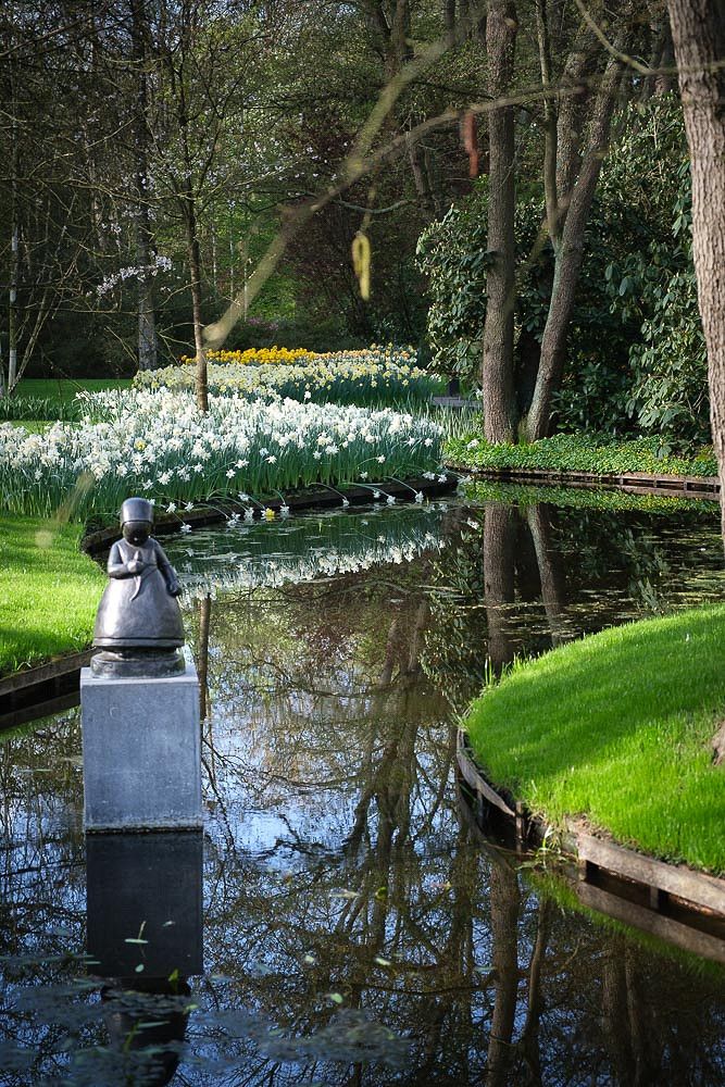
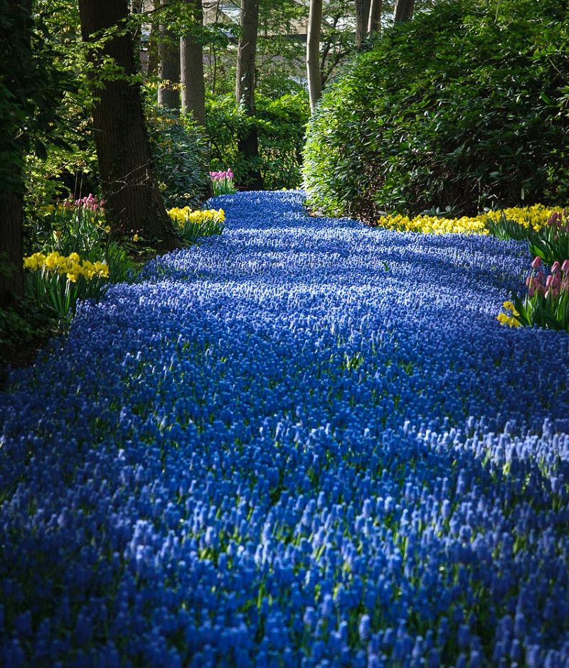
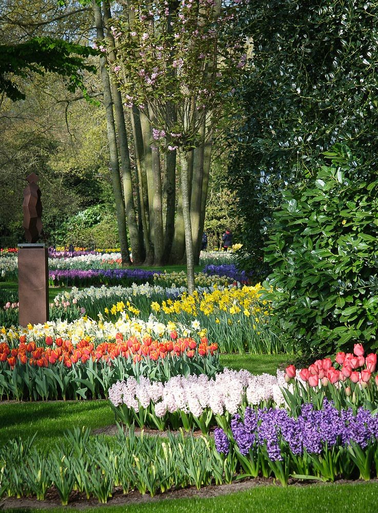
Our visit to Keukenhof began at 8:30 a.m., as this was the only available slot. This turned out to be a definite advantage, because after 12 p.m., it became so crowded that staying longer was no longer enjoyable. However, by then, we had explored every path in the beautiful grounds.
Beatrix, Lisse, Südholland, Niederlande
52° 16' 11.5" N 4° 32' 50.1" E
52.2698728 4.5472566
• Head northeast on Stationsweg. Go for 122 m.
• Turn right onto Stationsweg. Go for 75 m.
• Turn left. Go for 495 m.
• Turn right toward Stationsweg. Go for 126 m.
• Continue on Stationsweg. Go for 226 m.
• Take the 3rd exit from roundabout onto Heereweg (N208) toward Hillegom/Haarlem/Amsterdam/Den Haag/Bedrijventerrein Meer en Duin. Go for 409 m.
• Keep right toward Hillegom/Haarlem/Amsterdam/Den Haag. Go for 30 m.
• Take the 2nd exit from roundabout onto Heereweg (N208) toward Hillegom/Haarlem/Amsterdam/Den Haag. Go for 880 m.
• Turn right onto Leimuiderweg (N207). Go for 11.0 km.
• Keep right toward Alphen a/d Rijn/Gouda. Go for 45 m.
• Take the 2nd exit from roundabout onto Provinciale Weg (N207) toward Alphen a/d Rijn/Gouda. Go for 9.4 km.
• Turn right onto N207. Go for 914 m.
• Keep right onto Oostkanaalweg (N207). Go for 3.3 km.
• Turn left and take ramp onto N11 toward Bodegraven/Utrecht. Go for 7.5 km.
• Take ramp onto A12. Go for 82.3 km.
• Continue on A12 toward Arnhem/Doetinchem/Oberhausen. Go for 23.2 km.
• Continue on A3. Go for 64.8 km.
• Take exit 10 toward Köln/Düsseldorf/Duisburg onto A3. Go for 74.7 km.
• Continue on A3 toward Frankfurt a.M. Go for 58.3 km.
• Take exit 36 toward Neuwied/Rengsdorf. Go for 704 m.
• Take the 1st exit from roundabout onto B256 toward Neuwied/Rengsdorf. Go for 1.4 km.
• Pass 2 roundabouts and continue on B256. Go for 14.8 km.
• Take ramp onto Berggärtenstraße (B42) toward Bonn/Linz/NR-Zentrum. Go for 798 m.
• Turn left onto Dierdorfer Straße toward Neuwied-Heddesdorf/Neuwied-Raiffeisenring. Go for 430 m.
• Take the 3rd exit from roundabout onto Sohler Weg. Go for 388 m.
• Take the 1st exit from roundabout onto Ringstraße. Go for 642 m.
• Turn left onto Hofgründchen. Go for 38 m.
• Turn right onto Wilhelm-Leuschner-Straße. Go for 289 m.
• Continue on Bismarckstraße. Go for 7 m.
• Turn right onto Moltkeplatz. Go for 58 m.
• Turn left onto Wilhelm-Leuschner-Straße. Go for 44 m.
• Arrive at Wilhelm-Leuschner-Straße. Your destination is on the left.
☍
357,4 km
(3 hrs. 35 min.)
Neuwied
Wilhelm-Leuschner-Straße, Neuwied, Landkreis Neuwied, Rheinland-Pfalz, Deutschland
50° 25' 48.9" N 7° 27' 58.7" E
50.4302393 7.4663020