Via the A8 we drive to the A81 via the B31 to the Ravenna Gorge in Freiburg, continue on the A5 to the B31, over the Rhine bridge to Vogelgrun and on the D415 to Colmar.
On the Route de Vins Alsace we drive to Strasbourg.
Day
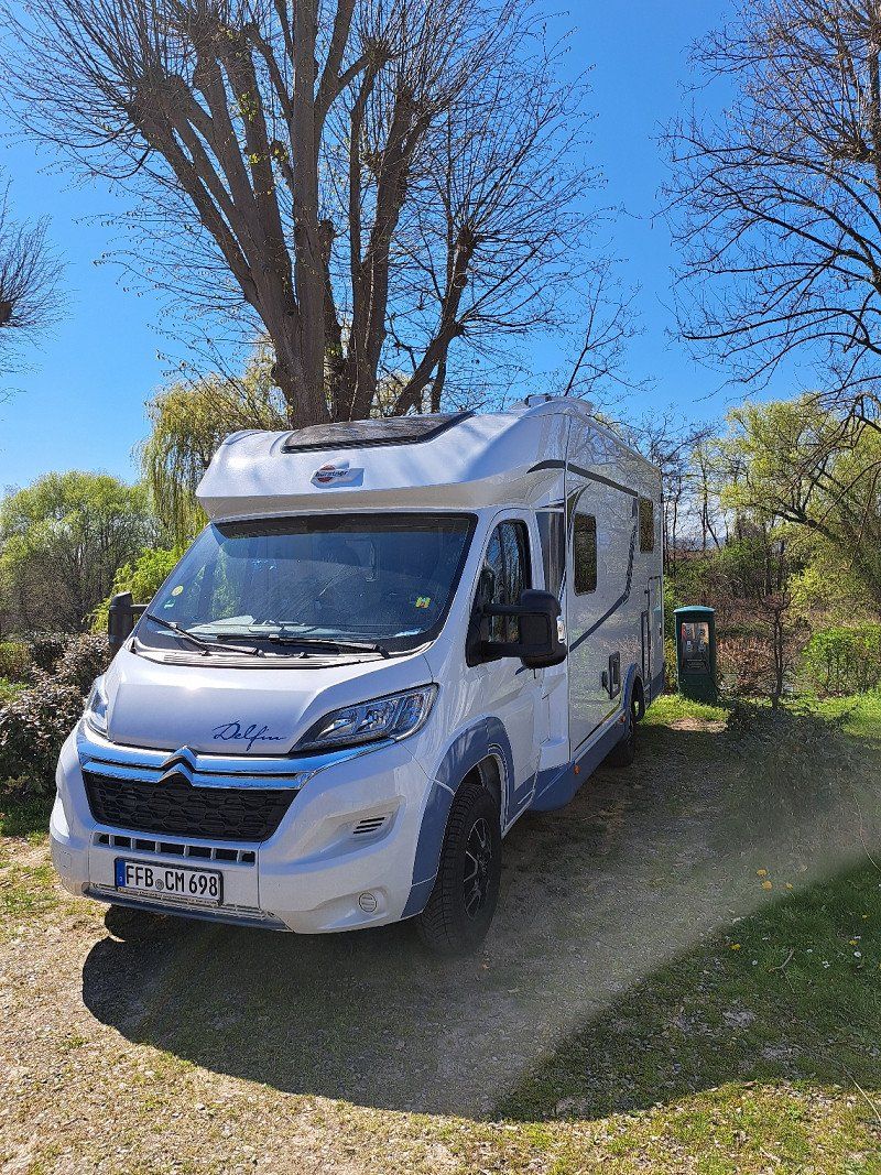
05.04. 2023 Gröbenzell - Abreise nach Colmar
Sunshine was our companion on the way to Colmar.
We first drive the A8 and from there onto the A81. At the Sundhausen exit, we take the B27 and past Donaueschingen onto the B31.
It now goes to the Ravenna Gorge and on to Freibug.
From Freiburg we went on the A5 to the Bad Krozingen motorway junction, over the Rhine bridge, past Vogelgrun to France and on the D415 to Colmar.
Deutschland
48° 11' 35.8" N 11° 22' 30.7" E
48.1932834 11.3752077
• Head east on Ährenfeldstraße. Go for 255 m.
• Turn left onto Olchinger Straße (St2345). Go for 2.4 km.
• Continue on Lochhausener Straße. Go for 2.0 km.
• Take ramp onto A99 toward Lindau. Go for 6.0 km.
• Take exit 4 toward Lindau/Memmingen/Germering-Süd onto A96. Go for 159 km.
• Take exit 3 toward Sigmarszell/Scheidegg/Flughafen Friedrichshafen. Go for 330 m.
• Turn right onto B31 toward Flughafen Friedrichshafen/Lindau/Ravensburg/B467. Go for 35.7 km.
• Continue on B31 toward Donaueschingen/Meersburg. Go for 4.9 km.
• Keep left onto B31 toward Stuttgart/Singen/Stockach/Überlingen/Uhldingen-Mühlhofen. Go for 12.6 km.
• Continue on B31N. Go for 15.6 km.
• Continue on A98. Go for 12.5 km.
• Take exit 11 toward Stuttgart/Villingen-Schwenningen onto A81. Go for 20.6 km.
• Take exit 38 toward Geisingen/Freiburg/Tuttlingen/B31/Immendingen. Go for 411 m.
• Turn left onto B311 toward Freiburg/Donaueschingen/Geisingen. Go for 789 m.
• Keep right onto B31. Go for 46.9 km.
• Take ramp toward Birklehof. Go for 67 m.
• Turn left onto Oberhöllsteig. Go for 132 m.
• Turn right onto Ravennaschlucht. Go for 458 m.
• Arrive at Ravennaschlucht.
☍
320,9 km
(3 hrs. 15 min.)
05.04. 2023 Ravenna- schlucht-Sehenswert
Breitnau, Deutschland
47° 55' 4.3" N 8° 5' 24.5" E
47.9178509 8.0901453
• Head toward Oberhöllsteig on Ravennaschlucht. Go for 458 m.
• Turn left onto Oberhöllsteig. Go for 125 m.
• Turn right and take ramp onto B31. Go for 30.2 km.
• Take ramp onto A5 toward Basel. Go for 12.5 km.
• Take exit 64A toward Bad Krozingen/Staufen/Münstertal/Colmar/Breisach. Go for 213 m.
• Turn left onto B31 toward Breisach/Colmar (Elsaß)/Hartheim/Hausen/Möhlin. Go for 924 m.
• Arrive at B31. Your destination is on the right.
☍
44,4 km
( 36 min.)
05.04. 2023 Bad Krozingen
Bad Krozingen, Deutschland
47° 57' 34.8" N 7° 39' 45.6" E
47.9596753 7.6626777
• Head north on B31. Go for 8.9 km.
• Arrive at B31.
☍
8,9 km
( 6 min.)
05.04. 2023 Zur Rheinbrücke
Breisach am Rhein, Deutschland
48° 1' 23.3" N 7° 35' 40.4" E
48.0231438 7.5945588
• Head northwest on B31. Go for 505 m.
• Take the 2nd exit from roundabout onto B31 toward Colmar. Go for 615 m.
• Continue on Pont Julius Leber (D415). Go for 306 m.
• Take the 2nd exit from roundabout onto D415 toward Colmar/Neuf-Brisach/Volgelsheim. Go for 668 m.
• Take the 3rd exit from roundabout onto D52 toward Fessenheim/Vogelgrun. Go for 403 m.
• Take the 1st exit from roundabout onto Rue du Rhin toward Vogelgrun. Go for 491 m.
• Arrive at Rue du Rhin. Your destination is on the left.
☍
3,0 km
( 3 min.)
05.04. 2023 Vogelgrun D415
Frankreich
48° 0' 45.6" N 7° 34' 24.4" E
48.0126560 7.5734360
• Head southeast on Rue du Rhin. Go for 130 m.
• Take the 4th exit from roundabout onto Rue du Rhin. Go for 669 m.
• Take the 2nd exit from roundabout onto D52 toward Colmar/Freiburg/Marckolsheim/Biesheim/Neuf-Brisach/Brisach. Go for 413 m.
• Take the 3rd exit from roundabout onto D415 toward Colmar/Neuf-Brisach. Go for 1.4 km.
• Take the 3rd exit from roundabout onto D415 toward Colmar/Neuf-Brisach. Go for 1.5 km.
• Take the 1st exit from roundabout onto D468 toward Neuf-Brisach/Volgelsheim. Go for 1.0 km.
• Turn right onto Rue Vauban. Go for 129 m.
• Turn left onto Rue de l'Hôtel de Ville. Go for 45 m.
• Arrive at Rue de l'Hôtel de Ville. Your destination is on the left.
☍
5,4 km
( 7 min.)
Neuf-Brisach - Sehenswert
Parking with camper:
A) "Neuf-Brisach car park" France
(Neuf-Brisach car park in Googlemaps
input)
B) "Parking Bus", Neuf-Brisach, France
(Parking Bus - Neuf-Brisach in
enter google maps)
Interesting star-shaped fortifications worth seeing built by
Louis XIV in 1699.
Frankreich
48° 1' 5.1" N 7° 31' 48.5" E
48.0180910 7.5301450
• Head toward Rue du Maréchal Foch on Rue de l'Hôtel de Ville. Go for 21 m.
• Turn left onto Rue du Maréchal Foch. Go for 74 m.
• Turn right onto Place d'Armes Général de Gaulle (D468). Go for 172 m.
• Turn right onto Rue de Colmar (D290). Go for 203 m.
• Continue on D290. Go for 88 m.
• Continue on Square Alphonse Halter (D290). Go for 22 m.
• Continue on D290. Go for 440 m.
• Take the 1st exit from roundabout onto D415 toward Colmar/Andolsheim. Go for 9.3 km.
• Take the 2nd exit from roundabout onto D415 toward A35/Colmar/Horbourg-Wihr. Go for 889 m.
• Take the 1st exit from roundabout onto D418 toward D415/Colmar/Horbourg-Wihr. Go for 465 m.
• Take the 2nd exit from roundabout onto Route de Neuf-Brisach (D418) toward D415/Colmar. Go for 1.7 km.
• Turn left onto Allée du Camping. Go for 198 m.
• Arrive at Allée du Camping. Your destination is on the right.
☍
13,6 km
( 14 min.)
05.04. 2023 Camping de l'Ill - Colmar
Located on the Ill, the campsite in Colmar "Camping de I'll" is only 2 km
from the city center and can be reached on foot in 1/2 hour.
The proximity to Colmar is certainly an advantage of this campsite.
The sanitary facilities are no longer the newest, but are clean and well maintained.
Like most campsites in France, this campsite is also very cheap at €16.50 without electricity for 2 people per night for a large mobile home pitch.
The staff is extremely friendly.
Recommendation:
Reservations are essential during the holiday season.
At Easter this campsite was fully booked and we experienced that a few campers were sent away.
Luckily we had reserved.
Our conclusion:
We would go back anytime with prior reservation.
The campsite is open from the end of March to the beginning of January of the following year.
The Christmas market in picturesque Colmar would certainly be worth a trip during Advent.
Attention: The entrance barrier to the campsite is open from 12.00 p.m. to 2.00 p.m
closed!!
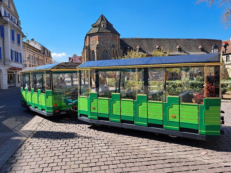
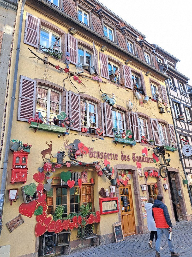
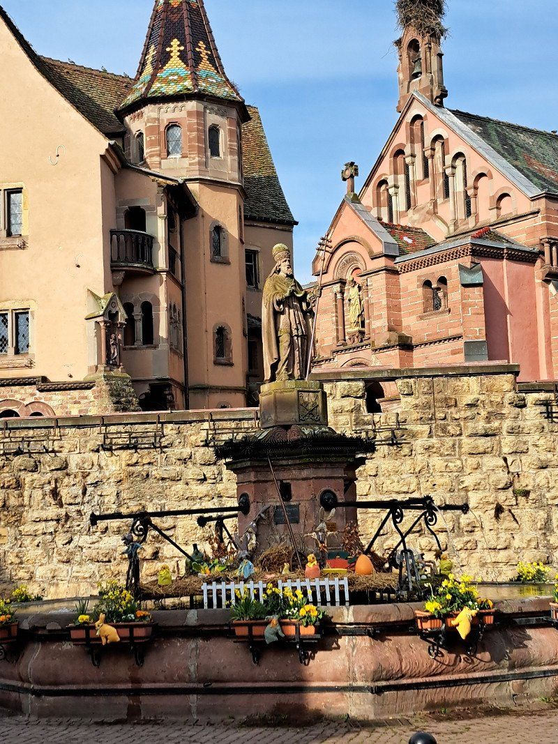
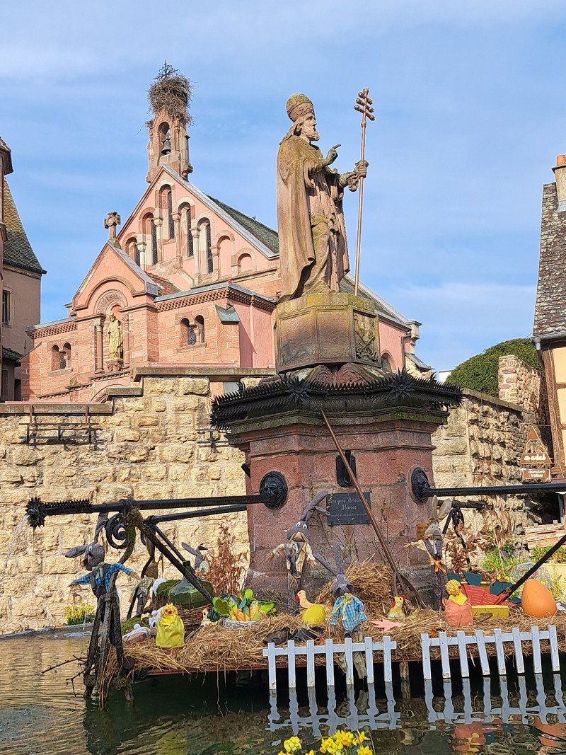
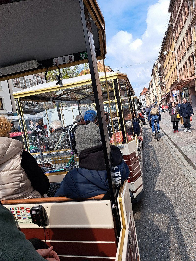
City tour of Colmar:
With the "petit train blanc colmar"
(small white tourist train) you can explore the old town of Colmar in a relatively short time, comfortably, in a playful and original way.
The little white train features
60 places and runs daily in the period from
01 April to 15 November from 9 a.m. to 6 p.m.
Tickets can be purchased at the Tourist Office or directly from the train driver for €6/adult. be bought.
There are individual headphones with simultaneous translation into 12 languages.
The tour of the old town takes about 35-40 minutes.
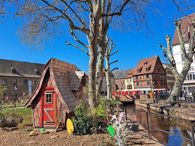
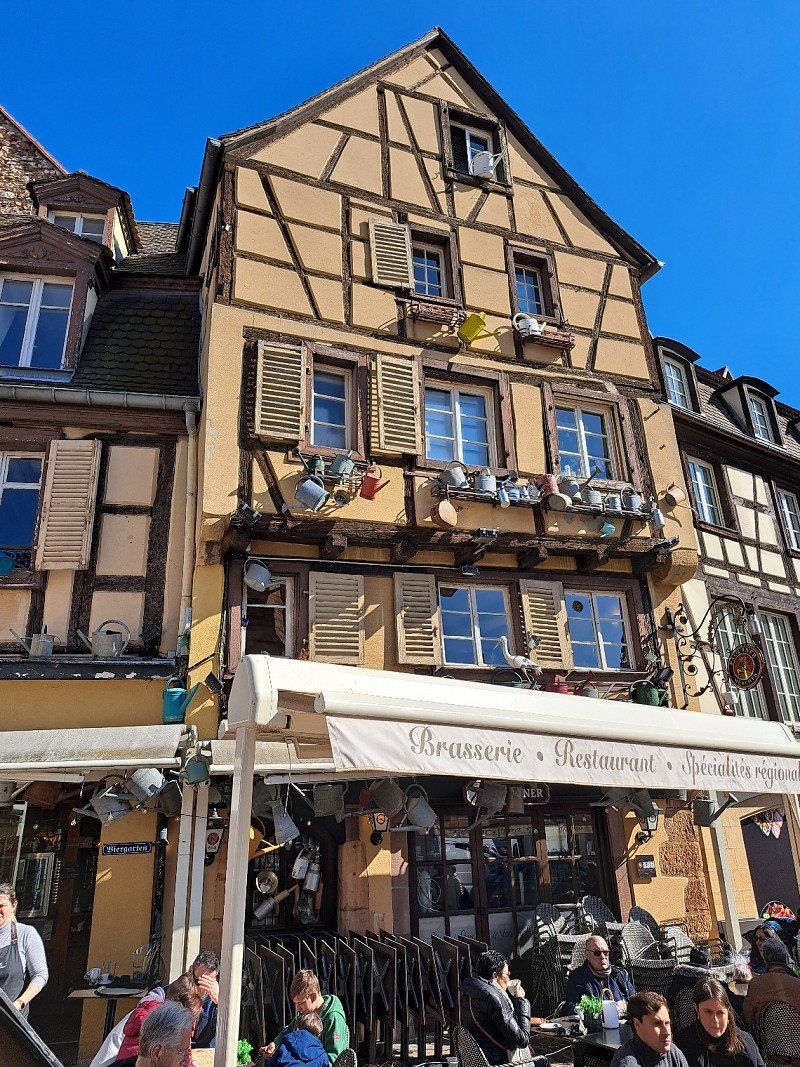
We had good weather for the first 2 days and were able to thoroughly enjoy Colmar and the "Route de vins Alsace".
Depending on the time of year, the nights were still quite cool at +5°C.
With the parking heater, however, that was no problem at all.
1 allée du camping, 68180, Horbourg wihr, Frankreich
48° 4' 44.8" N 7° 23' 11.3" E
48.0791105 7.3864702
• Head southeast on Allée du Camping. Go for 168 m.
• Turn right toward Rue de Colmar. Go for 39 m.
• Turn left onto Rue de Colmar. Go for 13 m.
• Turn left onto Grand'Rue (D418). Go for 368 m.
• Take the 2nd exit from roundabout onto Route de Neuf-Brisach (D418) toward Colmar-Centre. Go for 672 m.
• Turn left onto Rue du Grillenbreit. Go for 469 m.
• Continue on Rue du Rhin. Go for 248 m.
• Turn left onto Avenue d'Alsace (D201). Go for 808 m.
• Turn slightly right onto Avenue de Fribourg. Go for 356 m.
• Continue on Avenue Georges Clemenceau. Go for 542 m.
• Continue on Avenue Raymond Poincaré. Go for 448 m.
• Turn left onto Route de Rouffach (D514). Go for 3.3 km.
• Turn right and take ramp onto D83 toward Strasbourg. Go for 1.4 km.
• Take the 4th exit from roundabout onto D1 BIS toward Husseren-les-Châteaux/Eguisheim. Go for 489 m.
• Continue on Route de Wettolsheim (D1 BIS). Go for 850 m.
• Turn right onto Rue des Fleurs. Go for 371 m.
• Continue on Rue du Riesling. Go for 25 m.
• Turn left onto Rue de l'Hôpital. Go for 61 m.
• Arrive at Rue de l'Hôpital. Your destination is on the left.
☍
10,6 km
( 16 min.)
Day
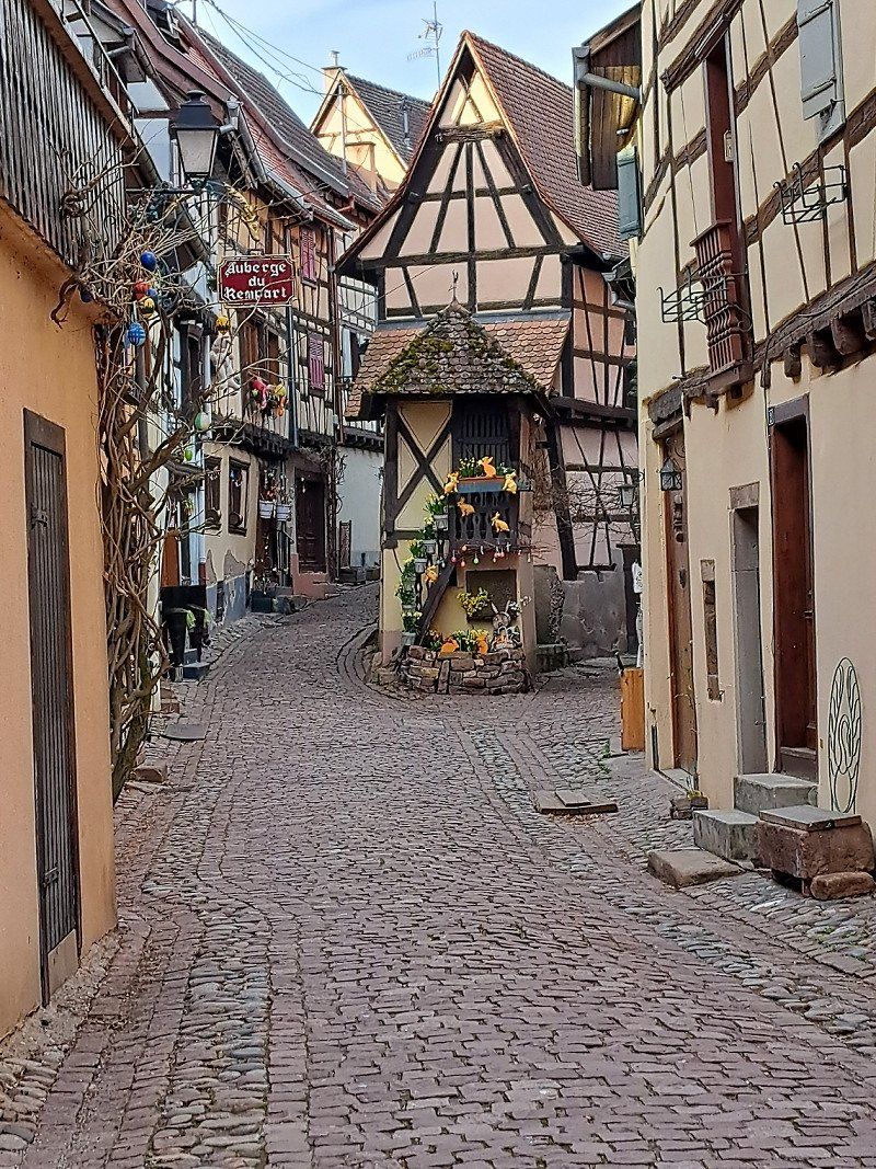
Eguisheim - Sehenswert - Googlemaps
Address/designation of a mobile home parking space:
"Area sosta comunale Mairi"
(close to the outskirts)
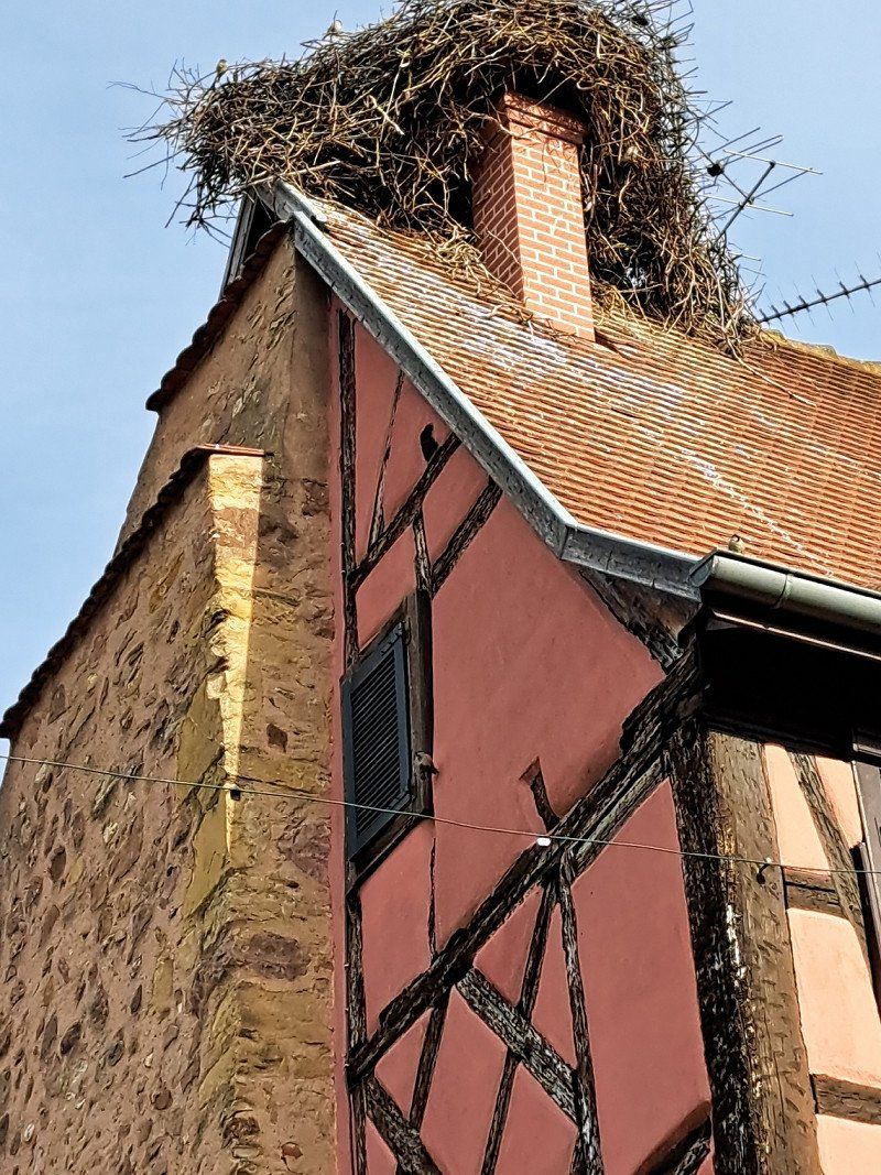
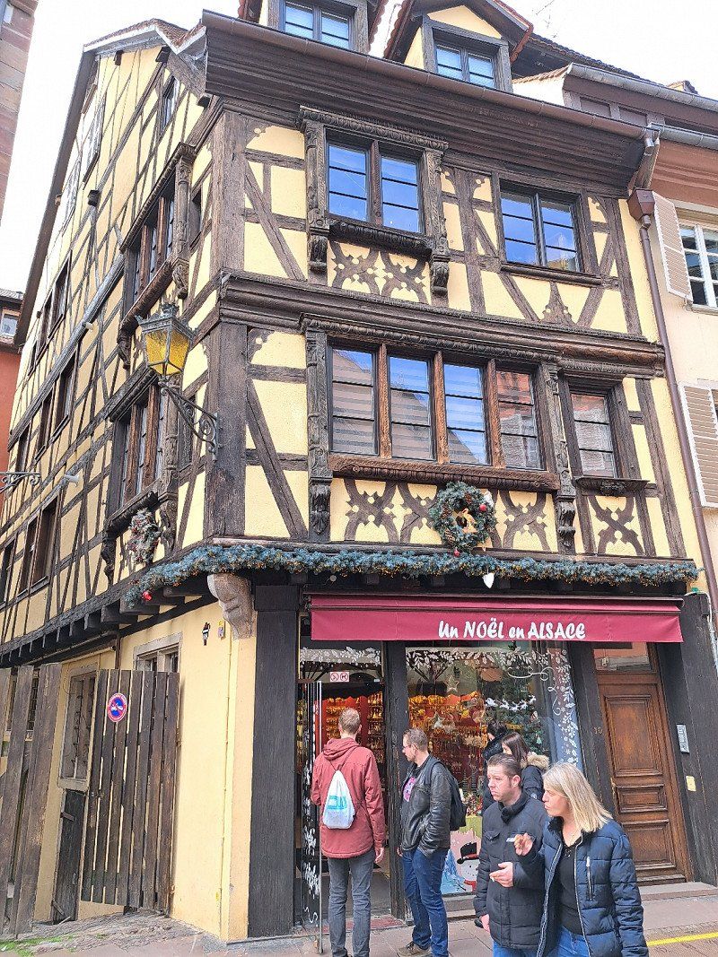
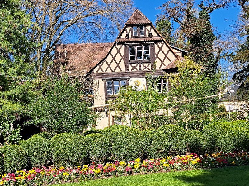
Most beautiful place in Alsace, if not in France.
Historic city center with many half-timbered houses along the city wall.
Frankreich
48° 2' 35.8" N 7° 18' 23.5" E
48.0432650 7.3065220
• Head toward Place du Château Saint-Léon on Rue de l'Hôpital. Go for 40 m.
• Turn right onto Grand Rue (D514). Go for 30 m.
• Turn right onto Impasse Quibourg. Go for 62 m.
• Turn right onto Rue Allmend Nord. Go for 29 m.
• Turn left onto Rue de l'Hôpital. Go for 44 m.
• Turn right onto Rue du Riesling. Go for 25 m.
• Continue on Rue des Fleurs. Go for 371 m.
• Turn left onto Route de Wettolsheim (D1 BIS). Go for 850 m.
• Continue on D1 BIS. Go for 363 m.
• Take the 3rd exit from roundabout onto D83 toward Nancy/Strasbourg/Munster/Wintzenheim/Z.I. Colmar. Go for 2.4 km.
• Take the 3rd exit from roundabout onto Carrefour Ligibel (D83) toward Freiburg/Nancy/Strasbourg/Z.I. Colmar/Ingersheim/Turckheim. Go for 1.0 km.
• Take the 3rd exit from roundabout onto Carrefour Ligibel (D83) toward Freiburg/Nancy/Strasbourg/Z.I. Colmar/Ingersheim. Go for 825 m.
• Take the 2nd exit from roundabout onto Avenue de Lorraine (D83) toward Freiburg/Nancy/St Dié/Strasbourg/Z.I. Colmar. Go for 282 m.
• Take the 2nd exit from roundabout onto D415 toward Nancy/Saint Dié/Sigolsheim/Kaysersberg/Ammerschwihr. Go for 1.9 km.
• Take the 1st exit from Rond-Point du Florimont roundabout onto D10 toward Ribeauville/Bennwihr/Sigolsheim. Go for 3.5 km.
• Take the 2nd exit from roundabout onto D1 BIS. Go for 1.6 km.
• Turn right onto Place de la Mairie. Go for 29 m.
• Arrive at Place de la Mairie. Your destination is on the left.
☍
13,3 km
( 14 min.)
06.04. 2023 Bennwihr
Frankreich
48° 8' 42.1" N 7° 19' 28.9" E
48.1450190 7.3246950
• Head toward Rue du Général de Gaulle on Place de la Mairie. Go for 29 m.
• Turn right onto Rue du Général de Gaulle (D1 BIS). Go for 1.7 km.
• Take the 4th exit from roundabout onto Route de Colmar (D300). Go for 1.5 km.
• Take the 3rd exit from roundabout onto Avenue Jacques Preiss (D300). Go for 355 m.
• Turn left onto Place Fernand Zeyer (D300). Go for 13 m.
• Arrive at Place Fernand Zeyer (D300). Your destination is on the right.
☍
3,5 km
( 4 min.)
06.04. 2023 Riquewihr
Frankreich
48° 9' 58.2" N 7° 17' 59.4" E
48.1661580 7.2998220
• Head south on Place Fernand Zeyer (D300). Go for 13 m.
• Turn right onto Place Fernand Zeyer. Go for 52 m.
• Turn right onto Rue du Général de Gaulle (D300). Go for 32 m.
• Continue on Avenue Jacques Preiss (D300). Go for 306 m.
• Take the 3rd exit from roundabout onto Route de Ribeauvillé (D3 II). Go for 248 m.
• Continue on D3 II. Go for 600 m.
• Turn left onto Route du Vin (D1 BIS). Go for 2.9 km.
• Take the 1st exit from roundabout onto Avenue du Général de Gaulle (D1 BIS). Go for 93 m.
• Take the 2nd exit from roundabout toward D1 BIS/Bergheim/Ht Koenigsbourg. Go for 76 m.
• Keep left onto Grand'Rue. Go for 358 m.
• Continue on Grand'Rue. Go for 93 m.
• Turn left onto Rue de la Mairie. Go for 33 m.
• Arrive at Rue de la Mairie. Your destination is on the right.
☍
4,9 km
( 7 min.)
06.04. 2023 Ribeauvillé
Frankreich
48° 11' 40.8" N 7° 19' 8.7" E
48.1946680 7.3190910
• Head toward Grand'Rue on Rue de la Mairie. Go for 33 m.
• Turn left onto Grand'Rue. Go for 45 m.
• Turn slightly right onto Grand'Rue. Go for 77 m.
• Turn right onto Rue de l'Abbé Louis Kremp. Go for 100 m.
• Continue on Rue Klée. Go for 475 m.
• Turn left onto Route de Bergheim (D1 BIS). Go for 2.9 km.
• Pass 2 roundabouts and continue on Route du Vin (D1 BIS). Go for 3.4 km.
• Turn left onto Rue de la Montée. Go for 18 m.
• Turn right onto Place de l'Hôtel de Ville. Go for 19 m.
• Arrive at Place de l'Hôtel de Ville. Your destination is on the right.
☍
7,1 km
( 10 min.)
06.04. 2023 Saint-Hippolyte
Frankreich
48° 13' 59.9" N 7° 22' 4.6" E
48.2333090 7.3679530
• Head toward Ruelle de l'Abreuvoir on Place de l'Hôtel de Ville. Go for 35 m.
• Continue on Route du Vin. Go for 2.0 km.
• Continue on Route du Vin (D35). Go for 2.1 km.
• Turn left onto Rue de la Liberté (D35). Go for 33 m.
• Turn right onto Rue de la Liberté (D35). Go for 2.0 km.
• Arrive at Rue du Maréchal Foch (D35). Your destination is on the right.
☍
6,2 km
( 8 min.)
06.04. 2023 Châtenois
Frankreich
48° 16' 21.1" N 7° 23' 58.2" E
48.2725180 7.3994940
• Head north on Rue du Maréchal Foch (D35). Go for 445 m.
• Take the 2nd exit from roundabout onto Route de Scherwiller (D35) toward Scherwiller. Go for 2.7 km.
• Turn left onto Rue de Dambach (D35) toward Dambach-la-Ville/Dieffenthal/Kientzville. Go for 408 m.
• Continue toward D35. Go for 32 m.
• Take the 2nd exit from roundabout onto D35 toward Dieffenthal/Dambach la V. Go for 3.7 km.
• Turn left onto Rue Clemenceau. Go for 31 m.
• Turn left onto Rue Clemenceau. Go for 5 m.
• Turn right onto Rue Clemenceau. Go for 97 m.
• Turn right onto Rue de la Paix. Go for 64 m.
• Turn left onto Rue des Teinturiers. Go for 52 m.
• Turn right onto Rue des Teinturiers. Go for 47 m.
• Arrive at Rue des Teinturiers. Your destination is on the right.
☍
7,5 km
( 10 min.)
06.04. 2023 Dambach-la-Ville
Frankreich
48° 19' 23" N 7° 25' 34.9" E
48.3230670 7.4263490
• Head northwest on Rue des Teinturiers. Go for 84 m.
• Continue on Place du Marché. Go for 23 m.
• Turn right onto Rue des Ours. Go for 71 m.
• Continue on Rue du Général Braun. Go for 65 m.
• Turn left onto Rue du Maréchal Foch (D35). Go for 2.8 km.
• Turn left onto D35. Go for 3.1 km.
• Turn left onto Route du Vin (D35). Go for 966 m.
• Turn right onto D253. Go for 594 m.
• Continue on D35 toward Eichhoffen/Barr. Go for 2.1 km.
• Pass 2 roundabouts and continue on D425. Go for 772 m.
• Turn left onto Rue Principale. Go for 688 m.
• Arrive at Rue Principale.
☍
11,2 km
( 16 min.)
Mittelbergheim - Sehenswert
Parking options with a mobile home:
A) "Rue Rotland car park" (5 places)
67140 Mittelbergheim
(Og search term in Googlemaps
input)
Good location - close to the town center!
B) "Parking de la Gare"
67140 Mittelbergheim
(Og search term in Googlemaps
input)
Not such a good location as further from
town center away!
The picturesque Mittelbergheim (655 inhabitants) is one of the most beautiful
villages in France.
It is also known for the very good culinary offer.
Frankreich
48° 23' 46" N 7° 26' 31.6" E
48.3961100 7.4421180
• Head toward Rue des Vosges on Rue Principale. Go for 35 m.
• Turn left onto Rue de la Montagne (D362). Go for 471 m.
• Continue on D362. Go for 87 m.
• Take the 2nd exit from roundabout onto Route d'Andlau (D62). Go for 547 m.
• Take the 1st exit from roundabout onto Route d'Eichhoffen (D425). Go for 542 m.
• Take the 2nd exit from roundabout onto Route des Vosges (D35). Go for 397 m.
• Arrive at Route des Vosges (D35). Your destination is on the left.
☍
2,1 km
( 4 min.)
06.04. 2023 Eichhoffen
Frankreich
48° 23' 0.7" N 7° 26' 29.9" E
48.3835260 7.4416470
• Head toward Rue des Peupliers on Route des Vosges (D35). Go for 375 m.
• Pass 3 roundabouts and continue on Avenue du Docteur Marcel Krieg (D425). Go for 2.7 km.
• Continue on Rue de l'Hôpital. Go for 207 m.
• Continue on Quai de l'Abattoir. Go for 273 m.
• Continue on Rue Paul Degermann. Go for 197 m.
• Turn left onto Route de Strasbourg (D706). Go for 71 m.
• Turn sharp right onto Rue du Docteur Sultzer (D35). Go for 5.0 km.
• Take the 2nd exit from roundabout onto D35. Go for 3.6 km.
• Arrive at Rue Monseigneur Médard Barth (D35). Your destination is on the left.
☍
12,4 km
( 17 min.)
06.04. 2023 Bœrsch
Frankreich
48° 28' 39.9" N 7° 26' 25.1" E
48.4777390 7.4403040
• Head southwest on Rue Monseigneur Médard Barth (D35). Go for 2.2 km.
• Turn right onto Route de Klingenthal (D426). Go for 178 m.
• Take the 2nd exit from roundabout onto Rue du Colonel de Witt-Guizot (D303). Go for 282 m.
• Arrive at Rue du Colonel de Witt-Guizot (D303).
☍
2,7 km
( 4 min.)
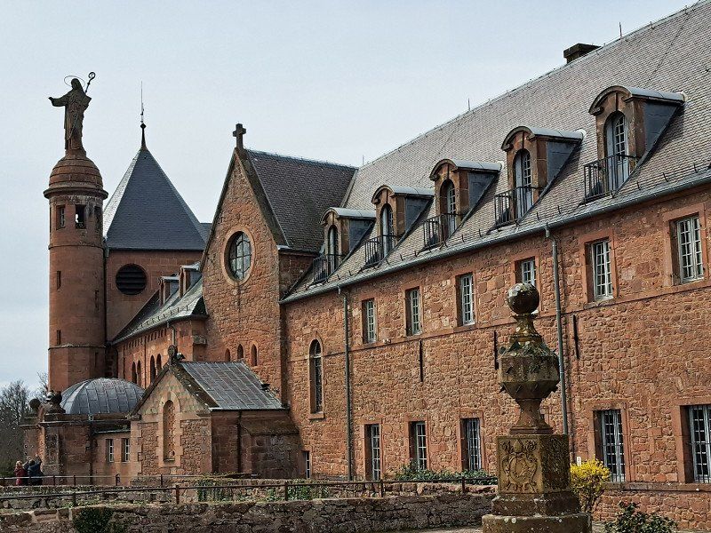
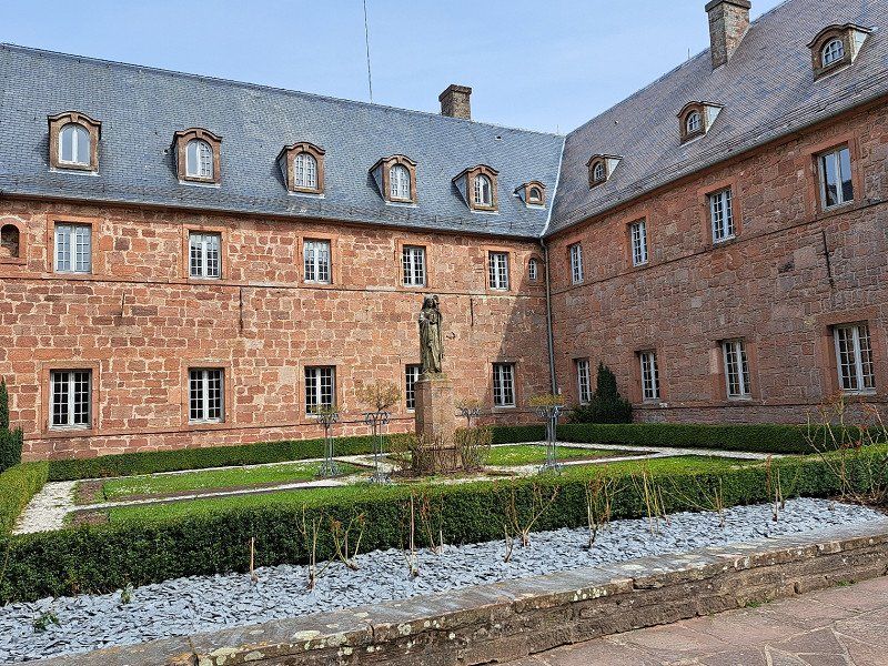
Ottrott - Odilienberg Sehenswert
The monastery of St. Odilienberg is located near the towns of Obernai and Barr at an altitude of 763m.
There is a great panoramic view of Kaysersberg and the Vosges from there.
There is a parking lot for cars, buses and mobile homes on the way on the D426, at the very top of the Odilienberg monastery.
The rest (200m) is easy to walk.
The best way to navigate is with Google Maps
"Odilienberg car park" - In Ottrott
(D226 - 67530 Ottrott)
A visit to the old monastery is definitely worth it. The panorama from this 763m high monastery mountain is gigantic. You have a good view of the Vosges and even as far as Kaysersberg.
Frankreich
48° 27' 31.7" N 7° 25' 40.3" E
48.4588180 7.4278650
• Head toward Rue Saint-Simon on Rue du Colonel de Witt-Guizot (D303). Go for 252 m.
• Take the 1st exit from roundabout onto Route de Klingenthal (D426). Go for 190 m.
• Turn left onto Route de Boersch (D35). Go for 2.6 km.
• Take the 3rd exit from roundabout onto Route de Rosheim (D35). Go for 2.2 km.
• Take the 2nd exit from roundabout onto Route de Boersch (D35). Go for 448 m.
• Turn left onto Avenue Clemenceau. Go for 631 m.
• Arrive at Avenue Clemenceau. Your destination is on the right.
☍
6,3 km
( 9 min.)
06.04. 2023 40 Avenue Clémenceau
Address of the free parking space:
Avenue Clemenceau 40, 67560 Rosheim
(Sufficient for 10 WoMo's)
In Rosheim there are some ancient buildings worth seeing.
Rosheim, Frankreich
48° 29' 52.4" N 7° 28' 6.2" E
48.4978803 7.4683789
• Head northeast on Avenue Clemenceau. Go for 159 m.
• Take the 2nd exit from roundabout onto Avenue du Maréchal Foch (D435). Go for 276 m.
• Continue on Avenue Foch (D435). Go for 150 m.
• Turn left onto Avenue du Général Leclerc (D35). Go for 308 m.
• Pass 2 roundabouts and continue on Avenue de la Gare (D35). Go for 1.6 km.
• Continue on Avenue de la Gare. Go for 69 m.
• Take the 4th exit from roundabout onto D500 toward Molsheim/Strasbourg/Saint-Dié. Go for 2.0 km.
• Take ramp onto A352 toward E25/Strasbourg/Aéroport Entzheim. Go for 7.6 km.
• Continue on A35. Go for 13.3 km.
• Take exit 4 toward Kehl/Z.I. Plaine des Bouchers/Elsau. Go for 483 m.
• Turn right onto Rue de la Montagne Verte toward Montagne Verte/Elsau. Go for 723 m.
• Continue on Pont de la Montagne Verte. Go for 99 m.
• Continue on Rue de la Tour Verte. Go for 259 m.
• Turn left onto Route de Schirmeck (M392) toward Lingolsheim/Ostwald/Montagne Verte. Go for 277 m.
• Turn right onto Rue de l'Auberge de Jeunesse. Go for 141 m.
• Continue on Rue de l'Auberge de Jeunesse. Go for 55 m.
• Turn left onto Rue de l'Auberge de Jeunesse. Go for 38 m.
• Turn right. Go for 45 m.
• Arrive at your destination on the right.
☍
27,6 km
( 22 min.)
06.04. 2023 Camping de Strasbourg
The campsite is very big.
We found that, given the size, there were relatively few showers and toilets.
But the sanitary facilities were very clean.
The staff was also very friendly.
Campsite opening hours: 7:00 a.m. - 11:00 p.m
In France, campsites are generally very cheap.
We paid €22 for a large, spacious pitch including electricity and
2 people/per night.
Fresh water, gray and black water disposal included in the price.
Our conclusion:
Overall, this campsite is recommended and we would go back at any time.
Reservations in advance during the holiday season are also highly recommended for this campsite!
For France and especially for the planned Strasbourg tour with a motorhome, a "Crit Air Badge" has been required since January 1st, 2023.
I have these relatively cheap online at the French Environment Agency for €4.70
ordered and received it in the mail within 18 days.
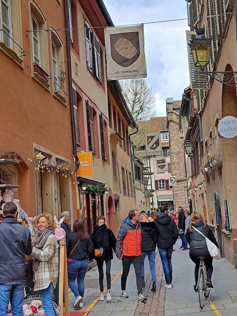
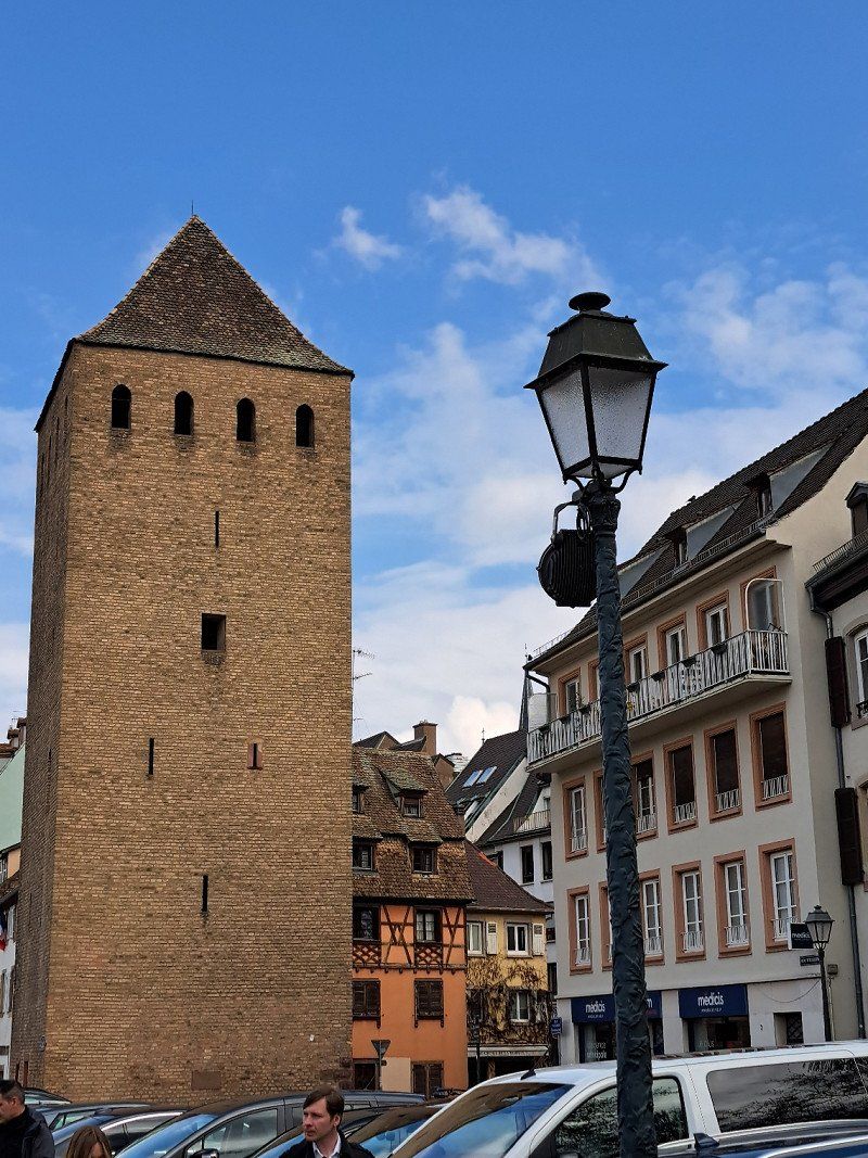
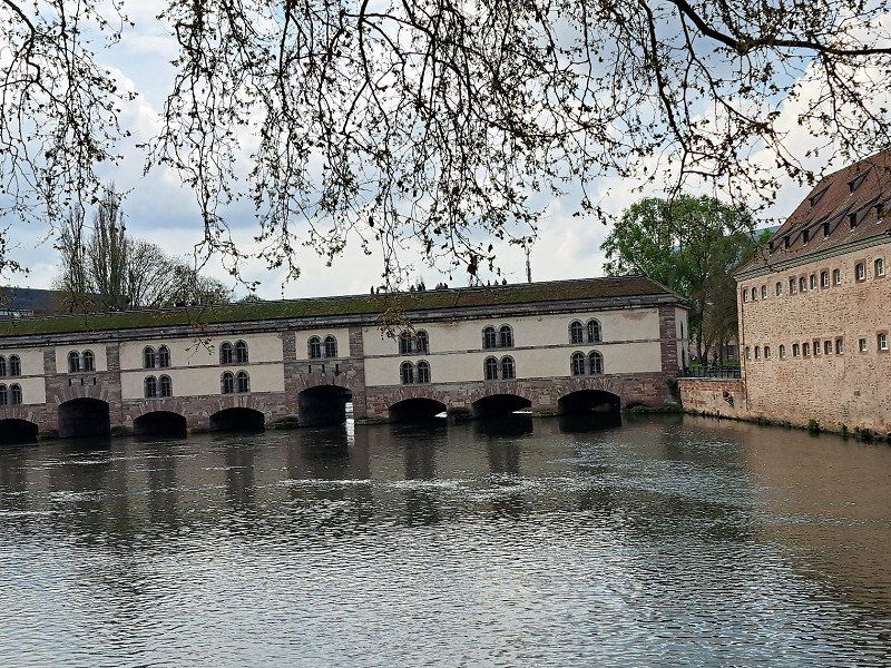
Here is some useful information about the campsite and Strasbourg:
A bicycle path leads directly past the "Camping de Strasbourg" campsite into the city center of Strasbourg
to the "Grande I'lle".
The city center is within walking distance
1.25 hours and by e-bike in 1/4 hour.
There is a bus stop about 170m from the main entrance of the campsite.
Take the "L1" bus line in the direction of "Lamproie" and get off at the bus stop
"Etoile Bourse".
From there it is 450m to the
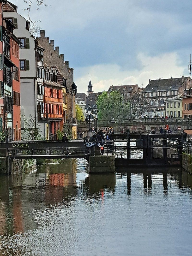
Rue de la 1ere Armee, across the Ille bridge
to the cathedral.
The bus line "L1" runs 4 times an hour, so there are no long waiting times (e.g. in bad weather).
You can take the tram (line B) from the "Montagere Verte" stop (600m walk from the campsite) to the city center (stop "Homme de Fere").
To get to the tram stop you have to turn left on the main road (coming from the campsite)!!
The friendly lady at the campsite reception foolishly sent us in the wrong direction (to the right)!!
From the city center - Kleberplatz, you can also easily take the tram within Strasbourg in different directions (e.g. with the E line to the Orangery).
The 3-day pass for unlimited travel in Strasbourg costs €9.30/adult.
You could also take the "L2" bus line, which is a bit more cumbersome.
The L2 bus line goes to Gare Centrum.
(Railroad station)
For better and more reliable navigation with pictorial and verbal directions, I bought the Komoot app for €19.50 (applies worldwide).
I have already tested this Komoot app and it works e.g. B. perfect for hiking and cycling. There are also many already
saved route suggestions (e.g. with Freeontour) for hikes and bicycle tours.
Strasbourg (Grande I'lle) also has a complete walking tour already saved.
For Strasbourg it is recommended to buy the Strasbourg pass, a 7-day pass for €5.
In return, you get discounted admission to Mussen or the boat tour at Batorama.
Address:
Tourist Office in Strasbourg for sale.
Address:
Pl. de la Cathedrale 17, 6700 Strasbourg
It is advisable to buy the "boat ticket" (next to the tourist office) in advance at the "Batorana".
You can also choose the departure time at the same time.
It is advisable to get involved early on at the jetty so that you can get a good one
can "get hold of" a window seat.
The boat tour lasts 1.0 hours.
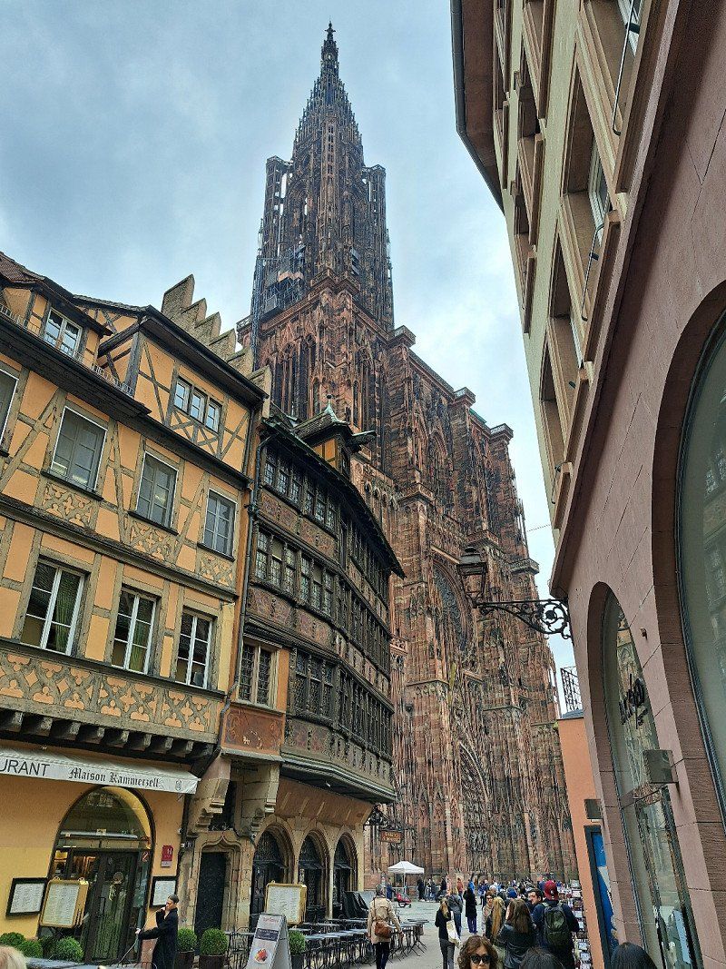
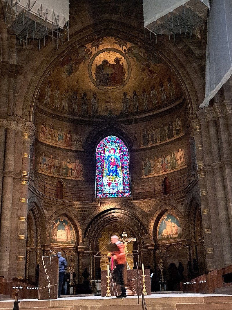
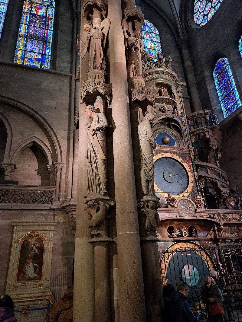
A total of 320 steps lead to the platform of the cathedral.
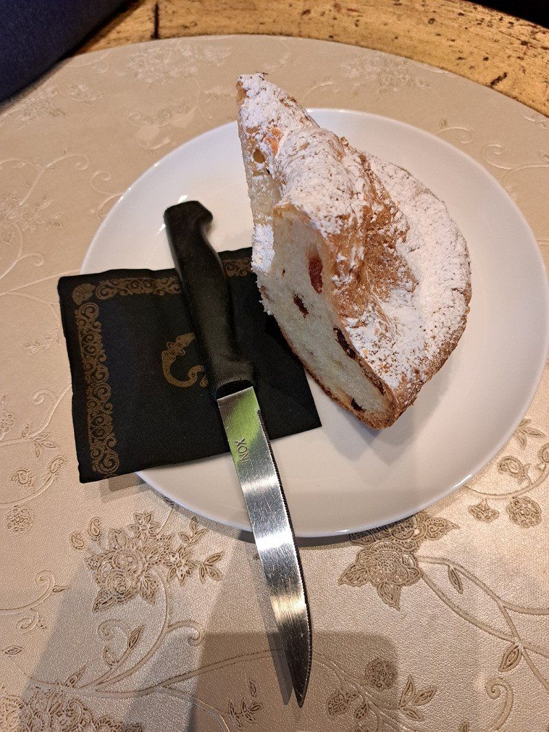
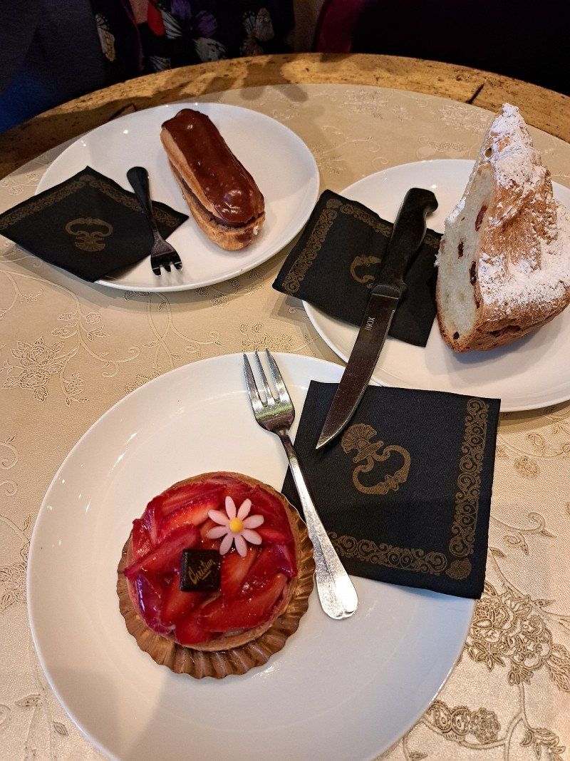
Eat in Alsace:
Enormously important is also the "culinary"
At Strasbourg. However, the hearty Alsatian cuisine is not suitable for losing weight!!
Bakery:
Hearty stew with 3 pcs.
marinated meat products, potatoes, long cooked in the oven.
Flammkueche - Flammkuchen
Zewelkueche - onion tart
(Flammkuchen are offered around the Cathedrale)
Choucroute-Alsatian sauerkraut pan
Sauerkraut with 3 kinds of fish
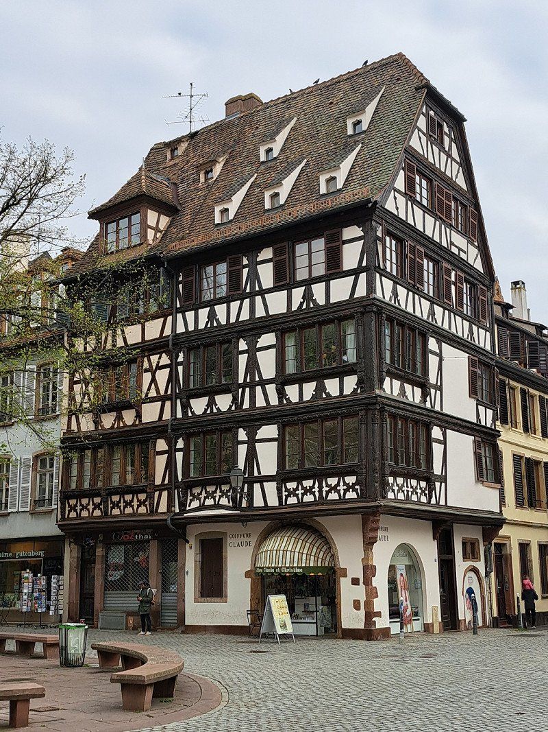
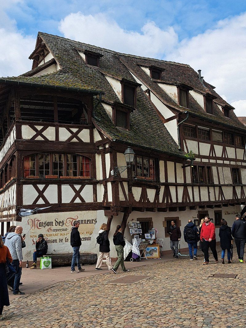
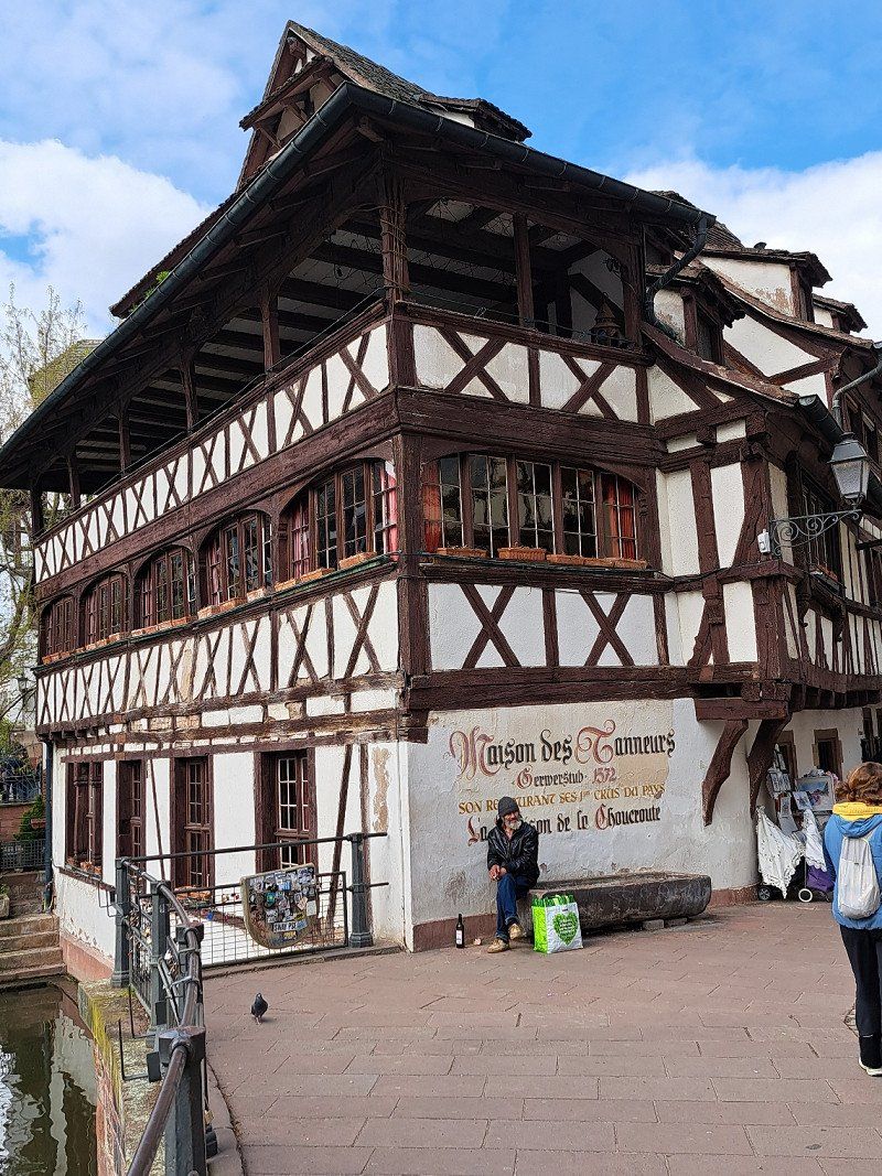
Offered in the Maison Kammerzell (Oldest House in Strasbourg - Next to the Strasbourg Cathedrale).
Carpe frite - Baked carp
Coq Au Riesling Chicken in Riesling sauce
Escargots de Bourgone
Vineyard snails Burgundy Art
Pasta Ravioli and Pasta Gusta
Münsterkäse - With a strong character
This is served with Alsatian beer or Alsatian white wine.
deserts:
Dampfnüdle, crumble cake, Kougelhof,
manele
The "Christian" patisserie on Spießgasse
(next to the Cathedrale) offers the best ice cream and cupcakes.
Good breakfast/brunch is available at
"Madame Julia" between Rive etoile and Grand rue.
The "Maison Lorho" has a huge selection of cheeses and is famous for it.
Lots of locals shop there.
The shop is on Spießgasse.
9 Rue de l'auberge de jeunesse, 67200, STRASBOURG, Frankreich
48° 34' 30.7" N 7° 43' 0.9" E
48.5751962 7.7169077
• Head northwest.
• Arrive at your destination on the right.
☍
Distance not available
(Duration not available)
Day
Day
Day
Day
07.04. - 10.04. 2023 Camping de Strasbourg
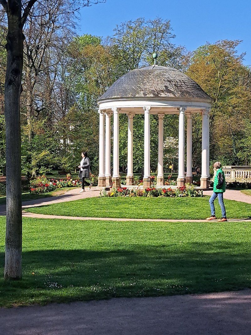
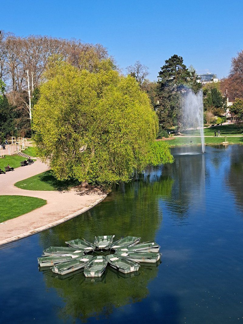
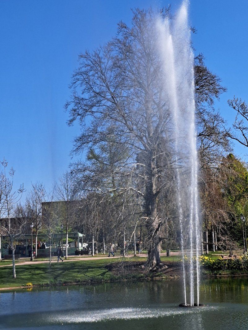
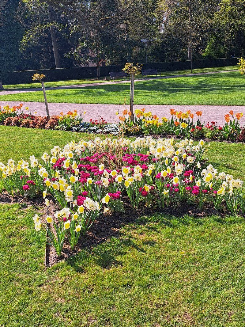
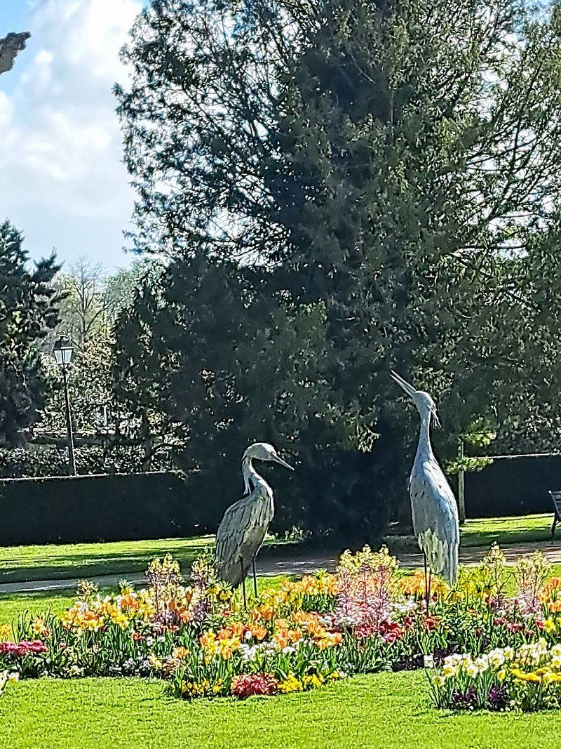
You should definitely see the orangery.
It is a beautiful park with beautifully landscaped, colorful flower beds.
The orangery can be reached by tram - line E.
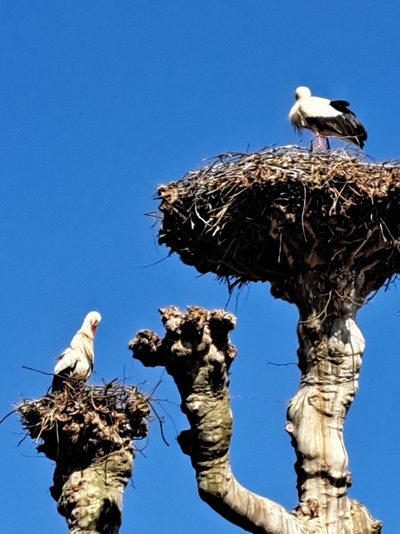
Some storks are nesting on the trees in the orangery. In the center of the park there is a small lake.
Many of the storks also spend the winter in Strasbourg because the winters are no longer as cold as a result of climate change.
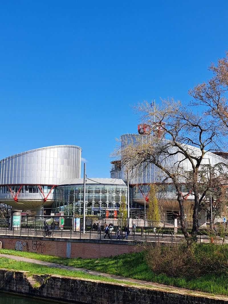
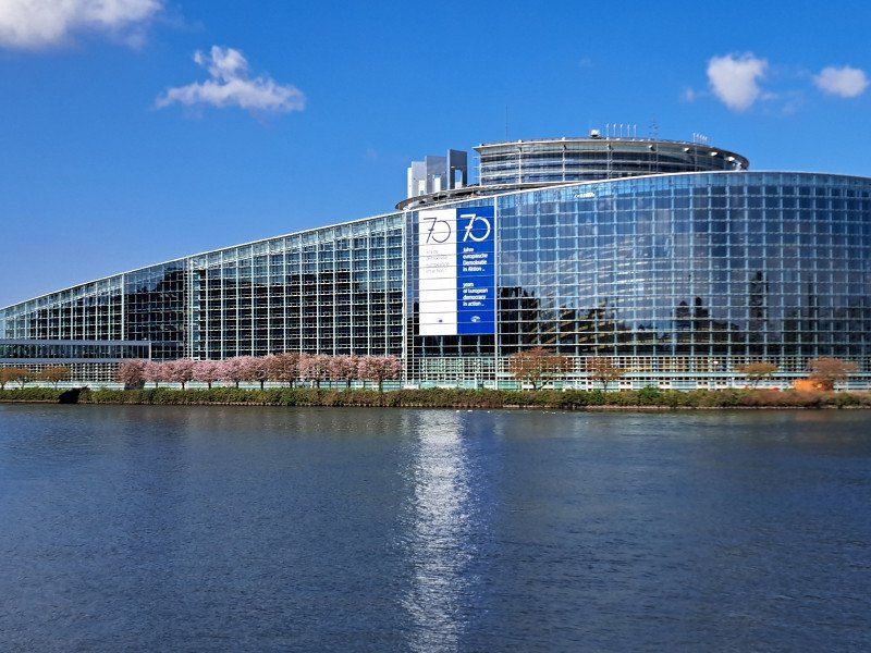
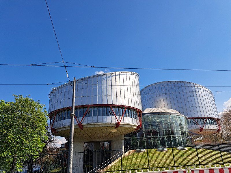
A 10-minute walk from the Orangery is the European Court of Justice and the European Parliament.
The "Pepite France" is a very old medieval quarter worth seeing, about 10-12 minutes walk from the Cathedrale.
You should definitely see that.
9 Rue de l'auberge de jeunesse, 67200, STRASBOURG, Frankreich
48° 34' 30.7" N 7° 43' 0.9" E
48.5751962 7.7169077
• Head northwest. Go for 86 m.
• Turn right toward Rue de l'Auberge de Jeunesse. Go for 165 m.
• Turn left onto Rue de l'Auberge de Jeunesse. Go for 12 m.
• Turn right onto Rue de l'Auberge de Jeunesse. Go for 196 m.
• Turn left onto Route de Schirmeck (M392). Go for 259 m.
• Turn right onto Rue de la Tour Verte toward A35/Colmar/Kehl/Elsau/Meinau. Go for 261 m.
• Continue on Rue de la Montagne Verte. Go for 99 m.
• Continue on Rue de la Montagne Verte. Go for 1.0 km.
• Continue on Rue de la Kaltau. Go for 229 m.
• Take left ramp onto N4. Go for 5.0 km.
• Continue on Europabrücke (B28). Go for 11.6 km.
• Take ramp onto A5 toward Karlsruhe. Go for 63.3 km.
• Take exit 46 toward München/Stuttgart/Pforzheim onto A8. Go for 60.6 km.
• Continue on A8 toward München/Ulm/S-Möhringen/Degerloch/Flughafen/Messe. Go for 203 km.
• Take exit 80 toward M.-Langwied. Go for 293 m.
• Turn left onto Eschenrieder Straße toward M.-Langwied/M.-Lochhausen. Go for 1.8 km.
• Continue on Langwieder Hauptstraße. Go for 293 m.
• Turn right toward Lochhausener Straße. Go for 29 m.
• Continue on Lochhausener Straße. Go for 3.1 km.
• Turn right onto Ährenfeldstraße. Go for 255 m.
• Arrive at Ährenfeldstraße. Your destination is on the left.
☍
351,5 km
(3 hrs. 35 min.)
10.04. 2023 Strasbourg Rückreise nach Gröbenzell
We got up early. The toilet cassette was emptied and cleaned before the morning shower. After a leisurely breakfast, we started our journey home at 8:30 a.m. Before leaving the campsite, we emptied the gray water tank.
With good weather and no traffic jams, we drove the ~350km non-stop home in 3.5 hours.
At lunchtime we could already enjoy a good cup of coffee on our terrace and eat something in the sun before the usual cleaning up work on the camper started.
Deutschland
48° 11' 35.8" N 11° 22' 30.7" E
48.1932834 11.3752077