From Franconia via Hesse, the Lüneburg Heath, on to the NOK to look at ships, to Scharbeutz on the Baltic Sea, across the Elbe meadows, Halle, back to Franconia.
Day
Langenzenn
Landkreis Fürth, Bayern, Deutschland
49° 29' 42.3" N 10° 47' 37.6" E
49.4950727 10.7937902
• Head west on Klosterstraße. Go for 29 m.
• Turn slightly left onto Schwabenberg. Go for 92 m.
• Turn right onto Hindenburgstraße. Go for 319 m.
• Continue on Würzburger Straße. Go for 265 m.
• Turn right onto Würzburger Straße (FÜ11). Go for 3.5 km.
• Turn left onto Erlachskirchen toward Neustadt a.d. Aisch. Go for 60 m.
• Turn right onto B8 toward Würzburg/Neustadt a.d. Aisch. Go for 14.2 km.
• Take the 3rd exit from roundabout onto B8/B470 toward Würzburg/Neustadt a.d. Aisch/Rothenburg/T./Bad Windsheim. Go for 1.7 km.
• Turn right onto Riedfelder Ortsstraße (B8) toward Würzburg/Schweinfurt/Riedfeld. Go for 14.8 km.
• Take the 1st exit from roundabout onto Am Mühlberg (B8) toward Würzburg/Schweinfurt/Scheinfeld/Gewerbegebiet Mühlberg. Go for 1.8 km.
• Turn right onto Würzburger Straße (B8) toward Würzburg/Schweinfurt. Go for 14.3 km.
• Take the 2nd exit from roundabout onto B8 toward Würzburg/Kitzingen. Go for 1.3 km.
• Turn right onto St2420 toward Rüdenhausen/Rödelsee/Iphofen. Go for 3.6 km.
• Take the 2nd exit from roundabout onto KT12. Go for 2.2 km.
• Continue on Rödelseer Straße (KT12). Go for 366 m.
• Turn left onto Hauptstraße (St2272). Go for 114 m.
• Turn right onto Schwarzacher Straße (KT12). Go for 236 m.
• Continue on Bahnhofstraße (KT12). Go for 218 m.
• Continue on Am Bahnhof (KT12). Go for 290 m.
• Continue on KT12. Go for 3.7 km.
• Continue on Großlangheimer Straße (KT12). Go for 202 m.
• Turn right onto Kitzinger Straße (KT12). Go for 125 m.
• Turn right onto B22. Go for 608 m.
• Continue on St2271. Go for 6.6 km.
• Take the 4th exit from roundabout onto St2260. Go for 1.3 km.
• Take the 3rd exit from roundabout onto St2260. Go for 5.5 km.
• Turn right onto WÜ4. Go for 88 m.
• Turn right onto WÜ4. Go for 693 m.
• Continue on Kaltenhausen (WÜ4). Go for 336 m.
• Turn left onto Schiffmühle (WÜ4). Go for 334 m.
• Continue on Mühle (WÜ4). Go for 63 m.
• Continue on WÜ4. Go for 217 m.
• Continue on WÜ57 toward Schweinfurt/Obereisenheim. Go for 1.4 km.
• Continue on An der Mainaue (WÜ57). Go for 412 m.
• Turn left onto Hirtengasse. Go for 84 m.
• Turn right onto Türkenstraße. Go for 57 m.
• Arrive at Türkenstraße. Your destination is on the left.
☍
81,1 km
(1 hrs. 3 min.)
Obereisenheim
Landkreis Würzburg, Bayern, Deutschland
49° 53' 29.1" N 10° 10' 49" E
49.8914154 10.1802876
• Head northeast on Türkenstraße.
• Arrive at Türkenstraße. Your destination is on the left.
☍
Distance not available
(Duration not available)
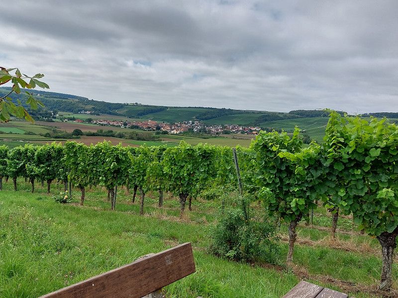
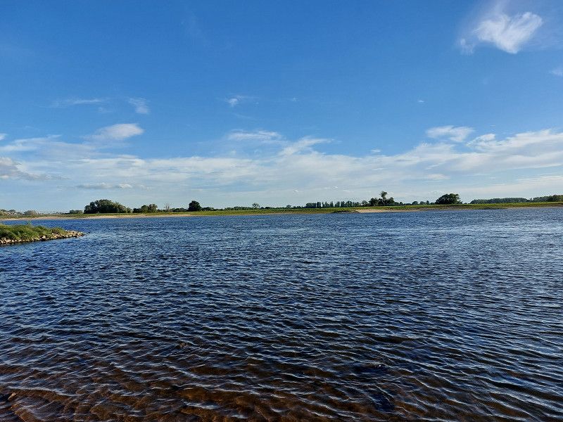
Stellplatz Obereisenheim
is located directly on the Main with a great view of the water and the ships passing by.
A few steps from the parking space there are several swimming areas where dogs and people are allowed into the water.
The pitch has electricity, V/E; 12 € per night (including 3 € voucher for restaurants or wineries).
Obereisenheim has a small village shop where you can get rolls in the morning and the hikes through the vineyards are super nice.
Day
Obereisenheim
Landkreis Würzburg, Bayern, Deutschland
49° 53' 29.1" N 10° 10' 49" E
49.8914154 10.1802876
• Head northeast on Türkenstraße.
• Arrive at Türkenstraße. Your destination is on the left.
☍
Distance not available
(Duration not available)
Day
Obereisenheim
After breakfast we continue north
Landkreis Würzburg, Bayern, Deutschland
49° 53' 29.1" N 10° 10' 49" E
49.8914154 10.1802876
• Head toward Dorfstraße on Türkenstraße. Go for 57 m.
• Turn left onto Hirtengasse. Go for 84 m.
• Turn left onto An der Mainaue (WÜ57). Go for 860 m.
• Continue on WÜ57. Go for 998 m.
• Continue on SW22. Go for 315 m.
• Continue on Obereisenheimer Straße (SW22). Go for 1.3 km.
• Continue on Mainstraße (SW22). Go for 441 m.
• Continue on SW22. Go for 5.2 km.
• Continue on Dorfstraße (SW22). Go for 814 m.
• Continue on SW22. Go for 439 m.
• Turn right onto St2270 toward Schweinfurt/Bergrheinfeld. Go for 2.2 km.
• Take the 2nd exit from roundabout onto St2270 toward Schweinfurt/B26. Go for 1.3 km.
• Take the 3rd exit from roundabout onto St2277 toward Schnackenwerth. Go for 2.7 km.
• Take the 2nd exit from roundabout onto St2277. Go for 438 m.
• Turn left onto St2446. Go for 954 m.
• Take the 2nd exit from roundabout onto St2446 toward A70/Karlstadt/Werneck/B19. Go for 206 m.
• Take ramp onto A70 toward Kassel/Würzburg. Go for 2.8 km.
• Take exit 2 toward Kassel/Fulda onto A7. Go for 112 km.
• Continue on A7. Go for 65.1 km.
• Take the exit toward Kassel-Nord/Flughafen Kassel-Calden/Niestetal/Niestetal-Heiligenrode. Go for 508 m.
• Turn right onto Dresdener Straße (L3237) toward Nieste/Heiligenrode. Go for 119 m.
• Keep right toward Nieste/Staufenberg. Go for 16 m.
• Take the 3rd exit from roundabout onto An der Autobahn. Go for 173 m.
• Continue on Sandershäuser Straße (K3). Go for 307 m.
• Turn left onto Sandershäuser Straße (K3). Go for 64 m.
• Continue on Heiligenröder Straße (K3). Go for 1.5 km.
• Turn right onto Hannoversche Straße (L562). Go for 891 m.
• Turn left onto Ysenburgstraße (K1). Go for 232 m.
• Turn left onto Spiekershäuser Straße (K1). Go for 334 m.
• Arrive at Spiekershäuser Straße (K1). Your destination is on the left.
☍
202,4 km
(1 hrs. 56 min.)
Day
Stellplatz an der Fulda
Spiekershauser Straße/Fuldablick, 34266, Niestetal, Germany
51° 19' 37" N 9° 33' 18" E
51.3269444 9.5550000
• Head toward Am Dachsacker on Spiekershäuser Straße (K1). Go for 334 m.
• Turn right onto Ysenburgstraße (K1). Go for 232 m.
• Turn right onto Hannoversche Straße (L562). Go for 891 m.
• Turn left onto Heiligenröder Straße (K3). Go for 1.5 km.
• Continue on Sandershäuser Straße (K3). Go for 64 m.
• Turn right onto Sandershäuser Straße (K3). Go for 307 m.
• Continue on An der Autobahn. Go for 107 m.
• Turn right onto Kasseler Straße (L3237). Go for 112 m.
• Take ramp onto A7 toward Hamburg/Hannover. Go for 120 km.
• Take the exit. Go for 495 m.
• Turn left onto L492 toward Wendhausen. Go for 775 m.
• Turn left onto Goslarsche Landstraße (B6) toward Hildesheim. Go for 6.4 km.
• Turn left onto Goslarsche Landstraße (L491) toward B243/Seesen/Zentrum/Universität/Hochschule HAWK. Go for 293 m.
• Take ramp onto Am Kreuzfeld (L491) toward Seesen/HI-Marienburg/HI-Itzum/HI-Ochtersum. Go for 881 m.
• Take ramp onto Struckmannstraße (K104). Go for 557 m.
• Turn left onto Hohnsen (K104). Go for 470 m.
• Turn right onto Hohnsen. Go for 14 m.
• Arrive at Hohnsen.
☍
133,5 km
(1 hrs. 16 min.)
Zwischenübernachtung
We continued on the A7 (perpetual construction site) towards Lüneburg Heath
Day
Stellplatz am Hohnsen-See
Hohnsen, 31134, Hildesheim, Germany
52° 8' 20" N 9° 57' 14" E
52.1388889 9.9538889
• Head west on Hohnsen. Go for 46 m.
• Turn left onto Hohnsen. Go for 47 m.
• Turn left onto Hohnsen (K104). Go for 521 m.
• Continue on Hohnsen. Go for 354 m.
• Continue on Annenstraße. Go for 253 m.
• Turn left onto Goschenstraße. Go for 362 m.
• Turn right onto Wollenweberstraße. Go for 362 m.
• Continue on Zingel. Go for 431 m.
• Continue on Kennedydamm. Go for 3.7 km.
• Keep right toward A7. Go for 43 m.
• Take ramp onto A7. Go for 116 km.
• Take exit 43 toward Bispingen/Behringen. Go for 363 m.
• Take the 3rd exit from roundabout onto Behringer Straße (L211). Go for 3.3 km.
• Continue on L211. Go for 3.1 km.
• Continue on Oberhaverbeck (L211). Go for 217 m.
• Turn left. Go for 24 m.
• Turn right. Go for 14 m.
• Turn slightly left. Go for 13 m.
• Arrive at your destination.
☍
129,1 km
(1 hrs. 15 min.)
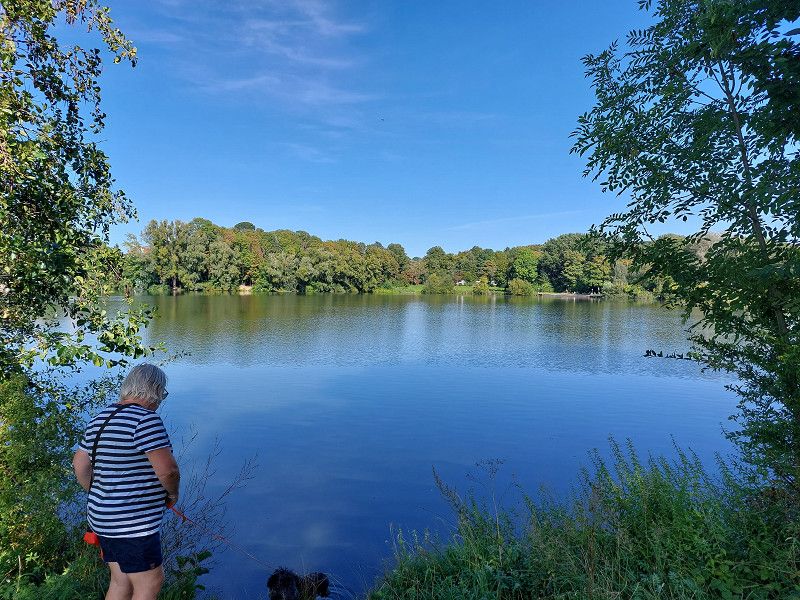
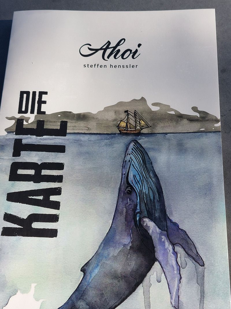
Ungeplant, aber schön
We made an unplanned stop at the parking space at Hohnsesee and it was worth it.
The paths around the lake invite people and dogs to take a walk.
In the evening there were delicious burgers at AHOI by Steffen Henssler right on the square.
Day
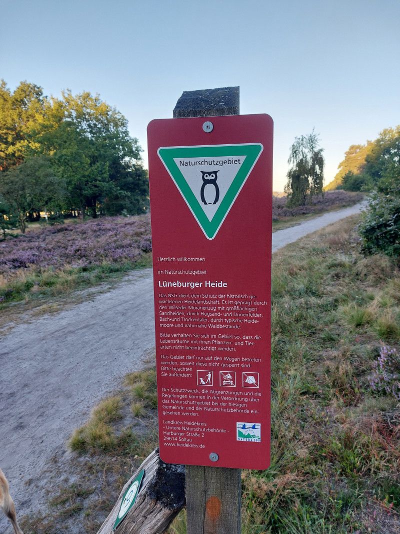
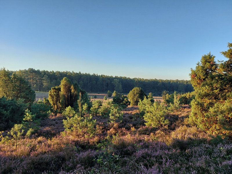
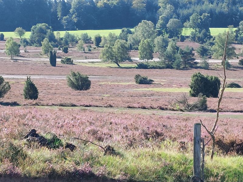
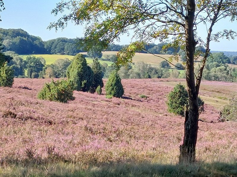
Stellplatz im Naturschutzpark
Lüneburg Heath for hiking
Oberhaverbeck, 29646, Bispingen, Germany
53° 8' 34" N 9° 55' 11" E
53.1427778 9.9197222
• Head southwest.
• Arrive at your destination.
☍
Distance not available
(Duration not available)
Nicht so leicht zu finden
The parking space wasn't that easy to find because the navigation system takes you directly to the town. The first thing we had to do was turn around in several moves on a narrow road.
The pitch is simple, only has 1 power column and V/E. Since it was very hot at the time we were traveling, the place was quite dusty. But the small cafe on the square with delicious home-baked cakes and the location right away for walking definitely make up for it.
Day
Stellplatz im Naturschutzpark
Oberhaverbeck, 29646, Bispingen, Germany
53° 8' 34" N 9° 55' 11" E
53.1427778 9.9197222
• Head southwest.
• Arrive at your destination.
☍
Distance not available
(Duration not available)
Wandern
Since there are various hiking trails in all directions and with different levels of difficulty directly from the parking space, we also used the morning and explored the NP on foot until it just got too warm for us and the dogs.
Absolutely worth seeing even in autumn.
Day
Stellplatz im Naturschutzpark
Oberhaverbeck, 29646, Bispingen, Germany
53° 8' 34" N 9° 55' 11" E
53.1427778 9.9197222
• Head southwest. Go for 18 m.
• Turn left toward Oberhaverbeck/L211. Go for 70 m.
• Turn right onto Oberhaverbeck (L211). Go for 217 m.
• Continue on L211. Go for 3.1 km.
• Turn left onto K51. Go for 2.5 km.
• Turn left onto K34. Go for 1.0 km.
• Continue on L212. Go for 4.7 km.
• Take the 3rd exit from roundabout onto Dorfstraße (L212). Go for 1.7 km.
• Turn left and take ramp onto A7 toward Hamburg. Go for 47.7 km.
• Keep right onto A7. Go for 94.4 km.
• Take exit 9 toward Rendsburg-Mitte onto A210. Go for 3.7 km.
• Take exit 2 toward Schacht-Audorf/Schülldorf/Osterrönfeld. Go for 498 m.
• Turn right toward Schacht-Audorf/Schülldorf/Osterrönfeld. Go for 220 m.
• Take the 2nd exit from roundabout onto K76. Go for 1.4 km.
• Arrive at K76. Your destination is on the left.
☍
161,3 km
(1 hrs. 34 min.)
Day
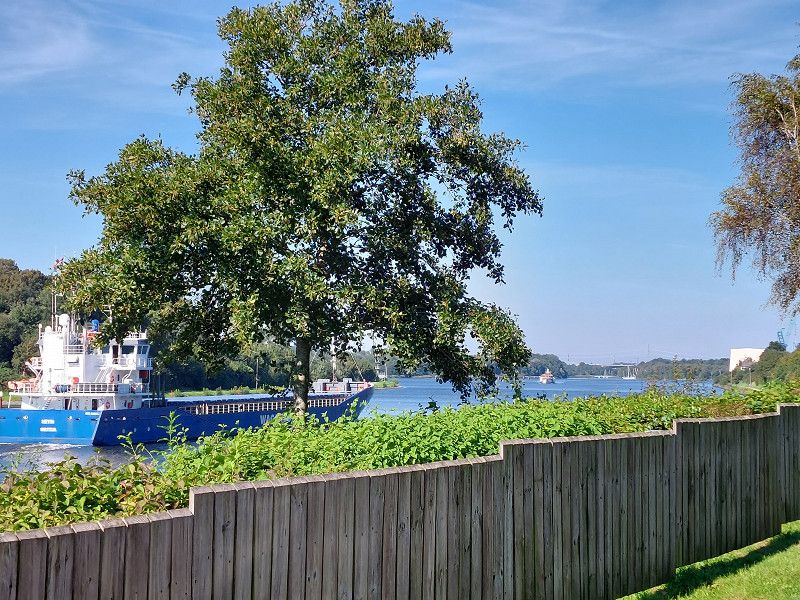
Wohnmobilpark Schacht-Audorf
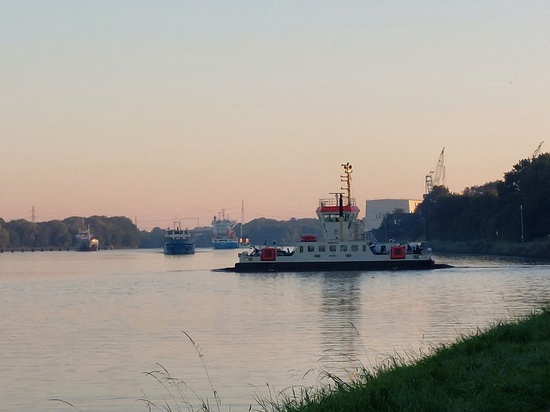
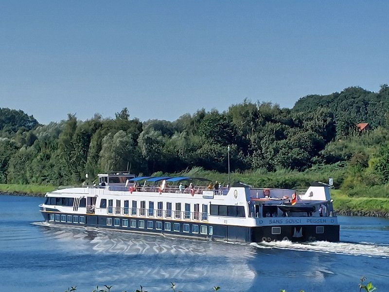
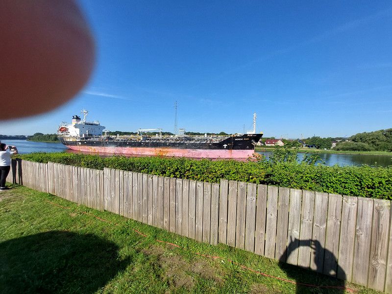
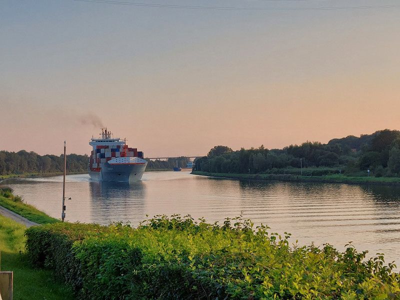
Look at the ships on the NOK
An der K 76, 24790, Schacht-Audorf, Germany
54° 18' 22" N 9° 42' 45" E
54.3061111 9.7125000
• Head north on K76.
• Arrive at K76. Your destination is on the left.
☍
Distance not available
(Duration not available)
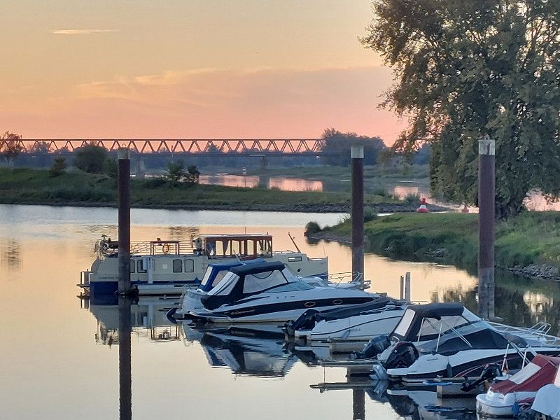
Einfach Wahnsinn
Fantastic parking space right on the NOK. We had 2 seats next to each other in the front row, which had just become available when we arrived.
You just have to be lucky.
No cruise ships came by, but there was still a lot going on.
Day
Wohnmobilpark Schacht-Audorf
An der K 76, 24790, Schacht-Audorf, Germany
54° 18' 22" N 9° 42' 45" E
54.3061111 9.7125000
• Head toward Kieler Straße on K76. Go for 508 m.
• Turn right onto Kieler Straße (L47). Go for 294 m.
• Turn right onto Dorfstraße. Go for 121 m.
• Turn right onto Kanalstraße. Go for 129 m.
• Turn left onto Kieler Straße (L47). Go for 157 m.
• Turn left onto K76. Go for 1.8 km.
• Take the 2nd exit from roundabout. Go for 267 m.
• Take ramp onto A210 toward Kiel/Hamburg/A7/Flensburg. Go for 24.1 km.
• Take the exit onto A215. Go for 2.8 km.
• Take the exit toward Lübeck/Fähre Norwegenkai/Fähre Ostuferhafen onto B76 (Olof-Palme-Damm). Go for 1.5 km.
• Keep left onto Theodor-Heuss-Ring (B76). Go for 719 m.
• Keep left onto Theodor-Heuss-Ring (B76). Go for 1.1 km.
• Keep left onto Theodor-Heuss-Ring (B76) toward Plön. Go for 27.4 km.
• Continue on Rautenbergstraße (B76) toward Lübeck/Eutin/Fähre Fegetasche. Go for 25.7 km.
• Turn left and take ramp onto A1 toward Lübeck/Scharbeutz/Lübeck-Travemünde. Go for 2.2 km.
• Take exit 16 toward Scharbeutz. Go for 368 m.
• Turn left onto B76/B432 toward Scharbeutz. Go for 1.6 km.
• Turn left onto Strandallee toward Haffkrug. Go for 50 m.
• Turn left onto Strandallee. Go for 52 m.
• Continue straight ahead. Go for 184 m.
• Arrive at your destination on the left.
☍
91,0 km
(1 hrs. 11 min.)
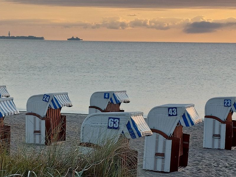
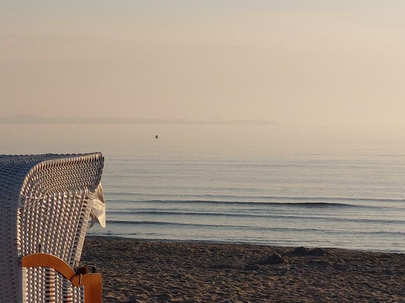
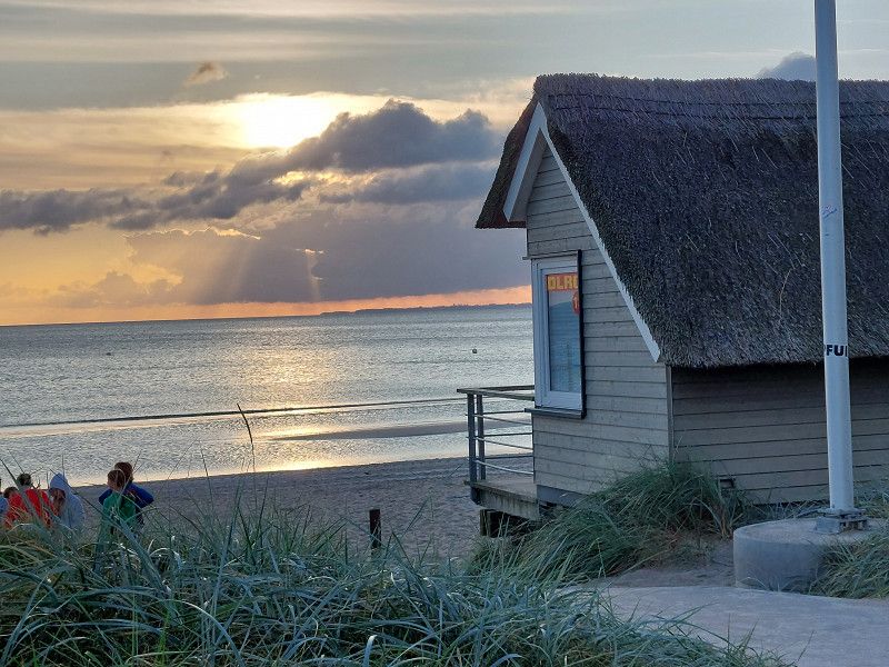
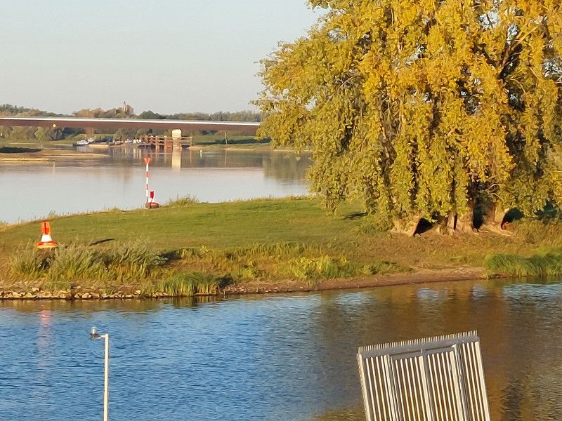
Noch mehr Schiffe
You can walk along the NOK in both directions.
10 minutes from the parking space is an Edeka with a bakery, where you can get fresh rolls and everything else in the morning.
Day
Stellplatz Ostseestrand Ferienpark Scharbeutz
booked from September 10th to 20th
Strandallee 98b, 23683, Scharbeutz, Germany
54° 2' 7" N 10° 44' 51" E
54.0352778 10.7475000
• Head northwest.
• Arrive at your destination on the left.
☍
Distance not available
(Duration not available)
Ganz anders
We had booked the parking space for the next 11 days in advance so that we could spend lovely, relaxing days by the sea without driving
Kleiner Schock
Coming from the 'wilderness' of the Lüneburg Heath to Scharbeutz was a bit of a culture shock.
We were not prepared for so many people and Halligalli. That's why we approached it slowly at first.
Day
Zum Strand
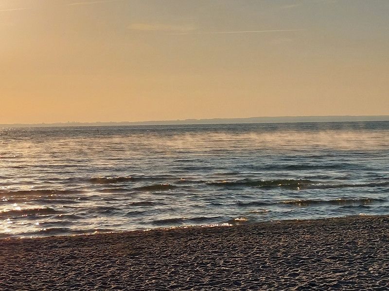
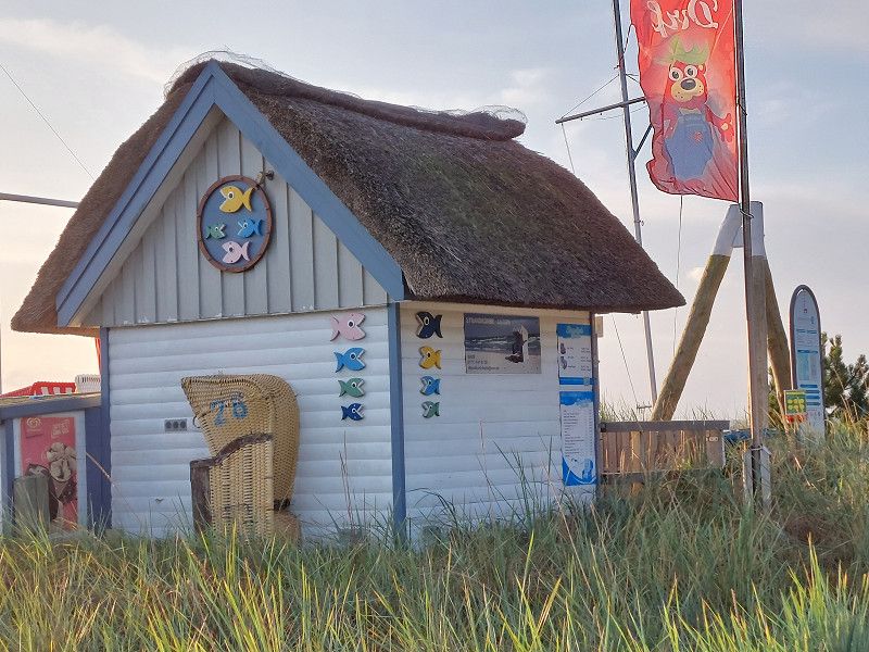
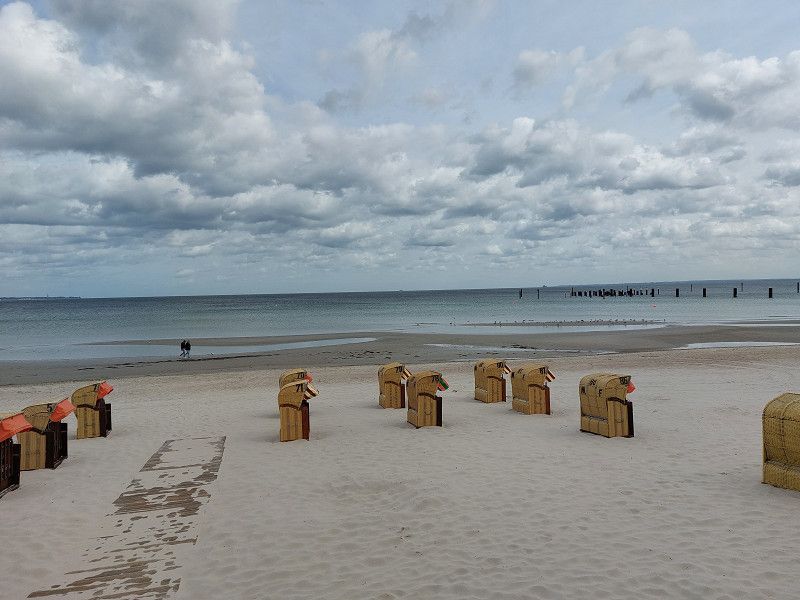
The weather was still great and you only had to cross the street to get to the beach.
Only the designated dog beach was a little further away, a 600m walk, but not a problem either.
Leihen vom CP
A really great facility at the Ostseepark - you can actually 'borrow' various things (free of charge).
Including e.g. B. CCE cable, extension cable, grill, microwave, etc.
And even 2 electric smarts are available for approx. 1 hour each. We then drove to the supermarket to do some shopping. Worked great!
Day
Day
Day
Day
Day
Day
Day
Day
Day
Stellplatz Ostseestrand Ferienpark Scharbeutz
Say goodbye and slowly head home
Strandallee 98b, 23683, Scharbeutz, Germany
54° 2' 7" N 10° 44' 51" E
54.0352778 10.7475000
• Head southeast. Go for 184 m.
• Continue on Strandallee. Go for 52 m.
• Turn right onto Strandallee. Go for 50 m.
• Turn right onto Pönitzer Chaussee (B76). Go for 1.6 km.
• Take ramp onto A1 toward Lübeck. Go for 48.8 km.
• Take exit 27 toward Bargteheide/Kiel/A21. Go for 519 m.
• Turn left onto L89 toward Kiel/A21/Schwarzenbek/Trittau/Lasbek. Go for 428 m.
• Turn right onto L90 toward A1/Lübeck/A21/Kiel/B404/Schwarzenbek/Todendorf. Go for 464 m.
• Turn left and take ramp onto B404 toward Berlin/A24/Schwarzenbek. Go for 19.1 km.
• Take ramp onto A24 toward Berlin. Go for 77.2 km.
• Take exit 13 toward Ludwigslust onto A14. Go for 37.3 km.
• Take exit 11 toward Karstädt/Perleberg/Lenzen. Go for 261 m.
• Turn right onto B5 toward Lenzen/Perleberg/Karstädt/B194. Go for 750 m.
• Take the 1st exit from roundabout onto B5 toward Kyritz/Perleberg/Karstädt. Go for 11.4 km.
• Turn right and take ramp onto B189 toward Stendal/Wittenberge/Lenzen. Go for 10.2 km.
• Turn left onto L11 toward Bad Wilsnack/Weisen/Gewerbegebiet Wittenberge-Süd/Gewerbegebiet Breese. Go for 247 m.
• Take the 1st exit from roundabout onto Waldhaus (L11). Go for 1.8 km.
• Turn right onto Hartwigstraße. Go for 293 m.
• Turn left onto Perleberger Straße. Go for 1.5 km.
• Take the 2nd exit from Am Stern roundabout onto Lenzener Straße. Go for 273 m.
• Turn left onto Weinbergstraße. Go for 178 m.
• Turn right onto Wahrenberger Straße. Go for 64 m.
• Turn left onto Im Hagen. Go for 370 m.
• Turn slightly right. Go for 91 m.
• Turn left. Go for 65 m.
• Arrive at your destination.
☍
213,1 km
(2 hrs. 11 min.)
Abschied
After breakfast it was time to say goodbye to the Baltic Sea and slowly drive towards home.
Day
Sportbootanger Nedwighafen
Elbstraße 65, 19322, Wittenberge, Germany
52° 59' 27" N 11° 44' 41" E
52.9908333 11.7447222
• Head southeast.
• Arrive at your destination.
☍
Distance not available
(Duration not available)
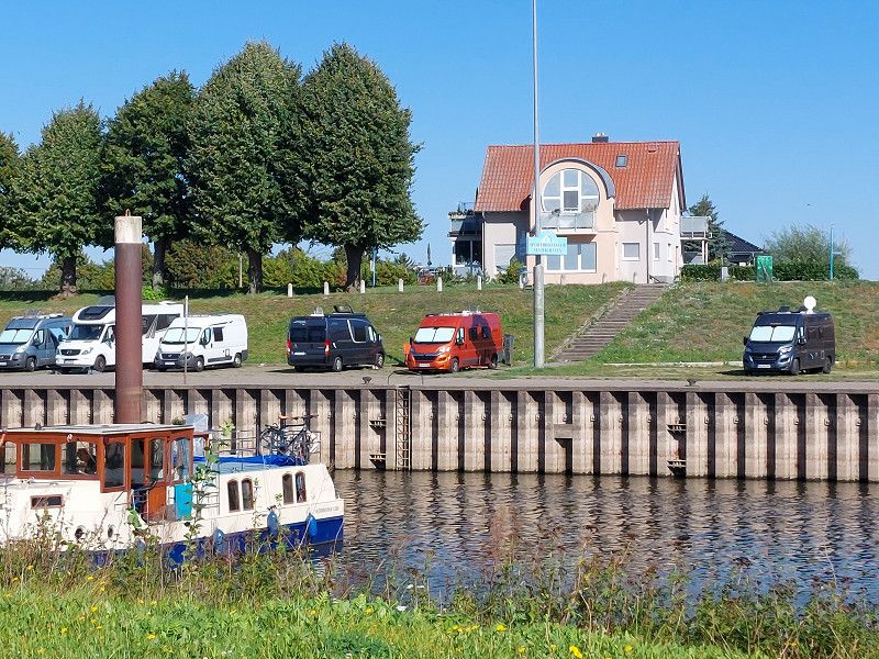
Wittenberge an der Elbe
Again got 2 parking spaces in the 1st row and enjoyed the great view.
However, there is no ship traffic here.
Day
Sportbootanger Nedwighafen
Elbstraße 65, 19322, Wittenberge, Germany
52° 59' 27" N 11° 44' 41" E
52.9908333 11.7447222
• Head northwest. Go for 65 m.
• Turn right toward Elbstraße. Go for 91 m.
• Turn left onto Elbstraße. Go for 334 m.
• Turn right. Go for 112 m.
• Turn left toward Wahrenberger Straße. Go for 215 m.
• Turn left onto Wahrenberger Straße. Go for 1.2 km.
• Turn left onto Wahrenberger Straße. Go for 71 m.
• Turn left onto B189. Go for 2.8 km.
• Turn left onto L38 toward Losenrade. Go for 6.2 km.
• Continue on Wegenitz (L38). Go for 141 m.
• Continue on L38. Go for 1.4 km.
• Continue on Feldneuendorf (L38). Go for 301 m.
• Continue on L38. Go for 549 m.
• Take the 2nd exit from roundabout onto Vor dem Mühlentor (L2). Go for 675 m.
• Continue on Vor dem Mühlentor (K1020). Go for 4.1 km.
• Turn left onto B189 toward Stendal/Osterburg. Go for 8.8 km.
• Continue on B189 toward Stendal/Erxleben. Go for 32.8 km.
• Take ramp toward Magdeburg/Stendal/Lüderitzer Straße/Zentrum. Go for 293 m.
• Turn right onto B189 toward Magdeburg/Lüderitz. Go for 9.5 km.
• Turn right onto Windberger Chaussee (L30) toward Vinzelberg/Windberge. Go for 596 m.
• Turn right and take ramp onto A14 toward Dresden. Go for 28.6 km.
• Take the exit. Go for 588 m.
• Turn right onto B189 toward Wolmirstedt/Zielitz/Rogätz/Magdeburg. Go for 12.4 km.
• Take ramp onto A2 toward Hannover/Halle/A14. Go for 4.8 km.
• Take exit 68 toward Leipzig/Dresden/Halle onto A14. Go for 93.7 km.
• Take exit 17 toward Halle-Zentrum onto B100 (Zur Straßenmeisterei). Go for 2.5 km.
• Take ramp onto Europachaussee toward Leipzig/Merseburg/Halle-Süd/Messe/Halle-Ost. Go for 8.5 km.
• Turn left onto Merseburger Straße (B91) toward Merseburg. Go for 11.2 km.
• Keep left onto Thomas-Müntzer-Straße (B91) toward A38/Weißenfels. Go for 581 m.
• Keep left onto Thomas-Müntzer-Straße (B91) toward A38/Weißenfels/Gewerbegebiet Leuna Tor 6. Go for 1.1 km.
• Turn right onto L178 toward Göttingen/A38/Mücheln (Geiseltal)/Braunsbedra. Go for 2.6 km.
• Continue on L178 toward A38/Mücheln (Geiseltal)/Braunsbedra. Go for 10.0 km.
• Arrive at Schortauer Weg (L178). Your destination is on the right.
☍
246,6 km
(2 hrs. 48 min.)
Day
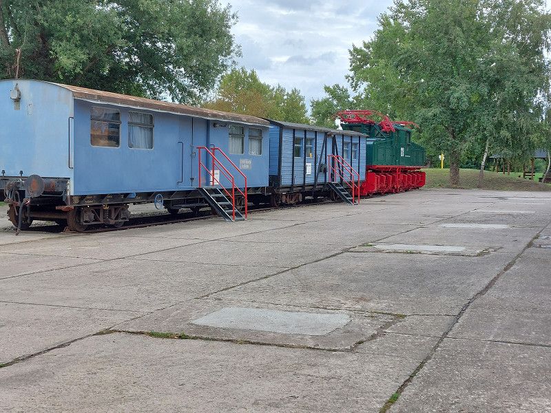
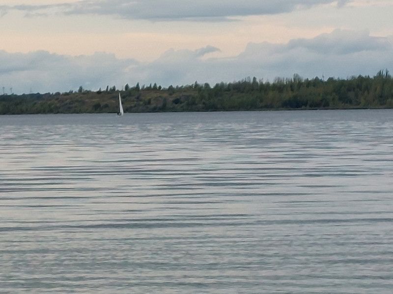
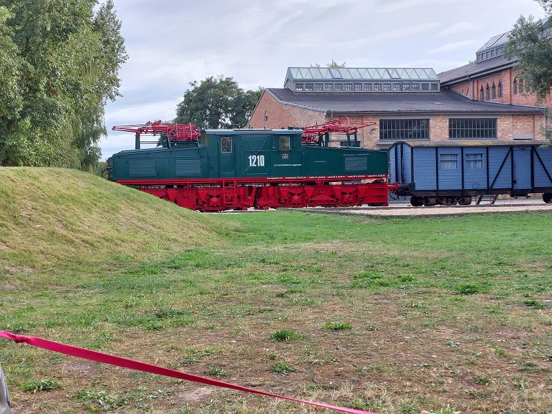
Mobilpark am Geiseltalsee
Schortauer Weg, 06242, Braunsbedra, Germany
51° 17' 39" N 11° 51' 12" E
51.2941667 11.8533333
• Head south on Schortauer Weg (L178). Go for 8.4 km.
• Take ramp onto A38 toward Leipzig. Go for 11.6 km.
• Take exit 27 toward München/Erfurt onto A9. Go for 237 km.
• Take exit 52 toward Heilbronn/N.-Hafen onto A6. Go for 6.1 km.
• Take exit 58 toward Fürth/N.-Hafen onto A73. Go for 7.1 km.
• Continue on Südwesttangente. Go for 13.5 km.
• Continue on B8. Go for 6.1 km.
• Take ramp toward Raindorf/Langenzenn-Ost/Gewerbegebiet Ost. Go for 1.6 km.
• Continue on Nürnberger Straße. Go for 2.0 km.
• Turn left onto Denkmalplatz (FÜ17). Go for 354 m.
• Turn right onto Schreiberstorberg. Go for 84 m.
• Turn left onto Hindenburgstraße. Go for 81 m.
• Turn right onto Schwabenberg. Go for 92 m.
• Turn slightly right onto Klosterstraße. Go for 29 m.
• Arrive at Klosterstraße. Your destination is on the left.
☍
294,1 km
(2 hrs. 37 min.)
Zufallsfund
I only found the parking space by chance and we had only planned one overnight stay.
But it's so beautiful here. If you don't need electricity, you can stand freely on the back lawn. Cycling and hiking trails start directly at the SP. In a few minutes you are at the lake and the dog can go into the water.
Day
Langenzenn
Landkreis Fürth, Bayern, Deutschland
49° 29' 42.3" N 10° 47' 37.6" E
49.4950727 10.7937902