Via trier, only now filled in. From our hometown in Twente, add another 350 km. Electric bicycles are included.
Day
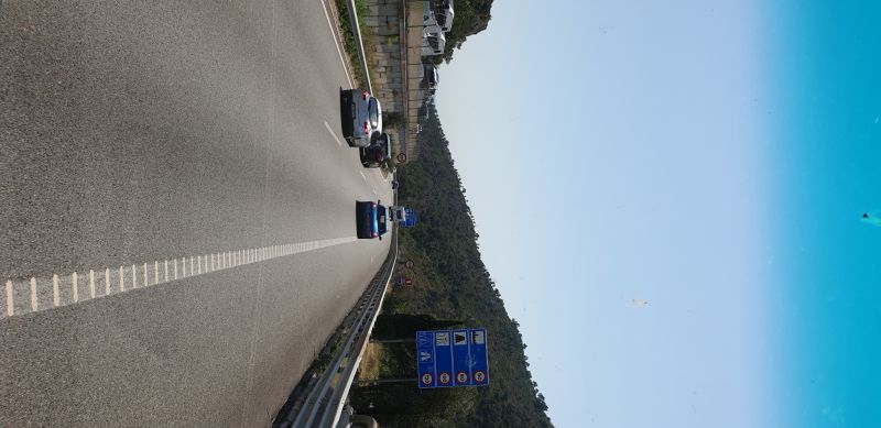
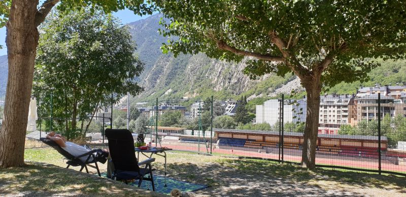
Stellplatz Weingut von Nell
Via Germany border crossing, nl the Netherlands, direction Koblenz to Trier.
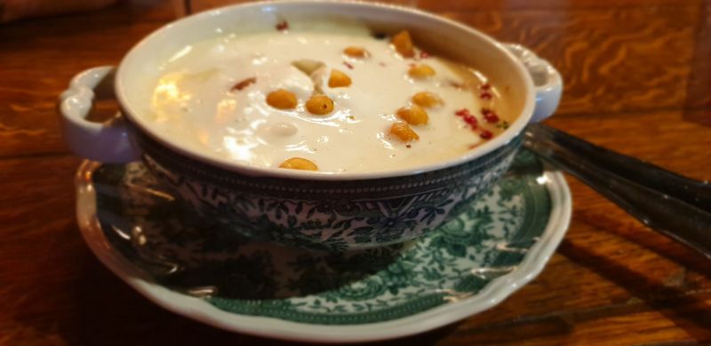
food is recommended! here also a tour possible in wine cellars
trws own our 1st night so add a few 100 km.
Contournement Luxembourg-Ville, 5958 Itzig, Luxembourg
49° 44' 19" N 6° 39' 26" E
49.7386111 6.6572222
• Head northeast on Im Tiergarten. Go for 622 m.
• Turn right onto Im Tiergarten. Go for 75 m.
• Turn left onto Olewiger Straße (L143). Go for 948 m.
• Turn slightly right toward L143. Go for 95 m.
• Continue on L143. Go for 1.1 km.
• Turn right onto Sankt-Barbara-Ufer (B49) toward Köln/Aachen/B51. Go for 1.4 km.
• Turn left onto Kaiser-Wilhelm-Brücke toward Luxemburg/A64/B51/Köln/Aachen. Go for 363 m.
• Turn right onto Bitburger Straße (B51) toward Luxemburg/A64/Köln/Aachen. Go for 2.8 km.
• Take ramp onto A64 toward Luxembourg. Go for 9.2 km.
• Continue on A1 (Sauertalbrücke). Go for 33.4 km.
• Arrive at A1.
☍
50,1 km
( 36 min.)
Day
Contournement Luxembourg-Ville
Contournement Luxembourg-Ville, 5958 Itzig, Luxembourg
49° 35' 19.7" N 6° 9' 44.7" E
49.5888168 6.1624210
• Head southwest on A1. Go for 3.0 km.
• Take the exit toward Metz/Saarbrücken/Livange onto A3. Go for 13.0 km.
• Continue on A31. Go for 43.1 km.
• Take exit 33 toward Strasbourg/Sarrebruck/Woippy-St Éloi/Metz-Deux-Fontaines. Go for 564 m.
• Continue on Avenue des Deux Fontaines. Go for 128 m.
• Make a U-Turn at Rue du Professeur Leriche onto Avenue des Deux Fontaines. Go for 141 m.
• Keep right onto Avenue des Deux Fontaines. Go for 205 m.
• Continue on Rue Yvan Goll. Go for 40 m.
• Turn left onto Rue Paul Dassenoy. Go for 119 m.
• Arrive at Rue Paul Dassenoy. Your destination is on the right.
☍
60,3 km
( 38 min.)
Straatsburg
12 Rue Paul Dassenoy, 57050 Metz, France
49° 8' 3.9" N 6° 10' 26.7" E
49.1344141 6.1740794
• Head toward Rue Yvan Goll on Rue Paul Dassenoy. Go for 119 m.
• Turn left onto Rue Yvan Goll. Go for 113 m.
• Take ramp onto A31 toward Nancy. Go for 56.4 km.
• Take the exit toward Lyon/Paris/Dijon/Toul onto A31. Go for 12.9 km.
• Take exit 15 toward Toul-Centre/Hôpital Jeanne d'Arc. Go for 375 m.
• Continue on D400. Go for 1.0 km.
• Take the 3rd exit from roundabout onto D400. Go for 380 m.
• Take ramp onto A31 toward Nancy/Metz. Go for 1.1 km.
• Arrive at A31. Your destination is on the left.
☍
72,3 km
( 43 min.)
Autoroute de Lorraine-Bourgogne
quite boring road unfortunately
N4, 54840 Gondreville, France
48° 41' 0.3" N 5° 56' 50.9" E
48.6834237 5.9474735
• Head northeast on A31. Go for 2.3 km.
• Take exit 16 toward Velaine en Haye/Gondreville/Z.A. Internationale Gondreville-Fontenoy. Go for 660 m.
• Take the 1st exit from roundabout onto A31 toward Paris/Lyon/Dijon/Toul. Go for 122 km.
• Take the left exit toward Lyon/Besançon/Dijon/Langres-Sud onto A31. Go for 115 km.
• Continue on A6 (Autoroute du Soleil). Go for 127 km.
• Keep right onto A46 toward Marseille/Genève/Grenoble/Lyon-Est. Go for 18.3 km.
• Take the exit toward Genève/Grenoble/Aéroport Saint Exupéry onto A432. Go for 1.7 km.
• Arrive at A432.
☍
387,6 km
(3 hrs. 9 min.)
A432
A432, 01700 Miribel, France
45° 51' 30.6" N 4° 55' 1.7" E
45.8584943 4.9171263
• Head east on A432. Go for 31.2 km.
• Take the exit toward E70/Turin/Milan/Grenoble/Chambéry/L'Isle d'Abeau onto A43. Go for 27.8 km.
• Take the exit toward Valence/Grenoble onto A48. Go for 49.3 km.
• Take exit 14 toward Villard de Lans/Autrans/Le Fontanil/St Égrève. Go for 319 m.
• Take the 1st exit from roundabout onto D105 F toward Sassenage/Villard de Lans/Autrans/Noyarey/Parc du Vercors. Go for 1.3 km.
• Take the 4th exit from roundabout onto Avenue Saint-Jean (D1532) toward Sassenage/Villard de Lans/Autrans/Parc du Vercors. Go for 2.5 km.
• Take the 2nd exit from Place Jean Prévost roundabout onto Route de Villard-de-Lans (D531) toward Villard de Lans/Autrans. Go for 436 m.
• Take the 2nd exit from Giratoire du Hameau du Château roundabout onto Route de Villard-de-Lans (D531). Go for 18.2 km.
• Take the 3rd exit from roundabout onto Avenue Léopold Fabre. Go for 712 m.
• Turn right onto Route de Saint-Donat. Go for 476 m.
• Arrive at Route de Saint-Donat. Your destination is on the left.
☍
132,2 km
(1 hrs. 24 min.)
Camperplaats 40 plekken
nice view, location for ski area
481 Route de Saint-Donat, 38250 Lans-en-Vercors, France
45° 7' 26.7" N 5° 35' 26.5" E
45.1240900 5.5906850
• Head north on Route de Saint-Donat. Go for 18 m.
• Turn right onto Route de l'Aigle. Go for 490 m.
• Turn right onto Avenue Léopold Fabre (D106). Go for 8.1 km.
• Take the 3rd exit from Place du 4 Avril 1929 roundabout onto Route du Vercors (D106). Go for 14.4 km.
• Take the 2nd exit from Rond-Point San-Giovanni Lupatoto roundabout onto Avenue du Général de Gaulle (D106 G). Go for 380 m.
• Take the 3rd exit from roundabout onto Avenue de la Houille Blanche. Go for 380 m.
• Turn right onto Avenue de la Houille Blanche (D106 G). Go for 29 m.
• Turn left onto Avenue Victor Hugo (D106 G). Go for 70 m.
• Turn right onto Place Edmond Aguiard (D1532). Go for 718 m.
• Continue on Boulevard Joseph Vallier (D1532). Go for 535 m.
• Arrive at Boulevard Joseph Vallier (D1532). Your destination is on the right.
☍
25,1 km
( 32 min.)
E sigg.vulling gehaald
35 Boulevard Joseph Vallier, 38100 Grenoble, France
45° 10' 47.8" N 5° 42' 37.6" E
45.1799457 5.7104426
• Head east on Boulevard Joseph Vallier (D1532). Go for 85 m.
• Make a U-Turn at Rue Abbé Grégoire onto Boulevard Joseph Vallier (D1532). Go for 595 m.
• Take ramp onto A480 toward Fontaine/Aéroport St Geoirs/Turin/Milan/Chambéry/Sisteron/Gap/Briançon. Go for 6.3 km.
• Take exit 8 toward Gap/Briançon/Vizille/Stations de l'Oisans onto N85. Go for 3.9 km.
• Take the 2nd exit from roundabout onto N85 toward Gap/Briançon/Vizille. Go for 1.7 km.
• Keep left onto N85 toward Gap/Briançon/Vizille/La Mure/Stations de l'Oisans. Go for 3.5 km.
• Turn right onto N85. Go for 471 m.
• Take ramp toward Gap/Vizille-Centre/N.D. de Mésage-Haut/Laffrey/La Mure. Go for 229 m.
• Turn right onto Route Napoléon (N85) toward Gap/La Mure/Laffrey/N.D. de Mésage-Haut. Go for 14.3 km.
• Pass 3 roundabouts and continue on Avenue du 22 Août 1944 (N85). Go for 4.5 km.
• Take the 3rd exit from roundabout onto Avenue du 22 Août 1944 (N85) toward Gap/La Mure. Go for 1.2 km.
• Take the 2nd exit from roundabout onto Rue Jean Jaurès (D1085 F) toward N85/Gap/Valbonnais/Alpe du Gd Serre. Go for 806 m.
• Turn left onto Rue des Alpes (D1085 F). Go for 1.1 km.
• Pass 2 roundabouts and continue on Route de Gap (N85). Go for 49.7 km.
• Turn left onto D14 toward St Laurent du Cros/Ancelle/St Léger/Chaillol/Pont du Fossé/Orcières-Merlette. Go for 2.1 km.
• Turn right onto Route du Col de Manse (D14). Go for 942 m.
• Continue on D14. Go for 3.0 km.
• Turn right onto D944. Go for 725 m.
• Take the 2nd exit from roundabout onto D14. Go for 2.4 km.
• Continue on Lieu-dit Les Guérins (D14). Go for 67 m.
• Continue on D314. Go for 220 m.
• Continue on Lieu-dit Les Férauds (D314). Go for 53 m.
• Continue on D314. Go for 461 m.
• Continue on D14. Go for 3.5 km.
• Continue on Lieu-dit Les Fauris (D14). Go for 83 m.
• Continue on D14. Go for 293 m.
• Continue on Route de Manse (D14). Go for 760 m.
• Continue on Avenue Simone Veil (D14). Go for 499 m.
• Take the 3rd exit from roundabout onto Avenue François Mitterrand (D14). Go for 393 m.
• Take the 1st exit from roundabout onto Avenue François Mitterrand. Go for 1.0 km.
• Turn slightly left onto N94. Go for 5.2 km.
• Pass 3 roundabouts and continue on N94. Go for 28.0 km.
• Take ramp onto D263 toward Châteauroux les-Alpes/Les Écrins. Go for 311 m.
• Turn left onto Chemin des Peschiers. Go for 518 m.
• Keep right. Go for 681 m.
• Turn right. Go for 64 m.
• Arrive at your destination on the right.
☍
139,7 km
(2 hrs. 20 min.)
Fontmoline, camping les eygas
water sports camping las eygas
Fontmoline, 05380 Châteauroux-les-Alpes, France
44° 36' 7.7" N 6° 31' 41.5" E
44.6021375 6.5281933
• Head north. Go for 14 m.
• Turn left. Go for 106 m.
• Turn right. Go for 21 m.
• Turn right toward Lieu-dit Fontmolines. Go for 413 m.
• Turn slightly left onto Lieu-dit Fontmolines. Go for 259 m.
• Turn right onto Chemin des Traverses. Go for 614 m.
• Turn right onto Avenue de la Gare (D263). Go for 139 m.
• Take the 2nd exit from roundabout onto D263. Go for 108 m.
• Continue on N94. Go for 3.0 km.
• Take the 2nd exit from roundabout onto N94 toward Gap/Sisteron/Baratier/Les Orres/Crots. Go for 5.3 km.
• Take the 3rd exit from roundabout onto N94 toward Gap/Sisteron/Crots/Lac de Serre Ponçon. Go for 19.7 km.
• Take the 2nd exit from roundabout onto N94. Go for 4.4 km.
• Turn left onto D942 toward A51/Sisteron/Gap/La Bâtie Neuve/Tallard/N.D. du Laus. Go for 14.1 km.
• Turn right onto D900 B toward A51/Sisteron/Gap/Tallard. Go for 1.2 km.
• Continue on D942 toward Lettret/Tallard/Sisteron/Aix en Pce. Go for 5.5 km.
• Take the 2nd exit from roundabout onto Avenue de l'Aérodrome (N85). Go for 821 m.
• Take the 3rd exit from roundabout onto Avenue de l'Aérodrome (D1085) toward Sisteron/Digne/Aix en Pce/La Saulce/Laragne/Montéglin. Go for 21.5 km.
• Arrive at Route Napoléon (D1085).
☍
77,2 km
(1 hrs. 7 min.)
Day
Route napoleon
D1085, 05300 Le Poet, France
44° 17' 55.5" N 5° 54' 3.4" E
44.2987413 5.9009520
• Head south on Route Napoléon (D1085). Go for 7.1 km.
• Take the 3rd exit from roundabout onto Route Napoléon (D4085). Go for 1.7 km.
• Take the 3rd exit from roundabout onto Route de Gap (D4085) toward Digne les Bains/Sisteron-Centre/Aix en Pce/Ribiers. Go for 3.7 km.
• Pass 2 roundabouts and continue on Avenue de la Libération (D4085). Go for 990 m.
• Arrive at Avenue de la Libération (D4085). Your destination is on the left.
☍
13,4 km
( 12 min.)
Vollone
it was only this last part that it became a bit more interesting and beautiful views
2 Rue des Cordeliers, 04200 Sisteron, France
44° 11' 38.1" N 5° 56' 38.3" E
44.1939272 5.9439626
• Head southeast on Avenue de la Libération (D4085).
• Arrive at Avenue de la Libération (D4085). Your destination is on the left.
☍
Distance not available
(Duration not available)
Vollone
2 Rue des Cordeliers, 04200 Sisteron, France
44° 11' 38.1" N 5° 56' 38.3" E
44.1939272 5.9439626
• Head southeast on Avenue de la Libération (D4085). Go for 2.4 km.
• Take the 2nd exit from roundabout onto D4 toward Sisteron-Nord/Gap/Digne les Bains/Aix en Pce/Marseille/Nice/Volonne. Go for 848 m.
• Take the 1st exit from roundabout onto A51 (Autoroute du Val de Durance) toward Nice/Marseille/Aix en Pce/Digne les Bains. Go for 60.4 km.
• Take exit 17 onto D952. Go for 1.9 km.
• Take the 2nd exit from roundabout onto Rue Francis Perrin (D952). Go for 2.2 km.
• Turn left onto D11. Go for 1.8 km.
• Continue on Lieu-dit Mallabé (D11). Go for 125 m.
• Continue on D11. Go for 3.7 km.
• Continue on Route de Saint-Paul-lez-Durance (D3). Go for 4.8 km.
• Turn right onto Route de Ginasservis (D3) toward Rians. Go for 1.7 km.
• Pass 3 roundabouts and continue on Avenue Sainte-Catherine (D3). Go for 22.2 km.
• Take the 3rd exit from roundabout onto Route d'Esparron (D560) toward A8/Fréjus/St Raphaël/Brignoles/Barjols/St Zacharie/Toulon. Go for 543 m.
• Take the 2nd exit from roundabout onto Route d'Esparron (D560) toward A8/Fréjus/St Raphaël/Brignoles/Barjols/St Zacharie/Toulon. Go for 252 m.
• Take the 2nd exit from roundabout onto D560 A toward A8/Fréjus/St Raphaël/Brignoles/St Zacharie/Toulon/Basilique de St Maximin. Go for 462 m.
• Pass 2 roundabouts and continue on Lieu-dit Le Petit Chemin (D560 A). Go for 1.5 km.
• Take the 3rd exit from Rond-Point des Sapeurs-Pompiers roundabout onto A8 (La Provençale) toward Nice/Fréjus. Go for 108 km.
• Take exit 42 toward Grasse/Mougins/Le Cannet onto D6285 (Avenue des Alliés). Go for 2.6 km.
• Continue on Boulevard Sadi Carnot (N285) toward D6285/Cannes/Rocheville. Go for 194 m.
• Take the 2nd exit from roundabout onto Boulevard Sadi Carnot (N85) toward Cannes. Go for 1.5 km.
• Continue on Rue Jean de Riouffé. Go for 137 m.
• Arrive at Rue Jean de Riouffé. Your destination is on the left.
☍
217,4 km
(2 hrs. 15 min.)
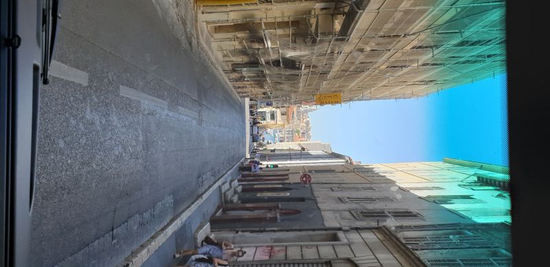
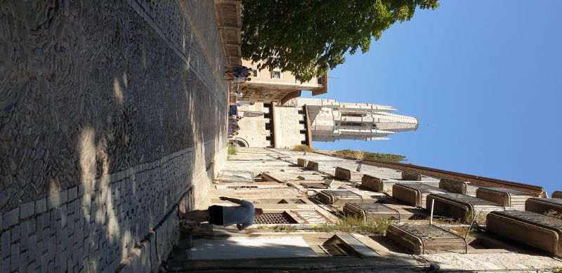
Cannes
zie tripadvisor voor de resentie in Cannes , Cannes viel trws niet tegen, brede boulevard, leuke terrasjes en " poppetjes" kijken
Frankrijk
43° 33' 10.2" N 7° 1' 2.5" E
43.5528470 7.0173690
• Head south on Rue Jean de Riouffé.
• Arrive at Rue Jean de Riouffé. Your destination is on the left.
☍
Distance not available
(Duration not available)
Cannes
see TripAdvisor for the residence in Cannes, Cannes was not disappointing, wide boulevard, nice terraces and "dolls" watching
フランス, 8 Rue Jean de Riouffe, 06400 Cannes, France
43° 33' 10.2" N 7° 1' 2.5" E
43.5528470 7.0173690
• Head toward Rue d'Antibes on Rue Jean de Riouffé. Go for 147 m.
• Turn right onto Boulevard de la Croisette (N98). Go for 417 m.
• Take the 1st exit from roundabout onto Place Bernard Cornut-Gentille. Go for 66 m.
• Turn left onto Rue Félix Faure. Go for 17 m.
• Continue on Place Bernard Cornut-Gentille. Go for 53 m.
• Continue on Rue Georges Clemenceau. Go for 3.6 km.
• Pass 4 roundabouts and continue on Avenue Saint-Exupéry (D6207). Go for 2.6 km.
• Take the 2nd exit from Rond-Point Saint-Exupéry roundabout toward A8. Go for 421 m.
• Take ramp onto A8 (La Provençale) toward Aix en Pce/Fréjus/St Raphaël. Go for 25.2 km.
• Take exit 38 toward St Raphaël/Fréjus-Centre. Go for 893 m.
• Take the 1st exit from Rond-Point du Gargalon roundabout onto Avenue Jean Lachenaud toward Aix en Pce/Bagnols/Capitou/Le Pin de la Lègue/A8. Go for 832 m.
• Take the 1st exit from Rond-Point de l'Olivade roundabout onto Avenue Jean Lachenaud. Go for 468 m.
• Take the 1st exit from Rond-Point du Bonfin roundabout toward A8 (Aix en Pce)/Bagnols/Capitou/Le Pin de la Lègue. Go for 293 m.
• Take the 2nd exit from Rond-Point du Capitou roundabout onto Chemin du Bonfin toward Capitou. Go for 200 m.
• Take the 1st exit from roundabout onto Avenue des Lions. Go for 224 m.
• Arrive at Avenue des Lions.
☍
35,3 km
( 35 min.)
Day
Fréjus
take a rest, we are not going here but we continue towards st tropes .. iig a place nearby because standing there with the camper is impossible.
Ps stood illegally last night in Cannes at the Marina, we got caught but we were allowed to stay as long as we were gone before 6:00 in the morning
687 AV DES LIONS, POLE CAPITOU NORD, 83600 Fréjus, France
43° 28' 17.5" N 6° 44' 6.9" E
43.4715215 6.7352608
• Head west on Avenue des Lions. Go for 198 m.
• Take the 3rd exit from roundabout. Go for 189 m.
• Continue on Chemin du Bonfin. Go for 22 m.
• Continue toward La Provençale/A8. Go for 41 m.
• Take the 3rd exit from Rond-Point du Capitou roundabout onto A8 (La Provençale) toward Marseille/Aix en Pce/Toulon/Draguignan. Go for 15.5 km.
• Take exit 36 toward St Tropez/Draguignan/Ste Maxime/Vidauban/Le Muy onto D1555. Go for 850 m.
• Turn right onto Route de Sainte-Maxime (D125) toward St Tropez/Ste Maxime. Go for 17.5 km.
• Pass 3 roundabouts and continue on Route du Plan de La Tour (D25). Go for 1.5 km.
• Take the 2nd exit from Rond-Point des Virgiles roundabout onto Route du Plan de La Tour (D25) toward St Tropez/Ste Maxime-Centre. Go for 512 m.
• Take the 2nd exit from Rond-Point de Neuenbrg roundabout onto D25 toward St Tropez/Grimaud. Go for 372 m.
• Take the 2nd exit from Rond-Point Léonce Olivier roundabout onto Avenue du 8 Mai 1945 toward St Tropez/Toulon/Grimaud. Go for 609 m.
• Continue toward Avenue Antoine de Saint-Exupéry. Go for 35 m.
• Take the 2nd exit from Rond-Point du Préconil roundabout onto Avenue Antoine de Saint-Exupéry. Go for 45 m.
• Turn right onto Avenue du Préconil. Go for 126 m.
• Turn right onto Avenue Jean Jaurès. Go for 99 m.
• Take the 2nd exit from roundabout onto Avenue Charles de Gaulle (D559) toward Fréjus. Go for 175 m.
• Take the 2nd exit from roundabout onto D25. Go for 50 m.
• Continue on Place Louis Blanc (D25). Go for 12 m.
• Turn right onto Place Louis Blanc. Go for 13 m.
• Turn left onto Boulevard Frédéric Mistral. Go for 115 m.
• Turn right onto Boulevard Frédéric Mistral. Go for 87 m.
• Turn sharp left onto Boulevard des Mimosas. Go for 44 m.
• Arrive at Boulevard des Mimosas. Your destination is on the right.
☍
38,0 km
( 31 min.)
Sainte-Maxime
Frankrijk
43° 18' 36.7" N 6° 38' 25.7" E
43.3101840 6.6404820
• Head toward Boulevard Bellevue on Boulevard des Mimosas. Go for 156 m.
• Turn slightly left onto Boulevard des Mimosas. Go for 122 m.
• Turn right onto Avenue Georges Clemenceau (D25). Go for 155 m.
• Take the 2nd exit from roundabout onto Rue du Docteur Sigalas. Go for 157 m.
• Take the 1st exit from roundabout onto Place Jean Mermoz. Go for 36 m.
• Continue on Avenue Antoine de Saint-Exupéry. Go for 111 m.
• Take the 2nd exit from Rond-Point du Préconil roundabout onto Avenue Antoine de Saint-Exupéry toward St Tropez/Toulon/Grimaud. Go for 288 m.
• Take the 2nd exit from Rond-Point du Train des Pignes roundabout onto Avenue Saint-Exupéry toward Toulon/St Tropez. Go for 191 m.
• Turn right onto Boulevard Jean Moulin (D559). Go for 232 m.
• Continue on Boulevard Jean Moulin (D559). Go for 644 m.
• Pass 3 roundabouts and continue on Route du Littoral (D559). Go for 4.9 km.
• Take the 3rd exit from roundabout onto Route du Littoral (D559). Go for 743 m.
• Take ramp onto D61 A toward Grimaud/Port-Grimaud. Go for 512 m.
• Arrive at D61 A. Your destination is on the left.
☍
8,3 km
( 12 min.)
Holiday Marina
D61A, 83310 Grimaud, France
43° 16' 14.5" N 6° 34' 11.3" E
43.2707000 6.5698000
• Head southwest on D61 A. Go for 7 m.
• Arrive at D61 A. Your destination is on the left.
☍
0,0 km
(Duration not available)
Day
Bootje huren volgens tripadvisor in grimaud
to be continued
Unnamed Road, 83310 Grimaud, Frankrijk
43° 16' 14" N 6° 34' 11.5" E
43.2705542 6.5698482
• Head toward Lieu-dit Fangaroute on D61 A. Go for 658 m.
• Continue on Route des Blaquières (D61 A). Go for 505 m.
• Take the 2nd exit from roundabout onto Route des Blaquières (D61 A). Go for 509 m.
• Take the 3rd exit from roundabout onto Route du Pont de Vinaigre (D61) toward St Tropez/Gassin/La Croix Valmer. Go for 1.9 km.
• Take the 1st exit from roundabout onto D98 toward Hyères/Toulon/Cogolin. Go for 562 m.
• Pass 4 roundabouts and continue on Grande Rue (D98). Go for 26.8 km.
• Take the 1st exit from roundabout onto Avenue Lou Mistraou (D98). Go for 4.7 km.
• Take the 2nd exit from roundabout onto D98. Go for 3.7 km.
• Take the 3rd exit from roundabout onto Chemin de la Décelle (VC3) toward La Londe les Maures. Go for 208 m.
• Take the 1st exit from Rond-Point de la Garenne roundabout onto D559. Go for 311 m.
• Continue on Lieu-dit La Pascalette (D559). Go for 72 m.
• Continue on D559. Go for 786 m.
• Continue on Lieu-dit Le Bas Jardin (D559). Go for 98 m.
• Continue on D559. Go for 1.2 km.
• Continue on Chemin du Moulin Premier (D559). Go for 15 m.
• Turn right. Go for 699 m.
• Turn left. Go for 140 m.
• Arrive at your destination on the left.
☍
42,8 km
( 40 min.)
Day
3590
3590 Route de Hyères, 83250 La Londe-les-Maures, France
43° 7' 56.9" N 6° 11' 53.5" E
43.1324839 6.1982037
• Head south. Go for 140 m.
• Turn right toward Route de Nice/D559. Go for 699 m.
• Turn right onto Route de Nice (D559). Go for 13 m.
• Continue on Chemin du Moulin Premier (D559). Go for 95 m.
• Continue on Route de Nice (D559). Go for 36 m.
• Continue on Chemin du Moulin Premier (D559). Go for 4 m.
• Arrive at Chemin du Moulin Premier (D559). Your destination is on the left.
☍
1,0 km
( 1 min.)
Day
Chateau du galaloupet
Large vineyard ... nice wine bought ..
it turns out that a few months ago louis vitton bought this yard
3212 Route de Nice, 83400 Hyères, Frankrijk
43° 7' 34.9" N 6° 11' 34.2" E
43.1263572 6.1928252
• Head toward Rond-Point des Commandos d'Afrique on Chemin du Moulin Premier (D559). Go for 171 m.
• Take the 3rd exit from Rond-Point des Commandos d'Afrique roundabout onto D98 toward Hyères-Centre/Toulon. Go for 5.8 km.
• Take the 3rd exit from Rond-Point Henri Petit roundabout onto D98 toward A570/Draguignan/Toulon/La Crau/La Garde/La Bayorre. Go for 985 m.
• Continue on A570. Go for 7.4 km.
• Take the left exit toward La Bigue/La Valette du Var/Toulon onto A57. Go for 7.3 km.
• Continue on A50. Go for 21.4 km.
• Take exit 11 toward La Cadière d'Azur/Le Beausset/Circuit du Castellet/Z.I. Signes. Go for 428 m.
• Take the 1st exit from roundabout onto Route des Sources (D82) toward Bandol/Sanary S/Mer/Le Plan du Castellet. Go for 844 m.
• Turn right onto Chemin de Touron. Go for 89 m.
• Turn left onto Chemin de Touron. Go for 22 m.
• Arrive at Chemin de Touron. Your destination is on the right.
☍
44,5 km
( 32 min.)
Simone bakker
162 Chemin de Touron, 83330 Le Castellet, France
43° 11' 6.9" N 5° 46' 3.5" E
43.1852479 5.7676267
• Head north on Chemin de Touron. Go for 22 m.
• Turn right onto Chemin de Touron. Go for 89 m.
• Turn left onto Route des Sources (D82). Go for 841 m.
• Take the 4th exit from roundabout onto A50 toward La Ciotat/Marseille. Go for 15.5 km.
• Take exit 9 toward La Ciotat. Go for 914 m.
• Take the 2nd exit from roundabout. Go for 1.0 km.
• Continue on Avenue Émile Bodin (D559). Go for 294 m.
• Take the 1st exit from roundabout onto Avenue Caporal Chef Alain Deruy. Go for 234 m.
• Take the 2nd exit from Rond-Point de Lattre de Tassigny roundabout onto Chemin du Puits de Brunet (D141). Go for 190 m.
• Take the 2nd exit from Rond-Point Marcel Lallouette roundabout onto Chemin du Puits de Brunet (D141). Go for 590 m.
• Take the 1st exit from roundabout onto Chemin du Puits de Brunet (D141). Go for 204 m.
• Take the 2nd exit from roundabout onto Chemin de Fardeloup. Go for 52 m.
• Turn right onto Avenue Louis Crozet. Go for 309 m.
• Turn right onto Chemin de Saint-Loup. Go for 31 m.
• Turn left onto Chemin de Saint-Loup. Go for 3.4 km.
• Continue on Route des Crêtes (D141). Go for 3.8 km.
• Arrive at Route des Crêtes (D141). Your destination is on the left.
☍
27,4 km
( 31 min.)
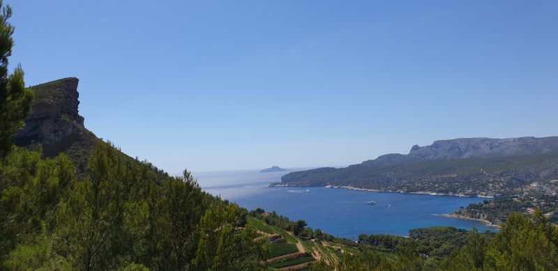
Route des Crêtes
helaas ivm brandgevaar afgesloten...terug via cassis
La Ciotat, Frankrijk
43° 11' 24.3" N 5° 33' 50.5" E
43.1900860 5.5640320
• Head southeast on Route des Crêtes (D141).
• Arrive at Route des Crêtes (D141). Your destination is on the left.
☍
Distance not available
(Duration not available)
Route des Crêtes
unfortunately closed due to fire risk ... back via cassis
Route des Crêtes, 13600 La Ciotat, France
43° 11' 24.3" N 5° 33' 50.5" E
43.1900860 5.5640320
• Head southeast on Route des Crêtes (D141). Go for 2.3 km.
• Turn left onto Route des Crêtes (D141). Go for 3.0 km.
• Continue on Avenue Marcel Camusso (D141). Go for 489 m.
• Turn left onto Avenue Jean Graille (D141). Go for 223 m.
• Turn left onto Avenue Louis Crozet (D141). Go for 263 m.
• Take the 1st exit from roundabout onto Chemin du Puits de Brunet (D141). Go for 192 m.
• Take the 3rd exit from roundabout onto Chemin du Puits de Brunet (D141). Go for 598 m.
• Take the 2nd exit from Rond-Point Marcel Lallouette roundabout onto Chemin du Puits de Brunet (D141). Go for 189 m.
• Take the 2nd exit from Rond-Point de Lattre de Tassigny roundabout onto Avenue Caporal Chef Alain Deruy. Go for 292 m.
• Take the 2nd exit from roundabout onto Avenue Émile Bodin (D559). Go for 293 m.
• Keep left onto Avenue Émile Bodin (D559). Go for 1.0 km.
• Take the 2nd exit from roundabout. Go for 100 m.
• Take ramp onto A50. Go for 28.7 km.
• Keep left onto Tunnel Prado-Carénage toward Le Pharo/Vieux Port. Go for 22 m.
• Keep right onto Tunnel Prado-Carénage toward Vieux Port. Go for 184 m.
• Take ramp onto Quai de Rive-Neuve toward St Victor. Go for 934 m.
• Continue on Quai des Belges. Go for 244 m.
• Turn left toward Quai du Port. Go for 12 m.
• Continue on Quai du Port. Go for 181 m.
• Turn right onto Rue Bonneterie. Go for 40 m.
• Turn left onto Rue de la Loge. Go for 119 m.
• Arrive at Rue de la Loge. Your destination is on the right.
☍
39,4 km
( 41 min.)
Marseille
helaas geen camperplek maar wel parkeerplek voor onze 8,5 mtr...onder de brug richting de haven ( port)
Frankrijk
43° 17' 47.3" N 5° 22' 11.2" E
43.2964820 5.3697800
• Head west on Rue de la Loge.
• Arrive at Rue de la Loge. Your destination is on the right.
☍
Distance not available
(Duration not available)
Marseille
unfortunately no camper place but parking space for our 8.5 mtr ... under the bridge towards the harbor (port)
Rue de la Loge, 13002 Marseille, France
43° 17' 47.3" N 5° 22' 11.2" E
43.2964820 5.3697800
• Head toward Rue de la Guirlande on Rue de la Loge. Go for 119 m.
• Turn right onto Rue Bonneterie. Go for 40 m.
• Turn right onto Quai du Port. Go for 640 m.
• Continue on Quai du Vieux-Port. Go for 252 m.
• Take the 1st exit from roundabout onto Avenue Vaudoyer. Go for 233 m.
• Continue on Esplanade de la Tourette. Go for 100 m.
• Turn left onto Place de la Major. Go for 46 m.
• Continue on Avenue Robert Schuman. Go for 169 m.
• Continue on Esplanade de la Cathédrale. Go for 6 m.
• Continue on Avenue Robert Schuman. Go for 435 m.
• Continue on Boulevard de Dunkerque toward Aéroport Marignane/Fos/Martigues/Lyon/Aix en Pce. Go for 560 m.
• Take left ramp onto Autoroute du Littoral (A55) toward Fos/Martigues/Aéroport Marignane/Aix en Pce/Lyon/L'Estaque/Les Arnavaux. Go for 12.0 km.
• Take the left exit toward Fos/Martigues onto A55. Go for 10.2 km.
• Take the exit toward Châteauneuf-les-M./Carry-le-Rouet/Carry le Rouet/Châteauneuf les Martigues onto D9. Go for 1.0 km.
• Pass 2 roundabouts and continue on Voie Rapide la Côte Bleue (D9 E). Go for 14.8 km.
• Take the 2nd exit from roundabout onto Avenue de Carro (D49 B). Go for 318 m.
• Turn slightly right onto Avenue de Carro (D49 B). Go for 161 m.
• Take the 2nd exit from roundabout onto Avenue de Carro (D49 B). Go for 201 m.
• Continue on Avenue René Fouque (D49 B). Go for 124 m.
• Arrive at Avenue René Fouque (D49 B). Your destination is on the right.
☍
41,5 km
( 31 min.)
Plage de Carro
And then a little further to point de carro, wake up by the sea ... bakery around the corner
43 Avenue René Fouque, 13500 Martigues, France
43° 19' 55.4" N 5° 2' 33.7" E
43.3320522 5.0426936
• Head southwest on Avenue René Fouque (D49 B). Go for 3 m.
• Turn left onto Esplanade Rabeton. Go for 61 m.
• Turn right onto Rue Germain Bozonnat. Go for 32 m.
• Turn right onto Avenue René Fouque (D49 B). Go for 163 m.
• Continue on Avenue de Carro (D49 B). Go for 173 m.
• Take the 2nd exit from roundabout onto Avenue de Carro (D49 B). Go for 480 m.
• Take the 3rd exit from roundabout onto Voie Rapide la Côte Bleue (D9 E). Go for 576 m.
• Take the 2nd exit from roundabout onto Voie Rapide la Côte Bleue (D9 E). Go for 1.1 km.
• Take ramp onto Route de Martigues (D49). Go for 3.8 km.
• Turn left onto Route de Ponteau. Go for 859 m.
• Take the 2nd exit from roundabout onto Route de Ponteau. Go for 926 m.
• Take the 1st exit from roundabout onto Chemin des Olives (D49 F) toward Martigues/Lavéra. Go for 1.7 km.
• Turn right onto D9. Go for 1.1 km.
• Turn right onto Allée Alessandro Volta. Go for 73 m.
• Arrive at Allée Alessandro Volta. Your destination is on the right.
☍
11,0 km
( 12 min.)
Day
Via a55 richting alles
beautiful along water, a55 and n568
6 Allée Alessandro Volta, 13500 Martigues, Frankrijk
43° 23' 17.9" N 5° 1' 56.1" E
43.3883055 5.0322384
• Head northeast on Allée Alessandro Volta. Go for 349 m.
• Turn left onto Rue Jacques de Vaucanson. Go for 270 m.
• Turn right onto Rue Jacques de Vaucanson. Go for 625 m.
• Continue on Rue Frédéric Sauvage. Go for 18 m.
• Take the 1st exit from roundabout onto Route du Port de Lavéra (D9). Go for 386 m.
• Take middle ramp onto A55 toward Istres. Go for 1.7 km.
• Arrive at A55. Your destination is on the left.
☍
3,4 km
( 5 min.)
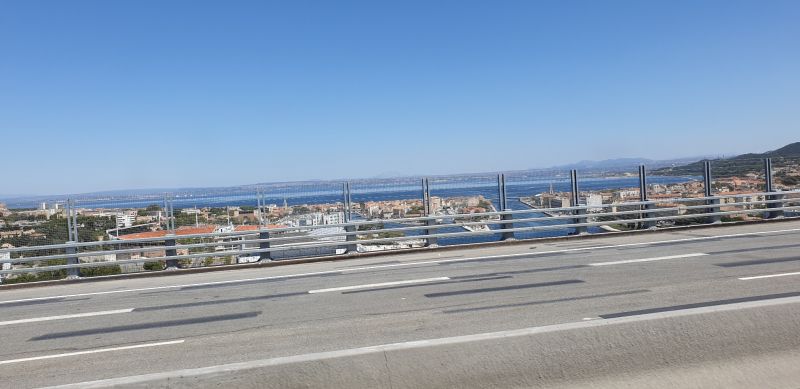
Viaduc de Martigues
Martigues, Frankrijk
43° 24' 10.5" N 5° 2' 31.1" E
43.4029049 5.0419799
• Head northwest on A55.
• Arrive at A55. Your destination is on the left.
☍
Distance not available
(Duration not available)
Viaduc de Martigues
1 Allée Georges Seurat, 13500 Martigues, France
43° 24' 10.5" N 5° 2' 31.1" E
43.4029049 5.0419799
• Head northwest on A55. Go for 1.9 km.
• Continue on N568. Go for 7.3 km.
• Keep right onto N568 toward Montpellier/Nîmes/Arles/Istres/Port St Louis. Go for 2.2 km.
• Take the 3rd exit from roundabout onto Route d'Arles (N568) toward Nîmes/Montpellier/Istres/Port St Louis. Go for 1.8 km.
• Take the 3rd exit from Carrefour de la Fenouillère roundabout onto N568 toward Arles/Nîmes/Montpellier/Port St Louis/Le Ventillon. Go for 4.0 km.
• Take the 2nd exit from roundabout onto N568 toward Arles/Nîmes/Montpellier/St Martin de Crau. Go for 19.7 km.
• Take ramp onto N113. Go for 17.4 km.
• Take ramp toward St Gilles/Vauvert. Go for 855 m.
• Continue on Route de Dours (D572 N) toward St Gilles/Vauvert. Go for 8.4 km.
• Continue on D6572. Go for 1.9 km.
• Turn left onto Rue Sadi Carnot toward Nîmes/Montpellier/Vauvert/Stade d'Espeyran. Go for 242 m.
• Continue on Chemin du Vin. Go for 137 m.
• Take the 2nd exit from roundabout onto Chemin du Vin toward Montpellier/Vauvert. Go for 619 m.
• Continue on Avenue des Costières. Go for 211 m.
• Take the 3rd exit from roundabout onto Route de Montpellier (D6572) toward Montpellier/Vauvert. Go for 11.7 km.
• Arrive at D6572. Your destination is on the left.
☍
78,2 km
( 51 min.)
D6572
D6572, 30600 Vauvert, France
43° 39' 20.2" N 4° 17' 19.1" E
43.6556164 4.2886487
• Head toward Lieu-dit Mas de la Crosse on D6572. Go for 4.2 km.
• Pass 3 roundabouts and continue on D6572. Go for 5.1 km.
• Take the 1st exit from roundabout onto Route des Plages (D6313) toward A9/Montpellier/Lunel. Go for 1.2 km.
• Take the 2nd exit from roundabout onto D6313 toward A9/Montpellier/Nîmes/Lunel. Go for 1.6 km.
• Take the 4th exit from roundabout onto N113 toward Montpellier/Lunel. Go for 2.4 km.
• Pass 2 roundabouts and continue on Avenue du Vidourle (N113). Go for 1.9 km.
• Take the 4th exit from Espace Pierre Sarguet roundabout onto D61 toward La Grande Motte/La Grande-Motte/Carnon/Palavas/Marsillargues. Go for 1.3 km.
• Pass 4 roundabouts and continue on Route de la Mer (D61). Go for 11.8 km.
• Continue on D62. Go for 1.4 km.
• Take ramp onto D62 E1 toward D62/La Grande Motte. Go for 1.2 km.
• Keep right onto D59 toward Centre Ville/Grand Travers/Couchant/Petite Motte. Go for 321 m.
• Continue on Avenue de Montpellier. Go for 234 m.
• Continue on Quai Georges Pompidou. Go for 253 m.
• Continue on Rue du Port. Go for 147 m.
• Turn left onto Rue du Port. Go for 43 m.
• Continue on Place du 1er Octobre 1974. Go for 143 m.
• Arrive at Place du 1er Octobre 1974. Your destination is on the right.
☍
33,3 km
( 29 min.)
La Grande-Motte
beautiful route much drought due to heat
Frankrijk
43° 33' 38.5" N 4° 5' 9.9" E
43.5607040 4.0860720
• Head west on Place du 1er Octobre 1974. Go for 55 m.
• Continue on Place du 1er Octobre 1974. Go for 76 m.
• Turn right onto Rue du Port. Go for 190 m.
• Continue on Quai Georges Pompidou. Go for 253 m.
• Continue on Avenue de Montpellier. Go for 228 m.
• Continue on D59. Go for 64 m.
• Keep left onto D59. Go for 139 m.
• Turn slightly left onto D62 E1. Go for 439 m.
• Keep left onto D62 E1. Go for 21 m.
• Take ramp onto D62. Go for 8.6 km.
• Take ramp onto D62 E2. Go for 1.6 km.
• Pass 4 roundabouts and continue on D62 E2. Go for 4.5 km.
• Turn right onto Avenue de Lattre de Tassigny (D986). Go for 2.5 km.
• Take the 3rd exit from roundabout onto M185. Go for 2.4 km.
• Take the 3rd exit from roundabout onto Avenue de Palavas toward Villeneuve lès M.-Centre/Comdamine. Go for 788 m.
• Turn right onto Boulevard des Écoles. Go for 247 m.
• Arrive at Boulevard des Écoles. Your destination is on the right.
☍
22,0 km
( 20 min.)
Villeneuve-lès-Maguelone
close to Montpellier, beautiful view again
Frankrijk
43° 31' 59.7" N 3° 51' 41.8" E
43.5332397 3.8616165
• Head southwest on Boulevard des Écoles.
• Turn right onto Avenue de la Gare (M185 E4). Go for 401 m.
• Take the 2nd exit from roundabout onto Avenue de la Gare (M185 E4). Go for 311 m.
• Take the 1st exit from roundabout onto M185. Go for 1.1 km.
• Take the 2nd exit from roundabout onto M185 toward Lattes. Go for 2.3 km.
• Take the 3rd exit from roundabout onto Route de Palavas (M986). Go for 5.6 km.
• Keep middle onto Avenue de Palavas toward Montpellier-Centre. Go for 210 m.
• Keep left onto Avenue de Palavas. Go for 37 m.
• Continue on M986. Go for 20 m.
• Take the 2nd exit from Rond-Point des Prés d'Arènes roundabout onto Rue de l'Abrivado toward Montpellier Centre. Go for 465 m.
• Continue on Avenue des Prés d'Arènes. Go for 875 m.
• Turn right onto Carrefour des Alizés. Go for 18 m.
• Turn right onto Carrefour des Alizés. Go for 73 m.
• Continue on Avenue de la Liberté. Go for 755 m.
• Keep left onto Avenue de la Liberté toward A75/Clermont-Ferrand/Les Cévennes/Mosson. Go for 640 m.
• Turn right onto Place Auguste Fages. Go for 268 m.
• Turn left toward Place Bouschet de Bernard. Go for 24 m.
• Continue on Place Roger Salengro. Go for 131 m.
• Turn right onto Rue Daru (M5). Go for 152 m.
• Continue on Rue du Faubourg du Courreau. Go for 3 m.
• Continue on Plan Cabanes. Go for 44 m.
• Turn right onto Rue du Faubourg du Courreau. Go for 80 m.
• Turn left onto Rue de la Merci. Go for 256 m.
• Continue on Rue François Franque. Go for 38 m.
• Turn slightly left onto Rue François Franque. Go for 52 m.
• Turn right onto Rue Foch. Go for 347 m.
• Turn right onto Place des Martyrs de la Résistance. Go for 65 m.
• Arrive at Place des Martyrs de la Résistance. Your destination is on the left.
☍
14,3 km
( 17 min.)
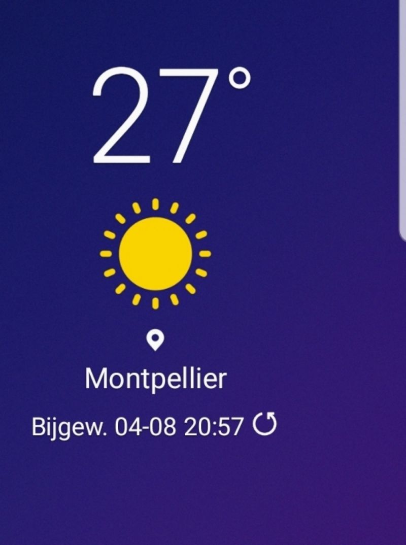
Montpellier
met de fiets (elec) 12 km naar het historische centrum tis te doen...even een puzzel maar volhouden ...mooie route trwd
Frankrijk
43° 36' 38.8" N 3° 52' 36.2" E
43.6107690 3.8767160
• Head northeast on Place des Martyrs de la Résistance.
• Arrive at Place des Martyrs de la Résistance. Your destination is on the left.
☍
Distance not available
(Duration not available)
Montpellier
by bike (elec) 12 km to the historic center tis to do ... just a puzzle but keep going ... beautiful route trwd
8 Place Martyrs de la Résistance, 34000 Montpellier, France
43° 36' 38.8" N 3° 52' 36.2" E
43.6107690 3.8767160
• Head toward Rue Foch on Place des Martyrs de la Résistance. Go for 24 m.
• Turn left onto Place des Martyrs de la Résistance. Go for 68 m.
• Turn slightly right onto Rue Foch. Go for 347 m.
• Turn right onto Rue la Blottière. Go for 86 m.
• Turn right toward Boulevard Professeur Louis Vialleton. Go for 20 m.
• Turn right onto Boulevard Professeur Louis Vialleton. Go for 215 m.
• Continue on Boulevard Ledru-Rollin. Go for 168 m.
• Continue on Boulevard du Jeu de Paume. Go for 46 m.
• Turn right onto Rue Marceau. Go for 224 m.
• Continue on Rue Chaptal. Go for 474 m.
• Turn left onto Boulevard Renouvier. Go for 214 m.
• Turn left onto Rue Raoux. Go for 36 m.
• Continue on Avenue Georges Clemenceau. Go for 18 m.
• Turn right onto Avenue de Toulouse. Go for 83 m.
• Turn left toward A9/Nîmes. Go for 9 m.
• Take left ramp onto Avenue de la Liberté. Go for 934 m.
• Continue on Carrefour des Alizés. Go for 89 m.
• Continue on Boulevard Jacques Fabre de Morlhon. Go for 1.4 km.
• Take the 2nd exit from Rond-Point des Prés d'Arènes roundabout onto M986 toward A9/Palavas les Flots/Lattes/Arena/Parc des Expositions. Go for 5.8 km.
• Take the 1st exit from roundabout onto M185. Go for 2.3 km.
• Take the 3rd exit from roundabout onto Avenue de Palavas toward Villeneuve lès M.-Centre/Comdamine. Go for 788 m.
• Turn right onto Boulevard des Écoles. Go for 247 m.
• Arrive at Boulevard des Écoles. Your destination is on the right.
☍
13,6 km
( 16 min.)
Villeneuve-lès-Maguelone
weer terug met de fiets op camperplaats
Frankrijk
43° 31' 59.7" N 3° 51' 41.8" E
43.5332397 3.8616165
• Head southwest on Boulevard des Écoles.
• Turn right onto Avenue de la Gare (M185 E4). Go for 401 m.
• Take the 2nd exit from roundabout onto Avenue de la Gare (M185 E4). Go for 311 m.
• Take the 3rd exit from roundabout onto M185. Go for 890 m.
• Turn right onto Route de Montpellier (M185 E4). Go for 1.4 km.
• Turn right onto Route de Sète (M612). Go for 864 m.
• Turn sharp left toward Place Charles Lindbergh. Go for 170 m.
• Turn right onto Place Charles Lindbergh. Go for 73 m.
• Turn left onto Rue Alberto Santos-Dumont. Go for 199 m.
• Turn left onto Rue Amelia Earhart. Go for 75 m.
• Arrive at Rue Amelia Earhart. Your destination is on the left.
☍
4,4 km
( 6 min.)
Day
Verder via a9 Beziers, narbonne, perpignan en Spanje gerona
9 Rue Alberto Santos Dumont, 34430 Saint-Jean-de-Védas, France
43° 33' 26.2" N 3° 50' 49.8" E
43.5572856 3.8471689
• Head southeast on Rue Amelia Earhart. Go for 236 m.
• Turn left onto Rue Alberto Santos-Dumont. Go for 317 m.
• Take the 2nd exit from Place Roland Garros roundabout onto Rue Jacqueline Auriol. Go for 270 m.
• Turn left onto Rue Saint-Exupéry. Go for 524 m.
• Turn sharp left onto Rue Henri Farman. Go for 111 m.
• Take the 1st exit from roundabout. Go for 215 m.
• Take the 2nd exit from roundabout toward A75/Clermont-Fd/Béziers/Montpellier-Hôpitaux-Facultés/Montpellier-Mosson/St Jean de Védas. Go for 856 m.
• Take the 6th exit from Place de l'Europe roundabout onto A709 toward Barcelone. Go for 1.9 km.
• Continue on A9 (La Languedocienne). Go for 164 km.
• Arrive at La Catalane (A9).
☍
168,3 km
(1 hrs. 25 min.)
La Catalane
towards the le peage border
A9, 66160 Le Boulou, France
42° 31' 35.2" N 2° 49' 13.6" E
42.5264434 2.8204406
• Head south on A9 (La Catalane). Go for 8.7 km.
• Continue on AP-7 (Autopista de la Mediterrània). Go for 3.5 km.
• Take exit 1 toward La Jonquera N./Aduana. Go for 505 m.
• Take the 3rd exit from roundabout onto N-2 toward Perpignan/El Pertús. Go for 2.4 km.
• Arrive at N-2.
☍
15,0 km
( 9 min.)
Grens
N-II, La Junquera, Girona, Spanje
42° 27' 12.4" N 2° 51' 54.3" E
42.4534500 2.8650783
• Head north on N-2.
• Arrive at N-2.
☍
Distance not available
(Duration not available)
Grens
N-II, La Jonquera, Girona, Spain
42° 27' 12.4" N 2° 51' 54.3" E
42.4534500 2.8650783
• Head toward Carrer Doctor Subiros on N-2. Go for 654 m.
• Continue on Avenue de France (D900). Go for 650 m.
• Turn right onto Rue de la Redoute. Go for 77 m.
• Turn right onto Rue du Ravin. Go for 58 m.
• Turn left onto Avenue de France (D900). Go for 600 m.
• Continue on N-2. Go for 2.9 km.
• Pass 4 roundabouts and continue on N-2. Go for 3.1 km.
• Take ramp onto AP-7 (Autopista de la Mediterrània) toward Girona/Barcelona. Go for 53.8 km.
• Take exit 6B toward Girona O./Sant Gregori. Go for 912 m.
• Take the 3rd exit from Rotonda de Domeny roundabout onto Carrer de Sant Gregori (GI-531) toward Girona. Go for 1.2 km.
• Take the 3rd exit from Rotonda de Taialà roundabout onto Carrer de Sant Gregori (GI-531) toward Centre Ciutat/França/Figueres/Banyoles/C-66/Palamós. Go for 230 m.
• Take the 3rd exit from Rotonda Josep Tarradellas roundabout onto Rambla d'en Xavier Cugat (GI-531) toward Centre Ciutat. Go for 583 m.
• Take the 1st exit from Rotonda del Pont de la Barca roundabout onto Carrer del Pont de la Barca (N-2A) toward Centre Ciutat/Hospitals. Go for 369 m.
• Turn right onto Avinguda de França (N-2A) toward Centre Ciutat. Go for 126 m.
• Take the 1st exit from Rotonda del Pont de Pedret roundabout onto N-2A toward Centre Ciutat. Go for 297 m.
• Take the 2nd exit from Rotonda del Rellotge roundabout onto Avinguda de Ramon Folch toward Centre Ciutat/C-65/Sant Feliu de Guíxols. Go for 215 m.
• Take the 1st exit from roundabout onto Gran Via de Jaume I toward Centre Ciutat/Sant Feliu de Guíxols/C-65. Go for 595 m.
• Turn left onto Plaça Hospital toward Centre Ciutat. Go for 127 m.
• Continue on Plaça Pompeu Fabra. Go for 115 m.
• Continue on Plaça Catalunya. Go for 59 m.
• Turn left onto Plaça Catalunya. Go for 111 m.
• Continue on Rambla de la Llibertat. Go for 64 m.
• Turn right onto Pujada del Pont de Pedra. Go for 42 m.
• Turn left onto Plaça del Vi. Go for 69 m.
• Continue on Carrer Ciutadans. Go for 172 m.
• Continue on Plaça Oli. Go for 14 m.
• Turn left onto Carrer de la Cort Reial. Go for 58 m.
• Turn right onto Carrer de la Cort Reial. Go for 60 m.
• Continue on Carrer de les Ballesteries. Go for 163 m.
• Continue on Pujada de Sant Feliu. Go for 2 m.
• Keep right onto Pujada de Sant Feliu. Go for 142 m.
• Turn right onto Plaça de la Catedral. Go for 51 m.
• Arrive at Plaça de la Catedral. Your destination is on the right.
☍
67,7 km
( 50 min.)
Camperplaats 5 min fietsen en afgesloten
nice old town many Dutch
Plaça de la Catedral, 9, 17004 Girona, Spain
41° 59' 13.9" N 2° 49' 30.5" E
41.9871981 2.8251312
• Head south on Plaça de la Catedral.
• Arrive at Plaça de la Catedral. Your destination is on the right.
☍
Distance not available
(Duration not available)
Camperplaats 5 min fietsen en afgesloten
nice old town many Dutch
Plaça de la Catedral, 9, 17004 Girona, Spain
41° 59' 13.9" N 2° 49' 30.5" E
41.9871981 2.8251312
• Head south on Plaça de la Catedral.
• Turn left onto Plaça de la Catedral. Go for 83 m.
• Turn left onto Pujada de la Catedral. Go for 38 m.
• Turn right onto Pujada de la Catedral. Go for 19 m.
• Continue on Plaça dels Lledoners. Go for 18 m.
• Turn slightly left onto Plaça dels Lledoners. Go for 6 m.
• Turn slightly right onto Carrer de Bellmirall. Go for 40 m.
• Turn left onto Carrer dels Alemanys. Go for 34 m.
• Turn right onto Plaça Sant Domènec. Go for 118 m.
• Continue on Plaça de Josep Ferrater i Mora. Go for 36 m.
• Continue on Plaça de Josep Ferrater i Mora. Go for 111 m.
• Continue on Passeig del General Peralta. Go for 43 m.
• Turn right onto Passeig de Fora Muralla. Go for 373 m.
• Turn slightly right onto Passatge Pedreres. Go for 7 m.
• Turn left onto Carrer Sol. Go for 232 m.
• Continue on Carrer Isabel la Catòlica. Go for 184 m.
• Turn right onto Carrer Vista Alegre. Go for 105 m.
• Turn left onto Carrer del Carme. Go for 273 m.
• Turn right onto Pont de la Font de Rei. Go for 122 m.
• Take the 3rd exit from Plaça Països Catalans roundabout onto Carrer d'Emili Grahit toward C-65/St. Feliu de Guíxols/La Creueta. Go for 1.6 km.
• Take the 2nd exit from Rotonda d'Emili Grahit roundabout onto C-250 toward Cassà de la Selva/Figueres. Go for 613 m.
• Take the 2nd exit from roundabout onto GIV-6703 toward els Àngels/Aeroport/Figueres/Barcelona. Go for 344 m.
• Take ramp onto N-2 toward Barcelona/Aeroport. Go for 5.9 km.
• Take ramp onto A-2 (Autovia del Nordest) toward Barcelona/N-2. Go for 16.8 km.
• Take exit 692B toward St. Feliu G./Lloret de Mar/Tossa de Mar onto C-35. Go for 1.6 km.
• Take exit 85 toward Sta. Coloma F./Lloret M./Vidreres/Lloret de Mar onto C-63. Go for 11.1 km.
• Take the 1st exit from roundabout onto Carrer Joan Miró toward St. Pere del Bosc. Go for 71 m.
• Turn right. Go for 16 m.
• Turn right. Go for 34 m.
• Arrive at your destination on the right.
☍
39,9 km
( 33 min.)
Route langs water c 64
C-63, 93, 17310 Lloret de Mar, Girona, Spanje
41° 42' 50.4" N 2° 49' 50.6" E
41.7139950 2.8307317
• Head north. Go for 63 m.
• Turn right. Go for 9 m.
• Turn left toward Carrer Joan Miró. Go for 16 m.
• Turn left onto Carrer Joan Miró. Go for 47 m.
• Take the 2nd exit from roundabout onto Avinguda de les Alegries (C-63) toward Centre Ciutat/Blanes/Tossa de Mar. Go for 565 m.
• Take the 3rd exit from roundabout onto Avinguda de les Alegries (GI-680) toward Centre Ciutat/Blanes/Tossa de Mar. Go for 603 m.
• Take the 3rd exit from roundabout onto Avinguda de les Alegries (C-63) toward Centre Ciutat/Blanes/Tossa de Mar. Go for 319 m.
• Take ramp toward Blanes. Go for 248 m.
• Continue on Avinguda de la Vila de Blanes (GI-682) toward Blanes/Barcelona. Go for 320 m.
• Pass 4 roundabouts and continue on Carretera d'Accés a la Costa Brava (GI-682). Go for 3.4 km.
• Take the 3rd exit from roundabout onto Carretera d'Accés a la Costa Brava (GI-682) toward Palafolls/Barcelona/C-32. Go for 283 m.
• Pass 2 roundabouts and continue on Carretera Accés Costa Brava (GI-682). Go for 1.2 km.
• Take the 2nd exit from roundabout onto Carretera de Blanes a Sant Feliu de Guíxols (GI-682) toward Girona/Barcelona/C-32. Go for 778 m.
• Take the 3rd exit from roundabout onto Carretera Nou Accés Costa Brava (GI-682) toward C-32/Palafolls/Mataró/Barcelona. Go for 1.8 km.
• Take the 2nd exit from roundabout onto B-682 toward C-32/Malgrat M./Mataró/Barcelona. Go for 234 m.
• Turn right onto Avinguda de la Costa Brava. Go for 172 m.
• Turn left onto Carrer de Salvador Espriu. Go for 124 m.
• Turn slightly right onto Camí de Can Baltasar. Go for 59 m.
• Turn right onto Carrer Sol Roig. Go for 10 m.
• Arrive at Carrer Sol Roig. Your destination is on the right.
☍
10,1 km
( 14 min.)
Blanes
Carrer Sol Roig, 33, 08389 Palafolls, Barcelona, Spain
41° 40' 1.4" N 2° 45' 12.1" E
41.6670480 2.7533576
• Head toward Carrer del Sindicat on Carrer Sol Roig. Go for 96 m.
• Turn right onto Carrer del Sindicat. Go for 60 m.
• Turn left onto Carrer de Salvador Espriu. Go for 32 m.
• Turn right onto Avinguda de la Costa Brava. Go for 139 m.
• Turn right onto Camí 1 (B-682). Go for 1.8 km.
• Take the 1st exit from roundabout onto B-682 toward N-2/C-32/Girona/Barcelona. Go for 283 m.
• Take ramp onto N-2 toward C-32/Barcelona/Girona. Go for 637 m.
• Take the 2nd exit from roundabout onto N-2 toward Aeroport/Girona/C-32/Barcelona. Go for 2.0 km.
• Take the 3rd exit from roundabout onto N-2 toward C-32/Barcelona. Go for 292 m.
• Take ramp onto C-32 (Autopista de Barcelona a Mataró) toward Barcelona. Go for 46.4 km.
• Keep right onto C-31 toward Barcelona/Glòries/Tiana/Montgat. Go for 8.7 km.
• Take the left exit toward Cinturó Litoral/Tarragona-Lleida/Port-Aeroport onto B-10 (Ronda del Litoral). Go for 1.1 km.
• Arrive at Ronda del Litoral (B-10).
☍
61,6 km
( 37 min.)
Day
761
Ronda Litoral, 761, 08930 Sant Adrià de Besòs, Barcelona, Spanje
41° 25' 14.3" N 2° 13' 21.6" E
41.4206513 2.2226605
• Head southeast on B-10 (Ronda del Litoral). Go for 13.8 km.
• Take exit 18 toward El Prat de Llobregat/Castelldefels/Aeroport onto C-31 (Avinguda de la Gran Via de l'Hospitalet). Go for 11.2 km.
• Keep right toward Gavà Mar. Go for 115 m.
• Continue on Carrer Autovia de Castelldefels toward Gavà Mar. Go for 81 m.
• Take ramp toward Gavà Mar. Go for 445 m.
• Take the 1st exit from roundabout onto Avinguda d'Europa toward Gavà/Barcelona. Go for 251 m.
• Take the 1st exit from roundabout toward C-31/Barcelona. Go for 46 m.
• Turn right onto Carrer Autovia de Castelldefels. Go for 258 m.
• Continue on Autovia de Castelldefels (C-31). Go for 450 m.
• Arrive at Autovia de Castelldefels (C-31).
☍
26,7 km
( 20 min.)
Autovia de Castelldefels
actually day 10 went from gerona to barça ... from camping tres .... by taxi .... note that small dogs must in barça in a travel bag !! this also applies to hop on hop off ... 1 company accepts this, the red g
no dogs at all
Autovia de Castelldefels, 08850 Gavà, Barcelona, Spanje
41° 16' 22.1" N 2° 2' 34.9" E
41.2728153 2.0430338
• Head northeast on Autovia de Castelldefels (C-31). Go for 369 m.
• Turn right. Go for 81 m.
• Turn right. Go for 220 m.
• Turn slightly right toward Carrer Autovia de Castelldefels. Go for 212 m.
• Continue on Carrer Autovia de Castelldefels. Go for 8 m.
• Turn left. Go for 61 m.
• Turn left. Go for 23 m.
• Turn left. Go for 26 m.
• Arrive at your destination on the right.
☍
1,0 km
( 2 min.)
Day
Camping 3 Estrellas
humid climate
Unnamed Road, 08850 Gavà, Barcelona, Spain
41° 16' 18.1" N 2° 2' 35.9" E
41.2717000 2.0433000
• Head east.
• Arrive at your destination on the right.
☍
Distance not available
(Duration not available)
Camping 3 Estrellas
humid climate
Unnamed Road, 08850 Gavà, Barcelona, Spain
41° 16' 18.1" N 2° 2' 35.9" E
41.2717000 2.0433000
• Head east. Go for 62 m.
• Turn left. Go for 21 m.
• Turn left. Go for 66 m.
• Turn right toward Carrer Autovia de Castelldefels. Go for 36 m.
• Turn left onto Carrer Autovia de Castelldefels. Go for 39 m.
• Turn right onto Carrer Autovia de Castelldefels. Go for 40 m.
• Turn right onto Autovia de Castelldefels (C-31). Go for 6.2 km.
• Take exit 192AB toward Girona-Lleida/Aeroport Terminal T2/Barcelona/Ronda de Dalt onto B-22. Go for 1.5 km.
• Take the exit toward Barcelona/Ronda de Dalt/Tarragona/Lleida/Girona onto B-20. Go for 3.0 km.
• Continue on C-32 (Ronda de Dalt). Go for 2.8 km.
• Take exit 12 toward Esplugues/St. Just Desvern/Pubilla Cases/Ctra. Collblanc. Go for 417 m.
• Turn right onto Carrer del Molí. Go for 208 m.
• Turn right onto Carrer de Vidal i Ribas. Go for 75 m.
• Arrive at Carrer de Vidal i Ribas. Your destination is on the right.
☍
14,4 km
( 11 min.)
Day
Hier wordt geparkeerd op de rotonde
Carrer de Vidal i Ribas, 20, 08950 Esplugues de Llobregat, Barcelona, Spanje
41° 22' 25.8" N 2° 5' 43.8" E
41.3738444 2.0955138
• Head toward Avinguda Ciutat de l'Hospitalet on Carrer de Vidal i Ribas. Go for 31 m.
• Continue on Enrique Tierno Galván. Go for 184 m.
• Continue on Carrer de Sant Josep. Go for 118 m.
• Turn left onto Carrer de Josep Anselm Clavé. Go for 309 m.
• Turn left onto Carrer del Pas del Sucre. Go for 185 m.
• Turn left and take ramp onto C-32 (Ronda de Dalt) toward Barcelona. Go for 1.8 km.
• Continue on B-20 (Ronda de Dalt). Go for 2.0 km.
• Take exit 9 toward Sarrià/Manresa/E-9/C-16/Túnels de Vallvidrera/Via Augusta onto Carrer del General Vives. Go for 141 m.
• Take the 2nd exit from Rotonda de Can Caralleu roundabout onto Carrer del General Vives toward Túnels de Vallvidrera/C-16/Vallvidrera/BV-1462/St. Cugat del Vallès. Go for 64 m.
• Keep right onto Carrer del General Vives toward Girona/C-33/A-7. Go for 429 m.
• Take the 3rd exit from roundabout onto Túnels de Vallvidrera (C-16) toward Vallvidrera/BV-1462/St. Cugat del Vallès/Tibidabo/Túnels de Vallvidrera. Go for 74.7 km.
• Arrive at C-16.
☍
79,9 km
( 48 min.)
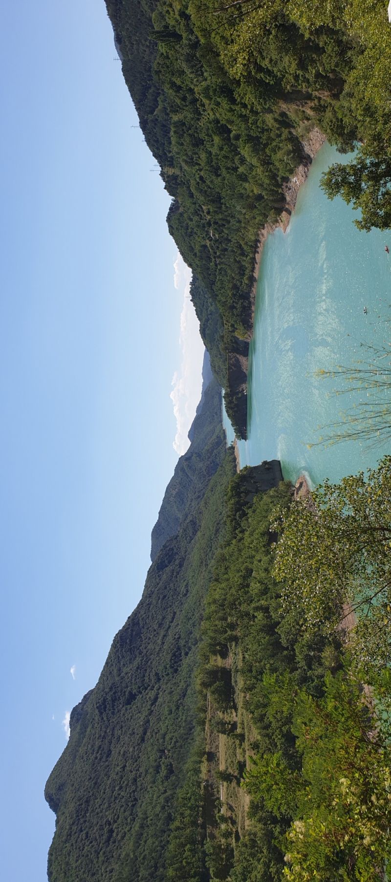
C16, richting andorra
much peage, towards the Spanish pyrinene
C-16, 08692 Puigreig, Barcelona, Spain
41° 55' 42" N 1° 52' 42.4" E
41.9283323 1.8784347
• Head north on C-16. Go for 14.1 km.
• Continue on C-16. Go for 30.8 km.
• Arrive at C-16. Your destination is on the left.
☍
45,0 km
( 28 min.)
Supermooie route naar andorra
C-16, 5, 08694 Guardiola de Berga, Barcelona, Spain
42° 16' 51.2" N 1° 51' 10.9" E
42.2808775 1.8530143
• Head north on C-16. Go for 11.9 km.
• Take ramp onto C-16 toward Bellver de Cerdanya/La Seu d'Urgell/Andorra. Go for 2.4 km.
• Take the 3rd exit from roundabout onto N-260 toward La Seu d'Urgell/Andorra la Vella. Go for 2.3 km.
• Pass 2 roundabouts and continue on N-260. Go for 30.3 km.
• Keep right toward Andorra. Go for 163 m.
• Continue on Carretera de la Seu d'Urgell a Andorra (N-145). Go for 7.7 km.
• Take the 2nd exit from roundabout onto N-145 toward Andorra la Vella. Go for 685 m.
• Keep left onto N-145. Go for 753 m.
• Continue on Carretera d'Espanya (CG1). Go for 126 m.
• Pass 6 roundabouts and continue on Carretera d'Espanya. Go for 3.4 km.
• Continue on Avinguda Francesc Cairat toward Andorra la Vella. Go for 652 m.
• Take the 3rd exit from roundabout onto Túnel de la Tàpia toward França/Andorra la Vella. Go for 1.1 km.
• Continue toward Prat de la Tresa/CG1. Go for 19 m.
• Take the 1st exit from roundabout onto Prat de la Tresa (CG1) toward França/Andorra la Vella. Go for 880 m.
• Turn right onto CG1 toward França. Go for 105 m.
• Pass 3 roundabouts and continue on Avinguda de Salou (CG1). Go for 2.7 km.
• Arrive at Avinguda de Salou (CG1).
☍
65,2 km
( 54 min.)
Camí Vell
only campsite in town ... visited old and new city center .... also installed new dynamo in. camper
Av. de Salou, 32, AD500 Andorra la Vella, Andorra
42° 30' 2.6" N 1° 30' 50.6" E
42.5007199 1.5140476
• Head northeast on Avinguda de Salou (CG1).
• Arrive at Avinguda de Salou (CG1).
☍
Distance not available
(Duration not available)
Day
Camí Vell
this rest day the camper is made
Av. de Salou, 32, AD500 Andorra la Vella, Andorra
42° 30' 2.6" N 1° 30' 50.6" E
42.5007199 1.5140476
• Head toward Carrer Prada Motxilla on Avinguda de Salou (CG1). Go for 627 m.
• Take the 3rd exit from roundabout onto Avinguda de Tarragona (CG1) toward França/Escaldes-Engordany/Ordino/La Massana. Go for 283 m.
• Take the 1st exit from roundabout onto Avinguda de Tarragona (CG1) toward França/Escaldes-Engordany/Ordino/La Massana. Go for 465 m.
• Pass 5 roundabouts and continue on Carretera d'Engolasters (CG2). Go for 2.2 km.
• Turn left onto Avinguda del Pont de la Tosca (CG2). Go for 848 m.
• Pass 2 roundabouts and continue on Avinguda Coprincep Episcopal (CG2). Go for 1.9 km.
• Take the 1st exit from roundabout onto Carretera Nou Vial (CG2) toward França/Canillo. Go for 776 m.
• Take the 1st exit from roundabout onto Carretera Nou Vial (CG2) toward França/Canillo. Go for 499 m.
• Keep right toward Avinguda de François Mitterrand/CG2. Go for 104 m.
• Continue on Avinguda de François Mitterrand (CG2). Go for 256 m.
• Pass 5 roundabouts and continue on Plaça de l'Areny (CG2). Go for 4.6 km.
• Take the 3rd exit from roundabout onto Avinguda Sant Joan de Caselles (CG2) toward França. Go for 3.2 km.
• Pass 2 roundabouts and continue on CG2. Go for 4.0 km.
• Turn left onto Carrer de la Pujada. Go for 73 m.
• Continue on Carrer Major. Go for 26 m.
• Continue on Marrades del Piol. Go for 43 m.
• Arrive at Marrades del Piol. Your destination is on the right.
☍
19,8 km
( 25 min.)
Day
Via Frankrijk naar lourdes cg-2
unfortunately border Spain closed due to falling of a large boulder ... now via cg-2 to canillo (where there is a large ski area) to soldeu
Camí Marrades del Piol, 1797, AD100 Soldeu, Andorra
42° 34' 39.5" N 1° 39' 54.6" E
42.5776250 1.6651794
• Head west on Marrades del Piol.
• Arrive at Marrades del Piol. Your destination is on the right.
☍
Distance not available
(Duration not available)
Via Frankrijk naar lourdes cg-2
unfortunately border Spain closed due to falling of a large boulder ... now via cg-2 to canillo (where there is a large ski area) to soldeu
Camí Marrades del Piol, 1797, AD100 Soldeu, Andorra
42° 34' 39.5" N 1° 39' 54.6" E
42.5776250 1.6651794
• Head east on Marrades del Piol. Go for 43 m.
• Continue on Plaça del Piol. Go for 26 m.
• Continue on Carrer de la Pujada. Go for 73 m.
• Turn left onto CG2. Go for 697 m.
• Take the 1st exit from roundabout onto CG2. Go for 2.9 km.
• Keep right toward Pas de la Casa/França. Go for 376 m.
• Continue on Túnel d'Envalira. Go for 3.5 km.
• Take the 2nd exit from roundabout onto Túnel d'Envalira. Go for 100 m.
• Continue on Tunnel d'Envalira. Go for 264 m.
• Take the 2nd exit from roundabout onto N22 toward Toulouse/Foix/Perpignan/L'Hospitalet/Porté-Puymorens. Go for 5.0 km.
• Turn left onto N320 toward Toulouse/Foix/Ax les Thermes/L'Hospitalet/Porte-Puymorens. Go for 3.4 km.
• Turn left onto N320 toward Perpignan/Barcelone. Go for 1.7 km.
• Keep left onto N320. Go for 101 m.
• Turn right toward Foix/Toulouse/L'Hospitalet Ax les Thermes. Go for 51 m.
• Turn left onto N20 toward Foix/Toulouse/L'Hospitalet Ax les Thermes. Go for 1.2 km.
• Pass 2 roundabouts and continue on N20. Go for 36.4 km.
• Arrive at Avenue Paul Berdot (N20). Your destination is on the right.
☍
55,8 km
( 56 min.)
Prachtige route n20
22 La Prade, 09310 Sinsat, France
42° 48' 0.4" N 1° 39' 19.5" E
42.8001179 1.6554046
• Head toward Lieu-dit Illat on Avenue Paul Berdot (N20). Go for 3.7 km.
• Turn right toward Ornolac/Ussat. Go for 189 m.
• Turn left onto Rue des Thermes (D23). Go for 442 m.
• Continue on Rond-Point du Manoir (D23). Go for 1.8 km.
• Continue on D123. Go for 142 m.
• Continue on D23. Go for 214 m.
• Continue on Avenue de l'Ayroule (D123). Go for 516 m.
• Pass 2 roundabouts and continue on Avenue de l'Ayroule (D123). Go for 331 m.
• Continue on Quai de l'Ariège (D123). Go for 107 m.
• Continue on Avenue Peyrevidal (D618 Y). Go for 211 m.
• Turn left onto Rue de Monaco (D618 Y). Go for 151 m.
• Turn right onto Chemin de la Croix de Quié. Go for 35 m.
• Continue on Avenue Paul Joucla (D618). Go for 151 m.
• Take the 1st exit from roundabout onto Lieu-dit Arrigols (D618) toward Foix/Toulouse/Parc de la Préhistoire/Grotte de Bédeilhac/Col de Port. Go for 569 m.
• Take the 2nd exit from roundabout onto Route de Saurat (D618) toward Foix/Toulouse/Saurat/Massat. Go for 718 m.
• Take the 1st exit from roundabout onto N20 toward Foix/Toulouse. Go for 12.2 km.
• Take ramp toward Foix/Tarbes/St Girons/Z.A. Foix Sud. Go for 265 m.
• Turn right. Go for 18 m.
• Arrive at your destination on the left.
☍
21,8 km
( 18 min.)
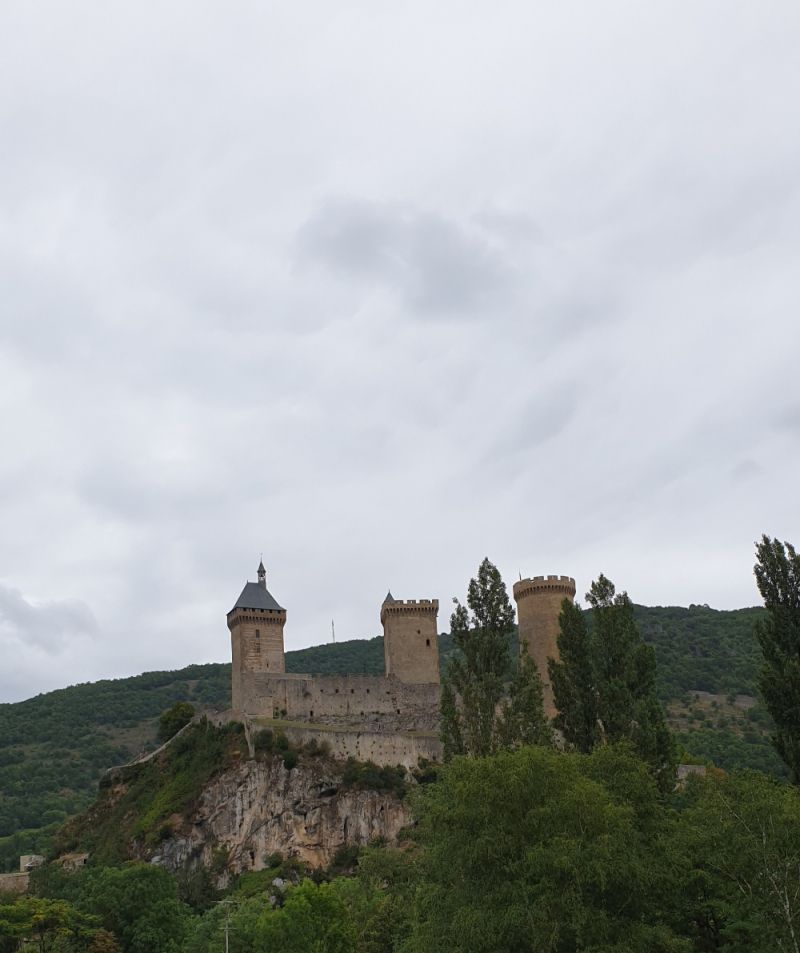
Barreau de Peysales
Barreau de Peysales, 09000 Foix, Frankrijk
42° 56' 56" N 1° 37' 22.6" E
42.9488959 1.6229417
• Head east. Go for 84 m.
• Take the 2nd exit from roundabout. Go for 137 m.
• Take the 3rd exit from roundabout onto Route d'Espagne (D117) toward Foix/Tarbes/Toulouse/St Girons/Château de Foix. Go for 782 m.
• Pass 2 roundabouts and continue on Cours Gabriel Fauré (D117). Go for 2.1 km.
• Take the 1st exit from roundabout onto Avenue de Lérida (D117) toward Tarbes/St Girons/Rivière Souterraine de Labouiche/Grotte du Mas d'Azil. Go for 269 m.
• Turn right onto Avenue de Lérida (D117) toward Tarbes/St Girons/La Bastide de Sérou/Rivière Souterraine de Labouiche/Grotte du Mas d'Azil. Go for 14.8 km.
• Turn left onto Lieu-dit Les Andreaux. Go for 109 m.
• Arrive at Lieu-dit Les Andreaux. Your destination is on the right.
☍
18,3 km
( 17 min.)
96
96 Les Andreaux, 09240 La Bastide-de-Sérou, Frankrijk
43° 0' 33.8" N 1° 27' 2.4" E
43.0093797 1.4506618
• Head north on Lieu-dit Les Andreaux. Go for 109 m.
• Turn left onto Lieu-dit Les Andreaux (D117). Go for 26.6 km.
• Turn right onto Route de Foix toward Centre Ville. Go for 712 m.
• Continue on Avenue René Plaisant. Go for 488 m.
• Continue on Avenue François Camel. Go for 230 m.
• Take the 1st exit from Place François Camel roundabout onto Avenue Aristide Bergès. Go for 103 m.
• Take the 1st exit from roundabout onto Avenue Aristide Bergès (D117) toward A64/Tarbes/St-Gaudens/Cité de St Lizier/Aérodrome de St-Girons-Antichan. Go for 1.9 km.
• Pass 4 roundabouts and continue on D117. Go for 19.8 km.
• Take the 3rd exit from roundabout onto Avenue Tolosane (D117) toward Salies du Salat/Montsaunès/St Martory/St Gaudens. Go for 3.4 km.
• Turn left onto Rue du Centre (D69) toward Lestelle/Figarol. Go for 313 m.
• Take the 2nd exit from Place du Pré Commun roundabout onto Route de Lestelle (D69). Go for 432 m.
• Continue on Route de Lestelle (D69). Go for 1.2 km.
• Continue on D69. Go for 445 m.
• Turn left onto Lieu-dit Las Escoumes Sud. Go for 145 m.
• Arrive at Lieu-dit Las Escoumes Sud. Your destination is on the right.
☍
56,0 km
( 52 min.)
Richting Lourdes
follow route tarbes
181 Las Escoumes S, 31360 Lestelle-de-Saint-Martory, Frankrijk
43° 6' 57.2" N 0° 54' 48" E
43.1158752 0.9133389
• Head toward Lieu-dit Las Escoumes Nord on Lieu-dit Las Escoumes Sud. Go for 145 m.
• Turn right onto D69. Go for 445 m.
• Continue on Route de Lestelle (D69). Go for 1.6 km.
• Take the 3rd exit from Place du Pré Commun roundabout onto Rue du Cagire (D26). Go for 413 m.
• Turn left onto Route de Toulouse (D26) toward D117/A64/St Martory. Go for 125 m.
• Continue on D117. Go for 1.2 km.
• Take the 2nd exit from roundabout toward Tarbes/Lourdes/Toulouse. Go for 66 m.
• Take ramp onto A64 (La Pyrénéenne) toward Tarbes/Lourdes/St Gaudens. Go for 64.9 km.
• Arrive at La Pyrénéenne (A64). Your destination is on the right.
☍
68,9 km
( 37 min.)
La Pyrénéenne
45 Rue Carrera de Dessus, 65190 Ozon, France
43° 10' 24" N 0° 14' 35.6" E
43.1733430 0.2432207
• Head northwest on A64 (La Pyrénéenne). Go for 239 m.
• Take exit 14 toward Bagnères de B. Go for 566 m.
• Take the 1st exit from roundabout onto Avenue de Bagnôres (D20) toward Cieutat/Bagnères de B. Go for 8.7 km.
• Take the 1st exit from roundabout onto Lieu-dit Eth Hailla (D938). Go for 4.5 km.
• Turn right onto Route du Mesnil (D26). Go for 1.0 km.
• Continue on Route de la Serre Devant (D26). Go for 1.1 km.
• Turn right onto Route de la Serre Devant (D8). Go for 98 m.
• Turn left onto Route d'Ordizan (D26). Go for 69 m.
• Continue on Rue de l'Adour (D26). Go for 405 m.
• Turn right onto Avenue de la Mongie (D935). Go for 4.1 km.
• Turn left onto D937. Go for 12.9 km.
• Take the 3rd exit from roundabout onto D937. Go for 315 m.
• Take the 3rd exit from roundabout onto Avenue Victor Hugo. Go for 442 m.
• Take the 2nd exit from roundabout onto Rue d'Alger. Go for 292 m.
• Continue on Rue de Bagnères. Go for 215 m.
• Turn left onto Avenue Maréchal Juin. Go for 198 m.
• Pass 2 roundabouts and continue on Avenue Maréchal Juin. Go for 429 m.
• Turn left onto Avenue du Maréchal Foch (D914). Go for 84 m.
• Arrive at Avenue du Maréchal Foch (D914). Your destination is on the left.
☍
35,7 km
( 38 min.)
Lourdes
Frankrijk
43° 5' 29.3" N 0° 2' 44.6" W
43.0914630 -0.0457260
• Head south on Avenue du Maréchal Foch (D914).
• Arrive at Avenue du Maréchal Foch (D914). Your destination is on the left.
☍
Distance not available
(Duration not available)
Lourdes
at 9 p.m. every evening there is an illuminated prossession ...
luckily this evening was done immediately as the next day was rain and we left on time for limouge.
10 Boulevard Espagne, 65100 Lourdes, France
43° 5' 29.3" N 0° 2' 44.6" W
43.0914630 -0.0457260
• Head toward Impasse Blancard on Avenue du Maréchal Foch (D914). Go for 172 m.
• Continue on Square Ferdinand Foch (D914). Go for 52 m.
• Continue on Place du Champ Commun (D914). Go for 96 m.
• Continue on Rue Lafitte (D914). Go for 181 m.
• Continue on Rue Saint-Pierre (D914). Go for 115 m.
• Continue on Avenue du Général Baron Maransin (D914). Go for 277 m.
• Take the 2nd exit from Rond-Point Michel Crauste roundabout onto Avenue Alexandre Marquis (D914). Go for 150 m.
• Turn left onto Boulevard du Commandant Célestin Romain (D914). Go for 272 m.
• Take the 2nd exit from roundabout onto Boulevard du Commandant Célestin Romain (D914) toward Pau/Lannedarré. Go for 1.6 km.
• Turn left onto Avenue de Vizens (D937) toward Peyrouse/St Pé de B./Bétharram/Grottes de Bétharram. Go for 1.2 km.
• Arrive at Avenue de Vizens (D937).
☍
4,1 km
( 7 min.)
Avenue de Vizens
la loupe, simple 2 star campsite but good location. make sure you are in front of the gate before 20.00 otherwise you will not get on it anymore ... very close to the caves Bernadettes
D937, 65100 Lourdes, France
43° 5' 58.3" N 0° 4' 31.1" W
43.0995354 -0.0753149
• Head southwest on Avenue de Vizens (D937).
• Arrive at Avenue de Vizens (D937).
☍
Distance not available
(Duration not available)
Avenue de Vizens
la loupe, simple 2 star campsite but good location. make sure you are in front of the gate before 20.00 otherwise you will not get on it anymore ... very close to the caves Bernadettes
D937, 65100 Lourdes, France
43° 5' 58.3" N 0° 4' 31.1" W
43.0995354 -0.0753149
• Head southwest on Avenue de Vizens (D937). Go for 105 m.
• Turn left onto Route de Pau. Go for 2.1 km.
• Continue on Rue de Pau. Go for 626 m.
• Take the 3rd exit from Rond-Point Michel Crauste roundabout onto Avenue Alexandre Marquis (D914). Go for 995 m.
• Take the 2nd exit from Rond-Point de l'Europe roundabout onto Avenue François Abadie (N21) toward A64/Tarbes/Adé/Aéroport Tarbes Lourdes Pyrénées/Z.I. du Monge. Go for 15.3 km.
• Take the 3rd exit from Rond-Point Morane-Saulnier roundabout onto N21 toward Ibos. Go for 1.4 km.
• Pass 2 roundabouts and continue on Rocade Sud-Ouest (N21). Go for 1.3 km.
• Take the 3rd exit from Rond-Point de l'Hôpital roundabout onto Boulevard de Lattre de Tassigny (N21) toward Tarbes-Centre/Toulouse/Bagnères de B. Go for 255 m.
• Pass 5 roundabouts and continue on Boulevard du Président Kennedy (N21). Go for 2.9 km.
• Take the 1st exit from Rond-Point Alsthom roundabout onto Pont Alsthom (D608) toward Soues/Barbazan-Debat. Go for 167 m.
• Continue on Rue Édouard Dallas (D608). Go for 77 m.
• Take the 2nd exit from roundabout onto Rue Édouard Dallas (D608). Go for 606 m.
• Turn right onto Avenue François Mitterrand (D817) toward Tournay/Lannemezan/Toulouse. Go for 564 m.
• Pass 2 roundabouts and continue on Avenue François Mitterrand (D817). Go for 15.0 km.
• Take the 3rd exit from roundabout onto Rue Adolphe Pédebidou (D817) toward Tournay-Centre/Lannemezan/Abbaye Cistercienne de l'Escaladieu/Château de Mauvezin/Abbaye Notre Dame. Go for 3.2 km.
• Turn right onto Chemin de la Gravette. Go for 54 m.
• Turn right onto Chemin de la Gravette. Go for 491 m.
• Continue on Lieu-dit La Gravette. Go for 6 m.
• Arrive at Lieu-dit La Gravette. Your destination is on the left.
☍
45,1 km
( 47 min.)
Day
Via a64 richting Toulouse en limouge
due to rain left earlier ... on to chateau meiland / marillaux ... Interest because of program SBS 6
otherwise to limouge / porcelain city and check beautiful crockery ...
check the site of chateau marillaux for things around there ... now we are not going to oura dur sur glane but this is a really impressive experience
25 La Gravette, 65190 Lanespède, Frankrijk
43° 9' 52.6" N 0° 15' 43.1" E
43.1646099 0.2619746
• Head toward Lieu-dit Éras Caussadas on Lieu-dit La Gravette. Go for 6 m.
• Continue on Chemin de la Gravette. Go for 458 m.
• Continue toward Place de l'Église. Go for 31 m.
• Turn left onto Chemin de la Gravette. Go for 79 m.
• Turn right onto Route Départementale (D817). Go for 9.0 km.
• Take the 3rd exit from roundabout onto Rue du Goutillou (D817) toward A64/Tarbes/Foix/Toulouse/Lutilhous/Lannemezan. Go for 1.8 km.
• Take the 1st exit from roundabout onto A64 (La Pyrénéenne) toward Foix/Toulouse. Go for 113 km.
• Take exit 37 toward Portet S/G./St Simon. Go for 352 m.
• Turn right onto Boulevard de l'Europe (D63). Go for 97 m.
• Turn right onto Chemin des Alouettes. Go for 144 m.
• Turn right onto Chemin des Alouettes. Go for 357 m.
• Turn right onto Route de Francazal (D15 B). Go for 128 m.
• Take the 1st exit from roundabout. Go for 45 m.
• Turn right onto Route de Francazal. Go for 52 m.
• Turn left. Go for 80 m.
• Arrive at your destination on the right.
☍
125,6 km
(1 hrs. 10 min.)
Via de E9 Toulouse
ff highway - work ...
2 Route de Francazal, 31120 Portet-sur-Garonne, Frankrijk
43° 31' 58.4" N 1° 23' 29" E
43.5328793 1.3913983
• Head southwest. Go for 28 m.
• Turn right. Go for 64 m.
• Turn left toward Route de Francazal/D15 B. Go for 91 m.
• Take the 1st exit from roundabout onto Route de Francazal (D15 B). Go for 245 m.
• Take the 1st exit from roundabout onto Boulevard des Courties (D63 F). Go for 571 m.
• Take the 1st exit from Rond-Point du Général Pottier roundabout onto Boulevard Hélène Viannay (M63). Go for 161 m.
• Continue on D63. Go for 49 m.
• Keep left onto Boulevard de l'Europe (D63). Go for 265 m.
• Take ramp onto A64 (La Pyrénéenne) toward Toulouse. Go for 4.2 km.
• Take the exit toward Paris/Bordeaux/Auch/Aéroport Blagnac/Le Mirail onto A620 (Périphérique Intérieur). Go for 11.5 km.
• Take the exit toward A62/Bordeaux/Paris onto E9/E72. Go for 1.0 km.
• Continue on A62 (Autoroute des Deux Mers). Go for 32.1 km.
• Take exit 10 toward Paris/Limoges/Montauban onto A20. Go for 756 m.
• Take the left exit toward Paris/Limoges/Montauban onto A20 (L'Occitane). Go for 99.2 km.
• Take exit 56 toward Aurillac/Sarlat/Figeac/St Céré/Gourdon/Gramat. Go for 1.1 km.
• Continue toward Sarlat/Payrac/Gourdon. Go for 50 m.
• Take the 3rd exit from roundabout onto D801 toward Sarlat/Payrac/Gourdon. Go for 9.1 km.
• Take the 1st exit from roundabout onto D820 toward Brive/St Projet/Payrac. Go for 2.0 km.
• Turn right onto D23 toward Reilhaguet/Rocamadour. Go for 5.6 km.
• Arrive at D23.
☍
168,1 km
(1 hrs. 39 min.)
Snelweg goed te rijden
today highway day .. now in the area l'occitane A20
nest nice area and the sky clears again ...
D23, 46350 Reilhaguet, France
44° 47' 8.4" N 1° 31' 35.2" E
44.7856554 1.5264321
• Head northeast on D23. Go for 2.7 km.
• Turn left onto Rue du Pech de l'Olm (D673). Go for 2.0 km.
• Turn right onto D673. Go for 13 m.
• Continue on D23. Go for 334 m.
• Continue on Rue de Glameau (D23). Go for 275 m.
• Continue on D23. Go for 1.9 km.
• Continue on Lieu-dit Les Bouygues (D23). Go for 94 m.
• Continue on D23. Go for 278 m.
• Continue on Lieu-dit Le Bourgnou (D23). Go for 169 m.
• Continue on D23. Go for 604 m.
• Continue on Lieu-dit Verdoire (D23). Go for 118 m.
• Continue on D23. Go for 205 m.
• Turn left onto D43. Go for 733 m.
• Continue on Lieu-dit Les Boules (D43). Go for 46 m.
• Continue on D43. Go for 1.6 km.
• Continue on Lieu-dit Les Clauzels (D43). Go for 67 m.
• Continue on D43. Go for 79 m.
• Continue on Lieu-dit La Plantade (D43). Go for 98 m.
• Continue on D43. Go for 953 m.
• Continue on Lieu-dit Port de Pinsac (D43). Go for 133 m.
• Continue on D43. Go for 2.5 km.
• Continue on Lieu-dit Le Platant (D43). Go for 52 m.
• Continue on D43. Go for 861 m.
• Continue on Lieu-dit Le Raysse de Banat (D43). Go for 100 m.
• Continue on D43. Go for 1.3 km.
• Turn right onto Avenue de Toulouse (D820). Go for 1.8 km.
• Take the 1st exit from roundabout onto Avenue du Général de Gaulle (D820) toward A20/Brive/Gramat/St Céré/Martel. Go for 298 m.
• Take the 1st exit from roundabout onto Rue de Martel (D804) toward Brive/Cahors/Gramat/St Céré/Martel. Go for 1.7 km.
• Take the 2nd exit from roundabout toward Brive la G./Paris/Cahors/Toulouse. Go for 1.2 km.
• Take ramp onto A20 (L'Occitane) toward Paris/Limoges/Brive la G. Go for 118 km.
• Take exit 36 toward Z.I. Ponteix/Z.I. Magré Romanet/Limoges-Sud. Go for 159 m.
• Turn right onto Avenue du Ponteix (D55 A) toward St Yrieix la Perche/Limoges-Sud/Aéroport Bellegarde/Z.I. Magré-Romanet. Go for 765 m.
• Take the 2nd exit from roundabout onto Boulevard de la Valoine toward Z.I. Magré-Romanet. Go for 1.1 km.
• Take the 2nd exit from roundabout onto Boulevard Geneviève de Gaulle-Anthonioz toward Périgueux/Aixe S/Vienne/Hôpital C.H.U. Dupuytren/Aéroport Bellegarde. Go for 1.2 km.
• Take the 3rd exit from roundabout onto Boulevard du 21 Août 1944 toward Périgueux/Aixe S/Vienne/Hôpital C.H.U. Dupuytren/Aéroport Bellegarde. Go for 663 m.
• Take the 2nd exit from roundabout onto Boulevard du 21 Août 1944 toward Périgueux/Aixe S/Vienne/Hôpital C.H.U. Dupuytren/Aéroport Bellegarde. Go for 660 m.
• Continue on Boulevard du 21 Août 1944. Go for 214 m.
• Turn left onto Avenue Baudin (N21) toward Poitiers/Angoulême/St Junien/Bellac/Centre Ville/C.H.U. Dupuytren/Aéroport Bellegarde/Périgueux/Aixe S/Vienne/Rochechouart. Go for 5.8 km.
• Turn left onto Pont de l'Aiguille (D46) toward Bosmie-l'Aiguille/Solignac. Go for 317 m.
• Take the 1st exit from Carrefour Vienne Briance roundabout onto Rue de la Poste (D32). Go for 142 m.
• Continue on Rue de Beynac (D32). Go for 805 m.
• Continue on D32. Go for 1.3 km.
• Turn right onto Rue du Cramouloux (D32). Go for 1.1 km.
• Continue on Rue de l'Aixete (D32). Go for 66 m.
• Continue on Rue de l'Aixette (D32). Go for 470 m.
• Continue on D32. Go for 785 m.
• Continue on Lieu-dit Les Jaulies (D32). Go for 90 m.
• Turn right. Go for 144 m.
• Turn right. Go for 253 m.
• Arrive at your destination on the right.
☍
156,4 km
(1 hrs. 46 min.)
La Côte, chateau l,'hotel marrileux
unfortunately we were not allowed to go here, understandably only tried ... they could have placed a gate
Beynac, Frankrijk
45° 47' 5.9" N 1° 9' 59.2" E
45.7849594 1.1664378
• Head toward Lieu-dit Les Chênes Rouges. Go for 253 m.
• Turn left toward D32. Go for 144 m.
• Turn right onto D32. Go for 810 m.
• Continue on Rue de la Caraque (D32). Go for 306 m.
• Continue on Lieu-dit Le Portail (D32). Go for 148 m.
• Continue on Rue de la Caraque (D32). Go for 30 m.
• Continue on D32. Go for 674 m.
• Continue on Rue du Moulin de Fert (D32). Go for 604 m.
• Turn left toward Rue des Fossés. Go for 23 m.
• Continue on Rue des Fossés. Go for 66 m.
• Turn left onto Rue des Fossés. Go for 252 m.
• Turn right onto Impasse des Jardins. Go for 85 m.
• Arrive at Impasse des Jardins. Your destination is on the left.
☍
3,4 km
( 4 min.)
Aixe-sur-Vienne
camping municip, neat clean campsite on the water ... Please note in the village is maison de la porcelaine .. going down! tip!
possibly by bus or train to limoge is also possible
Frankrijk
45° 47' 43.6" N 1° 8' 3.3" E
45.7954440 1.1342530
• Head toward Rue des Fossés on Impasse des Jardins. Go for 21 m.
• Turn left onto Rue des Fossés. Go for 31 m.
• Turn left onto Rue Gambetta (D32 A4). Go for 94 m.
• Turn left onto Avenue Pasteur (N21). Go for 555 m.
• Turn right onto Rue de Cognac (D10) toward Rochechouart/St Junien/Cognac la Forêt/St Priest S/S Aixe/Pont de la Gabie. Go for 917 m.
• Take the 2nd exit from roundabout onto Lieu-dit Moulin Cheyrou (D10). Go for 711 m.
• Take the 1st exit from roundabout onto D2000 toward A20/Angoulême/Poitiers/Limoges-Nord/Verneuil S/Vienne/Aéroport Bellegarde. Go for 6.3 km.
• Take the 1st exit from roundabout onto Route de Bouiges (D47) toward Verneuil S/Vienne. Go for 689 m.
• Continue on D47. Go for 31 m.
• Turn left onto Route Départementale 20 (D20). Go for 957 m.
• Take the 2nd exit from roundabout onto D20 toward Nieul/Aéroport Bellegarde/Z.A. le Verdoyer. Go for 245 m.
• Take the 2nd exit from roundabout onto Avenue de l'Aéroport (D20) toward St Gence/Nieul/Aéroport Bellegarde. Go for 1.5 km.
• Take the 2nd exit from roundabout onto Avenue de l'Aéroport (D20). Go for 1.3 km.
• Turn left onto Rue des Landes (C8). Go for 1.0 km.
• Turn right onto Allée Gilbert Bécaud. Go for 161 m.
• Arrive at Allée Gilbert Bécaud. Your destination is on the left.
☍
14,6 km
( 16 min.)
Day
Via de n520 en de A20 richting parijs
we skip limoges and opt for Paris ...
we got a tip that around all embassies there is the eiffel tower ... parking is not so difficult there ... we are going to experience it ..
64 Rue des Landes, 87100 Limoges, Frankrijk
45° 52' 41" N 1° 9' 59.1" E
45.8780441 1.1664037
• Head toward Rue des Landes on Allée Gilbert Bécaud. Go for 161 m.
• Turn left onto Rue des Landes (C8). Go for 1.0 km.
• Turn right onto Avenue du Général Chambe (D20). Go for 1.2 km.
• Take the 1st exit from roundabout onto D200. Go for 665 m.
• Turn left and take ramp onto Rocade Nord-Ouest (N520). Go for 12.5 km.
• Take the 2nd exit from roundabout onto Rocade Nord-Ouest (N520) toward A20/Orléans/Toulouse/Clermont Fd/Limoges-Centre/Ambazac. Go for 967 m.
• Take the 2nd exit from roundabout toward Paris/Montluçon/Châteauroux/Guéret/Ambazac/Rilhac-Rancon/Beaune les Mines. Go for 157 m.
• Take the 3rd exit from roundabout onto A20 (L'Occitane) toward Paris/Montluçon/Châteauroux/Guéret/Ambazac. Go for 175 km.
• Take the exit toward A85/Tours/Blois/Paris/Orléans onto A71. Go for 78.7 km.
• Take exit 1 toward E5/E60/A10/Bordeaux/Tours/Blois/Orleans - Centre. Go for 802 m.
• Take the 4th exit from roundabout onto Avenue Georges Pompidou (D2552) toward St Jean de la Ruelle. Go for 416 m.
• Take the 3rd exit from roundabout onto Rue des Bas Champs toward Z.A. les Portes de Micy/Zone d'Actvités les Portes de Micy. Go for 602 m.
• Turn left. Go for 77 m.
• Arrive at your destination on the left.
☍
272,5 km
(2 hrs. 25 min.)
Via A10 snelweg
4 Rue des Bas Champs, 45380 La Chapelle-Saint-Mesmin, Frankrijk
47° 53' 55.3" N 1° 50' 57.8" E
47.8987009 1.8494018
• Head north. Go for 77 m.
• Turn right onto Rue des Bas Champs. Go for 515 m.
• Take the 1st exit from roundabout onto Avenue Georges Pompidou (D2552) toward A71 (A10)/Blois/La Chapelle St Min. Go for 156 m.
• Keep right toward A71 (A10)/Paris/Blois/Vierzon/Orléans-la Source. Go for 369 m.
• Take ramp onto Échangeur d'Orléans-Centre (A71) toward E5/Bordeaux/Paris/Blois/Orléans-Nord. Go for 716 m.
• Take ramp onto A10 (L'Aquitaine). Go for 96.9 km.
• Take the exit toward N118/A13/Rouen/Versailles/Paris-Pte de St Cloud/Boulogne-Billancourt/Les Ulis/Z.A. Courtaboeuf-Autres Secteurs onto N104 (La Francilienne). Go for 1.2 km.
• Take ramp onto N118 toward Rouen/A13/Versailles/Paris-Pte de St Cloud/Boulogne-Billancourt/Les Ulis/Z.A. Courtaboeuf-Autres Secteurs. Go for 22.6 km.
• Continue on Pont de Sèvres (D910). Go for 489 m.
• Keep middle onto Avenue du Général Leclerc (D910). Go for 804 m.
• Keep left onto D910. Go for 1.2 km.
• Continue on Rue Henry de La Vaulx toward A6 (Aéroport Orly-Lyon)/Quai d'Issy/Porte d'Orléans/Voie G.Pompidou. Go for 218 m.
• Keep right onto Rue Henry de La Vaulx toward Paris-Centre(Voie G.Pompidou). Go for 232 m.
• Keep left toward Rue Henry de La Vaulx. Go for 47 m.
• Turn left onto Quai Saint-Exupéry toward Paris-Centre/Voie G.Pompidou/Concorde/Châtelet. Go for 476 m.
• Keep right onto Voie Georges Pompidou toward Trocadéro/Concorde. Go for 1.5 km.
• Take left ramp onto Quai Louis Blériot. Go for 278 m.
• Turn right onto Place Clément Ader. Go for 63 m.
• Continue on Pont de Grenelle-Cadets de Saumur. Go for 256 m.
• Turn left onto Quai de Grenelle toward Parc du Champ de Mars. Go for 765 m.
• Continue on Quai Branly toward Invalides/Parc du Champ de Mars/Musée du Quai Branly. Go for 870 m.
• Turn right onto Avenue de La Bourdonnais. Go for 462 m.
• Turn slightly left onto Rue Saint-Dominique. Go for 26 m.
• Arrive at Rue Saint-Dominique. Your destination is on the right.
☍
130,2 km
(1 hrs. 23 min.)
Tis gelukt.....we staan geparkeerd naast de eiffeltoren
enter embassies on navi ... one of the ... is next to bus station
149 Place du Général Gouraud, 75007 Paris, Frankrijk
48° 51' 27.6" N 2° 18' 1.9" E
48.8576537 2.3005159
• Head toward Rue Augereau on Rue Saint-Dominique. Go for 256 m.
• Turn left onto Avenue Bosquet. Go for 366 m.
• Continue on Place de la Résistance toward Étoile. Go for 58 m.
• Turn slightly right onto Pont de l'Alma. Go for 201 m.
• Continue on Place de l'Alma. Go for 55 m.
• Turn left onto Avenue du Président Wilson. Go for 577 m.
• Take the 2nd exit from Place d'Iéna roundabout onto Avenue d'Iéna toward Place Ch.De Gaulle-Étoile/Porte Maillot. Go for 964 m.
• Take the 7th exit from Place Charles de Gaulle roundabout onto Avenue de la Grande Armée. Go for 1.1 km.
• Continue on Place de la Porte-Maillot. Go for 278 m.
• Turn right onto Place de la Porte-Maillot toward A1/A13. Go for 52 m.
• Continue on Porte Maillot. Go for 31 m.
• Keep left onto Porte Maillot toward Neuilly S/Seine/A1-A13/Bois de Boulogne. Go for 76 m.
• Take ramp onto Boulevard Périphérique. Go for 6.3 km.
• Take ramp onto Porte de la Chapelle toward A1/Lille/St Denis. Go for 491 m.
• Continue on A1 (Autoroute du Nord). Go for 27.3 km.
• Take exit 7 toward Chantilly/Survilliers/Fosses/Ermenonville. Go for 340 m.
• Continue on D16. Go for 158 m.
• Take the 3rd exit from roundabout onto D10 toward Fosses/Survilliers/Z.I. St Witz. Go for 210 m.
• Take the 2nd exit from roundabout onto D16 toward Senlis/Chantilly/Paris/Fosses/Louvres/Z.I. St Witz/Z.I. Fosses-Marly/Abbaye de Royaumont. Go for 1.4 km.
• Take the 2nd exit from roundabout onto D16 toward Paris/Senlis/Fosses/Louvres/Z.I. St Witz/Z.I. Fosses-Marly. Go for 366 m.
• Turn left and take ramp onto D317 toward Senlis/Chantilly/Fosses/Abbaye Royaumont. Go for 775 m.
• Take the 2nd exit from roundabout onto D317 toward Senlis/Chantilly/Fosses-Centre/Survilliers. Go for 267 m.
• Take the 2nd exit from roundabout onto D1017 toward D317/Senlis/Chantilly/La Chapelle en Serval. Go for 3.4 km.
• Pass 3 roundabouts and continue on Rue du Connétable (D924 A). Go for 9.1 km.
• Turn left onto Avenue de Condé. Go for 104 m.
• Turn right onto Rue d'Aumale. Go for 164 m.
• Arrive at Rue d'Aumale. Your destination is on the left.
☍
54,4 km
( 53 min.)
Day
Heerlijk geslapen en ontbeten in het park
great spot!
Chantilly
a1 afslag chantilly
Frankrijk
49° 11' 35.4" N 2° 28' 7.5" E
49.1931600 2.4687389
• Head east on Rue d'Aumale. Go for 164 m.
• Turn left onto Avenue de Condé. Go for 104 m.
• Turn right onto Rue du Connétable (D924). Go for 120 m.
• Turn right onto Avenue du Bouteiller. Go for 80 m.
• Arrive at Avenue du Bouteiller. Your destination is on the right.
☍
0,5 km
( 1 min.)
Chatteu
chatteau chantilly ... wow imposing castle ... worth it
1 Avenue du Bouteiller, 60500 Chantilly, Frankrijk
49° 11' 37.3" N 2° 28' 20.3" E
49.1936960 2.4723087
• Head south on Avenue du Bouteiller.
• Arrive at Avenue du Bouteiller. Your destination is on the right.
☍
Distance not available
(Duration not available)
Chatteu
chatteau chantilly ... wow imposing castle ... worth it
paul cezanne, Chantilly, France
49° 11' 37.3" N 2° 28' 20.3" E
49.1936960 2.4723087
• Head north on Avenue du Bouteiller. Go for 80 m.
• Turn right onto Rue du Connétable (D924). Go for 483 m.
• Continue on Rue du Connétable (D924 A). Go for 724 m.
• Take the 4th exit from Carrefour des Lions roundabout onto Carrefour des Lions (D924 A). Go for 971 m.
• Turn left onto D138. Go for 1.4 km.
• Turn slightly left onto Rue de la Porte Vaillant. Go for 409 m.
• Turn left onto Rue de la Porte Vaillant. Go for 1.1 km.
• Continue on Lieu-dit La Cabotière. Go for 538 m.
• Arrive at your destination on the right.
☍
5,7 km
( 9 min.)
Domaine de Chantilly
unfortunately I am not allowed in ...
Domaine de Chantilly, Le Château, 60500 Chantilly, France
49° 11' 32.2" N 2° 29' 7.9" E
49.1922711 2.4855396
• Head south.
• Arrive at your destination on the right.
☍
Distance not available
(Duration not available)
Domaine de Chantilly
unfortunately I am not allowed in ...
Domaine de Chantilly, Le Château, 60500 Chantilly, France
49° 11' 32.2" N 2° 29' 7.9" E
49.1922711 2.4855396
• Head south.
• Arrive at your destination on the right.
☍
Distance not available
(Duration not available)
Domaine de Chantilly
unfortunately I am not allowed in ... you can walk here all day, 14.30 admire horse stable / horse show with Lipizzaner
Domaine de Chantilly, Le Château, 60500 Chantilly, Frankrijk
49° 11' 32.2" N 2° 29' 7.9" E
49.1922711 2.4855396
• Head north. Go for 121 m.
• Turn slightly right toward Lieu-dit La Cabotière. Go for 308 m.
• Continue on Lieu-dit La Cabotière. Go for 619 m.
• Continue on Rue de la Porte Vaillant. Go for 628 m.
• Turn left onto Rue de la Porte Vaillant. Go for 292 m.
• Turn left onto Rue de la Nonette (D138 E). Go for 111 m.
• Continue on D138 E. Go for 417 m.
• Take the 1st exit from roundabout onto Route de Senlis (D924) toward Senlis/Vineuil St Firmin-Zone d'Activités/Courteuil. Go for 1.5 km.
• Continue on Rue Eusébe Fasquel (N134). Go for 168 m.
• Continue on Route Nationale 134 (D924). Go for 3.4 km.
• Take the 2nd exit from roundabout onto Avenue Félix Vernois (D330) toward D924/A1. Go for 648 m.
• Take the 2nd exit from roundabout onto Cours Thore Montmorency (D330). Go for 385 m.
• Take the 4th exit from Place du Chalet roundabout onto Place du Chalet (D1017) toward A1. Go for 227 m.
• Turn right onto Avenue Georges Clemenceau (D1324) toward A1/Soissons/Crépy en V. Go for 1.4 km.
• Take the 2nd exit from roundabout onto D1324 toward N324/Lille/Soissons/Meaux/Crépy en Valois. Go for 1.1 km.
• Take the 4th exit from roundabout onto N330 toward Cambrai/Arras/Lille. Go for 318 m.
• Take ramp onto A1 (Autoroute du Nord) toward Cambrai/Arras/Lille. Go for 93.8 km.
• Keep right onto A2 toward Cambrai/Valenciennes/Bruxelles/Liège. Go for 77.1 km.
• Continue on E19. Go for 8.1 km.
• Arrive at E19/E42.
☍
190,6 km
(1 hrs. 44 min.)
Grens België bereikt
we will make 1 stop today in maastricht, so we return via Liège.
Tip: Reserve a camper place at Marina ...
E19, 7300 Boussu, Belgium
50° 27' 5.3" N 3° 46' 41.3" E
50.4514599 3.7781492
• Head east on E19/E42. Go for 29.0 km.
• Keep right onto E42 toward Liège/Charleroi/La Louvière/Garocentre Sud/Magnapark. Go for 104 km.
• Continue on E40. Go for 11.6 km.
• Take the exit toward Maastricht onto E25. Go for 9.6 km.
• Continue on A2. Go for 10.2 km.
• Keep right onto N2 toward Maastricht/Centrum Noord/Berg en Terblijt. Go for 210 m.
• Take ramp toward Maastricht/Centrum Zuid/Cadier en Keer. Go for 521 m.
• Turn left onto John F. Kennedysingel (N278) toward Maastricht-Centrum/Industrieterrein 26000-26400. Go for 2.9 km.
• Take the 2nd exit from Tongerseplein roundabout onto Hertogsingel toward Hasselt. Go for 347 m.
• Turn right onto Calvariestraat. Go for 322 m.
• Continue on Kommel. Go for 199 m.
• Continue on Brusselsestraat. Go for 34 m.
• Continue on Oude Tweebergenpoort. Go for 69 m.
• Continue on Keizer Karelplein. Go for 88 m.
• Continue on Vrijthof. Go for 114 m.
• Turn right onto Vrijthof. Go for 8 m.
• Turn right. Go for 8 m.
• Arrive at your destination on the left.
☍
169,5 km
(1 hrs. 34 min.)
Maastricht, Vrijthof
just enjoy the terrace here, or to olvrouweplein. cycled trws from the Marina
Maastricht, Vrijthof, 6211 TA Maastricht, Nederland
50° 50' 58.4" N 5° 41' 20.6" E
50.8495520 5.6890430
• Head toward Vrijthof. Go for 8 m.
• Turn left onto Vrijthof. Go for 8 m.
• Continue on Helmstraat. Go for 133 m.
• Turn left onto Grote Gracht. Go for 290 m.
• Continue on Brusselsestraat. Go for 528 m.
• Take the 3rd exit from Koningin Emmaplein roundabout onto Hertogsingel toward Hasselt. Go for 636 m.
• Take the 2nd exit from Tongerseplein roundabout onto Prins Bisschopsingel (N278) toward Randweg-Zuid/MECC Ziekenhuis AZM/A2/A79. Go for 1.9 km.
• Take ramp. Go for 270 m.
• Turn left onto Limburglaan. Go for 729 m.
• Continue on Hoge Weerd (N591). Go for 1.0 km.
• Turn right onto Hoge Weerd. Go for 440 m.
• Turn right onto Hoge Weerd. Go for 285 m.
• Arrive at your destination on the right.
☍
6,2 km
( 10 min.)
Maastricht Marina
Do make a reservation in advance .. (we have done this a few hours in advance) ... a water taxi will go to the center .. report to the harbor master
Hoge Weerd 20, 6229 AM Maastricht, Netherlands
50° 49' 27.8" N 5° 42' 1.1" E
50.8244000 5.7003000
• Head north. Go for 94 m.
• Turn right toward Hoge Weerd. Go for 181 m.
• Continue on Hoge Weerd. Go for 104 m.
• Turn left onto Hoge Weerd. Go for 391 m.
• Turn slightly right onto Hoge Weerd. Go for 49 m.
• Turn left onto Hoge Weerd (N591). Go for 1.0 km.
• Turn right onto Oeslingerbaan. Go for 412 m.
• Take the 2nd exit from roundabout onto Oeslingerbaan. Go for 812 m.
• Take left ramp onto A2 toward N2/Eindhoven/Heerlen/Aachen. Go for 36.6 km.
• Take the exit toward Nijmegen/Venlo/Roermond onto A73 (Knooppunt Het Vonderen). Go for 39.2 km.
• Take exit 12+13 toward Duisburg onto A67. Go for 6.3 km.
• Take exit 41 toward Venlo/Industrieterrein Venlo 0-1000. Go for 475 m.
• Turn left onto Weselseweg. Go for 1.6 km.
• Continue on Dammerbrucher Straße (B58). Go for 3.5 km.
• Take the 3rd exit from roundabout onto Maasstraße (L2) toward Kevelaer/Walbeck. Go for 6.5 km.
• Turn left onto Kevelaerer Straße (L361). Go for 8.6 km.
• Turn right onto Velder Dyck (L486). Go for 1.6 km.
• Turn left onto Kölner Straße (B9). Go for 2.2 km.
• Take the 2nd exit from roundabout onto Kölner Straße (B9) toward A57/Kleve/Weeze. Go for 709 m.
• Turn right onto Rheinstraße (L491) toward Sonsbeck. Go for 575 m.
• Turn left onto Grotendonker Straße (K13). Go for 1.0 km.
• Continue on Schravelner Straße (K13). Go for 2.8 km.
• Continue on Et Grotendonk (K13) toward Uedem. Go for 3.8 km.
• Continue on Am Welleshof (K13). Go for 502 m.
• Continue on Steinbergen (K13). Go for 503 m.
• Turn right onto Weezer Straße (L5). Go for 637 m.
• Take the 3rd exit from roundabout onto Gustav-Adolf-Straße (L5). Go for 8.4 km.
• Turn left onto B67. Go for 8.6 km.
• Take the 2nd exit from roundabout onto Reeser Landstraße (B67) toward Arnheim/Oberhausen/A3/Münster/Isselburg. Go for 6.9 km.
• Turn left onto Am Fenn (L468) toward Dinxperlo/Anholt/Isselburg. Go for 2.5 km.
• Continue on Breels (L605). Go for 1.2 km.
• Take the 1st exit from roundabout onto Hahnerfeld (L606). Go for 8.4 km.
• Turn left onto Sporker Ringstraße (K3). Go for 3.7 km.
• Turn left onto Hamalandstraße (L602). Go for 1.6 km.
• Continue on Hamelandroute (N313). Go for 1.8 km.
• Pass 4 roundabouts and continue on Hamelandweg (N313). Go for 10.9 km.
• Turn right onto Europaweg (N18). Go for 17.7 km.
• Take ramp toward Neede/Haaksbergen-Zuid/Borculo. Go for 454 m.
• Take the 1st exit from roundabout onto Needseweg (N315) toward Haaksbergen-Zuid. Go for 556 m.
• Turn left onto Eibergsestraat. Go for 4.1 km.
• Continue on Koningin Wilhelminastraat toward Rekken/Boekelo/Enschede/N18. Go for 1.7 km.
• Continue on Enschedesestraat. Go for 454 m.
• Take the 4th exit from roundabout onto Enschedesestraat. Go for 466 m.
• Turn right onto Fazantstraat. Go for 170 m.
• Arrive at Fazantstraat. Your destination is on the left.
☍
199,8 km
(2 hrs. 24 min.)
Day
Haaksbergen
huiswaarts....the end
Nederland
52° 9' 29.3" N 6° 44' 50.4" E
52.1581512 6.7473399