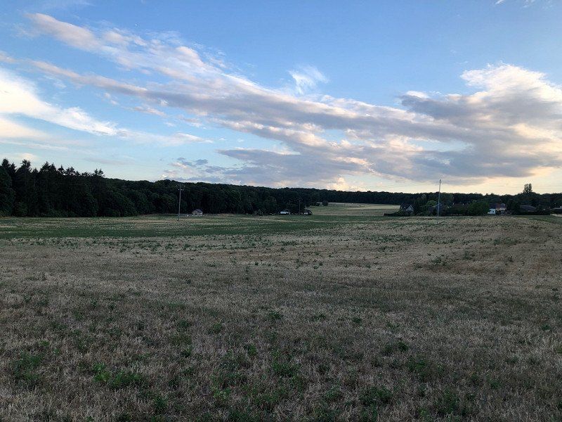
Our route through France (and Luxembourg), unfortunately somewhat shortened by forest fires.
Day
Münster, Deutschland
51° 57' 38.4" N 7° 37' 34.1" E
51.9606649 7.6261347
• Head toward Domplatz on Geisbergweg. Go for 102 m.
• Turn left onto Domplatz. Go for 137 m.
• Turn left onto Domplatz. Go for 61 m.
• Continue on Pferdegasse. Go for 91 m.
• Turn left onto Aegidiimarkt. Go for 53 m.
• Turn right onto Aegidiimarkt. Go for 32 m.
• Continue on Aegidiimarkt. Go for 452 m.
• Turn left onto Weseler Straße (K6). Go for 3.5 km.
• Continue on B51. Go for 2.6 km.
• Continue on A43. Go for 213 m.
• Take exit 2 toward Köln/Dortmund onto A1 (Hansalinie). Go for 164 km.
• Take exit 109 toward Trier/B51/Euskirchen onto A1. Go for 37.7 km.
• Take exit 114 toward Blankenheim/Dahlem/Trier onto B51. Go for 38.1 km.
• Take ramp onto B51/B410. Go for 7.2 km.
• Take the 2nd exit from roundabout onto B51 toward Luxemburg/A60/Trier/Bitburg/E42/Schloßheck. Go for 223 m.
• Take ramp onto A60 toward Luxembourg/Trier/Bitburg. Go for 18.9 km.
• Take exit 6 toward Luxembourg/Bitburg onto B51. Go for 9.6 km.
• Take ramp onto B257 toward Luxemburg/Echternach/Irrel. Go for 16.5 km.
• Keep left onto B257 toward Luxemburg/Echternach. Go for 2.3 km.
• Continue on N11a. Go for 183 m.
• Take the 4th exit from roundabout onto E29. Go for 197 m.
• Continue on N11b. Go for 231 m.
• Take the 4th exit from roundabout onto N10 toward Luxembourg/N11/Echternach. Go for 929 m.
• Continue on Rue des Remparts. Go for 749 m.
• Turn left onto Route de Luxembourg (N11) toward Luxembourg/Junglinster. Go for 13 m.
• Turn right onto Rue Maximilien (N10). Go for 1.6 km.
• Turn left onto Route de Berdorf (CR364) toward Berdorf/Mullerthal. Go for 937 m.
• Continue on CR364. Go for 2.4 km.
• Continue on Rue d'Echternach (CR364). Go for 1.0 km.
• Turn left onto Rue de Consdorf (CR137). Go for 266 m.
• Turn left. Go for 18 m.
• Arrive at your destination on the left.
☍
310,4 km
(3 hrs. 8 min.)
Day
Camping Belle-Vue 2000
2 nights with electricity approx. 50€
rue de Consdorf 29, 6551, Berdorf, Luxemburg
49° 49' 10.1" N 6° 20' 51.6" E
49.8194800 6.3476700
• Head southeast. Go for 25 m.
• Turn right toward Rue de Consdorf/CR137. Go for 86 m.
• Turn right onto Rue de Consdorf (CR137). Go for 363 m.
• Turn left onto Rue de Grundhof (CR364). Go for 1.0 km.
• Continue on CR364. Go for 3.1 km.
• Turn left onto CR121. Go for 3.9 km.
• Continue on Rue de l'Ernz Noire (CR121). Go for 165 m.
• Arrive at Rue de l'Ernz Noire (CR121). Your destination is on the right.
☍
8,7 km
( 9 min.)
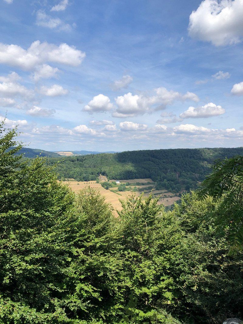
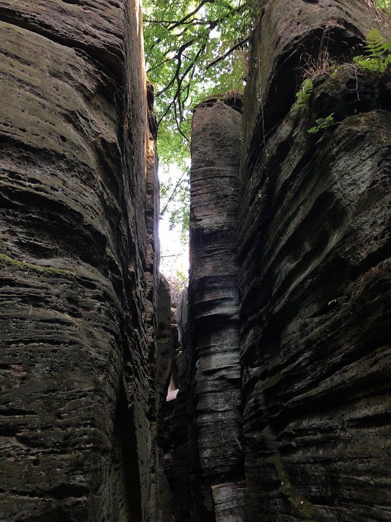
Müllerthal, Waldbillig, Luxemburg
49° 47' 25.3" N 6° 18' 26.9" E
49.7903622 6.3074713
• Head southwest on Rue de l'Ernz Noire (CR121).
• Turn right onto Rue des Rochers (CR356). Go for 538 m.
• Continue on CR356. Go for 1.1 km.
• Continue on Rue Michel Rodange (CR356). Go for 492 m.
• Turn left onto Rue de Christnach (CR128). Go for 106 m.
• Turn left onto Rue de Christnach (CR128). Go for 531 m.
• Continue on CR128. Go for 151 m.
• Continue on Am Lahr (CR128). Go for 537 m.
• Take the 2nd exit from roundabout onto Um Bierg (CR356). Go for 452 m.
• Continue on CR356. Go for 784 m.
• Continue on Freckeisen (CR356). Go for 650 m.
• Continue on CR356. Go for 888 m.
• Continue on Savelborn (CR356). Go for 277 m.
• Turn left onto Savelborn (CR358). Go for 65 m.
• Continue on CR358. Go for 2.4 km.
• Continue on Rue de Savelborn (CR358). Go for 746 m.
• Turn left onto Rue de Larochette (N14a). Go for 312 m.
• Continue toward N14a. Go for 28 m.
• Turn right onto N14. Go for 3.4 km.
• Turn left onto Medernacherstrooss (CR347). Go for 759 m.
• Continue on Haaptstrooss (CR347). Go for 268 m.
• Continue on Schierenerstrooss (CR347). Go for 435 m.
• Continue on CR347. Go for 4.8 km.
• Continue on Route de Stegen (CR347). Go for 310 m.
• Turn right onto Route de Luxembourg (N7). Go for 637 m.
• Continue on N7. Go for 134 m.
• Turn left onto N7. Go for 693 m.
• Take the 3rd exit from roundabout onto N15 toward Feulen/Wiltz/Bastogne. Go for 11.4 km.
• Take the 2nd exit from roundabout onto Haaptstrooss (N15) toward Wiltz/Bastogne. Go for 15.4 km.
• Take the 2nd exit from roundabout onto Bastnicherstrooss (N15) toward Doncols/Bastogne/Clervaux/Industrie-Komplex Lentzweiler/Industrie-Komplex Eselborn. Go for 497 m.
• Take the 2nd exit from roundabout onto N15. Go for 1.2 km.
• Keep left onto N15. Go for 1.4 km.
• Continue on Bras (N84). Go for 9.6 km.
• Take the 3rd exit from roundabout onto Chaussée d'Arlon (N30) toward E25/Zone Industrielle Bastogne. Go for 1.7 km.
• Take ramp onto N4 toward E25/Namur/Marche. Go for 75.4 km.
• Take ramp onto E411 toward Bruxelles/Namur/E42. Go for 14.9 km.
• Take the exit toward Mons/Charleroi onto E42. Go for 86.2 km.
• Keep right onto E42 toward Lille/Tournai. Go for 45.0 km.
• Continue on E42. Go for 331 m.
• Continue on A27. Go for 10.9 km.
• Continue on A22. Go for 740 m.
• Take the exit toward Calais/Dunkerque/Lille onto A1 (Autoroute du Nord). Go for 3.5 km.
• Continue on A25. Go for 62.5 km.
• Continue on N225. Go for 10.2 km.
• Take ramp onto A16 (Autoroute des Estuaires) toward Calais/Tunnel/S la Manche/Port de Dunkerque. Go for 42.9 km.
• Take exit 40 toward Peuplingues onto D215. Go for 420 m.
• Continue on Route d'Escalles (D243 E3). Go for 974 m.
• Turn right onto Rue du Moulin. Go for 153 m.
• Continue on Rue du Moulin. Go for 1.1 km.
• Arrive at your destination.
☍
418,0 km
(4 hrs. 10 min.)
Day
Camping des Noires Mottes
2 nights with electricity approx. 50€
62231, Sangatte, Frankreich
50° 55' 31" N 1° 46' 50.7" E
50.9252800 1.7807400
• Head toward Impasse du Moulin. Go for 132 m.
• Continue on Rue du Moulin. Go for 1.1 km.
• Turn right onto Route d'Escalles (D243 E3). Go for 545 m.
• Take the 1st exit from roundabout onto Route d'Escalles (D243) toward Sangatte/Escalles. Go for 1.6 km.
• Continue on D243. Go for 961 m.
• Continue on La Haute Escalles (D243). Go for 306 m.
• Continue on Route de Peuplingues (D243). Go for 829 m.
• Continue on Rue de la Mer (D243). Go for 19 m.
• Turn left onto Rue de la Mer (D940) toward Wissant/Maison du Site des Deux-Caps/Cap Gris-Nez. Go for 169 m.
• Turn right onto Rue de la Mer. Go for 495 m.
• Arrive at Rue de la Mer.
☍
6,2 km
( 10 min.)
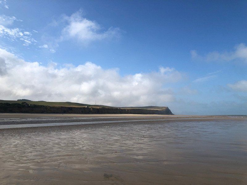
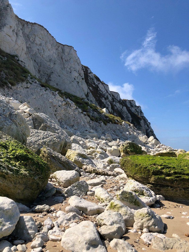
Cap Blanc-Nez, Escalles, Frankreich
50° 55' 31.5" N 1° 42' 24.9" E
50.9254190 1.7069230
• Head southeast on Rue de la Mer. Go for 327 m.
• Turn right toward D940. Go for 124 m.
• Turn left onto D940. Go for 307 m.
• Turn right onto Rue de la Mer (D243). Go for 19 m.
• Continue on Route de Peuplingues (D243). Go for 829 m.
• Continue on Rue de Peuplingues (D243). Go for 306 m.
• Continue on D243. Go for 961 m.
• Continue on Route d'Escalles (D243). Go for 1.6 km.
• Take the 1st exit from roundabout onto Route de Bonningues (D243) toward A16/(Boulogne)/Marquise/Boulogne/Bonningues. Go for 1.2 km.
• Continue on D243. Go for 210 m.
• Turn right and take ramp onto A16 (Autoroute des Estuaires) toward Marquise/Boulogne. Go for 95.6 km.
• Take exit 23 toward Abbeville-Centre/Le Havre/Rouen/Eu/Le Tréport onto E402 (Autoroute des Estuaires). Go for 1.1 km.
• Take the exit toward Le Tréport/Rouen/Le Havre/St Valéry S/S/Le Crotoy onto A28 (Autoroute des Estuaires). Go for 73.7 km.
• Keep right onto A29 toward Le Havre/Caen. Go for 83.8 km.
• Continue on N1029. Go for 7.1 km.
• Keep left onto A29 toward Deauville/Trouville/Caen. Go for 16.0 km.
• Take the exit toward Lisieux/Caen onto A13 (Autoroute de Normandie). Go for 51.2 km.
• Take the exit onto N814 (Périphérique). Go for 10.5 km.
• Keep left onto N13 toward Bessin/Cherbourg/Bayeux/Aéroport Carpiquet. Go for 94.4 km.
• Take ramp onto Route de Montebourg (D974) toward Valognes/Aéroport Quettehou/Aéroport Maupertus. Go for 833 m.
• Pass 4 roundabouts and continue on Boulevard Division Leclerc (D974). Go for 1.5 km.
• Take the 1st exit from roundabout onto Rue de Poterie (D902). Go for 126 m.
• Take the 2nd exit from roundabout onto Rue de Poterie (D902). Go for 798 m.
• Turn left onto Route de Saint-Pierre (D24). Go for 16.0 km.
• Turn right onto Route du Hamel Ès Ronches (D901). Go for 1.1 km.
• Turn left onto D612. Go for 993 m.
• Continue on Rue de la Carneville (D612). Go for 292 m.
• Continue on D612. Go for 1.1 km.
• Continue on Lieu-dit Les Landes (D612). Go for 77 m.
• Continue on D612. Go for 84 m.
• Continue on Clos de Haut du Nord (D612). Go for 56 m.
• Continue on Lieu-dit La Brasserie (D612). Go for 41 m.
• Continue on Hameau de la Brosserie (D612). Go for 243 m.
• Continue on D612. Go for 353 m.
• Continue on Lieu-dit Le Sapin (D612). Go for 115 m.
• Continue on D612. Go for 31 m.
• Continue on Route de Carneville (D612). Go for 1.0 km.
• Continue on Village Les Aubiers (D116). Go for 194 m.
• Continue on Village Le Tôt de Haut (D116). Go for 140 m.
• Continue on D116. Go for 54 m.
• Continue on Village Le Tôt de Haut (D116). Go for 175 m.
• Continue on D116. Go for 174 m.
• Continue on Village La Vallée des Moulins (D116). Go for 508 m.
• Continue on D116. Go for 157 m.
• Continue on Village Inthéville (D116). Go for 809 m.
• Continue on Village Fréval (D116). Go for 61 m.
• Turn left onto Lieu-dit Fréval. Go for 14 m.
• Arrive at Lieu-dit Fréval.
☍
466,4 km
(4 hrs. 22 min.)
Day
Camping de la Plage
2 nights around 50€
2, village Fréval, 50840, FERMANVILLE, Frankreich
49° 41' 29.6" N 1° 26' 16.7" W
49.6915578 -1.4379671
• Head toward Village Fréval on Lieu-dit Fréval. Go for 14 m.
• Turn right onto Village Fréval (D116). Go for 61 m.
• Continue on Village Inthéville (D116). Go for 809 m.
• Continue on D116. Go for 157 m.
• Continue on Village La Vallée des Moulins (D116). Go for 508 m.
• Continue on D116. Go for 174 m.
• Continue on Village Le Tôt de Haut (D116). Go for 175 m.
• Continue on D116. Go for 54 m.
• Continue on Village Le Tôt de Haut (D116). Go for 140 m.
• Continue on Village Les Aubiers (D116). Go for 571 m.
• Turn left onto Village Le Planitre. Go for 106 m.
• Turn right onto Lieu-dit Le Planitre. Go for 71 m.
• Turn left onto Village Le Planitre. Go for 45 m.
• Turn right onto Route du Bruley. Go for 566 m.
• Arrive at Route du Bruley. Your destination is on the right.
☍
3,5 km
( 5 min.)
Fermanville, Frankreich
49° 40' 36.3" N 1° 28' 5.4" W
49.6767516 -1.4681692
• Head southwest on Route du Bruley. Go for 289 m.
• Turn right onto Village Le Pied Sablon. Go for 397 m.
• Turn right onto Village Le Pied Sablon (D116). Go for 812 m.
• Continue on Village Le Planitre (D116). Go for 160 m.
• Continue on Village Le Mont Tereire (D116). Go for 464 m.
• Turn right onto Route de Carneville (D612). Go for 1.0 km.
• Continue on D612. Go for 31 m.
• Continue on Lieu-dit Le Sapin (D612). Go for 115 m.
• Continue on D612. Go for 353 m.
• Continue on Hameau de la Brosserie (D612). Go for 243 m.
• Continue on Lieu-dit La Brasserie (D612). Go for 41 m.
• Continue on Clos de Haut du Nord (D612). Go for 56 m.
• Continue on D612. Go for 84 m.
• Continue on Lieu-dit Les Landes (D612). Go for 77 m.
• Continue on D612. Go for 1.1 km.
• Continue on Lieu-dit La Rue (D612). Go for 292 m.
• Continue on D612. Go for 954 m.
• Turn right onto Route du Hamel Ès Ronches (D901). Go for 1.2 km.
• Turn left onto Route de la Filature (D24). Go for 16.0 km.
• Turn right onto Rue de Poterie (D902). Go for 780 m.
• Take the 2nd exit from roundabout onto Rue Villault Duchesnois (D902). Go for 116 m.
• Take the 4th exit from roundabout onto Boulevard Division Leclerc (D974). Go for 106 m.
• Pass 5 roundabouts and continue on Route de Montebourg (D974). Go for 2.0 km.
• Take ramp onto N13. Go for 31.8 km.
• Take ramp onto N174 toward Rennes/Le Mont St Michel/Saint Lô/St Jean de Daye. Go for 48.7 km.
• Take the 1st exit from roundabout onto A84 toward Rennes/Villedieu les Poêles. Go for 44.7 km.
• Continue on N175. Go for 10.6 km.
• Take ramp onto N175 toward St Brieuc/St Malo/Le Mont-St Michel/Pontorson. Go for 2.1 km.
• Take ramp onto Lieu-dit La Chaussée (D43) toward Courtils. Go for 7.1 km.
• Continue on D275. Go for 3.6 km.
• Turn left onto Chemin des Dits. Go for 124 m.
• Turn right. Go for 630 m.
• Turn right toward D275. Go for 78 m.
• Turn right onto D275. Go for 246 m.
• Turn left onto Route de la Cote. Go for 353 m.
• Continue on Lieu-dit La Jacotière. Go for 88 m.
• Continue on Lieu-dit Le Bas Pays. Go for 367 m.
• Turn right onto Route du Mont-Saint-Michel. Go for 2.5 km.
• Turn left onto Montée aux Poulains. Go for 261 m.
• Arrive at Montée aux Poulains. Your destination is on the left.
☍
179,8 km
(2 hrs. 5 min.)
Day
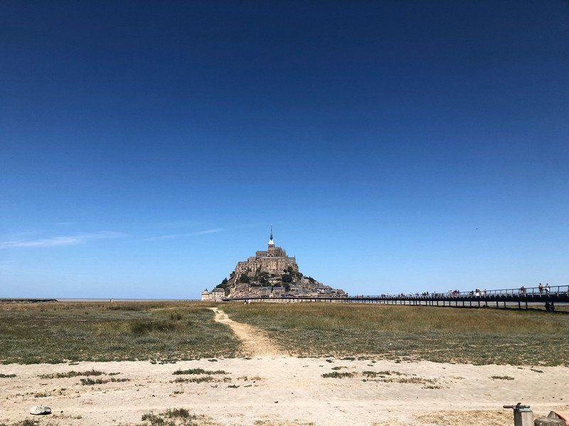
Le Mont-Saint-Michel, Frankreich
50170 Le Mont-Saint-Michel, Frankreich
48° 38' 9.8" N 1° 30' 41.2" W
48.6360630 -1.5114570
• Head west on Montée aux Poulains. Go for 261 m.
• Turn right toward Route du Mont-Saint-Michel. Go for 104 m.
• Continue on Route du Mont-Saint-Michel. Go for 2.6 km.
• Turn left onto Lieu-dit Le Bas Pays. Go for 178 m.
• Turn sharp right toward D776. Go for 443 m.
• Turn left onto D776. Go for 272 m.
• Turn right toward Rue au Bis. Go for 40 m.
• Continue on Rue au Bis. Go for 1.1 km.
• Turn left onto Rue Maurice Desfeux. Go for 59 m.
• Turn slightly right onto Rue Maurice Desfeux. Go for 229 m.
• Turn left onto Rue de Grandelle (D80). Go for 427 m.
• Continue on D80. Go for 587 m.
• Continue on Route de la Baie (D80). Go for 987 m.
• Continue on Rue de Beau Seuil (D80). Go for 216 m.
• Continue on Rue de la Forge (D80). Go for 325 m.
• Continue on D80. Go for 991 m.
• Continue on Rue de la Saint-Côme (D80). Go for 979 m.
• Take the 1st exit from roundabout onto Rue d'Enfer. Go for 254 m.
• Turn right onto Route Nationale (N175). Go for 2.6 km.
• Keep left onto N176. Go for 76.8 km.
• Take ramp onto N12. Go for 28.2 km.
• Keep left onto N12 toward St Brieuc-Centre/Brest/Plérin/Port de St Brieuc-le Légué. Go for 974 m.
• Keep left onto Avenue de France (N12) toward Lannion/Morlaix/Brest/Plérin/Aéroport St Brieuc-Armor. Go for 38.3 km.
• Take ramp toward Kernilien/Lannion/Tréguier/Bégard. Go for 249 m.
• Take the 2nd exit from roundabout onto D767 toward Lannion/Perros-Guirec/Bégard/Tréguier. Go for 25.8 km.
• Take the 2nd exit from Rond-Point Kroafhent-Tro Boutilh roundabout onto D767 toward Tréguier/Perros-Guirec/Trégastel. Go for 1.3 km.
• Take the 2nd exit from roundabout onto Rue de Saint-Marc (D786). Go for 778 m.
• Turn left onto Route Kermaria Sulard (D31). Go for 2.6 km.
• Continue on D31. Go for 283 m.
• Continue on Lieu-dit Poul an Deyer (D31). Go for 87 m.
• Continue on D31. Go for 491 m.
• Continue on Lieu-dit Croaz Dibenn (D31). Go for 55 m.
• Continue on D31. Go for 462 m.
• Continue on Lieu-dit Guern Vunut (D31). Go for 149 m.
• Continue on D31. Go for 166 m.
• Continue on Lieu-dit Poul Ar Ranet (D31). Go for 160 m.
• Continue on D31. Go for 577 m.
• Continue on Route de l'Annion (D31). Go for 762 m.
• Continue on Rue de la Croix Pavée (D31). Go for 276 m.
• Continue on Rue de la Croix Blanche (D31). Go for 68 m.
• Take the 3rd exit from roundabout onto Route de Perros-Guirec (D6). Go for 412 m.
• Turn right onto Route de Trélévern (D73). Go for 758 m.
• Continue on D73. Go for 759 m.
• Continue on Lieu-dit Launay (D73). Go for 85 m.
• Continue on D73. Go for 687 m.
• Continue on Route de Kermaria Sulard (D73). Go for 1.1 km.
• Continue on Lieu-dit Men Guen (D73). Go for 125 m.
• Continue on D73. Go for 98 m.
• Continue on Rue de Toul Ar Harr (D73). Go for 424 m.
• Turn right onto Rue de Lopereg (D38). Go for 269 m.
• Continue on Rue de Pont-Salaün (D38). Go for 331 m.
• Continue on Rue des Écoles (D38). Go for 415 m.
• Turn left onto Rue de la Mairie (D38). Go for 463 m.
• Turn left onto Rue de Ker-Awel. Go for 156 m.
• Turn left onto Rue de Ker-Awel. Go for 37 m.
• Arrive at Rue de Ker-Awel. Your destination is on the left.
☍
197,4 km
(2 hrs. 13 min.)
Camping Les Macareux, Rue de Ker Awell, Trévou-Tréguignec, Frankreich
2 nights approx. 38€
18 Rue de Ker Awell, 22660 Trévou-Tréguignec, Frankreich
48° 49' 0.2" N 3° 21' 38.2" W
48.8167112 -3.3605986
• Head northeast on Rue de Ker-Awel. Go for 37 m.
• Turn right onto Rue de Ker-Awel. Go for 107 m.
• Turn right toward Rue de la Mairie/D38. Go for 161 m.
• Turn left onto Rue de la Mairie (D38). Go for 115 m.
• Continue on Rue de Trestel (D38). Go for 673 m.
• Turn right onto Rue de Trestel. Go for 22 m.
• Arrive at Rue de Trestel. Your destination is on the right.
☍
1,1 km
( 2 min.)
Trestel, Trévou-Tréguignec, Frankreich
Trestel, 22660 Trévou-Tréguignec, Frankreich
48° 49' 9.9" N 3° 21' 17.1" W
48.8194060 -3.3547570
• Head northwest on Rue de Trestel. Go for 22 m.
• Turn right onto Rue de Trestel (D38). Go for 985 m.
• Turn left onto Rue du Royau (D70). Go for 730 m.
• Turn right onto Rue du Royau. Go for 48 m.
• Arrive at Rue du Royau. Your destination is on the right.
☍
1,8 km
( 3 min.)
Day
Le Bricon Guyomard Simone, Rue du Royau, Trévou-Tréguignec, Frankreich
1 night about 19€
68 Rue du Royau, 22660 Trévou-Tréguignec, Frankreich
48° 49' 39.1" N 3° 20' 28.4" W
48.8275223 -3.3412219
• Head east on Rue du Royau. Go for 107 m.
• Turn left onto Rue du Royau (D70). Go for 882 m.
• Turn slightly right onto Rue de Tréguier (D70). Go for 2.0 km.
• Continue on D70. Go for 313 m.
• Continue on Lieu-dit Landébédan (D70). Go for 84 m.
• Continue on Lieu-dit Landebeden (D70). Go for 92 m.
• Continue on D70. Go for 109 m.
• Continue on Lieu-dit Ty Glass (D70). Go for 199 m.
• Continue on D70. Go for 724 m.
• Continue on Lieu-dit Croas Quijou (D70). Go for 89 m.
• Continue on D70. Go for 74 m.
• Turn right onto D31. Go for 677 m.
• Continue on Lieu-dit Saint-Nicolas (D31). Go for 1.1 km.
• Take the 3rd exit from roundabout onto Lieu-dit Saint-Nicolas (D31). Go for 426 m.
• Continue on D31. Go for 305 m.
• Continue on Lieu-dit Convenant Kernec (D31). Go for 115 m.
• Continue on D31. Go for 820 m.
• Continue on Route de Penvénan (D31). Go for 1.5 km.
• Take the 2nd exit from roundabout onto Rue de la Croix Blanche (D31). Go for 113 m.
• Continue on Rue de la Croix Pavée (D31). Go for 276 m.
• Continue on Route de l'Annion (D31). Go for 762 m.
• Continue on D31. Go for 577 m.
• Continue on Lieu-dit Poul Ar Ranet (D31). Go for 160 m.
• Continue on D31. Go for 166 m.
• Continue on Lieu-dit Guern Vunut (D31). Go for 149 m.
• Continue on D31. Go for 462 m.
• Continue on Lieu-dit Croaz Dibenn (D31). Go for 55 m.
• Continue on D31. Go for 491 m.
• Continue on Lieu-dit Poul an Deyer (D31). Go for 87 m.
• Continue on D31. Go for 283 m.
• Continue on Route Kermaria Sulard (D31). Go for 2.6 km.
• Turn right onto Route de Tréguier (D786). Go for 727 m.
• Take the 3rd exit from roundabout onto Route de Perros (D767). Go for 1.4 km.
• Take the 3rd exit from Rond-Point Kroafhent-Tro Boutilh roundabout onto Route de Guingamp (D767) toward St Brieuc/Guingamp/Caouënnec-Lanvézéac/Rospez/Buhulien. Go for 25.8 km.
• Take the 2nd exit from roundabout onto N12 toward St Brieuc/Guingamp-Centre. Go for 67.0 km.
• Take ramp onto N176 toward Dinan/St Malo/Caen/Jugon les Lacs. Go for 77.9 km.
• Continue on N175. Go for 12.7 km.
• Take ramp onto N175. Go for 8.3 km.
• Take ramp onto D673 toward Granville. Go for 516 m.
• Take the 2nd exit from roundabout toward Cherbourg/Sartilly/Jullouville/Granville. Go for 124 m.
• Continue on Avenue des Réfractaires et Maquisards (D673). Go for 560 m.
• Take the 2nd exit from roundabout onto Route de Granville (D673) toward Sartilly/Granville/Cherbourg. Go for 2.1 km.
• Take the 3rd exit from roundabout onto Lieu-dit La Moinerie (D973) toward Granville/Sartilly. Go for 3.4 km.
• Pass 3 roundabouts and continue on D973. Go for 9.0 km.
• Take the 3rd exit from roundabout onto Route de Bouillon (D109) toward Bouillon/Jullouville. Go for 822 m.
• Continue on Lieu-dit La Pichardière (D109). Go for 131 m.
• Continue on Route de Bouillon (D109). Go for 402 m.
• Continue on D109. Go for 750 m.
• Continue on Route du Mesnil-Grimeult (D109). Go for 304 m.
• Turn right onto Route de Saint-Pair (D21). Go for 295 m.
• Continue on Route du Chesnay (D21). Go for 2.1 km.
• Turn right onto Route du Chesnay. Go for 77 m.
• Arrive at Route du Chesnay. Your destination is on the left.
☍
230,3 km
(2 hrs. 27 min.)
Day
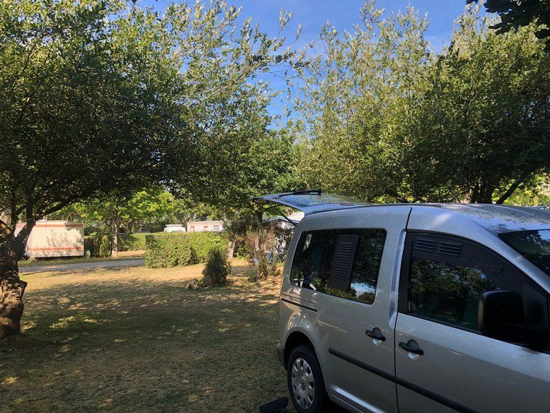
Camping La Mariennee
3 nights approx. 72€
50380, St Pair Sur Mer, Frankreich
48° 48' 5.4" N 1° 32' 33.7" W
48.8015000 -1.5427000
• Head north on Route du Chesnay.
• Turn right onto Route du Chesnay. Go for 43 m.
• Turn right onto Route du Chesnay. Go for 72 m.
• Turn right onto Route du Chesnay (D21). Go for 544 m.
• Take the 1st exit from roundabout onto Route de la Lande (D373). Go for 781 m.
• Take the 2nd exit from roundabout onto D373. Go for 278 m.
• Take the 3rd exit from roundabout onto Route Nationale (D973) toward Granville/Cherbourg. Go for 764 m.
• Take the 1st exit from roundabout onto Route Nationale (D973) toward Cherbourg/Granville. Go for 901 m.
• Take the 1st exit from roundabout toward Cherbourg/Coutances/Villedieu les P. Go for 199 m.
• Continue on D971. Go for 1.9 km.
• Take ramp toward Granville/Villedieu les P. Go for 243 m.
• Turn right onto Route de Villedieu (D924). Go for 318 m.
• Pass 2 roundabouts and continue on Lieu-dit Le Scion (D924). Go for 21.5 km.
• Take the 3rd exit from roundabout onto D924 toward Caen/A84/Villedieu les Poêles/Gavray/Coutances. Go for 181 m.
• Take the 2nd exit from roundabout onto A84 toward Caen. Go for 73.1 km.
• Take the exit toward Paris/Alençon/Flers/Caen-Centre onto N814 (Périphérique). Go for 12.7 km.
• Take ramp onto A13 (Autoroute de Normandie) toward A13 (A813)/Deauville/Trouville/Le Havre/Rouen/Paris. Go for 50.3 km.
• Take the exit toward Le Havre/Amiens/Calais/Honfleur/Pont de Normandie onto A29. Go for 18.0 km.
• Continue on N1029. Go for 7.1 km.
• Continue on A29. Go for 84.2 km.
• Continue on A28. Go for 20.2 km.
• Take the exit toward Reims/Lille/Amiens onto A29. Go for 58.6 km.
• Take the exit toward Reims/Lille/Paris/Amiens-Sud onto A16 (L'Européenne). Go for 3.9 km.
• Take the exit toward Reims/Lille/Paris-Est/A1/Amiens-Sud onto E44. Go for 1.1 km.
• Continue on A29. Go for 10.2 km.
• Take the exit toward Paris/Lille/Reims/St Quentin onto A29. Go for 32.7 km.
• Take the exit toward Paris/Lille/Bruxelles/Péronne. Go for 1.9 km.
• Take the left exit toward Lille/Calais/Bruxelles/Péronne onto A1 (Autoroute du Nord). Go for 19.6 km.
• Keep right onto A2 toward Cambrai/Valenciennes/Bruxelles/Liège. Go for 77.1 km.
• Continue on E19. Go for 37.0 km.
• Keep right onto E42 toward Liège/Charleroi/La Louvière/Garocentre Sud/Magnapark. Go for 104 km.
• Continue on E40. Go for 11.6 km.
• Take the exit toward Maastricht onto E25. Go for 9.6 km.
• Continue on A2. Go for 46.0 km.
• Take the exit toward Nijmegen/Venlo/Roermond onto A73 (Knooppunt Het Vonderen). Go for 39.2 km.
• Take exit 12+13 toward Duisburg onto A67. Go for 8.1 km.
• Continue on A40. Go for 27.8 km.
• Take exit 8 toward Nijmegen/Oberhausen onto A57. Go for 6.6 km.
• Take exit 8 toward Dortmund/Oberhausen onto A42. Go for 17.5 km.
• Take exit 8 toward Arnheim/Hannover onto A3. Go for 6.3 km.
• Continue on A2 toward Hannover/Emden/Dreieck/Bottrop. Go for 10.8 km.
• Take exit 5 toward Gladbeck/Marl. Go for 970 m.
• Continue on Essener Straße (B224). Go for 23.2 km.
• Take the exit toward Münster onto A43. Go for 42.9 km.
• Continue on B51. Go for 2.8 km.
• Keep left onto B54. Go for 3.3 km.
• Turn right onto Aegidiistraße. Go for 452 m.
• Continue on Aegidiistraße. Go for 32 m.
• Turn left onto Aegidiimarkt. Go for 53 m.
• Turn right onto Pferdegasse. Go for 91 m.
• Continue on Domplatz. Go for 61 m.
• Turn right onto Domplatz. Go for 137 m.
• Turn right onto Geisbergweg. Go for 102 m.
• Arrive at Geisbergweg. Your destination is on the left.
☍
897,4 km
(8 hrs. 4 min.)
Day
Münster, Deutschland
51° 57' 38.4" N 7° 37' 34.1" E
51.9606649 7.6261347