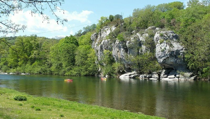
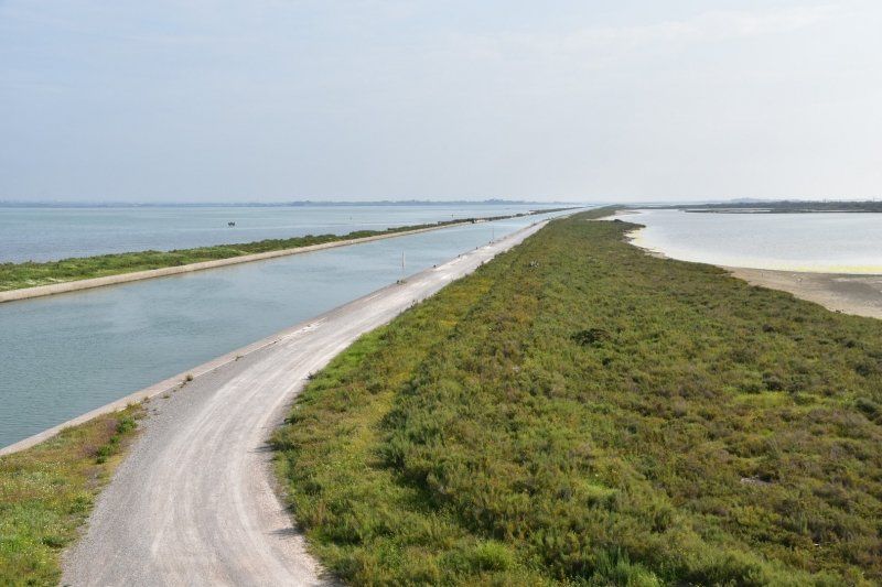
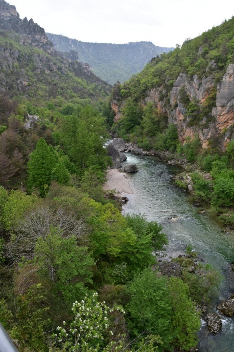
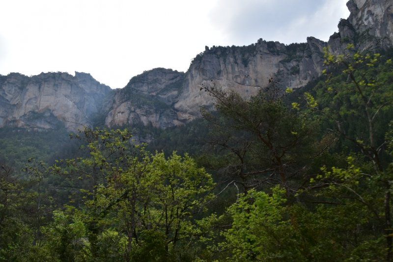
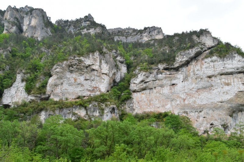
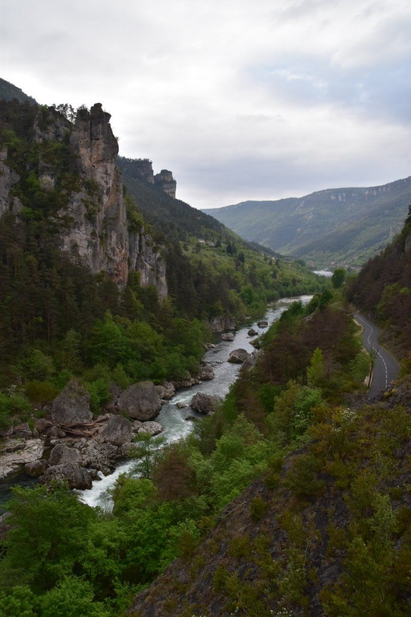
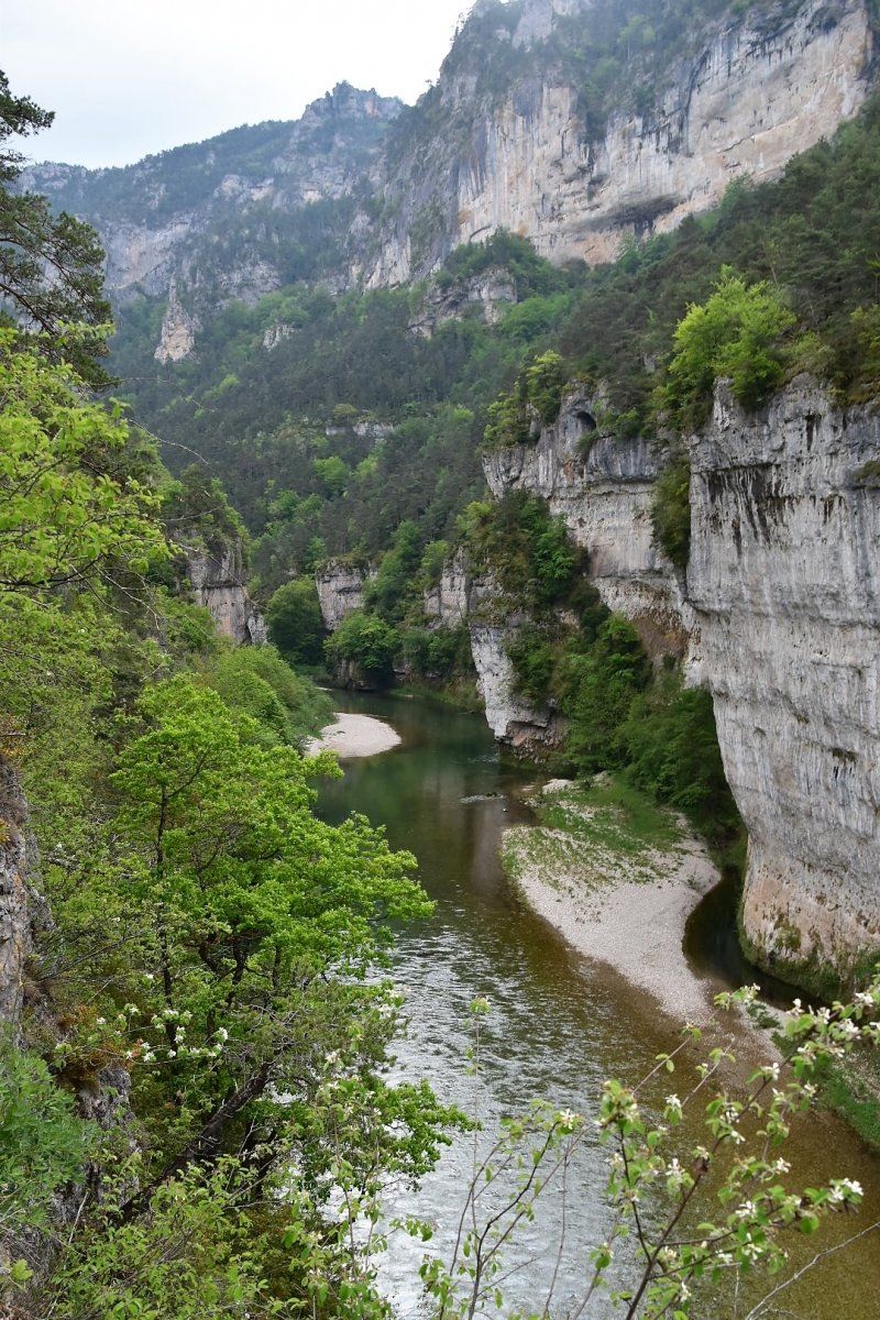
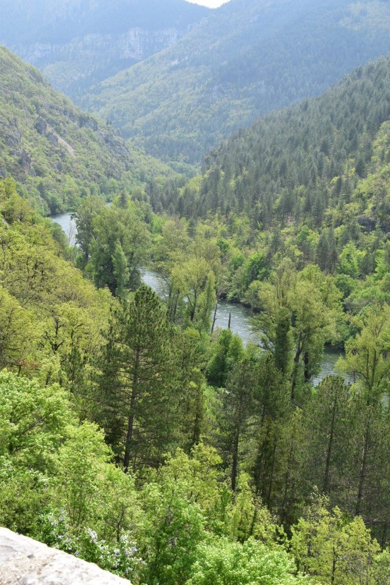
Back to France. The goal is the high plateau of the Cevennes and the Gorges du Tarn. The Tarn has eaten up to 500 meters deep into the Cevennes. There are both steep-sided bottlenecks, such as the Pas de Soucis rocky rock, and wide basins such as the Cirque des Baumes with its colorful rock faces.
Day
Sissach, Schweiz
46° 12' 15.8" N 6° 8' 35.4" E
46.2043907 6.1431577
• Head toward Quai de l'Ile on Pont de l'Ile. Go for 148 m.
• Turn left onto Quai Turrettini. Go for 37 m.
• Turn slightly right onto Rue du Temple. Go for 213 m.
• Turn left onto Rue Albert-Richard. Go for 139 m.
• Continue on Rue du Mandement. Go for 63 m.
• Continue on Rue de Saint-Jean. Go for 243 m.
• Turn left onto Rue de Sous-Terre. Go for 341 m.
• Continue on Pont de Sous-Terre. Go for 79 m.
• Continue on Rue des Deux-Ponts. Go for 374 m.
• Continue on Pont de Saint-Georges. Go for 66 m.
• Keep left onto Pont de Saint-Georges. Go for 43 m.
• Continue on Route des Jeunes. Go for 290 m.
• Keep right onto Voie Centrale toward Carouge/La Praille/Ports Francs. Go for 1.2 km.
• Keep left onto Voie Centrale toward France/E25/Perly/E62/Lausanne/A1/Aéroport/A1a. Go for 142 m.
• Continue on A1a. Go for 3.9 km.
• Take exit 2 toward France onto A1 (Perly). Go for 2.2 km.
• Continue on A41. Go for 1.1 km.
• Take the exit toward Paris/Lyon onto A40 (Autoroute Blanche). Go for 78.4 km.
• Take the exit onto A40. Go for 10.4 km.
• Take exit 7 toward Bourg-Sud/A42/Genève/Lyon/Aéroport Saint Exupéry. Go for 1.1 km.
• Make a U-Turn. Go for 153 m.
• Take ramp onto A40 toward A42/Genève/Lyon/Aéroport Saint Exupéry. Go for 10.0 km.
• Continue on A42 toward Grenoble/Chambéry/Lyon/Aéroport Saint-Exupéry. Go for 1.6 km.
• Arrive at A42. Your destination is on the right.
☍
112,3 km
(1 hrs. 12 min.)
über Genf und A40/A42 nach Lyon, Frankreich
E611, 01160 Pont-d'Ain, Frankreich
46° 3' 47.2" N 5° 19' 42.1" E
46.0631072 5.3283691
• Head south on A42. Go for 47.3 km.
• Take the left exit toward Marseille/Grenoble/Lyon/N346 onto A42. Go for 990 m.
• Take the left exit toward Marseille/Grenoble onto N346 (Échangeur Rocade Est). Go for 14.0 km.
• Keep left onto A46 toward Marseille/St Étienne/Z.I. Lyon Sud-Est. Go for 16.8 km.
• Take exit 16 toward Ternay/Communay. Go for 380 m.
• Take the 4th exit from roundabout onto D307 toward Chuzelles/Vienne. Go for 497 m.
• Take the 2nd exit from roundabout onto D307 toward N7/Vienne/Seyssuel/Chuzelles. Go for 7.1 km.
• Arrive at Avenue Marcellin Berthelot (N7). Your destination is on the right.
☍
87,1 km
( 52 min.)
Vienne, Parking Place Joseph Muray et Jean Tardy
April 23, 2018: First stop in Vienne on the Rhone. Parking space is part of a public car park. No infrastructure, but quiet and free at night. Vienne has an old town center and Roman remains. Large river cruise ships anchor on the Rhone, even from Switzerland.
Avenue Marcellin Berthelot, 38200, Vienne, Frankrijk
45° 32' 18" N 4° 52' 19" E
45.5383333 4.8719444
• Head southeast on Avenue Marcellin Berthelot (N7). Go for 301 m.
• Take the 1st exit from roundabout onto Avenue Marcellin Berthelot (N7) toward A7 Marseille/Vienne Centre Ville. Go for 229 m.
• Turn left onto Quai Pajot (N7) toward Marseille/A7/Valence/Vienne-Centre. Go for 720 m.
• Turn right onto Quai Pajot (N7). Go for 793 m.
• Continue on Boulevard du Rhône Sud (N7) toward A7 (Marseille)/Valence/Reventin-Vaugris/Condrieu/Roussillon. Go for 1.6 km.
• Pass 2 roundabouts and continue on N7. Go for 1.7 km.
• Take ramp toward A7 (Marseille)/Valence/Ampuis/Condrieu/Z.I. Vaugris. Go for 473 m.
• Take left ramp onto A7 (Autoroute du Soleil) toward Valence/Marseille. Go for 88.4 km.
• Take exit 16 toward Privas/La Voulte/Livron/Loriol. Go for 727 m.
• Take the 1st exit from roundabout onto Lieu-dit Maison Soulier (D104 N) toward Privas/Le Pouzin/La Voulte S/R./Parc Industriel Rhône Vallée. Go for 1.8 km.
• Continue on D104. Go for 552 m.
• Take the 2nd exit from roundabout onto Route de Loriol (D104) toward Privas/Le Pouzin/La Voulte S/R. Go for 845 m.
• Turn right onto Quai René Révollat (D86). Go for 186 m.
• Take the 1st exit from roundabout onto Avenue Marcel Nicolas (D104) toward Aubenas/Privas/St Julien en St Alban/Rompon. Go for 13.9 km.
• Take the 2nd exit from roundabout onto Cours du Palais (D104). Go for 248 m.
• Pass 2 roundabouts and continue on D104. Go for 26.8 km.
• Take the 1st exit from roundabout onto Route de Montélimar (N102) toward Vals les Bains. Go for 390 m.
• Take the 3rd exit from roundabout onto Route de Montélimar toward Aubenas. Go for 284 m.
• Take the 2nd exit from roundabout onto Route de Montélimar toward St Étienne de Fontbellon. Go for 669 m.
• Turn right onto Avenue de Bois Vignal. Go for 484 m.
• Take the 2nd exit from Rond-Point des Écoles roundabout onto Boulevard Camille Laprade. Go for 172 m.
• Turn left onto Avenue Victor Hugo. Go for 150 m.
• Turn right onto Rue Charles Demars. Go for 119 m.
• Keep right onto Rue Charles Demars toward Vals les Bains/Le Puy/Mende. Go for 11 m.
• Continue on Route de Vals (D104). Go for 151 m.
• Turn left onto Rampe du Château. Go for 49 m.
• Arrive at Rampe du Château. Your destination is on the right.
☍
141,7 km
(1 hrs. 46 min.)
Day
Aubenas, Frankreich
44° 37' 15.3" N 4° 23' 23.5" E
44.6209090 4.3898630
• Head toward Route de Vals on Rampe du Château. Go for 49 m.
• Turn right onto Route de Vals (D104). Go for 151 m.
• Turn right onto Boulevard Gambetta (D104). Go for 367 m.
• Turn slightly right onto Place Général de Gaulle (D104). Go for 82 m.
• Take the 2nd exit from Boulevard de Vernon roundabout onto Boulevard Jean Mathon (D104). Go for 1.3 km.
• Pass 12 roundabouts and continue on Route Dales (D104). Go for 32.7 km.
• Turn right onto D252 toward Casteljau. Go for 1.8 km.
• Turn left onto Voie de Casteljau à Berrias. Go for 899 m.
• Turn right onto Chemin des Granges. Go for 225 m.
• Turn right onto Lieu-dit Les Granges. Go for 692 m.
• Arrive at your destination.
☍
38,3 km
( 41 min.)
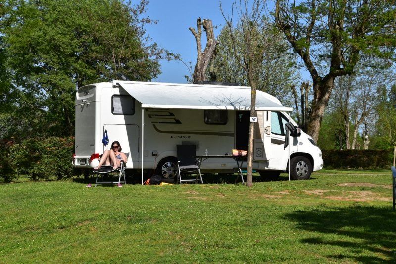
Camping Mazet Plage, Berrias-et-Casteljau, Frankreich
Der Camping Mazet Plage liegt direkt am Fluss Chassezac. Heisser Sommertag im April! Abkühlung im Pool.
44° 23' 17.7" N 4° 12' 9.3" E
44.3882517 4.2025859
• Head toward Chemin des Granges. Go for 593 m.
• Continue on Lieu-dit Les Granges. Go for 99 m.
• Turn right onto Lieu-dit Les Granges. Go for 61 m.
• Continue on Chemin des Granges. Go for 125 m.
• Turn right onto Voie de Casteljau à Berrias. Go for 214 m.
• Turn slightly left onto Voie de la Rouvière à Berrias. Go for 652 m.
• Turn left onto D202. Go for 127 m.
• Turn slightly right onto D202. Go for 25 m.
• Turn right onto Route d'Ales (D104) toward St Ambroix/St Paul le Jeune. Go for 5.1 km.
• Continue on D901 toward Alès/St Ambroix/St Paul le Jeune. Go for 5.1 km.
• Continue on D904. Go for 504 m.
• Take the 2nd exit from roundabout onto D904 toward Alès/St Ambroix/St Brès. Go for 7.4 km.
• Arrive at Boulevard du Portalet (D904). Your destination is on the right.
☍
20,1 km
( 22 min.)
Day
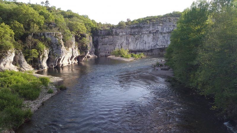
Gorge de Chassezac
25.4.2018: Wanderung im Bois de Paiolive (Steineichenwald) entlang der Gorge de Chassezac.
Day
Saint-Ambroix, Frankreich
In den Cevennen soll es sehr kalt werden; darum fahren wir zuerst nach Süden Richtung Meer.
44° 15' 36.4" N 4° 11' 47.1" E
44.2601020 4.1964200
• Head toward Rue de l'Esplanade on Boulevard du Portalet (D904). Go for 2.5 km.
• Turn left onto Traverse du Moulinet (D437) toward Lussan/Potelières/Le Moulinet. Go for 1.0 km.
• Continue on D437. Go for 38 m.
• Continue on Traverse du Moulinet (D437). Go for 564 m.
• Turn right onto Route de Potelières (D37). Go for 5.9 km.
• Turn left onto D16. Go for 168 m.
• Take the 2nd exit from roundabout onto D37. Go for 12.7 km.
• Turn right onto D979. Go for 1.1 km.
• Pass 4 roundabouts and continue on Route de Saint-Ambroix (D979). Go for 17.0 km.
• Turn left onto Rue Dhuoda. Go for 302 m.
• Continue on Rue Saint-Firmin. Go for 193 m.
• Turn right onto Rue Saint-Firmin. Go for 125 m.
• Turn left onto Place Bosc. Go for 288 m.
• Turn right onto Boulevard Charles Gide. Go for 193 m.
• Turn left onto Place Albert 1er. Go for 32 m.
• Continue on Rue Jacques d'Uzès. Go for 98 m.
• Continue on Place Dampmartin. Go for 17 m.
• Continue on Rue Pélisserie. Go for 20 m.
• Turn left onto Rue de l'Épée. Go for 29 m.
• Arrive at Rue de l'Épée. Your destination is on the right.
☍
42,3 km
( 43 min.)
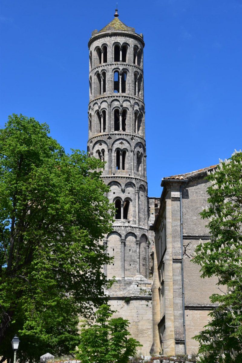
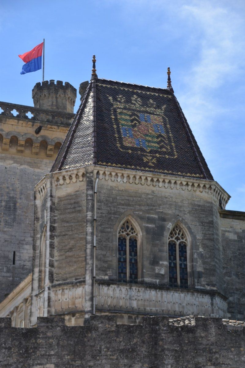
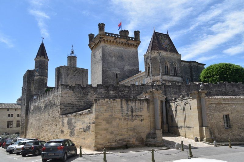
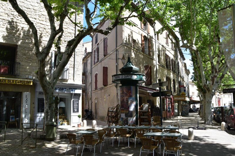
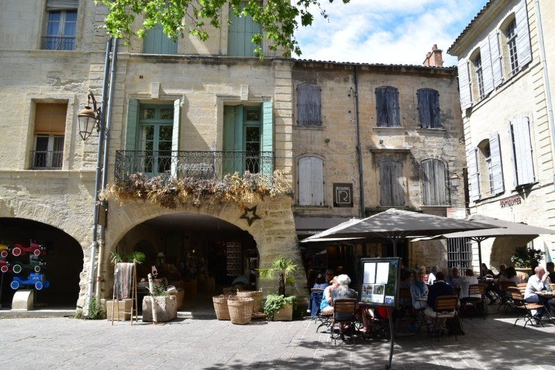
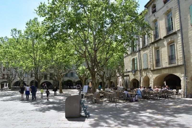
Uzès, Frankreich
26.4.2018: Grosse Altstadt mit regem Treiben. Ausserdem gibt es den Herzogspalast und die Kathedrale zu besichtigen. Der Palast ist noch heute im Privatbesitz.
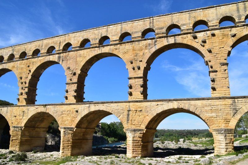
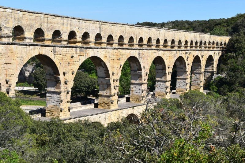
In einem kleinen Tal, unterhalb von Uzès entspringt der Fluss "Eure". In der Römerzeit versorgte die Eure, die Stadt Nîmes über eine Wasserleitung mit Frischwasser. Teil dieser Wasserleitung war der Viadukt "Pont du Gard". (s.o.)
44° 0' 43.6" N 4° 25' 11.8" E
44.0121100 4.4199460
• Head toward Rue Pélisserie on Rue de l'Épée. Go for 29 m.
• Turn left onto Rue Pélisserie. Go for 63 m.
• Turn left onto Rue du 4 Septembre. Go for 57 m.
• Turn right onto Place d'Austerlitz. Go for 91 m.
• Turn slightly left onto Rue de Gisfort. Go for 156 m.
• Continue on Rue Saint-Ferréol. Go for 139 m.
• Turn right onto Rue Saint-Ferréol. Go for 130 m.
• Turn left onto Rue de l'Escalette. Go for 37 m.
• Turn right onto Rue du Professeur Gaston Broche. Go for 110 m.
• Turn left onto Place Croix des Palmiers. Go for 175 m.
• Take the 2nd exit from roundabout onto Route de Nîmes (D979) toward A9/Avignon/Pont du Gard/Nîmes/Musée du Bonbon. Go for 482 m.
• Take the 2nd exit from roundabout onto Route de Nîmes (D979) toward Avignon/Nîmes. Go for 479 m.
• Take the 2nd exit from roundabout onto Route de Remoulins (D981) toward A9/Avignon/Remoulins/Pont du Gard. Go for 854 m.
• Pass 2 roundabouts and continue on Route de Remoulins (D981). Go for 2.5 km.
• Take the 3rd exit from roundabout onto Route de Remoulins (D981) toward A9/Avignon/Remoulins/Pont du Gard. Go for 4.3 km.
• Take the 2nd exit from roundabout onto D981 toward A9/Avignon/Remoulins/Pont du Gard. Go for 3.2 km.
• Take the 2nd exit from roundabout onto Route de Rémoulins (D981) toward A9/Avignon/Remoulins/Pont du Gard. Go for 730 m.
• Take the 2nd exit from roundabout onto Route de Rémoulins (D19) toward A9/Avignon/Bagnols S/C. Go for 540 m.
• Take the 1st exit from roundabout onto Route d'Uzès (D19) toward Nîmes/Remoulins. Go for 2.5 km.
• Turn right onto Avenue Geoffroy Perret (D6086) toward Beaucaire/Tarascon/Pont du Gard. Go for 366 m.
• Take the 1st exit from roundabout onto Avenue du Pont du Gard (D981) toward Pont du Gard. Go for 1.3 km.
• Continue on Lieu-dit La Couasse (D981). Go for 185 m.
• Turn right onto Avenue du Pont du Gard. Go for 53 m.
• Arrive at Avenue du Pont du Gard. Your destination is on the left.
☍
18,5 km
( 24 min.)
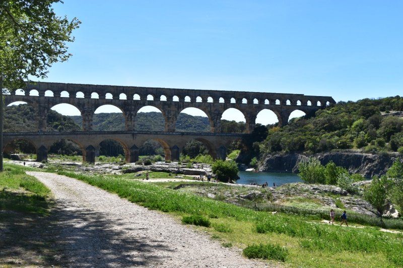
Pont du Gard / Remoulins, Camping La Sousta
Der Campingplatz ist nur 3 Gehminuten vom Pont du Gard gelegen.
Avenue du Pont du Gard, 30210, Remoulins, Frankrijk
43° 56' 55.3" N 4° 32' 44.2" E
43.9487000 4.5456000
• Head south on Avenue du Pont du Gard. Go for 53 m.
• Turn left onto Lieu-dit La Couasse (D981). Go for 185 m.
• Continue on Avenue du Pont du Gard (D981). Go for 1.3 km.
• Pass 3 roundabouts and continue on D6086. Go for 14.0 km.
• Take the 2nd exit from roundabout onto D6086 toward A9/Nîmes. Go for 795 m.
• Take the 2nd exit from roundabout onto Route d'Avignon (D6086) toward Nîmes/La Paloma. Go for 1.3 km.
• Take the 2nd exit from Rond-Point Lieutenant-Colonel Pierre Colin roundabout onto Route d'Avignon (D6086) toward Nîmes-Centre. Go for 1.4 km.
• Turn right onto Route d'Avignon. Go for 1.5 km.
• Turn right onto Route d'Avignon (D127). Go for 709 m.
• Continue on Rue Pierre Semard. Go for 208 m.
• Keep left onto Rue Notre-Dame. Go for 733 m.
• Continue on Square de la Couronne. Go for 85 m.
• Turn slightly left onto Boulevard Amiral Courbet. Go for 37 m.
• Turn right onto Rue de la Couronne. Go for 82 m.
• Arrive at Rue de la Couronne.
☍
22,4 km
( 30 min.)
Day
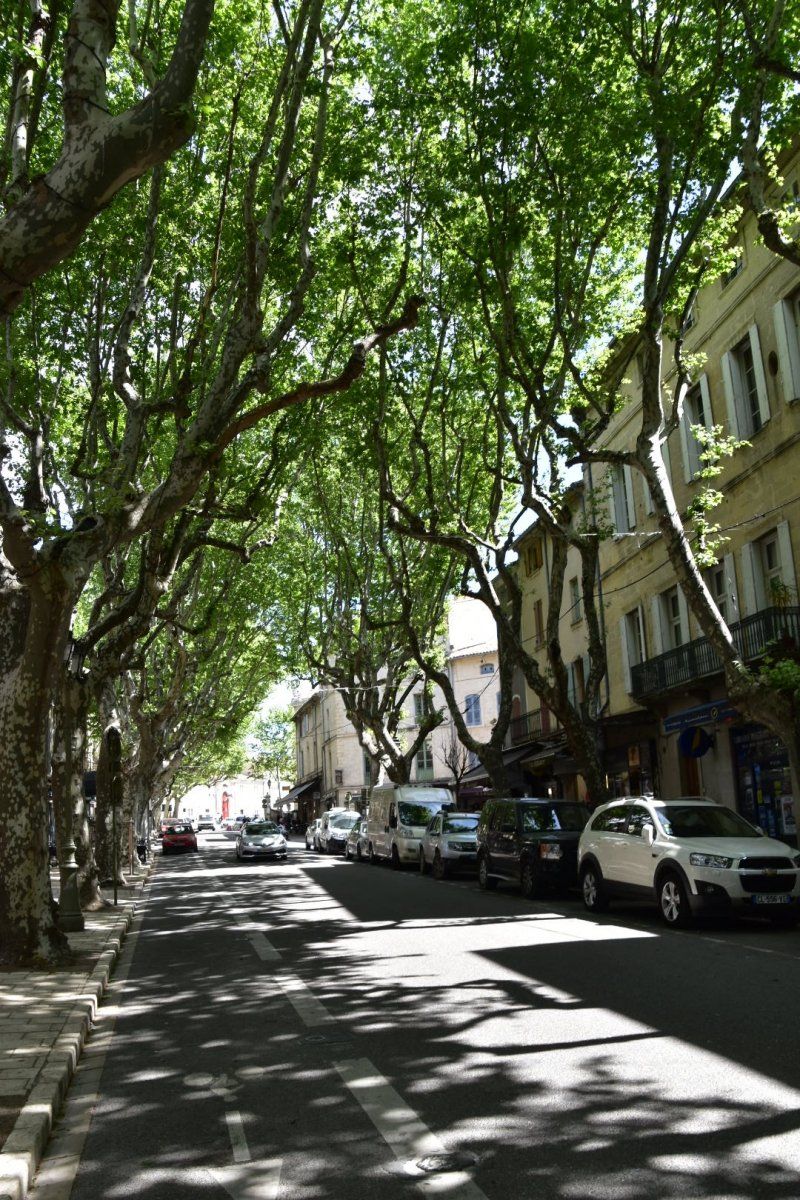
Nîmes, Frankreich
27.4.2018: kein Parkplatz für Wohnmobile! Die Fahrt in dichtem Verkehr auf Innenstadtkreis ist der Alptraum.
Aber die Stadt ist sehenswert: verwinkelte Alstadt, riesiges Amphitheater, römischer Tempel (maison carrée), Geschäfte und Cafés mit gutem Essen: Salat mit geräuchertem Lachs.
Endlich finden wir hier einen freundlichen Töffhändler, der den Hinterpneu am Scooter ersetzt. 11:30, kurz vor der Mittagspause gebracht und 14:30 wieder abgeholt, eingeladen und weitergefahren. Toll!
43° 50' 12.1" N 4° 21' 36.2" E
43.8366990 4.3600540
• Head northwest on Rue de la Couronne.
• Turn right onto Place de la Salamandre. Go for 70 m.
• Turn slightly left onto Grand'Rue. Go for 28 m.
• Turn right onto Rue des Greffes. Go for 51 m.
• Turn left onto Boulevard Amiral Courbet. Go for 78 m.
• Turn right onto Rue des Calquières. Go for 159 m.
• Continue on Place de l'Écluse. Go for 69 m.
• Turn left onto Rue Notre-Dame. Go for 86 m.
• Turn right onto Rue Cardinal de Cabrières. Go for 13 m.
• Turn slightly right onto Rue Fénelon. Go for 310 m.
• Turn right onto Boulevard Talabot. Go for 208 m.
• Turn left onto Avenue Général Leclerc. Go for 74 m.
• Turn right onto Allée Boissy d'Anglas. Go for 329 m.
• Turn slightly right onto Boulevard Natoire. Go for 78 m.
• Turn left onto Boulevard Sergent Triaire. Go for 274 m.
• Continue on Boulevard Sergent Triaire. Go for 814 m.
• Continue on Rue de l'Ancienne Gare. Go for 219 m.
• Turn slightly left onto Chemin du Capouchiné (D13). Go for 505 m.
• Take the 1st exit from Rond-Point de Meknès roundabout onto Boulevard du Président Salvador Allende (N113) toward A9/Montpellier/Alès/Sommières. Go for 401 m.
• Take the 2nd exit from Rond-Point Paul-Émile Victor roundabout onto Avenue du Président Salvador Allende (N113) toward Montpellier/Alès/Sommières. Go for 596 m.
• Take the 4th exit from Rond-Point Km Delta roundabout onto A54 toward Montpellier. Go for 492 m.
• Take the exit toward Montpellier/Toulouse/Barcelone onto A9 (La Languedocienne). Go for 32.0 km.
• Keep right onto A709 toward A75/Clermont-Ferrand/Montpellier/Aéroport. Go for 19.7 km.
• Take exit 32 toward Millau/Sète. Go for 1.0 km.
• Take the 2nd exit from Place de l'Europe roundabout onto M116 E1 toward Millau/Montpellier-Mosson. Go for 988 m.
• Take the 1st exit from roundabout onto Route de Sète (M612) toward Sète/Frontignan. Go for 2.8 km.
• Take the 1st exit from roundabout onto M612. Go for 3.5 km.
• Continue on D612. Go for 1.8 km.
• Pass 3 roundabouts and continue on D612. Go for 9.9 km.
• Take ramp toward Frontignan-Centre-Plage/Les Aresquiers. Go for 260 m.
• Take the 3rd exit from Rond-Point des Étangs roundabout onto D129. Go for 323 m.
• Take ramp. Go for 179 m.
• Turn left toward D129. Go for 63 m.
• Continue on Avenue des Vacances (D129). Go for 476 m.
• Take the 1st exit from Rond-Point des Vacances roundabout onto Avenue des Vacances. Go for 220 m.
• Arrive at Avenue des Vacances. Your destination is on the right.
☍
77,9 km
(1 hrs. 1 min.)
Frontignan Plage, Mediterranee Camping
27.4.2018 einfacher Camping, aber für 15 EUR Strom, Dusche, alles inkl. Und nur wenige Gehminuten vom Strand entfernt.
34110, Frontignan, Frankreich
43° 25' 46.9" N 3° 45' 34.2" E
43.4297000 3.7595000
• Head southeast on Avenue des Vacances. Go for 103 m.
• Take the 1st exit from roundabout onto Avenue Paul Valéry (D50). Go for 648 m.
• Take the 2nd exit from roundabout onto D50. Go for 422 m.
• Take the 2nd exit from roundabout. Go for 127 m.
• Turn left and take ramp onto D612. Go for 2.2 km.
• Take the 1st exit from roundabout onto D600 toward A9/Béziers/Frontignan-Centre/Balaruc/Z.I. les Eaux Blanches/La Peyrade. Go for 724 m.
• Take the 2nd exit from Rond-Point Salvador Allende roundabout onto D600 toward A9/Montpellier/Béziers. Go for 7.1 km.
• Take ramp onto A9 (La Languedocienne) toward Béziers/Toulouse/Barcelone. Go for 36.9 km.
• Take the exit toward Valras-Plage/Sérignan/Aéroport Béziers-Cap d'Agde/Béziers-Centre onto A75 (La Méridienne). Go for 1.9 km.
• Take exit 64 toward Béziers-Centre. Go for 1.7 km.
• Take the 1st exit from Rond-Point des Étoiles roundabout onto D612 toward Béziers-Centre/Bédarieux/Boujan S/Libron. Go for 2.3 km.
• Take ramp. Go for 320 m.
• Take the 3rd exit from Rond-Point Vincent Badie roundabout onto Avenue de la Voie Domitienne (D28) toward Béziers-Centre/Béziers-Arènes. Go for 860 m.
• Pass 2 roundabouts and continue on Avenue Pierre Verdier. Go for 1.3 km.
• Continue on Avenue Émile Claparède. Go for 424 m.
• Continue on Avenue Camille Saint-Saëns. Go for 67 m.
• Turn right onto Avenue du 22 Août 1944. Go for 707 m.
• Take the 5th exit from Place de la Victoire roundabout onto Allées Paul Riquet. Go for 127 m.
• Arrive at Allées Paul Riquet. Your destination is on the left.
☍
57,8 km
( 43 min.)
Day
2. Tag am Meer
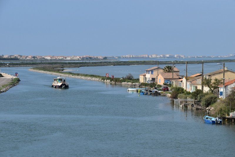
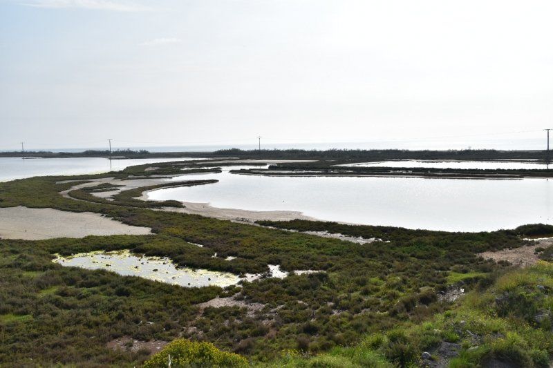
Ausfahrt mit Töff über Deiche durch verschiedene Etanges (Lagunen). Wir sehen Flamingos und Schnepfen(?). Mittendurch führt der auch für grosse Tanker schiffbare Sète-Rhone-Kanal. Nachmittag: faulenzen am Meer.
Day
Regentag am Mittelmeer
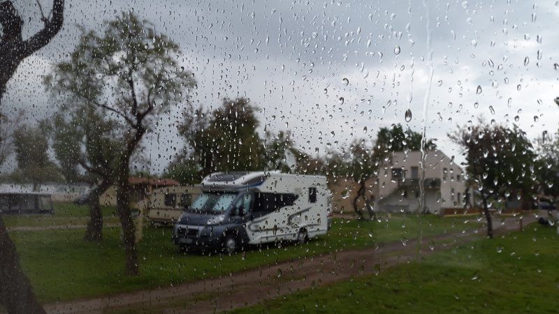
29.4.2018: Es regnet. Aber hier wenigstens wärmer. Also bleiben wir noch einen Tag länger am Meer und bleiben fast den ganzen Tag im WoMo und lesen oder spielen.
Day
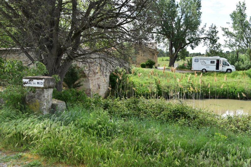
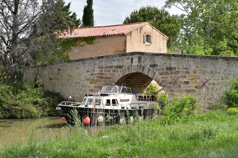
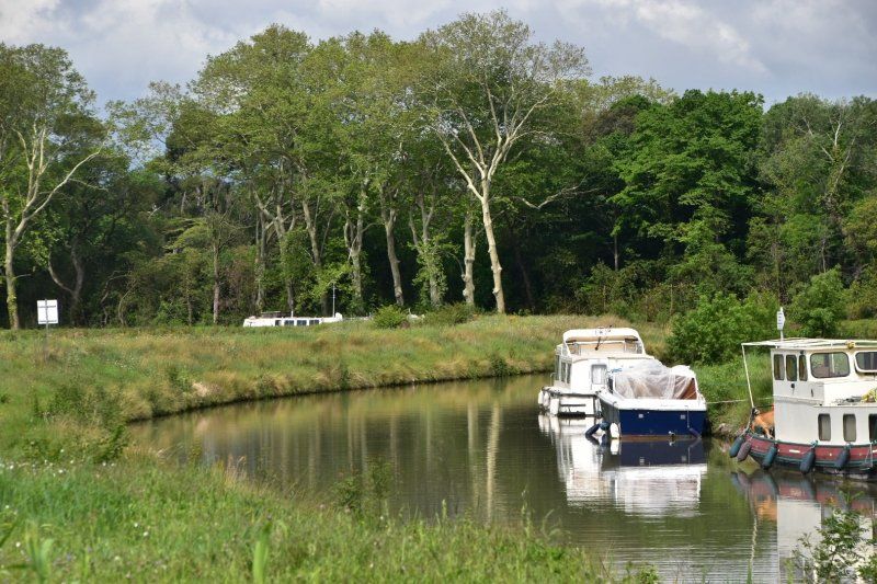
Béziers und Canal du Midi, Frankreich
Bei Sète verlassen wir das Meer und fahren erst ein Stück auf der A9 Richtung Barcelona! Aber in Béziers dann auf die D611 und über Land nach Carcassonne. Unterwegs haben wir mehrmals den Canal du Midi gestreift und überquert.
43° 20' 39.2" N 3° 12' 56.9" E
43.3442330 3.2157950
• Head toward Rue de la Coquille on Allées Paul Riquet. Go for 262 m.
• Continue on Place Jean Jaurès. Go for 8 m.
• Turn right onto Place Jean Jaurès. Go for 124 m.
• Turn slightly right onto Place Jean Jaurès. Go for 30 m.
• Continue on Avenue d'Estienne d'Orves. Go for 52 m.
• Turn left onto Avenue d'Estienne d'Orves. Go for 86 m.
• Turn left onto Avenue Alphonse Mas. Go for 37 m.
• Continue on Place Garibaldi. Go for 62 m.
• Take the 1st exit from Place Garibaldi roundabout onto Avenue de la Marne. Go for 458 m.
• Continue on Avenue Colonel d'Ornano. Go for 657 m.
• Keep right onto Place des Alliés (D609). Go for 203 m.
• Continue on Avenue du Pont-Vieux. Go for 118 m.
• Keep right onto Avenue Henri Galinier (D612 B) toward Mazamet/Castres/Carcassonne/Saint Pons. Go for 459 m.
• Continue on Avenue Henri Galinier (D612 B) toward Carcassonne/Capestang/Maureilhan/St Pons. Go for 650 m.
• Keep left onto Rue Jean-Baptiste Blattes toward Carcassonne/Capestang/Stade de la Présidente. Go for 296 m.
• Take the 1st exit from roundabout onto Route de Capestang (D11) toward Carcassonne/Montady/Capestang. Go for 593 m.
• Pass 3 roundabouts and continue on Route de Capestang (D11). Go for 4.2 km.
• Take the 3rd exit from roundabout onto Avenue de Béziers (D11) toward Montady/Capestang. Go for 6.7 km.
• Pass 2 roundabouts and continue on Avenue de Toulouse (D11). Go for 4.4 km.
• Continue on D5. Go for 4.5 km.
• Arrive at D5.
☍
23,9 km
( 27 min.)
Ouveillan, Frankreich
D5, 34310 Ouveillan, Frankreich
43° 18' 39.5" N 2° 57' 5.6" E
43.3109731 2.9515457
• Head west on D5. Go for 4.0 km.
• Take the 2nd exit from roundabout onto D5 toward Carcassonne/Bize-Minervois. Go for 3.7 km.
• Take the 3rd exit from roundabout onto D5. Go for 6.9 km.
• Continue on D11. Go for 4.2 km.
• Continue on D610. Go for 17.8 km.
• Turn left onto Avenue de la Belle Aude. Go for 465 m.
• Continue on Rue Georges Brassens. Go for 185 m.
• Turn right onto Avenue de l'Alaric (D57). Go for 148 m.
• Turn left onto Avenue du Languedoc (D610). Go for 8.3 km.
• Turn left onto Avenue Pasteur (D610). Go for 870 m.
• Turn right onto Avenue des Capucins (D6113). Go for 817 m.
• Take the 2nd exit from roundabout onto Avenue des Capucins (D6113) toward A61/Carcassonne. Go for 2.8 km.
• Take ramp toward A61/Toulouse/Foix/Castres/Mazamet. Go for 300 m.
• Take the 3rd exit from roundabout onto D6113 toward A61/Narbonne. Go for 284 m.
• Continue on D6161. Go for 17 m.
• Keep left onto D6161. Go for 2.8 km.
• Take the 1st exit from Rond-Point Charlemagne roundabout onto Route de Saint-Hilaire (D42) toward Centre Ville/D342/Centre-Ville. Go for 448 m.
• Turn left onto D104. Go for 484 m.
• Turn right onto D104. Go for 47 m.
• Arrive at D104. Your destination is on the right.
☍
54,5 km
( 49 min.)
Carcassonne, Stellplatz beim Camping La Cité
30.4.2018 Cité de Carcassonne ist die von einer doppelten Ringmauer umgebene mittelalterliche Stadt auf dem Hügel. Natürlich sind bei schönstem Sonnenschein ausser uns noch weitere Millionen Besucher hier.
Die "Unterstadt": schachbrettartige Gassen, aber etwas heruntergekommen.
Der Stellplatz bietet für 15 EUR nur Wasser; liegt aber sehr nah an der Cité.
Route de St. Hilaire 104, 11000, Carcassonne, Frankreich
43° 12' 1.8" N 2° 21' 12.2" E
43.2005000 2.3534000
• Head south on D104. Go for 29 m.
• Turn left onto D104. Go for 516 m.
• Turn right onto Route de Saint-Hilaire (D42). Go for 407 m.
• Take the 5th exit from Rond-Point Charlemagne roundabout onto Rocade Sud (D6161) toward Narbonne/A61/Trèbes/La Cité. Go for 3.0 km.
• Continue on D6113. Go for 195 m.
• Pass 3 roundabouts and continue on Rocade Nord (D6113). Go for 3.6 km.
• Take the 1st exit from Rond-Point du Xénon roundabout onto Rue Georges Guille (D118) toward Mazamet/Conques sur Orbiel/Villalier/Z.I. Pont Rouge. Go for 265 m.
• Take the 2nd exit from roundabout onto D118 toward Mazamet/Villemoustaussou. Go for 1.3 km.
• Take the 3rd exit from Carrefour de Bezons roundabout onto Chemin d'Albi en Espagne (D118). Go for 729 m.
• Take the 2nd exit from roundabout onto Avenue du Cabardès (D118). Go for 1.3 km.
• Take the 3rd exit from roundabout onto Avenue du Cabardès (D118). Go for 1.3 km.
• Pass 2 roundabouts and continue on Chemin d'Albi en Espagne (D118). Go for 17.0 km.
• Continue on D73. Go for 124 m.
• Continue on D118. Go for 20.3 km.
• Take the 3rd exit from roundabout onto Rue du Général de Gaulle (D53). Go for 802 m.
• Turn right onto Boulevard de la Maylarie. Go for 1.1 km.
• Turn left onto Avenue de Toulouse. Go for 695 m.
• Turn left onto Boulevard du Thoré (N112) toward Béziers. Go for 630 m.
• Pass 4 roundabouts and continue on Rocade Sud (N112). Go for 13.2 km.
• Take ramp toward Castres-Lameilhe/Hauterive. Go for 359 m.
• Pass 3 roundabouts and continue on Avenue Émilie de Villeneuve (D85). Go for 2.9 km.
• Continue on Boulevard Docteurs Aribat. Go for 152 m.
• Continue on Place Carnot. Go for 18 m.
• Continue on Boulevard Carnot. Go for 151 m.
• Keep left onto Boulevard Miredames. Go for 199 m.
• Continue on Pont Miredames. Go for 84 m.
• Turn left onto Rue Henri IV. Go for 156 m.
• Turn left onto Rue Pierre Borel. Go for 17 m.
• Arrive at Rue Pierre Borel. Your destination is on the right.
☍
70,6 km
(1 hrs. 11 min.)
Day
Castres, Frankreich
43° 36' 22.4" N 2° 14' 28.7" E
43.6062140 2.2412950
• Head toward Rue Malpas on Rue Pierre Borel. Go for 50 m.
• Turn left onto Rue des Capucins. Go for 10 m.
• Turn right onto Rue des Capucins. Go for 48 m.
• Turn left onto Quai du Carras. Go for 132 m.
• Continue on Pont Miredames. Go for 225 m.
• Continue on Place Pierre Fabre. Go for 110 m.
• Turn right onto Place Pierre Fabre. Go for 164 m.
• Continue on Avenue Augustin Malroux (D612). Go for 701 m.
• Continue toward Avenue d'Albi/D612. Go for 22 m.
• Pass 2 roundabouts and continue on Avenue d'Albi (D612). Go for 3.9 km.
• Take the 1st exit from roundabout onto D612 toward Albi/Réalmont. Go for 11.2 km.
• Take the 2nd exit from roundabout onto Route Dalbi (D612) toward Albi/Réalmont. Go for 4.6 km.
• Take the 2nd exit from roundabout onto Avenue du Général de Gaulle (D612) toward Albi/Centre Ville/Place des Couverts. Go for 781 m.
• Turn left onto Boulevard Gambetta (D612) toward Albi. Go for 240 m.
• Turn left onto Avenue Jules Pelissier (D612). Go for 29 m.
• Turn right onto Avenue Jules Pelissier (D612) toward Albi. Go for 9.6 km.
• Continue on D612 toward Albi. Go for 4.3 km.
• Pass 5 roundabouts and continue on Route de Castres (D60/D612). Go for 4.7 km.
• Turn left onto Boulevard Carnot. Go for 383 m.
• Take the 1st exit from roundabout onto Avenue du Général de Gaulle (D84). Go for 309 m.
• Continue on Place Lapérouse (D13). Go for 98 m.
• Turn left onto Place Lapérouse. Go for 102 m.
• Continue on Boulevard Général Sibille. Go for 236 m.
• Turn left onto Boulevard Général Sibille. Go for 15 m.
• Turn right. Go for 88 m.
• Turn left. Go for 115 m.
• Turn left. Go for 21 m.
• Arrive at your destination on the right.
☍
42,1 km
( 43 min.)
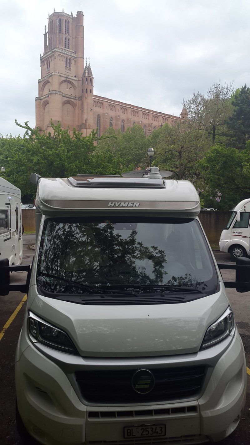
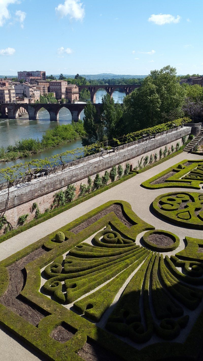
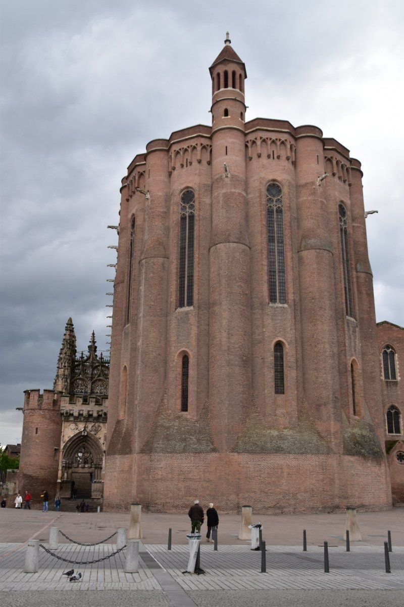
Albi, Frankreich, Parking de la Cathédrale
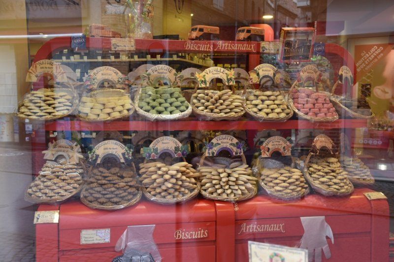
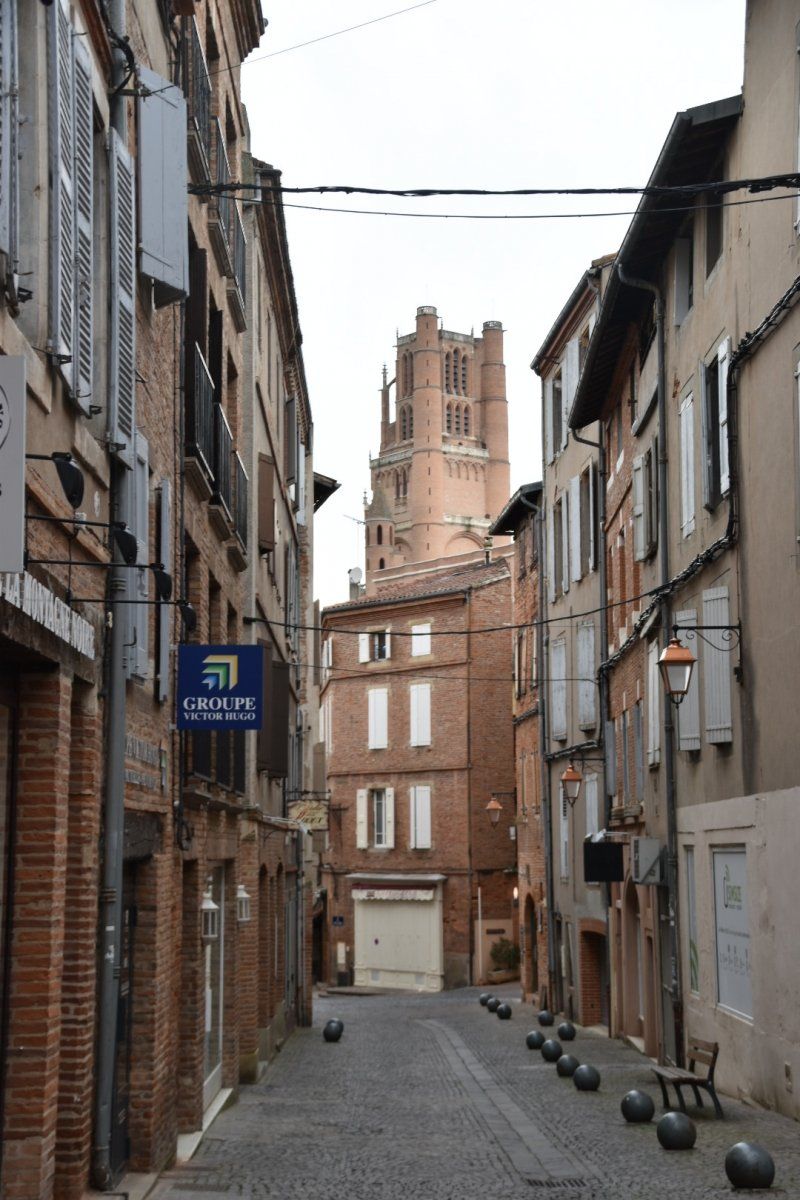
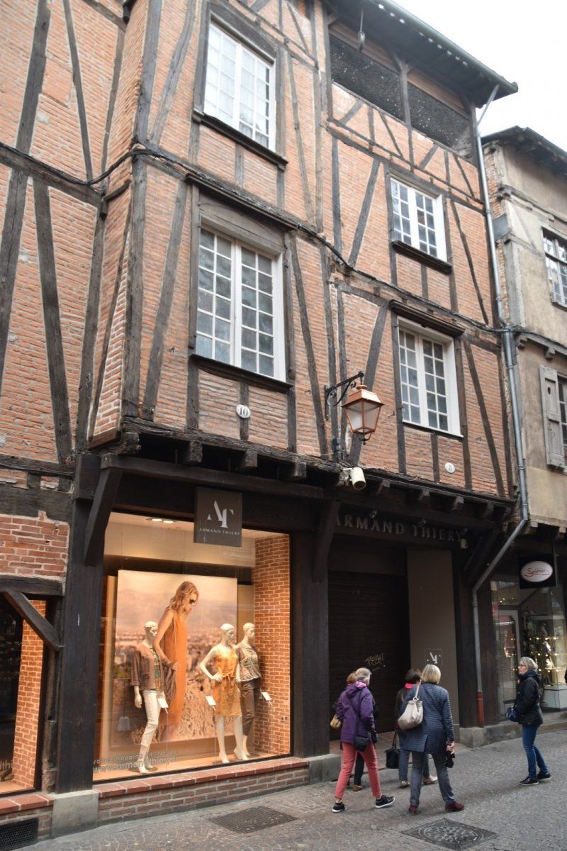
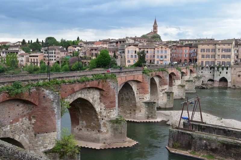
1.5.2018: beautiful city on the Tarn. The old bridge is closed to vehicles over 2m wide and over 2t, but the French still drive over it with their motorhomes!
Most of the buildings in the old town, as well as the cathedral and the bishop's palace, are built of bricks. Lots of life in old streets.
We are in a marked area of a large car park directly below the cathedral; free. Everything within walking distance.
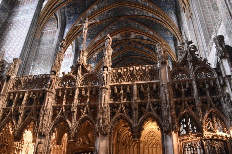
The "Henri de Toulouse-Lautrec" museum is located in the Episcopal Palace of Albi. It shows many special paintings by the well-known French painter. We visit this the next morning before continuing.
Côte de l'Abattoir, 81000, Albi, Frankreich
43° 55' 38" N 2° 8' 27" E
43.9272222 2.1408333
• Head north. Go for 21 m.
• Turn right. Go for 115 m.
• Turn right toward Boulevard Général Sibille. Go for 88 m.
• Turn left onto Boulevard Général Sibille. Go for 61 m.
• Turn right onto Rue du Chanoine Birot. Go for 54 m.
• Turn right onto Rue Puech Bérenguier. Go for 97 m.
• Turn slightly left onto Rue Saint-Clair. Go for 43 m.
• Turn slightly right onto Rue de l'Oulmet. Go for 59 m.
• Turn left onto Rue Peyrolière. Go for 105 m.
• Continue on Rue Saint-Julien. Go for 49 m.
• Turn right onto Rue des Catherinettes. Go for 54 m.
• Turn left onto Rue Sainte-Claire. Go for 23 m.
• Turn right onto Place Sainte-Claire. Go for 144 m.
• Turn right onto Lices Georges Pompidou (D600). Go for 169 m.
• Turn left onto Rue de la Croix-Verte. Go for 464 m.
• Take the 2nd exit from Place Saint-Amarand roundabout onto Avenue du Maréchal de Lattre de Tassigny (D999). Go for 791 m.
• Take the 4th exit from Square Rhin et Danube roundabout onto Avenue du Maréchal de Lattre de Tassigny (D100). Go for 549 m.
• Take the 2nd exit from Route de Millau roundabout onto Route de Millau (D999). Go for 389 m.
• Pass 4 roundabouts and continue on Route de Millau (D999). Go for 1.8 km.
• Take the 3rd exit from roundabout onto Route de Millau (D999) toward Millau/Cunac/Cambon. Go for 692 m.
• Pass 2 roundabouts and continue on Route de Millau (D999). Go for 12.3 km.
• Take the 4th exit from roundabout onto Avenue de Millau (D999) toward Alban/Millau. Go for 11.5 km.
• Turn left onto Place des Tilleuls (D53) toward St André/Villeneuve S/Tarn/Trébas/Ambialet/Église St Jean de Lacalm. Go for 44 m.
• Turn right onto Place des Tilleuls. Go for 46 m.
• Continue on Place des Tilleuls. Go for 279 m.
• Turn left onto Avenue de Millau (D999). Go for 307 m.
• Take the 3rd exit from roundabout onto Avenue de Millau (D999) toward St Sernin S/Rance/Lacaune/Millau. Go for 7.4 km.
• Pass 2 roundabouts and continue on Route de Saint-Affrique (D999). Go for 40.9 km.
• Take the 1st exit from Rond-Point des Pompiers roundabout onto Boulevard Aristide Briand (D225) toward A75/Millau/Roquefort/Rodez. Go for 559 m.
• Turn left onto Rue du Pont Vieux. Go for 64 m.
• Turn right onto Rue Voltaire. Go for 113 m.
• Continue on Place de l'Hôtel de Ville. Go for 67 m.
• Arrive at Place de l'Hôtel de Ville. Your destination is on the right.
☍
79,4 km
(1 hrs. 16 min.)
Day
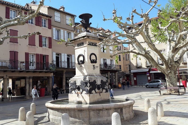
Saint-Affrique, Frankreich
43° 57' 29.5" N 2° 53' 13.7" E
43.9581900 2.8871260
• Head northwest on Place de l'Hôtel de Ville. Go for 32 m.
• Turn left onto Rue de la Force. Go for 24 m.
• Turn left onto Rue Valérie. Go for 50 m.
• Turn left onto Boulevard Victor Hugo. Go for 18 m.
• Turn left onto Boulevard de la République (D999). Go for 64 m.
• Turn right onto Rue Peyré Cadias (D993) toward St Rome de Tarn/Rodez/Lacs du Lévézou/St Victor/Les Costes G. Go for 5.1 km.
• Take the 2nd exit from roundabout onto D993. Go for 694 m.
• Turn right onto D3. Go for 3.6 km.
• Continue on Lieu-dit Moulin d'Aiguebelle (D3). Go for 69 m.
• Continue on Avenue de Ladoux (D3). Go for 631 m.
• Turn left onto Avenue de la Liberté (D999). Go for 379 m.
• Turn left onto Avenue de Millau (D992) toward Millau/St Georges de L. Go for 10.9 km.
• Take the 1st exit from Giratoire Marc Legrand roundabout onto D992 toward A75/Millau/Creissels. Go for 1.7 km.
• Take the 3rd exit from Giratoire d'Issis roundabout onto Avenue de Saint-Affrique (D992) toward A75/Millau/Creissels. Go for 289 m.
• Pass 3 roundabouts and continue on Avenue du Languedoc (D992). Go for 3.4 km.
• Take the 4th exit from Giratoire du Larzac roundabout onto Boulevard Pierre Bousquet (D809) toward Clermont-Fd/A75/Millau-Centre/Rodez/Mende/Gorges du Tarn. Go for 830 m.
• Take the 2nd exit from roundabout onto Rue de la Saunerie. Go for 118 m.
• Arrive at Rue de la Saunerie. Your destination is on the left.
☍
27,9 km
( 29 min.)
Millau, Frankreich, Aire de Camping-cars de Millau
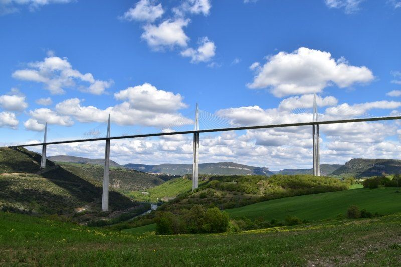
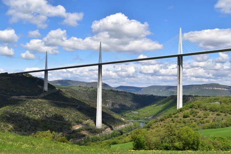
2.5.2018: The Viaduct in Millau is the longest cable-stayed bridge in the world at 2460 m and the tallest structure in France with a maximum pier height of 343 m. Here the A75 crosses the Tarn valley.
The old town can be easily reached from the parking space in a few minutes.
The Place du Marechal-Foch is surrounded by arcades that date from the 12th to the 16th centuries and are based on cylindrical columns.
Rue de la Saunerie, 12100, Millau, Frankrijk
44° 5' 45" N 3° 5' 9" E
44.0958333 3.0858333
• Head toward Rue de la Croix de Gaven on Rue de la Saunerie. Go for 49 m.
• Take the 2nd exit from roundabout onto Boulevard Pierre Bousquet (D809). Go for 370 m.
• Take the 1st exit from roundabout onto Boulevard Pierre Bousquet (D809). Go for 404 m.
• Take the 1st exit from Rond-Point de Cureplat roundabout onto Pont de Cureplat (D991) toward Montpellier le Vieux/Gorges de la Dourbie. Go for 305 m.
• Take the 2nd exit from Giratoire du Confluent roundabout onto Route du Causse Noir (D110). Go for 1.8 km.
• Turn right onto Route du Causse Noir (D110). Go for 13 m.
• Turn right onto Route du Causse Noir (D110). Go for 5.1 km.
• Continue on D110. Go for 1.5 km.
• Continue on Lieu-dit Les Privats (D110). Go for 100 m.
• Continue on D110. Go for 3.1 km.
• Continue on Lieu-dit Longuiers (D110). Go for 180 m.
• Continue on D110. Go for 2.1 km.
• Continue on Lieu-dit Les Pélissiers (D110). Go for 88 m.
• Continue on D110. Go for 46 m.
• Continue on Lieu-dit Les Pélissiers (D110). Go for 26 m.
• Continue on D110. Go for 1.1 km.
• Turn right toward Lieu-dit Le Maubert. Go for 396 m.
• Continue on Lieu-dit Le Maubert. Go for 1.1 km.
• Turn right. Go for 174 m.
• Arrive at your destination.
☍
18,1 km
( 24 min.)
Day
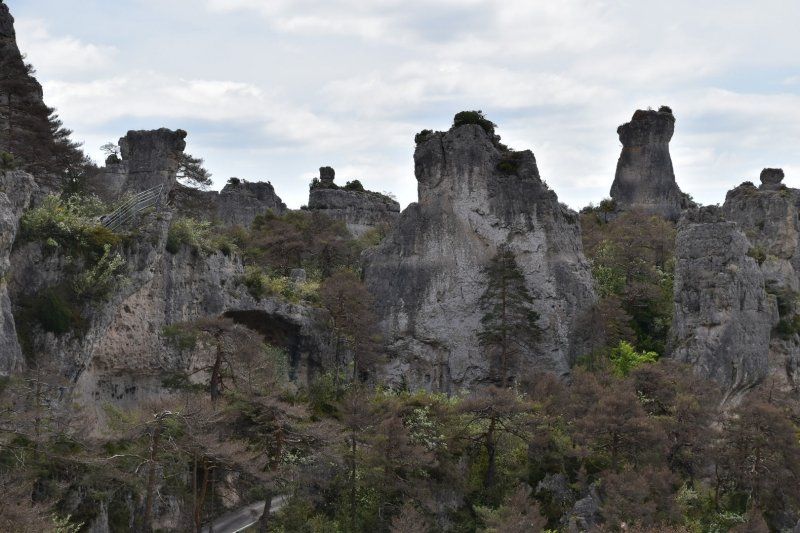
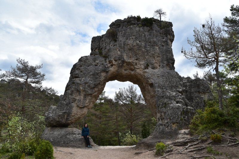
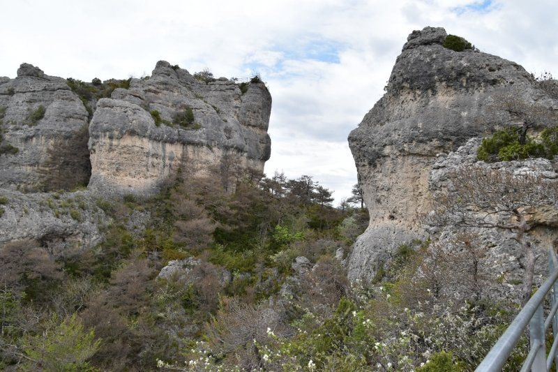
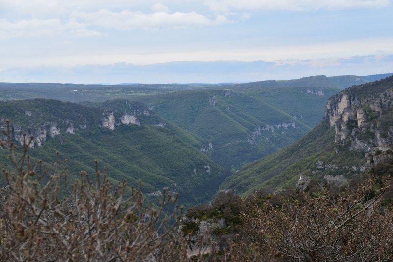
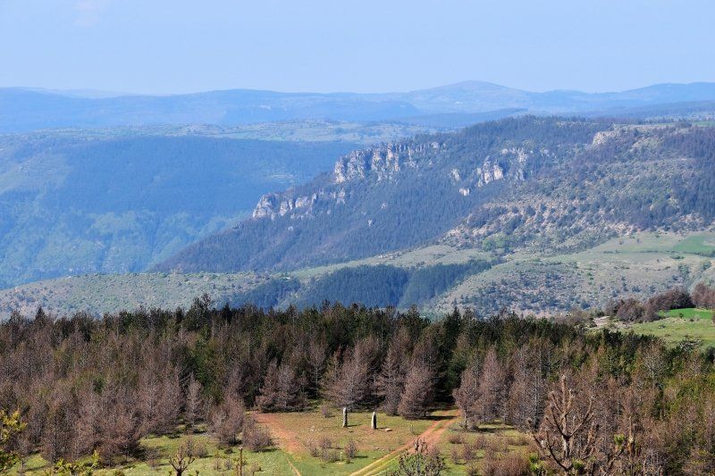
Chaos de Montpellier le Vieux, Frankreich
3 May 2018: First on the D991 along the Dourbie to La Roque, then on adventurous, small, steep roads (D41) to the high plateau and to the rock paradise "Chaos de Montpellier Le Vieux". 5 hiking trails lead up and down through the forest to fantastic rock formations and magnificent views to the Gorges du Tarn.
The griffon vultures are the pride of the "Cevennes National Park".
Eradicated around 1940, after several years of careful preparation, the first five couples were released over the Jonte Gorge in December 1981. Now more than 50 pairs breed in the Cevennes again. Breathtaking when 4-5 of these powerful birds circle over you.
44° 7' 58.8" N 3° 12' 17.1" E
44.1329935 3.2047471
• Head northwest. Go for 1.3 km.
• Continue on Lieu-dit Le Maubert. Go for 457 m.
• Turn right onto D110. Go for 3.8 km.
• Turn left onto D29. Go for 6.1 km.
• Continue on D187. Go for 51 m.
• Continue on Lieu-dit La Grave (D187). Go for 84 m.
• Continue on D187. Go for 105 m.
• Continue on D29. Go for 73 m.
• Turn left onto D996. Go for 157 m.
• Turn right onto D996. Go for 174 m.
• Make a U-Turn onto D996. Go for 82 m.
• Turn right onto Chemin de Brouillet. Go for 135 m.
• Arrive at Chemin de Brouillet. Your destination is on the right.
☍
12,5 km
( 21 min.)
Le Rozier, Frankreich, Camping Municipal de Brouillet
On small roads it goes back down to Peyreleau (picturesque village with an outstanding clock tower) and to Le Rozier at the confluence of the Jonte and Tarn. Camping municipal right on the river.
48150, Le Rozier, Frankreich
44° 11' 29.8" N 3° 12' 16.6" E
44.1916000 3.2046000
• Head east on Chemin de Brouillet. Go for 135 m.
• Turn right onto D996. Go for 232 m.
• Turn left onto D996. Go for 466 m.
• Turn right onto D907. Go for 4.8 km.
• Continue on D907 BIS. Go for 5.5 km.
• Arrive at Rue Alexis Solanet (D907 BIS). Your destination is on the left.
☍
11,1 km
( 13 min.)
Day
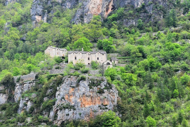
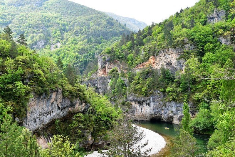
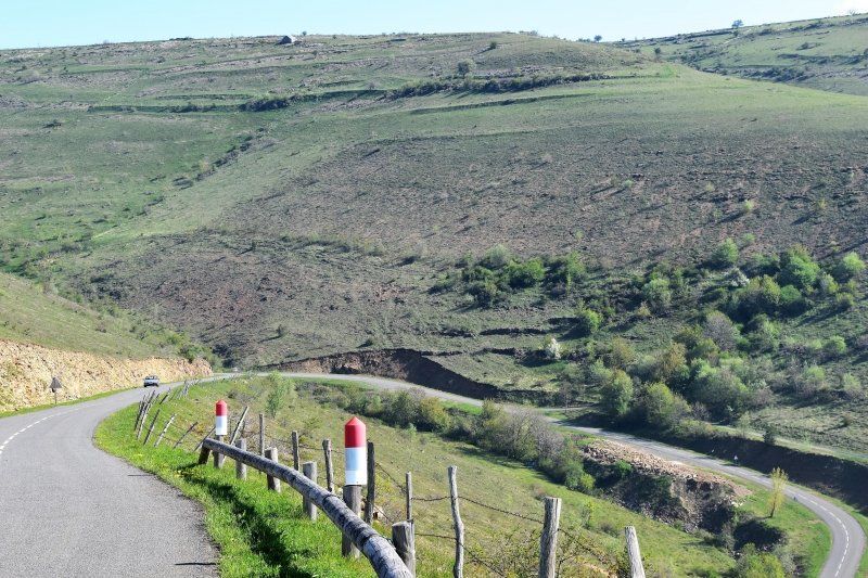
Gorges du Tarn
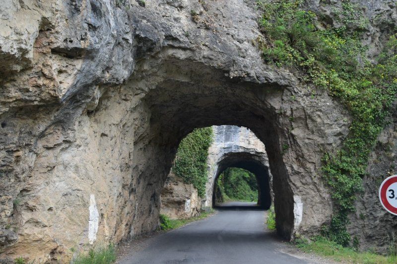
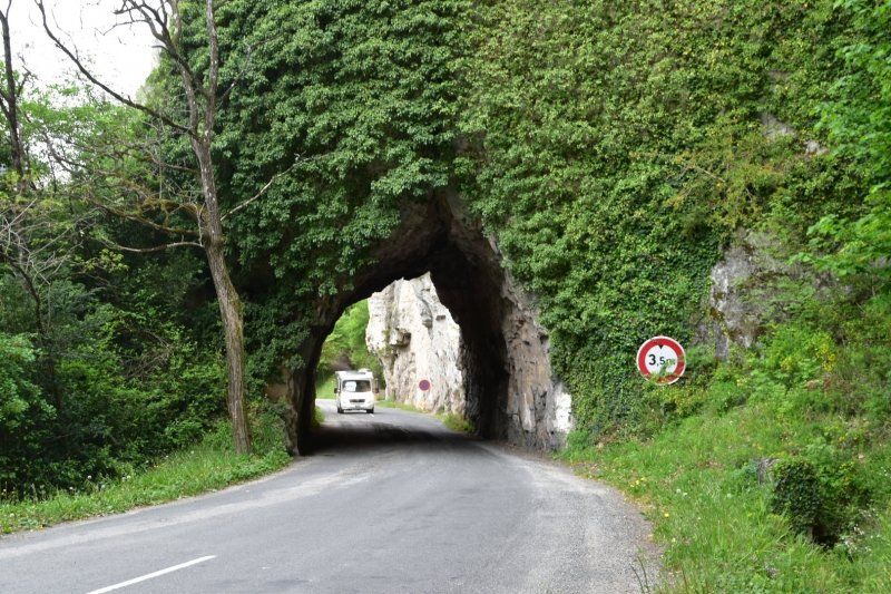
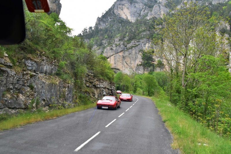
4.5.2018 From here it goes on an increasingly narrow road through the Gorges du Tarn. We cross several rock tunnels (the smallest has a clearance of 3.5 m) and are glad that we can still drive in the middle of the street in the pre-season and that there are only a few cars and rarely mobile homes.
Pas de Soucy bis St. Chély-du-Tarn, Frankreich
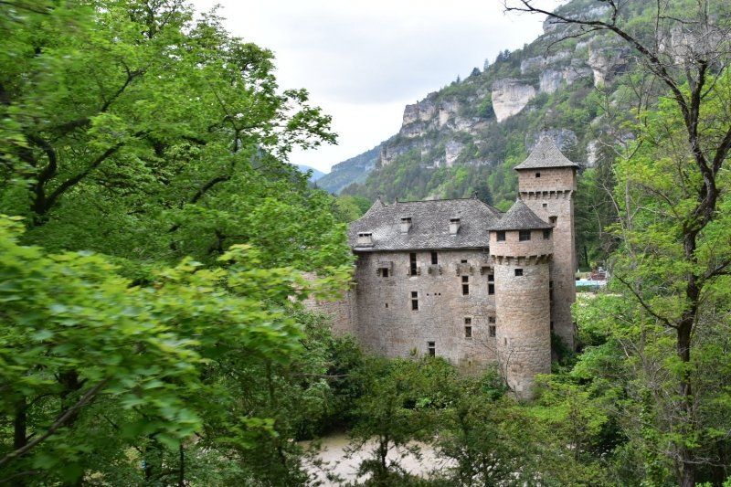
Die schönsten Stellen und Orte sind: Pas de Soucy (hier versperren riesige Felsbrocken die Fahrt auf dem Tarn), St. Chély-du-Tarn, St. Enimie, Castelbouc und Florac.
44° 16' 39.5" N 3° 13' 38.1" E
44.2776430 3.2272560
• Head northeast on Rue Alexis Solanet (D907 BIS). Go for 11.4 km.
• Take the 1st exit from roundabout onto D43. Go for 4.9 km.
• Continue on D16. Go for 746 m.
• Turn left onto D16. Go for 1.3 km.
• Turn left onto D986. Go for 11.0 km.
• Turn right onto D907 BIS. Go for 19 m.
• Turn left onto Route de Mende (D986). Go for 80 m.
• Arrive at Route de Mende (D986). Your destination is on the left.
☍
29,5 km
( 36 min.)
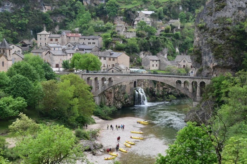
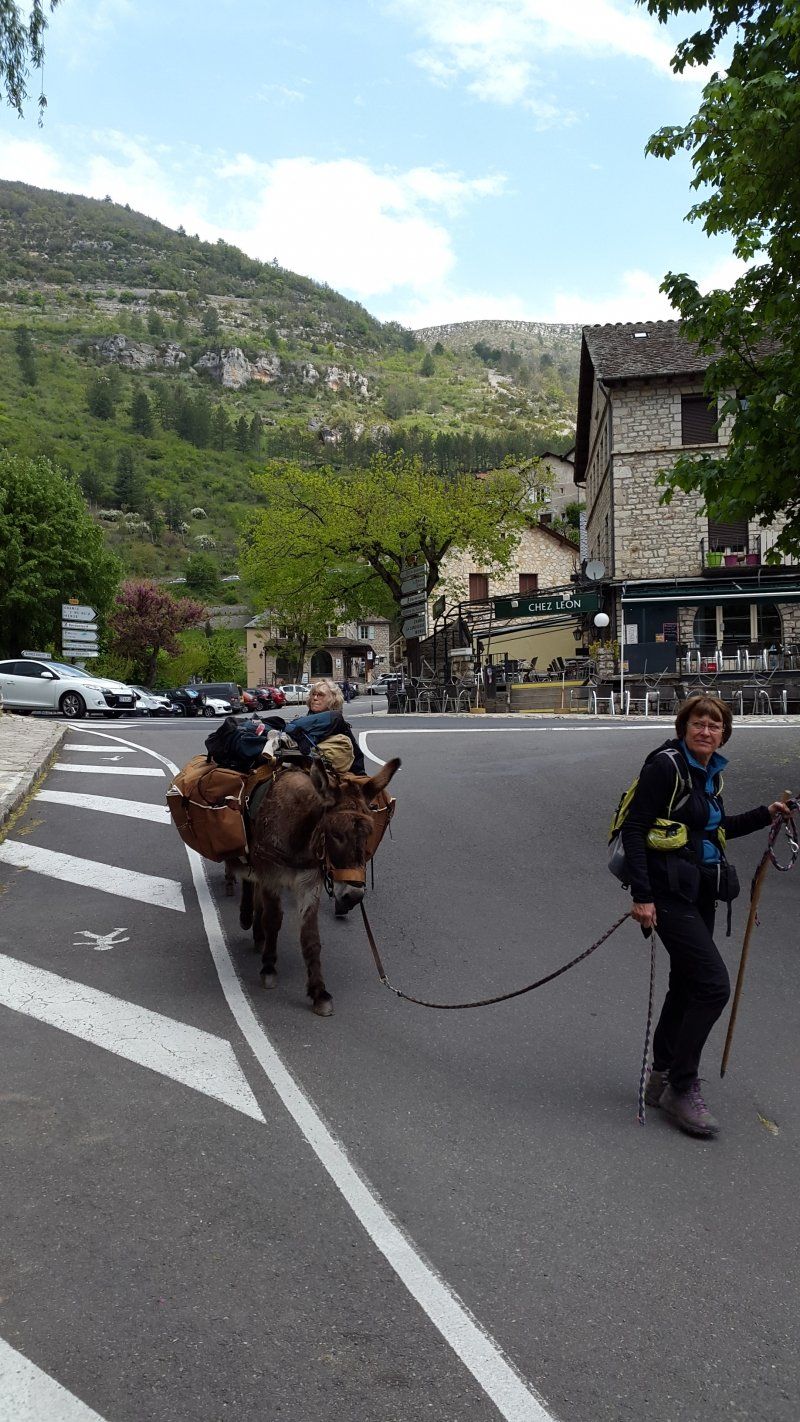
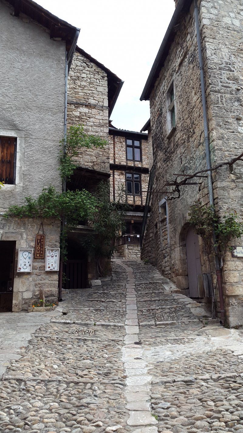
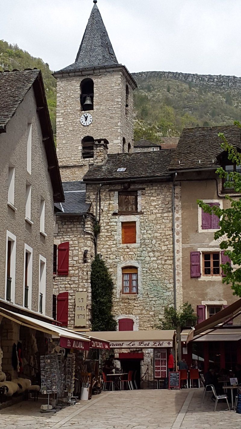
Sainte-Enimie, Frankreich
Awarded: Most beautiful village in France.
Small, steep streets and tourists on the banks of the Tarn. Two women with two donkeys also rest on the bank.
44° 21' 58.7" N 3° 24' 37.7" E
44.3662980 3.4104750
• Head toward Rue du Serre on Route de Mende (D986). Go for 80 m.
• Turn left onto Rue du Front du Tarn (D907 BIS). Go for 17.1 km.
• Turn left onto Chemin de la Leche. Go for 182 m.
• Turn right onto Chemin du Réjal. Go for 122 m.
• Continue on Chemin des Plots. Go for 152 m.
• Continue on Chemin des Faisses. Go for 163 m.
• Turn left onto Chemin Royal (D907 BIS). Go for 3.9 km.
• Turn right onto N106 toward Alès/Florac. Go for 3.4 km.
• Take the 2nd exit from roundabout onto N106. Go for 474 m.
• Take the 3rd exit from roundabout onto D998 toward Génolhac/Le Pont de Montvert/Cocurès/Bédouès. Go for 273 m.
• Arrive at D998. Your destination is on the left.
☍
25,8 km
( 30 min.)
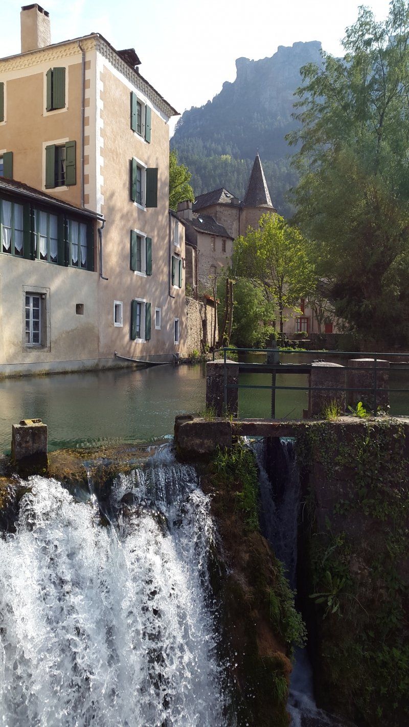
Florac, Frankreich
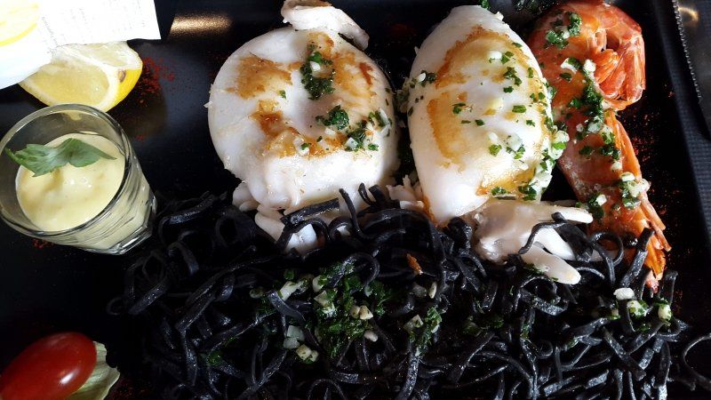
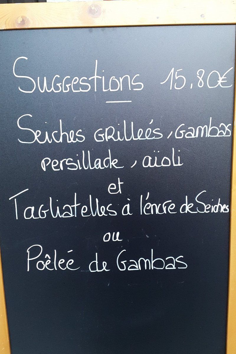
Florac is a beautiful place with small streets, a "castle" that houses the park administration and a surprisingly large brook across the old town. Everywhere people sit in front of the cafes and restaurants, so that we only find the third place to drink our beer. In the evening we let ourselves be spoiled again by the French cuisine: Seiches grillées with prawns and tagliatelle.
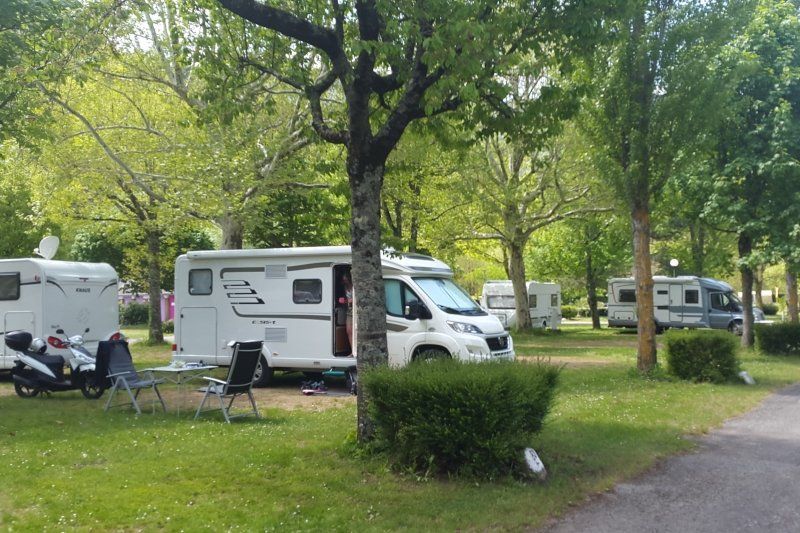
The campsite is located at the confluence of the Tarn and Tarnon right on the Tarn River and offers large plots under trees and a swimming pool in summer.
Route du Pont de Montvert, 48400, Florac, Frankreich
44° 20' 9.2" N 3° 35' 20.8" E
44.3359000 3.5891000
• Head east on D998. Go for 2.9 km.
• Turn left onto D135. Go for 6.0 km.
• Continue on Lieu-dit Le Cros (D135). Go for 54 m.
• Continue on D135. Go for 2.1 km.
• Continue on Lieu-dit Saint Martin (D135). Go for 113 m.
• Continue on D135. Go for 4.2 km.
• Arrive at D135. Your destination is on the right.
☍
15,4 km
( 17 min.)
Day
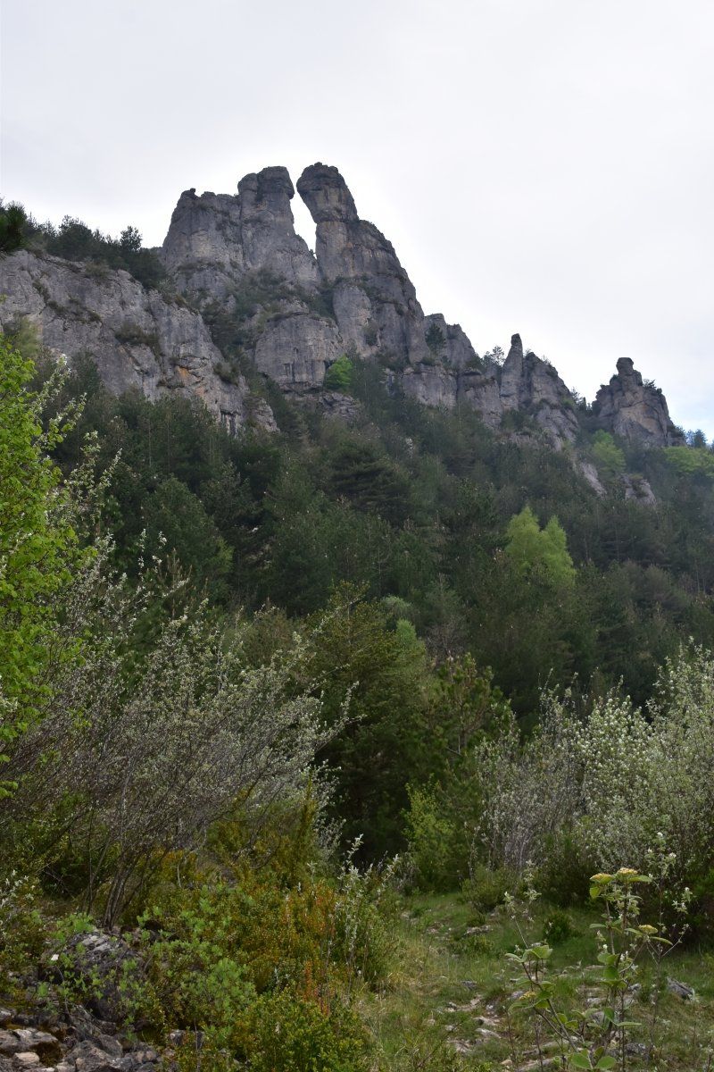
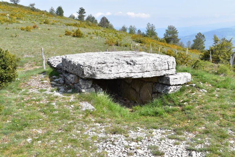
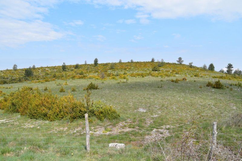
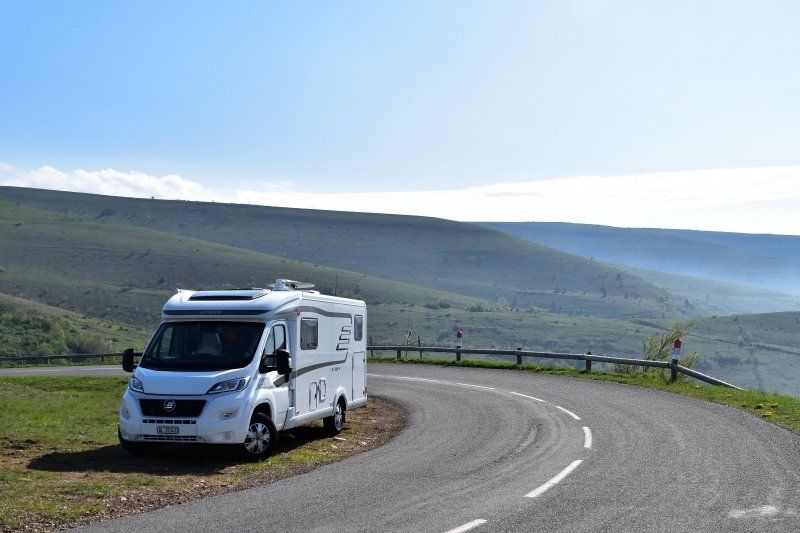
Wanderung auf den Causse Méjean, Cevennen, Frankreich
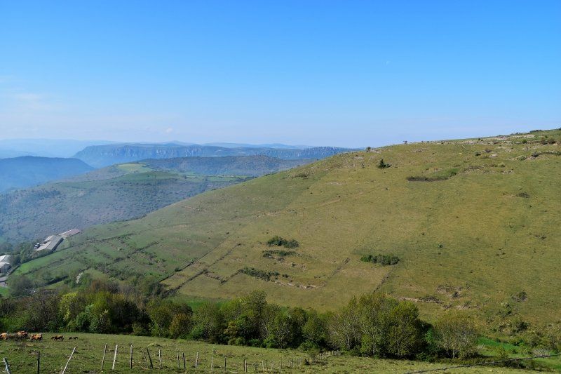
The Causse Méjean is a lime plateau in the south of France. It is the largest and highest of the Grands Causses in the Massif Central. The Causse Méjean is bordered in the north and west by the almost 500 meter deep Tarn Gorge, in the south by the Jonte Gorge, which flows into the Tarn at Peyreleau, and in the east by the Tarnon, another tributary of the Tarn (mouth at Florac).
May 5th, 2018: Hike to the 1000 m high Causse Méjean (approx. 500 meters altitude; 2 hours). From the parking lot at the church, a rather steep hiking trail goes up to the plateau. Initially through the forest, later through isolated scrub we cross the country road D16 several times, which winds up the mountain in numerous hairpin bends.
Once at the top we stumble across the dolmen tomb "Pierre Plate". We continue across the barren steppe landscape to our viewpoint above the Tarn and the Tarnon tributary.
Day
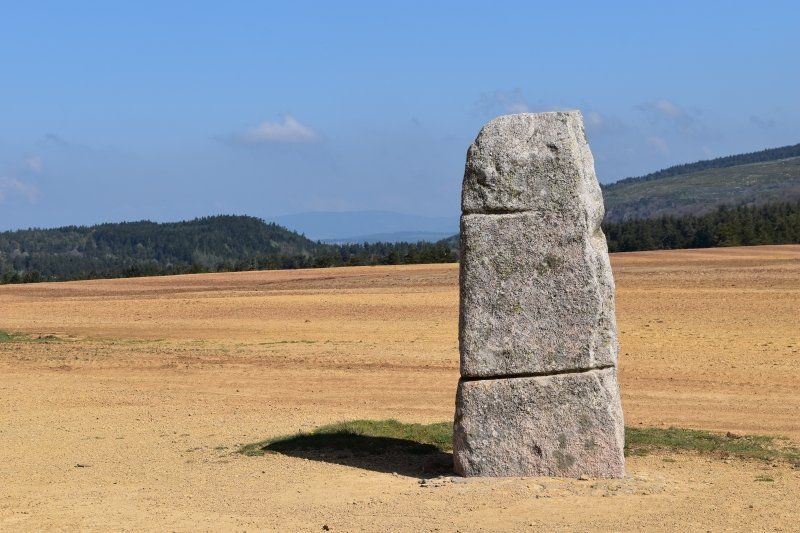
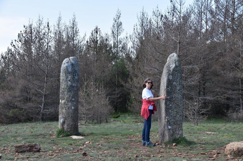
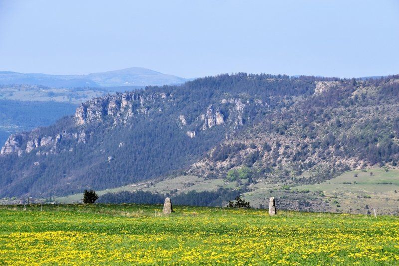
D135/D35 bei Les Bondons, Frankreich
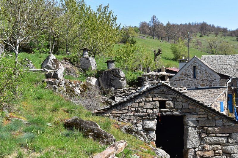
We drive on the narrow D135 at over 1200m to the hiking trail "Balade au pays des menhirs" and marvel at menhirs of different sizes in a great landscape. In a small village we discover the ancient beehives in tree trunks; very special.
D35, 48400 Les Bondons, Frankreich
44° 24' 58.3" N 3° 36' 12.3" E
44.4161875 3.6034298
• Head north on D135.
• Turn left onto D35. Go for 5.0 km.
• Turn right onto Col de Montmirat (N106). Go for 3.4 km.
• Turn right onto D25 toward St Étienne du Valdonnez/Lanuéjols. Go for 1.5 km.
• Continue on Place de la Mairie (D25). Go for 92 m.
• Turn right onto Place de l'Église (D25). Go for 120 m.
• Continue on Rue Droite (D25). Go for 173 m.
• Continue on Route de Varazoux (D25). Go for 341 m.
• Continue on D25. Go for 3.3 km.
• Continue on Lieu-dit Langlade (D25). Go for 250 m.
• Turn right onto Lieu-dit Langlade (D41). Go for 186 m.
• Continue on D41. Go for 2.2 km.
• Continue on Lotissement Les Terres Bleues (D41). Go for 230 m.
• Continue on D41. Go for 6.5 km.
• Continue on Lieu-dit Le Masseguin (D41). Go for 154 m.
• Continue on D41. Go for 1.2 km.
• Turn left onto D41. Go for 3.6 km.
• Continue on Route de la Loubière (D41). Go for 73 m.
• Continue on D41. Go for 39 m.
• Continue on Route de la Loubière (D41). Go for 680 m.
• Turn left onto Square des Tilleuls. Go for 67 m.
• Turn left onto Avenue de la Gare (D901). Go for 2.7 km.
• Turn right onto D27. Go for 398 m.
• Continue on Route de la Gare (D27). Go for 1.8 km.
• Continue on D27. Go for 8.9 km.
• Turn right onto N88 toward Le Puy/Châteauneuf de Randon/Langogne/Margeride. Go for 25.1 km.
• Turn left onto Place de la Halle. Go for 106 m.
• Turn right onto Boulevard Notre-Dame. Go for 74 m.
• Turn sharp right onto Place du Souvenir Français. Go for 25 m.
• Turn left onto Place des Moines. Go for 11 m.
• Arrive at Place des Moines. Your destination is on the left.
☍
68,4 km
(1 hrs. )
Langogne, Lac de Naussac, Frankreich
Stellplatz direkt am See mit Strom und Wasserstation für EUR 10,40.
44° 43' 38" N 3° 51' 19.5" E
44.7272360 3.8554160