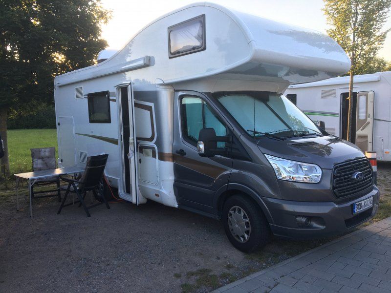
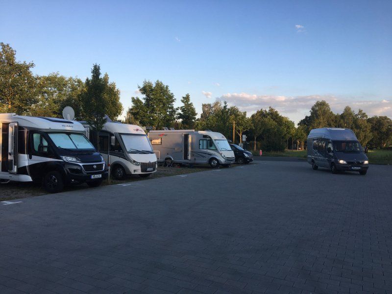
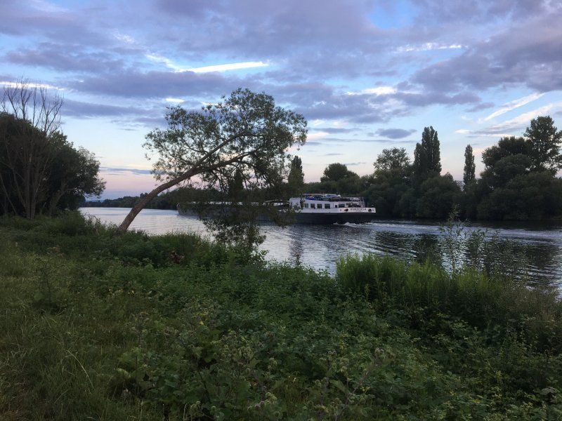
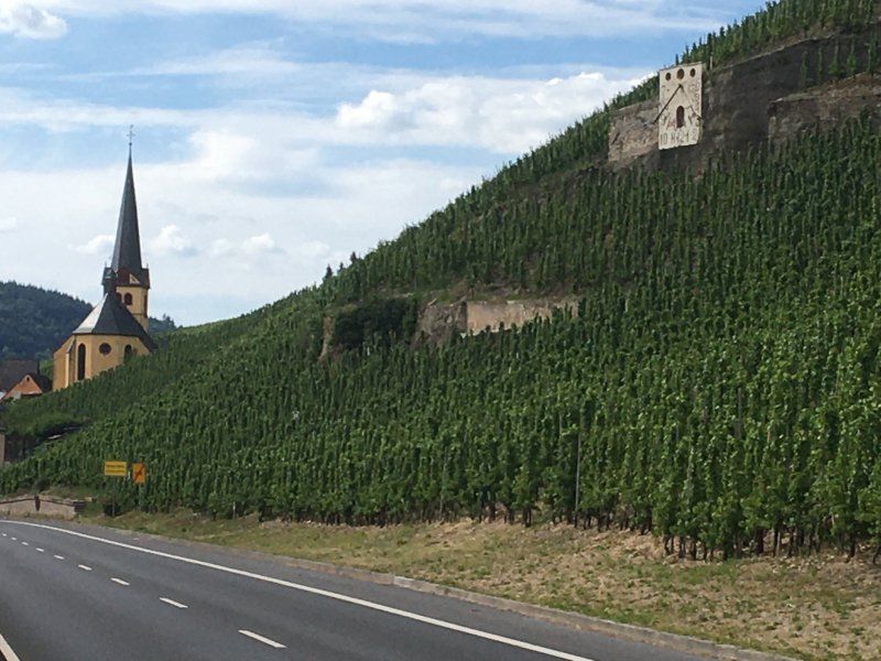
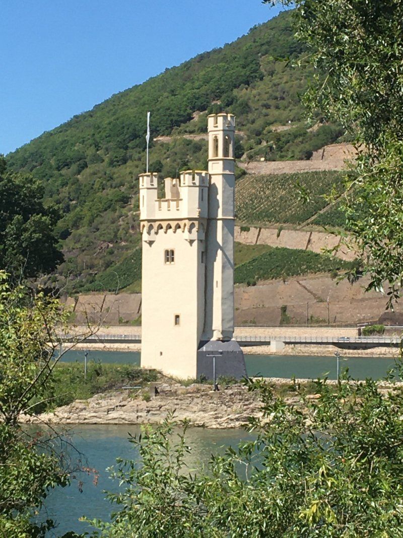
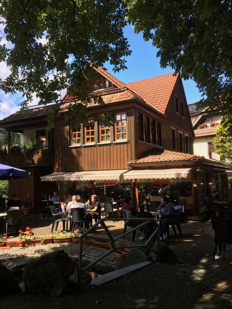
The route took us over 1,500 km in fourteen days with consistently summer temperatures to the Rhine and the Moselle, to the Fulda in Kassel, the Main in Frankfurt am Main and in Limburg to the Lahn. We were in the most beautiful wine-growing regions in Germany - on the Moselle and in the Middle Rhine Valley. In addition to historical attractions such as the Bingen Mouse Tower, the Wartburg near Eisenach or the oldest city in Germany, there were also tranquil small towns on the Moselle or the Frankfurt skyline.
Abfahrt von Zuhause (13.07.2020)
Schmerzker Ring 128, 14776 Brandenburg an der Havel, Deutschland
52° 23' 11.9" N 12° 35' 25.1" E
52.3866362 12.5903062
• Head west on Schmerzker Ring. Go for 56 m.
• Turn right onto Schmerzker Ring. Go for 244 m.
• Turn slightly left onto Schmerzker Ring. Go for 90 m.
• Turn right onto Altes Dorf. Go for 180 m.
• Turn slightly right onto Altes Dorf. Go for 109 m.
• Turn right onto Belziger Chaussee. Go for 822 m.
• Turn left toward B102. Go for 40 m.
• Turn right onto B102. Go for 3.3 km.
• Turn left and take ramp onto A2 toward Hannover. Go for 139 km.
• Take exit 58 toward Kassel/Salzgitter/Braunschweig-Süd onto A39. Go for 50.9 km.
• Take the left exit toward Kassel onto A7. Go for 115 km.
• Take exit 79 toward Marburg/Kassel onto A49 (Südtangente). Go for 4.1 km.
• Take exit 5 toward Kassel-Auestadion onto B3. Go for 1.0 km.
• Turn right onto Am Sportzentrum (K19). Go for 443 m.
• Turn right onto Giesenallee. Go for 156 m.
• Turn right. Go for 17 m.
• Turn right. Go for 38 m.
• Arrive at your destination on the left.
☍
315,4 km
(2 hrs. 52 min.)
Day
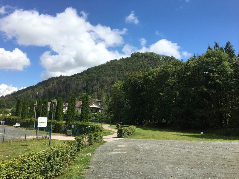
Wohnmobilplatz Kassel (13.07. - 15.07.2020)
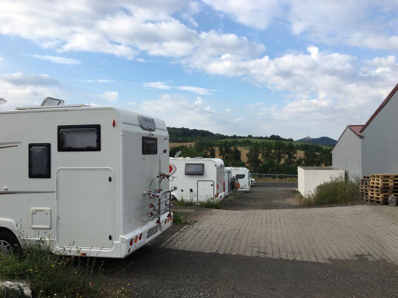
The partially paved or asphalted parking space for 20 campers is opposite the Kassel campsite. Due to the corona pandemic, the sanitary facilities at the campsite were not allowed to be used. In the high season, only the low season parking space price of € 9 / night plus € 0.50 per kWh for electricity was due. The parking space is relatively close to the center (15 minutes by bike) near a sports center (including the Kassel Huskies venue).
Rating by us: 3.5 out of 5 stars
Giesenallee 7, 34121 Kassel, Deutschland
51° 17' 28.7" N 9° 29' 13" E
51.2912931 9.4869376
• Head south. Go for 55 m.
• Turn left onto Giesenallee. Go for 156 m.
• Turn left onto Am Sportzentrum (K19). Go for 426 m.
• Turn left onto Am Auestadion (B3). Go for 871 m.
• Take ramp onto A49 (Südtangente) toward Marburg/Baunatal/Dortmund/Kassel-Niederzwehren. Go for 82.3 km.
• Take the left exit toward Basel/Frankfurt/Wiesbaden/Gießen onto A5. Go for 71.1 km.
• Take exit 17 toward Offenbach/P+R onto A661. Go for 13.8 km.
• Take exit 14 toward Frankfurt-Ost/Hanau/Maintal onto B8/B40 (Ratsweg). Go for 716 m.
• Turn left onto Hanauer Landstraße (B8/B40) toward Hanau/Maintal/Offenbach/Fechenheim. Go for 3.9 km.
• Turn right onto Frankfurter Landstraße. Go for 483 m.
• Arrive at Frankfurter Landstraße. Your destination is on the left.
☍
173,8 km
(1 hrs. 38 min.)
Day
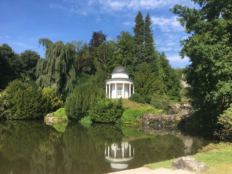
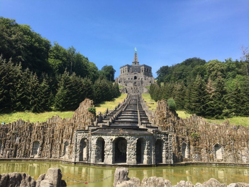
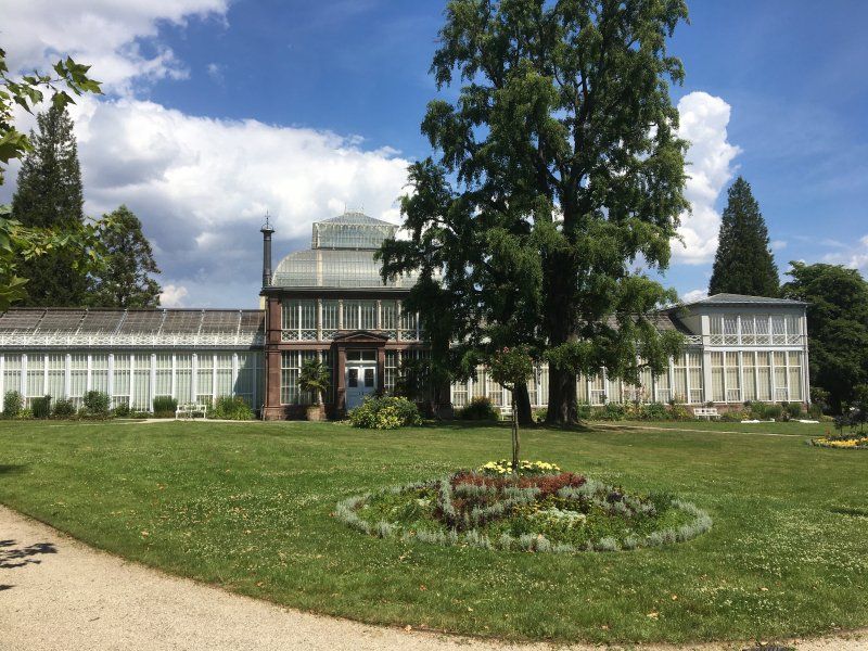
Rundgang durch Kassel und Ausflug zur Wilhelmshöhe
With around 202,000 inhabitants, Kassel is the center of northern Hesse and the third largest city in Hesse after Frankfurt am Main and Wiesbaden. Badly destroyed in World War II (1943), the city now has several sights in the city center (St. Martin's Church, Natural History Museum in the Ottoneum, Fridericianum). The orangery in the Karlsaue with the Karlsaue state park and Wilhelmshöhe Palace with the orangery, as well as the imposing Hercules and grandiose water features (from Wednesday, Friday, Saturday and Sunday at 2:30 p.m., however, currently do not yet speak of the medieval tradition of the Hessian landgraves) because of the corona pandemic).
Day
Campingplatz Mainkur (15.07. - 17.07.2020)
The small, family-run campsite is located on a former lock right on the Main in the municipality of Maintal just outside Frankfurt. Downtown Frankfurt can be easily reached by bus from Mainkur train station (20 minutes' walk from the campsite into town).
The pitches are spacious and partly shady under large trees, which can affect television reception. The sanitary facilities are very clean and in a very good condition. However, the cost of an overnight stay of 12 € / night for the motorhome, 8 € per adult / night, 3 € electricity / night is not exactly low.
Rating: 4.5 out of 5 stars
Frankfurter Landstraße 107, 63477, Maintal/Frankfurt am Main, Deutschland
50° 8' 18.2" N 8° 46' 58.8" E
50.1384000 8.7830000
• Head toward Hanauer Landstraße on Frankfurter Landstraße. Go for 439 m.
• Turn left onto Hanauer Landstraße (B8/B40). Go for 3.9 km.
• Turn left onto B8/B40 toward Darmstadt/A661/Flughafen Frankf. Kreuz/Offenbach. Go for 79 m.
• Take ramp onto A661 toward Darmstadt/Flughafen Frankf. Kreuz/Offenbach. Go for 5.4 km.
• Take exit 17 toward Köln/Wiesbaden/F. Kreuz/Flughafen onto A3. Go for 17.6 km.
• Take exit 48 toward Darmstadt/Mainz/Rüsselsheim onto A67. Go for 6.3 km.
• Take exit 3 toward Mainz/Wiesbaden/Rüsselsheim/Rüdesheim onto A60. Go for 44.2 km.
• Take exit 12 toward Köln/Koblenz/St. Goar/Rhein/Bingen-Mitte/Flughafen Hahn/B9 onto A61. Go for 21.9 km.
• Take the exit toward Rheinböllen/Trier/Simmern/Bacharach/Rhein/Flughafen Hann. onto B50. Go for 35.8 km.
• Continue on B327. Go for 9.5 km.
• Take the 2nd exit from roundabout onto B50 toward Köln/Lüttich/Wittlich/Bernkastel-Kues/Mülheim a.d.Mosel. Go for 27.3 km.
• Continue on A60. Go for 542 m.
• Take the exit toward Saarbrücken/Luxembourg/Trier onto A1. Go for 19.3 km.
• Take exit 130 toward Luxembourg/Trier onto A602. Go for 9.6 km.
• Continue on B49. Go for 2.5 km.
• Keep left onto Georg-Schmitt-Platz (B49) toward B51/Saarburg/Konz/Luxemburg/Universität/Wip. Go for 227 m.
• Continue on Katharinenufer (B49) toward Centrum/Alleenring. Go for 2.5 km.
• Take ramp onto Konrad-Adenauer-Brücke (B49/B51) toward Luxemburg/TR-West/TR-Euren-Zewen/Gewerbegebiet TR-Monaise. Go for 497 m.
• Take ramp. Go for 270 m.
• Turn left onto In den Moselauen. Go for 36 m.
• Turn left toward In den Moselauen. Go for 167 m.
• Turn slightly right onto In den Moselauen. Go for 42 m.
• Arrive at In den Moselauen. Your destination is on the left.
☍
208,2 km
(2 hrs. 17 min.)
Day
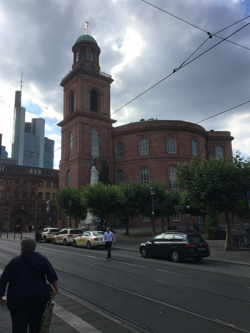
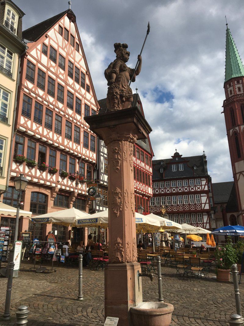
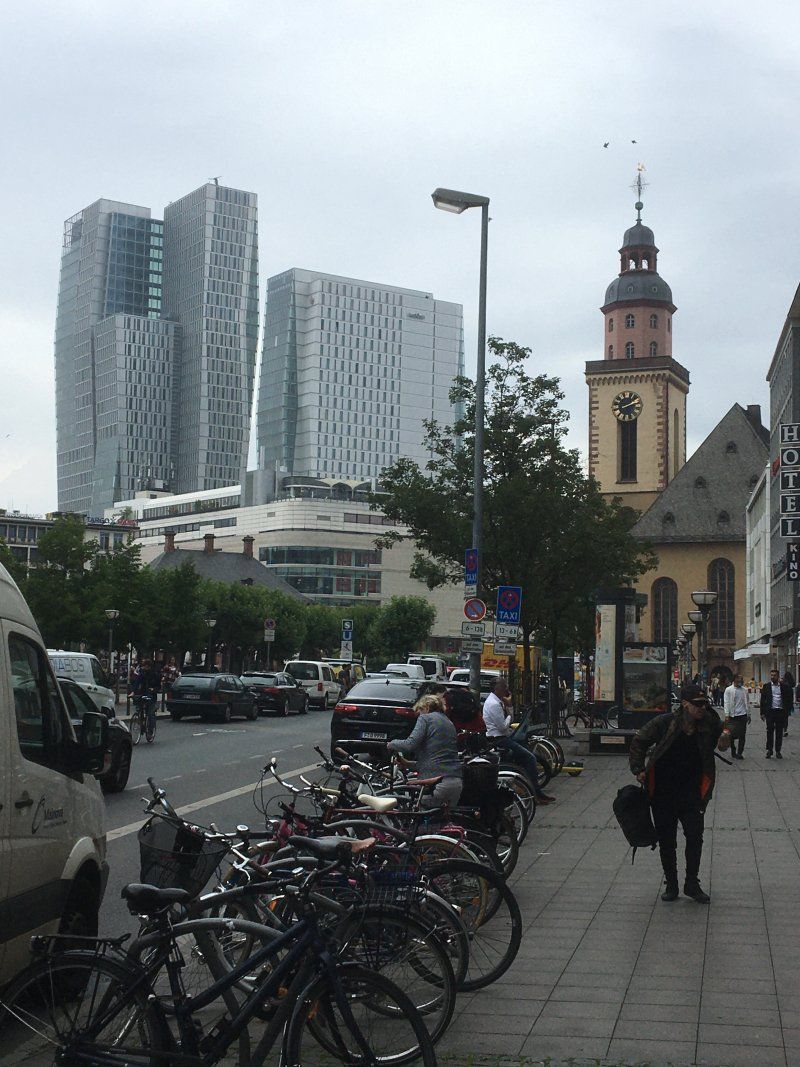
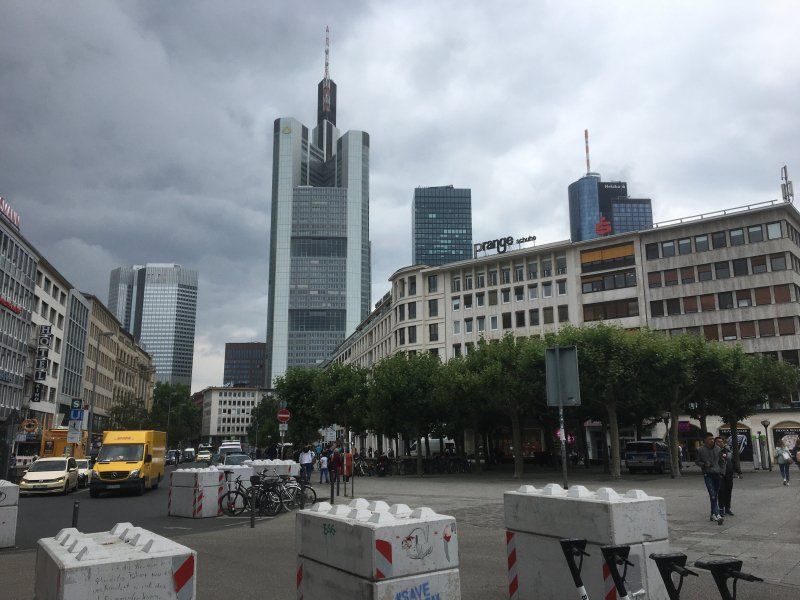
Stadtrundfahrt und Besuch der Innenstadt von Frankfurt am Main
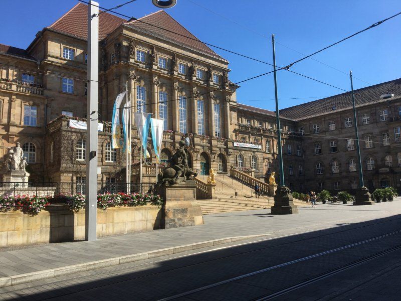
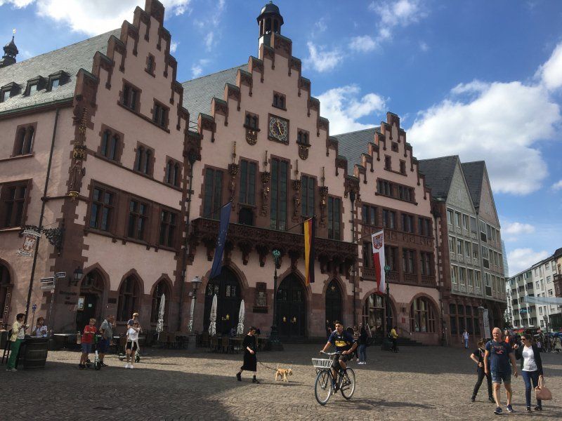
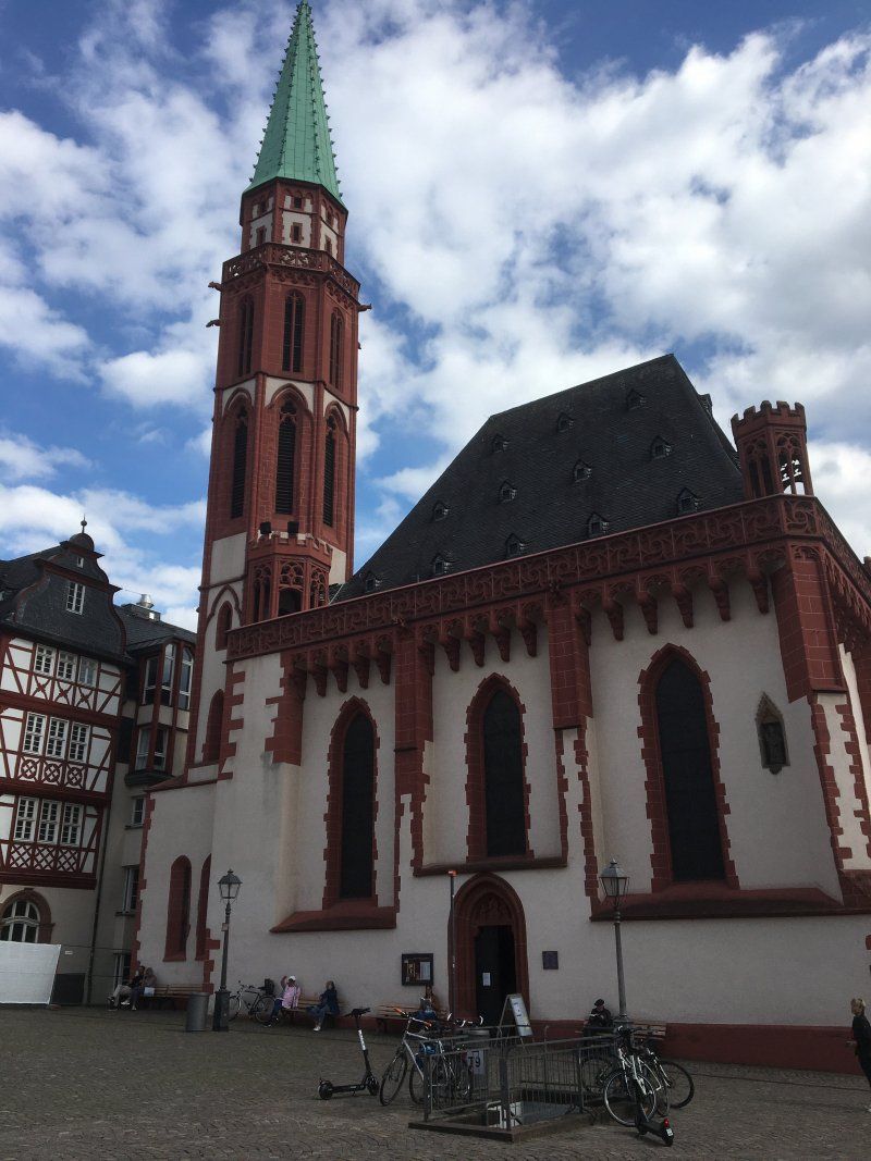
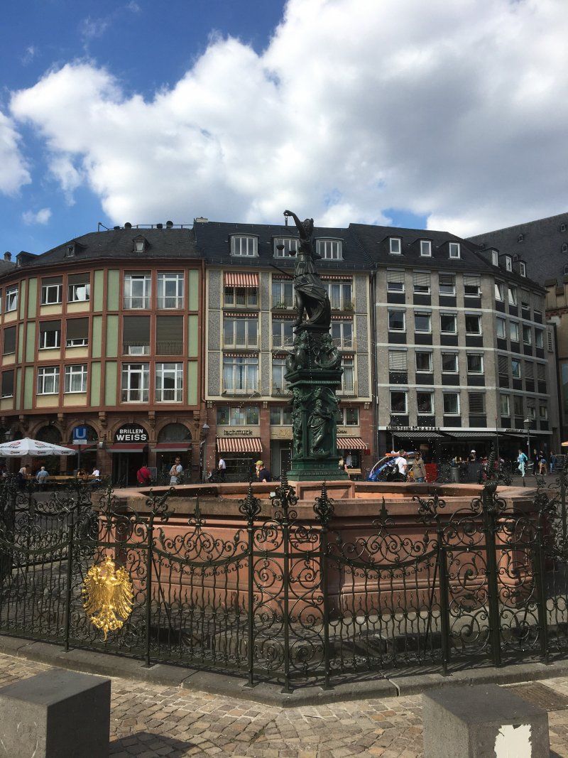
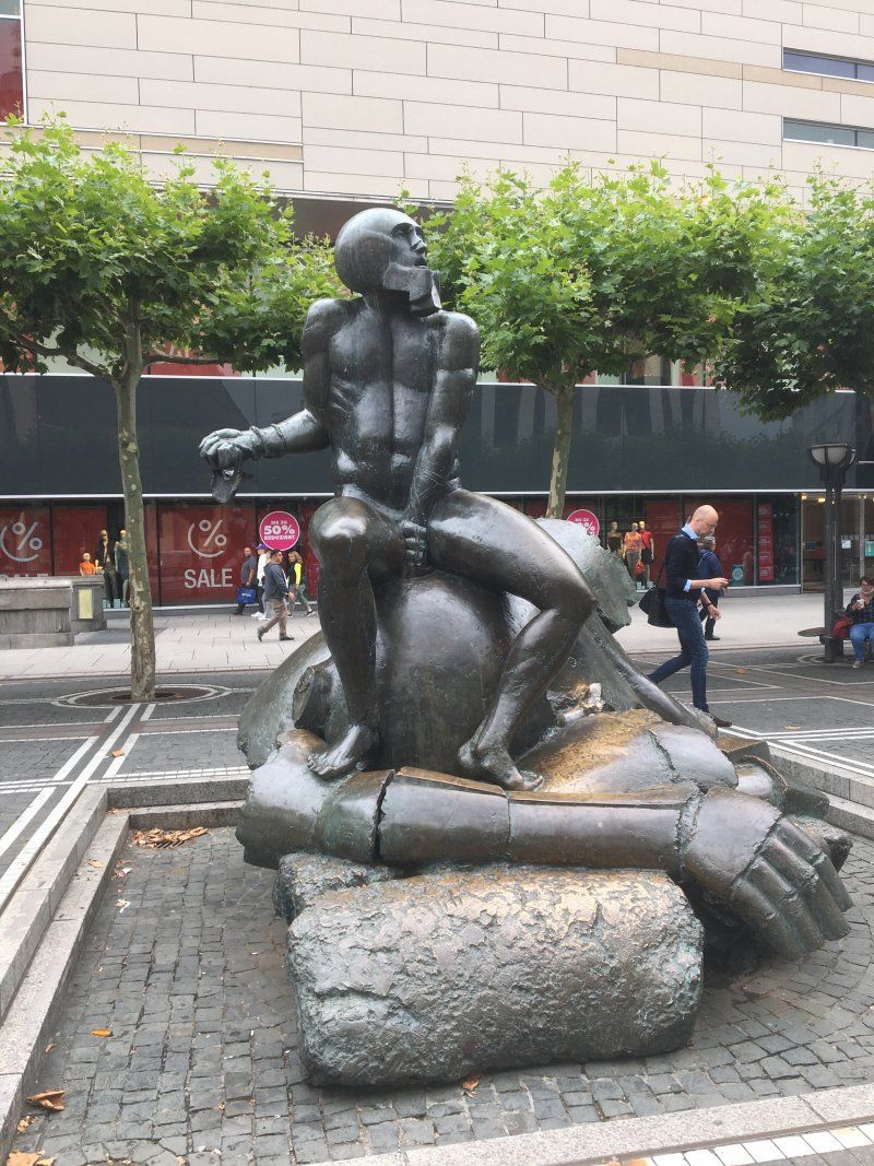
With around 760,000 inhabitants, Frankfurt am Main is the largest city in Hesse and the center of the Frankfurt metropolitan area with 2.3 million inhabitants. The banking metropolis - once a dreamy half-timbered town - was almost completely destroyed in Allied bombing raids in World War II. It is thanks to the will of Frankfurt and clever political decisions that at least the old town with the cathedral, the Römerberg (including the seat of the town hall), the opera and the Paulskirche were completely rebuilt. Today, it offers an attractive contrast to the skyline of the high-rise banks, which is why the banking district is also fondly called Mainhattan by the Frankfurters. Tip: Before taking the city tour, be sure to take a city tour with one of the Hop On, Hop Off buses from the Paulskirche! Then a shopping spree in the Zeil with the shopping center "My Zeil".
Day
Day
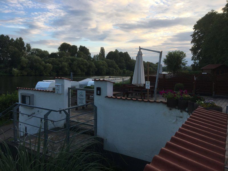
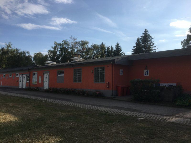
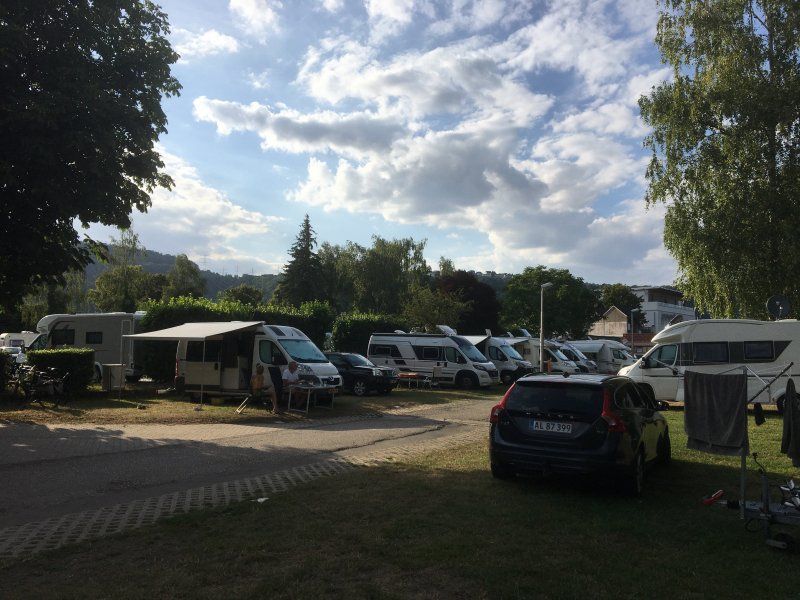
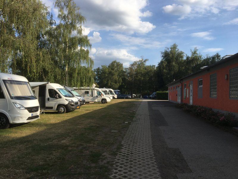
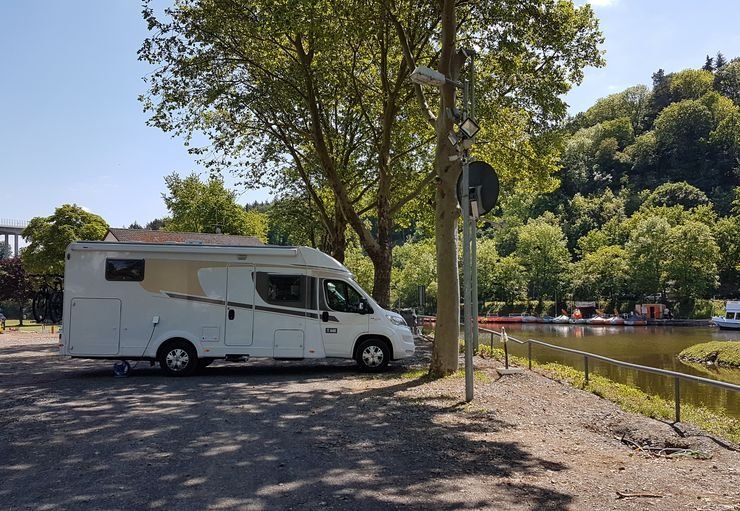
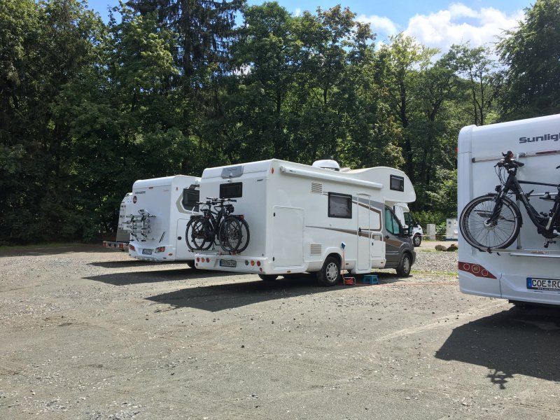
Reisemobilpark Treviris (17.07. - 19.07.2020)
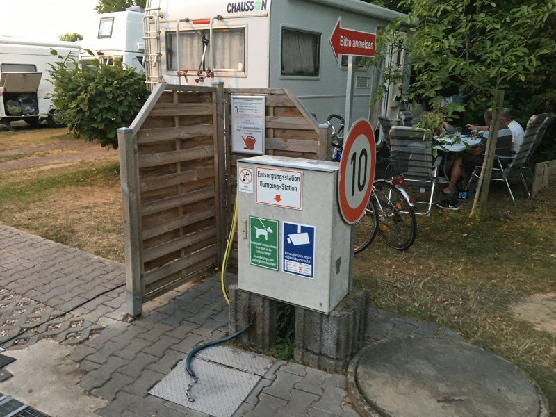
The Reismobilpark for 120 motorhomes is located in the Trier-Euren district near the exhibition center, right on the banks of the Moselle. The parking space for motorhomes up to 7.5 m in length costs € 7.80 / night. In addition there are € 6.60 per adult / night and € 0.70 / kWh of electricity. In addition to complete supply and disposal, the place has very good sanitary facilities (showers: 1 € / 4 minutes) and a bread service.
The city center is very easy to reach via bike paths in about 15 minutes.
Rating: 4.5 out of 5 stars
In den Moselauen, 54295, Trier, Deutschland
49° 44' 25" N 6° 37' 28" E
49.7402778 6.6244444
• Head south on In den Moselauen. Go for 42 m.
• Turn slightly left toward In den Moselauen. Go for 167 m.
• Turn right onto In den Moselauen. Go for 139 m.
• Turn right and take ramp onto Konrad-Adenauer-Brücke (B49/B51). Go for 508 m.
• Turn right and take ramp onto Pacelliufer (B49) toward Centrum. Go for 5.5 km.
• Continue on A602. Go for 9.8 km.
• Continue on E44 (Autobahndreieck Moseltal). Go for 77 m.
• Take the exit onto A1. Go for 19.0 km.
• Take exit 126 toward Mainz/Flughafen Hahn/B50 onto A60. Go for 1.4 km.
• Continue on B50. Go for 9.7 km.
• Take ramp onto B269 toward Traben-Trarbach/Mosel/B53. Go for 3.0 km.
• Take the 3rd exit from roundabout onto L189 toward Zeltingen-Rachtig/Erden. Go for 1.2 km.
• Arrive at Am Moselufer (L189). Your destination is on the right.
☍
50,5 km
( 38 min.)
Day
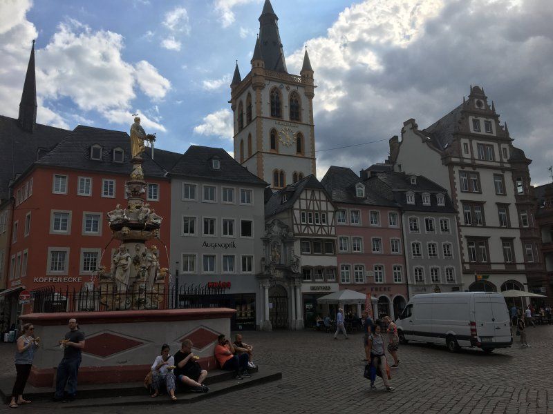
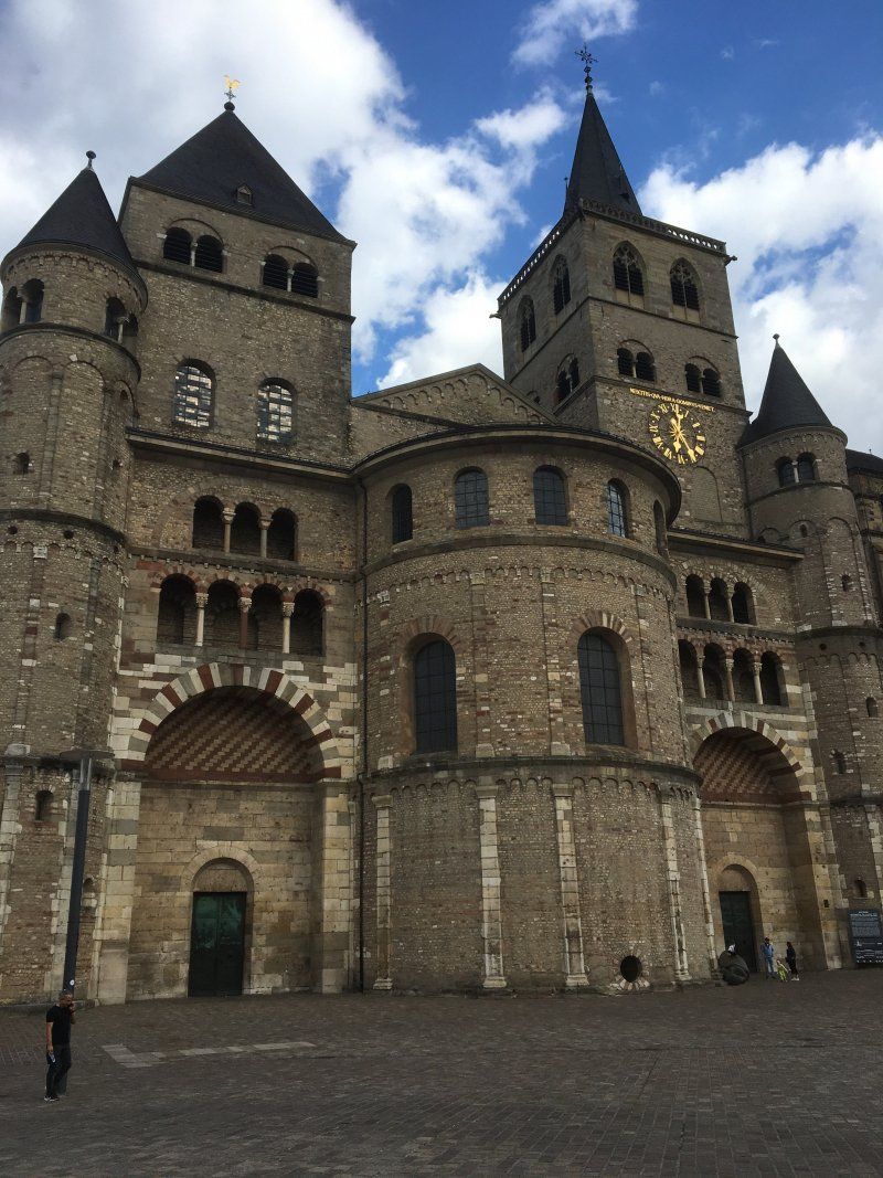
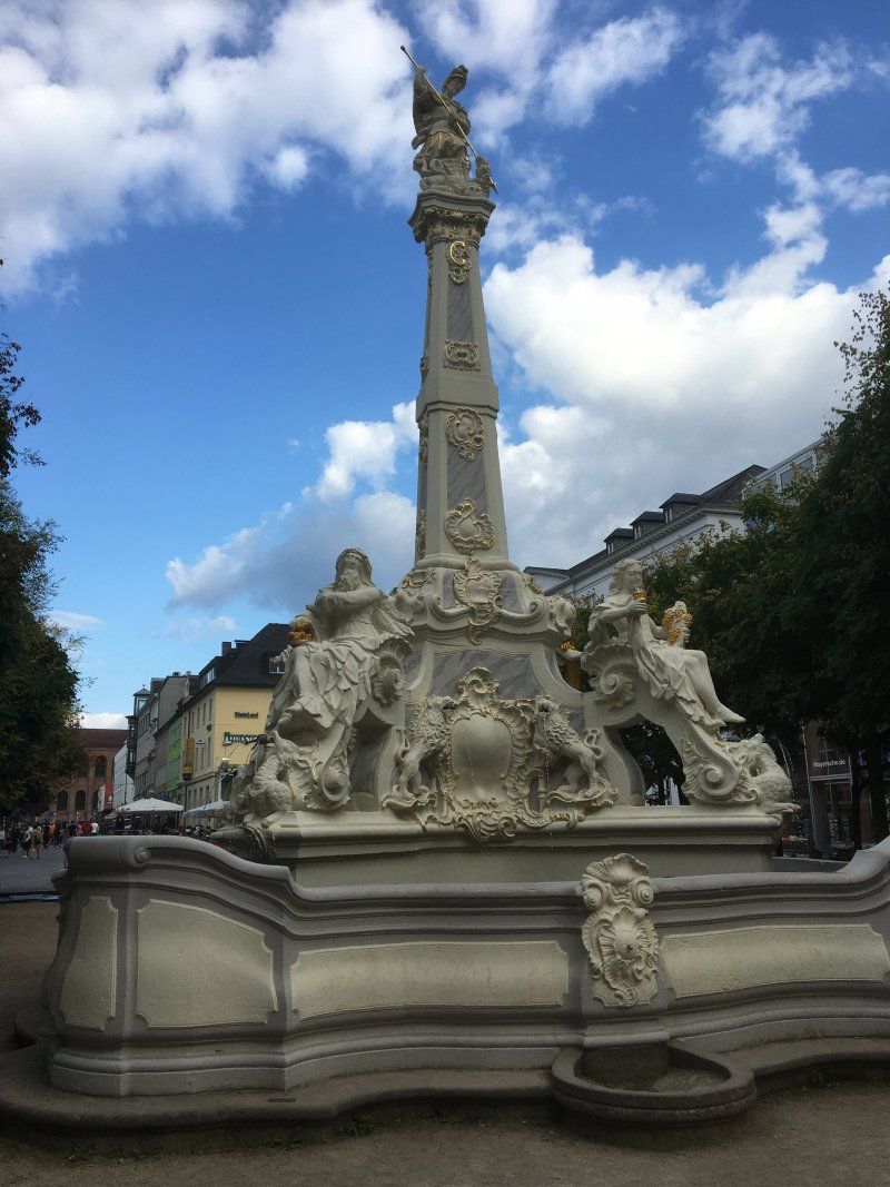
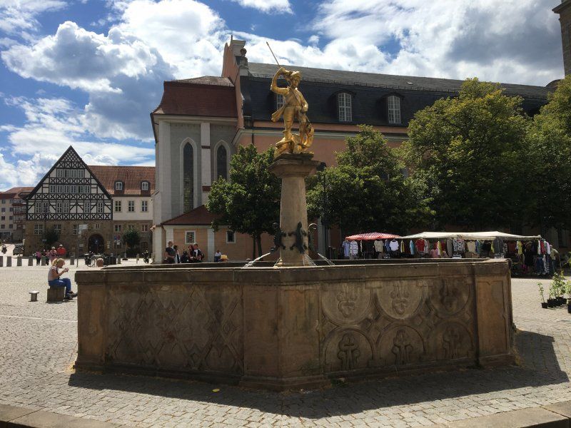
Besuch in der ältesten Stadt Deutschlands
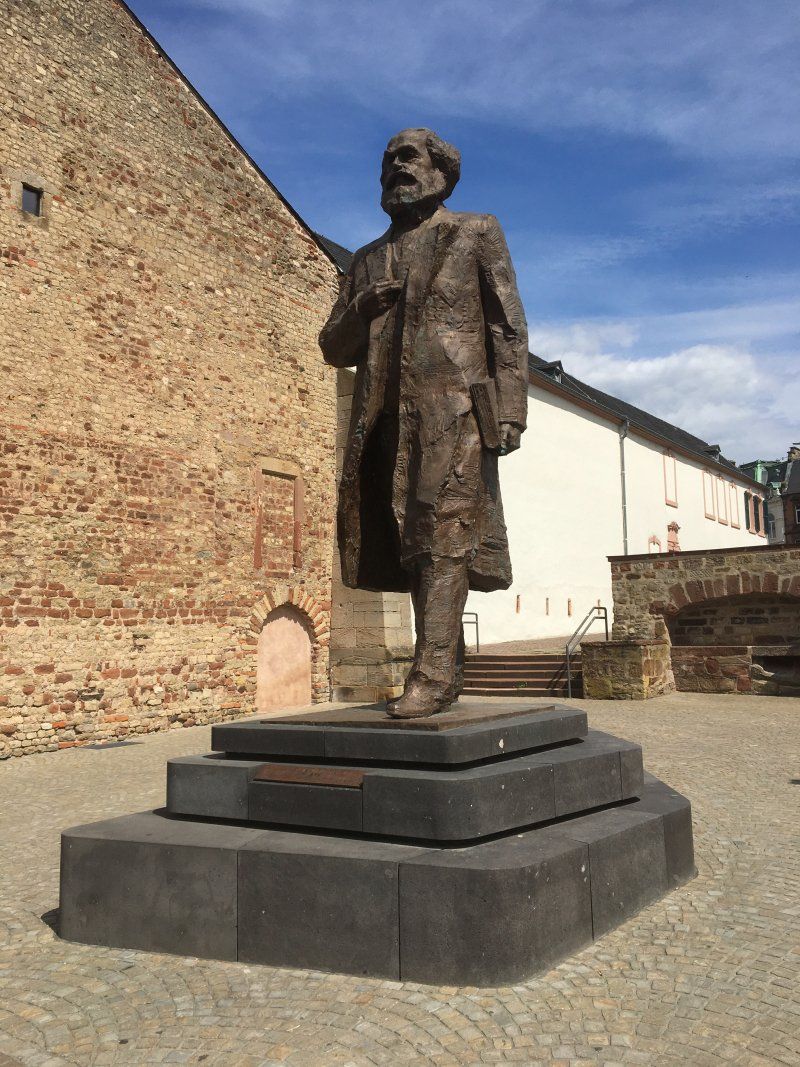
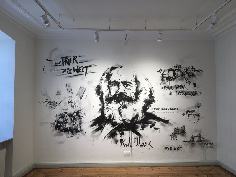
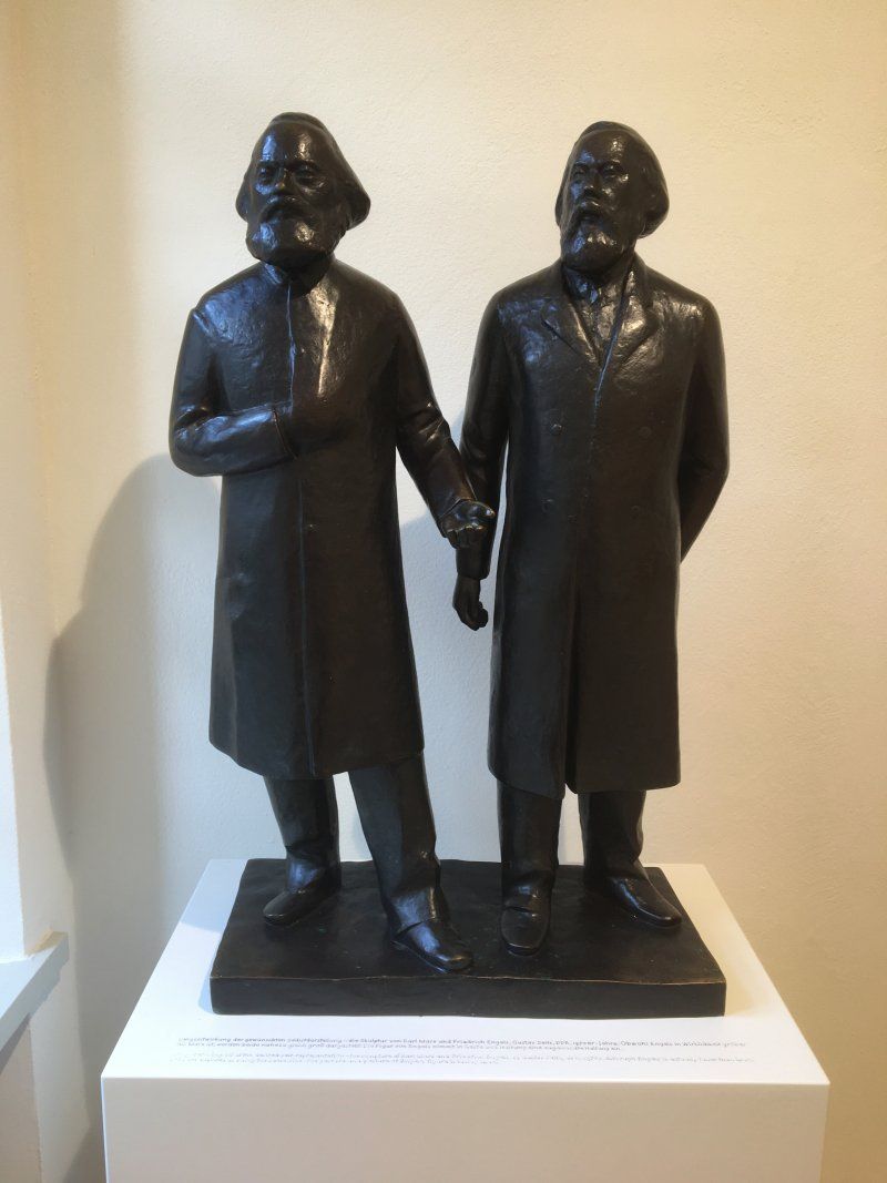
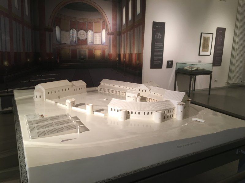
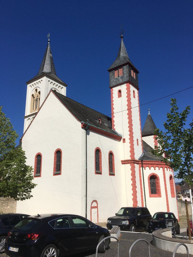
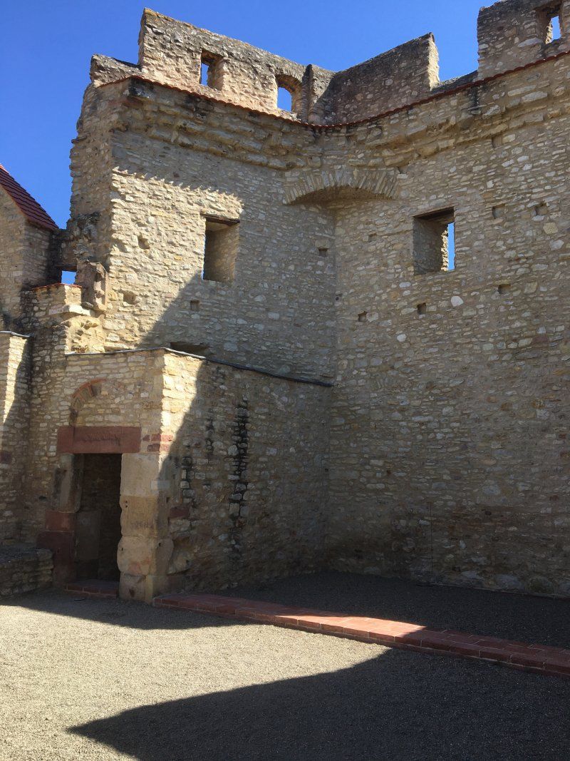
Trier, as a Roman foundation (Augusta Treverorum) and around 2,000 years old, is demonstrably the oldest city in Germany. Numerous Roman buildings such as the famous Porta Nigra, the Constantine basilica and the ruins of the imperial and barbarian baths tell of this in today's Rhineland-Palatinate city (approx. 111,000 inhabitants). The Chinese have put a memorial to the great thinker and philosopher Karl Marx in the old town and the city commemorates his work with a remarkable exhibition in the Karl Marx House. In addition, the city has a romantic and lovely old town with the cathedral and the Liebfrauenkirche, the main market, the St. Georgsbrunnen, the Palais Walderdorff. Located just outside the city, Monaise Castle is worth a visit.
Day
Tagesausflug nach Luxemburg
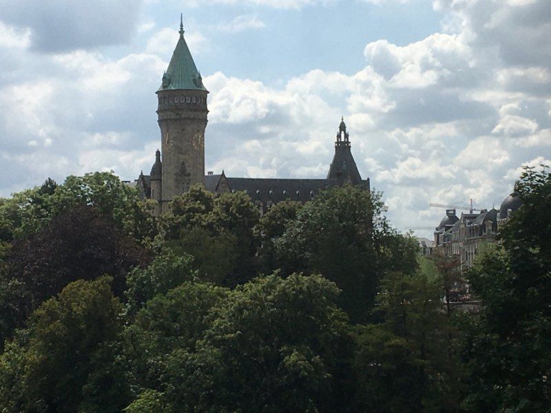
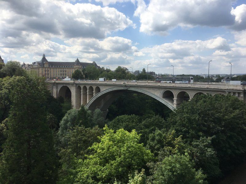
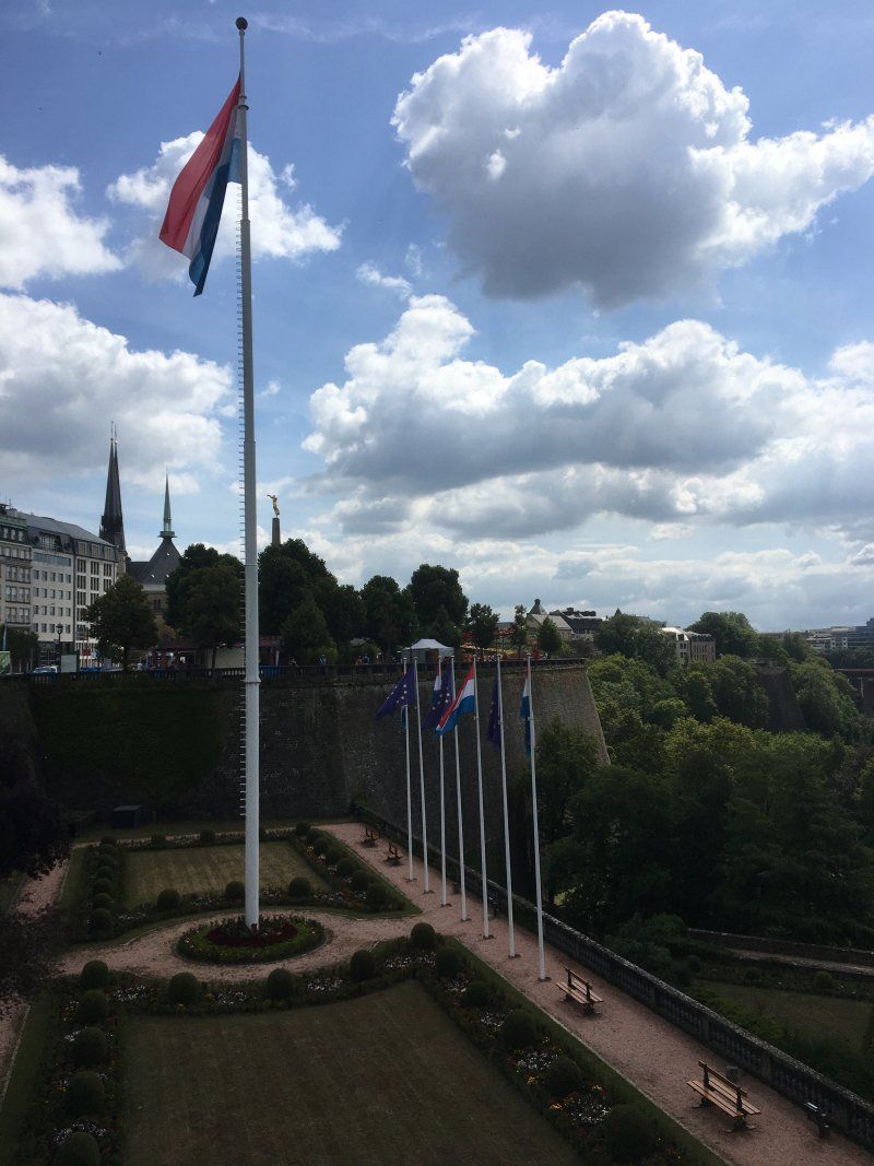
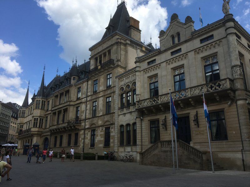
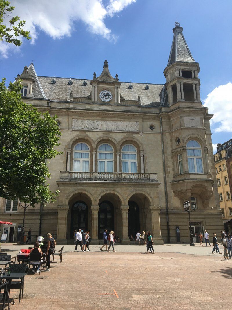
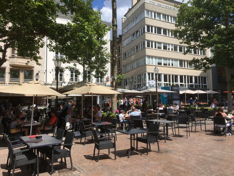
Luxembourg is only about 45 minutes by train (the trains run every hour) from Trier and is therefore definitely worth a flying visit. With 120,000 inhabitants, the city is the administrative center of the Grand Duchy of Luxembourg (630,000 inhabitants). Alongside Brussels and Strasbourg, the city is the seat and meeting place of numerous European institutions. It is a 15-minute walk from the Luxembourg main station to the center of the lively upper town with the Grand Ducal castle, the Church of Our Lady (Notre Dame), the town hall and the Place d'Armes, popular with residents and tourists, and the Gëlle Fra ("Golden woman", National monument in honor of the Luxembourgers who died in both World Wars and the Korean War).
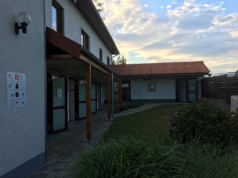
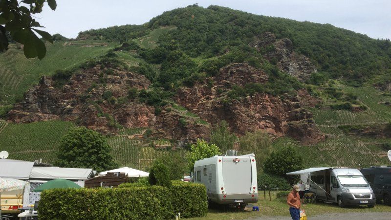
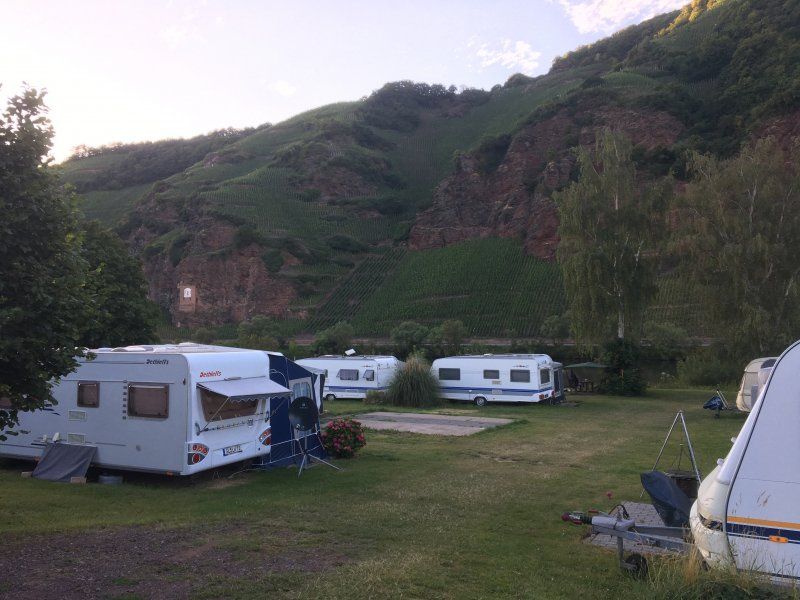
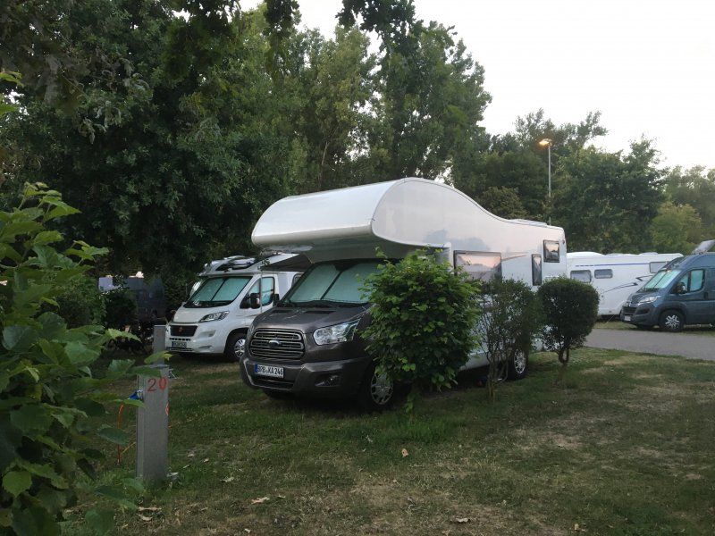
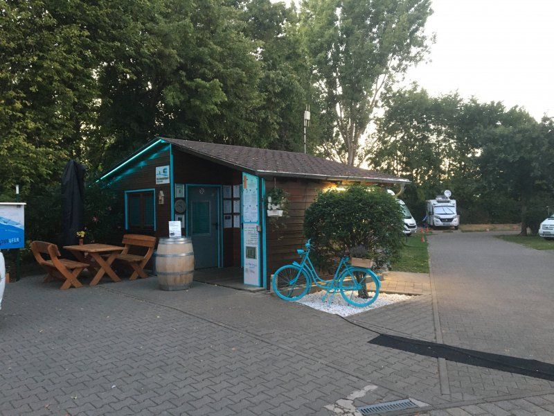
Stellplatz Camping Erden (19.07. - 21.07.2020)
The parking space for approx. 20 campers is located on a campsite directly on the banks of the Moselle on the outskirts of the wine town of Erden on the Moselle with dense trees (some with limited TV reception). The ground is partly uneven and overgrown with grass or gravel. In contrast to the campsite, it is not possible to reserve the parking spaces in advance. In addition to complete supply and disposal, the place has sufficient washing and showering facilities, bread service (daily from 8:00 a.m. at the reception, no advance booking necessary!) And a small restaurant (11:00 a.m. - 2:00 p.m. and 5:00 p.m. - 9:00 p.m.). Pitch, incl. 2 people: € 10.50 / night, electricity (flat rate): € 3 / night, showers: € 0.30 / minutes (with a chip card that is charged with € 5, the remaining amount will be deducted from the total price on departure) ).
Rating: 4.5 out of 5 stars
Am Moselufer 1, 54492, Erden, Deutschland
49° 58' 48" N 7° 1' 16" E
49.9800000 7.0211111
• Head west on Am Moselufer (L189). Go for 58 m.
• Turn left onto Poststraße toward Erden. Go for 50 m.
• Turn right onto Auf der Geig. Go for 268 m.
• Turn right toward L189. Go for 10 m.
• Turn right onto L189. Go for 1.4 km.
• Take the 2nd exit from roundabout onto B269 toward Mainz/Wittlich/B50/E42/Flughafen Hahn. Go for 2.8 km.
• Take ramp onto B50. Go for 17.5 km.
• Take the 3rd exit from roundabout onto B50/B327 toward Mainz/Koblenz/Flughafen Hahn. Go for 9.6 km.
• Continue on B50 toward A61/Flughafen Hahn/B327. Go for 35.2 km.
• Take ramp onto A61 toward Ludwigshafen/Mainz. Go for 21.3 km.
• Take exit 50 toward Frankfurt/Mainz/Ingelheim/Bingen-Ost onto A60. Go for 3.7 km.
• Take exit 13 toward Bingen-Kempten/Bingen-Ost Gewerbegebiet/Rüdesheim a.Rh. Fähre. Go for 404 m.
• Take the 2nd exit from roundabout onto L419. Go for 1.4 km.
• Turn right onto Mainzer Straße toward Bin.-Gaulsheim. Go for 228 m.
• Turn left onto Außerhalb Gaulsheim. Go for 148 m.
• Arrive at Außerhalb Gaulsheim. Your destination is on the left.
☍
94,1 km
(1 hrs. 1 min.)
Day
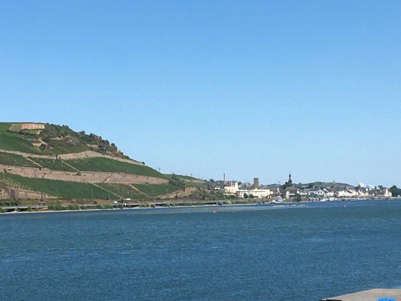
Bernkastel-Kues, Perle der Mosel
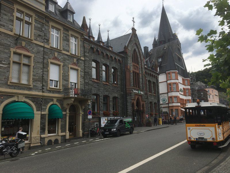
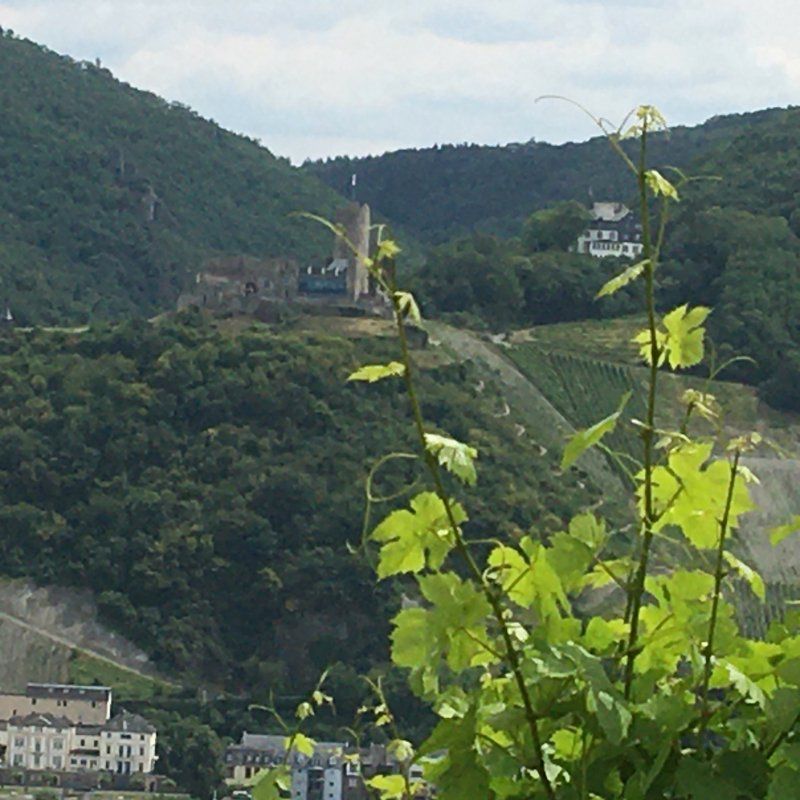
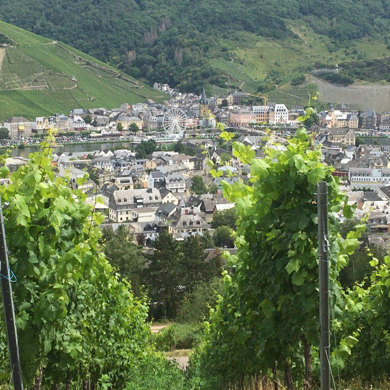
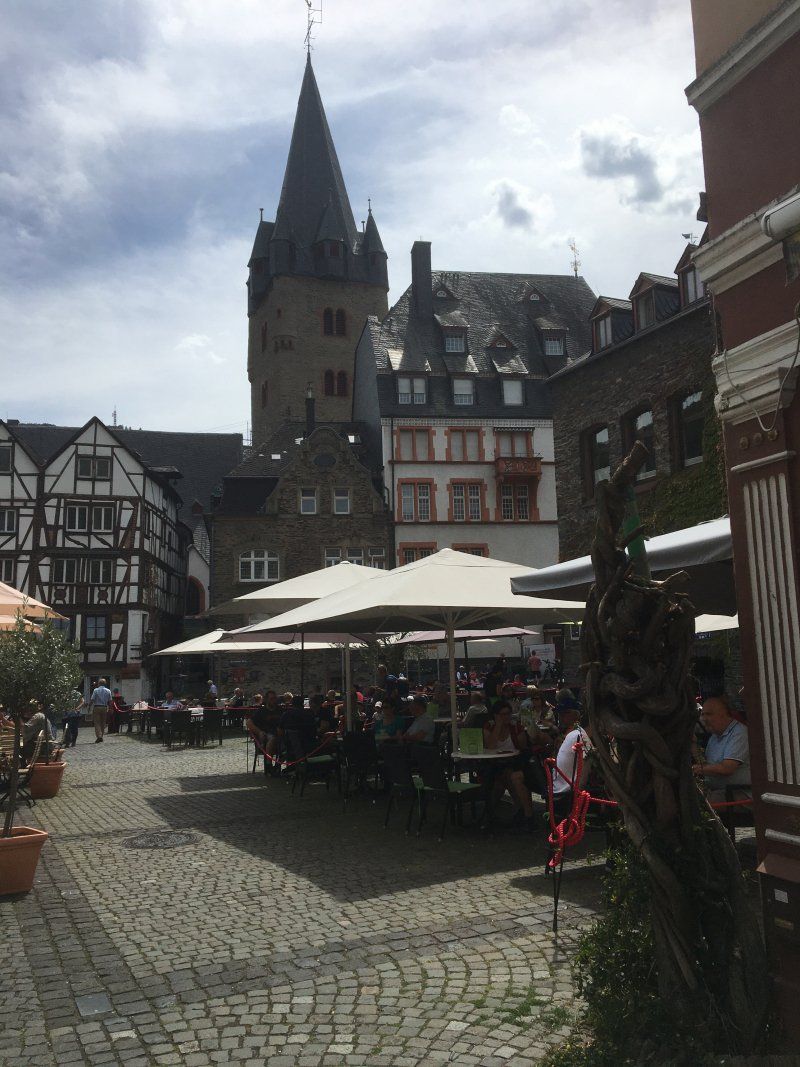
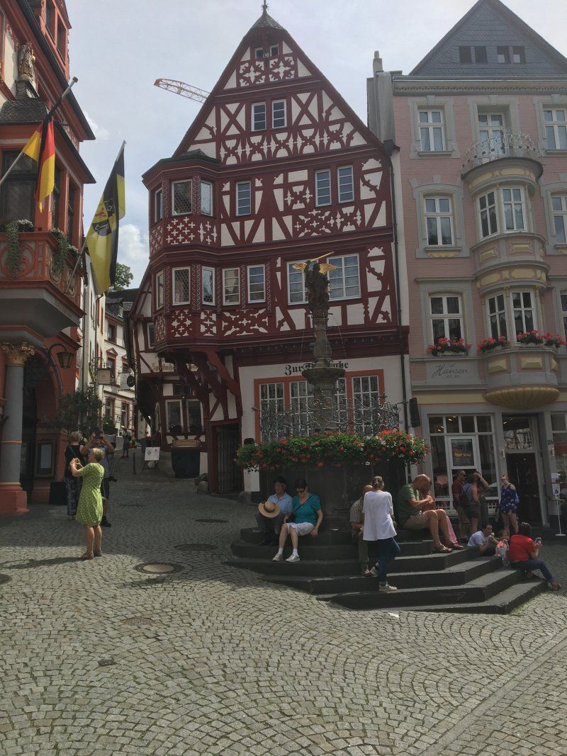
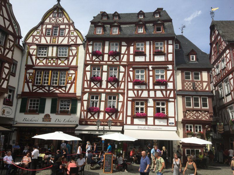
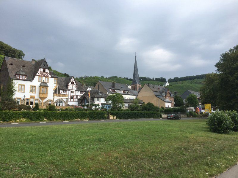
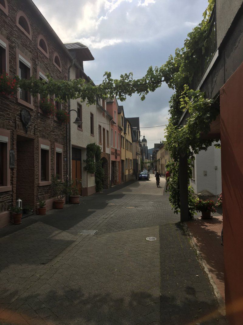
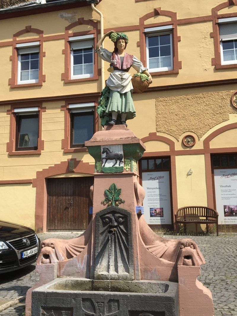
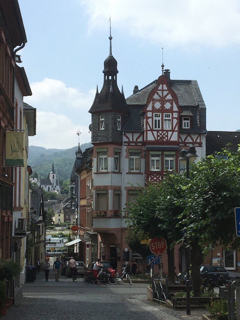
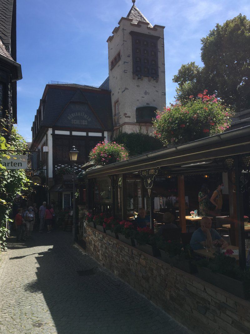
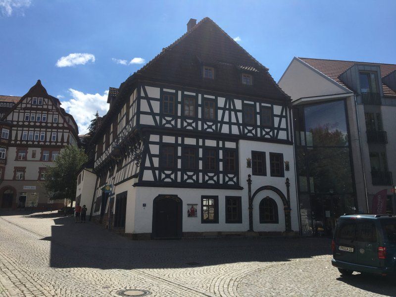
We were able to explore both wine towns, Bernkastel-Kues-Kues (11 km from Erben) and Traben-Trarbach (15 km) by bike on the very well-developed and signposted Moselle cycle path, which leads directly past the parking space in Erden on the Moselle. It is not for nothing that Bernkastel-Kues-Kues is called the pearl of the Moselle, as the town of just 7,000 inhabitants in the valley of the Central Moselle has a large number of pretty half-timbered buildings (including the so-called pointed house). The city's most famous son, the medieval philosopher and universal scholar Nikolaus von Kues (his scholarly name was Cusanus), is omnipresent in the city (including birthplace, Catholic academy). As part of a small city tour (start at the harbor, duration: approx. 45 minutes, € 9 / adult) with a Bimmelguste, we were able to explore both districts of the twin city and the surrounding area. The city of Bernkastel-Kues has only been a dual city since 1905 (merger of the city of Bernkastel with the small wine-growing village of Kues). In addition to numerous half-timbered houses, the Protestant church in Kues, the Cusanus birth house and the town hall are particularly worth seeing. The Cusanus Abbey (originally a hospital) founded by Nikolaus von Kues in 1451 is still preserved and can also be visited (at least partially).
Day
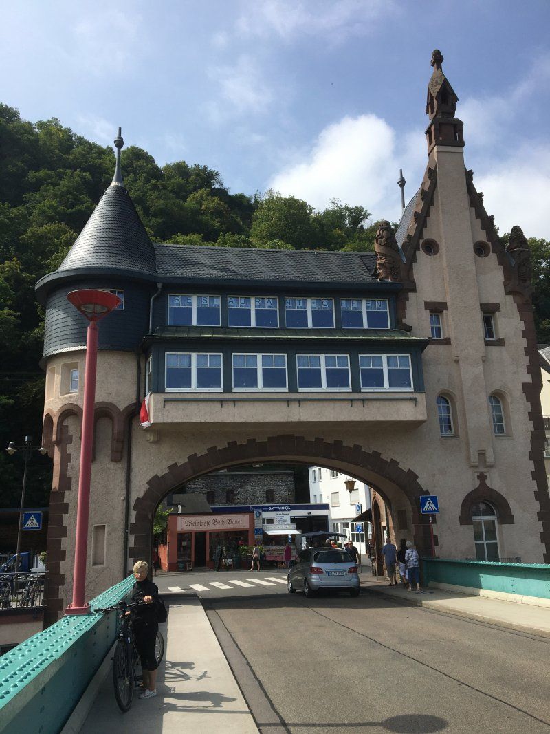
Traben-Trarbach, die Weinstadt
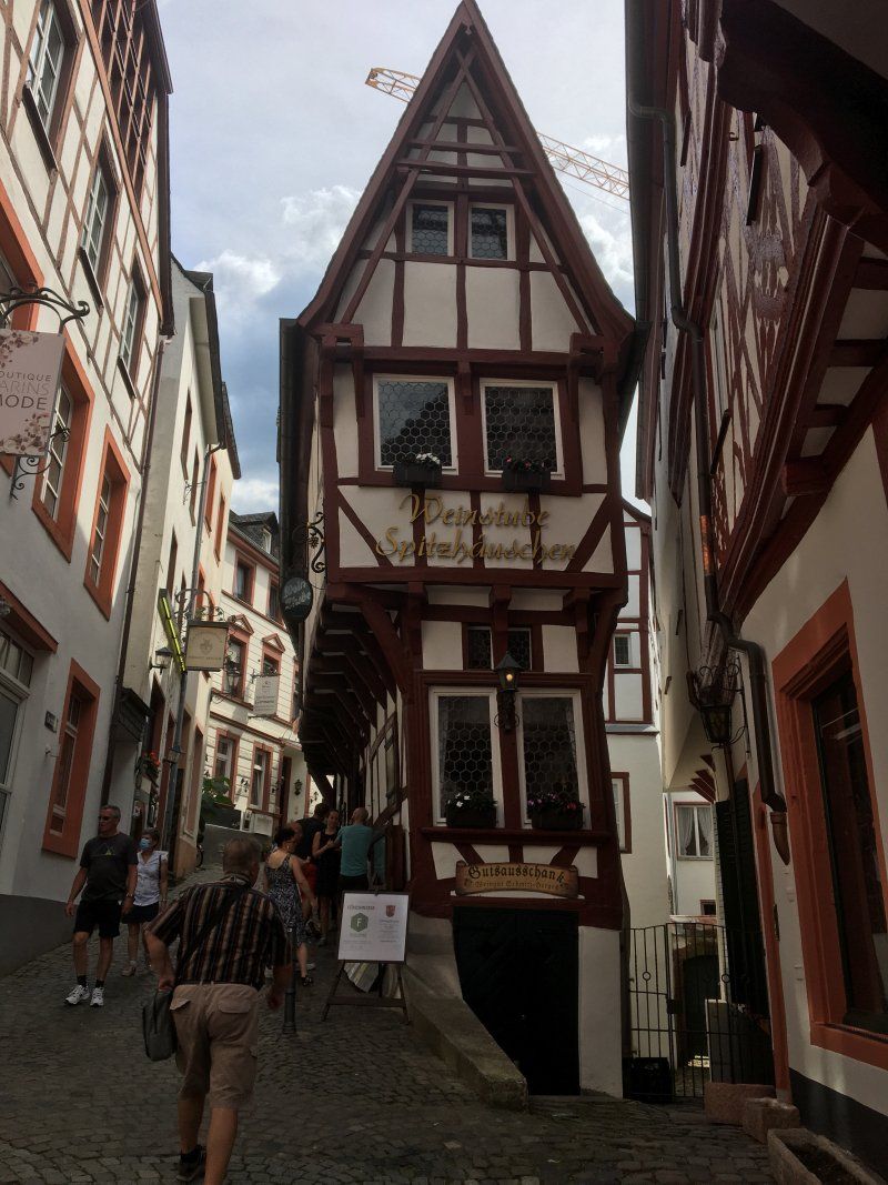
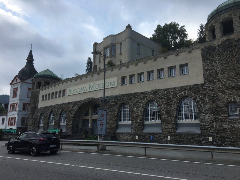
The small town on the Central Moselle, which has only 6,000 inhabitants, is known for the bridge tavern on the Moselle Bridge built in 1898, which connects the districts of Traben and Trarbach. In 1904 the formerly independent towns merged to form the city of Traben-Trarbach. Particularly worth seeing are the former post office and the Lorettahaus in the Traben district and of course the bridge gate with the bridge tavern. A special curiosity is the Buddha Museum, unique in Germany, in a former winery. The city's most famous son, the architect Bruno Möhring (one of the founders of Art Nouveau in Germany) has left his mark everywhere in the city (including the bridge gate, Buddha Museum, Hotel Bellevue). Traben-Trarbach is also famous for its famous vineyards, which deliver excellent white wines.
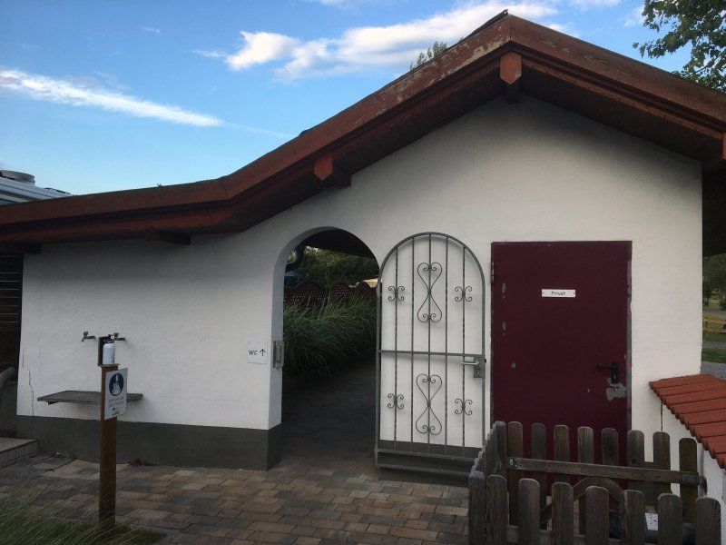
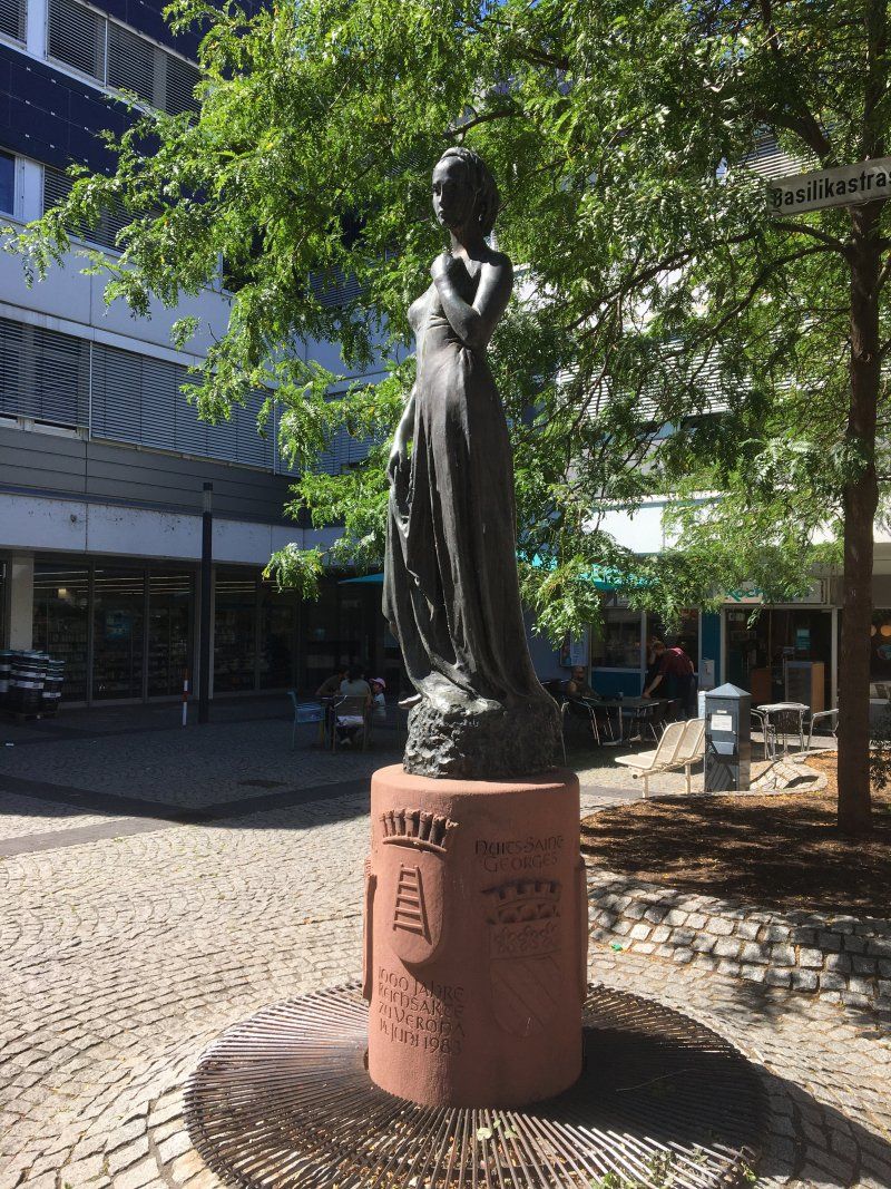
Wohnmobilpark Bingen (21.07. -23.07.2020)
Small but nice parking space near the Rhine. Operators are very friendly and service-oriented. The spaces are quite generous for a parking space of this size and delimited by hedges. Shower and washing facilities would also be nice. Cost for one night, including electricity (flat rate up to 6 KWh / night): 10 €
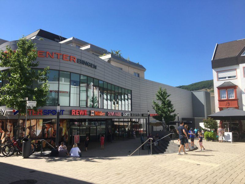
Bingen city center can be reached in about 10 minutes by bike.
Rating: 4 out of 5 stars
Mainzer Straße 275, 55411, Bingen, Deutschland
49° 58' 7" N 7° 56' 38" E
49.9686111 7.9438889
• Head toward Mainzer Straße on Außerhalb Gaulsheim. Go for 148 m.
• Turn right onto Mainzer Straße. Go for 228 m.
• Turn left onto L419. Go for 1.3 km.
• Take ramp. Go for 27 m.
• Take the 2nd exit from roundabout onto A60 toward St. Goar/Bingen/Rüdesheim a.Rh./Mainz. Go for 17.9 km.
• Take exit 18 toward Frankfurt a.M./Wiesbaden/Mz.-Gonsenheim onto A643. Go for 7.1 km.
• Take the exit toward Frankfurt onto A66. Go for 12.3 km.
• Take exit 9 toward Köln onto A3. Go for 47.4 km.
• Take exit 42 toward Limburg-Nord onto B49/B54. Go for 1.9 km.
• Turn right onto B8 toward Altenkirchen/Elz/Koblenz. Go for 446 m.
• Turn left onto Offheimer Weg toward Brückenvorstadt. Go for 359 m.
• Turn left onto Westerwaldstraße. Go for 267 m.
• Turn slightly left onto Seilerbahn. Go for 516 m.
• Turn right onto Am Haustein. Go for 114 m.
• Continue on Schleusenweg. Go for 132 m.
• Turn right onto Campingplatz Limburg. Go for 127 m.
• Arrive at Campingplatz Limburg.
☍
90,3 km
( 56 min.)
Day
Entlang des Rhein-Radwegs von Bingen nach Rüdesheim
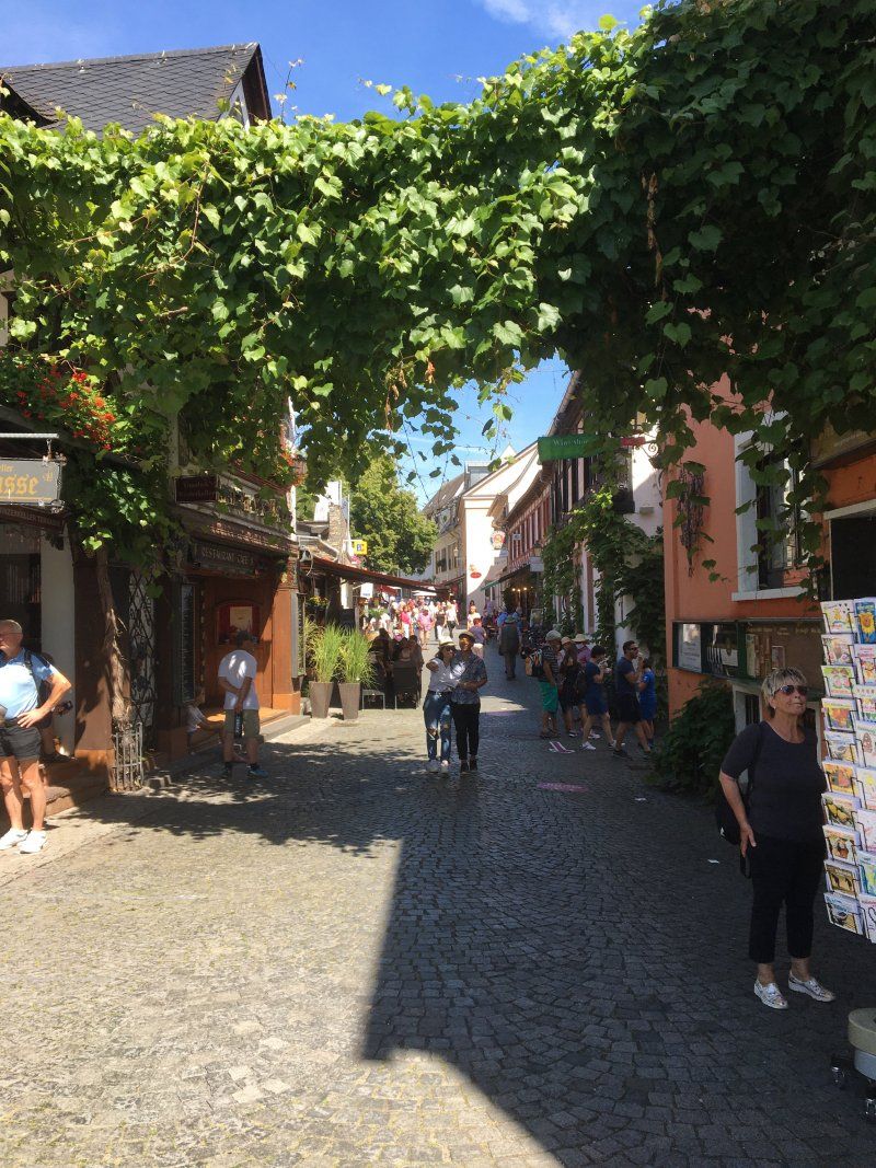
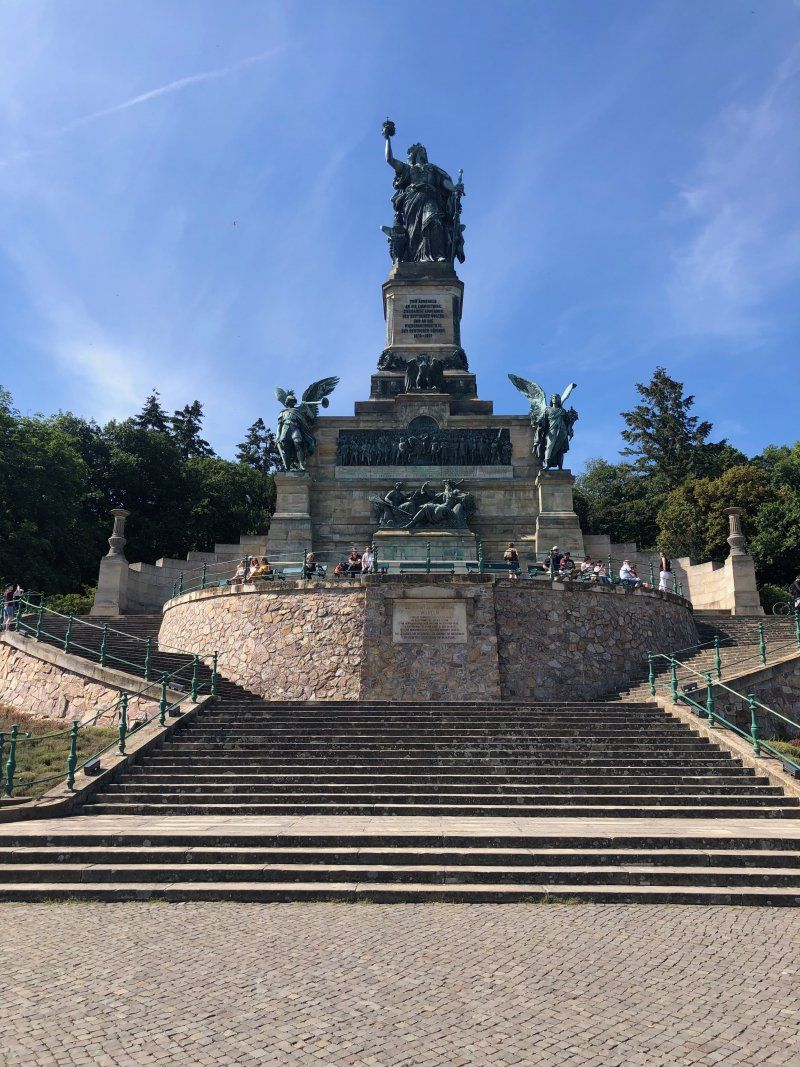
The 54 km long circular tour led us from the Bingen motorhome park to Ingelheim and there into the ruins of the Palatinate of the German kings and emperors of the Holy Roman Empire, which had been built and then continuously expanded. The Kaiserpfalz itself with its surviving remains (Heidelsheimer Tor, Aula) is a unique area monument and simply a must for those interested in history. From there we went through the vineyards to Budenheim and from there to the Rheinhafen in Ingelsheim's Frei Weinheim district. The ferry took us to the other bank of the Rhine and then we drove to Rüdesheim on the well-developed Rhine cycle path R3. The first thing to do in the wine town of Rüdesheim was a walk through the magical city center and the only three meters wide Drosselgasse. There is a lovingly equipped wine bar next to the other. On a subsequent 45 minute drive with a Bimmelguste through Rüdesheim and the surrounding vineyards, we were able to enjoy the panorama over the Rhine and the Bingen opposite. Then we took the cable car up to the Niederwald monument, inaugurated in 1883 by Emperor Wilhelm II. The approximately 38 m high Niederwald monument with the 12.5 m high Germania is to commemorate the victory in the Franco-Prussian War and the (re) establishment of the German Empire. The Niederwalddenkmal has been part of the UNESCO World Heritage Upper Middle Rhine Valley since 2002. From Rüsselsheim we then took the ferry from Rüdesheim to the opposite Bingen.
Day
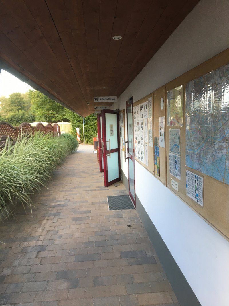
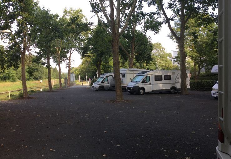
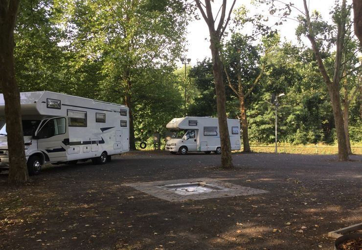
Stellplatz am Lahn-Camping (23.07. -24.07.2020)
The parking space for eight campers is in front of a campsite right on the water and next to an outdoor pool. The graveled site has a large stock of trees on the edge (no TV reception!). Unfortunately, some of the power connections were broken, so that the choice of place was severely restricted. The infrastructure of the nearby campsite cannot be used. Entry and exit take place with a chip card. The payment for the parking space (€ 12.00 / night) and the electricity used (€ 0.50 / kWh) is made at the parking machine upon departure. Electricity and fresh water are on site, and disposal takes place via Holiday Clean (chemical toilet) and via floor inlet (gray water). Overall, okay for an overnight stay or a short trip to the beautiful little bishop's road.
Rating: 3 out of 5 stars
Schleusenweg 16, 65549, Limburg an der Lahn, Deutschland
50° 23' 19.7" N 8° 4' 31.1" E
50.3888000 8.0753000
• Head toward Schleusenweg on Campingplatz Limburg. Go for 127 m.
• Turn left onto Schleusenweg. Go for 132 m.
• Turn left onto Schleusenweg. Go for 552 m.
• Turn right onto Westerwaldstraße (K470). Go for 64 m.
• Continue on Weilburger Straße (K470). Go for 343 m.
• Turn right onto Weilburger Straße (B8/B54). Go for 243 m.
• Continue on Weilburger Straße (B49/B54) toward A3/Köln/Koblenz/Frankfurt/Gießen/Siegen. Go for 52.2 km.
• Take ramp onto B429 toward Wettenberg/Heuchelheim/Gießen. Go for 4.9 km.
• Take ramp onto A480 (Gießener Ring) toward Kassel/Marburg. Go for 14.1 km.
• Take the left exit toward Hannover/Kassel/Fulda onto A5. Go for 60.5 km.
• Continue on A7. Go for 3.7 km.
• Take the exit toward Berlin/Dresden/Erfurt/Bad Hersfeld onto A4. Go for 10.6 km.
• Take exit 32 toward Bad Hersfeld/Eschwege/Bebra/Hünfeld. Go for 308 m.
• Turn left onto B27 toward Eschwege/Rotenburg a.d. Fulda/Bebra/Bad Hersfeld. Go for 1.2 km.
• Turn right onto B62 toward Philippsthal/Heringen. Go for 12.2 km.
• Turn left onto B62 toward Frankfurt/Eisenach/Obersuhl/Heringen-Herta/Gewerbegebiet Friedewald. Go for 393 m.
• Continue on B62 toward Frankfurt/A4/Erfurt/Gewerbegebiet Friedewald. Go for 763 m.
• Take the 2nd exit from roundabout onto A4 toward Erfurt. Go for 36.1 km.
• Take exit 39 toward Eisenach-West/Bad Salzungen/Treffurt/Creuzburg/B19. Go for 255 m.
• Turn right onto B19 toward Vacha/Bad Salzungen/Wutha-Farnroda/Eisenach. Go for 3.8 km.
• Take ramp toward Mühlhausen/Bad Langensalza/Mihla. Go for 275 m.
• Turn left onto Mühlhäuser Straße (L1016) toward Mühlhausen/Bad Langensalza/Mihla/Gewerbegebiet Kindel/Flughafen Kindel/Gewerbegebiet Großenlupnitz/Gewerbegebiet Stockhausen/Gewerbegebiet Wartenberg. Go for 335 m.
• Turn right onto L1021 toward A4/Dresden/Mühlhausen/Bad Langensalza/Großenlupnitz/Hötzelsroda. Go for 441 m.
• Turn left onto An der Schiebwiese toward Gewerbegebiet Stregda-Ost. Go for 140 m.
• Turn right onto Ringstraße. Go for 192 m.
• Turn slightly left onto Ringstraße. Go for 61 m.
• Arrive at Ringstraße. Your destination is on the left.
☍
203,9 km
(2 hrs. 5 min.)
Day
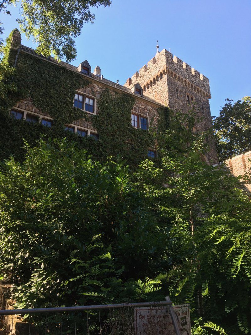
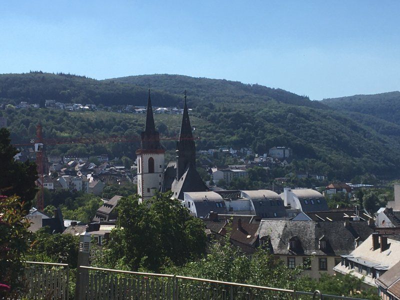
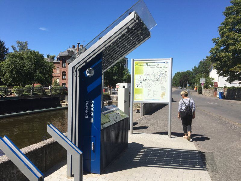
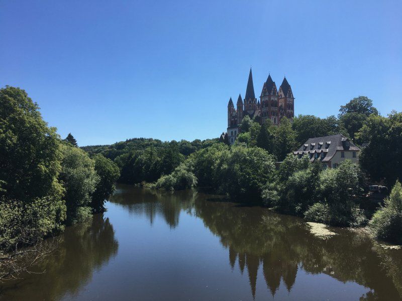
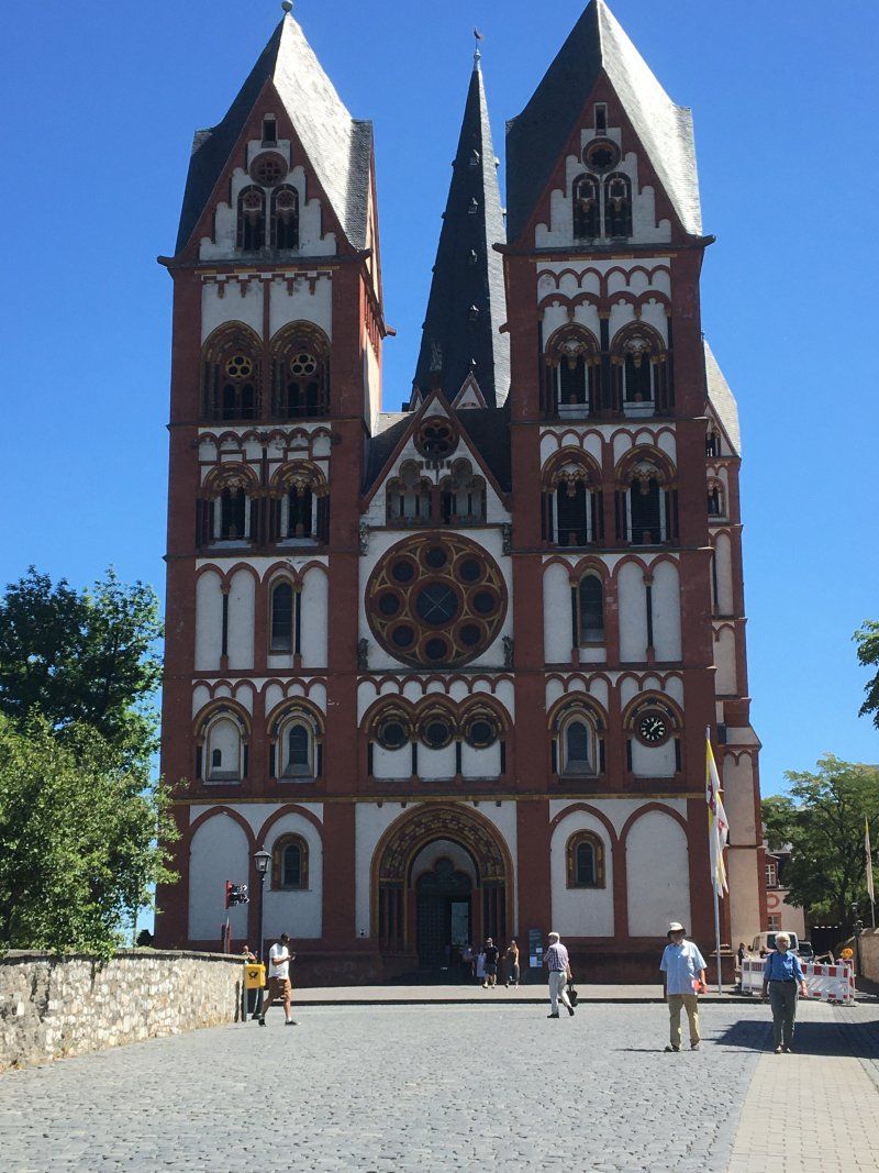
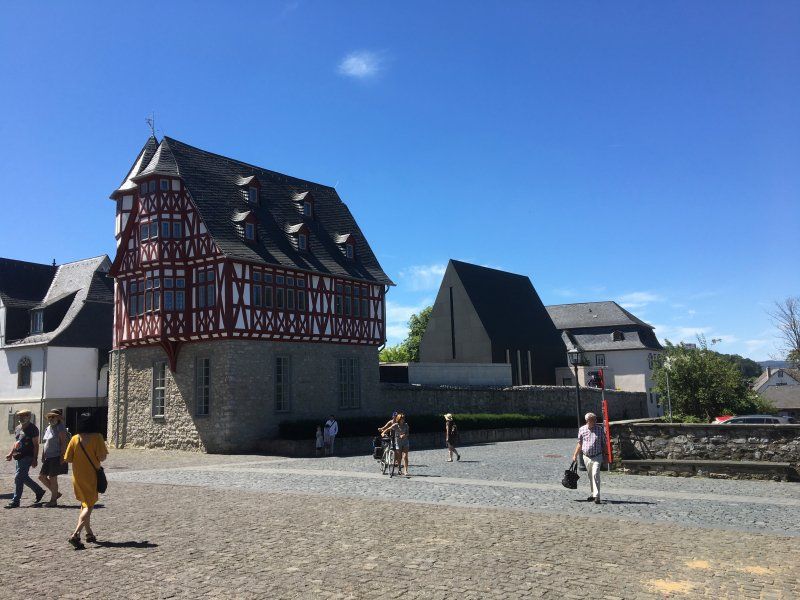
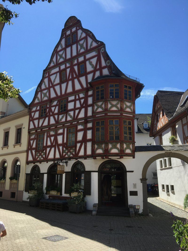
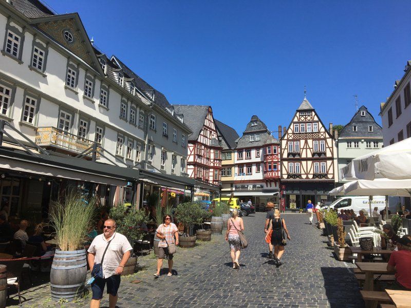
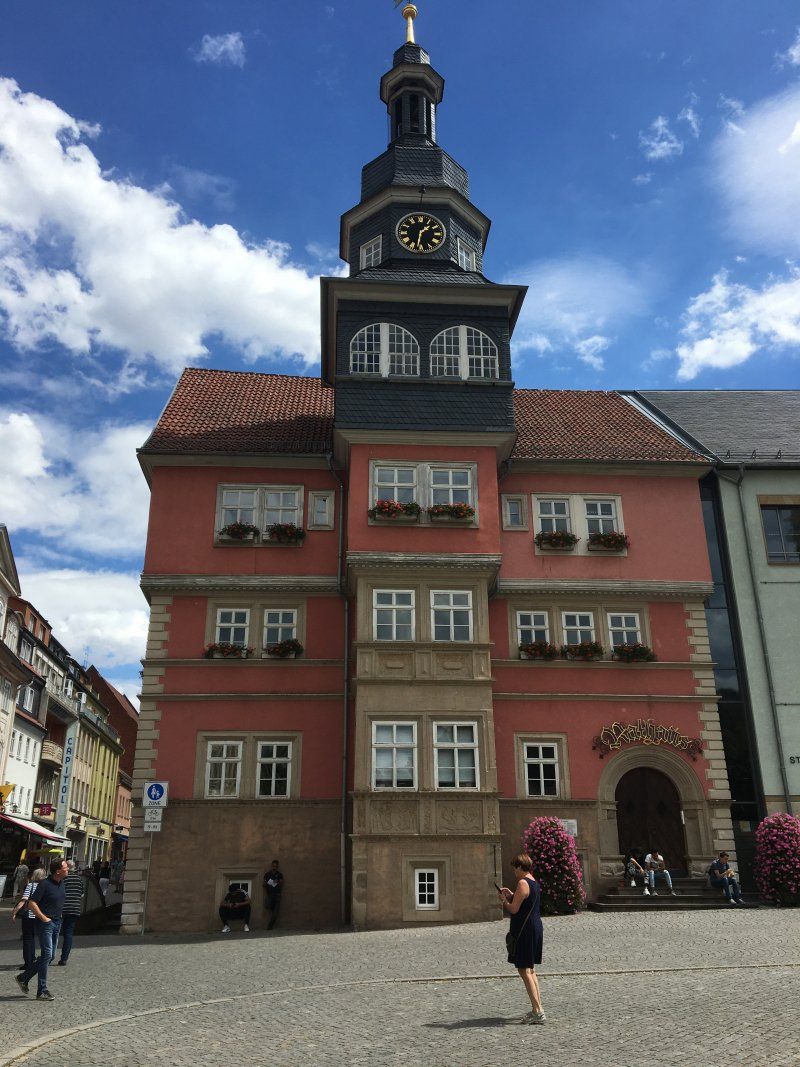
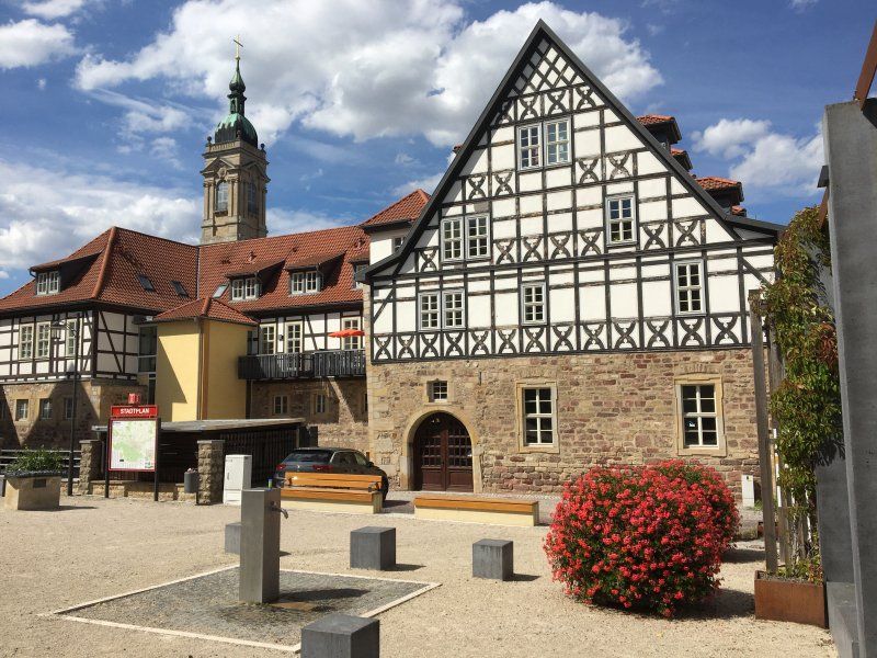
Limburg an der Lahn, die Bischofsstadt
The district town of the Central Hesse district of Limburg-Weilburg with its approx. 36,000 inhabitants is located on the Lahn and can be easily reached on foot from the parking space (approx. 10 minutes on foot). In the half-timbered town with a well-preserved or lovingly restored building substance, the Limburg Cathedral with its diocesan museum (headline "Protzbau" by the then bishop) and the numerous, sometimes strange-looking half-timbered houses are particularly worth seeing. Limburg with the well-developed and signposted Lahn Cycle Path is the station of the "Cycle Path of German Unity" leading from Koblenz to Vacha. The corresponding information and service point on the bike path, which leads directly past the parking space, is also exemplary.
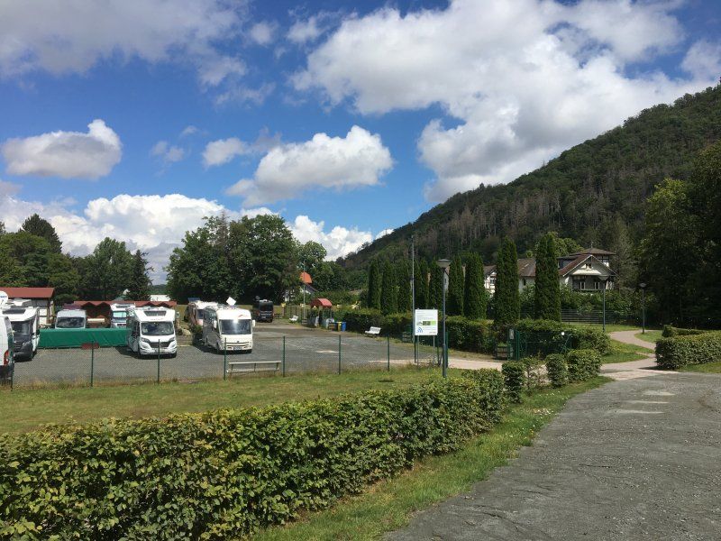
Wohnmobile Waldhelm (24.07. - 26.07.2020)
The graveled place for approx. 20 campers is located in the industrial area of Strega-Ost, approx. 7 km from the city center of Eisenach. The parking space is operated by a very nice camper dealer and has a shower and toilet (unfortunately only two each plus a urinal for the men). The power connections have no CE connections, so appropriate adapters are required. Otherwise there is everything you need for a short trip and you also have a wonderful view of the Wartburg (especially after sunset a great sight!). The pitch costs € 13.00 per night including electricity, showers € 0.50 / 3 minutes.
Rating: 4 out of 5 stars
Ringstraße 27, 99817, Eisenach, Deutschland
51° 0' 8" N 10° 19' 36" E
51.0022222 10.3266667
• Head toward Am Frohnishofer Weg on Ringstraße. Go for 253 m.
• Turn left onto An der Schiebwiese. Go for 140 m.
• Turn right onto L1021. Go for 396 m.
• Turn right onto L1016 toward Mihla/Stregda/Gewerbegebiet Stregda-West/Nationalpark Hainich/Berka v.d.H. Go for 24.2 km.
• Turn left onto Am Bahnhof (L1016). Go for 307 m.
• Turn right onto Mühlhäuser Straße (L1016) toward Mühlhausen/Oberdorla. Go for 1.9 km.
• Take the 2nd exit from roundabout onto Eisenacher Landstraße (L1016). Go for 4.8 km.
• Turn left onto Langensalzaer Straße (B247). Go for 1.5 km.
• Continue on Wendewehrstraße (B247) toward A38/Göttingen/Leinefelde-Worbis. Go for 870 m.
• Turn right onto Ammersche Landstraße (B247). Go for 3.8 km.
• Turn right onto L1015. Go for 19.0 km.
• Continue on Kuhtrift (L1014) toward A38/Worbis/Breitenworbis. Go for 1.8 km.
• Take the 2nd exit from roundabout onto L1014 toward Bischofferode/Großbodungen/Haynrode/Gewerbegebiet am Sottelgraben. Go for 117 m.
• Continue on Auf dem Pfingstrasen (L1014). Go for 187 m.
• Continue on L1014. Go for 2.7 km.
• Continue on Forsthaus Hahn (L1014). Go for 107 m.
• Continue on L1014. Go for 1.4 km.
• Pass 2 roundabouts and continue on L1014. Go for 2.5 km.
• Continue on Hauptstraße (L1014). Go for 893 m.
• Continue on Grenzbachhof (L1014). Go for 81 m.
• Continue on L1014. Go for 346 m.
• Continue on Chaussee (L1014). Go for 436 m.
• Continue on Chaussee (L1011). Go for 1.4 km.
• Turn left onto Chaussee (L1014) toward Osterode/Mackenrode/Epschenrode. Go for 10.1 km.
• Turn right onto Mackenroder Hauptstraße. Go for 258 m.
• Continue on Kastanienplatz. Go for 111 m.
• Continue on Mackenroder Hauptstraße. Go for 433 m.
• Continue on Auf der Waardt. Go for 372 m.
• Take ramp onto B243. Go for 10.4 km.
• Take ramp toward Bad Lauterberg/Kliniken/Osterhagen/Bartolfelde. Go for 254 m.
• Take the 2nd exit from roundabout onto K432. Go for 1.9 km.
• Turn right onto Wissmannstraße (B27). Go for 16.4 km.
• Take ramp onto B4/B242 toward Bad Harzburg/Clausthal-Zellerfeld. Go for 7.5 km.
• Continue on B4 toward Hannover/Bad Harzburg/Torfhaus. Go for 13.8 km.
• Turn left onto Am Schwimmbad. Go for 31 m.
• Arrive at Am Schwimmbad. Your destination is on the right.
☍
130,7 km
(2 hrs. )
Day
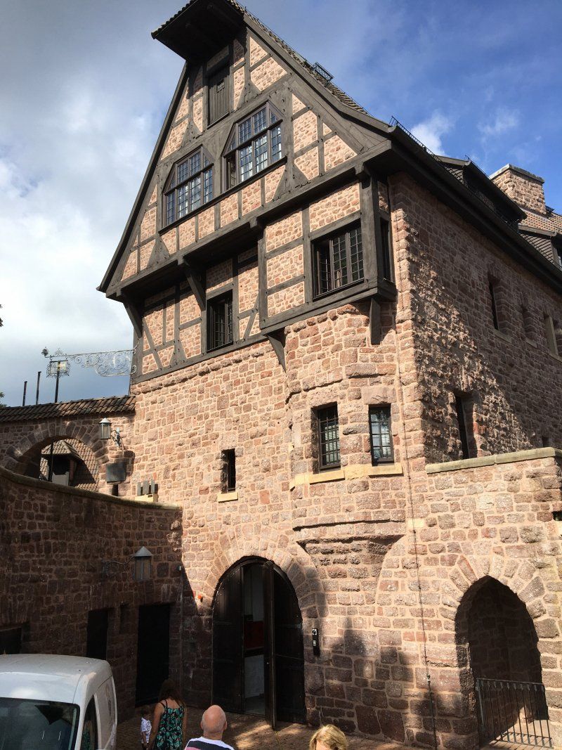
Besuch von Eisenach und der Wartburg
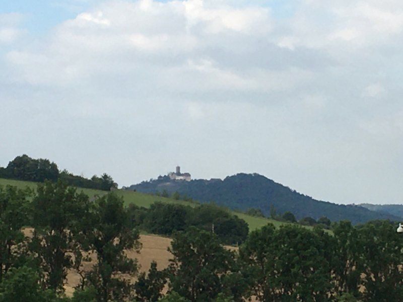
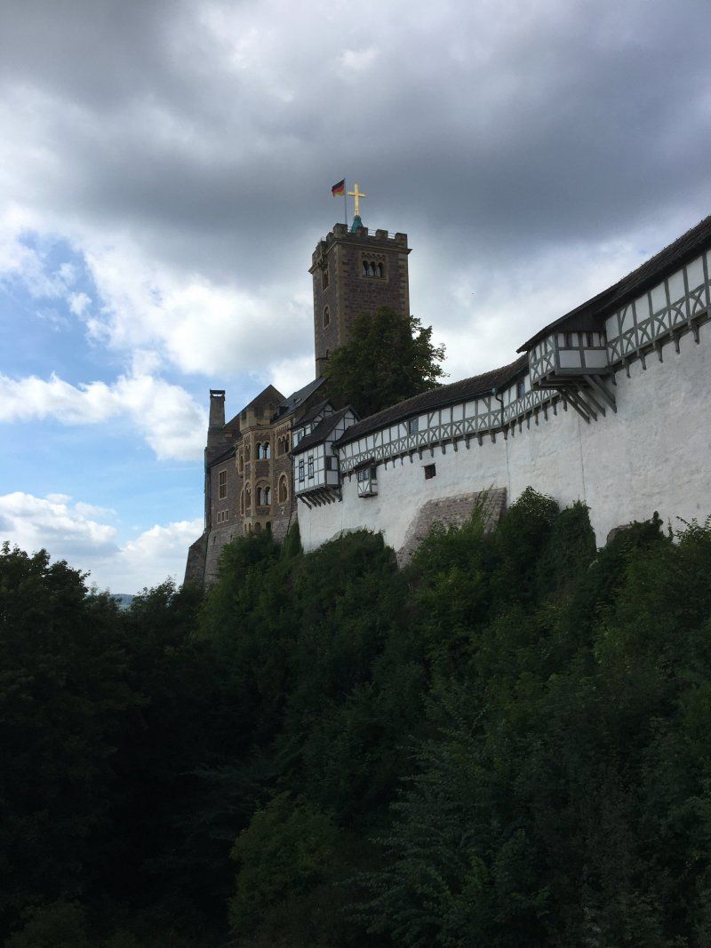
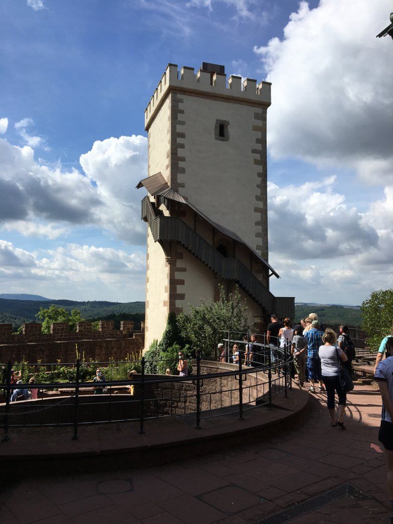
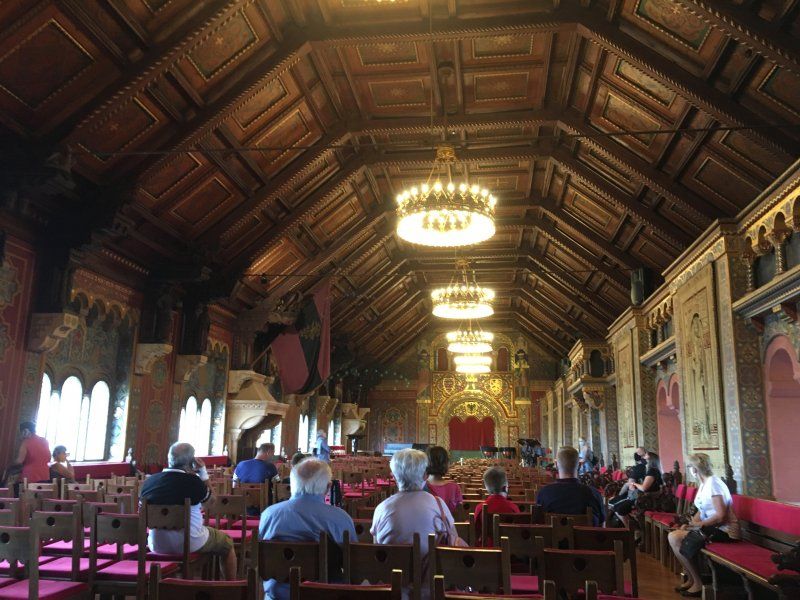
We used the actually not planned stopover (planned stopovers in Fulda and Göttingen) for a visit to Eisenach and the Wartburg. We had visited both sights in the past, but these visits were already some years ago. We were all the more astonished at how the district town with its 42,000 inhabitants has developed in the years since our last visit. The lovingly renovated old town with the Georgenkirche, the former city palace (now tourist information), the town hall and the Luther and Bach houses are well worth a visit. From the Wartburg to be reached via the Wartburgallee (only something for e-bike riders or well-trained cyclists) you have a wonderful view over Eisenach and the fraternity monument. And of course not to be forgotten: the Wartburg, the epitome of German romanticism and the German pursuit of national unity. The castle, rebuilt in a romantic style in 1837 from a castle ruin (only the Pallas was still preserved), is now an international tourist magnet and offers interesting things for young and old (singing room, Luther room, Pirckheim study room, bedroom originally furnished by the then prince of Saxony-Weimar -Eisenach).
Stellplatz an der Sole-Therme Bad Harzburg (26.07. - 27.07.2020)
The gravel place with a covering layer of compacted crushed sand (be careful after heavy rain!) Without trees near the Soletherme Bad Harzburg offers space for 80 mobile. There is a well-equipped sanitary building on the square and its own restaurant, the "Hexenstübchen". Due to the nearby federal road and the Radau (the little foot is actually called that) it is a bit noisy. The parking space including shower costs € 13.30. Electricity costs 0.50 kWh (using a coin at the power connection). The city center can be easily reached on foot in about 10 minutes.
Rating 4 out of 5 stars
Nordhäuser Straße 10, 38667, Bad Harzburg, Deutschland
51° 52' 7" N 10° 33' 30" E
51.8686111 10.5583333
• Head toward Nordhäuser Straße on Am Schwimmbad. Go for 31 m.
• Turn left onto Nordhäuser Straße (B4). Go for 5.1 km.
• Continue on A369. Go for 4.0 km.
• Take the exit toward Braunschweig/Osterwieck/Vienenburg-Ost onto A36. Go for 35.7 km.
• Continue on B4. Go for 253 m.
• Take ramp onto A39 toward Wolfsburg/Berlin. Go for 17.2 km.
• Take exit 28 toward Berlin/Königslutter onto A2. Go for 139 km.
• Take exit 78 toward Brandenburg/Bad Belzig. Go for 396 m.
• Turn left onto B102 toward Brandenburg/Gewerbegebiet Massivhauspark. Go for 3.7 km.
• Continue on B102N. Go for 674 m.
• Turn left onto Rietzer Straße toward Schmerzke. Go for 527 m.
• Turn slightly right onto Altes Dorf. Go for 289 m.
• Turn left onto Schmerzker Ring. Go for 114 m.
• Turn slightly left onto Schmerzker Ring. Go for 220 m.
• Turn left onto Schmerzker Ring. Go for 56 m.
• Arrive at Schmerzker Ring. Your destination is on the left.
☍
207,7 km
(1 hrs. 54 min.)
Day
Bad Harzburg, Kurstadt mit Tradition
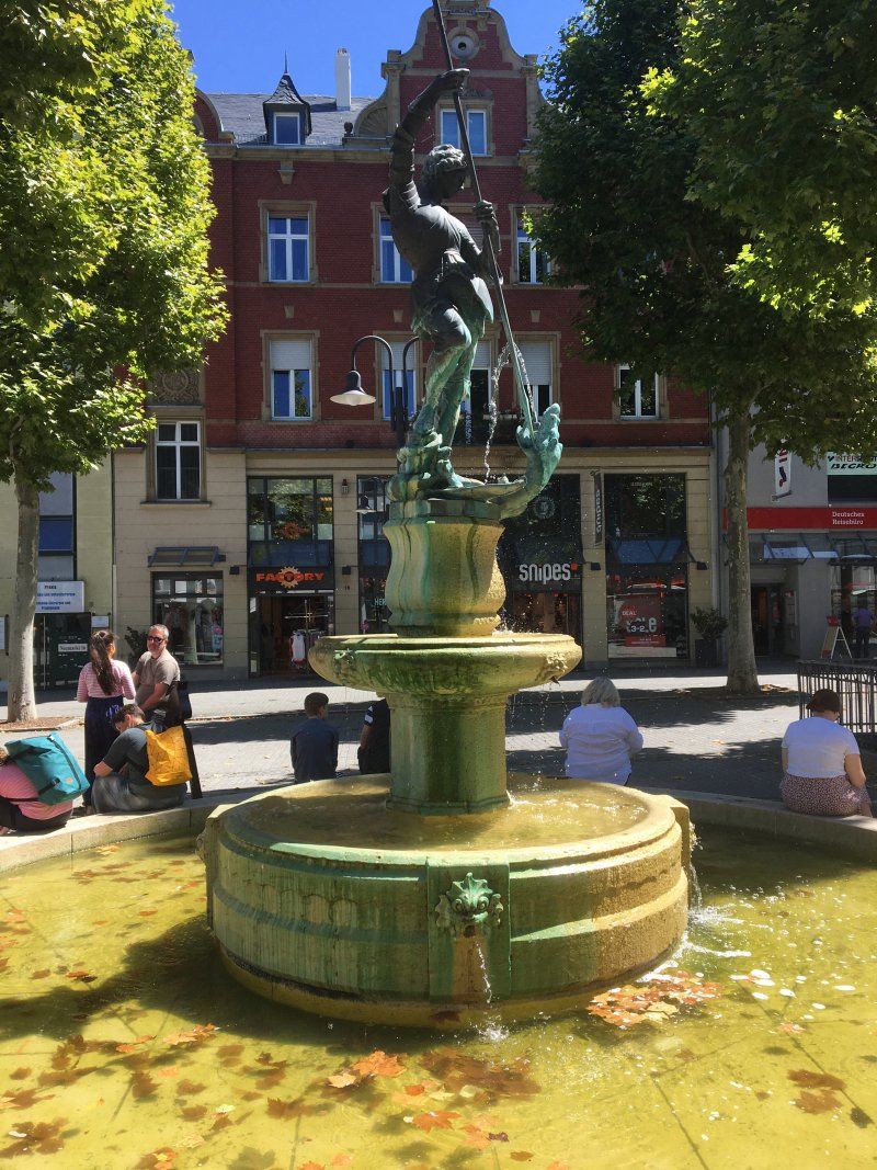
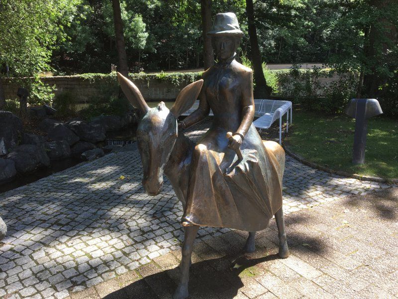
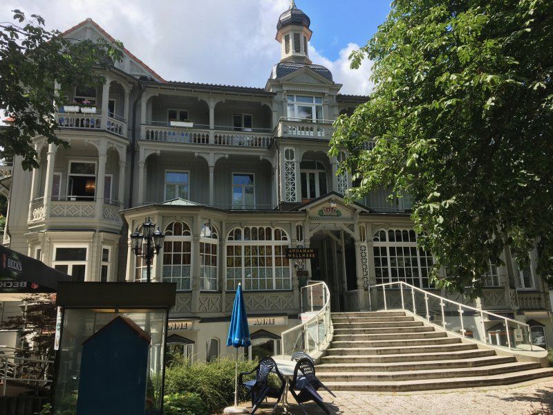
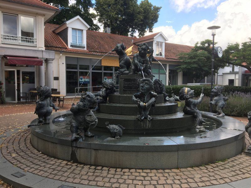
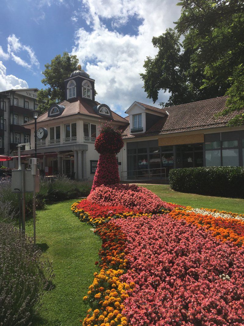
The traditional city of 22,000 inhabitants is centrally located on the northern edge of the Harz Mountains and is known for its wide range of tourism. Located below the Great Castle Hill, the city invites you to stroll through the extensive promenade with the well-worth seeing fountain of youth and a walk through the spa gardens. You can explore the Harzburg ruins on the Great Castle Hill by cable car. The plastic of the donkey rider in the spa gardens is a reminder of the numerous, especially female tourists who explored the castle hill with a mule or donkey. A visit to the "Little Wonderland" opposite the Sole-Therme is worthwhile for the little ones.
Ankunft Zuhause (27.07.2020)
Schmerzker Ring 128, 14776 Brandenburg an der Havel, Deutschland
52° 23' 11.9" N 12° 35' 25.1" E
52.3866362 12.5903062