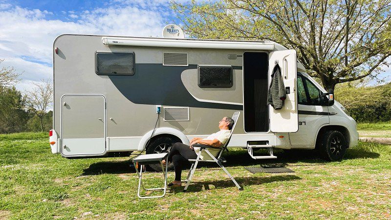
High time for a holiday by the sea. After all the Corona hype, it's high time to clear our minds again. With that in mind, we're off.
https://youtu.be/vxB2laFews4
Day
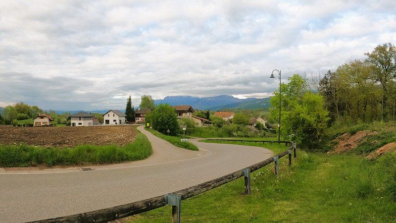
Dangstetten, Küssaberg, Deutschland
Dangstetten, 79790 Küssaberg, Deutschland
47° 35' 47.5" N 8° 19' 15.9" E
47.5965372 8.3210709
• Head toward Küßnacher Straße on Küferweg. Go for 63 m.
• Turn sharp right onto Küßnacher Straße (L162). Go for 1.5 km.
• Take the 2nd exit from roundabout onto Zurzacher Straße (L162). Go for 592 m.
• Continue toward Zürcherstrasse. Go for 59 m.
• Continue on Zürcherstrasse. Go for 27 m.
• Turn right onto Zürcherstrasse. Go for 176 m.
• Turn left onto Ostumfahrung Zurzach. Go for 720 m.
• Continue on Bruggerstrasse. Go for 1.6 km.
• Continue on Zurzibergstrasse. Go for 1.4 km.
• Take the 2nd exit from roundabout onto Zurzibergstrasse. Go for 544 m.
• Turn right onto Staltig. Go for 225 m.
• Continue on Steig. Go for 262 m.
• Continue on Würenlingerstrasse. Go for 2.9 km.
• Continue on Tegerfelderstrasse. Go for 1.4 km.
• Continue on Breitenstrasse. Go for 860 m.
• Continue on Siggenthalerstrasse. Go for 180 m.
• Take the 2nd exit from roundabout onto Siggenthalerstrasse. Go for 699 m.
• Turn left onto Döttingerstrasse (5). Go for 386 m.
• Turn right onto Stillistrasse (5) toward Bern/Luzern/Aarau/Brugg/Hard. Go for 2.8 km.
• Take the 2nd exit from roundabout onto Zurzacherstrasse (5). Go for 2.0 km.
• Turn left onto Aarauerstrasse (3/5). Go for 491 m.
• Turn left onto Badenerstrasse (3). Go for 201 m.
• Take the 2nd exit from roundabout onto Zürcherstrasse (3). Go for 440 m.
• Take the 1st exit from roundabout onto Hauserstrasse. Go for 631 m.
• Take the 2nd exit from roundabout onto Hauserstrasse. Go for 521 m.
• Take the 2nd exit from roundabout onto Zubringer Hausen. Go for 278 m.
• Take ramp onto Zubringer Hausen. Go for 2.0 km.
• Continue on Lenzburgerstrasse. Go for 3.4 km.
• Take the 3rd exit from roundabout onto A1 toward Bern. Go for 37.2 km.
• Continue on A1 (Härkingen) toward E25/Lausanne/Bern/Biel/Bienne/Oensingen. Go for 50.8 km.
• Take the exit toward Lausanne/Fribourg/Neuchâtel/Bern-Neufeld onto A1 (Wankdorf). Go for 99.8 km.
• Continue on A1. Go for 2.7 km.
• Take the exit toward Genève onto A1. Go for 55.0 km.
• Take the exit toward Vernier/Z.I. Meyrin-Vernier. Go for 687 m.
• Take ramp onto Route de Vernier toward Vernier/Châtelaine/Z.I. Meyrin-Vernier. Go for 677 m.
• Continue on Route du Nant-d'Avril. Go for 447 m.
• Turn left onto Avenue Louis-Pictet. Go for 339 m.
• Continue on Route de Peney. Go for 2.3 km.
• Continue on Route du Bois-de-Bay. Go for 345 m.
• Turn left onto Route du Bois-de-Bay. Go for 25 m.
• Turn left onto Route du Bois-de-Bay. Go for 55 m.
• Turn left. Go for 21 m.
• Turn slightly right. Go for 182 m.
• Arrive at your destination on the right.
☍
277,1 km
(3 hrs. 12 min.)
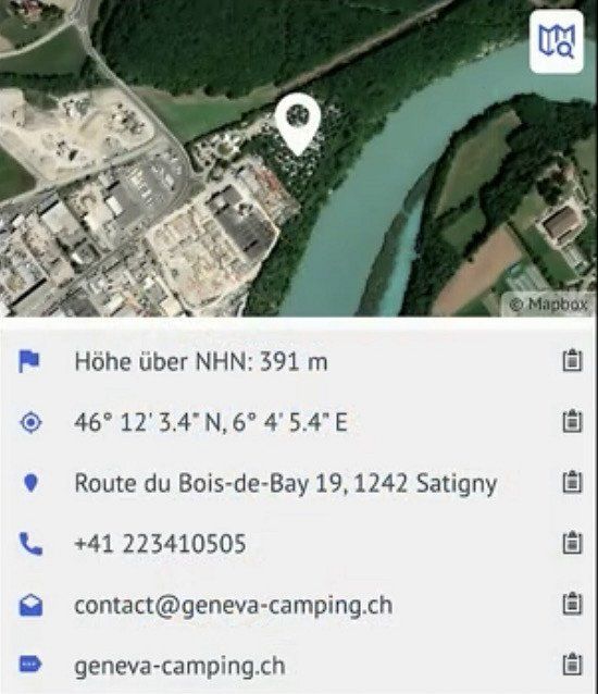
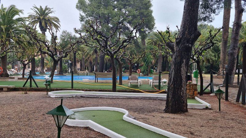
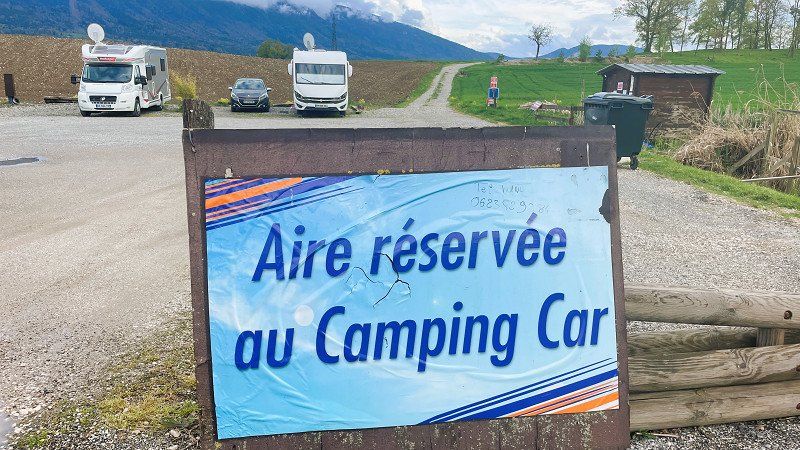
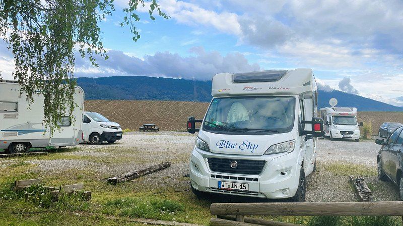
Geneva City Camping Bois de Bay
Spain tour 2022
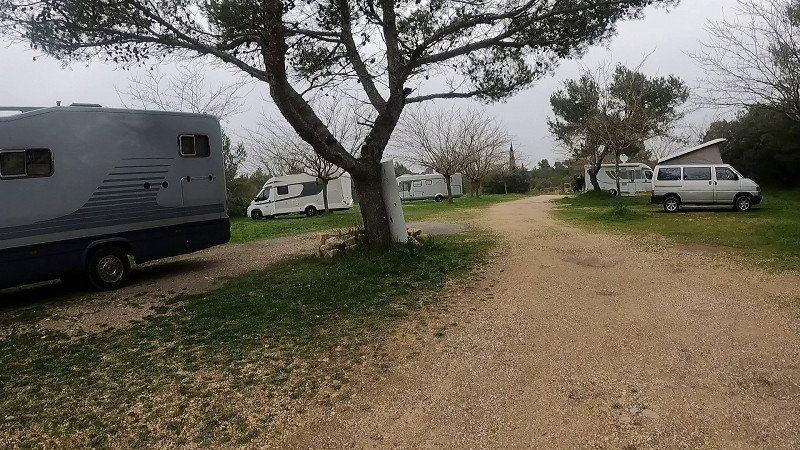
Our first stage took us through Switzerland to Geneva to the CP Geneva-Camping. The site is in the middle of the industrial area and right on the runway at Geneva Airport. Due to the industrial and aircraft noise, the place is only suitable for us as a stage place. The price for one night including electricity and supply and disposal is 51.- Sfr
https://youtu.be/vxB2laFews4
Route de Bois–de–Bay 19, 1242, Satigny, Switzerland
46° 12' 4.4" N 6° 4' 5.2" E
46.2012100 6.0681000
• Head southeast.
• Turn right. Go for 24 m.
• Turn right. Go for 20 m.
• Turn right. Go for 27 m.
• Turn left. Go for 85 m.
• Turn slightly right toward Route du Bois-de-Bay. Go for 98 m.
• Turn right onto Route du Bois-de-Bay. Go for 55 m.
• Turn right onto Route du Bois-de-Bay. Go for 25 m.
• Turn right onto Route du Bois-de-Bay. Go for 345 m.
• Continue on Route de Peney. Go for 2.3 km.
• Continue on Avenue Louis-Pictet. Go for 339 m.
• Turn right onto Route du Nant-d'Avril. Go for 447 m.
• Continue on Route de Vernier. Go for 534 m.
• Take ramp onto A1 toward France/Genève-La Praille/Perly/St-Julien. Go for 9.3 km.
• Continue on A41. Go for 71.5 km.
• Continue on A43. Go for 46.9 km.
• Take the exit toward Marseille/Valence/Grenoble onto A48. Go for 42.0 km.
• Take the exit toward Marseille/Valence onto A49. Go for 60.7 km.
• Continue on N532. Go for 10.6 km.
• Continue on E713. Go for 240 m.
• Continue on N7. Go for 9.5 km.
• Keep left onto E713 toward E15/A7/Marseille/Montélimar/Privas/Lyon. Go for 405 m.
• Keep left onto Échangeur de Valence-Sud (E713) toward Marseille/Avignon/Montélimar/Privas. Go for 153 m.
• Take ramp onto A7 (Autoroute du Soleil). Go for 93.0 km.
• Keep right onto A9 (Échangeur d'Orange) toward Barcelone/Toulouse/Montpellier/Nîmes. Go for 46.3 km.
• Take exit 24 toward Nîmes-Est/Nîmes-Centre/Nîmes-Courbessac/Marguerittes. Go for 755 m.
• Take the 3rd exit from roundabout onto Route d'Avignon (D6086) toward Nîmes. Go for 1.4 km.
• Take the 2nd exit from Rond-Point Lieutenant-Colonel Pierre Colin roundabout onto Route d'Avignon (D6086) toward Nîmes-Centre. Go for 1.4 km.
• Turn right onto Route d'Avignon. Go for 1.5 km.
• Turn right onto Route d'Avignon (D127). Go for 709 m.
• Continue on Rue Pierre Semard. Go for 208 m.
• Keep left onto Rue Notre-Dame. Go for 733 m.
• Continue on Square de la Couronne. Go for 85 m.
• Turn slightly left onto Boulevard Amiral Courbet. Go for 37 m.
• Turn right onto Rue de la Couronne. Go for 82 m.
• Arrive at Rue de la Couronne.
☍
401,8 km
(3 hrs. 42 min.)
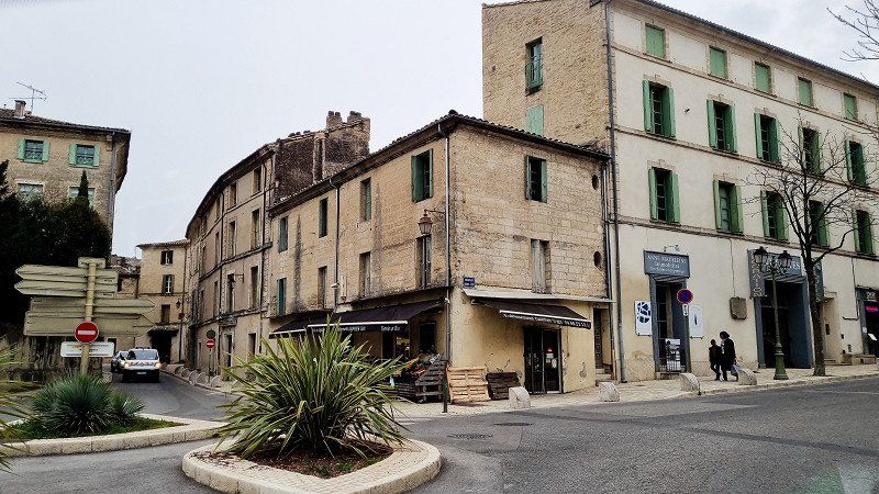
Nîmes, Frankreich
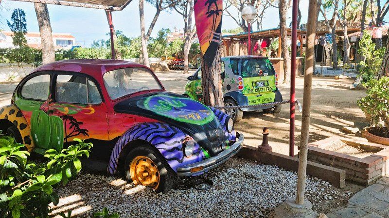
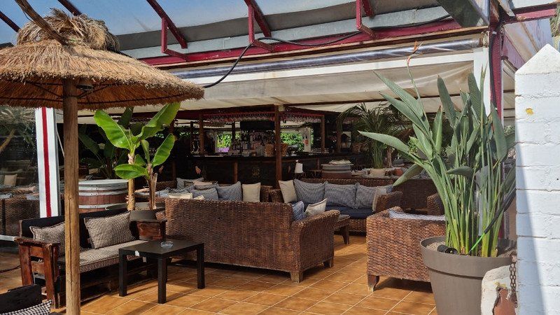
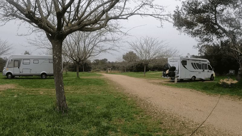
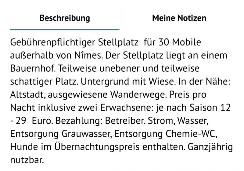
the Domain de Fontbespierre pitch is located near Nimes on a farm. Very quiet and idyllic. We felt very comfortable.
Toll-free through France. From Geneva we take the country road and it's a relaxed and stress-free route. We are enthusiastic about the landscapes and we will be traveling more often in France toll-free in the future.
https://youtu.be/gGw3Ou3VaAU
43° 50' 12.1" N 4° 21' 36.2" E
43.8366990 4.3600540
• Head northwest on Rue de la Couronne.
• Turn right onto Place de la Salamandre. Go for 70 m.
• Turn slightly left onto Grand'Rue. Go for 28 m.
• Turn right onto Rue des Greffes. Go for 51 m.
• Turn left onto Boulevard Amiral Courbet. Go for 78 m.
• Turn right onto Rue des Calquières. Go for 159 m.
• Continue on Place de l'Écluse. Go for 69 m.
• Turn left onto Rue Notre-Dame. Go for 86 m.
• Turn right onto Rue Cardinal de Cabrières. Go for 13 m.
• Turn slightly right onto Rue Fénelon. Go for 310 m.
• Turn right onto Boulevard Talabot. Go for 208 m.
• Turn left onto Avenue Général Leclerc. Go for 74 m.
• Turn right onto Allée Boissy d'Anglas. Go for 329 m.
• Turn slightly right onto Boulevard Natoire. Go for 78 m.
• Turn left onto Boulevard Sergent Triaire. Go for 274 m.
• Continue on Boulevard Sergent Triaire. Go for 814 m.
• Continue on Rue de l'Ancienne Gare. Go for 219 m.
• Turn slightly left onto Chemin du Capouchiné (D13). Go for 505 m.
• Take the 1st exit from Rond-Point de Meknès roundabout onto Boulevard du Président Salvador Allende (N113) toward A9/Montpellier/Alès/Sommières. Go for 401 m.
• Take the 2nd exit from Rond-Point Paul-Émile Victor roundabout onto Avenue du Président Salvador Allende (N113) toward Montpellier/Alès/Sommières. Go for 596 m.
• Take the 4th exit from Rond-Point Km Delta roundabout onto A54 toward Montpellier. Go for 492 m.
• Take the exit toward Montpellier/Toulouse/Barcelone onto A9 (La Languedocienne). Go for 226 km.
• Continue on AP-7 (Autopista de la Mediterrània). Go for 20.3 km.
• Take exit 3 toward Figueres N./Roses/Figueres/Girona/Barcelona/Olot/Ripoll. Go for 391 m.
• Take the 3rd exit from roundabout onto N-2 toward Figueres/Girona/Barcelona. Go for 5.4 km.
• Take ramp onto Carretera de Roses (C-260) toward Roses. Go for 1.6 km.
• Pass 2 roundabouts and continue on C-260. Go for 3.4 km.
• Take the 3rd exit from roundabout onto C-260 toward Castelló d'Empúries/Roses/Cadaqués. Go for 1.9 km.
• Take the 4th exit from roundabout onto C-260 toward Roses/Cadaqués. Go for 1.8 km.
• Take the 4th exit from roundabout onto C-260 toward Empuriabrava/Roses/Cadaqués. Go for 2.0 km.
• Pass 5 roundabouts and continue on Carretera de Besalú a Roses (C-260). Go for 5.5 km.
• Take the 3rd exit from roundabout onto Carretera de Besalú a Roses (C-260) toward Centre Ciutat. Go for 749 m.
• Take the 1st exit from roundabout onto Carrer Bernat Metge. Go for 166 m.
• Arrive at Carrer Bernat Metge. Your destination is on the left.
☍
273,9 km
(2 hrs. 38 min.)
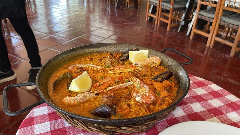
Camping Joncar Mar
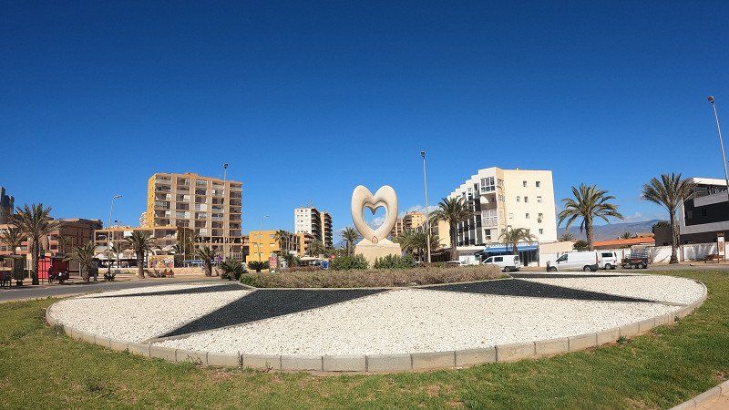
The CP Joncar Mar has been our first stop in Spain every year so far. You can find several SP descriptions on our Youtube channel.
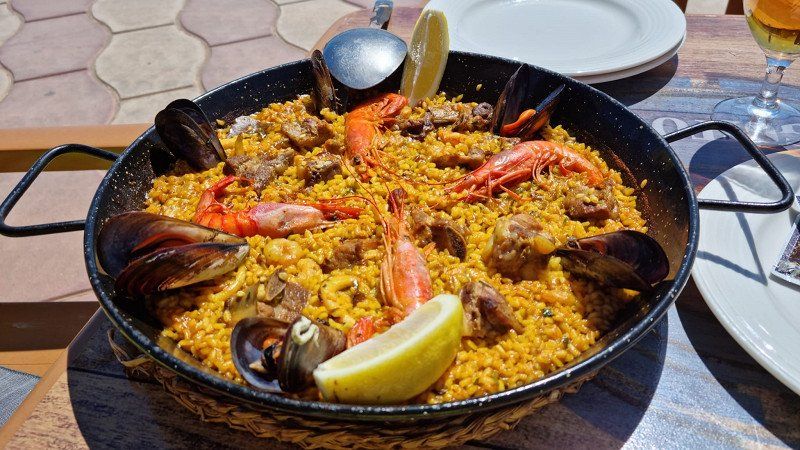
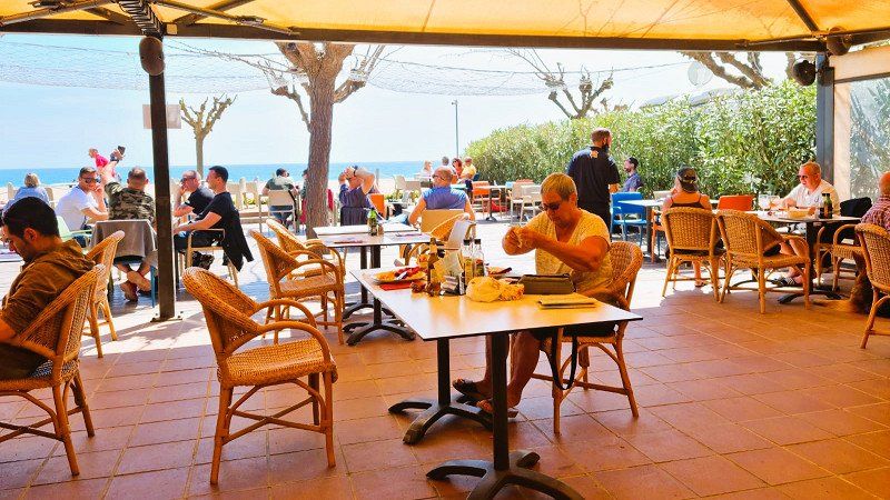
All the restaurants were open and we particularly enjoyed the excellent Paela in the La Palmera restaurant - 100 m - next to the CP directly on the sea.
C/ Bernat Metge 9-10, 17480, Roses, Spain
42° 15' 56" N 3° 9' 47" E
42.2655600 3.1630600
• Head toward Carrer Joanot Martorell on Carrer Bernat Metge. Go for 148 m.
• Take the 3rd exit from roundabout onto Carretera de Besalú a Roses (C-260) toward Santa Margarida/Figueres/Girona/AP-7/N-2. Go for 750 m.
• Take the 2nd exit from roundabout onto Carretera de Besalú a Roses (C-260) toward AP-7/Figueres/Girona/Sta. Margarida. Go for 655 m.
• Take the 3rd exit from roundabout onto Carretera de Besalú a Roses (C-260) toward AP-7/Empuriabrava/Figueres/Girona. Go for 1.1 km.
• Pass 5 roundabouts and continue on C-260. Go for 7.4 km.
• Take the 4th exit from roundabout onto Carretera Castelló (GIV-6213) toward Fortià. Go for 2.8 km.
• Take the 2nd exit from roundabout onto GI-8594 toward Vilamalla. Go for 3.3 km.
• Take the 3rd exit from roundabout. Go for 169 m.
• Take the 1st exit from roundabout onto C-31 toward AP-7/Figueres/Empordà Internacional. Go for 1.8 km.
• Take the 2nd exit from roundabout onto C-31 toward Sta. Llogaia d'Àlguema/Figueres. Go for 812 m.
• Take the 2nd exit from roundabout onto N-2A toward AP-7/Girona/Barcelona. Go for 1.3 km.
• Take the 2nd exit from roundabout onto N-2A toward Girona. Go for 557 m.
• Take the 1st exit from roundabout toward Barcelona/Girona. Go for 891 m.
• Take left ramp onto AP-7 (Autopista de la Mediterrània) toward Girona/Barcelona. Go for 108 km.
• Keep right onto AP-7 (Autopista de la Mediterrània) toward Lleida/E-90/AP-2/Tarragona/Sabadell/C-58/Túnels de Vallvidrera/E-9/Manresa/C-16/Polígon Industrial de Zona Franca/Fira. Go for 129 km.
• Take exit 37 toward T-312/Cambrils/N-340. Go for 1.1 km.
• Keep left toward Cambrils. Go for 73 m.
• Take the 4th exit from roundabout onto T-312 toward Cambrils. Go for 986 m.
• Take the 1st exit from roundabout onto N-340 toward Cambrils oest. Go for 1.5 km.
• Turn left toward Urb. Eldorado/Urb. Marcambrils/Platja de L'Ardiaca. Go for 172 m.
• Turn right onto Carrer de Jerez toward Platja de L'Ardiaca/Urb. Tarraco/Urb. La Dorada/Urb. Marcambrils. Go for 615 m.
• Turn left onto Carrer Cèsar Martinell. Go for 56 m.
• Turn right onto Carrer de Guillem Carbonell. Go for 194 m.
• Turn left onto Carrer de Josep Pujol. Go for 27 m.
• Turn right. Go for 26 m.
• Turn left. Go for 204 m.
• Arrive at your destination on the left.
☍
262,9 km
(2 hrs. 39 min.)
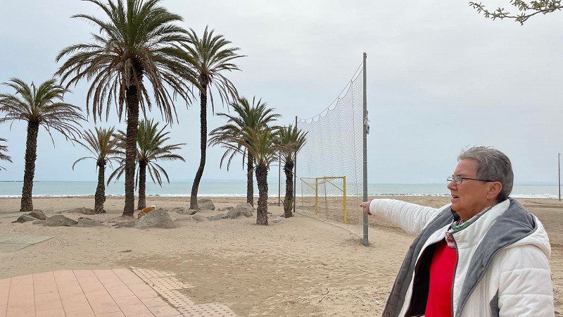
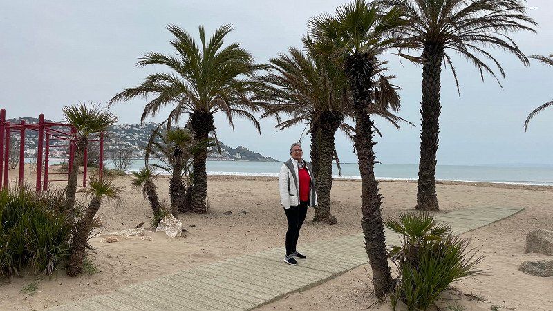
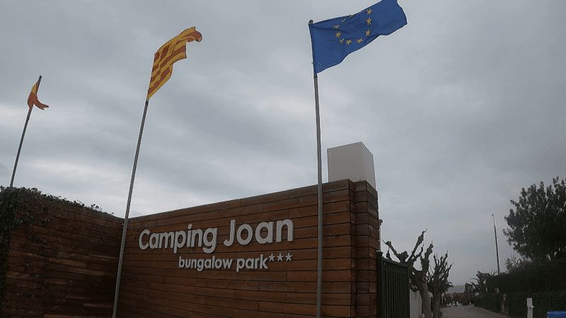
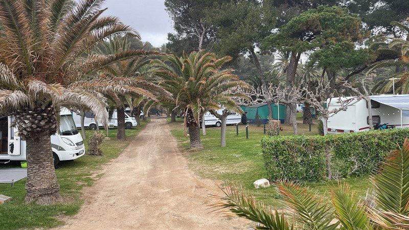
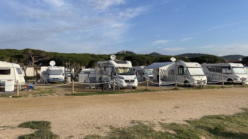
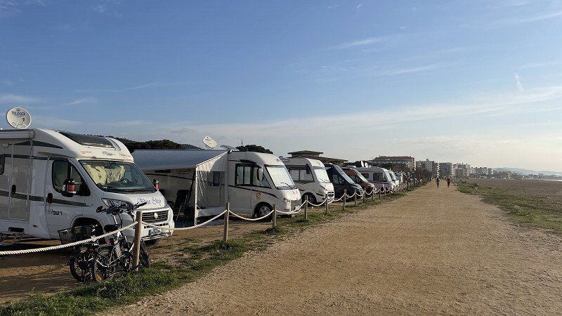
Camping Joan
The Joan campsite in Cambrils is close to the center, but not for larger mobile homes. The spaces are narrow and you have to be extremely careful through the trees. The price with the ACSI card including electricity was €21.70 per day. The sanitary facilities are new and very clean. CP is right on Cambrils beach and comes highly recommended.
https://youtu.be/Y9jpqttRJ0Y
Passeig Marítim 88, 43850, Cambrils, Spain
41° 3' 28.3" N 1° 1' 35.8" E
41.0578500 1.0266000
• Head southeast. Go for 14 m.
• Turn right. Go for 22 m.
• Turn right. Go for 94 m.
• Turn slightly left toward Carrer de Josep Pujol. Go for 159 m.
• Turn right onto Carrer de Josep Pujol. Go for 129 m.
• Turn left onto Carrer de Lluís Domènech i Montaner. Go for 132 m.
• Turn left onto Carrer del Massó. Go for 37 m.
• Turn slightly right onto Carrer Cèsar Martinell. Go for 59 m.
• Turn left onto Carrer Cèsar Martinell. Go for 148 m.
• Continue on Carrer Gòtic. Go for 323 m.
• Turn right onto N-340. Go for 2.2 km.
• Take the 3rd exit from roundabout onto T-312 toward Tarragona/E-15/A-7/Castelló/AP-7/Montbrió del Camp. Go for 993 m.
• Take the 2nd exit from roundabout toward E-15/Tarragona/Barcelona/València. Go for 416 m.
• Take ramp onto AP-7 (Autopista de la Mediterrània) toward Castelló/València. Go for 215 km.
• Continue on A-7 (Autovía del Mediterráneo). Go for 46.0 km.
• Keep right onto A-7 toward Alacant/Alicante/Albacete/A-35. Go for 44.5 km.
• Continue on A-35 toward Albacete/Murcia. Go for 32.7 km.
• Take exit 11 toward La Font de la Figuera/Alacant/Alicante/Murcia onto A-33. Go for 12.8 km.
• Take exit 79 toward Villena/Alacant/Alicante onto A-31 (Autovía Alicante). Go for 53.6 km.
• Keep right onto A-7 (Circunvalación de Alicante) toward Aspe/Elx/Elche/Murcia. Go for 6.3 km.
• Keep left onto Ronda Este de Elche (EL-20) toward Elx/Elche/Santa Pola. Go for 4.7 km.
• Take the 2nd exit from roundabout onto EL-20 toward Santa Pola/N-340/Crevillent. Go for 1.1 km.
• Take the 3rd exit from roundabout onto EL-20 toward CV-854/Asprelles/N-340/Crevillent. Go for 1.3 km.
• Take the 2nd exit from roundabout onto EL-20 toward N-340/Crevillent. Go for 652 m.
• Take the 3rd exit from roundabout onto Carretera de Elche en La Marina (CV-853) toward Polígon Industrial l'Alcudia/La Foia/La Marina. Go for 901 m.
• Continue on Carretera de la Hoya (CV-853). Go for 75 m.
• Continue on CV-853. Go for 534 m.
• Take the 2nd exit from roundabout onto Partida Alzabaras Bajo (CV-853). Go for 3.5 km.
• Continue on Carretera de la Hoya (CV-853). Go for 14 m.
• Continue on Partida Hoya (CV-853). Go for 82 m.
• Continue on Carretera de la Hoya (CV-853). Go for 1.7 km.
• Take the 2nd exit from roundabout onto Carretera de Elche a La Marina (CV-853) toward La Marina. Go for 5.0 km.
• Take the 1st exit from roundabout onto N-332 toward Guardamar del Segura/Cartagena. Go for 4.9 km.
• Take the 1st exit from roundabout onto Calle del Mar Cantábrico toward San Fulgencio/San Fulgencio (Urbanizaciones). Go for 141 m.
• Take the 2nd exit from roundabout onto Calle del Mar Cantábrico. Go for 358 m.
• Arrive at Calle del Mar Cantábrico. Your destination is on the left.
☍
441,0 km
(4 hrs. 7 min.)
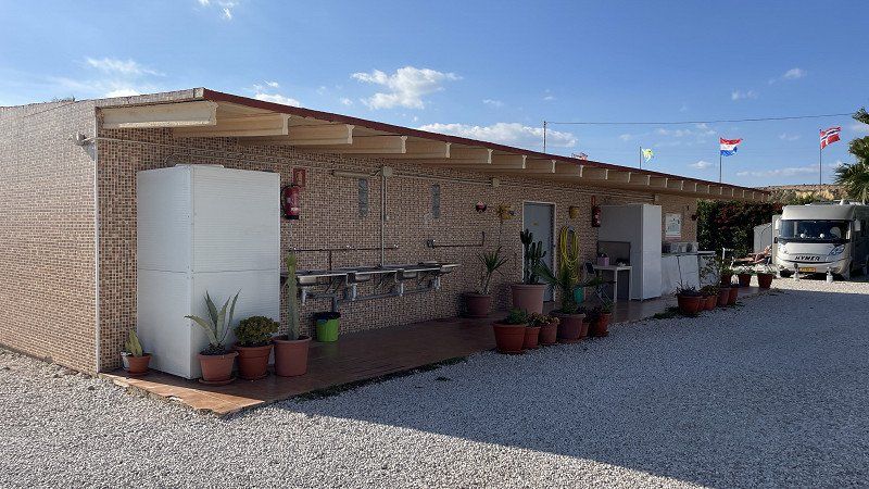
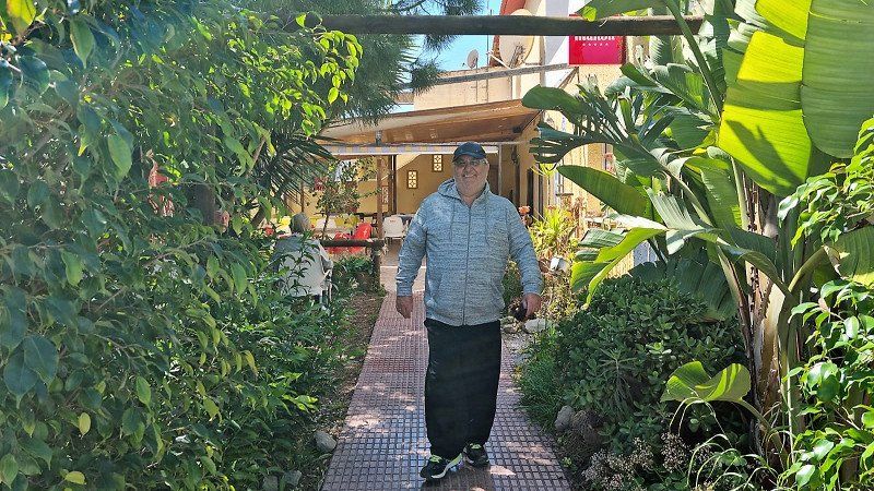
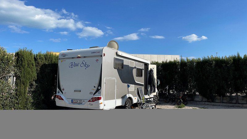
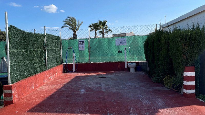
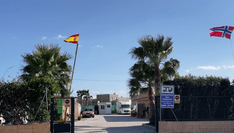
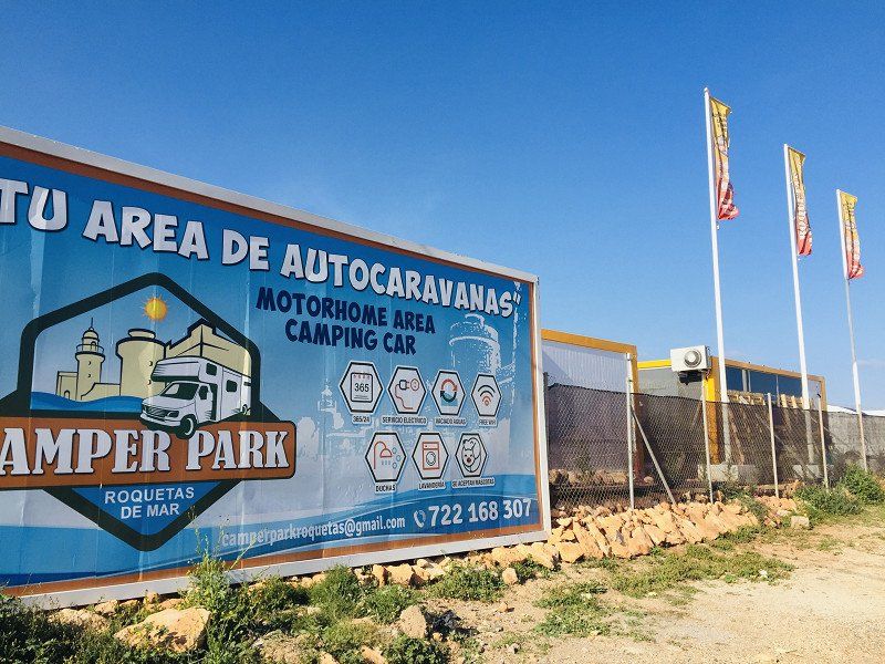
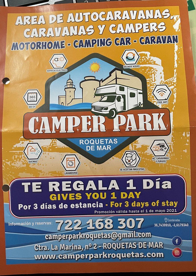
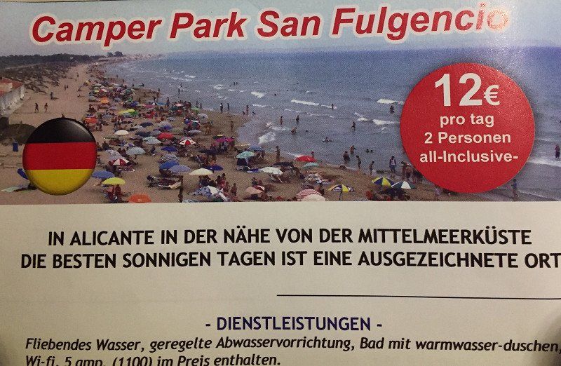
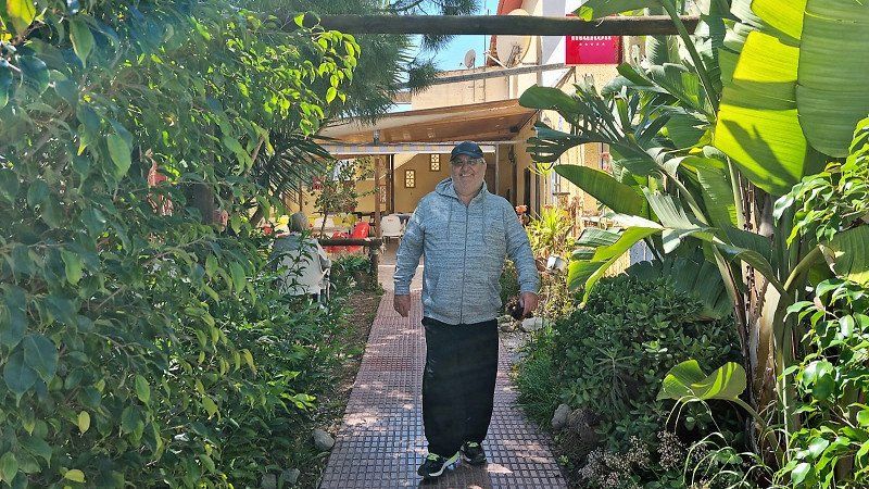
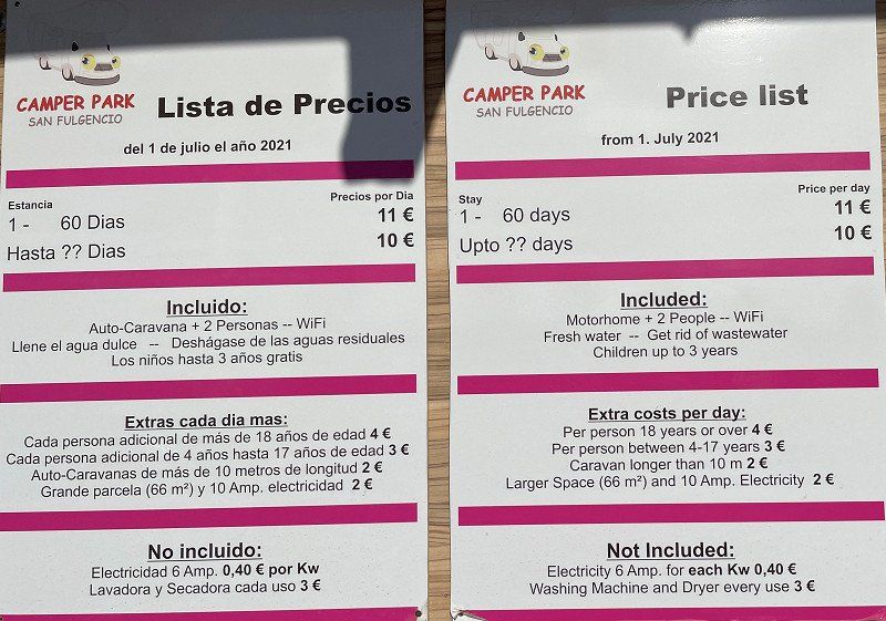
Camper Park San Fulgencio
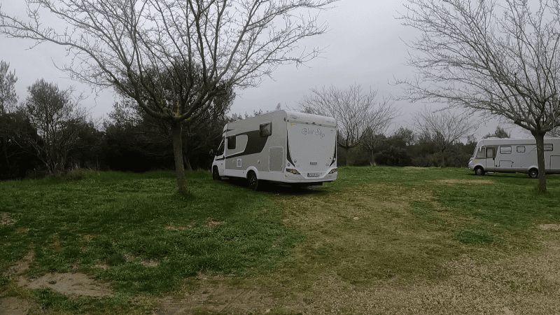
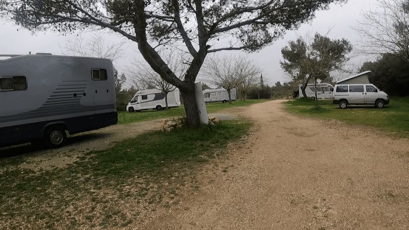
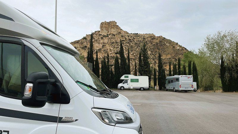
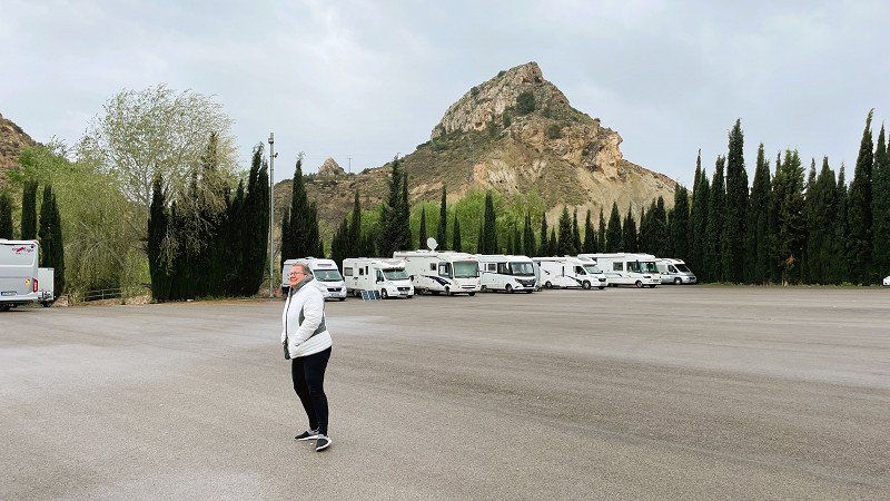
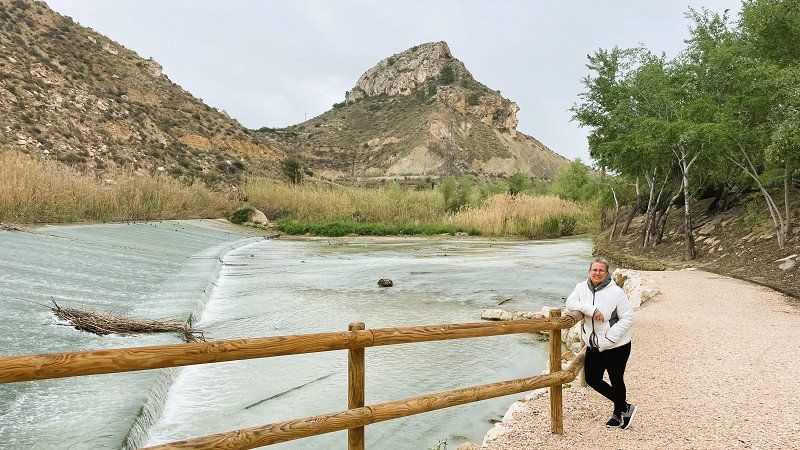
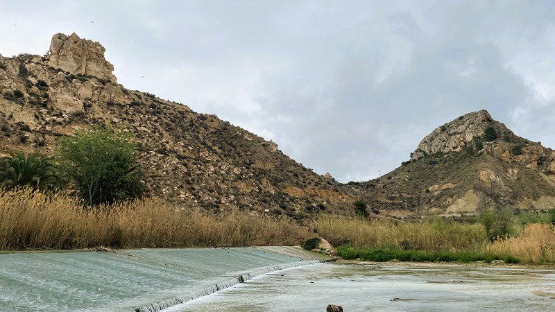
On our trip to Andalusia we spent 2 nights at Camper Park San Fulgencio and visited Archena. Unfortunately, it was very rainy, which is why we drove on quickly.
https://youtu.be/cg45qR3divY
Mar Cantabrico 7, 03177, San Fulgencio, Spain
38° 7' 15" N 0° 39' 36" W
38.1208333 -0.6600000
• Head west on Calle del Mar Cantábrico. Go for 66 m.
• Turn left. Go for 67 m.
• Turn left toward Calle Mar Menor. Go for 112 m.
• Turn left onto Calle Mar Menor. Go for 96 m.
• Turn right onto Calle del Mar Cantábrico. Go for 199 m.
• Take the 2nd exit from roundabout onto Calle del Mar Cantábrico. Go for 177 m.
• Take the 1st exit from roundabout onto N-332 toward Guardamar/Torrevieja/Cartagena. Go for 955 m.
• Take the 2nd exit from roundabout onto Carretera Nacional de Alicante a Cartagena (N-332) toward Cartagena. Go for 1.7 km.
• Take ramp toward Centre Ciutat Grau/Crevillent/AP-7/Cartagena/A-7/CV-91/Rojales/N-332/Alacant/Alicante. Go for 215 m.
• Take the 3rd exit from roundabout onto CV-91 toward Rojales/Orihuela/AP-7/Cartagena. Go for 9.2 km.
• Take the 2nd exit from roundabout onto CV-91/CV-905 toward Almoradí/Orihuela/Hospital/AP-7/Torrevieja/Cartagena. Go for 262 m.
• Take the 5th exit from roundabout onto AP-7 (Autopista del Mediterráneo) toward Torrevieja/Cartagena. Go for 59.1 km.
• Take exit 800 toward Murcia/Almería onto AP-7. Go for 78.8 km.
• Take exit 878 toward Águilas. Go for 944 m.
• Take the 3rd exit from roundabout onto RM-D24 toward Águilas/Los Arejos. Go for 147 m.
• Take the 1st exit from roundabout onto RM-11 toward Águilas. Go for 3.9 km.
• Take the 2nd exit from roundabout onto Vial de Circunvalación (RM-333) toward Vera. Go for 1.0 km.
• Take the 1st exit from roundabout onto RM-333 toward Calarreona/Almería. Go for 1.1 km.
• Take the 2nd exit from roundabout onto RM-333 toward Calarreona/Almería. Go for 656 m.
• Take the 2nd exit from roundabout onto RM-333 toward Vera. Go for 745 m.
• Take the 2nd exit from Carretera Vera roundabout onto Carretera Vera (RM-333) toward Vera. Go for 428 m.
• Take the 2nd exit from roundabout onto Carretera Vera (RM-333) toward Vera. Go for 1.6 km.
• Continue on N-332. Go for 121 m.
• Continue on A-332. Go for 7.8 km.
• Take ramp. Go for 235 m.
• Take the 3rd exit from roundabout onto AL-7107 toward A-332/Villaricos/Garrucha. Go for 985 m.
• Pass 6 roundabouts and continue on AL-7107. Go for 17.7 km.
• Take the 1st exit from roundabout toward avda. El Salar. Go for 450 m.
• Continue on Avenida del Salar. Go for 554 m.
• Take the 2nd exit from roundabout onto Avenida del Salar. Go for 754 m.
• Take the 3rd exit from roundabout. Go for 409 m.
• Arrive at your destination on the left.
☍
190,5 km
(1 hrs. 58 min.)
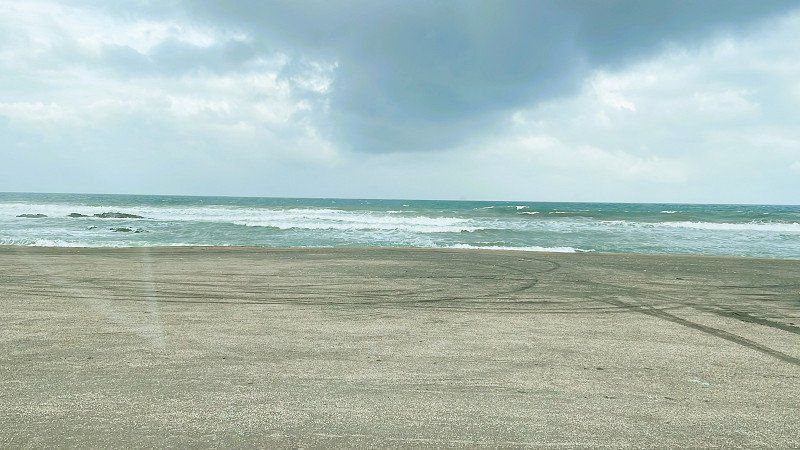
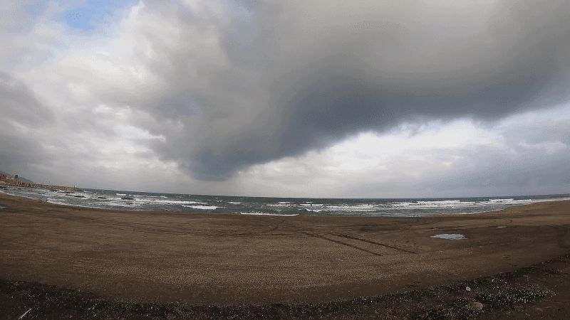
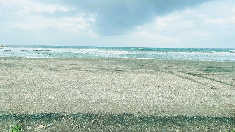
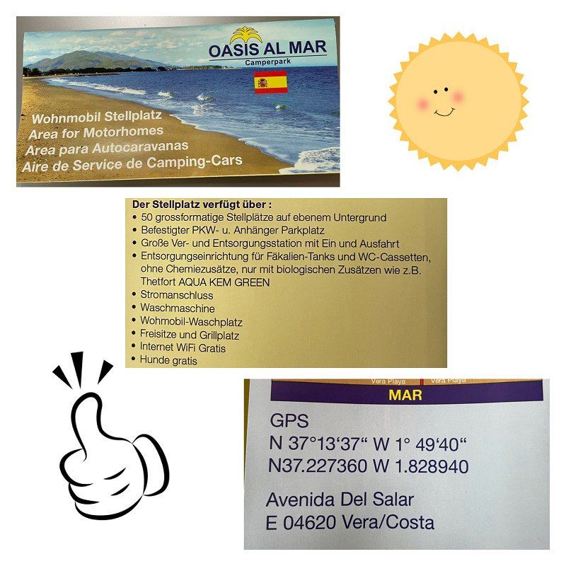
Camperparc Oasis al Mar
On our trip to Roquetas de Mar we used the SP Oasis al Mar in Vera as a stage place. Unfortunately, it was pouring rain and since the place was full and we only got the last place for 1 night, we had to leave early in the morning.
https://youtu.be/YgIHiorw1Mg
Avenida Del Salar, 04620, Vera, Spain
37° 13' 37" N 1° 49' 40" W
37.2269444 -1.8277778
• Head southwest. Go for 398 m.
• Pass 3 roundabouts and continue on Avenida Alhambra. Go for 1.1 km.
• Take the 1st exit from roundabout. Go for 57 m.
• Turn slightly right toward Carretera de Vera a Garrucha/A-352. Go for 157 m.
• Turn right onto Carretera de Vera a Garrucha (A-352). Go for 3.0 km.
• Take the 1st exit from roundabout onto Carretera de Vera a Garrucha (A-352) toward Centro Ciudad Vera/E-15/N-340/Almería/AP-7/Murcia/Cartagena. Go for 637 m.
• Take the 3rd exit from roundabout onto Carretera de Ronda (A-1200) toward Murcia/E-15/Almería/A-7/Cartagena/AP-7. Go for 420 m.
• Take the 3rd exit from roundabout onto Carretera de Ronda (A-1200). Go for 187 m.
• Take the 3rd exit from roundabout onto Carretera de Ronda (A-1200). Go for 706 m.
• Take the 2nd exit from roundabout onto N-340a toward Almería/Murcia/Cartagena. Go for 3.7 km.
• Take the 2nd exit from roundabout toward E-15/A-7/Almería. Go for 264 m.
• Take left ramp onto A-7 (Autovía del Mediterráneo) toward Almería. Go for 96.1 km.
• Take exit 800 toward Roquetas de Mar/Aguadulce/Vícar (Este). Go for 162 m.
• Take the 3rd exit from roundabout onto A-391 toward E-15/A-7/Almería/El Parador/A-1051/Roquetas de Mar/Aguadulce. Go for 241 m.
• Take the 1st exit from roundabout onto A-1051 toward El Parador/Roquetas de Mar. Go for 401 m.
• Take the 2nd exit from roundabout onto A-1051 (Variante de Roquetas de Mar) toward Roquetas de Mar/N-340a. Go for 3.8 km.
• Take exit 4 toward Las Salinas/Roquetas de Mar (Norte). Go for 174 m.
• Take the 5th exit from roundabout onto A-1051R2 toward Las Salinas/Roquetas de Mar (Norte)/Almería/A-1051/Málaga/A-7. Go for 407 m.
• Take the 2nd exit from roundabout onto A-1051R2 toward Las Salinas/Roquetas de Mar (Norte). Go for 1.1 km.
• Take the 1st exit from roundabout onto Carretera de Alicún (A-391) toward Roquetas de Mar. Go for 551 m.
• Pass 2 roundabouts and continue on Carretera de Alicún (A-391). Go for 969 m.
• Take the 2nd exit from Plaza Norieta roundabout onto Avenida Roquetas de Mar (AL-4151). Go for 346 m.
• Take the 2nd exit from roundabout onto Avenida Roquetas (AL-4151). Go for 86 m.
• Turn right onto Calle San Leopoldo. Go for 106 m.
• Arrive at Calle San Leopoldo. Your destination is on the left.
☍
115,2 km
(1 hrs. 9 min.)
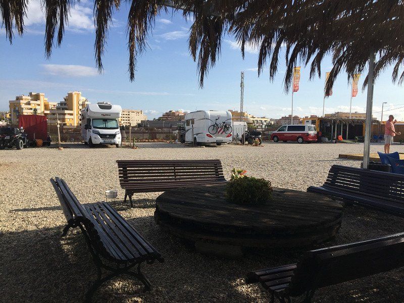
Camper Park Roquetas de Mar, Carretera la Marina, Roquetas de Mar, Spanien
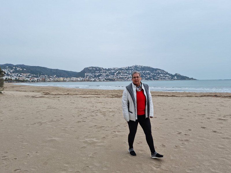
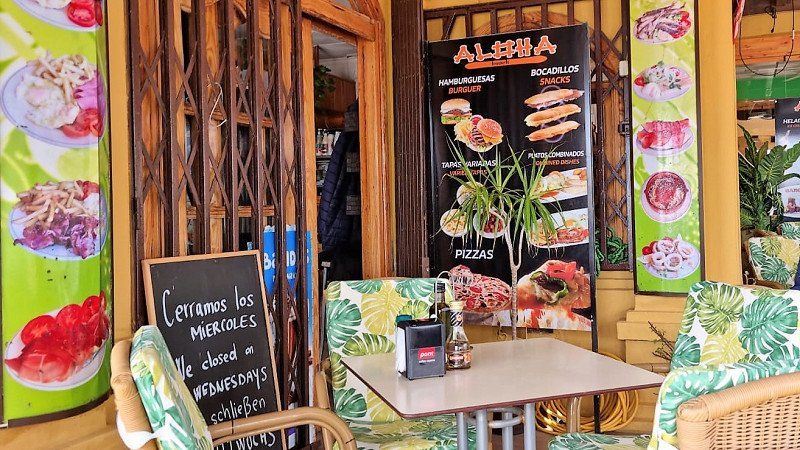
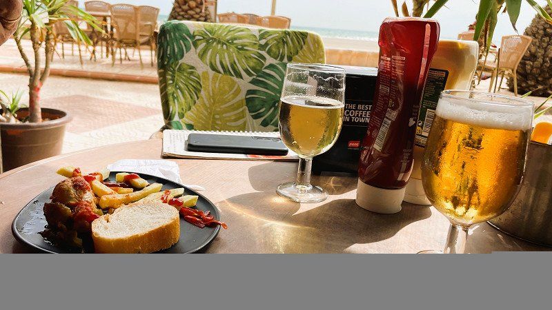
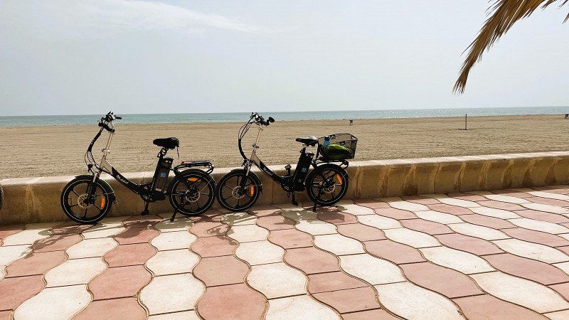
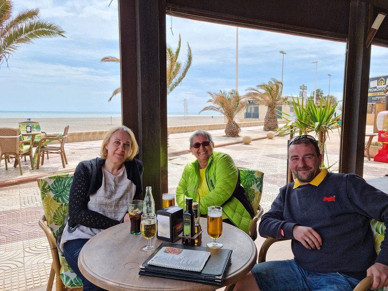
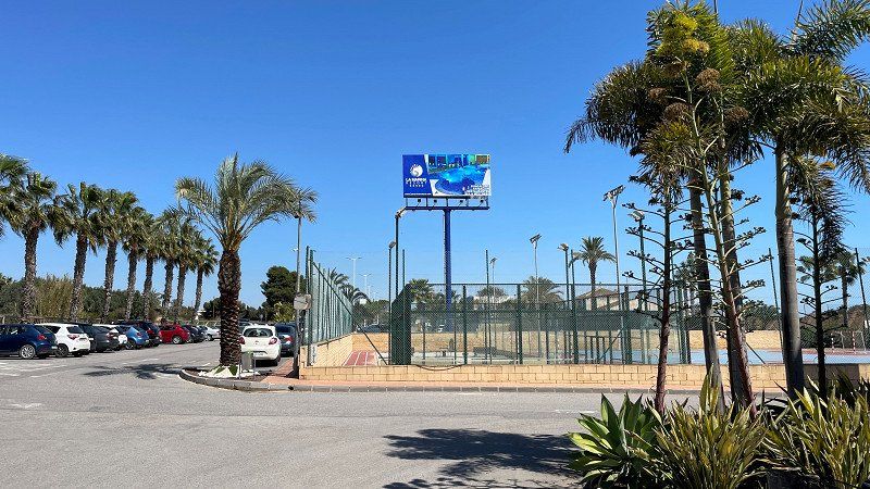
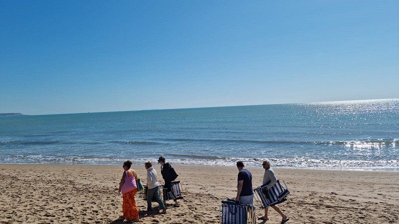
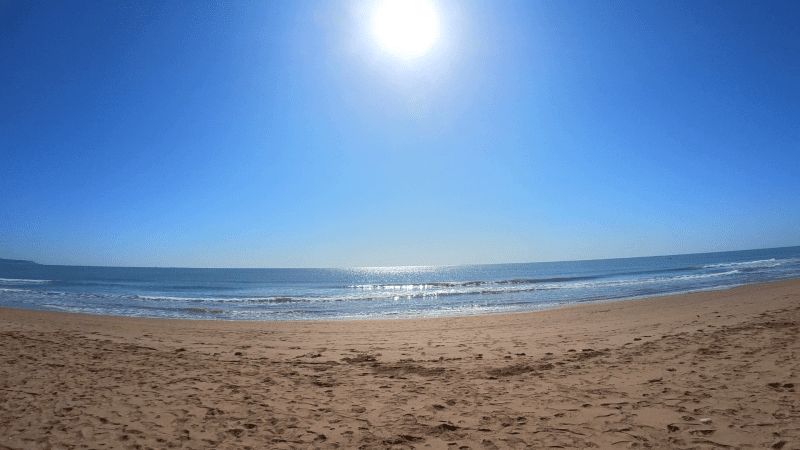
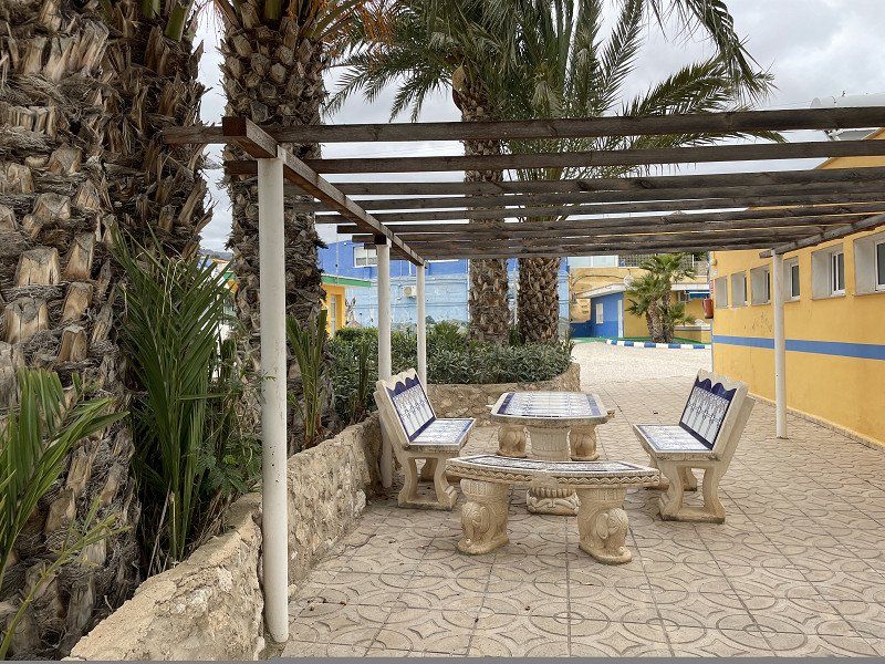
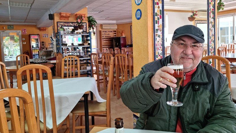
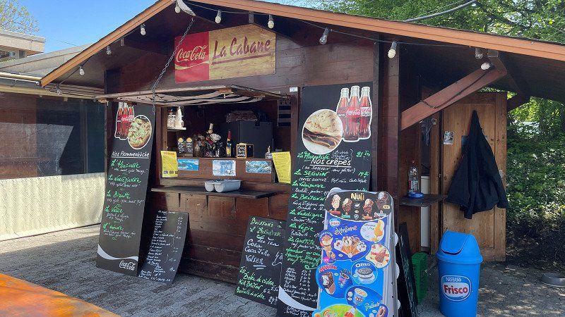
After three days of rain we were finally able to get out again yesterday and today. On the bike path along the beach to the center of Roquetas. Shopping and stocking up was the order of the day. In the tapas bar Aloa-Beach we enjoyed the finest beer and tapas.
https://youtu.be/86wZB324Fiw
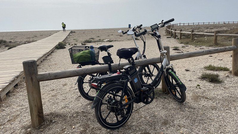
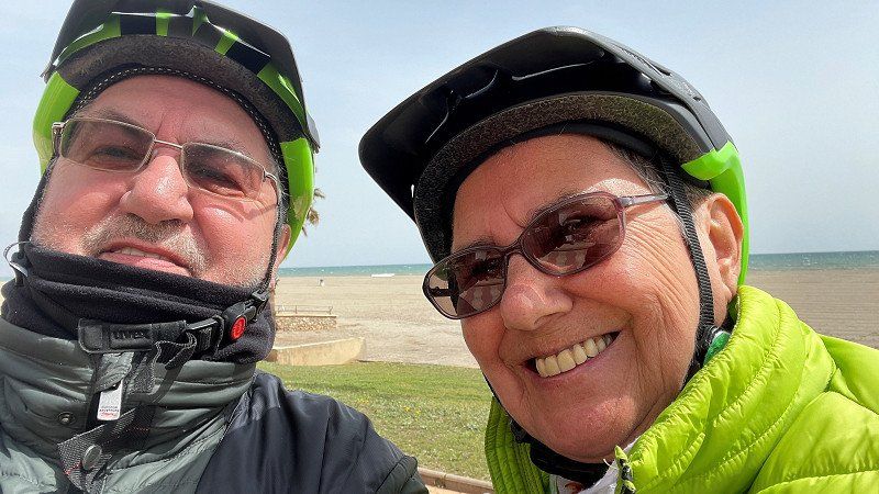
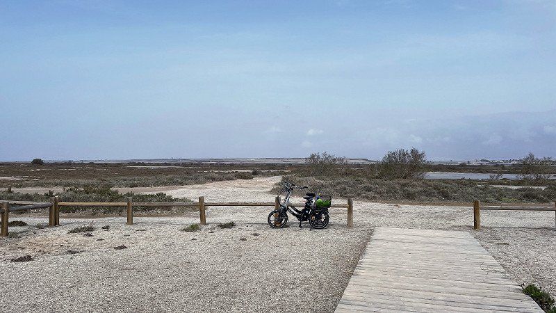
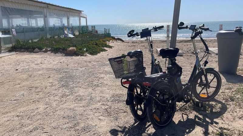
Today we were out and about with our RSM-Bike*s in the west of Roquetas. A beach promenade lined with palm trees led us through a beautiful landscape. See for yourself:
https://youtu.be/VgvEhoVHrso
We spent some nice days in Roquetas. Marcel and Jana on Tour, who we met in Croatia last year, were also here and we did a lot together. So we visited the lively market in Roquetas and we sat in a tourist train to get to know the city better. We thoroughly enjoyed it. See for yourself what a wonderful city Roquetas is.
https://youtu.be/xN45CgljUcg
Av. Roquetas de Mar, 04740 Roquetas de Mar, Almería, Spanien
36° 45' 46.7" N 2° 36' 47.6" W
36.7629778 -2.6132240
• Head southwest on Calle San Leopoldo. Go for 11 m.
• Turn right onto Calle Enix. Go for 31 m.
• Turn right onto Avenida Rector Gustavo Villapalos. Go for 113 m.
• Take the 3rd exit from roundabout onto Avenida Roquetas de Mar (AL-4151). Go for 338 m.
• Take the 2nd exit from Plaza Norieta roundabout onto Carretera de Alicún (A-391) toward Almería. Go for 186 m.
• Pass 2 roundabouts and continue on Carretera de Alicún (A-391). Go for 1.3 km.
• Take the 3rd exit from roundabout onto A-1051R2 toward Almería/A-1051/Málaga. Go for 1.2 km.
• Take the 2nd exit from roundabout onto A-1051 (Variante de Roquetas de Mar) toward A-7/Almería/Málaga. Go for 4.0 km.
• Take the 2nd exit from roundabout onto A-1051 toward A-391/La Envía/Felix/Enix/E-15/A-7/Almería/Málaga/Aguadulce (Norte). Go for 457 m.
• Take the 3rd exit from roundabout onto A-7 (Autovía del Mediterráneo) toward Almería/Murcia. Go for 101 km.
• Take exit 695A toward E-15/AP-7/Cartagena. Go for 1.3 km.
• Continue on AP-7. Go for 66.3 km.
• Take exit 845 toward Mazarrón. Go for 749 m.
• Take the 3rd exit from roundabout onto D-4 toward Mazarrón. Go for 1.6 km.
• Continue on Calle Lorca (D-4). Go for 286 m.
• Take the 2nd exit from roundabout onto Calle Ficaria toward Mazarrón. Go for 345 m.
• Turn right onto Calle de la Boquera. Go for 12 m.
• Continue on Calle Molinete. Go for 68 m.
• Turn right onto Calle de la Fuente. Go for 48 m.
• Turn left onto Calle Miguel de Cervantes. Go for 83 m.
• Arrive at Calle Miguel de Cervantes. Your destination is on the right.
☍
179,1 km
(1 hrs. 36 min.)
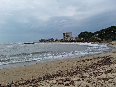
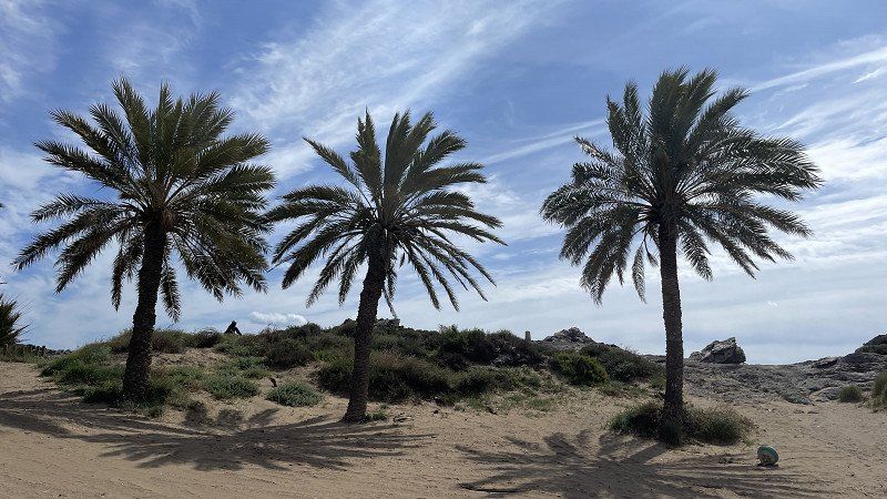
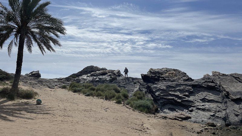
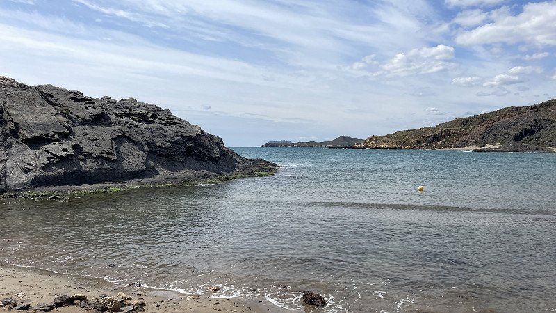
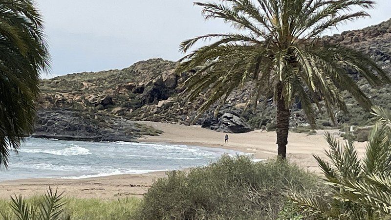
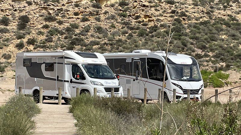
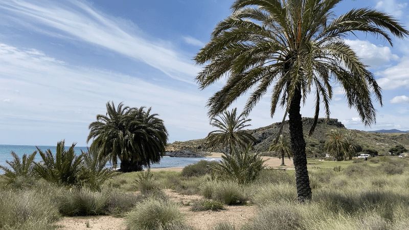
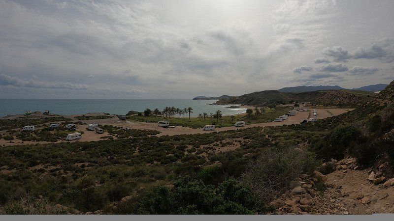
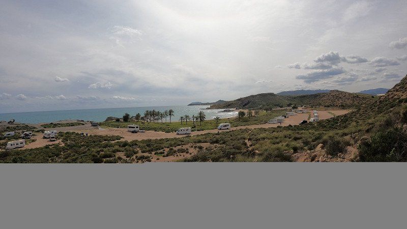
Mazarrón, Spanien
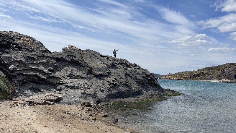
the paradise: the snake bay at Mazzaron
It is indeed a paradise and we are glad and happy that we were there. It's a pity that the rain suddenly drove us away. Afraid of getting stuck in the mud, we left as soon as the rain started.
https://youtu.be/NPToUfiSKbg
Mazarrón, Murcia, Spanien
37° 35' 44.9" N 1° 18' 53" W
37.5958175 -1.3147353
• Head southeast on Calle Miguel de Cervantes.
• Continue on Camino de las Acacias. Go for 131 m.
• Continue on Calle de las Encinas-Urb. El Molino. Go for 78 m.
• Turn left onto Camino de las Acacias. Go for 39 m.
• Turn right onto Camino de las Acacias. Go for 86 m.
• Continue on Camino de las Encinas. Go for 157 m.
• Take the 2nd exit from roundabout onto Calle Lorca (D-4) toward Murcia/RM-3/Morata/E-15/AP-7/Vera/Almería/Cartagena. Go for 326 m.
• Continue on D-4. Go for 1.5 km.
• Take the 1st exit from roundabout onto AP-7 toward Cartagena. Go for 45.1 km.
• Take the left exit toward E-15/Los Alcázares/Alicante onto AP-7 (Autopista del Mediterráneo). Go for 37.8 km.
• Take exit 763 toward La Zenia/Orihuela Costa onto Calle del Ópalo. Go for 628 m.
• Turn right onto Carretera de Villamartín. Go for 251 m.
• Take the 3rd exit from roundabout onto Carretera de Villamartín. Go for 274 m.
• Take the 4th exit from roundabout onto N-332 toward Alicante. Go for 1.6 km.
• Take the 2nd exit from roundabout onto N-332 toward Alicante. Go for 1.3 km.
• Take the 2nd exit from roundabout onto Carretera de Circunvalación (N-332) toward Alicante. Go for 951 m.
• Keep left onto Carretera de Circunvalación (N-332) toward Guardamar del Segura/Alicante. Go for 3.6 km.
• Keep left onto Carretera de Circunvalación (N-332) toward Alacant/Alicante. Go for 4.3 km.
• Take the 2nd exit from roundabout onto N-332 toward Guardamar/Alacant/Alicante. Go for 1.3 km.
• Take the 2nd exit from roundabout onto Carretera de Alicante (N-332) toward Guardamar/Alacant/Alicante. Go for 1.2 km.
• Pass 6 roundabouts and continue on N-332. Go for 9.8 km.
• Take the 3rd exit from roundabout onto Calle del Mar Cantábrico toward San Fulgencio (Urbanizaciones). Go for 232 m.
• Take the 2nd exit from roundabout onto Calle del Mar Cantábrico. Go for 342 m.
• Arrive at Calle del Mar Cantábrico. Your destination is on the left.
☍
111,0 km
(1 hrs. 9 min.)
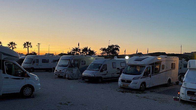
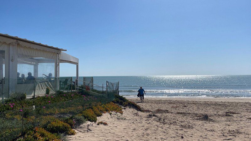
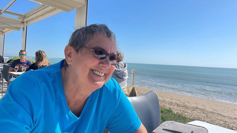
Camper Park San Fulgencio - Camping, San Fulgencio, Spanien
Camper Park San Fulgencio
Finally sun, sea and beach. Every year we are drawn back to the San Fulgencio camper park. The beach of La Marina and the restaurants in the area make our happiness perfect. See for yourself:
https://youtu.be/SxJm5jV-zk8
Mar Cantabrico 7, (Nort) 38º 7´ 15´´ * (West) -0º 39´36´´, 03177 San Fulgencio, Alicante, Spanien
38° 7' 14.7" N 0° 39' 35.3" W
38.1207570 -0.6598010
• Head west on Calle del Mar Cantábrico. Go for 83 m.
• Turn left. Go for 67 m.
• Turn left toward Calle Mar Menor. Go for 112 m.
• Turn left onto Calle Mar Menor. Go for 96 m.
• Turn right onto Calle del Mar Cantábrico. Go for 199 m.
• Take the 2nd exit from roundabout onto Calle del Mar Cantábrico. Go for 177 m.
• Take the 1st exit from roundabout onto N-332 toward Guardamar/Torrevieja/Cartagena. Go for 955 m.
• Take the 2nd exit from roundabout onto Carretera Nacional de Alicante a Cartagena (N-332) toward Cartagena. Go for 1.7 km.
• Take ramp toward Centre Ciutat Grau/Crevillent/AP-7/Cartagena/A-7/CV-91/Rojales/N-332/Alacant/Alicante. Go for 215 m.
• Take the 3rd exit from roundabout onto CV-91 toward Rojales/Orihuela/AP-7/Cartagena. Go for 9.2 km.
• Take the 2nd exit from roundabout onto CV-91/CV-905 toward Almoradí/Orihuela/Hospital/AP-7/Torrevieja/Cartagena. Go for 262 m.
• Take the 5th exit from roundabout onto AP-7 (Autopista del Mediterráneo) toward Torrevieja/Cartagena. Go for 60.0 km.
• Continue on CT-32. Go for 6.8 km.
• Continue on A-30 (Autovía de Murcia). Go for 2.4 km.
• Continue on Calle Juan Muñoz Delgado. Go for 250 m.
• Continue on Paseo de Alfonso XIII. Go for 277 m.
• Take the 1st exit from roundabout onto Calle Esparta. Go for 437 m.
• Continue on Ronda de la Ciudad de la Unión. Go for 36 m.
• Pass 2 roundabouts and continue on Ronda de la Ciudad de la Unión. Go for 857 m.
• Take the 3rd exit from Plaza de Severo Ochoa roundabout onto Calle Jorge Juan. Go for 465 m.
• Take the 2nd exit from roundabout onto Calle Jorge Juan. Go for 98 m.
• Turn right onto Calle Antonio Oliver. Go for 181 m.
• Make a U-Turn onto Calle Antonio Oliver. Go for 71 m.
• Arrive at Calle Antonio Oliver. Your destination is on the right.
☍
84,9 km
( 53 min.)
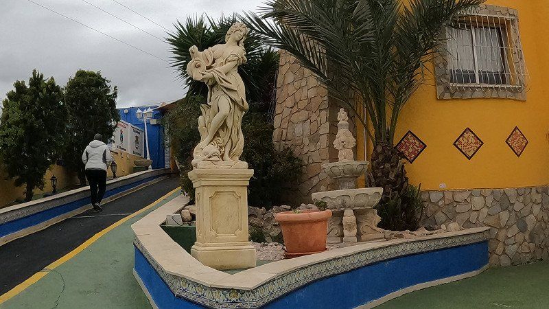
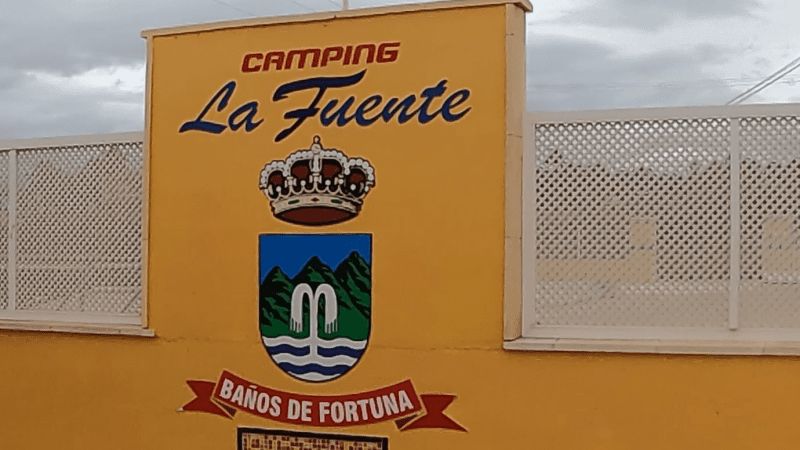
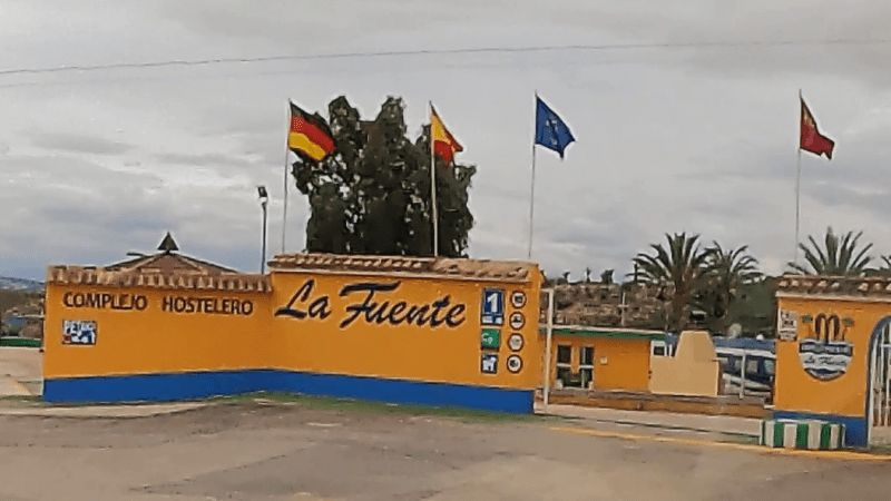
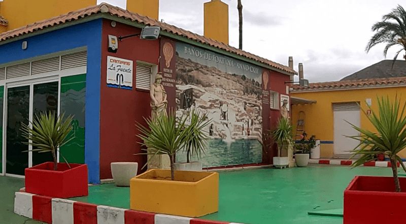
La Fuente, Cartagena, Murcia, Spanien
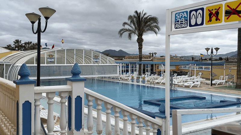
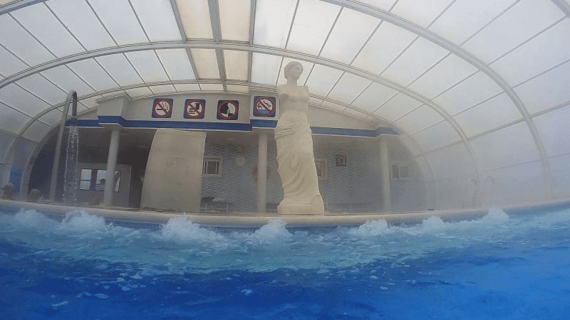
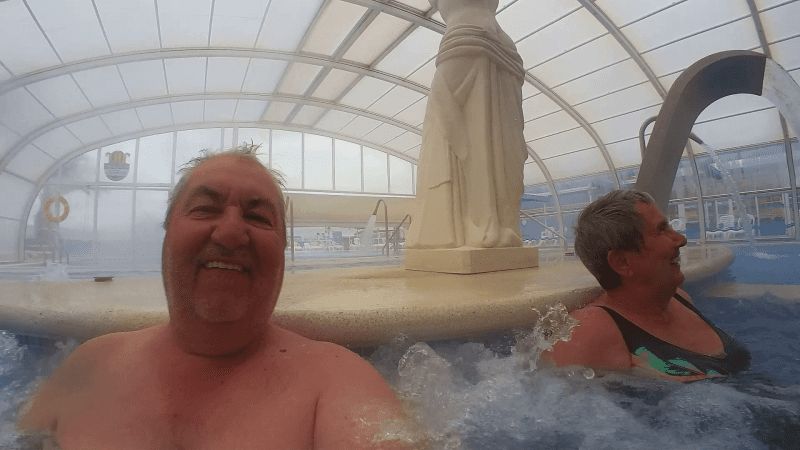
After we left Snake Bay in a hurry - because of the rain - (we didn't want to get stuck in the mud) we set up camp at La Fuente in Fortuna. Here we will have fun in the thermal baths for the next few days.
https://youtu.be/bmjfQEBSkUw
30204 Cartagena, Murcia, Spanien
37° 36' 58.9" N 0° 59' 25.9" W
37.6163608 -0.9905227
• Head south on Calle Antonio Oliver. Go for 123 m.
• Turn right onto Calle Jorge Juan. Go for 282 m.
• Take the 4th exit from roundabout onto Calle Jorge Juan. Go for 414 m.
• Take the 1st exit from roundabout onto Calle Jorge Juan. Go for 370 m.
• Take the 3rd exit from Plaza de Severo Ochoa roundabout onto Ronda Transversal (RM-36) toward Avenida Victor Beltrí/Los Barreros/La Palma/Murcia/F-30/A-30/Alicante/A-37. Go for 1.0 km.
• Take the 1st exit from roundabout onto Ronda Transversal (RM-36). Go for 438 m.
• Pass 2 roundabouts and continue on Ronda Transversal (RM-36). Go for 1.4 km.
• Take the 1st exit from roundabout onto RM-F-36 toward Murcia/A-30/Alicante/AP-7. Go for 599 m.
• Take the 2nd exit from roundabout onto RM-F-36 toward La Palma. Go for 1.5 km.
• Take the 3rd exit from roundabout toward F-36/La Palma/Torre Pacheco/A-30/Murcia. Go for 237 m.
• Continue on Finca Lo Comadrón toward Murcia. Go for 57 m.
• Take the 2nd exit from roundabout onto A-30 (Autovía de Murcia) toward Murcia. Go for 33.8 km.
• Keep left onto A-30 (Autovía de Murcia) toward Murcia/Albacete/E-15/Alicante/A-7. Go for 15.5 km.
• Take exit 134 toward Molina de Segura/Albacete onto A-30 (Autovía de Murcia). Go for 24.0 km.
• Keep right onto A-33 toward Jumilla/Yecla/Valencia. Go for 90.8 km.
• Take the exit onto A-35. Go for 33.4 km.
• Continue on A-7 (Autovía del Mediterráneo). Go for 76.4 km.
• Take exit 321 toward CV-310/Bétera. Go for 291 m.
• Take the 3rd exit from roundabout toward E-15/Alicante/A-7/CV-310/Bétera. Go for 429 m.
• Continue toward Bétera. Go for 30 m.
• Take the 1st exit from roundabout onto CV-310 toward Bétera. Go for 2.0 km.
• Take the 2nd exit from roundabout onto CV-3106. Go for 392 m.
• Turn left. Go for 50 m.
• Turn right toward Calle Universo. Go for 185 m.
• Turn left onto Calle Universo. Go for 203 m.
• Arrive at Calle Universo. Your destination is on the right.
☍
284,0 km
(2 hrs. 40 min.)
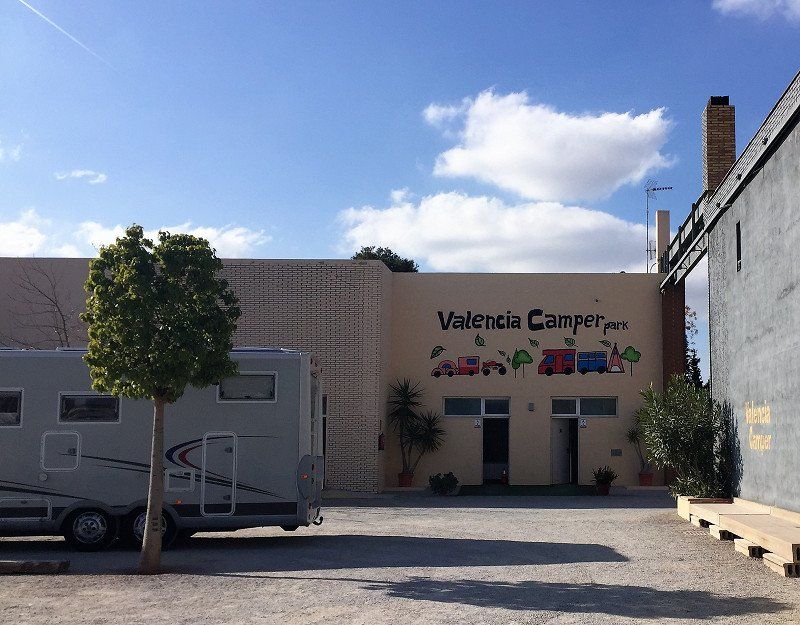
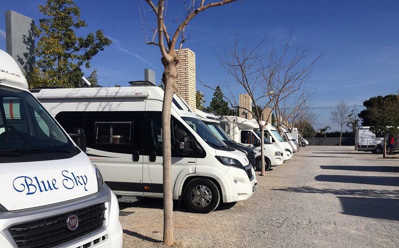
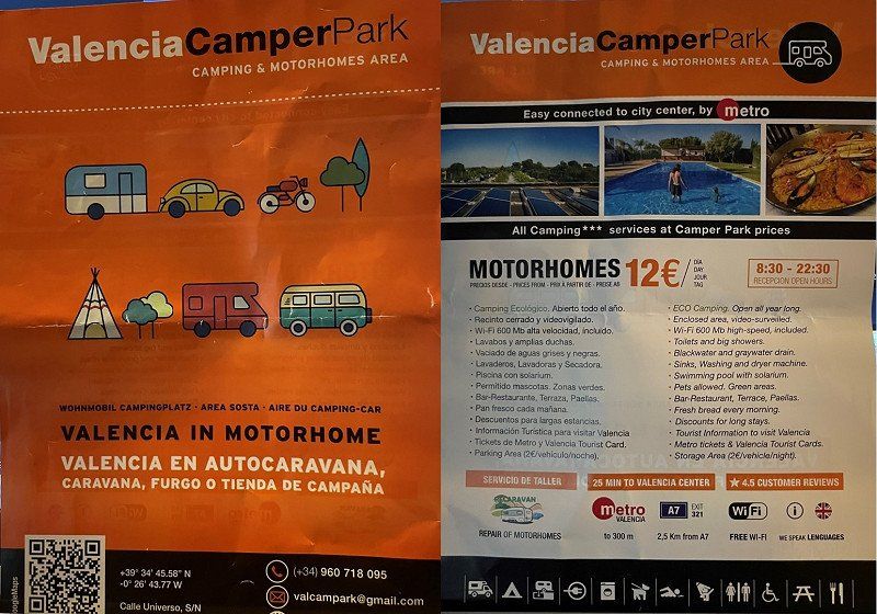
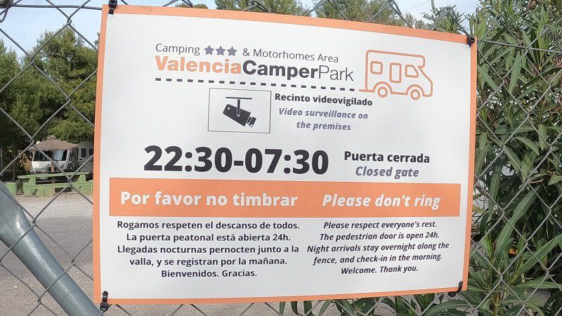
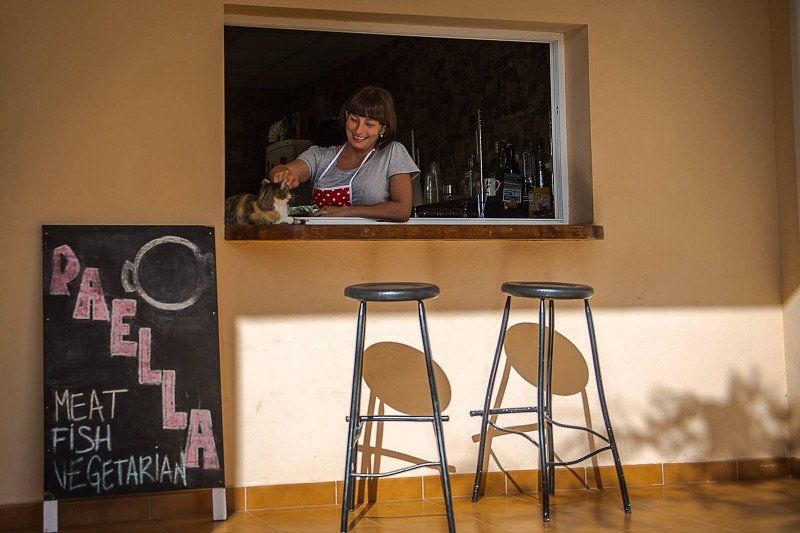
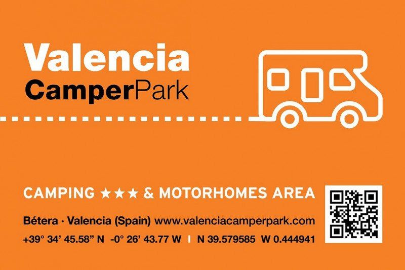
Valencia Camper Park
ValenciaCamperPark
https://youtu.be/xD-Gavcsx5o
Calle Universo s/n, 46117, Bétera, Spain
39° 34' 47" N 0° 26' 41.1" W
39.5797200 -0.4447400
• Head toward Calle Mercurio on Calle Universo. Go for 203 m.
• Turn right. Go for 185 m.
• Turn left toward CV-3106. Go for 50 m.
• Turn right onto CV-3106. Go for 313 m.
• Take the 2nd exit from roundabout onto CV-310. Go for 2.0 km.
• Take the 3rd exit from roundabout toward E-15/Castellón/A-7/Godella/Burjassot. Go for 347 m.
• Continue toward Castelló/Castellón. Go for 38 m.
• Take the 2nd exit from roundabout onto A-7 (Autovía del Mediterráneo) toward Castelló/Castellón. Go for 14.2 km.
• Keep left onto A-7 (Autovía del Mediterráneo) toward AP-7/Castelló/Castellón/Barcelona. Go for 485 m.
• Continue on AP-7 (Autovía del Mediterráneo). Go for 199 km.
• Take exit 38 toward N-340/C-44/l'Hospitalet de l'Infant/Móra la Nova. Go for 728 m.
• Take the 4th exit from roundabout onto A-7 (Autovia de la Mediterrània) toward Cambrils/Tarragona. Go for 2.4 km.
• Take exit 1131 toward Miami Platja. Go for 340 m.
• Take the 1st exit from roundabout toward N-340/Miami Platja. Go for 39 m.
• Continue on Avinguda del Doctor Gil Vernet. Go for 846 m.
• Take the 2nd exit from roundabout onto Avinguda del Doctor Gil Vernet. Go for 665 m.
• Turn right onto Plaça Dr. Fleming toward Cambrils/Tarragona. Go for 185 m.
• Take ramp onto Avinguda de Barcelona (N-340) toward Cambrils/Tarragona. Go for 3.5 km.
• Turn right. Go for 139 m.
• Arrive at your destination on the left.
☍
225,2 km
(2 hrs. 8 min.)
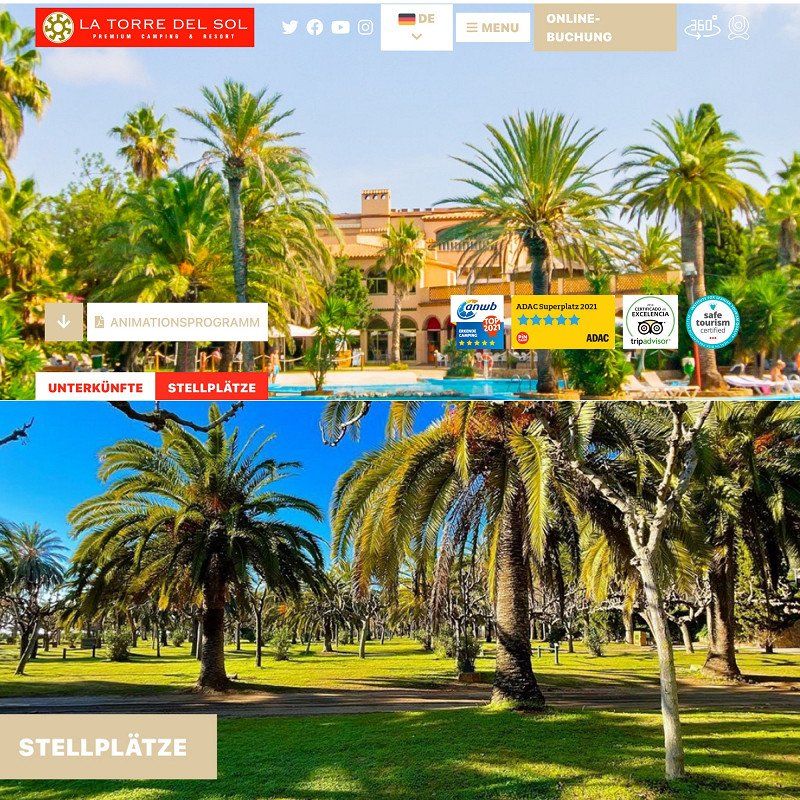
Camping La Torre del Sol
We first drove from the ValenciaCamperPark to the EbroDelta to spend the night on the pitch there. Since this SP has no power supply, we continued because we didn't want to be without shore power for 2 nights. However, the SP in the EbroDelta is definitely worth a visit, which is why we will come back and then be supplied with sufficient power. Then we continued in the direction of Cambrils and, as feared, most CPs were full or charged exorbitant prices of up to €90 per night. We didn't see that and on the premium campsite "La Torre del Sol" we got a place for €37.50 including electricity and much more. You can find out everything else in our video:
https://youtu.be/Ww45ZZX34YM
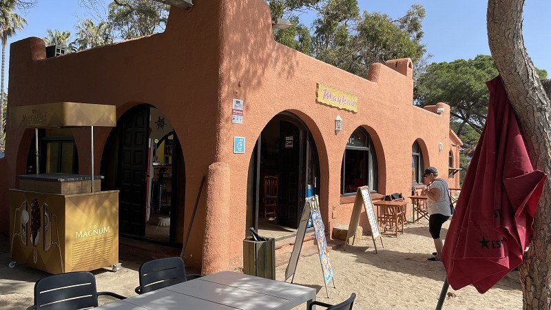
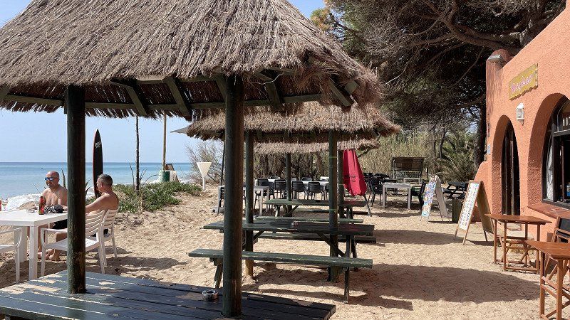
During our 6-day stay on the "La Torre del Sol" campsite, we also went on several smaller bike tours in the Montroig area. So we were also on the CP Oasis Mar, 6 km away, where we stood every year. However, it was fully booked this year, which is why we only paid a short visit. We were at the Maykao beach bar around 25 years ago with the whole family, which is why we set out to find it again. It was successful and I was immediately amazed by the charm that this beach bar exudes. But see for yourself:
https://youtu.be/RGosQXBTtaI
Carretera N.-340, 43300, Mont-roig del Camp, Spain
41° 2' 13" N 0° 58' 30" E
41.0369400 0.9750000
• Head north. Go for 117 m.
• Turn right onto N-340. Go for 2.5 km.
• Take the 2nd exit from roundabout onto N-340 toward Cambrils/Tarragona. Go for 4.8 km.
• Take the 3rd exit from roundabout onto T-312 toward Tarragona/E-15/A-7/Castelló/AP-7/Montbrió del Camp. Go for 993 m.
• Take the 2nd exit from roundabout toward E-15/Tarragona/Barcelona/València. Go for 416 m.
• Take ramp onto AP-7 (Autopista de la Mediterrània) toward Tarragona/Barcelona. Go for 138 km.
• Take exit 12B toward Centre Ciutat la Roca del V./Granollers est/Mataró/C-60. Go for 1.0 km.
• Take the left exit toward La Roca del V./Mataró onto C-60 (Autovia Mataró Granollers). Go for 9.8 km.
• Take the exit toward Mataró oest Hospital/Girona onto C-32 (Autopista de Barcelona a Mataró). Go for 23.2 km.
• Take exit 122 toward Calella/Pineda de Mar/Sta. Susanna. Go for 1.1 km.
• Continue on Carrer del Torrent dels Frares toward Calella Platges/Pineda de Mar/Sta. Susanna/Girona/N-2. Go for 23 m.
• Continue on Carrer Torrent del Convent toward Calella Platges/Pineda de Mar/Sta. Susanna/Girona/N-2. Go for 27 m.
• Keep left toward Calella Platges/Pineda de Mar/Sta. Susanna/Girona/N-2. Go for 204 m.
• Continue on Avinguda del Rierany dels Frares toward Pineda Centre/Sta. Susanna/N-2/Girona. Go for 120 m.
• Turn left onto Carrer Andorra toward Pineda Centre/Sta. Susanna/N-2/Girona. Go for 72 m.
• Turn left onto Carrer Montecarlo. Go for 138 m.
• Continue on Carrer Garbí (N-2) toward Pineda Centre Ciutat/Sta. Susanna/Girona. Go for 217 m.
• Take the 3rd exit from roundabout onto Carrer Garbí (N-2) toward Girona. Go for 367 m.
• Pass 2 roundabouts and continue on Carrer Garbí (N-2). Go for 1.7 km.
• Take the 2nd exit from roundabout onto Carrer de Santiago Rusiñol toward Centre Ciutat. Go for 801 m.
• Turn left onto Carrer del Consolat de Mar toward Santa Susanna. Go for 494 m.
• Continue on Avinguda del Mar. Go for 964 m.
• Take the 1st exit from roundabout. Go for 210 m.
• Continue on Carrer dels Pins. Go for 475 m.
• Arrive at Carrer dels Pins. Your destination is on the left.
☍
188,2 km
(1 hrs. 57 min.)
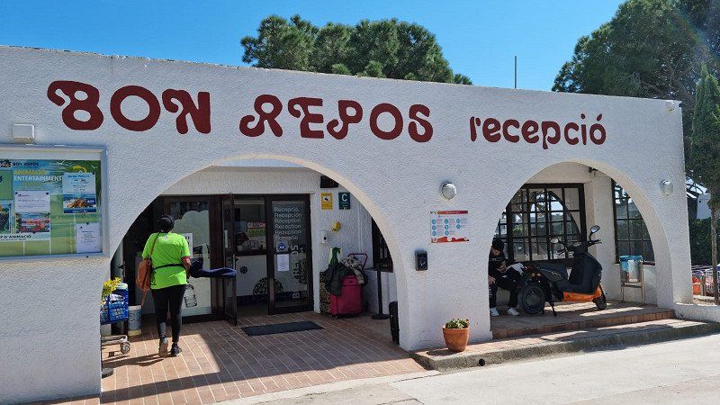
Camping Bon Repos
From Montroig we drove to Santa Susanna on Easter Monday. The highway was almost completely free of traffic, only a few vehicles were on the road around Barcelona. So we arrived at CP Bon Repo around noon. The space was almost full, but since we booked through booking.com, we also got a great premium seat in the front row. Although we had some rain today, so far we are absolutely delighted with the town and the campsite.
https://youtu.be/WB0kNCyQqHI
April, April, the weather doesn't know what it wants.
We spend the last few days on the Bon Repo with severe weather changes. One day rain, one day sunshine..........
Nevertheless, we make the best of it and enjoy the beautiful CP and the - if available - sunbeams.
Tomorrow, Sunday, we start our journey home and we want to be home again on Wednesday. Here are some more impressions:
https://youtu.be/PCNpOQj37Lc
Final Paseo Maritim, 08398, Santa Susanna, Spain
41° 37' 54" N 2° 43' 11" E
41.6316600 2.7197200
• Head northeast on Carrer dels Pins. Go for 463 m.
• Turn left onto Avinguda del Mar. Go for 32 m.
• Turn right onto Avinguda del Mar. Go for 307 m.
• Take the 1st exit from roundabout onto Avinguda del Mar. Go for 64 m.
• Turn left onto Avinguda de Colom. Go for 586 m.
• Turn right onto N-2. Go for 41 m.
• Continue on N-2. Go for 2.5 km.
• Pass 6 roundabouts and continue on N-2. Go for 33.0 km.
• Take the exit onto AP-7 (Autopista de la Mediterrània). Go for 67.2 km.
• Continue on A9 (La Catalane). Go for 226 km.
• Take exit 25 toward Alès/Nîmes-Quartiers Ouest onto A54. Go for 1.3 km.
• Turn right onto Avenue du Président Salvador Allende (N113) toward Nîmes-Centre. Go for 581 m.
• Pass 5 roundabouts and continue on Boulevard du Président Salvador Allende (D6113). Go for 2.6 km.
• Take the 3rd exit from roundabout onto Avenue Général Leclerc. Go for 976 m.
• Keep left onto Avenue Carnot. Go for 382 m.
• Keep left onto Avenue Carnot. Go for 73 m.
• Continue on Rue Notre-Dame. Go for 150 m.
• Continue on Square de la Couronne. Go for 85 m.
• Turn slightly left onto Boulevard Amiral Courbet. Go for 37 m.
• Turn right onto Rue de la Couronne. Go for 82 m.
• Arrive at Rue de la Couronne.
☍
336,2 km
(3 hrs. 12 min.)
Nîmes, Frankreich
As on the outward journey, we also used the SP at the farm near Nimes as a stage on the return journey: https://youtu.be/fhAggM8ypqw
43° 50' 12.1" N 4° 21' 36.2" E
43.8366990 4.3600540
• Head northwest on Rue de la Couronne.
• Turn right onto Place de la Salamandre. Go for 70 m.
• Turn slightly left onto Grand'Rue. Go for 28 m.
• Turn right onto Rue des Greffes. Go for 51 m.
• Turn left onto Boulevard Amiral Courbet. Go for 78 m.
• Turn right onto Rue des Calquières. Go for 159 m.
• Continue on Place de l'Écluse. Go for 69 m.
• Turn left onto Rue Notre-Dame. Go for 583 m.
• Continue on Rue Pierre Semard. Go for 208 m.
• Continue on Route d'Avignon (D127). Go for 709 m.
• Continue on Avenue de Bir Hakeim. Go for 675 m.
• Take the 3rd exit from Rond-Point du Souvenir Français roundabout onto Boulevard du Président Salvador Allende (N86) toward Courbessac. Go for 905 m.
• Continue on Route d'Avignon (D6086). Go for 1.3 km.
• Take the 2nd exit from Rond-Point Lieutenant-Colonel Pierre Colin roundabout onto Route d'Avignon (D6086) toward A9/Avignon/Montélimar/Marguerittes. Go for 1.3 km.
• Take the 1st exit from roundabout onto A9 (La Languedocienne) toward Lyon. Go for 47.7 km.
• Continue on A7 (Autoroute du Soleil). Go for 92.5 km.
• Take exit 15 toward Genève/Chambéry/Grenoble/Romans/Valence onto E713 (Échangeur de Valence-Sud). Go for 708 m.
• Continue on N7. Go for 9.7 km.
• Continue on E713. Go for 168 m.
• Continue on N532. Go for 10.6 km.
• Keep left onto A49 toward Genève/Chambéry/Grenoble/Romans-Centre. Go for 60.6 km.
• Take the exit toward Voiron/Lyon/Chambéry/Genève onto A48. Go for 41.8 km.
• Take the exit toward Genève/Chambéry/La Tour du Pin onto A43. Go for 46.8 km.
• Continue on A41 toward Genève/Annecy/Aix les Bains. Go for 39.5 km.
• Take exit 16 toward Cran-Gevrier onto D3508. Go for 1.3 km.
• Take ramp onto Boulevard Ouest (D1501) toward Annecy/Albertville/Annecy-le-Vieux/Thônes. Go for 808 m.
• Keep left onto Boulevard Ouest (D1501) toward Annecy-Centre/Cran-Gevrier/Annecy-le-Vieux. Go for 436 m.
• Keep right toward Annecy-Centre/Cran-Gevrier. Go for 142 m.
• Turn right onto Avenue des Hirondelles. Go for 485 m.
• Take the 3rd exit from roundabout onto Avenue Bouvard. Go for 395 m.
• Continue on Avenue de Brogny. Go for 302 m.
• Turn sharp right onto Rue Jean Jaurès. Go for 512 m.
• Turn right onto Avenue d'Albigny (D909). Go for 160 m.
• Turn left onto Quai Eustache Chappuis (D1508). Go for 178 m.
• Turn left onto Esplanade de l'Hôtel de Ville. Go for 157 m.
• Turn right. Go for 16 m.
• Arrive at your destination on the right.
☍
361,0 km
(3 hrs. 18 min.)
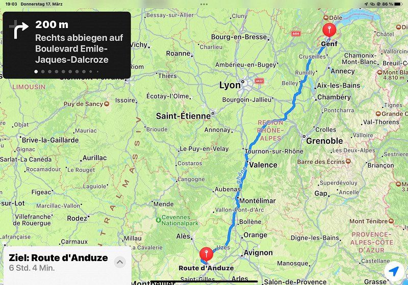
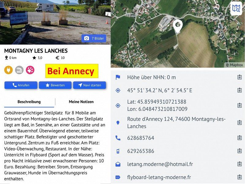
Annecy, Frankreich
On the way home we found this fine little pitch near Annecy. Parking space with attached restaurant, which was closed when we visited. A small lake / pond creates an idyllic atmosphere.
https://youtu.be/nB6v4NxBJjQ
45° 53' 56.7" N 6° 7' 46.3" E
45.8990887 6.1295411
• Head east. Go for 16 m.
• Turn left onto Esplanade de l'Hôtel de Ville. Go for 157 m.
• Turn right onto Quai Eustache Chappuis (D1508). Go for 178 m.
• Turn right onto Pont Albert Lebrun (D909). Go for 337 m.
• Turn left onto Rue Louis Revon (D5). Go for 145 m.
• Continue on Place Amédée VIII. Go for 301 m.
• Take the 3rd exit from roundabout onto Boulevard du Lycée. Go for 239 m.
• Turn right onto Avenue de Brogny. Go for 1.9 km.
• Keep left onto Voie de Metz (D1201). Go for 525 m.
• Keep left onto Voie de Metz (D1201) toward A41/Genève/Chamonix/Bourg en Bresse/Metz-Tessy/Pringy/Centre Hospitalier. Go for 1.0 km.
• Take ramp toward Genève/Pringy/Cruseilles/St Julien en G./P.A.E. de la Bouvarde. Go for 745 m.
• Take the 2nd exit from roundabout toward Chambéry/Genève/Chamonix. Go for 163 m.
• Take ramp onto A41 toward Chamonix Mt B./Thonon/Évian/Genève/Annemasse. Go for 27.0 km.
• Continue on A1. Go for 64.4 km.
• Continue on A1a (Ecublens) toward Lausanne-Sud/Lausanne-Ouchy/Lausanne-Centre. Go for 4.6 km.
• Take the 4th exit from roundabout onto Route de Chavannes toward Genève/Neuchâtel/Vallorbe. Go for 651 m.
• Turn left onto Chemin du Bois-de-Vaux. Go for 205 m.
• Take the 2nd exit from roundabout onto Chemin du Camping. Go for 73 m.
• Arrive at Chemin du Camping. Your destination is on the right.
☍
102,7 km
(1 hrs. 11 min.)
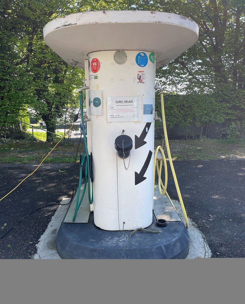
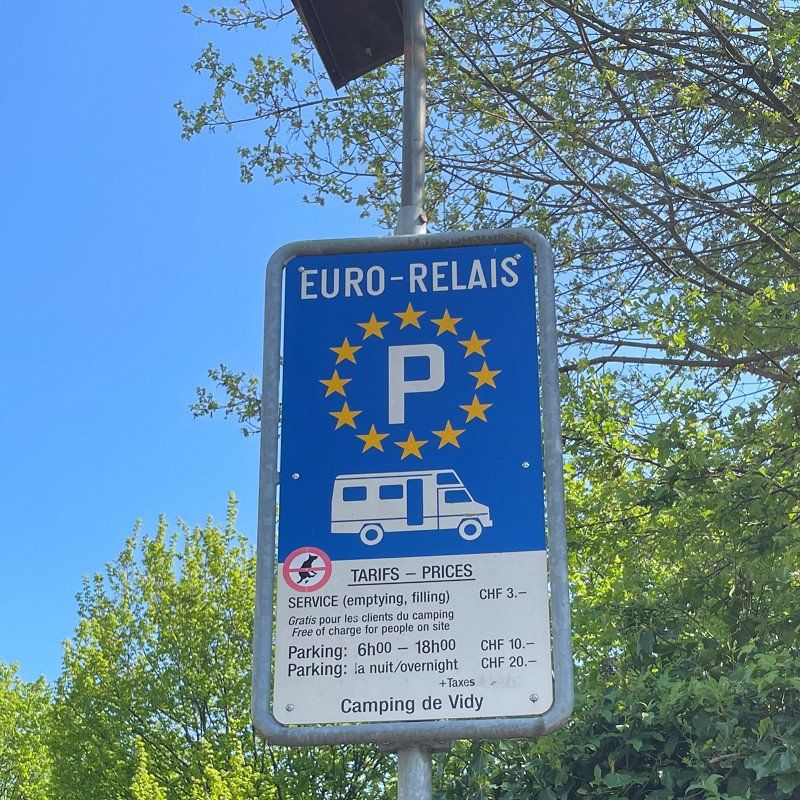
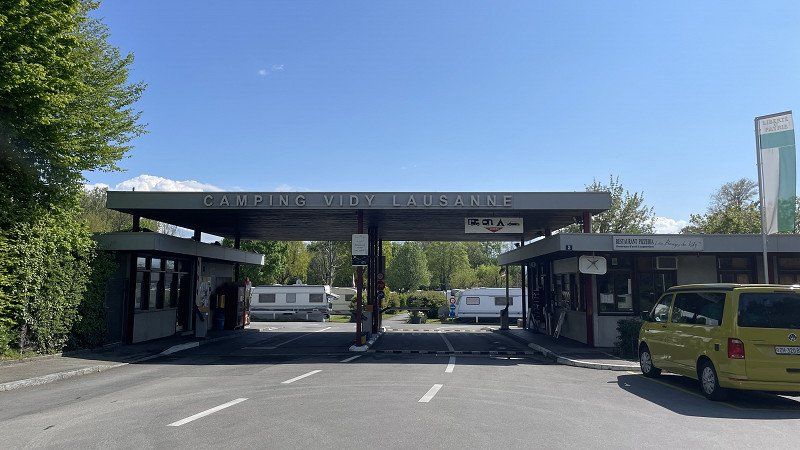
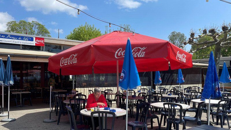
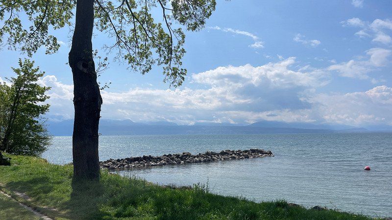
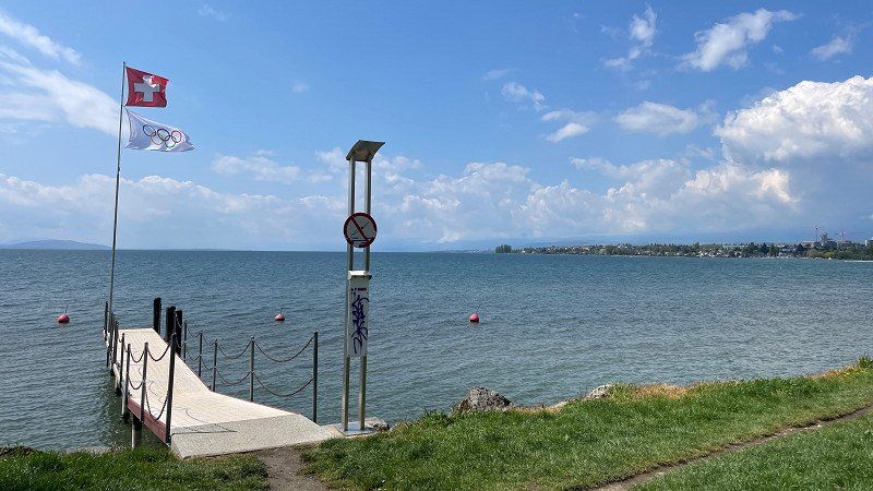
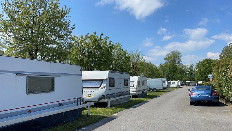
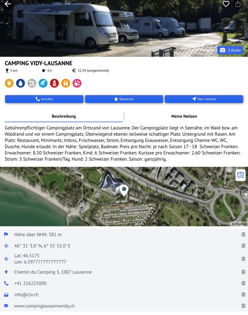
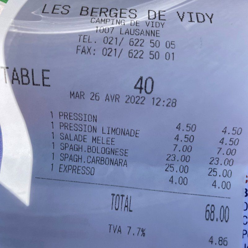
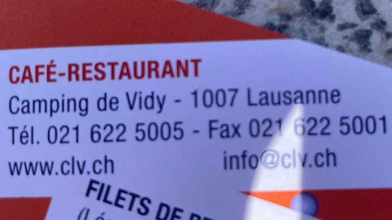
Quick-Stop an Camping Vidy
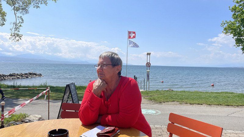
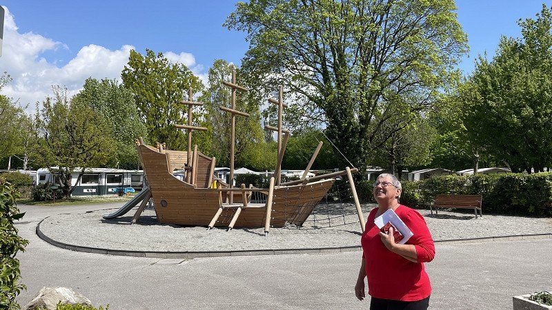
On our way home we drove from Annecy in France about 110 km to Lausanne in Switzerland. We stayed at the SP Vidy, which is part of the Vidy campsite. We were able to use all the amenities of the CP and we had a good meal in the adjoining restaurant - albeit very expensive by our standards.
https://youtu.be/S-QG0LqsB9M
Chemin du Camping 3, 1007, Lausanne, Switzerland
46° 31' 3" N 6° 35' 52" E
46.5175000 6.5977778
• Head south on Chemin du Camping. Go for 28 m.
• Arrive at Chemin du Camping. Your destination is on the left.
☍
0,0 km
( )
Camping de Vidy
We stayed at the SP Vidy, which is part of the Vidy campsite. We were able to use all the amenities of the CP and we had a good meal in the adjoining restaurant - albeit very expensive by our standards.
https://youtu.be/S-QG0LqsB9M
Chemin du Camping 3, 1007, Lausanne, Switzerland
46° 31' 2" N 6° 35' 53" E
46.5172200 6.5980500
• Head north on Chemin du Camping. Go for 61 m.
• Take the 2nd exit from roundabout onto Chemin du Bois-de-Vaux. Go for 242 m.
• Turn right onto Route de Chavannes toward Vevey. Go for 336 m.
• Take the 1st exit from roundabout onto A1a. Go for 3.6 km.
• Take exit 17 toward Bern/Neuchâtel/Besançon/Simplon/Gd-St-Bernard/A9/Lausanne-Crissier onto A1 (Ecublens). Go for 21.4 km.
• Continue on A1 toward Bern/Neuchâtel/Yverdon. Go for 81.0 km.
• Take the left exit toward Zürich/Basel/Biel/Bienne onto A1/A6. Go for 6.0 km.
• Continue on A1. Go for 53.8 km.
• Continue on A1 (Verzweigung Wiggertal) toward Zürich/Aarau/Oftringen/Zofingen. Go for 35.0 km.
• Keep right onto A1/A3 toward Zürich/Wettingen-Ost/Neuenhof. Go for 21 m.
• Take the exit. Go for 165 m.
• Turn left onto Birmenstorferstrasse. Go for 157 m.
• Keep left onto Birmenstorferstrasse. Go for 324 m.
• Turn left onto Mellingerstrasse. Go for 1.9 km.
• Take the 1st exit from roundabout onto Mellingerstrasse. Go for 788 m.
• Turn left onto Wettingerstrasse. Go for 243 m.
• Turn right onto Sonnenbergstrasse. Go for 7 m.
• Turn right onto Ehrendingerstrasse. Go for 2.4 km.
• Continue on Landstrasse. Go for 1.4 km.
• Take the 2nd exit from roundabout onto Landstrasse. Go for 295 m.
• Continue on Kantonsstrasse. Go for 739 m.
• Take the 2nd exit from roundabout onto Surbtalstrasse (17). Go for 125 m.
• Pass 2 roundabouts and continue on Surbtalstrasse (17). Go for 8.8 km.
• Take the 1st exit from roundabout onto Zurzibergstrasse. Go for 590 m.
• Take the 2nd exit from roundabout onto Zurzibergstrasse. Go for 1.4 km.
• Continue on Bruggerstrasse. Go for 1.6 km.
• Continue on Ostumfahrung Zurzach. Go for 720 m.
• Turn right onto Zürcherstrasse. Go for 176 m.
• Turn left onto Zürcherstrasse. Go for 86 m.
• Continue on Zurzacher Straße (L162). Go for 553 m.
• Take the 2nd exit from roundabout onto Dangstetter Straße (L162). Go for 1.6 km.
• Turn sharp left onto Küferweg. Go for 63 m.
• Arrive at Küferweg. Your destination is on the right.
☍
225,5 km
(2 hrs. 20 min.)
Dangstetten, Küssaberg, Deutschland
home trip
https://youtu.be/FrPEsfq-HzA
Dangstetten, 79790 Küssaberg, Deutschland
47° 35' 47.5" N 8° 19' 15.9" E
47.5965372 8.3210709