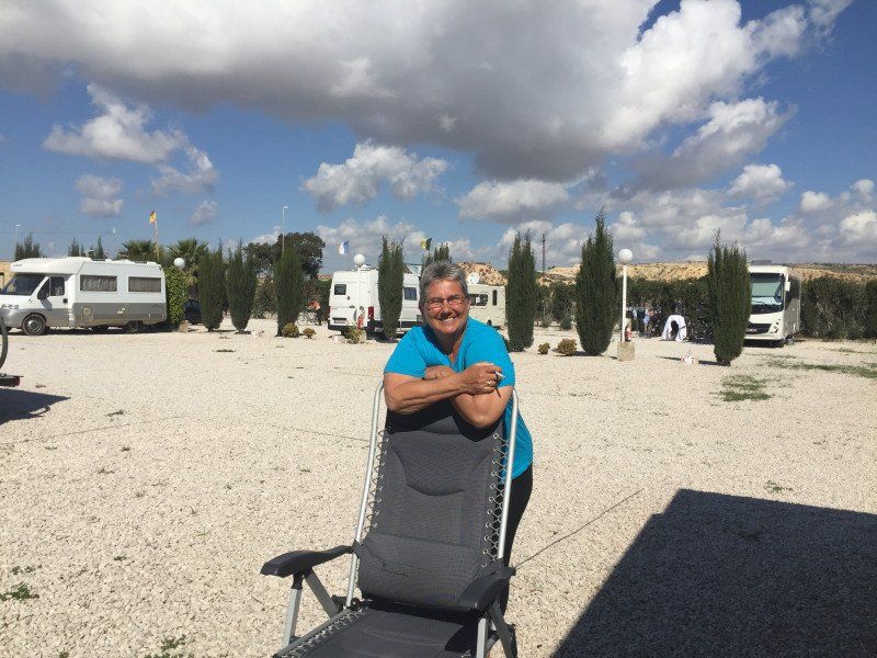
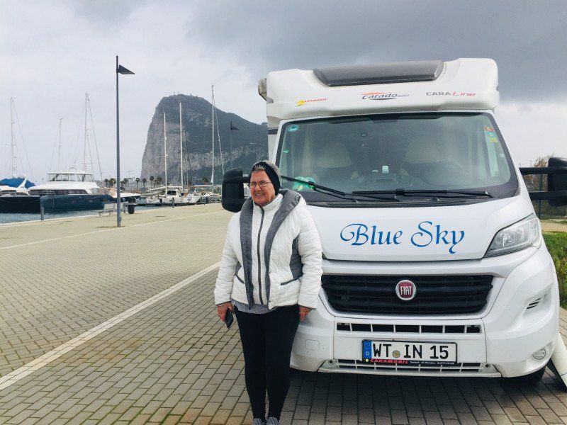
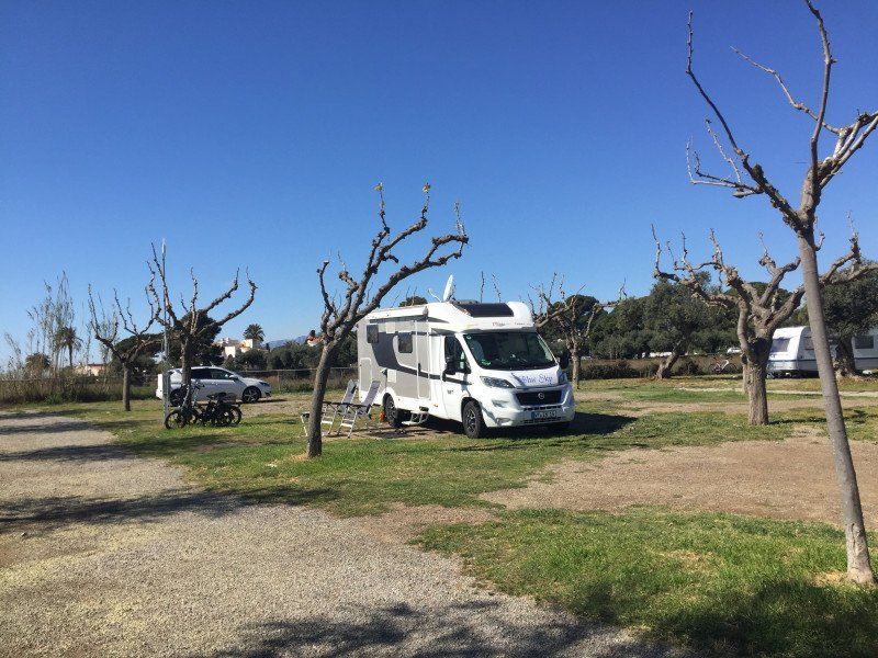
Day
Dangstetten, Küssaberg, Deutschland
Dangstetten, 79790 Küssaberg, Deutschland
47° 35' 47.5" N 8° 19' 15.9" E
47.5965372 8.3210709
• Head toward Küßnacher Straße on Küferweg. Go for 63 m.
• Turn sharp right onto Küßnacher Straße (L162). Go for 1.5 km.
• Take the 2nd exit from roundabout onto Zurzacher Straße (L162). Go for 592 m.
• Continue toward Zürcherstrasse. Go for 59 m.
• Continue on Zürcherstrasse. Go for 27 m.
• Turn right onto Zürcherstrasse. Go for 176 m.
• Turn left onto Ostumfahrung Zurzach. Go for 720 m.
• Continue on Bruggerstrasse. Go for 1.6 km.
• Continue on Zurzibergstrasse. Go for 1.4 km.
• Take the 2nd exit from roundabout onto Zurzibergstrasse. Go for 544 m.
• Turn right onto Staltig. Go for 225 m.
• Continue on Steig. Go for 262 m.
• Continue on Würenlingerstrasse. Go for 2.9 km.
• Continue on Tegerfelderstrasse. Go for 1.4 km.
• Continue on Breitenstrasse. Go for 860 m.
• Continue on Siggenthalerstrasse. Go for 180 m.
• Take the 2nd exit from roundabout onto Siggenthalerstrasse. Go for 699 m.
• Turn left onto Döttingerstrasse (5). Go for 386 m.
• Turn right onto Stillistrasse (5) toward Bern/Luzern/Aarau/Brugg/Hard. Go for 2.8 km.
• Take the 2nd exit from roundabout onto Zurzacherstrasse (5). Go for 2.0 km.
• Turn left onto Aarauerstrasse (3/5). Go for 491 m.
• Turn left onto Badenerstrasse (3). Go for 201 m.
• Take the 2nd exit from roundabout onto Zürcherstrasse (3). Go for 440 m.
• Take the 1st exit from roundabout onto Hauserstrasse. Go for 631 m.
• Take the 2nd exit from roundabout onto Hauserstrasse. Go for 521 m.
• Take the 2nd exit from roundabout onto Zubringer Hausen. Go for 278 m.
• Take ramp onto Zubringer Hausen. Go for 2.0 km.
• Continue on Lenzburgerstrasse. Go for 3.4 km.
• Take the 3rd exit from roundabout onto A1 toward Bern. Go for 37.2 km.
• Continue on A1 (Härkingen) toward E25/Lausanne/Bern/Biel/Bienne/Oensingen. Go for 50.8 km.
• Take the exit toward Lausanne/Fribourg/Neuchâtel/Bern-Neufeld onto A1 (Wankdorf). Go for 99.8 km.
• Continue on A1. Go for 2.7 km.
• Take the exit toward Genève onto A1. Go for 65.2 km.
• Continue on A41. Go for 71.5 km.
• Continue on A43. Go for 46.9 km.
• Take the exit toward Marseille/Valence/Grenoble onto A48. Go for 42.0 km.
• Take the exit toward Marseille/Valence onto A49. Go for 60.7 km.
• Continue on N532. Go for 10.6 km.
• Continue on E713. Go for 240 m.
• Continue on N7. Go for 9.5 km.
• Keep left onto E713 toward E15/A7/Marseille/Montélimar/Privas/Lyon. Go for 405 m.
• Keep left onto Échangeur de Valence-Sud (E713) toward Marseille/Avignon/Montélimar/Privas. Go for 153 m.
• Take ramp onto A7 (Autoroute du Soleil). Go for 93.8 km.
• Take exit 21 toward Orange-Centre/Caderousse. Go for 1.5 km.
• Take the 2nd exit from roundabout onto Avenue Charles de Gaulle (D17) toward Centre-Ville. Go for 258 m.
• Turn right toward Avenue Charles de Gaulle/D17. Go for 28 m.
• Take the 3rd exit from roundabout onto Avenue Charles de Gaulle (D17) toward Centre Ville. Go for 384 m.
• Take the 3rd exit from roundabout onto Cours Aristide Briand toward Avignon/Carpentras/Montélimar/Gap/Vaison la R. Go for 264 m.
• Continue on Rue Auguste Lacour. Go for 96 m.
• Continue on Boulevard Édouard Daladier (N7) toward Avignon/Camaret/Vaison la R. Go for 437 m.
• Turn left onto Pont Neuf (D975) toward Vaison la R./Camaret/Cagnan. Go for 69 m.
• Continue on Avenue Frédéric Mistral. Go for 563 m.
• Turn right onto Rue Pierre Semard. Go for 9 m.
• Turn left onto Rue des Lilas. Go for 61 m.
• Arrive at Rue des Lilas. Your destination is on the left.
☍
621,7 km
(5 hrs. 43 min.)
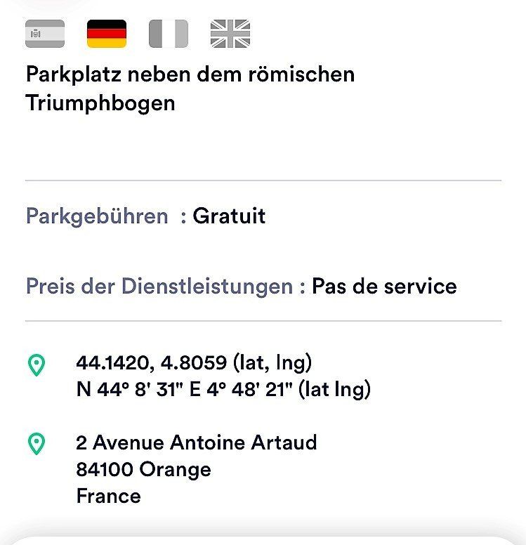
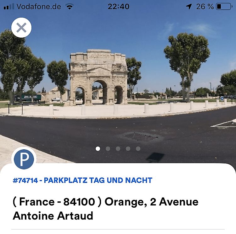
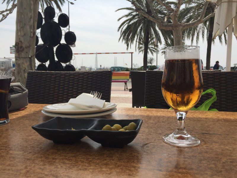
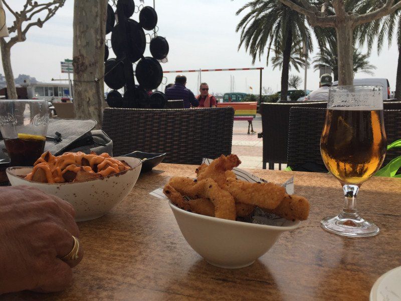
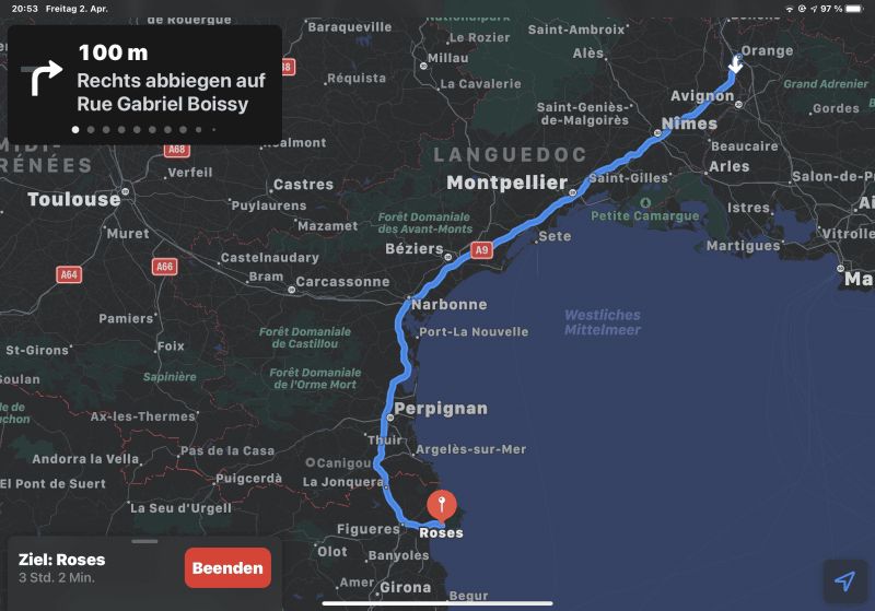
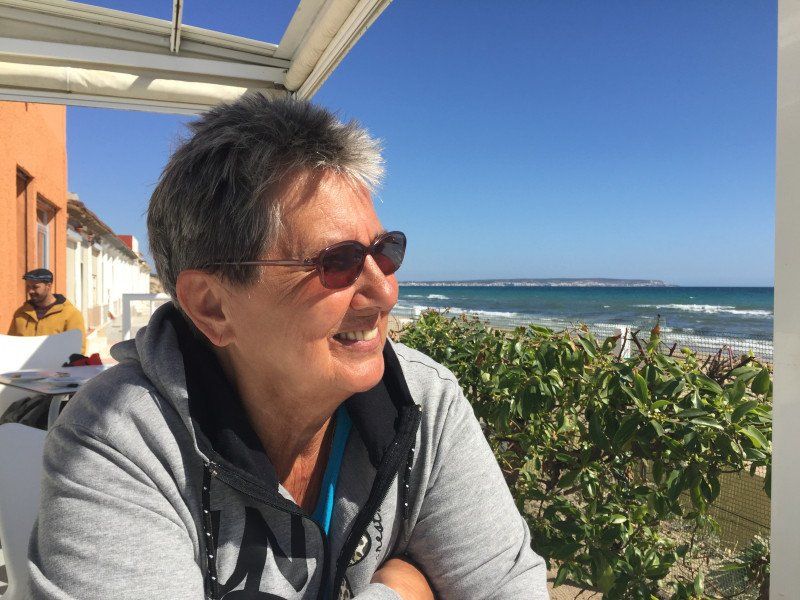
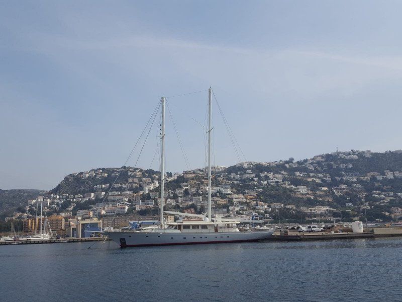
Orange, Orange, Frankreich
Park for Night
Free parking lot at the Roman Triumphboden - 2 other motor homes stayed with us there. Corona made it very quiet, as there was a curfew in France from 6 p.m. At normal times there is definitely a lot of hype at this place.
84100 Orange, Frankreich
44° 8' 14.4" N 4° 49' 10.5" E
44.1373271 4.8195796
• Head northwest on Rue des Lilas. Go for 61 m.
• Turn right onto Rue Pierre Semard. Go for 9 m.
• Turn left onto Avenue Frédéric Mistral. Go for 364 m.
• Turn right onto Rue Pasteur. Go for 99 m.
• Take the 3rd exit from roundabout onto Avenue Henri Fabre (D975). Go for 312 m.
• Turn right onto Boulevard Édouard Daladier (N7). Go for 437 m.
• Continue on Rue Auguste Lacour toward A7/A9/Caderousse/Nîmes. Go for 96 m.
• Continue on Cours Aristide Briand. Go for 196 m.
• Take the 1st exit from roundabout onto Avenue Charles de Gaulle (D17) toward A7/A9/Caderousse. Go for 352 m.
• Take the 3rd exit from roundabout onto Avenue Charles de Gaulle (D17) toward A7/A9. Go for 283 m.
• Take the 3rd exit from roundabout onto A9 (Échangeur d'Orange) toward Nîmes/Montpellier. Go for 281 km.
• Continue on AP-7 (Autopista de la Mediterrània). Go for 20.3 km.
• Take exit 3 toward Figueres N./Roses/Figueres/Girona/Barcelona/Olot/Ripoll. Go for 391 m.
• Take the 3rd exit from roundabout onto N-2 toward Figueres/Girona/Barcelona. Go for 5.4 km.
• Take ramp onto Carretera de Roses (C-260) toward Roses. Go for 1.6 km.
• Pass 2 roundabouts and continue on C-260. Go for 3.4 km.
• Take the 3rd exit from roundabout onto C-260 toward Castelló d'Empúries/Roses/Cadaqués. Go for 1.9 km.
• Take the 4th exit from roundabout onto C-260 toward Roses/Cadaqués. Go for 1.8 km.
• Take the 4th exit from roundabout onto C-260 toward Empuriabrava/Roses/Cadaqués. Go for 2.0 km.
• Pass 5 roundabouts and continue on Carretera de Besalú a Roses (C-260). Go for 5.5 km.
• Take the 3rd exit from roundabout onto Carretera de Besalú a Roses (C-260) toward Centre Ciutat. Go for 749 m.
• Take the 1st exit from roundabout onto Carrer Bernat Metge. Go for 166 m.
• Arrive at Carrer Bernat Metge. Your destination is on the left.
☍
326,2 km
(2 hrs. 56 min.)
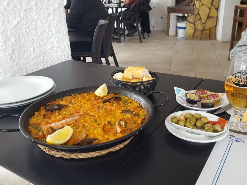
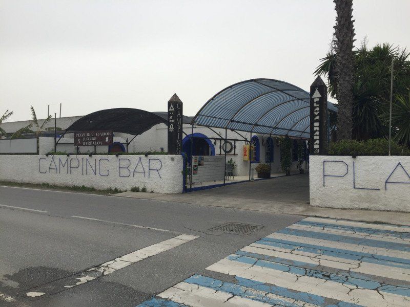
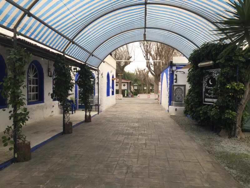
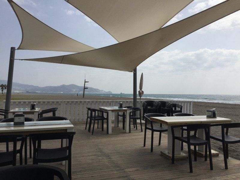
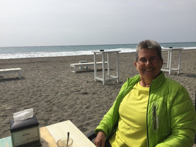
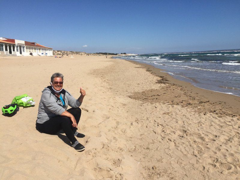
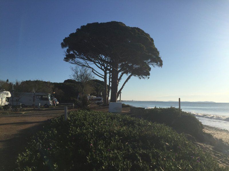
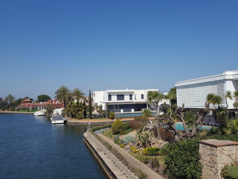
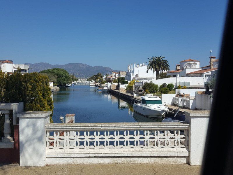
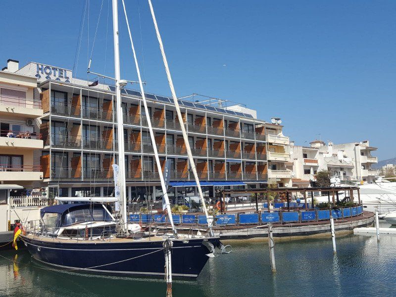
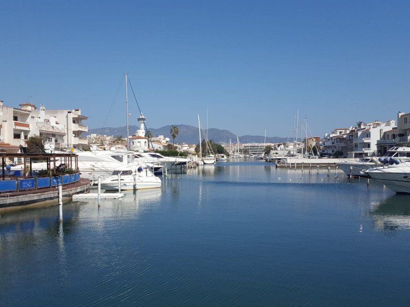
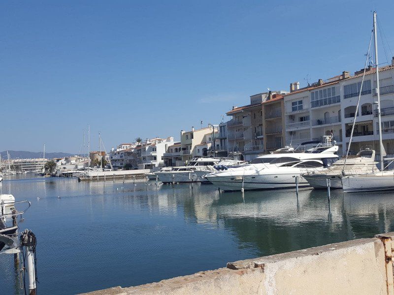
Camping Joncar Mar
Finally open restaurants again, which are open until 6 p.m. A treat for our battered Corona souls.
C/ Bernat Metge 9-10, 17480, Roses, Spain
42° 15' 56" N 3° 9' 47" E
42.2655600 3.1630600
• Head toward Carrer Joanot Martorell on Carrer Bernat Metge. Go for 148 m.
• Take the 3rd exit from roundabout onto Carretera de Besalú a Roses (C-260) toward Santa Margarida/Figueres/Girona/AP-7/N-2. Go for 750 m.
• Take the 2nd exit from roundabout onto Carretera de Besalú a Roses (C-260) toward AP-7/Figueres/Girona/Sta. Margarida. Go for 655 m.
• Take the 3rd exit from roundabout onto Carretera de Besalú a Roses (C-260) toward AP-7/Empuriabrava/Figueres/Girona. Go for 1.1 km.
• Pass 5 roundabouts and continue on C-260. Go for 7.4 km.
• Take the 4th exit from roundabout onto Carretera Castelló (GIV-6213) toward Fortià. Go for 2.8 km.
• Take the 2nd exit from roundabout onto GI-8594 toward Vilamalla. Go for 3.3 km.
• Take the 3rd exit from roundabout. Go for 169 m.
• Take the 1st exit from roundabout onto C-31 toward AP-7/Figueres/Empordà Internacional. Go for 1.8 km.
• Take the 2nd exit from roundabout onto C-31 toward Sta. Llogaia d'Àlguema/Figueres. Go for 812 m.
• Take the 2nd exit from roundabout onto N-2A toward AP-7/Girona/Barcelona. Go for 1.3 km.
• Take the 2nd exit from roundabout onto N-2A toward Girona. Go for 557 m.
• Take the 1st exit from roundabout toward Barcelona/Girona. Go for 891 m.
• Take left ramp onto AP-7 (Autopista de la Mediterrània) toward Girona/Barcelona. Go for 108 km.
• Keep right onto AP-7 (Autopista de la Mediterrània) toward Lleida/E-90/AP-2/Tarragona/Sabadell/C-58/Túnels de Vallvidrera/E-9/Manresa/C-16/Polígon Industrial de Zona Franca/Fira. Go for 47.1 km.
• Take exit 27 toward St. Sadurní d'Anoia/Subirats. Go for 1.1 km.
• Take the 2nd exit from roundabout onto BP-2427 toward Polígon Industrial de Subirats/St. Sadurní d'Anoia/Gelida. Go for 375 m.
• Take the 1st exit from roundabout onto BP-2427 toward St. Sadurní de l'Heura/Gelida/St. Sadurní A./Igualada. Go for 1.3 km.
• Continue on BV-2244. Go for 362 m.
• Take the 2nd exit from roundabout onto Carretera de Sant Sadurní d'Anoia (BV-2244). Go for 1.4 km.
• Take the 2nd exit from roundabout onto BV-2244 toward Igualada. Go for 2.3 km.
• Continue on BP-2151. Go for 4.6 km.
• Continue on Carrer la Carretera (BP-2151). Go for 1.3 km.
• Continue on Carretera Sant Sadurní (BP-2151). Go for 669 m.
• Continue on BP-2151 toward Igualada. Go for 57 m.
• Take the 1st exit from roundabout onto Carretera de Vilanova (C-15) toward Igualada. Go for 3.2 km.
• Take ramp toward Cabrera A./Canaletes. Go for 226 m.
• Turn left onto BV-2304 toward Cabrera A./Canaletes. Go for 348 m.
• Continue on La Quadra d'Agullàdols (BV-2304). Go for 52 m.
• Continue on BV-2304. Go for 2.8 km.
• Turn right onto C-244 toward St. Pere Sacarrera/Urb. Font B. (Mediona). Go for 679 m.
• Take the 2nd exit from roundabout onto BV-2136 toward St. Joan de Mediona/La Llacuna. Go for 774 m.
• Take the 3rd exit from roundabout onto BV-2136 toward St. Joan de Mediona/La Llacuna. Go for 3.6 km.
• Continue on Avinguda de Montserrat (BV-2136). Go for 620 m.
• Continue on BV-2136. Go for 889 m.
• Continue on Can Xombo (BV-2136). Go for 132 m.
• Continue on BV-2136. Go for 4.3 km.
• Turn left. Go for 116 m.
• Arrive at your destination on the right.
☍
207,6 km
(2 hrs. 22 min.)
Carretera Rofes, 134, 08779 Rofes, Barcelona, Spanien
41° 29' 31.6" N 1° 33' 56" E
41.4921208 1.5655518
• Head toward Carrer Horts. Go for 91 m.
• Turn slightly left onto Carrer Horts. Go for 50 m.
• Turn left onto Barri Rofes. Go for 193 m.
• Turn right onto BV-2136. Go for 4.1 km.
• Continue on Can Xombo (BV-2136). Go for 132 m.
• Continue on BV-2136. Go for 889 m.
• Continue on Avinguda de Montserrat (BV-2136). Go for 620 m.
• Continue on BV-2136. Go for 3.5 km.
• Take the 2nd exit from roundabout onto BV-2136 toward St. Pere Sacarrera/Igualada/La Pobla Claramunt/Vilafranca P./St. Quintí M. Go for 728 m.
• Take the 1st exit from roundabout onto C-244 toward Vilafranca del Penedès/St. Quintí de Mediona/Vilafranca P./St. Quintí M. Go for 711 m.
• Turn left onto BV-2304 toward Canaletes (Cabrera d'Anoia)/Vilafranca del Penedès. Go for 2.8 km.
• Continue on La Quadra d'Agullàdols (BV-2304). Go for 52 m.
• Continue on BV-2304. Go for 289 m.
• Turn right and take ramp onto C-15 toward Vilafranca P. Go for 15.5 km.
• Take ramp toward Tarragona/AP-7. Go for 538 m.
• Take the 2nd exit from roundabout onto N-340 toward AP-7/Tarragona. Go for 3.8 km.
• Take ramp toward E-15/E-90/Barcelona/AP-7/Tarragona/AP-2/Lleida. Go for 358 m.
• Take the 4th exit from roundabout onto Avinguda de Tarragona (N-340a) toward Barcelona/AP-7/Girona/AP-7/Tarragona/AP-7/Lleida/AP-7. Go for 577 m.
• Take the 2nd exit from roundabout onto Avinguda de Tarragona (N-340a) toward Barcelona/AP-7/Girona/AP-7/Tarragona/AP-7/Lleida/AP-7/els Monjos. Go for 381 m.
• Take the 1st exit from roundabout onto AP-7 (Autopista de la Mediterrània) toward Lleida/Tarragona. Go for 148 km.
• Take exit 42 toward Vinarós/N-238/Alcanar/Ulldecona. Go for 1.2 km.
• Turn right onto N-238 toward Vinaròs/Alcanar/Hacienda Sant Jordi Golf & Resort. Go for 582 m.
• Take ramp onto CV-11 toward San Rafael del Río/Traiguera. Go for 416 m.
• Pass 3 roundabouts and continue on CV-11. Go for 4.9 km.
• Arrive at CV-11. Your destination is on the left.
☍
189,9 km
(1 hrs. 55 min.)
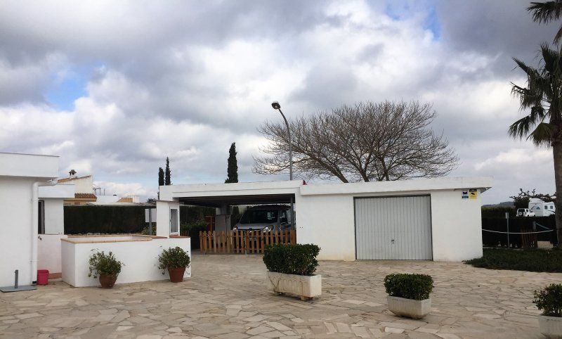
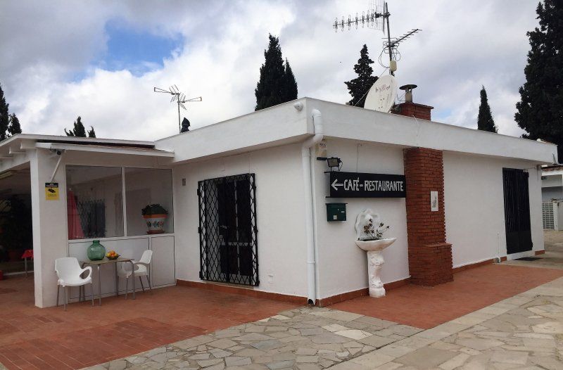
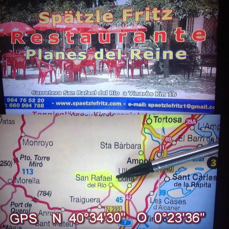
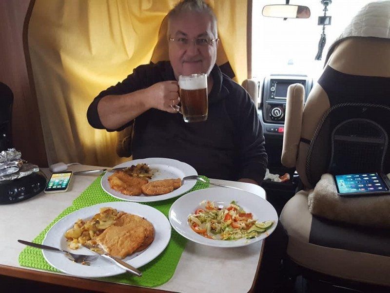
Área de Späetzle Fritz, Spanien
On the way to the Spätzle-Fritz we were duped and stolen on the A7. See the film on our YouTube channel. Nevertheless, we enjoyed a great WoMo dinner at Spätzle-Fritz.
Urbanizacion Planes del Regne CL1, 52, 12320, 12320, Castellón, Spanien
40° 34' 31.9" N 0° 23' 37.5" E
40.5755260 0.3937615
• Head northwest on CV-11. Go for 5.0 km.
• Take the 4th exit from roundabout onto Barrio de las Casas Nuevas (CV-11) toward N-238/Vinaròs/E-15/AP-7. Go for 6.4 km.
• Pass 2 roundabouts and continue on CV-11. Go for 3.5 km.
• Take the 3rd exit from roundabout onto CV-11 toward N-238/E-15/AP-7/Ulldecona. Go for 456 m.
• Take the 4th exit from roundabout onto N-238 toward AP-7/Ulldecona. Go for 1.3 km.
• Turn left toward E-15/AP-7/Valencia/Barcelona. Go for 295 m.
• Take ramp onto AP-7 (Autopista del Mediterráneo) toward Valencia. Go for 134 km.
• Continue on A-7 (Autovía del Mediterráneo). Go for 46.0 km.
• Keep left onto A-7 (Autopista del Mediterráneo) toward Alacant/Alicante/Gandia/A-38. Go for 244 m.
• Continue on AP-7 (Autopista del Mediterráneo). Go for 16.9 km.
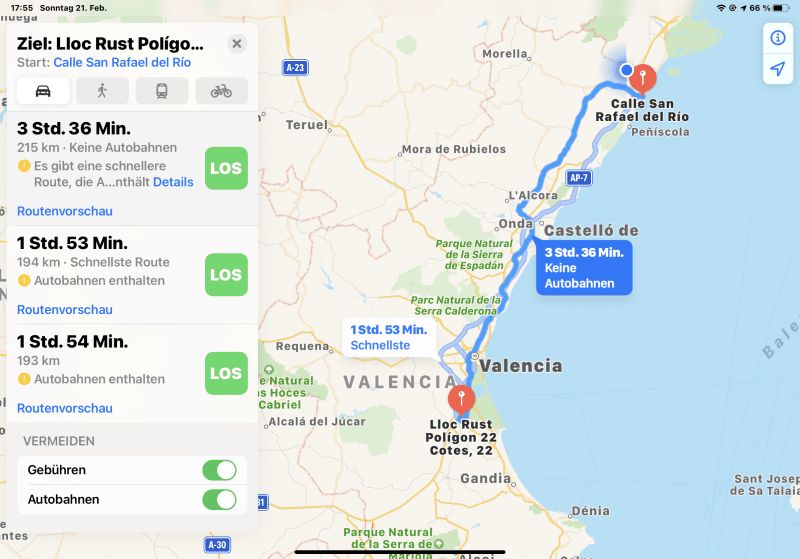
• Take exit 58 toward Algemesí/CV-42/Alzira. Go for 1.2 km.
• Take the 2nd exit from roundabout onto CV-42 toward Centre Ciutat Algemesí. Go for 867 m.
• Continue on Carretera Valencia (CV-42). Go for 355 m.
• Take the 4th exit from roundabout onto Calle de Valencia. Go for 396 m.
• Take the 2nd exit from roundabout onto Calle de Valencia. Go for 180 m.
• Turn left onto Calle Fernando de Aragón. Go for 77 m.
• Turn right onto Calle de San Pedro. Go for 71 m.
• Continue on Calle de Agustí Alaman Rodríguez. Go for 59 m.
• Continue on Calle del Maestro Giner. Go for 75 m.
• Arrive at Calle del Maestro Giner.
☍
217,5 km
(2 hrs. )
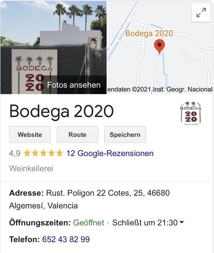
Algemesí, Spanien
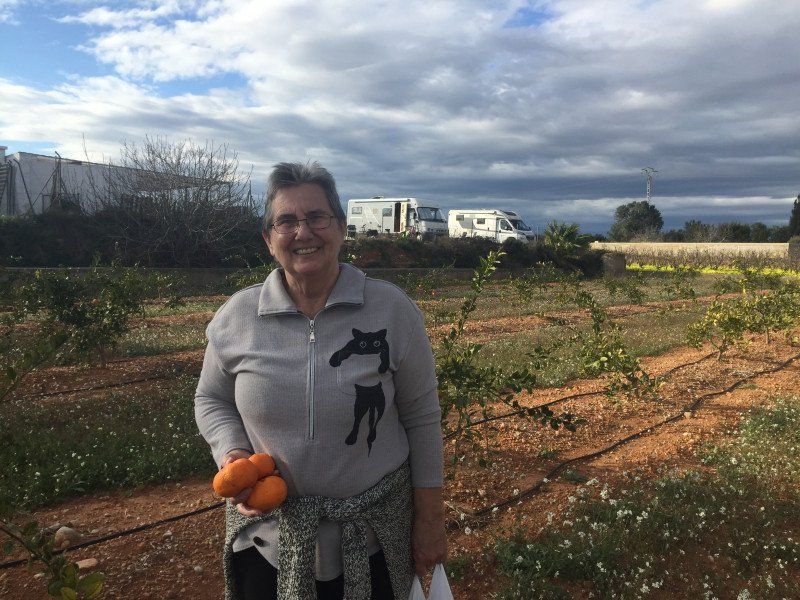
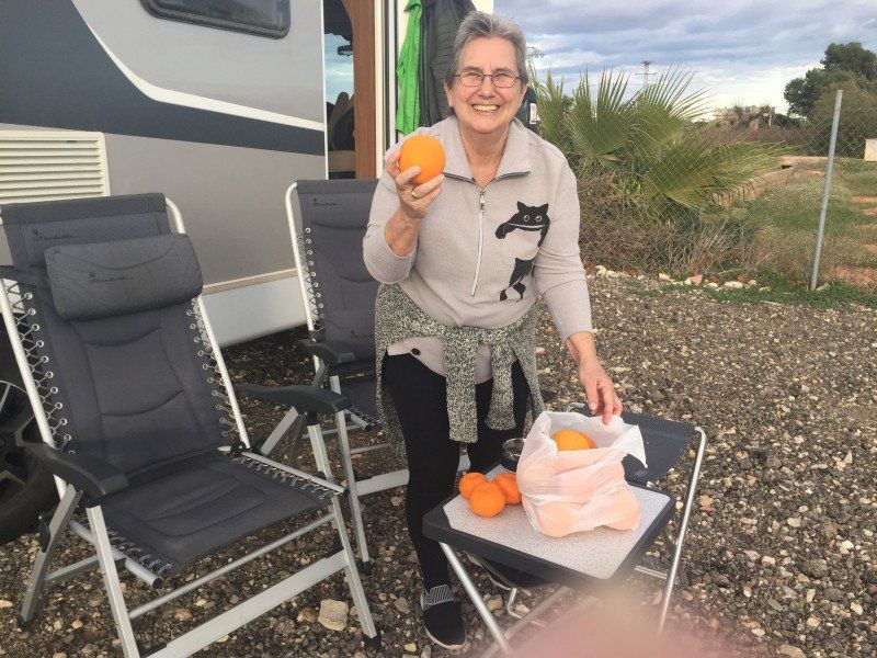
the newly opened Bodega 2020 pitch is worth an overnight stay. The home-grown wine and the environment in the orange and lemon fields are just great. The WoMo dinner was lovingly prepared.
46680 Algemesí, Valencia, Spanien
39° 11' 33.2" N 0° 26' 1.4" W
39.1925693 -0.4337304
• Head toward Calle Botánico Cavanilles on Calle del Maestro Giner. Go for 54 m.
• Turn right onto Calle Botánico Cavanilles. Go for 61 m.
• Turn right onto Calle de Valencia. Go for 185 m.
• Turn left onto Avenida del País Valenciano. Go for 479 m.
• Turn left onto Ronda del Calvari (CV-42). Go for 278 m.
• Continue on Ronda Alcira (CV-42) toward Alzira/Xàtiva. Go for 658 m.
• Take the 1st exit from roundabout onto Ronda Alcira (CV-42) toward Alzira. Go for 162 m.
• Continue on CV-42. Go for 893 m.
• Take the 3rd exit from roundabout onto CV-42 toward Alzira. Go for 924 m.
• Take the 2nd exit from roundabout onto CV-42 toward Alzira. Go for 842 m.
• Take the 2nd exit from roundabout toward Guadassuar/A-7/València. Go for 848 m.
• Continue toward Guadassuar/L'Alcúdia/A-7/València. Go for 42 m.
• Take the 2nd exit from roundabout onto CV-50 toward Guadassuar/l'Alcúdia/A-7/València. Go for 5.0 km.
• Take the 3rd exit from roundabout onto CV-50 toward l'Alcúdia/Albacete/A-7. Go for 371 m.
• Take the 2nd exit from roundabout onto A-7 (Autovía del Mediterráneo) toward Albacete. Go for 25.0 km.
• Continue on A-35 toward Albacete/Murcia. Go for 32.7 km.
• Take exit 11 toward La Font de la Figuera/Alacant/Alicante/Murcia onto A-33. Go for 12.8 km.
• Take exit 79 toward Villena/Alacant/Alicante onto A-31 (Autovía Alicante). Go for 53.6 km.
• Keep right onto A-7 (Circunvalación de Alicante) toward Aspe/Elx/Elche/Murcia. Go for 6.3 km.
• Keep left onto Ronda Este de Elche (EL-20) toward Elx/Elche/Santa Pola. Go for 4.7 km.
• Take the 2nd exit from roundabout onto EL-20 toward Santa Pola/N-340/Crevillent. Go for 1.1 km.
• Take the 3rd exit from roundabout onto EL-20 toward CV-854/Asprelles/N-340/Crevillent. Go for 1.3 km.
• Take the 2nd exit from roundabout onto EL-20 toward N-340/Crevillent. Go for 652 m.
• Take the 3rd exit from roundabout onto Carretera de Elche en La Marina (CV-853) toward Polígon Industrial l'Alcudia/La Foia/La Marina. Go for 901 m.
• Continue on Carretera de la Hoya (CV-853). Go for 75 m.
• Continue on CV-853. Go for 534 m.
• Take the 2nd exit from roundabout onto Partida Alzabaras Bajo (CV-853). Go for 3.5 km.
• Continue on Carretera de la Hoya (CV-853). Go for 14 m.
• Continue on Partida Hoya (CV-853). Go for 82 m.
• Continue on Carretera de la Hoya (CV-853). Go for 1.7 km.
• Take the 2nd exit from roundabout onto Carretera de Elche a La Marina (CV-853) toward La Marina. Go for 5.0 km.
• Take the 1st exit from roundabout onto N-332 toward Guardamar del Segura/Cartagena. Go for 4.9 km.
• Take the 1st exit from roundabout onto Calle del Mar Cantábrico toward San Fulgencio/San Fulgencio (Urbanizaciones). Go for 141 m.
• Take the 2nd exit from roundabout onto Calle del Mar Cantábrico. Go for 358 m.
• Arrive at Calle del Mar Cantábrico. Your destination is on the left.
☍
166,1 km
(1 hrs. 42 min.)
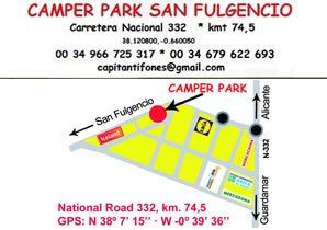
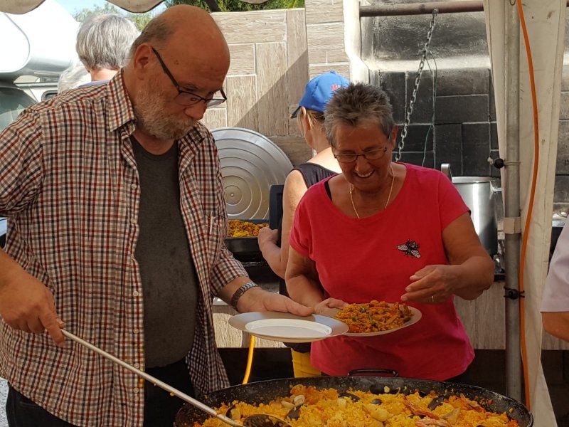
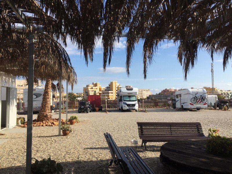
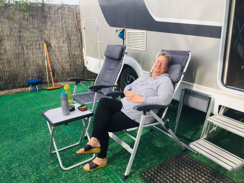
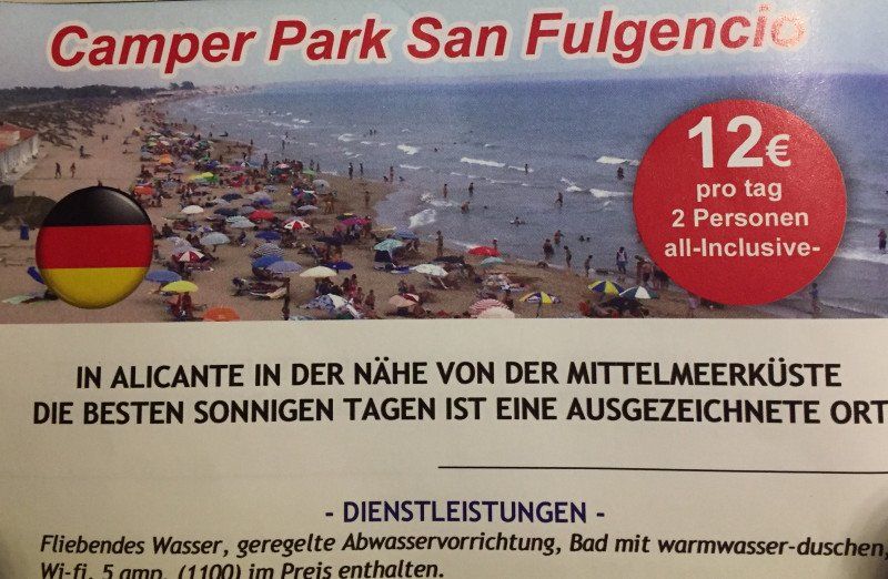
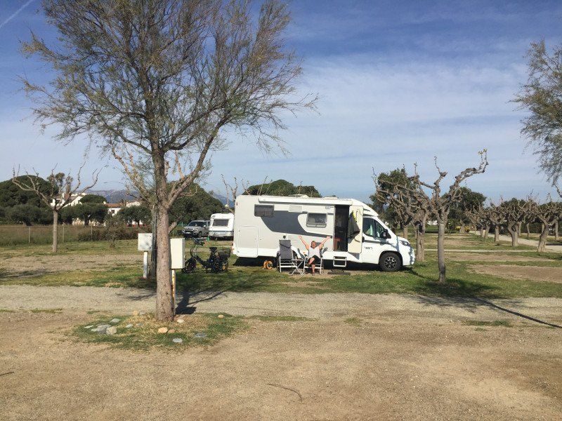
Camper Park San Fulgencio
We spent 2 days at the Camperpark San Fulgencio.
Mar Cantabrico 7, 03177, San Fulgencio, Spanien
38° 7' 15" N 0° 39' 36" W
38.1208333 -0.6600000
• Head west on Calle del Mar Cantábrico. Go for 66 m.
• Turn left. Go for 67 m.
• Turn left toward Calle Mar Menor. Go for 112 m.
• Turn left onto Calle Mar Menor. Go for 96 m.
• Turn right onto Calle del Mar Cantábrico. Go for 199 m.
• Take the 2nd exit from roundabout onto Calle del Mar Cantábrico. Go for 177 m.
• Take the 1st exit from roundabout onto N-332 toward Guardamar/Torrevieja/Cartagena. Go for 955 m.
• Take the 2nd exit from roundabout onto Carretera Nacional de Alicante a Cartagena (N-332) toward Cartagena. Go for 1.7 km.
• Take ramp toward Centre Ciutat Grau/Crevillent/AP-7/Cartagena/A-7/CV-91/Rojales/N-332/Alacant/Alicante. Go for 215 m.
• Take the 3rd exit from roundabout onto CV-91 toward Rojales/Orihuela/AP-7/Cartagena. Go for 9.2 km.
• Take the 2nd exit from roundabout onto CV-91/CV-905 toward Almoradí/Orihuela/Hospital/AP-7/Torrevieja/Cartagena. Go for 262 m.
• Take the 5th exit from roundabout onto AP-7 (Autopista del Mediterráneo) toward Torrevieja/Cartagena. Go for 59.1 km.
• Take exit 800 toward Murcia/Almería onto AP-7. Go for 113 km.
• Continue toward Autovía del Mediterráneo/A-7. Go for 502 m.
• Take the left exit toward Los Gallardos/Almería onto A-7 (Autovía del Mediterráneo). Go for 101 km.
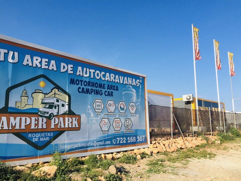
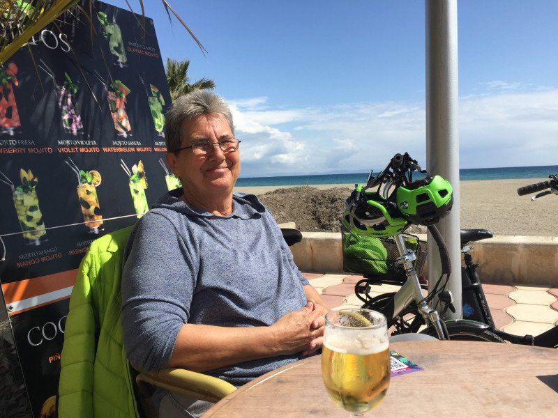
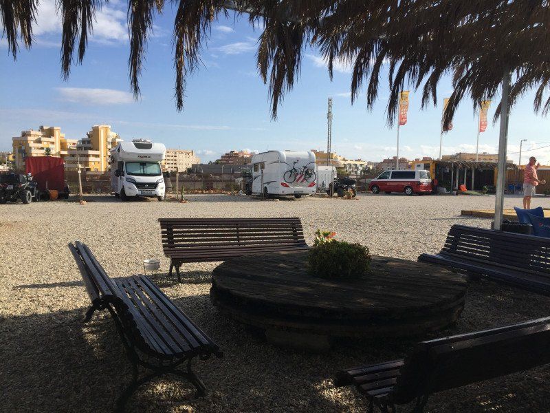
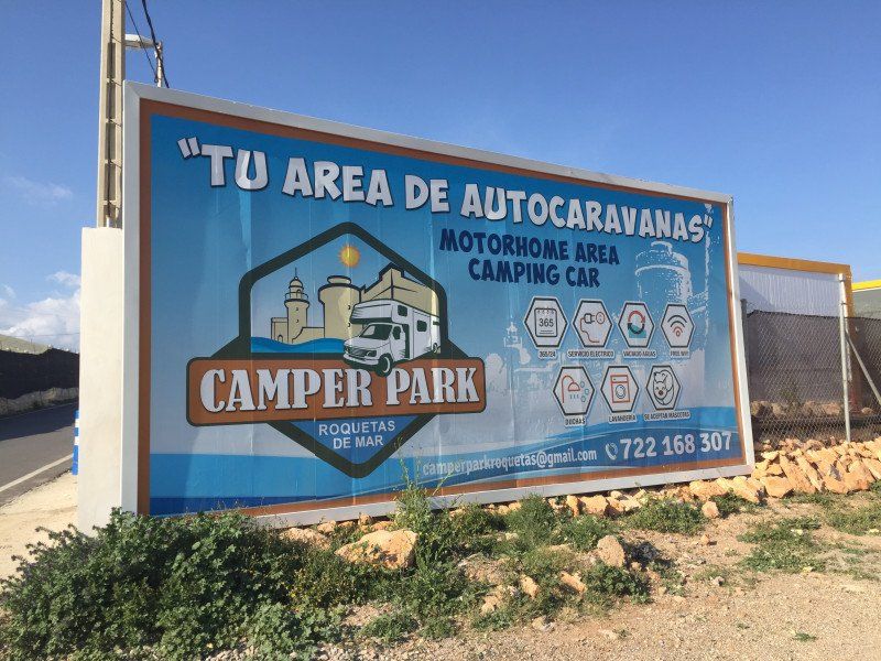
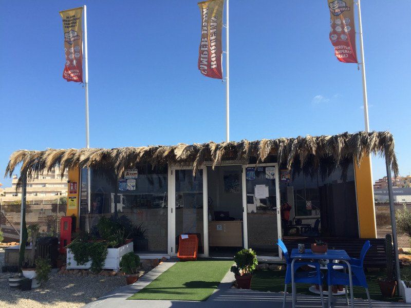
• Take exit 800 toward Roquetas de Mar/Aguadulce/Vícar (Este). Go for 162 m.
• Take the 3rd exit from roundabout onto A-391 toward E-15/A-7/Almería/El Parador/A-1051/Roquetas de Mar/Aguadulce. Go for 241 m.
• Take the 1st exit from roundabout onto A-1051 toward El Parador/Roquetas de Mar. Go for 401 m.
• Take the 2nd exit from roundabout onto A-1051 (Variante de Roquetas de Mar) toward Roquetas de Mar/N-340a. Go for 9.0 km.
• Take the 3rd exit from roundabout onto Variante de Roquetas de Mar (A-1051R4). Go for 724 m.
• Take the 4th exit from roundabout onto Camino de la Solana. Go for 130 m.
• Turn right onto Camino de los Baños. Go for 1.2 km.
• Continue on Carretera Los Mercados. Go for 82 m.
• Turn left onto Calle Colombia. Go for 262 m.
• Continue on Carretera La Marina. Go for 113 m.
• Arrive at Carretera La Marina.
☍
298,9 km
(2 hrs. 46 min.)
Camper Park Roquetas de Mar, Carretera la Marina, Roquetas de Mar, Spanien
We stayed a few days at the new camper park in Roquetas. The parking space close to the city offers everything a modern SP should have. And the free-standing by the sea are also tolerated in the preseason.
Ctra. la Marina, 2, 04740 Roquetas de Mar, Almería, Spanien
36° 44' 41.3" N 2° 37' 5.3" W
36.7447956 -2.6181284
• Head south on Carretera La Marina. Go for 113 m.
• Continue on Calle Colombia. Go for 262 m.
• Turn right onto Carretera Los Mercados. Go for 82 m.
• Continue on Camino de los Baños. Go for 1.2 km.
• Turn left onto Camino de la Solana. Go for 38 m.
• Take the 1st exit from roundabout onto Variante de Roquetas de Mar (A-1051R4). Go for 603 m.
• Take the 2nd exit from roundabout onto A-1051 (Variante de Roquetas de Mar) toward A-7/Almería/Málaga. Go for 2.9 km.
• Take exit 6 toward Roquetas de Mar/Centro Ciudad/Carretera de las Losas/A-1051/Vícar (Oeste)/Roquetas de Mar (Sur). Go for 320 m.
• Take the 5th exit from roundabout onto AL-9029 toward Carretera de las Losas/A-1051/Vícar (Oeste)/Roquetas de Mar (Sur). Go for 213 m.
• Take the 2nd exit from roundabout onto Carretera Yegua Verde (AL-9029) toward Vícar (Oeste). Go for 1.3 km.
• Pass 2 roundabouts and continue on Carretera Zamora Cuatro (AL-9029). Go for 1.7 km.
• Take the 4th exit from roundabout onto N-340a. Go for 2.5 km.
• Take the 2nd exit from roundabout onto El Cosario (N-340a) toward E-15/N-340/Almería/Motril/Málaga. Go for 207 m.
• Continue on N-340a. Go for 210 m.
• Take the 2nd exit from roundabout toward E-15/A-7/Motril/Málaga. Go for 142 m.
• Continue toward Motril/Málaga. Go for 30 m.
• Take the 3rd exit from roundabout onto A-7 (Autovía del Mediterráneo) toward Motril/Málaga. Go for 179 km.
• Keep right onto MA-20 toward Málaga/Aeropuerto. Go for 13.2 km.
• Continue on AP-7. Go for 4.1 km.
• Continue on A-7 (Autovía del Mediterráneo). Go for 10.9 km.
• Keep left onto A-7 (Autopista del Mediterráneo) toward Marbella/Algeciras. Go for 1.8 km.
• Continue on AP-7 (Autopista del Mediterráneo). Go for 11.9 km.
• Keep right toward Autopista del Mediterráneo/AP-7. Go for 356 m.
• Continue on AP-7 (Autopista del Mediterráneo). Go for 14.8 km.
• Continue on A-7 (Autopista del Mediterráneo). Go for 5.2 km.
• Keep left onto AP-7 (Autopista del Mediterráneo) toward Estepona/Algeciras. Go for 8.7 km.
• Keep right toward Autopista del Mediterráneo/AP-7. Go for 356 m.
• Continue on AP-7 (Autopista del Mediterráneo). Go for 15.5 km.
• Continue on A-7 (Autovía del Mediterráneo). Go for 2.4 km.
• Continue on AP-7 (Autopista del Mediterráneo). Go for 11.6 km.
• Keep right onto AP-7. Go for 10.2 km.
• Continue on A-7 (Autovía del Mediterráneo). Go for 13.4 km.
• Take exit 1106 toward CA-34/La Línea/Gibraltar. Go for 239 m.
• Turn right onto N-340a toward San Roque (Este). Go for 1.1 km.
• Turn left toward CA-34/La Línea/Gibraltar. Go for 214 m.
• Keep left onto CA-34 toward La Línea/Gibraltar. Go for 1.7 km.
• Pass 5 roundabouts and continue on Avenida de España (CA-34). Go for 4.4 km.
• Take the 1st exit from roundabout onto Avenida Príncipe de Asturias (N-351). Go for 552 m.
• Take the 1st exit from Rotonda Real Balompédica Linense roundabout onto Avenida Príncipe de Asturias (N-351). Go for 326 m.
• Turn right onto Avenida Alcaidesa Marina toward Gibraltar. Go for 49 m.
• Take the 2nd exit from roundabout onto Carretera de la Frontera. Go for 608 m.
• Continue toward Winston Churchill Avenue. Go for 29 m.
• Continue on Winston Churchill Avenue. Go for 63 m.
• Turn left toward Kingsway. Go for 262 m.
• Take the 1st exit from roundabout onto Kingsway. Go for 379 m.
• Continue on Kingsway Tunnel. Go for 529 m.
• Continue on Kingsway. Go for 367 m.
• Take the 1st exit from roundabout onto Devil's Tower Road. Go for 438 m.
• Take the 1st exit from roundabout onto Devil's Tower Road. Go for 358 m.
• Take the 3rd exit from roundabout onto Winston Churchill Avenue toward City Centre/Port. Go for 323 m.
• Take the 1st exit from roundabout onto Smith Dorrien Avenue. Go for 319 m.
• Take the 1st exit from roundabout onto Line Wall Road. Go for 484 m.
• Turn left onto John Mackintosh Square. Go for 104 m.
• Turn slightly left onto City Mill Lane. Go for 6 m.
• Arrive at City Mill Lane. Your destination is on the left.
☍
327,8 km
(3 hrs. 17 min.)
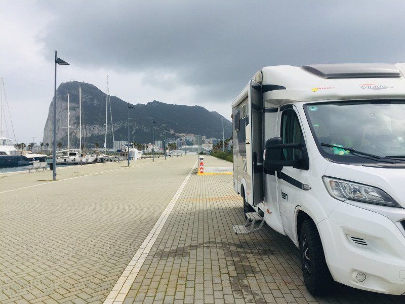
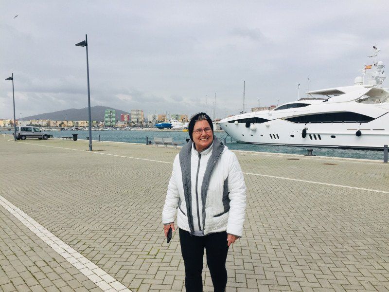
Gibraltar
We stayed right in the marina. Unfortunately we had bad weather, which is why we only stayed 1 night.
36° 8' 26.7" N 5° 21' 12.9" W
36.1407510 -5.3535850
• Head toward Cornwall's Lane on City Mill Lane. Go for 25 m.
• Turn slightly right onto City Mill Lane. Go for 121 m.
• Turn right onto Governor's Street. Go for 163 m.
• Continue on Town Range. Go for 54 m.
• Turn right onto George's Lane. Go for 113 m.
• Turn left onto Cathedral Square. Go for 72 m.
• Turn right onto Cathedral Square. Go for 34 m.
• Turn slightly left toward Line Wall Road. Go for 34 m.
• Continue on Line Wall Road. Go for 714 m.
• Take the 1st exit from roundabout onto Smith Dorrien Avenue. Go for 323 m.
• Take the 3rd exit from roundabout onto Winston Churchill Avenue. Go for 301 m.
• Take the 1st exit from roundabout onto Devil's Tower Road. Go for 343 m.
• Take the 1st exit from roundabout onto Devil's Tower Road. Go for 434 m.
• Take the 3rd exit from roundabout onto Kingsway. Go for 466 m.
• Continue on Kingsway Tunnel. Go for 550 m.
• Continue on Kingsway. Go for 336 m.
• Take the 2nd exit from roundabout. Go for 212 m.
• Keep right. Go for 281 m.
• Turn right. Go for 140 m.
• Continue toward Avenida Príncipe de Asturias. Go for 151 m.
• Turn right onto Avenida Príncipe de Asturias. Go for 115 m.
• Make a U-Turn onto Avenida Príncipe de Asturias. Go for 511 m.
• Continue on Avenida Príncipe de Asturias (N-351). Go for 269 m.
• Take the 2nd exit from Rotonda Real Balompédica Linense roundabout onto Avenida Príncipe de Asturias (N-351) toward San Roque/Campamento. Go for 533 m.
• Take the 4th exit from roundabout onto Avenida de España (CA-34). Go for 444 m.
• Take the 3rd exit from roundabout onto Avenida de España (CA-34) toward San Roque. Go for 425 m.
• Take the 3rd exit from roundabout onto Avenida de España (CA-34). Go for 425 m.
• Take the 3rd exit from roundabout onto Avenida de España (CA-34) toward San Roque. Go for 1.9 km.
• Pass 2 roundabouts and continue on CA-34. Go for 2.9 km.
• Take ramp onto A-7 (Autovía del Mediterráneo) toward Estepona/Málaga. Go for 14.6 km.
• Continue on AP-7 (Autopista del Mediterráneo) toward Estepona/Málaga. Go for 9.7 km.
• Keep right onto AP-7. Go for 12.0 km.
• Continue on A-7 (Autopista del Mediterráneo). Go for 2.8 km.
• Continue on AP-7 (Autopista del Mediterráneo) toward Marbella/Málaga. Go for 15.1 km.
• Keep right toward Autopista del Mediterráneo/AP-7. Go for 321 m.
• Continue on AP-7 (Autopista del Mediterráneo). Go for 8.9 km.
• Continue on A-7 (Autovía del Mediterráneo). Go for 5.2 km.
• Keep left onto AP-7 (Autopista del Mediterráneo) toward Fuengirola/Málaga. Go for 14.7 km.
• Keep right toward Autopista del Mediterráneo/AP-7. Go for 375 m.
• Continue on AP-7 (Autopista del Mediterráneo). Go for 12.0 km.
• Continue on A-7 (Autopista del Mediterráneo). Go for 13.1 km.
• Keep right onto AP-7 toward Torremolinos/Málaga (Oeste)/MA-20/MA-21/Aeropuerto. Go for 3.7 km.
• Continue on MA-20. Go for 12.9 km.
• Continue on A-7 (Autovía del Mediterráneo). Go for 84.7 km.
• Take exit 903 toward GR-5300/Lobres/Molvízar/N-340/Salobreña. Go for 406 m.
• Take the 1st exit from roundabout toward GR-5300/Lobres/Molvízar/N-340/Salobreña. Go for 309 m.
• Take the 3rd exit from roundabout onto GR-5300 toward Lobres/N-340/Salobreña. Go for 844 m.
• Take the 1st exit from roundabout onto GR-5300 toward N-340/Salobreña/Motril. Go for 870 m.
• Take the 1st exit from roundabout onto N-323 toward Salobreña/Motril. Go for 1.4 km.
• Take the 2nd exit from roundabout onto Autovía Acceso Oeste al Puerto de Motril (GR-14) toward Motril/Salobreña. Go for 554 m.
• Take the 2nd exit from roundabout onto N-323a toward N-323/Puerto. Go for 3.3 km.
• Turn right onto Calle Moral. Go for 183 m.
• Turn right onto Camino del Pelaillo. Go for 1.0 km.
• Turn left. Go for 81 m.
• Arrive at your destination on the left.
☍
231,5 km
(2 hrs. 26 min.)
Camping Playa Granada
a cute little CP. There were only 3 other campers on the site, which we liked. The beach restaurants were open, which is why we enjoyed this very much for a few days.
Camino del Pelaillo s/n, 18613, Motril, Spain
36° 43' 3.7" N 3° 32' 46.2" W
36.7176900 -3.5461800
• Head southwest. Go for 38 m.
• Turn slightly right. Go for 33 m.
• Turn slightly left toward Camino del Pelaillo. Go for 13 m.
• Turn right onto Camino del Pelaillo. Go for 1.1 km.
• Turn left onto Calle Moral. Go for 183 m.
• Turn right onto Carretera de la Celulosa (N-323a). Go for 461 m.
• Take the 2nd exit from roundabout onto Paseo del Puerto. Go for 992 m.
• Continue on Calle Muelle Pesquero. Go for 345 m.
• Take the 2nd exit from roundabout. Go for 295 m.
• Take the 1st exit from roundabout toward Granada/A-44/Almería/A-7/Málaga/A-7. Go for 254 m.
• Take the 3rd exit from roundabout toward N-340/Motril/GR-16/Almería/A-7/Málaga/A-7/A-44/Granada. Go for 711 m.
• Keep left onto GR-16. Go for 2.5 km.
• Take the 1st exit from roundabout onto A-7 (Autovía del Mediterráneo) toward Adra/Almería. Go for 80.5 km.
• Take exit 809 toward La Mojonera/Vícar (Oeste). Go for 518 m.
• Take the 3rd exit from roundabout onto N-340a toward La Mojonera. Go for 265 m.
• Continue on El Cosario (N-340a). Go for 166 m.
• Take the 2nd exit from roundabout onto N-340a toward Almería. Go for 2.5 km.
• Take the 1st exit from roundabout onto Carretera Zamora Cuatro (AL-9029) toward Roquetas de Mar. Go for 596 m.
• Pass 2 roundabouts and continue on Carretera Yegua Verde (AL-9029). Go for 2.4 km.
• Take the 3rd exit from roundabout onto AL-9029 toward Centro Ciudad Roquetas de Mar/Málaga/A-1051/A-7/Almería. Go for 169 m.
• Pass 2 roundabouts and continue on AL-9029. Go for 1.4 km.
• Keep left onto AL-9029. Go for 230 m.
• Turn left onto Camino El Cañuelo (AL-9029). Go for 228 m.
• Take the 2nd exit from roundabout onto Camino El Cañuelo (A-1050). Go for 150 m.
• Keep right toward Camino El Cañuelo/A-1050. Go for 123 m.
• Continue on Camino El Cañuelo (A-1050). Go for 210 m.
• Take the 2nd exit from Plaza Norieta roundabout onto Avenida Roquetas de Mar (AL-4151). Go for 324 m.
• Take the 2nd exit from roundabout onto Avenida Roquetas (AL-4151). Go for 86 m.
• Turn right onto Calle San Leopoldo. Go for 106 m.
• Arrive at Calle San Leopoldo. Your destination is on the left.
☍
96,8 km
(1 hrs. 5 min.)
Camper Park Roquetas de Mar, Carretera la Marina, Roquetas de Mar, Spanien
On our return to Roquetas we were again at the Camperpark Roquetas and enjoyed a few more days.
Av. Roquetas de Mar, 04740 Roquetas de Mar, Almería, Spanien
36° 45' 46.7" N 2° 36' 47.6" W
36.7629778 -2.6132240
• Head southwest on Calle San Leopoldo. Go for 11 m.
• Turn right onto Calle Enix. Go for 31 m.
• Turn right onto Avenida Rector Gustavo Villapalos. Go for 113 m.
• Take the 3rd exit from roundabout onto Avenida Roquetas de Mar (AL-4151). Go for 338 m.
• Take the 2nd exit from Plaza Norieta roundabout onto Carretera de Alicún (A-391) toward Almería. Go for 186 m.
• Pass 2 roundabouts and continue on Carretera de Alicún (A-391). Go for 1.3 km.
• Take the 3rd exit from roundabout onto A-1051R2 toward Almería/A-1051/Málaga. Go for 1.2 km.
• Take the 2nd exit from roundabout onto A-1051 (Variante de Roquetas de Mar) toward A-7/Almería/Málaga. Go for 4.0 km.
• Take the 2nd exit from roundabout onto A-1051 toward A-391/La Envía/Felix/Enix/E-15/A-7/Almería/Málaga/Aguadulce (Norte). Go for 457 m.
• Take the 3rd exit from roundabout onto A-7 (Autovía del Mediterráneo) toward Almería/Murcia. Go for 101 km.
• Take exit 695A toward E-15/AP-7/Cartagena. Go for 1.3 km.
• Continue on AP-7. Go for 111 km.
• Take the left exit toward E-15/Los Alcázares/Alicante onto AP-7 (Autopista del Mediterráneo). Go for 37.8 km.
• Take exit 763 toward La Zenia/Orihuela Costa onto Calle del Ópalo. Go for 628 m.
• Turn right onto Carretera de Villamartín. Go for 251 m.
• Take the 3rd exit from roundabout onto Carretera de Villamartín. Go for 274 m.
• Take the 4th exit from roundabout onto N-332 toward Alicante. Go for 1.6 km.
• Take the 2nd exit from roundabout onto N-332 toward Alicante. Go for 1.3 km.
• Take the 2nd exit from roundabout onto Carretera de Circunvalación (N-332) toward Alicante. Go for 951 m.
• Keep left onto Carretera de Circunvalación (N-332) toward Guardamar del Segura/Alicante. Go for 3.6 km.
• Keep left onto Carretera de Circunvalación (N-332) toward Alacant/Alicante. Go for 4.3 km.
• Take the 2nd exit from roundabout onto N-332 toward Guardamar/Alacant/Alicante. Go for 1.3 km.
• Take the 2nd exit from roundabout onto Carretera de Alicante (N-332) toward Guardamar/Alacant/Alicante. Go for 1.2 km.
• Pass 6 roundabouts and continue on N-332. Go for 9.8 km.
• Take the 3rd exit from roundabout onto Calle del Mar Cantábrico toward San Fulgencio (Urbanizaciones). Go for 232 m.
• Take the 2nd exit from roundabout onto Calle del Mar Cantábrico. Go for 342 m.
• Arrive at Calle del Mar Cantábrico. Your destination is on the left.
☍
284,3 km
(2 hrs. 36 min.)
Camper Park San Fulgencio - Camping, San Fulgencio, Spanien
On the way back we stayed a few days longer and enjoyed La Marina beach and its surroundings.
Mar Cantabrico 7, (Nort) 38º 7´ 15´´ * (West) -0º 39´36´´, 03177 San Fulgencio, Alicante, Spanien
38° 7' 14.7" N 0° 39' 35.3" W
38.1207570 -0.6598010
• Head west on Calle del Mar Cantábrico. Go for 83 m.
• Turn left. Go for 67 m.
• Turn left toward Calle Mar Menor. Go for 112 m.
• Turn left onto Calle Mar Menor. Go for 96 m.
• Turn right onto Calle del Mar Cantábrico. Go for 199 m.
• Take the 2nd exit from roundabout onto Calle del Mar Cantábrico. Go for 177 m.
• Take the 3rd exit from roundabout onto N-332 toward Santa Pola/Alicante. Go for 23.9 km.
• Take ramp onto N-338 (Carretera del Aeropuerto) toward Aeropuerto/A-70/Valencia/València/Murcia/A-31/Madrid. Go for 4.8 km.
• Take the exit toward Alacant/Alicante/Benidorm/València/Valencia onto A-70 (Autovía del Mediterráneo). Go for 21.7 km.
• Continue on AP-7 (Autovía del Mediterráneo). Go for 105 km.
• Take exit 60 toward Xeresa/Tavernes. Go for 1.1 km.
• Continue toward N-322/Xeresa/Valencia. Go for 42 m.
• Take the 1st exit from roundabout toward Xeresa/Valencia. Go for 165 m.
• Turn right onto Camino de la Estación toward Xeresa. Go for 216 m.
• Take the 4th exit from roundabout onto Camino de la Estación toward AP-7/Valencia/Alicante. Go for 290 m.
• Continue toward CV-605. Go for 2.2 km.
• Turn left onto CV-605 toward Platja de Xeraco. Go for 1.3 km.
• Continue on Partida La Calzada (CV-605). Go for 1.2 km.
• Take the 1st exit from roundabout onto Camino del Mar toward Platja de Xeraxo. Go for 546 m.
• Turn right onto Polígono 5. Go for 28 m.
• Arrive at Polígono 5. Your destination is on the right.
☍
163,2 km
(1 hrs. 38 min.)
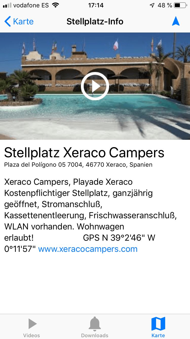
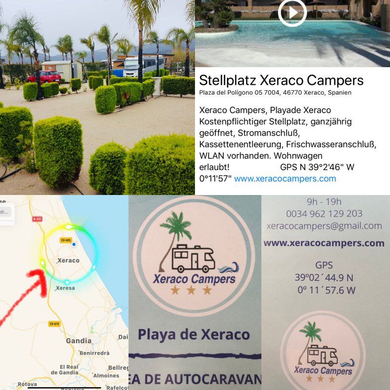
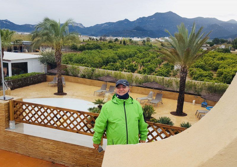
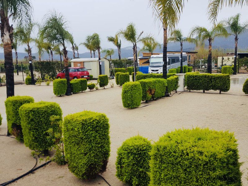
Xeraco campers, Carrer Migjorn, Xeraco, Spanien
Although we liked this CP very much, we only stay 1 night due to the bad weather. However, we have firmly resolved to visit this place again next year.
Carrer Migjorn, 46770 Xeraco, Valencia, Spanien
39° 2' 45.6" N 0° 11' 57.5" W
39.0460052 -0.1992968
• Head toward Camino del Mar on Polígono 5. Go for 28 m.
• Turn left onto Camino del Mar. Go for 534 m.
• Take the 1st exit from roundabout onto CV-605 toward Cullera. Go for 2.3 km.
• Continue on Camino de la Acequia de la Bova (CV-605). Go for 115 m.
• Continue on CV-605. Go for 2.3 km.
• Take the 3rd exit from roundabout onto CV-603 toward N-332/Valencia/Alacant. Go for 433 m.
• Take the 2nd exit from roundabout onto CV-603 toward N-332/Valencia/Alacant. Go for 1.0 km.
• Take the 1st exit from roundabout onto CV-50 toward N-332/Cullera/Valencia. Go for 91 m.
• Take the 2nd exit from roundabout toward Cullera. Go for 161 m.
• Take ramp onto N-332 toward Valencia. Go for 4.1 km.
• Keep left onto A-38 toward València. Go for 23.0 km.
• Take the exit onto AP-7 (Autopista del Mediterráneo). Go for 9.7 km.
• Continue on A-7 (Autovía del Mediterráneo). Go for 45.8 km.
• Keep left onto A-7 (Autovía del Mediterráneo) toward AP-7/Castelló/Castellón/Barcelona. Go for 485 m.
• Continue on AP-7 (Autovía del Mediterráneo). Go for 199 km.
• Take exit 38 toward N-340/C-44/l'Hospitalet de l'Infant/Móra la Nova. Go for 728 m.
• Take the 4th exit from roundabout onto A-7 (Autovia de la Mediterrània) toward Cambrils/Tarragona. Go for 8.7 km.
• Take exit 1138 toward Mont-Roig/T-323/Barcelona/N-340/València/Mont-Roig del Camp. Go for 307 m.
• Take the 1st exit from roundabout toward Mont-Roig del Camp. Go for 332 m.
• Continue toward N-340/Tarragona/Castelló. Go for 37 m.
• Take the 1st exit from roundabout onto T-323 toward Tarragona/N-340. Go for 882 m.
• Take the 2nd exit from roundabout toward Mont-Roig Badia. Go for 96 m.
• Continue straight ahead. Go for 20 m.
• Take the 3rd exit from roundabout. Go for 126 m.
• Turn right toward Carrer Poblas. Go for 215 m.
• Turn left onto Carrer Poblas. Go for 144 m.
• Arrive at Carrer Poblas. Your destination is on the right.
☍
300,2 km
(2 hrs. 43 min.)
Camping Oasis Mar
We are on the Oasis Mar every year and we can only recommend this CP.
Ctra. N-340, Barcelona-Valencia, km.1139, Mont-Roig del Camp, Spain
41° 2' 51.1" N 1° 0' 12.3" E
41.0475300 1.0034300
• Head northwest on Carrer Poblas. Go for 327 m.
• Continue straight ahead. Go for 32 m.
• Turn left. Go for 57 m.
• Continue straight ahead. Go for 23 m.
• Take the 1st exit from roundabout. Go for 58 m.
• Take the 1st exit from roundabout onto N-340 toward Cambrils/Tarragona. Go for 4.8 km.
• Take the 3rd exit from roundabout onto T-312 toward Tarragona/E-15/A-7/Castelló/AP-7/Montbrió del Camp. Go for 993 m.
• Take the 2nd exit from roundabout toward E-15/Tarragona/Barcelona/València. Go for 416 m.
• Take ramp onto AP-7 (Autopista de la Mediterrània) toward Tarragona/Barcelona. Go for 236 km.
• Take exit 4 toward Figueres S/Roses. Go for 1.5 km.
• Continue straight ahead. Go for 29 m.
• Take the 3rd exit from roundabout toward La Jonquera/Perpignan/C-260/Roses/Cadaqués/N-260/Llançà/Centre Duaner Vilamalla. Go for 144 m.
• Continue toward N-2. Go for 165 m.
• Take ramp onto N-2. Go for 5.8 km.
• Take ramp onto Carretera de Roses (C-260) toward Roses/Castelló d'Empúries. Go for 1.1 km.
• Pass 2 roundabouts and continue on C-260. Go for 3.4 km.
• Take the 3rd exit from roundabout onto C-260 toward Castelló d'Empúries/Roses/Cadaqués. Go for 1.9 km.
• Take the 4th exit from roundabout onto C-260 toward Roses/Cadaqués. Go for 1.8 km.
• Take the 4th exit from roundabout onto C-260 toward Empuriabrava/Roses/Cadaqués. Go for 2.0 km.
• Pass 5 roundabouts and continue on Carretera de Besalú a Roses (C-260). Go for 5.5 km.
• Take the 3rd exit from roundabout onto Carretera de Besalú a Roses (C-260) toward Centre Ciutat. Go for 749 m.
• Take the 1st exit from roundabout onto Carrer Bernat Metge. Go for 166 m.
• Arrive at Carrer Bernat Metge. Your destination is on the left.
☍
266,7 km
(2 hrs. 32 min.)
Camping Joncar Mar
We spent 6 days here and we enjoyed them to the full.
C/ Bernat Metge 9-10, 17480, Roses, Spain
42° 15' 56" N 3° 9' 47" E
42.2655600 3.1630600
• Head toward Carrer Joanot Martorell on Carrer Bernat Metge. Go for 148 m.
• Take the 3rd exit from roundabout onto Carretera de Besalú a Roses (C-260) toward Santa Margarida/Figueres/Girona/AP-7/N-2. Go for 750 m.
• Take the 2nd exit from roundabout onto Carretera de Besalú a Roses (C-260) toward AP-7/Figueres/Girona/Sta. Margarida. Go for 655 m.
• Take the 3rd exit from roundabout onto Carretera de Besalú a Roses (C-260) toward AP-7/Empuriabrava/Figueres/Girona. Go for 1.1 km.
• Pass 2 roundabouts and continue on C-260. Go for 2.9 km.
• Take the 2nd exit from roundabout onto Avinguda Tramuntana toward Empuriabrava. Go for 610 m.
• Take the 2nd exit from Plaça de la Font roundabout onto Avinguda de Joan Carles I. Go for 944 m.
• Take the 2nd exit from roundabout onto Avinguda de Joan Carles I. Go for 1.4 km.
• Enter the roundabout. Go for 95 m.
• Arrive at your destination on the left.
☍
8,6 km
( 11 min.)
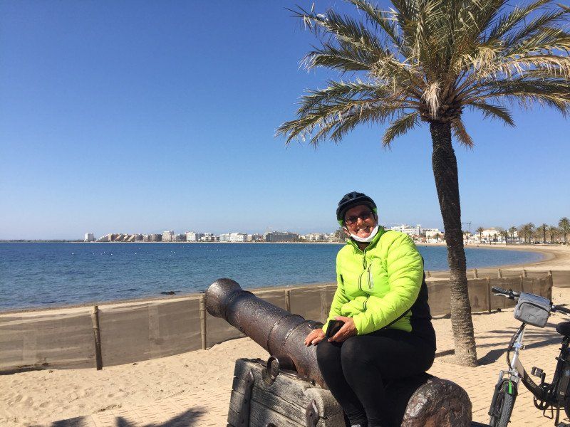
Empuriabrava, Spanien
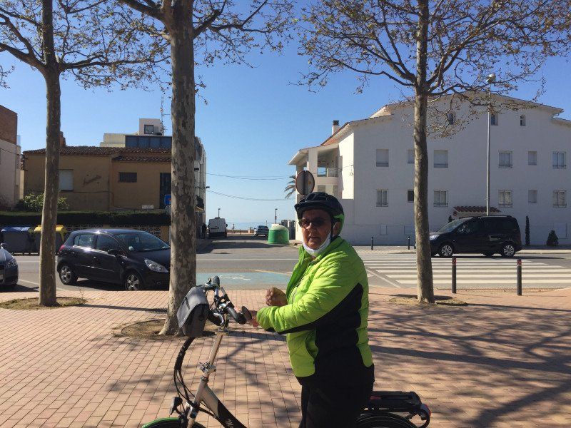
We asked about Empuriabrava by bike and had the PCR test done there.
17487 Empuriabrava, Provinz Girona, Spanien
42° 14' 43" N 3° 7' 35.2" E
42.2452870 3.1264427
• Follow the roundabout. Go for 18 m.
• Take the 1st exit from roundabout onto Avinguda de Joan Carles I. Go for 1.3 km.
• Take the 2nd exit from roundabout onto Avinguda de Joan Carles I. Go for 921 m.
• Take the 1st exit from Plaça de la Font roundabout onto Avinguda Tramuntana toward Centre Històric/Roses/Cadaqués/Figueres/AP-7. Go for 560 m.
• Take the 2nd exit from roundabout onto Carretera de Roses (C-260) toward AP-7/Castelló E./Figueres/Girona/Perpinyà. Go for 882 m.
• Pass 6 roundabouts. Go for 9.0 km.
• Keep left onto C-260. Go for 696 m.
• Take ramp onto Cinturó de Ronda (N-2) toward La Jonquera/Perpinyà. Go for 5.4 km.
• Take ramp onto AP-7 (Autopista de la Mediterrània) toward La Jonquera. Go for 14.0 km.
• Take exit 2 toward La Jonquera/Figueres/Girona onto N-2. Go for 1.9 km.
• Take the 3rd exit from roundabout onto Carretera a Cantallops (GI-601) toward Cantallops. Go for 296 m.
• Take the 2nd exit from roundabout onto GI-601. Go for 192 m.
• Turn left onto GI-601. Go for 979 m.
• Turn slightly right onto GI-601. Go for 3.3 km.
• Turn right. Go for 25 m.
• Arrive at your destination on the left.
☍
39,4 km
( 36 min.)
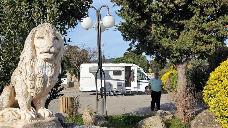
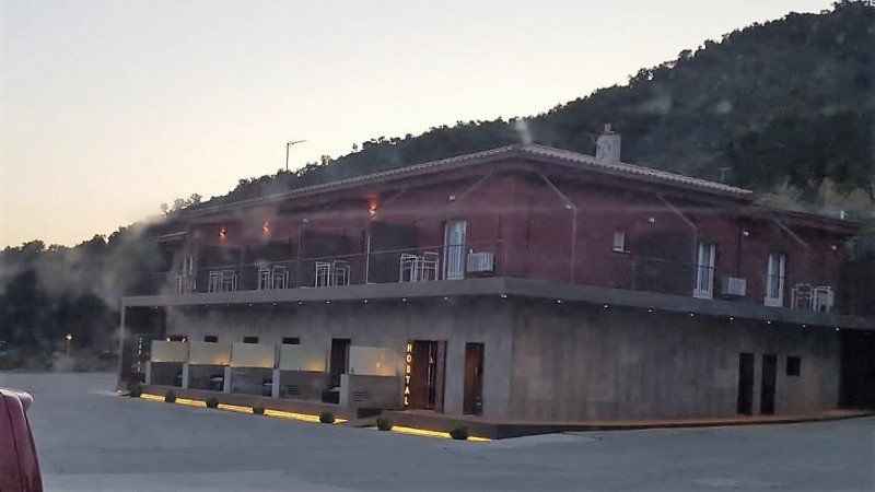
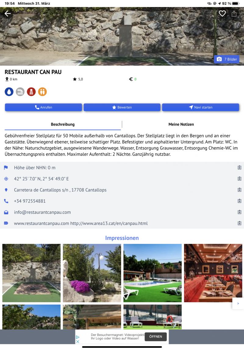
Restaurant Can Pau Cantallops, GI-601, GI601, Spanien
The SP in La Jonquera was a single construction site, which is why we drove 4 km into the mountains and found this wonderful SP there.
GI-601, km 4, 17708 GI601, Girona, Spanien
42° 25' 5.2" N 2° 54' 55.8" E
42.4181098 2.9154920
• Head northeast. Go for 25 m.
• Turn left onto GI-601. Go for 4.5 km.
• Take the 2nd exit from roundabout onto Carretera a Cantallops (GI-601). Go for 227 m.
• Take the 1st exit from roundabout onto N-2 toward Centre Urbà/Perpignan/E-15/Girona/AP-7/Barcelona. Go for 287 m.
• Take ramp onto AP-7 (Autopista de la Mediterrània) toward E-15. Go for 7.4 km.
• Continue on A9 (La Catalane). Go for 281 km.
• Continue on A7 (Autoroute du Soleil). Go for 92.5 km.
• Take exit 15 toward Genève/Chambéry/Grenoble/Romans/Valence onto E713 (Échangeur de Valence-Sud). Go for 708 m.
• Continue on N7. Go for 9.7 km.
• Continue on E713. Go for 168 m.
• Continue on N532. Go for 10.6 km.
• Keep left onto A49 toward Genève/Chambéry/Grenoble/Romans-Centre. Go for 60.6 km.
• Take the exit toward Voiron/Lyon/Chambéry/Genève onto A48. Go for 41.8 km.
• Take the exit toward Genève/Chambéry/La Tour du Pin onto A43. Go for 46.8 km.
• Continue on A41 toward Genève/Annecy/Aix les Bains. Go for 71.6 km.
• Continue on A1. Go for 8.9 km.
• Take the exit toward Vernier/Genève-Centre/Z.I. Meyrin-Vernier/Z.I. Lignon. Go for 399 m.
• Turn left onto Route de Vernier. Go for 663 m.
• Continue on Route du Nant-d'Avril. Go for 447 m.
• Turn left onto Avenue Louis-Pictet. Go for 339 m.
• Continue on Route de Peney. Go for 2.3 km.
• Continue on Route du Bois-de-Bay. Go for 345 m.
• Turn left onto Route du Bois-de-Bay. Go for 25 m.
• Turn left onto Route du Bois-de-Bay. Go for 55 m.
• Turn left. Go for 21 m.
• Turn slightly right. Go for 182 m.
• Arrive at your destination on the left.
☍
641,4 km
(5 hrs. 40 min.)
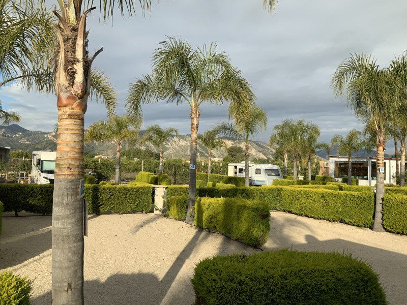
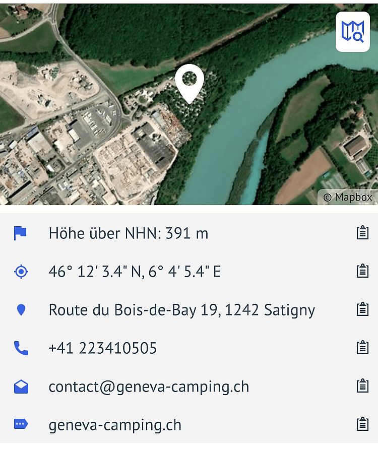
Camping Bois-de-Bay, Route du Bois-de-Bay, Satigny, Geneva, Genf, Schweiz
Stage place with aircraft noise
Route du Bois-de-Bay 19, 1242 Satigny, Schweiz
46° 12' 4.7" N 6° 4' 5.5" E
46.2013015 6.0681958
• Head southeast.
• Turn right. Go for 24 m.
• Turn right. Go for 20 m.
• Turn right. Go for 27 m.
• Turn left. Go for 85 m.
• Turn slightly right toward Route du Bois-de-Bay. Go for 98 m.
• Turn right onto Route du Bois-de-Bay. Go for 55 m.
• Turn right onto Route du Bois-de-Bay. Go for 25 m.
• Turn right onto Route du Bois-de-Bay. Go for 345 m.
• Continue on Route de Peney. Go for 2.3 km.
• Continue on Avenue Louis-Pictet. Go for 339 m.
• Turn right onto Route du Nant-d'Avril. Go for 447 m.
• Continue on Route de Vernier. Go for 654 m.
• Turn left and take ramp toward Lausanne/Aéroport. Go for 289 m.
• Take left ramp onto A1 toward Lausanne/Aéroport/Palexpo. Go for 54.8 km.
• Take the exit toward Bern/Neuchâtel/Simplon/Gd-St-Bernard/Lausanne-Nord/Lausanne-Crissier onto A1 (Ecublens). Go for 21.7 km.
• Continue on A1 toward Bern/Neuchâtel/Yverdon. Go for 81.0 km.
• Take the left exit toward Zürich/Basel/Biel/Bienne onto A1/A6. Go for 6.0 km.
• Continue on A1. Go for 53.8 km.
• Continue on A1 (Verzweigung Wiggertal) toward Zürich/Aarau/Oftringen/Zofingen. Go for 35.0 km.
• Keep right onto A1/A3 toward Zürich/Wettingen-Ost/Neuenhof. Go for 21 m.
• Take the exit. Go for 165 m.
• Turn left onto Birmenstorferstrasse. Go for 157 m.
• Keep left onto Birmenstorferstrasse. Go for 324 m.
• Turn left onto Mellingerstrasse. Go for 1.9 km.
• Take the 1st exit from roundabout onto Mellingerstrasse. Go for 788 m.
• Turn left onto Wettingerstrasse. Go for 243 m.
• Turn right onto Sonnenbergstrasse. Go for 7 m.
• Turn right onto Ehrendingerstrasse. Go for 2.4 km.
• Continue on Landstrasse. Go for 1.4 km.
• Take the 2nd exit from roundabout onto Landstrasse. Go for 295 m.
• Continue on Kantonsstrasse. Go for 739 m.
• Take the 2nd exit from roundabout onto Surbtalstrasse (17). Go for 125 m.
• Pass 2 roundabouts and continue on Surbtalstrasse (17). Go for 8.8 km.
• Take the 1st exit from roundabout onto Zurzibergstrasse. Go for 590 m.
• Take the 2nd exit from roundabout onto Zurzibergstrasse. Go for 1.4 km.
• Continue on Bruggerstrasse. Go for 1.6 km.
• Continue on Ostumfahrung Zurzach. Go for 720 m.
• Turn right onto Zürcherstrasse. Go for 176 m.
• Turn left onto Zürcherstrasse. Go for 86 m.
• Continue on Zurzacher Straße (L162). Go for 553 m.
• Take the 2nd exit from roundabout onto Dangstetter Straße (L162). Go for 1.6 km.
• Turn sharp left onto Küferweg. Go for 63 m.
• Arrive at Küferweg. Your destination is on the right.
☍
281,1 km
(2 hrs. 54 min.)
Dangstetten, Küssaberg, Deutschland
Dangstetten, 79790 Küssaberg, Deutschland
47° 35' 47.5" N 8° 19' 15.9" E
47.5965372 8.3210709