In summer 2019 I went to Croatia again. This time right after our trip to Florida.
Harsum, Deutschland
On Monday morning we started south. Nothing stopped us on the entire route. Only the metropolitan region of Nuremberg thwarted our plans. There was a traffic jam everywhere, so we didn't take the BAB 3, but the BAB 73 in the direction of BAB 9. When we had finally fought our way through the traffic, we could already drive onto the BAB 9. Together we decided to stand the night in Beilngries.
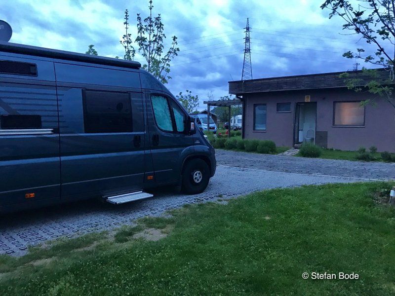
In the afternoon we arrive at the Altmühl campsite. As we found out, a lot has changed here. The reception was no longer manned and in the near future the registration should run via "Rosi", a computer. Unfortunately, it didn't work when we checked in, so we could just choose a parking space. Unfortunately, we couldn't order bread rolls because of this.
52° 12' 35.9" N 9° 57' 46.6" E
52.2099738 9.9629420
• Head toward Oststraße on Hessingsweg. Go for 65 m.
• Turn left onto Oststraße. Go for 14 m.
• Turn right onto Breite Straße (L467). Go for 62 m.
• Turn right onto Kaiserstraße (L467). Go for 323 m.
• Continue on Kaiserstraße (K201). Go for 180 m.
• Continue on Konrad-Adenauer-Straße (K201). Go for 431 m.
• Continue on K201. Go for 401 m.
• Continue on Hildesheimer Straße (K201). Go for 563 m.
• Turn left onto Borsumer Straße (K201). Go for 127 m.
• Turn right onto Bundesstraße (B494). Go for 1.1 km.
• Take ramp onto A7 toward Kassel. Go for 195 km.
• Keep right onto A7 (Hattenbacher Dreieck) toward München/Stuttgart/Würzburg/Fulda/Basel/Frankfurt/Wiesbaden/Gießen. Go for 111 km.
• Take exit 99 toward Bamberg/Schweinfurt/Werneck/Erfurt onto A70. Go for 65.6 km.
• Take exit 17 toward Nürnberg onto A73. Go for 61.8 km.
• Keep right onto Frankenschnellweg (N4) toward Schwabach/B2/Ansbach/B14/N.-Eibach/N.-Hafen. Go for 3.0 km.
• Take ramp onto A73 toward Hafen/München/Feucht/Prag/Praha/Regensburg/Heilbronn. Go for 2.6 km.
• Arrive at A73. Your destination is on the right.
☍
443,1 km
(4 hrs. )
Day
Südwesttangente, 90455 Nürnberg, Deutschland
49° 23' 44.7" N 11° 4' 46" E
49.3957474 11.0794403
• Head southeast on A73. Go for 11.2 km.
• Take exit 54 toward München/Ingolstadt onto A9. Go for 37.2 km.
• Take exit 57 toward Greding/Titting. Go for 167 m.
• Turn left onto Bahnhofstraße (St2336) toward Thalmässing/Berching/Landerzhofen/Stadtmitte. Go for 419 m.
• Turn right onto St2227. Go for 471 m.
• Turn right onto Kindinger Straße (St2227). Go for 604 m.
• Turn left onto RH29 toward Beilngries/Kaising. Go for 3.3 km.
• Continue on EI23. Go for 500 m.
• Take the 2nd exit from roundabout onto EI23. Go for 1.4 km.
• Continue on Kaldorf (EI23). Go for 1.2 km.
• Continue on EI23. Go for 877 m.
• Continue on Hirschberg (EI21). Go for 444 m.
• Continue on EI21. Go for 1.3 km.
• Turn right toward Hirschberger Straße. Go for 52 m.
• Continue on Hirschberger Straße. Go for 1.3 km.
• Take the 2nd exit from roundabout onto Ringstraße. Go for 423 m.
• Turn right onto Sandstraße. Go for 99 m.
• Turn left onto Seestraße. Go for 352 m.
• Turn slightly left onto Badstraße. Go for 138 m.
• Turn right onto Flurstraße. Go for 201 m.
• Turn left onto An der Altmühl. Go for 192 m.
• Arrive at An der Altmühl. Your destination is on the left.
☍
61,8 km
( 39 min.)
Altmühltaler Naturpark Camping Beilngries
The next day started with the usual routine. After breakfast we left at 9 a.m. - or so we thought. We still had to pay and that dragged on for over a quarter of an hour. But then it started.
An der Altmühl 24, 92339, Beilngries, Deutschland
49° 1' 34.7" N 11° 28' 11.6" E
49.0263000 11.4699000
• Head toward Flurstraße on An der Altmühl. Go for 192 m.
• Turn right onto Flurstraße. Go for 611 m.
• Turn left onto Alte Ingolstädter Straße. Go for 128 m.
• Turn right onto Alte Ingolstädter Straße. Go for 129 m.
• Turn right onto Ingolstädter Straße (B299). Go for 856 m.
• Take the 2nd exit from roundabout onto Ingolstädter Straße (B299) toward München/A9/Landshut/Ingolstadt/Denkendorf. Go for 3.4 km.
• Continue on St2229. Go for 8.3 km.
• Pass 2 roundabouts and continue on St2229. Go for 1.5 km.
• Turn left and take ramp onto A9 toward München. Go for 82.7 km.
• Take the exit toward Salzburg/Innsbruck/Messe/ICM onto A99. Go for 29.4 km.
• Take exit 21 toward Salzburg/Innsbruck onto A8. Go for 117 km.
• Continue on A1 (West Autobahn). Go for 2.1 km.
• Take the exit toward Ljubljana/Villach/Salzburg-Süd onto A10 (Tauern Autobahn). Go for 182 km.
• Continue on A11 (Karawanken Autobahn). Go for 11.6 km.
• Take exit 11 toward St. Jakob i. R. Go for 1.7 km.
• Turn left onto Rosental Bundesstraße (B85) toward Feistritz i. R./Rosegg/St. Jakob i. R. Go for 9 m.
• Turn left and take ramp onto A11 (Karawanken Autobahn) toward Villach. Go for 2.2 km.
• Arrive at Karawanken Autobahn (A11). Your destination is on the right.
☍
443,6 km
(4 hrs. 18 min.)
Karawanken Autobahn, 9232, Österreich
46° 34' 0.3" N 14° 0' 24.7" E
46.5667433 14.0068727
• Head north on A11 (Karawanken Autobahn). Go for 5.9 km.
• Take exit 3 toward St. Niklas/Faaker See. Go for 306 m.
• Turn left onto Föderlacher Landesstraße (L59). Go for 83 m.
• Turn right onto Großattelstraße (L52). Go for 464 m.
• Take the 2nd exit from roundabout onto Großattelstraße (L58). Go for 631 m.
• Take ramp onto A11 (Karawanken Autobahn) toward Ljubljana. Go for 18.1 km.
• Continue on Predor Karavanke (A2). Go for 71.0 km.
• Take the left exit toward Gradec/Graz/Maribor/Zagreb/Novo mesto/Ljubljana-zahod onto A1/A2. Go for 9.0 km.
• Take exit 31 toward Zagreb/Novo mesto/Škofljica/Kočevje onto A2. Go for 103 km.
• Continue on A3 (Autocesta Bregana-Zagreb-Lipovac). Go for 8.7 km.
• Take exit 2 toward Sv. Nedelja. Go for 700 m.
• Take the 1st exit from roundabout onto Ulica Dr. Franje Tuđmana (3063). Go for 625 m.
• Pass 2 roundabouts and continue on Ulica dr. Franje Tuđmana (3063). Go for 2.5 km.
• Take the 1st exit from roundabout onto Rakitska cesta (3064) toward Rakitje. Go for 946 m.
• Turn sharp left onto Jezerska ulica. Go for 54 m.
• Turn right onto Jezerska ulica. Go for 77 m.
• Arrive at Jezerska ulica.
☍
222,5 km
(2 hrs. 15 min.)
Day
Camp Zagreb
Arrive at the beautiful parking space on the outskirts of Zagreb. The pizzeria on the pitch was really great. Unfortunately it started to rain during the night and didn't stop, so we postponed the city tour and drove further south.
Jezerska 6, 10437, Rakitje, Kroatien
45° 48' 8.3" N 15° 49' 35.8" E
45.8023000 15.8266000
• Head toward Vrbik on Jezerska ulica. Go for 77 m.
• Turn left onto Jezerska ulica. Go for 54 m.
• Turn sharp right onto Rakitska cesta (3064). Go for 934 m.
• Take the 1st exit from roundabout onto Ulica dr. Franje Tuđmana (3063) toward Podsused. Go for 870 m.
• Continue on Samoborska cesta. Go for 29 m.
• Turn right onto Priobalna cesta. Go for 2.9 km.
• Turn right onto Ljubljanska avenija. Go for 927 m.
• Take ramp onto E59 (Autocesta Zagreb-Macelj) toward Sl. Brod-Varaždin/Split/Rijeka. Go for 1.4 km.
• Continue on A3 (Autocesta Bregana-Zagreb-Lipovac). Go for 3.7 km.
• Take the exit toward Split/Rijeka onto A1 (Autocesta Bosiljevo-Split-Dubrov.). Go for 127 km.
• Take exit 9 toward Rijeka/E65/Senj/23. Go for 740 m.
• Take the exit. Go for 1.1 km.
• Turn left onto Žuta lokva (23) toward Rijeka/Otok Rab/Senj. Go for 305 m.
• Turn right onto Žuta lokva (23) toward Rijeka/Senj. Go for 22.1 km.
• Continue on Ulica Kapetana Knežića (23) toward Rijeka/Senj. Go for 755 m.
• Turn left onto Ulica Stjepana Radića. Go for 61 m.
• Turn right onto Ulica Petra Preradovića. Go for 14 m.
• Turn left onto Ulica Ivana Mažuranića. Go for 52 m.
• Arrive at Ulica Ivana Mažuranića. Your destination is on the right.
☍
162,6 km
(1 hrs. 46 min.)
Day
Senj, Kroatien
Zengg, Kroatien
44° 59' 21.7" N 14° 54' 13" E
44.9893604 14.9036052
• Head toward Ulica Zgon on Ulica Ivana Mažuranića. Go for 50 m.
• Turn left onto Velika vrata. Go for 40 m.
• Turn left onto Ulica Stjepana Radića. Go for 154 m.
• Turn right onto Stara cesta (23). Go for 22.9 km.
• Turn left onto Žuta lokva (23) toward Zagreb/Split/Brinje. Go for 305 m.
• Turn right and take ramp toward Zagreb/Split. Go for 1.4 km.
• Continue on Čvor Žuta lokva. Go for 767 m.
• Take the left exit toward Split/Gospić onto A1 (Autocesta Bosiljevo-Split-Dubrov.). Go for 117 km.
• Take exit 16 toward Obrovac/Starigrad/Maslenica/Rijeka onto 8. Go for 12.8 km.
• Arrive at Ulica doktora Franje Tuđmana (8). Your destination is on the left.
☍
155,3 km
(1 hrs. 40 min.)
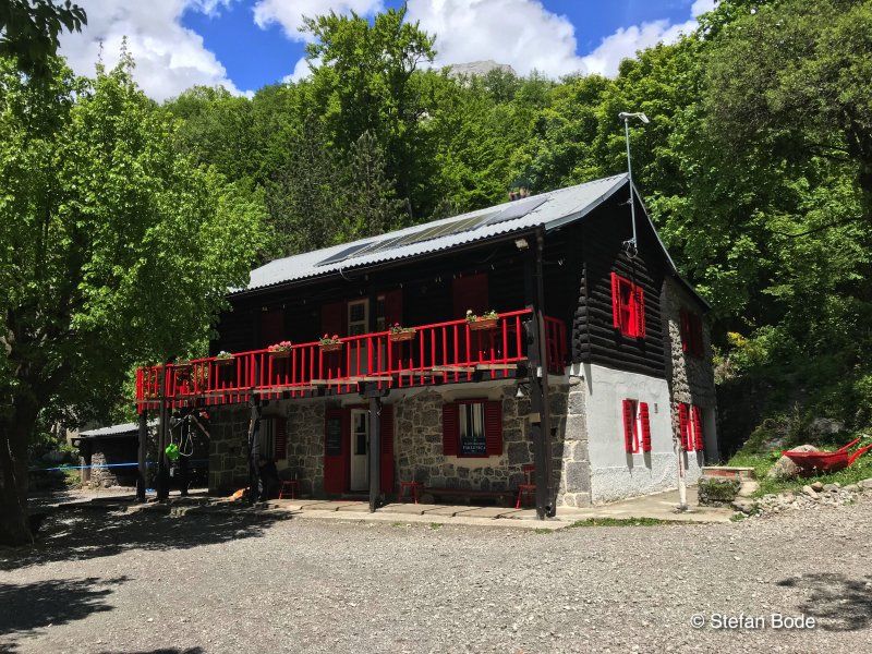
Camp Katinka
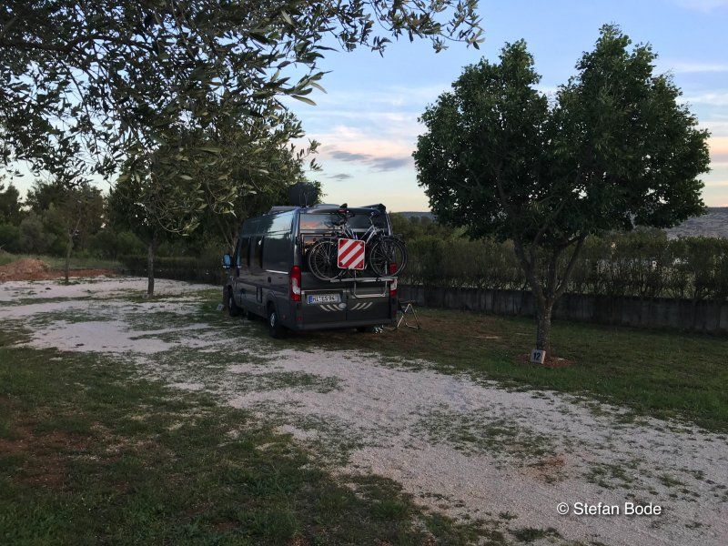
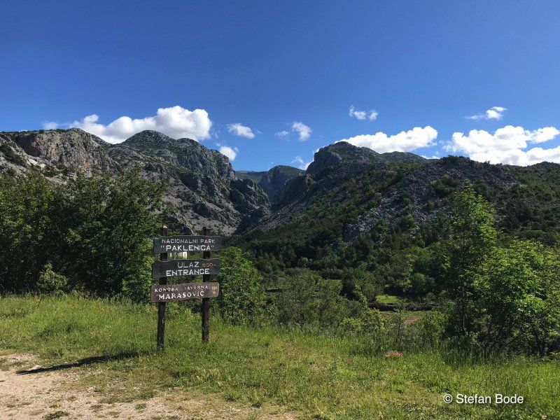
Camp Katinka was a nice pitch that wasn't heavily occupied. It served us as a starting point for our hikes in the Paklenica National Park.
Ul. dr. Franje Tuđmana 24, 23244, Starigrad, Kroatien
44° 17' 9" N 15° 27' 5" E
44.2858385 15.4513800
• Head northwest on Ulica doktora Franje Tuđmana (8). Go for 250 m.
• Turn left. Go for 13 m.
• Turn right toward Ulica doktora Franje Tuđmana/8. Go for 65 m.
• Turn right onto Ulica doktora Franje Tuđmana (8). Go for 12.5 km.
• Take ramp onto A1 (Autocesta Bosiljevo-Split-Dubrov.) toward Split/Zadar/Posedarje. Go for 234 km.
• Take exit 36 toward Dubrovnik/Ploče onto 425 (Čvor Ploče). Go for 15.4 km.
• Keep right toward Dubrovnik/Metković/8. Go for 802 m.
• Continue on 425. Go for 129 m.
• Turn right onto Jadranska magistrala (8). Go for 22.0 km.
• Keep left onto 674 toward Dubrovnik/O. Korčula/Ston. Go for 31.9 km.
• Continue on Jadranska magistrala (8). Go for 43.4 km.
• Turn left onto 420 toward Mokošica/Dubrovnik. Go for 1.0 km.
• Turn left toward Dubrovnik. Go for 20 m.
• Continue on 420. Go for 1.8 km.
• Take the 3rd exit from roundabout onto Obala pape Ivana Pavla II toward Centar/Lapad. Go for 238 m.
• Continue on Obala Stjepana Radića. Go for 303 m.
• Keep right onto Obala Stjepana Radića toward Centar/Lapad. Go for 428 m.
• Continue on Nikole Tesle. Go for 43 m.
• Continue toward Nikole Tesle. Go for 20 m.
• Continue on Nikole Tesle. Go for 231 m.
• Continue on Ulica od Batale. Go for 540 m.
• Turn right onto Ulica kralja Tomislava. Go for 338 m.
• Take the 1st exit from roundabout onto Ulica kralja Tomislava. Go for 68 m.
• Turn right onto Ulica Ive Dulčića. Go for 362 m.
• Turn right onto Ulica Riječka. Go for 93 m.
• Take the 3rd exit from roundabout onto Ulica Vatroslava Lisinskog. Go for 445 m.
• Arrive at Ulica Vatroslava Lisinskog. Your destination is on the right.
☍
365,9 km
(3 hrs. 47 min.)
Day
Day
Solitudo Sunny Camping
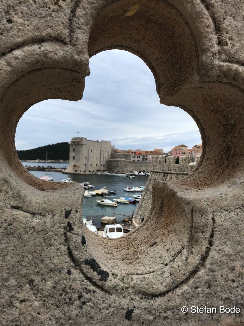
Once again we went down the coast to Dubrovnik in search of better weather. Here we made a stop to visit the old town again.
Vatroslava Lisinskog 60, 20000, Dubrovnik, Kroatien
42° 39' 43.2" N 18° 4' 13.1" E
42.6620000 18.0703000
• Head east on Ulica Vatroslava Lisinskog. Go for 414 m.
• Take the 2nd exit from roundabout onto Ulica Vatroslava Lisinskog. Go for 433 m.
• Continue on Ulica Ivana Zajca. Go for 130 m.
• Turn left onto Lapadska obala. Go for 874 m.
• Turn left onto Nikole Tesle. Go for 247 m.
• Continue on Hrvatskog Crvenog križa. Go for 185 m.
• Continue on Ulica dr. Ante Starčevića. Go for 8 m.
• Continue toward Gruž/Lapad. Go for 108 m.
• Turn left onto Vukovarska ulica. Go for 86 m.
• Keep right onto Obala Stjepana Radića toward Gruž. Go for 741 m.
• Continue on Obala pape Ivana Pavla II. Go for 230 m.
• Take the 2nd exit from roundabout onto Obala pape Ivana Pavla II (420) toward Split. Go for 1.9 km.
• Turn right onto 420 toward Split/Zračna luka/Cavtat. Go for 1.0 km.
• Turn right onto Most dr. Franja Tuđmana (8) toward Split. Go for 43.4 km.
• Continue on 674. Go for 31.9 km.
• Continue on Jadranska magistrala (8). Go for 21.9 km.
• Turn left onto 425 toward Ploče/A1/Zagreb/Split. Go for 150 m.
• Keep right onto 425 toward Zagreb/Split. Go for 14.7 km.
• Take the exit onto A1 (Čvor Ploče). Go for 125 km.
• Take exit 26 toward Prgomet/Split/Trogir/Kaštela. Go for 1.9 km.
• Turn right onto 6112 toward Zračna luka Split. Go for 925 m.
• Turn right onto 58 toward Trogir/Prapatnica. Go for 3.1 km.
• Turn left onto 6293 toward Trogir/Seget. Go for 314 m.
• Continue on Kovačevići (6293). Go for 837 m.
• Continue on Donji Strižići (6293). Go for 352 m.
• Continue on 6293. Go for 6.1 km.
• Continue on Ulica Čarije (6293). Go for 680 m.
• Continue on 6293. Go for 2.9 km.
• Continue on Put Vlaške (6293). Go for 2.2 km.
• Turn sharp right onto Ulica hrvatskih žrtava toward Šibenik/H.Medena. Go for 371 m.
• Turn left. Go for 32 m.
• Turn right. Go for 22 m.
• Arrive at your destination on the right.
☍
263,6 km
(3 hrs. )
Day
Day
Kamp Seget
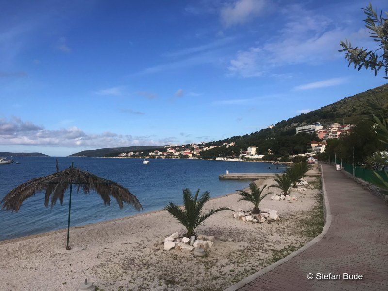
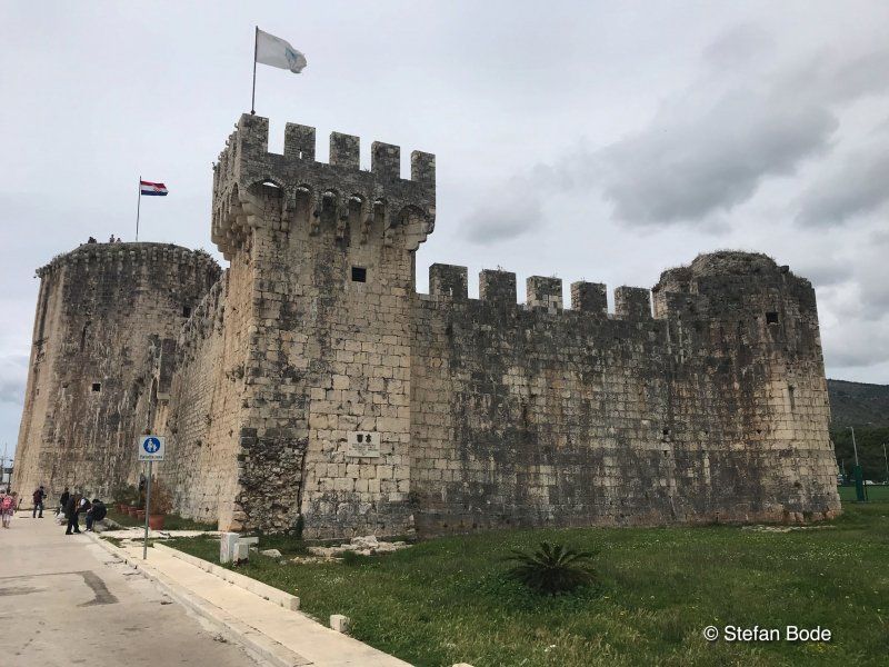
On the way north again we headed for Kamp Seget. From here we went sightseeing to Trogir.
Hrvatskih žrtava 121, 21218, Seget Donji, Kroatien
43° 31' 7.7" N 16° 13' 26.4" E
43.5188000 16.2240000
• Head east. Go for 22 m.
• Turn left toward Ulica hrvatskih žrtava. Go for 32 m.
• Turn right onto Ulica hrvatskih žrtava. Go for 460 m.
• Turn right onto Ulica don Petra Špike. Go for 14 m.
• Turn right toward Put akademika Mihe Barada. Go for 17 m.
• Turn right onto Put akademika Mihe Barada. Go for 11 m.
• Turn left onto Ulica hrvatskih žrtava. Go for 79 m.
• Turn right toward Ulica hrvatskih žrtava. Go for 31 m.
• Continue on Put Vlaške. Go for 2.2 km.
• Continue on 6293. Go for 2.9 km.
• Continue on Ulica Čarije (6293). Go for 680 m.
• Continue on 6293. Go for 6.1 km.
• Continue on Donji Strižići (6293). Go for 352 m.
• Continue on Kovačevići (6293). Go for 837 m.
• Continue on 6293. Go for 314 m.
• Turn right onto 58 toward Zagreb/Split/Prgomet/Radošić. Go for 3.1 km.
• Turn left onto 6112 toward Zagreb/A1/Dubrovnik/Ploče/Zadar/Šestanovac/Split/Kladnjice/Radošić. Go for 936 m.
• Turn left and take ramp onto A1 (Autocesta Bosiljevo-Split-Dubrov.) toward Zagreb. Go for 52.4 km.
• Take exit 21 toward N.P. Kornati/otok Murter/Vodice/Pirovac/59. Go for 1.2 km.
• Turn right onto 59 toward NP Kornati/otok Murter/Vodice/Pirovac. Go for 4.7 km.
• Take the 1st exit from roundabout onto 27 toward Benkovac/Stankovci. Go for 19.7 km.
• Turn right onto Miranje Gornje (27) toward Obrovac/Benkovac. Go for 2.5 km.
• Take the 1st exit from roundabout onto Šopot (27) toward Obrovac/Benkovac. Go for 1.9 km.
• Turn left onto Zadarska ulica (56) toward Zadar/Nadin. Go for 12.6 km.
• Turn right onto Donje Biljane (6258) toward Smilčić/A1. Go for 369 m.
• Continue on 6258. Go for 2.4 km.
• Continue on Smilčić (6258). Go for 174 m.
• Continue on 6258. Go for 208 m.
• Continue on Smilčić (6258). Go for 161 m.
• Turn right onto Smilčić (502) toward Islam L. Go for 46 m.
• Turn left onto Smilčić (6258) toward Islam L. Go for 947 m.
• Turn left onto Smilčić (6258) toward Rijeka/Zadar. Go for 466 m.
• Continue on Donji Kašić (6258). Go for 3.3 km.
• Continue on Islam Grčki (6258). Go for 3.9 km.
• Continue on Islam Latinski (6258). Go for 1.3 km.
• Continue on Grgurice (6258). Go for 377 m.
• Turn right onto 8 toward Rijeka/Pag/Posedarje. Go for 3.7 km.
• Turn left onto 106 toward Zagreb/Split/Otok Pag/Rijeka. Go for 1.3 km.
• Turn left and take ramp onto A1 (Autocesta Bosiljevo-Split-Dubrov.) toward Zagreb/Rijeka. Go for 251 km.
• Take the exit toward Ljubljana/Maribor onto A3 (Autocesta Bregana-Zagreb-Lipovac). Go for 5.4 km.
• Keep right onto E59 (Autocesta Zagreb-Macelj) toward Maribor/Krapina/A2/Zagreb zapad. Go for 235 m.
• Take exit 3 toward Zagreb zapad onto Ljubljanska avenija. Go for 1.2 km.
• Take ramp onto Ulica Velimira Škorpika. Go for 523 m.
• Take the 4th exit from Ulica Velimira Škorpika roundabout onto Ulica Velimira Škorpika. Go for 258 m.
• Take ramp onto Ljubljanska avenija toward Sl. Brod/A3/Ljubljana/Maribor/A2/Karlovac/A1/Samobor. Go for 2.3 km.
• Take the exit toward Kerestinec/Ježdovec/Rakitje. Go for 479 m.
• Turn right onto Zagrebačka ulica (3064) toward Rakitje. Go for 1.3 km.
• Continue on Rakitska cesta (3064). Go for 683 m.
• Turn right onto Jezerska ulica. Go for 54 m.
• Turn right onto Jezerska ulica. Go for 77 m.
• Arrive at Jezerska ulica.
☍
395,3 km
(3 hrs. 49 min.)
Day
Day
Day
Camp Zagreb
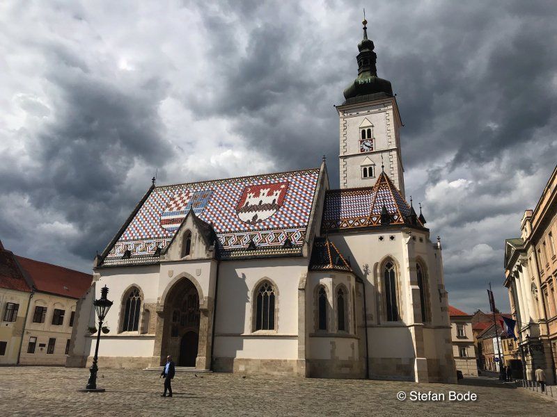
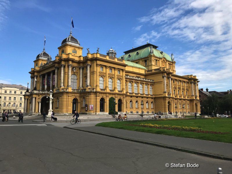
At the end of our stay in Croatia, we drove to the Autocamp Zagreb again. This time it worked with the sightseeing of Zagreb.
Jezerska 6, 10437, Rakitje, Kroatien
45° 48' 8.3" N 15° 49' 35.8" E
45.8023000 15.8266000
• Head toward Vrbik on Jezerska ulica. Go for 77 m.
• Turn left onto Jezerska ulica. Go for 54 m.
• Turn left onto Rakitska cesta (3064). Go for 683 m.
• Turn left onto Zagrebačka ulica (3064). Go for 1.3 km.
• Continue on Ježdovečka ulica toward Zagreb/Kerestinec. Go for 430 m.
• Turn left toward Zagreb. Go for 42 m.
• Take ramp. Go for 1.4 km.
• Take the exit toward Maribor/Krapina onto E59 (Autocesta Zagreb-Macelj). Go for 908 m.
• Continue on A2 (Autocesta Zagreb-Macelj). Go for 60.3 km.
• Continue on A4. Go for 33.5 km.
• Take the left exit toward Dravograd/Pohorje/Maribor-jug onto Slivnica pri Mariboru. Go for 937 m.
• Continue on Spodnje Hoče. Go for 502 m.
• Continue on Ljubljanska cesta (430) toward Maribor/Center. Go for 3.9 km.
• Turn left toward Pohorje/Razvanje. Go for 871 m.
• Turn right onto Razvanjska cesta toward Pohorje. Go for 230 m.
• Continue on Streliška cesta. Go for 422 m.
• Pass 3 roundabouts and continue on Streliška cesta. Go for 1.2 km.
• Continue on Lackova cesta. Go for 311 m.
• Keep right toward Lackova cesta. Go for 51 m.
• Take the 2nd exit from roundabout onto Lackova cesta toward Pohorje/Radvanje. Go for 450 m.
• Turn left onto Lackova cesta. Go for 17 m.
• Continue on Pot k mlinu. Go for 143 m.
• Turn left onto Pot k mlinu. Go for 319 m.
• Turn slightly right onto Pohorska ulica. Go for 181 m.
• Turn left onto Pohorska ulica. Go for 19 m.
• Arrive at Pohorska ulica. Your destination is on the left.
☍
108,2 km
(1 hrs. 8 min.)
Day
Camping Center Kekec
Idyllic campsite at the foot of a ski jump. From here you can go sightseeing to Maribor by bike.
Pohorska ulica 35c, 2000, Maribor, Slowenien
46° 32' 10" N 15° 36' 16" E
46.5361111 15.6044444
• Head northeast on Pohorska ulica. Go for 19 m.
• Turn right onto Pohorska ulica. Go for 181 m.
• Turn slightly left onto Pot k mlinu. Go for 462 m.
• Continue on Lackova cesta. Go for 17 m.
• Turn right onto Lackova cesta. Go for 400 m.
• Take the 2nd exit from roundabout onto Železnikarjeva ulica toward Dravograd/Center. Go for 621 m.
• Keep right toward Dravograd/Center. Go for 51 m.
• Take the 2nd exit from roundabout onto Železnikarjeva ulica toward Dravograd/Center. Go for 347 m.
• Take the 1st exit from roundabout onto Cesta proletarskih brigad (1) toward Ljubljana/Ptuj. Go for 2.8 km.
• Turn left and take ramp onto 430 toward Šentilj/Lendava/Pobrežje. Go for 2.3 km.
• Keep left onto 430 toward Avstrija/E59/Šentilj/E57. Go for 5.0 km.
• Take the 4th exit from roundabout onto A1 toward Šentilj/Gradec/Graz. Go for 11.4 km.
• Continue on A9 (Pyhrn Autobahn). Go for 230 km.
• Continue on A8 (Innkreis Autobahn) toward Passau/Wels. Go for 14.2 km.
• Take the left exit toward Passau/Ried im Innkreis/Pichl bei Wels onto A8 (Innkreis Autobahn). Go for 62.0 km.
• Continue on A3 (Grenzübergang Suben). Go for 136 km.
• Take exit 99 toward Hof/Regensburg onto A93. Go for 34.0 km.
• Take exit 34 toward S.-Klardorf Gewerbegebiet/Rieden/Wackersdorf-Ost/Steinberg a. See. Go for 278 m.
• Turn right onto SAD2 toward Steinberg a. See/Nittenau/Gewerbegebiet Wackersdorf. Go for 280 m.
• Take ramp onto A93 toward Regensburg. Go for 883 m.
• Arrive at A93. Your destination is on the left.
☍
501,9 km
(4 hrs. 36 min.)
Day
A93, Schwandorf, Deutschland
49° 16' 6.8" N 12° 7' 28.2" E
49.2685567 12.1245134
• Head south on A93. Go for 5.5 km.
• Take exit 35 toward Teublitz/Maxhütte-Haidhof/Burglengenfeld. Go for 423 m.
• Turn left onto SAD1 toward Nittenau/Bruck/Maxhütte-Haidhof. Go for 193 m.
• Take ramp onto A93 toward Hof/Berlin/Dresden. Go for 150 km.
• Take the left exit toward Berlin/Hof-Nord onto A72. Go for 14.2 km.
• Take exit 1 toward Berlin/Leipzig/Erfurt onto A9. Go for 113 km.
• Take exit 19 toward Göttingen/AD Halle-Süd onto A38. Go for 82.0 km.
• Take exit 14 toward Roßla/Bennungen. Go for 194 m.
• Turn left onto K2300 toward Nordhausen/Roßla/Bennungen. Go for 296 m.
• Turn left and take ramp onto A38 toward Leipzig. Go for 8.6 km.
• Arrive at A38. Your destination is on the right.
☍
374,8 km
(3 hrs. 3 min.)
A38, Südharz, Deutschland
A38, Deutschland
51° 27' 8.6" N 11° 12' 47" E
51.4523959 11.2130681
• Head east on A38. Go for 3.4 km.
• Take exit 15 toward Sangerhausen-West/Martinsrieth/Wallhausen. Go for 288 m.
• Turn right onto L221 toward Wallhausen/Sangerhausen-West. Go for 263 m.
• Turn right and take ramp onto A38 toward Göttingen. Go for 40.5 km.
• Take exit 9 toward Großwechsungen/Osterode/Harz/Bad Sachsa/Ellrich onto B243. Go for 2.8 km.
• Turn right and take ramp toward Osterode/Bad Sachsa/Ellrich/Haferungen/B243. Go for 226 m.
• Turn right onto L3243 toward Osterode/Bad Sachsa/Ellrich/Haferungen/B243. Go for 619 m.
• Turn left onto B243 toward Osterode/Bad Sachsa/Ellrich/Günzerode. Go for 31.4 km.
• Turn right onto Osteroder Straße (B243). Go for 30.5 km.
• Continue on B243/B248 toward Hannover/A7/Kassel/Seesen. Go for 1.7 km.
• Turn left toward Hannover/A7/Kassel. Go for 112 m.
• Take ramp onto A7 toward Hannover. Go for 43.1 km.
• Take exit 61 toward Hildesheim-Drispenstedt/Hohenhameln/Harsum. Go for 284 m.
• Turn right onto Bundesstraße (B494). Go for 2.4 km.
• Turn left onto Morgenstern (L467) toward Harsum. Go for 538 m.
• Turn right onto Kaiserstraße (L467). Go for 323 m.
• Turn left onto Breite Straße (L467). Go for 62 m.
• Turn left onto Oststraße. Go for 14 m.
• Turn right onto Hessingsweg. Go for 65 m.
• Arrive at Hessingsweg. Your destination is on the left.
☍
158,5 km
(1 hrs. 36 min.)
Harsum, Deutschland
52° 12' 35.9" N 9° 57' 46.6" E
52.2099738 9.9629420