Harsum, Deutschland
52° 12' 35.9" N 9° 57' 46.6" E
52.2099738 9.9629420
• Head toward Oststraße on Hessingsweg. Go for 65 m.
• Turn left onto Oststraße. Go for 14 m.
• Turn right onto Breite Straße (L467). Go for 62 m.
• Turn right onto Kaiserstraße (L467). Go for 323 m.
• Continue on Kaiserstraße (K201). Go for 180 m.
• Continue on Konrad-Adenauer-Straße (K201). Go for 431 m.
• Continue on K201. Go for 401 m.
• Continue on Hildesheimer Straße (K201). Go for 563 m.
• Turn left onto Borsumer Straße (K201). Go for 127 m.
• Turn right onto Bundesstraße (B494). Go for 1.1 km.
• Take ramp onto A7 toward Kassel. Go for 195 km.
• Keep right onto A7 (Hattenbacher Dreieck) toward München/Stuttgart/Würzburg/Fulda/Basel/Frankfurt/Wiesbaden/Gießen. Go for 111 km.
• Take exit 99 toward Bamberg/Schweinfurt/Werneck/Erfurt onto A70. Go for 65.6 km.
• Take exit 17 toward Nürnberg onto A73. Go for 45.9 km.
• Take the exit toward Regensburg/München/N.-Flughafen/N.-Hafen/N.-Messe/N.-Stadion onto A3. Go for 21.7 km.
• Keep left onto E45 (Autobahnkreuz Nürnberg) toward München/Heilbronn/N.-Hafen/N.-Messe/N.-Stadion/A9. Go for 2.4 km.
• Continue on A9. Go for 148 km.
• Take the exit toward Salzburg/Innsbruck/Messe/ICM onto A99. Go for 29.4 km.
• Take exit 21 toward Salzburg/Innsbruck onto A8. Go for 117 km.
• Continue on A1 (West Autobahn). Go for 2.1 km.
• Take the exit toward Ljubljana/Villach/Salzburg-Süd onto A10 (Tauern Autobahn). Go for 182 km.
• Continue on A11 (Karawanken Autobahn). Go for 3.4 km.
• Take exit 3 toward St. Niklas/Faaker See. Go for 392 m.
• Turn left onto Großattelstraße (L58) toward Wernberg/Rosegg/St. Niklas. Go for 644 m.
• Take the 2nd exit from roundabout onto Großattelstraße (L52). Go for 7.1 km.
• Turn right onto Schlossweg. Go for 117 m.
• Arrive at Schlossweg. Your destination is on the right.
☍
935,9 km
(8 hrs. 29 min.)
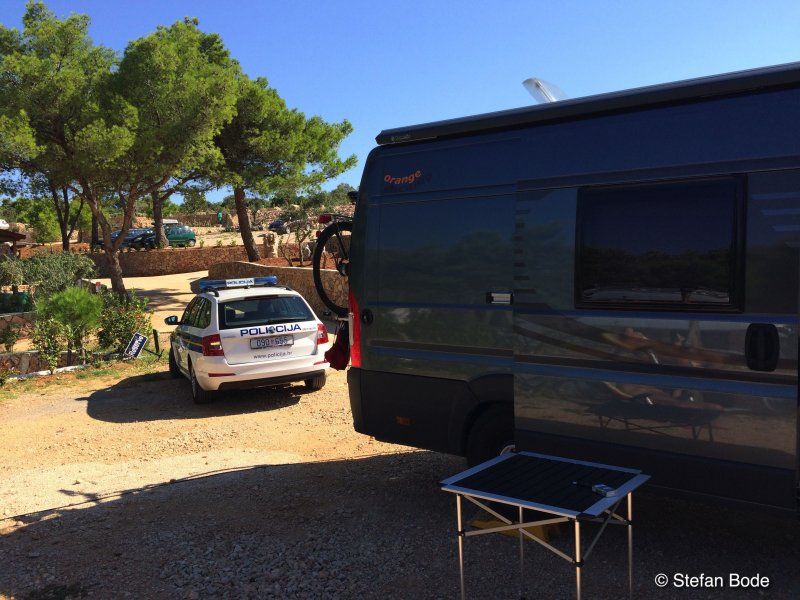
Stellplatz Gasthof Roseggerhof
Overnight in front of the Karawanken tunnel
Schulweg 4, 9232, Rosegg, Österreich
46° 35' 25" N 14° 1' 13" E
46.5902778 14.0202778
• Head toward Schulweg on Schlossweg. Go for 6 m.
• Turn left onto Schulweg. Go for 104 m.
• Turn left onto Schlossallee. Go for 41 m.
• Turn left onto Rosegger Straße (L52). Go for 482 m.
• Turn left onto Rosegger Straße (L52). Go for 26 m.
• Continue on Mühlbacher Straße (L55). Go for 4.5 km.
• Take ramp. Go for 96 m.
• Turn right onto Rosental Bundesstraße (B85). Go for 1.8 km.
• Take ramp onto A11 (Karawanken Autobahn) toward Ljubljana. Go for 11.3 km.
• Continue on Predor Karavanke (A2). Go for 71.0 km.
• Take exit 36 toward Trst/Trieste/Koper/Postojna/Reka/Rijeka onto A1. Go for 44.3 km.
• Take exit 41 toward Reka/Rijeka/Ilirska Bistrica. Go for 414 m.
• Turn left onto Reška cesta (6). Go for 9.0 km.
• Take the 3rd exit from roundabout onto Postojnska cesta (6). Go for 340 m.
• Turn left onto Snežniška cesta (404) toward Knežak. Go for 1.2 km.
• Continue on 404. Go for 798 m.
• Continue on Parje (404). Go for 1.3 km.
• Continue on Drskovče (404). Go for 897 m.
• Continue on Zagorje (404). Go for 2.4 km.
• Continue on Knežak (404). Go for 3.6 km.
• Continue on Šembije (404). Go for 2.8 km.
• Continue on Topolc (404). Go for 580 m.
• Continue on Podstenje (404). Go for 109 m.
• Continue on Topolc (404). Go for 1.5 km.
• Continue on Šercerjeva cesta (404). Go for 865 m.
• Take the 2nd exit from roundabout onto Šercerjeva cesta (404). Go for 855 m.
• Take the 3rd exit from roundabout onto Gregorčičeva cesta (915) toward Reka/Rijeka. Go for 226 m.
• Continue on Gregorčičeva cesta. Go for 408 m.
• Take the 3rd exit from roundabout onto Bazoviška cesta. Go for 484 m.
• Take the 1st exit from roundabout onto Bazoviška cesta. Go for 230 m.
• Take the 2nd exit from roundabout onto Bazoviška cesta (6) toward Reka/Rijeka/Jelšane. Go for 9.9 km.
• Continue on 202. Go for 256 m.
• Continue on Autocesta Rupa-Rijeka (A7). Go for 15.7 km.
• Take exit 5 toward Pula/Pazin/Opatija onto A8 (Istarski Ipsilon). Go for 1.3 km.
• Take the 2nd exit from roundabout onto Kvarnerska cesta. Go for 287 m.
• Continue toward 8. Go for 35 m.
• Take the 2nd exit from roundabout onto 8. Go for 340 m.
• Take the 1st exit from roundabout onto Nova cesta (66) toward Cres/Opatija. Go for 6.9 km.
• Take the 1st exit from roundabout onto Liburnijska ulica (66). Go for 10.4 km.
• Take the 3rd exit from roundabout onto Ljube Mrakovčića (66) toward Pula. Go for 12.5 km.
• Continue on 402 toward Otok Lošinj/Otok Cres/Brestova. Go for 45 m.
• Turn left onto 402 toward Otok Lošinj/Otok Cres/Brestova. Go for 1.2 km.
• Continue on Stipani (402). Go for 545 m.
• Continue on 402. Go for 1.4 km.
• Continue on Brestova (402). Go for 59 m.
• Turn left onto Brestova. Go for 12 m.
• Arrive at Brestova. Your destination is on the right.
☍
222,5 km
(3 hrs. 5 min.)
Fähren-Anlegestelle Brestova, D402, Zagorje, Kroatien
D402, 52234, Zagorje, Kroatien
45° 8' 40.9" N 14° 13' 24.8" E
45.1446832 14.2235640
• Head southwest on Brestova. Go for 12 m.
• Turn left onto Brestova (402). Go for 40 m.
• Take the Brestova-Porozina Ferry. Stay on for 5.1 km.
• Head north on Porozina (100). Go for 371 m.
• Continue on 100. Go for 24.8 km.
• Take the 1st exit from roundabout onto 5124. Go for 1.2 km.
• Turn left onto Ulica Melin I (58095). Go for 281 m.
• Turn right onto Melin I. Go for 82 m.
• Turn right. Go for 87 m.
• Turn right toward Lungomare svetog Mikule. Go for 214 m.
• Turn right onto Lungomare svetog Mikule. Go for 29 m.
• Arrive at Lungomare svetog Mikule. Your destination is on the left.
☍
32,2 km
(1 hrs. 12 min.)
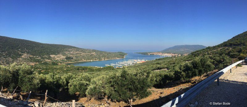
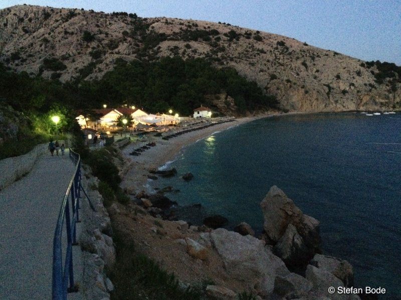
Camping Kovacine
To begin with, sunny days by the sea in Cres
Melin 1 20, 51557, Cres, Kroatien
44° 57' 46.1" N 14° 23' 48.5" E
44.9628000 14.3968000
• Head southwest on Lungomare svetog Mikule. Go for 29 m.
• Turn left. Go for 214 m.
• Turn left toward Melin I. Go for 87 m.
• Turn left onto Melin I. Go for 82 m.
• Turn left onto Ulica Melin I (58095). Go for 281 m.
• Turn right onto 5124. Go for 1.1 km.
• Take the 1st exit from roundabout onto 100. Go for 18.0 km.
• Continue on Hrasta (100). Go for 272 m.
• Continue on 100. Go for 3.9 km.
• Continue on Belej (100). Go for 1.3 km.
• Continue on 100. Go for 9.1 km.
• Continue on Osor (100). Go for 105 m.
• Take the 2nd exit from roundabout onto Osor (100) toward Mali Lošinj. Go for 573 m.
• Continue on 100. Go for 1.2 km.
• Take the 1st exit from roundabout onto 100. Go for 14.6 km.
• Continue on Rujnica (100). Go for 1.5 km.
• Continue on 100. Go for 1.0 km.
• Continue on Rujnica (100). Go for 459 m.
• Continue on 100. Go for 1.1 km.
• Continue on Veloselska cesta (100) toward Veli Lošinj/Čikat. Go for 1.9 km.
• Take the 1st exit from roundabout onto Veloselska cesta (5159) toward Čikat/Sunčana uvala. Go for 687 m.
• Continue on 5159 toward Čikat. Go for 1.1 km.
• Turn slightly left onto Čikat. Go for 855 m.
• Turn slightly right onto Čikat. Go for 138 m.
• Continue on Srebrna uvala. Go for 369 m.
• Arrive at Srebrna uvala. Your destination is on the left.
☍
59,9 km
(1 hrs. )
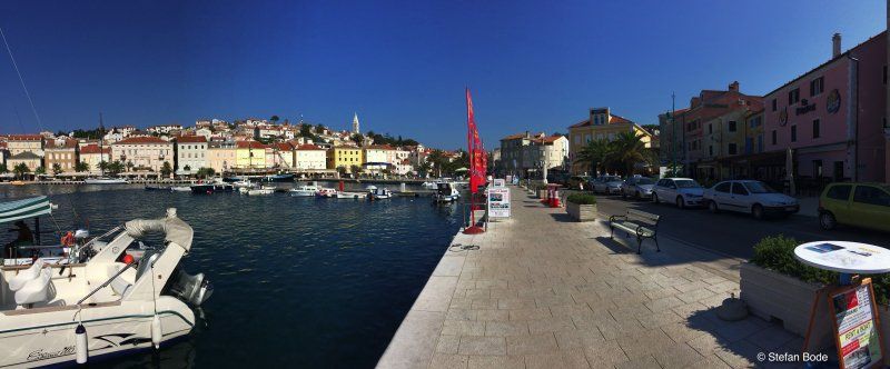
Camping Cikat
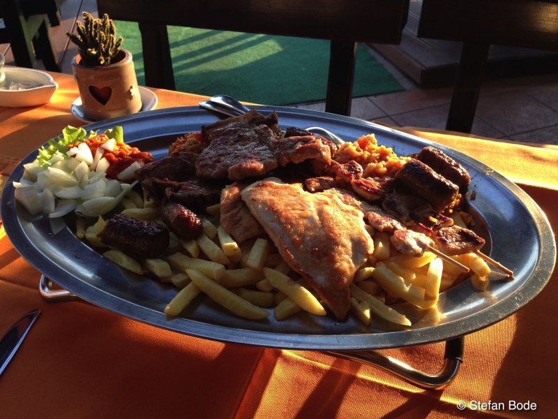
In sunny weather we continue across the islands to Mali Losinj. From the campsite we went sightseeing in the small town.
Čikat 6a, 51550, Mali Losinj, Kroatien
44° 32' 7.4" N 14° 26' 53.2" E
44.5354000 14.4481000
• Head northeast on Srebrna uvala. Go for 369 m.
• Continue on Čikat. Go for 993 m.
• Turn slightly right toward 5159. Go for 63 m.
• Continue on 5159. Go for 1.0 km.
• Continue on Veloselska cesta (5159) toward Centar. Go for 665 m.
• Take the 2nd exit from roundabout onto Veloselska cesta (100). Go for 1.9 km.
• Continue on 100 toward Porozina/Cres. Go for 1.1 km.
• Continue on Rujnica (100). Go for 459 m.
• Continue on 100. Go for 1.0 km.
• Continue on Rujnica (100). Go for 1.5 km.
• Continue on 100. Go for 14.5 km.
• Take the 2nd exit from roundabout onto 100 toward Porozina/Cres/Merag. Go for 1.2 km.
• Continue on Osor (100). Go for 532 m.
• Take the 2nd exit from roundabout onto Osor (100) toward Cres. Go for 152 m.
• Continue on 100. Go for 9.1 km.
• Continue on Belej (100). Go for 1.3 km.
• Continue on 100. Go for 3.9 km.
• Continue on Hrasta (100). Go for 272 m.
• Continue on 100. Go for 17.9 km.
• Take the 1st exit from roundabout onto 100. Go for 2.3 km.
• Turn right toward 101. Go for 41 m.
• Continue on 101. Go for 10.8 km.
• Turn right onto 101. Go for 70 m.
• Take the Valbiska-Merag Ferry. Stay on for 9.0 km.
• Head east on 104. Go for 51 m.
• Turn right toward 104. Go for 164 m.
• Continue on 104. Go for 5.7 km.
• Continue on Nenadić (104). Go for 414 m.
• Continue on 104 toward Rijeka/Malinska. Go for 3.8 km.
• Turn right onto 102 toward Baška/Punat/Krk. Go for 6.6 km.
• Pass 2 roundabouts and continue on 102. Go for 4.9 km.
• Turn right onto 102. Go for 13.5 km.
• Turn left onto Jurandvor (102). Go for 1.3 km.
• Continue on Zaobilaznica Baška (102). Go for 849 m.
• Continue on Ulica Kricin. Go for 246 m.
• Arrive at Ulica Kricin. Your destination is on the right.
☍
117,8 km
(2 hrs. 30 min.)
Bunculuka Camping Resort
Then we took the ferry to Krk. This was followed by a few relaxing days at the campsite near Baska.
Kricin 30, 51523, Baska, Kroatien
44° 58' 9" N 14° 46' 1.3" E
44.9691600 14.7670400
• Head southwest on Ulica Kricin. Go for 246 m.
• Continue on Zaobilaznica Baška (102). Go for 15.6 km.
• Take the 2nd exit from roundabout onto 102 toward Rijeka/Krk. Go for 4.9 km.
• Pass 4 roundabouts and continue on 102. Go for 27.2 km.
• Take ramp onto 8 toward Split/Crikvenica. Go for 22.0 km.
• Pass 2 roundabouts and continue on Stara cesta (8). Go for 45.5 km.
• Turn left onto Žuta lokva (23) toward Zagreb/Split/Brinje. Go for 305 m.
• Turn right and take ramp toward Zagreb/Split. Go for 1.4 km.
• Continue on Čvor Žuta lokva. Go for 767 m.
• Take the left exit toward Split/Gospić onto A1 (Autocesta Bosiljevo-Split-Dubrov.). Go for 202 km.
• Take the exit. Go for 454 m.
• Take the 3rd exit from roundabout toward Ražine/Gospodarska zona Podi. Go for 1.1 km.
• Continue toward 65064. Go for 29 m.
• Take the 2nd exit from roundabout onto 65064 toward Vrpolje/Ražine. Go for 1.6 km.
• Continue on Dzelalići (65064). Go for 95 m.
• Continue on 65064. Go for 419 m.
• Continue on Šišara (65064). Go for 782 m.
• Turn left onto 58 toward Split/Vrpolje. Go for 1.3 km.
• Turn right onto 6108 toward Primošten/Jadrtovac. Go for 1.4 km.
• Continue on Obala Morinje (6108). Go for 1.2 km.
• Continue on 6108. Go for 1.5 km.
• Turn left onto 8 toward Primošten/Rogoznica. Go for 14.0 km.
• Turn right toward Camp Adriatic. Go for 235 m.
• Turn slightly right toward Tepli bok. Go for 14 m.
• Continue on Tepli bok. Go for 15 m.
• Turn right. Go for 37 m.
• Arrive at your destination on the left.
☍
343,7 km
(4 hrs. 1 min.)
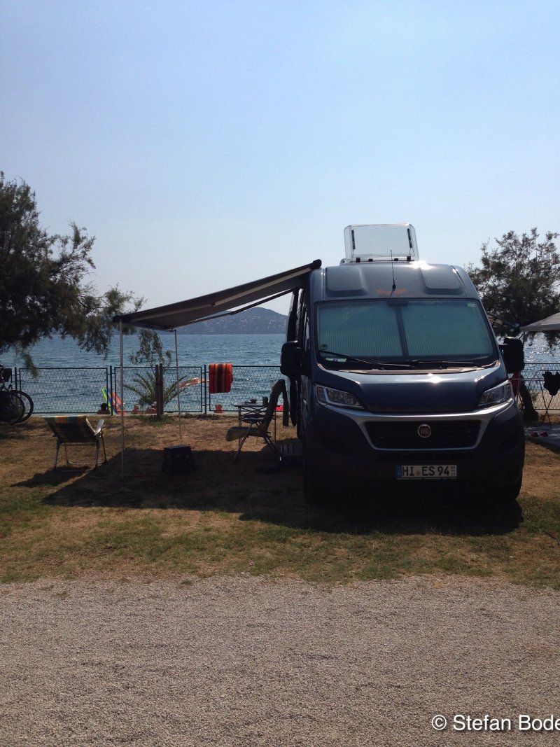
Camping Adriatic
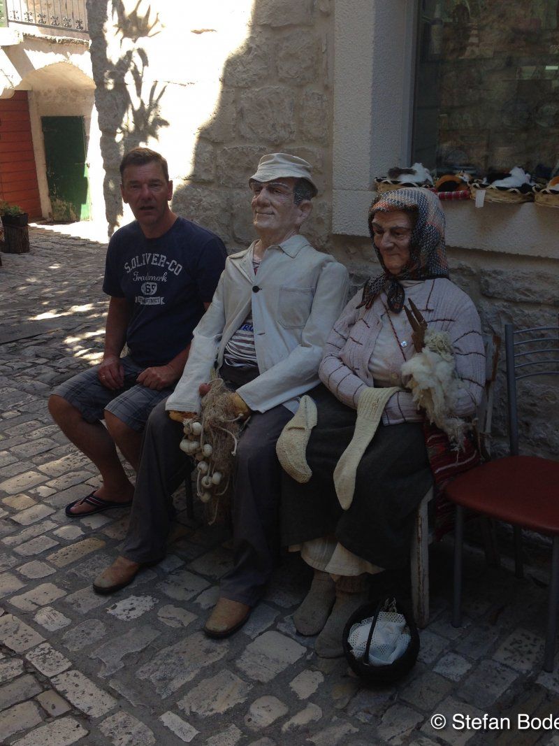
We continued south along the coast. From the Adriatic campsite we went sightseeing to Primosten.
Huljerat , 22202, Primosten, Kroatien
43° 36' 24.8" N 15° 55' 13.6" E
43.6069000 15.9204400
• Head east. Go for 28 m.
• Turn sharp right. Go for 39 m.
• Turn right. Go for 15 m.
• Turn slightly left toward Ulica Huljerat/8. Go for 325 m.
• Turn right onto Ulica Huljerat (8) toward Split. Go for 30.3 km.
• Turn right onto Ulica hrvatskih žrtava toward O. Čiovo/Trogir/Marina Trogir/Grad Trogir. Go for 2.6 km.
• Turn right. Go for 32 m.
• Turn right. Go for 22 m.
• Arrive at your destination on the right.
☍
33,4 km
( 30 min.)
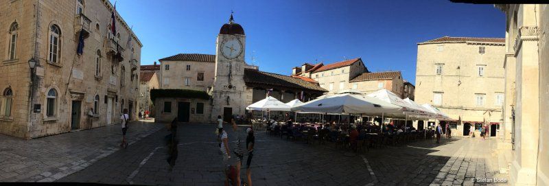
Kamp Seget
In Seget Donji there was a short break to relax. Only interrupted by a sightseeing tour in Trogir.
Hrvatskih žrtava 121, 21218, Seget Donji, Kroatien
43° 31' 7.7" N 16° 13' 26.4" E
43.5188000 16.2240000
• Head east. Go for 22 m.
• Turn left toward Ulica hrvatskih žrtava. Go for 32 m.
• Turn right onto Ulica hrvatskih žrtava. Go for 460 m.
• Turn right onto Ulica don Petra Špike. Go for 14 m.
• Turn right toward Put akademika Mihe Barada. Go for 17 m.
• Turn right onto Put akademika Mihe Barada. Go for 11 m.
• Turn left onto Ulica hrvatskih žrtava. Go for 79 m.
• Turn right toward Ulica hrvatskih žrtava. Go for 31 m.
• Continue on Put Vlaške. Go for 2.2 km.
• Continue on 6293. Go for 2.9 km.
• Continue on Ulica Čarije (6293). Go for 680 m.
• Continue on 6293. Go for 6.1 km.
• Continue on Donji Strižići (6293). Go for 352 m.
• Continue on Kovačevići (6293). Go for 837 m.
• Continue on 6293. Go for 314 m.
• Turn right onto 58 toward Zagreb/Split/Prgomet/Radošić. Go for 3.1 km.
• Turn left onto 6112 toward Zagreb/A1/Dubrovnik/Ploče/Zadar/Šestanovac/Split/Kladnjice/Radošić. Go for 936 m.
• Turn left and take ramp onto A1 (Autocesta Bosiljevo-Split-Dubrov.) toward Zagreb. Go for 52.4 km.
• Take exit 21 toward N.P. Kornati/otok Murter/Vodice/Pirovac/59. Go for 1.2 km.
• Turn right onto 59 toward NP Kornati/otok Murter/Vodice/Pirovac. Go for 4.7 km.
• Take the 1st exit from roundabout onto 27 toward Benkovac/Stankovci. Go for 19.7 km.
• Turn right onto Miranje Gornje (27) toward Obrovac/Benkovac. Go for 2.5 km.
• Take the 1st exit from roundabout onto Šopot (27) toward Obrovac/Benkovac. Go for 1.9 km.
• Turn left onto Zadarska ulica (56) toward Zadar/Nadin. Go for 12.6 km.
• Turn right onto Donje Biljane (6258) toward Smilčić/A1. Go for 369 m.
• Continue on 6258. Go for 2.4 km.
• Continue on Smilčić (6258). Go for 174 m.
• Continue on 6258. Go for 208 m.
• Continue on Smilčić (6258). Go for 161 m.
• Turn right onto Smilčić (502) toward Islam L. Go for 46 m.
• Turn left onto Smilčić (6258) toward Islam L. Go for 947 m.
• Turn left onto Smilčić (6258) toward Rijeka/Zadar. Go for 466 m.
• Continue on Donji Kašić (6258). Go for 3.3 km.
• Continue on Islam Grčki (6258). Go for 3.9 km.
• Continue on Islam Latinski (6258). Go for 1.3 km.
• Continue on Grgurice (6258). Go for 377 m.
• Turn right onto 8 toward Rijeka/Pag/Posedarje. Go for 11.4 km.
• Turn right onto 8 toward Karlobag/Starigrad. Go for 12.7 km.
• Turn left onto Ulica doktora Franje Tuđmana. Go for 19 m.
• Turn left onto Ulica doktora Franje Tuđmana. Go for 94 m.
• Turn left onto Ulica doktora Franje Tuđmana. Go for 114 m.
• Turn right onto Ulica doktora Franje Tuđmana. Go for 108 m.
• Arrive at Ulica doktora Franje Tuđmana. Your destination is on the left.
☍
151,1 km
(1 hrs. 54 min.)
Starigrad Paklenica, Starigrad-Paklenica, Kroatien
23244, Starigrad-Paklenica, Kroatien
44° 17' 9.9" N 15° 26' 46" E
44.2860915 15.4461000
• Head northeast on Ulica doktora Franje Tuđmana. Go for 31 m.
• Turn left onto Ulica doktora Franje Tuđmana. Go for 77 m.
• Turn left onto Ulica doktora Franje Tuđmana. Go for 208 m.
• Turn right onto Ulica doktora Franje Tuđmana. Go for 19 m.
• Turn left onto Ulica doktora Franje Tuđmana (8). Go for 47.5 km.
• Turn right onto Ulica Vile Velebita. Go for 190 m.
• Turn left onto Ulica bana Ivana Karlovića. Go for 65 m.
• Turn right onto Varoš. Go for 91 m.
• Turn slightly right onto Ulica braće Radić. Go for 85 m.
• Turn right onto Ulica braće Radić. Go for 166 m.
• Arrive at Ulica braće Radić. Your destination is on the right.
☍
48,5 km
( 46 min.)
Karlobag, Kroatien
44° 31' 42.3" N 15° 4' 22.3" E
44.5284238 15.0728705
• Head north on Ulica braće Radić. Go for 36 m.
• Turn left onto Ulica Ante Starčevića. Go for 57 m.
• Turn right onto Ulica braće Radić. Go for 220 m.
• Turn right onto Obala Vladimira Nazora (8). Go for 61.9 km.
• Take the 4th exit from roundabout. Go for 132 m.
• Continue on Splitska ulica (8). Go for 805 m.
• Continue on Obala dr. Franje Tuđmana (8). Go for 559 m.
• Turn left onto Stara cesta (8) toward Rijeka/N. Vinodolski. Go for 18 m.
• Take the 2nd exit from roundabout onto Ulica Filipa Vukasovića (8) toward Rijeka. Go for 22.1 km.
• Continue toward Ulica Zatrep/8. Go for 22 m.
• Take the 2nd exit from roundabout onto Ulica Zatrep (8) toward Rijeka/Otok Krk/Crikvenica. Go for 21.7 km.
• Take ramp toward Otok Lošinj/Otok Cres/Otok Krk. Go for 241 m.
• Take the 3rd exit from roundabout onto 102. Go for 6.1 km.
• Take the 3rd exit from roundabout onto 102 toward Krk/Cres-Lošinj/Njivice. Go for 11.2 km.
• Pass 2 roundabouts and continue on 102. Go for 10.1 km.
• Take the 1st exit from roundabout onto 5131 toward Krk. Go for 328 m.
• Continue on Ulica Stjepana Radića (5131). Go for 779 m.
• Turn right onto Ulica Slavka Nikolića (5106) toward Otok Lošinj/Otok Cres/Valbiska/Vrh/Krk. Go for 126 m.
• Continue on Ulica Slavka Nikolića. Go for 1.2 km.
• Take the 2nd exit from roundabout onto Plavnička ulica. Go for 442 m.
• Turn slightly left onto Plavnička ulica. Go for 137 m.
• Turn left onto Plavnička ulica. Go for 66 m.
• Arrive at Plavnička ulica. Your destination is on the right.
☍
138,3 km
(2 hrs. )
Jezevac Premium Camping Resort
Back to Krk along the coastal road. Here we drove to the Jezevac campsite and were once again disappointed by the management. Despite statements to the contrary, there was only one emergency place. We used the day for a trip to Krk.
Plavnička 37, 51500, Krk, Kroatien
45° 1' 8" N 14° 33' 59.9" E
45.0188900 14.5666300
• Head toward Creska ulica on Plavnička ulica. Go for 66 m.
• Turn right onto Plavnička ulica. Go for 537 m.
• Take the 4th exit from roundabout onto Ulica Slavka Nikolića toward Rijeka. Go for 1.4 km.
• Turn left onto Ulica Stjepana Radića (5131) toward Rijeka/Malinska. Go for 779 m.
• Continue on 5131. Go for 312 m.
• Take the 2nd exit from roundabout onto 102 toward Rijeka/Malinska. Go for 8.7 km.
• Pass 3 roundabouts and continue on 102. Go for 18.6 km.
• Keep left onto 102 toward Zagreb/Rijeka/Uvala Scott/Kraljevica. Go for 139 m.
• Take the 2nd exit from roundabout onto E65. Go for 674 m.
• Continue on A7. Go for 15.2 km.
• Keep left onto Orehovica (A7) toward Ljubljana/Trieste/Pula/Rijeka zapad. Go for 12.1 km.
• Take ramp onto Istarski Ipsilon (A8) toward Pula/Pazin/Opatija. Go for 1.3 km.
• Take the 1st exit from roundabout onto Istarski Ipsilon (A8) toward Pula/Poreč/Pazin. Go for 9.9 km.
• Turn right onto Istarski Ipsilon (A8). Go for 35.9 km.
• Take exit 3 toward Pazin/Ind.Zona/77. Go for 367 m.
• Turn right onto 48 toward Poreč/Pazin. Go for 807 m.
• Take the 3rd exit from roundabout onto 48 toward Poreč. Go for 1.4 km.
• Take the 3rd exit from roundabout onto 48 toward Poreč. Go for 18.6 km.
• Turn right and take ramp onto A9 (Istarski Ipsilon) toward Trieste/Umag/Umago. Go for 7.3 km.
• Take exit 4 toward Motovun/Montona/Višnjan/Visignano. Go for 1.0 km.
• Turn right onto Farini (5042) toward Poreč. Go for 4.2 km.
• Turn right onto Ulica Tarska (50046) toward Gedići/Jama Baredine. Go for 275 m.
• Continue on 50046. Go for 376 m.
• Continue on Ulica Tarska (50046). Go for 113 m.
• Continue on 50046. Go for 139 m.
• Keep right onto Gedići (50046). Go for 628 m.
• Continue on 50046. Go for 533 m.
• Continue on St. Vergotini (50046). Go for 241 m.
• Continue on 50046. Go for 1.0 km.
• Continue on Perci (50046). Go for 405 m.
• Continue on 50046. Go for 762 m.
• Continue on Ulica V. Gortana (50046). Go for 230 m.
• Turn left onto Ulica Frata (50046). Go for 10 m.
• Turn slightly right onto Ulica glavica (50046). Go for 157 m.
• Continue on Ulica Frata (50046). Go for 47 m.
• Continue on Ulica glavica (50046). Go for 221 m.
• Turn left onto Ulica Istarska (50046). Go for 177 m.
• Take the 2nd exit from roundabout onto Ulica Republika toward Vabriga/Abrega. Go for 128 m.
• Turn right onto Turistička ulica. Go for 172 m.
• Continue on Ulica brajde. Go for 32 m.
• Turn slightly right toward 5037. Go for 20 m.
• Take the 3rd exit from roundabout onto 5037. Go for 734 m.
• Continue on Lanterna (5037). Go for 2.1 km.
• Turn right. Go for 165 m.
• Turn right. Go for 194 m.
• Turn left. Go for 57 m.
• Turn right. Go for 415 m.
• Turn right toward Lanterna. Go for 87 m.
• Take the 1st exit from roundabout onto Lanterna. Go for 68 m.
• Arrive at Lanterna. Your destination is on the left.
☍
148,7 km
(2 hrs. 2 min.)
Lanterna Premium Camping Resort
The departure from Krk took place in the pouring rain. After Rijeka it got better. At Lanterna we met friends with whom we explored Novigrad.
Lanterna 1, 52465, Poreč/Tar, Kroatien
45° 17' 49.1" N 13° 35' 39.6" E
45.2969800 13.5943300
• Head northwest on Lanterna. Go for 46 m.
• Take the 1st exit from roundabout. Go for 134 m.
• Turn left. Go for 275 m.
• Turn slightly left. Go for 111 m.
• Turn left. Go for 71 m.
• Turn right. Go for 214 m.
• Turn left toward Lanterna/5037. Go for 165 m.
• Turn left onto Lanterna (5037). Go for 2.1 km.
• Continue on 5037. Go for 680 m.
• Take the 2nd exit from roundabout onto 5037. Go for 265 m.
• Take the 3rd exit from roundabout onto 75. Go for 1.1 km.
• Pass 3 roundabouts and continue on Ulica Mirna (75). Go for 6.0 km.
• Take the 1st exit from roundabout onto Ulica Domovinskih žrtava (301) toward Rijeka/Fiume/Pula/Pola/Buje/Buie. Go for 5.5 km.
• Take the 2nd exit from roundabout onto 301 toward Brtonigla/Nova vas/Villanova/Trieste/Umag/Umago. Go for 207 m.
• Turn left and take ramp onto A9 (Istarski Ipsilon) toward Trieste/Umag/Umago. Go for 13.4 km.
• Take the 2nd exit from roundabout onto 510 toward Trieste/Koper/Kaštel. Go for 1.8 km.
• Continue on Dragonja (11). Go for 227 m.
• Keep left onto Dragonja (11). Go for 8.3 km.
• Take the 2nd exit from roundabout onto Srgaši (11) toward Ljubljana/Koper. Go for 5.2 km.
• Keep right toward Ljubljana/Trst/Trieste/Center/Centro. Go for 98 m.
• Take the 2nd exit from roundabout onto Šmarska cesta (11) toward Trst/Trieste/Ljubljana/Center. Go for 518 m.
• Turn right onto Šmarska cesta toward Ljubljana/Trst/Trieste. Go for 294 m.
• Take the 2nd exit from roundabout onto Istrska cesta (H5) toward Ljubljana/Trst/Trieste. Go for 3.7 km.
• Continue on A1 toward Ljubljana/Reka/Rijeka/Črni Kal. Go for 93.8 km.
• Take left exit 36 toward Beljak/Villach/Kranj/Ljubljana-sever onto A2. Go for 71.8 km.
• Continue on Karawankentunnel (A11). Go for 21.1 km.
• Continue on A10 (Tauern Autobahn) toward E55/E66/Salzburg/Villach-Ossiacher See. Go for 180 km.
• Take the exit toward E60/Wien/Linz/Salzburg Flughafen onto A1 (West Autobahn). Go for 8.2 km.
• Take exit 292 toward Freilassing. Go for 265 m.
• Take the 3rd exit from roundabout onto Münchner Bundesstraße (B155) toward Freilassing. Go for 1.3 km.
• Pass 2 roundabouts and continue on Münchner Bundesstraße (B155). Go for 848 m.
• Continue on Salzburger Straße (B304). Go for 501 m.
• Take ramp onto B20 toward Passau/Burghausen/Laufen/Gewerbegebiet Freilassing Nord. Go for 12.4 km.
• Turn left onto Schloßplatz (B20) toward Passau/Burghausen/Tittmoning. Go for 28.9 km.
• Turn right onto Hochöster (St2357). Go for 5.1 km.
• Turn left toward Berghamer Straße. Go for 388 m.
• Turn right onto Berghamer Straße. Go for 323 m.
• Arrive at Berghamer Straße.
☍
475,1 km
(5 hrs. 6 min.)
Stellplatz am Waldpark Lindach
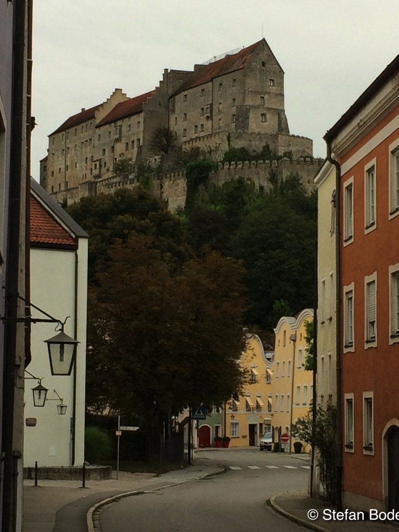
The parking space in Burghausen was our overnight place on the way home. The walk into the city was a little longer but worth seeing.
Berghamer Straße 1, 84489, Burghausen, Deutschland
48° 9' 16" N 12° 48' 28" E
48.1544444 12.8077778
• Head northeast on Berghamer Straße. Go for 491 m.
• Turn right onto Bachstraße. Go for 8 m.
• Continue on Robert-Koch-Straße. Go for 677 m.
• Turn right onto Mozartstraße. Go for 118 m.
• Turn left onto Berchtesgadener Straße. Go for 1.2 km.
• Turn left onto Marktler Straße toward B20/Straubing/A94/Passau/Marktl a. Inn/Sportpark SV Wacker. Go for 9.0 km.
• Take ramp onto B12 toward Passau/Straubing/B20. Go for 4.7 km.
• Take ramp onto B20 toward Straubing/Eggenfelden/Pfarrkirchen. Go for 21.7 km.
• Take the 2nd exit from roundabout onto B20 toward Straubing/Eggenfelden. Go for 386 m.
• Take ramp onto B20 toward Straubing/Deggendorf/Passau/Pfarrkirchen/Rottal Inn Klinik. Go for 66.8 km.
• Take ramp onto A3 toward Nürnberg/Regensburg. Go for 29.7 km.
• Take exit 103 toward Donaustauf onto St2660. Go for 2.7 km.
• Turn right onto St2145 toward Donaustauf/Walhalla. Go for 3.4 km.
• Turn right onto Barbinger Straße. Go for 72 m.
• Turn right onto Maxstraße. Go for 224 m.
• Continue on Wörther Straße. Go for 366 m.
• Turn left onto Walhallastraße. Go for 232 m.
• Arrive at Walhallastraße.
☍
141,9 km
(1 hrs. 37 min.)
Walhalla, Walhallastraße, Donaustauf, Deutschland
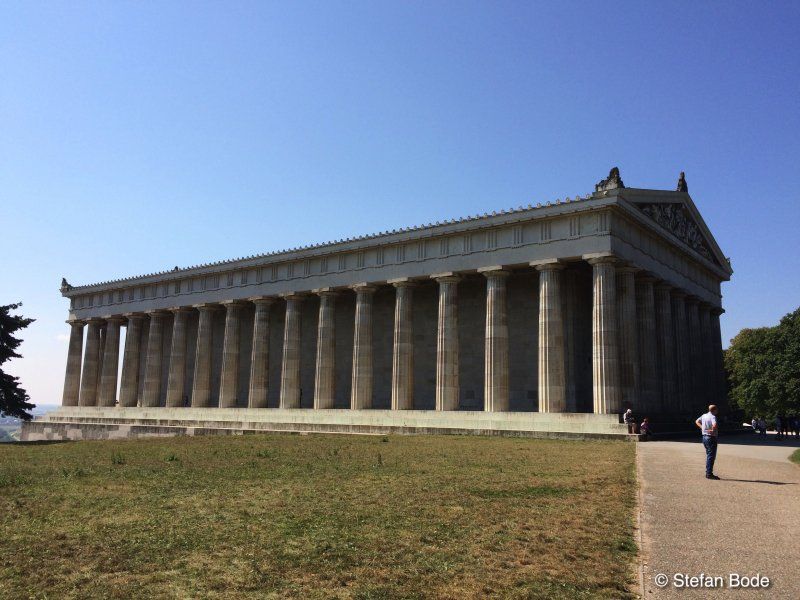
Last sightseeing stop - Walhalla. Often seen from the motorway, never driven there. This time it was different and it was worth it.
Walhallastraße 48, 93093 Donaustauf, Deutschland
49° 1' 52.1" N 12° 13' 26.7" E
49.0311443 12.2240770
• Head west on Walhallastraße. Go for 232 m.
• Turn left onto Wörther Straße. Go for 222 m.
• Turn right onto St2125. Go for 2.7 km.
• Pass 2 roundabouts and continue on Hauptstraße (St2125). Go for 6.4 km.
• Continue on Coburger Straße (Rs6) toward A3/A93/Regensburg-Cham/Gewerbegebiet Haslbach. Go for 1.2 km.
• Turn right onto Coburger Straße. Go for 101 m.
• Take the 1st exit from roundabout onto Coburger Straße. Go for 103 m.
• Turn right onto B16. Go for 3.2 km.
• Keep left onto B16 toward München/Nürnberg/Passau/Ingolstadt/Lappersdorf/Regensburg-West. Go for 96 m.
• Take ramp onto A93 toward Hof. Go for 170 km.
• Take the left exit toward Berlin/Hof-Nord onto A72. Go for 14.2 km.
• Take exit 1 toward Berlin/Leipzig/Erfurt onto A9. Go for 113 km.
• Take exit 19 toward Göttingen/AD Halle-Süd onto A38. Go for 111 km.
• Take exit 9 toward Großwechsungen/Osterode/Harz/Bad Sachsa/Ellrich onto B243. Go for 2.8 km.
• Turn right and take ramp toward Osterode/Bad Sachsa/Ellrich/Haferungen/B243. Go for 226 m.
• Turn right onto L3243 toward Osterode/Bad Sachsa/Ellrich/Haferungen/B243. Go for 619 m.
• Turn left onto B243 toward Osterode/Bad Sachsa/Ellrich/Günzerode. Go for 31.4 km.
• Turn right onto Osteroder Straße (B243). Go for 30.5 km.
• Continue on B243/B248 toward Hannover/A7/Kassel/Seesen. Go for 1.7 km.
• Turn left toward Hannover/A7/Kassel. Go for 112 m.
• Take ramp onto A7 toward Hannover. Go for 43.1 km.
• Take exit 61 toward Hildesheim-Drispenstedt/Hohenhameln/Harsum. Go for 284 m.
• Turn right onto Bundesstraße (B494). Go for 2.4 km.
• Turn left onto Morgenstern (L467) toward Harsum. Go for 538 m.
• Turn right onto Kaiserstraße (L467). Go for 323 m.
• Turn left onto Breite Straße (L467). Go for 62 m.
• Turn left onto Oststraße. Go for 14 m.
• Turn right onto Hessingsweg. Go for 65 m.
• Arrive at Hessingsweg. Your destination is on the left.
☍
536,6 km
(4 hrs. 49 min.)
Harsum, Deutschland
52° 12' 35.9" N 9° 57' 46.6" E
52.2099738 9.9629420