We had about 12 days and had our only fixed stop in Lyon. The mobile home was 2.8m high, 6.8m long and 2.6m wide. The goal was mountains and water. Had packed bicycles, sport climbing equipment, via ferrata sets and hiking boots.
Gernsbach, Deutschland
76593 Gernsbach, Deutschland
48° 45' 47.4" N 8° 20' 37.4" E
48.7631780 8.3437129
• Head toward Von-Bolin-Straße on Martinsenstraße. Go for 64 m.
• Turn left onto Von-Bolin-Straße. Go for 111 m.
• Turn left onto Loffenauer Straße (L564). Go for 476 m.
• Turn right onto Gottlieb-Klumpp-Straße. Go for 633 m.
• Take the 2nd exit from roundabout onto Bleichstraße. Go for 221 m.
• Continue on Hördener Straße. Go for 93 m.
• Take ramp onto Hördener Straße (B462). Go for 14.3 km.
• Take ramp onto A5 toward Basel. Go for 106 km.
• Take exit 62 toward Freiburg/B31 onto B31A. Go for 3.2 km.
• Take ramp onto Tel-Aviv-Yafo-Allee toward FR-Landwasser/FR-Betzenhausen/Gewerbegebiet Hochdorf/-Nord. Go for 573 m.
• Continue on Paduaallee. Go for 1.3 km.
• Take ramp onto Elsässer Straße (K9860) toward Universitäts-Kliniken/Diakonie-Krankenhaus/Mooswald/Landwasser. Go for 1.3 km.
• Turn right onto Falkenbergerstraße. Go for 142 m.
• Arrive at Falkenbergerstraße. Your destination is on the right.
☍
128,8 km
(1 hrs. 21 min.)
Falkenbergerstraße 21
Good to stand for a night during the holidays, as it is right next to a school
48° 0' 46.3" N 7° 49' 28.2" E
48.0128518 7.8245098
• Head northeast on Falkenbergerstraße. Go for 142 m.
• Turn left onto Elsässer Straße (K9860). Go for 1.1 km.
• Turn left and take ramp onto Paduaallee. Go for 1.5 km.
• Take ramp onto B31A toward Karlsruhe-Basel/Umkirch/Mundenhof. Go for 2.3 km.
• Take ramp onto A5 toward Basel. Go for 60.3 km.
• Continue on A2. Go for 14.1 km.
• Keep right onto A2 (Verzweigung Augst) toward Chiasso/Gotthard/Luzern/Bern/Arisdorf. Go for 28.2 km.
• Take exit 45 toward Lausanne/Bern/Biel/Bienne/Oensingen onto A1 (Härkingen). Go for 7.0 km.
• Take exit 44 toward Delémont/Moutier/Balsthal onto Oensingen. Go for 577 m.
• Keep left toward Oensingen-Nord/Delémont/Moutier/Balsthal. Go for 829 m.
• Continue on 12. Go for 2.1 km.
• Take the 2nd exit from roundabout onto Solothurnerstrasse (12). Go for 782 m.
• Enter the roundabout. Go for 18 m.
• Arrive at your destination on the left.
☍
119,0 km
(1 hrs. 14 min.)
Day
Balsthal, Schweiz
In residential area
4710 Balsthal, Schweiz
47° 18' 34.5" N 7° 41' 18" E
47.3095856 7.6883283
• Follow the roundabout. Go for 39 m.
• Take the 3rd exit from roundabout onto Solothurnerstrasse (12) toward Olten/Solothurn. Go for 759 m.
• Take the 2nd exit from roundabout onto Solothurnerstrasse (12). Go for 3.0 km.
• Continue on Oensingen. Go for 110 m.
• Take ramp onto A1 toward Bern/Biel/Solothurn. Go for 43.5 km.
• Take the exit toward Lausanne/Fribourg/Neuchâtel/Bern-Neufeld onto A1 (Wankdorf). Go for 99.8 km.
• Continue on A1. Go for 2.7 km.
• Take the exit toward Genève onto A1. Go for 65.2 km.
• Continue on A41. Go for 71.5 km.
• Continue on A43. Go for 56.8 km.
• Take exit 7 toward L'Isle d'Abeau-Centre/Morestel/Crémieu/L'Isle d'Abeau-les Sayes. Go for 1.0 km.
• Take the 2nd exit from roundabout onto Montée de la Croix Blanche. Go for 104 m.
• Turn slightly left onto Chemin des Marais. Go for 593 m.
• Arrive at Chemin des Marais.
☍
345,0 km
(3 hrs. 18 min.)
Day
8 Chemin des Marais
Wedding overnight stay in front of the location 2 nights
45° 35' 55.8" N 5° 14' 12.8" E
45.5988333 5.2368823
• Head northwest on Chemin des Marais. Go for 593 m.
• Turn slightly right onto Montée de la Croix Blanche. Go for 27 m.
• Take the 3rd exit from roundabout toward Grenoble/Chambéry/Lyon/Aéroport Saint Exupéry. Go for 164 m.
• Take ramp onto A43 toward Genève/Grenoble/Chambéry. Go for 10.3 km.
• Take the exit toward Valence/Grenoble onto A48. Go for 41.6 km.
• Take the exit toward Marseille/Valence onto A49. Go for 59.4 km.
• Take exit 6 toward Crest/Chabeuil. Go for 355 m.
• Take the 4th exit from roundabout onto D538 toward Alixan/Chabeuil/Crest. Go for 459 m.
• Pass 3 roundabouts and continue on D538. Go for 11.9 km.
• Take the 4th exit from roundabout onto D538 toward Chabeuil/Porte Fortifiée. Go for 1.6 km.
• Take the 5th exit from Chemin de Fabert roundabout onto D538 toward Beaumont les V./Crest. Go for 1.5 km.
• Take the 1st exit from Chemin de Fabert roundabout onto Route de Crest (D538) toward Montmeyran/Crest. Go for 1.8 km.
• Take the 3rd exit from roundabout onto D538 toward Montmeyran/Crest. Go for 3.9 km.
• Take the 2nd exit from roundabout onto Route de la Raye (D538) toward Crest. Go for 2.6 km.
• Take the 3rd exit from roundabout onto D538 toward Crest. Go for 5.3 km.
• Pass 2 roundabouts and continue on D538. Go for 6.5 km.
• Take the 4th exit from roundabout onto D104 toward Gap/Montélimar/Die. Go for 1.4 km.
• Continue on D164. Go for 3.9 km.
• Take the 1st exit from roundabout onto D70 toward Saou. Go for 249 m.
• Continue on Route du Pas de Lauzun (D70). Go for 1.3 km.
• Turn left onto Lieu-dit Les Cyprès (D70). Go for 185 m.
• Continue on Lieu-dit Les Faures (D70). Go for 178 m.
• Continue on D70. Go for 835 m.
• Continue on Lieu-dit Sauvane (D70). Go for 100 m.
• Continue on D70. Go for 602 m.
• Continue on Lieu-dit Fontiane (D70). Go for 97 m.
• Continue on D70. Go for 115 m.
• Continue on Lieu-dit Le Bouchet (D70). Go for 88 m.
• Continue on D70. Go for 1.0 km.
• Continue on Lieu-dit Lausens (D70). Go for 130 m.
• Continue on D70. Go for 4.4 km.
• Continue on D136. Go for 1.4 km.
• Turn left toward Route de la Forêt. Go for 32 m.
• Turn left onto Route de la Forêt. Go for 218 m.
• Arrive at Route de la Forêt. Your destination is on the left.
☍
164,4 km
(1 hrs. 48 min.)
Day
Day
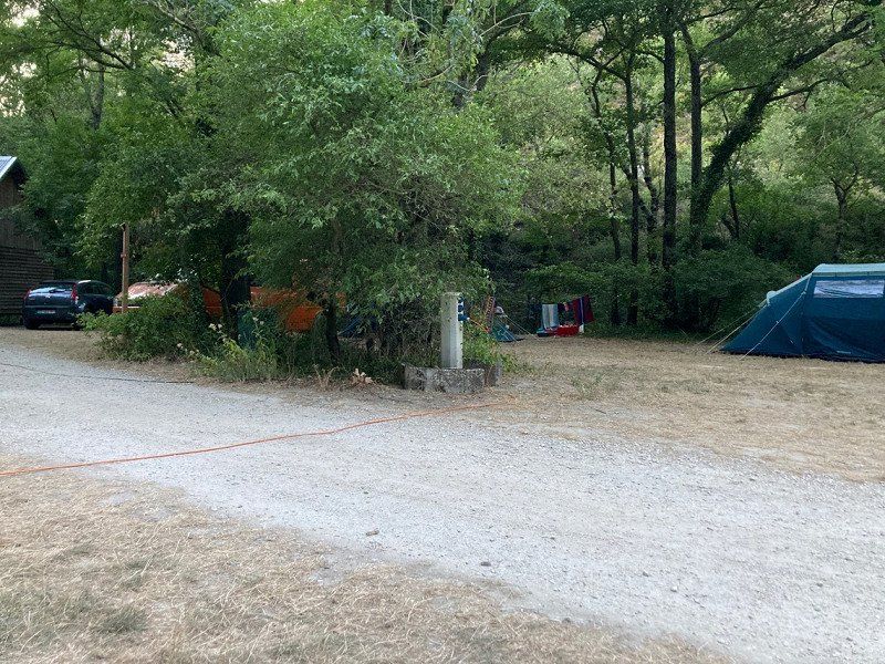
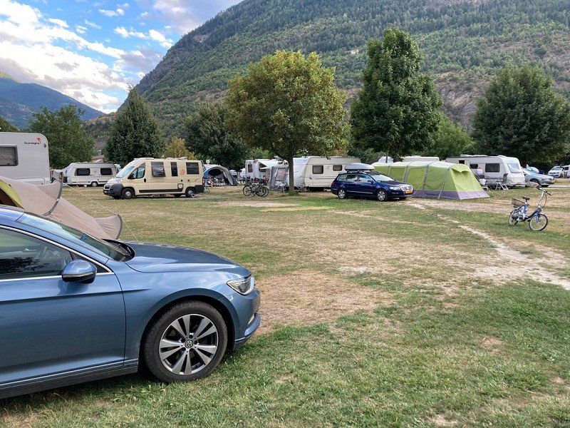
Camping Municipal La Graville
€23 per night high season incl. electricity
26400, Saou, Frankreich
44° 38' 55.3" N 5° 4' 48.7" E
44.6487000 5.0802000
• Head north on Route de la Forêt. Go for 218 m.
• Turn right toward D136. Go for 32 m.
• Turn sharp left onto D136. Go for 606 m.
• Continue on Lieu-dit Le Château de Lastic (D136). Go for 163 m.
• Continue on D136. Go for 316 m.
• Continue on Route de la Forêt (D136). Go for 186 m.
• Continue on D136. Go for 79 m.
• Turn left onto La Placette (D136). Go for 65 m.
• Turn left onto Route de Bourdeaux (D538). Go for 517 m.
• Continue on Lieu-dit Le Colombier (D538). Go for 9.2 km.
• Continue on D70. Go for 6 m.
• Continue on Rue de la Traversée (D70). Go for 112 m.
• Turn left onto Place de la Lève (D70). Go for 34 m.
• Turn right onto Route de Nyons (D70). Go for 703 m.
• Continue on D70. Go for 2.0 km.
• Keep right onto D70. Go for 64 m.
• Continue on Lieu-dit Les Valentins (D70). Go for 191 m.
• Continue on D70. Go for 1.1 km.
• Continue on Lieu-dit Saint-Jean (D70). Go for 166 m.
• Continue on D70. Go for 481 m.
• Continue on Lieu-dit Le Moulinet (D70). Go for 20 m.
• Continue on D70. Go for 3.3 km.
• Continue on Lieu-dit Peyrache (D70). Go for 169 m.
• Continue on D70. Go for 1.2 km.
• Continue on Lieu-dit Grange Neuve (D70). Go for 192 m.
• Continue on D70. Go for 1.2 km.
• Continue on Lieu-dit Daumas (D70). Go for 77 m.
• Continue on D70. Go for 168 m.
• Continue on Lieu-dit Jean Kioc (D70). Go for 103 m.
• Continue on D70. Go for 273 m.
• Continue on Lieu-dit Chauvet (D70). Go for 180 m.
• Continue on D70. Go for 424 m.
• Turn left onto Route de Saint-Nazaire (D335) toward Gumiane/St Nazaire/Le Desert/La Motte/Chalancon. Go for 1.5 km.
• Turn left onto D335. Go for 1.3 km.
• Continue on Lieu-dit Pierres Rousses (D335). Go for 129 m.
• Continue on D335. Go for 1.2 km.
• Continue on Col de Lescou (D173). Go for 590 m.
• Continue on D173. Go for 159 m.
• Continue on Lieu-dit Barthélemy (D173). Go for 191 m.
• Continue on D173. Go for 230 m.
• Continue on Lieu-dit La Touve (D173). Go for 117 m.
• Continue on D173. Go for 619 m.
• Continue on Rue du Château (D173). Go for 201 m.
• Continue on D173. Go for 3.0 km.
• Continue on Col de Pré-Guittard (D173). Go for 522 m.
• Continue on D173. Go for 363 m.
• Continue on Lieu-dit Pré Guittard (D173). Go for 86 m.
• Continue on D173. Go for 1.3 km.
• Continue on D173. Go for 391 m.
• Continue on Lieu-dit La Grand-Grange (D173). Go for 52 m.
• Continue on D173. Go for 700 m.
• Continue on Lieu-dit Borel (D173). Go for 162 m.
• Continue on D173. Go for 413 m.
• Continue on Lieu-dit Trémont (D173). Go for 112 m.
• Continue on D173. Go for 108 m.
• Continue on Lieu-dit Le Gay (D173). Go for 118 m.
• Continue on D173. Go for 5.2 km.
• Turn right onto D61. Go for 7.6 km.
• Turn left onto Route de Gap (D94) toward Gap/Verclause/Rosans/Serres. Go for 9.3 km.
• Continue on D994. Go for 27.2 km.
• Take the 3rd exit from roundabout onto Rue Roger Tesse (D1075) toward Grenoble/Gap/Aspres S/Buëch/Veynes. Go for 2.8 km.
• Take the 1st exit from roundabout onto D994 toward Gap/Veynes. Go for 12.9 km.
• Take the 1st exit from roundabout onto Avenue Commandant Dumont (D994) toward Gap/La Roche-des-Arnauds/La Joue du Loup/Superdévoluy. Go for 223 m.
• Take the 2nd exit from roundabout onto Avenue Commandant Dumont (D994) toward Gap. Go for 22.6 km.
• Take the 2nd exit from Rond-Point du Sénateur roundabout onto Avenue de Veynes (D994) toward Gap. Go for 778 m.
• Take the 2nd exit from roundabout onto Avenue de Veynes (D994) toward Grenoble/Briançon/Centre Ville. Go for 560 m.
• Take the 1st exit from roundabout onto Avenue de Veynes (D994) toward Grenoble/Briançon/Centre Ville. Go for 171 m.
• Take the 2nd exit from Carrefour du Turrelet roundabout onto Rue de la Chapelle. Go for 187 m.
• Turn left onto Rue de la Chapelle. Go for 99 m.
• Continue on Rue du Pré de Foire. Go for 214 m.
• Continue on Rue du Pré de Foire. Go for 12 m.
• Take the 1st exit from Rond-Point de l'Europe roundabout onto Boulevard Georges Pompidou. Go for 303 m.
• Take the 2nd exit from roundabout onto Boulevard Georges Pompidou toward Grenoble/Briançon. Go for 674 m.
• Continue on Boulevard Pierre-et-Marie Curie. Go for 223 m.
• Take the 1st exit from roundabout onto Avenue Maréchal Foch (N94). Go for 156 m.
• Arrive at Avenue Maréchal Foch (N94). Your destination is on the left.
☍
128,1 km
(2 hrs. 7 min.)
Day
Day
Day
5 bis Avenue du Maréchal Foch
Free parking. Was very crowded and cramped.
44° 33' 46.4" N 6° 5' 7.8" E
44.5628859 6.0855113
• Head toward Avenue de la Gare on Avenue Maréchal Foch (N94). Go for 623 m.
• Pass 2 roundabouts and continue on Avenue d'Embrun (N94). Go for 959 m.
• Take the 3rd exit from roundabout onto N94 toward Briançon/Embrun/La Bâtie Neuve/Lac de Serre-Ponçon. Go for 14.6 km.
• Take the 2nd exit from roundabout onto N94. Go for 727 m.
• Take ramp toward Réallon/Parc National des Écrins/Espinasses. Go for 193 m.
• Turn left onto D203 L. Go for 59 m.
• Turn right onto D3. Go for 9.5 km.
• Arrive at Tunnel du Rocher Chabrand (D3). Your destination is on the left.
☍
26,6 km
( 25 min.)
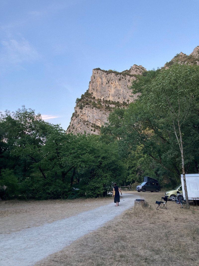
Forêt Domaniale de Serre-Ponçon
Lots of small roadside parking spaces sometimes straight sometimes a bit uneven. Great view. Good to stand a quiet night.
44° 29' 12.7" N 6° 16' 36.7" E
44.4868587 6.2768568
• Head east on Tunnel du Rocher Chabrand (D3). Go for 9.5 km.
• Turn right and take ramp onto N94. Go for 18.8 km.
• Pass 2 roundabouts and continue on N94. Go for 18.2 km.
• Take the 2nd exit from roundabout onto N94 toward Briançon. Go for 4.9 km.
• Take the 2nd exit from roundabout onto N94. Go for 6.0 km.
• Turn left onto D38 toward Freissinières/Champcella. Go for 236 m.
• Turn left onto D38. Go for 1.9 km.
• Continue on Route de Benjamin Vallotton (D38). Go for 392 m.
• Continue on D38. Go for 125 m.
• Continue on Route de Benjamin Vallotton (D38). Go for 237 m.
• Turn right onto D38. Go for 143 m.
• Turn left. Go for 244 m.
• Arrive at your destination on the right.
☍
60,6 km
( 54 min.)
Day
Camping Municipal Des Allouviers
€23 per night including electricity
05310, Freissinieres, Frankreich
44° 44' 29" N 6° 33' 41.8" E
44.7414000 6.5616000
• Head south. Go for 244 m.
• Turn right onto D38. Go for 143 m.
• Turn left onto Route de Benjamin Vallotton (D38). Go for 237 m.
• Continue on D38. Go for 125 m.
• Continue on Route de Benjamin Vallotton (D38). Go for 392 m.
• Continue on D38. Go for 1.9 km.
• Turn right onto D38. Go for 236 m.
• Turn left onto N94. Go for 17.2 km.
• Take the 2nd exit from roundabout onto Route de Gap (N94). Go for 1.7 km.
• Turn right onto Route de Gap (D2) toward Briançon-Ste Catherine/Col d'Izoard/Centre Ville. Go for 243 m.
• Pass 2 roundabouts and continue on Avenue de la République (D2). Go for 1.2 km.
• Turn right onto Avenue Baldenberger (N94). Go for 374 m.
• Take the 4th exit from Place Champ-de-Mars roundabout onto Place Champ-de-Mars (N94). Go for 2.8 km.
• Turn left toward La Vachette/Val des Prés/Névache. Go for 41 m.
• Continue on Route de la Durance (D994 G). Go for 1.5 km.
• Continue on Route de la Clarée (D994 G). Go for 2.2 km.
• Continue on Montée du Lavoir (D994 G). Go for 1.5 km.
• Continue on D994 G. Go for 12 m.
• Continue on Montée du Lavoir (D994 G). Go for 2.6 km.
• Continue on D994 G. Go for 3.0 km.
• Continue on Lieu-dit Plampinet (D994 G). Go for 277 m.
• Continue on D994 G. Go for 4.7 km.
• Continue on Lieu-dit Le Cros (D994 G). Go for 85 m.
• Continue on D994 G. Go for 821 m.
• Take the 1st exit from roundabout onto D301 T. Go for 2.1 km.
• Continue on Lieu-dit Chalets de Lacou (D301 T). Go for 184 m.
• Continue on D301 T. Go for 782 m.
• Turn slightly left onto Lieu-dit Chalets du Verney (D301 T). Go for 134 m.
• Continue on D301 T. Go for 557 m.
• Continue on Lieu-dit La Basse Sausse (D301 T). Go for 96 m.
• Continue on D301 T. Go for 916 m.
• Continue on Lieu-dit Chalets de Lacha (D301 T). Go for 47 m.
• Continue on D301 T. Go for 452 m.
• Continue on Lieu-dit La Meuille (D301 T). Go for 90 m.
• Continue on D301 T. Go for 369 m.
• Turn slightly right onto Lieu-dit Chalets de Fontcouverte (D301 T). Go for 119 m.
• Continue on D301 T. Go for 123 m.
• Continue on D301 T. Go for 799 m.
• Continue on Lieu-dit Rif Tord (D301 T). Go for 95 m.
• Continue on Lieu-dit Le Jadis (D301 T). Go for 223 m.
• Continue on D301 T. Go for 2.1 km.
• Continue on Lieu-dit Chalets de Laval (D301 T). Go for 101 m.
• Continue on D301 T. Go for 379 m.
• Continue on Chemin des Rochilles. Go for 7.9 km.
• Turn right toward Lieu-dit Plan Lachat. Go for 1.9 km.
• Continue on Lieu-dit Plan Lachat. Go for 21 m.
• Turn slightly left toward Route du Galibier/D902. Go for 442 m.
• Turn sharp left onto Route du Galibier (D902). Go for 6.3 km.
• Arrive at Route du Galibier (D902).
☍
69,5 km
(1 hrs. 43 min.)
Day
Day
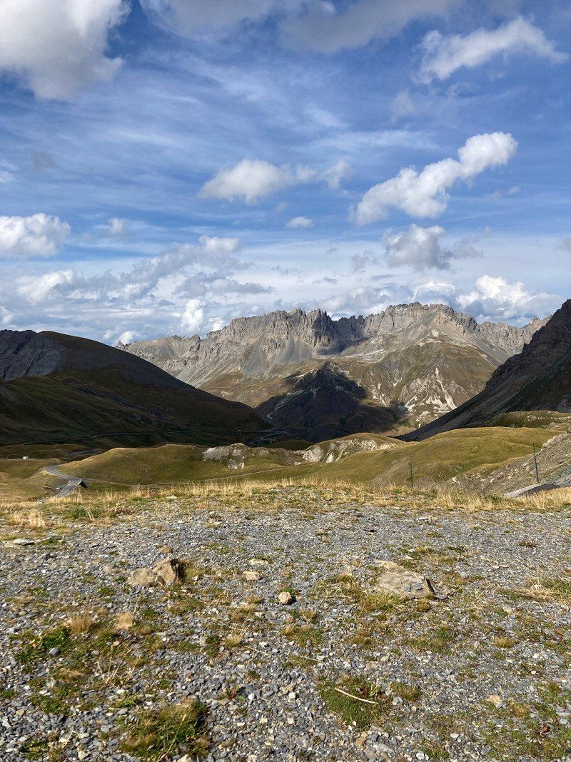
D 902
Very nice pass with many great views and no additional costs. The restrictions were up to 19t and 4m in height.
45° 4' 4.9" N 6° 24' 35.3" E
45.0680411 6.4098165
• Head east on Route du Galibier (D902). Go for 6.3 km.
• Turn sharp right toward Lieu-dit Plan Lachat. Go for 442 m.
• Turn slightly right onto Lieu-dit Plan Lachat. Go for 201 m.
• Turn slightly left. Go for 1.7 km.
• Turn left. Go for 1.3 km.
• Turn slightly left toward Lieu-dit Les Gillères. Go for 6.0 km.
• Continue on Lieu-dit Les Gillères. Go for 441 m.
• Turn left onto Chemin de Pragoutier. Go for 3.3 km.
• Turn sharp left toward Lieu-dit Les Diseurs. Go for 206 m.
• Continue on Lieu-dit Les Diseurs. Go for 131 m.
• Turn slightly right toward Lieu-dit Pissebout. Go for 658 m.
• Continue on Lieu-dit Pissebout. Go for 532 m.
• Continue on Lieu-dit Le Giez. Go for 741 m.
• Turn right toward Rue du Rocher Saint-Pierre. Go for 692 m.
• Turn right onto Rue du Rocher Saint-Pierre. Go for 17 m.
• Continue on Place des Chouillères. Go for 34 m.
• Turn slightly right onto Rue de Tigny. Go for 63 m.
• Turn left onto Place de Tigny. Go for 45 m.
• Turn slightly left onto Rue de Tigny. Go for 132 m.
• Turn right onto Chemin du Crêt de la Brive. Go for 179 m.
• Take the 2nd exit from roundabout onto Route du Télégraphe (D902). Go for 16.7 km.
• Turn left onto Rue du Général Ferrié (D1006). Go for 933 m.
• Take the 2nd exit from roundabout onto Rue du Temple (D1006) toward A43/St Jean de M. Go for 367 m.
• Take the 1st exit from roundabout toward A43/Albertville/Chambéry/Turin. Go for 105 m.
• Continue on Rue du Stade. Go for 227 m.
• Take the 1st exit from roundabout onto A43 (Autoroute de la Maurienne) toward Albertville/Chambéry. Go for 51.3 km.
• Take the exit toward Albertville/Tarentaise/Beaufortain/Val d'Arly onto A430. Go for 14.3 km.
• Continue on N90. Go for 3.6 km.
• Take ramp toward Albertville-Centre/Annecy/Ugine/Beaufortain. Go for 130 m.
• Continue on Chemin des Communaux. Go for 85 m.
• Take the 3rd exit from roundabout onto Avenue des Chasseurs Alpins (D1212) toward Annecy/Albertville-Centre. Go for 400 m.
• Pass 2 roundabouts and continue on Route d'Ugine (D1212). Go for 3.3 km.
• Turn right onto D118 toward Césarches/Z.A. Venthon. Go for 283 m.
• Turn right onto D118. Go for 36 m.
• Arrive at D118. Your destination is on the left.
☍
114,9 km
(2 hrs. )
Picknickplatz Albertville
At the power station. We stayed here for one night while passing through. Street was relatively quiet after.
1504–1564 D 118
45° 41' 40.1" N 6° 24' 14.1" E
45.6944611 6.4039147
• Head west on D118. Go for 36 m.
• Turn right onto D118. Go for 539 m.
• Continue on Lieu-dit Le Bassin (D118). Go for 107 m.
• Continue on D118. Go for 497 m.
• Turn right and take ramp onto D1212 toward Ugine. Go for 4.5 km.
• Take the 2nd exit from roundabout onto Avenue Jean-Marie Meunier (D1212). Go for 472 m.
• Take the 3rd exit from roundabout onto Route d'Annecy (D1508) toward Annecy. Go for 529 m.
• Take the 2nd exit from roundabout onto Avenue André Pringolliet (D109) toward Centre Ville/Héry S/Ugine. Go for 1.3 km.
• Continue on Rue Léon Ecoffet (D109). Go for 635 m.
• Turn right onto D109. Go for 119 m.
• Continue on Lieu-dit La Montagnette (D109). Go for 197 m.
• Continue on D109. Go for 1.6 km.
• Continue on Lieu-dit La Motte (D109). Go for 85 m.
• Continue on D109. Go for 1.1 km.
• Continue on Lieu-dit Le Château (D109). Go for 115 m.
• Continue on Impasse de la Creusette (D109). Go for 1.3 km.
• Continue on Lieu-dit Pierre Coquin (D109). Go for 155 m.
• Continue on Lieu-dit Planfay (D109). Go for 48 m.
• Continue on D109. Go for 1.9 km.
• Continue on Lieu-dit La Massome (D109). Go for 98 m.
• Continue on D109. Go for 1.1 km.
• Continue on Lieu-dit La Villette (D109). Go for 114 m.
• Continue on Lieu-dit Le Crédo (D109). Go for 182 m.
• Continue on D109. Go for 1.9 km.
• Continue on Lieu-dit Les Rafforts (D109). Go for 850 m.
• Continue on D109. Go for 434 m.
• Continue on Lieu-dit Flon (D109). Go for 94 m.
• Continue on D109. Go for 770 m.
• Turn left onto D1212. Go for 3.7 km.
• Pass 3 roundabouts and continue on Route de Megève (D1212). Go for 6.3 km.
• Take the 3rd exit from roundabout onto Route de Megève (D1212) toward Chamonix-Mt-B./Megève. Go for 3.2 km.
• Take the 2nd exit from roundabout onto Route Nationale (D1212) toward A40/Chamonix/Sallanches/Rochebrune/Mt d'Arbois. Go for 502 m.
• Take the 3rd exit from Route Nationale roundabout onto Route d'Albertville à Sallanches (D1212) toward A40/Sallanches/Chamonix. Go for 318 m.
• Take the 3rd exit from Giratoire du Palais des Sports roundabout onto Route Nationale (D1212) toward A40/Sallanches/Chamonix. Go for 1.6 km.
• Take the 2nd exit from roundabout onto Route de Sallanches (D1212) toward A40/Genève/Chamonix/Saint Gervais/Sallanches. Go for 1.6 km.
• Take the 3rd exit from roundabout onto Route de Sallanches (D1212) toward A40/Genève/Combloux/Sallanches. Go for 1.4 km.
• Pass 4 roundabouts and continue on Route de Sallanches (D1212). Go for 3.5 km.
• Turn right onto Route du Chef-Lieu (D199) toward Domancy. Go for 2.6 km.
• Take the 1st exit from roundabout onto Route du Chef-Lieu (D199). Go for 338 m.
• Take the 1st exit from roundabout onto Route du Fayet (D1205). Go for 2.2 km.
• Take the 2nd exit from roundabout onto Route de Passy (D339). Go for 229 m.
• Take the 2nd exit from roundabout onto Route de Passy (D339) toward A40/Chamonix/Passy. Go for 910 m.
• Take the 1st exit from roundabout onto A40 (Autoroute Blanche) toward Milan/Turin/Chamonix-Mt-Blanc. Go for 1.7 km.
• Continue on N205. Go for 16.1 km.
• Take the 3rd exit from roundabout onto Route Blanche (D1506) toward Chamonix/Mt Blanc/Martigny. Go for 1.2 km.
• Pass 2 roundabouts and continue on Route Blanche (D1506). Go for 1.4 km.
• Take the 1st exit from Carrefour du Mont-Blanc roundabout onto Route du Bouchet (D1506). Go for 363 m.
• Take the 2nd exit from Carrefour du Fond des Gires roundabout onto Route du Bouchet (D1506). Go for 766 m.
• Arrive at Route du Bouchet (D1506). Your destination is on the left.
☍
70,8 km
(1 hrs. 19 min.)
Forêt Communale de Chamonix
Super parking lot for a city visit https://park4night.com//lieu/351998/
45° 55' 52.7" N 6° 52' 59.3" E
45.9312973 6.8831416
• Head toward Chemin des Coverays on Route du Bouchet (D1506). Go for 1.3 km.
• Take the 2nd exit from Rond-Point de la Chapelle roundabout onto Route du Bouchet (D1506). Go for 4.9 km.
• Take the 3rd exit from roundabout onto D1506. Go for 10.8 km.
• Continue on Route Cantonale (203). Go for 21.5 km.
• Take the 3rd exit from roundabout onto A21 toward Lausanne/Simplon/Martigny-Expo/Port Franc. Go for 4.8 km.
• Take exit 22 toward Simplon/Sion onto A9 (Autoroute du Rhône). Go for 42.3 km.
• Continue on E62. Go for 6.7 km.
• Pass 3 roundabouts and continue on Kantonsstrasse (E62). Go for 1.1 km.
• Take the 3rd exit from Kreisel Roschätte roundabout onto Kantonsstrasse (E62) toward Simplon/Brig. Go for 917 m.
• Continue on A9. Go for 5.7 km.
• Take the exit. Go for 355 m.
• Take the 2nd exit from Kreisel Tenne roundabout onto Kantonsstrasse (E62) toward Simplon/Brig/Lötschberg/Gampel/Steg. Go for 788 m.
• Pass 2 roundabouts and continue on Kantonsstrasse (E62). Go for 533 m.
• Turn left and take ramp onto A9 toward Simplon/Brig. Go for 7.8 km.
• Take exit 33 toward Baltschieder onto Visp West. Go for 1.2 km.
• Take the 2nd exit from Kreisel Wehreya roundabout toward Baltschieder/Industrie West. Go for 349 m.
• Turn right toward Rosenweg. Go for 57 m.
• Continue on Rosenweg. Go for 51 m.
• Continue on Sonnenstrasse. Go for 360 m.
• Turn left. Go for 56 m.
• Arrive at your destination on the right.
☍
111,5 km
(1 hrs. 26 min.)
Day
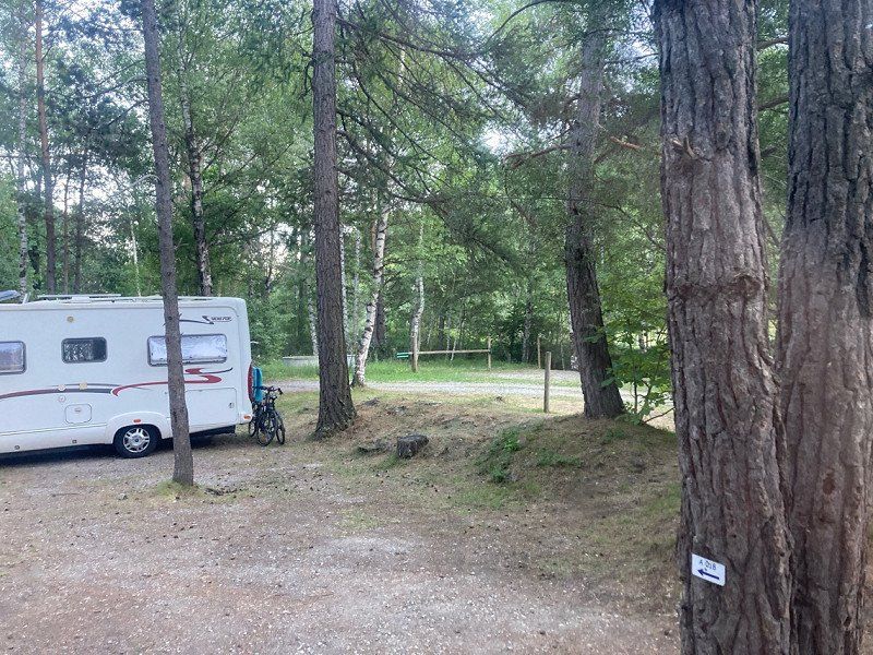
Camping & Schwimmbad Mühleye
Incl. electricity 34 CHF
Mühleye 7, 3930, Visp, Schweiz
46° 17' 53.1" N 7° 52' 22.2" E
46.2980800 7.8728300
• Head toward Sonnenstrasse. Go for 56 m.
• Turn sharp right onto Sonnenstrasse. Go for 360 m.
• Continue on Rosenweg. Go for 108 m.
• Turn right toward Baltschiederbrücke. Go for 79 m.
• Take the 3rd exit from Kreisel Ausserlos roundabout onto Baltschiederbrücke toward Simplon/Brig/Ausserberg/Eggerberg/Baltschieder. Go for 143 m.
• Take the 1st exit from Kreisel Baltschieder roundabout toward Simplon/Brig/Lalden. Go for 836 m.
• Continue on Taleia. Go for 147 m.
• Continue on Tscharei. Go for 3.0 km.
• Continue on Ryfa toward Simplon/Brig. Go for 1.1 km.
• Turn right onto Kantonsstrasse (9). Go for 135 m.
• Take the 1st exit from roundabout onto A9 toward Simplon/Brig. Go for 3.0 km.
• Keep left onto A9 toward Brig-Glis/Furka/Grimsel/Nufenen/Simplon. Go for 201 m.
• Take the 3rd exit from roundabout onto Überlandstrasse (19) toward Furka/Grimsel/Nufenen/Brig/Naters/Simplon. Go for 1.4 km.
• Keep left onto 19 toward Furka/Grimsel/Nufenen/Simplon/Naters. Go for 3.5 km.
• Pass 4 roundabouts and continue on Furkastrasse (19). Go for 36.9 km.
• Keep left onto Furkastrasse (19) toward Furka/Grimsel/Oberwald. Go for 7.4 km.
• Turn left onto 6 toward Grimsel. Go for 6.0 km.
• Turn left toward Grimselpass/6. Go for 56 m.
• Turn left onto Grimselpass (6). Go for 20 m.
• Turn left. Go for 71 m.
• Arrive at your destination on the right.
☍
64,5 km
(1 hrs. 7 min.)
Day
Day
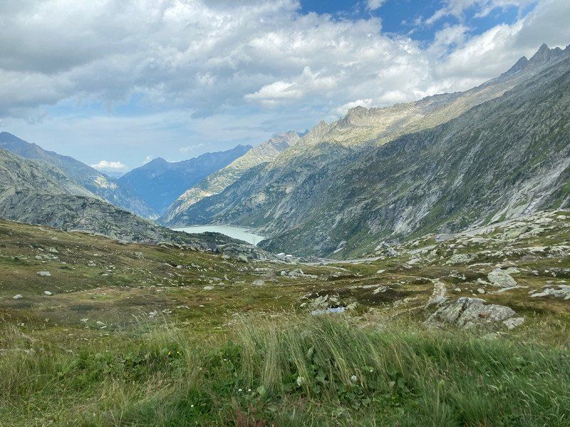
Oberaarstrasse
Plenty of parking spaces to choose from. Great view and certainly good opportunities for small hikes. We stopped here for a lunch break. On the way to the Aaretal there is another stopping point.
46° 33' 42" N 8° 20' 8.2" E
46.5616744 8.3356181
• Head west. Go for 139 m.
• Turn left onto Grimselpass (6). Go for 25.5 km.
• Turn right onto Grimselstrasse. Go for 58 m.
• Turn left onto Grimselstrasse. Go for 168 m.
• Turn right onto Steinigässli. Go for 359 m.
• Turn left onto Bottigenstrasse. Go for 515 m.
• Turn left onto Sustenstrasse (11). Go for 5.2 km.
• Pass 3 roundabouts and continue on Hauptstrasse (6/11). Go for 8.2 km.
• Continue on A8. Go for 27.8 km.
• Keep left onto A8 toward Bern/Thun/Spiez. Go for 5.1 km.
• Continue on 6/11. Go for 18 m.
• Continue on A8. Go for 608 m.
• Take ramp onto Interlakenstrasse (6/11) toward Spiez/Faulensee. Go for 816 m.
• Arrive at Interlakenstrasse (6/11). Your destination is on the left.
☍
74,4 km
(1 hrs. 7 min.)
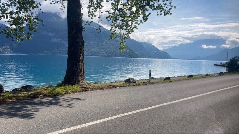
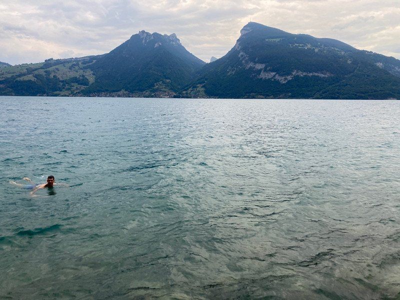
Interlakenstrasse
Several parking spaces near Spiez almost directly on the water. A country road with little traffic at night. Great for going swimming. https://park4night.com//lieu/275408/
46° 40' 12" N 7° 42' 50.8" E
46.6699931 7.7141156
• Head east on Interlakenstrasse (6/11). Go for 664 m.
• Take ramp onto A8 toward Interlaken. Go for 772 m.
• Continue on 6/11. Go for 18 m.
• Continue on A8. Go for 246 m.
• Turn left toward Krattigenhalde. Go for 18 m.
• Turn left onto Krattigenhalde. Go for 40 m.
• Turn right onto A8. Go for 216 m.
• Continue on 6/11. Go for 18 m.
• Continue on A8. Go for 5.5 km.
• Continue on A6. Go for 44.2 km.
• Continue on A1. Go for 44.6 km.
• Take exit 45 toward E35/Basel/Egerkingen onto A2. Go for 41.5 km.
• Keep right onto A3 (Basel-Kleinhüningen) toward Mulhouse/EuroAirport/Basel-Kleinhüningen/Lörrach/Weil am Rhein. Go for 3.8 km.
• Continue on A35. Go for 25.5 km.
• Take the exit toward Paris/Lyon/Mulhouse onto A35. Go for 36.6 km.
• Take exit 24 toward Nancy St Dié Par Col/Épinal/Kaysersberg/Colmar-Nord onto Rue Édouard Branly. Go for 910 m.
• Take the 2nd exit from roundabout onto Avenue Joseph Rey toward N422/Nancy/St Dié/Épinal/Strasbourg. Go for 518 m.
• Take the 2nd exit from roundabout onto Avenue Joseph Rey toward Nancy/St Dié/Épinal/Belfort/Kaysersberg. Go for 542 m.
• Take the 2nd exit from roundabout onto Rue du 152ème Régiment d'Infanterie (D83) toward Parc des Expositions. Go for 446 m.
• Pass 4 roundabouts and continue on Avenue de Lorraine (D83). Go for 3.0 km.
• Take the 1st exit from roundabout onto Route de Colmar (D11 II) toward Ingersheim-Centre. Go for 888 m.
• Take the 3rd exit from roundabout onto Place du Général de Gaulle (D1 B15). Go for 115 m.
• Take the 2nd exit from roundabout onto Route de Turckheim (D10). Go for 992 m.
• Turn left. Go for 20 m.
• Turn right. Go for 96 m.
• Arrive at your destination on the left.
☍
211,2 km
(2 hrs. 4 min.)
Day
Lycee Polyvalent Lazare de Schwendi
Good to use as a parking space during the school holidays. Had to put wedges.
A few pedestrians on the way, as there is a train station nearby, the train is hardly perceptible acoustically.
48° 5' 22.3" N 7° 17' 43.5" E
48.0895228 7.2954128
• Head toward Route de Turckheim. Go for 96 m.
• Turn left toward Résidence Les Rives de la Fecht/D10. Go for 20 m.
• Turn right onto Résidence Les Rives de la Fecht (D10). Go for 940 m.
• Take the 2nd exit from roundabout onto Place du Général de Gaulle (D1 B15). Go for 98 m.
• Take the 3rd exit from roundabout onto Route de Colmar (D11 II). Go for 930 m.
• Take the 2nd exit from roundabout onto Route de Colmar (D418) toward Colmar-Centre. Go for 2.9 km.
• Turn left onto Place de la 5ème Division Blindée (D415). Go for 256 m.
• Turn right onto Rue de la Cavalerie (D415). Go for 624 m.
• Continue on Rue du Ladhof (D4 II). Go for 288 m.
• Turn right onto Rue Billing. Go for 194 m.
• Arrive at Rue Billing.
☍
6,4 km
( 10 min.)
Day
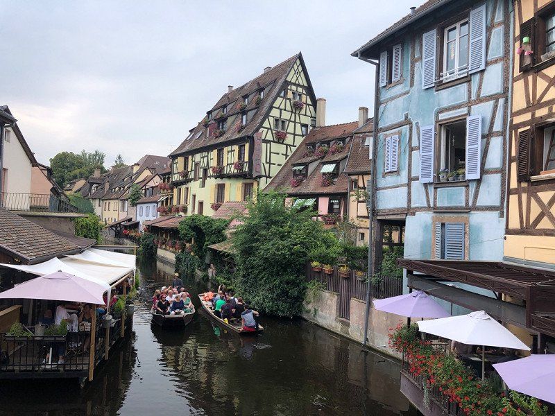
Parkbucht im Wohngebiet Colmar
Street in residential area with ample parking. We used this because the camper pitches were occupied during the day. At night there were a lot of free seats on the official seats. It makes sense to arrive either early in the morning or late in the afternoon.
15 Rue Billing
48° 4' 59" N 7° 22' 6" E
48.0830592 7.3683236
• Head toward Place Billing on Rue Billing. Go for 194 m.
• Turn left onto Rue du Ladhof (D4 II). Go for 241 m.
• Turn right toward Route de Sélestat/D201. Go for 45 m.
• Turn right onto Route de Sélestat (D201). Go for 1.2 km.
• Turn slightly right onto D201 toward D83/Strasbourg. Go for 847 m.
• Pass 2 roundabouts and continue on Avenue Gilbert Meyer (D83). Go for 2.3 km.
• Take the 2nd exit from roundabout onto D83. Go for 11.3 km.
• Keep left onto A35. Go for 39.0 km.
• Continue on A355 toward E25/A4/Paris/A35/Karlsruhe/Strasbourg. Go for 23.6 km.
• Keep right toward A35/A4/Schiltigheim/Karlsruhe/Lauterbourg/Hoerdt. Go for 2.6 km.
• Continue on A35. Go for 30.9 km.
• Take exit 56 toward Forstfeld/Karlsruhe/Bâle/Rastatt/Baden-Baden/Roppenheim/Beinheim onto D504. Go for 1.2 km.
• Take the 2nd exit from roundabout onto D504 toward D4/A5/(Karlsruhe-Bâle)/Karlsruhe/Rastatt/Iffezheim/Z.I. Beinheim. Go for 1.7 km.
• Take ramp. Go for 285 m.
• Take the 3rd exit from roundabout. Go for 196 m.
• Take the 1st exit from roundabout onto Route de l'Europe. Go for 183 m.
• Turn right onto Route de l'Europe. Go for 22 m.
• Turn right onto Route de l'Europe. Go for 307 m.
• Turn left. Go for 28 m.
• Arrive at your destination on the left.
☍
116,0 km
(1 hrs. 7 min.)
Day
Roppenheim The Style Outlets, Route de l'Europe, Roppenheim, Frankreich
Difficult to find parking at weekends. There were no buses on Saturday, so the mobile homes were parked in bus parking lots.
1 Rte de l'Europe, 67480 Roppenheim, Frankreich
48° 50' 11.8" N 8° 5' 13.7" E
48.8366025 8.0871379
• Head northeast.
• Turn left onto Route de l'Europe. Go for 300 m.
• Turn left toward Route de l'Europe. Go for 92 m.
• Take the 2nd exit from roundabout onto Route de l'Europe. Go for 281 m.
• Take the 2nd exit from roundabout. Go for 154 m.
• Take the 2nd exit from roundabout onto D504. Go for 657 m.
• Take the 2nd exit from roundabout onto D504 toward A5/Karlsruhe/Baden-Baden/Rastatt/Iffezheim. Go for 1.2 km.
• Continue on B500. Go for 6.4 km.
• Take ramp onto A5 toward Karlsruhe. Go for 10.5 km.
• Take exit 49 toward Gernsbach/Gaggenau. Go for 401 m.
• Turn left onto B462 toward Freudenstadt/Gernsbach/Gaggenau. Go for 13.9 km.
• Take ramp onto Hördener Straße toward Gernsbach/hist. Altstadt/Schloß Eberstein. Go for 272 m.
• Continue on Bleichstraße. Go for 137 m.
• Take the 2nd exit from roundabout onto Bleichstraße. Go for 500 m.
• Continue on Igelbachstraße (L78). Go for 219 m.
• Turn left onto Loffenauer Straße (L564). Go for 535 m.
• Turn right onto Von-Bolin-Straße. Go for 111 m.
• Turn right onto Martinsenstraße. Go for 64 m.
• Arrive at Martinsenstraße. Your destination is on the left.
☍
35,8 km
( 30 min.)
Gernsbach, Deutschland
76593 Gernsbach, Deutschland
48° 45' 47.4" N 8° 20' 37.4" E
48.7631780 8.3437129