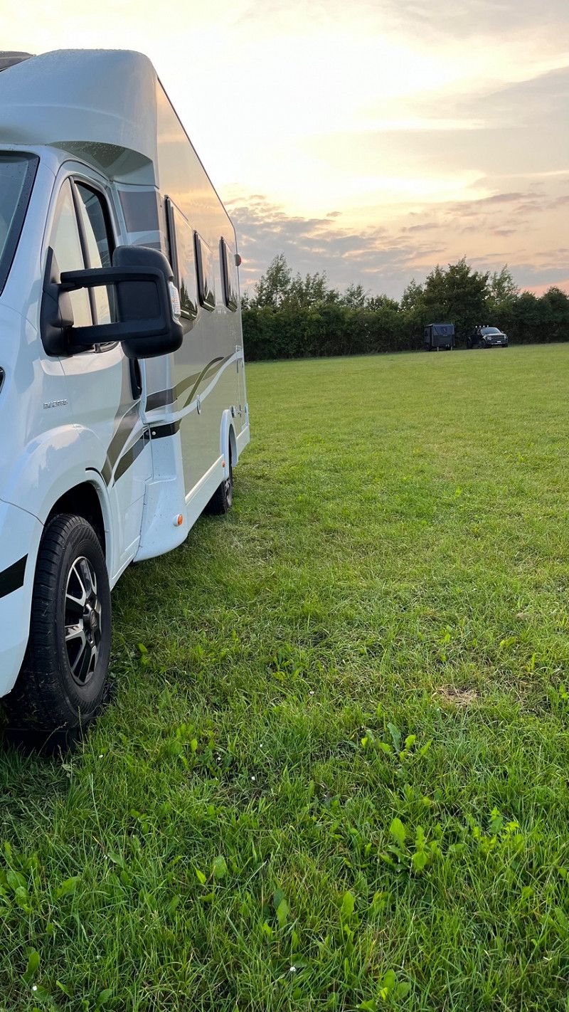
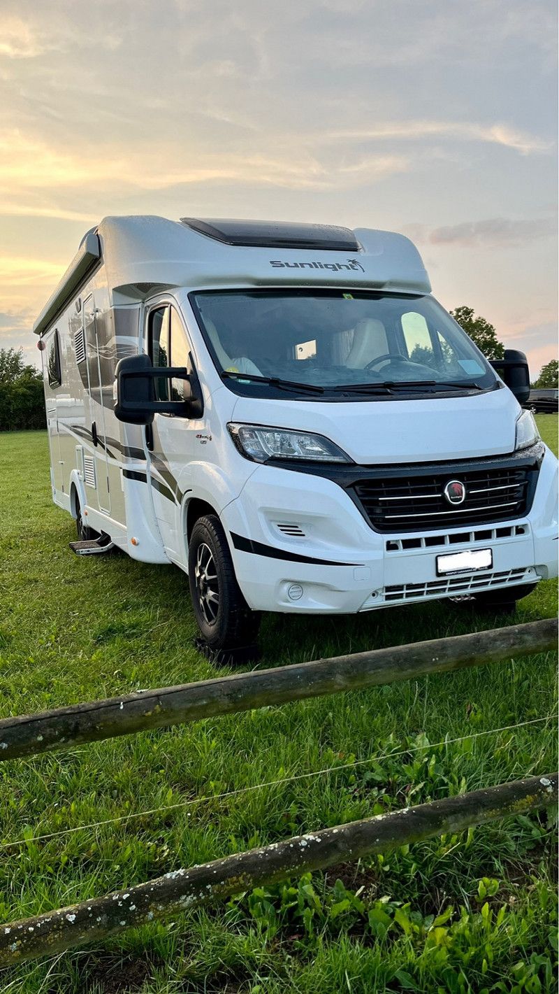
We travel with the motorhome from Switzerland to Denmark via Copenhagen to Jutland and back. This tour is a 3 week tour that is described anew every day. We are on the road until 08/12/2023.
Day
Basel-Landschaft
Departure
5.52 a.m. Arrival from Basel
Schweiz
47° 30' 33.5" N 7° 39' 31.8" E
47.5092938 7.6588333
• Head toward Madilohstrasse. Go for 339 m.
• Turn slightly right onto Madilohstrasse. Go for 228 m.
• Continue on Weiherstrasse. Go for 618 m.
• Turn slightly left onto Gempengasse. Go for 269 m.
• Continue on Oberdorf. Go for 187 m.
• Continue on Kirchplatz. Go for 133 m.
• Turn slightly left onto Hauptstrasse. Go for 8 m.
• Continue on Baselstrasse. Go for 998 m.
• Continue on Münchensteinerstrasse. Go for 224 m.
• Turn right onto Margelackerstrasse. Go for 294 m.
• Continue on Birsfelderstrasse toward Luzern/Bern/Birsfelden/Muttenz. Go for 1.1 km.
• Take ramp onto A2/A3 (Verzweigung Hagnau) toward Luzern/Bern/Zürich/Basel/Birsfelderhafen/Karlsruhe/Mulhouse/Basel Flughafen/Basel-St. Jakob/Birsfelden Hafen. Go for 4.9 km.
• Keep left onto A2 (Verzweigung Wiese) toward Karlsruhe/Basel-Rheinhafen. Go for 363 m.
• Continue on A2 (Verzweigung Wiese). Go for 1.5 km.
• Continue on A5. Go for 291 km.
• Take the exit toward Hannover/Kassel/Frankfurt/Darmstadt onto A5. Go for 50.3 km.
• Take exit 16 toward Friedberg/Friedrichsdorf/Karben/Rosbach. Go for 359 m.
• Turn right onto B455 toward Friedberg/Rosbach. Go for 6.2 km.
• Keep right toward B3. Go for 111 m.
• Take ramp. Go for 177 m.
• Turn right onto B3 toward Frankfurt/Lauterbach/Friedberg-Süd. Go for 1.1 km.
• Turn left onto K24. Go for 344 m.
• Turn right onto Pfingstweide. Go for 710 m.
• Turn left onto Freseniusstraße. Go for 1.5 km.
• Turn right onto Görbelheimer Hohl. Go for 452 m.
• Turn right onto Hauptstraße (B275) toward Lauterbach/Florstadt/FB-Ossenheim/FB-Bruchenbrücken. Go for 2.7 km.
• Arrive at Florstädter Straße (B275).
☍
365,9 km
(3 hrs. 28 min.)
Wetterau I
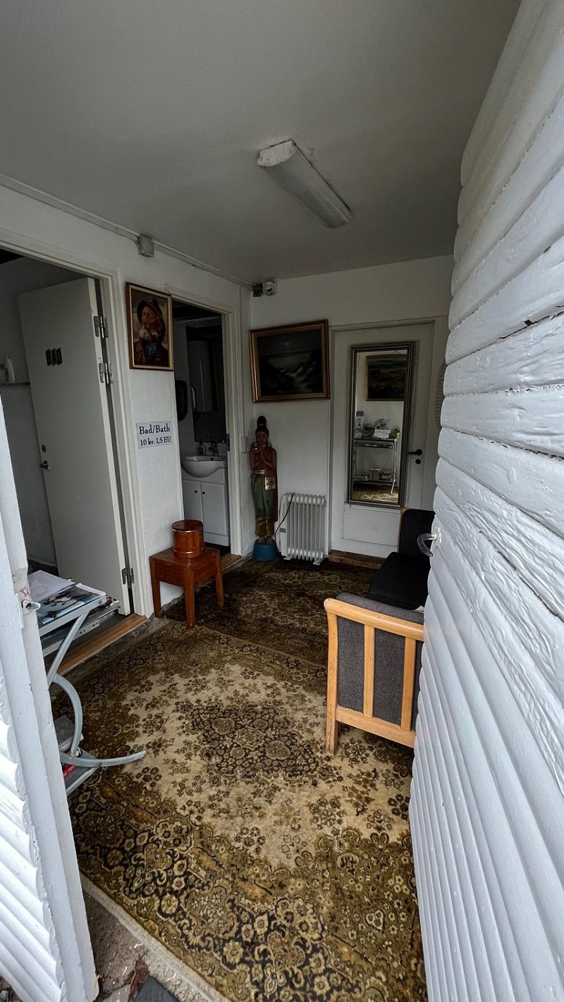
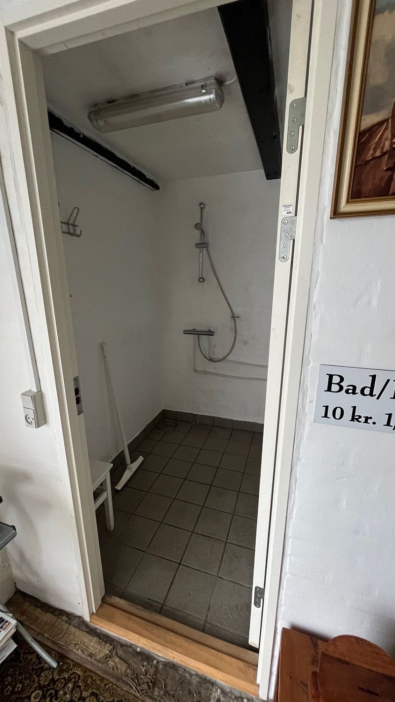
The first stopover is behind Frankfurt, Raststätte Wetterau. (Simple restaurant, enough for good coffee and a small snack.) Toilet facilities were clean.
Deutschland
50° 19' 51.9" N 8° 48' 45.1" E
50.3310961 8.8125171
• Head toward Karlshof on Florstädter Straße (B275). Go for 972 m.
• Turn left onto L3187 toward Reichelsheim/Dorn-Assenheim. Go for 1.5 km.
• Turn left onto K171 toward Friedberg/Fb-Bauernheim. Go for 2.0 km.
• Continue on Dorn-Assenheimer-Straße (K171). Go for 1.4 km.
• Continue on K171. Go for 628 m.
• Turn right onto Kammerfeld (L3351) toward Dorheim. Go for 1.1 km.
• Turn left onto Wetteraustraße (L3351) toward Schotten/Friedberg/B455. Go for 872 m.
• Turn left onto B455. Go for 1.8 km.
• Turn right onto B3 toward Kassel/A5/Gießen/Usingen/B275/Bad Nauheim. Go for 8.2 km.
• Take ramp onto A5 toward Kassel. Go for 47.3 km.
• Take left exit 4 toward Kassel/Dortmund onto A49. Go for 79.2 km.
• Take exit 7 toward Hannover/Frankfurt onto A44. Go for 4.7 km.
• Take the left exit toward Hamburg/Hannover/Kassel onto A7. Go for 263 km.
• Take exit 42 toward Evendorf/Amelinghausen/Döhle. Go for 338 m.
• Turn left onto L212. Go for 494 m.
• Take the 2nd exit from roundabout onto L212 toward Egestorf/Döhle. Go for 1.3 km.
• Turn right onto Hundornweg. Go for 298 m.
• Turn left. Go for 149 m.
• Arrive at your destination on the left.
☍
415,1 km
(3 hrs. 41 min.)
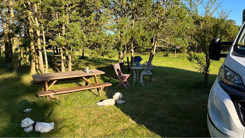
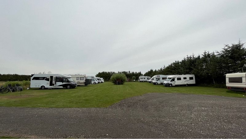
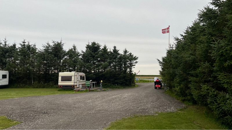
Regenbogen Egestorf
Great natural campsite, quiet location, a bit old but is great on the route. Restaurant is also available including bread service.
There was even a welcome pack for the dogs.
Pool is available on site. Unfortunately we couldn't use it because it was raining.
Campingplatz 1, 21272, Egestorf, Deutschland
53° 10' 19.2" N 10° 3' 47.9" E
53.1720000 10.0633000
• Head northwest. Go for 2 m.
• Arrive at your destination on the right.
☍
0,0 km
(Duration not available)
Day
Regenbogen Camp Egestorf
Today we drove on at 11 o'clock.
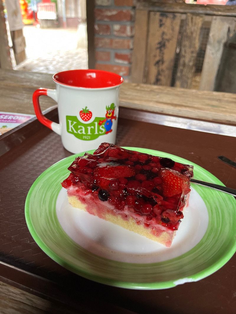
Today's destination was Karl's adventure world in Warensdorf, Ratekau.
Harburg, Niedersachsen, Deutschland
53° 10' 19.5" N 10° 3' 48.6" E
53.1720953 10.0634876
• Head toward Hundornweg. Go for 146 m.
• Turn right onto Hundornweg. Go for 298 m.
• Turn left onto L212. Go for 1.2 km.
• Take the 2nd exit from roundabout onto L212 toward Hamburg/A7/Amelinghausen/Evendorf. Go for 509 m.
• Take ramp onto A7 toward Hamburg. Go for 24.9 km.
• Keep left onto Horster Dreieck toward Lübeck/Berlin/Hamburg/Lüneburg/A1. Go for 2.5 km.
• Continue on A1. Go for 13.2 km.
• Take exit 36 toward Lübeck/Berlin/Hamburg-Südost onto A1. Go for 68.0 km.
• Keep right onto A226 (Autobahndreieck Bad Schwartau) toward Lübeck-Travemünde/Hafen Skandinavienkai/Lübeck-Siems/Hafen CTL,LK,SLK/Lübeck-Schlutup/Lübeck-Dänischburg. Go for 5.2 km.
• Continue on Travemünder Landstraße (B75). Go for 924 m.
• Take ramp toward Lübeck-Kücknitz/Lübeck-Pöppendorf/Lübeck-Rangenberg/Lübeck-Waldhusen. Go for 347 m.
• Turn left onto Waldhusener Weg (K20). Go for 993 m.
• Turn right onto K20. Go for 352 m.
• Turn left onto K20. Go for 1.0 km.
• Continue on Sonnenbergsredder (K20). Go for 2.3 km.
• Continue on Grammersdorf (K15). Go for 310 m.
• Continue on K15. Go for 275 m.
• Continue on Wilmsdorf (K15). Go for 81 m.
• Continue on K15. Go for 178 m.
• Continue on Wilmsdorf (K15). Go for 178 m.
• Continue on Fuchsbergstraße (K15). Go for 2.4 km.
• Turn right onto Fuchsbergstraße. Go for 11 m.
• Turn right. Go for 121 m.
• Arrive at your destination on the right.
☍
125,3 km
(1 hrs. 14 min.)
Fuchsbergstraße 8–10
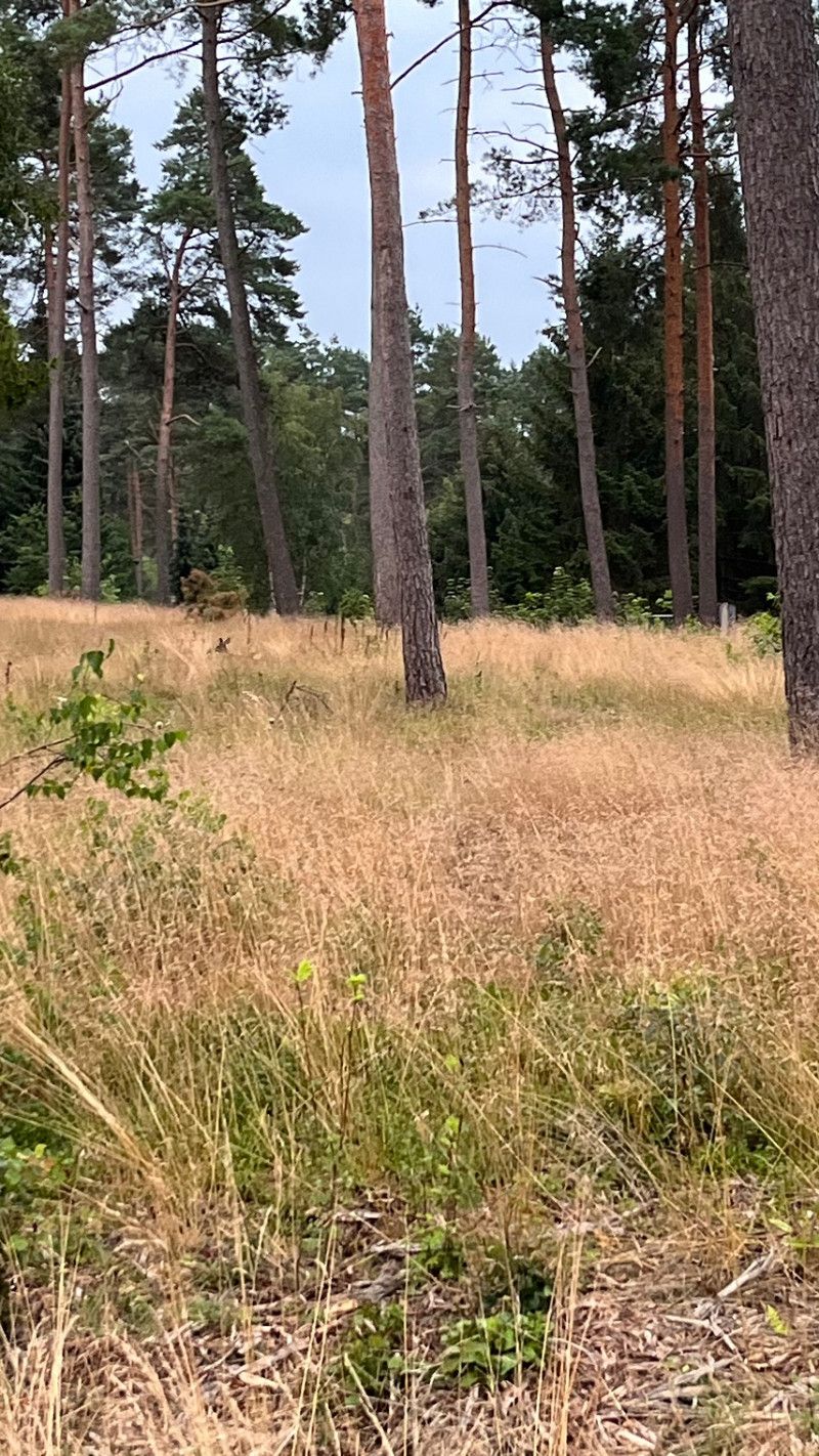
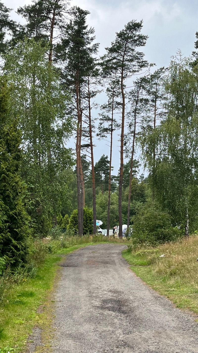
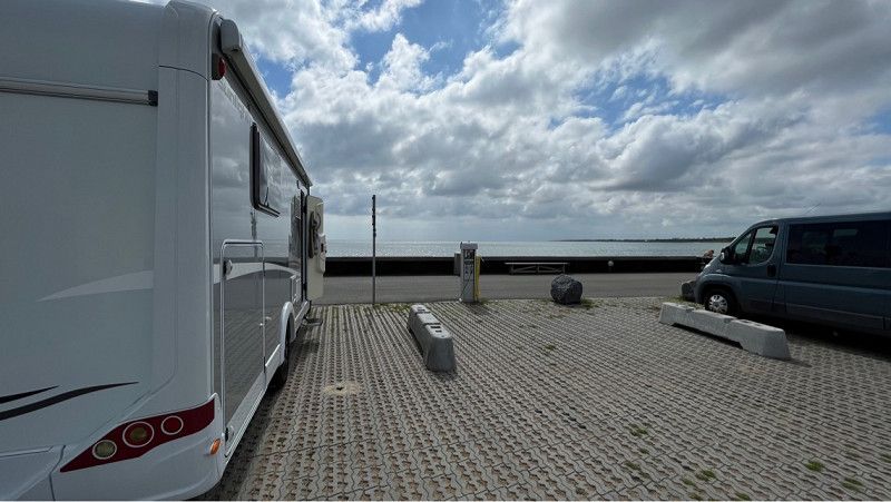
Since today's onward journey was a bit difficult and there was a lot of traffic, we decided to stay here for one night.
For 10 euros without electricity and plumbing. Can you stand well in a large meadow.
Quiet and lots of space.
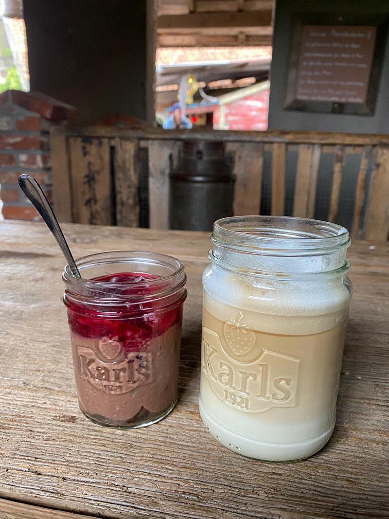
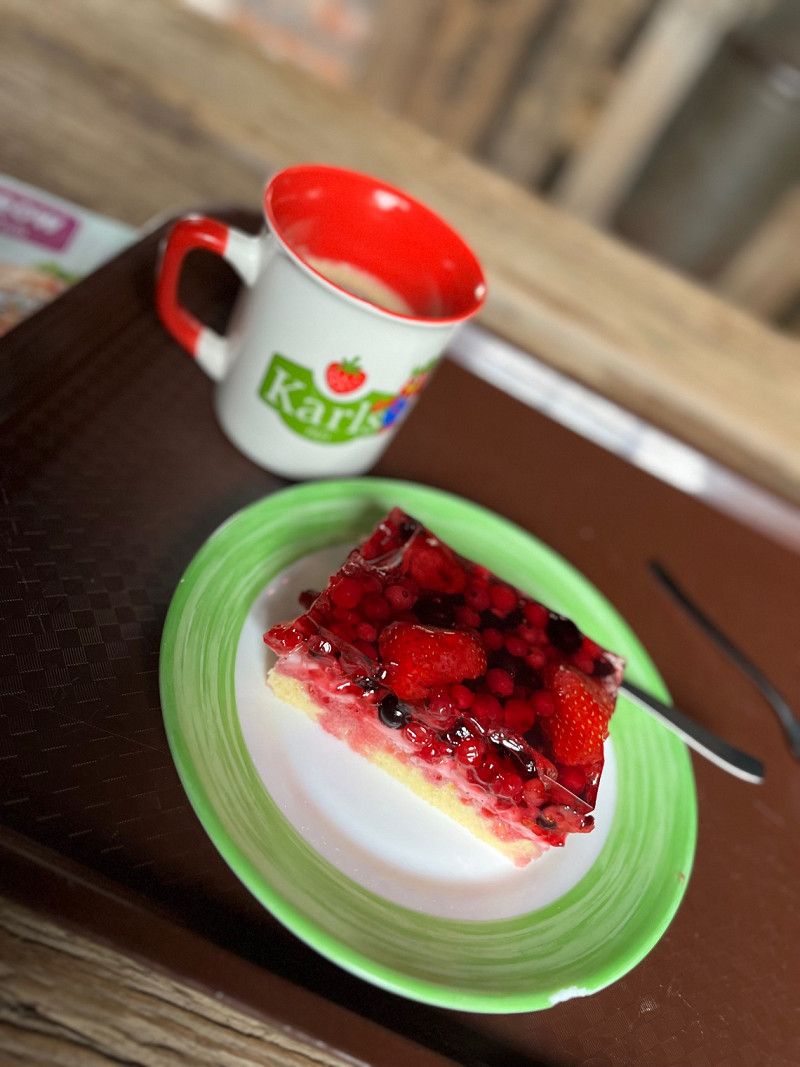
You can also have dinner at Karls.
So tomorrow we continue to Putgarten.
53° 57' 49.7" N 10° 49' 11.2" E
53.9638089 10.8197655
• Head northeast. Go for 95 m.
• Turn right toward Fuchsbergstraße. Go for 18 m.
• Turn left onto Fuchsbergstraße. Go for 11 m.
• Turn right onto Fuchsbergstraße (K15). Go for 320 m.
• Turn left onto Niendorfer Straße (K15). Go for 1.2 km.
• Continue on Häven. Go for 1.3 km.
• Turn left onto Bäderrandstraße (B76). Go for 9.0 km.
• Take the 2nd exit from roundabout onto Hamburger Ring (B76) toward Kiel/Eutin/Haffkrug. Go for 1.1 km.
• Turn left onto Strandallee (B76). Go for 473 m.
• Turn left onto Pönitzer Chaussee (B76) toward Lübeck/A1/Puttgarden/B432/Bad Segeberg/Puttgarden/Kiel/Eutin. Go for 1.4 km.
• Turn left and take ramp onto A1 toward Puttgarden. Go for 47.2 km.
• Continue on B207. Go for 21.2 km.
• Keep left onto B207 toward Puttgarden. Go for 126 m.
• Turn left onto Fährhafenstraße (K49). Go for 88 m.
• Turn right onto Zur Westmole. Go for 710 m.
• Turn right onto An der Mole. Go for 273 m.
• Turn right onto Neuer Skandinavienkai. Go for 83 m.
• Turn right onto Neuer Skandinavienkai. Go for 97 m.
• Arrive at Neuer Skandinavienkai. Your destination is on the right.
☍
84,6 km
(1 hrs. )
Day
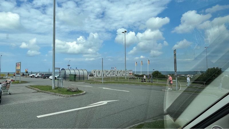
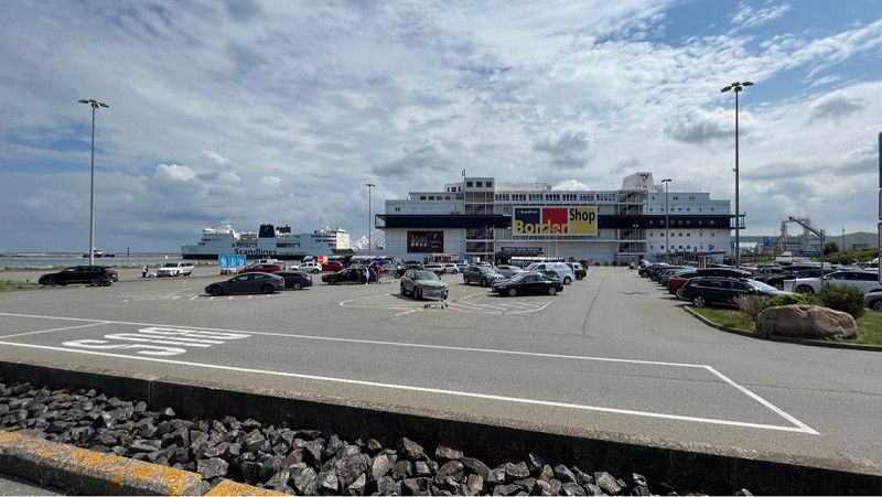
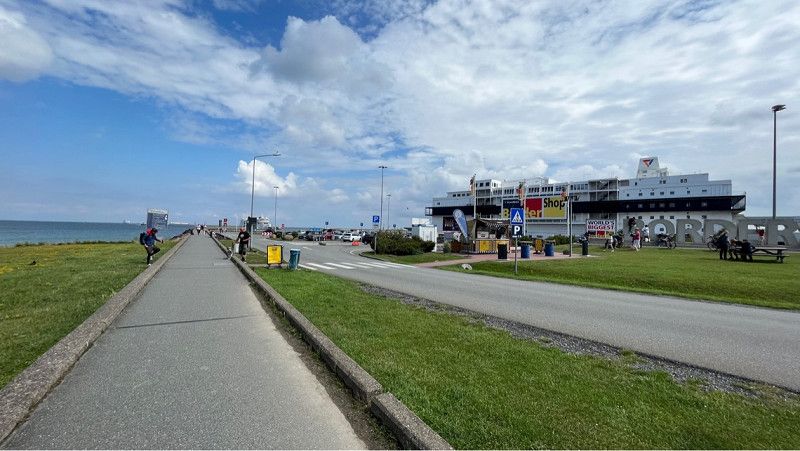
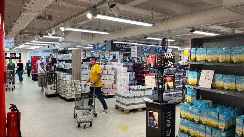
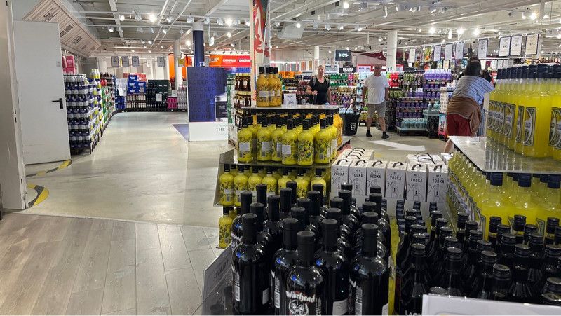
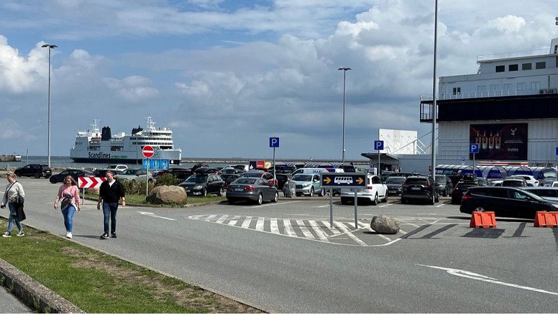
BorderShop Puttgarden
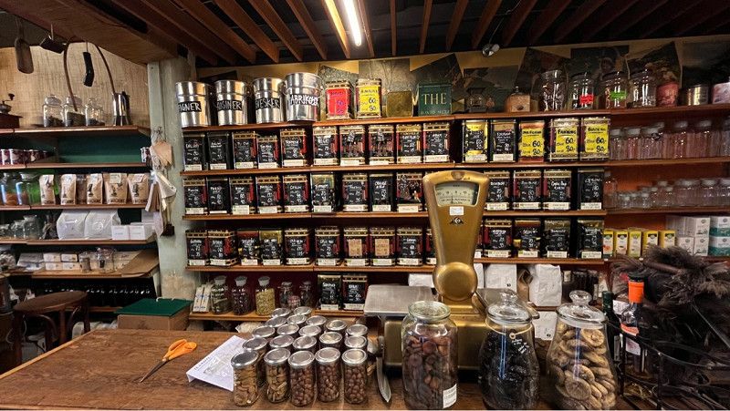
Huge border shop, whether beer, wine, champagne, chocolate, there is almost everything here.
The Scandinavian citizens all go shopping here again before going home.
Neuer Skandinavienkai 1, Puttgarden, Ostholstein, Schleswig-Holstein, Deutschland
54° 30' 13.9" N 11° 13' 36.1" E
54.5038507 11.2267050
• Head northeast on Neuer Skandinavienkai.
• Turn left toward Neuer Skandinavienkai. Go for 75 m.
• Turn left onto Neuer Skandinavienkai. Go for 101 m.
• Turn left toward An der Mole. Go for 200 m.
• Continue on An der Mole. Go for 73 m.
• Turn left onto Zur Westmole. Go for 710 m.
• Turn left onto Fährhafenstraße (K49). Go for 56 m.
• Turn left onto E47. Go for 868 m.
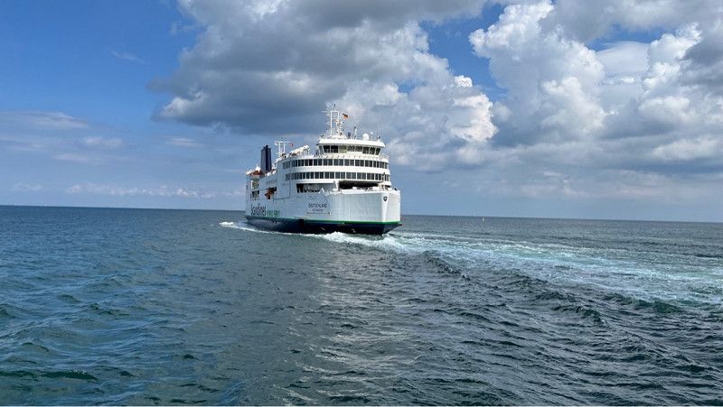
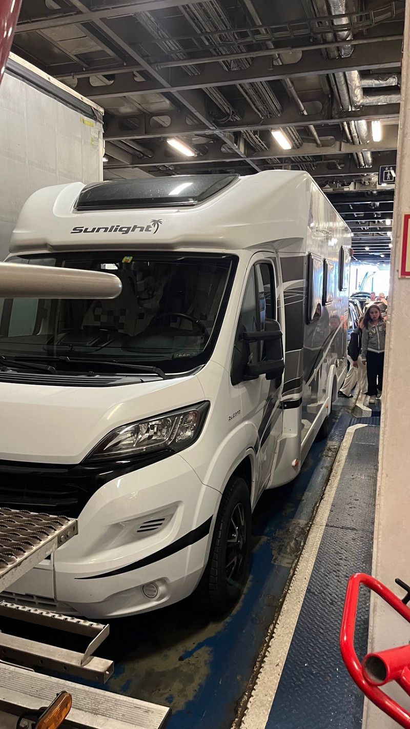
• Take the Puttgarden-Rødby Ferry. Stay on for 18.7 km.
• Head northeast. Go for 768 m.
• Take ramp toward Rødby/275/Rødbyhavn. Go for 111 m.
• Turn left onto Færgestationsvej toward Rødbyhavn/153/Rødby/275. Go for 262 m.
• Turn left onto Færgevej toward Rødby/153/275/Rødbyhavn. Go for 424 m.
• Turn right onto Havnegade (153/275) toward Maribo/Rødby/Nakskov. Go for 705 m.
• Turn left onto Vestre Allé (275) toward Nakskov. Go for 4.7 km.
• Continue on Nakskov Landevej (275). Go for 14.9 km.
• Take the 3rd exit from roundabout onto Højrebyvej (291). Go for 9.5 km.
• Turn left onto Winchellsgade. Go for 361 m.
• Continue on Havnegade. Go for 631 m.
• Continue on Erlingsvej. Go for 95 m.
• Continue on Niels Nielsensgade. Go for 242 m.
• Turn slightly left onto Gasvej. Go for 273 m.
• Turn left onto Strandpromenaden. Go for 475 m.
• Turn left onto Strandpromenaden. Go for 1.9 km.
• Continue on Hestehovedet. Go for 114 m.
• Turn right onto Hestehovedet. Go for 103 m.
• Turn right. Go for 20 m.
• Turn right. Go for 33 m.
• Arrive at your destination.
☍
56,4 km
(1 hrs. 43 min.)
Day
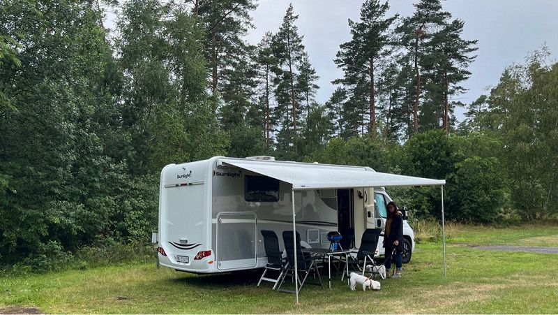
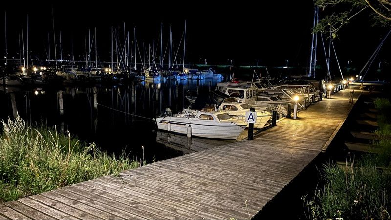
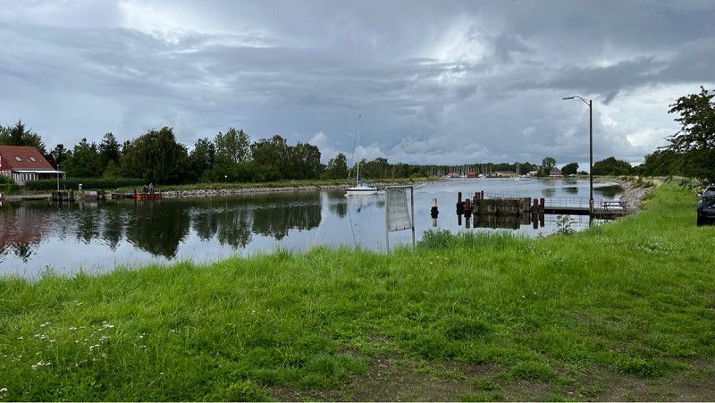
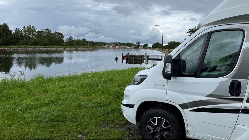
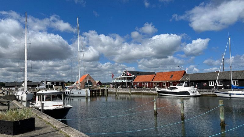
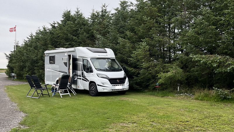
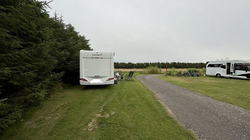
Nakskov Fjord Camping
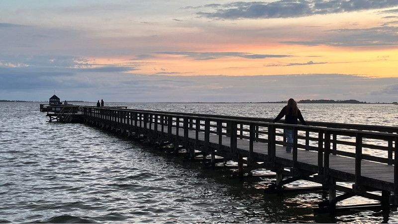
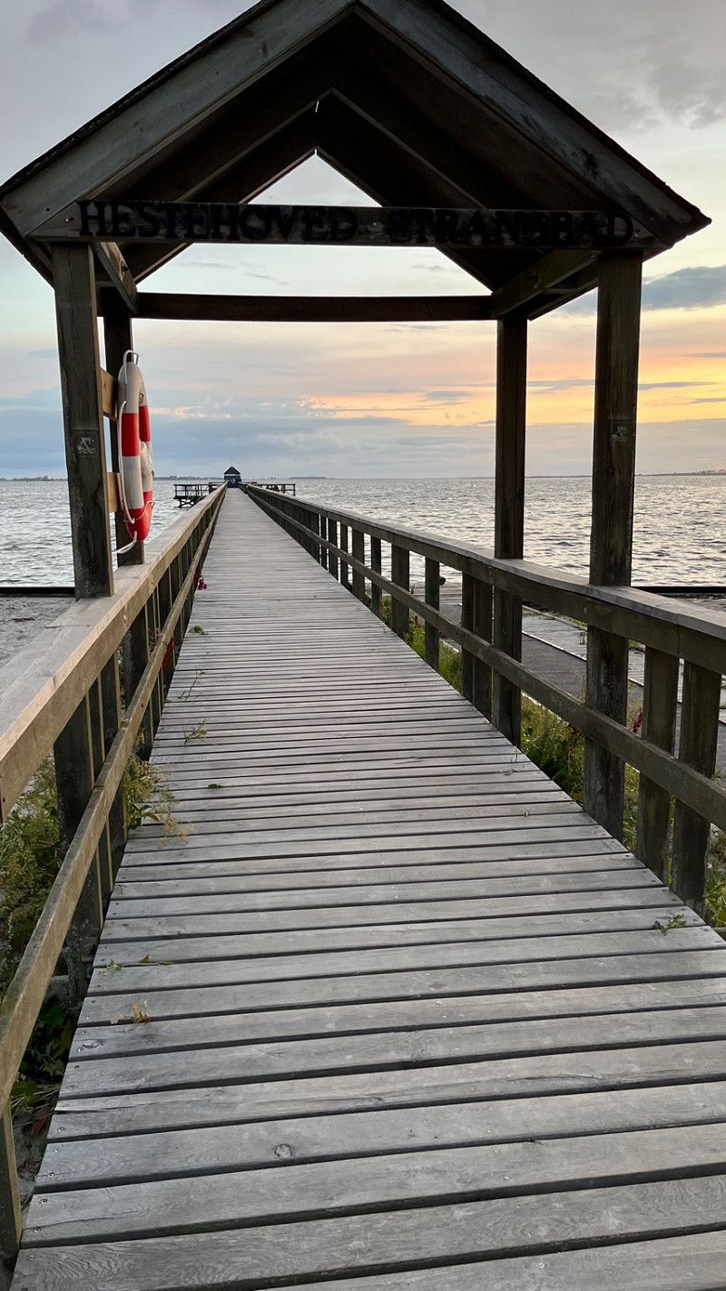
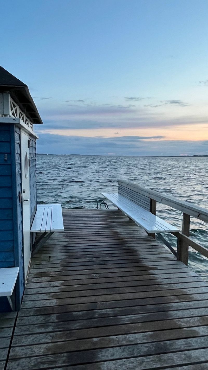
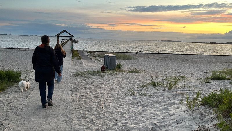
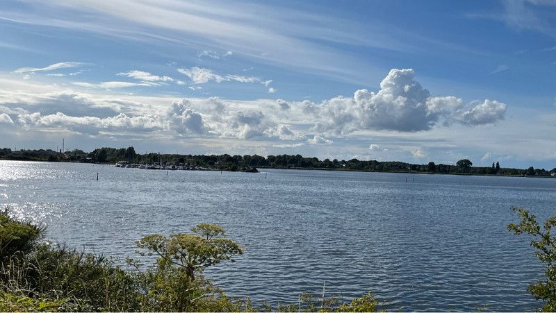
After a short stay on Fehmarn and a stroll over a huge Bordershop ship in the port of Puttgarden, we reached Denmark and arrived on Lolland after about 1 hour ferry ride. We continued to Nakskov Fjord where we stop for 2 nights at Nakskov Fjord Camping.
This campsite is beautifully situated and very well maintained.
We ended our day in a beautiful evening atmosphere by the fjord.
Hestehovedet 2, 4900, Nakskov, Dänemark
54° 49' 59" N 11° 5' 28" E
54.8330600 11.0911100
• Head northeast. Go for 203 m.
• Turn right toward Hestehovedet. Go for 20 m.
• Turn left onto Hestehovedet. Go for 103 m.
• Turn left onto Hestehovedet. Go for 114 m.
• Continue on Strandpromenaden. Go for 1.9 km.
• Turn right onto Strandpromenaden. Go for 475 m.
• Turn right onto Gasvej. Go for 273 m.
• Turn left onto Thestrupsvej. Go for 54 m.
• Turn right onto Tårsvej. Go for 34 m.
• Take the 1st exit from roundabout onto Vejlegadebro. Go for 103 m.
• Continue on Vejlegade. Go for 138 m.
• Turn left onto Nørrevold. Go for 439 m.
• Continue on Perlestikkergade. Go for 438 m.
• Take the 2nd exit from roundabout onto Perlestikkergade. Go for 247 m.
• Continue on Maribovej. Go for 70 m.
• Turn right onto Tuxensvej. Go for 105 m.
• Arrive at Tuxensvej. Your destination is on the left.
☍
4,7 km
( 10 min.)
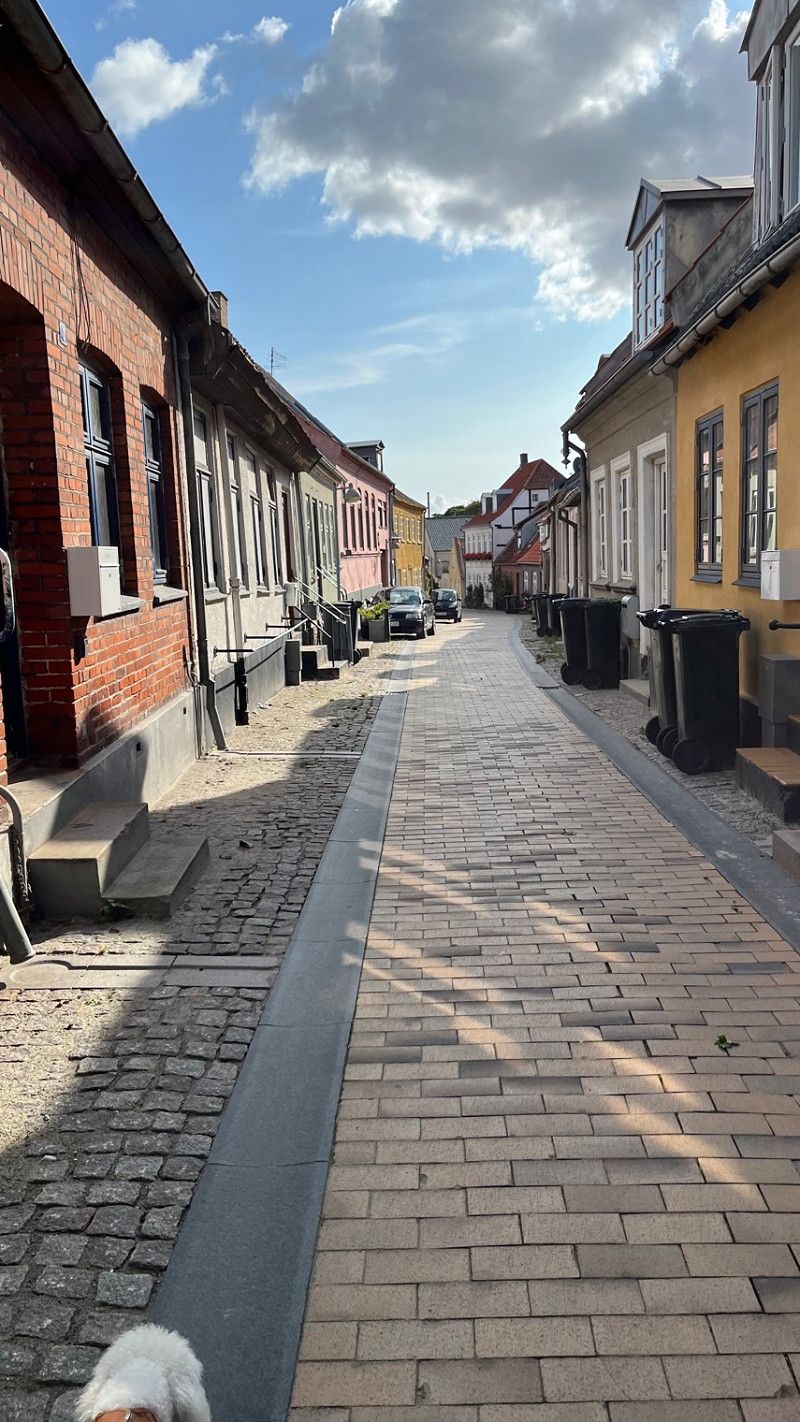
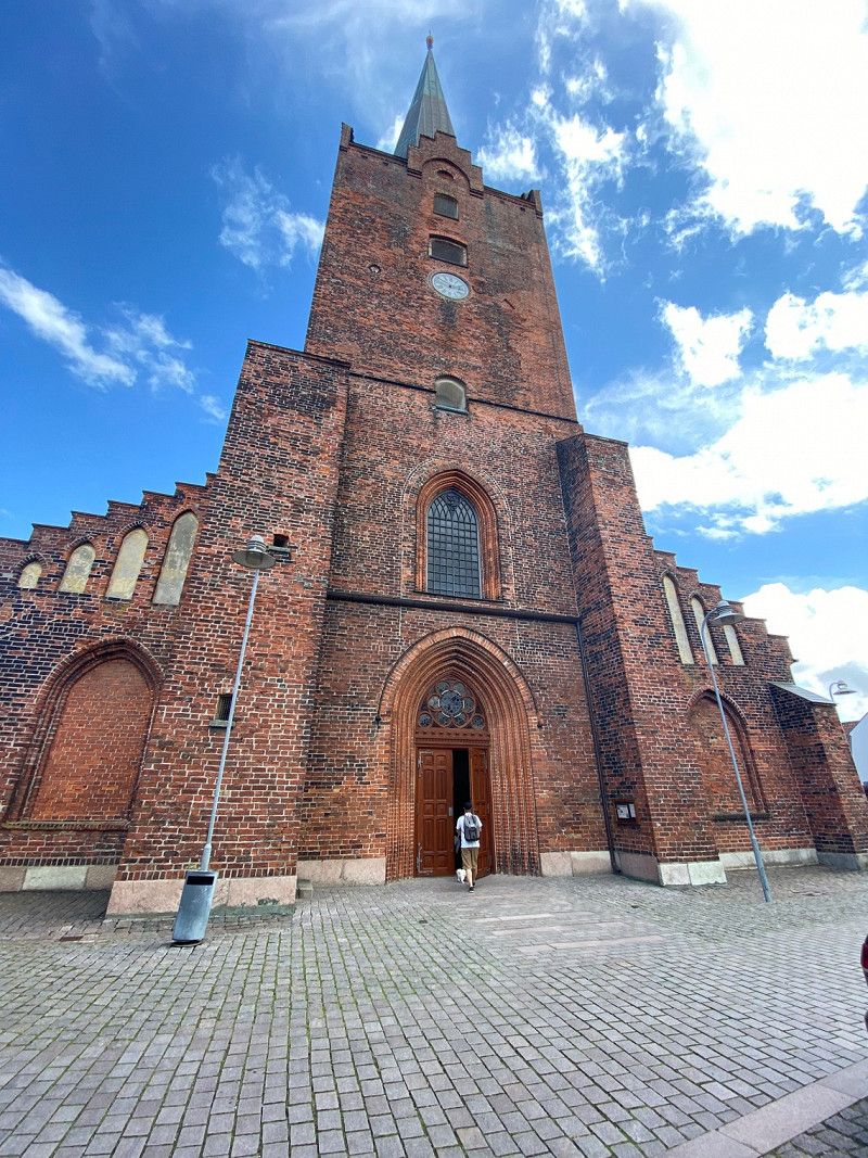
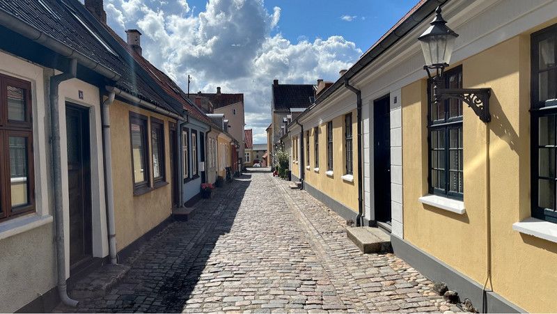
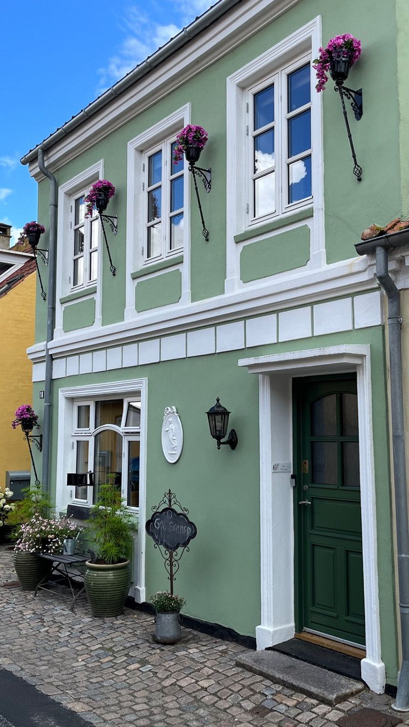
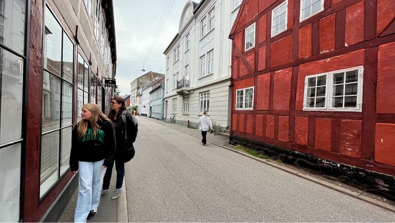
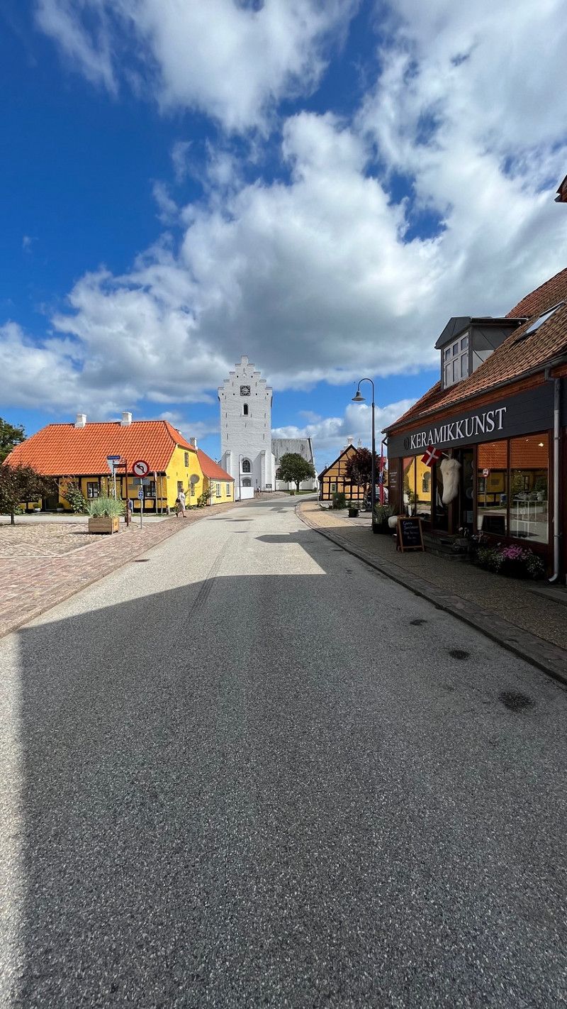
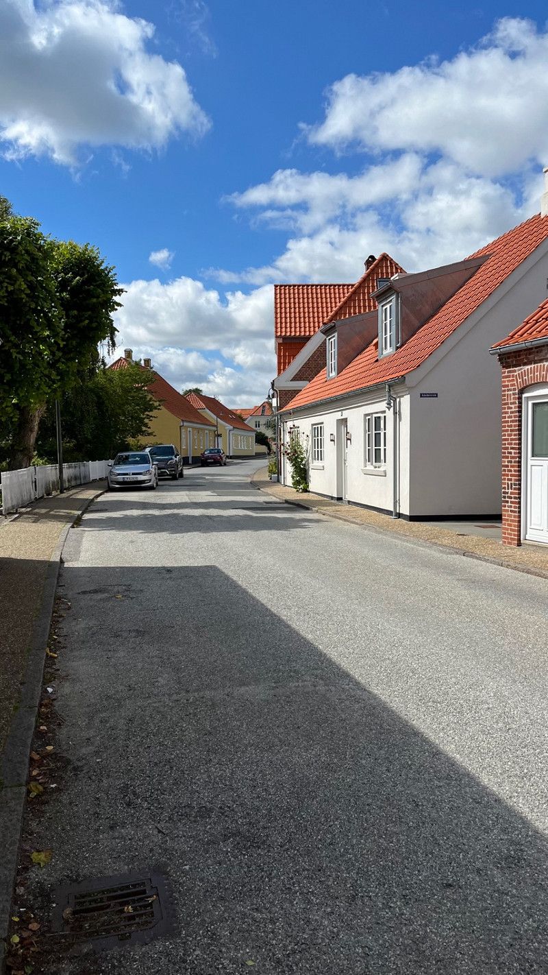
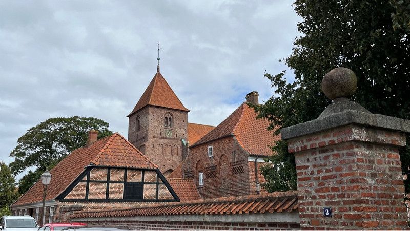
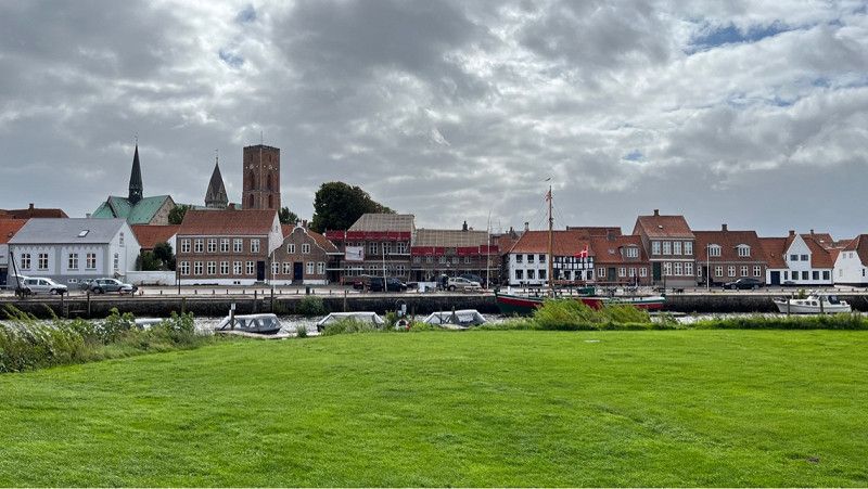
Nakskov
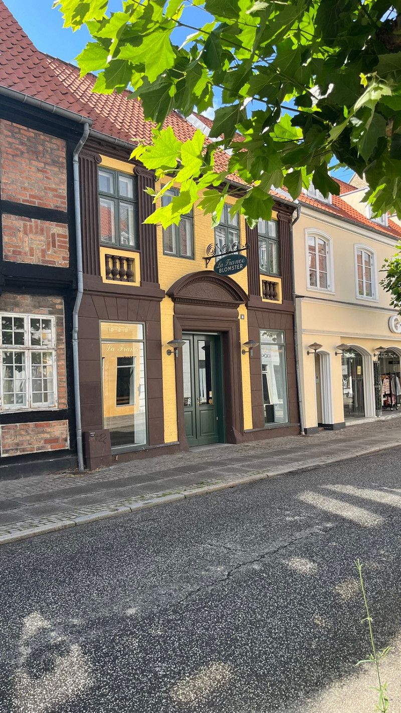
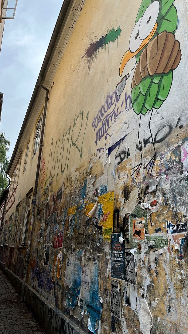
Today we walked to the nearby town of Nakskov. We did everything on foot today because there was no way to do anything by bus or public transport.
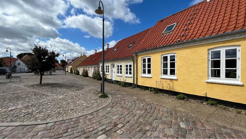
Nakskov is the largest town on Lolland and has 12495 inhabitants.
In the old town there are some houses from the 16th to 18th centuries.
In the town is the Gothic Church of St. Nicholas, built in the 15th century. Some parts of the church are from the 13th century.
Otherwise, the port is the center of Nakskov, where grain and sugar beets are exported.
Region Seeland, Dänemark
54° 49' 49.8" N 11° 8' 57.7" E
54.8304979 11.1493517
• Head north on Tuxensvej. Go for 105 m.
• Turn left onto Maribovej. Go for 70 m.
• Turn right onto Løjtoftevej (289). Go for 19.0 km.
• Turn left onto Ravnsborgvej. Go for 1.5 km.
• Turn left onto Glentehøjvej. Go for 764 m.
• Arrive at Glentehøjvej. Your destination is on the right.
☍
21,5 km
( 21 min.)
Day
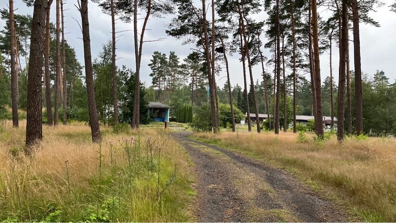
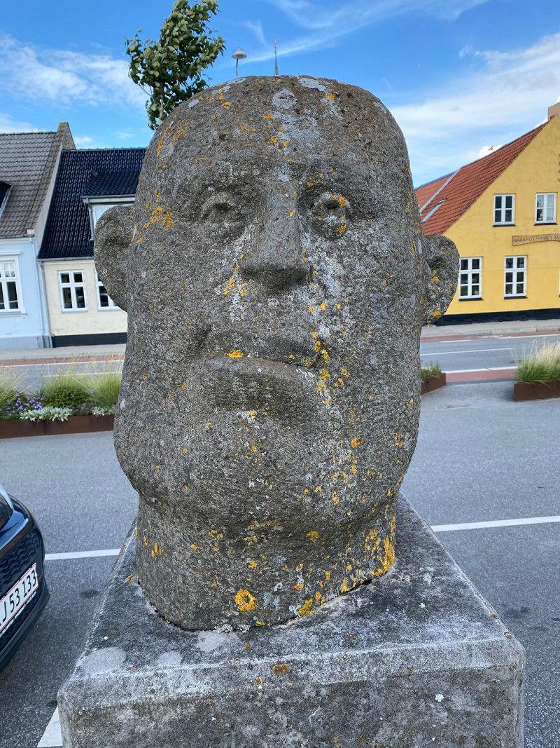
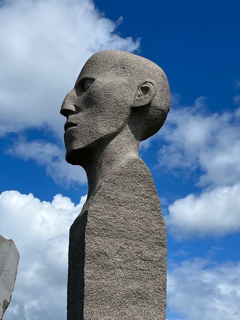
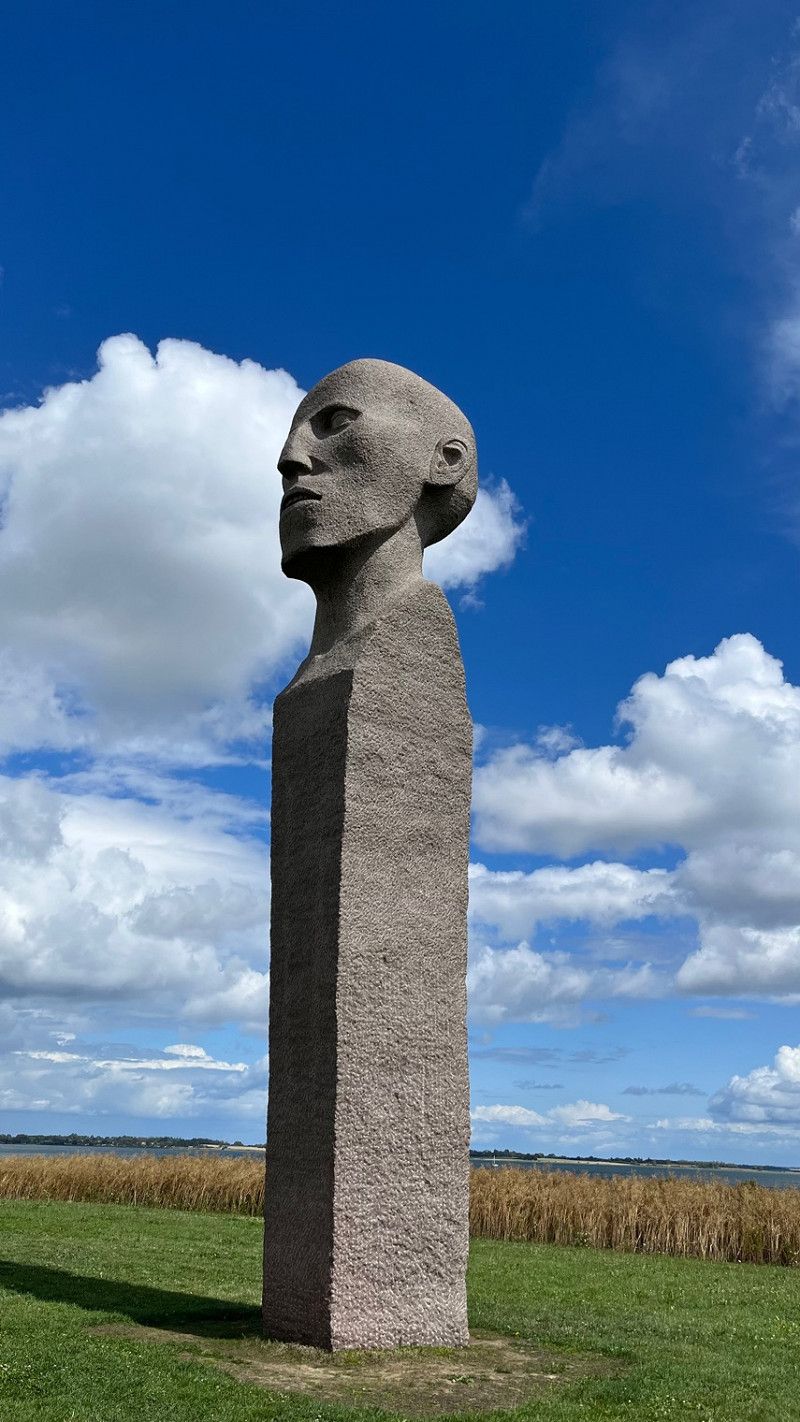
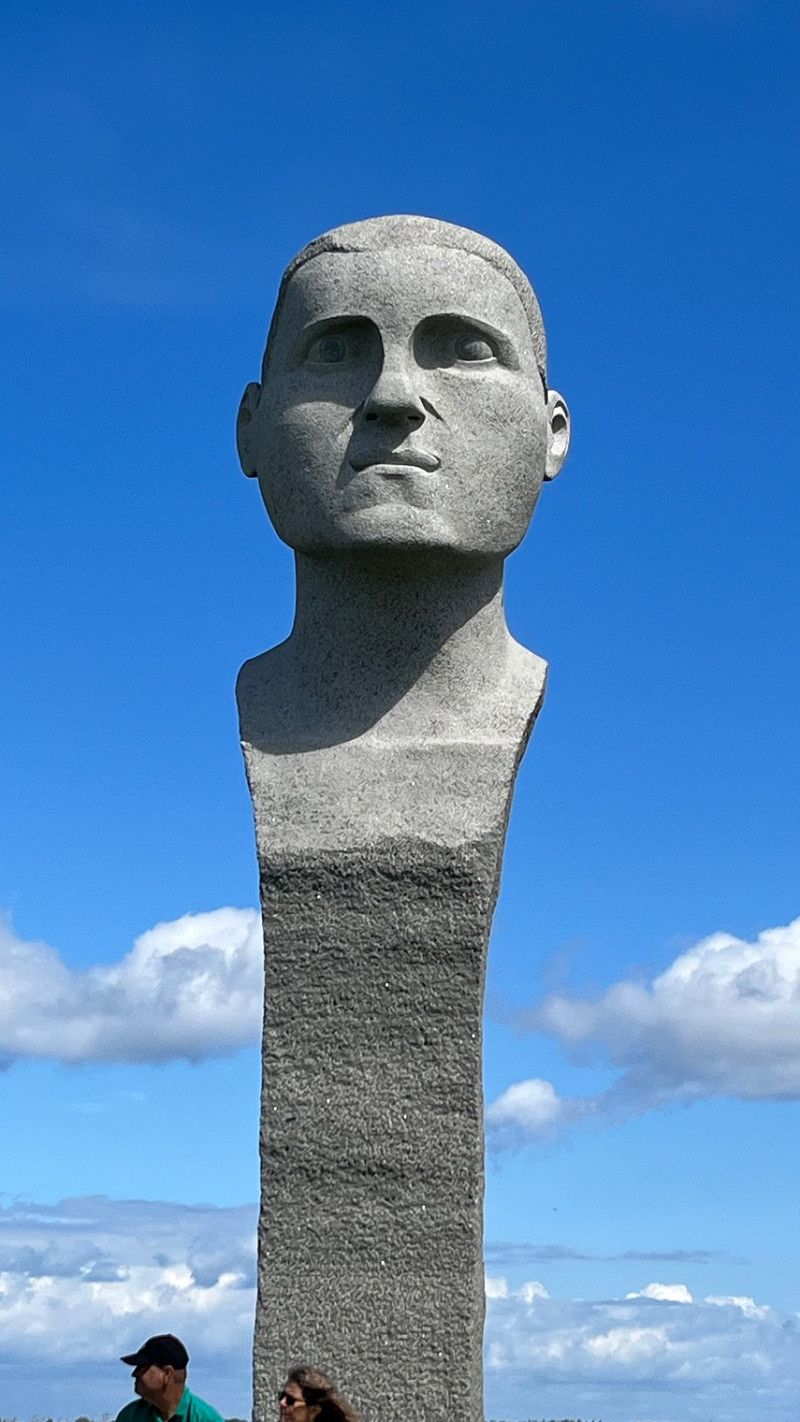
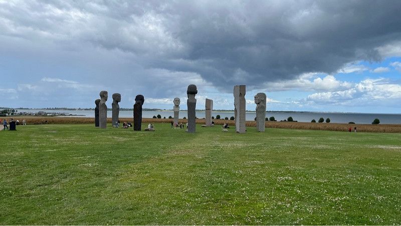
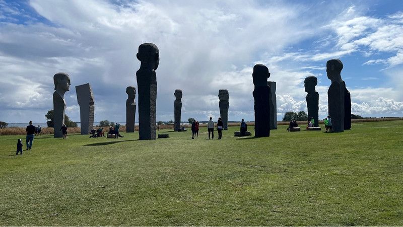
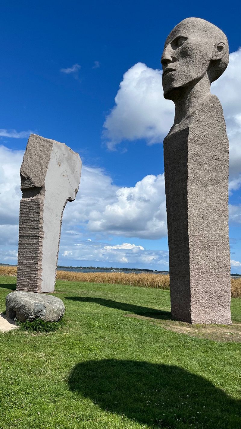
Dodekalitten
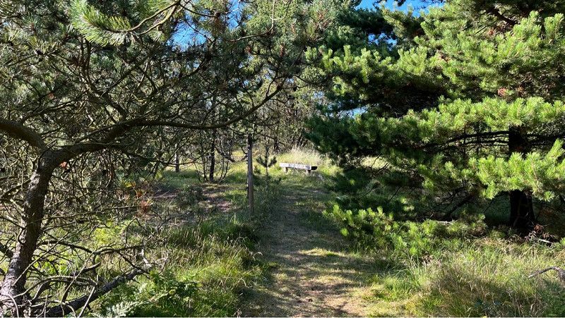
We parked right on the side of the road (Kragenæsvej) and walked about 1.2 km through the forest to the Dodekalitten.
A beautiful place and impressive.
The Dodecalite (Greek: Twelve Stones) consists of 12 stone pillars, each 7-9m high and weighing 25-45 tons each, with the top 2m shaped like heads, all in a circle 40m diameter to the centre show.
These 11 stone figures are currently in the middle of a field in Lolland.
Dänemark
54° 54' 23.9" N 11° 21' 23.8" E
54.9066273 11.3566201
• Head south on Glentehøjvej. Go for 764 m.
• Turn right onto Ravnsborgvej. Go for 1.5 km.
• Turn left onto Bandholmvej (289). Go for 17.6 km.
• Turn left onto Vestre Landevej (9) toward Maribo. Go for 1.4 km.
• Continue on Vestre Landevej (9) toward København/E47/Nykøbing. Go for 416 m.
• Turn left and take ramp onto E47 (Sydmotorvejen) toward København/Nykøbing/Sakskøbing. Go for 11.7 km.
• Take exit 46 toward Nykøbing. Go for 552 m.
• Turn right onto Nykøbingvej (9) toward Nykøbing. Go for 11.9 km.
• Take the 2nd exit from roundabout onto Sakskøbingvej (9) toward Nykøbing. Go for 1.7 km.
• Keep left onto Brovejen (9) toward Guldborg. Go for 127 m.
• Take the 2nd exit from roundabout onto Guldborgvej toward Guldborg. Go for 390 m.
• Turn right onto Dæmningen. Go for 238 m.
• Arrive at Dæmningen. Your destination is on the right.
☍
48,2 km
( 41 min.)
Dæmningen
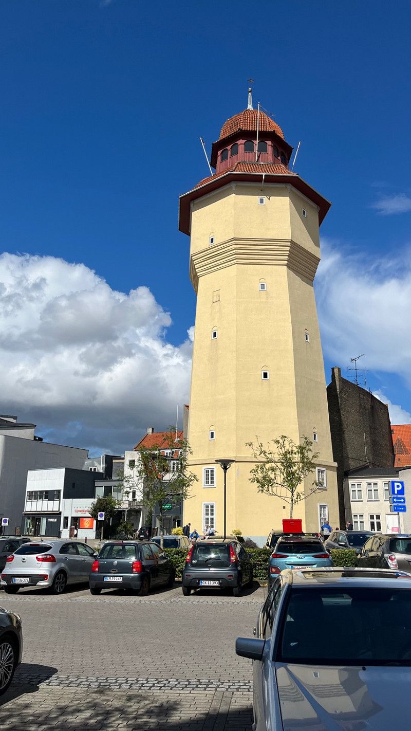
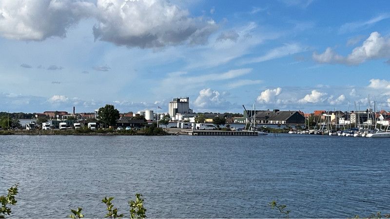
Then we continued to Nykobing Falster.
Nykøbing is on the west coast of Falster.
A beautiful city with interesting historical buildings.
Tonight we stay at the marina in Nykøbing.
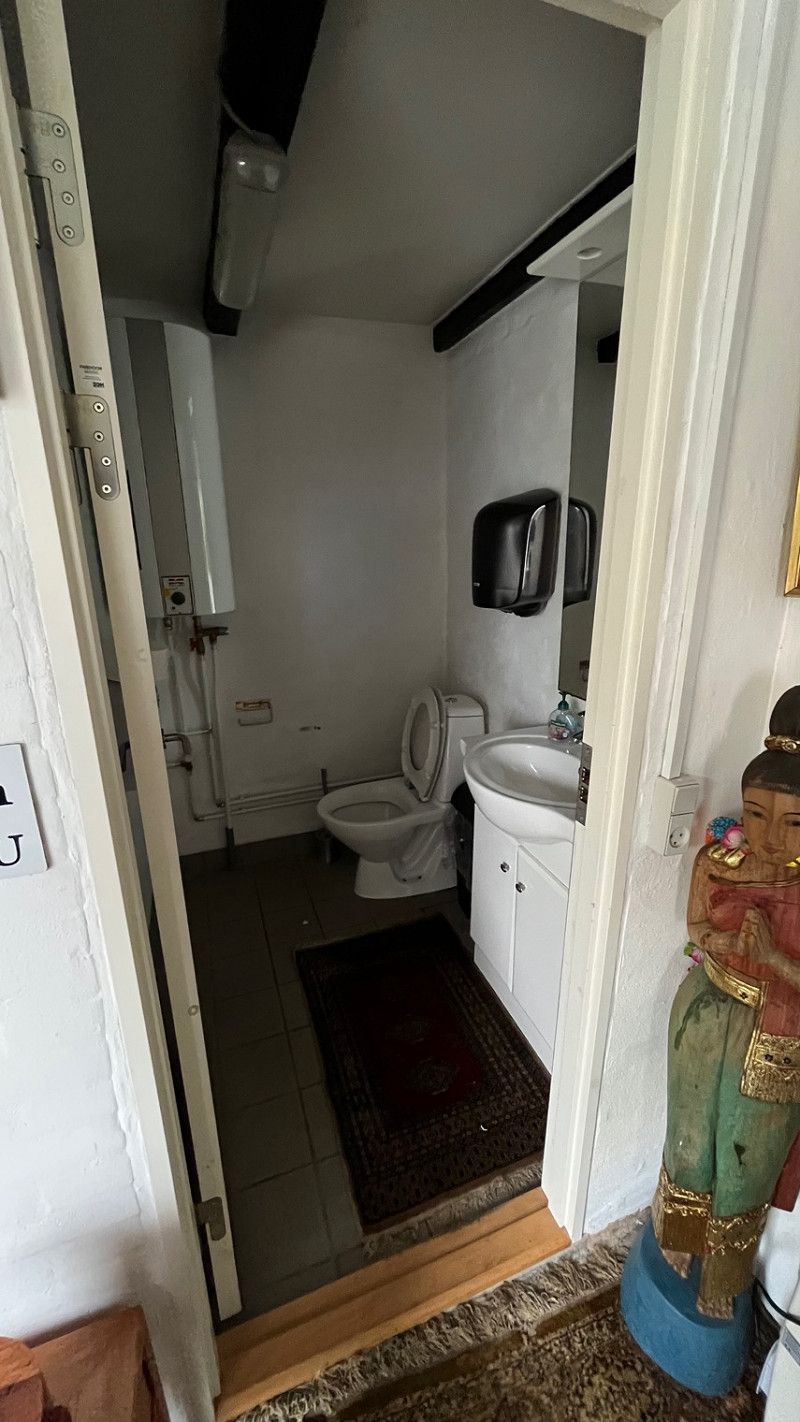
The pitch offers 12 pitches with electricity and clean toilet facilities. Gray water disposal with fresh water.
You can stand right on the water.
Adress is:
Dæmningen 2, 4800 Nykøbing Falster, Denmark
Dæmningen 2, Nyköbing Falster, Region Seeland, Dänemark
54° 45' 38" N 11° 51' 35.3" E
54.7605680 11.8598090
• Head toward Guldborgvej on Dæmningen. Go for 238 m.
• Turn right onto Guldborgvej. Go for 1.7 km.
• Turn right onto Vibehaven. Go for 658 m.
• Turn left onto Ved Hamborgskoven. Go for 180 m.
• Arrive at Ved Hamborgskoven.
☍
2,8 km
( 4 min.)
Day
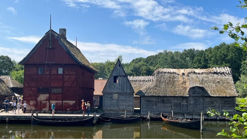
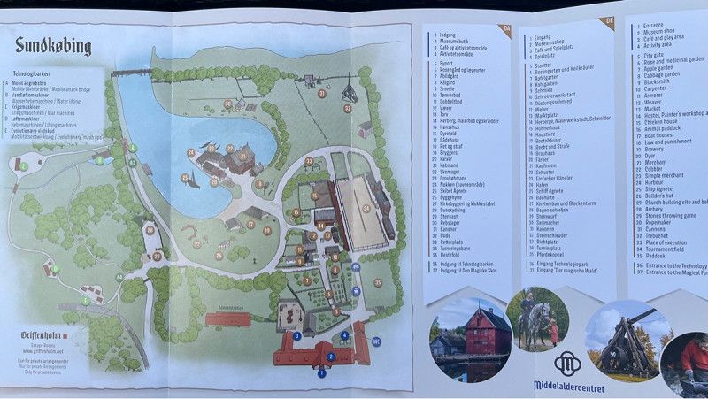
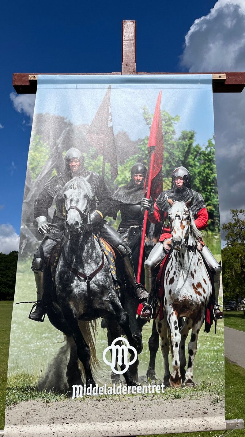
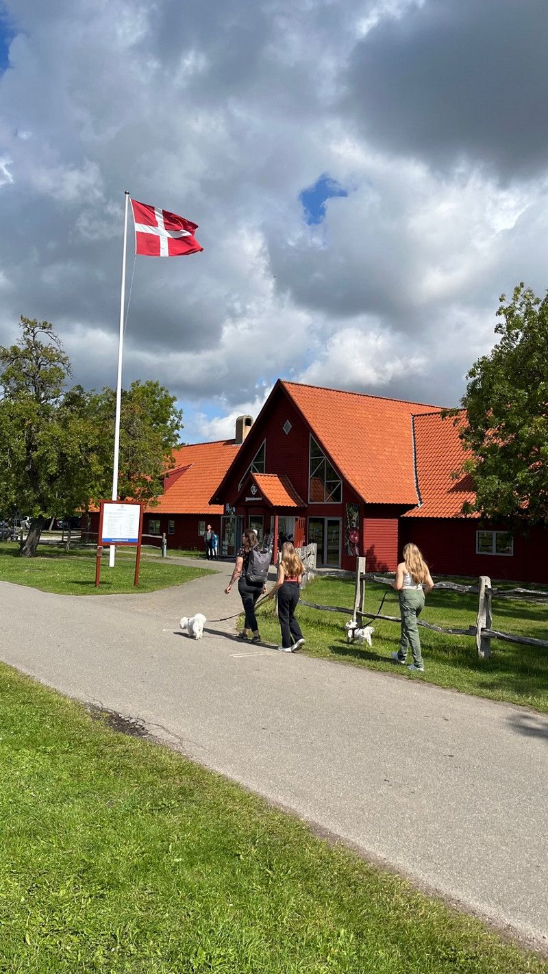
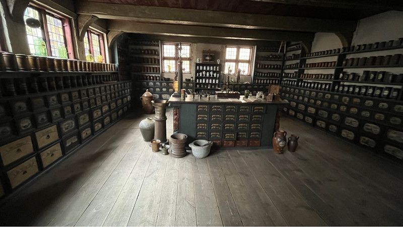
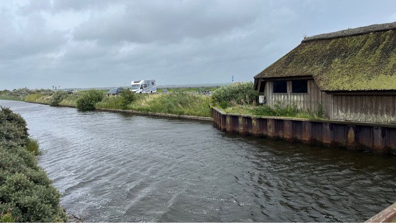
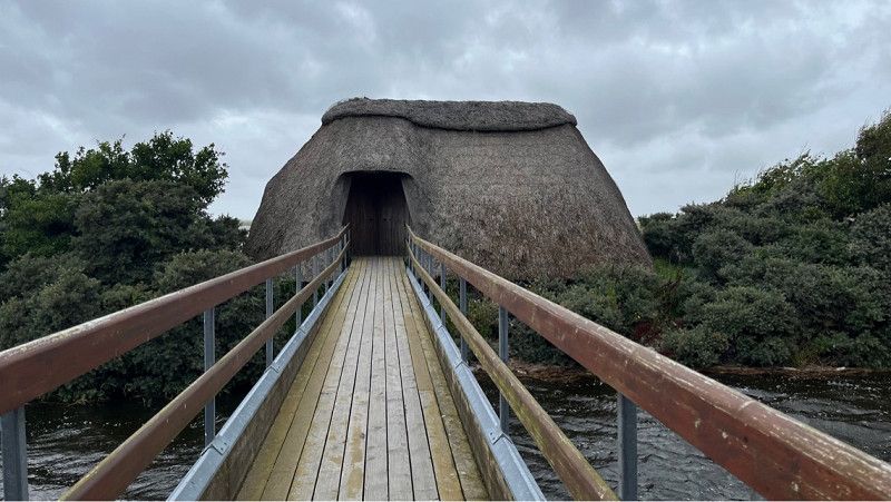
Middelaldercentret
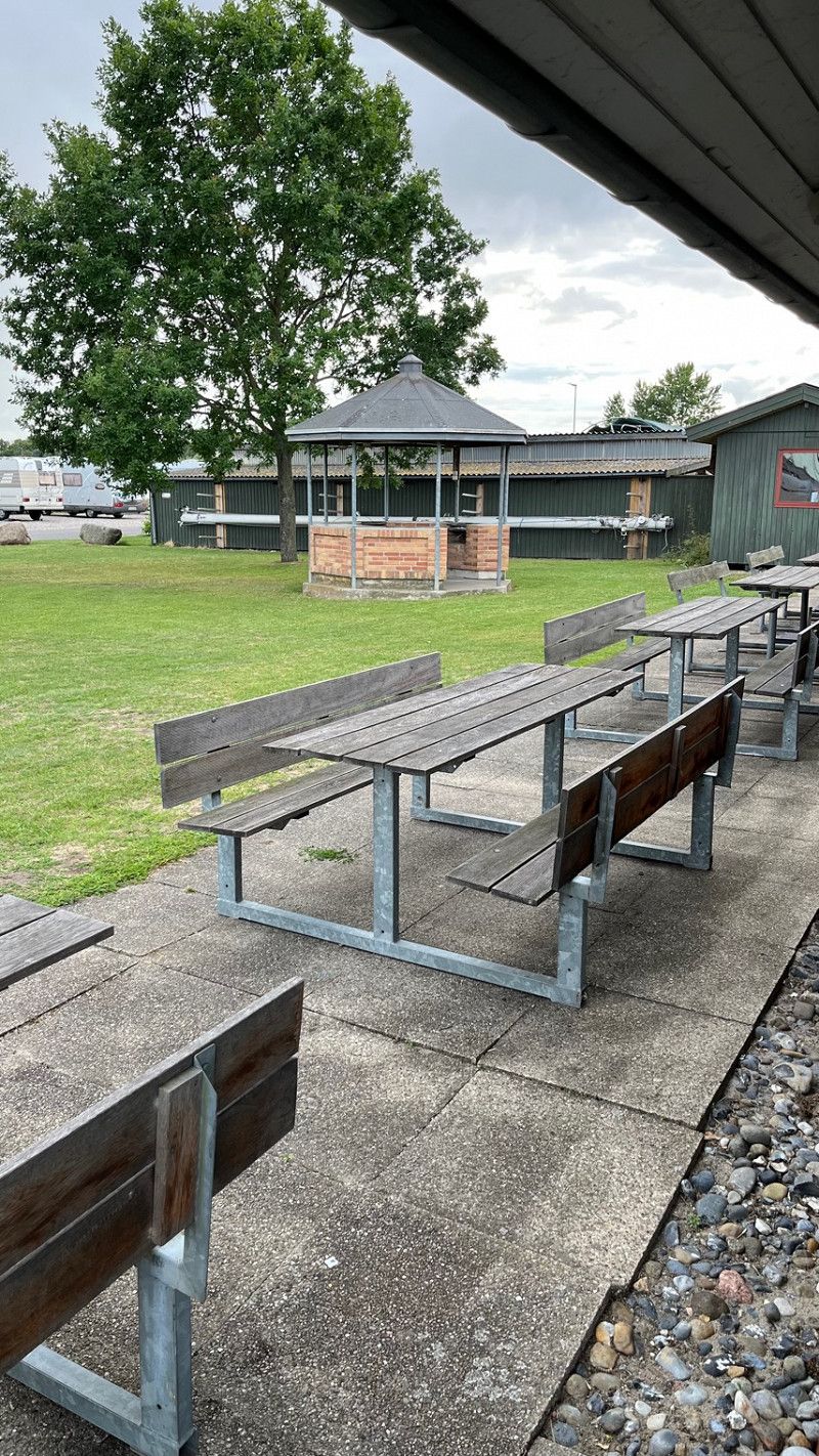
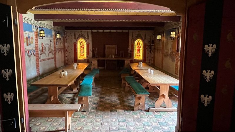
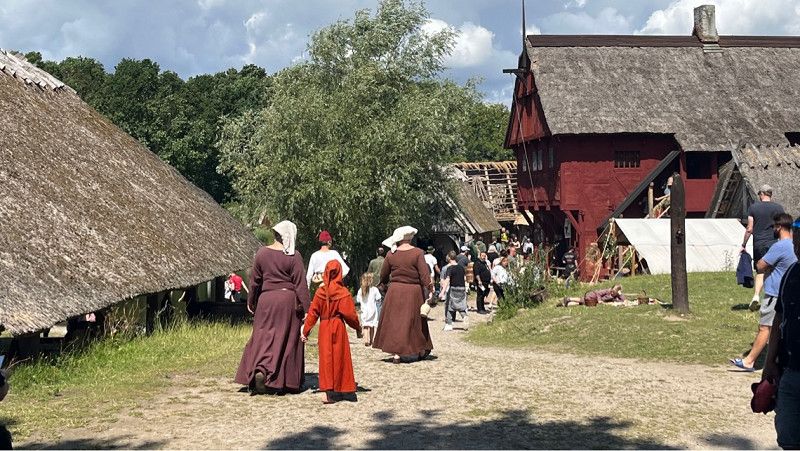
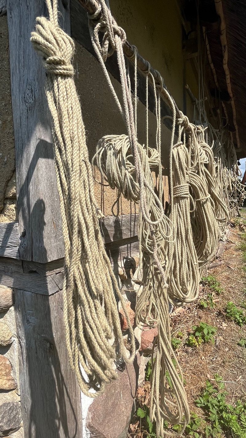
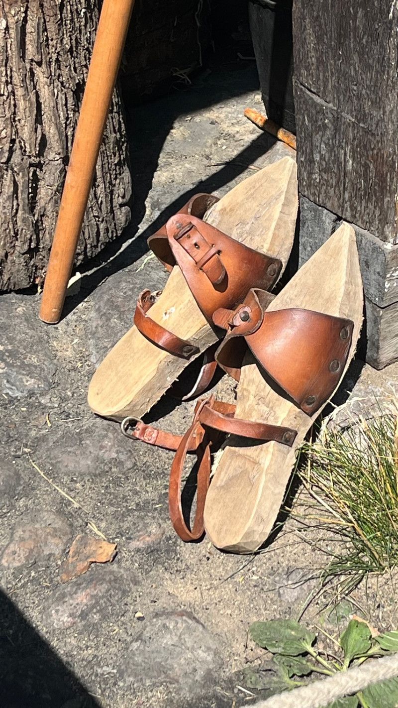
Our first stop is the Middelaldercentret near Nykobing. This is an open-air museum where a small village has been recreated. We were fortunate that exactly when we were there, an international medieval group authentically revived the village. During the day you have the opportunity to visit several performances. The highlight is the slingshot, which is actively presented on site. A jousting game can also be seen.
Since there is a large parking area and a meadow in front of the site, we don't know if you are allowed to stand here overnight. It would be an option.
Ved Hamborgskoven, Sundby, Region Seeland, Dänemark
54° 46' 35" N 11° 50' 26.2" E
54.7763956 11.8406146
• Head toward Hamborgskovvej on Ved Hamborgskoven. Go for 180 m.
• Turn right onto Vibehaven. Go for 658 m.
• Turn right onto Guldborgvej. Go for 7.2 km.
• Continue on Majbøllevej. Go for 3.1 km.
• Turn right and take ramp onto E47 (Sydmotorvejen) toward København. Go for 58.5 km.
• Take exit 37 toward Rønnede/Næstved/Faxe. Go for 407 m.
• Turn left onto Ny Næstvedvej (154) toward Faxe/Rønnede. Go for 1.4 km.
• Take the 2nd exit from roundabout onto Vordingborgvej (151/154) toward Køge/Faxe. Go for 187 m.
• Turn right onto Faxevej (154) toward Faxe. Go for 5.0 km.
• Take the 3rd exit from roundabout onto Køgevej (154). Go for 337 m.
• Turn right onto Køgevej (154/209). Go for 5.7 km.
• Turn right onto Stevnsvej (154). Go for 13.8 km.
• Take the 2nd exit from roundabout onto Frøslevvej. Go for 986 m.
• Take the 2nd exit from roundabout onto Højerupvej. Go for 4.2 km.
• Continue on Højerup Bygade. Go for 390 m.
• Turn left onto Hærvejen. Go for 1.3 km.
• Turn right onto Fyrvej. Go for 519 m.
• Arrive at Fyrvej. Your destination is on the left.
☍
103,8 km
(1 hrs. 15 min.)
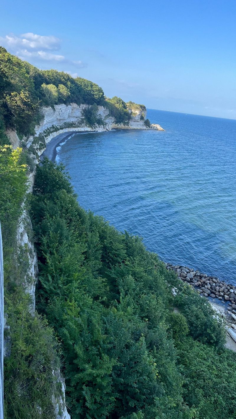
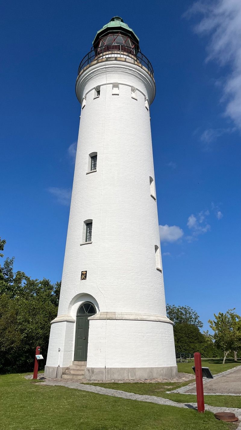
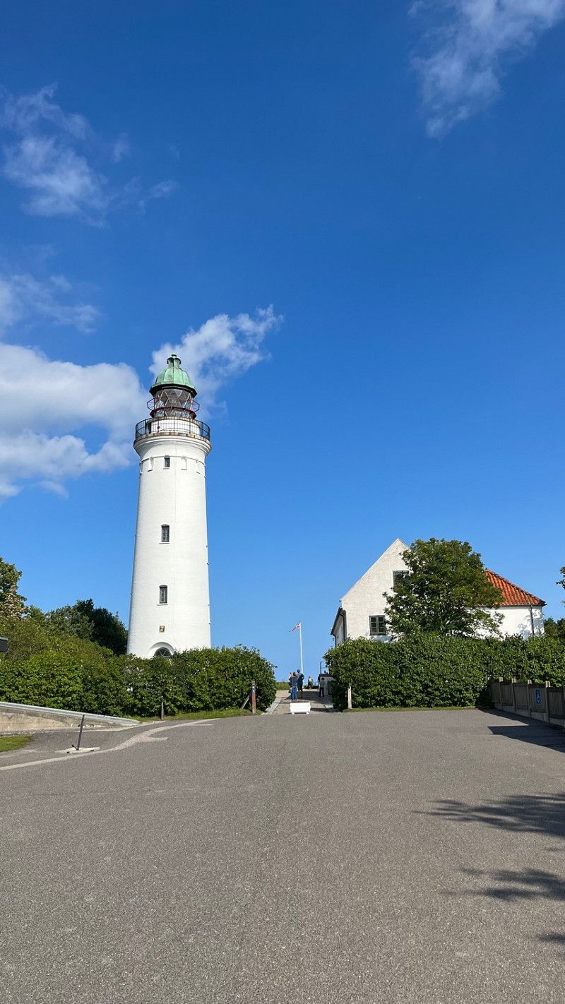
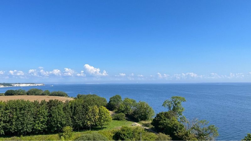
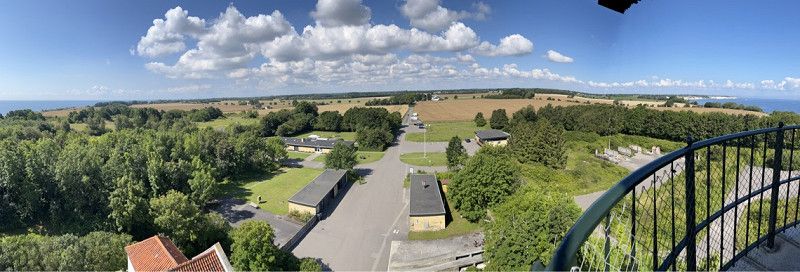
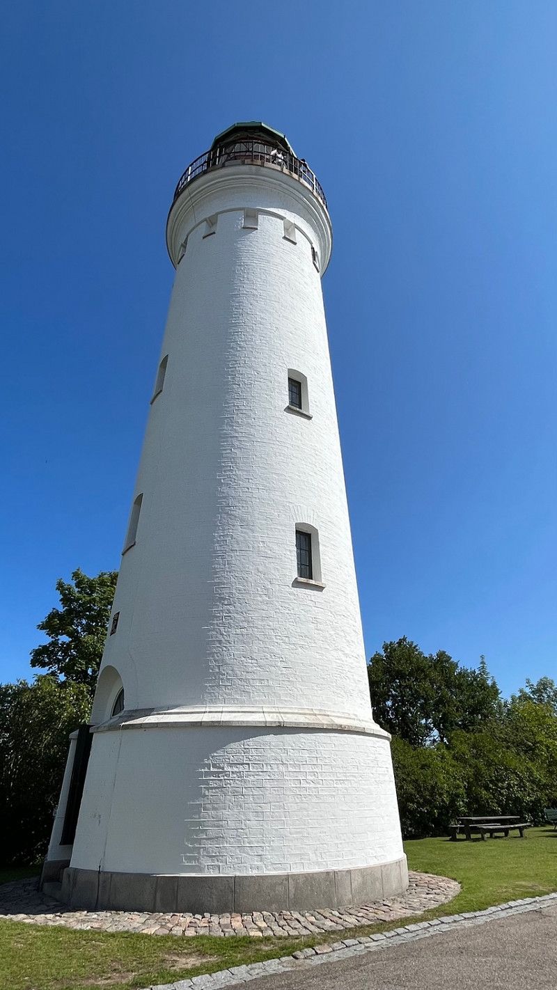
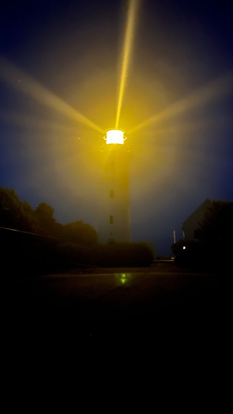
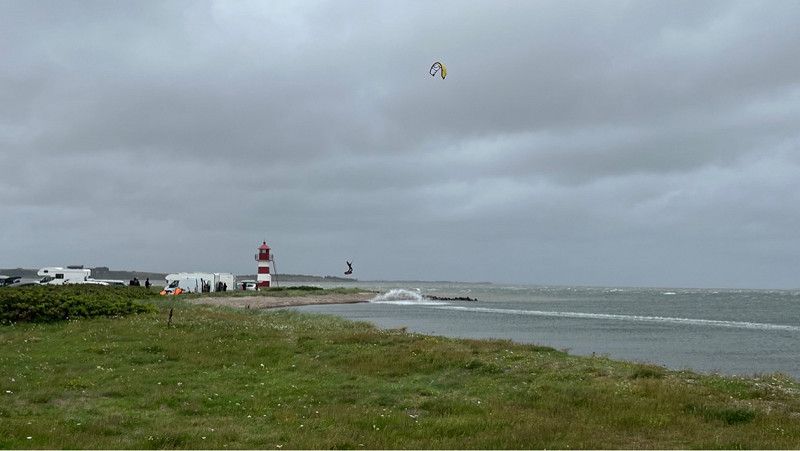
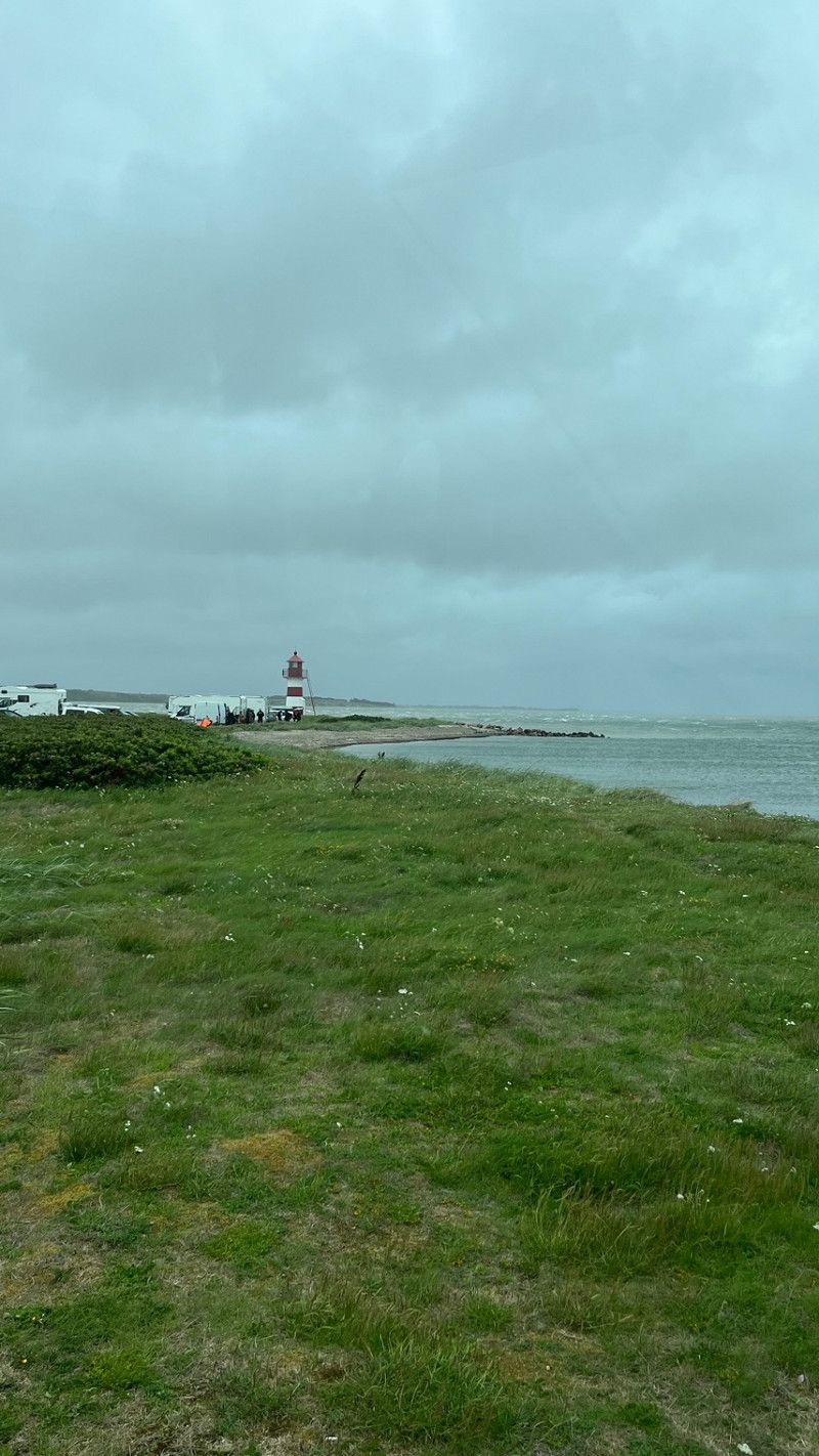
Stevns Fyr
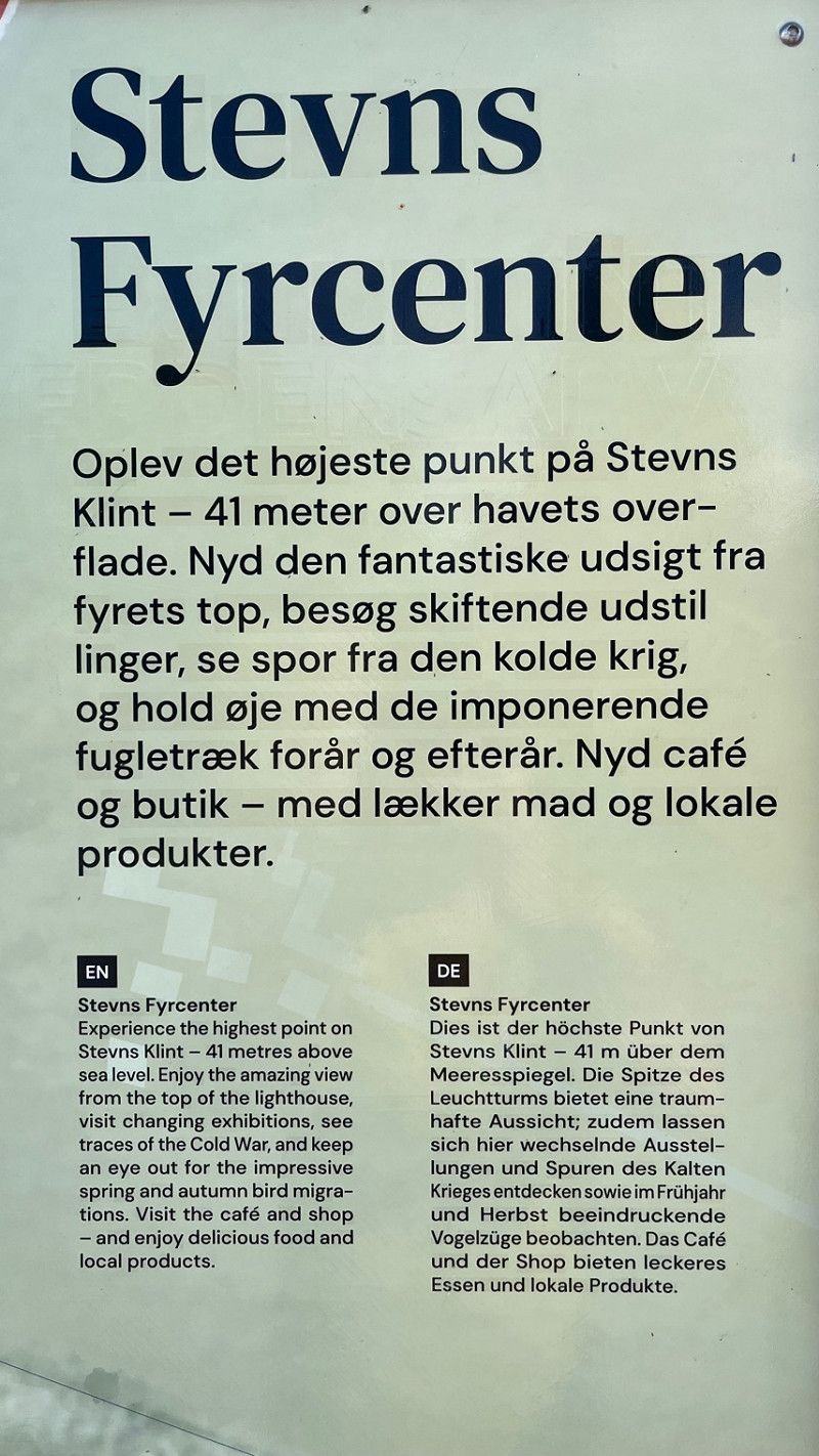
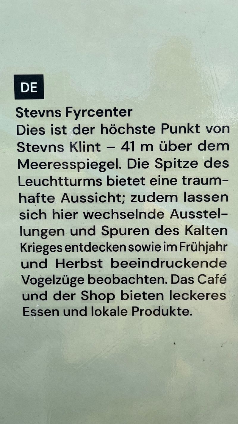
Stevns Fyrcenter
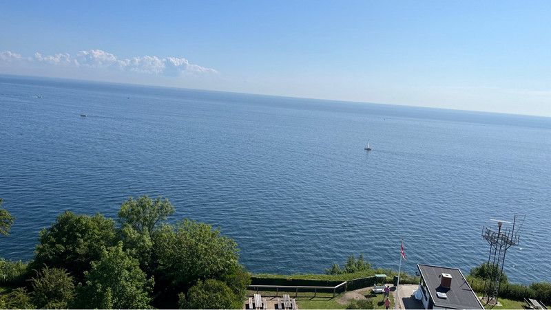
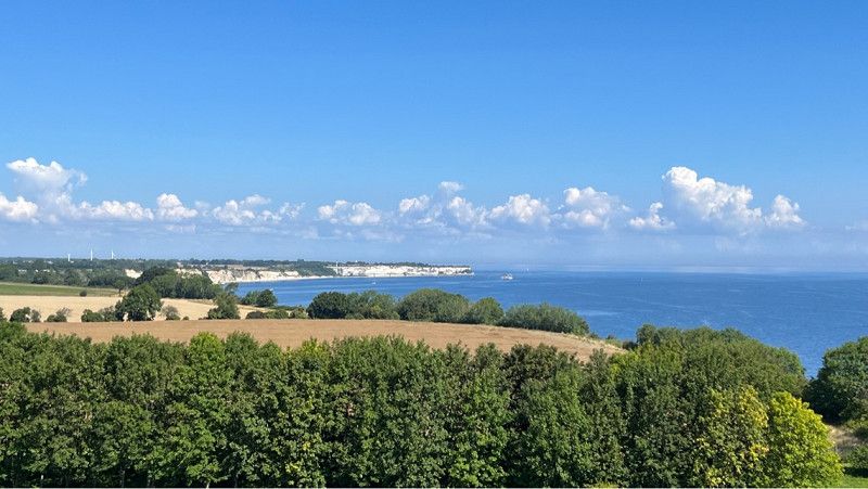
This is the highest point of Stevns Klint - 41 m above sea level. The top of the lighthouse offers a dreamy view; You can also discover changing exhibitions and traces of the Cold War here, as well as watch impressive bird migrations in spring and autumn. The café and shop offer delicious food and local products.
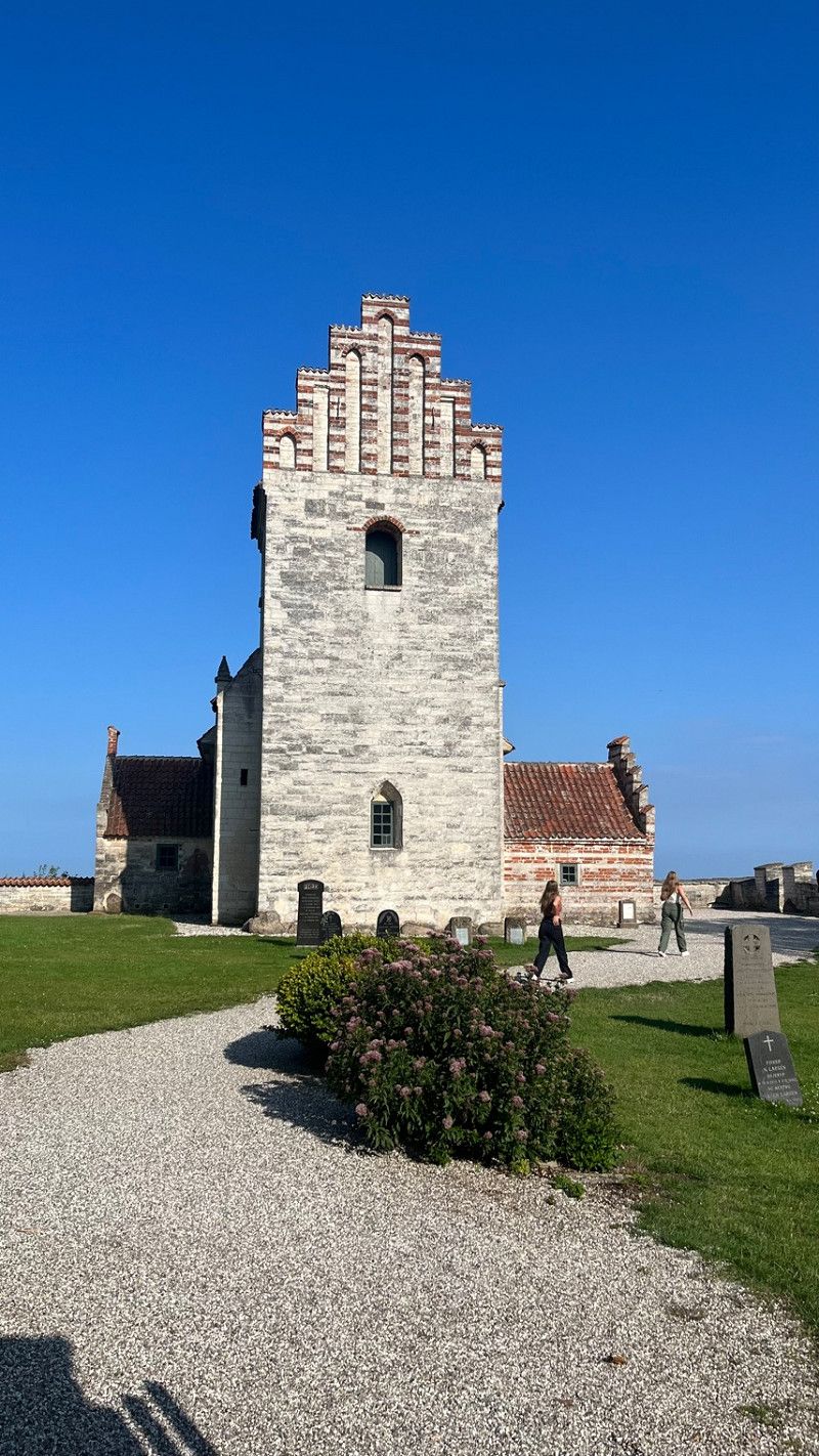
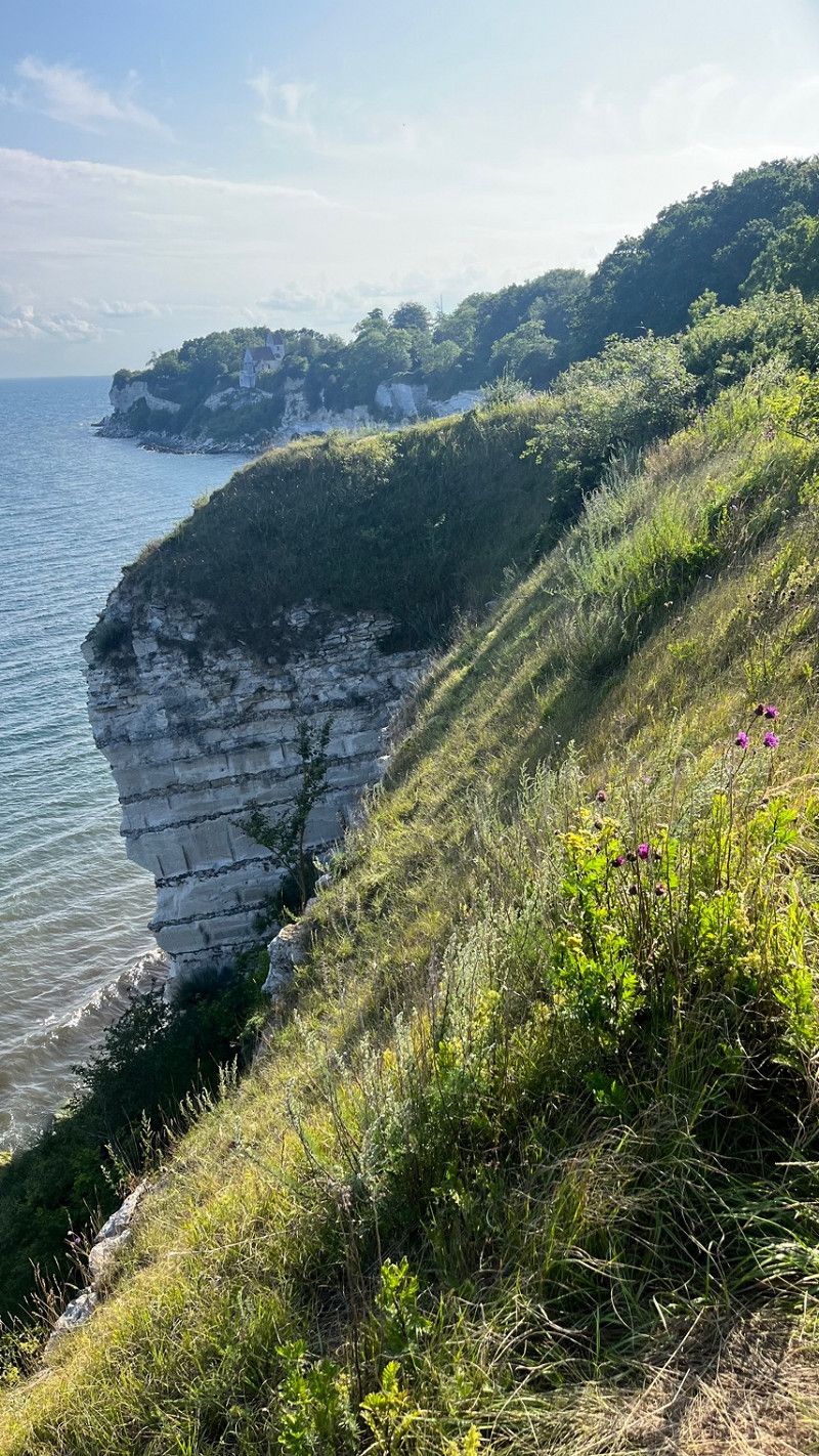
From here you can take a leisurely evening stroll along Stevns Klint. We walked 1.5 km towards Højerup and visited the old church - where the chancel fell into the sea in 1928.
We stayed overnight in the parking lot at the lighthouse. You can also stand here overnight, but please no camping behavior.
Fyrvej, Højerup, Region Seeland, Dänemark
55° 17' 26.4" N 12° 27' 12.9" E
55.2906729 12.4535959
• Head east on Fyrvej.
• Arrive at Fyrvej. Your destination is on the left.
☍
Distance not available
(Duration not available)
Day
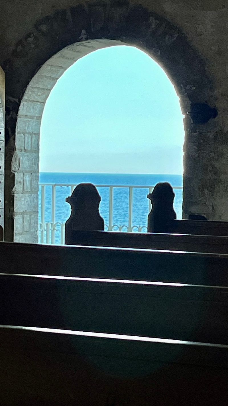
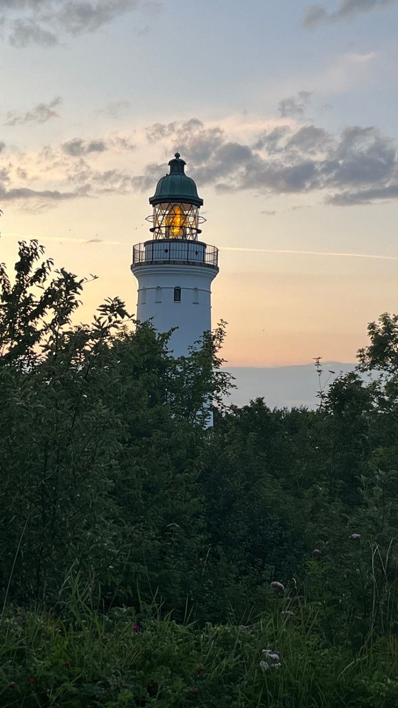
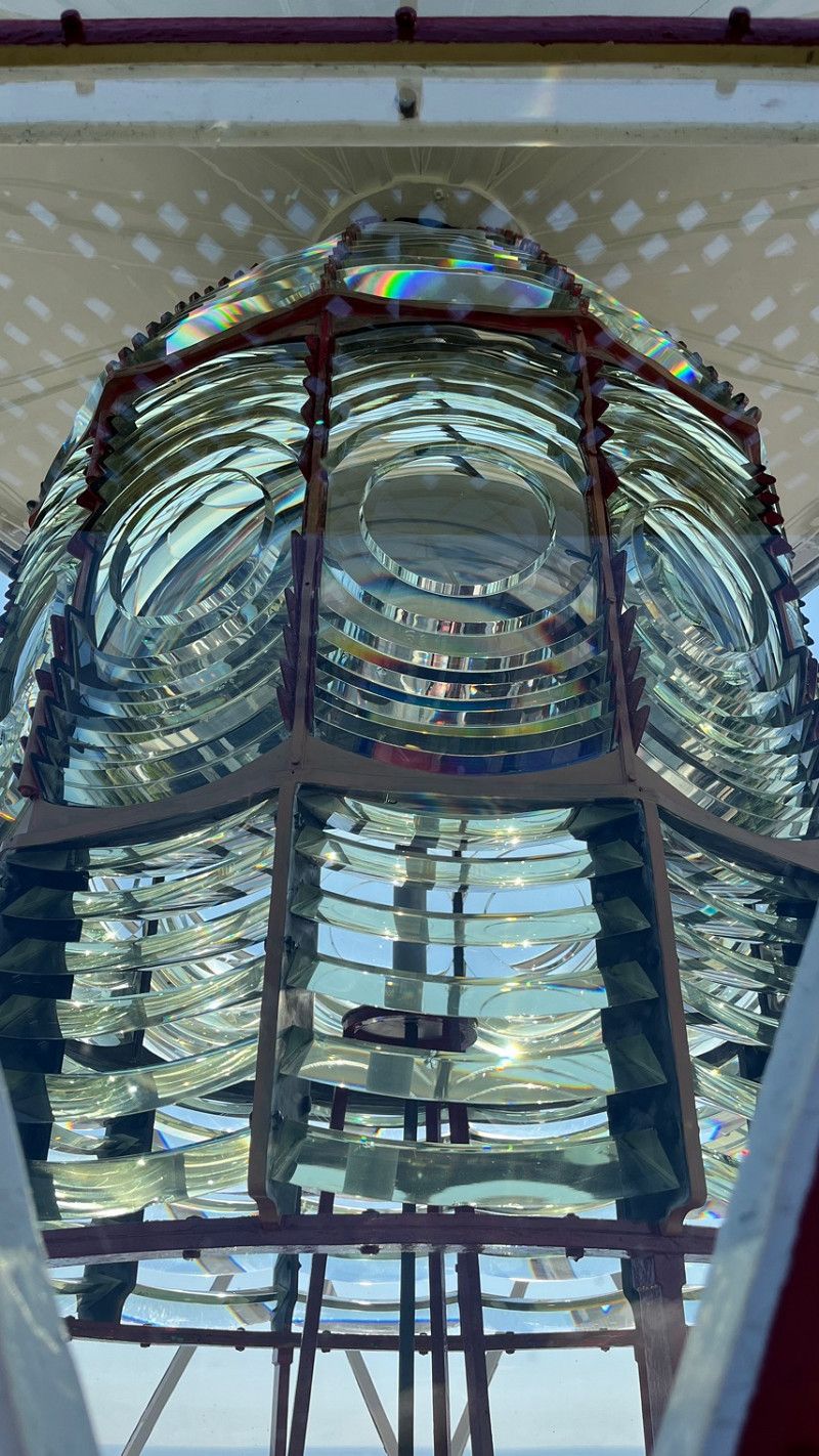
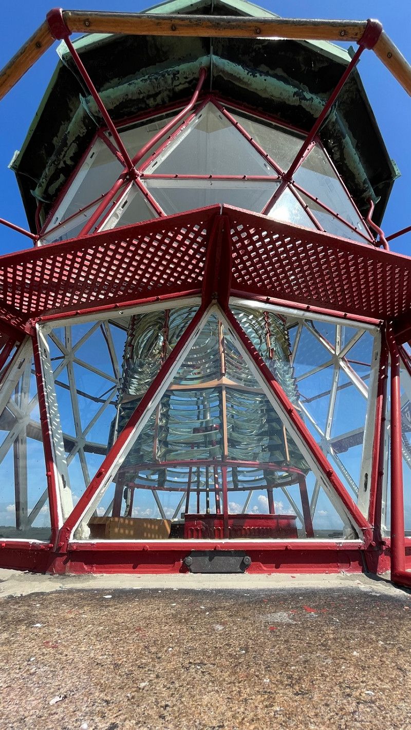
Stevns Fyr
Before we made our way to Copenhagen today, we climbed the lighthouse. Visiting the lighthouse is free. You are welcome to leave a donation, which we were happy to do. Climbing the lighthouse is not difficult, the view is really great when the weather is good.
We stood the night at the lighthouse very well.
Fyrvej, Højerup, Region Seeland, Dänemark
55° 17' 26.4" N 12° 27' 12.9" E
55.2906729 12.4535959
• Head east on Fyrvej. Go for 186 m.
• Turn right onto Fyrvej. Go for 448 m.
• Turn left onto Hærvejen. Go for 1.3 km.
• Turn right onto Højerup Bygade. Go for 390 m.
• Continue on Højerupvej. Go for 4.1 km.
• Take the 2nd exit from roundabout onto Frøslevvej. Go for 960 m.
• Take the 1st exit from roundabout onto Rødvigvej (261). Go for 17.4 km.
• Turn right onto Strandvejen (209/261). Go for 3.7 km.
• Turn right onto Strandvejen. Go for 474 m.
• Continue on Toldbodvej. Go for 447 m.
• Continue on Østre Banevej. Go for 418 m.
• Take the 3rd exit from roundabout onto Værftsvej. Go for 1.1 km.
• Turn left onto Værftsvej. Go for 1.9 km.
• Continue on Lyngvej. Go for 1.4 km.
• Turn right and take ramp onto E20/E47 (Køge Bugt Motorvejen) toward Helsingør/København. Go for 24.6 km.
• Take the exit toward E55/Helsingør/København N onto E47 (Motorring 3). Go for 17.9 km.
• Take exit 18 toward Nybrovej/Vangede/København/19s. Go for 333 m.
• Turn left onto Lagergårdsvej toward København/19. Go for 373 m.
• Turn right onto Lyngbyvej. Go for 189 m.
• Take left ramp onto 201 toward København/19. Go for 432 m.
• Continue on 19 (Helsingørmotorvejen). Go for 4.5 km.
• Keep right onto O2 (Nordhavnsvej) toward Svanemøllen. Go for 2.8 km.
• Turn left onto Sundkrogsgade. Go for 696 m.
• Continue on Færgehavnsvej. Go for 110 m.
• Turn slightly right onto Containervej. Go for 99 m.
• Turn slightly left onto Færgehavnsvej. Go for 422 m.
• Turn slightly right onto Baltikavej. Go for 496 m.
• Turn right onto Skagerrakvej. Go for 66 m.
• Continue on Oceanvej. Go for 829 m.
• Turn left. Go for 15 m.
• Arrive at your destination on the left.
☍
88,3 km
(1 hrs. 27 min.)
Oceanvej
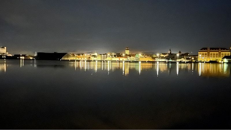
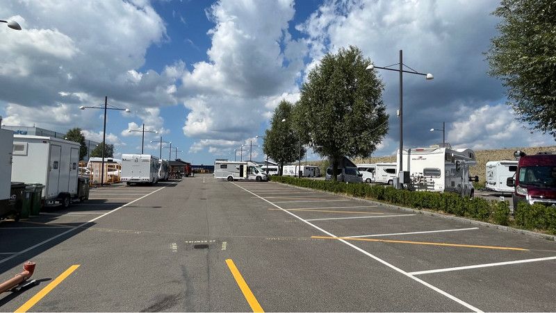
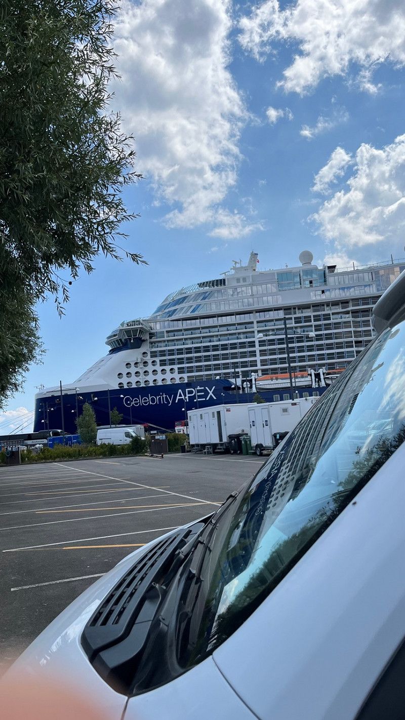
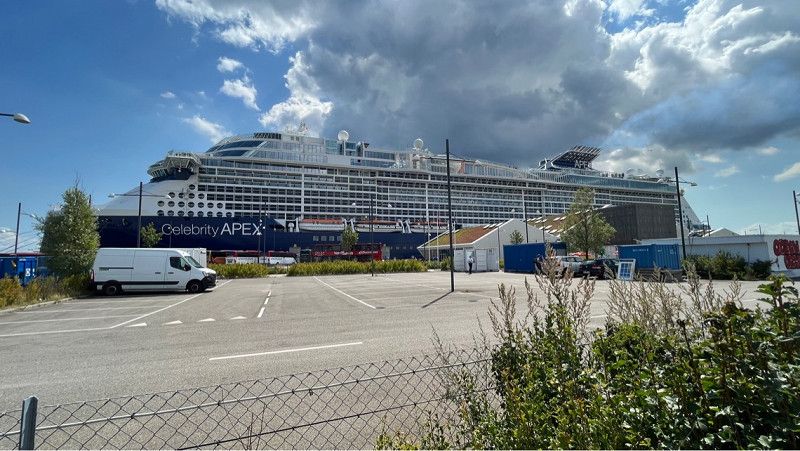
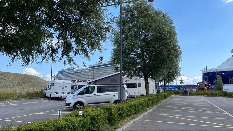
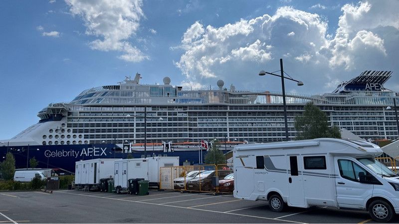
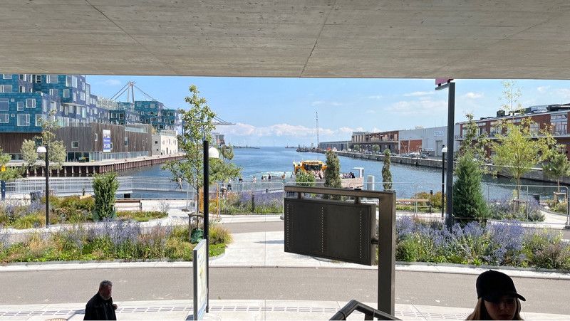
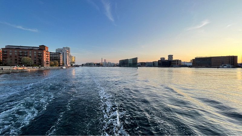
Our next stop is Copenhagen. After a long search and endless recession reading, we decided on the autocamper pitch at Nordhavn. Unfortunately, Copenhagen does not offer a lot of opportunities to stay overnight with a mobile home on pitches.
Going by the reviews, this place is not very good.
We ourselves can only speak very positively about the staff at this place. Reservation and overnight stay in this place is good.
Interesting are the huge cruise ships that arrive at night.
To visit Copenhagen you can take the bus directly to the metro. From there it is 4 stations and you are in the middle of Copenhagen.
The groundskeeper told us today that the place will only exist until the end of August 2023 because everything is being rebuilt here.
A pity.
Oceanvej 15, Kopenhagen, Hauptstadtregion, Dänemark
55° 42' 51.6" N 12° 37' 8.2" E
55.7143430 12.6189400
• Head toward Oceanvej. Go for 15 m.
• Turn right onto Oceanvej. Go for 829 m.
• Continue on Skagerrakvej. Go for 66 m.
• Turn left onto Baltikavej. Go for 496 m.
• Turn slightly left onto Færgehavnsvej. Go for 422 m.
• Turn slightly right onto Containervej. Go for 99 m.
• Turn slightly left onto Færgehavnsvej. Go for 110 m.
• Continue on Sundkrogsgade. Go for 696 m.
• Turn left onto Kalkbrænderihavnsgade (O2). Go for 2.1 km.
• Continue on Øster Voldgade. Go for 767 m.
• Turn right onto Sølvgade. Go for 224 m.
• Continue on Sølvtorvet. Go for 45 m.
• Keep left onto Sølvgade. Go for 62 m.
• Turn left onto Øster Farimagsgade. Go for 439 m.
• Turn right. Go for 65 m.
• Arrive at your destination on the right.
☍
6,5 km
( 12 min.)
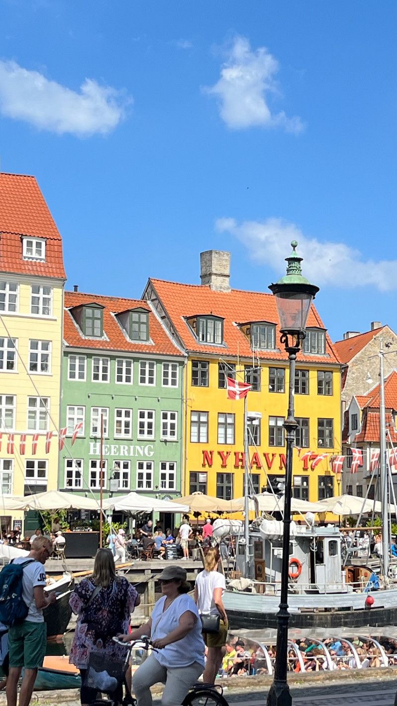
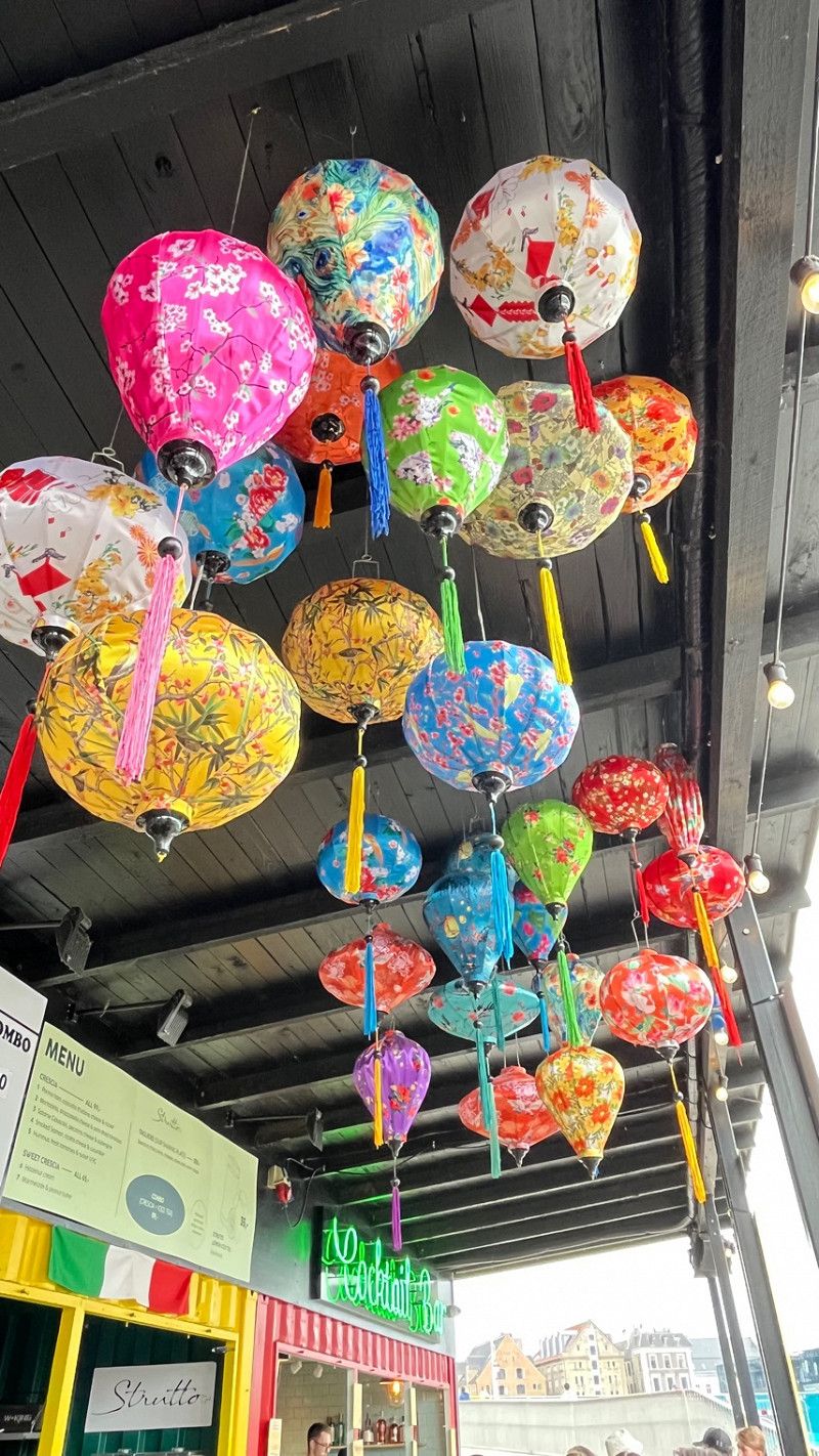
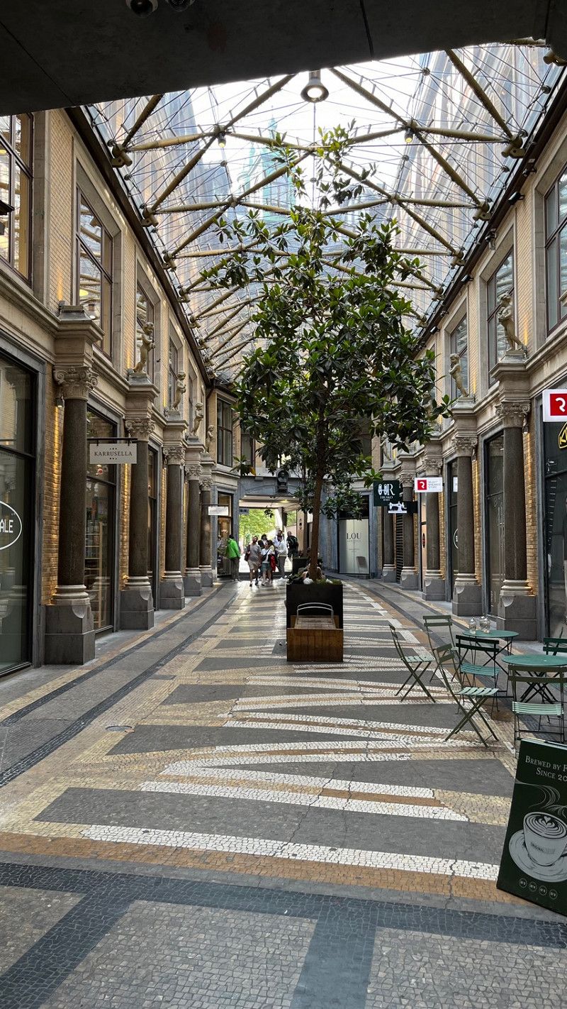
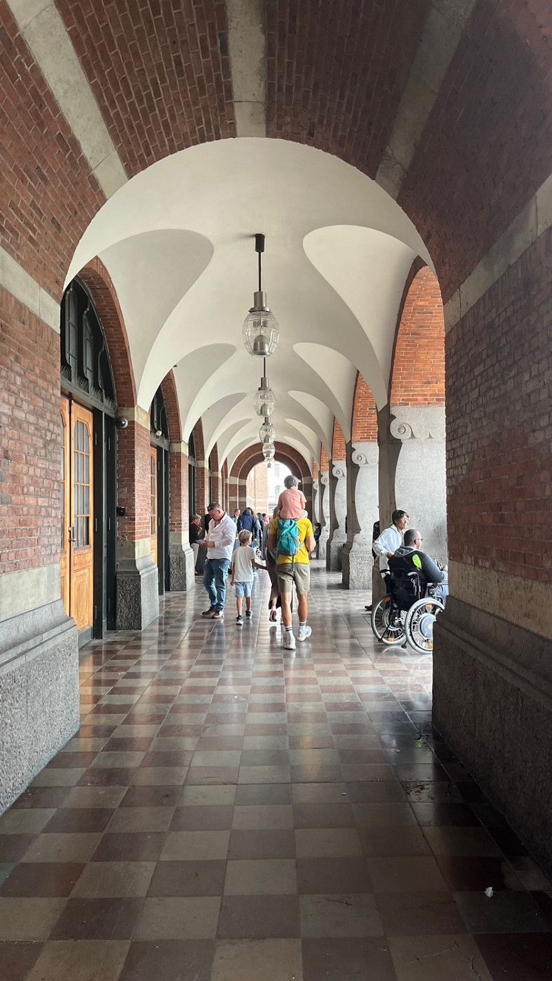
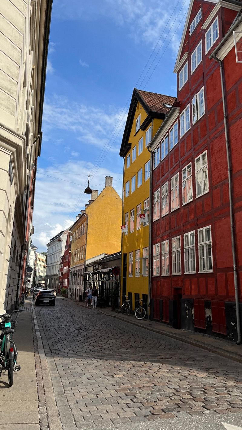
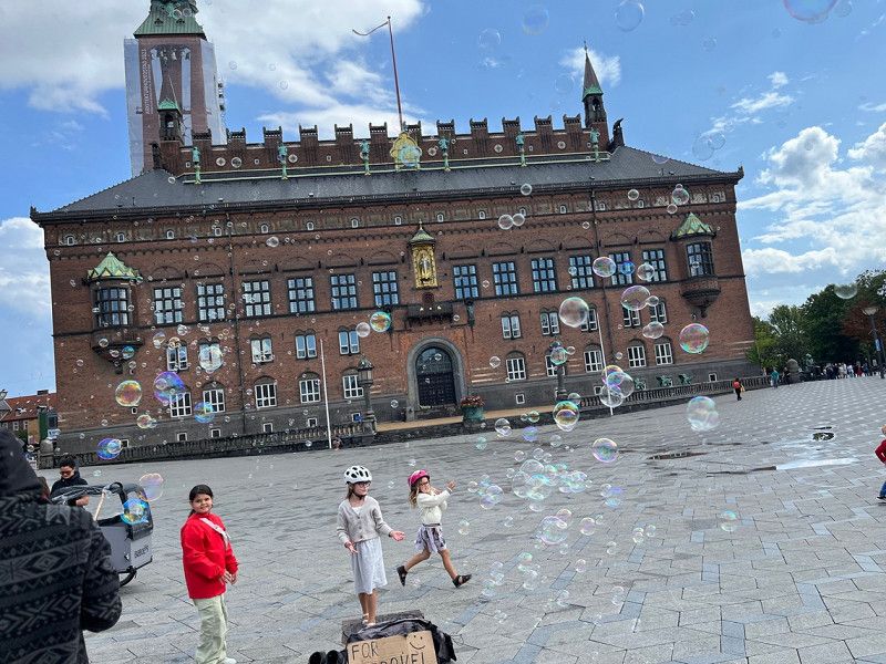
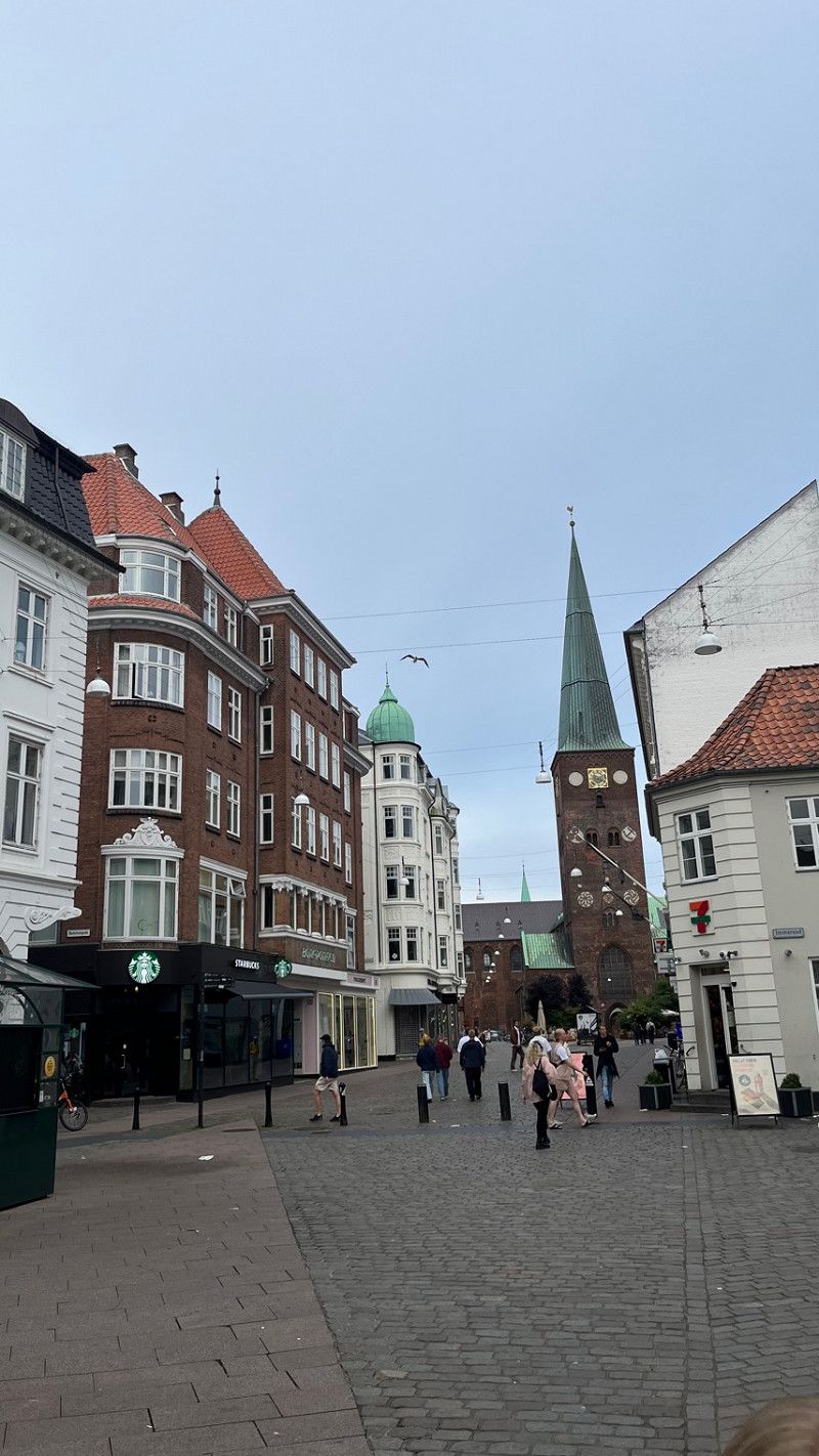
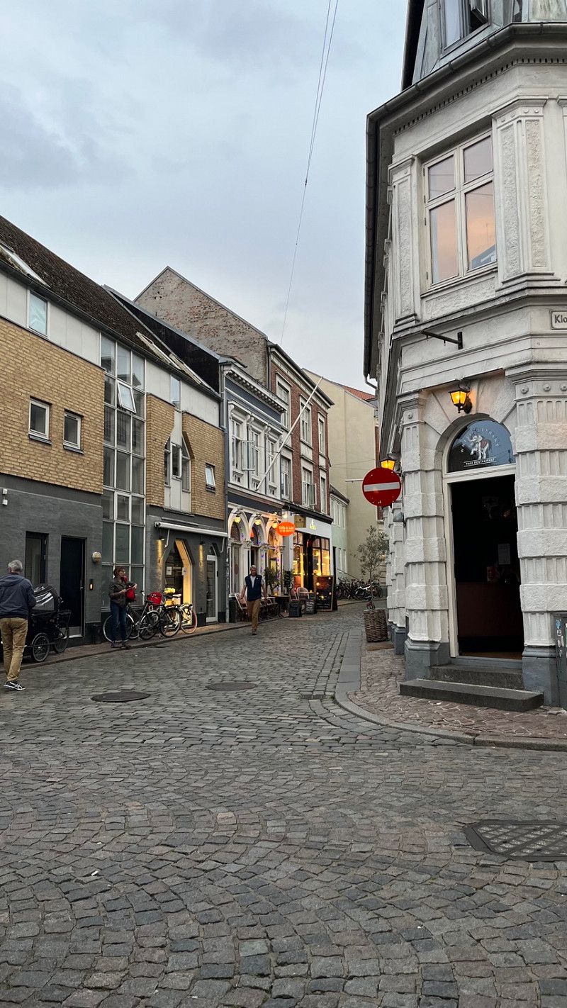
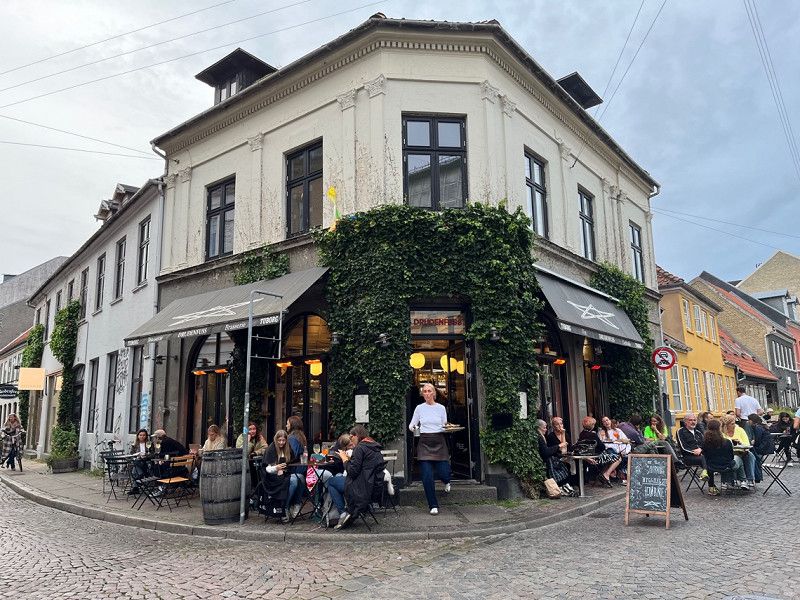
Kopenhagen
City tour day 1
We are enthusiastic about this city that we spontaneously extended by one night.
So we stay here for 3 days.
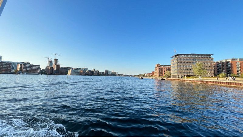
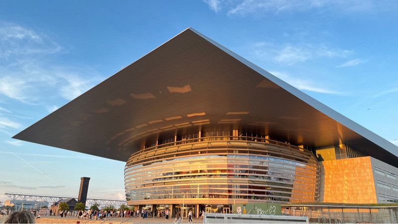
We viewed Nyhavn and King's Garden and did some shopping.
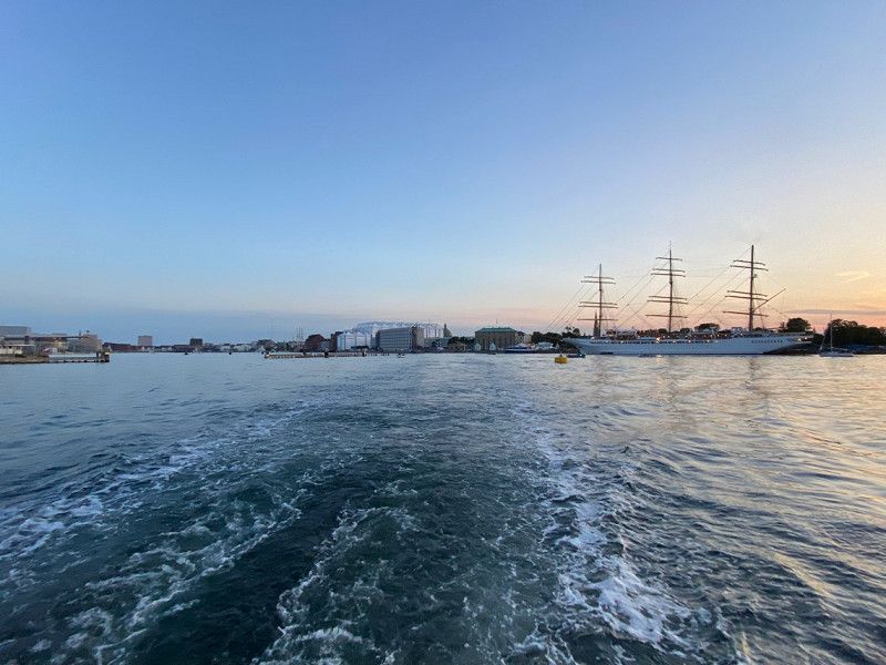
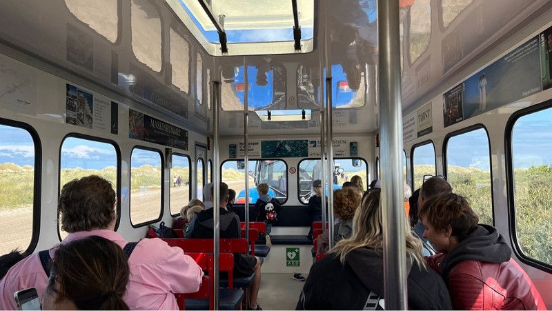
We especially like the Haven Bus. We drove the entire route and viewed the city from the water.
Hauptstadtregion, Dänemark
55° 41' 12.2" N 12° 34' 12.3" E
55.6867243 12.5700724
• Head northeast.
• Arrive at your destination on the right.
☍
Distance not available
(Duration not available)
Day
Kopenhagen
City tour part 2
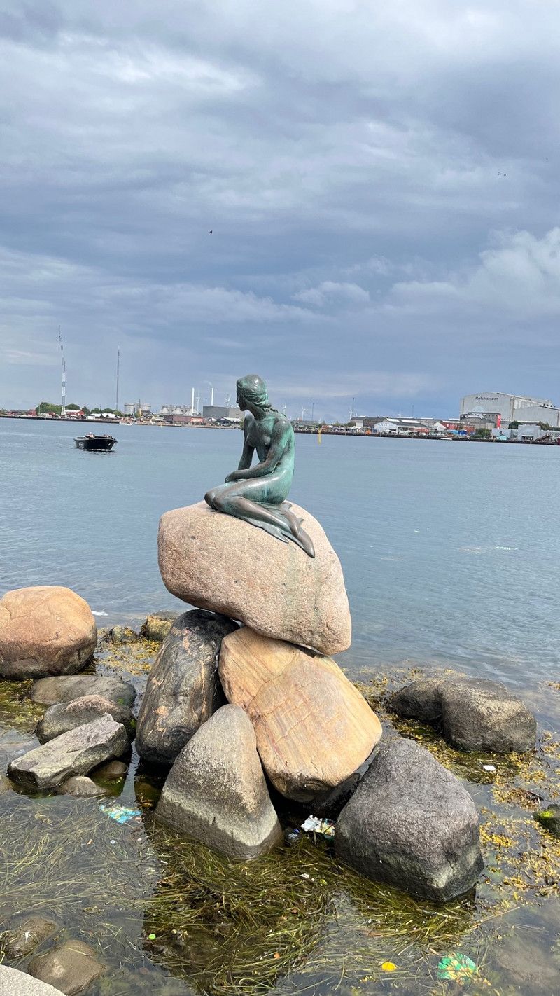
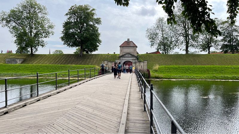
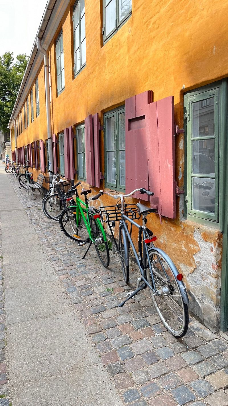
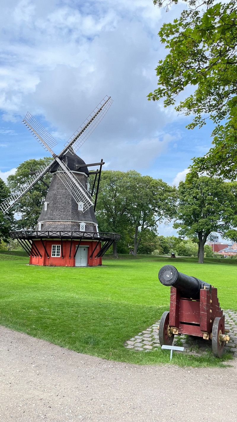
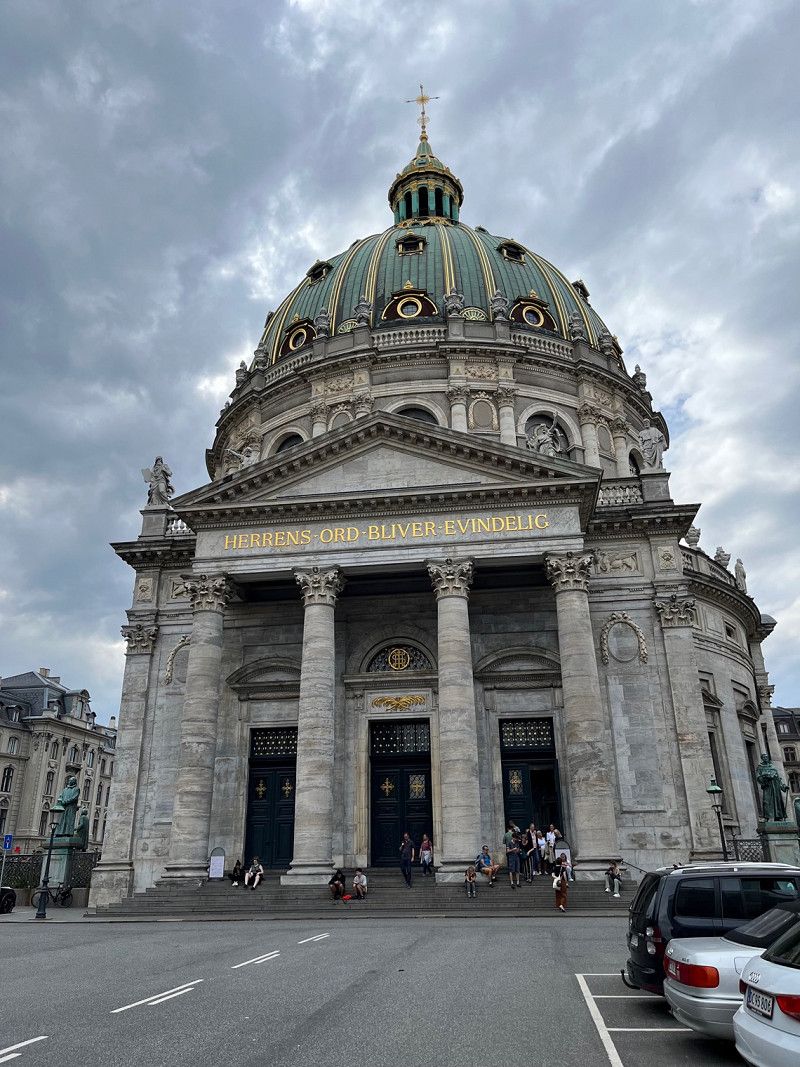
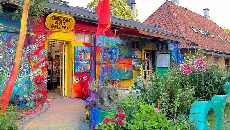
The Little Mermaid, Kastellet, Nyboder, Frederiks Kirke, Amalienborg Palace, Nordatlantens Brygge, Christiania,
Hauptstadtregion, Dänemark
55° 41' 12.2" N 12° 34' 12.3" E
55.6867243 12.5700724
• Head northeast.
• Arrive at your destination on the right.
☍
Distance not available
(Duration not available)
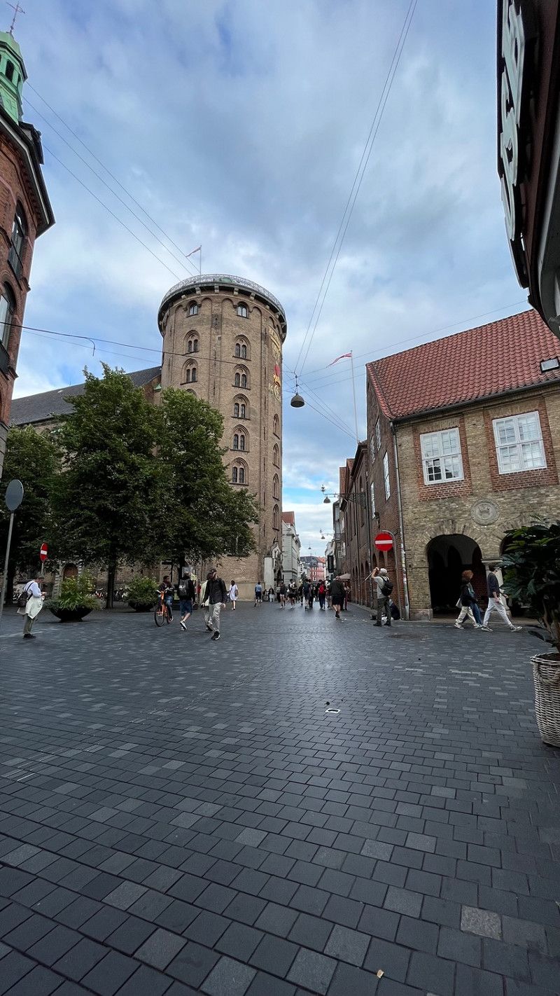
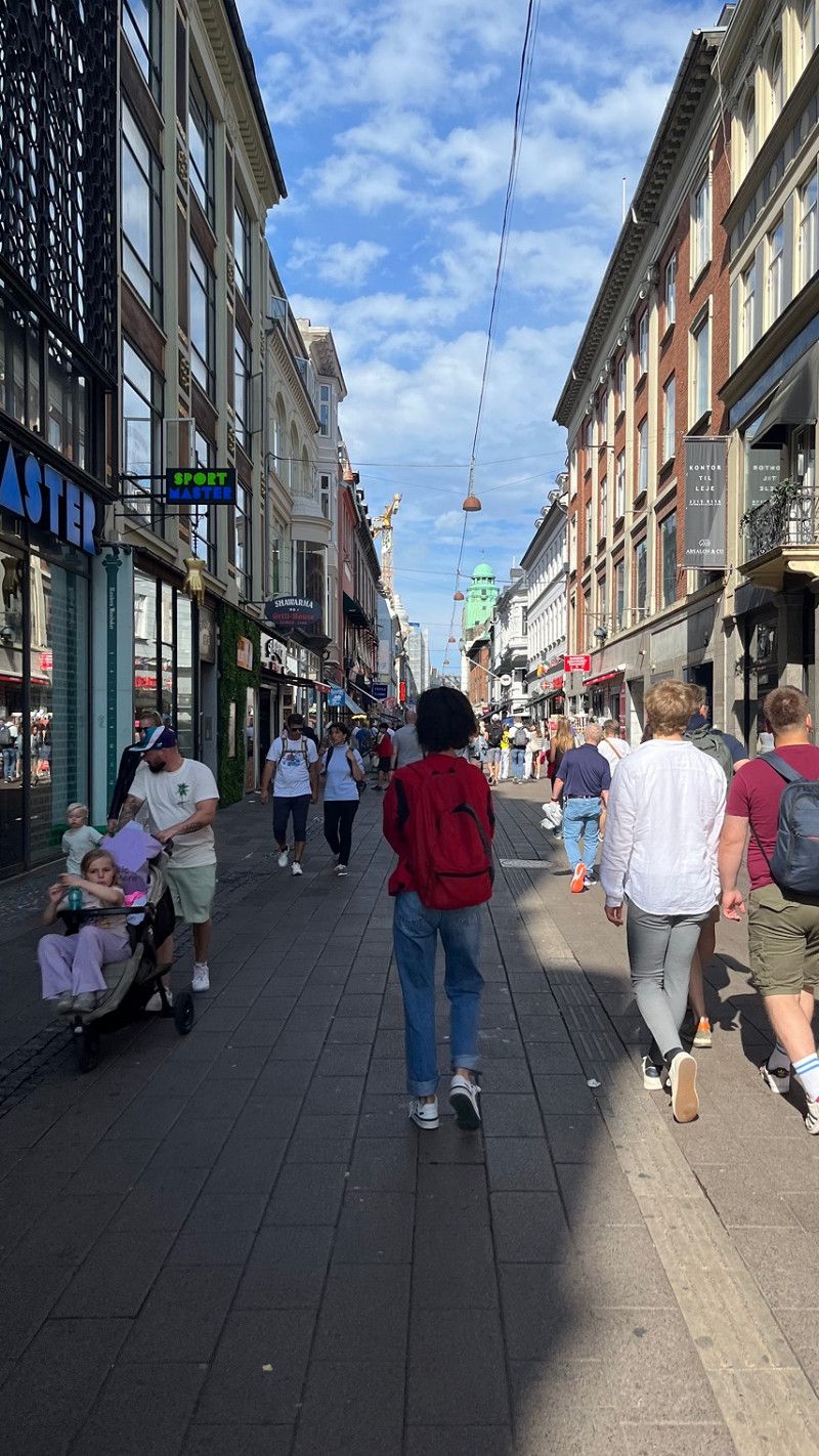
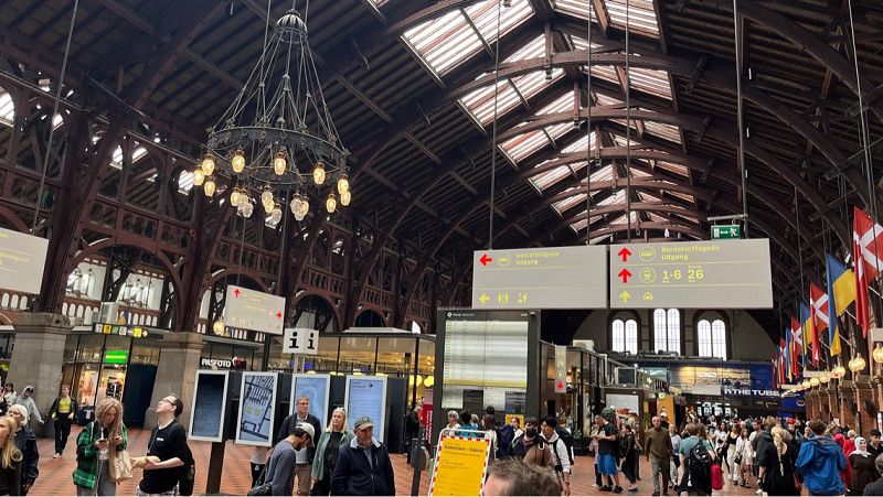
Day
Kopenhagen
City tour part 3
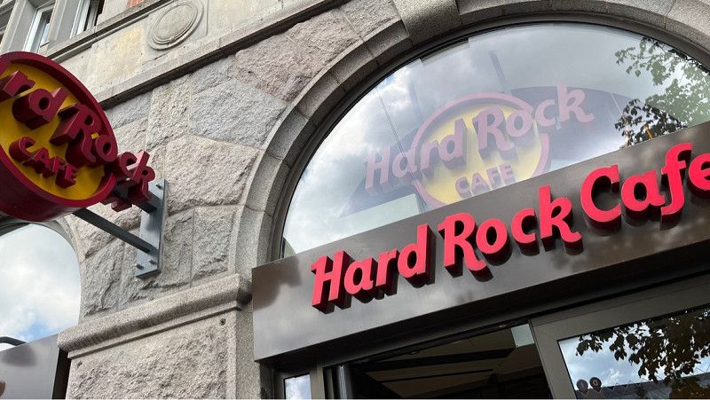
We took the metro and the S-Bahn to the main train station. After a short stroll through the souvenir shops we had a good meal in the Hard Rock Café.
Then we walked through the city center and visited some of the filming locations of the Olsen Gang.
Hauptstadtregion, Dänemark
55° 41' 12.2" N 12° 34' 12.3" E
55.6867243 12.5700724
• Head toward Øster Farimagsgade. Go for 65 m.
• Turn left onto Øster Farimagsgade. Go for 439 m.
• Turn right onto Sølvgade. Go for 330 m.
• Turn left toward Øster Voldgade. Go for 39 m.
• Continue on Øster Voldgade. Go for 728 m.
• Continue on Folke Bernadottes Allé (O2) toward 16/19. Go for 2.1 km.
• Turn right onto Sundkrogsgade. Go for 696 m.
• Continue on Færgehavnsvej. Go for 110 m.
• Turn slightly right onto Containervej. Go for 99 m.
• Turn slightly left onto Færgehavnsvej. Go for 422 m.
• Turn slightly right onto Baltikavej. Go for 496 m.
• Turn slightly left onto Kattegatvej. Go for 419 m.
• Turn right onto Nordsøvej. Go for 244 m.
• Arrive at Nordsøvej. Your destination is on the left.
☍
6,2 km
( 12 min.)
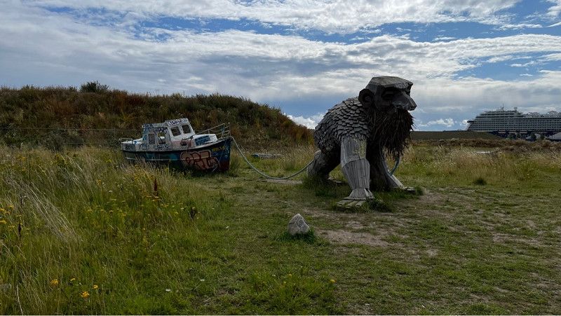
Day
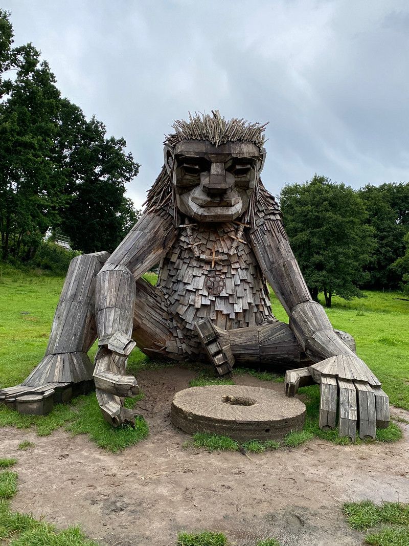
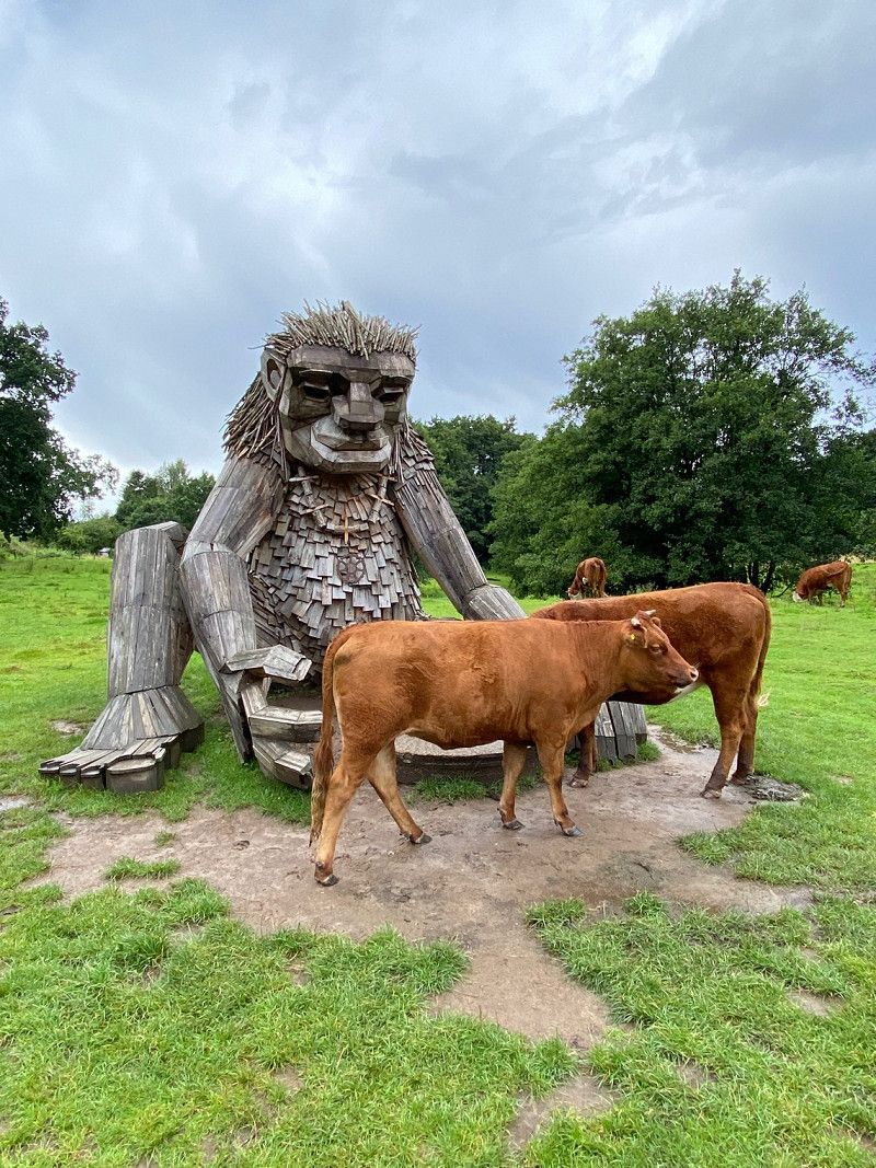
Nordsøvej
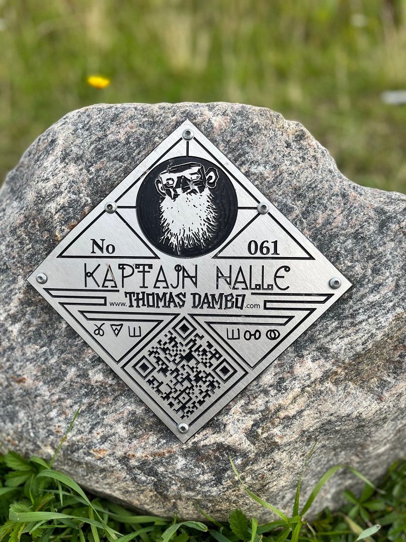
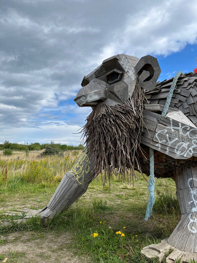
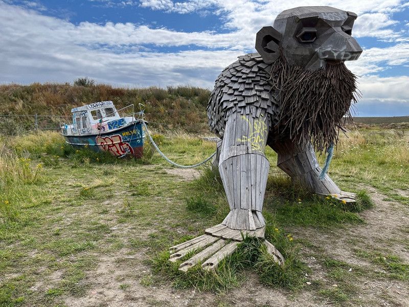
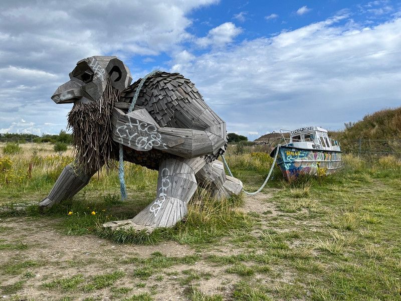
Troll #61 by Thomas Dambo
www.ThomasDambo.com
Interesting the art, there are over 100 of these trolls around the world.
This is not far from the parking space in the north port.
Nordsøvej 8, Kopenhagen, Hauptstadtregion, Dänemark
55° 43' 10.3" N 12° 36' 41.5" E
55.7195270 12.6115270
• Head toward Kattegatvej on Nordsøvej. Go for 244 m.
• Turn left onto Kattegatvej. Go for 419 m.
• Turn slightly right onto Baltikavej. Go for 496 m.
• Turn slightly left onto Færgehavnsvej. Go for 422 m.
• Turn slightly right onto Containervej. Go for 99 m.
• Turn slightly left onto Færgehavnsvej. Go for 110 m.
• Continue on Sundkrogsgade. Go for 596 m.
• Turn right onto Kalkbrænderihavnsgade (O2). Go for 2.7 km.
• Continue on 19 (Lyngbyvej). Go for 4.6 km.
• Keep left onto 201 toward Birkerød/Holte/E47s/Rødby/Lyngby V. Go for 325 m.
• Take the exit toward Rødby/E47s/Lyngby V onto Lyngbyvej. Go for 351 m.
• Keep right onto Lyngbyvej. Go for 133 m.
• Take ramp onto E47 (Motorring 3) toward E47s/E55s/Rødby. Go for 12.9 km.
• Take exit 24 toward Glostrup. Go for 636 m.
• Turn right onto Roskildevej (156). Go for 4.3 km.
• Turn left onto Albertslundvej. Go for 253 m.
• Turn right onto Fængselsvej. Go for 108 m.
• Turn right onto Fængselsvej. Go for 123 m.
• Arrive at Fængselsvej. Your destination is on the left.
☍
28,8 km
( 31 min.)
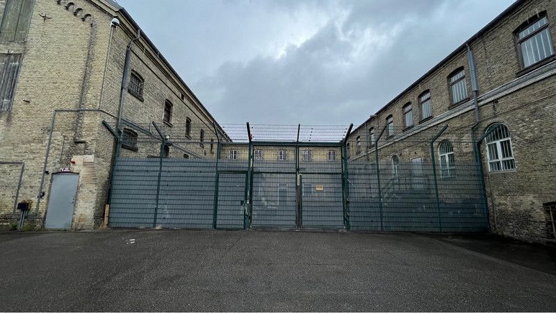
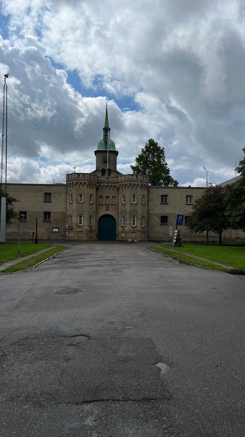
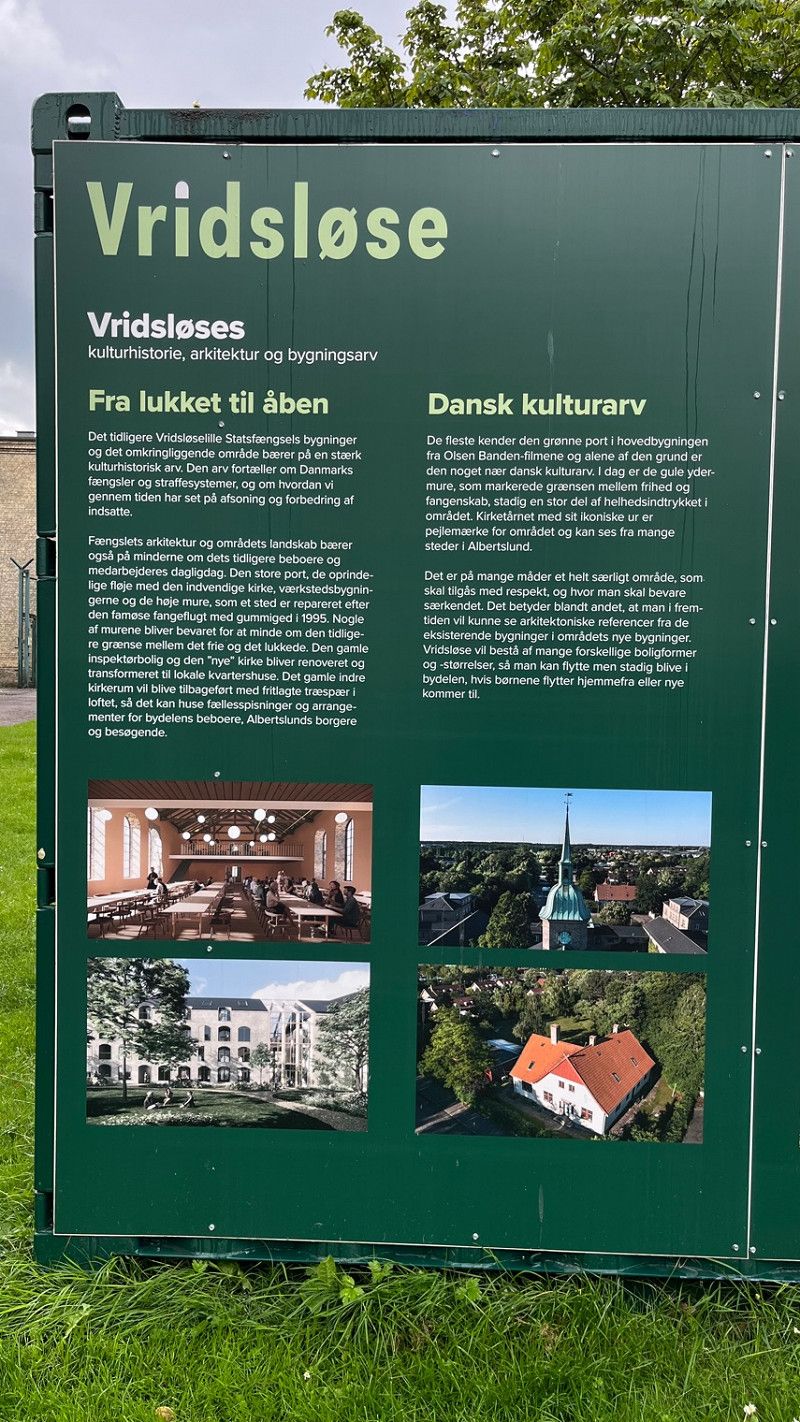
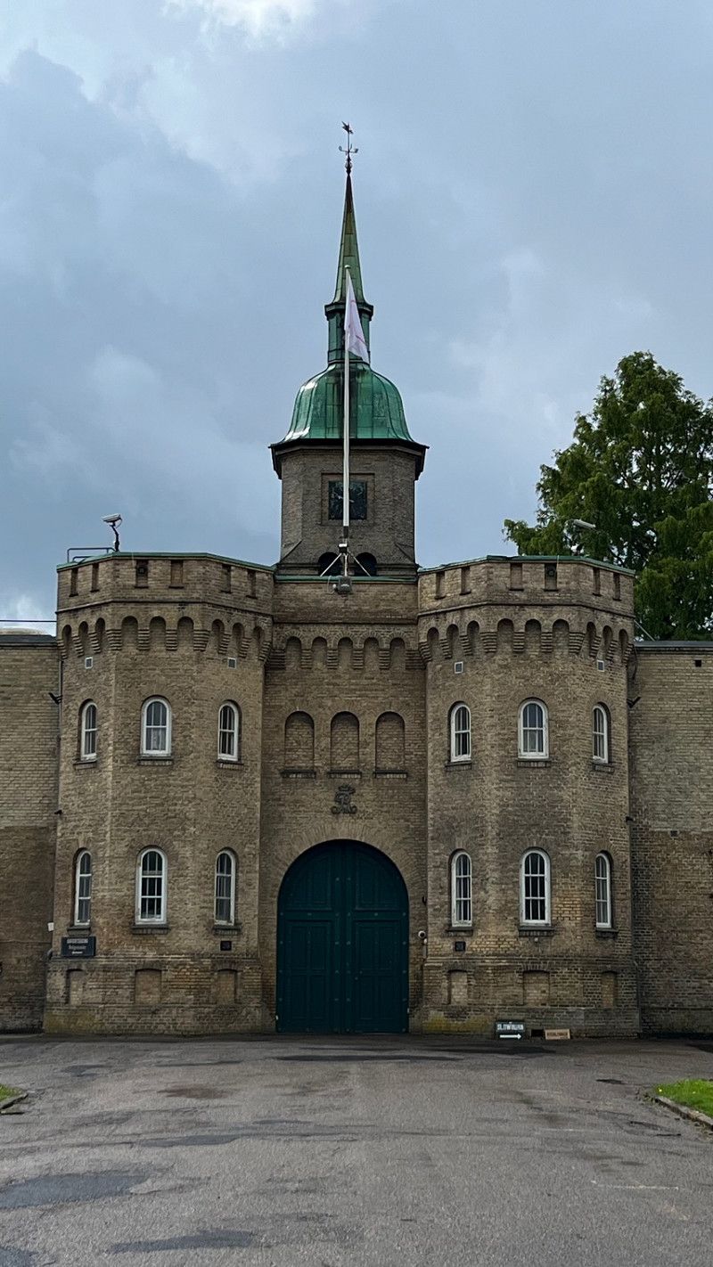
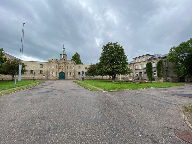
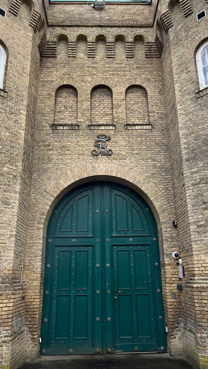
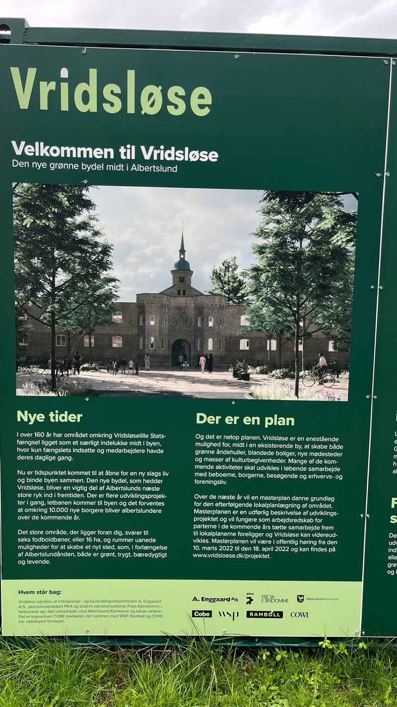
Fængselsvej
Location for the Olsen Gang films.
The entrance to Vridsløselille State Prison in Albertslund,
Egon Olsen from the Danish Olsen Gang always went through the main gate of the prison after his release.
The prison was used to house offenders in closed prisons as well as prisoners on remand. It had a capacity of 241 occupants.
Fængselsvej 39, Albertslund, Hauptstadtregion, Dänemark
55° 39' 37.1" N 12° 20' 52.1" E
55.6603070 12.3477990
• Head west on Fængselsvej.
• Turn right onto Fængselsvej. Go for 35 m.
• Turn right onto Fængselsvej. Go for 62 m.
• Turn left onto Fængselsvej. Go for 93 m.
• Turn left onto Fængselsvej. Go for 108 m.
• Turn right onto Albertslundvej. Go for 114 m.
• Make a U-Turn at Hedemarksvej onto Albertslundvej. Go for 291 m.
• Turn left onto Roskildevej (156). Go for 2.4 km.
• Turn left and take ramp onto 21 (Holbækmotorvejen). Go for 2.0 km.
• Continue on O4 (Vallensbæk) toward Ishøj/E20v/Rødby/E47. Go for 3.9 km.
• Continue on Ishøj. Go for 167 m.
• Continue on E20/E47 (Ishøj). Go for 18.9 km.
• Keep left onto E20 (Køge Vest) toward Odense. Go for 97.9 km.
• Take exit 46 toward Nyborg V/Fåborg/Kerteminde/165/Ullerslev/160. Go for 532 m.
• Turn right onto Hjulbyvej (8) toward Kerteminde/165/Ullerslev/160. Go for 890 m.
• Turn left onto Odensevej (160). Go for 2.0 km.
• Turn right onto Kertemindevej (165). Go for 12.6 km.
• Turn right onto Odensevej (165/315). Go for 165 m.
• Turn right onto Paludan Müllers Plads (165/315). Go for 325 m.
• Continue on Hindsholmvej (315). Go for 90 m.
• Turn right onto Grønlandsgade. Go for 185 m.
• Turn left onto Marinavejen. Go for 58 m.
• Turn right onto Marinavejen. Go for 44 m.
• Arrive at Marinavejen. Your destination is on the left.
☍
142,7 km
(1 hrs. 34 min.)
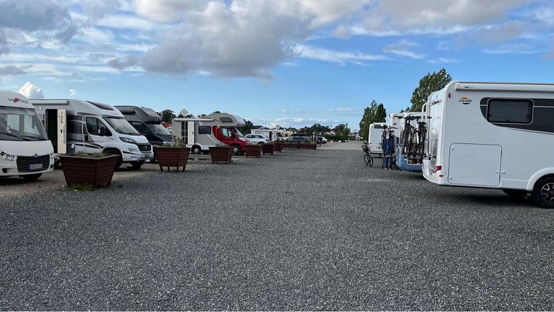
Marinavejen
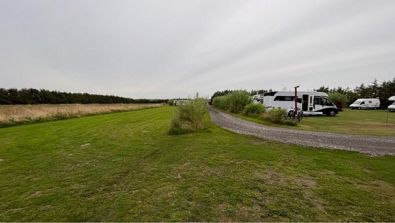
Parking space for 20 mobile homes, electricity and water including supply and disposal is available here.
You can easily go shopping here on foot, as there is a Coop nearby.
Place is gravel. Nice location with nice views of the harbour.
Children's playground is nicely done and spacious.
Marinavejen 4, Kerteminde, Region Süddänemark, Dänemark
55° 27' 7.6" N 10° 39' 52.9" E
55.4520990 10.6646830
• Head west on Marinavejen. Go for 44 m.
• Turn left onto Marinavejen. Go for 58 m.
• Turn right onto Grønlandsgade. Go for 185 m.
• Turn left onto Hindsholmvej (315). Go for 90 m.
• Turn right onto Hans Schacksvej (165). Go for 944 m.
• Pass 2 roundabouts and continue on Hans Schacksvej (165). Go for 13.3 km.
• Continue on Kertemindevej (165). Go for 1.2 km.
• Continue on Kertemindevej (165). Go for 1.6 km.
• Turn right onto Ejbygade (O2). Go for 1.3 km.
• Continue on Ejbygade. Go for 259 m.
• Turn right onto Havnegade. Go for 1.7 km.
• Turn left onto Østre Dæmning. Go for 371 m.
• Arrive at Østre Dæmning. Your destination is on the right.
☍
21,0 km
( 26 min.)
Day
Østre Dæmning
Hans Hulehånd is the name of the Thomas Dambo troll hiding in Odense.
We were able to reach the troll via a small wooden footbridge. A short walk is worthwhile here.
The car park by the canal is also very inviting for a coffee.
Unfortunately, I don't know if you can stand here for one night.
Østre Dæmning 3, Odense C, Region Süddänemark, Dänemark
55° 26' 3.2" N 10° 25' 5.8" E
55.4342120 10.4182740
• Head toward Østre Kanalvej on Østre Dæmning. Go for 371 m.
• Turn right onto Havnegade. Go for 1.7 km.
• Turn left onto Ejbygade. Go for 250 m.
• Turn right onto Odins Bro (O2). Go for 2.4 km.
• Continue on Rismarksvej (O2). Go for 4.9 km.
• Turn right onto Middelfartvej (161). Go for 7.8 km.
• Turn left onto Middelfartvej (161). Go for 323 m.
• Turn right and take ramp onto E20 (Fynske Motorvej) toward Kolding. Go for 28.3 km.
• Take exit 58A toward Middelfart Ø. Go for 501 m.
• Take the 3rd exit from roundabout onto Aulbyvej toward E20/Odense/Middelfart/161. Go for 319 m.
• Take the 1st exit from roundabout onto Aulbyvej. Go for 522 m.
• Turn right onto Hovedvejen (161). Go for 6.5 km.
• Turn right. Go for 96 m.
• Arrive at your destination on the left.
☍
54,1 km
( 48 min.)
Fünen Hjulmandshuset
Small rest area to take a break.
There is a chic food truck and a beautiful old house called Hjulmandshuset.
It's a small art museum.
Was completely rebuilt after a fire.
Fünen
55° 30' 7.1" N 9° 42' 41.5" E
55.5019621 9.7115351
• Head toward Brovejen. Go for 96 m.
• Turn right onto Brovejen (161). Go for 5.0 km.
• Turn right onto Vejle Landevej (171). Go for 4.3 km.
• Take the 2nd exit from roundabout onto Vejle Landevej (171). Go for 7.0 km.
• Continue on Fredericiavej (171). Go for 1.7 km.
• Turn right onto Overmøllevej. Go for 1.6 km.
• Continue on Søndergade. Go for 630 m.
• Take the 2nd exit from roundabout onto Søndergade. Go for 918 m.
• Continue on Ågade. Go for 100 m.
• Turn right onto Møllegade. Go for 861 m.
• Turn left onto Møllegade. Go for 10 m.
• Arrive at Møllegade. Your destination is on the right.
☍
22,2 km
( 24 min.)
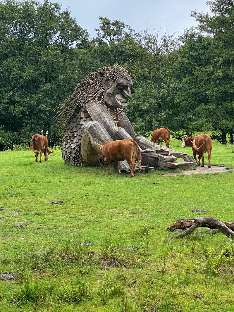
Møllegade
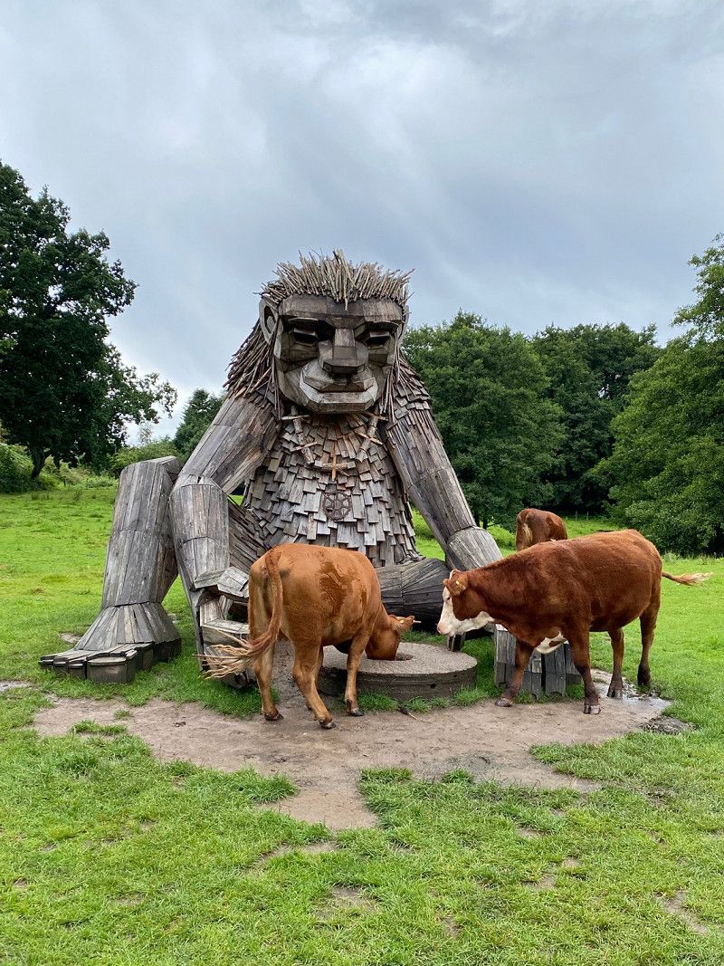
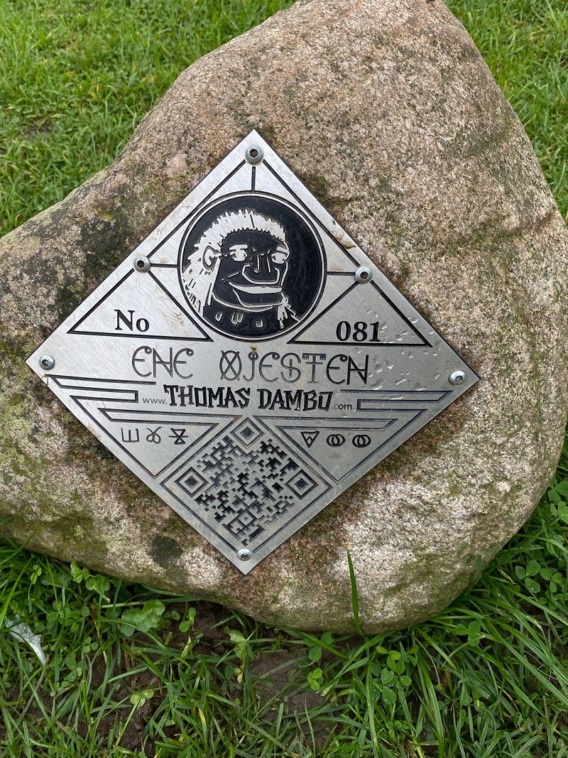
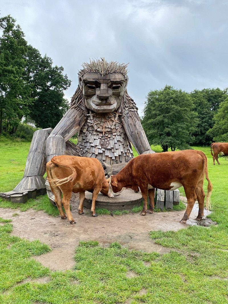
Here we drove to the next troll.
There is also a beautiful old mill with a pond where you can take a nice walk.
We went on a quest to find the troll.
This is beautifully guarded by cows on a pasture.
The place is good to stay the night, the only thing is that the train might be a bit disturbing.
Otherwise it is in a very nice location.
55° 38' 16.2" N 9° 39' 40.2" E
55.6378250 9.6611597
• Head southwest on Møllegade. Go for 10 m.
• Turn right onto Møllegade. Go for 861 m.
• Turn right onto Ågade. Go for 163 m.
• Continue on Kirkebakken. Go for 515 m.
• Turn right toward 28. Go for 189 m.
• Take ramp onto 28. Go for 5.6 km.
• Turn right onto Fredericiavej (28/171) toward Vejle/E45. Go for 4.8 km.
• Turn right onto Ejgil Jensens Vej (O1). Go for 259 m.
• Turn left onto Gammelhavn. Go for 171 m.
• Take the 1st exit from roundabout onto Dæmningen. Go for 709 m.
• Continue on Nørretorv. Go for 112 m.
• Continue on Nørrebrogade (O1). Go for 336 m.
• Turn sharp left onto Skovgade (O1/O2). Go for 502 m.
• Turn right onto Vedelsgade (442). Go for 111 m.
• Turn left onto Gormsgade (442). Go for 9.2 km.
• Take the 1st exit from roundabout onto Mangehøje (442). Go for 2.8 km.
• Take the 2nd exit from roundabout onto Kollegievej. Go for 167 m.
• Turn left. Go for 14 m.
• Turn right. Go for 14 m.
• Arrive at your destination.
☍
26,5 km
( 33 min.)
Kollegievej
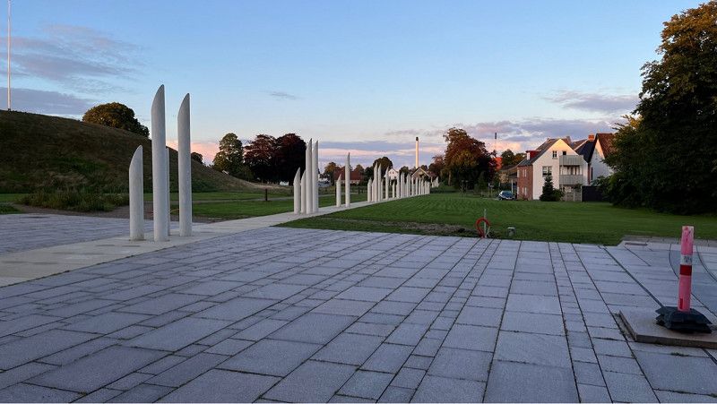
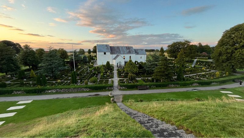
This is our pitch for the night. Next to the Vinkinger Museum. The place has space for about 10 - 15 mobiles.
The parking space is free and the area has only recently been gravelled.
Around the museum there is currently a small construction site where new sidewalks and parks are being built.
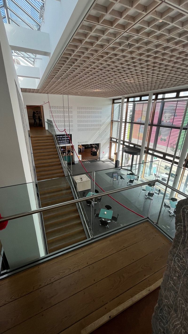
The place is really worth seeing and the museum is even free and completely new.
Everything in this museum is interactive and digital.
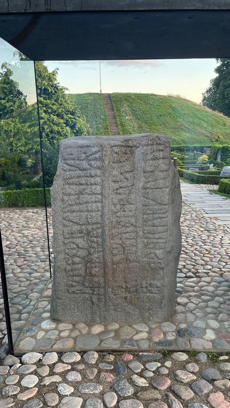
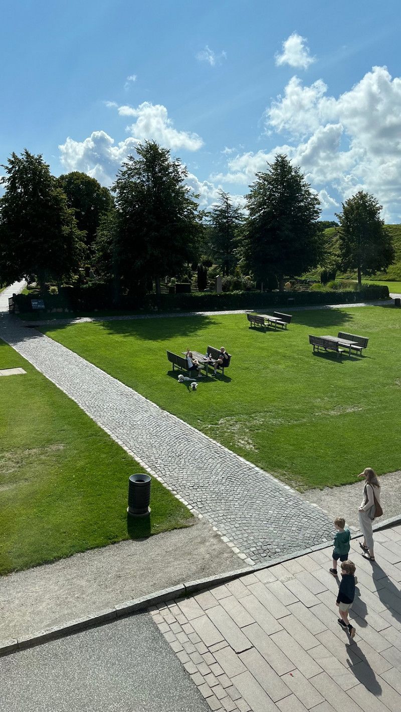
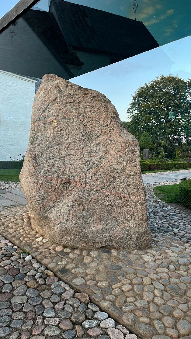
In the 10th century, King Harald Bluetooth had the "baptismal certificate of Denmark" carved into a rune stone in Jelling and two burial mounds and a church were built in Jelling. The Jelling Monuments have been a UNESCO World Heritage Site since 1994. In the experience center Kongernes Jelling you will experience the exciting history of the Vikings and the monuments. Following the discovery and exploration of a massive, diamond-shaped palisade in 2006-13, all of the terrain around the hills was altered and surrounded by a myriad of new white concrete piers, marking the location of the original picket fence.
55° 45' 29.1" N 9° 24' 54" E
55.7580831 9.4149895
• Head northwest. Go for 14 m.
• Turn left toward Kollegievej. Go for 14 m.
• Turn right onto Kollegievej. Go for 121 m.
• Take the 2nd exit from roundabout onto Mangehøje (442). Go for 1.2 km.
• Turn left onto Tørringvej. Go for 8.2 km.
• Turn right toward 30. Go for 660 m.
• Continue on 30. Go for 16.3 km.
• Turn left and take ramp onto E45 (Østjyske Motorvej) toward Aarhus. Go for 51.2 km.
• Take the exit toward Hinnerup. Go for 1.0 km.
• Turn right onto Søftenvej (505) toward Lisbjerg. Go for 679 m.
• Turn left onto Høgemosevej. Go for 675 m.
• Continue on Engholmvej. Go for 926 m.
• Continue on Ølstedvej. Go for 1.0 km.
• Turn left onto Randersvej (180). Go for 240 m.
• Turn right onto Randersvej. Go for 24 m.
• Arrive at Randersvej. Your destination is on the left.
☍
82,3 km
(1 hrs. 4 min.)
Day
Aarhus Camping
Today we continued north.
We are going to Aarhus
Unfortunately, there are few offers for mobile homes around Aarhus, so we decided on a campsite above Aarhus.
It is the Aarhus campsite.
Great nature campsite with beautiful pitches.
Toilet facilities clean and the welcome at the reception very friendly with great tips and information about Aarhus.
The bus stop is about 400 m from the camp.
Bus line 118 runs from the campsite every 20 minutes directly to the center of Aarhus.
If you want you can stay seated until the bus station.
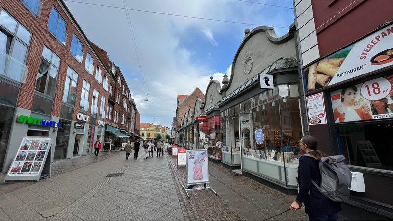
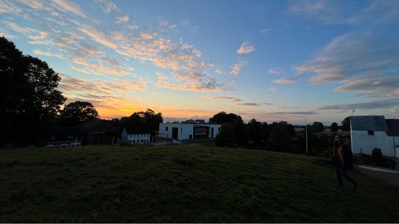
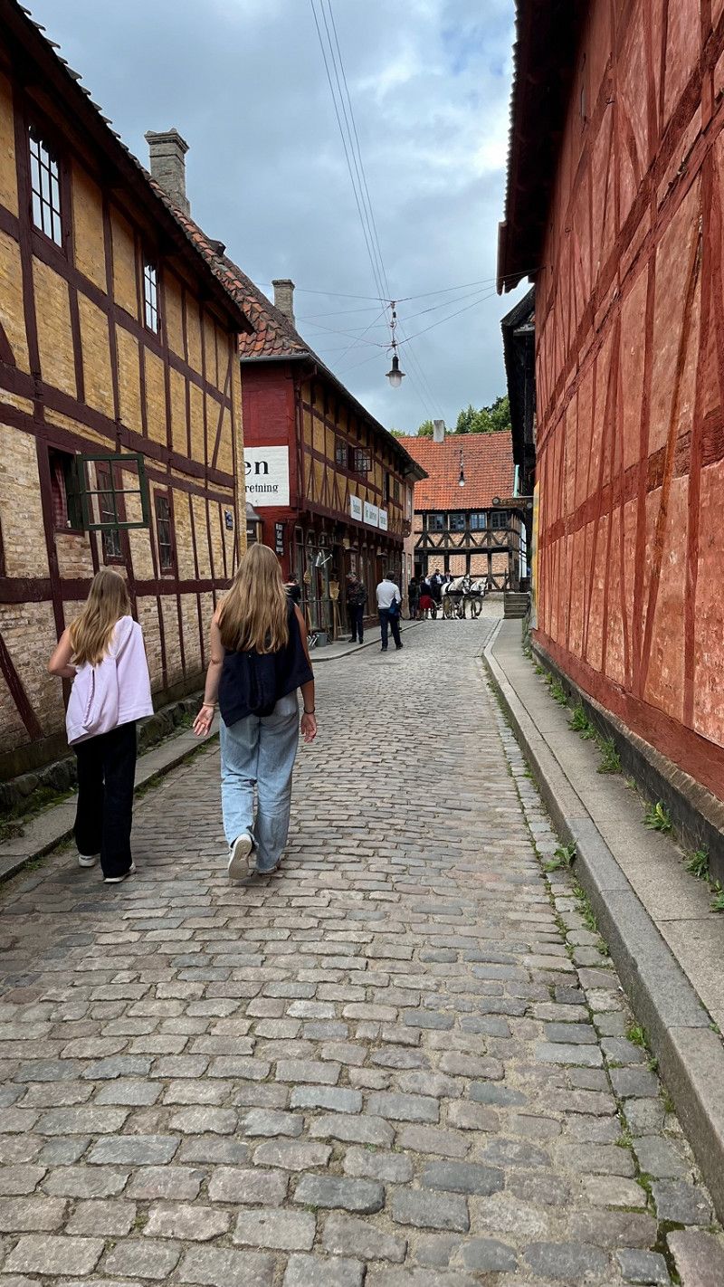
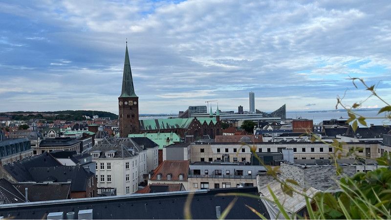
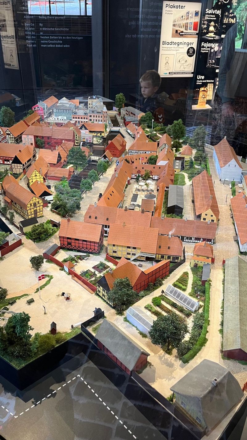
Aarhus is a hip city on the Jutland Peninsula. Located in Aarhus, Den Gamle By is an open-air museum in the shape of an old town with centuries-old half-timbered houses.
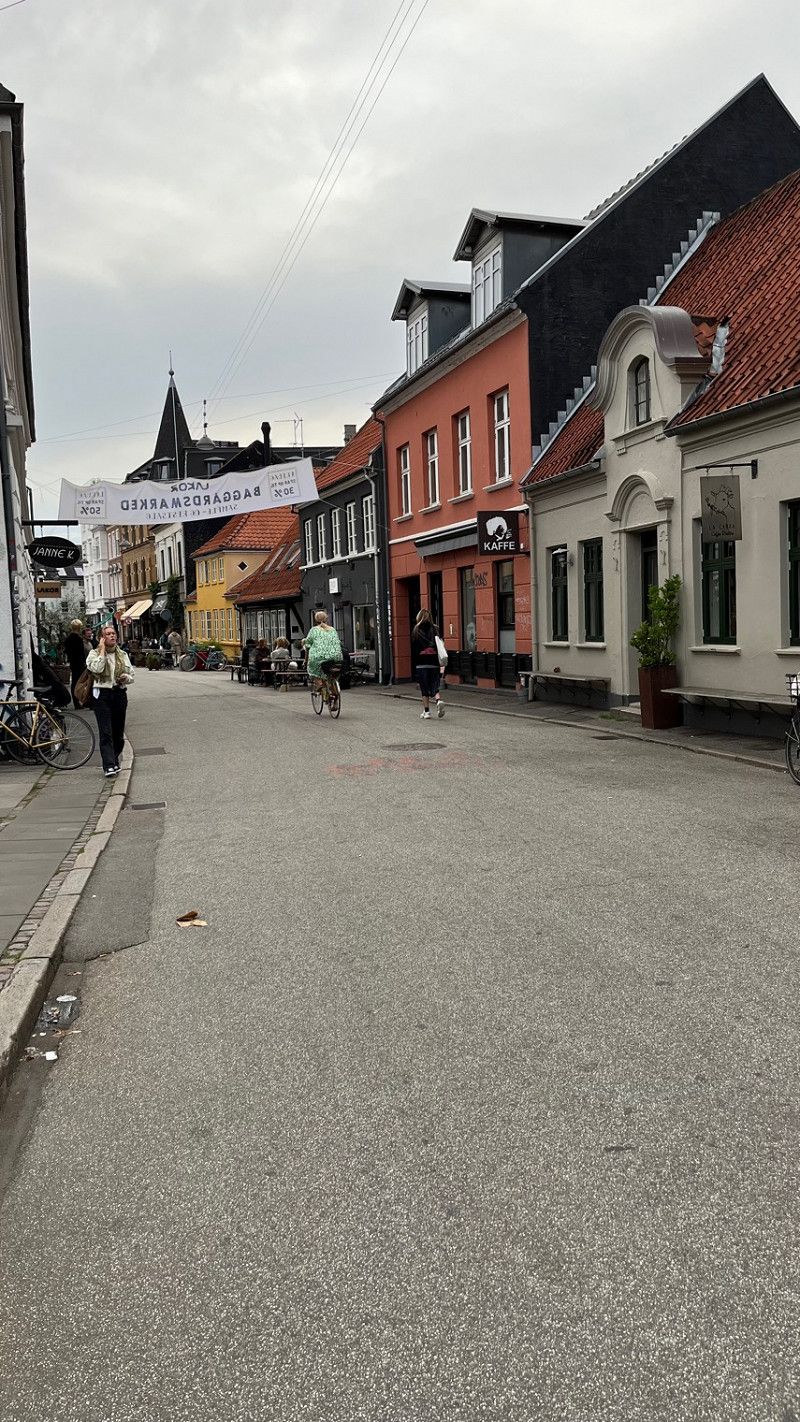
Today we looked at the beautiful old town with the small cafes and bars.
Tomorrow we're going to Den Gamle By.
56° 13' 36" N 10° 9' 46.1" E
56.2266668 10.1628074
• Head west on Randersvej. Go for 24 m.
• Turn left onto Randersvej (180). Go for 2.2 km.
• Take ramp onto Randersvej (180/505). Go for 3.7 km.
• Continue on Randersvej toward O1/Centrum. Go for 1.3 km.
• Continue on Nørrebrogade (O1) toward Centrum. Go for 1.5 km.
• Turn right onto Kystvejen (O1). Go for 1.4 km.
• Turn left onto Jægergårdsgade. Go for 201 m.
• Turn left onto Sydhavnsgade. Go for 280 m.
• Turn left onto Filmbyen. Go for 50 m.
• Arrive at Filmbyen. Your destination is on the left.
☍
10,6 km
( 17 min.)
Day
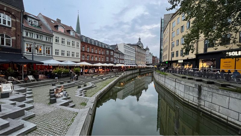
Aarhus
Aarhus city tour with a visit to the oldest open-air museum.
Den Gamle By is an open-air museum in Aarhus, Denmark. Unlike most open air museums, it is not the rural but the urban culture and history that is on display here. It is the oldest of its kind.
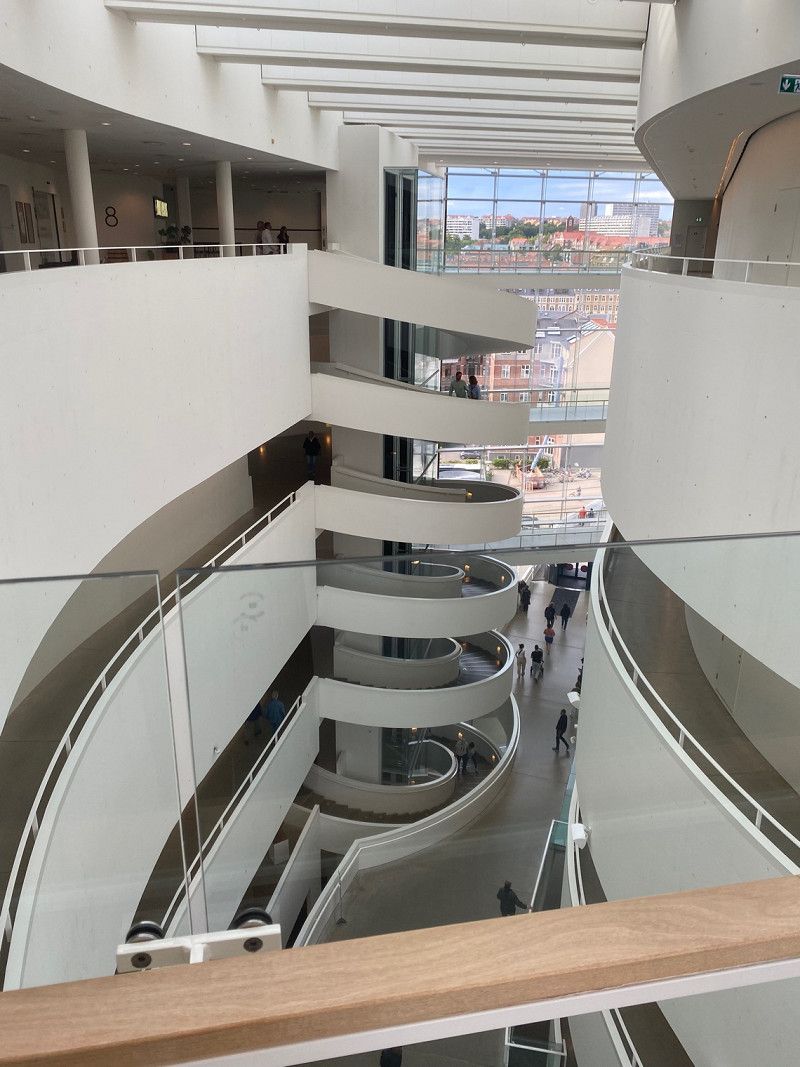
Afterwards we went to the Aarhus Art Museum.
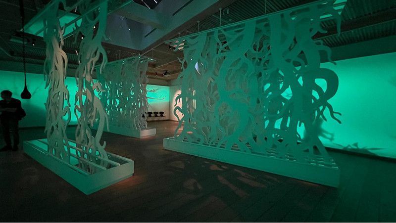
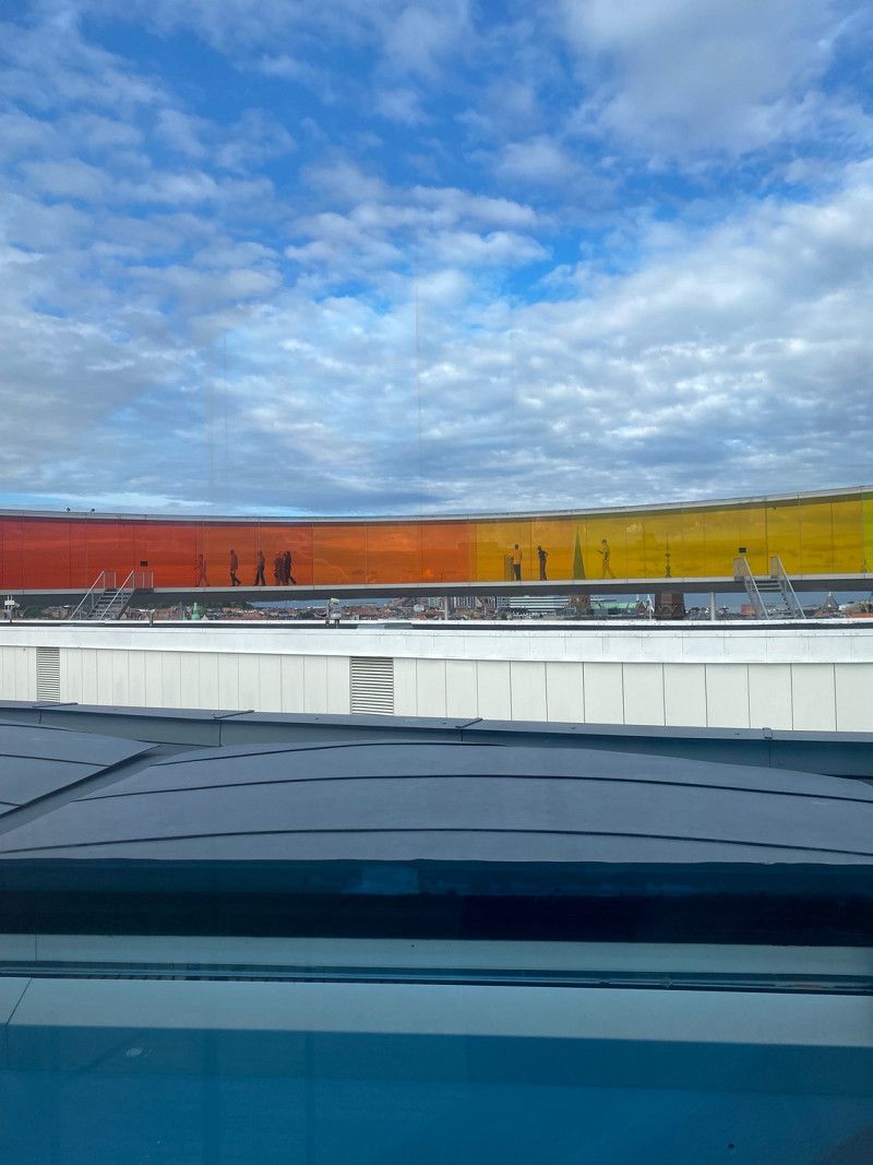
ARoS Aarhus Art Museum is one of the largest art museums in Northern Europe and one of the most visited art museums in Scandinavia. Here, the Your rainbow panorama is a must.
It is a spectacular work of art by Olafur Eliasson.
The pictures and the view are really great.
Children up to the age of 18 are free here
Adults pay EUR 25 per person.
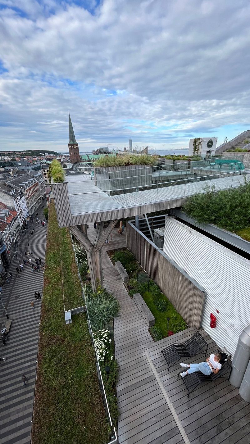
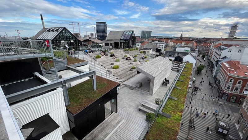
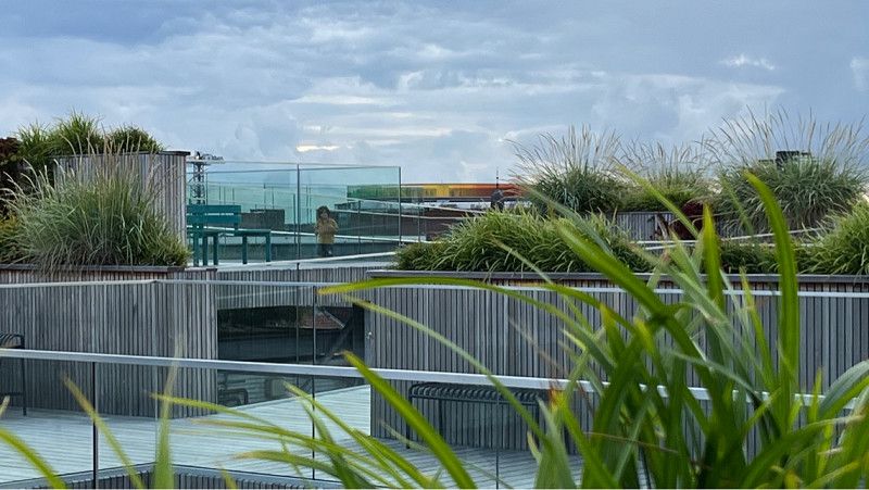
The Roof Top Garden is a must for everyone.
Salling ROOFTOP is worth a visit for its outstanding views alone, but the rooftop also features a fertile greenhouse bar and cafe where you can enjoy a good meal or a refreshing cocktail. There is also a lounge area where you can really relax and a stage where a disc jockey sets the mood for the weekend on Fridays 5-7pm.
Dogs are unfortunately not allowed on the terrace. At the very top - 25 meters above the pedestrian zone, if you are courageous you can step onto a glass ramp and enjoy the magnificent view over the city. Here you can find out whether you are afraid of heights or not.
Region Mitteljütland, Dänemark
56° 8' 58.7" N 10° 12' 48.3" E
56.1496278 10.2134046
• Head northwest on Filmbyen. Go for 14 m.
• Turn right onto Filmbyen. Go for 140 m.
• Turn right onto Havnevej. Go for 95 m.
• Turn left onto Mindet. Go for 117 m.
• Continue on Europaplads. Go for 103 m.
• Turn right onto Europaplads (O1). Go for 798 m.
• Turn left onto Nørreport (O1). Go for 1.5 km.
• Continue on Randersvej toward E45/O2/Lufthavn. Go for 4.3 km.
• Keep left onto Søftenvej (505) toward Hinnerup/Aalborg/E45/Kolding/15/Silkeborg. Go for 1.1 km.
• Take ramp onto Djurslandmotorvejen (15). Go for 2.8 km.
• Take ramp onto E45 (Nordjyske Motorvej) toward Aalborg. Go for 156 km.
• Take exit 13 toward Sæby S/Syvsten. Go for 579 m.
• Take the 2nd exit from roundabout onto Ålborgvej (180/541) toward Sæby/Hals. Go for 2.0 km.
• Take the 2nd exit from roundabout onto Ålborgvej (180). Go for 1.7 km.
• Take the 1st exit from roundabout onto Sønder Ringvej. Go for 665 m.
• Pass 2 roundabouts and continue on Sønder Ringvej. Go for 1.3 km.
• Turn right onto Havnen. Go for 26 m.
• Arrive at Havnen. Your destination is on the left.
☍
172,7 km
(1 hrs. 52 min.)
Day
Sæby Havnen
Today we have arrived in Saeby and are right next to the harbor wall.
The parking space has only recently been expanded and there are now over 20 spaces for mobile homes.
Showers and toilets are very clean.
The pitches are very straight.
Electricity and water are also available.
In the immediate vicinity there are bars, bistro, cafes,
The beach is also a tip.
The place is beautiful and everything is within walking distance.
Havnen 20, 9300, Sæby, Dänemark
57° 19' 57" N 10° 31' 54" E
57.3325000 10.5316667
• Head toward Sønder Ringvej on Havnen. Go for 26 m.
• Turn left onto Sønder Ringvej. Go for 156 m.
• Turn right onto Gasværksvej. Go for 511 m.
• Turn right onto Gasværksvej. Go for 248 m.
• Continue on Søndergade. Go for 232 m.
• Continue on Frederikshavnsvej. Go for 785 m.
• Take the 2nd exit from roundabout onto Frederikshavnsvej (180). Go for 4.2 km.
• Take ramp onto E45 (Europavej) toward Frederikshavn. Go for 6.5 km.
• Continue on Havnepladsen (35/40). Go for 1.7 km.
• Continue on Skagensvej (40) toward Skagen. Go for 1.9 km.
• Pass 6 roundabouts and continue on Ålbækvej (40). Go for 34.2 km.
• Continue on Frederikshavnsvej (40). Go for 1.7 km.
• Take the 2nd exit from roundabout onto Kattegatvej. Go for 651 m.
• Turn left onto Buttervej. Go for 365 m.
• Take the 2nd exit from roundabout onto Bøjlevejen. Go for 3.3 km.
• Take the 2nd exit from roundabout onto Fyrvej (40). Go for 1.5 km.
• Arrive at Fyrvej (40). Your destination is on the right.
☍
57,9 km
( 55 min.)
Day
Skagen Autocamper Overnanting
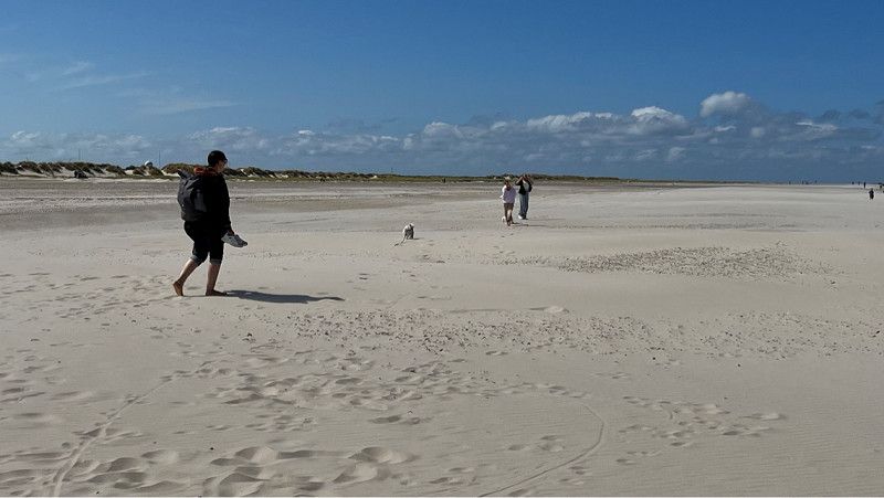
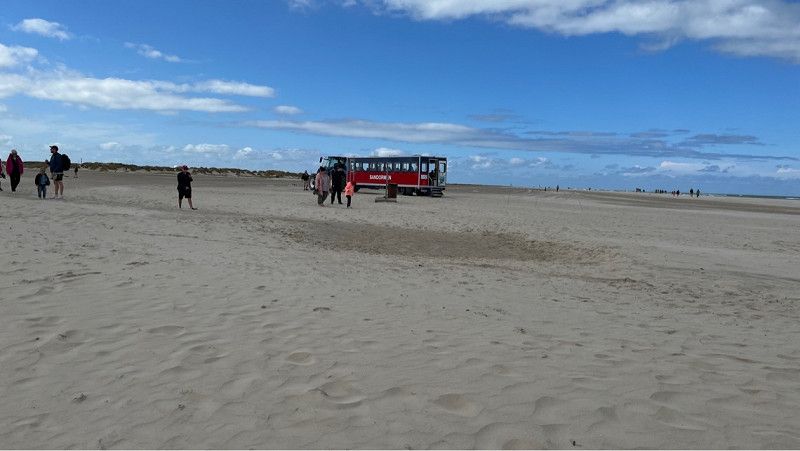
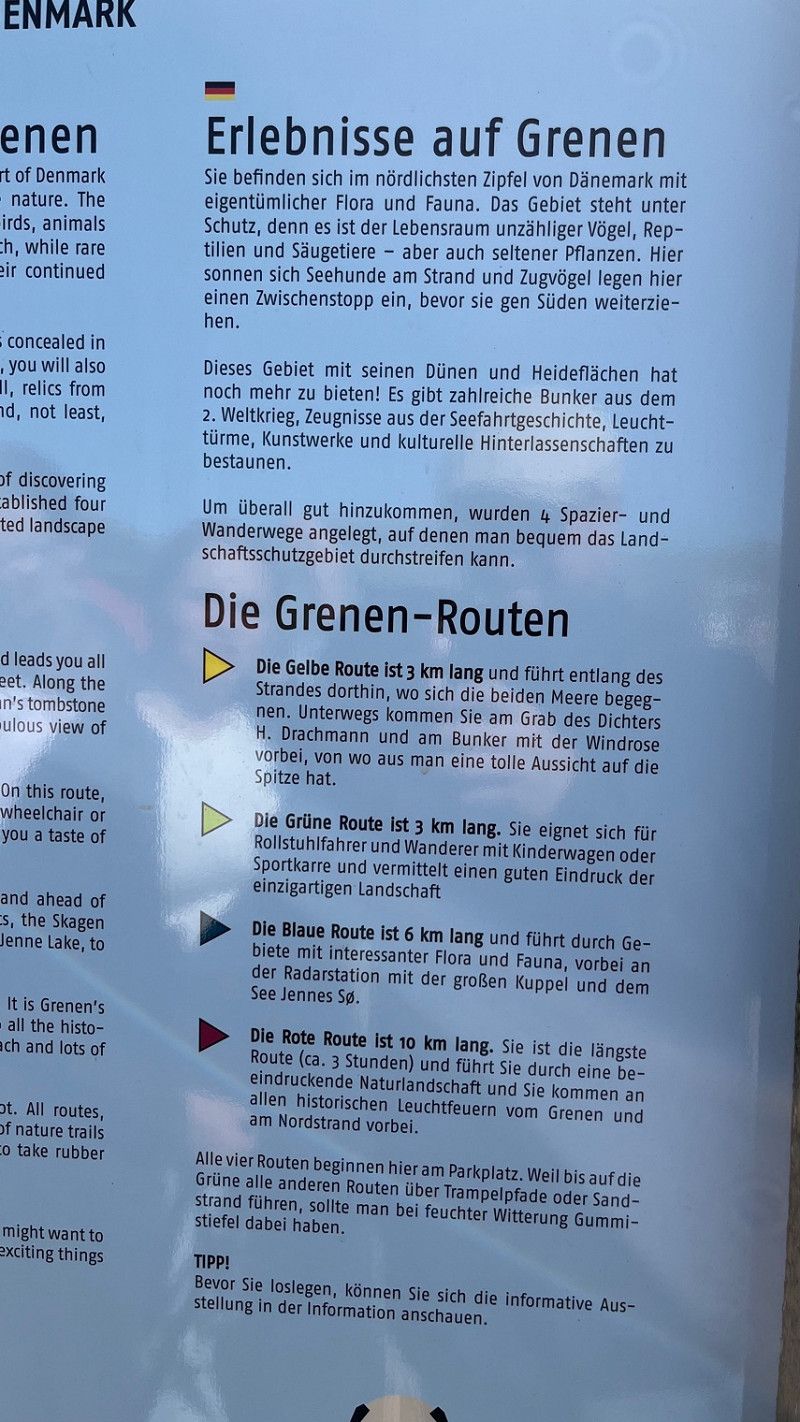
Today we drove to Denmark's northernmost point.
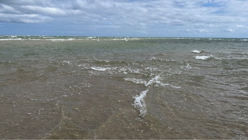
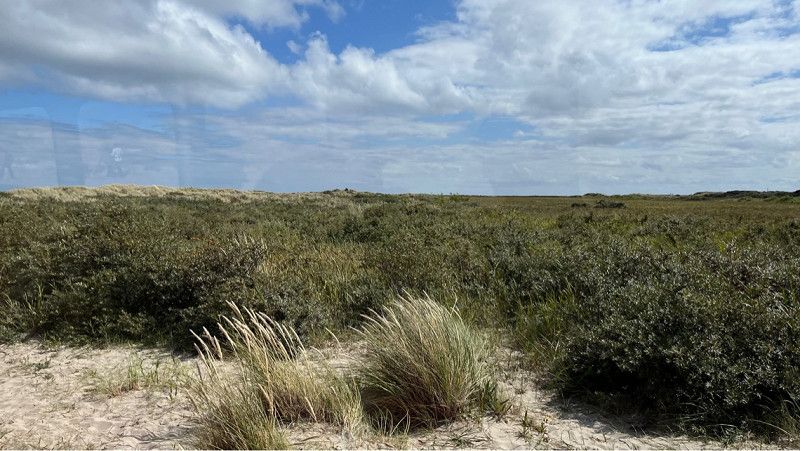
Skagen is the point where the North Sea and Baltic Sea meet.
A great place to put your feet in the water.
We took the opportunity and drove the mobile home to the middle parking lot.
It is also possible to stay overnight here.
It wasn't an option for us as there is a high probability it could be a bit noisy in the morning hours as visitors want to see the sunrise.
In addition, it is very cuddly to stand on.
The exact address where we stood is:
Skagen Autocamper Overnanting
Grenen, 9990 Skagen, Denmark
Unfortunately I can't enter it here at FREEONTOUR.
From this place, tractors (Sandormen) drive directly to the point where the North and Baltic Sea meet.
Fun ride for young and old.
Fyrvej, Skagen, Region Nordjütland, Dänemark
57° 44' 7.8" N 10° 37' 48.7" E
57.7354971 10.6301849
• Head toward Gammel Fyrvej on Fyrvej (40). Go for 1.4 km.
• Take the 1st exit from roundabout onto Bøjlevejen. Go for 3.3 km.
• Take the 3rd exit from roundabout onto Buttervej. Go for 430 m.
• Turn right onto Kattegatvej. Go for 562 m.
• Take the 1st exit from roundabout onto Frederikshavnsvej (40). Go for 10.9 km.
• Take the 2nd exit from roundabout onto Ålbækvej (40). Go for 6.4 km.
• Take the 1st exit from roundabout onto Hirtshalsvej (597). Go for 3.9 km.
• Arrive at Hirtshalsvej (597). Your destination is on the right.
☍
26,9 km
( 23 min.)
Ålbaek Camping und Stellplatz
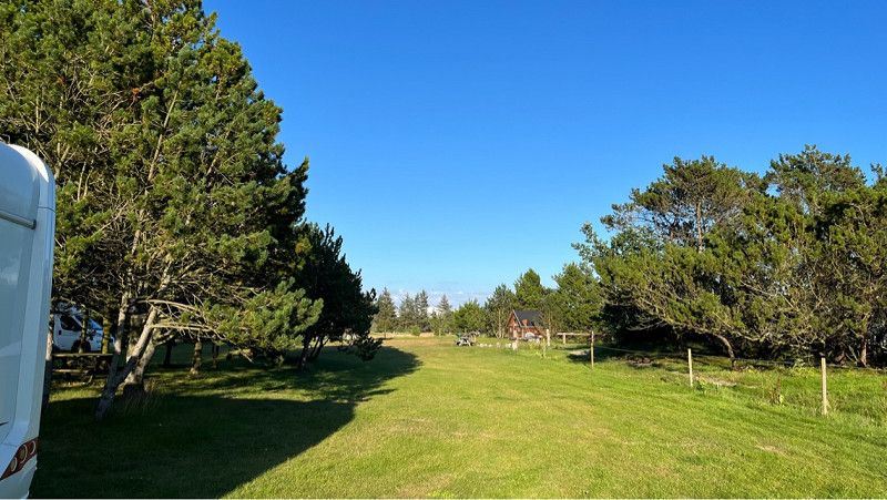
Beautiful pitch for mobile homes and caravans on a farm with horses.
Nature camping is really the right word here.
We registered with the nice owner and were allowed to stay here for 150 crowns without electricity. There would also be electricity.
The location is perfect and the pictures speak for themselves.
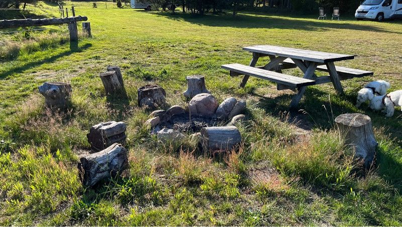
In the evening you can go for a walk around the owners' premises.
Where there are various picnic benches.
The lady also runs a B&B.
Really a great private place.
Hirtshalsvej 524, Ålbæk, Region Nordjütland, Dänemark
57° 36' 21.9" N 10° 21' 36.3" E
57.6060840 10.3600930
• Head toward Mosevej on Hirtshalsvej (597). Go for 11.5 km.
• Take the 2nd exit from roundabout onto Skagensvej (597). Go for 10.6 km.
• Take the 1st exit from roundabout onto Aalborgvej (E39) toward Hirtshals. Go for 2.2 km.
• Take the 2nd exit from roundabout onto Aalborgvej (E39) toward Hirtshals/Havn. Go for 1.1 km.
• Turn right onto Willemoesvej toward Østhavn. Go for 185 m.
• Turn right onto Willemoesvej. Go for 65 m.
• Arrive at Willemoesvej. Your destination is on the left.
☍
25,7 km
( 20 min.)
Day
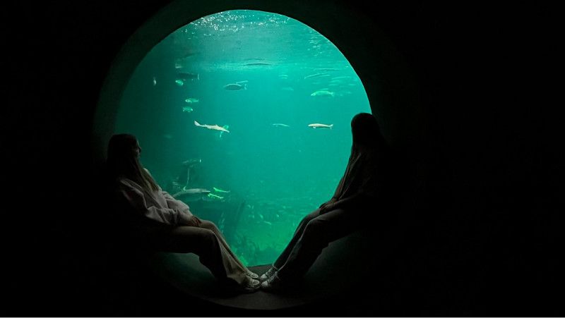
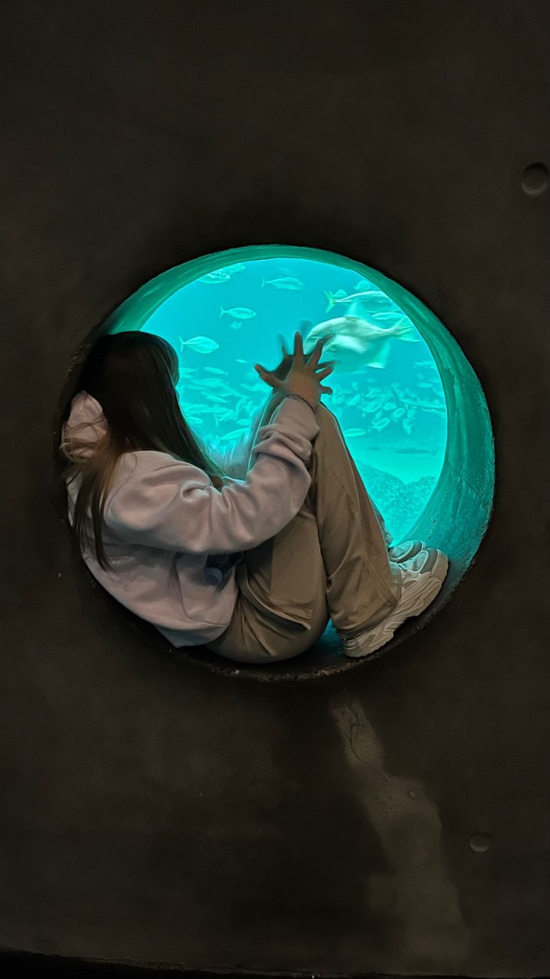
Nordsøen Oceanarium / Nordsee-Ozeanarium
Today we only drive about 20 km further to the large North Sea Oceanarium.
The North Sea Museum opens at 10:00 a.m. and closes at 5:00 p.m.
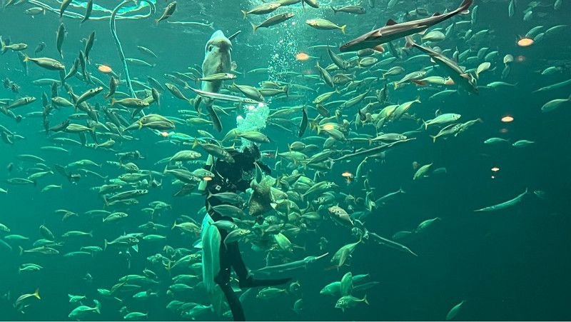
With a volume of more than 4.5 million liters of seawater and a height of over four floors, the size of the oceanarium gives a natural impression of the North Sea.
Outside there is a playground for children and the seal pool.
You will also find a ship there where different wind speeds are simulated.
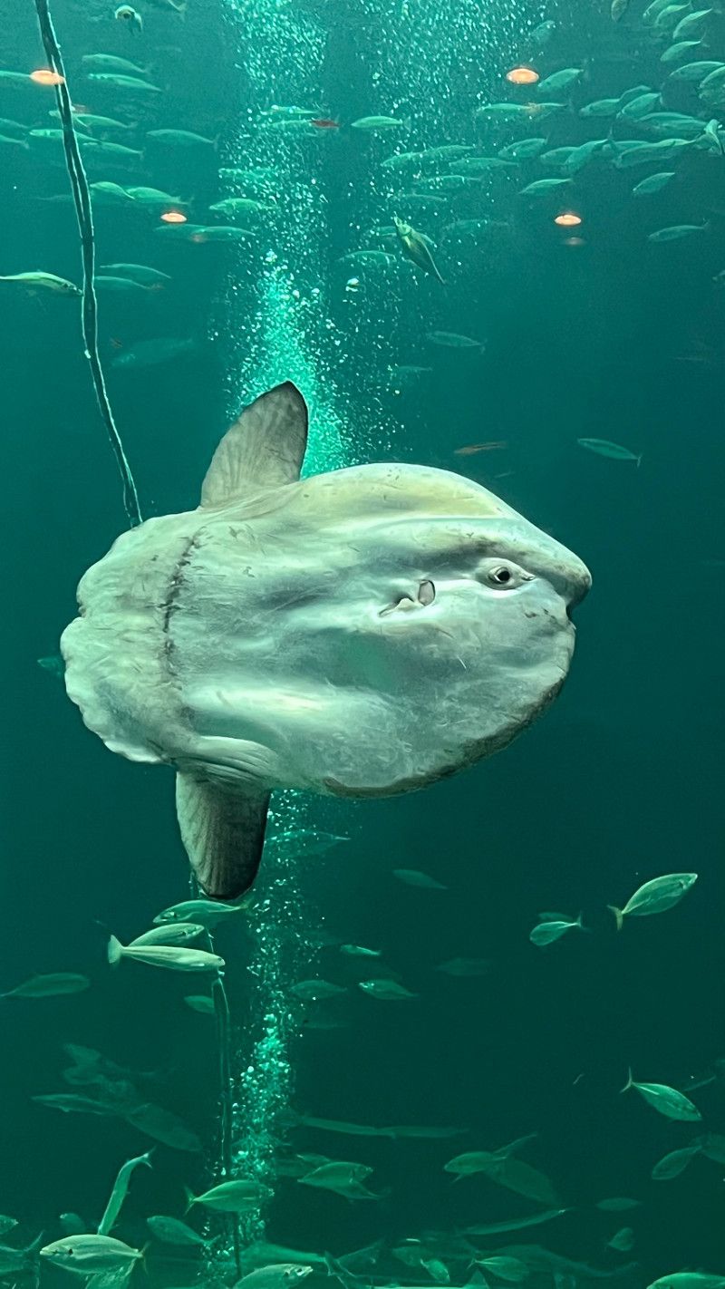
The biggest attraction is the large sea aquarium with the sunfish where feeding takes place twice a day by a diver in the tank. This will be moderated in Danish.
Great museum, a must for every aquarium lover.
The dogs have to stay outside here.
Willemoesvej, Hirtshals, Region Nordjütland, Dänemark
57° 35' 12.1" N 9° 58' 48.8" E
57.5866903 9.9802239
• Head southwest on Willemoesvej. Go for 40 m.
• Turn right onto Willemoesvej. Go for 26 m.
• Turn left onto Willemoesvej. Go for 40 m.
• Turn left onto Willemoesvej. Go for 185 m.
• Turn left onto Aalborgvej (E39) toward Aalborg/Skagen/597/55. Go for 1.1 km.
• Take the 1st exit from roundabout onto Dalsagervej (55) toward Hirtshals S. Go for 941 m.
• Turn right onto Søndre Ringvej (55) toward Tornby. Go for 2.5 km.
• Turn left onto Hovedvejen (55) toward Hjørring. Go for 10.4 km.
• Turn right onto Skallerupvej toward Skallerup Klit/Lønstrup/Sønderlev. Go for 8.4 km.
• Turn right onto Lønstrupvej. Go for 1.5 km.
• Continue on Strandvejen. Go for 562 m.
• Turn left onto Rubjergvej. Go for 2.0 km.
• Turn right. Go for 22 m.
• Arrive at your destination on the left.
☍
27,6 km
( 29 min.)
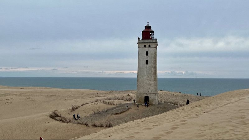
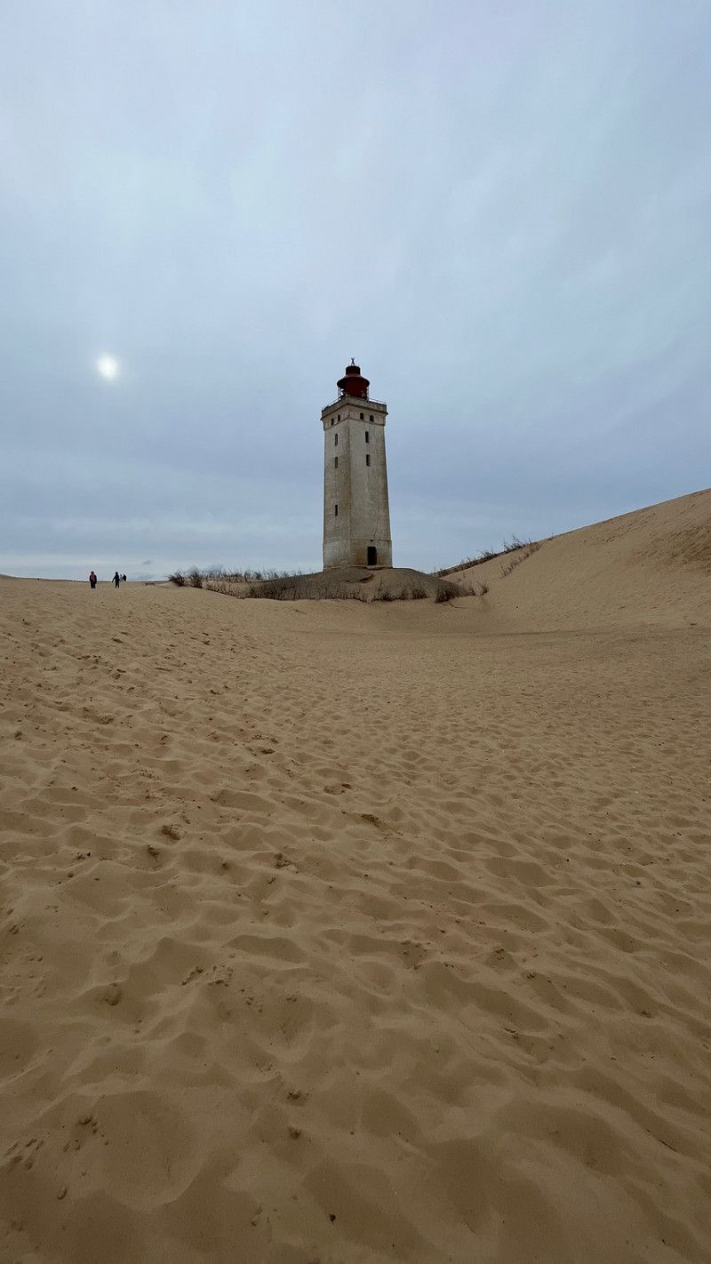
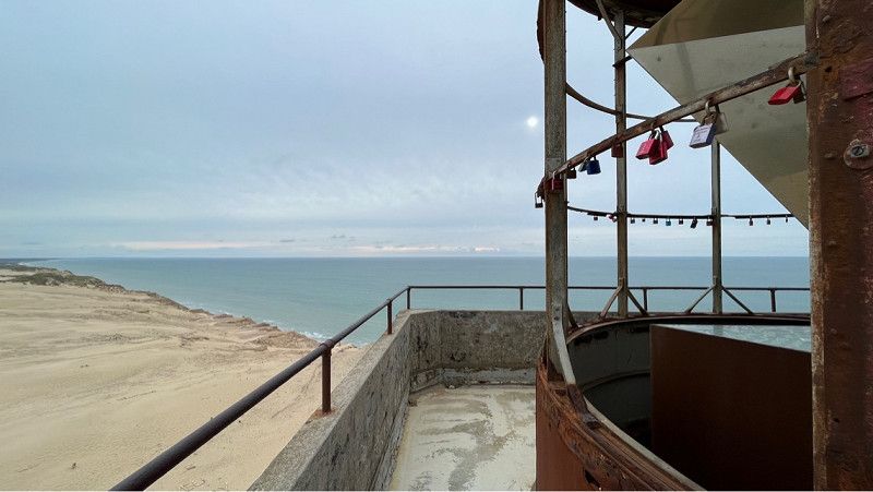
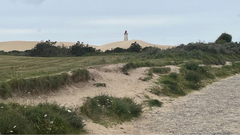
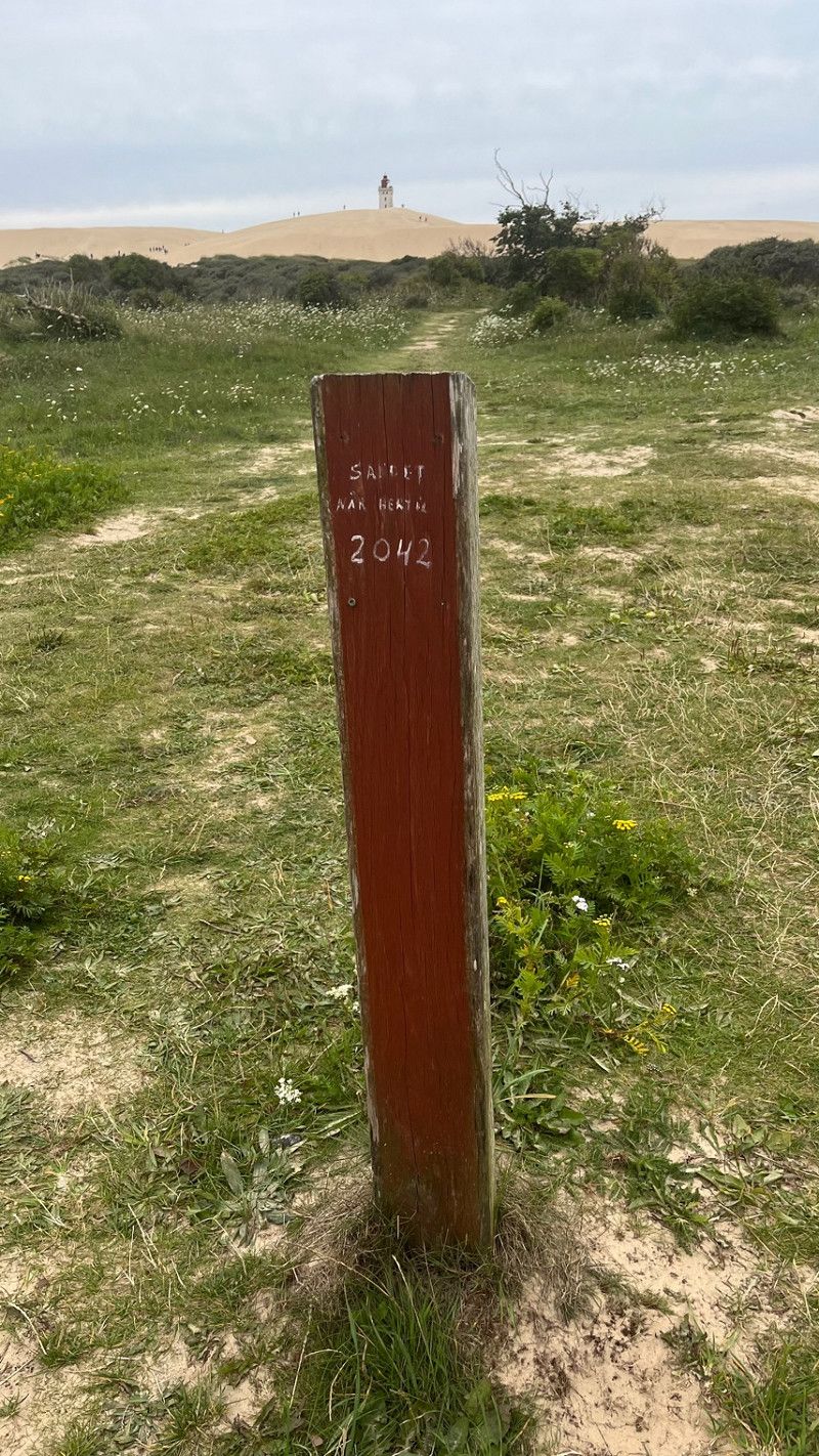
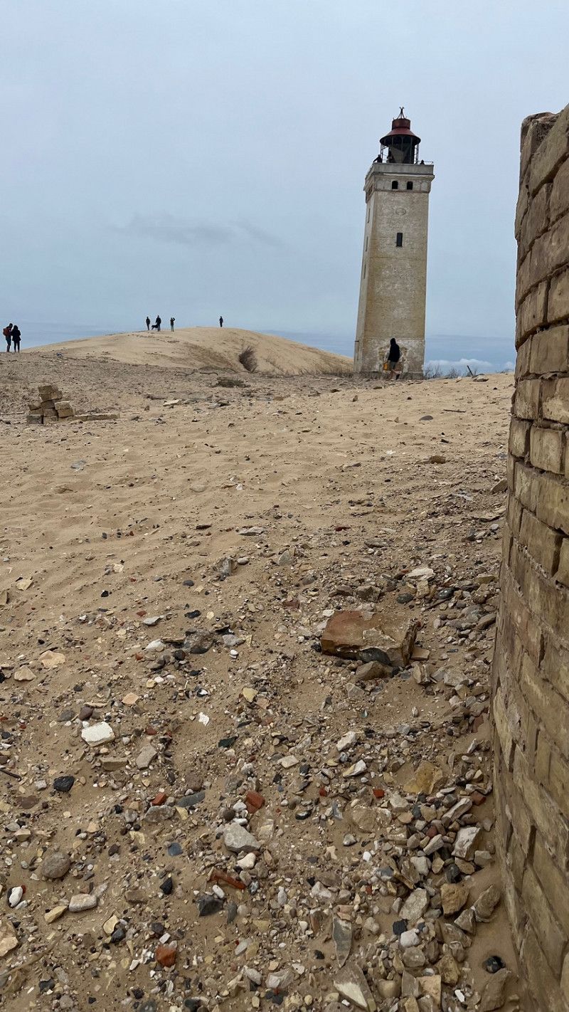
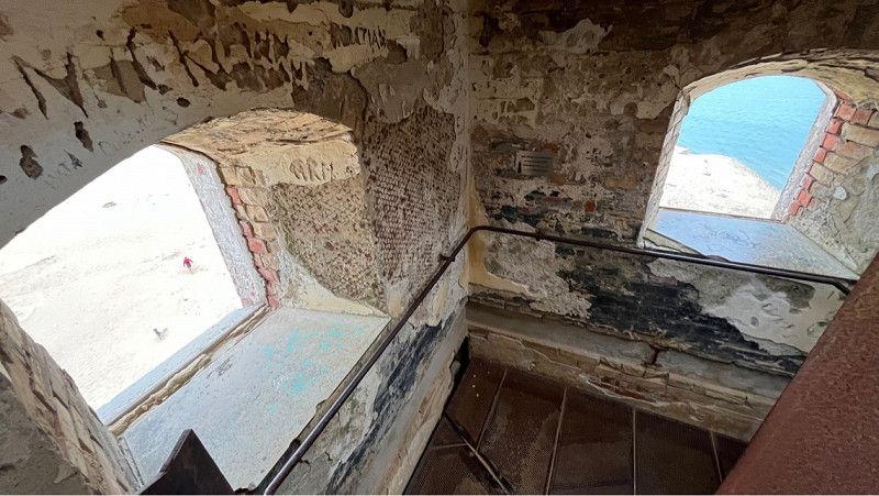
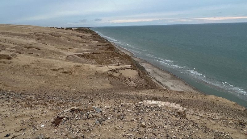
Rubjerg Knude Fyr Leuchtturm
The Rubjerg Knude Fyr lighthouse was built in 1900. At that time there was both a lighthouse and a lighthouse keeper's house at this location. The lighthouse keeper's house was later buried by sand, and in 2019 the lighthouse was moved about 70 meters inland to prevent
lest he fall into the sea.
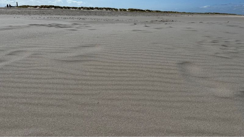
The dunes move further and further inland.
What is impressive is that there is a small plaque on the path stating that the dune will be located in 2046.
It is estimated that the lighthouse would have to be moved again in about 30 years, will that happen? It is unknown.
Rubjergvej, Lønstrup, Region Nordjütland, Dänemark
57° 27' 5.6" N 9° 47' 43.1" E
57.4515474 9.7953141
• Head toward Rubjergvej. Go for 22 m.
• Turn right onto Rubjergvej. Go for 2.3 km.
• Continue on Lønstrupvej. Go for 4.1 km.
• Turn right onto Løkkensvej (55) toward Løkken. Go for 2.5 km.
• Turn left onto Løkkensvej. Go for 113 m.
• Arrive at Løkkensvej. Your destination is on the left.
☍
9,0 km
( 9 min.)
Thommy‘s Bondegårdsferie / Privater Stellplatz
Small, cozy private parking space for motorhomes.
There is fresh water and a toilet with shower.
There is a bread roll service and there is a large vegetable stand with firewood in front of the premises.
In the morning, fresh eggs from happy chickens are left on your doorstep for free.
Tommy is a super nice guy.
Great hospitality, thank you.
Løkkensvej 875, Løkken, Region Nordjütland, Dänemark
57° 23' 20" N 9° 46' 26.5" E
57.3888760 9.7740380
• Head toward Vittrup Kirkevej on Løkkensvej. Go for 67 m.
• Turn right onto Vittrup Kirkevej. Go for 140 m.
• Turn left onto Løkkensvej (55). Go for 2.1 km.
• Turn right onto Kystvejen toward Nr. Lyngby. Go for 3.5 km.
• Turn left onto Lyngbyvej. Go for 162 m.
• Turn left onto Lyngby Mølle Vej. Go for 30 m.
• Turn right onto Lyngby Mølle Vej. Go for 149 m.
• Arrive at Lyngby Mølle Vej. Your destination is on the left.
☍
6,2 km
( 7 min.)
Day
Ehemaliger Friedhof von Lyngby / Glasbläserei Lyngby
Former fishing town where today there are mostly holiday homes.
Some houses have been dismantled as the sea erodes the dunes.
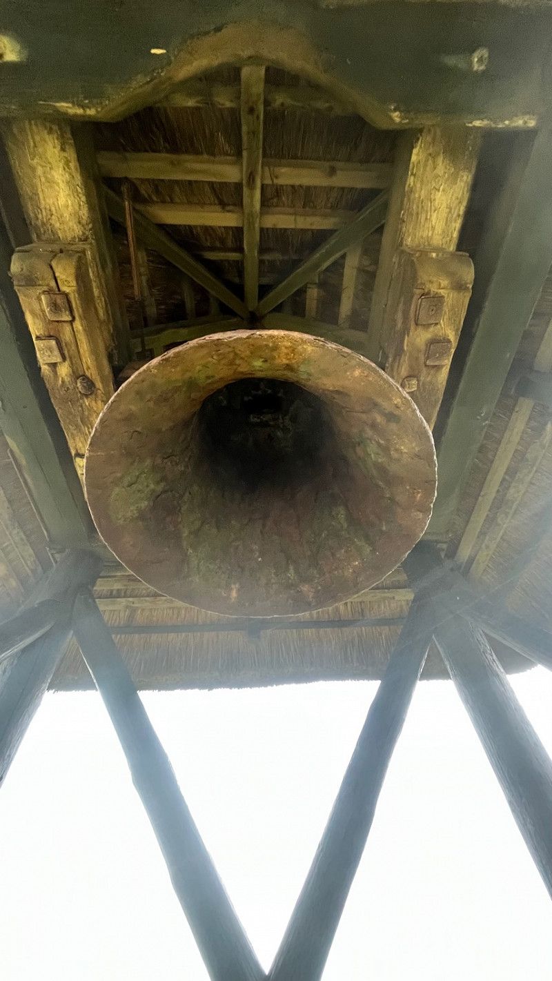
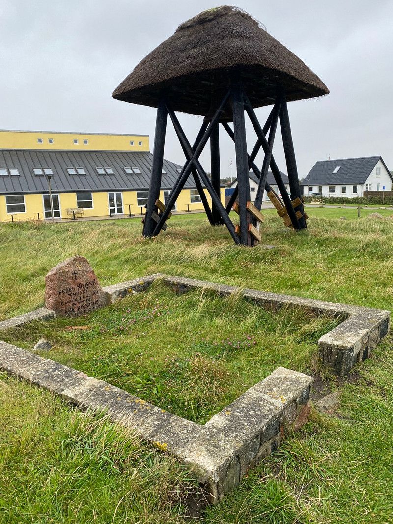
Today there is not much left of the cemetery. An old bell tower can still be seen.
From there you have a great view of the water and a good starting point for checking out the old bunkers on the beach.
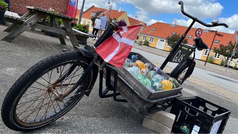
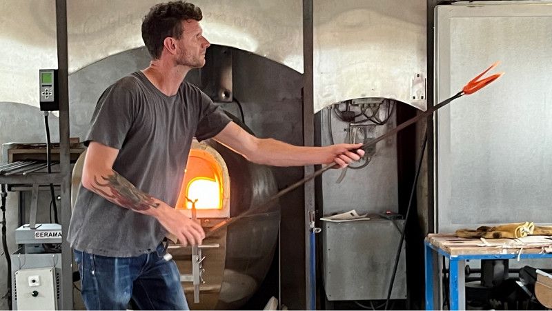
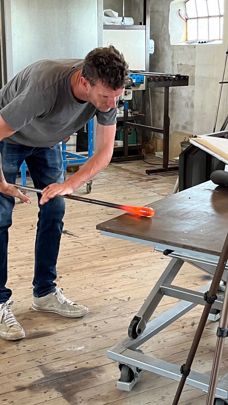
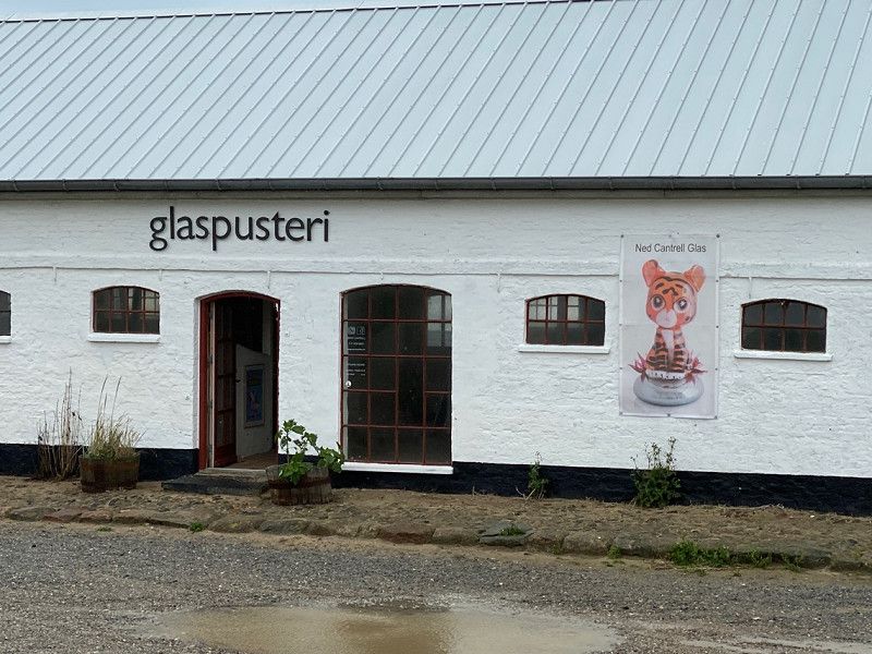
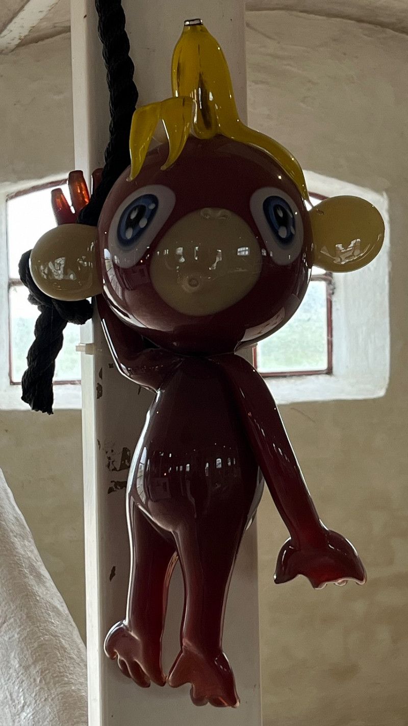
We also visited a glass blowing factory.
Great glass art that is made there.
Lyngby Mølle Vej 11, Løkken, Region Nordjütland, Dänemark
57° 24' 46.4" N 9° 44' 46.1" E
57.4128890 9.7461400
• Head south on Lyngby Mølle Vej. Go for 46 m.
• Turn left onto Lyngbyvej. Go for 53 m.
• Turn right onto Lyngbyvej. Go for 36 m.
• Turn right onto Lyngbyvej. Go for 240 m.
• Turn right onto Kystvejen. Go for 3.5 km.
• Turn right onto Løkkensvej (55) toward Løkken. Go for 1.1 km.
• Take the 2nd exit from roundabout onto Løkkensvej (55) toward Aalborg/Løkken C. Go for 1.1 km.
• Turn right onto Danmarksgade toward Brønderslev/Vrensted/Løkken C. Go for 185 m.
• Turn right onto Søndergade. Go for 268 m.
• Turn right onto Møstingsvej. Go for 56 m.
• Arrive at Møstingsvej. Your destination is on the right.
☍
6,6 km
( 8 min.)
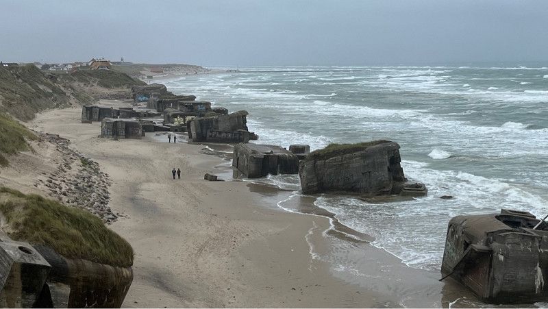
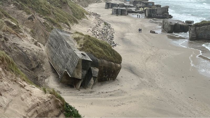
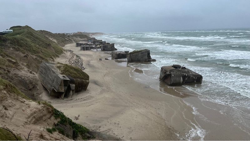
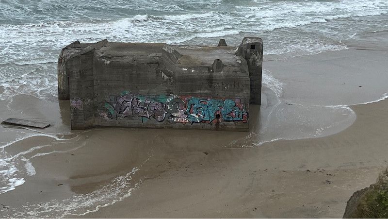
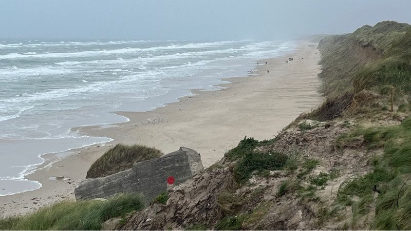
Lökken Furreby Küstenbatterie,
Visit of the old bunkers from the 2nd World War.
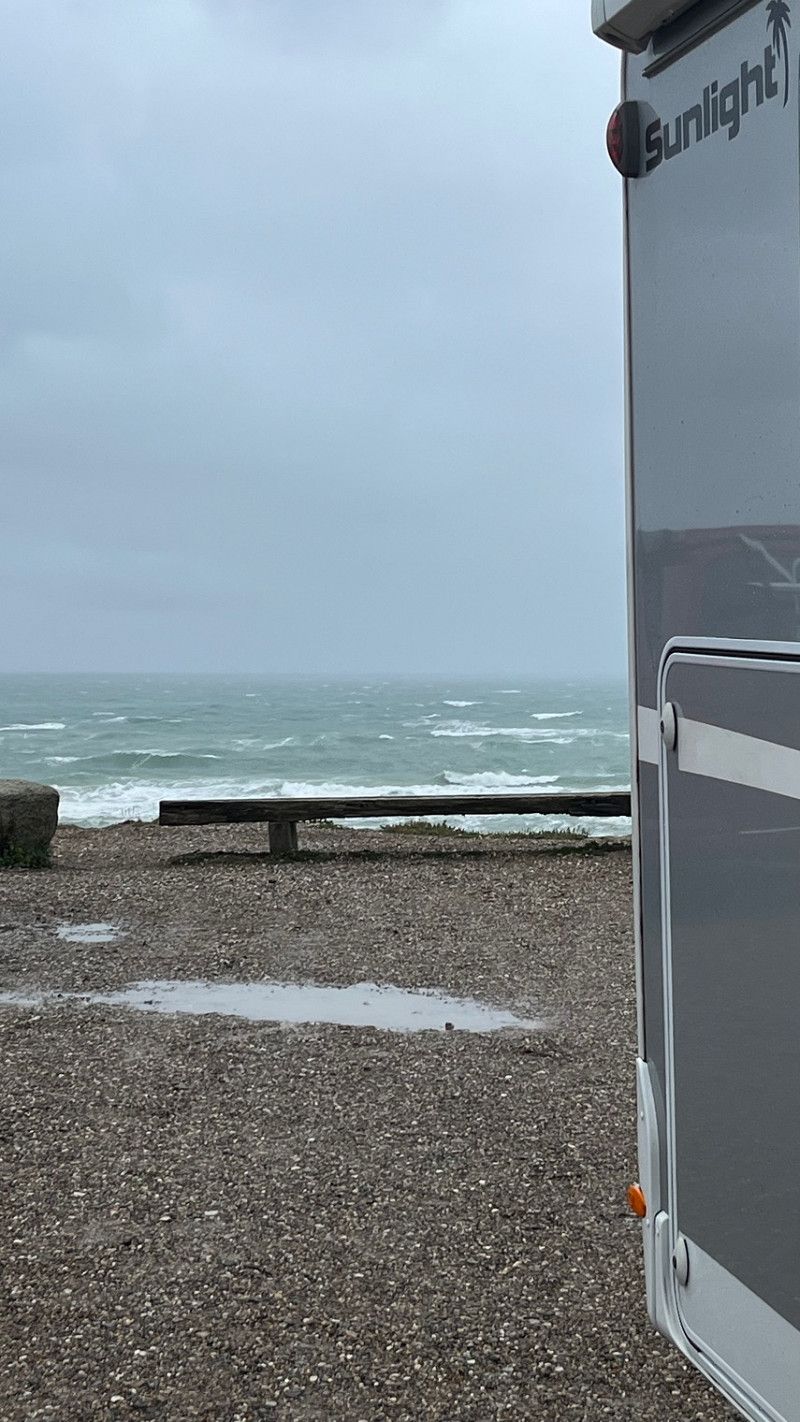
Since it's so stormy today, we couldn't go to the beach as we had planned.
So I got a picture from above.
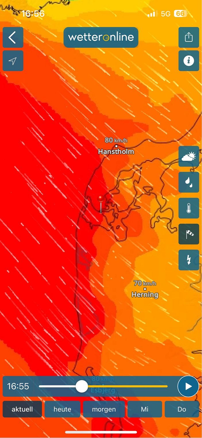
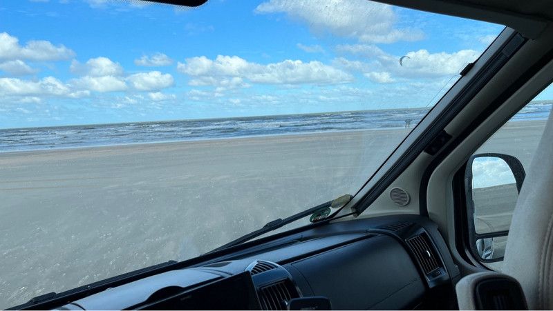
Today we have wind speeds of 120 km/h and drizzle that feels like needles on the skin.
Today is spent driving.
Unfortunately it is no longer inside.
We drive and see what we encounter on our tour.
Lokken Strand, 9480 Lokken, Denmark
Region Nordjütland, Dänemark
57° 22' 13.7" N 9° 42' 40.5" E
57.3704858 9.7112502
• Head east on Møstingsvej. Go for 18 m.
• Turn right onto Asylvej. Go for 77 m.
• Turn left onto Toldbodvej. Go for 20 m.
• Turn right onto Toldbodvej. Go for 50 m.
• Turn right onto Toldbodvej. Go for 20 m.
• Continue on Jyllandsgade. Go for 63 m.
• Turn right onto Jyllandsgade. Go for 102 m.
• Turn left onto Danmarksgade. Go for 145 m.
• Turn right onto Løkkensvej (55) toward Aalborg. Go for 582 m.
• Pass 3 roundabouts and continue on Omfartsvejen (55). Go for 22.6 km.
• Turn right onto Gammel Landevej. Go for 1.3 km.
• Continue on Sandmosevej. Go for 17 m.
• Continue on Gammel Landevej. Go for 1.2 km.
• Take the 1st exit from roundabout onto Tranumvej. Go for 4.8 km.
• Continue on Tranum Engevej. Go for 2.1 km.
• Take the 2nd exit from roundabout onto Tranum Engevej. Go for 5.0 km.
• Continue on Dybdalsvej. Go for 1.3 km.
• Continue on Drosselvej. Go for 12 m.
• Continue on Dybdalsvej. Go for 898 m.
• Take the 2nd exit from roundabout onto Hjortdalvej. Go for 3.5 km.
• Turn left onto Bonderupvej. Go for 2.0 km.
• Continue on Mellemmøllevej. Go for 792 m.
• Turn right onto Ålborgvej (11). Go for 20.4 km.
• Turn right. Go for 129 m.
• Arrive at your destination on the right.
☍
67,1 km
( 55 min.)
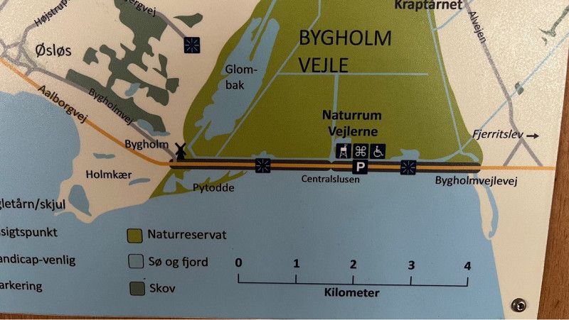
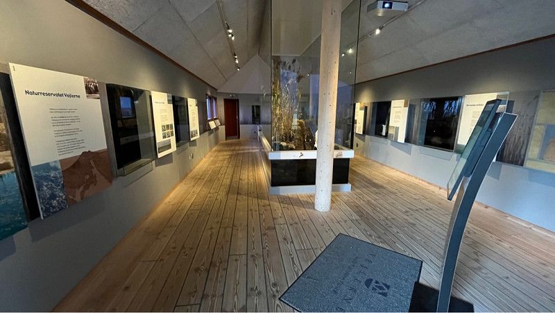
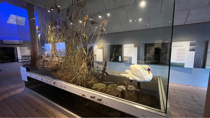
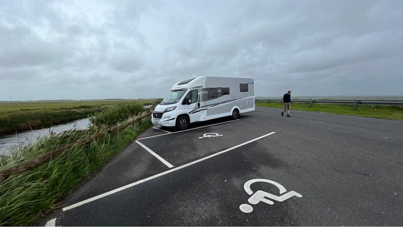
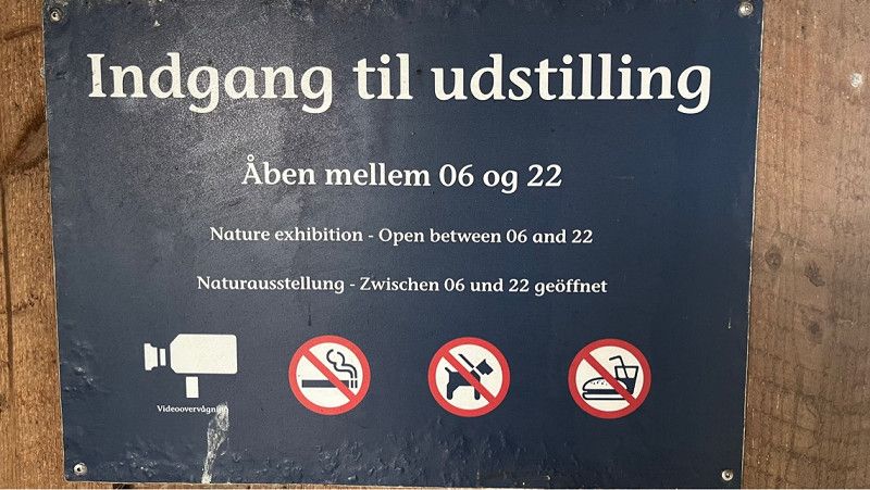
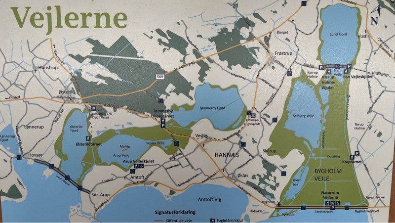
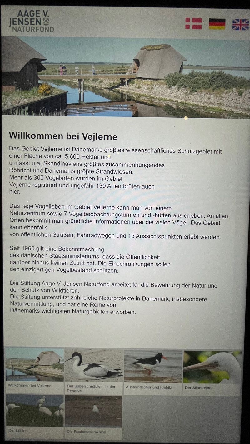
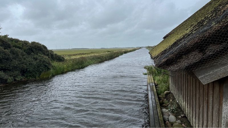
Naturum Vejlerne
Nice perk place to take a break.
Toilet is available.
The special thing about this parking lot is that it is in a nature reserve and it is an observation point including a small museum.
Bygholmvejlevej 640
Gøttrupholme
9690 Fjerritslev
Denmark
Bygholmvejlevej 640, Fjerritslev, Region Nordjütland, Dänemark
57° 1' 59.1" N 9° 6' 5.8" E
57.0330860 9.1016050
• Head toward Bygholmvejlevej. Go for 81 m.
• Turn right onto Bygholmvejlevej (11/29). Go for 8.4 km.
• Pass 2 roundabouts and continue on Oddesundvej (11/26). Go for 26.3 km.
• Take the 1st exit from roundabout onto Oddesundvej (11/26) toward Holstebro/Nykøbing. Go for 51.0 km.
• Turn left onto Gammel Færgevej. Go for 84 m.
• Turn left onto Gammel Færgevej. Go for 531 m.
• Arrive at Gammel Færgevej. Your destination is on the left.
☍
86,4 km
(1 hrs. 5 min.)
Grisetå Odde Fyr / Kit Spot
Gammel Færgevej 2, Struer, Region Mitteljütland, Dänemark
56° 34' 42.6" N 8° 33' 52.6" E
56.5784900 8.5646090
• Head south on Gammel Færgevej. Go for 531 m.
• Turn right onto Gammel Færgevej. Go for 84 m.
• Turn left onto Oddesundvej (11). Go for 7.0 km.
• Take the 2nd exit from roundabout onto Oddesundvej (11/513) toward Holstebro/Struer. Go for 3.1 km.
• Turn right onto Vester Ringgade toward Struer Vest. Go for 3.2 km.
• Continue on Kløvenhøj. Go for 410 m.
• Continue on Lindevej. Go for 355 m.
• Pass 2 roundabouts and continue on Lindtorpvej (509). Go for 13.5 km.
• Turn right onto Burvej (509). Go for 6.7 km.
• Turn left onto Søndergade (28). Go for 5.6 km.
• Turn right onto Holstebrovej (16/28) toward Ulfborg/Ringkøbing. Go for 10.9 km.
• Take the 2nd exit from roundabout onto Holstebrovej (16/28) toward Ringkøbing/Skjern. Go for 8.2 km.
• Continue on Holstebrovej (16). Go for 2.3 km.
• Take the 1st exit from roundabout onto Vestre Ringvej (15). Go for 2.5 km.
• Take the 1st exit from roundabout onto Søndervig Landevej (15). Go for 3.3 km.
• Turn left onto Baggersvej. Go for 237 m.
• Turn right onto Sønderbyvej. Go for 220 m.
• Arrive at Sønderbyvej. Your destination is on the right.
☍
68,1 km
( 57 min.)
Sønderbyvej
Parking space on private property.
Electricity is provided and fresh water too.
There is no toilet or bathroom.
The place is clean and you stand on the lawn behind the house.
Payment is in cash.
We paid 14 euros for one night.
Address:
Sønderbyvej 8, 6950 Ringkøbing, Denmark
Unfortunately I didn't take any pictures
Sønderbyvej 8, Ringkøbing, Region Mitteljütland, Dänemark
56° 6' 49" N 8° 10' 15.7" E
56.1136020 8.1710390
• Head toward Baggersvej on Sønderbyvej. Go for 220 m.
• Turn left onto Baggersvej. Go for 10 m.
• Turn slightly left onto Baggersvej. Go for 227 m.
• Turn left onto Søndervig Landevej (15). Go for 72 m.
• Pass 2 roundabouts and continue on Søndervig Landevej (15). Go for 4.0 km.
• Turn right onto Houvig Klitvej (181). Go for 638 m.
• Turn left toward Lodbergsvej. Go for 158 m.
• Turn left onto Lodbergsvej. Go for 27 m.
• Arrive at Lodbergsvej. Your destination is on the left.
☍
5,3 km
( 6 min.)
Day
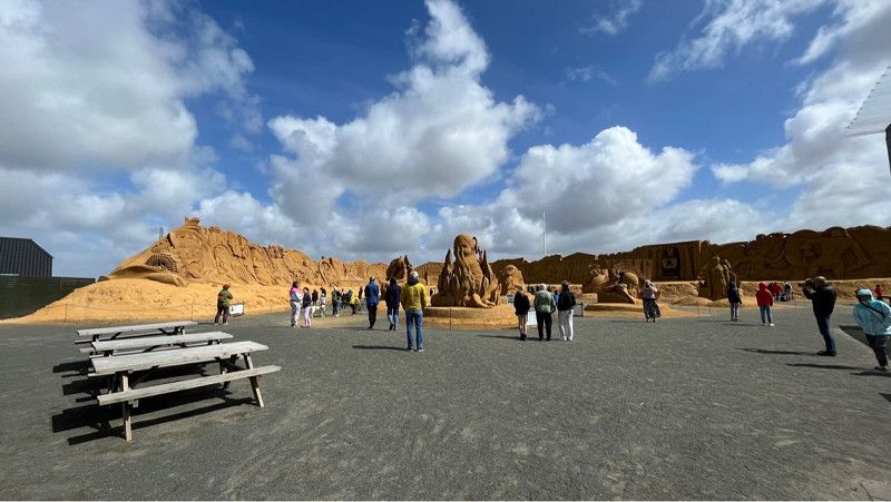
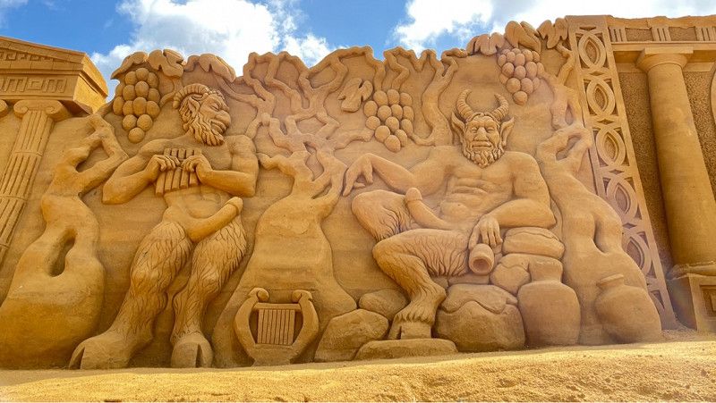
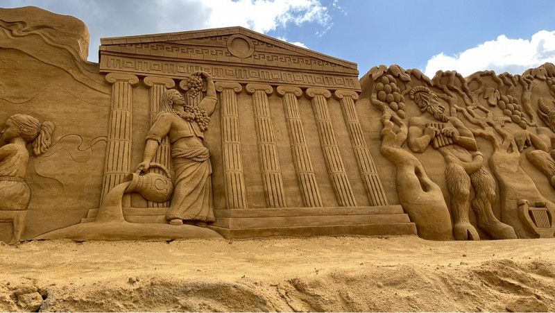
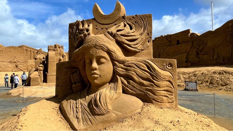
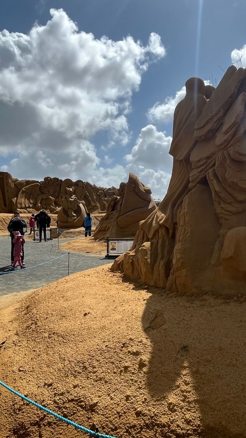
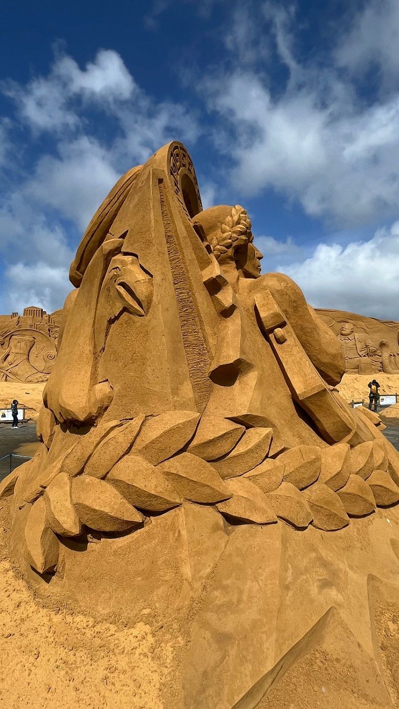
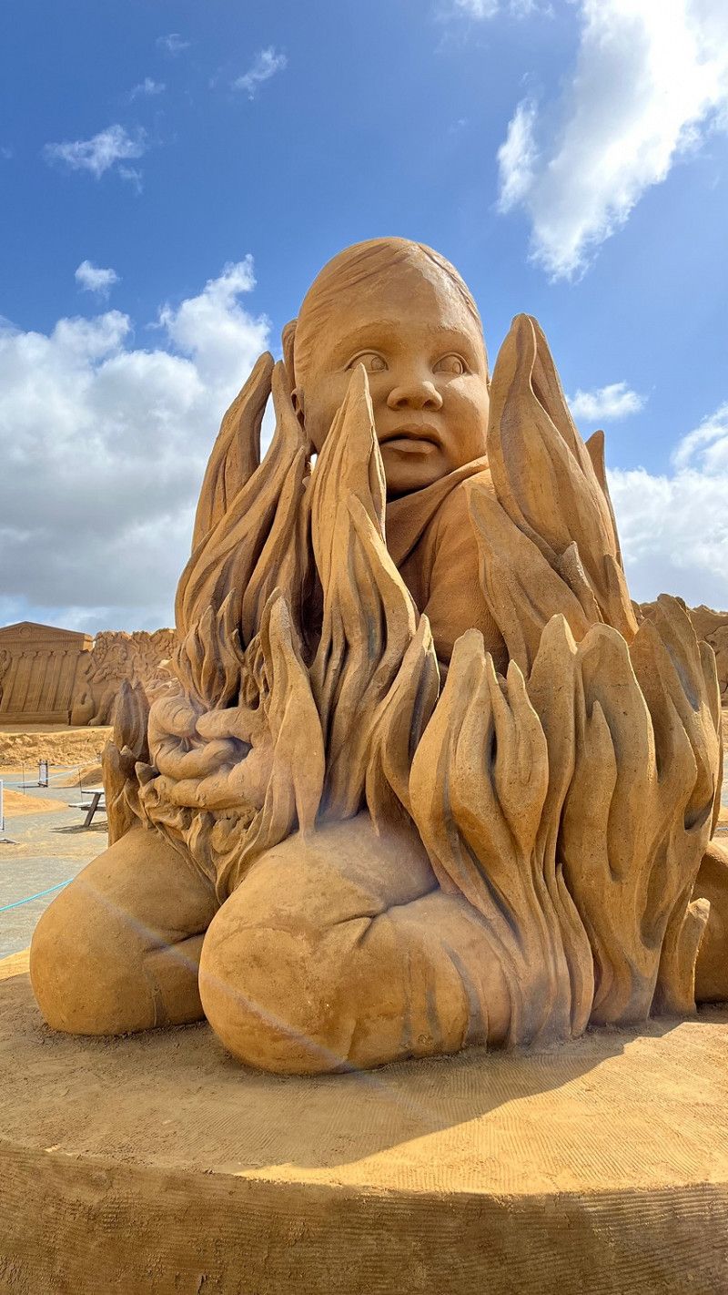
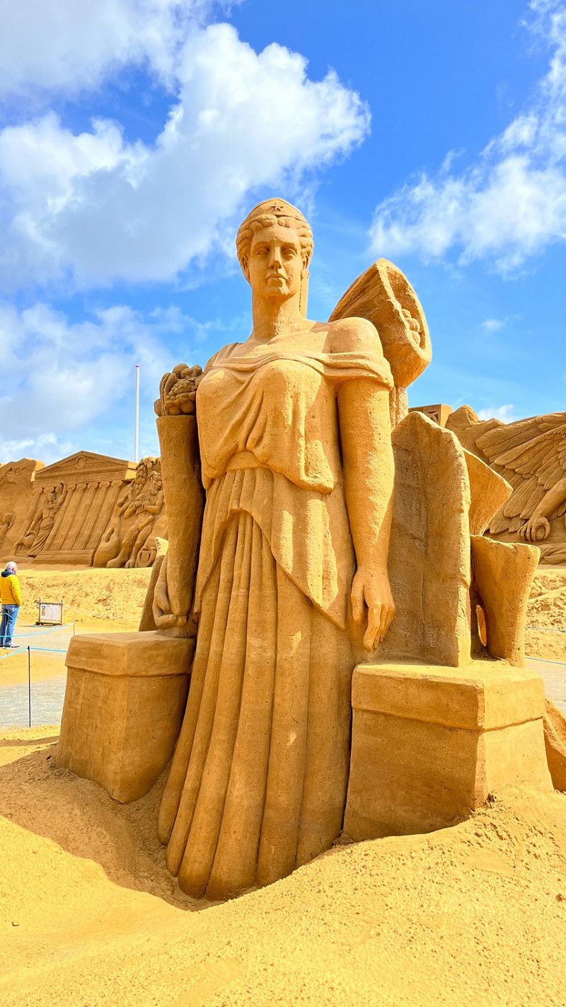
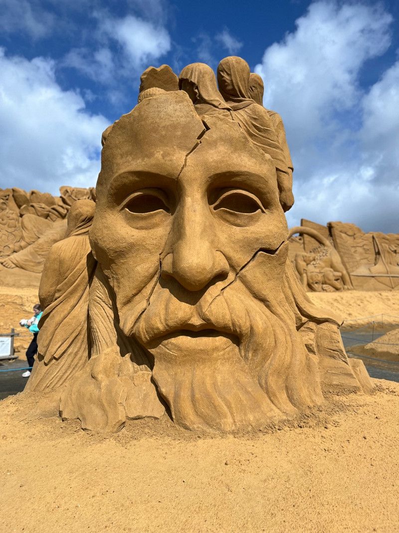
Sandskulpturen-Festival Ringkøbing
Today we went to the sand sculpture festival in Ringkøbing in the morning.
The exhibition is easy to reach by motorhome and there is plenty of parking space.
Entry per person 80 DKK
The sculptures are up to 7 meters high and the sand sculpture wall is up to 200 meters long.
Every year a new theme is chosen.
In 2023 it's Greek mythology's turn.
Only the best sand sculptors from around the world are hired by the Worldwide Sculpture Organization. The sculptors travel to festivals around the world.
They often take part in international sand sculpture competitions. For your
Many artists have already received awards for their works.
Lodbergsvej 44, Ringkøbing, Region Mitteljütland, Dänemark
56° 7' 28.2" N 8° 6' 53.2" E
56.1245020 8.1147880
• Head south on Lodbergsvej. Go for 346 m.
• Turn left toward Houvig Klitvej/181. Go for 97 m.
• Turn right onto Houvig Klitvej (181). Go for 296 m.
• Turn left onto Søndervig Landevej (15). Go for 347 m.
• Pass 3 roundabouts and continue on Søndervig Landevej. Go for 7.9 km.
• Continue on Søndervigvej. Go for 715 m.
• Continue on Torvegade. Go for 204 m.
• Continue on Torvet. Go for 69 m.
• Turn slightly right onto Algade. Go for 215 m.
• Continue on Herningvej. Go for 32 m.
• Turn right onto Kongevejen. Go for 650 m.
• Continue on Vellingvej. Go for 997 m.
• Continue on Parkvej. Go for 205 m.
• Continue on Vellingvej. Go for 3.6 km.
• Keep right onto Velling Kirkeby. Go for 2.2 km.
• Turn right onto Tændpibe. Go for 2.5 km.
• Continue on Stauningvej. Go for 6.3 km.
• Continue on Kirkebyvej. Go for 1.6 km.
• Continue on Stauningvej. Go for 1.8 km.
• Arrive at Stauningvej. Your destination is on the left.
☍
30,1 km
( 29 min.)
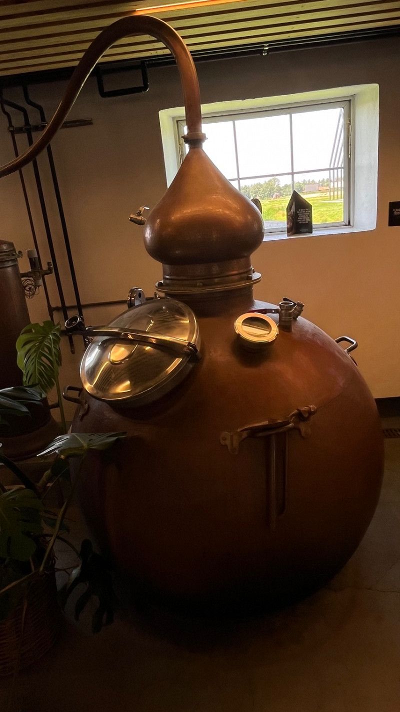
Stauning Whiskey Brennerei
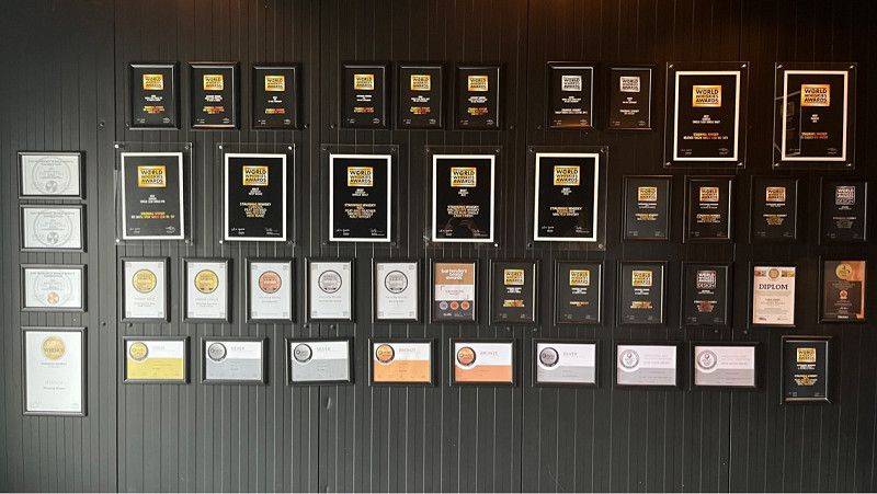
Here you can see a whiskey distillery.
There are guided tours and you can taste each whiskey beforehand.
It is still a young distillery.
The distillery was founded by nine friends in 2005.
Stauning Whiskey is distilled in the classic style that has been lost due to industrialization. The whiskeys are all made from local grains, and are malted on the ground and distilled under direct heat in 24 small copper stills.
This distillery is really worth seeing.
Stauningvej 38, Skjern, Region Mitteljütland, Dänemark
55° 57' 8.9" N 8° 24' 12.1" E
55.9524790 8.4033550
• Head southeast on Stauningvej. Go for 5.1 km.
• Turn right onto Lønborgvej. Go for 182 m.
• Turn left onto Klostervej. Go for 1.3 km.
• Take the 1st exit from roundabout onto Bredgade. Go for 81 m.
• Continue on Vardevej. Go for 3.2 km.
• Turn right onto Vestre Kvartervej (11). Go for 36.3 km.
• Turn left onto Ribevej (11) toward Ribe/E20. Go for 10.3 km.
• Take the 2nd exit from roundabout onto 11/191 toward Ribe/Esbjerg/Tjæreborg. Go for 3.9 km.
• Continue on Ålbæk Hovedvej (11) toward Ribe/Bramming. Go for 3.8 km.
• Pass 2 roundabouts and continue on Varde Hovedvej (11/24). Go for 17.6 km.
• Turn right onto Ringvejen (11/24) toward Tønder/Aabenraa. Go for 2.5 km.
• Take the 2nd exit from roundabout onto Haderslevvej (24) toward Haderslev/Ribe/Flensborg/179/Aabenraa. Go for 383 m.
• Take the 1st exit from roundabout onto Haulundvej. Go for 498 m.
• Arrive at Haulundvej. Your destination is on the right.
☍
85,2 km
(1 hrs. 7 min.)
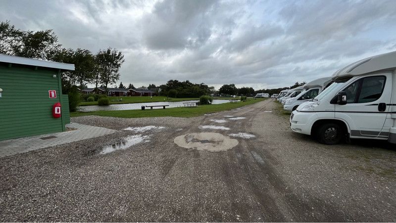
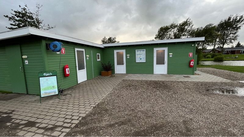
Storkesøen Naturcamping Ribe
The parking space offers a very good starting point for exploring Ribe on foot.
The city center is about 1.5 km away.
Anyone who is good on foot can easily manage this.
We can only recommend the restaurant on the square. It offers a dish every day and you can eat until you are full.
It tastes very good.
It is a paradise for anglers. There are 2 large ponds here and you can buy a fishing license at reception.
The reception offers everything an angler needs.
Haulundvej, Ripen, Region Süddänemark, Dänemark
55° 18' 58.5" N 8° 45' 35.3" E
55.3162462 8.7598157
• Head toward Skovbryder on Haulundvej. Go for 275 m.
• Turn right onto Roagervej. Go for 590 m.
• Take the 1st exit from roundabout onto Tøndervej (11) toward Ribe. Go for 600 m.
• Take the 2nd exit from roundabout onto Ringvejen (11/24) toward Varde/Esbjerg/Ribe N. Go for 2.2 km.
• Turn right toward Ribe C. Go for 249 m.
• Continue on Plantagevej. Go for 62 m.
• Turn right onto Saltgade. Go for 415 m.
• Arrive at Saltgade. Your destination is on the right.
☍
4,4 km
( 5 min.)
Day
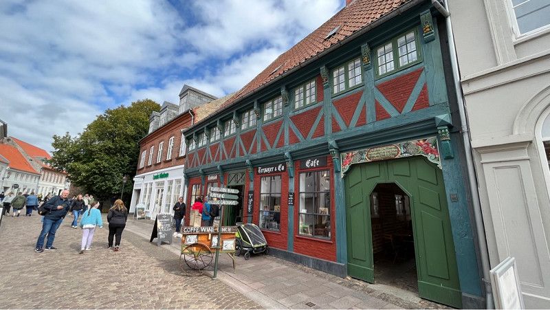
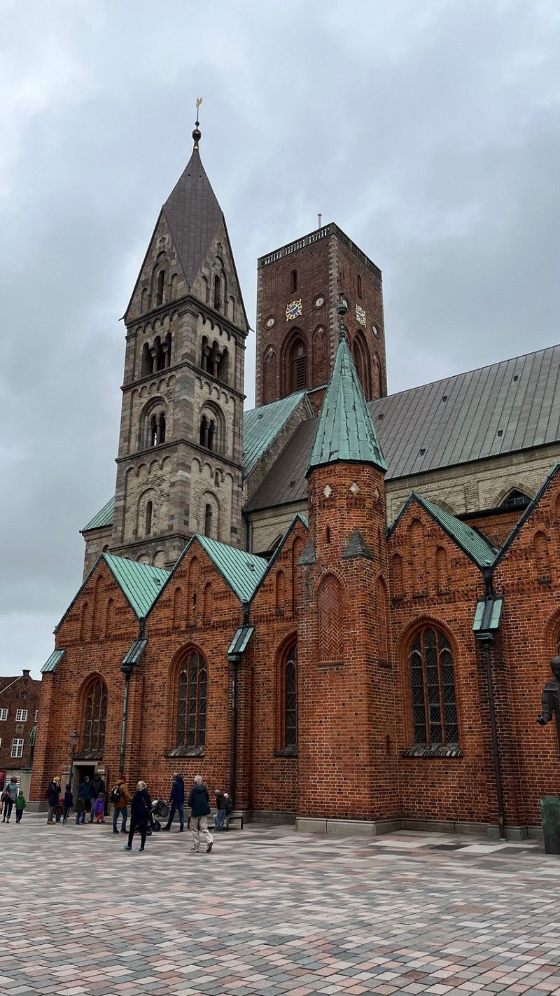
Ribe Stadtbesichtigung
Today we looked at Ribe.
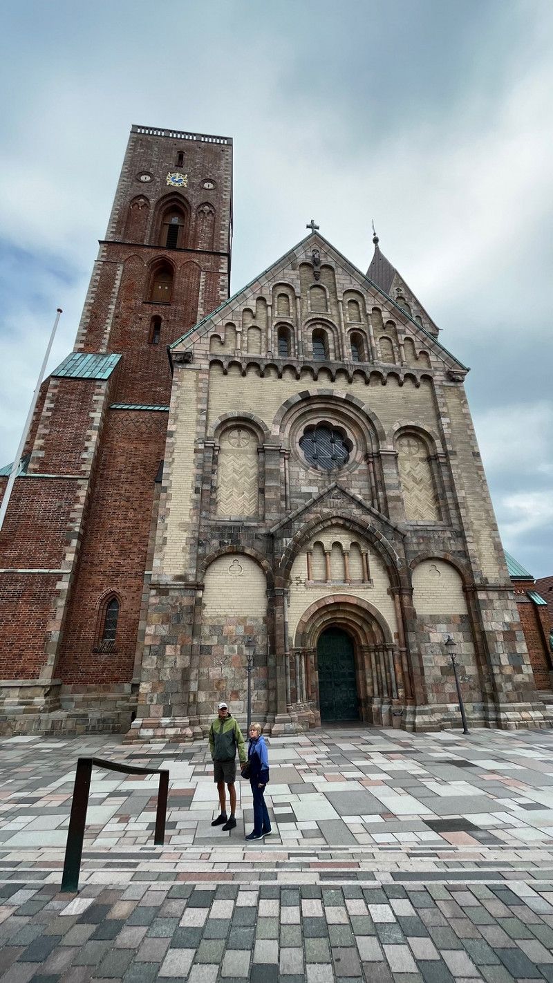
Ribe is the oldest town in Denmark.
The port of Ribe was the most important on the North Sea until modern times.
Thanks to this glorious period, Ribe can still boast numerous well-preserved buildings and houses today.
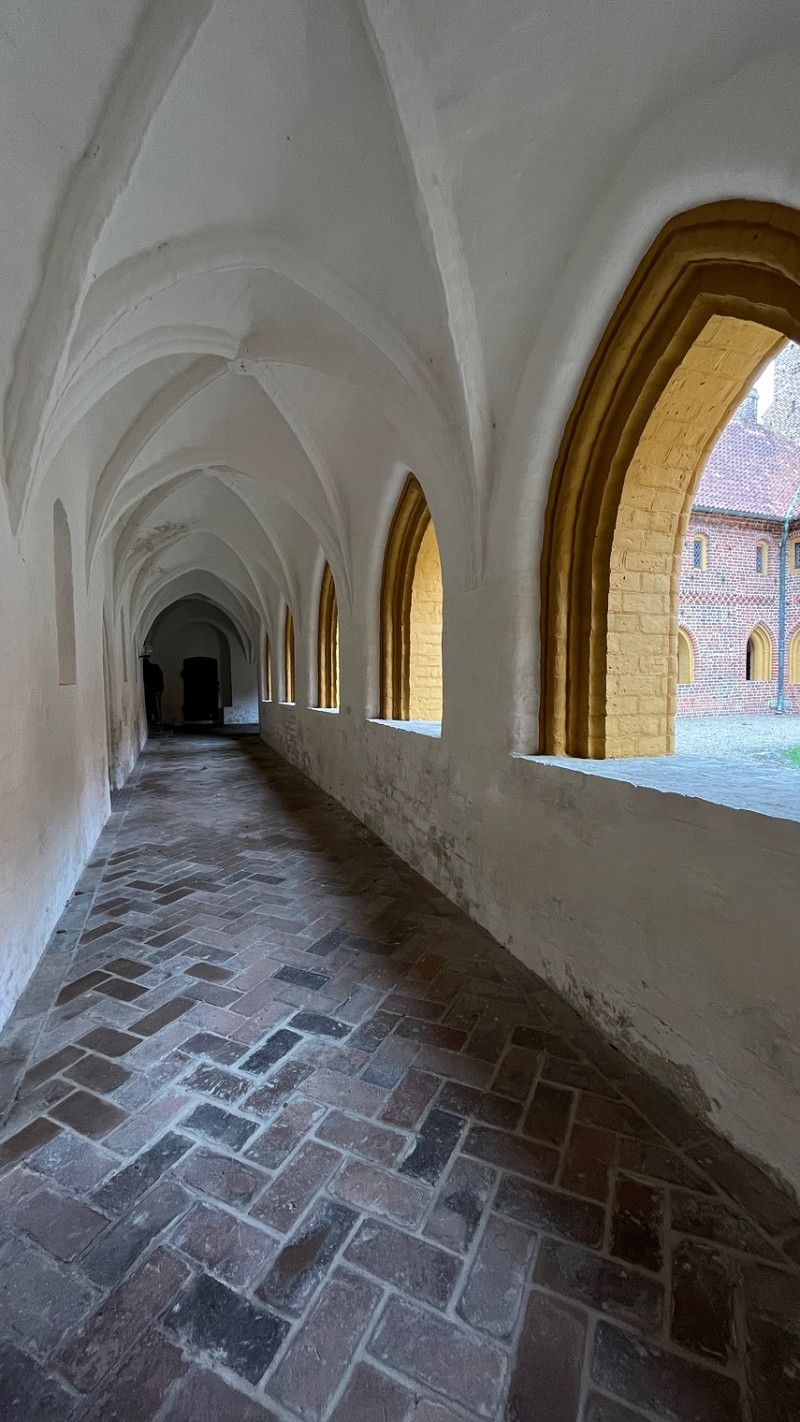
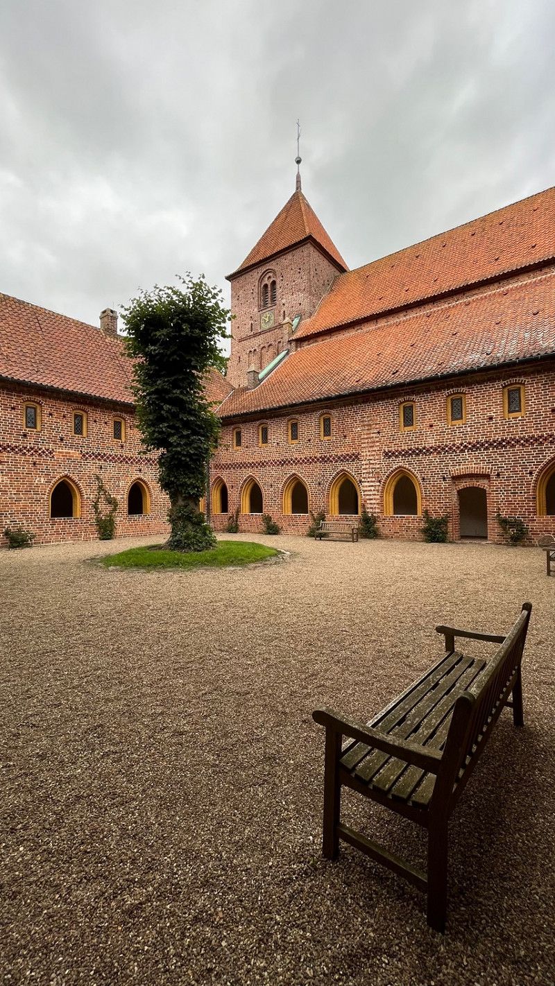
The Ribe Cathedral and the old monastery church with its monastery courtyard, which is the best-preserved monastery church in Scandinavia.
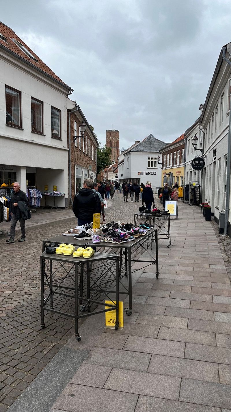
The city is also very good for shopping.
Saltgade 4A
55° 19' 49.1" N 8° 45' 59.7" E
55.3303155 8.7665737
• Head south on Saltgade. Go for 43 m.
• Turn left onto Sanct Nicolaj Gade. Go for 276 m.
• Take the 1st exit from Odins Plads roundabout onto Odins Plads. Go for 66 m.
• Take the 1st exit from roundabout onto Dagmarsgade. Go for 167 m.
• Turn left onto Kurveholmen. Go for 242 m.
• Continue on Brorsonsvej. Go for 196 m.
• Continue on Hundegade. Go for 274 m.
• Continue on Haulundvej. Go for 203 m.
• Take the 2nd exit from roundabout onto Haulundvej. Go for 156 m.
• Take the 1st exit from roundabout onto Haderslevvej (24) toward Esbjerg/Ribe N/Varde/11/Tønder. Go for 318 m.
• Take the 2nd exit from roundabout onto Tøndervej (11) toward Tønder/Rømø. Go for 665 m.
• Take the 2nd exit from roundabout onto Tøndervej (11) toward Tønder/Rømø. Go for 17.2 km.
• Take the 1st exit from roundabout onto Rømøvej (175) toward Rømø. Go for 13.8 km.
• Continue on Vesterhavsvej. Go for 3.6 km.
• Turn right onto Lakolk Butikscenter. Go for 37 m.
• Turn left onto Lakolk Camping. Go for 114 m.
• Arrive at Lakolk Camping. Your destination is on the right.
☍
37,3 km
( 34 min.)
Day
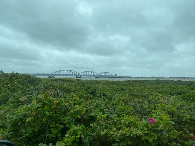
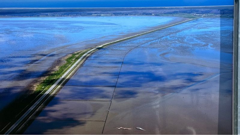
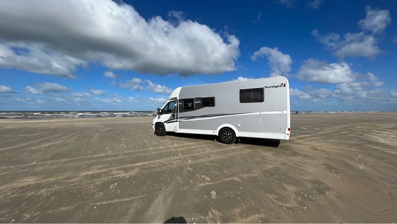
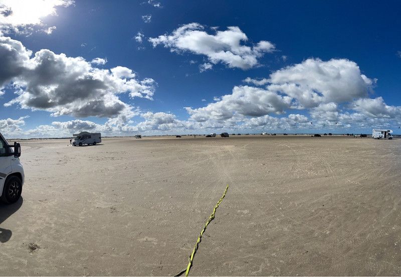
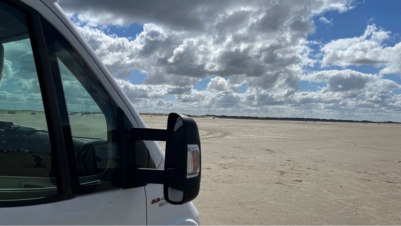
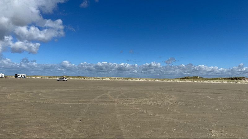
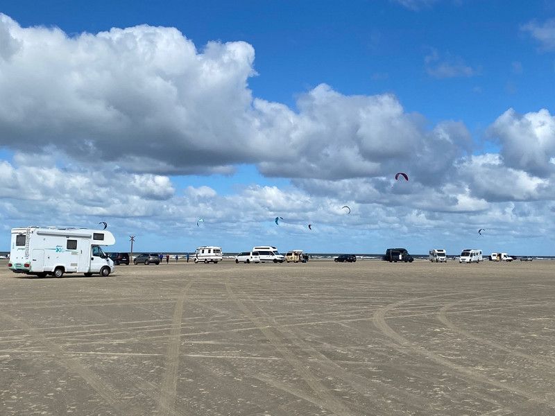
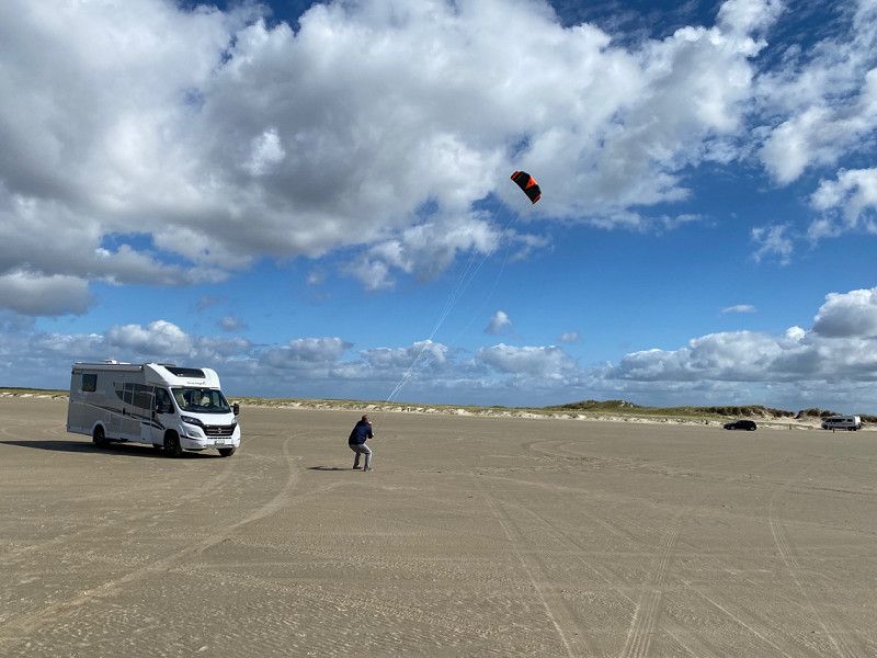
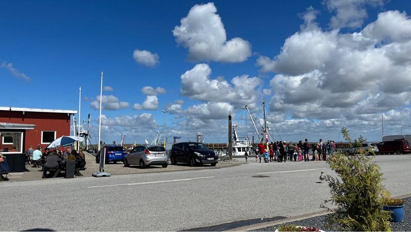
Rømø Autostrand
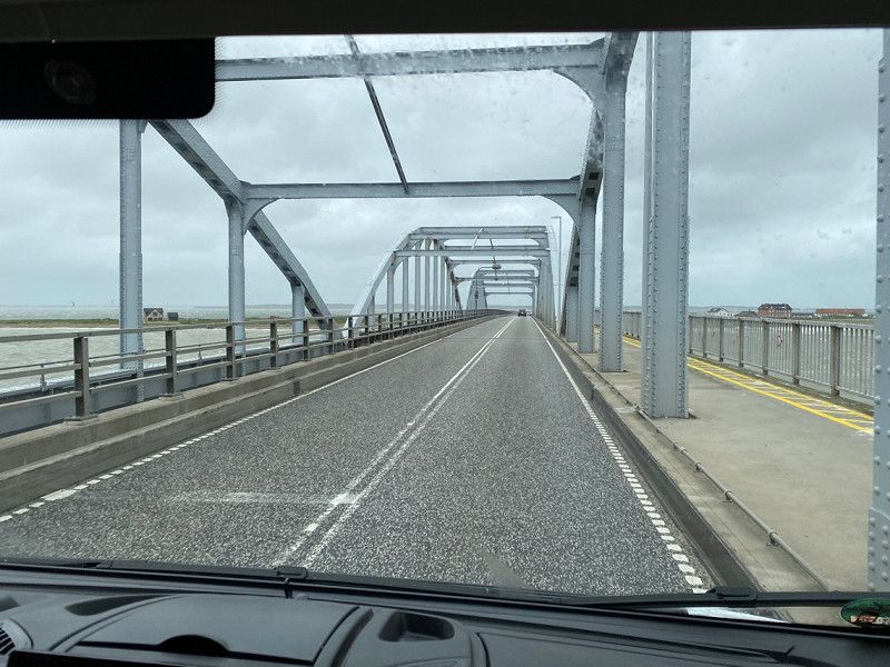
Today we reached Rømø via the 10 km long dam.
First we went to the car beach.
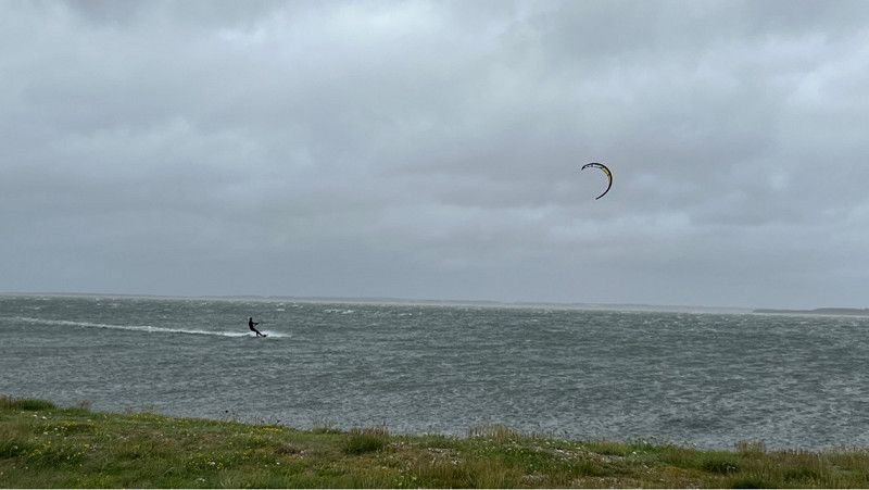
The island is known for its wide sandy beaches, which are among the most beautiful in Europe.
You can go to the beach with your motorhome during the day. It is not permitted to spend the night on the Rømø car beach.
Lakolk Camping 2, 6792, Rømø, Dänemark
55° 8' 45.1" N 8° 29' 36" E
55.1458690 8.4933460
• Head toward Lakolk Butikscenter on Lakolk Camping. Go for 114 m.
• Turn right onto Lakolk Butikscenter. Go for 37 m.
• Turn left onto Vesterhavsvej. Go for 3.6 km.
• Turn right onto Havnebyvej (175). Go for 7.8 km.
• Continue on Nordre Havnevej. Go for 237 m.
• Continue on Østre Havnevej. Go for 84 m.
• Turn left onto Havnepladsen. Go for 49 m.
• Arrive at Havnepladsen. Your destination is on the right.
☍
11,9 km
( 13 min.)
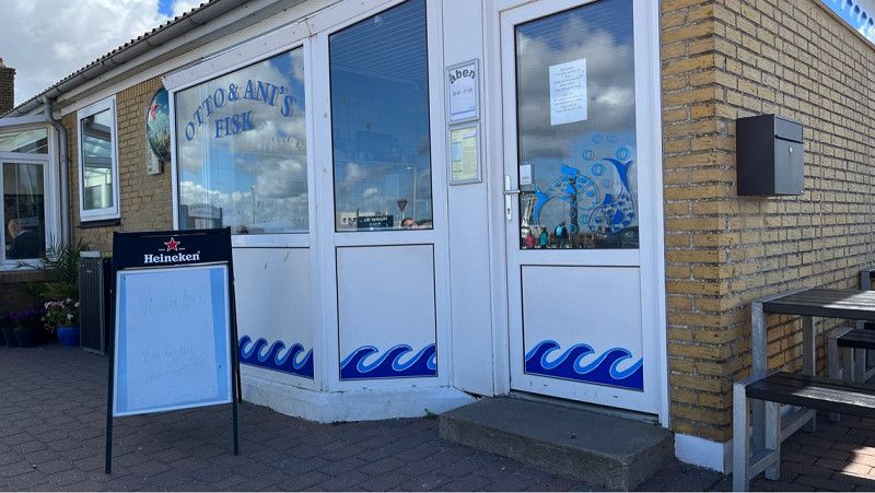
Otto & Ani's Fisk
Our next stop is Otto & Ani's Fisch Bistro on the other side of the island in Rømø harbor.
Otto & Ani's Fisk
Havnepladsen 4, 6792 Rømø, Denmark
The fish sandwiches are very tasty.
There is a large selection here.
If you don't like fish sandwiches or fish, you can also buy fries opposite.
You can easily park your motorhome there.
Havnepladsen 4, Hauneby, Region Süddänemark, Dänemark
55° 5' 11.8" N 8° 33' 55" E
55.0866040 8.5652860
• Head east on Havnepladsen. Go for 8 m.
• Turn left onto Kommandørkaj. Go for 101 m.
• Turn left onto Slippen. Go for 67 m.
• Turn right onto Nordre Havnevej. Go for 237 m.
• Continue on Nørre Frankel (175). Go for 7.8 km.
• Turn right onto Vesterhavsvej (175). Go for 13.8 km.
• Take the 2nd exit from roundabout onto Ribevej (11) toward Tønder/Skærbæk. Go for 13.2 km.
• Pass 2 roundabouts and continue on Ribelandevej (11). Go for 8.7 km.
• Take the 2nd exit from roundabout onto Ribelandevej (11) toward Tønder. Go for 940 m.
• Take the 2nd exit from roundabout onto Ribelandevej (11) toward Tønder. Go for 1.7 km.
• Take the 2nd exit from roundabout onto 11 toward Husum/Kruså/8. Go for 2.1 km.
• Pass 2 roundabouts and continue on Sønderløgumlandevej (11). Go for 5.6 km.
• Continue on B5. Go for 2.0 km.
• Turn left onto Grenzstraße (L192) toward A7/Flensburg. Go for 29.9 km.
• Turn right onto Ellunder Straße (K30). Go for 2.3 km.
• Turn left onto Lecker Chaussee (B199). Go for 1.3 km.
• Take ramp onto A7 toward Hamburg/Kiel. Go for 152 km.
• Keep left onto A7. Go for 206 km.
• Take exit 65 toward Bockenem/Lutter. Go for 348 m.
• Turn left onto B243 toward Bockenem. Go for 1.7 km.
• Turn right onto Schlangenweg toward Bockenem. Go for 523 m.
• Turn right onto An den Teichhöfen. Go for 288 m.
• Continue on Ortshäuser Straße (K333). Go for 253 m.
• Turn right onto Mahlumer Straße (L500). Go for 338 m.
• Arrive at Mahlumer Straße (L500). Your destination is on the right.
☍
451,3 km
(4 hrs. 24 min.)
Stellplatz am Freibad
Great place for one night.
We used this place on our return journey.
You stand quietly here and can quickly get back on the motorway in the morning.
There are also gas stations.
Mahlumer Straße 31, 31167, Bockenem, Deutschland
52° 0' 30" N 10° 8' 15" E
52.0083333 10.1375000
• Head toward Martin-Luther-Straße on Mahlumer Straße (L500). Go for 386 m.
• Turn right onto Ulmenweg. Go for 627 m.
• Turn left onto Walter-Althoff-Straße. Go for 152 m.
• Turn left onto B243. Go for 640 m.
• Turn right and take ramp onto A7 toward Kassel. Go for 104 km.
• Take exit 79 toward Marburg/Kassel onto A49 (Südtangente). Go for 86.5 km.
• Take the left exit toward Basel/Frankfurt/Wiesbaden/Gießen onto A5. Go for 111 km.
• Take the exit toward Basel/Karlsruhe/Heidelberg onto A5. Go for 262 km.
• Take exit 65 toward Müllheim/Neuenburg/Badenweiler/Bad Bellingen. Go for 332 m.
• Take the 2nd exit from roundabout onto B378 toward Bad Bellingen/Badenweiler/Müllheim/Neuenburg/Karlsruhe/A5. Go for 355 m.
• Take the 1st exit from roundabout onto B378 toward Bad Bellingen/Badenweiler/Müllheim/Neuenburg. Go for 200 m.
• Take the 3rd exit from roundabout onto Am Wurloch toward Bad Bellingen. Go for 213 m.
• Turn left onto Westtangente. Go for 519 m.
• Continue on Gottlieb-Daimler-Straße. Go for 445 m.
• Continue on Hans-Buck-Straße. Go for 819 m.
• Continue on Oberer Wald. Go for 388 m.
• Arrive at Oberer Wald. Your destination is on the left.
☍
569,0 km
(5 hrs. 21 min.)
Day
Dreiländer-Camping Gugel
Today we drove to Camping Gugel to soak up the sun again.
The campsite offers everything you can imagine.
From the swimming pool to tennis or mini golf.
Great place to stop if you're passing through.
Oberer Wald 1, 79395, Neuenburg, Deutschland
47° 47' 48" N 7° 33' 1" E
47.7966700 7.5502800
• Head northeast on Oberer Wald. Go for 1.0 km.
• Continue on Hans-Buck-Straße. Go for 187 m.
• Continue on Gottlieb-Daimler-Straße. Go for 445 m.
• Continue on Westtangente. Go for 519 m.
• Turn right onto Am Wurloch. Go for 102 m.
• Turn right onto B378 toward A5/Basel/Karlsruhe/Mulhouse. Go for 184 m.
• Take the 2nd exit from roundabout onto B378 toward Basel/A5/Mulhouse. Go for 351 m.
• Take the 1st exit from roundabout onto A5 toward Basel. Go for 29.2 km.
• Continue on A2. Go for 5.6 km.
• Take exit 6 toward Delémont/Muttenz onto A18 (Verzweigung Hagnau). Go for 1.5 km.
• Take the exit toward Muttenz-Süd/Bottmingen/Münchenstein/Bruderholz/Muttenz. Go for 325 m.
• Turn left onto Münchensteinerstrasse. Go for 53 m.
• Keep left onto Münchensteinerstrasse toward Muttenz. Go for 745 m.
• Turn right onto Münchensteinerstrasse. Go for 224 m.
• Continue on Baselstrasse. Go for 998 m.
• Turn right onto Kirchplatz. Go for 67 m.
• Turn left onto Kirchplatz. Go for 80 m.
• Turn slightly right onto Oberdorf. Go for 187 m.
• Continue on Gempengasse. Go for 269 m.
• Turn slightly right onto Weiherstrasse. Go for 618 m.
• Continue on Madilohstrasse. Go for 567 m.
• Arrive at your destination.
☍
43,4 km
( 38 min.)
Basel-Landschaft
That was our Denmark round trip with many great impressions and experiences that we will remember for a long time.
Thank you for reading along silently and for your interest in this tour.
See you soon
Schweiz
47° 30' 33.5" N 7° 39' 31.8" E
47.5092938 7.6588333