Day
Kassel, Deutschland
Sophienstraße 21, 34117 Kassel, Deutschland
51° 18' 45.8" N 9° 28' 47.1" E
51.3127114 9.4797461
• Head toward Wilhelmshöher Allee on Sophienstraße. Go for 91 m.
• Turn right onto Wilhelmshöher Allee. Go for 620 m.
• Turn left onto Schönfelder Straße. Go for 383 m.
• Continue on Schönfelder Straße toward Auestadion. Go for 308 m.
• Continue on Ludwig-Mond-Straße. Go for 1.3 km.
• Continue on Am Auestadion (B3). Go for 1.5 km.
• Take ramp onto A49 (Südtangente) toward Marburg/Baunatal/Dortmund/Kassel-Niederzwehren. Go for 82.3 km.
• Take the left exit toward Basel/Frankfurt/Wiesbaden/Gießen onto A5. Go for 111 km.
• Take the exit toward Basel/Karlsruhe/Heidelberg onto A5. Go for 135 km.
• Take exit 51 toward Iffezheim/Flughafen Baden-Airpark onto B500. Go for 2.8 km.
• Turn left onto L75 toward Kehl/Rheinmünster/Hügelsheim/Flughafen Baden-Airpark. Go for 1.7 km.
• Take the 2nd exit from roundabout onto Hauptstraße (L75) toward Kehl/Rheinmünster/Flughafen Baden-Airpark. Go for 5.1 km.
• Continue on L75 toward Kehl/Rheinmünster. Go for 1.8 km.
• Take the 1st exit from roundabout onto Grünfeldstraße toward Gewerbegebiet Grünfeld/Grünfeld Gewerbegebiet. Go for 406 m.
• Continue on An der Heckenmühle. Go for 237 m.
• Continue on Grünfeldstraße. Go for 394 m.
• Continue on Am Campingpark. Go for 25 m.
• Arrive at Am Campingpark.
☍
345,1 km
(3 hrs. 11 min.)
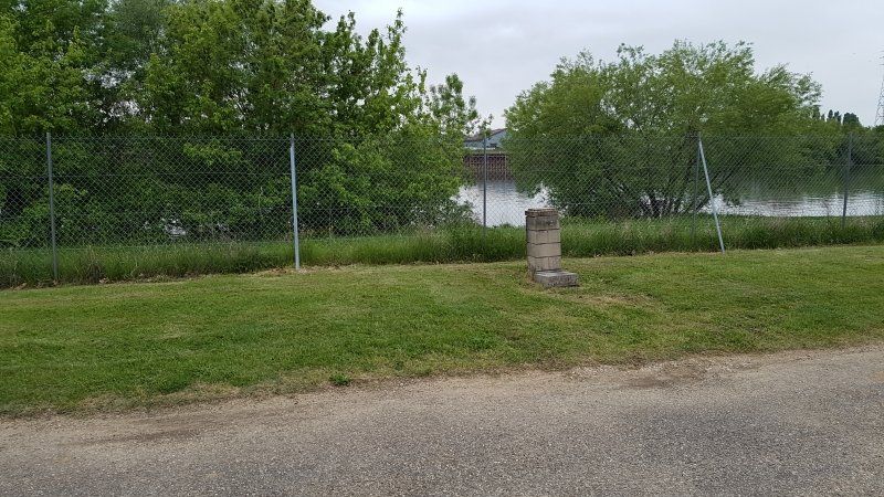
Freizeitcenter Oberrhein, Rheinmünster, Deutschland
Am Campingpark 1, 77836 Rheinmünster, Deutschland
48° 46' 23.7" N 8° 2' 24.6" E
48.7732403 8.0401668
• Head toward Grünfeldstraße on Am Campingpark. Go for 25 m.
• Continue on Grünfeldstraße. Go for 394 m.
• Continue on An der Heckenmühle. Go for 237 m.
• Continue on Grünfeldstraße. Go for 383 m.
• Take the 1st exit from roundabout onto Rastatter Straße (L75) toward Kehl/Lichtenau/Greffern/Gewerbegebiet Dow/B36. Go for 949 m.
• Turn left onto K3735 toward Schwarzach. Go for 1.5 km.
• Turn left onto Hauptstraße (L85) toward Bühl/Oberbruch. Go for 591 m.
• Turn left onto Hurststraße (L85). Go for 5.4 km.
• Take the 1st exit from roundabout onto A5 toward Basel. Go for 123 km.
• Take exit 66 toward Lyon/Mulhouse/Flughafen Euro onto A5. Go for 611 m.
• Continue on A36 (La Comtoise). Go for 13.5 km.
• Keep left onto A36 (La Comtoise) toward Paris/Lyon/Guebwiller. Go for 223 km.
• Take the exit onto A31. Go for 6.1 km.
• Continue on A6 (Autoroute du Soleil). Go for 24.6 km.
• Take exit 25.2 toward Chalon S/S.-Centre/Châtenoy le Royal. Go for 1.1 km.
• Turn right onto Avenue de l'Europe (D906) toward Autun/Chalon-Centre/Châtenoy le R. Go for 3.0 km.
• Continue on Pont Jean-Richard (D673). Go for 571 m.
• Take the 2nd exit from roundabout onto Avenue de Verdun (D673). Go for 544 m.
• Turn left onto Avenue des Granges Forestier. Go for 360 m.
• Turn slightly left onto Rue Julien Leneveu. Go for 834 m.
• Arrive at Rue Julien Leneveu. Your destination is on the left.
☍
406,8 km
(3 hrs. 37 min.)
Day
Rue Julien Leneveu , 71380, St Marcel, Frankreich
12 Rue Julien Leneveu, 71380 Saint-Marcel, Frankreich
46° 47' 3.5" N 4° 52' 21.4" E
46.7843108 4.8726082
• Head southwest on Rue Julien Leneveu. Go for 147 m.
• Turn left. Go for 57 m.
• Turn slightly left toward Chemin des Savelles. Go for 460 m.
• Turn left onto Chemin des Savelles. Go for 445 m.
• Turn right onto D5 A. Go for 319 m.
• Take the 2nd exit from Rond-Point des Orlans roundabout onto D673 toward A6/St Marcel/Z.I.Sud/Zone Portuaire Sud. Go for 4.2 km.
• Take the 2nd exit from roundabout onto Route Express Chalon Montceau (N80) toward Le Creusot/Cluny. Go for 753 m.
• Take the 2nd exit from roundabout toward Paris/Dijon/Lyon/Bourg en B./Mâcon. Go for 558 m.
• Take ramp onto A6 (Autoroute du Soleil) toward Lyon/Bourg en B./Mâcon. Go for 108 km.
• Take the exit toward Bordeaux/Clermont-Fd/Roanne onto A89. Go for 58.5 km.
• Take the exit toward Bordeaux/Clermont-Fd/Thiers onto A89. Go for 84.0 km.
• Continue on A710 toward Clermont-Fd. Go for 2.0 km.
• Keep left toward Boulevard Edgar Quinet. Go for 665 m.
• Continue on Boulevard Edgar Quinet. Go for 512 m.
• Take the 2nd exit from roundabout onto Boulevard Edgar Quinet toward Chamalières/Royat/Le Puy de Dôme. Go for 714 m.
• Turn slightly left onto Avenue Fernand Forest (D69) toward Chamalières/Royat/Le Puy de Dôme/Les Buges/Limoges/Clermont-Fd-Centre. Go for 1.1 km.
• Keep left onto Boulevard Daniel Mayer toward Champétières/Royat/Les Bughes. Go for 412 m.
• Take the 2nd exit from roundabout onto Boulevard Daniel Mayer toward Limoges/Chamalières/Royat/Puy de Dôme/Les Bughes. Go for 367 m.
• Continue on Boulevard Maurice Pourchon. Go for 940 m.
• Take the 3rd exit from roundabout onto Boulevard Gordon Bennett toward Limoges/Chamalières/Royat/Puy de Dôme. Go for 402 m.
• Continue on Boulevard Lavoisier toward Limoges/Bordeaux/Chamalières/Puy de Dôme/Vulcania. Go for 579 m.
• Keep right onto Boulevard Lavoisier toward Volvic/Durtol/Puy de Dôme/Vulcania/Limoges/Tulle/Bordeaux. Go for 91 m.
• Turn slightly right onto Avenue Raymond Bergougnan (D942) toward Volvic/Durtol/Puy de Dôme/Vulcania/Limoges/Tulle/Bordeaux. Go for 6.8 km.
• Pass 2 roundabouts and continue on Route de Bordeaux (D942). Go for 11.2 km.
• Take the 4th exit from roundabout onto Lieu-dit Le Mozat (D2089) toward E70/Clermont-Fd/Nébouzat. Go for 208 m.
• Arrive at Lieu-dit Le Mozat (D2089). Your destination is on the right.
☍
283,7 km
(2 hrs. 41 min.)
Day
Camping Domes, Les 4 routes de Nébouzat, Nébouzat, Frankreich
Bedingt durch eine Sturmwarnung sind wir nicht nach Les Longes, sondern hierher.
Les 4 routes de Nébouzat, 63210 Nébouzat, Frankreich
45° 43' 37.7" N 2° 53' 27.3" E
45.7271437 2.8909064
• Head east on Lieu-dit Le Mozat (D2089). Go for 421 m.
• Turn left toward D2089. Go for 41 m.
• Continue on D2089. Go for 447 m.
• Take the 3rd exit from roundabout onto D2089 toward Tulle/Bordeaux/Rochefort-Mgne/La Bourboule. Go for 2.1 km.
• Take the 2nd exit from roundabout onto Lieu-dit Pont d'Olby (D2089) toward A89/La Bourboule/Rochefort-Mgne. Go for 22.6 km.
• Take the 2nd exit from roundabout toward Clermont-Fd/Tulle/Bordeaux. Go for 169 m.
• Take ramp onto A89 toward Bordeaux/Limoges/Tulle. Go for 111 km.
• Take the left exit toward E70/Toulouse/Bordeaux/Périgueux/Brive la G. onto A20 (L'Occitane). Go for 16.7 km.
• Take the exit toward Bordeaux/Périgueux/Sarlat onto A89 (Viaduc du Maumont). Go for 168 km.
• Continue on N89. Go for 17.8 km.
• Take ramp onto Rocade de Bordeaux (N230) toward E70/A10 (Paris)/Aéroport Mérignac/Lormont/Carbon Blanc/Bassens/Bordeaux-Lac. Go for 1.5 km.
• Take ramp onto A630 (Rocade de Bordeaux) toward Aéroport Mérignac/Bordeaux-Centre/Zone Portuaire. Go for 15.9 km.
• Take exit 10 toward Lège-Cap-Ferret onto D213 (Avenue Marcel Dassault). Go for 793 m.
• Take the 5th exit from roundabout onto Avenue Marcel Dassault (D213) toward Martignas/Andernos les Bains/Lège Cap Ferret. Go for 238 m.
• Pass 2 roundabouts and continue on Avenue Marcel Dassault (D213). Go for 1.0 km.
• Keep right onto Avenue Marcel Dassault. Go for 313 m.
• Take the 3rd exit from roundabout onto Avenue Marcel Dassault (D213). Go for 693 m.
• Pass 4 roundabouts and continue on Avenue Marcel Dassault (D213). Go for 4.3 km.
• Take the 3rd exit from roundabout onto Avenue du Bassin d'Arcachon (D213) toward Lège Cap Ferret. Go for 1.6 km.
• Take the 2nd exit from roundabout onto Avenue du Bassin d'Arcachon (D213) toward Boulac/Andernos/Lège-Cap Ferret. Go for 3.0 km.
• Take the 2nd exit from roundabout onto Avenue Pierre et Marcelle Girard (D213) toward Lège-Cap Ferret. Go for 7.9 km.
• Keep right onto Route du Cap-Ferret toward Andernos/Arès/Lège/Cap-Ferret. Go for 172 m.
• Continue on Avenue du Cap Ferret (D106). Go for 11.4 km.
• Pass 6 roundabouts and continue on Avenue Charles de Gaulle (D106). Go for 19.1 km.
• Turn right onto Avenue du Truc Vert. Go for 1.9 km.
• Continue on Route Forestière du Truc Vert. Go for 2.4 km.
• Arrive at Route Forestière du Truc Vert. Your destination is on the left.
☍
411,2 km
(4 hrs. 2 min.)
Day
CAMPING LE TRUC VERT, Route du Truc-Vert, Lège-Cap-Ferret-Océan, Frankreich
Route du Truc-Vert, 33970 Lège-Cap-Ferret-Océan, Frankreich
44° 42' 55.4" N 1° 14' 32.6" W
44.7153829 -1.2423754
• Head toward Avenue du Milan on Route Forestière du Truc Vert. Go for 2.4 km.
• Continue on Avenue du Truc Vert. Go for 1.9 km.
• Turn left onto Route de Bordeaux (D106). Go for 3.4 km.
• Pass 4 roundabouts and continue on D106. Go for 12.9 km.
• Take the 3rd exit from roundabout onto D106. Go for 2.6 km.
• Take the 2nd exit from roundabout onto D106. Go for 6.7 km.
• Take ramp onto Route de Marcheprime (D5) toward A63/Marcheprime/Le Temple. Go for 8.4 km.
• Pass 5 roundabouts and continue on Route du Barp (D5). Go for 7.4 km.
• Take the 3rd exit from roundabout onto Route du Barp (D5). Go for 392 m.
• Take the 1st exit from roundabout onto A63 toward Bassin d'Arcachon/Bayonne. Go for 184 km.
• Continue on AP-8 (Autopista del Cantábrico). Go for 12.2 km.
• Take the exit toward Bilbao/Vitoria-Gasteiz/Burgos/Hernani/A-15/Iruña/Pamplona onto AP-1/AP-8. Go for 14.8 km.
• Take the exit onto AP-1/AP-8 (Autopista del Cantábrico). Go for 10.5 km.
• Take exit 38 toward N-634/Zarautz/Getaria. Go for 578 m.
• Take the 2nd exit from roundabout onto Calle Irita. Go for 119 m.
• Take the 2nd exit from roundabout onto Camino Mendibeltz. Go for 162 m.
• Turn left onto Camino Sorginmuno. Go for 18 m.
• Turn right toward Camino Talaimendi. Go for 203 m.
• Turn slightly left onto Camino Talaimendi. Go for 87 m.
• Turn right toward Camino Talaimendi. Go for 373 m.
• Continue on Camino Talaimendi. Go for 212 m.
• Turn slightly left onto Camino Talaimendi. Go for 262 m.
• Turn right toward Camino Talaimendi. Go for 77 m.
• Turn slightly left onto Camino Talaimendi. Go for 10 m.
• Turn left onto Laurgain kalea. Go for 16 m.
• Continue toward Camino Talaimendi. Go for 57 m.
• Turn left onto Camino Talaimendi. Go for 5 m.
• Turn right. Go for 27 m.
• Turn left. Go for 32 m.
• Arrive at your destination on the left.
☍
270,4 km
(2 hrs. 48 min.)
Day
Day
Day
Day
Day
Day
Day
Day
Day
Day
Day
Day
Camping Gran Camping Zarautz
Monte Talai-mendi Zarautz, 20800, Zarautz, Spanje
43° 17' 26.2" N 2° 8' 48.1" W
43.2906000 -2.1467000
• Head east. Go for 32 m.
• Turn right toward Camino Talaimendi. Go for 27 m.
• Turn left onto Camino Talaimendi. Go for 5 m.
• Turn right toward Laurgain kalea. Go for 57 m.
• Continue on Laurgain kalea. Go for 16 m.
• Turn right onto Camino Talaimendi. Go for 10 m.
• Turn slightly right toward Camino Talaimendi. Go for 77 m.
• Turn left onto Camino Talaimendi. Go for 262 m.
• Turn slightly right onto Camino Talaimendi. Go for 212 m.
• Turn left toward Camino Talaimendi. Go for 373 m.
• Turn left onto Camino Talaimendi. Go for 87 m.
• Turn slightly right toward Camino Sorginmuno. Go for 203 m.
• Turn left onto Camino Sorginmuno. Go for 18 m.
• Turn right onto Camino Mendibeltz. Go for 112 m.
• Take the 2nd exit from roundabout onto Calle Irita toward Bilbao/A-8/Donostia/S. Sebastián. Go for 133 m.
• Take the 2nd exit from roundabout toward Donostia/San Sebastián/Bilbo/Vitoria/Gasteiz. Go for 75 m.
• Take ramp onto AP-1/AP-8 (Autopista del Cantábrico) toward Bilbo/Bilbao/Vitoria-Gasteiz. Go for 31.4 km.
• Take exit 69 toward Bergara/Vitoria-Gasteiz onto AP-1. Go for 44.7 km.
• Continue on Autopista Vitoria-Eibar. Go for 87 m.
• Take exit 101 toward Vitoria-Gasteiz/Burgos/A-1 onto N-622. Go for 3.8 km.
• Take ramp onto A-1 toward Burgos/Madrid. Go for 24.0 km.
• Take exit 328 toward Burgos/Logroño/AP-68/Bilbao onto AP-1 (Autovía del Norte). Go for 83.3 km.
• Continue on A-1 (Autovía del Norte) toward Madrid/A-62/Valladolid/Portugal. Go for 7.1 km.
• Keep right onto BU-30 (Nudo de Landa) toward Palencia/Valladolid/A-62/León/A-231. Go for 4.2 km.
• Continue on A-62 (Autovía de Castilla) toward Palencia/Valladolid. Go for 144 km.
• Take exit 151 toward Medina del Campo/Madrid onto A-6 (Autovía del Noroeste). Go for 3.7 km.
• Take exit 179 toward Tordesillas (Sur) onto N-6. Go for 2.2 km.
• Take the 3rd exit from roundabout onto Carretera de Salamanca (N-620). Go for 233 m.
• Turn right onto Camino de Pollos. Go for 37 m.
• Turn left toward Camino de Pollos. Go for 240 m.
• Turn right onto Camino de Pollos. Go for 30 m.
• Arrive at Camino de Pollos. Your destination is on the right.
☍
350,6 km
(3 hrs. 11 min.)
Day
Camping el Astral
Camino de Pollos 8, 47100, Tordesillas, Spanien
41° 29' 45.2" N 5° 0' 18.7" W
41.4959000 -5.0052000
• Head southeast on Camino de Pollos. Go for 30 m.
• Turn left toward Camino de Pollos. Go for 240 m.
• Turn right onto Camino de Pollos. Go for 37 m.
• Turn right onto Carretera de Salamanca (N-620). Go for 1.5 km.
• Take the 1st exit from roundabout onto N-620. Go for 7.3 km.
• Take the 3rd exit from roundabout toward E-80/A-62/Salamanca/Valladolid. Go for 195 m.
• Take ramp onto A-62 (Autovía de Castilla) toward Salamanca. Go for 193 km.
• Continue on A25 (Autoestrada Beiras Litoral e Alta). Go for 60.0 km.
• Take exit 26 toward N17/Gouveia/Centro Celorico. Go for 264 m.
• Take the 4th exit from roundabout onto N17 toward Gouveia. Go for 404 m.
• Turn left onto N17. Go for 169 m.
• Take the 1st exit from roundabout onto N17. Go for 24.8 km.
• Take the 2nd exit from roundabout onto N17. Go for 12.3 km.
• Take the 2nd exit from roundabout onto N17. Go for 181 m.
• Take the 1st exit from roundabout onto N17. Go for 1.6 km.
• Take the 3rd exit from roundabout onto N17. Go for 2.4 km.
• Turn right onto M504-2. Go for 1.0 km.
• Turn left onto M503-1. Go for 1.7 km.
• Continue on Rua Principal (M503-1). Go for 714 m.
• Continue on M503. Go for 11 m.
• Continue on Rua Principal (M503). Go for 261 m.
• Continue on M503. Go for 163 m.
• Continue on Rua Principal (M503). Go for 233 m.
• Continue on M503. Go for 1.3 km.
• Continue on Avenida da Rigueira (M503). Go for 520 m.
• Continue on M503. Go for 266 m.
• Continue on Rua 25 de Abril (M503). Go for 202 m.
• Turn right onto Avenida do Rio Cobral (M504-3). Go for 543 m.
• Continue on M504-3. Go for 1.4 km.
• Turn left onto M504. Go for 48 m.
• Turn right. Go for 466 m.
• Turn right. Go for 43 m.
• Arrive at your destination on the right.
☍
313,0 km
(3 hrs. 10 min.)
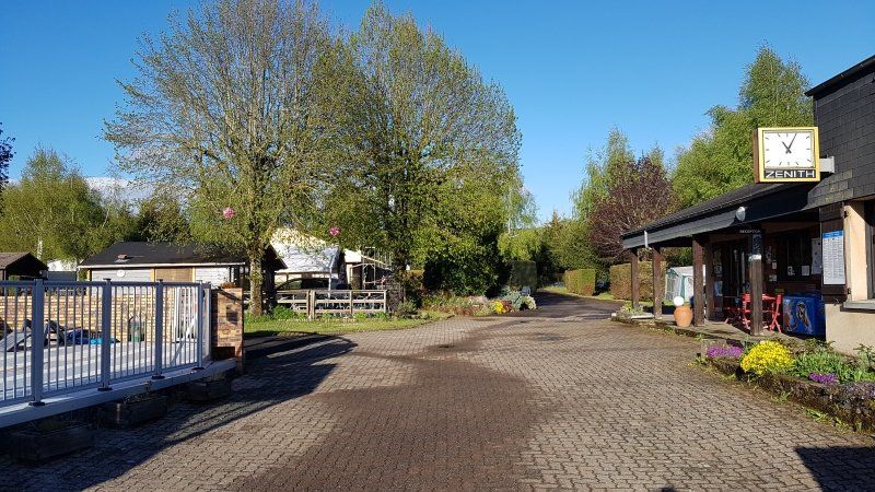
Day
Camping Toca da Raposa
Quinta do Ameal 1, 3450-351, Meruge/Oliveira do Hospital, Portugal
40° 24' 11.5" N 7° 49' 35" W
40.4032000 -7.8264000
• Head east. Go for 694 m.
• Turn right onto M504. Go for 1.7 km.
• Continue on Rua do Campo de Futebol (M504). Go for 251 m.
• Take the 1st exit from roundabout onto Variante de Lagares da Beira. Go for 2.8 km.
• Continue on N230. Go for 2.5 km.
• Take the 2nd exit from roundabout onto Avenida Dom Manuel I (N230). Go for 900 m.
• Turn slightly left onto Avenida Dom Manuel I (N230). Go for 148 m.
• Continue on N230. Go for 2.3 km.
• Continue on Estrada da Atalhada (N230). Go for 1.1 km.
• Continue on N230. Go for 214 m.
• Turn left onto N337. Go for 4.5 km.
• Take the 2nd exit from roundabout onto N337. Go for 6.0 km.
• Turn left and take ramp onto Variante de Tábua (N337) toward IC12/S.ta Comba Dão/Carregal do Sal. Go for 6.0 km.
• Continue on N234-6. Go for 4.8 km.
• Turn right toward Coimbra/IP3/C. Sal/IC12/Mangualde/Nelas/Viseu/S.ta Comba Dão. Go for 290 m.
• Take left ramp onto A35 (Autoestrada Mira-Mangualde). Go for 1.1 km.
• Take the exit onto IP3. Go for 39.8 km.
• Continue on Autoestrada do Baixo Mondego (A14). Go for 3.8 km.
• Take the left exit onto A1 (Autoestrada do Norte). Go for 68.1 km.
• Take exit 9 toward Leiria/Oeste/A8/M.nha Grande/(N242) onto A8-1. Go for 2.4 km.
• Keep left onto A8-1 toward Leiria Sul/A8/Aveiro/A17/Batalha/A19. Go for 252 m.
• Take ramp onto A8-1. Go for 469 m.
• Continue on A8 (Autoestrada do Oeste) toward Leiria Sul/Aveiro/A17/Batalha/A19. Go for 11.3 km.
• Take the exit onto A8 (Autoestrada do Oeste). Go for 55.2 km.
• Take exit 14 toward Peniche onto IP6. Go for 14.3 km.
• Take ramp onto N247 toward Lourinhã/Atouguia. Go for 10.4 km.
• Pass 2 roundabouts and continue on Avenida António José d'Almeida (N247). Go for 556 m.
• Take the 2nd exit from roundabout onto Avenida Doutor Catanho de Menezes. Go for 600 m.
• Take the 2nd exit from roundabout onto Rua Dr. Francisco Sá Carneiro. Go for 348 m.
• Take the 2nd exit from Rua Dr. Francisco Sá Carneiro roundabout onto Rua Dr. Francisco Sá Carneiro. Go for 178 m.
• Take the 1st exit from roundabout onto Avenida de Angola (N8-2). Go for 198 m.
• Turn left toward Rua da Guiné. Go for 21 m.
• Turn left onto Rua da Guiné. Go for 77 m.
• Turn right onto Rua João das Regras. Go for 280 m.
• Turn left onto Estrada da Granjola. Go for 461 m.
• Arrive at Estrada da Granjola. Your destination is on the left.
☍
244,0 km
(2 hrs. 39 min.)
Day
Day
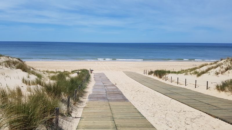
Parque de Campismo Praia da Areia Branca
Rua do Campismo, 2530 - 226, Lourinhã, Portugal
39° 13' 58.8" N 9° 19' 1.2" W
39.2330000 -9.3170000
• Head northeast on Estrada da Granjola. Go for 461 m.
• Turn right toward Rua João das Regras. Go for 138 m.
• Continue on Rua João das Regras. Go for 142 m.
• Turn left onto Rua da Guiné. Go for 77 m.
• Turn right toward Avenida de Angola/N8-2. Go for 21 m.
• Continue on Avenida de Angola (N8-2). Go for 188 m.
• Take the 2nd exit from roundabout onto Rua Dr. Francisco Sá Carneiro. Go for 177 m.
• Take the 2nd exit from Rua Dr. Francisco Sá Carneiro roundabout onto Rua Dr. Francisco Sá Carneiro. Go for 343 m.
• Take the 2nd exit from roundabout onto Avenida Doutor Catanho de Menezes. Go for 605 m.
• Take the 1st exit from roundabout onto Avenida António José d'Almeida (N247). Go for 216 m.
• Pass 2 roundabouts and continue on N247. Go for 10.2 km.
• Take ramp onto IP6 toward Lisboa/A8/Leiria. Go for 14.4 km.
• Take left ramp onto A8 (Autoestrada do Oeste) toward Leiria/Óbidos/Rio Maior/A15. Go for 4.4 km.
• Take exit 16 toward Santarém/Rio Maior onto A15 (Autoestrada do Atlântico). Go for 40.1 km.
• Continue on Nó da A1-A15 toward Porto/Torres Novas. Go for 133 m.
• Take the exit onto A1 (Autoestrada do Norte). Go for 27.0 km.
• Take exit 7 toward Abrantes/C.lo Branco/T.res Novas onto A23 (Autoestrada da Beira Interior). Go for 122 km.
• Take exit 23 toward C.lo Branco Norte/Pampilhosa/N112/Penamacor/N233 onto N3. Go for 958 m.
• Take ramp toward Oleiros/N112/R233/C. Branco Norte/Espanha/Idanha N.va. Go for 220 m.
• Take the 2nd exit from roundabout onto N233 toward Espanha/C.lo Branco Este/Penamacor/A23. Go for 166 m.
• Pass 2 roundabouts and continue on N233. Go for 6.0 km.
• Keep right onto N240. Go for 29.1 km.
• Take the 1st exit from roundabout onto N240. Go for 9.0 km.
• Take the 1st exit from roundabout onto Rua Dr. António Miranda Boavida (N240). Go for 11.2 km.
• Keep right onto N332-4. Go for 3.7 km.
• Turn left toward CC-174. Go for 2.6 km.
• Continue on CC-174. Go for 4.2 km.
• Turn left onto EX-117. Go for 9.1 km.
• Continue on EX-108. Go for 16.3 km.
• Take the 1st exit from roundabout onto EX-A1 toward Coria/Plasencia/Navalmoral de la Mata. Go for 52.9 km.
• Take exit 46 toward Trujillo. Go for 344 m.
• Take the 1st exit from roundabout onto EX-208 toward Trujillo/P. N. de Monfragüe. Go for 3.4 km.
• Arrive at EX-208. Your destination is on the left.
☍
369,7 km
(3 hrs. 43 min.)
Day
Day
Day
Day
Day
Day
Day
Camping Parque Natural Monfragüe
Apdo.De Correos 36, 10680, Malpartida de Plasencia, Spanje
39° 56' 35.9" N 6° 5' 1" W
39.9433000 -6.0836000
• Head southeast on EX-208. Go for 5.8 km.
• Turn right onto Casa del Porquero. Go for 468 m.
• Make a U-Turn onto Casa del Porquero. Go for 468 m.
• Turn left onto EX-208. Go for 9.2 km.
• Take the 1st exit from roundabout onto EX-A1 (Autovía del Norte de Extremadura) toward Navalmoral de la Mata/E-90/A-5. Go for 46.3 km.
• Take the exit onto A-5 (Autovía de Extremadura). Go for 113 km.
• Take exit 76 toward Torrijos/Toledo onto A-40 (Autovía de Castilla La Mancha). Go for 28.4 km.
• Take exit 118 toward Bargas/Madrid onto A-40 (Autovía de Castilla La Mancha). Go for 23.8 km.
• Continue on AP-41. Go for 3.1 km.
• Take exit 44 toward Villaseca de la Sagra/Añover de Tajo. Go for 790 m.
• Take the 3rd exit from roundabout onto CM-4001. Go for 6.7 km.
• Take the 1st exit from roundabout onto CM-4001 toward A-4/R-4/Aranjuez. Go for 3.7 km.
• Take the 1st exit from roundabout onto CM-4004. Go for 4.6 km.
• Turn left onto Carretera Toledo-Cuenca (N-400). Go for 11.5 km.
• Take the 3rd exit from roundabout onto Carretera Toledo-Cuenca (N-400) toward Toledo/Ocaña/Cuenca/E-5/A-4/Madrid/Córdoba. Go for 667 m.
• Continue on N-4. Go for 2.9 km.
• Take the 3rd exit from roundabout onto Carretera de Andalucía toward Aranjuez/Centro Urbano. Go for 673 m.
• Take the 2nd exit from Glorieta de Le Pecq-Sur-Seine roundabout onto Carretera de Andalucía. Go for 979 m.
• Turn right onto Carretera de Andalucía toward Madrid. Go for 71 m.
• Continue on Calle de las Infantas. Go for 94 m.
• Turn left onto Calle Stuart. Go for 66 m.
• Turn left onto Calle del Príncipe. Go for 96 m.
• Continue on Avenida del Príncipe toward Hospital del Tajo/A-4/Barrio Montaña/Madrid. Go for 21 m.
• Keep right onto Carretera de Madrid toward Hospital del Tajo/A-4/Barrio Montaña/Madrid. Go for 45 m.
• Continue on Carretera de Madrid a Aranjuez. Go for 25 m.
• Continue on Carretera de Madrid. Go for 42 m.
• Continue on Carretera de Madrid. Go for 41 m.
• Continue on Carretera a Madrid. Go for 58 m.
• Continue on Carretera de Madrid. Go for 108 m.
• Continue on Carretera de Madrid a Aranjuez. Go for 71 m.
• Continue on Carretera de Madrid. Go for 161 m.
• Turn right onto Carretera de Madrid a Aranjuez. Go for 432 m.
• Continue on Vereda de Colmenar. Go for 154 m.
• Turn right onto Camino del Rebollo. Go for 305 m.
• Turn slightly left onto Camino del Rebollo. Go for 11 m.
• Arrive at Camino del Rebollo.
☍
264,7 km
(2 hrs. 26 min.)
Day
Camping Internacional Aranjuez
Antigua Ctra. de Andalucía Km. 46,800, 28300, Aranjuez, Spanje
40° 2' 31.9" N 3° 35' 57.5" W
40.0422000 -3.5993000
• Head northwest on Camino del Rebollo. Go for 316 m.
• Turn left onto Vereda de Colmenar. Go for 154 m.
• Continue on Camino Colmenar. Go for 393 m.
• Turn right onto Carretera de Madrid. Go for 224 m.
• Continue on Carretera de Madrid a Aranjuez. Go for 19 m.
• Continue on Carretera de Madrid. Go for 541 m.
• Take the 6th exit from Glorieta de las Doce Calles roundabout onto Carretera de Madrid a Aranjuez toward Hospital/Madrid. Go for 131 m.
• Continue on Carretera de Madrid. Go for 479 m.
• Continue on Carretera de Madrid a Aranjuez. Go for 13 m.
• Continue on Carretera de Madrid. Go for 230 m.
• Take the 2nd exit from roundabout onto Carretera de Madrid toward A-4/Madrid. Go for 156 m.
• Keep left onto Carretera de Madrid a Aranjuez. Go for 203 m.
• Continue on Carretera de Madrid. Go for 46 m.
• Continue on Carretera de Madrid a Aranjuez. Go for 81 m.
• Continue on Carretera de Madrid. Go for 717 m.
• Continue on Carretera de Madrid a Aranjuez. Go for 391 m.
• Continue on Carretera de Madrid. Go for 2.0 km.
• Take the 3rd exit from roundabout onto Carretera de Madrid (M-305) toward E-5/A-4/Córdoba/Madrid. Go for 4.0 km.
• Continue on A-4 (Autovía del Sur). Go for 19.3 km.
• Take exit 17 toward A-3/R-3/A-2 onto M-50. Go for 23.4 km.
• Continue on M-45. Go for 2.1 km.
• Keep right onto M-50 toward M-21/M-40/Feria de Madrid/Aeropuerto/E-90/Zaragoza/A-2/San Fernando de Henares/M-206/Torrejón de Ardoz. Go for 2.6 km.
• Take exit 19A toward Torrejón de Ardoz. Go for 601 m.
• Keep left toward Torrejón de Ardoz. Go for 1.3 km.
• Continue on Carretera Nacional II. Go for 790 m.
• Continue on Calle Maestro Chapí. Go for 564 m.
• Take left ramp onto A-2 (Autovía del Nordeste) toward Ajalvir/M-108/Alcalá de Henares/Zaragoza. Go for 281 km.
• Take exit 311B toward Zaragoza/Vía Hispanidad/Z-30 onto N-2A (Carretera Madrid). Go for 1.3 km.
• Take the 2nd exit from roundabout onto Carretera Madrid (N-2A). Go for 1.5 km.
• Take ramp toward Rosales del Canal/Montecanal/Valdespartera. Go for 132 m.
• Continue on Camino del Canal. Go for 120 m.
• Take the 3rd exit from roundabout onto Calle San Juan Bautista de la Salle. Go for 701 m.
• Take the 2nd exit from roundabout onto Calle San Juan Bautista de la Salle. Go for 431 m.
• Arrive at Calle San Juan Bautista de la Salle. Your destination is on the left.
☍
345,9 km
(3 hrs. 2 min.)
Day
Day
Ciudad de Zaragoza
San Juan Bautista La Salle S/N, 50012, Zaragoza, Spanien
41° 38' 3.5" N 0° 56' 6.4" W
41.6343000 -0.9351000
• Head east on Calle San Juan Bautista de la Salle. Go for 412 m.
• Take the 4th exit from roundabout onto Calle San Juan Bautista de la Salle. Go for 1.0 km.
• Take the 2nd exit from roundabout onto Calle San Juan Bautista de la Salle. Go for 665 m.
• Continue straight ahead. Go for 53 m.
• Take the 2nd exit from roundabout. Go for 367 m.
• Take the 1st exit from roundabout onto Carretera Madrid (N-2A). Go for 1.3 km.
• Take the 1st exit from roundabout onto Carretera Madrid (N-2A). Go for 580 m.
• Take ramp onto A-2 (Autovía del Nordeste) toward Z-40/Aeropuerto/A-68/Logroño/Pamplona/Huesca/A-23/Barcelona. Go for 28.3 km.
• Continue on AP-2 (Autopista Zaragoza Mediterráneo). Go for 214 km.
• Continue toward E-15/AP-7/Vilafranca del P./Barcelona/Girona. Go for 1.6 km.
• Continue on AP-7 (Autopista de la Mediterrània). Go for 126 km.
• Take the exit toward Maçanet de la Selva/Sta. Coloma de Farners/Lloret de Mar/St. Feliu de Guíxols/Port Palamós/Sant Feliu de G./Lloret de M./Vidreres/Sils/Caldes de M./Palamós onto C-35. Go for 18.3 km.
• Continue on C-65. Go for 5.8 km.
• Continue on C-31 toward Palamós/Platja d'Aro/St. Feliu G. nord. Go for 5.9 km.
• Take exit 316 toward La Platja d'Aro nord/Platja d'Aro. Go for 281 m.
• Take the 1st exit from roundabout onto Carretera de Circumval.lació (GI-665) toward Platja d'Aro. Go for 972 m.
• Take the 2nd exit from roundabout onto Avinguda del Cavall Bernat (C-253) toward Calonge. Go for 285 m.
• Take the 1st exit from roundabout onto Avinguda del Cavall Bernat (C-253) toward St. Antoni de Calonge/Calonge. Go for 544 m.
• Continue on Avinguda d'Andorra (C-253). Go for 1.6 km.
• Turn right toward Urb. Torre Valentina/Cala de la Roca/Cala de les Roques/Planès. Go for 20 m.
• Turn right onto Carrer de Pelai Martínez. Go for 55 m.
• Turn left onto Carrer de Rafael de Casanova. Go for 60 m.
• Turn right onto Carrer Antoni Gaudí. Go for 141 m.
• Turn right onto Carrer de Domènech i Montaner. Go for 311 m.
• Turn right onto Carrer del Doctor Barraquer. Go for 62 m.
• Continue on Carrer del Doctor Barraquer. Go for 85 m.
• Turn right onto Carrer del Doctor Barraquer. Go for 150 m.
• Turn right onto Carrer de Miquel Servet. Go for 58 m.
• Arrive at Carrer de Miquel Servet. Your destination is on the right.
☍
408,8 km
(3 hrs. 39 min.)
Day
Camping Treumal
Apartado Correos 348, 17250, Platja d'aro, Spanien
41° 49' 58.8" N 3° 5' 16.8" E
41.8330000 3.0880000
• Head toward Carrer del Doctor Barraquer on Carrer de Miquel Servet. Go for 58 m.
• Turn left onto Carrer del Doctor Barraquer. Go for 150 m.
• Turn left onto Carrer del Doctor Barraquer. Go for 147 m.
• Turn left onto Carrer de Domènech i Montaner. Go for 311 m.
• Turn left onto Carrer Antoni Gaudí. Go for 141 m.
• Turn left onto Carrer de Rafael de Casanova. Go for 60 m.
• Turn right onto Carrer de Pelai Martínez. Go for 55 m.
• Turn right toward Avinguda d'Andorra/C-253. Go for 15 m.
• Turn left onto Avinguda d'Andorra (C-253). Go for 1.6 km.
• Continue on Avinguda del Cavall Bernat (C-253). Go for 525 m.
• Take the 2nd exit from roundabout onto Avinguda del Cavall Bernat (C-253). Go for 239 m.
• Take the 1st exit from roundabout onto Carretera de Circumval.lació (GI-665) toward Palamós/Palafrugell/Girona/El Masnou/AP-7. Go for 980 m.
• Take the 3rd exit from roundabout onto C-31 toward St. Feliu G./AP-7. Go for 6.3 km.
• Continue on C-65. Go for 6.3 km.
• Take the exit toward Girona/AP-7 nord/Llagostera onto C-65. Go for 7.6 km.
• Pass 3 roundabouts and continue on C-65. Go for 7.9 km.
• Keep left onto Carretera a Sant Feliu de Guíxols (C-65). Go for 6.4 km.
• Take the 2nd exit from roundabout onto Carretera de Girona a Sant Feliu de Guíxols (C-65) toward E-15/AP-7/Barcelona/França/Francia. Go for 406 m.
• Take ramp onto AP-7 (Autopista de la Mediterrània) toward França/Francia. Go for 64.5 km.
• Continue on A9 (La Catalane). Go for 172 km.
• Keep right onto A709 toward Montpellier/Aéroport. Go for 10.3 km.
• Take exit 29 toward Carnon/La Grande Motte onto M66 (Avenue Pierre Mendès France). Go for 1.7 km.
• Continue on D66. Go for 2.0 km.
• Continue on M66. Go for 520 m.
• Keep left onto M66. Go for 2.2 km.
• Keep right toward Carnon-Ouest/Palavas/Les Cabanes de Pérols. Go for 143 m.
• Keep left onto M66 E2. Go for 754 m.
• Keep right onto M66 E2. Go for 70 m.
• Continue on Lieu-dit Les Cabanes de Pérols (M62 E3). Go for 195 m.
• Take the 1st exit from roundabout onto M62 E3. Go for 347 m.
• Continue on D21 E. Go for 160 m.
• Take the 1st exit from roundabout onto D62 E2. Go for 276 m.
• Take the 2nd exit from roundabout onto Avenue de la Pourquière (D21 E). Go for 321 m.
• Take the 2nd exit from Rond-Point de la Légion d'Honneur roundabout onto Avenue de Saint-Maurice. Go for 375 m.
• Pass 2 roundabouts and continue on Avenue de Saint-Maurice. Go for 423 m.
• Turn right onto Avenue de Saint-Maurice. Go for 14 m.
• Arrive at Avenue de Saint-Maurice. Your destination is on the right.
☍
295,6 km
(2 hrs. 50 min.)
Day
Camping Club Des Roquilles
34250, Palavas Les Flots, Frankreich
43° 32' 17.5" N 3° 57' 38.9" E
43.5382000 3.9608000
• Head southeast on Avenue de Saint-Maurice. Go for 14 m.
• Turn left onto Avenue de Saint-Maurice. Go for 82 m.
• Pass 2 roundabouts and continue on Avenue de Saint-Maurice. Go for 699 m.
• Take the 2nd exit from Rond-Point de la Légion d'Honneur roundabout onto Avenue de la Pourquière (D21 E). Go for 267 m.
• Take the 1st exit from roundabout onto D62 E2. Go for 289 m.
• Take the 2nd exit from roundabout onto D21 E. Go for 239 m.
• Continue on M62 E3. Go for 290 m.
• Take the 1st exit from roundabout onto M62 E3. Go for 513 m.
• Continue on M62 E3. Go for 150 m.
• Take left ramp onto Avenue Georges Frêche (M66). Go for 1.2 km.
• Keep left onto M66. Go for 2.2 km.
• Continue on D66. Go for 2.0 km.
• Continue on M66. Go for 834 m.
• Take ramp onto A709 toward Nîmes/Alès/Marseille/Lyon/Vendargues/Baillargues. Go for 10.8 km.
• Continue on A9 (La Languedocienne). Go for 87.3 km.
• Continue on A7 (Autoroute du Soleil). Go for 92.5 km.
• Take exit 15 toward Genève/Chambéry/Grenoble/Romans/Valence onto E713 (Échangeur de Valence-Sud). Go for 708 m.
• Continue on N7. Go for 9.7 km.
• Continue on E713. Go for 168 m.
• Continue on N532. Go for 10.6 km.
• Keep left onto A49 toward Genève/Chambéry/Grenoble/Romans-Centre. Go for 60.6 km.
• Take the exit toward Voiron/Lyon/Chambéry/Genève onto A48. Go for 41.8 km.
• Take the exit toward Genève/Chambéry/La Tour du Pin onto A43. Go for 46.8 km.
• Continue on A41 toward Genève/Annecy/Aix les Bains. Go for 71.6 km.
• Continue on A1. Go for 940 m.
• Take exit 1 toward Genève-Centre/La Praille/Carouge onto A1a (Perly). Go for 4.8 km.
• Take exit 4 toward La Praille/Acacias onto Route des Jeunes. Go for 475 m.
• Keep right onto Route des Acacias toward La Praille/Carouge. Go for 416 m.
• Take the 1st exit from roundabout onto Route des Acacias. Go for 610 m.
• Continue on Pont des Acacias. Go for 109 m.
• Continue on Boulevard du Pont-d'Arve. Go for 118 m.
• Keep right onto Boulevard du Pont-d'Arve. Go for 483 m.
• Turn slightly left onto Boulevard de la Tour toward Evian/Chamonix/Hôpital Urgences. Go for 171 m.
• Continue on Boulevard Helvétique toward Evian/Chamonix. Go for 926 m.
• Continue on Place Camoletti. Go for 40 m.
• Continue on Rue de la Scie. Go for 111 m.
• Turn right onto Quai Gustave-Ador toward Thonon/Evian. Go for 1.6 km.
• Continue on Quai de Cologny toward Thonon/Evian. Go for 2.3 km.
• Continue on Route de Thonon. Go for 1.1 km.
• Keep right onto Route de Thonon toward Collonge/Vésenaz. Go for 337 m.
• Take the 3rd exit from roundabout onto Route d'Hermance. Go for 424 m.
• Turn left onto Chemin de Sous-Caran. Go for 241 m.
• Turn left onto Chemin de la Bise. Go for 280 m.
• Turn left onto Chemin de la Réserve. Go for 73 m.
• Arrive at Chemin de la Réserve. Your destination is on the right.
☍
456,8 km
(4 hrs. 13 min.)
Day
Camping, terrain de TCS Pointe à la Bise, Chemin de la Réserve, Collonge-Bellerive, Schweiz
Chemin de la Réserve 8, 1245 Collonge-Bellerive, Schweiz
46° 14' 39.9" N 6° 11' 36.8" E
46.2444261 6.1935569
• Head toward Chemin de la Bise on Chemin de la Réserve. Go for 73 m.
• Turn right onto Chemin de la Bise. Go for 280 m.
• Turn right onto Chemin de Sous-Caran. Go for 241 m.
• Turn right onto Route d'Hermance. Go for 372 m.
• Take the 1st exit from roundabout onto Route de Thonon. Go for 1.4 km.
• Continue on Quai de Cologny. Go for 2.3 km.
• Continue on Quai Gustave-Ador. Go for 1.8 km.
• Turn right onto Quai du Général-Guisan. Go for 216 m.
• Continue on Pont du Mont-Blanc. Go for 396 m.
• Turn right onto Quai du Mont-Blanc toward Lausanne. Go for 653 m.
• Continue on Quai Wilson. Go for 650 m.
• Continue on Avenue de France. Go for 182 m.
• Keep right onto Rue de Lausanne (1). Go for 2.6 km.
• Keep left onto Route de Lausanne (1) toward Lausanne/Versoix/Route du Lac. Go for 175 m.
• Take ramp onto A1a toward Lausanne. Go for 2.2 km.
• Continue on A1. Go for 49.1 km.
• Take the exit toward Bern/Neuchâtel/Simplon/Gd-St-Bernard/Lausanne-Nord/Lausanne-Crissier onto A1 (Ecublens). Go for 21.7 km.
• Continue on A1 toward Bern/Neuchâtel/Yverdon. Go for 81.0 km.
• Take the left exit toward Zürich/Basel/Biel/Bienne onto A1/A6. Go for 6.0 km.
• Continue on A1. Go for 44.6 km.
• Take exit 45 toward E35/Basel/Egerkingen onto A2. Go for 41.5 km.
• Keep right onto A3 (Basel-Kleinhüningen) toward Mulhouse/EuroAirport/Basel-Kleinhüningen/Lörrach/Weil am Rhein. Go for 3.8 km.
• Continue on A35. Go for 25.5 km.
• Take the left exit toward Strasbourg/Colmar/Freiburg onto A36 (La Comtoise). Go for 4.3 km.
• Keep left onto A36 (La Comtoise) toward Paris/Lyon/Guebwiller. Go for 1.3 km.
• Take exit 18 toward Guebwiller/Wittenheim/Kingersheim/Illzach-Centre/Bourtzwiller onto D366. Go for 16.0 km.
• Take ramp onto D83 toward Colmar/Merxheim/Rouffach. Go for 6.4 km.
• Take ramp toward Soultzmatt/Westhalten/Gundolsheim. Go for 232 m.
• Turn left onto D15. Go for 142 m.
• Continue on D18 BIS. Go for 1.3 km.
• Continue on Rue Saint-Blaise (D18 BIS) toward Soultzmatt. Go for 1.8 km.
• Continue on Route de Westhalten (D18 BIS). Go for 349 m.
• Continue on Rue de la Vallée (D18 BIS). Go for 1.5 km.
• Turn right onto Rue d'Osenbach (D18 BIS). Go for 1.2 km.
• Continue on D18 BIS. Go for 1.1 km.
• Continue on Rue de Soultzmatt (D18 BIS). Go for 27 m.
• Turn left onto Rue de l'Or. Go for 122 m.
• Turn left onto Rue du Heidenberg. Go for 28 m.
• Continue on Rue du Stade. Go for 489 m.
• Arrive at Rue du Stade. Your destination is on the left.
☍
323,1 km
(3 hrs. 15 min.)
Day
Camping Osenbach
68570, Osenbach, Frankreich
47° 58' 50.5" N 7° 13' 7.3" E
47.9807000 7.2187000
• Head northwest on Rue du Stade. Go for 489 m.
• Continue on Rue du Heidenberg. Go for 28 m.
• Turn right onto Rue de l'Or. Go for 122 m.
• Turn right onto Rue de Soultzmatt (D18 BIS). Go for 27 m.
• Continue on D18 BIS. Go for 1.1 km.
• Continue on Rue d'Osenbach (D18 BIS). Go for 1.2 km.
• Turn left onto Rue de la Vallée (D18 BIS). Go for 1.5 km.
• Continue on Route de Westhalten (D18 BIS). Go for 349 m.
• Continue on Rue Saint-Blaise (D18 BIS). Go for 1.8 km.
• Continue on D18 BIS. Go for 1.3 km.
• Continue on D15. Go for 104 m.
• Take ramp onto D83 toward Colmar/Rouffach. Go for 3.4 km.
• Take ramp toward D18 BIS/Rouffach-Centre/Z.I. Est. Go for 200 m.
• Take the 2nd exit from roundabout onto Route du Rhin (D18 BIS) toward A35/Oberhergheim/Niederentzen/Gare SNCF. Go for 762 m.
• Take the 2nd exit from roundabout onto D18 BIS. Go for 3.7 km.
• Take the 4th exit from roundabout onto D18 BIS toward Colmar/Oberhergheim/Niederentzen. Go for 282 m.
• Take the 3rd exit from roundabout onto A35 toward Colmar. Go for 20.1 km.
• Continue on D83. Go for 10.7 km.
• Keep left onto A35. Go for 14.0 km.
• Take exit 14 toward N83/Erstein/Benfeld/Kogenheim onto D83. Go for 24.4 km.
• Take the 1st exit from roundabout onto Route Lyon (D83). Go for 2.9 km.
• Keep right toward Rocade Sud/M353. Go for 222 m.
• Take ramp onto Rocade Sud (M353) toward Offenburg. Go for 4.6 km.
• Keep left onto Rocade Sud (M353) toward Karlsruhe/Basel/Offenburg. Go for 1.3 km.
• Continue on Pierre-Pflimlin-Brücke (L98). Go for 4.0 km.
• Pass 2 roundabouts and continue on L98. Go for 6.7 km.
• Continue on B33A. Go for 314 m.
• Keep left onto B33A toward Karlsruhe/A5/Strasbourg/Flughafen/Kehl/Schutterwald. Go for 240 m.
• Take ramp onto A5 toward Karlsruhe. Go for 70.4 km.
• Take exit 46 toward München/Stuttgart/Pforzheim onto A8. Go for 52.3 km.
• Take exit 49 toward Leonberg-Ost/Karlsruhe/Leonberg. Go for 2.4 km.
• Turn right onto Glemseckstraße (L1187) toward Stuttgart/Böblingen/Sindelfingen. Go for 6.1 km.
• Take the 3rd exit from roundabout onto Magstadter Straße (L1187) toward Stuttgart-Zentrum. Go for 1.9 km.
• Take the 2nd exit from Schattenring roundabout onto Leonberger Straße (B14) toward Waiblingen/S-Zentrum/S-Süd/Stadion Neckarpark. Go for 6.1 km.
• Keep left onto Hauptstätter Straße (B14) toward Waiblingen/Esslingen/B10/City-Ring/S-Bad Cannstatt/Stadion Neckarpark. Go for 828 m.
• Keep right onto Konrad-Adenauer-Straße toward City-Ring/Stuttgart-Ost/Stuttgart-Nord/Hauptbahnhof. Go for 209 m.
• Make a U-Turn onto Konrad-Adenauer-Straße. Go for 353 m.
• Keep right onto Konrad-Adenauer-Straße. Go for 265 m.
• Turn slightly left. Go for 65 m.
• Arrive at your destination on the right.
☍
246,9 km
(2 hrs. 35 min.)
Day
Stuttgart, Deutschland
48° 46' 33" N 9° 10' 58.6" E
48.7758459 9.1829321
• Head south on Charlottenplatz (B27). Go for 791 m.
• Make a U-Turn onto Hohenheimer Straße (B27). Go for 1.2 km.
• Take ramp onto Friedrichstraße (B27) toward Heilbronn/Ludwigsburg. Go for 3.9 km.
• Keep right onto Heilbronner Straße (B27). Go for 1.5 km.
• Take ramp onto B10/B27 toward A81/Gewerbegebiet Zuffenhausen. Go for 2.0 km.
• Take ramp onto B10 toward Vaihingen (Enz)/A81/Korntal/S-Neuwirtshaus/S-Stammheim/Gewerbegebiet Zuffenhausen. Go for 4.5 km.
• Take ramp onto A81 toward Heilbronn. Go for 37.7 km.
• Keep left onto Autobahnkreuz Weinsberg toward Mannheim/Heilbronn/Neckarsulm/A6. Go for 1.5 km.
• Continue on A6. Go for 84.5 km.
• Continue on A67 toward Hannover/Frankfurt/Köln/Darmstadt. Go for 35.6 km.
• Continue on E451 (Darmstädter Kreuz). Go for 450 m.
• Continue on A5. Go for 111 km.
• Take left exit 4 toward Kassel/Dortmund onto A49. Go for 82.7 km.
• Take exit 5 toward Kassel-Auestadion/Kassel-Stadtmitte onto B3. Go for 2.0 km.
• Keep left onto Am Auestadion (B3) toward Kongress Palais-Stadthalle/Bahnhof-Wilhelmshöhe/Wolfhagen/Kinderkrankenhaus Park Schönfeld. Go for 99 m.
• Continue on Ludwig-Mond-Straße. Go for 1.3 km.
• Continue on Schönfelder Straße. Go for 674 m.
• Turn right onto Wilhelmshöher Allee. Go for 356 m.
• Turn left onto Rathenauplatz. Go for 36 m.
• Turn right onto Königstor. Go for 266 m.
• Turn right onto Sophienstraße. Go for 63 m.
• Arrive at Sophienstraße.
☍
371,8 km
(3 hrs. 26 min.)
Kassel, Deutschland
51° 18' 45.8" N 9° 28' 47.1" E
51.3127114 9.4797461