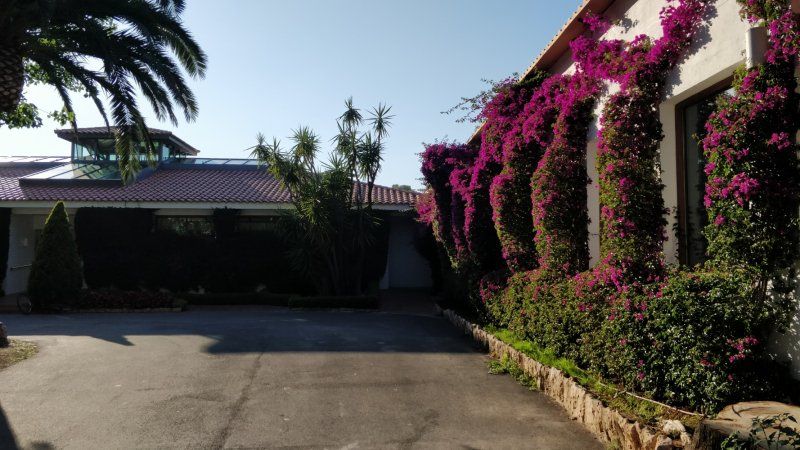
6 weeks in Andalusia - time to relax. Travel for two in a semi-integrated motorhome.
Day
Geilenkirchen, Deutschland
50° 58' 1.8" N 6° 7' 2.9" E
50.9671680 6.1174584
• Head northeast on Merowingerstraße. Go for 56 m.
• Turn left onto Karolinger Straße. Go for 84 m.
• Turn left onto An der Linde. Go for 242 m.
• Take the 2nd exit from roundabout onto Kreuzstraße. Go for 554 m.
• Take the 2nd exit from roundabout onto Kreuzstraße (L42) toward Aachen/B56/B221/Heinsberg/Heerlen/Teveren Flughafen. Go for 1.0 km.
• Take the 1st exit from roundabout onto B56 toward B221/Düren/Aachen. Go for 15.6 km.
• Take ramp onto A44 toward Liège/Aachen. Go for 24.4 km.
• Continue on E40. Go for 22.8 km.
• Take the exit toward Verviers onto E42. Go for 10.4 km.
• Take exit 7 toward Theux/Aéroport Laboru. Go for 870 m.
• Take the 1st exit from roundabout onto Chaussée de Verviers (N657). Go for 4.0 km.
• Continue on Rue du Pont (N690). Go for 100 m.
• Take the 2nd exit from roundabout onto Rue Chinrue. Go for 245 m.
• Turn right onto Rue de la Chaussée. Go for 111 m.
• Take the 1st exit from roundabout onto Rue Tillot (N62) toward E25/Sprimont/Banneux. Go for 8.2 km.
• Continue on Rue de la Gendarmerie (N678). Go for 1.1 km.
• Take the 2nd exit from roundabout onto Rue de Louveigné (N678) toward E25/Sprimont. Go for 758 m.
• Take the 4th exit from roundabout onto E25 toward Sprimont/Luxembourg/Bastogne. Go for 83.0 km.
• Take the left exit toward Luxembourg/Arlon onto E25/E411. Go for 37.1 km.
• Take exit 32 toward Longwy/Aubange/Messancy onto N81 (Route de Longwy). Go for 2.0 km.
• Pass 3 roundabouts and continue on N81. Go for 7.2 km.
• Continue on A28. Go for 3.0 km.
• Continue on A28. Go for 952 m.
• Continue on N52. Go for 524 m.
• Take ramp onto N52 toward Mont St Martin. Go for 23.6 km.
• Continue on A30. Go for 26.7 km.
• Continue on A31. Go for 73.5 km.
• Take the exit toward Lyon/Paris/Dijon/Toul onto A31. Go for 132 km.
• Take the left exit toward Lyon/Besançon/Dijon/Langres-Sud onto A31. Go for 115 km.
• Continue on A6 (Autoroute du Soleil). Go for 147 km.
• Keep left onto Autoroute du Soleil (M6) toward Lyon-Centre. Go for 6.8 km.
• Keep left onto Autoroute du Soleil (M7). Go for 32.9 km.
• Take the exit. Go for 621 m.
• Take the 1st exit from roundabout onto Chemin du Pavillon (D131). Go for 216 m.
• Take the 3rd exit from roundabout onto N7 toward Valence/Roussillon/Auberives S/V./Z.A. du Saluant. Go for 1.5 km.
• Take the 2nd exit from roundabout onto N7 toward Valence/Auberives S/V./Roussillon. Go for 4.8 km.
• Take the 3rd exit from roundabout onto Chemin des Vignes (D131 B) toward Assieu. Go for 1.4 km.
• Continue on Route d'Auberives (D131 B). Go for 2.5 km.
• Continue on D131 B. Go for 263 m.
• Continue on Route de Vienne (D131 B). Go for 330 m.
• Continue on D131 B. Go for 39 m.
• Continue on D131. Go for 338 m.
• Continue on Lieu-dit Le Plan Français (D131). Go for 110 m.
• Continue on D131. Go for 493 m.
• Continue on Lieu-dit Les Pégières (D131). Go for 129 m.
• Continue on D131. Go for 1.2 km.
• Take the 2nd exit from roundabout onto Route de Terre Basse (C1). Go for 464 m.
• Turn left toward Route de Terre Basse/C1. Go for 14 m.
• Turn slightly left onto Route de Terre Basse (C1). Go for 14 m.
• Turn right onto Rue Émile Romanet. Go for 239 m.
• Arrive at Rue Émile Romanet (VC4). Your destination is on the left.
☍
797,0 km
(7 hrs. 44 min.)
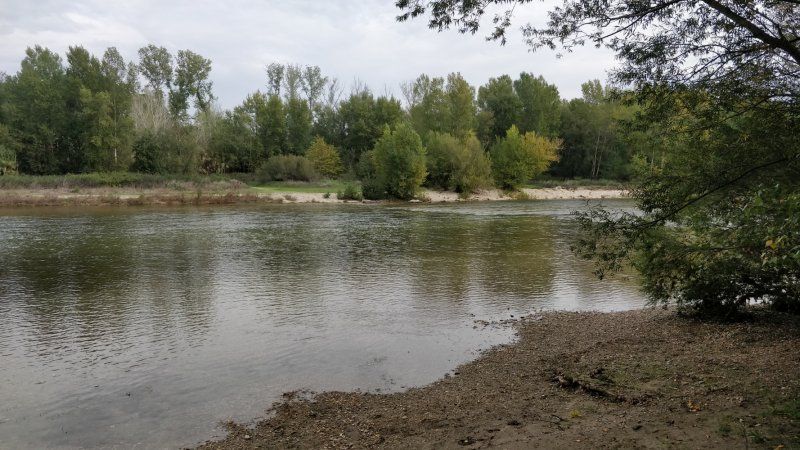
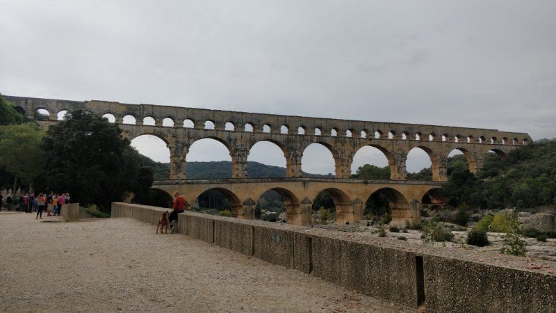
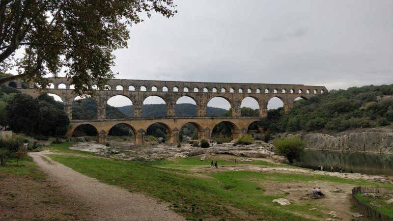
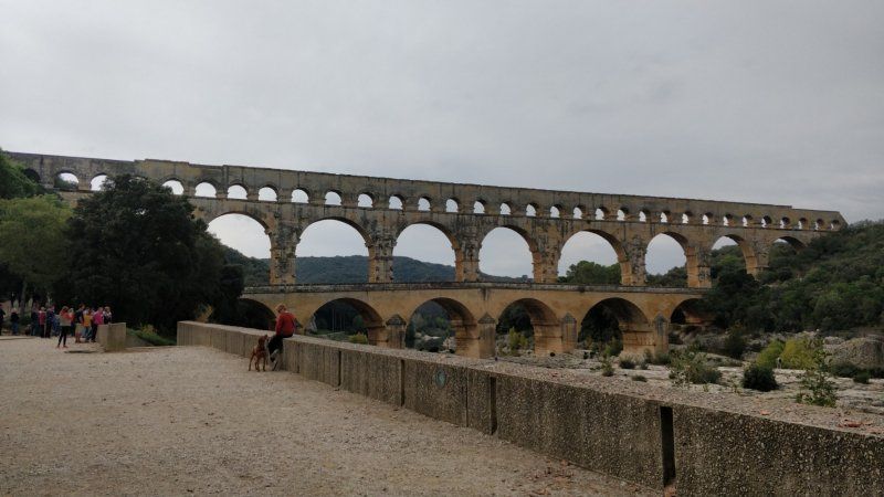
Ville-sous-Anjou, Frankreich
Overnight stay
38150 Ville-sous-Anjou, Frankreich
45° 21' 40.6" N 4° 51' 50.8" E
45.3612750 4.8641020
• Head toward Route de la Madone on Rue Émile Romanet (VC4). Go for 23 m.
• Continue on Chemin de la Reneze (VC21). Go for 304 m.
• Turn right onto Route des Combes (VC3). Go for 607 m.
• Turn left onto Route d'Agnin (D131). Go for 1.4 km.
• Continue on Route de Vienne (D131). Go for 1.4 km.
• Turn right onto Route du Pilat (D51). Go for 591 m.
• Continue on D51. Go for 250 m.
• Continue on Lieu-dit Le Lac (D51). Go for 178 m.
• Continue on D51. Go for 511 m.
• Continue on Route d'Agnin (D51). Go for 1.3 km.
• Take the 2nd exit from roundabout onto Route d'Agnin (D51). Go for 1.0 km.
• Turn left onto Route de Valence (N7). Go for 904 m.
• Take the 3rd exit from roundabout onto Route de Valence (N7) toward A7/Valence/Annonay/Beaurepaire/St Rambert d'A. Go for 1.1 km.
• Take the 4th exit from roundabout toward Romans/Valence. Go for 307 m.
• Take the 2nd exit from roundabout. Go for 70 m.
• Take ramp onto A7 (Autoroute du Soleil) toward Valence/Marseille. Go for 143 km.
• Keep right onto A9 (Échangeur d'Orange) toward Barcelone/Toulouse/Montpellier/Nîmes. Go for 281 km.
• Continue on AP-7 (Autopista de la Mediterrània). Go for 71.4 km.
• Take exit 8 toward Aeroport/Riudellots de la Selva/Cassà de la Selva/C-25/Vic/C-25z/Sta. Coloma de Farners. Go for 942 m.
• Take the 2nd exit from roundabout onto C-25 toward C-25z/Sta. Coloma de Farners. Go for 2.7 km.
• Take ramp onto C-25 (Eix Transversal). Go for 56.0 km.
• Take the exit toward Lleida/Manresa onto C-25 (Eix Transversal). Go for 21.8 km.
• Arrive at Eix Transversal (C-25).
☍
586,6 km
(5 hrs. 3 min.)
Day
Santa María de Oló, Spanien
Wegpunkt für die Barcelona - Umfahrung
C-25, 08273 Santa María de Oló, Barcelona, Spanien
41° 52' 5" N 2° 0' 23.3" E
41.8680561 2.0064763
• Head southwest on C-25 (Eix Transversal). Go for 26.0 km.
• Take exit 130 toward Tarragona/Igualada onto C-37. Go for 11.3 km.
• Continue on C-37z. Go for 49 m.
• Continue on C-37. Go for 11.7 km.
• Continue on C-15. Go for 28.5 km.
• Take ramp toward Tarragona/AP-7. Go for 538 m.
• Take the 2nd exit from roundabout onto N-340 toward AP-7/Tarragona. Go for 3.8 km.
• Take ramp toward E-15/E-90/Barcelona/AP-7/Tarragona/AP-2/Lleida. Go for 358 m.
• Take the 4th exit from roundabout onto Avinguda de Tarragona (N-340a) toward Barcelona/AP-7/Girona/AP-7/Tarragona/AP-7/Lleida/AP-7. Go for 577 m.
• Take the 2nd exit from roundabout onto Avinguda de Tarragona (N-340a) toward Barcelona/AP-7/Girona/AP-7/Tarragona/AP-7/Lleida/AP-7/els Monjos. Go for 381 m.
• Take the 1st exit from roundabout onto AP-7 (Autopista de la Mediterrània) toward Lleida/Tarragona. Go for 66.2 km.
• Take exit 37 toward T-312/Cambrils/N-340. Go for 1.1 km.
• Keep left toward Cambrils. Go for 73 m.
• Take the 4th exit from roundabout onto T-312 toward Cambrils. Go for 986 m.
• Take the 1st exit from roundabout onto N-340 toward Cambrils oest. Go for 4.8 km.
• Take the 2nd exit from roundabout onto N-340 toward Miami Platja/Castelló. Go for 3.9 km.
• Turn right onto Avinguda de les Palmeres toward Urb. Masos d'en Blade/Urb. la Riviera. Go for 166 m.
• Turn left toward Avinguda de la Ribera. Go for 103 m.
• Take the 2nd exit from roundabout onto Avinguda de la Ribera. Go for 373 m.
• Turn left. Go for 337 m.
• Arrive at your destination on the right.
☍
161,2 km
(1 hrs. 36 min.)
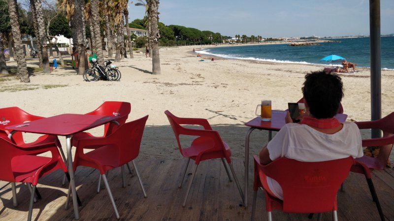
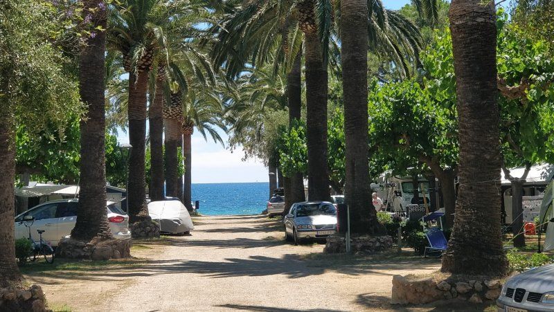
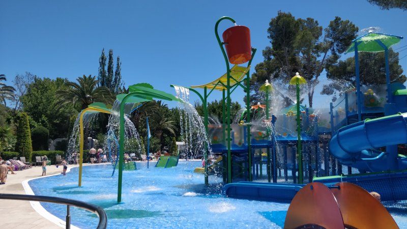
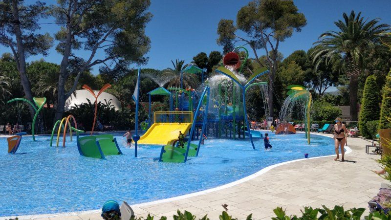
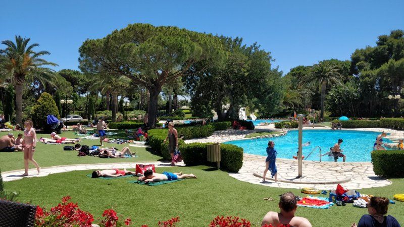
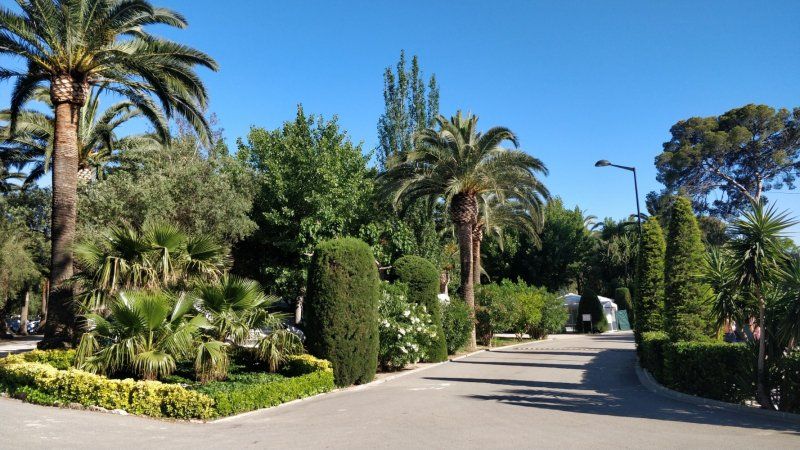
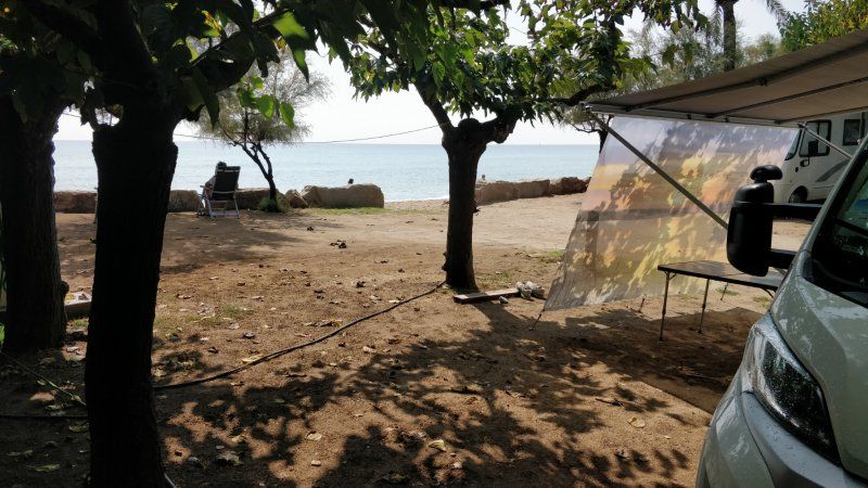
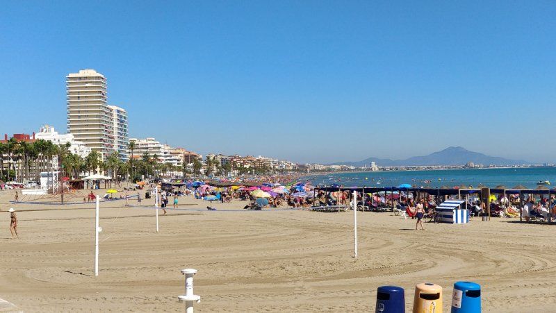
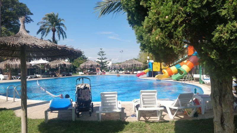
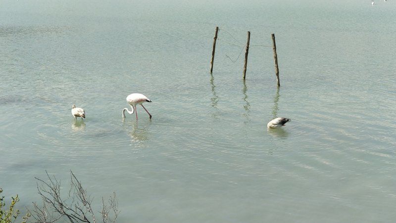
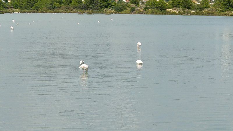
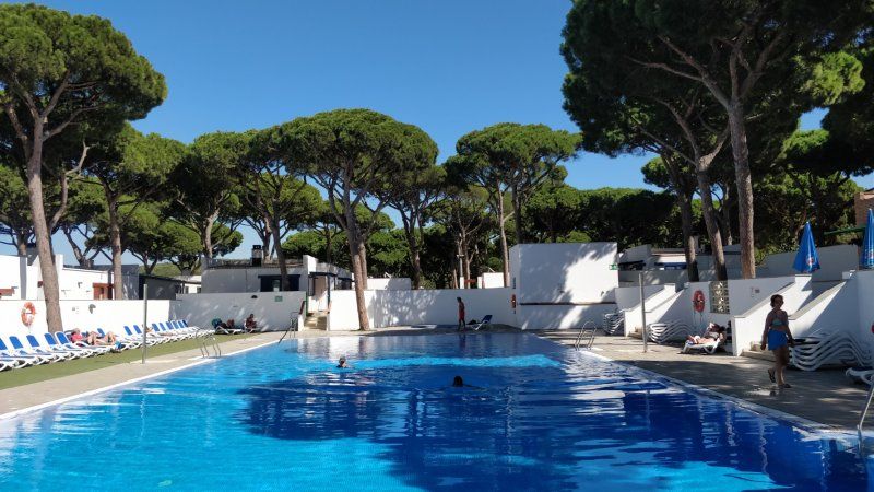
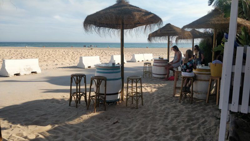
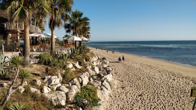
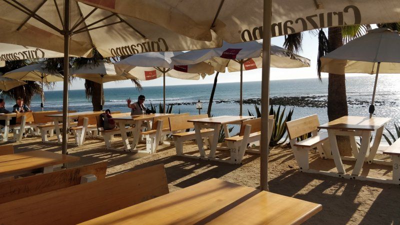
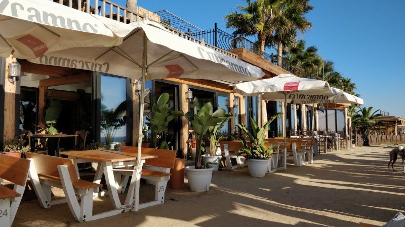
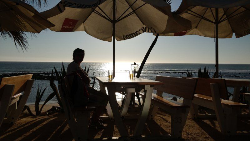
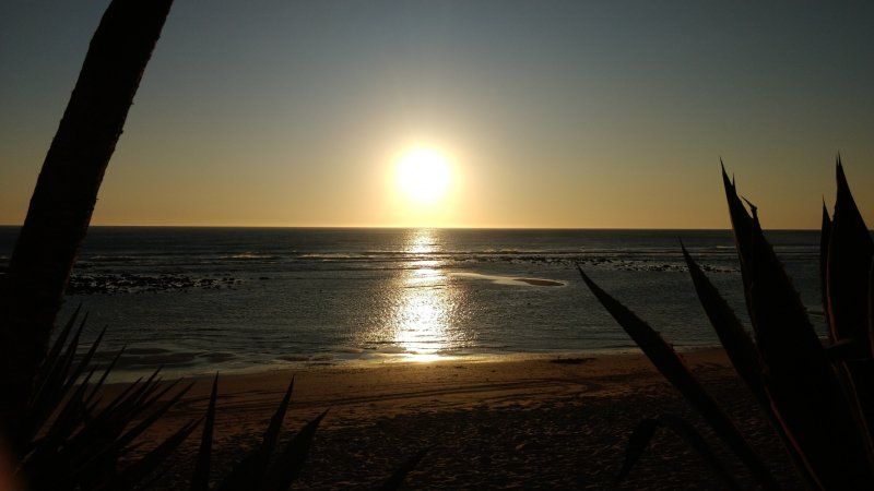
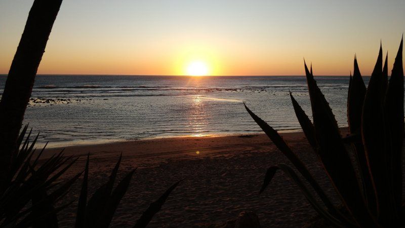
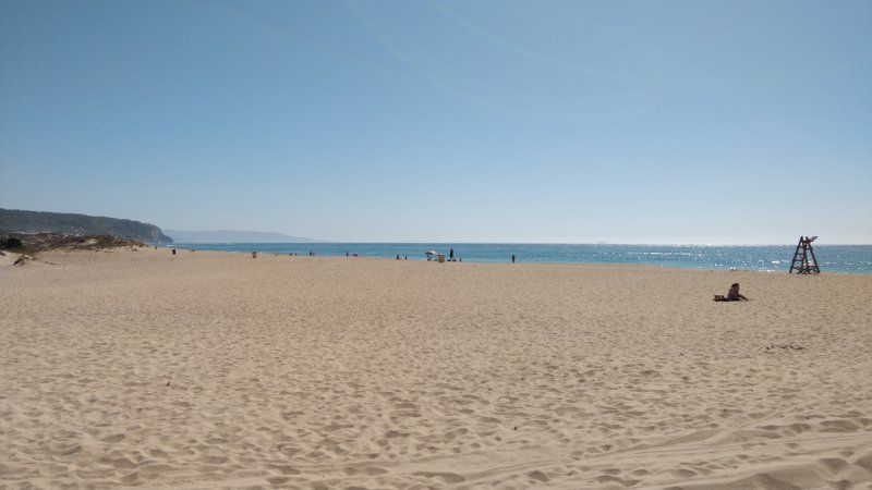
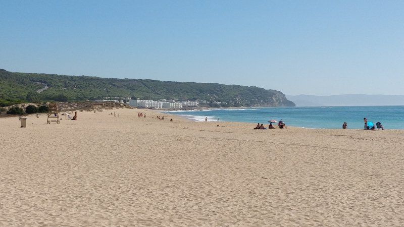
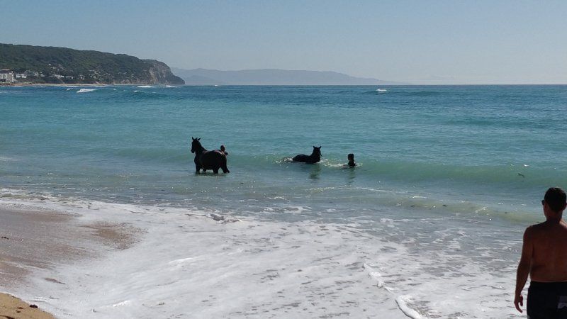
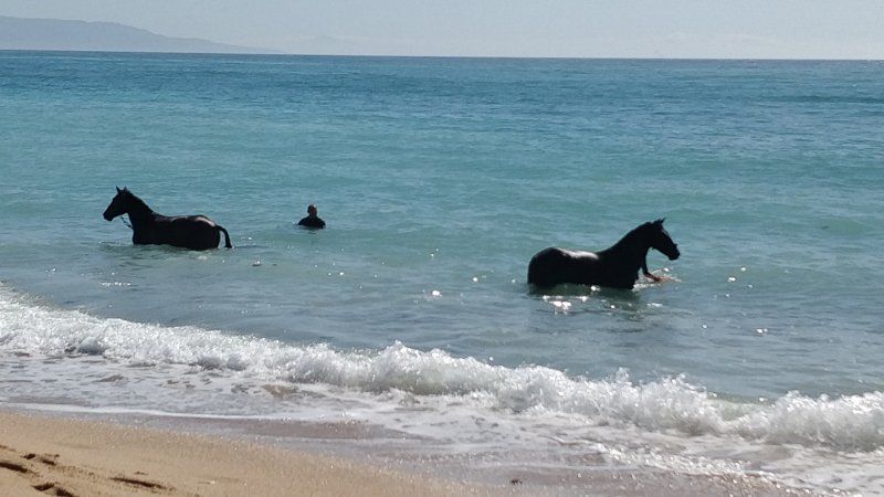
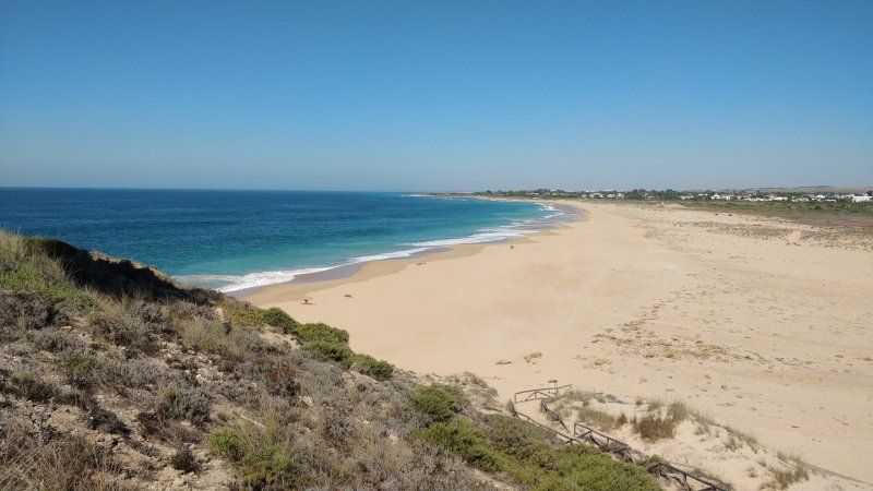
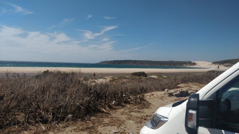
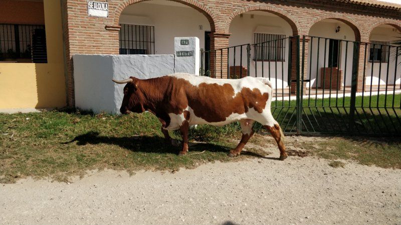
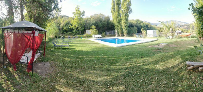
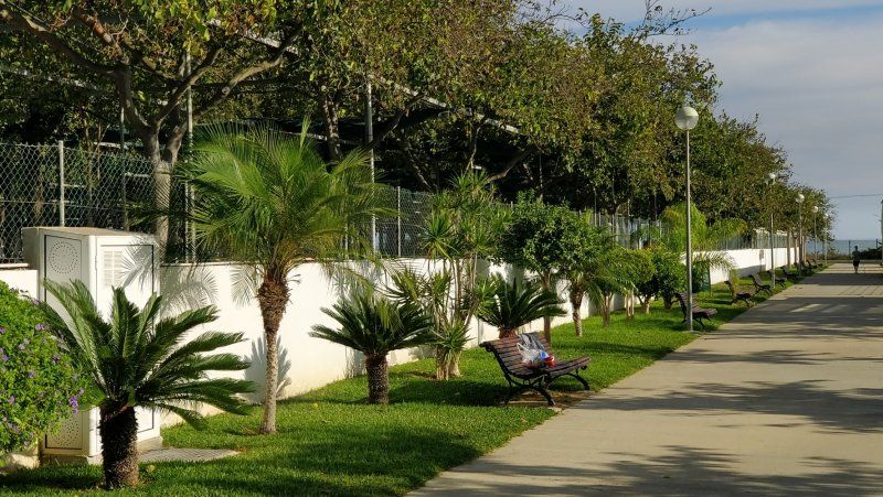
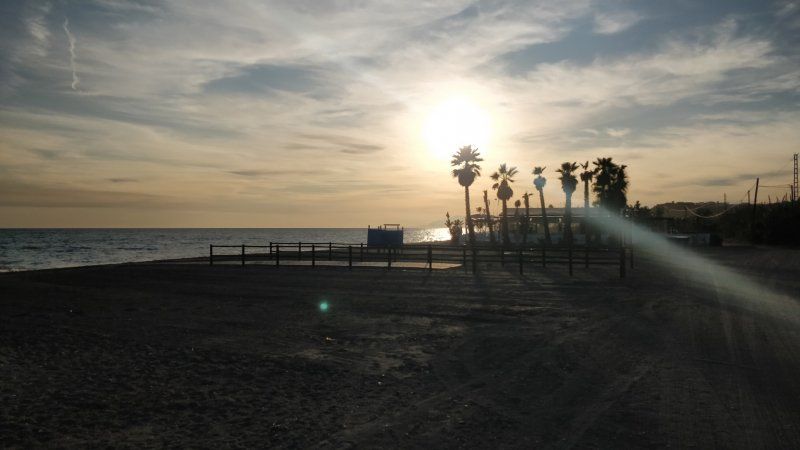
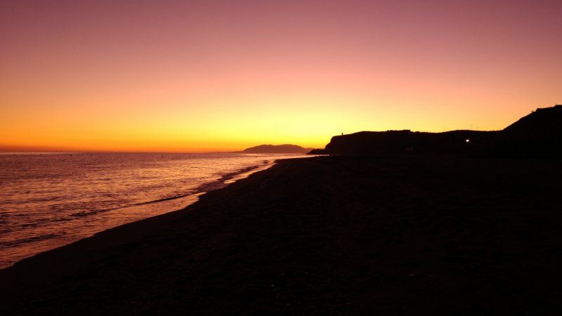
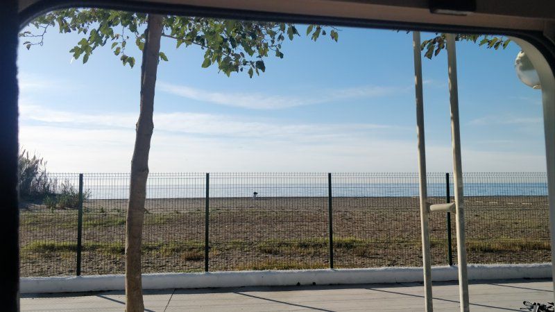
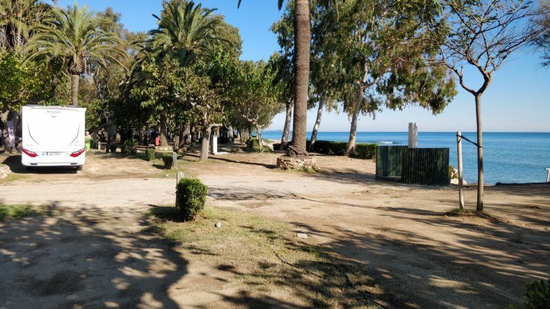
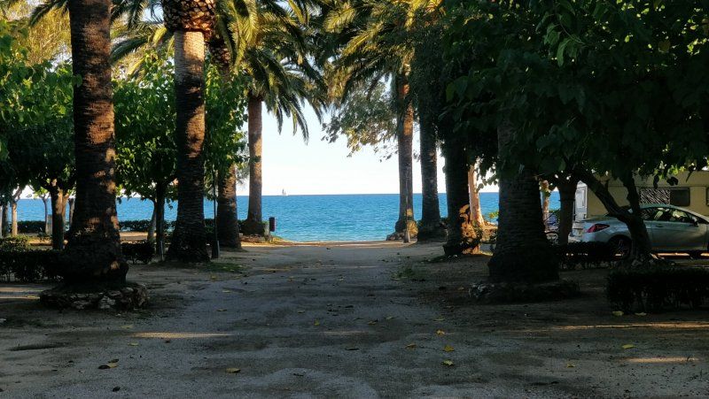
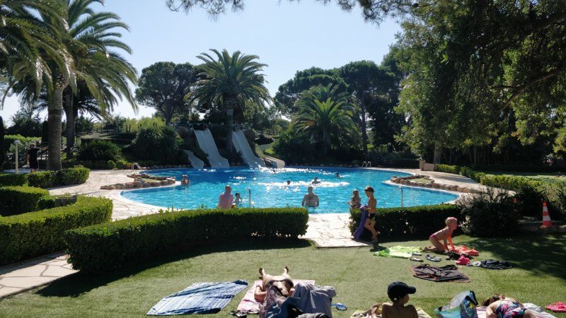
Playa Montroig Camping Resort
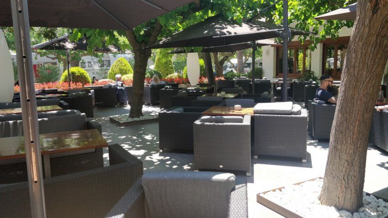
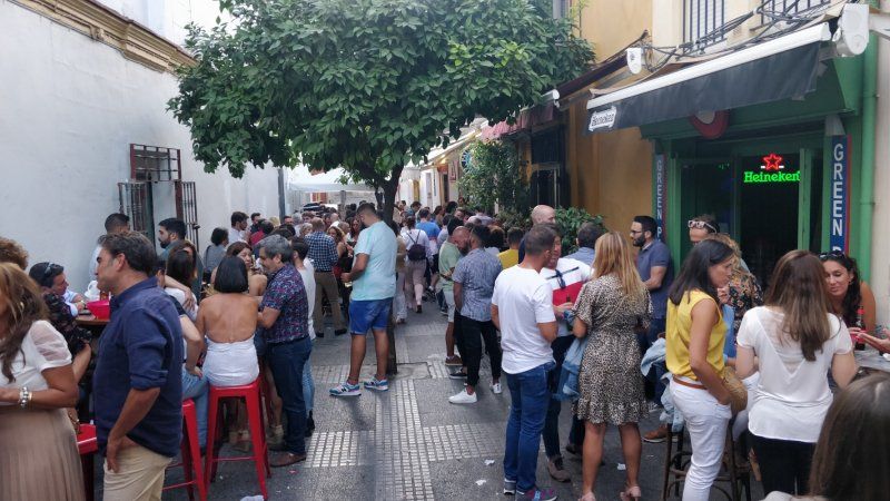
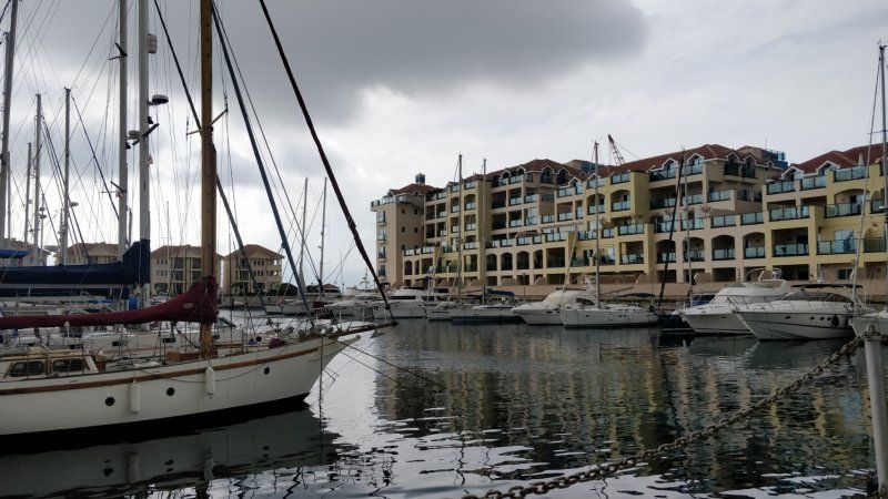
By bike to Cambrils for ice cream and strolling.
Apartado de Correos 3, 43300, Mont-roig del Camp, Spanien
41° 1' 50.5" N 0° 58' 7" E
41.0307000 0.9686000
• Head north.
• Arrive at your destination on the right.
☍
Distance not available
(Duration not available)
Day
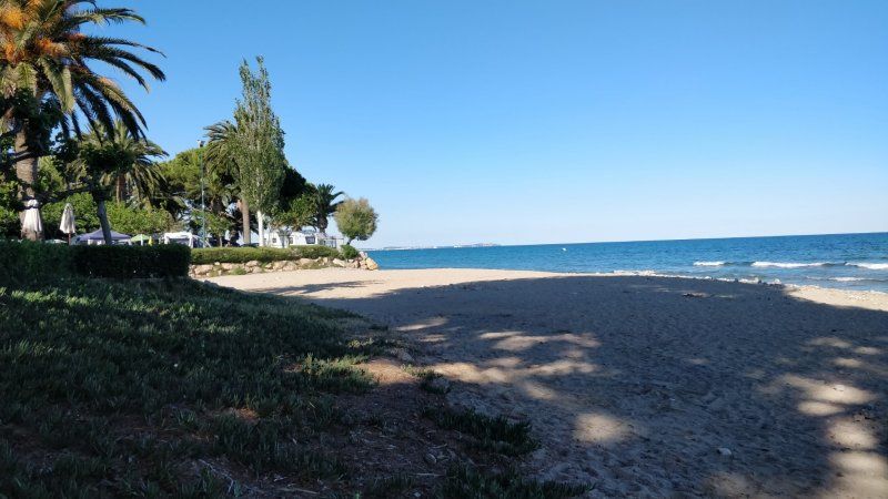
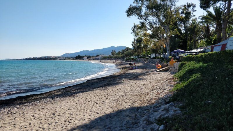
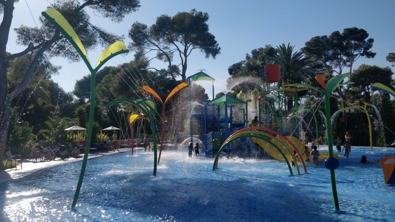
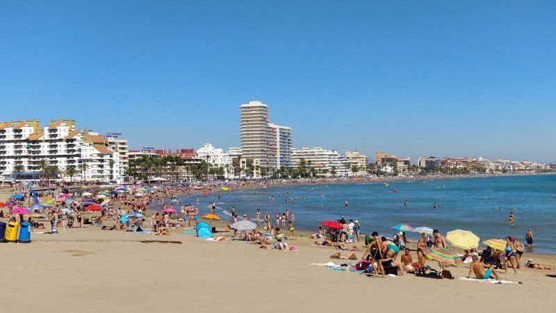
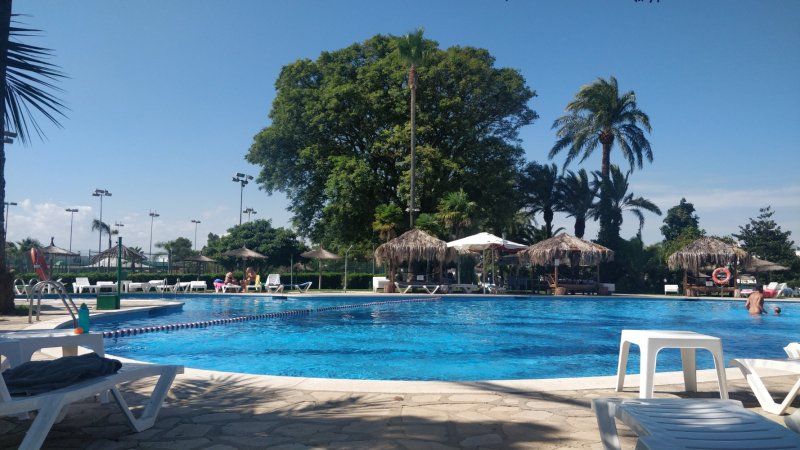
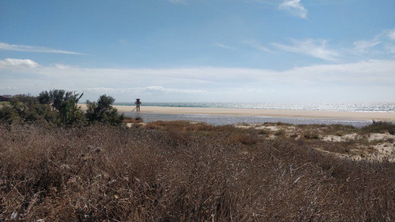
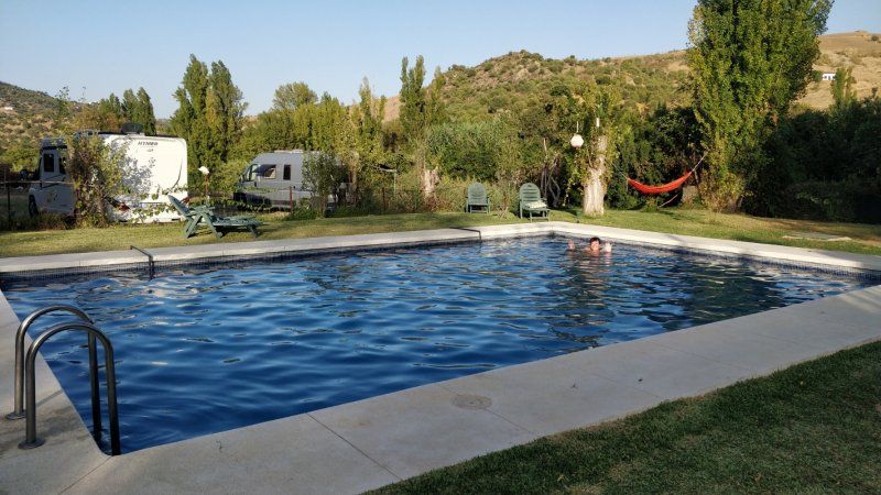
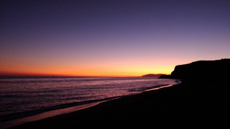
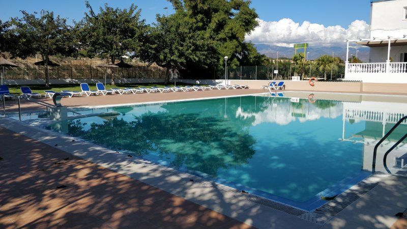
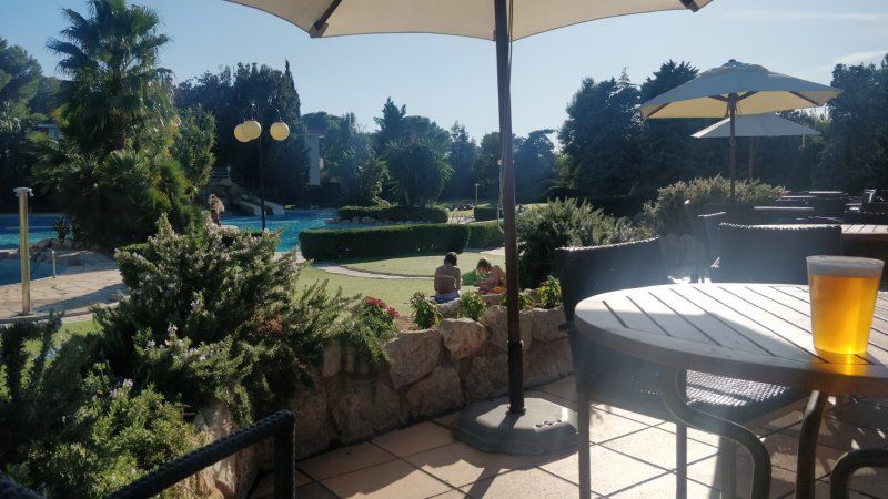
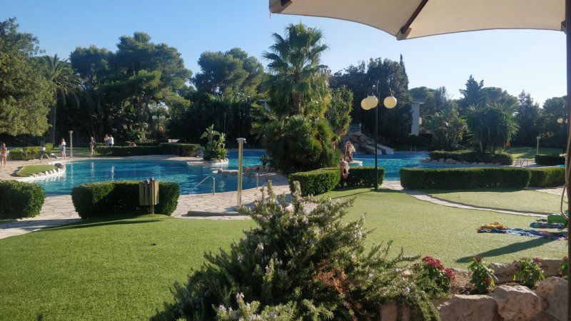
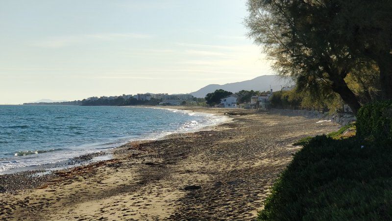
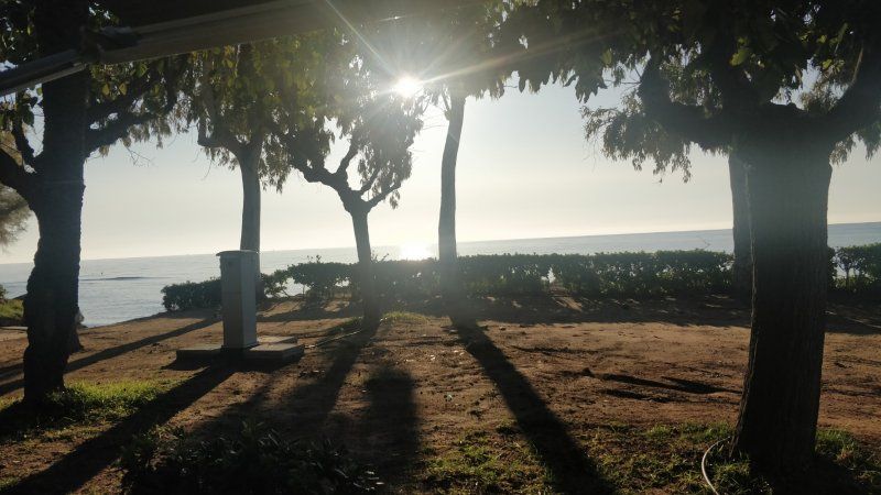
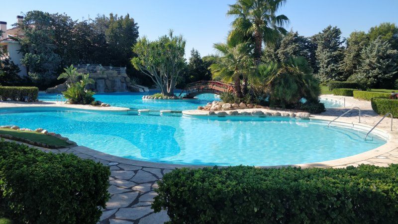
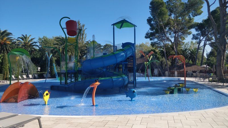
Playa Montroig Camping Resort
Lazing around the pool
Apartado de Correos 3, 43300, Mont-roig del Camp, Spanien
41° 1' 50.5" N 0° 58' 7" E
41.0307000 0.9686000
• Head south. Go for 337 m.
• Turn right onto Avinguda de la Ribera. Go for 199 m.
• Turn right toward N-340. Go for 23 m.
• Continue on N-340. Go for 701 m.
• Turn sharp right. Go for 129 m.
• Arrive at your destination on the right.
☍
1,4 km
( 2 min.)
Day
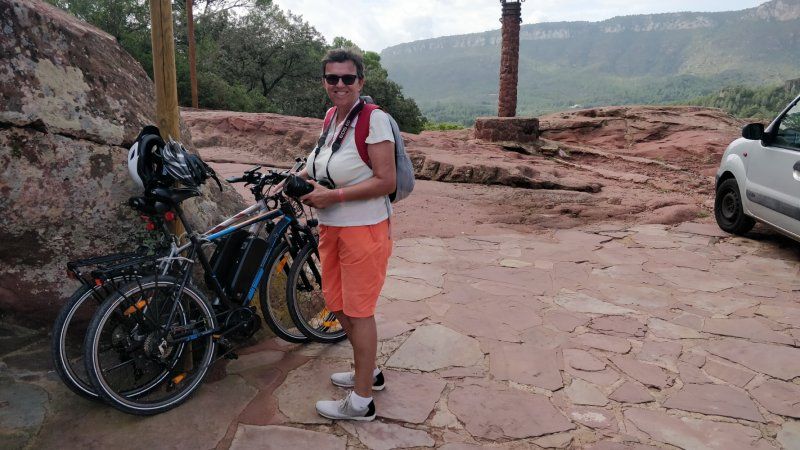
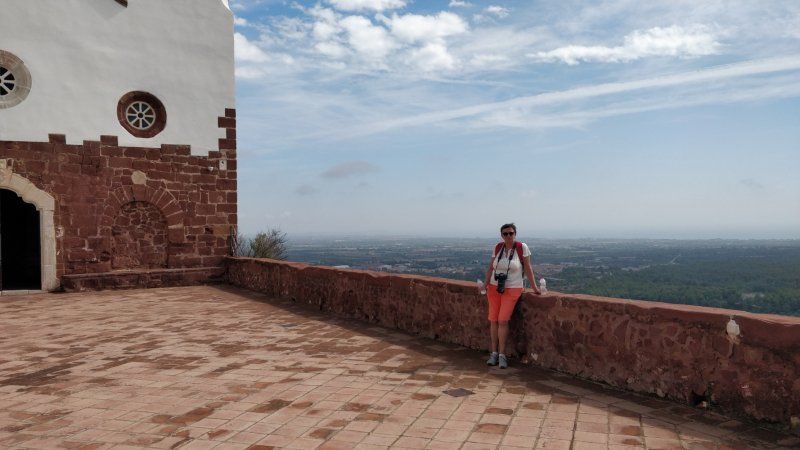
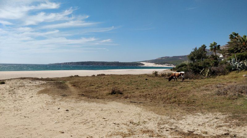
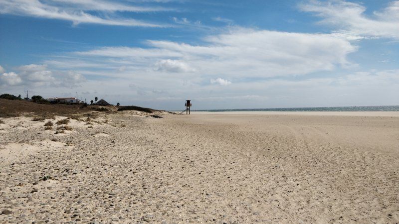
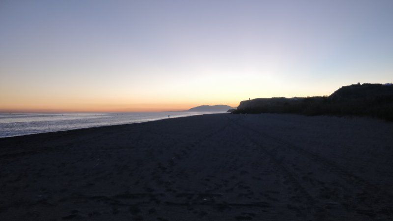
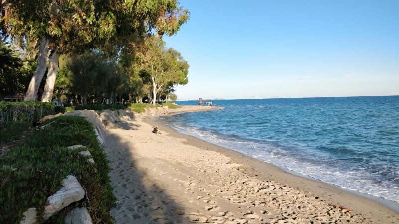
Playa Montroig Camping Resort, Mont-roig del Camp, Spanien
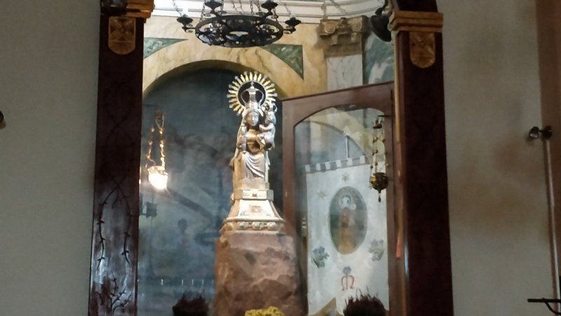
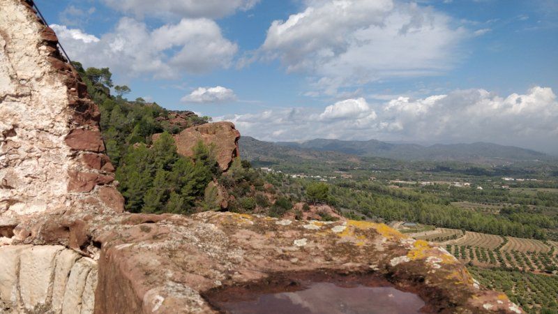
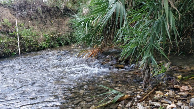
By bike to the 'Ermita der la Mare der Deu der la Roca'. A small Marian pilgrimage church with a hermitage on a small mountain. Very nice.
N-340, Km 1.136, 43300 Mont-roig del Camp, Tarragona, Spanien
41° 1' 58.9" N 0° 58' 8.5" E
41.0330317 0.9690164
• Head north. Go for 79 m.
• Turn left toward N-340. Go for 186 m.
• Turn sharp right onto N-340. Go for 2.5 km.
• Turn right onto Avinguda de Barcelona toward A-7. Go for 291 m.
• Continue on Carrer de Cambrils. Go for 16 m.
• Turn right and take ramp onto Plaça Dr. Fleming toward A-7. Go for 134 m.
• Turn right onto Avinguda del Doctor Gil Vernet toward A-7/Urb. Via Marina/Urb. Casalot/Urb. Costa Zefir. Go for 626 m.
• Pass 2 roundabouts. Go for 1.0 km.
• Take the 2nd exit from roundabout onto A-7 (Autovia de la Mediterrània) toward l'Hospitalet I./Castelló. Go for 2.4 km.
• Take exit 1129 toward E-15/l'Hospitalet I./AP-7/Vandellòs/Móra E. Go for 153 m.
• Take the 2nd exit from roundabout toward Barcelona/València. Go for 348 m.
• Keep left toward València. Go for 14 m.
• Take ramp onto AP-7 (Autopista de la Mediterrània). Go for 41.3 km.
• Take exit 41 toward Amposta/N-340/La Ràpita. Go for 2.2 km.
• Take the 2nd exit from roundabout onto N-340a toward N-340/Castelló/Tarragona. Go for 902 m.
• Take the 1st exit from roundabout onto N-340 toward Amposta S/Sant Carles de la Ràpita/Castelló. Go for 2.7 km.
• Take ramp toward TV-3403/Amposta/Sant Jaume d'Enveja/els Muntells/TV-3405. Go for 313 m.
• Turn right onto Avinguda de Sant Jaume (TV-3405) toward TV-3403/Sant Jaume d'Enveja/els Muntells/Platges d'Amposta/Urb. Eucaliptus/Poble nou del Delta. Go for 162 m.
• Continue on TV-3405 toward TV-3403/Sant Jaume d'Enveja/els Muntells. Go for 96 m.
• Continue on Avinguda de Sant Jaume (TV-3405). Go for 2.5 km.
• Continue on TV-3403. Go for 19 m.
• Continue on Avinguda de Sant Jaume (TV-3405). Go for 1.1 km.
• Take the 3rd exit from roundabout onto TV-3405 toward St. Jaume E./Deltebre/els Muntells. Go for 611 m.
• Turn right onto TV-3405 toward els Muntells. Go for 6.8 km.
• Turn right toward El Poble nou del Delta. Go for 4.1 km.
• Turn left onto Carretera Salines-Poble Nou del Delta. Go for 3.6 km.
• Continue on Carretera de les Salines de Poblenou del Delta. Go for 185 m.
• Take the 1st exit from roundabout. Go for 6.2 km.
• Turn right. Go for 795 m.
• Turn left. Go for 289 m.
• Turn right. Go for 1.1 km.
• Turn slightly right. Go for 171 m.
• Arrive at your destination.
☍
82,9 km
(1 hrs. 14 min.)
Day
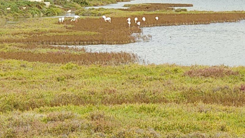
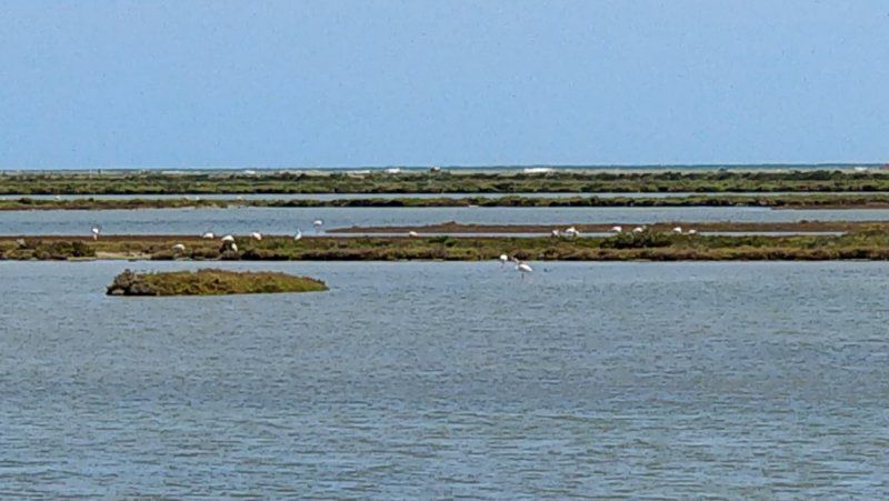
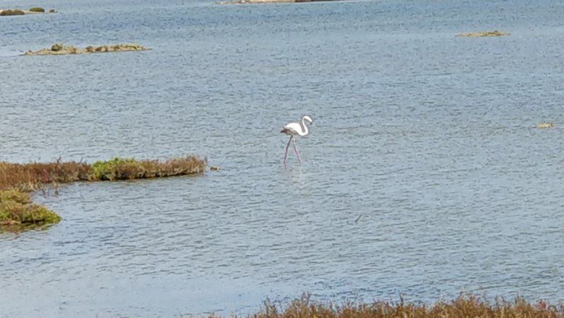
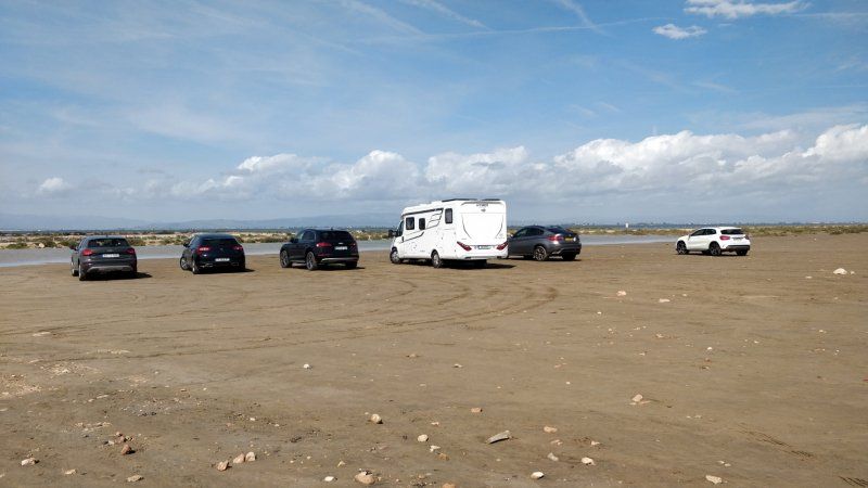
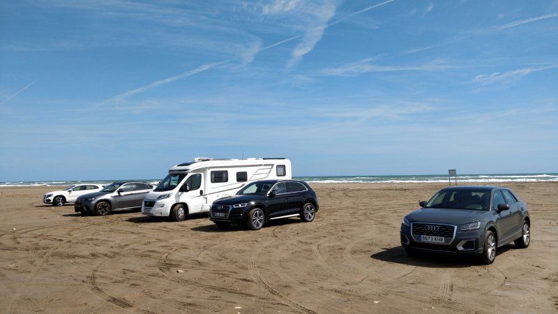
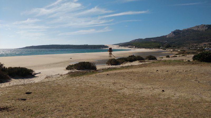
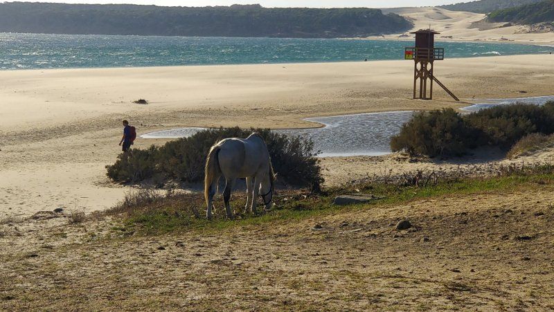
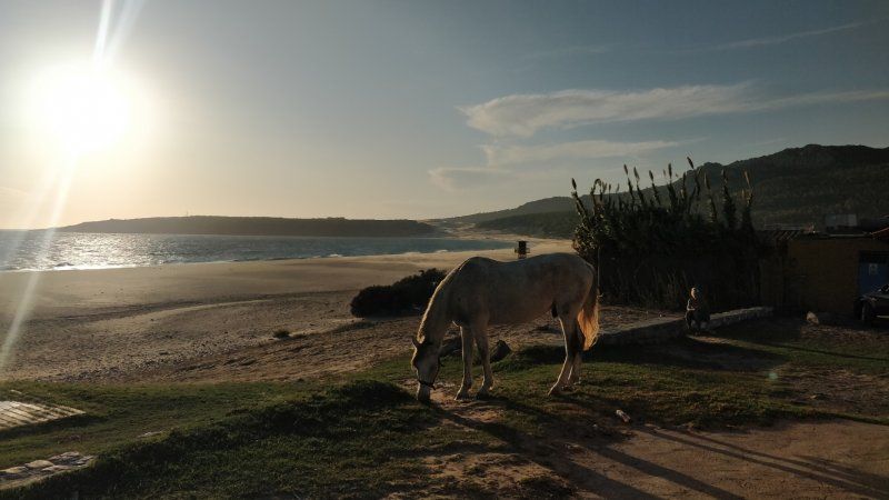
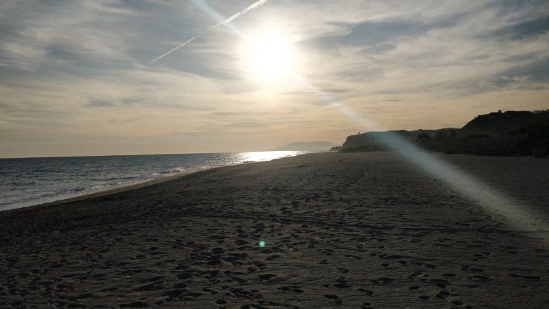
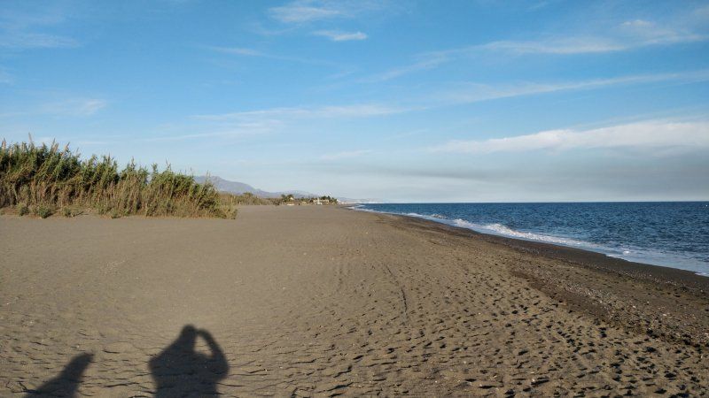
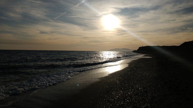
Punta de la Banya, Spanien
Enjoy the Ebro Delta
40° 33' 37.6" N 0° 40' 20.4" E
40.5604468 0.6723368
• Head southeast. Go for 171 m.
• Turn slightly left. Go for 1.1 km.
• Turn left. Go for 289 m.
• Turn right. Go for 795 m.
• Turn left toward Carretera de les Salines de Poblenou del Delta. Go for 6.2 km.
• Take the 2nd exit from roundabout onto Carretera de les Salines de Poblenou del Delta. Go for 2.1 km.
• Continue on Carretera Salines-Poble Nou del Delta. Go for 4.0 km.
• Continue on Carretera a Sant Carles de la Ràpita. Go for 3.9 km.
• Continue on Carrer Menorca. Go for 3.0 km.
• Continue on Carretera a Poble Nou del Delta. Go for 727 m.
• Turn right onto TV-3408 toward Amposta/N-340/Castelló. Go for 2.2 km.
• Take the 4th exit from roundabout onto TV-3406 toward Amposta/Castelló. Go for 459 m.
• Continue on Camí Salt (TV-3406). Go for 193 m.
• Turn right onto Camí Salt. Go for 12 m.
• Take left ramp onto N-340 toward Sant Carles de la Ràpita sud/Castelló. Go for 3.1 km.
• Pass 2 roundabouts and continue on N-340. Go for 32.4 km.
• Take ramp toward Peñíscola. Go for 428 m.
• Take the 3rd exit from roundabout onto CV-141 toward Peñíscola. Go for 276 m.
• Continue on Avenida de la Estación (CV-141). Go for 3.5 km.
• Pass 4 roundabouts and continue on Avenida de la Estación (CV-1410). Go for 2.5 km.
• Take the 2nd exit from Plaza de la Constitución roundabout onto Avenida Akra-Leuka. Go for 497 m.
• Turn left onto Calle Levante. Go for 87 m.
• Turn right onto Avenida Doctor Marcelino Roca. Go for 35 m.
• Continue on Calle del Puertovera. Go for 105 m.
• Continue on Calle Atarazanas. Go for 59 m.
• Continue on Bajada del Bufador. Go for 48 m.
• Continue on Calle del Príncipe. Go for 74 m.
• Turn left onto Calle Mayor. Go for 73 m.
• Turn right onto Calle de Jaime Sanz Roca. Go for 43 m.
• Turn left onto Plaza de San Roque. Go for 11 m.
• Turn right onto Plaza de San Roque. Go for 14 m.
• Continue on Calle Castell. Go for 81 m.
• Continue on Plaza de Armas. Go for 15 m.
• Turn right onto Plaza Nuestra Señora de la Ermitana. Go for 21 m.
• Arrive at Plaza Nuestra Señora de la Ermitana. Your destination is on the right.
☍
68,5 km
(1 hrs. 13 min.)
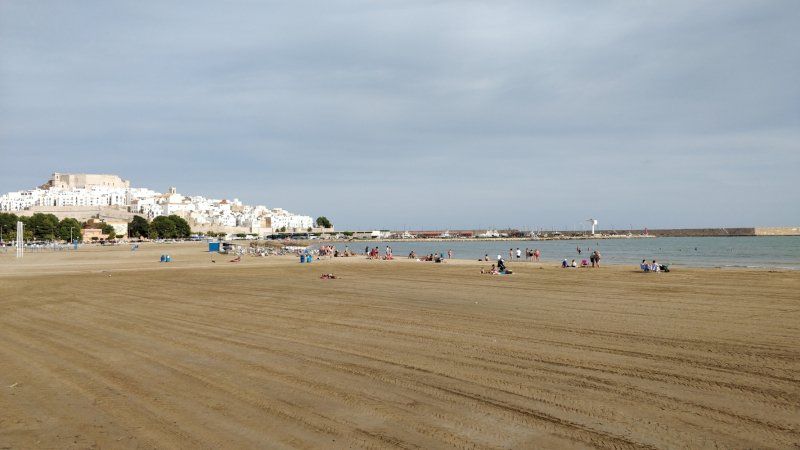
Day
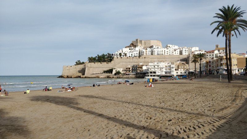
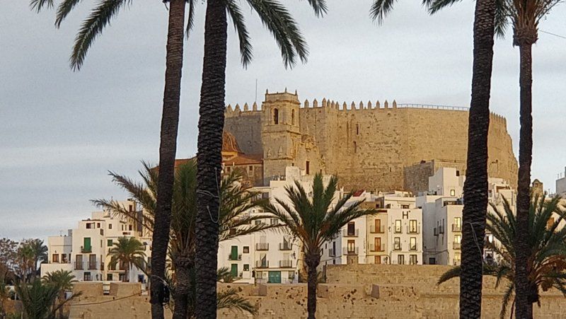
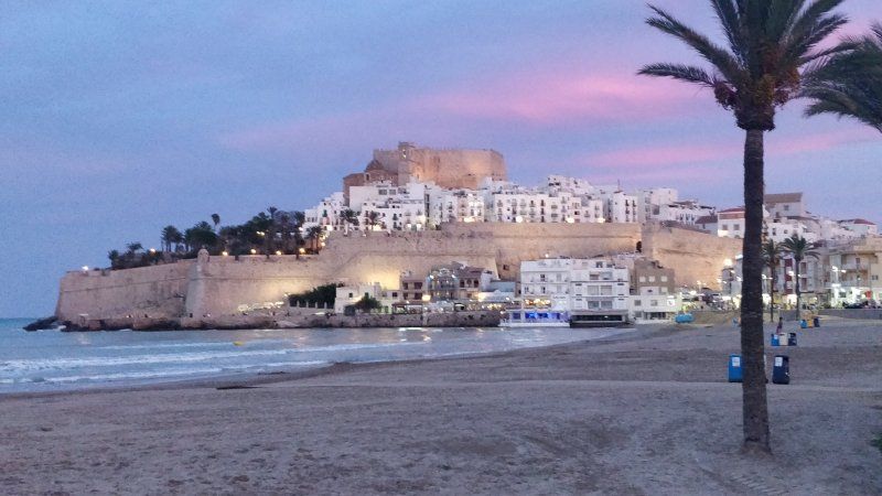
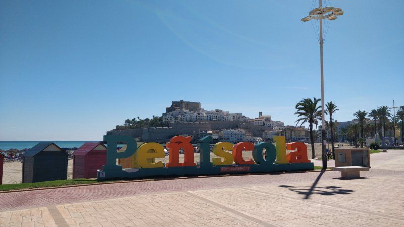
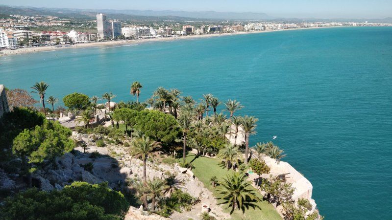
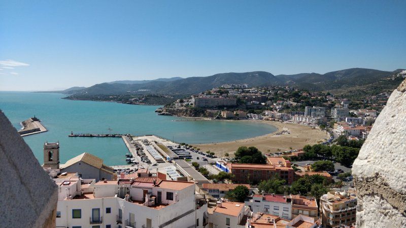
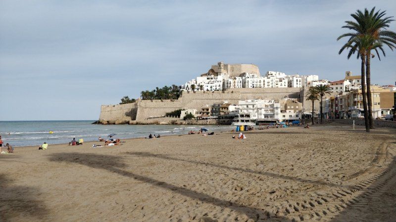
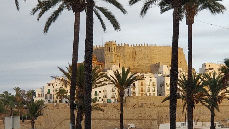
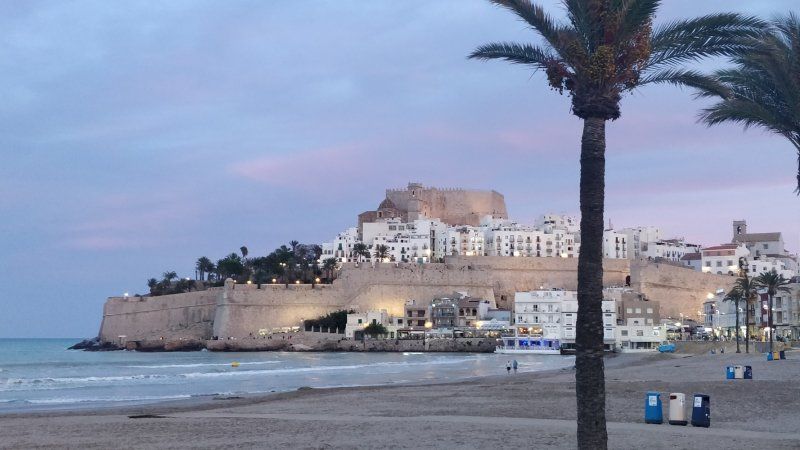
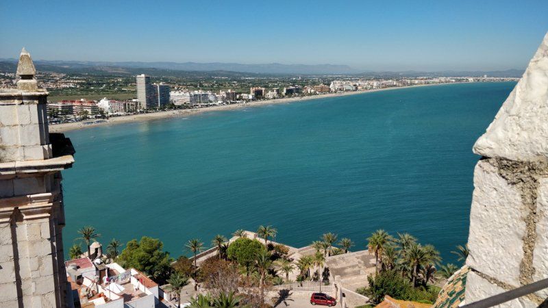
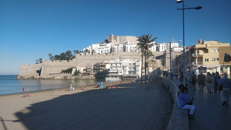
Peniscola Castle, Calle Castillo, Peniscola, Spanien
The next morning we walked into the city and visited the Castell with the old town.
Because the pool at the campsite was empty, we stayed in town for a long time, for example having a beer in a small bar and rested from the tour.
Later I sat at the campsite in front of the Womo for about 1 hour and then went back to the center for dinner in the evening.
Calle Castillo, s/n, 12598 Peñíscola, Castellón, Spanien
40° 21' 32" N 0° 24' 28" E
40.3588968 0.4077690
• Head toward Calle de los Santos Mártires on Plaza Nuestra Señora de la Ermitana. Go for 46 m.
• Turn slightly left onto Plaza de Armas. Go for 28 m.
• Turn right onto Travesía de San Vicente. Go for 25 m.
• Turn right onto Calle San Vicente. Go for 30 m.
• Turn left onto Calle del Olvido. Go for 26 m.
• Turn right onto Subida al Portal Fosc. Go for 146 m.
• Turn right onto Plaza de Toros. Go for 69 m.
• Turn slightly right onto Avenida del Mar. Go for 288 m.
• Take the 1st exit from roundabout onto Avenida del Mar (CV-1401). Go for 140 m.
• Take the 2nd exit from roundabout onto Placa Illueca. Go for 69 m.
• Take the 2nd exit from Plaza Illueca roundabout onto Plaza Illueca toward N-340/AP-7/Valencia/Barcelona. Go for 51 m.
• Continue on Calle Pigmalión. Go for 107 m.
• Take the 1st exit from roundabout onto Calle Pigmalión. Go for 503 m.
• Turn left onto Camino Peñíscola a Benicarló toward AP-7/Valencia/Barcelona. Go for 176 m.
• Take the 3rd exit from roundabout onto Avenida de la Estación (CV-1410) toward Centre Ciutat Peñíscola. Go for 343 m.
• Turn right. Go for 24 m.
• Arrive at your destination on the left.
☍
2,1 km
( 6 min.)
Camping Ferrer, Avinguda de l'Estació, Peniscola, Spanien
ACSI € 16
Arrival in the late afternoon, space very tight, so I took the first one at the entrance. Real as the pegs stood,
Then around 17:30 in the city, wanted to eat something. However, most of the restaurants didn't open until 8 p.m.
We then drank a beer in a bar and after 8 p.m. we enjoyed a ham platter with Iberian acorn ham in the Pata Negra bar. Delicious.
Avinguda de l'Estació, 27, 12598 Peñíscola, Castellón, Spanien
40° 21' 45.5" N 0° 23' 44" E
40.3626305 0.3955456
• Head toward Avenida de la Estación. Go for 24 m.
• Turn left onto Avenida de la Estación (CV-1410). Go for 240 m.
• Take the 2nd exit from roundabout onto Avenida de la Estación (CV-1410) toward N-340/E-15/AP-7/Castelló/Tarragona/Benicarló. Go for 329 m.
• Take the 3rd exit from roundabout onto Avenida de la Estación (CV-141) toward E-15/AP-7/Castelló/Tarragona. Go for 1.3 km.
• Take the 3rd exit from roundabout onto Avenida de la Estación (CV-141). Go for 3.6 km.
• Continue on CV-141 toward Benicarló/Tarragona/E-15/AP-7/Valencia/Barcelona. Go for 72 m.
• Take the 2nd exit from roundabout onto N-340 toward Benicarló/Tarragona/E-15/AP-7/Valencia/Barcelona. Go for 1.8 km.
• Take ramp toward N-340a/Benicarló sud/Benicarló Sur/Castelló/Castellón/E-15/AP-7/Tarragona. Go for 332 m.
• Take the 1st exit from roundabout onto AP-7 (Autopista del Mediterráneo) toward Valencia. Go for 115 km.
• Keep left onto V-21 toward Valencia (Norte)/Puçol/V-23/Sagunt/Sagunto. Go for 19.6 km.
• Take the 2nd exit from Plaza Cardenal Vicente Enrique y Tarancón roundabout onto Avenida de Aragón toward Estadi Mestalla/Av. Aragón/Av. d'Aragó/Grans Víes. Go for 749 m.
• Take the 2nd exit from roundabout onto Avenida de Aragón. Go for 209 m.
• Take the 3rd exit from Plaza Zaragoza roundabout. Go for 129 m.
• Continue on Puente de Aragón. Go for 169 m.
• Continue toward Avenida Jacinto Benavente. Go for 48 m.
• Turn left onto Avenida Jacinto Benavente toward Alicante/Alacant/Madrid/A-3/Ciudad de las Artes y Las Ciencias/El Saler. Go for 719 m.
• Continue on Calle del Alcalde Reig toward Ciudad de las Artes y Las Ciencias/El Saler. Go for 532 m.
• Take the 2nd exit from roundabout onto Avenida Profesor López Piñero (V-15) toward Madrid/Aeropuerto/A-3/Hospital La Fe/Ciutat de les Arts i les Ciències. Go for 107 m.
• Keep left onto Avenida Profesor López Piñero (V-15). Go for 3.4 km.
• Continue on CV-500. Go for 6.5 km.
• Pass 3 roundabouts and continue on Avenida de los Pinares (CV-500). Go for 6.4 km.
• Turn right. Go for 53 m.
• Arrive at your destination on the right.
☍
161,4 km
(1 hrs. 41 min.)
Day
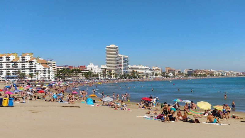
Peniscola
Enjoy Peniscola
Day
Devesa Gardens Camping & Resort, Carretera de El Saler, Valencia, Spanien
Very nice place, pool, supermarket, restaurant, everything open, bus in front of the place 25 minutes to Valencia, ACSI 18 €
Carretera de El Saler, Km. 13, 46012 València, Valencia, Spanien
39° 19' 22.2" N 0° 18' 35.7" W
39.3228310 -0.3099180
• Head northeast. Go for 53 m.
• Turn left onto Avenida de los Pinares (CV-500). Go for 2.1 km.
• Pass 2 roundabouts and continue on Avenida de los Pinares (CV-500). Go for 4.2 km.
• Take the 3rd exit from roundabout onto CV-500 toward València. Go for 6.6 km.
• Continue on V-15. Go for 3.4 km.
• Take the 1st exit from roundabout onto Calle del Alcalde Reig toward Centre Ciutat. Go for 614 m.
• Continue on Avenida Jacinto Benavente toward Centro Ciudad/Centre Ciutat. Go for 684 m.
• Turn left onto Gran Vía Marqués del Turia. Go for 517 m.
• Turn right onto Calle Isabel la Católica. Go for 348 m.
• Turn slightly left onto Calle Pérez Bayer. Go for 116 m.
• Continue on Plaza Niños de San Vicente. Go for 30 m.
• Continue on Calle Sagasta. Go for 92 m.
• Continue on Calle Correos. Go for 174 m.
• Arrive at Calle Correos. Your destination is on the right.
☍
18,9 km
( 21 min.)
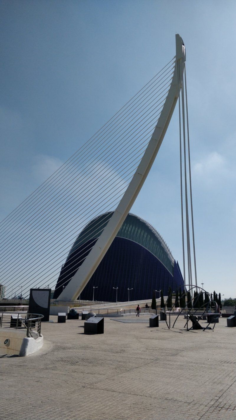
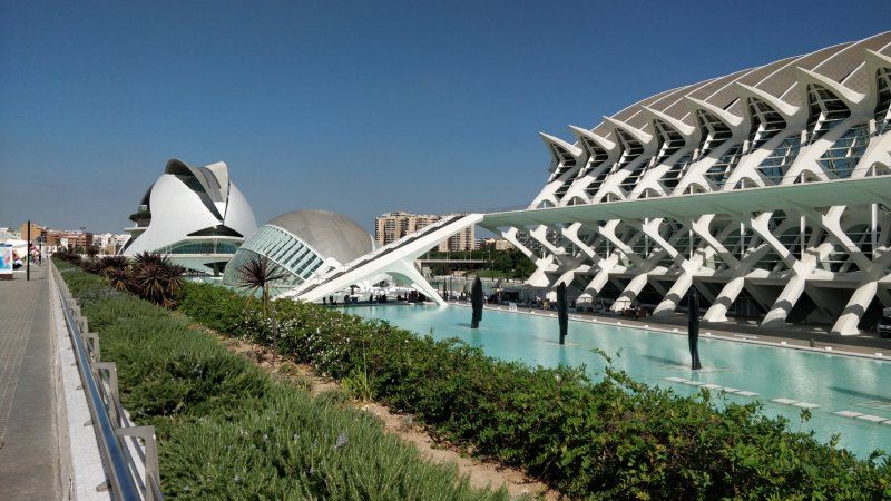
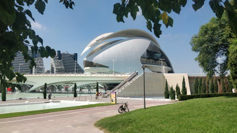
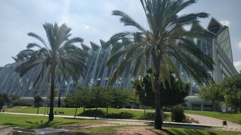
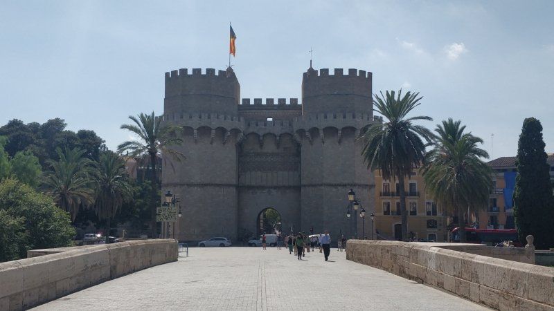
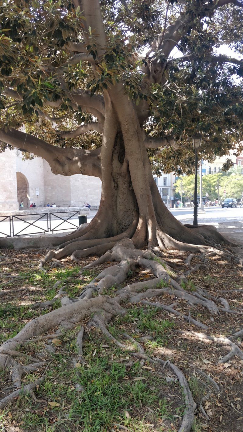
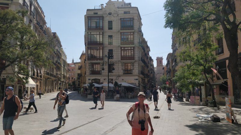
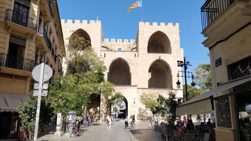
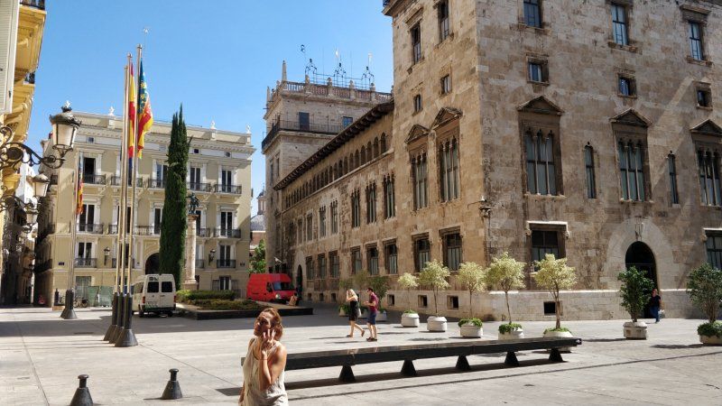
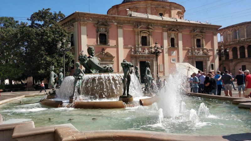
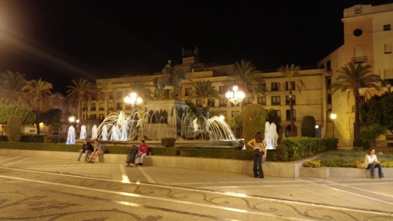
Valencia, Spanien
Enjoy Valencia
Valencia, Provinz Valencia, Spanien
39° 28' 11.7" N 0° 22' 34.6" W
39.4699075 -0.3762881
• Head west on Calle Correos.
• Arrive at Calle Correos. Your destination is on the right.
☍
Distance not available
(Duration not available)
Day
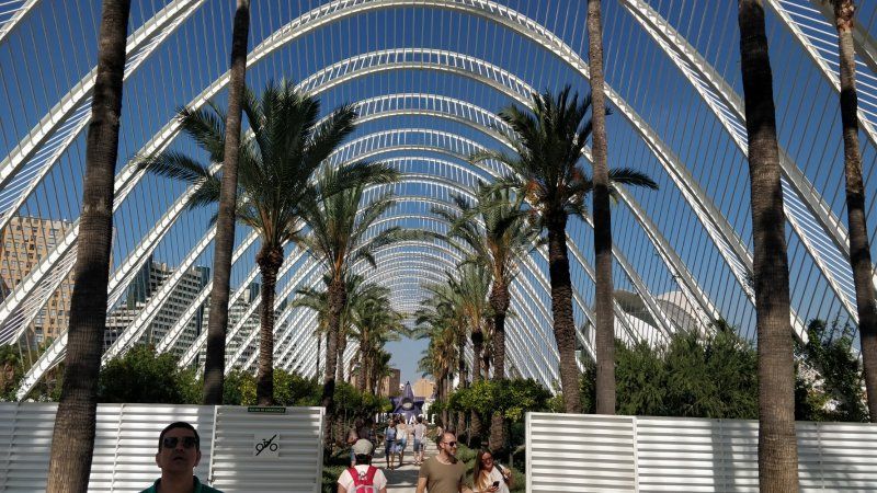
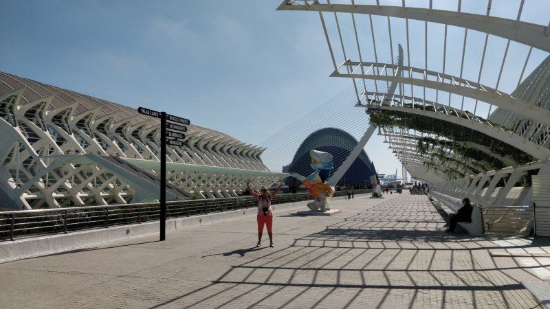
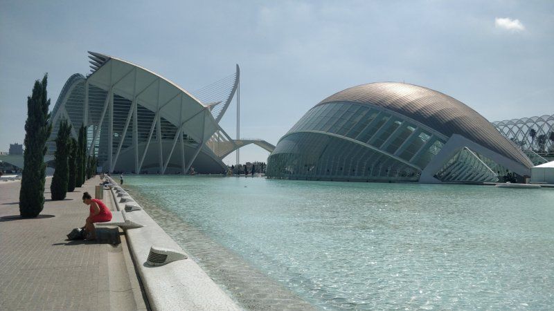
Valencia, Spanien
Enjoy Valencia
Valencia, Provinz Valencia, Spanien
39° 28' 11.7" N 0° 22' 34.6" W
39.4699075 -0.3762881
• Head toward Calle Pérez Pujol on Calle Correos. Go for 89 m.
• Turn right onto Calle Pérez Pujol. Go for 73 m.
• Turn left onto Calle Roger de Lauria. Go for 81 m.
• Turn right onto Calle Pascual y Genís. Go for 143 m.
• Continue on Calle Félix Pizcueta. Go for 272 m.
• Turn right onto Gran Vía Marqués del Turia. Go for 157 m.
• Continue on Gran Vía de las Germanías toward Aeropuerto/Madrid/A-3/CV-35/Llíria/V-31/Alacant/Albacete. Go for 243 m.
• Keep right onto Gran Vía de las Germanías toward Alacant/V-31/Albacete/València Joaquín Sorolla. Go for 164 m.
• Turn left onto Calle de Gibraltar. Go for 34 m.
• Turn slightly right onto Calle Cuba. Go for 253 m.
• Turn right onto Calle Puerto Rico. Go for 167 m.
• Turn right onto Calle Filipinas. Go for 82 m.
• Make a U-Turn onto Calle Filipinas. Go for 506 m.
• Continue on Plaza de Manuel Sanchis Guarner. Go for 69 m.
• Turn right onto Avenida de Ausiàs March. Go for 1.3 km.
• Take the 3rd exit from roundabout onto Avenida de Ausiàs March (V-31) toward V-30/Hospital La Fe/Hospital Urgències/Urgencias. Go for 13.0 km.
• Keep right toward E-15/Alacant/Alicante/AP-7/Gandia/A-38. Go for 868 m.
• Continue on AP-7 (Autopista del Mediterráneo). Go for 92.0 km.
• Take exit 63 toward N-332/Benissa/Teulada/Calp. Go for 1.6 km.
• Continue toward Variante de Benissa/N-332. Go for 34 m.
• Take the 3rd exit from roundabout onto Variante de Benissa (N-332) toward Teulada/Gata de Gorgos/Oliva/València. Go for 2.7 km.
• Take the 1st exit from roundabout onto Avenida de Europa (CV-740). Go for 286 m.
• Take the 2nd exit from roundabout onto Avenida de Europa (CV-740). Go for 276 m.
• Take the 3rd exit from roundabout onto Avenida de Europa (CV-740) toward Centre Urbà/Moraira. Go for 121 m.
• Take the 2nd exit from roundabout onto Avenida del Mediterráneo (CV-740). Go for 1.0 km.
• Take the 1st exit from Plaza Gabriel Miró roundabout onto Carretera de Morarira a Teulada (CV-743) toward Moraira. Go for 2.7 km.
• Pass 4 roundabouts and continue on Carretera de Morarira a Teulada (CV-743). Go for 3.0 km.
• Take the 1st exit from roundabout onto Carretera Moraira-Calpe (CV-746) toward Calp. Go for 1.2 km.
• Turn right onto Camino del Paellero. Go for 449 m.
• Arrive at Camino del Paellero. Your destination is on the right.
☍
122,9 km
(1 hrs. 24 min.)
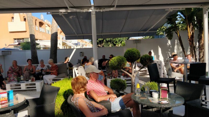
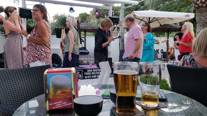
Day
Camping Moraira
Saxo Disco Garden!
Camino del Paellero, 50, 03724 Teulada, Alicante, Spanien
38° 41' 9.6" N 0° 7' 8.9" E
38.6859871 0.1191330
• Head toward Calle Ifach on Camino del Paellero. Go for 449 m.
• Turn right onto Carretera Moraira-Calpe (CV-746). Go for 587 m.
• Take the 2nd exit from roundabout onto Carretera Moraira-Calpe (CV-746). Go for 1.1 km.
• Take the 2nd exit from roundabout onto Avenida de la Marina (CV-746). Go for 6.1 km.
• Continue on Partida Pinamar (CV-746). Go for 235 m.
• Continue on CV-746. Go for 313 m.
• Continue on Partida Pinamar (CV-746). Go for 81 m.
• Continue on Urbanització Pinarmar (CV-746). Go for 240 m.
• Continue on Sector C-Urb. Calalga (CV-746). Go for 207 m.
• Continue on Urbanización Caleta (CV-746). Go for 469 m.
• Take the 2nd exit from roundabout onto Avenida Costa Blanca (CV-746). Go for 270 m.
• Take the 2nd exit from roundabout onto Avenida Costa Blanca (CV-746). Go for 782 m.
• Take the 1st exit from roundabout onto Avenida de la Marina (CV-746). Go for 354 m.
• Take the 1st exit from Rotonda Ti Marguí roundabout onto Avenida de la Marina (CV-746). Go for 300 m.
• Continue on Avenida de los Ejércitos Españoles (CV-746). Go for 377 m.
• Pass 3 roundabouts and continue on Avenida de los Ejércitos Españoles (CV-746). Go for 1.1 km.
• Take the 3rd exit from roundabout onto Calle Málaga toward Golf Ifach. Go for 110 m.
• Pass 2 roundabouts and continue on Calle Málaga. Go for 195 m.
• Turn right onto Avenida Gabriel Miró. Go for 61 m.
• Turn left onto Calle Goleta. Go for 88 m.
• Arrive at Calle Goleta. Your destination is on the left.
☍
13,3 km
( 22 min.)
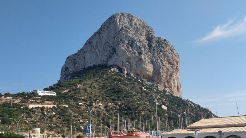
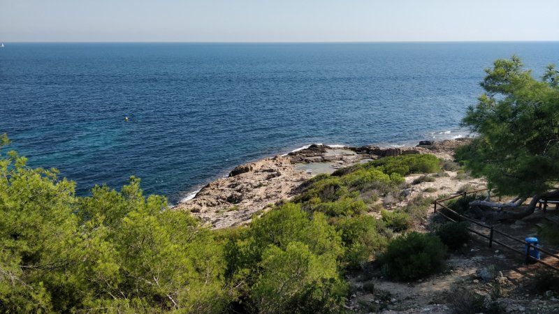
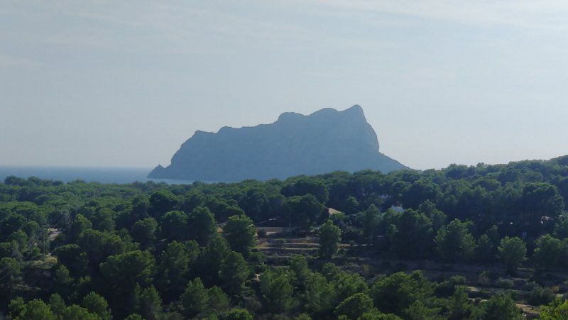
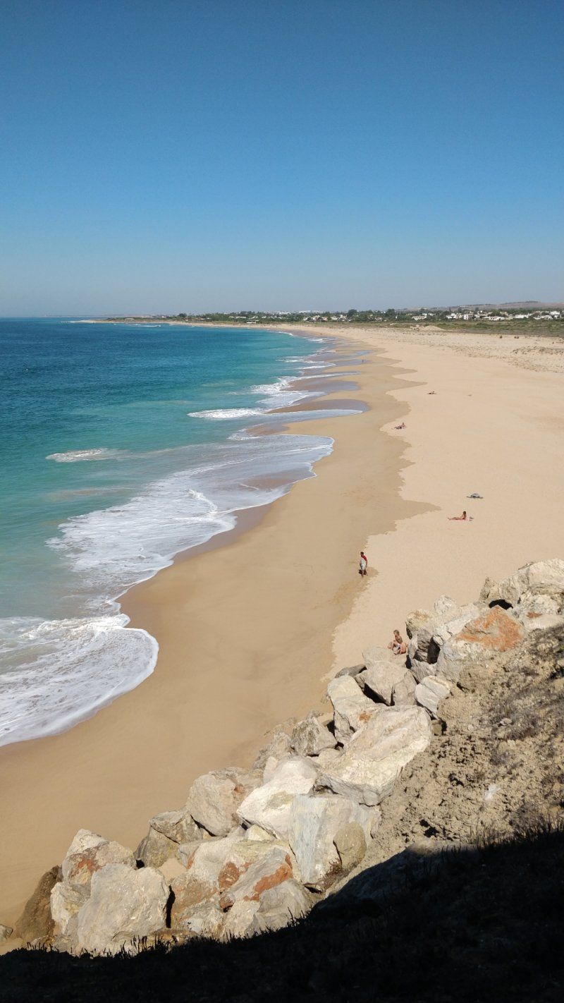
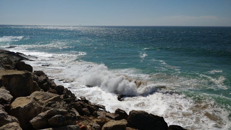
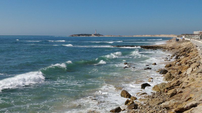
Calpe, Spanien
Bicycle excursion, approx. 25 KM, over the port and "rocks of Calpe", 350 HM
Calp, Provinz Alicante, Spanien
38° 38' 37.1" N 0° 2' 44.5" E
38.6436469 0.0456876
• Head southwest on Calle Goleta.
• Continue on Avenida Masnou. Go for 313 m.
• Continue on Plaza El Salvador. Go for 18 m.
• Continue on Avenida Masnou. Go for 224 m.
• Continue on Calle San Isidro. Go for 7 m.
• Continue on Avenida Masnou. Go for 141 m.
• Turn slightly right toward Avenida Masnou. Go for 23 m.
• Take the 2nd exit from roundabout. Go for 30 m.
• Turn slightly right onto Avenida Masnou. Go for 111 m.
• Take the 2nd exit from Rotonda Refugio del Viento roundabout onto Avenida de la Diputación (CV-746). Go for 209 m.
• Take left ramp onto N-332 toward Alacant/Alicante. Go for 7.2 km.
• Take ramp. Go for 2.1 km.
• Keep left toward Alicante/Alacant. Go for 30 m.
• Take ramp onto AP-7 (Autopista del Mediterráneo). Go for 69.2 km.
• Continue on A-7 (Circunvalación de Alicante). Go for 61.3 km.
• Take exit 138 toward Almería/Granada onto A-7 (Autovía del Mediterráneo). Go for 83.8 km.
• Take exit 651 toward Vélez Rubio/Granada onto A-91. Go for 17.0 km.
• Continue on A-92N. Go for 118 km.
• Take exit 0 toward Guadix/N-324. Go for 976 m.
• Continue on Carretera Baza. Go for 668 m.
• Continue on Avenida Buenos Aires. Go for 1.3 km.
• Turn left onto Avenida Buenos Aires. Go for 7 m.
• Continue on Calle Adolfo Suárez. Go for 45 m.
• Turn right onto Calle Adolfo Suárez. Go for 56 m.
• Arrive at Calle Adolfo Suárez. Your destination is on the left.
☍
362,7 km
(3 hrs. 18 min.)
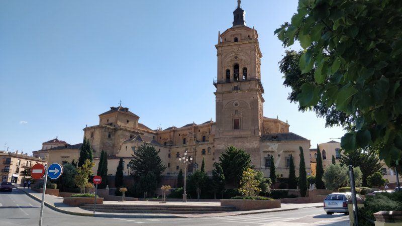
Day
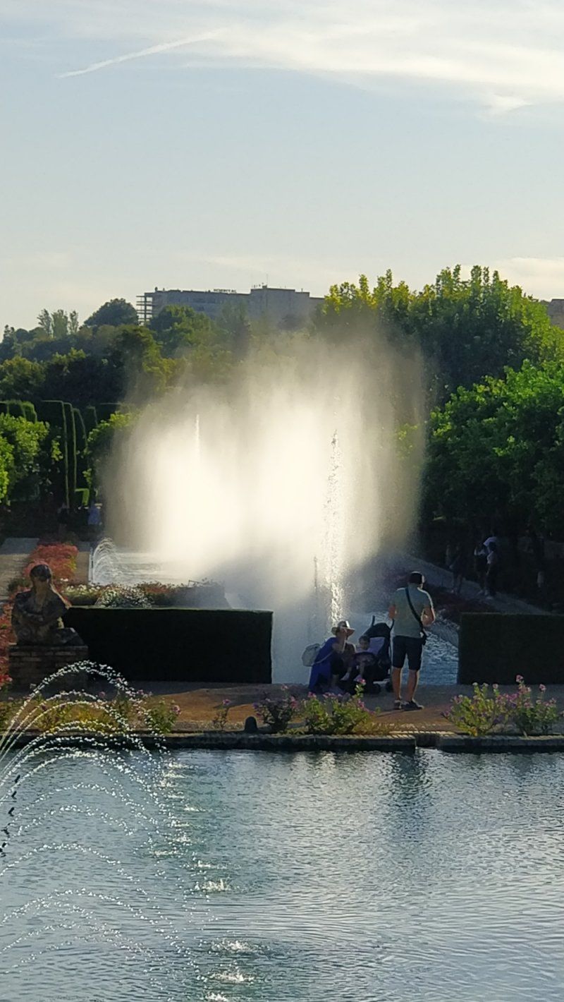
PARKING AUTOCARAVANAS GUADIX, Guadix, Spanien
Parking space with V / E, free, well suited for visiting Guadix
18500 Guadix, Granada, Spanien
37° 18' 13.3" N 3° 8' 1.3" W
37.3036998 -3.1336987
• Head southwest on Calle Adolfo Suárez. Go for 51 m.
• Turn right onto Calle Adolfo Suárez. Go for 51 m.
• Turn right onto Avenida Buenos Aires. Go for 469 m.
• Turn left onto Carretera de Benalúa. Go for 153 m.
• Continue on A-325. Go for 1.5 km.
• Take left ramp onto A-92 toward Granada. Go for 53.3 km.
• Take exit 241A toward Granada onto GR-30 (Autovía de Sierra Nevada). Go for 13.1 km.
• Take exit 16 toward Armilla/Ronda Sur/Sierra Nevada/Alhambra/Hospital Campus de la Salud. Go for 312 m.
• Keep left toward Ronda Sur/Sierra Nevada/Alhambra/Hospital Campus de la Salud. Go for 702 m.
• Continue on A-395 (Ronda Sur). Go for 3.5 km.
• Take exit 5B toward Sierra Nevada/Pinos Genil onto A-395 (Carretera de Sierra Nevada). Go for 1.4 km.
• Continue on A-395. Go for 2.1 km.
• Take ramp toward Cenes de la Vega/Pinos Genil/Güéjar Sierra/Dúdar/Quéntar. Go for 226 m.
• Turn left onto A-4026 toward Cenes de la Vega/Pinos Genil/Quéntar/Dúdar/Güéjar Sierra. Go for 549 m.
• Pass 2 roundabouts and continue on A-4026. Go for 1.6 km.
• Turn right onto A-4026. Go for 508 m.
• Continue on Carretera de Güéjar Sierra Nevada (A-4026). Go for 325 m.
• Turn left onto Carretera Güéjar Sierra (GR-3200). Go for 1.3 km.
• Continue on GR-3200. Go for 4.9 km.
• Continue on Paseo Mirasierra (GR-3200). Go for 124 m.
• Turn right. Go for 96 m.
• Turn right. Go for 34 m.
• Turn right. Go for 38 m.
• Arrive at your destination on the left.
☍
86,3 km
(1 hrs. 2 min.)
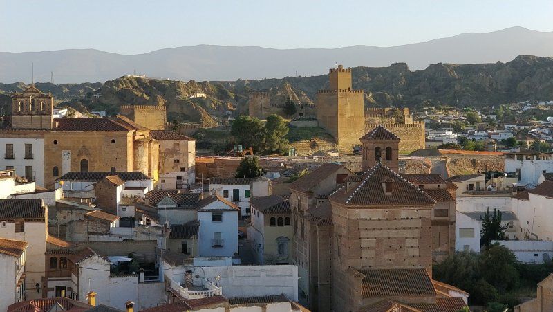
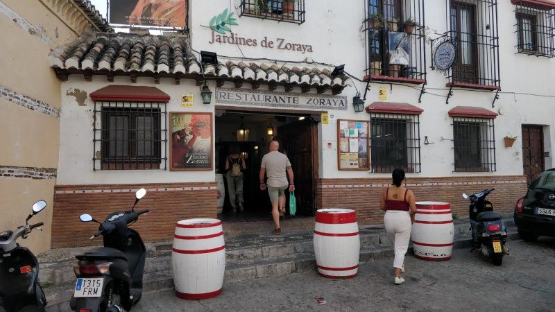
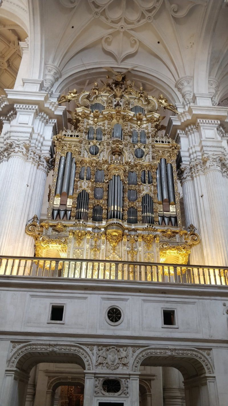
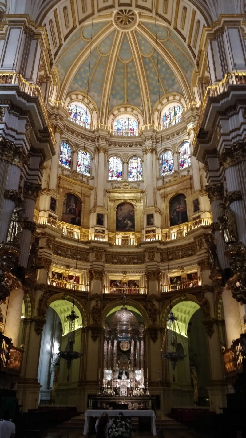
Guadix
Visit the cathedral in the afternoon and the old town in the evening.
Visited the cave houses of Guadix the next morning
Day
Camping las Lomas
Very good for Granada. Very well-tended, albeit older, place. Good little restaurant, supermarket.
ACSI € 20. Bus runs about every hour directly in front of the square to Granada.
Ctra. Güejar-sierra, 18160, Guejar Sierra, Spanien
37° 9' 37.1" N 3° 27' 15.1" W
37.1603000 -3.4542000
• Head south. Go for 38 m.
• Turn left toward Paseo Mirasierra/GR-3200. Go for 165 m.
• Turn right onto Paseo Mirasierra (GR-3200). Go for 1.1 km.
• Continue on Avenida de la Libertad (GR-3200). Go for 97 m.
• Turn slightly right onto Paseo Mirasierra. Go for 194 m.
• Turn right onto Calle Camino de la Estación. Go for 117 m.
• Turn left. Go for 551 m.
• Turn left. Go for 487 m.
• Turn right toward A-4030. Go for 22 m.
• Continue on A-4030. Go for 192 m.
• Turn left onto A-4030. Go for 885 m.
• Turn right. Go for 345 m.
• Turn slightly left. Go for 206 m.
• Turn left. Go for 316 m.
• Turn right. Go for 133 m.
• Turn left. Go for 24 m.
• Turn right. Go for 461 m.
• Turn slightly left. Go for 518 m.
• Turn left. Go for 797 m.
• Turn right toward A-395. Go for 704 m.
• Turn left onto A-395. Go for 8.7 km.
• Turn sharp left onto A-395. Go for 2.5 km.
• Keep right onto A-395. Go for 4.9 km.
• Arrive at your destination on the right.
☍
23,5 km
( 37 min.)
Day
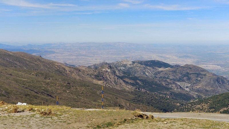
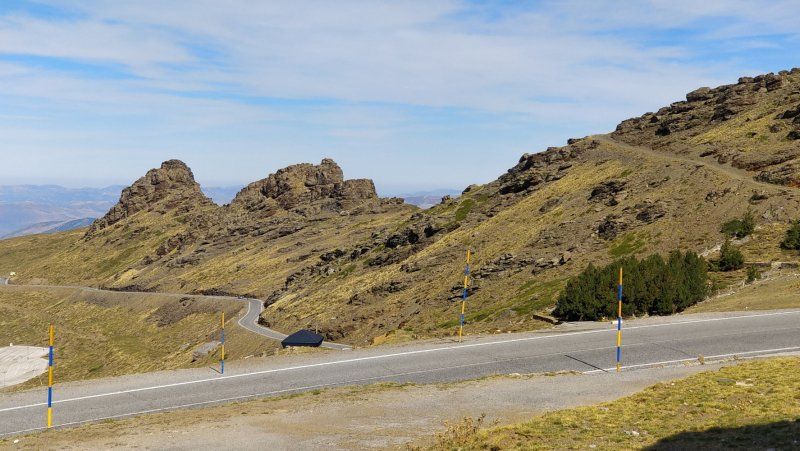
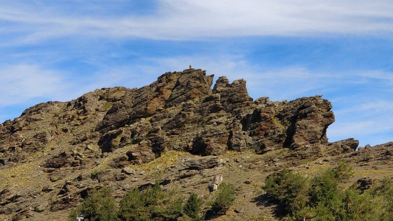
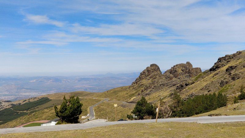
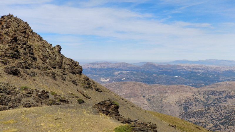
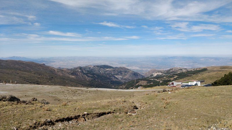
Parkplatz am Pico del Valeta. auf 2500 m Höhe, Spanien
To Pico approx. 11.8 KM easy, 800 m difference in altitude. possibly try with a bike
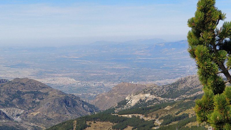
Plaza de Andalucía, 4 Edf. Cetursa, 18196, Granada, Spanien
37° 5' 37.4" N 3° 23' 11.2" W
37.0937359 -3.3864397
• Head west. Go for 41 m.
• Continue on A-395. Go for 2.9 km.
• Turn left onto A-395. Go for 4.4 km.
• Turn sharp right onto A-395. Go for 14.7 km.
• Turn left. Go for 1.4 km.
• Turn right. Go for 1.0 km.
• Turn sharp left toward Calle Urbanizable. Go for 3.6 km.
• Continue on Calle Urbanizable. Go for 321 m.
• Turn left onto Camino de los Cahorros. Go for 753 m.
• Turn left onto Camino de los Cahorros. Go for 19 m.
• Arrive at Camino de los Cahorros.
☍
29,2 km
( 41 min.)
Day
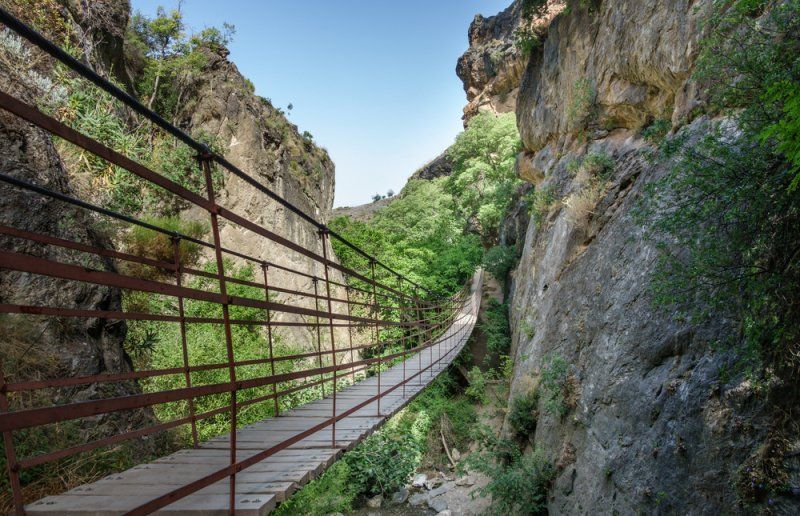
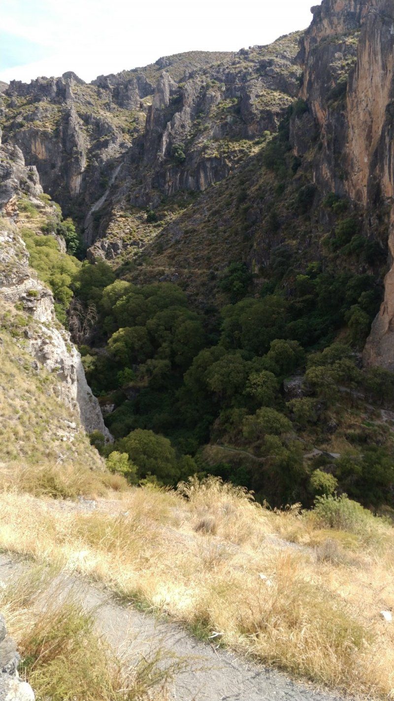
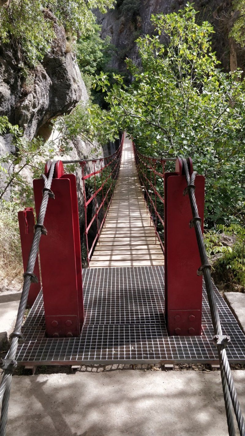
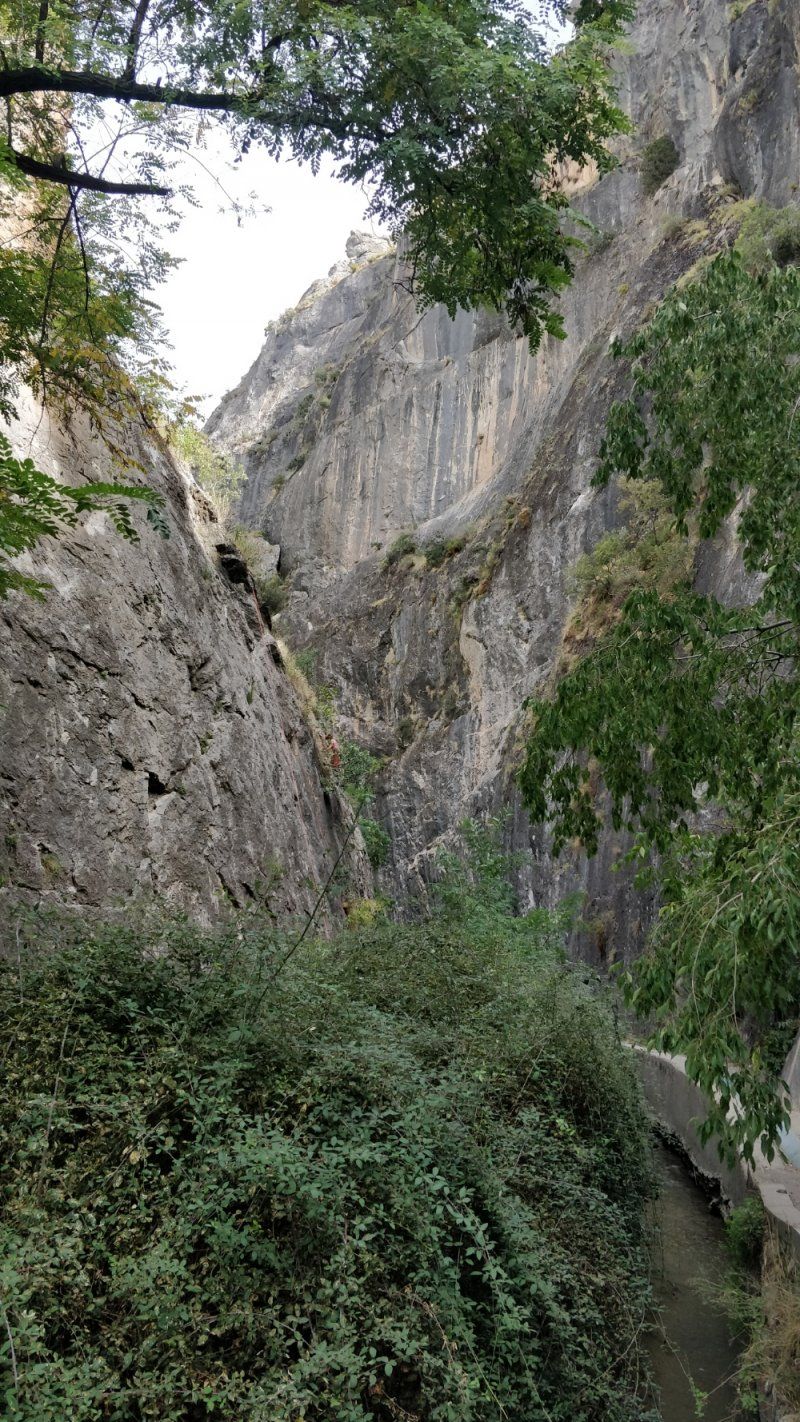
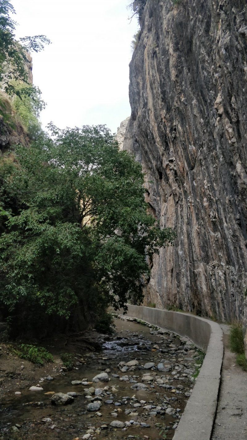
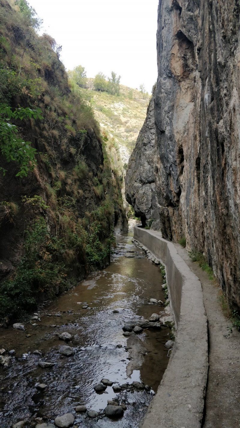
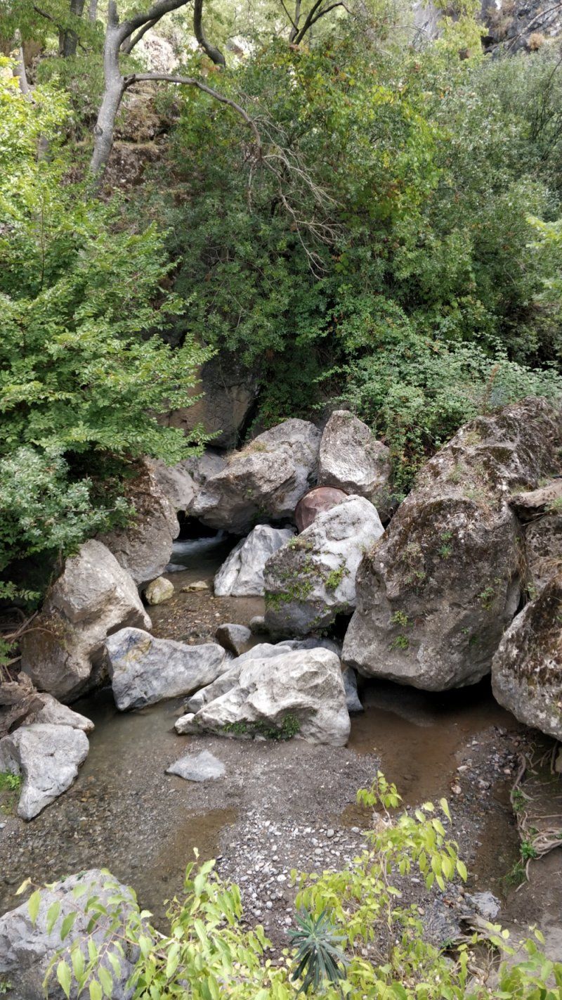
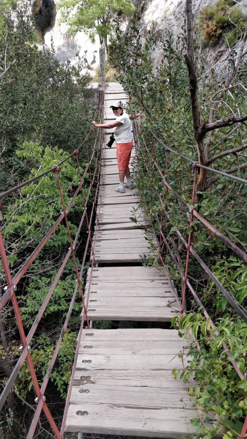
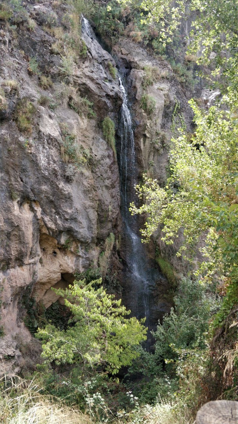
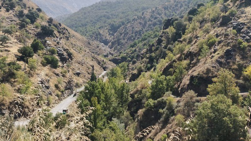
Parkplatz Mirador de los Cahorros, Monachil, Spanien
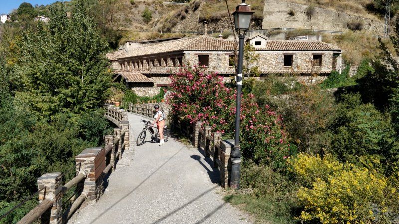
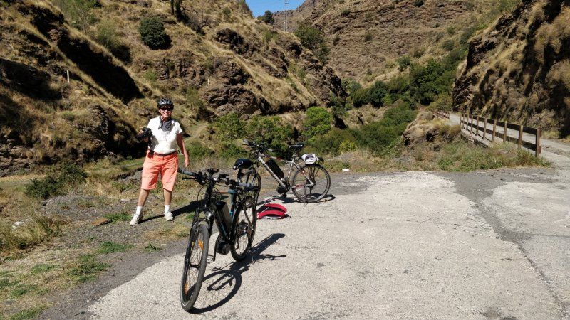
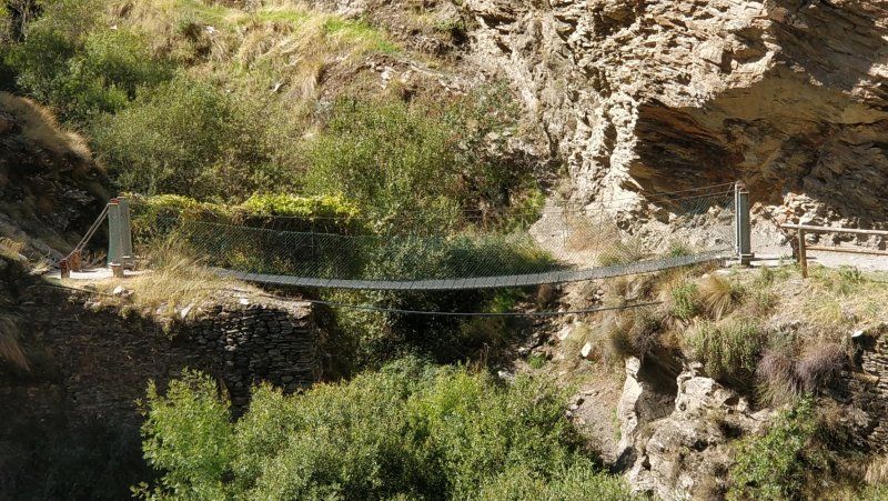
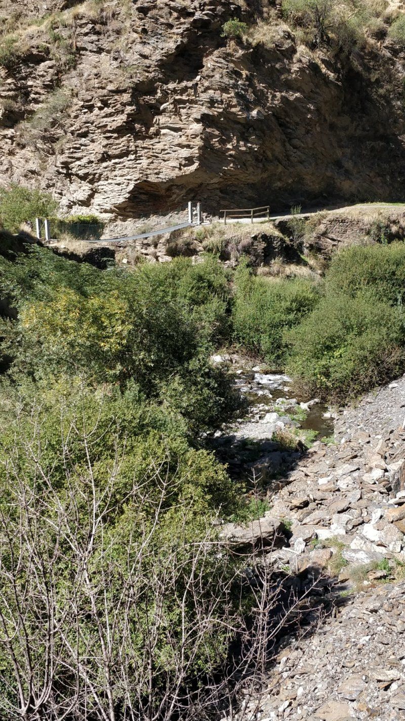
Los Cahorros is an area that belongs to the Sierra Nevada, is located near the Monachil River, and from which you have a great view of the gorges. You can take a tour in this area, the most famous of which is Cahorros Altos, the starting point of which is 5 km east of the village of Monachil.
Los Cahorros, 18193 Monachil, Granada, Spanien
37° 7' 44.7" N 3° 31' 25.1" W
37.1290829 -3.5236288
• Head southwest on Camino de los Cahorros. Go for 19 m.
• Turn right onto Camino de los Cahorros. Go for 753 m.
• Turn slightly left onto Calle Urbanizable. Go for 670 m.
• Continue on Calle Río. Go for 112 m.
• Continue on Calle Cuevas. Go for 19 m.
• Continue on Paseo Río. Go for 203 m.
• Continue on Calle Río. Go for 195 m.
• Continue on Calle Carlos Carreras. Go for 143 m.
• Turn left onto Calle Emilio Aragón. Go for 35 m.
• Turn right onto Calle Emilio Aragón. Go for 191 m.
• Turn slightly left onto GR-3202. Go for 802 m.
• Continue on GR-3202. Go for 40 m.
• Turn slightly right onto Colinas Bermejas (GR-3202). Go for 143 m.
• Continue on GR-3202. Go for 342 m.
• Continue on Carretera a Monachil. Go for 29 m.
• Continue on Calle Granada. Go for 11 m.
• Turn left toward Calle Madrid. Go for 17 m.
• Turn right onto Calle Madrid. Go for 211 m.
• Take the 1st exit from roundabout onto Avenida Libertad. Go for 148 m.
• Turn slightly left onto Calle Granada. Go for 1.1 km.
• Take the 2nd exit from roundabout onto A-4028. Go for 1.1 km.
• Take the 2nd exit from roundabout onto Carretera de Monachil (A-4028) toward Ronda Sur/A-4208/Granada. Go for 810 m.
• Continue on A-4028. Go for 12 m.
• Continue on Carretera de Monachil (A-4028). Go for 364 m.
• Take the 2nd exit from roundabout. Go for 159 m.
• Take the 4th exit from roundabout onto A-395 (Ronda Sur) toward E-902/A-44/Jaén/Motril. Go for 1.5 km.
• Take exit 1B toward Jaén/N-432/A-92/A-44 onto GR-30 (Autovía de Sierra Nevada). Go for 3.9 km.
• Take exit 12 toward Centro Ciudad/Méndez Núñez. Go for 317 m.
• Take the 2nd exit from roundabout onto Calle de Méndez Núñez. Go for 417 m.
• Continue on Avenida de Fuente Nueva. Go for 473 m.
• Continue on Calle del Doctor Severo Ochoa. Go for 353 m.
• Continue on Avenida de Madrid. Go for 305 m.
• Turn right onto Plaza de San Isidro. Go for 37 m.
• Continue on Avenida de Murcia. Go for 328 m.
• Continue on Carretera de Murcia. Go for 545 m.
• Take the 2nd exit from roundabout onto Carretera de Murcia. Go for 819 m.
• Turn right onto Calle de Pagés toward Barrio Albayzín/Barrio Sacromonte/Mirador de San Nicolás. Go for 57 m.
• Turn left onto Calle San Gregorio Alto. Go for 113 m.
• Keep right onto Calle San Gregorio Alto. Go for 137 m.
• Continue on Placeta de la Cruz de Piedra. Go for 15 m.
• Turn slightly right onto Carril de San Miguel. Go for 145 m.
• Turn left onto Carril de San Miguel. Go for 12 m.
• Arrive at Carril de San Miguel. Your destination is on the right.
☍
17,2 km
( 32 min.)
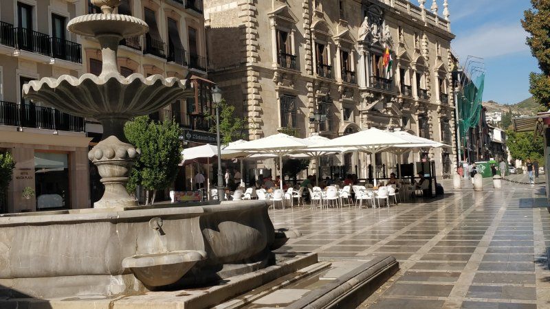
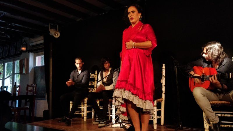
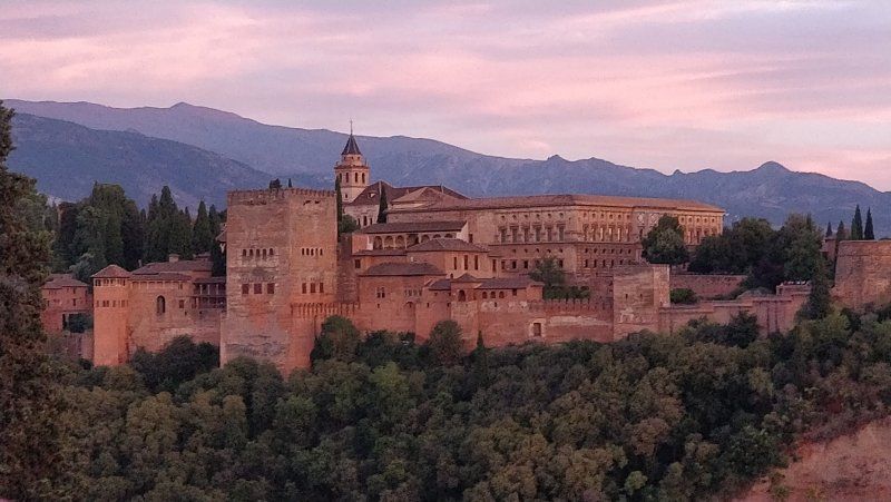
Albaicín, Granada, Spanien
Old quarter of Granada
Albaicín, Granada, Provinz Granada, Spanien
37° 11' 7.7" N 3° 35' 24.5" W
37.1854794 -3.5901282
• Head southwest on Carril de San Miguel. Go for 12 m.
• Turn right onto Carril de San Miguel. Go for 145 m.
• Turn slightly left onto Placeta de la Cruz de Piedra. Go for 6 m.
• Turn sharp right onto Calle Cruz de Piedra del Albaicín. Go for 116 m.
• Turn left onto Callejón Fajalauza. Go for 55 m.
• Turn slightly left onto Calle Puerta de Fajalauza. Go for 98 m.
• Continue on Camino de San Antonio. Go for 355 m.
• Take the 3rd exit from roundabout onto Cuesta San Antonio. Go for 410 m.
• Turn left onto Calle Real de Cartuja. Go for 87 m.
• Continue on Calle Acera de San Ildefonso. Go for 31 m.
• Continue on Avenida del Hospicio. Go for 218 m.
• Continue on Avenida de la Constitución. Go for 39 m.
• Take the 1st exit from roundabout onto Avenida de la Constitución. Go for 374 m.
• Turn right onto Calle Vidrio de San Lázaro. Go for 88 m.
• Turn right onto Calle Emilio Durán Durán. Go for 82 m.
• Turn right onto Avenida de Madrid. Go for 109 m.
• Continue on Calle del Doctor Severo Ochoa. Go for 369 m.
• Continue on Avenida de Fuente Nueva. Go for 473 m.
• Continue on Calle de Méndez Núñez. Go for 346 m.
• Take the 5th exit from roundabout toward Sierra Nevada/Alhambra. Go for 239 m.
• Take ramp onto GR-30 (Carretera de Circunvalación). Go for 3.5 km.
• Take exit 16 toward Armilla/Ronda Sur/Sierra Nevada/Alhambra/Hospital Campus de la Salud. Go for 312 m.
• Keep left toward Ronda Sur/Sierra Nevada/Alhambra/Hospital Campus de la Salud. Go for 702 m.
• Continue on A-395 (Ronda Sur). Go for 3.5 km.
• Take exit 5B toward Sierra Nevada/Pinos Genil onto A-395 (Carretera de Sierra Nevada). Go for 1.4 km.
• Continue on A-395. Go for 2.1 km.
• Take ramp toward Cenes de la Vega/Pinos Genil/Güéjar Sierra/Dúdar/Quéntar. Go for 226 m.
• Turn left onto A-4026 toward Cenes de la Vega/Pinos Genil/Quéntar/Dúdar/Güéjar Sierra. Go for 549 m.
• Pass 2 roundabouts and continue on A-4026. Go for 1.6 km.
• Turn right onto A-4026. Go for 508 m.
• Continue on Carretera de Güéjar Sierra Nevada (A-4026). Go for 325 m.
• Turn left onto Carretera Güéjar Sierra (GR-3200). Go for 1.3 km.
• Continue on GR-3200. Go for 4.9 km.
• Continue on Paseo Mirasierra (GR-3200). Go for 1.3 km.
• Continue on Avenida de la Libertad (GR-3200). Go for 328 m.
• Continue on Calle Ventorrillo (SE-53). Go for 120 m.
• Continue on Avenida Duque San Pedro (SE-53). Go for 8 m.
• Take the 1st exit from roundabout onto Avenida Duque San Pedro (SE-53). Go for 45 m.
• Turn slightly left onto Avenida Duque San Pedro (SE-53). Go for 155 m.
• Continue on Plaza Mayor. Go for 33 m.
• Turn right onto Plaza Mayor. Go for 25 m.
• Continue on Calle Genil. Go for 183 m.
• Turn right onto Calle Genil (SE-53). Go for 10 m.
• Continue on Calle Maitena (SE-53). Go for 460 m.
• Continue on SE-53. Go for 600 m.
• Turn slightly left toward Carretera Estación de Maitena. Go for 236 m.
• Continue on Carretera Estación de Maitena. Go for 1.4 km.
• Arrive at Carretera Estación de Maitena.
☍
29,4 km
( 44 min.)
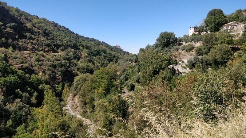
Vereda de la Estrella, mit dem Fahrrad ab Camping Las Lomas
The Vereda de la Estrella is another breathtaking route that has existed since 1890 when it was used as a link between the mines. The starting point of this fascinating route is in the Barranco de San Juan, a fantastic river valley, where the last stop of the Sierra Railway used to be.
Vía Verde de Sierra Nevada, Vereda de La Estrella, 18160, Granada, Spanien
37° 8' 57.5" N 3° 24' 58.4" W
37.1492969 -3.4162115
• Head northeast on Carretera Estación de Maitena. Go for 2.1 km.
• Continue on SE-53. Go for 78 m.
• Continue on Calle Maitena (SE-53). Go for 271 m.
• Turn left onto Calle Era Moraleda. Go for 207 m.
• Continue on Camino del Castañal. Go for 152 m.
• Continue on Calle Hermanas Quirós. Go for 254 m.
• Continue on Avenida Duque San Pedro (SE-53). Go for 22 m.
• Take the 2nd exit from roundabout onto Avenida Duque San Pedro (SE-53). Go for 41 m.
• Continue on Calle Ventorrillo (SE-53). Go for 120 m.
• Continue on Avenida de la Libertad (SE-53). Go for 328 m.
• Continue on Paseo Mirasierra (GR-3200). Go for 452 m.
• Turn slightly left onto Paseo Mirasierra (GR-3200). Go for 819 m.
• Continue on GR-3200. Go for 4.9 km.
• Continue on Carretera Güéjar Sierra (GR-3200). Go for 1.3 km.
• Turn right onto Carretera de Güéjar Sierra Nevada (A-4026). Go for 325 m.
• Continue on A-4026. Go for 1.7 km.
• Take the 2nd exit from roundabout onto A-4026. Go for 293 m.
• Take the 2nd exit from roundabout onto A-4026 toward Sierra Nevada/A-395/Ronda Sur/A-395. Go for 522 m.
• Turn right and take ramp onto A-395 toward Granada/Ronda Sur. Go for 2.3 km.
• Continue on Carretera de Sierra Nevada (A-395). Go for 1.0 km.
• Take ramp onto A-395 (Ronda Sur). Go for 4.0 km.
• Take exit 1B toward Jaén/N-432/A-92/A-44 onto GR-30 (Autovía de Sierra Nevada). Go for 7.1 km.
• Take exit 9 toward Málaga/A-92G/Sevilla/Córdoba/N-432/Aeropuerto. Go for 271 m.
• Take the 3rd exit from roundabout onto Avenida de Andalucía (N-432) toward A-92G/Málaga/Sevilla/Córdoba/Aeropuerto. Go for 1.1 km.
• Keep left onto Carretera de Córdoba (N-432) toward A-92G/Málaga/Sevilla/Aeropuerto. Go for 398 m.
• Continue on A-92G. Go for 9.0 km.
• Take left ramp onto A-92 toward Málaga/Sevilla. Go for 77.3 km.
• Take exit 152 toward Córdoba onto A-45 (Autovía de Málaga). Go for 99.8 km.
• Take exit 0 toward Centro Ciudad de Córdoba/Madrid onto A-4 (Autovía del Sur). Go for 2.2 km.
• Take exit 406 toward Córdoba Oeste y Sur/Hospital/Granada. Go for 1.5 km.
• Keep left toward A-3050/Córdoba Oeste/La Torrecilla/Hospital. Go for 504 m.
• Continue on Ronda Oeste. Go for 1.3 km.
• Take ramp toward avda. Menéndez Pidal/Zona Universitaria. Go for 331 m.
• Continue on Avenida de Menéndez Pidal. Go for 144 m.
• Take the 1st exit from Glorieta Voluntaria Isabel García roundabout onto Avenida de Menéndez Pidal. Go for 1.3 km.
• Turn left. Go for 42 m.
• Turn right. Go for 30 m.
• Turn right. Go for 63 m.
• Arrive at your destination on the right.
☍
223,5 km
(2 hrs. 19 min.)
Day
Aire de Cordoba, Calle 4, Córdoba, Spanien
Conveniently located parking space for a visit to Cordoba, less than 500 m from the old town
37°52'28. 4°47'11., Calle 4, 4, 14014 Córdoba, Spanien
37° 52' 28.4" N 4° 47' 11.4" W
37.8745520 -4.7864970
• Head northeast.
• Turn right onto Calle Escritora Rosa Chacel. Go for 12 m.
• Turn left onto Avenida de Menéndez Pidal. Go for 36 m.
• Turn left onto Avenida Vallellano toward Centro Ciudad. Go for 554 m.
• Turn slightly right onto Glorieta Cruz Roja. Go for 87 m.
• Take the 1st exit from roundabout onto Glorieta Cruz Roja toward Centro Ciudad. Go for 131 m.
• Continue on Paseo de la Victoria. Go for 554 m.
• Turn slightly right onto Avenida Ronda de los Tejares toward Centro Ciudad/Plaza de Colón. Go for 390 m.
• Turn right onto Calle Cruz Conde. Go for 421 m.
• Turn left onto Calle Jesús María. Go for 70 m.
• Turn right onto Calle Diego de León. Go for 19 m.
• Turn left onto Calle Claudio Marcelo. Go for 194 m.
• Turn right onto Calle María Cristina. Go for 42 m.
• Continue on Calle Ambrosio de Morales. Go for 217 m.
• Continue on Calle Séneca. Go for 29 m.
• Turn right onto Calle Antonio del Castillo. Go for 113 m.
• Turn left onto Calle Horno del Cristo. Go for 85 m.
• Turn right onto Calle Rey Heredia. Go for 28 m.
• Turn left onto Calle Encarnación. Go for 128 m.
• Turn left onto Calle Magistral González Francés. Go for 109 m.
• Arrive at Calle Magistral González Francés. Your destination is on the right.
☍
3,2 km
( 10 min.)
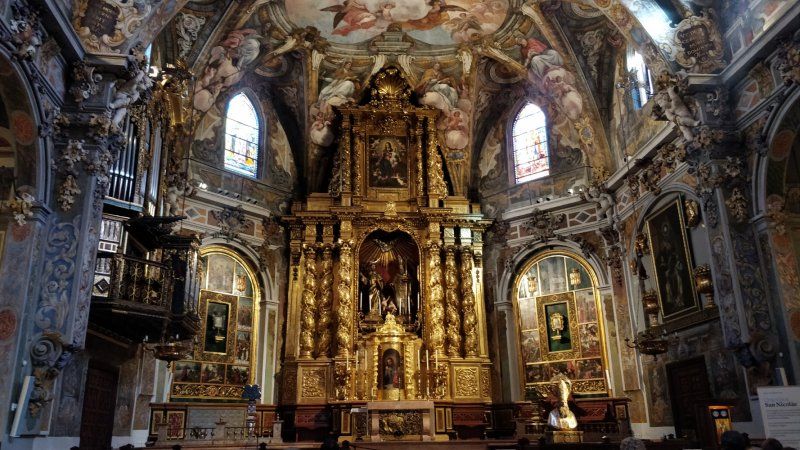
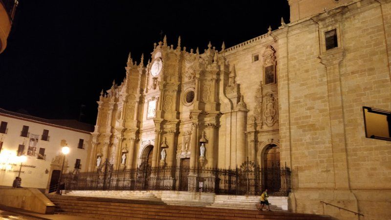
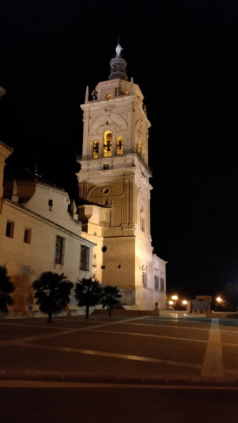
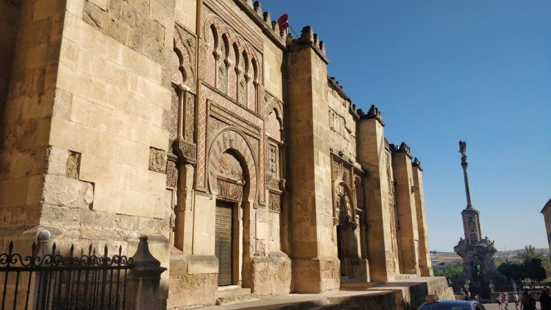
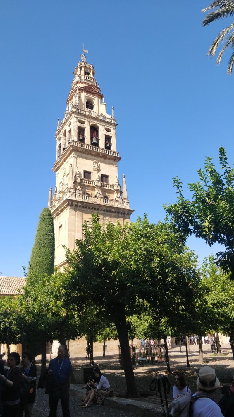
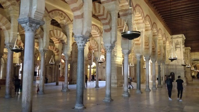
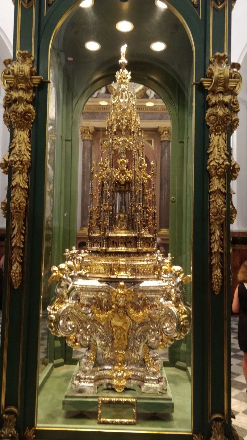
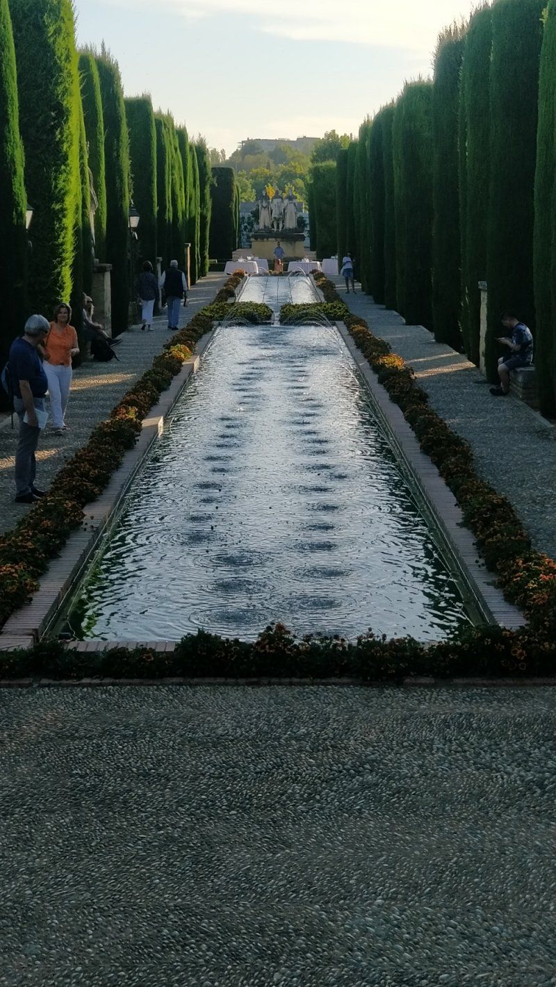
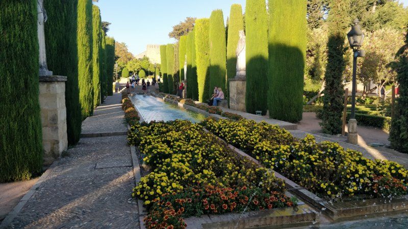
Mezquita-Catedral de Córdoba, Calle Cardenal Herrero, Córdoba, Spanien
Old town and cathedral
Calle Cardenal Herrero, 1, 14003 Córdoba, Spanien
37° 52' 44.1" N 4° 46' 45.8" W
37.8789056 -4.7793869
• Head toward Calle Corregidor Luis de la Cerda on Calle Magistral González Francés. Go for 76 m.
• Turn left onto Calle Cardenal González. Go for 299 m.
• Turn right onto Plaza Cruz del Rastro. Go for 44 m.
• Continue on Puente de Miraflores. Go for 223 m.
• Continue on Calle Carmen Olmedo Checa. Go for 405 m.
• Turn left onto Avenida Campo de la Verdad. Go for 668 m.
• Turn right toward N-4/Madrid/Sevilla/N-432/Granada. Go for 42 m.
• Turn right onto Avenida Compositor Rafael Castro toward N-4/Madrid/Sevilla/N-432/Granada. Go for 126 m.
• Take ramp onto A-4 (Autovía Ronda de Córdoba) toward Granada/N-432/Sevilla/Málaga. Go for 132 km.
• Continue on Nudo Gota de Leche toward Centro Ciudad Sevilla/avd. Kansas City/Estación de Santa Justa. Go for 392 m.
• Take the exit toward Ronda Urbana Norte/Sevilla Norte/E-803/Mérida/A-66 onto SE-30 (Nudo Gota de Leche). Go for 4.2 km.
• Take the 2nd exit from Glorieta Olímpica roundabout onto SE-30 (Puente El Alamillo) toward Huelva/E-1/A-49/Mérida/E-803/N-630/Isla de la Cartuja/Estadio Olímpico. Go for 3.7 km.
• Take exit 20B toward Santiponce/Itálica onto N-630 (Ruta de la Plata). Go for 2.9 km.
• Take the 1st exit from roundabout onto Ruta de la Plata (N-630) toward Merida/E-803. Go for 621 m.
• Take the 2nd exit from roundabout onto Avenida Rocío Vega toward Santiponce. Go for 61 m.
• Turn left onto Calle Feria. Go for 70 m.
• Arrive at Calle Feria.
☍
146,3 km
(1 hrs. 29 min.)
Day
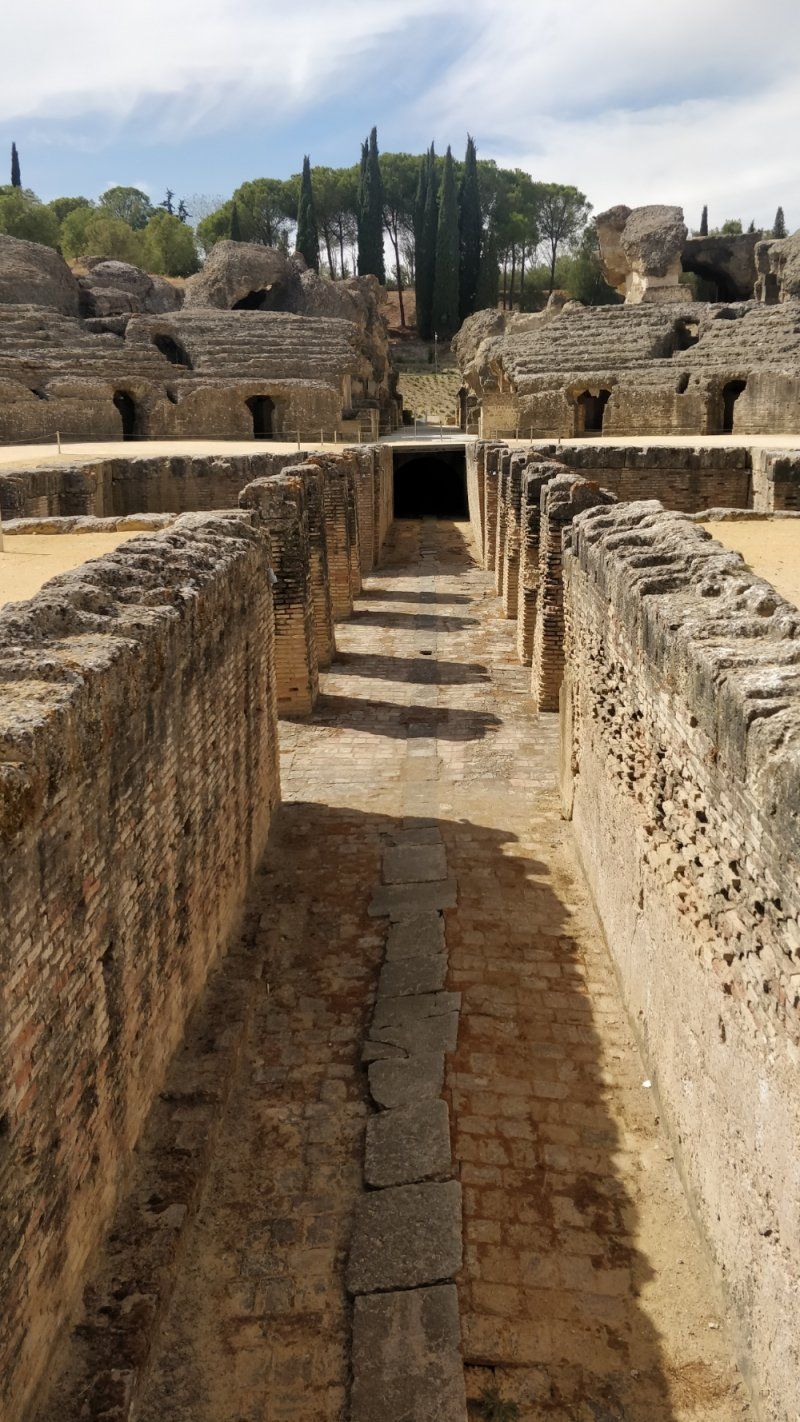
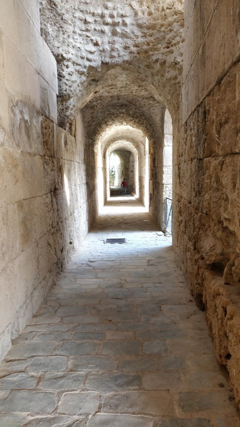
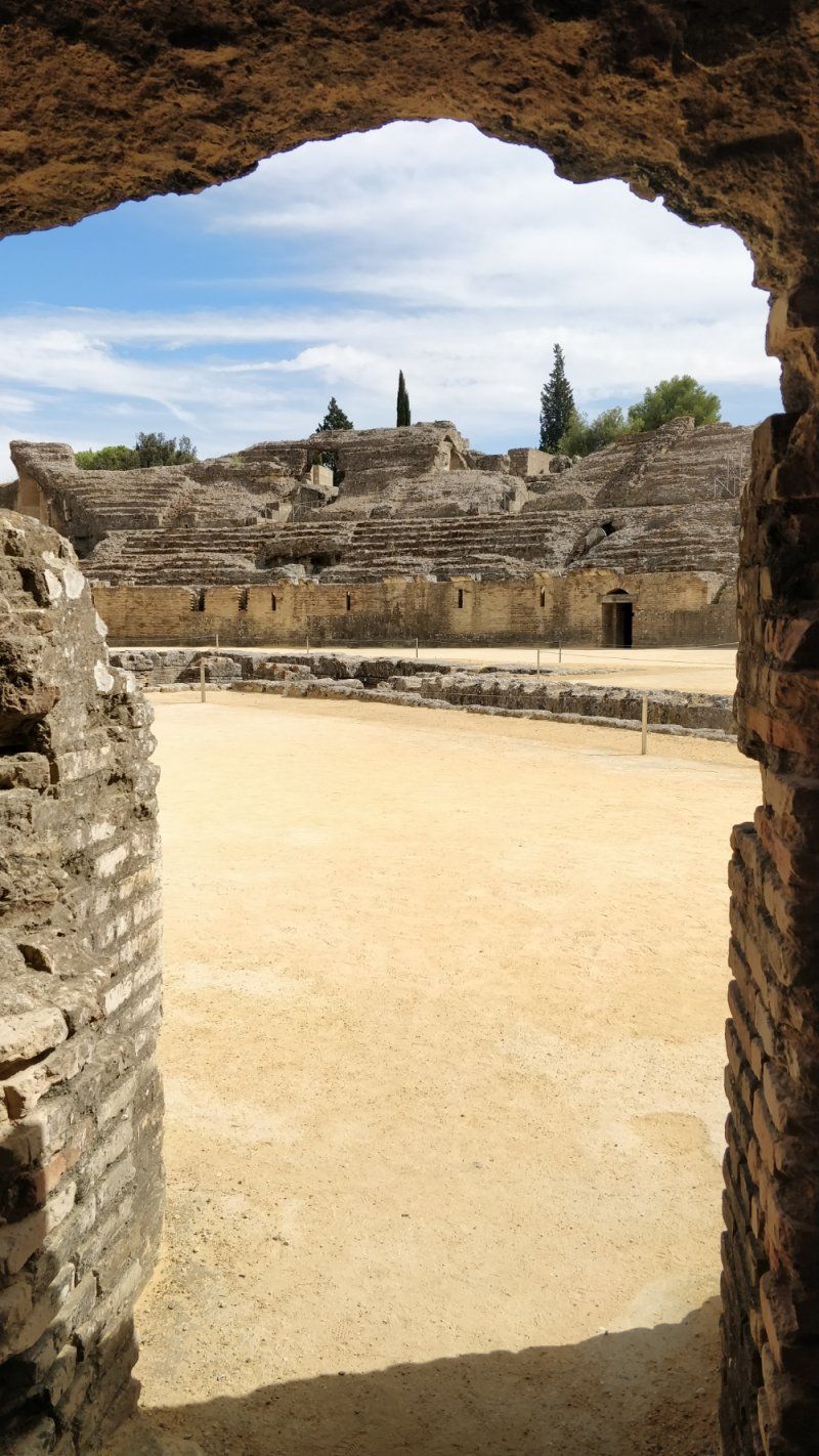
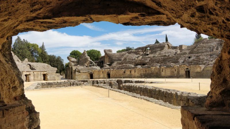
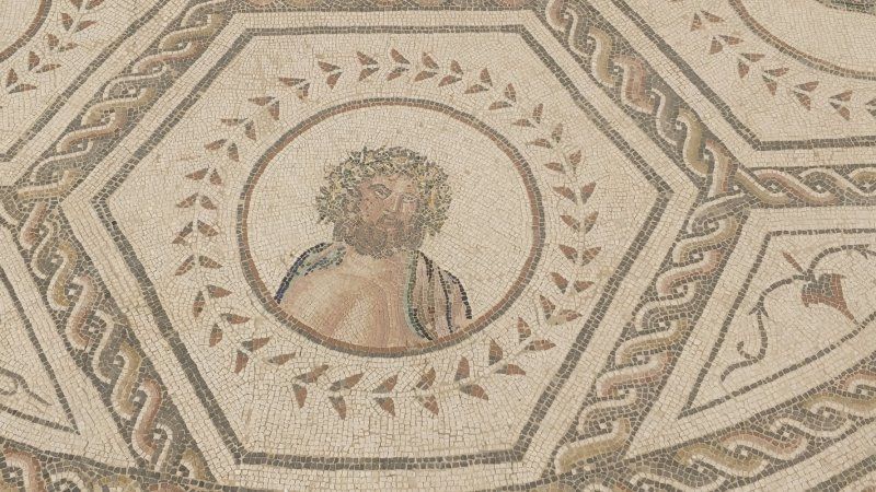
Italica, Amphitheater und , Spanien
Drittgrößtes Amphitheater im römischen Reich und Theatro Romano. Parkplatz mit Übernachtungsmöglichkeit
Calle la Feria, 2D, 41970 Santiponce, Sevilla, Spanien
37° 26' 30.2" N 6° 2' 17.6" W
37.4417318 -6.0382341
• Head south on Calle Feria. Go for 91 m.
• Continue toward Calle Bécquer. Go for 95 m.
• Turn left onto Calle Bécquer. Go for 151 m.
• Turn left onto Lugar La Encinilla. Go for 17 m.
• Turn right onto Ruta de la Plata (N-630). Go for 207 m.
• Take the 2nd exit from roundabout onto Ruta de la Plata (N-630) toward Sevilla/E-803. Go for 2.2 km.
• Continue on N-630. Go for 649 m.
• Take left ramp onto A-66 (Autovía de la Plata) toward Huelva/A-49/E-5/Cádiz/A-4. Go for 9.9 km.
• Take exit 9A toward Cádiz onto A-4 (Autovía del Sur). Go for 13.3 km.
• Continue on AP-4 (Autopista del Sur). Go for 40.2 km.
• Take exit 53 toward El Cuervo de Sevilla onto N-4. Go for 21.6 km.
• Continue on A-4 (Autovía del Sur). Go for 4.5 km.
• Take exit 632 toward Jerez (Norte)/Guadalcacín. Go for 268 m.
• Take the 3rd exit from roundabout toward N-4A/Centro Ciudad Jerez/Guadalcacín. Go for 265 m.
• Take the 1st exit from roundabout onto N-4 toward N-4A/Centro Ciudad Jerez. Go for 901 m.
• Take the 1st exit from roundabout onto Avenida Tío Pepe (N-4) toward Jerez de la Frontera/N-4A/Jerez. Go for 538 m.
• Arrive at Avenida Tío Pepe (N-4).
☍
94,9 km
( 58 min.)
Day
Stellplatz La Morada del Sur am Rande von Jerez de la Frontera, Spanien
Stellplatz bei WoMo Händler, mit allem.
5 Km in die Innenstadt.
Bus direkt vor dem Platz, Taxi in die Stadt zwischen 7 und 8 €
Sehr schöner Abend in Jerez, gemütliche Kneipen und Restaurants
Ctra. Madrid-Cádiz, 635, 11407 Jerez de la Frontera, Cádiz, Spanien
36° 42' 48.1" N 6° 6' 33.2" W
36.7133578 -6.1092269
• Head southwest on Avenida Tío Pepe (N-4). Go for 85 m.
• Take the 3rd exit from roundabout onto Avenida Tío Pepe (N-4). Go for 663 m.
• Take the 2nd exit from roundabout onto N-4 toward Aeropuerto/Sevilla/A-4. Go for 937 m.
• Take the 5th exit from roundabout toward A-4/Cádiz. Go for 384 m.
• Take the 2nd exit from roundabout onto A-4 (Autovía del Sur) toward Jerez (Sur)/Cádiz. Go for 22.8 km.
• Take exit 655 onto CA-37. Go for 4.1 km.
• Take the exit toward Cádiz onto CA-35. Go for 8.1 km.
• Continue on Avenida Cortes de Cádiz. Go for 645 m.
• Take the 1st exit from Glorieta de Jesús Gargallo roundabout onto Avenida Astilleros. Go for 1.1 km.
• Turn right onto Avenida del Puerto. Go for 90 m.
• Turn sharp left onto Carretera Cuesta de las Calesas. Go for 343 m.
• Continue on Calle Santa Elena. Go for 107 m.
• Turn right onto Calle Murallas de San Roque. Go for 89 m.
• Take the 1st exit from roundabout onto Calle Murallas de San Roque. Go for 31 m.
• Continue on Calle Concepción Arenal. Go for 190 m.
• Continue on Avenida Campo del Sur. Go for 1.3 km.
• Continue on Avenida Duque de Nájera. Go for 458 m.
• Turn left onto Calle Campo de las Balas. Go for 261 m.
• Turn left. Go for 22 m.
• Arrive at your destination on the right.
☍
41,6 km
( 32 min.)
Day
Jerez de la Frontera
Very nice, quiet city. Lively old town with quaint pubs and restaurants
Day
Day
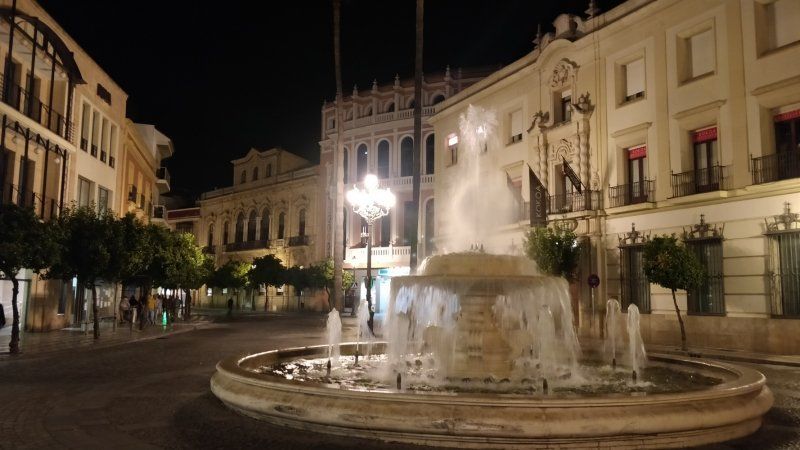
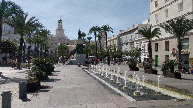
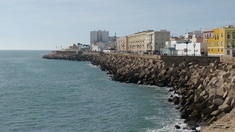
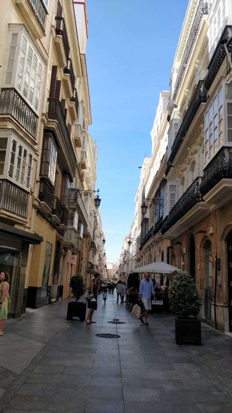
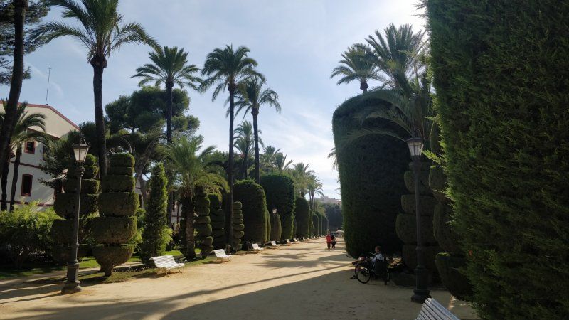
Cádiz, Spanien, Wohnmobilstellplatz am Castle
Dieses Mal hat uns Cadiz nicht soo gut gefallen wie bei vorhergehenden Besuchen, daher sind wir Abends weiter gefahren
Calle Campo de las Balas, 5, 11002 Cádiz, Spanien
36° 32' 4.6" N 6° 18' 24.3" W
36.5346207 -6.3067553
• Head toward Calle Campo de las Balas. Go for 22 m.
• Continue on Calle Campo de las Balas. Go for 104 m.
• Turn right onto Avenida Duque de Nájera. Go for 576 m.
• Continue on Avenida Campo del Sur. Go for 1.3 km.
• Continue on Calle Concepción Arenal. Go for 190 m.
• Continue on Calle Murallas de San Roque. Go for 9 m.
• Take the 2nd exit from roundabout onto Calle Murallas de San Roque. Go for 121 m.
• Turn right onto Plaza de la Constitución toward San Fernando/N-4/Algeciras/N-340/Puerto Real/N-443/Sevilla/A-4. Go for 200 m.
• Continue on Avenida Andalucía. Go for 1.4 km.
• Continue on Plaza San José. Go for 30 m.
• Continue on Avenida Ana de Viya. Go for 681 m.
• Continue on Avenida Cayetano del Toro. Go for 827 m.
• Continue on Avenida Periodista Beatriz Cienfuegos. Go for 677 m.
• Keep right onto Avenida Vía Augusta Julia. Go for 13.0 km.
• Continue on A-48 (Autovía de la Costa de la Luz). Go for 26.3 km.
• Take exit 26 toward N-340/Conil. Go for 349 m.
• Take the 1st exit from roundabout toward N-340/Conil. Go for 582 m.
• Take the 2nd exit from roundabout onto A-2232 toward Conil/Conil de la Frontera. Go for 174 m.
• Take the 2nd exit from roundabout onto A-2232. Go for 1.9 km.
• Take the 2nd exit from roundabout onto A-2232 toward A-2233/Zahora/Caños de Meca. Go for 174 m.
• Take the 2nd exit from roundabout onto A-2233 toward Barbate/Los Caños de Meca. Go for 6.8 km.
• Pass 3 roundabouts and continue on A-2233. Go for 3.2 km.
• Take the 2nd exit from roundabout onto A-2233. Go for 430 m.
• Take the 2nd exit from roundabout onto A-2233 toward Caños de Meca/Barbate. Go for 121 m.
• Turn left. Go for 81 m.
• Arrive at your destination on the right.
☍
59,2 km
( 48 min.)
Camping Pinar San José, Zahora, Spanien
Lugar Pago Zahora, 17, 11159 Zahora, Cádiz, Spanien
36° 12' 3.5" N 6° 2' 4.4" W
36.2009770 -6.0345620
• Head west. Go for 192 m.
• Turn right toward A-2233. Go for 55 m.
• Turn right onto A-2233. Go for 73 m.
• Take the 2nd exit from roundabout onto A-2233 toward Vejer/Conil. Go for 437 m.
• Take the 2nd exit from roundabout onto A-2233. Go for 379 m.
• Take the 2nd exit from roundabout onto A-2233. Go for 1.8 km.
• Take the 1st exit from roundabout onto A-2230. Go for 5.6 km.
• Continue on Montecote (A-2230). Go for 115 m.
• Continue on A-2230. Go for 1.6 km.
• Take the 6th exit from roundabout toward A-4200/La Muela/E-5/A-48/Cadiz/Algeciras. Go for 238 m.
• Take the 1st exit from roundabout onto A-48 (Autovía de la Costa de la Luz) toward N-340/Algeciras/Málaga. Go for 659 m.
• Continue on N-340. Go for 1.3 km.
• Take the 1st exit from roundabout onto N-340. Go for 441 m.
• Take the 2nd exit from roundabout onto N-340. Go for 33.2 km.
• Turn right onto CA-8202 toward Bolonia. Go for 6.7 km.
• Continue on El Lentiscal (CA-8202). Go for 126 m.
• Continue on CA-8202. Go for 36 m.
• Turn left. Go for 90 m.
• Turn slightly right. Go for 604 m.
• Arrive at your destination on the right.
☍
53,6 km
( 50 min.)
Day
Zahora und Barbate erkundet
Very nice beaches, the area is perfect for e-bike tours. Enjoyed the sunset in the Sajorami Beach restaurant with an excellent meal
Day
Fahrradtouren in der Umgebung, Pool
Day
Bolonia, Spanien
Overnight on a small pitch
11391 Bolonia, Provinz Cádiz, Spanien
36° 5' 19.7" N 5° 46' 28.5" W
36.0887959 -5.7745904
• Head east. Go for 694 m.
• Turn right onto CA-8202. Go for 36 m.
• Continue on El Lentiscal (CA-8202). Go for 126 m.
• Continue on CA-8202. Go for 6.6 km.
• Turn right onto N-340. Go for 14.6 km.
• Take the 2nd exit from roundabout onto N-340 toward Algeciras/Málaga. Go for 16.9 km.
• Take the 1st exit from roundabout onto N-340 toward Málaga. Go for 572 m.
• Take the 3rd exit from roundabout onto Calle Maestro Luis Cano Toba toward Barriada Los Pastores. Go for 449 m.
• Turn right onto Pasaje Carretera del Cobre. Go for 131 m.
• Turn right onto Carretera al Cobre (CA-9208). Go for 369 m.
• Keep right onto Carretera al Cobre. Go for 22 m.
• Turn right toward Autovía del Mediterráneo/A-7. Go for 74 m.
• Take the 5th exit from roundabout onto A-7 (Autovía del Mediterráneo) toward Estepona/Málaga. Go for 4.8 km.
• Continue on N-340 toward A-7/San Roque/Málaga/Sevilla. Go for 1.3 km.
• Continue on A-7 (Autovía del Mediterráneo). Go for 9.4 km.
• Take exit 1107 toward San Roque (Sur)/La Línea/Gibraltar. Go for 467 m.
• Keep left onto CA-34 toward La Línea/Gibraltar. Go for 1.7 km.
• Pass 5 roundabouts and continue on Avenida de España (CA-34). Go for 4.4 km.
• Take the 1st exit from roundabout onto Avenida Príncipe de Asturias (N-351). Go for 552 m.
• Take the 1st exit from Rotonda Real Balompédica Linense roundabout onto Avenida Príncipe de Asturias (N-351). Go for 326 m.
• Turn right onto Avenida Alcaidesa Marina toward Gibraltar. Go for 49 m.
• Take the 1st exit from roundabout onto Avenida Alcaidesa Marina. Go for 204 m.
• Take the 2nd exit from roundabout onto Avenida de los Barcos. Go for 117 m.
• Enter the roundabout. Go for 39 m.
• Arrive at your destination on the left.
☍
63,9 km
(1 hrs. 6 min.)
Day
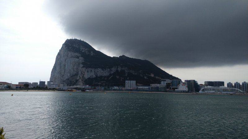
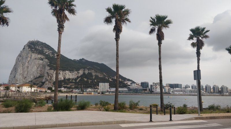
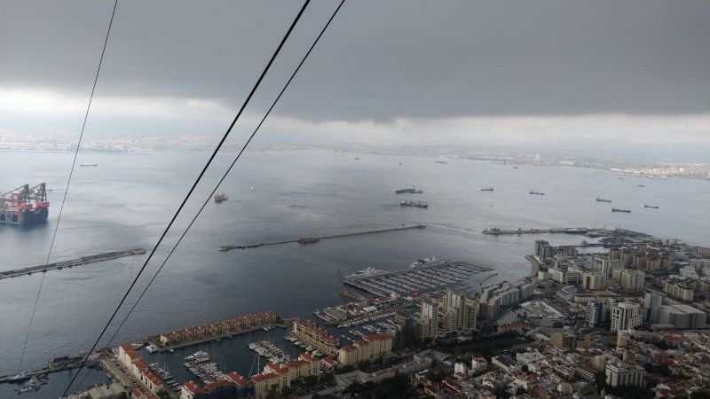
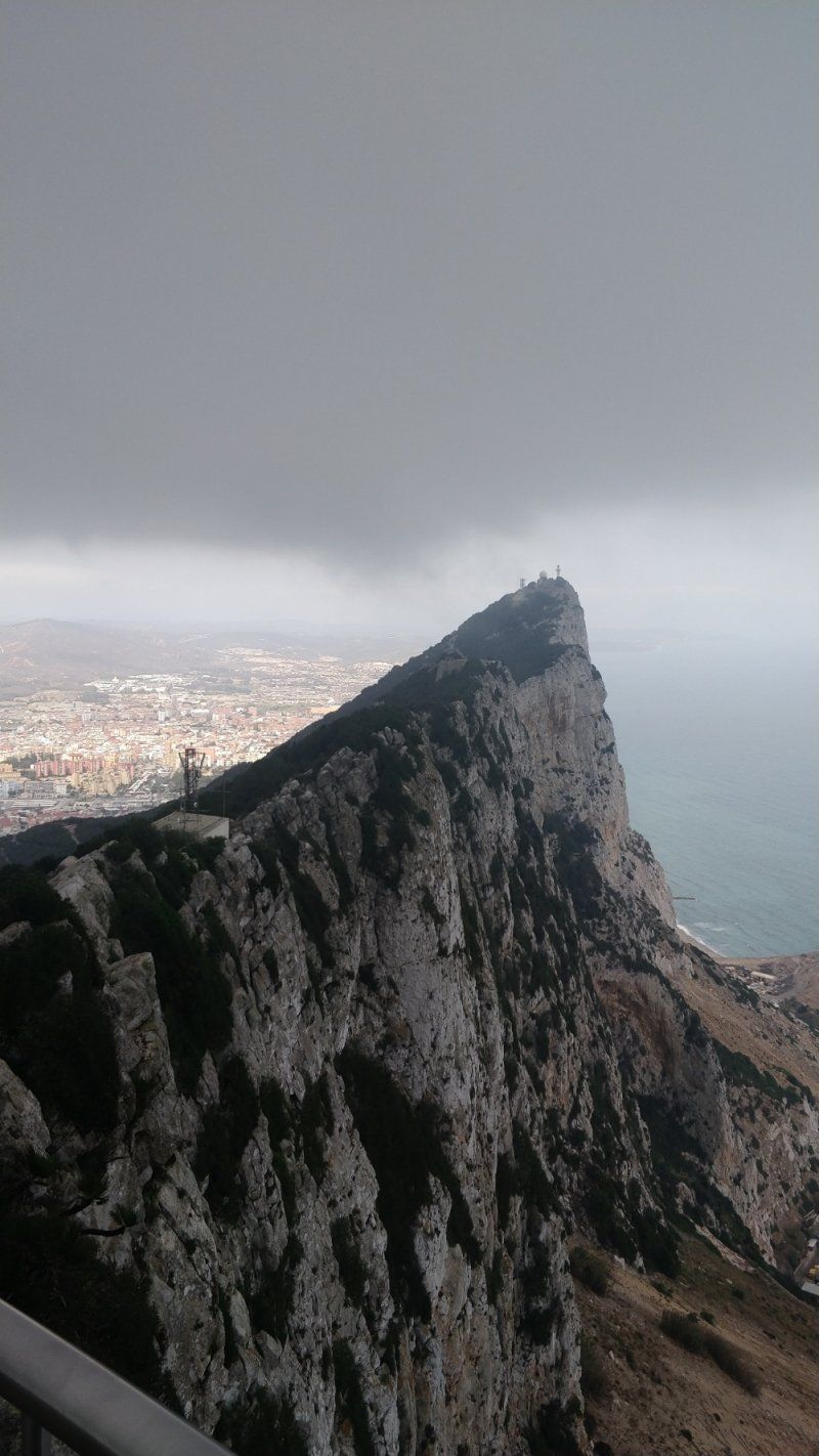
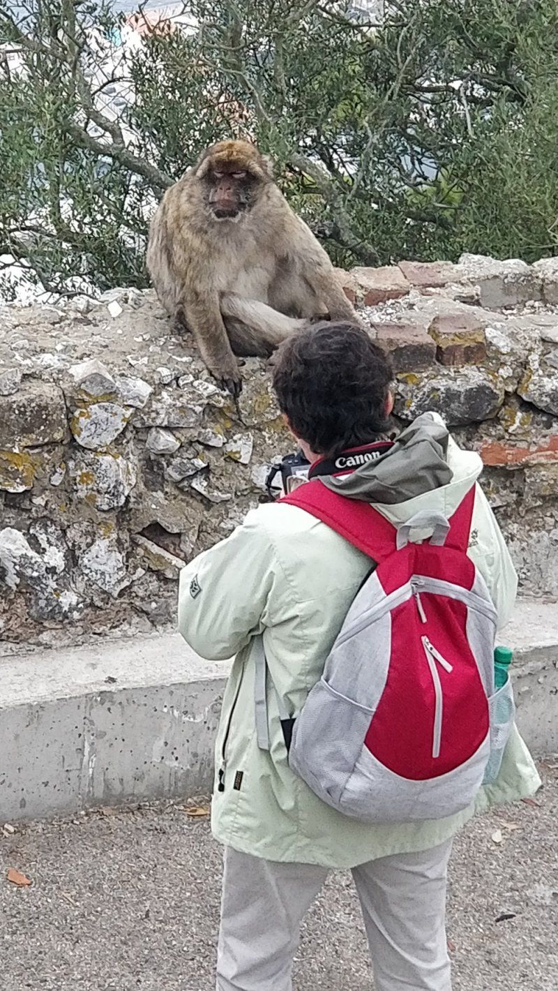
Stellplatz am Jachthafen, Gibralta
Sehr gut gelegen für einen Besuch Gibraltas. etwa 800 m zu Fuß über die Grenze, dahinter gibt's Busse durch Gibralta.
Puerto deportivo s/n, Cádiz, Spanien
36° 9' 22.9" N 5° 21' 16.9" W
36.1563645 -5.3546920
• Follow the roundabout. Go for 17 m.
• Take the 2nd exit from roundabout onto Avenida de los Barcos. Go for 97 m.
• Take the 1st exit from roundabout onto Avenida Príncipe de Asturias. Go for 71 m.
• Continue on Avenida Alcaidesa Marina. Go for 141 m.
• Continue on Avenida Príncipe de Asturias. Go for 21 m.
• Take the 3rd exit from roundabout onto Avenida Príncipe de Asturias. Go for 113 m.
• Turn right. Go for 4 m.
• Turn left toward Avenida Príncipe de Asturias/N-351. Go for 47 m.
• Continue on Avenida Príncipe de Asturias (N-351). Go for 269 m.
• Take the 2nd exit from Rotonda Real Balompédica Linense roundabout onto Avenida Príncipe de Asturias (N-351) toward San Roque/Campamento. Go for 533 m.
• Take the 4th exit from roundabout onto Avenida de España (CA-34). Go for 444 m.
• Take the 3rd exit from roundabout onto Avenida de España (CA-34) toward San Roque. Go for 425 m.
• Take the 3rd exit from roundabout onto Avenida de España (CA-34). Go for 425 m.
• Take the 3rd exit from roundabout onto Avenida de España (CA-34) toward San Roque. Go for 1.9 km.
• Pass 2 roundabouts and continue on CA-34. Go for 2.9 km.
• Take ramp onto A-7 (Autovía del Mediterráneo) toward Estepona/Málaga. Go for 14.6 km.
• Continue on AP-7 (Autopista del Mediterráneo) toward Estepona/Málaga. Go for 9.7 km.
• Keep right onto AP-7. Go for 12.0 km.
• Continue on A-7 (Autopista del Mediterráneo). Go for 2.8 km.
• Continue on AP-7 (Autopista del Mediterráneo) toward Marbella/Málaga. Go for 15.0 km.
• Take exit 172 toward San Pedro de Alcántara onto A-397 (Carretera Ronda-San Pedro). Go for 1.3 km.
• Take the 5th exit from roundabout onto Carretera Ronda-San Pedro (A-397) toward Ronda. Go for 782 m.
• Take the 2nd exit from roundabout onto Carretera Ronda-San Pedro (A-397) toward Ronda. Go for 988 m.
• Take the 2nd exit from roundabout onto Carretera Ronda-San Pedro (A-397). Go for 42.6 km.
• Turn right toward Camino de los Tejares. Go for 30 m.
• Turn left onto Camino de los Tejares. Go for 9 m.
• Turn right. Go for 335 m.
• Turn left toward Camino de los Quegijales. Go for 336 m.
• Turn right onto Camino de los Quegijales. Go for 949 m.
• Turn sharp right onto Avenida Juan Pablo II. Go for 13 m.
• Arrive at Avenida Juan Pablo II. Your destination is on the right.
☍
108,9 km
(1 hrs. 27 min.)
Day
Day
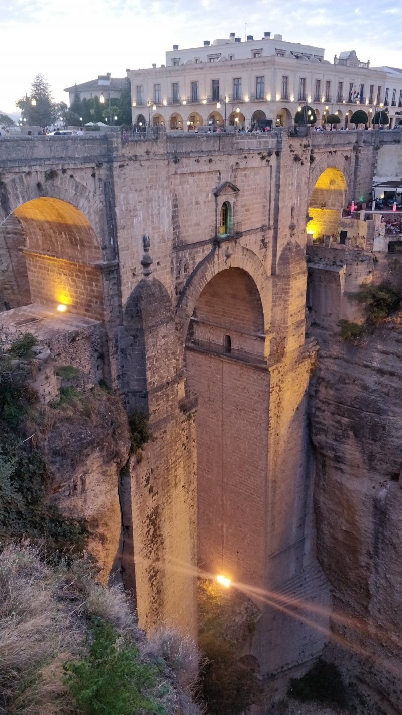
Ronda; Parkstreifen 7 Minuten von der Puente Viejo
Sights [edit | Edit source]
Old town (La Ciudad)
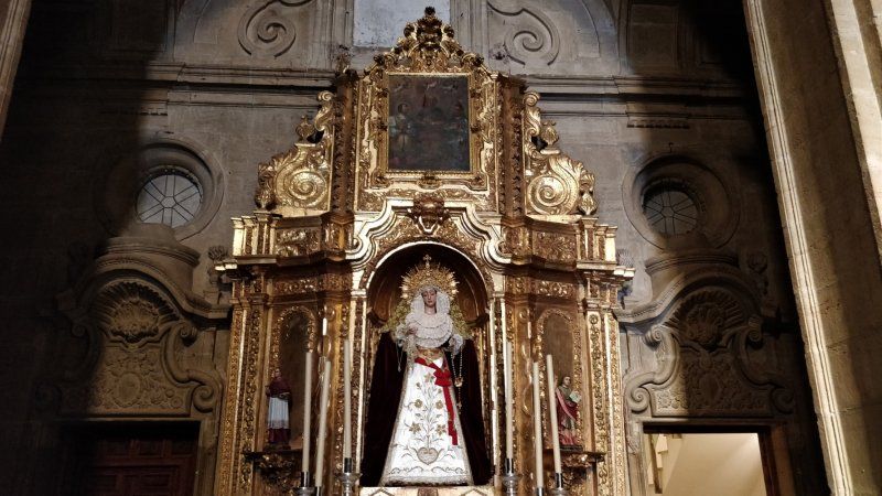
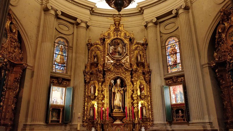
Santa María la Mayor
The majority of the historically significant buildings are located in the old town, the "Ciudad Vieja", usually called La Ciudad for short, which, with its mixture of North African and Spanish traditions, is a worth seeing example of the architecture and urban development of many Andalusian cities.
Most of the buildings from the time of the Moorish rule were destroyed after the conquest by the Catholic Spanish. You can still see the Baños Arabes ("Arab Baths"), the Puente Viejo ("Old Bridge") bridge, two palaces, the Casa del Gigante and the Palacio de Mondragón (with the Ronda Museum, "Museo Municipal", beautifully preserved courtyards and a garden in Moorish style), and some smaller buildings, such as the former minaret Alminar de San Sebastián. In the Casa del Rey Moro, the “House of the Moorish King”, you can climb stairs carved into the rock - La Mina - down to the Tajo de Rondasteigen.
The monastery and church Colegiata de Santa María la Mayor on Plaza Duquesa de Parcent were built at the end of the 15th century under King Ferdinand II ("Fernando el Católico") on the site of the city's former great mosque. The mihrāb with Arabic inscriptions and part of the minaret that has been converted into a bell tower can still be seen from the original structure. Inside the building there are Gothic and Renaissance features.
To the southeast of the square, there are still some remains of the old city wall on the slope of the mountain.
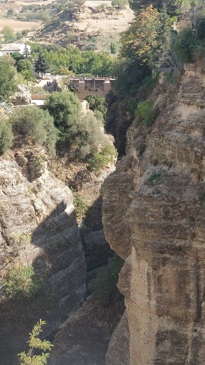
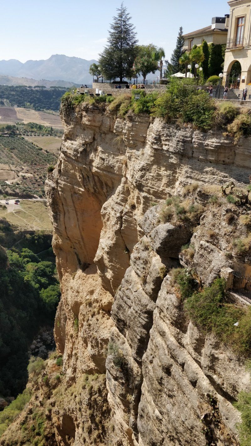
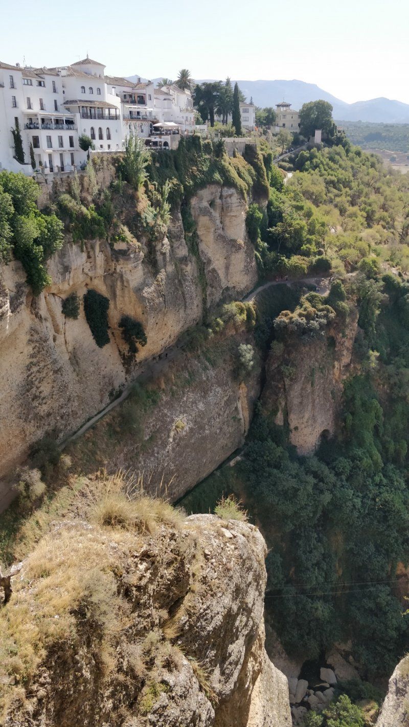
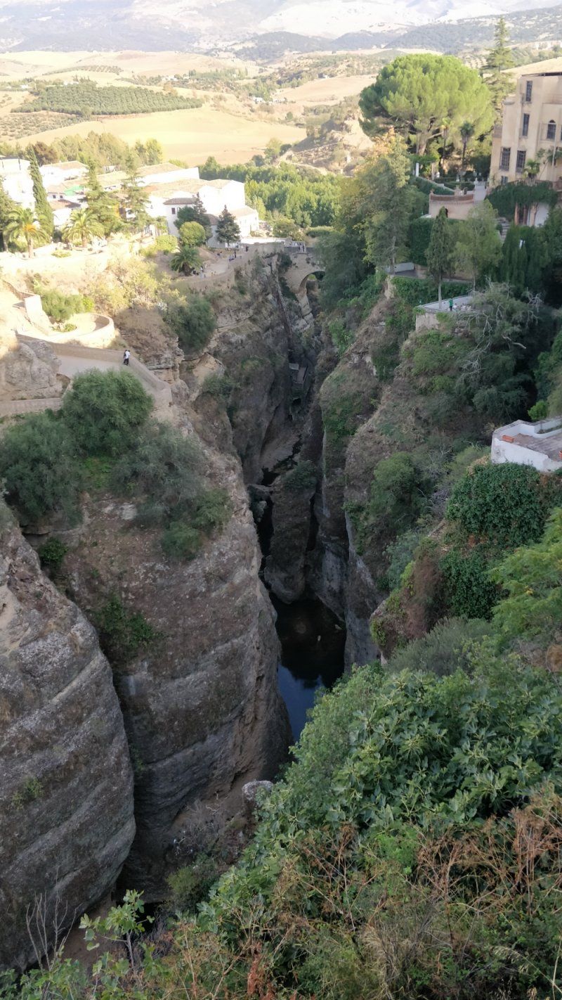
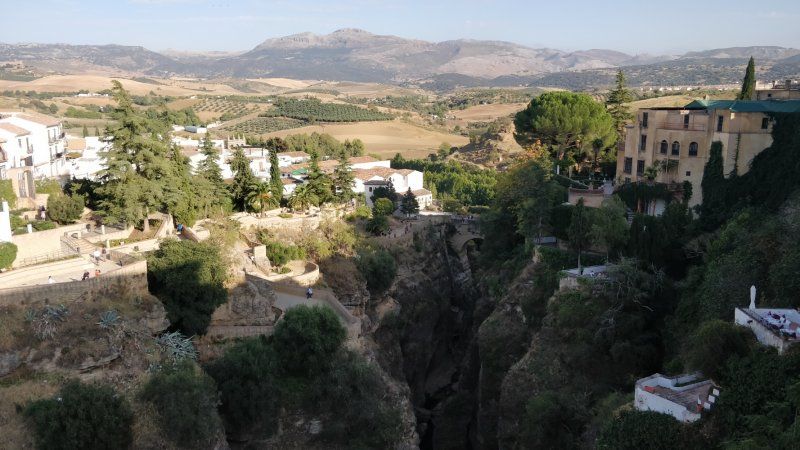
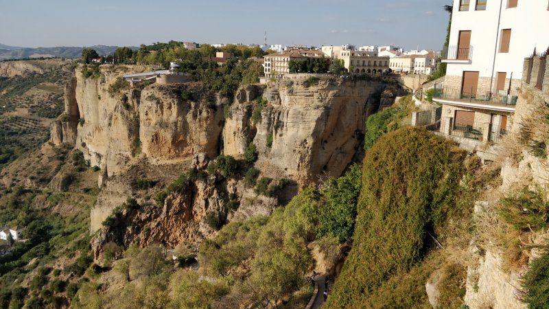
The old town is separated from the younger part of town, El Mercadillo, which was only created after the Spanish conquest, by the 80 m deep El Tajo gorge.
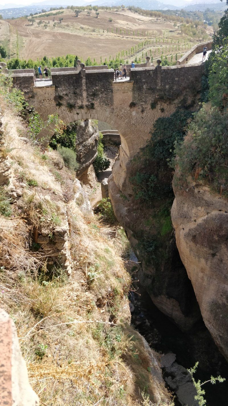
The abyss in the city center is spanned by the Puente Nuevo ("New Bridge") from the late 18th century. From Plaza María Auxiliadora there is an unpaved path down to the lookout point, from which one can have the famous view of Ronda with the Puente Nuevo.
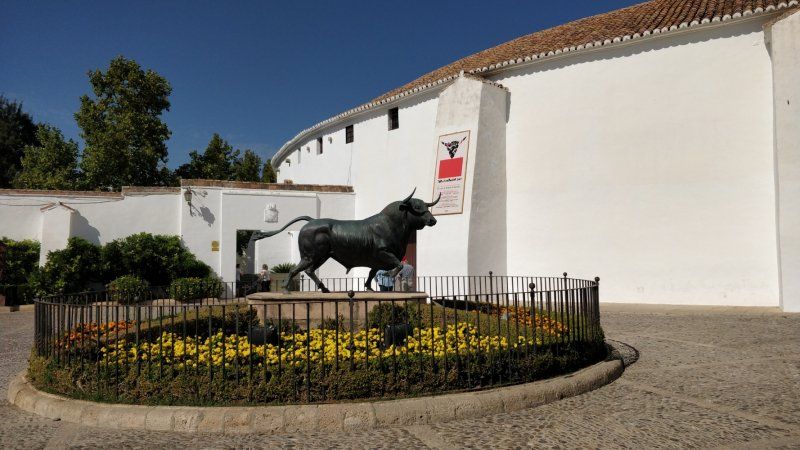
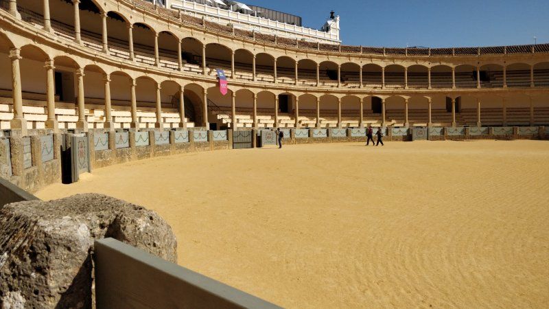
The bullring, Plaza de Toros, was built by the same architect, José Martín de Aldehuela, in the years 1779–1785. It is one of the oldest and largest in Spain and is considered the birthplace of Spanish bullfighting in its current form.
The chapel Templete de la Virgen de los Dolores, also from the 18th century, is located on Calle Santa Cecilia. Noteworthy are the narrow late baroque columns of the portal, which, influenced by Central and South American iconography, depict human-bird hybrids and similarly strange creatures.
At the edge of the El Tajo Gorge are the beautifully landscaped Jardines de Cuenca, named after Ronda's twin town.
In the vicinity of the city there are other interesting witnesses to the history of Ronda and the region:
The "Alameda del Tajo" square
Town house in Ronda
Cueva de la Pileta, in the Benaoján district, a cave (Spanish: Cueva) with cave paintings dating back to between 18,000 and 15,000 years BC. BC, is located about 20 km southwest of the city and, together with the Dolmen de Chopo, a tumulus, is one of the oldest witnesses of human settlement activities in the region.
Lugar Partido Rural Navares y Tejares, 16, 29400 Ronda, Málaga, Spanien
36° 44' 29.5" N 5° 9' 29.1" W
36.7415322 -5.1580951
• Head east on Avenida Juan Pablo II. Go for 471 m.
• Turn left onto Calle José Aurelio Fernández Baca. Go for 215 m.
• Turn right onto Avenida Cruz de San Jorge. Go for 141 m.
• Turn left onto Calle Ignacio Huelín Vallejo. Go for 381 m.
• Turn slightly right onto Calle Polo. Go for 84 m.
• Continue on Avenida de Málaga. Go for 3 m.
• Pass 2 roundabouts and continue on Avenida de Málaga. Go for 778 m.
• Take the 1st exit from roundabout onto Calle Médico Luis Peralta. Go for 160 m.
• Turn right onto Calle Torero Francisco Romero. Go for 51 m.
• Arrive at Calle Torero Francisco Romero. Your destination is on the left.
☍
2,3 km
( 6 min.)
Parking de Autocaravanas Ciudad de Ronda, Calle Torero Francisco Romero, Ronda, Spanien
Calle Torero Francisco Romero, s/n, 29400 Ronda, Málaga, Spanien
36° 45' 8.5" N 5° 8' 52.8" W
36.7523570 -5.1479882
• Head south on Calle Torero Francisco Romero.
• Turn right onto Calle Lola Peña Parrés. Go for 192 m.
• Turn right onto Avenida de Málaga. Go for 41 m.
• Take the 2nd exit from roundabout onto Avenida de Málaga. Go for 84 m.
• Take the 3rd exit from roundabout toward Campillos. Go for 177 m.
• Continue on A-367 toward Campillos. Go for 5.9 km.
• Turn slightly left onto A-7377. Go for 572 m.
• Continue on Variante de Arriate (A-7377). Go for 1.2 km.
• Continue on A-7377. Go for 647 m.
• Continue on Variante de Arriate (A-7377). Go for 557 m.
• Continue on A-7377. Go for 2.9 km.
• Continue on Variante de Arriate (A-7377). Go for 47 m.
• Take the 2nd exit from roundabout onto MA-7403. Go for 294 m.
• Continue on CA-9122. Go for 1.2 km.
• Continue on Pilar Alto (CA-9122). Go for 154 m.
• Continue on CA-9122. Go for 3.0 km.
• Take the 2nd exit from roundabout onto CA-9121. Go for 230 m.
• Turn right. Go for 73 m.
• Turn right toward Calle Camino de la Viña. Go for 57 m.
• Continue on Calle Camino de la Viña. Go for 129 m.
• Turn right onto Calle Cádiz Club de Fútbol. Go for 73 m.
• Arrive at Calle Cádiz Club de Fútbol. Your destination is on the right.
☍
17,6 km
( 15 min.)
Day
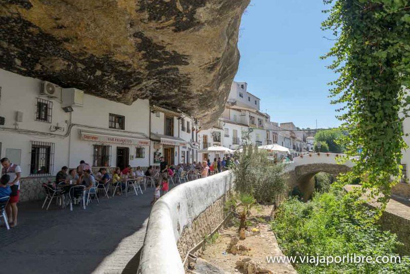
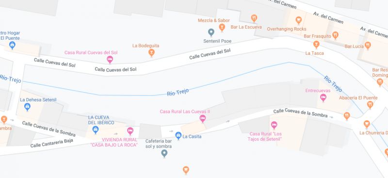
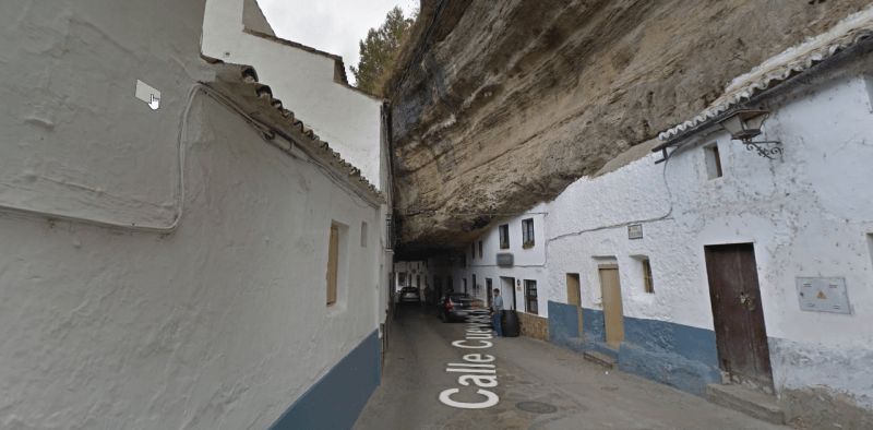
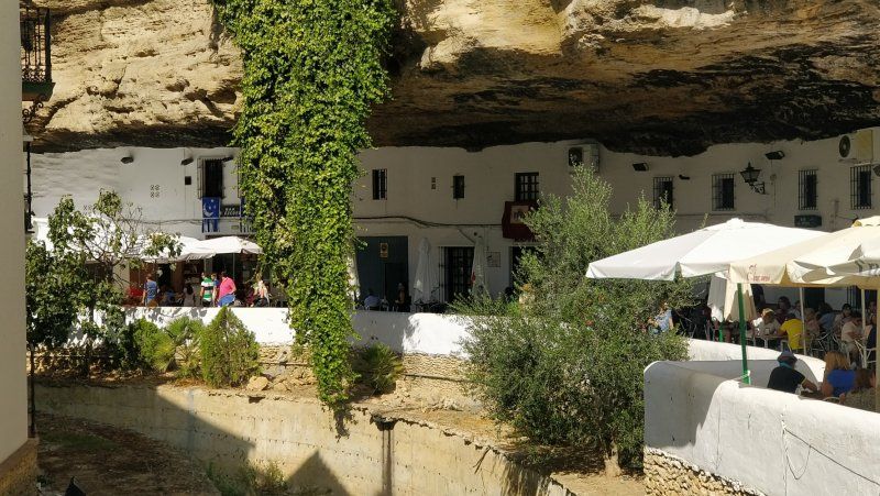
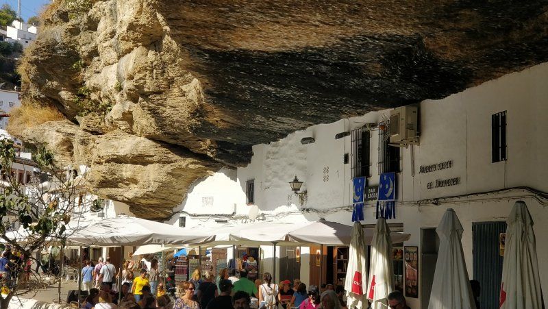
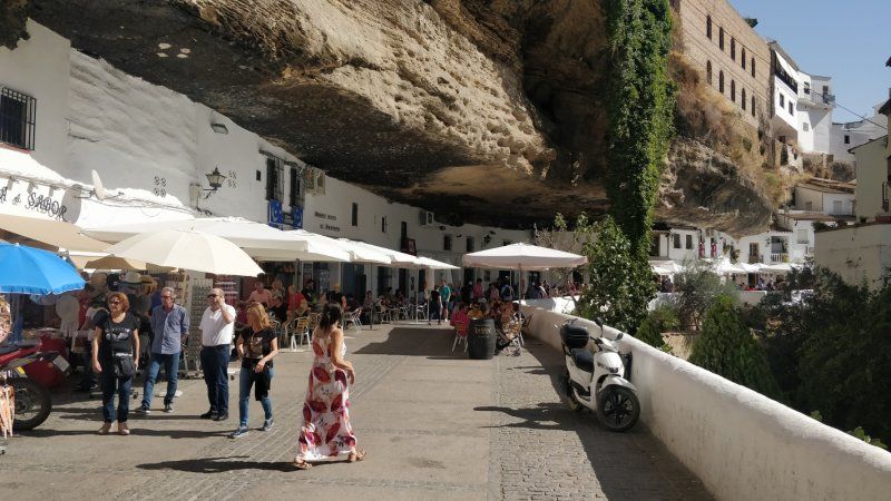
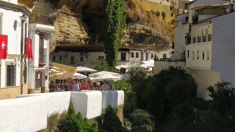
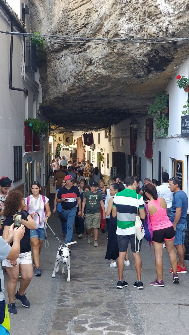
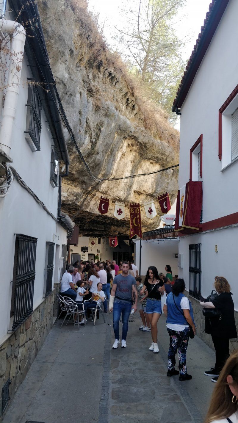
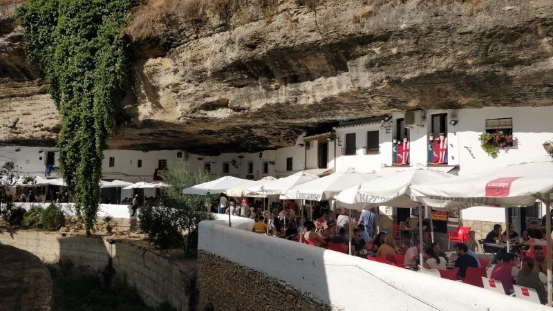
Setenil de las Bodegas, Spanien
Parkplatz in Seitenstrasse
Calle Ramón Y Cajal, 47, 11692 Setenil de las Bodegas, Cádiz, Spanien
36° 51' 51.1" N 5° 10' 24.4" W
36.8641810 -5.1734520
• Head toward Calle Camino de la Viña on Calle Cádiz Club de Fútbol. Go for 73 m.
• Turn left onto Calle Camino de la Viña. Go for 186 m.
• Turn left toward CA-9121. Go for 73 m.
• Turn sharp right onto CA-9121. Go for 45 m.
• Continue on Calle Federico García Lorca. Go for 531 m.
• Continue on Calle Carril Alto. Go for 425 m.
• Continue on Calle Alcaide Manrique. Go for 173 m.
• Turn left onto Calle San Sebastián. Go for 650 m.
• Continue on CA-9113. Go for 2.3 km.
• Turn left onto MA-8406. Go for 4.7 km.
• Continue on MA-7402 toward Ronda. Go for 694 m.
• Turn right onto MA-8405 toward Montecorto/Los Villalones. Go for 4.4 km.
• Turn left onto MA-8407 toward Montecorto. Go for 4.6 km.
• Continue on Camino de Montecorto a Villalones (MA-8407). Go for 201 m.
• Continue on Calle Pablo Ruíz Picasso (MA-8407). Go for 19 m.
• Turn left onto Avenida de la Constitución (MA-8407). Go for 642 m.
• Turn right and take ramp onto A-374. Go for 1.6 km.
• Turn left onto A-7378 toward Zahara. Go for 1.3 km.
• Continue on A-2300. Go for 946 m.
• Continue on A-6300. Go for 151 m.
• Continue on A-2300. Go for 10.5 km.
• Turn left toward CA-9104. Go for 47 m.
• Turn right onto CA-8102. Go for 1.0 km.
• Turn slightly left onto CA-8102. Go for 340 m.
• Turn slightly right. Go for 375 m.
• Arrive at your destination on the right.
☍
36,1 km
( 40 min.)
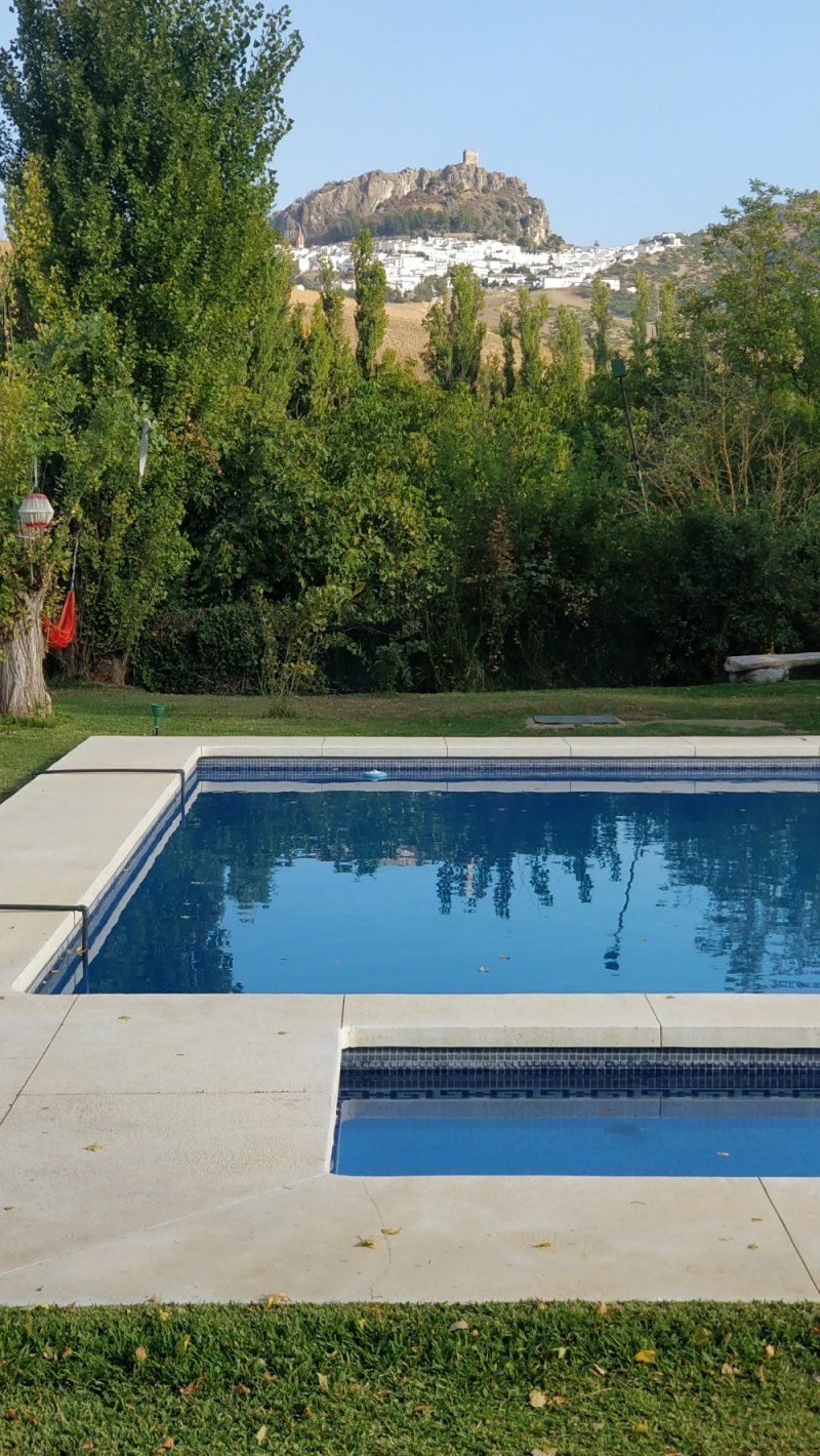
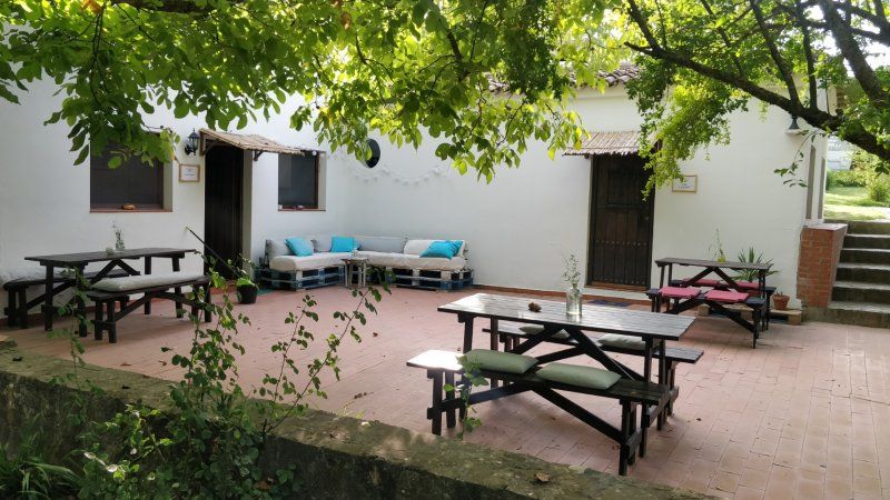
Finca Vegana, Zahara de la Sierra, Spanien
Bocaleones, 11688 Zahara de la Sierra, Cádiz, Spanien
36° 50' 57.9" N 5° 24' 38.1" W
36.8494240 -5.4105870
• Head south. Go for 375 m.
• Turn slightly left onto CA-8102. Go for 1.4 km.
• Turn right onto CA-9104. Go for 238 m.
• Continue on Calle Los Vientos (CA-9104). Go for 38 m.
• Continue on CA-9104. Go for 871 m.
• Turn right onto Avenida de Andalucía. Go for 401 m.
• Turn slightly left onto Avenida de Andalucía. Go for 17 m.
• Continue on Calle Fernando Hué. Go for 83 m.
• Turn right onto Avenida de Andalucía. Go for 76 m.
• Continue on Calle Boquete San Juan. Go for 119 m.
• Turn left onto Calle San Juan. Go for 28 m.
• Turn left onto Calle Doctor Gómez Ulla. Go for 31 m.
• Turn left onto Calle Manchega. Go for 123 m.
• Arrive at Calle Manchega. Your destination is on the left.
☍
3,8 km
( 8 min.)
Day
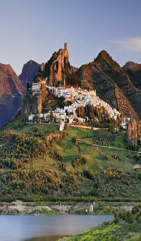
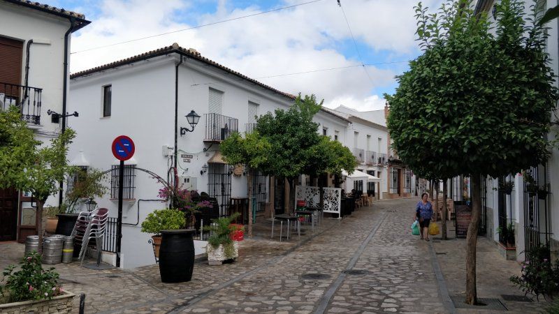
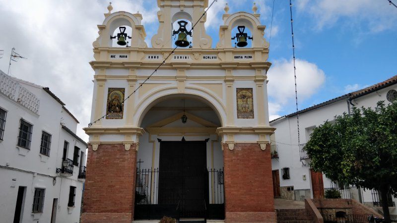
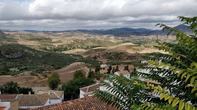
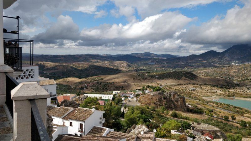
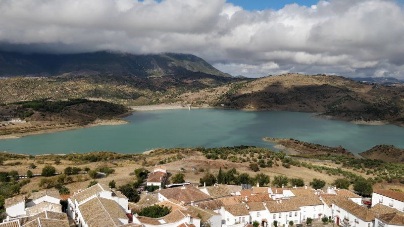
Zahara de la Sierra, Spanien
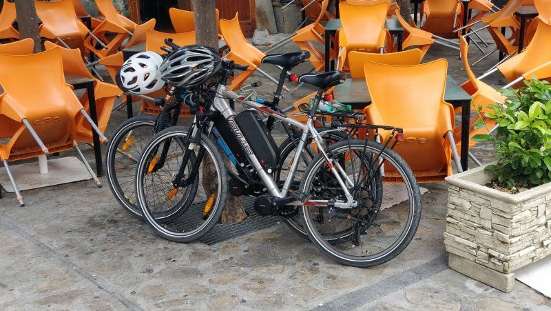
Enjoyed the beautiful "white village of Andalusia" with the e-bikes to Zahara
11688 Zahara de la Sierra, Provinz Cádiz, Spanien
36° 50' 22.2" N 5° 23' 31.2" W
36.8394942 -5.3919919
• Head toward Avenida de Andalucía on Calle Manchega. Go for 28 m.
• Turn slightly right onto Calle Fernando Hué. Go for 83 m.
• Continue on Avenida de Andalucía. Go for 139 m.
• Keep right onto Avenida de Andalucía. Go for 279 m.
• Turn left onto CA-9104. Go for 871 m.
• Continue on Calle Los Vientos (CA-9104). Go for 38 m.
• Continue on CA-9104. Go for 238 m.
• Turn left onto CA-8102. Go for 1.0 km.
• Turn slightly left onto CA-8102. Go for 340 m.
• Turn slightly right. Go for 375 m.
• Arrive at your destination on the right.
☍
3,4 km
( 7 min.)
Finca Vegana, Zahara de la Sierra, Spanien
Bocaleones, 11688 Zahara de la Sierra, Cádiz, Spanien
36° 50' 57.9" N 5° 24' 38.1" W
36.8494240 -5.4105870
• Head toward Camino del Rodeo. Go for 1.1 km.
• Continue straight ahead. Go for 393 m.
• Turn slightly right. Go for 804 m.
• Turn right toward A-2300. Go for 648 m.
• Turn left onto A-2300. Go for 319 m.
• Turn right onto CA-9105. Go for 195 m.
• Turn left toward A-384. Go for 123 m.
• Turn right onto A-384. Go for 2.9 km.
• Take ramp onto A-384 toward Olvera/Antequera. Go for 51.0 km.
• Turn right toward A-7278/Teba. Go for 25 m.
• Turn right onto A-7278. Go for 4.0 km.
• Pass 2 roundabouts and continue on A-7278. Go for 7.0 km.
• Turn left onto A-367 toward Campillos/A-357/Málaga. Go for 4.3 km.
• Take the 1st exit from roundabout onto A-357 toward Ardales/Málaga. Go for 49.4 km.
• Take exit 63 toward AP-46/A-45/Córdoba. Go for 399 m.
• Take the 3rd exit from roundabout toward E-15/Almería/A-7. Go for 339 m.
• Take the 2nd exit from roundabout toward Almería/E-15/A-7. Go for 1.7 km.
• Continue on A-7 (Autovía del Mediterráneo). Go for 36.0 km.
• Take exit 960 toward MA-176/Cajiz-Iznate/N-340a/Almayate-Valle Niza. Go for 250 m.
• Take the 1st exit from roundabout onto MA-3203. Go for 3.0 km.
• Continue on Urbanización Valle Mar (MA-3203). Go for 335 m.
• Turn left onto N-340a. Go for 1.2 km.
• Take the 1st exit from roundabout onto N-340a. Go for 2.2 km.
• Turn sharp right. Go for 27 m.
• Arrive at your destination on the right.
☍
167,7 km
(2 hrs. 2 min.)
Day
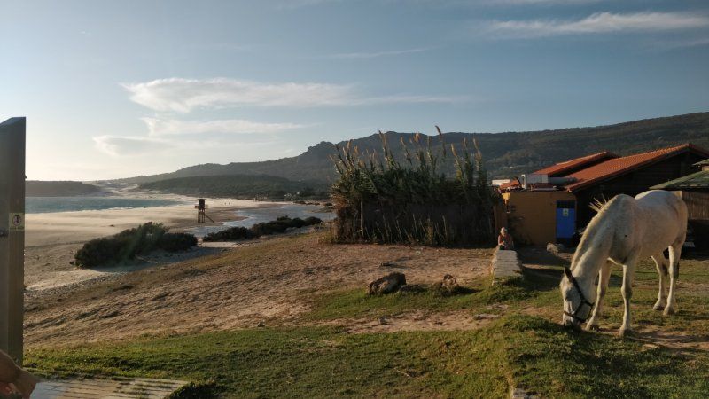
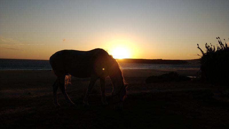
Camping Almayate Costa, N-340, Almayate, Spanien
Explore the beautiful beach and eat in a tiny, Arabic restaurant on the beach
N-340, Km. 267, 29749 Almayate, Málaga, Spanien
36° 43' 30.4" N 4° 8' 6.9" W
36.7251084 -4.1352416
• Head north. Go for 27 m.
• Turn right onto N-340a. Go for 745 m.
• Turn left onto Calle Antonio Márquez Robles (MA-3120). Go for 526 m.
• Turn slightly right onto Calle Gallito. Go for 19 m.
• Turn right onto Calle Doctor Rodríguez de la Fuente. Go for 39 m.
• Turn right onto Calle Chicuelo. Go for 42 m.
• Arrive at Calle Chicuelo. Your destination is on the left.
☍
1,4 km
( 2 min.)
Day
Almayate, Spanien
Let it fade away slowly, pool, beach
29749 Almayate, Málaga, Spanien
36° 43' 54.4" N 4° 7' 50.2" W
36.7317725 -4.1306222
• Head toward Calle Doctor Rodríguez de la Fuente on Calle Chicuelo. Go for 42 m.
• Turn left onto Calle Doctor Rodríguez de la Fuente. Go for 39 m.
• Turn left onto Calle Gallito. Go for 19 m.
• Turn slightly left onto Calle Antonio Márquez Robles (MA-3120). Go for 526 m.
• Turn left onto N-340a. Go for 2.1 km.
• Pass 2 roundabouts and continue on Avenida de Andalucía (N-340a). Go for 651 m.
• Take the 5th exit from roundabout onto Calle del Río. Go for 133 m.
• Turn right onto Calle Pintor Cipriano Maldonado (A-356). Go for 564 m.
• Turn left onto Urbanización Casa de la Viña. Go for 66 m.
• Turn right onto Calle Valdepeñas. Go for 91 m.
• Turn right onto Avenida Condado de Huelva. Go for 60 m.
• Turn right onto Calle Pintor Cipriano Maldonado (A-356). Go for 78 m.
• Arrive at Calle Pintor Cipriano Maldonado (A-356). Your destination is on the left.
☍
4,4 km
( 8 min.)
Day
Torre del Mar, Spanien
E-bike tour, explore Torre del Mar, pool.
Torre del Mar, Provinz Málaga, Spanien
36° 44' 38.8" N 4° 5' 51.2" W
36.7441242 -4.0975579
• Head toward Urbanización Casa de la Viña on Calle Pintor Cipriano Maldonado (A-356). Go for 832 m.
• Continue on Avenida de Andalucía (N-340a). Go for 101 m.
• Pass 2 roundabouts and continue on Avenida de Andalucía (N-340a). Go for 2.5 km.
• Turn right onto Calle Antonio Márquez Robles (MA-3120). Go for 544 m.
• Turn slightly right onto Calle Gallito. Go for 19 m.
• Turn right onto Calle Doctor Rodríguez de la Fuente. Go for 39 m.
• Turn right onto Calle Chicuelo. Go for 42 m.
• Arrive at Calle Chicuelo. Your destination is on the left.
☍
4,0 km
( 6 min.)
Day
Almayate, Spanien
Explore the mountainous surroundings by e-bike
29749 Almayate, Málaga, Spanien
36° 43' 54.4" N 4° 7' 50.2" W
36.7317725 -4.1306222
• Head toward Calle Doctor Rodríguez de la Fuente on Calle Chicuelo. Go for 42 m.
• Turn left onto Calle Doctor Rodríguez de la Fuente. Go for 39 m.
• Turn left onto Calle Gallito. Go for 19 m.
• Turn slightly left onto Calle Antonio Márquez Robles (MA-3120). Go for 504 m.
• Turn right onto N-340a. Go for 2.9 km.
• Take the 2nd exit from roundabout onto N-340a. Go for 1.3 km.
• Turn right onto Urbanización Valle Mar (MA-3203). Go for 335 m.
• Continue on MA-3203. Go for 3.0 km.
• Take the 3rd exit from roundabout onto MA-3203 toward Iznate/Cajiz. Go for 180 m.
• Take the 2nd exit from roundabout onto A-7 (Autovía del Mediterráneo) toward Rincón de la Victoria/Málaga. Go for 27.3 km.
• Keep right onto MA-20 toward Málaga/Aeropuerto. Go for 9.4 km.
• Take exit 3 toward Aeropuerto onto MA-23. Go for 2.0 km.
• Take the 2nd exit from roundabout toward Aeropuerto. Go for 214 m.
• Keep right toward Salidas. Go for 518 m.
• Turn right. Go for 72 m.
• Arrive at your destination on the right.
☍
47,8 km
( 43 min.)
Day
Flughafen Málaga
Av. del Comandante García Morato, s/n, 29004, Málaga, Spanien
36° 40' 37.7" N 4° 29' 31" W
36.6771258 -4.4919451
• Head south. Go for 547 m.
• Keep left toward MA-23/MA-20/A-7/Málaga/Algeciras/Aeropuerto. Go for 182 m.
• Take ramp onto MA-23 toward Málaga/MA-20/Torremolinos/Algeciras-Cádiz/A-7/Almería. Go for 1.7 km.
• Take the left exit toward E-15/Málaga-Almería/A-7/Granada-Córdoba/A-45/Sevilla onto MA-20. Go for 9.9 km.
• Continue on A-7 (Autovía del Mediterráneo). Go for 27.0 km.
• Take exit 960 toward MA-176/Cajiz-Iznate/N-340a/Almayate-Valle Niza. Go for 250 m.
• Take the 1st exit from roundabout onto MA-3203. Go for 3.0 km.
• Continue on Urbanización Valle Mar (MA-3203). Go for 335 m.
• Turn left onto N-340a. Go for 1.2 km.
• Take the 1st exit from roundabout onto N-340a. Go for 2.2 km.
• Turn sharp right. Go for 27 m.
• Arrive at your destination on the right.
☍
46,4 km
( 35 min.)
Day
Camping Almayate Costa, N-340, Almayate, Spanien
N-340, Km. 267, 29749 Almayate, Málaga, Spanien
36° 43' 30.4" N 4° 8' 6.9" W
36.7251084 -4.1352416
• Head north. Go for 27 m.
• Turn right onto N-340a. Go for 2.9 km.
• Pass 2 roundabouts and continue on Avenida de Andalucía (N-340a). Go for 651 m.
• Take the 5th exit from roundabout onto Calle del Río. Go for 133 m.
• Turn right onto Calle Pintor Cipriano Maldonado (A-356). Go for 571 m.
• Turn right onto Calle Casas Nuevas. Go for 137 m.
• Turn left onto Calle Carrera de las Agustinas. Go for 545 m.
• Take the 2nd exit from roundabout onto Calle Pintor Cipriano Maldonado. Go for 142 m.
• Continue on A-356R. Go for 1.1 km.
• Take the 2nd exit from roundabout onto A-7 (Autovía del Mediterráneo) toward Nerja/Motril/Almería. Go for 382 km.
• Take the left exit onto A-7/A-30 (Murcia Ronda Oeste). Go for 3.1 km.
• Continue on A-7 (Autovía del Mediterráneo) toward Alicante. Go for 58.9 km.
• Keep right onto AP-7 (Circunvalación de Alicante) toward Benidorm/Valencia. Go for 68.3 km.
• Take exit 64 toward N-332/CV-755/Altea/Calp. Go for 2.2 km.
• Keep left toward N-332/Calpe/Valencia. Go for 133 m.
• Take ramp onto N-332. Go for 7.3 km.
• Take ramp onto Avenida de la Diputación (CV-746) toward Calp/Calpe. Go for 287 m.
• Pass 2 roundabouts and continue on Avenida de la Diputación (CV-746). Go for 1.0 km.
• Take the 3rd exit from roundabout onto Avenida de los Ejércitos Españoles (CV-746). Go for 185 m.
• Pass 2 roundabouts and continue on Avenida de los Ejércitos Españoles (CV-746). Go for 844 m.
• Take the 3rd exit from roundabout onto Calle Letonia. Go for 170 m.
• Take the 2nd exit from roundabout onto Calle Lituania. Go for 155 m.
• Take the 1st exit from roundabout onto Avenida Rumanía. Go for 265 m.
• Take the 2nd exit from roundabout onto Avenida Bulgaria. Go for 591 m.
• Continue on Urbanización Los Almendros. Go for 9 m.
• Continue on Avenida Bulgaria. Go for 167 m.
• Arrive at Avenida Bulgaria. Your destination is on the right.
☍
531,6 km
(4 hrs. 58 min.)
Day
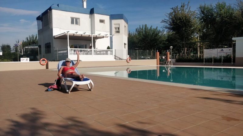
Relaxen, Sonne, Strand, Pool
Day
Relaxen, Sonne, Strand, Pool
Day
Sol de Calpe Boreal
Start your journey home
03710, Calpe, Spanien
38° 38' 59.3" N 0° 4' 5.9" E
38.6498000 0.0683000
• Head toward Calle Finlandia on Avenida Bulgaria. Go for 237 m.
• Take the 4th exit from roundabout onto Avenida Bulgaria. Go for 486 m.
• Continue on Urbanización Los Almendros. Go for 9 m.
• Continue on Avenida Bulgaria. Go for 533 m.
• Take the 3rd exit from roundabout onto Avenida Polonia. Go for 356 m.
• Turn right onto Avenida de los Ejércitos Españoles (CV-746). Go for 265 m.
• Pass 3 roundabouts and continue on Avenida de los Ejércitos Españoles (CV-746). Go for 1.1 km.
• Take the 3rd exit from roundabout onto Calle Málaga toward Golf Ifach. Go for 110 m.
• Pass 2 roundabouts and continue on Calle Málaga. Go for 195 m.
• Turn right onto Avenida Gabriel Miró. Go for 61 m.
• Turn left onto Calle Goleta. Go for 88 m.
• Arrive at Calle Goleta. Your destination is on the left.
☍
3,4 km
( 7 min.)
Day
Calpe, Spanien
Calp, Provinz Alicante, Spanien
38° 38' 37.1" N 0° 2' 44.5" E
38.6436469 0.0456876
• Head southwest on Calle Goleta.
• Turn left onto Avenida de Valencia. Go for 65 m.
• Turn left onto Calle Navío. Go for 88 m.
• Continue on Calle Málaga. Go for 92 m.
• Pass 2 roundabouts and continue on Calle Málaga. Go for 153 m.
• Take the 4th exit from roundabout onto Avenida de la Diputación (CV-746). Go for 277 m.
• Turn right onto Sector F-Parda Benicolada. Go for 351 m.
• Take the 2nd exit from roundabout onto Avenida Generalitat Valenciana. Go for 424 m.
• Take the 3rd exit from roundabout onto Sector m-Parda Benicolada. Go for 345 m.
• Take the 1st exit from roundabout onto N-332 toward Oliva/Valencia/E-15/AP-7. Go for 749 m.
• Take the 2nd exit from roundabout onto N-332. Go for 8.8 km.
• Take ramp toward AP-7/E-15/Alacant/Alicante/València. Go for 365 m.
• Take the 4th exit from roundabout toward E-15/Alacant/Alicante/AP-7/València. Go for 527 m.
• Take ramp onto AP-7 (Autopista del Mediterráneo) toward Valencia. Go for 94.1 km.
• Continue on A-7 (Autovía del Mediterráneo). Go for 45.8 km.
• Keep left onto A-7 (Autovía del Mediterráneo) toward AP-7/Castelló/Castellón/Barcelona. Go for 485 m.
• Continue on AP-7 (Autovía del Mediterráneo). Go for 199 km.
• Take exit 38 toward N-340/C-44/l'Hospitalet de l'Infant/Móra la Nova. Go for 728 m.
• Take the 4th exit from roundabout onto A-7 (Autovia de la Mediterrània) toward Cambrils/Tarragona. Go for 2.4 km.
• Take exit 1131 toward Miami Platja. Go for 340 m.
• Take the 1st exit from roundabout toward N-340/Miami Platja. Go for 39 m.
• Continue on Avinguda del Doctor Gil Vernet. Go for 846 m.
• Take the 2nd exit from roundabout onto Avinguda del Doctor Gil Vernet. Go for 665 m.
• Turn right onto Plaça Dr. Fleming toward Cambrils/Tarragona. Go for 185 m.
• Take ramp onto Avinguda de Barcelona (N-340) toward Cambrils/Tarragona. Go for 2.8 km.
• Turn sharp right. Go for 50 m.
• Turn right. Go for 21 m.
• Arrive at your destination on the left.
☍
359,3 km
(3 hrs. 20 min.)
Day
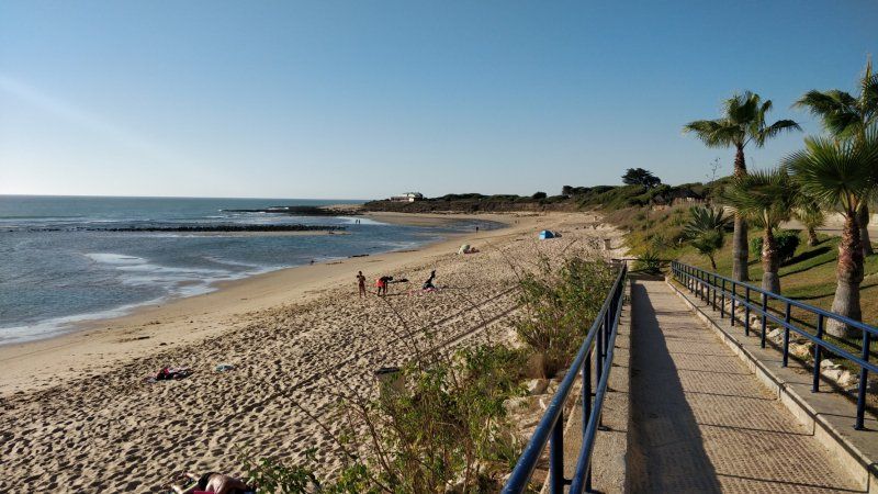
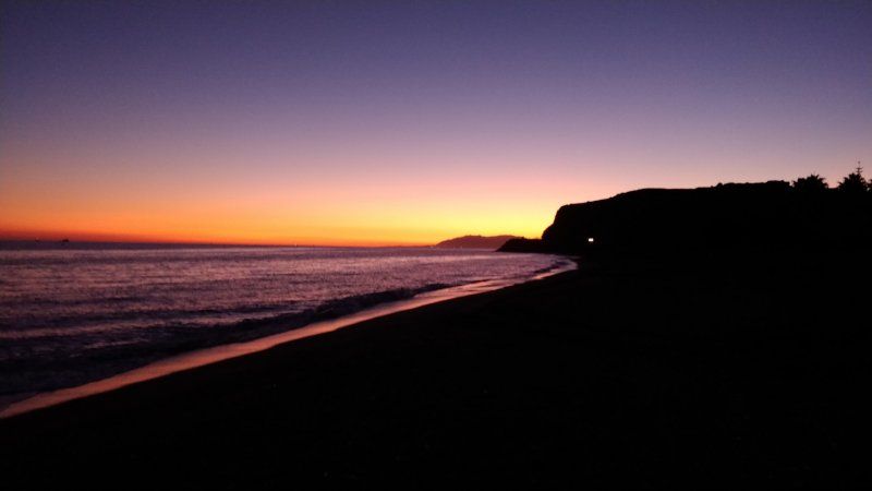
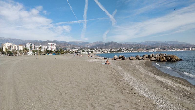
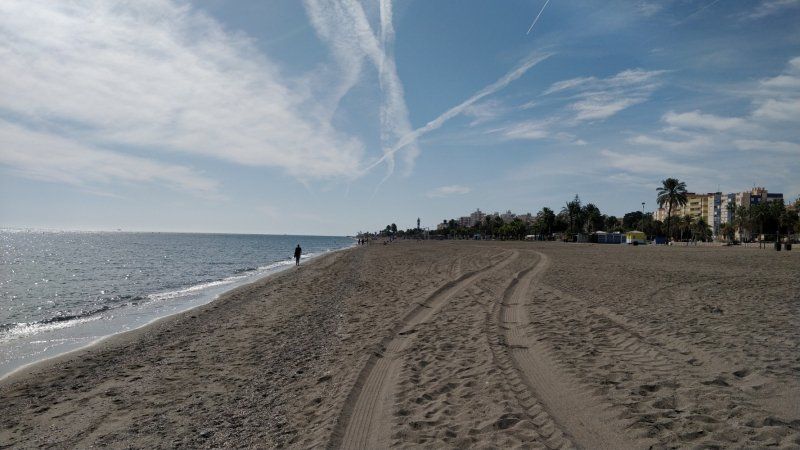
Playa Montroig Camping Resort, N-340, Mont-roig del Camp, Spanien
Relax
N-340, Km 1.136, 43300 Mont-roig del Camp, Tarragona, Spanien
41° 2' 1.2" N 0° 58' 8.4" E
41.0336681 0.9689987
• Head northeast. Go for 21 m.
• Turn left toward N-340. Go for 60 m.
• Turn right onto N-340. Go for 3.1 km.
• Pass 3 roundabouts and continue on Avinguda del Baix Camp (N-340). Go for 5.4 km.
• Turn right onto Passeig de Sant Joan Baptista de la Salle. Go for 588 m.
• Take the 3rd exit from roundabout onto Carrer Tramuntana. Go for 96 m.
• Take the 3rd exit from roundabout onto Plaça Creu Missió. Go for 103 m.
• Continue on Rambla de Jaume I. Go for 263 m.
• Turn right onto Carrer de Roger de Flor. Go for 56 m.
• Arrive at Carrer de Roger de Flor. Your destination is on the right.
☍
9,7 km
( 12 min.)
Day
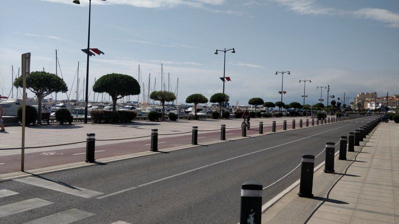
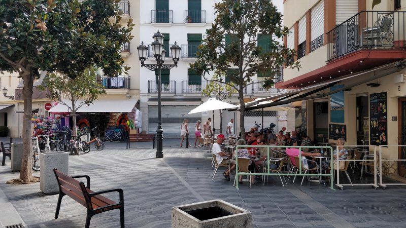
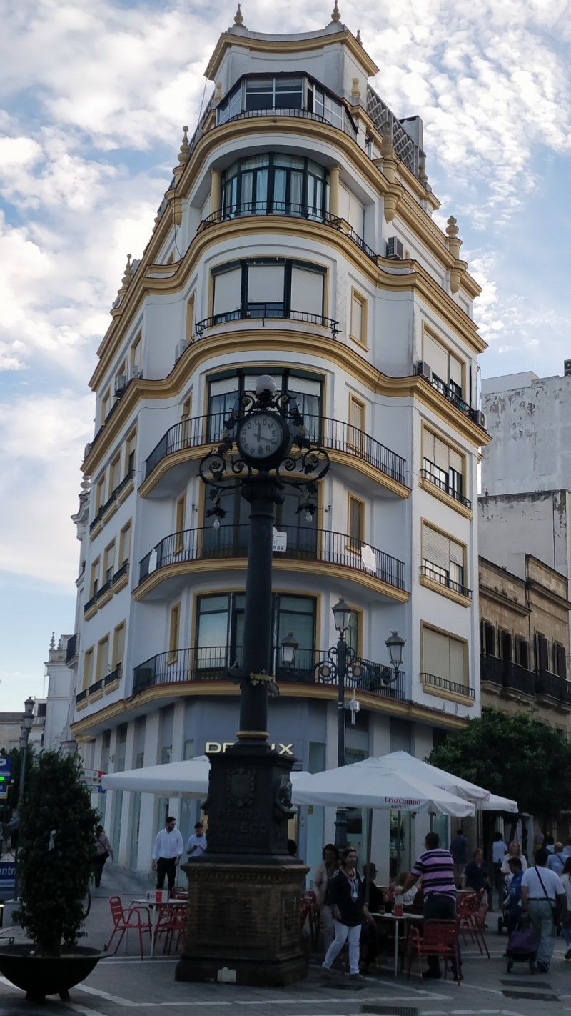
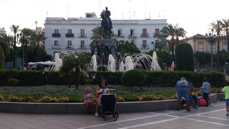
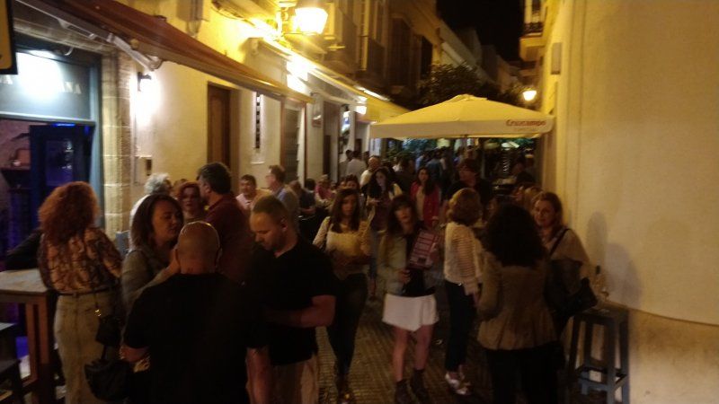
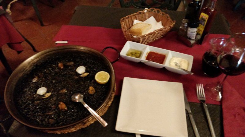
Cambrils, Spanien
Cambrils, Provinz Tarragona, Spanien
41° 4' 0" N 1° 3' 37.3" E
41.0666754 1.0603606
• Head toward Carrer Pau Casals on Carrer de Roger de Flor. Go for 12 m.
• Turn right onto Carrer Pau Casals. Go for 197 m.
• Take the 2nd exit from Carrer Ramon Llull roundabout onto Carrer Eduard Toldrà. Go for 120 m.
• Turn right onto Carrer de Robert Gerhard. Go for 114 m.
• Take the 3rd exit from roundabout onto Carrer Tramuntana. Go for 100 m.
• Take the 1st exit from roundabout onto Carrer Tramuntana. Go for 179 m.
• Take the 1st exit from roundabout onto Avinguda de la Horta de Santa Maria. Go for 159 m.
• Take the 2nd exit from roundabout onto Avinguda Josep Vidal Barraquer. Go for 278 m.
• Turn left onto Carrer Santa Joaquina Vedruna. Go for 99 m.
• Turn right onto Carrer Barcelona toward València/N-340. Go for 62 m.
• Turn left onto Avinguda del Baix Camp (N-340). Go for 170 m.
• Take the 1st exit from roundabout onto T-312 toward Tarragona/E-15/A-7/Castelló/AP-7/Montbrió del Camp. Go for 899 m.
• Take the 2nd exit from roundabout toward E-15/Tarragona/Barcelona/València. Go for 416 m.
• Take ramp onto AP-7 (Autopista de la Mediterrània) toward Tarragona/Barcelona. Go for 93.0 km.
• Take exit 25 toward Martorell/Manresa/A-2/Igualada/Lleida onto N-2A. Go for 5.7 km.
• Take ramp onto A-2 (Autovia Lleida-Barcelona) toward Igualada/Lleida. Go for 2.0 km.
• Take exit 582B toward Esparreguera (sud)/A-2/Barcelona onto B-40 (Quart Cinturó). Go for 8.7 km.
• Take the exit toward Viladecavalls/Manresa onto C-16 (Autopista de Manresa). Go for 33.9 km.
• Take exit 57A toward Girona/Vic onto C-25 (Eix Transversal). Go for 19.3 km.
• Arrive at Eix Transversal (C-25). Your destination is on the right.
☍
165,3 km
(1 hrs. 35 min.)
C-25, 08273 Santa Maria d’Oló, Spanien
C-25, Spanien
41° 53' 5.4" N 2° 2' 34.7" E
41.8848396 2.0429837
• Head east on C-25 (Eix Transversal). Go for 17.5 km.
• Take the exit onto C-17/C-25 (Eix Transversal). Go for 2.6 km.
• Keep right onto C-25 (Eix Transversal) toward Girona/Vic/Centre Ciutat Manlleu. Go for 53.9 km.
• Take the exit onto C-25. Go for 3.1 km.
• Take the 3rd exit from roundabout onto AP-7 (Autopista de la Mediterrània) toward Girona/França/Francia. Go for 72.4 km.
• Continue on A9 (La Catalane). Go for 251 km.
• Take exit 23 toward Uzès/Remoulins/Pont du Gard. Go for 1.0 km.
• Take the 3rd exit from roundabout onto D6100 toward Nîmes/Alès/Beaucaire/Tarascon/Remoulins/Uzès/Pont du Gard. Go for 1.9 km.
• Take the 3rd exit from Carrefour de l'Arnède roundabout onto Avenue Geoffroy Perret (D6100) toward Nîmes/Beaucaire/Tarascon. Go for 1.6 km.
• Take the 1st exit from roundabout onto Avenue du Pont du Gard (D981) toward Pont du Gard. Go for 1.3 km.
• Continue on Lieu-dit La Couasse (D981). Go for 185 m.
• Turn right onto Avenue du Pont du Gard. Go for 53 m.
• Arrive at Avenue du Pont du Gard. Your destination is on the left.
☍
406,5 km
(3 hrs. 42 min.)
Day
Camping La Sousta
Great starting point for the Pont-du-Gard
28 Avenue du Pont du Gard, 30210, Remoulins, Frankreich
43° 56' 55.3" N 4° 32' 44.2" E
43.9487000 4.5456000
• Head south on Avenue du Pont du Gard. Go for 53 m.
• Turn left onto Lieu-dit La Couasse (D981). Go for 185 m.
• Continue on Avenue du Pont du Gard (D981). Go for 1.3 km.
• Take the 2nd exit from roundabout onto D6086 toward A9/Avignon/Montélimar/Alès/Uzès/Bagnols S/C./Pont du Gard. Go for 442 m.
• Turn left onto Place des Grands Jours (D19) toward Alès/Uzès/Pont du Gard. Go for 2.4 km.
• Take the 3rd exit from roundabout onto Route d'Uzès (D19) toward Alès/Uzès/Pont du Gard/Vers. Go for 612 m.
• Take the 3rd exit from roundabout toward Pont du Gard/Rive Gauche. Go for 109 m.
• Continue on Route du Pont du Gard (D981). Go for 335 m.
• Arrive at Route du Pont du Gard (D981).
☍
5,5 km
( 9 min.)
Day
Pont du Gard, Route du Pont du Gard, Vers-Pont-du-Gard, Frankreich
400 Route du Pont du Gard, 30210 Vers-Pont-du-Gard, Frankreich
43° 56' 51.2" N 4° 32' 5.9" E
43.9475660 4.5349600
• Head east on Route du Pont du Gard (D981). Go for 335 m.
• Continue toward Route de Rémoulins/D19. Go for 37 m.
• Take the 1st exit from roundabout onto Route de Rémoulins (D19) toward A9/Avignon/Bagnols S/C. Go for 515 m.
• Take the 2nd exit from roundabout onto Chemin des Croisées (D19 A) toward A9/Avignon/Bagnols S/C./Nîmes. Go for 510 m.
• Take the 2nd exit from roundabout onto Chemin des Croisées (D19 A) toward A9/Avignon/Bagnols S/C. Go for 1.3 km.
• Take the 1st exit from roundabout onto D6086 toward A9/Nîmes/Avignon/Remoulins. Go for 1.2 km.
• Take the 2nd exit from roundabout onto D6101 toward A9/Avignon/Nîmes/Beaucaire/Tarascon. Go for 618 m.
• Take the 3rd exit from Carrefour de l'Arnède roundabout onto D6100 toward A9/Nîmes/Avignon/Les Angles. Go for 1.8 km.
• Take the 2nd exit from roundabout onto A9 (La Languedocienne) toward Nîmes/Orange/Lyon. Go for 30.7 km.
• Continue on A7 (Autoroute du Soleil). Go for 196 km.
• Keep right onto Autoroute du Soleil (M7) toward Paris/A6/Clermont-Fd/A89/Roanne. Go for 152 km.
• Continue on A31. Go for 114 km.
• Take the exit toward Metz/Nancy/Épinal/Langres-Nord onto A31. Go for 132 km.
• Take the left exit toward Metz/Luxembourg onto A31. Go for 74.7 km.
• Keep left onto A30 (Autoroute de la Vallée de la Fensch) toward Longwy/Hayange/Florange/Fameck/Uckange. Go for 26.4 km.
• Continue on N52. Go for 24.2 km.
• Keep left onto A28 toward E44/N52/Luxembourg/Arlon/Pétange/Aubange/Athus. Go for 862 m.
• Continue on A28 (Complexe Douanier Aubange). Go for 3.0 km.
• Continue on N81. Go for 4.0 km.
• Take the 2nd exit from roundabout onto Route d'Arlon (N81) toward Arlon/E25-E411. Go for 1.9 km.
• Take the 2nd exit from roundabout onto Rue des Ardennes (N81). Go for 1.3 km.
• Pass 2 roundabouts and continue on Rue de l'École (N81). Go for 2.0 km.
• Take the 4th exit from roundabout onto E25/E411 toward Bruxelles/Namur/Liège. Go for 35.7 km.
• Take the exit toward Liège/Bastogne onto E25. Go for 84.2 km.
• Take exit 45 toward Verviers/Theux/Banneux. Go for 434 m.
• Continue on Rue de Louveigné (N678). Go for 510 m.
• Take the 1st exit from roundabout onto Rue de Louveigné (N678) toward Spa/Verviers/Theux/Banneux/Zone Industrielle Cornemont. Go for 1.1 km.
• Continue on Rue de Theux. Go for 1.5 km.
• Continue on Rue de Theux toward N62/Spa/Theux. Go for 6.7 km.
• Take the 2nd exit from roundabout onto La Boverie toward E42/Verviers/Pepinster/Centre. Go for 274 m.
• Turn left onto Place du Perron. Go for 136 m.
• Take the 2nd exit from roundabout onto Rue du Pont (N690). Go for 113 m.
• Continue on Chaussée de Verviers (N657). Go for 4.0 km.
• Take the 2nd exit from roundabout onto Chaussée de Verviers (N657). Go for 266 m.
• Take the 2nd exit from roundabout onto E42 toward Maastricht/Aachen/Liège/Verviers. Go for 9.8 km.
• Take the exit toward Aachen/Eupen/Zone Industrielle Les Plénesses onto E40. Go for 23.3 km.
• Continue on A44. Go for 18.7 km.
• Take exit 5B toward Alsdorf/Übach-Palenberg/Merkstein/Baesweiler. Go for 371 m.
• Turn left onto L240 toward Übach-Palenberg/H'rath-Merkstein/Alsdorf/Baesweiler. Go for 4.6 km.
• Take the 2nd exit from roundabout onto B57 toward Übach-Palenberg/Herzogenrath-Merkstein. Go for 1.4 km.
• Turn right onto B57 toward Mönchengladbach/Geilenkirchen/Übach-Palenberg/Industriegebiet Baesweiler. Go for 2.9 km.
• Take the 2nd exit from roundabout onto B57 toward A44/Mönchengladbach/Immendorf. Go for 2.1 km.
• Take the 3rd exit from roundabout onto K27 toward Waurichen. Go for 3.7 km.
• Turn right onto Aachener Straße. Go for 172 m.
• Take the 3rd exit from roundabout onto Konrad-Adenauer-Straße. Go for 736 m.
• Take the 2nd exit from roundabout onto Konrad-Adenauer-Straße. Go for 563 m.
• Take the 1st exit from roundabout onto An der Linde. Go for 255 m.
• Turn right onto Karolinger Straße. Go for 84 m.
• Turn right onto Merowingerstraße. Go for 56 m.
• Arrive at Merowingerstraße. Your destination is on the right.
☍
972,8 km
(8 hrs. 45 min.)
Geilenkirchen, Deutschland! Zuhause!
Home! Hit the gas, 1000 km in a row!
Merowingerstraße 11, 52511 Geilenkirchen, Germany
50° 58' 1.8" N 6° 7' 2.9" E
50.9671680 6.1174584