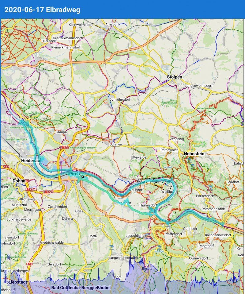
Route description for Vogtland
Rottweil
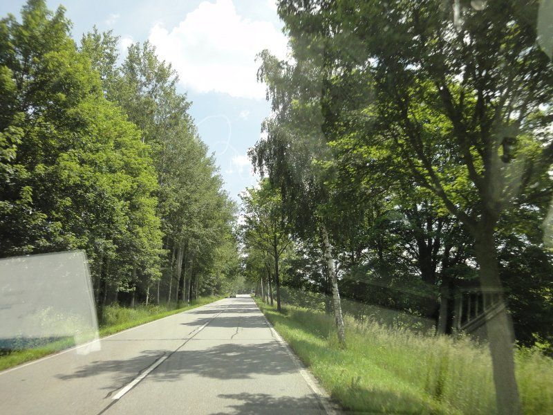
We start our trip on Saturday morning. Originally we wanted to go two days earlier.
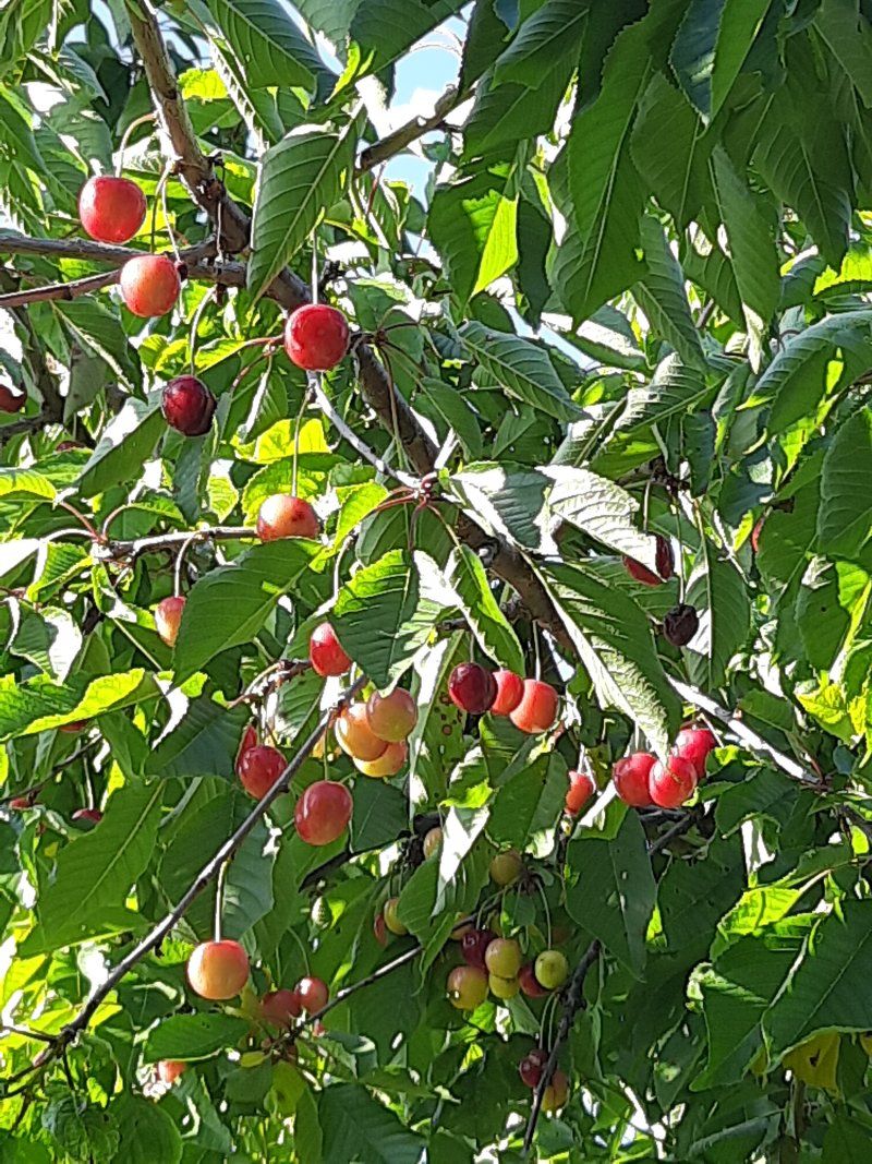
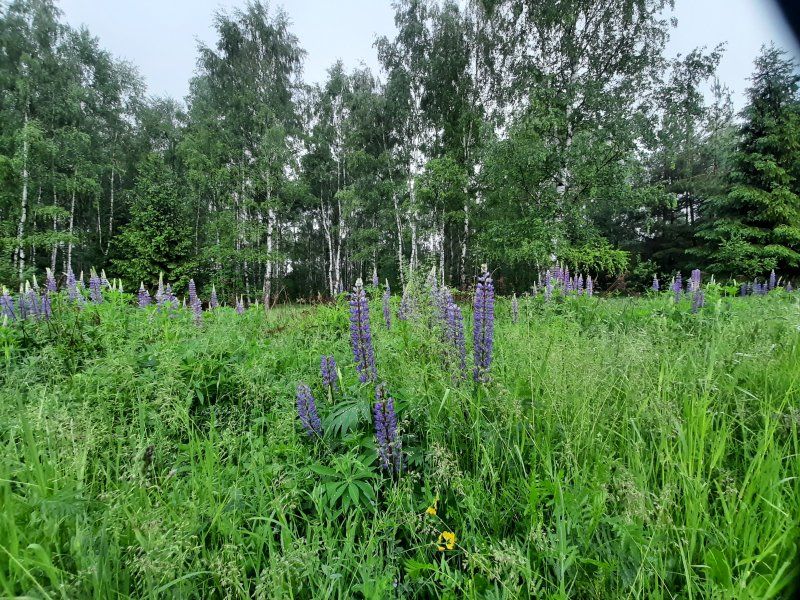
It's strawberry and cherry time in our garden, hence the later departure.
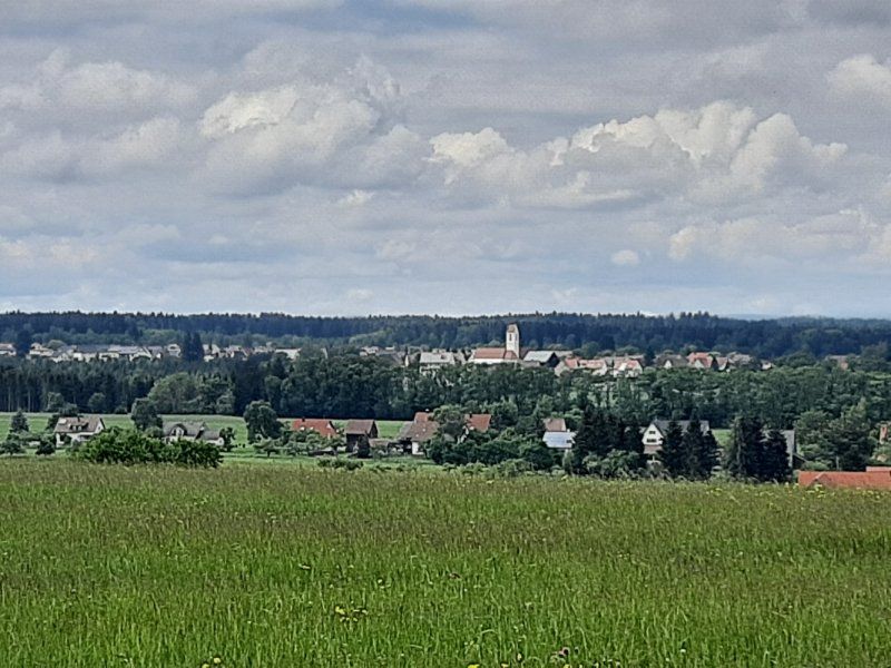
After 255 km we took a break at the rest area near Ansberg.
Deutschland
48° 9' 54.9" N 8° 37' 42.4" E
48.1652577 8.6284530
☍ 433,1 km (3 hrs. 56 min.)
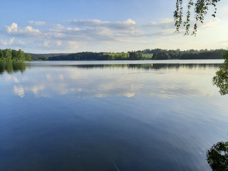
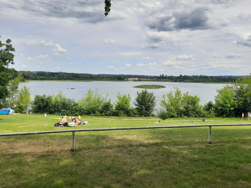
Stellplatz am Untreusee
GPS: 50.285599,11.9139
Arrive after a five hour drive.
There wasn't much going on on the freeways, traffic was moving south on the oncoming lane.
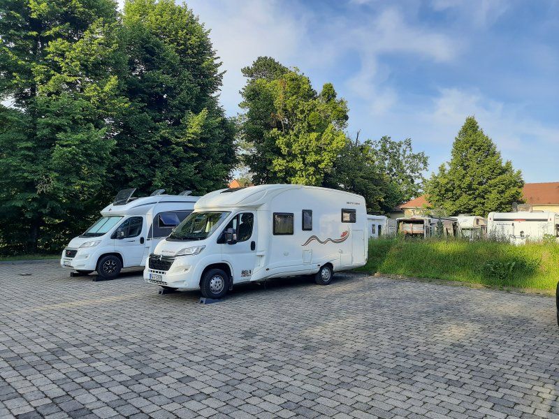
Approached the second parking lot, the first parking lot was unsuitable for our camper in terms of length, short parking spaces and at an angle.
We liked the second parking lot, which is also signposted for campers. There were already a few mobile homes on the site.
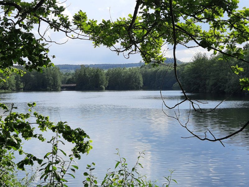
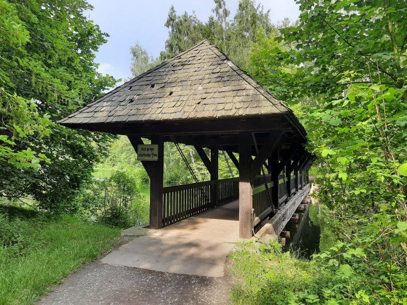
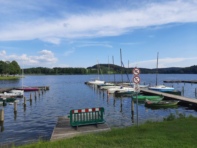
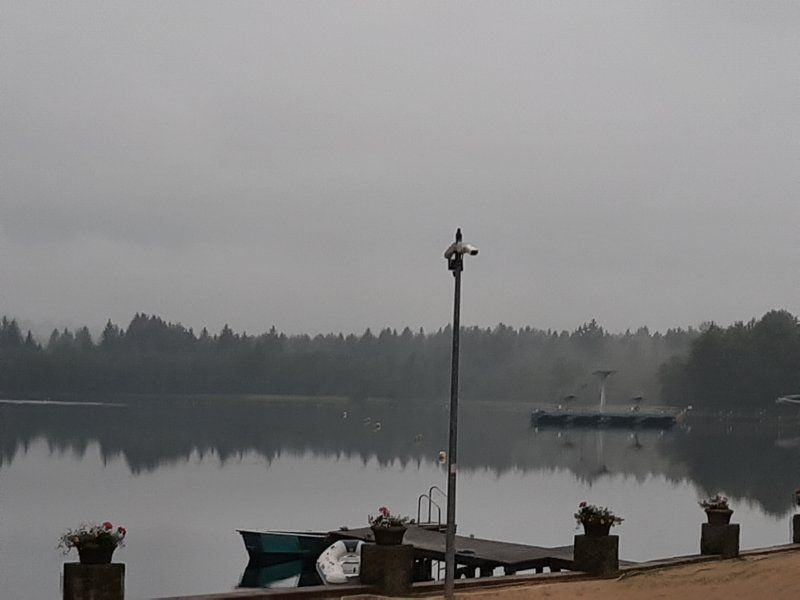
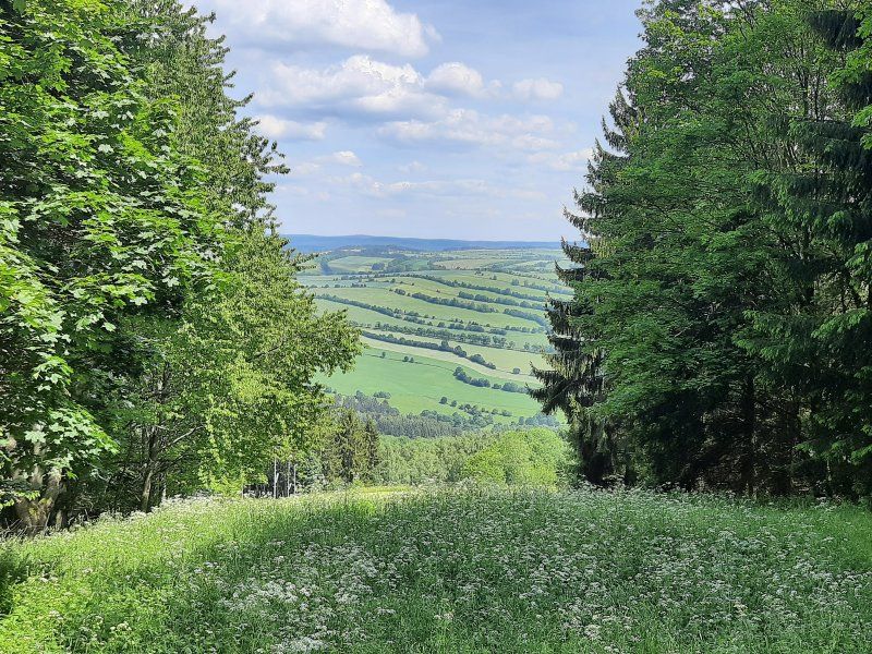
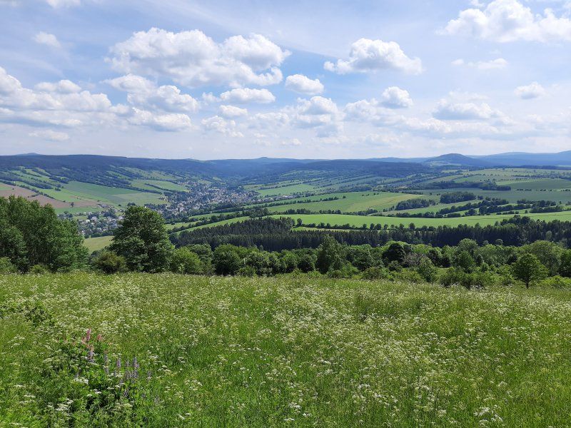
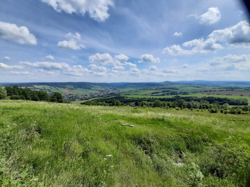
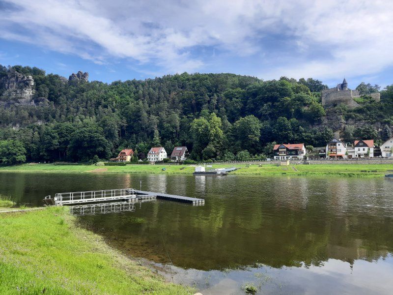
After a very short coffee break, we immediately went swimming in the lake. The Untreusee dam is a nature reserve with an adjoining amusement park, climbing garden, mini golf, boat harbor with beer garden.
We used the muggy, hot weather at 28°C for swimming. Water temperature 20.8°C current display at the jetty. Two hours of bathing fun were enough to then walk around the lake. We enjoyed beautiful scenery on the walk.
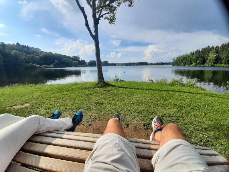
Arriving back at the Womo, Irmgard prepared dinner, which we ate comfortably outside.
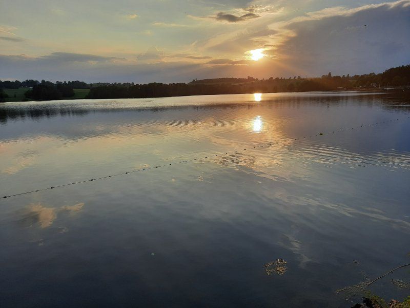
The announced thunderstorm passed and it was a warm, beautiful summer evening. Irmgard took advantage of the weather and went back to the lake at 8 p.m. to swim.
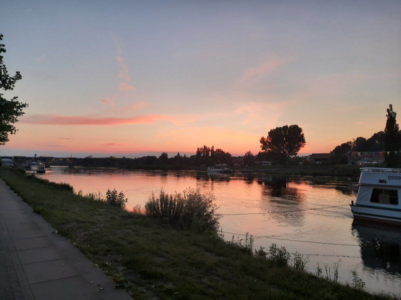
We ended the day with the sunset.
Am Lindenbühl 6, 95032 Hof, Deutschland
50° 17' 12.2" N 11° 54' 50.6" E
50.2867300 11.9140600
☍ 45,2 km ( 31 min.)
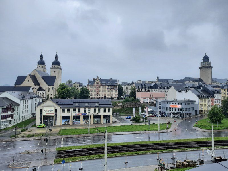
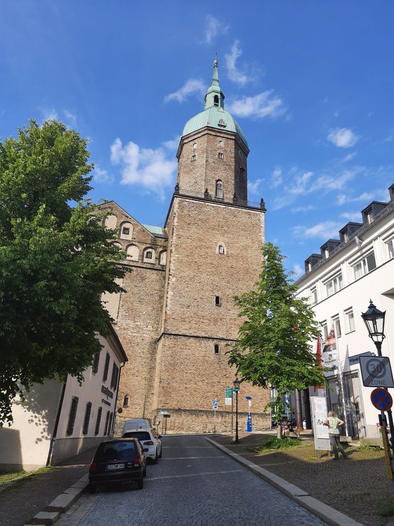
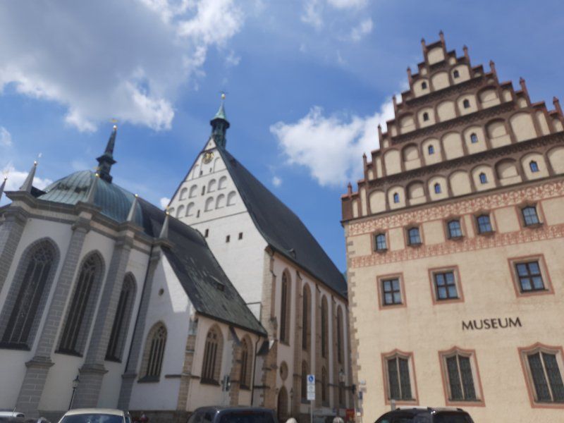
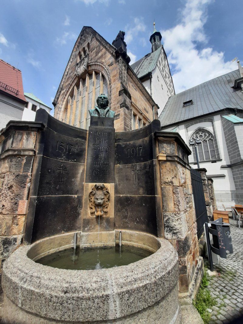
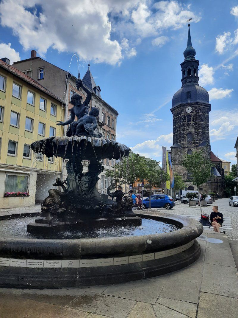
Plauen
GPS: 50.493482,12.140713
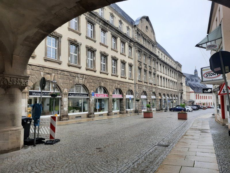
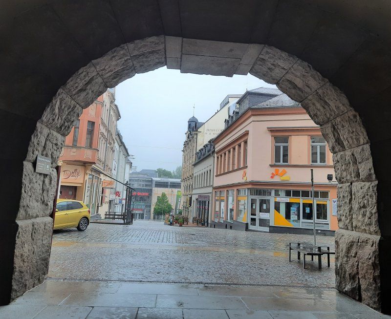
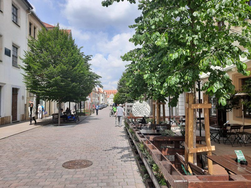
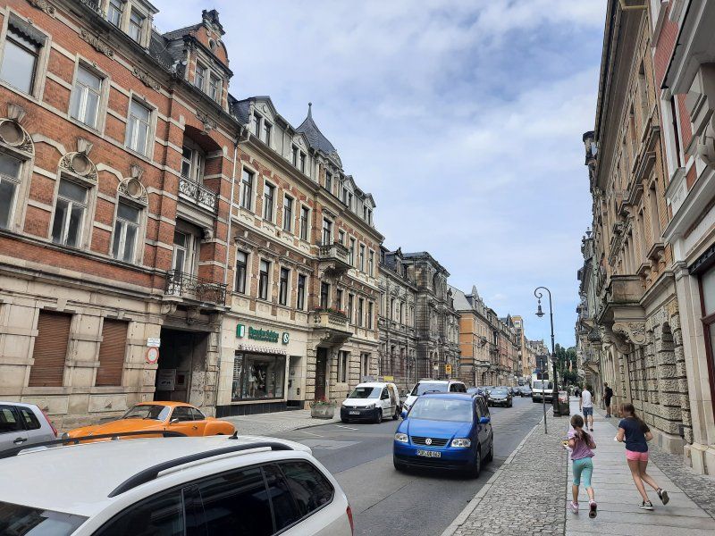
On the way to Plauen we got caught in a heavy thunderstorm on the A72 near the Elster Bridge, which didn't let up until Plauen.
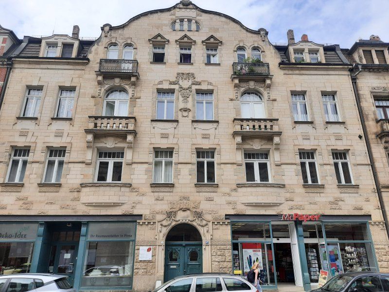
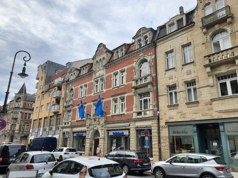
The approached parking lot near the center was empty. The rain had eased off a little and thunder was heard from time to time. Despite the rain and equipped with an umbrella, we went on a city tour.
The old town of Plauen did not have it easy. A major fire at the end of World War II destroyed around 40%. However, Plauen rebuilt most of the buildings.
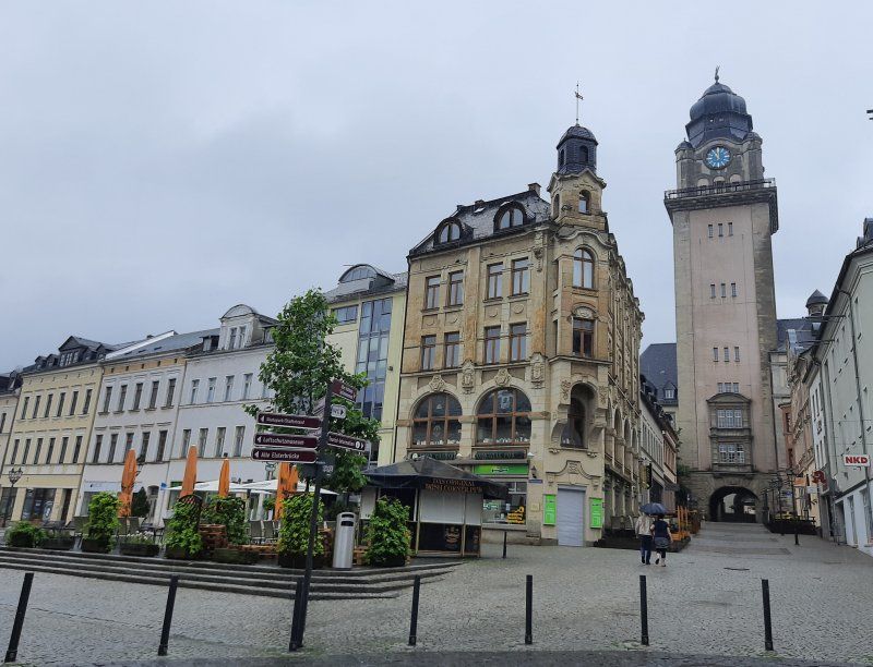
We walk up to the old town.
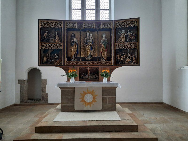
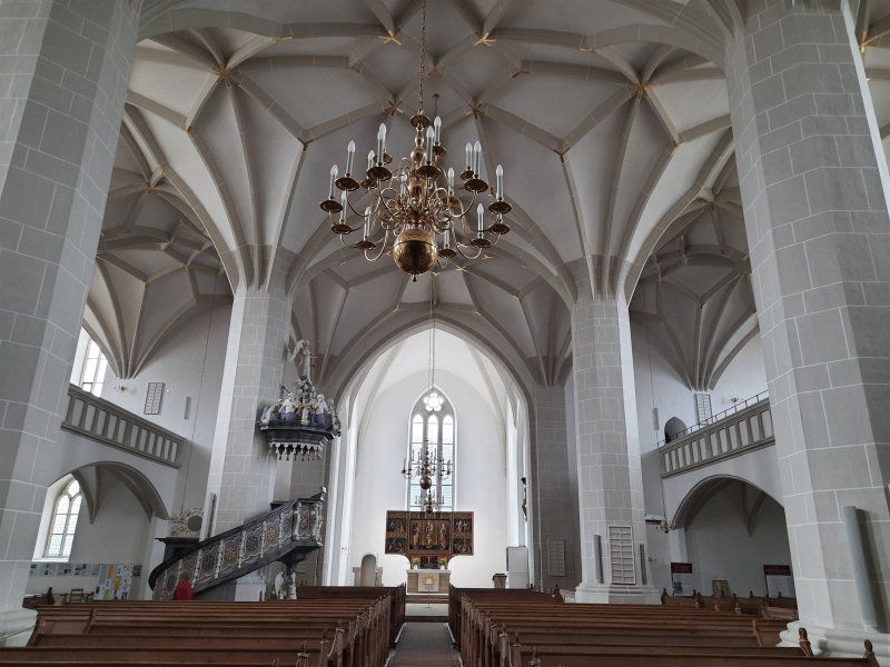
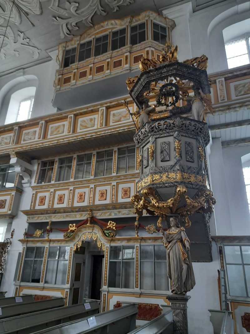
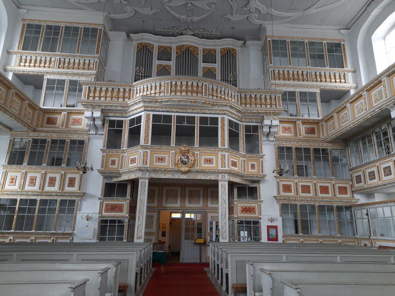
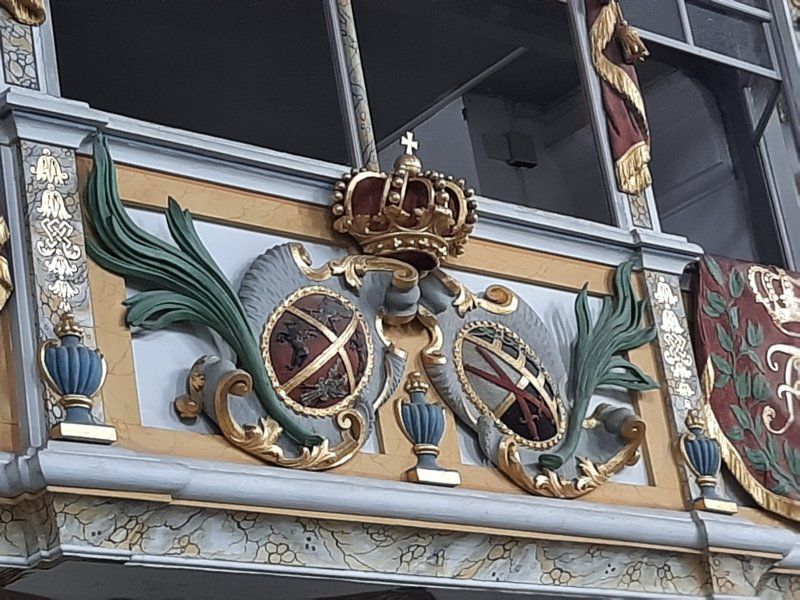
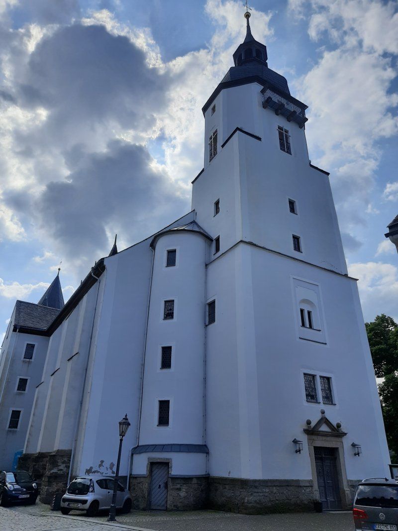
The chapel of the bailiffs and the Johanniskirche
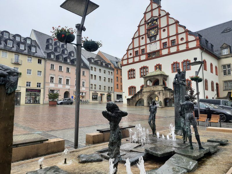
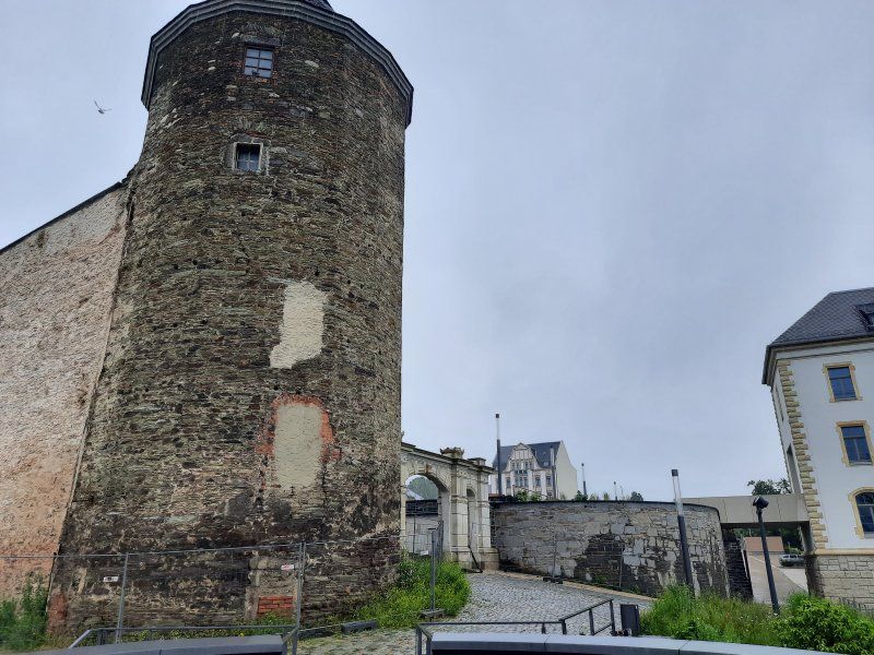
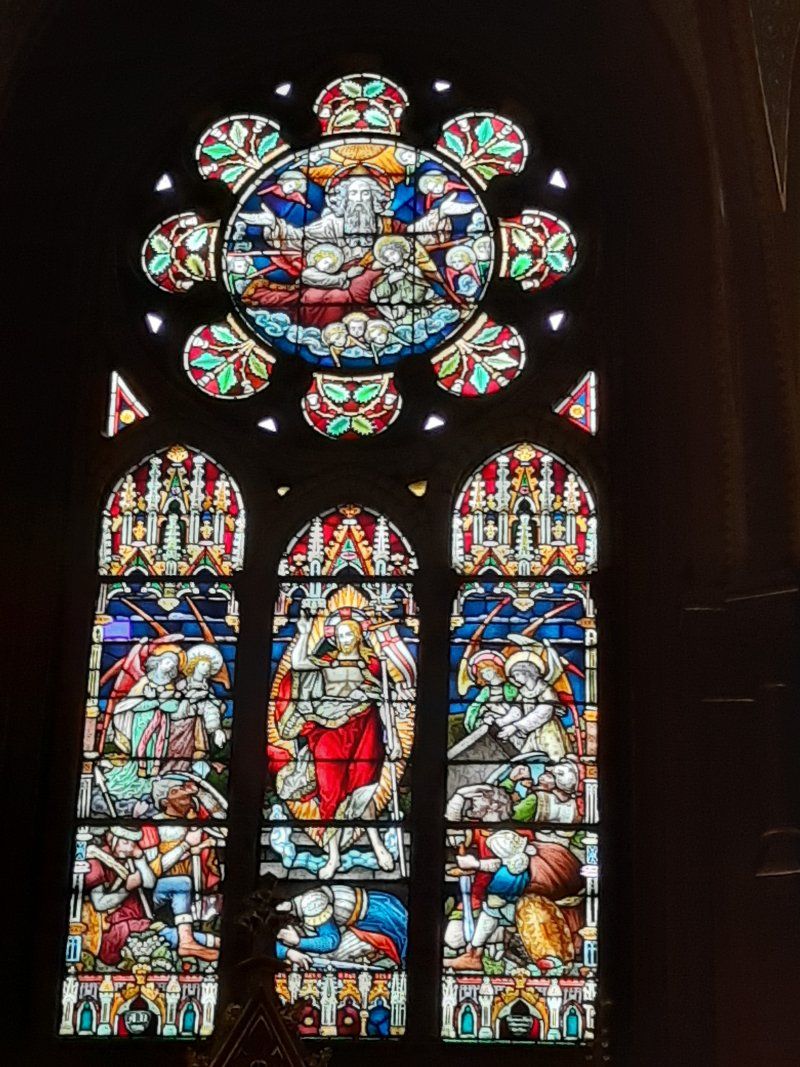
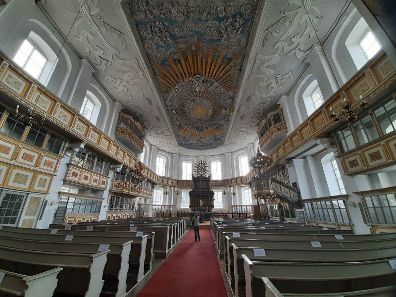
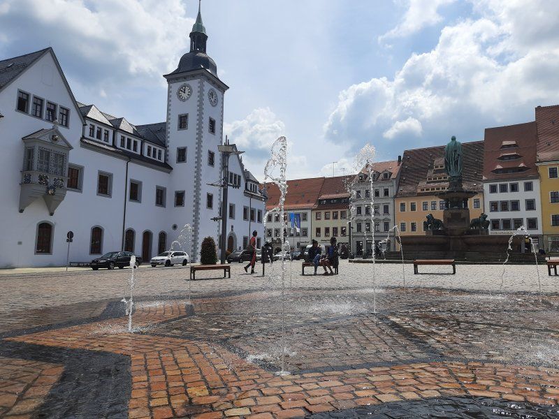
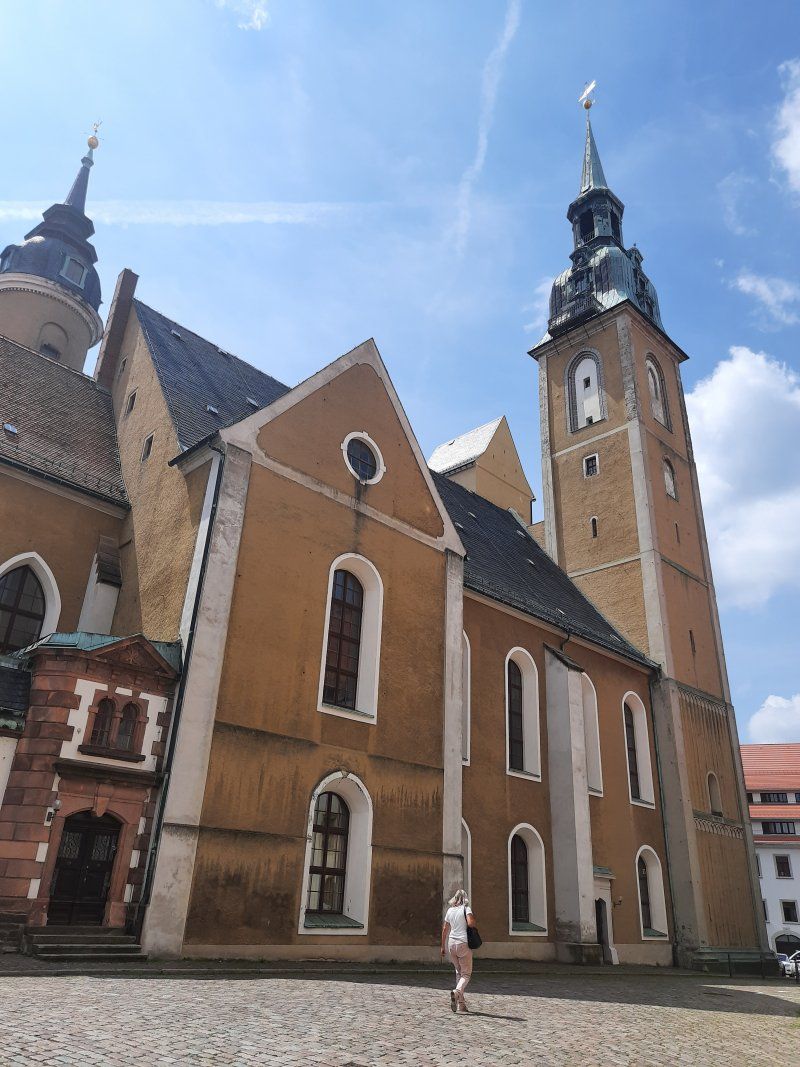
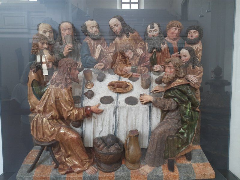
had opened, which we looked at extensively on dry ground. The Johanniskirche has its origins as St. Johannis as early as 1122 (it was built by the Eventsteiners) and experienced its heyday in the epoch of the bailiffs, who had the church house expanded into a three-aisled basilica in 1233. What amazed us was the altar in the choir room with the Mother of God. The rest of the way through the city ran in the rain via the market square with the old town hall and art clock on the gable, the King Albert fountain, the monument to reunification and finally the castle ruins with a view of the old town. The castle of the bailiffs in Plauen was also badly damaged by the bombs – everything was destroyed apart from two towers and a few walls and a cell block.
During our visit, the city was deserted, no cars drove.
One and a half hours were enough to look at the city, after which we arrived at the camper a bit soaked.
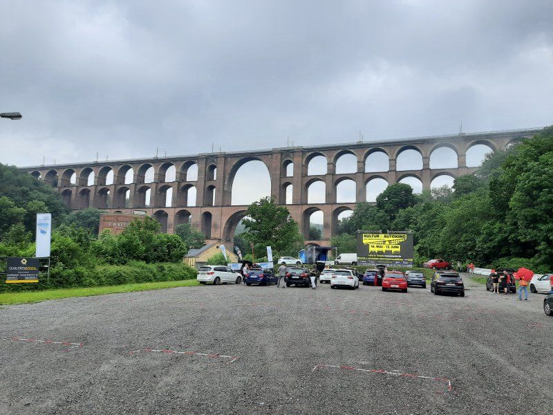
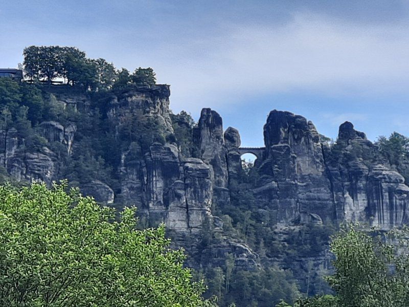
As we continued our journey, it was a short stretch on the A72 to our next destination, the town of Mylau with the world's largest brick bridge, the "Götschtalbrücke".

Plauen, Deutschland
50° 29' 36.7" N 12° 8' 28" E
50.4935299 12.1411114
☍ 23,4 km ( 21 min.)
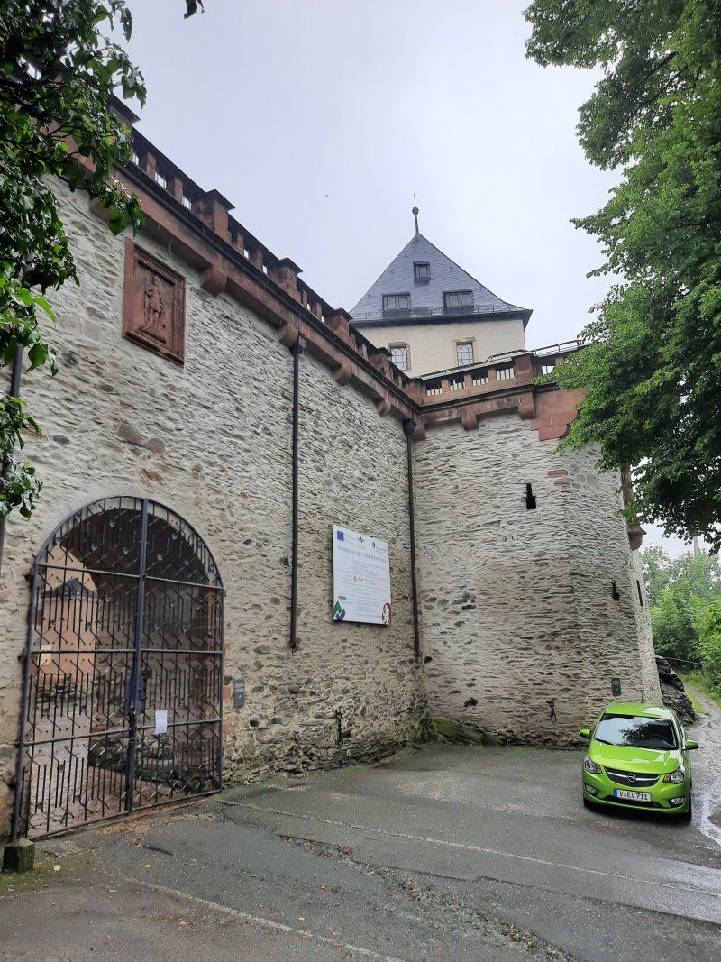
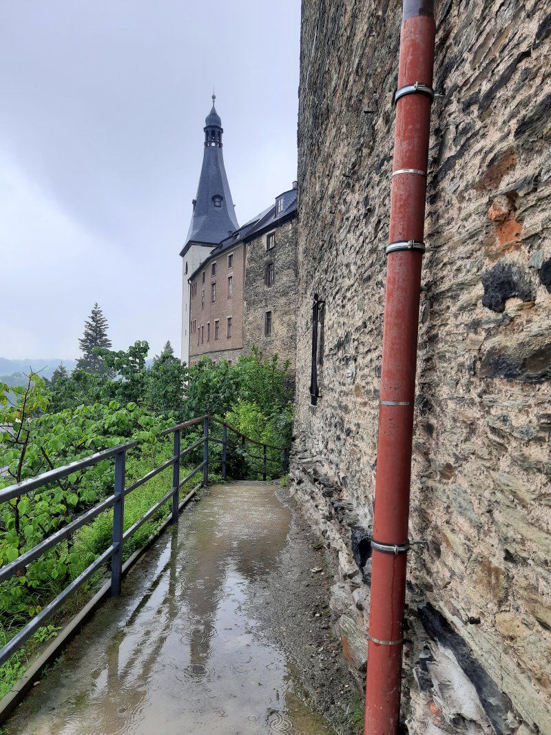
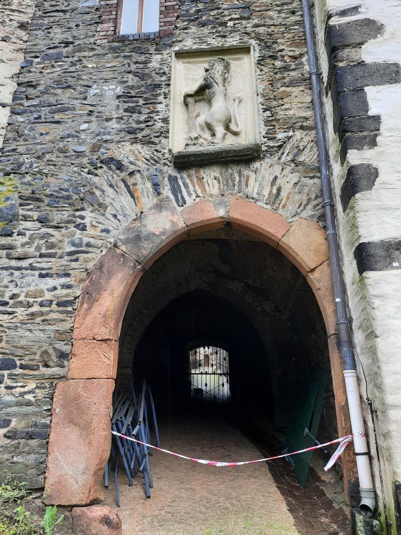
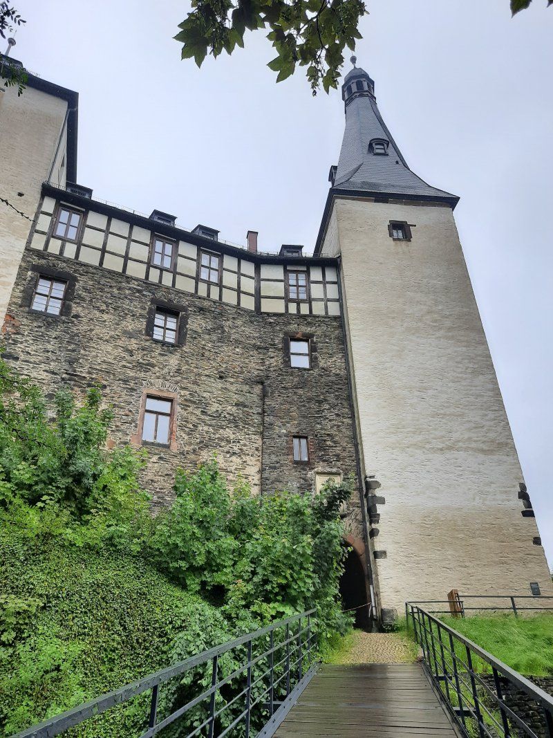
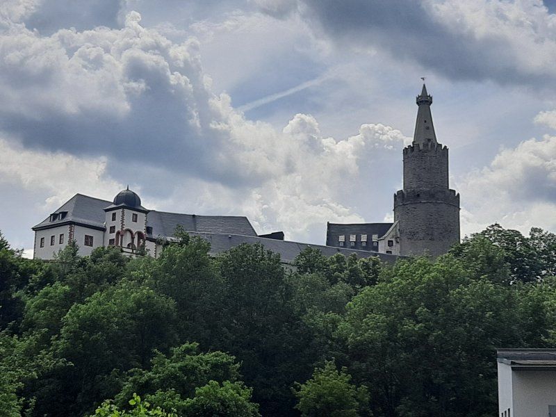
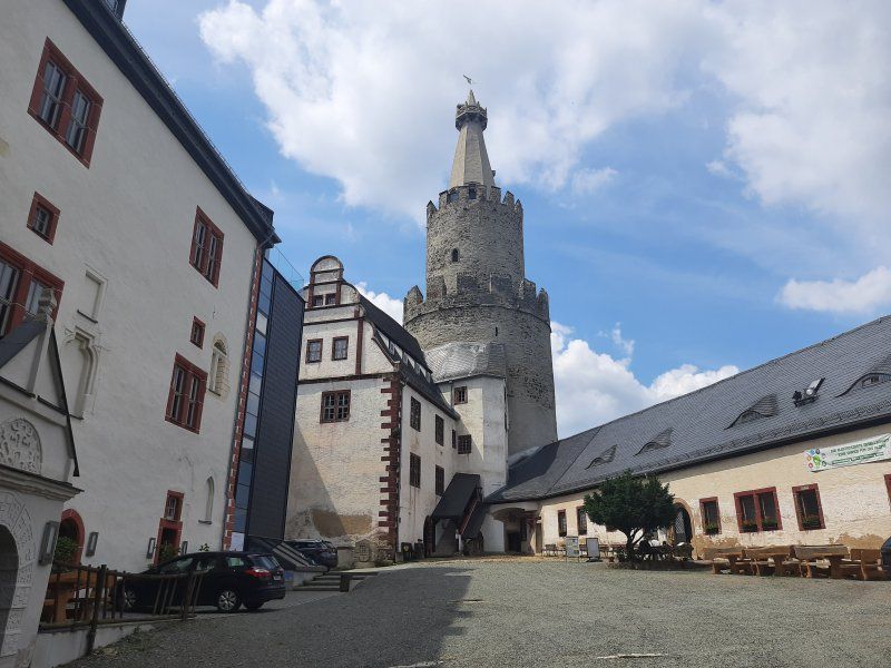
Mylau
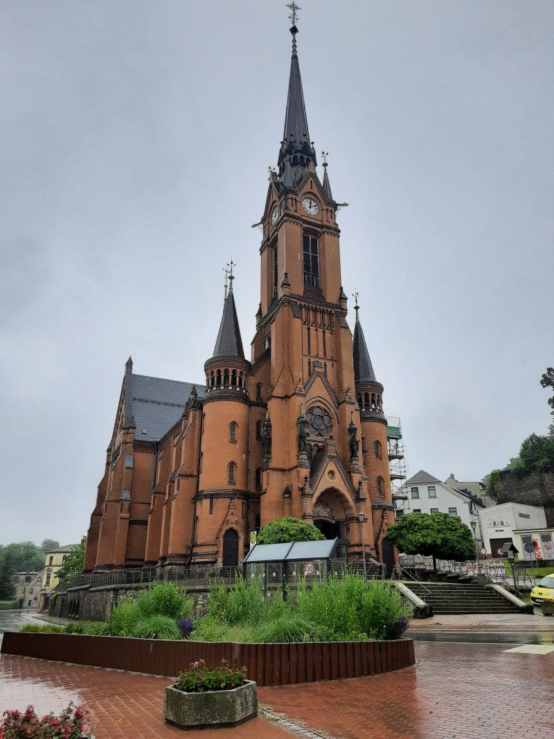
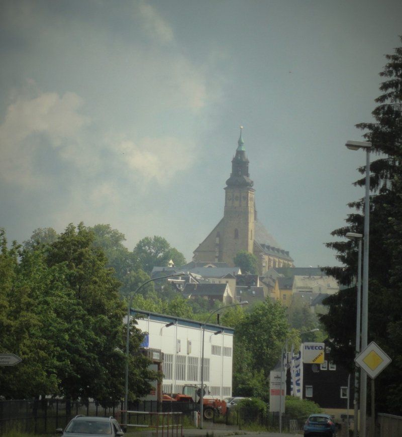
We obediently followed the navigation system that led us to the castle gate of Mylau Castle. That wasn't the selected parking lot we wanted to go to. We turned around and drove out of town into a discount store parking lot. Again, the rain didn't stop us from looking at the small town with the largest brick bridge in the world. First we visited the large brick church which can be seen from afar. The neo-Gothic church with an unusually high tower was built in the years 1887-90 on the site of a previous building, probably from the 13th century.
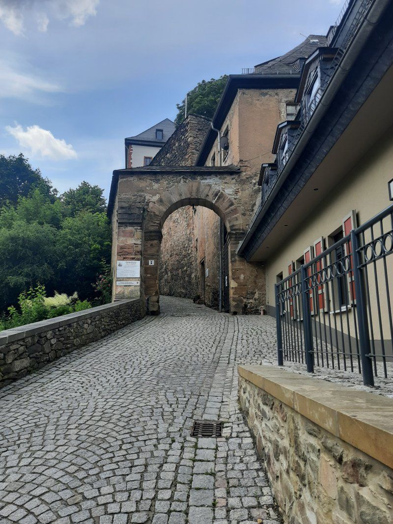
Next to the church is the castle gate to the castle garden. A paved footpath leads up to the castle, to the Löwentor. The gate was locked and a path leads along the castle wall around the whole castle. The castle museum was closed so we used the path around the castle.
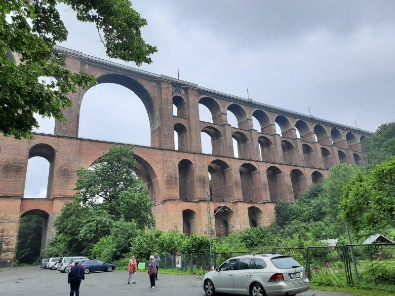
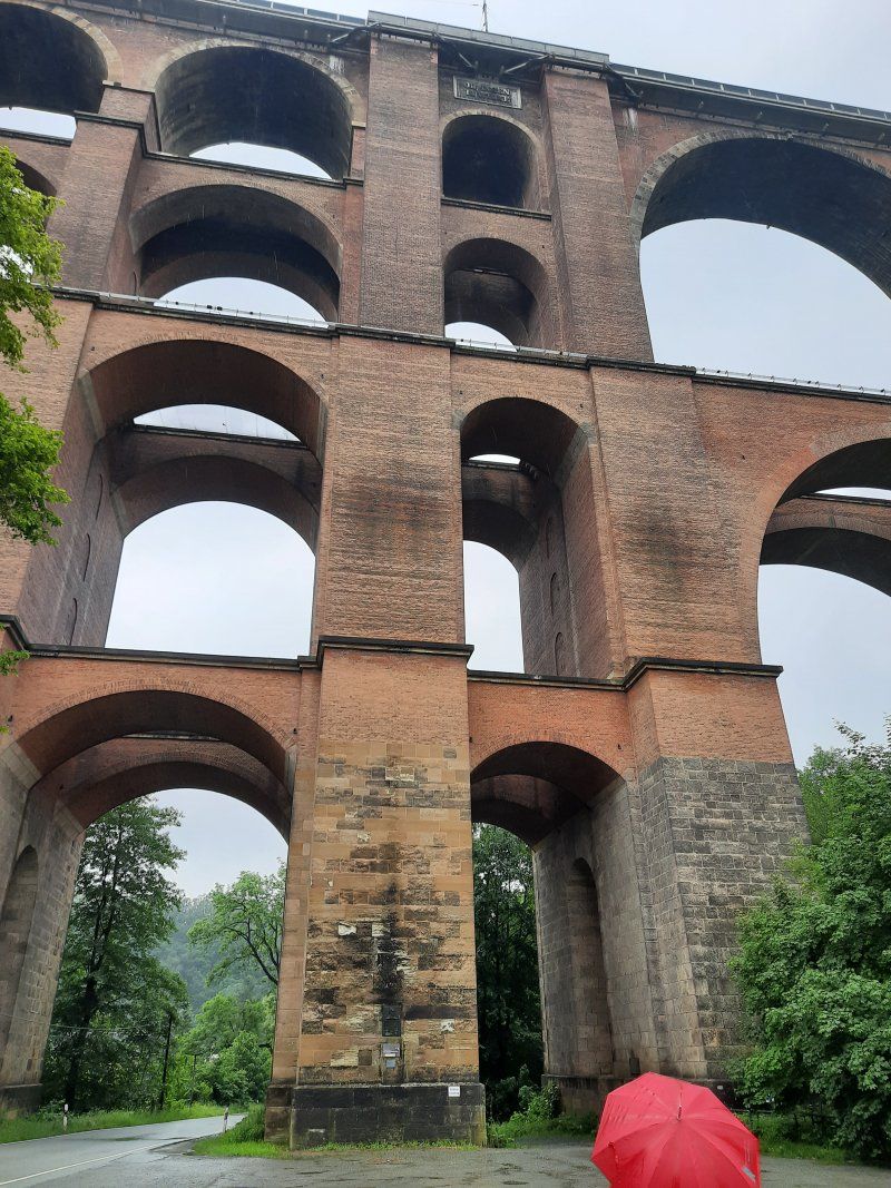
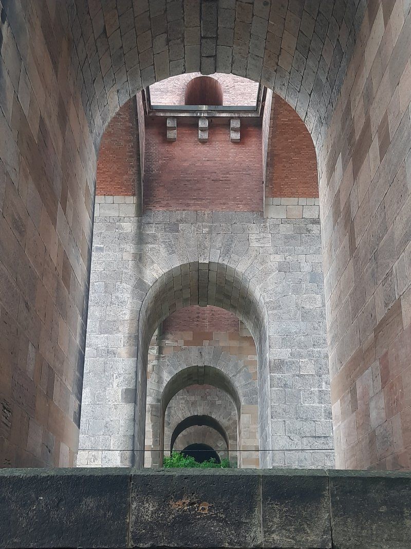
After circumnavigating the castle, we went to the Göltzschtalbrücke, a 2 km walk.
Really impressive structure: The largest brick bridge in the world with almost 26 million bricks and a total length of 574 m, the Göltzschtalbrücke in the Saxon Vogtland is the largest brick bridge in the world. From a distance you can only see a bridge, but when you stand directly in front of it, you can see what an engineering feat this structure is. What people created here in the 19th century is sensational.

Mylau, Deutschland
50° 37' 8.1" N 12° 15' 57.5" E
50.6189108 12.2659709
☍ 38,4 km ( 34 min.)
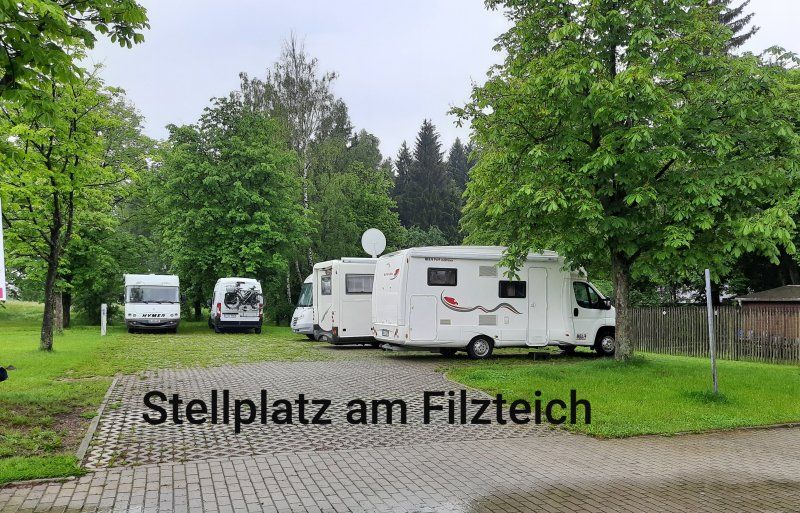
Stellplatz Filzteich (Schneeberg)
The pitch (GPS: 50.573787,12.611844) is about 3 km away from Schneeberg on a hill.
Four mobile homes were parked on arrival.
The seaside resort was closed, so the place was free. The weather was rainy but warm (18°C).
It was bleak on the pitch on this rainy day.
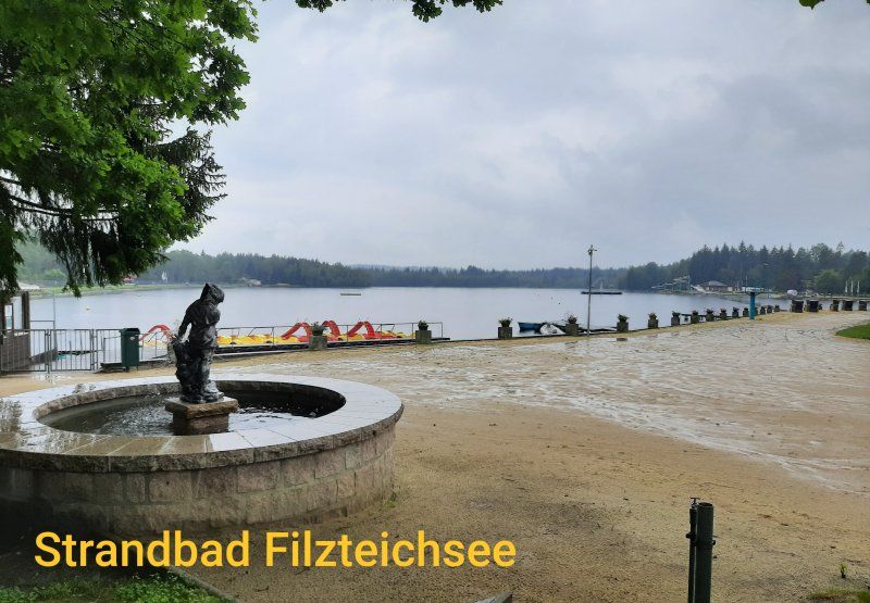
It rained until the evening and we still decided to take a walk around the lake. A special circular route around the lake is not signposted, so we set out on our own. Irmgard took the bathing suit with her to possibly go swimming at a suitable spot. The paths lead far from the lake, around the lake, estimated route length around 4 km. It is all a nature reserve around the lake and there was no path to get to the lake shore. It had stopped raining and the air was very damp.
At dusk it was very quiet, just before that there was a loud chirping of birds. Silence also lay over the lake.
We skipped a visit to the town of Schneeberg. We only saw the church as we drove by.
Am Filzteich 3, 08289 Schneeberg, Germany
50° 34' 25" N 12° 36' 39" E
50.5736111 12.6108333
☍ 20,9 km ( 26 min.)
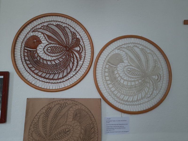
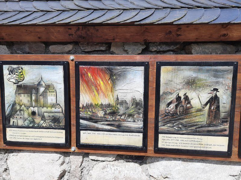
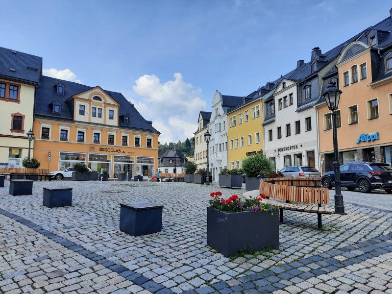
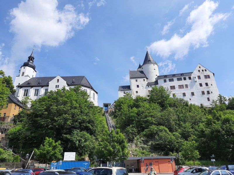
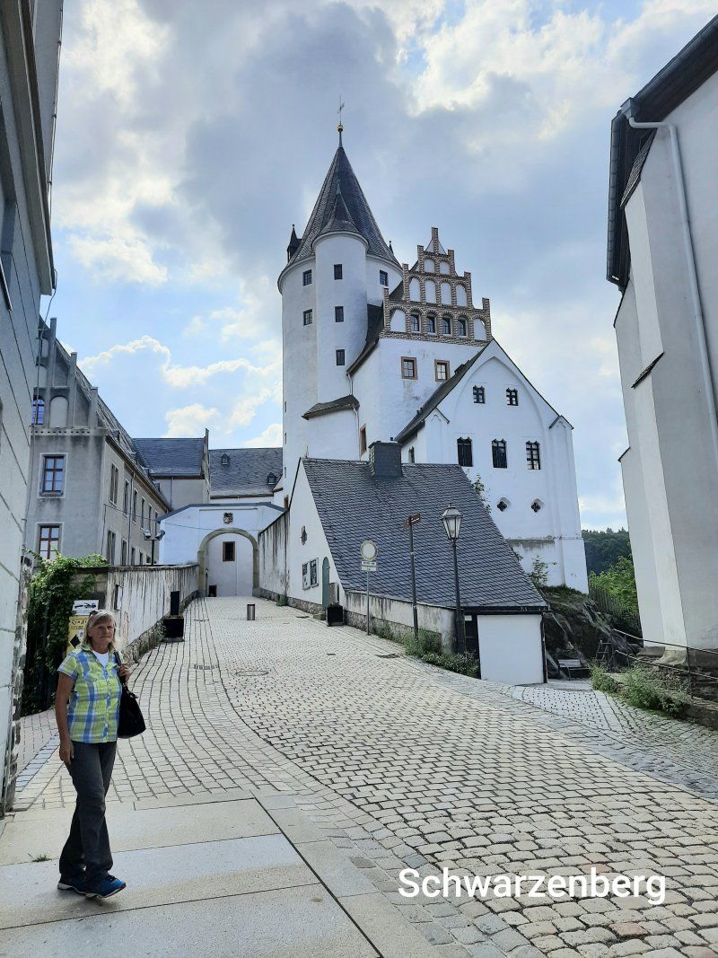
Schwarzenberg
This morning we were woken up with the first rays of the sun. A very quiet night on the square lay behind us. At 7:30 a.m., the first employees drove up from the lido. Irmgard thought about swimming another lap, which she didn't do. By the time we left, no bath visitor had arrived. Around 9 a.m. we continue along Silberstrasse to the RV park Uferstrasse, Schwarzenberg, (GPS: N50°32'06" E12°46'58"). The parking space is close to the center.
It soon becomes the norm that our sat nav leads us to the wrong destinations. Today it took us past the parking lot to the upper town of Schwarzenberg, where there was no parking lot in sight. (Perhaps it is because we approach all destinations with coordinate data). Spontaneously we turned around and drove into the parking lot for mobile homes that Irmgard had seen driving past in the lower town.
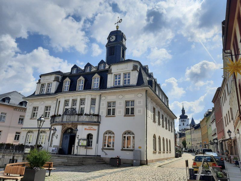
We now went to the old town on foot, for this you can use an elevator to the castle. We use the stairs that also lead to St.Georg Church. The castle and the St.Georg church next door form the silhouette of the city, which is also called "The Pearl of the Ore Mountains". The keep of the castle comes from a protective castle of the 12th century. The castle church has a very special architectural style unusual for a church.
The castle includes a museum.
The old town is mainly characterized by two streets or an alley "Künstlergasse", where beautiful pictorial paintings of the earlier history and legends of the city of Schwarzenberg can be seen.
We had to walk a little further to a media store to buy a charging cable for Irmgard's mobile phone. After our city tour through the streets of Schwarzenberg, we return to the camper place and continue along the Deutsche Alleenstraße to Annaberg-Buchholz.


Uferstraße 10, 08340 Schwarzenberg/Erzgebirge, Germany
50° 32' 6" N 12° 46' 59" E
50.5350000 12.7830556
☍ 23,8 km ( 29 min.)
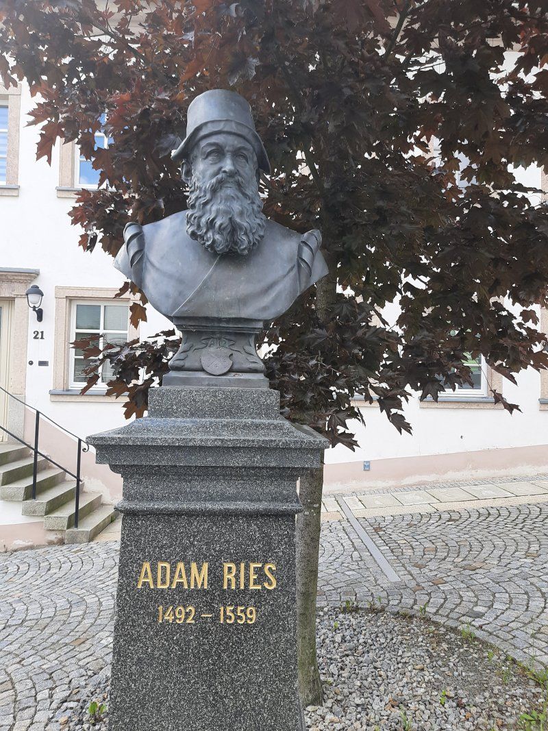
Annaberg-Buchholz
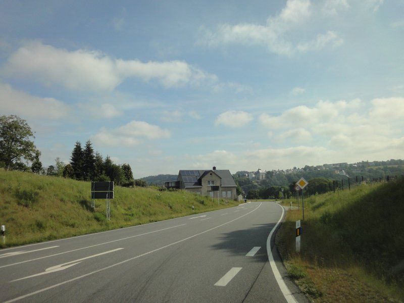
Today was kind of a day with detours on our route. Already on the way to Schwarzenberg we had to turn around because the road was closed. We also had to turn around on the way to Annaberg because we were standing in front of a closed road. The sat nav had guided us fully to the road closures, only after the turning process did it take us to the correct diversion route.
We almost didn't think we would find the parking space anymore, we were also surprised by the hilly landscape of the Erzgebirge and the sometimes very narrow roads on the detour route.
The parking space encountered is located directly in the center of Annaberg. The operator of the parking space is the municipal building yard. Parking space and disposal is free, electricity 1 € / 2 Kw
Annaberg-Buchholz is located in the Middle Ore Mountains at an altitude of 600 meters (above sea level) on both sides of the Sehma valley.
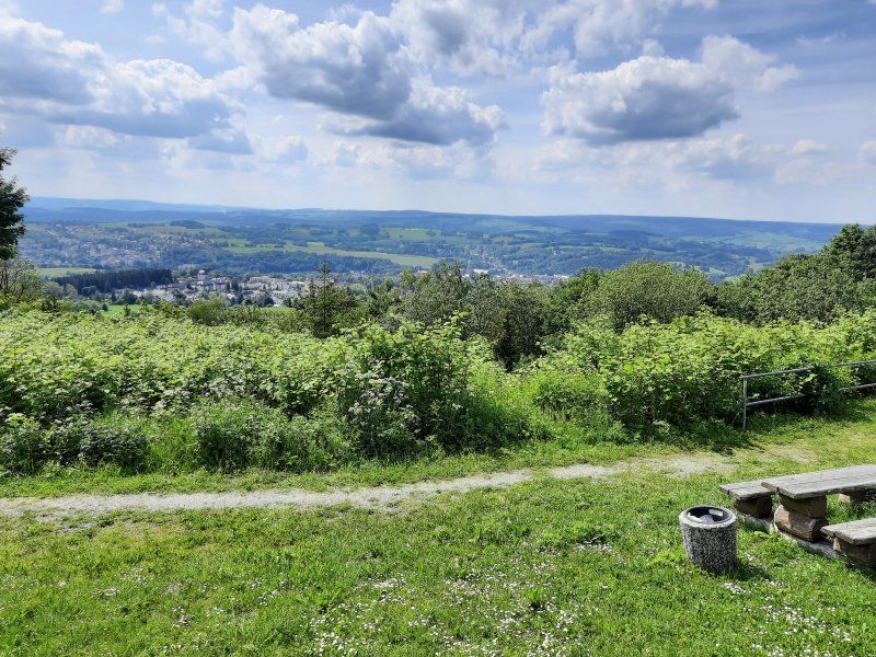
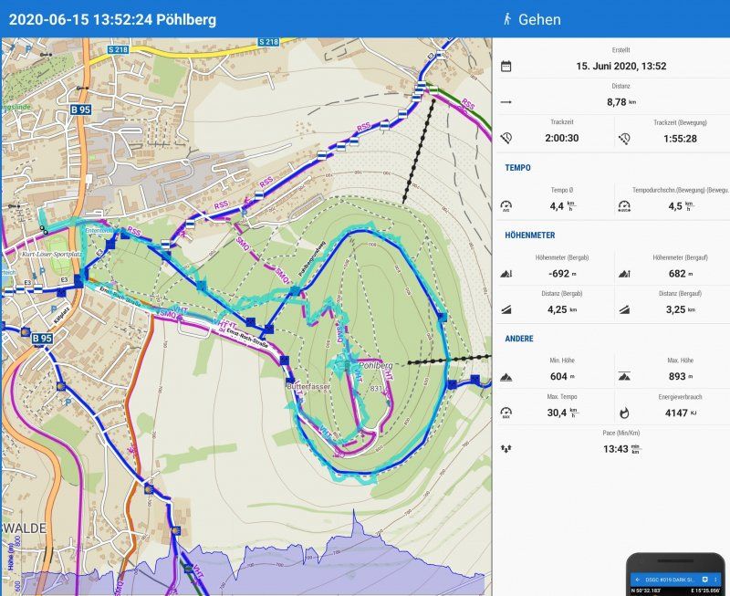
After the coffee break, we got ready for a circular hike on the Pöhlberg, which was approached from the parking space. (route length 8 km)
After the hike we toured the city.
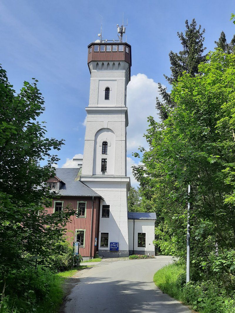
The tower of the largest late Gothic hall church in Saxony, St. Annen in Annaberg, is a much-visited sight. With a height of 78.6 meters, it forms a striking dominant feature of the city. We had the opportunity to enjoy a "tower view" over the historic old town and the Ore Mountains. Information and exhibitions on the former tasks of the tower keepers as well as family and tower stories enrich the stay in the tallest building in the city. At the height of the tour of the tower, we are greeted by the tower lady, with whom we had an interesting conversation about the history of the city. The tower guard lives in the highest apartment in the city, her apartment is below the dome of the tower. The cityscape is characterized by many Gründerzeit buildings and the special feature of the extreme hillside location in places.
On our city tour we touch the house with the exhibition on the life and work of the famous arithmetic master and Saxon official Adam Ries.
The baroque town hall, built in 1751, is located on the north-east side of the Annaberg market square.


Deutschland
50° 34' 42.9" N 13° 0' 27.3" E
50.5785870 13.0075835
☍ 14,2 km ( 18 min.)
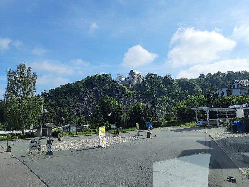
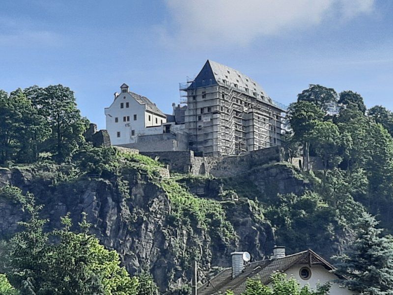
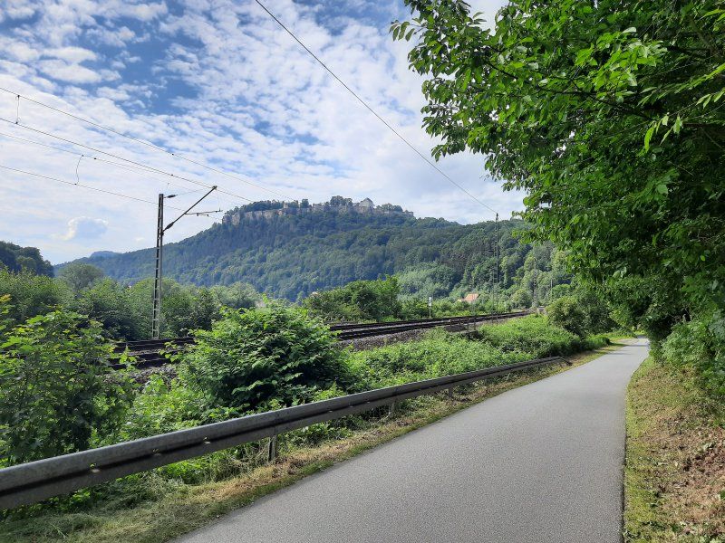
Wolkenstein
After a long lie-in and disposal of our toilet casette, we continued on the Silberstraße to the first stage destination Freiberg.
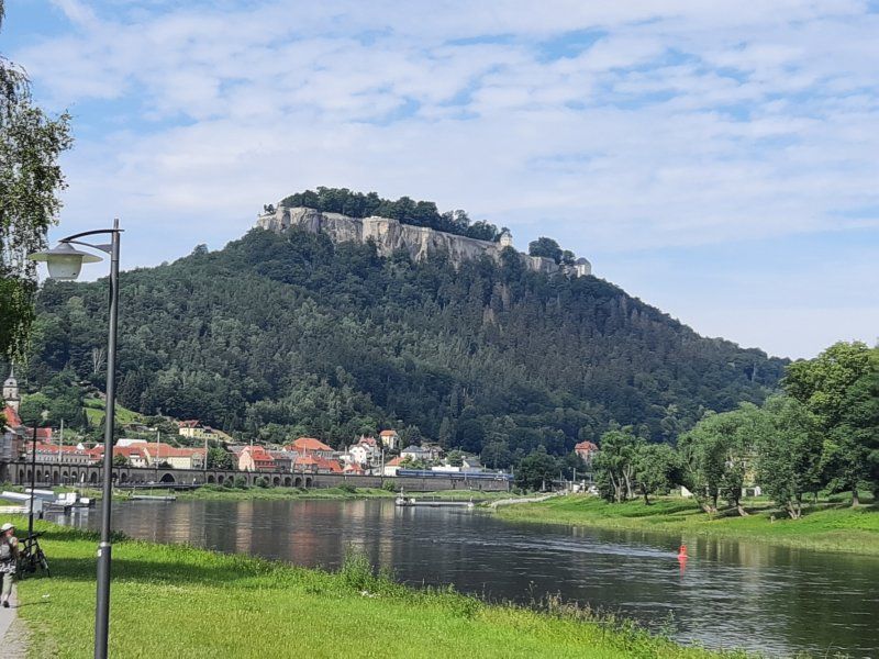
There was a photo stop en route to photograph Selva Castle. Unfortunately the castle is scaffolded. We refrained from visiting.
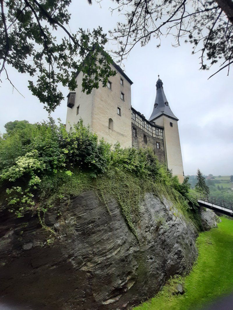
Wolkenstein Castle is a Renaissance-era castle complex on a mountain spur above the Zschopau valley, which goes back to a high medieval castle of the Lords of Waldenburg.
The Evangelical Lutheran St. Bartholomew's Church goes back to a medieval chapel belonging to the castle and was built in its present form after the town fire of 1687.
Deutschland
50° 39' 21.2" N 13° 4' 13.2" E
50.6558998 13.0703273
☍ 7,2 km ( 8 min.)
Marienberg
The historic old town of Marienberg - developed as a city on the drawing board - is a witness to mining town planning. The Renaissance town hall, the mining authority, the hall church “St. Marien", the city wall with gates and towers and the mountain warehouse are just some of the urban planning references to mining in the region.
Deutschland
50° 39' 1.3" N 13° 9' 44.2" E
50.6503661 13.1622883
☍ 39,0 km ( 39 min.)
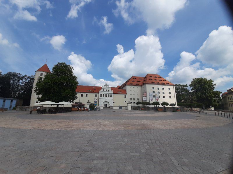
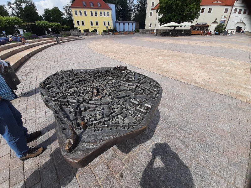
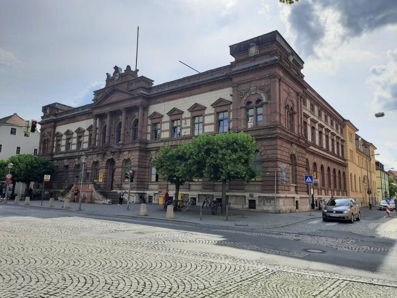
Freiberg
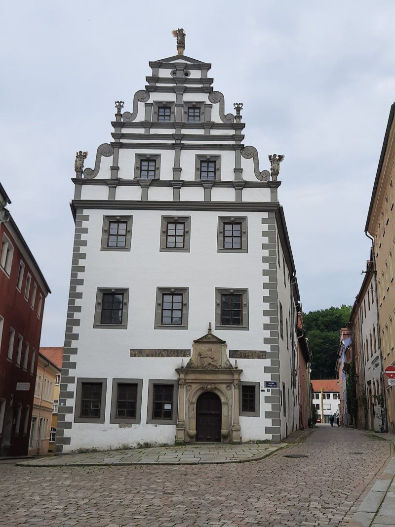
On the way to Freiberg, a diversion was signposted, which we did not follow. But followed a sprinter with the license plate "FG" for Freiberg. In the shortest way we came back to the previous main road. Arrived in Freiberg we also reached the free parking lot at the mining academy. We start our tour and went to Freudenstein Castle.
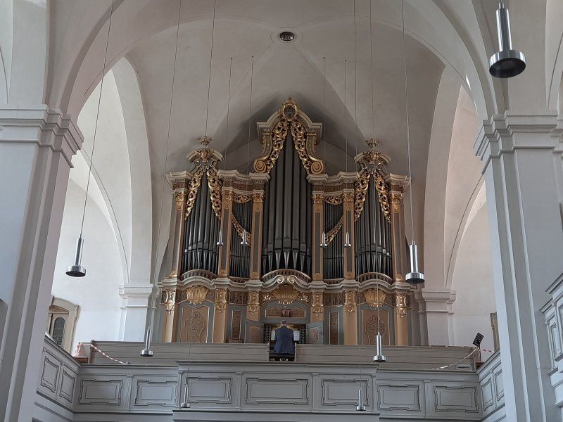
On the square in front of the castle there is a beautiful metal profile of the city. Here we were able to get a rough overview of the further course of the path, which now leads us in the direction of the cathedral. You should have seen the Freiberg Cathedral. It stands magnificently on the Untermarkt and is home to a famous Silbermann organ.
On our city tour we cross the Obermarkt and go to the Petrikirche. The striking church with its two towers offers a possibility to climb a tower and enjoy the city panorama from which we refrain.
Small shops and boutiques line the city center. Historical buildings and the ubiquitous history of mining complete the image of Freiberg.
We didn't have time to visit museums, our main destination today was Dresden.

Silberhofstraße 7, 09599 Freiberg, Deutschland
50° 54' 46.7" N 13° 21' 3.6" E
50.9129637 13.3509999
☍ 41,1 km ( 38 min.)
Dresden Andreas-Schubert-Straße 44
On the way to Dresden we were stuck in a traffic jam on the autobahn for an hour and a half. An accident had occurred in the construction site area and almost nothing was running on the three lanes. The selected, free parking lot at the Lukaskirche is well located for a city tour. 30 minutes walk to City Hall. It was a good decision to drive into the parking lot, it was pretty empty and from what we later saw downtown, there would have been no chance of finding a parking space.
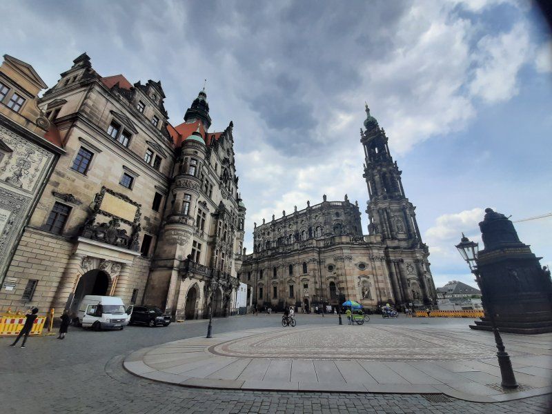
Dresden: , city of baroque and beauty on the Elbe. The city of Augustus the Strong has endless sights to offer.
Frauenkirche, Semperoper, Zwinger, Goldener Reiter.
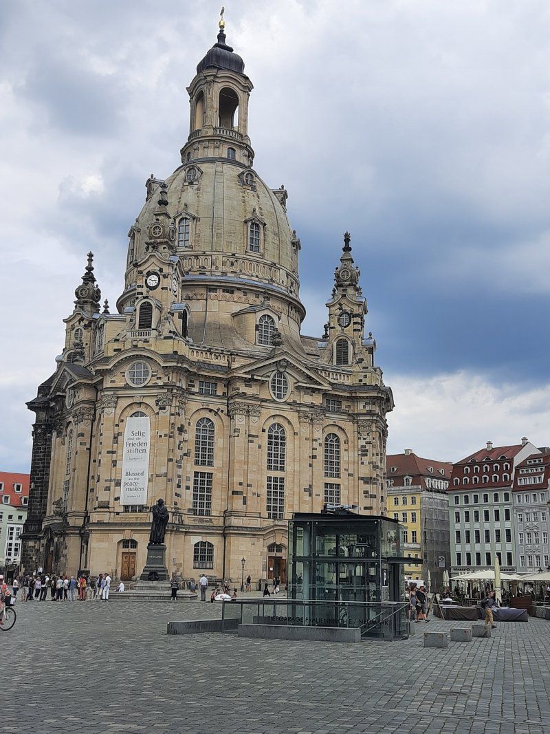
The Dresden Frauenkirche is the first attraction we saw on our short trip to Dresden.
We walk past the town hall to the Catholic Court Church, which unfortunately was closed
From there we visit the Frauenkirche, the Residenzschloss, the Zwinger, walk past the Semperoper, Altmarkt on the Schlossplatz through the Fürstenzug to the Brühl'schen Terrassen.
Built from 1726 to 1743 as the "Church of Our Lady", it represents the absolute splendor of the Baroque like no other building.
In February 1945 it was so badly damaged that it collapsed a day later. In the GDR its ruins were left as a memorial against the war.
It was only after reunification that the church was rebuilt true to the original on the initiative of citizens' and supporters' associations as well as donors.
The isolated dark stones in the church facade are stones from the ruins of the original Frauenkirche, which could be reused in their old place.
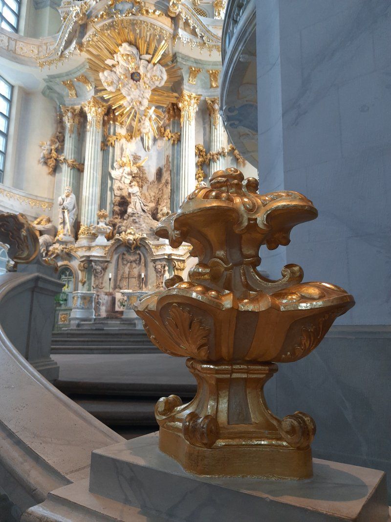
The interior of the church was also restored according to the historical model. The richly decorated altar and the eight ceiling paintings in the dome are real eye-catchers.
Our tour continued via the Altmarkt, it is the oldest square in Dresden and, together with the Neumarkt, the Theaterplatz and the Schlossplatz, forms the most important square ensemble in Dresden's old town.
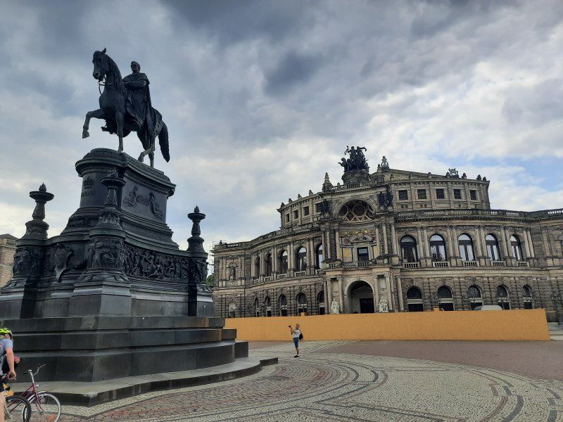
The Semperoper is another landmark. The first Semper Opera was built between 1838 and 1841 under master builder Gottfried Semper.
It was built in the Renaissance style and was considered one of the most beautiful theaters in Europe.
However, it burned down completely in 1869.
The second construction of the opera was commissioned in 1871. Again to Gottfried Semper, who, however, was never present in person because he was banned from Saxony for political reasons. His son took over the direction. In 1878 the second opera was finished. In February 1945 it was hit during the bombardment of Dresden and almost completely burned out.
In 1977 the cornerstone for reconstruction was laid and in 1985 the third Semperoper was reopened.
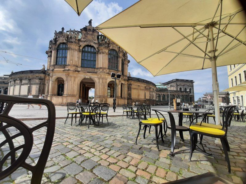
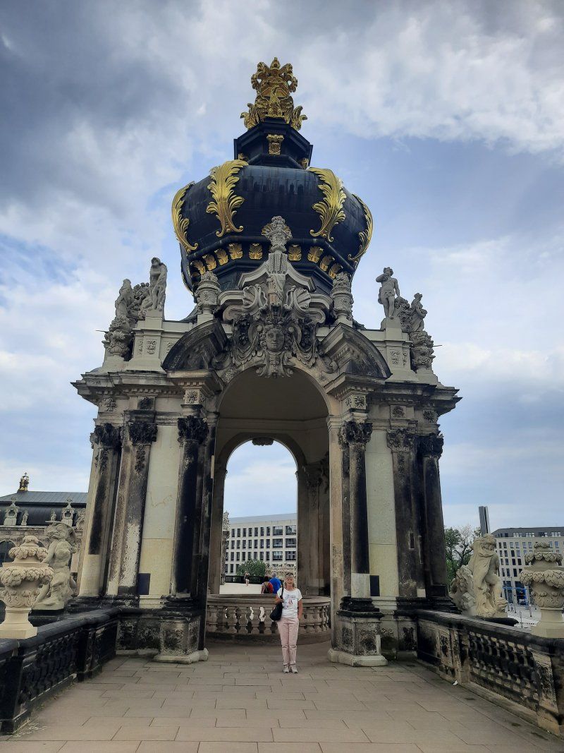
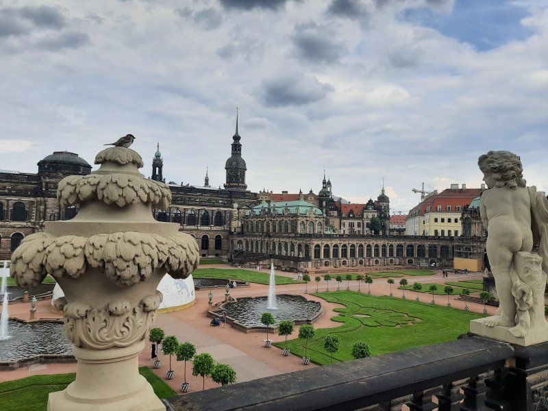
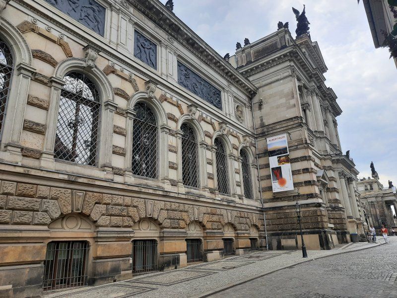
The Dresden Zwinger is one of the most interesting sights. The name Zwinger comes from Middle High German (twingære = oppressor) and refers to the part between the inner and outer fortress wall.
Built from 1709 under the reign of August the Strong as a place of representation, the Zwinger was originally intended to be the porch of a city palace. The Zwinger is therefore a particularly pompous building ensemble of richly decorated pavilions, galleries and gates as well as gardens and water features.
We took a break in the cafe in front of the Zwinger before continuing on the city tour.
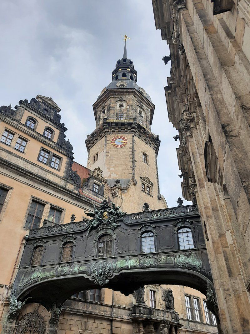
The Residenzschloss is one of the oldest buildings in Dresden and is now a museum. It used to be the seat of the Saxon electors.
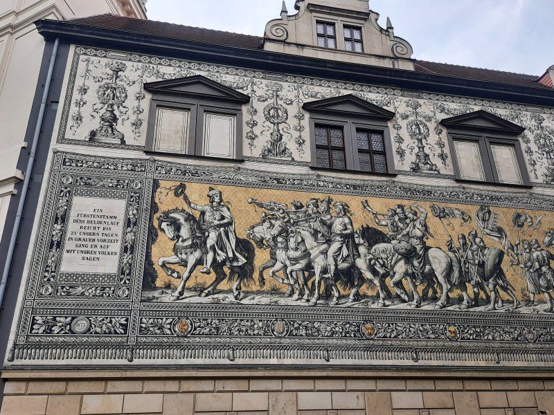
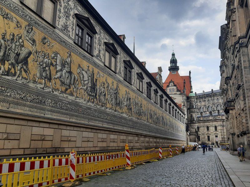
The Procession of Princes is the largest porcelain mural in the world. On the wall of the stable courtyard of the Residenzschloss is the so-called Fürstenzug, a special attraction in Dresden.
The 102 meter long painting, fired onto around 23,000 porcelain tiles, shows the 34 Saxon rulers of the House of Wettin from 1127 to 1873. It is designed as a cavalcade. As early as the 16th century there were paintings on the wall of the stable yard, but they quickly withered. On the occasion of the 800th anniversary of the ruling house of Wettin, they wanted to redesign it. From 1872 to 1876, the original procession of princes was created using the so-called “sgraffototechnik” – a scratching technique. But even this was not up to the weather and had to be transferred to the aforementioned porcelain tiles between 1904 and 1907. The procession of princes survived the Second World War largely unscathed. The procession of princes shows a total of 94 people – including only one female figure.
Before we stroll over the "Balcony of Europe" - the Brühlsche Terrasse, we first went to the Augustusbrücke to get an overall picture of the Brühlsche Terrasse. Built in the 16th century as part of the city fortifications, it was built on from 1814 and opened to the public.
Since then, the Brühlsche Terrasse has been one of the most beautiful vantage points in the city and a popular place for walking. There are also numerous plastics and sculptures that adorn the terrace. From the Brühlsche Terrasse you have a wonderful view over the Elbe to Dresden Neustadt.
We ended our city tour with the last attraction, the Albertinum, and went back to our mobile home.
The Albertinum - today the home of the Neue Meister gallery and the sculpture collection - was originally the armory, i.e. the armory, of Dresden. It was built in the 16th century and has long been one of the most important in Europe.
In the 18th century it was rebuilt and expanded in the Baroque style under August the Strong and his son. The Albertinum bears his name in homage to the then King Albert.

Dresden, Deutschland
51° 1' 57.1" N 13° 44' 3.1" E
51.0325304 13.7341984
☍ 25,0 km ( 21 min.)
Pirna Schloßpark 13a
After dinner we went for a short evening walk through the old town at the market. We were amazed at how well the gastronomy was attended by guests.
Pirna with historic old town.
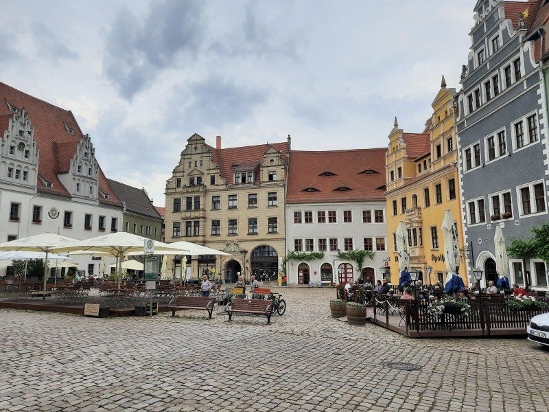
Pirna was first mentioned in documents in 1233. The city quickly developed into a flourishing trading center on the Elbe. This helped to achieve considerable wealth, which was also expressed in the construction of magnificent buildings.
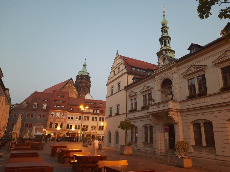
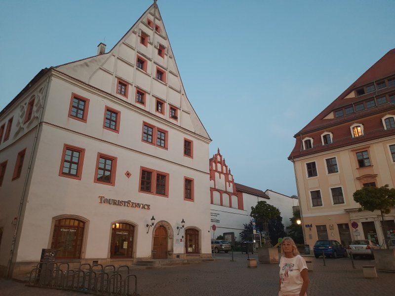
A pearl of Saxon Switzerland – market square in Pirna, Canaletto and history: The works of the important veduta painter Bernardo Bellotto – better known as Canaletto – prove that the town center has remained almost unchanged for centuries. Commissioned by Elector Friedrich August III. he created numerous views of Dresden and Pirna. Between 1753 and 1755 he created a total of eleven large Pirna city views, using a camera obscura. The most well-known work of art from this series is "The Market Square in Pirna", where the "Canaletto House", named after the painter, can also be seen. The TouristService Pirna is located here today, as well as a small exhibition on the painter and his works. The detailed vedute give a unique insight into the city ambience and life of that time. The attentive observer will not be able to resist a comparison with today's appearance and will see that a lot has been preserved.
The town hall of Pirna
The building on the market square was first mentioned in 1396 and rebuilt several times in the centuries that followed. It received its baroque tower at the beginning of the 18th century. The building is adorned with a sundial, the city coat of arms, an art clock and a moon phase ball.
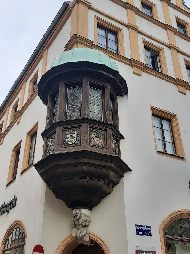
The Teufelserkerhaus is located on Obere Burgstraße and was built at the end of the 16th century. A two-story, lavishly decorated bay window supported by three devils gave the building its name.
Parking lot was very quiet at night, early in the morning the cobblestone street passing by is very noisy. For this reason we got up early, had breakfast and got ready for the planned bike tour.


Pirna, Deutschland
50° 57' 36.4" N 13° 57' 6.9" E
50.9601141 13.9519282
☍ 15,7 km ( 17 min.)
Parkplatz Gohrisch - Wanderung Sächsische Schweiz
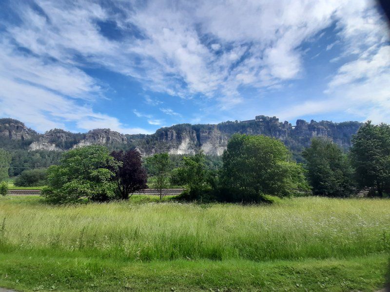
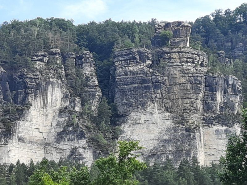
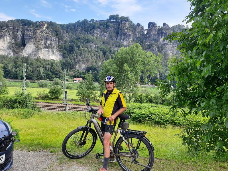
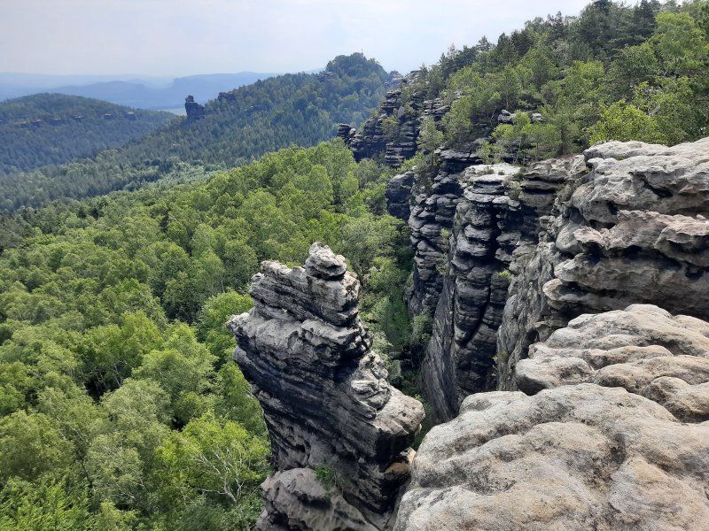
Today we set off early to Gohrisch for a half-day hike over the three mountains Gohischstein, Papststein and Kleinhennenstein .
Before we parked in the center of the spa town of Gohisch, we drove to the site for disposal.
Hike:
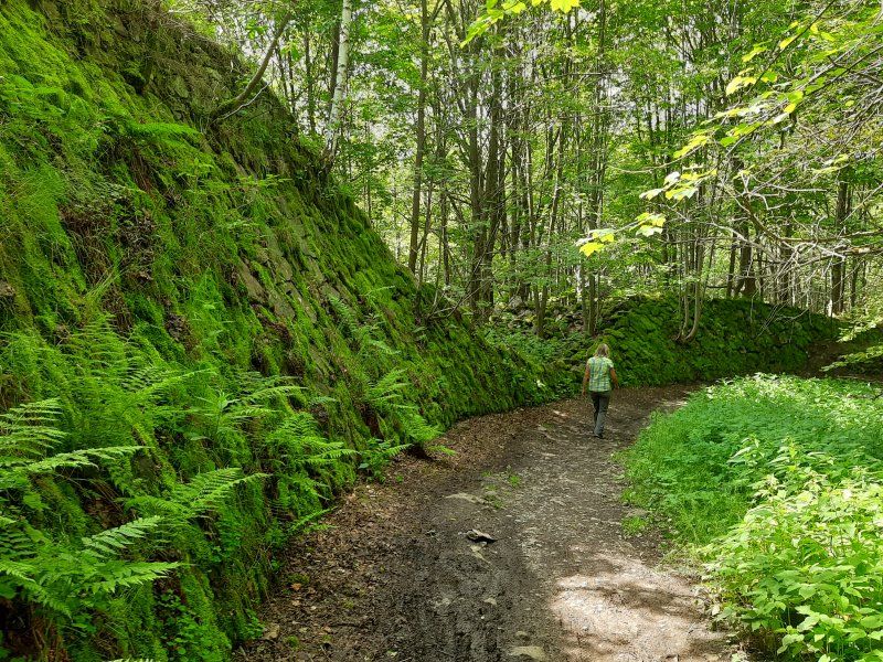
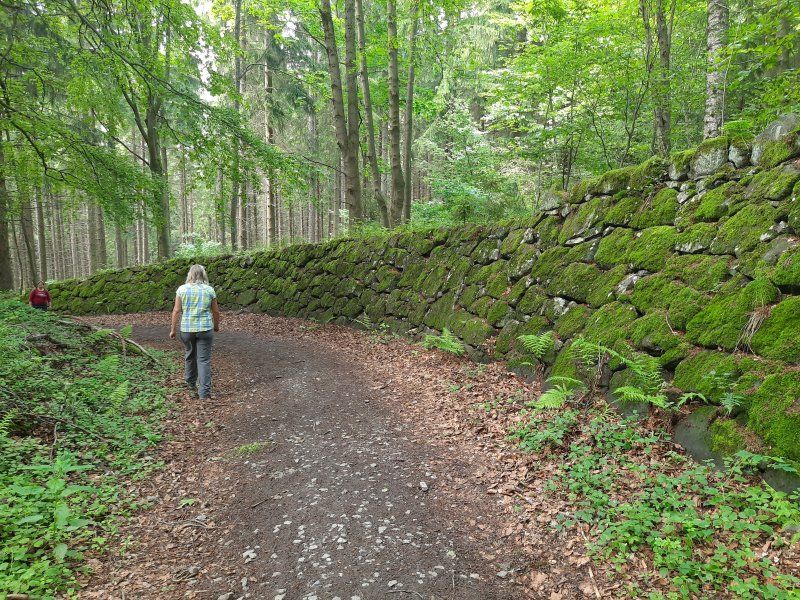
Our hike starts at the car park in the center of the spa town of Gohrisch. A signpost shows us the direction to the Stille Grund and to the Gohrisch rock with the yellow dot marking. In the flat meadow valley of the Stille Grund we reach the corner of the forest
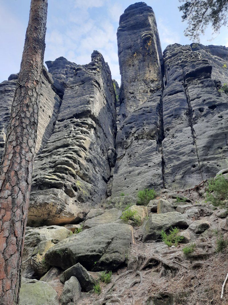
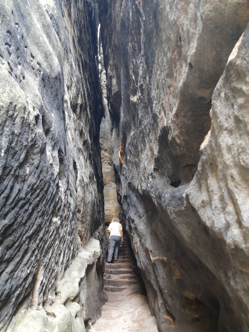
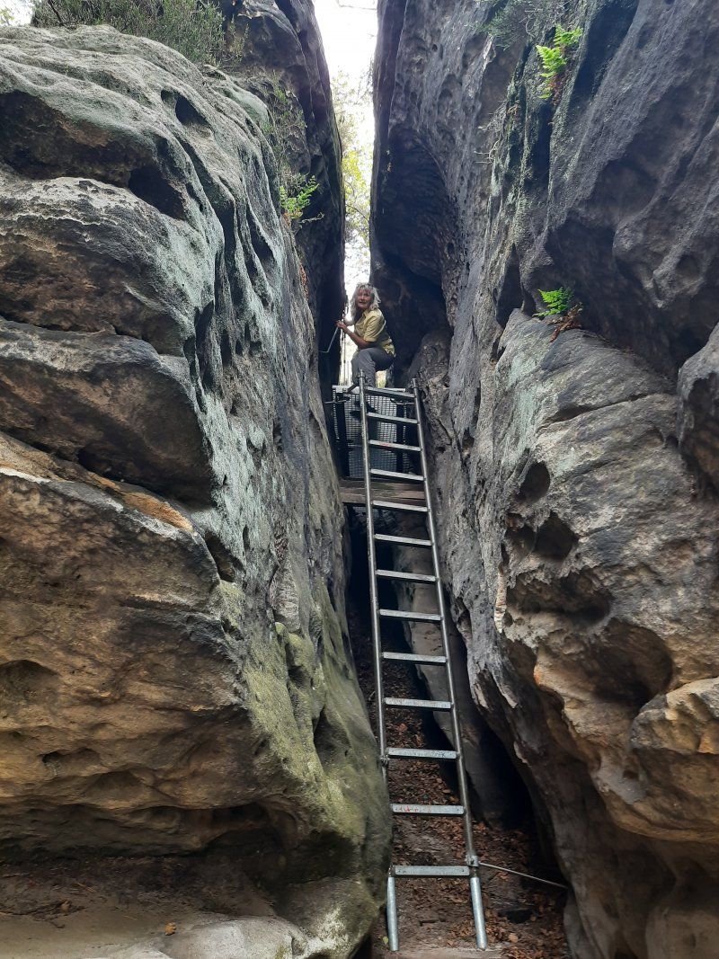
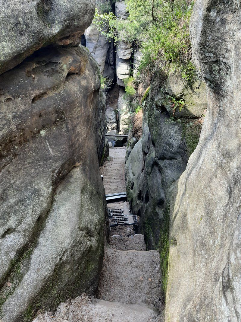
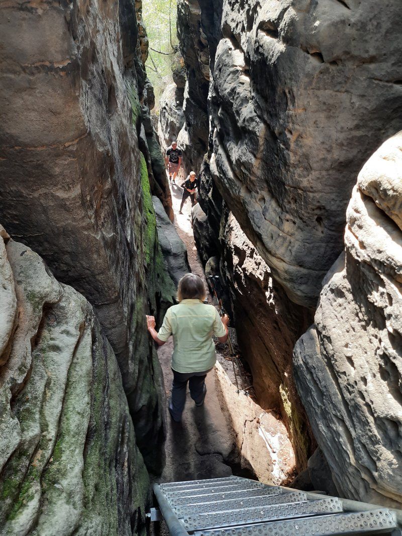
and go into the spruce and pine forest. Later on, the ascent becomes steeper over wooden steps. Above we can already see the steep cliffs of the Gohrisch, the previous forest is now being replaced by large, old beeches. There are two options for the ascent: on the left, the more difficult path through the Falkenschlucht, which requires surefootedness, and on the right, the easier ascent. We choose the Falkenschlucht. On the way to the entrance, a small boulder has to be overcome and then we see the "Zwerg" climbing rock in front of us, where we observe mountaineers. Now it goes into the Falkenschlucht. We climb up wooden ladders in the narrow, dark gorge, which was artificially widened in 1886.
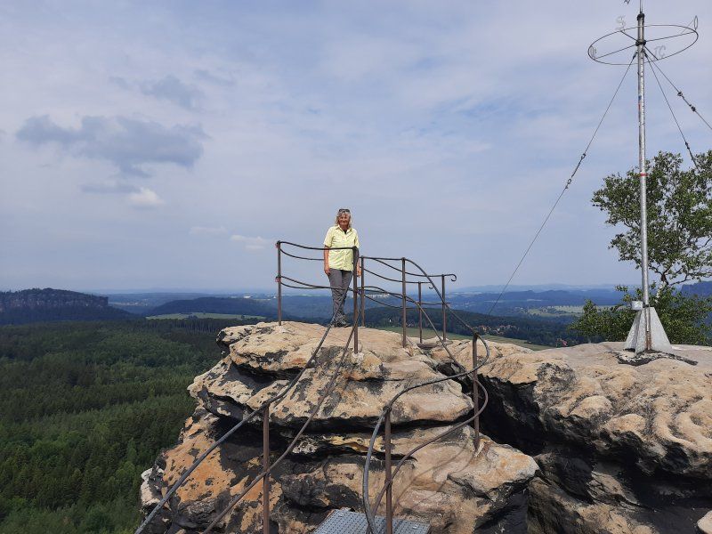
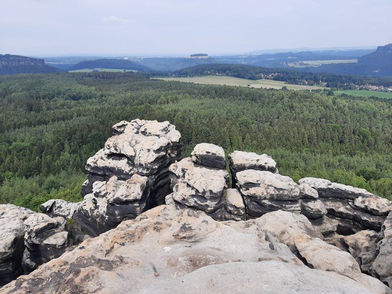
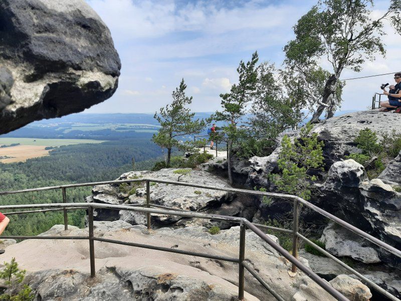
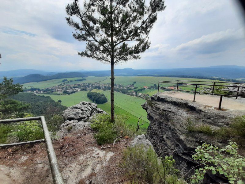
Arriving on the Gohrisch plateau, which is very rugged, we have to go up and down several times before we get to the viewing platform. Weather vanes have adorned the crag for over 100 years. The weather vane erected in 1985 with the summit greeting "Berg Heil". The view from the rocky north-west spur is magnificent.
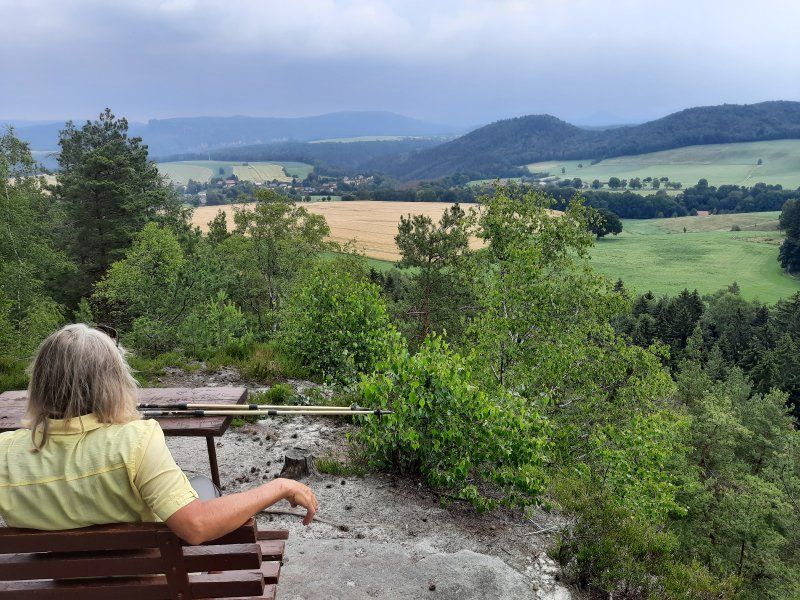
From the refuge, the descent takes us through a gorge in the east side of Table Mountain, then steeply down steps and wooden steps carved into the rock to the road and the hikers' car park, from which we hiked up the Papststein. After crossing the road, the ascent begins the papal stone. Steadily rising, first over long rows of steps, later between rocks over iron stairs, it goes up to the Papststein. Two viewing platforms awaited us at the top. From the Papststein we now descend via steps, then the path runs a little below the highest ridge. Further steps lead, initially in a wet rocky gorge that was made accessible in 1845, down to a saddle with a crossroads. Here you go on the slightly uphill path in the direction of Kleinhennersdorfer Stein. We continue hiking at the same height along the promising mountain eaves. A rest area with a bench and table invites you to linger and look out.
On the horizon we saw that a storm front was forming, so we decided to take the shortest route back to the starting point in Gohrisch.
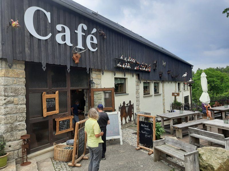
The parking lot belongs to a village shop where the parking ticket can be redeemed in the cafe.
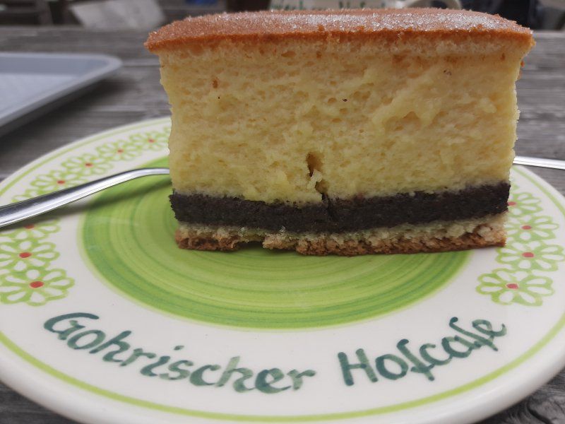
After our hike, we went to the cafe and tried the local Eierschecke. Irmgard the normal and I the poppies. The cafe is a nice setting to take a break.
From here the journey continued to Moritzburg

Dorfpl. 180, 01824 Gohrisch, Germany
50° 54' 47" N 14° 6' 29" E
50.9130556 14.1080556
☍ 65,1 km ( 54 min.)
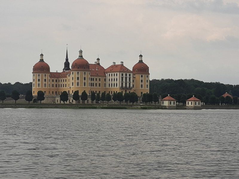
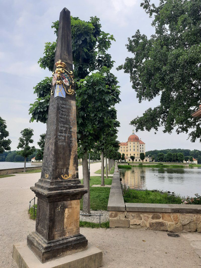
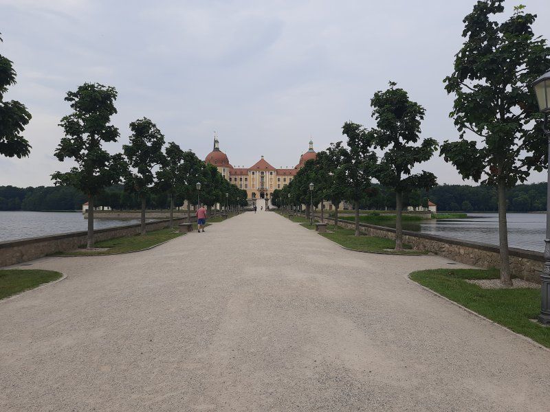
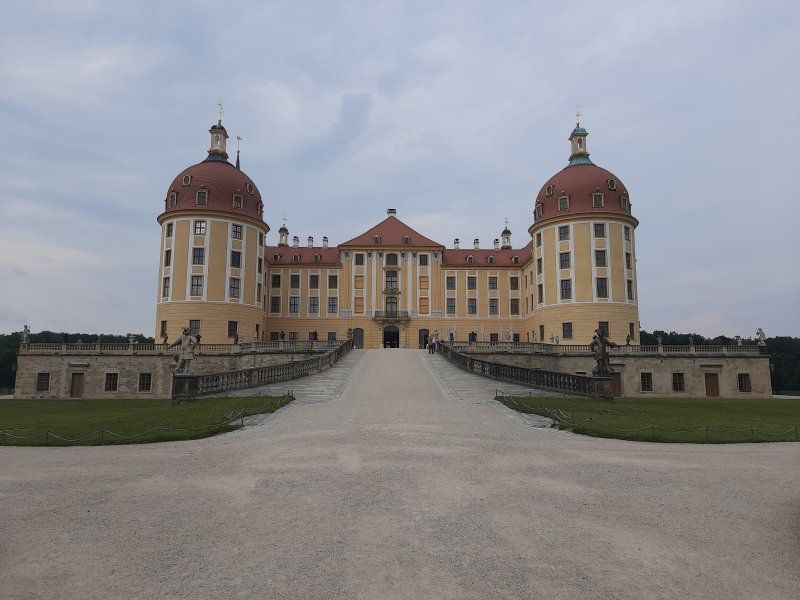
Parkplatz Schloss Moritzburg
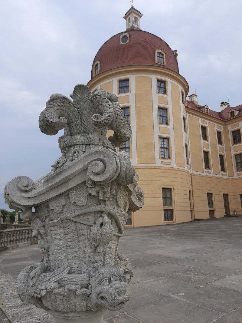
Paid parking approached next to the castle. Fee for one hour 1.-€.
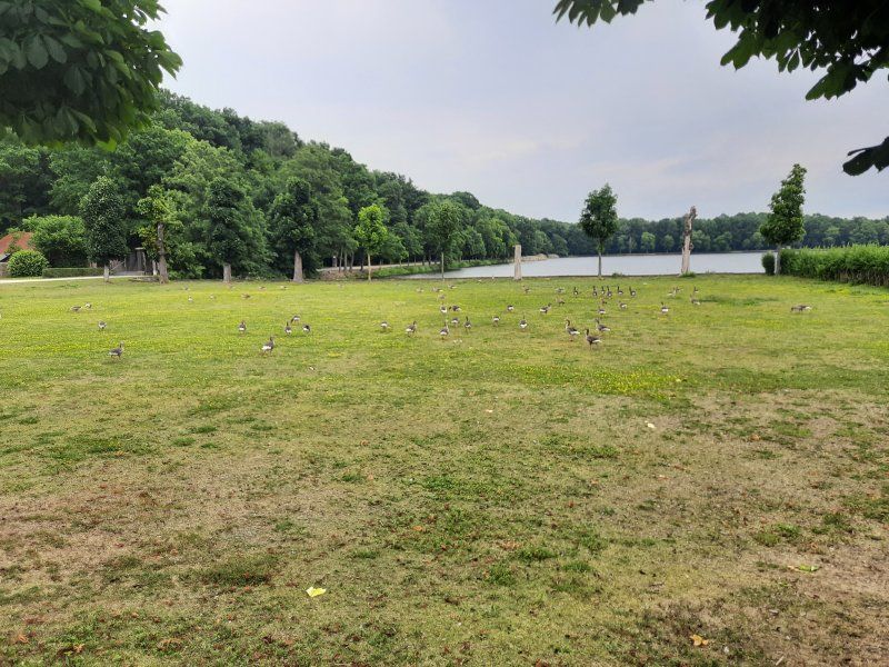
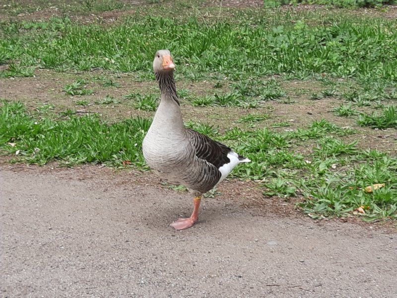
We only looked at the castle from the outside and walked around the moat back to the mobile home. In the castle park there were an enormous number of geese running around freely, you had to be careful not to step on their droppings.
The weather was cloudy, you didn't know if it was going to rain, there was a strong wind. The temperature has dropped to 20°C.
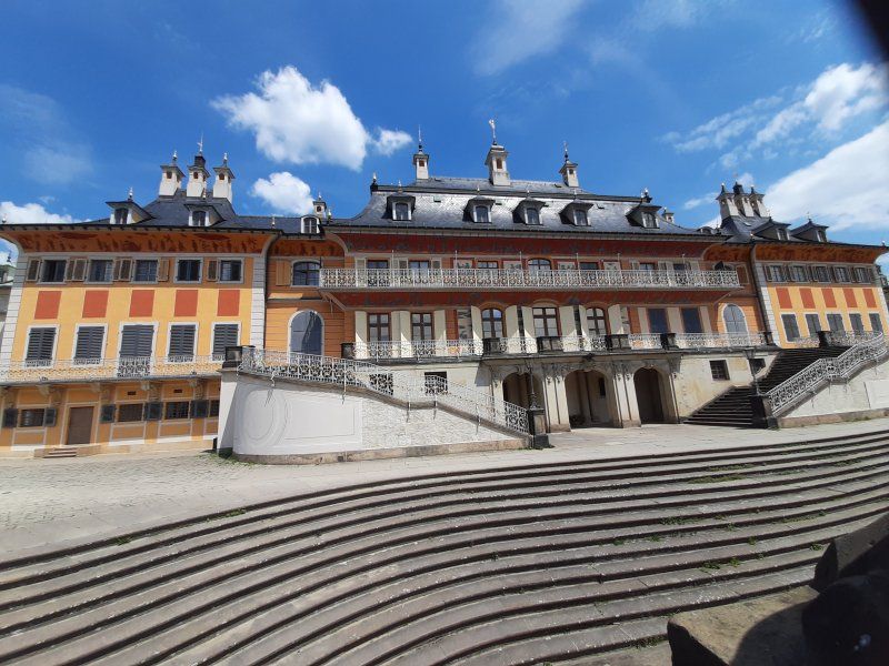
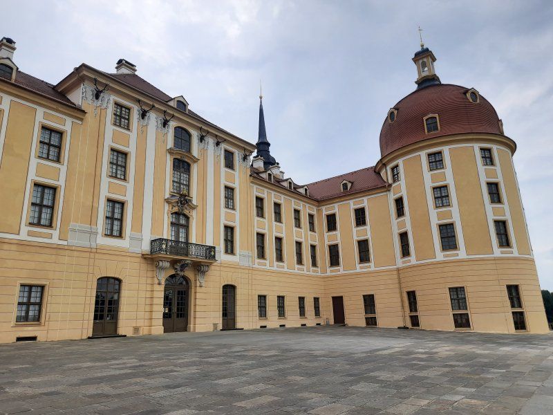
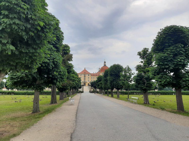
MORITZBURG CASTLE
Moritzburg is located in the middle of the landscape protection area Friedewald and Moritzburg pond area. This area includes 22 Moritzburg ponds with around 418 hectares of water and is best known for the hunting and baroque palace.
The hunting lodge, which dates back to a 16th-century hunting lodge, received its present form in the 18th century under Augustus the Strong.
Surrounded by water, the castle building with four round towers now serves as a museum and shows baroque living culture from the time of Augustus the Strong.


Schloßallee 4, 01468 Moritzburg, Germany
51° 9' 48.7" N 13° 40' 45.8" E
51.1635391 13.6793896
☍ 21,4 km ( 25 min.)
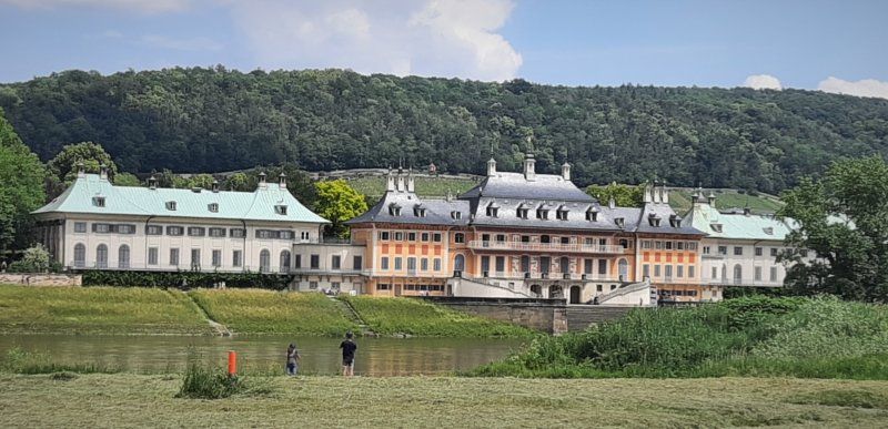
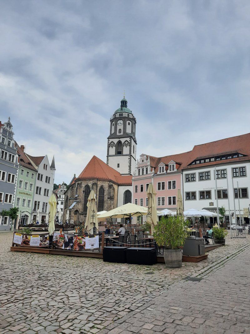
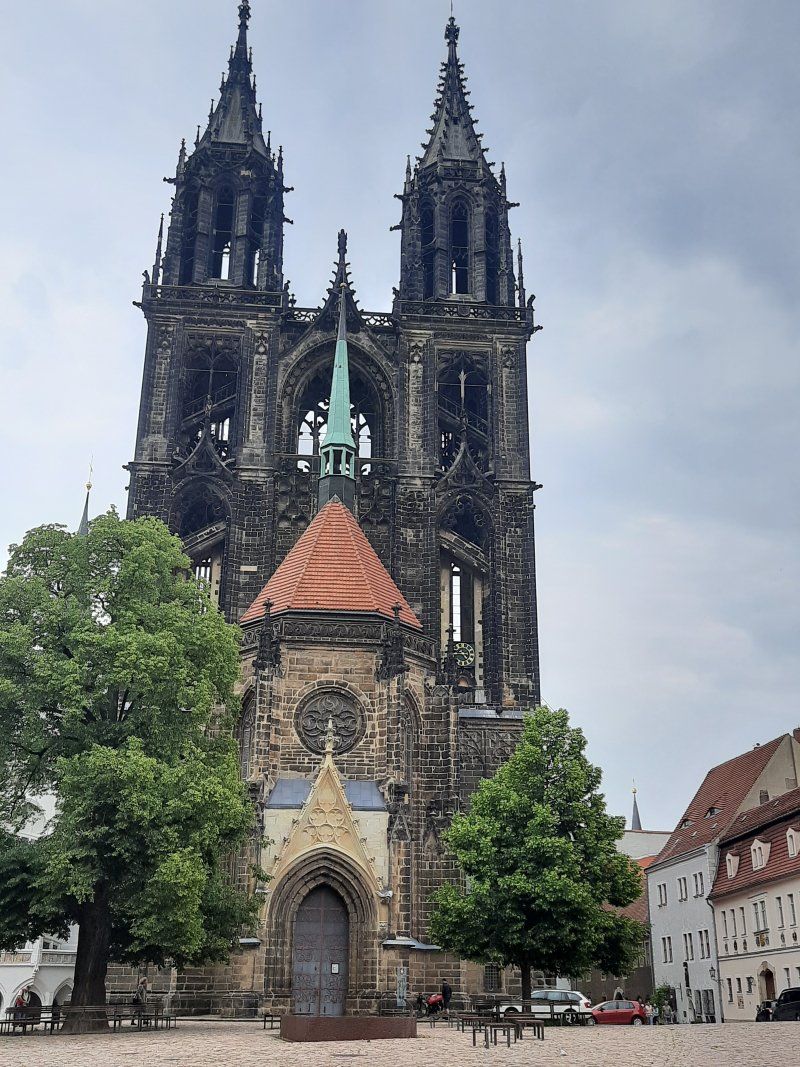
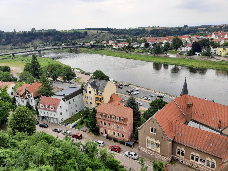
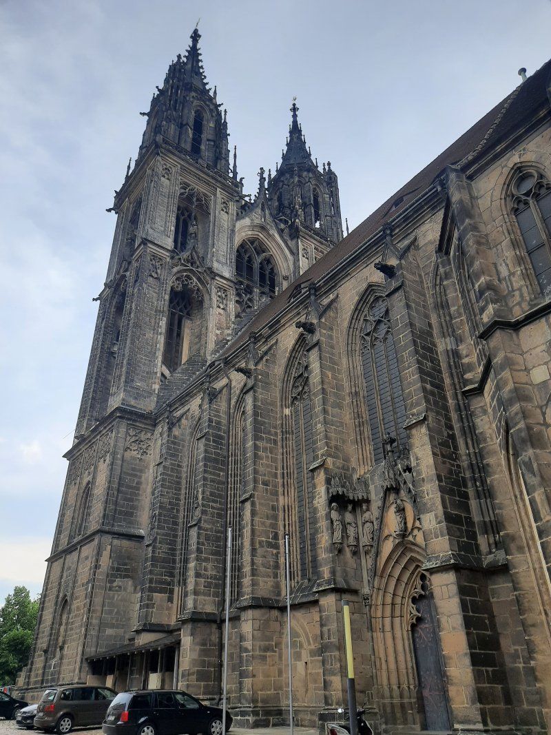
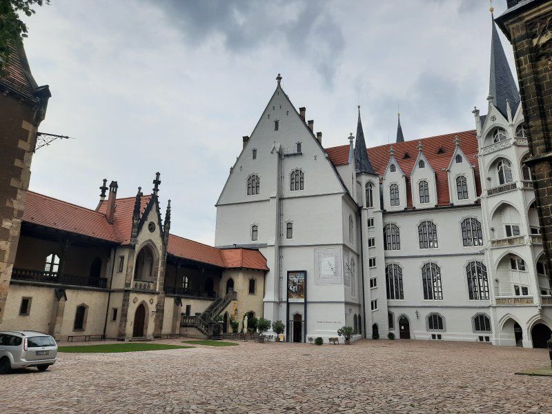
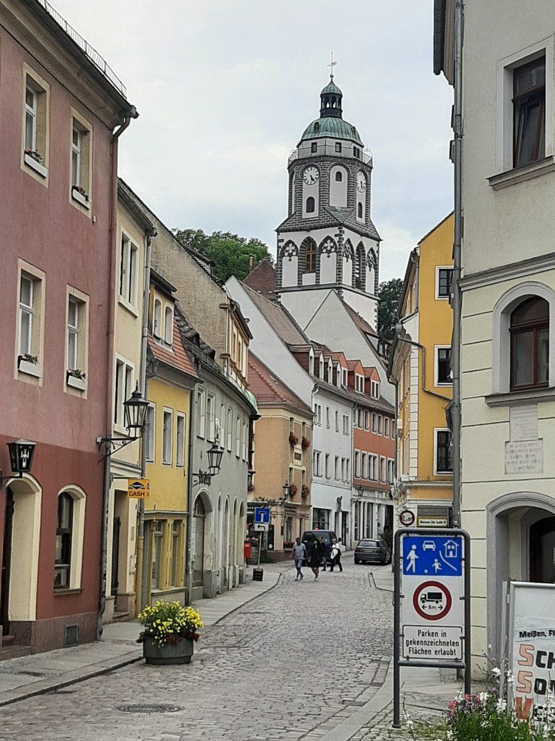
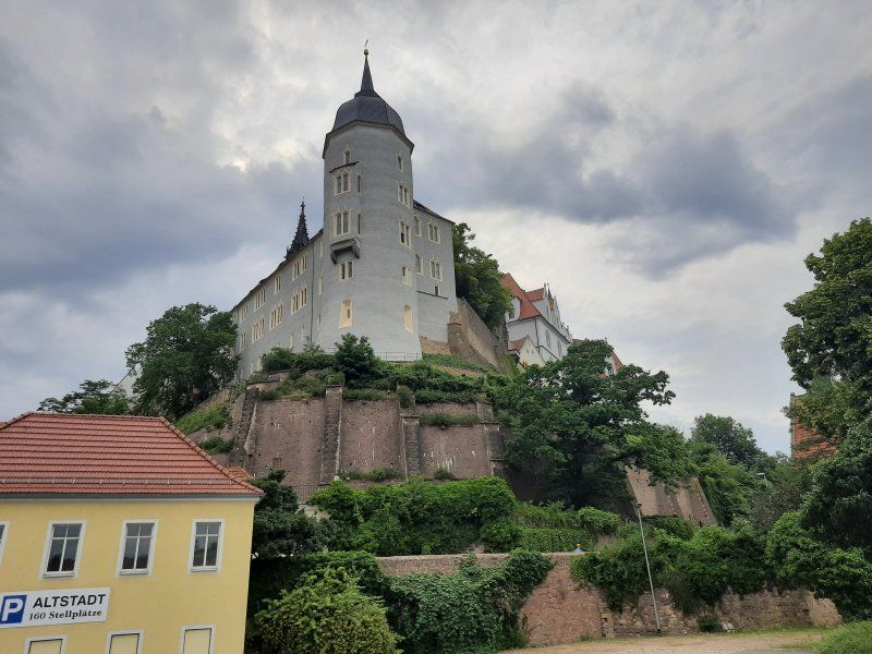
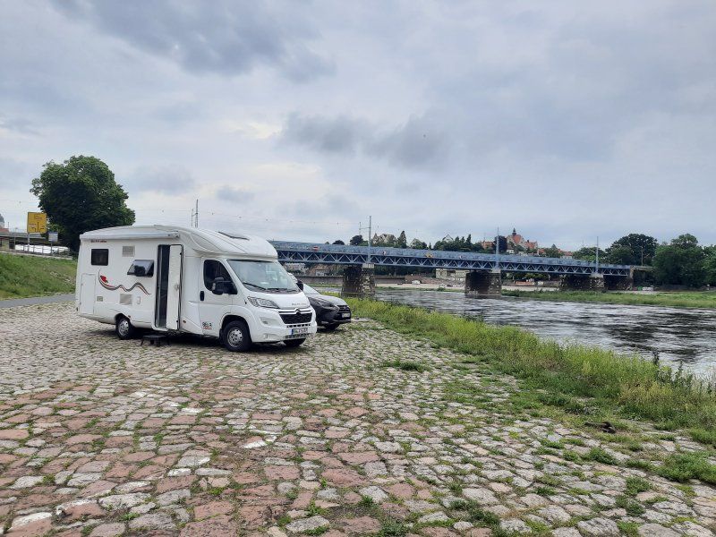
Meißen Siebeneichen 13
Parking lot approached directly on the banks of the Elbe, there was no other mobile home on the site.
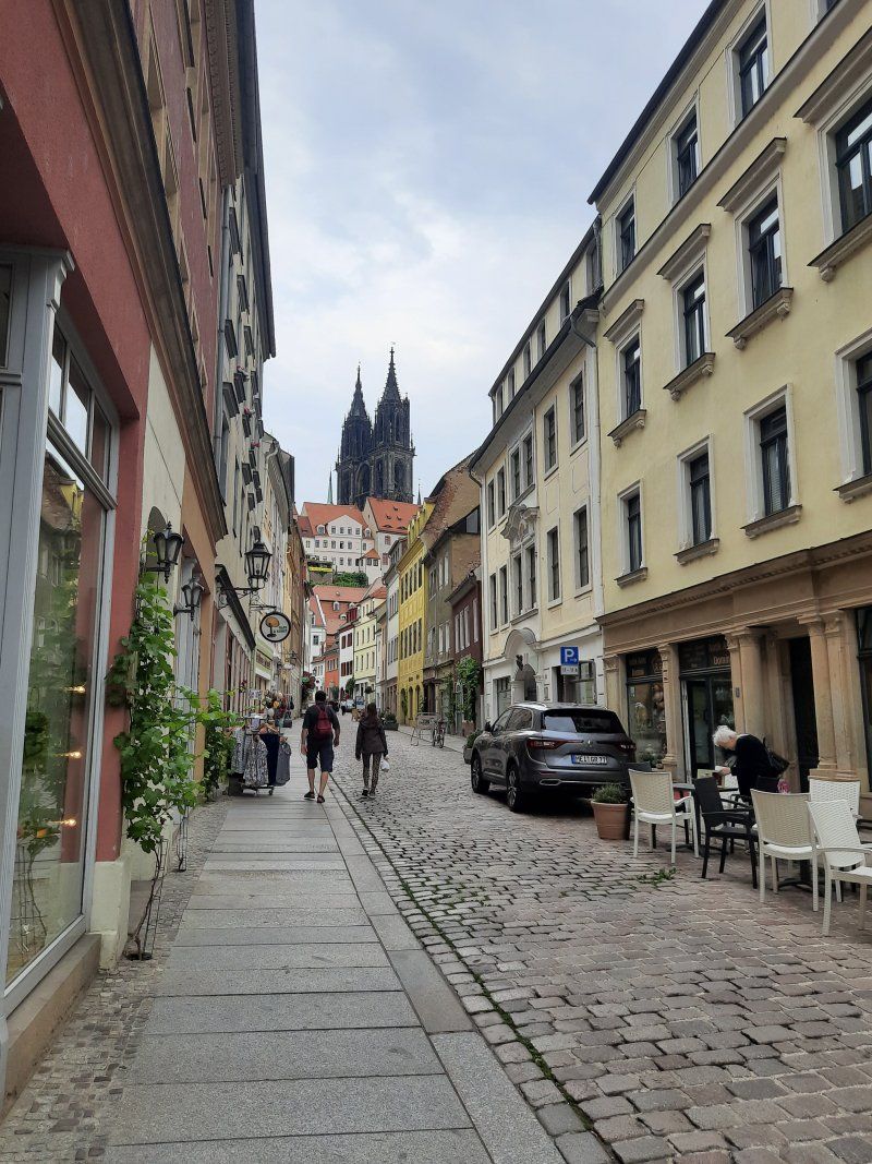
From 5 p.m. the place is free of charge. As soon as we arrived we went straight to visit the old town. The experience of the last few days showed us that the churches close at 5 p.m., so we hurried to see the cathedral. Admission was €4.50 per person. It was already 4:50 p.m. and it was no longer worth buying tickets. We then strolled through the streets and alleyways of Meißen to perhaps see pieces of jewelry made from the famous porcelain. We didn't see any porcelain, so we returned to our mobile home and spent the evening on the banks of the Elbe.

Meißen, Deutschland
51° 9' 30.9" N 13° 28' 41.2" E
51.1585961 13.4781176
☍ 139,8 km (1 hrs. 32 min.)
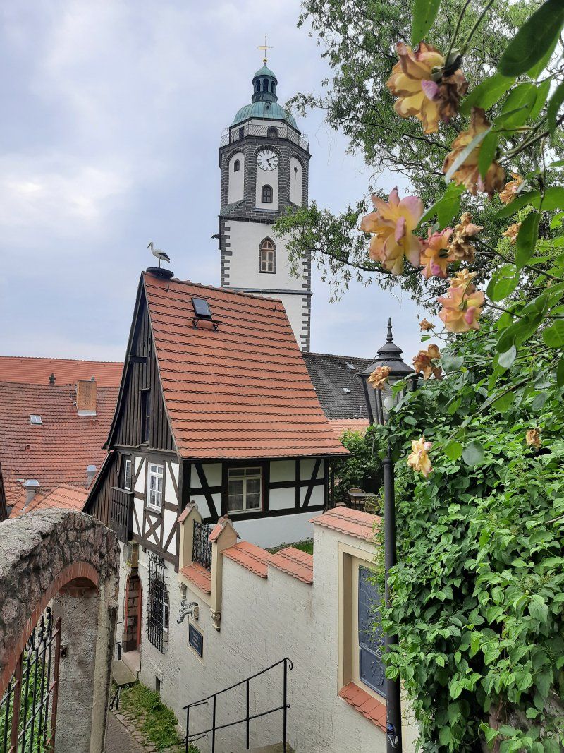
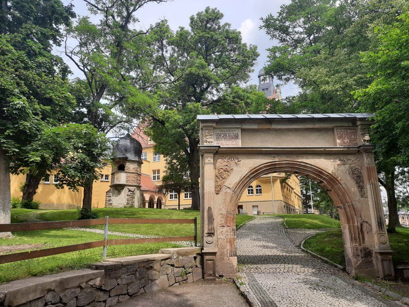
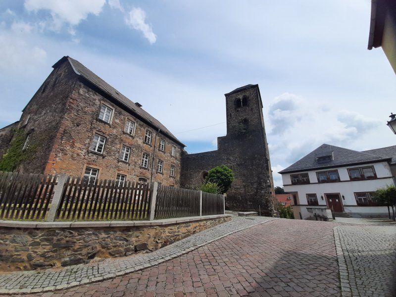
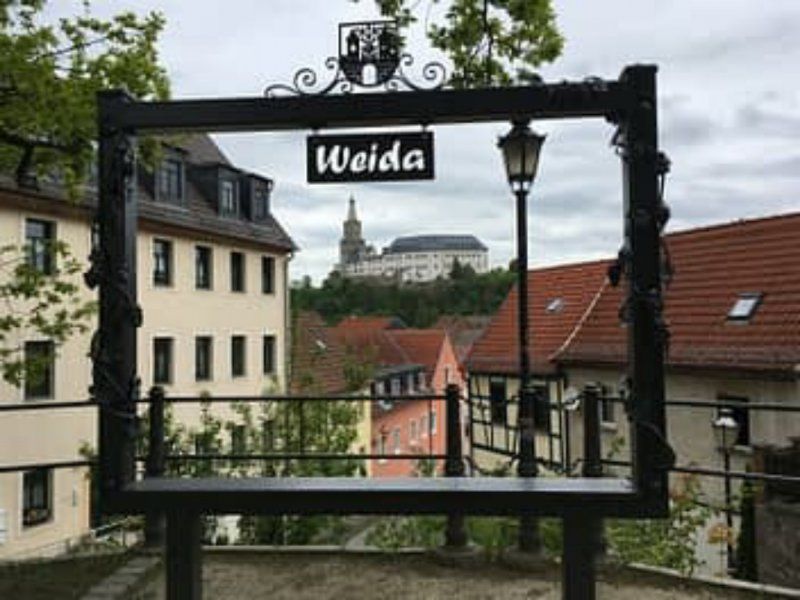
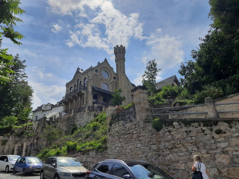
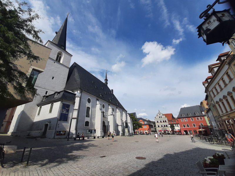
Weida
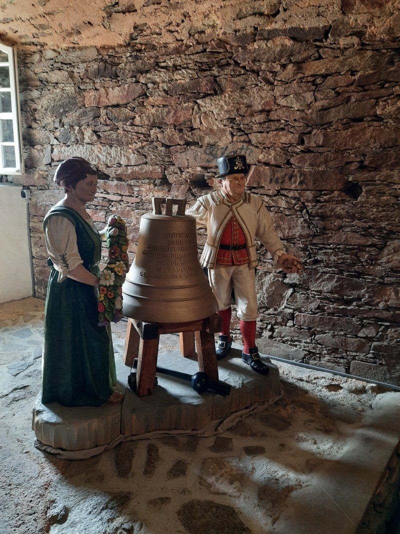
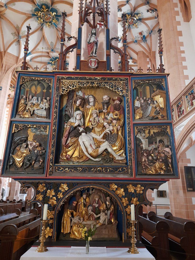
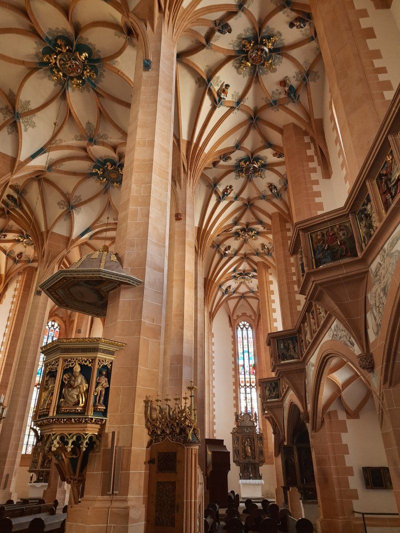
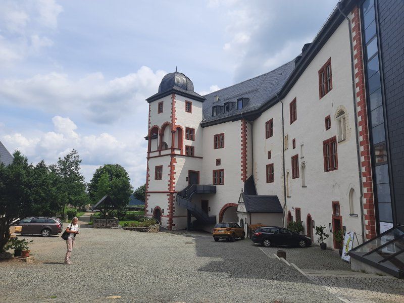
Weida is not only the cradle of the Vogtland, but with the transfer of town rights in 1209, it is also the oldest town in the Vogtland.
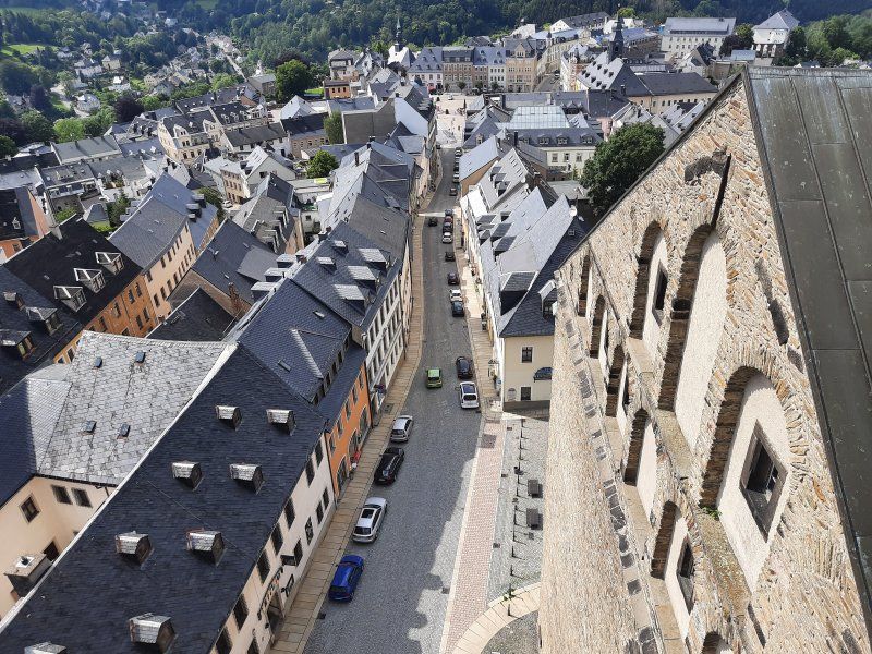
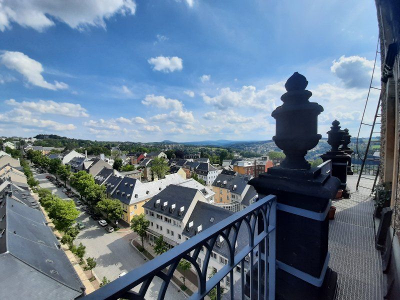
The tour first took us to the Osterburg, which we visited from the outside. The most important center of power of the bailiffs was located here. From here, the bailiffs gradually expanded their sphere of influence. Between 1163 and 1193, Henry I had a Romanesque fortification built in Weida. It has a strategically favorable mountain location and used to be called the "Feste Haus zu Weida". Up until 1427, the Osterburg was the ancestral seat of the bailiffs of Weida. Due to its elevated position you can get a wonderful view over the city.
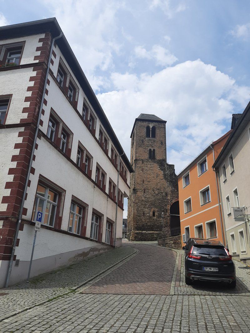
From the Osterburg we continue into the city with its rich inventory of medieval buildings. The path from the Osterburg leads us directly to the ruins of the Kornhaus. The construction goes back to the bailiffs of Weida, who founded a Dominican convent here in 1293. The ruin was the former monastery church. After the Reformation, the monastery was dissolved and the building was used by the city as a grain store. The current name "Kornhaus" goes back to this use.
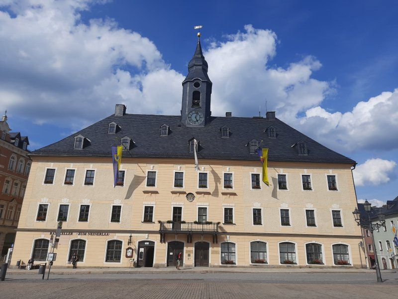
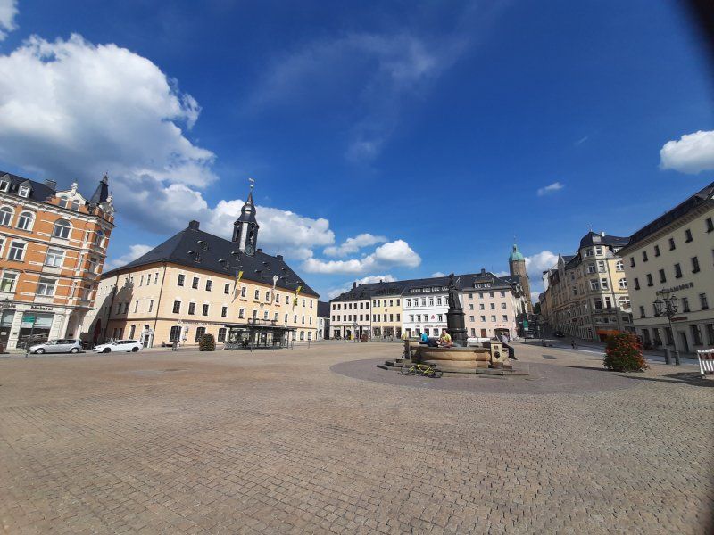
The way through the city leads us further to the town hall.
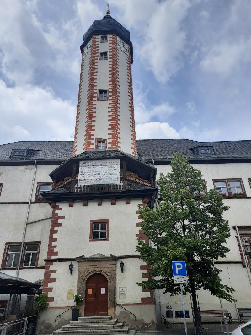
The Town Hall was built in 1587-89 and was a magnificent, ornate High Renaissance building with numerous turrets and dormers. Unfortunately, it didn't survive the devastation of the Thirty Years' War either. The town hall also burned down in 1633. In 1667 it was rebuilt in a simpler version, but twenty years later it burned down again. The new building had a slightly different shape. Only the 50 meter high town hall tower has retained its original appearance.
From the church you have a particularly beautiful view of the Osterburg. The view is so beautiful that it has been framed.
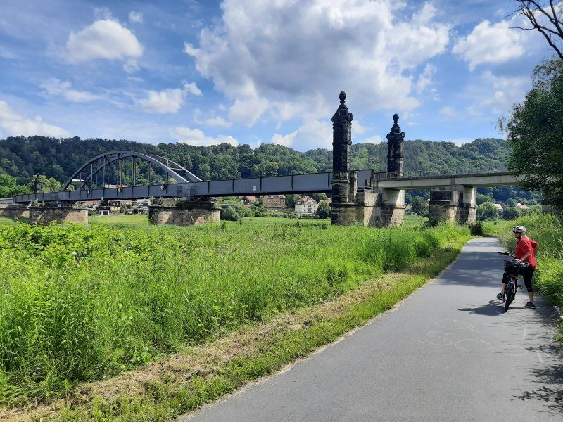
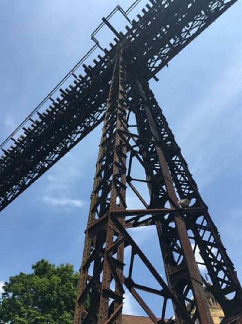
Just outside the city route, but also well worth seeing, is the Oschütztal viaduct - a pendulum pillar bridge that spans the valley of the Oschützbach. The viaduct was built in 1884 according to plans by architect Claus Koepcke and engineer Hans Manfred Krüger. The bridge was and is an engineering feat from the early days of steel bridge construction.

Deutschland
50° 46' 31.1" N 12° 3' 21.8" E
50.7753192 12.0560529
☍ 46,1 km ( 35 min.)
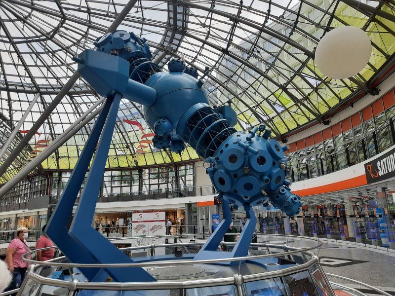
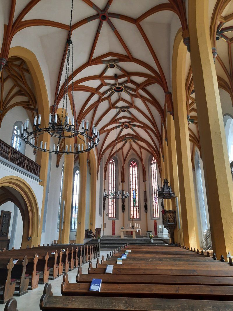
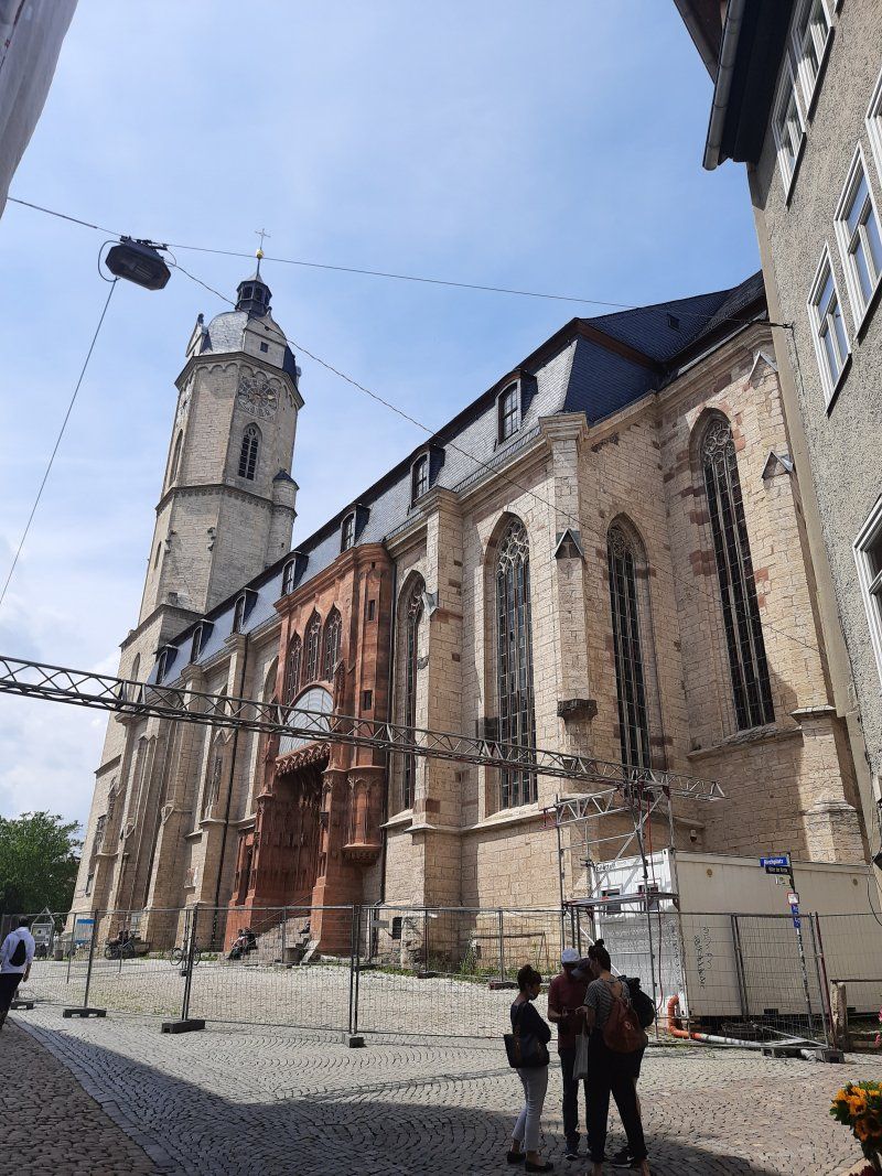
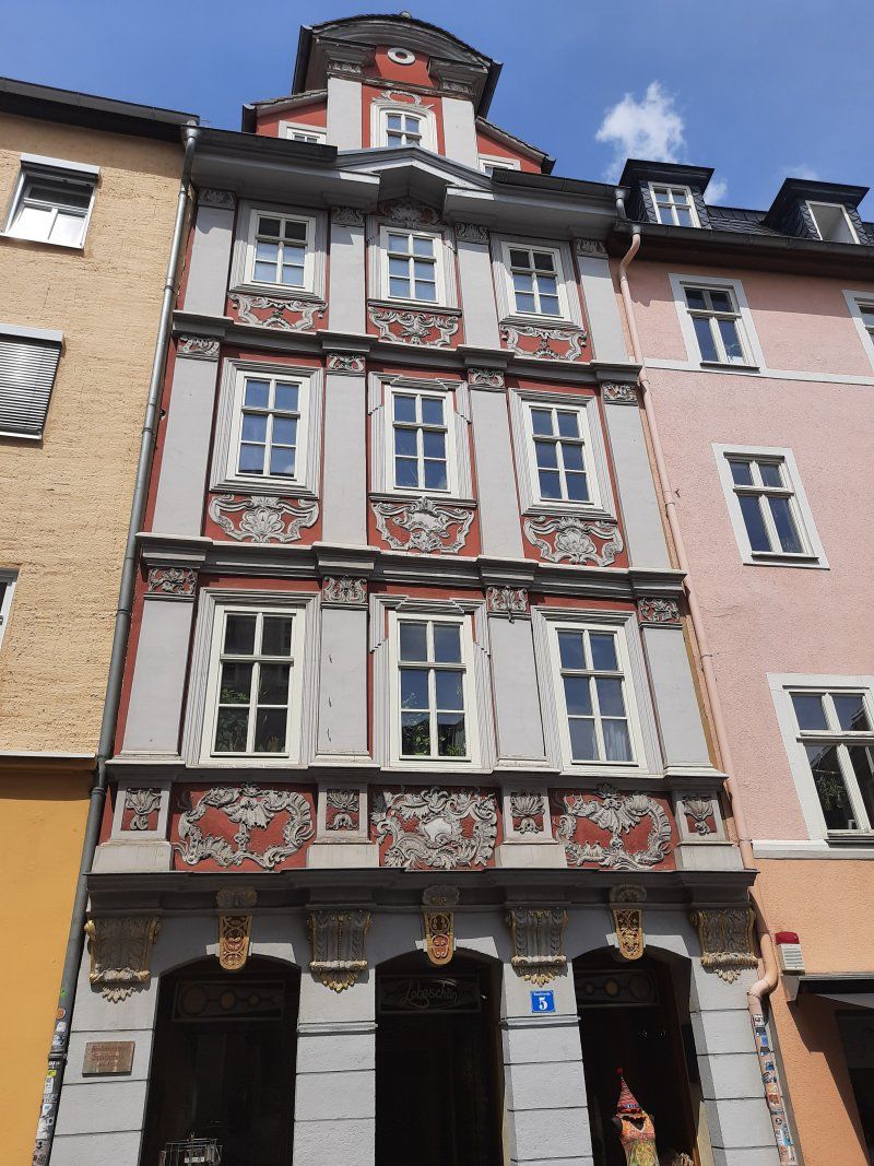
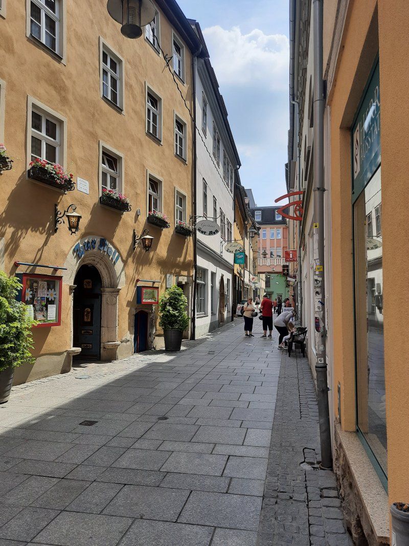
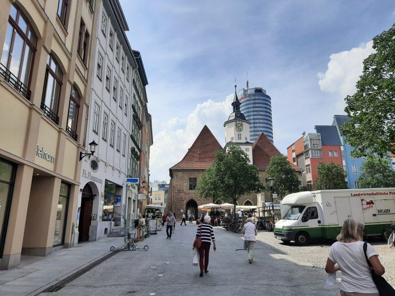
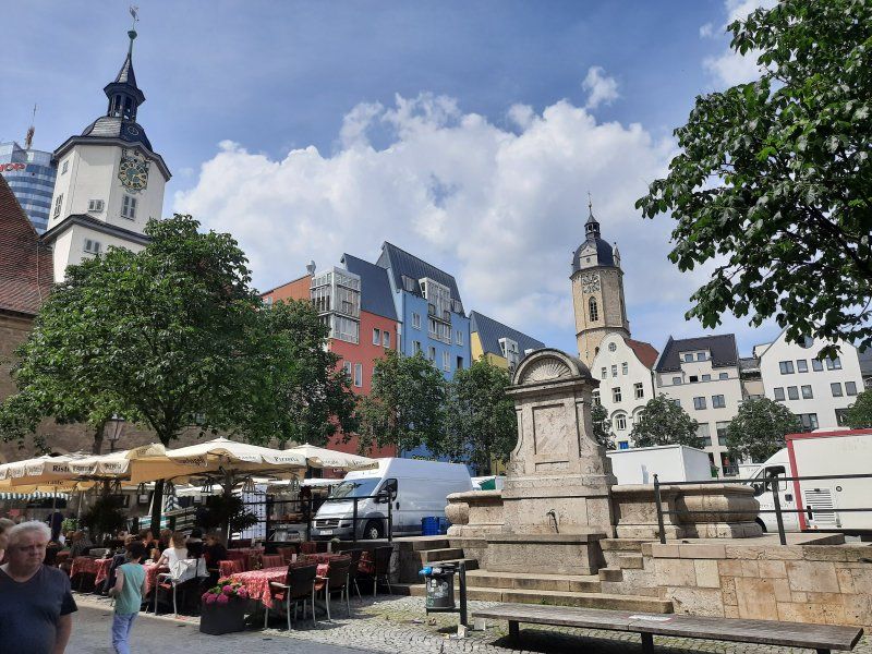
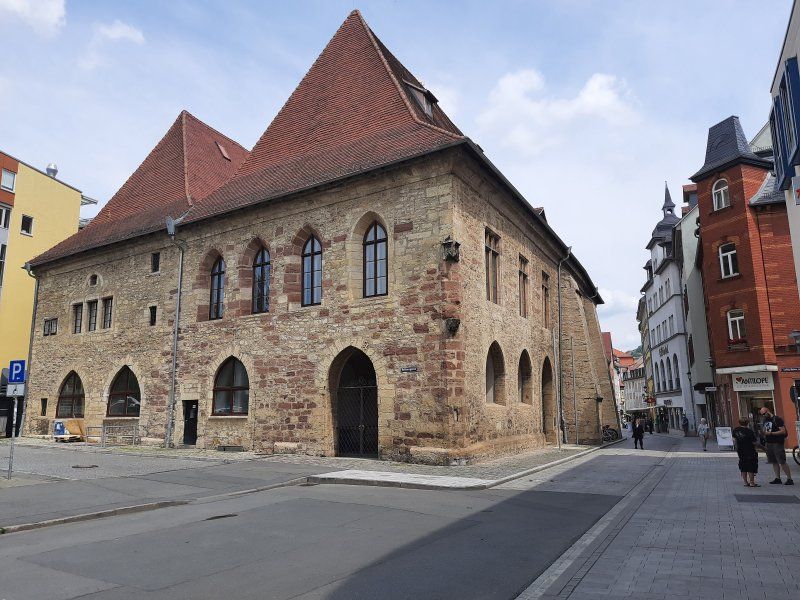
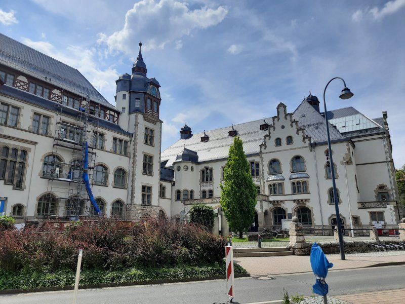
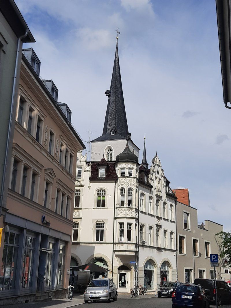
Jena
In Jena we parked near the center. One hour parking with a parking disc. There was enough time to stroll through the pedestrian zone and St. Michael's Church. It is a modern city with a large crowd in the shops.
The Thuringian university town of Jena advertises itself with the slogan "City of Light". In the second half of the 19th century, Jena developed into an industrial city and a center for optics and precision engineering. Since 1990, Jena has been transformed into a center for education and science.
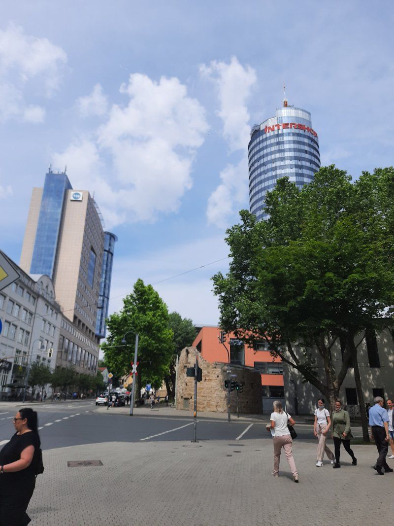
jentower
A modern landmark of the city is the Jentower, at 133 meters high the tallest office building in Thuringia. In the 1960s, the GDR Council of Ministers decided to redesign important cities with a socialist face. The skyscraper was inaugurated in 1972.
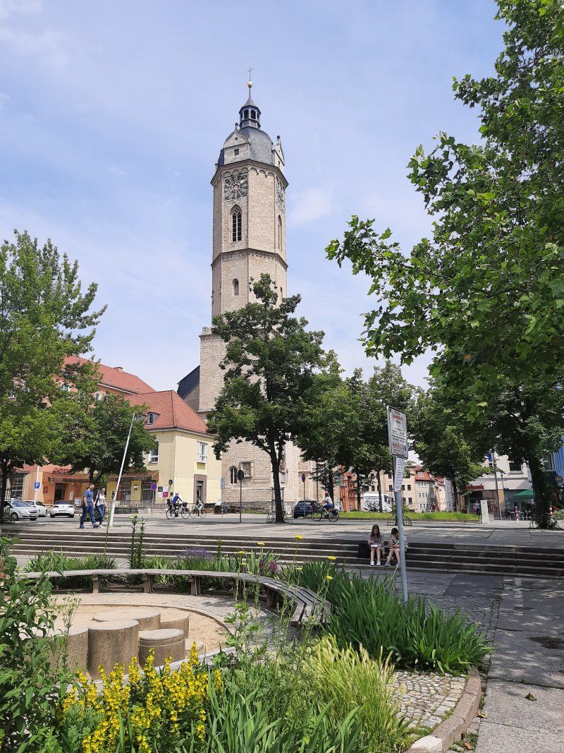
St Michael
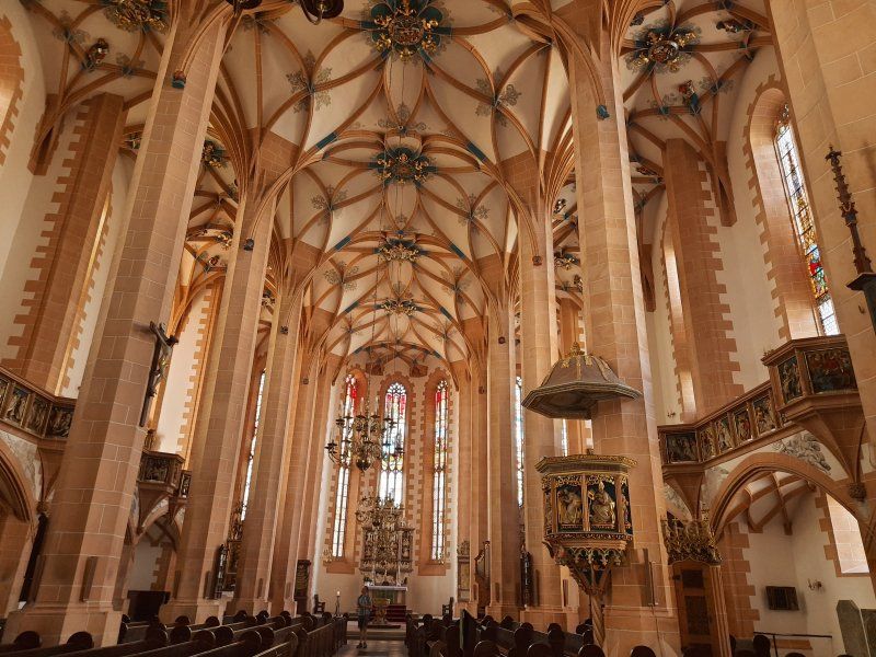
The town church of St. Michael has been the center of church life for more than 750 years. It had two previous buildings from the Romanesque period. The church, dedicated to Michael the dragon slayer, was built from 1380 in several construction phases until 1557.
Deutschland
50° 55' 37.4" N 11° 35' 21.3" E
50.9270540 11.5892372
☍ 23,2 km ( 28 min.)
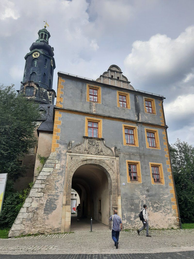
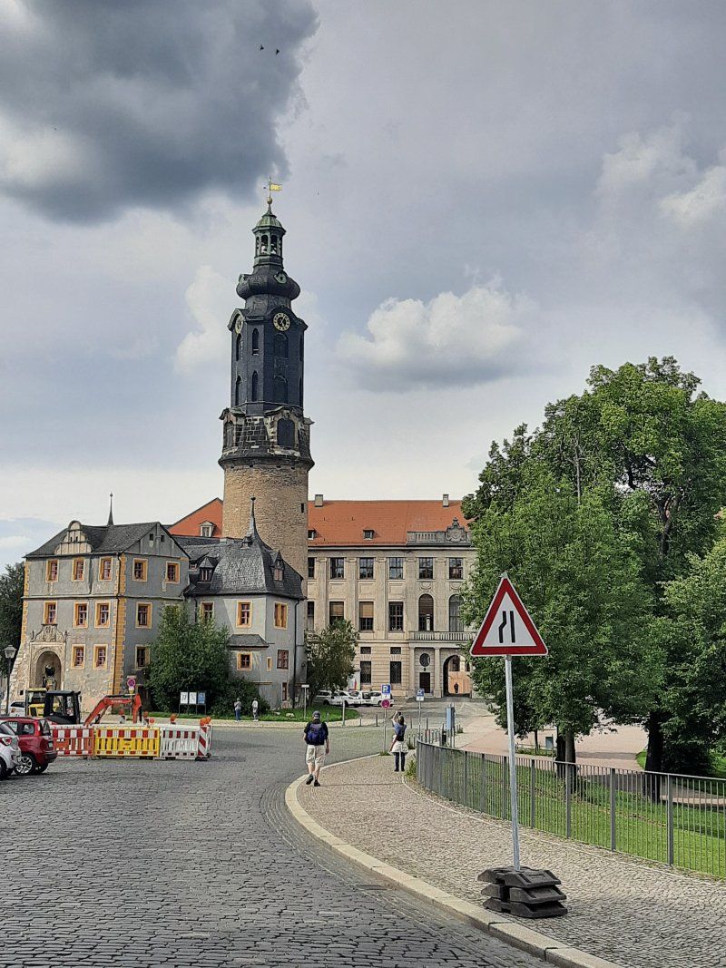
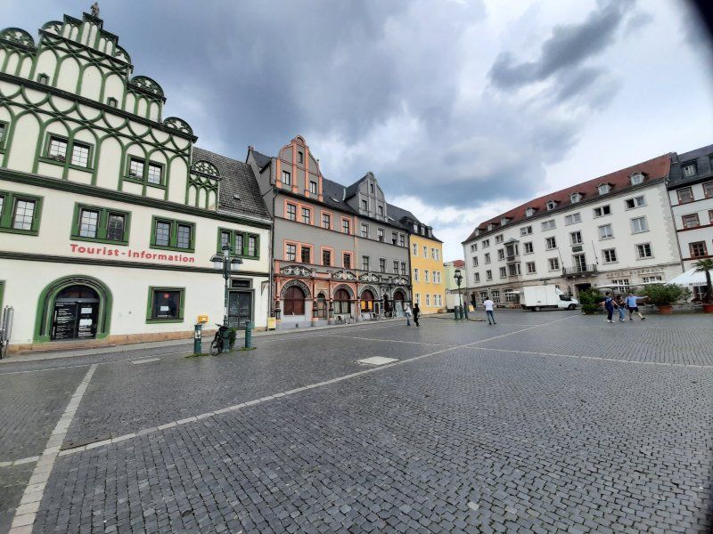
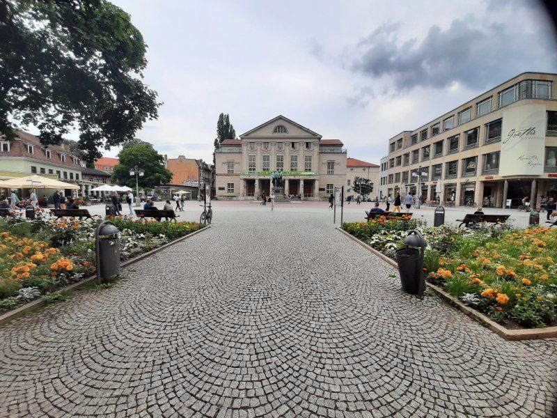
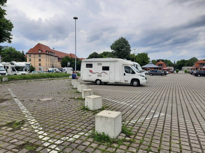
Weimar
The journey from Jena to Weimar was on a well-developed federal highway. I can't understand why our sat nav took us unnecessarily through narrow one-way streets for the last few kilometers. We found that there was an easy way to the pitch.
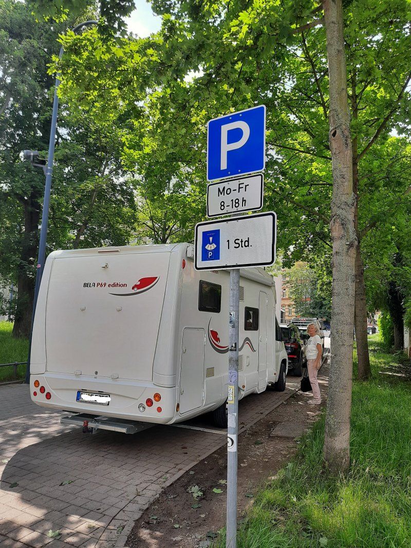
The parking space was already overcrowded when we arrived and we parked in the adjacent parking lot where five mobile homes were already parked. We bought the ticket for the parking fee at the parking machine. (10.- € /24h).
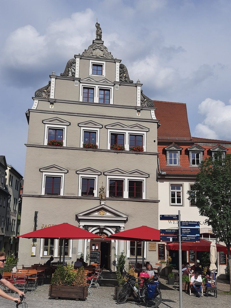
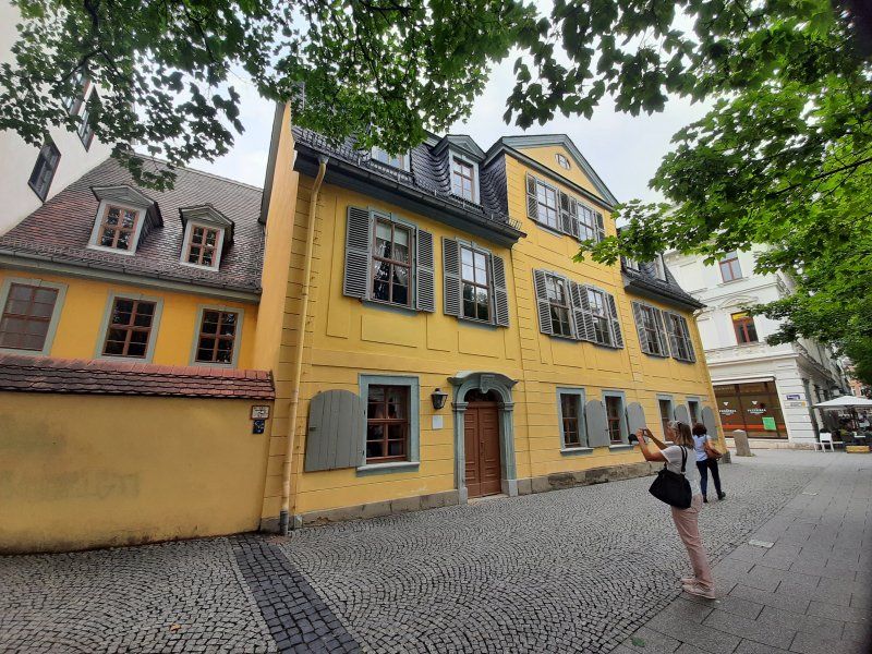
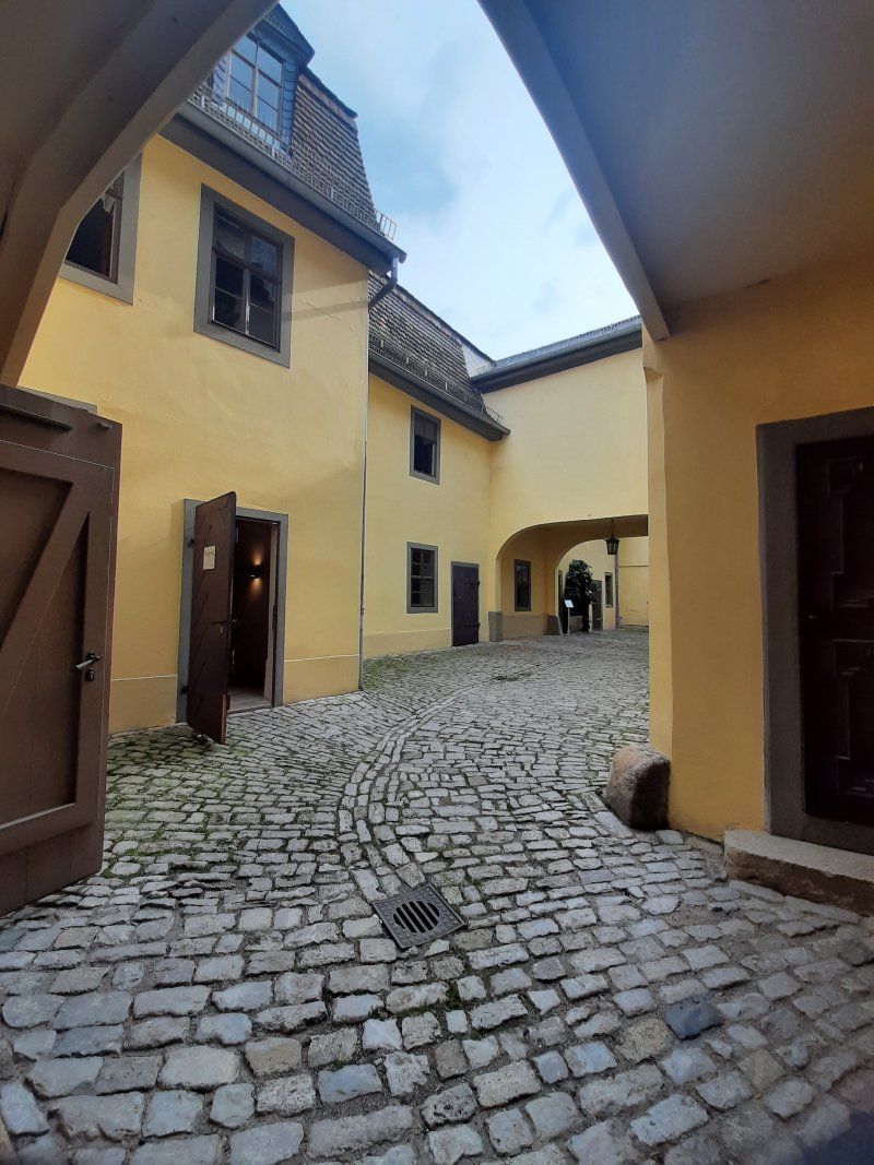
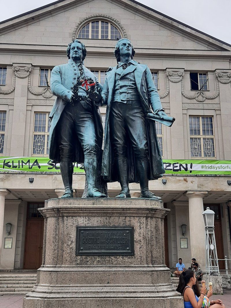
Weimar In the next few hours we strolled through the historic, cultural city in peace and quiet. We passed all the important sights, including the city church of St. Peter and Paul, the city palace, Bauhaus Museum, House of the Weimar Republic, Park on the Ilm and the Goethe and Schiller residential building.
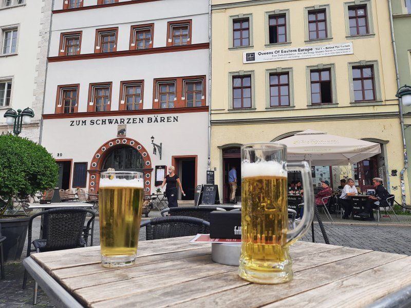
On the market square we enjoyed a stop in the open air at the Bärenhaus and let the city work its magic on us. This was also the last evening of our trip. Tomorrow we're going back home.
Herrmann-Brill-Platz 1, 99423 Weimar, Germany
50° 59' 5" N 11° 19' 0" E
50.9847222 11.3166667
☍ 444,5 km (4 hrs. 18 min.)
Rottweil
After a good night's sleep, we got ready to continue our journey home. You can spend a good two days in Weimar if you want to see everything extensively. This is a reason to visit the city again another time and to go specifically to the sights. We really liked the city.
Deutschland
48° 9' 54.9" N 8° 37' 42.4" E
48.1652577 8.6284530