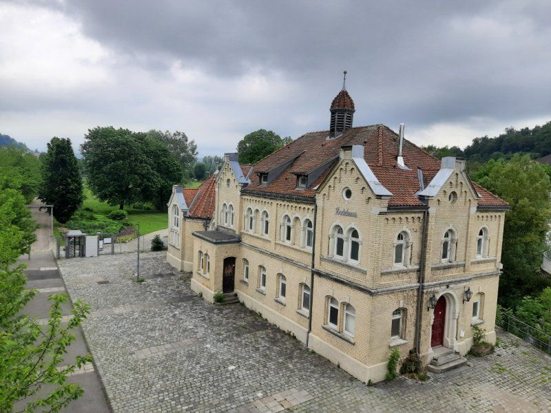
Actually it should go to Italian Tuscany this spring. The corona pandemic had prevented this. Instead, they went on a discovery tour through the Hohenloher Land! Hohenlohe can rightly be described as an insider tip in Baden-Württemberg. We were also able to discover a lot of culture in Hohenlohe, numerous castles, fortresses and monasteries.
Day
Lochenstraße
We left at 9.30 on Wednesday morning. On the A81 we continued via Stuttgart towards Heilbronn. Beilstein was chosen for the first stop.
Rottweil, Deutschland
48° 11' 52" N 8° 41' 40" E
48.1977778 8.6944346
• Head toward Wochenbergstraße on Lochenstraße. Go for 170 m.
• Turn right onto Hardtstraße. Go for 203 m.
• Turn right onto Schömberger Straße (B27). Go for 5.3 km.
• Turn left onto L423 toward Dietlingen/Rottweil-Ost. Go for 323 m.
• Turn right onto Balinger Straße (K5562). Go for 8.4 km.
• Continue on Hauptstraße (K5506). Go for 573 m.
• Turn right onto Trichtinger Straße (K5502). Go for 292 m.
• Continue on K5502. Go for 2.1 km.
• Continue on Harthausener Straße (K5502). Go for 579 m.
• Continue on Im Dorf (K5502). Go for 97 m.
• Turn left onto Kirchstraße (K5500) toward Oberndorf/Bochingen/Altoberndorf. Go for 1.5 km.
• Continue on K5500. Go for 983 m.
• Turn right onto Radäcker (K5502). Go for 2.3 km.
• Take the 1st exit from roundabout onto Rankäcker (L415). Go for 746 m.
• Take ramp onto A81 toward Stuttgart. Go for 62.3 km.
• Take the exit toward Karlsruhe/Heilbronn onto A8/A81. Go for 7.4 km.
• Take the exit toward Würzburg/Mannheim/Heilbronn onto A81. Go for 38.9 km.
• Take exit 12 toward Ilsfeld/Lauffen/Beilstein/Abstatt. Go for 431 m.
• Turn right onto L1100 toward Beilstein/Gewerbegebiet Auenstein. Go for 3.8 km.
• Arrive at Auensteiner Straße (L1100). Your destination is on the left.
☍
136,4 km
(1 hrs. 23 min.)
Beilstein
The journey on the A81 was without much traffic, the Stuttgart Cross could be driven without traffic jams.
Stopover: Beilstein
Arrival: 11:00 a.m.
In Beilstein, we drove to the discounter ALDI before visiting the castle to buy the essentials for the day. There was so much going on at ALDI that a larger line of people lined up in front of the shopping carts. We went to the discounter REWE next door, this was normal shopping.
After shopping we drove to our planned parking lot at the sports area. (GPS: 49.041993,9.318279)
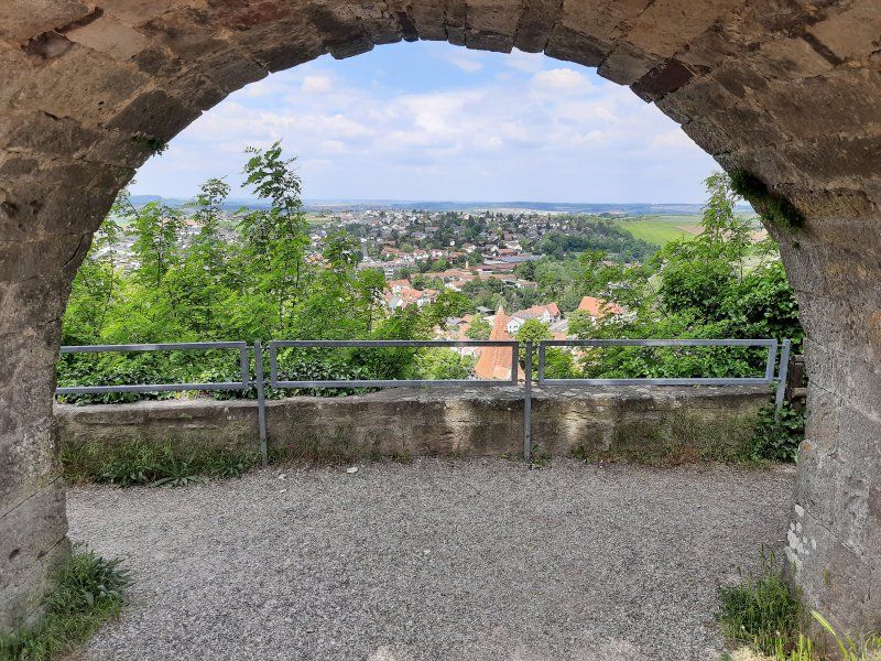
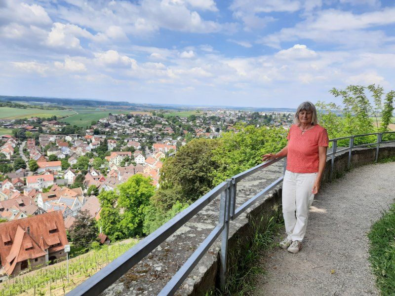
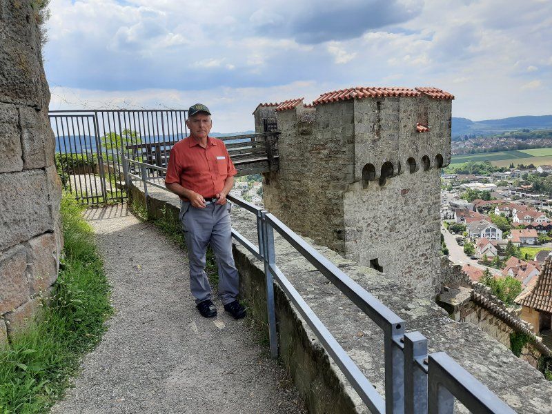
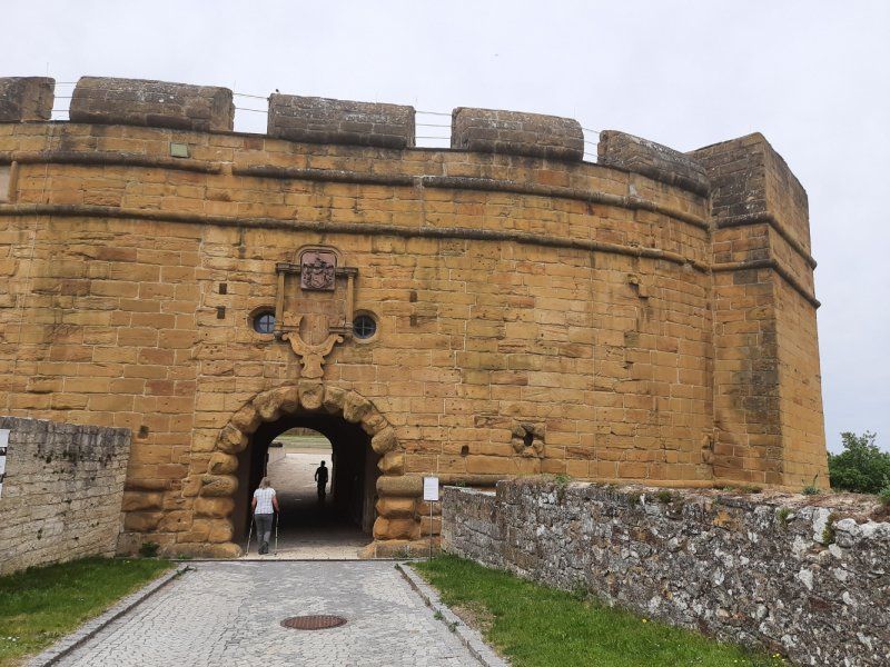
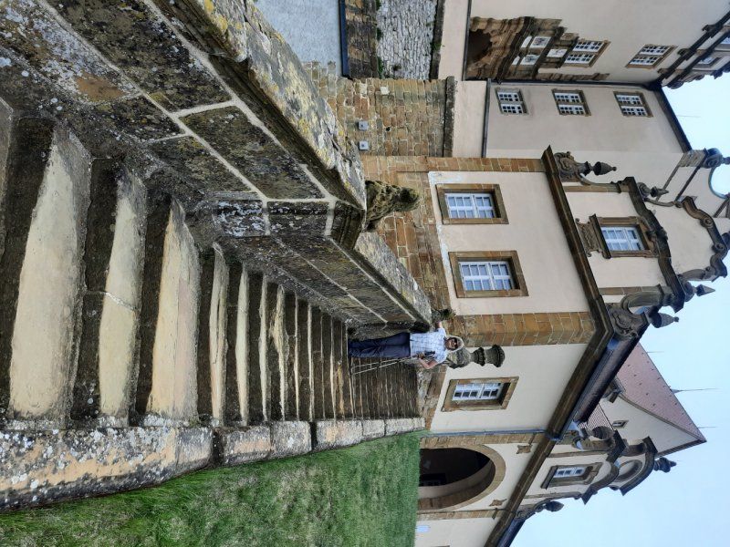
A free parking space was found at the sports grounds and schools. 10 minutes to the center. The path led us first to the castle, at the top of the castle there are two nice large parking lots. You could have parked well here, a camper parked. The castle is on a beautiful hill with a wonderful all-round view. No public traffic was encountered at the castle.
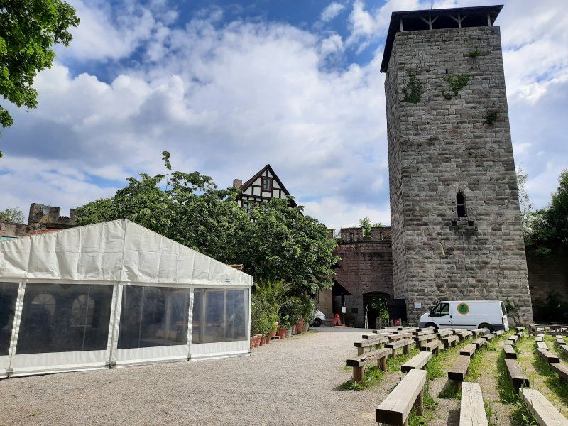
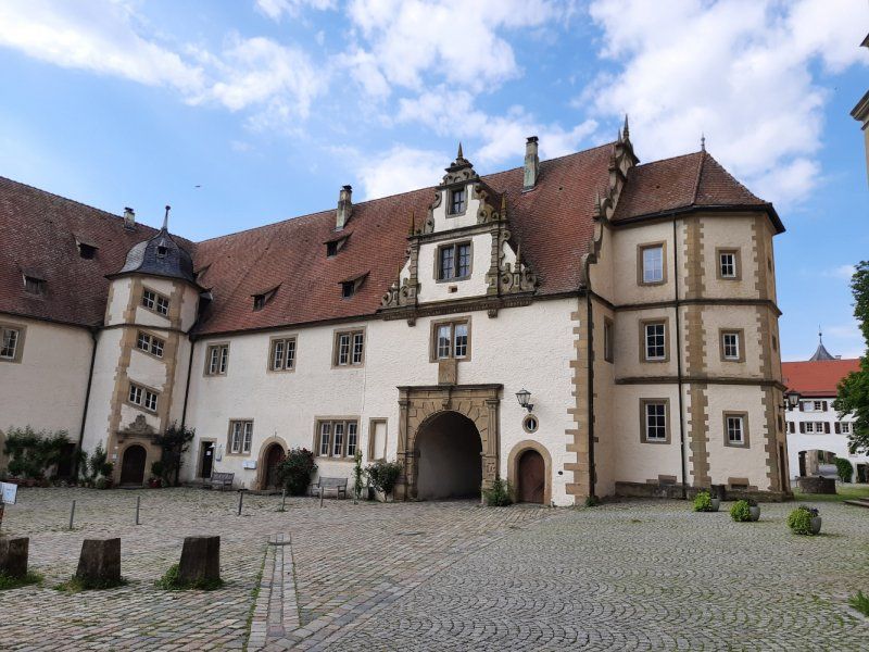
Hohenbeilstein Castle was built between 1070 and 1080.
When the builder family died out, the castle passed to the Margrave of Baden in 1234.
And that from a Count of Württemberg, something like that would be quite normal today, because the castle went back to Württemberg in 1340. Today you can visit the castle very well, because there is not only a restaurant in it, but also a falconry in the ruins.
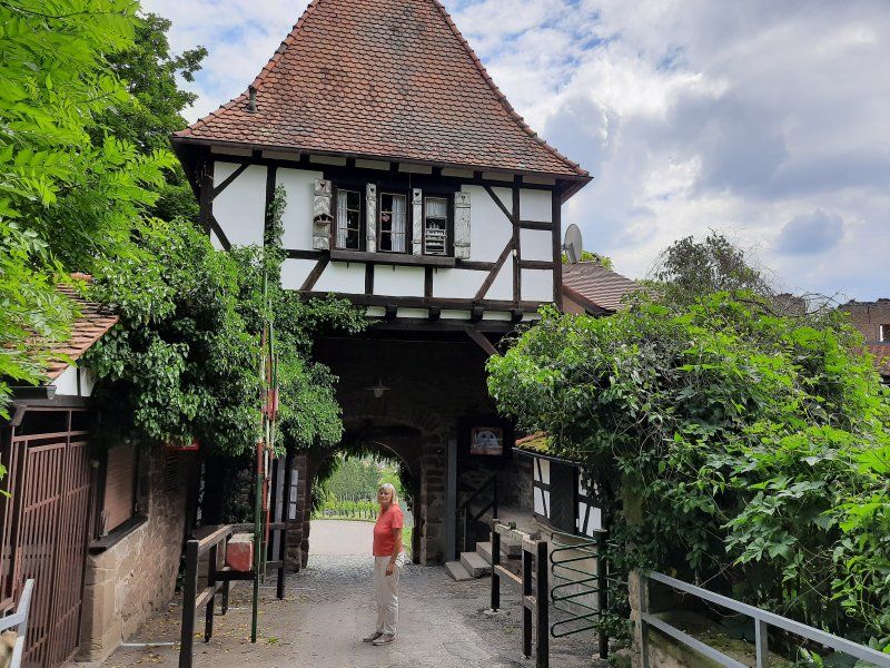
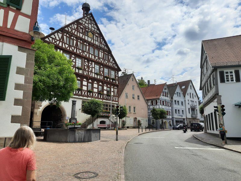
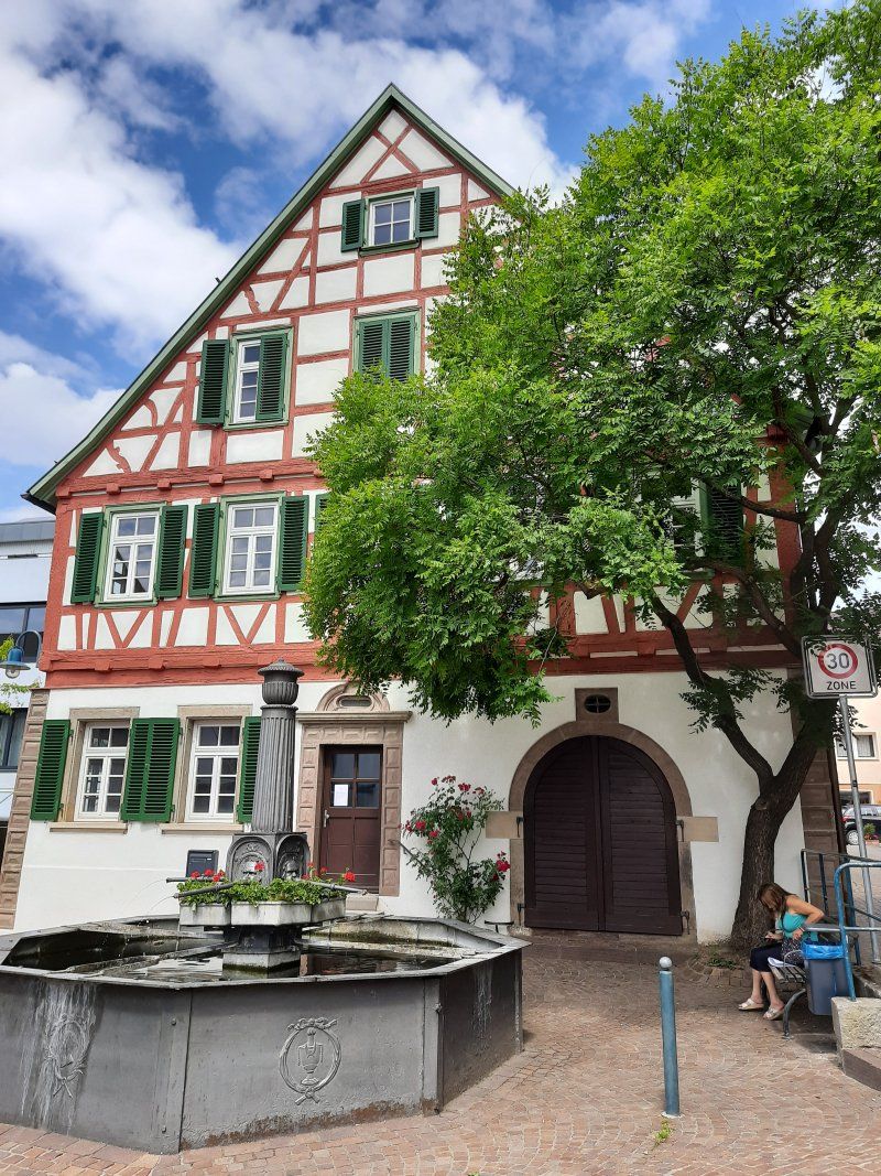
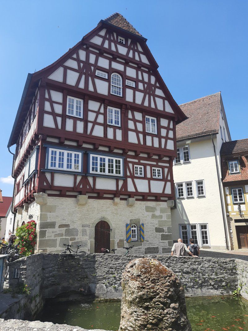
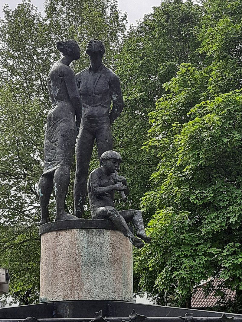
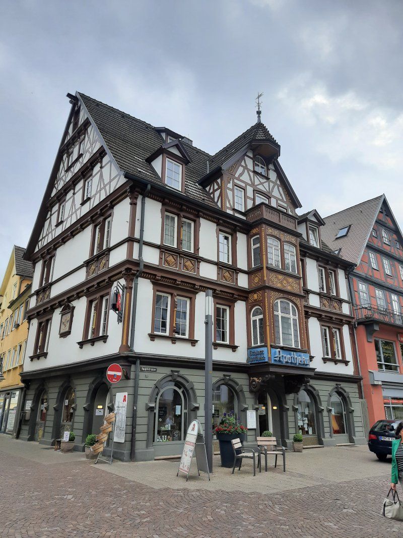
The town at the foot of the castle was only mentioned in a document in 1304. The town can impress with beautiful half-timbered houses. Beilstein is a wine town in the Heilbronn district, located at the foot of the Löwenstein Mountains. An hour of sightseeing is enough.
Deutschland
49° 2' 30.2" N 9° 18' 46.6" E
49.0417163 9.3129536
• Head north on Auensteiner Straße (L1100). Go for 3.8 km.
• Turn left and take ramp onto A81 toward Heilbronn. Go for 28.2 km.
• Take exit 7 toward Möckmühl/Schöntal/Jagsthausen/Widdern. Go for 361 m.
• Turn left onto L1047. Go for 434 m.
• Take the 1st exit from roundabout onto L1047 toward Schöntal/Jagsthausen/Widdern. Go for 1.1 km.
• Pass 3 roundabouts and continue on L1047. Go for 6.3 km.
• Turn right onto Heilbronner Straße. Go for 58 m.
• Arrive at Heilbronner Straße. Your destination is on the right.
☍
40,2 km
( 26 min.)
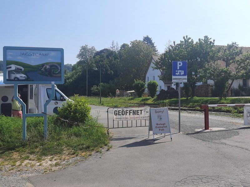
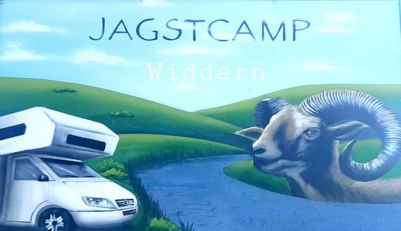
Jagstcamp Widdern
The parking space is easy to get to, parceled-out spaces on gravel. Easy payment with an envelope.
The seats were all reserved. No. 6 was the only one that only started on May 21. was reserved, the only free place for today. What luck for us!
Fee: 8 € with ES. Electricity with an extra charge.
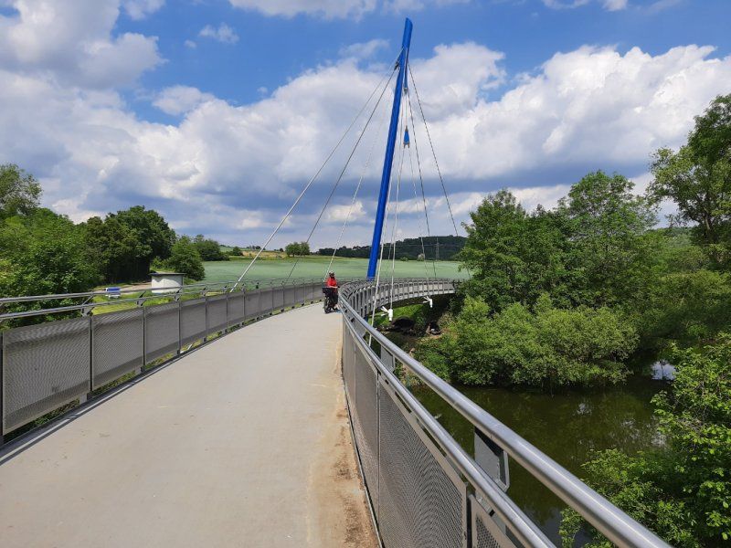
After the coffee break, I got our bicycles out of the garage and set off on the first bike tour towards Götzenburg and Schöntal Abbey for the time being along the Jagst.
Heilbronner Str. 11, 74259 Widdern, Germany
49° 18' 50" N 9° 25' 8" E
49.3138889 9.4188889
• Head northeast on Heilbronner Straße. Go for 25 m.
• Turn sharp left. Go for 62 m.
• Turn left toward L1047. Go for 25 m.
• Turn right onto L1047. Go for 156 m.
• Turn right onto Möckmühler Straße (L1025) toward Merchingen/Unterkessach/Schöntal/Jagsthausen. Go for 5.4 km.
• Turn right onto Sindringer Straße (L1050) toward Künzelsau/Öhringen/Sindringen/Gewerbegebiet Haussen. Go for 4.1 km.
• Turn left onto L1045. Go for 1.4 km.
• Turn right onto L1050 toward Öhringen/Friedrichsruhe/Zweiflingen. Go for 5.3 km.
• Take the 2nd exit from roundabout onto Öhringer Straße (L1050). Go for 1.5 km.
• Turn left onto K2354 toward Neuenstein. Go for 2.4 km.
• Continue on K2352. Go for 150 m.
• Continue on K2354. Go for 965 m.
• Continue on Friedrichsruher Straße (K2354). Go for 458 m.
• Take the 2nd exit from roundabout onto Friedrichsruher Straße (K2354). Go for 805 m.
• Turn left onto L1051. Go for 1.1 km.
• Take the 2nd exit from roundabout onto Mutfeld (L1051). Go for 290 m.
• Take ramp onto A6 toward Nürnberg. Go for 7.3 km.
• Take exit 42 toward Kupferzell/Schwäbisch Hall/Künzelsau/Waldenburg. Go for 382 m.
• Turn right onto B19 toward Schwäbisch Hall/Untermünkheim/Wackershofen. Go for 4.0 km.
• Turn right onto B14 toward A6/Stuttgart/Gaildorf/Schwäbisch Hall-West. Go for 230 m.
• Continue on K2576 toward Gailenkirchen/Wittighausen. Go for 7.4 km.
• Continue on Dr.-Max-Bühler-Straße (K2576) toward Gewerbegebiet Stadtheide. Go for 185 m.
• Take the 2nd exit from roundabout onto Dr.-Max-Bühler-Straße (K2576). Go for 1.6 km.
• Turn right onto B19. Go for 2.8 km.
• Take the 2nd exit from roundabout onto B19 toward Gaildorf/Rosengarten-Westheim. Go for 3.1 km.
• Turn left onto Über dem Kocher (L1055) toward Michelbach/B./Hirschfelden. Go for 3.2 km.
• Turn right onto Kirchstraße. Go for 126 m.
• Arrive at Kirchstraße. Your destination is on the right.
☍
54,7 km
( 48 min.)
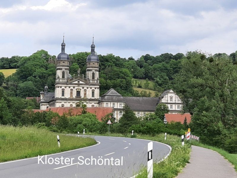
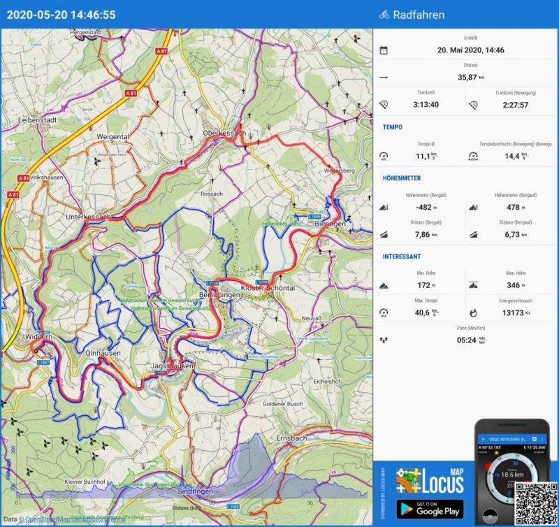
Radtour zur Götzenburg - Kloster Schöntal
Cycling tour:
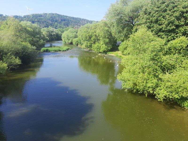
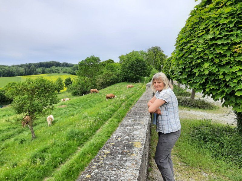
The Jagst is a low mountain river in the north of Baden-Württemberg. In addition to the Kocher and the Enz, it is one of the three largest tributaries of the Neckar with a length of 190.2 kilometers. Many natural sections invite you to cycle.
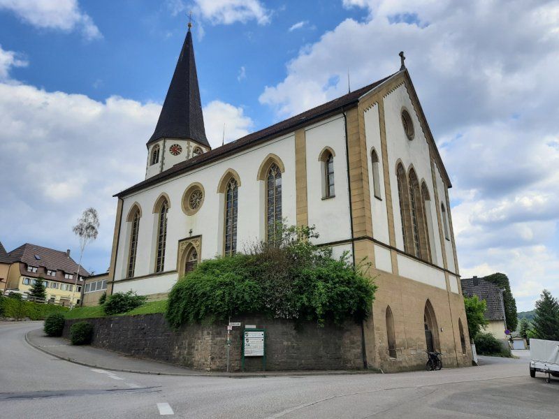
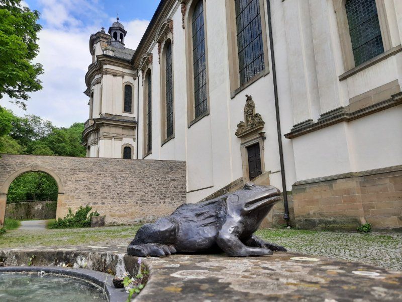
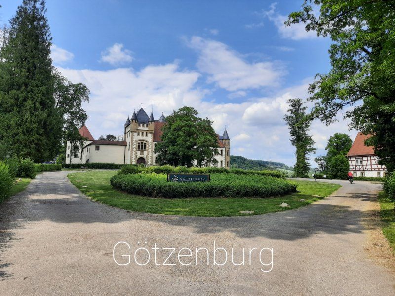
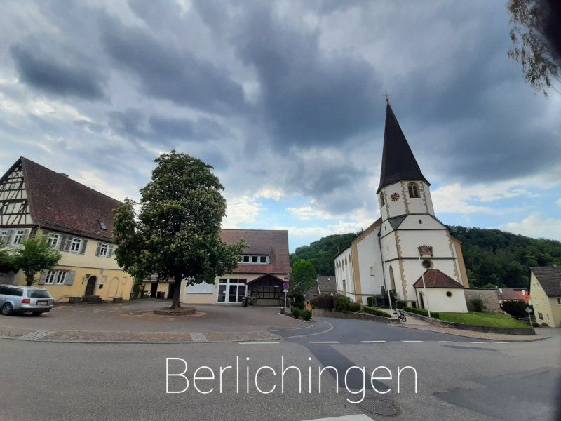
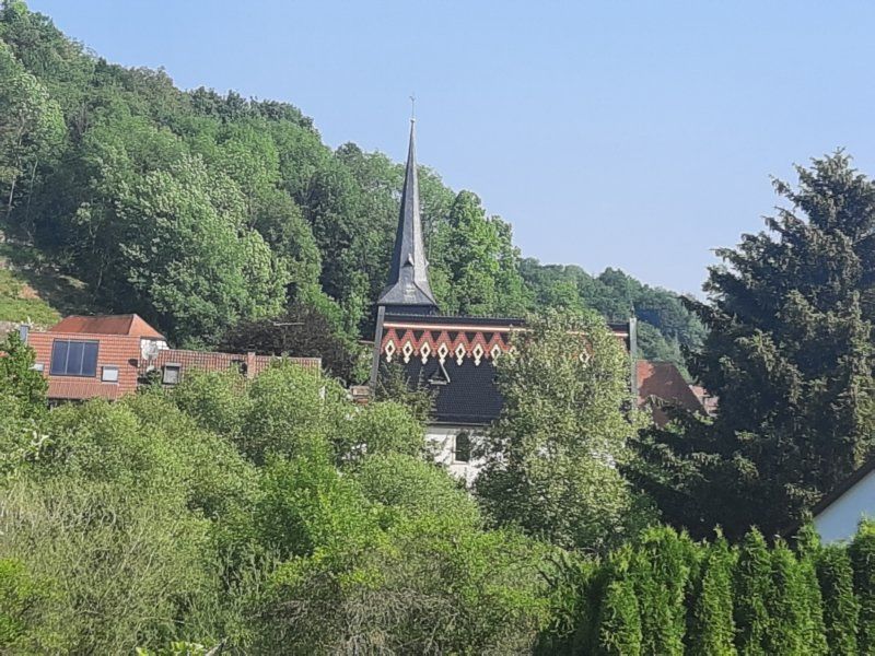
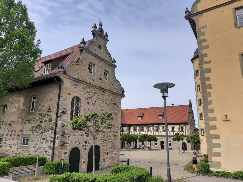
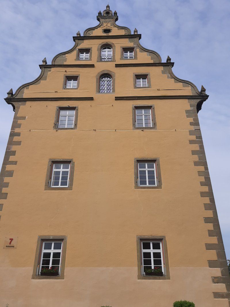
The first sight was the Jagsthausen Castle, later also the Old Castle, and more recently in Jagsthausen, based on Goethe's drama Götz von Berlichingen Götzenburg. In front of the Schöntal monastery we drive through the village of Berlichingen, whose church we looked at.
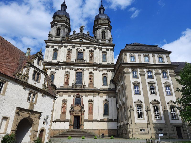
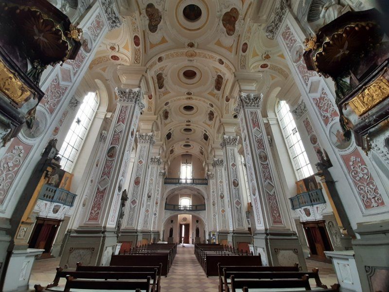
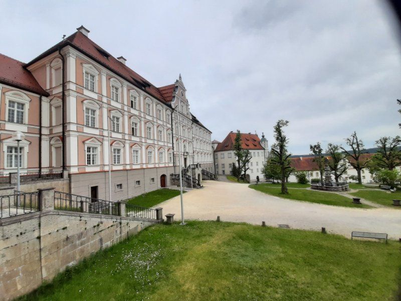
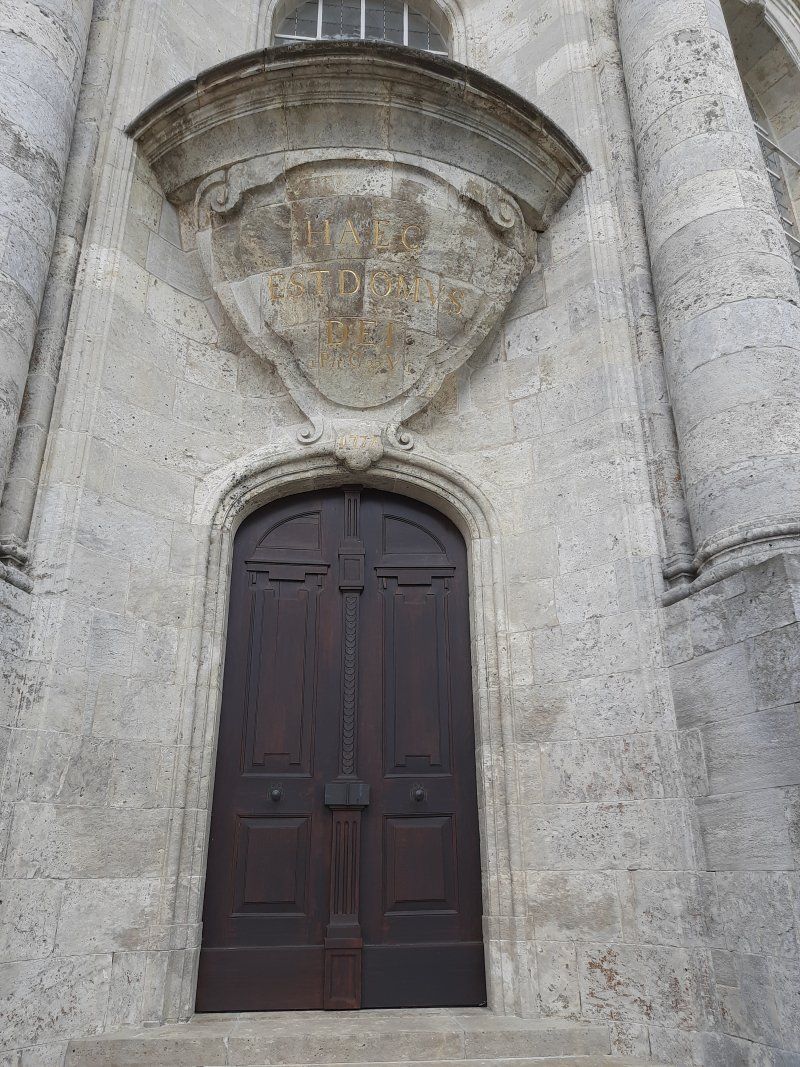
Schöntal an der Jagst Monastery is a former Cistercian abbey with an ornate baroque church.
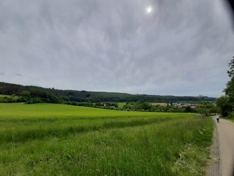
Round trip: 36 km. The Jagsttal is a beautiful landscape ideal for cycling, great bike paths.
Day
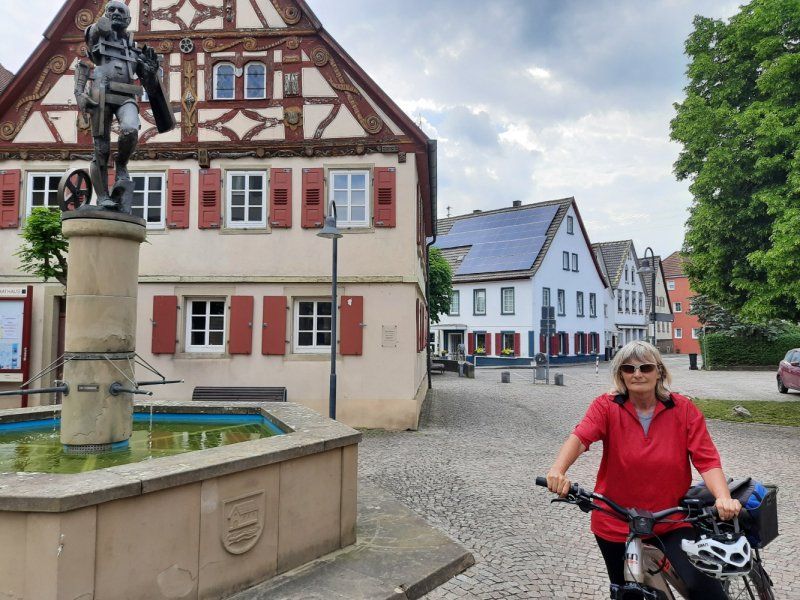
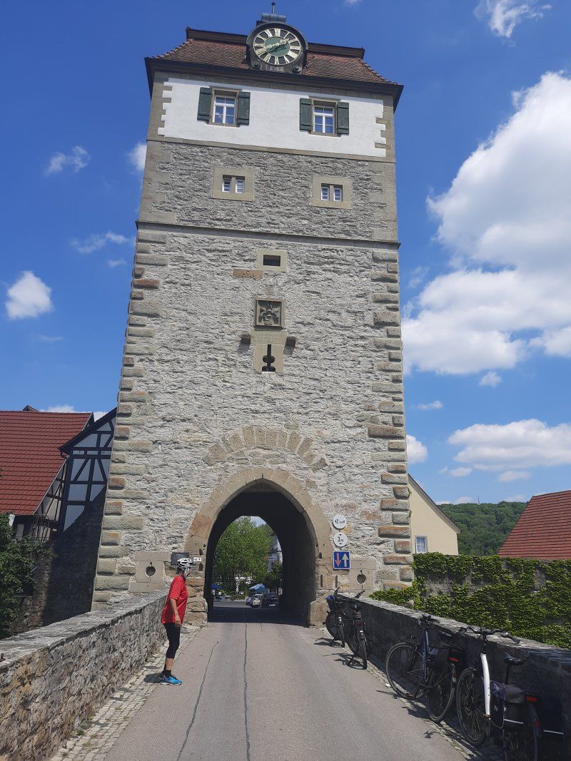
Widdern
The city of Widdern is a small community at the mouth of the Kessach in the Jagst.
Before we continued our journey, we looked around in the smallest town in Baden Württemberg.
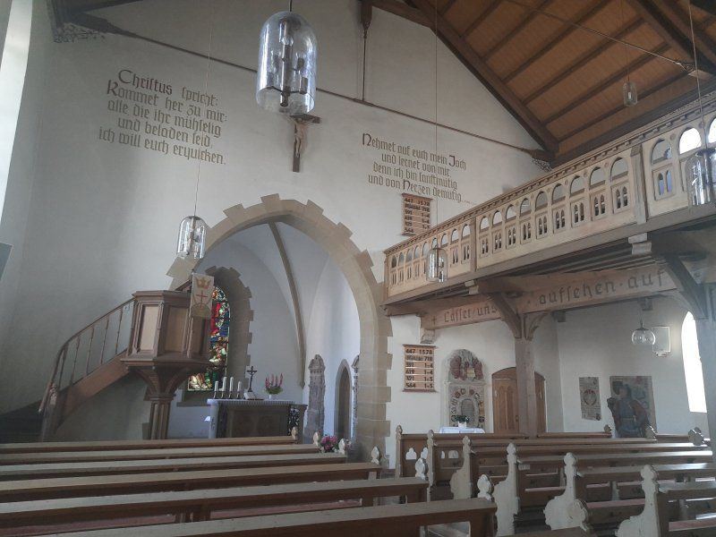
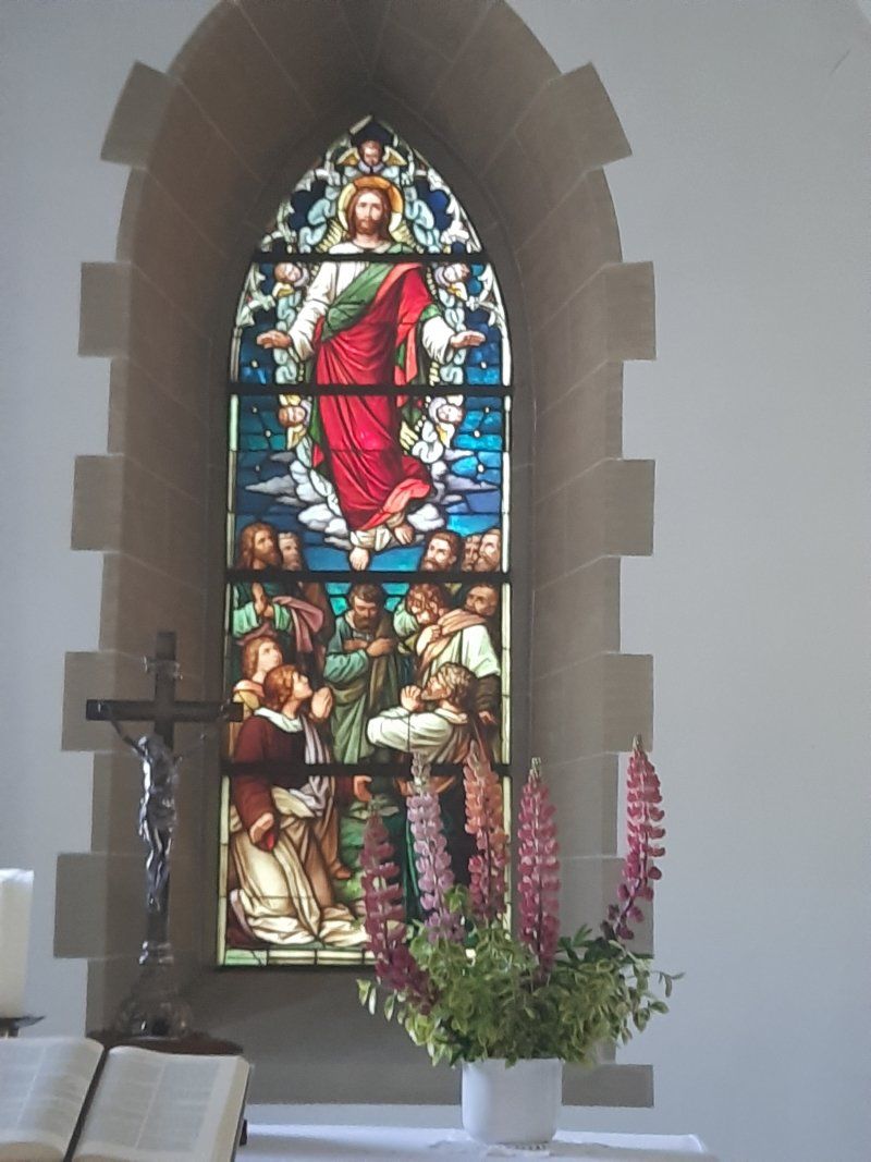
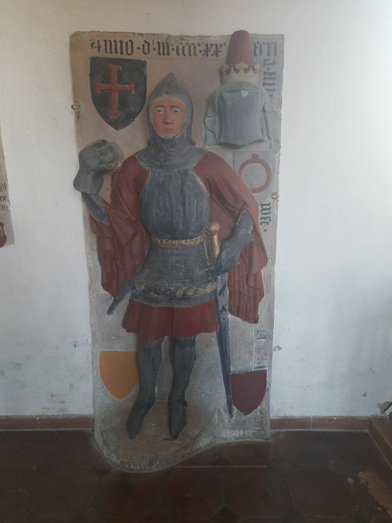
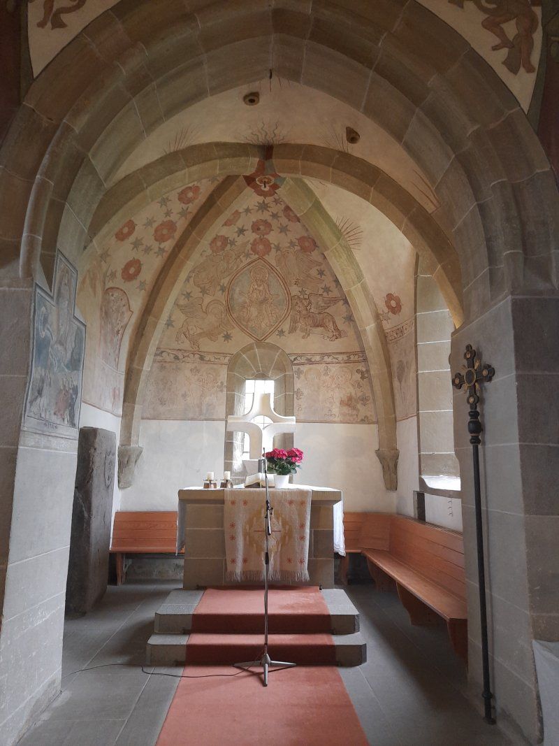
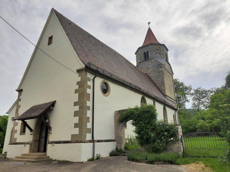
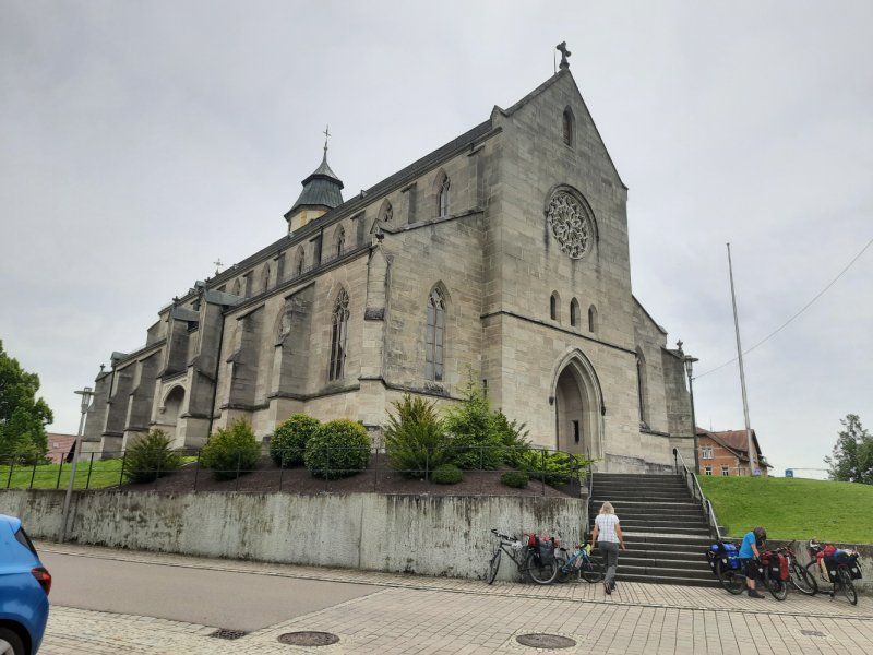
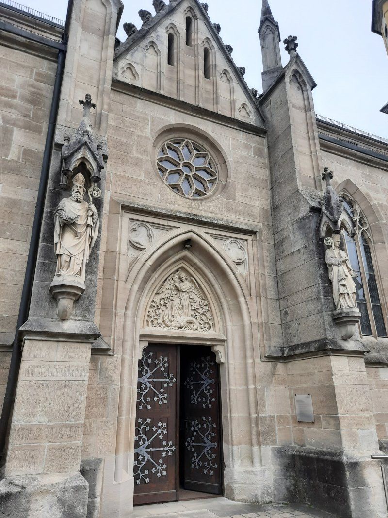
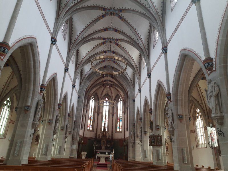
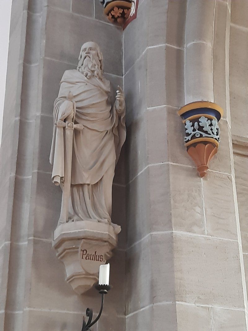
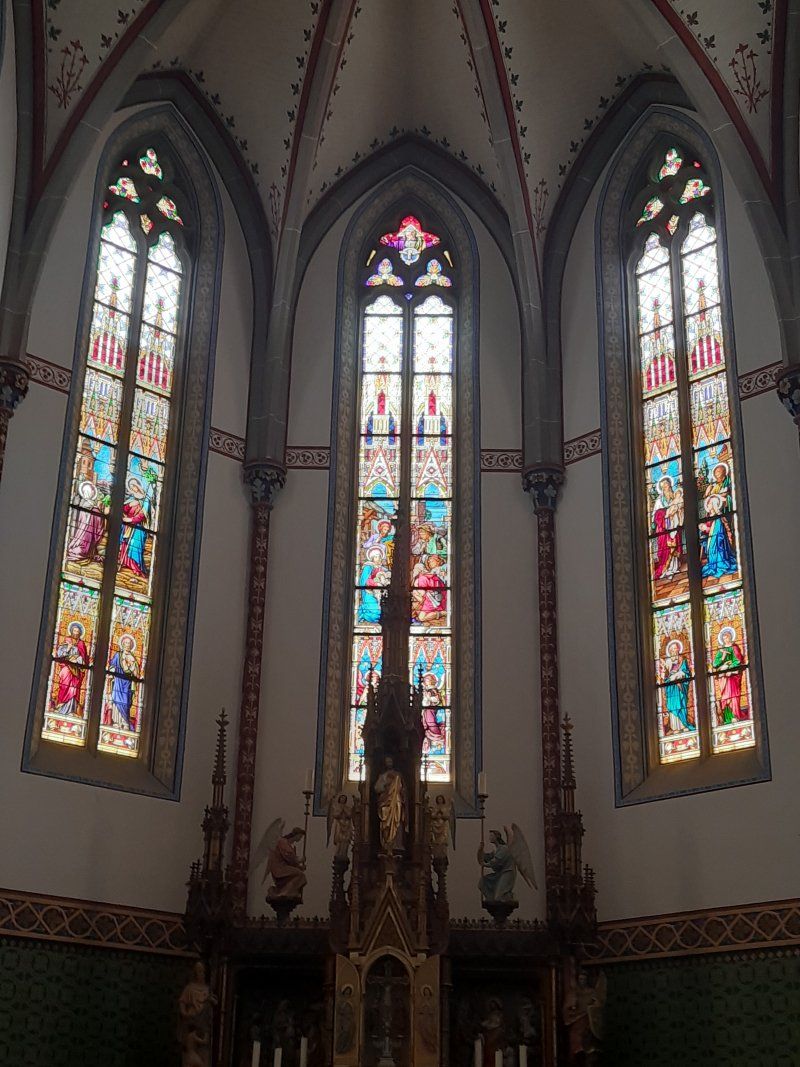
The Evangelical Laurentiuskirche was mentioned for the first time in 1258 and was rebuilt in its present form from 1892 to 1895 while maintaining the late Gothic core of the building. Grave monuments from the 15th to the 18th centuries have been preserved in the church.
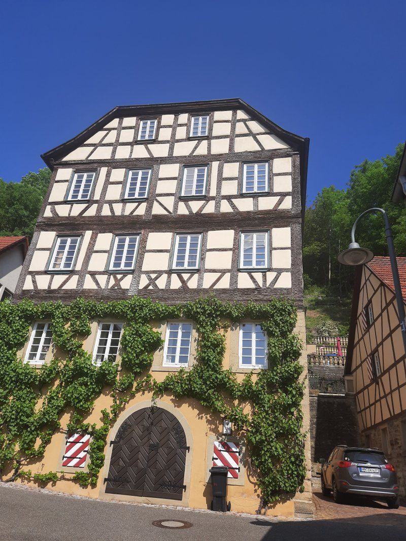
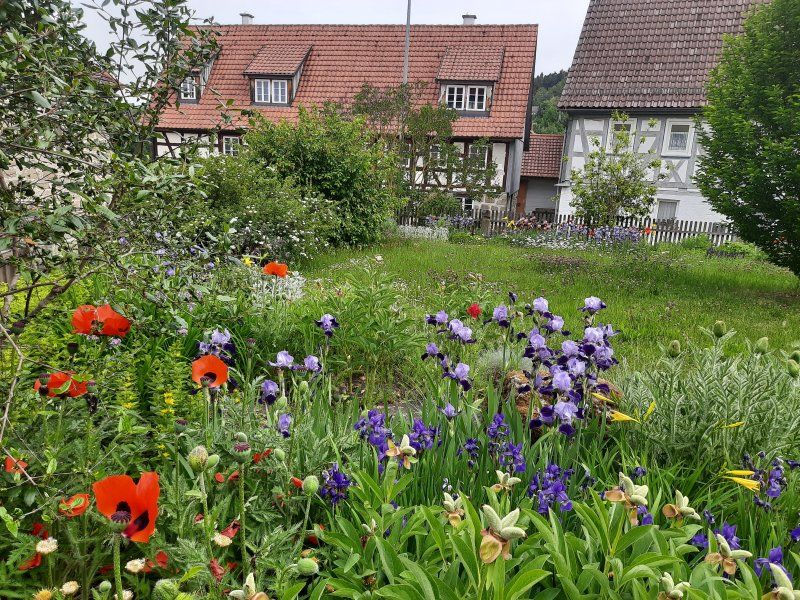
You could see individual half-timbered houses
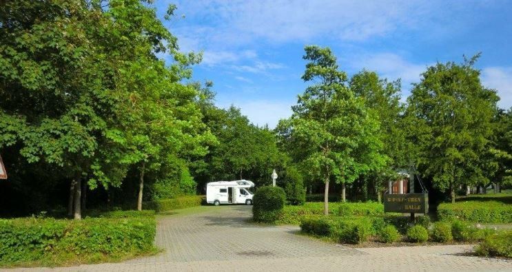
Michelbach an der Bilz
When we arrived at the parking space in Michelbach GPS: 49.071301,9.769860, there was a camper on the pitch. The two marked parking spaces for campers were still free, of which we placed our Womo in first place. Electricity, water and parking fees are free. A short time later two more womos came, so we were lucky to get a parking space.
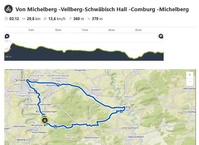
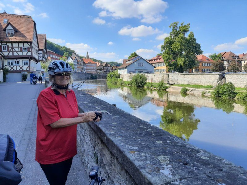
We got the bikes out of the garage and got ready for the second bike tour on this trip, which led to Vellberg - Schwäbisch Hall and the former Comburg monastery.
Deutschland
49° 4' 9.7" N 9° 45' 51.2" E
49.0693651 9.7642234
• Head toward Hofäcker on Kirchstraße. Go for 126 m.
• Turn left onto Hirschfelder Straße (L1055). Go for 3.2 km.
• Turn left onto B19. Go for 7.4 km.
• Turn right onto Marktplatz (B19) toward Aalen/Schwäb. Gmünd/Backnang. Go for 231 m.
• Keep right onto Karlstraße (B19) toward Schwäb. Gmünd/B298/Aalen/Backnang. Go for 206 m.
• Turn left onto Schillerstraße (B19) toward Aalen/Sulzbach. Go for 15.4 km.
• Turn left onto Aalener Straße (B19) toward A7/Aalen. Go for 11.5 km.
• Turn right onto Hauptstraße. Go for 144 m.
• Turn right onto Hohenstadter Straße (L1080). Go for 532 m.
• Take the 3rd exit from roundabout onto Eichklingenstraße. Go for 184 m.
• Continue on Fliederstraße. Go for 125 m.
• Turn left onto An der Wart. Go for 11 m.
• Arrive at An der Wart. Your destination is on the right.
☍
39,0 km
( 37 min.)
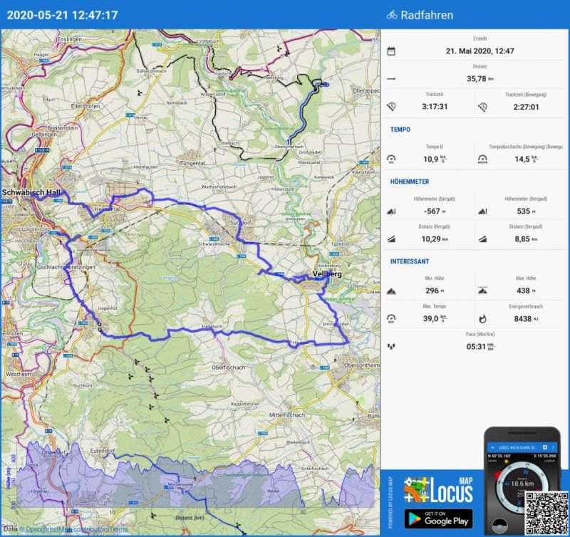
Radtour Vellberg - Schwäbisch Hall - Comburg
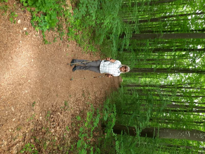
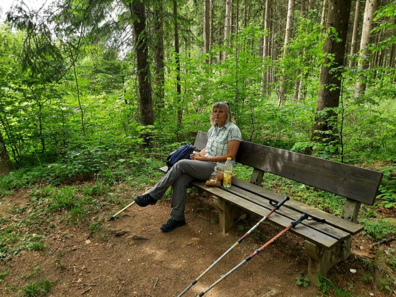
Total distance 40 km. Right from the start it went steeply uphill from the parking space, thanks to the e-bikes this was easy to master. The route to Vellberg was an up and down, partly on signposted bike paths but also on gravel paths through forest and fields. We often strayed from the planned route and did not have a cell phone to navigate.
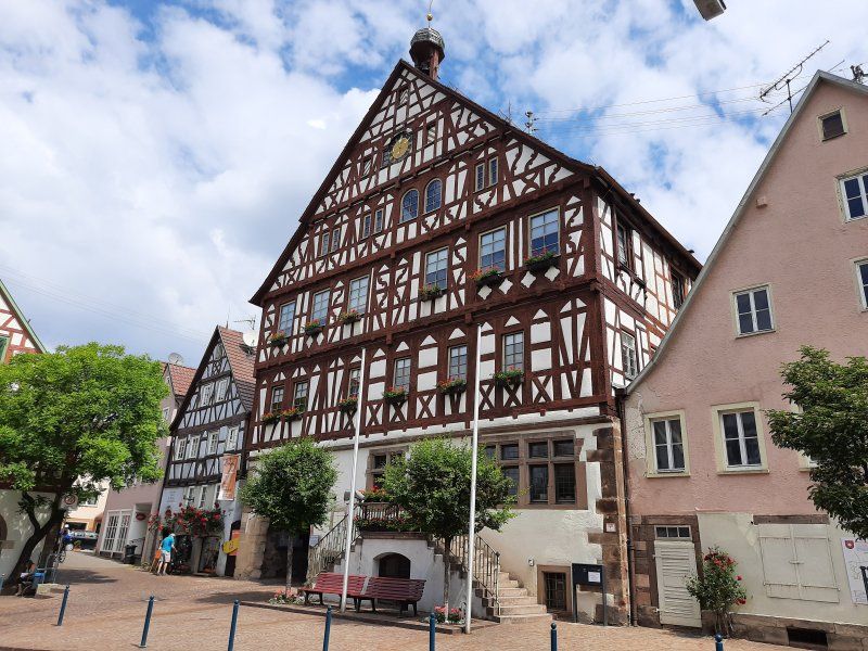
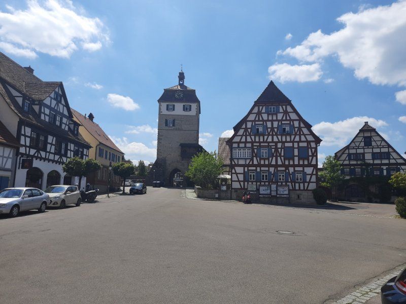
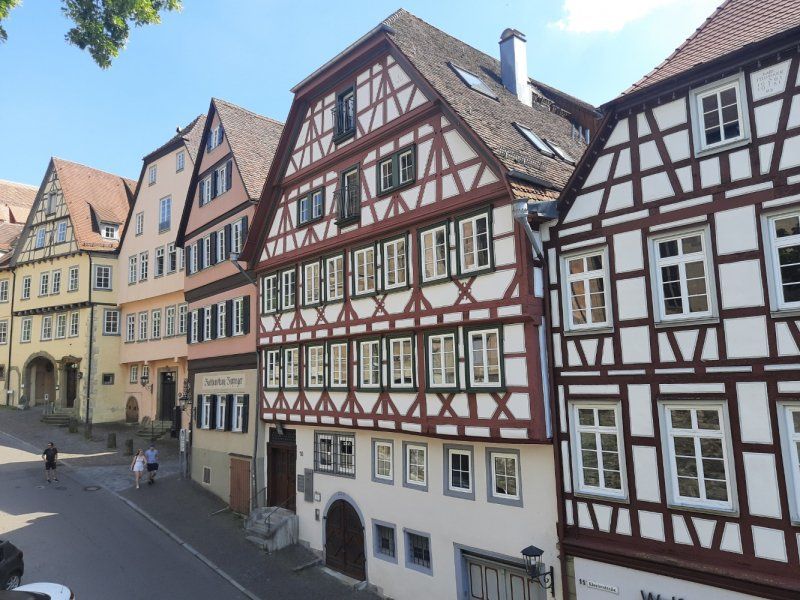
Vellberg was our first goal. We were amazed at the magnificent city complex with its preserved city walls, towers and city gates. It is gigantic and the height of the city wall. The many half-timbered houses are also impressive with their construction. As nice as the town is the gastronomy is to be criticized in the coffee one was stupid and in another gas station one was not served despite repeated requests to the waitress. For these reasons we saw a stop from here. (I think everything works differently without Corona).
The onward journey to Schwäbisch Hall was also not without problems, in part the cycle paths were poorly signposted due to the lack of signs and once the cycle path ended in a newly built construction area. Here we had lost quite a bit of time and effort to get back on the bike path. This section of the route between the two cities was easy to drive, you could do a lot without an electric motor.
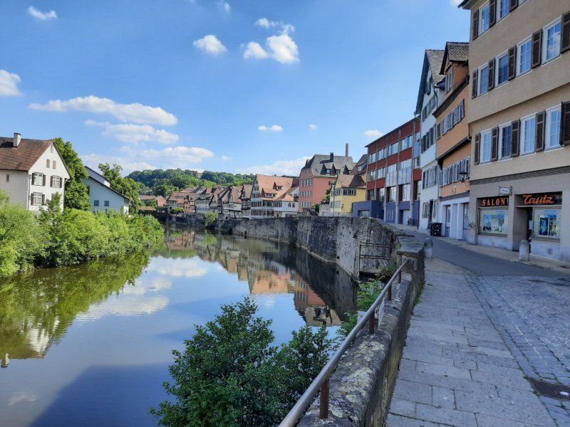
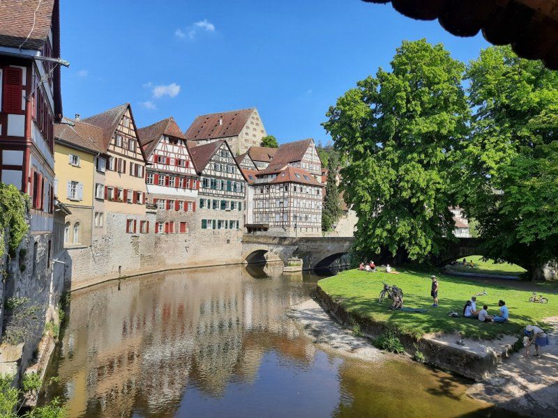
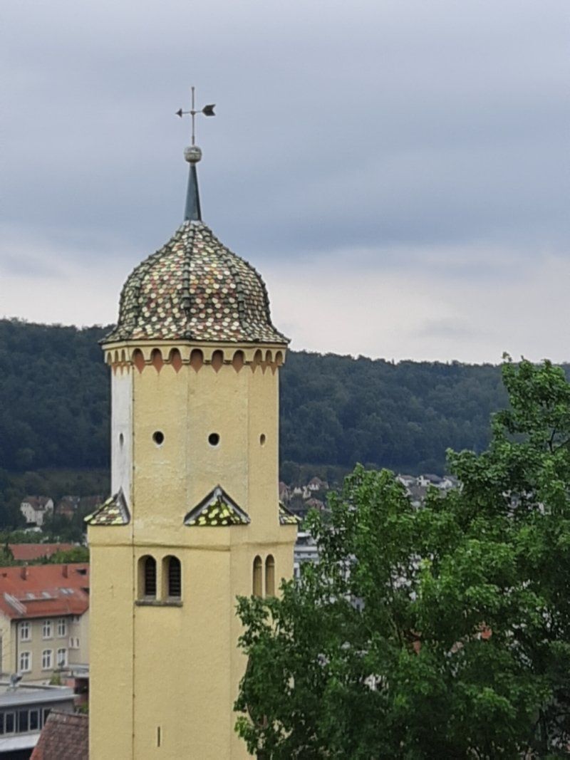
Schwäbisch Hall was of course the highlight of the tour, I did not imagine the city as impressive. The beautiful facades of the half-timbered houses, the narrow streets with the picturesque gables. The old wooden bridges that lead over the Kocher and the river itself give the city a very special flair. Unfortunately the church, which we would have liked to see, was already closed when we arrived.
In a coffee right outside the church we enjoyed our piece of cake in wonderful summer weather.
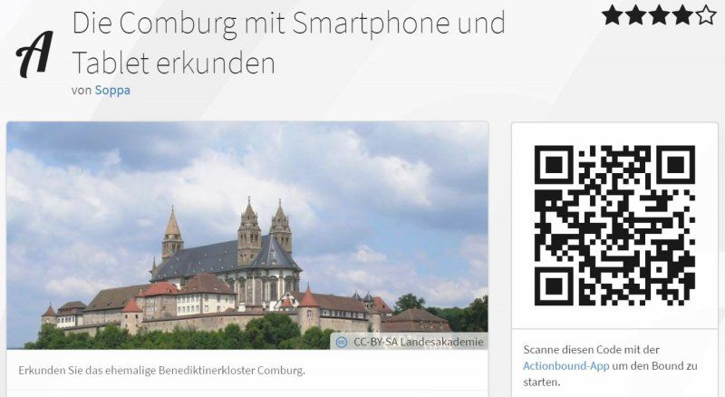
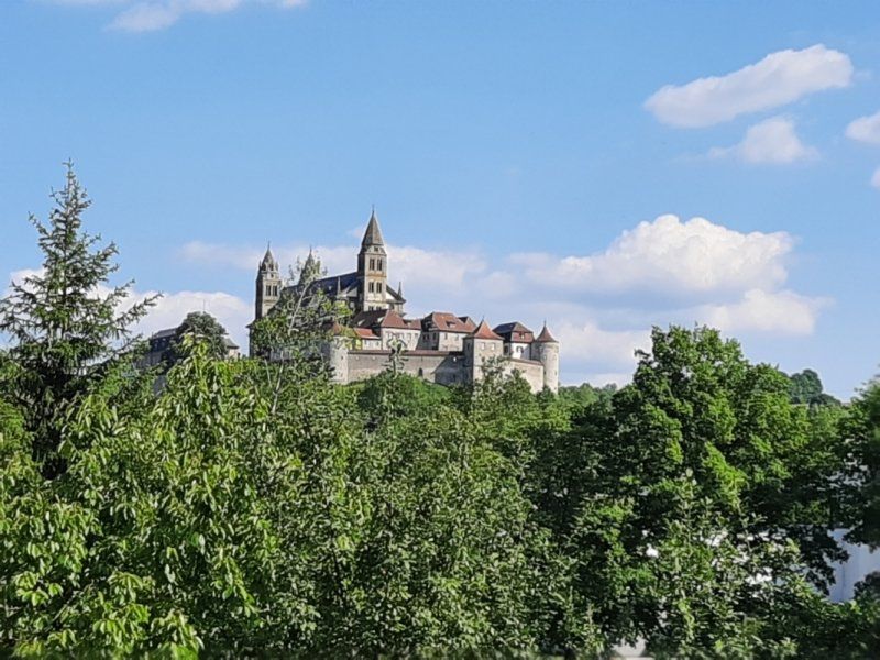
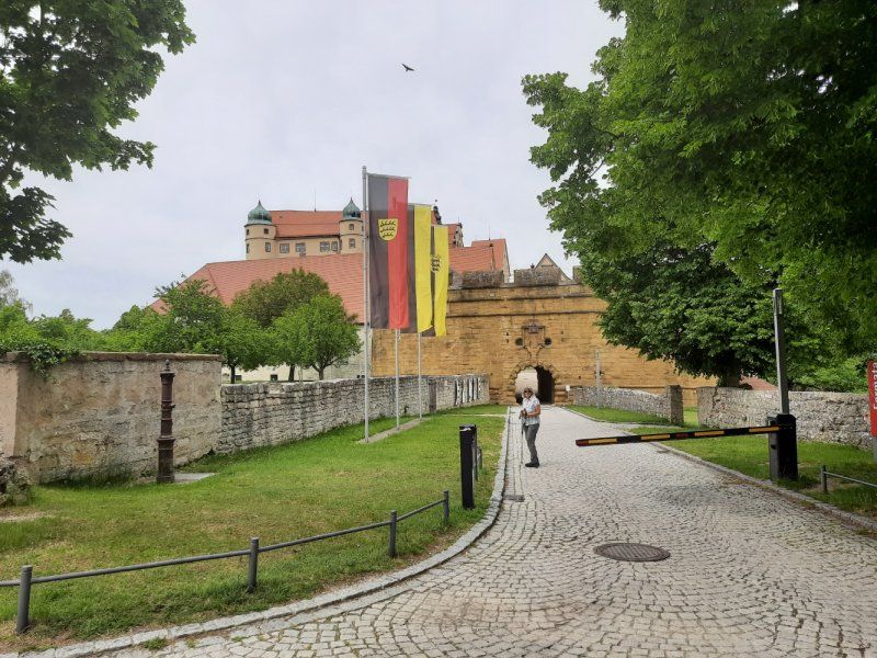
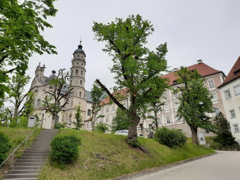
Continue to the last stage of the round tour, the former Comburg monastery. At first it was difficult to find the right way out of the alleys of the old town, which led to the Comburg. In front of the monastery, a beautiful avenue with chestnut trees leads up to Comburg.
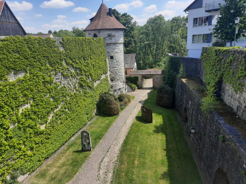
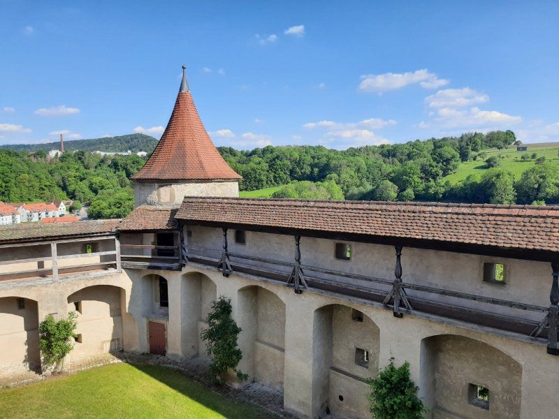
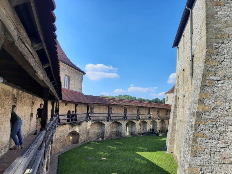
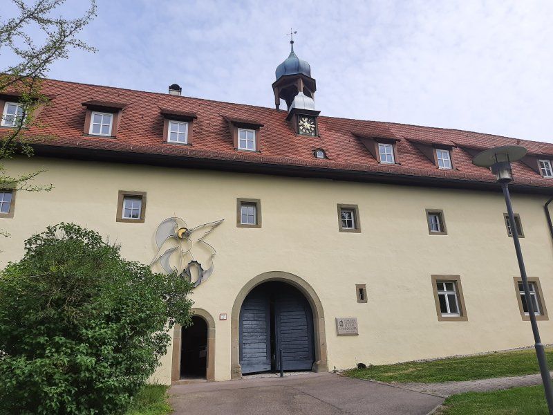
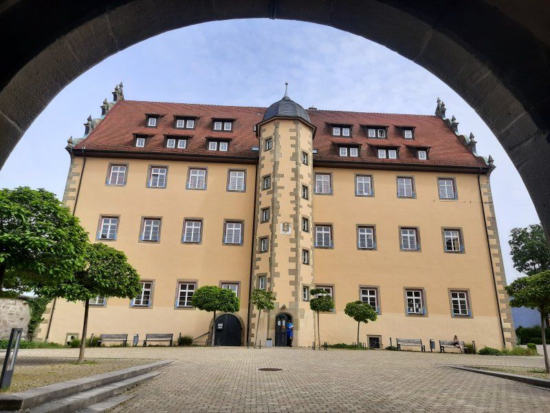
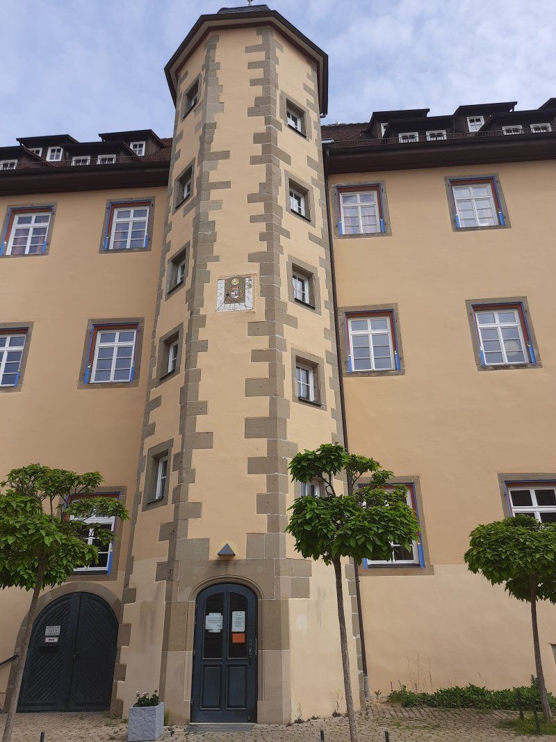
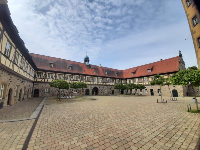
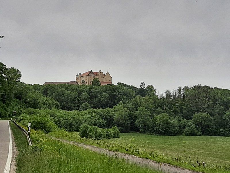
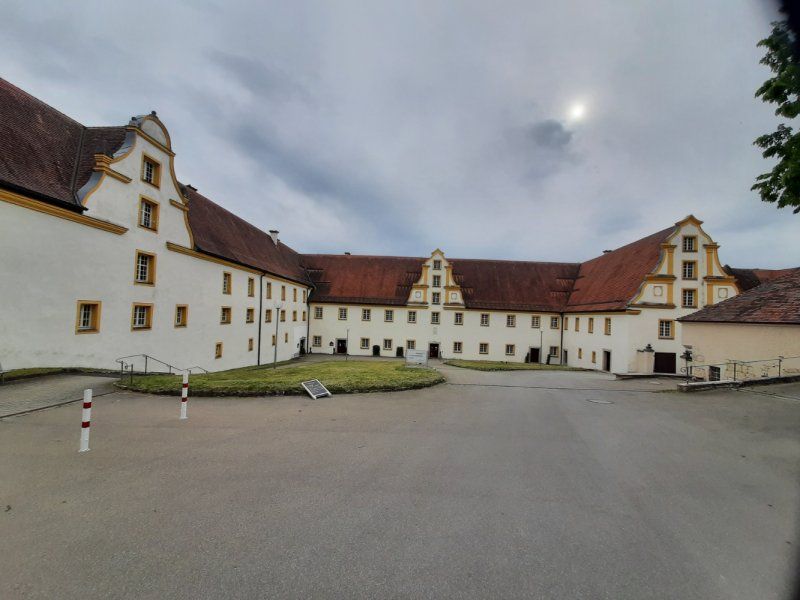
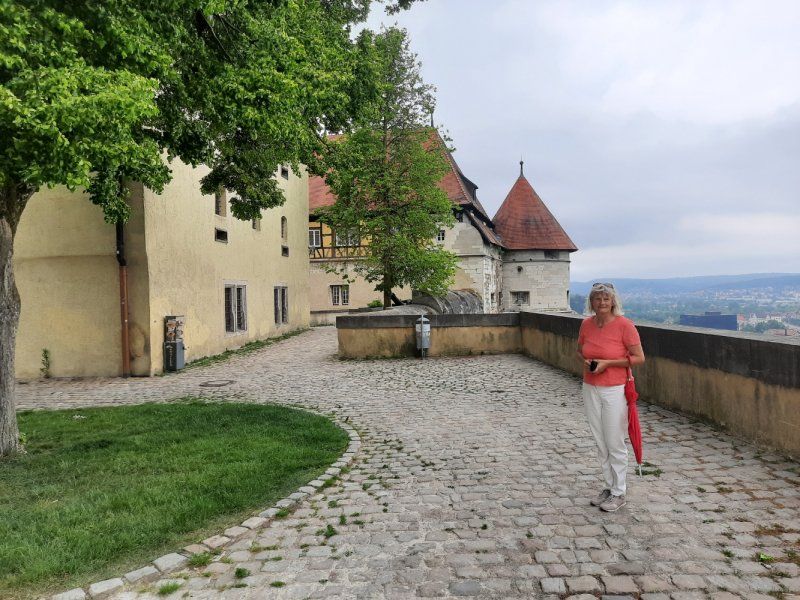
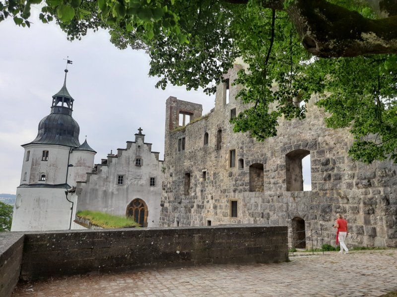
The Comburg, also written Komburg and called Großcomburg, is a former Benedictine monastery and later knighthood.
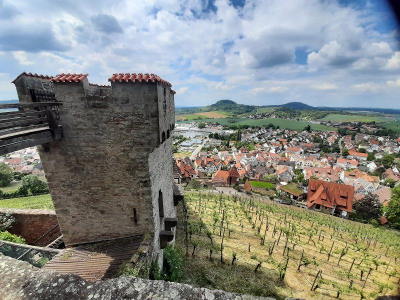
The Großcomburg was founded in 1078. The castle-like complex with its walls, towers, chapels and buildings experienced its first flowering during the Staufer period.
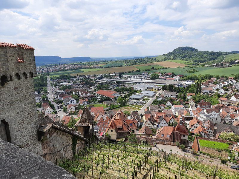
The Großcomburg Abbey rises majestically and majestically high above the Kochertal Valley - a monument of European rank.The Großcomburg grounds are freely accessible and the 420 m long walk-in walkway offers wonderful views of the city of Schwäbisch Hall and the panoramic mountain Einkorn (510 m high) ).
It is known for two treasures: the gold-plated antependium and the Romanesque chandelier.
Visiting the Church of St. Nicholas is only possible on short tours. Unfortunately, the church is closed to visitors due to Corone, so all we had to do was visit the complex with the rampart.
After an extensive inspection, we continue our journey, it was only a few kilometers to our parking space in Michelbach.
Day
Michelbach
After a sleepless night we got up quite late for breakfast. We don't know why it was that we both slept so badly, it couldn't have been all green around the square, except that the church clock struck quite loudly every quarter of an hour. After the Womo was ready to go, we took a closer look at the place Michelbach with the church and the castle. What amazed us, the 2000 soul community, has an excellent infrastructure. The journey to Abtsgmünd was a little way along the motorway and later on the road along the Kocher. The Kochertal is a scenic but rich valley.
Abtsgmünd
In Abtsgmünd we wanted to visit the castle garden, it should be beautifully laid out. We found and saw no castle, so we visited the local church, which is also beautiful.
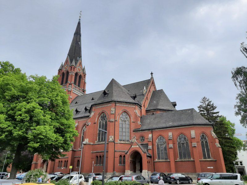
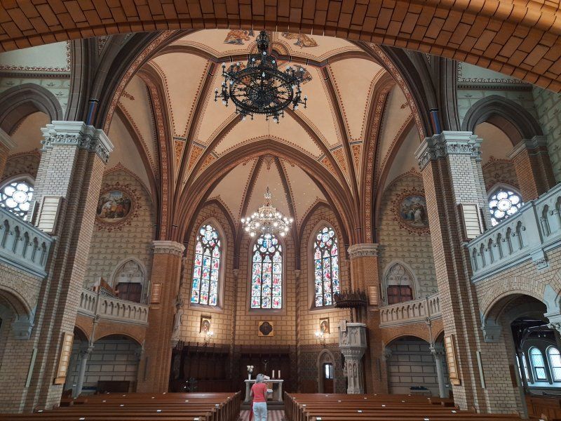
The Catholic parish church of St. Michael is a neo-Gothic basilica with a late Romanesque basement. The Rechberg Cross has been in front of the church since 1994; this cross, dated to 1331, is the second oldest stone cross in Baden-Württemberg. It was probably created by a sideline of the Counts of Rechberg.
Deutschland
48° 53' 27.9" N 10° 0' 6.1" E
48.8910782 10.0016920
• Head northwest on An der Wart. Go for 59 m.
• Turn left onto Knöcklestraße. Go for 170 m.
• Turn left onto Knöcklestraße. Go for 46 m.
• Turn right onto Eichklingenstraße. Go for 65 m.
• Take the 1st exit from roundabout onto Hohenstadter Straße (L1080). Go for 556 m.
• Turn left onto Hauptstraße. Go for 144 m.
• Turn right onto B19. Go for 1.1 km.
• Pass 2 roundabouts and continue on Abtsgmünder Straße (B19). Go for 6.9 km.
• Take the 2nd exit from roundabout onto Bachstraße toward Seitsberg. Go for 366 m.
• Continue on Kocherstraße. Go for 218 m.
• Continue on K3237. Go for 761 m.
• Continue on K3311. Go for 10 m.
• Continue on K3237. Go for 171 m.
• Take the 1st exit from roundabout onto B19 toward A7/Stuttgart/Nördlingen/B29/Heidenheim/Ellwangen. Go for 250 m.
• Turn right onto B29 toward A7/Nördlingen/Ellwangen. Go for 10.5 km.
• Turn right onto L1076 toward Lauchheim/Kapfenburg. Go for 958 m.
• Continue on Hauptstraße. Go for 90 m.
• Arrive at Hauptstraße. Your destination is on the right.
☍
22,3 km
( 22 min.)
Lauchheim
Hiking parking lot at the shooting club
We used the parking lot to park, it is big enough for our Womo and is on the outskirts of the city on the railway line. Good starting point for our hike.
Deutschland
48° 52' 16.9" N 10° 14' 35.8" E
48.8713499 10.2432861
• Head toward Hettelsberger Weg on Hauptstraße. Go for 90 m.
• Turn left onto Bahnhofstraße (L1076). Go for 2.1 km.
• Take the 2nd exit from roundabout onto L1076. Go for 7.3 km.
• Turn left onto B29A toward A7/Neresheim. Go for 1.1 km.
• Continue on L1084. Go for 8.8 km.
• Continue on L1084. Go for 1.7 km.
• Turn left onto B466. Go for 1.6 km.
• Continue on Dischinger Straße (L2033) toward Dillingen/Dischingen/Kloster. Go for 172 m.
• Turn left onto Ulrichstraße (K3309). Go for 934 m.
• Turn left. Go for 8 m.
• Arrive at your destination.
☍
23,7 km
( 21 min.)
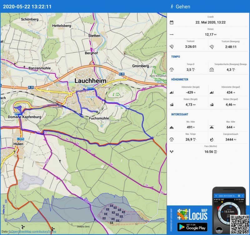
Wanderung Kapfenburg
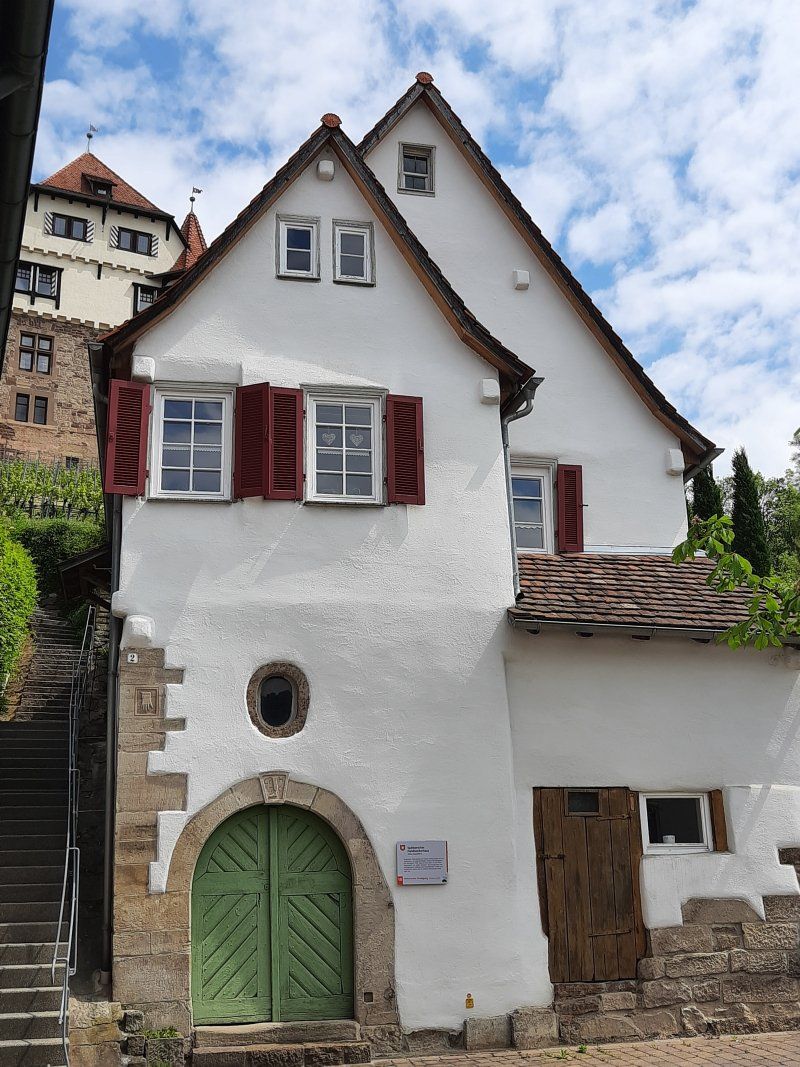
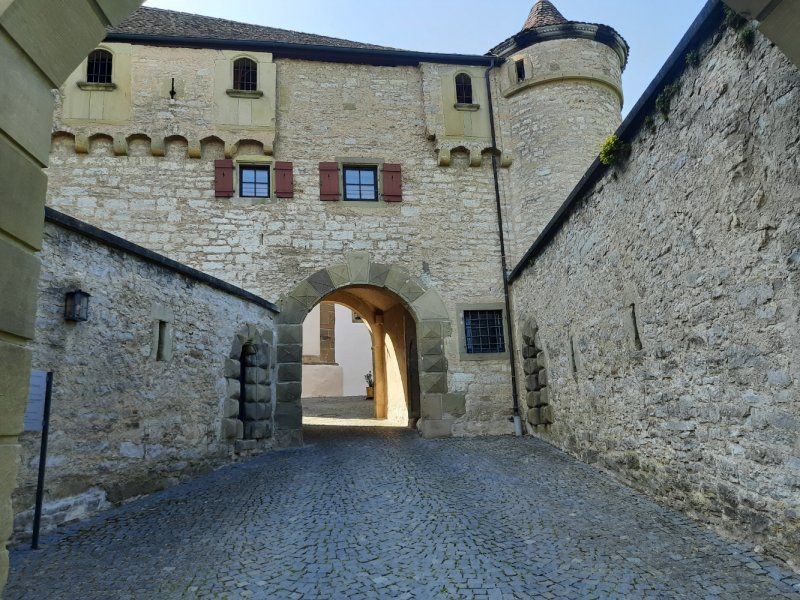
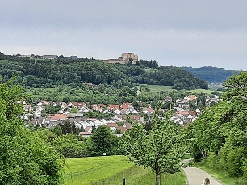
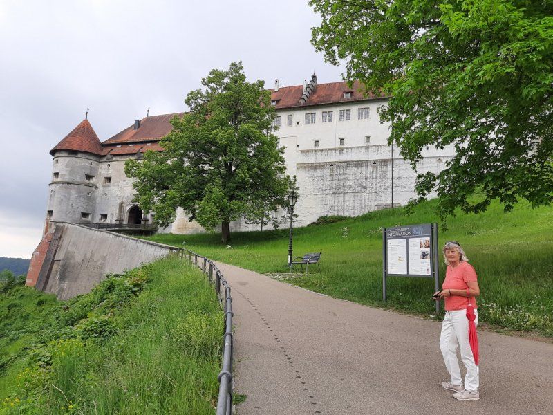
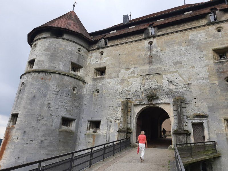
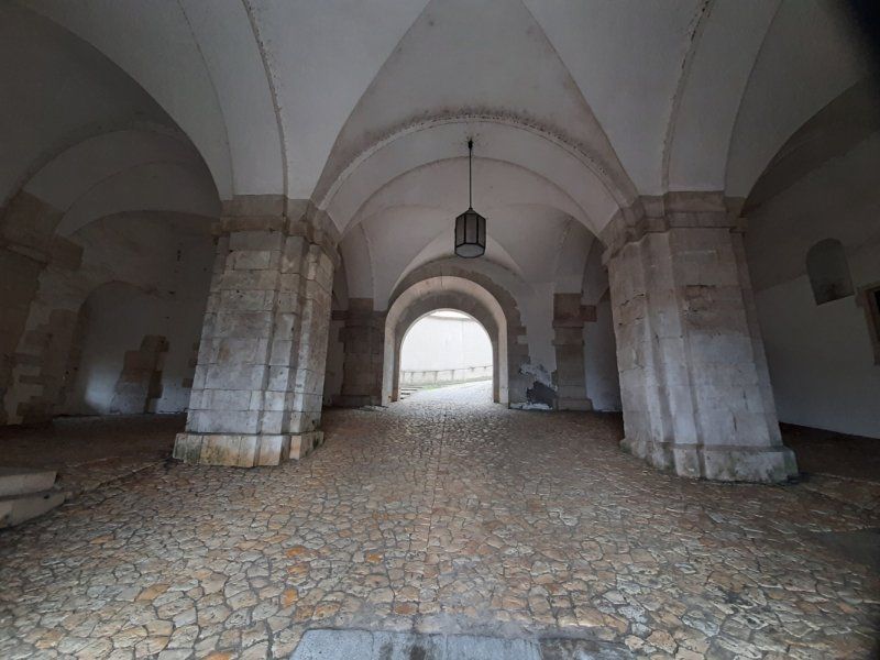
Hiking parking lot at the Schützenhaus from there we started our small circular hike that led over the Kapfenburg. It was unusually humid today, which was particularly difficult the climb to the castle. The castle complex could only be viewed from the outside, which we made extensive.
The Kapfenburg is located on a mountain nose of the Albtrauf, 130 meters above the city of Lauchheim.
After the fall of the Staufer, the Counts of Oettingen and their feudal lords, the Lords of Gromberg, took over a large part of the lands around the Kapfenburg. In 1364 the Teutonic Order House Mergentheim acquired the castle. It was the last coming foundation of the order in southern Germany. The religious state in Prussia and the religious houses in the empire were already living apart. The Kapfenburg is above all a testimony to a small spiritual and knightly residence of the late Middle Ages and early modern times.
In the Rhine Confederation Act of 1806, Napoleon abolished the Teutonic Order and awarded the Kapfenburg to King Friedrich of Württemberg. Since then it has been owned by the country.
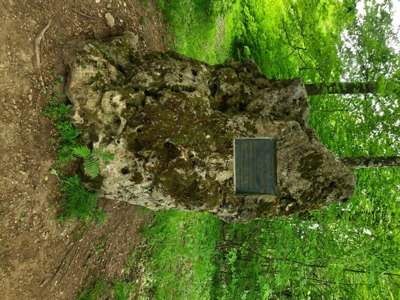
The further hiking trail ran through various forests, mainly Buchenwald. We stopped at the beautiful stone hiking point. The further route now went downhill to the town of Lauchheim. We were quite surprised when we came across a beautiful city gate with remains of the old city wall. Tower tower system from 1621 with octagonal tower with coat of arms as
Part of the city fortifications built around 1400. A few half-timbered gables can still be seen in the center.
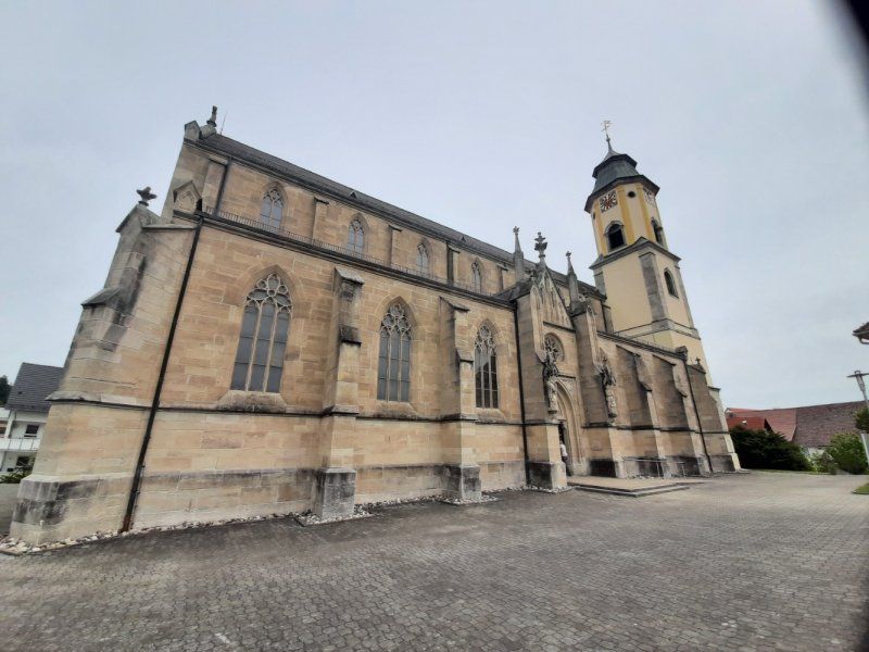
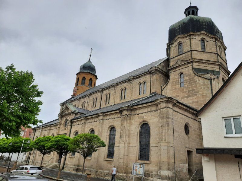
The Catholic parish church of St. Peter and Paul is worth seeing.
In an elevated topographical position and eaves oriented towards the main street, the tower from the period around 1500, the nave with the octagonal choir tower after the city fire in neoclassical style in 1869 by G. v. Morlock renewed in sandstone.
On the way to the camper we used the little detour through the center to get to know the place better.
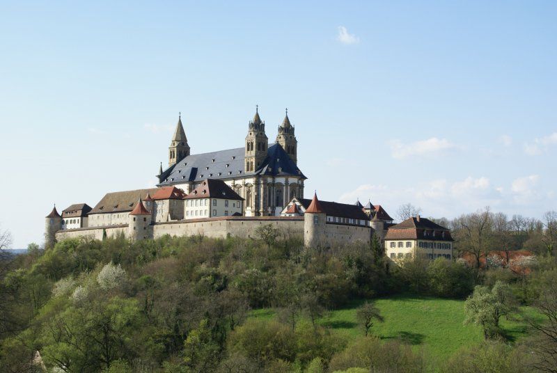
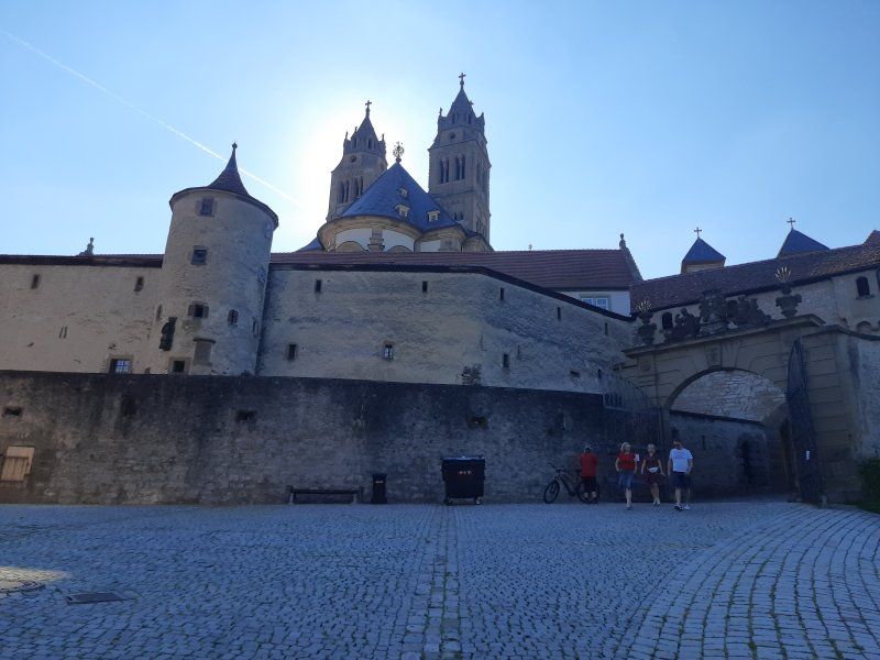
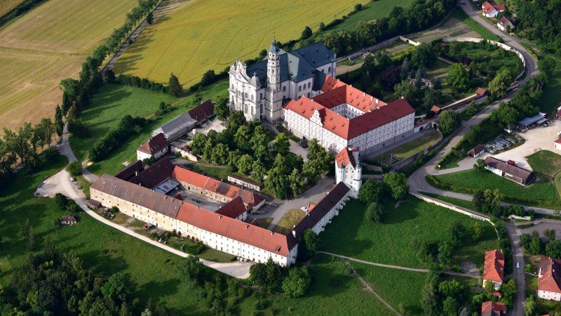
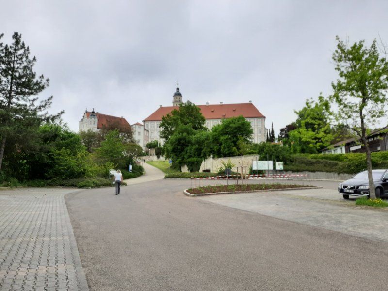
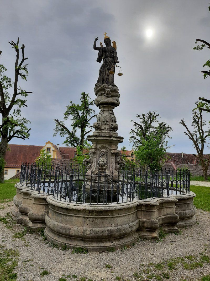
Neresheim Abbey
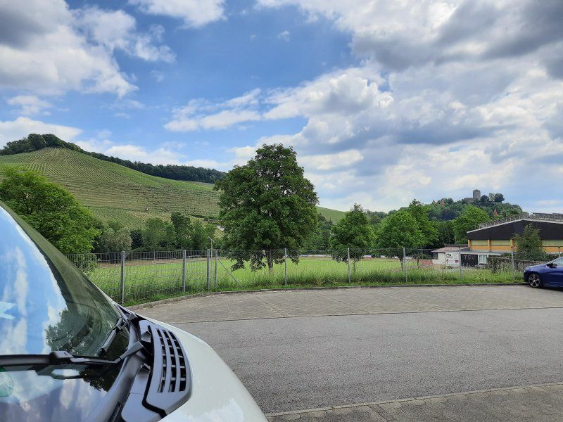
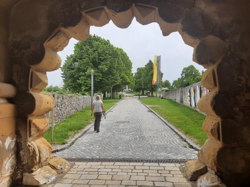
On the way to the abbey, we used a bit of the A7 motorway. The monastery complex can be seen from a distance on a hill. Arrived almost at the destination, the city of Neresheim had to be driven through, which went smoothly due to little traffic. The mountain road leading to the abbey is well developed and wide. In front of the abbey there is a large parking lot next to the mountain road, on which we wanted to park and spend the night. The Womo was turned off, without wasting time we walked to the monastery.
The monastery complex could only be visited from the outside, due to the Corona crisis, the monastery and church are closed to visitors and no church services were held.
The Neresheim Abbey is a Benedictine monastery in the Diocese of Rottenburg-Stuttgart in Baden-Württemberg and a member of the Beuron Congregation. The monastery complex is located above the town of Neresheim on the Ulrichsberg in a dominant position above the Härtsfeld. The monastery was founded in 1095 by Count Hartmann I von Dillingen and his wife Adelheid von Winterthur-Kyburg, presumably a daughter of the last Winterthur Count Adalbert II the count of Kyburg, founded as an Augustinian canon at his castle in Neresheim and converted in 1106 into a Benedictine abbey, which joined the Hirsau reform. The first (Benedictine) monks came from Petershausen Abbey in 1106 and a second group from Zwiefalten Abbey in 1119. In addition to the men's community, there was also a women's convent, which however entered into in the middle of the 13th century.
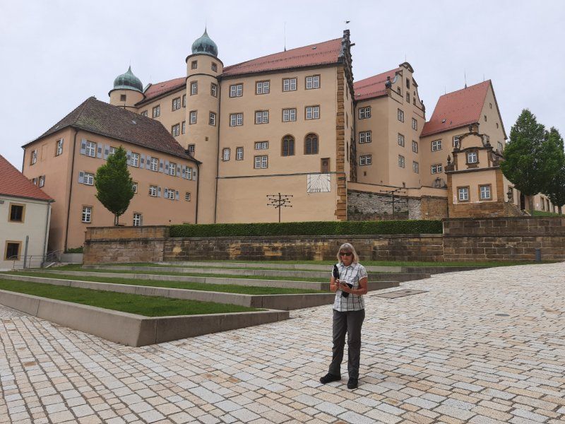
After the monastery tour in the monastery courtyard, we went back to the Womo. Now the decision was to spend the night here or to move to another parking space. We refrained from spending the night in the parking lot, the space was too sloping. We decided to drive to the parking space in Heidenheim an der Brenz for the night. Heidenheim is new to us and is definitely an interesting place with its castle.
Kloster, Neresheim, Deutschland
48° 45' 21.1" N 10° 20' 37.4" E
48.7558741 10.3437116
• Head toward Alte Kösinger Straße. Go for 8 m.
• Turn right onto Ulrichstraße (K3309). Go for 934 m.
• Turn right onto Dischinger Straße (L2033). Go for 172 m.
• Continue on Hauptstraße (B466). Go for 11.0 km.
• Take the 1st exit from roundabout onto Daimlerstraße (B466) toward A7/Ulm/Heidenheim/Nattheim/Gewerbegebiet Nattheim-Nord. Go for 1.1 km.
• Take the 1st exit from roundabout onto Heidenheimer Straße (B466) toward A7/Ulm/Heidenheim/Gewerbegebiet Nattheim-Rinderberg/Gewerbegebiet Nattheim-Süd. Go for 3.1 km.
• Turn right onto Nürnberger Straße (B466) toward Ulm/Heidenheim. Go for 2.1 km.
• Turn left onto Am Kalkwerk toward Gewerbegebiet Tieräcker. Go for 452 m.
• Continue on Wilhelm-Kentner-Straße. Go for 353 m.
• Turn left onto In den Seewiesen. Go for 39 m.
• Turn right onto In den Seewiesen. Go for 97 m.
• Arrive at your destination on the right.
☍
19,2 km
( 18 min.)
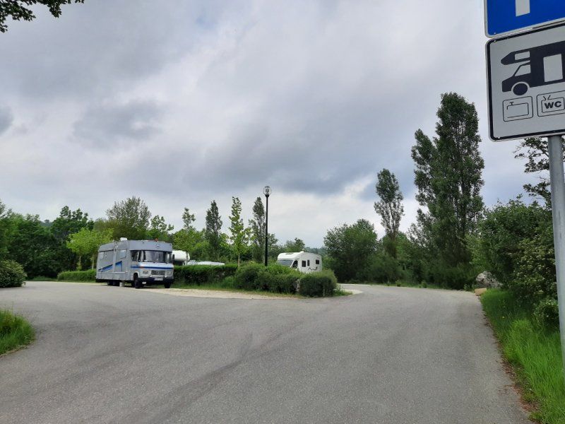
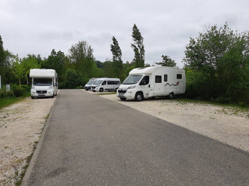
Stellplatz in den Seewiesen
Fee: 2 €, water and supply 1.- €, electricity 1Kw = 0.50 €
22 parking spaces, asphalt access, gravel underground. On arrival the place was 50% full.
Arrived at the parking space around 6:30 p.m.
We ended the day with dinner and sat in front of the Womo. It became significantly cooler, as in the evenings of the past few days.
In den Seewiesen, 89522, Heidenheim/B., Deutschland
48° 41' 40" N 10° 9' 47" E
48.6944444 10.1630556
• Head north. Go for 82 m.
• Continue on In den Seewiesen. Go for 15 m.
• Turn left onto In den Seewiesen. Go for 39 m.
• Turn right onto Wilhelm-Kentner-Straße. Go for 353 m.
• Continue on Am Kalkwerk. Go for 452 m.
• Turn right onto Nürnberger Straße (B466). Go for 2.0 km.
• Turn right onto B466A toward A7/Gewerbegebiet Nattheim-Rinderberg/Gewerbegebiet Nattheim-Süd. Go for 1.2 km.
• Turn left and take ramp onto A7 toward Ulm. Go for 30.5 km.
• Take exit 120 toward Stuttgart/Ulm onto A8. Go for 61.7 km.
• Take exit 57 toward Kirchheim unter Teck/Lenningen/Dettingen unter Teck. Go for 296 m.
• Turn left onto B465 toward Lenningen/Owen/Kirchheim-Nabern/Dettingen unter Teck. Go for 5.0 km.
• Turn right onto Bahnhofstraße. Go for 33 m.
• Turn right onto Schießhüttestraße. Go for 30 m.
• Arrive at Schießhüttestraße. Your destination is on the left.
☍
101,8 km
( 59 min.)
Day
Besichtigung Heidenheim
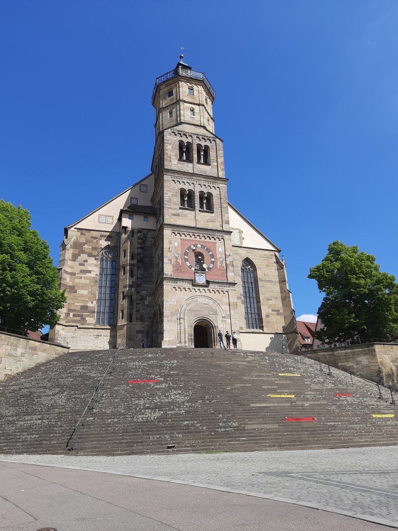
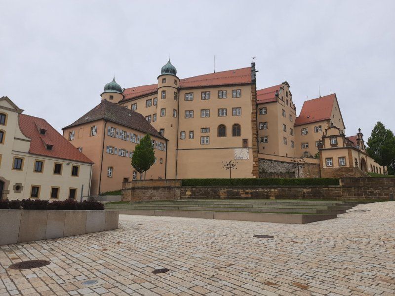
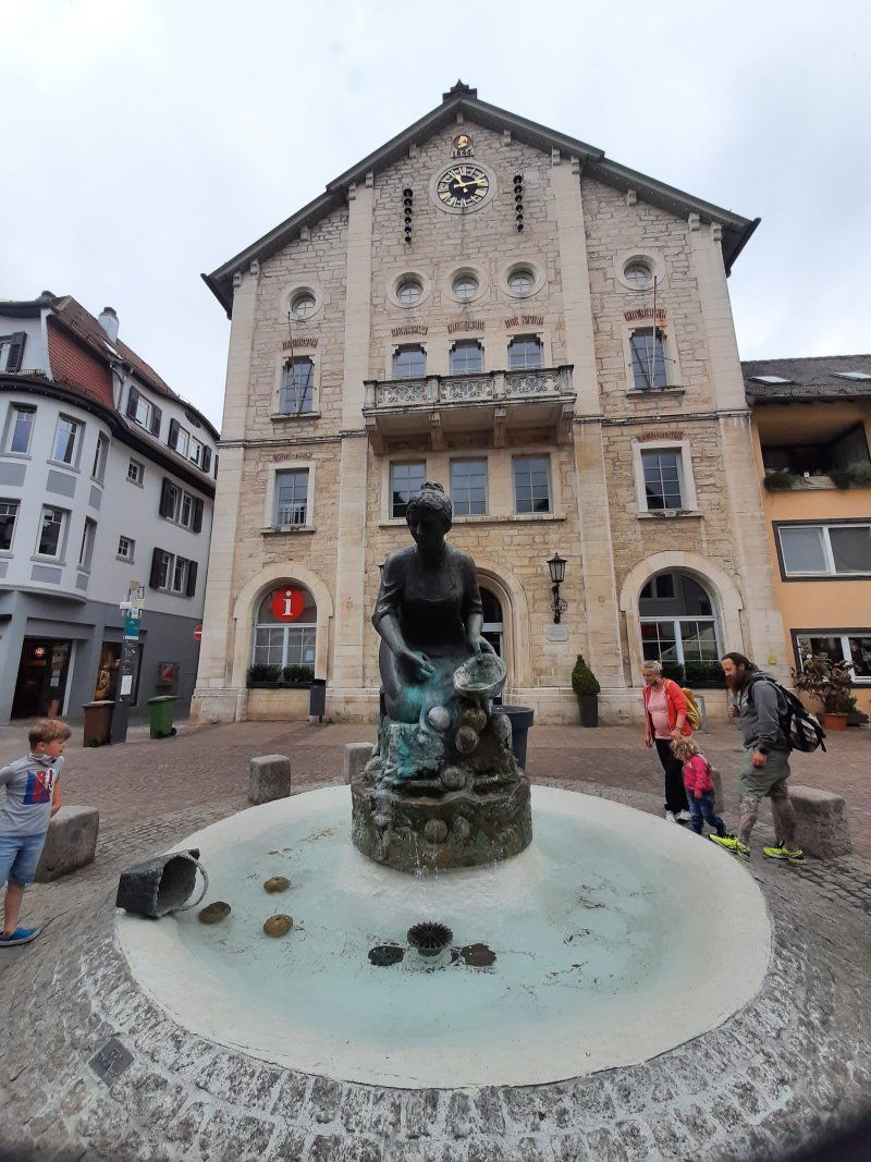
It was a 30 minute walk to the city center, the first thing to do was go to the castle. Hellenstein Castle is a fortress located above the city of Heidenheim an der Brenz. It was once the headquarters of the Lords of Hellenstein. The ownership changed later: in the late Middle Ages, the complex was in Bavarian hands, at the beginning of modern times it was Württemberg. From the castle complex you have a nice overview of the old town.
In the city center there is the Evangelical Michaelskirche (old parish church of the city), the Elmar Doch House (Touristik Info) with the Knöpfleswäscherin fountain. At other Protestant churches in the core city there is the Evangelische Pauluskirche (built 1895-1898, today's main and dean's church) which was open and we visited
Two hours are enough to visit the museum without visiting it. After returning from the motorhome it started to rain and we drove straight to Owen, where our grandchildren were waiting for us.
Owen, Deutschland
Schießhüttestraße 3, 73277 Owen, Deutschland
48° 35' 16.1" N 9° 27' 0.3" E
48.5878146 9.4500845
• Head north on Schießhüttestraße. Go for 12 m.
• Turn left onto Schießhüttestraße. Go for 153 m.
• Turn left onto Brühlstraße. Go for 20 m.
• Turn right onto Brühlstraße. Go for 73 m.
• Turn left onto Neue Straße. Go for 341 m.
• Turn right onto Beurener Straße (L1210). Go for 1.4 km.
• Turn right onto K1243 toward Nürtingen. Go for 4.8 km.
• Continue on Im Tiefenbach (K1243). Go for 820 m.
• Continue on K1243. Go for 1.5 km.
• Continue on Im Äußeren Bogen (K1243). Go for 124 m.
• Continue on Tiefenbachstraße (K1243). Go for 750 m.
• Turn left onto Kirchheimer Straße (B297) toward Stuttgart/Tübingen/Reutlingen/Krankenhaus/P+R. Go for 200 m.
• Turn right onto Kirchheimer Straße (B297) toward Stuttgart/Tübingen/Reutlingen/Zentrum/P+R. Go for 575 m.
• Turn left onto Neuffener Straße (B297) toward Stuttgart/Tübingen/Reutlingen/Neuffen/Stadtmitte. Go for 185 m.
• Turn right onto Steinengrabenstraße (B297) toward Stuttgart/Tübingen/Reutlingen/Innenstadtring. Go for 455 m.
• Turn left onto Metzinger Straße (B297) toward A8/Tübingen/Reutlingen/Metzingen/B313. Go for 660 m.
• Turn right onto Wörthbrücke (B297/B313) toward A8/Stuttgart/Tübingen/Reutlingen/Nt-Neckarhausen. Go for 221 m.
• Turn left onto Wasen (B297) toward Tübingen/Reutlingen/NT-Neckarhausen. Go for 6.1 km.
• Continue on Tübinger Straße (B297) toward Tübingen/Neckartenzlingen/Reutlingen/B312/Metzingen. Go for 2.8 km.
• Pass 2 roundabouts and continue on Tübinger Straße (B297). Go for 8.8 km.
• Take ramp onto B27. Go for 7.9 km.
• Keep left onto Stuttgarter Straße (B27) toward Rottweil/Hechingen. Go for 40.8 km.
• Continue on B27. Go for 9.1 km.
• Turn right onto Hardtstraße. Go for 203 m.
• Turn left onto Lochenstraße. Go for 170 m.
• Arrive at Lochenstraße. Your destination is on the left.
☍
88,2 km
(1 hrs. 16 min.)
Lochenstraße
Rottweil, Deutschland
48° 11' 52" N 8° 41' 40" E
48.1977778 8.6944346