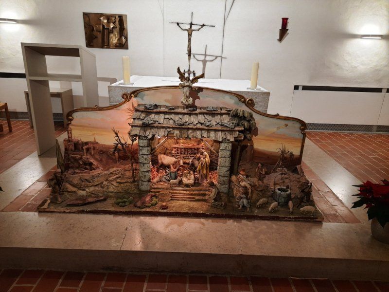
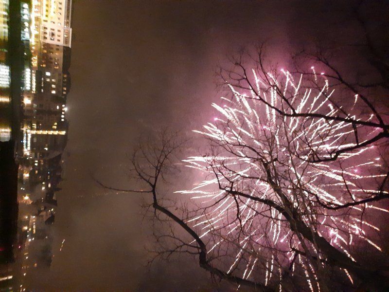
New Year's Eve around the Rhine
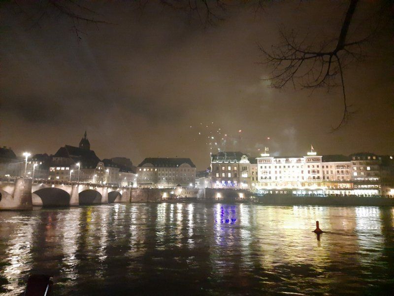
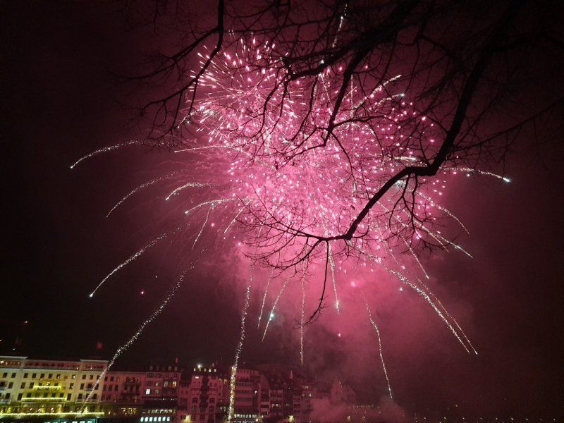
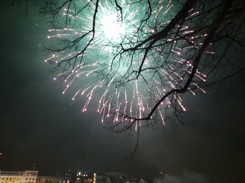
The new year started with a big New Year's Eve fireworks display over the Rhine. A very special atmosphere prevailed on the Münsterplatz in Basel, hundreds of people listened to the trombone choir right in front of the Münster, shortly before 12, and then waited for the fireworks, which started at 0.30 am. Crowds thronged along the banks of the Rhine and on the bridges to see the fireworks. Incidentally, the fireworks are largely financed by the Hotel Trois Rois and Michele Parini, watch and jewelery dealer from Basel.
Day
Rottweil
Rottweil, Deutschland
48° 11' 52" N 8° 41' 40" E
48.1977778 8.6944346
• Head toward Wochenbergstraße on Lochenstraße. Go for 170 m.
• Turn right onto Hardtstraße. Go for 203 m.
• Turn right onto Schömberger Straße (B27). Go for 7.4 km.
• Take the 2nd exit from roundabout onto B27 toward Tuttlingen/Schramberg/Villingen-Schwenningen/Rottweil/B14/Stadtmitte/Gewerbegebiet Neckartal/Gewerbegebiet Saline/Süd/Gewerbegebiet Zimmern o.R. Go for 364 m.
• Take the 1st exit from roundabout onto B27 toward Rottweil/Schramberg/B14. Go for 321 m.
• Continue on B14 toward Tuttlingen/Villingen-Schwenningen/Rottweil-West/Gewerbegebiet Saline/Süd/Krankenhaus/B27. Go for 49 m.
• Take left ramp toward Tuttlingen/Villingen-Schwenningen/Rottweil-West/Gewerbegebiet Saline/Süd/Krankenhaus/B27. Go for 568 m.
• Continue on B14. Go for 5.2 km.
• Take ramp onto B27 toward A81/Villingen-Schwenningen/Deißlingen. Go for 16.3 km.
• Continue toward Schaffhausen/Donaueschingen/Bad Dürrheim. Go for 57 m.
• Turn slightly left onto B27/B33. Go for 23.4 km.
• Take the 2nd exit from roundabout onto Schaffhauser Straße (B27) toward Schaffhausen/Waldshut-Tiengen/Gewerbegebiet Vogelherd. Go for 213 m.
• Turn right onto Waldshuter Straße (L214) toward Fützen/Epfenhofen/Gewerbegebiet Vogelherd. Go for 758 m.
• Take the 2nd exit from roundabout onto Waldshuter Straße (L214). Go for 326 m.
• Continue on L214. Go for 1.6 km.
• Take ramp onto B314 toward Waldshut-Tiengen. Go for 27.7 km.
• Take ramp onto A98 toward Waldshut-Tiengen/Basel. Go for 5.8 km.
• Take ramp toward Basel/WT-Waldshut/Industriegebiet Kaitle. Go for 516 m.
• Turn right onto B34 toward Basel/WT-Waldshut/Industriegebiet Kaitle. Go for 1.5 km.
• Take the 2nd exit from roundabout onto Konstanzer Straße (B34) toward Basel. Go for 1.5 km.
• Turn left onto Rheinbrückenstraße. Go for 225 m.
• Continue on Rheinbrückerstrasse. Go for 61 m.
• Turn right onto Zollplatz. Go for 135 m.
• Continue on Bahnhofstrasse (7). Go for 69 m.
• Take the 1st exit from roundabout onto Bahnhofstrasse (7) toward Aarau/5/Basel/Zürich. Go for 304 m.
• Keep right onto 7 toward Basel/Leibstadt. Go for 11.8 km.
• Pass 2 roundabouts and continue on Winterthurerstrasse (7). Go for 8.2 km.
• Take the 2nd exit from roundabout onto 7 toward Basel/Stein/Säckingen/Eiken. Go for 2.8 km.
• Take the 2nd exit from roundabout onto A3 toward Basel/Bern. Go for 28.1 km.
• Take exit 6 toward Delémont/Muttenz/Bruderholz Spital onto A18 (Verzweigung Hagnau). Go for 6.6 km.
• Take the exit toward Arlesheim/Dornach onto Bruggstrasse. Go for 431 m.
• Keep right onto Bruggstrasse. Go for 360 m.
• Take the 2nd exit from roundabout onto Bruggstrasse. Go for 148 m.
• Take the 1st exit from roundabout onto Neuarlesheimerstrasse. Go for 85 m.
• Turn left onto Amthausstrasse. Go for 35 m.
• Take the 1st exit from roundabout onto Bruggweg. Go for 1.1 km.
• Continue on Hauptstrasse. Go for 194 m.
• Turn slightly left onto Kohliberg. Go for 117 m.
• Turn slightly right onto Schlossweg. Go for 268 m.
• Turn slightly left onto Schlossweg. Go for 1.1 km.
• Arrive at Schlossweg. Your destination is on the left.
☍
156,0 km
(1 hrs. 59 min.)
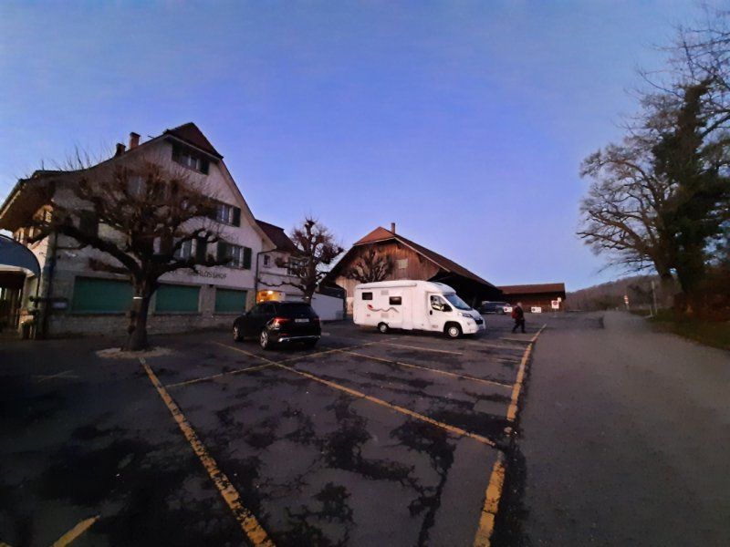
Schloß Berg Gaststätte Parkplatz
The route to the Schlossberg Gaststätte is narrow and winding. We didn't really want to drive that far, the parking spaces on the way were too small or occupied and there were no turning options. We were lucky the gas restaurant was closed for a long time and the parking lots in front of the restaurant were almost empty. It is also difficult to find a parking space in Dornach, especially for campers.
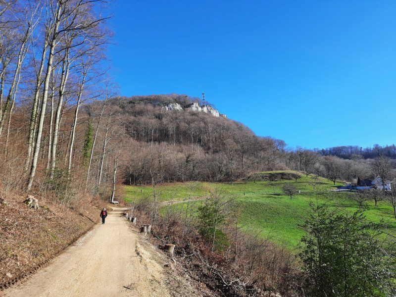
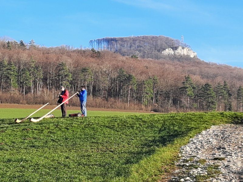
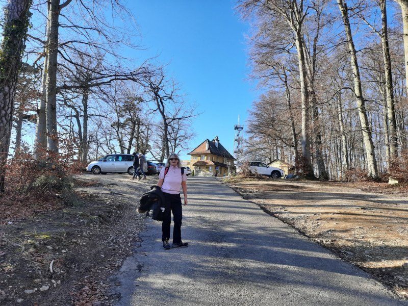
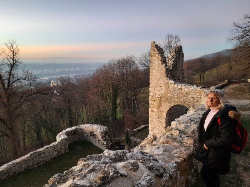
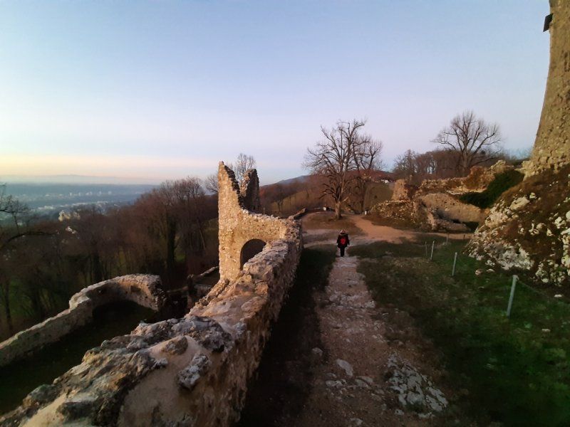
Baselland: scenic hike (14 km)
The greatest difficulty of this hike was the choice of route. Firstly, there are many hiking trails and secondly, something interesting to see everywhere. The route taken brings something out of everything. It connects with the bliss of views on the tower, a thirst for discovery in the ruins and, last but not least, architecture and art. Truly a full hiking program.
The Gempen plateau stands like a natural ski jump between Birs and Rhine at the gates of Basel. The old Confederates made use of this platform in the Swabian War in 1499 when they observed the Swabian army from the Gempenstollen, which besieged the Solothurn Castle Dorneck. The military was also active on the Gempen plateau during the Second World War. At that time, the Swiss soldiers were watching the battles between the enemy armies of Germany and France.
Schlossweg 125, 4143 Dornach, Schweiz
47° 28' 55.2" N 7° 37' 45.3" E
47.4819937 7.6292485
• Head toward Gobenweg on Schlossweg. Go for 1.4 km.
• Turn slightly left onto Kohliberg. Go for 117 m.
• Turn slightly right onto Hauptstrasse. Go for 194 m.
• Continue on Bruggweg. Go for 1.1 km.
• Take the 3rd exit from roundabout onto Amthausstrasse. Go for 69 m.
• Turn right onto Nepomukplatz. Go for 72 m.
• Take the 2nd exit from roundabout onto Bruggstrasse. Go for 150 m.
• Take the 2nd exit from roundabout onto Bruggstrasse. Go for 319 m.
• Take ramp onto A18 toward Basel. Go for 6.3 km.
• Take the exit toward Karlsruhe/Mulhouse/Basel Flughafen onto A2/A3 (Verzweigung Hagnau). Go for 4.6 km.
• Keep right onto A3 (Basel-Kleinhüningen) toward Mulhouse/EuroAirport/Basel-Kleinhüningen/Lörrach/Weil am Rhein. Go for 116 m.
• Take exit 1 toward Basel-Kleinhüningen/Lörrach/Weil am Rhein onto 320 (Schwarzwaldallee). Go for 392 m.
• Turn right onto Hochbergerstrasse (320) toward Lörrach/Weil am Rhein/Rheinhafen. Go for 10 m.
• Turn right onto Freiburgerstrasse toward Lörrach/Weil am Rhein/Rheinhafen. Go for 649 m.
• Take the 1st exit from roundabout onto Freiburgerstrasse. Go for 124 m.
• Continue on Basler Straße (B3). Go for 144 m.
• Turn right onto Basler Straße toward Otterbach. Go for 130 m.
• Continue on Nonnenholzstraße. Go for 233 m.
• Arrive at Nonnenholzstraße. Your destination is on the left.
☍
16,1 km
( 17 min.)
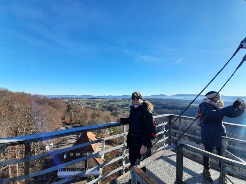
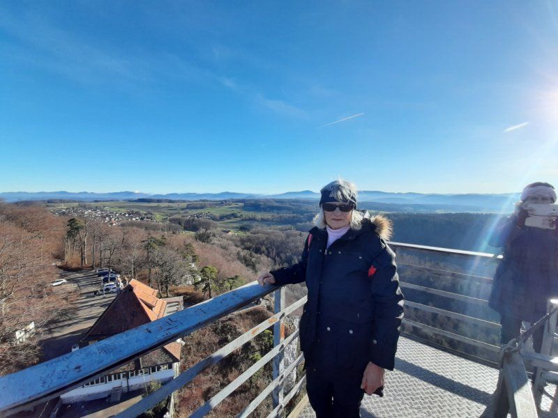
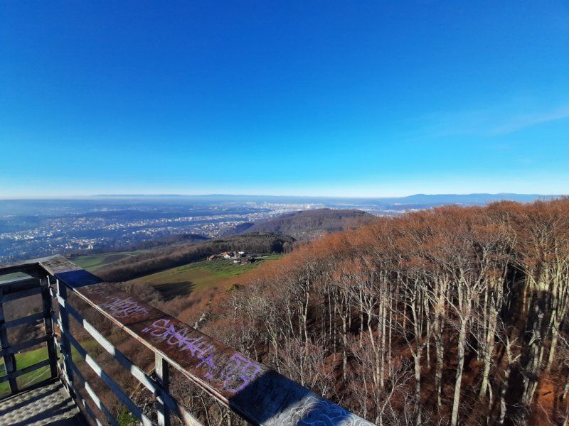
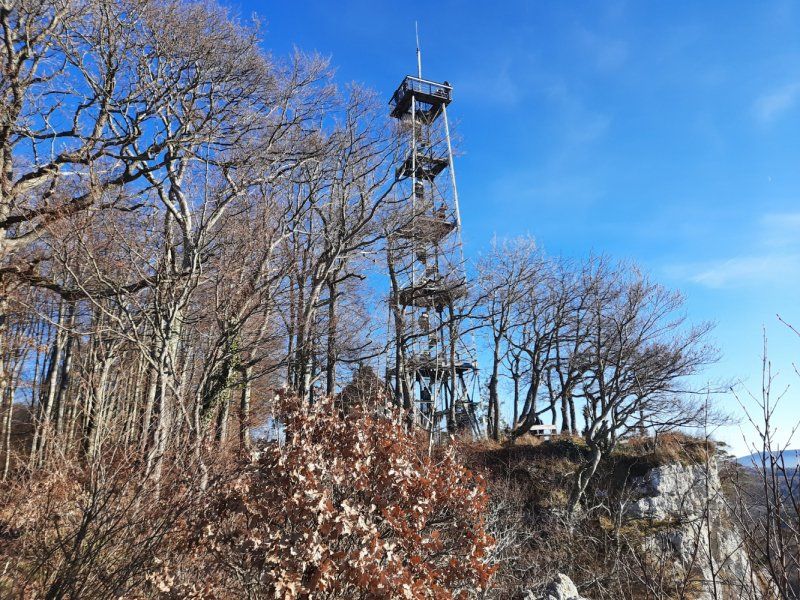
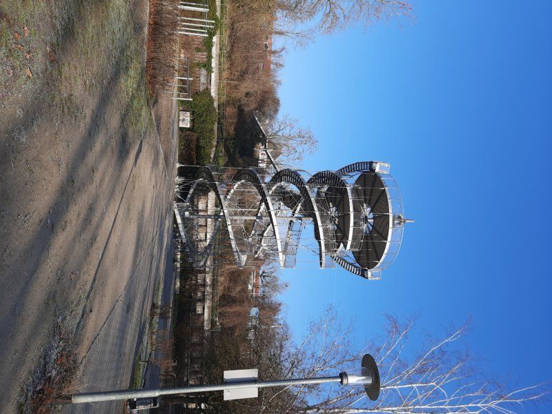
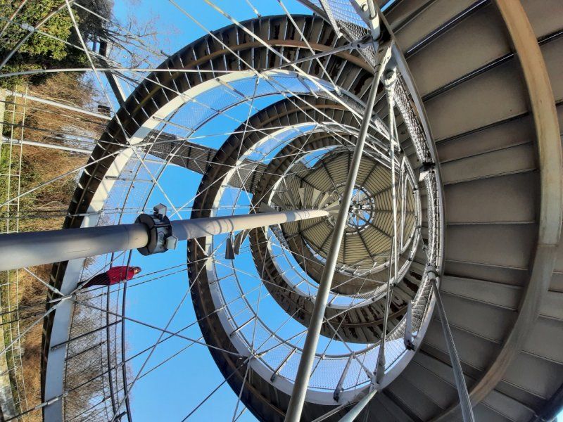
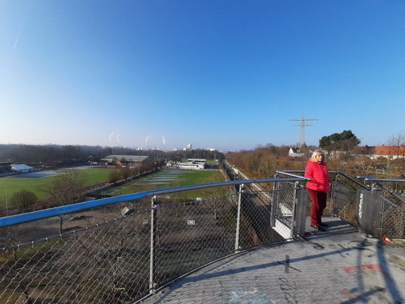
Gempenturm
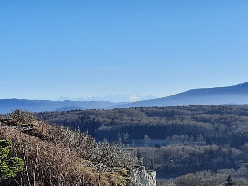
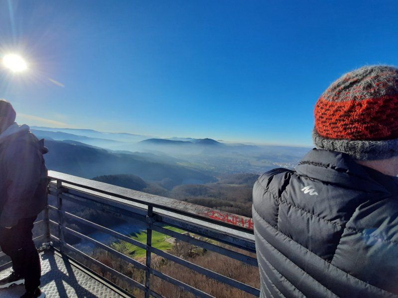
The Gempenturm turned out to be an ideal vantage point, from where the view of the Basel region and the Upper Rhine Plain is optimal. The steel truss tower had also survived the First World War because it was built in 1897 on the initiative of local hosts. In order to reduce the financial costs, a barred entrance door was installed, which can only be opened thanks to a coin operated machine.
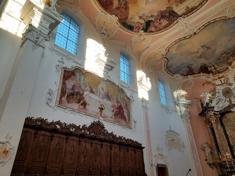
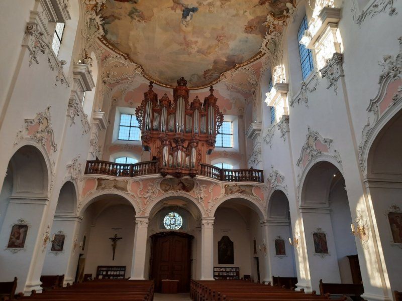
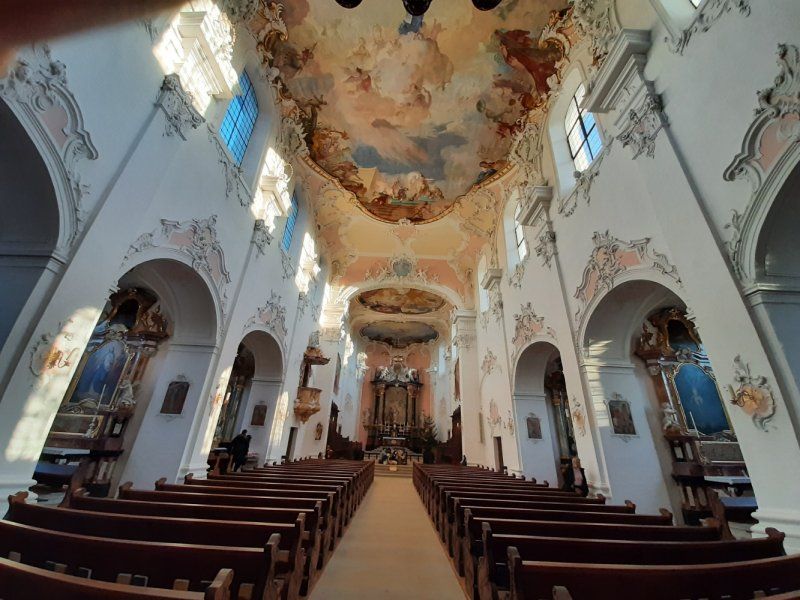
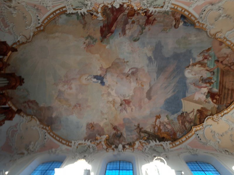
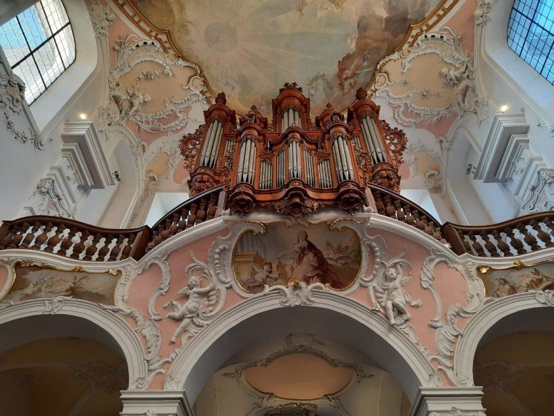
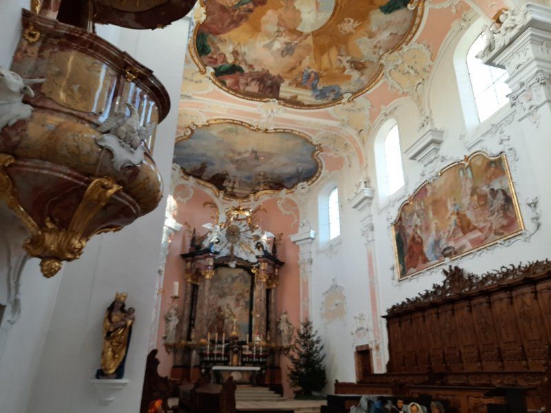
Dom Arlesheim
The lookout tower is far from the only attraction in the area. The cathedral in Arlesheim, an imposing Rococo building from the 18th century, is worth a visit. The cathedral church of Arlesheim is the only cathedral in Switzerland.
architecture
The cathedral was built between 1679 and 1681 according to the plans of Franz Demess. The baroque construction was very simple and strict. The common room was accompanied by chapels, as it is today, and the walls were livened up by low galleries like those found in Jesuit churches. The cathedral has two towers, each of which is closed by a knob and a cross.
inner space
The single-nave interior is accompanied by side chapels. The premises are built in baroque style. The choir has an altar on which is surrounded by various angels. The side walls and ceiling are provided with murals or with ceiling paintings. Under the choir is the crypt, which is open to the public.
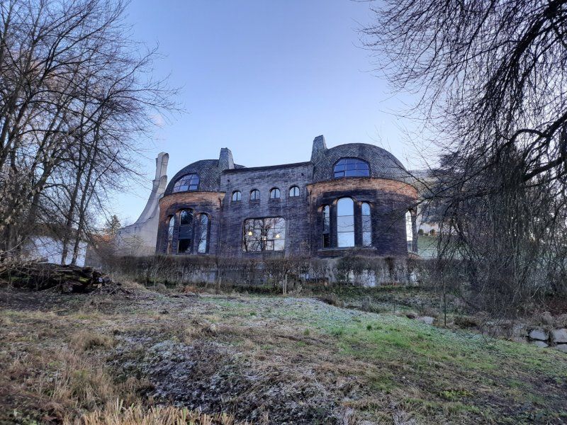
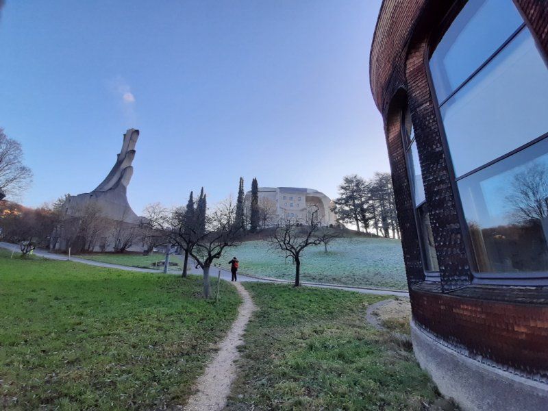
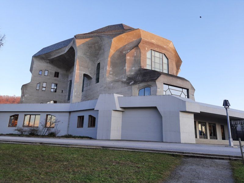
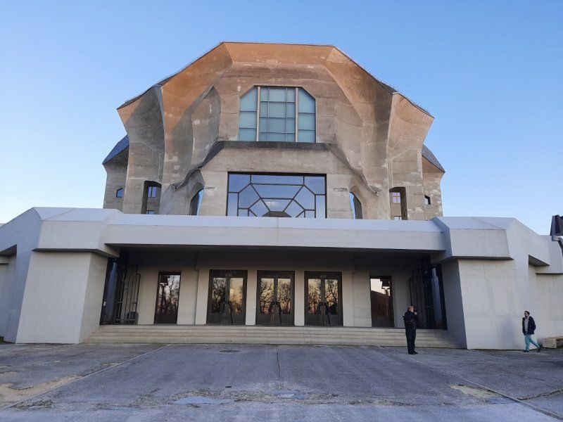
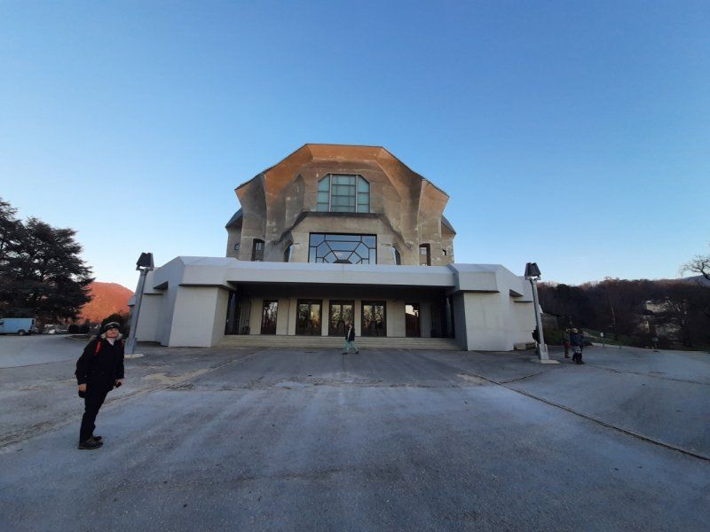
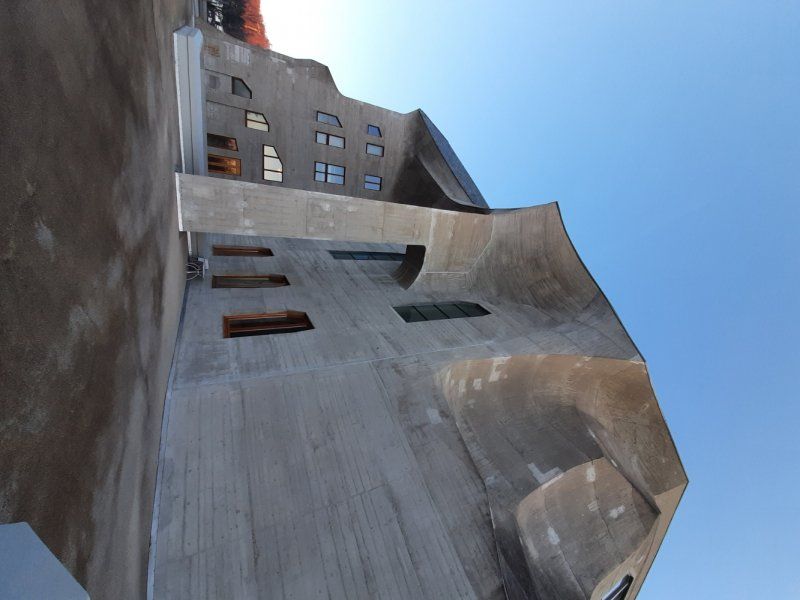
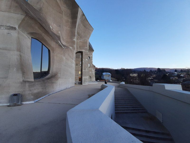
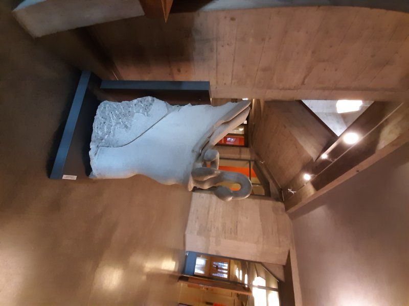
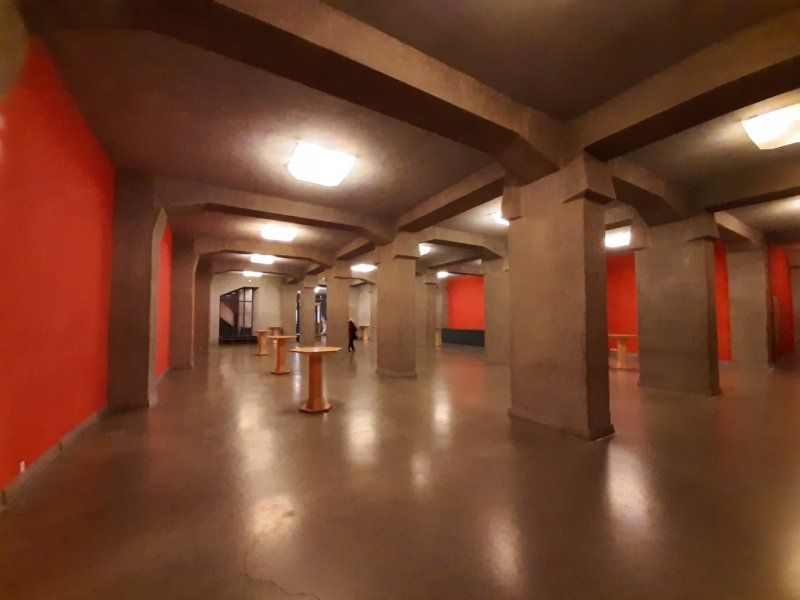
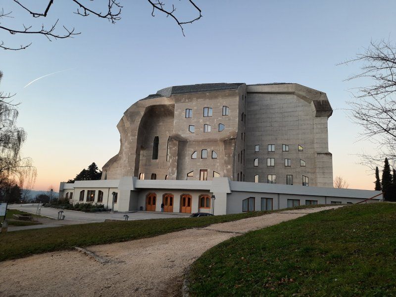
Goetheanum in Dornach
The Goetheanum is an oversized monumental building designed by Rudolf Steiner. The name Goetheanum is derived from the name Johann Wolfgang von Goethe. The exposed concrete construction largely avoids right angles, which gives the Goetheanum a special appearance. The size of the monumental building is gigantic. The largest extension in the east-west direction is 90 m, in the north-south direction 85 m, the height of the building is 37 m.
architecture
The shape of the first Goetheanum (1913-1922) was strongly influenced by geometric conditions. The first Goetheanum was erected as a wooden structure that rested on a concrete base. On the night of January 1, 1923, the building was completely destroyed by arson; all that was left was the concrete base. The individual forms, however, were transformed into lively movement.
At the second Goetheanum (built in 1925-1928 as a successor to the first Goetheanum in fireproof concrete). We now find the shape of the whole building seized by this movement. In the east it resembles a closed cube, but the farther it extends to the west, the more dynamic and dynamic it becomes. In the east of the building there seemed to be something inside that would find its revelation and realization in the west. This is how two polar world forces are expressed in this building. One is self-contained, hides something in itself, tends towards heaviness (east), the other turns outward, communicates and tends towards lightness (west). But there is still a third force in this building, which seizes and connects the first two. It leads them to an increased movement.
The second Goetheanum was built as a center for worldwide anthroposophical activities.
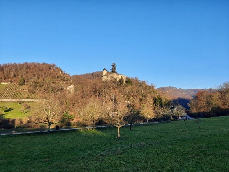
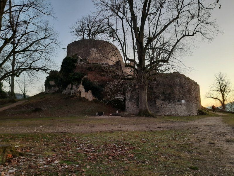
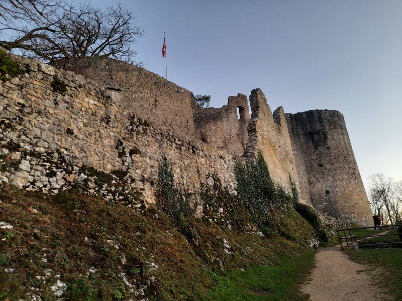
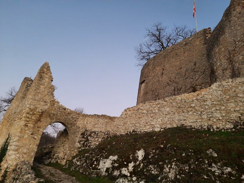
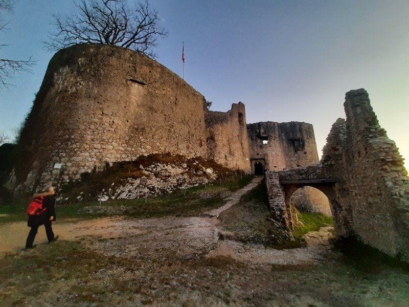
Burgruine Dorneck
Finally, the end of the hike are the medieval castles Reichenstein and Dorneck castle ruins.
Very large and extensive ruin of a castle that has been expanded over the centuries, with kennels, bastions and numerous towers on a rocky ridge above Dornach.
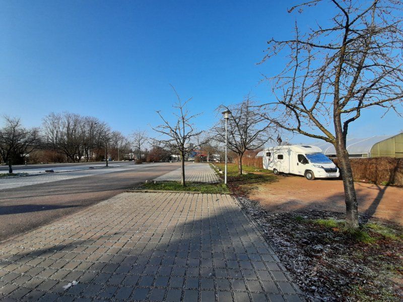
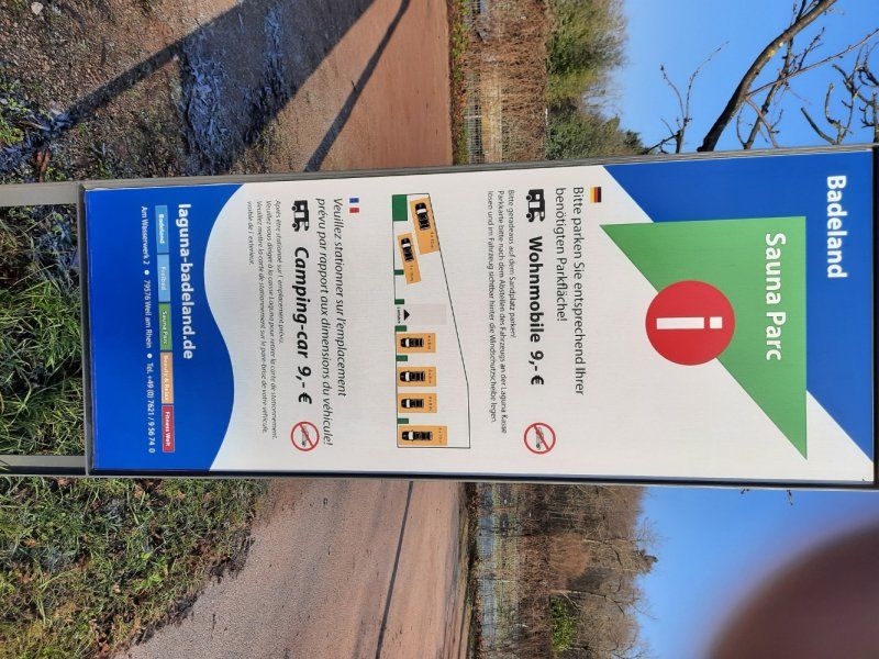
Laguna Bad Stellplatz 47.586201, 7.61806
For the night we drove to the parking space in Weil am Rhein at the Laguna Bad. We were the only motorhome on the site (fee: 9.- € / 24h). The registration and payment of the parking fee takes place at the cash register of the bath.
Weil am Rhein, Deutschland
47° 34' 52.8" N 7° 36' 28.5" E
47.5813452 7.6079213
• Head west on Nonnenholzstraße. Go for 233 m.
• Continue on Basler Straße. Go for 144 m.
• Turn left onto Basler Straße (B3). Go for 120 m.
• Continue on Freiburgerstrasse. Go for 110 m.
• Take the 1st exit from roundabout. Go for 162 m.
• Continue on Am Umschlagbahnhof. Go for 442 m.
• Take the 3rd exit from roundabout onto Badenstrasse. Go for 487 m.
• Take the 2nd exit from roundabout onto Hochbergerstrasse. Go for 428 m.
• Turn right onto Riehenring (320). Go for 191 m.
• Take the 2nd exit from roundabout onto Riehenring (320). Go for 217 m.
• Continue on Riehenring. Go for 504 m.
• Turn right onto Feldbergstrasse. Go for 801 m.
• Continue on Johanniterbrücke. Go for 296 m.
• Turn slightly left onto Schanzenstrasse. Go for 131 m.
• Turn left onto Spitalstrasse. Go for 251 m.
• Continue on Totentanz. Go for 104 m.
• Turn slightly right onto Blumenrain. Go for 197 m.
• Turn slightly left onto Schifflände. Go for 84 m.
• Arrive at Schifflände.
☍
4,9 km
( 10 min.)
Day
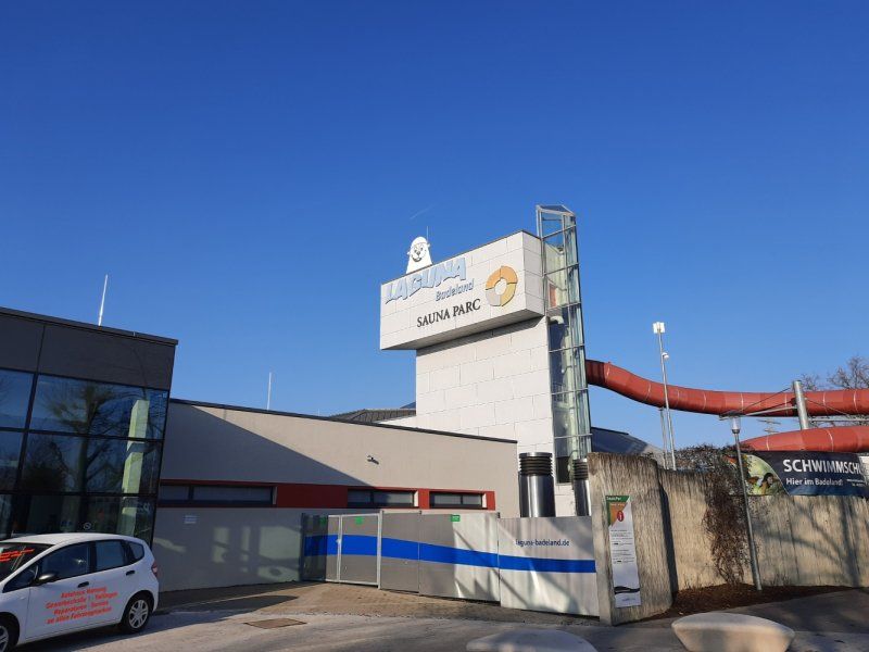
Besuch des Laguna Badeland
With the receipt of a free ticket for 3 hours we used the morning time to visit the bath. The bath has a sporty swimmer pool, wave pool, white water slide and is very geared towards children.
After the bathing fun, we set off to take a closer look at Weil am Rhein and Basel.
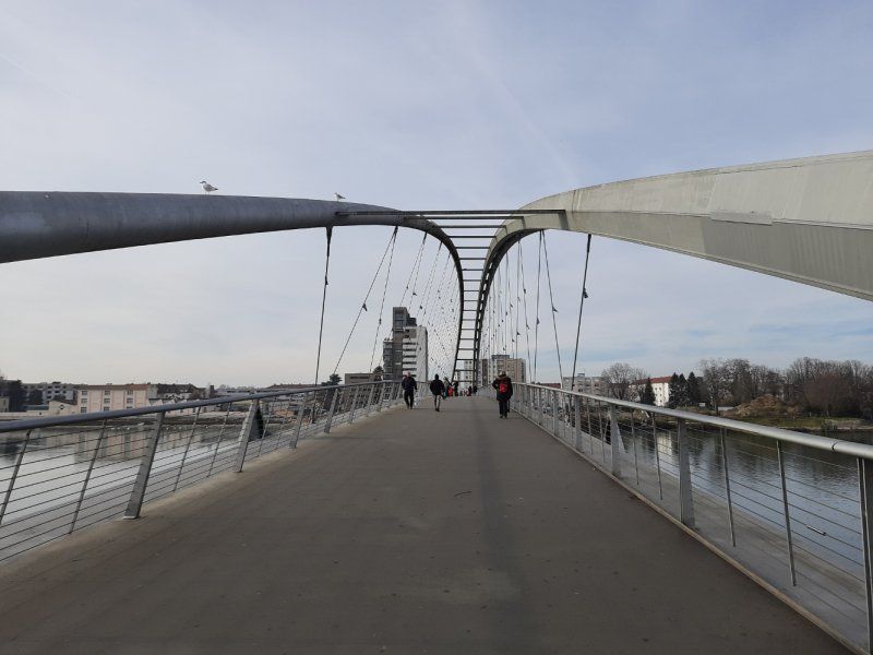
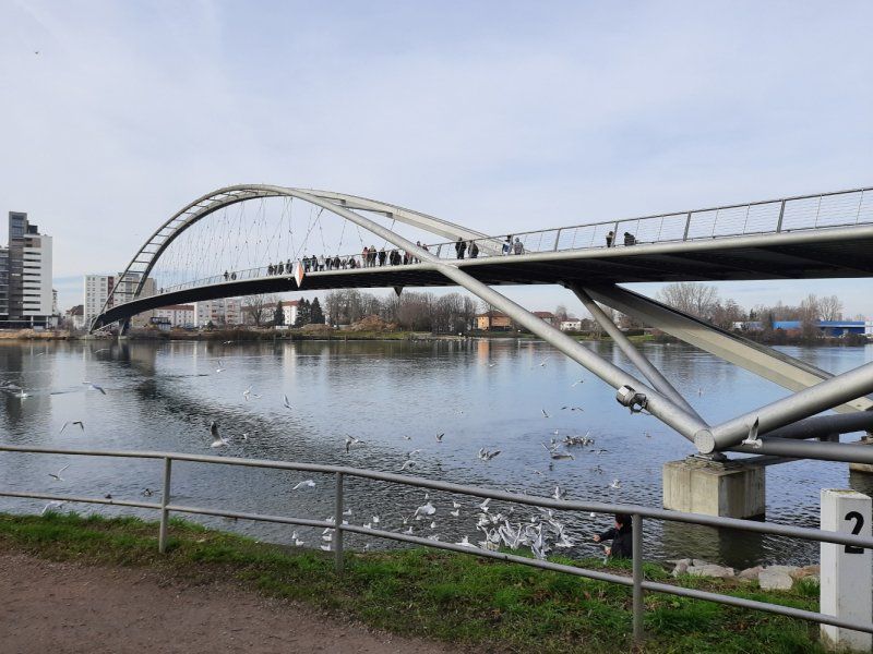
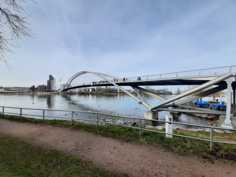
Dreiländerbrücke in Weil am Rhein
The city center of Weil am Rhein is a modern architectural city with many shops, there was not much to see.
We decided to go to the Dreiländerbrücke.
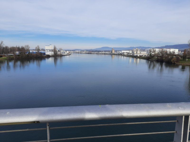
The three-country bridge connects the two twin cities Weil am Rhein on the German and Huningue on the French side of the Rhine. With a span of around 230 m and a total length of 248 m, the Dreiländerbrücke is the world's longest self-supporting pedestrian and bicycle bridge.
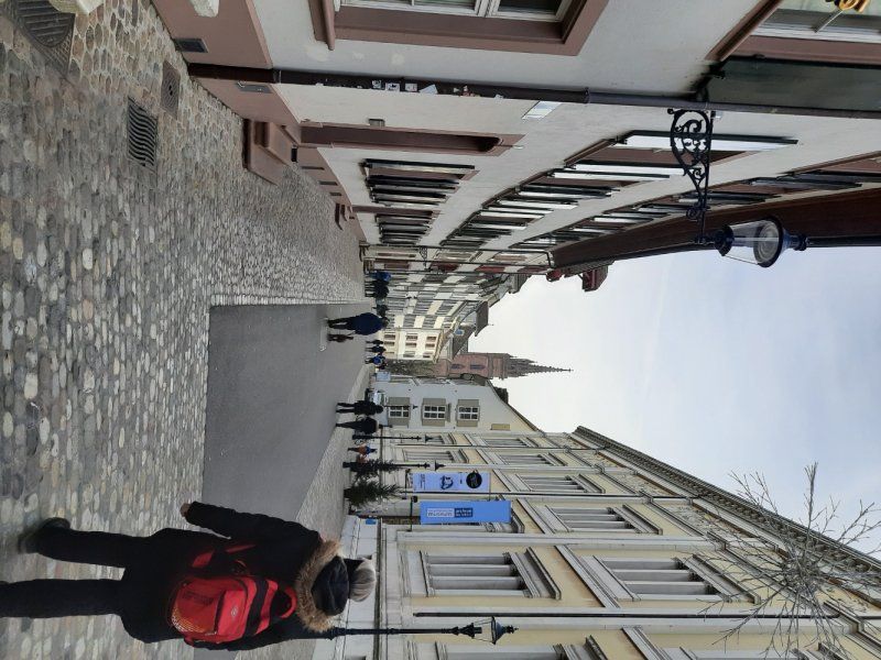
After visiting the bridge, we continued walking towards Basel's old town. Walking time about 1 hour
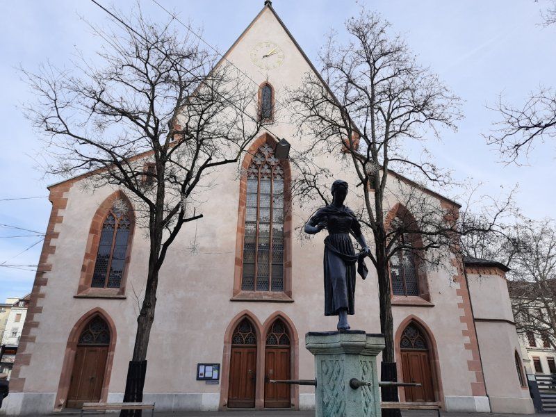
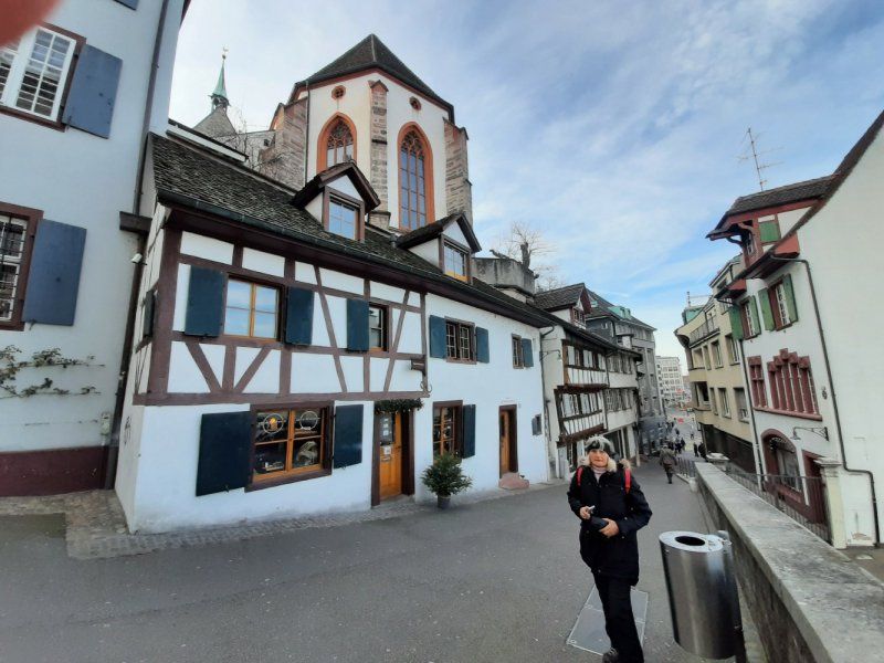
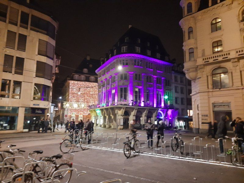
Basel Altstadt
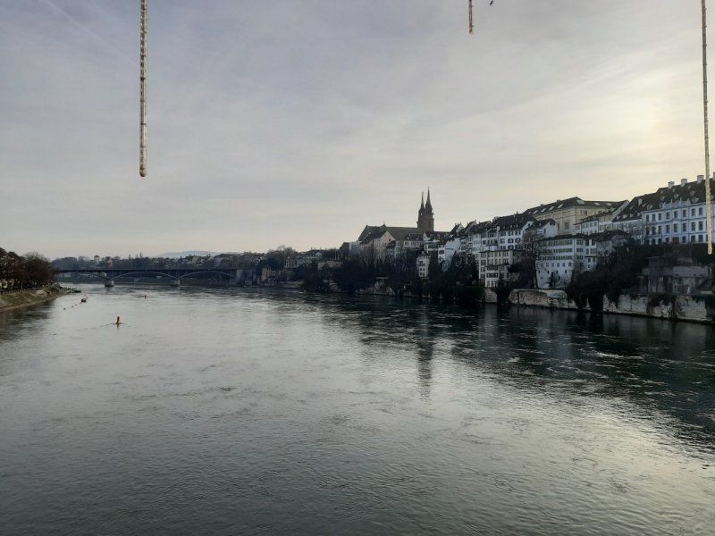
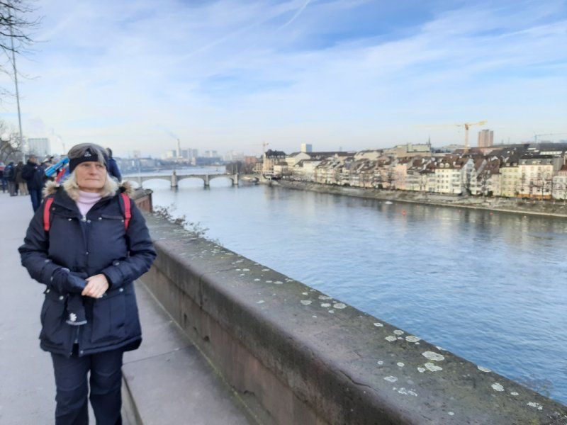
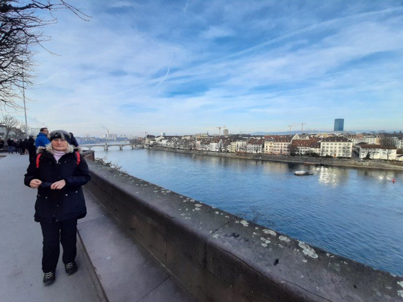
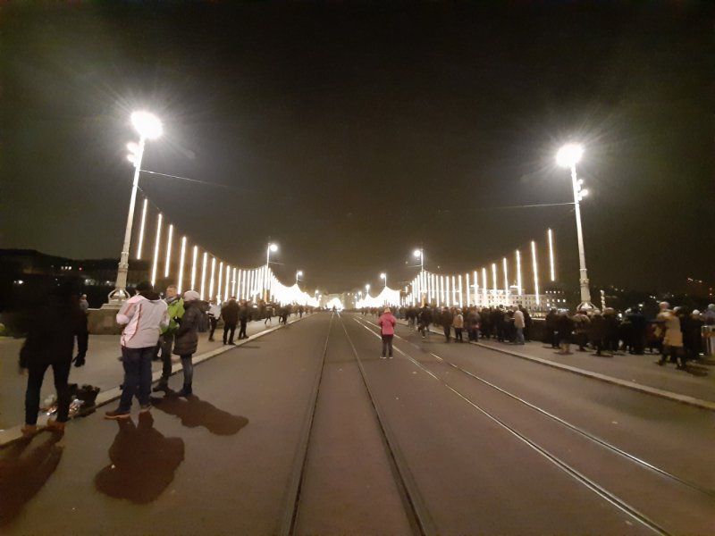
We reached the historic old town via the middle bridge on the other side of the Rhine. In front of the bridge we visited St. Clara Church where we attended the closing service at 10pm. The Middle Bridge has become a symbol of the city of Basel. It was opened in 1226 and is one of the oldest Rhine crossings between Lake Constance and the North Sea. From the bridge you can see the cathedral above on the other bank of the Rhine, which was our next port of call.
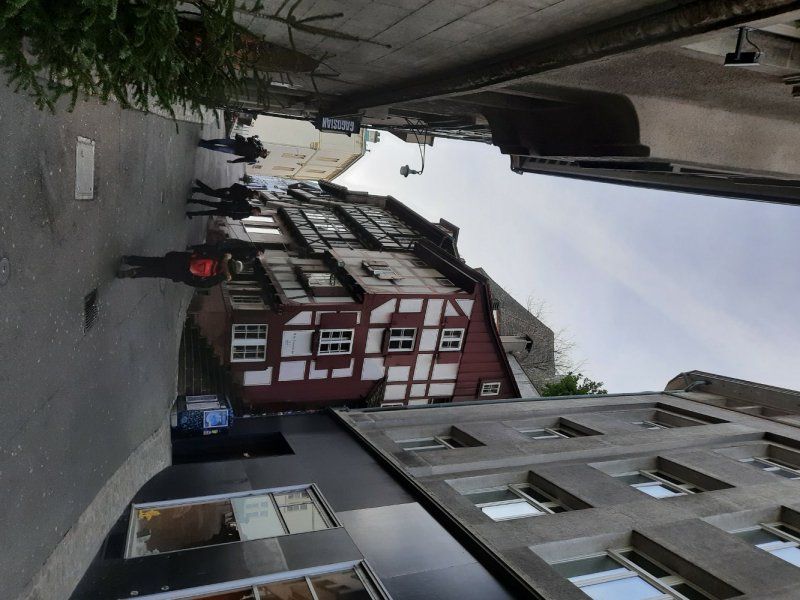
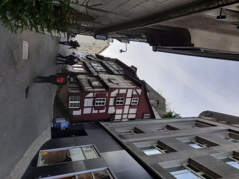
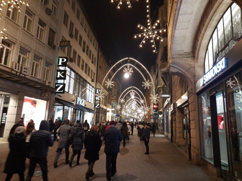
This old town is phenomenally beautiful!
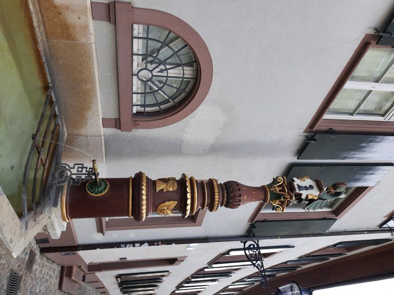
The beautiful little streets with countless steps and the fascinating old houses are an extraordinary eye-catcher. In the streets we noticed the many fountains in the old town of Basel.
Schweiz
47° 33' 34.6" N 7° 35' 18.9" E
47.5595986 7.5885761
• Head northwest on Schifflände. Go for 84 m.
• Turn slightly right onto Blumenrain. Go for 197 m.
• Turn slightly right onto Totentanz. Go for 102 m.
• Continue on Sankt Johanns-Vorstadt. Go for 262 m.
• Turn right onto Johanniterbrücke. Go for 296 m.
• Continue on Feldbergstrasse. Go for 120 m.
• Continue toward Erasmusplatz. Go for 45 m.
• Continue on Feldbergstrasse. Go for 636 m.
• Turn left onto Riehenring. Go for 688 m.
• Take the 3rd exit from roundabout onto Riehenring (320). Go for 227 m.
• Turn right onto Hochbergerstrasse (320). Go for 145 m.
• Turn left onto Freiburgerstrasse. Go for 649 m.
• Take the 1st exit from roundabout onto Freiburgerstrasse. Go for 124 m.
• Continue on Basler Straße (B3). Go for 144 m.
• Turn right onto Basler Straße toward Otterbach. Go for 130 m.
• Continue on Nonnenholzstraße. Go for 233 m.
• Arrive at Nonnenholzstraße. Your destination is on the left.
☍
4,1 km
( 8 min.)
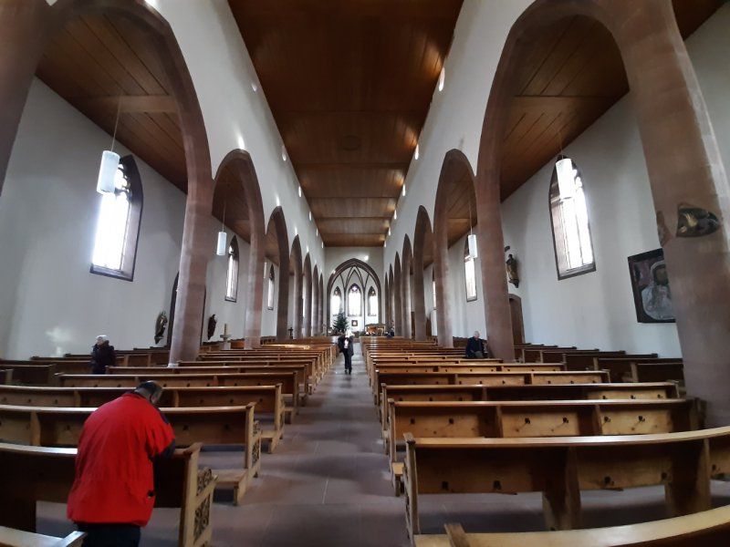
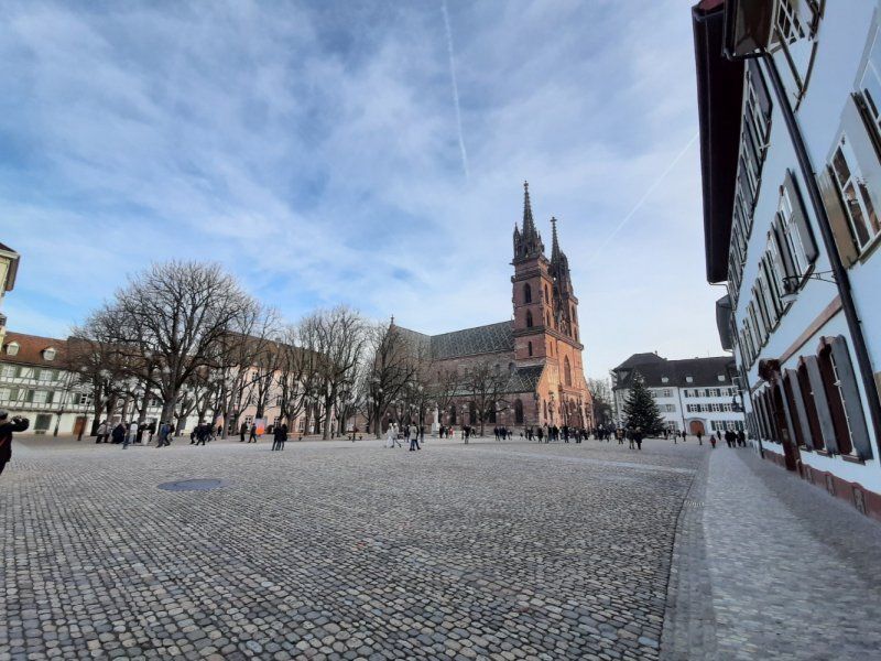
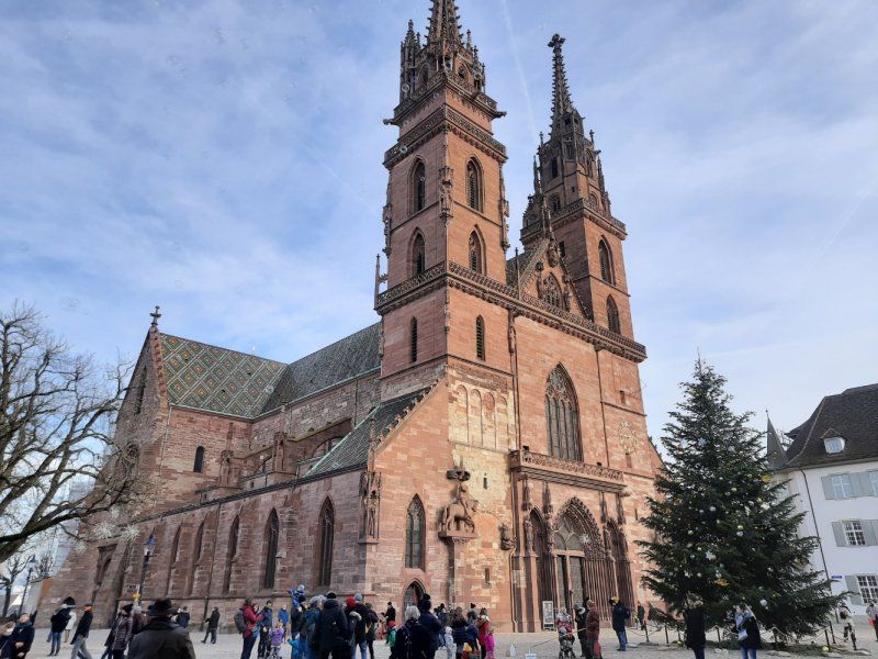
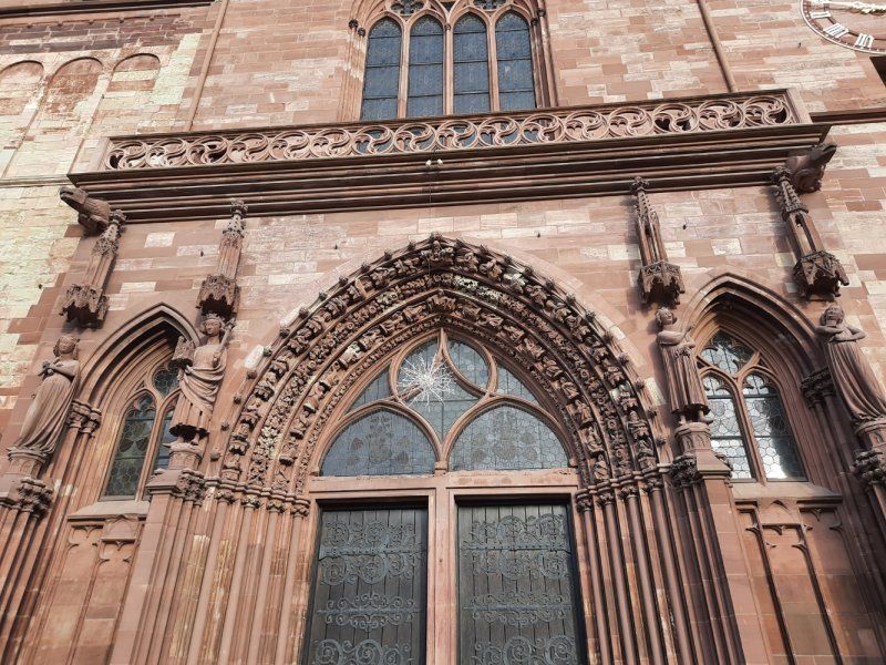
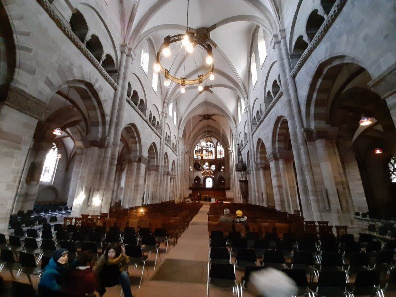
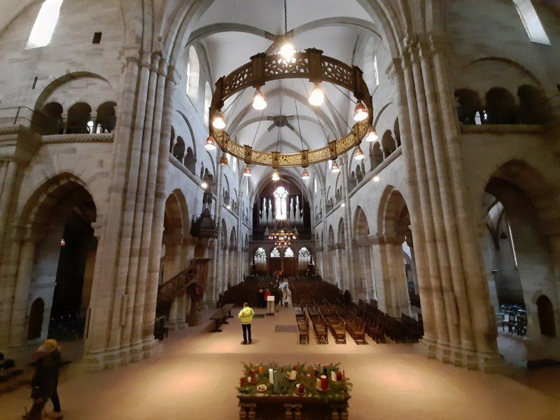
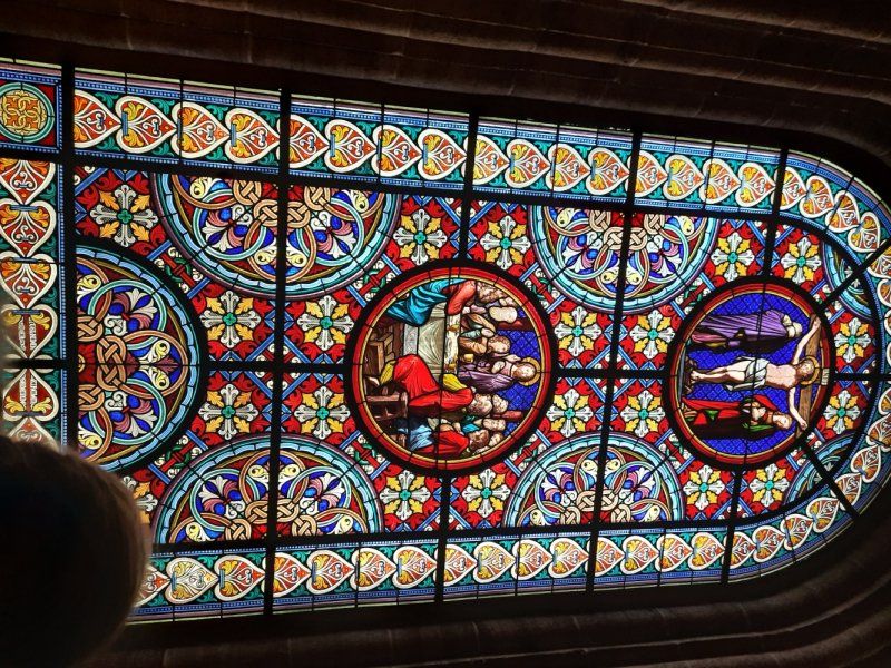
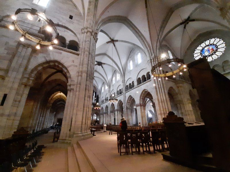
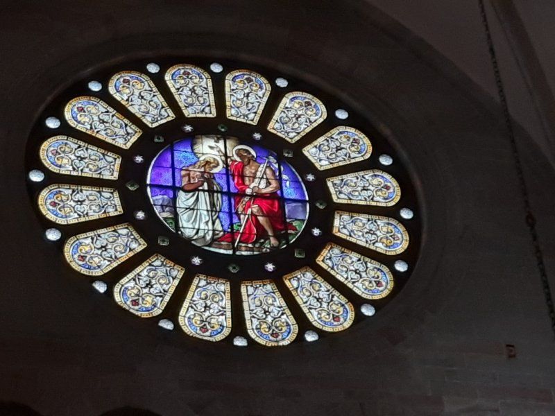
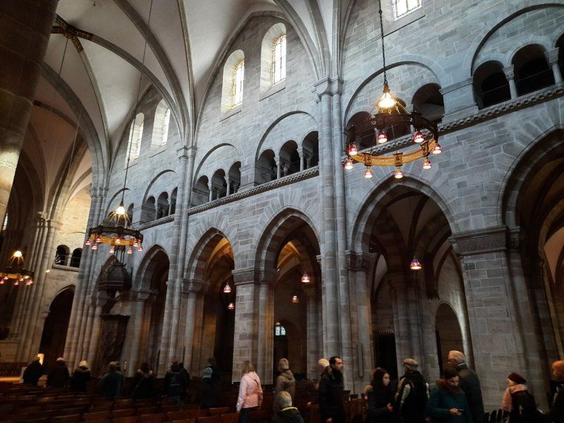
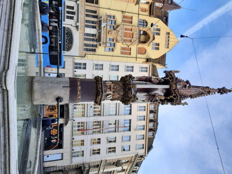
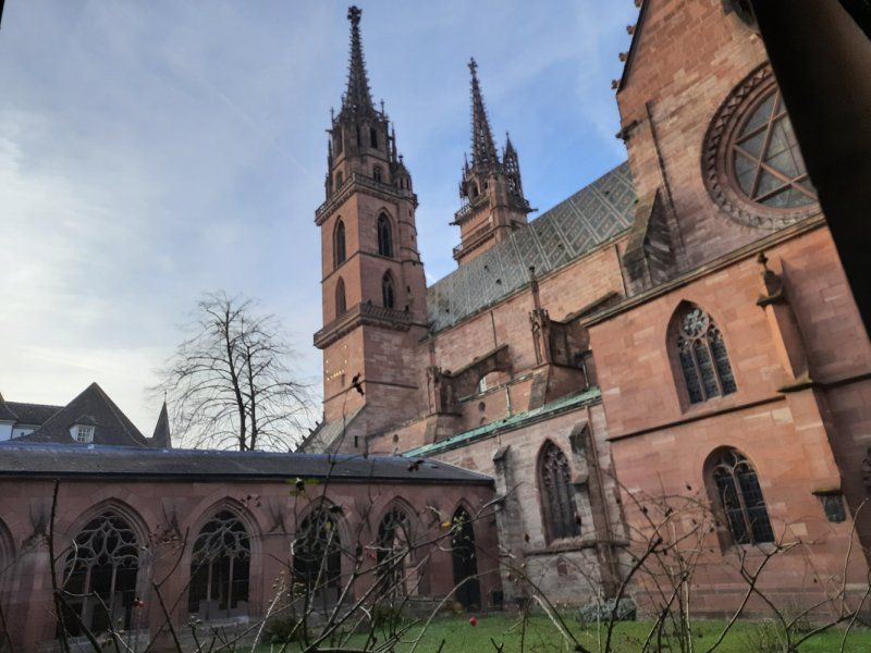
Basler Münster
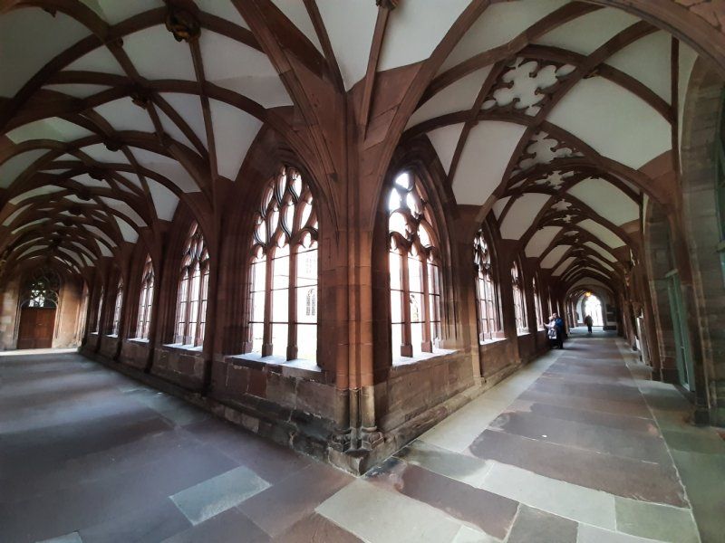
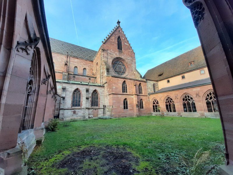
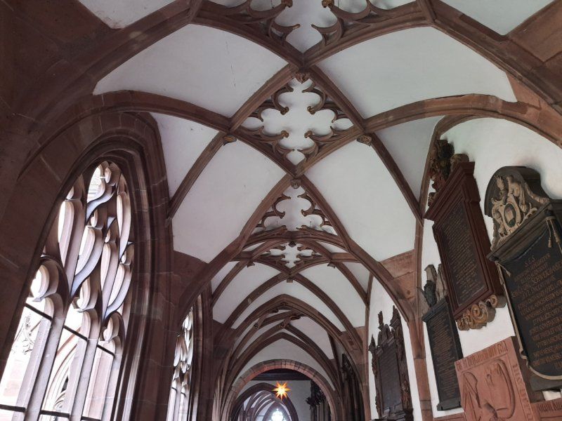
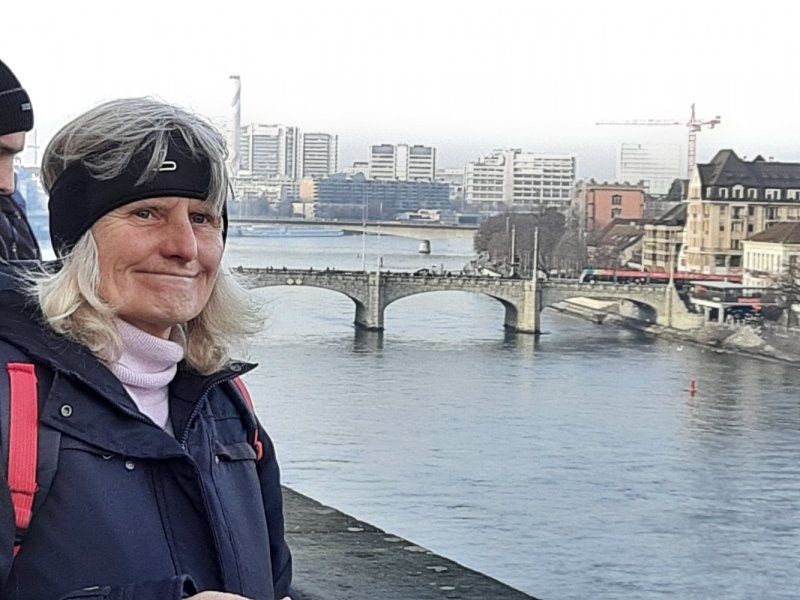
The Münster is one of the most striking landmarks of Basel. The Münster can be seen particularly well from the banks of the Rhine in Kleinbasel. The minster was built from red sandstone between 1019 and 1500 in the Romanesque and Gothic style. The two towers are striking, the Martinsturm (62 m) on the right, the Georgsturm (64 m) on the left. The roofing is very striking. The colored bricks (beaver tail) form a striking pattern on the roof. In front of the Münster is the Münsterplatz, which is fenced by time-honored houses. Behind the cathedral is the Palatinate, a popular viewpoint on the Rhine and Kleinbasel. The cloister is on the right.
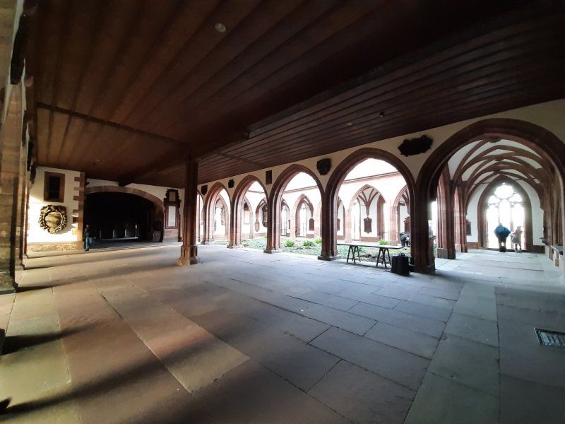
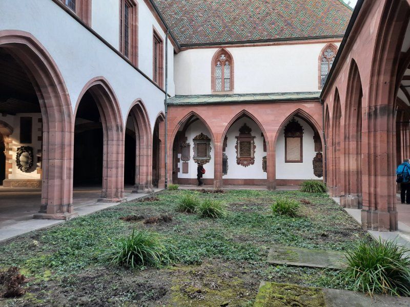
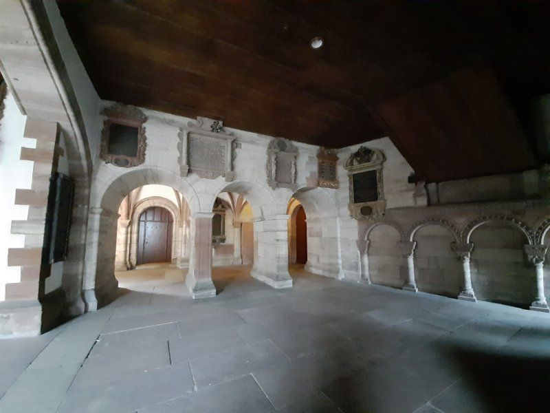
Kreuzgang
As described, the Basel Minster is a great building - both the church and the adjacent cloister are beautiful, as is the outside platform with a great view of the river and the opposite city side.
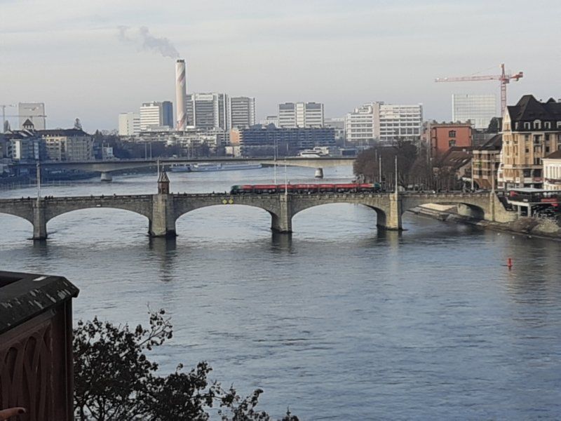
Basler Pfalz
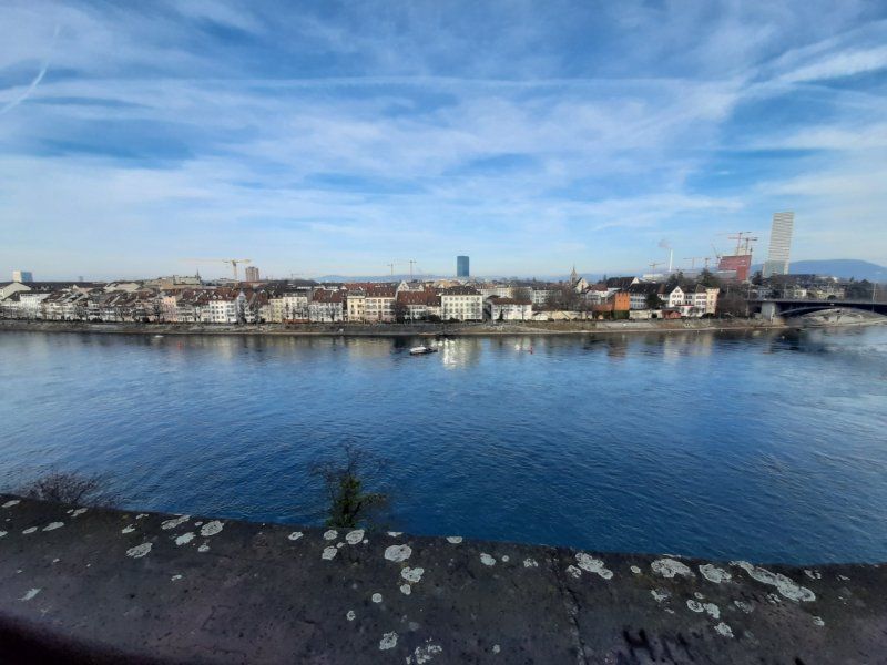
The name Palatinate comes from the Latin "palatium" for palace. Because once the bishop's residence was in the immediate vicinity. But today is the name of the panoramic terrace on the back of the Basel cathedral. It offers a fantastic view of the Rhine with its bridges and the skyline of Kleinbasel with the Roche Tower, which is currently the tallest skyscraper in Switzerland.
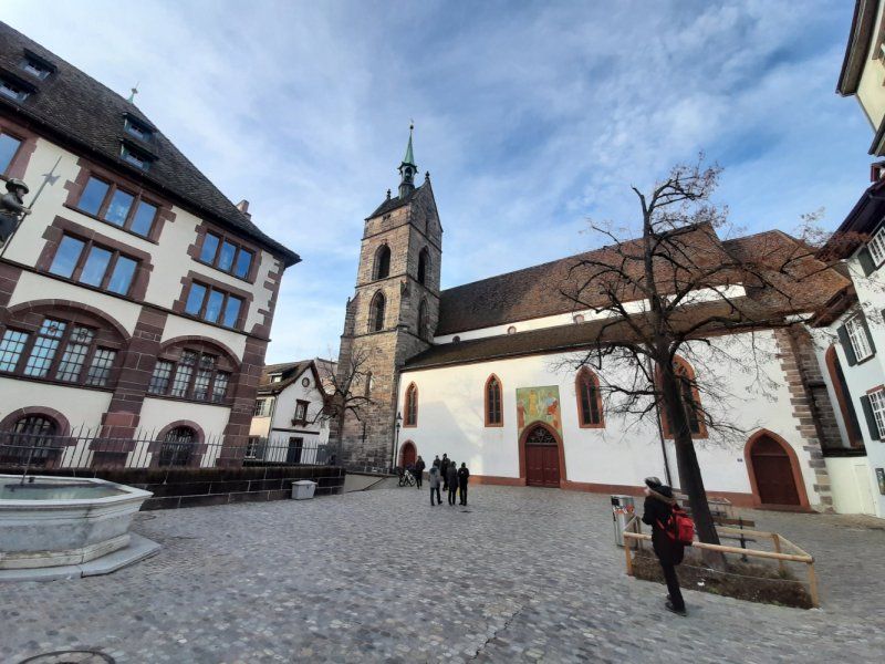
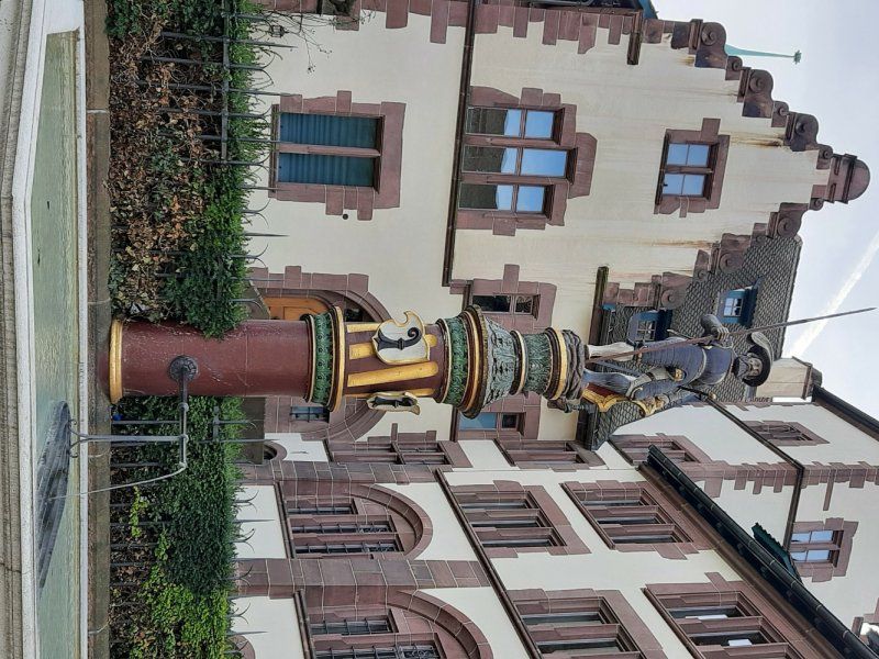
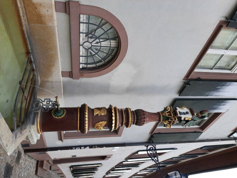
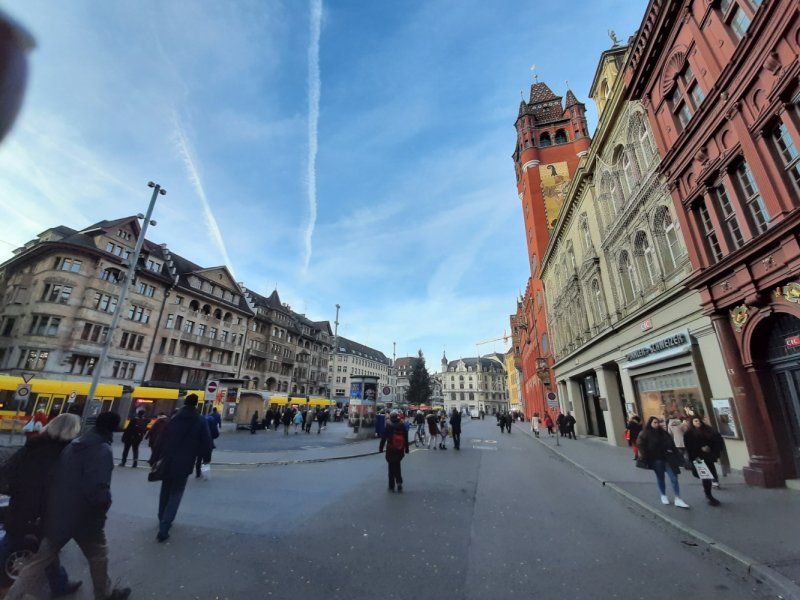
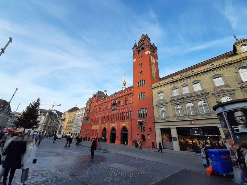
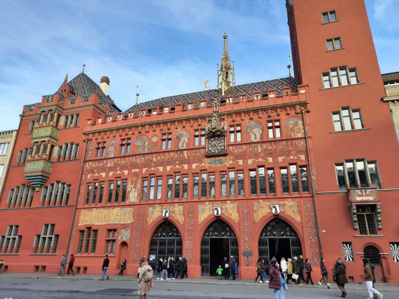
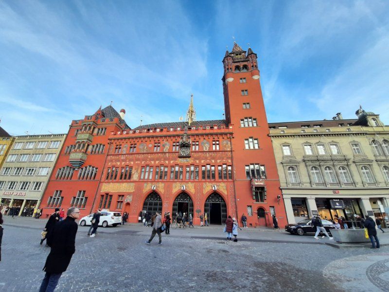
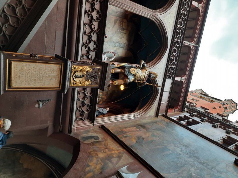
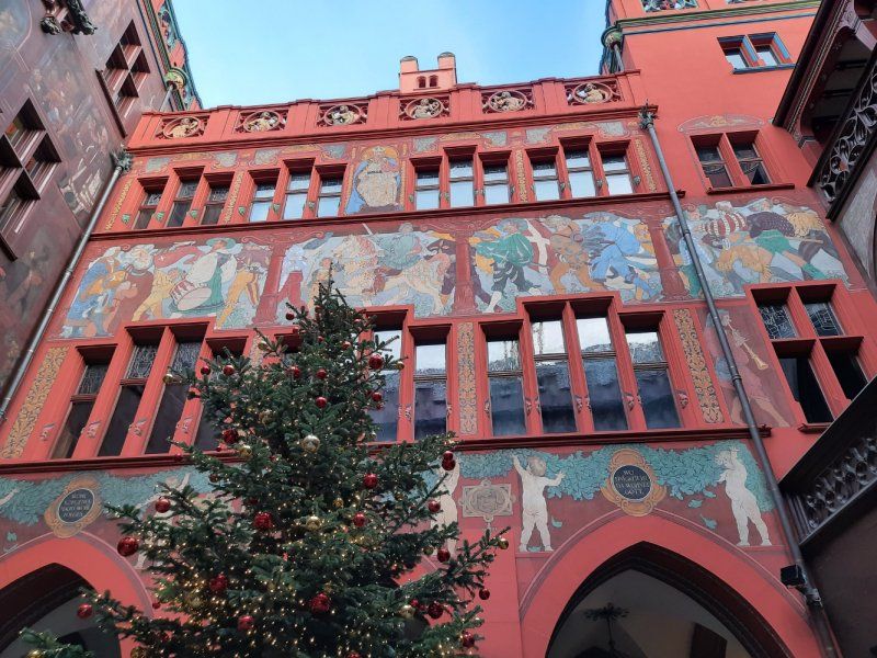
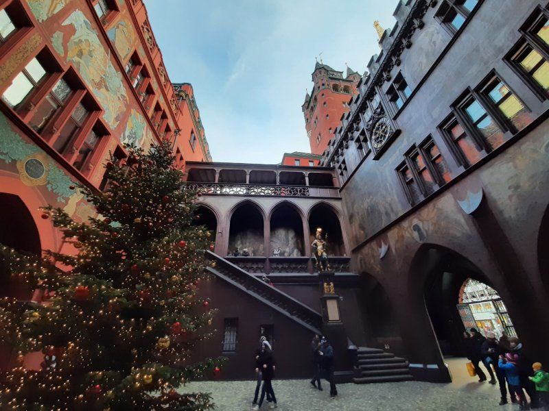
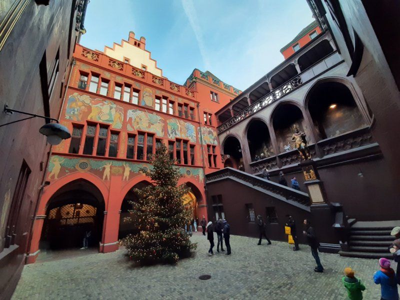
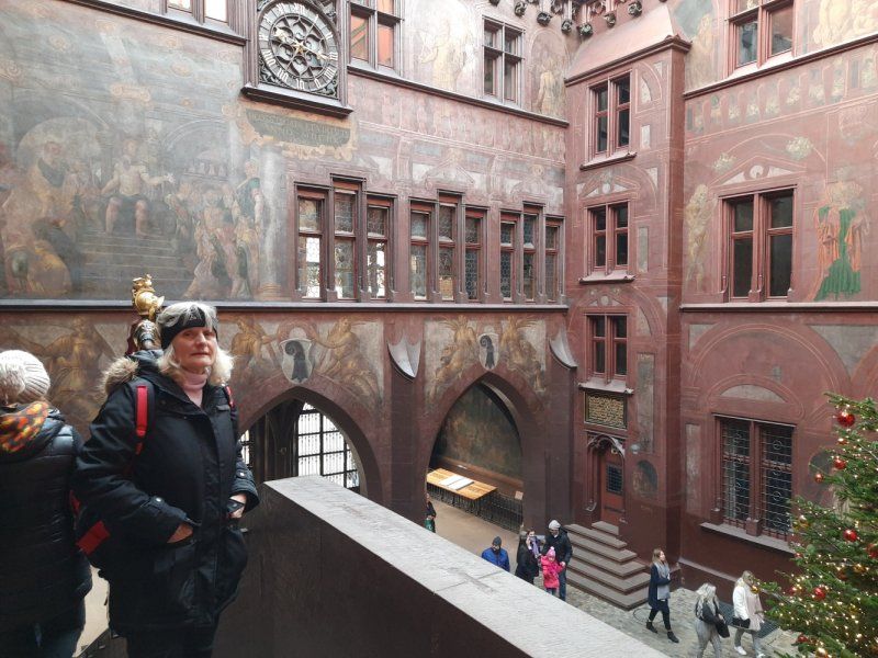
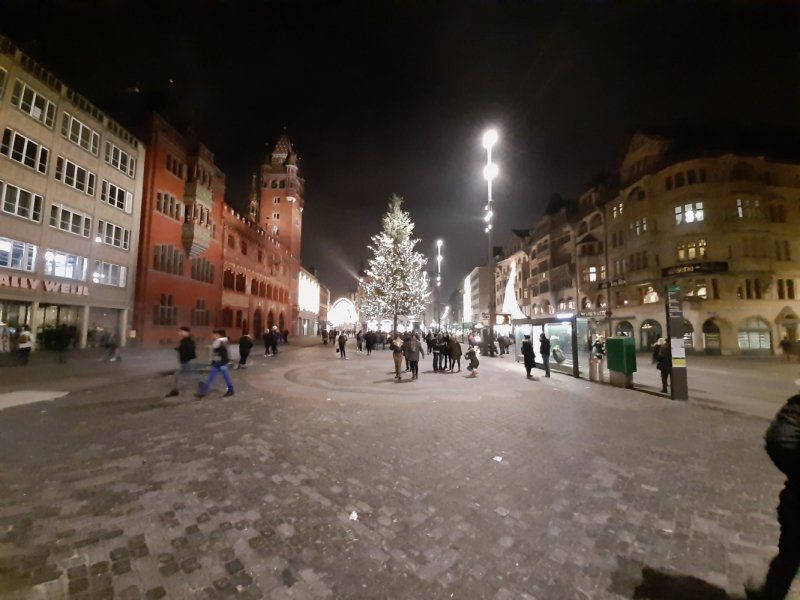
Rathaus am Marktplatz
The market square is located in the middle of the old town. As soon as you enter the square, you can see the striking red facade of the town hall with its tower, the beautiful courtyard and the colorful facade painting. Only the large Christmas tree on the market square distracts a bit from this impressive building, which is the seat of the Basel government and parliament.
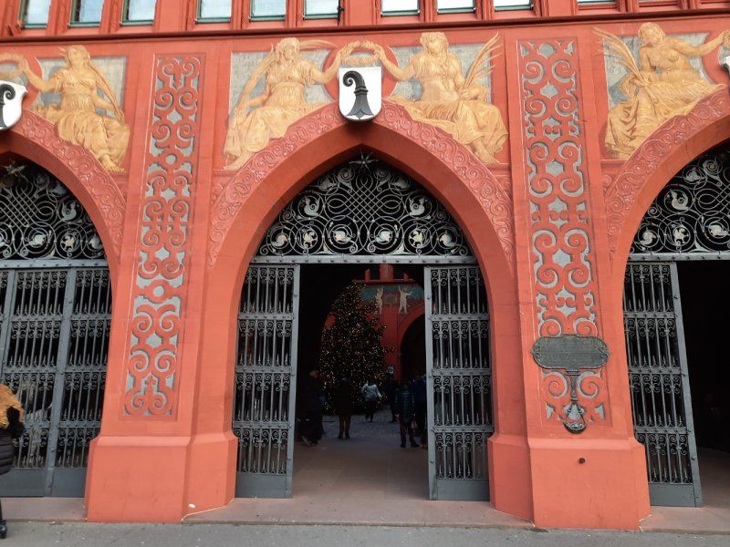
The facade of the town hall was decorated with bogus architecture by Hans Bock. The 12 cantons with which Basel formed the Confederation in the past can be seen on the gables. Not only is the facade very special, but the courtyard also shines with art. In addition to the murals, I noticed the statue of Lucius Munatius Plancus in the courtyard. This was a Roman general and fought together with Caesar. I also had a wonderful view from the courtyard towards the sky. The gables form a pattern and show the tower of the town hall from a different point of view. The wall paintings are also from Hans Bock. The painting behind the staircase shows the Last Judgment.
Silvesternacht mit Feuerwerk
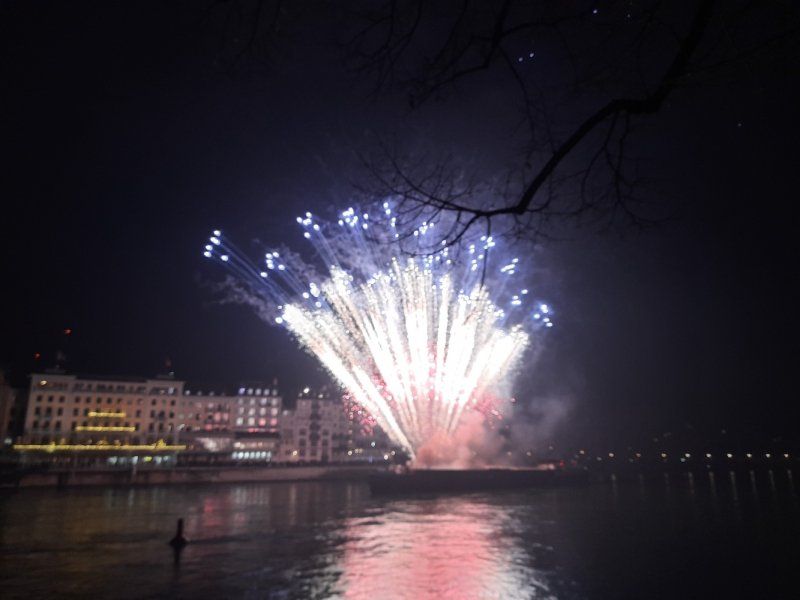
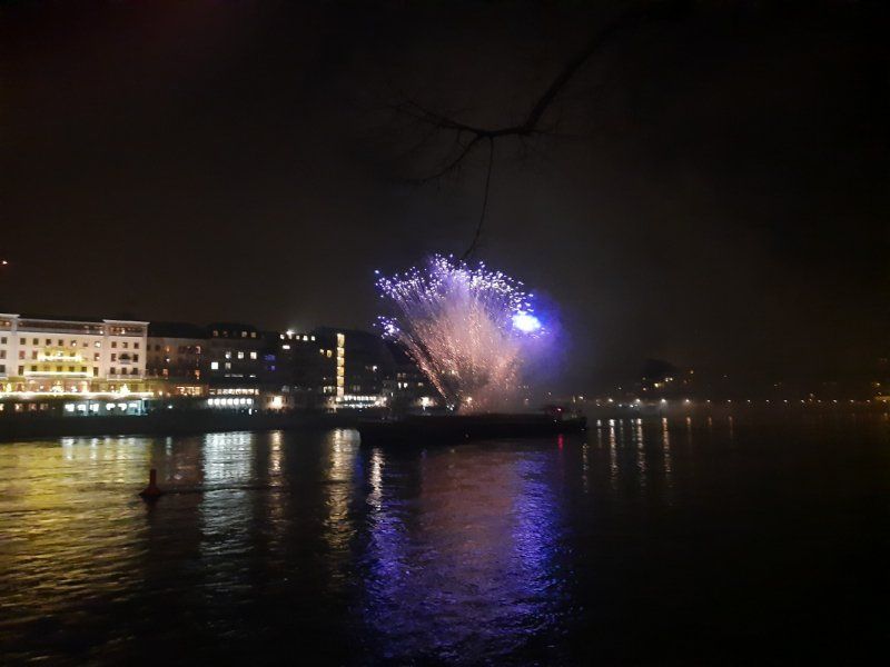
The traditional New Year's Eve celebration begins in Basel at 11:30 p.m. on the Münsterplatz, where the Basel City Trombone Choir performed a few pieces from the Münster gallery. Afterwards, between 11:45 p.m. and 11:55 p.m., the Martinsturm with its large bell rings the year. The new year is finally ushered in with all the bells of the city. We did not attend the turn of the year at 00:15 with a short service (about 15 minutes) in the Münster. We were at the closing service in the St. Clara church at 10 p.m. We made our way towards the banks of the Rhine, where the traditional fireworks started at 00:30. Large crowds stood on the middle bridge. We looked for a place on the banks of the Rhine. Free mulled wine is served at the Johanniterbrücke from 11:00 p.m. and until 1:00 a.m. After the fireworks, we went back to the Womo parking space in Weil am Rhein in the freezing cold. (Walking time: 45 minutes)
Nonnenholzstraße
Take a short walk before departure. I was impressed by the tower crossing over the main road that we climbed the previous day.
The crawl tower impresses with its construction and structure. It connects the city center with the local recreation area Dreiländergarten. and the three-country laguna pool.
Today we went to the top platform which is a viewing pulpit. The view of Basel was worse than the day before.
Weil am Rhein, Deutschland
47° 34' 52.8" N 7° 36' 28.5" E
47.5813452 7.6079213
• Head east on Nonnenholzstraße. Go for 836 m.
• Continue on Mattrain. Go for 474 m.
• Turn left onto B317. Go for 107 m.
• Turn right onto Zollfreie Straße (B317). Go for 2.7 km.
• Take the 2nd exit from roundabout onto Wiesentalstraße (B317) toward Donaueschingen/Schopfheim. Go for 1.0 km.
• Turn right onto Clara-Immerwahr-Straße toward Stadtmitte. Go for 416 m.
• Take the 2nd exit from roundabout onto Schillerstraße. Go for 120 m.
• Turn left onto Brühlstraße. Go for 527 m.
• Continue on Belchenstraße (L141). Go for 707 m.
• Continue on Brombacher Straße. Go for 74 m.
• Turn right onto Untereckstraße. Go for 104 m.
• Turn left onto Untere Hartmattenstraße. Go for 86 m.
• Arrive at Untere Hartmattenstraße. Your destination is on the right.
☍
7,2 km
( 9 min.)
Day
Lörrach
We chose the return route to our home town via Lörrach - Feldberg - Donaueschingen - Rottweil
Deutschland
47° 37' 0.9" N 7° 40' 15.3" E
47.6169191 7.6709248
• Head southwest on Untere Hartmattenstraße. Go for 86 m.
• Turn right onto Untereckstraße. Go for 104 m.
• Turn right onto Brombacher Straße. Go for 1.5 km.
• Take the 3rd exit from roundabout. Go for 682 m.
• Turn right onto B317. Go for 5.5 km.
• Take the 2nd exit from roundabout onto Landstraße (B317) toward Donaueschingen/Schopfheim. Go for 28.0 km.
• Turn right onto B317 toward Donaueschingen/Todtnau/Münstertal. Go for 29.0 km.
• Take ramp onto B31 toward Villingen-Schwenningen/Donaueschingen/Neustadt-Mitte. Go for 28.6 km.
• Turn right and take ramp onto B27/B33 toward Stuttgart/Villingen-Schwenningen/Bad Dürrheim/Donaueschingen. Go for 13.3 km.
• Keep right onto B27. Go for 16.3 km.
• Take the 1st exit from roundabout onto B14/B27 toward Stuttgart/A81/Tübingen/Balingen/Schramberg/Oberndorf a.N./RW-Bühlingen/Gewerbegebiet Zimmern o.R./Gewerbegebiet Berner Feld/Gewerbegebiet Neckartal. Go for 5.9 km.
• Take ramp onto B14 toward Tübingen/Balingen/Oberndorf/Villingendorf/Rottweil-Nord/Gewerbegebiet Berner Feld/Gewerbegebiet Neckartal. Go for 323 m.
• Continue on B27. Go for 273 m.
• Pass 2 roundabouts and continue on Nordumgehung (B27). Go for 7.8 km.
• Turn left onto Hardtstraße. Go for 203 m.
• Turn left onto Lochenstraße. Go for 170 m.
• Arrive at Lochenstraße. Your destination is on the left.
☍
137,7 km
(1 hrs. 49 min.)
Rottweil
Rottweil, Deutschland
48° 11' 52" N 8° 41' 40" E
48.1977778 8.6944346